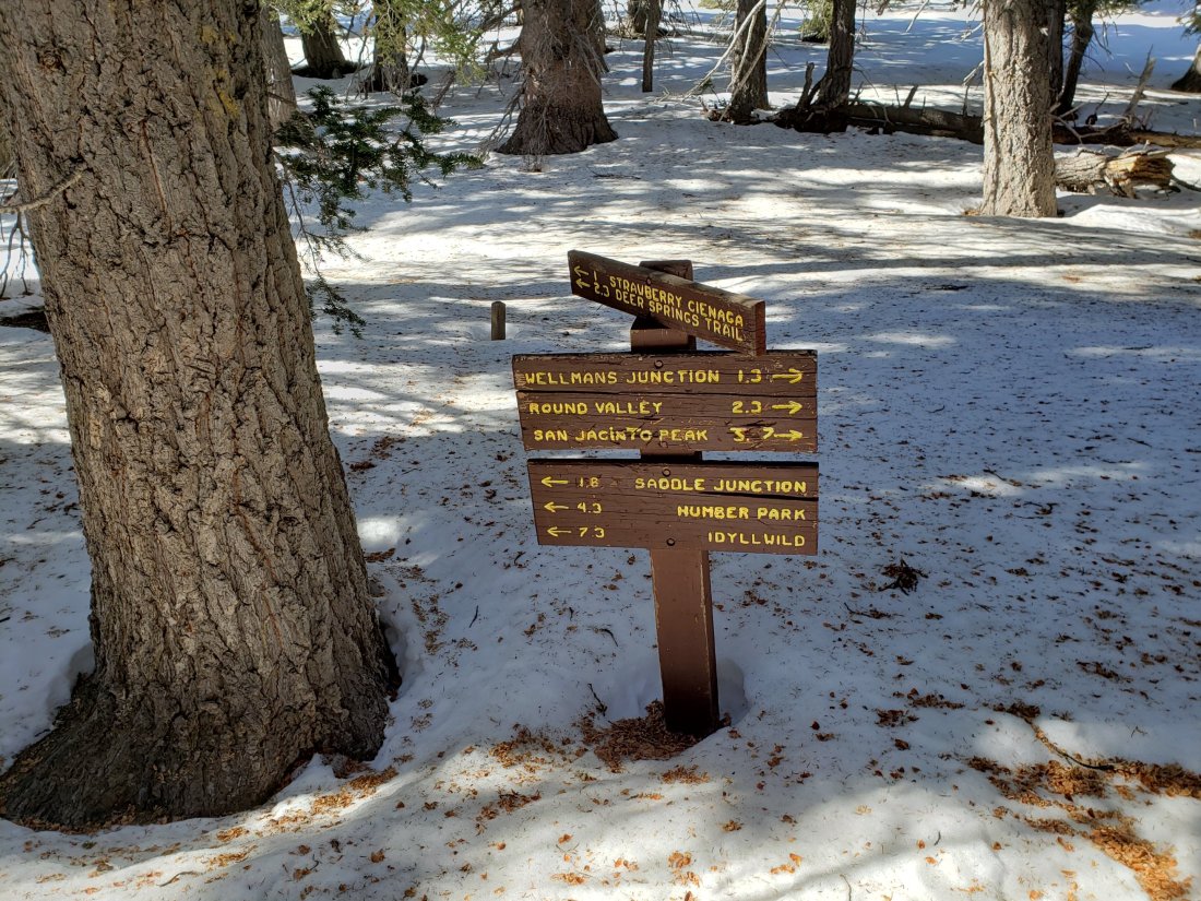
Trail and snow update 30th December 2019
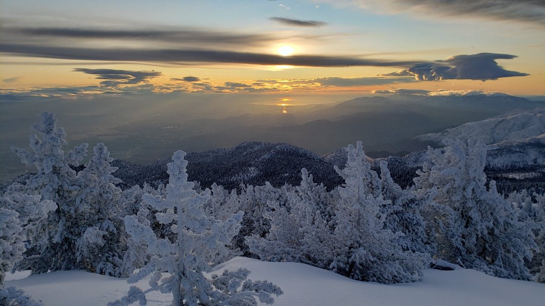
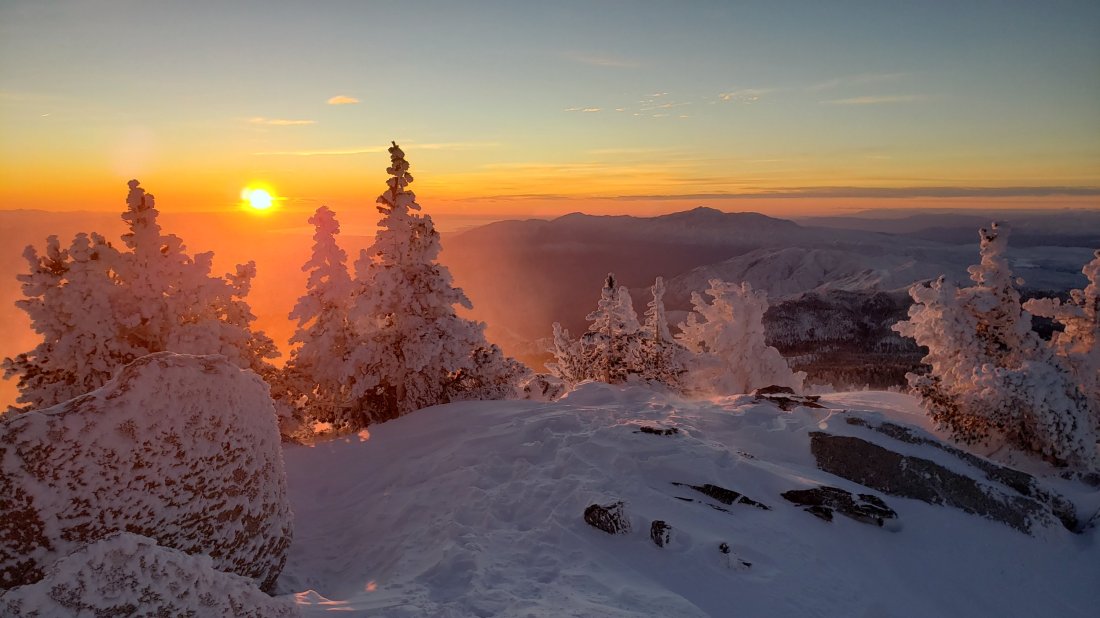
The seventh storm of this winter passed through today. It was forecast to be quite significant a few days ago, then in recent days it seemed like little or no snow was expected. I was unconvinced either way, so I ascended San Jacinto Peak via the east side (Devil’s Slide to East Ridge Trail) and descended the west side (Deer Springs Trail), affording a reasonable survey of the snow and trail conditions around the mountain.
It started snowing steadily while I was at San Jacinto Peak late morning, and continued gently as I descended Deer Springs Trail. The hiking was delightful, but there was minimal new accumulation, with <0.5″ below 8000′, only an inch above 9000′, and perhaps two inches at the highest peaks. Much of the afternoon as I descended through snow clouds, I could see the high peaks above me in blue sky, and the cloud band was at 6000-10,000′ for much of the afternoon.
Hiking conditions were perfect early this morning, with a firm icy snow track up Devil’s Slide Trail, ideal for microspikes. I switched to snowshoes at 9000′ elevation on the ascent, and kept them on down to about 6500′ on the descent. Unfortunately these conditions will likely change this week with rapid warming expected at all elevations.
I was surprised to find no evidence of any tracks on Deer Springs Trail from San Jacinto Peak down through Little Round Valley to the PCT. I would not recommend following my track from today as I took a very direct largely off-trail route. I also broke trail from the top of Marion Mountain Trail through to Strawberry Junction, but that track accurately follows the trail.
Snow depths measured today are listed at the foot of this posting. With the exception of trails mentioned below, currently some major trails have not been traveled and are obscured by heavy snowfall. A wild SE gale on the night of 25th resulted in very extensive drifting of snow, and it was windy again today, especially above 9000′ elevation. Cautious navigation is strongly recommended everywhere.
Snow depths are currently ideal for snowshoeing almost everywhere above about 7500′ elevation off-trail, and strongly recommended on-trail above 8500′. Microspikes are recommended on several well-traveled trails (see below) and will become increasingly useful at all elevations over the next few days as established trails become consolidated by hiker traffic and undergo freeze-thaw cycles. They are especially useful for descending trails when they become icy and compacted.
Notwithstanding the warming forecast for the first week of January, hikers should be prepared for temperatures below freezing in the high country, and well below freezing when considering windchill effects (see my weather data from the Peak below).
Note that the USFS gate at Humber Park is closed. There are nine legal parking spaces (available for all uses) just below the gate and near the upper Ernie Maxwell trailhead. The next closest legal parking is 0.1 mile downhill on Forest Drive.
WEATHER Rapid warming is forecast for the first week of 2020, with temperatures above seasonal likely for Idyllwild and the high country especially by next weekend (3rd-5th January 2020), leading to snowmelt at all elevations. Medium term forecasts show no storm activity for the first half of January.
At San Jacinto Peak (10,810ft/3295m) today, Monday 30th December 2019 at 1110 the air temperature was 17.6°F (-8°C), with a windchill temperature of -4.1°F (-20°C), 94% relative humidity, and a dangerously bitter NE wind sustained at 17 mph gusting to 25.8 mph.
At the Peak on Friday 27th December 2019 at 0655 the air temperature was 12.3°F (-12°C), with a windchill temperature of -4.9°F (-21°C), 74% relative humidity, and a brisk due North wind sustained at 9 mph gusting to 16.7 mph.
TRAIL CONDITIONS
All trails above about 6000′ are snow-covered, with depth depending on elevation (see below).
Reliable tracks are currently in place for Devil’s Slide Trail, from Saddle Junction to San Jacinto Peak, and from the Tram through to Wellman Divide.
Round Valley Trail from the Tram through to Wellman Divide has been well-traveled and a good track through the snow is easy to follow.
Skyline Trail has been traveled since the last snow, and tracks exist through the continuous snow above 6500′. However not all the snow tracks are reliable, so cautious navigation is recommended.
Devil’s Slide Trail has a well-worn (but increasingly icy) track to follow, and microspikes are especially useful for descending. Trees down on the trail about 1.7 miles up (just below Powderbox Spring) are easily passable. At Saddle Junction, trees are also down across the starts of the Caramba Trail and the PCT southbound.
The parts of Willow Creek Trail and Caramba Trail nearest to Saddle Junction have well-defined snowshoe tracks, likely heading around Skunk Cabbage Meadow.
The PCT southbound from Saddle Junction has hardly been traveled, with only a couple of snowshoe tracks to follow.
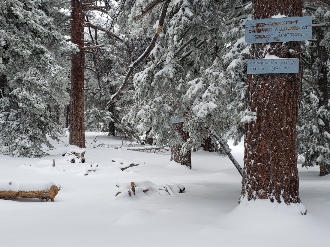
Tahquitz Peak trail from Chinquapin Flat/PCT Mile 178 There are no steps to follow through the angled icy snow for at least 0.25 miles. Do not attempt to cross these ice slopes without additional traction. Crampons are currently recommended, ideally in conjunction with an ice axe (if you know how to use it). Snowshoes are not advised as the fresh snow is not consolidated with the earlier hard icy snow underneath, making for a very treacherous footing.
The Peak Trail above 10,300′ has not been traversed since before the late November storms. The only defined trail to San Jacinto Peak from the east is the steep option up the East Ridge.
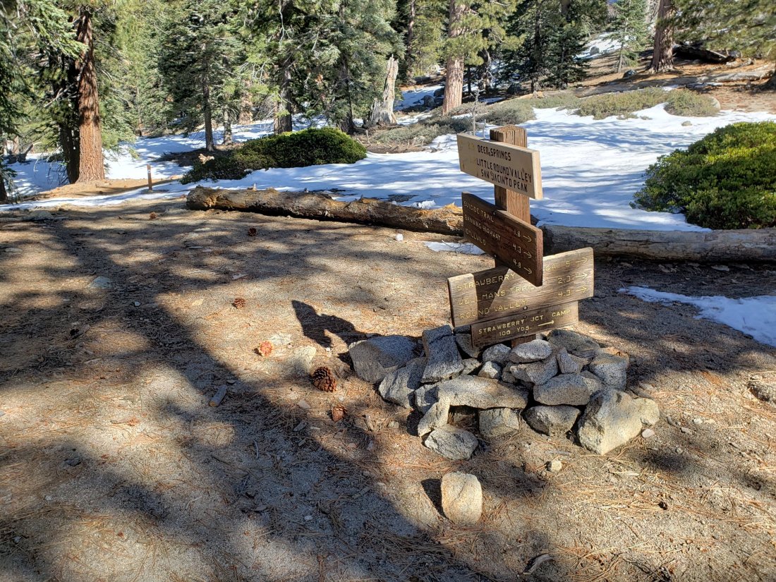
Deer Springs Trail See my comments above regarding the route above the PCT. The trail up to the Suicide Rock turning is excellent and well-defined. From there to Strawberry Junction there is a reasonable snowshoe track to follow. Beyond that the track is less well-traveled and more likely to be obscured by drifting snow.
Marion Mountain Trail has been traveled by one person and has a reasonable snowshoe track to follow.
Seven Pines Trail and Fuller Ridge Trail (PCT Miles 185.5-190.5) have had no visible signs of hiker traffic so far this winter, and no tracks or trail to follow. Indeed Seven Pines Trail has only been hiked a handful of times since November 2018. Extremely cautious navigation is recommended for those who are not very familiar with hiking these trails in snow.
The Forest Service closure of Dark Canyon Road will remain in place into 2020, hence there is no vehicular access to Seven Pines trailhead.
Ernie Maxwell Trail is completely snow-covered but has an excellent, defined track. Microspikes are recommended but are not essential (many thanks to Anne King and Anabel for this update from today).
SNOW DEPTHS measured today are as follows. Please note that average depth is given; drifts are much deeper than the average in places. Altitudes are approximate.
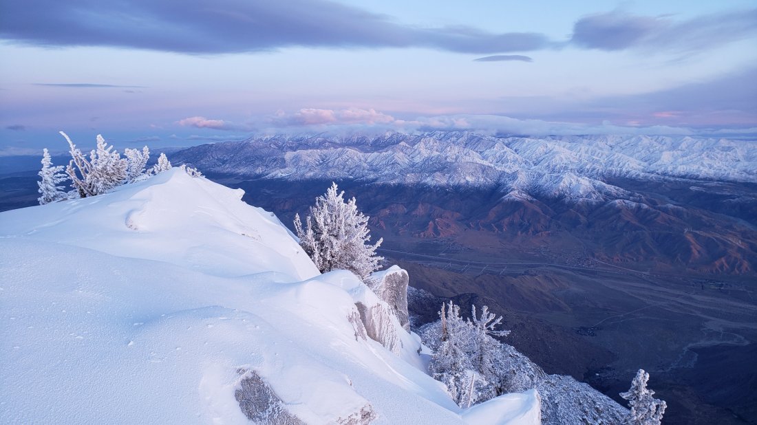
San Jacinto Peak (10810′): 47″ (very heavily drifted)
Little Round Valley (9800′): 26″
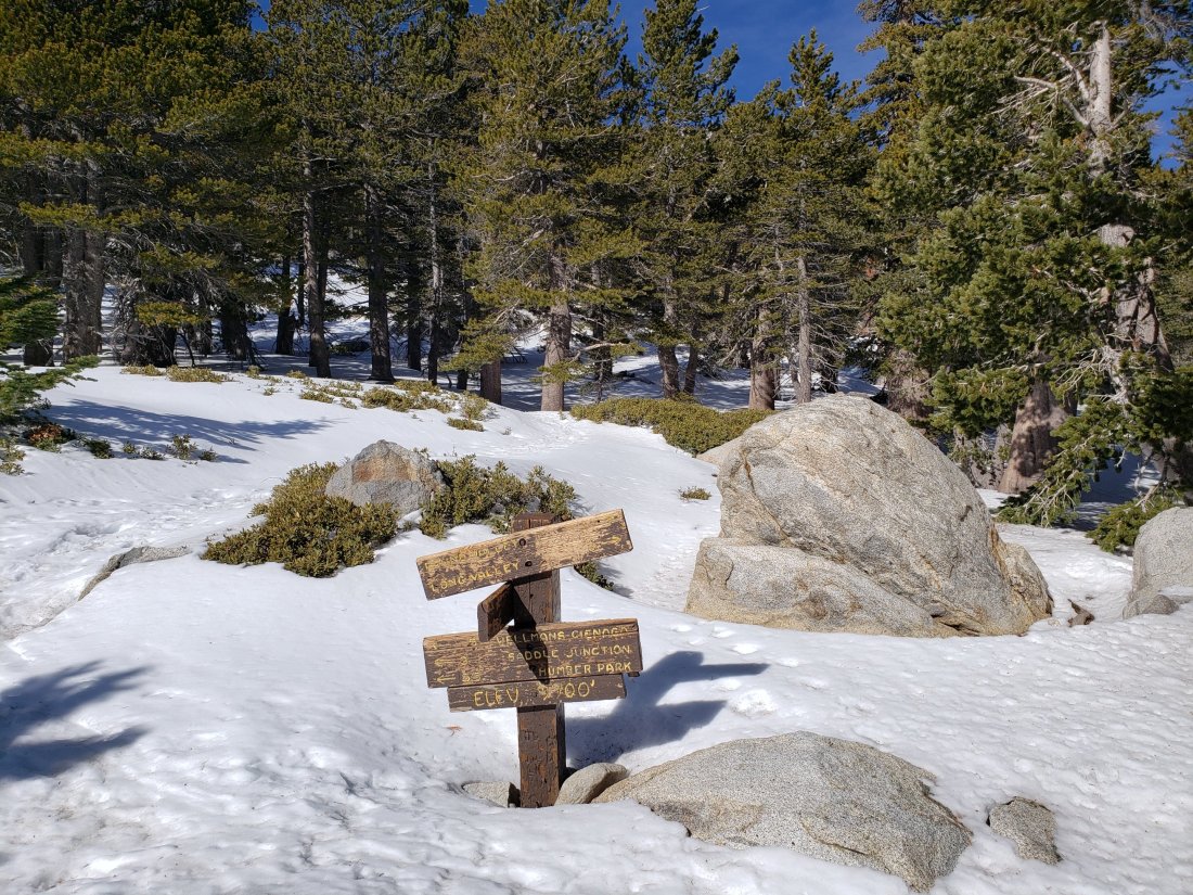
Wellman Divide (9700′): 25″ (27″ on 27th December)
Annie’s Junction (9070′): 23″ (25″ on 27th December)
Fuller Ridge Trail south end (8980′): 24″
Marion Mountain Trail junction with PCT (8800′): 22″
Strawberry Junction (8100′): 11″
Saddle Junction (8070′): 17″ (19″ on 27th December)
Devil’s Slide trailhead at Humber Park (6520′): 7″ (11″ on 27th December)
Idyllwild (at 5550′): 2″ (6.75″ on 27th December)


sanjacjonUncategorized 5 MinutesEdit”Trail and snow update 30th December 2019″
Snow storm update 27th December 2019
The sixth storm of this winter came rapidly after the fifth (described here), with significant snowfall more-or-less continuously from the afternoon of 25th December until early afternoon on 26th. At San Jacinto Peak, an additional inch of snow fell in the early hours of 27th.
Ultimately snow quantities were below forecasts, especially in the high country. It was a cold system, with single digit (Fahrenheit) air temperatures in the high country. Although the snow level dropped below 4000′, depths at low elevations did not rival the Thanksgiving snowstorm of last month.
A short video describing the conditions from San Jacinto Peak at sunset on 26th December is available on YouTube.
Snow depths measured on 27th are listed at the foot of this posting. With the exception of trails mentioned below, currently many major trails have not been traveled and are obscured by heavy snowfall. A wild SE gale on the night of 25th resulted in very extensive drifting of snow, especially above 9000′ elevation. Cautious navigation is strongly recommended everywhere.
Snow depths are currently ideal for snowshoeing almost everywhere above about 6000′ elevation. Microspikes will become increasingly useful at lower and mid-elevations over the next two days as established trails become consolidated by hiker traffic and undergo freeze-thaw cycles. They are especially useful for descending trails when they become icy and compacted.
Hikers should be prepared for temperatures below freezing in the high country, and far below freezing when considering windchill effects.
Note that the USFS gate at Humber Park is closed. There are nine legal parking spaces – available for all uses – just below the gate (near the upper Ernie Maxwell trailhead). The next closest legal parking is 0.1 mile downhill on Forest Drive.
WEATHER The seventh winter storm of 2019/20 is forecast for Monday 30th December. It will again be a cold system with a low (4000′) snow level, but little (or no?) snowfall in the San Jacinto mountains.
Looking into 2020 it may warm fairly rapidly in the first week of the New Year, with considerable snowmelt at all elevations. Medium term forecasts currently show no storm activity for the first half of January.
At San Jacinto Peak (10,810ft/3295m) today, Friday 27th December 2019 at 0655 the air temperature was 12.3°F (-12°C), with a windchill temperature of -4.9°F (-21°C), 74% relative humidity, and a brisk due North wind sustained at 9 mph gusting to 16.7 mph.
At the Peak on Boxing Day, Thursday 26th December 2019, at 1640 the air temperature was 9.9°F (-13°C), with a windchill temperature of -10.6°F (-23°C), 76% relative humidity, and a chilly due West wind sustained at 9 mph gusting to 17.0 mph.
TRAIL CONDITIONS
All trails above about 4500′ are covered with between 2″ and 40+” of snow, depending on elevation. This includes the Pacific Crest Trail from south of Mile 151 (the Hwy 74 crossing) to about Mile 197.
Reliable tracks are currently in place only for Devil’s Slide Trail, from Saddle Junction to San Jacinto Peak, and from the Tram through to Wellman Divide. While this situation will likely change over the coming weekend, be advised that the storm on Monday 29th may again obliterate some tracks (at least above 8000′).
SNOW DEPTHS measured today are as follows. Average depth is given. With strong winds during this storm, drifts are significantly deeper than the average in places. Altitudes are approximate.
San Jacinto Peak (10810′): 49″ (but very heavily drifted)(23″ on 20th December)
Wellman Divide (9700′): 27″ (5″ on 20th December)
Annie’s Junction (9070′): 25″ (9″ on 20th December)
Saddle Junction (8070′): 19″ (2″ on 20th December)
Devil’s Slide trailhead at Humber Park (6520′): 11″
Idyllwild (at 5550′): 6.75″ (storm total, but already melting rapidly today)

sanjacjonUncategorized 3 MinutesEdit”Snow storm update 27th December 2019″
Snow storm 25th-26th December 2019
Please continue to check this page for periodic storm updates throughout the next 48 hours.

UPDATED @ 1820 Thursday 26th
Despite a few minor flurries in the late afternoon, San Jacinto Peak did not add any signficant new snow to the update below. The clouds largely cleared near dusk, producing a spectacular, if frigid, sunset. I recorded a short video, available here on YouTube.
UPDATED @ 1320 Thursday 26th
It continues to snow off-and-on lightly in the high country, with San Jacinto Peak having added about three more inches today, for a storm total of right around 15″. A good snowfall, but well below most projections. Grand total at the Peak is about four feet, but with enormous variation due to drifting (although it is now almost calm).
Snowfall has been similarly light in Idyllwild, where an additional 1.5″ today takes the storm total to 7″ (at 5550′), closer to, but still below, most forecasts.
UPDATED @ 0905 Thursday 26th
A howling south-east gale in the high country overnight produced about 8-10″ of fresh snowfall at San Jacinto Peak. Massive drifting has obliterated all tracks, certainly at least above about 8000′.
On the east side the snow level is down to 4500′ elevation on Skyline Trail, with a dusting as low as 2500′ in Andreas Canyon (Maynard Mine). Clouds are starting to break over Palm Springs. (Many thanks to Florian Boyd for that information.)
In Idyllwild at 5550′ elevation another 4.5″ of snow fell overnight, for a current storm total of 5.5″ there (many thanks to Anne King for that information).
UPDATED @ 1645 Wednesday 25th
Off-and-on light snow overnight resulted in a fresh inch in Idyllwild, and a white Christmas (the third in the last four years). Further snow today added up to another 1.75″ (at 5550′ elevation).
I snowshoed to San Jacinto Peak again today, in a mix of blue sky and blizzard conditions. Most of my broken trails from yesterday were gone, filled in with fresh snow and spindrift from the strong winds. An additional 2″ snow was on Devil’s Slide Trail and at Saddle Junction, with a consistent 3″ everywhere above 9000′. Later this afternoon the Peak was right at the top of the cloud, and the sun put in a couple of brief appearances. Temperatures were very similar to yesterday, with a windchill of -11°F (-24°C) from a harsh SW wind gusting to 29.8 mph.sanjacjonUncategorized 2 MinutesEdit”Snow storm 25th-26th December 2019″
Brief snow update 24th December 2019
A lengthy hike today in moderate depth fresh snow to and from San Jacinto Peak via Devil’s Slide Trail and Wellman Divide allowed us to compare snow and trail conditions with the same trails hiked on multiple days last week.
A short video I posted on YouTube illustrates how spectacular (and chilly) it was at San Jacinto Peak at noon today.
It started snowing yesterday at 0845 (we were hiking at about 6200′ near Pine Cove). Lower down in Idyllwild, the snow quickly turned to sleet then rain which ended by 1600, and at 5550′ we ended up with 0.55″ rain for the day. Long Valley (8600′) added about 4-5″ snow on top of the roughly one inch that remained from earlier in the winter.
Hiking conditions were slow this morning, breaking trail from Humber Park to San Jacinto Peak. There was a little postholing on Devil’s Slide Trail, and then I switched to snowshoes for the remainder of the day.
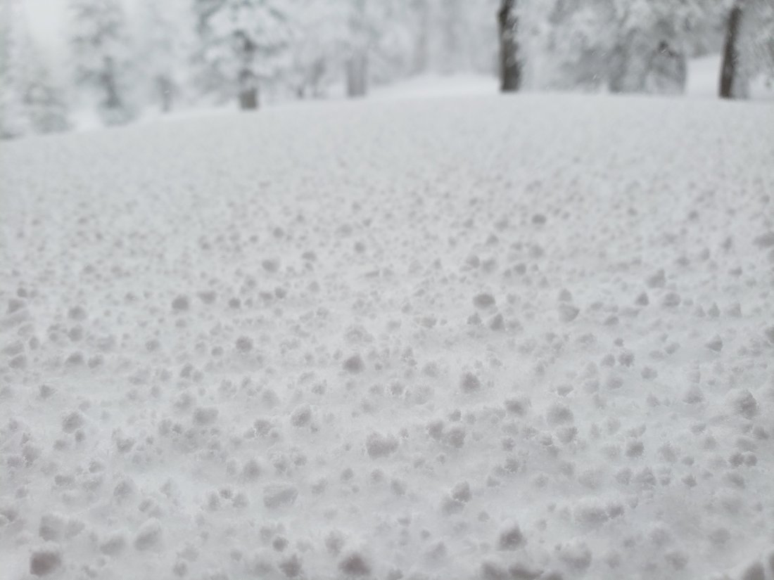
As we descended Devil’s Slide Trail mid-afternoon we ran into a brief snowstorm that had dusted Idyllwild with a fraction of an inch, and about 0.5″ at Humber Park (see photo below).
Snow depths measured today are listed at the foot of this posting. In summary, areas above 7000′ added between 5-11″ fresh powder.
Snowshoes are strongly recommended everywhere above about 7500′ elevation, with microspikes advised below that elevation. This advice is only applicable for today (and perhaps tomorrow) with much more snow forecast, as discussed below.
Hikers should be prepared for temperatures well below freezing in the high country, and potentially far below freezing when considering windchill effects.
Note that the USFS gate at Humber Park is now closed. There are nine legal parking spaces – available for all uses – just below the gate (near the upper Ernie Maxwell trailhead). The next closest legal parking is 0.1 mile downhill on Forest Drive.
WEATHER A major snowstorm – the sixth storm of this winter – is forecast for 25th-26th December. Cold temperatures and substantial precipitation are forecast at all elevations, with snow level as low as 4000′ elevation, and with as much as two feet of snow in the high country and 10+” possible at mid-elevations. NWS San Diego has issued a YouTube video discussion of this next storm.
At San Jacinto Peak (10,810ft/3295m) today, Tuesday 24th December 2019 at 1210 the air temperature was 12.3°F (-11°C), with a windchill temperature of -11.1°F (-24°C), 81% relative humidity, and a sharp WSW wind sustained at 15 mph gusting to 21.8 mph.
At the Peak on Friday 20th December 2019 at 0940 the air temperature was 38.3°F (4°C), with a windchill temperature of 34.3°F (1°C), 27% relative humidity, and a very light ENE wind sustained at 3.5 mph gusting to 5.8 mph.
TRAIL CONDITIONS
All trails above about 6000′ are snow-covered, with depth depending on elevation (see below).
Tahquitz Peak trail from Chinquapin Flat/PCT Mile 178 There are no steps to follow through the moderately angled icy snow for about 0.25 miles of this trail. Do not attempt to cross these ice slopes without additional traction. Microspikes are essential, crampons are preferable, ideally in conjunction with an ice axe (if you know how to use it). Snowshoes are not advised as the fresh few inches of snow are not consolidated with the earlier hard icy snow underneath, making for a very treacherous footing.
The Peak Trail above 10,300′ has not been traversed since before the late November storms. The only defined trail to San Jacinto Peak from the east is the steep option up the East Ridge.
Round Valley Trail from the Tram through to Wellman Divide has been traveled and an acceptable track through the snow is easy to follow.
Devil’s Slide Trail was well-traveled today and an obvious track is easy to follow (microspikes recommended).
Ernie Maxwell Trail is largely clear of snow in its lower half (below about 6000′).
South Ridge Trail is completely clear of snow to Old Lookout Flat (7800′), with limited icy snow patches from there to Tahquitz Peak, mainly above about 8400′. Microspikes are useful (but not essential), especially for descending when the snow is firm i.e. on cold mornings.
Seven Pines Trail and Fuller Ridge Trail (PCT Miles 185.5-190.5) have no visible signs of hiker traffic since the recent storms, and no tracks or trail to follow. Indeed Seven Pines Trail has only been hiked a handful of times since November 2018. Extremely cautious navigation is recommended for those who are not very familiar with hiking these trails in snow. The Forest Service closure of Dark Canyon Road will remain in place into 2020, hence there is no vehicular access to Seven Pines trailhead.
SNOW DEPTHS measured today are as follows. Please note that average depth is given; drifts may be much deeper than the average in places. Altitudes are approximate.
San Jacinto Peak (10810′): 33″ (23″ on 20th December)
Wellman Divide (9700′): 13″ (5″ on 20th December)
Annie’s Junction (9070′): 16″ (9″ on 20th December)
Long Valley (8600′): 6″ (1″ on 20th December)
Saddle Junction (8070′): 8″ (2″ on 20th December)
Devil’s Slide trailhead at Humber Park (6520′): 1.5″


sanjacjonUncategorized 4 MinutesEdit”Brief snow update 24th December 2019″
Trail update 20th December 2019
We spent this morning hiking to and from San Jacinto Peak via Devil’s Slide Trail and Wellman Divide. This allowed for a comparison of snow and trail conditions with the same trails hiked four days ago, and with our hike from home of the Tahquitz Peak area trails on Wednesday 18th.
Hiking conditions continued to be near-perfect early this morning (as they have been all week) on firm snow, and the three of us ascended to San Jacinto Peak with no postholing and with minimal need for microspikes. The latter were useful for the descent down to about 7800′ on Devil’s Slide Trail however, and by about midday the softening snow made for less enjoyable hiking than a few hours earlier.
It was remarkably warm today – for late December – in the high country, with the windchill temperature at San Jacinto Peak almost exactly 40°F warmer than on Monday 16th!
Snow depths measured today and earlier this week are listed at the foot of this posting. In summary, all of the high country has continued to lose a few inches of snow depth since Monday despite much colder temperatures than recent weeks.
Microspikes are recommended for all trails above about 8500′. Snow depth is marginal for snowshoeing only off-trail above about 8800′ elevation. Established tracks are too compacted for comfortable snowshoeing.
Hikers should be prepared for temperatures at or below freezing in the high country, and well below freezing when considering windchill effects (notably in the last ten days of 2019).
WEATHER Temperatures will be well above seasonal this weekend (21st-22nd), before the fifth storm system of this winter is forecast to arrive on Monday 23rd. Cold temperatures and moderate precipitation are forecast daily for 23rd to 26th December at all elevations, with as much as 12-15″ snow possible in the high country across the week. The latest video from NWS San Diego discusses this multiple storm pattern in detail.
At San Jacinto Peak (10,810ft/3295m) today, Friday 20th December 2019 at 0940 the air temperature was 38.3°F (4°C), with a windchill temperature of 34.3°F (1°C), 27% relative humidity, and a very light ENE wind sustained at 3.5 mph gusting to 5.8 mph.
At the Peak on Monday 16th December 2019 at 0940 the air temperature was 14.7°F (-10°C), with a windchill temperature of -5.1°F (-21°C), 18% relative humidity, and a cool due North wind sustained at 12 mph gusting to 18.2 mph.
TRAIL CONDITIONS
All trails above about 7800′ are at least partly snow-covered, with depth depending on elevation (see below).
Tahquitz Peak trail from Chinquapin Flat/PCT Mile 178 There are no steps to follow through the moderately angled icy snow for about 0.25 miles of this trail. We crossed early morning on 18th and found it somewhat challenging. Please do not attempt to cross these ice slopes without additional traction. Microspikes are essential, ideally in conjunction with an ice axe (if you know how to use it) for this often treacherous trail.
The Peak Trail above 10,300′ has not been traversed since before the late November storms. The only defined trail to San Jacinto Peak from the east is the steep option up the East Ridge.
Round Valley Trail from the Tram through to Wellman Divide has been well-traveled and a good track through the snow is easy to follow.
Devil’s Slide Trail is free of snow to 7800′, with limited patchy compacted snow thereafter to Saddle Junction.
Ernie Maxwell Trail is completely clear of snow.
South Ridge Trail is completely clear of snow to Old Lookout Flat (7800′), with limited icy snow patches from there to Tahquitz Peak, mainly above about 8400′. Microspikes are useful (but not essential), especially for descending when the snow is firm i.e. on cold mornings.
Deer Springs Trail is basically clear of snow below 8100′, with just a few patches near Strawberry Junction. Snow cover is patchy from there to about 8500′ (no traction required), and thereafter is continuous. An excellent track is now in place through to Little Round Valley. From there to San Jacinto Peak, the visible consolidated route does not follow the usual trail and is steep.
Marion Mountain Trail has been well traveled and has a good track to follow. It is largely clear below 8000′.
Seven Pines Trail and Fuller Ridge Trail (PCT Miles 185.5-190.5) have no visible signs of hiker traffic since the recent storms, and no tracks or trail to follow. Indeed Seven Pines Trail has only been hiked a handful of times since November 2018. Extremely cautious navigation is recommended for those who are not very familiar with hiking these trails in snow.
The Forest Service closure of Dark Canyon Road will remain in place into 2020, hence there is no vehicular access to Seven Pines trailhead.
SNOW DEPTHS measured today – or earlier this week as indicated – are as follows. Please note that average depth is given; drifts may be much deeper than the average in places. Altitudes are approximate.
San Jacinto Peak (10810′): 23″ (36″ on 4th December)
Little Round Valley (9800′): 20″ on 16th December (25″ on 9th December)
Wellman Divide (9700′): 5″ (16″ on 4th December)
Annie’s Junction (9070′): 9″ (18″ on 4th December)
Fuller Ridge Trail south end (8980′): 12″ on 16th December
Marion Mountain Trail junction with PCT (8800′): 10″ on 16th December
Tahquitz Peak (8836′): 8′ on 18th December
Long Valley (8600′): 1″
Chinquapin Flat (8500′): 6″ on 18th December
Strawberry Junction (8100′): <1″ on 16th December (5-6″ on 9th December)
Saddle Junction (8070′): 2″ (13″ on 4th December)

sanjacjonUncategorized 4 MinutesEdit”Trail update 20th December 2019″
Trail and snow update 16th December 2019
[UPDATE Wednesday 18th December: I have updated trail conditions below for either side of Tahquitz Peak based on our hike this morning from home ascending from the north (via Saddle Junction) and descending South Ridge.]
We spent this morning ascending San Jacinto Peak via the east side (Devil’s Slide to East Ridge Trail) and descending the west side (Deer Springs Trail), affording a thorough survey of the snow and trail conditions around the mountain.
Pleasantly frigid conditions – 26°F in Idyllwild and much colder in the high country – were ideal for hiking this morning on compacted icy snow, and I ascended to San Jacinto Peak with zero postholing and in a time typical of dry summer trail conditions. Microspikes were useful above 9000′, and especially for the descent down to about 8500′. These conditions should remain largely unchanged this week (at least in the mornings) with cold temperatures forecast at all elevations. Trail conditions are discussed in a short video recorded this morning at San Jacinto Peak. Overall snow conditions on the trails were more reminiscent of April than of late December.
Snow depths measured today are listed at the foot of this posting. In summary, all elevations above 6500′ have lost many inches of snow depth in the past week (depending on sun exposure of the location), with all trails below about 8000′ now largely snow-free.
Microspikes are recommended for all trails above about 8500′. Snow depths are marginally adequate for snowshoeing off-trail above about 8800′ elevation. Established tracks are too compacted for comfortable snowshoeing.
Hikers should be prepared for temperatures at or below freezing in the high country, and well below freezing when considering windchill effects.
WEATHER Cool temperatures below seasonal continue for the next couple of days, before returning to above seasonal on 19th-22nd December. The fifth storm system of this winter is currently forecast to arrive overnight on Sunday 22nd, with cold temperatures and precipitation possible for the entire Christmas week.
At San Jacinto Peak (10,810ft/3295m) today, Monday 16th December 2019 at 0940 the air temperature was 14.7°F (-10°C), with a windchill temperature of -5.1°F (-21°C), 18% relative humidity, and a cool due North wind sustained at 12 mph gusting to 18.2 mph.
By contrast, at the Peak on Thursday 12th December 2019 at 0940 the air temperature was 40.2°F (5°C), with a windchill temperature of 27.7°F (-3°C), 71% relative humidity, and a brisk NW wind sustained at 16 mph gusting to 25.7 mph.
TRAIL CONDITIONS
All trails above about 7800′ are at least partly snow-covered, with depth depending on elevation (see below).
Tahquitz Peak trail from Chinquapin Flat/PCT Mile 178 [updated 18th December 2019] There are no steps to follow through the angled icy snow for about 0.25 miles of this trail section. We crossed early this morning and found it quite challenging. Do not attempt to cross these ice slopes without additional traction. Microspikes (at a minimum) are essential, ideally in conjunction with an ice axe (if you know how to use it), for this treacherous trail.
The Peak Trail above 10,300′ has not been completely traversed since before the late November storms. The only defined trail is the steeper option up the East Ridge (although the current track does not follow the normal trail route).
Round Valley Trail from the Tram through to Wellman Divide has been well-traveled and a good track through the snow is easy to follow.
Devil’s Slide Trail is free of snow to 7800′, with only patchy compacted snow cover thereafter to Saddle Junction.
Ernie Maxwell Trail is completely clear of snow.
South Ridge Trail [updated 18th December] is completely clear of snow to Old Lookout Flat (7800′), with limited icy snow patches from there to Tahquitz Peak, mainly above about 8400′. Microspikes are useful (but not essential), especially for descending when the snow is firm i.e. on cold mornings.
Deer Springs Trail is basically clear of snow below 8100′, with just a few patches near Strawberry Junction. Snow cover is patchy from there to about 8500′ (no traction required), and thereafter is continuous. An excellent track is now in place through to Little Round Valley. From there to San Jacinto Peak, the visible route does not follow the usual trail course and is steep.
Marion Mountain Trail has been well traveled and has a good track to follow. It is largely clear below 8000′.
Seven Pines Trail and Fuller Ridge Trail (PCT Miles 185.5-190.5) have no visible signs of hiker traffic since the recent storms, and no tracks or trail to follow. Indeed Seven Pines Trail has only been hiked a handful of times since November 2018. Extremely cautious navigation is recommended for those who are not very familiar with hiking these trails in snow.
The Forest Service closure of Dark Canyon Road will remain in place into 2020, hence there is no vehicular access to Seven Pines trailhead.
SNOW DEPTHS measured today are as follows. Please note that average depth is given; drifts are much deeper than the average in places. Altitudes are approximate.
San Jacinto Peak (10810′): 26″ (36″ on 4th December)
Little Round Valley (9800′): 20″ (25″ on 9th December)
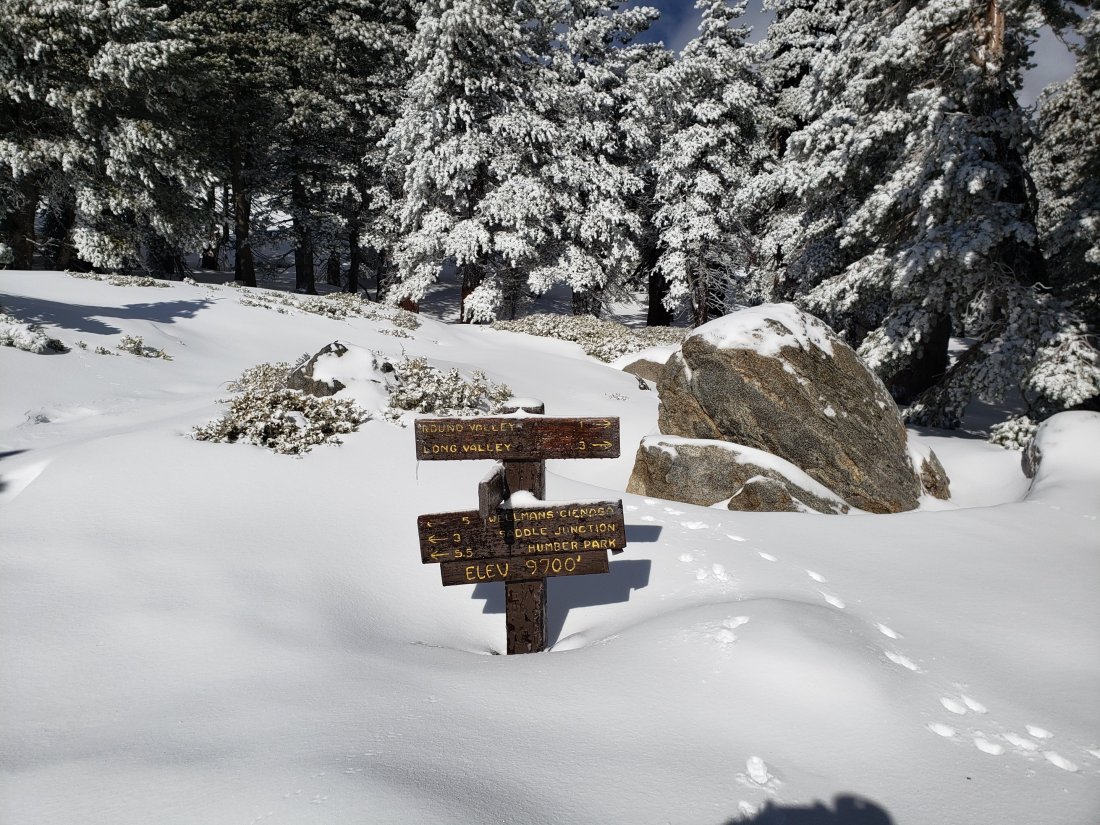
Wellman Divide (9700′): 7″ (previously 16″ on 4th December)
Annie’s Junction (9070′): 11″ (previously 18″ on 4th December)
Fuller Ridge Trail south end (8980′): 12″
Marion Mountain Trail junction with PCT (8800′): 10″
Long Valley (8600′): 2″
Strawberry Junction (8100′): <1″ (5-6″ on 9th December)
Saddle Junction (8070′): 2″ (previously 13″ on 4th December)

sanjacjonUncategorized 4 MinutesEdit”Trail and snow update 16th December 2019″
Brief trail update 12th December 2019
We spent this morning briskly hiking to and from San Jacinto Peak via the east side (Devil’s Slide to East Ridge Trail via Wellman Divide). This allowed for a comparison of snow and trail conditions with three days ago. That update from Monday 9th (linked here) contains much more detail for trails all around the mountain and a more thorough discussion of the current snow situation.
Hiking conditions were unexpectedly good early this morning on reasonably firm snow, and I ascended to San Jacinto Peak with minimal postholing and without need for the spikes or snowshoes I was carrying. Microspikes were useful for the descent down to about 7800′ on Devil’s Slide Trail however, and by the late morning I was postholing fairly badly in the rapidly softening snow.
Snow depths measured today are listed at the foot of this posting. In summary, all elevations above 6500′ have lost 3-5″ of snow depth since Monday, and consequently trails below about 7800′ are now largely snow-free.
Microspikes are recommended and will become increasingly useful especially for descending trails when icy and compacted. Snow depths are currently adequate for snowshoeing off-trail above about 8800′ elevation. Snowshoes will be useful on trails from the late morning onwards for the next couple of days to avoid postholing in soft snowmelt.
Hikers should be prepared for temperatures at or below freezing in the high country, and well below freezing when considering windchill effects (especially after Saturday 14th December).
WEATHER Warm conditions well above seasonal are forecast for the next two days. Obviously rapid snowmelt will continue at all elevations. Temperatures are forecast to return to seasonal norms – well below freezing in the high country – starting Sunday 15th December (with a possibility of precipitation forecast starting Sunday 23rd).
At San Jacinto Peak (10,810ft/3295m) today, Thursday 12th December 2019 at 0940 the air temperature was 40.2°F (5°C), with a windchill temperature of 27.7°F (-3°C), 71% relative humidity, and a brisk NW wind sustained at 16 mph gusting to 25.7 mph.
At the Peak on Monday 9th December 2019 at 1100 the air temperature was 21°F (-6°C), with a windchill temperature of 3.7°F (-16°C), 64% relative humidity, and a cool due North wind sustained at 7 mph gusting to 17.2 mph.
TRAIL CONDITIONS
All trails above about 7700′ are snow-covered, with depth depending on elevation (see below).
The Peak Trail above 10,300′ has not been traversed since before the late November storms. The only defined trail is the steeper option up the East Ridge Trail (even that was partly obscured today by spindrift).
Round Valley Trail from the Tram through to Wellman Divide has been well-traveled and a good track through the snow is easy to follow.
Devil’s Slide Trail is virtually free of snow to 7700′, with a compacted snow track thereafter to Saddle Junction (about 90% coverage). Note that Humber Park is now open.
Ernie Maxwell Trail is completely clear of snow.
SNOW DEPTHS measured today are as follows. Please note that average depth is given; drifts are much deeper than the average in places. Altitudes are approximate.
San Jacinto Peak (10810′): 25″ (36″ on 4th December)
Wellman Divide (9700′): 10″ (16″ on 4th December)
Annie’s Junction (9070′): 11″ (18″ on 4th December)
Long Valley (8600′): 2″
Saddle Junction (8070′): 5″ (13″ on 4th December)
sanjacjonUncategorized 2 MinutesEdit”Brief trail update 12th December 2019″
Trail update 9th December 2019
Anabel and I spent today ascending San Jacinto Peak via the east side (Devil’s Slide to East Ridge Trail) and descending the west side (Deer Springs Trail), affording a thorough survey of the snow and trail conditions around the mountain. Other hikes in recent days surveyed Spitler Peak, South Ridge, and Ernie Maxwell trails.
Hiking conditions were perfect early this morning on a firm layer of icy snow, and I ascended to San Jacinto Peak with minimal postholing and without need for the spikes or snowshoes I was carrying. Microspikes were useful for the descent down to about 7800′ however. Unfortunately these conditions will likely change this week with rapid warming expected at all elevations. These conditions are discussed in a short video recorded at San Jacinto Peak this morning.
The fourth storm of this winter passed through over the weekend, but was much warmer than the previous three, initially producing rain at all elevations and no measurable snowfall in the high country until Sunday evening, when 1-3″ inches fell above 8000′.
In Idyllwild (at 5550′) a total of 1.52″ of rain fell in the forty-eight hour period between late afternoon Friday 6th and the evening of Sunday 8th, with the most intense rainfall in a few hours on Sunday evening. On Saturday it rained all the way to San Jacinto Peak, leaving a firm, icy crust of freezing rain on top of snow from prior storms. By Sunday evening it was cold enough at higher elevations for a light snowfall, with an inch above 8000′, two inches above 9000′, and about three inches at San Jacinto Peak.
Several major trails have been traveled and currently have reliable snowshoe or posthole tracks. These trails are: Humber Park to San Jacinto Peak, Deer Springs Trail, Marion Mountain Trail, and the Round Valley Trail from the Tram to Wellman Divide. For detail see Trail Conditions below.
Snow depths measured today are listed at the foot of this posting. These data may change rapidly this week due to anticipated rapid melting.
Microspikes are recommended on many trails and will become increasingly useful at higher elevations over the next few days as melting makes snowshoe use impractical, established trails become consolidated by hiker traffic, and the trails undergo freeze-thaw cycles (or just thaw!). Spikes are especially useful for descending trails when they become icy and compacted. Snow depths are currently adequate for snowshoeing almost everywhere above about 8500′ elevation. This may change with rapid melting anticipated over the next week (although ironically that may make snowshoes more useful to avoid postholing in soft snowmelt).
Waterproof footwear is strongly recommended on approach trails at least (e.g. Devil’s Slide, lower Deer Springs) due to extensive slush and water runoff in the trails. Snow will be soft and melting at all elevations over the next few days.
Despite relatively warm weather between storm systems, hikers should generally be prepared for temperatures at or below freezing in the high country, and potentially well below freezing when considering windchill effects.
Be Mountain Lion aware. Lions are always very common in the San Jacinto mountains, although tracks in the snow are a useful reminder of just how common. Recently there has been a lot of lion activity in the Devil’s Slide Trail area, including adjacent parts of the PCT and Ernie Maxwell Trail. I was fortunate to see a lion twice on Devil’s Slide Trail, on 14th October and again on 4th November, both very early in the morning. Some recent track photos are at the foot of this update.
WEATHER Warm conditions well above seasonal are forecast for the next several days, with high temperatures well above freezing as high as San Jacinto Peak on 10th-15th December, and temperatures near 60°F forecast for mid-elevations (e.g., Idyllwild to about 6000′) on 12th-14th. Obviously this will lead to rapid snowmelt at all elevations. Temperatures are forecast to return to seasonal norms starting about Sunday 15th December (with no precipitation currently forecast).
At San Jacinto Peak (10,810ft/3295m) today, Monday 9th December 2019 at 1100 the air temperature was 21°F (-6°C), with a windchill temperature of 3.7°F (-16°C), 64% relative humidity, and a cool due North wind sustained at 7 mph gusting to 17.2 mph.
During passage of last week’s storm, at the Peak on Wednesday 4th December 2019 at 1350 the air temperature was 25.4°F (-4°C), with a windchill temperature of 9.0°F (-13°C), 100% relative humidity, and a sharp WSW wind sustained at 9 mph gusting to 21.4 mph.

North end of Little Round Valley today, 9th December 2019, currently under about two feet of snow.
TRAIL CONDITIONS
All trails above about 7500′ are snow-covered, with depth depending on elevation (see below).
Round Valley Trail from the Tram through to Wellman Divide has been well-traveled and a good track through the snow is easy to follow.
Skyline Trail has been well-traveled since the last snow, and tracks exist through the remaining snow patches above about 7000′. However not all the snow tracks are reliable, so cautious navigation is recommended.
Devil’s Slide Trail is less than 50% snow-covered from the trailhead to 7500′, but there is extensive ice near water crossings at least early in the morning. It has a well-worn (but icy) track to follow, and microspikes are useful for descending, at least in the morning. Two new trees down on the trail about 1.7 miles up (just below Powderbox Spring) are easily passable. At Saddle Junction, trees are also down across the starts of the Caramba Trail and the PCT southbound.
Deer Springs Trail is largely clear below 7100′. It will probably largely clear to Strawberry Junction (8100′) during the course of this week. Snow was shallow and slushy to about 8600′ this afternoon. Snow averages at least a foot deep from Marion Mountain Trail through to Little Round Valley. An excellent track is now in place through to Little Round Valley. From there to San Jacinto Peak, the visible route does not follow the usual trail and is steep.
Marion Mountain Trail has been well traveled and has a good track to follow. It is largely clear below 7000′ and will continue to clear higher up this week.
Seven Pines Trail and Fuller Ridge Trail (PCT Miles 185.5-190.5) have no visible signs of hiker traffic since the recent storms, and no tracks or trail to follow. Indeed Seven Pines Trail has only been hiked a handful of times since November 2018. Extremely cautious navigation is recommended for those who are not very familiar with hiking these trails in snow.
The Forest Service closure of Dark Canyon Road will remain in place into 2020, hence there is no vehicular access to Seven Pines trailhead.
Ernie Maxwell Trail is completely clear of snow.
Spitler Peak Trail had a few soft patches of snow through the least exposed middle and upper elevation sections of the trail. In addition to the one large tree one mile from the PCT, there are now two smaller trees down nearer the PCT (the trail is passable to hikers, but not pack animals).
SNOW DEPTHS measured today are as follows. Please note that average depth is given; drifts are much deeper than the average in places. Altitudes are approximate.
San Jacinto Peak (10810′): 30″ (previously 36″ on 4th December)
Little Round Valley (9800′): 25″
Wellman Divide (9700′): 13″ (previously 16″ on 4th December)
Annie’s Junction (9070′): 13″ (previously 18″ on 4th December)
Fuller Ridge Trail south end (8980′): 14″
Marion Mountain Trail junction with PCT (8800′): 13″
Long Valley (8600′): 5″
Strawberry Junction (8100′): 6″
Saddle Junction (8070′): 9″ (previously 13″ on 4th December)
Devil’s Slide Trail at Humber Park (6550′): 0″ (previously 1″ on 4th December)


sanjacjonUncategorized 5 MinutesEdit”Trail update 9th December 2019″
Snow storm 4th December 2019
Our third storm of this winter passed through on Tuesday night and today. It started gently snowing at San Jacinto Peak at 1830 last night. This system was much milder than the previous two this winter. Consequently much of the night the precipitation fell as freezing rain even at 10,800′, with only about 2-3″ of snow accumulating overnight. It subsequently snowed steadily from 0700 to 1330 today, with total new accumulation of about 8″ (replacing the same amount lost at the Peak to melting in preceding days).
A short video from 1400 this afternoon at San Jacinto Peak is available on YouTube.
The lowest elevation reached by the snow level was about 8400′. Saddle Junction (8100′) lost at least 5″ of snow to rainfall in a day, while Annie’s Junction (9070′) gained about 4″ of fresh snow, but lost about 6″ to rain and melting.
At times sleet was falling and often failing to accumulate in Long Valley (8600′) in the morning, which reported 1.0″ of rainfall, before a couple of inches of snow accumulated there in the early afternoon.
On my descent this afternoon I ran into a misty, windblown, drizzle at 9900′, which stayed with me all the way down to Idyllwild.
In Idyllwild (at 5550′) an impressive 1.96″ of rain fell between Tuesday and Wednesday nights.
Note that the USFS gate at Humber Park is now closed. There are nine legal parking spaces – available for all uses – just below the gate (near the upper Ernie Maxwell trailhead). The next closest legal parking is 0.1 mile downhill on Forest Drive.
Currently many major trails have not been traveled and are obscured by fresh snowfall above 8500′. Good snowshoe tracks exist for Humber Park to San Jacinto Peak and from the Tram to Wellman Divide. Cautious navigation is recommended everywhere.
Snow depths measured today are listed at the foot of this posting. Melting of the major Thanksgiving snowstorm had been significant in many areas, with 20-30% of last week’s snowfall lost above 7000′, and much more lost below that elevation.
Snow depths are currently good for snowshoeing almost everywhere above about 8000′ elevation. This will change with rapid melting anticipated over the next ten days.
Microspikes will become increasingly useful at all elevations over the next few days as established trails become consolidated by hiker traffic and undergo freeze-thaw cycles (emphasis on the thaw). They are especially useful for descending trails when they become icy and compacted.
Waterproof footwear is strongly recommended on approach trails at least (e.g. Devil’s Slide, lower Deer Springs) due to extensive slush and water runoff in the trails.
Despite relatively mild weather between storm systems, hikers should be prepared for temperatures at or below freezing in the high country, and potentially well below freezing when considering windchill effects.
WEATHER The warming rollercoaster ride that defines the weather in the San Jacinto mountains nowadays will continue into December. Warm conditions immediately following this latest storm will take high country temperatures above freezing tomorrow. A brief cooler storm system at the weekend (7th-8th December) will produce moderate rain at mid-elevations (to 9000′) but very little snow is forecast higher up. Then it dramatically warms yet again to temperatures well above seasonal in the week 9th-13th December, with 40+°F likely at the highest peaks and rapid snowmelt likely everywhere.
At San Jacinto Peak (10,810ft/3295m) today, Wednesday 4th December 2019 at 1350 the air temperature was 25.4°F (-4°C), with a windchill temperature of 9.0°F (-13°C), 100% relative humidity, and a sharp WSW wind sustained at 9 mph gusting to 21.4 mph.
At the Peak on Tuesday 3rd December 2019 at 1645 the air temperature was 32.6°F (0°C), with a windchill temperature of 18.4°F (-8°C), 56% relative humidity, and a brisk SW wind sustained at 13 mph gusting to 20.7 mph, while heavily overcast.
TRAIL CONDITIONS
All trails above about 8000′ are snow-covered, with depth depending on elevation (see below).
Reliable, well-traveled tracks were currently in place only for Devil’s Slide Trail, from Saddle Junction to San Jacinto Peak, and from the Tram through to Wellman Divide.
Devil’s Slide Trail this evening was only about 50% snow-covered from the trailhead to 7500′, and had significant water erosion due to runoff. A similar situation is likely at least on Deer Springs Trail below Strawberry Junction.
SNOW DEPTHS measured today are as follows. Average depth is given. Drifts will be much deeper than the average in places. Altitudes are approximate.
San Jacinto Peak (10810′): 36″ (had melted to 28″ by 3rd December)
Wellman Divide (9700′): 16″ (had melted to 12″ by 3rd December)
Annie’s Junction (9070′): 18″ (had melted to 20″ by 3rd December)
Saddle Junction (8070′): 13″ (had melted to 18″ by 3rd December)
Devil’s Slide Trail at Humber Park (6550′): 1″ (had melted to 5″ by 3rd December)
Idyllwild (at 5550′): 1″ (remaining from Thanksgiving storm, not new accumulation.

San Jacinto Trail Report: available for everyone, funded by readers.
While thousands of hours of labor are provided for free, this Report is wholly dependent on small private donations to cover its direct costs (e.g., gear, gas, web space). We are having another busy winter, which will be followed by a very busy PCT season. Every contribution is invaluable, and your donation helps subsidise the thousands of thru-hikers who also use the Report. If you consult this Report regularly, please visit the Donate page. Thank you.
sanjacjonUncategorized 4 MinutesEdit”Snow storm 4th December 2019″
Great Thanksgiving snow storm 27th-29th November 2019
The past three days has seen the most prodigious November snow storm to occur in the San Jacinto mountains in living memory. The quantities of snow that have fallen would not be unexpected in say January or February, but in November?!
The depths that accumulated at mid and lower elevations were especially remarkable, including a November record for Idyllwild, where meteorological records began in 1943. The previous record for Idyllwild snowfall in November was 19.5″ in 1952 (and even that may not have been all in one storm event).
Videos from San Jacinto Peak on each of the last three days are on YouTube, the latest being from just after sunrise Saturday morning.
Special thanks to the indefatigable Anne for reporting on weather conditions in Idyllwild while I was on the mountain for an extended period, and to Kyle Eubanks for company on Wednesday/Thursday and for always reliable snow depth data on the route to/from the Tram.
Currently the USFS gate at Humber Park remains open. Regardless, there are always up to nine legal parking spaces this side of the gate (near the upper Ernie Maxwell trailhead). The next closest legal parking is just downhill on Forest Drive.
Currently many major trails have not been traveled and are obscured by heavy snowfall. Cautious navigation is strongly recommended everywhere.
Snow depths measured today are listed at the foot of this posting. Melting of the first snowstorm of the season last week had been considerable in most areas, with nearly half of last week’s snowfall lost above 8000′, and much more lost below that elevation.
Snow depths are currently ideal for snowshoeing almost everywhere above about 5000′ elevation. This will change with rapid melting already underway below 6000′.
Microspikes will become increasingly useful at lower and mid-elevations over the next few days as established trails become consolidated by hiker traffic and undergo freeze-thaw cycles. They are especially useful for descending trails when they become icy and compacted.
Crampons (always with an ice axe if you know how to use it) may become useful around the high peaks once the snow has consolidated over the next few days.
Hikers should be prepared for temperatures at or below freezing in the high country, and well below freezing when considering windchill effects.

WEATHER As is seemingly normal these days a rapid warming will result in temperatures at or even above freezing as high as San Jacinto Peak by 1st December. Another (small this time!) snow storm, with rain below about 7000′, arrives on 3rd/4th December, before yet further warming.
At San Jacinto Peak (10,810ft/3295m) today, Saturday 30th November 2019 at 0640 the air temperature was 20.6°F (-7°C), with a windchill temperature of -2.5°F (-19°C), 23% relative humidity, and a sharp WNW wind sustained at 17 mph gusting to 28.3 mph.
At the Peak on Friday 29th November 2019 at 0840 the air temperature was 6.2°F (-15°C), with a windchill temperature of -18.2°F (-28°C), 100% relative humidity, and a brisk WNW wind sustained at 11 mph gusting to 23.2 mph, while snowing heavily.

TRAIL CONDITIONS
All trails above about 4500′ are covered with between 10″ and 35″ of snow, depending on elevation. This includes the Pacific Crest Trail from south of Mile 151 (the Hwy 74 crossing) to about Mile 196.
Reliable, well-traveled tracks are currently in place only for Devil’s Slide Trail, from Saddle Junction to San Jacinto Peak, and from the Tram through to Wellman Divide. However strong winds in the high country will have obscured tracks within hours or even minutes.
SNOW DEPTHS measured today are as follows. Average depth is given. With strong winds during this storm, drifts are significantly deeper than the average in places. Altitudes are approximate.
San Jacinto Peak (10810′): 36″ (incl. 4″ on morning of 27th November) (drifts to 50″ on east side).
Wellman Divide (9700′): 17″
Annie’s Junction (9070′): 24″
Saddle Junction (8070′): 25″ (includes 4″ on 25th November)
Devil’s Slide Trail at Humber Park (6550′): 17″
Idyllwild (at 5550′): 21″ (storm total, but already melting rapidly today)
PCT Mile 151 (at its crossing with Highway 74) (4700′): 12″ (thanks to Jill G. for this information)


sanjacjonUncategorized 3 MinutesEdit”Great Thanksgiving snow storm 27th-29th November 2019″
White Friday! Record snow storm 27th-29th November 2019
San Jacinto Trail Report: available for everyone, funded by readers.
If you have found this Report useful, please consider visiting the Donate page. Thank you.
UPDATED @ 0800 Saturday 30th
Just posted a new video to YouTube. Please take a look as it was an indescribably beautiful early morning on San Jacinto Peak. The cloud has cleared but the wind remains strong, with a windchill of 2°F (-17°C).
UPDATED @ 1655 Friday 29th
It appears to have finally (?) stopped snowing in Idyllwild and at San Jacinto Peak. Idyllwild (at 5550′) added another 1.5″ of snow today, for an astonishing storm total of 21 inches.
San Jacinto Peak remains in the cloud. There was very little fresh accumulation after the graupel downpour early in the afternoon, adding only a few inches for today and giving a final storm total of just under three feet (about 30-35 inches). With strong winds there has been heavy drifting, of at least 40-50 inches in places.
UPDATED @ 1300 Friday 29th
It has continued to snow steadily all morning at San Jacinto Peak, accumulating at about 0.5″ per hour. Conditions have been borderline whiteout for much of the morning. Snowfall got much heavier in the past hour, with an intense graupel storm probably indicating a thunderstorm nearby.
Meanwhile in Idyllwild it stopped snowing after a couple of minor flurries that accumulated to barely 0.5″ this morning. There was even a brief sunshine sighting at about noon.
The power came back on in Idyllwild at about 1300, having been out for most of town for several hours, and it promptly started to snow again!
UPDATED @ 0955 Friday 29th
See the latest video just posted on YouTube to get a feel for current conditions on San Jacinto Peak and for a weather update.
It continues to snow lightly in the high country, and has restarted in Idyllwild, with 0.25″ accumulating there so far this morning.

UPDATED @ 0720 Friday 29th
White Friday! In what is likely a November record for Idyllwild, another 6.75″ of snow fell at 5550′ elevation overnight, for a storm total of 19.5 inches! In November! It has stopped snowing there (although electricity is out in large parts of town, just to make life more exciting).
At San Jacinto Peak, an additional 8-10″ of fresh powder fell overnight, for a storm total of close to 30 inches, and an average depth around the Peak of nearly three feet. It is still snowing lightly, but bright sky to the east suggests the cloud level is very thin.sanjacjonUncategorized 2 MinutesEdit”White Friday! Record snow storm 27th-29th November 2019″
Record snow storm 27th-29th November 2019
Please continue to check this page for periodic storm updates throughout today.
UPDATED @ 0720 Friday 29th
White Friday! In what is likely a record for Idyllwild in November, another 6.75″ of snow fell at 5550′ elevation overnight, for a storm total of 19.5 inches! In November! It has stopped snowing there (although electricity is out in large parts of town, just to make life more exciting).
At San Jacinto Peak, an additional 8-10″ of fresh powder fell overnight, for a storm total of close to 30 inches, and an average depth around the Peak of nearly three feet.
UPDATED @ 1730 Thursday 28th
It stopped snowing at all elevations at about 1630 this evening (although it has restarted at a very gentle rate in the last few minutes at San Jacinto Peak).
Fresh snowfall for today was about 14″ at San Jacinto Peak. In combination with yesterday’s 5-6″, and a patchy 4″ remaining from last week, there is an average of about 24″ around the Peak. I found some drifts of at least 30″ on the East Ridge just now.
In Idyllwild (at 5550′) a very impressive 11.75″ fell today, for a storm total of nearly 13″.
It is probably fair to estimate that everywhere in the San Jacinto mountains above about 5000′ elevation has between one and 2.5 feet of snow as of tonight.
UPDATED @ 1505 Thursday 28th
Idyllwild (at 5550′) has added 8″ of fresh snow today so far. About the same has fallen at San Jacinto Peak, for a current storm total of about 12-13″ there. Snowfall totals today have been remarkably similar across many elevations of the mountains, with 6-10″ also today at Long and Round valleys, and Wellman Divide.
UPDATED @ 1220 Thursday 28th
Snow started falling heavily at all mountain elevations at about 0830. In Idyllwild by noon, three inches had fallen this morning, for a storm total of four inches.
At San Jacinto Peak, an additional four inches had fallen this morning, for a storm total of about 9″, and a grand total of about 13″ depth.
Many thanks to Kyle Eubanks for reporting total snow depths as he descended from the Peak to the Tram: Wellman Divide 6-8″, Round Valley 8-10″, Long Valley 6″.
Fine granular snow continues to fall heavily at all elevations. If it continues to accumulate at roughly one inch per hour, we will reach some very impressive totals, especially for November.
UPDATED @ 0815 Thursday 28th
No fresh snow overnight at San Jacinto Peak nor in Idyllwild. An overnight low temperature of 29°F in Idyllwild (at 5550′), and a rather chillier 15°F at San Jacinto Peak. Windchil at the Peak at about 0700 was a brisk -6.9°F (-22°C).
A short video giving a feel for the conditions at San Jacinto Peak has just been uploaded to YouTube.
Forecasts continue to predict 2-3 feet of snow in the high country later today and a foot or more around 6000′ elevation.
UPDATED @ 1930 Wednesday 27th
It stopped snowing in Idyllwild at about 1700, and at San Jacinto Peak by 1830. Fresh snowfalls of one inch in Idyllwild and about five at the Peak. Overnight temperatures will plunge with clear skies. Heavy snow is forecast tomorrow, we’ll see!
UPDATED @ 1720 Wednesday 27th
Snowfall at San Jacinto Peak is up to 4″ of fresh powder, for a total of about 8″. Fairly fine flakes continue to fall steadily and are accumulating rapidly. The WSW wind has dropped a little, but still gusting close to 30 mph. Air temperature just now was 15.6°F, with a windchill of -6.7°F.
Snow accumulation in Idyllwild (at 5550′ elevation) was 1.0″ as of 1700.
UPDATED @ 1520 Wednesday 27th
Snowfall at San Jacinto Peak has been heavier since about 1330, with 1.0-1.5 inches of fresh snow so far today (on top of an average of 4″ remaining from last week).
Rainfall in Idyllwild (at 5550′ elevation) was exactly 0.25″ until just before 1500, at which time the precipitation switched to snow and started to accumulate.
UPDATED @ 1310 Wednesday 27th
Started snowing just before 1200 at San Jacinto Peak. Currently fine rounded grain snow which is struggling to accumulate, especially in a severe SW wind (gusting over 30 mph). Air temperature about 20°F with a windchill down to -2°F.
A steady light rainfall began in Idyllwild (at 5550′) at about 1230.
San Jacinto Trail Report: available for everyone, funded by readers.
If you have found this Report useful, please consider visiting the Donate page. Thank you.
sanjacjonUncategorizedLeave a comment 3 MinutesEdit”Record snow storm 27th-29th November 2019″
Weather and snow update 25th November 2019
San Jacinto Trail Report: available for everyone, funded by readers.
While thousands of hours of labor are provided for free, this Report is wholly dependent on small private donations to cover its direct costs (e.g., gear, gas, web space). It looks like we will have another busy winter, followed by an even busier PCT season. Every contribution is invaluable, and your donation helps subsidise the thousands of thru-hikers who also use the Report. If you find the Report useful, please consider visiting the Donate page. Thank you.
The first snow storm of this winter last week will be quickly followed by a much more substantial system this week. Although we hiked to San Jacinto Peak this morning, conditions reported here are only valid until sometime on Wednesday 27th, when heavy rain and snowfall are forecast to start (see Weather below). This week’s storm will be unusually cold and severe for November, so please plan accordingly and exercise considerable caution.
Currently all main trails, including the main routes on both east and west sides of San Jacinto Peak, have been well-traveled and are obvious.
Melting has been considerable in most areas, with nearly half of last week’s snowfall lost above 8000′, and much more lost below that elevation.
Microspikes are currently useful at all elevations above about 6500′. They are especially useful for descending the trails, many of which are icy and compacted. Snow depths are now inadequate for snowshoeing.
Hikers should be prepared for temperatures at or below freezing in the high country, and well below freezing when considering windchill effects. Temperatures later this week will be far below seasonal at all elevations, with dangerously low windchill values in the high country.
WEATHER The likelihood of an historically large storm this week (27th-29th November) is fading. However the storm will still be dramatic for November, with 12+ inches of snow forecast for 6000′ elevation (e.g. Fern Valley and Pine Cove) and at least two feet of snow above 10,000′ elevation. It will be unseasonably cold everywhere, with high country windchill temperatures well below 0°F (-18°C). Heavy rainfall is possible at mid-elevations at least.
At San Jacinto Peak (10,810ft/3295m) today, Monday 25th November 2019 at 0950 the air temperature was 34.4°F (1°C), with a windchill temperature of 16.6°F (-9°C), 33% relative humidity, and a wild WNW wind sustained at 32.0 mph gusting to 48.4 mph.
At the Peak on Wednesday 20th November 2019 at 0710 the air temperature was 20.5°F (-6°C), with a windchill temperature of 3.3°F (-16°C), 100% relative humidity, and a brisk WSW wind sustained at 5.0 mph gusting to 16.3 mph, while lightly snowing.

TRAIL CONDITIONS
All trails above about 6800′ are at least partially snow-covered, and microspikes are recommended. See comments above.
Reliable, well-traveled tracks are currently in place for Devil’s Slide Trail, Tahquitz-area meadows, Tahquitz Peak from the PCT, South Ridge Trail, Deer Springs Trail, Marion Mountain Trail, and from the Tram through to San Jacinto Peak.
SNOW DEPTHS measured today are as follows. Average depth is given, drifts may be significantly deeper than the average in places. Altitudes are approximate.
San Jacinto Peak (10810′): 6″ (about 10″ on 21st November)
Wellman Divide (9700′): 5″
Annie’s Junction (9070′): 5″
Saddle Junction (8070′): 4″ (about 7″ on 21st)
Devil’s Slide Trail at Humber Park (6550′): 0″ (5″ on 21st)
Idyllwild (at 5550′): 0″ (4″ on 21st).

sanjacjonUncategorized 2 MinutesEdit”Weather and snow update 25th November 2019″
Snow storm update 22nd November 2019
[Weather update: the likelihood of an historically large storm this week (27th-29th November) is fading. However the storm will still be dramatic for November, with 10+ inches of snow forecast for 6000′ elevation (e.g. Fern Valley and Pine Cove) and about two feet of snow above 10,000′ elevation. It will be unseasonably cold everywhere. Heavy rainfall is possible at mid-elevations at least. Please be prepared and very cautious.]
[Technical note: although it seems counterintuitive, I have found that I am often able to upload videos more easily to YouTube from the high country than upload text updates to this website. Please subscribe to San Jacinto Trail Report on YouTube if you would like to get the latest real time updates from the mountain, in addition to the greater detail here on the website. Thank you.]
Our first snow storm of winter 2019/2020 arrived in some style on Wednesday. Rain starting around midday on Tuesday 19th turned to snow at San Jacinto Peak that afternoon as I hiked up, but did not start settling due to the warm ground until early on Wednesday. Even then, it fell as very fine rounded grain snow initially, struggling to accumulate to more than an inch or so. Eventually the Peak received 10″ of snow, though it is interesting to note that this is not much more than at Saddle Junction, nearly 3000′ lower.
At lower elevations, rain did not turn to snow until about midday Wednesday. Thereafter, it snowed intermittently all afternoon, in large, wet snowflakes that accumulated rapidly. For the whole system in a 24 hour period, Idyllwild (at 5550′) received 0.86″ rain followed by 4.0″ snow.
I recorded a short video at about 0730 Wednesday morning at San Jacinto Peak, which give a flavour for the conditions at that time, available here on YouTube.
Thursday morning we hiked Devil’s Slide Trail to Saddle Junction to assess snow depths at about 6500′ and 8100′. In that two hour period, the snow depth at Humber Park reduced by almost half due to rapid melting (and the sun has barely even emerged from the cloud yet).
This morning we hiked from home to Tahquitz Peak via South Ridge Trail to assess snow conditions on a (largely) sun-exposed route.
Microspikes are potentially useful at all elevations above about 7000′. In fresh powder they are not currently required, but with freeze-thaw cycles the trails will become increasingly icy and compacted. With anticipated rapid melting, the elevation at which spikes are useful may rise quickly. Snow depths were marginal for snowshoeing above about 8000′ elevation today, but will likely be unsuitable by the weekend.
Waterproof footwear is recommended on approach trails at least (e.g., Devil’s Slide, lower Deer Springs) due to slushy melting snow, especially after early morning. It will also be invaluable for at least the next few days elsewhere in soft melting snow.
Despite dramatic temperature fluctuations between storm systems, hikers should nevertheless be prepared for temperatures near or below freezing in the high country, and potentially well below freezing when considering windchill effects.
The warmth of the ground before the snow fell will speed the rapid melting during the warming trend expected in the next few days. Conditions may therefore change quickly. Depending on when the Trail Report is updated, it is possible to find less snow this weekend than is described here.
Saddle Junction (c.8070′) at about 0900 on 21st November 2019.
WEATHER As is so often the case these days following a good winter storm, a significant warming trend follows. This will be especially pronounced on 23rd-25th November which will melt much of the new snow at all elevations, especially below about 8000′. However this brief, warm spell will be followed by another storm system, currently forecast to be even more dramatic than this week’s. Precipitation on 27th-29th November may be more than double what we experienced in recent days.
At San Jacinto Peak (10,810ft/3295m) on Wednesday 20th November 2019 at 0710 the air temperature was 20.5°F (-6°C), with a windchill temperature of 3.3°F (-16°C), 100% relative humidity, and a brisk WSW wind sustained at 5.0 mph gusting to 16.3 mph, while lightly snowing.
At the Peak on 19th November 2019 at 1645 the air temperature was 33.4°F (1°C), with a windchill temperature of 19.3°F (-7°C), 89% relative humidity, and an sharp WSW wind at 9.0 mph gusting to 20.4 mph, while lightly snowing.
TRAIL CONDITIONS
All trails above about 5000′ were completely snow-covered Thursday morning, but by this afternoon melting meant that many areas below 7000′ were already becoming patchy and/or slushy. Those areas may refreeze overnight and be more challenging underfoot in subsequent days (microspikes recommended).
All trails above 7500′, including much of the PCT in the San Jacinto mountains, are currently under continuous snow cover approximately 2-10″ deep.
Reliable, well-traveled tracks are currently in place for (at least): Devil’s Slide Trail, Tahquitz-area meadows, Tahquitz Peak from the PCT, South Ridge Trail, and from the Tram through to San Jacinto Peak.
SNOW DEPTHS measured on 21st November are as follows. Average depth is given, drifts may be significantly deeper than the average in places. Altitudes are approximate. Many thanks to Kyle Eubanks for data from Long Valley to the Peak.
San Jacinto Peak (10810′): 10″
Long Valley (8500′): 5″
Saddle Junction (8070′): 7″
Devil’s Slide Trail at Humber Park (6550′): 5.0″ (early Thursday morning, now almost all melted)
Idyllwild (at 5550′): 4.0″ (all melted by today).
sanjacjonUncategorized 4 MinutesEdit”Snow storm update 22nd November 2019″
Snow updates 20th November 2019
UPDATED @ 1430
During the course of the morning the snow level dropped to 5000′ elevation, and it is currently snowing steadily in Idyllwild (approaching 2″ depth at 5550′ elevation).
As I descended from San Jacinto Peak, snow depths were remarkably consistent at 1-1.5″ at all elevations, with very little setting on bushes. On the East Ridge of San Jacinto Peak some drifted areas were 2-3″ deep. The highest elevations were in and out of the cloud, with intermittent snowfall.
At Saddle Junction (8100′) at 1230, depth was only 0.5″, suggesting that rain had turned to snow only very recently.
UPDATED @ 0800
So far the storm system has been disappointing in the high country with well under one inch of snowfall at San Jacinto Peak. However it continues to snow very gently. Thunderstorms were visible over San Diego county overnight, which got much heavier rainfall than the San Jacinto mountains, including in the desert interior. By 0700 this morning rainfall in Idyllwild was 0.78″ at 5550′ elevation.
Carrying microspikes is currently recommended anywhere above about 6000′ elevation.
A short video report from San Jacinto Peak early this morning is available on YouTube.sanjacjonUncategorizedLeave a comment 1 MinuteEdit”Snow updates 20th November 2019″
Weather and trail update 13th November 2019
[UPDATE Monday 18th November: the first storm system of this winter arrives tomorrow afternoon, with an inch-plus of rain expected, and a few inches of snow possible above 6000′. Excellent weather and warnings summary just published by NWS available here on YouTube.]
A busy autumn has continued this week with multiple ascents of San Jacinto Peak, and a hike on the Black Mountain Trail (the latter now accessible from the south with the reopening of Highway 243). A short weather discussion recorded at the Peak this morning is available on YouTube.
About a dozen trees down on the upper section of Black Mountain Trail, reported last week, have all been removed. This delightful trail is now in its best maintained condition in at least eight years.
Hikers to Tahquitz Peak and Black Mountain fire lookouts should note that both close for the season this weekend, Black Mountain on Saturday 16th, and Tahquitz on Sunday 17th.
In a sign of how urgently we need precipitation, I was surprised to find that the Cinco Poses Spring spigot, about four miles up the Black Mountain Truck Trail, was dry yesterday. Other than that, the condition of water sources around the mountain is not significantly changed from the comprehensive update in last week’s posting. Given the forecast, hopefully the Trail Report will not be mentioning water availability again this year!
Hikers should be prepared for temperatures at or below freezing. From Tuesday 19th, temperatures will be below freezing in the high country, and may approach 0°F (-18°C) at the highest peaks when considering windchill effects.
WEATHER Exceptionally warm weather in November so far – with temperatures well above seasonal average at all elevations – will finally come to an end with a vigourous cold front forecast to arrive on Tuesday 19th. This should produce some much-needed precipitation on 20th and 21st at least, with a dusting of snow possible above about 6000′ elevation, and rainfall forecast everywhere else.
The latest very informative weather modeling from our local National Weather Service San Diego office was released today via YouTube.
At San Jacinto Peak (10,810’/3295m) today, Wednesday 13th November 2019, at 0840 the air temperature was 53°F (12°C), with a windchill temperature of 52.5°F (11°C), 20% relative humidity, and a barely discernible West wind sustained at <1.0 mph gusting to 1.7 mph.
In contrast, at the Peak on Monday 11th November 2019 at 0800 the air temperature was 38.6°F (4°C), with a windchill temperature of 24.8°F (-4°C), 21% relative humidity, and a severe NNE wind sustained at 24 mph gusting to 27.6 mph.
This large tree, down across upper Black Mountain Trail for about seven years, required an awkward scramble on hands-and-knees to pass, until this week.
TRAIL CONDITIONS
The Pacific Crest Trail remains open at the rockslide just north of Antsell Rock (Mile 172.5). The updated video report from 7th October (available here) can be useful for deciding whether to try to hike around the rockslide or take an alternate route.
One fallen burned pine tree, along the trail and at a challenging height, one mile from the top of the Spitler Peak Trail is passable with care by hikers. The trail is currently impassable to pack animals however.
Forest Service closures to the Boulder Basin and Black Mountain Group campgrounds (both accessed from Black Mountain Road), and Dark Canyon Road, will remain in place all year. Consequently, Dark Canyon campground is also closed, and there is no access to Seven Pines trailhead.
We resurveyed Seven Pines Trail in mid October. There are three trees down on Forest Service land, and about 30 on State Park land, the latter almost all above 7500′ elevation. The anticipated tree removal work by State Park in September did not occur. This trail has been extremely lightly traveled since late 2018, and is indistinct in places, especially in its uppermost mile. Hikers without prior experience of this trail should take care with routefinding.
The Caramba Trail from near Reeds Meadow through Laws Camp to Caramba, and the Cedar Trail from Willow Creek Trail to Laws, are not maintained. Temporary signage to this effect has been in place since the end of June. Both trails are very indistinct and heavily overgrown with challenging whitethorn in places, and hikers without considerable prior experience of this area should exercise extremely cautious navigation. From Laws east to Caramba the route of the original trail is relatively easy to follow (for those who were very familiar with this trail prior to the 2013 Mountain Fire). An informal use trail to Laws has been developed which is much more direct and avoids all of the challenging bush-whacking of the unmaintained trails (some local hikers have kindly dubbed it the “King Trail”). It leaves the Willow Creek Trail exactly 1.0 mile from Saddle Junction (0.46 mile from the Skunk Cabbage turning), descending largely on deer trails for 1.2 miles, basically paralleling Willow Creek just to its south. Currently it is quite obvious for about a mile, becoming more indistinct as it nears Laws (by which time Willow Creek is close on the north [left] side, so navigation is not a challenge).
The Cranston Fire closure order expired at the beginning of August. Although this does not impact the wilderness trail situation, it does mean that the popular dirt roads and mountain bike trails of the May Valley and Bonita Vista roads area are now open. May Valley Road is apparently open to vehicular traffic despite being washed out in places (the new USFS gate just up from the Cowbell Alley access is currently locked open).sanjacjonUncategorized 4 MinutesEdit”Weather and trail update 13th November 2019″
Trail and water update 7th November 2019
A busy ten days has included surveys of water sources and trees down on the Pacific Crest Trail and all side trails from Highway 74 north to Black Mountain, plus ascents of San Jacinto Peak, Tahquitz Peak, and Black Mountain Trail (the latter now accessible from the south with the reopening of Highway 243). Every week I am hopeful that it will be the final discussion of water sources for 2019, but having said that, there is still no precipitation forecast in the foreseeable future.
Although just north of the area typically covered by the Trail Report, I got word that Whitewater Preserve and associated trails, including the trail to/from the PCT, reopened this week. This area had been closed since the Valentine’s Day flood event. Thanks to Don Line for this information.
Hikers should be prepared for temperatures at or below freezing throughout the high country, but certainly above about 10,000′ elevation, especially by mid month.
WEATHER Temperatures continue to be above seasonal average at all elevations, and are forecast to remain that way for another week. By about 15th November, seasonally typical temperatures are forecast, including conditions well below freezing in the high country. No precipitation is forecast for the foreseeable future, although several days next week (13th-15th November) are likely to be cloudy.
At San Jacinto Peak (10,810’/3295m) on Monday 4th November 2019 at 0830 the air temperature was 33.8°F (1°C), with a windchill temperature of 19.9°F (-7°C), 47% relative humidity, and a stiff NNE wind sustained at 14 mph gusting to 21.3 mph.
At the Peak on Friday 1st November 2019 at 0900 the air temperature was 42.9°F (7°C), with a windchill temperature of 34.3°F (1°C), 14% relative humidity, and a moderate SE wind sustained at 10 mph gusting to 16.8 mph.
TRAIL CONDITIONS
All trails, including the entire Pacific Crest Trail throughout the San Jacinto mountains, have been free of snow since the end of June.
The Pacific Crest Trail remains open at the rockslide just north of Antsell Rock (Mile 172.5). The updated video report from 7th October (available here) can be useful for deciding whether to try to hike around the rockslide or take an alternate route.
The Black Mountain Trail has ten trees down on the upper mile of the trail, most of which are new this year. While many are easily passable by hikers, a couple require some scrambling.
One fallen burned pine tree, along the trail and at a challenging height, one mile from the top of the Spitler Peak Trail is passable with care by hikers. The trail is currently impassable to pack animals however.
Forest Service closures to the Boulder Basin and Black Mountain Group campgrounds (both accessed from Black Mountain Road), and Dark Canyon Road, will remain in place all year. Consequently, Dark Canyon campground is also closed, and there is no access to Seven Pines trailhead.
We resurveyed Seven Pines Trail in mid October. There are three trees down on Forest Service land, and about 30 on State Park land, the latter almost all above 7500′ elevation. The anticipated tree removal work by State Park in September did not occur. This trail has been very lightly traveled since late 2018, and is indistinct in places, especially in its uppermost mile. Hikers without prior experience of this trail should take care with routefinding.
The Caramba Trail from near Reeds Meadow through Laws Camp to Caramba, and the Cedar Trail from Willow Creek Trail to Laws, are not maintained. Temporary signage to this effect has been in place since the end of June. Both trails are very indistinct and heavily overgrown with challenging whitethorn in places, and hikers without considerable prior experience of this area should exercise extremely cautious navigation. From Laws east to Caramba the route of the original trail is relatively easy to follow (for those who were very familiar with this trail prior to the 2013 Mountain Fire). An informal use trail to Laws has been developed which is much more direct and avoids all of the challenging bush-whacking of the unmaintained trails (some local hikers have kindly dubbed it the “King Trail”). It leaves the Willow Creek Trail exactly 1.0 mile from Saddle Junction (0.46 mile from the Skunk Cabbage turning), descending largely on deer trails for 1.2 miles, basically paralleling Willow Creek just to its south. Currently it is quite obvious for about a mile, becoming more indistinct as it nears Laws (by which time Willow Creek is close on the north [left] side, so navigation is not a challenge).
The Cranston Fire closure order expired at the beginning of August. Although this does not impact the wilderness trail situation, it does mean that the popular dirt roads and mountain bike trails of the May Valley and Bonita Vista roads area are now open. May Valley Road is apparently closed to vehicular traffic (there is a new USFS gate just up from the Cowbell Alley access).
WATER STATUS: Eastern slope
The Round Valley spigot continues to flow well.
Both the northern and southern springs at Wellman’s Cienega are flowing steadily. These springs are the sources for Willow Creek, which is flowing well where it crosses the Willow Creek Trail.
Tahquitz Valley creek, where it crosses the meadow trail, dried up in late September.
Tahquitz Creek is flowing very well at the northern end of Little Tahquitz Meadow. It continues to flow well further upstream at its source (known locally as Grethe Spring) where it crosses the PCT (approx. PCT Mile 177).

Candy’s Creek – that flows through Skunk Cabbage Meadow and then crosses the Caramba Trail near Reeds Meadow – is basically dry in the former. It is much more accessible where it is flowing gently across the Caramba Trail.
WATER STATUS: Western slope
The North Fork of the San Jacinto River is flowing well both where it crosses the Deer Springs Trail and the Fuller Ridge Trail on the PCT (approx. PCT Mile 186.0).
O’Sullivan Creek (PCT Mile 186.4) on Fuller Ridge Trail is also flowing.
The creek in Little Round Valley continues to flow gently. This is the first time in seven or more years that this has flowed throughout the year.

Shooting Star Spring (below Little Round Valley but above the North Fork of the San Jacinto River crossing) is flowing.
The Deer Springs stream crossing at the PCT (approx. PCT mile 185) is flowing well.
Switchback Spring (about 0.4 miles north of Strawberry Junction) is now flowing only gently, there is very little depth in which to filter water, and it is heavily overgrown.
Strawberry Cienega has functionally dried up. The tiny pool between the rocks, formerly good for filtering, filled with sediment last winter and no longer accumulates water.
On Devil’s Slide Trail, Middle Spring is barely a trickle now (but with tiny pools from which to drink for dogs being walked on the trail).
On the Ernie Maxwell Trail, the crossing of Chinquapin Creek just below Humber Park continues to flow just upstream of the trail. Intermittent diversion by Fern Valley Water District (who unhelpfully refer to it as Tahquitz Creek!) results in the flow across the actual trail being unreliable at present. This creek is an important source of water for the many dogs walked on this trail.
WATER STATUS: Desert Divide
Highway 74 water cache is being resupplied regularly for southbound PCT hikers. This is located on the north side of the highway where the PCT crosses Highway 74. The ususal warnings apply about never completely relying on a water cache.
Live Oak Spring (N 33 37 21, W 116 33 24) Flowing well. The most reliable water source on the Desert Divide.
Cedar Spring (N 33 40 36, W 116 34 35) Flowing gently. Easiest access is the trough just upstream from the sign on the trail to the campsite.
Apache Spring (N 33 43 11, W 116 37 13) Flowing gently. The trail off the PCT to this spring was greatly upgraded earlier this year, and is now a joy to use (despite the 17 switchbacks!).

Spitler Peak Trail Descending this trail from the PCT there are five water crossings. The first two, at 0.9 and 0.95 miles down, cross a tiny (almost dry) side creek which should be ignored. The next three crossings, at 1.1 to 1.3 miles down, are Spitler Creek, which continues to flow gently.
Antsell Rock Creek (N 33 41 52, W 116 39 08) Right by the Spitler Peak Trail trailhead on Apple Canyon Road, Antsell Rock Creek is flowing well. Just on the upstream side of the road there is excellent access to the creek. Potentially useful if hikers are descending the Spitler Peak Trail.

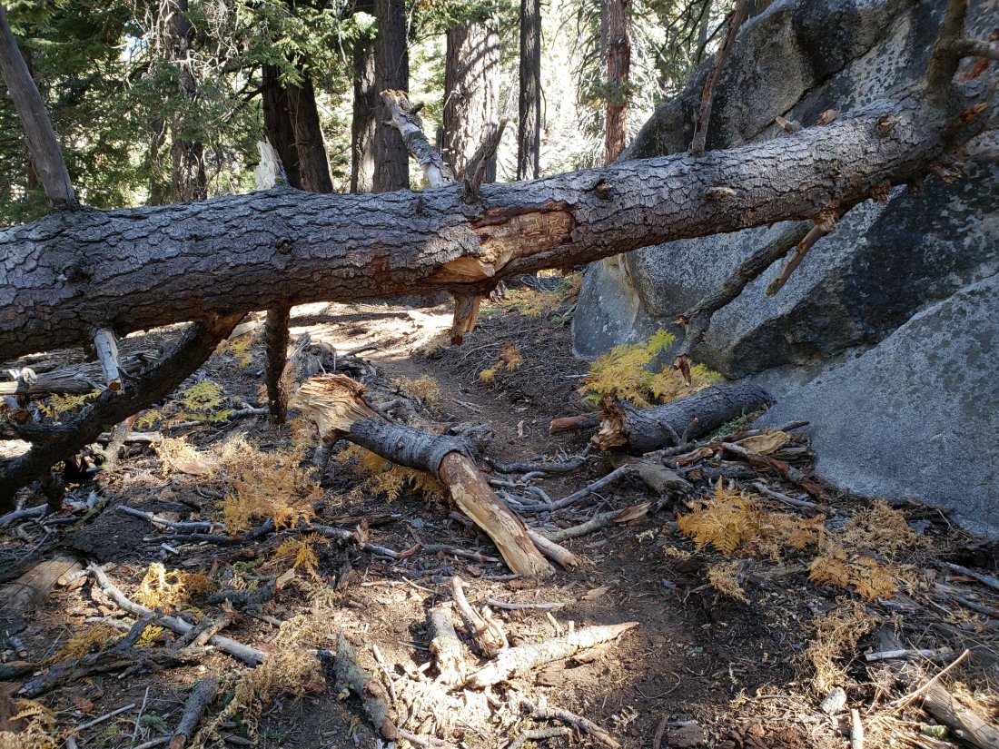
sanjacjonUncategorized 6 MinutesEdit”Trail and water update 7th November 2019″
Trail and weather update 30th October 2019
In light of the challenging wind/fire conditions this week, after an ascent of San Jacinto Peak on Monday we have spent the past two days surveying long sections of the Desert Divide, one of the most windy (and flammable) parts of the San Jacinto mountains.
Winds were strong today (20-30 mph) in Garner Valley and on parts of the Desert Divide. Both yesterday and today we passed by the notoriously exposed Fobes Saddle and it was interesting to note that the West wind there yesterday was actually stronger than the ENE wind this morning. Although it looked very hazy and dusty in the lowlands to both the east and west, the air remained clear and fresh in the mountains (at least above about 5000′).
Santa Ana winds have not been strong in the high country. Although seemingly counterintuitive, this is typical in the San Jacinto mountains, where terrain above about 9000′ is largely above the strongest north-east winds. Nevertheless with air temperatures near freezing everywhere above 4000′, windchill conditions at all montane elevations have been well below freezing.
Other than the weather conditions and associated fire risk, the most notable news is Caltrans’ announcement last night at a local community meeting that Highway 243 between Idyllwild and Banning will reopen no later than the evening of Friday 1st November. There may be some limited flagman operations for the foreseeable future. The entire highway from Lake Fulmor down to Banning has also been repaved in the past two months.
Our indefatigable PCTA Section B trail crew removed 16 downed trees in the Red Tahquitz area last weekend (PCT Miles 174.4 to 176.5). Only about five trees remain down between South Peak and the rockslide at Mile 172.5.
Almost all water sources have been rechecked in recent days, and there have been no significant changes since last week’s Report, linked here.
Despite unusually mild November weather, hikers should nevertheless be prepared for temperatures at or below freezing every day throughout the high country, but certainly above about 10,000′ elevation.
WEATHER Following a rapid plunge this week to temperatures well below seasonal, the first ten days of November are forecast to have temperatures well above seasonal average, more typical of late September. There continues to be no precipitation forecast for the foreseeable future.
At San Jacinto Peak (10,810’/3295m) on Monday 28th October 2019 at 0925 the air temperature was 38.3°F (4°C), with a windchill temperature of 30.8°F (-1°C), 18% relative humidity, and a light NNW wind sustained at 4.0 mph gusting to 8.3 mph.

TRAIL CONDITIONS
All trails, including the entire Pacific Crest Trail throughout the San Jacinto mountains, have been free of snow since the end of June.
The Pacific Crest Trail remains open at the rockslide just north of Antsell Rock (Mile 172.5). The updated video report from 7th October (available here) can be useful for deciding whether to try to hike around the rockslide or take an alternate route.
One newly fallen tree, along the trail and at a challenging height, one mile from the top of the Spitler Peak Trail is passable with care by hikers. The trail is currently impassable to pack animals however.
Forest Service closures to the Boulder Basin and Black Mountain Group campgrounds (both accessed from Black Mountain Road), and Dark Canyon Road, will remain in place all year. Consequently, Dark Canyon campground is also closed, and there is no access to Seven Pines trailhead.
We resurveyed Seven Pines Trail in mid October. There are three trees down on Forest Service land, and about 30 on State Park land, the latter almost all above 7500′ elevation. The anticipated tree removal work by State Park in September did not occur. This trail has been very lightly traveled since late 2018, and is indistinct in places, especially in its uppermost mile. Hikers without prior experience of this trail should take care with routefinding.
The Caramba Trail from near Reeds Meadow through Laws Camp to Caramba, and the Cedar Trail from Willow Creek Trail to Laws, are not maintained. Temporary signage to this effect has been in place since the end of June. Both trails are very indistinct and heavily overgrown with challenging whitethorn in places, and hikers without considerable prior experience of this area should exercise extremely cautious navigation. From Laws east to Caramba the route of the original trail is relatively easy to follow (for those who were very familiar with this trail prior to the 2013 Mountain Fire). An informal use trail to Laws has been developed which is much more direct and avoids all of the challenging bush-whacking of the unmaintained trails (some local hikers have kindly dubbed it the “King Trail”). It leaves the Willow Creek Trail exactly 1.0 mile from Saddle Junction (0.46 mile from the Skunk Cabbage turning), descending largely on deer trails for 1.2 miles, basically paralleling Willow Creek just to its south. Currently it is quite obvious for about a mile, becoming more indistinct as it nears Laws (by which time Willow Creek is close on the north [left] side, so navigation is not a challenge).
The Cranston Fire closure order expired at the beginning of August. Although this does not impact the wilderness trail situation, it does mean that the popular dirt roads and mountain bike trails of the May Valley and Bonita Vista roads area are now open. May Valley Road remains closed to vehicular traffic (there is a new USFS gate just up from the Cowbell Alley access).sanjacjonUncategorized 4 MinutesEdit”Trail and weather update 30th October 2019″
Trail and water update 23rd October 2019
[Update 29th October: Caltrans has just announced that Highway 243 between Idyllwild and Banning will reopen no later than 6pm on Friday 1st November. There may be some limited flagman operations for the foreseeable future.]
Three ascents of San Jacinto Peak last week followed by two so far this week, by a wide variety of routes, have allowed thorough assessment of many water sources. Today’s loop hike up the Peak Trail and down Deer Springs Trail included a check of Strawberry Cienega.
Our hard-working PCTA Section B trail crew has scheduled tree removal work on the PCT in the Red Tahquitz area for 25th-27th October. There are some 20 trees down on the PCT between Miles 172.5 (the rockslide) and 176.5 (just north-west of Red Tahquitz). Anyone interested in helping is encouraged to check the project announcement on the PCTA website, and contact crew leader Don Line at the email address given therein.
The status of water sources, some of which having experienced significant declines in flow rates recently, is updated below.
Hikers should be prepared for temperatures at or near freezing, potentially colder when considering windchill effects, especially above about 10,000′ elevation but possible at all montane elevations starting next week.
WEATHER Temperatures have been well above seasonal average for most of October. However starting early next week wintry temperatures, with lows near freezing in Idyllwild, are expected. There continues to be no significant precipitation forecast for the foreseeable future.
At San Jacinto Peak (10,810’/3295m) today, Wednesday 23rd October 2019 at 0920 the air temperature was 48.3°F (9°C), with a windchill temperature of 46.9°F (8°C), 25% relative humidity, and a very light NW breeze sustained at 1.5 mph gusting to 3.1 mph.
At the Peak on Monday 21st October 2019 at 0915 the air temperature was 41.9°F (6°C), with a windchill temperature of 36.3°F (2°C), 37% relative humidity, and a gentle NW breeze sustained at 5 mph gusting to 7.5 mph.
TRAIL CONDITIONS
All trails, including the entire Pacific Crest Trail throughout the San Jacinto mountains, have been free of snow since the end of June.
The Pacific Crest Trail remains open at the rockslide just north of Antsell Rock (Mile 172.5). The updated video report from 7th October (available here) can be useful for deciding whether to try to hike around the rockslide or take an alternate route.
The section of the PCT north of the rockslide (Miles 172.5 to 176.5) is badly impacted by 20 downed trees. Although all of these are passable by hikers, some caution is required. The trail is impassable to pack animals. As reported above, many of these will hopefully be cleared this weekend.
One newly fallen tree, along the trail and at a challenging height, one mile from the top of the Spitler Peak Trail is passable with care by hikers. The trail is currently impassable to pack animals however.
Forest Service closures to the Boulder Basin and Black Mountain Group campgrounds (both accessed from Black Mountain Road), and Dark Canyon Road, will remain in place all year. Consequently, Dark Canyon campground is also closed, and there is no access to Seven Pines trailhead.
We resurveyed Seven Pines Trail last week. There are three trees down on Forest Service land, and about 30 on State Park land, the latter almost all above 7500′ elevation. The anticipated tree removal work by State Park in September did not happen. This trail has been very lightly traveled since late 2018, and is indistinct in places, especially in its uppermost mile. Hikers without prior experience of this trail should take care with routefinding.
The Caramba Trail from near Reeds Meadow through Laws Camp to Caramba, and the Cedar Trail from Willow Creek Trail to Laws, are not maintained. Temporary signage to this effect has been in place since the end of June. Both trails are very indistinct and heavily overgrown with challenging whitethorn in places, and hikers without considerable prior experience of this area should exercise extremely cautious navigation. From Laws east to Caramba the route of the original trail is relatively easy to follow (for those who were very familiar with this trail prior to the 2013 Mountain Fire). An informal use trail to Laws has been developed which is much more direct and avoids all of the challenging bush-whacking of the unmaintained trails (some local hikers have kindly dubbed it the “King Trail”). It leaves the Willow Creek Trail exactly 1.0 mile from Saddle Junction (0.46 mile from the Skunk Cabbage turning), descending largely on deer trails for 1.2 miles, basically paralleling Willow Creek just to its south. Currently it is quite obvious for about a mile, becoming more indistinct as it nears Laws (by which time Willow Creek is close by on your left hand side, so navigation is not a challenge).
The Cranston Fire closure order expired at the beginning of August. Although this does not impact the wilderness trail situation, it does mean that the popular dirt roads and mountain bike trails of the May Valley and Bonita Vista roads area are now open. May Valley Road remains closed to vehicular traffic (there is a new USFS gate just up from the Cowbell Alley access).
WATER STATUS: Eastern slope
The Round Valley spigot continues to flow well at about 2.0 gpm.
Both the northern and southern springs at Wellman’s Cienega are flowing steadily. These springs are the sources for Willow Creek, which is flowing well where it crosses the Willow Creek Trail.
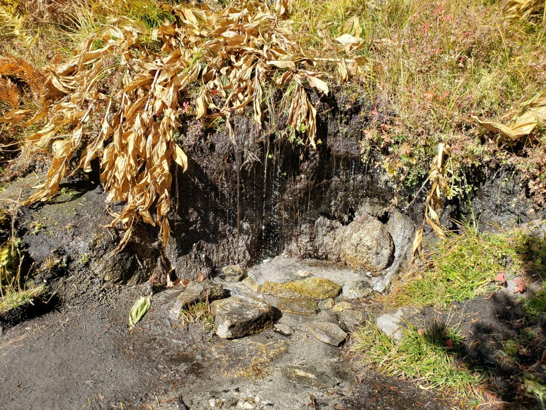
Tahquitz Valley creek, where it crosses the meadow trail, dried up in late September.
Tahquitz Creek is flowing well at the northern end of Little Tahquitz Meadow. It is also flowing gently further upstream at its source (known locally as Grethe Spring) where it crosses the PCT (approx. PCT Mile 177).
Candy’s Creek – that flows through Skunk Cabbage Meadow and then crosses the Caramba Trail near Reeds Meadow – is almost dry in the former. It is much more accessible where it is flowing gently across the Caramba Trail.
WATER STATUS: Western slope
The North Fork of the San Jacinto River is flowing well both where it crosses the Deer Springs Trail and the Fuller Ridge Trail on the PCT (approx. PCT Mile 186.0).

O’Sullivan Creek (PCT Mile 186.4) on Fuller Ridge Trail is also flowing.
The creek in Little Round Valley continues to flow gently. This is the first time in seven or more years that this has flowed into the autumn.
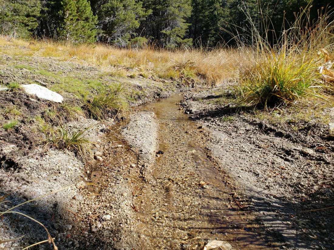
Shooting Star Spring (below Little Round Valley but above the North Fork of the San Jacinto River crossing) is flowing.
The Deer Springs stream crossing at the PCT (approx. PCT mile 185) is flowing well.
Switchback Spring (about 0.4 miles north of Strawberry Junction) is now flowing only gently, there is very little depth in which to filter water, and it is heavily overgrown.
Strawberry Cienega has functionally dried up. The tiny pool between the rocks, formerly good for filtering, filled with sediment last winter and no longer accumulates water.
On Devil’s Slide Trail, Middle Spring is barely a trickle now.
On the Ernie Maxwell Trail, the crossing of Chinquapin Creek just below Humber Park continues to flow just upstream of the trail. Intermittent diversion by Fern Valley Water District (who unhelpfully refer to it as Tahquitz Creek!) results in the flow across the actual trail being unreliable at present. This creek is an important source of water for the many dogs walked on this trail.
WATER STATUS: Desert Divide
Live Oak Spring (N 33 37 21, W 116 33 24) Flowing well. The most reliable water source on the Desert Divide.
Cedar Spring (N 33 40 36, W 116 34 35) Flowing well. Easiest access is the trough just upstream from the trail to the campsite.
Apache Spring (N 33 43 11, W 116 37 13) Flowing gently. The trail off the PCT to this spring was greatly upgraded earlier this year, and is now a joy to use (despite 17 switchbacks!).
Spitler Peak Trail Descending this trail from the PCT there are five water crossings. The first two, at 0.9 and 0.95 miles down, cross a tiny side creek which should be ignored. The next three crossings, at 1.1 to 1.3 miles down, are Spitler Creek, which continues to flow well.
Antsell Rock Creek (N 33 41 52, W 116 39 08) Right by the Spitler Peak Trail trailhead on Apple Canyon Road, Antsell Rock Creek is flowing well. Just on the upstream side of the road there is excellent access to the creek. Potentially useful if hikers are descending the Spitler Peak Trail.sanjacjonUncategorized 6 MinutesEdit”Trail and water update 23rd October 2019″
Trail update 16th October 2019
An active few days has seen us hiking multiple ascents of San Jacinto Peak via both the Peak and Deer Springs trails, much of the PCT in the San Jacinto mountains, multiple hikes east to Laws or Caramba, and hikes in Long and Round valleys, plus Skyline and Seven Pines trails.
Our hard-working PCTA Section B trail crew has scheduled tree removal work on the PCT in the Red Tahquitz area for 25th-27th October. As reported last week, there are some 20 trees down on the PCT between Miles 172.5 (the rockslide) and 176.5 (just north-west of Red Tahquitz). Anyone interested in helping is encouraged to check the project announcement on the PCTA website, and contact crew leader Don Line at the email address given therein.
The final (nearly 4′ diameter) tree down across Willow Creek Trail on State Park land was cut on 12th October by the PCTA Section B trail crew.
The newly constructed section of the Round Valley Trail designed to keep hikers away from the meadows, between the High Trail junction and the Round Valley spigot, opened to hikers on 9th October. We were among the first hikers to use it as we passed through on a C2C2I speed hike on 11th.
The status of water sources, all of which have been checked in the past few days, is unchanged from last week’s report linked here. Many thanks to Kyle Koppenhaver (owner of Minimul Packs) for checking a couple of the water sources I hike to less frequently.
Although some days will be milder, hikers should be prepared for autumnal temperatures at or near freezing above about 10,000′ elevation, and potentially cooler when considering windchill effects.

WEATHER After weeks of considerable variability, temperatures have settled down, to above seasonal average for late October. Overnight low temperatures, especially next week, will be well above seasonal. That said, windchill values at or even below freezing overnight, generally above 10,000′ elevation, are now typical. There continues to be no precipitation forecast for the foreseeable future.
At San Jacinto Peak (10,810’/3295m) today, Wednesday 16th October 2019 at 0945 the air temperature was 52.0°F (11°C), with a windchill temperature of 47.7°F (8°C), 13% relative humidity, and a light SE breeze sustained at 5 mph gusting to 9.7 mph.
At the Peak on Monday 14th October 2019 at 0940 the air temperature was 39.9°F (5°C), with a windchill temperature of 34.5°F (1°C), 18% relative humidity, and a gentle due West breeze sustained at 3 mph gusting to 7.0 mph.

TRAIL CONDITIONS
All trails, including the entire Pacific Crest Trail throughout the San Jacinto mountains, have been free of snow since the end of June.
The Pacific Crest Trail remains open at the rockslide just north of Antsell Rock (Mile 172.5). My updated video report from 7th October (available here) can be useful for deciding whether to try to hike around the rockslide or take an alternate route.
The section of the PCT north of the rockslide (Miles 172.5 to 176.5) is badly impacted by 20 downed trees. Although all of these are passable by hikers, some caution is required. The trail is impassable to pack animals. As reported above, many of these will hopefully be cleared in late October.
One newly fallen tree, along the trail and at a challenging height, one mile from the top of the Spitler Peak Trail is passable with care by hikers. The trail is currently impassable to pack animals however.
Forest Service closures to the Boulder Basin and Black Mountain Group campgrounds (both accessed from Black Mountain Road), and Dark Canyon Road, will remain in place all year. Consequently, Dark Canyon campground is also closed, and there is no vehicular access to Seven Pines trailhead.
We surveyed Seven Pines Trail again today. There are three trees down on Forest Service land, and about 30 on State Park land, the latter almost all above 7500′ elevation. This trail has been very lightly traveled since late 2018, and is indistinct in places, especially in its uppermost mile. Hikers without prior experience of this trail should take care with routefinding.
The Caramba Trail from near Reeds Meadow through Laws Camp to Caramba, and the Cedar Trail from Willow Creek Trail to Laws, are not maintained. Temporary signage to this effect has been in place since the end of June. Both trails are very indistinct and heavily overgrown with challenging whitethorn in places, and hikers without considerable prior experience of this area should exercise extremely cautious navigation. From Laws east to Caramba the route of the original trail is relatively easy to follow (for those who were very familiar with this trail prior to the 2013 Mountain Fire). An informal use trail to Laws has been developed which is much more direct and avoids all of the challenging bush-whacking of the unmaintained trails (some local hikers have kindly dubbed it the “King Trail”). It leaves the Willow Creek Trail exactly 1.0 mile from Saddle Junction (0.46 mile from the Skunk Cabbage turning), descending largely on deer trails for 1.2 miles, basically paralleling Willow Creek just to its south. Currently it is quite obvious for about a mile, becoming more indistinct as it nears Laws (by which time Willow Creek is close by on your left hand side).
The Cranston Fire closure order expired at the beginning of August. Although this does not impact the wilderness trail situation, it does mean that the popular dirt roads and mountain bike trails of the May Valley and Bonita Vista roads area are now open. May Valley Road remains closed to vehicular traffic (there is a new USFS gate just up from the Cowbell Alley access).sanjacjonUncategorizedLeave a comment 4 MinutesEdit”Trail update 16th October 2019″
Trail and water update 8th October 2019
[Update 12th October: the final (very large) tree down across Willow Creek Trail on State Park land was cut today by our hard-working PCTA Section B Trail crew.]
[Update 11th October: the newly constructed section of the Round Valley Trail, between the High Trail junction and the Round Valley spigot, opened to hikers on 9th We were among the first hikers to use it as we passed through on a C2C speed hike.]
Near-perfect hiking weather has seen us on a wide diversity of trails in the past five days, including a loop out to Caramba, the PCT south to Spitler Peak, the Apache Spring and Spitler Peak trails, and the Peak and Deer Springs trails to San Jacinto Peak.
I took the opportunity as I passed by the rockslide just north of Antsell Rock (PCT Mile 172.5) yesterday, to record an updated video (available on YouTube here). This may be useful for deciding whether to try to hike around the rockslide or take an alternate route.
The status of water sources, some of which having experienced significant declines in flow rates recently, is updated below. The status of highway closures is also described at the foot of this posting.
Hikers should be prepared for autumnal temperatures at or near freezing above about 10,000′ elevation, and potentially cooler when considering windchill effects.
WEATHER As noted last week, temperatures continue on an unpredictable rollercoaster. Above-average temperatures in recent days will give way to cold Santa Ana (NE) winds accompanied by extremely low humidity on 10th-11th October. This will be followed by rapid warming back to seasonal temperatures and a swing to SW airflow starting on Sunday 13th. Despite this variability, windchill values at or even below freezing overnight, generally above 10,000′ elevation, are now typical. There is no precipitation forecast for the foreseeable future.
At San Jacinto Peak (10,810’/3295m) today, Tuesday 8th October 2019 at 0855 the air temperature was 43.5°F (6°C), with a windchill temperature of 38.2°F (4°C), 27% relative humidity, and a gentle NE breeze sustained at 5 mph gusting to 6.8 mph.
In contrast, at the Peak on Tuesday 1st October 2019 at 0915 the air temperature was 35.5°F (2°C), with a windchill temperature of 22.5°F (-5°C), 19% relative humidity, and a brisk W wind sustained at 9 mph gusting to 17.8 mph.

TRAIL CONDITIONS
All trails, including the entire Pacific Crest Trail throughout the San Jacinto mountains, have been free of snow since the end of June.
The Pacific Crest Trail remains open at the rockslide just north of Antsell Rock (Mile 172.5). An updated video report from 7th October (available here) can be useful for deciding whether to try to hike around the rockslide or take an alternate route.
The section of the PCT north of the rockslide (Miles 172.5 to 176.5) is badly impacted by 20 downed trees. Although all of these are passable by hikers, some caution is required. The trail is impassable to pack animals. It is anticipated that these trees may be cleared in late October.
One newly fallen tree, along the trail and at a challenging height, one mile from the top of the Spitler Peak Trail is passable with care by hikers. The trail is currently impassable to pack animals however.
Forest Service closures to the Boulder Basin and Black Mountain Group campgrounds (both accessed from Black Mountain Road), and Dark Canyon Road, will remain in place all year. Consequently, Dark Canyon campground is also closed, and there is no vehicular access to Seven Pines trailhead.
Seven Pines Trail has at least 35 trees down, almost all above 7500′ elevation. This trail has been very lightly traveled since 2018, and is indistinct in places. Hikers without considerable prior experience of this trail should take great care with routefinding.
The Caramba Trail from near Reeds Meadow through Laws Camp to Caramba, and the Cedar Trail from Willow Creek Trail to Laws, are not maintained. Temporary signage to this effect has been in place since the end of June. Both trails are very indistinct and heavily overgrown with impenetrable whitethorn in places, and hikers without considerable prior experience of this area should exercise extremely cautious navigation. From Laws to Caramba the route of the original trail is relatively easy to follow (for those who were very familiar with this trail prior to the 2013 Mountain Fire). An informal use trail to Laws is under development (details to follow).
The Cranston Fire closure order expired at the beginning of August. Although this does not impact the wilderness trail situation, it does mean that the popular dirt roads and mountain bike trails of the May Valley and Bonita Vista roads area are now open.
WATER STATUS: Eastern slope
The Round Valley spigot continues to flow well at about 2.0 gpm.
Both the northern and southern springs at Wellman’s Cienega are flowing steadily. These springs are the sources for Willow Creek, which is flowing well where it crosses the Willow Creek Trail.
Tahquitz Valley creek, where it crosses the meadow trail, dried up in late September.
Tahquitz Creek is flowing well at the northern end of Little Tahquitz Meadow. It is also flowing gently further upstream at its source (known locally as Grethe Spring) where it crosses the PCT (approx. PCT Mile 177).
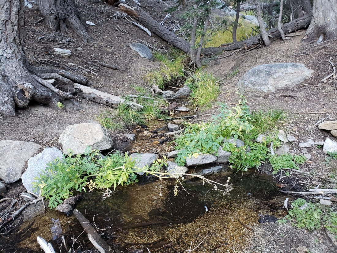
Candy’s Creek – that flows through Skunk Cabbage Meadow and then crosses the Caramba Trail near Reeds Meadow – is flowing gently, but is very overgrown with thick vegetation, and is too shallow for easy filtering. It is much more accessible where it is flowing steadily across the Caramba Trail.
WATER STATUS: Western slope
The North Fork of the San Jacinto River is flowing well both where it crosses the Deer Springs Trail and the Fuller Ridge Trail on the PCT (approx. PCT Mile 186.0).
O’Sullivan Creek (PCT Mile 186.4) on Fuller Ridge Trail is also flowing.
The creek in Little Round Valley is flowing. This is the first time in seven or more years that this has flowed into the autumn.
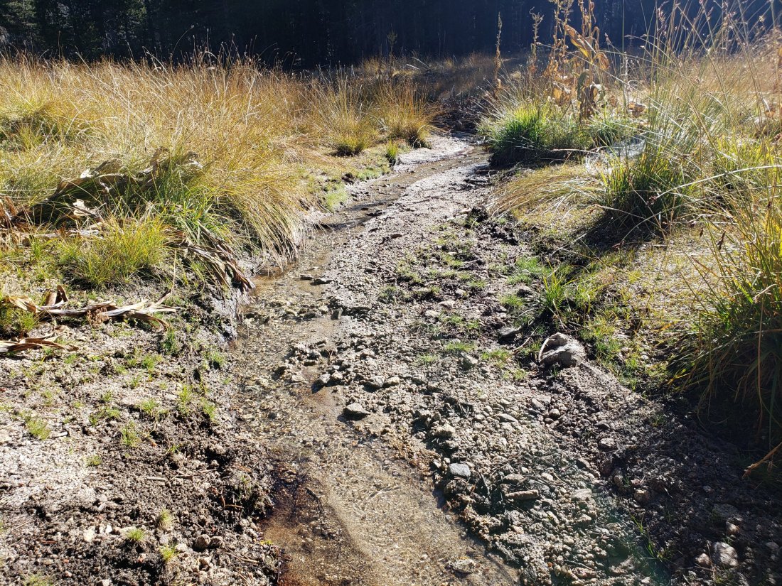
Shooting Star Spring (below Little Round Valley but above the North Fork of the San Jacinto River crossing) is flowing well.
The Deer Springs stream crossing at the PCT (approx. PCT mile 185) is flowing well.
Switchback Spring (about 0.4 miles north of Strawberry Junction) is now flowing only gently, there is very little depth in which to filter water, and it is heavily overgrown.
Strawberry Cienega spring is flowing very gently. The tiny pool between the rocks, formerly good for filtering, filled with sediment last winter.
On Devil’s Slide Trail, Middle Spring is barely a trickle now (although there is just sufficient water for dogs to drink).
On the Ernie Maxwell Trail, the crossing of Chinquapin Creek just below Humber Park continues to flow well just upstream of the trail. Intermittent diversion by Fern Valley Water District (who unhelpfully refer to it as Tahquitz Creek!) results in the flow across the actual trail being unreliable at present. This creek is an important source of water for the many dogs walked on this trail.
WATER STATUS: Desert Divide
Live Oak Spring (N 33 37 21, W 116 33 24) Flowing well. The most reliable water source on the Desert Divide.
Cedar Spring (N 33 40 36, W 116 34 35) Flowing well. Easiest access is the trough just upstream from the trail to the campsite.
Apache Spring (N 33 43 11, W 116 37 13) Flowing gently. The trail off the PCT to this spring was greatly upgraded earlier this year, and is now a joy to use (despite the 17 switchbacks!).
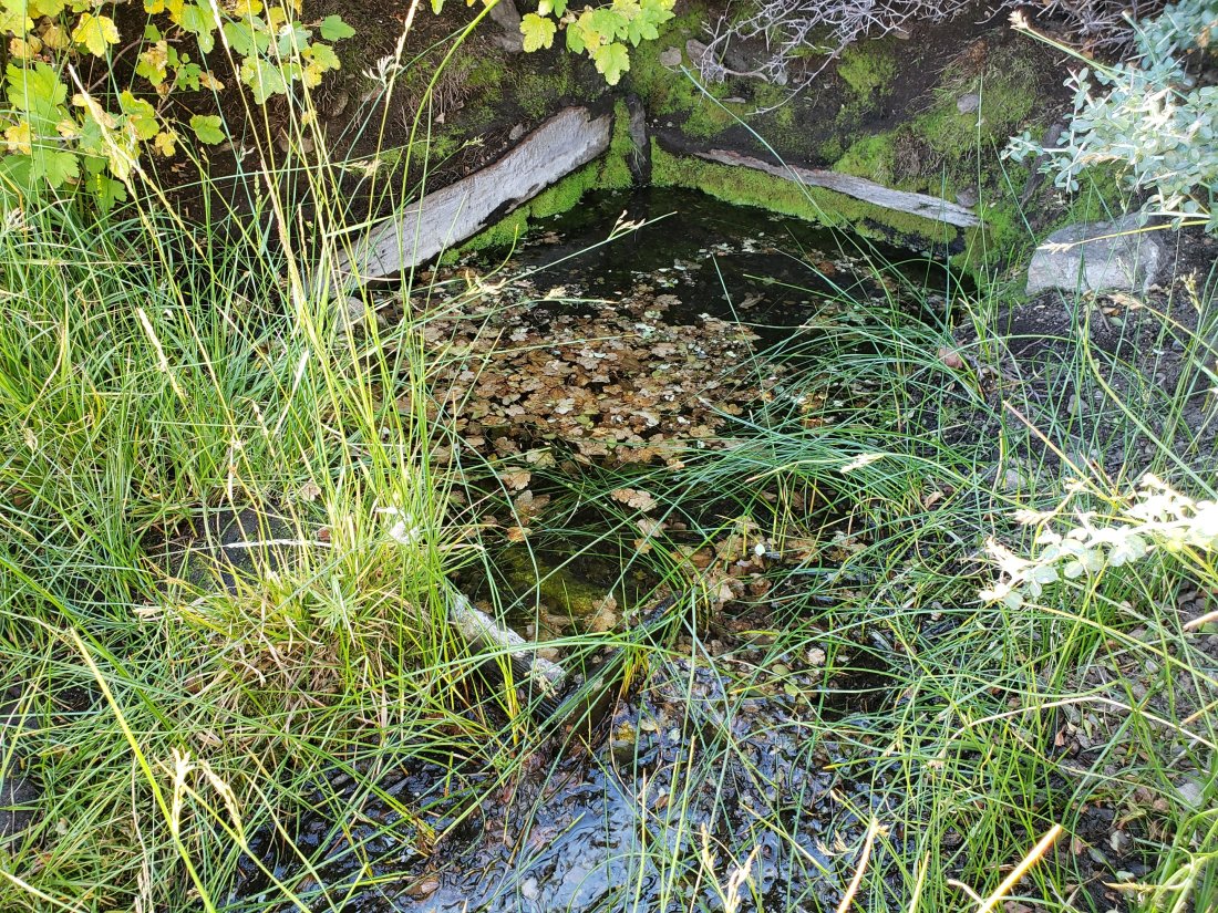
Spitler Peak Trail Descending this trail from the PCT there are five water crossings. The first two, at 0.9 and 0.95 miles down, cross a tiny side creek which should be ignored. The next three crossings, at 1.1 to 1.3 miles down, are Spitler Creek, which continues to flow well.
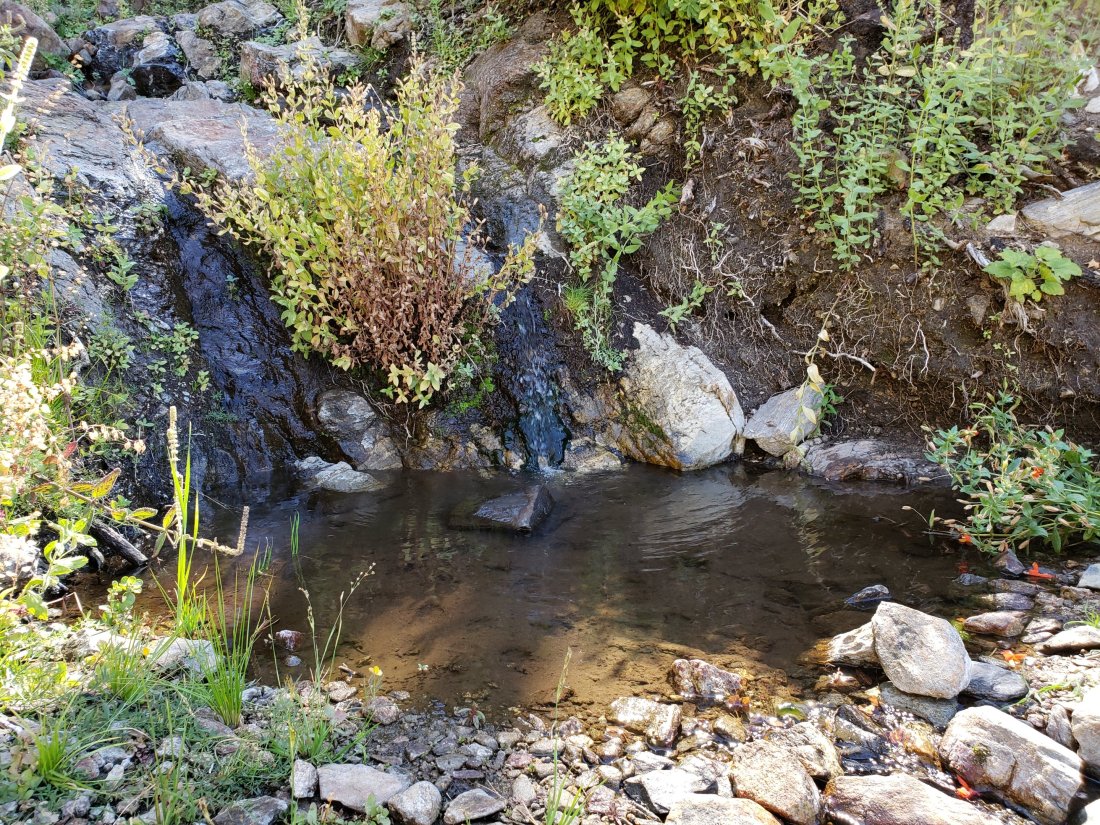
Antsell Rock Creek (N 33 41 52, W 116 39 08) Right by the Spitler Peak Trail trailhead on Apple Canyon Road, Antsell Rock Creek is flowing well. Just on the upstream side of the road there is excellent access to the creek. Useful if hikers are descending the Spitler Peak Trail.
ACCESS CLOSURES The Valentine’s Day 2019 flood events continue to make access to the San Jacinto mountains challenging. However progress is being made. Highway 243 between Banning and Idyllwild is closed from Skyland Ranch (north of Bay Tree Spring) to just north of Lake Fulmor. This highway has been estimated by Caltrans to reopen on 1st November 2019, with some form of traffic control (to be determined) into 2020. However, informed local opinion suggests that this is unlikely to happen, and that the original Caltrans estimate of sometime in 2020 for controlled reopening seems to be more realistic. Highway 74 between Mountain Center and Valle Vista (Hemet) reopened full time on 3rd October, but with some localized flagging operations for the foreseeable future.sanjacjonUncategorized1 Comment 6 MinutesEdit”Trail and water update 8th October 2019″
Trail and weather update 3rd October 2019
I have spent most of the last ten days hiking in the San Jacinto high country. There has been yet another wild swing in weather conditions in the past few days.
Two pieces of noteworthy trail-related news. Highway 74 between Valle Vista and Mountain Center reopens this evening at 1700 with no pilot car. Localized flagging operations will continue for several weeks.
The annual maintenance closure of the Palm Springs Aerial Tramway will continue thru Sunday 6th October. Check the tram website to confirm the reopening currently scheduled for 7th October.
The status of water sources is basically unchanged, as described here.
Although temperatures for the next week will be above seasonal norms, hikers should nevertheless be prepared for temperatures near freezing above about 10,000′ elevation, and potentially lower when considering windchill effects.
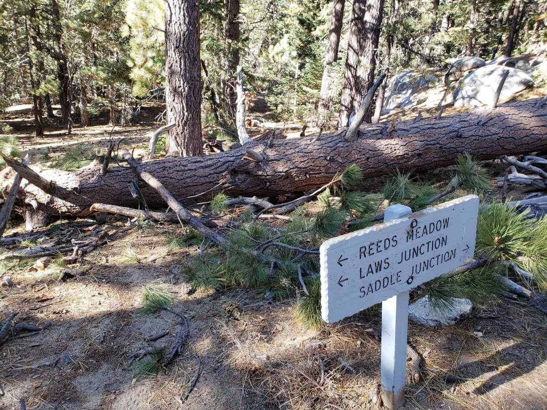
WEATHER In keeping with the weather theme for 2019, temperatures are on a dramatic rollercoaster again. After wintry temperatures in late September, the next week will be much warmer than average for early October, with a return to prevailing westerly airflow since Monday. There is no precipitation forecast for the foreseeable future.
At San Jacinto Peak (10,810’/3295m) on Tuesday 1st October 2019 at 0915 the air temperature was 35.5°F (2°C), with a windchill temperature of 22.5°F (-5°C), 19% relative humidity, and a brisk W wind sustained at 9 mph gusting to 17.8 mph.
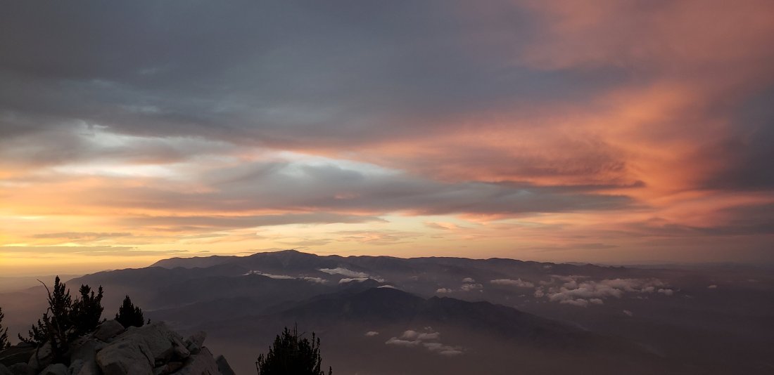
TRAIL CONDITIONS
All trails, including the entire Pacific Crest Trail throughout the San Jacinto mountains, have been free of snow since the end of June.
Hikers planning ascents of Skyline Trail are reminded that the Palm Springs Aerial Tramway is closed for maintenance until 7th October.
The Pacific Crest Trail remains open at the rockslide near Antsell Rock (Mile 172.5). The video report from late May (available here) can be useful for deciding whether to try to hike around the rockslide.
Forest Service closures to the Boulder Basin and Black Mountain Group campgrounds (both accessed from Black Mountain Road), and Dark Canyon Road, will remain in place all year. Consequently, Dark Canyon campground is also closed, and there is no vehicular access to Seven Pines trailhead.
Seven Pines Trail has at least 35 trees down, almost all above 7500′ elevation. This trail has been very lightly traveled since 2018, and is indistinct in places. Hikers without considerable prior experience of this trail should take great care with routefinding.
The Caramba Trail from near Reeds Meadow through Laws Camp to Caramba, and the Cedar Trail from Willow Creek Trail to Laws, are not maintained. Temporary signage to this effect has been in place since the end of June. Both trails are very indistinct and heavily overgrown in places, and hikers without considerable prior experience of this area should exercise extremely cautious navigation.
The Cranston Fire closure order expired at the beginning of August. Although this does not impact the wilderness trail situation, it does mean that the popular dirt roads and mountain bike trails of the May Valley and Bonita Vista roads area are now open.sanjacjonUncategorized1 Comment 2 MinutesEdit”Trail and weather update 3rd October 2019″
Weather update 27th September 2019
[UPDATE 28th September: Palm Springs media outlets are reporting that the Palm Springs Aerial Tramway, currently closed for maintenance, will not now reopen until Monday 7th October. Many thanks to Florian Boyd for this breaking news.]
I spent Monday to Friday in the San Jacinto high country, hiking mostly off-trail. It was a week of dramatic and changeable autumn weather.
After weeks dominated by west and south-west winds, a shift to a northerly air flow in the early hours of Tuesday 24th caused a dramatic temperature drop, with an air temperature near freezing and a windchill of 19°F at San Jacinto Peak. I posted a short video from there that morning. Later that morning I recorded a wind gust of 49 mph near Marion Mountain.
The cool N-NE wind flow remained all week. Although Wednesday 25th was a little warmer, it was cloudy, and in the afternoon I watched as haboob conditions (a type of sandstorm) developed in the Coachella Valley and Anza-Borrego desert. The north-east winds drove sand all the way through the San Gorgonio Pass as far as Beaumont by dusk.
Thursday 26th was a day of spectacular cloud formations throughout Southern California. While much of the western lowlands and many peaks were shrouded in cloud, with its exceptional prominence San Jacinto Peak remained above it for most of the day. Thunderstorms originating near Joshua Tree spread south to Borrego, but stayed east of the San Jacinto mountains. I posted a short video of the surrounding cloud view at noon yesterday.
A high, deep marine cloud layer over the coastal lowlands led to a dramatic (even by San Jac standards) sunset last night, and a great visual effect at sunrise this morning.
San Jacinto Peak is unusually prominent over its surrounding lowlands. In addition to creating much of it’s own weather, it also casts it’s own distinctive, if short-lived, shadow. Conditions vary, but at sunrise this morning, the deep marine layer to the west provided a perfect canvas for the “San Jac shadow“. My time-lapse video, recorded this morning, shows the spectacular 30 minute rise and fall of the San Jac shadow in just under one minute.
Regarding trail conditions, the status of water sources and highway closures is basically unchanged since last week, as described here.
Despite occasional milder days, hikers should now be prepared for temperatures around freezing above about 10,000′ elevation, and potentially lower when considering windchill effects.


WEATHER After wintry temperatures for the next few days, milder weather will return on about 2nd October. Autumnal temperatures dominate, accompanied by periodic strong winds and extremely variable humidity at the highest peaks. Air temperatures, and certainly windchill values, at or below freezing overnight are now typical. There is no precipitation forecast for elevations above about 5000′ for the foreseeable future.
At San Jacinto Peak (10,810’/3295m) today, Friday 27th September 2019 at 0630 the air temperature was 47.0°F (8°C), with a windchill temperature of 40.1°F (5°C), 51% relative humidity, and a cool N wind sustained at 7 mph gusting to 13.9 mph.
At the Peak on Thursday 26th September 2019 at 0625, the air temperature was 37.2°F (3°C), with a windchill temperature of 31.5°F (0°C), 98% relative humidity, and a light NNE wind at 2 mph gusting to 6.2 mph, accompanied by cloud and brief drizzle.
At the Peak on Tuesday 24th September 2019 at 0625, the air temperature was 34.5°F (1°C), with a windchill temperature of 19.3°F (-8°C), 85% relative humidity, and a sevare NNE wind at 17 mph gusting to 29.9 mph.
TRAIL CONDITIONS
All trails, including the entire Pacific Crest Trail throughout the San Jacinto mountains, have been free of snow since the end of June.
Hikers planning ascents of Skyline Trail are reminded that the Palm Springs Aerial Tramway is closed for maintenance until 7th October.
The Pacific Crest Trail remains open at the rockslide near Antsell Rock (Mile 172.5). The video report from late May (available here) can be useful for deciding whether to try to hike around the rockslide.
Forest Service closures to the Boulder Basin and Black Mountain Group campgrounds (both accessed from Black Mountain Road), and Dark Canyon Road, will remain in place all year. Consequently, Dark Canyon campground is also closed, and there is no vehicular access to Seven Pines trailhead.
Seven Pines Trail has at least 35 trees down, almost all above 7500′ elevation. This trail has been very lightly traveled since 2018, and is indistinct in places. Hikers without considerable prior experience of this trail should take great care with routefinding.
The Caramba Trail from near Reeds Meadow through Laws Camp to Caramba, and the Cedar Trail from Willow Creek Trail to Laws, are not maintained. Temporary signage to this effect has been in place since the end of June. Both trails are very indistinct and heavily overgrown in places, and hikers without considerable prior experience of this area should exercise extremely cautious navigation.
The Cranston Fire closure order expired at the beginning of August. Although this does not impact the wilderness trail situation, it does mean that the popular dirt roads and mountain bike trails of the May Valley and Bonita Vista roads area are now open.

sanjacjonUncategorized1 Comment 4 MinutesEdit”Weather update 27th September 2019″
Trail and water update 18th September 2019
Again I’ve spent the last three days camped in the San Jacinto high country, hiking extensively on the trail system and elsewhere.
Autumnal weather arrived abruptly (and in some style) on Monday evening, with strong, chilly winds dominating the high country for the past two nights. I documented the spectacular cloud effects at sunset on Monday 16th at San Jacinto Peak in a short video, available here on YouTube.
The status of water sources, most of which having experienced significant declines in flow rates in the past couple of weeks, is updated below. The status of highway closures is unchanged and is described at the foot of this posting.
Hikers should be prepared for autumnal temperatures at or below freezing above about 10,000′ elevation (but potentially lower), at least when considering windchill effects.

WEATHER Autumnal temperatures dominate, accompanied by extremely low humidity and periodic strong winds at the highest peaks. Windchill values at or below freezing overnight, generally above 10,000′ elevation, are now typical. There is a chance of precipitation on several days next week (25th-29th September).
At San Jacinto Peak (10,810’/3295m) today, Wednesday 18th September 2019 at 0620 the air temperature was 42.9°F (6°C), with a windchill temperature of 30.9°F (-1°C), 7% relative humidity, and a potent SW wind sustained at 27 mph gusting to 31.8 mph.
At the Peak on Tuesday 17th September 2019 at 0625, the air temperature was 38.0°F (3°C), with a windchill temperature of 24.2°F (-4°C), 35% relative humidity, and a fresh WSW wind at 17 mph gusting to 26.4 mph.
TRAIL CONDITIONS
All trails, including the entire Pacific Crest Trail throughout the San Jacinto mountains, have been free of snow since the end of June.
Hikers planning ascents of Skyline Trail are reminded that the Palm Springs Aerial Tramway is closed for maintenance 9th-29th September. Warning signs have been posted at the Ramon and Museum trailheads by friend of the Trail Report, Florian Boyd.
The Pacific Crest Trail remains open at the rockslide near Antsell Rock (Mile 172.5). The video report from late May (available here) can be useful for deciding whether to try to hike around the rockslide.
Forest Service closures to the Boulder Basin and Black Mountain Group campgrounds (both accessed from Black Mountain Road), and Dark Canyon Road, will remain in place all year. Consequently, Dark Canyon campground is also closed, and there is no vehicular access to Seven Pines trailhead.
Seven Pines Trail has at least 35 trees down, almost all above 7500′ elevation. State Park has apparently scheduled work this month to remove some or most of these obstructing trees. This trail has been very lightly traveled since 2018, and is indistinct in places. Hikers without considerable prior experience of this trail should take great care with routefinding.
The Caramba Trail from near Reeds Meadow through Laws Camp to Caramba, and the Cedar Trail from Willow Creek Trail to Laws, are not maintained. Temporary signage to this effect has been in place since the end of June. Both trails are indistinct in places, and hikers without considerable prior experience of this area should use cautious navigation.
The Cranston Fire closure order expired at the beginning of August. Although this does not impact the wilderness trail situation, it does mean that the popular dirt roads and mountain bike trails of the May Valley and Bonita Vista roads area are now open.
WATER STATUS: Eastern slope
The Round Valley spigot continues to flow well at about 2.0 gpm.
Both the northern and southern springs at Wellman’s Cienega are flowing steadily. These springs are the sources for Willow Creek, which is flowing well where it crosses the Willow Creek Trail.
Tahquitz Valley continues to flow gently where it crosses the meadow trail, the first time in some seven years that this has flowed all summer.
Tahquitz Creek is flowing well at the northern end of Little Tahquitz Meadow. It is also flowing gently further upstream at its source (known locally as Grethe Spring) where it crosses the PCT (approx. PCT Mile 177).
Candy’s Creek – that flows through Skunk Cabbage Meadow and then crosses the Caramba Trail near Reeds Meadow – is flowing gently, but is very overgrown with thick vegetation, and is too shallow for easy filtering. It is much more accessible where it is flowing steadily across the Caramba Trail.
WATER STATUS: Western slope
The North Fork of the San Jacinto River is flowing well both where it crosses the Deer Springs Trail and the Fuller Ridge Trail on the PCT (approx. PCT Mile 186.0).

O’Sullivan Creek (PCT Mile 186.4) on Fuller Ridge Trail is also flowing.
The creek in Little Round Valley is flowing at its strongest in at least six years, but the flow rate continues to decline steadily.
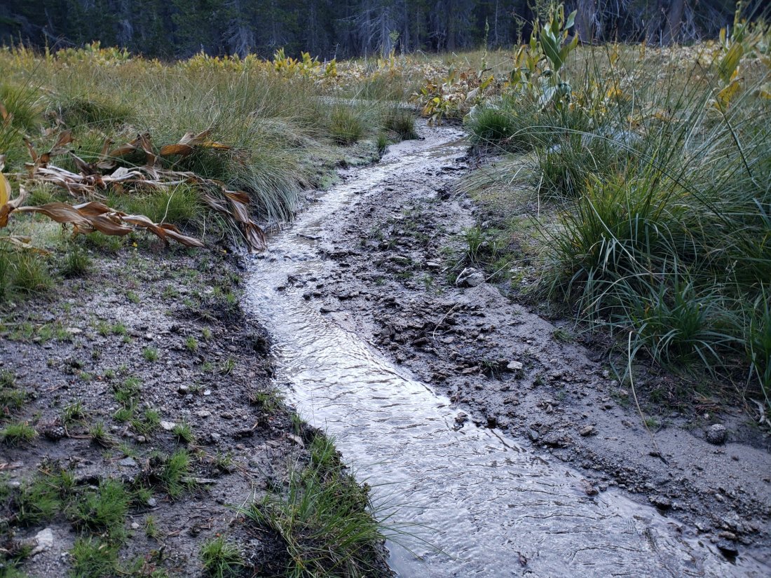
Shooting Star Spring (below Little Round Valley but above the North Fork of the San Jacinto River crossing) is flowing well.
The Deer Springs stream crossing at the PCT (approx. PCT mile 185) is flowing well.

Switchback Spring (about 0.4 miles north of Strawberry Junction) is now flowing only gently, there is very little depth in which to filter water, and it is heavily overgrown.
Strawberry Cienega spring is flowing very gently. The tiny pool between the rocks, formerly good for filtering, filled with sediment over the winter.
On Devil’s Slide Trail, Middle Spring is flowing very weakly now.
On the Ernie Maxwell Trail, the crossing of Chinquapin Creek just below Humber Park continues to flow well just upstream of the trail. Intermittent diversion by Fern Valley Water District (who unhelpfully refer to it as Tahquitz Creek!) results in the flow across the actual trail being unreliable at present. This creek is an important source of water for the many dogs walked on this trail.
WATER STATUS: Desert Divide
Live Oak Spring (N 33 37 21, W 116 33 24) Flowing well. The most reliable water source on the Desert Divide.
Cedar Spring (N 33 40 36, W 116 34 35) Flowing well. Easiest access is the trough just upstream from the trail to the campsite.
Apache Spring (N 33 43 11, W 116 37 13) Flowing weakly. The trail off the PCT to this spring was greatly improved earlier this summer.
Spitler Peak Trail Descending this trail from the PCT there are five water crossings. The first two, at 0.9 and 0.95 miles down, cross a tiny side creek which is largely dry and should be ignored. The next three crossings, at 1.1 to 1.3 miles down, are Spitler Creek, which continues to flow gently.
Antsell Rock Creek (N 33 41 52, W 116 39 08) Right by the Spitler Peak Trail trailhead on Apple Canyon Road, Antsell Rock Creek is flowing well. Just on the upstream side of the road there is excellent access to the creek. Useful if hikers are descending the Spitler Peak Trail.
ACCESS CLOSURES The Valentine’s Day 2019 flood events continue to make access to the San Jacinto mountains challenging, however the news is encouraging. Highway 243 between Banning and Idyllwild is closed from Skyland Ranch (north of Bay Tree Spring) to just north of Lake Fulmor. This highway is now estimated to reopen on 1st November 2019, with some form of traffic control (details to be determined). Highway 74 from Mountain Center to Hemet reopened full time, but with a pilot car, on 30th August, likely continuing until October.sanjacjonUncategorized3 Comments 5 MinutesEdit”Trail and water update 18th September 2019″
Trail update 11th September 2019
I’ve spent the last three days camped in the San Jacinto high country, hiking extensively on the trail system and elsewhere. A short vlog from San Jacinto Peak – the first in a while – is on YouTube linked here.
The status of water sources, many of which were rechecked yesterday and today, is basically unchanged from the update linked here, and news on the status of road closures is also described at the foot of that posting.
The thunderstorms of last week refreshed the forest and caused some minor erosion, visible throughout the trail system.
Extensive trail work should be underway this month, with tree clearance crews from various agencies scheduled for upper Deer Springs Trail, the PCT from Spitler to Red Tahquitz, and Seven Pines Trail, at least.
Hikers should always be prepared for rapidly changing weather conditions in the high country. Autumnal temperatures are now the norm (see Weather below). Thunderstorms with lightning, precipitation, and rapid temperature drops, are possible in the high country even when such storms are not forecast.
WEATHER Autumnal temperatures (accompanied by extremely low humidity) are here, with windchill values near freezing overnight above 10,000′ elevation. That said, the next few days, including the weekend, will be unseasonably warm, before a return to pleasantly chilly September conditions next week. No notable precipitation is forecast.
At San Jacinto Peak (10,810’/3295m) today, Wednesday 11th September 2019 at 0620 the air temperature was 43.9°F (7°C), with a windchill temperature of 36.1°F (2°C), 13% relative humidity, and a brisk due West wind at 12 mph gusting to 16.5 mph.
At the Peak on Tuesday 10th September 2019 at 0625, the air temperature was 43.3°F (6°C), with a windchill temperature of 33.4°F (1°C), 9% relative humidity, and a steady WSW wind at 10 mph gusting to 14.9 mph.

TRAIL CONDITIONS
All trails, including the entire Pacific Crest Trail throughout the San Jacinto mountains, have been free of snow since the end of June.
Hikers planning ascents of Skyline Trail are reminded that the Palm Springs Aerial Tramway is closed for maintenance 9th-29th September. Warning signs have kindly been posted at the Ramon and Museum trailheads by great friend of the Trail Report, Florian Boyd.
The Pacific Crest Trail remains open at the rockslide near Antsell Rock (Mile 172.5). The video report from late May (available here) can be useful for deciding whether to try to hike around the rockslide.
Forest Service closures to the Boulder Basin and Black Mountain Group campgrounds (both accessed from Black Mountain Road), and Dark Canyon Road, will remain in place all year. Consequently, Dark Canyon campground is also closed, and there is no vehicular access to Seven Pines trailhead.
Willow Creek Trail has had almost all obstructing trees removed this summer. Two trees down on the trail between Willow Creek and Hidden Divide are both passable, one on USFS land by a temporary alternate trail, and one on State Park land can be climbed over. This is a huge improvement from the nearly 30 trees down on this trail in June.
Seven Pines Trail has at least 35 trees down, almost all above 7500′ elevation. State Park has scheduled work this month to remove some or most of these obstructing trees. This trail has been very lightly traveled since 2018, and is indistinct in places. Hikers without considerable prior experience of this trail should take great care with routefinding.
The Caramba Trail from near Reeds Meadow through Laws Camp to Caramba, and the Cedar Trail from Willow Creek Trail to Laws, are not maintained. Temporary signage to this effect has been in place since the end of June. Both trails are indistinct in places, and hikers without considerable prior experience of this area should use cautious navigation.
The Cranston Fire closure order expired at the beginning of August. Although this does not impact the wilderness trail situation, it does mean that the popular dirt roads and mountain bike trails of the May Valley and Bonita Vista roads area are now open.sanjacjonUncategorizedLeave a comment 3 MinutesEdit”Trail update 11th September 2019″
Trail and weather update 4th September 2019
[UPDATE 6th September: spectacular thunderstorms over the whole mountain yesterday afternoon produced violent precipitation. Trail erosion caused by runoff was widespread all the way to San Jacinto Peak this morning. In Idyllwild we received 0.77″ of rain, most of it in less than 30 minutes, during which we were also bombarded by intense garbanzo bean-sized hail for at least five minutes!]
Ascents of San Jacinto Peak yesterday and Friday included full surveys of the main eastern and western high country trails. Most other trails, and the Tahquitz area meadows, were thoroughly surveyed last week.
The status of water sources, many of which were rechecked yesterday, is unchanged from the last update linked here, and news on the status of road closures is also described at the foot of that posting.
Three storms occurred in the past two days. Relatively light rainfall occurred on Sunday and Monday afternoons (0.03″ and 0.08″ respectively in Idyllwild), though with heavier rain locally in the high country. Pea-sized hail was reported in Little Round Valley on Monday afternoon.
However in between there was a spectacular overnight thunderstorm between about 0130-0300 on Monday 2nd, which produced severe localised rainfall and strong winds. In Idyllwild less than 0.2″ rain fell, but Palm Springs and the Desert Divide recorded about one inch. One cell passed over Pinyon (1.4″ rain) tracking NW over Garner Valley and Lake Hemet. The San Jacinto high country was hardest hit by a very intense storm cell, with 2.46″ of rain in under two hours at Long Valley. Evidence of substantial run-off is obvious on all the high country trails. Colleagues overnighting at Tahquitz Peak fire lookout reported winds in excess of 40mph – even blowing out one of the windows – and hundreds of lightning strikes, none of which thankfully hit the tower itself.
Hikers should always be prepared for rapidly changing weather conditions in the high country in summer (as the last few days have demonstrated!). Monsoonal conditions are always a possibility in this season (see Weather below). Thunderstorms with lightning, precipitation, and rapid temperature drops, can occur in the high country even when such storms are not forecast.
WEATHER Humid, potentially monsoonal, summer weather continues for the next couple of days, with well above-average temperatures for September. At the weekend (7th-8th September) temperatures are forecast to drop dramatically to seasonal norms, and it will start to feel autumnal in the high country.
At San Jacinto Peak (10,810’/3295m) yesterday, Tuesday 3rd September 2019 at 0815 the air temperature was 52.5°F (11°C), with a windchill temperature of 49.0°F (9°C), 68% relative humidity, and a light SE breeze at 4 mph gusting to 8.6 mph.
At the Peak on Friday 30th August 2019 at 0815, the air temperature was 54.0°F (12°C), with a windchill temperature of 49.3°F (10°C), 33% relative humidity, and a steady W wind at 9 mph gusting to 11.6 mph.

TRAIL CONDITIONS
All trails, including the entire Pacific Crest Trail throughout the San Jacinto mountains, have been free of snow since the end of June.
Hikers planning ascents of Skyline Trail are reminded that the Palm Springs Aerial Tramway is closed for maintenance 9th-29th September.
The Pacific Crest Trail remains open at the rockslide near Antsell Rock (Mile 172.5). The video report from late May (available here) can be useful for deciding whether to try to hike around the rockslide.
Forest Service closures to the Boulder Basin and Black Mountain Group campgrounds (both accessed from Black Mountain Road), and Dark Canyon Road, will remain in place all year. Consequently, Dark Canyon campground is also closed, and there is no vehicular access to Seven Pines trailhead.
Willow Creek Trail has had almost all obstructing trees removed this summer. As of Monday 26th August there remained two trees down on the trail between Willow Creek and Hidden Divide (one on USFS land is passable by a temporary alternate trail, and one on State Park land can be climbed over). This is a huge improvement from the nearly 30 trees down on this trail in June.
Seven Pines Trail has at least 35 trees down, almost all above 7500′ elevation. State Park has scheduled work this month to remove some or most of these obstructing trees. This trail has been very lightly traveled since 2018, and is indistinct in places. Hikers without considerable prior experience of this trail should take great care with routefinding.
The Caramba Trail from near Reeds Meadow through Laws Camp to Caramba, and the Cedar Trail from Willow Creek Trail to Laws, are not maintained. Temporary signage to this effect has been in place since the end of June. Both trails are indistinct in places, and hikers without considerable prior experience of this area should use cautious navigation.
The Cranston Fire closure order expired at the beginning of August. Although this does not impact the wilderness trail situation, it does mean that the popular dirt roads and mountain bike trails of the May Valley and Bonita Vista roads area are now open.sanjacjonUncategorizedLeave a comment 3 MinutesEdit”Trail and weather update 4th September 2019″
Trail and water update 28th August 2019
[UPDATE 2nd September 2019: A spectacular overnight thunderstorm between about 0130-0300 this morning produced some intense localised rainfall and severe winds. In Idyllwild less than 0.2″ rain fell, but Palm Springs, Pinyon, and the Desert Divide all recorded about one inch. The San Jacinto high country was hardest hit, with 2.46″ of rain in under two hours at Long Valley. Colleagues overnighting at Tahquitz Peak fire lookout reported severe winds – even blowing out one of the windows – and hundreds of lightning strikes, none of which thankfully hit the tower itself.]
Ascents of San Jacinto Peak in the past few days included full surveys of the Willow Creek, Round Valley, and Deer Springs trails among others. The Tahquitz area meadow trail complex was also hiked today in conjunction with a fire lookout shift at Tahquitz Peak.
The status of water sources, most of which have been checked in recent days, is updated below, and the latest (positive!) news on the status of road closures is also described at the foot of this posting.
Hikers should always be prepared for rapidly changing weather conditions in the high country in summer. Monsoonal conditions are always a possibility in this season (see Weather below). Thunderstorms with lightning, precipitation, and rapid temperature drops, can occur in the high country even when such storms are not otherwise forecast.
Remain rattlesnake aware. With warmer than average temperatures persisting into late August (and early September apparently), Southern Pacific Rattlesnakes have remained very active. Of note, myself and others have had multiple sightings in the last week or so right around the Devil’s Slide trailhead at Humber Park, and at or near Tahquitz Peak fire lookout.
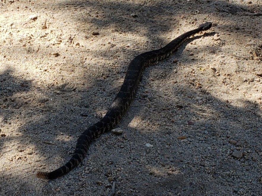
WEATHER Typical summer weather continues for the foreseeable future, with above-average temperatures for late August. Overnight low temperatures will remain well above-average into September. There is a chance of monsoonal precipitation, most likely in the first few days of September. Wednesday 13th June remains the warmest morning of the year recorded at San Jacinto Peak.
At San Jacinto Peak (10,810’/3295m) on Monday 26th August 2019 at 0910 the air temperature was 56.1°F (13°C), with a windchill temperature of 54.3°F (12°C), 56% relative humidity, and a light ESE breeze at 4 mph gusting to 8.8 mph.
At the Peak on Friday 23rd August 2019 at 0815, the air temperature was 53.1°F (12°C), with a windchill temperature of 46.4°F (8°C), 14% relative humidity, and a steady SSW wind at 12 mph gusting to 17.9 mph.

TRAIL CONDITIONS
All trails, including the entire Pacific Crest Trail throughout the San Jacinto mountains, have been free of snow since the end of June.
The Pacific Crest Trail remains open at the rockslide near Antsell Rock (Mile 172.5). The video report from late May (available here) can be useful for deciding whether to try to hike around the rockslide.
As reported last month, Forest Service closures to the Boulder Basin and Black Mountain Group campgrounds (both accessed from Black Mountain Road), and Dark Canyon Road, will remain in place through this year. Consequently, Dark Canyon campground is also closed, and there is no vehicular access to Seven Pines trailhead.
Willow Creek Trail has had almost all obstructing trees removed this summer. As of Monday 26th August there remained two trees down on the trail between Willow Creek and Hidden Divide (one on USFS land is passable by a temporary alternate trail, and one on State Park land can be climbed over). This is a huge improvement from the nearly 30 trees down on this trail in June.
Seven Pines Trail has at least 35 trees down, almost all above 7500′ elevation. State Park has scheduled work in September to remove some or most of these obstructing trees. This trail has been very lightly traveled since 2018, and is indistinct in places. Hikers without considerable prior experience of this trail should take great care with routefinding.
The Caramba Trail from near Reeds Meadow through Laws Camp to Caramba, and the Cedar Trail from Willow Creek Trail to Laws, are not maintained. Temporary signage to this effect has been in place since the end of June. Both trails are indistinct in places, and hikers without considerable prior experience of this area should use cautious navigation.
The Cranston Fire closure order expired at the beginning of this month. Although this does not impact the wilderness trail situation, it does mean that the popular dirt roads and mountain bike trails of the May Valley and Bonita Vista roads area are now open.
WATER STATUS: Eastern slope
The Round Valley spigot continued to flow well at about 2.0 gpm on 26th August.
Both the northern and southern springs at Wellman’s Cienega are flowing steadily, but flow rates continue to decline. These springs are the sources for Willow Creek, which is flowing very well where it crosses the Willow Creek Trail.
Tahquitz Valley continues to flow gently where it crosses the meadow trail, the first time in some seven years that this has flowed all summer.

Tahquitz Creek is flowing well at the northern end of Little Tahquitz Meadow. It is also flowing gently further upstream at its source (known locally as Grethe Spring) where it crosses the PCT (approx. PCT Mile 177).

Candy’s Creek – that flows through Skunk Cabbage Meadow and then crosses the Caramba Trail near Reeds Meadow – is flowing gently, but is very overgrown with thick vegetation, and is too shallow for easy filtering. It is much more accessible where it is flowing steadily across the Caramba Trail.
WATER STATUS: Western slope
The North Fork of the San Jacinto River is flowing well where it crosses the Deer Springs Trail and even better where it crosses the Fuller Ridge Trail on the PCT (approx. PCT Mile 186.0).
O’Sullivan Creek (PCT Mile 186.4) on Fuller Ridge Trail is also flowing well.
The creek in Little Round Valley is flowing at its strongest in at least six years, but the flow rate continues to decline steadily.
Shooting Star Spring (below Little Round Valley but above the North Fork of the San Jacinto River crossing) is flowing well.
The Deer Springs stream crossing at the PCT (approx. PCT mile 185) is flowing well.
Switchback Spring (about 0.4 miles north of Strawberry Junction) is now flowing only gently, there is very little depth in which to filter water, and it is heavily overgrown.
The little creek at Strawberry Cienega is flowing very gently. The tiny pool between the rocks, formerly good for filtering, filled with sediment over the winter.
On Devil’s Slide Trail, Middle Spring is flowing very weakly now. Powderbox and Jolley springs, and the several unnamed ephemeral creeks on this trail, dried up many weeks ago.
On the Ernie Maxwell Trail, the crossing of Chinquapin Creek just below Humber Park continues to flow well just upstream of the trail. Intermittent diversion by Fern Valley Water District (who erroneously refer to it as Tahquitz Creek!) results in the flow across the actual trail being unreliable at present. This creek is an important source of water for the many dogs walked on this trail.
WATER STATUS: Desert Divide
Live Oak Spring (N 33 37 21, W 116 33 24) Flowing well. The most reliable water source on the Desert Divide.
Cedar Spring (N 33 40 36, W 116 34 35) Flowing well. Easiest access is the trough just upstream from the trail to the campsite.
Apache Spring (N 33 43 11, W 116 37 13) Flowing gently. The trail off the PCT to this spring was greatly improved earlier this summer.
Spitler Peak Trail Descending this trail from the PCT there are five water crossings. The first two, at 0.9 and 0.95 miles down, cross a tiny side creek which is largely dry and should be ignored. The next three crossings, at 1.1 to 1.3 miles down, are Spitler Creek, which continues to flow gently.
Antsell Rock Creek (N 33 41 52, W 116 39 08) Right by the Spitler Peak Trail trailhead on Apple Canyon Road, Antsell Rock Creek is flowing well. Just on the upstream side of the road there is excellent access to the creek. Useful if hikers are descending the Spitler Peak Trail.
ACCESS CLOSURES The Valentine’s Day 2019 flood events continue to make access to the San Jacinto mountains challenging, however the news is encouraging. Highway 243 between Banning and Idyllwild is closed from Skyland Ranch (north of Bay Tree Spring) to just north of Lake Fulmor. This highway is now estimated to reopen on 1st November 2019, with some form of traffic control (details to be determined). Highway 74 from Mountain Center to Hemet reopens full time with a pilot car this Friday 30th August, likely continuing until October. Currently this road is open with a pilot car and restricted hours (0400-0800, 1800-0000) on weekdays.sanjacjonUncategorized1 Comment 6 MinutesEdit”Trail and water update 28th August 2019″
Trail update 21st August 2019
Two ascents of San Jacinto Peak in the past three days surveyed most of the major trails and water sources on the east and west sides of the mountain. The Tahquitz area meadows were surveyed last week.
The Cranston Fire closure order expired at the beginning of this month. Although this does not impact the wilderness trail situation, it does mean that the popular dirt roads and mountain bike trails of the May Valley and Bonita Vista roads area are now open.
Highway 243 just north of Pine Cove has apparently been experiencing some hard closures this week as part of ongoing roadwork. This may affect access to Black Mountain Road and Lake Fulmor during normal business hours for the remainder of this week.
The status of water sources is essentially unchanged from the previous update linked here. Road closures are also described at the foot of that posting.
Hikers should always be prepared for rapidly changing weather conditions in the high country in summer. Thunderstorms with lightning, precipitation, and rapid temperature drops, can occur in the high country even when such storms are not otherwise forecast at lower elevations.
WEATHER Typical summer weather at present. Today is forecast to be the warmest day of the year at San Jacinto Peak, finally surpassing 13th June. Cooler overnight temperatures last weekend made for delightful early morning hikes/runs. Monsoonal conditions, usually in the afternoons, are forecast as a possibility most days next week, starting Saturday 24th.
At San Jacinto Peak (10,810’/3295m) yesterday, Tuesday 20th August 2019 at 0855, the air temperature was 57.6°F (14°C), with a windchill temperature of 53.2°F (12°C), 19% relative humidity, and a pleasant due West wind at 8 mph gusting to 16.1 mph.
At the Peak on Sunday 18th August 2019 at 0715, the air temperature was 49.7°F (10°C), with a windchill temperature of 41.9°F (6°C), 14% relative humidity, and a cool SW wind at 17 mph gusting to 19.4 mph.

TRAIL CONDITIONS
All trails, including the entire Pacific Crest Trail throughout the San Jacinto mountains, have been free of snow since the end of June.
The Pacific Crest Trail remains open at the rockslide near Antsell Rock (Mile 172.5). The video report from late May (available here) can be useful for deciding whether to try to hike around the rockslide.
As reported last month, closures to the Boulder Basin and Black Mountain Group campgrounds (both accessed from Black Mountain Road), and Dark Canyon Road, will remain in place through this year.
With the closure of Dark Canyon Road, Dark Canyon campground is also closed, and there is no access to Seven Pines trailhead.
Willow Creek Trail has had most obstructing trees removed this summer, and there are fewer than five trees down on the trail between Willow Creek and Hidden Divide (2-3 on USFS land and one on State Park). This is a huge improvement from the nearly 30 trees down on this trail in early June. However at least one of the remaining trees can be a little challenging to hike around (or over, depending on one’s abilities).
Seven Pines Trail has at least 35 trees down, almost all above 7500′ elevation. This trail has been very lightly traveled since 2018, and is indistinct in places. Hikers without considerable prior experience of this trail should take great care with routefinding.
The Caramba Trail from near Reeds Meadow through Laws Camp to Caramba, and the Cedar Trail from Willow Creek Trail to Laws, are not maintained. Temporary signage to this effect has been in place since the end of June. Both trails are indistinct in places, and hikers without considerable prior experience of this area should use cautious navigation.sanjacjonUncategorized2 Comments 3 MinutesEdit”Trail update 21st August 2019″
Trail and water update 13th August 2019
Three ascents of San Jacinto Peak in the past five days have covered most of the major trails on the east and west sides of the mountain. The Tahquitz area meadows were surveyed last week.
The status of water sources, most of which have been checked in recent days, is updated below, and the status of road closures is also described at the foot of this posting.
As reported last month, closures to the Boulder Basin and Black Mountain Group campgrounds (both accessed from Black Mountain Road), and Dark Canyon Road, will remain in place through this year.
Hikers should always be prepared for rapidly changing weather conditions in the high country in summer. Monsoonal conditions, most often in the afternoons, are a slim possibility for the foreseeable future. Thunderstorms with lightning, precipitation, and rapid temperature drops, can occur in the high country even when such storms are not otherwise forecast.
WEATHER Typical summer weather at present. Slightly cooler overnight temperatures recently have made for delightful early morning hiking. There is no precipitation in the forecast (but see comments above regarding monsoonal storms). Wednesday 12th June remains the warmest morning of the year recorded at San Jacinto Peak.
At San Jacinto Peak (10,810’/3295m) today, Tuesday 13th August 2019 at 0805, the air temperature was 53.6°F (12°C), with a windchill temperature of 49.4°F (10°C), 33% relative humidity, and a pleasant SE wind at 5 mph gusting to 10.8 mph.
At the Peak on Saturday 10th August 2019 at 0810, the air temperature was 48.1°F (9°C), with a windchill temperature of 41.2°F (5°C), 16% relative humidity, and a fresh SSW breeze at 10 mph gusting to 14.7 mph.
TRAIL CONDITIONS
All trails, including the entire Pacific Crest Trail throughout the San Jacinto mountains, have been free of snow since the end of June.
The Pacific Crest Trail remains open at the rockslide near Antsell Rock (Mile 172.5). The video report from late May (available here) can be useful for deciding whether to try to hike around the rockslide.
With the closure of Dark Canyon Road, Dark Canyon campground is also closed, and there is no vehicular access to Seven Pines trailhead (although the road is hikeable of course, 3.5 miles each way).
Willow Creek Trail has had most obstructing trees removed this summer, and there are fewer than five trees down on the trail between Willow Creek and Hidden Divide (2-3 on USFS land and one on State Park). This is a huge improvement from the nearly 30 trees down on this trail in early June. However at least one of the remaining trees can be challenging to hike around (or over, depending on one’s abilities).
Seven Pines Trail has at least 35 trees down, almost all above 7500′ elevation. This trail has been very lightly traveled since 2018, and is indistinct in places. Hikers without considerable prior experience of this trail should take great care with routefinding.
The Caramba Trail from near Reeds Meadow through Laws Camp to Caramba, and the Cedar Trail from Willow Creek Trail to Laws, are not maintained. Signage to this effect has been in place since the end of June. Both trails are indistinct in places, and hikers without considerable prior experience of this area should use cautious navigation.
WATER STATUS: Eastern slope
The Round Valley spigot is flowing well.
Both the northern and southern springs at Wellman’s Cienega are flowing well, but flow rates dropped dramatically last month. These springs are the sources for Willow Creek, which is flowing well where it crosses the Willow Creek Trail.
Tahquitz Valley continues to flow well where it crosses the meadow trail.
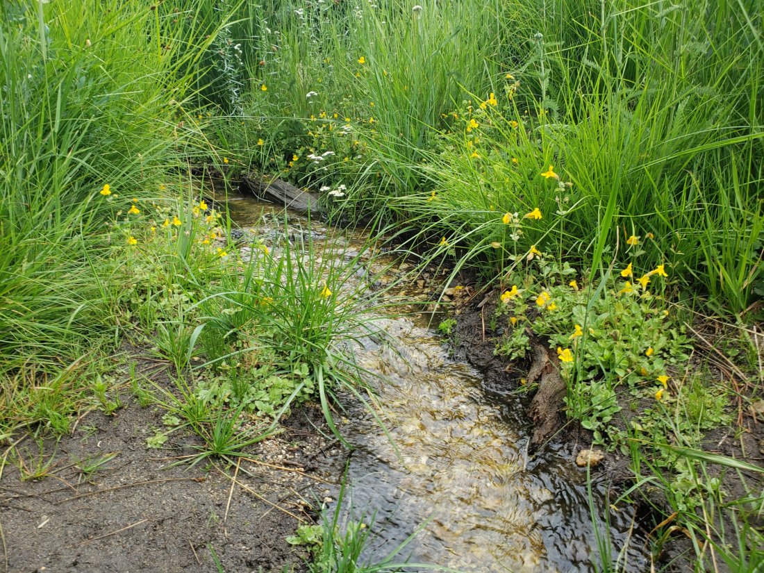
Tahquitz Creek is flowing strongly at the northern end of Little Tahquitz Meadow. It is also flowing well further upstream at its source (known locally as Grethe Spring) where it crosses the PCT (approx. PCT Mile 177).
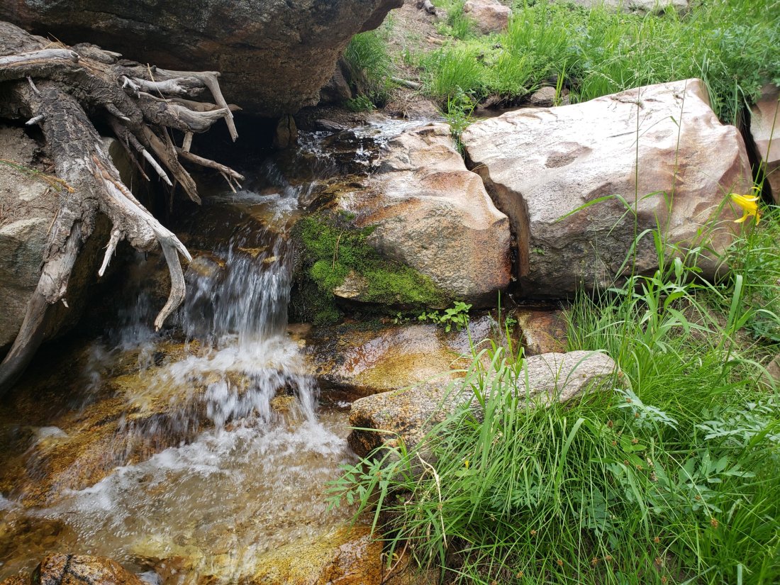
Candy’s Creek – that flows through Skunk Cabbage Meadow and then crosses the Caramba Trail near Reeds Meadow – is flowing gently, but is very overgrown with thick vegetation, and is too shallow for easy filtering. It is much more accessible where it crosses the Caramba Trail.
WATER STATUS: Western slope
The North Fork of the San Jacinto River is flowing very well where it crosses the Deer Springs Trail and even better where it crosses the Fuller Ridge Trail on the PCT (approx. PCT Mile 186.0).
O’Sullivan Creek (PCT Mile 186.4) on Fuller Ridge Trail is flowing well.
The creek in Little Round Valley is flowing at its strongest in at least six years, but the flow rate continues to decline steadily.
Shooting Star Spring (below Little Round Valley but above the North Fork of the San Jacinto River crossing) is flowing well.
The Deer Springs stream crossing at the PCT (approx. PCT mile 185) is flowing very well.
Switchback Spring (about 0.4 miles north of Strawberry Junction) is now flowing only gently, but there is very little depth in which to filter water, and it is heavily overgrown.
The little creek at Strawberry Cienega is flowing gently. However the tiny pool between the rocks, good for filtering, was filled with sediment over the winter.
On Devil’s Slide Trail, Middle Spring is flowing very weakly now. Powderbox and Jolley springs, and the several unnamed ephemeral creeks on this trail, dried up many weeks ago.
On the Ernie Maxwell Trail, the crossing of Chinquapin Creek just below Humber Park continues to flow well just upstream of the trail. Intermittent diversion by Fern Valley Water District results in the flow across the actual trail being inconsistent at present. This creek is an important source of water for the many dogs walked on this trail.
WATER STATUS: Desert Divide
Live Oak Spring (N 33 37 21, W 116 33 24) Flowing well. The most reliable water source on the Desert Divide.
Cedar Spring (N 33 40 36, W 116 34 35) Flowing well. Easiest access is the trough just upstream from the trail to the campsite.
Apache Spring (N 33 43 11, W 116 37 13) Flowing gently. The trail off the PCT to this spring was greatly improved earlier this summer.
Spitler Peak Trail Descending this trail from the PCT there are five water crossings. The first two, at 0.9 and 0.95 miles down, cross a tiny side creek which is largely dry and should be ignored. The next three crossings, at 1.1 to 1.3 miles down, are Spitler Creek, which continues to flow well.
Antsell Rock Creek (N 33 41 52, W 116 39 08) Right by the Spitler Peak Trail trailhead on Apple Canyon Road, Antsell Rock Creek is flowing well. Just on the upstream side of the road there is excellent access to the creek. Useful if hikers are descending the Spitler Peak Trail.
ACCESS CLOSURES The Valentine’s Day 2019 flood events continue to make access to the San Jacinto mountains challenging. Highway 243 between Banning and Idyllwild is closed from Skyland Ranch (north of Bay Tree Spring) to just north of Lake Fulmor. This will not reopen until well into 2020, possibly with a pilot car by spring, but it may be next summer before it fully reopens. The status of Highway 74 from Mountain Center to Hemet remains unchanged, namely reopening full time in September but with flagmen and partial single lane traffic. Currently this road is open with a pilot car and restricted hours (0400-0800, 1800-0000) on weekdays, and broader hours (0400-0000) on weekends and holidays. It is unclear when it will completely reopen to unhindered access.
sanjacjonUncategorized3 Comments 5 MinutesEdit”Trail and water update 13th August 2019″
Trail (and road) update 1st August 2019
Anne and I hiked Marion Mountain Trail to San Jacinto Peak this morning, doing a plant survey and packing out an unconscionable amount of trash. I surveyed trees on Willow Creek Trail yesterday, and hiked the east side trails to San Jacinto Peak on Monday 29th July.
Although not strictly trail-related, the big news concerns our ongoing road situation. Highway 243, closed since the Valentine’s Day flood event, will not reopen until well into next year. The highway “should be open with a pilot car by spring of 2020”, but it will be a year (presumably from now) before it is “back to normal” (per Caltrans, as quoted in Idyllwild Town Crier newspaper, dated today). The status of Highway 74 from Mountain Center to Hemet remains unchanged, namely reopening full time in September but with flagmen and partial single lane traffic. Currently this road is open with a pilot car and restricted hours (0400-0800, 1800-0000) on weekdays, and broader hours (0400-0000) on weekends and holidays. It is unclear when it will completely return to “normal”.
Water status is not significantly different from last weeks report (linked here), although flow rates continue to decline steadily, and ephemeral sources below 9000′ should no longer be relied upon.
As reported previously, closures to the Boulder Basin and Black Mountain Group campgrounds (both accessed from Black Mountain Road), and Dark Canyon Road, will remain in place through this year.
On Willow Creek Trail there are now only five trees down, in a 0.3 mile section either side of the Forest Service/State Park boundary (four on USFS land and one on State Park). This is a great improvement from the nearly 30 trees down on this trail in early June. However a couple of the remaining large trees require caution to hike around (or over, depending on preference).
Hikers should always be prepared for rapidly changing weather conditions in the high country in summer. Thunderstorms with lightning, precipitation, and rapid temperature drops, can occur in the high country even when such storms are not forecast for lower elevations.
WEATHER Typical summer temperatures at present. There is no precipitation in the forecast (but see comments above regarding monsoonal storms). Below-average temperatures are currently forecast for later next week. Wednesday 12th June remains the warmest day of the year recorded at San Jacinto Peak.
At San Jacinto Peak (10,810’/3295m) today 1st August 2019 at 0820, the air temperature was 52°F (11°C), with a windchill temperature of 47.3°F (8°C), 45% relative humidity, and a ligh WSW breeze at 6 mph gusting to 9.1 mph.
At the Peak on Monday 29th July 2019 at 0735, the air temperature was 55°F (13°C), with a windchill temperature of 50.8°F (10°C), 38% relative humidity, and a light WSW wind at 6 mph gusting to 12 mph.
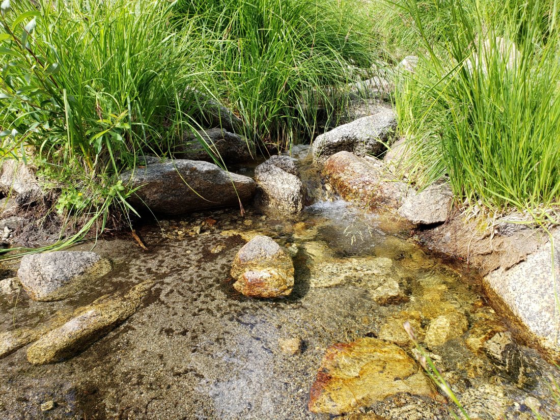
TRAIL CONDITIONS
All trails, including the entire Pacific Crest Trail throughout the San Jacinto mountains, have been free of snow since the end of June.
The Pacific Crest Trail remains open at the rockslide near Antsell Rock (Mile 172.5). The video report from late May (available here) may be useful for deciding whether to try to hike around the rockslide.
With the closure of Dark Canyon Road, Dark Canyon campground is also closed, and there is no vehicular access to Seven Pines trailhead (although the road is hikeable of course, 3.5 miles each way).
The improving treefall situation on Willow Creek Trail is described above.
I last surveyed Seven Pines Trail in mid June and it had 35 trees down, almost all above 7500′ elevation. This trail has been very lightly traveled since 2018, and is indistinct in places. Hikers without considerable prior experience of this trail should take care with routefinding.
The Caramba Trail from near Reeds Meadow through Laws Camp to Caramba, and the Cedar Trail from Willow Creek Trail to Laws, are not maintained. Signage to this effect has been in place since the end of June. Both trails are very indistinct in places, and hikers without considerable prior experience of this area should use cautious navigation.
sanjacjonUncategorizedLeave a comment 3 MinutesEdit”Trail (and road) update 1st August 2019″
Trail and water update 25th July 2019
A long day yesterday included surveying trails east, west, and south of San Jacinto Peak, having checked water sources throughout the Tahquitz area meadows last week. The status of all major water sources, trails, and road access, are detailed below.
As reported last week, closures to the Boulder Basin and Black Mountain Group campgrounds (both accessed from Black Mountain Road), and Dark Canyon Road, will remain in place through this year.
Hikers should always be prepared for rapidly changing weather conditions in the high country in summer. Monsoonal conditions, most often in the afternoons, are possible for the foreseeable future. Thunderstorms with lightning, precipitation, and rapid temperature drops, can occur in the high country even when such storms are not forecast for lower elevations.
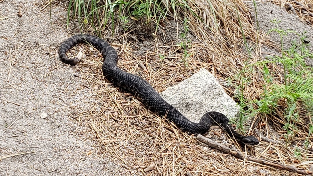
WEATHER Humid monsoonal conditions with summer temperatures took hold a few days ago. In Idyllwild it has tried to rain each day since Monday (<0.01″ each day). There have also been localised showers throughout the high country each day, but the intense thunderstorm cells have so far been at lower elevations. To date, Wednesday 12th June remains the warmest day of the year recorded at San Jacinto Peak.
At San Jacinto Peak (10,810’/3295m) yesterday 24th July 2019 at 0720, the air temperature was 52.3°F (11°C), with a windchill temperature of 47.4°F (8°C), 66% relative humidity, and a light SE wind at 4 mph gusting to 11.2 mph.
At the Peak on 18th July 2019 at 0800, the air temperature was 51°F (11°C), with a windchill temperature of 43°F (6°C), 12% relative humidity, and a stiff SSW wind at 18 mph gusting to 25.2 mph.
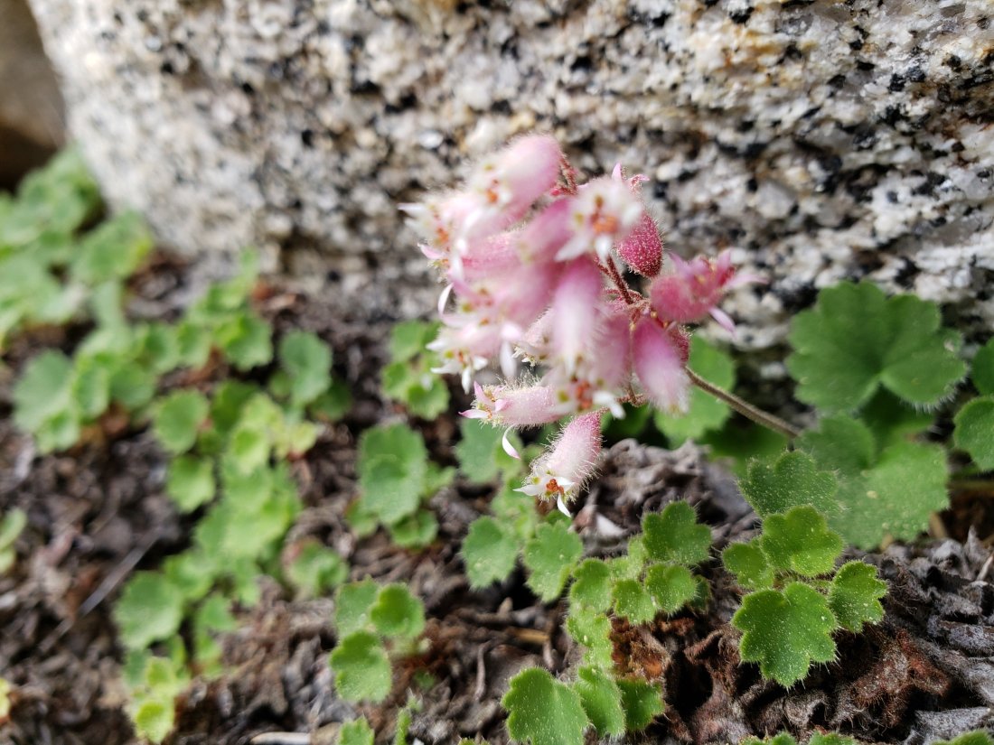
TRAIL CONDITIONS
All trails, including the entire Pacific Crest Trail throughout the San Jacinto mountains, have been free of snow since the end of June.
The Pacific Crest Trail remains open at the rockslide near Antsell Rock (Mile 172.5). The video report from late May (available here) may be useful for deciding whether to try to hike around the rockslide.
With the closure of Dark Canyon Road, Dark Canyon campground is also closed, and there is no vehicular access to Seven Pines trailhead (although the road is hikeable of course, 3.5 miles each way).
Willow Creek Trail has had most obstructing trees removed, and there are now only five trees down on the trail between Willow Creek and Hidden Divide (four on USFS land and one on State Park). This is a huge improvement from the nearly 30 trees down on this trail in early June. However a couple of the remaining trees can be challenging to hike around (or over, depending on one’s abilities).
I surveyed Seven Pines Trail in mid June and it had 35 trees down, almost all above 7500′ elevation. This trail has been very lightly traveled since 2018, and is indistinct in places. Hikers without considerable prior experience of this trail should take great care with routefinding.
The Caramba Trail from near Reeds Meadow through Laws Camp to Caramba, and the Cedar Trail from Willow Creek Trail to Laws, are not maintained. Signage to this effect has been in place since the end of June. Both trails are very indistinct in places, and hikers without considerable prior experience of this area should use cautious navigation.
WATER STATUS: Eastern slope
The Round Valley spigot is flowing well at about 2.0 gpm.
Both the northern and southern springs at Wellman’s Cienega are flowing well, but flow rates have dropped dramatically this month.
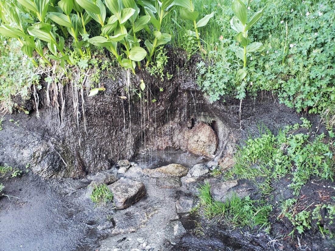
These springs are the sources for Willow Creek, which is flowing very well where it crosses the Willow Creek Trail.
Tahquitz Valley is still flowing well where it crosses the meadow trail.

Tahquitz Creek is flowing strongly at the northern end of Little Tahquitz Meadow. It is also flowing well further upstream at its source (known locally as Grethe Spring) where it crosses the PCT (approx. PCT Mile 177).


Candy’s Creek – that flows through Skunk Cabbage Meadow and then crosses the Caramba Trail near Reeds Meadow – is flowing gently, but is very overgrown with thick vegetation, and is too shallow for easy filtering.

WATER STATUS: Western slope
The North Fork of the San Jacinto River is flowing very well where it crosses the Deer Springs Trail and even better where it crosses the Fuller Ridge Trail on the PCT (approx. PCT Mile 186.0).
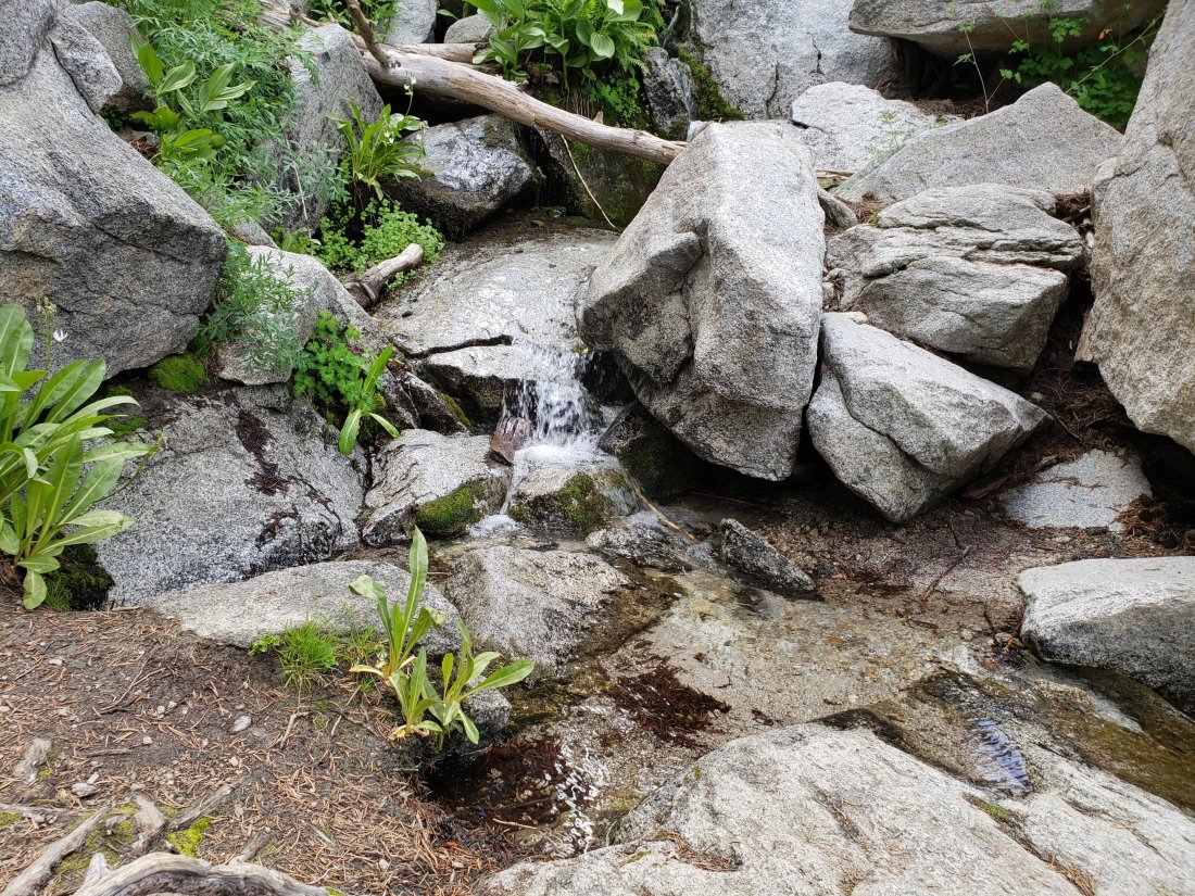
O’Sullivan Creek (PCT Mile 186.4) on Fuller Ridge Trail is flowing well.
The creek in Little Round Valley is flowing the strongest I have seen in at least six years, but flow rate has dropped dramatically this month.
Shooting Star Spring (below Little Round Valley but above the North Fork of the San Jacinto River crossing) is flowing well.
The Deer Springs stream crossing at the PCT (approx. PCT mile 185) is flowing strongly.
Switchback Spring (about 0.4 miles north of Strawberry Junction) is now flowing only gently, but there is very little depth in which to filter water.
The little creek at Strawberry Cienega is flowing gently. However the tiny pool between the rocks, good for filtering, was filled with sediment over the winter.

On Devil’s Slide Trail, Middle Spring is flowing gently, but flow rate is greatly diminished. Powderbox and Jolley springs, and the several unnamed ephemeral creeks on this trail, dried up several weeks ago.
On the Ernie Maxwell Trail, the crossing of Chinquapin Creek just below Humber Park continues to flow very well (an important source of water for the many dogs walked on this trail).
WATER STATUS: Desert Divide
Live Oak Spring (N 33 37 21, W 116 33 24) Flowing well. The most reliable water source on the Desert Divide.
Cedar Spring (N 33 40 36, W 116 34 35) Flowing well. Easiest access is the trough just upstream from the trail to the campsite.
Apache Spring (N 33 43 11, W 116 37 13) Flowing fairly well. See comments above regarding the greatly improved trail to this spring.
Spitler Peak Trail Descending this trail from the PCT there are five water crossings. The first two, at 0.9 and 0.95 miles down, cross a tiny side creek which is largely dry and should be ignored. The next three crossings, at 1.1 to 1.3 miles down, are Spitler Creek, which is currently flowing well.
Antsell Rock Creek (N 33 41 52, W 116 39 08) Right by the Spitler Peak Trail trailhead on Apple Canyon Road, Antsell Rock Creek is flowing very well. Just on the upstream side of the road there is excellent access to the creek. Useful if hikers are descending the Spitler Peak Trail.
ACCESS CLOSURES The Valentine’s Day flood events continue to make access to the San Jacinto mountains challenging. In the past week even the open sections of Highways 74 and 371 have been closed briefly for roadside fires, so always be prepared for additional delays. Highway 243 between Banning and Idyllwild is closed from Skyland Ranch (north of Bay Tree Spring) to just north of Lake Fulmor. The remaining closed section may not reopen until 2020. Highway 74 between Mountain Center and Hemet is currently open with a pilot car and restricted hours (0400-0800, 1800-0000) on weekdays, and broader hours (0400-0000) on weekends and holidays. It may reopen in September but still with a flagman and partial single lane traffic.sanjacjonUncategorized3 Comments 5 MinutesEdit”Trail and water update 25th July 2019″
Trail and water update 18th July 2019
We surveyed trails to San Jacinto Peak on 15th July (east side) and today (Deer Springs Trail), and my fire lookout shift at Tahquitz Peak on 16th incorporated a survey of water sources throughout the Tahquitz area meadows. The status of major water sources, trails, and road access, are all detailed below.
As I reported earlier this week, USFS confirmed closures to the Boulder Basin and Black Mountain Group campgrounds (both accessed from Black Mountain Road), and Dark Canyon Road, will remain in place through this year.
Be bear aware. Recent observations were described in a recent posting.
Hikers should always be prepared for rapidly changing weather conditions in the high country in summer. Afternoon monsoonal conditions are possible next week. Thunderstorms with lightning and precipitation can occur around the high peaks even when such storms are not forecast for lower elevations.

WEATHER Genuine summer temperatures arrived a few days ago, although in keeping with the 2019 trend, this has so far been the coolest July in the San Jacinto mountains for several years. To date, Wednesday 12th June remains the warmest day of the year recorded at San Jacinto Peak. As mentioned above, thunderstorms are forecast as a possibility every afternoon next week (22nd-26th July).
At San Jacinto Peak (10,810’/3295m) today 18th July 2019 at 0800, the air temperature was 51°F (11°C), with a windchill temperature of 43°F (6°C), 12% relative humidity, and a stiff SSW wind at 18 mph gusting to 25.2 mph.
At the Peak on Monday 15th July 2019 at 0730 the air temperature was 50.9°F (10°C), with a windchill temperature of 43°F (6°C), 31% relative humidity, and a fresh SW wind sustained at 19 mph gusting to 23.2 mph.
TRAIL CONDITIONS
All trails, including the entire Pacific Crest Trail throughout the San Jacinto mountains, have been free of snow since the end of June.
The Pacific Crest Trail remains open at the rockslide near Antsell Rock (Mile 172.5). The video report from late May (available here) may be useful for deciding whether to try to hike around the rockslide.
Dark Canyon Road remains closed for the foreseeable future, with no planned reopening date. Dark Canyon campground is therefore also closed, and there is no vehicular access to Seven Pines trailhead (although the road is hikeable of course, 3.5 miles each way).
The Boulder Basin and Black Mountain Group campgrounds also remain closed until 2020.
The rehabilitation of Apache Spring Trail has been completed by an ACE (American Conservation Experience) crew. This is great news as this side trail off the PCT had been indistinct since the 2013 Mountain Fire.
Willow Creek Trail had eight of the nine trees down on the State Park section removed on 7th July by the PCTA trail crew. This reduces the total to 11 trees down on the trail between Willow Creek and Hidden Divide. This is a huge improvement from the nearly 30 trees down on this trail about a month ago.
I surveyed Seven Pines Trail in mid June and it had 35 trees down, almost all above 7500′ elevation. This trail has been very lightly traveled since 2018, and is indistinct in places. Hikers without considerable prior experience of this trail should take great care with routefinding.
The Caramba Trail from near Reeds Meadow through Laws Camp to Caramba, and the Cedar Trail from Willow Creek Trail to Laws, are not maintained. Signage to this effect has been in place since the end of June. When USFS reopened these routes in November 2018 they made it clear they would not be maintained for the foreseeable future (and the trails had been closed since the Mountain Fire in July 2013). Both are indistinct in places, and hikers without considerable prior experience of this area should use cautious navigation.

WATER STATUS: Eastern slope
The Round Valley spigot is flowing well at about 2.0 gpm.
Both the northern and southern springs at Wellman’s Cienega are flowing well, but flow rates have dropped dramatically this month. These are the sources for Willow Creek, which is flowing very well where it crosses the Willow Creek Trail.
Tahquitz Valley is still flowing well where it crosses the meadow trail.
Tahquitz Creek is flowing strongly at the northern end of Little Tahquitz Meadow. It is also flowing well further upstream at its source (known locally as Grethe Spring) where it crosses the PCT (approx. PCT Mile 177).
Candy’s Creek – that flows through Skunk Cabbage Meadow and then crosses the Caramba Trail near Reeds Meadow – is flowing gently, but is very overgrown with thick vegetation, and is too shallow for easy filtering.
WATER STATUS: Western slope
The North Fork of the San Jacinto River is flowing very well where it crosses the Deer Springs Trail and even better where it crosses the Fuller Ridge Trail on the PCT (approx. PCT Mile 186.0).
O’Sullivan Creek (PCT Mile 186.4) on Fuller Ridge Trail is flowing well.
The creek in Little Round Valley is flowing the strongest I have seen in at least six years, but flow rate has dropped dramatically this month.

Shooting Star Spring (below Little Round Valley but above the North Fork of the San Jacinto River crossing) is flowing well.
The Deer Springs stream crossing at the PCT (approx. PCT mile 185) is flowing strongly.
Switchback Spring (about 0.4 miles north of Strawberry Junction) is now flowing only gently, but there is very little depth in which to filter water.
The little creek at Strawberry Cienega is flowing gently.
On Devil’s Slide Trail, Middle Spring is flowing gently, but flow rate is greatly diminished compared to last month. In 2018, this spring had dried up by 1st July. Powderbox and Jolley springs, and the several unnamed ephemeral creeks on this trail, have now dried up.
On the Ernie Maxwell Trail, the crossing of Chinquapin Creek just below Humber Park continues to flow very well (an important source of water for the many dogs walked on this trail).
WATER STATUS: Desert Divide
Live Oak Spring (N 33 37 21, W 116 33 24) Flowing well. The most reliable water source on the Desert Divide.
Cedar Spring (N 33 40 36, W 116 34 35) Flowing well. Easiest access is the trough just upstream from the trail to the campsite.
Apache Spring (N 33 43 11, W 116 37 13) Flowing fairly well. See comments above regarding the greatly improved trail to this spring.
Antsell Rock Creek (N 33 41 52, W 116 39 08) Right by the Spitler Peak Trail trailhead on Apple Canyon Road, Antsell Rock Creek is flowing very well. Just on the upstream side of the road there is excellent access to the creek. Useful if hikers are descending the Spitler Peak Trail.
ACCESS CLOSURES The Valentine’s Day flood events continue to make access to the San Jacinto mountains challenging. In the past week even the open sections of Highways 74 and 371 have been closed briefly for roadside fires, so always be prepared for additional delays. Highway 243 between Banning and Idyllwild is closed from Skyland Ranch (north of Bay Tree Spring) to just north of Lake Fulmor. The remaining closed section may reopen later this year, or not until 2020 (see this excellent article in the Press Enterprise). Highway 74 between Mountain Center and Hemet is currently open with a pilot car and restricted hours (0400-0800, 1800-0000) on weekdays, and broader hours (0400-0000) on weekends and holidays. It will not reopen in July as had been hoped. Instead it is expected to open round-the-clock, but still with a flagman and partial single lane traffic, perhaps as early as August.


sanjacjonUncategorizedLeave a comment 5 MinutesEdit”Trail and water update 18th July 2019″
Campground closure update 15th July 2019
U. S. Forest Service informed me today that closures to the Boulder Basin and Black Mountain Group campgrounds (both accessed from Black Mountain Road), and Dark Canyon Road and Campground, will remain in place for the remainder of the season. That presumably means that they will be closed into 2020.
Note that the yellow post campsites along upper Black Mountain Road, and the Fuller Ridge campground, remain open.
Closure of Dark Canyon Road means that there is no vehicle access to Seven Pines trailhead (although the road is still hikeable, 3.5 miles from the gate to the trailhead).
San Jacinto Ranger District was apparently notified that the limited funds available in the current federal budget year for rehabilitation of these campgrounds and associated access roads have been redirected to fire fighting and suppression.
Other trail and water conditions were updated four days ago, linked here.sanjacjonUncategorized6 Comments 1 MinuteEdit”Campground closure update 15th July 2019″
Trail update 11th July 2019
I ascended San Jacinto Peak three times in the past two days, surveying the east side, Deer Springs and Fuller Ridge trails en route. Not much new to report, with snow gone but water still flowing well. Other than flow rates slowly declining, the water situation is unchanged from the previous report.
Be bear aware. At least one of the two bears we have had in the San Jacinto mountains since 2017 has been active. One was seen and photographed on Sylvan Way in Pine Cove on 20th June, and one of my neighbors in Idyllwild had one in their yard a few days later. On Saturday 29th June, hikers saw a bear on Devil’s Slide Trail at about 0900.
Hikers should always be prepared for rapidly changing weather conditions in the high country in summer. Thunderstorms with lightning and precipitation can occur at or near the high peaks even when such storms are not forecast for lower elevations.
WEATHER The cool conditions that characterized June and early July 2019 will be remembered fondly. Genuine summer temperatures are now forecast for the foreseeable future at all elevations. To date, Wednesday 12th June remains the warmest day of the year in the high country. No precipitation is in the forecast.
At San Jacinto Peak (10,810’/3295m) yesterday 10th July 2019 at 0645, the air temperature was 50.1°F (10°C), with a windchill temperature of 42.4°F (6°C), 33% relative humidity, and a brisk SSE wind at 11 mph gusting to 20.5 mph.
Then by 1320 yesterday again at the Peak, the air temperature was 55.7°F (13°C), with a windchill temperature of 55°F (12°C), 48% relative humidity, and a very light NE breeze at 1 mph gusting to 4.8 mph.
TRAIL CONDITIONS
All trails, including the entire Pacific Crest Trail throughout the San Jacinto mountains, are free of snow. This now includes the East Ridge Trail.
The Pacific Crest Trail remains open at the rockslide near Antsell Rock (Mile 172.5). The video report from late May (available here) may be useful for deciding whether to try to hike around the rockslide.
Dark Canyon Road remains closed for the foreseeable future, with no planned reopening date. Dark Canyon campground is therefore also closed, and there is no vehicular access to Seven Pines trailhead (although the road is hikeable of course).
The Boulder Basin and Black Mountain Group campgrounds remain closed until at least late July. They have a revised tentative reopening date of 25th July.
The rehabilitation of Apache Spring Trail has been completed by an ACE (American Conservation Experience) crew. This is great news as this side trail off the PCT had been indistinct since the 2013 Mountain Fire.
Willow Creek Trail had eight of the nine trees down on the State Park section removed on 7th July by the PCTA trail crew. This reduces the total to 11 trees down on the trail between Willow Creek and Hidden Divide. This is a huge improvement from the nearly 30 trees down on this trail about a month ago.
I surveyed Seven Pines Trail in mid June and it had 35 trees down, almost all above 7500′ elevation. This trail has been very lightly traveled since 2018, and is indistinct in places. Hikers without considerable prior experience of this trail should take great care with routefinding.
The Caramba Trail from near Reeds Meadow through Laws Camp to Caramba, and the Cedar Trail from Willow Creek Trail to Laws, are not maintained. New signage to this effect has just been mounted. When USFS reopened these routes in November 2018 they made it clear they would not be maintained for the foreseeable future (and the trails had been closed since the Mountain Fire in July 2013). Both are indistinct in places, and hikers without considerable prior experience of this area should exercise very cautious navigation.

sanjacjonUncategorized2 Comments 3 MinutesEdit”Trail update 11th July 2019″
Trail and water update 3rd July 2019
The streak ends today at 33. Having ascended San Jacinto Peak every day in June and for the first three days of July, it is time for sanity to prevail. It has been a remarkably enjoyable month-plus, and a challenge, mentally as much as physically. I talk much more (too much, sorry) about the streak in a video I recorded at the Peak early this morning.
In other news, the snow has gone from the trail network. Trail, road, and water source news is all outlined below.
Be bear aware. At least one of the two bears we have had in the San Jacinto mountains since 2017 has put in a reappearance. One was seen and photographed on Sylvan Way in Pine Cove on 20th June, and one of my neighbors off South Circle Drive in Idyllwild had one in their yard a few days later. Then on Saturday 29th June, hikers saw a bear on Devil’s Slide Trail at about 0900. Black Bears have been harmless to humans up here in recent history.
For those interested in obscure history factoids, 3rd July is the feast day for Hyacinth of Caesarea. A Christian boy living some 1900 years ago, he was martyred by the Romans, becoming Saint Hyacinth (the first of at least three Saint Hyacinths). San Jacinto is Spanish for Saint Hyacinth, hence many locations around here are named for him, including the mountains and the Peak.
Hikers should always be prepared for rapidly changing weather conditions in the high country in summer. Thunderstorms with lightning and precipitation can occur at or near the high peaks even when such storms are not forecast for lower elevations.

WEATHER The relatively cool conditions that characterized June 2019 look set to continue until about 10th July, when true midsummer temperatures are forecast to take hold. Wednesday 12th June remains the warmest day of the year so far in the high country. On average it was the coolest June in Idyllwild and in the high country for nearly a decade (and I could not have been more fortunate with the weather for my ascent record month). No precipitation is in the forecast.
At San Jacinto Peak (10,810’/3295m) today 3rd July 2019 at 0745, the air temperature was 49.1°F (10°C), with a windchill temperature of 42.4°F (6°C), 21% relative humidity, and a light due West wind at 6 mph gusting to 9 mph.
The last two days of June were the coolest for a week, with spectacular cloud cover in the early mornings (photos above and below), and Anne and I even got lightly rained on in Little Round Valley and at the Peak on Saturday 29th.
For example, at San Jacinto Peak on Sunday 30th June 2019 at 0730 the air temperature was 46°F (8°C), with a windchill temperature of 35.9°F (2°C), 46% relative humidity, and a chilly SW wind sustained at 19 mph gusting to 22.7 mph.

TRAIL CONDITIONS
All trails, including the entire Pacific Crest Trail throughout the San Jacinto mountains, are free of snow.
East Ridge Trail from near Miller Peak to San Jacinto Peak has only six tiny patches remaining on the trail, which can literally be stepped over.
The Pacific Crest Trail remains open at the rockslide near Antsell Rock (Mile 172.5). The video report from late May (available here) may be useful for deciding whether to try to hike around the rockslide.
Dark Canyon Road remains closed for the foreseeable future. Dark Canyon campground is therefore also closed, and there is no vehicular access to Seven Pines trailhead (although the road is hikeable of course).
The Boulder Basin and Black Mountain Group campgrounds remain closed until at least late July. They have a revised tentative reopening date of 25th July.
The rehabilitation of Apache Spring Trail has been completed by an ACE (American Conservation Experience) crew. This is great news as this side trail off the PCT had been indistinct since the 2013 Mountain Fire.
Another ACE crew recently completed six days work on Devil’s Slide Trail, smoothing out some of the rocky sections with dirt. It will be interesting to see how their work holds up in the next serious rainfall.
Willow Creek Trail had 18 trees down on the trail between Willow Creek and Hidden Divide yesterday, 2nd July (nine each on USFS and State land). The USFS volunteer tree have been working hard (thanks Steve and Jana!), and another team will be dealing with the State Park side on 7th July.
Seven Pines Trail was surveyed in mid June and has 35 trees down, almost all above 7500′ elevation. This trail has been very lightly traveled for many months, and is indistinct in places. Hikers without considerable prior experience of this trail should take great care with routefinding.
The Caramba Trail from near Reeds Meadow through Laws Camp to Caramba, and the Cedar Trail from Willow Creek Trail to Laws, are not maintained. New signage to this effect has just been mounted. When USFS reopened these routes in November 2018 they made it clear they would not be maintained for the foreseeable future (and the trails had been closed since the Mountain Fire in July 2013). Both are indistinct in places, and hikers without considerable prior experience of this area should exercise very cautious navigation.
WATER STATUS: Eastern slope
The Round Valley pipe is flowing well (once you turn the tap on). Flow rate on 2nd July was just over 2.0 gpm, which is as strong as it gets. [UPDATE 12th July 2019: the new tap has been removed! Water is back to gushing from the pipe uncontrollably. Thanks to Florian Boyd for this information.]

Both the northern and southern springs at Wellman’s Cienega are flowing well, but flow rates have dropped considerably in the last two weeks. These are the sources for Willow Creek, which is flowing very well where it crosses the Willow Creek Trail.

Tahquitz Valley is just still flowing.
Tahquitz Creek is flowing well at the northern end of Little Tahquitz Meadow. It is also flowing well further upstream at its source (known locally as Grethe Spring) where it crosses the PCT (approx. PCT Mile 177).
Skunk Cabbage Creek – that flows through Skunk Cabbage Meadow and then crosses the Caramba Trail near Reeds Meadow – is currently flowing well.
WATER STATUS: Western slope
The North Fork of the San Jacinto River is flowing very well where it crosses the Deer Springs Trail and even better where it crosses the Fuller Ridge Trail on the PCT (approx. PCT Mile 186.2).
O’Sullivan Creek (PCT Mile 186.4) on Fuller Ridge Trail is flowing well.
The creek in Little Round Valley is flowing the strongest I have seen in at least six years, but flow rate has halved in the past week.
Shooting Star Spring (below Little Round Valley but above the North Fork of the San Jacinto River crossing) is flowing well.
The Deer Springs stream crossing at the PCT (approx. PCT mile 185.6) is flowing strongly, as are several nearby seasonal tributaries.
Switchback Spring (about 0.4 miles north of Strawberry Junction) is flowing well, but there is little depth in which to filter water.

The little creek at Strawberry Cienega is flowing well.
On Devil’s Slide Trail, Middle Spring is flowing well, but flow rate is only a few percent compared to less than a month ago. In 2018, this spring had dried up by 1st July. Powderbox and Jolley springs, and the several unnamed ephemeral creeks on this trail, have now dried up.
On the Ernie Maxwell Trail, the crossing of Chinquapin Creek just below Humber Park continues to flow very well (an important source of water for the many dogs walked on this trail).
WATER STATUS: Desert Divide
Live Oak Spring (N 33 37 21, W 116 33 24) Flowing well. The most reliable water source on the Desert Divide.
Cedar Spring (N 33 40 36, W 116 34 35) Flowing well. Easiest access is the trough just upstream from the trail to the campsite.
Apache Spring (N 33 43 11, W 116 37 13) Flowing fairly well. See comments above regarding the greatly improved trail to this spring.
Spitler Peak Trail Descending the trail there are five water crossings. The first two, at 0.9 and 0.95 miles down, cross a tiny side creek which is largely dry and should be ignored. The next crossing, at 1.1 miles down, is Spitler Creek and is the best source of water (currently flowing well). The next two crossings are the same creek, but for obvious reasons it is best to fill up at the highest of the three crossings.
Antsell Rock Creek (N 33 41 52, W 116 39 08) Right by the Spitler Peak Trail trailhead on Apple Canyon Road, Antsell Rock Creek is flowing very well. Just on the upstream side of the road there is excellent access to the creek. Useful if hikers are descending the Spitler Peak Trail.
ACCESS CLOSURES The Valentine’s Day flood events continue to make access to the San Jacinto mountains challenging. Highway 243 between Banning and Idyllwild is closed from Skyland Ranch (north of Bay Tree Spring) to just north of Lake Fulmor. The remaining closed section may reopen this autumn, winter, or even not until 2020 (see this excellent article in the Press Enterprise). Highway 74 between Mountain Center and Hemet is currently open with a pilot car and restricted hours (0400-0800, 1800-0000) on weekdays, and broader hours (0400-0000) on weekends and holidays. It will not reopen without restrictions in late July as had been hoped. Instead it is expected to open round-the-clock but with a flagman and partial single lane traffic, perhaps sometime next month.sanjacjonUncategorized2 Comments 7 MinutesEdit”Trail and water update 3rd July 2019″
Trail and water update 26th June 2019
As nonsensical as it seems, I have continued to ascend San Jacinto Peak every morning this month, by as many diverse routes as possible. For example on Monday I descended via Fuller Ridge Trail (having ascended from Saddle Junction), hiking part way – and getting a ride back to Idyllwild – with Florian Boyd who had manned Black Mountain fire lookout the previous day. On Tuesday we took a long circuitous route to the Peak via Willow Creek Trail, Hidden Divide, and Round Valley. Today, a quick up-and-down from Humber Park.
The snow has (virtually) gone from the trail network. A few tiny patches remain on the East Ridge Trail only.
The Pacific Crest Trail remains open at the rockslide near Antsell Rock (Mile 172.5). The video report from late May (available here) may be useful for deciding whether to try to scramble around the rockslide.
The rehabilitation of Apache Spring Trail has been completed by an ACE (American Conservation Experience) crew. This is great news as this side trail off the PCT had been indistinct since the 2013 Mountain Fire.
Another ACE crew has just completed six days work on Devil’s Slide Trail, smoothing out some of the rocky sections with dirt. It will be interesting to see how their work holds up in the next serious rainfall.
Dark Canyon Road remains closed for the foreseeable future. Dark Canyon campground is therefore also closed, and there is no vehicular access to Seven Pines trailhead (although the road is hikeable of course).
The Boulder Basin and Black Mountain Group campgrounds remain closed until at least late July. They have a revised tentative reopening date of 25th July.
The status of various water sources is updated below. Also updated at the foot of this posting are the highway conditions (bad news for most readers).
Hikers should always be prepared for rapidly changing conditions in the high country in summer. Thunderstorms with lightning and precipitation can occur at or near the high peaks even when such storms are not forecast for lower elevations.
WEATHER Delightfully cool June temperatures continue for the rest of the month (and into the first few days of July)! Wednesday 12th June remains the warmest day of the year so far in the high country. On average this has been the coolest June in Idyllwild and in the high country for nearly a decade. No precipitation is in the forecast.
At San Jacinto Peak (10,810’/3295m) today 26th June 2019 at 0845, the air temperature was 49°F (10°C), with a windchill temperature of 41.8°F (6°C), 19% relative humidity, and a light SSW wind at 7 mph gusting to 13.7 mph.
The coolest day at the Peak since 9th June was on Saturday 22nd June, when at 0750 the air temperature was 37.4°F (3°C), with a windchill temperature of 23.9°F (-5°C), 48% relative humidity, and a stiff NE wind of 14 mph gusting to 24.5 mph.
TRAIL CONDITIONS
All trails, including the entire Pacific Crest Trail throughout the San Jacinto mountains, are free of snow, with a couple of very minor exceptions.
Deer Springs Trail There are a few tiny snow patches through Little Round Valley but it is snow-free from there to San Jacinto Peak. The campsites in LRV are snow-free.
East Ridge Trail from near Miller Peak to San Jacinto Peak remains 10% snow-covered, with some drifted areas still 1-2 feet deep, but it is possible to follow almost the entire trail route without crossing drifts.
Note that as of my survey on 25th June, Willow Creek Trail has 26 trees down on the trail between Willow Creek and Hidden Divide. However this morning I passed to the USFS volunteer tree crew (Steve and Jana) who were going to start work on the 18 on the USFS side. Another team will apparently be working on the eight on the State Park side very soon.
I surveyed Seven Pines Trail on behalf of the State Park two weeks ago, and it has 35 trees down, almost all above 7500′ elevation. This trail has been very lightly traveled for many months, and is indistinct in places. Hikers without considerable prior experience of this trail should take great care with routefinding.
Black Mountain Road is easily passable, albeit a little bumpy in places, through to at least Fuller Ridge campground.
A reminder that the Caramba Trail from near Reeds Meadow through Laws Camp to Caramba is not maintained. When USFS reopened the trail in November 2018 they made it clear that it would not be maintained for the foreseeable future (and it had been closed since the Mountain Fire in July 2013). The trail is indistinct in places, and hikers without considerable prior experience of this trail should exercise very cautious navigation.
WATER STATUS: Eastern slope
The Round Valley pipe is flowing well. It was fitted with a new tap on 13th June (please turn it off after use). Flow rate yesterday (25th June) was about 2.0 gpm, which is as strong as it gets.
Both the northern and southern springs at Wellman’s Cienega are flowing well, but flow rates have dropped considerably in the last two weeks. These are the sources for Willow Creek, which is flowing very well where it crosses the Willow Creek Trail.
Tahquitz Valley is flowing.
Tahquitz Creek is flowing well at the northern end of Little Tahquitz Meadow. It is also flowing well further upstream at its source (known locally as Grethe Spring) where it crosses the PCT (approx. PCT Mile 177).
Skunk Cabbage Creek – that flows through Skunk Cabbage Meadow and then crosses the Caramba Trail near Reeds Meadow – is currently flowing well.
WATER STATUS: Western slope
The North Fork of the San Jacinto River is flowing very well where it crosses the Deer Springs Trail and even better where it crosses the Fuller Ridge Trail on the PCT (approx. PCT Mile 186.2).
O’Sullivan Creek (PCT Mile 186.4) on Fuller Ridge Trail is flowing well.
The creek in Little Round Valley is flowing the strongest I have seen in at least six years.
Shooting Star Spring (below Little Round Valley but above the North Fork of the San Jacinto River crossing) is flowing well.
The Deer Springs stream crossing at the PCT (approx. PCT mile 185.6) is flowing very strongly, as are several nearby seasonal tributaries.
Switchback Spring at PCT Mile 183.5 (about 0.4 miles north of Strawberry Junction) is flowing well, but there is little depth in which to filter water.
The little creek at Strawberry Cienega (PCT mile 183.0) is flowing well.
On Devil’s Slide Trail, Middle Spring is flowing well, but flow rate is only 10% compared to less than a month ago. Powderbox and Jolley springs, and the several unnamed ephemeral creeks on this trail, have functionally dried up.
On the Ernie Maxwell Trail, the crossing of Chinquapin Creek just below Humber Park continues to flow very well (an important source of water for the many dogs walked on this trail).
WATER STATUS: Desert Divide
Live Oak Spring (N 33 37 21, W 116 33 24) Flowing well. The most reliable water source on the Desert Divide.
Cedar Spring (N 33 40 36, W 116 34 35) Flowing well. Easiest access is the trough just upstream from the trail to the campsite.
Apache Spring (N 33 43 11, W 116 37 13) Flowing fairly well. See comments above regarding the greatly improved trail to this spring.
Spitler Peak Trail Descending the trail there are five water crossings. The first two, at 0.9 and 0.95 miles down, cross a tiny side creek which is largely dry and should be ignored. The next crossing, at 1.1 miles down, is Spitler Creek and is the best source of water (currently flowing well). The next two crossings are the same creek, but for obvious reasons it is best to fill up at the highest of the three crossings.
Antsell Rock Creek (N 33 41 52, W 116 39 08) Right by the Spitler Peak Trail trailhead on Apple Canyon Road, Antsell Rock Creek is flowing very well. Just on the upstream side of the road there is excellent access to the creek. Useful if hikers are descending the Spitler Peak Trail.
ACCESS CLOSURES The Valentine’s Day flood events continue to make access to the San Jacinto mountains challenging. Highway 243 between Banning and Idyllwild is closed from Skyland Ranch (north of Bay Tree Spring) to just north of Lake Fulmor. The remaining closed section may reopen this autumn, winter, or even not until 2020 (see this excellent article in the Press Enterprise). Highway 74 between Mountain Center and Hemet is currently open with a pilot car and restricted hours (0400-0800, 1800-0000) on weekdays, and broader hours (0400-0000) on weekends. It will not reopen without restrictions in late July as had been hoped. Instead it is expected to open round-the-clock but with a flagman and partial single lane traffic, perhaps sometime next month.sanjacjonUncategorized1 Comment 6 MinutesEdit”Trail and water update 26th June 2019″
Trail update 20th June 2019
I have continued to ascend San Jacinto Peak daily this month, by as many diverse routes as possible. This morning for example I started my hike on Fuller Ridge Trail. Following the great work of the PCT Section B Trail Crew last week, this trail is completely free of obstacles for the first time in years. Key pieces of news are as follows.
The snow has virtually gone. It is now possible to ascend the Peak by several different routes without putting a foot on snow. The couple of persistent on-trail areas where tiny patches of snow remain – mainly Little Round Valley and East Ridge – are described briefly below. Obviously additional traction (e.g., microspikes) is no longer required in the San Jacinto high country.
The Pacific Crest Trail remains open at the rockslide near Antsell Rock (Mile 172.5). USFS informed me yesterday that an explosives team has been requested for later in the year. Obviously that work will close the trail for some considerable time in due course. Hikers continue to let me know that the video report from late May (available here) is useful for deciding whether to try to scramble around the rockslide.
The rehabilitation of Apache Spring Trail is being completed this week by an ACE (American Conservation Experience) crew. This is great news as this side trail off the PCT had been indistinct since the 2013 Mountain Fire. The average gradient has also been lowered slightly.
Another ACE crew started work yesterday on Devil’s Slide Trail, dealing with the minor rockfall areas caused by this winter and the flood event on Valentine’s Day.
Dark Canyon Road remains closed, apparently due to a combination of flood damage (see photos in prior report) and plague reported in the ground squirrel population in that area (the latter has become an annual event). Dark Canyon campground is therefore also closed, and there is no vehicular access to Seven Pines trailhead (although the road is hikeable of course).
The Boulder Basin and Black Mountain Group campgrounds remain closed until at least late July. They have a revised tentative reopening date of 25th July.
The status of various water sources was updated in a previous report. While there has been no dramatic change since then, I have noticed decreases in flow rates in most creeks and springs in the past week or so. Also, the Round Valley pipe had a new spigot added last week.
Be rattlesnake aware. The San Jacinto form of the Southern Pacific Rattlesnake is the second most dangerous animal in the high country (after your fellow human beings). They have a neurotoxic venom, which is considerably more life-threatening than the haemotoxic venom of many lower elevation rattlesnakes. They are now active, especially below 9000′ elevation (and Anabel and I encountered one at 9100′ yesterday).

WEATHER Temperatures have been a few degrees cooler in recent days – 12th June was the warmest day of the year so far in the high country – and look set to remain that way for the rest of June. On average this has been the coolest June in Idyllwild and in the high country for several years. No precipitation is in the forecast.
At San Jacinto Peak (10,810’/3295m) today 20th June 2019 at 1045, the air temperature was 49°F (10°C), with a windchill temperature of 45.3°F (8°C), 47% relative humidity, and a cool due West wind at 9 mph gusting to 18.4 mph.
At the Peak yesterday 19th June 2019 at 0855, the air temperature was 50.1°F (10°C), with a windchill temperature of 43.7°F (6°C), 43% relative humidity, and a brisk NE wind sustained at 7 mph, gusting to 17.0 mph.
The coolest day at the Peak since 9th June was on Tuesday 18th June, when at 0855 the air temperature was 45.1°F (7°C), with a windchill temperature of 35.2°F (2°C), 60% relative humidity, and a stiff NE wind of 16 mph gusting to 20.9 mph.
TRAIL CONDITIONS
The Pacific Crest Trail, including Fuller Ridge, is clear of snow throughout the San Jacinto mountains. Water is currently abundant and widespread.
Deer Springs Trail There are only tiny snow patches through Little Round Valley but it is snow-free from there to San Jacinto Peak. The campsites in LRV are now snow-free.
Tahquitz Peak trail from the PCT/ Chinquapin Flat is clear of snow.
East Ridge Trail from near Miller Peak to San Jacinto Peak remains 20% snow-covered, with some drifted areas still 2-3 feet deep, but it is largely possible to follow the trail route.
Round Valley trail to Wellman Divide is now clear of snow.
Devil’s Slide, South Ridge, Willow Creek, Marion Mountain, Seven Pines, Ernie Maxwell, High, Long Valley, and Skyline trails are all clear of snow.
Note that as of 5th June, Willow Creek Trail has 27 trees down on the trail between Saddle Junction and Hidden Divide, making it slow going and a little hazardous in places. The relevant agencies have been notified.
I surveyed Seven Pines Trail on behalf of the State Park last week, and it has 35 trees down, almost all above 7500′ elevation. This trail has been very lightly traveled for many months, and is indistinct in places. Hikers without considerable prior experience of this trail should take great care with routefinding.
South Ridge Road is clear and has been graded, but may require 4WD very near the top due to mud.
Black Mountain Road is easily passable, albeit a little bumpy in places, through to at least Fuller Ridge campground.
A reminder that the Caramba Trail from near Reeds Meadow through Laws Camp to Caramba is not maintained. When USFS reopened the trail in November 2018 they made it clear that it would not be maintained for the foreseeable future (and it had been closed since the Mountain Fire in July 2013). The trail is indistinct in places, and hikers without considerable prior experience of this trail should exercise very cautious navigation.sanjacjonUncategorized1 Comment 4 MinutesEdit”Trail update 20th June 2019″
Trail update 13th June 2019
I have ascended San Jacinto Peak daily this month, by as many diverse routes as possible. This has included almost all the PCT above 8000′ in the region, Marion Mountain, Seven Pines, and Willow Creek trails, Round Valley, plus Tahquitz Peak and the Tahquitz area meadows. Today’s ascent surpassed my record set last September for consecutive days summiting San Jacinto Peak (currently at 13). I recorded a short vlog at the Peak this morning, available here on YouTube. Key pieces of news are as follows.
The snow has virtually gone. It is now almost possible to ascend the Peak by several different routes without putting a foot on snow. The couple of persistent on-trail areas where snow remains – mainly Little Round Valley and East Ridge – are described below. Obviously additional traction (e.g., microspikes) is no longer required in the San Jacinto high country.
The Pacific Crest Trail remains open at the rockslide near Antsell Rock (Mile 172.5), as reported on 10th June. The video report from late May (available here) may be useful for deciding whether to try to scramble around the rockslide.
Dark Canyon Road is closed, apparently due to flood damage (see photos below). This means Dark Canyon campground is also closed, and there is no vehicular access to Seven Pines trailhead (although the road is hikeable of course).
The Boulder Basin and Black Mountain Group campgrounds remain closed until at least late July. They have a revised tentative reopening date of 25th July.
The status of various water sources was updated in a previous report. and there has been no significant change since then. Most creeks and springs are currently flowing at their best rates in nearly a decade, with many additional ephemeral sources also flowing. [UPDATE: just after I took the photo below, the Round Valley pipe had a new spigot added. Thanks to Florian Boyd for this information.]
Hikers should always be prepared for rapidly changing conditions in the high country in summer. Thunderstorms with lightning and precipitation can occur at or near the high peaks even when such storms are not forecast for lower elevations.
Be rattlesnake aware. The San Jacinto form of the Southern Pacific Rattlesnake is the second most dangerous animal in the high country (after human beings). They have a neurotoxic venom, which is considerably more life-threatening than the haemotoxic venom of many lower elevation rattlesnakes. They are now active, especially below 9000′ elevation.

WEATHER Temperatures will remain summer-like for the foreseeable future – it is now summer, after all – but most of the next week will be a few degrees cooler than the past couple of days. No precipitation is in the forecast.
At San Jacinto Peak (10,810’/3295m) today 13th June 2019 at 0925, the air temperature was 59°F (15°C), with a windchill temperature of 55°F (13°C), 11% relative humidity, and a light SW breeze at 3 mph gusting to 5.4 mph.
At the Peak yesterday 12th June 2019 – the warmest day of the year so far at this altitude – at 0925, the air temperature was 59°F (15°C), with a windchill temperature of 58°F (14.5°C), 43% relative humidity, and a very light SW breeze sustained at 1 mph, gusting to 5.8 mph.
The last recent cool day at the Peak was Sunday 9th June, when at 0655 the air temperature was 41.9°F (5.5°C), with a windchill temperature of 31.1°F (-0.5°C), 49% relative humidity, and a stiff East wind of 17 mph gusting to 22.5 mph.

TRAIL CONDITIONS
The Pacific Crest Trail, including Fuller Ridge, is clear of snow through the San Jacinto mountains. [UPDATE 14th June: the PCT Section B Trail Crew cleared the remaining six downed trees on Fuller Ridge today, meaning the Fuller Ridge Trail is completely clear of obstructions.]
Deer Springs Trail There are only tiny snow patches from about 8800′ to well above the Fuller Ridge Trail turning at about 9700′. Snow remains more continuous (30% cover) through Little Round Valley but it is virtually snow-free from there to just below San Jacinto Peak. The campsites in LRV are now snow-free.
Tahquitz Peak trail from the PCT/ Chinquapin Flat is clear of snow.
East Ridge Trail from near Miller Peak to San Jacinto Peak remains 50% snow-covered, with some drifted areas still 2-3 feet deep. Descending this route yesterday was largely an exercise in postholing through (flavorless) soft serve ice cream.
Round Valley trail to Wellman Divide has about 10% snow cover in its upper section near the Divide.
Devil’s Slide, South Ridge, Willow Creek, Marion Mountain, Seven Pines, Ernie Maxwell, High, Long Valley, and Skyline trails are all clear of snow.
Note that as of 5th June, Willow Creek Trail has 27 trees down on the trail between Saddle Junction and Hidden Divide, making it slow going and a little hazardous in places. The relevant agencies have been notified.
I surveyed Seven Pines Trail on behalf of the State Park today, and it has 35 trees down, almost all above 7500′ elevation. This trail has been very lightly traveled for many months, and is indistinct in places. Hikers without considerable prior experience of this trail should take great care with routefinding.
South Ridge Road is clear and has been graded, but may require 4WD very near the top due to mud.
Black Mountain Road is easily passable through to at least Fuller Ridge campground.
A reminder that the Caramba Trail from near Reeds Meadow through Laws Camp to Caramba is not maintained. When USFS reopened the trail in November 2018 they made it clear that it would not be maintained for the foreseeable future (and it had been closed since the Mountain Fire in July 2013). The trail is indistinct in places, and hikers without considerable prior experience of this trail should exercise very cautious navigation.


sanjacjonUncategorizedLeave a comment 4 MinutesEdit”Trail update 13th June 2019″
Forest news 10th June 2019
This update is a compilation of very recent news relevant to hikers in the San Jacinto mountains. For the latest general trail situation see the report from 6th June. I have hiked San Jacinto Peak every day this month by many different routes, and will update the snow situation (such as it is) later this week.
The Pacific Crest Trail remains open at the rockslide near Antsell Rock (Mile 172.5). l spoke to U.S. Forest Service today and they have not made a determination to close the trail at this time. Hence the trail remains open until further notice. Passage around the rockslide requires exposed class 2 moves below it, or class 3 moves up and over it (if that sentence doesn’t make sense to you, probably best not to attempt to hike past the rockslide). Many hikers have kindly commented that the video report from late May (available here) was useful for deciding whether to try to pass the rockslide or not.
The Boulder Basin and Black Mountain Group campgrounds remain closed until at least late July. They have a revised tentative reopening date of 25th July. According to USFS, the continuing closure is due to insufficient staffing to repair the considerable damage to the access roads and campsites at these locations caused by the Valentine’s Day storm. Other camping areas along Black Mountain road are open. Black Mountain road itself is relatively easily passable with a high clearance vehicle.
Our superb local Pacific Crest Trail Section B Trail Crew cleared all of the downed trees from Spitler Peak Trail yesterday, Sunday 9th June. At least a dozen fallen trees, killed by the 2013 Mountain Fire, had made parts of the upper switchbacks of this trail something of an assault course this winter. Spitler Peak Trail is now clear and readily accessible to all.sanjacjonUncategorized1 Comment 1 MinuteEdit”Forest news 10th June 2019″
Snow and trail update 6th June 2019
I have ascended San Jacinto Peak every day so far this month, by different routes each day. This has included almost all the PCT above 8000′ in the region, the east and west approaches to the Peak, Willow Creek Trail, Round Valley, plus Tahquitz Peak and the Tahquitz area meadows.
The snow has almost gone. What remains is not refreezing at night, and is soft even in the early morning. The few on-trail areas where snow persists are described below.
The status of the rock slide at PCT Mile 172.5 (just north of Antsell Rock) is discussed in detail in a posting from 30th May. A short section of trail either side of this rockslide will apparently be officially closed by USFS imminently. I will update as soon as details are available.
The status of various water sources was updated in the previous report. Most creeks and springs are currently flowing at their best rates in about a decade. Many additional ephemeral water sources also flowing. That said, it is striking how much the flow rates of some (e.g., springs on Devil’s Slide, Wellman’s Cienega) have dropped in recent days.
Snow depths are not updated in detail as so little remains, and what does will melt dramatically over the next few days. Northern slopes of all the ten thousand foot peaks still have almost continuous snow cover, as is very obvious looking south from San Jacinto Peak. Snow depth around San Jacinto Peak averages roughly 6″, and about 8″ Little Round Valley, but it is increasingly patchy, with deeper drifts in places, at both locations.
Microspikes are no longer needed anywhere in the San Jacinto high country. Snow is staying soft overnight everywhere, so footwear with decent tread is sufficient for the patches that remain. Traction might be useful (but not essential) for extensive high country off-trail travel. Descending the east ridge of San Jacinto Peak late this morning was a mix of postholing through soft-serve ice cream interspersed with fun glissading on firmer sections.
Hikers should always be prepared for rapidly changing conditions in the high country in summer. Thunderstorms with lightning and precipitation can occur at or near the high peaks even when such storms are not forecast for lower elevations.
Be rattlesnake aware. Although Southern Pacific Rattlesnakes emerged at mid elevations in April, after a cool May they have just started to appear in the high country. Word around Idyllwild-Pine Cove so far this summer is that they are especially common this year. The San Jacinto form of this species is the second most dangerous animal in the high country (after your fellow human beings). They have a neurotoxic venom, which is considerably more life-threatening than the haemotoxic venom of many lower elevation rattlesnakes. I had my first high elevation observation today.
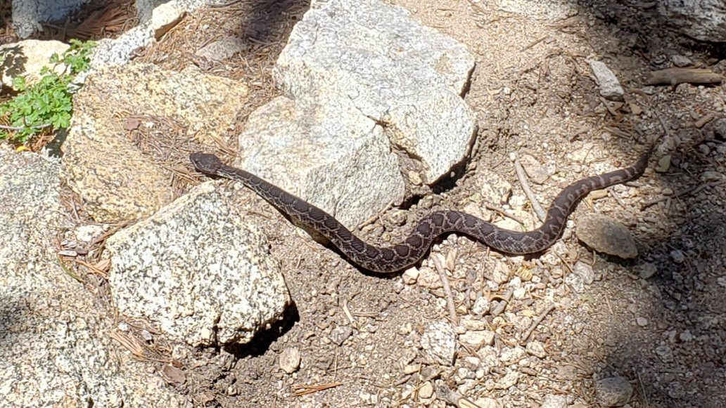
WEATHER Temperatures will be summer-like for the foreseeable future, with some very slight cooling possible late next week. No precipitation in the forecast.
At San Jacinto Peak (10,810’/3295m) today 6th June 2019 at 1050, the air temperature was 51°F (10°C), with a windchill temperature of 47°F (8°C), 46% relative humidity, and a light West breeze at 5 mph gusting to 7.3 mph.
At the Peak yesterday 5th June 2019 at 0830, the air temperature was 53°F (11°C), with a windchill temperature of 44°F (7°C), 37% relative humidity, and a modest NNE breeze at 6 mph gusting to 10.5 mph.
The last cool day of the season at the Peak was Monday 3rd June, when at 0755 the air temperature was 38°F (2°C), with a windchill temperature of 26.7°F (-3°C), 78% relative humidity, and a cool due North wind of 11 mph gusting to 17.2 mph.
TRAIL CONDITIONS
Trails below about 9600′ are essentially clear of snow, except for a few spots described below. Most higher trails also have only limited snow patches.
Waterproof footwear remains useful on some trails (e.g., Deer Springs, Fuller Ridge) due to multiple stream crossings and considerable water flowing in the trails. It is also valuable in the soft melting snow in many areas, especially after mid-morning.
Pacific Crest Trail is basically clear of snow through the San Jacinto mountains, including Fuller Ridge. Very limited patchy snow cover persists in a couple of areas, e.g., around Miles 181.5 and 189, but these present no challenge.
Deer Springs Trail is clear of snow up to north of the junction with the Marion Mountain Trail (about 8800′). There are only limited snow patches from that elevation to well above the Fuller Ridge Trail turning at about 9700′. Snow is more continuous (40% cover) through Little Round Valley but now only about 10% from there up to just below San Jacinto Peak. The campsites in LRV are now largely snow-free.
Tahquitz Peak trail from the PCT/ Chinquapin Flat is almost completely clear of snow (enough to pass easily without microspikes). There are a couple of extremely minor snow patches, but these have good steps in the soft snow.
East Ridge Trail from near Miller Peak to San Jacinto Peak remains 90% snow-covered, with some drifted areas still 2-3 feet deep. See my comments above about the mix of postholing and glissading.
Round Valley trail to Wellman Divide has about 40% snow cover. In places the tracks do not match the trail and a little care routefinding will still be required for the next few days.
Devil’s Slide, Willow Creek, Marion Mountain, Seven Pines, Ernie Maxwell, High, Long Valley, and Skyline trails are all clear of snow.
Note that as of 5th June, Willow Creek Trail has 27 trees down on the trail between Saddle Junction and Hidden Divide, making it slow going and a little hazardous in places. The relevant agencies have been notified.
South Ridge Road is clear and has been graded, but it requires 4WD very near the top due to mud. South Ridge Trail is clear of snow to Tahquitz Peak, with just a few tiny patches nearer the Peak. Microspikes not required, even for descending.
Black Mountain Road is easily passable through to Fuller Ridge campground. Note that the Boulder Basin and Black Mountain Group campgrounds remain closed. Friday 28th June is the tentative reopening date for Boulder Basin.sanjacjonUncategorized1 Comment 4 MinutesEdit”Snow and trail update 6th June 2019″
Snow and trail update 2nd June 2019
[UPDATE 5th June 2019: I have ascended San Jacinto Peak every day so far this month, by different routes each day. Various trail and snow conditions are updated by date in the text below, including the Tahquitz Peak area and PCT today.]
Early this morning I hiked briskly to San Jacinto Peak via Marion Mountain and upper Deer Springs trails. Yesterday I hiked San Jacinto Peak up the eastern side from Devil’s Slide Trail via Wellman Divide, descending the same way. Anne and Anabel joined me to Saddle Junction, but then they returned home the long way via the PCT southbound, Tahquitz Peak, and South Ridge Trail. The past week has also included hikes including much of the PCT locally, plus Tahquitz Peak and the Tahquitz area meadows.
I posted a video from early this morning at the Peak to YouTube. There had been a tiny snowfall right at San Jacinto Peak overnight, likely from a localised thunderstorm.
Detailed trail conditions are discussed below, and an update to the road access problems are described near the foot of this posting. The status of the rock slide at PCT Mile 172.5 (just north of Antsell Rock) is discussed in detail in a posting from 30th May. UPDATE 4th June 2019: a short section of trail around this rockslide will be officially closed by USFS in the next few days. I will update as soon as details are available.
I have also added the status of various water sources, mainly for the benefit of thru-hikers. Many additional ephemeral water sources are also available, and of course snow is still in parts of the high country for melting.
Snow depths are not updated in detail, as most areas now have no consistent depth to measure, and what little remains will melt dramatically this week. Only above about 10,400′ is snow cover largely continuous (80% coverage). Snow depth around San Jacinto Peak averages roughly 12″, and about the same in Little Round Valley, but it is increasingly patchy in both locations.
Melting is currently very rapid, with a continuing warming trend forecast. Currently microspikes can be useful (depending on your comfort level on soft snow) only for trails above about 9700′, likely for a few more days at the highest elevations, in particular for descending San Jacinto Peak (especially on the west side). Traction is also useful (but not essential) for some high country off-trail travel.
Hikers should always be prepared for rapidly changing conditions in the high country in summer. Thunderstorms with lightning and precipitation can occur at or near the high peaks even when such storms are not forecast for lower elevations.

WEATHER Temperatures will continue to climb to summer-like levels, with highs at or near 80°F by the middle of this week in Idyllwild, and near 50°F at San Jacinto Peak. We have been having unseasonal thunderstorm activity in recent days, and be prepared for this possibility in the afternoon or evening any day this week.
At San Jacinto Peak (10,810’/3295m) today 2nd June 2019 at 0705, the air temperature was 34°F (1°C), with a windchill temperature of 22°F (-6°C), 86% relative humidity, and a chilly NNE breeze at 9 mph gusting to 17 mph.
At the Peak on 1st June 2019 at 0830, the air temperature was 35°F (2°C), with a windchill temperature of 26°F (-3°C), 75% relative humidity, and a cool SE breeze at 8 mph gusting to 13 mph.
Finally, at the Peak on 27th May 2019 at 0855 the air temperature was 25°F (-4°C), with a windchill temperature of 5.5°F (-14°C), 52% relative humidity, and a very sharp WNW wind at 12 mph gusting to 28.6 mph.
TRAIL CONDITIONS
Most trails below about 9600′ are largely clear of snow, although it persists in some stubborn areas, more so on the western (Deer Springs Trail) side. Trail conditions will continue to change rapidly with more melting. Details for specific routes are below.
Waterproof footwear remains useful on approach trails (e.g., Devil’s Slide, lower Deer Springs) due to multiple stream crossings and considerable water flowing in the trails. It is also invaluable in the soft melting snow in many areas, especially after mid-morning.
Major trails have all been well traveled in the past week, so they have obvious, consolidated tracks.
Pacific Crest Trail [UPDATED 5th June 2019] The PCT is almost clear of snow through the San Jacinto mountains. Snow cover is very thin and patchy in a few areas, e.g., around Miles 181.5, 185, and 189. Microspikes are no longer required to hike the PCT through the San Jacinto mountains. However they may prove useful to those hikers unfamiliar with snow travel, e.g. in persistent patches on the north side of Fuller Ridge around Mile 189).
Deer Springs Trail is clear of snow up to beyond the junction with the Marion Mountain Trail (about 8800′). There are only limited snow patches from that elevation to well above the Fuller Ridge Trail turning at about 9500′. Snow is more continuous (60% cover) through Little Round Valley and then about 40% up to 10,500′ just below San Jacinto Peak. Some of the campsites in LRV are now largely snow-free.
Tahquitz Peak trail from the PCT/ Chinquapin Flat [UPDATED 5th June] is almost completely clear of snow (enough to pass easily without microspikes). There are a couple of minor snow patches, but these have good steps in the soft snow.
East Ridge Trail from near Miller Peak to San Jacinto Peak remains 90% snow-covered, with some drifted areas still 2-3 feet deep. It remains firm enough to go straight up with minimal postholing, at least in the mornings.
Round Valley trail to Wellman Divide has about 50% snow cover. In places the tracks do not match the trail and some care routefinding is required.
Devil’s Slide, Willow Creek, Marion Mountain, Seven Pines, Ernie Maxwell, High, Long Valley, and Skyline trails are all clear of snow.
Note that as of 5th June, Willow Creek Trail has 27 trees down on the trail between Saddle Junction and Hidden Divide, making it slow going and a little hazardous in places. The relevant agencies have been notified.
South Ridge Road is clear and has been graded, but it requires 4WD very near the top due to mud. South Ridge Trail is clear of snow to Tahquitz Peak, with just a few tiny patches nearer the Peak. Microspikes not required, even for descending.
WATER STATUS: Eastern slope
The Round Valley pipe is flowing well. Flow rate on 4th June was 2.1 gpm, which is as strong as it gets. [A new spigot was added on 13th June to control water flow. Thanks to Florian Boyd for this information.]
Both the northern and southern springs at Wellman’s Cienega are flowing well. These are the sources for Willow Creek, which is flowing well where it crosses the Willow Creek Trail.

Tahquitz Valley is flowing.
Tahquitz Creek is flowing well at the northern end of Little Tahquitz Meadow. It is also flowing well further upstream at its source (known locally as Grethe Spring) where it crosses the PCT (approx. PCT Mile 177).
Skunk Cabbage Creek – that flows through Skunk Cabbage Meadow and then crosses the Caramba Trail near Reeds Meadow – is currently flowing well.
WATER STATUS: Western slope
The North Fork of the San Jacinto River is flowing very well where it crosses the Deer Springs Trail and where it crosses the Fuller Ridge Trail on the PCT (approx. PCT Mile 186.2).
O’Sullivan Creek (PCT Mile 186.4) on Fuller Ridge Trail is flowing well.
The creek in Little Round Valley is flowing the strongest I have seen in at least six years.
Shooting Star Spring (below Little Round Valley but above the North Fork of the San Jacinto River crossing) is flowing well.
The Deer Springs stream crossing at the PCT (approx. PCT mile 185.6) is flowing very strongly. [PCT hikers note: many PCT guides and apps confuse the Deer Springs crossing with the North Fork of the San Jacinto River. The latter is another 0.5 miles further north on the Fuller Ridge Trail, see above.]
Switchback Spring at PCT Mile 183.5 (about 0.4 miles north of Strawberry Junction) is flowing well.
The little creek at Strawberry Cienega (PCT mile 183.0) is flowing well.
On Devil’s Slide Trail, Jolley, Middle, and Powderbox springs are all flowing well, as are several unnamed ephemeral creeks, but flow rates have dropped in recent days.
On the Ernie Maxwell Trail, the crossing of Chinquapin Creek just below Humber Park continues to flow very well, as do several other minor creeks that cross the trail.
WATER STATUS: Desert Divide
Highway 74 There is a water cache where the PCT crosses Highway 74, on the north side of the highway. This appears to be reliably maintained (by local trail angel Grumpy), but never assume water caches will definitely be there.
Pool 3.5 miles north of Highway 74 is now dry.
Live Oak Spring (N 33 37 21, W 116 33 24) Flowing well. The most reliable water source on the Desert Divide.
Cedar Spring (N 33 40 36, W 116 34 35) Flowing well. Easiest access is the trough just upstream from the trail to the campsite.
Apache Spring (N 33 43 11, W 116 37 13) Flowing fairly well, but the access trail off the PCT is somewhat unclear. Easier to get water from Spitler Creek described below.
Spitler Peak Trail Descending the trail there are five water crossings. The first two, at 0.9 and 0.95 miles down, cross a tiny side creek which is already drying up and should be ignored. The next crossing, at 1.1 miles down, is Spitler Creek and is the best source of water (currently flowing well). The next two crossings are the same creek, but for obvious reasons it is best to fill up at the highest of the three crossings.
Antsell Rock Creek (N 33 41 52, W 116 39 08) Right by the Spitler Peak Trail trailhead on Apple Canyon Road, Antsell Rock Creek is flowing very well. Just on the upstream side of the road there is excellent access to the creek. Useful if hikers are descending the Spitler Peak Trail.
ACCESS CLOSURES The Valentine’s Day flood events continue to make access to the San Jacinto mountains challenging. Highway 243 between Banning and Idyllwild is closed from Skyland Ranch (north of Bay Tree Spring) to just north of Lake Fulmor. The remaining closed section may not reopen until late summer at best. Highway 74 between Mountain Center and Hemet is currently open with a pilot car and restricted hours (0400-0800, 1800-0000). It is not now expected to reopen without restrictions until late July at the earliest.

Trail sign at Wellman Divide today 1st June 2019 (above) and for comparison on 22nd March 2019 (below).

sanjacjonUncategorized4 Comments 7 MinutesEdit”Snow and trail update 2nd June 2019″
Rock slide update 30th May 2019
Florian Boyd and I hiked southbound on the PCT this morning from Devil’s Slide Trail to the Zen Center Trail (roughly PCT Miles 179.5 to 171). This allowed us to take a look at the much-discussed rock fall partially blocking the PCT just north of Antsell Rock at about Mile 172.5. I recorded the following video there late morning today, also available here on YouTube.https://video.wordpress.com/embed/6x7JUv4r?hd=0&autoPlay=0&permalink=1&loop=0&preloadContent=metadata&muted=0&playsinline=0&controls=1
As described in the video, the rock fall is fairly easily passable with care both around on the downslope side, and up-and-over. I did both and personally recommend the former, especially if coming southbound. If hiking solo, I would strongly recommend waiting for a partner (or several) to help with the transfer of packs.
As posted yesterday, the U.S. Forest Service has NOT closed the trail at this time (I have this in writing direct from them). Any signs you may see – apparently there is one at the Highway 74 crossing – to the contrary are unofficial and misleading. This situation may change next week after an official assessment in the next couple of days.
Note also that between Miles 171 and 177 there are at least 26 trees down across the trail. (These are being reported to PCTA/USFS today.) So some caution is required with these hazards also. Obviously the trail is not passable to horses for the foreseeable future.
Snow from the three storms in the previous two weeks has largely cleared below 9000′, with only a few limited patches through to Mile 180 (no microspikes required). There will be a more extensive update on trail conditions on the afternoon of Saturday 1st June.sanjacjonUncategorized17 Comments 1 MinuteEdit”Rock slide update 30th May 2019″
Snow storm update 27th May 2019
[UPDATE 29th May 2019: U.S. Forest Service has confirmed that the trail is NOT closed at the rock slide near PCT Mile 172.5. An official assessment will be made in the next few days. A closure notice would then take several more days to come into effect. Hence the trail will remain open at least into next week. Any signs to the contrary on the trail are not official and not accurate.]
[UPDATE 28th May 2019: we hiked to the PCT via South Ridge and Tahquitz Peak this morning, mainly to assess the challenging snow slope on the north side of Tahquitz, updated in the text below, with photo.]
This morning I had my last true snow hike of a memorable season, to San Jacinto Peak via Devil’s Slide Trail and Wellman Divide, descending the same way. Our third snow storm in the last eight days! It was still snowing very finely on me as I hiked up Devil’s Slide Trail past Saddle Junction until about 8600′, when I broke out into spectacular sunshine for the rest of the morning.
A light snowfall coated the entire mountain down to about 5500′, with five fresh inches at San Jacinto Peak. On top of the two storms last week, the Peak has had 20″ of snowfall in late May this year! Last night’s snow was an extremely fine grain powder, reminiscent of sand, and was so light that it was heavily drifting in the strong wind. It was delightful to hike in, with minimal postholing, and I didn’t use microspikes all the way to San Jacinto Peak (although I did use them on the uppermost descent).
Yesterday and overnight in Idyllwild we had drizzle and rain (0.53″ at 5550′), which briefly turned to snow early this morning (0.25″).
Exceptionally rapid melting was already well underway during my descent. It felt like it was raining coming through the wooded sections with so much snow melt falling from the trees. Devil’s Slide Trail below 7000′ was already completely clear of snow by noon today, when just five or so hours earlier I had hiked up in a continuous couple of inches of lovely fresh powder. There was no sign that Humber Park or Idyllwild had even received any overnight snow by early this afternoon.
I recorded an unneccessarily long and rambling video (sorry!) just after 0900 this morning at San Jacinto Peak, available on YouTube here.
Melting is so rapid, and with a very strong warming trend forecast, that equipment recommendations may change daily. Currently, I suggest microspikes will be useful for some trails above about 7000′, especially early tomorrow morning, and likely for a few more days at the highest elevations, especially for descending San Jacinto Peak. The PCT will largely clear in the next day or two, at least below 8000′.
Waterproof or water resistant footwear is strongly recommended on approach trails at least (e.g., Devil’s Slide, lower Deer Springs) due to considerable water flowing in the trails and slushy melting snow everywhere. It will also be invaluable for at least the next few days elsewhere in soft melting snow.

Tahquitz Peak and Tahquitz Rock emerging from the cloud at around noon today, 27th May 2019.
WEATHER Other than what I recorded at the Peak this morning (see below), the weather will be warm the rest of this week, hot next week. A very significant warming trend will commence tomorrow, leading to almost complete melting everywhere by or in the first week of June. There is a slim chance of brief afternoon thunderstorms tomorrow and Wednesday, May 28th and 29th. For the rest of May hikers should still be prepared for temperatures near freezing in the high country, and potentially below freezing with windchill on some days.
At San Jacinto Peak (10,810ft/3295m) today, 27th May 2019, at 0855 the air temperature was 25°F (-4°C), with a windchill temperature of 5.5°F (-14°C), 52% relative humidity, and a very sharp WNW wind at 12 mph gusting to 28.6 mph.
At the Peak on 23rd May 2019 at 1055 the air temperature was 24.4°F (-4°C), with a windchill temperature of 9.5°F (-12.5°C), 100% relative humidity, and a brisk West wind at 10 mph gusting to 15.5 mph.

Jean Peak (10,670′) early this morning, 27th May 2019, from the Peak Trail.
TRAIL CONDITIONS
All trails above 6000′ were completely covered with 1-5″ of fresh snow this morning, but by this afternoon very rapid melting meant that most areas below 8000′ were already becoming very wet and slushy, or were already clear (<7000′).
All trails above 9000′ are currently under continuous snow cover roughly 4-20″ deep but this situation will change dramatically with melting in the next few days.
Reasonable tracks to follow are already in place for the PCT throughout the San Jacinto mountains. Reliable, well-traveled tracks are also in place for Devil’s Slide Trail, and the Wellman and Peak trails on the east side, and through Round and Long valleys to the Tram. It is likely that Deer Springs and Marion Mountain trails will be hiked today given the holiday and the traffic I witnessed on the lower trails on my descent.
Pacific Crest Trail Early this morning snow cover was thin and patchy from about Mile 158 to 163, and then continuous thereafter, and at least a couple of inches deep, through to at least Mile 194. See however the comments above regarding melting. Microspikes are unlikely to be needed anywhere on the PCT by about Thursday 30th May.
Note that the much-reported rockfall at about Mile 172.5 (Antsell-South Peak) is basically one huge rock and is passable with some minor scrambling (thanks to multiple PCT hikers for confirming this information). The area was assessed today by the PCTA Trail crew. USFS will make a determination as to any possible closure shortly and I will update as necessary.
Tahquitz Peak trail from the PCT/ Chinquapin Flat is tricky again with the recent snowfalls. Microspikes (in conjunction with an ice axe, if you are familiar with its use) and considerable caution are recommended for this section. There are reasonable steps to follow in the softening snow, but with a couple of short steep icy patches. The situation is improving rapidly with considerable melting.

SNOW DEPTHS measured on 27th May are as follows (for those areas that had snow remaining from the winter, plus snow from last week’s stroms, the combined average total is indicated in parentheses). For locations that were measured on 20th May and then [estimated] on 23rd May, see those data in the previous report (I have not re-estimated those locations due to the rapid nature of recent melting). Average depth is given, drifts may be significantly deeper than the average in places. Altitudes are approximate.
San Jacinto Peak (10,810′): 5″ (total 20″)
Wellman Divide (9700′): 4″ (total 10″)
Annie’s Junction (PCT Mile 181.5 at State Park boundary) (9050′): 3″ (total 6″)
Long Valley (8500′): 2″ (almost completely melted by the time of writing)
Saddle Junction (8070′): 2″ (total 3″, largely melted by this afternoon)
Devil’s Slide Trail at Humber Park (6550′): 0.5″ (now all melted)
Idyllwild (at 5550′): 0.25″ (now completely melted)


sanjacjonUncategorized2 Comments 5 MinutesEdit”Snow storm update 27th May 2019″
Snow storm update 23rd May 2019
[UPDATE 25th May 2019: as anticipated in the text below, snow melt has been extremely rapid. For example Long Valley (8500′) almost completely cleared of snow yesterday. However, precipitation is now very likely on Sunday 26th May at all elevations, with light snow forecast for the high country above about 6000′.]
Today we had a superb hike with Jenn Murdock to San Jacinto Peak ascending on the east side via Devil’s Slide Trail and Wellman Divide, returning the same way. Tim Dailey joined us early and helped break trail to 8500′.
Two days after we got our May snowstorm (described here) we got another one! Slightly less snowfall yesterday than on Sunday, but the combined effect has been quite dramatic, especially for late May.
The entire mountain from 5000′ to the Peak was in the cloud all day, with light fine drizzle on the ascent and descent of Devil’s Slide Trail, and a fine damp fog everywhere else, with visibility occasionally under 50 yards. The sun tried but failed to break through a couple of times when we were at San Jacinto Peak.
I recorded a short video at about 1055 this morning at San Jacinto Peak, available on YouTube here.
Microspikes are currently recommended at all elevations above about 7000′. Melting is expected to b very rapid, and the elevation at which spikes are useful may rise rapidly. Snow depths were great for snowshoeing above about 9000′ elevation (and I even wore them down to 8100′ on the descent) but that situation will also change soon with the rapid melting likely in the next few days.
Waterproof footwear is strongly recommended on approach trails at least (e.g., Devil’s Slide, lower Deer Springs) due to considerable water flowing in the trails and slushy melting snow everywhere. It will also be invaluable for at least the next few days elsewhere in soft melting snow.
Due to the time of year (high sun angle) and the warmth of the ground before the snow fell this week, melting will be unusually rapid during the warming trend over the next week or so. Conditions will therefore change rapidly. I do not anticipate updating the Trail Report for at least 3-4 days, so do not be surprised to find somewhat less snow over this weekend (and definitely next week) than currently described here.
WEATHER Overall a significant warming trend will commence tomorrow, which will be especially pronounced next week. However May 26th and 27th will be cool and overcast with the possibility of light precipitation on Sunday 26th (perhaps a few inches of snow in the high country) . Hikers should be prepared for temperatures near or below freezing in the high country, and potentially well below freezing with windchill on some days.
At San Jacinto Peak (10,810ft/3295m) today, 23rd May 2019, at 1055 the air temperature was 24.4°F (-4°C), with a windchill temperature of 9.5°F (-12.5°C), 100% relative humidity, and a brisk West wind at 10 mph gusting to 15.5 mph.
At the Peak on 20th May 2019 at 1050 the air temperature was 19°F (-7°C), with a windchill temperature of -2°F (-19°C), 88% relative humidity, and an icy NW wind at 14 mph gusting to 25 mph.
TRAIL CONDITIONS
All trails above 6000′ were completely snow-covered this morning, but by this afternoon some melting meant that most areas below 7000′ were already becoming very wet and slushy.
All trails above 8000′, including much of the PCT in the San Jacinto mountains, are currently under continuous snow cover 4-15″ deep (deeper in areas that retained snow since the winter, see data below).
Reasonable tracks to follow are already in place for the PCT at least from Saddle Junction (approx PCT Mile 179.7) all the way through Fuller Ridge.
Reliable, well-traveled tracks are also in place for Devil’s Slide Trail, and the Wellman and Peak trails on the east side. Good friend of the Trail Report Kyle Eubanks also broke reliable trail from Wellman Divide through Round and Long valleys to the Tram last night.
Upper Deer Springs Trail from the Peak down to the Fuller Ridge Trail junction has NOT had any traffic and currently has no tracks to follow. Marion Mountain and Seven Pines trails have not been hiked since the fresh snowfall.
Pacific Crest Trail Snow cover is likely thin and patchy from about Mile 158 to 163, and then continuous thereafter, and at least several inches deep, through to at least Mile 194. PCT hikers not comfortable with angled snow/ice travel should consider the Black Mountain Road alternative to Fuller Ridge, at least for the next week or so.
SNOW DEPTHS measured today 23rd May are as follows (for those areas that still had snow remaining from the winter, the combined total is indicated in parentheses). Locations that were measured on 20th May are shown as [estimated] based on likely additional accumulation from yesterday’s storm at that elevation. Average depth is given, drifts may be significantly deeper than the average in places. Altitudes are approximate.
San Jacinto Peak (10,810′): 15″ (total 23″)
Peak Trail (at and above 10,000′): 13″
Little Round Valley (9800′): 13″ (total 28″) [estimated]
Wellman Divide (9700′): 10″
Pacific Crest Trail at south end of Fuller Ridge Trail (8950′): 9″ [estimated]
Annie’s Junction (PCT Mile 181.5 at State Park boundary) (9050′): 9″
Long Valley (8500′): 3″
Strawberry Junction (8100′): 4″ [estimated]
Saddle Junction (8070′): 5″
Devil’s Slide Trail at Humber Park (6550′): 3″ (at 0600 this morning, now largely melted)
Idyllwild (at 5550′): 1.75″ (last night, now completely melted)

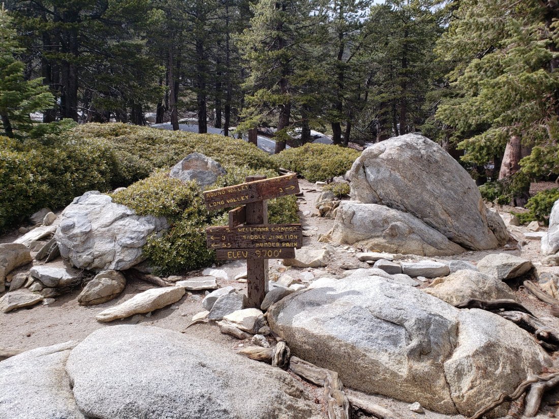


sanjacjonUncategorizedLeave a comment 4 MinutesEdit”Snow storm update 23rd May 2019″
Brief snow update 22nd May 2019
[UPDATE 22nd May at 2020: contrary to what was generally forecast, heavy snowfall accumulated rapidly at all elevations above 5000′ in mid-afternoon today. In Idyllwild we had 1.75″ in about two hours, with 3-4″ reported in Pine Cove, and 2-3″ in Long Valley. An additional 4″ fell at Wellman Divide (for a total this week of 10″) and 6″ fell above 10,000′ (for a total of 14″). The snow stopped and the mountain partly cleared at about 1700 this evening, with melting already underway in Idyllwild at dusk. I hope to do a comprehensive update of conditions tomorrow afternoon.][Many thanks to Kyle Eubanks for snow data from the Tram side of San Jacinto Peak.]
We hiked this morning to Tahquitz Peak (8836′) via South Ridge Trail, also checking the trail from Tahquitz through to Chinquapin Flat. For a more detailed review of the trails since the snow storm on 20th May, see the previous report. I recorded the following video at Tahquitz at about 1100 this morning.https://video.wordpress.com/embed/BB18617j?hd=0&autoPlay=0&permalink=1&loop=0&preloadContent=metadata&muted=0&playsinline=0&controls=1
After recording that video, there has been more snowfall in the high country, with for example 1-2″ fresh snow at Long Valley (8500′) since 0800 this morning. We hiked through some very light snowfall (graupel) on South Ridge on our descent also. The highest peaks (>10,000′) were above the cloud for most of the morning at least.
Melting has removed most snow below 8000′ (and almost all snow below 7000′). However freeze-thaw cycles have turned remaining snow icy, so microspikes are recommended everywhere above 8000′ at present, and may be useful at lower elevations in some places. This advice will remain valid throughout the Memorial Day weekend.
Tahquitz Peak trail to Chinquapin Flat is readily passable with microspikes for those comfortable with basic snow hiking, as the trail has no significant angled icy patches and only 1-3″ snow on the trail (see photo below).

WEATHER More light precipitation is forecast at all elevations for this afternoon and tonight (at least 2-4″ snow above 8000′), and then again in the middle of the day tomorrow, 23rd May. A warming trend – with steady melting of snow – will slowly take hold commencing Friday 24th.


sanjacjonUncategorized2 Comments 2 MinutesEdit”Brief snow update 22nd May 2019″
Snow storm update 20th May 2019
Today we hiked to San Jacinto Peak ascending on the east side via Devil’s Slide Trail and Wellman Divide, then descending the west side down Deer Springs Trail. This included two short sections of the PCT (roughly Miles 180-182 and 184-186). I broke trail through fresh snowfall almost all of the ascent and then back down to the south end of Fuller Ridge.
Well we got our May snowstorm! Seemingly without fail – even in very dry years – we get at least one snow event in May. Credit to NOAA/National Weather Service, who typically wildly overestimate their snowfall predictions, they got this one almost exactly right, with 9″ of fresh snow at San Jacinto Peak (measured snow depths today are listed below). It looks like we may quickly follow up with a second snow storm on Wednesday 22nd. In Idyllwild at 5550′ we received 1.29″ of rainfall, and <0.25″ of snow, in the past 24 hours.
I was pleased to see that many of the PCT hikers that I had spoken to yesterday at Nomad Ventures in Idyllwild had taken advice to get back on the trail today, taking advantage of a decent weather window. Even on the short sections of the trail I did, I encountered close to 30 thru hikers heading north. One of them, Don Kreitz, accompanied me to the Peak, and was treated to a spectacular (if chilly) morning up there.
I recorded a video at about 1045 this morning at San Jacinto Peak in a strong and frigid NW wind, available on YouTube here.
At present the PCT in the San Jacinto mountains is passable for most hikers without microspikes. Depending on confidence and experience on angled icy snow, some PCT hikers will prefer to use microspikes, especially on Fuller Ridge. However this situation may change rapidly as freeze-thaw cycles, and the possibility of additional snowfall, make the snow increasingly icy and treacherous. IF IN DOUBT, CARRY MCROSPIKES.
Microspikes remain recommended for ascending and descending from San Jacinto Peak, at least. Snow depths were marginal for snowshoeing, but it would be possible above about 9000′ elevation.
WEATHER Rain is possible again tomorrow, Tuesday 21st, especially overnight into Wednesday 22nd. Further rain is likely in the middle of the day Wednesday, including the possibility of light snowfall down to 6000′. Snow is forecast throughout the mountain that day, with several inches likely in the high country. Drier and slightly warmer weather is likely starting Thursday 23rd May.
Hikers must be prepared for temperatures below seasonal averages everywhere, below freezing in the high country, and well below freezing with windchill.
At San Jacinto Peak (10,810ft/3295m) today, 20th May 2019, at 1050 the air temperature was 19°F (-7°C), with a windchill temperature of -2.0°F (-19°C), 88% relative humidity, and an icy NW wind at 14 mph gusting to 25 mph.
At the Peak on 16th May 2019, at 1345 the air temperature was 27°F (-3°C), with a windchill temperature of 8.4°F (-13°C), 100% relative humidity, and a sharp SW wind at 15 mph gusting to 24 mph.

TRAIL CONDITIONS
All trails above 6000′ were completely snow-covered this morning, but by this afternoon some rapid melting meant that most areas below 7000′ were already clear of snow, trails below 8000′ were melting fast, and there was partial melting of exposed sections of trail below 9000′.
Almost all trails above 7500′, including much of the PCT in the San Jacinto mountains, are currently under continuous light snow cover 2-9″ deep.
Reliable tracks to follow are already in place for the PCT at least from Saddle Junction (approx PCT Mile 179.7) all the way through Fuller Ridge.
Reliable tracks are also in place for Devil’s Slide Trail, the Wellman and Peak trails on the east side, and the entire Deer Springs Trail on the west side. Good friend of the Trail Report Kyle Eubanks also broke reliable trail from Wellman Divide through Round and Long valleys to the Tram this morning.
Marion Mountain and Seven Pines trails have not been hiked since the fresh snowfall.
Pacific Crest Trail Snow cover is likely thin and patchy from about Mile 158 to 163, and then increasingly continuous thereafter, through to about Mile 194.
Deer Springs Trail was rapidly clearing of snow below Strawberry Junction (8100′) this afternoon, although much of the trail was through wet slushy snow, or was a meltwater creek, so waterproof footwear is recommended.
SNOW DEPTHS measured today 20th May are as follows (for those areas that still had snow remaining from the winter, the combined total is indicated in parentheses). Average depth is given, drifts may be significantly deeper than the average in places. Altitudes are approximate.
San Jacinto Peak (10,810′): 9″ (total 17″)
Peak Trail (at and above 10,000′): 8″
Little Round Valley (9800′): 7″ (total 22″)
Wellman Divide (9700′): 6″
Pacific Crest Trail at south end of Fuller Ridge Trail (8950′): 6″
Annie’s Junction (PCT Mile 181.5 at State Park boundary) (9050′): 5″
Long Valley (8500′): 2″
Strawberry Junction (8100′): 3″
Saddle Junction (8070′): 4″
Devil’s Slide Trail at Humber Park (6550′): 1.5″ (at 0600 this morning, now largely melted)

sanjacjonUncategorized3 Comments 4 MinutesEdit”Snow storm update 20th May 2019″
Storm update 19th May 2019
I have spent the day hearing stories from PCT hikers in Idyllwild of challenging weather overnight, with probably all hikers bailing off the mountain at some point this morning (some even packing up camp in the early hours to descend).
Wind gusts were especially severe in the night. First hand reports of tents being literally destroyed by very strong winds came from Fobes saddle, between Spitler and Apache peaks, and near Red Tahquitz.
Snowfall totals were all in the range of 1-3″, with 2-3″ at San Jacinto Peak, about 2″ at Strawberry Junction (8100′) and on the north side of Red Tahquitz (8300′), 1-2″ at about 6500′ in upper Pine Cove, 1″ at Long Valley (8500′), and <1″ at Black Mountain (7700′). This depth of snow should not significantly impact route finding on the trail system. In many locations, slightly warmer conditions later in the morning turned the precipitation to rain, and there was no evidence of the snow by later in the day (e.g., at Long Valley).
Rainfall in Idyllwild (at 5550′) in the last 24 hours has been 0.84″, and 0.25″ at Long Valley. By this afternoon the rainfall had become very patchy, and the upper mountain was above the cloud in largely blue sky conditions.
WEATHER Further precipitation is forecast for tonight, mainly at lower to mid-elevations, with less than one inch of snow forecast for San Jacinto Peak, but potentially half-an-inch of rain, or even 1-2″ snow, at the elevation of Idyllwild (5000-6000′). Severe winds are again forecast for Tuesday 21st, and heavier precipitation (perhaps several inches of snow in the high country) for Wednesday 22nd.
There will be a full update on trail, snow, and weather conditions tomorrow afternoon (Monday 20th May).sanjacjonUncategorizedLeave a comment 1 MinuteEdit”Storm update 19th May 2019″
Storm and trail update 17th May 2019
[UPDATE 19th May 2019, 1150: Rainfall so far today has been 0.68″ in Idyllwild. It snowed barely an inch over 6000′ overnight, with 2″ (5cm) snow at San Jacinto Peak. Much snow has already melted this morning at the elevation of Long Valley (8500′). After some rainfall, it is now sleeting again in the high country. Extreme winds have been reported, especially along the Desert Divide (approx PCT Miles 157-175).]
[WEATHER UPDATE 18th May 2019: A winter weather warning has been issued for the next two days available here. Although these tend to overestimate snowfall in the San Jacinto mountains, some precipitation is likely and it will be very cold. Temperatures well below freezing (10-30 degrees below freezing with windchill) are expected for much of the next six days, 19th-24th May, in the San Jacinto high country.]
Yesterday we hiked to San Jacinto Peak in the rain, hoping for some snow up high. After a few hours around the Peak we descended via Wellman Divide and Devil’s Slide Trail in clearer conditions. The rain started and ended a couple of hours earlier than forecast, between about 0700-1300, and the system was milder than expected with no snowfall even at the Peak. In Idyllwild at 5550′ we received 0.20″ rain, but rainfall was significantly heavier than that between about 8000-10,000′ elevation.
I recorded the following short video at San Jacinto Peak on 16th May.https://video.wordpress.com/embed/wXpHn786?hd=0&autoPlay=0&permalink=1&loop=0&preloadContent=metadata&muted=0&playsinline=0&controls=1
At about 1400 as we descended, the high country cleared (see photo below) but Idyllwild and the mountain below about 9000′ largely remained in the cloud until dusk.
Details of trail conditions are below. I am no longer updating snow depths as most areas below 10,000′ are largely clear (albeit with some persistent drifts around). Currently I am not updating water conditions. Due to rainfall and rapid snow melt all established water sources are flowing well, and many ephemeral sources are flowing also.
With this mild system and rainfall, melting has continued rapidly. The PCT in the San Jacinto mountains is now safely passable for hikers without microspikes. Depending on confidence and experience on icy snow, some PCT hikers may still prefer to use microspikes, especially on the north end of Fuller Ridge (aroud Mile 190).
Microspikes remain useful (but not essential) above 9700′ in some areas, especially descending from San Jacinto Peak, in particular on the western (Deer Springs Trail) route.
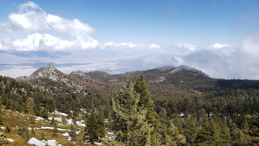
WEATHER Following a couple of milder days, there is the chance of light precipitation on most days from Sunday 19th to Thursday 23rd May. Temperatures will be below seasonal averages, and at or below freezing in the high country (well below freezing with windchill). Light snowfall at the highest elevations is a possibility on several days in the next week.
At San Jacinto Peak (10,810ft/3295m) yesterday, 16th May 2019, at 1345 the air temperature was 27°F (-3°C), with a windchill temperature of 8.4°F (-13°C), 100% relative humidity, and a sharp SW wind at 15 mph gusting to 24 mph.
At San Jacinto Peak on 11th May 2019, at 1530 the air temperature was 30°F (-1°C), with a windchill temperature of 15°F (-9°C), 97% relative humidity, and a fresh NE wind at 12 mph gusting to 20 mph.
TRAIL CONDITIONS
Trails above about 8700′ remain partly snow-covered. All main trails are now well traveled, and have good tracks to follow which largely align with the established trail system.
Pacific Crest Trail The trail is clear of snow from Highway 74 (Mile 151) to about Mile 174 (Red Tahquitz) after which the trail has a few snow patches to about Mile 179. There is a short section with about 80% snow cover near Mile 181. There is patchy snow on Miles 185-186 at about 30% coverage.
Fuller Ridge Trail (approx. PCT Miles 185.5-190.5) can be traversed without microspikes, although they are useful for those less experienced on angled icy snow. Snow patches are frequent enough to use microspikes for parts of the five mile length of the Fuller Ridge Trail, briefly around Miles 187.5-188, and then more continuously on Miles 188.5-190. Particularly at the northernmost end, the track does not follow the trail in places, and there are a couple of steeper descents.
San Jacinto Peak trails On the eastern side, the Wellman Trail from Annie’s Junction (PCT turning near Mile 181.5) to Wellman Divide (9700′) is clear of snow. The Peak Trail from Wellman Divide to the Peak averages less than 20% snow-covered and the track now largely follows the trail route, but microspikes remain useful, especially for descending those areas where stubborn icy snow patches remain. The East Ridge Trail remains almost completely under snow. On the western side, the upper Deer Springs Trail from Little Round Valley is about 60% snow-covered through the Valley, 50% covered on the ascent to the Peak, and about 50% snow-covered at San Jacinto Peak itself. The tracks through the snow patches now largely follow the route of the Deer Springs Trail. Microspikes are recommended in places, especially for descending from the Peak to about 9600′.
Tahquitz Peak trail from Chinquapin Flat was updated in detail earlier this week. Microspikes are no longer required for the steps through the very short remaining sections of icy snow.
Black Mountain Road is clear of snow. No microspikes are required to hike to the PCT. The road has been cleared, repaired, and partially graded to the turning to Boulder Basin, and cleared and repaired to the Fuller Ridge campground.
Skyline Trail is clear. C2C hikers have not been encountering snow until well past Long Valley Ranger Station.
Devil’s Slide Trail is clear of snow.
Tahquitz meadows trails are clear of snow with only occasional small patches to cross. No microspikes required.
Deer Springs Trail is clear of snow to Strawberry Junction (8100′) and almost completely clear to the Seven Pines Trail junction. There is about 20% snow cover from there to the Fuller Ridge Trail junction, but microspikes are no longer required. The track above the Fuller Ridge junction now follows the trail and there is only about 20% snow cover as the trail nears Little Round Valley. For the section through and beyond Little Round Valley, see “San Jacinto Peak trails” above.
Marion Mountain Trail is clear of snow.sanjacjonUncategorized2 Comments 4 MinutesEdit”Storm and trail update 17th May 2019″
Tahquitz trail update 14th May 2019
We hiked up South Ridge to Tahquitz Peak and across to Chinquapin Flat this morning. With a couple of recent warm days, the notoriously stubborn icy snow on the north side of Tahquitz Peak is now sufficiently melted for that trail to be safely passable without additional traction (such as microspikes). The hardest section of that trail is shown in a short video available on YouTube.
Otherwise trail conditions are not substantially different from the previous report of three days ago, linked here. The necessity for microspikes continues to diminish with continued rapid melting everywhere until Thursday, as I describe in the video.
WEATHER Cooler conditions arrive tomorrow, with the possibility of light snow (<2″) in the high country on Thursday 16th, and rain at lower elevations. Temperatures will be below (or well below) freezing on 16th and 17th. Below seasonal temperatures are forecast to continue well into next week, with several further chances for very light precipitation.

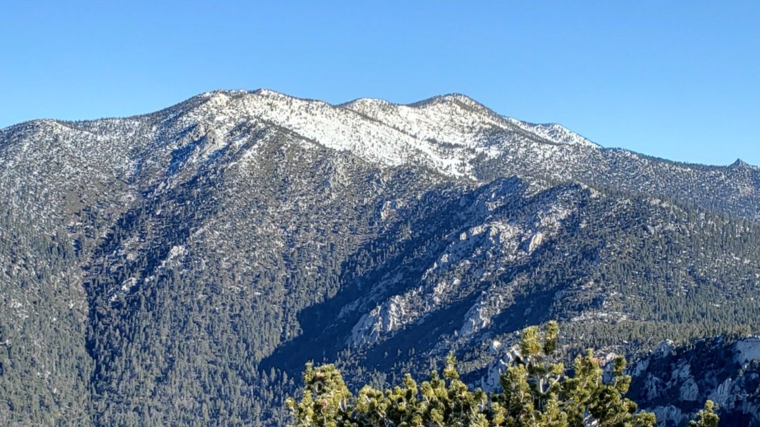
sanjacjonUncategorized1 Comment 1 MinuteEdit”Tahquitz trail update 14th May 2019″
Weather and trail update 11th May 2019
This afternoon I hiked to and from San Jacinto Peak via Devil’s Slide Trail and Wellman Divide, having done the same via Marion Mountain and upper Deer Springs trails on 10th May. On 8th May we hiked to Tahquitz Peak from home, checking trails all around that mountain. I recorded a video at 0920 on 10th May in the cloud at San Jacinto Peak available on YouTube at this link.
Today I wanted to see if there was any chance of snow in the high country as had been forecast. While the trees above 10,300′ were plastered with thick rime, alas no snow.
Idyllwild was in the cloud all morning on 10th and it was trying to drizzle in Pine Cove (6300′) at first light. On our ascent of Marion Mountain Trail we quickly emerged from the cloud, only to find another layer 3000′ higher enshrouding the high peaks. The lower cloud was a classic marine layer (“May grey”) coming from the west, while the upper layer was moving in the opposite direction driven by high elevation easterly winds. Where both levels were visible, the effect was spectacular.

Despite recent cooler weather, snowmelt has continued rapidly, with many areas below about 9500′ now clear or largely clear of snow, and sun-exposed slopes from San Jacinto Peak down now partly or largely clear too. The PCT in the San Jacinto mountains is now safely passable for most hikers without microspikes. Depending on confidence and experience on icy snow, some PCT hikers will still prefer to use microspikes, especially on the north end of Fuller Ridge (about Miles 189-191).
Microspikes remain recommended above 9700′ in some areas, especially descending from San Jacinto Peak, and in particular on the western (Deer Springs Trail) route.
WEATHER There will be yet another rapid warming trend over the next couple of days. Light rain is possible on 12th May at all elevations.
At San Jacinto Peak (10,810ft/3295m) today, 11th May 2019, at 1530 the air temperature was 30°F (-1°C), with a windchill temperature of 15°F (-9°C), 97% relative humidity, and a fresh NE wind at 12 mph gusting to 20 mph.
At the Peak on 10th May 2019, at 0915 the air temperature was 29°F (-2°C), with a windchill temperature of 15°F (-9°C), 100% relative humidity, and a cool ENE wind at 5 mph gusting to 15 mph.
TRAIL CONDITIONS
Many trails above about 9000′ remain partly snow-covered. Details for specific routes are below. Hikers should be prepared for temperatures near freezing in the high country for several days this week (below freezing when considering windchill effects). All main trails are now well traveled, and have good tracks to follow which largely align with the established trail system.
Pacific Crest Trail The trail is clear of snow from Highway 74 (Mile 151) to about Mile 174 (Red Tahquitz) after which the trail is only patchily 10% snow-covered to about Mile 179. There is a short section with about 90% snow cover near Mile 181. Many nobo PCT hikers have been missing the hard left uphill turning at Annie’s Junction (approx. Mile 181.5) in the patchy snow. There is patchy snow on Miles 185-186 at about 30% coverage.
Fuller Ridge Trail (approx. PCT Miles 186-191) can be traversed without microspikes, although they are useful for those less experienced on angled icy snow. Snow patches are frequent enough to use microspikes for parts of the five mile length of the Fuller Ridge Trail, briefly around Miles 187.5-188, and then more continuously on Miles 189-191. Particularly on the northernmost two miles, the track does not follow the trail in places, and there are a couple of steeper descents.
San Jacinto Peak trails On the eastern side, the Wellman Trail from Annie’s Junction (PCT turning near Mile 181.5) to Wellman Divide (9700′) is clear of snow. The Peak Trail from Wellman Divide to the Peak averages less than 40% snow-covered and the track now largely follows the trail route, but microspikes remain useful, especially for descending those areas where stubborn icy snow patches remain. The East Ridge Trail remains completely under snow. On the western side, the upper Deer Springs Trail from Little Round Valley is about 70% snow-covered through the Valley, 60% covered on the ascent to the Peak, and about 50% snow-covered at San Jacinto Peak itself. The tracks through the snow patches now largely follow the route of the Deer Springs Trail. Microspikes are recommended in places, especially for descending from the Peak to about 9600′.
Black Mountain Road is clear of snow. No microspikes are required to hike to the PCT. Beyond the Fuller Ridge campground turning there are some very limited snow patches down to about 7300′ elevation. For vehicular access, Black Mountain Road has been cleared, repaired, and partially graded to the turning to Boulder Basin, and cleared and repaired to the Fuller Ridge campground.
Skyline Trail is clear. C2C hikers have not been encountering snow until well past Long Valley Ranger Station.
Devil’s Slide Trail is clear of snow.
Tahquitz meadows trails are functionally clear of snow with only occasional patches to cross. No microspikes required.
Deer Springs Trail is clear of snow to Strawberry Junction (8100′) and almost completely clear to the Seven Pines Trail junction. There is about 20% snow cover from there to the Fuller Ridge Trail junction, but microspikes are no longer required. The track above the Fuller Ridge junction now follows the trail and there is only about 20% snow cover as the trail nears Little Round Valley. For the section through and beyond Little Round Valley, see “San Jacinto Peak trails” above.
Marion Mountain Trail is clear of snow.
Tahquitz Peak trail from Chinquapin Flat There are some steps to follow through the short (but steep) remaining sections of icy snow. Microspikes in conjunction with hiking poles (or ideally an ice axe if you know how to use it) remain strongly recommended for this challenging trail until it is clear of snow (likely one to two more weeks).
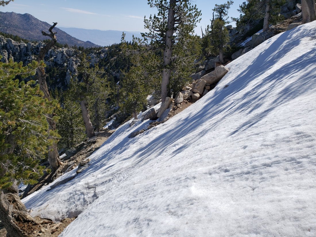
South Ridge Trail is clear of snow to Tahquitz Peak. South Ridge Road was repaired and graded on 7th May and is passable to the trailhead to all vehicle types.
SNOW DEPTHS measured on 10th May (or on various recent dates as indicated in parentheses) are as follows. Current average depth is given; drifts can be much deeper than the average in places. Altitudes are approximate.
San Jacinto Peak (10,810′): 10″ (was 75″ on 22nd March)
Little Round Valley (9800′): 15″ (with drifts 2-3 feet in places)
Wellman Divide (9700′): 0″ (but with drifted patches nearby)
Pacific Crest Trail at south end of Fuller Ridge Trail (8950′): 1″
Annie’s Junction (PCT Mile 181.5 at State Park boundary) (9050′): 4″ (on 6th May)
Long Valley (8500′): 0″
Strawberry Junction (8100′): 0″
Saddle Junction (8070′): 0″ (was 20″ on 22nd March)
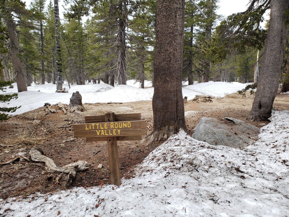
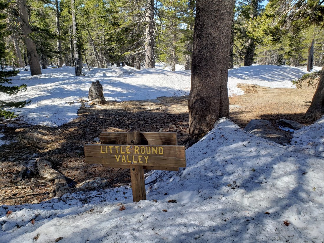

sanjacjonUncategorizedLeave a comment 5 MinutesEdit”Weather and trail update 11th May 2019″
Trail update 6th May 2019
[UPDATE 8th May: we hiked South Ridge to Tahquitz Peak this morning. South Ridge Road was repaired and fully graded yesterday. I have updated the status of the challenging Tahquitz Peak to Chinquapin Flat trail also.]
This morning we briskly hiked to and from San Jacinto Peak via Devil’s Slide Trail and Wellman Divide. Other trails surveyed in recent days were outlined in the previous update three days ago. I recorded a short video at about 0900 this morning just below Miller Peak, available on YouTube. There was some very light rain in Idyllwild this afternoon, totaling 0.26″ at 5550′ elevation, but yet again the high country was above the cloud.
Snowmelt has continued rapidly, with many areas below about 9000′ now clear or largely clear of snow, and sun-exposed slopes below 10,400′ largely clear too. The PCT in the San Jacinto mountains is now safely passable for most hikers without microspikes. Depending on confidence and experience on icy snow, some PCT hikers will still prefer to use microspikes, especially on the north end of Fuller Ridge (about Miles 189-191).
Microspikes are still recommended above 9500′ in many areas, especially descending from San Jacinto Peak, and in particular on the western (Deer Springs Trail) route. We hiked the traverse from Chinquapin Flat (about PCT Mile 178) to Tahquitz Peak on 3rd May and found that it remains challenging even in microspikes.
WEATHER Temperatures this week will be below average for early May, with considerable cloudiness and light precipitation possible on several days, at least at mid-elevations (San Jacinto Peak has been above the cloud for four of the five most recent storms). Light rain at mid elevations and light snow in the high country are most likely on Friday and Saturday (10-11 May) with a few inches of snow possible, mainly above about 8500′.
At San Jacinto Peak (10,810ft/3295m) today, 6th May 2019, at 0830 the air temperature was 29°F (-2°C), with a windchill temperature of 20°F (-7°C), 54% relative humidity, and a very light SSW breeze at 3 mph gusting to 6 mph.
At the Peak on Wednesday 1st May 2019, at 0845 the air temperature was 34°F (1°C), with a windchill temperature of 23.6°F (-5°C), 14% relative humidity, and a brisk West breeze at 12 mph gusting to 17 mph.
TRAIL CONDITIONS
Many trails above about 9000′ remain at least partly snow-covered. Details for specific routes are below. Hikers should be prepared for temperatures at or below freezing in the high country this week (well below freezing when considering windchill effects). All main trails are now well traveled, and have good tracks to follow.
Pacific Crest Trail The trail is clear of snow from Highway 74 (Mile 151) to about Mile 174 (Red Tahquitz) after which the trail is only patchily 20% snow-covered to about Mile 179. There is almost continuous snow either side of Mile 181. Many nobo PCT hikers are missing the hard left uphill turning at Annie’s Junction (approx. Mile 181.5) in the patchy snow.
Fuller Ridge Trail (approx. PCT Miles 186-191) can be traversed without microspikes, although they are useful for those less experienced on angled icy snow. Snow patches are frequent enough to use microspikes for parts of the five mile length of the Fuller Ridge Trail, specifically approx. Miles 187.5-188, and 189-191. Particularly on the northernmost two miles, the track does not follow the trail in places, and there are a couple of steeper descents. PCT hikers not comfortable with angled snow/ice travel could still consider the Black Mountain Road alternative. Fuller Ridge campground (Mile 191) is clear of snow.
San Jacinto Peak trails On the eastern side, the Wellman Trail from Annie’s Junction (PCT turning near Mile 181.5) to Wellman Divide (9700′) is largely clear of snow, but microspikes are useful for descending those areas where stubborn icy snow patches remain. The Peak Trail from Wellman Divide to the Peak is only partly snow-covered and the track now largely follows the trail route, but microspikes remain useful, especially for descending. On the western side, the upper Deer Springs Trail from Little Round Valley to the Peak remains about 80% snow-covered, and note that the consolidated tracks are steep and do not closely follow the trail route. Microspikes are recommended, especially for descending.
Black Mountain Road is clear of snow to the PCT. No microspikes are required to hike to the PCT. Beyond the Fuller Ridge campground turning there are some small snow patches down to about 7300′ elevation. For vehicular access, Black Mountain Road has been cleared, repaired, and partially graded to the turning to Boulder Basin, and cleared and repaired to the Fuller Ridge campground.
Skyline Trail is clear. C2C hikers have not been encountering snow until well past Long Valley Ranger Station.
Devil’s Slide Trail is clear of snow.
Tahquitz meadows trails are largely clear of snow with only occasional patches to cross. No microspikes required.
Deer Springs Trail is clear of snow to Strawberry Junction (8100′) and largely clear to the Seven Pines Trail junction. There is about 70% snow cover from there to the Fuller Ridge Trail junction, and microspikes are useful. The track above the Fuller Ridge junction now more closely follows the trail and there is only about 50% snow cover to Little Round Valley. Through and above Little Round Valley the tracks largely do not approximate to the true trail, and are steep and postholey in places, with about 90% snow cover (microspikes useful again, especially for descending).
Marion Mountain Trail is clear of snow, with just a couple of tiny patches very near the PCT. Microspikes not required.
Tahquitz Peak trail from Chinquapin Flat [UPDATED 8th May] There are some steps to follow through the short (but steep) remaining sections of snow. Microspikes in conjunction with hiking poles (or ideally an ice axe if you know how to use it) remain strongly recommended for this challenging trail until it is clear of snow (likely one to two more weeks).
South Ridge Trail is clear of snow to Tahquitz Peak. South Ridge Road [UPDATED 8th May] was repaired and graded yesterday and is passable to he top to all vehicles.

Peak Trail looking north at 9800′ just above Wellman Divide today 6th May 2019 (above) and the same view two weeks earlier on 22nd April (below).

SNOW DEPTHS measured on various recent dates (as indicated in parentheses) are as follows. Current average depth is given; drifts can be much deeper than the average in places. Altitudes are approximate.
San Jacinto Peak (10,810′): 19″ (on 6th May; was 75″ on 22nd March)
Little Round Valley (9800′): 20″ (on 1st May)
Wellman Divide (9700′): 0″ (but with drifted patches nearby)
Pacific Crest Trail at south end of Fuller Ridge Trail (8950′): 4″ (on 1st May)
Annie’s Junction (PCT Mile 181.5 at State Park boundary) (9050′): 4″ (on 6th May)
Long Valley (8500′): 0″
Strawberry Junction (8100′): 0″
Saddle Junction (8070′): 0″ (was 20″ on 22nd March)

Trail junction sign at south end of Fuller Ridge Trail (8940′) on 1st May 2019 (above) and two weeks earlier on 18th April 2019 for comparison (below)
sanjacjonUncategorized1 Comment 5 MinutesEdit”Trail update 6th May 2019″
Snow and trail update 3rd May 2019
Today we hiked to Red Tahquitz (above PCT Mile 174) from home, ascending via Devil’s Slide Trail and the Tahquitz meadows, then returning via Tahquitz Peak and South Ridge. This allowed an assessment of PCT Miles 174-179, an area that traditionally holds stubborn late icy snow patches. Other trails hiked in recent days include San Jacinto Peak via Fuller Ridge Trail and both east and west sides, upper Deer Springs Trail, and Marion Mountain Trail. I recorded a short vlog at about 0900 this morning at Red Tahquitz, available here on YouTube.
Snowmelt has continued rapidly, with almost all areas below about 9000′ now clear or largely clear of snow. The PCT in the San Jacinto mountains is now safely passable for most hikers without microspikes. Depending on confidence and experience on icy snow, some PCT hikers will still prefer to use microspikes, especially on the north end of Fuller Ridge (about Miles 189-191).
Microspikes are still recommended above 9000′ in many areas, especially descending from San Jacinto Peak, in particular on the western (Deer Springs Trail) route. We hiked the traverse from Chinquapin Flat (about PCT Mile 178.5) to Tahquitz Peak this morning and found that it remains challenging even in microspikes. Although this is melting fast, an ice axe and extreme care remain advisable for the next few days at least.
As reported in the previous update, the mix of snow and bare patches seems to have obscured tracks in several places, and I have witnessed and heard stories of folks losing the trail in recent days. As always, snow travel requires cautious navigation.
WEATHER After another warm weekend, the following week (6th-12th May) will have below average temperatures, with considerable cloud and chances of light precipitation on several days, at least at mid-elevations (San Jacinto Peak has been above the cloud for three of the four most recent storms).
At San Jacinto Peak (10,810ft/3295m) on 1st May 2019, at 0845 the air temperature was 34°F (1°C), with a windchill temperature of 23.6°F (-5°C), 14% relative humidity, and a brisk West breeze at 12 mph gusting to 17.4 mph.
At the Peak on 29th April 2019, at 0910 the air temperature was 33°F (1°C), with a windchill temperature of 26.9°F (-3°C), 46% relative humidity, and a light but chilly WSW breeze at 3 mph gusting to 5 mph.
TRAIL CONDITIONS
Many trails above about 9000′ remain largely or partly snow-covered, although this is changing rapidly. Details for specific routes are below. Hikers should be prepared for temperatures at or below freezing in the high country (well below freezing when considering windchill effects). All main trails are now well traveled, and have good tracks.
Pacific Crest Trail The trail is clear of snow from Highway 74 (Mile 151) to about Mile 174 (Red Tahquitz) after which the trail is only 20% snow-covered to about Mile 178. Miles 179-181 and 182-186 are clear of snow. Many nobo PCT hikers are missing the hard left uphill turning at Annie’s Junction (approx. Mile 181.8) in the patchy snow.
Fuller Ridge Trail (approx. PCT Miles 186-191) can be traversed without microspikes, although they are useful for those less experienced on angled icy snow. Snow patches are frequent enough to use microspikes for parts of the five mile length of the Fuller Ridge Trail, specifically Miles 187.5-188, and 189-191. Particularly on the northernmost two miles, the track does not follow the trail in many places, and there are a couple of steep challenging descents. Use caution. PCT hikers not comfortable with angled snow/ice travel could consider the Black Mountain Road alternative. Fuller Ridge campground is clear of snow.
San Jacinto Peak trails On the eastern side, the Wellman Trail from Annie’s Junction (PCT turning near Mile 181.8) to Wellman Divide (9700′) is largely clear of snow, but microspikes are useful on those areas where stubborn icy snow patches remain. The Peak Trail from Wellman Divide to the Peak is now only partly snow-covered and the track now largely follows the trail route, but microspikes remain useful, especially for descending. On the western side, the upper Deer Springs Trail from Little Round Valley to the Peak remains about 90% snow-covered, and note that the consolidated tracks are steep and do not closely follow the trail route. Microspikes are recommended.
Black Mountain Road is clear of snow to the PCT. No microspikes are required to hike to the PCT. Beyond the Fuller Ridge campground turning there are some small snow patches down to about 7200′ elevation. For vehicular access, Black Mountain Road has been cleared, repaired, and partially graded to the turning to Boulder Basin, and cleared and repaired to the Fuller Ridge campground.
Skyline Trail is clear. C2C hikers have not been encountering snow until well past Long Valley Ranger Station.
Devil’s Slide Trail is now completely clear of snow to Saddle Junction.
Tahquitz meadows trails are largely clear of snow with only occasional patches to cross. No microspikes required.
Deer Springs Trail is clear of snow to Strawberry Junction (8100′) and largely clear to the Seven Pines Trail junction. There is about 70% snow cover from there to the Fuller Ridge Trail junction, and microspikes are useful. The track above the Fuller Ridge junction now more closely follows the trail and there is only about 50% snow cover to Little Round Valley. Through and above Little Round Valley the tracks largely do not approximate to the true trail, and are steep and postholey in places, with about 90% snow cover (microspikes useful again, especially for descending).
Marion Mountain Trail is clear of snow, with just a couple of tiny patches very near the PCT. Microspikes are not required.
Tahquitz Peak trail from Chinquapin Flat There are some steps to follow through the snow. Microspikes in conjunction with hiking poles (or ideally an ice axe if you know how to use it) are strongly recommended for this perilous trail until it is completely clear of snow.
South Ridge Trail is clear of snow to Tahquitz Peak. South Ridge Road is clear of snow, but is impassable to vehicles near the top due to severe storm damage.
SNOW DEPTHS measured on various recent dates (as indicated in parentheses) are as follows. Current average depth is given; drifts can be much deeper than the average in places. Altitudes are approximate.
San Jacinto Peak (10,810′): 20″ (on 1st May; was 75″ on 22nd March)
Little Round Valley (9800′): 20″ (on 1st May)
Wellman Divide (9700′): 0″ (but with drifted patches nearby)
Pacific Crest Trail at south end of Fuller Ridge Trail (8950′): 4″ (on 1st May)
Annie’s Junction (PCT Mile 181.5 at State Park boundary) (9050′): 6″
Long Valley (8500′): 0″
Strawberry Junction (8100′): 0″
Saddle Junction (8070′): 0″ (was 20″ on 22nd March)
sanjacjonUncategorized1 Comment 5 MinutesEdit”Snow and trail update 3rd May 2019″
Minor storm 29th April 2019
[UPDATE 1st May 2019: we hiked Marion Mountain Trail to San Jacinto Peak this morning. Rapid melting has led to some marked changes to trails and snow depths, which are all updated in the text below.]
Today we hiked to and from San Jacinto Peak via Devil’s Slide Trail and Wellman Divide. Other trails hiked in recent days include Fuller Ridge Trail and upper Deer Springs Trail, Tahquitz Peak via South Ridge and from the PCT, and around Skunk Cabbage and Tahquitz meadows. I recorded a vlog just after 0900 this morning at San Jacinto Peak, available here on YouTube.
In that vlog I mention the ice axe training video that Second Chance Hiker and I just uploaded, which is linked here.
On our ascent there was evidence of a very brief snow storm overnight, with a little graupel remaining above 9000′ to the Peak (see photo below). As we descended this morning, we encountered drizzle around 9000′ and again between 7000′-6000′. As has been the case with other recent precipitation events during the day, the high country has remained largely above the clouds, with some spectacular views as a result. Indeed today it was much colder at 9000′ late morning than at the Peak (10,810′) an hour earlier. It continued drizzling periodically in Idyllwild this afternoon, adding up to 0.28″.
Despite cooler conditions today (and tomorrow morning) melting has been very rapid in the past week – with overall snow coverage much more reminiscent of late May than late April – and with bare patches present and expanding rapidly at all elevations.
This has created new navigation hazards. The five PCT hikers (in three separate groups) I met on the Wellman Trail as I descended this morning had all intended to stay on the PCT but had missed the turning at Annie’s Junction (approx PCT Mile 181.5). The mix of snow and bare patches seems to have obscured the tracks, and hikers had just followed the more heavily-traveled trail straight ahead. As always, snow travel requires cautious navigation.
Microspikes in combination with hiking poles continue to be recommended throughout the high country above about 8800′ (and lower in some areas e.g., north end of Fuller Ridge). Microspikes are sufficient traction to hike the PCT throughout the San Jacinto mountains.

WEATHER After tomorrow morning, warm stable weather will return, and the first few days of May are forecast to have pleasant seasonal temperatures with no precipitation. However the second week of May will be cooler, cloudy, with the possibility of light precipitation on several days.
At San Jacinto Peak (10,810ft/3295m) today, 29th April 2019, at 0910 the air temperature was 33°F (1°C), with a windchill temperature of 26.9°F (-3°C), 46% relative humidity, and a light but chilly WSW breeze at 3 mph gusting to 5 mph.
At the Peak on 25th April 2019, at 1015 the air temperature was 47.6°F (8°C), with a windchill temperature of 45°F (7°C), 46% relative humidity, and a very light SSE breeze at 1 mph gusting to 4.4 mph.

TRAIL CONDITIONS
Many trails above about 8800′ remain largely or partly snow-covered, although this is changing rapidly. Details for specific routes are below. Hikers should be prepared for temperatures near or below freezing in the high country (even colder when considering windchill effects).
Major trails are now well traveled, and have obvious tracks. Routefinding can be challenging in places for those not familiar with the area due to wandering, inaccurate tracks which often do not match the established trail routes, so use caution.
Pacific Crest Trail The trail is clear of snow from Highway 74 (Mile 151) to about Mile 174 (Red Tahquitz) after which the trail is about 70% snow-covered to about Mile 178, but with more snow-free areas opening up every day. Note that navigation through the snow has reported to be a problem around Miles 174-177. Miles 179-181 and 182-185 are clear of snow. Multiple hikers are missing the hard left uphill turning at Annie’s Junction (approx. Mile 181.5) in the patchy snow.
Fuller Ridge Trail (approx. PCT Miles 185.5-190.5) is best traversed carrying microspikes used in conjunction with hiking poles. Snow patches are frequent enough to use microspikes for some of the five mile length of the Fuller Ridge Trail, specifically Miles 185.5-186, 187.2-187.7, and 188.5-190.4. Particularly on the northernmost two miles, the track does not follow the trail in many places, and there are a couple of steep challenging descents where hikers have clearly fallen. Please use caution. PCT hikers not comfortable with angled snow/ice travel should continue to consider the Black Mountain Road alternative. Fuller Ridge campground is clear of snow.
San Jacinto Peak trails On the eastern side, the Wellman Trail from Annie’s Junction (PCT turning near Mile 181.5) to Wellman Divide (9700′) is largely clear of snow, but microspikes are useful on those areas where stubborn icy snow patches remain. The Peak Trail from Wellman Divide to the Peak is now only partly snow-covered and the track now largely follows the trail route, but microspikes remain recommended. On the western side, the upper Deer Springs Trail [UPDATED 1st May] from Little Round Valley to the Peak remains about 90% snow-covered, and note that the consolidated tracks are steep and do not closely follow the trail route. Microspikes are recommended.
Black Mountain Road is clear of snow to the PCT. No microspikes are required to hike to the PCT. Just before the Fuller Ridge campground turning, the road is partly snow-covered at up to 2 feet deep, which continues in patches north of Fuller Ridge down to about 7200′ elevation. For vehicular access, Black Mountain Road has been cleared, repaired, and partially graded to the turning to Boulder Basin, and cleared and repaired to the PCT crossing.
Skyline Trail is clear. C2C hikers have not been encountering snow until past Long Valley Ranger Station.
Devil’s Slide Trail is now completely clear of snow to Saddle Junction.
Deer Springs Trail [UPDATED 1st May] is clear of snow to Strawberry Junction (8100′) and largely clear to the Seven Pines Trail junction. There is about 70% snow cover from there to the Fuller Ridge Trail junction, and microspikes are useful. The track above the Fuller Ridge junction now more closely follows the trail and there is only about 50% snow cover to Little Round Valley. Through and above Little Round Valley the tracks largely do not approximate to the true trail, and are steep and postholey in places, with about 90% snow cover (microspikes useful again, especially for descending).
Marion Mountain Trail [UPDATED 1st May] is clear of snow, with just a couple of tiny patches very near the PCT. Microspikes are not required.
Tahquitz Peak trail from Chinquapin Flat There are reasonable steps to follow through the snow. Microspikes in conjunction with hiking poles (or ideally an ice axe if you know how to use it) are strongly recommended for this perilous trail until it is completely clear of snow.
South Ridge Trail is clear of snow to Tahquitz Peak. South Ridge Road is clear of snow, but is impassable to vehicles near the top due to severe storm damage.

SNOW DEPTHS measured on various dates (as indicated) are as follows. Current average depth is given; drifts can be much deeper than the average in places. Altitudes are approximate.
San Jacinto Peak (10,810′): 20″ (on 1st May; was 75″ on 22nd March)
Little Round Valley (9800′): 20″ (on 1st May)
Wellman Divide (9700′): 0″ (but with drifted patches nearby)
Pacific Crest Trail at south end of Fuller Ridge Trail (8950′): 4″ (on 1st May)
Annie’s Junction (PCT Mile 181.5 at State Park boundary) (9050′): 6″
Long Valley (8500′): 0″
Strawberry Junction (8100′): 0″
Saddle Junction (8070′): 0″ (was 20″ on 22nd March)


sanjacjonUncategorizedLeave a comment 6 MinutesEdit”Minor storm 29th April 2019″
Snow and trail update 25th April 2019
Today I hiked to and from San Jacinto Peak via Fuller Ridge Trail and upper Deer Springs Trail. Other trails hiked in the last few days include San Jacinto Peak from Humber Park and Tahquitz Peak via South Ridge, plus a run to and around the Tahquitz area meadows yesterday.
I recorded a vlog at about 1100 this morning at San Jacinto Peak, available here on YouTube.
Snow conditions underfoot were frankly pretty ugly today. Even before sunrise, snow on Fuller Ridge was not icy hard, and by the afternoon descent it was downright soft and sloppy. Even “waterproof” boots with gaiters struggled to stay dry. Melting has been very rapid in the past week – with overall coverage more reminiscent of late May than late April – and bare patches are present and expanding at all elevations.
Microspikes in combination with hiking poles continue to be recommended throughout the high country above about 8700′ (and lower in some areas e.g., north end of Fuller Ridge). Microspikes are sufficient traction to hike the PCT throughout the San Jacinto mountains.
WEATHER Temperatures at all elevations will be above average for the next three days, with very rapid snow melt continuing. There is cooler weather forecast for early next week, with a chance of light precipitation on Monday 29th April. The first few days of May are forecast to have pleasant seasonal temperatures with no precipitation.
At San Jacinto Peak (10,810ft/3295m) today, 25th April 2019, at 1015 the air temperature was 47.6°F (8°C), with a windchill temperature of 45°F (7°C), 46% relative humidity, and a very light SSE breeze at 1 mph gusting to 4.4 mph.
At the Peak on 22nd April 2019, at 0900 the air temperature was 29°F (-2°C), with a windchill temperature of 11.8°F (-11°C), 55% relative humidity, and a brisk due North wind at 11 mph gusting to 17 mph.
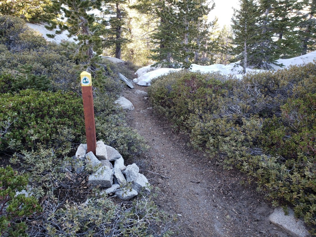
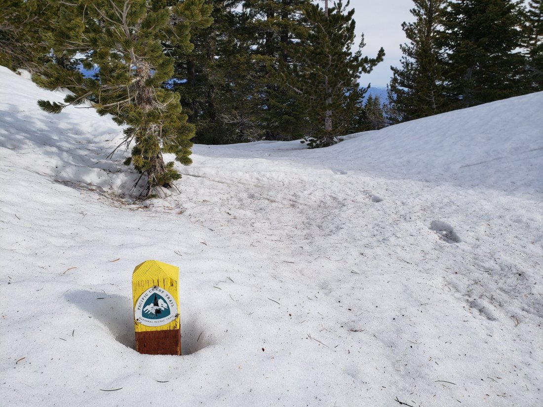
TRAIL CONDITIONS
Many trails above about 8800′ remain largely or partly snow-covered, although this is changing rapidly. Details for specific routes are below. Despite warmer weather overall, hikers should be prepared for temperatures at or below freezing in the high country (and colder when considering windchill effects), especially next week.
Major trails are now well traveled, and have obvious tracks. Routefinding is challenging in places for those not familiar with the area due to wandering, inaccurate tracks which often do not match the established trail routes, so use caution.
Pacific Crest Trail The trail is clear of snow from Highway 74 (Mile 151) to about Mile 174, except for tiny icy patches at Apache Peak, Mile 169.5. Between about Mile 174 and Mile 178, the trail is largely snow-covered, but with more snow-free areas opening up every day. Miles 179-181 and 182-184.5 are clear of snow.
Fuller Ridge Trail (approx. PCT Miles 185.5-190.5) is best traversed carrying microspikes used in conjunction with hiking poles. Snow patches are frequent enough to use microspikes for about half the five mile length of the Fuller Ridge Trail, specifically Miles 185.5-186, 187.2-187.7, and 188.5-190.4. Particularly on the northernmost two miles, the track does not follow the trail in many places, and there are a couple of steep challenging descents where hikers have clearly fallen. Please use caution. PCT hikers not comfortable with angled snow/ice travel should continue to consider the Black Mountain Road alternative. Fuller Ridge campground is clear of snow.
San Jacinto Peak trails On the eastern side, the Wellman Trail from Annie’s Junction (PCT turning at Mile 181.6) to Wellman Divide (9700′) is largely clear of snow, but microspikes are useful on those areas where stubborn icy snow patches remain. The Peak Trail from Wellman Divide to the Peak remains completely snow-covered and microspikes are recommended. There are multiple meandering tracks, most of which do not closely follow the trail route, so some caution with navigation is required. On the western side, the upper Deer Springs Trail from Little Round Valley to the Peak remains almost completely snow-covered, and note that the consolidated tracks are steep and do not closely follow the trail route. Microspikes are strongly recommended.
Black Mountain Road is clear of snow to the PCT. No microspikes are required to hike to the PCT. Just before the Fuller Ridge campground turning, the road is partly snow-covered at up to 2 feet deep, which continues in patches north of Fuller Ridge down to about 7200′ elevation. For vehicular access, Black Mountain Road has been cleared, repaired, and partially graded to the turning to Boulder Basin, and cleared and repaired to the PCT crossing.
Skyline Trail is clear. C2C hikers have not been encountering snow until past Long Valley Ranger Station.
Devil’s Slide Trail is clear of snow, with a couple of tiny icy patches near Saddle Junction.
Deer Springs Trail is clear of snow to Strawberry Junction (8100′). Snow is limited to small patches for the next mile north, before becoming largely continuous near the Marion Mountain Trail junction. The track above the Fuller Ridge junction up to San Jacinto Peak largely does not approximate to the true trail, and is steep and postholey in places.
Marion Mountain Trail is clear of snow to the viewpoint at 7500′. Above that there is only limited patchy snow at about 10% coverage all the way to the PCT at 8700′ elevation. Microspikes are not required for the ascent, but some hikers may find them useful for descending the uppermost 0.5 mile.
Tahquitz Peak trail from Chinquapin Flat [UPDATED Saturday 27th April] There are reasonable steps to follow through the snow. Microspikes in conjunction with hiking poles (or ideally an ice axe if you know how to use it) are strongly recommended for this perilous trail until it is completely clear of snow.
South Ridge Trail is clear of snow to Tahquitz Peak. There are a few tiny snow patches near the Peak, but with very well-defined steps. Microspikes are not required. South Ridge Road is clear of snow, but is impassable to vehicles near the top due to severe storm damage.
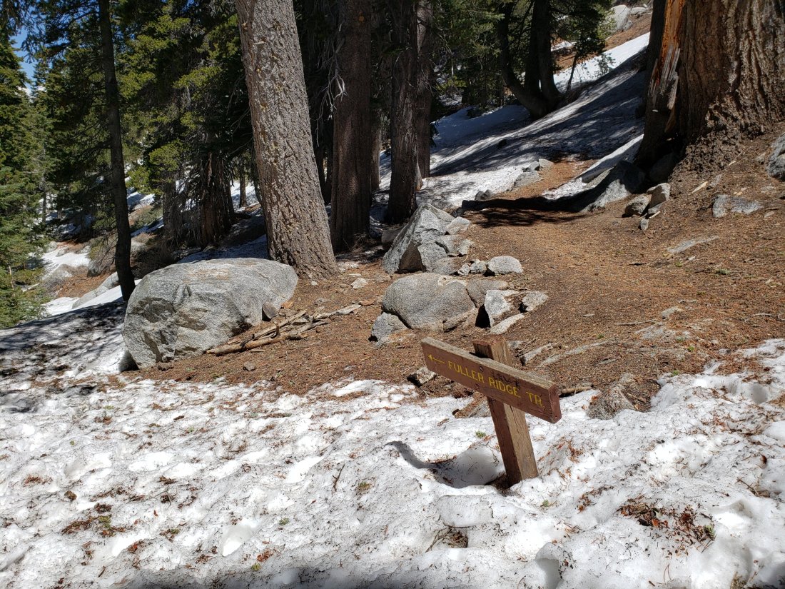
SNOW DEPTHS measured today (and on earlier dates as indicated) are as follows. Current average depth is given; drifts can be much deeper than the average in places. Altitudes are approximate.
San Jacinto Peak (10,810′): 25″ (75″ on 22nd March)
Little Round Valley (9800′): 22″
Wellman Divide (9700′): 12″ (on 22nd April)
Pacific Crest Trail at south end of Fuller Ridge Trail (8950′): 10″
Pacific Crest Trail at top of Marion Mountain Trail (8700′): 17″ (on 18th April)
Annie’s Junction (PCT at State Park boundary north of Saddle Junction) (9050′): 10″ (on 22nd April)
Long Valley (8500′): 0″
Strawberry Junction (8100′): 0″ but with drifted patches
Saddle Junction (8070′): 0″ but with some drifted patches (20″ on 22nd March)


sanjacjonUncategorizedLeave a comment 5 MinutesEdit”Snow and trail update 25th April 2019″
Snow and trail update 22nd April 2019
This morning we hiked to and from San Jacinto Peak via Devil’s Slide Trail and Wellman Divide. In recent days I have hiked South Ridge Trail to Tahquitz Peak, Deer Springs Trail, Marion Mountain Trail, and the southern end of Fuller Ridge Trail. The status of various water sources is largely unchanged from an earlier report (linked here). I recorded the following video at 0910 this morning at San Jacinto Peak.https://video.wordpress.com/embed/cmXDaI7S?hd=0&autoPlay=0&permalink=1&loop=0&preloadContent=metadata&muted=0&playsinline=0&controls=1
Just like last Tuesday 16th, there was some brief precipitation later in the day after I recorded the video. In Idyllwild we received 0.1″ of rain in the afternoon, but again the high country was largely above the cloud. Other than continued rapid melting of snow, trail conditions are not substantially changed from last week.
Microspikes in combination with hiking poles continue to be recommended throughout the high country above 8700′ (and lower in some areas e.g., Fuller Ridge). Microspikes are sufficient traction to hike the PCT throughout the San Jacinto mountains.
WEATHER Despite cooler conditions today, temperatures will be at or above average for the foreseeable future, with very rapid snow melt continuing at all elevations. There is no notable precipitation in the forecast before May.
At San Jacinto Peak (10,810ft/3295m) today, 22nd April 2019, at 0900 the air temperature was 29°F (-2°C), with a windchill temperature of 11.8°F (-11°C), 55% relative humidity, and a brisk due North wind at 11 mph gusting to 17 mph.
At the Peak on 18th April 2019, at 0900 the air temperature was 41°F (5°C), with a windchill temperature of 31°F (-1°C), 38% relative humidity, and a cool NE wind at 11 mph gusting to 14 mph.
At the Peak on 16th April 2019 at 0855, the air temperature was 25.5°F (-4°C), with a windchill temperature of 7.7°F (-14°C), 100% relative humidity, and a bitter due West wind at 10 mph gusting to 26 mph.
TRAIL CONDITIONS
Many trails above about 8700′ remain largely or partly snow-covered, although this is changing rapidly. Details for specific routes are below. Despite warmer weather overall, hikers should be prepared for temperatures at or near freezing in the high country (and colder when considering windchill effects).
Many major trails are now well traveled, and have obvious, consolidated tracks. Routefinding is challenging in places for those not familiar with the area due to wandering, inaccurate tracks which often do not match the established trail routes, so use caution.
Pacific Crest Trail The trail is clear of snow from Highway 74 (Mile 151) to about Mile 174, except for some small icy snow patches at Apache Peak, Mile 169.5. Some hikers will find microspikes useful for that area, although it is now passable without spikes for those experienced on angled snow travel in appropriate footwear. Between about Mile 174 and Mile 178, the trail averages about 90% snow-covered, but with more snow-free areas opening up every day. Miles 179-181 and 182-184.5 are largely free of snow.
Fuller Ridge Trail (PCT Miles 185.5-190.5) is best traversed with microspikes and at least hiking poles. The short sections that face south and on top of the ridge are now largely snow-free, but the majority of the trail remains snow-covered and is challenging in places. PCT hikers not comfortable with angled snow/ice travel should continue to consider the Black Mountain Road alternative.
San Jacinto Peak trails On the eastern side, the Wellman Trail from Annie’s Junction (PCT turning at Mile 181.6) to Wellman Divide (9700′) is largely clear of snow, but microspikes are useful on those areas where stubborn icy snow patches remain. The Peak Trail from Wellman Divide to the Peak remains completely snow-covered and microspikes are recommended. There are multiple meandering tracks, most of which do not closely follow the trail route, so some caution with navigation is required. On the western side, the upper Deer Springs Trail from Little Round Valley to the Peak remains almost completely snow-covered, and note that the consolidated tracks are steep and do not closely follow the trail route. Microspikes are strongly recommended.
Black Mountain Road is clear of snow to the PCT/Fuller Ridge campground. No microspikes are required to hike to the PCT. Beyond the Fuller Ridge campground turning, the road is partly snow-covered at up to 2 feet deep down to about 7200′ elevation. Black Mountain Road has been graded and is now passable to vehicles to the PCT crossing near Fuller Ridge campground.
Skyline Trail is clear of snow to about 7200′. Microspikes are useful but not essential above that elevation. There is an obvious track to follow through the short snow-covered patches.
Devil’s Slide Trail is clear of snow, with a couple of tiny icy patches near the top.
Deer Springs Trail is clear of snow to Strawberry Junction (8100′). Snow is limited to small patches for the next mile north, before becoming largely continuous near the Marion Mountain Trail junction. The track above the Fuller Ridge junction up to San Jacinto Peak largely does not approximate to the true trail, and is steep and postholey in places.
Marion Mountain Trail is clear of snow to the viewpoint at 7500′. Above that there is only patchy snow at about 20% coverage all the way to the PCT at 8700′ elevation. Microspikes are not required for the ascent, but are useful for descending the uppermost 0.5 mile.
Tahquitz Peak trail from Chinquapin Flat remains very treacherous. There are no tracks or steps to follow. Crampons in conjunction with an ice axe are strongly recommended for this section. It is possible to pass between the PCT and Tahquitz Peak along the top of Tahquitz Ridge with caution.
South Ridge Trail is clear of snow to Tahquitz Peak. There are a few small snow patches near the Peak, but with very well-defined steps. Microspikes are not required. South Ridge Road is clear of snow, but is impassable near the top due to severe storm damage.
SNOW DEPTHS measured today (and on 18th April as indicated) are as follows. Current average depth is given; drifts can be much greater than the average depth. Altitudes are approximate.
San Jacinto Peak (10,810′): 25″ (75″ on 22nd March)
Little Round Valley (9800′): 24″ (on 18th April)
Wellman Divide (9700′): 12″ (43″ on 22nd March)
Pacific Crest Trail at south end of Fuller Ridge Trail (8950′): 20″ (on 18th April)
Pacific Crest Trail at top of Marion Mountain Trail (8700′): 17″ (on 18th April)
Annie’s Junction (PCT at State Park boundary north of Saddle Junction) (9050′): 10″ (34″ on 22nd March)
Long Valley (8500′): 0″
Strawberry Junction (8100′): 1″ (on 18th April)
Saddle Junction (8070′): 0″ but with some drifted patches (20″ on 22nd March)
sanjacjonUncategorized1 Comment 4 MinutesEdit”Snow and trail update 22nd April 2019″
Snow and trail update 18th April 2019
[ACCESS UPDATE: Caltrans has announced that starting Saturday 21st April there will be limited access on Highway 74 between Mountain Center and Hemet, in two time windows 0500-0800 and 1800-0000.]
This morning we hiked Marion Mountain and Deer Springs trails to San Jacinto Peak. Two days earlier we hiked to and from San Jacinto Peak via Devil’s Slide Trail and Wellman Divide, in damp, cloudy, windy conditions.
Road access issues and the status of various water sources were updated last week (linked here) and will only be revised when there are noteworthy changes to report.
I recorded the following video on 16th April at San Jacinto Peak.https://video.wordpress.com/embed/4KGqnEUK?hd=0&autoPlay=0&permalink=1&loop=0&preloadContent=metadata&muted=0&playsinline=0&controls=1
Shortly after I recorded the video, we were very briefly snowed on as we descended through 10,000′, just some tiny rounded grains that completely failed to accumulate. In Idyllwild we received barely 0.02″ of drizzle, mainly in the afternoon, when the high country was above the cloud. Trail and snow conditions are largely unchanged from last week, other than some continued melting.
Microspikes in combination with hiking poles continue to be recommended throughout the high country above 8500′ (and lower in some areas, e.g., Fuller Ridge). Microspikes are sufficient to hike all of the PCT in the San Jacinto mountains at present.
WEATHER After a very brief reminder of winter on 16th, summer returned the next day. Temperatures will be above (or well above) average for the foreseeable future, with very rapid snow melt continuing at all elevations. There is no notable precipitation in the forecast.
At San Jacinto Peak (10,810ft/3295m) today, 18th April 2019, at 0900 the air temperature was 41°F (5°C), with a windchill temperature of 31°F (-1°C), 38% relative humidity, and a cool NE wind at 11 mph gusting to 14 mph.
At the Peak on 16th April 2019 at 0855, the air temperature was 25.5°F (-4°C), with a windchill temperature of 7.7°F (-14°C), 100% relative humidity, and a bitter due West wind at 10 mph gusting to 26 mph.
At the Peak on Friday 12th April 2019 at 0910, the air temperature was 22°F (-6°C), with a windchill temperature of 3.8°F (-16°C), 55% relative humidity, and a moderate due North wind at 8 mph gusting to 18 mph.
TRAIL CONDITIONS
Many trails above about 8700′ remain largely snow-covered, although this is changing rapidly. Details for specific routes are below. Despite warmer weather overall, hikers should be prepared for temperatures at or near freezing in the high country (and colder when considering windchill effects).
Waterproof footwear is useful on approach trails (e.g., Devil’s Slide, lower Deer Springs) due to multiple stream crossings and considerable water flowing in the trails. It will also be invaluable for the next few weeks in soft melting snow.
Many major trails are now well traveled, and have obvious, consolidated tracks. Routefinding is challenging in places for those not familiar with the area due to wandering, inaccurate tracks however, so use caution. Some PCT marker posts above 8500′ remain snow-covered.
Pacific Crest Trail The trail is clear of snow from Highway 74 (Mile 151) to about Mile 173, except for the challenging area at Apache Peak, Mile 169.5. Most hikers will find microspikes useful for that area, although it is now passable without spikes for those experienced on angled snow travel in appropriate footwear. Between about Mile 174 and Mile 191, much of the trail averages about 80% snow-covered, but with more snow-free areas opening up every day. Miles 179-181 and 182-184.5 are largely free of snow.
Fuller Ridge Trail is best traversed with microspikes and at least hiking poles. The short sections that face south and on top of the ridge are now largely snow-free, but the majority of the trail remains snow-covered and challenging. PCT hikers not comfortable with angled snow/ice travel should continue to consider the Black Mountain Road alternative.
Black Mountain Road is clear of snow until about 7000′ (5 miles up). From the Boulder Basin junction to the PCT/Fuller Ridge campground (miles 5 to 8) there is only about 10% snow cover. No microspikes are required to hike to the PCT. Note that Black Mountain Road is currently accessible to vehicles to about 4.5 miles up from Highway 243. Beyond the Fuller Ridge campground turning, the road is continuously snow-covered at 1-3 feet deep down to about 7000′ elevation. Black Mountain Road is being graded over the next ten days, and should be passable to vehicles (at least to Fuller Ridge) by about 25th April.
Skyline Trail is clear of snow to 7200′. Microspikes and hiking poles are sufficient above that elevation, although an ice axe (if you know how to use it) could be useful on the traverse chutes. There is an obvious track to follow through the snow-covered section.
Devil’s Slide Trail is clear of snow, with short icy snow patches near Saddle Junction.
Deer Springs Trail is clear of snow to Strawberry Junction (8100′). Snow is limited to patches for the next mile north, before becoming continuous near the Marion Mountain Trail junction. The track above the Fuller Ridge junction up to San Jacinto Peak largely does not approximate to the true trail, and is steep and postholey in places.
Marion Mountain Trail is clear of snow to the viewpoint at 7500′. Above that there is only patchy snow at about 20% coverage all the way to the PCT at 8700′ elevation. Microspikes are not required for the ascent, but are useful for descending the uppermost 0.5 mile.
Tahquitz Peak trail from Chinquapin Flat remains very treacherous. There are no tracks or steps to follow. Crampons in conjunction with an ice axe are very strongly recommended for this section. It is possible to pass between the PCT and Tahquitz Peak along the top of Tahquitz Ridge with caution.
South Ridge Trail is almost completely clear of snow to Tahquitz Peak. Above Old Lookout Flat (7800′) there are occasional snow patches, mainly near the Peak, but with very well-defined steps. Microspikes are not required. South Ridge Road is clear of snow, but is impassable near the top due to severe storm damage.
SNOW DEPTHS measured on 16th and 18th April are as follows. Current average depth is given; drifts can be much greater than the average depth. Altitudes are approximate.
San Jacinto Peak (10,810′): 28″ (75″ on 22nd March)
Little Round Valley (9800′): 24″
Wellman Divide (9700′): 16″ (43″ on 22nd March)
Pacific Crest Trail at south end of Fuller Ridge Trail (8950′): 20″
Pacific Crest Trail at top of Marion Mountain Trail (8700′): 17″
Annie’s Junction (PCT at State Park boundary north of Saddle Junction) (9050′): 14″ (34″ on 22nd March)
Long Valley (8500′): 0.5″
Strawberry Junction (8100′): 1″
Saddle Junction (8070′): 2″ (20″ on 22nd March)

sanjacjonUncategorizedLeave a comment 4 MinutesEdit”Snow and trail update 18th April 2019″
Trail update 12th April 2019
This morning we hiked to San Jacinto Peak via Devil’s Slide Trail and Wellman Divide, descending the same way. The past few days have included hikes on the north and south ends of Fuller Ridge, Black Mountain Road, Deer Springs Trail, and Spitler and Apache peaks.
Detailed trail conditions are discussed below, with measured snow depths at the foot of this post. Road access issues and the status of various water sources were updated earlier this week (linked here) and for the foreseeable future will only be revised when there are noteworthy changes to report.
I recorded the following vlog this morning at San Jacinto Peak.https://video.wordpress.com/embed/0iZuq0T6?hd=0&autoPlay=0&permalink=1&loop=0&preloadContent=metadata&muted=0&playsinline=0&controls=1
Microspikes in combination with hiking poles (or in some situations an ice axe if you know how to use it) continue to be recommended throughout the high country. Microspikes are sufficient to hike all of the PCT in the San Jacinto mountains at present.
WEATHER Temperatures will be at or above average for the foreseeable fuure, with extensive snow melt continuing at all elevations. There is no notable precipitation in the forecast.
At San Jacinto Peak (10,810ft/3295m) today 12th April 2019 at 0910, the air temperature was 22°F (-6°C), with a windchill temperature of 3.8°F (-16°C), 55% relative humidity, and a due North wind at 8 mph gusting to 18 mph.
At the Peak on Monday 8th April at 0905 the air temperature was 49°F (9°C), with a windchill temperature of 48°F (9°C), 19% relative humidity, and a barely discernible West breeze at 2 mph gusting to 4 mph.

TRAIL CONDITIONS
Most trails above about 8500′ remain largely snow-covered. Trail conditions will continue to change rapidly with more melting. Details for specific routes are below. Despite warmer weather overall, hikers should still be prepared for temperatures near freezing in the high country (and colder when considering windchill effects).
Waterproof footwear is useful on approach trails (e.g., Devil’s Slide, lower Deer Springs) due to multiple stream crossings and considerable water flowing in the trails. It is also invaluable in the soft melting snow in many areas, especially after mid-morning.
Many major trails have been well traveled in the past week, so they have obvious, well consolidated tracks. Routefinding is challenging in places for those not familiar with the area due to wandering, inaccurate tracks however, so use caution. Some signage above about 8500′ remains snow-covered, including PCT marker posts.
Pacific Crest Trail The trail is clear of snow from Highway 74 (Mile 151) to about Mile 173, except for the challenging section at Mile 169.5, discussed in detail a few days ago. Between about Mile 174 and Mile 191, much of the trail averages 90% snow-covered, but with more snow-free areas opening up every day. Miles 180-181 and 182-184 are now largely free of snow.
Fuller Ridge Trail should not be attempted without microspikes and at least hiking poles. Significant sections remain challenging. PCT hikers not familiar with angled snow/ice travel should consider the Black Mountain Road alternative to Fuller Ridge, at least for the next few days.
Black Mountain Road is clear of snow until about 7000′ (5 miles up). From the Boulder Basin junction to the PCT/Fuller Ridge campground (miles 5 to 8) there is only about 10% snow cover. No microspikes are required to hike to the PCT. Note that Black Mountain Road is currently accessible to vehicles to about 4.5 miles up from Highway 243. Beyond the Fuller Ridge campground turning, the road is continuously snow-covered at 1-3 feet deep down to about 7000′ elevation.
Skyline Trail is clear of snow to 7200′. Microspikes and hiking poles are sufficient above that elevation, although an ice axe (if you know how to use it) could be useful on the traverse chutes. There is an obvious track to follow through the snow-covered section.
Devil’s Slide Trail is clear of snow, with a short icy snow section near Saddle Junction.
Deer Springs Trail is clear of snow to Strawberry Junction (8100′), except for a few tiny patches near the Junction. Snow is limited to patches for the next mile north, before becoming continuous near the Marion Mountain Trail junction. The track above the Fuller Ridge junction up to San Jacinto Peak does not approximate to the true trail, and is steep and postholey in places.
Marion Mountain Trail has been hiked and has a reasonable track to follow. Snow is patchy above about 7600′ and is nearly continuous above about 8300′.
Tahquitz Peak trail from Chinquapin Flat remains very treacherous. Last week I made the first traverse of this trail for several weeks. There are no tracks or steps to follow. Crampons in conjunction with an ice axe are very strongly recommended for this section. It is possible to pass between the PCT and Tahquitz Peak along the top of Tahquitz Ridge with caution.
Ernie Maxwell Trail is clear of snow.
South Ridge Trail is almost completely clear of snow to Tahquitz Peak. Above Old Lookout Flat (7800′) there are occasional snow patches, mainly near the Peak, but with very well-defined steps. Microspikes are not required. South Ridge Road is clear of snow, but is impassable near the top due to severe storm damage.
SNOW DEPTHS measured today are as follows, with additional data from 8th April included. Total depth is given. Drifts can be much greater than the average depth. Altitudes are approximate.
San Jacinto Peak (10,810′): 35″ (75″ on 22nd March)
Little Round Valley (9800′): 34″ on 8th April
Wellman Divide (9700′): 19″ (43″ on 22nd March)
Pacific Crest Trail at south end of Fuller Ridge Trail (8950′): 30″ on 8th April
Pacific Crest Trail at top of Marion Mountain Trail (8700′): 25″ on 8th April
Annie’s Junction (PCT at State Park boundary north of Saddle Junction) (9050′): 15″ (34″ on 22nd March)
Strawberry Junction (8100′): 2″ on 8th April
Saddle Junction (8070′): 3″ (20″ on 22nd March)


sanjacjonUncategorizedLeave a comment 4 MinutesEdit”Trail update 12th April 2019″
Apache ice update 9th April 2019
Anabel and I hiked back-and-forth across the snow on the north-east flank of Apache Peak (PCT Mile 169.5) early this morning. Conditions are much improved, and it is fairly easy to cross with care and microspikes. I met a few hikers who were making the wise decision (for their comfort level) of using the Spitler Peak Trail alternate to avoid this section. I recorded the following video on site (in a wild wind storm, sorry).https://video.wordpress.com/embed/Q79Izt6d?hd=0&autoPlay=0&permalink=1&loop=0&preloadContent=metadata&muted=0&playsinline=0&controls=1
[If you have any trouble viewing this video, it is also available at this link on YouTube.]
All other trail and snow info is in yesterday’s full update.sanjacjonUncategorizedLeave a comment 1 MinuteEdit”Apache ice update 9th April 2019″
Snow, trail and water update 8th April 2019
This morning I hiked to San Jacinto Peak up the eastern side from Devil’s Slide Trail via Wellman Divide, descending the western side down Deer Springs Trail. The past week has included hikes on half-a-dozen local parts of the PCT, plus Spitler Peak Trail, Cedar Springs Trail, Tahquitz Peak and the Tahquitz area meadows.
Detailed trail conditions are discussed below, and measured snow depths and current access problems are described near the foot of this posting. Access to Black Mountain Road from Idyllwild became possible this afternoon due to a short section of Highway 243 reopening.
I have also added the status of various water sources, mainly for the benefit of thru-hikers. Some sources in the high country are still inaccessible under snow, while I have noticed some minor ephemeral streams are already drying up. Of course snow is available for melting in the high country also.
The most challenging PCT hiking problem continues to be around Apache Peak. I talked to many thru-hikers on Sunday about their experiences in this area, and I plan to check it again tomorrow.
I recorded the following vlog this morning at San Jacinto Peak.https://video.wordpress.com/embed/34HyFTpW?hd=0&autoPlay=0&permalink=1&loop=0&preloadContent=metadata&muted=0&playsinline=0&controls=1
In the blog I describe fairly good snow conditions for my ascent this morning. The descent was softer with more postholing, especially through Little Round Valley. Overall snow conditions are more reminiscent of mid May than early April. Temperatures above seasonal have resulted in substantial snow melt at all elevations. Melting has also made snow conditions more uniform (and hence easier underfoot when cold and hard) and consolidated trails are good for fairly easy hiking. However, soft snow from mid morning onwards can result in some postholing and sliding later in the day.
Microspikes, in combination with hiking poles or, in some situations, an ice axe (if you know how to use it) are recommended throughout the high country. Microspikes are sufficient to hike all of the PCT in the San Jacinto mountains at present. Crampons (always with an ice axe) may be useful for those hikers who are less confident on angled snow and ice. Snowshoes continue to have some use for off-trail travel only, in flatter terrain, and especially in softer afternoon snow. I saw tracks of folks hiking the Peak and PCT without spikes, but also much evidence of them slipping and sliding.

WEATHER Temperatures will be below seasonal for the next few days, resulting in excellent snow hiking conditions, then above average thereafter, with extensive snow melt resuming at all elevations.
At San Jacinto Peak (10,810’/3295m) today 8th April 2019 at 0905, the air temperature was 49°F (9°C), with a windchill temperature of 48°F (9°C), 19% relative humidity, and a barely discernible West breeze at 2 mph gusting to 4 mph.
Weather at the Peak on 1st April 2019 was almost identical to today. At 0930 the air temperature was 49°F (9°C), with a windchill temperature of 48°F (9°C), 17% relative humidity, and largely calm conditions with an occasional West breeze to 2 mph.

TRAIL CONDITIONS
Most trails above about 8200′ remain largely snow-covered. Trail conditions will continue to change rapidly with more melting. Details for specific routes are below. Despite warmer weather overall, hikers should be prepared for temperatures below freezing in the high country (>8,000’/2300m elevation) over the next few days, and even colder when considering windchill effects.
Waterproof footwear is useful on approach trails (e.g., Devil’s Slide, lower Deer Springs) due to multiple stream crossings and considerable water flowing in the trails. It is also invaluable in the soft melting snow in many areas, especially after mid-morning.
Many major trails have been well traveled in the past week, so they have obvious, well consolidated tracks. Routefinding is challenging in places for those not familiar with the area due to wandering, inaccurate tracks however, so use caution. Some signage above about 8500′ remains snow-covered, including many PCT marker posts.
Pacific Crest Trail The trail is clear of snow from Highway 74 (Mile 151) to about Mile 173, except for the challenging section at Mile 169.5. Between about Mile 173 and Mile 191, the trail averages 90% snow-covered, but with more snow-free areas opening up every day. Miles 182 to 184 are now largely free of snow.
Fuller Ridge Trail should not be attempted without microspikes, ideally with an ice axe (if you know how to use one), or at least hiking poles. Significant sections remain challenging. PCT hikers not familiar with angled snow/ice travel should consider the Black Mountain Road alternative to Fuller Ridge, at least for the next few days.
Black Mountain Road is clear of snow until about 7000′ (5 miles up). From the Boulder Basin junction to the PCT/Fuller Ridge campground (miles 5 to 8) snow cover is patchy. Note that Black Mountain Road is now accessible due to the reopening of a short section of Highway 243.
Skyline Trail is clear of snow to 7200′. Microspikes and hiking poles are sufficient above that elevation, although an ice axe (if you know how to use it) could be useful on the traverse chutes. There is an obvious track to follow through the snow-covered section. [Thanks to Chris Dow and others for this update.]
Devil’s Slide Trail is largely clear of snow, with a few icy snow patches near Saddle Junction. Some hikers will find microspikes useful, especially for descending.
Deer Springs Trail is clear of snow to Strawberry Junction (8100′), except for a few tiny patches near the Junction. Snow is limited to patches for the next mile north, before becoming continuous near the Marion Mountain Trail junction. The track above the Fuller Ridge junction up to San Jacinto Peak does not approximate to the true trail, and is steep and postholey in places.
Marion Mountain Trail has been hiked and has a reasonable track to follow. Snow is patchy above about 7500′ and is nearly continuous above about 8200′.
Tahquitz Peak trail from Chinquapin Flat remains very treacherous. Last week I made the first traverse of this trail for several weeks. Crampons in conjunction with an ice axe are very strongly recommended for this section. It is possible to pass between the PCT and Tahquitz Peak along the top of Tahquitz Ridge with caution.
Ernie Maxwell Trail is clear of snow.
South Ridge Road is clear of snow, but is impassable near the top due to severe storm damage. South Ridge Trail is largely clear of snow to Tahquitz Peak. Above Old Lookout Flat (7800′) there is about 30% patchy snow coverage. Microspikes are valuable for descending – and can be useful for ascending – the switchbacks above 8500′, especially when icy in the early morning.
SNOW DEPTHS measured today are as follows. Current total depth is given. Drifts can be much greater than the average depth. Altitudes are approximate.
San Jacinto Peak (10,810′): 38″ (75″ on 22nd March) (online reports of 6-8 feet at the Peak are wildly inaccurate!)
Little Round Valley (9800′): 34″
Wellman Divide (9700′): 23″ (43″ on 22nd March)
Annie’s Junction (PCT at State Park boundary north of Saddle Junction) (9050′): 20″ (33″ on 12th March)
Pacific Crest Trail at south end of Fuller Ridge Trail (8950′): 30″
Pacific Crest Trail at top of Marion Mountain Trail (8700′): 25″
Annie’s Junction (PCT at State Park boundary north of Saddle Junction) (9050′): 16″ (34″ on 22nd March)
Long Valley (8500′): 2″ (per State Park)
Strawberry Junction (8100′): 2″
Saddle Junction (8070′): 6″ (20″ on 22nd March)

WATER STATUS: Eastern slope
The Round Valley faucet is not flowing (per Mount San Jacinto State Park).
Both the northern and southern springs at Wellman’s Cienega are flowing well. These are the sources for Willow Creek, which is flowing well where it crosses the Willow Creek Trail.
Tahquitz Valley is flowing.
Tahquitz Creek is flowing well at the northern end of Little Tahquitz Meadow. It is also flowing well further upstream at its source (known locally as Grethe Spring) where it crosses the PCT (approx. PCT Mile 177).
Skunk Cabbage Creek – that flows through Skunk Cabbage Meadow and then crosses the Caramba Trail near Reeds Meadow – is currently flowing well.
WATER STATUS: Western slope
The North Fork of the San Jacinto River is not accessible under snow where it crosses the Deer Springs Trail above Fuller Ridge. It is accessible where it crosses the Fuller Ridge Trail on the PCT (approx. PCT Mile 186.2).
O’Sullivan Creek (PCT Mile 186.4) on Fuller Ridge Trail is flowing well.
The spring in the creek in Little Round Valley is wholly under snow but is close to being snow-free.
Shooting Star Spring (below Little Round Valley but above the North Fork of the San Jacinto River crossing) is currently hidden under snow.
The Deer Springs stream crossing at the PCT (approx. PCT mile 185.6) is wholly snow-covered. [PCT hikers note: almost all PCT guides and apps confuse the Deer Springs crossing with the North Fork of the San Jacinto River. The latter is another 0.5 miles further north on the Fuller Ridge Trail, see above.]
Switchback Spring at PCT Mile 183.5 (about 0.4 miles north of Strawberry Junction) is flowing well.
The little creek at Strawberry Cienega (PCT mile 183.0) is flowing well.
On Devil’s Slide Trail, Jolley, Middle, and Powderbox springs are all flowing strongly, as are several unnamed ephemeral creeks.
On the Ernie Maxwell Trail, the crossing of Chinquapin Creek just below Humber Park continues to flow very well, as do several other creeks that cross the trail.
WATER STATUS: Desert Divide
Highway 74 There is a water cache where the PCT crosses Highway 74, on the south side of the highway. This appears to be reliably maintained, but never assume water caches will definitely be there.
Pool 3.5 miles north of Highway 74 is flowing.
Live Oak Spring (N 33 37 21, W 116 33 24) Flowing well. The most reliable water source on the Desert Divide.
Cedar Spring (N 33 40 36, W 116 34 35) Flowing well. Easiest access is the trough just upstream from the trail to the campsite.
Apache Spring (N 33 43 11, W 116 37 13) Flowing fairly well, but the access tail off the PCT is unclear. Easier to get water from Spitler Creek described below.
Spitler Peak Trail Descending the trail there are five water crossings. The first two, at 0.9 and 0.95 miles down, cross a tiny side creek which is already drying up and should be ignored. The next crossing, at 1.1 miles down, is Spitler Creek and is the best source of water (currently flowing well). The next two crossings are the same creek, but for obvious reasons it is best to fill up at the highest of the three crossings.
Antsell Rock Creek (N 33 41 52, W 116 39 08) Right by the Spitler Peak Trail trailhead on Apple Canyon Road, Antsell Rock Creek is flowing very well. Just on the upstream side of the road there is excellent access to the creek.
ACCESS CLOSURES The Valentine’s Day flood events continue to make access to the San Jacinto mountains challenging. Highway 243 between Banning and Idyllwild is closed from north of Bay Tree Spring to just north of Lake Fulmor. The remaining closed section may not reopen until July or later. Highway 74 between Mountain Center and Hemet may partially reopen – with a pilot car and restricted hours – by May. Whitewater Preserve (PCT Mile 218.5) recently announced that they will not be able to accommodate day use or overnight PCT hikers this year, due to severe damage to Whitewater Canyons roads and trails. Currently the trail from the PCT to Whitewater is non-existent and requires a wide water crossing with quickly flowing water.


sanjacjonUncategorized3 Comments 8 MinutesEdit”Snow, trail and water update 8th April 2019″
Apache ice update 2nd April 2019
Anne, Anabel and I hiked to the challenging icy snow traverse around Apache Peak (approx PCT Mile 169.5) this morning. I recorded the following video at about 0950. With care, this section will now be readily passable for most folks with microspikes. All other trail info was updated yesterday in the report linked here.https://video.wordpress.com/embed/ssJEPQTs?hd=0&autoPlay=0&permalink=1&loop=0&preloadContent=metadata&muted=0&playsinline=0&controls=1 sanjacjonUncategorized1 Comment 1 MinuteEdit”Apache ice update 2nd April 2019″
Snow and trail update 1st April 2019
This morning we hiked briskly to San Jacinto Peak from Devil’s Slide Trail via Wellman Divide, descending the same way. On Saturday we hiked to Tahquitz Peak via South Ridge. Detailed trail conditions are discussed below and both measured snow depths and current access problems are described near the foot of this posting.
Currently the most challenging PCT problem is around Apache Peak. I talked to many thru-hikers on Sunday about their experiences in this area, and I will be checking it again tomorrow. I recorded the following vlog this morning at San Jacinto Peak.https://video.wordpress.com/embed/G5OnMFQr?hd=0&autoPlay=0&permalink=1&loop=0&preloadContent=metadata&muted=0&playsinline=0&controls=1
Sadly, snow conditions are more reminiscent of 1st May than of 1st April. Temperatures above seasonal norms have resulted in significant snow melt at all elevations. San Jacinto Peak has lost 15″ to 35″ of snow in the past 20 days, depending on specifc location, due to melting and consolidation. Melting has also made snow conditions more uniform (and hence easier underfoot in the mornings) and consolidated trails are currently virtually perfect for fast easy hiking. However, soft snow from late morning onwards can result in some postholing and sliding later in the day.
Microspikes, in combination with hiking poles or, in some situations, an ice axe (if you know how to use it) are recommended throughout the high country. With prior experience on angled snow, and considerable care, microspikes are sufficient to hike all of the PCT in the San Jacinto mountains at present. Crampons (always with an ice axe) will be useful for those hikers who are less confident on angled snow and ice, especially around Apache Peak for the next couple of days. Snowshoes continue to have some use for off-trail travel in flatter terrain, especially in softer afternoon snow.

WEATHER Temperatures will be seasonal for the next few days, then well above average thereafter, with extensive snow melt at all elevations. Highs may reach near-summer temperatures next week. There is a possibility of light precipitation overnight on 4th-5th April, with a light dusting of snow in the high country.
At San Jacinto Peak (10,810’/3295m) today 1st April 2019, at 0930 the air temperature was 49°F (9°C), with a windchill temperature of 48°F (9°C), 17% relative humidity, and largely calm conditions with an occasional West breeze gusting to 2 mph.
In contrast, at the Peak on Thursday 28th March 2019, at 0935 the air temperature was 28°F (-2°C), with a windchill temperature of 9.9°F (-12°C), 15% relative humidity, and a sharp 15 mph West wind gusting to 27 mph.
TRAIL CONDITIONS
Almost all trails above about 8000′ remain snow-covered. With melting, trail conditions will continue to change rapidly. Details for specific routes are below. Despite warmer weather overall, hikers should be prepared for temperatures at or below freezing around the highest peaks (>10,000’/3000m elevation), and even colder when considering windchill effects.
Waterproof footwear is useful on approach trails (e.g., Devil’s Slide, lower Deer Springs) due to multiple stream crossings and considerable water flowing in the trails. It is also advisable due to the somewhat slushy quality of melting snow in many areas, especially after mid-morning.
Many major trails have been well traveled in the past week, so they have obvious, well consolidated tracks. Routefinding is challenging in places for those not familiar with the area due to wandering, inaccurate tracks however, so use caution. Some signage above about 9000′ remains snow-covered, including many PCT marker posts.
Pacific Crest Trail The trail is basically clear of snow from Highway 74 to about Mile 173, except for the challenging section at Mile 169.5. Between about Mile 173 and Mile 192, the trail is largely snow-covered, depths in places up to two feet, but with more snow-free areas opening up every day. Based on my own assessment, and in discussion with PCT hikers who have completed both areas, the icy snow at Apache Peak (Mile 169.5) is currently more treacherous than Fuller Ridge.
Fuller Ridge Trail should not be attempted without a minimum of microspikes, ideally with an ice axe (if you know how to use one), or at least hiking poles. Significant sections remain an icy snow slope. PCT hikers not familiar with angled snow/ice travel should consider the Black Mountain Road alternative to Fuller Ridge, at least for the next few days.
Black Mountain Road is clear of snow until about 7000′ (5 miles up). From the Boulder Basin junction to the PCT/Fuller Ridge campground (miles 5 to 8) snow cover is patchy. [Note that Black Mountain Road is not currently accessible to private vehicles due to the closures on Highway 243.]
Devil’s Slide Trail is largely clear of snow, with a few extended icy snow patches near Saddle Junction. Some hikers will find microspikes useful, especially for descending in the morning.
Deer Springs Trail is largely clear of snow to Strawberry Junction (8100′). There are confusing multiple tracks through the snow from near Marion Mountain Trail junction through to Fuller Ridge (roughly PCT Miles 184-186). Careful navigation is required. The track above the Fuller Ridge junction up to San Jacinto Peak does not closely approximate to the true trail, so again navigation is tricky.
Marion Mountain Trail has been hiked and has a reasonable track to follow. Snow is patchy above about 7000′ and is nearly continuous above about 7900′.
Tahquitz Peak trail from Chinquapin Flat remains very treacherous even as the snow softens. [UPDATE 4th April] After the first 0.1 mile, there are no tracks to follow and no sign of any attempt to traverse this trail for several weeks. Crampons in conjunction with an ice axe are very strongly recommended for this section. It is possible to pass between the PCT and Tahquitz Peak along the top of Tahquitz Ridge with caution.
Ernie Maxwell Trail is clear of snow.
South Ridge Road is clear of snow, but is impassable near the top due to severe storm damage. South Ridge Trail is largely clear of snow below Old Lookout Flat (7800′), but is about 50% snow-covered above it. Microspikes are valuable for descending – and can be useful for ascending – the switchbacks above 8500′, especially when icy in the early morning.
SNOW DEPTHS measured today are as follows. Current total depth is given. Drifts can be much greater than the average depth. Altitudes are approximate. For some snow depths on the western side trails last week, see the previous report linked here.
San Jacinto Peak (10,810′): 52″ (75″ on 22nd March)
Wellman Divide (9700′): 28″ (43″ on 22nd March)
Annie’s Junction (PCT at State Park boundary north of Saddle Junction) (9050′): 22″ (34″ on 22nd March)
Saddle Junction (8070′): 9″ (20″ on 22nd March)
Devil’s Slide trailhead at Humber Park (6500′): 0″ (5″ on 22nd March)
ACCESS CLOSURES The Valentine’s Day flood events continue to make access to the San Jacinto mountains challenging. Highway 243 between Banning and Idyllwild is closed from north of Bay Tree Spring to just north of Alandale. The section from near Alandale to Lake Fulmor will reopen in late April – allowing access to Black Mountain Road – but the remainder may not reopen until July or even later. Highway 74 between Mountain Center and Hemet will partially reopen – with a pilot car and restricted hours – by May. Whitewater Preserve (PCT Mile 218.5) recently announced that they will not be able to accommodate day use or overnight PCT hikers this year, due to severe damage to Whitewater Canyons roads and trails. Currently the trail from the PCT to Whitewater is non-existent and requires a wide water crossing with quickly flowing water.
sanjacjonUncategorized1 Comment 5 MinutesEdit”Snow and trail update 1st April 2019″
Snow and trail update 28th March 2019
[UPDATE 30th March: we hiked South Ridge to Tahquitz Peak this morning, and Ernie Maxwell Trail yesterday, and I have amended the text below accordingly.]
This morning (28th March) I hiked with Jenn Murdock to San Jacinto Peak from Devil’s Slide Trail via Wellman Divide, descending the same way. Yesterday I hiked Deer Springs and Fuller Ridge trails for search-and-rescue reasons, on 26th I hiked Spitler Peak Trail and the PCT north around Apache Peak, and on 25th up Black Mountain Road to the north end of Fuller Ridge. Many thanks to Tim Dailey and Jenn for supplementary information on the trails around Tahquitz Peak from their hike on 26th.
Detailed trail conditions are discussed below and both measured snow depths and current access problems are described near the foot of this posting. Currently the most challenging PCT problem is around Apache Peak, which I discuss in detail in a posting from two days ago. I recorded the following vlog this morning at San Jacinto Peak.https://video.wordpress.com/embed/Kp9SkTcq?hd=0&autoPlay=0&permalink=1&loop=0&preloadContent=metadata&muted=0&playsinline=0&controls=1
Temperatures above seasonal norms have resulted in significant snow melt at all elevations. San Jacinto Peak has lost 12″ to 30″ of snow in the past 16 days, depending on specifc location, due to melting and consolidation. Melting has also made snow conditions more uniform (and hence easier underfoot in the mornings) by reducing the dangerous ice layer just under the surface snow. Snow conditions yesterday and today were virtually perfect on the consolidated trails for fast easy hiking. However, soft snow from late morning onwards does result in moderate postholing later in the day.
Microspikes, in combination with hiking poles or, in some situations, an ice axe (if you know how to use it) are strongly recommended throughout the high country. With prior experience on angled snow, and considerable care, microspikes are sufficient to hike all of the PCT in the San Jacinto mountains at present. Crampons (always with an ice axe) will be useful for those hikers who are less confident on angled snow and ice, especially around Apache Peak for the next few days. Snowshoes continue to be useful for off-trail travel in flatter terrain, especially in softer afternoon snow.
WEATHER Temperatures will continue to be at or above average into early April, with extensive snow melt at all elevations, especially on sunny aspects and below 9000′. Highs may reach as high as 70°F (21°C) in Idyllwild on 1st April, and 90°F (32°C) in the desert. There is no notable precipitation in the forecast.
At San Jacinto Peak (10,810’/3295m) today, Thursday 28th March 2019, at 0935 the air temperature was 28°F (-2°C), with a windchill temperature of 9.9°F (-12°C), 15% relative humidity, and a sharp 15 mph West wind gusting to 27 mph.
At the Peak on Friday 22nd March 2019, at 1230 the air temperature was 29°F (-2°C), with a windchill temperature of 16.3°F (-9°C), 29% relative humidity, and a light 7 mph NW wind gusting to 11 mph.

TRAIL CONDITIONS
Almost all trails above about 7700′ remain snow-covered. With rapid melting, trail conditions will continue to change rapidly. Details for specific routes are below. Despite warmer weather overall, hikers should nevertheless be prepared for temperatures around freezing around the highest peaks (>10,000’/3000m elevation), and colder when considering windchill effects.
Waterproof footwear is useful on approach trails (e.g., Devil’s Slide, lower Deer Springs) due to multiple stream crossings and considerable water flowing in the trails. It is also advisable due to the somewhat slushy quality of melting snow in many areas, especially after mid-morning.
Many major trails have been well traveled in the past week, so they have obvious, well consolidated tracks. Routefinding is challenging in places for those not familiar with the area due to wandering, inaccurate tracks however, so use caution. Much signage above about 8500′ remains snow-covered, including many PCT marker posts.
Pacific Crest Trail The trail is essentially clear of snow from Highway 74 to about Mile 169. Between about Mile 174 and Mile 192, the trail is largely snow-covered, depths ranging from an inch to two feet. Based on my own assessment, and in discussion with PCT hikers who have completed the San Jacinto mountain section, the icy snow at Apache Peak (Mile 169.5) is currently more treacherous than Fuller Ridge.
Fuller Ridge Trail should not be attempted without a minimum of microspikes, ideally with an ice axe (if you know how to use one), or at least hiking poles. Significant sections remain largely a featureless icy snow slope. Crampons and ice axe remain recommended for those less comfortable on snow. PCT hikers not familiar with angled snow/ice travel should consider the Black Mountain Road alternative to Fuller Ridge.
Black Mountain Road is largely clear of snow for its lower four miles. Up to 7000′ (5 miles up) there is shallow patchy snow. From the Boulder Basin junction to the PCT/Fuller Ridge campground (miles 5 to 8) snow cover is extensive, from a few inches to two feet deep. At yellow post campsites 4 & 5, there is a large area clear of snow good for camping. Snow is largely soft and postholing is inevitable without snowshoes. Beyond Fuller Ridge, snow is largely 1-2′ deep, with deeper drifts, down to near Camp Lackey. [Note that vehicle access is currently not possible beyond 2.5 miles due to downed trees and snow. Black Mountain Road is not currently accessible to private vehicles due to the closures on Highway 243.]
Devil’s Slide Trail has only patchy snow to 7900′, but some patches are icy. The trail has been heavily traveled, is obvious, and some hikers will find microspikes ideal, especially for descending in the morning.
Deer Springs Trail is clear of snow to the Suicide Rock turning, and largely clear of snow from there to about 7800′. From there to Strawberry Junction (8100′) there is extensive soft snow cover, with a few hazardous sections of water flowing under snow bridges or on the trail route.
There are confusing multiple tracks through the snow from near Marion Mountain Trail junction through to Fuller Ridge (roughly PCT Miles 184-186). Careful navigation is required. The track above the Fuller Ridge junction up to San Jacinto Peak does not closely approximate to the true trail, so again navigation is tricky.
Marion Mountain Trail has been hiked and has a reasonable track to follow. Snow is patchy above about 7000′ and is nearly continuous above about 7600′.
Tahquitz Peak trail from Chinquapin Flat remains very treacherous even as the snow softens. There are no tracks to follow and no sign of any attempt to traverse this trail in the past couple of weeks. Crampons in conjunction with an ice axe are strongly recommended for this section. It is possible to pass from Tahquitz Peak to the PCT along the top of Tahquitz Ridge with extreme caution.
Ernie Maxwell Trail is clear of snow. [UPDATED 29th March]
[UPDATED 30th March] South Ridge Road is clear of snow, but is impassable near the top due to severe storm damage. South Ridge Trail is largely clear of snow below Old Lookout Flat (7800′), but is about 50% snow-covered above it. Microspikes are valuable for descending, and can be useful for ascending, the switchbacks above 8500′, especially when icy in the early morning.

SNOW DEPTHS measured yesterday and today are as follows. Current total depth is given. Drifts can be much greater than the average depth. Altitudes are approximate.
San Jacinto Peak (10,810′): 55″ (75″ on 22nd March)
Wellman Divide (9700′): 35″ (43″ on 22nd March)
Annie’s Junction (PCT at State Park boundary north of Saddle Junction) (9050′): 27″ (34″ on 22nd March)
Fuller Ridge Trail south end (8950′): 35″
Strawberry Junction (8100′): 7″ (but ranging from 0-15″)
Saddle Junction (8070′): 11″ (20″ on 22nd March)
Devil’s Slide trailhead at Humber Park (6500′): 0″ (5″ on 22nd March)
ACCESS CLOSURES The parking area at Humber Park has reopened, as has the trailhead access for Marion Mountain Trail. The Valentine’s Day flood events continue to make access to the San Jacinto mountains challenging. Palm Springs Aerial Tramway remains closed until 1st April (according to their website). Highway 243 between Banning and Idyllwild is closed from north of Bay Tree Spring to just north of Alandale. The section from near Alandale to Lake Fulmor may reopen in April – allowing access to Black Mountain Road – but the remainder may not reopen until July or even later. Highway 74 between Mountain Center and Hemet will partially reopen – with a pilot car and restricted hours – by May. Several minor roads around Idyllwild-Pine Cove remain partly closed or damaged. Apple Canyon Road (access for the Spitler Peak trailhead) is still flooded at Hurkey Creek and is recommended only for 4WD/high clearance vehicles. Whitewater Preserve (PCT Mile 218.5) recently announced that they will not be able to accommodate day use or overnight PCT hikers this year, due to severe damage to Whitewater Canyons roads and trails. Currently the trail from the PCT to Whitewater is non-existent and requires a wide water crossing with quickly flowing water.

sanjacjonUncategorized3 Comments 6 MinutesEdit”Snow and trail update 28th March 2019″
Apache ice update 26th March 2019
Just a quick vlog update on the challenging situation around PCT mile 169.5, on the north-east flank of Apache Peak. I was up there this morning, and at the north end of Fuller Ridge yesterday.https://video.wordpress.com/embed/RhSFL8ih?hd=0&autoPlay=0&permalink=1&loop=0&preloadContent=metadata&muted=0&playsinline=0&controls=1
Otherwise conditions remain largely unchanged from the previous Report linked here. I will be on Fuller Ridge tomorrow, and will do a complete update on 28th March after hiking San Jacinto Peak.sanjacjonUncategorized2 Comments 1 MinuteEdit”Apache ice update 26th March 2019″
Snow storm and trail update 22nd March 2019
[UPDATE 24th March 2019: Whitewater Preserve (PCT Mile 218.5) issued this statement today. “It is with heavy hearts that we have decided that due to the severe damage to Whitewater Canyons roads and trails that Whitewater Preserve will not be able to accommodate day use or overnight PCT hikers this year. There would be no phones available (landline or otherwise), no restrooms, no wifi, and no road access to be picked up or dropped off. Also as of right now the trail from the PCT to Whitewater is non-existent and requires a wide water crossing with quickly flowing water.”]
Today (22nd March) I hiked to San Jacinto Peak from Devil’s Slide Trail via Wellman Divide, descending the same way. On 21st we hiked the Spitler Peak Trail to the PCT between Apache and Spitler peaks, and on 20th to Tahquitz Peak via South Ridge. I recorded the following video at San Jacinto Peak at about 1230 today.https://video.wordpress.com/embed/QPonglxM?hd=0&autoPlay=0&permalink=1&loop=0&preloadContent=metadata&muted=0&playsinline=0&controls=1
Detailed trail conditions are below and measured snow depths are at the foot of this posting.
In classic San Jacinto mountains style, the snow conditions today were very different from just four days ago. We had a couple of inches of fresh snow overnight on 20th, and slightly more during the day on 21st. As the underlying snow was very icy due to recent cold days, the new snow created a challenging loose powder layer that was giving way on even moderate slopes. Above 8000′ I used snowshoes to break trail but with considerable slippage. Crampons would be a good option, but with heavy postholing in unbroken areas. Microspikes were useful below 8000′.
Carrying snowshoes (with poles), crampons (with ice axe), and microspikes, is the unfortunate but ideal combination at present, such is the variability of snow conditions due to altitude, aspect, and time of day.
Current road and trailhead access issues have changed and are discussed at the bottom of this post.

WEATHER Temperatures will be at or above average for the remainder of March, with extensive snow melt at all elevations, especially below 8000′. There is no notable precipitation in the forecast.
At San Jacinto Peak (10,810’/3295m) today, Friday 22nd March 2019, at 1230 the air temperature was 29°F (-2°C), with a windchill temperature of 16.3°F (-9°C), 29% relative humidity, and a light 7 mph NW wind gusting to 11 mph.
At the Peak on Monday 18th March 2019, at 0935 the air temperature was 30°F (-1°C), with a windchill temperature of 17.1°F (-8°C), 44% relative humidity, and a light 9 mph SSE wind gusting to 12.2 mph.

TRAIL CONDITIONS
All trails above about 6500′ were snow-covered today. As I descended today, very rapid melting was already underway below 7500′. This will continue for the foreseeable future, so trail conditions will once again change rapidly. Details for specific routes are below.
Despite warmer weather overall, hikers should nevertheless be prepared for temperatures at or below freezing in the high country (and colder when considering windchill effects).
Microspikes are recommended everywhere especially once trails have been broken and become consolidated, in particular for descending. Crampons with an ice axe (and knowledge of how to use both) are currently useful in many areas above 8000′, and they are strongly recommended for moderate angle slopes (PCT Miles 169-174, Fuller Ridge, Tahquitz Peak) at least until underlying snow conditions soften over the next few days. Snowshoes are recommended off-trail above about 7800′, for breaking trail everywhere at present, and may also be useful on-trail in soft afternoon snow on warmer days.
Waterproof footwear is useful on approach trails (e.g., Devil’s Slide, lower Deer Springs) due to multiple stream crossings and considerable water flowing in the trails. It is also advisable due to the slushy quality of melting snow in many areas, especially after mid-morning.
The limited number of trails that had obvious tracks over the past ten days have now been completely covered with fresh snow. As a result routefinding is challenging for those not familiar with the area. Most signage above about 8500′ is snow-covered. Most PCT marker posts are also completely obscured. Currently no trails have been broken other than my route today (and I would not recommend following that above 10,000′ as I took a very direct ascent route from the base of Miller Peak).
Pacific Crest Trail Shallow snow will quickly clear from Highway 74 to about Mile 165. Between Mile 169 and Mile 193, snow depths average 1-3 feet. See my video above for the specific problem around Apache Peak (Mile 169.5).
Fuller Ridge Trail has been traversed by very few hikers, carrying crampons/ice axe, however it remains a largely a featureless ice slope along almost all its five mile length. Crampons and ice axe remain very strongly recommended. The majority of PCT hikers (those who are not familiar with angled snow/ice travel) should consider the Black Mountain Road alternative to Fuller Ridge.
Black Mountain Road will quickly clear of snow for its lower 2.5 miles. Up to 7000′ (5 miles up) there is shallow patchy snow. From the Boulder Basin junction to the PCT/Fuller Ridge campground (miles 5 to 8) snow cover is continuous at 1-2′ deep. Snow is largely soft and extensive postholing is inevitable without snowshoes. Beyond Fuller Ridge, snow is largely 1-2′ deep, with deeper drifts, almost to Camp Lackey. [Note that vehicle access is not possible beyond 2.5 miles due to downed trees and snow. Black Mountain Road is not currently accessible to private vehicles due to the closures on Highway 243.]
Devil’s Slide Trail now has patchy snow to 7500′, but is completely under snow thereafter. The trail has been heavily traveled, is obvious, and microspikes are ideal especially for descending.
Deer Springs Trail is melting rapidly to about 7500′. From there to Strawberry Junction (8100′) there is almost continuous soft snow cover, with some hazardous sections of water flowing under or on the trail route.
Tahquitz Peak trail from Chinquapin Flat [updated 20th March] remains very treacherous even as the snow softens. There are no tracks to follow and no sign of any attempt to traverse this trail in the past ten days. Crampons in conjunction with an ice axe are strongly recommended for this section, but it may be passable for those very confident with the use of microspikes.
Ernie Maxwell Trail will quickly clear of snow for most of its length, with shallow snow patches more frequent near Humber Park.
South Ridge Road is largely clear of snow, but is impassable near the top due to severe road damage. South Ridge Trail will quicklyclear of snow below Old Lookout Flat (7800′), but is almost completely snow-covered above it. Microspikes are very valuable for descending, and can be useful for ascending the final switchbacks close to Tahquitz Peak. An ice axe would be a good idea on the uppermost switchbacks.
SNOW DEPTHS measured today are as follows, with new snow accumulation given first and total in parentheses. Strong winds have led to major drifting and drifts can be much greater than the average depth. Altitudes are approximate.
San Jacinto Peak (10,810′): 7″ (75″)
Wellman Divide (9700′): 6.5″ (43″)
Annie’s Junction (PCT at State Park boundary north of Saddle Junction) (9050′): 6.5″ (34″)
Saddle Junction (8100′): 6″ (20″)
Devil’s Slide trailhead at Humber Park (6500′): 4.5″ (5″) (but largely melted)
Idyllwild (at 5550′): 3.5″ (3.5″) (but largely melted already)
ACCESS CLOSURES The parking area at Humber Park has reopened, as has the trailhead access for Marion Mountain Trail. The Valentine’s Day flood events continue to make access to the San Jacinto mountains challenging. Palm Springs Aerial Tramway remains closed until 1st April (according to their website). Highway 243 between Banning and Idyllwild is closed from north of Bay Tree Spring to just north of Alandale until approximately July. Highway 74 between Mountain Center and Valle Vista (Hemet) will partially reopen by May. Several minor roads around Idyllwild-Pine Cove remain partly closed or damaged. Apple Canyon Road (access for the Spitler Peak trailhead) is still flooded at Hurkey Creek and is recommended only for 4WD/high clearance vehicles.sanjacjonUncategorized1 Comment 5 MinutesEdit”Snow storm and trail update 22nd March 2019″
Snow and trail update 18th March 2019
[UPDATE 20th March 2019: multiple hikers (wearing microspikes) turned back at PCT Mile 169.5 today due to steep ice on the NE flank of Apache Peak. This slope had probably been easier on recent warmer days when the snow was softer. Also tonight it is currently snowing in Idyllwild (about one inch so far).]
[UPDATE 20th March 2019: Snow conditions are basically unchanged from the report below, microspikes are ideal on traveled consolidated trails. At Tahquitz Peak (8836′) this morning it briefly snowed on us, but with no accumulation. It felt very cold, with high humidity and a windchill temperature of 19°F (-7°C) despite only a fairly light 11mph wind. I have updated the Tahquitz area trails in the text below.]
Today (18th March) I hiked to San Jacinto Peak from Devil’s Slide Trail via Wellman Divide on the eastern side, descending the western side via Deer Springs Trail, including some of Fuller Ridge, a route which incorporated a few miles of the PCT. On Saturday we hiked part of the PCT north of Highway 74 to assess conditions at lower elevation, and on Friday I hiked Black Mountain Road at the north end of Fuller Ridge. I recorded the following vlog from San Jacinto Peak at about 0935 this morning.https://video.wordpress.com/embed/nrfhGeuD?hd=0&autoPlay=0&permalink=1&loop=0&preloadContent=metadata&muted=0&playsinline=0&controls=1
Detailed trail conditions are below and measured snow depths from my circuit today are at the foot of this posting. At elevations below 8000′ there is little sign of the fresh snow that fell on 11th/12th March (described in the previous report). There has been considerable melting at lower elevations, but proportionately less high up. Increased trail traffic and consolidation of the main trails makes hiking much easier than just a few days ago. However many slopes and traverses are still challenging. Of the two PCT hikers I passed today (neither wearing even microspikes) one had just fallen about ten yards below the trail in one of the low angle sections near Deer Spring.
Current road and trailhead access issues are discussed at the bottom of this post.
WEATHER A strong warming trend has been in evidence in recent days, accompanied by extensive snow melt at lower elevations (<8000′). After another spring-like day tomorrow, it will cool considerably on 20th and 21st, with windchill temperatures at the highest elevations close to 0°F (-18°C). On those days, light rain or snow is possible depending on elevation. From the 22nd, mild, cloudy, and somewhat unsettled weather is forecast and continued melting will resume at all elevations.
At San Jacinto Peak (10,810’/3295m) today, Monday 18th March 2019, at 0935 the air temperature was 30°F (-1°C), with a windchill temperature of 17.1°F (-8°C), 44% relative humidity, and a light 9 mph SSE wind gusting to 12.2 mph.
In contrast, at the Peak on Tuesday 12th March 2019, at 0755 the air temperature was 16°F (-9°C), with a windchill temperature of -4.7°F (-20°C), 100% relative humidity, and a bitter 15 mph due North wind gusting to 22.4 mph.
TRAIL CONDITIONS
All trails above about 7500′ remain completely snow-covered, despite rapid melting in the past few days. Details for specific routes are below.
Hikers should be prepared for temperatures at or near freezing in the high country, below freezing above 10,000′, and well below freezing on 20th and 21st March (especially when considering windchill effects).
Microspikes are recommended everywhere on well consolidated trails, in particular for descending. Crampons with an ice axe (and knowledge of how to use both) are strongly recommended for moderate angle slopes (at least Fuller Ridge and Tahquitz Peak) as the snow continues to consolidate with freeze-thaw cycles, at least in the morning, or all day in colder temperatures. Snowshoes are recommended off-trail above about 7800′, and may be useful even on- trail in the afternoon on warmer days.
Waterproof footwear is useful on approach trails (e.g., Devil’s Slide, lower Deer Springs) due to multiple stream crossings and considerable water flowing in the trails. It is also advisable currently due to the slushy quality of the snow in many areas, especially after mid-morning.
With increased foot traffic on the trails, navigation is not as tricky as it has been for the previous month, however routefinding through snow remains challenging for those not familiar with the area. Do not assume that the hikers who put down tracks ahead of you knew where they were going (based on what I saw today, they often didn’t)! Most signage above about 8500′ continues to be snow-covered. Many PCT marker posts are obscured.
Pacific Crest Trail Clear of snow from Highway 74 to about Palm View Peak. Patchy snow starts at about Mile 165. Between Mile 175 and Mile 195, snow depths are 1-3 feet. Fuller Ridge Trail has been traversed by a few hikers carrying crampons/ice axe, however it remains a largely a featureless ice slope along almost all its five mile length. Crampons and ice axe remain very strongly recommended. The majority of PCT hikers (those who are not familiar with angled snow/ice travel) should consider the Black Mountain Road alternative to Fuller Ridge.
Black Mountain Road is largely clear of snow for its lower 2.5 miles. Up to 7000′ (5 miles up) there is shallow patchy snow. From the Boulder Basin junction to the PCT/Fuller Ridge campground (miles 5 to 8) snow cover is continuous at 1-2′ deep. Snow is largely soft and extensive postholing is inevitable without snowshoes. Beyond Fuller Ridge, snow is largely 1-2′ deep, with deeper drifts, almost to Camp Lackey. [Note that vehicle access is not possible beyond 2.5 miles due to downed trees and snow. Black Mountain Road is not currently accessible to private vehicles due to the closures on Highway 243.]
Devil’s Slide Trail has patchy snow to 7500′, but is completely under snow thereafter. The trail has been heavily traveled, is obvious, and microspikes are ideal especially for descending.
Deer Springs Trail is largely clear to about 7500′. From there to Strawberry Junction (8100′) there is about 80% soft snow cover, with some hazardous sections of water flowing under or on the trail route.
Tahquitz Peak trail from Chinquapin Flat [updated 20th March] remains very treacherous even as the snow softens. There are no tracks to follow and no sign of any attempt to traverse this trail since the fresh snow last week. Crampons in conjunction with an ice axe are strongly recommended for this section, but it may be passable for those very confident with the use of microspikes.
Ernie Maxwell Trail is largely clear of snow for most of its length, with shallow snow patches more frequent near Humber Park.
South Ridge Road is clear of snow, but is impassable near the top due to severe road damage. South Ridge Trail [updated 20th March] is largely clear of snow below Old Lookout Flat (7800′), but almost completely snow-covered above it. Microspikes are very valuable for descending, and can be useful for ascending the final switchbacks close to Tahquitz Peak. An ice axe would be a good idea on the uppermost switchbacks.
SNOW DEPTHS measured today are as follows. Strong winds have led to major drifting and drifts can be much greater than the average depth. Altitudes are approximate.
San Jacinto Peak (10,810′): 69″ (75″ on 12th March)
Little Round Valley (9800′): 40″
Wellman Divide (9700′): 41″ (47″ on 12th March)
Annie’s Junction (PCT at State Park boundary north of Saddle Junction) (9050′): 29″ (33″ on 12th March)
Pacific Crest Trail at south end of Fuller Ridge Trail (8950′): 35″
Pacific Crest Trail at top of Marion Mountain Trail (8700′): 30″
Strawberry Junction (8100′): 11″
Saddle Junction (8100′): 17″ (26″ on 12th March)
Devil’s Slide trailhead at Humber Park (6500′): 1″ (6″ on 12th March)
Idyllwild (at 5550′): 0″ (2.5″ on 12th March)
ACCESS CLOSURES The parking area at Humber Park has now reopened, as has the trailhead access for Marion Mountain Trail. The Valentine’s Day flood events continue to make access to the San Jacinto mountains challenging. Palm Springs Aerial Tramway remains closed until approximately 15th April (according to local media). Highway 243 between Banning and Idyllwild is closed from north of Bay Tree Spring to just north of Alandale until at least June. Highway 74 between Mountain Center and Valle Vista (Hemet) is closed until June. Several minor roads around Idyllwild-Pine Cove remain partly closed or damaged. Apple Canyon Road (access for the Spitler Peak trailhead) is still flooded by Hurkey Creek and was closed to non-residents.


sanjacjonUncategorizedLeave a comment 6 MinutesEdit”Snow and trail update 18th March 2019″
Major snow storm 12th March 2019
[UPDATE 16th March 2019: I was in the Black Mountain/Fuller Ridge area yesterday. Melting has continued steadily mainly below 7000′. General snow conditions are little changed from the report below, although snow is soft on warm afternoons. There are now tracks on the PCT through Fuller Ridge but crampons/ice axe are required. Two sets of prints far off-trail showed that PCTers were having great trouble navigating safely in the Fuller Ridge area.]
In anticipation of the forecast storm, yesterday I ascended San Jacinto Peak up Devil’s Slide Trail, a short section of the PCT, then via Wellman Divide. From the latter I took the “scenic route” via Jean Peak (I guess I needed a little more exercise). This morning I descended roughly following the trail system to Humber Park, but with plenty of off-trail travel through thick snow. As forecast the storm produced about a foot of fresh powder throughout the high country (measured snow depths detailed below) on top of the existing few feet. I recorded the following vlog at San Jacinto Peak at about 0800 this morning.https://video.wordpress.com/embed/93EUrT8z?hd=0&autoPlay=0&permalink=1&loop=0&preloadContent=metadata&muted=0&playsinline=0&controls=1
Conditions were considerably more wild at San Jacinto Peak yesterday evening, as shown in this short video clip.https://video.wordpress.com/embed/38NBhbp0?hd=0&autoPlay=0&permalink=1&loop=0&preloadContent=metadata&muted=0&playsinline=0&controls=1
As described in the posting from last week (available here), the basal conditions are very firm and icy. This meant that the ascent yesterday in microspikes (to 9000′) and then crampons was solid, but technical at higher elevation. This morning I descended in snowshoes in the glorious fluffy powder, but where I postholed through to the ice beneath (especially as the new snow grew shallower) it became very treacherous. I kept sliding downslope and had to switch to crampons for one traverse, and then descended the lower elevations in microspikes.
Carrying snowshoes (with poles), crampons (with ice axe), and microspikes, is the unfortunate but ideal combination at present, such is the variability of snow conditions due to altitude, aspect, and time of day.
WEATHER A strong warming trend was already in evidence this afternoon, with most snow in Idyllwild already rapidly melting. Since I recorded the vlog above, forecasts have somewhat moderated the high temperatures expected, but they will nevertheless be at or above average for the next week or so.
At San Jacinto Peak today, Tuesday 12th March 2019, at 0755 the air temperature was 16°F (-9°C), with a windchill temperature of -4.7°F (-20°C), 100% relative humidity, and a sharp 15 mph due North wind gusting to 22.4 mph.
At the Peak on Monday 11th March 2019, at 1805 the air temperature was 17.5°F (-8°C) with a windchill temperature of -7.1°F (-22°C), 100% relative humidity, and a brutal 32 mph NE wind gusting to 40.1 mph.
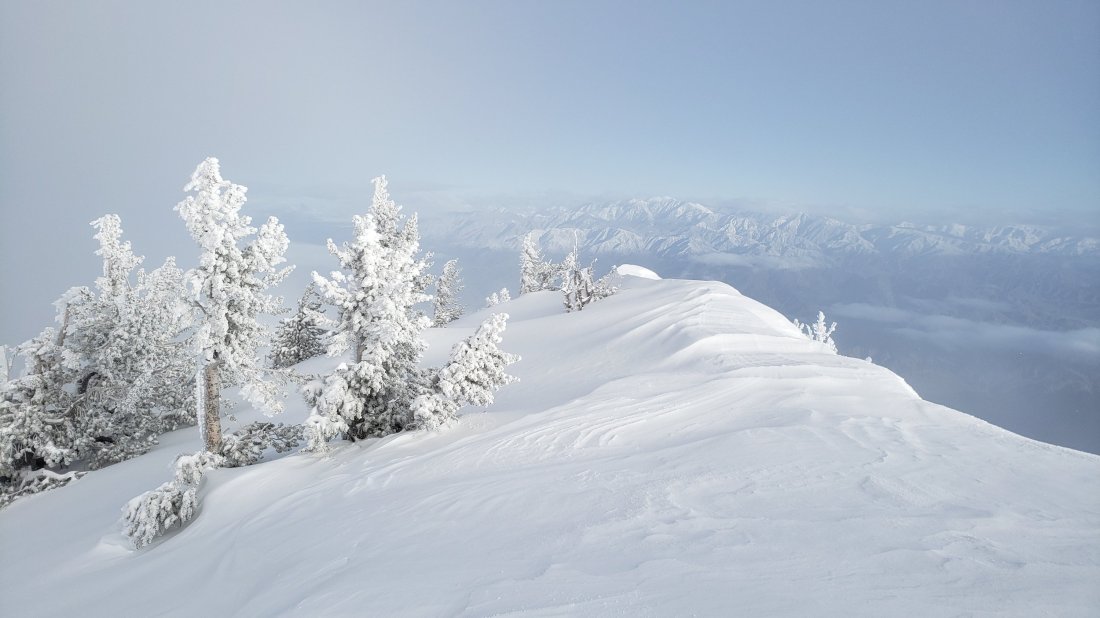
TRAIL CONDITIONS
All trails above about 6000′ are again completely snow-covered, although rapid melting is anticipated in the coming days, at least below about 9000′. The very limited number of tracks that were present on some parts of the PCT in the San Jacinto mountains have now been completely covered by fresh snow. Please see this posting about the specific challenges of Fuller Ridge just two days ago.
Hikers should be prepared for temperatures at or below freezing in the high country, and below freezing above 10,000′ (considerably colder when considering windchill effects).
Snowshoes are currently recommended everywhere above about 7500′. Microspikes may become useful mainly in the colder early mornings as the most popular trails become consolidated (e.g. Devil’s Slide, lower Deer Springs). Crampons with an ice axe (and knowledge of how to use both) are useful at higher elevations, as the icy snow underlying the fresh snowfall is treacherous. Their usefulness will increase with the strong freeze-thaw cycle expected in the next week. Crampons and ice axe are currently essential on Fuller Ridge, as discussed here.
Waterproof footwear is strongly recommended on the approach trails (e.g., Devil’s Slide, lower Deer Springs) due to multiple stream crossings and considerable water flowing in the trails. It is also advisable due to the slushy quality of the snow due to thawing.
Routefinding remains very challenging for those not familiar with the area. Almost all signage above about 8500′ is snow-covered. Most PCT marker posts are also completely obscured. Currently no trails have been broken whatsoever, other than my descent route today, and those tracks may be obscured quickly due to melting of surface snow and spindrift.
Please note that Tahquitz Peak trail from the PCT at Chinquapin Flat is extremely treacherous. With the fresh snowfall there will not even be a hint of “trail” to follow whatsoever. Crampons in conjunction with an ice axe, and excellent knowledge of how to use both, are critical.
Snow depths measured today are as follows. The first number is fresh snowfall overnight, followed by the total depth in parentheses (based on pre-storm measurements as I ascended yesterday). Very strong overnight winds have led to major drifting; drifts can be much greater than the average depth, especially at the exposed peaks. Altitudes are approximate.
San Jacinto Peak (10,810′): 13″ (75″)
Wellman Divide (9700′): 11″ (47″)
Annie’s Junction (PCT at State Park boundary north of Saddle Junction) (9050′): 7″ (33″)
Saddle Junction (8100′): 6.5″ (26″)
Devil’s Slide trailhead at Humber Park (6500′): 5″ (6″)
Idyllwild (at 5550′): 2.5″ (2.5″, but largely melted already)
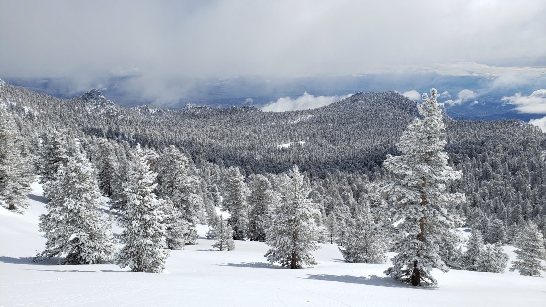
sanjacjonUncategorized3 Comments 4 MinutesEdit”Major snow storm 12th March 2019″
Snow and trail update 10th March 2019
Yesterday I hiked to Castle Rocks on Fuller Ridge. With our continuing road closures, this involved a lengthy hike each way, along a closed section of Highway 243, then up a snowy Black Mountain Road, before using crampons and ice axe to ascend Fuller Ridge. Most of the week was spent hiking trails nearer Idyllwild to check conditions. I recorded the following video from Castle Rocks at about 1140 in the morning yesterday.https://video.wordpress.com/embed/bgjSwMKQ?hd=0&autoPlay=0&permalink=1&loop=0&preloadContent=metadata&muted=0&playsinline=0&controls=1
Snow conditions are largely unchanged since the previous report on Monday (see that report for detailed snow depth data). Despite very cold conditions, there has been some slow melting at lower elevations, with no significant net change in snow depths. Two days ago it snowed lightly overnight, with an inch in Idyllwild at 5550′, two inches up to 7000′, and three inches above that. This lovely fine powder was sitting on top of very firm, icy snow, a combination which made for easy snow hiking with the right equipment (microspikes to about 8000′, crampons with ice axe higher).
Carrying snowshoes (with poles), crampons (with ice axe), and microspikes, is the unfortunate but ideal gear combination at present, such is the variability of snow conditions due to altitude, aspect, and time of day. PCT hikers may prefer not to carry the weight of snowshoes, accepting that this will result in some serious postholing on warmer days and in the afternoons.
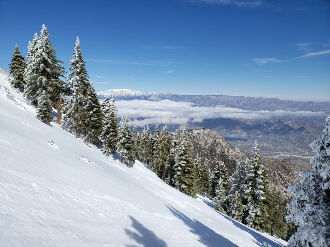
WEATHER After several more days of cold weather including snowfall forecast for tomorrow (with severe cold in the high country), a major shift to settled, sunny weather and above-average temperatures later in the week will result in rapid melting at all elevations.
At Castle Rocks (8600′) on Fuller Ridge yesterday, Saturday 9th March 2019, at 1130 the air temperature was 23°F (-5°C), with a windchill temperature of 7.9°F (-13°C), 80% relative humidity, and an icy 15 mph NW wind gusting to 21 mph.
At San Jacinto Peak (10,810′) on Monday 4th March 2019 at 1025 the air temperature was 34°F (1°C), with a windchill temperature of 17°F (-8°C), 18% relative humidity, and a biting 24 mph WNW wind gusting to 33 mph.
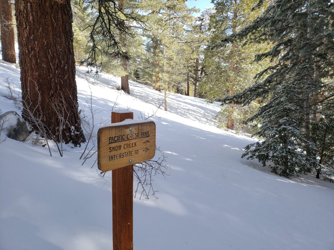
TRAIL CONDITIONS
All trails above about 7500′ remain completely snow-covered, despite rapid melting in the past few days. Details for specific routes are below.
Hikers should be prepared for temperatures below freezing in the high country, and well below freezing above 10,000′ (especially when considering windchill effects).
Microspikes are currently useful mainly in the morning and on well consolidated trails (e.g. Devil’s Slide, lower Deer Springs). Crampons with an ice axe (and solid knowledge of how to use both) are recommended for higher elevations and on moderate angle slopes (e.g. Fuller Ridge, Tahquitz Peak) as the snow consolidates with freeze-thaw cycles, at least in the morning, or all day in colder temperatures. Snowshoes are recommended off-trail above about 8000′, and everywhere at mid elevations after mid-morning on milder days.
Waterproof footwear is useful at least on approach trails (e.g., Devil’s Slide, lower Deer Springs) due to multiple stream crossings and considerable water flowing in the trails. It is also advisable currently due to the slushy quality of the snow on sun-exposed slopes after mid-morning.
Routefinding remains very challenging for those not familiar with the area. Almost all signage above about 8500′ is snow-covered. Many PCT marker posts are obscured. Very few trails have been broken whatsoever, and tracks from will be at least partly obscured by forecast snow tomorrow.
Pacific Crest Trail Most of the PCT through the San Jacinto mountains has been traversed by only a handful of hikers (or not at all) for weeks, so caution is required for route finding. Patchy snow starts at about Mile 155. By Mile 164, snow depths in places are 1-2 feet. Fuller Ridge Trail is largely a featureless ice slope along almost all its five mile length. Crampons and ice axe are essential. Most PCT hikers should consider the Black Mountain Road alternative.
Black Mountain Road was largely clear of snow by yesterday afternoon for its lower three miles. Up to 7000′ (5 miles up) there was shallow patchy snow. From the Lookout junction to the PCT/Fuller Ridge campground (miles 5 to 8) snow cover is continuous at about 20″ deep. Snow is currently firm and easy to traverse, with or without microspikes.
Devil’s Slide Trail is largely snow-covered to 7500′, then completely under snow thereafter. The trail has been heavily traveled, is obvious, and microspikes are ideal for the consolidated icy snow.
Deer Springs Trail is largely clear to the Suicide Rock trail junction (6900′). From there to Strawberry Junction (8100′) there is about 90% soft snow cover, with many hazardous sections of water flowing under or on the trail route.
Tahquitz Peak trail from Chinquapin Flat is extremely treacherous. Crampons in conjunction with an ice axe, and excellent knowledge of how to use both, are critical.
Ernie Maxwell Trail has about 10% snow cover (1-2″ deep) for most of its length, increasing to about 40% near Humber Park.
South Ridge Road is largely clear of snow in its lower half, but is impassable near the trailhead due to severe road damage. South Ridge Trail is continuously snow-covered ranging from a few inches deep below Old Lookout Flat, to 1-3 feet deep above it. Crampons are very useful on the final approach to Tahquitz Peak (above about 8500′).
Access closures The Valentine’s Day floods continue to make access to the San Jacinto mountains challenging. Palm Springs Aerial Tramway remains closed until approximately 1st April. Highway 243 between Banning and Idyllwild is closed from north of Bay Tree Spring to just north of Alandale until at least April. Highway 74 between Mountain Center and Valle Vista (Hemet) is closed until sometime in March or April. Many minor roads around Idyllwild-Pine Cove remain partly closed or damaged. Apple Canyon Road (access for the Spitler Peak trailhead) is still flooded at Hurkey Creek and closed to non-residents.sanjacjonUncategorized1 Comment 4 MinutesEdit”Snow and trail update 10th March 2019″
Snow and trail update 4th March 2019
[UPDATE 8th March 2019: a minor snowfall overnight produced barely one inch in Idyllwild, and only a couple of inches up to about 9000′, with the upper mountain above the cloud. Very cold temperatures are forecast for the next five days, with potential for significant new snowfall on Monday at all elevations.]
[UPDATE 7th March 2019: yesterday Idyllwild received an additional 0.69″ of rainfall. There was a very light dusting of snow in the mid elevations (the upper mountain was above the cloud). Highway 243 remains closed to traffic either side of the Black Mountain Road, but on my hike today I found that both the highway and lower BMR are now clear of snow, so this is now an option for PCT hikers wishing to avoid Fuller Ridge.]
Today I ascended San Jacinto Peak up Devil’s Slide Trail, a short section of the PCT, then via Wellman Divide. I descended through Little Round Valley, the PCT/Deer Springs Trail southbound from the south end of Fuller Ridge to Strawberry Junction, and then descended lower Deer Springs Trail. Other than my own from last week, there were no tracks anywhere above 8100′, and none anywhere on the PCT north of Saddle Junction. Yesterday we ran the Pacific Crest Trail just south of Highway 74, to assess trail conditions at lower elevation. I recorded the following video at San Jacinto Peak at about 1030 this morning.https://video.wordpress.com/embed/LTkfppre?hd=0&autoPlay=0&permalink=1&loop=0&preloadContent=metadata&muted=0&playsinline=0&controls=1
Snow conditions have changed dramatically compared to last week. Two days ago it rained most of the day, with a total of 1.56″ in Idyllwild at 5550′. Despite forecasts for light snow at higher elevations, I discovered today that it rained all the way to San Jacinto Peak, for at least the third time this winter. This helped consolidate snow at all elevations, augmented melting, and glazed the upper elevations with a crust of freezing rain.
As a consequence of the firm icy snow, in the early morning I was able to ascend to 9700′ with just microspikes, before changing to crampons for the final climb to the Peak. Crampons were also essential for the direct descent to Little Round Valley. By late morning, the snow was becoming soft, and at the Deer Springs-Fuller Ridge trail junction, I had to put on snowshoes to minimize postholing.
Carrying snowshoes (with poles), crampons (with ice axe), and microspikes, is the unfortunate but ideal combination at present, such is the variability of snow conditions due to altitude, aspect, and time of day.
Mild weather (and rainfall) led to significant melting in the previous few days, mainly below 9000′. Lower elevations that received the most rain lost a great deal of snow in just a few days (12″ at Saddle Junction, 15+” at Humber Park, c.20″ in Idyllwild). Conversely, the highest elevations experienced minimal melting, despite relatively mild temperatures. Snow depth measurements are listed near the foot of this posting.

My ice axe at the location of the sign (buried in the snow) for the southern end of Fuller Ridge “trail”, today 4th March 2019.
WEATHER Unsettled and uncertain are the best words to describe the weather for the San Jacintos over the next ten days. After another warm day tomorrow, temperatures will fall below average, and remain there for about a week. At mid-elevations, precipitation is possible on several days between 6th-12th March, but whether it falls as rain or light snow depends on the day and altitude. Above about 9000′ should be above the rainfall, but may also be largely above the cloud, and fresh snowfall is forecast to be little more than an inch or two for the high country all week.
At San Jacinto Peak today, Monday 4th March 2019, at 1025 the air temperature was 34°F (1°C), with a windchill temperature of 17°F (-8°C), 18% relative humidity, and a biting 24 mph WNW wind gusting to 33 mph.
At the Peak on Monday 25th February 2019, at 1145 the air temperature was 27°F (-3°C), with a windchill temperature of 12.5°F (-11°C), 57% relative humidity, and a fresh 7 mph NW wind gusting to 15 mph.

From the very top of the Snow Creek drainage, 4th March 2019. San Jacinto Peak summit to the left, San Gorgonio in the distance to the right.
TRAIL CONDITIONS
All trails above about 7500′ remain completely snow-covered, despite rapid melting in the past few days. Details for specific trails are below.
Hikers should be prepared for temperatures at or below freezing in the high country, and well below freezing above 10,000′ (especially when considering windchill effects).
Snowshoes are strongly recommended on all trails and off-trail areas above about 8000′, especially after mid-morning on warm days. Microspikes are currently useful mainly in the colder early mornings on well consolidated trails (e.g. Devil’s Slide, lower Deer Springs). Crampons with an ice axe (and knowledge of how to use both) are becoming increasingly useful at higher elevations and on moderate angle slopes (e.g. Fuller Ridge, Tahquitz Peak) as the snow consolidates with freeze-thaw cycles, at least in the morning, or all day in colder temperatures.
Waterproof footwear is strongly recommended on the approach trails (e.g., Devil’s Slide, lower Deer Springs) due to multiple stream crossings and considerable water flowing in the trails. It is also advisable currently due to the slushy quality of the snow, especially after mid-morning.
Routefinding remains very challenging for those not familiar with the area. Almost all signage above about 8500′ is snow-covered. Many PCT marker posts are also completely obscured. Very few trails have been broken whatsoever, and my tracks from today will be obscured quickly due to melting of surface snow and forecast light snwfall. Much of the PCT through the San Jacinto mountains high country has hardly been traversed for weeks (or in the case of Fuller Ridge, not at all since November).
Devil’s Slide Trail is about 90% snow-covered to 7500′, then completely under snow thereafter. The trail has been heavily traveled, is obvious, and microspikes are ideal for the consolidated icy snow.
Deer Springs Trail has patchy snow up to the Suicide Rock trail junction (6900′). From there to Strawberry Junction (8100′) there is about 90% soft snow cover, with many hazardous sections of water flowing under or on the trail route.
Tahquitz Peak trail from Chinquapin Flat is extremely treacherous. There is no evidence of it having been traversed since early February, so there is not even a hint of “trail” to follow whatsoever. Crampons in conjunction with an ice axe, and excellent knowledge of how to use both, are critical.
Ernie Maxwell Trail [updated 6th March] has about 10% snow cover (1-2″ deep) for most of its length, increasing to about 40% near Humber Park. Microspikes are useful in the early morning in the upper half of the trail, and on colder frozen days, but are generally not essential later in the day.
South Ridge Road [updated 5th March] is largely clear of snow, but is impassable near the trailhead due to severe road damage. South Ridge Trail is essentially continuously snow-covered (about 90% below 7000′), ranging from a few inches deep below Old Lookout Flat, to 1-3 feet deep above it. Crampons are very useful on the final approach to Tahquitz Peak (above about 8500′) where there is no trail as such and the entire peak is a largely featureless, consolidated snow dome.
Snow depths measured today are as follows. Measurements noted from 1st March will have dropped slightly due to melting, but likely only by a few inches, and mainly at the lower elevations. Only average depth is given, due to the complexity of past storms. Strong winds have led to major drifting; drifts can be much greater than the average depth, especially at the exposed peaks. Altitudes are approximate.
San Jacinto Peak (10,810′): 55″ [60″ on 25th February]
Little Round Valley (9800′): 48″
Wellman Divide (9700′): 40″ [45″ on 25th February]
Annie’s Junction (PCT at State Park boundary north of Saddle Junction) (9050′): 29″ [40″ on 25th February]
PCT at south end of Fuller Ridge Trail (8950′): 35″
Tahquitz Peak (8836′): 36″ measured on 1st March, with massive drifting ranging from 0″ to seven feet.
Marion Mountain Trail junction with PCT/Deer Springs Trail (8800′): 28″
Strawberry Junction (8100′): 16″
Saddle Junction (8100′): 23″ [35″ on 25th February]
Old Lookout Flat on South Ridge Trail (7800′): 14″ measured on 1st March, very heavily drifted
Devil’s Slide trailhead at Humber Park (6500′): 3″ but patchy [18″ on 25th February]
South Ridge Road junction with South Ridge Trail (6500′): 4″ measured on 1st March
PCT at crossing of Highway 74 (4700′): 0″ [2″ on 27th February]
Nature note Spring is in the air! I had my first returning spring migrant bird today, with several Violet-green Swallows flying around over Saddle Junction and Angel’s Glide (8100-8500′). Early March is when I typically record the first swallows up here.

Annie’s Junction (9070′), the high point of the PCT in the San Jacinto mountains, (above) today 4th March, (below) one week earlier on 25th February.

Access closures The Valentine’s Day floods continue to make access to the San Jacinto mountains challenging. Palm Springs Aerial Tramway remains closed until approximately 1st April. Highway 243 between Banning and Idyllwild is closed from north of Bay Tree Spring to just north of Alandale until at least April. Highway 74 between Mountain Center and Valle Vista (Hemet) is closed until sometime in March or April. The status of some of the trailhead access roads was updated in an earlier posting linked here. Many minor roads around Idyllwild-Pine Cove remain partly closed or damaged. Apple Canyon Road (access for the Spitler Peak trailhead) is still flooded and completely closed.

sanjacjonUncategorized1 Comment 6 MinutesEdit”Snow and trail update 4th March 2019″
Snow and trail update 1st March 2019
[UPDATE Saturday 2nd March: it started raining at 0400 in Idyllwild, with 1.56″ recorded by late evening. As has often been the case this winter, it has rained to a higher elevation on the mountain than forecast, with more than an inch of rain so far at Long Valley (8600′). For much of the storm the highest elevations have been above the cloud.]
For a change of scenery today we hiked from home in Idyllwild to Tahquitz Peak via South Ridge Road and South Ridge Trail. This also allowed assessment of the snow situation on one of the most sun-exposed (and therefore rapidly melting) trails in the entire region. There was no evidence of any ascent of Tahquitz Peak since the 14th February flooding/rain event. The previous two days we had hiked/run trails in the Desert Divide area, including the Pacific Crest Trail just north of Highway 74, to assess the snow situation on the lower elevations of the PCT.
Mild weather has led to significant melting this week, but mainly below 7000′, and extensive snow still covers almost all elevations above about 6000′. Snow is largely rotten and was terrible underfoot today below about 7500′, making snowshoes essential (and postholing a nightmare). Even at higher elevations, a thin refrozen crust masked softer snow beneath, making for challenging snowshoeing. Only above 8500′, at which point spikes or crampons were better anyway (at least in the early morning), was the going somewhat easier. Carrying snowshoes, crampons (with ice axe), and microspikes, is the unfortunate but ideal combination at present, such is the variability of snow conditions due to altitude, aspect, and time of day.
Snow depths measured today and earlier this week are as follows. Measurements from prior days will have dropped slightly due to melting, but likely only by a few inches, and mainly at the lower elevations. Only average depth is given, due to the complexity of past storms. Strong winds have led to major drifting; drifts can be much greater than the average depth, especially at the exposed peaks. Altitudes are approximate.
San Jacinto Peak (10,810′): 60″ [measured on 25th February]
Wellman Divide (9700′): 45″ [measured on 25th February]
Annie’s Junction (State Park boundary north of Saddle Junction) (9050′): 40″ [measured on 25th February]
Tahquitz Peak (8836′): 36″, but with massive drifting ranging from 0″ to seven feet.
Saddle Junction (8100′): 35″ [measured on 25th February]
Old Lookout Flat on South Ridge Trail (7800′): 14″, very heavily drifted
Devil’s Slide trailhead at Humber Park (6500′): 18″ [measured on 25th February]
South Ridge Road junction with South Ridge Trail (6500′): 4″
PCT at crossing of Highway 74 (4700′): 2″ [measured on 27th February]
Access closures The Valentine’s Day floods continue to make access to the San Jacinto mountains challenging. Palm Springs Aerial Tramway remains closed until approximately 1st April. Highway 243 between Banning and Idyllwild is closed from north of Bay Tree Spring to just north of Alandale until at least April. Highway 74 between Mountain Center and Valle Vista (Hemet) is closed until sometime in March. The status of some of the trailhead access roads was updated in an earlier posting linked here. Many minor roads around Idyllwild-Pine Cove remain partly closed or damaged.
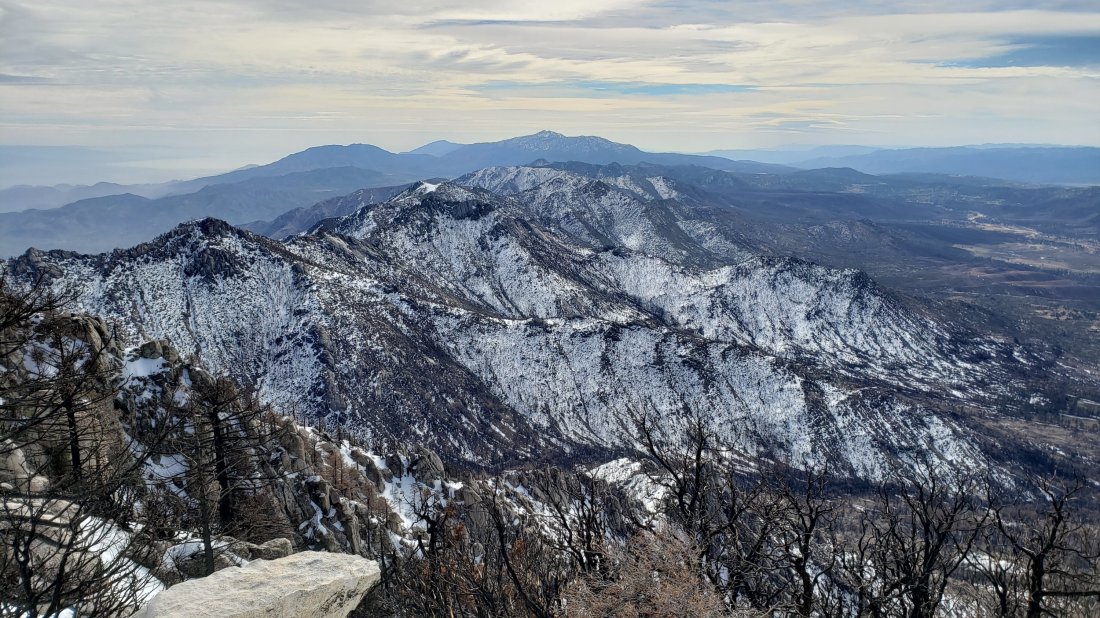
WEATHER Temperatures will remain at or above average for the next week, with continued melting of snow at all elevations, especially on sun-exposed slopes. Significant rainfall is forecast for tomorrow, Saturday 2nd March, with about one inch possible at the elevation of Idyllwild, which will accelerate snow melt below c.7000′. A light dusting of snow (just a couple of inches) is likely in the high country. Further rain is forecast on/off for Tuesday to Friday next week, 5th-7th March, perhaps totaling another half-inch at mid elevations, but with more snow (2-5″ depending on altitude) above about 7000′.
At Tahquitz Peak today, Friday 1st March 2019, at 0950 the air temperature was 37°F (3°C), with a windchill temperature of 24.8°F (-4°C), 51% relative humidity, and a bitter 11 mph NW wind gusting to 17 mph.
At San Jacinto Peak on Monday 12th February 2019, at 1145 the air temperature was 27°F (-3°C), with a windchill temperature of 12.5°F (-11°C), 57% relative humidity, and a fresh 7 mph NW wind gusting to 15 mph.
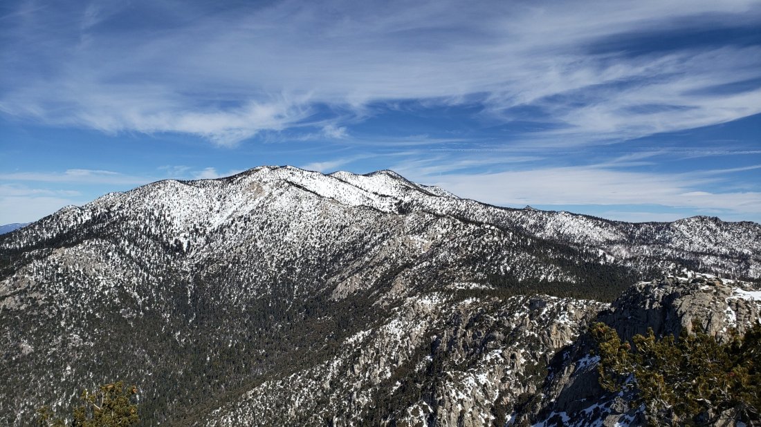
TRAIL CONDITIONS
All trails above about 6000′ remain snow-covered at this time, despite rapid melting in the past few days. The Pacific Crest Trail north of Highway 74 is largely free of snow (up to 5000′ elevation) on exposed sections, but thereafter has continuous snow cover (for an idea of depths depending on elevation, see measurements above).
Hikers should be prepared for temperatures near freezing in the high country and at or below freezing above 10,000′, especially when considering windchill effects.
Snowshoes are currently very strongly recommended on all trails and off-trail areas above about 7000′, especially after mid-morning, and at lower elevations in some areas and on warm afternoons in soft snow. Microspikes are currently useful only in the colder early mornings on well consolidated trails (e.g. Devil’s Slide, lower Deer Springs). Crampons (with an ice axe) are becoming increasingly useful at higher elevations as the snow consolidates with freeze-thaw cycles, at least in the morning prior to about 0930.
Waterproof footwear is strongly recommended on the approach trails (e.g., Devil’s Slide, lower Deer Springs) due to multiple stream crossings and considerable water flowing in the trails. It is also advisable everywhere else due to the soft and slushy quality of the snow, especially after mid-morning.
Routefinding remains very challenging for those not familiar with the area. Almost all signage above about 8500′ is snow-covered. Many PCT marker posts at lower elevations are also completely obscured. Very few trails have been broken whatsoever, and even my snowshoe tracks from early this morning were becoming indistinct within an hour due to melting of surface snow. Much of the PCT through the San Jacinto mountains has not been traversed for weeks (or in the case of Fuller Ridge, for months).
Tahquitz Peak trail from Chinquapin Flat is extremely treacherous. There is no evidence of it having been traversed since early February, so there is not even a hint of “trail” to follow whatsoever. Crampons in conjunction with an ice axe, and excellent knowledge of how to use both, are critical.
South Ridge Road continues to be largely snow-covered (c.70%) at 1-4″ deep. South Ridge Trail is essentially continuously snow-covered (a few bare patches below 7000′), ranging from a few inches deep below Old Lookout Flat, to 1-3 feet deep above it. Crampons were very useful on the final approach to Tahquitz Peak (above about 8500′) this morning, where there is no trail as such and the entire peak is a largely featureless, consolidated snow dome.
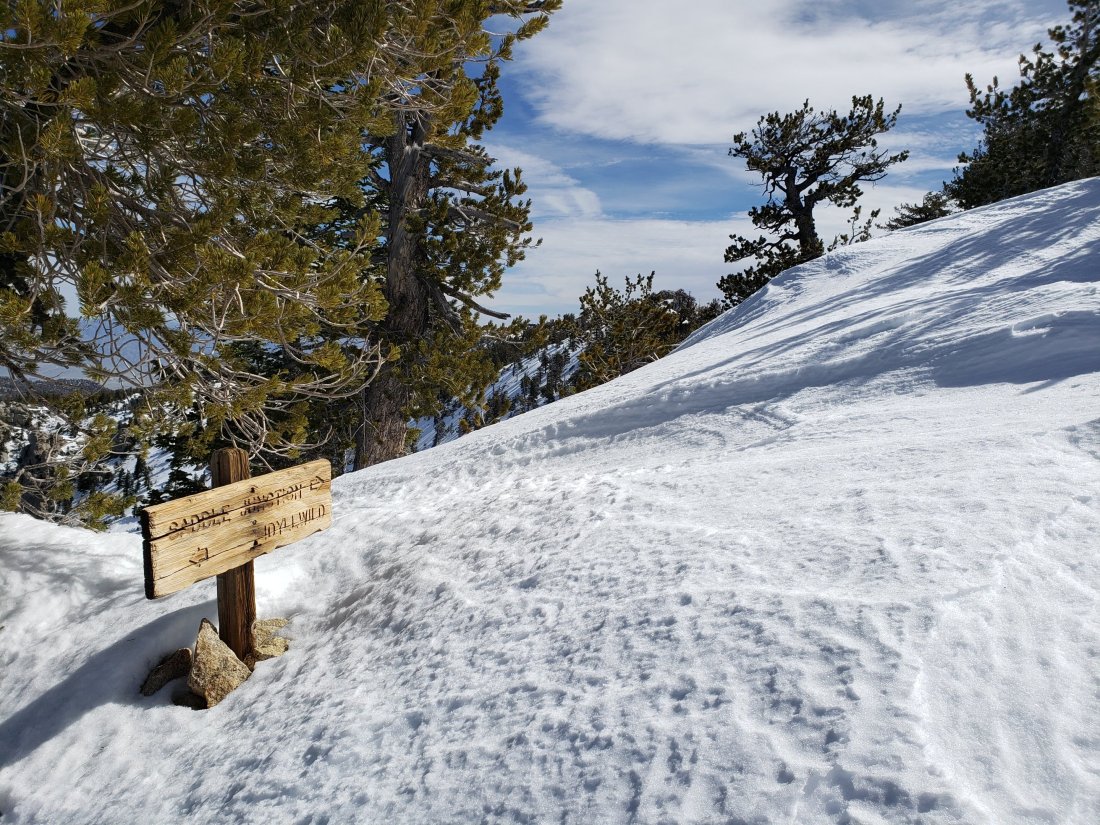
sanjacjonUncategorizedLeave a comment 5 MinutesEdit”Snow and trail update 1st March 2019″
Snow and trail update 25th February 2019
Today I hiked to San Jacinto Peak from Humber Park via Saddle Junction and Wellman Divide, descending the same way (in order to try to consolidate a reasonable trail). Above Saddle Junction, the only (vague) tracks to be seen anywhere on the mountain were my own from last week’s report. Early in the morning I was able to use microspikes to ascend to Saddle Junction in firm icy snow, but the rest of the hike was in snowshoes. The early afternoon descent below 9000′ felt a bit like wading through soft serve ice cream, as the snow melted in the warm sun.
I recorded the following vlog just after 1145 at San Jacinto Peak this morning. (After I recorded this video the Tram gave an updated reopening date of 1st April.)https://video.wordpress.com/embed/bh8Y7yPX?hd=0&autoPlay=0&permalink=1&loop=0&preloadContent=metadata&muted=0&playsinline=0&controls=1
The only additional snowfall has been 3-5″ in the afternoon just after my last trail report on 21st. However it was obvious from the state of the trees that the upper mountain (>9000′) was above that precipitation. Strong winds at higher elevations have smoothed the existing snow so there is little or no evidence of the trail system. Considerable caution is required with both route-finding and traversing slopes.
Snow depths measured today are as follows. Only average depth is given, due to the complexity of past storms. Strong winds have led to major drifting; drifts can be much greater than the average depth in places. Altitudes are approximate.
San Jacinto Peak (10,810′): 60″
Wellman Divide (9700′): 45″
Annie’s Junction (State Park boundary north of Saddle Junction) (9050′): 40″
Saddle Junction (8100′): 35″
Devil’s Slide trailhead at Humber Park (6500′): 18″
Access closures The Valentine’s Day floods continue to make access to the San Jacinto mountains challenging. Palm Springs Aerial Tramway remains closed until about 1st April. Check their website for updates. Highway 243 between Banning and Idyllwild is closed from north of Bay Tree Spring to just north of Alandale until at least April. Highway 74 between Mountain Center and Valle Vista (Hemet) is closed until sometime in March. The status of some of the trailhead access roads was updated in my posting yesterday. Many minor roads around Idyllwild-Pine Cove are also closed or damaged.

WEATHER Temperatures will remain above average through at least the first week of March, with steady melting of snow at all elevations, especially on sun-exposed slopes (which at this time of year is almost everything except the north faces). Light precipitation is forecast as a possibility for Saturday 2nd March, with very light rain to at least 8000′, and a dusting of snow (maybe an inch) above that.
At San Jacinto Peak today, Monday 25th February 2019, at 1145 the air temperature was 27°F (-3°C), with a windchill temperature of 12.5°F (-11°C), 57% relative humidity, and a fresh 7 mph NW wind gusting to 15 mph.
At the Peak on Friday 15th February 2019, at 0945 the air temperature was 19.5°F (-7°C), with a windchill temperature of -2.4°F (-19°C), 31% relative humidity, and a harsh 18 mph WSW wind gusting to 27.8 mph.
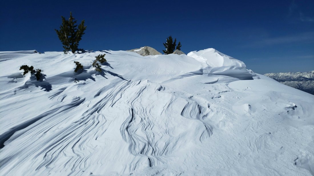
TRAIL CONDITIONS
All trails above about 4000′ remain snow-covered at this time, despite rapid melting in the past couple of days, especially below 7000′. Measured average snow depths are listed above. It continues to be delightful to see so many ephemeral creeks flowing that had had little or no flow for much of the past six years.
Hikers should be prepared for temperatures near freezing in the high country and below freezing above 10,000′, especially when considering windchill effects.
Snowshoes are currently essential on all “trails” above 7000′, especially after mid-morning, and anywhere in the backcountry (and at lower elevations on warm afternoons in soft snow). Microspikes are currently useful only in the early mornings on well consolidated trails (e.g. Devil’s Slide, lower Deer Springs). Crampons (with an ice axe) may become increasingly useful at the highest elevations if the snow consolidates with freeze-thaw cycles, at least in the mornings.
Waterproof footwear is strongly recommended on the approach trails (e.g., Devil’s Slide, lower Deer Springs) due to multiple stream crossings and considerable water flowing in the trails.
Routefinding will be very challenging for those not familiar with the area. Almost all signage above about 8500′ is completely snow-covered. Most PCT marker posts at lower elevations are also completely obscured. Very few trails have been broken whatsoever, and even my snowshoe tracks from early this morning were becoming vague by my descent a few hours later due to melting of surface snow.
Tahquitz Peak trail from Chinquapin Flat will be extremely treacherous. Crampons in conjunction with an ice axe, and knowledge of how to use both, are essential.


sanjacjonUncategorized2 Comments 3 MinutesEdit”Snow and trail update 25th February 2019″
Trailhead access update 24th February 2019
With so much poor and inaccurate information floating around since the Valentine’s Day flood event and subsequent heavy snowfalls, I checked on some trailhead access issues today.
Black Mountain Road (4S01) is completely inaccessible by vehicle. Highway 243 is closed both north and south of the start of the road. To the south, the highway is closed – a hard closure with concrete barriers – just north of Alandale, more than two miles before the Black Mountain Road junction. The highway hasn’t even been ploughed north of the closure. Snow is currently about two feet deep there. This closure greatly impacts access to Black Mountain, Fuller Ridge campground and the Pacific Crest Trail at the north end of Fuller Ridge.
Azalea Drive has been narrowly ploughed. This is the access for Marion Mountain Trail, Seven Pines Trail, and associated campgrounds. The ploughed road still requires 4WD/AWD or chains, and has almost no pullout or turn-around opportunities. It has been ploughed only as far as the junction of the Dark Canyon (4S02) and Marion Mountain campground (4S71) roads. Therefore it requires 0.6 mile of snowshoeing to reach the trailhead for Marion Mountain Trail. Snow was about two feet deep there today.
Inexplicably South Ridge Road (5S11) remains open. This is the access for South Ridge Trail and associated yellow post campsites. Although currently covered in deep snow, the upper section of this road was severely damaged on Valentine’s Day, and is both impassable to vehicles and very dangerous.sanjacjonUncategorized2 Comments 1 MinuteEdit”Trailhead access update 24th February 2019″
Partial snow update 21st February 2019
This afternoon I snowshoed to the top of Angel’s Glide at 9000′ on the PCT north of Saddle Junction. Since the unprecedented rainfall/flooding event on Valentine’s Day last week (discussed in detail in the posting linked here), the mountain has received some snowfall on six of the subsequent seven days. Although none of the snowfall events in isolation have been dramatic, the cumulative effect has been substantial.
The snow conditions that I described the day after the Valentine’s Day rains (described in the previous posting here) have changed beyond all recognition. There is now thick powder everywhere above 5000′. with shallower snow down below 4000′. See more detailed discussion in Trail conditions section below.
Access closures The Valentine’s Day floods have made access to the San Jacinto mountains extremely challenging for non-residents. Palm Springs Aerial Tramway remains closed indefinitely due to damage to the access road to Valley Station. It seems likely to be weeks rather than days before the tram can safely reopen. Check their website for updates. Highway 243 between Banning and Idyllwild is closed at Bay Tree Spring (4 miles north of Lake Fulmor) for at least two months. Highway 74 between Mountain Center and Valle Vista is closed for as much as one month. In addition, periodic closures for maintenance of varying durations are happening on the only route to Idyllwild (Highway 74 from Garner Valley then Highway 243 up from Mountain Center).
Snow depths measured today are as follows. Only average depth is given, due to the complexity of past storms. Strong winds have led to major drifting and drifts are much deeper than the average depth in places. Altitudes are approximate.
Annie’s Junction (State Park boundary north of Saddle Junction) (9050′): 46″
Saddle Junction (8100′): 34″ [added 18″ since 15th February]
Devil’s Slide trailhead at Humber Park (6500′): 17″ [added 14″ since 15th February]
Idyllwild (at 5550′): 15″ [all new snow since 14th February]
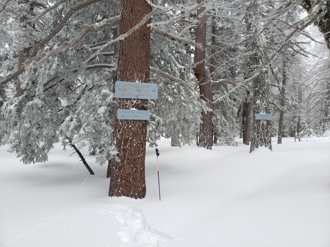
WEATHER It was prescient when I wrote six days ago that in the El Niño-driven winter we are having, it seems that conditions will remain highly variable and unpredictable. It is currently snowing again heavily in Idyllwild (Thursday evening). Then over the next week we will experience a very rapid warming trend, with temperatures forecast to be above seasonal by late next week. By the middle of next week, temperatures may well be just above freezing at San Jacinto Peak. This is proving to be quite the winter for wildly variable weather.
At San Jacinto Peak on Friday 15th February 2019, at 0945 the air temperature was 19.5°F (-7°C), with a windchill temperature of -2.4°F (-19°C), 31% relative humidity, and a harsh 18 mph WSW wind gusting to 27.8 mph.
TRAIL CONDITIONS All trails above about 3000′ are snow-covered at this time. With extremely rapid warming forecast over the next week, there will be considerable snow loss at lower elevations due to melting (<6000′). However snow depths are such that it will take considerable time for melting to have any significant impact at higher elevations. Measured average snow depths are listed above.
For the next few days hikers should be prepared for temperatures near or below freezing in the high country (>8000′) and below freezing above 10,000′.
Snowshoes are currently essential on all trails above 5000′. Microspikes may become useful on lower elevation trails during the course of the coming week. Waterproof footwear is strongly recommended on the approach trails (<8200′) due to considerable water flowing in the trails.
Routefinding is currently extremely challenging for those hikers who are not very familiar with the area, with areas above 8000′ largely just featureless snow slopes with no hint of trails whatsoever. Almost all signage above about 8500′ is currently completely snow-covered and almost all PCT marker posts and some other signage above about 7500′ is also obscured. No trails have been broken and snow is so deep that travel is slow and arduous, even with snowshoes.
Crampons in conjunction with an ice axe, and good knowledge of how to use both, are essential for moderate angle terrain, such as the Tahquitz Peak trail from Chinquapin Flat, sections of Fuller Ridge Trail, and any off-trail travel on the north faces of San Jacinto Peak and Tahquitz Peak.
There is an increased risk of avalanche conditions at the highest elevations. With considerable fresh snowfall on top of the icy Valentine’s Day frozen rain layer at all elevations, accompanied by strong SW-W winds at higher elevations, wind slab and storm slab conditions are possible, especially on easterly and northerly slopes. Upper Snow Creek drainage is infamously vulnerable, but the exposed easterly slopes above about 9800′ e.g., between Wellman Divide and Miller and San Jacinto peaks, could be unstable too. Cautious routefinding and conservative decision-making are recommended in any areas that display signs of possible instability (shooting cracks, whumphing, large cracks perpendicular to slope).
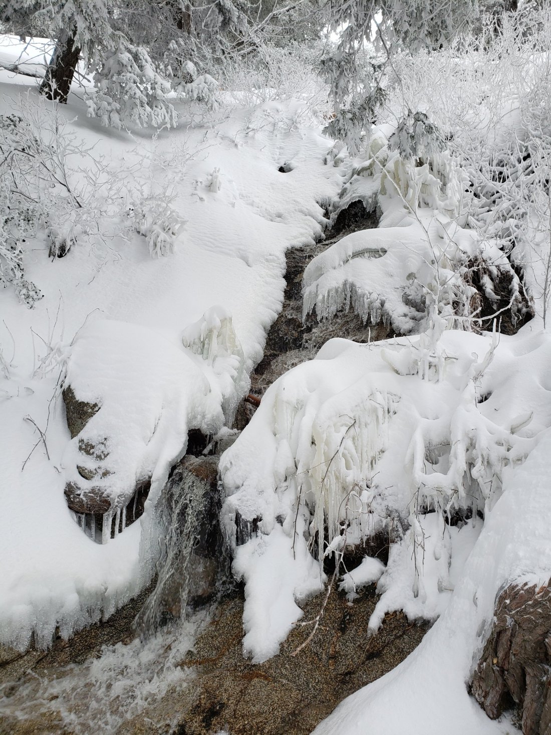
sanjacjonUncategorizedLeave a comment 3 MinutesEdit”Partial snow update 21st February 2019″
Snow and trail update 15th February 2019
[UPDATE Wednesday 20th February: it started snowing again gently at 1230, with about one inch accumulating in three hours. After two days of torrential rain last week it has snowed on five of the subsequent six days (so far!). I plan a more detailed update on the snow conditions in the high country for Friday.]
[UPDATE Tuesday 19th February: Following major road damage in the Valentine’s Day rains, CalTrans have announced Highway 243 between Banning and Lake Fulmor will be closed for at least two months, and Highway 74 between Valle Vista and Mountain Center will be closed for at least one month.]
[UPDATE Monday 18th February: in Idyllwild we received 5.75″ more fresh snow overnight, and then two more inches this afternoon, for a total of about 10″ around town. The high country received only a few additional inches. It even snowed an inch in Garner Valley (4100′). Highway 74 is currently open at Lake Hemet to all traffic.]
[UPDATE Sunday 17th February: It started snowing in Idyllwild at 1200 today, and is accumulating at 0.5″ per hour (at least thru 1900). The Highway 74 access issue remains unpredictable. This morning it was open to all traffic at Lake Hemet, as it was yesterday. By early afternoon, CHP was allowing only residents, homeowners, and employees uphill, as was the case on Friday. Visitors should be aware that if they try to come up to Idyllwild by the one and only open route, they risk getting turned around depending on the day or the weather.]
[UPDATE II Saturday 16th February: Highway 74 from Garner Valley to Mountain Center and Highway 243 from Mountain Center to Idyllwild are open to all traffic (not just residents). When descending from Idyllwild, use the Saunders Meadow Road diversion (i.e. past the transfer station) as Hwy 243 is single lane for uphill traffic only. All other road closures remain in effect.]
[UPDATE I Saturday 16th February: Just back from a hike from home up South Ridge Trail to Old Lookout Flat. About 3.5″ fresh snow at top of South Ridge Road (6500′) and the same depth at Old Lookout Flat (7800′). Bitter conditions high up with 30-40 mph winds. Idyllwild (at 5550′) had 2.25″ of snow overnight, but melting is now very rapid at town elevation. South Ridge Road has a huge boulder in the road at 0.4 miles up, and was severely damaged by washouts from 0.7 miles to the top. Do not attempt vehicular access. At Long Valley (8600′) there was little more than an inch of fresh snowfall.]
Following the unprecedented rainfall and flooding event yesterday, discussed in detail in the posting linked here, today I hiked to San Jacinto Peak from Humber Park via Saddle Junction and Wellman Divide, descending Deer Springs Trail to the Suicide Rock Trail, then back to Humber via the Suicide Climbers Trail. There was not a single track anywhere to be seen on the mountain.
I recorded a rambling and overly long (sorry) vlog at about 0945 at San Jacinto Peak this morning, available on YouTube at this link.
For the second time this year, it rained all the way to San Jacinto Peak, and consequently snowfall in the upper elevations was far below what had been forecast, with barely 5″ at San Jacinto Peak, and only 1-2″ above 10,000′. Even that snowfall seemed to have been accompanied by freezing rain, so there was barely any powder on top of very icy snow.
Relatively mild and heavy rain, accompanied by strong winds, has smoothed the existing snow at all elevations, so there is very little evidence of the trails, especially above 8500′. This also makes even fairly low angle exposed slopes (like those on the Peak Trail above Wellman Divide) quite challenging to traverse in anything other than crampons. Considerable caution is required with both route-finding and traversing slopes.
Currently, there is no change to the timetable for road closures that I outlined yesterday. However, the Palm Springs Aerial Tramway will be closed indefinitely due to flood damage to the access road to Valley Station. Check their website for updates.
Snow depths measured today are as follows. Only average depth is given, due to the complexity of past storms. Strong winds have led to major drifting; drifts can be much greater than the average depth in places. Altitudes are approximate.
San Jacinto Peak (10,810′): 55″ [was c.50″ on Monday 11th]
Little Round Valley (9800′): 40″
Wellman Divide (9700′): 30″
Fuller Ridge Trail/PCT at junction with Deer Springs Trail (8950′): 36″
Annie’s Junction (State Park boundary north of Saddle Junction) (9050′): 24″
Marion Mountain Trail at junction with PCT/Deer Springs Trail (8800′): 22″
Saddle Junction (8100′): 16″ [was 26″ on Monday 11th]
Strawberry Junction (8100′): 11″
Devil’s Slide trailhead at Humber Park (6500′): 3″ [was 7″ on Monday 11th]
WEATHER Well, it can’t be as crazy as it was on Valentine’s Day! However, in the El Niño-driven winter we are having, it seems that conditions will remain highly variable and unpredictable. Minor storms with snowfall down as low as 5000′ are forecast for tonight and Sunday 17th. Snowfall at all elevations may be just a few inches at most, with about 2-3″ forecast for the Peak on Sunday. Then a potentially more substantial storm is currently predicted around Thursday 21st, with greater snowfall possible (4-9″ at the Peak}. Temperatures will remain well below average for the foreseeable future, with consequently little or no melting of snow and ice above 6500′.
At San Jacinto Peak today, Friday 15th February 2019, at 0945 the air temperature was 19.5°F (-7°C), with a windchill temperature of -2.4°F (-19°C), 31% relative humidity, and a harsh 18 mph WSW wind gusting to 27.8 mph.
At the Peak on Monday 11th February 2019, at 1225 the air temperature was 22°F (-6°C), with a windchill temperature of 3.6°F (-16°C), 28% relative humidity, and a moderate 9 mph WNW wind gusting to 18.3 mph.
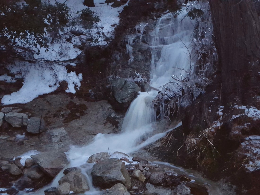
TRAIL CONDITIONS
All trails above about 6000′ remain snow-covered at this time, despite considerable snow loss at lower elevations due to rainfall. Measured average snow depths are listed above. Trail damage from the rain event yesterday was less than feared. Although many washouts occurred in areas where streams cross trails, none were so severe as to be impassable. In fact, it was delightful to see so many ephemeral creeks flowing that had had little or no flow for much of the past six years.
For at least the next ten days hikers should be prepared for temperatures below freezing in the high country (>6000′) and well below freezing above 10,000′ (with potential for severe cold when considering windchill effects).
Microspikes (or even better crampons with an ice axe) are currently essential on all trails above 6500′, especially in the morning. Snowshoes may soon be useful depending on the depth of fresh snowfalls, and/or during afternoon melting on exposed and lower elevation trails.
Waterproof footwear is strongly recommended on the approach trails (below 8200′) due to multiple stream crossings and considerable water flowing in the trails.
Routefinding will be challenging for those not familiar with the area. Almost all signage above about 9000′ is currently completely snow-covered. Many PCT marker posts at lower elevations are also completely obscured. No trails had been broken whatsoever on my circuit of the mountain today. The snow is so icy from the rainfall yesterday that I did not posthole at all until the early afternoon descent of lower Deer Springs Trail. Consequently there are no tracks anywhere on the trail system above 8000′. Below about 8900′ there were subtle signs of the trails from traffic earlier in the week, but these may disappear in the next day or so with forecast fresh snowfalls.
Tahquitz Peak trail from Chinquapin Flat will be extremely treacherous. Crampons in conjunction with an ice axe, and knowledge of how to use both, are essential.
The Ernie Maxwell Trail is almost completely snow-covered with about 1-2″ snow, but is passable without additional traction. [Thanks to Anne and Anabel King for this update from today.]
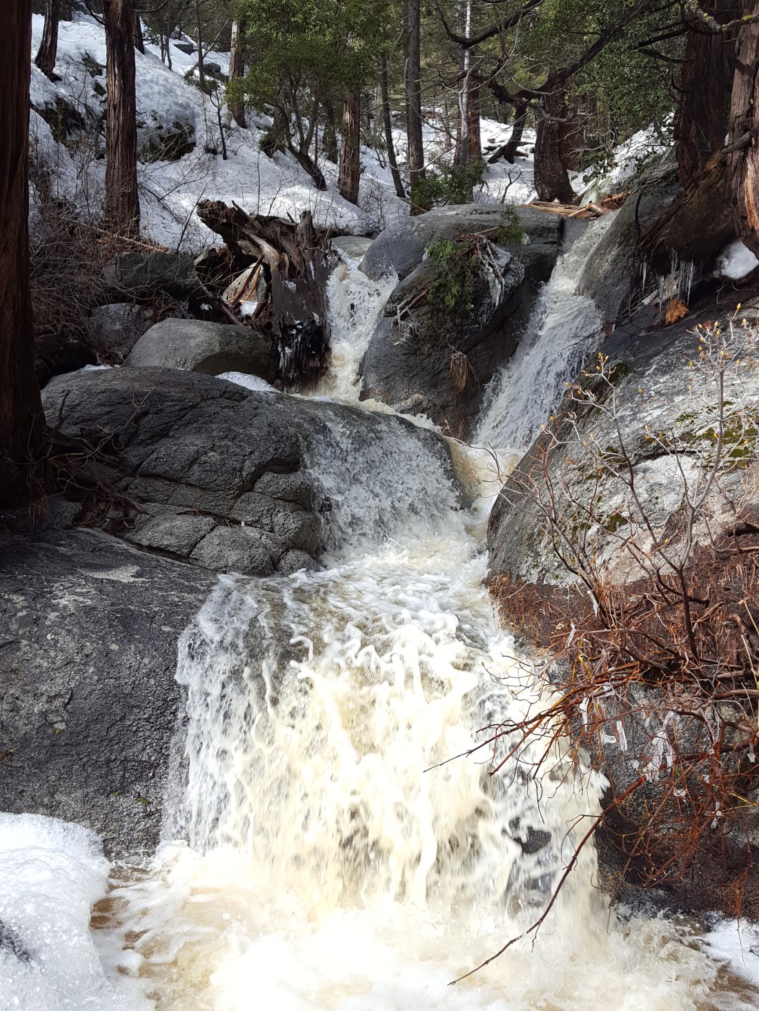
sanjacjonUncategorized1 Comment 5 MinutesEdit”Snow and trail update 15th February 2019″
Major flooding event 14th February 2019
Today Idyllwild and neighbouring communities in the San Jacinto mountains experienced a once-in-a-generation rainfall and flooding event. Many minor roads remain flooded, severely damaged, and/or impassable. There is currently no road access to Idyllwild. Unless under an evacuation order, please do not attempt to move around or visit the region. Highway 74 is closed at Lake Hemet and Valle Vista (both with an estimated reopening on 16th February).
Highway 243 from Pine Cove to Banning is also closed. This CHP link has a dramatic photo of Highway 243 completely washed out just north of Lake Fulmor. CalTrans has already posted an estimated reopening of 23rd February.
In about 24 hours we had an astonishing 7.77″ of rain in Idyllwild. By 0700 this morning, we had had 3.66″ of rain at home in Idyllwild (5550′) since yesterday. It finally stopped raining at about 1745 by which time we’d had an additional 4.11″.
With air temperatures above 45°F for much of the day, and so much mild rain, melting of existing snow was prodigious. Huge snow loss – basically all of the 6″ we had in town – massively increased the flood water volumes.
Long Valley (8600′) received a remarkable 9.1″ of rain in the same period. It then started snowing after about 1415 on top of the rain-saturated pre-existing snow. So far there has been only about an inch of fresh snowfall. The Palm Springs Aerial Tramway has been closed all day, and will not reopen until Saturday 16th February.
I will start assessment of trail conditions tomorrow. There may be washouts, trees down, and even landslides, in addition to horrible slushy snow conditions, that may make hiking anywhere in the region challenging for the foreseeable future.
My video below shows where upper Fern Valley Road – access for Humber Park – is impassable as Chinquapin Creek has flooded the road (with floodwater 2-3 feet deep).https://video.wordpress.com/embed/rOWeu9Ov?hd=0&autoPlay=0&permalink=1&loop=0&preloadContent=metadata&muted=0&playsinline=0&controls=1
Strawberry Creek where it flows under Village Center Drive near Idyllwild Post Office at about 0900.https://video.wordpress.com/embed/PLjGe9rb?hd=0&autoPlay=0&permalink=1&loop=0&preloadContent=metadata&muted=0&playsinline=0&controls=1
I took this video of Strawberry Creek – between River Drive and Tahquitz Drive – at about 0800 this morning. Nowadays it is rarely more than a gentle trickle at best. Not today.https://video.wordpress.com/embed/9snk7fiw?hd=0&autoPlay=0&permalink=1&loop=0&preloadContent=metadata&muted=0&playsinline=0&controls=1
Tahquitz Drive just down from the Episcopal Church turned into a river, a foot deep in places, with the snow berms functioning as river banks.https://video.wordpress.com/embed/hE0LZA4G?hd=0&autoPlay=0&permalink=1&loop=0&preloadContent=metadata&muted=0&playsinline=0&controls=1 sanjacjonUncategorized4 Comments 2 MinutesEdit”Major flooding event 14th February 2019″
Storm update 11th February 2019
[UPDATE Wednesday 13th February: We are bracing ourselves for a major “pineapple express” storm system. Currently much lighter rainfall than forecast, with barely 0.1″ in the past five hours since it started raining at 1300 this afternoon in Idyllwild. As much as 5″ (125mm) of rain has been forecast for elevations below about 8000′, with about two feet of snow possible at the high peaks. Flooding and landslides are possible on mountain roads, with voluntary evacuations in/near areas affected by the July 2018 Cranston Fire.]
Following a minor two-day storm over the weekend, today I snowshoed to San Jacinto Peak from Humber Park via Saddle Junction and Wellman Divide, descending the same way. For the second time in a few days I was breaking trail all the way to the Peak. Snowfall yesterday evening plus windy, drifting conditions, meant that again there was not a single track anywhere to be seen on the mountain. Very unusually, when I returned to Saddle Junction this afternoon the only tracks visible for the day were those from my early morning ascent. I recorded the following vlog at San Jacinto Peak just after noon today.https://video.wordpress.com/embed/2Y9IJ6Yv?hd=0&autoPlay=0&permalink=1&loop=0&preloadContent=metadata&muted=0&playsinline=0&controls=1
The weekend storm occurred in two phases, some very light snow throughout the mountain on Saturday (mainly in the morning) and a somewhat heavier snowfall on Sunday that was confined to the western side of the mountain below 9000′ (the top of the mountain was above the cloud). Saturday snowfall was about one inch at all elevations. The Sunday snow produced an additional 2.5″ at 5550′ in Idyllwild, 3″ at Humber Park (6500′), 5″ at Saddle Junction (8100′), and 6″ at Annie’s Junction (9050′). There was no clear sign of significant fresh snowfall above about 9000′. Otherwise conditions looked very similar to those following last week’s major storm described in detail here. With cold conditions for the last week, signs of melting were minimal.
Snow depths measured today are as follows. Average current depth is given (known new accumulations are described above). Locations not surveyed since last week are estimated based on the depth six days ago and their elevation. Strong winds have led to major drifting, again even as low as 7500′ on Devil’s Slide Trail. Drifts can be double the average depth in places. Altitudes are approximate.
San Jacinto Peak (10,810′): 50″ (with drifts averaging 5-6 feet)
Little Round Valley (9800′): 45″ [estimated]
Wellman Divide (9700′): 37″
Fuller Ridge Trail/PCT at junction with Deer Springs Trail (8950′): 38″ [estimated]
Annie’s Junction (State Park boundary north of Saddle Junction) (9050′): 31″
Marion Mountain Trail at junction with PCT/Deer Springs Trail (8800′): 27″ [estimated]
Saddle Junction (8100′): 26″
Strawberry Junction (8100′): 20″ [estimated]
Devil’s Slide trailhead at Humber Park (6500′): 7″ (some significant recent melting)
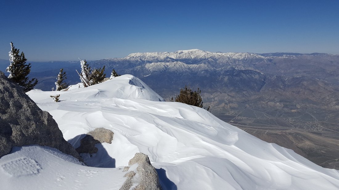
WEATHER In keeping with the theme of this winter, a mild multi-day storm system is forecast from the afternoon of Wednesday 13th through to early morning Friday 15th. At San Jacinto Peak, about 1-1.5′ of snow is predicted across the period, although air temperatures even there will be only just below freezing. Most precipitation is forecast to fall as rain, potentially as high as 8500′, with the likelihood of a mix of rain, freezing rain, and snow above about 8000′. At all elevations below 8000′, at least three inches of rain are forecast in only a 30 hour period. Obviously this may lead to substantial loss of snow volume at mid and lower elevations.
At San Jacinto Peak today, Monday 11th February 2019, at 1220 the air temperature was 22°F (-5.5°C), with a windchill temperature of 3.6°F (-16°C), 28% relative humidity, and a cool 9 mph WNW wind gusting to 18 mph.
At the Peak on Wednesday 6th February 2019, at 1150 the air temperature was 4.9°F (-15°C), with a windchill temperature of -31.7°F (-35°C), 71% relative humidity, and a savage 21 mph WNW wind gusting to 48.8 mph.
TRAIL CONDITIONS
All trails above about 5000′ are completely snow-covered at this time (measured average snow depths are listed above). This includes almost the entire PCT from Highway 74 near Paradise Corner to below the Black Mountain Truck Trail (roughly PCT miles 150-195).
Hikers should be prepared for temperatures below freezing in the high country (>8000′) and well below freezing above 10,000′ (with potential for even more severe cold when considering windchill effects).
Snowshoes are currently strongly recommended everywhere above 6500′. Crampons or microspikes may soon be useful (following rain/freezing rain later this week) on almost all trails above about 7000′.
Waterproof footwear is recommended on the approach trails (below about 8200′) due to multiple stream crossings and water flowing in the trails. This will become quite extreme with the change in the weather in the next few days.
Routefinding will be challenging for those not familiar with the area. Almost all signage above about 9000′ is currently completely snow-covered. Many PCT marker posts and some other signs at lower elevations are also completely obscured. Few if any trails will be meaningfully broken prior to further precipitation this week.
Tahquitz Peak trail from Chinquapin Flat remains extremely treacherous. It has not been traversed since the latest snowfall. Crampons in conjunction with an ice axe, and knowledge of how to use both, are essential.
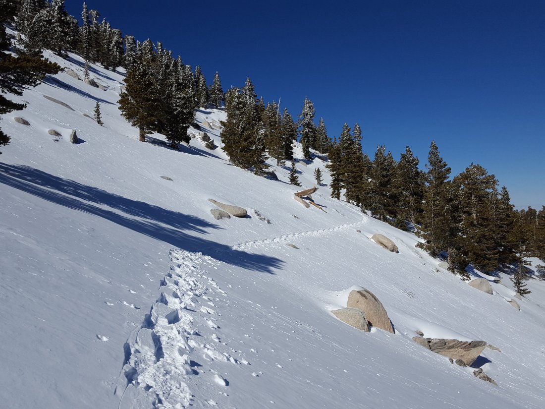
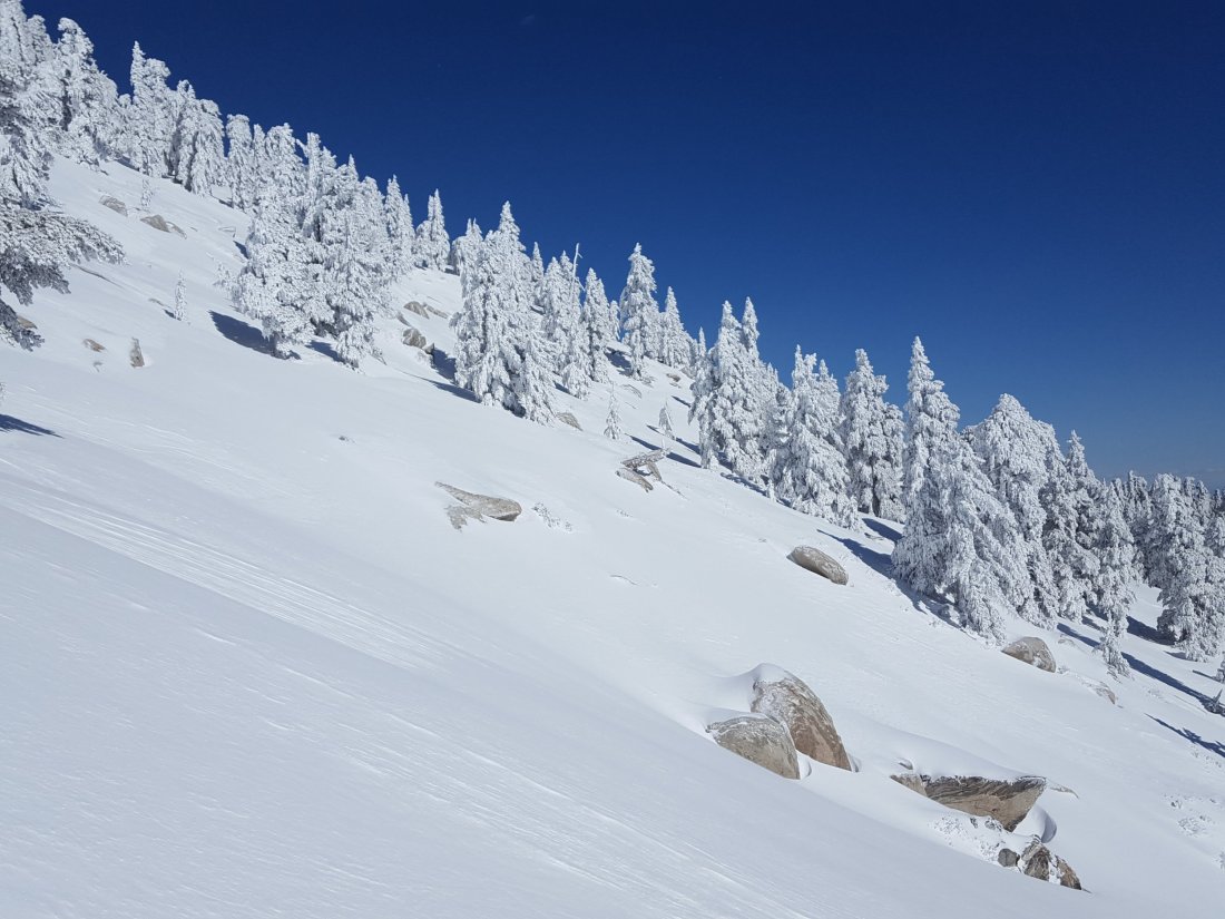
sanjacjonUncategorizedLeave a comment 4 MinutesEdit”Storm update 11th February 2019″
Major storm update 6th February 2019
[UPDATE Sunday 10th February: it has snowed gently on/off in Idyllwild (5550′) since 0900 this morning, adding about 2.0″ to the existing snow depth. It is clear and sunny higher on the mountain (>8000′) and on the eastern side, with no new snow accumulation today.]
[UPDATE Saturday 9th February: it snowed lightly in Idyllwild (5550′) this morning between 0800-1230, adding about 1.2″ to the existing snow. At the same time it was snowing higher on the mountain, also adding about an inch at higher elevations.]
Following another multi-day storm, today I snowshoed to San Jacinto Peak from Humber Park via Saddle Junction and Wellman Divide, descending Deer Springs Trail to the Suicide Rock Trail, then back to Humber via the Suicide Climbers Trail. I was breaking trail from pre-dawn to dusk, with not a single track anywhere to be seen on the mountain. I recorded the following vlog in spectacular, wild spindrift conditions just before noon (please excuse the ice in my moustache, it was chilly up there!).https://video.wordpress.com/embed/JZbBQ81p?hd=0&autoPlay=0&permalink=1&loop=0&preloadContent=metadata&muted=0&playsinline=0&controls=1
What was effectively a four-day storm (at least at mid-elevations) started on Saturday with the heaviest snowfall at the highest elevations, as described in the previous update. A second significant snowfall occurred on Monday into Tuesday. At 5550′ elevation in Idyllwild, we ended up with an impressive 3.74″ of rain (early on) plus 6.25″ snow (towards the end of the storm). Snow level was at about 4000′ on both the east (below Mountain Center) and west (Pinyon) sides of the mountain.

Looking west from San Jacinto Peak towards Black Mountain, 6th February 2019.
Snow depths measured today are as follows. Only average depth is given, due to the complexity of past storms. Extremely strong winds have led to major drifting, even as low as 7500′ (on Devil’s Slide Trail, see photo below). Drifts can be double the average depth in places. Altitudes are approximate.
San Jacinto Peak (10,810′): 50″ (with drifts averaging 5-6 feet)
Little Round Valley (9800′): 38″
Wellman Divide (9700′): 36″
Fuller Ridge Trail/PCT at junction with Deer Springs Trail (8950′): 32″
Annie’s Junction (State Park boundary north of Saddle Junction) (9050′): 25″
Marion Mountain Trail at junction with PCT/Deer Springs Trail (8800′): 22″
Saddle Junction (8100′): 20″
Strawberry Junction (8100′): 15″
Devil’s Slide trailhead at Humber Park (6500′): 10″

Tahquitz Peak and Tahquitz Rock as seen from the Suicide Rock Trail this afternoon, 6th February 2019.
WEATHER For the first time this winter, it will remain cold post-storm. Overnight low temperatures will remain below freezing everywhere above 5000′ for the foreseeable future, so melting of snow and ice will be very slow. Some light precipitation (snow in the high country, mixed below 6500′) is forecast for Saturday morning and Sunday evening, with another possible multi-day storm later next week.
At San Jacinto Peak today, Wednesday 6th February 2019, at 1150 the air temperature was 4.9°F (-15°C), with a windchill temperature of -31.7°F (-35°C), 71% relative humidity, and a savage 21 mph WNW wind gusting to 48.8 mph.
At San Jacinto Peak on Sunday 3rd February 2019, at 0635 the air temperature was 13°F (-11°C), with a windchill temperature of -5°F (-21°C), 100% relative humidity, and a bitter 18 mph SW wind gusting to 25 mph.
TRAIL CONDITIONS
All trails above about 4000′ are completely snow-covered at this time. Measured average snow depths are listed above.
For at least the next ten days hikers should be prepared for temperatures below freezing in the high country (>8000′) and well below freezing above 10,000′ (with potential for even more severe cold when considering windchill effects).
Snowshoes are very strongly recommended everywhere above 6500′. Crampons or microspikes will soon be useful (once heavily used trails are consolidated) on almost all trails above about 7000′.
Waterproof footwear is recommended on the approach trails (below 8200′) due to multiple stream crossings and water flowing in the trails.
Routefinding will be challenging for those not familiar with the area. Almost all signage above about 9000′ is currently completely snow-covered. Mamy PCT marker posts at lower elevations are also completely obscured. No trails had been broken whatsoever on my circuit of the mountain today. My snowshoe tracks on the east side ascent were quickly invisible due to strong winds and severe drifting. My tracks on the Deer Springs Trail will be more obvious as it was less windy lower down this afternoon, however I was off-trail for some of the descent and I would not recommend trying to ascend some of my route, even where it is visible.
Tahquitz Peak trail from Chinquapin Flat will be extremely treacherous. Crampons in conjunction with an ice axe, and knowledge of how to use both, are essential.
The Ernie Maxwell Trail is completely snow-covered, but is passable without snowshoes. [Thanks to Anne and Anabel King for this update from today.]


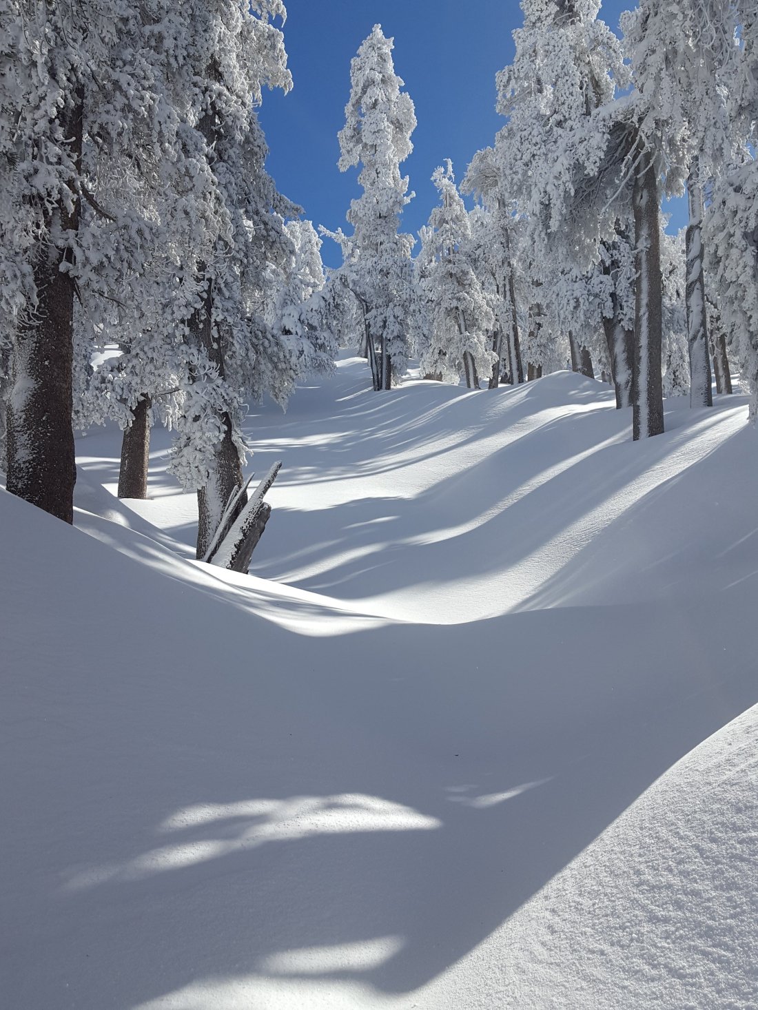

sanjacjonUncategorized4 Comments 3 MinutesEdit”Major storm update 6th February 2019″
Storm update 3rd February 2019
[UPDATE Tuesday 5th February: For the first time this winter, Idyllwild awoke to a reasonable blanket of snow, 2.5″ depth at 5550′ elevation. It has continued to snow gently all day, with an additional 2″ accumulation. Since Friday, Idyllwild has had 3.74″ rain and 5.0″ snow. Long Valley (8500′) added another 3-4″ of snow overnight, but the upper mountain has often been above the cloud today.]
[UPDATE Monday 4th February: it has rained – and tried but largely failed to snow – in Idyllwild continuously since yesterday evening. At Humber Park this morning there was an additional one inch of snow at 6500′, but it was also occasionally drizzling. By this evening another 1″ of snow had accumulated. I happened to be there when U. S. Forest Service was closing the Humber Park gate, reducing legal parking spaces from 100+ to 10. It has been snowing on/off at Long Valley (8500′), with an additional 3-5″ accumulating, but for at least part of the day the upper mountain was above the cloud.]
I spent the previous three days on the mountain, descending this morning from San Jacinto Peak via Wellman Divide to Humber Park. On Friday I was assessing the snow from the minor storm we had on Thursday, and then observed the continuous snowfall we had on Saturday. Snow conditions were perfect for snowshoeing today everywhere above 8000′, with a few inches of soft powder on top of firmer deep snow, with occasional deep drifts.
The minor storm on Thursday produced a very even snowfall across the mountain, with 2.5″ at Saddle Junction (8100′), and 3″ from Long Valley (8500′) all the way to San Jacinto Peak (10,810′), with just a fraction of an inch down to 6400′ in Idyllwild.
Yesterday’s storm was more typical in terms of the snow distribution, but failed to produce the major snowfall of 2-3 feet that had been forecast for the high country. As has been the case all winter, the system was very mild, with much of the precipitation falling as rainfall (up to 8500′) until late on Saturday. Although there was a brief dusting to lower elevations, sticking snow level was down to about 6000′, with 1″ of fresh snowfall at Humber Park, 1.5″ at Saddle Junction, 4″ at 9000′, and about 13″ at San Jacinto Peak. Strong winds have caused extensive drifting, especially into the trails, and quickly eliminate any sign of prior tracks, so route-finding is challenging.
In Idyllwild (at 5550′ elevation) we had 1.72″ rain plus 0.25″ snow yesterday.
I recorded the following vlog at San Jacinto Peak at sunrise today.https://video.wordpress.com/embed/dqgkZ2NK?hd=0&autoPlay=0&permalink=1&loop=0&preloadContent=metadata&muted=0&playsinline=0&controls=1
All trails above about 6500′ are completely snow-covered at this time (some individual trail conditions are discussed below). Microspikes are useful but not essential up to about 8000′, especially for descending. Snowshoes are currently invaluable above about 9000′. Crampons may be a useful alternative to above about 9,000′ (and on the north side of Tahquitz Peak) as the snow continues to firm up. Some revised snow depths are at the foot of this posting.
For at least the next ten days hikers should be prepared for temperatures below freezing in the high country (>8000′) and well below freezing above 10,000′ (with potential for even more severe cold when considering windchill effects).

Weather February is currently forecast be a cold month at all elevations. Further light snow is forecast this evening, tomorrow, and Tuesday, with a possibility of a little more again next weekend. As temperatures will remain low all week, snow conditions should remain excellent for snowshoeing in the high country.
At San Jacinto Peak today, Sunday 3rd February 2019, at 0635 the air temperature was 13°F (-11°C), with a windchill temperature of -5°F (-21°C), 100% relative humidity, and a bitter 18 mph SW wind gusting to 25 mph.
At the Peak yesterday, Saturday 2nd February 2019, at 1210 the air temperature was a relatively mild 26.9°F (-3°C), with a windchill temperature of 9.8°F (-12°C), 100% relative humidity, and a howling 19 mph SW wind gusting to 40.3 mph.

TRAIL CONDITIONS
The Pacific Crest Trail is continuously snow-covered from south of Red Tahquitz (approx. PCT Mile 175) through to at least Mile 192. Fuller Ridge Trail section has not been traveled since November, there is no trail to follow, and it will be very treacherous in places. It will likely be impassable without ice axe, crampons, and good knowledge of how to use both.
Devil’s Slide Trail has a continuous snow cover of a couple of inches. Currently microspikes are not required in the soft snow for either descending or ascending, but they may become useful soon due to compaction and overnight freezing.
Tahquitz Peak trail from Chinquapin Flat remains very treacherous. Crampons (or microspikes if you are very comfortable with their use), an ice axe, and knowledge of how to use both, are essential.
The Ernie Maxwell Trail is largely clear of snow in its lower half, and the snow is very thin and soft in the upper section (nearer Humber Park).
South Ridge Road is open, and is readily passable with 4WD/AWD.
Measured snow depths from today (including all recent and past storms) are as follows. Only the average depth is given, due to the complexity of past storms, recent melting, and windblown drifts. Much deeper drifts and patches may be encountered. Altitudes are approximate.
San Jacinto Peak (10810′): 3.5-4.0 feet (very heavily drifted on east slope)
Wellman Divide (9700′): 30″ (but very heavily drifted here)
Annie’s Junction (State Park boundary north of Saddle Junction) (9050′): 13″
Long Valley (8500′): 7″
Saddle Junction (8100′): 5″
Humber Park (6500′): 1″


sanjacjonUncategorized2 Comments 4 MinutesEdit”Storm update 3rd February 2019″
Snow and weather update 28th January 2019
[UPDATE Saturday 2nd February: currently snowing at about 0.5″ per hour here at San Jacinto Peak (1115). About 6-7″ new accumulation since Thursday.]
[UPDATE Thursday 31st January: at 1330 it just started raining here in Idyllwild, and it is snowing lightly in Long Valley. Rainfall is expected up to about 7500′ (maybe 0.5″), with a few inches of snow in the high country. Major precipitation is expected on Saturday, with 2-3 feet of snow likely at San Jacinto Peak, and a mix of rain and light snow down to 5000′ at least. Next major update will be on Sunday 3rd February. Additional light precipitation is forecast for Monday-Tuesday.]
Today I took a long circuitous hike to San Jacinto Peak via Saddle Junction, the Pacific Crest Trail, then Deer Springs Trail through Little Round Valley, before descending via Wellman Divide and back to Humber Park. Snow conditions were pretty rotten in most areas, with changes to microspikes, then snowshoes, and back again, to minimize postholing. I descended in snowshoes all the way to 8900′ on the PCT above Saddle Junction, and there was abundant evidence of hikers having postholed horribly during the weekend.
I recorded the following vlog at San Jacinto Peak this afternoon. By dusk when I returned to Humber Park it had reopened, in contrast to what I say in the video.ErrorThis video doesn’t exist
Almost all trails above about 8000′ remain largely or completely snow-covered at this time (individual trail conditions are discussed below). Microspikes are useful but not essential on trails above about 8000′ in the morning when snow is firm, and for descending. Snowshoes are currently very useful above about 9000′, as the snow has softened considerably at all elevations in recent days, and they are strongly recommended for off-trail travel and in warmer afternoons when snow softens. Crampons are a useful alternative to microspikes in the mornings above about 10,000′ (and on the north side of Tahquitz Peak). . Some revised snow depths are at the foot of this posting.
Hikers should be prepared for temperatures at or below freezing in the high country (>8000′) and well below freezing when considering windchill effects (especially at the high peaks).
With the lifting of the federal government shutdown, the U.S. Forest Service Idyllwild Ranger Station and Humber Park are now open. Adventure Passes and wilderness permits are available and are required as usual.
Weather After several mild days, including today, a dramatic change is forecast starting on Thursday 31st January and lasting for the first four days of February. Precipitation is likely on several or all of those five days, with a mix of moderate rainfall and a few inches of snow at the elevation of Idyllwild (5000′-6000′), and with up to a foot of snow possible at San Jacinto Peak on Thursday, and another 2-3 feet on Friday night and Saturday.
At San Jacinto Peak today, Monday 28th January 2019, under completely cloudy skies, at 1315 the air temperature was 39.5°F (4°C), with a windchill temperature of 29.5°F (-1.4°C), 32% relative humidity, and a light 9 mph due North wind gusting to 13.7 mph.
At the Peak on Friday 25th January 2019, at 0955 the air temperature was 35°F (1.7°C), with a windchill temperature of 26.6°F (-3°C), 21% relative humidity, and a gentle 6 mph SSW wind gusting to 8.5 mph.
TRAIL CONDITIONS
The Pacific Crest Trail is almost continuously snow-covered from at least Red Tahquitz (approx. PCT Mile 175) through to at least Mile 191. Immediately north of Saddle Junction, snow is patchy until about 8700′, and then again descending past Strawberry Cienega. Otherwise microspikes are useful in most areas. Fuller Ridge Trail section has not been traveled since November, there is no trail to follow, and it will be treacherous in places. After the forecast snow in the next few days, it will be impassable without ice axe, crampons, and good knowledge of how to use both.
Devil’s Slide Trail is largely clear to about 7700′, then continuous snow cover to Saddle Junction. Ascending is possible without microspikes, but they are useful for descending the uppermost section.
South Ridge Trail is largely clear to Old Lookout Flat (7800′) and no microspikes are required. There is patchy 50% shallow snow cover from there up to Tahquitz Peak. Microspikes are useful in the early morning and for descending, but are not essential.
Deer Springs Trail below Strawberry Junction is largely clear of snow below 8000′ (no microspikes required). The trail is obvious and fairly well compacted above 8800′ (junction with Marion Mountain Trail) and microspikes are fine to Little Round Valley. There is a random scattering of a few unhelpful tracks from Little Round Valley through to San Jacinto Peak, none of which follow the trail route. This section requires snowshoes, at least on warmer days and in the afternoon, and careful route-finding.
Marion Mountain Trail is obvious and well-compacted through to the PCT/Deer Springs Trail junction. Microspikes are sufficient. The trailhead is completely clear of snow..
Tahquitz Peak trail from Chinquapin Flat remains treacherous. On 20th January, I was in microspikes and had to use an ice axe to cut steps across the ice slope. There has been very limited traffic since. Crampons (or microspikes if you are very comfortable with them), an ice axe, and knowledge of how to use both, are strongly recommended.
The Ernie Maxwell Trail is clear of snow.
South Ridge Road is passable with 4WD/AWD but some patches are slippery for hikers.
Suicide Rock Trail has only a few tiny snow patches either side of the Marion Creek crossing (flowing strongly) and close to Suicide Rock. Microspikes are not necessary.
Suicide Rock Climbers Trail is largely clear of snow, except for patches heading around to the North Face.
Measured snow depths are as follows. Only the average depth is given, due to the complexity of past storms, recent melting, and windblown drifts. Much deeper drifts and patches may be encountered. Altitudes are approximate.
San Jacinto Peak (10810′): 2-3′
Little Round Valley (9800′): 20″ (was 36″ on 18th January)
Wellman Divide (9700′): 17″ (was 30″ on 18th January)
Annie’s Junction (State Park boundary north of Saddle Junction) (9050′): 9″ (had been 17″ on 18th January)
Long Valley (8500′): 1-4″ [as reported by State Park]
Strawberry Junction (8100′): 2″ (had been 8″ on 18th January)
Saddle Junction (8100′): 3″ (had been 20″ on 15th January and 8″ on 22nd)
Humber Park (6500′): 0″ (was 4″ on 16th January, and 1″ on 18th)


sanjacjonUncategorized2 Comments 4 MinutesEdit”Snow and weather update 28th January 2019″
Snow and trail update 22nd January 2019
[UPDATE Saturday 26th: Forest Service Ranger Station in Idyllwild remains closed today. Likely reopening is Monday. Comments on access and passes below still apply.]
[UPDATE Friday 25th January: we hiked Deer Springs Trail to Strawberry Junction yesterday and from Humber Park to San Jacinto Peak this morning. Snow conditions are largely unchanged from the report below. However on the descent today the snow was softening rapidly, and this weekend the snow will be ugly underfoot due to unusually warm weather. Snowshoes will likely be useful in many areas above 8000′, especially after late morning.]
This is a fairly brief update of snow/trail conditions following last week’s major four-day storm. Details of that storm and subsequent snow depths are at the previous posting linked here. Today we hiked briskly to San Jacinto Peak from Humber Park via Wellman Divide and back. Conditions underfoot were perfect for a rapid ascent (an hour faster than on Friday 18th), with very cold weather yesterday and today leading to solid icy snow all the way up, perfect for microspikes only, with no postholing. Some revised snow depths are at the foot of this posting. Special thanks to Brian Clayton for an update on Marion Mountain and upper Deer Springs trails from yesterday, Monday 21st January.
Almost all trails above about 7000′ are largely or completely snow-covered at this time (individual trail conditions are discussed below). Microspikes are very useful on almost all trails above about 7000′, in the morning when snow is firm, and especially for descending. Snowshoes can be useful above 8000′, but currently mainly off-trail and in warmer afternoons when snow softens. They will be more useful this weekend as the snow softens in the unseasonably warm weather. Crampons are a useful alternative to microspikes in the mornings above 10,000′ (and on the north side of Tahquitz Peak).
Despite mild temperatures forecast for much of the remainder of January, hikers should nevertheless be prepared for temperatures near freezing in the high country (and below freezing when considering windchill effects, especially at the high peaks).
Note that during the federal government shutdown, the U.S. Forest Service Idyllwild Ranger Station is closed. The gate to Humber Park is also closed, limiting legal parking to just ten spaces, being patrolled by the Forest Service Law Enforcement Officer during the shutdown. Adventure Passes are currently required to park at Humber Park. Although Idyllwild ran out of passes for sale last weekend (and new ones cannot be issued during the shutdown), Nomad Ventures has located a small supply that will likely last only through next weekend. I have been liaising with the USFS LEO regarding this situation. Those unable to display an alternative pass (e.g., interagency, golden age, veteran, volunteer) could be cited, and are requested to park elsewhere for recreation e.g., Deer Springs Trail, South Ridge, lower end of Ernie Maxwell Trail on Tahquitz View Drive.
Weather After a couple of frigid days yesterday and today, mild weather is forecast for most days until at least 1st February. On some days this will include temperatures above freezing at San Jacinto Peak, and reaching 60°F in Idyllwild. Needless to say, this will result in steady melting at all elevations.
At San Jacinto Peak today, Tuesday 22nd January 2019, at 0940 the air temperature was 13.5°F (-10°C), with a windchill temperature of -13.1°F (-25°C), 28% relative humidity, and a brutal 22 mph due North wind gusting to 32.9 mph.
At the Peak on Friday 18th January 2019, at 1045 the air temperature was 32°F (0°C), with a windchill temperature of 18.7°F (-7°C), 72% relative humidity, and a brisk 11 mph due North wind gusting to 17.8 mph.
TRAIL CONDITIONS
Tahquitz Peak trail from Chinquapin Flat is treacherous (see photo below). On 20th January, I was in microspikes and had to use an ice axe to cut steps across the ice slope. There was no sign of any use since last weeks storms, and there is no trail as such. Crampons (or microspikes if you are very comfortable with them), an ice axe, and knowledge of how to use both, are strongly recommended.

South Ridge Trail is largely clear to Old Lookout Flat (7800′) and no microspikes are required. More-or-less continuously snow-covered from there up to Tahquitz Peak. Microspikes are useful in the early morning and for descending.
Marion Mountain Trail is obvious and well-compacted through to the PCT/Deer Springs Trail junction. Microspikes are sufficient. The trailhead is completely clear of snow.
Deer Springs Trail below Strawberry Junction is largely clear of snow below 8000′ (no microspikes required). The trail is obvious and compacted above 8800′ (junction with Marion Mountain Trail) and microspikes (or crampons) are fine through Little Round Valley. The “trail” from Little Round Valley through to San Jacinto Peak is indistinct, does not actually follow the trail route, and may require snowshoes, at least in the afternoon.
Devil’s Slide Trail is clear to about 6800′, then with patches of icy compacted snow to 7700′, then continuous snow cover to Saddle Junction. Ascending is possible without microspikes, but they are very useful for descending.
The Ernie Maxwell Trail is clear of snow.
South Ridge Road is passable with 4WD/AWD but some patches are slippery for hikers.
Suicide Rock Trail has only a few short snow patches either side of the Marion Creek crossing (flowing strongly) and near to Suicide Rock. Microspikes are not necessary.
Suicide Rock Climbers Trail is largely clear of snow, except on the branch that leads to the North Face.
Measured snow depths are as follows. Only the average depth is given, due to the complexity of past storms, recent melting, and windblown drifts. Altitudes are approximate.
Wellman Divide (9700′): 24″ (was 30″ on 18th January)
Annie’s Junction (State Park boundary north of Saddle Junction) (9050′): 12″ (had been 17″ on 18th January)
Tahquitz Peak (8836′): 6″, with drifts to 24″ [observations from 20th January]
Saddle Junction (8100′): 8″ (had been 20″ on 15th January and 13″ on 18th) [now at 6-7″ on 25th January]
Humber Park (6500′): 0″ (was 4″ on 16th January, and 1″ on 18th)


sanjacjonUncategorizedLeave a comment 4 MinutesEdit”Snow and trail update 22nd January 2019″
Major storm update 18th January 2019
[UPDATE Sunday 20th January: I have just updated the condition of the Tahquitz Peak and South Ridge trails in the text below, with photo. The north side is currently very treacherous and passable with crampons/ice axe only.
[UPDATE Saturday 19th January: Idyllwild has completely sold out of Adventure Passes. I have discussed the issue with the Forest Service law enforcement officer. Folks unable to display an alternative pass (interagency, golden age, veteran, volunteer) could still be cited at Humber Park, and are requested to park elsewhere for recreation e.g., Deer Springs Trail, South Ridge, lower end of Ernie Maxwell Trail at Tahquitz View Drive, etc.]
More-or-less exactly as forecast, an unusual sequence of three storms ran into each other over the past four days, Monday 14th – Thursday 17th. This brought almost continuous precipitation to the mid elevations, and started with heavy snowfall in the high country on Monday and Tuesday. The upper mountain was above the cloud for most of Wednesday. Unfortunately the two later storms were very mild systems which brought rain up to about 7500′ (Wednesday) and then heavy rain all the way up to 9300′ elevation (Thursday), plus freezing rain to San Jacinto Peak. This washed/melted much of the snow off trees and turned powder to atrocious slush in many areas below 8000′, and melted and compacted the snow even at the highest peaks. Some pre- and post-storm photos are at the foot of this posting.
Today we hiked to San Jacinto Peak from Humber Park via Wellman Divide, descending Deer Springs Trail to the Suicide Rock Trail, then back to Humber via the Climbers Trail. Specific information for some trails is discussed at the end of this posting. I recorded this vlog in spectacular rime conditions at San Jacinto Peak late this morning.https://video.wordpress.com/embed/4DX5zdYk?hd=0&autoPlay=0&permalink=1&loop=0&preloadContent=metadata&muted=0&playsinline=0&controls=1
At 5550′ elevation in Idyllwild, we ended up with an impressive 4.31″ of rain plus about one inch of snow (which never had the chance to settle) over the four days.
Despite above-average temperatures forecast for much of the remainder of January, hikers should nevertheless be prepared for temperatures near freezing in the high country (and below freezing when considering windchill effects).
Note that during the federal government shutdown, the U.S. Forest Service Idyllwild Ranger Station is closed. The gate to Humber Park is also closed, limiting legal parking to just ten vehicles, and is being patrolled by the Forest Service Law Enforcement Officer during the shutdown. Adventure Passes are currently required to park at Humber Park, although town has largely run out of passes for sale (and new ones cannot be issued during the shutdown!). Currently Nomad Ventures apparently has the only remaining supply of passes in Idyllwild. Once the supply of passes has been exhausted, I will notify the USFS LEO, and presumably they will no longer be enforced.
Measured snow depths are as follows. Only the average depth is given, due to the complexity of past storms and recent melting. Strong winds have led to considerable drifting, mainly above 10,000′, sometimes double the reported depth in places. Altitudes are approximate.
San Jacinto Peak (10,810′): 3-4 feet (with drifts to 5 feet)
Little Round Valley (9800′): 3 feet
Wellman Divide (9700′): 30″
Wellman’s North Cienega (9300′): 18″
Fuller Ridge Trail at junction with Deer Springs Trail (8950′): 24″
Annie’s Junction (State Park boundary north of Saddle Junction) (9050′): 17″
Marion Mountain Trail at junction with Deer Springs Trail (8800′): 21″
Tahquitz Peak (8836′): 6″, with drifts to 24″ [updated 20th January]
Saddle Junction (8100′): 13″ (had been 20″ on 15th)
Strawberry Junction (8100′): 8″
Humber Park (6500′): 1″ (was 4″ on 16th)

Weather As has been the pattern this winter (in a world of changing climate), a notable warming trend is forecast to follow this week’s storm event. This trend may last into early February, and on some days may include temps above freezing at San Jacinto Peak, and reaching 60°F in Idyllwild. Needless to say, this will result in extensive and rapid melting at all elevations, especially <9000′.
At San Jacinto Peak today, Friday 18th January 2019, at 1045 the air temperature was 32°F (0°C), with a windchill temperature of 18.7°F (-7°C), 72% relative humidity, and a brisk 11 mph due North wind gusting to 17.8 mph.

TRAIL CONDITIONS
Almost all trails above about 7000′ are largely or completely snow-covered at this time. Measured average snow depths are listed above.
Snowshoes are currently essential everywhere above 8000′. Microspikes are useful on almost all trails above about 7000′.
Waterproof footwear is recommended on the approach trails (below 8000′) due to multiple stream crossings and water flowing in the trails.
Routefinding will be challenging for those not very familiar with the area. No trails had been broken whatsoever on my circuit of the mountain today. My snowshoe tracks on the east side ascent will be quickly invisible due to melting and ice fall. My tracks on the Deer Springs Trail will be more obvious as I postholed in the soft afternoon snow.
Tahquitz Peak trail from Chinquapin Flat is treacherous (see photo below). On 20th January, I was in microspikes and had to use an ice axe to cut steps across the ice slope. There was no sign of any use since last weeks storms, and there is no trail as such. Crampons (or microspikes if you are very comfortable with their use), in conjunction with an ice axe, and knowledge of how to use them are strongly recommended.
South Ridge Trail is largely clear to Old Lookout Flat (7800′) and no microspikes are required. More-or-less continuously snow-covered from there up to Tahquitz Peak. Microspikes are useful in the early morning and for descending this section.
Deer Springs Trail below Strawberry Junction was largely clear of snow below 7700′ this afternoon (no microspikes required).
Devil’s Slide Trail was largely clear to about 6800′ early this morning.
Yesterday we hiked the Ernie Maxwell Trail in the pouring rain. It was largely clear of snow, but some of the few areas of compacted icy snow/slush were very slippery.
South Ridge Road is passable with 4WD/AWD but some patches are slippery for hikers.
Suicide Rock Trail has only a few short snow patches either side of the Marion Creek crossing (flowing strongly) and near to Suicide Rock. Microspikes are not necessary.
Suicide Rock Climbers Trail is largely clear of snow, except on the branch that leads to the North Face.


sanjacjonUncategorized1 Comment 5 MinutesEdit”Major storm update 18th January 2019″
Snow update 12th January 2019
[UPDATE Wednesday 16th January 2019 It finally stopped raining (for the time being)this afternoon in Idyllwild. More rain is forecast for tomorrow, with a light dusting of snow for the high country. Current storm total for Idyllwild at 5550′ is 2.50″ rain and about 1″ snow (which did not settle). The system turned much warmer overnight, and it rained to at least 7500′ elevation, washing off or melting all snow from the trees and Tahquitz and Suicide rocks below that elevation. The quality of the snow below about 7000′ is atrocious, basically white slush. Microspikes are very useful above 6000′, and snowshoes invaluable above 7500′. The higher elevations were above the cloud for some of the night and all of today, so new snow accumulations were minimal. Humber Park (6500′) is unchanged at 4″, Saddle Junction (8100′) has 20″, and Long Valley is reporting 22″. The trailhead for South Ridge Trail (top of South Ridge Road, 6500′) had an average of 5″ this afternoon, but with patches to 8″. Please note that South Ridge Road is currently impassable without good 4WD, snow tyres, and/or chains. The status of the high country snow conditions will be updated tomorrow and/or Friday.]
[UPDATE Tuesday 15th January 2019 It won’t stop snowing! I checked Devil’s Slide Trail and Saddle Junction this morning. Saddle Junction (8100′) had a total of 17″ of snow, of which about 8″ were new snowfall since the weekend. Humber Park (6500′) had a total of about 4″ by noon today, of which three inches were new in the past day. However snow was continuing to accumulate at as much as 0.5″ per hour, and it has largely continued to snow lightly all afternoon. Snow level has fluctuated around 6000′ elevation, with mainly rain and occasional sleet in Idyllwild at 5550′. At Long Valley, little precipitation fell overnight (less than an inch of snow added to yesterday’s total), but between 0600-1200 about another 2-3″ were added, for a storm total of about 8″, on top of the existing 4″.]
[UPDATE Monday 14th January 2019 light but steady precipitation started at about 1100 and continued all day. By dusk, Long Valley (8500′) had about 5″ of fresh snowfall, Humber Park (6400′) had less than one inch of snow, and Idyllwild (5550′) had recorded 1.12″ of rain with no settled snow. After dark it continues to drizzle at mid elevations, and lightly snow above about 6500′.]
There was a light snowfall everywhere above about 7000′ overnight, descending to about 5000′ briefly this afternoon. Yesterday afternoon I hiked to San Jacinto Peak up Deer Springs Trail, descending this morning via Wellman Divide to Humber Park. The only other person I saw in the high country today was Kham, friend of the Trail Report, who was postholing up beyond Wellman Divide. I recorded a brief vlog at San Jacinto Peak this morning.ErrorThis video doesn’t exist
The snow today came in three phases. In the early hours there was a light snowfall at the higher elevations (mainly above 7000′), totaling about 3″ at San Jacinto Peak, accompanied by howling, bitter southerly winds, ending around 0800. A second snow between 1000-1300 today fell mainly from 6500′ to 10,000′ (the highest elevations were largely above the cloud. Finally a brief but intense snow of larger, wet flakes, fell around 5000′ to 7000′ on the western side (especially around Idyllwild) early this afternoon.
Trail conditions Snowfall was insufficient to completely obscure the established tracks in the snow at all elevations. Details of the trail conditions prior to today’s snowfall are discussed in the previous report linked here. Microspikes are very useful, but not essential, on all trails above about 7000′ at this time (see snow depth details below). Snowshoes are currently very helpful everywhere above about 9000′, and locally above 8000′ (e.g., Tahquitz area meadows, Long Valley).
Hikers should be prepared for temperatures at or below freezing in the high country (>8000′ elevation), and well below freezing at the high peaks (with possible severe cold when considering windchill effects).
Note that during the federal government shutdown, the U.S. Forest Service Idyllwild Ranger Station is closed. Please note that the gate to Humber Park is now closed, limiting parking to just a handful of vehicles, and is being patrolled by the Forest Service Law Enforcement Officer during the shutdown (I had another chat with him there this afternoon). Adventure Passes are required to park in the available places at Humber Park.
Weather Storm systems on Monday 14th and then again on Thursday 17th may produce significant precipitation this week. Forecasts initially suggested as much as 3″ of rain at the elevation of Idyllwild, and snowfall of perhaps more than 1.5 feet at San Jacinto Peak. Most recent estimates forecast much less precipitation however. Most (all?) of the precipitation may occur in the first storm, arriving Monday.
At San Jacinto Peak today, Saturday 12th January 2019, at 0850 the air temperature was 17°F (-9.5°C), with a windchill temperature of 2.0°F (-17°C), 88% relative humidity, and a cool 7 mph due South wind gusting to 11.2 mph.
At the Peak on Friday 11th January, at 1710 the air temperature was 29°F (-1.5°C), with a windchill temperature of 13.8°F (-10°C), a remarkable 14% relative humidity, and a bitter 14 mph SSW wind gusting to 22 mph.
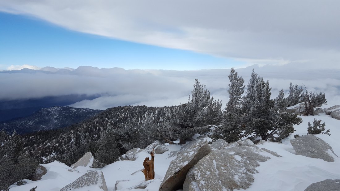
Measured snow depths are as follows. The first number is new accumulation measured today, the second (in parentheses) is the maximum depth at that location including the existing snow from earlier storms. Very strong winds led to considerable drifting, mainly above 10,000′ elevation, often double the reported depth in places. Note that with so much melting between storms this winter, the deepest snow is very patchy, and at all elevations there are some bare areas. Altitudes are approximate.
San Jacinto Peak (10,810′): 3-4″ (24″), with drifts >30″
Wellman Divide (9700′): 2″ (12″)
Annie’s Junction (State Park boundary north of Saddle Jn) (9050′): 1.5″ (10″)
Saddle Junction (8100′): 1″ (7″)
Humber Park (6500′): 1″ (2″)sanjacjonUncategorizedLeave a comment 4 MinutesEdit”Snow update 12th January 2019″
Snow conditions 9th January 2019
I spent all day today in the high country, ascending San Jacinto Peak via Saddle Junction and Wellman Divide, then descending all the way down Deer Springs Trail. I had not intended to record another vlog so soon after the last just three days ago, but I wanted to let folks know about the scrappy state of the snow.ErrorThis video doesn’t exist
All high elevation trails (>6800′) remain snow-covered, with thin patchy snow in places down to about 6000′ on many trails (discussed in detail below for those trails I have surveyed). For details of the snow that fell last weekend, see the posting from Sunday 6th January.
Microspikes are useful on all trails above about 6000′ at this time. They are especially helpful in the early morning when snow is icy, and for descending. Snowshoes are currently recommended everywhere above about 9000′, and they are helpful in many areas above about 8000′. There is already rapid melting occurring below 8000′, and even higher on sun-exposed slopes, and this will continue for the next two days as warm temperatures are forecast to continue.
Hikers should be prepared for temperatures at or below freezing in the high country (>8000′ elevation), and well below freezing at the high peaks (with possible severe cold when considering windchill effects).
Note that during the federal government shutdown, the U.S. Forest Service Idyllwild Ranger Station is closed. Adventure passes and wilderness permits are not required (or at least unenforceable) until the shutdown ends. Please note that the gate at Humber Park is now closed, so parking is very limited.
Weather After two more mild days on 10th and 11th, a period of cold conditions with precipitation is forecast for at least one week. A moderate storm seems likely on Friday night, with a few inches of snow forecast for San Jacinto Peak at least. Thereafter, precipitation is possible at all elevations on some or all days from 14th-17th January.
At San Jacinto Peak today, Wednesday 9th January 2019, at 1115 the air temperature was 33°F (0.5°C), with a windchill temperature of 20°F (-7°C), 28% relative humidity, and a cool 11 mph SW wind gusting to 15.7 mph.
At the Peak on Sunday 6th January 2019, at 0730 the air temperature was 15.8°F (-9°C), with a windchill temperature of -5.8°F (-21°C), 100% relative humidity, and a sharp 15 mph WSW wind gusting to 25.6 mph.
TRAIL CONDITIONS
Devil’s Slide Trail is almost continuously covered in 1-2″ snow, increasing to 4-6″ higher up. Microspikes are sufficient.
Pacific Crest Trail north from Saddle Junction has continuous snow cover. Depth at Saddle Junction was down to 7″, and at 9000′ to about 8-9″. Microspikes were adequate to about 9000′, but snowshoes were essential beyond there (to Wellman Divide in fact) as the only set of tracks occasionally visible between drifts were my own from three days earlier.
Peak Trail From Wellman Divide up, this trail has received only a handful of hikers since the snowfall three days ago. With strong winds and heavy drifting, much of the trail was obscured again this morning. Snowshoes were ideal all the way to San Jacinto Peak.
Deer Springs Trail has been relatively well traveled since the snow three days ago. Snow depth is at about 20″ in Little Round Valley, with some deeper drifts nearer San Jacinto Peak. There is a poorly consolidated snowshoe trail for the entire length of Deer Springs Trail above Strawberry Junction. Snow depth at Strawberry Junction averaged 4″. Below Strawberry Junction (8100′) the trail is largely snow-covered (only a few inches deep) above the Suicide Rock Trail junction, and largely clear below that junction. Microspikes are not needed in this section..
Marion Mountain Trail has been relatively well-traveled, with a good snowshoe track to follow. Thin snow starts at the trailhead, increasing to about 7″ at the junction with the PCT/Deer Springs Trail.
Fuller Ridge Trail/PCT and Seven Pines Trail have shown no signs of use since November, so route finding will be very challenging, especially for those not completely familiar with these trails.sanjacjonUncategorized2 Comments 3 MinutesEdit”Snow conditions 9th January 2019″
Snow update 6th January 2019
There was a heavier-than-forecast snowfall everywhere above about 5000′ overnight. I hiked to San Jacinto Peak yesterday from home via South Ridge Trail, Tahquitz Peak, Saddle Junction, and Wellman Divide, then descended late this morning to Humber Park. Many thanks to Kyle Eubanks who joined me up top, and provided the snow depths for Round and Long valleys on his descent. Credit to the only other people I saw in the high country all day, Monica and Kham, two energetic young ladies who had postholed to Annie’s Junction (9100′). They said very nice things about the Trail Report, including that it had inspired them to come out hiking in the snow today. I recorded the following vlog at San Jacinto Peak late this morning.https://video.wordpress.com/embed/P4VeRzgV?hd=0&autoPlay=0&permalink=1&loop=0&preloadContent=metadata&muted=0&playsinline=0&controls=1
Very fine light snow started at about 1300 yesterday afternoon in the high country, continuing all night, and finally stopping just after sunrise. In Idyllwild at 5550′, we had about 0.25″ rain, followed by 2.0″ snow.
Microspikes are useful, but not essential, on all trails above about 6000′ at this time (see snow depth details below). Snowshoes are currently very useful everywhere above about 8000′. This will continue for at least a couple of days until melting and compacting by foot traffic makes microspikes more practical. There is already rapid melting occurring below 7000′, and this will likely extend higher in the next few days as mild temperatures are forecast.
Hikers should be prepared for temperatures at or below freezing in the high country (>8000′ elevation), and well below freezing at the high peaks (with possible severe cold when considering windchill effects).
Note that during the federal government shutdown, the U.S. Forest Service Idyllwild Ranger Station is closed. Adventure passes and wilderness permits are not required (or at least unenforceable) until the shutdown ends. Please note that Humber Park is being patrolled by the Forest Service Law Enforcement Officer during the shutdown (I had a chat with him there today).

Weather Most of the coming week will be relatively mild, with considerable melting likely below 8000′ and on sun-exposed slopes. Starting on Friday night, further precipitation is forecast at all elevations in the period 12th-15th January. Currently, snowfall in the high country is forecast to be concentrated in the early morning of Saturday 12th and again overnight on Sunday 13th to Monday 14th.
At San Jacinto Peak today, Sunday 6th January 2019, at 0730 the air temperature was 15.8°F (-9°C), with a windchill temperature of -5.8°F (-21°C), 100% relative humidity, and a sharp 15 mph WSW wind gusting to 25.6 mph.
By way of remarkable contrast, at the Peak on Thursday 3rd January, at 0840 the air temperature was 36°F (2°C), with a windchill temperature of 29.3°F (-2°C), 20% relative humidity, and a mellow 4 mph NNE wind gusting to 6.4 mph.
Measured snow depths are as follows. The first number is new accumulation measured today, the second (in parentheses) is the maximum depth at that location including the existing snow from earlier storms. Very strong winds have led to extreme drifting, often double the reported depth in places. Note that with so much melting between storms this winter, the deepest snow is very patchy, and at all elevations there were bare areas until last night. Altitudes are approximate.
San Jacinto Peak (10,810′): 12″ (22″), with drifts of 30-40″ on East Ridge
Wellman Divide (9700′): 8″ (14″)
Round Valley (9100′): 9″ (13″)
Annie’s Junction (State Park boundary north of Saddle Jn) (9050′): 8″ (14″)
Long Valley (8500′): 6″ (8″).
Saddle Junction (8100′): 7″ (8″)
Humber Park (6500′): 4″ (4″)
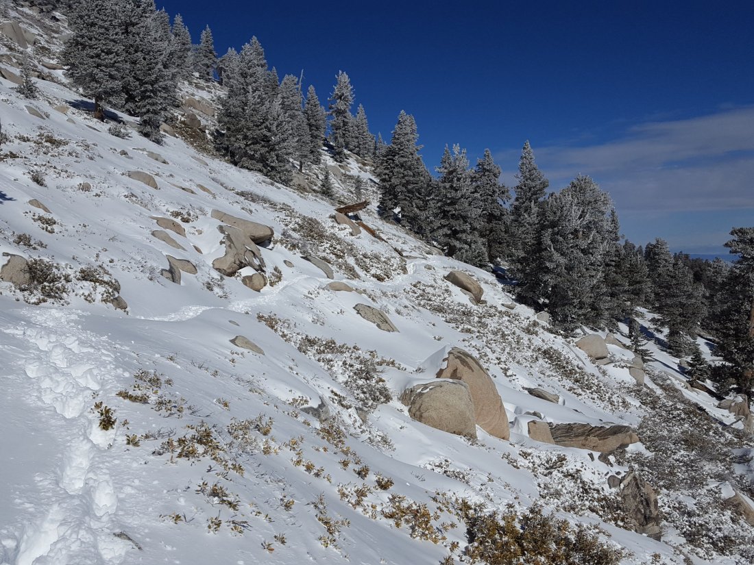

sanjacjonUncategorized3 Comments 2 MinutesEdit”Snow update 6th January 2019″
Cold! 1st January 2019
[UPDATE 3rd January 2019: Yesterday we hiked South Ridge Trail, then this morning I hiked to San Jacinto Peak via Devil’s Slide Trail. I have incorporated new info from those hikes into the report below. The swing in temperatures has been astounding, with San Jacinto Peak already above freezing early this morning (36°F). Consequently, melting has been very rapid, with many trails below 8000′ clearing fast. Only a handful of hikers have made it to San Jacinto Peak in recent days via all routes, with extremely few tracks visible in the high country, so trails remain a little slow-going in heavily drifted areas. Next full update will be after the snowstorm (fingers crossed) on Sunday.]
If today was a sign of things to come, 2019 will be an exciting year in the San Jacinto mountains! Early this morning I hiked to San Jacinto Peak via Devil’s Slide Trail and Wellman Divide, descending via Deer Springs Trail. Conditions at all elevations were very cold, with a howling northerly gale, and spindrift snow flying in all directions. I observed yet another record low windchill temperature at San Jacinto Peak, as discussed in the video.https://video.wordpress.com/embed/iKAquMN6?hd=0&autoPlay=0&permalink=1&loop=0&preloadContent=metadata&muted=0&playsinline=0&controls=1
I briefly described the snow that fell yesterday in the final update of 2018. All trails above about 6700′ are snow-covered, with patchy thin snow to 5700′ (discussed in detail below). With such strong winds, drifting has been very widespread, making tracks disappear within minutes, and route-finding complicated at times for those unfamiliar with the area.
Despite the cold conditions in the past week, a remarkable amount of melting had occurred in the days prior to the light snow yesterday. The 1-2″ of snow that fell yesterday may melt quickly on exposed slopes in the warmer temperatures expected for the rest of this week (see Weather below).
Microspikes are useful, but are not essential, on most trails above about 7800′ at this time (see details below). They are most valuable in the early morning when snow is icier, and for descending. Snowshoes are useful for travel off-trail and in some areas of the high country above about 9800′.
In general, hikers should be prepared for temperatures at or near freezing in the high country (>8000′ elevation), and well below freezing at the highest peaks (with potential for severe cold when considering windchill effects).
Note that during the federal government shutdown, the U.S. Forest Service Idyllwild Ranger Station is closed. Adventure passes and wilderness permits are not required (or at least unenforceable) until the shutdown ends.
Weather The next few days may be a microcosm of the highly erratic weather we have experienced so far this winter. The severe cold of the last few days will be replaced by relatively warm weather (with likely extensive melting) for the rest of this week, which may then end abruptly with a snow storm at the weekend. The latter was originally forecast to be comparable to the notable storm of early December 2018, but more recent forecasts have greatly reduced the predicted snow volumes.
At San Jacinto Peak today, Tuesday 1st January 2019, at 0900 the air temperature was 0.7°F (-17°C), with a windchill temperature of -33.4°F (-36°C), 58% relative humidity, and a bitter 25 mph due North wind gusting to 49.7 mph.
At the Peak yesterday, Monday 31st December 2018, at 0930 the air temperature was 16.5°F (-9°C), with a windchill temperature of 0.7°F (-17°C), 100% relative humidity, and a cool 6 mph WSW wind gusting to 12 mph.
TRAIL CONDITIONS
Tahquitz Peak trail from Chinquapin Flat is challenging, and the conditions are described in detail in this earlier report. I have not re-checked this trail since then, but with an inch or so of fresh snow, plus extreme wind-blown drifting, it is certain that conditions will be no less difficult. Crampons (or microspikes if you are very comfortable with their use), in conjunction with hiking poles or preferably an ice axe, are recommended. [I would discourage carrying an ice axe if you aren’t familiar with how to use it.]
South Ridge Trail has barely 1″ depth of patchy snow from the top of South Ridge Road to Old Lookout Flat (the plateau at 7800′). From 7800′ the trail is largely snow-covered at 1-2″ deep, with 3-5″ near Tahquitz Peak. There are some deeper drifts on the upper switchbacks. Due to the nature of the snow, microspikes are not essential, but some hikers will find them useful especially for descending the uppermost switchbacks. [Note that South Ridge Road is very icy, and challenging for both 2WD vehicles and hikers.]
Eastern slope trails The major trails had been well traveled and were fairly well consolidated until 30th December. However minimal hiker traffic and heavy drifting from strong winds since then has made the trails harder to follow. This includes the main Long Valley and Round Valley trails. The East Ridge Trail on San Jacinto Peak, the Sid Davis Trail, and the Old Tamarack Trail, have received no visible traffic, and require caution and snowshoes.
Deer Springs Trail has been lightly traveled since the snow on Christmas Day. Snow depth is at about 8-10″ in Little Round Valley, with deeper drifts nearer San Jacinto Peak. There is no consolidated trail between Little Round Valley and San Jacinto Peak, with tracks of just a few people, and these only approximate to the route of the trail.
Deer Springs Trail below Little Round Valley has continuous snow to Strawberry Junction. At the latter, snow depth is only 1″. Below Strawberry Junction there is very shallow patchy snow, and microspikes are not required in this section.
Marion Mountain Trail has been well traveled today. Thin snow starts at the trailhead, increasing to about 5″ at the junction with the PCT/Deer Springs Trail. Areas that had cleared following the earlier December snows, below about 7800′, are already starting to clear in patches.
Fuller Ridge Trail and Seven Pines Trail show no signs of recent use, so route finding will be very challenging for those not completely familiar with these trails.
Devil’s Slide Trail is largely clear of snow below 7600′. Snow cover is more-or-less continuous above that elevation, but very shallow and not too icy. Snow depth at Saddle Junction averages 2″. Most hikers will find microspikes are not required for the majority of this trail. There is a small but very treacherous patch of black ice at Middle Spring, about 1.4 trail miles above Humber Park.
Ernie Maxwell Trail has only patchy snow at no more than 1″ depth. Microspikes are not required. [Many thanks to Anne and Anabel King for this information.]
Skyline Trail has light patchy snow above about 6000′, which is then more continuous from the Traverse upwards (>7200′) at about 2-4″ deep. The trail is consolidated and fairly obvious. Some hikers are carrying microspikes and poles or ice axes, but report not needing to use them. [Many thanks to various correspondents for this information.]
Pacific Crest Trail north from Saddle Junction currently has only patchy snow to near 9000′. Microspikes are of limited use up to that elevation, but are then helpful from there to Annie’s Junction (the State Park boundary).
Pacific Crest Trail south from Saddle Junction has continuous snow cover (at only 2-4″ deep) to 8300′, and then about 3-6″ deep, but with a clear consolidated track, to 8400′ at Chinquapin Flat. There has been no recent foot traffic on the PCT south from Chinquapin Flat.

Finally, a huge thank you to all those supporters and donors who helped make 2018 such a remarkably successful year for the San Jacinto Trail Report, far, far beyond my most optimistic expectations for the project. All those supporters are listed here. If you found the Report to be useful to you in the past year, please consider visiting the Donate page. Many thanks. Happy New Year and safe hiking.
