Snow storm summary 29th December 2020
[UPDATE 31st December 2020: I was unable to resist one last ascent of San Jacinto Peak in the year. Strong Santa Ana winds on the night of 29th had largely eliminated my tracks above 9000ft, so I broke trail again. Remarkably a brief storm blew in around noon, with 0.5 inch of snow settling above 10,000ft. Wild accompanying winds again partially removed my tracks with spindrift. Strong Santa Ana winds overnight into 1st January will fill trails with spindrift making for challenging hiking and navigation for the first days of 2021. Snowshoes are strongly recommended above 8000ft.]
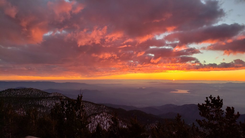
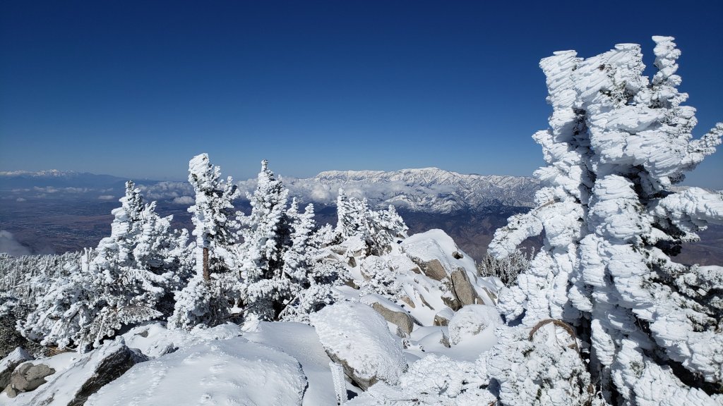
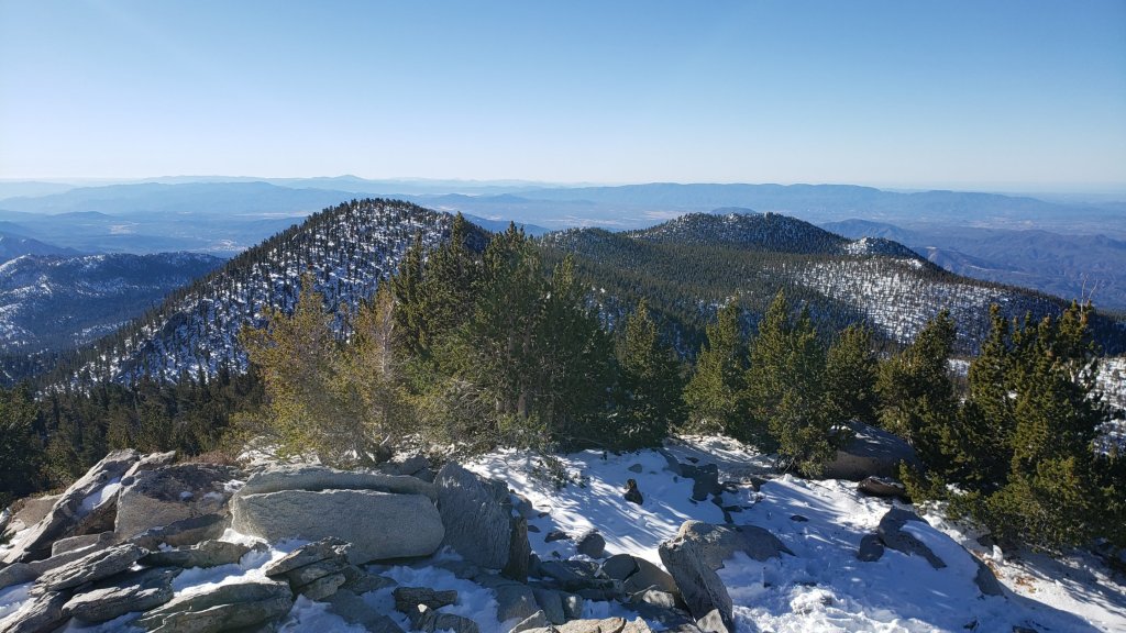
This is a summary of conditions following the third, and most substantial (so far), snow storm of winter 2020/21, with all of the snow falling yesterday, Monday 28th December. As is increasingly the trend with a changed climate in recent years, there was little difference in snowfall between the mid and upper elevations, with 15.5 inches measured in Idyllwild (at 5550ft) through to 17 inches at San Jacinto Peak (10,810ft). The storm system was colder than forecast at lower elevations, with a dusting of snow below 4000ft in many ranges, and even down to 4800ft on Skyline Trail, a desert-facing slope.
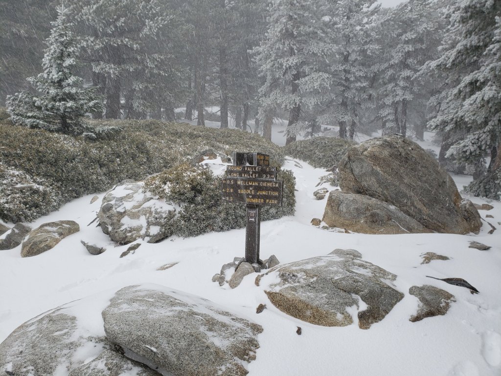
Currently very few no major trails have been traveled and most are obscured by significant snowfall. On my descent late this morning I was again surprised to see no tracks up to Saddle Junction. The significance of this is that there are currently no tracks on Willow Creek Trail, to Chinquapin Flat or Tahquitz Peak, or around the meadows. Beyond Saddle Junction, at the time of writing my snowshoe tracks to San Jacinto Peak are the only traveled high country trail. Cautious navigation is strongly recommended everywhere. Snow depths measured today are listed at the foot of this posting, but note that due to drifting, snow is sometimes deeper in the trails themselves.
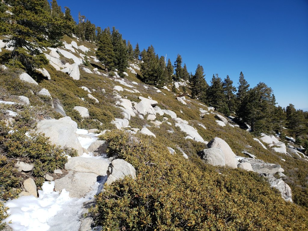
Snow depths are currently ideal for snowshoeing everywhere above about 6000‘, potentially lower on less exposed trails that will melt slowly (e.g., the Ernie Maxwell Trail). Elsewhere (and in addition), spikes are recommended for the foreseeable future as established trails become consolidated by hiker traffic and undergo freeze-thaw cycles.
Hikers should be prepared for temperatures below freezing in the high country, and far below freezing when considering wind chill effects (see below for recent temperatures at San Jacinto Peak today).
For details regarding coronavirus closures, hiking permits, camping restrictions, ranger station access, and the Tramway, please see this earlier report, or contact the State Park or Forest Service as indicated on their websites.
The USFS gate at Humber Park was (unexpectedly) open when I drove out around noon today. The parking area is an rink of compacted icy snow and is treacherous for most vehicles.

WEATHER Temperatures are forecast to remain below seasonal averages into the first week of January, with freezing conditions every night above about 5000ft. Snow melt will generally be slow, and conditions will be icy. Minor storm systems are possible around 6th-8th January.
At San Jacinto Peak (10,810ft/3295m) yesterday, Monday 28th December 2020 at 1330 the air temperature was 11.4°F (-11°C), with a windchill temperature of -16.8°F (-27°C), 93% relative humidity, and a wild SW wind sustained at 26 mph gusting to 39.0 mph.
At the Peak on Friday 25th December 2020 at 1125 the air temperature was 27.7°F (-2°C), with a windchill temperature of 15.3°F (-9°C), 69% relative humidity, and a sharp WSW wind sustained at 9 mph gusting to 14.1 mph.

TRAIL CONDITIONS
All trails above about 4500′ are snow-covered. By this afternoon, melting was already underway below 5000′. Reliable tracks are currently only known to be in place for Devil’s Slide Trail through to San Jacinto Peak via Wellman Divide. The closure of the Tram will result in extremely light hiker traffic to the highest peaks via the Peak Trail, and very limited traffic on the Long and Round Valley trails.
Tahquitz Peak trail from Chinquapin Flat/PCT Mile 178 has no steps to follow through the steeply angled icy snow. These icy slopes are treacherous. Currently crampons (with an ice axe) are strongly recommended. Snowshoes are not advised due to the angle of the icy snow.
Devil’s Slide Trail has a well-traveled track to follow.
The Ernie Maxwell Trail has a firm and well-defined 18″ wide snowshoe track to follow along its entire length [updated 30th December].
SNOW DEPTHS measured on 29th December 2020, are as follows. Note that average depth is given; due to strong winds there is extensive drifting, especially in the trails. Altitudes are approximate.
San Jacinto Peak (10810′): 17 inches
Wellman Divide (9700′): 15 inches
Annie’s Junction/approx. PCT Mile 181.8 (9070′): 15 inches
Saddle Junction/approx. PCT Mile 179.9 (8070′): 16 inches
Devil’s Slide Trail at Humber Park (6550′): 14 inches (at noon, melting already underway)
Idyllwild (at 5550′): 15.5 inches, melting slowly this afternoon.
San Jacinto Trail Report: available for everyone, funded by readers. While all labor and time is volunteered, this Report completely depends on small private donations to cover its costs. In an especially challenging year, and with a busy winter already well underway, every contribution is invaluable. If you have found this Report useful, please consider visiting the Donate page. Thank you.
Snow storm 28th December 2020
UPDATED @ 0750 Tuesday 29th
Final storm total at San Jacinto Peak is 17 inches of fresh, very fine, powder. An impressive 14 inches had fallen in Idyllwild by late yesterday evening.
Thanks to Florian Boyd for reporting snow down to 4800ft on Skyline (below Rescue 2). Snow level is much lower on the south face of the San Bernardino range, below 4000ft on Banning Bench, and at about that elevation on the hills around Garner Valley.
Snowshoes are recommended everywhere above 5000ft currently, and possibly lower locally.

UPDATED @ 1910 Monday 28th
It has continued to snow steadily throughout the early evening, with storm totals of 11 inches now in Idyllwild (at 5550ft), and 14 inches at San Jacinto Peak. Forecasts project several more inches are possible at all elevations above about 5000ft tonight. The next planned update will be early Tuesday morning.
UPDATED @ 1530 Monday 28th
Snowfall rates have declined at all elevations this afternoon (although light snow continues to fall), with about 11 inches total now at San Jacinto Peak (and the sun briefly putting in an appearance), and Idyllwild only adding another inch by 1430, for a storm total of 7.5″ (at 5550ft).
Weather at San Jacinto Peak at 1330 included an air temperature of 11.4°F (-11°C), with a windchill of -16.8°F (-27°C), and a bitter SW wind sustained at 26 mph gusting to 39.0 mph.
UPDATED @ 1110 Monday 28th
Idyllwild has added at least three inches so far this morning (for a storm total of about seven inches at 5550ft). San Jacinto Peak has added about four more, for a total of 8-9 inches. Radar suggests further heavy precipitation for at least the next hour.
Great friend of the Trail Report Florian Boyd reports light drizzle in Palm Springs (less than 0.2″ total). Snow is visible on Skyline down to about 6500ft (above “Flatrock”), but lower along the Desert Divide.
UPDATED @ 0930 Monday 28th
The much-anticipated third storm of the winter produced 3.75 inches of snow in Idyllwild (at 5500ft) overnight, and 4-5 inches at San Jacinto Peak.
It was snowing heavily intermittently on my hike this morning, with another two inches added in the high country already. The snow consists of extremely fine, small grains, which is consequently drifting heavily. On the Peak Trail, parts of the trail were 8-10 inches deep, even though adjacent bushes and rocks had only a couple of inches.
Although I postholed with spikes this morning, snowshoes are now recommended, at least above 8000′, and probably lower also.
San Jacinto Trail Report: available for everyone, funded by readers. While all labor and time is volunteered, this Report depends on small private donations to cover costs. With an especially challenging year in 2020, every contribution is invaluable. If you have found this Report useful, please consider visiting the Donate page. Thank you.
Trail and weather update 22nd December 2020
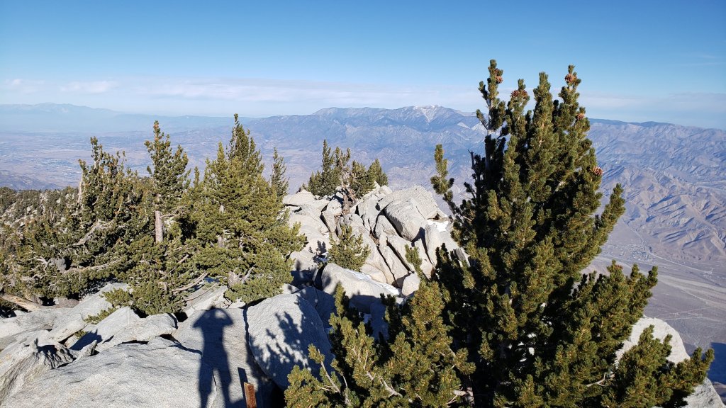
[UPDATED 25th December 2020: a delightful hike today – Skyline Trail to San Jacinto Peak then home to Idyllwild (a “C2C2I”) – was made all the more enjoyable by the light dusting of snow in the high country that fell late yesterday afternoon. Spikes are now recommended everywhere above about 8500′, especially north-facing slopes and shaded valleys, as a thin, slippery, layer of fresh powder is overlaying patchy ice left from the early November storm. I found a hint of snow down to 6100′ on Skyline, but cover was not continuous until Long Valley (0.25-0.5″). Above Wellman Divide depth was an inch, averaging 1.5″ above 10,500′. By late morning exposed slopes at all elevations were largely clear, and almost all areas below 9000′ were becoming snow-free.]
Despite temperatures in the high country near or below freezing, and the sun at its lowest potency of the year, melting of ice has continued steadily, with few significant ice patches remaining now. Weeks of freeze-thaw cycles and compaction by hiker traffic since the early November snowfall has nevertheless left the now tiny patches of snow very icy on high country trails, as described in detail below. Consequently it is still advised to carry spikes for all trails above 8500′ elevation at least. Although rarely required for ascending, spikes can be helpful for descending icy sections of trails, depending upon your comfort level on ice and icy compacted snow.
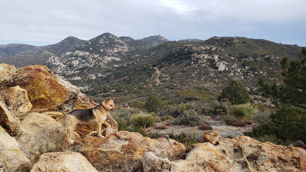
I have continued to hike every single day this year, including several ascents weekly to the highest peaks of the San Jacinto mountains by diverse routes. Other very recent hikes have included South Ridge, May Valley, Ramona Trail, Butterfly Peak, and most sections and side trails of the PCT along the Desert Divide.
Hikers should be prepared for temperatures at or below freezing in the high country, and well below freezing when considering wind chill effects (see below for weather recently recorded at San Jacinto Peak).
Due to continuing elevated fire risk, all camping remains prohibited in both the Mount San Jacinto State Park and the San Jacinto Ranger District of the San Bernardino National Forest, as does all stove use. See the State Park or Forest Service websites for further information. All developed campgrounds are also closed, most seasonally, but now including the Pinyon Flat campground and Ribbonwood Equestrian campground, which closed on 8th December due to the coronavirus crisis.
Due to the coronavirus crisis Mount San Jacinto State Park is encouraging visitation to be confined to local residents only. The Idyllwild ranger station of the State Park has again closed (the U.S. Forest Service ranger station in Idyllwild has not reopened since March). Day use permits are nevertheless required for the San Jacinto wilderness, and should be available at the self-serve kiosks outside either ranger station.
Palm Springs Aerial Tramway closed again starting 12th December due to the coronavirus crisis, and is not expected to reopen this year.
WEATHER Yet another warm spell in recent days – both high and low temperatures have been more than ten degrees above average – gives way to near-seasonal temperatures starting on 23rd, likely for the remainder of the year. Santa Ana winds accompanied by very low relative humidities (and critical fire conditions) are expected on 23rd-24th. In contrast, a fast-moving storm system forecast for Monday 28th December is expected to have a snow level around 5500′, with potential for several inches of snow in the high country.
At San Jacinto Peak (10,810ft/3295m) on Monday 21st December 2020 at 0820 the air temperature was 37.7°F (3°C), with a windchill temperature of 29.5°F (-1°C), 38% relative humidity, and a light SE wind sustained at 6 mph gusting to 9.5 mph.
At the Peak on Friday 18th December 2020 at 0850 the air temperature was 17.3°F (-7°C), with a windchill temperature of -3.7°F (-20°C), 62% relative humidity, and a bitter NNE wind sustained at 15 mph gusting to 22.2 mph.
TRAIL CONDITIONS
Trails below about 8500′ are generally snow-free, with most trails at higher elevations having limited icy snow patches only. Icy snow on trails persists in traditional areas that are colder and/or less sun-exposed, such as the north face of Tahquitz Peak, in Little Round Valley, on Deer Springs Trail around 9300′ near the North Fork River crossing, at around 10,000′ on the Peak Trail, and between Round Valley and Wellman Divide.
Tahquitz Peak trail from Chinquapin Flat/PCT Mile 178 has a well-defined track for 0.3 mile to follow through the largely continuous icy snow. Spikes are recommended for these notoriously treacherous ice slopes.
The trails around the Tahquitz area meadows remain surprisingly snow-covered in patches, especially around Skunk Cabbage and Little Tahquitz meadows. Trails in that area also have many new treefalls, but none that present hazards to hikers.
Devil’s Slide Trail is functionally clear of snow.
South Ridge Trail is clear and spikes are no longer required all the way to Tahquitz Peak.
Deer Springs Trail is largely clear of icy snow to San Jacinto Peak. There are many tiny patches in the trail above about 8700′ that require some caution. The only extended section is almost continuous ice cover for 0.25 mile around 9300′ elevation near the crossing of the North Fork of the San Jacinto River. Icy snow cover averages 30% in Little Round Valley. Most hikers may find spikes useful, depending upon comfort level hiking on ice and compacted icy snow, especially for descending some sections.
The East Ridge Trail between Miller and San Jacinto peaks remains 80% ice- and snow-covered, ranging from 1-6″ deep. There are reasonable tracks to follow.
Marion Mountain Trail is functionally clear of ice, however a couple of tiny patches remain.
The Pacific Crest Trail at the northern end of the Desert Divide (PCT Miles 172-177) had 43 treefall hazards and three minor landslide hazards (in addition to the major rockslide at Mile 172.5) during my survey on 27th November (and we have had several strong wind events since). It goes without saying that the trail is impassable by stock, and it is relatively slow-going for hikers also. The Trail on the north side of Red Tahquitz (Miles 175-177) remains 50% snow-covered, and spikes can be useful. There are no treefall hazards on the PCT south from Cedar Spring Trail (Miles 151-162).
Fuller Ridge Trail has cleared completely on sun-exposed slopes, but sections of icy snow remain in places. Icy snow cover persists in the canyon of the North Fork crossing (PCT Mile 186), on heavily forested parts of the ridge crest around Mile 187, and on the north facing slope near the northern end (Miles 189.5-191). There are tracks to follow through the snow patches where needed, and spikes can be helpful.
The Pacific Crest Trail above Snow Creek (approx. PCT Miles 198-206) was burned on both sides by the Snow Fire (17th-19th September 2020). A closure order – dated to 8th October 2021 – for the burn scar means that the Trail remains closed between Snow Creek and Black Mountain Road (PCT Miles 191-206).
Spitler Peak Trail has three new large treefall hazards (and a couple of smaller ones) in the upper switchbacks.
Seven Pines Trail has had no hiker traffic since the last snowfall. Indeed this trail has been hiked very little since November 2018, initially due to snowfall, then the road closure from February 2019. Extremely cautious navigation is recommended for those who are not very familiar with hiking this trail. The Forest Service closure of Dark Canyon Road continues, and there is no vehicular access to Seven Pines trailhead.
San Jacinto Trail Report: available for everyone, funded by readers. While all labor and time is volunteered, this Report completely depends on small private donations to cover its direct costs. In an especially challenging year, and with a busy winter already underway, every contribution is invaluable. If you have found this Report useful, please consider visiting the Donate page. Thank you.
Brief update 14th December 2020
Please see last week’s report (available here) for details of specific trail conditions, traction recommendations, and of the various closures. With temperatures in the high country near or below freezing, and the sun at its lowest potency of the year, melting of ice has slowed and hence overall trail conditions have not significantly changed in recent days. Furthermore with the Palm Springs Aerial Tramway closing again from 12th December, and Mount San Jacinto State Park encouraging visitation to be confined to local residents only (both measures due to the coronavirus crisis), it seems of limited value at this time to provide additional detail.
I continue to average several ascents to the highest peaks of the San Jacinto mountains every week by diverse routes. Our family ascent of San Jacinto Peak on Friday 11th December was my 200th of the year, far beyond the previous record of 147 in a calendar year. Recent hikes have also included South Ridge, and most sections and side trails of the PCT along the Desert Divide.
Hikers should be prepared for temperatures at or below freezing in the high country, and well below freezing when considering wind chill effects (see below for weather recently recorded at San Jacinto Peak).
Due to continuing elevated fire risk, all camping remains prohibited in both the Mount San Jacinto State Park and the San Jacinto Ranger District of the San Bernardino National Forest, as does all stove use. See the State Park or Forest Service websites for further information. All developed campgrounds are also closed, most seasonally, but now including the Pinyon Flat campground and Ribbonwood Equestrian campground, which closed on 8th December due to the coronavirus crisis.
WEATHER Temperatures at all elevations are forecast to be at or slightly above seasonal averages into late December. The warmest spell, with temperatures well above average, is currently forecast for 19th-22nd December. There continues to be no significant precipitation in the forecast.
At San Jacinto Peak (10,810ft/3295m) on Monday 14th December 2020 at 0925 the air temperature was 23.7°F (-5°C), with a windchill temperature of 3.4°F (-16°C), 15% relative humidity, and a wild WNW wind sustained at 16 mph gusting to 36.3 mph.
At the Peak on Friday 11th December 2020 at 0840 the air temperature was 31.3°F (0°C), with a windchill temperature of 16.8°F (-8°C), 13% relative humidity, and a sharp NW wind sustained at 8 mph gusting to 21.8 mph.


Trail and weather update 7th December 2020
[UPDATED 11th December 2020: The Palm Springs Aerial Tramway will close again from 12th December for the foreseeable future due to the coronavirus crisis.]
A month of freeze-thaw cycles, plus compaction by hiker traffic, has left the limited patches of snow very icy on high country trails. Consequently it is still advised to carry spikes for all trails above about 8000′ elevation, which all have some patches of ice and compacted icy snow, as described in detail below. Although often not required for ascending, spikes can be helpful for descending icy sections of trails, depending upon your comfort level on ice and icy compacted snow. No new snow depth data are given here, as almost all measurements average 1-2″ at most.
I have continued to average at least three ascents to the highest peaks of the San Jacinto mountains every week. Recent surveys also include the PCT from Mile 162 (Cedar Spring Trail) south to Mile 151 (Highway 74).
Hikers should be prepared for temperatures near or below freezing in the high country, and potentially well below freezing when considering wind chill effects. The dramatically differing winds and temperatures I recorded at San Jacinto Peak on my past three ascents over the last five days (see below) perfectly illustrate the unpredictability of mountain weather.
Due to continuing severe fire risk, all wilderness and dispersed camping remains prohibited in both the Mount San Jacinto State Park and the San Jacinto Ranger District of the San Bernardino National Forest, as does all stove use. For further information contact the State Park or Forest Service as indicated on their websites. All developed campgrounds are now also closed (either seasonally, or due to the coronavirus crisis).
Due to the coronavirus crisis the Idyllwild ranger station of the Mount San Jacinto State Park has again closed (the U.S. Forest Service ranger station in Idyllwild has not reopened since March). Day use permits are nevertheless required for the San Jacinto wilderness, and should be available at the self-serve kiosks outside either ranger station.
WEATHER Temperatures at all elevations are forecast to average several degrees above seasonal until mid December. A cold system is forecast around 15th-16th, with frigid temperatures possible in the high country. There continues to be no significant precipitation in the forecast.
At San Jacinto Peak (10,810ft/3295m) on Monday 7th December 2020 at 0825 the air temperature was 25.0°F (-4°C), with a windchill temperature of 6.9°F (-14°C), 43% relative humidity, and a sharp SE wind sustained at 13 mph gusting to 25.0 mph.
At the Peak on Sunday 6th December 2020 at 0830 the air temperature was 41.6°F (5°C), with a windchill temperature of 39.7°F (4°C), 14% relative humidity, under calm conditions, with an occasional light and variable breeze gusting to 3 mph.
At the Peak on Thursday 3rd December 2020 at 0840 the air temperature was 23.1°F (-5°C), with a windchill temperature of -0.6°F (-18°C), 21% relative humidity, and a howling due East wind sustained at 28 mph gusting to 48.1 mph.

TRAIL CONDITIONS
Trails below about 8000′ are snow-free, with most areas at higher elevations continuing to clear steadily. Snow on trails largely persists in traditional areas that are colder and/or less sun-exposed, such as the north face of Tahquitz Peak, in Little Round Valley, on Deer Springs Trail between Marion Mountain and Fuller Ridge trails, either side of Annie’s Junction, at around 10,000′ on the Peak Trail, between Round Valley and Wellman Divide, and around the summit boulders of San Jacinto Peak.
Tahquitz Peak trail from Chinquapin Flat/PCT Mile 178 has a well-defined track to follow through the angled icy snow. These icy slopes are treacherous. Spikes remain recommended.
The trails around the Tahquitz area meadows remain surprisingly snow-covered in patches, especially around Skunk Cabbage and Little Tahquitz meadows. Trails in that area also have a few new treefalls, but none that present hazards to hikers.
Devil’s Slide Trail is basically clear of snow. Most hikers will not need spikes on the handful of tiny icy snow patches that remain near Saddle Junction.
South Ridge Trail is clear and spikes are no longer required all the way to Tahquitz Peak.
Deer Springs Trail is clear of snow past Strawberry Junction to about 8600′, shortly before the Marion Mountain Trail junction (no spikes required). Snow cover is about 40% from there to the Fuller Ridge Trail junction. Thereafter icy snow cover averages 10% depending on exposure, but it is 50% in Little Round Valley. Above Little Round Valley the icy snow cover is only 5%. Most hikers may find spikes useful, depending upon your comfort level on ice and compacted snow, especially for descending some sections.
The East Ridge Trail between Miller and San Jacinto peaks remains 90% snow-covered, ranging from 1-6″ deep. There are reasonable tracks to follow.
Marion Mountain Trail is almost completely clear of icy snow, however a few tiny, tricky patches remain. Spikes could be useful for descending.
The Pacific Crest Trail at the northern end of the Desert Divide (PCT Miles 172-177) had 43 treefall hazards and three minor landslide hazards (in addition to the major rockslide at Mile 172.5) during my survey on 27th November. It goes without saying that the trail is impassable by stock, and it is relatively slow-going for hikers also. The Trail on the north side of Red Tahquitz (Miles 175-177) remains 80% snow-covered, and spikes are useful. Thankfully there are no treefall hazards on the PCT south from Cedar Spring Trail (Miles 151-162).
Fuller Ridge Trail has cleared completely on sun-exposed slopes, but extensive sections of icy snow remain in several sections. Icy snow cover is especially extensive in the canyon of the North Fork crossing (PCT Mile 186), on heavily forested parts of the ridge crest around Mile 187, and on the north facing slope near the northern end (Miles 189.5-191). There are a couple of reasonable sets of tracks to follow through the snow patches, and spikes are recommended.
The Pacific Crest Trail above Snow Creek (approx. PCT Miles 198-206) was burned on both sides by the Snow Fire (17th-19th September 2020). A closure order for the burn scar means that the Trail remains closed between Snow Creek and Black Mountain Road (PCT Miles 191-206).
Spitler Peak Trail has two new large treefall hazards in the upper switchbacks. The previous dozen downed trees on this trail were removed in early November.
Seven Pines Trail has had no hiker traffic since the last snowfall. Indeed this trail has been hiked very little since November 2018, initially due to snowfall, then the road closure from February 2019. Extremely cautious navigation is recommended for those who are not very familiar with hiking this trail. The Forest Service closure of Dark Canyon Road continues, and there is no vehicular access to Seven Pines trailhead.
San Jacinto Trail Report: available for everyone, funded by readers. While all labor and time is volunteered, this Report completely depends on small private donations to cover its direct costs. In an especially challenging year, and with a busy winter already underway, every contribution is invaluable. If you have found this Report useful, please consider visiting the Donate page. Thank you.
Trail update 1st December 2020
Three weeks of freeze-thaw cycles, and considerable compaction by hiker traffic, has left the limited patches of snow dangerously icy on the high country trails. Consequently spikes are recommended for all trails above about 8000′ elevation, which all have some patches of ice and compacted icy snow, as described in detail below. Even when not required for ascending, spikes are often useful for descending icy sections of trails, depending upon your comfort level on ice and icy compacted snow. No new snow depth data are given here, as almost all measurements average 1-2″ at most. I have continued to average three ascents to the highest peaks of the San Jacinto mountains every week. Recent surveys have also included the PCT from Mile 168 (Spitler Peak Trail) to 192 (Black Mountain Road) and almost all side trails to that section.
Hikers should be prepared for temperatures near or below freezing in the high country, and potentially well below freezing when considering wind chill effects (see below for temperatures recorded at San Jacinto Peak recently).
Due to continuing severe fire risk, all wilderness and dispersed camping remains prohibited in both the Mount San Jacinto State Park and the San Jacinto Ranger District of the San Bernardino National Forest, as does all stove use. For further information contact the State Park or Forest Service as indicated on their websites.
Day hiking permits are available at the Idyllwild and Long Valley ranger stations of the Mount San Jacinto State Park, which are both open. The U.S. Forest Service ranger station in Idyllwild remains closed due to the coronavirus crisis. USFS day use permits are nevertheless required for the San Jacinto wilderness, and should be available at the self-serve kiosk outside the ranger station. Seasonal developed campgrounds – Stone Creek, Marion Mountain, and Fern Basin – closed on 10th November for the winter.
The Palm Springs Aerial Tramway reopened in October at reduced capacity, limited days, and shortened hours. See their website for details.
WEATHER Temperatures at all elevations are forecast to remain several degrees above seasonal for the first week of December. Temperatures in the high country especially remain well above seasonal norms. There is no significant precipitation in the forecast.
At San Jacinto Peak (10,810ft/3295m) on Tuesday 1st December 2020 at 0820 the air temperature was 39.2°F (4°C), with a windchill temperature of 31.0°F (-1°C), 25% relative humidity, and a gusty NNW wind sustained at 5 mph gusting to 8.1 mph.
At the Peak on Monday 30th November 2020 at 0840 the air temperature was 37.1°F (3°C), with a windchill temperature of 32.8°F (0°C), 23% relative humidity, and a light NW breeze sustained at 2 mph gusting to 4.3 mph.
TRAIL CONDITIONS
Trails below about 8000′ are snow-free, with most areas at higher elevations also clearing steadily. Snow on trails largely persists in traditional areas that are colder and/or less sun-exposed, such as the north face of Tahquitz Peak, in Little Round Valley, on Deer Springs Trail between Marion Mountain and Fuller Ridge trails, either side of Annie’s Junction, at around 10,000′ on the Peak Trail, between Round Valley and Wellman Divide, and around the summit boulders of San Jacinto Peak.
Tahquitz Peak trail from Chinquapin Flat/PCT Mile 178 has a well-defined track to follow through the angled icy snow. These icy slopes are treacherous. Spikes remain recommended.
The trails around the Tahquitz area meadows remain surprisingly snow-covered in places, especially around Skunk Cabbage and Little Tahquitz meadows. Trails in that area also have a few new treefalls, but none that present major hazards to hikers.
Devil’s Slide Trail is basically clear of snow. Most hikers will not need spikes on the handful of tiny icy snow patches that remain near Saddle Junction. The major new treefall hazard just past the second switchback was removed on Friday 20th November.
South Ridge Trail is almost completely clear and spikes are no longer required all the way to Tahquitz Peak.
Deer Springs Trail is clear of snow past Strawberry Junction to about 8600′, shortly before the Marion Mountain Trail junction (no spikes required). Snow cover is about 60% from there to the Fuller Ridge Trail junction. Thereafter icy snow cover averages 20% depending on exposure, but it is 70% in Little Round Valley. Above Little Round Valley the icy snow cover is about 10%. Most hikers will find spikes are useful, depending upon your comfort level on ice and compacted snow, especially for descending in some sections.
Marion Mountain Trail is almost completely clear of icy snow, however a few tricky patches remain, especially near the PCT junction. Spikes could be useful for descending.
The Pacific Crest Trail at the northern end of the Desert Divide (PCT Miles 172-177) had 43 treefall hazards and three minor landslide hazards (in addition to the major rockslide at Mile 172.5) during my survey on 27th November. It goes without saying that the trail is impassable by stock, and it is relatively slow-going for hikers also. The Trail on the north side of Red Tahquitz (Miles 175-177) remains 90% snow-covered, and spikes are recommended.
Fuller Ridge Trail has cleared completely on sun-exposed slopes, but extensive sections of icy snow remain in several sections. Icy snow cover is especially extensive in the canyon of the North Fork crossing (PCT Mile 186), on heavily forested parts of the ridge crest around Mile 187, and on the north facing slope near the northern end (Miles 189.5-191). There are a couple of reasonable sets of tracks to follow through the snow patches, and spikes are recommended.
The Pacific Crest Trail above Snow Creek (approx. PCT Miles 198-206) was burned on both sides by the Snow Fire (17th-19th September 2020). A closure order for the burn scar means that the Trail remains closed between Snow Creek and Black Mountain Road (PCT Miles 191-206).
Spitler Peak Trail has two new large treefall hazards in the upper switchbacks. The previous dozen downed trees on this trail were removed in early November.
Seven Pines Trail has had no hiker traffic since the last snowfall. Indeed this trail has been hiked very little since November 2018, initially due to snowfall, then the road closure from February 2019. Extremely cautious navigation is recommended for those who are not very familiar with hiking this trail. The Forest Service closure of Dark Canyon Road continues, and there is no vehicular access to Seven Pines trailhead.


San Jacinto Trail Report: available for everyone, funded by readers. While all labor and time is volunteered, this Report completely depends on small private donations to cover its direct costs. In an especially challenging year, and with a busy winter already underway, every contribution is invaluable. If you have found this Report useful, please consider visiting the Donate page. Thank you.
Trail update 25th November 2020
Following the moderate snow storm on 7th-8th November, a dramatic swing to temperatures far above seasonal for much of the past two weeks has resulted in rapid and extensive melting at all elevations. Most trails below 8000′ are already largely clear, and at higher elevations snow is very patchy, especially on sun-exposed slopes. Where icy snow remains, most major trails have now been well traveled and have reliable, compacted tracks to follow. No new snow depth data are given here, as almost all measurements are 1-2″ at most. I have continued to average at least three ascents into the San Jacinto high country every week, hiking mid-elevation trails on the intervening days.
Spikes remain recommended for parts of all trails above about 8000′ elevation for at least the next week or so as consolidated snow undergoes freeze-thaw cycles, creating localized icy conditions. Even when not required for ascending, spikes are invariably useful for descending trails where the snow is compacted and icy.
Hikers should be prepared for temperatures near or below freezing in the high country, and well below freezing when considering wind chill effects (see below for temperatures recorded at San Jacinto Peak recently).
All wilderness and dispersed camping remains prohibited in both the Mount San Jacinto State Park and the San Jacinto Ranger District of the San Bernardino National Forest, as does all stove use. For further information contact the State Park or Forest Service as indicated on their websites.
Day hiking permits are available at the Idyllwild and Long Valley ranger stations of the Mount San Jacinto State Park, which are both open. The U.S. Forest Service ranger station in Idyllwild remains closed due to the coronavirus crisis. USFS day use permits are nevertheless required for the San Jacinto wilderness, and should be available at the self-serve kiosk outside the ranger station. Seasonal developed campgrounds – Stone Creek, Marion Mountain, and Fern Basin – closed on 10th November for the winter.
The Palm Springs Aerial Tramway has reopened at reduced capacity, limited days, and shortened hours. See their website for details.
WEATHER Following temperatures well above seasonal in recent days, the next couple of days will be typically cool for November, before again warming up after Saturday 28th. Temperatures in the high country will remain above average (i.e. near or above freezing) into early December, so steady snowmelt will continue. There is no significant precipitation in the forecast. The latest video discussion from NWS San Diego reviews the summer (spoiler alert: warmest ever), and includes medium term (December) and longer term (into February) weather projections (spoiler alert: warm and dry).
At San Jacinto Peak (10,810ft/3295m) on Wednesday 25th November 2020 at 0825 the air temperature was 29.1°F (-2°C), with a windchill temperature of 14.6°F (-10°C), 61% relative humidity, and a fresh due West wind sustained at 13 mph gusting to 17.8 mph.
At the Peak on Monday 23rd November 2020 at 0825 the air temperature was 28.2°F (-2°C), with a windchill temperature of 11.3°F (-12°C), 54% relative humidity, and a sharp due West wind sustained at 13 mph gusting to 23.1 mph.
At the Peak on Friday 20th November 2020 at 0815 the air temperature was 43.3°F (6°C), with a windchill temperature of 39.1°F (4°C), 51% relative humidity, and a light due West breeze sustained at 4 mph gusting to 6.2 mph.
TRAIL CONDITIONS
Trails below about 8000′ are now almost completely snow-free, with most areas at higher elevations also clearing very rapidly. Snow on trails largely persists in traditional areas that are colder and/or less sun-exposed, such as the north face of Tahquitz Peak, in Little Round Valley, Deer Springs Trail between Marion Mountain and Fuller Ridge trails, either side of Annie’s Junction, around 10,000′ on the Peak Trail, between Round Valley and Wellman Divide, and around the summit of San Jacinto Peak.
Tahquitz Peak trail from Chinquapin Flat/PCT Mile 178 has a well-defined track to follow through the angled icy snow. These icy slopes are treacherous. Currently spikes remain recommended.
Devil’s Slide Trail is basically clear of snow. Most hikers will not need spikes on the handful of tiny icy snow patches that remain near Saddle Junction. The major new treefall hazard just past the second switchback was removed on Friday 20th November.
South Ridge Trail is almost completely clear and spikes are no longer required all the way to Tahquitz Peak.
Deer Springs Trail is basically clear of snow up to and past Strawberry Junction to about 8600′, just before the Marion Mountain Trail junction (no spikes required). Snow cover is about 70% from there to the Fuller Ridge Trail junction. Thereafter icy snow cover averages 20% depending on exposure, but it is 90% in Little Round Valley. Above Little Round Valley the icy snow cover is about 20%. most hikers will find spikes are useful, depending upon your comfort level on ice and compacted snow, especially for descending in some sections.
Marion Mountain Trail is almost completely clear of icy snow, however a few tricky patches remain, especially near the PCT junction. Spikes can be useful in patches, especially for descending.
Ernie Maxwell Trail is completely clear of snow.
Removal of the dozen or so fallen tree hazards on Spitler Peak Trail was completed earlier this month.
Seven Pines Trail has had no hiker traffic since the last snowfall, with no tracks or trail to follow. Indeed this trail has been hiked very little since November 2018, initially due to snowfall, then the road closure from February 2019. Extremely cautious navigation is recommended for those who are not very familiar with hiking this trail. The Forest Service closure of Dark Canyon Road continues, and there is no vehicular access to Seven Pines trailhead.
San Jacinto Trail Report: available for everyone, funded by readers. While all labor and time is volunteered, this Report completely depends on small private donations to cover its direct costs. In an especially challenging year, and a busy winter already underway, every contribution is invaluable. If you have found this Report useful, please consider visiting the Donate page. Thank you.
Trail and snow update 18th November 2020
[UPDATE Friday 20th November: Melting continues to be widespread at all elevations, especially on sun-exposed slopes. The route from Devil’s Slide Trail to San Jacinto Peak via the Wellman and Peak trails was largely clear of snow and ice this morning. The usual two stubborn areas of continuous icy snow remain, an extended area of about 0.6 mile either side of Annie’s Junction, and again for about 0.4 mile near 10,000′ elevation on the Peak Trail. Spikes are useful in those sections, especially for descending. Devil’s Slide Trail is basically clear of snow.]
I have continued to average at least three ascents into the San Jacinto high country every week. Our speedy ascent on Monday 16th from Humber Park to San Jacinto Peak required no spikes on a well-consolidated trail, although spikes were very helpful for most of the descent on somewhat patchy, compacted, icy snow. I used spikes more extensively on today’s fast hike up and down via Marion Mountain and Deer Springs trails.
With a dramatic swing to temperatures far above seasonal, melting has been rapid at all elevations. Most areas below 7000′ are largely clear, and the snow on sun-exposed slopes all the way to the high peaks, but especially below 10,000′, is melting rapidly. We started this morning and on Monday before first light in an air temperature ten degrees above average, and descended to Idyllwild late morning in a temperature more than 20 degrees above seasonal. Melting will continue to be very fast this week.
Most major trails have now been traveled and have reliable compacted snow tracks to follow (of varying quality, depending on hiker traffic volume), which are also clearing rapidly of course lower down. Cautious navigation is nevertheless recommended everywhere. Snow depths measured Monday are listed at the foot of this posting.
Spikes remain strongly recommended in most areas above about 7000′ elevation for at least the next week or so as consolidated snow undergoes freeze-thaw cycles, creating dangerous icy conditions. Even when not needed for ascending, spikes are especially useful for descending trails where they are icy and compacted. Snowshoes remain useful for off trail travel only in the high country above about 9000‘, potentially lower on colder slopes.
Despite the unseasonably warm weather on average, hikers should nevertheless be prepared for temperatures near freezing in the high country, and at or below freezing when considering wind chill effects (see below for recent temperatures recorded at San Jacinto Peak).
For details regarding hiking permits, camping restrictions, ranger station access, and the Tramway, please see this previous Report, or contact the State Park or Forest Service as indicated on their websites.
WEATHER After a couple of remarkably warm days at the beginning of this week, the next ten days starting Wednesday 18th are forecast to be consistently slightly above seasonal both overnight and by day. Extensive snowmelt will continue at all elevations. There is no significant precipitation in the forecast.
At San Jacinto Peak (10,810ft/3295m) on Monday 16th November 2020 at 0850 the air temperature was 43.1°F (6°C), with a windchill temperature of 33.9°F (1°C), 33% relative humidity, and a surprisingly cool SSE wind sustained at 7 mph gusting to 18.9 mph.
At the Peak on Friday 13th November 2020 at 0835 the air temperature was 34.4°F (1°C), with a windchill temperature of 23.4°F (-5°C), 36% relative humidity, and a moderate NW wind sustained at 7 mph gusting to 12.5 mph.
At the Peak last Monday, 9th November 2020, at 1005 the air temperature was 19.0°F (-7°C), with a windchill temperature of 12.3°F (-11°C), 51% relative humidity, and a very light due North breeze sustained at 1.0 mph gusting to 5.3 mph.
TRAIL CONDITIONS
All trails above about 7500′ remain largely snow-covered. Most areas below 7500′ are clear or rapidly clearing of snow. Reliable tracks are now in place for most major trails including: Devil’s Slide, Deer Springs, Marion Mountain, Peak, Wellman, Long and Round Valley through to Wellman Divide, Skyline, South Ridge, Tahquitz Peak, and the Tahquitz area meadows.
Tahquitz Peak trail from Chinquapin Flat/PCT Mile 178 has steps to follow through the angled icy snow. These icy slopes are treacherous. Currently spikes are recommended.
Devil’s Slide Trail is largely clear of snow to 7600′. Snow is patchy but more continuous above that elevation, becoming continuous near Saddle Junction. The trail is hard and icy and spikes are very useful for descending. [The major new treefall hazard just past the second switchback was cut on 20th November.]
South Ridge Trail is largely clear to Old Lookout Flat at 7600′. Snow cover is largely continuous from there to the Peak, other than on sun-exposed sections of trail. Remaining snow will melt dramatically over the next few days. Spikes are useful for descending especially early in the morning. South Ridge Road (open) is clear of ice.
Deer Springs Trail is clear (or clearing rapidly) of snow up to and past Strawberry Junction to about 8600′, just before the Marion Mountain Trail junction. Snow is nearly continuous from there to the Fuller Ridge Trail junction. Thereafter snow cover averages 50% depending on exposure, but it is 100% in Little Round Valley. Above Little Round Valley the consolidated track through the snow does not accurately follow the trail route to San Jacinto Peak, but is adequate. Spikes are very useful, especially for descending, as snow is icy and compacted.
Marion Mountain Trail is basically clear to 7600′ (no spikes required). There is largely continuous icy snow for about 0.5 mile from 7600′-8100′, before clearing again until just below the PCT junction. Spikes are useful, especially for descending.
Ernie Maxwell Trail is almost clear of snow, with a few icy patches remaining on the upper end near Humber Park.
Seven Pines Trail has had no hiker traffic since the snowfall, with no tracks or trail to follow. Indeed this trail has only been hiked ery little since November 2018. Extremely cautious navigation is recommended for those who are not very familiar with hiking this trail. The Forest Service closure of Dark Canyon Road continues, and there is no vehicular access to Seven Pines trailhead.
SNOW DEPTHS measured today, 16th November 2020, are as follows. Note that average depth is given; extensive drifting and differential melting has led to uneven depths. Altitudes are approximate.
San Jacinto Peak (10810′): 4″ (was 9″ on 9th November)
Wellman Divide (9700′): 1″ (was 8″ on 9th November)
Annie’s Junction/approx. PCT Mile 181.8 (9070′): 4″ (was 8″ on 9th November)
Long Valley (8600′): 2″ (was 5″ on 9th November)
Saddle Junction/approx. PCT Mile 179.9 (8070′): 3″ (was 8″ on 9th November)
Devil’s Slide Trail at Humber Park (6550′): 0″ (was 8″ on 9th November)

San Jacinto Trail Report: available for everyone, funded by readers. While all labor and time is volunteered, this Report completely depends on small private donations to cover its direct costs. In an especially challenging year, and a busy winter already underway, every contribution is invaluable. If you have found this Report useful, please consider visiting the Donate page. Thank you.

Snow storm summary 9th November 2020
[UPDATED 13th November 2020: There is now a single snowshoe track up from Round Valley to Wellman Divide. This helps with navigation, although postholing will be challenging and snowshoes remain preferable on that section. Above Wellman Divide the Peak Trail is consolidated and spikes are sufficient.]
[UPDATED 11th November 2020: greatly increased hiker traffic on today’s Veterans Day holiday has changed the condition of several trails. My snowshoe track to San Jacinto Peak via the Wellman and Peak trails will be far more consolidated by the 17 people we passed during our descent today. There is still no broken trail up from Round Valley to Wellman Divide. Three people put in a (very ugly looking) posthole trail up Marion Mountain and Deer Springs trails to the Peak yesterday.]
This is an update on conditions following the first snow storm of winter 2020/21, with most of the snow falling on Saturday 7th, followed by a little more on Sunday 8th.
I had a very pleasant day in the high country today, breaking trail from Humber Park to San Jacinto Peak. Conditions were near perfect, with unusually little wind. I recorded a rambling video summary at San Jacinto Peak – complete with ice in the beard! – late this morning, which gives a feel for conditions around the high peaks. As discussed in the video, the storm produced an unusually even snowfall almost everywhere from 6000′ upwards. Snow level was at about 4700′.
On my descent this afternoon I was surprised to see no tracks other than my own up to Saddle Junction. The significance of this is that there are currently no tracks on Willow Creek Trail, to Chinquapin Flat or Tahquitz Peak, or around the meadows.
Currently most major trails have not been traveled and are somewhat obscured by snowfall. Cautious navigation is strongly recommended everywhere. Snow depths measured today are listed at the foot of this posting, but note that due to drifting, snow is often deeper in the trails themselves.
Snow depths are currently ideal for snowshoeing in the high country above about 8000‘, potentially lower on less traveled trails. Spikes are recommended for at least the next few days as established trails become consolidated by hiker traffic and undergo freeze-thaw cycles. They may be especially useful for descending trails when they become icy and compacted (e.g. Devil’s Slide, Ernie Maxwell, and lower Deer Springs trails).
Hikers should be prepared for temperatures below freezing in the high country, and well below freezing when considering wind chill effects (see below for recent temperatures at San Jacinto Peak today).
For details regarding hiking permits, camping restrictions, ranger station access, and the Tramway, please see this previous Report, or contact the State Park or Forest Service as indicated on their websites.
The USFS gate at Humber Park remains open, and the parking area was plowed on Sunday 8th.

WEATHER For the remainder of ths week, every day is forecast to be progressively warmer. Temperatures currently forecast to be well above seasonal next week (15th-20th) will result in rapid and extensive snowmelt at all elevations.
At San Jacinto Peak (10,810ft/3295m) today, Monday 9th November 2020 at 1005 the air temperature was 19.0°F (-7°C), with a windchill temperature of 12.3°F (-11°C), 51% relative humidity, and a very light due North breeze sustained at 1.0 mph gusting to 5.3 mph.
At the Peak on Saturday 7th November 2020 at 1005 the air temperature was 15.4°F (-9°C), with a windchill temperature of -6.6°F (-21°C), 100% relative humidity, and a bitter WNW wind sustained at 15 mph gusting to 23.9 mph.
TRAIL CONDITIONS
All trails above about 5500′ are snow-covered. By this afternoon, rapid melting was already underway below 7000′. Reliable tracks are currently in place only for Devil’s Slide Trail through to San Jacinto Peak via Wellman Divide, and for the Ernie Maxwell Trail. The greatly reduced hours and capacity of the Tram will result in very light hiker traffic to the highest peaks via the Peak Trail, and limited traffic on the Long and Round Valley trails.
Tahquitz Peak trail from Chinquapin Flat/PCT Mile 178 [updated 11th November] has steps to follow through the angled icy snow. These icy slopes are treacherous. Currently spikes are strongly recommended. Snowshoes are not advised due to the angle of the icy snow.
Devil’s Slide Trail has a well-traveled track to follow. A major new treefall hazard just past the second switchback is readily passable for hikers and has been reported to USFS.
SNOW DEPTHS measured today, 9th November 2020, are as follows. Note that average depth is given; due to strong winds there is extensive drifting, especially in the trails. Altitudes are approximate.
San Jacinto Peak (10810′): 9″
Wellman Divide (9700′): 8″
Annie’s Junction/approx. PCT Mile 181.8 (9070′): 8″
Long Valley (8600′): 5″
Saddle Junction/approx. PCT Mile 179.9 (8070′): 8″
Devil’s Slide Trail at Humber Park (6550′): 8″ early this morning, already melted to 2-4″.
Idyllwild (at 5550′): 6.5″, melting steadily today.
San Jacinto Trail Report: available for everyone, funded by readers. While all labor and time is volunteered, this Report completely depends on small private donations to cover its direct costs. In an especially challenging year, and a busy winter already underway, every contribution is invaluable. If you have found this Report useful, please consider visiting the Donate page. Thank you.
sanjacjonUncategorizedLeave a comment 4 MinutesEdit”Snow storm summary 9th November 2020″
First snow storm of winter 7th November 2020
[UPDATED 8th November 2020: In Idyllwild and the high country it continued snowing yesterday afternoon. At mid elevations on the western slope it also snowed briefly overnight and again this morning. Total snow accumulation as of late this morning: Idyllwild 5.75″, Devil’s Slide trailhead at Humber Park 7.0″. The high country has been periodically above the cloud this morning. Snow accumulation as of late yesterday afternoon: San Jacinto Peak 8″, Wellman Divide 6″, Long Valley 4″ (many thanks to Kyle Eubanks for data from yesterday.) The next detailed update is expected to be tomorrow afternoon.]
This is a brief update on conditions following the first snow storm of winter 2020/21. We apparently completely bypassed autumn, heading straight from summer-like conditions just two days ago (it was nearly 80°F in Idyllwild on Thursday!) into temperatures far below seasonal for the first week of November.
I recorded a short video on my hike to San Jacinto Peak this morning, which gives a feel for conditions in the high country. The storm today produced at least 3-4 inches of snow at all elevations above about 6000′ (it was still actively snowing at most of the locations where I recorded depths this afternoon, so depths will likely increase).
Currently almost all major trails have not been traveled and are obscured by snowfall. Cautious navigation is strongly recommended everywhere. Snow depths measured today are listed at the foot of this posting, but note that due to heavy drifting, snow is often deeper in the trails themselves.
At present postholing through shallow snow is relatively easy in most areas, especially below 10,000′. I used spikes this afternoon to assist with descending from San Jacinto Peak, although they were not essential. Spikes are recommended for at least the next few days as established trails become consolidated by hiker traffic and undergo freeze-thaw cycles. They are especially useful for descending trails when they become icy and compacted (e.g. Devil’s Slide and lower Deer Springs trails). Snow depths may be suitable for snowshoeing in the high country by tomorrow, especially above about 9500‘.
For the foreseeable future, hikers should be prepared for temperatures below freezing in the high country, with potentially dangerous cold when considering windchill effects (see below for temperatures at San Jacinto Peak today).
For links and details regarding hiking permits, camping restrictions, ranger station access, and the Tramway reopening, please see the previous Report.
Currently the USFS gate at Humber Park remains open. The parking area had not been plowed as of this afternoon.
WEATHER Another storm system tomorrow (Sunday 8th) is forecast to produce another light snowfall at mid and upper elevations (possibly less snow than today). Milder, brighter weather on 9th-13th will lead up to temperatures well above seasonal on 14th-16th, which will doubtless result in rapid and extensive snowmelt.
At San Jacinto Peak (10,810ft/3295m) today, Saturday 7th November 2020 at 1005 the air temperature was 15.4°F (-9°C), with a windchill temperature of -6.6°F (-21°C), 100% relative humidity, and a bitter WNW wind sustained at 15 mph gusting to 23.9 mph.
For comparison, at the Peak on Wednesday 4th November 2020 at 0600 the air temperature was 42.2°F (6°C), with a windchill temperature of 39.1°F (4°C), 16% relative humidity, and a light ESE wind sustained at 3 mph gusting to 4.3 mph.
TRAIL CONDITIONS
All trails above about 6000′ are snow-covered, with depth increasing somewhat with elevation. Reliable tracks are currently in place only for Devil’s Slide Trail. My track to and from Saddle Junction to San Jacinto Peak via Wellman Divide was disappearing within minutes due to strong winds. The partial closure of the Tram will result in very light hiker traffic to the highest peaks via the Peak Trail, and limited traffic on the Long and Round Valley trails.
Devil’s Slide Trail has a well-traveled track to follow. A major new treefall hazard just past the second switchback is readily passable for hikers and has been reported to the agencies.
Ernie Maxwell Trail is largely under a continuous 1-2″ of snow cover.
SNOW DEPTHS measured today are as follows. Total measured is first, followed by time of day and comments in parentheses. Note that average depth is given, drifting was deeper in the trails due to strong winds and light snow. Altitudes are approximate.
San Jacinto Peak (10810′): 4″ (by 1100)
Wellman Divide (9700′): 3″ (by 1145)
Annie’s Junction/approx. PCT Mile 181.8 (9070′): 2.5″ (by 1215)
Saddle Junction/approx. PCT Mile 179.9 (8070′): 2.5″
Devil’s Slide Trail at Humber Park (6550′): 2″ settled (at 1345, but judging by snow on my truck, as much as 4″ may have fallen)
Idyllwild (at 5550′): 1.25″ (again, more had fallen but not settled)(also 0.14″ rain fell overnight)
San Jacinto Trail Report: available for everyone, funded by readers. While all labor and time is volunteered, this Report completely depends on small private donations to cover its direct costs. With such a challenging year, and a busy winter already underway, every contribution is invaluable. If you have found this Report useful, please consider visiting the Donate page. Thank you.
sanjacjonUncategorizedLeave a comment 3 MinutesEdit”First snow storm of winter 7th November 2020″
Weather, water, and trail update 4th November 2020
Although we are currently in the midst of yet another unseasonably warm spell, a dramatic change in the weather is forecast starting Friday 6th. Significant snowfall is now expected above 5000′ elevation on both Saturday 7th and Sunday 8th. Total accumulation at 6000′ may be several inches, with 8-10″ possible around the highest peaks. Temperatures will be below seasonal everywhere, and 20-30 degrees below freezing on 7th-9th in the high country.
Almost daily ascents of San Jacinto Peak in the past ten days have included surveys of Fuller Ridge, Willow Creek, and the Tahquitz area, among many other trails.
Starting Friday 6th November, hikers should be prepared for temperatures well below freezing in the high country, and far below freezing when considering windchill effects (see also below for range of recently recorded temperatures).
Due to continuing exceptional fire risk, all wilderness and dispersed camping remains prohibited in both the Mount San Jacinto State Park and the San Jacinto Ranger District of the San Bernardino National Forest. All wilderness camping, including anywhere along the PCT, and camping at yellow post sites (such as those along Black Mountain Road and South Ridge Road) is currently prohibited.
Day hiking permits are available at the Idyllwild and Long Valley ranger stations of the Mount San Jacinto State Park, which are both open. The U.S. Forest Service ranger station in Idyllwild remains closed due to the coronavirus crisis. USFS day use permits are required for the San Jacinto wilderness, and should be available at the kiosk outside the ranger station.
Palm Springs Aerial Tramway, which closed 13th March due to the coronavirus crisis, partially reopened on 9th October. Trams are operating at greatly reduced capacity, reduced times, and on limited days; see the Tramway website for details.
Black Mountain Road was graded in June through to the Fuller Ridge campground. Boulder Basin campground (and the Black Mountain Group campground) will remain closed into 2021. South Ridge Road was partially graded in the first week of September, and is now readily passable.
WEATHER The first week of November has seen temperatures far above seasonal averages. Thursday 5th in particular will see very warm temperatures with extremely low relative humidity. As discussed above, very cold weather is forecast starting Friday 6th, lasting into the following week. There is a chance of precipitation throughout this weekend. Significant snowfall is now forecast above 5000′ elevation on both Saturday 7th and Sunday 8th. Total accumulation at 6000′ may be several inches, with 8-10″ possible around the highest peaks.
Air quality has largely returned to normal above about 4000′ elevation, thanks to several days of steady north and easterly winds.
At San Jacinto Peak (3295m/10,810ft) on Tuesday 3rd November 2020, at 0930 the air temperature was 44.3°F (7°C), with a windchill of 41.5°F (5°C), 36% relative humidity, and a light SW wind sustained at 2 mph gusting to 7.2 mph.
At the Peak on Sunday 1st November 2020, at 0735 the air temperature was 45.4°F (7°C), with a windchill of 40.7°F (5°C), 26% relative humidity, and a light SSW wind sustained at 4 mph gusting to 7.2 mph.
At the Peak on Monday 26th October 2020, at 0840 the air temperature was 23.3°F (-5°C), with a windchill of -0.4°F (-18°C), 13% relative humidity, and a blustery due North wind sustained at 18 mph gusting to 24.8 mph.
TRAIL CONDITIONS
The Pacific Crest Trail above Snow Creek (approx. PCT Miles 198-206) was burned on both sides by the Snow Fire (17th-19th September 2020). A closure order for the burn scar means that the Trail remains closed between Snow Creek and Black Mountain Road (PCT Miles 191-206).
The Pacific Crest Trail remains open at the rockslide just north of Antsell Rock (Mile 172.5). USFS plans for removal of the rockslide have been delayed due to the coronavirus crisis. A video report (available here) can be useful for deciding whether to hike around the rockslide or take an alternate route.
Many trails have treefall hazards remaining from last winter, passable for hikers but not for stock. Some are described in detail below, others include: PCT south of Red Tahquitz (approx. PCT Miles 173-175), PCT between Strawberry Cienega and Deer Springs camp (Miles 182-185), Fuller Ridge Trail near its northern end (PCT Miles 189.1-190.2), Spitler Peak, Cedar Spring, and Apache Spring trails. All significant tree hazards on Willow Creek Trail have now been removed.
Seven Pines Trail has been very lightly traveled since November 2018. There are 25 treefall hazards on the trail, almost all in the upper State Park section of trail, based on multiple June 2020 surveys. Very cautious navigation is recommended for those unfamiliar with this trail. The Forest Service closure of Dark Canyon Road will continue into 2021, so there is currently no vehicular access to Seven Pines trailhead.
Forest Service temporary signage indicates that the Caramba Trail from near Reeds Meadow through Laws Camp and on to Caramba, and the Cedar Trail from Willow Creek Trail to Laws, are “not maintained”. In reality both trails barely exist. Both are so heavily overgrown I advise hikers do not attempt to follow them. Many experienced hikers have reported getting lost in this area since summer 2019. An informal use trail to Laws is much more direct and avoids all of the challenging bush-whacking of the unmaintained trails (some local hikers have dubbed it the “King Trail”). It leaves the Willow Creek Trail exactly 1.0 mile from Saddle Junction (0.46 mile from the Skunk Cabbage turning), descending largely on established deer trails for 1.2 miles, roughly paralleling Willow Creek just to its south. Be advised that it is an indistinct use trail, becoming less obvious as it nears Laws (by which time Willow Creek is close by on your left hand side, so navigation is not a challenge). From Laws east to Caramba the route of the original Caramba Trail is relatively easy to follow (for those who were familiar with this trail prior to the 2013 Mountain Fire) despite USFS information to the contrary. Nevertheless, cautious navigation is still advised.
WATER STATUS: Eastern slope
The Round Valley pipe is flowing. Flow has periodically been redirected to the CCC/ACE camp in Long Valley and water pressure can be insufficient to also flow at the pipe (currently there is no maintenance crew camped in Long Valley). The nearby Round Valley creek dried up in early August. The small creek in Tamarack Valley also dried up in August.
Both the northern and southern springs at Wellman’s Cienega are flowing well. These are the sources for Willow Creek, which is flowing well where it crosses the Willow Creek Trail.
Tahquitz Creek is flowing at the northern end of Little Tahquitz Meadow. It is also flowing very gently for a short distance further upstream at its source (known locally as Grethe Spring) where it crosses the PCT (approx. PCT Mile 177). The small creek in Tahquitz Valley dried up in early August.
Candy’s Creek – that flows through Skunk Cabbage Meadow and then crosses the remaining visible section of Caramba Trail near Reeds Meadow – has nearly dried up in both locations.
WATER STATUS: Western slope
Ephemeral creeks, such as those along Marion Mountain Trail, and Stone Creek and its tributaries on Deer Springs Trail, are all dry.
The North Fork of the San Jacinto River is flowing where it crosses the Deer Springs Trail and again downstream where it crosses the Fuller Ridge Trail on the PCT (approx. PCT Mile 186.2).
The creek in Little Round Valley is flowing very weakly, and it dries up at the mouth of the valley. The same creek has now dried up where it crosses Fuller Ridge Trail (at about PCT Mile 186.4).
Shooting Star Spring (below Little Round Valley but above the North Fork of the San Jacinto River crossing) is flowing gently.
The Deer Springs stream crossing at the PCT (approx. PCT mile 185.6) is flowing gently.
Switchback Spring at PCT Mile 183.5 (about 0.4 miles on the PCT northbound from Strawberry Junction) is flowing gently. I have cleared out the tiny pool on the upslope side of the trail, and there is adequate depth in which to filter water.
The little creek at Strawberry Cienega (PCT mile 183.0) is dry.
On Devil’s Slide Trail, Middle Spring stopped flowing in the first week of October. Other springs on this trail are dry.
On the Ernie Maxwell Trail, the crossing of Chinquapin Creek just below Humber Park is dry again where it crosses the trail. Even when Fern Valley Water District diverts flow into the pipe system, as it has since August, there are small fresh pools just upslope from the trail (this creek is an important source of water for the many dogs walked on the Ernie Maxwell).
WATER STATUS: Desert Divide
Live Oak Spring (N 33 37 21, W 116 33 24) Flowing well. The most reliable water source on the Desert Divide.
Cedar Spring (N 33 40 36, W 116 34 35) Flowing well. Easiest access is the trough 60 yards upstream from the trail to the campsite.
Apache Spring (N 33 43 11, W 116 37 13) Barely trickling.
Spitler Peak Trail Descending the trail there are five water crossings. The first two, at 0.9 and 0.95 miles down, cross a tiny side creek which is now largely dry and should be ignored. The next crossing, at 1.1 miles down, is Spitler Creek and is the best source of water (currently flowing). The next two crossings are the same creek, but for obvious reasons it is best to fill up at the highest of the three crossings.
Antsell Rock Creek (N 33 41 52, W 116 39 08) Right by the Spitler Peak Trail trailhead on Apple Canyon Road, Antsell Rock Creek is flowing well. Just on the upstream side of the road there is excellent access to the creek. Useful if hikers are descending the Spitler Peak Trail.
San Jacinto Trail Report: available for everyone, funded by readers. While all labor and time is volunteered, this Report completely depends on small private donations to cover costs. With an especially challenging year in 2020, every contribution is invaluable. If you have found this Report useful, please consider visiting the Donate page. Thank you.sanjacjonUncategorized2 Comments 7 MinutesEdit”Weather, water, and trail update 4th November 2020″
Weather and trail update 27th October 2020
Recent hikes have included four ascents of San Jacinto Peak in the past six days via several routes, plus Tahquitz Peak and a check of water sources in the Tahquitz area meadows. Wild North winds overnight produced a lot of branches down on the trails today (I removed those I found). Assessment of any new downed trees forestwide may take a few weeks, but be aware of the possibility of new tree fall hazards.
Although yet another warming trend starts tomorrow, hikers should now be prepared for temperatures around freezing in the high country, and below freezing when considering windchill effects (see recent recorded temperatures below). Cloudy conditions at mid elevations in recent days failed to produce significant precipitation in the mountains.
Due to continuing exceptional fire risk, all dispersed camping remains prohibited in both the Mount San Jacinto State Park and the San Jacinto Ranger District of the San Bernardino National Forest. No wilderness camping (including anywhere along the PCT) or camping at yellow post sites (such as those along Black Mountain Road and South Ridge Road) is permitted. Day hiking permits are available at the Idyllwild and Long Valley ranger stations of the Mount San Jacinto State Park, which are both open. The U.S. Forest Service ranger station in Idyllwild remains closed due to the coronavirus crisis. USFS day use permits are required for the San Jacinto wilderness, and should be available at the kiosk outside the ranger station.
Palm Springs Aerial Tramway, which closed 13th March due to the coronavirus crisis, partially reopened on 9th October. Trams are operating at greatly reduced capacity, reduced times, and on limited days; see the Tramway website for details.
Black Mountain Road was graded in June through to the Fuller Ridge campground. Boulder Basin campground (and the Black Mountain Group campground) will remain closed into 2021. South Ridge Road was partially graded in the first week of September, and is now readily passable.
Water conditions have not significantly changed from those described in last week’s Report.
WEATHER After a long, hot summer, including much of October, we had a delightful, if brief, hint of winter, with temperatures falling to well below seasonal average over the past four days. However, temperatures will rise rapidly this week, and especially in the first week of November they are forecast to be well above average yet again. There continues to be no significant precipitation in the forecast. Fire risk remains severe.
An extremely light drizzle was reported in some areas around Idyllwild-Pine Cove on Sunday 25th, with 0.02″ measured at 5550′ elevation. The high country was above the cloud, with no precipitation above about 6500′.
Air quality had largely returned to normal in the high country, but strong North winds on Monday 26th stirred up all the smoke, ash, and dust again. Ash was flying around San Jacinto Peak yesterday morning, having blown up the north face from the Snow Fire scar 6000 feet below. Conditions had started to improve today (see comparison photos below).
At San Jacinto Peak (3295m/10,810ft) on Tuesday 27th October 2020, at 0900 the air temperature was 24.6°F (-4°C), with a windchill of 4.1°F (-16°C), 46% relative humidity, and a bitter due North wind sustained at 20 mph gusting to 27.3 mph.
At the Peak on Monday 26th October 2020, at 0840 the air temperature was 23.3°F (-5°C), with a windchill of -0.4°F (-18°C), 13% relative humidity, and a blustery due North wind sustained at 18 mph gusting to 24.8 mph.
TRAIL CONDITIONS
The Pacific Crest Trail above Snow Creek (approx. PCT Miles 198-206) was burned on both sides by the Snow Fire (17th-19th September 2020). A closure order for the burn scar means that the Trail remains closed between Snow Creek and Black Mountain Road (approx. Miles 191-206).
The Pacific Crest Trail remains open at the rockslide just north of Antsell Rock (Mile 172.5). USFS plans for removal of the rockslide have been delayed due to the coronavirus crisis. The video report (available here) can be useful for deciding whether to hike around the rockslide or take an alternate route.
Many trails have treefall hazards remaining from last winter, passable for hikers but not for stock. Some are described in detail below, others include: PCT south of Red Tahquitz (approx. PCT Miles 173-175), PCT between Strawberry Cienega and Deer Springs camp (Miles 182-185), Fuller Ridge Trail near its northern end (PCT Miles 189.1-190.2), Spitler Peak, Cedar Spring, and Apache Spring trails. All significant tree hazards on Willow Creek Trail have now been removed.
Seven Pines Trail has been very lightly traveled since November 2018. There are 25 treefall hazards on the trail, almost all in the upper State Park section of trail, based on multiple June 2020 surveys. Very cautious navigation is recommended for those unfamiliar with this trail. The Forest Service closure of Dark Canyon Road will continue into 2021, so there is currently no vehicular access to Seven Pines trailhead.
Forest Service temporary signage indicates that the Caramba Trail from near Reeds Meadow through Laws Camp and on to Caramba, and the Cedar Trail from Willow Creek Trail to Laws, are “not maintained”. In reality both trails barely exist. Both are so heavily overgrown I advise hikers do not attempt to follow them. Many experienced hikers have reported getting lost in this area since summer 2019. An informal use trail to Laws is much more direct and avoids all of the challenging bush-whacking of the unmaintained trails (some local hikers have dubbed it the “King Trail”). It leaves the Willow Creek Trail exactly 1.0 mile from Saddle Junction (0.46 mile from the Skunk Cabbage turning), descending largely on established deer trails for 1.2 miles, roughly paralleling Willow Creek just to its south. Be advised that it is an indistinct use trail, becoming less obvious as it nears Laws (by which time Willow Creek is close by on your left hand side, so navigation is not a challenge). From Laws east to Caramba the route of the original Caramba Trail is relatively easy to follow (for those who were familiar with this trail prior to the 2013 Mountain Fire) despite USFS information to the contrary. Nevertheless, cautious navigation is still advised.

San Jacinto Trail Report: available for everyone, funded by readers. While all labor and time is volunteered, this Report completely depends on small private donations to cover costs. With an especially challenging year in 2020, every contribution is invaluable. If you have found this Report useful, please consider visiting the Donate page. Thank you.sanjacjonUncategorizedLeave a comment 4 MinutesEdit”Weather and trail update 27th October 2020″
Weather, water, and trail update 22nd October 2020
Mount San Jacinto State Park and the San Jacinto Ranger District of the San Bernardino National Forest partially reopened on 9th October. All trails are open, except for the Pacific Crest Trail between Black Mountain Road and Snow Creek (Miles 191-206, closed due to the Snow Fire). Due to exceptional fire risk, all dispersed camping remains prohibited forestwide, meaning wilderness camping (including along the PCT) and camping at yellow post sites (such as those along Black Mountain Road and South Ridge Road) are not permitted. All wilderness camping in the State Park is also prohibited.
Hiking permits are available at the Idyllwild and Long Valley ranger stations of the Mount San Jacinto State Park, which are open. Please see the State Park website for details. The U.S. Forest Service ranger station in Idyllwild remains closed due to the coronavirus crisis. USFS day use permits are required for the San Jacinto wilderness, and should be available at the kiosk outside the ranger station.
With a significant change in the weather imminent, hikers should be prepared for temperatures near or below freezing in the high country (potentially well below freezing when considering windchill effects), especially on 25th-28th October.
Palm Springs Aerial Tramway, which closed 13th March due to the coronavirus crisis, partially reopened on 9th October. Trams are operating at greatly reduced capacity, reduced times, and limited days; see the Tramway website for details.
Black Mountain Road was graded in June through to the Fuller Ridge campground. Boulder Basin campground (and the Black Mountain Group campground) will remain closed into 2021.
South Ridge Road was partially graded in the first week of September, and is now readily passable.
WEATHER After a long, hot summer, including much of October, it looks like we may briefly bypass autumn and head straight into winter in the next few days. Temperatures are forecast to fall rapidly to well below seasonal average for several days. This may be accompanied by some light precipitation at mid elevations on Sunday 25th and Monday 26th October, with one or two tenths of an inch of rain possible. By the end of October, temperatures are forecast to be at or above average again, initially driven by strong Santa Ana winds.
The latest video report from NWS San Diego nicely summarizes the weather complexities of the next few days.
Air quality has not yet returned to normal, but may do so over the next few days given the forecast winds and rain. Until the high country receives significant precipitation, fire risk remains severe.
Another recent video from NWS San Diego is informative, including the latest projection for the winter overall (spoiler alert: not good news). Data show the three months July- September 2020 were the hottest in Idyllwild history, and that Idyllwild’s ten hottest summers have all occurred since 2002.
At San Jacinto Peak (3295m/10,810ft) on Tuesday 20th October 2020, at 0830 the air temperature was 51.4°F (10°C), with a windchill of 49.7°F (10°C), 17% relative humidity, and a very light WNW breeze gusting to 3.3 mph.
At the Peak on Monday 19th October 2020, at 0825 the air temperature was 50.6°F (10°C), with a windchill of 46.8°F (8°C), 22% relative humidity, and a steady NW wind sustained at 4 mph gusting to 9.1 mph.
TRAIL CONDITIONS
The Pacific Crest Trail above Snow Creek (approx. PCT Miles 198-206) was extensively burned on both sides of the Trail by the Snow Fire (17th-19th September 2020). A closure order for the burn scar means that the Trail remains closed between Snow Creek and Black Mountain Road (approx. Miles 191-206).
The Pacific Crest Trail remains open at the rockslide just north of Antsell Rock (Mile 172.5). USFS plans for removal of the rockslide have been delayed due to the coronavirus crisis. The video report (available here) can be useful for deciding whether to hike around the rockslide or take an alternate route.
Many trails have treefall hazards remaining from last winter, passable for hikers but not for stock. Some are described in detail below, others include: PCT south of Red Tahquitz (approx. PCT Miles 173-175), PCT between Strawberry Cienega and Deer Springs camp (Miles 182-185), Fuller Ridge Trail near its northern end (PCT Miles 189.1-190.2), Spitler Peak, Cedar Spring, and Apache Spring trails. All significant tree hazards on Willow Creek Trail have now been removed.
Seven Pines Trail has been very lightly traveled since November 2018. There are 25 treefall hazards on the trail, almost all in the upper State Park section of trail, based on multiple June 2020 surveys. Very cautious navigation is recommended for those unfamiliar with this trail. The Forest Service closure of Dark Canyon Road will continue into 2021, so there is currently no vehicular access to Seven Pines trailhead.
Forest Service temporary signage indicates that the Caramba Trail from near Reeds Meadow through Laws Camp and on to Caramba, and the Cedar Trail from Willow Creek Trail to Laws, are “not maintained”. In reality both trails barely exist. Both are so heavily overgrown I advise hikers do not attempt to follow them. Many experienced hikers have reported getting lost in this area since summer 2019. An informal use trail to Laws is much more direct and avoids all of the challenging bush-whacking of the unmaintained trails (some local hikers have dubbed it the “King Trail”). It leaves the Willow Creek Trail exactly 1.0 mile from Saddle Junction (0.46 mile from the Skunk Cabbage turning), descending largely on established deer trails for 1.2 miles, roughly paralleling Willow Creek just to its south. Be advised that it is an indistinct use trail, becoming less obvious as it nears Laws (by which time Willow Creek is close by on your left hand side, so navigation is not a challenge). From Laws east to Caramba the route of the original Caramba Trail is relatively easy to follow (for those who were familiar with this trail prior to the 2013 Mountain Fire) despite USFS information to the contrary. Nevertheless, cautious navigation is still advised.
WATER STATUS: Eastern slope
The Round Valley pipe is flowing. Flow has periodically been redirected to the CCC/ACE camp in Long Valley and water pressure can be insufficient to also flow at the pipe (currently there is no maintenance crew camped in Long Valley). The nearby Round Valley creek dried up in early August. The small creek in Tamarack Valley also dried up in August.
Both the northern and southern springs at Wellman’s Cienega are flowing steadily. These are the sources for Willow Creek, which is flowing well where it crosses the Willow Creek Trail.
Tahquitz Creek is flowing at the northern end of Little Tahquitz Meadow. It is also flowing very gently for a short distance further upstream at its source (known locally as Grethe Spring) where it crosses the PCT (approx. PCT Mile 177). The small creek in Tahquitz Valley dried up in early August.
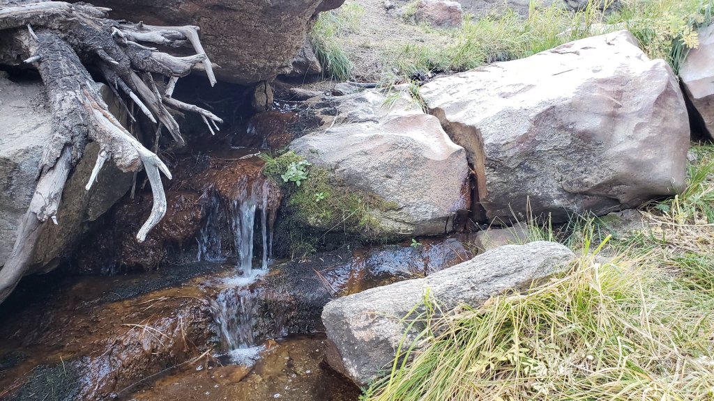
Candy’s Creek – that flows through Skunk Cabbage Meadow and then crosses the remaining visible section of Caramba Trail near Reeds Meadow – has nearly dried up in both locations.
WATER STATUS: Western slope
Ephemeral creeks, such as those along Marion Mountain Trail, and Stone Creek and its tributaries on Deer Springs Trail, are now all dry.
The North Fork of the San Jacinto River is flowing where it crosses the Deer Springs Trail and again downstream where it crosses the Fuller Ridge Trail on the PCT (approx. PCT Mile 186.2).
The creek in Little Round Valley is flowing weakly, and it dries up just below the mouth of the valley. The same creek has now dried up where it crosses Fuller Ridge Trail (at about PCT Mile 186.4).
Shooting Star Spring (below Little Round Valley but above the North Fork of the San Jacinto River crossing) is flowing gently.
The Deer Springs stream crossing at the PCT (approx. PCT mile 185.6) is flowing gently.
Switchback Spring at PCT Mile 183.5 (about 0.4 miles on the PCT northbound from Strawberry Junction) is flowing gently. I have cleared out the tiny pool on the upslope side of the trail, and there is adequate depth in which to filter water.
The little creek at Strawberry Cienega (PCT mile 183.0) is dry.
On Devil’s Slide Trail, Middle Spring stopped flowing in the first week of October. Other springs on this trail are dry.
On the Ernie Maxwell Trail, the crossing of Chinquapin Creek just below Humber Park is dry again where it crosses the trail. Even when Fern Valley Water District diverts flow into the pipe system, as it has since August, there are small fresh pools just upslope from the trail (this creek is an important source of water for the many dogs walked on the Ernie Maxwell).
WATER STATUS: Desert Divide
Live Oak Spring (N 33 37 21, W 116 33 24) Flowing well. The most reliable water source on the Desert Divide.
Cedar Spring (N 33 40 36, W 116 34 35) Flowing well. Easiest access is the trough 60 yards upstream from the trail to the campsite.
Apache Spring (N 33 43 11, W 116 37 13) Barely trickling.
Spitler Peak Trail Descending the trail there are five water crossings. The first two, at 0.9 and 0.95 miles down, cross a tiny side creek which is now largely dry and should be ignored. The next crossing, at 1.1 miles down, is Spitler Creek and is the best source of water (currently flowing). The next two crossings are the same creek, but for obvious reasons it is best to fill up at the highest of the three crossings.
Antsell Rock Creek (N 33 41 52, W 116 39 08) Right by the Spitler Peak Trail trailhead on Apple Canyon Road, Antsell Rock Creek is flowing well. Just on the upstream side of the road there is excellent access to the creek. Useful if hikers are descending the Spitler Peak Trail.

San Jacinto Trail Report: available for everyone, funded by readers. While all labor and time is volunteered, this Report completely depends on small private donations to cover costs. With an especially challenging year in 2020, every contribution is invaluable. If you have found this Report useful, please consider visiting the Donate page. Thank you.sanjacjonUncategorized1 Comment 7 MinutesEdit”Weather, water, and trail update 22nd October 2020″
Trail and weather update 15th October 2020
Both Mount San Jacinto State Park and the San Jacinto Ranger District of the San Bernardino National Forest partially reopened on 9th October. All trails are open, except for the Pacific Crest Trail between Black Mountain Road and Snow Creek (Miles 191-206, closed due to the Snow Fire). All camping remains prohibited forestwide, meaning wilderness camping (including along the PCT) or camping at yellow post sites (such as those along Black Mountain Road and South Ridge Road) is not permitted. All wilderness camping in the State Park is also prohibited. In the Forest, only developed campgrounds that were previously open – Pinyon, Marion Mountain, Fern Basin – have reopened (the latter two are scheduled to close for the season on 10th November anyway). Details of the Forest Service reopening are available here.
Hiking permits are available at the Idyllwild and Long Valley ranger stations of the Mount San Jacinto State Park, which are open. Please see the State Park website for details. The U.S. Forest Service ranger station in Idyllwild remains closed due to the coronavirus crisis. USFS day use permits are required for the San Jacinto wilderness, and should be available at the kiosk outside the ranger station.
Palm Springs Aerial Tramway, which closed 13th March due to the coronavirus crisis, partially reopened on 9th October. Trams are operating at greatly reduced capacity, reduced times, and limited days; see the Tramway website for full details.
Black Mountain Road was graded in June through to the Fuller Ridge campground. Boulder Basin campground (and the Black Mountain Group campground) will remain closed into 2021.
South Ridge Road was partially graded in the first week of September, and is now readily passable.
Water conditions – as confirmed by multiple hikes in the high country in the past few days via most major routes – are not significantly different from those described in last week’s Report (available here).
On a minor personal note, on Sunday 11th October, far off trail on the north face of San Jacinto Peak, I passed one million feet of elevation gain for 2020, achieved entirely within the San Jacinto mountains. My previous record for a calendar year was about 820,000 feet. Before anyone asks, the hard part about hiking/running over a million feet of elevation gain in a year? Descending one million feet.
WEATHER Other than a brief interlude around last weekend, temperatures have been well above seasonal for the month of October so far. Autumn finally arrives late next week, around Thursday 22nd, when temperatures are forecast to fall rapidly below seasonal average for several days. Air quality has not yet returned to normal, but in the past week has been the best in the San Jacinto mountains since mid August. There is currently no significant precipitation in the forecast. Fire risk remains extreme.
The latest video from NWS San Diego is very informative, including the latest projection for the winter (spoiler alert: bad news). Data show the three months July- September 2020 were the hottest in Idyllwild history, and that Idyllwild’s ten hottest summers have all occurred since 2002.
At San Jacinto Peak (3295m/10,810ft) today, Thursday 15th October 2020, at 0850 the air temperature was 50.3°F (10°C), with a windchill of 43.7°F (7°C), 33% relative humidity, and a fresh NNE wind sustained at 8 mph gusting to 16.5 mph.
At the Peak on Sunday 11th October 2020, at 1530 the air temperature was 44.9°F (8°C), with a windchill of 36.3°F (2°C), 47% relative humidity, and a steady NNE wind sustained at 10 mph gusting to 15.8 mph.
The warmest temperature I have ever recorded at San Jacinto Peak remains Wednesday 19th August 2020, when at 0745 the air temperature was 62.3°F (17°C), with no measurable windchill, 42% relative humidity, and calm, extremely hazy conditions.

TRAIL CONDITIONS
The Pacific Crest Trail above Snow Creek (approx. PCT Miles 198-206) was extensively burned on both sides of the Trail by the Snow Fire (17th-19th September 2020). A closure order for the burn scar means that the Trail remains closed between Snow Creek and Black Mountain Road (approx. Miles 191-206).
Many trails have treefall hazards remaining from last winter, passable for hikers but not for stock. Some are described in detail below, others include: PCT south of Red Tahquitz (approx. PCT Miles 173-175), PCT between Strawberry Cienega and Deer Springs camp (Miles 182-185), Fuller Ridge Trail near its northern end (PCT Miles 189.1-190.2), Spitler Peak, Cedar Spring, and Apache Spring trails. All significant tree hazards on Willow Creek Trail have now been removed.
Seven Pines Trail has been very lightly traveled since November 2018. There are 25 treefall hazards on the trail, almost all in the upper State Park section of trail, based on multiple June 2020 surveys. Very cautious navigation is recommended for those unfamiliar with this trail. The Forest Service closure of Dark Canyon Road will continue into 2021, so there is currently no vehicular access to Seven Pines trailhead.
The Pacific Crest Trail remains open at the rockslide just north of Antsell Rock (Mile 172.5). USFS plans for removal of the rockslide have been delayed due to the coronavirus crisis. The video report (available here) can be useful for deciding whether to hike around the rockslide or take an alternate route.
Forest Service temporary signage indicates that the Caramba Trail from near Reeds Meadow through Laws Camp and on to Caramba, and the Cedar Trail from Willow Creek Trail to Laws, are “not maintained”. In reality both trails barely exist. Both are so heavily overgrown I advise hikers do not attempt to follow them. Many experienced hikers have reported getting lost in this area since summer 2019. An informal use trail to Laws is much more direct and avoids all of the challenging bush-whacking of the unmaintained trails (some local hikers have dubbed it the “King Trail”). It leaves the Willow Creek Trail exactly 1.0 mile from Saddle Junction (0.46 mile from the Skunk Cabbage turning), descending largely on established deer trails for 1.2 miles, roughly paralleling Willow Creek just to its south. Be advised that it is an indistinct use trail, becoming less obvious as it nears Laws (by which time Willow Creek is close by on your left hand side, so navigation is not a challenge). From Laws east to Caramba the route of the original Caramba Trail is relatively easy to follow – for those who were familiar with this trail prior to the 2013 Mountain Fire – despite USFS information to the contrary. Nevertheless, cautious navigation is still advised.

San Jacinto Trail Report: available for everyone, funded by readers. While all labor and time is volunteered, this Report completely depends on small private donations to cover costs. With an especially challenging year in 2020, every contribution is invaluable. If you have found this Report useful, please consider visiting the Donate page. Thank you.sanjacjonUncategorized1 Comment 5 MinutesEdit”Trail and weather update 15th October 2020″
Forest and Park update 9th October 2020
The San Jacinto Ranger District of the San Bernardino National Forest partially reopened today. Forest Service has indicated this is primarily a day use reopening. All trails are open, except for the Pacific Crest Trail between Black Mountain Road and Snow Creek (closed due to the Snow Fire). Dispersed camping remains prohibited forestwide, meaning wilderness camping (including along the PCT) or camping at yellow post sites (such as those along Black Mountain Road and South Ridge Road) is not permitted. Only those developed campgrounds that were previously open – Pinyon, Marion Mountain, Fern Basin – have reopened (the latter two are scheduled to close for the season on 10th November anyway). Details of the Forest Service reopening are available here.
The wilderness of Mount San Jacinto State Park has also reopened. Hiking permits are available at the Idyllwild and Long Valley ranger stations. All camping in the State Park wilderness remains prohibited. Please see the State Park website for details.
Palm Springs Aerial Tramway, which has been closed since 13th March due to the coronavirus crisis, reopened today. Trams are operating at less than 25% capacity and reservations are required. Tram riders should be aware that all camping in the State Park wilderness remains prohibited. Full details of the Tram reopening are available at the Tramway website.
The unprecedented Forest and Park closures, in place for 31 days, were indicative of the exceptional fire risk and the associated resource challenges. Although conditions have ameliorated somewhat, please note that fire risk remains extreme. The wisdom of the closure decision was demonstrated by the outbreak of the Snow Fire in mid September, which burned 6200 acres, largely in the Snow Creek and Falls Creek drainages.
The U.S. Forest Service ranger station in Idyllwild remains closed due to the coronavirus crisis. USFS day use permits are required for the San Jacinto wilderness, and should be available at the kiosk outside the ranger station.
Black Mountain Road was graded in June through to the Fuller Ridge campground. Boulder Basin campground (and the Black Mountain Group campground) will remain closed into 2021.
South Ridge Road was partially graded in the first week of September, and is now readily passable.
WEATHER After temperatures well above seasonal for the first week of October, cooler autumnal weather finally arrived on 7th October. Regrettably it will last less than a week, with temperatures rising again to well above average from 12th October onwards. With a shift from easterly to westerly winds, air quality today was the best in and around the San Jacinto mountains since mid August. There is no significant precipitation in the forecast. Fire risk remains extreme.
The past month was the hottest September in recorded Idyllwild history. Remarkably, 27 of the 30 days recorded average temperatures above the historic average for the month. This followed an exceptionally hot and dry August, the hottest ever recorded for California. Overall the summer period (July-early September) was the sixth hottest in Idyllwild history, with the top ten hottest summers all occurring since 2002.
At San Jacinto Peak (3295m/10,810ft) on Thursday 8th October 2020, at 0900 the air temperature was 48.3°F (9°C), with a windchill of 40.6°F (5°C), 32% relative humidity, and a cool WSW wind sustained at 7 mph gusting to 15.9 mph.
At the Peak on Tuesday 6th October 2020, at 0840 the air temperature was 48.4°F (9°C), with a windchill of 41.5°F (5°C), 29% relative humidity, and a light SE wind sustained at 5 mph gusting to 13.6 mph.
The warmest temperature I have ever recorded at San Jacinto Peak was on Wednesday 19th August 2020, when at 0745 the air temperature was 62.3°F (17°C), with no measurable windchill, 42% relative humidity, and calm, extremely hazy conditions.
TRAIL CONDITIONS
The Pacific Crest Trail above Snow Creek (approx. PCT Miles 198-206) was extensively burned on both sides of the Trail by the Snow Fire (September 17th-19th). A closure order expected for the burn scar means that the Trail will remain closed between Snow Creek and Black Mountain Road (approx. Mile 191).
Many trails have treefall hazards remaining from last winter, passable for hikers but not for stock. Some are described in detail below, others include: PCT south of Red Tahquitz (approx. PCT Miles 173-175), PCT between Strawberry Cienega and Deer Springs camp (Miles 182-185), Fuller Ridge Trail near its northern end (PCT Miles 189.1-190.2), Spitler Peak, Cedar Spring, and Apache Spring trails. All significant tree hazards on Willow Creek Trail have now been removed.
Seven Pines Trail has been very lightly traveled since November 2018. There are 25 treefall hazards on the trail, almost all in the upper State Park section of trail, based on multiple June 2020 surveys. Very cautious navigation is recommended for those unfamiliar with this trail. The Forest Service closure of Dark Canyon Road will continue into 2021, so there is currently no vehicular access to Seven Pines trailhead.
The Pacific Crest Trail remains open at the rockslide just north of Antsell Rock (Mile 172.5). USFS plans for removal of the rockslide have been delayed due to the coronavirus crisis. The video report (available here) can be useful for deciding whether to hike around the rockslide or take an alternate route.
Forest Service temporary signage indicates that the Caramba Trail from near Reeds Meadow through Laws Camp and on to Caramba, and the Cedar Trail from Willow Creek Trail to Laws, are “not maintained”. In reality both trails barely exist. Both are so heavily overgrown I advise hikers do not attempt to follow them. Many experienced hikers have reported getting lost in this area since summer 2019. An informal use trail to Laws is much more direct and avoids all of the challenging bush-whacking of the unmaintained trails (some local hikers have dubbed it the “King Trail”). It leaves the Willow Creek Trail exactly 1.0 mile from Saddle Junction (0.46 mile from the Skunk Cabbage turning), descending largely on established deer trails for 1.2 miles, roughly paralleling Willow Creek just to its south. Be advised that it is an indistinct use trail, becoming less obvious as it nears Laws (by which time Willow Creek is close by on your left hand side, so navigation is not a challenge). From Laws east to Caramba the route of the original Caramba Trail is relatively easy to follow (for those who were familiar with this trail prior to the 2013 Mountain Fire) despite USFS information to the contrary. Nevertheless, cautious navigation is still advised.
WATER STATUS: Eastern slope
The Round Valley pipe is flowing. Flow has periodically been redirected to the CCC/ACE camp in Long Valley and water pressure can be insufficient to also flow at the pipe (currently there is no maintenance crew camped in Long Valley). The nearby Round Valley creek dried up in early August. The small creek in Tamarack Valley also dried up in August.
Both the northern and southern springs at Wellman’s Cienega are flowing steadily. These are the sources for Willow Creek, which is flowing well where it crosses the Willow Creek Trail.
Tahquitz Creek is flowing at the northern end of Little Tahquitz Meadow. It is also flowing very gently further upstream at its source (known locally as Grethe Spring) where it crosses the PCT (approx. PCT Mile 177). The small creek in Tahquitz Valley dried up in early August.
Candy’s Creek – that flows through Skunk Cabbage Meadow and then crosses the remaining visible section of Caramba Trail near Reeds Meadow – has nearly dried up in both locations.
WATER STATUS: Western slope
Ephemeral creeks, such as those along Marion Mountain Trail, and Stone Creek and its tributaries on Deer Springs Trail, are now all dry.
The North Fork of the San Jacinto River is flowing where it crosses the Deer Springs Trail and again downstream where it crosses the Fuller Ridge Trail on the PCT (approx. PCT Mile 186.2).
The creek in Little Round Valley is flowing weakly, and it dries up just below the mouth of the valley. The flow rate has dropped substantially in recent weeks. The same creek has now dried up where it crosses Fuller Ridge Trail (at about PCT Mile 186.4).
Shooting Star Spring (below Little Round Valley but above the North Fork of the San Jacinto River crossing) is flowing gently.
The Deer Springs stream crossing at the PCT (approx. PCT mile 185.6) is flowing steadily, but flow rate dropped markedly in September.
Switchback Spring at PCT Mile 183.5 (about 0.4 miles on the PCT northbound from Strawberry Junction) is flowing gently. I have cleared out the tiny pool on the upslope side of the trail, and there is adequate depth in which to filter water.
The little creek at Strawberry Cienega (PCT mile 183.0) is dry.
On Devil’s Slide Trail, Middle Spring stopped flowing in the first week of October. Other springs on this trail are dry.
On the Ernie Maxwell Trail, the crossing of Chinquapin Creek just below Humber Park is dry again where it crosses the trail. Even when Fern Valley Water District diverts flow into the pipe system, as it has since August, there are small fresh pools just upslope from the trail (this creek is an important source of water for the many dogs walked on the Ernie Maxwell).
WATER STATUS: Desert Divide
Live Oak Spring (N 33 37 21, W 116 33 24) Flowing well. The most reliable water source on the Desert Divide.
Cedar Spring (N 33 40 36, W 116 34 35) Flowing well. Easiest access is the trough 60 yards upstream from the trail to the campsite.
Apache Spring (N 33 43 11, W 116 37 13) Barely trickling.
Spitler Peak Trail Descending the trail there are five water crossings. The first two, at 0.9 and 0.95 miles down, cross a tiny side creek which is now largely dry and should be ignored. The next crossing, at 1.1 miles down, is Spitler Creek and is the best source of water (currently flowing). The next two crossings are the same creek, but for obvious reasons it is best to fill up at the highest of the three crossings.
Antsell Rock Creek (N 33 41 52, W 116 39 08) Right by the Spitler Peak Trail trailhead on Apple Canyon Road, Antsell Rock Creek is flowing well. Just on the upstream side of the road there is excellent access to the creek. Useful if hikers are descending the Spitler Peak Trail.
San Jacinto Trail Report: available for everyone, funded by readers. While all labor and time is volunteered, this Report completely depends on small private donations to cover costs. With an especially challenging year in 2020, every contribution is invaluable. If you have found this Report useful, please consider visiting the Donate page. Thank you.sanjacjonUncategorized2 Comments 7 MinutesEdit”Forest and Park update 9th October 2020″
Forest closure update 1st October 2020
[UPDATE 6th October: The Forest will reportedly reopen on Friday 9th October for day use. Wilderness camping will remain prohibited. Some forest roads may remain closed. Full details will be available shortly.]
The closure of the San Jacinto Ranger District of the San Bernardino National Forest, which began on Monday 7th September, has been extended until at least 8th October (see revised closure order here).
Notices posted at trailheads such as Humber Park and Ernie Maxwell Trail were amended by hand on 22nd September to simply say “extended, see website for details”. Apparently, “the closure will be reevaluated daily”, although the previous three closure orders have all run through to their expiration date. The Forest Service does have a relatively useful FAQs regarding the closure.
In addition to the forest and trails, this closure includes all campgrounds, picnic sites, trailheads, and forest roads. This unprecedented step has been taken due to exceptional fire risk, for public and firefighter safety, and due to lack of adequate emergency response resources. Other parts of the San Bernardino NF, as well as other national forests in Southern California, are included in the closure.
As indicated on the website of Mount San Jacinto State Park, all state park trails are also closed. As public trails into the Park largely pass through Forest Service land, the Park is functionally inaccessible.
The Snow Fire, which started on 17th September, was held initially at 6013 acres (see prior posting for discussion). On 22nd September that acreage was revised up to 6254, apparently due to improved mapping, rather than additional burning. Given the enormous challenges with almost all the other fires in the state at this time, we are extremely fortunate that the Snow Fire was not ultimately many times larger, or more destructive. The principal formal trail impacted was the PCT. About eight miles were burned (approx. PCT Miles 198-206) although damage to the trail is minimal due to the gentle gradient on this section and the relatively short, light chaparral in this area.
Black Mountain Road is closed (at the gate by Highway 243), possibly for the remainder of the year. All fire lookouts in the San Bernardino National Forest are currently closed, apparently for the protection of the volunteers who operate them and due to scarce resource availability in the event of any emergency.
Air quality on the mountain has varied from day-to-day, but in general has been poor. The smoke/smog level has visibly fluctuated between about 7000′ to 12,000′, although overall air quality has improved significantly in the San Jacinto mountains in recent days.
WEATHER Although temperatures cooled somewhat earlier this week, they have climbed again to well above seasonal. Temperatures are forecast to fall significantly next week. The air temperature at San Jacinto Peak on the morning of 23rd (59.9°F) was the highest ever recorded at that location in the second half of September. There is no precipitation in the forecast. The prospects for the remainder of 2020, discussed in an earlier video from NWS San Diego, are not encouraging.
Please stay safe everyone. I will continue to post updated information as it becomes available.
San Jacinto Trail Report: available for everyone, funded by readers.While all labor and time is volunteered, this Report completely depends on small private donations to cover costs. With an especially challenging year in 2020, every contribution is invaluable. If you have found this Report useful, please consider visiting the Donate page. Thank you.sanjacjonUncategorizedLeave a comment 2 MinutesEdit”Forest closure update 1st October 2020″
Forest and fire update 24th September 2020
[The next update to the Trail Report is scheduled for Thursday 1st October, when the Forest and Park closures will either be lifted or extended.]
The closure of the San Jacinto Ranger District of the San Bernardino National Forest, which began on Monday 7th September, has now been extended until at least 30th September (see revised closure order here).
Notices posted at trailheads such as Humber Park and Ernie Maxwell Trail were amended by hand on 22nd to simply say “extended, see website for details”. Apparently, “the closure will be reevaluated daily”. The Forest Service does have a relatively useful FAQs regarding the closure.
In addition to the forest and trails, this closure includes all campgrounds, picnic sites, trailheads, and forest roads. This unprecedented step has been taken due to exceptional fire risk. Other parts of the San Bernardino NF, as well as other national forests in Southern California, are included in the closure.
As indicated on the website of Mount San Jacinto State Park, all state park trails are also closed. As public trails into the Park largely pass through Forest Service land, the Park is functionally inaccessible.
The Snow Fire was held initially at 6013 acres (see prior posting for discussion). On 22nd that acreage was revised up to 6254, apparently due to improved mapping, rather than additional burning. There has been no visible sign of smoke or smoldering for the past few days, and containment percentage increases every day. Given the enormous challenges with almost all the other fires in the region at this time, we are extremely fortunate that the Snow Fire was not ultimately many times larger, or more destructive. The principal formal trail impacted was the PCT. About eight miles were burned (approx. PCT Miles 198-206) although damage to the trail is limited due to the gentle gradient on this section and the relatively short, light chaparral in this area.
Black Mountain Road is closed (at the gate about 1.7 miles up from Highway 243), possibly for the remainder of the year. One unfortunate consequence of this action is that the Black Mountain Fire Lookout is also now closed, potentially for the season. Indeed all fire lookouts in the San Bernardino National Forest are currently closed, apparently for the protection of the volunteers who operate them and due to scarce resource availability in the event of any emergency.
Air quality on the mountain has varied from day-to-day, but in general has been poor. This past weekend was the best air quality this month, but it has subsequently deteriorated again somewhat in the past couple of days (but remains better now than earlier in September).
WEATHER Although temperatures have cooled somewhat, overnight lows in particular remain above average. Temperatures well above seasonal are forecast to return for the last couple of days of September into the first few days of October (as discussed in the latest briefing from NWS San Diego).
The air temperature at San Jacinto Peak on the morning of 23rd (59.9°F) was the highest ever recorded at that location in the second half of September. There is no precipitation in the forecast. The prospects for the remainder of 2020, discussed in an earlier video from NWS San Diego, are not encouraging.
Please stay safe everyone. I will continue to post updated information as it becomes available.
San Jacinto Trail Report: available for everyone, funded by readers.While all labor and time is volunteered, this Report completely depends on small private donations to cover costs. With an especially challenging year in 2020, every contribution is invaluable. If you have found this Report useful, please consider visiting the Donate page. Thank you.sanjacjonUncategorizedLeave a comment 2 MinutesEdit”Forest and fire update 24th September 2020″
Snow Fire update 19th September 2020
[The entire National Forest and State Park remain closed due to exceptional fire risk, with full details in an earlier posting, available here.]
UPDATED at 0915
Encouraging news. Total spread looks to have been held under 6000 acres and the fire is largely extinguished. Viewed from above, the western flank (in the vicinity of the PCT) appears to be completely extinguished. A very solid retardant line held the spread right around 5000ft elevation in chaparral, and there is no sign of smoldering or smoke.
Minor smoke plumes are still visible on the east flank of Blaisdell Ridge at about 5000ft elevation, about two miles due north of Mountain Station of the Tramway. Although there is a spotter plane in the air, there is no active air attack, so I assume there is no significant flare-up in that area. This could change at any time of course.
There is minor smoldering and smoking low down in the Falls Creek drainage. Otherwise all the spot fires in the drainages appear to have died down.
Wind in the high country is very similar to yesterday, from WSW sustained above 10 mph gusting to 18 mph. Especially those of us living in Idyllwild-Pine Cove been very fortunate to have predominantly SW winds, and everyone has been helped by having relatively weak winds. Air quality is the best today in two weeks, with the San Gabriel and Santa Ana mountains clearly visible this morning fom the San Jacinto high country.
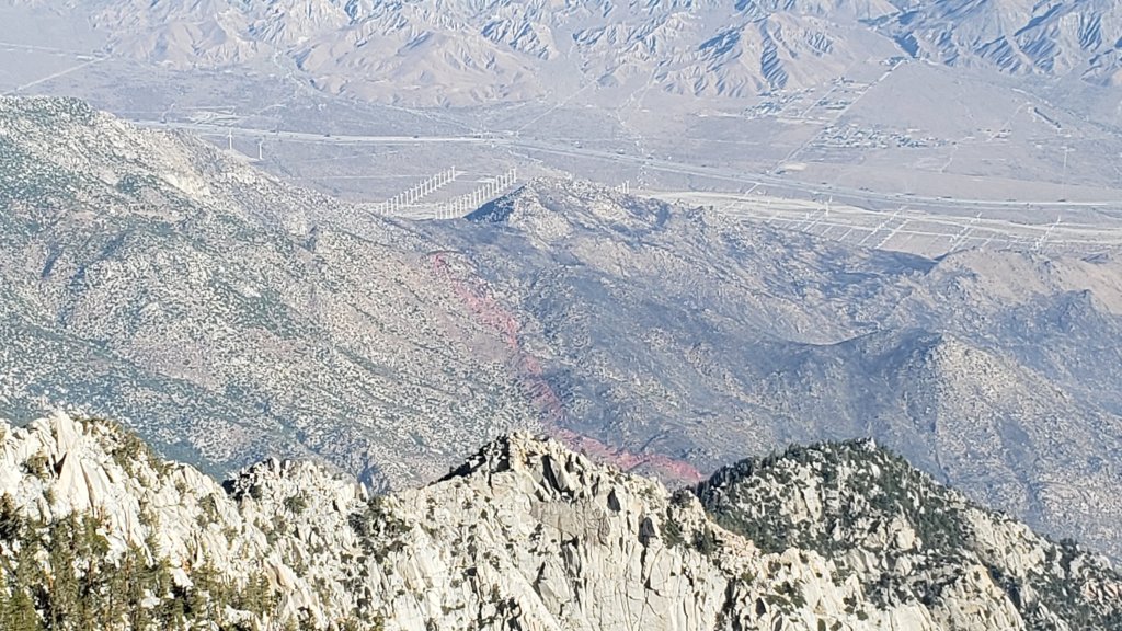
San Jacinto Trail Report: available for everyone, funded by readers.While all labor and time is volunteered, this Report completely depends on small private donations to cover costs. With an especially challenging year in 2020, every contribution is invaluable. If you have found this Report useful, please consider visiting the Donate page. Thank you.sanjacjonUncategorized2 Comments 1 MinuteEdit”Snow Fire update 19th September 2020″
Snow Fire update 18th September 2020
UPDATED 18th September @ 1710. Mixed news. Containment remains 5%. Reportedly air attack indicated 4500 acres burned at about 1600 (Cal Fire later put the figure at 4200 acres). The fire is holding on the east sides within the retardant and ridges to the west, but is spreading to the south and up the drainages/canyons.
UPDATED 18th September @ 1520. The latest report indicates 3500 acres burned at 5% containment. That acreage is roughly what I saw visibly burned this morning, as described below, suggesting that while the level of formal containment may be low, the fire has not changed dramatically in the past few hours and is not burning out-of-control. This could change at any time of course.
The Snow Fire started near the village of Snow Creek yesterday 17th September at about 1440. The cause was apparently a vehicle problem on Snow Creek Road that led to a vegetation fire. Gusty afternoon winds quickly dispersed embers widely onto the sides of the canyon, including just above Snow Creek community and on Blaisdell Ridge. By dusk last night, the fire was 1200 acres, burning in at least four separate spots. Special thanks to Florian Boyd for on-location information on 17th.
This fire is now impacting the lower north face of San Jacinto Peak up to about 5000ft in multiple canyons between the PCT to the west and approaching Blaisdell Canyon to the east.
UPDATED 18th September @ 0950. Currently the official estimate is at 2500 acres. A big fire front made a significant run up the West Fork drainage below the PCT, up to near 5000ft elevation, between 0830-0930. The fire crossed the PCT in that area at about 0900. With up to four air tankers in the air, including a DC-10 type, there were multiple retardant drops roughly perpendicular to the PCT at or above about 5000ft. Although the fire got into thicker chaparral creating lots of smoke, it appeared to be slowing down in that area by about 0945.
The entire isthmus (between Snow Creek East Fork and Falls Creek) burned overnight to its narrowest point at about 4200ft elevation. Spot fires remain smoldering in Snow Creek and Falls Creek drainages below about 4000ft, although almost all of the riparian vegetation survived unburned. The community of Snow Creek and the DWA facilities appear to be undamaged.
All morning the fire was burning in small patches on both flanks of Blaisdell Ridge up to c.5000ft. Prior to 0900, the focus of retardent drops was on the east flank of this ridge, slowing progress of the fire toward Palm Springs and the Tramway area. By 0930 the fire seemed to be petering out on Blaisdell in part because it is so rocky with relatively little fuel.
Although by late morning the prognosis for containment appeared to be somewhat positive, obviously this could change dramatically at short notice, as we have seen in so many other places in recent weeks. While the perimeter of the burned area may be several thousand acres, actual burning has been patchy within that due to rocky terrain and sparse vegetation in many areas.
In addition to the fire movement at its east end towards the Windy Point area (NW of Palm Springs), the main area of concern will be any movement westward up the West Fork drainage. By late morning there was an active fire front less than a mile from One Horse Ridge, and little more than two miles from the Fuller Ridge campground and trailhead.sanjacjonUncategorized1 Comment 2 MinutesEdit”Snow Fire update 18th September 2020″
Forest closure extended 14th September 2020
The entire San Jacinto Ranger District of the San Bernardino National Forest closed on Monday evening, 7th September. The initial closure order has now been extended to Monday 21st September (see closure order extension here).
In addition to the forest and trails, this closure includes all campgrounds, picnic sites, trailheads, and forest roads. This unprecedented step has been taken due to exceptional fire risk. Other parts of the San Bernardino NF, as well as other national forests statewide, are included in the closure. According to USFS, the closure situation is reevaluated daily.
As indicated on the website of Mount San Jacinto State Park, all state park trails are also closed. Prior trail and camping permits have been revoked. As public trails into the Park largely pass through Forest Service land, the Park is functionally inaccessible.
Black Mountain Road is closed (at the gate about 1.7 miles up from Highway 243), possibly for the remainder of the year. One unfortunate consequence of this action is that the Black Mountain Fire Lookout is also now closed, potentially for the season. Indeed all fire lookouts in the San Bernardino National Forest are currently closed, for the protection of the volunteers who operate them and due to scarce resource availability in the event of any emergency.
Air quality on the mountain has varied from day-to-day, but in general has been poor. Most of the past week has seen two layers of smoke, one at high elevation (>14,000′), the other closer to ground level (often <4000′). With prevailing winds from northerly directions for most of the past week, the higher elevation smoke was likely from fires in northern California (or even Oregon), the lower smoke from the Bobcat Fire in the Angeles NF and from the El Dorado Fire in the Yucaipa/Forest Falls area. This morning, winds had shifted (and strengthened) to the south-east, clearing out the upper elevation smoke, but raising the lower level smoke to nearly 12,000′ around the San Jacinto mountains.
Please stay safe everyone. I will continue to post updated information as it becomes available.
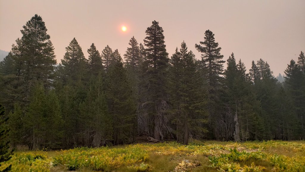
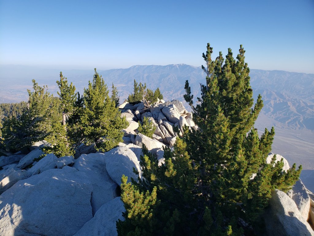

sanjacjonUncategorized1 Comment 2 MinutesEdit”Forest closure extended 14th September 2020″
Forest closure 7th September 2020
The entire San Jacinto Ranger District of the San Bernardino National Forest is closing effective at 1700 (5:00pm) today, Monday 7th September. In addition to the forest and trails, this closure includes all campgrounds, picnic sites, trailheads, and forest roads. This unprecedented step is being taken due to exceptional fire risk. Other parts of the San Bernardino NF, as well as other national forests in Southern California, are included in this closure (see USFS closure notice here). It is not clear at this time when the Forest will reopen, the situation is being reevaluated daily (although the initial closure order is for one week until 14th September).
According to the website of Mount San Jacinto State Park, all state park trails are also closed. All current trail and camping permits are being revoked. As all public trails into the Park pass through Forest Service land, the Park is functionally inaccessible.
Black Mountain Road is now closed (at the gate about 1.7 miles up from Highway 243), likely for the remainder of the year. One unfortunate consequence of this action is that the Black Mountain Fire Lookout is also now closed for the season.
The Santa Ana wind event expected for 8th and 9th September is described in detail in the latest video discussion from NWS San Diego.
Air quality on the mountain this morning was extremely poor (comparable to when we have had local fires burning within the San Jacinto mountains). From San Jacinto Peak at about 0740, I was completely unable to see San Gorgonio or the Coachella Valley, Black Mountain only a few miles away was barely visible, and looking south (where the visibility was best) I could only just make out Apache Peak.
Please stay safe everyone. Obviously I will post more information as soon as it comes available.
sanjacjonUncategorizedLeave a comment 1 MinuteEdit”Forest closure 7th September 2020″
Weather and water update 3rd September 2020
Hikes every day, including four ascents of San Jacinto Peak in the past five days by different routes, have allowed for a thorough check of water sources and trail conditions. A brief period of relatively cool weather (although still above seasonal averages!) in recent days included, on Monday 31st August, the first windchill temperature below 40°F recorded at San Jacinto Peak in exactly two months. Regrettably, these few cool days will be short-lived, with another spell of record heat forecast starting Friday 4th September until Tuesday 8th.
Hikers should be prepared for unseasonably hot weather, with temperatures far above seasonal, the overnight low temperatures in particular 15-22°F above average this weekend. Please give considerable extra thought to route choice, start times, clothing, sun protection, and water requirements. Air quality in the mountains had improved markedly in recent days, but then deteriorated again dramatically today (3rd September) with a switch in wind direction.
Although monsoon conditions are not forecast for the foreseeable future, hikers should always be prepared for rapidly changing weather conditions in the high country in late summer. Thunderstorms with lightning, intense precipitation, and rapid temperature drops, most likely in the afternoon or evening, can occur at or near the high peaks even when such storms are not forecast for lower elevations.
Permits are required for hiking and camping in Mount San Jacinto State Park, see their website for details. The U.S. Forest Service ranger station in Idyllwild remains closed due to the coronavirus crisis. USFS day use permits are required again for the San Jacinto wilderness starting 1st September, and should be available at the kiosk outside the ranger station. USFS has indicated that a permit quota will not be enforced for Devil’s Slide Trail for Labor Day weekend. USFS campgrounds are open, except those mentioned elsewhere in this update.
Palm Springs Aerial Tramway is closed indefinitely (since 12th March) due to the coronavirus crisis. The Tram has brought forward the normal September maintenance program into August this year, although no tentative reopening date has been approved.
Black Mountain Road reopened on 20th June, having been graded through to the Fuller Ridge campground. Boulder Basin campground will remain closed all year.
WEATHER As mentioned above, relatively cool weather ends on Thursday 3rd September, after which record-breaking hot temperatures are forecast until about 9th September. A couple of cool days will be followed by yet another warming starting 11th. There is no significant precipitation in the forecast. Regrettably, for the fourth year in a row, the late summer monsoons have largely missed us, with only 0.08″ rain measured in Idyllwild in August. Fire risk remains severe.
The National Weather Service has issued an excellent video discussion of the record-breaking heatwave expected over the Labor Day weekend. The video includes a brief summary of an exceptionally hot and dry August, the hottest ever recorded for much of Southern California.
The past month was likely the hottest August in recorded Idyllwild history (pending final National Weather Service data). Remarkably, 24 of the 31 days in August recorded an overnight low temperature of at least 60°F. Historically the average low for Idyllwild in August is 54°F.
At San Jacinto Peak (3295m/10,810ft) on Thursday 3rd September 2020, at 0745 the air temperature was 53.7°F (12°C), with a windchill of 47.1°F (8°C), 37% relative humidity, and a steady due East wind sustained at 13 mph gusting to 20.8 mph.
At the Peak on Monday 31st August 2020, at 0745 the air temperature was 47.4°F (9°C), with a windchill of 39.7°F (5°C), 58% relative humidity, and a firm SW wind sustained at 10 mph gusting to 17.6 mph.
The warmest temperature I have ever recorded (to date) at San Jacinto Peak was on Wednesday 19th August 2020, when at 0745 the air temperature was 62.3°F (17°C), with no measurable windchill, 42% relative humidity, and calm, extremely hazy conditions.
TRAIL CONDITIONS
All trails have been clear of snow since early June. Many trails have treefall hazards from this past winter, passable for hikers but not for stock. Some are described in detail below, others include: PCT south of Red Tahquitz (approx. PCT Miles 173-175), PCT between Strawberry Cienega and Deer Springs camp (Miles 182-185), Fuller Ridge Trail near its northern end (PCT Miles 189.1-190.2), Spitler Peak, Cedar Spring, and Apache Spring trails. All significant tree hazards on Willow Creek Trail have now been removed.
Seven Pines Trail has been very lightly traveled since November 2018. There are 25 treefall hazards on the trail, almost all in the upper State Park section of trail, based on multiple June 2020 surveys. Very cautious navigation is recommended for those unfamiliar with this trail. The Forest Service closure of Dark Canyon Road is expected to continue into 2021, so there is currently no vehicular access to Seven Pines trailhead.
The Pacific Crest Trail remains open at the rockslide just north of Antsell Rock (Mile 172.5). USFS plans for removal of the rockslide have been delayed due to the coronavirus crisis. The video report (available here) can be useful for deciding whether to hike around the rockslide or take an alternate route.
Forest Service temporary signage indicates that the Caramba Trail from near Reeds Meadow through Laws Camp and on to Caramba, and the Cedar Trail from Willow Creek Trail to Laws, are “not maintained”. In reality both trails no longer exist. Both are so heavily overgrown I advise hikers do not attempt to follow them. Many experienced hikers have reported getting lost in this area since summer 2019. An informal use trail to Laws is much more direct and avoids all of the challenging bush-whacking of the unmaintained trails (some local hikers have dubbed it the “King Trail”). It leaves the Willow Creek Trail exactly 1.0 mile from Saddle Junction (0.46 mile from the Skunk Cabbage turning), descending largely on established deer trails for 1.2 miles, roughly paralleling Willow Creek just to its south. Be advised that it is an indistinct use trail, becoming less obvious as it nears Laws (by which time Willow Creek is close by on your left hand side, so navigation is not a challenge). From Laws east to Caramba the route of the original Caramba Trail is relatively easy to follow (for those who were familiar with this trail prior to the 2013 Mountain Fire). Nevertheless, cautious navigation is still advised.
WATER STATUS: Eastern slope
The Round Valley pipe is flowing again. Flow has periodically been redirected to the CCC/ACE camp in Long Valley and water pressure can be insufficient to also flow at the pipe (currently there is no maintenance crew camped in Long Valley). The nearby Round Valley creek dried up in early August.
The small creek in Tamarack Valley also dried up in August.
Both the northern and southern springs at Wellman’s Cienega are flowing gently. These are the sources for Willow Creek, which is flowing well where it crosses the Willow Creek Trail.
Tahquitz Creek is flowing well at the northern end of Little Tahquitz Meadow. It is also flowing further upstream at its source (known locally as Grethe Spring) where it crosses the PCT (approx. PCT Mile 177). The small creek in Tahquitz Valley dried up in early August.
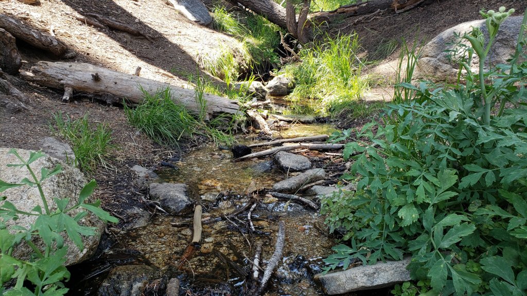
Candy’s Creek – that flows through Skunk Cabbage Meadow and then crosses the remaining visible section of Caramba Trail near Reeds Meadow – is currently flowing gently in both locations.
WATER STATUS: Western slope
Ephemeral creeks, such as those along Marion Mountain Trail and on Deer Springs Trail, are now all dry.
The North Fork of the San Jacinto River is flowing well where it crosses the Deer Springs Trail and again downstream where it crosses the Fuller Ridge Trail on the PCT (approx. PCT Mile 186.2).
The creek in Little Round Valley is flowing, although at less than half the volume compared to this time last year. The same creek has now dried up where it crosses Fuller Ridge Trail (at about PCT Mile 186.4).
Shooting Star Spring (below Little Round Valley but above the North Fork of the San Jacinto River crossing) is flowing steadily.
The Deer Springs stream crossing at the PCT (approx. PCT mile 185.6) is flowing steadily, but flow rate dropped markedly in August.
Switchback Spring at PCT Mile 183.5 (about 0.4 miles on the PCT northbound from Strawberry Junction) is trickling, but there is not adequate depth in which to filter water.
The little creek at Strawberry Cienega (PCT mile 183.0) is now dry.
On Devil’s Slide Trail, Middle Spring continues to trickle gently. Other springs on this trail are dry.
On the Ernie Maxwell Trail, the crossing of Chinquapin Creek just below Humber Park is dry again where it crosses the trail. Even when Fern Valley Water District diverts flow into the pipe system, as it has for much of August, there are small fresh pools just upslope from the trail (this creek is an important source of water for the many dogs walked on the Ernie Maxwell).
WATER STATUS: Desert Divide
Live Oak Spring (N 33 37 21, W 116 33 24) Flowing well. The most reliable water source on the Desert Divide.
Cedar Spring (N 33 40 36, W 116 34 35) Flowing well. Easiest access is the trough 60 yards upstream from the trail to the campsite.
Apache Spring (N 33 43 11, W 116 37 13) Flowing very weakly.
Spitler Peak Trail Descending the trail there are five water crossings. The first two, at 0.9 and 0.95 miles down, cross a tiny side creek which is largely dry and should be ignored. The next crossing, at 1.1 miles down, is Spitler Creek and is the best source of water (currently flowing). The next two crossings are the same creek, but for obvious reasons it is best to fill up at the highest of the three crossings.
Antsell Rock Creek (N 33 41 52, W 116 39 08) Right by the Spitler Peak Trail trailhead on Apple Canyon Road, Antsell Rock Creek is flowing very well. Just on the upstream side of the road there is excellent access to the creek. Useful if hikers are descending the Spitler Peak Trail.
San Jacinto Trail Report: available for everyone, funded by readers. While all labor and time is volunteered, this Report completely depends on small private donations to cover costs. With an especially challenging year in 2020, every contribution is invaluable. If you have found this Report useful, please consider visiting the Donate page. Thank you.sanjacjonUncategorized3 Comments 7 MinutesEdit”Weather and water update 3rd September 2020″
Weather and water update 26th August 2020
Six ascents of San Jacinto Peak in the past ten days, by a variety of routes, have allowed for a thorough check of water sources, including Willow Creek, Deer Springs, Round Valley, and Fuller Ridge trails, among others.
Hikers should be prepared for relatively hot and humid weather well into September. Although temperatures have dropped compared to the previous two weeks, they remain above seasonal averages, especially overnight. Please give extra thought to route choice, start times, clothing, sun protection, and water requirements.
Although monsoon conditions seem to have passed for the foreseeable future, hikers should always be prepared for rapidly changing weather conditions in the high country in late summer. Thunderstorms with lightning, intense precipitation, and rapid temperature drops, most likely in the afternoon or evening, can occur at or near the high peaks even when such storms are not forecast for lower elevations. A localized storm around Tahquitz Peak and Saddle Junction on 21st August included dangerous hail, up to one inch in diameter, falling for 20 minutes, while brief rain fell throughout the high country (but not in Idyllwild) on 22nd.
Air quality was very poor last week, mainly due to ozone smog and of course smoke. In the past week visibility from San Jacinto Peak has been some of the worst I have ever seen, and was so bad on 21st and 26th that the Coachella Valley was invisible. With a drop in atmospheric pressure, a subtle cooling trend, and increasing high altitude winds, air quality has been slowly improving in recent days.
Permits are required for hiking and camping in Mount San Jacinto State Park, see their website for details. The U.S. Forest Service ranger station in Idyllwild remains closed due to the coronavirus crisis. USFS day use permits will be required again for the San Jacinto wilderness starting 1st September. A permit quota will be in place for Devil’s Slide Trail for Labor Day weekend. Although Forest Service wilderness camping and hiking permits can currently be issued if requested, they are currently not required. USFS campgrounds are now open, except those mentioned elsewhere in this update.
Palm Springs Aerial Tramway is closed indefinitely (since 12th March) due to the coronavirus crisis. The Tram has brought forward the normal September maintenance program into August this year, although no tentative reopening date has been approved.
Black Mountain Road reopened on 20th June, having been graded through to the Fuller Ridge campground. Boulder Basin campground will remain closed all year.
WEATHER As mentioned above, temperatures will largely remain above average, especially overnight. A subtle cooling trend in the last couple of days of August will be followed by temperatures well above average in the first week of September. There is no significant precipitation in the forecast. Regrettably, for the fourth year in a row, the late summer monsoons have largely missed us, other than a couple of brief storms in the high country, with only 0.02″ rain measured in Idyllwild in August. Fire risk remains severe.
At San Jacinto Peak (3295m/10,810ft) on Wednesday 26th August 2020, at 0730 the air temperature was 52.3°F (11°C), with a windchill of 44.5°F (7°C), 50% relative humidity, and a strong SW wind sustained at 13 mph gusting to 24.1 mph.
At the Peak on Monday 24th August 2020, at 0825 the air temperature was 55.7°F (13°C), with a windchill of 50.6°F (10°C), 50% relative humidity, and a variable SW breeze sustained at 5 mph gusting to 18.2 mph.
The warmest temperature I have ever recorded at San Jacinto Peak was on Wednesday 19th August 2020, when at 0745 the air temperature was 62.3°F (17°C), with no measurable windchill, 42% relative humidity, and calm, extremely hazy conditions.

TRAIL CONDITIONS
All trails have been clear of snow since early June. Many trails have treefall hazards from this past winter, passable for hikers but not for stock. Some are described in detail below, others include: PCT south of Red Tahquitz (approx. PCT Miles 173-175), PCT between Strawberry Cienega and Deer Springs camp (Miles 182-185), Fuller Ridge Trail near its northern end (PCT Miles 189.1-190.2), Spitler Peak, Cedar Spring, and Apache Spring trails. All significant tree hazards on Willow Creek Trail have now been removed.
Seven Pines Trail has been very lightly traveled since November 2018. There are 25 treefall hazards on the trail, almost all in the upper State Park section of trail, based on multiple June 2020 surveys. Very cautious navigation is recommended for those unfamiliar with this trail. The Forest Service closure of Dark Canyon Road is expected to continue into 2021, so there is currently no vehicular access to Seven Pines trailhead.
The Pacific Crest Trail remains open at the rockslide just north of Antsell Rock (Mile 172.5). USFS plans for removal of the rockslide have been delayed due to the coronavirus crisis. The video report (available here) can be useful for deciding whether to hike around the rockslide or take an alternate route.
Forest Service temporary signage indicates that the Caramba Trail from near Reeds Meadow through Laws Camp and on to Caramba, and the Cedar Trail from Willow Creek Trail to Laws, are “not maintained”. In reality both trails no longer exist. Both are so heavily overgrown I advise hikers do not attempt to follow them. Many experienced hikers have reported getting lost in this area since summer 2019. An informal use trail to Laws is much more direct and avoids all of the challenging bush-whacking of the unmaintained trails (some local hikers have dubbed it the “King Trail”). It leaves the Willow Creek Trail exactly 1.0 mile from Saddle Junction (0.46 mile from the Skunk Cabbage turning), descending largely on established deer trails for 1.2 miles, roughly paralleling Willow Creek just to its south. Be advised that it is an indistinct use trail, becoming less obvious as it nears Laws (by which time Willow Creek is close by on your left hand side, so navigation is not a challenge). From Laws east to Caramba the route of the original Caramba Trail is relatively easy to follow (for those who were familiar with this trail prior to the 2013 Mountain Fire). Nevertheless, cautious navigation is still advised.
WATER STATUS: Eastern slope
The Round Valley pipe is flowing again. Flow has periodically been redirected to the CCC/ACE camp in Long Valley and water pressure can be insufficient to also flow at the pipe (currently there is no maintenance crew camped in Long Valley). The nearby Round Valley creek dried up in early August.
The small creek in Tamarack Valley also dried up in August.
Both the northern and southern springs at Wellman’s Cienega are flowing gently. These are the sources for Willow Creek, which is flowing well where it crosses the Willow Creek Trail.
Tahquitz Creek is flowing well at the northern end of Little Tahquitz Meadow. It is also flowing further upstream at its source (known locally as Grethe Spring) where it crosses the PCT (approx. PCT Mile 177). The small creek in Tahquitz Valley dried up in early August.
Candy’s Creek – that flows through Skunk Cabbage Meadow and then crosses the remaining visible section of Caramba Trail near Reeds Meadow – is currently flowing gently in both locations.
WATER STATUS: Western slope
Ephemeral creeks, such as those along Marion Mountain Trail and on Deer Springs Trail, are now all dry.
The North Fork of the San Jacinto River is flowing well where it crosses the Deer Springs Trail and again downstream where it crosses the Fuller Ridge Trail on the PCT (approx. PCT Mile 186.2).
The creek in Little Round Valley is flowing, although at less than half the volume compared to this time last year. The same creek has now dried up where it crosses Fuller Ridge Trail (at about PCT Mile 186.4).

Shooting Star Spring (below Little Round Valley but above the North Fork of the San Jacinto River crossing) is flowing steadily.
The Deer Springs stream crossing at the PCT (approx. PCT mile 185.6) is flowing steadily, but flow rate dropped markedly in August.
Switchback Spring at PCT Mile 183.5 (about 0.4 miles on the PCT northbound from Strawberry Junction) is trickling, but there is not adequate depth in which to filter water.
The little creek at Strawberry Cienega (PCT mile 183.0) is now dry.
On Devil’s Slide Trail, Middle Spring continues to trickle gently. Other springs on this trail are dry.
On the Ernie Maxwell Trail, the crossing of Chinquapin Creek just below Humber Park is dry again where it crosses the trail. Even when Fern Valley Water District diverts flow into the pipe system, as it has for much of August, there are small fresh pools just upslope from the trail (this creek is an important source of water for the many dogs walked on the Ernie Maxwell).
WATER STATUS: Desert Divide
Live Oak Spring (N 33 37 21, W 116 33 24) Flowing well. The most reliable water source on the Desert Divide.
Cedar Spring (N 33 40 36, W 116 34 35) Flowing well. Easiest access is the trough 60 yards upstream from the trail to the campsite.
Apache Spring (N 33 43 11, W 116 37 13) Flowing very weakly.
Spitler Peak Trail Descending the trail there are five water crossings. The first two, at 0.9 and 0.95 miles down, cross a tiny side creek which is largely dry and should be ignored. The next crossing, at 1.1 miles down, is Spitler Creek and is the best source of water (currently flowing). The next two crossings are the same creek, but for obvious reasons it is best to fill up at the highest of the three crossings.
Antsell Rock Creek (N 33 41 52, W 116 39 08) Right by the Spitler Peak Trail trailhead on Apple Canyon Road, Antsell Rock Creek is flowing very well. Just on the upstream side of the road there is excellent access to the creek. Useful if hikers are descending the Spitler Peak Trail.
San Jacinto Trail Report: available for everyone, funded by readers. While all labor and time is volunteered, this Report completely depends on small private donations to cover its direct costs. With a very challenging first half of 2020, every contribution is invaluable. If you have found this Report useful, please consider visiting the Donate page. Thank you.sanjacjonUncategorizedLeave a comment 7 MinutesEdit”Weather and water update 26th August 2020″
Weather and water update 19th August 2020
[UPDATED 22nd August with air quality information, and description of hail storm from 21st.]
Despite the weather, I continue to average 3-4 hikes per week to San Jacinto Peak, usually all by different routes. Other hikes/runs to check on conditions since the last report have included the Tahquitz area meadows, and South Ridge and Ernie Maxwell trails.
Hikers should be prepared for hot and humid weather for the remainder of August, even at the highest elevations. I observed a record temperature at San Jacinto Peak on Monday 17th (62.1°F), and then promptly broke that again today (62.3°F). Granted it’s not exactly Furnace Creek, but it is unusually warm night and day throughout the high country at present, often combined with high humidity. Please give considerable extra thought to route choice, start times, clothing, sun protection, and water requirements.
Hikers should also be prepared for rapidly changing weather conditions in the high country in late summer. Thunderstorms with lightning, intense precipitation, and rapid temperature drops, most likely in the afternoon or evening, can occur at or near the high peaks even when such storms are not forecast for lower elevations. A localized storm around Tahquitz Peak and Saddle Junction on 21st August included dangerous hail, up to one inch in diameter, falling for 20 minutes.
Air quality is currently very poor, mainly due to ozone smog and of course smoke. On Friday 21st, the AQI in Idyllwild was 120 in the morning, rising to 168 later in the day. Visibility has been very poor from San Jacinto Peak this week (so bad on 21st that I couldn’t even see Palm Springs airport). With a subtle cooling trend and increasing winds, air quality may steadily improve over the next week.
Permits are required for hiking and camping in Mount San Jacinto State Park, see their website for details. The U.S. Forest Service ranger station in Idyllwild remains closed due to the coronavirus crisis. USFS day use permits will be required again for the San Jacinto wilderness starting 1st September. A permit quota will be in place for Devil’s Slide Trail for Labor Day weekend. Although Forest Service wilderness camping and hiking permits can currently be issued if requested, they are currently not required. USFS campgrounds are now open, except those mentioned elsewhere in this update.
Palm Springs Aerial Tramway is closed indefinitely (since 12th March) due to the coronavirus crisis. The Tram has brought forward the normal September maintenance program into August this year, to allow for a theoretical reopening date of 1st September. However that requires approvals that will likely depend on significant improvement of the coronavirus crisis.
Be rattlesnake and bear aware. As described previously, potentially hazardous wildlife is active at present. As always, if you respect them, they will respect you.
Black Mountain Road reopened on 20th June, having been graded through to the Fuller Ridge campground. Boulder Basin campground will remain closed all year.
WEATHER As mentioned above, hot record (or near-record) temperatures are forecast for most of the rest of August. Overnight “low” temperatures in particular have been 15-20 degrees above seasonal. A slight cooling trend is forecast from 22nd August, but temperatures will remain well above average, especially overnight. There is no significant precipitation in the forecast (although thunderstorms are possible). Fire risk remains severe.
At San Jacinto Peak (3295m/10,810ft) on Wednesday 19th August 2020, at 0745 the air temperature was 62.3°F (17°C), with no measureable windchill, 42% relative humidity, and calm, extremely hazy conditions.
At the Peak on Monday 17th August 2020 at 0740 the air temperature was 62.1°F (17°C), with a windchill of 61.2°F (16°C), 50% relative humidity, and a light ESE wind sustained at 2 mph gusting to 9.4 mph.
TRAIL CONDITIONS
All trails have been clear of snow since early June. Many trails have treefall hazards from this past winter, passable for hikers but not for stock. Some are described in detail below, others include: PCT south of Red Tahquitz (approx. PCT Miles 173-175), PCT between Strawberry Cienega and Deer Springs camp (Miles 182-185), Fuller Ridge Trail near its northern end (PCT Miles 189.1-190.2), Spitler Peak, Cedar Spring, and Apache Spring trails.
Willow Creek Trail has nine tree hazards on State Park land between the USFS boundary and Hidden Divide from this past winter. Fourteen additional trees on Forest Service land, and two in the State Park, have been cleared since late May.
Seven Pines Trail has been very lightly traveled since November 2018. There are 25 treefall hazards on the trail, almost all in the upper State Park section of trail, based on multiple June 2020 surveys. Very cautious navigation is recommended for those unfamiliar with this trail. The Forest Service closure of Dark Canyon Road is expected to continue into 2021, so there is currently no vehicular access to Seven Pines trailhead.
The Pacific Crest Trail remains open at the rockslide just north of Antsell Rock (Mile 172.5). USFS plans for removal of the rockslide have been delayed due to the coronavirus crisis. The video report (available here) can be useful for deciding whether to hike around the rockslide or take an alternate route.
Forest Service temporary signage indicates that the Caramba Trail from near Reeds Meadow through Laws Camp and on to Caramba, and the Cedar Trail from Willow Creek Trail to Laws, are “not maintained”. In reality both trails no longer exist. Both are so heavily overgrown I advise hikers do not attempt to follow them. Many experienced hikers have reported getting lost in this area since summer 2019. An informal use trail to Laws is much more direct and avoids all of the challenging bush-whacking of the unmaintained trails (some local hikers have dubbed it the “King Trail”). It leaves the Willow Creek Trail exactly 1.0 mile from Saddle Junction (0.46 mile from the Skunk Cabbage turning), descending largely on established deer trails for 1.2 miles, roughly paralleling Willow Creek just to its south. Be advised that it is an indistinct use trail, becoming less obvious as it nears Laws (by which time Willow Creek is close by on your left hand side, so navigation is not a challenge). From Laws east to Caramba the route of the original Caramba Trail is relatively easy to follow (for those who were familiar with this trail prior to the 2013 Mountain Fire). Nevertheless, cautious navigation is still advised.
WATER STATUS: Eastern slope
The Round Valley pipe is flowing again. Flow has periodically been redirected to the CCC/ACE camp in Long Valley and water pressure can be insufficient to also flow at the pipe. This water source is inconsistent and should not be relied upon. The nearby Round Valley creek is now dry.
The small creek in Tamarack Valley is functionally dry.
Both the northern and southern springs at Wellman’s Cienega are flowing gently. These are the sources for Willow Creek, which is flowing well where it crosses the Willow Creek Trail.
Tahquitz Creek is flowing at the northern end of Little Tahquitz Meadow. It is also flowing further upstream at its source (known locally as Grethe Spring) where it crosses the PCT (approx. PCT Mile 177). The small creek in Tahquitz Valley is now dry.
Candy’s Creek – that flows through Skunk Cabbage Meadow and then crosses the remaining visible section of Caramba Trail near Reeds Meadow – is currently flowing gently in both locations.
WATER STATUS: Western slope
Ephemeral creeks, such as those along Marion Mountain Trail and on Deer Springs Trail, are now all dry.
The North Fork of the San Jacinto River is flowing well where it crosses the Deer Springs Trail and again downstream where it crosses the Fuller Ridge Trail on the PCT (approx. PCT Mile 186.2).
The creek in Little Round Valley is flowing, although at less than half the volume compared to this time last year. The same creek has now dried up where it crosses Fuller Ridge Trail (at about PCT Mile 186.4).
Shooting Star Spring (below Little Round Valley but above the North Fork of the San Jacinto River crossing) is flowing steadily.
The Deer Springs stream crossing at the PCT (approx. PCT mile 185.6) is flowing steadily.
Switchback Spring at PCT Mile 183.5 (about 0.4 miles on the PCT northbound from Strawberry Junction) is trickling, but there is not adequate depth in which to filter water.
The little creek at Strawberry Cienega (PCT mile 183.0) is now dry.
On Devil’s Slide Trail, Middle Spring continues to trickle gently. Other springs on this trail are dry.
On the Ernie Maxwell Trail, [updated 20th August] the crossing of Chinquapin Creek just below Humber Park is flowing again where it crosses the trail. Even when Fern Valley Water District diverts flow into the pipe system, as it had for much of August, there are small pools just upslope from the trail (this creek is an important source of water for the many dogs walked on the Ernie Maxwell).
WATER STATUS: Desert Divide
Live Oak Spring (N 33 37 21, W 116 33 24) Flowing well. The most reliable water source on the Desert Divide.
Cedar Spring (N 33 40 36, W 116 34 35) Flowing well. Easiest access is the trough 60 yards upstream from the trail to the campsite.
Apache Spring (N 33 43 11, W 116 37 13) Flowing very weakly.
Spitler Peak Trail Descending the trail there are five water crossings. The first two, at 0.9 and 0.95 miles down, cross a tiny side creek which is largely dry and should be ignored. The next crossing, at 1.1 miles down, is Spitler Creek and is the best source of water (currently flowing). The next two crossings are the same creek, but for obvious reasons it is best to fill up at the highest of the three crossings.
Antsell Rock Creek (N 33 41 52, W 116 39 08) Right by the Spitler Peak Trail trailhead on Apple Canyon Road, Antsell Rock Creek is flowing very well. Just on the upstream side of the road there is excellent access to the creek. Useful if hikers are descending the Spitler Peak Trail.
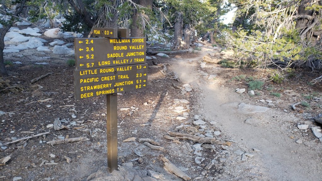

San Jacinto Trail Report: available for everyone, funded by readers. While all labor and time is volunteered, this Report completely depends on small private donations to cover its direct costs. With a very challenging first half of 2020, every contribution is invaluable. If you have found this Report useful, please consider visiting the Donate page. Thank you.sanjacjonUncategorizedLeave a comment 7 MinutesEdit”Weather and water update 19th August 2020″
Trail and water update 12th August 2020
I continue to average four hikes per week to San Jacinto Peak, surveying water sources on as many different routes as possible, recently including Deer Springs, Fuller Ridge, and Marion Mountain trails, plus the east side routes. The 33,000 acre Apple Fire on the south side of the San Bernardino mountains was no longer showing significant smoke by Sunday 9th, although yesterday from Black Mountain I watched a minor flare-up in Wood Canyon. The damage to an area where Anne and I used to hike regularly is catastrophic. In happier news, the story of how our dog Anabel recently survived a neurotoxic rattlesnake bite in the San Jacinto high country continues to attract considerable attention and encouraging feedback. Thank you so much for all the kind comments and positive thoughts.
Permits are required for hiking and camping in Mount San Jacinto State Park, see their website for details. The U.S. Forest Service ranger station in Idyllwild remains closed due to the coronavirus crisis. USFS day use permits will be required again for the San Jacinto wilderness starting 1st September. A permit quota will be in place for Devil’s Slide Trail for Labor Day weekend. Although Forest Service wilderness camping and hiking permits can currently be issued if requested, they are currently not required. USFS campgrounds are now open, except those mentioned in this post.
Hikers should be prepared for rapidly changing weather conditions in the high country in summer. Thunderstorms with lightning, precipitation, and rapid temperature drops, most likely in the afternoon or evening, are forecast to be a possibility every day for at least the next week.
Palm Springs Aerial Tramway is closed indefinitely (since 12th March) due to the coronavirus crisis. The Tram has brought forward the normal September maintenance program into August this year, to allow for a theoretical reopening date of 1st September. However that requires approvals that will likely depend on significant improvement of the coronavirus crisis.
Be rattlesnake and bear aware. As described previously, potentially hazardous wildlife is active at present. As always, if you respect them, they will respect you.
Black Mountain Road reopened on 20th June, having been graded through to the Fuller Ridge campground. Boulder Basin campground will remain closed all year.
WEATHER Starting Wednesday 12th August, very hot record high temperatures are forecast for at least the next week. Overnight “low” temperatures in particular may be 15-20 degrees above seasonal averages. There is no significant precipitation in the forecast. Fire risk remains severe.
At San Jacinto Peak (3295m/10,810ft) on Tuesday 11th August 2020, at 0830 the air temperature was 50.4°F (10°C), with a windchill of 41.5°F (5°C), 35% relative humidity, and a strong SW wind sustained at 16 mph gusting to 32.1 mph.
At the Peak on Monday 10th August 2020 at 0805 the air temperature was 52.4°F (11°C), with a windchill of 47.9°F (9°C), 24% relative humidity, and a moderate SW wind sustained at 4 mph gusting to 10.6 mph.
The warmest morning I have recorded at San Jacinto Peak so far in 2020 was on Monday 20th July, when at 0835 the air temperature was 59.7°F (15°C), with no discernible windchill, 31% relative humidity, largely calm with an occasional NE breeze gusting to 2.7 mph.
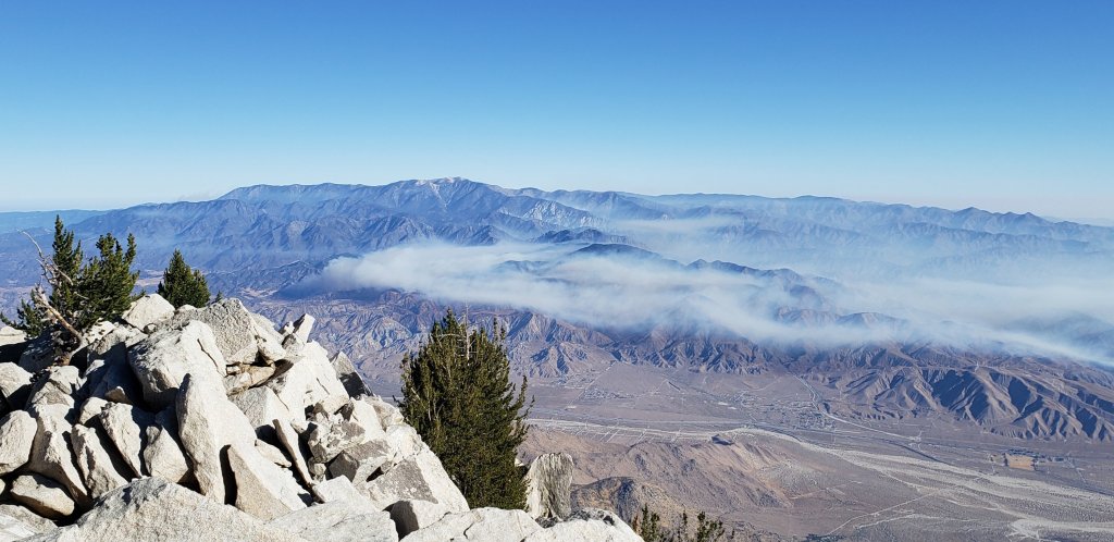
TRAIL CONDITIONS
All trails have been clear of snow since early June. Many trails have treefall hazards from this past winter, passable for hikers but not for stock. Some are described in detail below, others include: PCT south of Red Tahquitz (approx. PCT Miles 173-175), PCT between Strawberry Cienega and Deer Springs camp (Miles 182-185), Fuller Ridge Trail near its northern end (PCT Miles 189.1-190.2), Spitler Peak, Cedar Spring, and Apache Spring trails.
Willow Creek Trail has nine tree hazards on State Park land between the USFS boundary and Hidden Divide from this past winter. Fourteen additional trees on Forest Service land, and two in the State Park, have been cleared since late May. As reported previously, the challenging whitethorn on this trail has now been removed.
Seven Pines Trail has been very lightly traveled since November 2018. There are 25 treefall hazards on the trail, almost all in the upper State Park section of trail, based on multiple June 2020 surveys. Very cautious navigation is recommended for those unfamiliar with this trail. The Forest Service closure of Dark Canyon Road is expected to continue into 2021, so there is currently no vehicular access to Seven Pines trailhead.
The Pacific Crest Trail remains open at the rockslide just north of Antsell Rock (Mile 172.5). USFS plans for removal of the rockslide have been delayed due to the coronavirus crisis. The video report (available here) can be useful for deciding whether to hike around the rockslide or take an alternate route.
Forest Service temporary signage indicates that the Caramba Trail from near Reeds Meadow through Laws Camp and on to Caramba, and the Cedar Trail from Willow Creek Trail to Laws, are “not maintained”. In reality both trails no longer exist. Both are so heavily overgrown I advise hikers do not attempt to follow them. Many experienced hikers have reported getting lost in this area since summer 2019. An informal use trail to Laws is much more direct and avoids all of the challenging bush-whacking of the unmaintained trails (some local hikers have dubbed it the “King Trail”). It leaves the Willow Creek Trail exactly 1.0 mile from Saddle Junction (0.46 mile from the Skunk Cabbage turning), descending largely on established deer trails for 1.2 miles, roughly paralleling Willow Creek just to its south. Be advised that it is an indistinct use trail, becoming less obvious as it nears Laws (by which time Willow Creek is close by on your left hand side, so navigation is not a challenge). From Laws east to Caramba the route of the original Caramba Trail is relatively easy to follow (for those who were familiar with this trail prior to the 2013 Mountain Fire). Nevertheless, cautious navigation is still advised.
WATER STATUS: Eastern slope
The Round Valley pipe is flowing again. Flow has periodically been redirected to the CCC/ACE camp in Long Valley and water pressure can be insufficient to also flow at the pipe. This water source is inconsistent and should not be relied upon. The nearby Round Valley creek is now dry.
The small creek in Tamarack Valley is barely trickling and will dry up this month.
Both the northern and southern springs at Wellman’s Cienega are flowing gently. These are the sources for Willow Creek, which is flowing well where it crosses the Willow Creek Trail.
Tahquitz Creek is flowing at the northern end of Little Tahquitz Meadow. It is also flowing further upstream at its source (known locally as Grethe Spring) where it crosses the PCT (approx. PCT Mile 177). The small creek in Tahquitz Valley continues to flow gently.
Candy’s Creek – that flows through Skunk Cabbage Meadow and then crosses the remaining visible section of Caramba Trail near Reeds Meadow – is currently flowing steadily.
WATER STATUS: Western slope
Ephemeral creeks, such as those along Marion Mountain Trail and on Deer Springs Trail, are now all dry.
The North Fork of the San Jacinto River is flowing well where it crosses the Deer Springs Trail and again downstream where it crosses the Fuller Ridge Trail on the PCT (approx. PCT Mile 186.2).

The creek in Little Round Valley is flowing, although at less than half the volume compared to this time last year. The same creek has now dried up where it crosses Fuller Ridge Trail (at about PCT Mile 186.4).
Shooting Star Spring (below Little Round Valley but above the North Fork of the San Jacinto River crossing) is flowing steadily.
The Deer Springs stream crossing at the PCT (approx. PCT mile 185.6) is flowing steadily.
Switchback Spring at PCT Mile 183.5 (about 0.4 miles on the PCT northbound from Strawberry Junction) is trickling, but there is not adequate depth in which to filter water.
The little creek at Strawberry Cienega (PCT mile 183.0) is now dry.
On Devil’s Slide Trail, Middle Spring is flowing gently. Other creeks and springs on this trail are dry.
On the Ernie Maxwell Trail, the crossing of Chinquapin Creek just below Humber Park is now dry where it crosses the trail. However there are small pools just upslope from the trail (this is an important source of water for the many dogs walked on the Ernie Maxwell).
WATER STATUS: Desert Divide
Live Oak Spring (N 33 37 21, W 116 33 24) Flowing well. The most reliable water source on the Desert Divide.
Cedar Spring (N 33 40 36, W 116 34 35) Flowing well. Easiest access is the trough 60 yards upstream from the trail to the campsite.
Apache Spring (N 33 43 11, W 116 37 13) Flowing very weakly.
Spitler Peak Trail Descending the trail there are five water crossings. The first two, at 0.9 and 0.95 miles down, cross a tiny side creek which is largely dry and should be ignored. The next crossing, at 1.1 miles down, is Spitler Creek and is the best source of water (currently flowing). The next two crossings are the same creek, but for obvious reasons it is best to fill up at the highest of the three crossings.
Antsell Rock Creek (N 33 41 52, W 116 39 08) Right by the Spitler Peak Trail trailhead on Apple Canyon Road, Antsell Rock Creek is flowing very well. Just on the upstream side of the road there is excellent access to the creek. Useful if hikers are descending the Spitler Peak Trail.
San Jacinto Trail Report: available for everyone, funded by readers. While all labor and time is volunteered, this Report completely depends on small private donations to cover its direct costs. With a very challenging first half of 2020, every contribution is invaluable. If you have found this Report useful, please consider visiting the Donate page. Thank you.sanjacjonUncategorizedLeave a comment 7 MinutesEdit”Trail and water update 12th August 2020″
Trail and water update 5th August 2020
I have been averaging four hikes per week to San Jacinto Peak, via as many different routes as possible, plus most other major trails around the high country such as Willow Creek, South Ridge, and Caramba. Just 32 days since leaving ICU, Anabel accompanied me into the high country for the first time today with no apparent difficulty (for those unfamiliar with the full story of how our dog survived a neurotoxic rattlesnake bite in the San Jacinto high country, it is available here).
There are several current missing persons cases in and around the San Jacinto mountains. Only one, Roy Prifogle, was known to be hiking public trails at the time of his disappearance. Anyone with any relevant information should contact Riverside County Sheriffs Department.
Be rattlesnake and bear aware. As described last week potentially hazardous wildlife is active at present. As always, if you respect them, they will respect you.
Black Mountain Road reopened on 20th June, having been graded through to the Fuller Ridge campground. However Boulder Basin campground will remain closed all year.
Palm Springs Aerial Tramway is closed indefinitely (since 12th March) due to the coronavirus crisis. The Tram has brought forward their normal September maintenance program into August this year, to allow for a theoretical reopening date of 1st September. However that requires a variety of approvals that will likely depend on significant improvement of the coronavirus crisis.
Permits are required for hiking and camping in Mount San Jacinto State Park, see their website for details. The U.S. Forest Service ranger station in Idyllwild remains closed due to the coronavirus crisis. Although Forest Service wilderness camping and hiking permits can be issued if requested, they are currently not required. USFS campgrounds are now open, except those discussed elsewhere in this post.

WEATHER Starting today, four days of below average temperatures will provide welcome relief from the heat. By Sunday 9th August, temperatures are forecast to return to summer seasonal averages, before moving well above average starting about Wednesday 12th. There is no precipitation in the forecast. Fire risk remains severe.
At San Jacinto Peak (3295m/10,810ft) on Wednesday 5th August 2020, at 0805 the air temperature was 48.8°F (9°C), with a windchill of 41.4°F (5°C), 22% relative humidity, and a steady due West wind sustained at 12 mph gusting to 17.1 mph.
At the Peak on Monday 3rd August 2020 at 0745 the air temperature was 55.5°F (13°C), with a windchill of 52.9°F (12°C), 18% relative humidity, and a light but steady WNW wind sustained at 5 mph gusting to 8.5 mph.
The warmest morning I have recorded at San Jacinto Peak so far in 2020 was on Monday 20th July, when at 0835 the air temperature was 59.7°F (15°C), with no discernible windchill, 31% relative humidity, largely calm with an occasional NE breeze gusting to 2.7 mph.
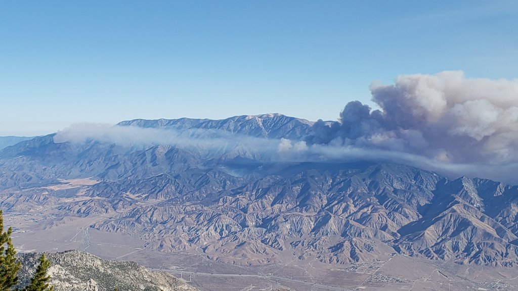
TRAIL CONDITIONS
All trails have been clear of snow since early June. Many trails have new treefall hazards from this past winter, passable for hikers but not for stock. Some are described in detail below, others include: PCT south of Red Tahquitz (approx. PCT Miles 173-175), PCT between Strawberry Cienega and Deer Springs camp (Miles 182-185), Fuller Ridge Trail near its northern end (PCT Miles 189.1-190.2), Spitler Peak, Cedar Spring, and Apache Spring trails.
Willow Creek Trail has nine tree hazards on State Park land between the USFS boundary and Hidden Divide from this past winter. Fourteen additional trees on Forest Service land, and two in the State Park, have been cleared since late May. As reported previously, the challenging whitethorn on this trail has now been removed.
Seven Pines Trail has been very lightly traveled since November 2018. There are 25 treefall hazards on the trail, almost all in the upper State Park section of trail, based on multiple June 2020 surveys. Very cautious navigation is recommended for those unfamiliar with this trail. The Forest Service closure of Dark Canyon Road is expected to continue into 2021, so there is currently no vehicular access to Seven Pines trailhead.
The Pacific Crest Trail remains open at the rockslide just north of Antsell Rock (Mile 172.5). USFS plans for removal of the rockslide have been delayed due to the coronavirus crisis. The video report (available here) can be useful for deciding whether to hike around the rockslide or take an alternate route.
Forest Service temporary signage indicates that the Caramba Trail from near Reeds Meadow through Laws Camp and on to Caramba, and the Cedar Trail from Willow Creek Trail to Laws, are “not maintained”. In reality both trails no longer exist. Both are so heavily overgrown I advise hikers do not attempt to follow them. Many experienced hikers have reported getting lost in this area since summer 2019. An informal use trail to Laws is much more direct and avoids all of the challenging bush-whacking of the unmaintained trails (some local hikers have dubbed it the “King Trail”). It leaves the Willow Creek Trail exactly 1.0 mile from Saddle Junction (0.46 mile from the Skunk Cabbage turning), descending largely on established deer trails for 1.2 miles, roughly paralleling Willow Creek just to its south. Be advised that it is an indistinct use trail, becoming less obvious as it nears Laws (by which time Willow Creek is close by on your left hand side, so navigation is not a challenge). From Laws east to Caramba the route of the original Caramba Trail is relatively easy to follow (for those who were familiar with this trail prior to the 2013 Mountain Fire). Nevertheless, cautious navigation is still advised.
WATER STATUS: Eastern slope
The Round Valley pipe is flowing again. Flow has periodically been redirected to the CCC/ACE camp in Long Valley and water pressure can be insufficient to also flow at the pipe. This water source is inconsistent and should not be relied upon. The nearby Round Valley creek is now dry.
The small creek in Tamarack Valley is barely flowing and will likely dry up this month.
Both the northern and southern springs at Wellman’s Cienega are flowing gently. These are the sources for Willow Creek, which is flowing well where it crosses the Willow Creek Trail.

Tahquitz Creek is flowing at the northern end of Little Tahquitz Meadow. It is also flowing further upstream at its source (known locally as Grethe Spring) where it crosses the PCT (approx. PCT Mile 177). The small creek in Tahquitz Valley continues to flow gently.
Candy’s Creek – that flows through Skunk Cabbage Meadow and then crosses the remaining visible section of Caramba Trail near Reeds Meadow – is currently flowing steadily.
WATER STATUS: Western slope
Ephemeral creeks, such as those along Marion Mountain Trail and on Deer Springs Trail, are now all dry (for filtering at least).
The North Fork of the San Jacinto River is flowing very well where it crosses the Deer Springs Trail and again downstream where it crosses the Fuller Ridge Trail on the PCT (approx. PCT Mile 186.2).
The creek in Little Round Valley is flowing, although at less than half the volume compared to this time last year. The same creek is flowing weakly where it crosses Fuller Ridge Trail (at about PCT Mile 186.4).
Shooting Star Spring (below Little Round Valley but above the North Fork of the San Jacinto River crossing) is flowing well.
The Deer Springs stream crossing at the PCT (approx. PCT mile 185.6) is flowing strongly.
Switchback Spring at PCT Mile 183.5 (about 0.4 miles on the PCT northbound from Strawberry Junction) is flowing gently, but there is not adequate depth in which to filter water.
The little creek at Strawberry Cienega (PCT mile 183.0) is now functionally dry and should not be relied upon for filtering.
On Devil’s Slide Trail, Middle Spring is flowing very gently. Other creeks and springs on this trail have functionally dried up.
On the Ernie Maxwell Trail, the crossing of Chinquapin Creek just below Humber Park is now dry where it crosses the trail, however there are small pools just upslope from the trail (this is an important source of water for the many dogs walked on the Ernie Maxwell).
WATER STATUS: Desert Divide
Live Oak Spring (N 33 37 21, W 116 33 24) Flowing well. The most reliable water source on the Desert Divide.
Cedar Spring (N 33 40 36, W 116 34 35) Flowing well. Easiest access is the trough just upstream from the trail to the campsite.
Apache Spring (N 33 43 11, W 116 37 13) Flowing weakly.
Spitler Peak Trail Descending the trail there are five water crossings. The first two, at 0.9 and 0.95 miles down, cross a tiny side creek which is largely dry and should be ignored. The next crossing, at 1.1 miles down, is Spitler Creek and is the best source of water (currently flowing well). The next two crossings are the same creek, but for obvious reasons it is best to fill up at the highest of the three crossings.
Antsell Rock Creek (N 33 41 52, W 116 39 08) Right by the Spitler Peak Trail trailhead on Apple Canyon Road, Antsell Rock Creek is flowing very well. Just on the upstream side of the road there is excellent access to the creek. Useful if hikers are descending the Spitler Peak Trail.
San Jacinto Trail Report: available for everyone, funded by readers. While all labor and time is volunteered, this Report completely depends on small private donations to cover its direct costs. With a very challenging first half of 2020, every contribution is invaluable. If you have found this Report useful, please consider visiting the Donate page. Thank you.sanjacjonUncategorized3 Comments 7 MinutesEdit”Trail and water update 5th August 2020″
Brief trail update 29th July 2020
I have summited San Jacinto Peak four times since last week’s report via various routes including Fuller Ridge Trail. Yesterday morning Anabel and I had a lovely hike to survey conditions on Willow Creek Trail, at ten miles her longest hike since her rattlesnake bite on 2nd July.
We currently have three, possibly four, missing persons cases from 2020 in and around the San Jacinto mountains, as summarized here (note only one was known to be a hiker on public trails). Anyone with any relevant information should contact Riverside County Sheriffs Department.
The current status of water sources has not changed significantly since last week’s report. Please consult that update for the latest water conditions.
Be bear aware. As I reported belatedly in last week’s update, I had a great view of a Black Bear at 0558 on Thursday 23rd at 7800′ elevation on Devil’s Slide Trail. This is one of the two individuals that appeared in the San Jacinto mountains – where they normally do not occur – in 2017, but to the best of my knowledge there had been no sightings for about a year. This individual is very distinctive, with a bright blond upper body and dark chocolate head and legs. As a (much smaller) youngster, the same bear walked past our house in Idyllwild two years ago in broad daylight (short video here).
Be rattlesnake aware. After a slow start to the summer, Southern Pacific Rattlesnakes have been active in recent weeks. As usual, the lower two-thirds of Devil’s Slide Trail, and the lowest section of Deer Springs Trail, seem to be particular hotspots. For the first year ever, they are also occurring at the elevation of Wellman’s Cienega, where they are particularly hard to see on the heavily vegetated trail. For anyone interested in the story of how our dog Anabel survived, against very long odds, being bitten by a neurotoxic rattlesnake in the high country earlier this month, it is available here.
Black Mountain Road reopened on 20th June, having been graded through to the Fuller Ridge campground. However Boulder Basin campground will remain closed all year. Palm Springs Aerial Tramway is closed indefinitely (since 12th March) due to the coronavirus crisis.
Permits are required for hiking and camping in Mount San Jacinto State Park, see their website for details. The State Park ranger station in Idyllwild has been open since late May. The U.S. Forest Service ranger station in Idyllwild remains closed due to the coronavirus crisis. Although Forest Service wilderness camping and hiking permits can be issued if requested, they are currently not required. USFS campgrounds are now open, except those discussed elsewhere in this post.
WEATHER Temperatures are forecast to be well above seasonal averages for the next week, until about Tuesday 4th August, with record temperatures (especially overnight lows) possible this weekend. There is no significant precipitation in the forecast. Fire risk remains severe.
At San Jacinto Peak (3295m/10,810ft) on Monday 27th July 2020, at 0840 the air temperature was 50.8°F (11°C), with a windchill of 46.9°F (8°C), 39% relative humidity, and a light SE breeze sustained at 6 mph gusting to 11.5 mph.
The coolest recent day at the Peak was Saturday 25th July 2020, when at 0715 the air temperature was 47.3°F (9°C), with a windchill of 38.9°F (5°C), 20% relative humidity, and a brisk SSE wind sustained at 7 mph gusting to 18.4 mph.
The warmest morning of the year to date recorded at San Jacinto Peak was 20th July 2020, when at 0835 the air temperature was 59.7°F (15°C), with no discernible windchill, 31% relative humidity, largely calm with an occasional NE breeze gusting to 2.7 mph
TRAIL CONDITIONS
All trails have been clear of snow since early June. Many trails have new treefall hazards from this past winter, passable for hikers but not for stock. Some are described in detail below, others include: PCT south of Red Tahquitz (approx. PCT Miles 173-175), PCT between Strawberry Cienega and Deer Springs camp (Miles 182-185), Fuller Ridge Trail near its northern end (PCT Miles 189.1-190.2), Spitler Peak, Cedar Spring, and Apache Spring trails.
Willow Creek Trail has nine tree hazards on State Park land between the USFS boundary and Hidden Divide from this past winter. Fourteen additional trees on Forest Service land, and two in the State Park, have been cleared since late May. As reported previously, the challenging whitethorn on this trail has now been removed.
Seven Pines Trail has been very lightly traveled since November 2018. There are 25 treefall hazards on the trail, almost all in the upper State Park section of trail, based on multiple May/June 2020 surveys. Very cautious navigation is recommended for those unfamiliar with this trail. The Forest Service closure of Dark Canyon Road is expected to continue into 2021, so there is currently no vehicular access to Seven Pines trailhead.
The Pacific Crest Trail remains open at the rockslide just north of Antsell Rock (Mile 172.5). USFS has not indicated when this area may close for removal of the rockslide. The video report (available here) can be useful for deciding whether to hike around the rockslide or take an alternate route.
Forest Service temporary signage indicates that the Caramba Trail from near Reeds Meadow through Laws Camp and on to Caramba, and the Cedar Trail from Willow Creek Trail to Laws, are “not maintained”. In reality both trails no longer exist. Both are so heavily overgrown I advise hikers do not attempt to follow them. Many experienced hikers have reported getting lost in this area since summer 2019. An informal use trail to Laws has been developed which is much more direct and avoids all of the challenging bush-whacking of the unmaintained trails (some local hikers have kindly named it the “King Trail”). It leaves the Willow Creek Trail exactly 1.0 mile from Saddle Junction (0.46 mile from the Skunk Cabbage turning), descending largely on established deer trails for 1.2 miles, roughly paralleling Willow Creek just to its south. Currently it is indistinct, becoming even less obvious as it nears Laws (by which time Willow Creek is close by on your left hand side, so navigation is not a challenge). I hope to work on the trail in early July. From Laws east to Caramba the route of the original Caramba Trail is relatively easy to follow (for those who were familiar with this trail prior to the 2013 Mountain Fire). Nevertheless very cautious navigation is still advised.

San Jacinto Trail Report: available for everyone, funded by readers. While all labor and time is volunteered, this Report completely depends on small private donations to cover its direct costs. With a very challenging first half of 2020, every contribution is invaluable. If you have found this Report useful, please consider visiting the Donate page. Thank you.sanjacjonUncategorized3 Comments 4 MinutesEdit”Brief trail update 29th July 2020″
Trail and water update 23rd July 2020
Daily hikes have included several to San Jacinto Peak, plus most of the major trails around the high country and Tahquitz Peak, in the past week. On my drive up Fern Valley Road before dawn on Monday 20th, I was very fortunate to see a relatively young Mountain Lion cub cross the road. Doubtless I had only missed seeing its mother by a minute or less. Remarkably that is the sixth time since September 2019 that I have seen a lion up here, having seen none for several years previously.
We currently have three missing persons cases from 2020 in and around the San Jacinto mountains, summarized here (although only one was a hiker on public trails). Anyone with any relevant information should contact Riverside County Sheriffs Department.
Anabel update: In another unlikely twist to the improbable story of how our dog Anabel survived a neurotoxic rattlesnake bite in the San Jacinto high country (the full story is available here), we were descending Devil’s Slide Trail early in the morning on Saturday 18th – the first day Anabel had been on that trail since she was bitten – when we passed a hiker who unexpectedly asked “what is the name of your dog?”. Remarkably the hiker proved to be Chelsea, the senior vet tech at Temecula Emergency Pet Clinic on the afternoon of 2nd July, the day Anabel was bitten and admitted! Although I had never met her, Chelsea of course recognized Anabel, having watched over her for many hours over two days. We had a long chat, Chelsea was visibly moved to see how well Anabel was doing, and it gave me the opportunity to again try to find the words to thank her, and her colleagues, for what they had done.
Be bear aware. I had a great view of a Black Bear at 0558 this morning at 7800′ elevation on Devil’s Slide Trail. This is one of the two individuals that appeared in the San Jacinto mountains – where they normally do not occur – in 2017, but to the best of my knowledge there had been no sightings for about a year. This individual is very distinctive, with a bright blond upper body and dark chocolate head and legs (“Blondie” feels like an appropriate nickname). As a youngster, the same bear walked past our house in Idyllwild two years ago (short video here). Now however, Blondie is all grown up and looked very large today, perhaps 50% larger than in the 2018 video.
Be rattlesnake aware. After a slow start to the summer, Southern Pacific Rattlesnakes have been especially active in the past couple of weeks. As usual, the lower two-thirds of Devil’s Slide Trail seems to be a particular hotspot. For the first year ever, they are also occurring at the elevation of Wellman’s Cienega, where they are particularly hard to see on the heavily vegetated trail.

Black Mountain Road reopened on 20th June, having been graded through to the Fuller Ridge campground. However Boulder Basin campground will remain closed all year. Palm Springs Aerial Tramway is closed indefinitely (since 12th March) due to the coronavirus crisis.
Permits are required for hiking and camping in Mount San Jacinto State Park, see their website for details. The U.S. Forest Service ranger station in Idyllwild remains closed due to the coronavirus crisis. Although Forest Service wilderness camping and hiking permits can be issued if requested, they are currently not required. USFS campgrounds are now open, except those discussed elsewhere in this post.
WEATHER A couple of days with slightly below seasonal temperatures this week will end on about Sunday 26th July, when hot summer weather returns. Temperatures are forecast to be far above seasonal averages next week. There is no significant precipitation in the forecast. Fire risk remains severe.
At San Jacinto Peak (3295m/10,810ft) on Monday 20th July 2020, at 0835 the air temperature was 59.7°F (15°C), with no discernible windchill, 31% relative humidity, largely calm with an occasional NE breeze gusting to 2.7 mph. This was the warmest morning I have recorded at the Peak so far in 2020.
At the Peak on Friday 17th July 2020 at 0755 the air temperature was 54.9°F (13°C), with a windchill of 50.0°F (10°C), 25% relative humidity, and a light due South wind sustained at 5 mph gusting to 12.5 mph.
TRAIL CONDITIONS
All trails have been clear of snow since early June. Many trails have new treefall hazards from this past winter, passable for hikers but not for stock. Some are described in detail below, others include: PCT south of Red Tahquitz (approx. PCT Miles 173-175), PCT between Strawberry Cienega and Deer Springs camp (Miles 182-185), Fuller Ridge Trail near its northern end (PCT Miles 189.1-190.2), Spitler Peak, Cedar Spring, and Apache Spring trails.
Willow Creek Trail has 14 tree hazards (five on Forest Service land, nine on State Park) between Willow Creek and Hidden Divide from this past winter. Ten additional trees on Forest Service land east of Saddle Junction, and two in the State Park, have been cleared since late May. As reported previously, the challenging whitethorn on this trail has now been removed.
Seven Pines Trail has been very lightly traveled since November 2018. There are 25 treefall hazards on the trail, almost all in the upper State Park section of trail, based on multiple May/June 2020 surveys. Very cautious navigation is recommended for those unfamiliar with this trail. The Forest Service closure of Dark Canyon Road is expected to continue into 2021, so there is currently no vehicular access to Seven Pines trailhead.
The Pacific Crest Trail remains open at the rockslide just north of Antsell Rock (Mile 172.5). USFS has not indicated when this area may close for removal of the rockslide. The video report (available here) can be useful for deciding whether to hike around the rockslide or take an alternate route.
Forest Service temporary signage indicates that the Caramba Trail from near Reeds Meadow through Laws Camp and on to Caramba, and the Cedar Trail from Willow Creek Trail to Laws, are “not maintained”. In reality both trails no longer exist. Both are so heavily overgrown I advise hikers do not attempt to follow them. Many experienced hikers have reported getting lost in this area since summer 2019. An informal use trail to Laws has been developed which is much more direct and avoids all of the challenging bush-whacking of the unmaintained trails (some local hikers have kindly named it the “King Trail”). It leaves the Willow Creek Trail exactly 1.0 mile from Saddle Junction (0.46 mile from the Skunk Cabbage turning), descending largely on established deer trails for 1.2 miles, roughly paralleling Willow Creek just to its south. Currently it is indistinct, becoming even less obvious as it nears Laws (by which time Willow Creek is close by on your left hand side, so navigation is not a challenge). I hope to work on the trail in early July. From Laws east to Caramba the route of the original Caramba Trail is relatively easy to follow (for those who were familiar with this trail prior to the 2013 Mountain Fire). Nevertheless very cautious navigation is still advised.
WATER STATUS: Eastern slope
The Round Valley pipe is not currently flowing. The flow as been redirected to the CCC camp in Long Valley and water pressure is insufficient to also flow at the pipe. Fortunately Round Valley creek just a few yards away is flowing gently, but it will likely dry up any day now.
Both the northern and southern springs at Wellman’s Cienega are flowing gently. These are the sources for Willow Creek, which is flowing well where it crosses the Willow Creek Trail.
Tahquitz Creek is flowing at the northern end of Little Tahquitz Meadow. It is also flowing further upstream at its source (known locally as Grethe Spring) where it crosses the PCT (approx. PCT Mile 177). The small creek in Tahquitz Valley continues to flow gently.
Candy’s Creek – that flows through Skunk Cabbage Meadow and then crosses the remaining visible section of Caramba Trail near Reeds Meadow – is currently flowing steadily.
WATER STATUS: Western slope
The North Fork of the San Jacinto River is flowing very well where it crosses the Deer Springs Trail and even better where it crosses the Fuller Ridge Trail on the PCT (approx. PCT Mile 186.2).
The creek in Little Round Valley is flowing, although at less than half the volume compared to this time last year. The same creek is flowing well where it crosses Fuller Ridge Trail (at about PCT Mile 186.4).

Shooting Star Spring (below Little Round Valley but above the North Fork of the San Jacinto River crossing) is flowing well.
The Deer Springs stream crossing at the PCT (approx. PCT mile 185.6) is flowing strongly.
Switchback Spring at PCT Mile 183.5 (about 0.4 miles north of Strawberry Junction) is flowing gently, but there is not adequate depth in which to filter water.
The little creek at Strawberry Cienega (PCT mile 183.0) is now functionally dry and should not be relied upon for filtering.
On Devil’s Slide Trail, Middle Spring is flowing gently. Other creeks and springs on this trail have functionally dried up.
On the Ernie Maxwell Trail, the crossing of Chinquapin Creek just below Humber Park continues to flow well (an important source of water for the many dogs walked on this trail).
WATER STATUS: Desert Divide
Live Oak Spring (N 33 37 21, W 116 33 24) Flowing well. The most reliable water source on the Desert Divide.
Cedar Spring (N 33 40 36, W 116 34 35) Flowing well. Easiest access is the trough just upstream from the trail to the campsite.
Apache Spring (N 33 43 11, W 116 37 13) Flowing fairly well.
Spitler Peak Trail Descending the trail there are five water crossings. The first two, at 0.9 and 0.95 miles down, cross a tiny side creek which is largely dry and should be ignored. The next crossing, at 1.1 miles down, is Spitler Creek and is the best source of water (currently flowing well). The next two crossings are the same creek, but for obvious reasons it is best to fill up at the highest of the three crossings.
Antsell Rock Creek (N 33 41 52, W 116 39 08) Right by the Spitler Peak Trail trailhead on Apple Canyon Road, Antsell Rock Creek is flowing very well. Just on the upstream side of the road there is excellent access to the creek. Useful if hikers are descending the Spitler Peak Trail.
San Jacinto Trail Report: available for everyone, funded by readers. While all labor and time is volunteered, this Report completely depends on small private donations to cover its direct costs. With a very challenging first half of 2020, every contribution is invaluable. If you have found this Report useful, please consider visiting the Donate page. Thank you.sanjacjonUncategorizedLeave a comment 7 MinutesEdit”Trail and water update 23rd July 2020″
Trail and water update 15th July 2020
Recent hikes have included several to San Jacinto Peak, the Tahquitz area meadows today to check on water conditions on my way to Tahquitz Peak, South Ridge Trail, and a few early morning runs on the Ernie Maxwell Trail.
Anabel update: Thank you so much to the remarkable number of people who commented or contacted us about Anabel’s story. At a time of so much dismal news, her toughness, good fortune, and a happy ending, has clearly resonated with many people. It has been the most viewed posting on the Trail Report since the July 2018 Cranston Fire. If you haven’t seen the story of how our dog Anabel survived a neurotoxic rattlesnake bite in the San Jacinto high country against long odds, it is available here. She is doing great, still only ten days removed from ICU, slowly increasing her walking mileage every morning, and all neurological effects to her breathing and mobility have rapidly declined. All three of us are fortunate indeed.

Be rattlesnake aware. On Monday 13th July, I saw a record (for me) four Southern Pacific Rattlesnakes in just 1.5 hours on my mid-morning descent from San Jacinto Peak to Humber Park. This was especially striking as up to now 2020 has generally been a relatively poor year for rattlesnake abundance on the mountain trails (notwithstanding what happened to Anabel last week). I came within inches of stepping on the highest of these, at 9200′ near Wellman’s Cienega, had another at 8600′ (photo below), and then two more low down on Devil’s Slide Trail at 6800′ and 6600′. All were large (at least three feet long) adults, and as usual all were relatively placid and easy to pass. With such warm weather, caution is advised for at least the next couple of months.
Black Mountain Road reopened on 20th June, having been graded through to the Fuller Ridge campground. USFS indicates that Boulder Basin campground will remain closed all year. Palm Springs Aerial Tramway is closed indefinitely (since 12th March) due to the coronavirus crisis.
For camping in Mount San Jacinto State Park, see their website for details. The U.S. Forest Service ranger station in Idyllwild remains closed due to the coronavirus crisis. Although Forest Service wilderness camping and hiking permits can be issued if requested, they are currently not required. USFS campgrounds are now open, except those discussed elsewhere in this post.
WEATHER After three days of about seasonal temperatures at the beginning of this week, hot summer weather returns on Thursday 16th and will persist for the foreseeable future. Fire risk will be severe. There is no significant precipitation in the forecast. Temperatures over the next week will be above seasonal averages, especially the overnight lows. Heat was exceptional this past weekend, with an overnight low on 11th July some 15° above the monthly average of 54°F, and an Idyllwild high on Sunday 12th of 95°F, nearly ten degrees above average.
At San Jacinto Peak (3295m/10,810ft) on Monday 13th July 2020, at 0825 the air temperature was 52.7°F (11°C), with a windchill of 46.6°F (8°C), 69% relative humidity, and a pleasant SW wind sustained at 9 mph gusting to 15.5 mph.
The coolest recent day at the Peak was Monday 29th June 2020, when at 0805 the air temperature was 35.3°F (2°C), with a windchill of 21.0°F (-6°C), 33% relative humidity, and a stiff due West wind sustained at 16 mph gusting to 31.2 mph.
The warmest day of 2020 so far recorded at San Jacinto Peak remains Monday 22nd June, when at 0830 the air temperature was 57.0°F (14°C) with 37% relative humidity and a barely discernible SW wind gusting to 2.9 mph.
TRAIL CONDITIONS
All trails have been clear of snow since early June. Many trails have new treefall hazards from this past winter, passable for hikers but not for stock. Some are described in detail below, others include: PCT south of Red Tahquitz (approx. PCT Miles 173-175), PCT between Strawberry Cienega and Deer Springs camp (Miles 182-185), Fuller Ridge Trail near its northern end (PCT Miles 189.1-190.2), Spitler Peak, Cedar Spring, and Apache Spring trails.
Willow Creek Trail has 14 tree hazards (five on Forest Service land, nine on State Park) between Willow Creek and Hidden Divide from this past winter. Ten additional trees on Forest Service land east of Saddle Junction, and two in the State Park, have been cleared since late May. As reported previously, the challenging whitethorn on this trail has now been removed.
Seven Pines Trail has been very lightly traveled since November 2018. There are 25 treefall hazards on the trail, almost all in the upper State Park section of trail, based on multiple May/June 2020 surveys. Very cautious navigation is recommended for those unfamiliar with this trail. The Forest Service closure of Dark Canyon Road is expected to continue into 2021, so there is currently no vehicular access to Seven Pines trailhead.
The Pacific Crest Trail remains open at the rockslide just north of Antsell Rock (Mile 172.5). USFS has not indicated when this area may close for removal of the rockslide. The video report (available here) can be useful for deciding whether to hike around the rockslide or take an alternate route.
Forest Service temporary signage indicates that the Caramba Trail from near Reeds Meadow through Laws Camp and on to Caramba, and the Cedar Trail from Willow Creek Trail to Laws, are “not maintained”. In reality both trails no longer exist. Both are so heavily overgrown I advise hikers do not attempt to follow them. Many experienced hikers have reported getting lost in this area since summer 2019. An informal use trail to Laws has been developed which is much more direct and avoids all of the challenging bush-whacking of the unmaintained trails (some local hikers have kindly named it the “King Trail”). It leaves the Willow Creek Trail exactly 1.0 mile from Saddle Junction (0.46 mile from the Skunk Cabbage turning), descending largely on established deer trails for 1.2 miles, roughly paralleling Willow Creek just to its south. Currently it is indistinct, becoming even less obvious as it nears Laws (by which time Willow Creek is close by on your left hand side, so navigation is not a challenge). I hope to work on the trail in early July. From Laws east to Caramba the route of the original Caramba Trail is relatively easy to follow (for those who were familiar with this trail prior to the 2013 Mountain Fire). Nevertheless very cautious navigation is still advised.
WATER STATUS: Eastern slope
The Round Valley pipe is not currently flowing. The flow as been redirected to the CCC camp in Long Valley and water pressure is insufficient to also flow at the pipe. Fortunately Round Valley creek just a few yards away is flowing gently, but it will likely dry up any day now.
Both the northern and southern springs at Wellman’s Cienega are flowing gently. These are the sources for Willow Creek, which is flowing well where it crosses the Willow Creek Trail.
Tahquitz Creek is flowing at the northern end of Little Tahquitz Meadow. It is also flowing further upstream at its source (known locally as Grethe Spring) where it crosses the PCT (approx. PCT Mile 177).

Candy’s Creek – that flows through Skunk Cabbage Meadow and then crosses the remaining visible section of Caramba Trail near Reeds Meadow – is currently flowing steadily.
WATER STATUS: Western slope
The North Fork of the San Jacinto River is flowing very well where it crosses the Deer Springs Trail and even better where it crosses the Fuller Ridge Trail on the PCT (approx. PCT Mile 186.2).
The creek in Little Round Valley is flowing, although at less than half the volume compared to this time last year. The same creek is flowing well where it crosses Fuller Ridge Trail (at about PCT Mile 186.4).
Shooting Star Spring (below Little Round Valley but above the North Fork of the San Jacinto River crossing) is flowing well.
The Deer Springs stream crossing at the PCT (approx. PCT mile 185.6) is flowing strongly.
Switchback Spring at PCT Mile 183.5 (about 0.4 miles north of Strawberry Junction) is flowing well, but there is little depth in which to filter water.
The little creek at Strawberry Cienega (PCT mile 183.0) is flowing gently, but will dry up very soon.
On Devil’s Slide Trail, Middle Spring is flowing gently. Other creeks and springs on this trail have functionally dried up.
On the Ernie Maxwell Trail, the crossing of Chinquapin Creek just below Humber Park continues to flow well (an important source of water for the many dogs walked on this trail).
WATER STATUS: Desert Divide
Live Oak Spring (N 33 37 21, W 116 33 24) Flowing well. The most reliable water source on the Desert Divide.
Cedar Spring (N 33 40 36, W 116 34 35) Flowing well. Easiest access is the trough just upstream from the trail to the campsite.
Apache Spring (N 33 43 11, W 116 37 13) Flowing fairly well.
Spitler Peak Trail Descending the trail there are five water crossings. The first two, at 0.9 and 0.95 miles down, cross a tiny side creek which is largely dry and should be ignored. The next crossing, at 1.1 miles down, is Spitler Creek and is the best source of water (currently flowing well). The next two crossings are the same creek, but for obvious reasons it is best to fill up at the highest of the three crossings.
Antsell Rock Creek (N 33 41 52, W 116 39 08) Right by the Spitler Peak Trail trailhead on Apple Canyon Road, Antsell Rock Creek is flowing very well. Just on the upstream side of the road there is excellent access to the creek. Useful if hikers are descending the Spitler Peak Trail.
San Jacinto Trail Report: available for everyone, funded by readers. While all labor and time is volunteered, this Report completely depends on small private donations to cover its direct costs. With a very challenging first few months of 2020, every contribution is invaluable. If you have found this Report useful, please consider visiting the Donate page. Thank you.sanjacjonUncategorizedLeave a comment 7 MinutesEdit”Trail and water update 15th July 2020″
Long read: A dog with nine lives.
[The latest weekly Trail Report from 7th July is linked here. The following article is a long read. It is the first time since the Cranston Fire in 2018 that I have posted something only tangentially related to the trails. I hope it will become clear why I wanted to write this.]
“It’s not the size of the dog in the fight, it’s the size of the fight in the dog.” – Mark Twain
Many readers of this website, especially regular hikers to the San Jacinto mountains and Idyllwild locals, know that I often run and hike the trails with Anabel, our six year old, 35 pound, Jindo-German Shepherd mix dog. I could probably write a short book about Anabel, but in a few lines, she is a rescue who spent most of her first year of life as a street dog in the Coachella Valley, and was saved by kennel manager Edgar Santiago of the wonderful animal sanctuary Living Free literally on the day she was due to be euthanized. Since we adopted her on 14th February 2015, she has become a truly remarkable trail companion. She averages 5000 miles every year running and hiking on the trails near Idyllwild with Anne and me, and she is a tough and agile mountaineer, completing dozens of difficult winter ascents that few humans attempt. Her sweet smile and placid demeanor give no hint of her challenging past, and she seems to instantly become a firm favorite of everyone who meets her.
On 2nd July, as the three of us descended from a long, cool early morning hike in the San Jacinto high country, Anabel was bitten by a large rattlesnake.

We know it was a big snake as the puncture wounds on her paw were more than an inch (actually 28mm) apart, suggesting a rattlesnake about four feet long, typically about as big as they get up here. Further details of exactly what happened we’ll never know for sure. Anne and I had stopped briefly to look at a spring, and Anabel was just a few yards ahead of us, but around a slight bend in the trail. We never heard any noise, no yelp from Anabel, certainly no rattling from a snake, but within seconds she reappeared hobbling on three legs, hanging the fourth, two spots lightly oozing blood from her front left paw. The look on her face will live with us forever – she instantly knew this was really bad.
Getting bitten by a rattlesnake is extremely dangerous for any dog. Getting bitten by a rattlesnake in the San Jacinto mountains is fatal for a dog. The distinctive black, petrophilic, form of Southern Pacific Rattlesnake (SPR) found up here has an unusually potent neurotoxic venom. While the vast majority of lowland rattlesnakes in southern California have haemotoxic venom, which is itself dangerous enough, treatment for an attack on the blood system is orders of magnitude easier than treating the nervous system attack of neurotoxic venom.
To the best of our knowledge, no dog bitten by a neurotoxic rattlesnake in the San Jacinto mountains has survived. Death invariably occurs within hours. In addition to the toxin, without emergency veterinary facilities in our mountain communities, the simple practicality of getting a dog to treatment in a timely fashion precludes prompt treatment. Indeed, the extreme toxicity of San Jacinto SPRs was in part discovered due to the very rapid deaths of several local dogs bitten in the recent past. This alerted academics at Loma Linda University Medical Center, and ultimately the global venomous snake experts at University of Queensland, Australia, that something was unusual about our local rattlesnakes, which has led to studies of their unique venom. This research has even led to claims that San Jacinto SPRs may be the most lethal snake in the country.
As a combination of wildlife biologist, mountaineer, search-and-rescuer, and dog parent, I happen to be especially interested in our unique local rattlesnakes. I had researched the topic to the point that I gave a talk to Riverside Mountain Rescue Unit five years ago about the severe risk posed to humans by San Jacinto SPRs, and how potential bite cases should be treated.
Getting Anabel to urgent care in the shortest time possible was critical. We were five miles from the trailhead. When hiking with Anabel I carry the Airlift by FidoPro, a sling-style pack designed to carry a dog out of a wilderness situation. Easier said than done. Even though I routinely train with a 40lb pack, hiking with an uncooperative, unwieldy, 35lb dog strapped to your lower back is a completely different experience.
Stopping briefly at Saddle Junction to reassess the situation, Anne matter-of-factly said “I think we’re losing her”. Without going into unpleasant detail, that was probably an understatement. I basically jogged down Devil’s Slide Trail, holding Anabel’s limp body in place by putting one arm behind my back and supporting her neck. The many hikers I passed were clearly dismayed by what they saw.
Remarkably when we got to the truck at Humber Park, Anabel seemingly improved. Being out of the sling, in a less stressful situation, in a cool shady truck bed, did her some good. Anne appeared a few minutes later, jogging down with both of our day packs. Fast forward a couple of hours, and we arrived at the Emergency Pet Clinic in Temecula. This ultimately proved to be the perfect decision. (Our regular vet in Hemet didn’t have an appointment available, the Banning vet couldn’t see Anabel until the evening, and the mobile vet was closed due to the coronavirus crisis. Thankfully we established all of this by ‘phone before leaving Idyllwild, so our decision-making was relatively efficient.)
On admission, Anabel didn’t appear to be in terrible condition. When it was clear she was going to be staying for the night, we reluctantly headed back to Idyllwild. All we could do was think positive thoughts. The next 48 hours seemed to last for weeks.
My ‘phone rang just after two o’clock in the morning that night. It didn’t exactly wake us up, as we’d hardly been sleeping. The overnight doctor was requesting permission to give Anabel more VenomVet. She had had one vial shortly after arrival at the Pet Clinic, once it was clear from her very low platelet count that the snake had given her a little haemotoxic venom mixed in with the nerve toxin (which is typical). We asked the doctor to do whatever it took. In an 18 hour period, Anabel would receive six vials of VenomVet (plus one of RTLR, a similar antivenin designed for use on horses).
VenomVet is a broad spectrum antivenin which works well for haemotoxic snake bites, and as its name suggests, it is specifically designed for veterinary use. Although it is technically certified by the Food and Drug Administration for use on neurotoxic bites too, it is clearly no match for the venom of San Jacinto SPRs.
In ‘phone calls on 2nd and 3rd July, managing veterinarian Dr. Tedder started one with “well, she’s hanging in there”, and another with “she hasn’t read the book on how these rattlesnake bites go”. The straightforward honesty of her euphonious Arkansas drawl belied the fact that, despite Anabel’s blood numbers normalizing thanks to the VenomVet, there was an unspoken understanding between us that Anabel would die if we couldn’t address the neurotoxin. We both knew the answer was CroFab.
The drug CroFab is specifically designed for treating neurotoxic snakebites in humans. Treatment is supposed to start within six hours of the bite, and it can take at least a couple of dozen vials to treat a human. Although not approved for veterinary use, it has been widely used for bitten dogs, and occasionally it is stocked by vets in southern California for that purpose. Unfortunately at $5000 per vial, it has become cost prohibitive for vets to keep even single doses of CroFab on hand.
Calls to all likely veterinary clinics in southern California drew blanks. In one conversation with the doctor, I had mentioned the research I had read on SPRs by Loma Linda University Medical Center. Just before 3pm on the 3rd, Dr. Tedder called to say that miraculously they had found that the Murrieta campus of Loma Linda Health, just two freeway exits north from the Pet Clinic, had CroFab, and that the nurse in charge of the pharmacy there had agreed to sell it to us. The doctor needed our approval for such a major financial commitment, but doubtless she knew the answer before even picking up the ‘phone. She immediately dispatched one of her vet techs to drive up to Murrieta to pick up the tiny box containing the CroFab.
Anne and I are not religious people. The critical events that would ultimately save Anabel’s life occurred on 3rd July. I mention the following only for readers with different belief systems to draw their own conclusions. San Jacinto is the Spanish for Saint Hyacinth, and the San Jacinto mountains are named for Hyacinth of Caeserea, a Christian boy martyred by the Romans some 1900 years ago, who became the first (of several) Saint Hyacinth. In the Catholic calendar, the celebration day of Saint Hyacinth is, of course, 3rd July.

It was an agonizing six hours before Dr. Tedder finally called again. Anabel had received a vial of CroFab in an intravenous saline solution about two hours earlier. All vital signs and lab tests were improving. The doctor suggested we get some sleep. The ‘phone didn’t ring that night. A textbook case of no news is good news.
Dr. Tedder suggested we visit Anabel on the afternoon of 4th July. We had been told how much her condition had improved. Although we tried not to show it at the time, we subsequently agreed how shocked we were when Anabel stumbled into the visiting room, with her head hanging low to the ground, wheezing heavily with each step. It was clear she had not so much been at death’s door, but rather had had one or two paws across the threshold. She barely recognized us at first, but the vet techs were so thrilled when her tail started softly wagging as she sniffed us for the first time in two-and-a-half days. After we had laid there gently petting Anabel for an hour or more, the doctor took time from her ridiculously busy schedule, with critical cases seemingly breaking out all around her, to have a long talk with us. Dr. Tedder was so impressed with how positive her reaction was to seeing us that we ended up returning home with Anabel that night.
Dr. Tedder worked for years in Escondido, treating hundreds of dog rattlesnake bite cases. She estimates that in cases using CroFab as part of the treatment, the survival rate was about 5%. Given the much greater logistical difficulties of getting to care from Idyllwild, let alone five miles up into the mountains, Anabel’s probability of survival was perhaps a couple of percent at best.
A hugely improbable sequence of factors had to fall into place for Anabel to survive. To get bitten on the paw and apparently not get a full envenomation (those two factors being related). To recognize the gravity of the situation and have the equipment and ability to get her off the mountain as quickly as possible. To get her promptly to the right place for treatment. To have a staff that was remarkably dedicated to keeping her alive against long odds. To have a doctor with huge expertise in the field of rattlesnake bites in dogs and who was genuinely personally invested in Anabel’s health. To have someone willing to supply a very expensive human drug to save a dogs life when frankly it would have been much easier for them to say no. And perhaps ultimately, to have a dog fit enough and strong enough, mentally and physically, to withstand everything she went through.
Anabel would not be alive today but for the incomparable Dr. Belinda Tedder and her amazing staff at the Emergency Pet Clinic of Temecula. The RN working in the pharmacy at Loma Linda Health Murrieta on Friday 3rd July made the most important decision of Anabel’s recent life. The suggestion of our beloved friend Erin Riley – who has had one of her own dogs survive being bitten by a (haemotoxic) rattlesnake – led me to buy a dog carrying system a couple of years ago. There are more comfortable options on the market, but FidoPro makes a product that can save the life of a dog, and crucially it is light and compact enough that I always took it with me whenever I went into the high country with Anabel, fully expecting to never need it. Words will never adequately express our profound gratitude to all of these people.
Doubtless we will hear some criticism for having Anabel off leash. She is blessed with a wonderful life of freedom. We avoid the most snake-prone trails in season, and put her on leash as temperatures rise. Anabel has done thousands of miles without incident in conditions more likely to encounter a rattlesnake than those we experienced on 2nd July. She has had multiple rattlesnake aversion trainings, and as a result has behaved perfectly during the half-a-dozen prior encounters we have had with San Jacinto SPRs. We were well above the highest elevation where I had previously recorded rattlesnakes on the mountain, in atypical habitat, and we had deliberately hiked very early on a cool morning to minimize the chance of a snake encounter. The air temperature was below 60°F at the time and place of the incident. It was a freak accident. Thankfully after it happened, we did everything else we could about as efficiently as possible.
Anabel’s recovery may take months. Right now her health improves in leaps and bounds every day. She may never completely recover, although I wouldn’t put anything past her. Just seeing that tail wag gently as she lies on her bed at first light every morning is more than we ever could have hoped for.
Postscript: On Tuesday 7th July, I finally felt up for a hike back into the San Jacinto high country. As I loaded my daypack before dawn, Anabel was watching me from her bed near the front door. She knew the routine, having done it hundreds of times before. Only three days removed from ICU, she slowly got up, and, wobbling slightly, walked over to the door mat where she sat down, waiting for her collar to go on. It brought tears to my eyes, for the umpteenth time in the past few days. Soon enough baby girl, soon enough. The San Jacinto mountains seem to kill human hikers with no thought, and with disconcerting frequency. This time they had let a small dog live, just barely, to hike another day.
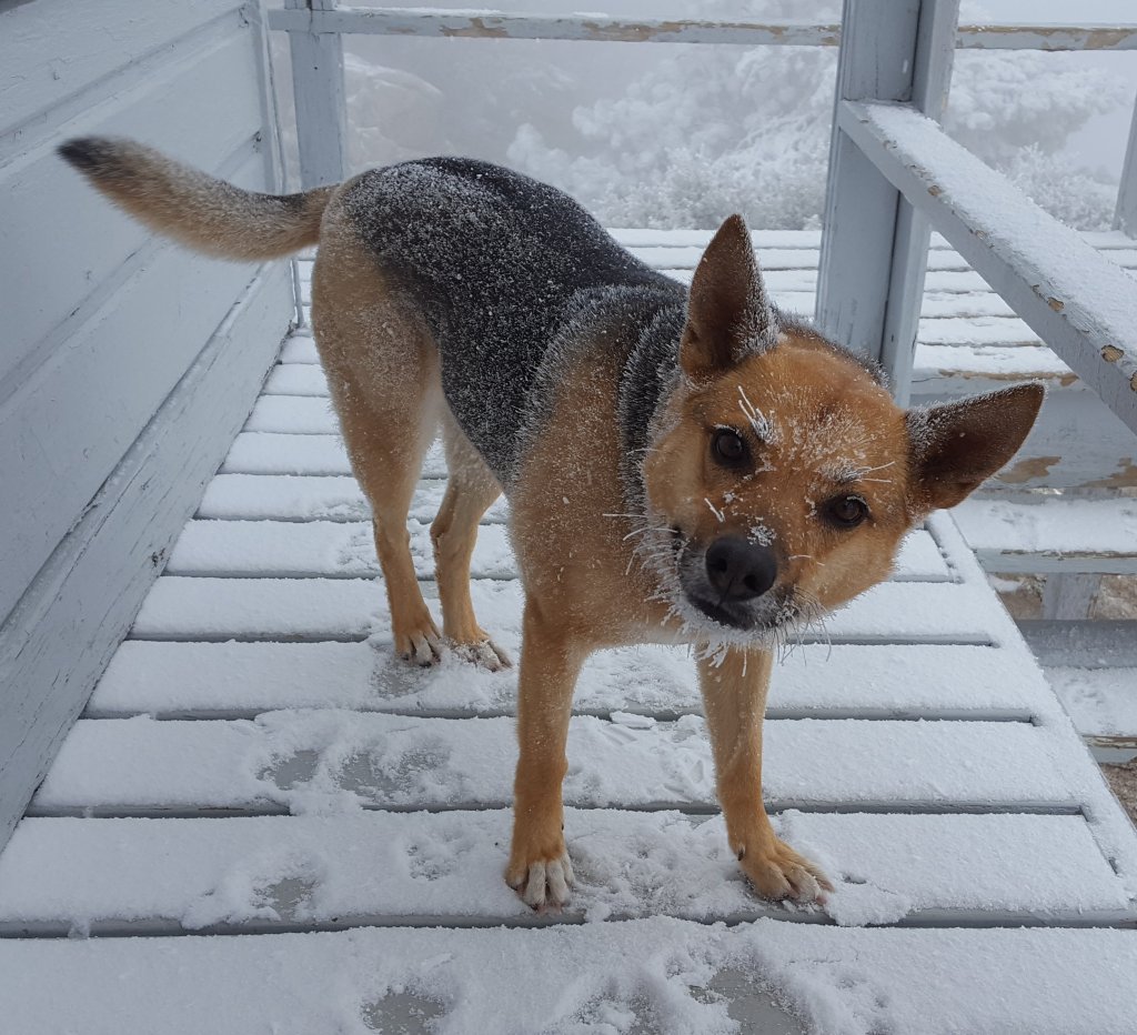
Copyright text and photographs Jon King 2020.sanjacjonUncategorized35 Comments 10 MinutesEdit”Long read: A dog with nine lives.”
Trail and water update 7th July 2020
The streak of daily ascents of San Jacinto Peak finished at 63. My personal goal had always been to try to complete two months, then a couple of cool days kept me going to 2nd July. Heavy hiker traffic over the long holiday weekend, and the prospect of very hot weather starting this week made it the right time to stop. I was back up there again today, worried about the dangerous fire conditions, with very low humidity and strong gusty winds.
Snow is long gone, and water is, for now, flowing where expected, as updated in detail at the foot of this post.
Black Mountain Road reopened on 20th June, having been graded through to the Fuller Ridge campground. USFS indicates that Boulder Basin campground will remain closed all year. Palm Springs Aerial Tramway is closed indefinitely (since 12th March) due to the coronavirus crisis.
For camping in Mount San Jacinto State Park, see their website for details. The U.S. Forest Service ranger station in Idyllwild remains closed. Although Forest Service wilderness camping and hiking permits can be issued if requested, they are currently not required. USFS campgrounds are now open, except those discussed elsewhere in this post.
WEATHER A dramatic warming starts on 9th July, with temperatures (both daytime and overnight) forecast to be well above average for the next ten days at least. Fire risk will be severe. There is no precipitation in the forecast.
At San Jacinto Peak (3295m/10,810ft) today, Tuesday 7th July 2020, at 0845 the air temperature was 53.2°F (12°C), with a windchill of 45.1°F (7°C), 15% relative humidity, and a strong SW wind sustained at 16 mph gusting to 31.7 mph.
The coolest recent day at the Peak was Monday 29th June 2020, when at 0805 the air temperature was 35.3°F (2°C), with a windchill of 21.0°F (-6°C), 33% relative humidity, and a stiff due West wind sustained at 16 mph gusting to 31.2 mph.
The warmest day of 2020 so far recorded at San Jacinto Peak was Monday 22nd June, when at 0830 the air temperature was 57.0°F (14°C) with 37% relative humidity and a barely discernible SW wind gusting to 2.9 mph.
TRAIL CONDITIONS
All trails have been clear of snow since early June. Many trails have new treefall hazards from this past winter, passable for hikers but not for stock. Some are described in detail below, others include: PCT south of Red Tahquitz (approx. PCT Miles 173-175), PCT between Strawberry Cienega and Deer Springs camp (Miles 182-185), Fuller Ridge Trail near its northern end (PCT Miles 189.1-190.2), Spitler Peak, Cedar Spring, and Apache Spring trails.
Willow Creek Trail has 14 tree hazards (five on Forest Service land, nine on State Park) between Willow Creek and Hidden Divide from this past winter. Ten additional trees on Forest Service land east of Saddle Junction, and two in the State Park, have been cleared since late May. As reported last week, the challenging whitethorn on this trail has now been removed.
Seven Pines Trail has been very lightly traveled since November 2018. There are 25 treefall hazards on the trail, almost all in the upper State Park section of trail, based on multiple May/June 2020 surveys. Very cautious navigation is recommended for those unfamiliar with this trail. The Forest Service closure of Dark Canyon Road is expected to continue into 2021, so there is currently no vehicular access to Seven Pines trailhead.
The Pacific Crest Trail remains open at the rockslide just north of Antsell Rock (Mile 172.5). USFS has not indicated when this area may close for removal of the rockslide. The video report (available here) can be useful for deciding whether to hike around the rockslide or take an alternate route.
Forest Service temporary signage indicates that the Caramba Trail from near Reeds Meadow through Laws Camp and on to Caramba, and the Cedar Trail from Willow Creek Trail to Laws, are “not maintained”. In reality both trails no longer exist. Both are so heavily overgrown I advise hikers do not attempt to follow them. Many experienced hikers have reported getting lost in this area since summer 2019. An informal use trail to Laws has been developed which is much more direct and avoids all of the challenging bush-whacking of the unmaintained trails (some local hikers have kindly named it the “King Trail”). It leaves the Willow Creek Trail exactly 1.0 mile from Saddle Junction (0.46 mile from the Skunk Cabbage turning), descending largely on established deer trails for 1.2 miles, roughly paralleling Willow Creek just to its south. Currently it is indistinct, becoming even less obvious as it nears Laws (by which time Willow Creek is close by on your left hand side, so navigation is not a challenge). I hope to work on the trail in early July. From Laws east to Caramba the route of the original Caramba Trail is relatively easy to follow (for those who were familiar with this trail prior to the 2013 Mountain Fire). Nevertheless very cautious navigation is still advised.
WATER STATUS: Eastern slope
The Round Valley pipe is not currently flowing. The flow as been redirected to the CCC camp in Long Valley and water pressure is insufficient to also flow at the pipe. Fortunately Round Valley creek just a few yards away is flowing, but may well dry up later this month.
Both the northern and southern springs at Wellman’s Cienega are flowing gently, but flow rates have dropped considerably in recent weeks. These are the sources for Willow Creek, which is flowing very well where it crosses the Willow Creek Trail.
Tahquitz Creek is flowing at the northern end of Little Tahquitz Meadow. It is also flowing further upstream at its source (known locally as Grethe Spring) where it crosses the PCT (approx. PCT Mile 177).
Candy’s Creek – that flows through Skunk Cabbage Meadow and then crosses the Caramba Trail near Reeds Meadow – is currently flowing.
WATER STATUS: Western slope
The North Fork of the San Jacinto River is flowing very well where it crosses the Deer Springs Trail and even better where it crosses the Fuller Ridge Trail on the PCT (approx. PCT Mile 186.2).
The creek in Little Round Valley is flowing, although at less than half the volume compared to this time last year. The same creek is flowing well where it crosses Fuller Ridge Trail (at about PCT Mile 186.4).
Shooting Star Spring (below Little Round Valley but above the North Fork of the San Jacinto River crossing) is flowing well.
The Deer Springs stream crossing at the PCT (approx. PCT mile 185.6) is flowing strongly.
Switchback Spring at PCT Mile 183.5 (about 0.4 miles north of Strawberry Junction) is flowing well, but there is little depth in which to filter water.
The little creek at Strawberry Cienega (PCT mile 183.0) is flowing.
On Devil’s Slide Trail, Middle Spring is flowing, but flow rate is only 10% compared to less than a month ago. Powderbox and Jolley springs, and the several unnamed ephemeral creeks on this trail, have functionally dried up.
On the Ernie Maxwell Trail, the crossing of Chinquapin Creek just below Humber Park continues to flow well (an important source of water for the many dogs walked on this trail) [thanks to Anne and Anabel for checking this on their run this morning].
WATER STATUS: Desert Divide
Live Oak Spring (N 33 37 21, W 116 33 24) Flowing well. The most reliable water source on the Desert Divide.
Cedar Spring (N 33 40 36, W 116 34 35) Flowing well. Easiest access is the trough just upstream from the trail to the campsite.
Apache Spring (N 33 43 11, W 116 37 13) Flowing fairly well.
Spitler Peak Trail Descending the trail there are five water crossings. The first two, at 0.9 and 0.95 miles down, cross a tiny side creek which is largely dry and should be ignored. The next crossing, at 1.1 miles down, is Spitler Creek and is the best source of water (currently flowing well). The next two crossings are the same creek, but for obvious reasons it is best to fill up at the highest of the three crossings.
Antsell Rock Creek (N 33 41 52, W 116 39 08) Right by the Spitler Peak Trail trailhead on Apple Canyon Road, Antsell Rock Creek is flowing very well. Just on the upstream side of the road there is excellent access to the creek. Useful if hikers are descending the Spitler Peak Trail.
San Jacinto Trail Report: available for everyone, funded by readers. While all labor and time is volunteered, this Report completely depends on small private donations to cover its direct costs. With a very challenging first few months of 2020, every contribution is invaluable. If you have found this Report useful, please consider visiting the Donate page. Thank you.sanjacjonUncategorized1 Comment 6 MinutesEdit”Trail and water update 7th July 2020″
Trail update 30th June 2020
I have continued to hike up San Jacinto Peak every morning since 1st May, today reaching two complete months (61 days). I again took a circuitous descent via Willow Creek Trail to work with Forest Service volunteer Bill Rhoads clearing thick whitethorn from the trail. Great news, we finished the final section today (photos below) and Willow Creek Trail now has no significant vegetation hazards, although downed trees remain as described below.
Water is, for now, flowing where expected, although flow rates are dropping steadily in the high country. Please see last week’s post for details of water sources and availability, which are unchanged in the past couple of weeks.
Black Mountain Road reopened on 20th June, having been graded through to the Fuller Ridge campground. USFS indicates that Boulder Basin campground will remain closed all year. Palm Springs Aerial Tramway is closed indefinitely (since 12th March) due to the coronavirus crisis.
Camping – with social distancing restrictions – is now available in Mount San Jacinto State Park, see their website for details. The U.S. Forest Service ranger station in Idyllwild remains closed. Although Forest Service wilderness camping and hiking permits can be issued if requested, they are currently not required. USFS campgrounds are now open, except those discussed elsewhere in this post.
WEATHER A few pleasantly cool days to finish June will be followed by a return to very warm temperatures starting on Friday 3rd, about seasonally average for July. There is no precipitation in the forecast.
At San Jacinto Peak (3295m/10,810ft) today, Tuesday 30th June 2020, at 0750 the air temperature was 40.1°F (5°C), with a windchill of 29.3°F (-1°C), 44% relative humidity, and a steady due East wind sustained at 14 mph gusting to 20.2 mph.
The coolest recent day at the Peak was Monday 29th June 2020, when at 0805 the air temperature was 35.3°F (2°C), with a windchill of 21.0°F (-6°C), 33% relative humidity, and a stiff due West wind sustained at 16 mph gusting to 31.2 mph.
The warmest day of 2020 so far recorded at San Jacinto Peak was Monday 22nd June, when at 0830 the air temperature was 57.0°F (14°C) with 37% relative humidity and a barely discernible SW wind gusting to 2.9 mph.
TRAIL CONDITIONS
All trails have been clear of snow since early June. Many trails have new treefall hazards from this past winter, passable for hikers but not for stock. Some are described in detail below, others include: PCT south of Red Tahquitz (approx. PCT Miles 173-175), PCT between Strawberry Cienega and Deer Springs camp (Miles 182-185), Fuller Ridge Trail near its northern end (PCT Miles 189.1-190.2), Spitler Peak, Cedar Spring, and Apache Spring trails.
Willow Creek Trail has 14 tree hazards (five on Forest Service land, nine on State Park) between Willow Creek and Hidden Divide from this past winter. Ten additional trees on Forest Service land between Saddle Junction and Willow Creek, and two in the State Park, have been cleared since late May. As reported above, the challenging whitethorn on this trail has now been removed.
Seven Pines Trail has been very lightly traveled since November 2018. There are 25 treefall hazards on the trail, almost all in the upper State Park section of trail, based on multiple June 2020 surveys. Very cautious navigation is recommended for those unfamiliar with this trail. The Forest Service closure of Dark Canyon Road (and Dark Canyon campground) is expected to continue into 2021, so there is currently no vehicular access to Seven Pines trailhead.
The Pacific Crest Trail remains open at the rockslide just north of Antsell Rock (Mile 172.5). USFS has not indicated when this area may close for removal of the rockslide. The video report (available here) can be useful for deciding whether to hike around the rockslide or take an alternate route.
Forest Service temporary signage indicates that the Caramba Trail from near Reeds Meadow through Laws Camp and on to Caramba, and the Cedar Trail from Willow Creek Trail to Laws, are “not maintained”. In reality both trails no longer exist. Both are so heavily overgrown I advise hikers do not attempt to follow them. Many experienced hikers have reported getting lost in this area since summer 2019. An informal use trail to Laws has been developed which is much more direct and avoids all of the challenging bush-whacking of the unmaintained trails (some local hikers have kindly named it the “King Trail”). It leaves the Willow Creek Trail exactly 1.0 mile from Saddle Junction (0.46 mile from the Skunk Cabbage turning), descending largely on established deer trails for 1.2 miles, roughly paralleling Willow Creek just to its south. Currently it is indistinct, becoming even less obvious as it nears Laws (by which time Willow Creek is close by on your left hand side, so navigation is not a challenge). I hope to work on the trail in early July. From Laws east to Caramba the route of the original Caramba Trail is relatively easy to follow (for those who were familiar with this trail prior to the 2013 Mountain Fire). Nevertheless very cautious navigation is still advised.


San Jacinto Trail Report: available for everyone, funded by readers. While all labor and time is volunteered, this Report completely depends on small private donations to cover its direct costs. With a very challenging first few months of 2020, every contribution is invaluable. If you have found this Report useful, please consider visiting the Donate page. Thank you.sanjacjonUncategorized5 Comments 4 MinutesEdit”Trail update 30th June 2020″
Trail and water update 24th June 2020
I have continued to hike up San Jacinto Peak every morning since 1st May, by as many diverse routes as possible. For example on Sunday I surveyed downed trees on Fuller Ridge Trail, and yesterday took a circuitous descent via Willow Creek Trail, where I again helped Forest Service volunteer Bill clear thick whitethorn, a project which is nearing completion.
I was encouraged by a conversation with two young hikers at San Jacinto Peak early this morning. They commented how clear of trash the trails were up here compared to other mountains they had hiked in Southern California. Clearly a hiker who systematically picks up every piece of trash they find, especially when they hike a rotation of trails every single day, can make a genuine difference to everyone’s trail experience.
Snow is now gone from the trail system, and water is, for now, flowing well where expected, as updated in detail at the foot of this post.
Black Mountain Road reopened on 20th June, having been graded through to the Fuller Ridge campground. USFS indicates that Boulder Basin campground will remain closed until next year.
Palm Springs Aerial Tramway is closed indefinitely (since 12th March) due to the coronavirus crisis.
Limited camping is now available in Mount San Jacinto State Park, see their website for details. The U.S. Forest Service ranger station in Idyllwild remains closed. Although Forest Service wilderness camping and hiking permits can be issued if requested, they are currently not required. USFS campgrounds are now open, except those discussed below.
WEATHER Above seasonal June temperatures continue to this weekend, followed by a very significant cooling between Sunday 28th June and Wednesday 1st July, before another rapid warming in early July. There is no precipitation in the forecast.
At San Jacinto Peak (3295m/10,810ft) today, Wednesday 24th June 2020, at 0800 the air temperature was 55.8°F (13°C), with a windchill of 53.8°F (12°C), 21% relative humidity, and a light SW wind sustained at 2 mph gusting to 8.2 mph.
The coolest recent day at the Peak was Friday 19th June 2020, when at 0755 the air temperature was 46.5°F (8°C), with a windchill of 37.8°F (3°C), 52% relative humidity, and a brisk due East wind sustained at 8 mph gusting to 20.2 mph.
The warmest day of 2020 so far recorded at San Jacinto Peak was Monday 22nd June, when at 0830 the air temperature was 57.0°F (14°C) with 37% relative humidity and a barely discernible SW wind gusting to 2.9 mph.
TRAIL CONDITIONS
All trails have been clear of snow since early June. Many trails have new treefall hazards from this past winter, passable for hikers but not for stock. Some are described in detail below, others include: PCT south of Red Tahquitz (approx. PCT Miles 173-175), PCT between Strawberry Cienega and Deer Springs camp (Miles 182-185), Fuller Ridge Trail near its northern end (PCT Miles 189.1-190.2), Spitler Peak, Cedar Spring, and Apache Spring trails.
Willow Creek Trail [updated 27th June] has 15 tree hazards (4 on Forest Service land, 11 on State Park) between Willow Creek and Hidden Divide from this past winter. Nine additional trees on Forest Service land between Saddle Junction and Willow Creek have been cleared since late May. Great progress has also been made on whitethorn removal, with the trail now clear on the State Park side and clear on the Forest Service section as far as the old Laws junction (see photo below).
Seven Pines Trail has been very lightly traveled since November 2018. There are 25 treefall hazards on the trail, almost all in the upper State Park section of trail, based on multiple May/June 2020 surveys. Very cautious navigation is recommended for those unfamiliar with this trail. The Forest Service closure of Dark Canyon Road is expected to continue into 2021, so there is currently no vehicular access to Seven Pines trailhead.
The Pacific Crest Trail remains open at the rockslide just north of Antsell Rock (Mile 172.5). USFS has not indicated when this area may close for removal of the rockslide. The video report (available here) can be useful for deciding whether to hike around the rockslide or take an alternate route.
Forest Service temporary signage indicates that the Caramba Trail from near Reeds Meadow through Laws Camp and on to Caramba, and the Cedar Trail from Willow Creek Trail to Laws, are “not maintained”. In reality both trails no longer exist. Both are so heavily overgrown I advise hikers do not attempt to follow them. Many experienced hikers have reported getting lost in this area since summer 2019. An informal use trail to Laws has been developed which is much more direct and avoids all of the challenging bush-whacking of the unmaintained trails (some local hikers have kindly named it the “King Trail”). It leaves the Willow Creek Trail exactly 1.0 mile from Saddle Junction (0.46 mile from the Skunk Cabbage turning), descending largely on established deer trails for 1.2 miles, roughly paralleling Willow Creek just to its south. Currently it is indistinct, becoming even less obvious as it nears Laws (by which time Willow Creek is close by on your left hand side, so navigation is not a challenge). I hope to work on the trail in early July. From Laws east to Caramba the route of the original Caramba Trail is relatively easy to follow (for those who were familiar with this trail prior to the 2013 Mountain Fire). Nevertheless very cautious navigation is still advised.
WATER STATUS: Eastern slope
The Round Valley pipe is not currently flowing. The flow as been redirected to the CCC camp in Long Valley and water pressure is insufficient to also flow at the pipe. Fortunately Round Valley creek just a few yards away is flowing, but will likely dry up in July.
Both the northern and southern springs at Wellman’s Cienega are flowing gently, but flow rates have dropped considerably in recent weeks. These are the sources for Willow Creek, which is flowing very well where it crosses the Willow Creek Trail.
Tahquitz Valley is flowing.
Tahquitz Creek is flowing well at the northern end of Little Tahquitz Meadow. It is also flowing well further upstream at its source (known locally as Grethe Spring) where it crosses the PCT (approx. PCT Mile 177).
Candy’s Creek – that flows through Skunk Cabbage Meadow and then crosses the Caramba Trail near Reeds Meadow – is currently flowing well.
WATER STATUS: Western slope
The North Fork of the San Jacinto River is flowing very well where it crosses the Deer Springs Trail and even better where it crosses the Fuller Ridge Trail on the PCT (approx. PCT Mile 186.2).

The creek in Little Round Valley is flowing, although at less than half the volume compared to this time last year. The same creek is flowing well where it crosses Fuller Ridge Trail (at about PCT Mile 186.4).
Shooting Star Spring (below Little Round Valley but above the North Fork of the San Jacinto River crossing) is flowing well.
The Deer Springs stream crossing at the PCT (approx. PCT mile 185.6) is flowing strongly.
Switchback Spring at PCT Mile 183.5 (about 0.4 miles north of Strawberry Junction) is flowing well, but there is little depth in which to filter water.
The little creek at Strawberry Cienega (PCT mile 183.0) is flowing.
On Devil’s Slide Trail, Middle Spring is flowing well, but flow rate is only 10% compared to less than a month ago. Powderbox and Jolley springs, and the several unnamed ephemeral creeks on this trail, have functionally dried up.
On the Ernie Maxwell Trail, the crossing of Chinquapin Creek just below Humber Park continues to flow well (an important source of water for the many dogs walked on this trail) [thanks to Anne and Anabel for checking this on their run this morning].
WATER STATUS: Desert Divide
Live Oak Spring (N 33 37 21, W 116 33 24) Flowing well. The most reliable water source on the Desert Divide.
Cedar Spring (N 33 40 36, W 116 34 35) Flowing well. Easiest access is the trough just upstream from the trail to the campsite.
Apache Spring (N 33 43 11, W 116 37 13) Flowing fairly well.
Spitler Peak Trail Descending the trail there are five water crossings. The first two, at 0.9 and 0.95 miles down, cross a tiny side creek which is largely dry and should be ignored. The next crossing, at 1.1 miles down, is Spitler Creek and is the best source of water (currently flowing well). The next two crossings are the same creek, but for obvious reasons it is best to fill up at the highest of the three crossings.
Antsell Rock Creek (N 33 41 52, W 116 39 08) Right by the Spitler Peak Trail trailhead on Apple Canyon Road, Antsell Rock Creek is flowing very well. Just on the upstream side of the road there is excellent access to the creek. Useful if hikers are descending the Spitler Peak Trail.
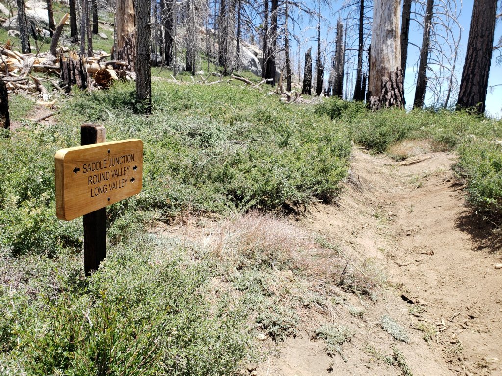
San Jacinto Trail Report: available for everyone, funded by readers. While all labor and time is volunteered, this Report completely depends on small private donations to cover its direct costs. With a very challenging first few months of 2020, every contribution is invaluable. If you have found this Report useful, please consider visiting the Donate page. Thank you.sanjacjonUncategorized1 Comment 6 MinutesEdit”Trail and water update 24th June 2020″
Trail update 17th June 2020
[UPDATE 21st June: Black Mountain Road reopened yesterday. I drove it today, and it has been graded through to Fuller Ridge campground. Boulder Basin and Black Mountain Group campgrounds remain closed.]
The streak continues. I have hiked daily to San Jacinto Peak since 1st May, making today 48 consecutive ascents (and also my 101st of the year). Use of many different ascent routes has allowed thorough reporting of, and work on, trail hazards, including in the past week Seven Pines, Marion Mountain, Deer Springs, Willow Creek, Peak, and Devil’s Slide trails.
Several recent days have been pleasantly cool in the morning, and I recorded a windchill temperature below freezing at San Jacinto Peak on Saturday 13th.
Snow is now completely gone from the trail system, and water is, for now, flowing steadily everywhere, so the Trail Report can be mercifully brief. The focus has been on trail maintenance work and surveying for future projects.
Limited camping is now available in Mount San Jacinto State Park, see their website for details. The U.S. Forest Service ranger station in Idyllwild remains closed, although faxed requests for camping permits are apparently being processed promptly. USFS facilities at Humber Park (e.g., trash and restrooms) reopened on Monday 15th June.
Palm Springs Aerial Tramway is closed indefinitely (since 12th March) due to the coronavirus crisis.
WEATHER Temperatures will be about seasonal until this weekend, when considerable warming to well-above average temperatures begins, with hot weather next week. Near record-breaking temperatures in the high country are forecast late next week. There is no precipitation in the forecast.
At San Jacinto Peak (3295m/10,810ft) today, Wednesday 17th June 2020, at 0735 the air temperature was 50.5°F (10°C), with a windchill of 44.2°F (7°C), 17% relative humidity, and a steady WNW wind sustained at 8 mph gusting to 14.5 mph.
The coolest recent day at the Peak was Saturday 13th June 2020, when at 0705 the air temperature was 38.6°F (4°C), with a windchill of 26.3°F (-3°C), 10% relative humidity, and a brisk due West wind sustained at 13 mph gusting to 23.4 mph.
The warmest day of 2020 to date recorded at San Jacinto Peak remains Thursday 28th May, when at 0830 the air temperature was 54.9°F (13°C).
TRAIL CONDITIONS
All trails have been clear of snow since early June. Many trails have new treefall hazards from this past winter, passable for hikers but not for stock. Some are described in detail below, others include: PCT south of Red Tahquitz (approx. PCT Miles 173-175), PCT between Strawberry Cienega and Deer Springs camp (Miles 182-185), Spitler Peak, Cedar Spring, and Apache Spring trails. The treefall mess around Saddle Junction was cut and cleaned up by USFS volunteer sawyer Steve on Monday 15th June.
Willow Creek Trail has 19 tree hazards (8 on Forest Service land, 11 on State Park) between Willow Creek and Hidden Divide from this past winter, based on new surveys on 8th and 11th June. Five additional trees on Forest Service land between Saddle Junction and Willow Creek have been cleared since late May. Great progress has been made on whitethorn cutting and removal, led by USFS volunteer Bill, with the trail now largely cleared on the State Park side and only a few more weeks work needed on the Forest Service section.
Seven Pines Trail has been very lightly traveled since November 2018. There are 25 treefall hazards on the trail, almost all in the upper State Park section of trail, based on multiple May/June 2020 surveys. Very cautious navigation is recommended for those unfamiliar with this trail. The Forest Service closure of Dark Canyon Road is expected to continue into 2021, so there is currently no vehicular access to Seven Pines trailhead.
Forest Service temporary signage indicates that the Caramba Trail from near Reeds Meadow through Laws Camp and on to Caramba, and the Cedar Trail from Willow Creek Trail to Laws, are “not maintained”. In reality both trails no longer exist. Both are so heavily overgrown I advise hikers do not attempt to follow them. Many experienced hikers have reported getting lost in this area since summer 2019. An informal use trail to Laws has been developed which is much more direct and avoids all of the challenging bush-whacking of the unmaintained trails (some local hikers have kindly named it the “King Trail”). It leaves the Willow Creek Trail exactly 1.0 mile from Saddle Junction (0.46 mile from the Skunk Cabbage turning), descending largely on established deer trails for 1.2 miles, roughly paralleling Willow Creek just to its south. Currently it is indistinct, becoming even less obvious as it nears Laws (by which time Willow Creek is close by on your left hand side, so navigation is not a challenge). I hope to work on the trail in July. From Laws east to Caramba the route of the original Caramba Trail is relatively easy to follow (for those who were familiar with this trail prior to the 2013 Mountain Fire). Nevertheless very cautious navigation is still advised.
The Pacific Crest Trail remains open at the rockslide just north of Antsell Rock (Mile 172.5). USFS has not indicated when this area may close for removal of the rockslide. The video report (available here) can be useful for deciding whether to hike around the rockslide or take an alternate route.
WATER All major creeks and springs are currently flowing well, as are some ephemeral sources. Consequently their status is not being updated in detail at this time. Flow rates have dropped dramatically in recent weeks, some 2-3 months earlier than last year, and some water challenges in late summer and autumn seem likely.
San Jacinto Trail Report: available for everyone, funded by readers.While all labor and time is volunteered, this Report completely depends on small private donations to cover its direct costs. With a very challenging first few months of 2020, every contribution is invaluable. If you have found this Report useful, please consider visiting the Donate page. Thank you.sanjacjonUncategorized 4 MinutesEdit”Trail update 17th June 2020″
Trail update 10th June 2020
I have continued to hike daily to San Jacinto Peak since 1st May, making today 41 consecutive ascents. The past few days have been delightfully cool, and I recorded windchill temperatures of 18°F (-8°C) at San Jacinto Peak on both Saturday 6th and Sunday 7th. We took advantage of the cool weather on both 8th and 10th June to hike a circuitous route via Willow Creek Trail, Hidden Divide, and Round Valley to the Peak.
It is that time of year when the Trail Report is brief. Snow is now completely gone from the trail system, and water is, for now, flowing steadily everywhere. My focus has been on trail maintenance work and surveying for future projects.
Limited camping is now available in Mount San Jacinto State Park. See their website for details. The U.S. Forest Service ranger station remains closed, although faxed requests for camping permits are being processed promptly. There is a tentative reopening date of 18th June for USFS operations.
The closure of Black Mountain Road has been extended to 1st July, per the Forest Service order issued last week. Grading work may be finished sooner. Palm Springs Aerial Tramway is closed indefinitely (since 12th March) due to the coronavirus crisis.
WEATHER Temperatures will be slightly above seasonal – especially the overnight lows – for the next ten days, averaging coolest this weekend (13th-14th June). There is no precipitation in the forecast.
At San Jacinto Peak (3295m/10,810ft) today, Wednesday 10th June 2020, at 0815 the air temperature was 50.4°F (10°C), with a windchill of 47.3°F (8.5°C), 33% relative humidity, and a very light ESE wind sustained at 1.0 mph gusting to 4.8 mph.
The coolest recent day at the Peak was Sunday 7th June 2020, when at 0720 the air temperature was 34.0°F (1°C), with a windchill of 18.1°F (-8°C), 22% relative humidity, and a brisk WNW wind sustained at 18 mph gusting to 29.0 mph.
The warmest day of 2020 to date recorded at San Jacinto Peak was Thursday 28th May, when at 0830 the air temperature was 54.9°F (13°C).
TRAIL CONDITIONS
All trails are clear of snow. Off-trail travel will still encounter minor drifts, e.g., on the north side of Jean Peak.
Many trails have new treefall hazards from this past winter, passable for hikers but not for stock. Some are described in detail below, others include: PCT south of Red Tahquitz (approx. PCT Miles 173-175), PCT between Strawberry Cienega and Deer Springs camp (Miles 182-185), Spitler Peak, Cedar Spring, and Apache Spring trails.
Willow Creek Trail has 19 tree hazards (8 on Forest Service land, 11 on State Park) between Willow Creek and Hidden Divide from this past winter, based on new surveys on 8th and 11th June. Five additional trees on Forest Service land between Saddle Junction and Willow Creek have been cleared since late May. Great progress has been made on whitethorn removal, with the trail now cleared on the State Park side and only a few more weeks work needed on the Forest Service section.
Seven Pines Trail has been very lightly traveled since November 2018. There are 25 treefall hazards on the trail, based on multiple May/June 2020 surveys. Very cautious navigation is recommended for those unfamiliar with this trail. The Forest Service closure of Dark Canyon Road is expected to continue into 2021, so there is currently no vehicular access to Seven Pines trailhead.
Forest Service temporary signage indicates that the Caramba Trail from near Reeds Meadow through Laws Camp and on to Caramba, and the Cedar Trail from Willow Creek Trail to Laws, are “not maintained”. In reality both trails no longer exist. Both are so heavily overgrown I advise hikers do not attempt to follow them. Many experienced hikers have reported getting lost in this area since summer 2019. An informal use trail to Laws has been developed which is much more direct and avoids all of the challenging bush-whacking of the unmaintained trails (some local hikers have kindly named it the “King Trail”). It leaves the Willow Creek Trail exactly 1.0 mile from Saddle Junction (0.46 mile from the Skunk Cabbage turning), descending largely on established deer trails for 1.2 miles, roughly paralleling Willow Creek just to its south. Currently it is indistinct, becoming even less obvious as it nears Laws (by which time Willow Creek is close by on your left hand side, so navigation is not a challenge). I hope to work on the trail in July. From Laws east to Caramba the route of the original Caramba Trail is relatively easy to follow (for those who were familiar with this trail prior to the 2013 Mountain Fire). Nevertheless very cautious navigation is still advised.
The Pacific Crest Trail remains open at the rockslide just north of Antsell Rock (Mile 172.5). USFS has not indicated when this area may close for removal of the rockslide. The video report (available here) can be useful for deciding whether to hike around the rockslide or take an alternate route.
WATER All major creeks and springs are currently flowing well, as are some ephemeral sources. Consequently their status is not being updated in detail at this time. Flow rates have dropped dramatically in recent weeks, some 2-3 months earlier than last year, and some water challenges in late summer and autumn seem likely.
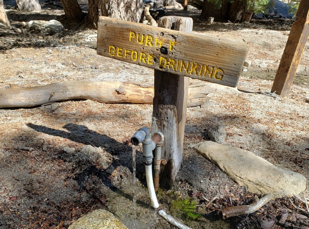
San Jacinto Trail Report: available for everyone, funded by readers.While all labor and time is volunteered, this Report completely depends on small private donations to cover its direct costs. With a very challenging first few months of 2020, every contribution is invaluable. If you have found this Report useful, please consider visiting the Donate page. Thank you.sanjacjonUncategorized 4 MinutesEdit”Trail update 10th June 2020″
Trail update 3rd June 2020
I have hiked to San Jacinto Peak daily since 1st May. For those keeping score at home, today’s ascent marked 34 days in a row, breaking by one day the record set last year. Early this morning around 9800′ elevation I could smell smoke from the Smoketree fire that burned in the hills near the Shannon Trail on 2nd June, just south of Palm Springs.
Using many different ascent routes has allowed a thorough assessment of trail conditions, including in the past week Seven Pines, Marion Mountain, Deer Springs, Willow Creek, and Devil’s Slide trails. Other than the few extremely limited patches described below, snow is now completely gone from the trail system.
As indicated on their website, Mount San Jacinto State Park headquarters in Idyllwild has reopened to issue day hiking permits. All camping in the State Park, including in wilderness, remains closed. The U.S. Forest Service ranger station remains closed, although faxed requests for camping permits are processed promptly.
The closure of Black Mountain Road has been extended to 1st July. While grading work might be finished sooner, the Forest Service order issued this week continues the road closure. Palm Springs Aerial Tramway is closed indefinitely (since 12th March) due to the coronavirus crisis.
Between 5th-9th June hikers should be prepared for temperatures near freezing above 10,000′ elevation (below freezing when considering windchill effects) .
WEATHER Temperatures remain well above seasonal until Friday 5th June when they drop to, or even below, average. Temperatures then rapidly rise again to above average from Tueday 10th June. There is no precipitation in the forecast. So far in 2020, January, February, and May have been the warmest and/or driest on record for those months ever in the San Jacinto high country.
At San Jacinto Peak (3295m/10,810ft) today, Wednesday 3rd June 2020, at 0820 the air temperature was 51.4°F (11°C), with a windchill of 46.7°F (8°C), 41% relative humidity, and a gusty NE wind sustained at 4 mph gusting to 12.7 mph.
At the Peak on Tuesday 2nd June 2020, at 0850 the air temperature was 50.7°F (10°C), with a windchill of 45.7°F (8°C), 46% relative humidity, and a light SE wind sustained at 2 mph gusting to 12.8 mph.
The warmest day of 2020 to date recorded at San Jacinto Peak was Thursday 28th May, when at 0830 the air temperature was 54.9°F (13°C).
TRAIL CONDITIONS
All trails are clear of snow, other than very limited patches as described below. Off-trail travel will encounter more extensive drifts in places, e.g., on the north side of Jean Peak.
Many trails have new treefall hazards from this past winter, passable for hikers but not for stock. Some are described in detail below, others include: PCT south of Red Tahquitz (approx. PCT Miles 173-175), PCT between Strawberry Cienega and Deer Springs camp (Miles 182-185), Spitler Peak, Cedar Spring, and Apache Spring trails.
The Peak Trail above Wellman Divide is clear of snow, except for tiny patches for 0.1 mile around 10,000′ and at San Jacinto Peak. The East Ridge Trail has only 5% drifted snow cover but the trail is obscured in a few places.
Deer Springs Trail is clear of snow with the exception of Little Round Valley. There is a new major double treefall hazard next to the Deer Springs crossing. Snow cover through Little Round Valley is 10%. The trail is obvious, with excellent steps, through the handful of tiny snow patches.
Willow Creek Trail is clear of snow, but has 19 tree hazards (8 on Forest Service land, 11 on State Park) between Willow Creek and Hidden Divide from this past winter. Five additional trees on Forest Service land between Saddle Junction and Willow Creek have been cleared in the past two weeks.
Seven Pines Trail has been very lightly traveled since November 2018. There are 25 treefall hazards on the trail, based on multiple May 2020 surveys. Very cautious navigation is recommended for those unfamiliar with this trail. The Forest Service closure of Dark Canyon Road is expected to continue into 2021, so there is currently no vehicular access to Seven Pines trailhead.
The Caramba Trail from near Reeds Meadow through Laws Camp to Caramba, and the Cedar Trail from Willow Creek Trail to Laws, are not maintained. Temporary signage to this effect has been in place since June 2019. Both trails are very indistinct and heavily overgrown with challenging whitethorn in places. Hikers without considerable prior experience of this area should exercise extremely cautious navigation. From Laws east to Caramba the route of the original trail is relatively easy to follow (for those who were familiar with this trail prior to the 2013 Mountain Fire). An informal use trail to Laws has been developed which is much more direct and avoids all of the challenging bush-whacking of the unmaintained trails (some local hikers have kindly named it the “King Trail”). It leaves the Willow Creek Trail exactly 1.0 mile from Saddle Junction (0.46 mile from the Skunk Cabbage turning), descending largely on established deer trails for 1.2 miles, roughly paralleling Willow Creek just to its south. Currently it is quite obvious for about a mile, becoming less distinct as it nears Laws (by which time Willow Creek is close by on your left hand side, so navigation is not a challenge).
The Pacific Crest Trail remains open at the rockslide just north of Antsell Rock (Mile 172.5). USFS has not indicated when this area may close for removal of the rockslide. The video report (available here) can be useful for deciding whether to hike around the rockslide or take an alternate route.
WATER All major creeks and springs are currently flowing well, as are some ephemeral sources. Consequently their status is not being updated in detail at this time. Flow rates dropped dramatically in May, some 2-3 months earlier than last year, and some water challenges in late summer and autumn seem likely.


San Jacinto Trail Report: available for everyone, funded by readers.While all labor and time is volunteered, this Report completely depends on small private donations to cover its direct costs. With a very challenging first few months of 2020, every contribution is invaluable. If you have found this Report useful, please consider visiting the Donate page. Thank you.sanjacjonUncategorized 4 MinutesEdit”Trail update 3rd June 2020″
Trail update 27th May 2020
We have hiked to San Jacinto Peak every day so far in May, using many different routes, for example in the past week alternating between Seven Pines/Marion Mountain trails and the Devil’s Slide/Peak Trail routes.
Other than the few remaining patchy areas described in detail below, snow has gone from the trail system, and microspikes are no longer required. On warm days, caution is advised on soft snow melting away from rocks and logs, and over running water.
As indicated on their website, Mount San Jacinto State Park headquarters in Idyllwild is now open to issue day hiking permits. All camping in the State Park, including in wilderness, remains closed.
Palm Springs Aerial Tramway is closed indefinitely (since 12th March) due to the coronavirus crisis. Black Mountain Road is closed by Forest Service order until 31st May. Reopening has been delayed until 7th June at the earliest for grading work.
Fire lookouts at Tahquitz Peak and Black Mountain should be operational starting 31st May and 7th June, respectively. When manned the structures will be closed to all visitors due to Covid-19 restrictions.
Despite warm weather at mid elevations, in the first week of June hikers should be prepared for temperatures near freezing at the highest peaks, and possibly below freezing when considering windchill effects.
WEATHER This week will be dominated by hot summer temperatures, 10-20 degrees above seasonal. Temperatures in the first week of June are forecast to drop, although remaining above seasonal most days. There is no precipitation in the forecast. The May storms of recent years failed us in 2020.
At San Jacinto Peak (3295m/10,810ft) today, Wednesday 27th May 2020, at 0755 the air temperature was 52.0°F (11°C), with a windchill of 49.9°F (10°C), 39% relative humidity, and a light SE wind sustained at 4 mph gusting to 12.3 mph.
In stark contrast, just eight days ago at the Peak on Tuesday 19th May 2020, at 0815 the air temperature was 17.9°F (-8°C), with a windchill of -1.5°F (-19°C), 51% relative humidity, and a bitter due West wind sustained at 9 mph gusting to 19.8 mph.
The warmest day of the year to date recorded at the Peak remains Thursday 7th May 2020, when at 0810 the air temperature was 53.1°F (12°C), with a “windchill” of 50.5°F (10°C), 17% relative humidity, and a very light due West wind sustained at 2 mph gusting to 5.2 mph.
TRAIL CONDITIONS
Other than a few very limited high country areas detailed below, all trails are clear of snow. Many trails have new treefall hazards from this winter, passable for hikers but not for stock. Some are described in detail below, others include: PCT south of Red Tahquitz (approx. PCT Miles 173-175), PCT between Strawberry Cienega and Deer Springs camp (Miles 182-185), Spitler Peak, Cedar Spring, and Apache Spring trails.
The Peak Trail above Wellman Divide is clear of snow, except for patches for 0.1 mile around 10,000′, and tiny patches at San Jacinto Peak. The East Ridge Trail [updated 29th May] still has 20% drifted snow cover.
Deer Springs Trail is clear of snow to Little Round Valley. There is a new major double treefall hazard next to the Deer Springs crossing. Snow cover through Little Round Valley is 20%. Up to San Jacinto Peak snow cover is <5%. The trail is obvious, with excellent steps, through the handful of tiny snow patches.
Willow Creek Trail is clear of snow, but has 24 new tree hazards (13 on Forest Service land, 11 on State Park) between Saddle Junction and Hidden Divide from this past winter, based on a full survey undertaken 13th May and repeated on 26th May. None are as large or as challenging to get around as in 2019.
Round Valley Trail is clear from Long Valley to Round Valley, but from the latter to Wellman Divide still has about 10% coverage of shallow snow patches. The High Trail has a few tiny snow drifts still across the trail, and one major treefall hazard.
Seven Pines Trail has been very lightly traveled since November 2018. There are 25 treefall hazards on the trail, based on multiple May 2020 surveys. Very cautious navigation is recommended for those unfamiliar with this trail. The Forest Service closure of Dark Canyon Road is anticipated to continue into 2021, so there is currently no vehicular access to Seven Pines trailhead.
The Caramba Trail from near Reeds Meadow through Laws Camp to Caramba, and the Cedar Trail from Willow Creek Trail to Laws, are not maintained. Temporary signage to this effect has been in place since June 2019. Both trails are very indistinct and heavily overgrown with challenging whitethorn in places. Hikers without considerable prior experience of this area should exercise extremely cautious navigation. From Laws east to Caramba the route of the original trail is relatively easy to follow (for those who were familiar with this trail prior to the 2013 Mountain Fire). An informal use trail to Laws has been developed which is much more direct and avoids all of the challenging bush-whacking of the unmaintained trails (some local hikers have kindly named it the “King Trail”). It leaves the Willow Creek Trail exactly 1.0 mile from Saddle Junction (0.46 mile from the Skunk Cabbage turning), descending largely on established deer trails for 1.2 miles, roughly paralleling Willow Creek just to its south. Currently it is quite obvious for about a mile, becoming less distinct as it nears Laws (by which time Willow Creek is close by on your left hand side, so navigation is not a challenge).
The Pacific Crest Trail remains open at the rockslide just north of Antsell Rock (Mile 172.5). USFS has not indicated when this area may close for removal of the rockslide. The video report (available here) can be useful for deciding whether to hike around the rockslide or take an alternate route.
WATER All major creeks and springs are currently flowing well, as are some ephemeral sources. Consequently their status is not being updated in detail at this time. Flow rates have dropped dramatically in May, some two months earlier than last year, and a dry late summer and autumn seem likely.


San Jacinto Trail Report: available for everyone, funded by readers.While all labor and time is volunteered, this Report completely depends on small private donations to cover its direct costs. With a very challenging first few months of 2020, every contribution is invaluable. If you have found this Report useful, please consider visiting the Donate page. Thank you.sanjacjonUncategorized 4 MinutesEdit”Trail update 27th May 2020″
Trail update 20th May 2020
We have continued to hike to San Jacinto Peak every day so far in May, using many different routes, today for example ascending via Devil’s Slide Trail and descending via Tahquitz Peak and South Ridge Trail.
Other than the few remaining patchy areas described in detail below, the snow has almost completely gone from the trail system. Consequently snow depths are no longer reported. Pleasantly cool weather so far this week has resulted in firm icy snow in the mornings, with easy hiking conditions where areas of snow remain. On warmer afternoons and days, caution is advised on soft snow melting away from rocks and logs, and over running water. Potentially ankle-breaking posthole conditions remain in such areas. Where snow remains in the high country, reliable tracks are now in place for all major routes on the mountain.
Hikers uncomfortable on limited patches of icy snow may find that microspikes remain useful in some areas on colder early mornings and/or for descending. Otherwise microspikes are no longer required on the trail system.
The trails have felt rather “wild west” in recent weeks, with huge numbers of hikers, especially at weekends, many clearly not familiar with wilderness regulations. I have several examples, but early this morning I extinguished an active campfire right next to the trail about 0.5 mile south of Annie’s Junction. It was a good learning opportunity for the camper, who was genuinely ignorant of the Forest camping and fire regulations. Thankfully the breeze today was much lighter than yesterday. Although California is clearly still in the depths of the coronavirus crisis, we urgently need the agencies to restore the permit and enforcement systems, such as they are. Otherwise I fear the next indirect consequence of Covid-19 could be a forest fire up here.
Despite mild weather at lower elevations, for the next several days hikers should be prepared for temperatures at or near freezing in the high country, and below freezing when considering windchill effects (for example see weather data below for Tuesday 19th May!).
Palm Springs Aerial Tramway is closed indefinitely (since 12th March) due to the coronavirus crisis. Black Mountain Road remains closed by Forest Service order until 31st May. It is expected to reopen on 1st June.
Fire lookouts at Tahquitz Peak and Black Mountain will be operational starting 31st May and 1st June, respectively. The structures will be closed to visitors due to Covid-19 restrictions.
WEATHER For the next few days temperatures are forecast to be close to seasonal. Starting on Monday 25th, the last week of May sees a return to very hot summer temperatures. Regrettably, there is no precipitation in the forecast. The seemingly reliable May storms of recent years have failed us in 2020.
At San Jacinto Peak (3295m/10,810ft) today, Wednesday 20th May 2020, at 0830 the air temperature was 31.4°F (0°C), with a windchill of 23.4°F (-5°C), 22% relative humidity, and a cool due West wind sustained at 3 mph gusting to 8.4 mph.
At the Peak on Tuesday 19th May 2020, at 0815 the air temperature was 17.9°F (-8°C), with a windchill of -1.5°F (-19°C), 51% relative humidity, and a bitter due West wind sustained at 9 mph gusting to 19.8 mph.
The warmest day of the year to date recorded at the Peak remains Thursday 7th May 2020, when at 0810 the air temperature was 53.1°F (12°C), with a “windchill” of 50.5°F (10°C), 17% relative humidity, and a very light due West wind sustained at 2 mph gusting to 5.2 mph.
TRAIL CONDITIONS
All trails below about 9000′ are clear of snow, while higher trails have only very short sections with limited (<30%) snow-cover (see details below).
The following trails are completely clear of snow: Ernie Maxwell, Devil’s Slide, Willow Creek, South Ridge, Marion Mountain, and Seven Pines. The Desert Divide south of Red Tahquitz (approx. PCT Mile 175), including side trails such as Spitler Peak, Cedar Spring, Apache Spring, Zen Centre, and Live Oak Spring trails, is all clear of snow. All of the latter have new treefall hazards from this winter, passable for hikers but not stock.
The Peak Trail above Wellman Divide is clear of snow, except for patches for 0.2 mile around 10,000′, and tiny patches very close to San Jacinto Peak. The East Ridge Trail still has 70% drifted snow cover. The Wellman Trail is largely clear, except for <10% cover in the first 0.4 mile north from Annie’s Junction (the State Park boundary).
Deer Springs Trail [updated 23rd May] is virtually clear of snow to Little Round Valley. There is a new major double treefall hazard next to the Deer Springs crossing. Snow cover is <10% on the 0.4 mile from 9500′ to the crossing of the North Fork of the San Jacinto River, and it is then clear again for the final 0.2 mile ascent to Little Round Valley. Snow cover through Little Round Valley is 30%. Up to San Jacinto Peak snow cover is <10%. The trail is now obvious, with excellent steps, through the snow patches.
Willow Creek Trail is completely clear of snow, but has 24 new tree hazards (13 on Forest Service land, 11 on State Park) between Saddle Junction and Hidden Divide from this past winter, based on a full survey undertaken 13th May. None are as large or as challenging to get around as in 2019, but some caution is recommended.
Fuller Ridge Trail (PCT Miles 185.5-190.5) is clear of snow, although a few minor patches remain, especially near the north end.
Round Valley Trail is largely clear from Long Valley to Round Valley, but from there to Wellman Divide still has about 30% coverage of shallow snow patches. Trail finding is a little tricky on that 1.0 mile section. The High Trail has a few minor snow drifts still across the trail, and one major treefall hazard.
Tahquitz Peak trail from Chinquapin Flat/PCT Mile 178 is virtually clear of snow. It is easy to hike around the edges of the two tiny patches that remain. Microspikes are no longer required.
Seven Pines Trail [updated 23rd May] has been very lightly traveled since November 2018. There are at least 25 treefall hazards on the trail, based on multiple May 2020 surveys. Very cautious navigation is recommended for those who are unfamiliar with hiking this trail. The Forest Service closure of Dark Canyon Road is expected to continue until 2021, consequently there is currently no vehicular access to Seven Pines trailhead.
The Caramba Trail from near Reeds Meadow through Laws Camp to Caramba, and the Cedar Trail from Willow Creek Trail to Laws, are not maintained. Temporary signage to this effect has been in place since June 2019. Both trails are very indistinct and heavily overgrown with challenging whitethorn in places. Hikers without considerable prior experience of this area should exercise extremely cautious navigation. From Laws east to Caramba the route of the original trail is relatively easy to follow (for those who were familiar with this trail prior to the 2013 Mountain Fire). An informal use trail to Laws has been developed which is much more direct and avoids all of the challenging bush-whacking of the unmaintained trails (some local hikers have kindly named it the “King Trail”). It leaves the Willow Creek Trail exactly 1.0 mile from Saddle Junction (0.46 mile from the Skunk Cabbage turning), descending largely on established deer trails for 1.2 miles, roughly paralleling Willow Creek just to its south. Currently it is quite obvious for about a mile, becoming less distinct as it nears Laws (by which time Willow Creek is close by on your left hand side, so navigation is not a challenge).
WATER All major creeks and springs are currently flowing well, as are some ephemeral sources. Consequently their status is not being updated in detail at this time.
PACIFIC CREST TRAIL
The Pacific Crest Trail remains open at the rockslide just north of Antsell Rock (Mile 172.5). USFS has told the Trail Report that there are currently no plans to close this section of the PCT during spring 2020. The video report (available here) can be useful for deciding whether to try to hike around the rockslide or take an alternate route. All hikers this spring are reporting having no significant difficulty here.
PCT hikers are reminded that overnight stays are not permitted at or near San Jacinto Peak, including in the historic shelter. Mt. San Jacinto State Park regulations permit overnight stays only in established campgrounds (Little Round Valley and Strawberry Junction are good options for thru-hikers).
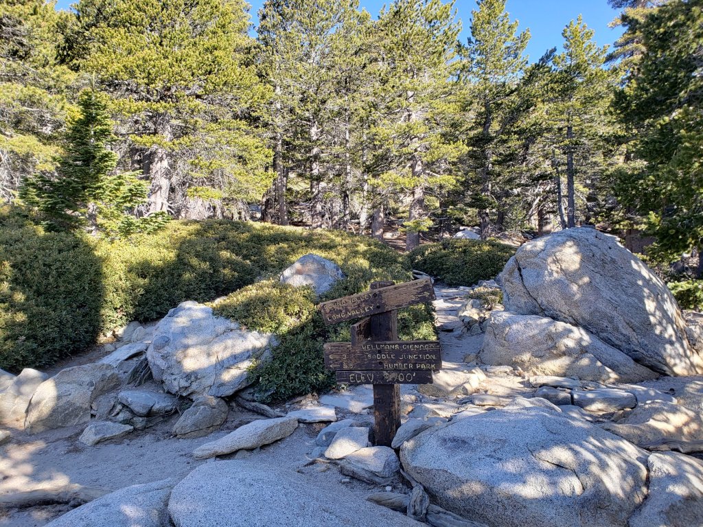

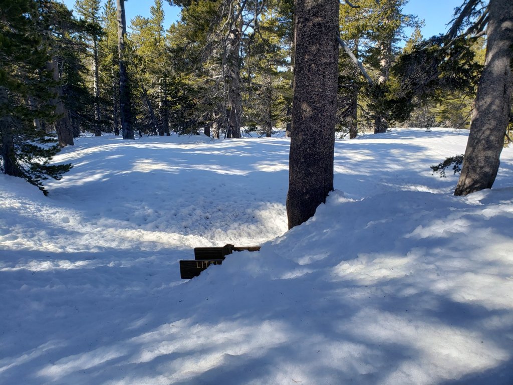
San Jacinto Trail Report: available for everyone, funded by readers.While all labor and time is volunteered, this Report completely depends on small private donations to cover its direct costs. With a very challenging first few months of 2020, every contribution is invaluable. If you have found this Report useful, please consider visiting the Donate page. Thank you.sanjacjonUncategorized 6 MinutesEdit”Trail update 20th May 2020″
Trail update 13th May 2020
We have hiked to San Jacinto Peak every day so far in May, using several different routes, including an east-west loop ascending the Peak Trail and descending Deer Springs Trail on Monday, via Marion Mountain Trail yesterday, and a circuitous route via Willow Creek and Round Valley trails today.
Very warm weather last week caused extensive snowmelt at all elevations, with all trails partly or completely clearing. Pleasantly cool weather so far this week has resulted in firm icy snow in the mornings, with easy hiking conditions where areas of snow remain. On sunny afternoons, snow can still be soft, and caution is advised on soft snow melting away from rocks and logs, and over running water. Potentially ankle-breaking posthole conditions remain widespread in such areas.
Where snow remains in the high country, useable tracks through the snow are now in place for all major routes on the mountain. Measured snow depths, with comparison to the recent maximum depth, are listed at the foot of this posting.
Microspikes remain useful in some areas (discussed below) on colder early mornings, and for descending. Many hikers with suitable footwear (and hiking poles if preferred) may not need additional traction, depending on your willingness to potentially posthole in softening snow later in the day.
Despite mild weather at lower elevations, hikers should be prepared for temperatures near freezing in the high country, and below freezing when considering windchill effects.
Palm Springs Aerial Tramway is closed indefinitely (since 12th March) due to the coronavirus crisis. Black Mountain Road is closed by Forest Service order until 31st May.

WEATHER Temperatures are forecast to largely remain pleasantly cool – at or slightly above seasonal – into next week. There is no significant precipitation forecast for the foreseeable future, although there is the possibility of light drizzle at mid elevations on the afternoon of Monday 18th May.
At San Jacinto Peak (3295m/10,810ft) today, Wednesday 13th May 2020, at 1020 the air temperature was 37.7°F (4°C), with a windchill of 31.8°F (0°C), 49% relative humidity, and a cool due West wind sustained at 5 mph gusting to 11.4 mph.
At the Peak on Tuesday 12th May 2020, at 0810 the air temperature was 31.0°F (-1°C), with a windchill of 15.1°F (-9°C), 76% relative humidity, and a biting due West wind sustained at 18 mph gusting to 31.8 mph.
The warmest day of the year to date recorded at the Peak was on Thursday 7th May 2020, when at 0810 the air temperature was 53.1°F (12°C), with a “windchill” of 50.5°F (10°C), 17% relative humidity, and a very light due West wind sustained at 2 mph gusting to 5.2 mph.
TRAIL CONDITIONS
All trails below about 9000′ are clear of snow, while higher trails have less than 50% snow-cover (see details below).
The following trails are now completely clear of snow: Ernie Maxwell, Devil’s Slide, Willow Creek, South Ridge, Marion Mountain, and Seven Pines. The Desert Divide south of Red Tahquitz (approx. PCT Mile 175), including side trails such as Spitler Peak, Cedar Spring, Apache Spring, Zen Centre, and Live Oak Spring trails, is all clear of snow. All of the latter have new treefall hazards from this winter, passable for hikers but not stock.
The Peak Trail above Wellman Divide is clear of snow, except for largely continuous drifted snow up to 1-2 feet deep for 0.2 mile around 10,000′, and in patches for 0.2 mile above 10,500′. The East Ridge Trail still has 90% drifted snow cover. The Wellman Trail is largely clear, except for 30% cover in the first 0.4 mile north from Annie’s Junction (at the State Park boundary).
Deer Springs Trail is clear of snow to 9500′, except for a handful of tiny patches between the Seven Pines Trail and Fuller Ridge Trail junctions. There is a new major double treefall hazard right by the Deer Springs crossing. Snow cover is about 40% on the 0.4 mile from 9500′ to the crossing of the North Fork of the San Jacinto River, and it is then >95% clear for the final 0.2 mile ascent to Little Round Valley. Snow cover through Little Round Valley is 50%, and the tracks are somewhat meandering. Up to San Jacinto Peak snow cover is 30%. Although the trail above Little Round Valley is clearing rapidly, snow drifts make it hard to follow, while conversely melting makes it hard to follow the tracks through the snow. Microspikes are useful, especially for descending. San Jacinto Peak has barely 20% snow cover.
Willow Creek Trail is completely clear of snow, but has 24 new tree hazards between Saddle Junction and Hidden Divide from this past winter, based on a full survey undertaken 13th May. None are as large or as challenging to get around as in 2019, but some caution is recommended. The agencies have been notified.
Fuller Ridge Trail (PCT Miles 185.5-190.5) is largely clear of snow, although as usual extensive patches remain especially at the north end (Miles 188.6-190).
Round Valley Trail is largely clear to Round Valley, but from there to Wellman Divide still has about 60% coverage of shallow snow patches. Trail finding is currently tricky on that 1.0 mile section. The High Trail has about a dozen minor snow drifts still across the trail, and one major treefall hazard.
Tahquitz Peak trail from Chinquapin Flat/PCT Mile 178 [updated 16th May] is virtually clear of snow and has good steps to follow through the tiny patches that remain. Microspikes are no longer required.
Seven Pines Trail has a few very minor snow drifts near its junction with the PCT. This trail has only been hiked a handful of times since November 2018. Extremely cautious navigation is recommended for those who are not very familiar with hiking this trail. The Forest Service closure of Dark Canyon Road continues, and there is no vehicular access to Seven Pines trailhead.
WATER All major creeks and springs are currently flowing well, as are many ephemeral seasonal sources. Consequently I am not updating the water situation in detail at this time.

PACIFIC CREST TRAIL
The Pacific Crest Trail remains open at the rockslide just north of Antsell Rock (Mile 172.5). USFS has told the Trail Report that there are currently no plans to close this section of the PCT during spring 2020. The video report (available here) can be useful for deciding whether to try to hike around the rockslide or take an alternate route. All hikers this spring are reporting having no significant difficulty here.
PCT hikers are reminded that overnight stays are not permitted at or near San Jacinto Peak, including in the historic shelter. Mt. San Jacinto State Park regulations permit overnight stays only in established campgrounds (additionally, due to the Covid-19 crisis, no camping is currently allowed anywhere in the State Park).
SNOW DEPTHS measured 11th-12th May 2020 (with depth on 10th-12th April 2020 in parentheses for comparison where known). Note that average depth is given, drifts can be much deeper in places. Altitudes are approximate.
San Jacinto Peak (10810′): 5″ (was 40″ on 12th April)
Little Round Valley (9800′): 10″ (was 35″ on 12th April)
Wellman Divide (9700′): 0″ (was 32″ on 12th April)
Annie’s Junction (9070′): <1″ (was 35″ on 12th April)
Seven Pines Trail junction with Deer Springs Trail (8700′): 0″ (was 31″ on 11th April)
Long Valley (8600′): 0″ (was 16″ on 11th April)
Strawberry Junction (8100′): 0″ (was 25″ on 11th April)
Saddle Junction (8070′): 0″ (was 26″ on 11th April)
Devil’s Slide trailhead at Humber Park (6550′): 0″ (was 14″ on 11th April)

San Jacinto Trail Report: available for everyone, funded by readers.While all labor and time is volunteered, this Report completely depends on small private donations to cover its direct costs. With a very challenging first few months of 2020, every contribution is invaluable. If you have found this Report useful, please consider visiting the Donate page. Thank you.sanjacjonUncategorized 5 MinutesEdit”Trail update 13th May 2020″
Trail update 5th May 2020
We have hiked to San Jacinto Peak every day so far in May, via several different routes, including loops ascending the Peak Trail and descending Deer Springs Trail today and on Saturday.
A couple of cooler days last weekend produced excellent firm icy snow in the early morning, and fast ascent conditions. By today, warmer temperatures kept the snow soft overnight, and the snow was quite unpleasant underfoot especially descending the western side from Little Round Valley to the top of Marion Mountain Trail. Over the next week or so, considerable caution is advised on soft snow melting away from rocks and logs, and over running water. Potentially ankle-breaking posthole conditions are currently widespread in such areas.
Summer-like temperatures on most days since about 25th April have radically changed hiking conditions. Most snow has gone below 9000′, with trails also clearing rapidly up to 10,000′, and in patches all the way to the highest peaks. Where snow remains in the high country, useable tracks through the snow are now in place for almost all major routes on the mountain.
Further temperatures more typical of July over the next few days mean that snowmelt will continue very rapidly, with most trails even at the highest elevations likely to be largely clear in the next ten days. Measured snow depths, with comparison to the recent maximum depth, are listed at the foot of this posting.
Microspikes can still be useful in some areas (discussed below) for hikers who are less comfortable on snow and ice, and in particular for descending. Many hikers with suitable footwear (and hiking poles if preferred) will not need additional traction, depending on your willingness to posthole in soft snow after early morning.
Due to apparent contradictions among, and inconsistent enforcement of, the various county, state, and federal rules and regulations during the coronavirus crisis, I recommend contacting relevant agencies directly for their latest information. According to their website, Mount San Jacinto State Park remains open only for local residents able to walk or bike to trailheads. Palm Springs Aerial Tramway is closed indefinitely (since 12th March).
WEATHER Temperatures overall remain unseasonably warm, over the next few days about 10-20°F above average for early May, according to the latest information from NWS San Diego. Very rapid snowmelt will continue at all elevations. Temperatures are forecast to drop to seasonal next week. There is no precipitation forecast for the foreseeable future.
At San Jacinto Peak (10,810ft/3295m) today, Tuesday 5th May 2020, at 0900 the air temperature was 49.2°F (10°C), with a windchill of 45.5°F (8°C), 21% relative humidity, and a light SW wind sustained at 3 mph gusting to 7.1 mph.
At the Peak on Monday 4th May 2020, at 0555 the air temperature was 44.3°F (7°C), with a windchill of 37.4°F (3°C), 8% relative humidity, and a steady due West wind sustained at 8 mph gusting to 11.8 mph.
The most recent cool day at the Peak was on Saturday 2nd May 2020, when at 0830 the air temperature was 34.3°F (1°C), with a windchill of 23.4°F (-5°C), 49% relative humidity, and a chilly due West wind sustained at 8 mph gusting to 13.9 mph.
TRAIL CONDITIONS
All trails above about 8900′ remain partly snow-covered, with depth depending on elevation (see below). Exposed slopes much higher – e.g. Wellman’s Cienega to Wellman Divide – are now clear. Some short sections of trails above about 8000′ may have remnant icy snow patches, depending on exposure.
The Desert Divide south of Red Tahquitz (approx. PCT Mile 175), including side trails such as Spitler Peak, Cedar Spring, Apache Spring, Zen Centre, and Live Oak Spring trails, is all clear of snow. All have new treefall hazards from this winter, passable for hikers but not stock.
The Peak Trail above Wellman Divide has about 30% snow cover, except for continuous cover of drifted snow about 1-2 feet deep around 10,000′ and again above 10,500′. The East Ridge Trail still has continuous drifted snow cover, also 1-2 feet deep. The Wellman Trail is largely clear, except for 90% cover in the first 0.4 mile north from Annie’s Junction.
Deer Springs Trail is clear of snow to Strawberry Junction, and north on the PCT almost to the Marion Mountain Trail junction (Mile 185) at about 8700′. Snow cover is about 50% from there to 9400′, where it increases to 80%. Snow cover through Little Round Valley to San Jacinto Peak is 90%, but melting has been dramatic even in the last four (coolish) days. Tracks through the snow do not follow the trail route to San Jacinto Peak, but are adequate. Microspikes are useful for descending.
Marion Mountain Trail is basically clear of snow to the PCT/Deer Springs Trail, with just a few small patches remaining above 8500′.
South Ridge Trail is clear to Tahquitz Peak, other than a few tiny snow patches above 8600′. Microspikes are no longer required.
Fuller Ridge Trail (PCT Miles 185.5-190.5) is rapidly clearing of snow, although as usual extensive patches remain especially near the south (185.5-186.5) and north (188..6-190) ends.
Round Valley Trail is largely clear, but through to Wellman Divide still has extensive shallow snow patches above Round Valley.
Devil’s Slide Trail is clear of snow to Saddle Junction. In four locations there are new significant treefall hazards.
Tahquitz Peak trail from Chinquapin Flat/PCT Mile 178 is clearing rapidly and now has reasonable steps to follow through the angled icy snow. Microspikes are recommended especially for descending and in the morning when the snow is icy.
Seven Pines Trail has only been hiked a handful of times since November 2018. Extremely cautious navigation is recommended for those who are not very familiar with hiking this trail. The Forest Service closure of Dark Canyon Road continues, and there is no vehicular access to Seven Pines trailhead.
PACIFIC CREST TRAIL
Current snow cover on the PCT is increasingly patchy between Miles 175-179 (to near Saddle Junction). The Trail is very rapidly clearing to about Mile 184 (one mile north of Strawberry Junction) except for a stubborn section of 0.5 mile approaching Annie’s Junction (Mile 180.8) which is always among the last areas to clear every spring. Most of Miles 184-190 has patchy snow cover, although exposed sections of Fuller Ridge (e.g., Miles 186.5-188.5) are clearing rapidly.
Microspikes may still be useful on some of the PCT for increasingly patchy snow travel between approximately Miles 174 and 190, depending upon your comfort level in variable snow/ice conditions. Hikers willing to posthole and using poles may find spikes unnecessary in most areas however. See above for conditions on some specific sections of the PCT and the many side trails.
The Pacific Crest Trail remains open at the rockslide just north of Antsell Rock (Mile 172.5). USFS has told the Trail Report that there are currently no plans to close this section of the PCT during spring 2020. The video report (available here) can be useful for deciding whether to try to hike around the rockslide or take an alternate route. All hikers this spring are reporting having no significant difficulty here.
PCT hikers are reminded that overnight stays are not permitted at or near San Jacinto Peak, including in the historic shelter. Mt. San Jacinto State Park regulations permit overnight stays only in established campgrounds (additionally, due to the Covid-19 crisis, no camping is currently allowed anywhere in the State Park).
SNOW DEPTHS measured 5th May 2020 (with depth on 10th-12th April 2020 in parentheses for comparison where known). Note that average depth is given, drifts can be much deeper in places. Altitudes are approximate.
San Jacinto Peak (10810′): 9″ (was 40″ on 12th April)
Little Round Valley (9800′): 16″ (was 35″ on 12th April)
Wellman Divide (9700′): <2″ (was 32″ on 12th April)
Annie’s Junction (9070′): 6″ (was 35″ on 12th April)
Seven Pines Trail junction with Deer Springs Trail (8700′): 5″ (was 31″ on 11th April)
Long Valley (8600′): 0″ (was 16″ on 11th April)
Strawberry Junction (8100′): 0″ (was 25″ on 11th April)
Saddle Junction (8070′): 0″ (was 26″ on 11th April)
Devil’s Slide trailhead at Humber Park (6550′): 0″ (was 14″ on 11th April)


San Jacinto Trail Report: available for everyone, funded by readers.While all labor and time is volunteered, this Report completely depends on small private donations to cover its direct costs. With a very challenging first few months of 2020, every contribution is invaluable. If you have found this Report useful, please consider visiting the Donate page. Thank you.sanjacjonUncategorized 6 MinutesEdit”Trail update 5th May 2020″
Trail update 27th April 2020
[UPDATE 1st May 2020: hikes today and on 29th April to San Jacinto Peak have confirmed very rapid snowmelt at all elevations, especially below 10,000′. Snow conditions were dreadful on 29th, with deep postholing in places above 9000′, but were much better this morning despite similar temperatures both days. Microspikes remain useful in places, but not essential, above 9000′.]
This morning we hiked to San Jacinto Peak via Devil’s Slide Trail and the Peak Trail route, having been up Deer Springs Trail the previous day. On 25th I checked the Tahquitz Peak area trails, and Apache Peak and the Desert Divide on 23rd.
Current conditions underfoot were discussed in a short video recorded this morning at San Jacinto Peak. Summer-like temperatures in recent days have radically changed hiking conditions. Snow melt has been considerable below 9000′, with trails clearing rapidly, but somewhat less so in the high country. Useable tracks through the snow are now in place for most major routes on the mountain. Cautious navigation is still recommended as many tracks do not accurately follow the trail routes.
Snow conditions will continue to change rapidly over the next week or so, depending on a complex combination of elevation, time of day, slope exposure, temperature, and cloud cover. In summary, little or no snow will be left below 9000′ soon, and most snow will be gone even from the high country by early May. Measured snow depths, with comparison to the recent maximum depth, are listed at the foot of this posting.
Inevitably, gear recommendations change almost as quickly as the snow conditions. Microspikes can be useful in some areas (see below) for hikers who are less comfortable on snow and ice, and in particular for descending compacted trails. Hikers with suitable footwear and hiking poles may not need additional traction, depending on your willingness to posthole in soft snow, and on temperature/time of day as mentioned above. Snowshoes remain marginally useful for another few days in areas off-trail above about 10,000′ elevation.
Due to some apparent contradictions among, and inconsistent enforcement of, the various county, state, and federal rules and regulations during the coronavirus crisis, I recommend contacting relevant agencies directly for their latest information. According to their website, Mount San Jacinto State Park remains open only for local residents able to walk or cycle to trailheads. The Palm Springs Aerial Tramway remains closed indefinitely (since 12th March).
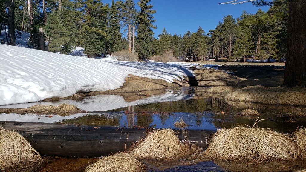
WEATHER The last few days of April will continue to be more reminiscent of late June. Temperatures moderate slightly in early May, but overall remain unseasonably warm. Rapid snowmelt will continue at all elevations.
At San Jacinto Peak (10,810ft/3295m) today, Monday 27th April 2020, at 0850 the air temperature was 46.0°F (8°C), with a windchill of 37.5°F (3°C), 21% relative humidity, and a steady WNW wind sustained at 12 mph gusting to 17.5 mph.
At the Peak on Tuesday 21st April 2020, at 0755 the air temperature was 21.8°F (-6°C), with a windchill of 4.4°F (-15°C), 68% relative humidity, and a bitter NNE wind sustained at 12 mph gusting to 17.8 mph.
PACIFIC CREST TRAIL
The icy slope on the NE side of Apache Peak (PCT Mile 169.5) that had multiple incidents in late March is now clear of snow.
The Pacific Crest Trail remains open at the rockslide just north of Antsell Rock (Mile 172.5). USFS has told the Trail Report that there are currently no plans to close this section of the PCT during spring 2020. The video report (available here) can be useful for deciding whether to try to hike around the rockslide or take an alternate route. All hikers this spring are reporting having no significant difficulty here.
Microspikes may still be useful on some of the PCT for increasingly patchy snow travel between approximately Miles 174 and 190, depending upon your comfort level in variable snow/ice conditions. Hikers willing to posthole and using poles may find spikes unnecessary in most areas however. See below for conditions on some specific sections of the PCT and the many side trails.
Current snow cover on the PCT is extensive but increasingly patchy between Miles 175-179 (to near Saddle Junction). The Trail is very rapidly clearing to about Mile 184 (one mile north of Strawberry Junction) except for a stubborn section of 0.5 mile approaching Annie’s Junction (Mile 180.8) which is always among the last areas to clear every spring. Most of Miles 184-190 is snow-covered, although exposed sections of Fuller Ridge (e.g., Miles 186.5-188.5) are clearing rapidly.
PCT hikers are reminded that overnight stays are not permitted at or near San Jacinto Peak, including in the historic shelter. Mt. San Jacinto State Park regulations permit overnight stays only in established campgrounds (additionally, due to the Covid-19 crisis, no camping is currently allowed anywhere in the State Park).
TRAIL CONDITIONS
All trails above about 9000′ remain largely snow-covered, with depth depending on elevation (see below) but exposed slopes much higher (e.g. Wellman’s Cienega to Wellman Divide) are clearing rapidly. Some short sections of trails above about 7900′ may have remnant icy snow patches, depending on exposure.
The Desert Divide south of Red Tahquitz, including side trails such as Spitler Peak, Cedar Spring, Apache Spring, Zen Centre, and Live Oak Spring trails, are all clear of snow. All have new treefall hazards from this winter, passable for hikers but not stock.
Deer Springs Trail is clear of snow to Strawberry Junction, and north on the PCT to about 8600′. Snow is largely continuous from about Mile 184 (just south of Marion Mountain Trail junction). Tracks through the snow do not accurately follow the trail route to San Jacinto Peak, but are adequate. Microspikes are useful for descending.
South Ridge Trail is clear to Tahquitz Peak, other than a few tiny snow patches above 8600′. Microspikes are no longer required.
Fuller Ridge Trail (PCT Miles 185.5-190.5). There are tracks to follow through the snow, although these do not currently match the route of the trail in some places.
Round Valley Trail through to Wellman Divide has not been visibly traveled since the Tram closure in mid March.
Devil’s Slide Trail is virtually clear of snow to Saddle Junction, with just a few minor icy patches above 8000′. Microspikes are no longer required. In four locations there are new significant treefall hazards. Several more minor obstructions have been removed.
Ernie Maxwell Trail is clear of snow.
Tahquitz Peak trail from Chinquapin Flat/PCT Mile 178 has no steps to follow through the angled icy snow. These ice slopes are notoriously treacherous. Currently crampons are strongly recommended, in conjunction with an ice axe (if you know how to use both).
Seven Pines Trail has had no hiker traffic so far this winter, with no tracks or trail to follow. Indeed this trail has only been hiked a handful of times since November 2018. Extremely cautious navigation is recommended for those who are not very familiar with hiking this trail. The Forest Service closure of Dark Canyon Road continues, and there is no vehicular access to Seven Pines trailhead.
SNOW DEPTHS measured 26-27th April 2020 (with depth on 10th-12th April 2020 in parentheses for comparison where known). Note that average depth is given, drifts can be much deeper in places. Altitudes are approximate.
San Jacinto Peak (10810′): 21″ (was 40″ on 12th April)
Wellman Divide (9700′): 7″ (was 32″ on 12th April)
Annie’s Junction (9070′): 11″ (was 35″ on 12th April)
Seven Pines Trail junction with Deer Springs Trail (8700′): 9″ (was 31″ on 11th April)
Long Valley (8600′): <1″ (was 16″ on 11th April)
Strawberry Junction (8100′): <1″ (was 25″ on 11th April)
Saddle Junction (8070′): <2″ (was 26″ on 11th April)
Devil’s Slide trailhead at Humber Park (6550′): 0″ (was 14″ on 11th April)
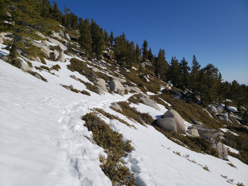


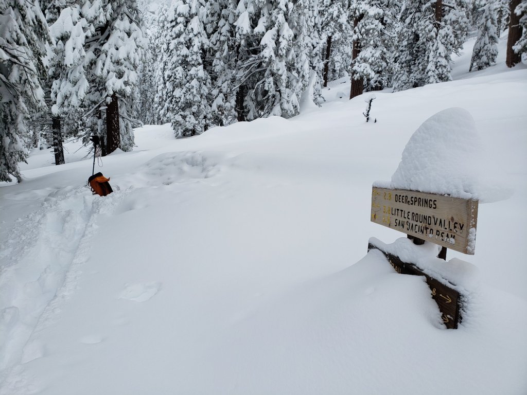
sanjacjonUncategorized 5 MinutesEdit”Trail update 27th April 2020″
Trail update 21st April 2020
[UPDATE 23rd April: conditions for the PCT at Apache Peak and South Ridge Trail are updated below, based on hikes yesterday and this morning, respectively.]
Today I made the most of what was likely the last true snow hike for the foreseeable future, doing a full circuit of the mountain, ascending the east side trails and descending Deer Springs Trail. Starting well before sunrise, conditions underfoot were ideal, with hard refrozen snow everywhere. This allowed me to ascend in just boots, using only the melted remains of my snowshoe tracks from three days ago for grip on slopes. Microspikes were essential for a very direct descent.
Exceptionally warm summer-like temperatures for the remainder of April will radically change hiking conditions in a couple of days starting tomorrow. Snow melt has been rapid even with moderate temperatures over the last few days, with 1-2 feet of snow lost (depending on elevation) in just a week (see photos below).
Snow conditions will continue to change very rapidly, depending on a complex combination of elevation, time of day, slope exposure, temperature, and cloud cover. The bottom line is that remarkably little snow may be left at most elevations by the end of April. Snow depths measured today, with comparison to the recent maximum depth, are listed at the foot of this posting. There has been no other hiker traffic above 9100′, and tracks disappear rapidly with melting, so very cautious navigation is recommended everywhere.
Inevitably, gear recommendations are changing almost as quickly as the snow depths and conditions. Microspikes can be useful in some areas (see below) for hikers who are less comfortable on snow and ice, on the few compacted trails, and in particular for descending. Hikers with suitable footwear and hiking poles may not need any additional traction, depending on your willingness to posthole in soft snow, and on temperature/time of day as mentioned above. Snowshoes remain useful, but for only another few days, in areas above about 9000′ elevation.
Due to the apparent contradictions and inconsistent enforcement of various county, state, and federal rules and regulations during the coronavirus crisis, I recommend contacting relevant agencies directly for their latest information. According to their website, Mount San Jacinto State Park remains open only for locals visiting from near their primary residences. The Palm Springs Aerial Tramway remains closed indefinitely (since 12th March).
WEATHER Regrettably – for those of us concerned about fire risk, water, and forest health – summer apparently begins tomorrow. For the remainder of April, overnight low temperatures are forecast to resemble early July averages, and daytime highs will be more typical of June. Extremely rapid snowmelt is expected at all elevations.
At San Jacinto Peak (10,810ft/3295m) today, Tuesday 21st April 2020, at 0755 the air temperature was 21.8°F (-6°C), with a windchill of 4.4°F (-15°C), 68% relative humidity, and a bitter NNE wind sustained at 12 mph gusting to 17.8 mph.
At the Peak on Saturday 18th April 2020, at 0930 the air temperature was 23.7°F (-5°C), with a windchill of 9.6°F (-12°C), 100% relative humidity, and a cool WNW wind sustained at 7 mph gusting to 14.2 mph.

PACIFIC CREST TRAIL
The short icy snow slope on the NE side of Apache Peak (PCT Mile 169.5) that had multiple incidents in late March has greatly improved. The very limited remaining snow is soft with obvious tracks, and is melting rapidly (see photo below).

The Pacific Crest Trail remains open at the rockslide just north of Antsell Rock (Mile 172.5). USFS has told the Trail Report that there are currently no plans to close this section of the PCT during spring 2020. The video report (available here) can be useful for deciding whether to try to hike around the rockslide or take an alternate route. All hikers this spring are reporting having no significant difficulty here.
Microspikes may be useful on some of the PCT for increasingly patchy snow travel between approximately Miles 173 and 191, depending upon your comfort level in variable snow/ice conditions. Hikers willing to posthole extensively and using poles may find spikes unnecessary in most areas however. See below for conditions on some specific sections of the PCT and the many side trails.
Current snow cover on the PCT is very limited between Miles 151 (Highway 74) and about 175 (Red Tahquitz). Snow is then largely continuous between Miles 175-179 (to near Saddle Junction). The Trail is rapidly clearing to about Mile 184 (just north of Strawberry Junction) except for a stubborn section of 0.5 mile approaching Annie’s Junction (Mile 180.8) which is always among the last areas to clear every spring. Most of Miles 184-191 is snow-covered, although exposed sections of Fuller Ridge (e.g., Miles 186.5-188.5) will start clearing rapidly. North from about Mile 191 to Snow Creek is clear.
PCT hikers are reminded that overnight stays are not permitted at or near San Jacinto Peak, including in the historic shelter. Mt. San Jacinto State Park regulations permit overnight stays only in established campgrounds (additionally, due to the Covid-19 crisis, no camping is currently allowed anywhere in the State Park).
TRAIL CONDITIONS
All trails above about 8000′ remain largely snow-covered, with depth depending on elevation (see below) but exposed slopes much higher are clearing rapidly. Some sections of trails above about 7000′ have may patchy icy snow cover, depending on exposure.
The Desert Divide south of Red Tahquitz, including side trails such as Spitler Peak, Cedar Spring, Apache Spring, Zen Centre, and Live Oak Spring trails, are all clear of snow. All have new treefall hazards from this winter, passable for hikers but not stock.
Deer Springs Trail is basically clear of snow to Strawberry Junction, with just a few tiny soft patches remaining. North on the PCT to about 8500′ is melting very rapidly. Snow is continuous from about Mile 184 (just south of Marion Mountain Trail junction). Snowshoes are currently useful above about 9500′ and microspikes can be useful for descending.
South Ridge Trail [updated 23rd April] is clear to Old Lookout Flat at 7600′. Snow cover is soft and extremely limited from there to about 8600′, after which cover is about 50% to the Peak. This will melt dramatically over the next few days. Microspikes can be useful for descending the uppermost 5-7 switchbacks early in the morning. South Ridge Road (currently closed) is clear of ice.
Fuller Ridge Trail (PCT Miles 185.5-190.5). There are tracks to follow through the snow, although these do match the route of the regular trail in many places.
Round Valley Trail through to Wellman Divide has not been visibly traveled since the Tram closure in mid March.
Devil’s Slide Trail is clear of snow below 7200′, largely clear below 8000′, and icy snow cover is increasingly patchy from there to Saddle Junction. Microspikes can be useful, especially for descending, but are not essential. In three locations there are new significant treefall hazards. Several more minor obstructions have been removed.
Ernie Maxwell Trail is clear of snow.
Tahquitz Peak trail from Chinquapin Flat/PCT Mile 178 has no steps to follow through the angled icy snow. These ice slopes are notoriously treacherous. Currently crampons are strongly recommended, in conjunction with an ice axe (if you know how to use both). Snowshoes are not advised due to the angle of the underlying ice.
Seven Pines Trail has had no hiker traffic so far this winter, with no tracks or trail to follow. Indeed this trail has only been hiked a handful of times since November 2018. Extremely cautious navigation is recommended for those who are not very familiar with hiking this trail. The Forest Service closure of Dark Canyon Road continues, and there is no vehicular access to Seven Pines trailhead.
SNOW DEPTHS measured 21st April 2020 (with depth on 10th-12th April 2020 in parentheses for comparison where known). Note that average depth is given, drifts can be much deeper in places. Altitudes are approximate.
San Jacinto Peak (10810′): 31″ (was 40″ on 12th April)
Little Round Valley (9800′): 30″
Wellman Divide (9700′): 14″ (was 32″ on 12th April)
Annie’s Junction (9070′): 21″ (was 35″ on 12th April)
Seven Pines Trail junction with Deer Springs Trail (8700′): 15″ (was 31″ on 11th April)
Long Valley (8600′): 4″ (was 16″ on 11th April)
Strawberry Junction (8100′): <1″ (was 25″ on 11th April)
Saddle Junction (8070′): 7″ (was 26″ on 11th April)
Devil’s Slide trailhead at Humber Park (6550′): 0″ (was 14″ on 11th April)
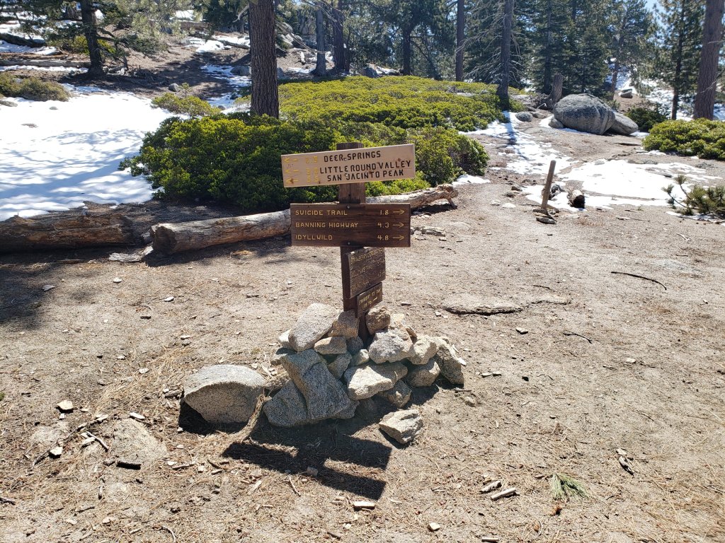

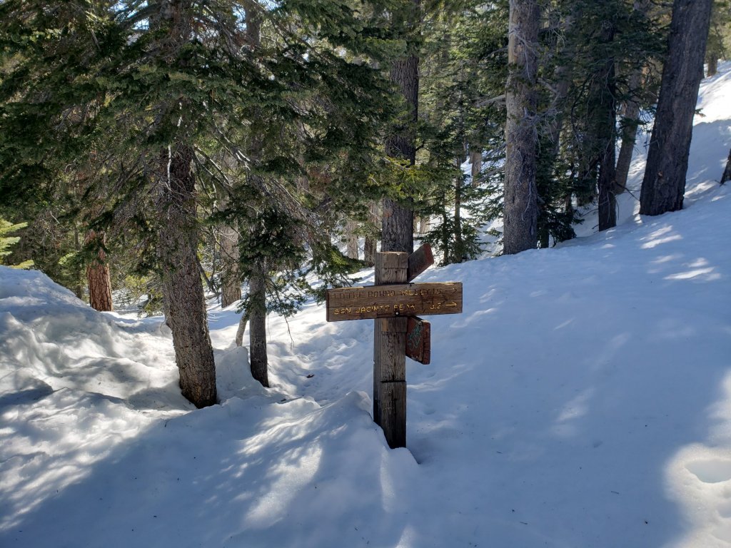
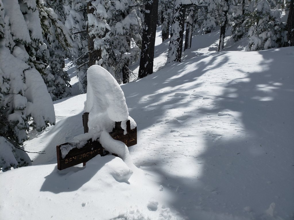
sanjacjonUncategorized 6 MinutesEdit”Trail update 21st April 2020″
Trail update 15th April 2020
[UPDATE 18th April: I discuss current gear recommendations, snow conditions, and forthcoming weather in a video recorded this morning at San Jacinto Peak. In the text below, conditions for some trails are updated based on hikes in the past two days.]
Anabel and I have been very busy in the days since the multi-day snow storm last week surveying as many different trails as possible. We hiked to the Apache Peak area this morning to assess conditions there (discussed below and in this short [breezy] video).
Snow conditions are changing very rapidly at present, and depend on many factors, as discussed in today’s video. Icy, reliable snow in the early morning can turn to the consistency of warm ice cream by mid/late morning in many areas, depending on exposure, temperature, and cloud cover, which can help or hinder hiking depending on your preference. Most areas below 7000′ have lost over a foot of snow in just three days, and some sun-exposed slopes have experienced even faster melting rates.
Snow depths measured in recent days, with comparison to the maximum depth a few days earlier, are listed at the foot of this posting. There has been little hiker traffic in the high country, so very cautious navigation is recommended everywhere.
Equipment recommendations are changing almost as quickly as the snow depths and conditions. Microspikes can be useful in some areas (see below) for hikers who are less comfortable on snow and ice, on the very few compacted trails, and in particular for descending. Hikers with suitable footwear and hiking poles may not need any additional traction, depending on your willingness to posthole in soft snow, and on temperature/time of day as discussed above. Snowshoes remain useful, but likely only for another few days depending on slope aspect, in areas above about 8000′ elevation.
Despite the strong warming trend at all elevations, hikers should be prepared for temperatures near or below freezing in the high country, and potentially well below freezing when considering windchill effects.
All trailhead parking is closed by county public health order. Enforcement was strong this weekend by multiple law enforcement agencies. I was sceptical if this would persist on weekdays, but there was clear evidence of it continuing yesterday at least. The Palm Springs Aerial Tramway remains closed indefinitely (since 12th March).

WEATHER Largely sunny conditions and warmer – but still below average – temperatures are forecast for the remainder of April. Extensive and rapid melting will accelerate at all elevations, especially on sun-exposed slopes.
PACIFIC CREST TRAIL
The short icy snow slope on the NE side of Apache Peak (PCT Mile 169.5) that had multiple incidents in late March has greatly improved. This morning – as described in this video – snow was relatively soft and is melting rapidly. Microspikes are recommended, but it is possible to traverse without them securely. Every individual should make their own assessment of whether to cross based on their comfort level on angled snow, their experience, available equipment, time of day, and current snow conditions. If in any doubt, turn around and take the Spitler Peak Trail alternate route at Mile 168.5.
The Pacific Crest Trail remains open at the rockslide just north of Antsell Rock (Mile 172.5). USFS has told the Trail Report that there are currently no plans to close this section of the PCT during spring 2020. The video report (available here) can be useful for deciding whether to try to hike around the rockslide or take an alternate route. All hikers this spring are reporting having no significant difficulty here.
Microspikes may be useful on some of the PCT for continuous snow travel between approximately Miles 173 and 192, depending upon your comfort level in variable snow/ice conditions. Hikers willing to posthole extensively and using poles may find spikes unnecessary in most areas however. See below for conditions on some specific sections of the PCT and the many side trails.
Current snow cover on the PCT is patchy and thin between Miles 166 and about 173 (Red Tahquitz), mainly confined to certain north-facing slopes e.g., Spitler Peak (Mile 168) and Apache Peak (Mile 169.5). Snow is currently continuous between Miles 174-192 (north end of Fuller Ridge). Short sections of the Trail will start to clear rapidly in the next few days (e.g., around Strawberry Junction Mile 183). North from about Mile 191 to Snow Creek is clear.
PCT hikers are reminded that overnight stays are not permitted at or near San Jacinto Peak, including in the historic shelter. Mt. San Jacinto State Park regulations normally permit overnight stays only in established campgrounds, although due to the Covid-19 crisis, no camping is currently allowed anywhere in the State Park.
TRAIL CONDITIONS
All trails above about 7500′ remain snow-covered, with depth depending on elevation (see below) but exposed slopes much higher are clearing rapidly. Some sections of trails above about 7000′ have may patchy icy snow cover, depending on exposure.
Spitler Peak Trail is virtually clear of snow, with just a few small thin patches remaining near the PCT. There are ten treefall hazards, most of which remain since last year.
Cedar Spring Trail is clear of snow to the PCT, but still largely snow-covered to the spring.
Apache Spring Trail was about 50% snow-covered this morning but was clearing very rapidly. There are two new treefall hazards.
Deer Springs Trail is largely clear of snow to the Suicide Rock junction (microspikes not required). From there to Strawberry Junction and north on the PCT to about 8500′ is melting very rapidly. Snowshoes may be useful above about 8500′ and microspikes can be useful for descending.
South Ridge Trail is virtually clear to Old Lookout Flat at 7600′. Snow cover is currently continuous higher up, but that will change dramatically over the next few days. Microspikes are useful. South Ridge Road (currently closed) is clear of ice.
Fuller Ridge Trail (PCT Miles 185.5-190.5). There are tracks to follow through the snow, although these do match the route of the regular trail in many places.
Round Valley Trail through to Wellman Divide has not been visibly traveled since the Tram closure in mid March.
Devil’s Slide Trail [updated 18th April] is clear of snow below 7200′, and is becoming patchy below 7700′. Icy snow cover is currently continuous from there to Saddle Junction. Microspikes can be useful, especially for descending, but are not essential. In three locations there are new significant treefall hazards, caused by sheer weight of heavy wet snow (USFS and PCTA have been notified).
Ernie Maxwell Trail is clear of snow, with just a few tiny patches near Humber Park.
Tahquitz Peak trail from Chinquapin Flat/PCT Mile 178 has no steps to follow through the angled icy snow. These ice slopes are notoriously treacherous. Currently crampons are strongly recommended, in conjunction with an ice axe (if you know how to use both). Snowshoes are not advised due to the angle of the underlying ice.
Seven Pines Trail has had no hiker traffic so far this winter, with no tracks or trail to follow. Indeed this trail has only been hiked a handful of times since November 2018. Extremely cautious navigation is recommended for those who are not very familiar with hiking this trail. The Forest Service closure of Dark Canyon Road continues, and there is no vehicular access to Seven Pines trailhead.
SNOW DEPTHS measured 13th-15th April 2020 (with depth on 10th-12th April 2020 in parentheses). Note that average depth is given, drifts can be much deeper in places. Altitudes are approximate.
San Jacinto Peak (10810′): 36″ (was 40″ on 12th April)
Wellman Divide (9700′): 27″ (was 32″ on 12th April)
Annie’s Junction (9070′): 33″ (was 35″ on 12th April)
Long Valley (8600′): 8″ (was 16″ on 11th April)
Strawberry Junction (8100′): 12″ (was 25″ on 11th April)
Saddle Junction (8070′): 18″ (was 26″ on 11th April)
Spitler Peak Trail at PCT Mile 168.5 (7040′): <1″ (was 10″ on 10th April)
Devil’s Slide trailhead at Humber Park (6550′): <2″ (was 14″ on 11th April)

sanjacjonUncategorized 5 MinutesEdit”Trail update 15th April 2020″
Snow storm update 10th April 2020
[UPDATE 11th April: I recorded a short video on Deer Springs Trail at the top of Seven Pines Trail late this morning. Snow was deep – for an April storm – on the west side, but I forgot to mention in the video that on the eastern side at similar elevation (Long Valley) there is less than half the depth of snow.]
We just returned from a hike to Humber Park, where current snow depth is 14″ at Devil’s Slide trailhead (6500′). A short video recorded there gives a feel for current conditions.
This protracted, mild, five day storm system feels like it is coming to an end, although it is still snowing off-and-on today, and a few more inches may fall in the next few hours.. We have hiked somewhere on the trail system every day this week, monitoring the changing conditions.
Settled snow level is at about 5000′ elevation, although this relatively warm system has consistently produced rain up to 6000′, and started on 6th/7th April with freezing rain up to 8500′. Consequently snow cover is thin and patchy below about 6000′.
Since Sunday night, Idyllwild (at 5550′) has recorded 2.49″ rain plus 8.0″ snow. Only about 2-4″ remains patchily settled at that elevation as melting has often exceeded snowfall.
Deepest fresh snow accumulation is expected between 6000-9000′, especially on southern and western sides of the mountain range. For most of the past five days, the high country has been above the cloud level, with for example Long Valley (8600′) so far receiving only about 8″ fresh snow (for a total of about 12″).
Hopefully it goes without saying that the entire trail system above about 5500′ elevation is heavily obscured by fresh snowfall. Extremely cautious navigation is required everywhere.
The current closure of the trailheads, status of the trail system, and other important Covid-19 related links are given in the previous Report.
Rapid warming – and melting – is expected starting tomorrow, with sunny days and overnight low temperatures well above freezing at almost all elevations forecast for the next ten days at least.


sanjacjonUncategorizedLeave a comment 1 MinuteEdit”Snow storm update 10th April 2020″
Trail update 5th April 2020
[UPDATE 8th April: I recorded a short video summary of the current storm situation this morning at Saddle Junction. Current snow depths are 5″ in Idyllwild (plus 2.3″ rain earlier), 8″ at Humber Park, and 14″ at Saddle Junction.]
The extent to which the Covid-19 crisis is impacting hiking in the San Jacinto mountains continues to evolve rapidly. Idyllwild-Pine Cove had its first confirmed case yesterday, with three in nearby Anza. All trailhead parking is now closed (see paragraph i on Page 2 of the Public Health Order now dated April 6th).
Adjacent National Forests such as the Angeles and Cleveland have closed parts of their trail systems, and this may happen here in the San Bernardino NF soon. Mount San Jacinto State Park “remains open for locals…visiting parks near their primary residences”. As trails are now open only to local residents who can walk to access them, the Trail Report will reduce its level of coverage accordingly.
This rapidly evolving situation coincides with the arrival of a potentially dangerous multi-day spring snow storm. The conditions are reminiscent of the May 2005 storm that famously led to the disappearance and subsequent death of PCT hiker John Donovan. PCT hikers who remain anywhere near the San Jacinto mountains are strongly advised to leave the trail and find safe shelter for the duration of this storm. I posted a video discussion of the major snow storm, and some frank and honest suggestions for PCT hikers to safely deal with the conditions, on YouTube a few days ago, which seems to have been well-received. In addition to weather considerations, unequivocal statements by the PCTA and US Forest Service regarding the Covid-19 situation, plus numerous federal, state, and county orders, should give any remaining PCT hikers abundant reason to reconsider their hike at this time.
We have hiked to San Jacinto Peak three of the previous five days, with hikes on the Ramona and South Ridge trails on the intervening days, to assess conditions. Snow depths measured today are listed at the foot of this posting.
Trail conditions have not significantly changed since the last update available here. Starting tonight this situation will change dramatically however, with substantial snowfall expected everywhere above 6000′ elevation between 6th-9th April.
Hikers should be prepared for temperatures below freezing in the high country, and well below freezing when considering windchill effects.
Due to the Covid-19 crisis, the Palm Springs Aerial Tramway is closed indefinitely (since 12th March). The USFS gate at Humber Park has been closed since 18th March.
WEATHER A dramatic spring snow storm (including an “atmospheric river” event) arrives tonight, and is forecast to last up to four days. Snowfall in Fern Valley (6000′) may be as much as 6-9 inches, with 1-2 feet possible at San Jacinto Peak. Snow may be mixed with periods of rainfall from 5000′-7000′, potentially creating very challenging conditions underfoot in that elevation range. Predictably, this storm will be followed by rapid warming, accompanied by considerable melting, starting on Saturday 11th and extending into the following week.
At San Jacinto Peak (10,810ft/3295m) today, Sunday 5th April 2020, at 1055 the air temperature was 27.4°F (-3°C), with a windchill of 10.4°F (-12°C), 78% relative humidity, and a sharp SW wind sustained at 9 mph gusting to 19.8 mph.
At the Peak on Friday 3rd April 2020, at 0850 the air temperature was 30.3°F (-1°C), with a windchill of 19.2°F (-7°C), 32% relative humidity, and a cool WNW wind sustained at 5 mph gusting to 11.9 mph.
SNOW DEPTHS measured today. Note that average depth is given, drifts can be much deeper in places. Altitudes are approximate.
San Jacinto Peak (10810′): 20″
Wellman Divide (9700′): 7″
Annie’s Junction (9070′): 14″
Long Valley (8600′): 2″
Strawberry Junction (8100′): 0″
Saddle Junction (8070′): 2″
Devil’s Slide trailhead at Humber Park (6550′): 0″ (0″)

sanjacjonUncategorized 3 MinutesEdit”Trail update 5th April 2020″
Trail update 31st March 2020
[UPDATED 3rd April 2020: a new discussion of the major snow storm expected next week, and some suggestions for PCT hikers to safely deal with the conditions, is available on YouTube. I have also updated some trail information below based on recent hikes.]
We hiked to the Apache Peak area this morning to assess conditions there (discussed below and in the short video available here), and to San Jacinto Peak two of the previous three days. A very light snow storm on Sunday night produced a barely measurable 0.25″ of graupel everywhere above 7000′, which briefly greatly helped traction early yesterday morning.
Otherwise, a cool and very unsettled March is giving way to a warmer April, and it has felt like the snow conditions have almost been changing by the hour on recent hikes. Icy, reliable snow in the early morning can turn to the consistency of warm ice cream by late morning in many areas, depending on exposure, temperature, and cloud cover, which can help or hinder hiking depending on your preference.
Snow depths measured yesterday are listed at the foot of this posting. There has been little hiker traffic in the high country, so cautious navigation is recommended everywhere, although most major trails, including the entire PCT, have reliable tracks to follow through the snow.
Equipment recommendations are changing almost as quickly as the snow conditions. Microspikes remain useful in some areas (see below) for hikers who are less comfortable on snow and ice, on compacted well-traveled trails, and in particular for descending. Hikers with suitable footwear and hiking poles will often not need any additional traction, depending on temperature as discussed above. Shallow snow depths largely preclude any use for snowshoes now, except perhaps in some areas off-trail above about 9500′ elevation, and on the western side in and above Little Round Valley.
Hikers should be prepared for temperatures near or below freezing in the high country, and potentially well below freezing when considering windchill effects.
Due to the Covid-19 crisis, the Palm Springs Aerial Tramway remains closed indefinitely since 12th March (currently until at least 30th April).
The USFS gate at Humber Park has been closed since 18th March. There are nine legal parking spaces (available for all uses) just below the gate and near the upper Ernie Maxwell trailhead. The next closest legal parking is 0.1 mile downhill on Forest Drive.
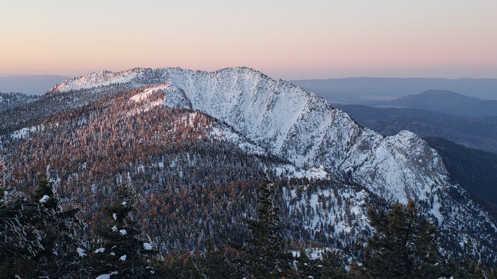
WEATHER Warmer – but still below average – temperatures are forecast for the first few days of April, followed by a return to cold weather with a moderate storm system around Monday 6th April, potentially lasting several days. Melting will continue to be rapid this week, especially on sun-exposed slopes and below 9000′ elevation.
At San Jacinto Peak (10,810ft/3295m) yesterday, Monday 30th March 2020, at 0950 the air temperature was 31.2°F (-0.5°C), with a windchill of 21.0°F (-6°C), 39% relative humidity, and a light NNW wind sustained at 4 mph gusting to 9.7 mph.
At the Peak on Saturday 28th March 2020, at 0910 the air temperature was 21.4°F (-6°C), with a windchill of 8.2°F (-13°C), 41% relative humidity, and a fresh due W wind sustained at 8 mph gusting to 11.4 mph.
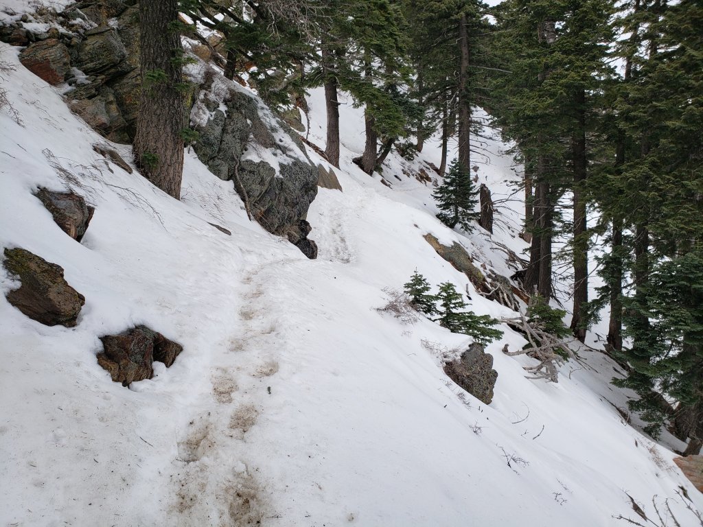
PACIFIC CREST TRAIL
The short icy snow slope on the NE side of Apache Peak (PCT Mile 169.5) that had multiple incidents a few days ago has greatly improved. This morning snow was relatively soft, and steps were large, flat, and well-formed. Most hikers passing through were using spikes, but it was possible to traverse without them securely. Every individual should make their own assessment of whether to cross based on their comfort level on angled snow, their experience, available equipment, time of day, and current snow conditions. If in any doubt, turn around and take the Spitler Peak Trail alternate option at Mile 168.5.
The Pacific Crest Trail remains open at the rockslide just north of Antsell Rock (Mile 172.5). USFS has told the Trail Report that there are currently no plans to close this section of the PCT during spring 2020. The video report (available here) can be useful for deciding whether to try to hike around the rockslide or take an alternate route. All hikers this spring are reporting having no significant difficulty here.
Microspikes may be useful on some of the PCT for patchy snow travel between approximately Miles 160 and 192, depending upon your comfort level in variable snow/ice conditions. Many thru-hikers using poles will probably find spikes unnecessary in most areas however. See below for conditions on some specific sections of the PCT and the many side trails.
Current snow cover on the PCT is patchy and thin between Miles 160 and about 175 (Red Tahquitz), mainly confined to certain north-facing slopes e.g., Spitler Peak (Mile 168) and Apache Peak (Mile 169.5). Snow is then continuous between Miles 175-179 (to near Saddle Junction). The Trail is then clear in large patches to about Mile 184, except for a stubborn section of 0.5 mile approaching Annie’s Junction (Mile 180.8) which is always among the last areas to clear every spring. Most of Miles 184-191 is snow-covered, although some exposed sections of Fuller Ridge (e.g., Miles 186.5-188.5) are starting to clear rapidly. North from about Mile 191 to Snow Creek is clear.
PCT hikers are reminded that overnight stays are not permitted at or near San Jacinto Peak, including in the historic shelter. Mt. San Jacinto State Park regulations normally permit overnight stays only in established campgrounds, although due to the Covid-19 crisis, no camping is currently allowed anywhere in the State Park.

TRAIL CONDITIONS
All trails above about 8000′ remain largely snow-covered, with depth depending on elevation (see below) but exposed slopes much higher are clearing rapidly (e.g., around Wellman’s Cienega). Some sections of trails above about 7000′ have patchy icy snow cover, depending on exposure.
Deer Springs Trail is largely clear of snow to Strawberry Junction with just a few patches close to the junction (microspikes not required). The PCT section from here to Fuller Ridge is partly clear of snow to about 8500′ elevation (south of the Marion Mountain Trail junction), then there is extensive snow cover thereafter, currently with an adequate track to follow. From Little Round Valley to San Jacinto Peak there may be drifting in places after strong winds. Snowshoes may be useful above about 9500′ and microspikes can be useful for descending.
South Ridge Trail [updated 4th April] is completely clear to Old Lookout Flat at 7600′. Snow cover is patchy (<20%) higher up, and the small patches are easily hiked. Microspikes may be useful but are not required. South Ridge Road is clear of ice.
Fuller Ridge Trail (PCT Miles 185.5-190.5) has been clearing, especially on sun-exposed slopes, mainly Miles 186.5-188.5. There are tracks to follow through the snow, although these do match the route of the regular trail in places.
Round Valley Trail through to Wellman Divide has not been visibly traveled since the Tram closure in mid March.
Devil’s Slide Trail is largely clear of snow below 7700′. Icy snow cover is about 50% from there to Saddle Junction. Microspikes can be useful mainly above 7600′, especially for descending, but are not essential.
Ernie Maxwell Trail is virtually clear of snow, with just a few tiny patches, mainly near Humber Park.
Tahquitz Peak trail from Chinquapin Flat/PCT Mile 178 has no steps to follow through the angled icy snow for at least 0.3 miles. These ice slopes are notoriously treacherous. Crampons are strongly recommended, in conjunction with an ice axe (if you know how to use both). Snowshoes are not advised due to the angle of the underlying ice.
Seven Pines Trail has had no hiker traffic so far this winter, with no tracks or trail to follow. Indeed this trail has only been hiked a handful of times since November 2018. Extremely cautious navigation is recommended for those who are not very familiar with hiking this trail. The Forest Service closure of Dark Canyon Road continues, and there is no vehicular access to Seven Pines trailhead.
SNOW DEPTHS measured on 3rd April 2020 (with depth on 31st March 2020 in parentheses). Note that average depth is given, drifts can be much deeper in places. Altitudes are approximate.
San Jacinto Peak (10810′): 22″ (27″)
Wellman Divide (9700′): 8″ (12″)
Annie’s Junction (9070′): 16″ (18″)
Long Valley (8600′): 3″ (6″)
Strawberry Junction (8100′): 0″ (1″)
Saddle Junction (8070′): 4″ (7″)
Devil’s Slide trailhead at Humber Park (6550′): 0″ (0″)

sanjacjonUncategorized 6 MinutesEdit”Trail update 31st March 2020″
Snow and trail update 27th March 2020
Three very minor snow storms in five days this week, including one last night, have left the trail system snow-covered in the San Jacinto mountains almost everywhere above 5000′ elevation. I have been to many different areas to observe the effects: San Jacinto Peak twice, South Ridge, Apache and Spitler peaks, plus elsewhere on the PCT. Special thanks to Kyle Eubanks who accompanied me at and descending San Jacinto Peak yesterday.
The storm last night produced 0.75″ snow at Idyllwild (5550′) and about 1.0″ in Long Valley (8600′). The most productive of the three storms was on 23rd, a warmer storm which initially included freezing to at least about 8500′, making a hard ice layer (e.g., at Saddle Junction, 8100′). This was followed by a dusting of snow, only 0.5″ at Saddle Junction, but about 3″ at Long Valley and on the high peaks.
Although there has been some fresh snowfall in the high country, it has often been no more than at mid elevations because the cloud level has largely held around 8700-9300′, with the high country often above some of the precipitation.
Currently most major trails have not been traveled and are obscured by light to moderate snowfall. Cautious navigation is strongly recommended everywhere. Snow depths measured yesterday are listed at the foot of this posting.
At present postholing through shallow to moderate snow is possible at all elevations. Microspikes will become increasingly useful over the next few days as established trails undergo freeze-thaw cycles. They are especially useful for descending trails when they become icy and compacted (e.g. Devil’s Slide and lower South Ridge trails). Snow depths are currently good for snowshoeing in the high country above about 9000′. Snowshoeing conditions will deteriorate rapidly with considerable snowmelt next week.
Hikers should be prepared for temperatures near or below freezing in the high country, and well below freezing when considering windchill effects.
Due to the Covid-19 crisis, the Palm Springs Aerial Tramway remains closed indefinitely since 12th March (currently until at least 30th April).
The USFS gate at Humber Park has been closed since 18th March. There are nine legal parking spaces (available for all uses) just below the gate and near the upper Ernie Maxwell trailhead. The next closest legal parking is 0.1 mile downhill on Forest Drive.
PCT hikers are reminded that overnight stays are not permitted at or near San Jacinto Peak, including in the historic shelter. Mt. San Jacinto State Park regulations permit overnight stays only in established campgrounds (although these are currently closed due to the Covid-19 crisis).

WEATHER After a cool and cloudy weekend, rapid warming to above-average temperatures starts on Monday 30th March. Extensive snowmelt is expected at all elevations next week, but especially below 9000′ and on sun-exposed slopes.
At San Jacinto Peak (10,810ft/3295m) on Thursday 26th March 2020 at 1115 the air temperature was 9.1°F (-13°C), with a windchill temperature of -10.6°F (-24°C), 61% relative humidity, and a bitter WSW wind sustained at 9 mph gusting to 14.8 mph.
At the Peak on Sunday 22nd March 2020 at 1055 the air temperature was 27.7°F (-2°C), with a windchill temperature of 18.3°F (-8°C), 45% relative humidity, and a light WSW wind sustained at 4 mph gusting to 7.7 mph.

TRAIL CONDITIONS
Almost all trails above about 5500′ are snow-covered, with depth depending on elevation. Reliable tracks are currently in place only for Devil’s Slide Trail, and from Saddle Junction to San Jacinto Peak. Strong winds in the high country and rapid melting on exposed slopes may have obscured tracks within hours however. The closure of the Tram will result in very light hiker traffic to the highest peaks via the Peak Trail, and little or no traffic on the Long and Round Valley trails.
Devil’s Slide Trail has a well-traveled track to follow. Microspikes may become useful, especially in early morning. Snow cover is still >90% even with some melting yesterday.
Ernie Maxwell Trail has very thin snow which will largely clear today, a few stubborn small icy snow patches persisting mainly near Humber Park. No microspikes required.
Tahquitz Peak trail from Chinquapin Flat/PCT Mile 178 has no steps to follow through the angled icy snow for at least 0.3 miles. These ice slopes are notoriously treacherous. Crampons are strongly recommended, in conjunction with an ice axe (if you know how to use both). Snowshoes are not advised due to the angle of the underlying ice.
Seven Pines Trail has had no visible signs of hiker traffic so far this winter, with no tracks or trail to follow. Indeed it has only been hiked a handful of times since November 2018. Extremely cautious navigation is recommended for those who are not very familiar with hiking this trail in snow. The Forest Service closure of Dark Canyon Road will remain in place until summer 2020, hence there is no vehicular access to Seven Pines trailhead.
SNOW DEPTHS measured on 26th March are as follows. Note that average depth is given, drifts can be much deeper in places. Altitudes are approximate.
San Jacinto Peak (10810′): 29″
Little Round Valley (9800′): 23″
Wellman Divide (9700′): 14″
Annie’s Junction (9070′): 20″
Long Valley (8600′): 8″
Strawberry Junction (8100′): 3″ (extensive melting in recent days)
Saddle Junction (8070′): 9″
Devil’s Slide Trail at Humber Park (6550′): 1″ (considerable melting yesterday)
Idyllwild (at 5550′): 0.5″ (from overnight snow, will rapidly melt today)

San Jacinto Trail Report: available for everyone, funded by readers. While all labor and time is volunteered, this Report completely depends on small private donations to cover its direct costs. With a busy winter overlapping with an unusual PCT season, every contribution is invaluable. If you have found this Report useful, please consider visiting the Donate page. Thank you.sanjacjonUncategorizedLeave a comment 4 MinutesEdit”Snow and trail update 27th March 2020″
Snow storms update 19th March 2020
[UPDATE 26th March: another short video recorded today discusses latest conditions based on a superb hike today to San Jacinto Peak with Kyle Eubanks, and in recent days to the Desert Divide. I anticipate a full text update to the Trail Report tomorrow.]
[UPDATE 22nd March: a video recorded today discusses latest conditions based on hikes today on the east and west sides of San Jacinto Peak, and yesterday to Tahquitz Peak.]
COVID-19 UPDATE: The Pacific Crest Trail Association has asked all PCT hikers on the Trail – as well as those waiting to start – to cancel or postpone their journeys. Read their statement here. Additionally, the State Park system has closed all camping facilities, including the Idyllwild campground. Camping is not permitted anywhere in Mount San Jacinto State Park until further notice. The Riverside County Park campground in Idyllwild is closed. Nomad Ventures in Idyllwild is closed indefinitely.
Three minor snow storms on consecutive days 17th-19th March have left the trail system snow-covered in the San Jacinto mountains almost everywhere above 4500′ elevation. I have been to many different areas to observe the effects, San Jacinto Peak on 17th, the PCT at Highway 74 and South Ridge yesterday, and Deer Springs Trail to the PCT today. Special thanks to Kyle Eubanks who ascended San Jacinto Peak today via Deer Springs Trail. A video discussion from Strawberry Junction of current conditions was posted this afternoon.
The storm on 17th produced 1-2 inches of snow at all elevations above about 5000′. The snow level fell lower on 18th, with a dusting of an inch down to 4600′ (Mile 151 on the PCT), 3″ in Idyllwild, and 5″ at the top of South Ridge Road (6500′). Snowfall today has ranged from 2″ in Idyllwild and Long Valley, to 3-4″ at Strawberry and Saddle junctions. It continues to snow lightly and intermittently in Idyllwild as I write this mid-afternoon on 19th.
Although there has been some fresh snowfall in the high country, it has often been much less than at mid elevations because the cloud level has largely held around 8700-9300′, with the high country above it. Conversely, on each of the three afternoons, short bursts of rapid snowmelt have occurred below 7000′ during brief appearances of the sun and temperatures barely above freezing. For these reasons elevations in the 7000-9000′ range have a disproportionate depth of snow at this time.
Currently almost all major trails, including almost the entire PCT through the high country of the San Jacinto mountains, have not been traveled and are obscured by moderate snowfall. Very cautious navigation is strongly recommended everywhere. Snow depths measured today are listed at the foot of this posting.
At present postholing through shallow to moderate snow is not too challenging in most areas below 8000′ (including most of the PCT). Microspikes may become increasingly useful over the next few days as established trails become consolidated by hiker traffic and undergo freeze-thaw cycles. They are especially useful for descending trails when they become icy and compacted (e.g. Devil’s Slide and lower Deer Springs trails). Snow depths are currently ideal for snowshoeing in the high country and snowshoes are recommended above about 8000′ for day hikers. Snowshoeing conditions will deteriorate rapidly below 9000′ with considerable snowmelt expected over this weekend.
Hikers should be prepared for temperatures below freezing in the high country, with potentially dangerous cold when considering windchill effects.
Due to the coronavirus crisis, the Palm Springs Aerial Tramway remains closed indefinitely since 12th March (until at least 30th April).
The USFS gate at Humber Park has been closed since 18th March. There are only nine legal parking spaces (available for all uses) just below the gate and near the upper Ernie Maxwell trailhead. The next closest legal parking is 0.1 mile downhill on Forest Drive.
WEATHER Warmer, brighter weather on 20th-22nd will result in rapid melting below 8000′, and locally higher on sun-exposed slopes. More unsettled and unpredictable conditions are possible next week, with light rain (or very light snow above 6000′) currently forecast on 23rd and 26th.
At San Jacinto Peak (10,810ft/3295m) on Tuesday 17th March 2020 at 0950 the air temperature was 10.6°F (-12°C), with a windchill temperature of -11.7°F (-24°C), 57% relative humidity, and a bitter SW wind sustained at 11 mph gusting to 22.8 mph.
PACIFIC CREST TRAIL
Microspikes may be useful on some of the PCT only after sufficient hiker traffic to compact the snow, and/or freeze-thaw cycles. Depending upon your comfort level in variable snow/ice conditions, most thru-hikers using footwear with good tread in combination with poles will find spikes unnecessary however. For the last three days I have found hiking in a few of inches of fresh powder to be relatively easy-going.
The Pacific Crest Trail remains open at the rockslide just north of Antsell Rock (Mile 172.5). USFS has told the Trail Report that there are currently no plans to close this section of the PCT during spring 2020. The video report (available here) can be useful for deciding whether to try to hike around the rockslide or take an alternate route. There is no current information on how snow/ice conditions may have impacted the route around this rockslide.
PCT hikers are reminded that overnight stays are not permitted at or near San Jacinto Peak, including in the historic shelter. Mt. San Jacinto State Park regulations permit overnight stays only in established campgrounds. Options for thru-hikers are Strawberry Junction and Little Round Valley.
TRAIL CONDITIONS
All trails above about 6000′ are snow-covered, with depth depending on elevation. Reliable tracks are currently in place only for Devil’s Slide Trail, and from Deer Springs Trail to San Jacinto Peak. Strong winds in the high country on 17th, and continuing patchy snowfall on 19th, may have obscured tracks within hours however. The closure of the Tram will result in very light hiker traffic to the highest peaks via the Peak Trail, and little or no traffic on the Long and Round Valley trails.
Devil’s Slide Trail has a well-traveled track to follow. Microspikes may become useful, especially in early morning. Snow cover is still >90% even with some melting this afternoon.
Ernie Maxwell Trail is largely under a continuous 2-4″ of snow cover.
Deer Springs Trail A reliable track was put in today from the trailhead to San Jacinto Peak by a combination of Kyle Eubanks and myself. See comments above however regarding effects of wind and continuing light snowfall.
Tahquitz Peak trail from Chinquapin Flat/PCT Mile 178 [updated 16th March] has no steps to follow through the angled icy snow for at least 0.3 miles. These ice slopes are notoriously treacherous. Crampons are strongly recommended, in conjunction with an ice axe (if you know how to use both). Snowshoes are not advised due to the angle of the underlying ice.
Seven Pines Trail has had no visible signs of hiker traffic so far this winter, with no tracks or trail to follow. Indeed it has only been hiked a handful of times since November 2018. Extremely cautious navigation is recommended for those who are not very familiar with hiking this trail in snow. The Forest Service closure of Dark Canyon Road will remain in place until summer 2020, hence there is no vehicular access to Seven Pines trailhead.
SNOW DEPTHS measured today are as follows. Total for storms on 18th-19th is first, followed by current total depth in brackets, then comments in parentheses. Note that average depth is given, drifts can be much deeper in places. Altitudes are approximate. Many thanks to Pete Kirkham for data for Saddle Saddle and Annie’s junctions.
San Jacinto Peak (10810′): 2″ [27″]
Little Round Valley (9800′): 2″ [20″]
Wellman Divide (9700′): 2″ [12″]
Annie’s Junction/approx. PCT Mile 181 (9070′): 3″ [19″]
Fuller Ridge south end/PCT Mile 185.5 (8950′): 4″ [12″]
Long Valley (8600′): 3″ [8″]
Strawberry Junction/approx. PCT Mile 183 (8100′): 4″ [6″]
Saddle Junction/approx. PCT Mile 179 (8070′): 4″ [8″]
Devil’s Slide Trail at Humber Park (6550′): 4″ [7″]
Idyllwild (at 5550′): 2″ [3″] (periodic melting every afternoon)

San Jacinto Trail Report: available for everyone, funded by readers. While all labor and time is volunteered, this Report completely depends on small private donations to cover its direct costs. With a busy winter overlapping with PCT season, every contribution is invaluable. If you have found this Report useful, please consider visiting the Donate page. Thank you.

sanjacjonUncategorizedLeave a comment 6 MinutesEdit”Snow storms update 19th March 2020″
Minor snow storm 17th March 2020
[UPDATE 18th March: Started snowing again this morning at about 0800. Currently settling down to 4600′ on Highway 74 at Pinyon (near PCT Mile 151). By 1430, two inches of fresh powder accumulated in Idyllwild (at 5550′), with the same depth at Humber Park (6400′) and Long Valley (8600′). The USFS gate at Humber Park is now closed.]
This is a very brief update on conditions following another minor snow storm early this morning. With another 3-4 similar storms forecast for the next 10-14 days, trail and snow conditions will be changing almost daily, so updates will be shorter than typical for efficiency.
The storm today produced 1-2 inches of snow at all elevations above about 5000′. As the snow depth data at the foot of this posting show, snowfall was not clearly correlated to elevation. The storm was not as cold as anticipated (although see the temperatures I recorded at San Jacinto Peak this morning!) and the snow level did not fall as low as forecast. Nevertheless, the PCT is largely snow-covered between about Mile 151 to Mile 195, albeit with only a couple of inches of easily hiked powder, especially in areas below about 7000′.
Currently most major trails, including most of the PCT through the high country of the San Jacinto mountains, have not been traveled and are at least partly obscured by snowfall. Cautious navigation is strongly recommended everywhere. Snow depths measured today are listed at the foot of this posting.
At present postholing through shallow snow is relatively easy in most areas below 9000′ (including all of the PCT). Today I carried microspikes and snowshoes; I did not use the former at all, and the latter only above 9300′ (Wellman’s Cienega). Microspikes may become increasingly useful over the next few days as established trails become consolidated by hiker traffic and undergo freeze-thaw cycles. They are especially useful for descending trails when they become icy and compacted (e.g. Devil’s Slide and lower Deer Springs trails). Snow depths are currently ideal for snowshoeing in the high country and snowshoes are recommended above 9000′.
Hikers should be prepared for temperatures well below freezing in the high country, with potentially dangerous cold when considering windchill effects.
Due to the coronavirus crisis, the Palm Springs Aerial Tramway remains closed indefinitely since 12th March (tentatively until at least 1st April).
Currently the USFS gate at Humber Park remains open. The parking area was plowed this morning, so presumably no closure is imminent.
WEATHER Another storm system over the next two days may produce another light snowfall at mid and upper elevations. Milder, brighter weather on 20th-22nd will be followed by more unsettled days on 23rd-25th with a possibility for slightly heavier snowfall above 6000′ and moderate rain at mid-elevations.
At San Jacinto Peak (10,810ft/3295m) today, Tuesday 17th March 2020 at 0950 the air temperature was 10.6°F (-12°C), with a windchill temperature of -11.7°F (-24°C), 57% relative humidity, and a bitter SW wind sustained at 11 mph gusting to 22.8 mph.
At the Peak on Saturday 14th March 2020 at 1010 the air temperature was 20.5°F (-6°C), with a windchill temperature of -2.9°F (-20°C), 79% relative humidity, and a wild SW wind sustained at 31 mph gusting to 41.5 mph.
PACIFIC CREST TRAIL
Microspikes may be useful on some of the PCT only if there is sufficient hiker traffic to compact the snow, and/or there are freeze-thaw cycles. Depending upon your comfort level in variable snow/ice conditions, most thru-hikers using footwear with good tread in combination with poles will find spikes unnecessary however. This morning I found the hiking in a couple of inches of fresh powder to be easy-going.
The Pacific Crest Trail remains open at the rockslide just north of Antsell Rock (Mile 172.5). USFS has told the Trail Report that there are currently no plans to close this section of the PCT during spring 2020. The video report (available here) can be useful for deciding whether to try to hike around the rockslide or take an alternate route. There is no current information on how snow/ice conditions may have impacted the route around this rockslide.
PCT hikers are reminded that overnight stays are not permitted at or near San Jacinto Peak, including in the historic shelter. Mt. San Jacinto State Park regulations permit overnight stays only in established campgrounds. Options for thru-hikers are Strawberry Junction and Little Round Valley.
TRAIL CONDITIONS
All trails above about 6000′ are snow-covered, with depth depending on elevation. Reliable tracks are currently in place only for Devil’s Slide Trail, and from Saddle Junction to San Jacinto Peak via Wellman Divide. Strong winds today in the high country were obscuring tracks within hours. The closure of the Tram will result in very light hiker traffic to the highest peaks via the Peak Trail, and little or no traffic on the Long and Round Valley trails.
Devil’s Slide Trail has a well-traveled track to follow. Microspikes may become useful, especially in early morning. Snow cover is still >90% even with some melting this afternoon.
Ernie Maxwell Trail is largely under a continuous 1-2″ of snow cover [thanks to Anne and Anabel for this update from today].
Tahquitz Peak trail from Chinquapin Flat/PCT Mile 178 [updated 16th March] has no steps to follow through the angled icy snow for at least 0.3 miles. These ice slopes are notoriously treacherous. Crampons are strongly recommended, in conjunction with an ice axe (if you know how to use both). Snowshoes are not advised due to the angle of the underlying ice.
Seven Pines Trail has had no visible signs of hiker traffic so far this winter, with no tracks or trail to follow. Indeed it has only been hiked a handful of times since November 2018. Extremely cautious navigation is recommended for those who are not very familiar with hiking this trail in snow. The Forest Service closure of Dark Canyon Road will remain in place until summer 2020, hence there is no vehicular access to Seven Pines trailhead.
SNOW DEPTHS measured today are as follows. Total for today’s storm is first, followed by current total depth in brackets, then comments in parentheses. Note that average depth is given, drifts can be much deeper in places. Altitudes are approximate.
San Jacinto Peak (10810′): 1.5″ [24″]
Wellman Divide (9700′): 2″ [10″]
Annie’s Junction/approx. PCT Mile 181.8 (9070′): 2″ [18″]
Saddle Junction/approx. PCT Mile 179.9 (8070′): 1.0″ [4″]
Devil’s Slide Trail at Humber Park (6550′): 1.5″ [2″] (melted to 1″ by this afternoon)
Idyllwild (at 5550′): 0.75″ (largely all melted by this afternoon)
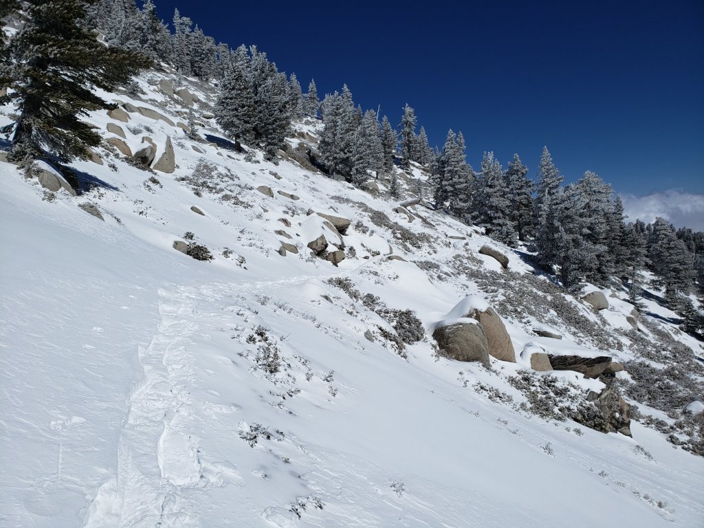
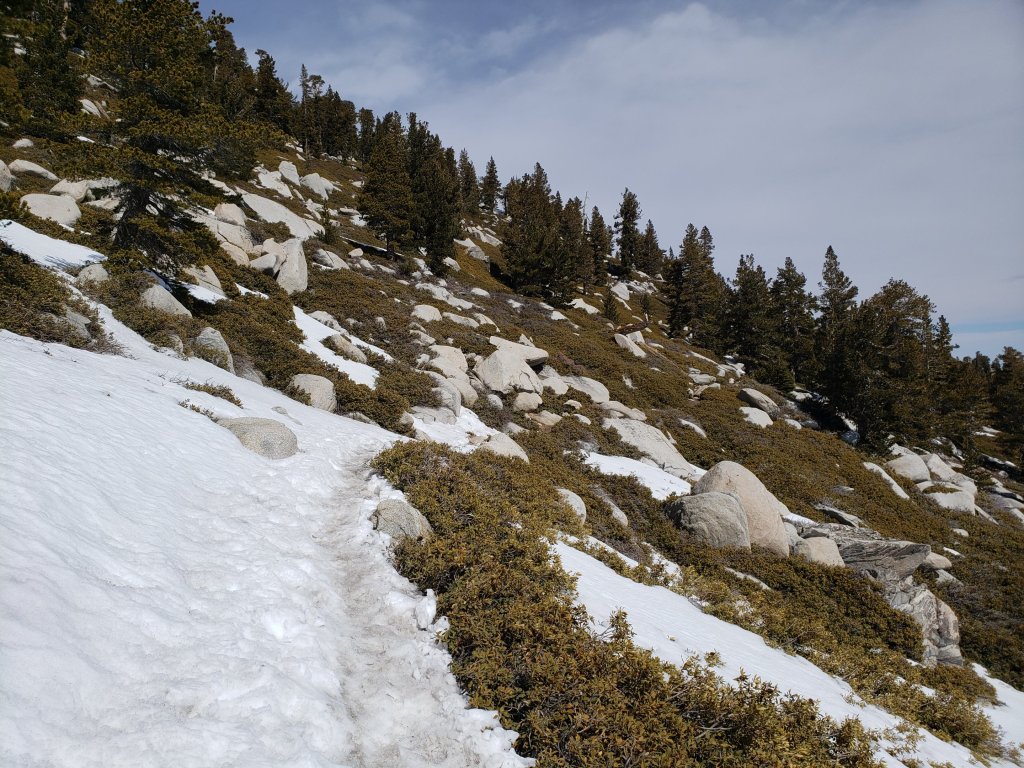
San Jacinto Trail Report: available for everyone, funded by readers. While all labor and time is volunteered, this Report completely depends on small private donations to cover its direct costs. With a busy winter overlapping with PCT season, every contribution is invaluable. If you have found this Report useful, please consider visiting the Donate page. Thank you.
sanjacjonUncategorized1 Comment 5 MinutesEdit”Minor snow storm 17th March 2020″
Snow and trail update 14th March 2020
[UPDATED 16th March: with trail and conditions changing almost daily, this morning I recorded this video discussion from Tahquitz Peak. In addition the specific conditions for the Tahquitz Peak area trails are updated in the text below.]
Back-to-back minor storms on 10th and 12th-13th March have combined to substantially change the complexion of the trails in the San Jacinto mountains for the foreseeable future. Both storms were warm systems, with both rain and snow levels fluctuating significantly. Rain fell to at least 10,000′ elevation on 10th March, while snow settled as low as 5500′ on 12th. Between about 6500′-9200′ snow and rain fell on top of the other multiple times during the course of the storms, which made it difficult to determine exact snowfall totals in these middle elevations as snow was washed away by later rainfall.
In Idyllwild (at 5550′), 1.31″ rain fell on 9th-10th March, followed by 2.49″ on 12th-13th, some very welcome numbers following an exceptionally dry January and February.
I broke trail to San Jacinto Peak this morning, using snowshoes above 8000′ (Saddle Junction). Snow conditions were very poor up to 9200′, as rain had fallen yesterday on top of snow, leaving a thick ice layer over the snow. Higher up it had not rained, and the going was easier on pure powder.
By my descent this afternoon rapid melting and softening meant the conditions were almost unrecognizable compared to the early morning. Devil’s Slide Trail was a mix of soft snow patches and slush, and was clearing rapidly below 7000′. My morning snowshoe tracks up to 8900′ were disappearing rapidly due to melting and snow pouring off the trees onto the trail.
Currently most major trails, including most of the PCT through the San Jacinto mountains, have not been traveled and are obscured by snowfall. Cautious navigation is strongly recommended everywhere. Snow depths measured today are listed at the foot of this posting. The current snow situation on the PCT in the San Jacinto mountains is outlined below, and is also discussed in a video posted yesterday.
Note that conditions will change starting 17th March when several days of further snowfall are possible, dropping snow to lower elevations than at present.
At present postholing through snow a few inches deep is relatively easy in most areas below 9000′ (including all of the PCT). Thru-hikers using good footwear and hiking poles will probably not need additional traction.
Microspikes may become increasingly useful over the next couple of days as established trails become consolidated by hiker traffic and undergo freeze-thaw cycles. They are especially useful for descending trails when they become icy and compacted (e.g. Devil’s Slide and lower Deer Springs trails). Snow depths are currently ideal for snowshoeing almost everywhere above about 8000′ elevation, and snowshoes are strongly recommended above 9000′.
Hikers should be prepared for temperatures below freezing in the high country, and far below freezing when considering windchill effects. The temperatures forecast for 17th-19th March will be among the lowest of this winter, and could be life-threatening.
Due to the coronavirus crisis, the Palm Springs Aerial Tramway remains closed indefinitely since 12th March (tentatively until at least 1st April).
Currently the USFS gate at Humber Park remains open.
WEATHER Milder, brighter weather until Monday 16th will be followed by cold and very unsettled weather for at least 17th-25th March. A cold system on 17th-19th March may drop snow levels below 4000′ elevation. Initially forecast to produce major snowfall, recent forecasts suggest this storm may drop just a few inches of snow at Idyllwild elevations (5000-6000′), and a similar amount in the high country.
At San Jacinto Peak (10,810ft/3295m) today, Saturday 14th March 2020 at 1010 the air temperature was 20.5°F (-6°C), with a windchill temperature of -2.9°F (-20°C), 79% relative humidity, and a wild SW wind sustained at 31 mph gusting to 41.5 mph.
At the Peak on Tuesday 10th March 2020 at 1130 the air temperature was 25°F (-4°C), with a windchill temperature of 9°F (-13°C), 100% relative humidity, and a brisk due South wind sustained at 10 mph gusting to 25.0 mph.

PACIFIC CREST TRAIL
Microspikes may be useful on some of the PCT for continuous snow travel between approximately Miles 158 and 193, depending upon your comfort level in variable snow/ice conditions. Many thru hikers using good footwear with poles may find spikes unnecessary however.
The Pacific Crest Trail remains open at the rockslide just north of Antsell Rock (Mile 172.5). USFS has told the Trail Report that there are currently no plans to close this section of the PCT during spring 2020. The video report (available here) can be useful for deciding whether to try to hike around the rockslide or take an alternate route. There is no current information on how snow/ice conditions may have impacted the route around this rockslide.
PCT hikers are reminded that overnight stays are not permitted at or near San Jacinto Peak, including in the historic shelter. Mt. San Jacinto State Park regulations permit overnight stays only in established campgrounds. Options for thru-hikers are Strawberry Junction and Little Round Valley.
TRAIL CONDITIONS
All trails above about 6800′ are continuously snow-covered, with depth depending on elevation. Reliable tracks are currently in place only for Devil’s Slide Trail, and from Saddle Junction to San Jacinto Peak via Wellman Divide. Strong winds and rapid melting in the high country may obscure tracks within hours. The closure of the Tram will result in very light hiker traffic to the highest peaks via the Peak Trail, and little or no traffic on the Long and Round Valley trails.
Devil’s Slide Trail has a well-worn track to follow. Microspikes may become useful, especially in early morning. Snow cover is still >80%.
Ernie Maxwell Trail is virtually clear of snow, with a few small soft patches remaining mainly near Humber Park.
South Ridge Trail [updated 16th March] is largely clear to Old Lookout Flat (7600′), but with some icy snow patches above 7000′. Snow cover is continuous and icy above 7600′, but there are good tracks to follow and it is easily hiked. Microspikes are not required but are useful. South Ridge Road is clear of ice.
Tahquitz Peak trail from Chinquapin Flat/PCT Mile 178 [updated 16th March] has no steps to follow through the angled icy snow for at least 0.3 miles. These ice slopes are notoriously treacherous. Crampons are strongly recommended, in conjunction with an ice axe (if you know how to use both). Snowshoes are not advised due to the angle of the underlying ice.
Seven Pines Trail has had no visible signs of hiker traffic so far this winter, with no tracks or trail to follow. Indeed it has only been hiked a handful of times since November 2018. Extremely cautious navigation is recommended for those who are not very familiar with hiking this trail in snow. The Forest Service closure of Dark Canyon Road will remain in place until summer 2020, hence there is no vehicular access to Seven Pines trailhead.
SNOW DEPTHS measured today are as follows. Storm total for the past week is first, followed by current total in brackets, then comments in parentheses. Note that average depth is given, drifts can be much deeper in places. Altitudes are approximate.
San Jacinto Peak (10810′): 8″ [22″]
Wellman Divide (9700′): 8″ [8″]
Annie’s Junction (9070′): 7″ [18″]
Saddle Junction (8070′): 5.5″ [6″] (already melted to <5″ by this afternoon)
Devil’s Slide Trail at Humber Park (6550′): 2″ [2″] (melted to <1″ by this afternoon)
Idyllwild (at 5550′): 0″ (minor snowfall on 12th March already melted)
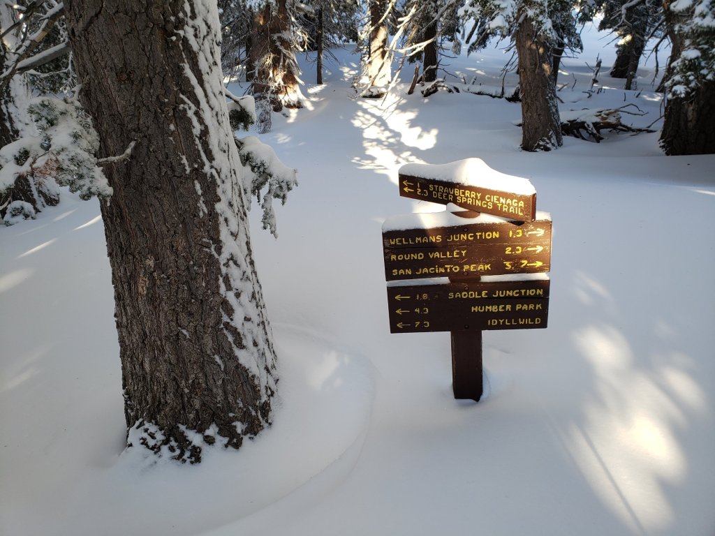

San Jacinto Trail Report: available for everyone, funded by readers. While all labor and time is volunteered, the Report completely depends on small private donations to cover its direct costs. With a very busy PCT season underway, every contribution is invaluable. If you have found this Report useful, please consider visiting the Donate page. Thank you.sanjacjonUncategorizedLeave a comment 5 MinutesEdit”Snow and trail update 14th March 2020″
Storm updates 12th-13th March 2020
Please continue to check this page for periodic storm updates. The next full trail update will likely be in the afternoon of Saturday 14th.
UPDATED 13th March @ 1130
Current snow and PCT conditions are discussed in this video recorded earlier this morning at Saddle Junction/PCT Mile 179.8 (8100′).
Fresh snow depth at Saddle Junction is 5.5″, with 2″ at Humber Park (6500′). The gate at Humber Park remains open (for now). Settled snow level is at about 6200′.
On Devil’s Slide Trail it snowed and/or rained on us throughout the morning. It has rained in Idyllwild since 0800 today, getting heavier in the past hour. Total rainfall by 0700 in the past 24 hours was an impressive 1.69″ rain, plus 0.5″ snow.
The high country is currently above the cloud (>9000′ on the west side, >8500′ on the east side).
UPDATED 12th March @ 1815
Precipitation largely stopped at all elevations at about 1645. The 0.5″ of slush that fell in Idyllwild did not last long before it resumed raining. Long Valley (8600′) added 5-6″ of fresh snow today.
Current snow level is at about 6500′. Consequently the entire PCT from about Mile 157 to 194 is now snow-covered. Depth of fresh snow is only a couple of inches for much of that section, but may be 4-6″ in areas between Mile 172 and 191.
UPDATED 12th March @ 1610
Multiple news outlets in the Coachella Valley are reporting that the Palm Springs Aerial Tramway will be closed until at least the end of March due to the coronavirus crisis. Just in time for the biggest snow depths of the winter….
UPDATED 12th March @ 1505
Heavy rain in Idyllwild – a useful 1.2″ in eight hours – turned to sleety wet snow half-an-hour ago and has started to accumulate above 5500′.
Rainfall doubled in the past two hours in Long Valley (8600′), from under an inch to nearly two inches. It has recently also turned to snow, with about 4-5″ fresh accumulation today.
The Palm Springs Aerial Tramway has apparently closed for the day due to lightning.
UPDATED 12th March @ 1250
I recently returned from a hike to the PCT at Mile 181 via Devil’s Slide Trail. Snow dusted early this morning down to about 7400′, but by mid morning had turned to heavy rain.
Fresh snowfall at Saddle Junction (8100′) was nearly one inch, but had largely melted and turned to slush by the time I descended. Rainfall was heavy up to 9000′ on the west and south sides of the mountain, and it is currently raining in Long Valley (8600′) on the east side also.
Thunderstorms started in Idyllwild about an hour ago, and since 0700 this morning there has been 0.6″ of rain at 5550′ elevation.
UPDATED 12th March @ 0630
Off-and-on light rainfall started in Idyllwild at 0530, with light snowfall starting to accumulate in Long Valley (8600′) at about 1″.
.
San Jacinto Trail Report: available for everyone, funded by readers. While all labor and time is volunteered, the Report depends completely on small private donations to cover its direct costs. With a busy PCT season underway, every contribution is invaluable. If you have found this Report useful, please consider visiting the Donate page. Thank you.sanjacjonUncategorized1 Comment 2 MinutesEdit”Storm updates 12th-13th March 2020″
Storm updates 10th March 2020
UPDATED 11th March @ 0500
Given the unpredictable weather situation over the next couple of days, the next full update may not be until Friday 13th. Current trail conditions below 9000′ (the high point of the PCT in the San Jacinto mountains) closely resemble the previous posting linked here.
Above 9000′ there is continuous snow cover, only a couple of inches deep in areas that had previously cleared, but a little over one foot deep near the highest peaks.
The Palm Springs Aerial Tramway was unexpectedly shut yesterday, so it is unlikely anyone made it to the Peak yesterday, and my tracks may have been obscured by a combination of melting, rain, and spindrift.
UPDATED 10th March @ 1630
Melting has been astoundingly rapid following the overnight snowfall. On my descent from San Jacinto Peak this afternoon there was partial melting everywhere below 9800′. From 8900′ down basically all snow from this morning had completely disappeared. Devil’s Slide Trail actually has less snow now than it did 24 hours ago!
The very rapid clearing is good news for the PCT, as snow from today only persists on top of pre-existing snow, and even then is only 1-2″ deep at most.
As I dropped below 7000′ on Devil’s Slide Trail at 1530 it started to rain, and has continued to do so in Idyllwild for the past hour, totaling 0.3″. However the high country remains above this precipitation (and it is certainly too warm for anything to settle anyway).
UPDATED 10th March @ 1205
Now at San Jacinto Peak which had a fresh snowfall of 4.5″ overnight. Currently the cloud level must be at approx. 11000′ as the sun is trying to emerge between occasional brief flurries of very fine grain snow (not accumulating).
Although the air temperature is relatively mild at just a few degrees below freezing, a bitter due South wind gusting to about 25mph is giving a windchill near 10°F (-12°C).
A little more detail on current trail conditions. The PCT was not significantly impacted by last night’s storm, as only 1-2″ of very wet and patchy snow fell below 9000′. It was so mild on my ascent this morning that melting was already evident everywhere below about 9500′.
Snow cover is continuous at 2-4″ deep on trails above 9000′. As the snow was so wet (and heavy), drifting has fortunately been quite limited.
The system was so warm that it rained all the way to San Jacinto Peak early this morning – after it had snowed – and there is a thick coating of verglas on all surfaces above about 8500′.
UPDATED 10th March @ 1010
Stopped raining at 0700. Snow dusted down to 7600′ on Devil’s Slide Trail, but only truly settled above 8000′. One inch of patchy melting snow at Saddle Junction (8100′), 2.5″ at Annie’s Junction (9070′), and 3.5″ at Wellman Divide (9700′).
UPDATED 10th March @ 0630
Rainfall started in Idyllwild at about 2130 last night, and has so far added up to an impressive 0.84″ (at 5550′ elevation). Fresh snowfall overnight in Long Valley (8600′) was about 3-4″.
San Jacinto Trail Report: available for everyone, funded by readers. While all labor and time is volunteered, the Report depends completely on small private donations to cover its direct costs. With a busy PCT season underway, every contribution is invaluable. If you have found this Report useful, please consider visiting the Donate page. Thank you.sanjacjonUncategorizedLeave a comment 2 MinutesEdit”Storm updates 10th March 2020″
Trail and weather update 5th March 2020
[UPDATE 9th March: With an unpredictable weather situation over the next few days, rather than post a new Report today I recorded this short video discussion at San Jacinto Peak this morning.]
[UPDATE 8th March: Weather discussion below has been revised reflecting the greatly reduced forecasts of precipitation next week.]
[UPDATE 6th March: information for South Ridge and the Tahquitz Peak trails is updated below based on our hike this morning.]
Temperatures well above historic averages have rapidly melted much of the snow that fell earlier this week in a minor snow storm discussed in the last Report. We have hiked to San Jacinto Peak the past two mornings, and it has felt like the snow conditions have been changing by the hour. In many areas below 8000′ almost all fresh snow has melted, and in areas that had previously cleared this winter and/or are sun-exposed below about 9500′ have lost almost all the fresh snowfall. Icy, reliable snow in the early morning is turning to the consistency of warm ice cream by late morning in many areas, which can help or hinder hiking depending on your preference.
Current conditions, and especially the forecast storm coming next week, are discussed in detail in a YouTube video recorded this morning at San Jacinto Peak.
Snow depths measured today are listed at the foot of this posting. Very strong Santa Ana winds in the high country overnight immediately after the snow storm caused very heavy drifting, even eliminating our tracks during the storm from Monday. There has been very little hiker traffic in the high country during this week, so very cautious navigation is recommended everywhere.
Equipment recommendations are changing almost as quickly as the snow conditions. Microspikes remain useful in some areas (see below) for hikers who are less comfortable on snow and ice, on compacted well-traveled trails, and in particular for descending. Hikers with suitable footwear and hiking poles will often not need any additional traction, depending on temperature as discussed above. Shallow snow depths largely preclude any use for snowshoes now, except in some areas off-trail above about 9500′ elevation, and on the western side in and above Little Round Valley.
Starting this weekend, hikers should be prepared for temperatures near or below freezing in the high country, and well below freezing when considering windchill effects.
WEATHER [updated Sunday 8th] A storm system is forecast to impact the San Jacinto mountains for several days next week (10th-13th March) with a high likelihood of precipitation on Tuesday 10th. Revised forecasts have reduced likely snowfall to a few inches in the high country and less than one inch of rain at mid elevations. This storm system will be much warmer than others this winter, with an initial snow level above 8000′, eventually dropping to 7000′ or lower. Another minor storm is possible on about 16th-17th March.
The latest video from NWS San Diego (posted on 6th March) discusses the forecast storm in detail.
At San Jacinto Peak (10,810ft/3295m) today, Thursday 5th March 2020, at 1010 the air temperature was 37.3°F (3°C), with a windchill of 29.5°F (-1°C), 32% relative humidity, and a light ESE wind sustained at 5 mph gusting to 9.5 mph.
In stark contrast, at the Peak on Monday 2nd March 2020, at 1020 the air temperature was 12.8°F (-11°C), with a windchill of -10.4°F (-24°C), 100% relative humidity, and a sharp NNW wind sustained at 10 mph gusting to 24.7 mph, while lightly snowing.
PACIFIC CREST TRAIL
The Pacific Crest Trail remains open at the rockslide just north of Antsell Rock (Mile 172.5). USFS has told the Trail Report that there are currently no plans to close this section of the PCT during spring 2020. The video report (available here) can be useful for deciding whether to try to hike around the rockslide or take an alternate route.
Microspikes may be useful on some of the PCT for patchy snow travel between approximately Miles 160 and 191, depending upon your comfort level in variable snow/ice conditions. Most thru hikers using poles will probably find spikes unnecessary however. See below for conditions on some specifc sections of the PCT and the many side trails.
Current snow cover on the PCT is patchy and thin between Miles 160 and about 175 (Red Tahquitz), mainly confined to certain north-facing slopes e.g., Spitler Peak (Mile 168) and Apache Peak (Mile 169.5). Snow is then continuous between Miles 175-179 (to near Saddle Junction). The Trail is then largely clear to about Mile 184, except for a stubborn section of 0.5 mile approaching Annie’s Junction (Mile 180.8) which is always among the last areas to clear every spring. Most of Miles 184-191 is snow-covered, although exposed sections of Fuller Ridge (e.g., Miles 186.5-188.5) are clearing rapidly. North from about Mile 191 to Snow Creek is clear.
PCT hikers are reminded that overnight stays are not permitted at or near San Jacinto Peak, including in the historic shelter. Mt. San Jacinto State Park regulations permit overnight stays only in established campgrounds. Options for thru-hikers are Strawberry Junction and Little Round Valley.
TRAIL CONDITIONS
All trails above about 9000′ remain largely snow-covered, with depth depending on elevation (see below) but exposed slopes are clearing very rapidly (e.g., around Wellman’s Cienega). Some sections of trails above about 7700′ have limited icy snow cover.
Deer Springs Trail is largely clear of snow to Strawberry Junction with just a few patches close to the junction (microspikes not required). The PCT section from here to Fuller Ridge is partly clear of snow to about 8500′ elevation (south of the Marion Mountain Trail junction), then there is extensive snow cover thereafter, currently with no track to follow. To Little Round Valley and onward to San Jacinto Peak there is no fresh track and heavy drifting in places. Snowshoes may be useful above about 9500′ and microspikes can be useful for descending.
Fuller Ridge Trail (PCT Miles 185.5-190.5) has been clearing quickly, especially on sun-exposed slopes, mainly Miles 186.5-188.5. There are no tracks to follow through the snow.
Round Valley Trail from the Tram through to Wellman Divide has been lighlty traveled and a track through the snow exists.
Devil’s Slide Trail has limited icy snow cover in patches, mainly in the 0.5 mile nearest to Saddle Junction. Due to snow and ice compaction caused by hiker traffic, microspikes are helpful in some areas above 7700′, especially for descending, but are not required.
Ernie Maxwell Trail is virtually clear of snow, with just a few tiny patches, mainly near Humber Park.
The notoriously treacherous Tahquitz Peak trail from Chinquapin Flat/PCT Mile 178 is clearing surprisingly quickly, the snow drifts are softening (on warm days), and crampons are no longer required. There is a set of tracks to follow, however overnight spindrift and freeze-thaw cycles can partly obscure tracks some mornings. Microspikes are strongly recommended, ideally in conjunction with an ice axe (if you know how to use it).
South Ridge Trail is clear of snow to Tahquitz Peak. A few tiny icy patches are easily hiked. Microspikes are not required. South Ridge Road is clear.
Seven Pines Trail has had no hiker traffic so far this winter, with no tracks or trail to follow. Indeed this trail has only been hiked a handful of times since November 2018. Extremely cautious navigation is recommended for those who are not very familiar with hiking this trail. The Forest Service closure of Dark Canyon Road continues, and there is no vehicular access to Seven Pines trailhead.
SNOW DEPTHS measured on 5th March 2020. Note that average depth is given, drifts can be much deeper in places. Altitudes are approximate.
San Jacinto Peak (10810′): 16″ (was 47″ on 27th December 2019)
Wellman Divide (9700′): 2″ (was 27″ on 27th December 2019)
Annie’s Junction (9070′): 12″ (was 25″ on 27th December 2019)
Long Valley (8600′): 2″
Strawberry Junction (8100′): <1″
Saddle Junction (8070′): 1″ (was 19″ on 27th December 2019)
Devil’s Slide trailhead at Humber Park (6550′): 0″ (was 11″ on 27th December 2019)
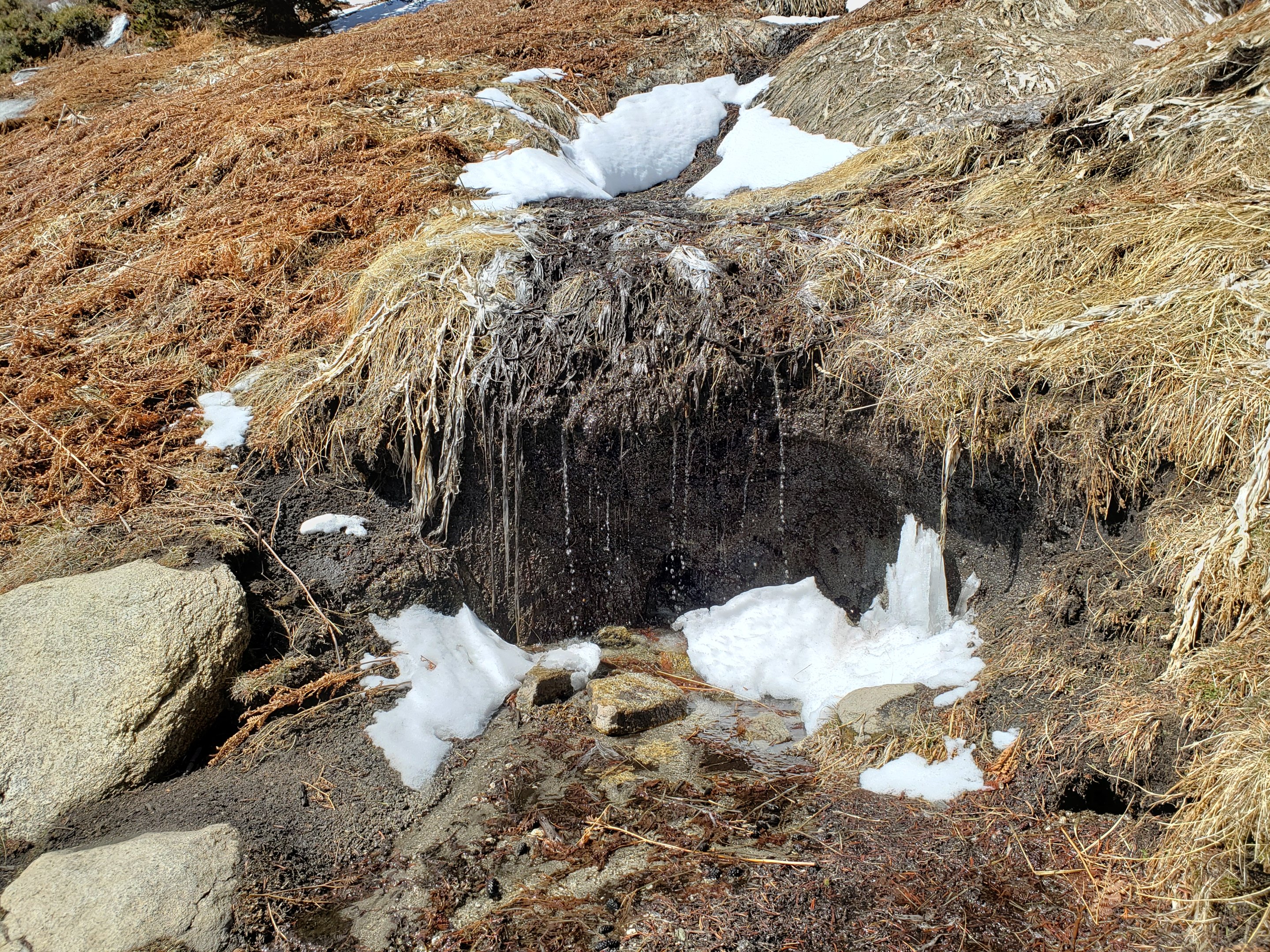

San Jacinto Trail Report: available for everyone, funded by readers. While thousands of hours of labor are volunteered, the Report depends on small private donations to cover its direct costs (e.g., gear, gas, web space). With a busy PCT season underway, every contribution is invaluable, and your donation helps subsidise the thousands of thru-hikers who also use the Report. If you have found this Report useful, please consider visiting the Donate page. Thank you.sanjacjonUncategorized 6 MinutesEdit”Trail and weather update 5th March 2020″
Snow storm update 2nd March 2020
[UPDATE 4th March: melting has been very rapid as expected, and conditions, especially below 9000′, already resemble the previous Report from 27th February. I broke trail again today to the Peak, as it had been eliminated by extensive spindrift the previous day and apparently no one hiked up from the Tram yesterday. There are currently no tracks on the PCT between Mile 181.8 (Annie’s Junction) and about Mile 191 where the continuous snow cover ends.]
[UPDATE 3rd March: last night Kyle Eubanks reported that my tracks to the Peak had been almost eliminated by drifting snow. Very strong Santa Ana winds overnight will likely have obscured almost all tracks above 8000′ elevation by this morning. Very cautious navigation is recommended everywhere, and it is typical for hiking times to almost double in heavily drifted snow.]
A very brief update on the thirteenth storm of this winter (the sixth of 2020), partly because it has been a long day, but mainly because conditions are expected to change quickly with rapid melting.
I recorded this video discussion of the conditions near San Jacinto Peak late this morning.
Contrary to many forecasts, this storm lasted well into today, with snowfall continuing to mid-afternoon, and produced more snow than was generally predicted (4-6″ in most of the high country). I hiked to San Jacinto Peak breaking trail from Humber Park early this morning, ascending in near blizzard conditions, and then broke the trail again on my descent as fresh snowfall and strong winds had largely obliterated my tracks.
Snow depths measured today are listed at the foot of this posting. Other than Devil’s Slide Trail, most trails remain largely or completely obscured by fresh snowfall and spindrift, so very cautious navigation is strongly recommended everywhere.
I ascended and descended San Jacinto Peak from Humber Park in just boots this morning, as the footing in 2-6″ of fresh snow was reasonable. Hiking poles are currently more useful than spikes. Microspikes may be useful, but are not required, above about 7500′ elevation, especially on the snow overlying compacted icy trails. Exposed trails with southerly aspects (e.g., South Ridge, PCT north of Saddle Junction, lower Deer Springs) are already melting rapidly up to 7600′. Snowshoes may be of limited use off-trail above about 9500′ elevation.
Despite unseasonably warm temperatures this week, hikers should nevertheless be prepared for temperatures near or below freezing in the high country, and potentially well below freezing when considering windchil effects (see below for weather recorded recently at San Jacinto Peak).
[Updated 4th March] Note that the USFS gate at Humber Park reopened on 4th March having been briefly closed 1st-3rd March.
WEATHER Temperatures will be above seasonal for the remainder of this week, and very rapid snow melt is expected, especially on sun-exposed slopes. A potentially significant storm is currently forecast for 10th-12th March, with rainfall (>1″) below 7000′ elevation, and at least several inches of snow at higher elevations.
At San Jacinto Peak (10,810ft/3295m) today, Monday 2nd March 2020, at 1020 the air temperature was 12.8°F (-11°C), with a windchill of -10.4°F (-24°C), 100% relative humidity, and a sharp NNW wind sustained at 10 mph gusting to 24.7 mph, while lightly snowing.
At the Peak yesterday, Sunday 1st March 2020 at 0845 the air temperature was 16.6°F (-9°C), with a windchill of -3.6°F (-20°C), 92% relative humidity, and a bitter WSW wind sustained at 9 mph gusting to 25.6 mph.PACIFIC CREST TRAILThe Pacific Crest Trail remains open at the rockslide just north of Antsell Rock (Mile 172.5). USFS has stated there are currently no plans to close this section of the PCT during spring 2020. The video report from 7th October (available here) can be useful for deciding whether to try to hike around the rockslide or take an alternate route.Microspikes are not required, but may be useful (especially cold early mornings) on the PCT for snow travel between approximately Miles 158 and 192, depending upon your comfort level on fresh powder and icy snow.PCT hikers are reminded that overnight stays are not permitted at or near San Jacinto Peak, including in the historic shelter. Mt. San Jacinto State Park regulations permit overnight stays only in established campgrounds. Options for thru-hikers are Strawberry Junction and Little Round Valley.
TRAIL CONDITIONS
All trails above about 6500′ are snow-covered. However melting is rapid today, and will be even faster over the next few days, so conditions will ameliorate very quickly.
Devil’s Slide Trail has a good track to follow, and microspikes are useful but not required.
Ernie Maxwell Trail is clearing rapidly of snow. A few patches remain, mainly near Humber Park. No spikes required.
SNOW DEPTHS measured today are as follows, with snow accumulation from this latest storm given first, followed by current total average depth in parentheses. Please note that averages are given; drifts are much deeper in places. Altitudes are approximate.
San Jacinto Peak (10810′): 6″ (17″)
Wellman Divide (9700′): 6″ (7″)
Annie’s Junction (9070′): 5″ (12″)
Long Valley (8600′): 4″ (4.5″)
Saddle Junction (8070′): 4″ (5″)
Devil’s Slide trailhead at Humber Park (6520′): 3″ (already largely melted to <1″)
Idyllwild (at 5550′): 1.5″ (completely melted by this afternoon)
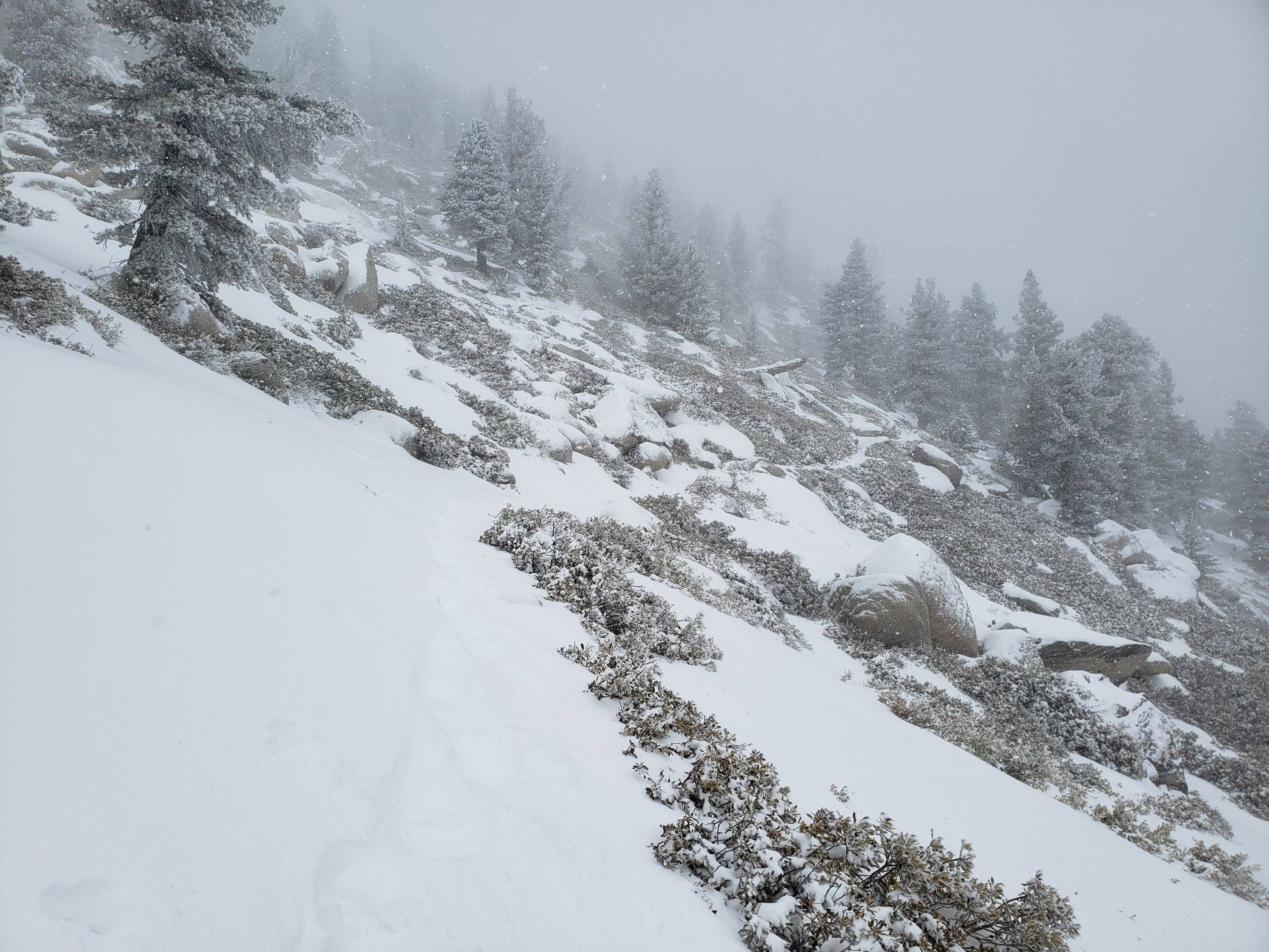
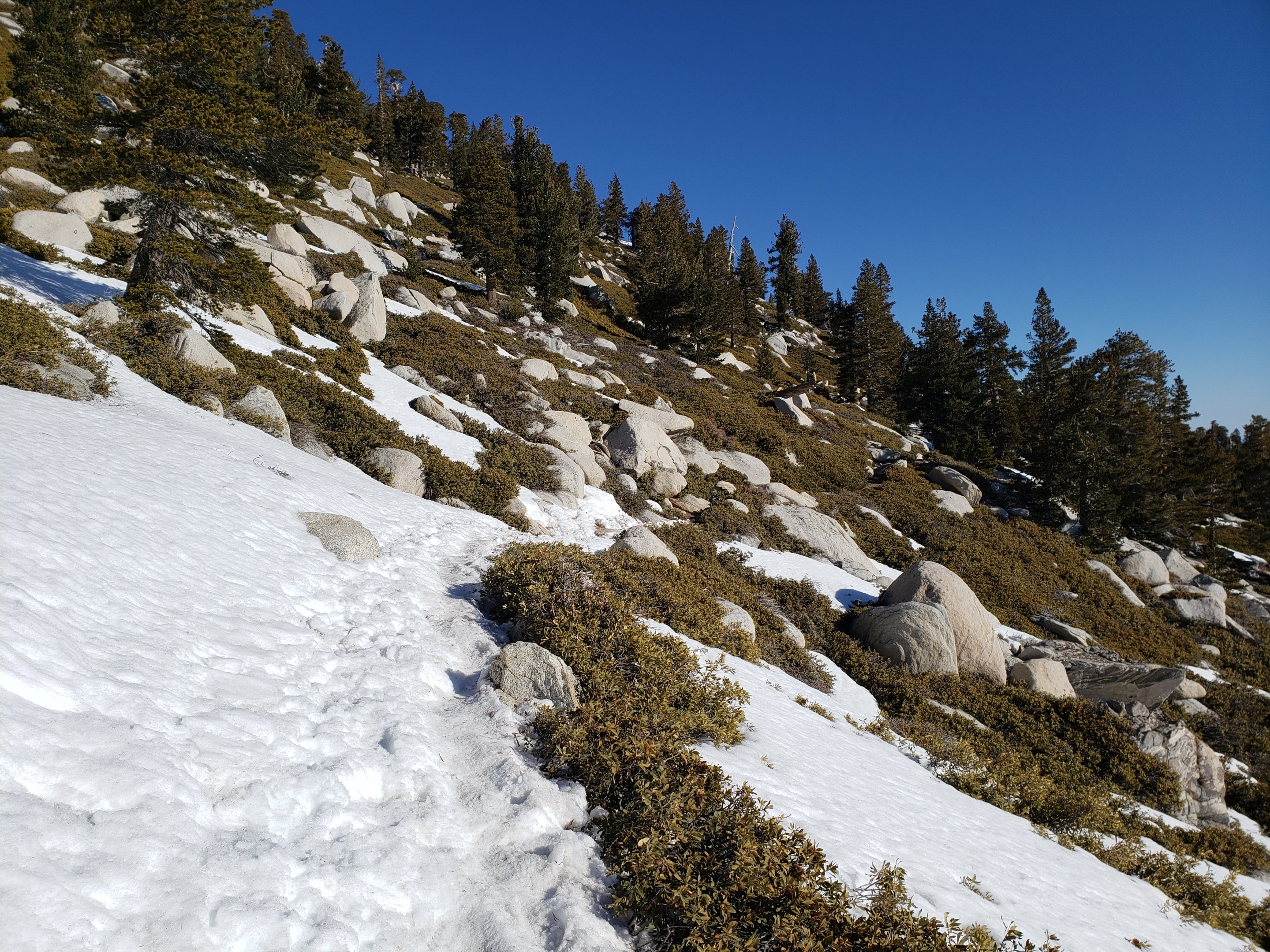
San Jacinto Trail Report: available for everyone, funded by readers. While thousands of hours of labor are volunteered, the Report is wholly dependent on small private donations to cover its direct costs (e.g., gear, gas, web space). With a busy PCT season coming soon, every contribution is invaluable, and your donation helps subsidise the thousands of thru-hikers who also use the Report. If you have found this Report useful, please consider visiting the Donate page. Thank you.
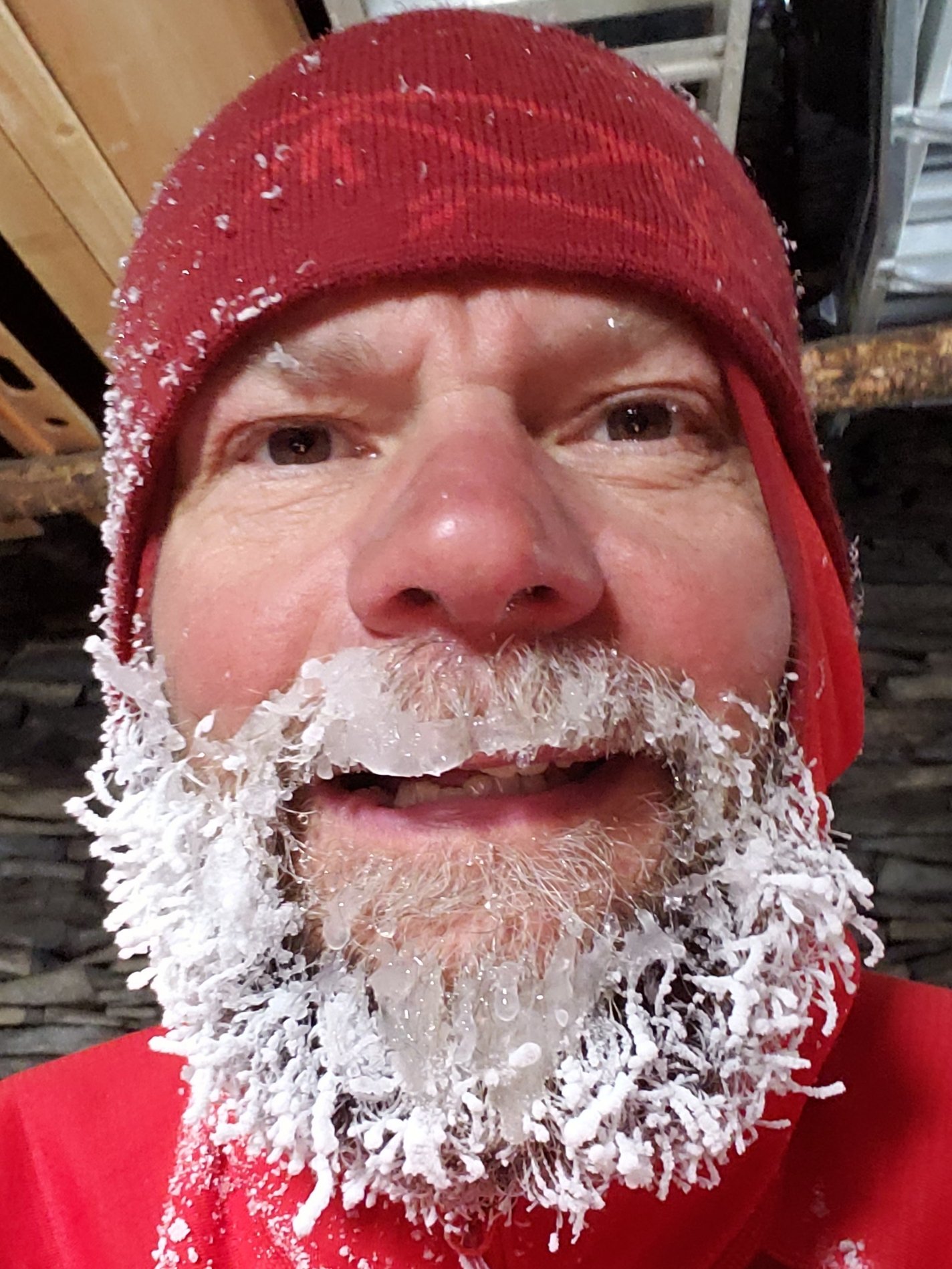
sanjacjonUncategorized 4 MinutesEdit”Snow storm update 2nd March 2020″
Trail update 27th February 2020
[UPDATE 1st March @ 1845: It snowed gently in Idyllwild today from 1530 to 1730, just under 1.0″ settling at 5550′ elevation. It was lightly snowing in Long Valley from 1300 to 1700 (also about 1.0″ total). At San Jacinto Peak this morning I recorded a windchill of -4°F (-20°C) although the high peaks remained largely above the cloud all morning at least. The full extent of this minor storm will be updated tomorrow. ]
We have hiked to San Jacinto Peak six of the last nine days, including today, affording a check of snow and trail conditions on most major routes around the mountain. South Ridge and the Tahquitz Peak area were hiked on 25th, and the PCT on the Desert Divide on 26th.
Temperatures far above historic averages – it was an astonishing 47°F (9°C) in Idyllwild at dawn yesterday – have meant that compacted icy snow below 8000′ (e.g., Devil’s Slide Trail) is slick in places. Unseasonably warm temperatures make the snow soft by mid morning at all elevations, the only positive being that postholing renders microspikes of limited use. The light snow that fell on 22nd February was almost completely gone within two days. Intense melting this week rapidly reduced snow depths to their lowest of the winter at all elevations.
Snow depths measured today are listed at the foot of this posting. Very strong Santa Ana winds in the high country yesterday caused spindrift to obscure parts of even heavily traveled trails. Cautious navigation is recommended everywhere.
Microspikes remain useful in some areas (see below) for hikers who are less comfortable on snow and ice, on compacted well-traveled trails, in particular for descending. Hikers with suitable footwear (plus hiking poles as preferred) will largely not need any additional traction, depending on temperature as discussed above. Shallow snow depths largely preclude any use for snowshoes now, even in areas off-trail above about 9500′ elevation.
Despite warm conditions on most days, hikers should be prepared for temperatures near or below freezing in the high country, and potentially well below freezing when considering windchill effects, especially on 1st-2nd March (see below for weather recorded recently at San Jacinto Peak).
Note that the USFS gate at Humber Park reopened on 5th February.
WEATHER Above average temperatures this week will continue until Friday 29th. A minor storm system is forecast to impact the San Jacinto mountains over the weekend (1st-2nd March) with the possibility of light precipitation including a couple of inches of snow in the high country. However temperatures will recover to well-above-seasonal immediately after the storm, so impacts to the trails will likely be limited to a day or two at most.
At San Jacinto Peak (10,810ft/3295m) today, Thursday 27th February 2020, at 0840 the air temperature was 32.4°F (0°C), with a windchill of 18.7°F (-8°C), 30% relative humidity, and a persistent NE wind sustained at 17 mph gusting to 21.0 mph.
At the Peak on Monday 24th February 2020, at 0945 the air temperature was 31.6°F (0°C), with a windchill of 21.9°F (-6°C), 54% relative humidity, and a light due North wind sustained at 4 mph gusting to 8.6 mph.
PACIFIC CREST TRAIL
The Pacific Crest Trail remains open at the rockslide just north of Antsell Rock (Mile 172.5). USFS has told the Trail Report that there are currently no plans to close this section of the PCT during spring 2020. The video report (available here) can be useful for deciding whether to try to hike around the rockslide or take an alternate route.
Microspikes may be useful on some of the PCT for patchy snow travel between approximately Miles 168 and 191, depending upon your comfort level on icy snow. Most thru hikers using poles will probably find spikes unnecessary however. See below for conditions on some specifc sections of the PCT and the many side trails.
Current snow cover on the PCT is very limited between Miles 165 and about 175 (Red Tahquitz), mainly confined to certain north-facing slopes e.g., Spitler Peak (Mile 168) and Apache Peak (Mile 169.5). Snow is then largely continuous between Miles 175-179 (to near Saddle Junction). The Trail is then largely clear to about Mile 184, except for a stubborn section of 0.5 mile approaching Annie’s Junction (Mile 180.8) which is always among the last areas to clear every spring. Most of Miles 184-191 is snow-covered, although exposed sections of Fuller Ridge (e.g., Miles 186.5-188.5) are clearing rapidly. North from about Mile 191 to Snow Creek is clear.
PCT hikers are reminded that overnight stays are not permitted at or near San Jacinto Peak, including in the historic shelter. Mt. San Jacinto State Park regulations permit overnight stays only in established campgrounds. Options for thru-hikers are Strawberry Junction and Little Round Valley.
Currently I am not updating the water situation in the San Jacinto mountains as the main springs and creeks are all flowing adequately. This may change soon as extremely low precipitation so far in 2020 is already causing flow rates far below average.
TRAIL CONDITIONS
All trails above about 9000′ remain largely snow-covered, with depth depending on elevation (see below) but sun exposed slopes are clearing rapidly (e.g., around Wellman’s Cienega). Some sections of trails above about 7700′ have limited icy snow cover.
Deer Springs Trail is largely clear of snow to Strawberry Junction with just a few patches close to the junction (microspikes not required). The PCT section from here to Fuller Ridge is largely clear of snow to about 8700′ elevation (just south of the Marion Mountain Trail junction), then there is extensive snow cover thereafter, with a well-traveled, consolidated track to follow. A track above 9000′ to Little Round Valley is consolidated, but be advised that it does not follow the established trail in places. Above Little Round Valley there is a direct (i.e. steep) track to follow to San Jacinto Peak. Microspikes can be useful for descending.
Fuller Ridge Trail (PCT Miles 185.5-190.5) has been clearing quickly, especially on sun-exposed slopes, mainly Miles 186.5-188.5. There are tracks to follow through the snow.
Marion Mountain Trail has been traveled and has a consolidated track to follow. Microspikes are useful, but not required, for descending the uppermost 0.5 mile. Note the road to Marion Mountain trailhead has been open all winter and is clear of snow.
Round Valley Trail from the Tram through to Wellman Divide has been well-traveled and a good track through the snow is easy to follow, onward to San Jacinto Peak.
Devil’s Slide Trail has limited icy snow cover in patches, mainly in the 0.5 mile nearest to Saddle Junction. Due to snow and ice compaction caused by hiker traffic, microspikes are helpful in some areas above 7700′, especially for descending, but are not required.
Ernie Maxwell Trail is virtually clear of snow, with just a few tiny patches, mainly near Humber Park.
The notoriously treacherous Tahquitz Peak trail from Chinquapin Flat/PCT Mile 178 is clearing surprisingly quickly, the snow drifts are softening (on warm days), and crampons are no longer required. There is a good set of tracks to follow. Microspikes are strongly recommended, in conjunction with an ice axe (if you know how to use it). In the morning, overnight wind conditions and the freeze-thaw cycle can partially obscure the existing steps through the angled icy snow for 0.1-0.2 mile.
South Ridge Trail is almost clear to Old Lookout Flat at 7600′, but with some remnant short, thin snow patches. Snow cover is fairly patchy (<20%) higher up, and the small patches are easily hiked. Microspikes are not required. South Ridge Road is clear of ice.
Seven Pines Trail has had no hiker traffic so far this winter, with no tracks or trail to follow. Indeed this trail has only been hiked a handful of times since November 2018. Extremely cautious navigation is recommended for those who are not very familiar with hiking this trail. The Forest Service closure of Dark Canyon Road continues, and there is no vehicular access to Seven Pines trailhead.
SNOW DEPTHS measured on 27th February 2020. Note that average depth is given, drifts can be much deeper in places. Altitudes are approximate.
San Jacinto Peak (10810′): 11″ (was 47″ on 27th December 2019)
Wellman Divide (9700′): 1″ (was 27″ on 27th December 2019)
Annie’s Junction (9070′): 7″ (was 25″ on 27th December 2019)Long Valley (8600′): 1″
Strawberry Junction (8100′): 0″
Saddle Junction (8070′): 1″ (was 19″ on 27th December 2019)
Devil’s Slide trailhead at Humber Park (6550′): 0″ (was 11″ on 27th December 2019)
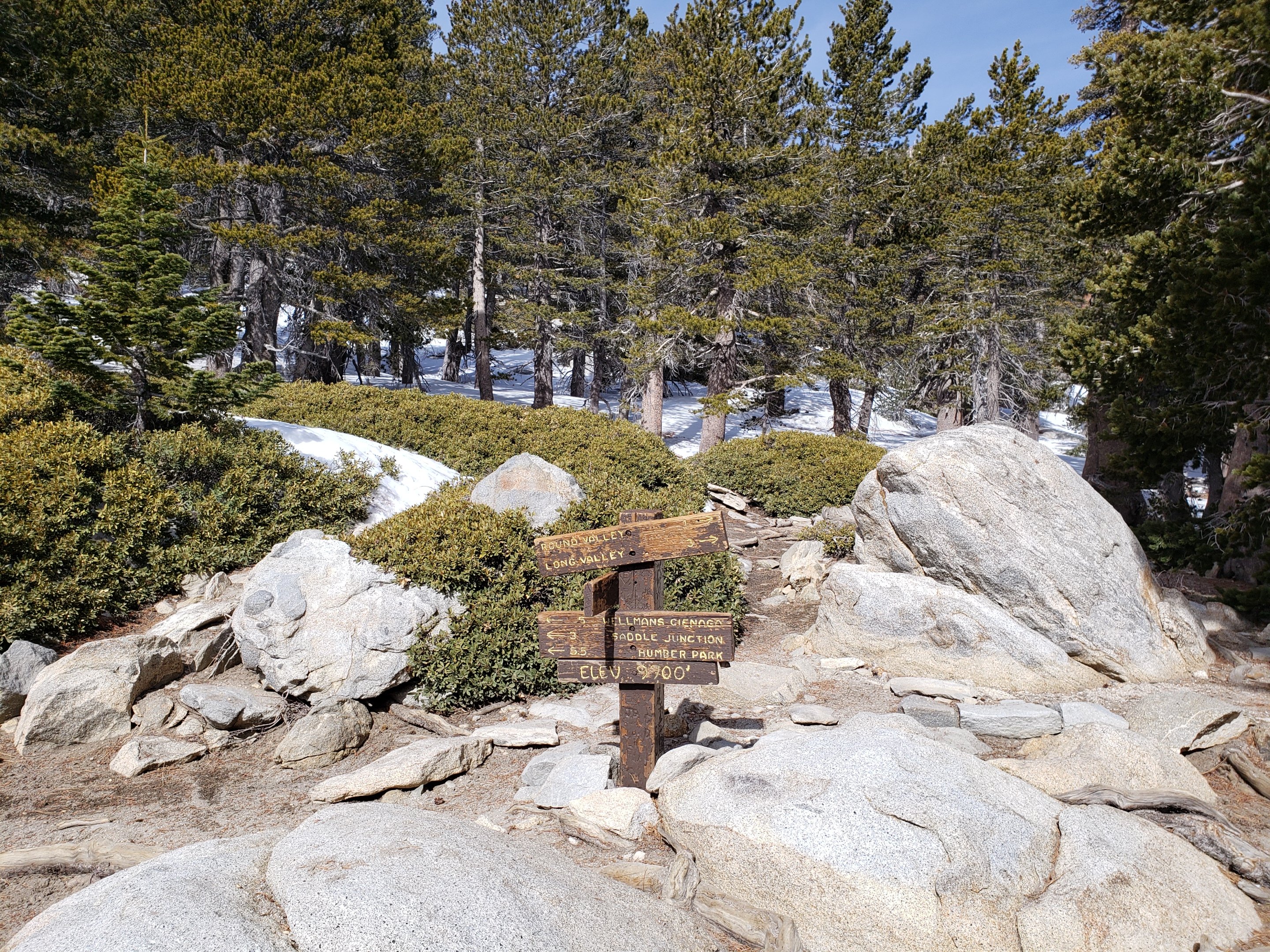
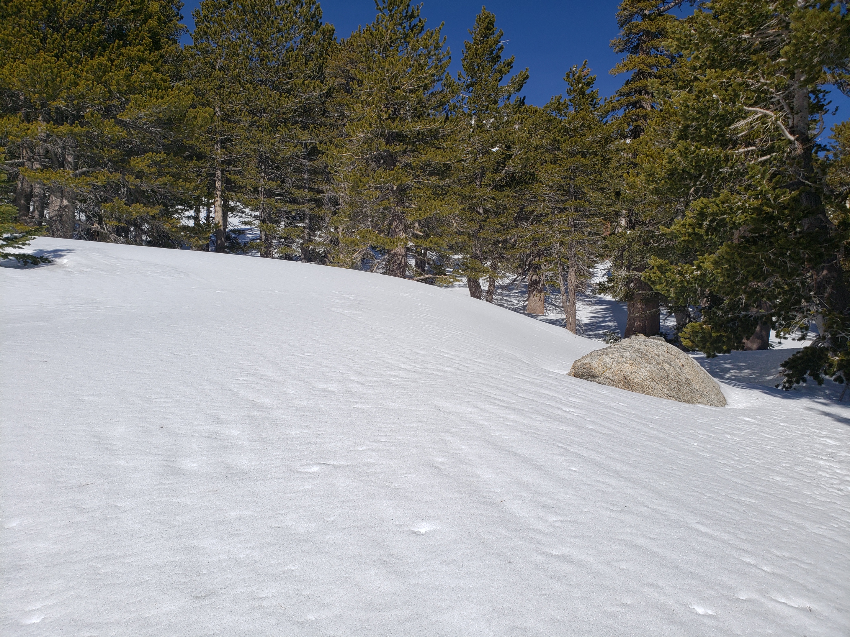 San Jacinto Trail Report: available for everyone, funded by readers.While thousands of hours of labor are volunteered, the Report depends on small private donations to cover its direct costs (e.g., gear, gas, web space). With a busy PCT season underway, every contribution is invaluable, and your donation helps subsidise the thousands of thru-hikers who also use the Report. If you have found this Report useful, please consider visiting the Donate page. Thank you.sanjacjonUncategorized 6 MinutesEdit”Trail update 27th February 2020″
Minor snow storm update 23rd February 2020
[UPDATE 24th February: our hike this morning to San Jacinto Peak showed that melting has been even faster than expected. Most trail conditions already more closely resemble the Report from 17th Feb available below. Note that due to compaction by hiker traffic over the weekend Devil’s Slide Trail had tricky ice in patches, especially early this morning.]
Just a brief update on the twelfth storm of this winter (the fifth of 2020) which passed over the San Jacinto mountains yesterday, 22nd February. Melting is happening so fast that conditions will largely revert to similar to the previous report (linked here) within a couple of days, so I will not go in to too much detail.
A short video from San Jacinto Peak this morning discusses current and future conditions.
Snowfall was 2-4″ in the high country (depending on location more than elevation), and just over an inch at Idyllwild, where we also had a mix of rain (0.2″) and hail (0.25″). Unlike the storm 12 days earlier, the snow was very wet, with large flakes, and there was much less wind associated with the storm, so drifting was minimal.
Snow depths measured today are listed at the foot of this posting. Most major trails have already been traveled and melting is so rapid already today that few trails are obscured by snowfall. Nevertheless cautious navigation is strongly recommended everywhere.
I ascended and descended San Jacinto Peak from Humber Park in just boots this morning, as the footing in 2-4″ of fresh snow was reasonable. Although large sections of trail, especially below 9000′, are already wet and slushy, these are not expected to refreeze overnight this week. Consequently ice formation should be limited and the need for additional traction minimal. Hiking poles are currently more useful than spikes.
Microspikes may be useful, but are not required, above about 7500′ elevation, especially on the snow overlying compacted icy trails. Exposed trails with southerly aspects (e.g., South Ridge, PCT north of Saddle Junction, lower Deer Springs) are melting very rapidly up to 8600′. Snowshoes may be of limited use off-trail above about 9500′ elevation.
Despite unseasonably warm temperatures this week, hikers should nevertheless be prepared for temperatures near or below freezing in the high country, and potentially well below freezing when considering windchil effects (see below for weather recorded recently at San Jacinto Peak).
Note that the USFS gate at Humber Park reopened on 5th February.

WEATHER Temperatures will be well above seasonal for the next week, and very rapid snow melt is expected, especially on sun-exposed slopes. A potentially significant snow storm is currently forecast for 1st-2nd March. The remainder of the spring (March to May) is otherwise expected to be warmer and drier than average, as discussed in the latest NWS San Diego video.
At San Jacinto Peak (10,810ft/3295m) today, Sunday 23rd February 2020, at 0910 the air temperature was 24.8°F (-4°C), with a windchill of 9.8°F (-12°C), 82% relative humidity, and a moderate NNW wind sustained at 5 mph gusting to 15.6 mph.
At the Peak on Friday 21st February 2020 at 0825 the air temperature was 30.8°F (-1°C), with a windchill of 15.4°F (-9°C), 55% relative humidity, and a sharp SSE wind sustained at 12 mph gusting to 22.2 mph.
PACIFIC CREST TRAIL
The Pacific Crest Trail remains open at the rockslide just north of Antsell Rock (Mile 172.5). USFS has stated there are currently no plans to close this section of the PCT during spring 2020. The video report from 7th October (available here) can be useful for deciding whether to try to hike around the rockslide or take an alternate route.
Microspikes are not required, but may be useful (especially cold early mornings) on the PCT for increasingly patchy snow travel between approximately Miles 158 and 192, depending upon your comfort level on fresh powder and icy snow.
PCT hikers are reminded that overnight stays are not permitted at or near San Jacinto Peak, including in the historic shelter. Mt. San Jacinto State Park regulations permit overnight stays only in established campgrounds. Options for thru-hikers are Strawberry Junction and Little Round Valley.
TRAIL CONDITIONS
All trails above about 6500′ are snow-covered. However melting is rapid today, and will be even faster over the next few days, so conditions will ameliorate very quickly.
Reliable tracks are currently in place for Devil’s Slide Trail, Saddle Junction to San Jacinto Peak, from the Tram through to Wellman Divide, Deer Springs Trail to at least Strawberry Junction, and Marion Mountain Trail to Deer Springs Trail and onward to San Jacinto Peak.
Devil’s Slide Trail has a good track to follow, and microspikes are useful but not required.
Ernie Maxwell Trail is largely clear of snow. A few patches remain, mainly near Humber Park. No spikes required.
South Ridge Trail is rapidly clearing to Old Lookout Flat at 7600′, but with some remnant snow patches. Snow cover is becoming fairly patchy (<50%) higher up, and the soft thin snow is easily hiked. Microspikes are not required.
Tahquitz Peak trail from Chinquapin Flat/PCT Mile 178 is clearing surprisingly quickly, snow drifts are softening, and crampons are no longer required (but some hikers may prefer them). Microspikes are strongly recommended, in conjunction with an ice axe (if you know how to use it). In the morning, overnight wind conditions and the freeze-thaw cycle may well have covered the existing steps through the angled icy snow for 0.1-0.2 mile.
SNOW DEPTHS measured today are as follows, with snow accumulation from this latest storm given first, followed by current total average depth in parentheses. Please note that averages are given; drifts are much deeper in places. Altitudes are approximate.
San Jacinto Peak (10810′): 3″ (17″)
Wellman Divide (9700′): 2″ (4″)(already largely melted)
Annie’s Junction (9070′): 4″ (13″)
Long Valley (8600′): 2″ (3″)(already largely melted)
Saddle Junction (8070′): 3″ (4″)
Devil’s Slide trailhead at Humber Park (6520′): 2″ (2″) (already largely melted)
Idyllwild (at 5550′): 1.2″ (completely melted by this afternoon)

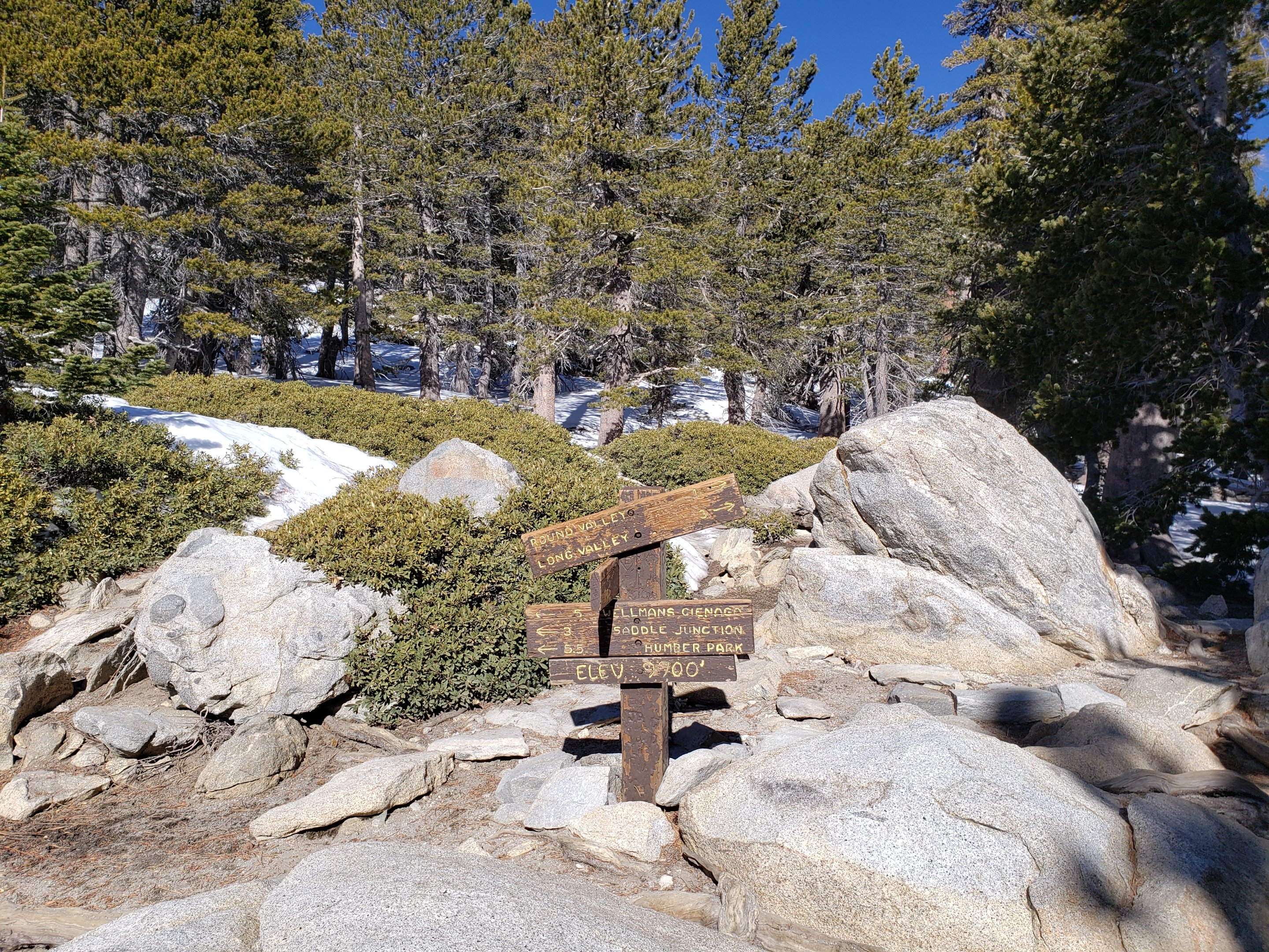
San Jacinto Trail Report: available for everyone, funded by readers. While thousands of hours of labor are volunteered, the Report is wholly dependent on small private donations to cover its direct costs (e.g., gear, gas, web space). With a busy PCT season coming soon, every contribution is invaluable, and your donation helps subsidise the thousands of thru-hikers who also use the Report. If you have found this Report useful, please consider visiting the Donate page. Thank you.sanjacjonUncategorized 4 MinutesEdit”Minor snow storm update 23rd February 2020″
Trail update 17th February 2020
[UPDATE 22nd February @ 1730: a minor storm system is passing over the San Jacinto mountains today. Two inches of snow had fallen at San Jacinto Peak by dusk today. In Idyllwild (at 5550′) there was a mix of rain, hail, and snow, currently about 1.3″ of the latter. Snow accumulation on lower Devil’s Slide Trail this evening was only 1.0″. Long Valley (8600′) has had a couple of brief dustings of snow totalling <1″. Very rapid warming (and therefore melting) over the next couple of days means that the conditions described below will still apply.]
I have hiked to San Jacinto Peak three of the past six mornings, including today, affording a check of snow and trail conditions on most major routes. South Ridge and the Tahquitz Peak area have also been hiked twice in the same period. I hope to fully survey the PCT again this week.
Cool early mornings like Saturday make for pleasant hiking on firm snow, and I ascended San Jacinto Peak without microspikes. In contrast this morning very mild temperatures – 40°F in Idyllwild – meant that icy snow below 8000′ (e.g., Devil’s Slide Trail) was very slick in places. Unseasonably warm temperatures make the snow soft by late morning at all elevations, the only positive being that postholing renders microspikes of limited use.
The light snow that fell a week ago in the early hours of the morning of Monday 10th was almost completely gone within days. Rapid melting this weekend has already reduced snow depths to the levels seen in early February at all elevations.
Snow depths measured today are listed at the foot of this posting. Strong winds in the high country may cause spindrift to obscure parts of even heavily traveled trails. Cautious navigation is recommended everywhere.
Microspikes remain useful in some areas (see below) for hikers inexperienced on snow and ice, on compacted, well-traveled trails, in particular for descending. Hikers with suitable footwear (plus hiking poles as preferred) will largely not need any additional traction, depending on temperature as discussed above. Snowshoes may be useful in some areas off-trail above about 9500′ elevation.
Hikers should be prepared for temperatures near or below freezing in the high country, and potentially well below freezing when considering windchill effects (see below for weather recorded recently at San Jacinto Peak).
Note that the USFS gate at Humber Park reopened on 5th February.
WEATHER Temperatures will remain above average this week, cooling to below seasonal next week (after 24th February). There is a possibility of light precipitation overnight on Friday 21st into early Saturday 22nd, including perhaps a couple of inches of snow in the high country. Otherwise there is little sign of precipitation into March.
The latest video report from NWS San Diego (issued on 14th February) describes the dire moisture situation we are now experiencing. Having been at c.200% of average at the end of 2019, the two wettest months of the water year (January and February) have been so poor in 2020, at <10% of average, that overall the San Jacinto mountains have dropped far below average precpitation already. The Sierra Nevada is faring no better, with snowpack at only 50-60% of average.
At San Jacinto Peak (10,810ft/3295m) today, Monday 17th February 2020, at 0750 the air temperature was 33.8°F (1°C), with a windchill of 18°F (-8°C), 42% relative humidity, and a very gusty NW wind sustained at 9 mph gusting to 28.7 mph.
At the Peak on Saturday 15th February 2020, at 0800 the air temperature was 32.4°F (0°C), with a windchill of 17.7°F (-8°C), 23% relative humidity, and a chilly WNW wind sustained at 18 mph gusting to 23.3 mph.
PACIFIC CREST TRAIL
The Pacific Crest Trail remains open at the rockslide just north of Antsell Rock (Mile 172.5). USFS has told the Trail Report that there are currently no plans to close this section of the PCT during spring 2020. The video report (available here) can be useful for deciding whether to try to hike around the rockslide or take an alternate route.
Microspikes may be useful on some of the PCT for patchy snow travel between approximately Miles 168 and 191, depending upon your comfort level on icy snow. Most thru hikers using poles will probably find spikes unnecessary however. See below for conditions on some specifc sections of the PCT and the many side trails.
Current snow cover on the PCT is very limited between Miles 151 (Highway 74) and about 175 (Red Tahquitz), mainly confined to certain north-facing slopes e.g., Spitler Peak (Mile 168) and Apache Peak (Mile 169.5). Snow is then largely continuous between Miles 175-179 (to near Saddle Junction). The Trail is then largely clear to about Mile 184, except for a stubborn section of 0.5 mile approaching Annie’s Junction (Mile 180.8) which is always among the last areas to clear every spring. Most of Miles 184-191 is snow-covered, although exposed sections of Fuller Ridge (e.g., Miles 186.5-188.5) are clearing rapidly. North from about Mile 191 to Snow Creek is clear.
PCT hikers are reminded that overnight stays are not permitted at or near San Jacinto Peak, including in the historic shelter. Mt. San Jacinto State Park regulations permit overnight stays only in established campgrounds. Options for thru-hikers are Strawberry Junction and Little Round Valley.
Currently I am not updating the water situation in the San Jacinto mountains as the main springs and creeks are all flowing adequately. This may change soon as extremely low precipitation so far in 2020 is already causing flow rates far below average.
TRAIL CONDITIONS
All trails above about 9000′ remain largely snow-covered, with depth depending on elevation (see below) but sun exposed slopes are clearing rapidly (e.g., around Wellman’s Cienega). Some sections of trails above about 7700′ have limited snow cover.
Deer Springs Trail is largely clear of snow to Strawberry Junction with just a few patches close to the junction (microspikes not required). The PCT section from here to Fuller Ridge is quickly clearing of snow to about 8700′ elevation (just south of the Marion Mountain Trail junction), then there is continuous snow cover thereafter, with a well-traveled, consolidated track to follow. A track above 9000′ to Little Round Valley is consolidated, but be advised that it does not follow the established trail in places. Above Little Round Valley there is a direct (i.e. steep) track to follow to San Jacinto Peak. Microspikes can be useful for descending.
Fuller Ridge Trail (PCT Miles 185.5-190.5) has been clearing quickly, especially on sun-exposed slopes, mainly Miles 186.5-188.5. There are tracks to follow through the snow.
Marion Mountain Trail has been traveled and has a consolidated track to follow. Microspikes are useful, but not required, for descending the uppermost 0.5 mile. Note the road to Marion Mountain trailhead has been open all winter and is clear of snow.
Round Valley Trail from the Tram through to Wellman Divide has been well-traveled and a good track through the snow is easy to follow, onward to San Jacinto Peak.
Devil’s Slide Trail has limited icy snow cover in patches, mainly in the 0.5 mile nearest to Saddle Junction. Microspikes may be helpful in some areas above 7700′, especially for descending, but are not required.
Ernie Maxwell Trail is virtually clear of snow, with just a few tiny patches, mainly near Humber Park.
The parts of Willow Creek Trail and Caramba Trail nearest to Saddle Junction have well-defined tracks, likely heading around Skunk Cabbage Meadow.
The notoriously treacherous Tahquitz Peak trail from Chinquapin Flat/PCT Mile 178 is clearing surprisingly quickly, the snow drifts are softening (on warm days), and crampons are no longer required. Microspikes are strongly recommended, in conjunction with an ice axe (if you know how to use it). In the morning, overnight wind conditions and the freeze-thaw cycle often cover the existing steps through the angled icy snow for 0.1-0.2 mile. Please do not attempt to cross this section without adequate equipment and knowledge. The consequences of a fall here can be very severe.
South Ridge Trail is clear to Old Lookout Flat at 7600′, but with some remnant very thin snow patches. Snow cover is fairly patchy (<50%) higher up, and the soft thin snow is easily hiked. Microspikes are not required. South Ridge Road is clear of ice.
Seven Pines Trail has had no hiker traffic so far this winter, with no tracks or trail to follow. Indeed this trail has only been hiked a handful of times since November 2018. Extremely cautious navigation is recommended for those who are not very familiar with hiking this trail.
The Forest Service closure of Dark Canyon Road continues, and there is no vehicular access to Seven Pines trailhead.
SNOW DEPTHS measured on 17th February 2020. Note that average depth is given, drifts can be much deeper in places. Altitudes are approximate.
San Jacinto Peak (10810′): 16″ (was 47″ on 27th December)
Little Round Valley (9800′): 16″
Wellman Divide (9700′): 2″ (was 27″ on 27th December)
Annie’s Junction (9070′): 11″ (was 25″ on 27th December)
Fuller Ridge Trail (PCT Mile 185.5) at junction with Deer Springs Trail (8950′): 12″
Long Valley (8600′): 1″
Strawberry Junction (8100′): <1″
Saddle Junction (8070′): 1″ (was 19″ on 27th December)
Devil’s Slide trailhead at Humber Park (6550′): 0″ (was 11″ on 27th December)


San Jacinto Trail Report: available for everyone, funded by readers. While thousands of hours of labor are volunteered, the Report depends on small private donations to cover its direct costs (e.g., gear, gas, web space). With a busy PCT season underway, every contribution is invaluable, and your donation helps subsidise the thousands of thru-hikers who also use the Report. If you have found this Report useful, please consider visiting the Donate page. Thank you.sanjacjonUncategorized 6 MinutesEdit”Trail update 17th February 2020″
Snow storm 10th February 2020
[UPDATED 13th February: current status of trails either side of Tahquitz Peak is updated below, based on our hike up from home this morning.]
[UPDATED 12th February: I have amended gear advice below following my hike today to San Jacinto Peak, when I broke trail from Saddle Junction to the Peak, almost entirely just in boots (with no additional traction gear). Melting has been even more rapid than expected, and conditions may start to resemble the Report from 4th February (below) perhaps as soon as this weekend.]
A brief update on the eleventh storm of this winter (but the first significant storm of 2020) which hit the San Jacinto mountains overnight and this morning. A short video from San Jacinto Peak this morning gives a feel for current conditions.
In general forecasters had a terrible time accurately predicting the timing and impact of this storm due to its unusual track and fragmentation in storm cells. Overall snowfall was less than had been expected, with fewer than 6″ in the high country, and less than an inch at Idyllwild, but snowfall may vary more by location than elevation.
Winds were very strong so drifting in trails is considerable. Snow fell as graupel and rounded grains, and as we descended this morning Kyle Eubanks accurately described it as like walking through bird seed. Depths were not sufficient to completely obscure tracks in most places. However winds remain strong for the next 24+ hours, so extensive drifting is expected.
Snow depths measured today are listed at the foot of this posting. Currently most major trails have not been traveled and may be partly obscured by snowfall. Cautious navigation is strongly recommended everywhere.
Microspikes are useful, but not required, above about 7500′ elevation, especially on the snow overlying compacted icy trails. Exposed trails with southerly aspects (e.g., South Ridge, PCT north of Saddle Junction, lower Deer Springs) are melting very rapidly up to 8500′, and spikes may not be needed much below 9000′. [Updated 15th Feb: I ascended San Jacinto Peak easily with no microspikes early this morning.]
Crampons (with an ice axe) may be useful, but certainly not required, in compacted areas above about 9500′. Snowshoes are of limited use only off-trail above about 9500′ elevation.
Hikers should be prepared for temperatures below freezing in the high country, and potentially well below freezing when considering windchil effects (see below for weather recorded recently at San Jacinto Peak).
Note that the USFS gate at Humber Park reopened on 5th February. Humber Park has been plowed, so it is unlikely that the gate will be closed again soon.WEATHER Temperatures are forecast to be at or even slightly below seasonal for the next week. Steady daytime snow melt is expected, especially on exposed slopes. No additional precipitation is in the forecast.
At San Jacinto Peak (10,810ft/3295m) today, Monday 10th February 2020, at 0845 the air temperature was 15.3°F (-9°C), with a windchill of -7.8°F (-22°C), 99% relative humidity, and a sharp NNE wind sustained at 14 mph gusting to 28.1 mph.
In marked contrast, at the Peak on Thursday 6th February 2020 at 0955 the air temperature was 31.9°F (0°C), with a windchill of 23.7°F (-5°C), 69% relative humidity, and a light WSW wind sustained at 5 mph gusting to 9.0 mph.
PACIFIC CREST TRAIL
The Pacific Crest Trail remains open at the rockslide just north of Antsell Rock (Mile 172.5). USFS has stated there are currently no plans to close this section of the PCT during spring 2020. The video report from 7th October (available here) can be useful for deciding whether to try to hike around the rockslide or take an alternate route.
Microspikes are not required, but may be useful (especially cold early mornings) on the PCT for increasingly patchy snow travel between approximately Miles 158 and 192, depending upon your comfort level on fresh powder and icy snow.
PCT hikers are reminded that overnight stays are not permitted at or near San Jacinto Peak, including in the historic shelter. Mt. San Jacinto State Park regulations permit overnight stays only in established campgrounds. Options for thru-hikers are Strawberry Junction and Little Round Valley.
TRAIL CONDITIONS
All trails above about 6500′ are snow-covered, with depth depending on elevation (see below).
Reliable tracks are currently in place only for Devil’s Slide Trail. From Saddle Junction to San Jacinto Peak, and from the Tram through to Wellman Divide, trails have been hiked but tracks will be largely obscured by wind-driven snow.
Devil’s Slide Trail has a good track to follow, and microspikes are useful but not required.
Ernie Maxwell Trail is largely clear of snow. A few tiny icy patches remain, mainly near Humber Park. No spikes required.
South Ridge Trail [updated 13th Feb] is clear to Old Lookout Flat at 7600′, but with some remnant very thin snow patches. Snow cover is fairly patchy (<50%) higher up, and the soft thin snow is easily hiked. Microspikes are not required.
Tahquitz Peak trail from Chinquapin Flat/PCT Mile 178 [updated 13th Feb] is clearing surprisingly quickly, snow drifts are softening, and crampons are no longer required (but some hikers may prefer them). Microspikes are strongly recommended, in conjunction with an ice axe (if you know how to use it). In the morning, overnight wind conditions and the freeze-thaw cycle may well have covered the existing steps through the angled icy snow for 0.1-0.2 mile.
SNOW DEPTHS measured today are as follows, with snow accumulation from this latest storm given first, followed by total average depth in parentheses. Please note that averages are given; drifts are much deeper in places. Altitudes are approximate.
Many thanks to Kyle Eubanks for data from Round and Long valleys.
San Jacinto Peak (10810′): 5″ (21″)
Wellman Divide (9700′): 4″ (6″)
Round Valley (9100′): 4″ (8″)
Annie’s Junction (9070′): 3.5″ (14″)
Long Valley (8600′): 4″ (5″)
Saddle Junction (8070′): 2″ (3″)
Devil’s Slide trailhead at Humber Park (6520′): 1.5″ (1.5″)
Idyllwild (at 5550′): 0.5″ (already melted by this afternoon)


San Jacinto Trail Report: available for everyone, funded by readers. While thousands of hours of labor are volunteered, the Report is wholly dependent on small private donations to cover its direct costs (e.g., gear, gas, web space). With a busy PCT season coming soon, every contribution is invaluable, and your donation helps subsidise the thousands of thru-hikers who also use the Report. If you have found this Report useful, please consider visiting the Donate page. Thank you.
sanjacjonUncategorized 4 MinutesEdit”Snow storm 10th February 2020″
Trails and weather 4th February 2020
[UPDATED 7th February to include the latest forecast for the storm on 9th-10th, and new information from my hike today around Tahquitz Peak, and from yesterday to San Jacinto Peak.]
We have hiked to San Jacinto Peak four of the past five mornings, affording a check of most major routes. South Ridge and the Tahquitz Peak area have also been hiked twice in the past four days. Delightfully frigid temperatures made for solid hiking on icy snow yesterday and today. Chilly conditions at San Jacinto Peak this morning are discussed in a short video available on YouTube.
In the early hours of the morning of Monday 3rd, we had 0.04″ rain in Idyllwild, with <0.25″ snow between 6400′-9100′ elevation. There was no fresh snowfall in the high country, which was above the cloud. By the time I descended from the Peak late morning, the fresh snow had already disappeared below 7600′, and almost all of it was gone today.
Snow depths measured today are listed at the foot of this posting. Strong winds in the high country may cause spindrift to obscure parts of even the heavily traveled trails. Cautious navigation is recommended everywhere.
Microspikes remain useful in some areas (see below) for hikers inexperienced on snow and ice, on compacted, well-traveled trails, in particular for descending. Hikers with suitable footwear and hiking poles will likely not need spikes. Snowshoes may be useful in limited areas off-trail above about 9500′ elevation. This information only applies through Sunday 9th (when fresh snowfall is expected).
Despite unseaonably warm weather on some days, hikers should nevertheless be prepared for temperatures near or below freezing in the high country, and potentially far below freezing when considering windchil effects (see below for weather recorded recently at San Jacinto Peak).
Note that the USFS gate at Humber Park reopened on 5th February.
WEATHER Following the current short but severe cold spell, there will be yet another rapid swing to above average temperatures (mainly 7th-8th February). The new video from NWS San Diego (issued on 7th Feb) indicates a good chance of precipitation at the beginning and end of next week (9th-14th February), before a return to warmer, dry conditions in the second half of the month. Current forecasts anticipate a light snowfall above about 4000′, with a few inches possible in the high country, mainly on 9th-10th February.
At San Jacinto Peak (10,810ft/3295m) today, Wednesday 4th February 2020, at 1010 the air temperature was 2.5°F (-16°C), with a windchill of -28.1°F (-33°C), 52% relative humidity, and a sharp due North wind sustained at 15 mph gusting to 29.8 mph.
At the Peak on Monday 3rd February 2020, at 0910 the air temperature was 18.4°F (-7°C), with a windchill of -2.5°F (-19°C), 22% relative humidity, and a chilly WSW wind sustained at 11 mph gusting to 23.9 mph.
PACIFIC CREST TRAIL
The Pacific Crest Trail remains open at the rockslide just north of Antsell Rock (Mile 172.5). USFS has stated there are currently no plans to close this section of the PCT during spring 2020. The video report from 7th October (available here) can be useful for deciding whether to try to hike around the rockslide or take an alternate route.
Microspikes may be useful, but certainly not essential, on some of the PCT for patchy snow travel between approximately Miles 165 and 191, depending upon your comfort level on icy snow. See below for conditions on some specifc sections of the PCT and the many side trails.
PCT hikers are reminded that overnight stays are not permitted at or near San Jacinto Peak, including in the historic shelter. Mt. San Jacinto State Park regulations permit overnight stays only in established campgrounds. Options for thru-hikers are Strawberry Junction and Little Round Valley.
TRAIL CONDITIONS
All trails above about 9000′ remain largely snow-covered, with depth depending on elevation (see below). Some sections of trails above about 7800′ may have limited snow cover.
Deer Springs Trail is clear of snow to Strawberry Junction with just a few tiny patches close to the junction (microspikes not required). The PCT section from here to Fuller Ridge is almost clear of snow to about 8700′ elevation (just south of the Marion Mountain Trail junction), then there is continuous snow cover thereafter, with a well-traveled, consolidated track to follow. A track above 9000′ to Little Round Valley is consolidated, but be advised that it does not follow the established trail in places. Above Little Round Valley there is a direct (i.e. steep) track to follow to San Jacinto Peak. Microspikes are useful for descending.
Fuller Ridge Trail (PCT Miles 185.5-190.5) has been clearing quickly, especially on sun-exposed slopes, mainly Miles 186.5-188.5. There are tracks to follow through the snow.
Marion Mountain Trail has been heavily traveled and has a good consolidated track to follow. Microspikes are useful, but not required, for descending the uppermost 0.5 mile. Note the road to Marion Mountain trailhead has been open all winter and is clear of snow.
Round Valley Trail from the Tram through to Wellman Divide has been well-traveled and a good track through the snow is easy to follow, on to San Jacinto Peak.
Devil’s Slide Trail has limited icy snow cover in patches, mainly in the 0.1 mile nearest to Saddle Junction. Microspikes may be helpful in some areas above 7700′, but are not required.
Ernie Maxwell Trail is clear of snow.
The parts of Willow Creek Trail and Caramba Trail nearest to Saddle Junction have well-defined tracks, likely heading around Skunk Cabbage Meadow.
The PCT southbound from Saddle Junction has been traveled to Chinquapin Flat.
Tahquitz Peak trail from Chinquapin Flat/PCT Mile 178 is clearing surprisingly quickly, the snow drifts are softening (on warm days), and crampons are no longer required. Microspikes are strongly recommended, in conjunction with an ice axe (if you know how to use it). In the morning, overnight wind conditions and the freeze-thaw cycle may well have covered the existing steps through the angled icy snow for 0.1-0.2 mile.
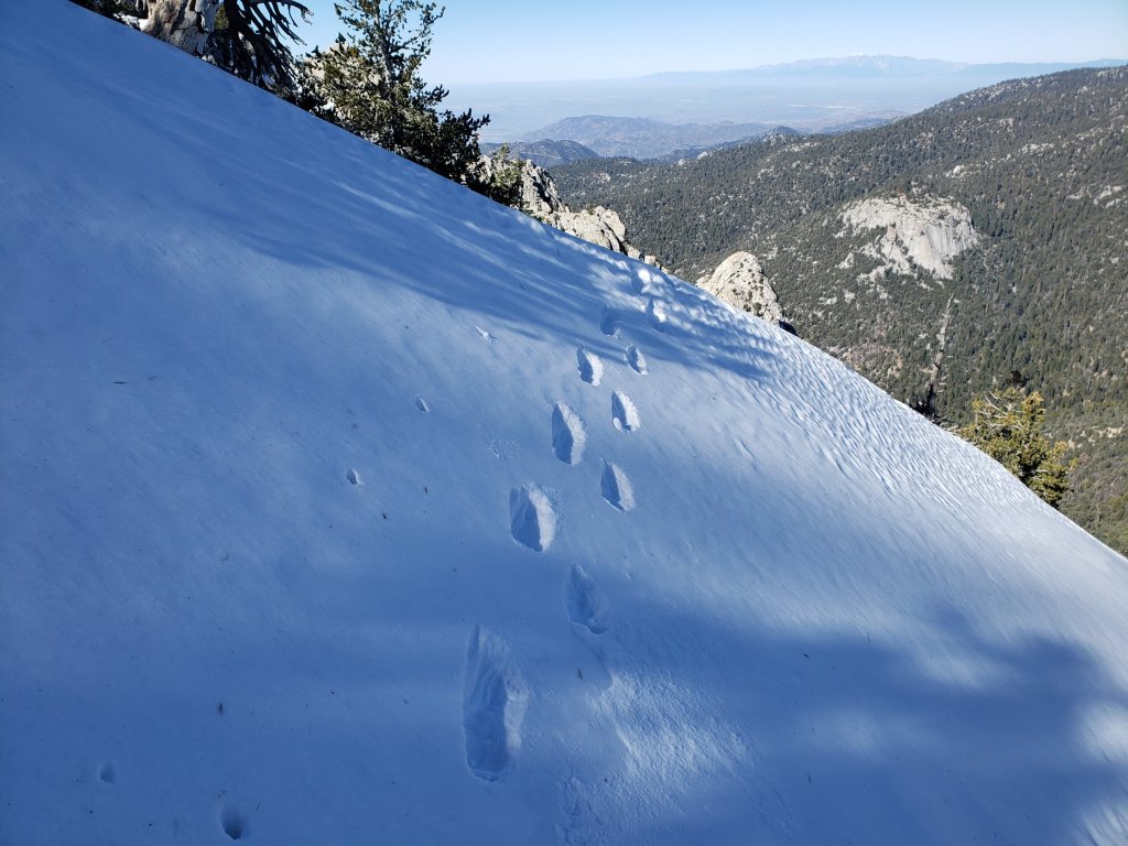
South Ridge Road is clear of ice. South Ridge Trail is basically clear to Tahquitz Peak, but with a few easily-traversed tiny remnant icy snow patches. Microspikes are no longer required.
Seven Pines Trail has had no hiker traffic so far this winter, with no tracks or trail to follow. Indeed this trail has only been hiked a handful of times since November 2018. Extremely cautious navigation is recommended for those who are not very familiar with hiking this trail in snow.
The Forest Service closure of Dark Canyon Road remains in place, hence there is no vehicular access to Seven Pines trailhead.
SNOW DEPTHS measured on 4th February 2020 (except where otherwise indicated). Note that average depth is given, drifts can be much deeper in places. Altitudes are approximate.
San Jacinto Peak (10810′): 20″ (was 47″ on 27th December)
Little Round Valley (9800′): 19″ (on 29th January 2020)
Wellman Divide (9700′): 2″ (was 27″ on 27th December)
Annie’s Junction (9070′): 11″ (was 25″ on 27th December)
Fuller Ridge Trail (PCT Mile 185.5) at junction with Deer Springs Trail (8950′): 12″ (on 29th January 2020)
Long Valley (8600′): <1″
Strawberry Junction (8100′): 0″
Saddle Junction (8070′): 1″ (was 19″ on 27th December)
Devil’s Slide trailhead at Humber Park (6520′): 0″ (was 11″ on 27th December)
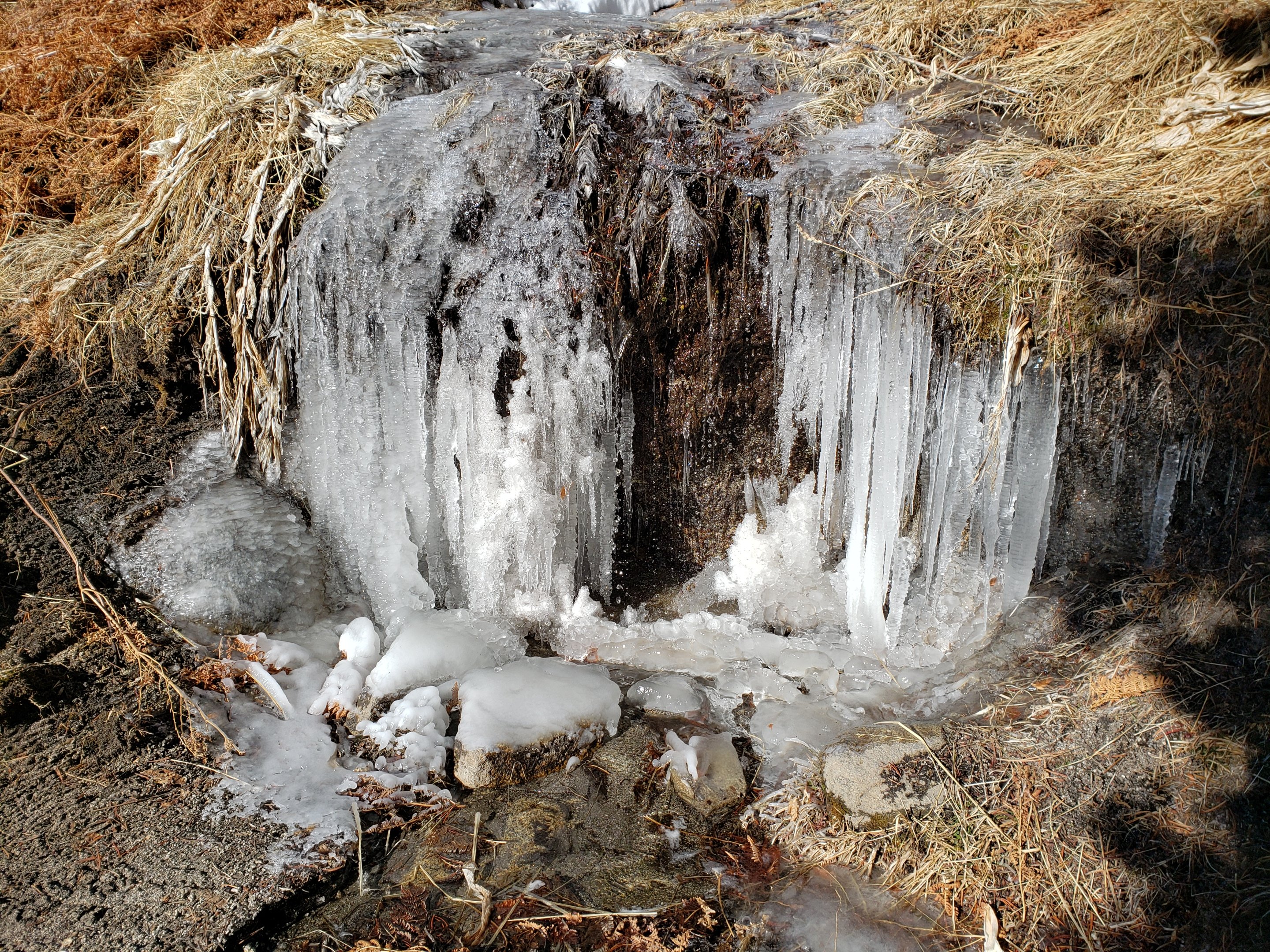
San Jacinto Trail Report: available for everyone, funded by readers. While thousands of hours of labor are volunteered, the Report is wholly dependent on small private donations to cover its direct costs (e.g., gear, gas, web space). With a busy PCT season coming soon, every contribution is invaluable, and your donation helps subsidise the thousands of thru-hikers who also use the Report. If you have found this Report useful, please consider visiting the Donate page. Thank you.
sanjacjonUncategorized 5 MinutesEdit”Trails and weather 4th February 2020″
Trail update 29th January 2020
[UPDATE Monday 3rd February: in the early hours of this morning we had 0.04″ rain in Idyllwild. On my morning hike to San Jacinto Peak there was <0.25″ snow between 6400-9100′ elevation. No fresh snowfall in the high country, which was above the cloud. By the time I descended late morning, the fresh snow had already disappeared below 7600′. Trail conditions are unchanged from the report below. Note that the windchill at the Peak this morning was -3°F (-19°C).]
[UPDATE Saturday 1st February: based on hikes to San Jacinto Peak today and yesterday, recent strong winds – it was gusting up to 43 mph this morning – have not generated sufficient spindrift to obscure any established trails.]
We have hiked to San Jacinto Peak three of the past four mornings, affording a check of most major routes, including a full east-west circuit today. South Ridge and the Tahquitz Peak area has also been hiked three times in the past week.
Relatively mild weather for late January is forecast to get even warmer briefly this weekend. Steady melting will continue unabated. Current trail conditions are more reminiscent of April than late January. In general the snow softens rapidly during the day but postholing doesn’t get too bad until after noon.
Snow depths measured today are listed at the foot of this posting. On days with strong winds in the high country drifting snow may obscure parts of even the heavily traveled trails. Cautious navigation is recommended everywhere.
Microspikes can be useful on-trail for compacted, well-traveled trails, in particular for descending. Crampons are an option above about 9000′ both on- and off-trail, but generally less practical than spikes. Snowshoes remain useful off-trail above about 9000′ elevation.
Despite warmer conditions on some days, hikers should prepared for temperatures near or below freezing in the high country, and well below freezing when considering windchill (see below for temperatures recorded recently at San Jacinto Peak).
Note that the USFS gate at Humber Park remains (inexplicably) closed. There are nine legal parking spaces – available for all uses – just below the gate and near the upper Ernie Maxwell trailhead. The next closest legal parking is 0.1 mile downhill on Forest Drive.
WEATHER Temperatures are forecast to be on a rollercoaster into early February. After a couple of colder and windy days today and tomorrow, this weekend (1st-2nd Feb) will be unseasonably warm. A short but very severe cold spell early next week (3rd-5th Feb) will be immediately followed by another rapid swing to well-above average temperatures.
There is a possibility of very light precipitation at mid-elevations on Sunday night. The latest video summary from NWS San Diego indicates a chance of precipitation in the second week (8th-14th) of February, before a return to warm, dry conditions in the second half of the month.
At San Jacinto Peak (10,810ft/3295m) today, Wednesday 29th January 2020, at 0820 the air temperature was 21.1°F (-6°C), with a windchill of 5.5°F (-15°C), 46% relative humidity, and a gusty NNW wind sustained at 4 mph gusting to 16.3 mph.
At the Peak on Monday 27th January 2020, at 0940 the air temperature was 32.1°F (0°C), with a windchill of 22.3°F (-5°C), 39% relative humidity, and a steady North wind sustained at 5 mph gusting to 11.6 mph.
PACIFIC CREST TRAIL NOTES
The Pacific Crest Trail remains open at the rockslide just north of Antsell Rock (Mile 172.5). USFS has stated there are currently no plans to close this section of the PCT during spring 2020. My video report from 7th October (available here) can be useful for deciding whether to try to hike around the rockslide or take an alternate route.
Microspikes are useful, but not essential, on most of the PCT for patchy snow travel between approximately Miles 165 and 191, depending upon your comfort level on icy snow. They are most useful if you plan to leave the PCT to summit San Jacinto Peak. See below for conditions on some specifc sections of the PCT and the many side trails.
PCT hikers are reminded that overnight stays are not permitted at or near San Jacinto Peak, including in the historic shelter. Mt. San Jacinto State Park regulations permit overnight stays only in established campgrounds. Options for thru-hikers are Strawberry Junction and Little Round Valley.
TRAIL CONDITIONS
All trails above about 9000′ remain largely snow-covered, with depth depending on elevation (see below). Some sections of trails above about 7800′ may be snow-covered. Limited icy snow patches remain in places above 6600′.
Deer Springs Trail is clear of snow to Strawberry Junction with just a few tiny patches close to the junction (microspikes not required). The PCT section from here to Fuller Ridge is almost clear of snow to about 8700′ elevation (just south of the Marion Mountain Trail junction), then there is continuous snow cover thereafter, with a well-traveled, consolidated track to follow. A track above 9000′ to Little Round Valley is consolidated, but be advised that it does not follow the established trail in places. Above Little Round Valley there is a direct (i.e. steep) track to follow to San Jacinto Peak. Microspikes are useful for descending.
Fuller Ridge Trail (PCT Miles 185.5-190.5) is clearing quickly, especially on sun-exposed slopes, mainly Miles 186.5-188.5. There are tracks to follow through the snow.
Marion Mountain Trail has been heavily traveled and has a good consolidated track to follow. Microspikes are useful, but not required, for descending the uppermost 0.5 mile. Note the road to Marion Mountain trailhead has been open all winter and is clear of snow.
Round Valley Trail from the Tram through to Wellman Divide has been well-traveled and a good track through the snow is easy to follow, on to San Jacinto Peak.
Skyline Trail has well-traveled tracks through the rapidly melting patchy icy snow above about 7300′.
Devil’s Slide Trail has very limited icy snow cover in patches, mainly in the 0.1 mile nearest to Saddle Junction. Microspikes may be helpful for some hikers but are not required.
Ernie Maxwell Trail is clear of snow.
The parts of Willow Creek Trail and Caramba Trail nearest to Saddle Junction have well-defined tracks, likely heading around Skunk Cabbage Meadow.
The PCT southbound from Saddle Junction has been traveled to Chinquapin Flat.
Tahquitz Peak trail from Chinquapin Flat/PCT Mile 178 has not been visibly traversed through to the fire lookout in 2020. There are no steps to follow through the angled icy snow for at least 0.25 miles. However the trail is clearing surprisingly quickly, the snow drifts are softening rapidly, and crampons are no longer required. Microspikes are recommended, in conjunction with an ice axe (if you know how to use it). Snowshoes are not advised.
South Ridge Road is clear of ice.
South Ridge Trail is virtually clear to Old Lookout Flat at 7600′, but with small remnant icy snow patches in its first 0.5 mile. Snow cover is very limited (<10%) higher up, but is almost continuous on the final six switchbacks close to Tahquitz Peak. Microspikes are useful, but not required, above about 8500′.
Seven Pines Trail has had no hiker traffic so far this winter, with no tracks or trail to follow. Indeed this trail has only been hiked a handful of times since November 2018. Extremely cautious navigation is recommended for those who are not very familiar with hiking this trail in snow.
The Forest Service closure of Dark Canyon Road remains in place, hence there is no vehicular access to Seven Pines trailhead.
SNOW DEPTHS measured today, 29th January 2020. Note that average depth is given, drifts can be much deeper in places. Altitudes are approximate.
San Jacinto Peak (10810′): 22″ (was 47″ on 27th December)
Little Round Valley (9800′): 19″
Wellman Divide (9700′): 4″ (was 27″ on 27th December)
Annie’s Junction (9070′): 13″ (was 25″ on 27th December)
Fuller Ridge Trail (PCT Mile 185.5) at junction with Deer Springs Trail (8950′): 12″
Long Valley (8600′): 1″
Strawberry Junction (8100′): 0″
Saddle Junction (8070′): 2″ (was 19″ on 27th December)
Devil’s Slide trailhead at Humber Park (6520′): 0″ (was 11″ on 27th December)

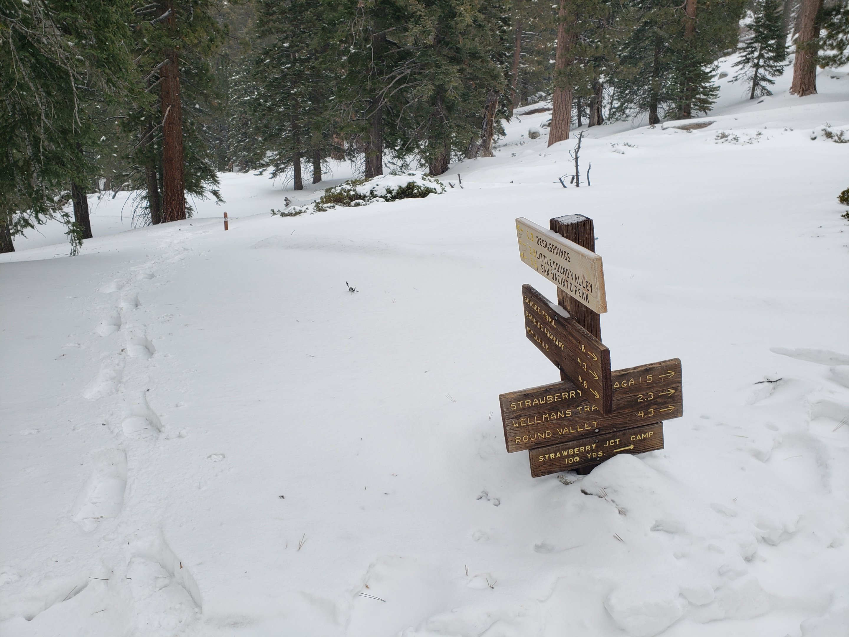
San Jacinto Trail Report: available for everyone, funded by readers. While thousands of hours of labor are provided for free, the Report is wholly dependent on small private donations to cover its direct costs (e.g., gear, gas, web space). With a busy PCT season coming soon, every contribution is invaluable, and your donation helps subsidise the thousands of thru-hikers who also use the Report. If you have found this Report useful, please consider visiting the Donate page. Thank you very much.
sanjacjonUncategorized 6 MinutesEdit”Trail update 29th January 2020″
Snow and trail update 22nd January 2020
[UPDATE 25th January: information for the Tahquitz Peak and South Ridge areas is updated below, based on hikes in the last two days.]
Early this morning I hiked briskly to San Jacinto Peak, ascending and descending via the east side. The minor storm in the early hours of Tuesday 21st that produced 0.19″ rain in Idyllwild also generated a tiny snowfall in the high country, with snow level near 9000′ elevation, and a maximum of 1.5″ snow at San Jacinto Peak. With a slightly loose layer of fresh snow on top of icy snow, microspikes were useful above 9000′. However even descending I had removed them by 8500′.
With mild conditions returning for the remainder of January, the snow softens rapidly during the day but postholing doesn’t get too bad until after noon. Conditions underfoot will broadly remain similar for the foreseeable future. Melting will continue to be steady at all elevations.
Snow depths measured today are listed at the foot of this posting. Strong winds in the high country may cause drifting snow to obscure parts of even the heavily traveled trails. Cautious navigation is recommended everywhere. For most of my 13 ascents so far this month, the quarter-mile of trail either side of Annie’s Junction, and some short sections of the Peak Trail above 9800′, were partly obscured by overnight spindrift.
Microspikes are recommended on-trail for compacted, well-traveled trails. They are especially useful for descending. Crampons are a good option, but generally less convenient than spikes, both on- and off-trail above about 9000′. Snowshoes are currently useful off-trail almost everywhere above about 9000′ elevation.
Hikers should be prepared for temperatures at or below freezing in the high country, and well below freezing when considering windchill effects (see below for temperatures I have recorded recently at San Jacinto Peak).
Note that the USFS gate at Humber Park remains closed. There are nine legal parking spaces (available for all uses) just below the gate and near the upper Ernie Maxwell trailhead. The next closest legal parking is 0.1 mile downhill on Forest Drive.
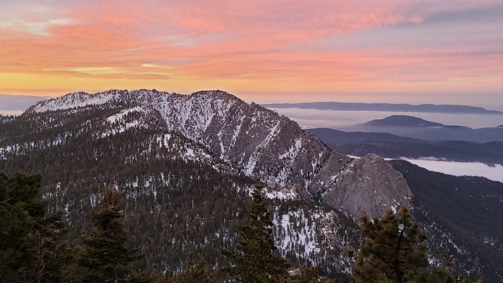
WEATHER Temperatures at all elevations are forecast to be above seasonal for the remainder of January. There is no significant precipitation in the forecast, and according to the latest outlook from NWS San Diego prospects for snow in early February are poor.
At San Jacinto Peak (10,810ft/3295m) today, Wednesday 22nd January 2020, at 0825 the air temperature was 28.2°F (-2°C), with a windchill of 9.3°F (-13°C), 75% relative humidity, and a stiff NW wind sustained at 11 mph gusting to 29.7 mph.
At the Peak on Monday 20th January 2020, at 0925 the air temperature was 31.3°F (0°C), with a windchill of 16.5°F (-9°C), 24% relative humidity, and a brisk SSE wind sustained at 13 mph gusting to 20.3 mph, under completely cloudy skies.
PACIFIC CREST TRAIL NOTES
The Pacific Crest Trail remains open at the rockslide just north of Antsell Rock (Mile 172.5). USFS has stated there are currently no plans to close this section of the PCT during spring 2020. My video report from 7th October (available here) can be useful for deciding whether to try to hike around the rockslide or take an alternate route.
Microspikes are useful on most of the PCT for snow travel between approximately Miles 165 and 192. Depending upon your comfort level on icy snow, spikes are not currently essential however. See below for conditions on some specifc sections of the PCT and the many side trails.
PCT hikers are reminded that overnight stays are not permitted at or near San Jacinto Peak, including in the historic shelter. Mt. San Jacinto State Park regulations permit overnight stays only in established campgrounds. Options for thru-hikers are Strawberry Junction and Little Round Valley.
TRAIL CONDITIONS
All trails above about 9000′ remain completely snow-covered, with depth depending on elevation (see below). Long sections of trails above about 7800′ may be snow-covered. Limited icy snow patches remain in places above 6500′.
Deer Springs Trail is largely clear of snow to Strawberry Junction with just a few patches close to the junction (microspikes not required). The PCT section from here to Fuller Ridge has patchy snow to about 8500′ elevation, then continuous snow cover thereafter, with a reasonable consolidated track to follow. A track above 9000′ to Little Round Valley is reasonably consolidated (in the early morning at least), but be advised that it does not follow the established trail in places. Above Little Round Valley there is a very direct (i.e. steep) track to follow to San Jacinto Peak. Microspikes are useful for descending. Snowshoes may be useful after late morning and on warm days.
Fuller Ridge Trail (PCT Miles 185.5-190.5) has one set of posthole tracks through the snow. I have not yet assessed how accurately these conform to the PCT route.
Marion Mountain Trail has been heavily traveled and has a good consolidated track to follow. Microspikes are useful, especially for descending.
Round Valley Trail from the Tram through to Wellman Divide has been well-traveled and a good track through the snow is easy to follow, on to San Jacinto Peak.
Skyline Trail has well-traveled tracks through the patchy snow above about 7000′.
Devil’s Slide Trail has increasingly patchy icy snow cover at only about 40% below 7700′, but higher up snow cover remains 80%. Microspikes are useful but not required.
Ernie Maxwell Trail is clear of snow, with just a few persistent thin icy snow patches near Humber Park. Microspikes not required.
The parts of Willow Creek Trail and Caramba Trail nearest to Saddle Junction have well-defined snowshoe tracks, likely heading around Skunk Cabbage Meadow.
The PCT southbound from Saddle Junction has been lightly traveled to Chinquapin Flat.
Tahquitz Peak trail from Chinquapin Flat/PCT Mile 178 has not been visibly traversed through to the fire lookout in 2020 [updated 24th January]. There are no steps to follow through the angled icy snow for at least 0.25 miles. However the trail is clearing surprisingly quickly, the snow drifts are softening rapidly, and crampons are no longer required. Microspikes are strongly recommended, in conjunction with an ice axe (if you know how to use it). Snowshoes are not advised.
South Ridge Road [updated 25th January] is clear of snow.
South Ridge Trail [updated 24th January] is almost clear to Old Lookout Flat at 7600′, but with some remnant icy snow patches in its first 0.5 mile. Snow cover is very limited (<10%) higher up, but becomes almost continuous on the final six switchbacks close to Tahquitz Peak. Microspikes are useful above about 8500′, or lower if descending.
Seven Pines Trail has had no hiker traffic so far this winter, with no tracks or trail to follow. Indeed this trail has only been hiked a handful of times since November 2018. Extremely cautious navigation is recommended for those who are not very familiar with hiking this trail in snow.
The Forest Service closure of Dark Canyon Road remains in place, hence there is no vehicular access to Seven Pines trailhead.
SNOW DEPTHS measured on 22nd January 2020 are as follows (or on 16th January where indicated). Please note that average depth is given; drifts can be much deeper in places. Altitudes are approximate.
San Jacinto Peak (10810′): 27″ (was 47″ on 27th December)
Little Round Valley (9800′): 22″ (on 16th January)
Wellman Divide (9700′): 6″ (was 27″ on 27th December)
Annie’s Junction (9070′): 17″ (was 25″ on 27th December, heavy drifting here)
Fuller Ridge Trail (PCT Mile 185.5) at junction with Deer Springs Trail (8950′): 14″ (on 16th January)
Long Valley (8600′): 2″
Strawberry Junction (8100′): <1″
Saddle Junction (8070′): 4″ (was 19″ on 27th December)
Devil’s Slide trailhead at Humber Park (6520′): <1″ (was 11″ on 27th December)


San Jacinto Trail Report: available for everyone, funded by readers. While thousands of hours of labor are provided for free, this Report is wholly dependent on small private donations to cover its direct costs (e.g., gear, gas, web space). With a busy PCT season coming soon, every contribution is invaluable, and your donation helps subsidise the thousands of thru-hikers who also use the Report. If you find the Report useful, please consider visiting the Donate page. Thank you.
sanjacjonUncategorized 5 MinutesEdit”Snow and trail update 22nd January 2020″
Trail update 16th January 2020
[UPDATE 17th January: all three of us hiked to San Jacinto Peak today to assess last night’s “storm”. Drizzle fell in Idyllwild (0.05 inch at 5550′) up to about 6000′. It fell as freezing rain to 9000′. Also between about 7500′-9000′ there was barely a dusting of fresh snow (<0.25″) under the verglas. The high country had some rime on the trees, but no fresh snowfall.]
Very early this morning I hiked briskly to San Jacinto Peak, ascending the east side and descending via the west side. Today I did not put on microspikes until Wellman’s Cienega, but frankly could have summited without them. They were useful for descending however. Although I carried snowshoes for uppermost Deer Springs Trail, that early in the morning I postholed very little down to 9000′, and not at all thereafter, so only used microspikes.
With persistent spring-like conditions in the high country (>8500′), the snow softens rapidly during the day but postholing doesn’t get too bad until after noon. Snowshoes remain helpful for any off-trail travel. Conditions underfoot will broadly remain similar for the foreseeable future, but will be more challenging on warmer days (such as this weekend, 18th-19th January). Despite cool overnight temperatures, melting has been steady at all elevations, and at an alarming rate for early January.
Snow depths measured today are listed at the foot of this posting. Strong winds this week in the high country may cause drifting snow to obscure parts of even the heavily traveled trails. Cautious navigation is recommended everywhere. For most of my nine ascents so far this month, the quarter-mile of trail either side of Annie’s Junction, and some short sections of the Peak Trail above 9800′, were partly obscured by overnight spindrift.
Microspikes are recommended on-trail for compacted, well-traveled trails. They are especially useful for descending. Crampons are an option, but less convenient than spikes, for firm trails above about 9000′. Snowshoes are currently recommended off-trail almost everywhere above about 8500′ elevation.
Hikers should be prepared for temperatures at or below freezing in the high country, and well below freezing when considering windchill effects (see below for temperatures I have recorded recently at San Jacinto Peak).
Note that the USFS gate at Humber Park remains closed. There are nine legal parking spaces (available for all uses) just below the gate and near the upper Ernie Maxwell trailhead. The next closest legal parking is 0.1 mile downhill on Forest Drive.
WEATHER Temperatures at mid-elevations are forecast to be near or above seasonal for the remainder of January (above seasonal in the high country). Light precipitation is possible for the evening of Thursday 16th (rain at Idyllwild elevation, little or no snow in the high country). Regrettably, long term forecasts for a very dry January seem to be increasingly accurate, a scary prospect for what is historically one of the wettest months of the year.
At San Jacinto Peak (10,810ft/3295m) today, Thursday 16th January 2020, at 0825 the air temperature was 26.3°F (-3°C), with a windchill of 7.7°F (-14°C), 27% relative humidity, and a stiff SW wind sustained at 17 mph gusting to 27.0 mph.
At the Peak on Tuesday 14th January 2020, at 0940 the air temperature was 32.1°F (0°C), with a windchill of 15.6°F (-9°C), 23% relative humidity, and a gusty due West wind sustained at 11 mph gusting to 29.2 mph.
At the Peak on Sunday 12th January 2020 at 0815 the air temperature was 29.2°F (-2°C), with a windchill of 11.1°F (-12°C), 42% relative humidity, and a frigid WNW wind sustained at 21 mph gusting to 31.2 mph.
PACIFIC CREST TRAIL NOTES
The Pacific Crest Trail remains open at the rockslide just north of Antsell Rock (Mile 172.5). USFS informed me last week that there are currently no plans to close this section of the PCT during spring 2020. My updated video report from 7th October (available here) can be useful for deciding whether to try to hike around the rockslide or take an alternate route.
Microspikes are useful on most of the PCT for snow travel between approximately Miles 165 and 192. Depending upon your comfort level on icy snow, they may not currently be essential however. See below for conditions on specifc sections of the PCT and the many side trails.
PCT hikers are reminded that overnight stays are not permitted at or near San Jacinto Peak, including in the historic shelter. Mt. San Jacinto State Park regulations permit overnight stays only in established campgrounds. Options for thru-hikers are Strawberry Junction and Little Round Valley.
TRAIL CONDITIONS
All trails above about 8500′ are completely snow-covered, with depth depending on elevation (see below).
Deer Springs Trail is largely clear of snow to Strawberry Junction with just a few patches close to the junction (microspikes not required). The PCT section from here to Fuller Ridge has patchy snow to about 8500′ elevation, then continuous snow cover thereafter, with a reasonable consolidated track to follow. The track above 9000′ to Little Round Valley is easy to follow and reasonably consolidated (in the early morning at least), but be advised that it does not follow the established trail in many places. Above Little Round Valley there is a very direct (i.e. steep) single set of snowshoe and posthole tracks to follow to San Jacinto Peak. Microspikes are useful for descending. Snowshoes will be useful after late morning and on warm days.
Fuller Ridge Trail (PCT Miles 185.5-190.5) has one set of posthole tracks through the snow. I have not yet assessed how accurately these conform to the PCT route.
Marion Mountain Trail has been heavily traveled and has a good consolidated track to follow. Microspikes are useful, especially for descending.
Round Valley Trail from the Tram through to Wellman Divide has been well-traveled and a good track through the snow is easy to follow, on to San Jacinto Peak.
Skyline Trail has been traveled since the last snowfall, and tracks exist through the increasingly patchy snow above about 7000′.
Devil’s Slide Trail has a very well-worn track to follow. Icy snow cover is increasingly patchy and only about 50% below 7700′, but higher up snow cover remains 90%. Microspikes are useful later in the day and for descending, but are not essential.
Ernie Maxwell Trail is largely clear, with about 30% cover of thin icy snow at the upper end near Humber Park. Microspikes are not required.
The parts of Willow Creek Trail and Caramba Trail nearest to Saddle Junction have well-defined snowshoe tracks, likely heading around Skunk Cabbage Meadow.
The PCT southbound from Saddle Junction has been lightly traveled to Chinquapin Flat.
Tahquitz Peak trail from Chinquapin Flat/PCT Mile 178 has not been reliably traversed through to the fire lookout in 2020. There limited or no steps to follow through the angled icy snow for at least 0.25 miles, depending on recent drifting. These ice slopes are notoriously treacherous. Crampons are recommended, in conjunction with an ice axe (if you know how to use both). Snowshoes are not advised due to the angle of the underlying ice.
South Ridge Road is mostly clear but with a few icy snow patches in its upper half (passable with 4WD/AWD).
South Ridge Trail [updated 18th January] is almost clear to Old Lookout Flat at 7600′, but with some stubborn icy snow patches in its first 0.5 mile. Higher up there is about 50% snow cover to Tahquitz Peak. Microspikes are useful above about 8000′, mainly for descending.
The Peak Trail above 10,300′ has not been traversed since before the late November storms. The only defined trail to San Jacinto Peak from the east is the steep option up the East Ridge.
Seven Pines Trail has had no hiker traffic so far this winter, with no tracks or trail to follow. Indeed this trail has only been hiked a handful of times since November 2018. Extremely cautious navigation is recommended for those who are not very familiar with hiking this trail in snow.
The Forest Service closure of Dark Canyon Road remains in place, hence there is no vehicular access to Seven Pines trailhead.
SNOW DEPTHS measured on 16th January 2020 are as follows. Please note that average depth is given; drifts can be much deeper in places. Altitudes are approximate.
San Jacinto Peak (10810′): 29″ (47″ on 27th December)
Little Round Valley (9800′): 22″
Wellman Divide (9700′): 8″ (27″ on 27th December)
Annie’s Junction (9070′): 19″ (25″ on 27th December, heavy drifting here)
Fuller Ridge Trail southern end at junction with Deer Springs Trail (8950′): 14″
Strawberry Junction (8100′): 1″
Saddle Junction (8070′): 7″ (19″ on 27th December)
Devil’s Slide trailhead at Humber Park (6520′): <1″ (11″ on 27th December)


San Jacinto Trail Report: available for everyone, funded by readers.
While thousands of hours of labor are provided for free, this Report is wholly dependent on small private donations to cover its direct costs (e.g., gear, gas, web space). We are having another busy winter, with an even busier PCT season coming soon. Every contribution is invaluable, and your donation helps subsidise the thousands of thru-hikers who also use the Report. If you find the Report useful, please consider visiting the Donate page. Thank you.
sanjacjonUncategorized 6 MinutesEdit”Trail update 16th January 2020″
Snow and trail update 8th January 2020
[UPDATE 10th January: I hiked to San Jacinto Peak this morning, and conditions were not significantly different from the Report from 8th below. However I did record a rambling video from the Peak discussing yesterday’s minor storm and current snow situation.]
[UPDATE 9th January: light snow today produced 1.2″ depth in Idyllwild (at 5550′). The high country was above the cloud almost all day, with Long Valley (8600′) receiving only 0.25″ fresh snow. This storm is unlikely to have significantly altered the conditions described below. ]
A brief update on snow and trail conditions based on hikes on three of the past four days to San Jacinto Peak. Leaving well before dawn on each day in order to make the most of colder, firmer snow, I was able to use microspikes without significant postholing all the way from Humber Park to San Jacinto Peak. Today was the first day in many weeks that I did not carry snowshoes on my pack. Although snow conditions on descent a couple of hours later were softer, it was early enough to minimise postholing. Nevertheless as usual the ascents were more fun than the descents. Snow conditions will continue to firm up with much colder weather from today into next week.
Snow depths measured today are listed at the foot of this posting. Some major trails have not been traveled this year, and remain obscured by heavy snowfall. Cautious navigation is recommended everywhere. Melting has been rapid in recent days, mainly below 9000′, with the first week of January among the warmest in recorded Idyllwild history.
Microspikes are strongly recommended on-trail for compacted, well-traveled trails (see below). They are especially useful for descending. Crampons are an option, but less convenient than spikes, for firm trails above about 9000′. Snowshoes are currently strongly recommended off-trail almost everywhere above about 8000′ elevation.
Hikers should be prepared for temperatures below freezing in the high country, and potentially far below freezing when considering windchill effects (see below for the temperatures I recorded at San Jacinto Peak this morning).
Note that the USFS gate at Humber Park remains closed. There are nine legal parking spaces (available for all uses) just below the gate and near the upper Ernie Maxwell trailhead. The next closest legal parking is 0.1 mile downhill on Forest Drive.
PCT hikers are reminded that overnight stays are not permitted at or near San Jacinto Peak. Mt. San Jacinto State Park regulations permit overnight stays only in established campgrounds. Options for thru-hikers are Strawberry Junction and Little Round Valley.
WEATHER Temperatures are forecast to be at or below seasonal for the remainder of January. There is a possibility of very light precipitation on the afternoon of Thursday 9th (<1″ snow at Idyllwild, 1-2″ in the high country).
According to the latest NWS San Diego video, there are chances for precipitation in the second half of January, but it is unclear whether storms may largely pass to the north. Otherwise a relatively dry month is a possibility (a scary prospect for what is historically the wettest month of the year).
At San Jacinto Peak (10,810ft/3295m) today, Wednesday 8th January 2020, at 0925 the air temperature was 23.8°F (-5°C), with a windchill of 0.3°F (-18°C), 19% relative humidity, and a wild WNW wind sustained at 21 mph gusting to 46.7 mph.
At the Peak on Tuesday 7th January 2020 at 0845 the air temperature was 38.7°F (3°C), with a windchill of 27.7°F (-3°C), 22% relative humidity, and a pleasant SSW breeze sustained at 8 mph gusting to 11.0 mph.
TRAIL CONDITIONS
All trails above about 6500′ are largely or completely snow-covered, with depth depending on elevation (see below).
Reliable tracks are currently in place for Devil’s Slide Trail, from Saddle Junction to San Jacinto Peak, from the Tram through to Wellman Divide, and on South Ridge Trail.
Round Valley Trail from the Tram through to Wellman Divide has been well-traveled and a good track through the snow is easy to follow, on to San Jacinto Peak.
Skyline Trail has been traveled since the last snow, and tracks exist through the continuous snow above about 7000′. However not all the snow tracks are reliable, so cautious navigation is recommended.
Devil’s Slide Trail has a well-worn track to follow, and microspikes are very useful. Snow cover is patchy and spikes are not essential below 7000′, but higher up snow cover remains >90%.
Ernie Maxwell Trail [updated 11th January] has about 50% cover of thin icy snow.
The parts of Willow Creek Trail and Caramba Trail nearest to Saddle Junction have well-defined snowshoe tracks, likely heading around Skunk Cabbage Meadow.
The PCT southbound from Saddle Junction has been lightly traveled to Chinquapin Flat.
Tahquitz Peak trail from Chinquapin Flat/PCT Mile 178 has not been traversed through to the fire lookout in 2020. There no steps to follow through the angled icy snow for at least 0.25 miles. These ice slopes are notoriously treacherous. Crampons are strongly recommended, in conjunction with an ice axe (if you know how to use both). Snowshoes are not advised due to the angle of the underlying icy snow.
South Ridge Road is mostly clear but with a few icy snow patches in its upper half (passable with 4WD/AWD).
South Ridge Trail is patchily snow-covered (<50%) to Old Lookout Flat at 7800′, with 90% snow cover from there to Tahquitz Peak. This trail has received little hiker traffic so far this year. Microspikes recommended above about 8000′.
The Peak Trail above 10,300′ has not been traversed since before the late November storms. The only defined trail to San Jacinto Peak from the east is the steep option up the East Ridge.
Deer Springs Trail The trail up to the Suicide Rock turning is excellent and well-defined. There has been very little hiker traffic further up the trail.
Seven Pines Trail and Fuller Ridge Trail (PCT Miles 185.5-190.5) have had no visible signs of hiker traffic so far this winter, and no tracks or trail to follow. Indeed Seven Pines Trail has only been hiked a handful of times since November 2018. Extremely cautious navigation is recommended for those who are not very familiar with hiking these trails in snow.
The Forest Service closure of Dark Canyon Road remains in place, hence there is no vehicular access to Seven Pines trailhead.
SNOW DEPTHS measured on 8th January are as follows. Please note that average depth is given; drifts can be much deeper in places. Altitudes are approximate.
San Jacinto Peak (10810′): 31″ (47″ on 27th December)
Wellman Divide (9700′): 11″ (27″ on 27th December)
Annie’s Junction (9070′): 22″ (25″ on 27th December, heavy drifting here)
Saddle Junction (8070′): 8″ (19″ on 27th December)
Devil’s Slide trailhead at Humber Park (6520′): 1″ (11″ on 27th December)
Idyllwild (at 5550′): 0″ (6.75″ on 27th December)
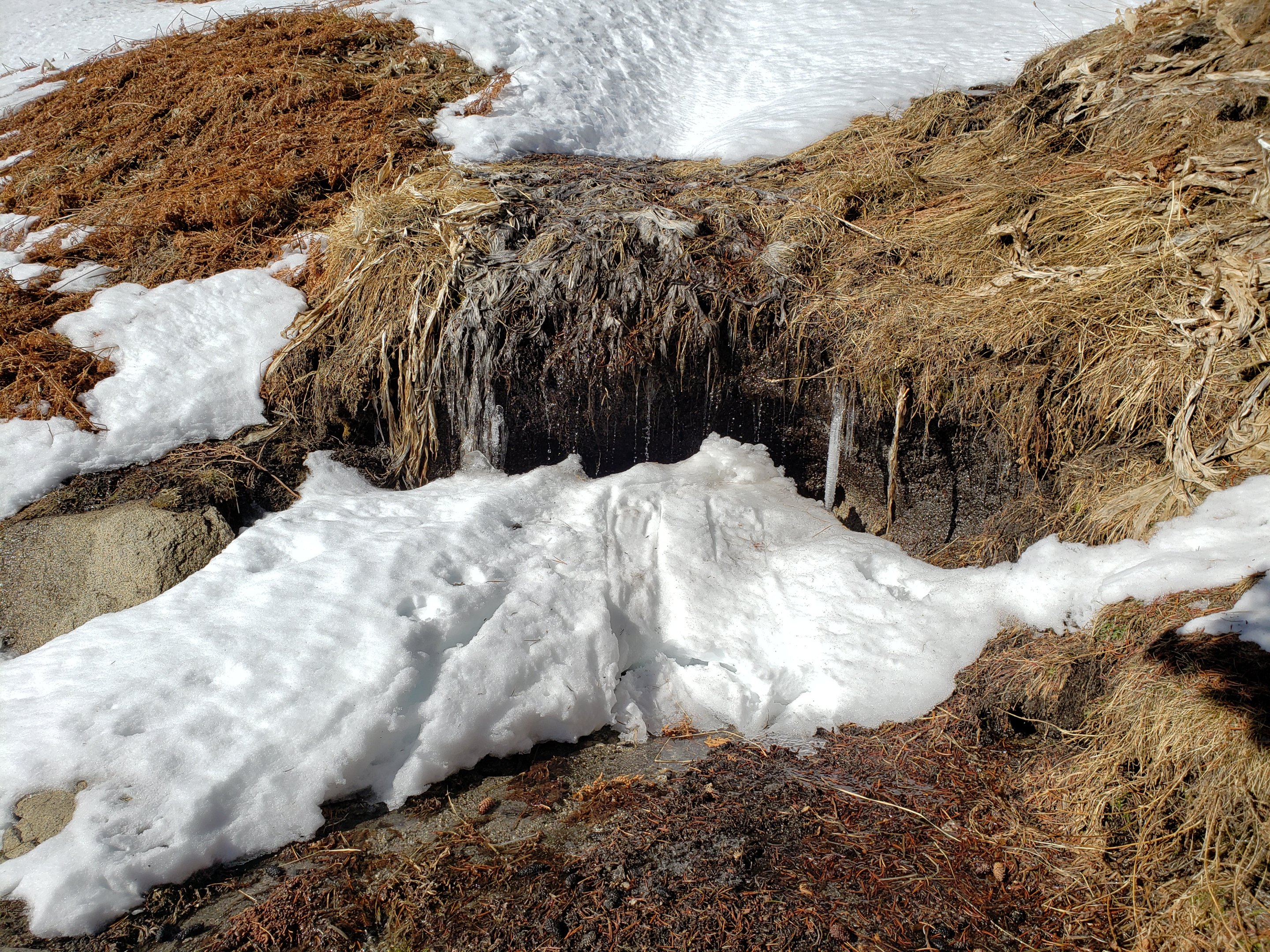

sanjacjonUncategorized 5 MinutesEdit”Snow and trail update 8th January 2020″
Snow and trail update 3rd January 2020
[UPDATE 5th January: Anne and Anabel hiked up South Ridge and have revised information for trails either side of Tahquitz Peak. I had the easy assignment, hiking in the pre-dawn hours to San Jacinto Peak via Devil’s Slide. That early the trails were icy enough to summit and descend using only microspikes, but trails were softening by noon.]
A brief update on snow and trail conditions based on my hike to San Jacinto Peak via Devil’s Slide Trail and Wellman Divide today (and the same route hiked on 1st January).
Leaving well before dawn today, I was able to use microspikes without postholing to 9000′ (top of “Angel’s Glide”), where I switched to snowshoes. On that same section on my descent a few hours later I was postholing in snowshoes in soft, treacle-like snow, which made for ugly snowshoeing. I used microspikes for descending Devil’s Slide Trail this afternoon, but was still slipping and sliding in the soft, melting snow. Suffice to say that the ascent was much more fun than the descent.
Unfortunately these poor snow conditions are unlikely to improve over the next few days, with warm weather into early next week.
Snow depths measured today are listed at the foot of this posting. With the exception of specific trails mentioned below, currently some major trails have not been traveled and are obscured by heavy snowfall. Cautious navigation is strongly recommended everywhere.
Snow depths are currently ideal for snowshoeing almost everywhere above about 7500′ elevation off-trail, and are recommended on-trail above 8500′ (except early mornings). Microspikes are recommended on several well-traveled trails (see below). They are especially useful for descending trails when they become icy and compacted.
Notwithstanding the next few warm days, hikers should be prepared for temperatures below freezing in the high country, and potentially below freezing when considering windchill effects.
Note that the USFS gate at Humber Park is closed. There are nine legal parking spaces (available for all uses) just below the gate and near the upper Ernie Maxwell trailhead. The next closest legal parking is 0.1 mile downhill on Forest Drive.
WEATHER Temperatures will remain well above seasonal in the high country for the next few days, leading to rapid snowmelt at all elevations. Strong winds forecast for Monday 6th may eliminate the existing well-defined snow tracks in the high country. Temperatures drop to more typical for January on about Wednesday 8th, then there is a slim possibility of precipitation by the following weekend (Sunday 12th).
At San Jacinto Peak (10,810ft/3295m) today, Friday 3rd January 2020, at 1025 the air temperature was 36.3°F (2°C), with a windchill of 27.6°F (-3°C), 44% relative humidity, and a light due North wind sustained at 7 mph gusting to 9.4 mph.
At the Peak on Wednesday 1st January 2020 at 1155 the air temperature was 37.1°F (3°C), with a windchill of 26.2°F (-4°C), 51% relative humidity, and a fresh due North wind sustained at 15 mph gusting to 19.7 mph.
TRAIL CONDITIONS
All trails above about 6500′ are snow-covered, with depth depending on elevation (see below).
Reliable tracks are currently in place for Devil’s Slide Trail, from Saddle Junction to San Jacinto Peak, and from the Tram through to Wellman Divide.
Round Valley Trail from the Tram through to Wellman Divide has been well-traveled and a good track through the snow is easy to follow. Note however that Tram hikers on New Year’s Day put through various confusing and steep trails directly from Round/Tamarack valleys toward San Jacinto Peak.
Skyline Trail has been traveled since the last snow, and tracks exist through the continuous snow above 6500′. However not all the snow tracks are reliable, so cautious navigation is recommended.
There is still no sign that anyone has ascended San Jacinto Peak from the west side, and my track to Little Round Valley and on to upper Deer Springs Trail from Monday no longer exists (due to high winds on Tuesday).
Devil’s Slide Trail has a well-worn track to follow, and microspikes are very useful. Snow cover is still >95%.
Ernie Maxwell Trail is now largely clear of snow. Microspikes are useful at least for descending, but not required. Snow cover is 50% near Humber Park, decreasing to 10% near Tahquitz View Drive.
The parts of Willow Creek Trail and Caramba Trail nearest to Saddle Junction have well-defined snowshoe tracks, likely heading around Skunk Cabbage Meadow.
The PCT southbound from Saddle Junction has been lightly traveled to Chinquapin Flat.
Tahquitz Peak trail from Chinquapin Flat/PCT Mile 178 has not been traversed through to the fire lookout in 2020 [updated Sunday 5th January]. There no steps to follow through the angled icy snow for at least 0.25 miles. These ice slopes are notoriously treacherous. Crampons are strongly recommended, in conjunction with an ice axe (if you know how to use both). Snowshoes are not advised due to the angle of the underlying icy snow.
South Ridge Road is mostly clear but with icy snow patches in its upper half (passable with 4WD/AWD).
South Ridge Trail is patchily snow-covered (c.50%) to Old Lookout Flat at 7800′. Virtually 100% snow cover from there to Tahquitz Peak. Until Sunday 5th January this upper section had only been hiked by one snowshoer. Microspikes recommended above about 8000′ [many thanks to Anne and Anabel King for this update from 5th].
The Peak Trail above 10,300′ has not been traversed since before the late November storms. The only defined trail to San Jacinto Peak from the east is the steep option up the East Ridge.
Deer Springs Trail See my comments above regarding the route toward San Jacinto Peak. The trail up to the Suicide Rock turning is excellent and well-defined.
Seven Pines Trail and Fuller Ridge Trail (PCT Miles 185.5-190.5) have had no visible signs of hiker traffic so far this winter, and no tracks or trail to follow. Indeed Seven Pines Trail has only been hiked a handful of times since November 2018. Extremely cautious navigation is recommended for those who are not very familiar with hiking these trails in snow.
The Forest Service closure of Dark Canyon Road will remain in place into 2020, hence there is no vehicular access to Seven Pines trailhead.
SNOW DEPTHS measured today are as follows. Please note that average depth is given; drifts are much deeper than the average in places. Altitudes are approximate.
San Jacinto Peak (10810′): 40″ (heavily drifted)(47″ on 27th December)
Wellman Divide (9700′): 22″ (27″ on 27th December)
Annie’s Junction (9070′): 26″ (25″ on 27th December, increase is due to heavy drifting here)
Saddle Junction (8070′): 12″ (19″ on 27th December)
Devil’s Slide trailhead at Humber Park (6520′): 2″ (11″ on 27th December)
Idyllwild (at 5550′): 0″ (6.75″ on 27th December)
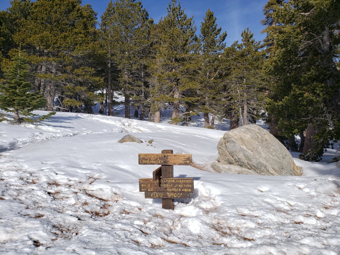
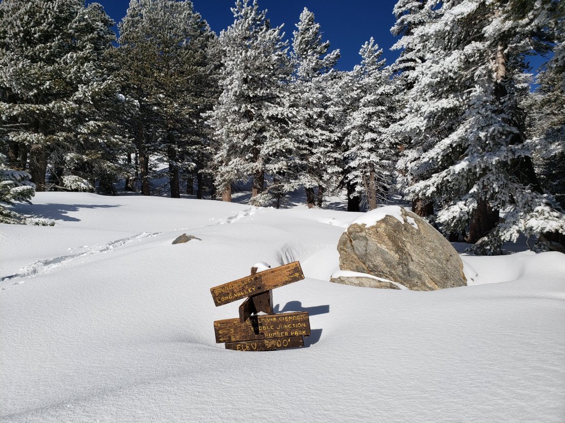
sanjacjonUncategorized 5 MinutesEdit”Snow and trail update 3rd January 2020″
Snow conditions update 1st January 2020
A very brief update on snow and trail conditions based on my hike to San Jacinto Peak from home in Idyllwild today. Information in the Report from 30th December 2019 is largely still applicable, except as described below. Snow depths measured today were not significantly changed from the previous Report, although drifting has been dramatic in places.
Strong NE winds yesterday resulted in heavy drifting above 8000′ elevation. I was dismayed to find that my tracks from Monday above Saddle Junction had been largely obliterated, so I had to break trail between Saddle Junction and San Jacinto Peak for the third time in six days.
Snow conditions above 8000′ were very poor, with relatively warm temperatures resulting in moist, heavy, clumping snow which made for grim snowshoeing. Unfortunately this is unlikely to improve over the next few days, with a marked warming trend into early next week.
There is now also good trail between the Tram and Wellman Divide. Note however that Tram hikers have put through various confusing and steep trails directly from Round/Tamarack valleys toward San Jacinto Peak.
No one ascended San Jacinto Peak from the west side today, and my track to Little Round Valley and on to upper Deer Springs Trail no longer exists.
Devil’s Slide Trail remains in excellent condition, with icy snow that is ideal for microspikes.
Ernie Maxwell Trail was also firm and largely snow-covered before dawn today. I did not use microspikes ascending, but they are useful at least for descending. Snow cover is 90% near Humber Park, decreasing to 60% near Tahquitz View Drive.
Weather At San Jacinto Peak (10,810ft/3295m) today, Wednesday 1st January 2020 at 1155 the air temperature was 37.1°F (3°C), with a windchill of 26.2°F (-4°C), 51% relative humidity, and a fresh due North wind sustained at 15 mph gusting to 19.7 mph.
For those readers interested in my brief end-of-2019 summary and thank you to donors message posted yesterday, it is available here.
