Storm summary 25th December 2021
[UPDATED 29th December @ 1440: light snow yesterday added another 1.5 inches at 5550ft, with 5-6 inches on the ground now in Idyllwild (variable due to some patchy melting). The high country has been largely above the cloud the past two days, with just a dusting of an inch at most in Long Valley (8600ft) yesterday, for a total of about 13 inches there. The high peaks have added equally little in the past 48 hours, with a little above two feet estimated around San Jacinto Peak. Snow levels dropped yesterday to near 4000ft, with a dusting in Garner Valley. About 1-2 inches of snow are expected above 5000ft in the next 24 hours in the fourth (and final) storm of the seven day period. Snowshoes are currently useful everywhere above 5500ft, and spikes are recommended everywhere above 5000ft especially as conditions become increasingly icy. The next comprehensive update of the high country snow situation will likely be in the evening of Friday 31st.]
[UPDATED 28th December @ 0720: our third snow storm in five days passed through yesterday afternoon with snow in Idyllwild starting at 1415, accumulating to 3.25 inches. It only snowed very lightly in Long Valley (8600ft) with a scant one inch accumulation, and similarly light dusting on top of the two feet already around the highest peaks. With four snow storms in seven days, I do not expect a comprehensive update of the high country snow situation before Friday 31st.]
[UPDATED 26th December: very light snow overnight produced one inch in Idyllwild at 5550ft, and about two inches in Long Valley (8600ft). Snow level was near 5000ft.]
This is a summary of conditions following the fourth – and most substantial – snow (and rain!) storm of winter 2021/22 to date, with the precipitation starting early morning on Thursday 23rd and continuing well into Friday 24th December.
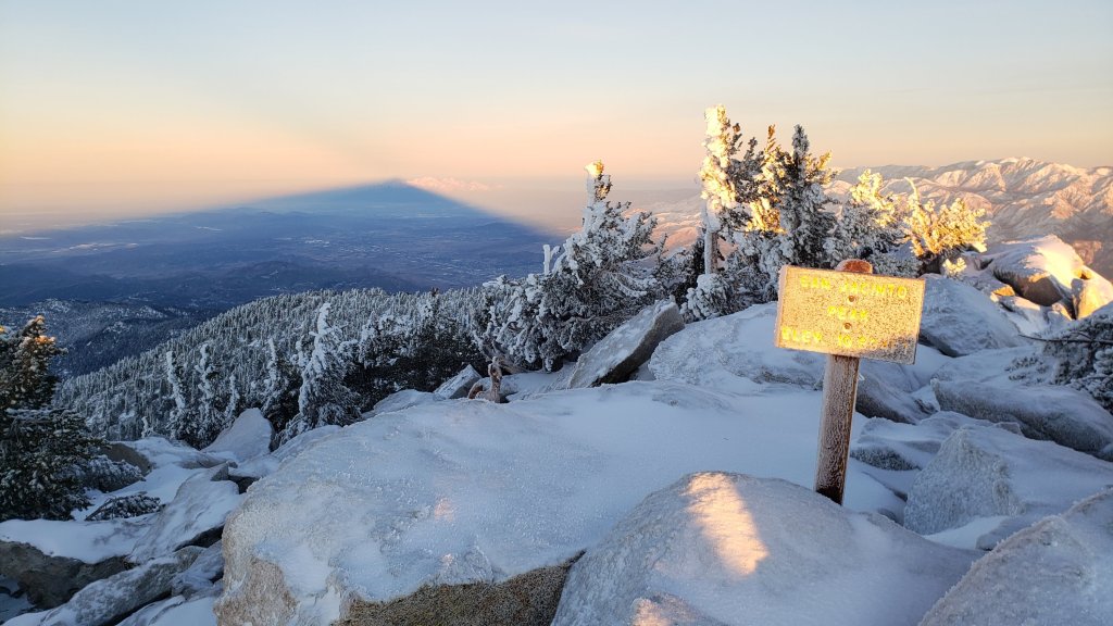
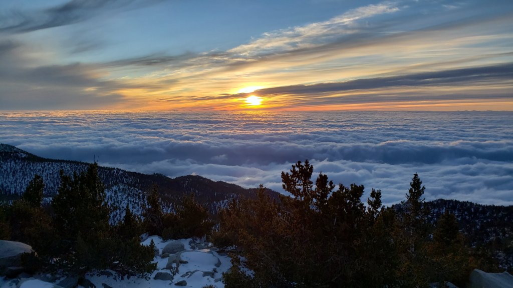
The storm system involved an atmospheric river drawing in moisture from tropical latitudes. Consequently the system was warm, with prodigious rain falling at high and mid elevations, often removing some of the existing snow first, before replacing it with some fresh powder later. My ascent to San Jacinto Peak on 23rd was a soggy, postholing one, with drizzle alternating with light rain, remarkably all the way to the Peak. There was a little snow mixed in by 10,200ft, but it was not until early afternoon that it finally turned completely to snow in the high country.
By the afternoon of 24th about 14 inches had fallen at San Jacinto Peak (10,810ft), and as I descended that day it was finally dusting down to about 6600ft on Devil’s Slide Trail. Detailed snow depths recorded on my hike on Friday 24th are given at the foot of this posting.
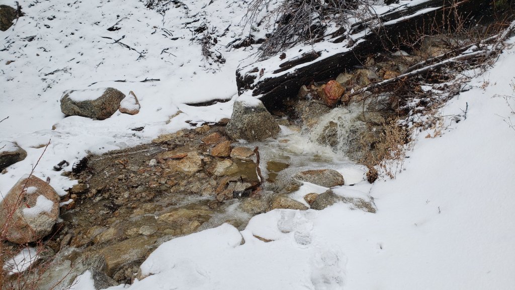
Much more significant than the snow falls were the excellent rainfall totals, with a whopping 4.35 inches measured in Idyllwild at 5550ft. It was such a pleasure to see all the minor creeks and springs flowing in full force along Devil’s Slide Trail this afternoon, in most cases for the first time in at least two-and-a-half years.
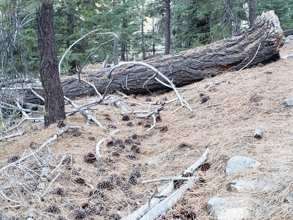
Both this storm and the previous one nine days ago left branches were heavily laden with ice, and as a result I have found many broken tree limbs in the trails. Hikers should expect to find many new treefall hazards, especially in vulnerable burn areas.
Currently very few major trails have been traveled and all are heavily obscured by snowfall. Beyond Saddle Junction, at the time of writing my snowshoe tracks to San Jacinto Peak are the only traveled high country trail. However, spindrift will have obscured much of these tracks within hours. Very cautious navigation is recommended everywhere.
Snow depths are currently ideal for snowshoeing everywhere above about 8500ft. Below that elevation snow coverage is generally too shallow for snowshoes. Spikes are recommended everywhere above about 7000ft for the foreseeable future as trails become compacted by hiker traffic and undergo freeze-thaw cycles. They will be especially valuable on trails with heavy water flow in the trails that will partially freeze over the next few days (e.g., Devil’s Slide and Deer Springs trails), and on colder mornings when conditions are icy, and for descending.
Note that significant additional snow is expected in the next week, which may change the trail conditions, and potentially the preferred equipment. However, some combination of snowshoes and spikes will likely be needed for the San Jacinto high country for the foreseeable future.
Hikers should be prepared for temperatures below freezing in the high country, and generally well below freezing when considering wind chill effects (see below for some of my recent weather observations from San Jacinto Peak).
For details regarding pre-existing (non snow/ice) hazards on the trails, coronavirus issues and ranger station access, please see this recent Report or contact the State Park or Forest Service as indicated on their websites.
The USFS gate at Humber Park closed on 13th December. Even when closed there are nine legal parking spaces this side of the gate (near the upper Ernie Maxwell trailhead). Any vehicles not parked in these spaces may be ticketed and/or towed. If there are signs further down indicating that the road is closed then the nine spaces are also unavailable for legal parking.
WEATHER Temperatures will remain well below seasonal averages into the first week of January 2022. Further snow is expected by the morning of 26th December. This fifth storm of the winter will be weaker than the fourth, but colder, with snowfall expected as low as 5000ft.
Conditions remain very unsettled into the first few days of January 2022, with further minor storm systems expected to bring snow down to mid elevations on 27th December, and again on 29th-30th. There is uncertainty in the forecast models how much snow will fall in the high country.
At San Jacinto Peak (10,810ft/3295m) on Thursday 23rd December 2021 at 1615 the air temperature was 27.7°F (-3°C), with a windchill temperature of 9.5°F (-13°C), 94% relative humidity, and a gusty due West wind sustained at 17 mph gusting to 27.8 mph.
At the Peak on Monday 20th December 2021 at 0940 the air temperature was 33.8°F (1°C), with a windchill temperature of 23.4°F (-5°C), 17% relative humidity, and a gentle WSW wind sustained at 6 mph gusting to 10.8 mph.
At the Peak on Tuesday 14th December 2021 at 1630 the air temperature was 10.4°F (-12°C), with a windchill temperature of -17.5°F (-27.5°C), 93% relative humidity, and a wild WNW wind sustained at 21 mph gusting to 32.5 mph.
TRAIL CONDITIONS
The Ernie Maxwell Trail is currently clear of snow. This is expected to change by Sunday 26th.
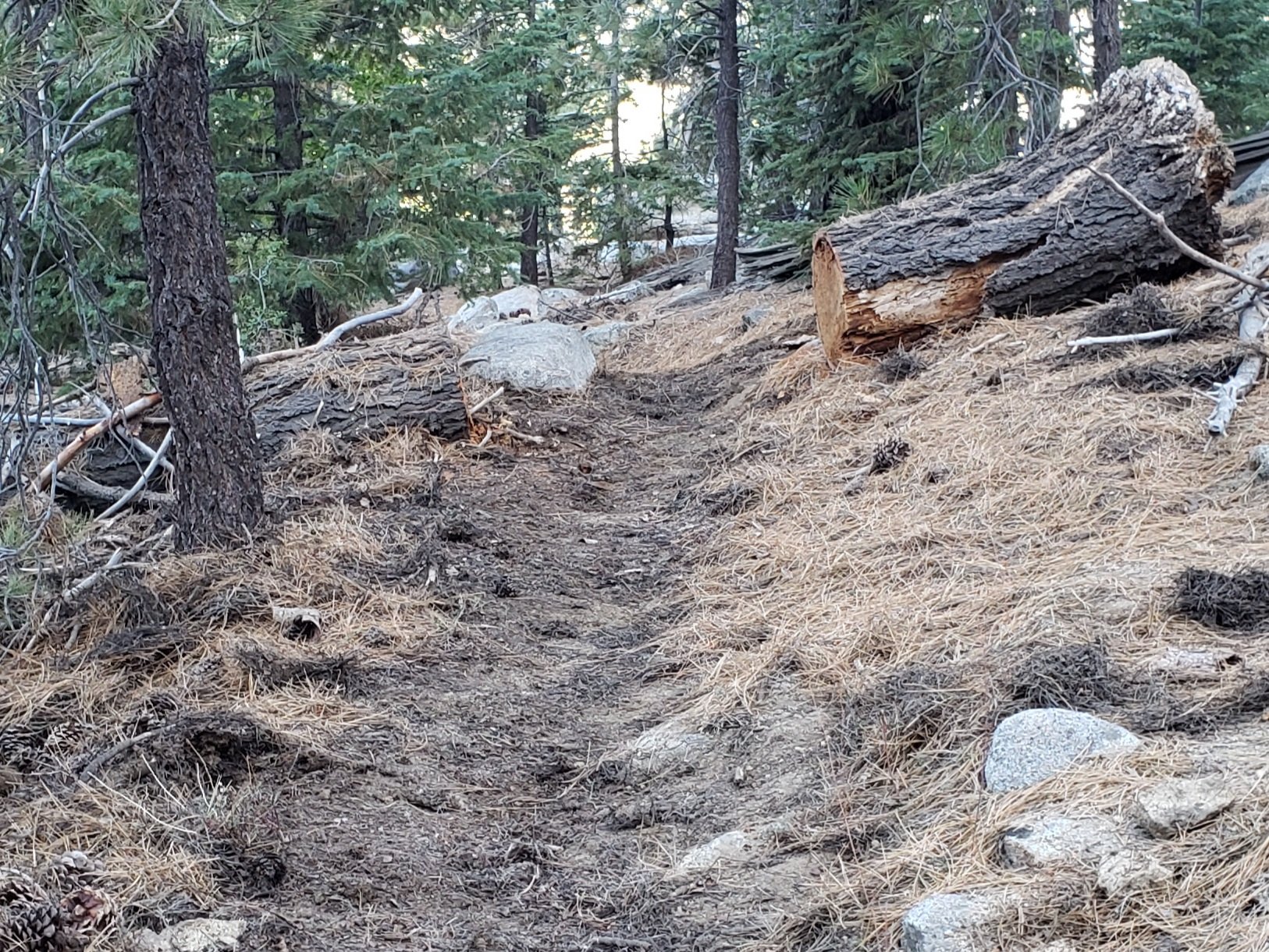
Devil’s Slide Trail has a well-traveled track to follow through the very shallow snow, although some short sections have considerable flowing water in the trail.
Dark Canyon Road, the access for Seven Pines Trail, is closed due to winter conditions, likely into next month.
Tahquitz Peak trail from Chinquapin Flat/PCT Mile 178 has no steps to follow through the angled icy snow. These icy slopes are treacherous. Currently crampons, with an ice axe (and knowledge of how to use both) are recommended. Snowshoes are not advised due to the angle of the icy snow.
SNOW DEPTHS measured on 24th December 2021 are as follows. The first number is the current average total depth, with the snow depth recorded earlier in the week prior to the storm following in parentheses. Note that average depth is given; due to strong winds accompanying the storms, there is extensive drifting, especially in the trails. Altitudes are approximate.
San Jacinto Peak (10810ft): 22 inches (was 8 inches on morning of 23rd December)
Wellman Divide (9700ft): 20 inches, likely heavily drifted (was 3 inches on morning of 23rd)
Annie’s Junction/approx. PCT Mile 181.8 (9070ft): 14 inches (was 4 inches on morning of 23rd)
Long Valley (8600ft): 12 inches (was about 4-5 inches on 23rd) [many thanks to Kyle Eubanks for these measurements]
Saddle Junction/approx. PCT Mile 179.9 (8070ft): 3 inches (was 2 inches on morning of 23rd, much of which was washed away by rain, before two inches of fresh snow fell on top of ice)
Devil’s Slide Trail at Humber Park (6520ft): <1 inch (was less than one inch on 20th, which all melted prior to a fresh dusting on afternoon of 24th)
Idyllwild (at 5550ft): 0 inches (was 0 inches on 20th)


Thank you fellow hikers for taking the time to read this. While all labor and time is volunteered, the San Jacinto Trail Report completely depends on small private donations to cover operating costs. Every year seems to have its challenges and 2021 has been no exception, so every contribution, no matter how small, is truly valuable. If you have found this Report useful, please consider visiting the Donate page. Thank you for your support.


sanjacjon Uncategorized Leave a comment 6 MinutesEdit”Storm summary 25th December 2021″
Storm updates 23rd-24th December 2021
The second significant storm (and fourth overall) of winter 2021/22 is currently impacting the San Jacinto mountains.
Please continue to check this page for periodic updates throughout the storm.
UPDATE @ 0705 on Friday 24th
Rainfall storm total in Idyllwild (at 5550ft) by 0700 this morning was a very impressive 3.47 inches.
San Jacinto Peak now has a storm total of about 13 inches of fresh snow, on top of about 8in from last week. Strong winds mean that the snow is heavily drifted.
Long Valley (8600ft) has added 5-6 inches, for a current total depth of 9-10in.
UPDATE @ 2010 on Thursday 23rd
San Jacinto Peak has gained about six inches of snow so far today, with perhaps another foot expected overnight. Long Valley (8600ft) had over an inch of rain (which helped remove 1-2 inches of snow) before it turned to snow, with about two inches accumulating so far. In Idyllwild rainfall has reached 1.2in, with at least that much expected again overnight.
UPDATE @ 1755 on Thursday 23rd
About five inches of snow have fallen so far at San Jacinto Peak. The rain has finally turned to snow in Long Valley, with about an inch accumulating there. Rainfall in Idyllwild surpassed an inch for today at 1650.
UPDATE @ 1540 on Thursday 23rd
As discussed below, this warm system is so far producing rain, rather than snow, at all but the highest elevations. Snow Creek at 6800ft on the north face currently leads the way with 1.2in already. Various sites in Pine Cove (around 6000ft) have passed one inch, while even at Long Valley at 8600ft, it continues to fall as rain (0.8in).
UPDATE @ 1340 on Thursday 23rd
In Idyllwild at 5550ft it started drizzling at about 0400. By 1330 storm total rainfall was already 0.85in.
My ascent to San Jacinto Peak this morning was a soggy, postholing one, with drizzle alternating with light rain all the way to the Peak. There was a little snow mixed in by 10,200ft, but it was not until 1230 that it finally turned completely to snow. It is already accumulating steadily at about an inch per hour.
In Long Valley (8600ft) it has rained about 0.6in this morning, and it remains just above freezing with no snow accumulation so far today.
It was so mild this morning (45°F at Humber Park!) that a lot of snow was melting below 9000ft. Devil’s Slide Trail – that had 90% snow/ice cover on Monday – was 75% clear this morning. It remained remarkably mild all the way up into the high country, where snow that was pleasantly compacted on Monday now had the consistency of soft serve ice cream. Hoping with undue optimism that it would be cold enough higher up for the snow to be firm, I nevertheless had to finally put on snowshoes at 10,000ft to finish my ascent without constant postholing.

Thank you fellow hikers for taking the time to read this. While all labor and time is volunteered, the San Jacinto Trail Report completely depends on small private donations to cover operating costs. Every year seems to have its challenges and 2021 has been no exception, so every contribution, no matter how small, is truly valuable. If you have found this Report useful, please consider visiting the Donate page. Thank you for your support.
sanjacjon Uncategorized Leave a comment 2 MinutesEdit”Storm updates 23rd-24th December 2021″
Trail and weather update 21st December 2021
The third and most significant snowstorm of the 2021/22 winter to date passed through the San Jacinto mountains on Tuesday 14th December, as described in detail in the previous Report. About nine inches fell at San Jacinto Peak (10,810ft) and about an inch in Idyllwild. It rained steadily at mid elevations before turning to snow, with 1.43 inches measured at 5550ft in Idyllwild.
The storm included strong, gusty winds, and drifting of snow was particularly severe. These winds, combined with trees heavily laden with ice, led to many new treefall hazards (both broken branches and whole trees). For example on May Valley Road on 16th I found seven trees down across the road (reported to USFS), and on 20th found three new trees down on a short section of Deer Springs Trail. Hikers should expect to find new treefall hazards on trails, especially in burn areas.
Although temperatures have been at or even slightly above seasonal averages since the storm, melting has been very slow everywhere above 5000ft, with the sun at its lowest potency of the year this week.
This morning we ascended San Jacinto Peak via the east side (Devil’s Slide, Wellman and Peak trails) and descended via Deer Springs Trail. This allowed for thorough survey of snow and treefall conditions on most of the high country trail system.
Rarely have I seen the weather forecasts for the San Jacinto mountains so variable and inconsistent as they are for the remainder of December 2021. The latest details are given in Weather below, but in summary the period is expected to be very unsettled, with precipitation possible almost any day in the next two weeks. Consequently trail conditions, and required equipment, could change frequently and at short notice.
Hikers should be prepared for temperatures below freezing in the high country, and generally well below freezing when considering wind chill effects (see below for my recent weather observations from San Jacinto Peak).
Spikes are strongly recommended everywhere above about 6000ft for the foreseeable future as well-used trails are compacted by hiker traffic and undergo further freeze-thaw cycles. They are especially valuable on icy consolidated tracks and for descending (details of individual trails are given below). Snow depths are currently adequate for snowshoeing everywhere off-trail above about 9000ft although they are not essential depending on your comfort level with light postholing in relatively shallow snow. They are not advised on the main trails, which are largely too compacted for comfortable snowshoeing.
The USFS gate at Humber Park closed on 13th December. Even when closed there are nine legal parking spaces just below the gate. In recent winters vehicles not parked in these spaces have periodically been ticketed and/or towed, usually at weekends or immediately following snow storms. When “Road Closed” signs are in place further down Fern Valley Road, these nine spaces are also unavailable for legal parking (according to CHP).
The Marion Mountain trailhead remains open. However Azalea Trail, the access road, has not been plowed, is extensively ice-covered and treacherous, and is 4WD/AWD passable only.
For details regarding pre-existing (non snow/ice) hazards on the trails, coronavirus issues and ranger station access, please see this recent Report or contact the State Park or Forest Service as indicated on their websites.
WEATHER Temperatures above seasonal averages, such as those we experienced this weekend, will continue until Wednesday 22nd. Forecast resolution remains relatively poor for the rest of December, but unsettled weather into early January is expected, with below average temperatures from 23rd December onwards, plus snow (high country) and moderate rain with dustings of snow (mid elevations). Moderate to heavy precipitation is expected on 23rd-24th, with 12+ inches of snow at the highest peaks and 2-3 inches of rain at Idyllwild elevation. The freeze level may be as high as 7000ft, so snow currently at mid elevations may be washed away by rain. Lighter precipitation is possible again on 25th and from 29th into early January 2022, but frankly could also occur any day for the remainder of December.
At San Jacinto Peak (10,810ft/3295m) on Monday 20th December 2021 at 0940 the air temperature was 33.8°F (1°C), with a windchill temperature of 23.4°F (-5°C), 17% relative humidity, and a gentle WSW wind sustained at 6 mph gusting to 10.8 mph.
At the Peak on Wednesday 15th December 2021 at 0640 the air temperature was 22.1°F (-6°C), with a windchill temperature of 0°F (-18°C), 31% relative humidity, and a gusty NW wind sustained at 21 mph gusting to 33.5 mph.
At the Peak on Tuesday 14th December 2021 at 1630 the air temperature was 10.4°F (-12°C), with a windchill temperature of -17.5°F (-27.5°C), 93% relative humidity, and a wild WNW wind sustained at 21 mph gusting to 32.5 mph.
TRAIL CONDITIONS
Note that conditions may change starting 23rd December when significant additional precipitation is possible, potentially adding light powder on top of ice and icy snow in the high country, and ice (initially falling as rain) to surfaces at mid elevations.
All trails above about 6000′ are largely or completely snow- and ice-covered. However, reliable and relatively prominent tracks are in place for almost all major trails as described below.
Tahquitz Peak trail from Chinquapin Flat/PCT Mile 178 has steps to follow through the angled icy snow. These icy slopes are notoriously treacherous. Currently spikes are strongly recommended. Snowshoes are rarely advisable on these slopes due to the angle of the icy snow.
The Ernie Maxwell Trail is almost completely covered with ice and compacted icy snow, and spikes are strongly recommended.
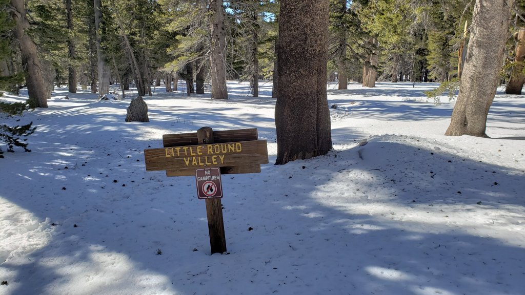
Deer Springs Trail has an excellent track to follow, well-traveled to Little Round Valley following the established trail route. Above Little Round Valley several different tracks meander up to the Peak, none of which accurately follow the actual trail for more than short sections, but several of which are relatively easy to follow.
Devil’s Slide and Marion Mountain trails have very well-traveled tracks to follow.
There are reasonable tracks to follow through the light snow around the Tahquitz meadows trail complex.
The Wellman Trail has been lightly traveled, and involves some uneven postholing through shallow snow, but there are a few tracks to follow.
There is a very well-traveled and consolidated trail from Long Valley through to Wellman Divide, which continues up the Peak Trail.
Spitler Peak Trail [updated 22nd] is virtually clear of snow. However there are six new trees down, all in the upper mile of the trail, including two major obstructions that require caution to get around.
Seven Pines Trail has a reasonable set of tracks to follow through the snow, although the track wanders from the established trail in its uppermost section. Dark Canyon Road is almost completely covered in 1-2 inches of snow, and is 4WD/AWD passable only.
There were no visible hiker tracks on Fuller Ridge Trail as of this afternoon.
May Valley Road is largely clear of snow, however it is largely impassable by vehicles due to multiple trees down (mentioned above, reported to USFS).
There is well-defined track on the Suicide Rock Trail through the snow from Deer Springs Trail.
SNOW DEPTHS measured on 20th December 2021, are as follows. Note that current average total depth is given first, followed in parentheses by the depth after the storm of 14th where known. Due to strong winds accompanying the storm there is extensive drifting, especially in and near the trails. Altitudes are approximate. Locations are listed in descending order by altitude.
San Jacinto Peak (10810ft): 8 inches (very heavily drifted; was 11 inches on 15th)
Little Round Valley (9800ft): 6 inches
Wellman Divide (9700ft): 3 inches (was 6.5 inches on 15th)
Annie’s Junction/approx. PCT Mile 181.8 (9070ft): 4 inches (was 5 inches on 15th)
Deer Springs Trail at Seven Pines Trail junction (8700ft): 4 inches
Strawberry Junction (8100ft): 1 inch
Saddle Junction/approx. PCT Mile 179.9 (8070ft): 2 inches (was 3 inches on 15th)
Deer Springs Trail at Suicide Rock Trail junction (6950ft): <1 inch (patchy, largely melted)
Devil’s Slide Trail at Humber Park (6520ft): <1 inch (2 inches on 15th)
Idyllwild (at 5550ft): 0.5 inch (very patchy, largely melted, was 1 inch on 15th)

Thank you fellow hikers for taking the time to read this. While all labor and time is volunteered, the San Jacinto Trail Report completely depends on small private donations to cover operating costs. Every year seems to have its challenges and 2021 has been no exception, so every contribution, no matter how small, is truly valuable. If you have found this Report useful, please consider visiting the Donate page. Thank you for your support.


sanjacjon Uncategorized Leave a comment 6 MinutesEdit”Trail and weather update 21st December 2021″
Snow storm summary 15th December 2021
This is a summary of conditions following the third – and most substantial – snow storm of winter 2021/22 to date, with all of the snow falling on Tuesday 14th December.
While we have to be grateful for any precipitation received given such a rapidly changing climate, it is hard not to be a little disappointed as snowfall in the high country was about half what was widely forecast. About nine inches fell at San Jacinto Peak (10,810ft), down to about an inch in Idyllwild (at 5550ft). The storm system was cold in its last few hours, with a dusting of snow to 4000ft, e.g., in Garner Valley. Detailed snow depths recorded on my hike on Tuesday 15th are given at the foot of this posting.
I recorded a brief YouTube video at San Jacinto Peak just after sunrise on 15th (available here) which gives a feel for the conditions at that time.
It rained relatively heavily in Idyllwild before the precipitation turned to snow, with 1.43 inches measured at 5550ft. The system was initially warm enough that rainfall occurred to at least 9700ft at Wellman Divide. Branches were heavily laden with ice between about 8000ft and 10,000ft, and I found many broken tree limbs in the trails. Hikers should expect to find many new treefall hazards in burn areas.
The snowfall was associated with persistent, strong, gusty winds, and as a consequence drifting was particularly severe. There are areas around the high peaks where it is possible to find drifts 18-24 inches deep, and on Devil’s Slide Trail for example there are short sections 4-6 inches deep even though only a couple of inches of fresh snow fell yesterday.
Currently very few major trails have been traveled and all are at least partly obscured by snowfall. Fortunately the snow is generally so shallow that navigation should not be a serious problem, but caution is advised. On my descent late this morning I was surprised to see no other tracks beyond Saddle Junction. The significance of this is that there are currently no tracks on Willow Creek Trail, to Chinquapin Flat or Tahquitz Peak, or around the meadows. Beyond Saddle Junction, at the time of writing my snowshoe tracks to San Jacinto Peak are the only traveled high country trail. This situation will likely improve significantly over the next few days, especially at the weekend, as more hikers venture into the snow.
Snow depths are currently adequate for snowshoeing everywhere above about 9000ft, although they are not essential depending on your comfort level with light postholing in relatively shallow snow. Spikes are recommended everywhere above about 6000ft for the foreseeable future as trails become compacted by hiker traffic and undergo freeze-thaw cycles. They will be especially valuable on increasingly consolidated tracks (e.g., Devil’s Slide and Deer Springs trails) on colder mornings when conditions are icy, and for descending.
Hikers should be prepared for temperatures below freezing in the high country, and generally well below freezing when considering wind chill effects (see below for my recent weather observations from San Jacinto Peak).
For details regarding pre-existing (non snow/ice) hazards on the trails, coronavirus issues and ranger station access, please see this recent Report or contact the State Park or Forest Service as indicated on their websites.
The USFS gate at Humber Park closed on 13th December. Even when closed there are nine legal parking spaces this side of the gate (near the upper Ernie Maxwell trailhead). Any vehicles not parked in these spaces may be ticketed and/or towed. If there are signs further down indicating that the road is closed, then the nine spaces are also unavailable for legal parking.
WEATHER Temperatures are forecast to remain at or slightly below seasonal averages for the next few days at mid elevations (and about seasonal in the high country). Snow melt will initially be slow above 9000ft, and conditions will be increasingly icy with challenging freeze-thaw conditions underfoot at all elevations. Forecasts suggest further unsettled weather for 21st-25th December at least, with the possibility of light to moderate snow (high country) and rain (mid elevations) currently most likely on or around Wednesday 22nd.
At San Jacinto Peak (10,810ft/3295m) on Wednesday 15th December 2021 at 0640 the air temperature was 22.1°F (-6°C), with a windchill temperature of 0.0°F (-18°C), 31% relative humidity, and a gusty NW wind sustained at 21 mph gusting to 33.5 mph.
At the Peak on Tuesday 14th December 2021 at 1630 the air temperature was 10.4°F (-12°C), with a windchill temperature of -17.5°F (-27.5°C), 93% relative humidity, and a wild WNW wind sustained at 21 mph gusting to 32.5 mph.
At the Peak on Monday 13th December 2021 at 1635 the air temperature was 27.2°F (-3°C), with a windchill temperature of 10.2°F (-12°C), 81% relative humidity, and a sharp SW wind sustained at 12 mph gusting to 21.9 mph.
SNOW DEPTHS measured on 15th December 2021 are as follows. The first number is the current average total depth, with the storm total following in parentheses. Shallow depths of snow remained from the minor storm the previous week, and these account for the differences. Note that average depth is given; due to strong winds there is extensive drifting, especially in the trails. Altitudes are approximate.
San Jacinto Peak (10810ft): 11 inches (storm total 9 inches, very heavily drifted)
Wellman Divide (9700ft): 6.5 inches (storm total 4.5 inches)
Annie’s Junction/approx. PCT Mile 181.8 (9070ft): 5 inches (storm total 3 inches)
Saddle Junction/approx. PCT Mile 179.9 (8070ft): 3 inches (storm total about 2 inches, there were two inches present on 13th December, but some of this was likely lost to warm rainfall on 14th)
Devil’s Slide Trail at Humber Park (6520ft): 2 inches (at noon today, melting already underway)
Idyllwild (at 5550ft): 1 inch, melting slowly this afternoon.

Thank you fellow hikers for taking the time to read this. While all labor and time is volunteered, the San Jacinto Trail Report completely depends on small private donations to cover operating costs. Every year seems to have its challenges and 2021 has been no exception, so every contribution, no matter how small, is truly valuable. If you have found this Report useful, please consider visiting the Donate page. Thank you for your support.


sanjacjon Uncategorized Leave a comment 4 MinutesEdit”Snow storm summary 15th December 2021″
Storm updates 14th December 2021
The first significant storm of winter 2021/22 is currently impacting the San Jacinto mountains.
Please continue to check this page for periodic storm updates throughout the next 24 hours.
UPDATE @ 1950 on Tuesday 14th
The moon started appearing on/off from 1830 over San Jacinto Peak and although it continues snowing very lightly, it is unlikely much more than a further inch will accumulate. Storm total at the Peak is currently a heavily drifted 8-9 inches.
In Idyllwild it stopped snowing by 1900. At 5550ft elevation, one inch had settled, in addition to nearly 1.5 inches of rain that fell earlier in the day.
UPDATE @ 1700 on Tuesday 14th
At San Jacinto Peak at 1630 the air temperature was 10.4°F (-12°C), with a windchill temperature of -17.5°F (-27.5°C), 93% relative humidity, and a very gusty WNW wind sustained at 21 mph gusting to 32.5 mph.
Total fresh snow accumulation is about 7-8 inches although it continues to snow steadily, but still in fine rounded grains (which are very slow to accumulate to significant depth). The snow is heavily drifting in a gusty westerly wind, to 12-18 inches in places.

UPDATE @ 1550 on Tuesday 14th
In Idyllwild at 5550ft the rain finally turned to snow at about 1500. In an hour about 0.25in has settled. Prior to that, 1.43in of rain fell today.
At San Jacinto Peak, snow accumulation had slowed considerably, to a current storm total of about six inches, with extreme drifting. Long Valley has approximately four inches fresh snow. An intensification is underway, that looks likely to last for another 1-2 hours.
UPDATE @ 1355 on Tuesday 14th
The storm has intensified significantly in the last hour. Rainfall for the day is just over 0.9in in Idyllwild, with currently no sign of it turning to snow.
The snowfall rate is up to at least one inch per hour at San Jacinto Peak, where I just measured a current storm total of about five inches. However the wind is gusting wildly, and some drifts are already 12 inches deep, while wind-exposed rocks remain bare.
Radar outputs suggest a series of bands over the next couple of hours, with waves of strong storm activity alternating with (relative) lulls in intensity.
Fresh snowfall in Long Valley (8600ft) is about 3-4in, on top of 0.5in remaining from last week.
UPDATE @ 1105 on Tuesday 14th
Light rain immediately prior to sunrise had produced 0.19in rain in Idyllwild (at 5550ft) and 0.3in rain in Long Valley (8600ft) by 0730. At about that time the precipitation in Long Valley turned to light snow. By mid morning, total rainfall in Idyllwild was almost exactly 0.5in.
Very light snow, falling as tiny rounded grains, started before dawn at San Jacinto Peak (10,810ft), only accumulating to 0.25in until 0900. (This is on top of a patchy two inches remaining from last week’s minor storm.) Intermittent heavier snow, but still rounded grains, started around 0915, currently accumulating to about one inch in the past two hours.
Current forecasts predict about 18in of snow around the highest peaks, but snowfall rates will have to accelerate rapidly in the next few hours for that to be realized.
Thank you fellow hikers for taking the time to read this. While all labor and time is volunteered, the San Jacinto Trail Report completely depends on small private donations to cover operating costs. Every year seems to have its challenges and 2021 has been no exception, so every contribution, no matter how small, is truly valuable. If you have found this Report useful, please consider visiting the Donate page. Thank you for your support.
sanjacjon Uncategorized Leave a comment 2 MinutesEdit”Storm updates 14th December 2021″
Minor snow storm 9th December 2021
[UPDATED 11th December: the first significant snow storm of the winter is coming (finally!) to the San Jacinto mountains, with rain and snow all day Tuesday 14th. At mid elevations heavy rain (>1in) most of the day will turn to snow on Tuesday evening, with a few inches likely in Idyllwild. Snow level will eventually drop overnight, with a dusting possible as low as 3500ft. The high country is expecting 1-2 feet of snow, heaviest on Tuesday afternoon. Winds will be dangerously strong especially over the peaks and ridges, leading to severe drifting.]
For the first time since late October we had a minor storm system pass through the San Jacinto mountains on Thursday 9th December. It started drizzling in Idyllwild just before sunrise, and by dusk totaled 0.85in of rain (at 5550ft elevation). Just after dark the precipitation briefly turned to snow and dusted in town (<0.25in). The measurable settled snow level was at about 6200ft, with a dusting of 0.5in snow at Devil’s Slide trailhead (6520ft).
The high country was periodically above the cloud in the morning, with occasional drizzle, which turned to light snow at about 1230. Barely one inch of snow fell in Long Valley (8600ft). I was not able to check the high peaks in the afternoon, but estimate 2-3in snow accumulated at most.
Spikes are recommended if you plan on hiking above about 7000ft elevation in the next few days. All trails above about 6000ft currently have at least some significant sections of snow and ice. Although warming temperatures this weekend will melt some ice and snow from lower and/or sun-exposed parts of the trail system, higher and shaded sections of trail will remain challenging. Forecast overnight temperatures will result in icy freeze/thaw conditions for the foreseeable future, and considerable additional fresh snow is expected early next week. Snowshoes are not currently required anywhere (although that will likely change after Tuesday 14th).
Hikers should be prepared for temperatures at or below freezing in the high country, and potentially well below freezing when considering wind chill effects.
For discussion of specific trail condition information (prior to this minor snowfall), please see the previous Report linked here.
Although there have been minor improvements in flow immediately after storms, water conditions in the high country remain poor, with many springs and creeks having dried this summer. Temperatures is the high country are now cold enough, especially overnight, that some of the few remaining water sources are completely frozen. The most recent update of water conditions is available in an earlier Report linked here.
The U.S. Forest Service ranger station in Idyllwild has been closed due to USFS coronavirus protocols since March 2020. Apparently it is unlikely to reopen until 2022. Hiking and camping permits are nevertheless required for USFS lands, and should be available at the kiosk outside the ranger station. The State Park ranger station has been open almost all year, and is the best source in Idyllwild for permits and additional trail information.
WEATHER
Temperatures will be at (or occasionally below) seasonal for December. Consequently almost all areas above about 5000ft will refreeze overnight. The first significant storm system of the winter is expected all day on Tuesday 14th December, with a mix of rain turning to snow at Idyllwild elevation (5000-6000ft), and moderate snowfall in the high country. Current forecast models suggest 3-5 inches of snow (on top of significant rainfall) in Idyllwild, and at least 15 inches of snow above 10,000ft elevation. Snow level may fall as low as 3500ft elevation by early morning on Wednesday 15th.
The subsequent ten days of December remain unsettled with the possibility of further precipitation. There is the tentative forecast of another “atmospheric river” event around 21st-23rd. The meteorological situation for our region in December is detailed in the latest NWS San Diego video.
Thank you fellow hikers for taking the time to read this. While all labor and time is volunteered, the San Jacinto Trail Report completely depends on small private donations to cover operating costs. Every year seems to be challenging and 2021 has been no exception, so every contribution, no matter how small, is truly valuable. If you have found this Report useful, please consider visiting the Donate page. Thank you for your support.
sanjacjon Uncategorized 1 Comment 3 MinutesEdit”Minor snow storm 9th December 2021″
Weather and trail update 7th December 2021
[UPDATED @ 1810 on Thursday 9th December: on/off light drizzle all morning across the San Jacinto mountains turned to rain around noon, with (so far) 0.75in of rain in Idyllwild at 5550ft. The high country was in and out of the cloud this morning, with some drizzle, turning to light snow at about 1230. About 1.0in of snow has fallen in Long Valley (8600ft). On the western slope snow level is at 6200ft with a light dusting of 0.25in at Devil’s Slide trailhead (6520ft). Spikes are now recommended for anyone hiking to the high country, especially as temperatures will result in icy freeze/thaw conditions for the foreseeable future. More substantial snow storms are currently forecast for 14th and 18th December. ]
[UPDATED @ 1530 on Tuesday 7th December: a very light drizzle this morning produced 0.04in of rain in Idyllwild (at 5550ft) and about 0.10in in Long Valley (8600ft).]
The record dry and warm conditions in November 2021 continued into the first week of December. There was no snow anywhere in the San Jacinto mountains at the beginning of December for the first time since systematic records began. The good news is that the next ten days look much more unsettled, with three light to moderate storm systems forecast, as discussed in Weather below.
Hikers should be prepared for temperatures around or below freezing in the high country and potentially well below freezing when considering wind chill effects. See below for my most recent weather observations from San Jacinto Peak.
Unsurprisingly, water conditions in the high country continue to deteriorate. Many springs and creeks dried months ago. The current status of most key water sources is discussed in detail in the previous Report linked here. This situation will change imminently with some precipitation forecast over the next ten days. With such low flow rates some water sources have started to freeze in the high country.
Full fire restrictions remain in place on Forest Service lands, as described here. All campfires anywhere in the San Jacinto mountains, including at all USFS campgrounds and yellow post sites, are prohibited. All forms of campfire are always prohibited in designated wilderness (both State Park and USFS). Currently fire risk remains very high, although that may change soon.
The U.S. Forest Service ranger station in Idyllwild has been closed due to USFS coronavirus protocols since March 2020. Apparently it will not reopen before February 2022. Hiking and camping permits are nevertheless required for USFS lands, and should be self-issued at the kiosk outside the ranger station. The State Park ranger station has been open almost all year, and is the best source in Idyllwild for permits and additional trail information. Forest Service campgrounds are closed for the season, along with the State Park Stone Creek campground. The State Park campground at the Idyllwild Ranger Station normally remains open all year.
WEATHER Forecast models for the next ten days have been quite variable, but the good news is that as many as three systems may bring some precipitation to all elevations over the next ten days. Very light rain (<0.1in) is forecast early on Tuesday 7th, although no snow is expected in this relatively warm system. There is increasing probability of a moderate and cold storm system on Thursday 9th December, producing some snowfall (2-6in) and dusting as low as 6000ft, plus moderate rainfall at mid and lower elevations. There is less clarity on another moderate but warmer storm next week around 14th-15th, with a few more inches of snow possible for the high country (>9000ft), currently most likely on Wednesday 15th.
At San Jacinto Peak (10,810ft/3295m) on Monday 6th December 2021 at 0835 the air temperature was 44.9°F (7°C), with a windchill temperature of 40.9°F (5°C), 40% relative humidity, and a gentle NW breeze sustained at 2 mph gusting to 6.3 mph.
At the Peak on Friday 3rd December 2021 at 0850 the air temperature was 38.7°F (4°C), with a windchill temperature of 31.7°F (0°C), 65% relative humidity, and a light SE wind sustained at 2 mph gusting to 9.8 mph.
At the Peak on Wednesday 1st December 2021 at 0830 the air temperature was 30.7°F (-1°C), with a windchill temperature of 20.1°F (-7°C), 31% relative humidity, and a cool NNE wind sustained at 5 mph gusting to 9.1 mph.
TRAIL CONDITIONS
For the first time since systematic records began, there was no settled snow anywhere in the San Jacinto mountains at the beginning of December. Obviously no snow equipment (e.g., spikes) is required at this time. However, this situation is expected to change soon with storm systems expected in the next ten days. The current poor status of most key water sources, that should also change in forthcoming days, is discussed in detail in the previous Report linked here.
The rockslide at PCT Mile 172.5, just north of Antsell Rock, was removed on Monday 14th June 2021. My “before, during, and after” video is available here. This section of the PCT is now safer and is narrow but readily passable with care by hikers (but remains impassable by stock).
Due to greatly reduced maintenance work by the agencies and PCTA during the coronavirus pandemic, many trails have accumulated treefall hazards since late 2019, passable with care by hikers but not for stock. Although reported promptly, regrettably neither Forest Service nor State Park have moved quickly to remove most hazards in 2021. With Santa Ana events and recent storms being accompanied by strong winds, hikers may encounter some new and additional hazards. Some are described below, others include the PCT between Strawberry Cienega and Strawberry Junction (PCT Miles 182-183, at least 7 trees down), and Fuller Ridge Trail near its northern end (PCT Miles 189.1-190.2, three trees).
Willow Creek Trail has at least 33 downed trees between Skunk Cabbage Junction and Hidden Divide. Of these 22 are on the Forest Service section (16 between Willow Creek and the Park boundary), with 11 in the State Park. Most are readily passable by hikers with care. Despite so much work last year by USFS volunteer Bill Rhoads and myself, the whitethorn has grown back rapidly, but still remains much less challenging than in 2019.
Spitler Peak Trail was cleared of multiple tree hazards by the Trail Report in early July, and has been trimmed periodically throughout 2021.
Marion Mountain Trail was cleared of multiple tree hazards by a California Conservation Corps team in late August, along with the adjacent PCT/Deer Springs Trail for 0.6 mile north to the south end of Fuller Ridge Trail. One new tree came down in early November 2021 on the PCT just yards south of its junction with Marion Mountain Trail, but it is easily passable for hikers.
Many treefall hazards from Red Tahquitz to Antsell Rock (PCT Miles 172.5-175) were cleared in June prior to the rockslide removal work mentioned above. Nevertheless about 20 remain, including at least six major obstructions for hikers. Tahquitz Creek to Red Tahquitz (PCT Miles 175-177) was cleared in early June.
Seven Pines Trail has had very limited hiker traffic since November 2018, largely because Dark Canyon Road was closed between February 2019 and early October 2021. The Trail Report has “adopted” Seven Pines Trail as a priority for maintenance work as the trail has had a disproportionate number of lost hiker rescues in recent years. Starting in November 2021, 42 treefall hazards on the lower 3.0 miles of trail have been removed. Most of this section has also been trimmed and cleared, and the trail is now obvious and easy to follow for much of its length. However approximately 18 downed trees remain on the upper 0.7 mile of trail, the route is very obscure in places, and cautious navigation is required especially for those who are not very familiar with hiking this trail. Dark Canyon campground remains closed.
The Caramba Trail from near Reeds Meadow through Laws Camp and on to Caramba, and the Cedar Trail from Willow Creek Trail to Laws (which both nominally reopened in late 2018) are optimistically described by the Forest Service as “not maintained”. In reality parts of these trails no longer exist with significant sections of both so heavily overgrown that I strongly advise hikers do not attempt to follow them. Multiple experienced hikers have reported getting lost in this area since summer 2019. An informal use trail to the Laws Camp area is much more direct and completely avoids all of the challenging bush-whacking of the unmaintained trails (other hikers kindly nicknamed it the “King Trail”). It leaves Willow Creek Trail exactly 1.0 mile from Saddle Junction, 0.45 mile from the Skunk Cabbage turning (trailhead at N33°46’46”, W116°39’32”, WGS84). The cairned use trail descends largely on established deer tracks for 0.9 mile, reaching Willow Creek just upstream of the former site of Laws Camp. From Laws east to Caramba the route of the old Caramba Trail has become increasingly tricky to follow, especially for the first 1.2 miles east of Laws where there are dozens of trees down. Closer to Caramba the trail is relatively obvious (for those familiar with the route prior to the 2013 Mountain Fire). Very cautious navigation is recommended throughout this area.


Thank you fellow hikers for taking the time to read this. While all labor and time is volunteered, the San Jacinto Trail Report completely depends on small private donations to cover operating costs. Every year seems to be challenging and 2021 has been no exception, so every contribution, no matter how small, is truly valuable. If you have found this Report useful, please consider visiting the Donate page. Thank you for your support.
sanjacjon Uncategorized Leave a comment 7 MinutesEdit”Weather and trail update 7th December 2021″
Trail update 1st December 2021
With the end of the month passing (and with no clouds on the horizon, literally) November 2021 is confirmed as the driest in recorded history in both the San Jacinto high country and in Idyllwild. There was no recorded precipitation at mid or upper elevations in the entire month. In Idyllwild it was also likely the warmest November on record, pending final data.
Thursday 25th November we were battered by a strong Santa Ana wind event with gusts above 30mph in Idyllwild, so hikers should not be surprised to find new treefall hazards in places on the trail system. Although my route on 29th from Devil’s Slide Trail to San Jacinto Peak had no new trees down, we did find two fresh large treefall hazards on Seven Pines Trail on 28th.
Full fire restrictions remain in place on Forest Service lands, as described here. All campfires anywhere in the San Jacinto mountains, including at all USFS campgrounds and yellow post sites, are prohibited. All forms of campfire are always prohibited in designated wilderness (both State Park and USFS). With unseasonably warm, dry conditions, and periodic Santa Ana wind events, fire risk remains very high.
Unsurprisingly, water conditions in the high country continue to deteriorate further. Many springs and creeks dried months ago. The current status of most key water sources is discussed below.
Forest Service campgrounds largely closed for the season earlier in November, along with the State Park Stone Creek campground (Marion Mountain campground will close 1st December). The State Park campground at the Idyllwild Ranger Station normally remains open all year.
Despite recent relatively warm days, hikers should nevertheless be prepared for temperatures near or below freezing around the highest peaks (>10,000ft), and potentially well below freezing when considering wind chill effects (see below for my most recent weather observations from San Jacinto Peak).
The U.S. Forest Service ranger station in Idyllwild has been closed due to USFS coronavirus protocols since March 2020. Apparently it will not reopen before February 2022. Hiking and camping permits are nevertheless required for USFS lands, and should be self-issued at the kiosk outside the ranger station.
The State Park ranger station has been open almost all year, and is the best source in Idyllwild for permits and additional trail information.
WEATHER Temperatures will remain far above seasonal for at least the next week – in Idyllwild more typical of October than December – before cooling closer to average from about 8th December. About two weeks of dry, predominantly north-east winds are forecast to finally give way to a prevailing westerly air flow from 9th December. There is the possibility of a minor storm system around 10th December and again on 13th-14th.
At San Jacinto Peak (10,810ft/3295m) on Wednesday 1st December 2021 at 0835 the air temperature was 33.4°F (1°C), with a windchill temperature of 18.1°F (-8°C), 31% relative humidity, and a stiff NE wind sustained at 17 mph gusting to 27.2 mph.
At the Peak on Monday 29th November 2021 at 0825 the air temperature was 38.9°F (3°C), with a windchill temperature of 30.7°F (-1°C), 43% relative humidity, and a brisk NE wind sustained at 7 mph gusting to 9.5 mph.
At the Peak on Wednesday 24th November 2021 at 0830 the air temperature was 30.7°F (-1°C), with a windchill temperature of 20.1°F (-7°C), 31% relative humidity, and a cool NNE wind sustained at 5 mph gusting to 9.1 mph.
TRAIL CONDITIONS
For the first time since systematic records began, there is no settled snow anywhere in the San Jacinto mountains at the beginning of December. Obviously no snow equipment (e.g., spikes) is required at this time.
Water conditions remain challenging despite five minor storms in October, with many springs and creeks already having dried up or having very low flows, as discussed in detail below. To date, temperatures have not been low enough to freeze springs in the high country, although that is possible by mid December.
The rockslide at PCT Mile 172.5, just north of Antsell Rock, was removed on Monday 14th June 2021. My “before, during, and after” video is available here. This section of the PCT is now safer and is narrow but readily passable with care by hikers (but remains impassable by stock).
Due to greatly reduced maintenance work by the agencies and PCTA during the coronavirus pandemic, many trails have accumulated treefall hazards since late 2019, passable with care by hikers but not for stock. Although reported promptly, regrettably neither Forest Service nor State Park have moved quickly to remove most hazards in 2021. With Santa Ana events and recent storms being accompanied by strong winds, hikers may encounter some new and additional hazards. Some are described below, others include the PCT between Strawberry Cienega and Strawberry Junction (PCT Miles 182-183, at least 7 trees down), and Fuller Ridge Trail near its northern end (PCT Miles 189.1-190.2, three trees).
Willow Creek Trail has at least 33 downed trees between Skunk Cabbage Junction and Hidden Divide. Of these 22 are on the Forest Service section (16 between Willow Creek and the Park boundary), with 11 in the State Park. Most are readily passable by hikers with care. Despite so much work last year by USFS volunteer Bill Rhoads and myself, the whitethorn has grown back rapidly, but still remains much less challenging than in 2019.
Spitler Peak Trail was cleared of multiple tree hazards by the Trail Report in early July, and has been trimmed periodically throughout 2021.
Marion Mountain Trail was cleared of multiple tree hazards by a California Conservation Corps team in late August, along with the adjacent PCT/Deer Springs Trail for 0.6 mile north to the south end of Fuller Ridge Trail. One new tree came down in early November 2021 on the PCT just yards south of its junction with Marion Mountain Trail, but it is easily passable for hikers.
Many treefall hazards from Red Tahquitz to Antsell Rock (PCT Miles 172.5-175) were cleared in June prior to the rockslide removal work mentioned above. Nevertheless about 20 remain, including at least six major obstructions for hikers. Tahquitz Creek to Red Tahquitz (PCT Miles 175-177) was cleared in early June.
Seven Pines Trail has had very limited hiker traffic since November 2018, largely because Dark Canyon Road was closed between February 2019 and early October 2021. The Trail Report has recently “adopted” Seven Pines Trail as a priority for maintenance work as the trail has had a disproportionate number of lost hiker rescues in recent years. In November 2021, 36 treefall hazards on the lower 3.0 miles of trail have been removed (although two new trees fell on this section in severe Santa Ana winds on 25th November). The lower 2.0 miles have also been trimmed and cleared, with (so far) less systematic trail rehabilitation for another mile further up. The trail is now obvious and easy to follow in this lower section. However at least 20 treefall hazards remain on the upper 0.7 mile of trail, the route is very obscure in places, and cautious navigation is required for those who are not very familiar with hiking this trail. Dark Canyon campground remains closed.
The Caramba Trail from near Reeds Meadow through Laws Camp and on to Caramba, and the Cedar Trail from Willow Creek Trail to Laws (which both nominally reopened in late 2018) are optimistically described by the Forest Service as “not maintained”. In reality parts of these trails no longer exist with significant sections of both so heavily overgrown that I strongly advise hikers do not attempt to follow them. Multiple experienced hikers have reported getting lost in this area since summer 2019. An informal use trail to the Laws Camp area is much more direct and completely avoids all of the challenging bush-whacking of the unmaintained trails (other hikers kindly nicknamed it the “King Trail”). It leaves Willow Creek Trail exactly 1.0 mile from Saddle Junction, 0.45 mile from the Skunk Cabbage turning (trailhead at N33°46’46”, W116°39’32”, WGS84). The cairned use trail descends largely on established deer tracks for 0.9 mile, reaching Willow Creek just upstream of the former site of Laws Camp. From Laws east to Caramba the route of the old Caramba Trail has become increasingly tricky to follow, especially for the first 1.2 miles east of Laws where there are dozens of trees down. Closer to Caramba the trail is relatively obvious (for those familiar with the route prior to the 2013 Mountain Fire). Very cautious navigation is recommended throughout this area.
WATER STATUS: Eastern slope
The Round Valley pipe is now trickling only very erratically and is no longer reliable. Creeks in Round Valley and Tamarack Valley were dry in May (in 2020 neither dried until August).
Hidden Lake dried up completely in June.
Both the northern and southern springs at Wellman’s Cienega are flowing gently (but adequately to filter). These are the sources for Willow Creek, which is flowing where it crosses the Willow Creek Trail (the flow remains good for filtering, but is by far the lowest I have ever seen this creek). Sections of the creek are dry near Laws Camp (the creek presumably sustained by subsurface flow).
Tahquitz Creek is flowing at the northern end of Little Tahquitz Meadow. It is also flowing gently further upstream at its source (known colloquially as Grethe Spring) where it crosses the PCT at approx. Mile 177.
The small creek in Tahquitz Valley dried in May, some four months earlier than in 2020.
Candy’s Creek – that flows through Skunk Cabbage Meadow and then crosses the remaining visible section of Caramba Trail near Reeds Meadow – dried up in early July.
WATER STATUS: Western slope
The North Fork of the San Jacinto River continues to flow gently where it crosses the Deer Springs Trail, and also very weakly where it crosses the Fuller Ridge Trail on the PCT (approx. PCT Mile 186.2). Less than two miles further downstream this river is, remarkably, completely dry (see photos in an earlier report here).
The creek in Little Round Valley completely dried up in early July, reminiscent of the extremely dry years of 2014-16. The same creek dried up where it crosses Fuller Ridge Trail (PCT Mile 186.4) in April.
Shooting Star Spring (not far below Little Round Valley but above the North Fork of the San Jacinto River crossing) is flowing weakly and is a very poor option for filtering.
The Deer Springs stream crossing is dry at the PCT/Deer Springs Trail (approx. PCT mile 185.6). (Despite some online mapping to the contrary, this is NOT the source for the North Fork of the San Jacinto River.)
The tiny but perennial spring about 0.4 miles north of Strawberry Junction (known colloquially as Switchback Spring) continues to flow remarkably well. I rework the tiny pool every week when I pass by and there is sufficient depth from which to filter water.
The little creek at Strawberry Cienega (PCT mile 183.0) is dry.
On Devil’s Slide Trail all springs have been dry for many months.
On the Ernie Maxwell Trail, the crossing of Chinquapin Creek just below Humber Park is currently flowing well where it crosses the trail. Even when the creek is dry across the trail, small but invaluable fresh pools remain just upslope from the trail (this creek is an especially useful source of water for the many dogs walked on this trail).
The faucet at Cinco Poses Spring about 4.5 miles up Black Mountain Road continues to flow.
WATER STATUS: Desert Divide
Live Oak Spring (N 33 37 21, W 116 33 24) Flowing. The most reliable water source on the Desert Divide.
Cedar Spring (N 33 40 36, W 116 34 35) Flowing weakly. Easiest access is the trough about 60 yards upstream from the trail to the campsite.
Apache Spring (N 33 43 11, W 116 37 13) Barely trickling, not now reliable.
Spitler Peak Trail Descending the trail from the PCT there are five water crossings. The first two, at 0.9 and 0.95 miles down, cross a tiny side creek which is largely dry and should be ignored. The next crossing, at 1.1 miles down, is Spitler Creek and is the best source of water (currently flowing very gently, but can be filtered). The next two crossings are the same creek, also flowing adequately for filtering.
Antsell Rock Creek (N 33 41 52, W 116 39 08) Right by the Spitler Peak Trail trailhead on Apple Canyon Road, Antsell Rock Creek dried up in July. Even in the very dry years of 2015 and 2016, this source did not dry until the autumn.
Thank you fellow hikers for taking the time to read this. While all labor and time is volunteered, the San Jacinto Trail Report completely depends on small private donations to cover operating costs. Every year seems to be challenging and 2021 has been no exception, so every contribution, no matter how small, is truly valuable. If you have found this Report useful, please consider visiting the Donate page. Thank you for your support.
sanjacjon Uncategorized 3 Comments 9 MinutesEdit”Trail update 1st December 2021″
Trail update 24th November 2021
November 2021 will likely set a number of unwanted meteorological records, most notably being the first November in recorded history with no snowfall in the San Jacinto high country. It will certainly be the driest November, and probably the warmest, since local records began. Although unfortunate for many other reasons, dry conditions with benign temperatures have been ideal for making major progress on trail maintenance, with continued focus on Seven Pines Trail, South Ridge Trail, and Spitler Peak Trail.
Santa Ana wind events peak in frequency in December and January (as discussed in this NWS San Diego video). Another major event is forecast for 24th-26th November, with extremely low humidity expected. Dry north-east winds prevail until 2nd December.
Full fire restrictions remain in place on Forest Service lands, as described here. All campfires anywhere in the San Jacinto mountains, including at all USFS campgrounds and yellow post sites, are prohibited. All forms of campfire are always prohibited in wilderness (State Park and USFS lands). With unseasonably warm, dry conditions, and periodic Santa Ana wind events, fire risk remains very high.
The effects of the light precipitation from multiple storms in October rapidly dissipated regionally (as mentioned in another NWS video) and water conditions in the high country continue to deteriorate further. Many springs and creeks dried months ago. The current status of most key water sources is discussed below.
Most major Forest Service campgrounds closed for the season earlier this month, along with the State Park Stone Creek campground (Marion Mountain will close 1st December, no water available). The State Park campground at the Idyllwild Ranger Station normally remains open all year. Black Mountain fire lookout closed on 13th, and Tahquitz Peak lookout on 20th November.
Despite recent relatively warm days, hikers should nevertheless be prepared for temperatures near or below freezing around the highest peaks (>10,000ft), and potentially well below freezing when considering wind chill effects (see below for most recent weather observations from San Jacinto Peak).
Be bear aware. Although rarely reported, several Black Bears remain active in the San Jacinto mountains. I was fortunate to see a very large (>300lb) uniformly dark brown individual at dawn on 7th September near Humber Park. I was able to get a couple of short, poor quality videos, of which one is available here.
The U.S. Forest Service ranger station in Idyllwild has been closed due to USFS coronavirus protocols since March 2020. Apparently it will not reopen until 2022. Hiking and camping permits are nevertheless required for USFS lands, and should be available at the kiosk outside the ranger station.
The State Park ranger station has been open almost all year, and is the best source in Idyllwild for permits and additional trail information.
WEATHER The current three day cool spell, in which temperatures are around seasonal averages, continues until Thursday 25th November. Thereafter a strong warming trend will bring temperatures far above seasonal for the last few days of November and into the first week of December. North-east winds, accompanied by very low relative humidity, are forecast for the next ten days. Regrettably there continues to be no significant precipitation in the forecast.
At San Jacinto Peak (10,810ft/3295m) on Wednesday 24th November 2021 at 0830 the air temperature was 30.7°F (-1°C), with a windchill temperature of 20.1°F (-7°C), 31% relative humidity, and a cool NNE wind sustained at 5 mph gusting to 9.1 mph.
At the Peak (10,810ft/3295m) on Monday 22nd November 2021 at 0905 the air temperature was 38.1°F (3°C), with a windchill temperature of 26.7°F (-3°C), 36% relative humidity, and a sharp SSE wind sustained at 9 mph gusting to 17.3 mph.
TRAIL CONDITIONS
Trails throughout the San Jacinto high country cleared several weeks ago of the very light snow that fell in late October, and spikes are not required anywhere. Water conditions remain challenging despite five minor storms in October, with many springs and creeks already having dried up or having very low flows, as discussed in detail below. To date, temperatures have not been low enough to freeze springs in the high country, although on the morning of Monday 22nd most of the North Fork of the San Jacinto River where it crosses Fuller Ridge Trail was solidly frozen (some unfrozen pools remained just upstream).
The rockslide at PCT Mile 172.5, just north of Antsell Rock, was removed on Monday 14th June 2021. My “before, during, and after” video is available here. This section of the PCT is now safer and is narrow but readily passable with care by hikers (but remains impassable by stock).
Due to greatly reduced maintenance work by the agencies and PCTA during the coronavirus pandemic, many trails have accumulated treefall hazards since late 2019, passable with care by hikers but not for stock. Although reported promptly, regrettably neither Forest Service nor State Park have moved quickly to remove most hazards in 2021. With Santa Ana events and recent storms being accompanied by strong winds, hikers may encounter some new and additional hazards. Some are described below, others include the PCT between Strawberry Cienega and Strawberry Junction (PCT Miles 182-183, at least 7 trees down), and Fuller Ridge Trail near its northern end (PCT Miles 189.1-190.2, three trees).
Willow Creek Trail has at least 33 downed trees between Skunk Cabbage Junction and Hidden Divide. Of these 22 are on the Forest Service section (16 between Willow Creek and the Park boundary), with 11 in the State Park. Most are readily passable by hikers with care. Despite so much work last year by USFS volunteer Bill Rhoads and myself, the whitethorn has grown back rapidly, but still remains much less challenging than in 2019.
Spitler Peak Trail was cleared of multiple tree hazards by the Trail Report in early July, and has been trimmed periodically throughout 2021.
Marion Mountain Trail was cleared of multiple tree hazards by a California Conservation Corps team in late August, along with the adjacent PCT/Deer Springs Trail for 0.6 mile north to the south end of Fuller Ridge Trail. One new tree came down in early November 2021 on the PCT just yards south of its junction with Marion Mountain Trail, but it is easily passable for hikers.
Many treefall hazards from Red Tahquitz to Antsell Rock (PCT Miles 172.5-175) were cleared in June prior to the rockslide removal work mentioned above. Nevertheless about 20 remain, including at least six major obstructions for hikers. Tahquitz Creek to Red Tahquitz (PCT Miles 175-177) was cleared in early June.
Seven Pines Trail has had limited hiker traffic since November 2018, largely because Dark Canyon Road was closed between February 2019 and early October 2021. The Trail Report has “adopted” Seven Pines Trail as a priority for maintenance work to improve hiker safety on a trail which has had a disproportionate number of lost hiker rescues in recent years. In November 2021, all 22 major treefall hazards on the lower 2.4 miles of trail have been removed, plus a couple more further up. The lower 1.5 miles have also been trimmed and cleared, with less systematic trimming for another mile further up also. The trail is now obvious and easy to follow in this lower section. However 33 treefall hazards remain on the upper trail, the route is very obscure in places, and cautious navigation is required for those who are not very familiar with hiking this trail. Dark Canyon campground remains closed.
The Caramba Trail from near Reeds Meadow through Laws Camp and on to Caramba, and the Cedar Trail from Willow Creek Trail to Laws (which both nominally reopened in late 2018) are optimistically described by the Forest Service as “not maintained”. In reality parts of these trails no longer exist with significant sections of both so heavily overgrown that I strongly advise hikers do not attempt to follow them. Multiple experienced hikers have reported getting lost in this area since summer 2019. An informal use trail to the Laws Camp area is much more direct and completely avoids all of the challenging bush-whacking of the unmaintained trails (other hikers kindly nicknamed it the “King Trail”). It leaves Willow Creek Trail exactly 1.0 mile from Saddle Junction, 0.45 mile from the Skunk Cabbage turning (trailhead at N33°46’46”, W116°39’32”, WGS84). The cairned use trail descends largely on established deer tracks for 0.9 mile, reaching Willow Creek just upstream of the former site of Laws Camp. From Laws east to Caramba the route of the old Caramba Trail has become increasingly tricky to follow, especially for the first 1.2 miles east of Laws where there are dozens of trees down. Closer to Caramba the trail is relatively obvious (for those familiar with the route prior to the 2013 Mountain Fire). Very cautious navigation is recommended throughout this area.
WATER STATUS: Eastern slope
The Round Valley pipe is now flowing only intermittently and is no longer reliable. Creeks in Round Valley and Tamarack Valley were dry in May (in 2020 neither dried until August).
Hidden Lake dried up completely in June.
Both the northern and southern springs at Wellman’s Cienega are flowing gently (but adequately to filter). These are the sources for Willow Creek, which is flowing where it crosses the Willow Creek Trail (the flow remains good for filtering, but is the lowest I have ever seen this creek). Sections of the creek are dry near Laws Camp (the creek presumably sustained by subsurface flow).
Tahquitz Creek is flowing at the northern end of Little Tahquitz Meadow. It is also flowing gently further upstream at its source (known colloquially as Grethe Spring) where it crosses the PCT at approx. Mile 177.
The small creek in Tahquitz Valley dried in May, some four months earlier than in 2020.
Candy’s Creek – that flows through Skunk Cabbage Meadow and then crosses the remaining visible section of Caramba Trail near Reeds Meadow – dried up in early July.
WATER STATUS: Western slope
The North Fork of the San Jacinto River continues to flow gently where it crosses the Deer Springs Trail, and also very weakly where it crosses the Fuller Ridge Trail on the PCT (approx. PCT Mile 186.2). Less than two miles further downstream this river is, remarkably, completely dry (see photos in an earlier report here).
The creek in Little Round Valley completely dried up in early July, reminiscent of the extremely dry years of 2014-16. The same creek dried up where it crosses Fuller Ridge Trail (PCT Mile 186.4) in April.
Shooting Star Spring (not far below Little Round Valley but above the North Fork of the San Jacinto River crossing) is flowing weakly and is a very poor option for filtering.
The Deer Springs stream crossing is dry at the PCT/Deer Springs Trail (approx. PCT mile 185.6). (Despite some online mapping to the contrary, this is NOT the source for the North Fork of the San Jacinto River.)
The tiny but perennial spring about 0.4 miles north of Strawberry Junction (known colloquially as Switchback Spring) continues to flow remarkably well. I rework the tiny pool every week when I pass by and there is sufficient depth from which to filter water.
The little creek at Strawberry Cienega (PCT mile 183.0) is dry.
On Devil’s Slide Trail all springs have been dry for many months.
On the Ernie Maxwell Trail, the crossing of Chinquapin Creek just below Humber Park is currently flowing where it crosses the trail. Even when the creek is dry across the trail, small but invaluable fresh pools remain just upslope from the trail (this creek is an especially useful source of water for the many dogs walked on this trail).
The faucet at Cinco Poses Spring about 4.5 miles up Black Mountain Road continues to flow.
WATER STATUS: Desert Divide
Live Oak Spring (N 33 37 21, W 116 33 24) Flowing. The most reliable water source on the Desert Divide.
Cedar Spring (N 33 40 36, W 116 34 35) Flowing weakly. Easiest access is the trough about 60 yards upstream from the trail to the campsite.
Apache Spring (N 33 43 11, W 116 37 13) Barely trickling, not now reliable.
Spitler Peak Trail Descending the trail from the PCT there are five water crossings. The first two, at 0.9 and 0.95 miles down, cross a tiny side creek which is largely dry and should be ignored. The next crossing, at 1.1 miles down, is Spitler Creek and is the best source of water (currently flowing very gently, but can be filtered). The next two crossings are the same creek, also flowing adequately for filtering.
Antsell Rock Creek (N 33 41 52, W 116 39 08) Right by the Spitler Peak Trail trailhead on Apple Canyon Road, Antsell Rock Creek dried up in July. Even in the very dry years of 2015 and 2016, this source did not dry until the autumn.

Thank you for taking the time to read this. While all labor and time is volunteered, the San Jacinto Trail Report completely depends on small private donations to cover operating costs. Every year seems to be challenging and 2021 has been no exception, so every contribution, no matter how small, is truly valuable. If you have found this Report useful, please consider visiting the Donate page. Thank you for your support.
sanjacjon Uncategorized 1 Comment 9 MinutesEdit”Trail update 24th November 2021″
Trail update 17th November 2021
Although it feels pleasantly cool after such a long, hot, summer, this November has so far been very warm and dry across the San Jacinto mountains, and is currently on track to finish as one of the 2-3 hottest in recorded Idyllwild history. Almost every day in the first three weeks of the month has recorded (or will record) well above seasonal temperatures for November. While undertaking trail maintenance work on Saturday 13th, we found wild currant bushes already budding at 7000ft elevation! Perhaps they thought that the cooler October was what passed for winter these days, and that spring has now sprung.
Santa Ana wind events peak in frequency in December and January (as discussed in this recent NWS San Diego video). I spent Thursday and Friday last week as volunteer fire lookout at Tahquitz Peak during a moderate Santa Ana wind event. Another possibly stronger event is tentatively forecast for 24th-25th November. On the plus side, Santa Ana winds produce the clearest visibility conditions of the year, and from Tahquitz Peak on Friday 12th I could clearly see (with binoculars) multiple container ships anchored off the coast.
The effects of the light precipitation from multiple storms in October have dissipated, and water conditions in the high country continue to deteriorate slowly, with many springs and creeks having dried this summer. The current status of most key springs and creeks is described below.
The major Forest Service campgrounds closed for the season this past week, including Fern Basin, Marion Mountain, and Boulder Basin (Dark Canyon campground has been closed since late 2018). The State Park Stone Creek campground also closed. The State Park campground at the Idyllwild Ranger Station normally remains open all year. Black Mountain fire lookout closed on 13th, and Tahquitz Peak lookout is scheduled to close on 20th November.
Full fire restrictions remain in place on Forest Service lands, as described here. All campfires anywhere in the San Jacinto mountains, including at all USFS campgrounds and yellow post sites, are prohibited. All forms of campfire are always prohibited in the State Park wilderness. With continuing dry conditions, and potential for Santa Ana wind events, fire risk remains very high.
Despite recent relatively warm days, hikers should nevertheless be prepared for temperatures near or below freezing around the highest peaks (>10,000ft), and potentially well below freezing when considering wind chill effects (see below for most recent weather observations from San Jacinto Peak).
Be bear aware. Although rarely reported, several Black Bears remain active in the San Jacinto mountains. I was fortunate to see a very large (>300lb) uniformly dark brown individual at dawn on 7th September near Humber Park. I was able to get a couple of short, poor quality videos, of which one is available here.
The U.S. Forest Service ranger station in Idyllwild has been closed due to USFS coronavirus protocols since March 2020. Apparently it is unlikely to reopen until 2022. Hiking and camping permits are nevertheless required for USFS lands, and should be available at the kiosk outside the ranger station.
The State Park ranger station has been open almost all year, and is the best source in Idyllwild for permits and additional trail information.
WEATHER Temperatures will remain above average for November until Tuesday 23rd, cooling trend is forecast, taking temperatures down to about seasonal. Although several days in the next week are forecast to be partly or mostly cloudy, regrettably there is no significant precipitation in the forecast.
At San Jacinto Peak (10,810ft/3295m) on Tuesday 16th November 2021 at 0825 the air temperature was 41.4°F (5°C), with a windchill temperature of 28.2°F (-2°C), 17% relative humidity, and a bitter NW wind sustained at 18 mph gusting to 28.9 mph.
At the Peak on Thursday 11th November 2021 at 0845 the air temperature was 37.8°F (3°C), with a windchill temperature of 25.4°F (-4°C), 42% relative humidity, and a fresh due North wind sustained at 9 mph gusting to 15.8 mph.
TRAIL CONDITIONS
Trails throughout the San Jacinto high country have cleared of the very light snow that fell in late October, and spikes are not required anywhere. Water conditions remain challenging despite five minor storms in October, with many springs and creeks already having dried up or having very low flows, as discussed in detail below. To date, temperatures have not been low enough to freeze springs in the high country.
The rockslide at PCT Mile 172.5, just north of Antsell Rock, was removed on Monday 14th June 2021. My “before, during, and after” video is available here. This section of the PCT is now safer and is narrow but readily passable with care by hikers (but remains impassable by stock).
Due to greatly reduced maintenance work during the coronavirus pandemic, many trails have accumulated treefall hazards since late 2019, passable with care by hikers but not for stock. Although reported promptly, regrettably neither Forest Service nor State Park have moved quickly to remove most hazards in 2021. With Santa Ana events and recent storms being accompanied by strong winds, hikers may encounter new and additional hazards. Some are described below, others include the PCT between Strawberry Cienega and Strawberry Junction (PCT Miles 182-183, at least 7 trees down), and Fuller Ridge Trail near its northern end (PCT Miles 189.1-190.2, three trees).
Spitler Peak Trail was cleared of multiple tree hazards by the Trail Report in early July. Marion Mountain Trail was cleared of multiple tree hazards by a California Conservation Corps team in late August, along with the adjacent PCT/Deer Springs Trail for 0.6 mile north to the south end of Fuller Ridge Trail. One new tree came down in early November 2021 on the PCT just yards south of its junction with Marion Mountain Trail, but it is easily passable for hikers.
Many treefall hazards from Red Tahquitz to Antsell Rock (PCT Miles 172.5-175) were cleared in June prior to the rockslide removal work mentioned above. Nevertheless about 20 remain, including at least six major obstructions for hikers. Tahquitz Creek to Red Tahquitz (PCT Miles 175-177) was cleared in early June.
Willow Creek Trail has at least 33 downed trees between Skunk Cabbage Junction and Hidden Divide. Of these 22 are on the Forest Service section (16 between Willow Creek and the Park boundary), with 11 in the State Park. Most are readily passable by hikers with care. Despite so much work last year by myself and USFS volunteers, the whitethorn has grown back rapidly, but still remains less challenging than in 2019.
Seven Pines Trail has had very limited hiker traffic since November 2018, largely because Dark Canyon Road was closed between February 2019 and early October 2021. The Trail Report has “adopted” Seven Pines Trail as our current focus of trail maintenance work in order to improve hiker safety on this trail that has had a disproportionate number of lost hiker rescues in recent years. Four major treefall hazards on the Forest Service section were removed on 2nd November 2021, and almost all the lower 1.4 miles of trail were trimmed and cleared by mid November. However at least 33 treefall hazards remain on the State Park section, the trail is obscure in places, and cautious navigation is recommended for those who are not very familiar with hiking this trail. Dark Canyon campground remains closed.
The Caramba Trail from near Reeds Meadow through Laws Camp and on to Caramba, and the Cedar Trail from Willow Creek Trail to Laws (which both nominally reopened in late 2018) are optimistically described by the Forest Service as “not maintained”. In reality parts of these trails no longer exist with significant sections of both so heavily overgrown that I strongly advise hikers do not attempt to follow them. Multiple experienced hikers have reported getting lost in this area since summer 2019. An informal use trail to the Laws Camp area is much more direct and completely avoids all of the challenging bush-whacking of the unmaintained trails (other hikers kindly nicknamed it the “King Trail”). It leaves Willow Creek Trail exactly 1.0 mile from Saddle Junction, 0.45 mile from the Skunk Cabbage turning (trailhead at N33°46’46”, W116°39’32”, WGS84). The cairned use trail descends largely on established deer tracks for 0.9 mile, reaching Willow Creek just upstream of the former site of Laws Camp. From Laws east to Caramba the route of the old Caramba Trail has become increasingly tricky to follow, especially for the first 1.2 miles east of Laws where there are dozens of trees down. Closer to Caramba the trail is relatively obvious (for those familiar with the route prior to the 2013 Mountain Fire). Very cautious navigation is recommended throughout this area.
WATER STATUS: Eastern slope
The Round Valley pipe is now flowing only intermittently and is no longer reliable. There is occasional flow (at about 0.2L/min) but without further precipitation input, this source should no longer be relied upon. Creeks in Round Valley and Tamarack Valley were dry in May (in 2020 neither dried until August).
Hidden Lake dried up completely in June.
Both the northern and southern springs at Wellman’s Cienega are flowing very gently (but adequately to filter). These are the sources for Willow Creek, which is flowing where it crosses the Willow Creek Trail (the flow remains good for filtering, but is the lowest I have ever seen this creek).
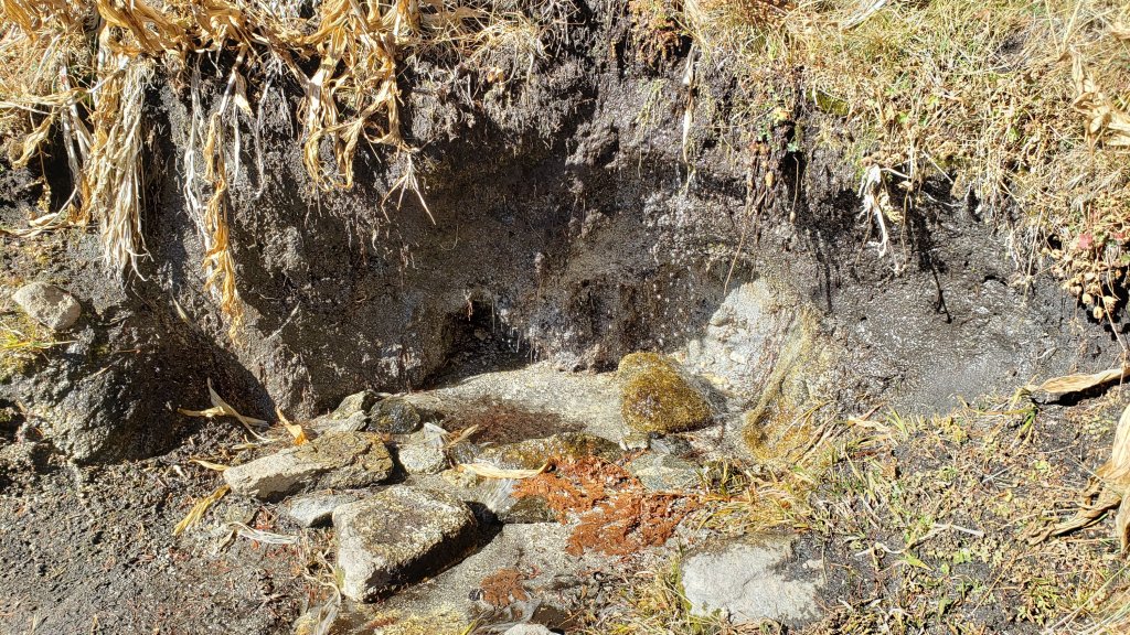
Tahquitz Creek is flowing at the northern end of Little Tahquitz Meadow. It is also flowing, but very gently, further upstream at its source (known locally as Grethe Spring) where it crosses the PCT at approx. Mile 177.
The small creek in Tahquitz Valley dried in May, some four months earlier than in 2020.
Candy’s Creek – that flows through Skunk Cabbage Meadow and then crosses the remaining visible section of Caramba Trail near Reeds Meadow – dried up in early July.
WATER STATUS: Western slope
The North Fork of the San Jacinto River continues to flow gently where it crosses the Deer Springs Trail, and also very weakly where it crosses the Fuller Ridge Trail on the PCT (approx. PCT Mile 186.2). Less than two miles further downstream this river is, remarkably, completely dry (see photos in an earlier report here).
The creek in Little Round Valley completely dried up in early July, reminiscent of the extremely dry years of 2014-16. The same creek dried up where it crosses Fuller Ridge Trail (PCT Mile 186.4) in April.
Shooting Star Spring (not far below Little Round Valley but above the North Fork of the San Jacinto River crossing) is flowing weakly and is a very poor option for filtering.
The Deer Springs stream crossing is dry at the PCT/Deer Springs Trail (approx. PCT mile 185.6). (Despite some online mapping to the contrary, this is NOT the source for the North Fork of the San Jacinto River.)
The tiny but perennial spring about 0.4 miles north of Strawberry Junction (known colloquially as Switchback Spring) continues to flow remarkably well. I rework the tiny pool every week when I pass by and there is sufficient depth from which to filter water.
The little creek at Strawberry Cienega (PCT mile 183.0) is dry.
On Devil’s Slide Trail all springs have been dry for many months.
On the Ernie Maxwell Trail, the crossing of Chinquapin Creek just below Humber Park is currently flowing where it crosses the trail. Even when the creek is dry across the trail, small but invaluable fresh pools remain just upslope from the trail (this creek is an especially useful source of water for the many dogs walked on this trail).
The faucet at Cinco Poses Spring about 4.5 miles up Black Mountain Road continues to flow.
WATER STATUS: Desert Divide
Live Oak Spring (N 33 37 21, W 116 33 24) Flowing. The most reliable water source on the Desert Divide.
Cedar Spring (N 33 40 36, W 116 34 35) Flowing weakly. Easiest access is the trough about 60 yards upstream from the trail to the campsite.
Apache Spring (N 33 43 11, W 116 37 13) Barely trickling, not now reliable.
Spitler Peak Trail Descending the trail from the PCT there are five water crossings. The first two, at 0.9 and 0.95 miles down, cross a tiny side creek which is largely dry and should be ignored. The next crossing, at 1.1 miles down, is Spitler Creek and is the best source of water (currently flowing very gently, but can be filtered). The next two crossings are the same creek, also flowing adequately for filtering.
Antsell Rock Creek (N 33 41 52, W 116 39 08) Right by the Spitler Peak Trail trailhead on Apple Canyon Road, Antsell Rock Creek dried up in July. Even in the very dry years of 2015 and 2016, this source did not dry until the autumn.
Thank you for taking the time to read this. While all labor and time is volunteered, the San Jacinto Trail Report completely depends on small private donations to cover operating costs. Every year seems to be challenging and 2021 has been no exception, so every contribution, no matter how small, is truly valuable. If you have found this Report useful, please consider visiting the Donate page. Thank you for your support.
sanjacjon Uncategorized 2 Comments 9 MinutesEdit”Trail update 17th November 2021″
Trail update 10th November 2021
After several recent years in which the summer has persisted very late in the year, then abruptly changed to winter, it is so pleasant to have some genuine autumnal weather this season, ideal for long vigorous hikes. We continue to undertake at least a couple of circuitous hikes of the high country, including the highest peaks, every week, which allow for thorough surveys of the water and trail conditions.
The effects of the light rainfall from multiple storms in October have regrettably already dissipated, and water conditions in the high country continue to deteriorate slowly, with many springs and creeks having dried this summer. The current status of most key springs and creeks is described below.
Despite some recent relatively warm days, hikers should nevertheless be prepared for temperatures near or below freezing in the high country, and potentially well below freezing when considering wind chill effects (see below for most recent weather observations from San Jacinto Peak).
Be bear aware. Although rarely reported, several Black Bears remain active in the San Jacinto mountains. I was fortunate to see a very large (>300lb), uniformly dark brown individual at dawn on 7th September near Humber Park. I was able to get a couple of short, poor quality videos, of which one is available here.
Full fire restrictions remain in place on Forest Service lands, as described here. All campfires anywhere in the San Jacinto mountains, including at all USFS campgrounds and yellow post sites, are prohibited. All forms of campfire are always prohibited in the State Park wilderness. Despite recent cooler temperatures and light precipitation, fire risk remains very high.
The U.S. Forest Service ranger station in Idyllwild has been closed due to USFS coronavirus protocols since March 2020. Apparently it is unlikely to reopen until 2022. Hiking and camping permits are nevertheless required for USFS lands, and should be available at the kiosk outside the ranger station.
The State Park ranger station has been open almost all year, and is the best source in Idyllwild for permits and additional trail information.
WEATHER Temperatures will remain well above average for November until Tuesday 16th, when a significant cooling trend is forecast. Regrettably there is currently no precipitation in the forecast.
At San Jacinto Peak (10,810ft/3295m) on Monday 8th November 2021 at 0845 the air temperature was 39.1°F (4°C), with a windchill temperature of 29.8°F (-1°C), 32% relative humidity, and a fresh WNW wind sustained at 5 mph gusting to 8.9 mph.
At the Peak on Thursday 4th November 2021 at 0840 the air temperature was 46.1°F (8°C), with a windchill temperature of 39.2°F (4°C), 31% relative humidity, and a cool WNW wind sustained at 6 mph gusting to 11.4 mph.
TRAIL CONDITIONS
Trails throughout the San Jacinto high country have cleared of the very light snow that fell in late October. Water conditions remain challenging despite recent autumnal weather, with many springs and creeks already having dried up or having very low flows, as discussed in detail below. To date, temperatures have not been low enough to freeze springs in the high country.
The rockslide at PCT Mile 172.5, just north of Antsell Rock, was removed on Monday 14th June 2021. My “before, during, and after” video is available here. This section of the PCT is now safer and is narrow but readily passable with care by hikers (but remains impassable by stock).
Due to greatly reduced maintenance work during the coronavirus pandemic, many trails have accumulated treefall hazards since late 2019, passable with care by hikers but not for stock. Although reported promptly, regrettably neither Forest Service nor State Park have moved quickly to remove most hazards in 2021. With recent storms being accompanied by strong winds, hikers may encounter new and additional hazards. Some are described below, others include the PCT between Strawberry Cienega and Strawberry Junction (PCT Miles 182-183, at least 7 trees down), and Fuller Ridge Trail near its northern end (PCT Miles 189.1-190.2, three trees).
Spitler Peak Trail was cleared of multiple tree hazards by the Trail Report in early July. Marion Mountain Trail was cleared of multiple tree hazards by a California Conservation Corps team in late August, along with the adjacent PCT/Deer Springs Trail for 0.6 mile north to the south end of Fuller Ridge Trail. One new tree came down in early November 2021 on the PCT just yards south of its junction with Marion Mountain Trail, but it is easily passable for hikers.
Many treefall hazards from Red Tahquitz to Antsell Rock (PCT Miles 172.5-175) were cleared in June prior to the rockslide removal work mentioned above. Nevertheless about 20 remain, including at least six major obstructions for hikers. Tahquitz Creek to Red Tahquitz (PCT Miles 175-177) was cleared in early June.
Willow Creek Trail has at least 33 downed trees between Skunk Cabbage Junction and Hidden Divide. Of these 22 are on the Forest Service section (16 between Willow Creek and the Park boundary), with 11 in the State Park. Most are readily passable by hikers with care. Despite so much work last year by myself and USFS volunteers, the whitethorn has grown back rapidly, but still remains less challenging than in 2019.
Seven Pines Trail has had very limited hiker traffic since November 2018, largely because Dark Canyon Road was closed between February 2019 and early October 2021. There are 33 treefall hazards on the State Park section of the trail. The four major treefall hazards on the Forest Service section were removed by the Trail Report on 2nd November 2021. Cautious navigation is recommended for those who are not very familiar with hiking this trail. Dark Canyon campground remains closed.
The Caramba Trail from near Reeds Meadow through Laws Camp and on to Caramba, and the Cedar Trail from Willow Creek Trail to Laws (which both nominally reopened in late 2018) are optimistically described by the Forest Service as “not maintained”. In reality parts of these trails no longer exist with significant sections of both so heavily overgrown that I strongly advise hikers do not attempt to follow them. Multiple experienced hikers have reported getting lost in this area since summer 2019. An informal use trail to the Laws Camp area is much more direct and completely avoids all of the challenging bush-whacking of the unmaintained trails (other hikers kindly nicknamed it the “King Trail”). It leaves Willow Creek Trail exactly 1.0 mile from Saddle Junction, 0.45 mile from the Skunk Cabbage turning (trailhead at N33°46’46”, W116°39’32”, WGS84). The cairned use trail descends largely on established deer tracks for 0.9 mile, reaching Willow Creek just upstream of the former site of Laws Camp. From Laws east to Caramba the route of the old Caramba Trail has become increasingly tricky to follow, especially for the first 1.2 miles east of Laws where there are dozens of trees down. Closer to Caramba the trail is relatively obvious (for those familiar with the route prior to the 2013 Mountain Fire). Very cautious navigation is recommended throughout this area.
WATER STATUS: Eastern slope
The Round Valley pipe is now flowing only intermittently and is no longer reliable. There is occasional flow (at about 0.2L/min) but without further precipitation input, this source should no longer be relied upon. Creeks in Round Valley and Tamarack Valley were dry in May (in 2020 neither dried until August).
Hidden Lake dried up completely in June.
Both the northern and southern springs at Wellman’s Cienega are flowing very gently (but adequately to filter). These are the sources for Willow Creek, which is flowing where it crosses the Willow Creek Trail (the flow remains good for filtering, but is the lowest I have ever seen this creek).
Tahquitz Creek is flowing gently at the northern end of Little Tahquitz Meadow. It is also flowing, but very gently, further upstream at its source (known locally as Grethe Spring) where it crosses the PCT at approx. Mile 177.
The small creek in Tahquitz Valley dried in May, some four months earlier than in 2020.
Candy’s Creek – that flows through Skunk Cabbage Meadow and then crosses the remaining visible section of Caramba Trail near Reeds Meadow – dried up in early July.
WATER STATUS: Western slope
The North Fork of the San Jacinto River continues to flow gently where it crosses the Deer Springs Trail, and also very weakly where it crosses the Fuller Ridge Trail on the PCT (approx. PCT Mile 186.2). Less than two miles further downstream this river is, remarkably, completely dry (see photos in earlier report here).
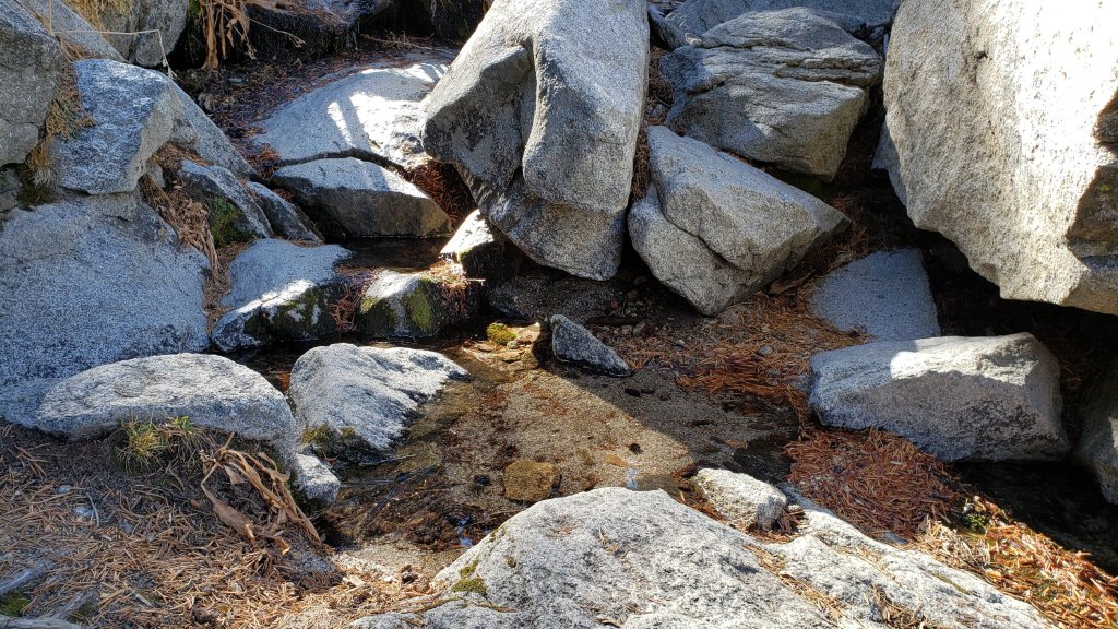
The creek in Little Round Valley completely dried up in early July, reminiscent of the extremely dry years of 2014-16. The same creek dried up where it crosses Fuller Ridge Trail (PCT Mile 186.4) in April.
Shooting Star Spring (not far below Little Round Valley but above the North Fork of the San Jacinto River crossing) is flowing weakly and is a very poor option for filtering.
The Deer Springs stream crossing is dry at the PCT/Deer Springs Trail (approx. PCT mile 185.6). (Despite some online mapping to the contrary, this is NOT the source for the North Fork of the San Jacinto River.)
The tiny but perennial spring about 0.4 miles north of Strawberry Junction (known colloquially as Switchback Spring) continues to flow remarkably well. I rework the tiny pool every week when I pass by and there is sufficient depth from which to filter water.
The little creek at Strawberry Cienega (PCT mile 183.0) is dry.
On Devil’s Slide Trail all springs have been dry for many months.
On the Ernie Maxwell Trail, the crossing of Chinquapin Creek just below Humber Park is currently flowing where it crosses the trail. Even when the creek is dry across the trail, small but invaluable fresh pools remain just upslope from the trail (this creek is an especially useful source of water for the many dogs walked on this trail).
The faucet at Cinco Poses Spring about 4.5 miles up Black Mountain Road continues to flow.
WATER STATUS: Desert Divide
Live Oak Spring (N 33 37 21, W 116 33 24) Flowing. The most reliable water source on the Desert Divide.
Cedar Spring (N 33 40 36, W 116 34 35) Flowing weakly. Easiest access is the trough about 60 yards upstream from the trail to the campsite.
Apache Spring (N 33 43 11, W 116 37 13) Barely trickling, not now reliable.
Spitler Peak Trail Descending the trail from the PCT there are five water crossings. The first two, at 0.9 and 0.95 miles down, cross a tiny side creek which is largely dry and should be ignored. The next crossing, at 1.1 miles down, is Spitler Creek and is the best source of water (currently flowing very gently, but can be filtered). The next two crossings are the same creek, also flowing adequately for filtering.
Antsell Rock Creek (N 33 41 52, W 116 39 08) Right by the Spitler Peak Trail trailhead on Apple Canyon Road, Antsell Rock Creek is now dry. Even in the very dry years of 2015 and 2016, this source did not dry until the autumn.
Thank you fellow hikers for taking the time to read this. While all labor and time is volunteered, the San Jacinto Trail Report completely depends on small private donations to cover operating costs. Every year seems to be challenging and 2021 has been no exception, so every contribution, no matter how small, is truly valuable. If you have found this Report useful, please consider visiting the Donate page. Thank you for your support.
sanjacjon Uncategorized Leave a comment 8 MinutesEdit”Trail update 10th November 2021″
Trail and water update 3rd November 2021
Following an October with five minor storms and warm interludes between those cold systems, November is starting with a week of well-above seasonal temperatures. The dusting of snow in the high country from late October has melted from the trail system, and spikes are no longer needed anywhere.
Although there have been minor improvements in flow immediately after recent storms, water conditions in the high country remain poor, with many springs and creeks having dried this summer. The current status of many key springs and creeks is described below.
Despite some recent relatively warm days, hikers should nevertheless be prepared for temperatures near or below freezing in the high country, and potentially well below freezing when considering wind chill effects (see below for most recent weather observations from San Jacinto Peak).
Be bear aware. Although rarely reported, several Black Bears remain active in the San Jacinto mountains. I was fortunate to see a very large (>300lb), uniformly dark brown individual at dawn on 7th September near Humber Park. I was able to get a couple of short, poor quality videos, of which one is available here.
The U.S. Forest Service ranger station in Idyllwild has been closed due to USFS coronavirus protocols since March 2020. Apparently it is unlikely to reopen until 2022. Hiking and camping permits are nevertheless required for USFS lands, and should be available at the kiosk outside the ranger station.
The State Park ranger station has been open almost all year, and is the best source in Idyllwild for permits and additional trail information.
WEATHER Temperatures will be above average for the first week of November, before dropping briefly to cooler, seasonal, conditions on 8th-9th. Regrettably there is currently no precipitation in the forecast.
At San Jacinto Peak (10,810ft/3295m) on Monday 1st November 2021 at 0855 the air temperature was 40.1°F (4°C), with a windchill temperature of 31.2°F (-1°C), 28% relative humidity, and a chilly NW wind sustained at 8 mph gusting to 15.3 mph.
At the Peak on Friday 29th October 2021 at 0840 the air temperature was 49.6°F (10°C), with a windchill temperature of 44.2F (7°C), 35% relative humidity, and a gentle SE wind sustained at 5 mph gusting to 9.3 mph.

TRAIL CONDITIONS
Trails throughout the San Jacinto high country have cleared of the light snow that fell last week. Water conditions remain challenging despite recent autumnal weather, with many springs and creeks already having dried up or having very low flows, as discussed in detail below. To date, temperatures have not been low enough to freeze springs in the high country.
The rockslide at PCT Mile 172.5, just north of Antsell Rock, was removed on Monday 14th June 2021. My “before, during, and after” video is available here. This section of the PCT is now safer and is narrow but readily passable with care by hikers (but remains impassable by stock).
Due to greatly reduced maintenance work during the coronavirus pandemic, many trails have accumulated treefall hazards since late 2019, passable with care by hikers but not for stock. Although reported promptly, regrettably neither Forest Service nor State Park have moved quickly to remove most hazards in 2021. With recent storms being accompanied by strong winds, hikers may encounter new and additional hazards. Some are described below, others include the PCT between Strawberry Cienega and Strawberry Junction (PCT Miles 182-183, at least 7 trees down), and Fuller Ridge Trail near its northern end (PCT Miles 189.1-190.2, three trees).
Spitler Peak Trail was cleared of multiple tree hazards by the Trail Report in early July. Marion Mountain Trail was cleared of multiple tree hazards by a California Conservation Corps team in late August, along with the adjacent PCT/Deer Springs Trail for 0.6 mile north to the south end of Fuller Ridge Trail.
Many treefall hazards from Red Tahquitz to Antsell Rock (PCT Miles 172.5-175) were cleared in June prior to the rockslide removal work mentioned above. Nevertheless about 20 remain, including at least six major obstructions for hikers. Tahquitz Creek to Red Tahquitz (PCT Miles 175-177) was cleared in early June.
Willow Creek Trail has at least 33 downed trees between Skunk Cabbage Junction and Hidden Divide. Of these 22 are on the Forest Service section (16 between Willow Creek and the Park boundary), with 11 in the State Park. Most are readily passable by hikers with care. Despite so much work last year by myself and USFS volunteers, the whitethorn has grown back rapidly, but still remains less challenging than in 2019.
Seven Pines Trail has had very limited hiker traffic since November 2018, largely because Dark Canyon Road was closed between February 2019 and early October 2021. There are 33 treefall hazards on the State Park section of the trail. The four major treefall hazards on the Forest Service section were removed on 2nd November 2021. Cautious navigation is recommended for those who are not very familiar with hiking this trail. Dark Canyon campground remains closed.
The Caramba Trail from near Reeds Meadow through Laws Camp and on to Caramba, and the Cedar Trail from Willow Creek Trail to Laws (which both nominally reopened in late 2018) are optimistically described by the Forest Service as “not maintained”. In reality parts of these trails no longer exist with significant sections of both so heavily overgrown that I strongly advise hikers do not attempt to follow them. Multiple experienced hikers have reported getting lost in this area since summer 2019. An informal use trail to the Laws Camp area is much more direct and completely avoids all of the challenging bush-whacking of the unmaintained trails (other hikers kindly nicknamed it the “King Trail”). It leaves Willow Creek Trail exactly 1.0 mile from Saddle Junction, 0.45 mile from the Skunk Cabbage turning (trailhead at N33°46’46”, W116°39’32”, WGS84). The cairned use trail descends largely on established deer tracks for 0.9 mile, reaching Willow Creek just upstream of the former site of Laws Camp. From Laws east to Caramba the route of the old Caramba Trail has become increasingly tricky to follow, especially for the first 1.2 miles east of Laws where there are dozens of trees down. Closer to Caramba the trail is relatively obvious (for those familiar with the route prior to the 2013 Mountain Fire). Very cautious navigation is recommended throughout this area.
WATER STATUS: Eastern slope
The Round Valley pipe is now flowing only intermittently and is no longer reliable. There is occasional flow (at about 0.2L/min) but without further precipitation input, this source should no longer be relied upon. Creeks in Round Valley and Tamarack Valley were dry in May (in 2020 neither dried until August).
Hidden Lake dried up completely in June.
Both the northern and southern springs at Wellman’s Cienega are flowing very gently (but adequately to filter). These are the sources for Willow Creek, which is flowing where it crosses the Willow Creek Trail (the flow remains good for filtering, but is the lowest I have ever seen this creek).
Tahquitz Creek is flowing gently at the northern end of Little Tahquitz Meadow. It is also flowing, but very gently, further upstream at its source (known locally as Grethe Spring) where it crosses the PCT at approx. Mile 177.
The small creek in Tahquitz Valley dried in May, some four months earlier than in 2020.
Candy’s Creek – that flows through Skunk Cabbage Meadow and then crosses the remaining visible section of Caramba Trail near Reeds Meadow – dried up in early July.
WATER STATUS: Western slope
The North Fork of the San Jacinto River continues to flow gently where it crosses the Deer Springs Trail, and also very weakly where it crosses the Fuller Ridge Trail on the PCT (approx. PCT Mile 186.2). Less than two miles further downstream this river is, remarkably, completely dry (see photos below).
The creek in Little Round Valley completely dried up in early July, reminiscent of the extremely dry years of 2014-16. The same creek dried up where it crosses Fuller Ridge Trail (PCT Mile 186.4) in April.
Shooting Star Spring (not far below Little Round Valley but above the North Fork of the San Jacinto River crossing) is flowing weakly and is a very poor option for filtering.
The Deer Springs stream crossing is dry at the PCT/Deer Springs Trail (approx. PCT mile 185.6). (Despite some online mapping to the contrary, this is NOT the source for the North Fork of the San Jacinto River.)
The tiny but perennial spring about 0.4 miles north of Strawberry Junction (known colloquially as Switchback Spring) continues to flow remarkably well. I rework the tiny pool every week when I pass by and there is just sufficient depth from which to filter water.
The little creek at Strawberry Cienega (PCT mile 183.0) is dry.
On Devil’s Slide Trail, Middle Spring is now dry. All other springs on this trail have been dry for months.
On the Ernie Maxwell Trail, the crossing of Chinquapin Creek just below Humber Park is currently flowing where it crosses the trail. Even when the creek is dry across the trail, small but invaluable fresh pools remain just upslope from the trail (this creek is an especially useful source of water for the many dogs walked on this trail).
The faucet at Cinco Poses Spring about 4.5 miles up Black Mountain Road continues to flow.
WATER STATUS: Desert Divide
Live Oak Spring (N 33 37 21, W 116 33 24) Flowing. The most reliable water source on the Desert Divide.
Cedar Spring (N 33 40 36, W 116 34 35) Flowing weakly. Easiest access is the trough about 60 yards upstream from the trail to the campsite.
Apache Spring (N 33 43 11, W 116 37 13) Barely trickling, not now reliable.
Spitler Peak Trail Descending the trail from the PCT there are five water crossings. The first two, at 0.9 and 0.95 miles down, cross a tiny side creek which is largely dry and should be ignored. The next crossing, at 1.1 miles down, is Spitler Creek and is the best source of water (currently flowing very gently, but can be filtered). The next two crossings are the same creek, also flowing adequately for filtering.
Antsell Rock Creek (N 33 41 52, W 116 39 08) Right by the Spitler Peak Trail trailhead on Apple Canyon Road, Antsell Rock Creek is now dry. Even in the very dry years of 2015 and 2016, this source did not dry until the autumn.
Thank you fellow hikers for taking the time to read this. While all labor and time is volunteered, the San Jacinto Trail Report completely depends on small private donations to cover operating costs. Every year seems to be challenging and 2021 has been no exception, so every contribution, no matter how small, is truly valuable. If you have found this Report useful, please consider visiting the Donate page. Thank you for your support.
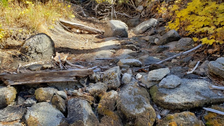

sanjacjon Uncategorized Leave a comment 7 MinutesEdit”Trail and water update 3rd November 2021″
Minor storm update 27th October 2021
Wednesday 27th October had the clearest visibility from the high country since late April, with the southern Channel Islands clearly visible from San Jacinto Peak. The combination of widespread precipitation two days earlier literally dampening down the smoke and smog, and a shift to Santa Ana winds blowing what remained offshore, led to lovely conditions.
For the fifth time this month, we had a minor storm system pass through the San Jacinto mountains on the afternoon of Monday 25th October. It started drizzling in both Idyllwild and at San Jacinto Peak at about 1600. In the next four hours a total of 0.56in rain fell at 5550ft in Idyllwild. By 1715 the precipitation had turned to very light snow in the high country, accumulating to just under one inch depth at San Jacinto Peak. Snow dusted down to about 8100ft, settling to a depth of 0.25in above 9000ft, and near 1.0in above 10,000ft. Strong winds accompanied the system, with a maximum wind gust recorded at San Jacinto Peak of 37.1mph, but with sustained winds above 20mph for most of the day. Remarkably by early evening skies were completely clear, and only the strong winds remained.
A short video discussion of the storm and trail conditions recorded at San Jacinto Peak early morning on Tuesday 26th October gave a feel for wind and snow conditions at that time (available here).
Due to snow falling on top of rain and ice, rocky areas and trails were deceptively slippery on 26th-27th, especially around the high peaks. Spikes are very useful if you plan on hiking above 9000ft elevation in the next few days. With rapidly warming temperatures most ice and icy snow will likely be gone from the trail system by the weekend, but some shaded sections of trail may remain challenging.
Hikers should be prepared for temperatures near or below freezing in the high country, and potentially well below freezing when considering wind chill effects (see below for recent weather observations from San Jacinto Peak).
Be bear aware. Although rarely reported, several Black Bears remain active in the San Jacinto mountains. I was fortunate to see a very large (>300lb), uniformly dark brown individual at dawn on 7th September near Humber Park. I was able to get a couple of short, poor quality videos, of which one is available here.
Although there have been minor improvements in flow immediately after recent storms, water conditions in the high country remain poor, with many springs and creeks having dried this summer. The current status of most water sources is unchanged from an earlier Report available here.
The U.S. Forest Service ranger station in Idyllwild has been closed due to USFS coronavirus protocols since March 2020. Apparently it is unlikely to reopen until 2022. Hiking and camping permits are nevertheless required for USFS lands, and should be available at the kiosk outside the ranger station.
The State Park ranger station has been open almost all year, and is the best source in Idyllwild for permits and additional trail information.
WEATHER Temperatures have been, and will continue, on something of a rollercoaster ride in October. After frigid conditions on 25th-26th, the last few days of October will be well above average for the month. Temperatures revert to cooler seasonal averages starting Sunday 31st October into the first week of November.
At San Jacinto Peak (10,810ft/3295m) on Wednesday 27th October 2021 at 0925 the air temperature was 36.6°F (2°C), with a windchill temperature of 23.5°F (-5°C), 80% relative humidity, and a fresh NNE wind sustained at 12 mph gusting to 21.0 mph.
At the Peak on Tuesday 26th October 2021 at 0645 the air temperature was 26.5°F (-3°C), with a windchill temperature of 7.9°F (-14°C), 32% relative humidity, and a bitter NW wind sustained at 18 mph gusting to 31.9 mph.
At the Peak on Monday 25th October 2021 at 1025 the air temperature was 32.6°F (0°C), with a windchill temperature of 14.4°F (-10°C), 97% relative humidity, and a wild WSW wind sustained at 20 mph gusting to 31.4 mph.

TRAIL CONDITIONS
Water conditions remain challenging despite recent autumnal weather, with many springs and creeks already having dried up or having very low flows, as discussed in an earlier Report. To date, temperatures have not been low enough to freeze springs in the high country.
The rockslide at PCT Mile 172.5, just north of Antsell Rock, was removed on Monday 14th June 2021. My “before, during, and after” video is available here. This section of the PCT is now safer and is narrow but readily passable with care by hikers (but remains impassable by stock).
Due to greatly reduced maintenance work during the coronavirus pandemic, many trails have accumulated treefall hazards since late 2019, passable with care by hikers but not for stock. Although reported promptly, regrettably neither Forest Service nor State Park have moved quickly to remove most hazards in 2021. With recent storms being accompanied by strong winds, hikers may encounter new and additional hazards. Some are described below, others include the PCT between Strawberry Cienega and Strawberry Junction (PCT Miles 182-183, at least 7 trees down), and Fuller Ridge Trail near its northern end (PCT Miles 189.1-190.2, three trees).
Spitler Peak Trail was cleared of multiple tree hazards by the Trail Report in early July. Marion Mountain Trail was cleared of multiple tree hazards by a CCC crew in late August, along with the adjacent PCT/Deer Springs Trail for 0.6 mile north to the south end of Fuller Ridge Trail.
Many treefall hazards from Red Tahquitz to Antsell Rock (PCT Miles 172.5-175) were cleared in June prior to the rockslide removal work. Nevertheless about 20 remain, including at least six major obstructions for hikers. Tahquitz Creek to Red Tahquitz (PCT Miles 175-177) was cleared in early June.
Willow Creek Trail has at least 33 downed trees between Skunk Cabbage Junction and Hidden Divide. Of these 22 are on the Forest Service section (16 between Willow Creek and the Park boundary), with 11 in the State Park. Most are readily passable by hikers with care. Despite so much work last year by myself and others, the whitethorn has grown back rapidly, but still remains less challenging than in 2019.
The Caramba Trail from near Reeds Meadow through Laws Camp and on to Caramba, and the Cedar Trail from Willow Creek Trail to Laws (which both nominally reopened in late 2018) are optimistically described by the Forest Service as “not maintained”. In reality parts of these trails no longer exist with significant sections of both so heavily overgrown that I strongly advise hikers do not attempt to follow them. Multiple experienced hikers have reported getting lost in this area since summer 2019. An informal use trail to the Laws Camp area is much more direct and completely avoids all of the challenging bush-whacking of the unmaintained trails (other hikers kindly nicknamed it the “King Trail”). It leaves Willow Creek Trail exactly 1.0 mile from Saddle Junction, 0.45 mile from the Skunk Cabbage turning (trailhead at N33°46’46”, W116°39’32”, WGS84). The cairned use trail descends largely on established deer tracks for 0.9 mile, reaching Willow Creek just upstream of the former site of Laws Camp. From Laws east to Caramba the route of the old Caramba Trail has become increasingly tricky to follow, especially for the first 1.2 miles east of Laws where there are dozens of trees down. Closer to Caramba the trail is relatively obvious (for those familiar with the route prior to the 2013 Mountain Fire). Very cautious navigation is recommended throughout this area.
Seven Pines Trail has had very limited hiker traffic since November 2018, largely because Dark Canyon Road was closed between February 2019 and early October 2021. There are at least 37 treefall hazards on the trail, four large ones on the short Forest Service section, and the remainder in the State Park, based on my October 2021 survey. Cautious navigation is recommended for those who are not very familiar with hiking this trail. Dark Canyon campground remains closed.

Thank you fellow hikers for taking the time to read this. While all labor and time is volunteered, the San Jacinto Trail Report completely depends on small private donations to cover operating costs. Every year seems to be challenging and 2021 has been no exception, so every contribution, no matter how small, is truly valuable. If you have found this Report useful, please consider visiting the Donate page. Thank you for your support.

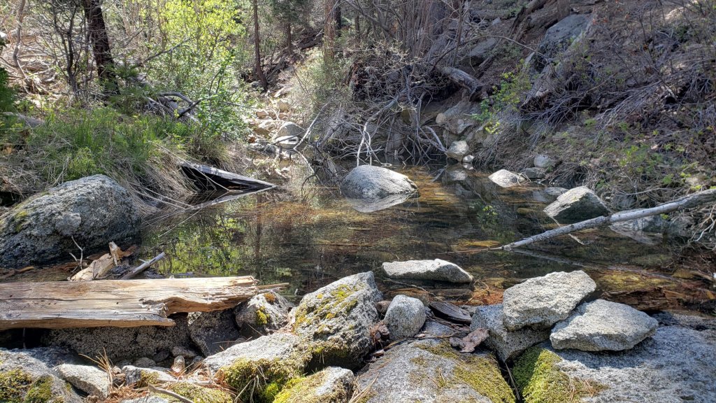
sanjacjon Uncategorized Leave a comment 6 MinutesEdit”Minor storm update 27th October 2021″
Weather and trail update 20th October 2021
[UPDATE 25th October: it started drizzling in both Idyllwild and at San Jacinto Peak at about 1600 today. By 1715 it had turned to very light snow at the Peak, accumulating at 0.25in/hr. Maximum wind gust recorded this afternoon at San Jacinto Peak has been 37.1mph, with sustained winds at about 20mph.]
[UPDATE 22nd October: an energetic early season storm is expected for the afternoon of Monday 25th. Forecast models vary regarding precipitation amounts, but several inches of snow are possible in the high country, accompanied by near-record wind speeds, with widespread light rainfall (0.5in) below 8000ft.]
Following three minor storm systems in the San Jacinto mountains between 5th and 11th October, we had further stormy weather on Monday 18th. An elevated marine layer on the western side of the mountain range was driven upslope by a very strong West wind, which I measured gusting to 40mph at San Jacinto Peak. There was occasional very light drizzle in Idyllwild, and as we descended the PCT in late morning, at about 8900ft just north of Saddle Junction a few snowflakes were falling (but not settling). The top of the cloud cover was at about 9000ft elevation, and the high country was clear and sunny all day, although cool in the stiff wind. Altogether a perfect morning for a brisk hike.
The minor storm on 11th October was, by just one day, the earliest I have recorded measurable snowfall in the San Jacinto high country in autumn, following an even lighter dusting overnight on 12th October 2018. Within a day, rapid melting meant that there was no snow remaining on the trail system, although today (a week later) a few tiny patches of snow remain in very sheltered locations. Spikes are not currently required anywhere in the high country. This advice may change after a storm expected next Monday 25th.
Hikers should be prepared for temperatures near or below freezing in the high country, and potentially well below freezing when considering wind chill effects (see below for recent weather observations from San Jacinto Peak).
Full fire restrictions remain (for now) in place on Forest Service lands, as described here. All campfires anywhere in the San Jacinto mountains, including at all USFS campgrounds and yellow post sites, are prohibited. All forms of campfire are always prohibited in the State Park wilderness. Despite the rainfall and cooler temperatures, fire risk remains very high.
Be bear aware. Although rarely reported, several Black Bears remain active in the San Jacinto mountains. I was fortunate to see a very large (>300lb), uniformly dark brown individual at dawn on 7th September near Humber Park. I was able to get a couple of short, poor quality videos, of which one is available here.
Water conditions in the high country remain poor, although there have been brief improvements in flow immediately after storms. The current status of many key springs and creeks is unchanged from the earlier Report available here.
The U.S. Forest Service ranger station in Idyllwild has been closed due to USFS coronavirus protocols since March 2020. Apparently it is unlikely to reopen until 2022. Hiking and camping permits are nevertheless required for USFS lands, and should be available at the kiosk outside the ranger station.
The State Park ranger station has been open almost all year, and is the best source in Idyllwild for permits and additional trail information.
WEATHER Temperatures have been, and will continue, on something of a rollercoaster ride in October. After frigid conditions on 18th-19th, rapidly rising temperatures to another brief period of warmth above seasonal norms on 20th-22nd will then give way to cooler-than-average conditions starting on 23rd. The last few days of October will again be warmer than average for the month. There is moderate precipitation forecast for Monday 25th October, with light snowfall expected above about 8000ft.
At San Jacinto Peak (10,810ft/3295m) on Monday 18th October 2021 at 0845 the air temperature was 25.3°F (-4°C), with a windchill temperature of 0.8°F (-17°C), 55% relative humidity, and a bitter due West wind sustained at 21 mph gusting to 39.7 mph.
At the Peak on Friday 15th October 2021 at 0915 the air temperature was 39.4°F (4°C), with a windchill temperature of 26.7°F (-3°C), 13% relative humidity, and a steady NE wind sustained at 15 mph gusting to 19.9 mph.
At the Peak on Tuesday 12th October 2021 at 0855 the air temperature was 16.8°F (-8°C), with a windchill temperature of -3.3°F (-20°C), 45% relative humidity, and a gusty NNE wind sustained at 7 mph gusting to 19.3 mph.
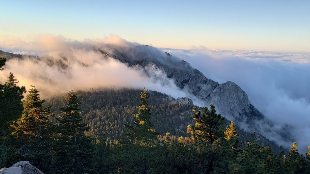
TRAIL CONDITIONS
Water conditions remain challenging despite recent autumnal weather, with many springs and creeks already having dried up or having very low flows, as discussed in an earlier Report. To date, temperatures have not been low enough to freeze springs in the high country.
The rockslide at PCT Mile 172.5, just north of Antsell Rock, was removed on Monday 14th June 2021. My “before, during, and after” video is available here. This section of the PCT is now safer and is narrow but readily passable with care by hikers (but remains impassable by stock).
Due to greatly reduced maintenance work during the coronavirus pandemic, many trails have accumulated treefall hazards since late 2019, passable with care by hikers but not for stock. Although reported promptly, regrettably neither Forest Service nor State Park have moved quickly to remove most hazards in 2021. With recent storms being accompanied by strong winds, hikers may encounter new and additional hazards. Some are described below, others include the PCT between Strawberry Cienega and Strawberry Junction (PCT Miles 182-183, at least 7 trees down), and Fuller Ridge Trail near its northern end (PCT Miles 189.1-190.2, three trees).
Spitler Peak Trail was cleared of multiple tree hazards by the Trail Report in early July. Marion Mountain Trail was cleared of multiple tree hazards by a CCC crew in late August, along with the adjacent PCT/Deer Springs Trail for 0.6 mile north to the south end of Fuller Ridge Trail.
Many treefall hazards from Red Tahquitz to Antsell Rock (PCT Miles 172.5-175) were cleared in June prior to the rockslide removal work. Nevertheless about 20 remain, including at least six major obstructions for hikers. Tahquitz Creek to Red Tahquitz (PCT Miles 175-177) was cleared in early June.
Willow Creek Trail has at least 33 downed trees between Skunk Cabbage Junction and Hidden Divide. Of these 22 are on the Forest Service section (16 between Willow Creek and the Park boundary), with 11 in the State Park. Most are readily passable by hikers with care. Despite so much work last year by myself and others, the whitethorn has grown back rapidly, but still remains less challenging than in 2019.
The Caramba Trail from near Reeds Meadow through Laws Camp and on to Caramba, and the Cedar Trail from Willow Creek Trail to Laws (which both nominally reopened in late 2018) are optimistically described by the Forest Service as “not maintained”. In reality parts of these trails no longer exist with significant sections of both so heavily overgrown that I strongly advise hikers do not attempt to follow them. Multiple experienced hikers have reported getting lost in this area since summer 2019. An informal use trail to the Laws Camp area is much more direct and completely avoids all of the challenging bush-whacking of the unmaintained trails (other hikers kindly nicknamed it the “King Trail”). It leaves Willow Creek Trail exactly 1.0 mile from Saddle Junction, 0.45 mile from the Skunk Cabbage turning (trailhead at N33°46’46”, W116°39’32”, WGS84). The cairned use trail descends largely on established deer tracks for 0.9 mile, reaching Willow Creek just upstream of the former site of Laws Camp. From Laws east to Caramba the route of the old Caramba Trail has become increasingly tricky to follow, especially for the first 1.2 miles east of Laws where there are dozens of trees down. Closer to Caramba the trail is relatively obvious (for those familiar with the route prior to the 2013 Mountain Fire). Very cautious navigation is recommended throughout this area.
Seven Pines Trail has had very limited hiker traffic since November 2018, largely because Dark Canyon Road was closed between February 2019 and early October 2021. There are 35 treefall hazards on the trail, four large ones on the short Forest Service section, and the remainder in the State Park, based on my most recent 2021 survey. Cautious navigation is recommended for those who are not familiar with hiking this trail. Dark Canyon campground remains closed.

Thank you fellow hikers for taking the time to read this. While all labor and time is volunteered, the San Jacinto Trail Report completely depends on small private donations to cover operating costs. Every year seems to be challenging and 2021 has been no exception, so every contribution, no matter how small, is truly valuable. If you have found this Report useful, please consider visiting the Donate page. Thank you for your support.

sanjacjon Uncategorized Leave a comment 6 MinutesEdit”Weather and trail update 20th October 2021″
Snow storm update 13th October 2021
The San Jacinto mountains were treated to a brief but energetic storm system on Monday 11th October that produced a very light dusting of graupel snow in the high country, plus large hail in Idyllwild. My video discussion of the storm from San Jacinto Peak on the morning of the 12th is available here. There was 0.25in depth of snow everywhere above about 8500ft, with drifting (mainly in the trails) to 0.5in above 9700ft. Melting was rapid and widespread during my descent on the Peak Trail and PCT late morning on 12th.
This is – by just one day – the earliest I have recorded measurable snowfall in the San Jacinto high country in autumn, following an even lighter dusting overnight on 12th October 2018.
Unusually for October, this was actually our third storm in a week. Minor storm systems produced rainfall across the San Jacinto mountains on Tuesday 5th and on Friday 8th, with 0.38in and 0.49in of rain recorded at 5500ft elevation in Idyllwild, respectively. Hoping for the first snow of the season I overnighted in the high country on 7th-8th, but only recorded rain with a little brief sleet, totaling an estimated 0.5in at San Jacinto Peak.
Full fire restrictions remain (for now) in place on Forest Service lands, as described here. All campfires anywhere in the San Jacinto mountains, including at all USFS campgrounds and yellow post sites, are prohibited. All forms of campfire are always prohibited in the State Park wilderness. Despite the rainfall and cooler temperatures, fire risk remains very high.
Be bear aware. Although rarely reported, several Black Bears remain in the San Jacinto mountains. Earlier reports this summer were from Seven Pines Trail and near Saddle Junction on Willow Creek Trail. I was fortunate to see a very large (>300lb), uniformly dark brown individual at dawn on 7th September near Humber Park. I was able to get a couple of short, poor quality videos, of which one is available here. This was a different individual, based on colour pattern and size, than one I saw on Devil’s Slide Trail in August 2020.
Hikers should be prepared for temperatures near or below freezing in the high country, and potentially well below freezing when considering wind chill effects (see most recent weather observations from San Jacinto Peak below).
Water conditions in the high country remain poor, although there have been brief improvements in flow immediately after storms. The current status of many key springs and creeks is described in the previous Report available here.
The U.S. Forest Service ranger station in Idyllwild has been closed due to USFS coronavirus protocols since March 2020. Apparently it is unlikely to reopen until 2022. Hiking and camping permits are nevertheless required for USFS lands, and should be available at the kiosk outside the ranger station. The State Park ranger station has been open almost all year.
WEATHER Temperatures well below seasonal at the beginning of this week are forecast to rise to around, or even slightly above, seasonal for October from 16th onwards. There is currently no additional precipitation in the forecasts.
At San Jacinto Peak (10,810ft/3295m) on Tuesday 12th October 2021 at 0855 the air temperature was 16.8°F (-8°C), with a windchill temperature of -3.3°F (-20°C), 45% relative humidity, and a gusty NNE wind sustained at 7 mph gusting to 19.3 mph.
At the Peak on Sunday 10th October 2021 at 0810 the air temperature was 39.4°F (4°C), with a windchill temperature of 31.2°F (0°C), 33% relative humidity, and a light due N wind sustained at 5 mph gusting to 9.9 mph.
TRAIL CONDITIONS
Water conditions remain a concern despite recent autumnal weather, with many springs and creeks already having dried up or having very low flows, as discussed in last week’s Report. To date, temperatures have not been low enough to freeze springs in the high country.
The rockslide at PCT Mile 172.5, just north of Antsell Rock, was removed on Monday 14th June 2021. My “before, during, and after” video is available here. This section of the PCT is now safer and is narrow but readily passable with care by hikers (but remains impassable by stock).
Many trails have accumulated treefall hazards since late 2019, passable with care by hikers but not for stock. Although reported promptly, regrettably neither Forest Service nor State Park have moved quickly to remove these hazards. With recent storms being accompanied by strong winds, it is likely that hikers may encounter new and additional hazards. Some are described below, others include the PCT between Strawberry Cienega and Strawberry Junction (PCT Miles 182-183, about 7 trees down), and Fuller Ridge Trail near its northern end (PCT Miles 189.1-190.2, three trees).
Spitler Peak Trail was cleared of multiple tree hazards by the Trail Report in early July. Marion Mountain Trail was cleared of multiple tree hazards by a CCC crew in late August, along with the adjacent PCT/Deer Springs Trail for 0.6 mile north to the south end of Fuller Ridge Trail.
Many treefall hazards from Red Tahquitz to Antsell Rock (PCT Miles 172.5-175) were cleared in June prior to the rockslide removal work. Nevertheless about 20 remain, including at least six major obstructions for hikers. Tahquitz Creek to Red Tahquitz (PCT Miles 175-177) was cleared in early June.
Willow Creek Trail has at least 33 downed trees between Skunk Cabbage Junction and Hidden Divide. Of these 22 are on the Forest Service section (16 between Willow Creek and the Park boundary), with 11 in the State Park. Most are readily passable by hikers with care. Despite so much work last year by myself and others, the whitethorn has grown back rapidly, but still remains less challenging than in 2019.
The Caramba Trail from near Reeds Meadow through Laws Camp and on to Caramba, and the Cedar Trail from Willow Creek Trail to Laws (which both nominally reopened in late 2018) are optimistically described by the Forest Service as “not maintained”. In reality parts of these trails no longer exist with significant sections of both so heavily overgrown that I strongly advise hikers do not attempt to follow them. Multiple experienced hikers have reported getting lost in this area since summer 2019. An informal use trail to the Laws Camp area is much more direct and completely avoids all of the challenging bush-whacking of the unmaintained trails (other hikers kindly nicknamed it the “King Trail”). It leaves Willow Creek Trail exactly 1.0 mile from Saddle Junction, 0.45 mile from the Skunk Cabbage turning (trailhead at N33°46’46”, W116°39’32”, WGS84). The cairned use trail descends largely on established deer tracks for 0.9 mile, reaching Willow Creek just upstream of the former site of Laws Camp. From Laws east to Caramba the route of the old Caramba Trail has become increasingly tricky to follow, especially for the first 1.2 miles east of Laws where there are dozens of trees down. Closer to Caramba the trail is relatively obvious (for those familiar with the route prior to the 2013 Mountain Fire). Very cautious navigation is recommended throughout this area.
Seven Pines Trail has had very limited hiker traffic since November 2018. There are 35 treefall hazards on the trail, four large ones on the short Forest Service section, and the remainder in the State Park, based on my most recent 2021 survey. Cautious navigation is recommended for those who are not familiar with hiking this trail. Dark Canyon Road has been closed since early 2019, and there is currently no vehicular access to Seven Pines trailhead. USFS apparently does not expect Dark Canyon Road to reopen this year.

Thank you for taking the time to read this. While all labor and time is volunteered, the San Jacinto Trail Report completely depends on small private donations to cover operating costs. Every year seems to be challenging and 2021 has been no exception, so every contribution, no matter how small, is truly valuable. If you have found this Report useful, please consider visiting the Donate page. Thank you for your support.

sanjacjon Uncategorized Leave a comment 5 MinutesEdit”Snow storm update 13th October 2021″
Trail update 6th October 2021
[UPDATE 8th October 2021: another minor storm system this morning produced 0.49in rain at 5550ft in Idyllwild. Hoping for the first snow of the season I overnighted in the high country, but it fell only as rain with a little brief sleet, totaling an estimated 0.5in at San Jacinto Peak.]
A very pleasant (and much-needed) late season monsoonal storm system produced rainfall across the San Jacinto mountains in two separate events on Tuesday 5th October, with 0.38in (9.7mm) recorded at 5500ft elevation in Idyllwild. Additionally, several days of steady Santa Ana winds either side of the turn of the month has dramatically improved air quality across the San Jacinto mountains and the wider region (see photos below).
Palm Springs Aerial Tramway has been closed since 7th September for annual maintenance and is not due to reopen until Monday 11th October. See their website for details.
Full fire restrictions remain in place on Forest Service lands, as described here. All campfires anywhere in the San Jacinto mountains, including at all USFS campgrounds and yellow post sites, are prohibited. All forms of campfire are always prohibited in the State Park wilderness. Despite cooler temperatures, fire risk remains extreme.
Be bear aware. Although rarely reported, several Black Bears remain in the San Jacinto mountains. Earlier reports this summer were from Seven Pines Trail and near Saddle Junction on Willow Creek Trail. I was fortunate to see a very large (>300lb), uniformly dark brown individual at dawn on 7th September near Humber Park. I was able to get a couple of short, poor quality videos, of which one is available here. This was a different individual, based on colour pattern and size, than one I saw on Devil’s Slide Trail in August 2020.
Hikers should be prepared for temperatures around freezing in the high country, and potentially well below freezing when considering wind chill effects (see recent weather observations from San Jacinto Peak below). In this season, such temperatures could well be accompanied by rain or snow (depending on elevation).
Water conditions in the high country remain poor, although there may be brief improvements in flow immediately after rain. The current status of many key springs and creeks is described below.
The U.S. Forest Service ranger station in Idyllwild has been closed due to USFS coronavirus protocols since March 2020. Apparently it is unlikely to reopen until 2022. Hiking and camping permits are nevertheless required for USFS lands, and should be available at the kiosk outside the ranger station. The State Park ranger station has been open almost all year.

WEATHER Temperatures are forecast to be below or near seasonal for October. There is the possibility of light precipitation on the morning of Friday 8th October, and again overnight on 11th-12th October. In both cases there is a chance of a light dusting of snow above 10,000ft (a dusting was visible above 11,000ft on Mt. San Gorgonio on 5th October). The latest video discussion from NWS San Diego describes the forthcoming week of weather.
At San Jacinto Peak (10,810ft/3295m) on Monday 4th October 2021 at 0820 the air temperature was 42.8°F (6°C), with a windchill temperature of 36.8°F (3°C), 39% relative humidity, and a light SSW wind sustained at 5 mph gusting to 8.1 mph.
At the Peak on Friday 1st October 2021 at 0905 the air temperature was 38.2°F (3°C), with a windchill temperature of 29.7°F (-2°C), 24% relative humidity, and a moderate NNE wind sustained at 7 mph gusting to 10.7 mph.
At the Peak on Monday 12th July 2021 at 0810 the air temperature was 67.6°F (19.8°C), with a “windchill” temperature of 67.2°F (19.6°C). This the highest air temperature ever reliably recorded at San Jacinto Peak, shattering the previous record temperature of 62.3°F (16.8°C) observed on 19th August 2020.
TRAIL CONDITIONS
Trails throughout the San Jacinto high country cleared of snow by early May. Water conditions are a concern, with many springs and creeks already having dried up or having very low flows, as discussed in detail below.
The rockslide at PCT Mile 172.5, just north of Antsell Rock, was removed on Monday 14th June 2021. My “before, during, and after” video is available here. This section of the PCT is now safer and is narrow but readily passable with care by hikers (but remains impassable by stock).
Many trails have accumulated treefall hazards since late 2019, passable with care by hikers but not for stock. Although reported promptly, regrettably neither Forest Service nor State Park have moved quickly to remove these hazards. Some are described below, others include the PCT between Strawberry Cienega and Strawberry Junction (PCT Miles 182-183, about 7 trees down), and Fuller Ridge Trail near its northern end (PCT Miles 189.1-190.2, three trees).
Spitler Peak Trail was cleared of multiple tree hazards by the Trail Report in early July. Marion Mountain Trail was cleared of multiple tree hazards by a CCC crew in late August, along with the adjacent PCT/Deer Springs Trail for 0.6 mile north to the south end of Fuller Ridge Trail.
Many treefall hazards from Red Tahquitz to Antsell Rock (PCT Miles 172.5-175) were cleared in June prior to the rockslide removal work. Nevertheless about 20 remain, including at least six major obstructions for hikers. Tahquitz Creek to Red Tahquitz (PCT Miles 175-177) was cleared in early June.
Willow Creek Trail has at least 33 downed trees between Skunk Cabbage Junction and Hidden Divide. Of these 22 are on the Forest Service section (16 between Willow Creek and the Park boundary), with 11 in the State Park. Most are readily passable by hikers with care. Despite so much work last year by myself and others, the whitethorn has grown back rapidly, but still remains less challenging than in 2019.
The Caramba Trail from near Reeds Meadow through Laws Camp and on to Caramba, and the Cedar Trail from Willow Creek Trail to Laws (which both nominally reopened in late 2018) are optimistically described by the Forest Service as “not maintained”. In reality parts of these trails no longer exist with significant sections of both so heavily overgrown that I strongly advise hikers do not attempt to follow them. Multiple experienced hikers have reported getting lost in this area since summer 2019. An informal use trail to the Laws Camp area is much more direct and completely avoids all of the challenging bush-whacking of the unmaintained trails (other hikers kindly nicknamed it the “King Trail”). It leaves Willow Creek Trail exactly 1.0 mile from Saddle Junction, 0.45 mile from the Skunk Cabbage turning (trailhead at N33°46’46”, W116°39’32”, WGS84). The cairned use trail descends largely on established deer tracks for 0.9 mile, reaching Willow Creek just upstream of the former site of Laws Camp. From Laws east to Caramba the route of the old Caramba Trail has become increasingly tricky to follow, especially for the first 1.2 miles east of Laws where there are dozens of trees down. Closer to Caramba the trail is relatively obvious (for those familiar with the route prior to the 2013 Mountain Fire). Very cautious navigation is recommended throughout this area.
Seven Pines Trail has had very limited hiker traffic since November 2018. There are 35 treefall hazards on the trail, four large ones on the short Forest Service section, and the remainder in the State Park, based on my most recent 2021 survey. Cautious navigation is recommended for those who are not familiar with hiking this trail. Dark Canyon Road has been closed since early 2019, and there is currently no vehicular access to Seven Pines trailhead. USFS apparently does not expect Dark Canyon Road to reopen this year.
WATER STATUS: Eastern slope
The Round Valley pipe is now flowing only intermittently and is no longer reliable. There is occasional flow (at about 0.2L/min) but without further precipitation input, this source should no longer be relied upon. Creeks in Round Valley and Tamarack Valley were dry in May (in 2020 neither dried until August).
Hidden Lake dried up completely in June.
Both the northern and southern springs at Wellman’s Cienega are flowing very gently (but adequately to filter). These are the sources for Willow Creek, which is flowing where it crosses the Willow Creek Trail (the flow remains good for filtering, but is the lowest I have ever seen this creek).
Tahquitz Creek is flowing gently at the northern end of Little Tahquitz Meadow. It is also flowing, but very gently, further upstream at its source (known locally as Grethe Spring) where it crosses the PCT at approx. Mile 177.
The small creek in Tahquitz Valley dried in May, some four months earlier than in 2020.
Candy’s Creek – that flows through Skunk Cabbage Meadow and then crosses the remaining visible section of Caramba Trail near Reeds Meadow – dried up in early July.
WATER STATUS: Western slope
The North Fork of the San Jacinto River continues to flow gently where it crosses the Deer Springs Trail but is now functionally dry where it crosses the Fuller Ridge Trail on the PCT (approx. PCT Mile 186.2).
The creek in Little Round Valley completely dried up in early July, reminiscent of the extremely dry years of 2014-16. The same creek dried up where it crosses Fuller Ridge Trail (PCT Mile 186.4) in April.
Shooting Star Spring (not far below Little Round Valley but above the North Fork of the San Jacinto River crossing) is flowing weakly and is a very poor option for filtering.
The Deer Springs stream crossing is dry at the PCT/Deer Springs Trail (approx. PCT mile 185.6). (Despite some online mapping to the contrary, this is NOT the source for the North Fork of the San Jacinto River.)
The tiny but perennial spring about 0.4 miles north of Strawberry Junction (known colloquially as Switchback Spring) continues to flow remarkably well. I rework the tiny pool at least once every week when I pass by and there is just sufficient depth from which to filter water.
The little creek at Strawberry Cienega (PCT mile 183.0) is functionally dry.
On Devil’s Slide Trail, Middle Spring is now dry. All other springs on this trail have been dry for months.
On the Ernie Maxwell Trail, the crossing of Chinquapin Creek just below Humber Park is currently flowing where it crosses the trail. Even when the creek is dry across the trail, small but invaluable fresh pools remain just upslope from the trail (this creek is an especially useful source of water for the many dogs walked on this trail).
The faucet at Cinco Poses Spring about 4.5 miles up Black Mountain Road continues to flow.
WATER STATUS: Desert Divide
Live Oak Spring (N 33 37 21, W 116 33 24) Flowing. The most reliable water source on the Desert Divide.
Cedar Spring (N 33 40 36, W 116 34 35) Flowing. Easiest access is the trough about 60 yards upstream from the trail to the campsite.
Apache Spring (N 33 43 11, W 116 37 13) Barely trickling, not now reliable.
Spitler Peak Trail Descending the trail from the PCT there are five water crossings. The first two, at 0.9 and 0.95 miles down, cross a tiny side creek which is largely dry and should be ignored. The next crossing, at 1.1 miles down, is Spitler Creek and is the best source of water (currently flowing very gently, but can be filtered). The next two crossings are the same creek, also flowing adequately for filtering.
Antsell Rock Creek (N 33 41 52, W 116 39 08) Right by the Spitler Peak Trail trailhead on Apple Canyon Road, Antsell Rock Creek is now dry. Even in the very dry years of 2015 and 2016, this source did not dry until the autumn.
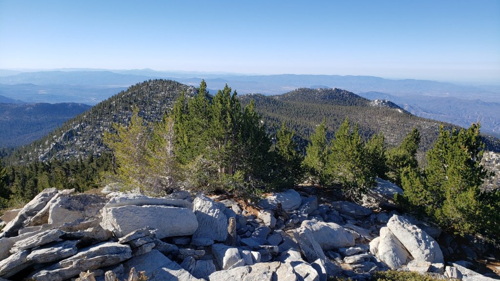
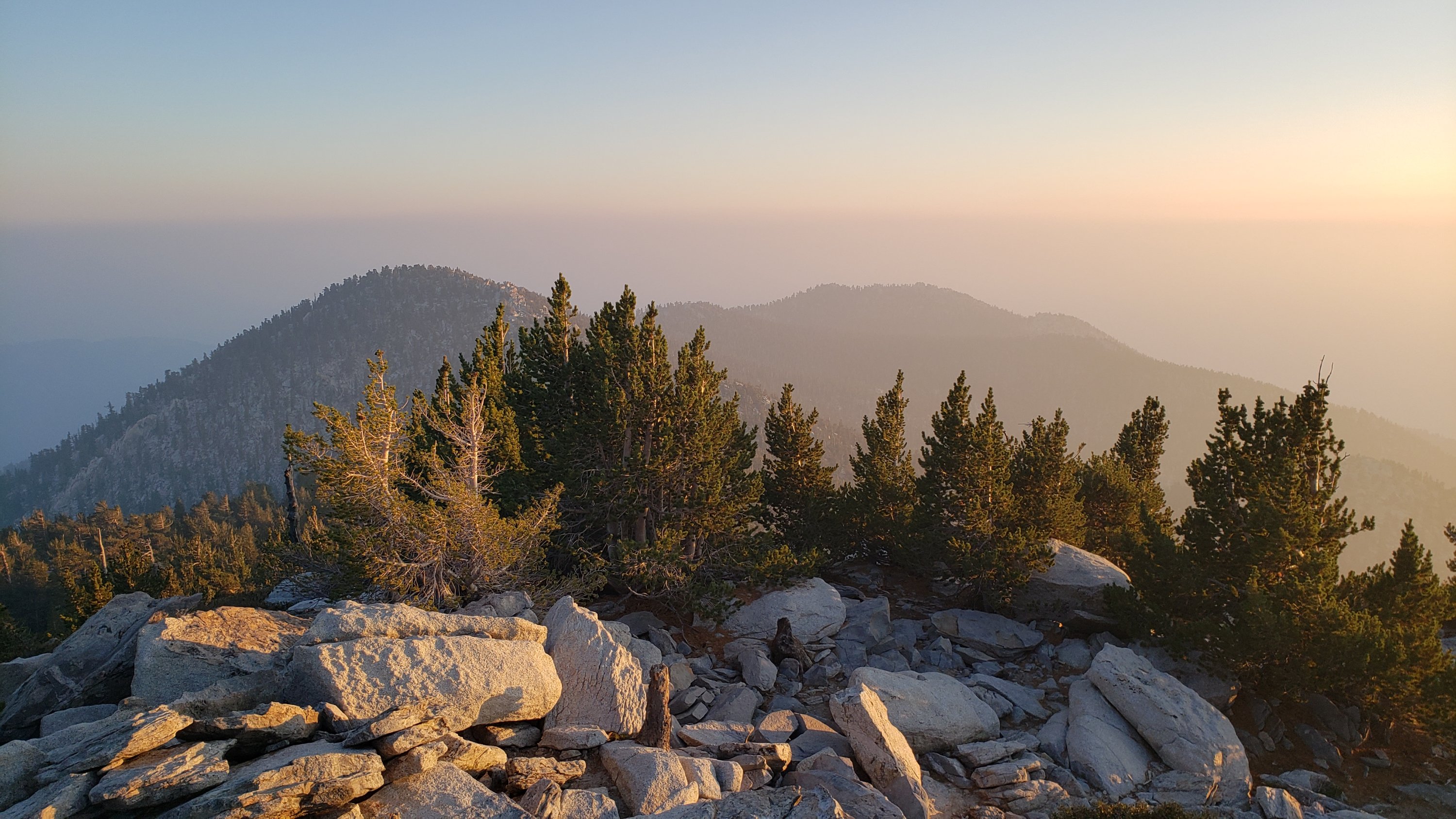
Thank you for taking the time to read this. While all labor and time is volunteered, the San Jacinto Trail Report completely depends on small private donations to cover operating costs. Every year seems to be challenging and 2021 has been no exception, so every contribution, no matter how small, is truly valuable. If you have found this Report useful, please consider visiting the Donate page. Thank you for your support.
sanjacjon Uncategorized 3 Comments 8 MinutesEdit”Trail update 6th October 2021″
Weather and water update 29th September 2021
[UPDATE 1st October 2021: three days of steady Santa Ana winds have dramatically improved air quality across the San Jacinto mountains and the wider region. This morning from San Jacinto Peak visibility was the best it has been in a couple of months, with just a narrow band of smoke visible at about 11,000ft elevation far to the west.]
In recent days temperatures have pleasantly dropped to near, or even below, seasonal averages, following about four months of nearly continuous well-above-average heat. This change is being accompanied by strengthening and shifting Santa Ana winds and a drop in humidity. Air quality has been variable but often poor for several weeks with smoke reaching us from fires hundreds of miles to the north. Stronger, shifting winds improved conditions somewhat today, but on 27th the smoke was the thickest I have seen in the San Jacinto high country without a fire burning nearby (see photo below).
The San Bernardino National Forest and the wilderness of Mount San Jacinto State Park reopened on Thursday 23rd September following a widespread closure related to fire conditions. Palm Springs Aerial Tramway has been closed since 7th September for annual maintenance and is not due to reopen until 11th October (note revised later date for reopening). See their website for details.
Full fire restrictions remain in place on Forest Service lands, as described here. All campfires anywhere in the San Jacinto mountains, including at all USFS campgrounds and yellow post sites, are prohibited. All forms of campfire are always prohibited in the State Park wilderness. Despite cooler temperatures, fire risk remains extreme.
Be bear aware. Although rarely reported, at least two Black Bears remain in the San Jacinto mountains. Earlier reports this summer were from Seven Pines Trail and near Saddle Junction on Willow Creek Trail. I was fortunate to see a very large (>300lb), uniformly dark brown individual at dawn on 7th September near Humber Park. I was able to get a couple of short, poor quality videos, of which one is available here. This was certainly a different individual, based on colour pattern and size, than one I saw on Devil’s Slide Trail in August 2020.
Hikers should now be prepared for temperatures close to freezing in the high country, and potentially below freezing when considering wind chill effects (see recent weather observations from San Jacinto Peak below).
Water conditions in the high country are poor and continue to deteriorate slowly. The current status of many key springs and creeks is described below.
The U.S. Forest Service ranger station in Idyllwild has been closed due to USFS coronavirus protocols since March 2020. Apparently it is unlikely to reopen until 2022. Hiking and camping permits are nevertheless required for USFS lands, and should be available at the kiosk outside the ranger station. The State Park ranger station has been open almost all year.
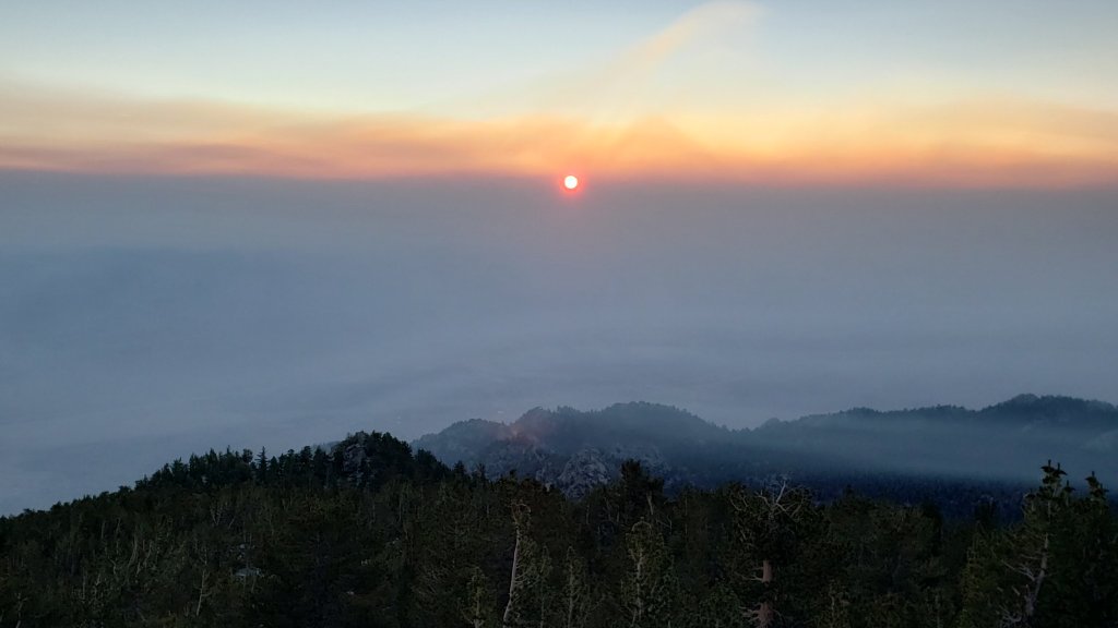
WEATHER Temperatures are generally forecast to be around seasonal and pleasantly autumnal, other than the first few days of October which will be above average for that month. From 2nd October almost every day is forecast to be partly or mostly cloudy, although currently there is no significant precipitation in the forecast. Fire risk remains severe.
The latest video discussion from NWS San Diego describes the forthcoming week of weather in detail.
At San Jacinto Peak (10,810ft/3295m) on Wednesday 29th September 2021 at 0850 the air temperature was 35.8°F (2°C), with a windchill temperature of 21.9°F (-5°C), 62% relative humidity, and a gusty NNE wind sustained at 11 mph gusting to 21.4 mph.
At the Peak on Tuesday 28th September 2021 at 0630 the air temperature was 39.6°F (4°C), with a windchill temperature of 26.3°F (-3°C), 27% relative humidity, and a stiff due West wind sustained at 21 mph gusting to 26.8 mph.
At the Peak on Monday 27th September 2021 at 0955 the air temperature was 49.5°F (10°C), with a windchill temperature of 45.3°F (7°C), 58% relative humidity, and a very light due West wind sustained at 2 mph gusting to 5.3 mph.
At the Peak on Monday 12th July 2021 at 0810 the air temperature was 67.6°F (19.8°C), with a “windchill” temperature of 67.2°F (19.6°C). This the highest air temperature ever reliably recorded at San Jacinto Peak, shattering the previous record temperature of 62.3°F (16.8°C) observed on 19th August 2020.
TRAIL CONDITIONS
Trails throughout the San Jacinto high country cleared of snow by early May. Water conditions are a major concern, with many springs and creeks already having dried up or having very low flows for the time of year, as discussed in detail below.
The rockslide at PCT Mile 172.5, just north of Antsell Rock, was removed on Monday 14th June 2021. My “before, during, and after” video is available here. This section of the PCT is now safer and is narrow but readily passable with care by hikers (but remains impassable by stock).
Many trails have accumulated treefall hazards from the past two winters, passable with care by hikers but not for stock. Although they are reported promptly, regrettably neither Forest Service nor State Park have moved quickly to remove these hazards. Some are described below, others include the PCT between Strawberry Cienega and Strawberry Junction (PCT Miles 182-183, about 7 trees down), and Fuller Ridge Trail near its northern end (PCT Miles 189.1-190.2, three trees).
Spitler Peak Trail was cleared of multiple tree hazards by the Trail Report in early July. Marion Mountain Trail was cleared of multiple tree hazards by a CCC crew in late August, along with the adjacent PCT/Deer Springs Trail for 0.6 mile north to the south end of Fuller Ridge Trail.
Many treefall hazards from Red Tahquitz to Antsell Rock (PCT Miles 172.5-175) were cleared in June. Nevertheless about 20 remain, including at least six major obstructions for hikers. Tahquitz Creek to Red Tahquitz (PCT Miles 175-177) was cleared in early June.
Willow Creek Trail has at least 33 downed trees between Skunk Cabbage Junction and Hidden Divide. Of these 22 are on the Forest Service section (16 between Willow Creek and the Park boundary), with 11 in the State Park. Most are readily passable by hikers with care. Despite so much work last year, the whitethorn has grown back rapidly, especially on the State Park section, but still remains less challenging than in 2019.
The Caramba Trail from near Reeds Meadow through Laws Camp and on to Caramba, and the Cedar Trail from Willow Creek Trail to Laws (which both nominally reopened in late 2018) are optimistically described by the Forest Service as “not maintained”. In reality parts of these trails no longer exist with significant sections of both so heavily overgrown that I strongly advise hikers do not attempt to follow them. Multiple experienced hikers have reported getting lost in this area since summer 2019. An informal use trail to the Laws Camp area is much more direct and completely avoids all of the challenging bush-whacking of the unmaintained trails (other hikers kindly nicknamed it the “King Trail”). It leaves Willow Creek Trail exactly 1.0 mile from Saddle Junction, 0.45 mile from the Skunk Cabbage turning (trailhead at N33°46’46”, W116°39’32”, WGS84). The cairned use trail descends largely on established deer tracks for 0.9 mile, reaching Willow Creek just upstream of the former site of Laws Camp. From Laws east to Caramba the route of the old Caramba Trail has become increasingly tricky to follow, especially for the first 1.2 miles east of Laws where there are dozens of trees down. Closer to Caramba the trail is relatively obvious (for those familiar with the route prior to the 2013 Mountain Fire). Very cautious navigation is recommended throughout this area.
Seven Pines Trail has had very limited hiker traffic since November 2018. There are 35 treefall hazards on the trail, four large ones on the short Forest Service section, and the remainder in the State Park, based on my most recent 2021 survey. Cautious navigation is recommended for those who are not familiar with hiking this trail. Dark Canyon Road has been closed since early 2019, and there is currently no vehicular access to Seven Pines trailhead. USFS apparently does not expect Dark Canyon Road to reopen this year.
WATER STATUS: Eastern slope
The Round Valley pipe is now flowing only intermittently and is no longer reliable. There is occasional flow (at just 0.2L/min) but without further precipitation input, this source should no longer be relied upon. Creeks in Round Valley and Tamarack Valley were dry in May (in 2020 neither dried until August).
Hidden Lake dried up completely in June.
Both the northern and southern springs at Wellman’s Cienega are flowing very gently (but adequately to filter). These are the sources for Willow Creek, which is flowing where it crosses the Willow Creek Trail (the flow remains good for filtering, but is the lowest I have ever seen this creek).
Tahquitz Creek is flowing gently at the northern end of Little Tahquitz Meadow. It is also flowing, but very gently, further upstream at its source (known locally as Grethe Spring) where it crosses the PCT at approx. Mile 177.
The small creek in Tahquitz Valley dried in May, some four months earlier than in 2020.
Candy’s Creek – that flows through Skunk Cabbage Meadow and then crosses the remaining visible section of Caramba Trail near Reeds Meadow – dried up in early July.
WATER STATUS: Western slope
The North Fork of the San Jacinto River continues to flow gently where it crosses the Deer Springs Trail but is now functionally dry where it crosses the Fuller Ridge Trail on the PCT (approx. PCT Mile 186.2).
The creek in Little Round Valley completely dried up in early July, reminiscent of the extremely dry years of 2014-16. The same creek dried up where it crosses Fuller Ridge Trail (PCT Mile 186.4) in April.
Shooting Star Spring (not far below Little Round Valley but above the North Fork of the San Jacinto River crossing) is flowing weakly and is a very poor option for filtering.
The Deer Springs stream crossing is dry at the PCT/Deer Springs Trail (approx. PCT mile 185.6). (Despite some online mapping to the contrary, this is NOT the source for the North Fork of the San Jacinto River.)
The tiny but perennial spring about 0.4 miles north of Strawberry Junction (known colloquially as Switchback Spring) continues to flow remarkably well. I rework the tiny pool at least once every week when I pass by and there is just sufficient depth from which to filter water.
The little creek at Strawberry Cienega (PCT mile 183.0) is functionally dry.
On Devil’s Slide Trail, Middle Spring is now dry. All other springs on this trail have been dry for months.
On the Ernie Maxwell Trail, the crossing of Chinquapin Creek just below Humber Park is currently flowing where it crosses the trail. Even when the creek is dry across the trail, small but invaluable fresh pools remain just upslope from the trail (this creek is an especially useful source of water for the many dogs walked on this trail).
The faucet at Cinco Poses Spring about 4.5 miles up Black Mountain Road continues to flow.
WATER STATUS: Desert Divide
Live Oak Spring (N 33 37 21, W 116 33 24) Flowing. The most reliable water source on the Desert Divide.
Cedar Spring (N 33 40 36, W 116 34 35) Flowing. Easiest access is the trough about 60 yards upstream from the trail to the campsite.
Apache Spring (N 33 43 11, W 116 37 13) Barely trickling, not now reliable.
Spitler Peak Trail Descending the trail from the PCT there are five water crossings. The first two, at 0.9 and 0.95 miles down, cross a tiny side creek which is largely dry and should be ignored. The next crossing, at 1.1 miles down, is Spitler Creek and is the best source of water (currently flowing very gently, but can be filtered). The next two crossings are the same creek, also flowing adequately for filtering.
Antsell Rock Creek (N 33 41 52, W 116 39 08) Right by the Spitler Peak Trail trailhead on Apple Canyon Road, Antsell Rock Creek is now dry. Even in the very dry years of 2015 and 2016, this source did not dry until the autumn.
Thank you hikers for taking the time to read this. While all labor and time is volunteered, the San Jacinto Trail Report completely depends on small private donations to cover operating costs. Every year seems to be challenging and 2021 has been no exception, so every contribution, no matter how small, is truly valuable. If you have found this Report useful, please consider visiting the Donate page. Thank you for your support.

sanjacjon Uncategorized 2 Comments 8 MinutesEdit”Weather and water update 29th September 2021″
Forest and Park reopening 23rd September 2021
The San Jacinto Ranger District of the San Bernardino National Forest reopened on Thursday 23rd September. Details of the Forest Service reopening are available here. The wilderness of Mount San Jacinto State Park also reopened on the same schedule.
Palm Springs Aerial Tramway has been closed since 7th September for annual maintenance and is not due to reopen until 11th October (note revised later date for reopening). See their website for details.
The Forest and Park closures, in place for 22 days, were indicative of the considerable fire risk and especially the associated resource challenges. Although conditions have apparently ameliorated somewhat, please note that fire risk remains extreme.
Full fire restrictions remain in place on Forest Service lands, as described here. All campfires anywhere in the San Jacinto mountains, including at all USFS campgrounds and yellow post sites, are prohibited. All forms of campfire are always prohibited in the State Park wilderness.
Hikers should be prepared for rapidly changing weather conditions in the high country in late summer and early winter. Thunderstorms with lightning, precipitation, and rapid temperature drops are possible in the high country, usually in the afternoons, even when such storms are not forecast for lower elevations.
Water conditions in the high country are poor and continue to deteriorate slowly. The current status of many key springs and creeks is described below.
The U.S. Forest Service ranger station in Idyllwild remains closed due to USFS coronavirus protocols. Apparently it is unlikely to reopen before October, possibly not until 2022. Hiking and camping permits are nevertheless required for USFS lands, and should be available at the kiosk outside the ranger station. The State Park ranger station reopened about seven months ago.
WEATHER Following several days of temperatures well above seasonal, conditions will cool this weekend to near or even below average into the first couple of days of October, before rising above seasonal yet again. Although several days in the next week or so will be partly or mostly cloudy, and locally an intense thunderstorm is most likely on Friday 24th, otherwise there is no significant precipitation in the forecast. Fire risk remains severe.
At San Jacinto Peak (10,810ft/3295m) on Wednesday 22nd September 2021 at 0905 the air temperature was 55.3°F (13°C), with a windchill temperature of 51.4°F (11°C), 39% relative humidity, and a very light SE wind sustained at 1 mph gusting to 3.7 mph.
At the Peak on Monday 20th September 2021 at 0930 the air temperature was 57.6°F (14°C), with a windchill temperature of 54.1°F (12°C), 25% relative humidity, and a very light SSE breeze sustained at 1 mph gusting to 6.1 mph.
At the Peak on Monday 12th July 2021 at 0810 the air temperature was 67.6°F (19.8°C), with a “windchill” temperature of 67.2°F (19.6°C). This the highest air temperature ever reliably recorded at San Jacinto Peak, shattering the previous record temperature of 62.3°F (16.8°C) observed on 19th August 2020.
TRAIL CONDITIONS
Trails throughout the San Jacinto high country cleared of snow by early May. Water conditions are a major concern, with many springs and creeks already having dried up or having very low flows for the time of year, as discussed in detail below.
The rockslide at PCT Mile 172.5, just north of Antsell Rock, was removed on Monday 14th June 2021. My “before, during, and after” video is available here. This section of the PCT is now safer and is narrow but readily passable with care by hikers (but remains impassable by stock).
Many trails have accumulated treefall hazards from the past two winters, passable with care by hikers but not for stock. Although they are reported promptly, regrettably neither Forest Service nor State Park have moved quickly to remove these hazards. Some are described below, others include the PCT between Strawberry Cienega and Strawberry Junction (PCT Miles 182-183, about 7 trees down), and Fuller Ridge Trail near its northern end (PCT Miles 189.1-190.2, three trees).
Spitler Peak Trail was cleared of multiple tree hazards by the Trail Report in early July. Marion Mountain Trail was cleared of multiple tree hazards by a CCC crew in late August, along with the adjacent PCT/Deer Springs Trail for 0.6 mile north to the south end of Fuller Ridge Trail.
Many treefall hazards from Red Tahquitz to Antsell Rock (PCT Miles 172.5-175) were cleared in June. Nevertheless about 20 remain, including at least six major obstructions for hikers. Tahquitz Creek to Red Tahquitz (PCT Miles 175-177) was cleared in early June.
Willow Creek Trail has at least 33 downed trees between Skunk Cabbage Junction and Hidden Divide. Of these 22 are on the Forest Service section (16 between Willow Creek and the Park boundary), with 11 in the State Park. Most are readily passable by hikers with care. Despite so much work last year, the whitethorn has grown back rapidly, especially on the State Park section, but still remains less challenging than in 2019.
The Caramba Trail from near Reeds Meadow through Laws Camp and on to Caramba, and the Cedar Trail from Willow Creek Trail to Laws (which both nominally reopened in late 2018) are optimistically described by the Forest Service as “not maintained”. In reality parts of these trails no longer exist with significant sections of both so heavily overgrown that I strongly advise hikers do not attempt to follow them. Multiple experienced hikers have reported getting lost in this area since summer 2019. An informal use trail to the Laws Camp area is much more direct and completely avoids all of the challenging bush-whacking of the unmaintained trails (other hikers kindly nicknamed it the “King Trail”). It leaves Willow Creek Trail exactly 1.0 mile from Saddle Junction, 0.45 mile from the Skunk Cabbage turning (trailhead at N33°46’46”, W116°39’32”, WGS84). The cairned use trail descends largely on established deer tracks for 0.9 mile, reaching Willow Creek just upstream of the former site of Laws Camp. From Laws east to Caramba the route of the old Caramba Trail has become increasingly tricky to follow, especially for the first 1.2 miles east of Laws where there are dozens of trees down. Closer to Caramba the trail is relatively obvious (for those familiar with the route prior to the 2013 Mountain Fire). Very cautious navigation is recommended throughout this area.
Seven Pines Trail has had very limited hiker traffic since November 2018. There are 35 treefall hazards on the trail, four large ones on the short Forest Service section, and the remainder in the State Park, based on my most recent 2021 survey. Cautious navigation is recommended for those who are not familiar with hiking this trail. Dark Canyon Road has been closed since early 2019, and there is currently no vehicular access to Seven Pines trailhead. USFS apparently does not expect Dark Canyon Road to reopen this year.
WATER STATUS: Eastern slope
The Round Valley pipe is now flowing only intermittently and is no longer reliable. There is occasional flow (at just 0.2L/min) but without further precipitation input, this source should no longer be relied upon. Creeks in Round Valley and Tamarack Valley were dry in May (in 2020 neither dried until August).
Hidden Lake dried up completely in June.
Both the northern and southern springs at Wellman’s Cienega are flowing very gently (but adequately to filter). These are the sources for Willow Creek, which is flowing where it crosses the Willow Creek Trail (the flow remains good for filtering, but is the lowest I have ever seen this creek).
Tahquitz Creek is flowing gently at the northern end of Little Tahquitz Meadow. It is also flowing, but very gently, further upstream at its source (known locally as Grethe Spring) where it crosses the PCT at approx. Mile 177.
The small creek in Tahquitz Valley dried in May, some four months earlier than in 2020.
Candy’s Creek – that flows through Skunk Cabbage Meadow and then crosses the remaining visible section of Caramba Trail near Reeds Meadow – dried up in early July.
WATER STATUS: Western slope
The North Fork of the San Jacinto River continues to flow gently where it crosses the Deer Springs Trail but is now functionally dry where it crosses the Fuller Ridge Trail on the PCT (approx. PCT Mile 186.2).
The creek in Little Round Valley completely dried up in early July, reminiscent of the extremely dry years of 2014-16. The same creek dried up where it crosses Fuller Ridge Trail (PCT Mile 186.4) in April.
Shooting Star Spring (not far below Little Round Valley but above the North Fork of the San Jacinto River crossing) is flowing weakly and is a very poor option for filtering.
The Deer Springs stream crossing is dry at the PCT/Deer Springs Trail (approx. PCT mile 185.6). (Despite some online mapping to the contrary, this is NOT the source for the North Fork of the San Jacinto River.)
The tiny but perennial spring about 0.4 miles north of Strawberry Junction (known colloquially as Switchback Spring) continues to flow remarkably well. I rework the tiny pool at least once every week when I pass by and there is just sufficient depth from which to filter water.
The little creek at Strawberry Cienega (PCT mile 183.0) is functionally dry.
On Devil’s Slide Trail, Middle Spring is now dry. All other springs on this trail have been dry for months.
On the Ernie Maxwell Trail, the crossing of Chinquapin Creek just below Humber Park is currently flowing where it crosses the trail. Even when the creek is dry across the trail, small but invaluable fresh pools remain just upslope from the trail (this creek is an especially useful source of water for the many dogs walked on this trail).
The faucet at Cinco Poses Spring about 4.5 miles up Black Mountain Road continues to flow.
WATER STATUS: Desert Divide
Live Oak Spring (N 33 37 21, W 116 33 24) Flowing. The most reliable water source on the Desert Divide.
Cedar Spring (N 33 40 36, W 116 34 35) Flowing. Easiest access is the trough about 60 yards upstream from the trail to the campsite.
Apache Spring (N 33 43 11, W 116 37 13) Barely trickling, not now reliable.
Spitler Peak Trail Descending the trail from the PCT there are five water crossings. The first two, at 0.9 and 0.95 miles down, cross a tiny side creek which is largely dry and should be ignored. The next crossing, at 1.1 miles down, is Spitler Creek and is the best source of water (currently flowing very gently, but can be filtered). The next two crossings are the same creek, also flowing adequately for filtering.
Antsell Rock Creek (N 33 41 52, W 116 39 08) Right by the Spitler Peak Trail trailhead on Apple Canyon Road, Antsell Rock Creek is now dry. Even in the very dry years of 2015 and 2016, this source did not dry until the autumn.
Thank you hikers for taking the time to read this. While all labor and time is volunteered, the San Jacinto Trail Report completely depends on small private donations to cover operating costs. Every year seems to be challenging and 2021 has been no exception, so every contribution, no matter how small, is truly valuable. If you have found this Report useful, please consider visiting the Donate page. Thank you for your support.
sanjacjon Uncategorized Leave a comment 7 MinutesEdit”Forest and Park reopening 23rd September 2021″
Forest closure 1st September 2021
[UPDATE 14th September 2021: the closure of San Bernardino National Forest was extended today until midnight on 22nd September, as reflected in the text below, and described in this USFS press release.]
The entire San Jacinto Ranger District of the San Bernardino National Forest closed effective at midnight, Tuesday 31st August 2021. In addition to the forest and trails, this closure includes all campgrounds, picnic sites, trailheads, and forest roads. This step is being taken due to exceptional fire risk and limited available firefighting resources statewide.
The closure includes all parking areas (e.g., Humber Park, Lake Fulmor), and all gated roads are locked (e.g., South Ridge Road, Black Mountain Road, May Valley Road, Azalea Road, Bee Canyon Road, etc.). I know this closure will be frustrating and will present challenges for locals and visitors alike. Regrettably it seems likely, with the direction the climate is heading, that this will be an increasingly common phenomenon in 21st Century California.
Other parts of the San Bernardino NF and other national forests in Southern California are included in this closure (see original USFS press release here, and closure extension here). The initial closure order for two-and-a-half weeks until Friday 17th September has now been extended to Wednesday 22nd September. Bear in mind that last year a similar closure was extended three additional times for a total of 31 days (and camping was then prohibited for about two months after that).
The wilderness of Mount San Jacinto State Park is also closing on the same schedule (see their website here). The State Park campgrounds at Idyllwild and Stone Creek remain open at this time, as do the minor trails in the immediate vicinity of the Palm Springs Aerial Tramway. Hikers will not be allowed beyond Long Valley Ranger Station.
As almost all public trails into the State Park pass through Forest Service land anyway, the USFS closure makes the Park functionally accessible only via the Tram.
The Palm Springs Aerial Tramway is closed for annual maintenance between 7th September and 3rd October 2021 (as described on their website here).
Despite some encouraging thunderous rumblings in recent days, and some localized rain in Garner Valley and elsewhere, sadly forecast monsoon conditions did not result in significant widespread precipitation in the San Jacinto mountains. Further chances for rain are currently forecast for some days in early to mid September.
Minor fires in the Black Mountain area on the afternoon of Monday 30th August originated from dry lightning strikes. They were extinguished promptly while thankfully very small, largely by water-dropping helicopter filling up from Lake Fulmor, in addition to ground crews.
Please stay safe everyone. I will post any new information as soon as it comes available.
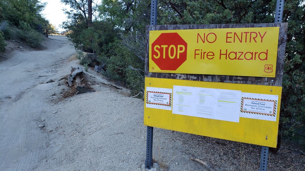
sanjacjon Uncategorized 1 Comment 2 MinutesEdit”Forest closure 1st September 2021″
Trail update 26th August 2021
Conditions have thankfully improved now, but the most striking event in the mountains in recent days has been the rapid deterioration in air quality due to smoke from fires in the north of the state. Smoke arrived in the high country on the morning of Monday 23rd August, largely above 7000ft, before steadily descending across the San Jacinto mountains during the course of that afternoon. By the morning of Tuesday 24th the smoke had thickened and sunk into the lower elevations largely below about 8800ft (see photos below), persisting until 25th. This event is especially remarkable given that the nearest major fires are hundreds of miles to the north, and in theory prevailing winds are largely moving the smoke away from us to the north and east. Give some thought to those in the Tahoe basin, where Air Quality Index readings over 800 were reported this week, more than quadruple the “very unhealthy” threshold.
A delightfully cool week has just come to an end, in which temperatures were at times below seasonal for the first time since mid June! On the morning of Thursday 19th August we recorded an overnight low temperature of 42°F (5°C) at 5550ft in Idyllwild. In a “normal” summer that temperature would probably not deserve a mention, but it has been far from a normal summer.
There is a chance of a return to monsoon conditions starting Sunday 29th August, potentially lasting into the first week of September. While grateful for the modest rain and higher humidity that we have received so far this season, given that the monsoon rainfall in Arizona has been among the heaviest ever recorded, we are probably unfortunate not to have had more precipitation so far this summer.
The most significant trail news from the past week is the great work by a small California Conservation Corps (CCC) crew working on some western slope trails in the State Park. Last week they cleared the 7-8 downed trees on Marion Mountain Trail, plus the similar number of tree hazards (including some major obstructions) on Deer Springs Trail between Strawberry Junction and Fuller Ridge Trail (PCT Miles 183-185.5). When I passed them on Saturday 21st, the CCC were working on improving the trail tread just below Strawberry Junction. It was great to be able to thank them in person for their hard work.
Daily wilderness hikes continue to include San Jacinto Peak multiple times per week by a variety of routes, plus various other trails, facilitating regular checks of water sources and trail hazards. On Tuesday 24th, USFS volunteer Bill Rhoads and I finally finished trail trimming on the PCT north of Saddle Junction (approx. Miles 180-181).
Hikers should be prepared for rapidly changing weather conditions in the high country in summer. Thunderstorms with lightning, precipitation, and rapid temperature drops can occur in the high country even when such storms are not forecast for lower elevations, usually most likely in the afternoons.
Full fire restrictions are in place on Forest Service lands, as described here. All campfires anywhere in the San Jacinto mountains, including at all USFS campgrounds and yellow post sites, are now prohibited. The total fire ban has finally been extended to Riverside County lands starting 23rd August, including for example the Hurkey Creek campground (thanks to Dan Roberts for updates on the county situation).
Water conditions in the high country are poor and continue to deteriorate. The current status of many key springs and creeks is described below.
The U.S. Forest Service ranger station in Idyllwild remains closed due to USFS coronavirus protocols. Apparently it is unlikely to reopen before October, possibly much later. Hiking and camping permits are nevertheless required for USFS lands, and should be available at the kiosk outside the ranger station. The State Park ranger station reopened about six months ago.


WEATHER A few days of temperatures around (or even below!) seasonal for the first time in two months came to an end early this week. Daytime high temperatures will again be above average for August starting Wednesday 25th, with overnight low temperatures in particular being well above seasonal, before cooling again to around average for September in the first week of that month. As mentioned above, monsoonal rains are a possibility from 29th August to at least 3rd September. Fire risk remains severe.
At San Jacinto Peak (10,810ft/3295m) on Tuesday 24th August 2021 at 0805 the air temperature was 50.1°F (9°C), with a windchill temperature of 41.8°F (5°C), 31% relative humidity, and a very gusty SW wind sustained at 6 mph gusting to 16.8 mph.
At the Peak on Saturday 21st August 2021 at 0815 the air temperature was 50.9°F (10°C), with a windchill temperature of 46.2°F (8°C), 16% relative humidity, and a brisk due South breeze sustained at 5 mph gusting to 8.4 mph.
At the Peak on Thursday 19th August 2021 at 0830 the air temperature was 48.9°F (9°C), with a windchill temperature of 41.7°F (5°C), 15% relative humidity, and a light WSW wind sustained at 6 mph gusting to 10.1 mph.
At the Peak on Monday 12th July 2021 at 0810 the air temperature was 67.6°F (19.8°C), with a “windchill” temperature of 67.2°F (19.6°C), 38% relative humidity, and a very light NNE breeze sustained at 2 mph gusting to 7.2 mph. This the highest air temperature ever reliably recorded at San Jacinto Peak, shattering the previous record temperature of 62.3°F (16.8°C) observed on 19th August 2020.

TRAIL CONDITIONS
Trails throughout the San Jacinto high country cleared of snow by early May. Water conditions are a major concern, with many springs and creeks already having dried up or having very low flows for the time of year, as discussed in detail below.
The rockslide at PCT Mile 172.5, just north of Antsell Rock, was removed on Monday 14th June. My “before, during, and after” video is available here. This section of the PCT is now safer and is narrow but readily passable with care by hikers (but remains impassable by stock).
Many trails have accumulated treefall hazards from the past two winters, passable with care by hikers but not for stock. Although they are reported promptly, regrettably neither Forest Service nor State Park have moved quickly to remove these hazards. Some are described below, others include the PCT between Strawberry Cienega and Strawberry Junction (PCT Miles 182-183, about 7 trees down), and Fuller Ridge Trail near its northern end (PCT Miles 189.1-190.2, three trees).
Spitler Peak Trail was cleared of multiple tree hazards by the Trail Report in early July. Marion Mountain Trail was cleared of multiple tree hazards by a CCC crew in late August, along with the adjacent PCT/Deer Springs Trail for 0.6 mile north to the south end of Fuller Ridge Trail.
Many treefall hazards from Red Tahquitz to Antsell Rock (PCT Miles 172.5-175) were cleared in June. Nevertheless about 20 remain, including at least six major obstructions for hikers. Tahquitz Creek to Red Tahquitz (PCT Miles 175-177) was cleared in early June.
Willow Creek Trail has at least 33 downed trees between Skunk Cabbage Junction and Hidden Divide. Of these 22 are on the Forest Service section (16 between Willow Creek and the Park boundary), with 11 in the State Park. Most are readily passable by hikers with care. Despite so much work last year, the whitethorn has grown back rapidly, especially on the State Park section, but still remains less challenging than in 2019.
The Caramba Trail from near Reeds Meadow through Laws Camp and on to Caramba, and the Cedar Trail from Willow Creek Trail to Laws (which both nominally reopened in late 2018) are optimistically described by the Forest Service as “not maintained”. In reality parts of these trails no longer exist with significant sections of both so heavily overgrown that I strongly advise hikers do not attempt to follow them. Multiple experienced hikers have reported getting lost in this area since summer 2019. An informal use trail to the Laws Camp area is much more direct and completely avoids all of the challenging bush-whacking of the unmaintained trails (other hikers kindly nicknamed it the “King Trail”). It leaves Willow Creek Trail exactly 1.0 mile from Saddle Junction, 0.45 mile from the Skunk Cabbage turning (trailhead at N33°46’46”, W116°39’32”, WGS84). The cairned use trail descends largely on established deer tracks for 0.9 mile, reaching Willow Creek just upstream of the former site of Laws Camp. From Laws east to Caramba the route of the old Caramba Trail has become increasingly tricky to follow, especially for the first 1.2 miles east of Laws where there are dozens of trees down. Closer to Caramba the trail is relatively obvious (for those familiar with the route prior to the 2013 Mountain Fire). Very cautious navigation is recommended throughout this area.
Seven Pines Trail has had very limited hiker traffic since November 2018. There are 35 treefall hazards on the trail, four large ones on the short Forest Service section, and the remainder in the State Park, based on my most recent 2021 survey. Cautious navigation is recommended for those who are not familiar with hiking this trail. Dark Canyon Road has been closed since early 2019, and there is currently no vehicular access to Seven Pines trailhead. USFS apparently does not expect Dark Canyon Road to reopen this year.

WATER STATUS: Eastern slope
The Round Valley pipe continues to flow weakly (at about 0.4L/min) as of last week. This source may not be reliable beyond August. Creeks in Round Valley and Tamarack Valley were dry in May (in 2020 neither dried until August).
Hidden Lake dried up completely in June.
Both the northern and southern springs at Wellman’s Cienega are flowing very gently (but adequately to filter). These are the sources for Willow Creek, which is flowing where it crosses the Willow Creek Trail (the flow remains good for filtering, but is the lowest I have ever seen this creek).
Tahquitz Creek is flowing gently at the northern end of Little Tahquitz Meadow. It is also flowing, but very gently, further upstream at its source (known locally as Grethe Spring) where it crosses the PCT at approx. Mile 177.
The small creek in Tahquitz Valley dried in May, some four months earlier than in 2020.
Candy’s Creek – that flows through Skunk Cabbage Meadow and then crosses the remaining visible section of Caramba Trail near Reeds Meadow – dried up in early July.
WATER STATUS: Western slope
The North Fork of the San Jacinto River continues to flow gently where it crosses the Deer Springs Trail and also downstream – but even more weakly – where it crosses the Fuller Ridge Trail on the PCT (approx. PCT Mile 186.2).

The creek in Little Round Valley completely dried up in early July, reminiscent of the extremely dry years of 2014-16. The same creek dried up where it crosses Fuller Ridge Trail (PCT Mile 186.4) in April.
Shooting Star Spring (not far below Little Round Valley but above the North Fork of the San Jacinto River crossing) is flowing weakly and is a very poor option for filtering.
The Deer Springs stream crossing is dry at the PCT/Deer Springs Trail (approx. PCT mile 185.6). (Despite some online mapping to the contrary, this is NOT the source for the North Fork of the San Jacinto River.)
The tiny but perennial spring about 0.4 miles north of Strawberry Junction (known colloquially as Switchback Spring) continues to flow remarkably well. I rework the tiny pool at least once every week when I pass by and there is just sufficient depth from which to filter water.

The little creek at Strawberry Cienega (PCT mile 183.0) is functionally dry.
On Devil’s Slide Trail, Middle Spring is now dry. All other springs on this trail have been dry for months.
On the Ernie Maxwell Trail, the crossing of Chinquapin Creek just below Humber Park is currently flowing where it crosses the trail. Even when the creek is dry across the trail, small but invaluable fresh pools remain just upslope from the trail (this creek is an especially useful source of water for the many dogs walked on this trail).
The faucet at Cinco Poses Spring about 4.5 miles up Black Mountain Road continues to flow.
WATER STATUS: Desert Divide
Live Oak Spring (N 33 37 21, W 116 33 24) Flowing. The most reliable water source on the Desert Divide.
Cedar Spring (N 33 40 36, W 116 34 35) Flowing. Easiest access is the trough about 60 yards upstream from the trail to the campsite.
Apache Spring (N 33 43 11, W 116 37 13) Barely trickling, not now reliable.
Spitler Peak Trail Descending the trail from the PCT there are five water crossings. The first two, at 0.9 and 0.95 miles down, cross a tiny side creek which is largely dry and should be ignored. The next crossing, at 1.1 miles down, is Spitler Creek and is the best source of water (currently flowing very gently, but can be filtered). The next two crossings are the same creek, also flowing adequately for filtering.
Antsell Rock Creek (N 33 41 52, W 116 39 08) Right by the Spitler Peak Trail trailhead on Apple Canyon Road, Antsell Rock Creek is now dry. Even in the very dry years of 2015 and 2016, this source did not dry until the autumn.
Thank you hikers for taking the time to read this. While all labor and time is volunteered, the San Jacinto Trail Report completely depends on small private donations to cover operating costs. Every year seems to be challenging and 2021 has been no exception, so every contribution, no matter how small, is truly valuable. If you have found this Report useful, please consider visiting the Donate page. Thank you for your support.
sanjacjon Uncategorized Leave a comment 10 MinutesEdit”Trail update 26th August 2021″
Weather and water update 19th August 2021
Regrettably monsoonal weather conditions in the past week did not produce significant precipitation in the San Jacinto mountains, and the monsoon pattern appears to have shifted away from us for the remainder of August. On the plus side, a major cooling trend for the next few days will take daytime high temperatures below seasonal averages for the first time this summer (discussed in Weather below). Daily wilderness hikes continue to include San Jacinto Peak multiple times per week, and Tahquitz Peak weekly, both by a variety of routes, plus various other trails, facilitating regular checks of water sources and trail conditions.
Hikers should be prepared for rapidly changing weather conditions in the high country in summer. Thunderstorms with lightning, precipitation, and rapid temperature drops can occur in the high country even when such storms are not forecast for lower elevations, usually most likely in the afternoons.
Full fire restrictions are in place on Forest Service lands, as described here. All campfires anywhere in the San Jacinto mountains, including at all USFS campgrounds and yellow post sites, are now prohibited.
Water conditions in the high country are poor and continue to deteriorate. The current status of many key springs and creeks is described below.
The U.S. Forest Service ranger station in Idyllwild remains closed due to USFS coronavirus protocols. Apparently it is unlikely to reopen before October. Hiking and camping permits are nevertheless required for USFS lands, and should be available at the kiosk outside the ranger station. The State Park ranger station reopened many months ago.
WEATHER Daytime high temperatures are falling rapidly to several degrees below seasonal for 18th-21st August. It should feel delightfully cool compared to the past two months! While overnight low temperatures will also fall dramatically compared to recent weeks, they will still largely be at or even slightly above seasonal norms. From Monday 23rd onwards, day and night temperatures will climb again to above average, with another heatwave currently forecast for the last week of August. Fire risk remains severe.
At San Jacinto Peak (10,810ft/3295m) on Thursday 19th August 2021 at 0830 the air temperature was 48.9°F (9°C), with a windchill temperature of 41.7°F (5°C), 15% relative humidity, and a light WSW wind sustained at 6 mph gusting to 10.1 mph.
At the Peak on Monday 16th August 2021 at 0805 the air temperature was 60.2°F (16°C), with a windchill temperature of 56.8°F (14°C), 57% relative humidity, and a pleasant NNW breeze sustained at 3 mph gusting to 8.5 mph.
At the Peak on Monday 12th July 2021 at 0810 the air temperature was 67.6°F (19.8°C), with a “windchill” temperature of 67.2°F (19.6°C), 38% relative humidity, and a very light NNE breeze sustained at 2 mph gusting to 7.2 mph. This the highest air temperature ever reliably recorded at San Jacinto Peak, shattering the previous record temperature of 62.3°F (16.8°C) observed on 19th August 2020.
TRAIL CONDITIONS
Trails throughout the San Jacinto high country cleared of snow by early May. Water conditions are a major concern, with many springs and creeks already having dried up or having very low flows for the time of year, as discussed in detail below.
The rockslide at PCT Mile 172.5, just north of Antsell Rock, was removed on Monday 14th June. My “before, during, and after” video is available here. This section of the PCT is now safer and is readily passable with care by hikers (but still not by stock).
Many trails have accumulated treefall hazards from the past two winters, passable with care by hikers but not for stock. Although they are reported promptly, regrettably neither Forest Service nor State Park have moved quickly to remove these hazards. Some are described below, others include the PCT between Strawberry Cienega and Deer Springs camp (PCT Miles 182-185, about 12 trees down), and Fuller Ridge Trail near its northern end (PCT Miles 189.1-190.2, three trees).
Spitler Peak Trail was cleared of multiple tree hazards by the Trail Report in early July.
Many treefall hazards from Red Tahquitz to Antsell Rock (PCT Miles 172.5-175) were cleared in June. Nevertheless about 20 remain, including at least six major obstructions for hikers. Tahquitz Creek to Red Tahquitz (PCT Miles 175-177) was cleared in early June.
Willow Creek Trail has at least 33 downed trees between Skunk Cabbage Junction and Hidden Divide. Of these 22 are on the Forest Service section (16 between Willow Creek and the Park boundary), with 11 in the State Park. Most are readily passable by hikers with care. Despite so much work last year, the whitethorn has grown back rapidly, especially on the State Park section, but still remains less challenging than in 2019.
The Caramba Trail from near Reeds Meadow through Laws Camp and on to Caramba, and the Cedar Trail from Willow Creek Trail to Laws (which both nominally reopened in late 2018) are optimistically described by the Forest Service as “not maintained”. In reality parts of these trails no longer exist with significant sections of both so heavily overgrown that I strongly advise hikers do not attempt to follow them. Multiple experienced hikers have reported getting lost in this area since summer 2019. An informal use trail to the Laws Camp area is much more direct and completely avoids all of the challenging bush-whacking of the unmaintained trails (other hikers kindly nicknamed it the “King Trail”). It leaves Willow Creek Trail exactly 1.0 mile from Saddle Junction, 0.45 mile from the Skunk Cabbage turning (trailhead at N33°46’46”, W116°39’32”, WGS84). The cairned use trail descends largely on established deer tracks for 0.9 mile, reaching Willow Creek just upstream of the former site of Laws Camp. From Laws east to Caramba the route of the old Caramba Trail has become increasingly tricky to follow, especially for the first 1.2 miles east of Laws where there are dozens of trees down. Closer to Caramba the trail is relatively obvious (for those familiar with the route prior to the 2013 Mountain Fire). Very cautious navigation is recommended throughout this area.
Seven Pines Trail has had limited hiker traffic since November 2018. There are 35 treefall hazards on the trail, four large ones on the short Forest Service section, and the remainder in the State Park, based on my most recent 2021 survey. Cautious navigation is recommended for those who are not familiar with hiking this trail. Dark Canyon Road has been closed since early 2019, and there is currently no vehicular access to Seven Pines trailhead. USFS apparently does not expect Dark Canyon Road to reopen this year.
WATER STATUS: Eastern slope
The Round Valley pipe continues to flow weakly (at about 0.4L/min) as of last week. This source may not be reliable beyond August. Creeks in Round Valley and Tamarack Valley were dry in May (in 2020 neither dried until August).
Hidden Lake dried up completely in June.
Both the northern and southern springs at Wellman’s Cienega are flowing very gently (but adequately to filter). These are the sources for Willow Creek, which is flowing where it crosses the Willow Creek Trail (on 4th August the flow was good for filtering, but was the lowest I have ever seen this creek).
Tahquitz Creek is flowing gently at the northern end of Little Tahquitz Meadow. It is also flowing, but very gently, further upstream at its source (known locally as Grethe Spring) where it crosses the PCT at approx. Mile 177.

The small creek in Tahquitz Valley dried in May, some four months earlier than in 2020.
Candy’s Creek – that flows through Skunk Cabbage Meadow and then crosses the remaining visible section of Caramba Trail near Reeds Meadow – dried up in early July.
WATER STATUS: Western slope
The North Fork of the San Jacinto River continues to flow steadily where it crosses the Deer Springs Trail and also downstream – but much more weakly – where it crosses the Fuller Ridge Trail on the PCT (approx. PCT Mile 186.2).
The creek in Little Round Valley completely dried up in early July, reminiscent of the extremely dry years of 2014-16. The same creek dried up where it crosses Fuller Ridge Trail (PCT Mile 186.4) in April.
Shooting Star Spring (not far below Little Round Valley but above the North Fork of the San Jacinto River crossing) is flowing weakly and is a very poor option for filtering.
The Deer Springs stream crossing is dry at the PCT/Deer Springs Trail (approx. PCT mile 185.6). (Despite some online mapping to the contrary, this is NOT the source for the North Fork of the San Jacinto River.)
The tiny but perennial spring about 0.4 miles north of Strawberry Junction (known colloquially as Switchback Spring) continues to flow well. I rework the tiny pool once or twice every week when I pass by and there is just sufficient depth from which to filter water.
The little creek at Strawberry Cienega (PCT mile 183.0) is functionally dry. The tiny pool, just a few inches in diameter, is not adequate for filtering (I nearly drained it dry trying to filter 0.25L in late June!).
On Devil’s Slide Trail, Middle Spring is now dry. All other springs on this trail have been dry for months.
On the Ernie Maxwell Trail, the crossing of Chinquapin Creek just below Humber Park is currently flowing where it crosses the trail. Even when dry across the trail, small but invaluable fresh pools remain just upslope from the trail (this creek is an especially useful source of water for the many dogs walked on this trail).
The faucet at Cinco Poses Spring about 4.5 miles up Black Mountain Road continues to flow.
WATER STATUS: Desert Divide
Live Oak Spring (N 33 37 21, W 116 33 24) Flowing. The most reliable water source on the Desert Divide.
Cedar Spring (N 33 40 36, W 116 34 35) Flowing. Easiest access is the trough about 60 yards upstream from the trail to the campsite.
Apache Spring (N 33 43 11, W 116 37 13) Barely trickling, not now reliable.
Spitler Peak Trail Descending the trail from the PCT there are five water crossings. The first two, at 0.9 and 0.95 miles down, cross a tiny side creek which is largely dry and should be ignored. The next crossing, at 1.1 miles down, is Spitler Creek and is the best source of water (currently flowing very gently, but can be filtered). The next two crossings are the same creek, also flowing adequately for filtering.
Antsell Rock Creek (N 33 41 52, W 116 39 08) Right by the Spitler Peak Trail trailhead on Apple Canyon Road, Antsell Rock Creek is now dry. Even in the very dry years of 2015 and 2016, this source did not dry until the autumn.

Thank you hikers for taking the time to read this. While all labor and time is volunteered, the San Jacinto Trail Report completely depends on small private donations to cover operating costs. Every year seems to be challenging and 2021 has been no exception, so every contribution, no matter how small, is truly valuable. If you have found this Report useful, please consider visiting the Donate page. Thank you for your support.
sanjacjon Uncategorized 2 Comments 8 MinutesEdit”Weather and water update 19th August 2021″
Weather and water update 11th August 2021
Hopefully the San Jacinto mountains will receive some desperately needed monsoonal rain for the third week in a row, although so far storms on 9th and 10th have produced plenty of thunder and lightning but with no significant rainfall around Idyllwild. The monsoon system as a whole is described in detail in the latest NWS-San Diego video.
Daily hikes include San Jacinto Peak multiple times per week, and Tahquitz Peak weekly, both by a variety of routes facilitating regular checks of water sources and trail conditions. Recent trail maintenance work has focused on South Ridge Trail and the PCT just north of Saddle Junction (the latter alongside Forest Service volunteer Bill Rhoads).
Regrettably a vehicle was broken into at the trailhead parking at the top of South Ridge Road on Saturday morning, 7th August. To add insult to injury, it was the vehicle of one of our invaluable volunteer fire lookouts at Tahquitz Peak. Another hiker vehicle parked on Tahquitz View Drive at the bottom of South Ridge Road was similarly damaged the same morning. Living nearby, I estimate that I have hiked past these trailheads more than 400 times in the past decade and this is the first break-in I have heard of or witnessed. Thankfully trailhead vehicle break-ins are extremely rare in the San Jacinto mountains, although we did have a spate at Humber Park and Deer Springs trailhead in 2014-2016. Hopefully this does not signal the start of a similar wave. The usual cautions may help; leave no valuables whatsoever in your vehicle, and nothing visible at all from the outside.
Hikers should be prepared for rapidly changing weather conditions in the high country in summer. Thunderstorms with lightning, precipitation, and rapid temperature drops can occur in the high country even when such storms are not forecast for lower elevations, usually most likely in the afternoons.
Full fire restrictions are in place on Forest Service lands, as described here. All campfires anywhere in the San Jacinto mountains, including at all USFS campgrounds and yellow post sites, are now prohibited.
Water conditions in the high country remain very poor, despite recent showers. The current status of many key springs and creeks is described below. While flow can improve briefly immediately after rain storms, the effects of monsoonal events typically only last a few days at most.
Be bear aware. Observations have been infrequent in the past two years, but 1-3 individuals remain active in the San Jacinto mountains. One was seen just east of Saddle Junction in early July, fresh tracks were on lower Seven Pines Trail on 22nd May and dumpsters in nearby Dark Canyon were visited by a bear in July.
The U.S. Forest Service ranger station in Idyllwild remains closed due to USFS coronavirus protocols. Apparently it may not reopen before October. Hiking and camping permits are nevertheless required for USFS lands, and should be available at the kiosk outside the ranger station. The State Park ranger station reopened many months ago.
WEATHER Daytime temperatures will be around seasonal this week, although with a minor heatwave at the weekend (14th-15th August). As seems to be increasingly “normal” in recent years, the overnight low temperatures will continue to average at least 5-10 degrees above historical norms for the foreseeable future. From 17th onwards, daytime high temperatures will be at (or even slightly below!) average for August. Monsoonal rains are possible every day 14th-20th August, generally most likely in the afternoons or at night. Fire risk remains severe.
At San Jacinto Peak (10,810ft/3295m) on Monday 9th August 2021 at 0810 the air temperature was 52.8°F (12°C), with a windchill temperature of 49.1°F (10°C), 56% relative humidity, and a light WNW breeze sustained at 2 mph gusting to 7.0 mph.
At the Peak on Thursday 5th August 2021 at 0755 the air temperature was 50.9°F (11°C), with a windchill temperature of 44.0°F (7°C), 75% relative humidity, and a steady due East wind sustained at 9 mph gusting to 13.8 mph.
At the Peak on Monday 12th July 2021 at 0810 the air temperature was 67.6°F (19.8°C), with a “windchill” temperature of 67.2°F (19.6°C), 38% relative humidity, and a very light NNE breeze sustained at 2 mph gusting to 7.2 mph. This the highest air temperature ever reliably recorded at San Jacinto Peak, shattering the previous record temperature of 62.3°F (16.8°C) observed on 19th August 2020.
TRAIL CONDITIONS
Trails throughout the San Jacinto high country cleared of snow by early May. Water conditions are a major concern, with many springs and creeks already having dried up or having very low flows for the time of year, as discussed in detail below.
The rockslide at PCT Mile 172.5, just north of Antsell Rock, was removed on Monday 14th June. My “before, during, and after” video is available here. This section of the PCT is now safer and is readily passable with care by hikers (but still not by stock).
Many trails have accumulated treefall hazards from the past two winters, passable with care by hikers but not for stock. Although they are reported promptly, regrettably neither Forest Service nor State Park have moved quickly to remove these hazards. Some are described below, others include the PCT between Strawberry Cienega and Deer Springs camp (PCT Miles 182-185, about 12 trees down), and Fuller Ridge Trail near its northern end (PCT Miles 189.1-190.2, three trees).
Spitler Peak Trail was cleared of multiple tree hazards by the Trail Report in early July.
Many treefall hazards from Red Tahquitz to Antsell Rock (PCT Miles 172.5-175) were cleared in June. Nevertheless about 20 remain, including at least six major obstructions for hikers. Tahquitz Creek to Red Tahquitz (PCT Miles 175-177) was cleared in early June.
Willow Creek Trail has 33 downed trees between Skunk Cabbage Junction and Hidden Divide. Of these 22 are on the Forest Service section (16 between Willow Creek and the Park boundary), with 11 in the State Park. Most are readily passable by hikers with care. Despite so much work last year, the whitethorn has grown back rapidly, especially on the State Park section, but remains less challenging than in 2019.
The Caramba Trail from near Reeds Meadow through Laws Camp and on to Caramba, and the Cedar Trail from Willow Creek Trail to Laws (which both nominally reopened in late 2018) are optimistically described by the Forest Service as “not maintained”. In reality parts of these trails no longer exist with significant sections of both so heavily overgrown that I strongly advise hikers do not attempt to follow them. Multiple experienced hikers have reported getting lost in this area since summer 2019. An informal use trail to the Laws Camp area is much more direct and completely avoids all of the challenging bush-whacking of the unmaintained trails (other hikers kindly nicknamed it the “King Trail”). It leaves Willow Creek Trail exactly 1.0 mile from Saddle Junction, 0.45 mile from the Skunk Cabbage turning (trailhead at N33°46’46”, W116°39’32”, WGS84). The cairned use trail descends largely on established deer tracks for 0.9 mile, reaching Willow Creek just upstream of the former site of Laws Camp. From Laws east to Caramba the route of the old Caramba Trail has become increasingly tricky to follow, especially for the first 1.2 miles east of Laws where there are dozens of trees down. Closer to Caramba the trail is relatively obvious (for those familiar with the route prior to the 2013 Mountain Fire). Very cautious navigation is recommended throughout this area.
Seven Pines Trail has had limited hiker traffic since November 2018. There are 35 treefall hazards on the trail, four large ones on the short Forest Service section, and the remainder in the State Park, based on my most recent 2021 survey. Cautious navigation is recommended for those who are not familiar with hiking this trail. Dark Canyon Road has been closed since early 2019, and there is currently no vehicular access to Seven Pines trailhead. USFS apparently does not expect Dark Canyon Road to reopen this year.

WATER STATUS: Eastern slope
The Round Valley pipe is flowing weakly (at about 0.4L/min) as of Monday 9th August. This source may not be reliable beyond this month. Creeks in Round Valley and Tamarack Valley were dry in May (in 2020 neither dried until August).
Hidden Lake dried up completely in June.
Both the northern and southern springs at Wellman’s Cienega are flowing very gently (but adequately to filter). These are the sources for Willow Creek, which is flowing where it crosses the Willow Creek Trail (on 4th August the flow was good for filtering, but was the lowest I have ever seen this creek).

Tahquitz Creek is flowing gently at the northern end of Little Tahquitz Meadow. It is also flowing, but very gently, further upstream at its source (known locally as Grethe Spring) where it crosses the PCT at approx. Mile 177.
The small creek in Tahquitz Valley dried in May, some four months earlier than in 2020.
Candy’s Creek – that flows through Skunk Cabbage Meadow and then crosses the remaining visible section of Caramba Trail near Reeds Meadow – dried up in early July.
WATER STATUS: Western slope
The North Fork of the San Jacinto River continues to flow steadily where it crosses the Deer Springs Trail and also downstream – but much more weakly – where it crosses the Fuller Ridge Trail on the PCT (approx. PCT Mile 186.2).
The creek in Little Round Valley completely dried up in early July, reminiscent of the extremely dry years of 2014-16. The same creek dried up where it crosses Fuller Ridge Trail (PCT Mile 186.4) in April.
Shooting Star Spring (not far below Little Round Valley but above the North Fork of the San Jacinto River crossing) is flowing weakly and is a very poor option for filtering.
The Deer Springs stream crossing is dry at the PCT/Deer Springs Trail (approx. PCT mile 185.6). (Despite some online mapping to the contrary, this is NOT the source for the North Fork of the San Jacinto River.)
The tiny but perennial spring about 0.4 miles north of Strawberry Junction (known colloquially as Switchback Spring) continues to flow well. I rework the tiny pool once or twice every week when I pass by and there is just sufficient depth from which to filter water.
The little creek at Strawberry Cienega (PCT mile 183.0) is functionally dry. The tiny pool, just a few inches in diameter, is not adequate for filtering (I nearly drained it dry trying to filter 0.25L in late June!).
On Devil’s Slide Trail, Middle Spring is now functionally dry. All other springs on this trail have been dry for months.
On the Ernie Maxwell Trail, the crossing of Chinquapin Creek just below Humber Park is currently flowing where it crosses the trail. Even when dry however there are small but invaluable fresh pools just upslope from the trail (this creek is an especially useful source of water for the many dogs walked on this trail).
The faucet at Cinco Poses Spring about 4.5 miles up Black Mountain Road continues to flow.
WATER STATUS: Desert Divide
Live Oak Spring (N 33 37 21, W 116 33 24) Flowing. The most reliable water source on the Desert Divide.
Cedar Spring (N 33 40 36, W 116 34 35) Flowing. Easiest access is the trough about 60 yards upstream from the trail to the campsite.
Apache Spring (N 33 43 11, W 116 37 13) Barely trickling, not now reliable.
Spitler Peak Trail Descending the trail from the PCT there are five water crossings. The first two, at 0.9 and 0.95 miles down, cross a tiny side creek which is largely dry and should be ignored. The next crossing, at 1.1 miles down, is Spitler Creek and is the best source of water (currently flowing very gently, but can be filtered). The next two crossings are the same creek, also flowing adequately for filtering.
Antsell Rock Creek (N 33 41 52, W 116 39 08) Right by the Spitler Peak Trail trailhead on Apple Canyon Road, Antsell Rock Creek is now dry. Even in the very dry years of 2015 and 2016, this source did not dry until the autumn.
Thank you hikers for taking the time to read this. While all labor and time is volunteered, the San Jacinto Trail Report completely depends on small private donations to cover operating costs. Every year seems to be challenging and 2021 has been no exception, so every contribution, no matter how small, is truly valuable. If you have found this Report useful, please consider visiting the Donate page. Thank you for your support.
sanjacjon Uncategorized Leave a comment 8 MinutesEdit”Weather and water update 11th August 2021″
Weather and water update 5th August 2021
Just last week I wrote how encouraging the summer monsoonal rains appeared to be for the first time in about five years, then last Friday 30th July we were treated to a much heavier rainfall (plus hail) associated with an intense thunderstorm right over town. In Idyllwild at 5550ft we recorded 1.89 inches (48mm) of rain, almost all of which fell within about an hour in mid-afternoon. This was the most rain we had recorded in a day in almost two-and-a-half years, since the unprecedented storm of 14th February 2019 when 7.77 inches (197mm) fell in fewer than twenty hours.
Idyllwild was evidently right underneath a major thunderstorm cell on the south-west side of the mountain, as there was erosion and flooding damage littering many of the town streets, and also on lower Deer Springs Trail and lower Marion Mountain Trail. While all of the San Jacinto mountains thankfully received some rain, there was generally less than an inch across the high country judging by minimal erosion on most trails and the continuing low flow of the springs.
Hikers should be prepared for rapidly changing weather conditions in the high country in summer. Thunderstorms with lightning, precipitation, and rapid temperature drops can occur in the high country even when such storms are not forecast for lower elevations, usually most likely in the afternoons.
Full fire restrictions are in place on Forest Service lands, as described here. All campfires anywhere in the San Jacinto mountains, including at all USFS campgrounds and yellow post sites, are now prohibited.
Water conditions in the high country remain very poor, despite recent showers. The current status of many key springs and creeks is described below. While flow can improve briefly immediately after rain storms, the effects of monsoonal events typically only last a few days at most.
Be bear aware. Observations have been infrequent in the past two years, but 1-3 individuals remain active in the San Jacinto mountains. One was seen just east of Saddle Junction in early July, fresh tracks were on lower Seven Pines Trail on 22nd May and dumpsters in nearby Dark Canyon were visited by a bear in July.
The U.S. Forest Service ranger station in Idyllwild remains closed due to USFS coronavirus protocols. Apparently it may not reopen before October. Hiking and camping permits are nevertheless required for USFS lands, and should be available at the kiosk outside the ranger station. The State Park ranger station reopened many months ago.
WEATHER A brief heatwave in the first week of the month with temperatures well above average (even for August) is forecast to give way to daytime high temperatures closer to seasonal in the second week of August. Nevertheless overnight low temperatures will continue to be about ten degrees above historical norms every day. There is no significant precipitation in the forecast, although monsoonal rains are possible on 10th-14th August. Fire risk remains severe.
At San Jacinto Peak (10,810ft/3295m) on Tuesday 3rd August 2021 at 0830 the air temperature was 58.2°F (15°C), with a windchill temperature of 52.0°F (11°C), 51% relative humidity, and a gusty ESE wind sustained at 7 mph gusting to 16.7 mph.
At the Peak on Sunday 1st August 2021 at 0755 the air temperature was 50.9°F (11°C), with a windchill temperature of 44.0°F (7°C), 75% relative humidity, and a steady due East wind sustained at 9 mph gusting to 13.8 mph.
At the Peak on Monday 12th July 2021 at 0810 the air temperature was 67.6°F (19.8°C), with a “windchill” temperature of 67.2°F (19.6°C), 38% relative humidity, and a very light NNE breeze sustained at 2 mph gusting to 7.2 mph. This the highest air temperature ever reliably recorded at San Jacinto Peak, shattering the previous record temperature of 62.3°F (16.8°C) observed at 0745 on 19th August 2020.
TRAIL CONDITIONS
Trails throughout the San Jacinto high country cleared of snow by early May. Water conditions are a major concern, with many springs and creeks already having dried up or having very low flows for the time of year, as discussed in detail below.
The rockslide at PCT Mile 172.5, just north of Antsell Rock, was removed on Monday 14th June. My “before, during, and after” video is available here. This section of the PCT is now safer and is readily passable with care by hikers (but still not by stock).
Many trails have accumulated treefall hazards from the past two winters, passable with care by hikers but not for stock. Some are described below, others include the PCT between Strawberry Cienega and Deer Springs camp (PCT Miles 182-185, about 12 trees down), and Fuller Ridge Trail near its northern end (PCT Miles 189.1-190.2, three trees). Spitler Peak Trail was cleared of multiple tree hazards by the Trail Report in early July. Many treefall hazards from Red Tahquitz to Antsell Rock (PCT Miles 172.5-175) were cleared in June. Nevertheless about 20 remain, including at least six major obstructions for hikers. Tahquitz Creek to Red Tahquitz (PCT Miles 175-177) is now clear.
Willow Creek Trail has 33 downed trees between Skunk Cabbage Junction and Hidden Divide. Of these 22 are on the Forest Service section (16 between Willow Creek and the Park boundary), with 11 in the State Park. Most are readily passable by hikers with care. Despite so much work last year, the whitethorn has grown back rapidly, especially on the State Park section, but remains less challenging than in 2019.
The Caramba Trail from near Reeds Meadow through Laws Camp and on to Caramba, and the Cedar Trail from Willow Creek Trail to Laws (which both nominally reopened in late 2018) are optimistically described by the Forest Service as “not maintained”. In reality parts of these trails no longer exist with significant sections of both so heavily overgrown that I strongly advise hikers do not attempt to follow them. Multiple experienced hikers have reported getting lost in this area since summer 2019. An informal use trail to the Laws Camp area is much more direct and completely avoids all of the challenging bush-whacking of the unmaintained trails (other hikers kindly nicknamed it the “King Trail”). It leaves Willow Creek Trail exactly 1.0 mile from Saddle Junction, 0.45 mile from the Skunk Cabbage turning (trailhead at N33°46’46”, W116°39’32”, WGS84). The cairned (but subtle) trail descends largely on established deer tracks for 0.9 mile, reaching Willow Creek just upstream of the former site of Laws Camp. From Laws east to Caramba the route of the old Caramba Trail has become increasingly tricky to follow, especially for the first 1.2 miles east of Laws where there are dozens of trees down. Closer to Caramba the trail is relatively obvious (for those familiar with the route prior to the 2013 Mountain Fire). Very cautious navigation is recommended throughout this area.
Seven Pines Trail has had limited hiker traffic since November 2018. There are 35 treefall hazards on the trail, four large ones on the short Forest Service section, and the remainder in the State Park, based on my most recent 2021 survey. Cautious navigation is recommended for those who are not familiar with hiking this trail. Dark Canyon Road has been closed since early 2019, and there is currently no vehicular access to Seven Pines trailhead. USFS apparently does not expect Dark Canyon Road to reopen this year.
WATER STATUS: Eastern slope
The Round Valley pipe is flowing weakly (at about 0.5L/min). This source may not be reliable throughout the summer. Creeks in Round Valley and Tamarack Valley were dry in May (in 2020 neither dried until August).
Hidden Lake dried up completely in June.
Both the northern and southern springs at Wellman’s Cienega are flowing very gently (but adequately to filter). These are the sources for Willow Creek, which is flowing where it crosses the Willow Creek Trail (on 12th July the flow was good for filtering, but was the lowest I have ever seen this creek).

Tahquitz Creek is flowing gently at the northern end of Little Tahquitz Meadow. It is also flowing, but very gently, further upstream at its source (known locally as Grethe Spring) where it crosses the PCT at approx. Mile 177.
The small creek in Tahquitz Valley dried in May, some four months earlier than in 2020.
Candy’s Creek – that flows through Skunk Cabbage Meadow and then crosses the remaining visible section of Caramba Trail near Reeds Meadow – dried up in early July.
WATER STATUS: Western slope
The North Fork of the San Jacinto River continues to flow steadily where it crosses the Deer Springs Trail and also downstream – but much more weakly – where it crosses the Fuller Ridge Trail on the PCT (approx. PCT Mile 186.2).
The creek in Little Round Valley completely dried up in early July, reminiscent of the extremely dry years of 2014-16. The same creek dried up where it crosses Fuller Ridge Trail (PCT Mile 186.4) in April.
Shooting Star Spring (not far below Little Round Valley but above the North Fork of the San Jacinto River crossing) is flowing weakly and is a very poor option for filtering.
The Deer Springs stream crossing is dry at the PCT/Deer Springs Trail (approx. PCT mile 185.6). (Despite some online mapping to the contrary, this is NOT the source for the North Fork of the San Jacinto River.)
The tiny but perennial spring about 0.4 miles north of Strawberry Junction (known colloquially as Switchback Spring) continues to flow well. I rework the tiny pool once or twice every week when I pass by and there is just adequate depth from which to filter water.
The little creek at Strawberry Cienega (PCT mile 183.0) is functionally dry. The tiny pool, just a few inches in diameter, is not adequate for filtering (I nearly drained it dry trying to filter 0.25L in late June).
On Devil’s Slide Trail, Middle Spring is now functionally dry. All other springs on this trail have been dry for months.
On the Ernie Maxwell Trail, the crossing of Chinquapin Creek just below Humber Park is currently flowing where it crosses the trail. Even when dry however there are small but invaluable fresh pools just upslope from the trail (this creek is an especially useful source of water for the many dogs walked on this trail).
The faucet at Cinco Poses Spring about 4.5 miles up Black Mountain Road continues to flow.
WATER STATUS: Desert Divide
Live Oak Spring (N 33 37 21, W 116 33 24) Flowing. The most reliable water source on the Desert Divide.
Cedar Spring (N 33 40 36, W 116 34 35) Flowing. Easiest access is the trough about 60 yards upstream from the trail to the campsite.
Apache Spring (N 33 43 11, W 116 37 13) Barely trickling, not now reliable.
Spitler Peak Trail Descending the trail from the PCT there are five water crossings. The first two, at 0.9 and 0.95 miles down, cross a tiny side creek which is largely dry and should be ignored. The next crossing, at 1.1 miles down, is Spitler Creek and is the best source of water (currently flowing very gently, but can be filtered). The next two crossings are the same creek, also flowing adequately for filtering.
Antsell Rock Creek (N 33 41 52, W 116 39 08) Right by the Spitler Peak Trail trailhead on Apple Canyon Road, Antsell Rock Creek is now dry. Even in the very dry years of 2015 and 2016, this source did not dry until the autumn.


Thank you hikers for taking the time to read this. While all labor and time is volunteered, the San Jacinto Trail Report completely depends on small private donations to cover operating costs. Every year seems to be challenging and 2021 has been no exception, so every contribution, no matter how small, is truly valuable. If you have found this Report useful, please consider visiting the Donate page. Thank you for your support.
sanjacjon Uncategorized Leave a comment 8 MinutesEdit”Weather and water update 5th August 2021″
Weather and water update 28th July 2021
[UPDATE Friday 30th July: major monsoonal thunderstorms this afternoon have produced up to two inches of rain (plus large hail) across the San Jacinto mountains. Obviously the water conditions reported below are not currently relevant. When runoff has subsided, likely within a few days, conditions should revert to “normal”. The next full update to the Report will likely be 3rd August.]
With the monsoons having failed here in the San Jacinto mountains for the past 3-4 years, it is so encouraging to be writing about summer rainstorms for the second week in a row. While the storm cells on Sunday 18th produced only about 0.17in (4mm), the monsoonal system that came through in the morning of Monday 26th July, more than doubled that with 0.42in (10mm) at 5550ft in Idyllwild. While this volume of rain will not change the water conditions on the mountain, and only offers a brief respite from fire risk, we’ll take anything at this point! We had a pleasantly cool, if humid, hike in light drizzle early Monday morning via Devil’s Slide Trail, reaching San Jacinto Peak just as the cloud was breaking up, then descending Deer Springs Trail. Water sources were of course flowing a little better following the rain, but this will likely last only a day or two. As last week, it was delightful to have the dust dampened down and to smell a wet forest.
Daily survey hikes continue to include San Jacinto Peak multiple times per week, plus Tahquitz Peak weekly, both by a variety of routes facilitating regular checks of water sources. Recent trail maintenance work (alongside Forest Service volunteer Bill Rhoads) has focused on the PCT just north of Saddle Junction.
Hikers should be prepared for rapidly changing weather conditions in the high country in summer. Monsoon conditions, ordinarily most common in the afternoon, are a possibility most days for the remainder of July at least. Thunderstorms with lightning, precipitation, and rapid temperature drops can occur in the high country even when such storms are not forecast for lower elevations.
Full fire restrictions on Forest Service lands began on 23rd June, as described here. All campfires anywhere in the San Jacinto mountains, including at all USFS campgrounds and yellow post sites, are now prohibited.
Water conditions in the high country are very poor and deteriorating, despite recent showers. The current status of many key springs and creeks is described below. Notably creeks in Little Round Valley and Skunk Cabbage Meadow are now dry.
Be bear aware. Observations have been infrequent in the past two years, but 1-3 individuals remain active in the San Jacinto mountains. One was seen just east of Saddle Junction in early July, and fresh tracks were on lower Seven Pines Trail on 22nd May.
The U.S. Forest Service ranger station in Idyllwild remains closed due to USFS coronavirus protocols. Apparently it may not reopen until October. Hiking and camping permits are nevertheless required for USFS lands, and should be available at the kiosk outside the ranger station. The State Park ranger station reopened many months ago.
WEATHER The brief cooling of the past couple of days will not last, and daytime high temperatures will be at or above seasonal averages for the remainder of July, before another heating trend in the first week of August. Overnight low temperatures continue to be up to ten degrees above seasonal every day. There is no significant precipitation in the forecast (although minor monsoonal rains are a possibility as discussed above). Fire risk remains severe.
At San Jacinto Peak (10,810ft/3295m) on Monday 26th July 2021 at 1040 the air temperature was 45.9°F (8°C), with a windchill temperature of 37.2°F (3°C), 94% relative humidity, and a moderate SSW wind sustained at 8 mph gusting to 14.3 mph.
At the Peak on Saturday 24th July 2021 at 0715 the air temperature was 51.8°F (11°C), with a windchill temperature of 47.6°F (9°C), 75% relative humidity, and a light SSE wind sustained at 3 mph gusting to 7.6 mph.
At the Peak on Monday 12th July 2021 at 0810 the air temperature was 67.6°F (19.8°C), with a “windchill” temperature of 67.2°F (19.6°C), 38% relative humidity, and a very light NNE breeze sustained at 2 mph gusting to 7.2 mph. This the highest air temperature ever reliably recorded at San Jacinto Peak, shattering the previous record temperature of 62.3°F (16.8°C) observed at 0745 on 19th August 2020.
TRAIL CONDITIONS
Trails throughout the San Jacinto high country cleared of snow by early May. Water conditions are a major concern, with many springs and creeks already having dried up or having very low flows for the time of year, as discussed in detail below.
The rockslide at PCT Mile 172.5, just north of Antsell Rock, was removed on Monday 14th June. My “before, during, and after” video is available here. This section of the PCT is now safer and is readily passable with care by hikers (but still not by stock).
Many trails have accumulated treefall hazards from the past two winters, passable with care by hikers but not for stock. Some are described below, others include the PCT between Strawberry Cienega and Deer Springs camp (PCT Miles 182-185, about 12 trees down), and Fuller Ridge Trail near its northern end (PCT Miles 189.1-190.2, three trees). Spitler Peak Trail was cleared of multiple tree hazards by the Trail Report in early July. Many treefall hazards from Red Tahquitz to Antsell Rock (PCT Miles 172.5-175) were cleared in June. Nevertheless about 20 remain, including at least six major obstructions for hikers. Tahquitz Creek to Red Tahquitz (PCT Miles 175-177) is now clear.
Willow Creek Trail has 33 downed trees between Skunk Cabbage Junction and Hidden Divide. Of these 22 are on the Forest Service section (16 between Willow Creek and the Park boundary), with 11 in the State Park. Most are readily passable by hikers with care. Despite so much work last year, the whitethorn has grown back rapidly, especially on the State Park section, but remains less challenging than in 2019.
The Caramba Trail from near Reeds Meadow through Laws Camp and on to Caramba, and the Cedar Trail from Willow Creek Trail to Laws (which both nominally reopened in late 2018) are optimistically described by the Forest Service as “not maintained”. In reality parts of these trails no longer exist with significant sections of both so heavily overgrown that I strongly advise hikers do not attempt to follow them. Multiple experienced hikers have reported getting lost in this area since summer 2019. An informal use trail to the Laws Camp area is much more direct and completely avoids all of the challenging bush-whacking of the unmaintained trails (other hikers kindly nicknamed it the “King Trail”). It leaves Willow Creek Trail exactly 1.0 mile from Saddle Junction, 0.45 mile from the Skunk Cabbage turning (trailhead at N33°46’46”, W116°39’32”, WGS84). The cairned (but subtle) trail descends largely on established deer tracks for 0.9 mile, reaching Willow Creek just upstream of the former site of Laws Camp. From Laws east to Caramba the route of the old Caramba Trail has become increasingly tricky to follow, especially for the first 1.2 miles east of Laws where there are dozens of trees down. Closer to Caramba the trail is relatively obvious (for those familiar with the route prior to the 2013 Mountain Fire). Very cautious navigation is recommended throughout this area.
Seven Pines Trail has had limited hiker traffic since November 2018. There are 35 treefall hazards on the trail, four large ones on the short Forest Service section, and the remainder in the State Park, based on my most recent 2021 survey. Cautious navigation is recommended for those who are not familiar with hiking this trail. Dark Canyon Road has been closed since early 2019, and there is currently no vehicular access to Seven Pines trailhead. USFS apparently does not expect Dark Canyon Road to reopen this year.

WATER STATUS: Eastern slope
The Round Valley pipe is flowing weakly (at about 0.5L/min). This source may not be reliable throughout the summer. Creeks in Round Valley and Tamarack Valley were dry in May (in 2020 neither dried until August).
Hidden Lake dried up completely in June.
Both the northern and southern springs at Wellman’s Cienega are flowing very gently (but adequately to filter). These are the sources for Willow Creek, which is flowing where it crosses the Willow Creek Trail (on 12th July the flow was good for filtering, but was the lowest I have ever seen this creek).
Tahquitz Creek is flowing gently at the northern end of Little Tahquitz Meadow. It is also flowing, but very gently, further upstream at its source (known locally as Grethe Spring) where it crosses the PCT at approx. Mile 177.
The small creek in Tahquitz Valley dried in May, some four months earlier than in 2020.
Candy’s Creek – that flows through Skunk Cabbage Meadow and then crosses the remaining visible section of Caramba Trail near Reeds Meadow – dried up in early July.
WATER STATUS: Western slope
The North Fork of the San Jacinto River continues to flow steadily where it crosses the Deer Springs Trail and also downstream – but much more weakly – where it crosses the Fuller Ridge Trail on the PCT (approx. PCT Mile 186.2).
The creek in Little Round Valley completely dried up in early July, reminiscent of the extremely dry years of 2014-16. The same creek dried up where it crosses Fuller Ridge Trail (PCT Mile 186.4) in April.
Shooting Star Spring (not far below Little Round Valley but above the North Fork of the San Jacinto River crossing) is flowing weakly and is very poor for filtering.
The Deer Springs stream crossing is dry at the PCT/Deer Springs Trail (approx. PCT mile 185.6). (Despite some online mapping to the contrary, this is NOT the source for the North Fork of the San Jacinto River.)
The tiny but perennial spring about 0.4 miles north of Strawberry Junction (known colloquially as Switchback Spring) continues to flow well. I rework the tiny pool every week and there is just about adequate depth from which to filter water.
The little creek at Strawberry Cienega (PCT mile 183.0) is functionally dry. The tiny pool, just a few inches in diameter, is not adequate for filtering (I nearly drained it dry trying to filter 0.25L in late June).
On Devil’s Slide Trail, Middle Spring is now dry. All other springs on this trail have been dry for months.
On the Ernie Maxwell Trail, the crossing of Chinquapin Creek just below Humber Park is dry where it crosses the trail. However, there are small but invaluable fresh pools just upslope from the trail (this creek is an especially useful source of water for the many dogs walked on this trail).
The faucet at Cinco Poses Spring about 4.5 miles up Black Mountain Road continues to flow.
WATER STATUS: Desert Divide
Live Oak Spring (N 33 37 21, W 116 33 24) Flowing. The most reliable water source on the Desert Divide.
Cedar Spring (N 33 40 36, W 116 34 35) Flowing. Easiest access is the trough about 60 yards upstream from the trail to the campsite.
Apache Spring (N 33 43 11, W 116 37 13) Barely trickling, not now reliable.
Spitler Peak Trail Descending the trail from the PCT there are five water crossings. The first two, at 0.9 and 0.95 miles down, cross a tiny side creek which is largely dry and should be ignored. The next crossing, at 1.1 miles down, is Spitler Creek and is the best source of water (currently flowing very gently, but can be filtered). The next two crossings are the same creek, also flowing adequately for filtering.
Antsell Rock Creek (N 33 41 52, W 116 39 08) Right by the Spitler Peak Trail trailhead on Apple Canyon Road, Antsell Rock Creek is now dry. Even in the very dry years of 2015 and 2016, this source did not dry until the autumn.
Thank you hikers for taking the time to read this. While all labor and time is volunteered, the San Jacinto Trail Report completely depends on small private donations to cover operating costs. Every year seems to be challenging and 2021 has been no exception, so every contribution, no matter how small, is truly valuable. If you have found this Report useful, please consider visiting the Donate page. Thank you.

sanjacjon Uncategorized 2 Comments 8 MinutesEdit”Weather and water update 28th July 2021″
Water and weather update 21st July 2021
Daily survey hikes have included San Jacinto Peak multiple times per week, plus Tahquitz Peak weekly, both by a variety of routes facilitating regular checks of water sources. Recent trail maintenance work (alongside Forest Service volunteer Bill Rhoads) has focused on the PCT just north of Saddle Junction.
Impressive early morning thunderstorms passed over us on Sunday 18th, largely to the south then west of Idyllwild. We had only 0.10in of rain in Idyllwild (at 5550ft) in that storm and from the condition of trails in the high country on 19th it was clear that there had been similarly little rain up there. We had a delightful early morning hike up South Ridge to Tahquitz Peak on 18th, initially in the warm rain, and it was so pleasant to have the dust dampened down and to smell a wet forest for the first time in months.
Hikers should be prepared for rapidly changing weather conditions in the high country in summer. Monsoon conditions, most often in the afternoons, are a possibility most days for the foreseeable future, especially 25th-26th July. Thunderstorms with lightning, precipitation, and rapid temperature drops can occur in the high country even when such storms are not forecast for lower elevations.
Full fire restrictions on Forest Service lands began on 23rd June, as described here. All campfires anywhere in the San Jacinto mountains, including at all USFS campgrounds and yellow post sites, are now prohibited. USFS enforcement has been effective, with multiple substantial fines apparently issued last week to violators along South Ridge Road.
Water conditions in the high country are very poor and deteriorating. The current status of many key springs and creeks is described below. Notably creeks in Little Round Valley and Skunk Cabbage Meadow are now dry.
Be bear aware. Observations have been infrequent in the past two years, but 1-3 individuals remain active in the San Jacinto mountains. One was seen just east of Saddle Junction in early July, and fresh tracks were on lower Seven Pines Trail on 22nd May.
The U.S. Forest Service ranger station in Idyllwild remains closed due to USFS coronavirus protocols. Apparently it may not reopen until October. Hiking and camping permits are required for USFS lands, and should be available at the kiosk outside the ranger station. The State Park ranger station reopened many months ago.

WEATHER Daytime high temperatures will fluctuate around seasonal averages for the next week, but with overnight lows continuing to be some several degrees above seasonal. There is a chance of light rainfall associated with thunderstorms at all elevations on 26th July. Fire risk remains severe.
At San Jacinto Peak (10,810ft/3295m) on Monday 19th July 2021 at 0755 the air temperature was 53.2°F (12°C), with a windchill temperature of 49.7°F (10°C), 86% relative humidity, and a very light ESE breeze sustained at 1 mph gusting to 6.7 mph.
At the Peak on Friday 16th July 2021 at 0750 the air temperature was 56.6°F (14°C), with a windchill temperature of 53.6°F (12°C), 53% relative humidity, and a very light SSE breeze sustained at 1 mph gusting to 6.8 mph.
At the Peak on Monday 12th July 2021 at 0810 the air temperature was 67.6°F (19.8°C), with a “windchill” temperature of 67.2°F (19.6°C), 38% relative humidity, and a very light NNE breeze sustained at 2 mph gusting to 7.2 mph. This the highest air temperature recorded at San Jacinto Peak, shattering the previous record temperature of 62.3°F (16.8°C) observed at 0745 on 19th August 2020.

TRAIL CONDITIONS
Trails throughout the San Jacinto high country cleared of snow by early May. Water conditions are a major concern, with many springs and creeks already having dried up or having very low flows for the time of year, as discussed in detail below.
The rockslide at PCT Mile 172.5, just north of Antsell Rock, was removed on Monday 14th June. My “before, during, and after” video is available here. This section of the PCT is now safer and is readily passable with care by hikers (but still not by stock).
Many trails have accumulated treefall hazards from the past two winters, passable with care by hikers but not for stock. Some are described below, others include the PCT between Strawberry Cienega and Deer Springs camp (PCT Miles 182-185, about 12 trees down), and Fuller Ridge Trail near its northern end (PCT Miles 189.1-190.2, three trees). Spitler Peak Trail was cleared of multiple tree hazards by the Trail Report in early July. Many treefall hazards from Red Tahquitz to Antsell Rock (PCT Miles 172.5-175) were cleared in June. Nevertheless about 20 remain, including at least six major obstructions for hikers. Tahquitz Creek to Red Tahquitz (PCT Miles 175-177) is now clear.
Willow Creek Trail has 33 downed trees between Skunk Cabbage Junction and Hidden Divide. Of these 22 are on the Forest Service section (16 between Willow Creek and the Park boundary), with 11 in the State Park. Most are readily passable by hikers with care. Despite so much work last year, the whitethorn has grown back rapidly, especially on the State Park section, but remains less challenging than in 2019.
The Caramba Trail from near Reeds Meadow through Laws Camp and on to Caramba, and the Cedar Trail from Willow Creek Trail to Laws (which both nominally reopened in late 2018) are optimistically described by the Forest Service as “not maintained”. In reality parts of these trails no longer exist with significant sections of both so heavily overgrown that I strongly advise hikers do not attempt to follow them. Multiple experienced hikers have reported getting lost in this area since summer 2019. An informal use trail to the Laws Camp area is much more direct and completely avoids all of the challenging bush-whacking of the unmaintained trails (some other local hikers have kindly nicknamed it the “King Trail”). It leaves Willow Creek Trail exactly 1.0 mile from Saddle Junction, 0.45 mile from the Skunk Cabbage turning (trailhead at N33°46’46”, W116°39’32”, WGS84). The cairned (but subtle) trail descends largely on established deer tracks for 0.9 mile, reaching Willow Creek just upstream of the former site of Laws Camp. From Laws east to Caramba the route of the old Caramba Trail has become increasingly tricky to follow, especially for the first 1.2 miles east of Laws where there are dozens of trees down. Closer to Caramba the trail is relatively obvious (for those familiar with the route prior to the 2013 Mountain Fire). Very cautious navigation is recommended throughout this area.
Seven Pines Trail has had limited hiker traffic since November 2018. There are 35 treefall hazards on the trail, four large ones on the short Forest Service section, and the remainder in the State Park, based on my recent survey. Cautious navigation is recommended for those who are not familiar with hiking this trail. Dark Canyon Road has been closed since early 2019, and there is currently no vehicular access to Seven Pines trailhead.
WATER STATUS: Eastern slope
The Round Valley pipe is flowing weakly (at about 0.5L/min). This source may not be reliable throughout the summer. Creeks in Round Valley and Tamarack Valley were dry in May (in 2020 neither dried until August).

Hidden Lake dried up completely in June.
Both the northern and southern springs at Wellman’s Cienega are flowing very gently (but adequately to filter). These are the sources for Willow Creek, which is flowing where it crosses the Willow Creek Trail (on 12th July the flow was good for filtering, but was the lowest I have ever seen this creek).
Tahquitz Creek is flowing steadily at the northern end of Little Tahquitz Meadow. It is also flowing, but very gently, further upstream at its source (known locally as Grethe Spring) where it crosses the PCT at approx. Mile 177.
The small creek in Tahquitz Valley dried in May, some four months earlier than in 2020.
Candy’s Creek – that flows through Skunk Cabbage Meadow and then crosses the remaining visible section of Caramba Trail near Reeds Meadow – dried up in early July.
WATER STATUS: Western slope
The North Fork of the San Jacinto River is flowing steadily where it crosses the Deer Springs Trail and also downstream – but much more weakly – where it crosses the Fuller Ridge Trail on the PCT (approx. PCT Mile 186.2).
The creek in Little Round Valley completely dried up in early July, reminiscent of the extremely dry years of 2014-16. The same creek dried up where it crosses Fuller Ridge Trail (PCT Mile 186.4) in April.

Shooting Star Spring (not far below Little Round Valley but above the North Fork of the San Jacinto River crossing) is flowing extremely weakly and is very poor for filtering.
The Deer Springs stream crossing is dry at the PCT/Deer Springs Trail (approx. PCT mile 185.6). (Despite some online mapping to the contrary, this is NOT the source for the North Fork of the San Jacinto River.)
The tiny but perennial spring about 0.4 miles north of Strawberry Junction (known colloquially as Switchback Spring) is flowing. I rework the tiny pool every week and there is just about adequate depth from which to filter water.
The little creek at Strawberry Cienega (PCT mile 183.0) is functionally dry. The tiny pool, just a few inches in diameter, is not adequate for filtering (I nearly drained it dry trying to filter 0.25L in late June).
On Devil’s Slide Trail, Middle Spring is now functionally dry. All other springs on this trail are dry.
On the Ernie Maxwell Trail, the crossing of Chinquapin Creek just below Humber Park is dry where it crosses the trail. However, there are small but invaluable fresh pools just upslope from the trail (this creek is an especially useful source of water for the many dogs walked on this trail).
The faucet at Cinco Poses Spring about 4.5 miles up Black Mountain Road continues to flow.
WATER STATUS: Desert Divide
Live Oak Spring (N 33 37 21, W 116 33 24) Flowing. The most reliable water source on the Desert Divide.
Cedar Spring (N 33 40 36, W 116 34 35) Flowing. Easiest access is the trough about 60 yards upstream from the trail to the campsite.
Apache Spring (N 33 43 11, W 116 37 13) Barely trickling, not now reliable.
Spitler Peak Trail Descending the trail from the PCT there are five water crossings. The first two, at 0.9 and 0.95 miles down, cross a tiny side creek which is largely dry and should be ignored. The next crossing, at 1.1 miles down, is Spitler Creek and is the best source of water (currently flowing very gently, but can be filtered). The next two crossings are the same creek, also flowing adequately for filtering.
Antsell Rock Creek (N 33 41 52, W 116 39 08) Right by the Spitler Peak Trail trailhead on Apple Canyon Road, Antsell Rock Creek is now dry. Even in the very dry years of 2015 and 2016, this source did not dry until the autumn.
Thank you hikers for taking the time to read this. While all labor and time is volunteered, the San Jacinto Trail Report completely depends on small private donations to cover operating costs. Every year seems to be challenging and 2021 has been no exception, so every contribution, no matter how small, is truly valuable. If you have found this Report useful, please consider visiting the Donate page. Thank you.

sanjacjon Uncategorized Leave a comment 8 MinutesEdit”Water and weather update 21st July 2021″
Water and weather update 14th July 2021
Daily survey hikes have included San Jacinto Peak multiple times per week, allowing for regular checks of water sources, for example on 12th descending via Round Valley, the High Trail, and Willow Creek Trail.
The astonishing air temperature I recorded at San Jacinto Peak on Monday 12th July, 67.6°F (19.8°C) at 0810, shattered the previous record Peak temperature of 62.3°F (16.8°C) observed at 0745 on 19th August 2020. I have rarely recorded high temperatures at or just above 60°F at the Peak (three times in summer 2018, but not once in 2019), but now 70 degrees seems to be a possibility. In over 500 early morning ascents of Devil’s Slide Trail, I have never known it to be so warm as on 12th, close to 80°F at Humber Park pre-dawn at 0515.
While temperatures will drop for the next few days, they will remain at or above seasonal averages (overnight lows especially tending to be high), so plan your hiking accordingly for hot, very dry conditions. There have been multiple heat-related rescues on Skyline Trail in recent weeks, and only hikers who are extremely familiar with that trail in these conditions should even be considering attempting it in summer.
Hikers should also be prepared for rapidly changing weather conditions in the high country in summer. Monsoon conditions, usually in the afternoons, are a possibility for the foreseeable future, especially 18th-23rd July. Thunderstorms with lightning, precipitation, and rapid temperature drops can occur in the high country even when such storms are not forecast for lower elevations.
Full fire restrictions on Forest Service lands began on 23rd June, as described here. All campfires at USFS campgrounds and yellow post sites in the San Jacinto mountains are now prohibited.
Water conditions in the high country are poor and deteriorating. The current status of many key springs and creeks is described below. The creek in Little Round Valley is now functionally dry. Even the relatively major Antsell Rock Creek has dried up at Apple Canyon Road adjacent to the Spitler Peak trailhead.
Be bear aware. Observations have been infrequent in the past two years, but 1-3 individuals remain active in the San Jacinto mountains. One was seen just east of Saddle Junction last week, and very fresh tracks were on lower Seven Pines Trail on 22nd May.
The U.S. Forest Service ranger station in Idyllwild remains closed due to USFS coronavirus protocols. It may reopen later this month. Hiking and camping permits are nevertheless required for USFS lands, and should be available at the kiosk outside the ranger station. The State Park ranger station reopened months ago.
WEATHER Daytime high temperatures will drop to near seasonal averages on 14th-18th, although with overnight lows tending to remain as much as 10°F above seasonal. Temperatures are forecast to again be above average next week. There is no significant widespread precipitation in the forecast. Fire risk remains severe.
At San Jacinto Peak (10,810ft/3295m) on Monday 12th July 2021 at 0810 the air temperature was 67.6°F (19.8°C), with a “windchill” temperature of 67.2°F (19.6°C), 38% relative humidity, and a very light NNE breeze sustained at 2 mph gusting to 7.2 mph, with visibility very limited by haze/smoke.
At the Peak on Tuesday 6th July 2021 at 0825 the air temperature was 56.5°F (14°C), with a windchill temperature of 49.9°F (10°C), 31% relative humidity, and a stiff due East wind sustained at 10 mph gusting to 17.4 mph.
TRAIL CONDITIONS
Trails throughout the San Jacinto high country cleared of snow by early May. Water conditions are a major concern, with most springs and creeks already having flows more typical of late autumn, as discussed in detail below.
The rockslide at PCT Mile 172.5, just north of Antsell Rock, was removed on Monday 14th June. My “before, during, and after” video is available here. This section of the PCT is now safer and is readily passable with care by hikers (but still not by stock).
Black Mountain Road reopened on 23rd April, and the Black Mountain Fire Lookout on 23rd May. Boulder Basin campground reopened on 22nd May along with other USFS seasonal campgrounds. Tahquitz Peak Fire Lookout reopened for the season on Sunday 30th May.
Many trails have accumulated treefall hazards from the past two winters, passable with care by hikers but not for stock. Some are described below, others include: PCT between Strawberry Cienega and Deer Springs camp (PCT Miles 182-185, about 12 trees down), Fuller Ridge Trail near its northern end (PCT Miles 189.1-190.2, three trees). Spitler Peak Trail was cleared of multiple tree hazards in early July.
Many treefall hazards from Red Tahquitz to Antsell Rock (PCT Miles 172.5-175) were cleared in June. Nevertheless about 20 remain, including at least six major obstructions for hikers. Tahquitz Creek to Red Tahquitz (PCT Miles 175-177) has been completely cleared.
Willow Creek Trail has 33 downed trees between Skunk Cabbage Junction and Hidden Divide. Of these 22 are on the Forest Service section (16 between Willow Creek and the Park boundary), with 11 in the State Park. Most are readily passable by hikers with care. Despite so much work last year, the whitethorn has grown back rapidly, especially on the State Park section, but nevertheless remains much less challenging than in 2019.
The Caramba Trail from near Reeds Meadow through Laws Camp and on to Caramba, and the Cedar Trail from Willow Creek Trail to Laws (which both nominally reopened in late 2018) are optimistically described by the Forest Service as “not maintained”. In reality parts of these trails no longer exist with significant sections of both so heavily overgrown that I strongly advise hikers do not attempt to follow them. Multiple experienced hikers have reported getting lost in this area since summer 2019. An informal use trail to the Laws area is much more direct and completely avoids all of the challenging bush-whacking of the unmaintained trails (local hikers have kindly nicknamed it the “King Trail“). It leaves Willow Creek Trail exactly 1.0 mile from Saddle Junction, 0.45 mile from the Skunk Cabbage turning (trailhead at N33°46’46”, W116°39’32”, WGS84). The cairned (but subtle) trail descends largely on established deer tracks for 0.9 mile, reaching Willow Creek just upstream of the former site of Laws Camp. From Laws east to Caramba the route of the old Caramba Trail has become increasingly tricky to follow, especially for the first 1.2 miles east of Laws where there are dozens of trees down. Closer to Caramba the trail is relatively obvious (for those familiar with the route prior to the 2013 Mountain Fire). Very cautious navigation is recommended throughout this area.
Seven Pines Trail has had limited hiker traffic since November 2018. There are 35 treefall hazards on the trail, four large ones on the short Forest Service section, and the remainder in the State Park, based on my recent survey. Cautious navigation is recommended for those who are not familiar with hiking this trail. Dark Canyon Road has been closed since early 2019, and there is currently no vehicular access to Seven Pines trailhead.
WATER STATUS: Eastern slope
The Round Valley pipe is flowing weakly (at about 0.5L/min). This source may not be reliable throughout the summer. Creeks in Round Valley and Tamarack Valley were dry in May (in 2020 neither dried until August).
Hidden Lake dried completely in June.
Both the northern and southern springs at Wellman’s Cienega are flowing very gently (but adequately to filter). These are the sources for Willow Creek, which is flowing, but very weakly, where it crosses the Willow Creek Trail.

Tahquitz Creek is flowing steadily at the northern end of Little Tahquitz Meadow. It is also flowing further upstream at its source (known locally as Grethe Spring) where it crosses the PCT at approx. Mile 177.
The small creek in Tahquitz Valley dried in May, some four months earlier than in 2020.
Candy’s Creek – that flows through Skunk Cabbage Meadow and then crosses the remaining visible section of Caramba Trail near Reeds Meadow – is currently flowing very gently in both locations.
WATER STATUS: Western slope
The North Fork of the San Jacinto River is flowing steadily where it crosses the Deer Springs Trail and again downstream where it crosses the Fuller Ridge Trail on the PCT (approx. PCT Mile 186.2).
The creek in Little Round Valley has stopped flowing, there are tiny pools for about 20 feet, and it dries up long before leaving the Valley. It is currently very marginal for filtering at best. The same creek dried up where it crosses Fuller Ridge Trail (at about PCT Mile 186.4) in April.
Shooting Star Spring (below Little Round Valley but above the North Fork of the San Jacinto River crossing) is flowing weakly and is very poor for filtering.
The Deer Springs stream crossing is dry at the PCT/Deer Springs Trail (approx. PCT mile 185.6). (Despite some online mapping to the contrary, this is NOT the source for the North Fork of the San Jacinto River.)
The tiny but perennial spring about 0.4 miles north of Strawberry Junction (known colloquially as Switchback Spring) is flowing. I rework the tiny pool every week and there is just about adequate depth from which to filter water.
The little creek at Strawberry Cienega (PCT mile 183.0) is almost dry. The tiny pool, just a few inches in diameter, is not adequate for filtering (I nearly drained it dry trying to filter 0.25L in late June).
On Devil’s Slide Trail, Middle Spring is now functionally dry. Other springs on this trail are dry.
On the Ernie Maxwell Trail, the crossing of Chinquapin Creek just below Humber Park is dry where it crosses the trail. However, there are tiny fresh pools just upslope from the trail (this creek is a critical source of water for the many dogs walked on this trail.
The faucet at Cinco Poses Spring about 4.5 miles up Black Mountain Road continues to flow.
WATER STATUS: Desert Divide
Live Oak Spring (N 33 37 21, W 116 33 24) Flowing. The most reliable water source on the Desert Divide.
Cedar Spring (N 33 40 36, W 116 34 35) Flowing. Easiest access is the trough about 60 yards upstream from the trail to the campsite.
Apache Spring (N 33 43 11, W 116 37 13) Barely trickling, not now reliable.
Spitler Peak Trail Descending the trail from the PCT there are five water crossings. The first two, at 0.9 and 0.95 miles down, cross a tiny side creek which is largely dry and should be ignored. The next crossing, at 1.1 miles down, is Spitler Creek and is the best source of water (currently flowing very gently, but can be filtered). The next two crossings are the same creek, also flowing adequately for filtering.

Antsell Rock Creek (N 33 41 52, W 116 39 08) Right by the Spitler Peak Trail trailhead on Apple Canyon Road, Antsell Rock Creek is now dry. Even in the very dry years of 2015 and 2016, this source did not dry until the autumn.


Thank you hikers for taking the time to read this. While all labor and time is volunteered, the San Jacinto Trail Report completely depends on small private donations to cover operating costs. Every year seems to be challenging and 2021 has been no exception, so every contribution, no matter how small, is truly valuable. If you have found this Report useful, please consider visiting the Donate page. Thank you.
sanjacjon Uncategorized Leave a comment 8 MinutesEdit”Water and weather update 14th July 2021″
Water and trail update 7th July 2021
Daily survey hikes have included San Jacinto Peak multiple times per week, plus in recent days Spitler Peak Trail, South Ridge Trail (several times), Laws/Caramba area, South Fork Wilderness Trail, and the Tahquitz/Skunk Cabbage meadow trail complex. Recent trail maintenance has focused on several of the trails mentioned above.
Full fire restrictions began on Wednesday 23rd June on Forest Service lands, as described here. All campfires at USFS campgrounds and yellow post sites in the San Jacinto mountains are now prohibited.
Temperatures for the foreseeable future will be largely well above seasonal averages, so plan your hiking accordingly for very hot, very dry conditions.
Hikers should also be prepared for rapidly changing weather conditions in the high country in summer. Monsoon conditions, usually in the afternoons, are a slim possibility for the foreseeable future. Thunderstorms with lightning, precipitation, and rapid temperature drops, can occur in the high country even when such storms are not forecast for lower elevations.
Water conditions in the high country are poor and deteriorating. Hot, dry weather for many weeks has not helped the situation. The current status of many key springs and creeks is described in detail below. The creek in Little Round Valley was almost dry on 6th July. On 5th July I was surprised to find that Antsell Rock Creek has dried up at Apple Canyon Road adjacent to the Spitler Peak trailhead.
Be bear aware. Although sightings have been infrequent in the past two years, one was reported on Willow Creek Trail at 0745 on 3rd July just east of Saddle Junction (per David English). The size and colour reported suggest this may be a third individual, different from the “Rite Aid” bear and “Blondie” who both appeared in 2017 (see my video of the latter in Idyllwild in 2018). The Trail Report last reported very fresh tracks on lower Seven Pines Trail on 22nd May (see this earlier Report for photo).
Mountain Lions are thankfully always common and widespread locally. One of my camera traps in the San Jacinto mountains near Idyllwild obtained great daylight video of an adult female on 24th June.
The rockslide at PCT Mile 172.5, just north of Antsell Rock, was removed on Monday 14th June. My “before, during, and after” video is available here. This section of the PCT is now safer and is readily passable with care by hikers (but still not by stock).
The U.S. Forest Service ranger station in Idyllwild remains closed due to USFS coronavirus protocols. It may reopen later this month. Hiking and camping permits are nevertheless required for USFS lands, and are usually available at the kiosk outside the ranger station. The State Park ranger station reopened months ago.
WEATHER Temperatures overall will be above seasonal averages for the foreseeable future, with overnight lows in particular tending to be far above seasonal. There is no significant precipitation in the forecast. Fire risk remains severe.
At San Jacinto Peak (10,810ft/3295m) on Tuesday 6th July 2021 at 0825 the air temperature was 56.5°F (14°C), with a windchill temperature of 49.9°F (10°C), 31% relative humidity, and a stiff due East wind sustained at 10 mph gusting to 17.4 mph.
At the Peak on Thursday 1st July 2021 at 0805 the air temperature was 52.3°F (11°C), with a windchill temperature of 47.6°F (9°C), 48% relative humidity, and a light due West wind sustained at 5 mph gusting to 9.0 mph.
TRAIL CONDITIONS
Trails throughout the San Jacinto high country cleared of snow by early May. Water conditions are a major concern, with most springs and creeks already having flows more typical of late autumn, as discussed in detail below.
Black Mountain Road reopened on 23rd April, and the Black Mountain Fire Lookout on 23rd May. Boulder Basin campground reopened on 22nd May along with other USFS seasonal campgrounds. Tahquitz Peak Fire Lookout reopened for the season on Sunday 30th May.
Many trails have accumulated treefall hazards from the past two winters, passable with care by hikers but not for stock. Some are described below, others include: PCT between Strawberry Cienega and Deer Springs camp (PCT Miles 182-185, about 12 trees down), Fuller Ridge Trail near its northern end (PCT Miles 189.1-190.2, three trees). Spitler Peak Trail was cleared of multiple tree hazards in early July.
Many treefall hazards from Red Tahquitz to Antsell Rock (PCT Miles 172.5-175) were cleared in June. Nevertheless about 20 remain, including at least six major obstructions for hikers. Tahquitz Creek to Red Tahquitz ( PCT Miles 175-177) has been completely cleared.
Willow Creek Trail has 14 downed trees on its Forest Service section (including a couple of new ones in high winds in June), with a couple of large, heavily-branched trees that are somewhat challenging to pass. This was reported to USFS in April. There are half-a-dozen additional trees down on the State Park section of the same trail.
The Caramba Trail from near Reeds Meadow through Laws Camp and on to Caramba, and the Cedar Trail from Willow Creek Trail to Laws (which both nominally reopened in late 2018) are optimistically described by the Forest Service as “not maintained”. In reality parts of these trails no longer exist with significant sections of both so heavily overgrown that I strongly advise hikers do not attempt to follow them. Multiple experienced hikers have reported getting lost in this area since summer 2019. An informal use trail to the Laws area is much more direct and completely avoids all of the challenging bush-whacking of the unmaintained trails (local hikers have kindly nicknamed it the “King Trail“). It leaves Willow Creek Trail exactly 1.0 mile from Saddle Junction, 0.45 mile from the Skunk Cabbage turning (trailhead at N33°46’46”, W116°39’32”, WGS84). The cairned (but subtle) trail descends largely on established deer tracks for 0.9 mile, reaching Willow Creek just upstream of the former site of Laws Camp. From Laws east to Caramba the route of the old Caramba Trail has become increasingly tricky to follow, especially for the first 1.2 miles east of Laws where there are dozens of trees down. Closer to Caramba the trail is relatively obvious (for those familiar with the route prior to the 2013 Mountain Fire). Very cautious navigation is recommended throughout this area.
Seven Pines Trail has had limited hiker traffic since November 2018. There are 35 treefall hazards on the trail, four large ones on the short Forest Service section, and the remainder in the State Park, based on my recent survey. Cautious navigation is recommended for those who are not familiar with hiking this trail. Dark Canyon Road has been closed since early 2019, and there is currently no vehicular access to Seven Pines trailhead.

WATER STATUS: Eastern slope
The Round Valley pipe is flowing weakly (at about 0.5L/min on 28th June). This source may not be reliable throughout the summer. Creeks in Round Valley and Tamarack Valley were dry in May (in 2020 neither dried until August).
Both the northern and southern springs at Wellman’s Cienega are flowing very gently (but adequately to filter). These are the sources for Willow Creek, which is flowing, but relatively weakly, where it crosses the Willow Creek Trail.
Tahquitz Creek is flowing steadily at the northern end of Little Tahquitz Meadow. It is also flowing further upstream at its source (known locally as Grethe Spring) where it crosses the PCT at approx. Mile 177.
The small creek in Tahquitz Valley dried some four months earlier than in 2020.
Candy’s Creek – that flows through Skunk Cabbage Meadow and then crosses the remaining visible section of Caramba Trail near Reeds Meadow – is currently flowing gently in both locations.
WATER STATUS: Western slope
The North Fork of the San Jacinto River is flowing steadily where it crosses the Deer Springs Trail and again downstream where it crosses the Fuller Ridge Trail on the PCT (approx. PCT Mile 186.2).
The creek in Little Round Valley has stopped flowing, there are tiny pools for about 20 feet, and it dries up long before leaving the Valley (see photo above). It is currently very marginal for filtering, and will completely dry in July. The same creek dried up where it crosses Fuller Ridge Trail (at about PCT Mile 186.4) in April.
Shooting Star Spring (below Little Round Valley but above the North Fork of the San Jacinto River crossing) is flowing weakly and is very poor for filtering.
The Deer Springs stream crossing is dry at the PCT/Deer Springs Trail (approx. PCT mile 185.6). (Despite some online mapping to the contrary, this is NOT the source for the North Fork of the San Jacinto River.)
The tiny but perennial spring about 0.4 miles north of Strawberry Junction (known colloquially as Switchback Spring) is flowing. I rework the tiny pool every week and there is just adequate depth from which to filter water.
The little creek at Strawberry Cienega (PCT mile 183.0) is almost dry. The tiny pool is barely sufficient for filtering (I nearly drained it dry trying to filter 0.25L in late June).

On Devil’s Slide Trail, Middle Spring is now almost dry. Other springs on this trail are dry.
On the Ernie Maxwell Trail, the crossing of Chinquapin Creek just below Humber Park is dry where it crosses the trail. However, there are tiny fresh pools just upslope from the trail (this creek is an important source of water for the many dogs walked on this trail.
The faucet at Cinco Poses Spring, about 4.5 miles up Black Mountain Road, continues to flow well.
WATER STATUS: Desert Divide
Live Oak Spring (N 33 37 21, W 116 33 24) Flowing. The most reliable water source on the Desert Divide.
Cedar Spring (N 33 40 36, W 116 34 35) Flowing. Easiest access is the trough about 60 yards upstream from the trail to the campsite.
Apache Spring (N 33 43 11, W 116 37 13) Barely trickling, not now reliable.
Spitler Peak Trail Descending the trail from the PCT there are five water crossings. The first two, at 0.9 and 0.95 miles down, cross a tiny side creek which is largely dry and should be ignored. The next crossing, at 1.1 miles down, is Spitler Creek and is the best source of water (currently flowing very gently, but can be filtered). The next two crossings are the same creek, also flowing adequately for filtering.
Antsell Rock Creek (N 33 41 52, W 116 39 08) Right by the Spitler Peak Trail trailhead on Apple Canyon Road, Antsell Rock Creek is now dry. Even in the very dry years of 2015 and 2016, this source did not dry until the autumn.


Thank you hikers for taking the time to read this. While all labor and time is volunteered, the San Jacinto Trail Report completely depends on small private donations to cover operating costs. Every year seems to be challenging and 2021 has been no exception, so every contribution, no matter how small, is truly valuable. If you have found this Report useful, please consider visiting the Donate page. Thank you.
sanjacjon Uncategorized Leave a comment 7 MinutesEdit”Water and trail update 7th July 2021″
Trail update 1st July 2021
Daily hikes have included San Jacinto Peak multiple times per week by a variety of routes, plus in recent days South Ridge Trail, Laws/Caramba area, South Fork Wilderness Trail, and the Tahquitz/Skunk Cabbage meadow trail complex.
Recently I have focused on vegetation trimming along several major trail sections, notably South Ridge Trail, upper Deer Springs Trail, the “Strawberry Trail” (PCT from Annie’s Junction to Strawberry Junction, Miles 181-183), Spitler Peak Trail, and the South Fork Wilderness Trail, the latter with the help of Forest Service volunteer Bill Rhoads.
Full fire restrictions began on Wednesday 23rd June on Forest Service lands, as described here. All campfires at USFS campgrounds and yellow post sites in the San Jacinto mountains are now prohibited.
Relatively cool, cloudy weather with minor precipitation (0.02in in Idyllwild at 5550ft) was a pleasant relief last week on 23rd and 24th June. Temperatures for the foreseeable future will be above seasonal averages, so plan your hiking accordingly for hot, dry conditions.
Hikers should also be prepared for rapidly changing weather conditions in the high country in summer. Monsoon conditions, usually in the afternoons, are a slim possibility for the foreseeable future. Thunderstorms with lightning, precipitation, and rapid temperature drops, can occur in the high country even when such storms are not forecast for lower elevations.
Water conditions in the high country continue to deteriorate. Recent hot, dry weather has not helped the situation. The current status of many key springs and creeks is described in detail in the previous Report.
The rockslide at PCT Mile 172.5, just north of Antsell Rock, was removed on Monday 14th June. My “before, during, and after” video is available here, and has been surprisingly popular (likely because it is short and stuff blows up!). The project was a success, making this section of the PCT significantly safer, and it is now readily passable with care by hikers (but it remains impassable for stock).
The U.S. Forest Service ranger station in Idyllwild remains closed due to USFS coronavirus protocols. It is not expected to reopen before late July. Hiking and camping permits are nevertheless required for USFS lands, and are usually available at the kiosk outside the ranger station. The State Park ranger station reopened months ago.
WEATHER Temperatures overall will be at or above seasonal averages for the foreseeable future, with overnight lows in particular tending to be well above seasonal. There is no significant precipitation in the forecast. Fire risk remains severe.
At San Jacinto Peak (10,810ft/3295m) on Thursday 1st July 2021 at 0805 the air temperature was 52.3°F (11°C), with a windchill temperature of 47.6°F (9°C), 48% relative humidity, and a light due West wind sustained at 5 mph gusting to 9.0 mph.
At the Peak on Monday 28th June 2021 at 0655 the air temperature was 58.8°F (15°C), with a windchill temperature of 54.7°F (13°C), 43% relative humidity, and a light due North wind sustained at 5 mph gusting to 8.4 mph.
At the Peak on Thursday 24th June 2021 at 0755 the air temperature was 44.0°F (6°C), with a windchill temperature of 34.7°F (2°C), 96% relative humidity, and a fresh SSW wind sustained at 12 mph gusting to 17.3 mph.

TRAIL CONDITIONS
Trails throughout the San Jacinto high country cleared of snow by early May. Water conditions are a major concern, with most springs and creeks already having flows more typical of late autumn. Conditions have not changed significantly since the previous Report.
Black Mountain Road reopened on 23rd April, and the Black Mountain Fire Lookout on 23rd May. Boulder Basin campground reopened on 22nd May along with other USFS seasonal campgrounds. Tahquitz Peak Fire Lookout reopened for the season on Sunday 30th May.
Many trails have accumulated treefall hazards from the past two winters, passable with care by hikers but not for stock. Some are described below, others include: PCT between Strawberry Cienega and Deer Springs camp (PCT Miles 182-185, about 12 trees down), Fuller Ridge Trail near its northern end (PCT Miles 189.1-190.2, three trees), and upper Spitler Peak Trail (five trees).
Excellent work by an ACE crew in anticipation of the rockslide blasting earlier in June resulted in the clearing of many treefall hazards from Red Tahquitz to Antsell Rock (PCT Miles 172.5-175). Nevertheless about 20 hazards remain, including at least six major obstructions for hikers. USFS volunteers had previously cleared all treefall hazards from Tahquitz Creek to Red Tahquitz (Miles 175-177).
Willow Creek Trail has 14 downed trees on its Forest Service section (including a couple of new ones in recent high winds), with a couple of large, heavily-branched trees that are somewhat challenging to pass. USFS has been made aware of the problem. There are half-a-dozen additional trees down on the State Park section of the same trail.
The Caramba Trail from near Reeds Meadow through Laws Camp and on to Caramba, and the Cedar Trail from Willow Creek Trail to Laws (which both nominally reopened in late 2018) are optimistically described by the Forest Service as “not maintained”. In reality parts of these trails no longer exist with significant sections of both so heavily overgrown that I strongly advise hikers do not attempt to follow them. Experienced hikers have reported getting lost in this area since summer 2019. An informal use trail to the Laws area is much more direct and completely avoids all of the challenging bush-whacking of the unmaintained trails (local hikers have kindly dubbed it the “King Trail“). It leaves Willow Creek Trail exactly 1.0 mile from Saddle Junction, 0.45 mile from the Skunk Cabbage turning (trailhead at N33°46’46”, W116°39’32”, WGS84). The cairned trail descends largely on established deer tracks for 0.9 mile. Be advised that it is a use trail, becoming somewhat less obvious as it nears Willow Creek. From Laws east to Caramba the route of the old Caramba Trail has become increasingly tricky to follow, especially for the first 1.2 miles east of Laws. Closer to Caramba the trail is relatively obvious (for those familiar with the route prior to the 2013 Mountain Fire). Cautious navigation is required throughout this area.
Seven Pines Trail has had limited hiker traffic since November 2018. There are 35 treefall hazards on the trail, four large ones on the short Forest Service section, and the remainder in the State Park, based on my May 2021 survey. Cautious navigation is recommended for those who are not familiar with hiking this trail. Dark Canyon Road has been closed since early 2019, and there is currently no vehicular access to Seven Pines trailhead.
Thank you hikers for taking the time to read this. While all labor and time is volunteered, the San Jacinto Trail Report completely depends on small private donations to cover operating costs. Every year seems to be challenging and 2021 has been no exception, so every contribution, no matter how small, is truly valuable. If you have found this Report useful, please consider visiting the Donate page. Thank you.
sanjacjon Uncategorized Leave a comment 5 MinutesEdit”Trail update 1st July 2021″
Trail and water update 24th June 2021
We have been able to maintain daily hikes despite the heat, including San Jacinto Peak multiple times per week by a variety of routes, and usually Tahquitz Peak once a week. Other trails surveyed in recent days have included most of the PCT in the San Jacinto mountains, South Ridge Trail, Laws/Caramba area, Willow Creek Trail, and the Tahquitz/Skunk Cabbage meadow trail complex several times.
Full fire restrictions come into force on Wednesday 23rd June on Forest Service lands, as described in this press release. All campfires at USFS campgrounds and yellow post sites in the San Jacinto mountains are now prohibited.
Temperatures this week will feel pleasantly cool compared to last week. Another heatwave, shorter and less severe than last week, arrives Saturday 26th June, potentially continuing until about 1st July. June 2021 is on pace to set a record for number of days >90°F recorded in June in Idyllwild history. Two hiker fatalities due to heat-related problems in the adjacent Santa Rosa mountains in recent days, including one just south of Highway 74 near PCT Mile 145, highlight the considerable risks of hiking in such weather. If you plan on hiking from 26th June onwards, please pay particular attention to forecasts and plan accordingly for very hot, very dry conditions.
Hikers should always be prepared for rapidly changing weather conditions in the high country in summer. Monsoon conditions, usually in the afternoons, are a slim possibility for the foreseeable future. Thunderstorms with lightning, precipitation, and rapid temperature drops, can occur in the high country even when such storms are not forecast for lower elevations.
The rockslide at PCT Mile 172.5, just north of Antsell Rock, was removed on Monday 14th June. My “before, during, and after” video is available here, and has been surprisingly popular (likely because it is short and stuff blows up!). The project was a success, making this section of the PCT significantly safer, and it is now readily passable with care by hikers (but it remains impassable for stock).
Water conditions in the high country continue to deteriorate. The recent weather will not help the situation. The current status of many key springs and creeks is described below.
Be rattlesnake aware. Although in general it appears to be a very poor year for them, Southern Pacific Rattlesnakes (Crotalus helleri) have been seen on multiple trails at elevations up to near 9000ft.
The U.S. Forest Service ranger station in Idyllwild remains closed due to USFS coronavirus protocols. It is not expected to reopen until July. Hiking and camping permits are required for USFS lands, and are available at the kiosk outside the ranger station. The State Park ranger station reopened months ago.
WEATHER Temperatures will remain around average until Saturday 26th, when they are forecast to rise to well above seasonal (especially overnight lows), accompanied by low humidity. There is currently no significant precipitation in the forecast (although monsoonal storms are a possibility in the first few days of July). Fire risk is severe.
At San Jacinto Peak (10,810ft/3295m) on Tuesday 22nd June 2021 at 0755 the air temperature was 49.3°F (10°C), with a windchill temperature of 41.3°F (5°C), 44% relative humidity, and a cool WSW wind sustained at 12 mph gusting to 22.8 mph.
At the Peak on Wednesday 16th June 2021 at 0700 the air temperature was 60.9°F (16°C), with a windchill temperature of 56.3°F (8°C), 26% relative humidity, and a pleasantly fresh NE wind sustained at 12 mph gusting to 17.8 mph.
TRAIL CONDITIONS
Trails throughout the San Jacinto high country cleared of snow in early May. Water conditions are a major concern, with most springs and creeks already having flows more typical of autumn.
Black Mountain Road reopened on 23rd April, and the Black Mountain Fire Lookout on 23rd May. Boulder Basin campground reopened on 22nd May along with other USFS seasonal campgrounds. Tahquitz Peak Fire Lookout reopened for the season on Sunday 30th May.
Many trails have accumulated treefall hazards from the past two winters, passable with care by hikers but not for stock. Some are described below, others include: PCT between Strawberry Cienega and Deer Springs camp (PCT Miles 182-185, about 12 trees down), Fuller Ridge Trail near its northern end (PCT Miles 189.1-190.2, three trees), and upper Spitler Peak Trail (five trees).
Excellent work by an ACE crew in anticipation of the rockslide blasting last week resulted in the clearing of many treefall hazards from Red Tahquitz to Antsell Rock (PCT Miles 172.5-175). Nevertheless about 20 hazards remain, including at least six major obstructions for hikers. USFS volunteers had previously cleared all treefall hazards from Tahquitz Creek to Red Tahquitz (Miles 175-177).
Willow Creek Trail has 14 downed trees on its Forest Service section (including two new ones in recent high winds), with a couple of large, heavily-branched trees that are somewhat challenging to pass. USFS has been notified. There are half-a-dozen additional trees down on the State Park section of the same trail.
The Caramba Trail from near Reeds Meadow through Laws Camp and on to Caramba, and the Cedar Trail from Willow Creek Trail to Laws (which both nominally reopened in late 2018) are optimistically described by the Forest Service as “not maintained”. In reality parts of these trails no longer exist with significant sections of both so heavily overgrown that I strongly advise hikers do not attempt to follow them. Experienced hikers have reported getting lost in this area since summer 2019. An informal use trail to the Laws area is much more direct and completely avoids all of the challenging bush-whacking of the unmaintained trails (local hikers have kindly dubbed it the “King Trail“). It leaves Willow Creek Trail exactly 1.0 mile from Saddle Junction, 0.45 mile from the Skunk Cabbage turning (trailhead at N33°46’46”, W116°39’32”, WGS84). The cairned trail descends largely on established deer tracks for 0.9 mile. Be advised that it is a use trail, becoming somewhat less obvious as it nears Willow Creek. From Laws east to Caramba the route of the old Caramba Trail has become increasingly tricky to follow, especially for the first 1.2 miles east of Laws. Closer to Caramba the trail is relatively obvious (for those familiar with the route prior to the 2013 Mountain Fire). Cautious navigation is required throughout this area.
Seven Pines Trail has had limited hiker traffic since November 2018. There are 35 treefall hazards on the trail, four large ones on the short Forest Service section, and the remainder in the State Park, based on my May 2021 survey. Cautious navigation is recommended for those who are not familiar with hiking this trail. Dark Canyon Road has been closed since early 2019, and there is currently no vehicular access to Seven Pines trailhead.
WATER STATUS: Eastern slope
The Round Valley pipe is flowing, but weakly (at about 0.5L/min in late June). This source may not be reliable throughout the summer. Creeks in Round Valley and Tamarack Valley are already dry (in 2020 neither dried until August).
Both the northern and southern springs at Wellman’s Cienega are flowing gently (but adequately to filter). These are the sources for Willow Creek, which is flowing relatively weakly where it crosses the Willow Creek Trail.
Tahquitz Creek is flowing steadily at the northern end of Little Tahquitz Meadow. It is also flowing further upstream at its source (known locally as Grethe Spring) where it crosses the PCT at approx. Mile 177.

The small creek in Tahquitz Valley is already dry where it crosses the trail, four months earlier than in 2020.
Candy’s Creek – that flows through Skunk Cabbage Meadow and then crosses the remaining visible section of Caramba Trail near Reeds Meadow – is currently flowing gently in both locations.
WATER STATUS: Western slope
The North Fork of the San Jacinto River is flowing steadily where it crosses the Deer Springs Trail and again downstream where it crosses the Fuller Ridge Trail on the PCT (approx. PCT Mile 186.2).
The creek in Little Round Valley is flowing very weakly for only about fifty feet [updated 1st July] and dries up before leaving the Valley. It is currently marginal for filtering. There is unlikely to be water in LRV beyond July. The same creek dried up where it crosses Fuller Ridge Trail (at about PCT Mile 186.4) in April.
Shooting Star Spring (below Little Round Valley but above the North Fork of the San Jacinto River crossing) is flowing weakly and is very poor for filtering.
The Deer Springs stream crossing is now dry at the PCT/Deer Springs Trail (approx. PCT mile 185.6).
The tiny, but perennial,
spring about 0.4 miles north of Strawberry Junction (known colloquially as Switchback Spring) is trickling. I rework the tiny pool every week and there is just adequate depth from which to filter water.
The little creek at Strawberry Cienega (PCT mile 183.0) is almost dry. The tiny pool is barely sufficient for filtering (I nearly drained it dry trying to filer 0.25L in late June).
On Devil’s Slide Trail, Middle Spring is barely trickling. Other springs on this trail are dry.
On the Ernie Maxwell Trail, the crossing of Chinquapin Creek just below Humber Park is dry where it crosses the trail. However, there are tiny fresh pools just upslope from the trail (this creek is an important source of water for the many dogs walked on this trail).
The faucet at Cinco Poses Spring, about 4.5 miles up Black Mountain Road, continues to flowing well.
WATER STATUS: Desert Divide
Live Oak Spring (N 33 37 21, W 116 33 24) Flowing. The most reliable water source on the Desert Divide.
Cedar Spring (N 33 40 36, W 116 34 35) Flowing. Easiest access is the trough about 60 yards upstream from the trail to the campsite.
Apache Spring (N 33 43 11, W 116 37 13) Barely trickling, not now reliable.
Spitler Peak Trail Descending the trail from the PCT there are five water crossings. The first two, at 0.9 and 0.95 miles down, cross a tiny side creek which is largely dry and should be ignored. The next crossing, at 1.1 miles down, is Spitler Creek and is the best source of water (currently flowing gently). The next two crossings are the same creek, but for obvious reasons it is best to fill up at the highest of the three crossings.
Antsell Rock Creek (N 33 41 52, W 116 39 08) Right by the Spitler Peak Trail trailhead on Apple Canyon Road, Antsell Rock Creek is flowing steadily. Just on the upstream side of the road there is excellent access to the creek. Useful if hikers are descending the Spitler Peak Trail.

Thank you hikers for taking the time to read this. While all labor and time is volunteered, the San Jacinto Trail Report completely depends on small private donations to cover operating costs. Every year seems to be challenging and 2021 has been no exception, so every contribution, no matter how small, is truly valuable. If you have found this Report useful, please consider visiting the Donate page. Thank you.
sanjacjon Uncategorized 3 Comments 8 MinutesEdit”Trail and water update 24th June 2021″
Rockslide and water update 17th June 2021
Temperatures this week will continue to be exceptional for June in the San Jacinto mountains. Tuesday 15th set a record high temperature for that date in Idyllwild (99°F), while 120°F in Palm Springs broke the daily record by four degrees (both locations passing records set in a heatwave in June 1961). If you plan on hiking prior to 21st, please pay particular attention to forecasts and plan accordingly for very hot, very dry conditions.
The major trail news this week is the removal on Monday 14th June of the rockslide at PCT Mile 172.5, just north of Antsell Rock. I have before, during (!), and after video available here. The blasting was a success, making this section of the PCT significantly safer, and thank you to USFS for inviting the Trail Report to assist with the project. The trail tread was improved both before and after the blasting by an American Conservation Experience (ACE) volunteer crew, and is now passable with care by hikers (but remains too narrow for stock).
Water conditions in the high country continue to deteriorate rapidly. This week’s weather will not help the situation. The current status of many key springs and creeks is described below.
Be rattlesnake aware. Southern Pacific Rattlesnakes (Crotalus helleri) have been seen on multiple trails at elevations up to near 9000ft.
Mountain Lions are thankfully always common and widespread locally. One of my camera traps in the San Jacinto mountains near Idyllwild obtained excellent footage of a healthy adult passing by on 22nd May and again on 5th June 2021.
The U.S. Forest Service ranger station in Idyllwild remains closed due to USFS coronavirus protocols. It is not expected to reopen before late July. Hiking and camping permits are required for USFS lands, and are available at the kiosk outside the ranger station. The State Park ranger station reopened months ago.
Black Mountain Road reopened on 23rd April, and the Black Mountain Fire Lookout on 23rd May. Boulder Basin campground reopened on 22nd May along with other USFS seasonal campgrounds. Tahquitz Peak Fire Lookout reopened for the season on Sunday 30th May.

WEATHER Temperatures will be far above normal (especially overnight lows), and potentially dangerous, until Sunday 20th, accompanied by low humidity. Temperatures return to near seasonal averages starting Monday 21st June. There is no precipitation in the forecast. Fire risk is severe.
At San Jacinto Peak (10,810ft/3295m) on Wednesday 16th June 2021 at 0700 the air temperature was 60.9°F (16°C), with a windchill temperature of 56.3°F (8°C), 26% relative humidity, and a pleasantly fresh NE wind sustained at 12 mph gusting to 17.8 mph.
At the Peak on Monday 7th June 2021 at 0755 the air temperature was 49.4°F (10°C), with a windchill temperature of 43.3°F (6°C), 28% relative humidity, and a brisk SSW breeze sustained at 6 mph gusting to 11.8 mph.
TRAIL CONDITIONS
Trails throughout the San Jacinto high country cleared of snow in early May. Water conditions are a concern, with most springs and creeks already having flows more typical of autumn.
Many trails have accumulated treefall hazards from the past two winters, passable with care by hikers but not for stock. Some are described below, others include: PCT between Strawberry Cienega and Deer Springs camp (PCT Miles 182-185, about 12 trees down), Fuller Ridge Trail near its northern end (PCT Miles 189.1-190.2, three trees), and upper Spitler Peak Trail (five trees).
Excellent work by the ACE crew in anticipation of the rockslide blasting resulted in the clearing of many treefall hazards from Red Tahquitz to Antsell Rock (PCT Miles 172.5-175). Nevertheless about 20 hazards remain, including at least seven major obstructions for hikers. USFS volunteers had previously cleared all treefall hazards from Tahquitz Creek to Red Tahquitz (Miles 175-177).
Willow Creek Trail has 12 downed trees on its Forest Service section, including a couple of large, heavily-branched trees that are somewhat challenging to pass. USFS has been notified. There are several additional trees down on the State Park section of the same trail.
The Caramba Trail from near Reeds Meadow through Laws Camp and on to Caramba, and the Cedar Trail from Willow Creek Trail to Laws (which both nominally reopened in late 2018) are optimistically described by the Forest Service as “not maintained”. In reality parts of these trails no longer exist with significant sections of both so heavily overgrown that I strongly advise hikers do not attempt to follow them. Experienced hikers have reported getting lost in this area since summer 2019. An informal use trail to the Laws area is much more direct and completely avoids all of the challenging bush-whacking of the unmaintained trails (local hikers have kindly dubbed it the “King Trail“). It leaves Willow Creek Trail exactly 1.0 mile from Saddle Junction, 0.45 mile from the Skunk Cabbage turning (trailhead at N33°46’46”, W116°39’32”, WGS84). The cairned trail descends largely on established deer tracks for 0.9 mile. Be advised that it is a use trail, becoming somewhat less obvious as it nears Willow Creek. From Laws east to Caramba the route of the old Caramba Trail has become increasingly tricky to follow, especially for the first 1.2 miles east of Laws. Closer to Caramba the trail is relatively obvious (for those familiar with the route prior to the 2013 Mountain Fire). Cautious navigation is required throughout this area.
Seven Pines Trail has had limited hiker traffic since November 2018. There are 35 treefall hazards on the trail, four large ones on the short Forest Service section, and the remainder in the State Park, based on my May 2021 survey. Cautious navigation is recommended for those who are not familiar with hiking this trail. Dark Canyon Road has been closed since early 2019, and there is currently no vehicular access to Seven Pines trailhead, although the road is expected to reopen soon.
WATER STATUS: Eastern slope
The Round Valley pipe is flowing. Creeks in Round Valley and Tamarack Valley are already dry (in 2020 neither dried until August).
Both the northern and southern springs at Wellman’s Cienega are flowing gently. These are the sources for Willow Creek, which is flowing relatively weakly where it crosses the Willow Creek Trail.
Tahquitz Creek is flowing steadily at the northern end of Little Tahquitz Meadow. It is also flowing further upstream at its source (known locally as Grethe Spring) where it crosses the PCT at approx. Mile 177.
The small creek in Tahquitz Valley is already dry where it crosses the trail, four months earlier than in 2020. However about 100 yards upstream there is a little surface flow with pools just about suitable for filtering.
Candy’s Creek – that flows through Skunk Cabbage Meadow and then crosses the remaining visible section of Caramba Trail near Reeds Meadow – is currently flowing gently in both locations.
WATER STATUS: Western slope
The North Fork of the San Jacinto River is flowing steadily where it crosses the Deer Springs Trail and again downstream where it crosses the Fuller Ridge Trail on the PCT (approx. PCT Mile 186.2).
The creek in Little Round Valley is flowing very weakly for only a few hundred feet and dries up before leaving the Valley. It is currently marginal for filtering. There is unlikely to be water in LRV beyond June this year. The same creek dried up where it crosses Fuller Ridge Trail (at about PCT Mile 186.4) in April.
Shooting Star Spring (below Little Round Valley but above the North Fork of the San Jacinto River crossing) is flowing weakly and is poor for filtering.
The Deer Springs stream crossing at the PCT (approx. PCT mile 185.6) is now flowing very weakly but remains adequate for filtering.
The tiny spring about 0.4 miles north of Strawberry Junction (known colloquially as Switchback Spring) is trickling. I reworked the tiny pool and there is just adequate depth from which to filter water.
The little creek at Strawberry Cienega (PCT mile 183.0) is functionally dry.
On Devil’s Slide Trail, Middle Spring barely continues to trickle. Other springs on this trail are dry.
On the Ernie Maxwell Trail, the crossing of Chinquapin Creek just below Humber Park is largely dry where it crosses the trail. However, there are small fresh pools just upslope from the trail (this creek is an important source of water for the many dogs walked on this trail).
The faucet at Cinco Poses Spring, about 4.5 miles up Black Mountain Road, was flowing well last week.
WATER STATUS: Desert Divide
Live Oak Spring (N 33 37 21, W 116 33 24) Flowing well. The most reliable water source on the Desert Divide.
Cedar Spring (N 33 40 36, W 116 34 35) Flowing well. Easiest access is the trough about 60 yards upstream from the trail to the campsite.
Apache Spring (N 33 43 11, W 116 37 13) Barely trickling, not now reliable.
Spitler Peak Trail Descending the trail from the PCT there are five water crossings. The first two, at 0.9 and 0.95 miles down, cross a tiny side creek which is largely dry and should be ignored. The next crossing, at 1.1 miles down, is Spitler Creek and is the best source of water (currently flowing gently). The next two crossings are the same creek, but for obvious reasons it is best to fill up at the highest of the three crossings.
Antsell Rock Creek (N 33 41 52, W 116 39 08) Right by the Spitler Peak Trail trailhead on Apple Canyon Road, Antsell Rock Creek is flowing steadily. Just on the upstream side of the road there is excellent access to the creek. Useful if hikers are descending the Spitler Peak Trail.
Thank you hikers for taking the time to read this. While labor and time is volunteered, the San Jacinto Trail Report completely depends on small private donations to cover costs. Every year seems to be challenging and 2021 has been no exception, so every contribution, no matter how small, is truly valuable. If you have found this Report useful, please consider visiting the Donate page. Thank you.
sanjacjon Uncategorized 2 Comments 7 MinutesEdit”Rockslide and water update 17th June 2021″
Weather and water update 10th June 2021
UPDATED 13th June: the 400 acre Flats Fire started late this morning just south of the Sugarloaf Cafe in the Pinyon area. Highway 74 is closed between Garner Valley (Hwy 371 junction) and Palm Desert. More information available here.
An ACE trail crew is working 10th-16th June on the northern Desert Divide (mainly PCT Miles 172-176). The PCT will be completely closed for critical maintenance work all day Monday 14th June between Spitler Peak Trail (Mile 168.5) and Tahquitz Creek (Mile 177). In general, hikers should expect significant delays and possible trail closures between about Apache Peak and Red Tahquitz for the next several days at least.
My daily hikes, largely surveying water resources, usually include San Jacinto Peak multiple times per week. The focus recently has transitioned to trail maintenance, fire lookout duties, and wilderness ranger patrol (a.k.a. trash pick up).
Temperatures next week are forecast to be exceptionally high in the San Jacinto mountains, near or above the records for mid June set in a heatwave in 1961. Next week’s weather is discussed in detail in this NWS San Diego video. If you are planning on hiking on 14th-20th, please pay particular attention to forecasts and plan accordingly for extremely hot, dry conditions.
Water conditions in the high country continue to deteriorate rapidly. The current status of many key springs and creeks is described below. Notable changes this week include Deer Springs crossing on the PCT/Deer Springs Trail which is now dry. Water flowing in Little Round Valley creek is down to only about 200ft. This will dry up in the next few weeks. The San Jacinto high country has been clear of snow since early May.
Be rattlesnake aware. Southern Pacific Rattlesnakes (Crotalus helleri) have been seen on multiple trails at elevations up to near 9000ft.
Be bear aware. Although reports have been very infrequent in the past two years, at least one Black Bear remains in the San Jacinto mountains. We found very fresh tracks on lower Seven Pines Trail on 22nd May (see this previous Report for photo).
Mountain Lions are thankfully always common and widespread locally. One of my camera traps in the San Jacinto mountains near Idyllwild obtained excellent footage of a healthy adult passing by on 22nd May and again on 5th June 2021.

The U.S. Forest Service ranger station in Idyllwild remains closed due to USFS coronavirus protocols. It is not expected to reopen before mid July. Hiking and camping permits are required for USFS lands, and are available at the kiosk outside the ranger station. The State Park ranger station reopened months ago.
Black Mountain Road reopened on 23rd April, and the Black Mountain Fire Lookout on 23rd May. Boulder Basin campground reopened on 22nd May along with other USFS seasonal campgrounds. Tahquitz Peak Fire Lookout reopened for the season on Sunday 30th May. Visitors are currently unable to access fire lookouts when manned due to USFS coronavirus protocols.
WEATHER Temperatures are – pleasantly, and unusually – currently below seasonal averages, before swinging dramatically to far above normal after Saturday 12th. Temperatures on at least 14th-19th June will be well above midsummer highs, accompanied by low humidity. There is no precipitation in the forecast. Fire risk is severe.
At San Jacinto Peak (10,810ft/3295m) on Monday 7th June 2021 at 0755 the air temperature was 49.4°F (10°C), with a windchill temperature of 43.3°F (6°C), 28% relative humidity, and a brisk SSW breeze sustained at 6 mph gusting to 11.8 mph.
At the Peak on Tuesday 1st June 2021 at 0810 the air temperature was 52.1°F (11°C), with a windchill temperature of 47.1°F (8°C), 41% relative humidity, and a light NE breeze sustained at 4 mph gusting to 7.6 mph.
TRAIL CONDITIONS
Trails throughout the San Jacinto high country are clear of snow. Water conditions are a concern, with most springs and creeks already having flows more typical of autumn.
Many trails have accumulated treefall hazards from the past two winters, passable with care by hikers but not for stock. Some are described below, others include: PCT from Tahquitz Creek to the rockslide (PCT Miles 172.5-177, about 60 trees down), PCT between Strawberry Cienega and Deer Springs camp (PCT Miles 182-185, about 12 trees down), Fuller Ridge Trail near its northern end (PCT Miles 189.1-190.2, three trees), and upper Spitler Peak Trail (five trees).
In addition to the trail crew on the PCT section Miles 172-175 mentioned above,, USFS volunteers are currently working on clearing treefall hazards between Red Tahquitz and Tahquitz Creek (PCT Miles 175-177).
Willow Creek Trail has 12 downed trees on its Forest Service section, including a couple of large, heavily-branched trees that are somewhat challenging to pass. USFS has been notified. There are several additional trees down on the State Park section of the same trail.
The Caramba Trail from near Reeds Meadow through Laws Camp and on to Caramba, and the Cedar Trail from Willow Creek Trail to Laws (which both nominally reopened in late 2018) are optimistically described by the Forest Service as “not maintained”. In reality parts of these trails no longer exist with significant sections of both so heavily overgrown that I strongly advise hikers do not attempt to follow them. Experienced hikers have reported getting lost in this area since summer 2019. An informal use trail to the Laws area is much more direct and completely avoids all of the challenging bush-whacking of the unmaintained trails (local hikers have kindly dubbed it the “King Trail“). It leaves Willow Creek Trail exactly 1.0 mile from Saddle Junction, 0.45 mile from the Skunk Cabbage turning (trailhead at N33°46’46”, W116°39’32”, WGS84). The cairned trail descends largely on established deer tracks for 0.9 mile. Be advised that it is a use trail, becoming somewhat less obvious as it nears Willow Creek. From Laws east to Caramba the route of the old Caramba Trail has become increasingly tricky to follow, especially for the first 1.2 miles east of Laws. Closer to Caramba the trail is relatively obvious (for those familiar with the route prior to the 2013 Mountain Fire). Cautious navigation is required throughout this area.
Seven Pines Trail has had limited hiker traffic since November 2018. There are 35 treefall hazards on the trail, four large ones on the short Forest Service section, and the remainder in the State Park, based on my May 2021 survey. Cautious navigation is recommended for those who are not familiar with hiking this trail. Dark Canyon Road has been closed since early 2019, and there is currently no vehicular access to Seven Pines trailhead, although the road is expected to reopen soon.
WATER STATUS: Eastern slope
The Round Valley pipe is flowing. Creeks in Round Valley and Tamarack Valley are already dry (in 2020 neither dried until August).
Both the northern and southern springs at Wellman’s Cienega are flowing gently. These are the sources for Willow Creek, which is flowing relatively weakly where it crosses the Willow Creek Trail.
Tahquitz Creek is flowing steadily at the northern end of Little Tahquitz Meadow. It is also flowing further upstream at its source (known locally as Grethe Spring) where it crosses the PCT at approx. Mile 177.
The small creek in Tahquitz Valley is already dry where it crosses the trail, four months earlier than in 2020. However about 100 yards upstream there is a little surface flow with pools just about suitable for filtering.
Candy’s Creek – that flows through Skunk Cabbage Meadow and then crosses the remaining visible section of Caramba Trail near Reeds Meadow – is currently flowing gently in both locations.
WATER STATUS: Western slope
The North Fork of the San Jacinto River is flowing steadily where it crosses the Deer Springs Trail and again downstream where it crosses the Fuller Ridge Trail on the PCT (approx. PCT Mile 186.2).
The creek in Little Round Valley is flowing very weakly for only a few hundred feet and dries up before leaving the Valley. It is currently marginal for filtering. There is unlikely to be water in LRV beyond June this year. The same creek dried up where it crosses Fuller Ridge Trail (at about PCT Mile 186.4) in April.
Shooting Star Spring (below Little Round Valley but above the North Fork of the San Jacinto River crossing) is flowing weakly and is poor for filtering.
The Deer Springs stream crossing at the PCT (approx. PCT mile 185.6) is now flowing very weakly but remains adequate for filtering.
The tiny spring about 0.4 miles north of Strawberry Junction (known colloquially as Switchback Spring) is trickling. I reworked the tiny pool and there is just adequate depth from which to filter water.
The little creek at Strawberry Cienega (PCT mile 183.0) is functionally dry.
On Devil’s Slide Trail, Middle Spring barely continues to trickle. Other springs on this trail are dry.
On the Ernie Maxwell Trail, the crossing of Chinquapin Creek just below Humber Park is largely dry where it crosses the trail. However, there are small fresh pools just upslope from the trail (this creek is an important source of water for the many dogs walked on this trail).
The faucet at Cinco Poses Spring, about 4.5 miles up Black Mountain Road, was flowing well last week.
WATER STATUS: Desert Divide
Live Oak Spring (N 33 37 21, W 116 33 24) Flowing well. The most reliable water source on the Desert Divide.
Cedar Spring (N 33 40 36, W 116 34 35) Flowing well. Easiest access is the trough about 60 yards upstream from the trail to the campsite.
Apache Spring (N 33 43 11, W 116 37 13) Barely trickling.
Spitler Peak Trail Descending the trail from the PCT there are five water crossings. The first two, at 0.9 and 0.95 miles down, cross a tiny side creek which is largely dry and should be ignored. The next crossing, at 1.1 miles down, is Spitler Creek and is the best source of water (currently flowing gently). The next two crossings are the same creek, but for obvious reasons it is best to fill up at the highest of the three crossings.
Antsell Rock Creek (N 33 41 52, W 116 39 08) Right by the Spitler Peak Trail trailhead on Apple Canyon Road, Antsell Rock Creek is flowing steadily. Just on the upstream side of the road there is excellent access to the creek. Useful if hikers are descending the Spitler Peak Trail.
Thank you hikers for taking the time to read this. While labor and time is volunteered, the San Jacinto Trail Report completely depends on small private donations to cover costs. Every year seems to be challenging and 2021 has been no exception, so every contribution, no matter how small, is truly valuable. If you have found this Report useful, please consider visiting the Donate page. Thank you.
sanjacjon Uncategorized Leave a comment 7 MinutesEdit”Weather and water update 10th June 2021″
Water and trail update 3rd June 2021
Daily hikes have included San Jacinto Peak multiple times per week and typically Tahquitz Peak once a week, both by a variety of routes. Additional trails surveyed in the last few days have included Spitler Peak Trail, Laws area, Willow Creek Trail, and the Tahquitz/Skunk Cabbage meadow trail complex.
Trails throughout the San Jacinto high country have been clear of snow since early May. Water conditions in the high country are deteriorating rapidly, and are reminiscent of the extremely dry years of 2015 and 2016. The current status of many key springs and creeks is described below.
Be rattlesnake aware. Southern Pacific Rattlesnakes (Crotalus helleri) have already been seen on multiple trails at elevations up to near 9000ft.

Be bear aware. Although reports have been very infrequent in the past two years, at least one Black Bear remains in the San Jacinto mountains. We found very fresh tracks on lower Seven Pines Trail on 22nd May (see previous Report for photo).
Mountain Lions are of course always common and widespread locally. One of my camera traps in the San Jacinto mountains near Idyllwild obtained excellent footage of a healthy adult (probably female?) on 22nd May, available here.
The U.S. Forest Service ranger station in Idyllwild remains closed due to the coronavirus crisis. It is not expected to reopen before July. Hiking and camping permits are required for USFS lands, and are available at the kiosk outside the ranger station. The State Park ranger station reopened months ago.
Black Mountain Road reopened on 23rd April, and the Black Mountain Fire Lookout on 23rd May. Boulder Basin campground reopened on 22nd May along with other USFS seasonal campgrounds.
Tahquitz Peak Fire Lookout reopened for the season on Sunday 30th May. Visitors are currently unable to access fire lookouts when manned due to USFS coronavirus protocols.
WEATHER Temperatures are forecast to be above seasonal averages in the first week of June (especially overnight lows). A significant cooling trend starts Sunday 6th for several days. There is no precipitation in the forecast. Fire risk is very high.
At San Jacinto Peak (10,810ft/3295m) on Tuesday 1st June 2021 at 0810 the air temperature was 52.1°F (11°C), with a windchill temperature of 47.1°F (8°C), 41% relative humidity, and a light NE breeze sustained at 4 mph gusting to 7.6 mph.
At the Peak on Wednesday 26th May 2021 at 0720 the air temperature was 38.7°F (2°C), with a windchill temperature of 28.6°F (-2°C), 32% relative humidity, and a moderate WSW breeze sustained at 7 mph gusting to 13.2 mph.
At the Peak on Saturday 22nd May 2021 at 0805 the air temperature was 18.8°F (-7°C), with a windchill temperature of 5.8°F (-15°C), 47% relative humidity, and a fresh West breeze sustained at 4 mph gusting to 8.8 mph.
TRAIL CONDITIONS
Trails throughout the San Jacinto high country are clear of snow. Water conditions are a concern, with most springs and creeks already having flows more typical of late summer or autumn at best.
Many trails have accumulated treefall hazards from the past two winters, passable with care by hikers but not for stock. Some are described below, others include: PCT from Tahquitz Creek to the rockslide (PCT Miles 172.5-177, about 60 trees down), PCT between Strawberry Cienega and Deer Springs camp (PCT Miles 182-185, about 12 trees down), Fuller Ridge Trail near its northern end (PCT Miles 189.1-190.2, three trees), and upper Spitler Peak Trail (five trees).
A trail crew is scheduled to work on the PCT section Miles 173-175 starting later this month. USFS volunteers are currently working on clearing treefall hazards between Red Tahquitz and Tahquitz Creek (PCT Miles 175-177).
Willow Creek Trail has 12 downed trees on its Forest Service section, including a couple of large, heavily-branched trees that are somewhat challenging to pass. USFS has been notified.
The Caramba Trail from near Reeds Meadow through Laws Camp and on to Caramba, and the Cedar Trail from Willow Creek Trail to Laws (which both nominally reopened in late 2018) are optimistically described by the Forest Service as “not maintained”. In reality parts of these trails no longer exist with significant sections of both so heavily overgrown that I strongly advise hikers do not attempt to follow them. Experienced hikers have reported getting lost in this area since summer 2019. An informal use trail to the Laws area is much more direct and completely avoids all of the challenging bush-whacking of the unmaintained trails (local hikers have kindly dubbed it the “King Trail“). It leaves Willow Creek Trail exactly 1.0 mile from Saddle Junction, 0.45 mile from the Skunk Cabbage turning (trailhead at N33°46’46”, W116°39’32”, WGS84). The cairned trail descends largely on established deer tracks for 0.9 mile. Be advised that it is a use trail, becoming somewhat less obvious as it nears Willow Creek. From Laws east to Caramba the route of the old Caramba Trail has become increasingly tricky to follow, especially for the first 1.2 miles east of Laws. Closer to Caramba the trail is relatively obvious (for those familiar with the route prior to the 2013 Mountain Fire). Cautious navigation is required throughout this area.
Seven Pines Trail has had limited hiker traffic since November 2018. There are 35 treefall hazards on the trail, four large ones on the short Forest Service section, and the remainder in the State Park, based on my May 2021 survey. Cautious navigation is recommended for those who are not familiar with hiking this trail. Dark Canyon Road has been closed since early 2019, and there is no vehicular access to Seven Pines trailhead.
The PCT through the Snow Fire closure area (approx. PCT Miles 191-207) reopened on 3rd April 2021. Only the tread of the Trail has reopened, USFS is not permitting camping along the roughly 17 mile section.
The Pacific Crest Trail remains open at the rockslide north of Antsell Rock (Mile 172.5). Reports that the assisting rope around the rockslide is “in tatters” are misleading. However the rope is ageing and if you choose to use it you do so completely at your own risk. USFS has told the Trail Report that responsibility for removing the rockslide is currently with the PCTA, and that there are no imminent plans to close this section of the PCT for rock removal work. This video report (recorded on 1st March 2021, starts at minute 9.05) may be useful for deciding whether to hike around the rockslide.
The State Park reminds all hikers that overnight stays are not permitted at or near San Jacinto Peak, including in the historic shelter. This is especially critical during the coronavirus pandemic as it is impossible to adequately clean and sterilize the shelter. Mt. San Jacinto State Park regulations permit overnight stays only in established campgrounds. Strawberry Junction (approx. Mile 183) is a good option for thru-hikers.
WATER STATUS: Eastern slope
The Round Valley pipe is flowing. Creeks in Round Valley and Tamarack Valley are already dry (in 2020 neither dried until August).
Both the northern and southern springs at Wellman’s Cienega are flowing gently. These are the sources for Willow Creek, which is flowing relatively weakly where it crosses the Willow Creek Trail.
Tahquitz Creek is flowing steadily at the northern end of Little Tahquitz Meadow. It is also flowing further upstream at its source (known locally as Grethe Spring) where it crosses the PCT at approx. Mile 177.
The small creek in Tahquitz Valley is already dry where it crosses the trail, four months earlier than in 2020. However about 100 yards upstream there is a little surface flow with pools just about suitable for filtering.
Candy’s Creek – that flows through Skunk Cabbage Meadow and then crosses the remaining visible section of Caramba Trail near Reeds Meadow – is currently flowing gently in both locations.
WATER STATUS: Western slope
The North Fork of the San Jacinto River is flowing steadily where it crosses the Deer Springs Trail and again downstream where it crosses the Fuller Ridge Trail on the PCT (approx. PCT Mile 186.2).
The creek in Little Round Valley is flowing very weakly for only a few hundred feet and dries up before leaving the Valley. It is currently marginal for filtering. There is unlikely to be water in LRV beyond June this year. The same creek dried up where it crosses Fuller Ridge Trail (at about PCT Mile 186.4) in April.
Shooting Star Spring (below Little Round Valley but above the North Fork of the San Jacinto River crossing) is flowing weakly and is poor for filtering.
The Deer Springs stream crossing at the PCT (approx. PCT mile 185.6) is now flowing very weakly but remains adequate for filtering.
The tiny spring about 0.4 miles north of Strawberry Junction (known colloquially as Switchback Spring) is trickling. I reworked the tiny pool and there is just adequate depth from which to filter water.
The little creek at Strawberry Cienega (PCT mile 183.0) is functionally dry.
On Devil’s Slide Trail, Middle Spring barely continues to trickle. Other springs on this trail are dry.
On the Ernie Maxwell Trail, the crossing of Chinquapin Creek just below Humber Park is largely dry where it crosses the trail. However, there are small fresh pools just upslope from the trail (this creek is an important source of water for the many dogs walked on this trail).
The faucet at Cinco Poses Spring, about 4.5 miles up Black Mountain Road, was flowing well last week.
WATER STATUS: Desert Divide
Live Oak Spring (N 33 37 21, W 116 33 24) Flowing well. The most reliable water source on the Desert Divide.
Cedar Spring (N 33 40 36, W 116 34 35) Flowing well. Easiest access is the trough about 60 yards upstream from the trail to the campsite.
Apache Spring (N 33 43 11, W 116 37 13) Barely trickling.
Spitler Peak Trail Descending the trail from the PCT there are five water crossings. The first two, at 0.9 and 0.95 miles down, cross a tiny side creek which is largely dry and should be ignored. The next crossing, at 1.1 miles down, is Spitler Creek and is the best source of water (currently flowing gently). The next two crossings are the same creek, but for obvious reasons it is best to fill up at the highest of the three crossings.
Antsell Rock Creek (N 33 41 52, W 116 39 08) Right by the Spitler Peak Trail trailhead on Apple Canyon Road, Antsell Rock Creek is flowing steadily. Just on the upstream side of the road there is excellent access to the creek. Useful if hikers are descending the Spitler Peak Trail.
Thank you hikers for taking the time to read this. While labor and time is volunteered, the San Jacinto Trail Report completely depends on small private donations to cover costs. Every year seems to be challenging and 2021 has been no exception, so every contribution, no matter how small, is truly valuable. If you have found this Report useful, please consider visiting the Donate page. Thank you.
sanjacjon Uncategorized Leave a comment 7 MinutesEdit”Water and trail update 3rd June 2021″
Trail and water update 27th May 2021
Daily hikes have included San Jacinto Peak 2-3 times per week and Tahquitz Peak once a week, both by a variety of routes. Additional trails surveyed in the past week have included Seven Pines Trail, Laws area and lower Caramba Trail, Willow Creek Trail, and the Tahquitz/Skunk Cabbage meadow trail complex.
Trails throughout the San Jacinto high country have been clear of snow since early May. Water conditions in the high country are already worryingly reminiscent of the extremely dry years of 2015 and 2016. The status of many key springs and creeks is described below.
Be rattlesnake aware. Southern Pacific Rattlesnakes (Crotalus helleri) have already been seen on multiple trails at elevations close to 9000ft.
Be bear aware. Although reports have been very infrequent in the past two years, at least one Black Bear remains in the San Jacinto mountains. We found very fresh tracks on lower Seven Pines Trail on 22nd May.
The U.S. Forest Service ranger station in Idyllwild remains closed due to the coronavirus crisis. It is not expected to reopen before July. Hiking and camping permits are required for USFS lands, and are available at the kiosk outside the ranger station.
Black Mountain Road reopened on 23rd April, and the Black Mountain Fire Lookout on 23rd May. Boulder Basin campground reopened on 22nd May (having been closed for two years due to maintenance issues) along with other USFS seasonal campgrounds.
Tahquitz Peak Fire Lookout reopens for the season on Sunday 30th May. Note that visitors are currently unable to access fire lookouts when manned due to coronavirus protocols.
WEATHER Temperatures are forecast to be above seasonal averages into early June, with some days well above seasonal (especially overnight lows). The first week of June is forecast to have weather more typical of July-August. There is no precipitation in the forecast. Fire risk is high.
A brief but dramatic cooling on Friday 21st and Saturday 22nd May provided a reminder of how quickly conditions can change in the mountains. The cooling was accompanied by strong westerly winds, with windchill temperatures far below freezing in the high country.
At San Jacinto Peak (10,810ft/3295m) on Wednesday 26th May 2021 at 0720 the air temperature was 38.7°F (2°C), with a windchill temperature of 28.6°F (-2°C), 32% relative humidity, and a moderate WSW breeze sustained at 7 mph gusting to 13.2 mph.
At the Peak on Saturday 22nd May 2021 at 0805 the air temperature was 18.8°F (-7°C), with a windchill temperature of 5.8°F (-15°C), 47% relative humidity, and a fresh West breeze sustained at 4 mph gusting to 8.8 mph.
At the Peak on Friday 21st May 2021 at 0830 the air temperature was 13.4°F (-10°C), with a windchill temperature of -11.0°F (-24°C), 68% relative humidity, and a frigid due West wind sustained at 18 mph gusting to 30.1 mph.

TRAIL CONDITIONS
Trails throughout the San Jacinto high country are clear of snow. Regrettably water conditions are already becoming a concern, with most springs and creeks already having flows more typical of late summer at best.
Many trails have accumulated treefall hazards from the past two winters, passable with care by hikers but not for stock. Some are described below, others include: PCT from Tahquitz Creek to the rockslide (PCT Miles 172.5-177, about 60 trees down), PCT between Strawberry Cienega and Deer Springs camp (PCT Miles 182-185, about 12 trees down), Fuller Ridge Trail near its northern end (PCT Miles 189.1-190.2, three trees), and upper Spitler Peak Trail (five trees). A trail crew is scheduled to work on the PCT section Miles 173-175 starting in June.
Willow Creek Trail has 12 downed trees on its Forest Service section, including a couple of large, heavily-branched trees that are somewhat challenging to pass. USFS has been notified.
The Caramba Trail from near Reeds Meadow through Laws Camp and on to Caramba, and the Cedar Trail from Willow Creek Trail to Laws (which both nominally reopened in late 2018) are optimistically described by the Forest Service as “not maintained”. In reality parts of these trails no longer exist with significant sections of both so heavily overgrown that I strongly advise hikers do not attempt to follow them. Experienced hikers have reported getting lost in this area since summer 2019. An informal use trail to the Laws area is much more direct and completely avoids all of the challenging bush-whacking of the unmaintained trails (local hikers have kindly dubbed it the “King Trail“). It leaves Willow Creek Trail exactly 1.0 mile from Saddle Junction, 0.45 mile from the Skunk Cabbage turning (trailhead at N33°46’46”, W116°39’32”, WGS84). The cairned trail descends largely on established deer tracks for 0.9 mile. Be advised that it is a use trail, becoming somewhat less obvious as it nears Willow Creek. From Laws east to Caramba the route of the old Caramba Trail has become increasingly tricky to follow, especially for the first 1.2 miles east of Laws. Closer to Caramba the trail is relatively obvious (for those familiar with the route prior to the 2013 Mountain Fire). Cautious navigation is required throughout this area.
Seven Pines Trail has had limited hiker traffic since November 2018. There are 35 treefall hazards on the trail, four large ones on the short Forest Service section, and the remainder in the State Park, based on my May 2021 survey. Cautious navigation is recommended for those who are not familiar with hiking this trail. Dark Canyon Road has been closed since early 2019, and there is no vehicular access to Seven Pines trailhead.
The PCT through the Snow Fire closure area (approx. PCT Miles 191-207) reopened on 3rd April 2021. Only the tread of the Trail has reopened, USFS is not permitting camping along the roughly 17 mile section.
The Pacific Crest Trail remains open at the rockslide north of Antsell Rock (Mile 172.5). Reports that the assisting rope around the rockslide is “in tatters” are misleading. However the rope is ageing and if you choose to use it you do so completely at your own risk. USFS has told the Trail Report that responsibility for removing the rockslide is currently with the PCTA, and that there are no imminent plans to close this section of the PCT for rock removal work. This video report (recorded on 1st March 2021, starts at minute 9.05) may be useful for deciding whether to hike around the rockslide.
The State Park reminds all hikers that overnight stays are not permitted at or near San Jacinto Peak, including in the historic shelter. This is especially critical during the coronavirus pandemic as it is impossible to adequately clean and sterilize the shelter. Mt. San Jacinto State Park regulations permit overnight stays only in established campgrounds. Strawberry Junction (approx. Mile 183) is a good option for thru-hikers.
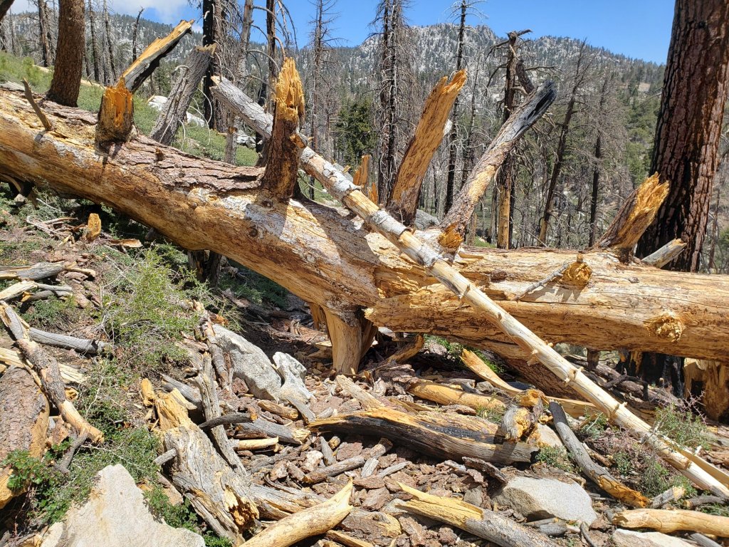
WATER STATUS: Eastern slope
The Round Valley pipe is flowing. Creeks in Round Valley and Tamarack Valley are already dry (last year neither dried until August).
Both the northern and southern springs at Wellman’s Cienega are flowing gently. These are the sources for Willow Creek, which is flowing relatively weakly where it crosses the Willow Creek Trail.
Tahquitz Creek is flowing steadily at the northern end of Little Tahquitz Meadow. It is also flowing further upstream at its source (known locally as Grethe Spring) where it crosses the PCT at approx. PCT Mile 177.
The small creek in Tahquitz Valley is already dry where it crosses the trail, four months earlier than in 2020. However about 100 yards upstream there is some flow, with pools suitable for filtering.
Candy’s Creek – that flows through Skunk Cabbage Meadow and then crosses the remaining visible section of Caramba Trail near Reeds Meadow – is currently flowing gently in both locations.
WATER STATUS: Western slope
The North Fork of the San Jacinto River is flowing steadily where it crosses the Deer Springs Trail and again downstream where it crosses the Fuller Ridge Trail on the PCT (approx. PCT Mile 186.2).
The creek in Little Round Valley is flowing very weakly for only a few hundred feet and dries up before leaving the Valley. There will not be water in LRV beyond June this year. The same creek dried up where it crosses Fuller Ridge Trail (at about PCT Mile 186.4) in April.
Shooting Star Spring (below Little Round Valley but above the North Fork of the San Jacinto River crossing) is flowing weakly.
The Deer Springs stream crossing at the PCT (approx. PCT mile 185.6) is flowing gently.
Switchback Spring at PCT Mile 183.5 (about 0.4 miles on the PCT northbound from Strawberry Junction) is trickling. I reworked the tiny pool and there is just adequate depth from which to filter water.
The little creek at Strawberry Cienega (PCT mile 183.0) is dry.
On Devil’s Slide Trail, Middle Spring barely continues to trickle. Other springs on this trail are dry.
On the Ernie Maxwell Trail, the crossing of Chinquapin Creek just below Humber Park is already dry where it crosses the trail. However, there are small fresh pools just upslope from the trail (this creek is an important source of water for the many dogs walked on this trail).
WATER STATUS: Desert Divide
Live Oak Spring (N 33 37 21, W 116 33 24) Flowing well. The most reliable water source on the Desert Divide.
Cedar Spring (N 33 40 36, W 116 34 35) Flowing well. Easiest access is the trough 60 yards upstream from the trail to the campsite.
Apache Spring (N 33 43 11, W 116 37 13) Barely trickling.
Spitler Peak Trail Descending the trail there are five water crossings. The first two, at 0.9 and 0.95 miles down, cross a tiny side creek which is largely dry and should be ignored. The next crossing, at 1.1 miles down, is Spitler Creek and is the best source of water (currently flowing). The next two crossings are the same creek, but for obvious reasons it is best to fill up at the highest of the three crossings.
Antsell Rock Creek (N 33 41 52, W 116 39 08) Right by the Spitler Peak Trail trailhead on Apple Canyon Road, Antsell Rock Creek is flowing very well. Just on the upstream side of the road there is excellent access to the creek. Useful if hikers are descending the Spitler Peak Trail.
Thank you hikers for taking the time to read this. While labor and time is volunteered, the San Jacinto Trail Report completely depends on small private donations to cover costs. Every year seems to be challenging and 2021 has been no exception, so every contribution, no matter how small, is truly valuable. If you have found this Report useful, please consider visiting the Donate page. Thank you.

sanjacjon Uncategorized Leave a comment 7 MinutesEdit”Trail and water update 27th May 2021″
Trail and water update 20th May 2021
Daily hikes have allowed for continued assessment of water and trail conditions, including San Jacinto Peak most recently on 18th May ascending via Devil’s Slide, Wellman, and Peak trails, and descending via Deer Springs Trail. On Sunday 16th May we enjoyed an early morning hike out to Caramba, returning off-trail directly up the Tahquitz Creek drainage. For the second time in just five days we found fresh Mountain Lion tracks on the way down to Laws.
Trails throughout the San Jacinto high country are now clear of snow. Water conditions in the high country are already worryingly reminiscent of the extremely dry years of 2015 and 2016. The status of many key springs and creeks is described below.
The live fuel moisture content of our forest is reportedly already – in May – some 10% below the level required for ignition. A long and challenging fire season appears to be inevitable.
Be rattlesnake aware. Southern Pacific Rattlesnakes (Crotalus helleri) have already been seen on multiple trails at higher elevations than is typical for this early in the summer, despite cooler weather in recent days. For example one was sunning itself in the PCT close to Strawberry Cienega near 8400ft as early as 0915 on Sunday 16th May before cooling cloud cover rolled in (thanks to Robert Schy for that observation).
Despite generally warm weather hikers should be prepared for temperatures below freezing in the high country on 21st-23rd May (well below freezing when considering wind chill effects).
The U.S. Forest Service ranger station in Idyllwild remains closed due to the coronavirus crisis. It is not expected to reopen before late June. Hiking and camping permits are required for USFS lands, and are available at the kiosk outside the ranger station.
Black Mountain Road reopened on 23rd April. With virtually no rainfall this winter, the grading undertaken last year through to the Fuller Ridge campground has held up well. It is anticipated that Boulder Basin campground will reopen on 22nd May, along with other USFS seasonal campgrounds.
WEATHER Although temperatures are forecast to largely remain at or above seasonal averages (especially the overnight lows), another brief but significant cooling is expected for Friday 21st to Sunday 23rd. Windchill temperatures in the high country will be far below freezing on 21st and 22nd. There is no precipitation in the forecast. Fire risk is high.
At San Jacinto Peak (10,810ft/3295m) on Tuesday 18th May 2021 at 0800 the air temperature was 43.8°F (7°C), with a windchill temperature of 36.9°F (3°C), 53% relative humidity, and a steady NW breeze sustained at 6 mph gusting to 9.7 mph.
TRAIL CONDITIONS
Trails throughout the San Jacinto high country are clear of snow and spikes are no longer required. Regrettably water conditions are already becoming a concern, with most springs and creeks already having flows more typical of late summer at best.
Many trails have accumulated treefall hazards from the past two winters, passable with care by hikers but not for stock. Some are described below, others include: PCT from Tahquitz Creek to the rockslide (PCT Miles 172.5-177, about 60 trees down), PCT between Strawberry Cienega and Deer Springs camp (PCT Miles 182-185, about 12 trees down), Fuller Ridge Trail near its northern end (PCT Miles 189.1-190.2, three trees), upper Spitler Peak Trail (five trees), and Skunk Cabbage Meadow trail (one large tree down).
Tahquitz Peak trail from Chinquapin Flat (PCT Mile 178) is clear of snow and no longer requires spikes between the PCT and Tahquitz Peak.
The East Ridge Trail on the east flank of San Jacinto Peak is essentially clear, with just a few tiny snow patches remaining.
Willow Creek Trail has 12 downed trees on its Forest Service section, including a couple of large, heavily-branched trees that are somewhat challenging to pass. USFS has been notified.
The Caramba Trail from near Reeds Meadow through Laws Camp and on to Caramba, and the Cedar Trail from Willow Creek Trail to Laws (which both nominally reopened in late 2018) are optimistically described by the Forest Service as “not maintained”. In reality parts of these trails no longer exist with significant sections of both so heavily overgrown that I strongly advise hikers do not attempt to follow them. Experienced hikers have reported getting lost in this area since summer 2019. An informal use trail to the Laws area is much more direct and completely avoids all of the challenging bush-whacking of the unmaintained trails (local hikers have kindly dubbed it the “King Trail“). It leaves Willow Creek Trail exactly 1.0 mile from Saddle Junction, 0.45 mile from the Skunk Cabbage turning (trailhead at N33°46’46”, W116°39’32”, WGS84). The cairned trail descends largely on established deer tracks for 0.9 mile. Be advised that it is a use trail, becoming somewhat less obvious as it nears Willow Creek. From Laws east to Caramba the route of the old Caramba Trail has become increasingly tricky to follow, especially for the first 1.2 miles east of Laws. Closer to Caramba the trail is relatively obvious (for those familiar with the route prior to the 2013 Mountain Fire). Cautious navigation is required throughout this area.
Seven Pines Trail has had minimal hiker traffic since November 2018. There are over 25 treefall hazards on the trail, almost all in the upper State Park section of trail, based on multiple recent surveys. Very cautious navigation is recommended for those who are not completely familiar with hiking this trail. Dark Canyon Road has been closed since early 2019, and there is no vehicular access to Seven Pines trailhead.
The PCT through the Snow Fire closure area (approx. PCT Miles 191-207) reopened on 3rd April 2021. Only the tread of the Trail has reopened, USFS is not permitting camping along the roughly 17 mile section.
The Pacific Crest Trail remains open at the rockslide north of Antsell Rock (Mile 172.5). Reports that the assisting rope around the rockslide is “in tatters” are misleading. However the rope is ageing and if you choose to use it you do so completely at your own risk. USFS has told the Trail Report that responsibility for removing the rockslide is currently with the PCTA, and that there are no imminent plans to close this section of the PCT for rock removal work. This video report (recorded on 1st March 2021, starts at minute 9.05) may be useful for deciding whether to hike around the rockslide.
The State Park reminds PCT hikers that overnight stays are not permitted at or near San Jacinto Peak, including in the historic shelter. This is especially critical during the coronavirus pandemic as it is impossible to adequately clean and sterilize the shelter. Mt. San Jacinto State Park regulations permit overnight stays only in established campgrounds. Strawberry Junction (approx. Mile 183) is a good option for thru-hikers.

WATER STATUS: Eastern slope
The Round Valley pipe is flowing. Creeks in Round Valley and Tamarack Valley are already dry (last year neither dried until August).
Both the northern and southern springs at Wellman’s Cienega are flowing gently. These are the sources for Willow Creek, which is flowing fairly well where it crosses the Willow Creek Trail.
Tahquitz Creek is flowing steadily at the northern end of Little Tahquitz Meadow. It is also flowing further upstream at its source (known locally as Grethe Spring) where it crosses the PCT at approx. PCT Mile 177.
The small creek in Tahquitz Valley is already dry where it crosses the trail, four months earlier than in 2020. However about 100 yards upstream there is some flow, with pools suitable for filtering.
Candy’s Creek – that flows through Skunk Cabbage Meadow and then crosses the remaining visible section of Caramba Trail near Reeds Meadow – is currently flowing gently in both locations.
WATER STATUS: Western slope
The North Fork of the San Jacinto River is flowing well where it crosses the Deer Springs Trail and again downstream where it crosses the Fuller Ridge Trail on the PCT (approx. PCT Mile 186.2).
The creek in Little Round Valley is flowing weakly for only a few hundred feet and dries up before leaving the Valley. The same creek dried up where it crosses Fuller Ridge Trail (at about PCT Mile 186.4) in April.
Shooting Star Spring (below Little Round Valley but above the North Fork of the San Jacinto River crossing) is flowing weakly.
The Deer Springs stream crossing at the PCT (approx. PCT mile 185.6) is flowing gently.
Switchback Spring at PCT Mile 183.5 (about 0.4 miles on the PCT northbound from Strawberry Junction) is trickling, but there is barely adequate depth from which to filter water.
The little creek at Strawberry Cienega (PCT mile 183.0) is now dry.
On Devil’s Slide Trail, Middle Spring continues to trickle very gently. Other springs on this trail are dry.
On the Ernie Maxwell Trail, the crossing of Chinquapin Creek just below Humber Park is already dry where it crosses the trail. However, there are small fresh pools just upslope from the trail (this creek is an important source of water for the many dogs walked on this trail).
WATER STATUS: Desert Divide
Live Oak Spring (N 33 37 21, W 116 33 24) Flowing well. The most reliable water source on the Desert Divide.
Cedar Spring (N 33 40 36, W 116 34 35) Flowing well. Easiest access is the trough 60 yards upstream from the trail to the campsite.
Apache Spring (N 33 43 11, W 116 37 13) Barely trickling.
Spitler Peak Trail Descending the trail there are five water crossings. The first two, at 0.9 and 0.95 miles down, cross a tiny side creek which is largely dry and should be ignored. The next crossing, at 1.1 miles down, is Spitler Creek and is the best source of water (currently flowing). The next two crossings are the same creek, but for obvious reasons it is best to fill up at the highest of the three crossings.
Antsell Rock Creek (N 33 41 52, W 116 39 08) Right by the Spitler Peak Trail trailhead on Apple Canyon Road, Antsell Rock Creek is flowing very well. Just on the upstream side of the road there is excellent access to the creek. Useful if hikers are descending the Spitler Peak Trail.
Thank you hikers for taking the time to read this. While labor and time is volunteered, the San Jacinto Trail Report completely depends on small private donations to cover costs. Every year seems to be challenging and 2021 has been no exception, so every contribution, no matter how small, is truly valuable. If you have found this Report useful, please consider visiting the Donate page. Thank you.
sanjacjon Uncategorized Leave a comment 7 MinutesEdit”Trail and water update 20th May 2021″
Trail and water update 13th May 2021
Daily hikes, including San Jacinto Peak most recently on 6th and 10th May by different routes, have allowed for thorough surveys of water sources and trail conditions. Other hikes in the past few days have included much of the PCT locally plus Willow Creek Trail, the Laws and Caramba areas (twice), and Tahquitz Peak.
Trails throughout the San Jacinto high country are now functionally clear of snow and spikes are no longer required (a handful of very minor snow patches remain on trails above 9000ft). Off-trail travel in some areas (e.g. northerly slopes of Jean Peak and Marion Mountain) will still encounter more extensive shallow snow cover.
Drying of ephemeral creeks and springs has been early and rapid, and water conditions in the high country are already worryingly reminiscent of the extremely dry years of 2015 and 2016. The status of many key springs and creeks is described below.
I found collections of firewood near San Jacinto Peak and in Little Round Valley on 6th May, and fire rings in the Laws area on 9th and at Tahquitz Peak on 12th. With so many human-caused fires in southern California in recent years, it is beyond discouraging that some hikers evidently need to be reminded that campfires are completely prohibited in wilderness at all times.
Be rattlesnake aware. Southern Pacific Rattlesnakes (Crotalus helleri) have already been seen on multiple trails up to about 7000ft this summer, several weeks earlier than they usually emerge at these elevations.
The U.S. Forest Service ranger station in Idyllwild remains closed due to the coronavirus crisis. It is not expected to reopen before late June. Hiking and camping permits are required for USFS lands, and are available at the kiosk outside the ranger station.
Black Mountain Road reopened on 23rd April. With virtually no rainfall this winter, the grading undertaken last year through to the Fuller Ridge campground has held up well. It is anticipated that Boulder Basin campground (currently closed) will reopen on 22nd May, along with other USFS campgrounds.
WEATHER Temperatures will be above average until Saturday 15th May, when a pleasantly cool weekend is predicted (notably on Sunday 16th). Temperatures then return to above seasonal (especially the overnight lows) from Monday 17th. There is no precipitation in the forecast. Fire risk is high.
At San Jacinto Peak (10,810ft/3295m) on Monday 10th May 2021 at 0850 the air temperature was 41.4°F (5°C), with a windchill temperature of 35.1°F (2°C), 35% relative humidity, and a very light SW breeze sustained at 2 mph gusting to 6.9 mph.
At the Peak on Thursday 6th May 2021 at 0805 the air temperature was 41.4°F (5°C), with a windchill temperature of 28.2°F (-2°C), 39% relative humidity, and a stiff SSE wind sustained at 16 mph gusting to 29.6 mph.
TRAIL CONDITIONS
Trails throughout the San Jacinto high country are essentially clear of snow and spikes are no longer required. Regrettably water conditions are already becoming a concern, with most springs and creeks already having flows more typical of late summer at best.
Many trails have accumulated treefall hazards from the past two winters, passable with care by hikers but not for stock. Some are described below, others include: PCT from Tahquitz Creek to the rockslide (PCT Miles 172.5-177, about 60 trees down), PCT between Strawberry Cienega and Deer Springs camp (PCT Miles 182-185, about 12 trees down), Fuller Ridge Trail near its northern end (PCT Miles 189.1-190.2, three trees), and upper Spitler Peak Trail (five trees).
Tahquitz Peak trail from Chinquapin Flat (PCT Mile 178) is clear of snow and no longer requires spikes between the PCT and Tahquitz Peak.
Deer Springs Trail is essentially completely clear of snow to San Jacinto Peak. Snow cover is 20% in Little Round Valley but the trail route itself is virtually clear.
The East Ridge Trail on the east flank of San Jacinto Peak remains about 30% snow-covered. There are sufficient cleared areas between snow patches that it is almost possible to ascend from near Miller Peak without having to cross any snow.
Willow Creek Trail has 12 downed trees on its Forest Service section, including a couple of large, heavily-branched challenges. USFS has been notified.
The Caramba Trail from near Reeds Meadow through Laws Camp and on to Caramba, and the Cedar Trail from Willow Creek Trail to Laws (which both reopened in late 2018) are optimistically described by the Forest Service as “not maintained”. In reality significant parts of these trails no longer exist; sections of both are so heavily overgrown that I strongly advise hikers do not attempt to follow them. Experienced hikers have reported getting lost in this area since summer 2019. An informal use trail to the Laws area is much more direct and completely avoids all of the challenging bush-whacking of the unmaintained trails (local hikers have kindly dubbed it the “King Trail“). It leaves Willow Creek Trail exactly 1.0 mile from Saddle Junction, 0.45 mile from the Skunk Cabbage turning (trailhead at N33°46’46”, W116°39’32”, WGS84). The cairned trail descends largely on established deer tracks for 0.9 mile. Be advised that it is a use trail, becoming somewhat less obvious as it nears Willow Creek. From Laws east to Caramba the route of the old Caramba Trail has become increasingly tricky to follow, especially for the first mile east of Laws. Closer to Caramba the trail is relatively obvious (for those familiar with the route prior to the 2013 Mountain Fire). Cautious navigation is required throughout this area.
Seven Pines Trail has had minimal hiker traffic since November 2018. There are over 25 treefall hazards on the trail, almost all in the upper State Park section of trail, based on multiple recent surveys. Very cautious navigation is recommended for those who are not completely familiar with hiking this trail. Dark Canyon Road has been closed since early 2019, and there is no vehicular access to Seven Pines trailhead.
The PCT through the Snow Fire closure area (approx. PCT Miles 191-207) reopened on 3rd April 2021. Only the tread of the Trail has reopened, USFS is not permitting camping along the 16+ mile section.
The Pacific Crest Trail remains open at the rockslide north of Antsell Rock (Mile 172.5). Reports that the assisting rope around the rockslide is “in tatters” are misleading. However the rope is ageing and if you choose to use it you do so completely at your own risk. USFS has told the Trail Report that responsibility for removing the rockslide is currently with the PCTA, and that there are currently no imminent plans to close this section of the PCT for rock removal work. This video report (recorded on 1st March 2021, starts at minute 9.05) may be useful for deciding whether to hike around the rockslide.
The State Park reminds PCT hikers that overnight stays are not permitted at or near San Jacinto Peak, including in the historic shelter. This is especially critical during the coronavirus pandemic as it is impossible to adequately clean and sterilize the shelter. Mt. San Jacinto State Park regulations permit overnight stays only in established campgrounds. Strawberry Junction (approx. Mile 183) is a good option for thru-hikers.
WATER STATUS: Eastern slope
The Round Valley pipe is flowing. Flow has periodically been redirected to the work camp in Long Valley and water pressure can be insufficient to also flow at the pipe. The nearby Round Valley creek is already dry (it didn’t dry until August last year). The small creek in Tamarack Valley is also dry already.
Both the northern and southern springs at Wellman’s Cienega are flowing gently. These are the sources for Willow Creek, which is flowing fairly well where it crosses the Willow Creek Trail.
Tahquitz Creek is flowing steadily at the northern end of Little Tahquitz Meadow. It is also flowing further upstream at its source (known locally as Grethe Spring) where it crosses the PCT at approx. PCT Mile 177. The small creek in Tahquitz Valley is already dry, four months earlier than in 2020.
Candy’s Creek – that flows through Skunk Cabbage Meadow and then crosses the remaining visible section of Caramba Trail near Reeds Meadow – is currently flowing gently in both locations.
WATER STATUS: Western slope
Ephemeral creeks, such as those along Marion Mountain Trail and on Deer Springs Trail, are all dry.
The North Fork of the San Jacinto River is flowing well where it crosses the Deer Springs Trail and again downstream where it crosses the Fuller Ridge Trail on the PCT (approx. PCT Mile 186.2).
The creek in Little Round Valley is flowing for only a few hundred feet and dries up before leaving the Valley. The same creek dried up where it crosses Fuller Ridge Trail (at about PCT Mile 186.4) in April.
Shooting Star Spring (below Little Round Valley but above the North Fork of the San Jacinto River crossing) is flowing steadily.
The Deer Springs stream crossing at the PCT (approx. PCT mile 185.6) is flowing steadily.
Switchback Spring at PCT Mile 183.5 (about 0.4 miles on the PCT northbound from Strawberry Junction) is trickling, but there is barely adequate depth from which to filter water.
The little creek at Strawberry Cienega (PCT mile 183.0) is now dry.
On Devil’s Slide Trail, Middle Spring continues to trickle very gently. Other springs on this trail are dry.
On the Ernie Maxwell Trail, the crossing of Chinquapin Creek just below Humber Park is already dry where it crosses the trail. However, there are small fresh pools just upslope from the trail (this creek is an important source of water for the many dogs walked on this trail).
WATER STATUS: Desert Divide
Live Oak Spring (N 33 37 21, W 116 33 24) Flowing well. The most reliable water source on the Desert Divide.
Cedar Spring (N 33 40 36, W 116 34 35) Flowing well. Easiest access is the trough 60 yards upstream from the trail to the campsite.
Apache Spring (N 33 43 11, W 116 37 13) Flowing very weakly.
Spitler Peak Trail Descending the trail there are five water crossings. The first two, at 0.9 and 0.95 miles down, cross a tiny side creek which is largely dry and should be ignored. The next crossing, at 1.1 miles down, is Spitler Creek and is the best source of water (currently flowing). The next two crossings are the same creek, but for obvious reasons it is best to fill up at the highest of the three crossings.
Antsell Rock Creek (N 33 41 52, W 116 39 08) Right by the Spitler Peak Trail trailhead on Apple Canyon Road, Antsell Rock Creek is flowing very well. Just on the upstream side of the road there is excellent access to the creek. Useful if hikers are descending the Spitler Peak Trail.
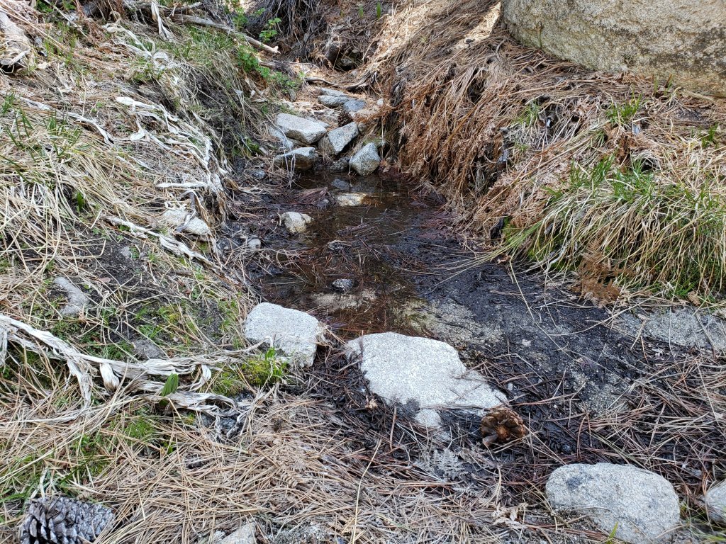
Thank you hikers for taking the time to read this. While labor and time is volunteered, the San Jacinto Trail Report completely depends on small private donations to cover costs. Every year seems to be challenging and 2021 has been no exception, so every contribution, no matter how small, is truly valuable. If you have found this Report useful, please consider visiting the Donate page. Thank you.
sanjacjon Uncategorized 2 Comments 7 MinutesEdit”Trail and water update 13th May 2021″
Trail update 6th May 2021
Intensive trail surveys have continued daily, including San Jacinto Peak most recently on 3rd and 6th May by different routes. Other hikes in the past few days have included much of the PCT locally plus some side trails (Willow Creek Trail, Zen Center Trail, South Ridge Trail, Tahquitz Peak area). An early morning hike to the Laws Camp area on 4th was rewarded with a beautifully lit, protracted view of a large adult Mountain Lion. This was my tenth (and best) lion sighting in just the past 20 months in the San Jacinto mountains.
Trails throughout the San Jacinto high country are almost entirely clear of snow and spikes are generally not required. There are some exceptions discussed below. As expected, the very light dusting of snow from 26th and 27th April completely melted within a couple of days. What little snow remains (from storms earlier in the winter) is now so patchy that snow depth measurements are no longer meaningful and they have been omitted from this report.
Drying of ephemeral creeks and springs has continued steadily, and water conditions in the high country are already worryingly reminiscent of the extremely dry years of 2015 and 2016.

WEATHER Temperatures are forecast to be above average (especially the overnight lows) for at least the next two weeks. There is no precipitation in the forecast.
At San Jacinto Peak (10,810ft/3295m) on Thursday 6th May 2021 at 0805 the air temperature was 41.4°F (5°C), with a windchill temperature of 28.2°F (-2°C), 39% relative humidity, and a stiff SSE wind sustained at 16 mph gusting to 29.6 mph.
At the Peak on Monday 3rd May 2021 at 0820 the air temperature was 34.3°F (1°C), with a windchill temperature of 23.6°F (-4°C), 55% relative humidity, and a moderate WNW wind sustained at 8 mph gusting to 13.5 mph.
At the Peak on Wednesday 28th April 2021 at 0840 the air temperature was 27.3°F (-3°C), with a windchill temperature of 13.9°F (-10°C), 61% relative humidity, and a gusty due North wind sustained at 8 mph gusting to 12.5 mph.
TRAIL CONDITIONS
Trails throughout the San Jacinto high country are almost entirely clear of snow and spikes are generally not required. There are some exceptions discussed below. See “Pacific Crest Trail” below for details of that trail. Regrettably water conditions are already becoming a concern, with most springs and creeks already having flows more typical of late summer.
Tahquitz Peak trail from Chinquapin Flat/PCT Mile 178 no longer requires spikes between the PCT and Tahquitz Peak, depending on your comfort level hiking on angled icy snow. Hiking poles and considerable caution are useful. There are good steps to follow through the small remaining patches for which some hikers will be more comfortable using spikes.
Deer Springs Trail is almost completely clear of snow to San Jacinto Peak. There are a few short snow patches below Little Round Valley, averaging only about 5% cover. Snow cover is 40% through Little Round Valley but the trail route is obvious and not challenging. Above Little Round Valley to San Jacinto Peak the trail has cleared very rapidly, with a handful of tiny snow patches only.
South Ridge Trail is clear to Tahquitz Peak. South Ridge Road is open.
Black Mountain Road reopened on 23rd April and is clear of snow.
Wellman Trail (from Annie’s Junction to Wellman Divide) is largely clear of snow, except for about 20% cover for 0.3 mile immediately north of Annie’s Junction.
The Peak Trail (Wellman Divide to San Jacinto Peak) is clear of snow except for the 0.2 mile patch between 9900-10,100ft, where snow cover is about 30%.
The East Ridge Trail on the east flank of San Jacinto Peak remains about 40% snow-covered. There is an ugly posthole track to follow in places but it can be easier to hike across the top of the compacted icy snow patches (at least in the early morning and on cold days).
Fuller Ridge Trail has limited stubborn snow patches around the crossing of the North Fork of the San Jacinto River (Mile 186), and on the northerly slopes of Fuller Ridge (approx. Miles 187.5-187.8 and 188.6-189.6).
Seven Pines Trail has been hiked very little since November 2018. Very cautious navigation is recommended for those who are not completely familiar with hiking this trail. The Forest Service closure of Dark Canyon Road continues, and there is no vehicular access to Seven Pines trailhead.
The Round Valley Trail to Wellman Divide has about 10% patchy snow cover. Long Valley is clear of snow.
Snow cover on the PCT: The PCT is clear of snow from Miles 151 (Highway 74) to about 175 (Red Tahquitz). A few small snow patches remain between Miles 175-177. Miles 177 to 185 are almost clear of snow with the exception of the notoriously stubborn 0.5 mile just south of Annie’s Junction at about Mile 180.8. Snow cover is about 10% from Mile 184 to 185.5, although spikes are not required. From Mile 185.5 to 191, snow is increasingly patchy. Stubborn sections remain around the crossing of the North Fork of the San Jacinto River (Mile 186), and on the northerly slopes of Fuller Ridge Trail (approx. Miles 187.5-187.8 and 188.6-190.4). North of Mile 190 is clear of snow.
Additional trails completely clear of snow include: Devil’s Slide, Marion Mountain, Ernie Maxwell, Spitler Peak, Cedar Spring, Skyline, and all Garner Valley trails.
The Caramba Trail from near Reeds Meadow through Laws Camp and on to Caramba, and the Cedar Trail from Willow Creek Trail to Laws (which both nominally reopened in late 2018) are optimistically described by the Forest Service as “not maintained”. In reality parts of these trails no longer exist. Long sections of both are so heavily overgrown that I strongly advise hikers do not attempt to follow them. Multiple experienced hikers have reported getting lost in this area since summer 2019. An informal use trail to Laws is much more direct and completely avoids all of the very challenging bush-whacking of the unmaintained trails (local hikers have kindly dubbed it the “King Trail“). It leaves Willow Creek Trail exactly 1.0 mile from Saddle Junction, 0.45 mile from the Skunk Cabbage turning (trailhead coordinates N33°46’46”, W116°39’32”). The trail descends largely on well-cairned deer tracks for 1.2 miles, roughly paralleling Willow Creek just to its south. Be advised that it is an indistinct use trail, becoming somewhat less obvious as it nears Laws (by which time Willow Creek is very close on the left hand side, so navigation is not a challenge). From Laws east to Caramba the route of the original Caramba Trail is relatively easy to follow (for those who were familiar with this trail prior to the 2013 Mountain Fire). Throughout this area cautious navigation is advised.
PACIFIC CREST TRAIL
All Mile numbers are approximate. The main Report (above) is updated at least weekly or during/after any storm and contains significant additional information relevant to PCT hikers.
PCT hikers are reminded that overnight stays are not permitted at or near San Jacinto Peak, including in the historic shelter. This is especially critical during the coronavirus pandemic as it is impossible to adequately clean and sterilize the shelter. Mt. San Jacinto State Park regulations permit overnight stays only in established campgrounds. Strawberry Junction (approx. Mile 183) is a good option for thru-hikers.
This has been a far below average snow year for the San Jacinto high country. Given accelerating climate change here, depending on your start date there may be relatively little snow and ice by the time you reach the San Jacinto mountains. Nevertheless even small, isolated sections of icy snow can be perilous. Details of current snow/ice conditions will be clear from updates to the Trail Report over coming weeks.
Spikes remain useful for those hikers less comfortable hiking on snow for very limited parts of the Trail between about Miles 165 and 191, although at this time most individuals hiking with poles will find spikes unnecessary. Please always practice safe decision-making based on your own comfort level (not that of your hiking partners), experience, ability, available equipment, time of day (which can greatly affect traction on snow and ice), and current snow and weather conditions.
The PCT through the Snow Fire closure area (approx. Miles 191-207) reopened on 3rd April 2021. Only the tread of the Trail has reopened, USFS is not permitting camping along the 16+ mile section.
PCT hikers – thanks for taking the time to read this. The San Jacinto Trail Report depends entirely on small private donations to cover its direct costs. With a busy winter overlapping with a complex PCT season, every contribution, no matter how small, is truly valuable. If you have found the Report useful, please consider visiting the Donate page. Thank you, and safe hiking.
Coming off at Mile 168.5 (the well-signed Spitler Peak Trail alternate) may still be a good option for some this nobo season. There are nearly 60 trees down across the Trail between Miles 169-177, plus the rock slide at Mile 172.5. Spitler Peak Trail itself clears of snow (as is now the case) long before the PCT north of that point. The short snow slope on the NE side of Apache Peak (Mile 169.5) that has proved challenging over the years is now clear of snow, with good steps to follow. Spikes are no longer required, although hiking poles and caution are always useful.
The Pacific Crest Trail remains open at the rockslide north of Antsell Rock (Mile 172.5). Reports that the assisting rope around the rockslide is “in tatters” are completely misleading. However the rope is not in new condition, and if you choose to use it, you do so completely at your own risk. USFS has told the Trail Report that responsibility for removing the rockslide is currently with the PCTA, and that there are currently no plans to close this section of the PCT for removal work before summer 2021 at the earliest. This video report (recorded on 1st March 2021, starts at minute 9.05) may be useful for deciding whether to hike around the rockslide.
If you take an alternate further south, it is possible to regain the PCT from Idyllwild via Devil’s Slide Trail at Saddle Junction (about Mile 179). It is recommended that you do not attempt to regain the PCT via South Ridge Trail as the slope on the north side of Tahquitz Peak remains partly ice-covered and is notoriously treacherous.


sanjacjon Uncategorized Leave a comment 7 MinutesEdit”Trail update 6th May 2021″
Minor storm update 28th April 2021
[Information specific to the Pacific Crest Trail is included at the foot of this Report. However much of the main Report is also applicable to PCT hikers.]
The past two days were a pleasant reminder of what April should feel like, with light precipitation at all elevations on/off on Monday 26th, followed by further brief precipitation on the afternoon of Tuesday 27th. Snowfall was minimal on both days, with about 0.5 inch at San Jacinto Peak on 26th (described in this short video), and about the same on 27th. By the time we descended the east slope from the high country late morning on 26th, some of what had settled below 10,000ft had already melted. On 27th snow dusted patchily down to about 6300ft on the west slope of the mountain, but struggled to settle below 9000ft on the eastern side. Total rainfall in Idyllwild across the two days was 0.3 inch. Although the high country had a dusting of about an inch of fresh snow, temperatures well above seasonal starting Thursday 29th April will cause very rapid melting, and will also accelerate melting of what little snow remains from earlier in the winter.
Daily hikes have continued to survey many of the major trails in the high country, including San Jacinto Peak most recently on 26th and 28th April, plus the PCT throughout the San Jacinto mountains and some of its side trails.
April 2021 will likely be the driest for that month in recorded history in the San Jacinto high country, and among the warmest and driest recorded in Idyllwild. Drying of ephemeral creeks and springs has continued steadily, and water conditions in the high country are already worryingly reminiscent of the extremely dry years of 2015 and 2016.
Carrying spikes will remain useful for some hikers on some traveled trails, mainly above about 8700ft, but is no longer required depending on individual comfort level on patchy compacted or soft snow.
WEATHER Temperatures rise rapidly starting 28th April to well above seasonal averages, and largely stay atypically warm throughout the first week of May. Temperatures at all elevations on 30th April and 1st May are forecast to be more typical of midsummer.
At San Jacinto Peak (10,810ft/3295m) on Wednesday 28th April 2021 at 0840 the air temperature was 27.3°F (-3°C), with a windchill temperature of 13.9°F (-10°C), 61% relative humidity, and a gusty due North wind sustained at 8 mph gusting to 12.5 mph.
At the Peak on Monday 26th April 2021 at 0855 the air temperature was 20.1°F (-7°C), with a windchill temperature of 2.8°F (-17°C), 99% relative humidity, and a bitter due West wind sustained at 11 mph gusting to 16.4 mph.
TRAIL CONDITIONS
Once the light dusting of fresh snow has melted, trails on the east and south flanks of the high country will be completely or largely clear of snow to San Jacinto Peak. Trails on the west side are clear to near 8700ft, with snow cover increasingly patchy from there to San Jacinto Peak. There are some exceptions discussed below. See “Pacific Crest Trail” below for details of that trail.
Tahquitz Peak trail from Chinquapin Flat/PCT Mile 178 [updated 30th April] no longer requires spikes between the PCT and Tahquitz Peak, depending on your comfort level hiking on angled icy snow. Hiking poles are useful. There are good steps to follow through the small remaining patches for which some hikers will be more comfortable using spikes.
Devil’s Slide Trail is clear of snow to Saddle Junction.
Deer Springs Trail is clear of snow past Strawberry Junction to about 8650ft, near its junction with Marion Mountain Trail. Snow is increasingly patchy from there to Little Round Valley, averaging only about 10% cover, but with several extended icy snow sections. Snow cover is 70% through Little Round Valley. Above Little Round Valley to San Jacinto Peak the trail has cleared very rapidly and is easy to follow, averaging only 10% snow cover. Some hikers will find spikes useful, especially for descending.
South Ridge Trail is clear to Tahquitz Peak. South Ridge Road is open.
Black Mountain Road reopened on 23rd April. There is patchy snow that may be challenging for vehicles (but not for hikers) beyond Farview Point.
Wellman Trail (from Annie’s Junction to Wellman Divide) is largely clear of snow, except for nearly continuous snow for about 0.3 mile immediately north of Annie’s Junction.
The Peak Trail (Wellman Divide to San Jacinto Peak) is clear of snow except for the 0.2 mile patch between 9900-10,100ft, where snow cover is about 60% and some hikers may find spikes useful.
The East Ridge Trail on the east flank of San Jacinto Peak remains about 60% snow-covered. There is an ugly posthole track to follow, but it can be easier to hike across the top of the compacted icy snow (at least in the early morning and on cold days).
Marion Mountain Trail is clear of snow to the PCT.
Fuller Ridge Trail has snow along about 30% of its 5.0 miles length. Stubborn sections in particular remain around the crossing of the North Fork of the San Jacinto River (Mile 186), and on the northerly slopes of Fuller Ridge (approx. Miles 187.5-187.8 and 188.6-190.4).
Seven Pines Trail has had no visible hiker traffic this winter, with no tracks to follow where small snow patches remain. Indeed this trail has been hiked very little since November 2018. Very cautious navigation is recommended for those who are not completely familiar with hiking this trail. The Forest Service closure of Dark Canyon Road continues, and there is no vehicular access to Seven Pines trailhead.
The Round Valley Trail to Wellman Divide has about 30% patchy snow cover. Long Valley is clear of snow.
Skyline Trail is virtually clear of snow. Spikes are no longer required.
Snow cover on the PCT: The PCT is clear of snow from Miles 151 (Highway 74) to about 175 (Red Tahquitz). A few small snow patches remain between Miles 175-177. Miles 177 to 185 are almost clear of snow with the exception of the notoriously stubborn 0.5 mile just south of Annie’s Junction at about Mile 180.8. Snow cover is about 60% from Mile 184 to 185.5, although spikes are not required. From Mile 185.5 to 191, snow is increasingly patchy. Stubborn sections remain around the crossing of the North Fork of the San Jacinto River (Mile 186), and on the northerly slopes of Fuller Ridge Trail (approx. Miles 187.5-187.8 and 188.6-190.4). Miles 191-207 are clear of snow.
Additional trails completely clear of snow include: all Garner Valley trails, Ernie Maxwell Trail, Spitler Peak Trail, Cedar Spring Trail, and May Valley Road.
SNOW DEPTHS measured on 26th April 2021. Note that average depth is given first, followed in parentheses by the depth recorded on 16th March after the last significant storms on 10th-15th March. Due to past drifting, and variable melting due to differential sun exposure, depths now vary greatly even in small areas. Altitudes are approximate.
San Jacinto Peak (10810ft): 0-2 inches (38 inches on 16th March)
Little Round Valley (9800ft): 0-6 inches (29 inches on 16th March)
Wellman Divide (9700ft): 0 inches (19 inches on 16th March)
Annie’s Junction (9070ft): 0-2 inches (24 inches on 16th March)
Deer Springs Trail at Seven Pines Trail junction/approx. PCT Mile 184.9 (8700ft): 0-2 inches (14 inches on 16th March)
Strawberry Junction/approx. PCT Mile 183.1 (8100ft): 0 inch (8 inches on 16th March)
Saddle Junction/approx. PCT Mile 179.9 (8070ft): 0 inch (17 inches on 16th March)
Devil’s Slide Trail at Humber Park (6550ft): 0 inch (12 inches on 16th March)
PACIFIC CREST TRAIL
All Mile numbers are approximate. The main Report (above) is updated at least weekly or during/after any storm and contains significant additional information relevant to PCT hikers.
PCT hikers are reminded that overnight stays are not permitted at or near San Jacinto Peak, including in the historic shelter. This is especially critical during the coronavirus pandemic as it is impossible to adequately clean and sterilize the shelter. Mt. San Jacinto State Park regulations permit overnight stays only in established campgrounds. Strawberry Junction (approx. Mile 183) is a good option for thru-hikers.
This has been a far below average snow year for the San Jacinto high country. Given accelerating climate change here, depending on your start date there may be relatively little snow and ice by the time you reach the San Jacinto mountains. Nevertheless even small, isolated sections of icy snow can be perilous. Details of current snow/ice conditions will be clear from updates to the Trail Report over coming weeks.
Spikes remain useful for those hikers less comfortable hiking on snow for parts of the Trail between about Miles 165 and 191, although at this time most individuals hiking with poles will find spikes unnecessary. Please always practice safe decision-making based on your own comfort level (not that of your hiking partners), experience, ability, available equipment, time of day (which can greatly affect traction on snow and ice), and current snow and weather conditions.
The PCT through the Snow Fire closure area (approx. Miles 191-207) reopened on Saturday 3rd April. Only the tread of the Trail has reopened, USFS is not permitting camping along the 16+ mile section.
PCT hikers – thanks for taking the time to read this. The San Jacinto Trail Report depends entirely on small private donations to cover its direct costs. With a busy winter overlapping with a complex PCT season, every contribution, no matter how small, is truly valuable. If you have found the Report useful, please consider visiting the Donate page. Thank you, and safe hiking.
We undertook a thorough survey of the Fuller Ridge section (Miles 185.5-191) of the PCT on 6th April 2021, discussed in detail in this video. Considerable additional melting has occurred since then. Spikes are not required for hikers comfortable with travel across moderate patches of snow.
We surveyed the PCT section from Spitler Peak Trail to Saddle Junction (approx. Miles 168.5-179.5) on 9th April, as described in this video. Spikes are no longer required around Apache Peak, or elsewhere on this section, although some hikers might find spikes useful for increasingly patchy snow travel on Miles 175-178.
Coming off at Mile 168.5 (the well-signed Spitler Peak Trail alternate) may still be a good option for some this nobo season. In addition to any possible snow/ice issues ahead, there are nearly 60 trees down across the Trail between Miles 169-177, plus the rock slide at Mile 172.5. Spitler Peak Trail itself clears of snow (as is now the case) long before the PCT north of that point. The short snow slope on the NE side of Apache Peak (Mile 169.5) that has proved challenging over the years is now clear of snow, with good steps to follow. Spikes are no longer required, although hiking poles and caution are always useful.
The Pacific Crest Trail remains open at the rockslide north of Antsell Rock (Mile 172.5). Reports that the assisting rope around the rockslide is “in tatters” are completely misleading. However the rope is not in new condition, and if you choose to use it, you do so completely at your own risk. USFS has told the Trail Report that responsibility for removing the rockslide is currently with the PCTA, and that there are currently no plans to close this section of the PCT for removal work before summer 2021 at the earliest. This video report (recorded on 1st March 2021, starts at minute 9.05) may be useful for deciding whether to hike around the rockslide.
If you take an alternate further south, it is possible to regain the PCT from Idyllwild via Devil’s Slide Trail at Saddle Junction (about Mile 179). Do not attempt to regain the PCT via South Ridge Trail as the slope on the north side of Tahquitz Peak remains partly ice-covered and is notoriously treacherous.

sanjacjon Uncategorized Leave a comment 8 MinutesEdit”Minor storm update 28th April 2021″
Trail update 21st April 2021
UPDATED Monday 26th April: A very minor storm is passing over the San Jacinto mountains today. Snowfall has been minimal (<0.5 inch), as I report from San Jacinto Peak in this short video. By the time we descended late morning, most of what had settled below 10,000ft had already melted. The next full update to the Report is expected tomorrow or on Wednesday.
[Information specific to the Pacific Crest Trail is included at the foot of this Report. However much of the main Report is also applicable to PCT hikers.]
A full schedule of daily hikes has included most of the major trails in the high country, including San Jacinto Peak on 20th April ascending via east side trails (Devil’s Slide, Wellman, and Peak) then descending Deer Springs Trail, plus the PCT throughout the San Jacinto mountains and several of its side trails. Snow conditions have not changed substantially (and certainly not for the worse) since the thorough survey of the PCT section from Spitler Peak Trail to Saddle Junction (Miles 168.5-179.5) on 9th April, as described in this video, nor on Fuller Ridge (Miles 185.5-191) as discussed in the video available here from 6th April.
April 2021 is on track to be the warmest and driest for that month in recorded history in Idyllwild and the San Jacinto high country. Snow melt, and the drying of ephemeral creeks and springs, has continued steadily with conditions now more reminiscent of late May or June. Carrying spikes remains useful for some hikers on traveled trails above about 8700ft but is no longer required depending on individual comfort level on patchy compacted or soft snow (with some important caveats discussed below). Off trail travel currently involves post-holing in areas that retain extensive snow cover.
Despite temperatures periodically above seasonal, hikers should be prepared for temperatures near or below freezing in the high country, and potentially well below freezing when considering wind chill effects (see below for weather data recorded recently at San Jacinto Peak).
WEATHER The remainder of April will be something of a rollercoaster ride for temperatures. The 21st and 22nd will be somewhat cloudy with temperatures below seasonal, followed by a quick return to typical April warmth on 23rd-25th. A cold day on Monday 26th April might be accompanied by very light precipitation. Any moisture will have no significant impact however as temperatures immediately rise to well above seasonal, with the last few days of April forecast to be more reminiscent of midsummer.
At San Jacinto Peak (10,810ft/3295m) on Sunday 18th April 2021 at 0755 the air temperature was 22.7°F (-5°C), with a windchill temperature of -0.2°F (-18°C), 58% relative humidity, and a sharp NNE wind sustained at 20 mph gusting to 31.0 mph.
At the Peak on Tuesday 13th April 2021 at 0850 the air temperature was 33.8°F (1°C), with a windchill temperature of 18.7°F (-7°C), 28% relative humidity, and a chilly due West wind sustained at 15 mph gusting to 26.0 mph.
TRAIL CONDITIONS
Trails on the east and south flanks of the high country are completely or largely clear of snow to San Jacinto Peak. Trails on the west side are clear to near 8700ft, with snow cover increasingly patchy from there to San Jacinto Peak. There are some important exceptions discussed below. See “Pacific Crest Trail” below for details of that trail.
Tahquitz Peak trail from Chinquapin Flat/PCT Mile 178 has challenging steps to follow through the angled icy snow, the route in places not following the trail. These slopes are notoriously treacherous. Spikes remain strongly recommended.
Devil’s Slide Trail is clear of snow to Saddle Junction.
Deer Springs Trail is clear of snow past Strawberry Junction to about 8650ft, near its junction with Marion Mountain Trail. Snow is increasingly patchy from there to Little Round Valley, averaging only about 20% cover, but with several extended icy snow sections. Snow cover is 80% through Little Round Valley. Above Little Round Valley to San Jacinto Peak the trail has cleared very rapidly and is easy to follow, averaging only 30% snow cover. Some hikers will find spikes useful, especially for descending.
South Ridge Trail is clear to Tahquitz Peak. South Ridge Road is open.
Wellman Trail (from Annie’s Junction to Wellman Divide) is largely clear of snow, except for nearly continuous snow for about 0.3 mile immediately north of Annie’s Junction.
The Peak Trail (Wellman Divide to San Jacinto Peak) is clear of snow except for a nearly continuous 0.2 mile patch between 9900-10,100ft, where some will find spikes useful.
The East Ridge Trail on the east flank of San Jacinto Peak remains about 80% snow-covered. There is an ugly posthole track to follow, but it is easier to hike across the top of the compacted icy snow (at least in the early morning).
Marion Mountain Trail is almost completely clear of snow to the PCT, with a few small icy patches between 7500-8500ft. Spikes are not required for ascending, some hikers may find them useful in places for descending.
Fuller Ridge Trail has snow along about 30% of its 5.0 miles length. Stubborn sections in particular remain around the crossing of the North Fork of the San Jacinto River (Mile 186), and on the northerly slopes of Fuller Ridge (approx. Miles 187.5-187.8 and 188.6-190.4). See the detailed video survey conducted on 6th April for more information.
Seven Pines Trail has had no visible hiker traffic this winter, with no tracks to follow where small snow patches remain. Indeed this trail has been hiked very little since November 2018. Very cautious navigation is recommended for those who are not completely familiar with hiking this trail. The Forest Service closure of Dark Canyon Road continues, and there is no vehicular access to Seven Pines trailhead.
The Round Valley Trail to Wellman Divide has about 50% patchy snow cover. Long Valley is essentially clear of snow.
Skyline Trail is virtually clear of snow. Spikes are no longer required.
Snow cover on the PCT: The PCT is clear of snow from Miles 151 (Highway 74) to about 175 (Red Tahquitz). Snow is patchy but extensive between Miles 175-177. Miles 177 to 185 are almost clear of snow with the exception of the notoriously stubborn 0.5 mile just south of Annie’s Junction at about Mile 180.8. Snow cover is about 80% from Mile 184 to 185.5, although spikes are not required. From Mile 185.5 to 191, snow is increasingly patchy. Stubborn sections remain around the crossing of the North Fork of the San Jacinto River (Mile 186), and on the northerly slopes of Fuller Ridge Trail (approx. Miles 187.5-187.8 and 188.6-190.4). See the video review of this section from 6th April for details, and to decide whether the Black Mountain Road alternate is a better option for hikers less comfortable on extended angled snow. Miles 191-207 are clear of snow.
Black Mountain Road reopened on 23rd April. There is snow challenging for vehicles beyond Farview Point.
Additional trails completely clear of snow include: all Garner Valley trails, Ernie Maxwell Trail, Spitler Peak Trail, Cedar Spring Trail, and May Valley Road.
SNOW DEPTHS measured on 18th April 2021. Note that average depth is given first, followed in parentheses by the depth recorded on 16th March after the last significant storms on 10th-15th March. Due to past drifting, and variable melting due to differential sun exposure, depths now vary greatly even in small areas. Altitudes are approximate.
San Jacinto Peak (10810ft): 4 inches (38 inches on 16th March)
Little Round Valley (9800ft): 6 inches (29 inches on 16th March)
Wellman Divide (9700ft): 0 inches (19 inches on 16th March)
Annie’s Junction (9070ft): 3 inches (24 inches on 16th March)
Deer Springs Trail at Seven Pines Trail junction/approx. PCT Mile 184.9 (8700ft): 2 inches (14 inches on 16th March)
Strawberry Junction/approx. PCT Mile 183.1 (8100ft): 0 inch (8 inches on 16th March)
Saddle Junction/approx. PCT Mile 179.9 (8070ft): 0 inch (17 inches on 16th March)
Devil’s Slide Trail at Humber Park (6550ft): 0 inch (12 inches on 16th March)
PACIFIC CREST TRAIL
All Mile numbers are approximate. The main Report (above) is updated at least weekly or during/after any storm and contains significant additional information relevant to PCT hikers.
PCT hikers are reminded that overnight stays are not permitted at or near San Jacinto Peak, including in the historic shelter. This is especially critical during the coronavirus pandemic as it is impossible to adequately clean and sterilize the shelter. Mt. San Jacinto State Park regulations permit overnight stays only in established campgrounds. Strawberry Junction (approx. Mile 183) is a good option for thru-hikers.
Spikes remain useful for those hikers less comfortable hiking on snow for parts of the Trail between about Miles 165 and 191, although at this time most individuals hiking with poles will find spikes unnecessary. Please always practice safe decision-making based on your own comfort level (not that of your hiking partners), experience, ability, available equipment, time of day (which can greatly affect traction on snow and ice), and current snow and weather conditions.
The PCT through the Snow Fire closure area (approx. Miles 191-207) reopened on Saturday 3rd April. Only the tread of the Trail has reopened, USFS is not permitting camping along the 16+ mile section.
We undertook a thorough survey of the Fuller Ridge section (Miles 185.5-191) of the PCT on 6th April 2021, discussed in detail in this video. Spikes are not required for hikers comfortable with travel across moderate patches of snow.
We surveyed the PCT section from Spitler Peak Trail to Saddle Junction (approx. Miles 168.5-179.5) on 9th April, as described in this video. Spikes are no longer required around Apache Peak, or elsewhere on this section, although some hikers may find spikes useful for snow travel on Miles 175-178.
PCT hikers – thanks for taking the time to read this. The San Jacinto Trail Report depends entirely on small private donations to cover its direct costs. With a busy winter overlapping with a complex PCT season, every contribution, no matter how small, is truly valuable. If you have found the Report useful, please consider visiting the Donate page. Thank you, and safe hiking.
This has been a far below average snow year for the San Jacinto high country. Given accelerating climate change here, depending on your start date there may be relatively little snow and ice by the time you reach the San Jacinto mountains. Nevertheless even small, isolated sections of icy snow can be perilous. Details of current snow/ice conditions will be clear from updates to the Trail Report over coming weeks.
Coming off at Mile 168.5 (the well-signed Spitler Peak Trail alternate) may still be a good option for some this nobo season. In addition to any possible snow/ice issues ahead, there are nearly 60 trees down across the Trail between Miles 169-177, plus the rock slide at Mile 172.5. Spitler Peak Trail itself clears of snow (as is now the case) long before the PCT north of that point. The short snow slope on the NE side of Apache Peak (Mile 169.5) that has proved challenging over the years is now clear of snow, with good steps to follow. Spikes are no longer required, although hiking poles and caution are always useful.
The Pacific Crest Trail remains open at the rockslide north of Antsell Rock (Mile 172.5). Reports that the assisting rope around the rockslide is “in tatters” are completely misleading. However the rope is not in new condition, and if you choose to use it, you do so completely at your own risk. USFS has told the Trail Report that responsibility for removing the rockslide is currently with the PCTA, and that there are currently no plans to close this section of the PCT for removal work before summer 2021 at the earliest. This video report (recorded on 1st March 2021, starts at minute 9.05) may be useful for deciding whether to hike around the rockslide.
If you take an alternate further south, it is possible to regain the PCT from Idyllwild via Devil’s Slide Trail at Saddle Junction (about Mile 179). Do not attempt to regain the PCT via South Ridge Trail as the slope on the north side of Tahquitz Peak is currently ice-covered and is notoriously treacherous.
Snow cover on the PCT: The PCT is clear of snow from Miles 151 (Highway 74) to about 175 (Red Tahquitz). Snow is patchy but extensive between Miles 175-177. Miles 177 to 185 are almost clear of snow with the exception of the notoriously stubborn 0.5 mile just south of Annie’s Junction at about Mile 180.8. Snow cover is about 80% from Mile 184 to 185.5, although spikes are not required. From Mile 185.5 to 191, snow is increasingly patchy. Stubborn sections remain around the crossing of the North Fork of the San Jacinto River (Mile 186), and on the northerly slopes of Fuller Ridge Trail (approx. Miles 187.5-187.8 and 188.6-190.4). See the video review of this section from 6th April for details, and to decide whether the Black Mountain Road alternate is a better option for hikers less comfortable on extended angled snow. Miles 191-207 are clear of snow.
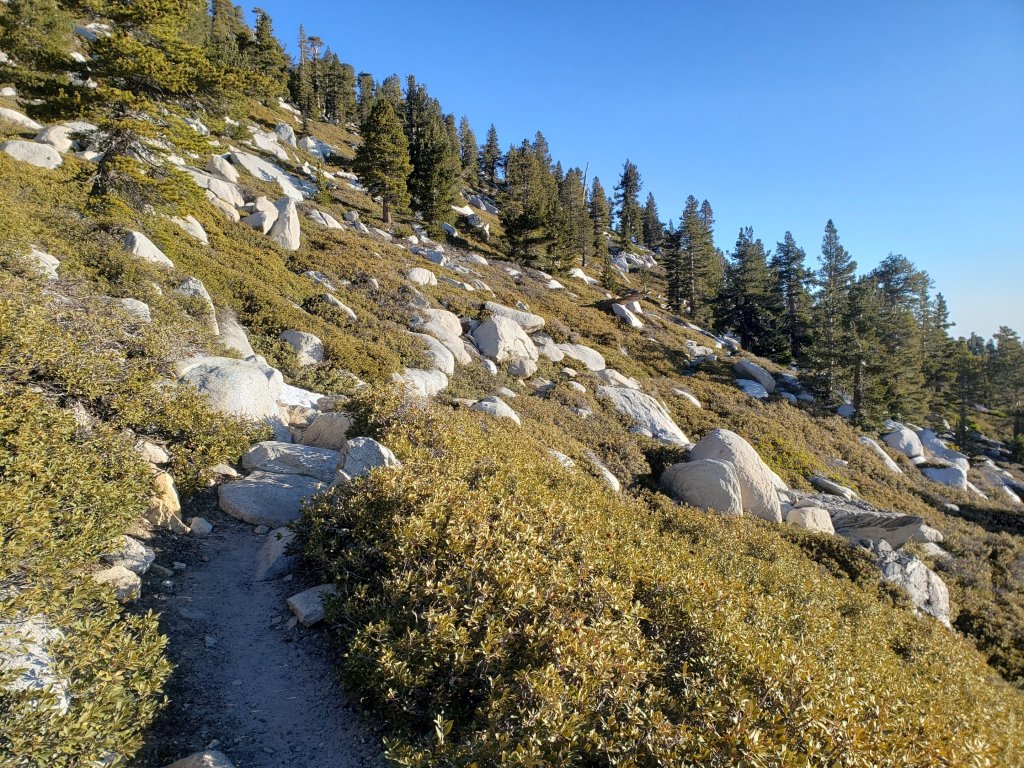
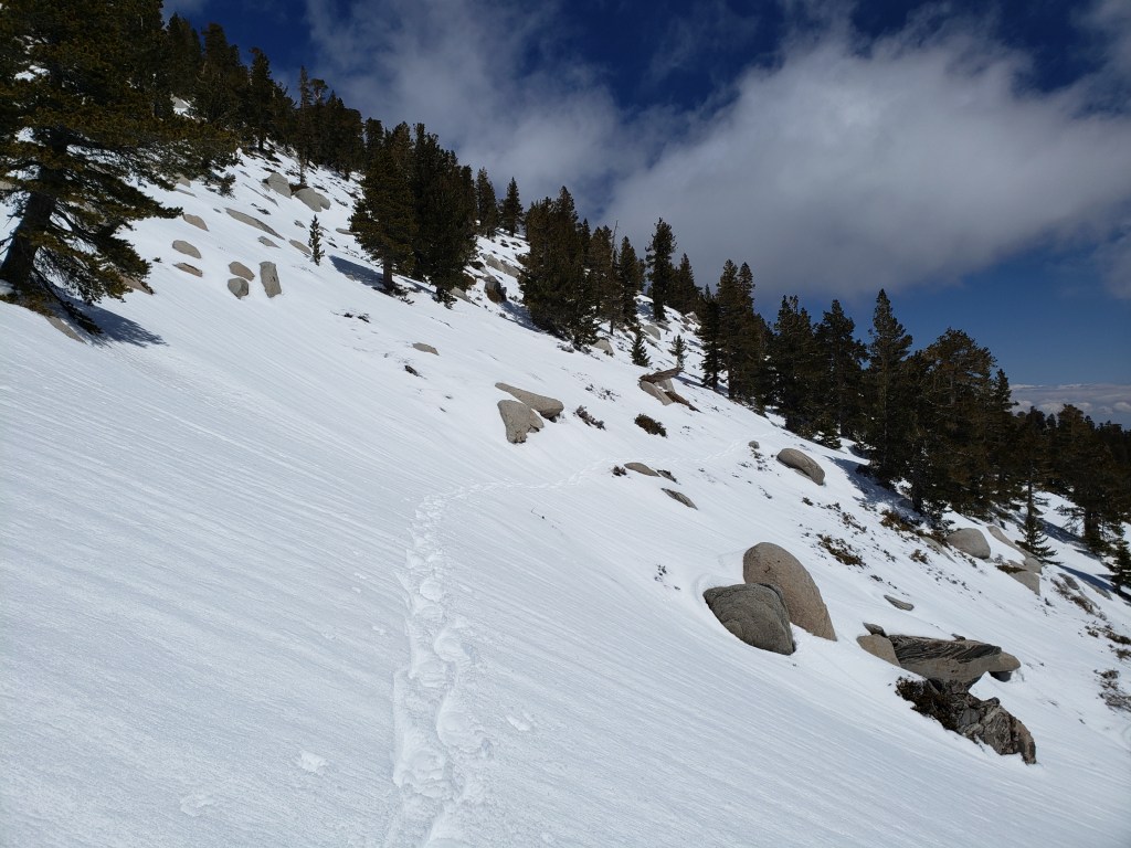
sanjacjon Uncategorized 1 Comment 9 MinutesEdit”Trail update 21st April 2021″
Trail update 15th April 2021
[Information specific to the Pacific Crest Trail is included at the foot of this Report. However much of the main Report is also applicable to PCT hikers.]
A busy past week or so of daily hikes has included a loop from home of Tahquitz Peak on 15th, San Jacinto Peak on 13th April ascending via east side trails (Devil’s Slide, Wellman, and Peak) then descending Deer Springs Trail, South Ridge Trail on 10th and 11th, a thorough survey of the PCT section from Spitler Peak Trail to Saddle Junction (Miles 168.5-179.5) on 9th April, as described in this video, and Marion Mountain Trail plus Fuller Ridge (Miles 185.5-191) of the PCT on 6th April, the latter discussed in detail in the video available here.
Pending final data, the first half of April may have been the warmest in recorded history in Idyllwild and the San Jacinto high country. Melting has of course been very rapid with conditions now more reminiscent of May or even June. Further warm temperatures forecast for next week will simply accelerate the process. Carrying spikes remains useful on traveled trails above about 8700ft but is no longer required depending on individual comfort level on compacted or soft snow (with some important caveats discussed below). Off trail travel currently involves post-holing in areas that retain extensive snow cover.
Despite temperatures above seasonal averages at upper elevations, hikers should nevertheless be prepared for temperatures near freezing in the high country, and potentially below freezing when considering wind chill effects (see below for weather data recorded recently at San Jacinto Peak).

WEATHER Following an unusually warm first couple of weeks of April, we are being treated to a very pleasant (if all too brief) cooling for a few days until about Friday 16th, when temperatures are forecast to warm once again to above seasonal. There is no precipitation in the forecast.
At San Jacinto Peak (10,810ft/3295m) on Tuesday 13th April 2021 at 0850 the air temperature was 33.8°F (1°C), with a windchill temperature of 18.7°F (-7°C), 28% relative humidity, and a chilly due West wind sustained at 15 mph gusting to 26.0 mph.
At the Peak on Wednesday 7th April 2021 at 0825 the air temperature was 38.8°F (4°C), with a windchill temperature of 24.9°F (-4°C), 58% relative humidity, and a strong WNW wind sustained at 22 mph gusting to 31.2 mph.
TRAIL CONDITIONS
Trails on the east and south flanks of the high country are completely or largely clear of snow to San Jacinto Peak. Trails on the west side are clear to near 8700ft, with snow cover increasingly patchy from there to San Jacinto Peak. There are some important exceptions discussed below. See “Pacific Crest Trail” below for details of that trail.
Tahquitz Peak trail from Chinquapin Flat/PCT Mile 178 has very challenging steps to follow through the angled icy snow, the route in places not following the trail. These slopes are notoriously treacherous. Spikes are very strongly recommended, preferably used in conjunction with an ice axe.
Devil’s Slide Trail is clear of snow to Saddle Junction.
Deer Springs Trail is clear of snow past Strawberry Junction to about 8650ft, shortly before the junction with Marion Mountain Trail. Snow is increasingly patchy from there to Little Round Valley, averaging only about 30% cover, but with several extended icy snow sections. Snow cover is 90% through Little Round Valley. Above Little Round Valley to San Jacinto Peak the trail has cleared very rapidly and is easy to follow, averaging only 40% snow cover. Some hikers will find spikes useful, especially for descending.
South Ridge Trail is essentially clear to Tahquitz Peak, with just a few tiny snow patches on the half-a-dozen switchbacks closest to the Peak. Spikes are no longer required. South Ridge Road is open.
Wellman Trail (from Annie’s Junction to Wellman Divide) is largely clear of snow, except for nearly continuous snow for about 0.3 mile immediately north of Annie’s Junction.
The Peak Trail (Wellman Divide to San Jacinto Peak) is clear of snow except for a nearly continuous 0.2 mile patch between 9900-10,100ft, where some will find spikes useful.
The East Ridge Trail on the east flank of San Jacinto Peak remains about 60% snow-covered but there is a reasonable track to follow.
Marion Mountain Trail is clear below 7500ft and again above 8500ft, with about 20% patchy snow cover between those elevations. Spikes are not required for ascending, but can be useful in places for descending.
Fuller Ridge Trail has snow along about 35% of its 5.0 miles length. Stubborn sections in particular remain around the crossing of the North Fork of the San Jacinto River (Mile 186), and on the northerly slopes of Fuller Ridge (approx. Miles 187.5-187.8 and 188.6-190.4). See the detailed video survey conducted on 6th April for more information.
Seven Pines Trail has had no visible hiker traffic this winter, with no tracks to follow where snow remains. Indeed this trail has been hiked very little since November 2018. Very cautious navigation is recommended for those who are not completely familiar with hiking this trail. The Forest Service closure of Dark Canyon Road continues, and there is no vehicular access to Seven Pines trailhead.
Where the trail is not readily visible, there is a clear track through the snow up from Round Valley to Wellman Divide. In addition Long Valley is largely clear of snow.
Skyline Trail is clear of snow to about 7200ft, thereafter there are small, shallow snow patches to Grubb’s Notch (8600ft). Spikes are no longer required.
The PCT is clear of snow from Miles 151 (Highway 74) to about 175 (Red Tahquitz). Snow is then more-or-less continuous between Miles 175-177 (see this video review of that section from 9th April). Snow cover is very patchy between Miles 177 to 185, with the exception of the notoriously stubborn 0.5 mile just south of Annie’s Junction at about Mile 180.8. Snow cover is almost continuous from Mile 184 to 185.5, although spikes are not essential. From Mile 185.5 to 191, snow is increasingly patchy. Stubborn sections remain around the crossing of the North Fork of the San Jacinto River (Mile 186), and on the northerly slopes of Fuller Ridge Trail (approx. Miles 187.5-187.8 and 188.6-190.4). See the video review of this section for details, and to decide whether the Black Mountain Road alternate is a better option for hikers less comfortable on extended angled snow. Miles 191-207 are clear of snow.
Black Mountain Road (closed to vehicles 1.7 miles from Hwy 243) is clear of snow for 5.0 miles to the Boulder Basin turning. The 3.0 miles to Fuller Ridge campground average only 5% snow cover, with a few short soft snow sections increasing in frequency closer to Fuller Ridge.
Trails completely clear of snow include: all Garner Valley trails, Ernie Maxwell Trail, Spitler Peak Trail, Cedar Spring Trail, and May Valley Road.
SNOW DEPTHS measured on 13th April 2021. Note that average depth is given first, followed in parentheses by the depth recorded on 16th March after the last significant storms on 10th-15th March. Due to past drifting, and variable melting due to differential sun exposure, depths now vary greatly even in small areas. Altitudes are approximate.
San Jacinto Peak (10810ft): 5 inches (38 inches on 16th March)
Little Round Valley (9800ft): 8 inches (29 inches on 16th March)
Wellman Divide (9700ft): 0 inches (19 inches on 16th March)
Annie’s Junction (9070ft): 4 inches (24 inches on 16th March)
Deer Springs Trail at Seven Pines Trail junction/approx. PCT Mile 184.9 (8700ft): 3 inches (14 inches on 16th March)
Strawberry Junction/approx. PCT Mile 183.1 (8100ft): 0 inch (8 inches on 16th March)
Saddle Junction/approx. PCT Mile 179.9 (8070ft): 0 inch (17 inches on 16th March)
Devil’s Slide Trail at Humber Park (6550ft): 0 inch (12 inches on 16th March)
PACIFIC CREST TRAIL
All Mile numbers are approximate. The main Report (above) is updated at least weekly or during/after any storm and contains much additional information relevant to PCT hikers.
PCT hikers are reminded that overnight stays are not permitted at or near San Jacinto Peak, including in the historic shelter. This is especially critical during the coronavirus pandemic as it is impossible to adequately clean and sterilize the shelter. Mt. San Jacinto State Park regulations permit overnight stays only in established campgrounds. Strawberry Junction (approx. Mile 183) is a good option for thru-hikers.
The PCT through the Snow Fire closure area (approx. Miles 191-207) reopened on Saturday 3rd April. Only the tread of the Trail has reopened, USFS is not permitting camping along the 16+ mile section.
We undertook a thorough survey of the Fuller Ridge section (Miles 185.5-191) of the PCT on 6th April 2021, discussed in detail in this video.
We surveyed the PCT section from Spitler Peak Trail to Saddle Junction (approx. Miles 168.5-179.5) on 9th April, as described in this video. Spikes are no longer required around Apache Peak, or elsewhere on this section, although some hikers may find spikes useful for snow travel on Miles 175-178.
Spikes remain useful for those hikers less comfortable hiking on snow for parts of the Trail between about Miles 165 and 191, although at this time most hikers will find spikes unnecessary. Please always practice safe decision-making based on your own comfort level (not that of your hiking partners), experience, ability, available equipment, time of day (which can greatly affect traction on snow and ice), and current snow and weather conditions.
PCT hikers – thanks for taking the time to read this. The San Jacinto Trail Report depends entirely on small private donations to cover its direct costs. With a busy winter overlapping with a complex PCT season, every contribution, no matter how small, is truly valuable. If you have found the Report useful, please consider visiting the Donate page. Thank you, and safe hiking.
This has been a far below average snow year for the San Jacinto high country. Given accelerating climate change here, depending on your start date there may be relatively little snow and ice by the time you reach the San Jacinto mountains. Nevertheless even small, isolated sections of icy snow can be very perilous. Details of current snow/ice conditions will be clear from updates to the Trail Report over coming weeks.
Coming off at Mile 168.5 (the well-signed Spitler Peak Trail alternate) may still be a good option for some this nobo season. In addition to snow/ice issues ahead, there are nearly 60 trees down across the Trail between Miles 169-177, plus the rock slide at Mile 172.5. Spitler Peak Trail itself clears of snow (as is now the case) long before the PCT north of that point.
The short snow slope on the NE side of Apache Peak (Mile 169.5) that has proved challenging over the years is virtually clear of snow, with good steps to follow. Spikes are no longer required, although hiking poles and caution are always useful. Every individual should make their own assessment of whether to cross based on their comfort level on angled snow, their experience, available equipment, time of day, and current snow conditions. If in any doubt whatsoever, turn around and take the very well signed Spitler Peak Trail alternate option at Mile 168.5.
The Pacific Crest Trail remains open at the rockslide north of Antsell Rock (Mile 172.5). Reports that the assisting rope around the rockslide is “in tatters” are completely misleading. However the rope is not in new condition, and if you choose to use it, you do so completely at your own risk. USFS has told the Trail Report that responsibility for removing the rockslide is currently with the PCTA, and that there are currently no plans to close this section of the PCT for removal work before summer 2021 at the earliest. This video report (recorded on 1st March 2021, starts at minute 9.05) may be useful for deciding whether to hike around the rockslide.
If you take an alternate further south, it is possible to regain the PCT from Idyllwild via Devil’s Slide Trail at Saddle Junction (about Mile 179). Do not attempt to regain the PCT via South Ridge Trail as the slope on the north side of Tahquitz Peak is currently ice-covered and is notoriously treacherous.
Current snow cover on the PCT is minimal from Miles 151 (Highway 74) to about 175 (Red Tahquitz). Snow is then more-or-less continuous between Miles 175-177 (see this video review of that section from 9th April). Snow cover is very patchy between Miles 177 to 185, with the exception of the notoriously stubborn 0.5 mile just south of Annie’s Junction at about Mile 180.8. Snow cover is almost continuous from Mile 184 to 185.5, although spikes are not essential. From Mile 185.5 to 191, snow is increasingly patchy. Stubborn sections remain around the crossing of the North Fork of the San Jacinto River (Mile 186), and on the northerly slopes of Fuller Ridge Trail (approx. Miles 187.5-187.8 and 188.6-190.4). See the video review of this section for details, and to decide whether the Black Mountain Road alternate is a better option for hikers less comfortable on extended angled snow. Miles 191-207 are clear of snow.
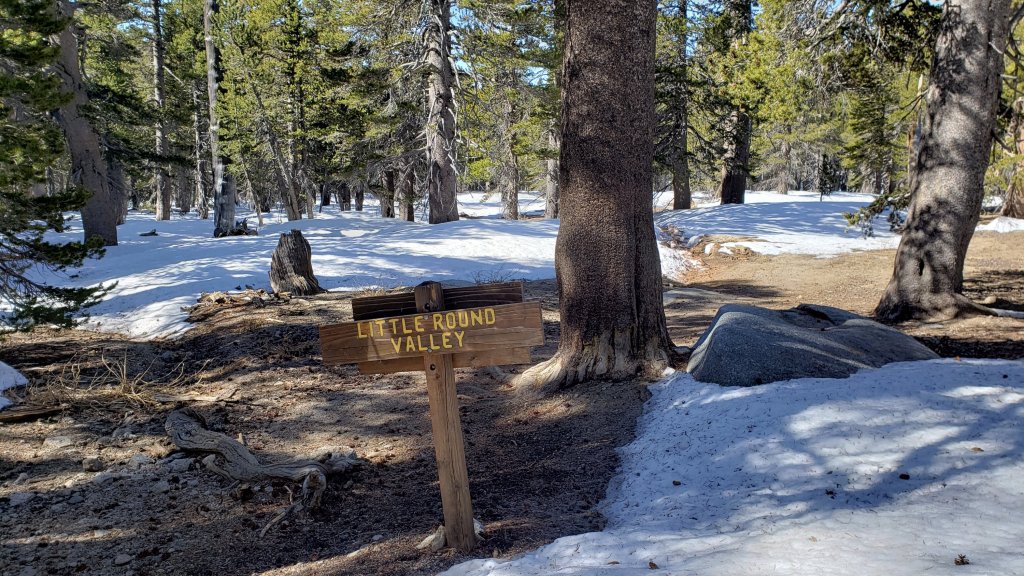


sanjacjon Uncategorized Leave a comment 9 MinutesEdit”Trail update 15th April 2021″
PCT and snow update 9th April 2021
[Please note that information specific to the Pacific Crest Trail is included at the foot of this Report. However much of the main Report is also applicable to PCT hikers.]
We undertook a thorough survey of the PCT section from Spitler Peak Trail to Saddle Junction (approx. Miles 168.5-179.5) on 9th April, as described in this video. Spikes are no longer required around Apache Peak, or elsewhere on this section, although some hikers may find spikes useful for snow travel on Miles 175-178.
We also surveyed the Fuller Ridge section (Miles 185.5-191) of the PCT on Tuesday 6th April, discussed in detail in the video available here.
The PCT through the Snow Fire closure area (approx. Miles 191-207) reopened on Saturday 3rd April. Only the tread of the Trail has reopened, and USFS is not permitting camping along the 16+ mile section.
Our hikes every day this year have focused on parts of the PCT and/or its side trails for the past two months or so. We had a swift ascent of San Jacinto Peak on 7th April via the east side (Devil’s Slide, PCT, Wellman, Peak, and East Ridge trails).
We have had a major warm spell in the first week of April. Temperatures are forecast to remain at or above seasonal averages at all elevations for at least the next week. Snowmelt has been rapid at all elevations, with sun-exposed slopes in particular clearing rapidly. Conditions have already become more reminiscent of a “normal” May or even early June. Carrying spikes remains recommended on well-traveled trails above about 8500ft (lower in places discussed below). They can be useful in the morning and for descending, as established trails are icy and compacted by hiker traffic and freeze-thaw cycles.
Despite temperatures well above seasonal norms at upper elevations, hikers should nevertheless be prepared for temperatures near freezing in the high country, and potentially below freezing when considering wind chill effects (see below for weather data recorded recently at San Jacinto Peak).
The USFS gate at Humber Park reopened on 19th March when the area was also plowed.
WEATHER Temperatures are forecast to remain above seasonal until about Tuesday 13th, when they drop slightly to average for April (but remaining relatively warm and dry). There is no significant precipitation in the forecast.
At San Jacinto Peak (10,810ft/3295m) on Wednesday 7th April 2021 at 0825 the air temperature was 38.8°F (4°C), with a windchill temperature of 24.9°F (-4°C), 58% relative humidity, and a strong WNW wind sustained at 22 mph gusting to 31.2 mph.
At the Peak on Thursday 1st April 2021 at 0850 the air temperature was 41.9°F (5°C), with a windchill temperature of 34.3°F (1°C), 16% relative humidity, and a steady (and rare) due South wind sustained at 7 mph gusting to 11.9 mph.
TRAIL CONDITIONS
Trails below about 8600ft are completely or largely clear of snow (with some important exceptions discussed below). On sun-exposed slopes, substantial sections of trail at higher elevations are also partly or largely clearing of snow.
Tahquitz Peak trail from Chinquapin Flat/PCT Mile 178 has limited steps to follow through the angled icy snow. These slopes are notoriously treacherous. Spikes (or even crampons) used in conjunction with an ice axe remain strongly recommended. Do not attempt to use snowshoes due to the angle of the icy snow.
Devil’s Slide Trail is essentially clear of snow to Saddle Junction, with just a few dirty snow patches remaining. Some hikers may continue to find spikes useful.
Deer Springs Trail is clear of snow to Strawberry Junction and essentially clear to about 8600ft. Snow is largely continuous from there to San Jacinto Peak, with an excellent track to follow. Above Little Round Valley the track through the snow does not follow the trail route to San Jacinto Peak, and is steep and direct. Spikes are recommended, especially for descending.
South Ridge Trail is clear to Old Lookout Flat at 7600′, with just a couple of tiny icy patches low down. Snow cover is a patchy 20% on the traverse at 7600-7800ft. The 18 switchbacks up to Tahquitz Peak are largely clear, but snow cover is about 60% on the half-a-dozen switchbacks closest to the Peak. Spikes can be useful close to Tahquitz Peak especially for descending. South Ridge Road is open.
Wellman Trail (from Annie’s Junction to Wellman Divide) is largely clear of snow, except for continuous snow for about 0.3 mile immediately north of Annie’s Junction.
The Peak Trail (Wellman Divide to San Jacinto Peak) is largely clear of snow, except for extended sections between 9900-10,100ft, and again above 10,500ft. Many hikers may find spikes useful in these areas.
The East Ridge Trail on the east flank of San Jacinto Peak remains completely snow-covered at 1-2 feet deep, but there is a reasonable track to follow through the snow.
Marion Mountain Trail is largely clear below 7500ft and again above 8500ft, with about 30% icy snow cover between those elevations. Spikes are not required for ascending, but are useful in places for descending.
Fuller Ridge Trail has snow along about 40% of its 5.0 miles length. Stubborn sections in particular remain around the crossing of the North Fork of the San Jacinto River (Mile 186), and on the northerly slopes of Fuller Ridge (approx. Miles 187.5-187.8 and 188.6-190.4). See the video survey conducted on 6th April for details.
Seven Pines Trail has had no visible hiker traffic this winter, nor since the most recent snowfall, with no tracks or trail to follow. Indeed this trail has been hiked very little since November 2018. Extremely cautious navigation is recommended for those who are not very familiar with hiking this trail. The Forest Service closure of Dark Canyon Road continues, and there is no vehicular access to Seven Pines trailhead.
The Ernie Maxwell Trail is clear of ice and snow.
There is a clear track up from Round Valley to Wellman Divide, which does not always follow the established trail route for some of its length. Long Valley is largely clear of snow.
Skyline Trail is clear of snow to about 7200ft, thereafter snow is shallow and increasingly patchy to Grubb’s Notch (8600ft). There is a well-worn but icy track to follow. Some hikers will find spikes useful.
Current snow cover on the PCT is minimal from Miles 151 (Highway 74) to about 175 (Red Tahquitz). Snow is then more-or-less continuous between Miles 175-177. Snow cover is steadily becoming increasingly patchy between Miles 177 to 184, with the exception of the notoriously stubborn 0.5 mile just south of Annie’s Junction at about Mile 180.8. Snow cover is almost continuous from Mile 184 to 185.5, although spikes are not essential. From Mile 185.5 to 191, snow is increasingly patchy. Stubborn sections remain around the crossing of the North Fork of the San Jacinto River (Mile 186), and on the northerly slopes of Fuller Ridge Trail (approx. Miles 187.5-187.8 and 188.6-190.4). See the video review of this section for details, and to decide whether the Black Mountain Road alternate is a better option for you. Miles 191-207 are almost completely clear of snow.
Black Mountain Road (closed to vehicles 1.7 miles from Hwy 243) is clear of snow for 5.0 miles to the Boulder Basin turning. The 3.0 miles to Fuller Ridge campground averages about 5% snow cover, with a few lengthy soft snow sections increasing in frequency closer to Fuller Ridge [surveyed 2nd and 6th April 2021].
Spitler Peak Trail and Cedar Spring Trail are both clear of snow.
May Valley Road, a major component of the PCT Mile 168.5 alternate route, is clear of snow.
SNOW DEPTHS measured on 7th April 2021. Note that average depth is given first, followed in parentheses by the depth recorded on 16th March after the last significant storms on 10th-15th March. Due to past drifting, and variable melting due to differential sun exposure, depths now vary greatly, especially in trails. Altitudes are approximate.
San Jacinto Peak (10810ft): 12 inches (38 inches on 16th March)
Wellman Divide (9700ft): <2 inches (19 inches on 16th March)
Annie’s Junction (9070ft): 6 inches (24 inches on 16th March)
Saddle Junction/approx. PCT Mile 179.9 (8070ft): 1 inch (17 inches on 16th March)
Devil’s Slide Trail at Humber Park (6550ft): 0 inch (12 inches on 16th March)
Idyllwild (at 5550ft): 0 inch (6 inches on 16th March)
PACIFIC CREST TRAIL
Following a general discussion, this information is organized roughly south to north (all Mile numbers are approximate). The main Report (above) is updated at least weekly or during/after any storm.
The PCT through the Snow Fire closure area (approx. Miles 191-207) reopened on Saturday 3rd April. Only the tread of the Trail has reopened, USFS is not permitting camping along the 16+ mile section.
We undertook a thorough survey of the Fuller Ridge section (Miles 185.5-191) of the PCT on 6th April 2021, discussed in detail in this video.
We surveyed the PCT section from Spitler Peak Trail to Saddle Junction (approx. Miles 168.5-179.5) on 9th April, as described in this video. Spikes are no longer required around Apache Peak, or elsewhere on this section, although some hikers may find spikes useful for snow travel on Miles 175-178.
Spikes remain recommended, but are no longer required for those comfortable hiking on snow, for parts of the Trail between about Miles 165 and 191. Please always practice safe decision-making based on your own comfort level (not that of your hiking partners), experience, ability, available equipment, time of day (which can greatly affect traction on snow and ice), and current snow and weather conditions.
This has been a far below average snow year for the San Jacinto high country (but, oddly, above average snowfall for mid elevations, 4000-6000ft). Given accelerating climate change here, depending on your start date there may be relatively little snow and ice by the time you reach the San Jacinto mountains. Nevertheless even small, isolated sections of icy snow can be very perilous. Details of current snow/ice conditions will be clear from updates to the Trail Report over coming weeks.
We undertook a thorough survey of the PCT section from Spitler Peak Trail to Saddle Junction (approx. Miles 168.5-179.5) on 9th April. Spikes are no longer required around Apache Peak, or elsewhere on this section, although some hikers may find them useful for snow travel on Miles 175-178.
Coming off at Mile 168.5 (the well-signed Spitler Peak Trail alternate) may still be a good option for some this nobo season. In addition to snow/ice issues ahead, there are nearly 60 trees down across the Trail between Miles 169-177, plus the rock slide at Mile 172.5. Spitler Peak Trail itself clears of snow (as is now the case) long before the PCT north of that point.
The short snow slope on the NE side of Apache Peak (Mile 169.5) that has proved challenging over the years is virtually clear of snow, with reasonable steps to follow. Spikes are no longer required, although hiking poles and caution are always useful. Every individual should make their own assessment of whether to cross based on their comfort level on angled snow, their experience, available equipment, time of day, and current snow conditions. If in any doubt whatsoever, turn around and take the very well signed Spitler Peak Trail alternate option at Mile 168.5.
PCT hikers – thanks for taking the time to read this. The San Jacinto Trail Report depends entirely on small private donations to cover its direct costs. With a busy winter overlapping with a complex PCT season, every contribution, no matter how small, is truly valuable. If you have found the Report useful, please consider visiting the Donate page. Thank you, and safe hiking.
The Pacific Crest Trail remains open at the rockslide north of Antsell Rock (Mile 172.5). Reports that the assisting rope around the rockslide is “in tatters” are completely misleading. However the rope is not in new condition, and if you choose to use it, you do so completely at your own risk. USFS has told the Trail Report that responsibility for removing the rockslide is currently with the PCTA, and that there are currently no plans to close this section of the PCT for removal work before summer 2021 at the earliest. This video report (recorded on 1st March 2021, starts at minute 9.05) may be useful for deciding whether to hike around the rockslide.
If you take an alternate further south, it is possible to regain the PCT from Idyllwild via Devil’s Slide Trail at Saddle Junction (about Mile 179). Do not attempt to regain the PCT via South Ridge Trail as the slope on the north side of Tahquitz Peak is currently ice-covered and is notoriously treacherous.
Current snow cover on the PCT is minimal from Miles 151 (Highway 74) to about 175 (Red Tahquitz). Snow is then more-or-less continuous between Miles 175-177. Snow cover is steadily becoming increasingly patchy between Miles 177 to 184, with the exception of the notoriously stubborn 0.5 mile just south of Annie’s Junction at about Mile 180.8. Snow cover is almost continuous from Mile 184 to 185.5, although spikes are not essential. From Mile 185.5 to 191, snow is increasingly patchy. Stubborn sections remain around the crossing of the North Fork of the San Jacinto River (Mile 186), and on the northerly slopes of Fuller Ridge Trail (approx. Miles 187.5-187.8 and 188.6-190.4). See the video review of this section for details, and to decide whether the Black Mountain Road alternate is a better option for you. Miles 191-207 are almost completely clear of snow.
PCT hikers are reminded that overnight stays are not permitted at or near San Jacinto Peak, including in the historic shelter. This is especially critical during the coronavirus pandemic as it is impossible to adequately clean and sterilize the shelter. Mt. San Jacinto State Park regulations permit overnight stays only in established campgrounds. Strawberry Junction (approx. Mile 183) is a good option for thru-hikers.


sanjacjon Uncategorized Leave a comment 9 MinutesEdit”PCT and snow update 9th April 2021″
Snow and PCT update 1st April 2021
UPDATED 6th April 2021: a thorough new video survey of Fuller Ridge (PCT Miles 185.5-191) was undertaken today. Spikes are generally recommended for parts of this section, other than for hikers who are very comfortable on angled snow/ice.
UPDATED 2nd April 2021: The PCT through the Snow Fire closure area (approx. Miles 191-207) will reopen on Saturday 3rd April. Only the tread of the Trail has reopened, meaning no camping is permitted along the 16+ mile section.
[Please note that information specific to the Pacific Crest Trail is included at the foot of this Report. However much of the main Report is also applicable to PCT hikers. Important PCT note: We surveyed the challenging north-east flank of Apache Peak (PCT Mile 169.5) on 29th March, as summarised in this video.]
Almost all of our recent daily hikes have focused on parts of the PCT and/or its side trails. We had a swift ascent of San Jacinto Peak this morning via Marion Mountain and Deer Springs trails, and on Sunday 28th via the east side (Devil’s Slide, Wellman, and Peak trails). Spikes were required almost the entire way today, but hardly at all on Sunday.
The weather recorded at San Jacinto Peak this morning is, regrettably, not an April Fool’s joke (details below). With even the “windchill” above freezing, and a relative humidity of only 16%, conditions were more reminiscent of June than of 1st April. The omens for this year’s fire season are not good at all.
We had unusual “thundersnow” events in the San Jacinto mountains on both 21st and 23rd March, then a more conventional dusting mainly in the early morning of 26th. All three events produced just 0.25-1.0 inch of snow, depending on elevation, which promptly largely melted off within hours.
More significantly, we have a major warming spell for the next week (it is 71°F in Idyllwild as I write this). Temperatures will be well above seasonal averages at all elevations. This will be especially pronounced at the highest elevations with air temperatures (even at night) expected to remain at or above freezing at San Jacinto Peak for almost all of the first half of April.
With the obvious exception of the light dusting events of the previous week, snowmelt has been steady at all elevations. Melting will accelerate dramatically over the next week. Sun-exposed slopes in particular are clearing rapidly, with conditions expected to become more reminiscent of a “normal” May or even early June in the first week of April. Spikes are recommended on all well-traveled trails above about 7500ft (lower in places discussed below), especially in the morning and for descending, as established trails are now compacted by hiker traffic and freeze-thaw cycles. Snowshoes are recommended only for off-trail travel above and around about 9000ft.
Despite temperatures well above seasonal norms at upper elevations, hikers should nevertheless be prepared for temperatures near freezing in the high country, and potentially below freezing when considering wind chill effects (see below for weather data recorded recently at San Jacinto Peak).
The USFS gate at Humber Park reopened on 19th March when the area was also plowed.
WEATHER Temperatures are forecast to remain well above seasonal until about Tuesday 6th April, when slight cooling is expected to near average temperatures. There is no significant precipitation in the forecast.
At San Jacinto Peak (10,810ft/3295m) on Thursday 1st April 2021 at 0850 the air temperature was 41.9°F (5°C), with a windchill temperature of 34.3°F (1°C), 16% relative humidity, and a steady (and rare) due South wind sustained at 7 mph gusting to 11.9 mph.
At the Peak on Sunday 28th March 2021 at 0815 the air temperature was 36.1°F (2°C), with a windchill temperature of 28.8°F (-2°C), 26% relative humidity, and a light SE wind sustained at 4 mph gusting to 8.0 mph.
At the Peak on Monday 22nd March 2021 at 0950 the air temperature was 25.5°F (-4°C), with a windchill temperature of 7.2°F (-14°C), 39% relative humidity, and a frigid NW wind sustained at 12 mph gusting to 23.8 mph.
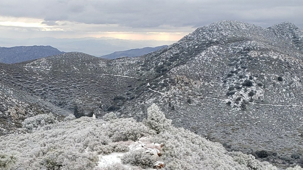
TRAIL CONDITIONS
All trails above about 8600ft remain largely or completely snow-covered. Areas below 7500ft are largely clear of snow, with the exception of north-facing slopes (down to about 6500ft). Areas between those elevations are clearing of snow. Rapid clearing at all elevations, especially on sun-exposed slopes, will accelerate this week.
Tahquitz Peak trail from Chinquapin Flat/PCT Mile 178 has no steps to follow through the angled icy snow. These slopes are notoriously treacherous. Currently crampons (or at least spikes) used in conjunction with an ice axe are strongly recommended. Do not attempt to use snowshoes due to the angle of the icy snow.
Devil’s Slide Trail is rapidly clearing of snow to 7600′ with a few extended icy snow patches remaining. Snow is widespread but increasingly patchy above that elevation to Saddle Junction. The trail is hard and icy and spikes are useful.
Deer Springs Trail is essentially clear of snow up to Strawberry Junction and largely clear to about 8600ft. Snow is virtually continuous from there to San Jacinto Peak, with an excellent track to follow. Above Little Round Valley the track through the snow does not follow the trail route to San Jacinto Peak, and is steep and direct. Spikes are recommended, especially for descending, as snow is icy and compacted.
South Ridge Trail [updated 30th March] is clear to Old Lookout Flat at 7600′, with just a couple of tiny icy patches low down. Snow cover is a patchy 40% on the traverse at 7600-7800ft. The 18 switchbacks up to Tahquitz Peak are largely clear, but snow cover is almost continuous on those closest to the Peak. Spikes are useful close to Tahquitz Peak especially for descending. South Ridge Road (open) is clear of snow and ice.
Marion Mountain Trail has extensive, icy, snow cover to the PCT/Deer Springs Trail junction. The trail is largely clear to about 6800ft, but thereafter cover is roughly 50% below 7500ft and again above 8500ft. Icy snow is nearly continuous between those elevations. Spikes are strongly recommended throughout.
Fuller Ridge Trail has tracks to follow through the icy snow. They do not accurately follow the PCT route in several places.
Seven Pines Trail has had no visible hiker traffic this winter, nor since the most recent snowfall, with no tracks or trail to follow. Indeed this trail has been hiked very little since November 2018. Extremely cautious navigation is recommended for those who are not very familiar with hiking this trail. The Forest Service closure of Dark Canyon Road continues, and there is no vehicular access to Seven Pines trailhead.
The Ernie Maxwell Trail is essentially clear of ice and snow, with a few icy snow patches near Humber Park. Spikes are not required.
There is a clear but lightly-traveled track up from Round Valley to Wellman Divide, which does not closely follow the established trail route for much of its length.
Skyline Trail is clear of snow to about 7200ft, thereafter snow is generally shallow and increasingly patchy to Grubb’s Notch (8600ft). There is a well-worn but icy track to follow, spikes are recommended.
Current snow cover on the PCT is minimal from Miles 151 (Highway 74) to about 165, and increasingly patchy, but nevertheless very challenging in places, between Miles 165 and about 175 (Red Tahquitz). Snow is then more-or-less continuous between Miles 175-178. Snow cover is steadily becoming patchy between Miles 178 to 183.5, with the exception of the notoriously stubborn half mile just south of Annie’s Junction at about Mile 181. From Mile 183.5 to 191, snow is largely continuous, although some exposed sections of Fuller Ridge (e.g., parts of Miles 186.5-188.5) are thinning rapidly.
Black Mountain Road (closed to vehicles 1.7 miles from Hwy 243) is clear of snow for 5.0 miles to the Boulder Basin turning. The 3.0 miles to Fuller Ridge campground averages about 10% snow cover, with some lengthy soft snow sections increasing in frequency closer to Fuller Ridge [surveyed 2nd April 2021].
Spitler Peak Trail is clear of snow. Spikes are not required.
Cedar Spring Trail is clear of snow from Morris Ranch Road to the PCT, with some small patches remaining on the east side of the PCT down to the spring itself.
May Valley Road, a major component of the PCT Mile 168.5 alternate route, is clear of snow.
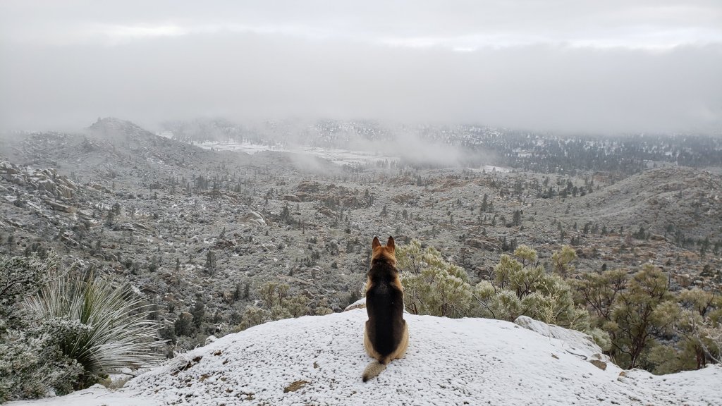
SNOW DEPTHS measured on 1st April 2021 (San Jacinto Peak and Little Round Valley) or 28th March 2021. Note that average depth is given first, followed in parentheses by the depth recorded on 16th March after the last significant storms on 10th-15th March. Due to past drifting, and variable melting due to differential sun exposure, depths now vary greatly, especially in trails. Altitudes are approximate.
San Jacinto Peak (10810ft): 14 inches (38 inches on 16th March)
Little Round Valley (9800ft): 10 inches (29 inches on 16th March)
Wellman Divide (9700ft): 4 inches (19 inches on 16th March)
Annie’s Junction (9070ft): 18 inches (24 inches on 16th March)
Strawberry Junction (8100ft): <1 inch (8 inches on 16th March)
Saddle Junction/approx. PCT Mile 179.9 (8070ft): 5 inches (17 inches on 16th March)
Devil’s Slide Trail at Humber Park (6550ft): <1 inch (12 inches on 16th March)
Idyllwild (at 5550ft): 0 inches (6 inches on 16th March)
PACIFIC CREST TRAIL
Following a general discussion, this information is organized roughly south to north (all Mile numbers are approximate). The main Report (above) is updated at least weekly or during/after any storm.
Spikes are currently recommended between about Miles 165 and 191, and they are essential if you attempt Miles 169-178 and 185-190 at least. Currently, an ice axe could be very useful in these areas in conjunction with your spikes, but only if you know how to use it. Challenging sections of angled icy snow requiring this equipment exist north of Apache Peak (Mile 169.5), so if you are not comfortable with the snow conditions in that area, use the Spitler Peak Trail alternate. Please always practice safe decision-making based on your own comfort level (not that of your hiking partners), experience, ability, available equipment, time of day (which can greatly affect traction on snow and ice), and current snow and weather conditions.
This has been a well-below average snow year for the San Jacinto high country (but, oddly, above average snowfall for mid elevations, 4000-6000ft). Given accelerating climate change here, depending on your start date there may be relatively little snow and ice by the time you reach the San Jacinto mountains. Nevertheless even small, isolated sections of icy snow can be very perilous. Details of current snow/ice conditions will be clear from updates to the Trail Report over coming weeks.
Coming off at Mile 168.5 (the well-signed Spitler Peak Trail alternate) may be a good option for many this nobo season. In addition to snow/ice issues ahead, there are nearly 60 trees down across the Trail between Miles 169-177, plus the rock slide at Mile 172.5. Spitler Peak Trail itself clears of snow (as is now the case) long before the PCT north of that point.
The detailed video report for PCT Miles 169-179 from 1st March is again accurate to current conditions. Although there will be significant melting over the next week or so, challenging conditions will persist around Apache Peak (and in the 7-8 miles immediately north) for the foreseeable future. Please exercise very cautious decision-making in this area.
The short snow slope on the NE side of Apache Peak (Mile 169.5) that has proved challenging over the years is currently snow-covered. This area was resurveyed on 29th March as discussed in this short video. Snow is hard and icy in the early mornings, but with reasonable steps to follow. Spikes, ideally in combination with an ice axe, and knowledge of how to use this equipment, are currently recommended. Every individual should make their own assessment of whether to cross based on their comfort level on angled snow, their experience, available equipment, time of day, and current snow conditions. If in any doubt whatsoever, turn around and take the very well signed Spitler Peak Trail alternate option at Mile 168.5.
PCT hikers – thanks for taking the time to read this. The San Jacinto Trail Report depends entirely on small private donations to cover its direct costs. With a busy winter overlapping with a complex PCT season, every contribution, no matter how small, is truly valuable. If you have found the Report useful, please consider visiting the Donate page. Thank you, and safe hiking.
The Pacific Crest Trail remains open at the rockslide north of Antsell Rock (Mile 172.5). Reports that the assisting rope around the rockslide is “in tatters” are inaccurate. However the rope is not in new condition, and if you choose to use it, you do so completely at your own risk. USFS has told the Trail Report that responsibility for removing the rockslide is currently with the PCTA, and that there are currently no plans to close this section of the PCT for removal work before summer 2021 at the earliest. The latest video report (recorded on 1st March 2021, starts at minute 9.05) may be useful for deciding whether to hike around the rockslide.
It is possible to regain the PCT from Idyllwild via Devil’s Slide Trail at Saddle Junction (about Mile 179) then hike on through to Mile 190.5 (Fuller Ridge campground). Currently this would involve significant snow travel, but nothing challenging, as snow is relatively shallow and melting steadily, including Fuller Ridge Trail (Miles 185.5-190.5). Do not attempt to regain the PCT via South Ridge Trail as the slope on the north side of Tahquitz Peak is currently ice-covered and is notoriously treacherous.
PCT hikers are reminded that overnight stays are not permitted at or near San Jacinto Peak, including in the historic shelter. Mt. San Jacinto State Park regulations permit overnight stays only in established campgrounds (when open). Strawberry Junction is a good option for thru-hikers.
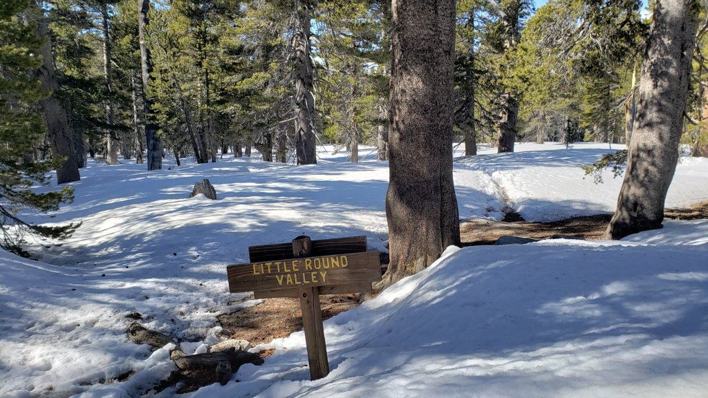

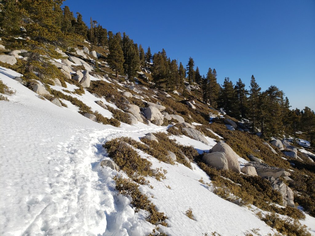
sanjacjon Uncategorized 4 Comments 9 MinutesEdit”Snow and PCT update 1st April 2021″
Snow and PCT update 22nd March 2021
[Please note that information specific to the Pacific Crest Trail is included at the foot of this Report. However much of the main Report is applicable to PCT hikers also.]
[UPDATE 26th March: a very light dusting of snow last night included 0.5 inch at and above 5000ft, and a very uniform 0.25 inch throughout Garner Valley down to 4000ft. By late morning today, all new snow below 6000ft had already melted, and it was disappearing rapidly at higher elevations in all sun-exposed areas. Equipment recommendations and trail conditions discussed below are unaffected.]
We have continued to hike daily on the mountain this year, with almost all recent hikes focused on subsections of the PCT. We had a relatively easy ascent of San Jacinto Peak on Monday 22nd, ascending via the east side trails (Devil’s Slide, Wellman, and Peak trails) and descending the west side via Deer Springs Trail.. No spikes were required on the ascent, but they were useful on the descent down to about 9000ft.
Yesterday evening we had an unusual “thundersnow” event in the San Jacinto mountains. For less than an hour around 1800 we had a thunderstorm produce a snowfall of up to an inch, with large, wet, snowflakes accumulating even though the temperature was well above 40 degrees Fahrenheit in Idyllwild. At the same time, the temperature plummeted more than ten degrees in about half-an-hour. Snow accumulation in Idyllwild (at 5550ft) was 0.7 inch, and 1.0 inch throughout the high country. Before dusk, we were back to blue skies. The event was a perfect demonstration of how fickle (and potentially perilous) the weather can be in an isolated mountain range. Similar events are forecast to be possible in the evenings of Tuesday 23rd and Thursday 25th.
With the obvious exception of the light dusting yesterday, melting has been steady at all elevations. Sun-exposed slopes in particular are clearing rapidly, with conditions expected to become more reminiscent of a “normal” May in the next week or so. At San Jacinto Peak on 22nd, I measured an average of about 27 inches, a loss of nearly one foot in a week, despite recent temperatures not being notably warm. Spikes are recommended on all well-traveled trails above about 7500ft (lower in places discussed below), especially in the morning and for descending, as established trails are now compacted by hiker traffic and freeze-thaw cycles. Snowshoes are recommended only for off-trail travel above and around about 8000ft.
Hikers should be prepared for temperatures at or below freezing in the high country, and potentially well below freezing when considering wind chill effects (see below for temperatures recorded recently at San Jacinto Peak).
The USFS gate at Humber Park reopened on 19th March when the area was also plowed.

WEATHER Temperatures are forecast to fluctuate around seasonal averages for the next few days, before warming significantly starting Saturday 27th March and continuing into early April. With warm, sunny, days snow melt will rapidly accelerate and will likely be particularly fast below 8000ft and also on sun-exposed slopes at all elevations. There is no significant precipitation in the forecast, although minor precipitation is possible in the afternoon on Tuesday 23rd and Thursday 25th. Medium term forecasts from NWS San Diego suggest above average precipitation is probable in the first half of April.
At San Jacinto Peak (10,810ft/3295m) on Monday 22nd March 2021 at 0950 the air temperature was 25.5°F (-4°C), with a windchill temperature of 7.2°F (-14°C), 39% relative humidity, and a frigid NW wind sustained at 12 mph gusting to 23.8 mph.
At San Jacinto Peak (10,810ft/3295m) on Tuesday 16th March 2021 at 1145 the air temperature was 21.2°F (-6°C), with a windchill temperature of 2.8°F (-16°C), 71% relative humidity, and a gusty NNW wind sustained at 12 mph gusting to 20.7 mph.
TRAIL CONDITIONS
All trails above about 8600ft remain continuously snow-covered. Areas below 7500ft are patchy or rapidly clearing of snow, with the exception of north-facing slopes (down to about 6500ft). Areas between those elevations are largely snow-covered, but with rapid clearing on sun-exposed slopes that will accelerate this week.
Tahquitz Peak trail from Chinquapin Flat/PCT Mile 178 has no steps to follow through the angled icy snow. These slopes are notoriously treacherous. Currently crampons, or at least spikes (used in conjunction with an ice axe) are essential. Do not attempt to use snowshoes due to the angle of the icy snow.
Devil’s Slide Trail is rapidly clearing of snow to 7600′ with a few extended icy snow patches remaining. Snow is largely continuous above that elevation to Saddle Junction. The trail is hard and icy and spikes are useful.
Deer Springs Trail is clear of snow to the Suicide Rock junction, and rapidly clearing of snow up to Strawberry Junction and beyond to about 8500ft. Snow is continuous from there to San Jacinto Peak, with an excellent track to follow. Above Little Round Valley the track I broke last week through the snow does not follow the trail route to San Jacinto Peak, and is steep and direct. Spikes are useful, and invaluable for descending, as snow is icy and compacted.
Marion Mountain Trail has extensive, icy, snow cover to the PCT/Deer Springs Trail junction. Snow cover is roughly 50% below 7000ft and again above 8500ft, but is nearly continuous between those elevations. Spikes are strongly recommended.
Fuller Ridge Trail has not be traveled recently and there are no tracks to follow.
Seven Pines Trail has had no visible hiker traffic this winter, nor since the most recent snowfall, with no tracks or trail to follow. Indeed this trail has been hiked very little since November 2018. Extremely cautious navigation is recommended for those who are not very familiar with hiking this trail. The Forest Service closure of Dark Canyon Road continues, and there is no vehicular access to Seven Pines trailhead.
The Ernie Maxwell Trail is largely clear of ice and snow, with icy snow patches increasingly frequent near Humber Park. Spikes are not required.
South Ridge Trail is essentially clear to Old Lookout Flat at 7600′, with a few persistent icy patches low down. Snow cover is becoming increasingly patchy on the traverse at 7600-7800ft. Snow cover is more extensive in the 18 switchbacks up to Tahquitz Peak, but this will change markedly this week, dropping to less than 50% cover except on the uppermost six switchbacks. Spikes are useful especially for descending, mainly close to Tahquitz Peak. South Ridge Road (open) is clear of snow and ice.
There are now visible tracks up from Round Valley to Wellman Divide, although they do not appear to closely follow the established trail route.
Skyline Trail is clear of snow to near 7000ft, thereafter snow is generally shallow but continuous to Grubb’s Notch (8600ft). There is a well-worn but icy track to follow, spikes are strongly recommended.
Current snow cover on the PCT is minimal from Miles 151 (Highway 74) to about 160, and increasingly patchy, but nevertheless very challenging in places, between Miles 160 and about 175 (Red Tahquitz). Snow is then more-or-less continuous between Miles 175-178. Snow cover is steadily becoming patchy between Miles 178 to 183.5, with the exception of the notoriously stubborn half mile just south of Annie’s Junction at about Mile 181. From Mile 183.5 to 191, snow is largely continuous, although some exposed sections of Fuller Ridge (e.g., parts of Miles 186.5-188.5) will be thinning rapidly.
Spitler Peak Trail is basically clear of snow, with a few icy patches remaining largely on the upper switchbacks.
Cedar Spring Trail is clear of snow from Morris Ranch Road to the PCT, with some small patches remaining on the east side of the PCT down to the spring itself.
May Valley Road, a major component of the PCT Mile 168.5 alternate route, is clear of snow.
SNOW DEPTHS measured on 22nd March 2021. Note that average depth is given first, followed in parentheses by the depth recorded on 16th March after the last notable series of storms from 10th-15th March. Due to past drifting, and variable melting due to differential sun exposure, depths now vary greatly, especially in trails. Altitudes are approximate.
San Jacinto Peak (10810ft): 27 inches (38 inches on 16th March)
Little Round Valley (9800ft): 24 inches (29 inches on 16th March)
Wellman Divide (9700ft): 6 inches (19 inches on 16th March)
Annie’s Junction (9070ft): 20 inches (24 inches on 16th March)
Deer Springs Trail at Seven Pines Trail junction (8700ft): 11 inches (14 inches on 16th March)
Strawberry Junction (8100ft): 3 inches (8 inches on 16th March)
Saddle Junction/approx. PCT Mile 179.9 (8070ft): 13 inches (17 inches on 16th March)
Deer Springs Trail at Suicide Rock Trail junction (6950ft): 0 inches (3 inches on 16th March)
Devil’s Slide Trail at Humber Park (6550ft): 5 inches (12 inches on 16th March)
Idyllwild (at 5550ft): 0 inches (6 inches on 16th March)
PACIFIC CREST TRAIL
Following a general discussion, this information is organized roughly south to north (all Mile numbers are approximate). The main Report (above) is updated at least weekly or during/after any storm.
Spikes are currently recommended between about Miles 163 and 191, and they are essential if you attempt Miles 169-178 at least. Currently, an ice axe could be very useful in these areas in conjunction with your spikes, but only if you know how to use it. Challenging and unpredictable weather is forecast for the next couple of weeks, with two or three minor snow storms possible, but warm weather in between the storm systems. This pattern will result in freeze-thaw cycles that can lead to tricky icy conditions, but also with steady snow melt so this advice may change. Please always practice safe decision-making based on your own comfort level (not that of your hiking partners), experience, ability, available equipment, time of day (which can greatly affect traction on snow and ice), and current snow and weather conditions.
There are complications this season beyond the usual challenges of snow and ice, such as a major fire closure, and the coronavirus crisis, the latter resulting in poorly maintained trails. Some of these factors may change (hopefully for the better) as the spring progresses, probably at short notice. Considerable patience and caution are recommended.
The bottom line is, if everything remains snowy/icy, and if the Snow Fire closure section doesn’t reopen soon (both of which are very big “ifs”), this will be an even more challenging year than usual to hike the PCT through the San Jacinto mountains section. Many folks may choose to skip parts or even all of this section.
To date, this has been a below average snow year for the San Jacinto high country (but, oddly, above average snowfall for mid elevations, 4000-6000ft). Given accelerating climate change here, depending on your start date there may be relatively little snow and ice by the time you reach the San Jacinto mountains. Nevertheless even small, isolated sections of icy snow can be very perilous. Details of current snow/ice conditions will be clear from updates to the Trail Report over coming weeks and months.
Coming off at Mile 168.5 (the well-signed Spitler Peak Trail alternate) may be a good option for many this nobo season. In addition to snow/ice issues ahead, there are nearly 60 trees down across the Trail between Miles 169-177, plus the rock slide at Mile 172.5. Spitler Peak Trail itself often clears of snow long before the PCT north of that point.
On Thursday 18th March I resurveyed Apache Peak. The detailed video report for PCT Miles 168-179 from 1st March is not currently accurate, due to the recent additional snowfall on 10-15th March. However, with significant melting likely over at least the next ten days, that video report will again become increasingly relevant within the next few days. I intend to resurvey the area soon. Unfortunately, as I speculated in the video, the challenging Apache Peak area is currently more tricky, with an unstable layer of fresh snow sitting over, and obscuring, the pre-existing icy snow. Please exercise very cautious decision-making in this area.
The short snow slope on the NE side of Apache Peak (Mile 169.5) that has had incidents in recent years is currently snow-covered. Snow is hard and icy in the early mornings. Spikes and an ice axe, and knowledge of how to use this equipment, are currently very strongly recommended. Every individual should make their own assessment of whether to cross based on their comfort level on angled snow, their experience, available equipment, time of day, and current snow conditions. If in any doubt whatsoever, turn around and take the very well signed Spitler Peak Trail alternate option at Mile 168.5.
PCT hikers – thanks for taking the time to read this. The San Jacinto Trail Report depends entirely on small private donations to cover its direct costs. With a busy winter overlapping with a complex PCT season, every contribution, no matter how small, is truly valuable. If you have found the Report useful, please consider visiting the Donate page. Thank you, and safe hiking.
The Pacific Crest Trail remains open at the rockslide north of Antsell Rock (Mile 172.5). Reports that the assisting rope around the rockslide is “in tatters” are inaccurate. However the rope is not in new condition, and if you choose to use it, you do so completely at your own risk. USFS has told the Trail Report that responsibility for removing the rockslide is currently with the PCTA, and that there are currently no plans to close this section of the PCT for removal work before summer 2021 at the earliest. The latest video report (recorded on 1st March 2021, starts at minute 9.05) may be useful for deciding whether to hike around the rockslide.
It is possible to regain the PCT from Idyllwild via Devil’s Slide Trail at Saddle Junction (about Mile 179) then hike on through to Mile 190.5 (Fuller Ridge campground). Currently this would involve significant snow travel, but nothing challenging, as snow is relatively shallow and melting steadily, including Fuller Ridge Trail (Miles 185.5-190.5). Do not attempt to regain the PCT via South Ridge Trail as the slope on the north side of Tahquitz Peak is currently ice-covered and is notoriously treacherous.
Good news (possibly) regarding the Snow Fire closure (Miles 191-206). US Forest Service has indicated to the Trail Report that if there is no new major weather impact in this area during March, the Pacific Crest Trail through this fire closure area may reopen in April.
Miles 191-206 of the PCT are currently closed, in theory until October 2021, due to the Snow Fire closure (closure order document here). Until this section reopens, it will be necessary to leave the trail at Black Mountain Road (about Mile 191) and hike the eight miles down Black Mountain Road to Highway 243. Currently the upper 3.5 miles of Black Mountain Road are largely snow-covered, with limited patches lower down also.
Black Mountain Road is open to hikers, it is only closed to vehicles at the gate 1.7 miles above Highway 243. This is a seasonal closure, and it might reopen to vehicles again in April (although that is weather dependent).
PCT hikers are reminded that overnight stays are not permitted at or near San Jacinto Peak, including in the historic shelter. Mt. San Jacinto State Park regulations permit overnight stays only in established campgrounds (when open). Strawberry Junction is a good option for thru-hikers.


sanjacjon Uncategorized Leave a comment 10 MinutesEdit”Snow and PCT update 22nd March 2021″
Snow and trail update 16th March 2021
[For information specific to the Pacific Crest Trail please see the dedicated PCT report, updated daily and best used in conjunction with this latest general Report.]
[UPDATED 19th March: Humber Park reopened for all parking this evening.]
[UPDATED 18th March: a short video describing conditions on the PCT at its junction with Spitler Peak Trail (Mile 168.5) is available here.]
The past week has seen the tenth, eleventh, and twelfth snow storms of winter 2020/21, the last of these yesterday. Conditions after the moderate storm of 10th-11th March were summarised in the previous Report. The two most recent storms produced much less precipitation, up to three inches of snow on 12th March, and 1-4 inches of snow yesterday.
This morning I ascended San Jacinto Peak breaking trail via the east side (Devil’s Slide, Wellman, and Peak trails) and descended via Deer Springs Trail. This facilitated survey of the highest parts of the PCT in the San Jacinto mountains (roughly Miles 179-181 and 185.5-183.5) plus several of its feeder trails.
I recorded video on today’s hike to give a feel for current conditions especially at high elevation locations along the PCT (available here on YouTube, special thanks to my neighbour Alex Coleman for expert video production). Although excellent tracks are now in place for some major trails (discussed below), cautious navigation is strongly recommended everywhere for the next few days in particular.
The storm system yesterday was warmer than others this winter, with rain initially as high as 6500ft before turning to snow. Coupled with cold overnight temperatures for the next couple of days, this creates hazardous conditions on slopes, where snow lies on top of ice (frozen rain), itself on top of older snow. Considerable caution and appropriate equipment are currently required everywhere, especially traditionally challenging slopes such as parts of PCT Miles 167-176, north face of Tahquitz Peak, north and east slopes of San Jacinto Peak, and Fuller Ridge, among others.
Current forecasts suggest that there may be no more precipitation for a couple of weeks, with warming and steady melting likely at most elevations. Days of freeze-thaw cycles will make the snow-ice conditions additionally challenging and variable.
As is increasingly the trend with a changed climate in recent years, there was little difference in snowfall between the mid and upper elevations in the storm yesterday, with 2.5 inches measured at Humber Park (at 6500ft) through to about 3.5 inches at San Jacinto Peak (10,810ft). Current overall snow depths for many locations around the mountain are given at the foot of this posting.
Snow conditions are currently ideal for snowshoeing everywhere above about 7000ft, potentially lower on less exposed trails for the next day or two. With steady melting already underway by this afternoon and compaction caused by freeze-thaw cycles and hiker traffic, conditions will deteriorate for snowshoeing over the next few days, especially on more heavily traveled trails below 9000ft. Nevertheless, snowshoes will be valuable anywhere off trail above about 8000ft for the foreseeable future. In addition to snowshoes, and as conditions change, spikes are strongly recommended for the foreseeable future everywhere above about 5500ft. They will be especially valuable on well-consolidated tracks over the next week (e.g., PCT, Devil’s Slide and Deer Springs trails) on colder mornings when conditions are icy, and for descending.
Hikers should be prepared for temperatures at or below freezing in the high country, and well below freezing when considering wind chill effects (see below for recent temperatures at San Jacinto Peak).
Snow depths are currently insufficient for significant avalanche risk in the high country, with the exception of the traditionally unstable north face of San Jacinto Peak (and possibly the north face of Tahquitz Peak).
The USFS gate at Humber Park was closed on 10th March. There is legal parking for nine vehicles only just below the gate. USFS has recently ticketed illegally parked vehicles. On snowy weekends this year the uppermost 0.1 mile of Fern Valley Road has been closed by CHP at its junction with Forest Drive. Although parking is normally legal along Forest Drive, CHP has periodically towed vehicles parked along that street. Exercise considerable caution when parking anywhere in this area especially during weekends.
South Ridge Road remains open, although the road is completely snow-covered and is becoming increasingly icy.
WEATHER Temperatures are forecast to fluctuate around seasonal averages at most elevations (but generally above average in the high country) for the next ten days. With many sunny days snow melt will steadily accelerate and will likely be particularly rapid below 8000ft and on sun-exposed slopes at all elevations. There is no significant precipitation in the forecast.
At San Jacinto Peak (10,810ft/3295m) on Tuesday 16th March 2021 at 1145 the air temperature was 21.2°F (-6°C), with a windchill temperature of 2.8°F (-16°C), 71% relative humidity, and a gusty NNW wind sustained at 12 mph gusting to 20.7 mph.
At the Peak on Friday 12th March 2021 at 1120 the air temperature was 10.2°F (-12°C), with a windchill temperature of 3.4°F (-16°C),100% relative humidity, and a light SW wind sustained at 2 mph gusting to 10.8 mph.
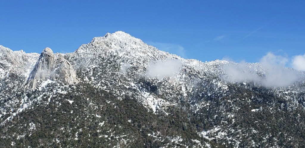
TRAIL CONDITIONS
All trails above about 5500′ are largely or completely snow-covered. By this afternoon, melting was already well underway below 7000′. Reliable tracks are currently only known to be in place for Devil’s Slide Trail through to San Jacinto Peak via Wellman Divide, and the entire Deer Springs Trail. At elevations below 10,000ft by this afternoon snow was softening rapidly, and was taking on the consistency of soft-serve ice cream even in the high country. This makes snowshoes even more valuable.
Tahquitz Peak trail from Chinquapin Flat/PCT Mile 178 has no steps to follow through the steeply angled icy snow. These icy slopes are treacherous. Currently crampons (with an ice axe) are strongly recommended. Snowshoes are not advised due to the angle of the icy snow.
Devil’s Slide Trail has a well-traveled track to follow.
The Ernie Maxwell Trail has a well-defined track to follow along its entire length.
There were no visible hiker tracks on Marion Mountain, Seven Pines, or Fuller Ridge trails, as of this afternoon.
Deer Springs Trail has an excellent snowshoe track to follow, well-traveled to Strawberry Junction, then a single set of tracks to Little Round Valley, all largely following the established trail route. Above Little Round Valley, my snowshoe track down from the Peak is very direct, steep, and would be a challenging ascent.
May Valley Road – a major component of the PCT Mile 168.5 alternate – is clear of snow [updated 17th March].
There is well-defined posthole track on the Suicide Rock Trail through the snow from Deer Springs Trail.
Spitler Peak Trail [updated 18th March] is almost clear of snow below the first creek crossing (about 6500ft elevation), but then snow cover is about 50% in the switchbacks up to the PCT. There is a well-defined track through most of this snow cover.
Current snow cover on the PCT is minimal from Miles 151 (Highway 74) to about 160, and increasingly patchy between Miles 160 and about 175 (Red Tahquitz), concentrated on north-facing slopes e.g., Spitler Peak (Mile 168) and Apache Peak (Mile 169.5-170). Note that in addition to the challenging north-east side of Apache Peak, the off-trail north side of the Apache saddle is also still largely snow-covered (also requiring spikes). Snow is then more-or-less continuous between Miles 175-191. Snow cover will become increasingly patchy between Miles 178 to 183.5 in the next few days, with the exception of the notoriously stubborn half mile just south of Annie’s Junction starting at about Mile 180.3. From Mile 183.5 to 191, snow is largely continuous, although some exposed sections of Fuller Ridge (e.g., parts of Miles 186.5-188.5) are thinning rapidly.
SNOW DEPTHS measured on 16th March 2021, are as follows. Note that current average total depth is given first, followed by added snow from the latest storm in parentheses where known. Note that there was some melting between the previous storm systems, accounting for the discrepancy between depths reported here and last weeks report. Due to strong winds accompanying the storms there is extensive drifting, especially in the trails. Altitudes are approximate.
San Jacinto Peak (10810ft): 38 inches (4 inches new snow in latest storm)
Little Round Valley (9800ft): 29 inches
Wellman Divide (9700ft): 19 inches (3 inches new)
Annie’s Junction/approx. PCT Mile 181.8 (9070ft): 24 inches (3 inches new)
Deer Springs Trail at Seven Pines Trail junction (8700ft): 14 inches
Strawberry Junction (8100ft): 8 inches
Saddle Junction/approx. PCT Mile 179.9 (8070′): 17 inches (3 inches new)
Deer Springs Trail at Suicide Rock Trail junction (6950ft): 3 inches
Devil’s Slide Trail at Humber Park (6550′): 12 inches (2.5 inches new, but melting rapidly)
Idyllwild (at 5550′): 6 inches (1.0 inch new; rapid melting was underway this afternoon)

San Jacinto Trail Report: available for everyone, funded by readers. The Report completely depends on small private donations to cover its costs. With a busy winter coinciding with a complex PCT season, every contribution is deeply appreciated. If you have found this Report useful, please consider visiting the Donate page. Thank you.
sanjacjon Uncategorized Leave a comment 6 MinutesEdit”Snow and trail update 16th March 2021″
Snow storm summary 12th March 2021
[UPDATE 15th March 2021 @ 0950: A minor snow storm is forecast for this afternoon and evening. We have just returned from Saddle Junction (8100ft, PCT Mile 179) where it was briefly snowing lightly, with occasional drizzle below 6500ft. About 2-5 inches are expected at all elevations above 4500ft. A comprehensive report of high country conditions is planned for tomorrow evening.]
[For additional information specific to the PCT, please see the Pacific Crest Trail report, best used in conjunction with this latest general update.]
Our tenth snow storm of winter 2020/21 fell largely on Wednesday 10th March, with some on/off light snow continuing through much of yesterday,Thursday 11th. In Idyllwild at 5550ft, 12 inches fell in total, ranging through to 17 inches measured today at San Jacinto Peak (10,810ft). Measurements for other locations, with cumulative depths, are given at the foot of this post.
I had a very enjoyable, if occasionally challenging, hike to San Jacinto Peak today, breaking trail the entire way with snowshoes on the east side trails (Devil’s Slide, PCT, Wellman, and Peak trails). Snow conditions were excellent for snowshoeing, especially below 9000ft, with snowshoes only sinking in a few inches rather than feet, but conditions became more spongy higher up. I recorded a YouTube video in late morning at the Peak under spectacular, partly cloudy, skies.
Yet again, there was little difference in snowfall between the mid and upper elevations, probably because the high country was above the clouds for some of the storm system. Although excellent tracks are in place on a few major trails (discussed below), very cautious navigation is strongly recommended everywhere.
I had a few small snowflakes falling on me most of the late morning and early afternoon from moody cumulus clouds around the mountains. As I descended Devil’s Slide Trail into Strawberry Valley in mid afternoon, this turned into a more persistent light snow for an hour or so, accumulating to just over an inch in Idyllwild. This was probably insufficient snowfall to significantly alter trail conditions on the handful of broken tracks in the high country.
Snow depths are currently ideal for snowshoeing everywhere above about 5000ft, potentially lower on less exposed trails for the next day or two. With rapid melting expected after Tuesday 16th March, and compaction caused by freeze-thaw cycles and hiker traffic, conditions will deteriorate for snowshoeing over the next few days, especially on more heavily traveled trails below 8000ft. Nevertheless, snowshoes will be invaluable anywhere off trail above about 8000ft for the foreseeable future. In addition to snowshoes, and as conditions change, spikes are strongly recommended for the foreseeable future everywhere above about 4500ft. They will be especially valuable on well-consolidated tracks (e.g., Devil’s Slide and Deer Springs trails) on colder mornings when conditions are icy, and for descending.
Snow depths are currently insufficient for significant avalanche risk in the high country, with the exception of the traditionally vulnerable locations on the north faces of San Jacinto and Tahquitz peaks.
Hikers should be prepared for temperatures at or below freezing in the high country, and well below freezing when considering wind chill effects, at least until Wednesday 17th, when temperatures at mid and upper elevations will warm to well above seasonal norms.
The USFS gate at Humber Park was closed early on the morning of 10th March. There is legal parking for nine vehicles only just below the gate. USFS has ticketed illegally parked vehicles.. On some snowy weekends this year the uppermost 0.1 mile of Fern Valley Road has been closed by CHP at its junction with Forest Drive. Although parking is normally legal along Forest Drive, CHP has periodically towed vehicles parked along that street. Exercise considerable caution when parking anywhere in this area.
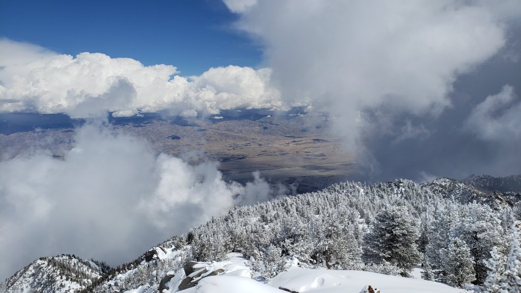
WEATHER Temperatures will remain at or below average for the next four days, and melting of snow will be minimal above about 6000ft. A light dusting of snow is possible on Monday 15th above about 5000ft, with rain possible around and below that elevation. Very strong winds the same day will cause heavy drifting, potentially obscuring broken trails and complicating navigation. A dramatic warming trend starts on Wednesday 17th, with very rapid snowmelt expected at all elevations for at least a week.
At San Jacinto Peak (10,810ft/3295m) today, Friday 12th March 2021 at 1120 the air temperature was 10.2°F (-12°C), with a windchill temperature of 3.4°F (-16°C), 100% relative humidity, and a light SW wind sustained at 2 mph gusting to 10.8 mph.
At the Peak on Monday 8th March 2021 at 0840 the air temperature was 27.0°F (-3°C), with a windchill temperature of 9.9°F (-12°C), 29% relative humidity, and a bitter due West wind sustained at 12 mph gusting to 22.8 mph.
TRAIL CONDITIONS
All trails above about 4000′ are heavily or moderately snow-covered. Snow melt is expected to be minimal for the next few days, so this situation will be largely unchanged, especially above 6000ft. Currently very few major trails have been traveled.
The east side trails from Humber Park to San Jacinto Peak – Devil’s Slide, Saddle Junction to Annie’s Junction, Wellman, and Peak trails – all have a well-defined snowshoe track to follow.
There were no visible hiker tracks on Willow Creek Trail, or the PCT south from Saddle Junction (i.e., toward Tahquitz Peak), as of this afternoon, with a partial snowshoe track at the start of the Caramba Trail.
Tahquitz Peak trail from Chinquapin Flat/PCT Mile 178 currently has no steps to follow through the steeply angled icy snow.. These icy slopes are notoriously treacherous. Currently crampons with an ice axe (and knowledge of how to use this equipment) are required. Snowshoes are not advised due to the angle of the icy snow.
The Ernie Maxwell Trail has a well-defined track to follow through the snow.
SNOW DEPTHS measured on 12th March 2021 are as follows. Note that current average total depth is given first, followed by added snow from the latest storm in parentheses. Due to strong winds accompanying the storm there is extensive drifting, especially in the trails. Altitudes are approximate.
San Jacinto Peak (10810ft): 35 inches (17 inches new snow in latest storm)
Wellman Divide (9700ft): 18 inches (15 inches new)
Annie’s Junction/approx. PCT Mile 181.8 (9070ft): 24 inches (18 inches new)
Saddle Junction/approx. PCT Mile 179.9 (8070′): 17 inches (15 inches new)
Devil’s Slide Trail at Humber Park (6550′): 14 inches (14 inches new, but snowing again this afternoon)
Idyllwild (at 5550′): 12 inches (all new; another inch added so far this afternoon)
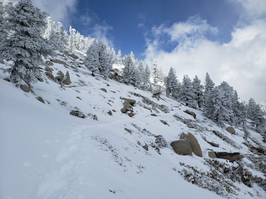

San Jacinto Trail Report: available for everyone, funded by readers. While labor and time is volunteered, this Report completely depends on small private donations to cover its costs. As a busy winter transitions into a complex northbound PCT season, every contribution is invaluable. If you have found this Report useful, please consider visiting the Donate page. Thank you.
sanjacjon Uncategorized Leave a comment 5 MinutesEdit”Snow storm summary 12th March 2021″
Minor snow storm update 4th March 2021
[UPDATE 11th March @ 0950: It has snowed lightly from pre-dawn yesterday into this morning, with 11.5 inches accumulating in Idyllwild (at 5550ft). The high country was periodically on the fringe of the cloud, and consequently Long Valley (8600ft) has about 12 inches. The system was a cold one, with snow down to 4000ft, i.e. covering the entire PCT in the San Jacinto mountains from between Mile 151 to about Mile 200. The snow level was at 4500ft on Skyline Trail early this morning (thanks to Florian Boyd). The gate at Humber Park was closed at 0750 yesterday morning, but nine legal parking spaces remain in the area just below the gate. The next detailed Report is expected tomorrow evening, Friday 12th.]
[For information specific to the Pacific Crest Trail, please see the dedicated PCT report, best used in conjunction with the most recent detailed update, available here.]
This morning we broke trail to San Jacinto Peak via Devil’s Slide, Wellman, and Peak trails, descending the same way, to check on the effects of the minor snow storm that passed through yesterday afternoon. I recorded a video report at the Peak that covers most of the same information.
Yesterday, 3rd March 2021, it started snowing in Idyllwild at 1120 and continued until about 1830, accumulating two inches in that time (at 5550ft), although it was often barely cold enough to settle consistently. Judging by snow depths measured on our hike (detailed below) the higher peaks were above the cloud for some of the storm, with the greatest depth recorded around 9000ft. A dusting of snow down to about 4500ft in Garner Valley was visible from the high country, but that is likely largely gone by this evening.
By our descent early this afternoon, snowmelt was astoundingly rapid even by the recent standards of the San Jacinto mountains. Below about 9000ft, we spent half the descent in slush, with much of the remainder on already clearing trail. This was in stark contrast to pleasant continuous 2-4 inch snow cover early this morning. I suspect that by tomorrow afternoon, Friday 5th, which is forecast to be an unseasonably warm day, trail conditions will largely resemble the previous report from a few days ago (available here). Consequently I will not discuss specific trail conditions from this morning in any great detail here. Furthermore, conditions will again change significantly next week, with one or more moderate storm systems forecast (see Weather below), although the relatively light snows predicted may again have a limited effect on long-term conditions.
The detailed video report for PCT Miles 168-179 from 1st March will still be largely valid, as so much melting will take place by 6th March that conditions will soon be back to resembling what I found on Monday 1st. If anything, the challenging Apache Peak area is currently more tricky, with a thin, unstable layer of fresh snow sitting over, and obscuring, the pre-existing icy snow.
Currently spikes are recommended on all trails above about 6500ft. However as discussed above this situation could change significantly with substantial melting in sun-exposed slopes in the next day or so. Snowshoes are recommended only for some off-trail travel above about 9000ft. These recommendations may well change again next week.
Hikers should be prepared for temperatures below freezing in the high country, and potentially far below freezing when considering wind chill effects, especially after this weekend.
Our pre-dawn start this morning was rewarded with immaculate tracks of not one but two Mountain Lions descending for long sections of Devil’s Slide Trail, both of which started on the PCT just north of Saddle Junction (photos below). The shallow powder was perfect for preserving the tracks so well. I am fortunate to see lions on average a couple of times each year, and have found tracks and scat many dozens of times, but these were some of the cleanest and longest sets of lion prints I have seen in the San Jacinto mountains. It did not appear that the two lions traveled together, although their tracks did overlap for a couple of short segments.
WEATHER The next three days are forecast to be warmer than average for early March, especially at elevations above 7000ft, resulting in extensive melting of the fresh snow. Starting Tuesday 9th, temperatures at all elevations drop to below seasonal, accompanied by unstable weather for up to a week. Currently the greatest likelihood for snow – roughly three inches in Idyllwild, six inches at the high peaks – is on Wednesday 10th March, but with possibilities for light precipitation for several days thereafter also.
At San Jacinto Peak (10,810ft/3295m) on Thursday 4th March 2021 at 1010 the air temperature was 28.2°F (-2°C), with a windchill temperature of 13.3°F (-11°C), 41% relative humidity, and a fresh NNW wind sustained at 6 mph gusting to 13.3 mph.
At the Peak on Monday 22nd February 2021 at 0910 the air temperature was 39.3°F (4°C), with a windchill temperature of 32.2°F (0°C), 33% relative humidity, and a light SSE breeze sustained at 4 mph gusting to 6.2 mph.
TRAIL CONDITIONS
Trails above about 8600ft largely remain snow-covered. Areas below 7500ft are generally patchy or clearing of snow, with the exception of north-facing slopes (down to about 5500ft).
Tahquitz Peak trail from Chinquapin Flat/PCT Mile 178 had challenging steps to follow through the angled icy snow, but these are now likely obscured by the fresh, drifted snowfall. These icy slopes are notoriously treacherous. Currently spikes (used in conjunction with at least hiking poles, or preferably an ice axe) are essential. Do not attempt to use snowshoes due to the angle of the icy snow.
Devil’s Slide Trail is largely clear of snow to 7500′. Snow is more extensive above that elevation to Saddle Junction, but clearing rapidly. Spikes can be useful.
SNOW DEPTHS measured at east side locations on 4th March 2021 are as follows. Three numbers are given: the new snow measured from the storm on 3rd March, followed by the current average depth, then finally followed (in parentheses) by the greatest depth of this winter recorded on 31st January. Due to heavy drifting, and variable melting due to differential sun exposure, depths now vary greatly in trails especially. Altitudes are approximate.
San Jacinto Peak (10810ft): 3.5 inches, total 18 inches (40 inches on 31st January)
Wellman Divide (9700ft): 2 inches, total 5 inches (31 inches on 31st January)
Annie’s Junction (9070ft): 4 inches, total 11 inches (29 inches on 31st January)
Saddle Junction/approx. PCT Mile 179.9 (8070′): 3 inches, total 5 inches (29 inches on 31st January)
Devil’s Slide Trail at Humber Park (6550′): 2 inches, total 2 inches (22 inches on 31st January)
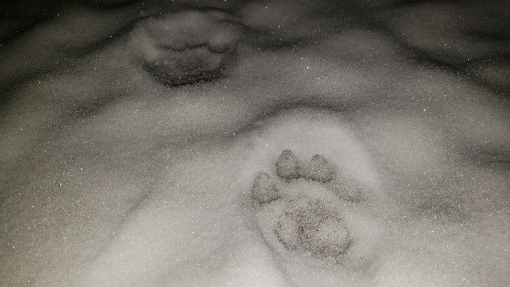

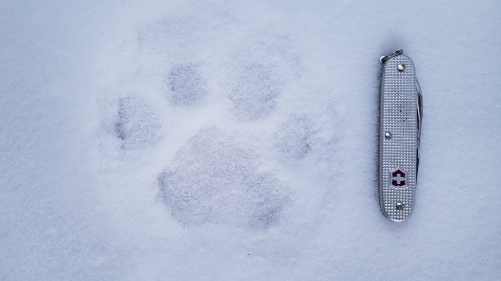
San Jacinto Trail Report: available for everyone, funded by readers. While labor and time is volunteered, this Report completely depends on small private donations to cover its direct costs. With a busy winter overlapping with an unusually complex PCT season, every contribution is invaluable and deeply appreciated. If you have found this Report useful, please consider visiting the Donate page. Thank you.
sanjacjon Uncategorized Leave a comment 5 MinutesEdit”Minor snow storm update 4th March 2021″
Trail update 1st March 2021
[UPDATED 3rd March 2021 @ 1910: It snowed in Idyllwild between 1120 and about 1830, accumulating two inches in that time. A similar depth settled in Long Valley (8600ft). At 5550ft in Idyllwild it was barely cold enough to settle consistently. Some 2-3 inches of fresh snow are expected everywhere above about 5000ft today.]
[For information specific to the Pacific Crest Trail, please see the dedicated PCT report, best used in conjunction with this most recent general update.]
Today we hiked Spitler Peak Trail to the PCT, then went northbound to Saddle Junction, before descending Devil’s Slide Trail. In a detailed video report for PCT Miles 168-179 I discuss the significant hazards in this section, especially the challenging Apache Peak area. [Special thanks to my next door neighbour Alex for his help with video production.]
Daily hikes in recent days have surveyed the PCT north of Highway 74, South Ridge, Marion Mountain, and Deer Springs trails, the north face of Tahquitz Peak, the Tahquitz area meadows, and of course routes to San Jacinto Peak.
Good news (potentially) regarding the Snow Fire closure (Miles 191-206). US Forest Service has indicated to the Trail Report that if there is no new major weather impact in this area during March, the Pacific Crest Trail through this fire closure area will likely reopen in April.
Melting has been steady at all elevations with several recent days of temperatures above average. Sun-exposed slopes in particular are clearing, with conditions more reminiscent of a “normal” April or May. Conditions will change in the next few days with minor storm systems forecast (see Weather below), although the light snows predicted may have a limited and short-term effect on conditions.
Spikes are recommended on all well-traveled trails above about 7500ft (lower in places discussed below), especially in the morning and for descending, as established trails are now compacted by hiker traffic and freeze-thaw cycles. Snowshoes are recommended only for some off-trail travel above about 9000ft, mainly afternoons when snow is softer. These recommendations will likely change later this week.
Hikers should be prepared for temperatures below freezing in the high country, and potentially far below freezing when considering wind chill effects.
The Palm Springs Aerial Tramway reopened on 18th February, with reduced days, hours, and capacity. See their website for details.
The USFS gate at Humber Park reopened on 26th February, as did gates at South Ridge Road and May Valley Road (Cowbell Alley).
The Idyllwild ranger station of Mount San Jacinto State Park reopened on 6th February, and the adjacent campground reopened on 12th February. Wilderness camping in the State Park has also reopened, see the State Park website for further information.
WEATHER A minor storm system is forecast for Wednesday 3rd, with a snow level around 6000ft, and a few inches of snow predicted for the highest peaks. Rainfall at mid elevations will be light (<0.25in). Next week (Monday 8th onwards) is forecast to be very unsettled, with light precipitation possible on several days, and likely much colder with a freeze level below 5000ft on multiple days. In between the systems on 4th-7th, temperatures will swing to above seasonal, creating freeze-thaw conditions, but also melting fresh thin snow cover very rapidly.
February 2021 was the driest February recorded in the high country of the San Jacinto mountains since records began (in the 1940s in Idyllwild, in the 1960s in the high country), with only one very minor storm producing 1-2 inches of snow on 12th. February is typically one of the two wettest months of the year. The previous driest February was, alarmingly, in 2020.
At San Jacinto Peak (10,810ft/3295m) on Monday 22nd February 2021 at 0910 the air temperature was 39.3°F (4°C), with a windchill temperature of 32.2°F (0°C), 33% relative humidity, and a light SSE breeze sustained at 4 mph gusting to 6.2 mph.

TRAIL CONDITIONS
Trails above about 8600ft remain extensively snow-covered. Areas below 7500ft are generally very patchy or clear of snow, with the exception of north-facing slopes (down to about 6500ft). Areas between those elevations are variably snow-covered, but largely clear on sun-exposed slopes.
Tahquitz Peak trail from Chinquapin Flat/PCT Mile 178 has challenging steps to follow through the angled icy snow. These icy slopes are notoriously treacherous. Currently spikes (used in conjunction with at least hiking poles, or preferably an ice axe) are essential. Do not attempt to use snowshoes due to the angle of the icy snow.
Devil’s Slide Trail is almost clear of snow to 7700′ with a few dirt-covered icy snow patches remaining. Snow is more extensive above that elevation to Saddle Junction, but clearing rapidly. Spikes can be useful.
Deer Springs Trail is basically clear of snow up to Strawberry Junction and beyond to about 8600ft, but then snow is largely continuous from there to San Jacinto Peak. Above Little Round Valley the posthole track through the snow does not follow the trail route to San Jacinto Peak, and is steep and direct. Spikes are useful, and invaluable for descending, as snow is icy and compacted.
Marion Mountain Trail has extensive, very icy, snow cover to the PCT/Deer Springs Trail junction. Snow cover is roughly 40% below 7000ft and about 50% above 8500ft, but is nearly continuous between those elevations. Spikes are strongly recommended.
Fuller Ridge Trail has not be traveled since the last snow (late January) and there are no tracks to follow.
Seven Pines Trail has had no visible hiker traffic this winter, with no tracks or trail to follow. Indeed this trail has been hiked very little since November 2018. Extremely cautious navigation is recommended for those who are not very familiar with hiking this trail. The Forest Service closure of Dark Canyon Road continues, and there is no vehicular access to Seven Pines trailhead.
The Ernie Maxwell Trail is almost completely clear of ice and snow, a couple of patches remain near Humber Park. Spikes are not required.
South Ridge Trail is essentially clear to Old Lookout Flat at 7600ft, with just a few tiny icy patches below 7000ft. Snow cover averages 30% on the traverse at 7600-7800ft, and then only 10% from there to Tahquitz Peak. Spikes can be useful for descending the longer icy patche close to Tahquitz Peak. South Ridge Road (now open) is basically clear, with a few tiny ice patches remaining.
Skyline Trail is clear of snow to near the start of the Traverse at about 7400ft, thereafter snow is fairly shallow but largely continuous to Grubb’s Notch (8600ft). There is a well-worn but icy track to follow, spikes are recommended.
Current snow cover on the PCT is minimal from Miles 151 (Highway 74) to about 160, and patchy but challenging between Miles 160 and about 175 (Red Tahquitz), mainly concentrated on north-facing slopes e.g., Spitler Peak (Mile 168) and Apache Peak (Mile 169.5-170), but also with many small but tricky patches elsewhere. Note that in addition to the challenging north-east side of Apache Peak, the off-trail north side of the Apache saddle is also still largely snow-covered (also requiring spikes). Snow is then almost continuous between Miles 175-178. Snow cover is increasingly patchy and limited between Miles 178 to 183.5, with the exception of the notoriously stubborn half mile just south of Annie’s Junction at about Mile 181. From Mile 183.5 to 191, snow is largely continuous, although some short exposed sections of Fuller Ridge (e.g., within Miles 186.5-188.5) are clear or thinning rapidly.
Spitler Peak Trail is basically clear of snow, with just a couple of tiny icy patches remaining.
Cedar Spring Trail is clear of snow from Morris Ranch Road to the PCT, with some small patches remaining down to the spring itself.

San Jacinto Trail Report: available for everyone, funded by readers. While labor and time is volunteered, this Report completely depends on small private donations to cover its direct costs. With a busy winter overlapping with an unusually complex PCT season, every contribution is invaluable and deeply appreciated. If you have found this Report useful, please consider visiting the Donate page. Thank you.
sanjacjon Uncategorized Leave a comment 6 MinutesEdit”Trail update 1st March 2021″
Snow and trail update 24th February 2021
[UPDATE Friday 26th February: Forest Service reopened gates at Humber Park, South Ridge Road (5S11), and May Valley Road (5S21) today.]
[For information specific to the Pacific Crest Trail, please see the dedicated PCT report, best used in conjunction with this most recent general update.]
We have continued to hike daily on the mountain this year, with many recent hikes focused on subsections of the PCT, including the Spitler area on 21st. I had an easy ascent of San Jacinto Peak on 22nd, on firm icy snow up the east side trails via Devil’s Slide (no spikes required on the ascent, but used on much of the descent). Barring a significant change to the forecast, the very minor storm that passed through on Friday 12th February will be our only precipitation of what is normally one of the wettest months of the year.
Melting has been steady at all elevations with several recent days of temperatures well above average. Sun-exposed slopes in particular are starting to clear, with conditions more reminiscent of a “normal” April or May. At San Jacinto Peak on 22nd, I measured an average of about 19 inches, a loss of nearly one foot in a week. Spikes are recommended on all well-traveled trails above about 7500ft (lower in places discussed below), especially in the morning and for descending, as established trails are now compacted by hiker traffic and freeze-thaw cycles. Snowshoes are recommended only for some off-trail travel above about 9000ft, mainly afternoons when snow is softer.
Hikers should be prepared for temperatures at or below freezing in the high country, and potentially well below freezing when considering wind chill effects (see below for temperatures recorded recently at San Jacinto Peak).
The Palm Springs Aerial Tramway reopened on 18th February, with reduced days, hours, and capacity. See their website for details.
The Idyllwild ranger station of Mount San Jacinto State Park reopened on 6th February, and the adjacent campground reopened on 12th February. Wilderness camping in the State Park has also reopened, see the State Park website for further information.
WEATHER Temperatures well above seasonal will largely continue this week, before dropping to around (or even slightly below) seasonal after Saturday 27th, and continuing into March. Minor storm systems are possible around 2nd-3rd March, perhaps including a light snowfall in the high country.
February has historically been one of the two wettest months (along with January) in the San Jacinto mountains. With only one very minor storm on 12th this year, February 2021 is destined to be even drier in the high country than February 2020, which was previously the driest February recorded at higher elevations since consistent records began (in the 1940s in Idyllwild, in the 1960s in the high country).
At San Jacinto Peak (10,810ft/3295m) on Monday 22nd February 2021 at 0910 the air temperature was 39.3°F (4°C), with a windchill temperature of 32.2°F (0°C), 33% relative humidity, and a light SSE breeze sustained at 4 mph gusting to 6.2 mph.
At the Peak on Monday 15th February 2021 at 0855 the air temperature was 30.1°F (-1°C), with a windchill temperature of 12.9°F (-10°C), 69% relative humidity, and a gusty NNW wind sustained at 14 mph gusting to 26.1 mph.
TRAIL CONDITIONS
All trails above about 8600ft remain extensively snow-covered. Areas below 7500ft are patchy or rapidly clearing of snow, with the exception of north-facing slopes (down to about 6500ft). Areas between those elevations are largely snow-covered, but with clearing on sun-exposed slopes.
Tahquitz Peak trail from Chinquapin Flat/PCT Mile 178 has challenging steps to follow through the angled icy snow. These icy slopes are notoriously treacherous. Currently spikes (used in conjunction with at least hiking poles, or preferably an ice axe) are essential. Do not attempt to use snowshoes due to the angle of the icy snow.
Devil’s Slide Trail is largely clear of snow to 7700′ with a few extended icy snow patches remaining. Snow is almost continuous above that elevation to Saddle Junction. The trail is hard and icy and spikes are useful.
Deer Springs Trail is largely clear of snow up to Strawberry Junction and beyond to about 8600ft, but then snow is largely continuous from there to San Jacinto Peak. The track(s) above the Marion Mountain Trail junction are easy to follow, but are largely posthole tracks in places, and in several places do not accurately follow the true trail route. Above Little Round Valley the posthole track through the snow does not follow the trail route to San Jacinto Peak, and is steep and direct. Spikes are useful, and invaluable for descending, as snow is icy and compacted.
Marion Mountain Trail has extensive, very icy, snow cover to the PCT/Deer Springs Trail junction. Snow cover is roughly 50% below 7000ft and again above 8500ft, but is nearly continuous between those elevations. Spikes are strongly recommended.
Fuller Ridge Trail has not be traveled since the last snow (late January) and there are no tracks to follow.
Seven Pines Trail has had no visible hiker traffic this winter, nor since the most recent snowfall, with no tracks or trail to follow. Indeed this trail has been hiked very little since November 2018. Extremely cautious navigation is recommended for those who are not very familiar with hiking this trail. The Forest Service closure of Dark Canyon Road continues, and there is no vehicular access to Seven Pines trailhead.
The Ernie Maxwell Trail is almost completely clear of ice and snow, a couple of extended patches remain near Humber Park. Spikes are not required.
South Ridge Trail is essentially clear to Old Lookout Flat at 7600′, with just a few tiny icy patches low down. Snow cover averages 30% on the traverse at 7600-7800ft, and then only 10% from there to Tahquitz Peak. Spikes can be useful for descending the uppermost switchbacks close to Tahquitz Peak. South Ridge Road (currently closed) is basically clear, with a few tiny ice patches remaining.
Skyline Trail is clear of snow to about 7300ft, thereafter snow is fairly shallow but continuous to Grubb’s Notch (8600ft). There is a well-worn but icy track to follow, spikes are strongly recommended.
Current snow cover on the PCT is minimal from Miles 151 (Highway 74) to about 160, and patchy between Miles 160 and about 175 (Red Tahquitz), mainly concentrated on north-facing slopes e.g., Spitler Peak (Mile 168) and Apache Peak (Mile 169.5-170). Note that in addition to the challenging north-east side of Apache Peak, the off-trail north side of the Apache saddle is also still largely snow-covered (also requiring spikes). Snow is then more-or-less continuous between Miles 175-178. Snow cover is increasingly patchy and limited between Miles 178 to 183.5, with the exception of the notoriously stubborn half mile just south of Annie’s Junction at about Mile 181. From Mile 183.5 to 191, snow is largely continuous, although some exposed sections of Fuller Ridge (e.g., parts of Miles 186.5-188.5) are clear or thinning rapidly.
Spitler Peak Trail is basically clear of snow, with just a couple of tiny icy patches remaining.
Cedar Spring Trail is clear of snow from Morris Ranch Road to the PCT, with some small patches remaining down to the spring itself.
SNOW DEPTHS measured at east side locations on 22nd February 2021 are as follows. Note that average depth is given first, followed (in parentheses) by the greatest depth of this winter recorded on 31st January. Due to past drifting, and variable melting due to differential sun exposure, depths now vary greatly in trails especially. Altitudes are approximate.
San Jacinto Peak (10810ft): 19 inches (40 inches on 31st January)
Wellman Divide (9700ft): 6 inches (31 inches on 31st January)
Annie’s Junction (9070ft): 11 inches (29 inches on 31st January)
Strawberry Junction (8100ft): <1 inch on 19th February (24 inches on 31st January)
Saddle Junction/approx. PCT Mile 179.9 (8070′): 6 inches (29 inches on 31st January)
Devil’s Slide Trail at Humber Park (6550′): 0 inches (22 inches on 31st January)
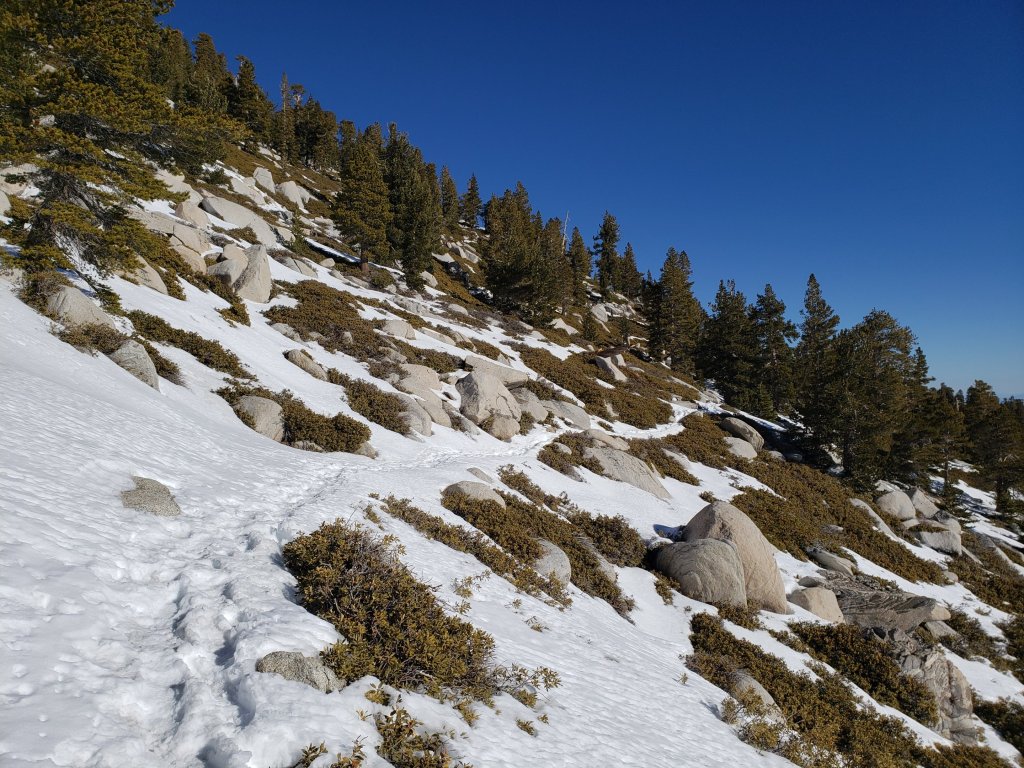
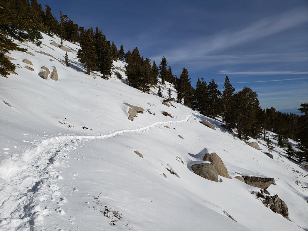

San Jacinto Trail Report: available for everyone, funded by readers. While labor and time is volunteered, this Report completely depends on small private donations to cover its direct costs. With a busy winter overlapping with an unusually complex PCT season, every contribution is invaluable and deeply appreciated. If you have found this Report useful, please consider visiting the Donate page. Thank you.
sanjacjon Uncategorized 1 Comment 6 MinutesEdit”Snow and trail update 24th February 2021″
Brief trail update 15th February 2021
[For information specific to the Pacific Crest Trail, please see the dedicated PCT report, best used in conjunction with the most recent general update.]
A brief rain and snow storm passed through on Friday 12th February. We hiked to Tahquitz Peak throughout the duration of the storm, and recorded this brief video report there.
Although the high country only received 1-2 inches of fresh powder, strong winds since (including today) have caused extensive drifting which has obscured well-worn tracks especially above 9000ft. On my ascent of San Jacinto Peak this morning up and down the east side trails via Devil’s Slide, again under spectacular cloudy skies, I had to break a few short sections of trail where drifting had been particularly extensive.
There was no sign of fresh tracks coming up to San Jacinto Peak from Little Round Valley on Deer Springs Trail, nor up from Round Valley to Wellman Divide. State Park law enforcement notified me that there are still no tracks emerging from Skyline Trail into Long Valley (a situation that will likely change soon with the reopening of the Tramway on Thursday 18th).
With temperatures recently at or slightly below average, plus several cloudy days, overall trail conditions are not substantially different from last week’s report. Please see that report for general conditions on the trails. The next ten days will see dramatic warming and much sunnier conditions, which will combine to cause rapid, widespread melting. This will be especially striking below 9000ft, and on sun-exposed slopes at all elevations. Due to warm temperatures and direct sun, snow conditions will deteriorate later this week and next weekend, likely becoming soft and sloppy.
Spikes are recommended on all trails above about 7000ft (lower in places), especially for descending, as established trails become increasingly consolidated by hiker traffic and freeze-thaw cycles. Snowshoes are recommended for off-trail travel anywhere above about 8000ft, and for trails that have yet to be traveled since the most recent snowfalls.
The Palm Springs Aerial Tramway, currently closed due to the coronavirus crisis, is scheduled to reopen on 18th February, with reduced days, hours, and capacity. See their website for details.
The Idyllwild ranger station of Mount San Jacinto State Park reopened on 6th February, and the adjacent campground reopened on 12th February. Wilderness camping in the State Park has also reopened, see the State Park website for further information.
WEATHER Temperatures at or slightly below seasonal continue until Thursday 18th, after which temperatures quickly rise to well above seasonal for the remainder of February, under clear, sunny skies.
At San Jacinto Peak (10,810ft/3295m) today, Monday 15th February 2021 at 0855 the air temperature was 30.1°F (-1°C), with a windchill temperature of 12.9°F (-10°C), 69% relative humidity, and a gusty NNW wind sustained at 14 mph gusting to 26.1 mph.
At the Peak on Tuesday 9th February 2021 at 0900 the air temperature was 29.2°F (-2°C), with a windchill temperature of 11.6°F (-11°C),34% relative humidity, and a sharp SW wind sustained at 17 mph gusting to 28.5 mph.

SNOW DEPTHS measured at east side locations on 15th February 2021 are as follows. Note that average depth is given first. For west side locations, data are for 9th February as indicated, still relevant as melting has been minimal in the past week. Recent measurements are followed (in parentheses) by the greatest depth of this winter recorded on 31st January. Altitudes are approximate.
San Jacinto Peak (10810ft): 30 inches (40 inches on 31st January)
Little Round Valley (9800ft): 23 inches on 9th February (32 inches on 31st January)
Wellman Divide (9700ft): 10 inches (31 inches on 31st January)
Annie’s Junction/approx. PCT Mile 181.8 (9070ft): 14 inches (29 inches on 31st January)
Deer Springs Trail at Seven Pines Trail junction (8700ft): 17 inches on 9th February (26 inches on 31st January)
Strawberry Junction (8100ft): 3-4 inches on 9th February (24 inches on 31st January)
Saddle Junction/approx. PCT Mile 179.9 (8070′): 10 inches (29 inches on 31st January)
Deer Springs Trail at Suicide Rock Trail junction (6950ft): 0-2 inches on 9th February (16 inches on 31st January)
Devil’s Slide Trail at Humber Park (6550′): 0-1 inches (22 inches on 31st January)
Idyllwild (at 5550′): 0 inches (18 inches on 31st January)
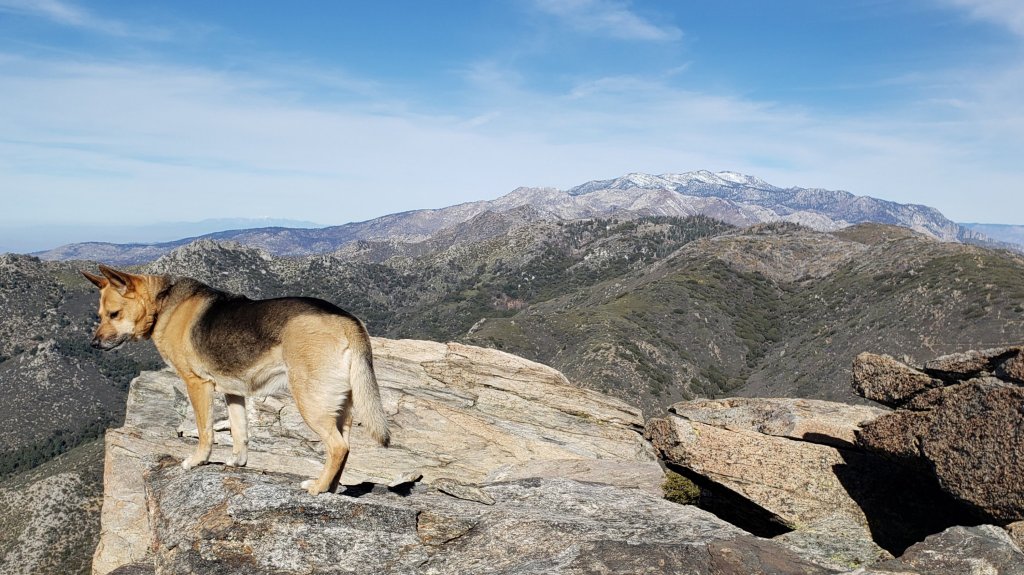
San Jacinto Trail Report: available for everyone, funded by readers. While labor and time is volunteered, this Report completely depends on small private donations to cover its direct costs. With a busy winter overlapping with an unusually complex PCT season, every contribution is invaluable.. If you have found this Report useful, please consider visiting the Donate page. Thank you.
sanjacjon Uncategorized 1 Comment 3 MinutesEdit”Brief trail update 15th February 2021″
Snow and trail update 9th February 2021
We have continued to hike every day on the mountain this year, with many recent hikes focused on subsections of the PCT. We had a pleasantly brisk ascent of San Jacinto Peak this morning under spectacular cloudy skies, on firm icy snow up the east side trails via Devil’s Slide (using spikes all the way from Humber Park), then descended the west side via Deer Springs Trail (finally removing spikes just below Strawberry Junction).
In three storms in six days ending Friday 29th January, Idyllwild received more than an entire winter’s worth of snow, 33.5 inches, in just one week (the long-term average being 32 inches per winter). In contrast, snow accumulations in the high country remain far below seasonal average. Melting has been rapid at lower and mid elevations, but slower in the high country. With cooler weather coming melting will slow to a crawl, especially above 7000ft and on slopes with limited sun exposure.
Garner Valley and areas below 5000ft are basically clear, with sun-exposed slopes below 6000ft clearing fast. Idyllwild has lost almost all of its nearly three feet of snow. At San Jacinto Peak this morning, I measured about 29 inches, a loss of 25% in ten days. Spikes are strongly recommended on all well-traveled trails above 7000ft (lower in places), especially in the morning and for descending, as established trails are now well consolidated by hiker traffic and freeze-thaw cycles. Snowshoes are recommended for off-trail travel anywhere above about 8000ft, and for trails that have yet to be traveled since the most recent storms.
Many major trails have now been traveled, and conditions are discussed below for specific trails where known. In addition to those, there are tracks around the Tahquitz area meadows on Willow Creek and Caramba trails, and to Chinquapin Flat. There are no tracks emerging at Wellman Divide on the Round Valley Trail. Cautious navigation continues to be recommended everywhere. Snow depths measured today, and compared with ten days ago, are listed at the foot of this posting.
Hikers should be prepared for temperatures near or below freezing in the high country, and well below freezing when considering wind chill effects (see below for temperatures recorded recently at San Jacinto Peak).
The Palm Springs Aerial Tramway, currently closed due to the coronavirus crisis, is scheduled to reopen on 18th February, with reduced days, hours, and capacity. See their website for details.
The USFS gate at Humber Park is closed. There is legal parking for nine vehicles just below the gate (assuming the road below that point is open). Vehicles parked there on recent weekends have been issued with warning notices by California Highway Patrol, and those parked illegally towed. Otherwise on weekends this year (and some weekdays) the uppermost 0.1 mile of Fern Valley Road has been closed by CHP at its junction with Forest Drive. Although parking is normally legal along Forest Drive, CHP has towed vehicles parked along that street on some recent weekends. Exercise considerable caution when parking anywhere in this area. The gate on South Ridge Road is also closed.
The Idyllwild ranger station of Mount San Jacinto State Park reopened on 6th February, and the adjacent campground is expected to reopen on 12th February. Wilderness camping in the State Park has also reopened, see the State Park website for further information.

WEATHER Temperatures well above seasonal this past weekend lead to substantial widespread snowmelt in the first week of February. For the foreseeable future, temperatures will be roughly around seasonal averages at mid elevations, but varying much more widely at higher elevations. There is a possibility of light precipitation in the morning of Friday 12th, and again on Saturday night, 13th February. These two minor storm systems may produce a dusting of fresh snow in the high country, and a little rain at 5000-6000ft. From Thursday 18th, temperatures again swing to well above seasonal.
At San Jacinto Peak (10,810ft/3295m) today, Tuesday 9th February 2021 at 0900 the air temperature was 29.2°F (-2°C), with a windchill temperature of 11.6°F (-11°C), 34% relative humidity, and a sharp SW wind sustained at 17 mph gusting to 28.5 mph.
At the Peak on Thursday 4th February 2021 at 0930 the air temperature was 35.6°F (2°C), with a windchill temperature of 20.0°F (-7°C), 23% relative humidity, and a bitter WNW wind sustained at 16 mph gusting to 30.6 mph.
TRAIL CONDITIONS
All trails above about 8300′ remain completely snow-covered. Most areas below 7500′ are patchy or rapidly clearing of snow. Areas between those elevations are largely snow-covered, but with clearing on sun-exposed slopes. Reliable tracks are now in place for most major trails including: Devil’s Slide, Deer Springs, Marion Mountain, Peak, Wellman, South Ridge, and around the Tahquitz area meadows.
Tahquitz Peak trail from Chinquapin Flat/PCT Mile 178 has challenging and indistinct steps to follow through the angled icy snow. These icy slopes are notoriously treacherous. Currently spikes at least are strongly recommended, crampons with an ice axe (and knowledge of how to use both) are preferable. Snowshoes must be avoided due to the angle of the icy snow.
Devil’s Slide Trail is slowly clearing of snow to 7500′ with about 50% cover of icy snow. Snow is almost continuous above that elevation. The trail is hard and icy and spikes are useful.
Deer Springs Trail is largely clear of snow up to the Suicide Rock trail junction (7000ft), with about 40% cover to 7800ft (about 0.5 mile below Strawberry Junction) where snow cover abruptly increases to 90%. Some snow free patches continue to 8300ft, but then snow is continuous from there to San Jacinto Peak. The track(s) above the Marion Mountain Trail junction are easy to follow, but are largely posthole tracks, and in several places do not accurately follow the true trail route. Above Little Round Valley the posthole track through the snow does not remotely follow the trail route to San Jacinto Peak, and is steep and direct (my fault I’m afraid). Spikes are very useful, and invaluable for descending, as snow is icy and compacted.
Marion Mountain Trail has patchy snow to 7500ft. There is continuous icy snow from there to the PCT/Deer Springs Trail junction. Spikes are recommended.
Fuller Ridge Trail has not be traveled since the last snow (late January) and there are no tracks to follow.
Seven Pines Trail has had no visible hiker traffic this winter, nor since the most recent snowfall, with no tracks or trail to follow. Indeed this trail has been hiked very little since November 2018. Extremely cautious navigation is recommended for those who are not very familiar with hiking this trail. The Forest Service closure of Dark Canyon Road continues, and there is no vehicular access to Seven Pines trailhead.
The east side trails from Humber Park to San Jacinto Peak – Devil’s Slide, Saddle Junction to Annie’s Junction, Wellman, and Peak trails – all have a very well-defined snowshoe track to follow, although the route does not exactly follow the established trail routes in the high country in places.
The Ernie Maxwell Trail is now largely clear in its lower 1.8 miles. Icy snow covers about 30% of the upper part closest to Humber Park. Spikes remain helpful especially for descending in the morning.
South Ridge Trail is largely clear to Old Lookout Flat at 7600′. Snow cover is patchy from there to the Peak, becoming more continuous on the upper switchbacks close to the Peak. Spikes are recommended, especially for descending. South Ridge Road (currently closed) is largely clear of ice, with a few lengthy patches remaining.
There is well-defined track on the Suicide Rock Trail through the patchy snow from Deer Springs Trail to the top of Suicide Rock.

SNOW DEPTHS measured on 9th February 2021, are as follows. Note that average depth is given first, followed (in parentheses) by the greatest depth of this winter recorded ten days earlier on 31st January. Altitudes are approximate.
San Jacinto Peak (10810ft): 29 inches (40 inches on 31st January)
Little Round Valley (9800ft): 23 inches (32 inches on 31st January)
Wellman Divide (9700ft): 8 inches (31 inches on 31st January)
Annie’s Junction/approx. PCT Mile 181.8 (9070ft): 18 inches (29 inches on 31st January)
Deer Springs Trail at Seven Pines Trail junction (8700ft): 17 inches (26 inches on 31st January)
Strawberry Junction (8100ft): 3-4 inches (24 inches on 31st January)
Saddle Junction/approx. PCT Mile 179.9 (8070′): 10 inches (29 inches on 31st January)
Deer Springs Trail at Suicide Rock Trail junction (6950ft): 0-2 inches (16 inches on 31st January)
Devil’s Slide Trail at Humber Park (6550′): 1-3 inches (22 inches on 31st January)
Idyllwild (at 5550′): <2 inches (18 inches on 31st January)


San Jacinto Trail Report: available for everyone, funded by readers. While all labor and time is volunteered, this Report completely depends on small private donations to cover its direct costs. With a busy winter overlapping with an unusually complex PCT season, every contribution is invaluable and deeply appreciated. If you have found this Report useful, please consider visiting the Donate page. Thank you.
sanjacjon Uncategorized 1 Comment 6 MinutesEdit”Snow and trail update 9th February 2021″
Snow and trail summary 1st February 2021
[UPDATED 4th February: Melting has been very rapid at low and mid elevations, steadier in the high country. Garner Valley and areas below 5000ft are basically clear, with sun-exposed slopes below 6000ft clearing fast. Idyllwild has lost 75% of its three feet of snow. At San Jacinto Peak this morning, I measured about 34 inches, a loss of 15%. Spikes are invaluable on all well-traveled trails above at least 6000ft, snowshoes are recommended above 8000ft, and are essential for off-trail travel anywhere above 7000ft. Melting will accelerate rapidly, as temperatures are forecast to be about ten degrees above average at all elevations for the next 5-6 days.]
Our seventh snow storm of winter 2020/21, and the third in one week, came on Friday 29th January. In Idyllwild at 5550ft, seven inches fell overnight, with an additional 5.5 inches during the daylight hours of Friday. In combination with back-to-back storms the previous weekend (discussed here), Idyllwild received more than an entire winter’s worth of snow, 33.5 inches, in just one week (the long-term average being 32 inches per winter).
Conditions on my ascent to San Jacinto Peak on 31st January are described in more detail in yet another overly long and rambling video discussion (I’ll learn to talk less soon I promise). I ascended via the east side trails (Devil’s Slide, Wellman, and Peak trails) and descended the west side via Deer Springs Trail. Snow conditions were greatly improved compared to just five days ago, with the fresh snow being much more consolidated and firm, with snowshoes only sinking in a few inches rather than feet.
Yet again, there was little difference in snowfall between the mid and upper elevations, with actually slightly less fresh snow in this latest storm at San Jacinto Peak (10,810ft) than in Idyllwild (at 5550ft), probably because the high country was above the clouds for some of the storm system. Snow depths measured today are listed at the foot of this posting. Although excellent tracks are in place on some major trails (discussed below), nevertheless cautious navigation is strongly recommended everywhere.
Snow depths are currently ideal for snowshoeing everywhere above about 6000ft, potentially lower on less exposed trails that will melt slowly. With rapid melting expected, and compaction caused by freeze-thaw cycles and hiker traffic, conditions will deteriorate for snowshoeing over the next few days, especially on more heavily traveled trails below 8000ft. Nevertheless, snowshoes will be invaluable anywhere off trail above about 8000ft for the foreseeable future. In addition to snowshoes, and as conditions change, spikes are strongly recommended for the foreseeable future everywhere above about 4500ft. They will be especially valuable on well-consolidated tracks (e.g., Devil’s Slide and Deer Springs trails) on colder mornings when conditions are icy, and for decsending.
Consolidation of layers in the snow should be rapid with warming temperatures and a strong February sun over the next week. The avalanche risk in the high country has diminished due to the relatively shallow snow depth, but should still be considered by anyone venturing above 9000ft or especially on to steep north-facing slopes due to the large quantity of subsurface graupel. Be aware of subsurface whoomphing noises, and significant cracking perpendicular to the slope. Current risk is in the usual locations on the north face of San Jacinto and Tahquitz peaks, but in past years has also been observed on relatively steep, less vegetated slopes, such as the Peak Trail and East Ridge Trail routes on the eastern flank of San Jacinto Peak.
Despite unseasonably warm temperatures in the high country for the next week or so, hikers should be prepared for temperatures generally below freezing in the high country, and well below freezing when considering wind chill effects.
The USFS gate at Humber Park is closed. There is legal parking for nine vehicles only just below the gate (assuming the road below that point is open). Vehicles parked there this weekend were issued with warning notices by California Highway Patrol. On weekends this year (and some weekdays) the uppermost 0.1 mile of Fern Valley Road has usually been closed by CHP at its junction with Forest Drive. Although parking is normally legal along Forest Drive, CHP has towed vehicles parked along that street on recent weekends. Exercise considerable caution when parking anywhere in this area.
The gate on South Ridge Road is closed. The unpaved section of Tahquitz View Drive has now been plowed, and there is safe parking on Tahquitz View Drive at or near the foot of South Ridge Road for a small number of vehicles.
Azalea Drive, the access road to Marion Mountain trailhead, has not been ploughed. The USFS gate about 0.5 mile below the trailhead is closed.
All camping is prohibited in Mount San Jacinto State Park, where the four wilderness camping areas in the State Park remain closed (camping is never permitted elsewhere in the State Park). Wilderness camping appears to now be permitted in the National Forest. See the State Park or Forest Service websites for further information.
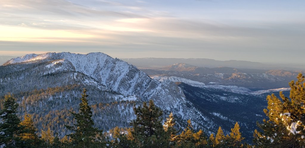
WEATHER A warming trend to temperatures slightly above seasonal (especially at higher elevations) will lead to significant melting in the first week of February. Next weekend, 6th-7th February, temperatures are currently forecast to be well above seasonal, and melting will accelerate at all elevations.
At San Jacinto Peak (10,810ft/3295m) today, Sunday 31st January 2021 at 0950 the air temperature was 37.8°F (3°C), with a windchill temperature of 31.9°F (0°C), 35% relative humidity, and a very light due West wind sustained at 2 mph gusting to 5.6 mph.
At the Peak on Tuesday 26th January 2021 at 1350 the air temperature was 9.8°F (-12°C), with a windchill temperature of -9.6°F (-23°C), 66% relative humidity, and a bitter due West wind sustained at 11 mph gusting to 14.9 mph.
TRAIL CONDITIONS
All trails above about 4500′ are snow-covered. Snow was melting rapidly this afternoon at all elevations, but especially below 6500ft. At all elevations by this afternoon snow was softening rapidly, and was taking on the consistency of soft-serve ice cream even in the high country. This makes snowshoes even more invaluable. The hikers I encountered postholing on Deer Springs Trail this afternoon were not having a good time.
There were no visible hiker tracks on Marion Mountain, Seven Pines, or Fuller Ridge trails, as of this afternoon.
The east side trails from Humber Park to San Jacinto Peak – Devil’s Slide, Saddle Junction to Annie’s Junction, Wellman, and Peak trails – all have a very well-defined snowshoe track to follow, although the route does not exactly follow the established trail routes in the high country in places.
Deer Springs Trail has an excellent snowshoe track to follow to Little Round Valley, largely accurately following the established trail route. Above Little Round Valley, my snowshoe track down from the Peak is very direct, steep, and would be a challenging ascent.
There is well-defined track on the Suicide Rock Trail through the snow from Deer Springs Trail to the top of Suicide Rock.
Tahquitz Peak trail from Chinquapin Flat/PCT Mile 178 had no steps to follow through the steeply angled icy snow as of this morning. These icy slopes are notoriously treacherous. Currently crampons with an ice axe (and knowledge of how to use both) are required. Snowshoes are not advised due to the angle of the icy snow.
South Ridge Road and upper South Ridge Trail have a track to follow to Tahquitz Peak.
The Ernie Maxwell Trail has a well-defined snowshoe track.
SNOW DEPTHS measured on 31st January 2021, are as follows. Note that current average total depth is given first, followed by added snow from the latest storm in parentheses where known. Note that there was some melting between the previous storm systems, accounting for the discrepancy between depths reported here and last weeks report. Due to strong winds accompanying the storms there is extensive drifting, especially in the trails. Altitudes are approximate.
San Jacinto Peak (10810ft): 40 inches (8 inches new snow in latest storm)
Little Round Valley (9800ft): 32 inches
Wellman Divide (9700ft): 31 inches (7 inches new)
Annie’s Junction/approx. PCT Mile 181.8 (9070ft): 29 inches (10 inches new)
Deer Springs Trail at Seven Pines Trail junction (8700ft): 26 inches
Strawberry Junction (8100ft): 24 inches
Saddle Junction/approx. PCT Mile 179.9 (8070′): 29 inches (10 inches new)
Deer Springs Trail at Suicide Rock Trail junction (6950ft): 16 inches
Devil’s Slide Trail at Humber Park (6550′): 22 inches (12 inches new, but melting rapidly)
Idyllwild (at 5550′): 18 inches (all new; although 33 inches fell, rapid melting was already underway yesterday)
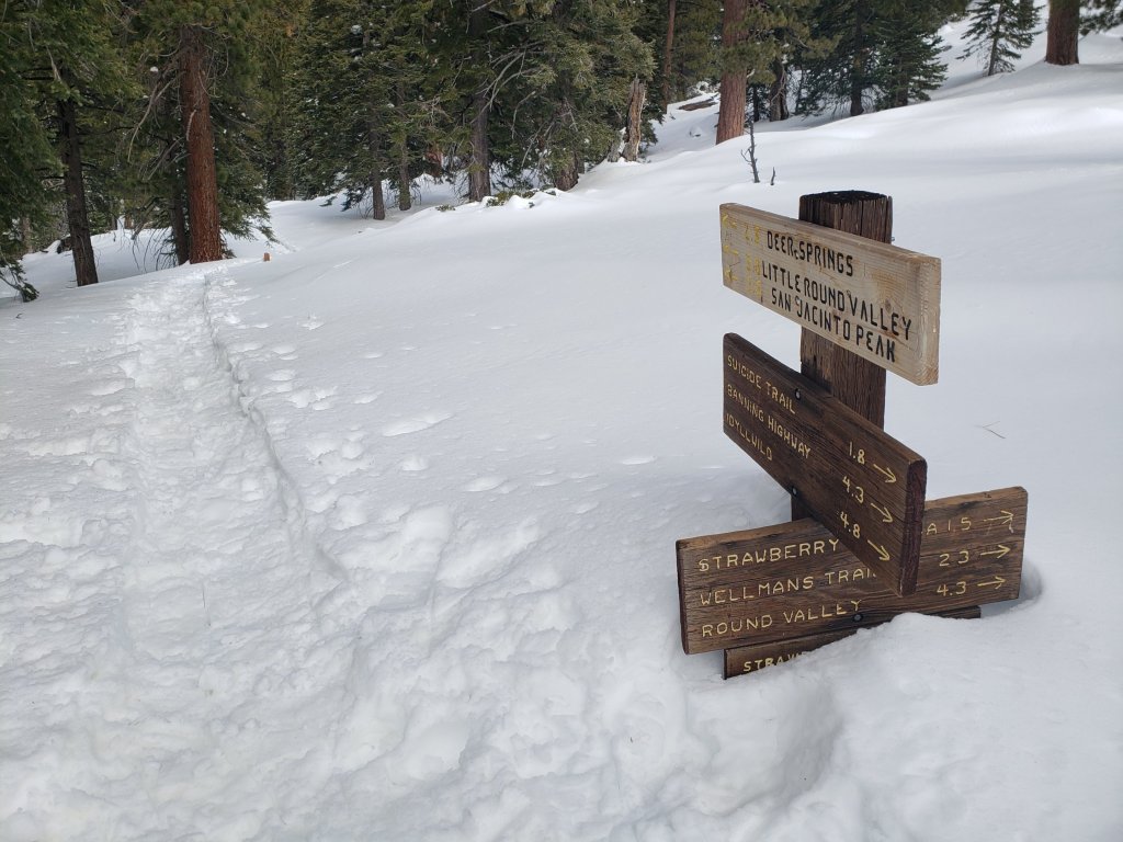
San Jacinto Trail Report: available for everyone, funded by readers. While all labor and time is volunteered, this Report completely depends on small private donations to cover its costs. Already deep into a very busy winter, every contribution is invaluable. If you have found this Report useful, please consider visiting the Donate page. Thank you.
sanjacjon Uncategorized 2 Comments 6 MinutesEdit”Snow and trail summary 1st February 2021″
Snow storm summary 26th January 2021
[UPDATED 29th January: An additional seven inches of snow fell overnight in Idyllwild (at 5550ft) and it has continued to snow on/off all day, adding 5.25 more inches. Long Valley (8600ft but on the east slope) has added only about 5-6 inches in this storm. The next full high country update is planned for Sunday evening, 31st January.]
This is a summary of conditions following the fifth and sixth snow storms of winter 2020/21, which came on consecutive days, largely overnight on 24th and 25th January. As is increasingly the trend with a rapidly changing climate in recent years, there was relatively little difference in snowfall between the mid and upper elevations, with a combined storms total of 20.75 inches measured in Idyllwild (at 5550ft) through to 26 inches at San Jacinto Peak (10,810ft). The second of the two storm systems was much colder than the first, accounting for about 75% of the snow total, and with a dusting of snow below 2000ft in places.
My ascent to San Jacinto Peak this morning is described in more detail in a video discussion available here. Overall it was unusually challenging due to substantial depth of graupel, mainly above 10,000ft. This made for exceptional postholing in snowshoes even though overall snow depths remain below average for the season.
Currently major trails have not been traveled and all are obscured by significant snowfall. Beyond Humber Park, at the time of writing, my snowshoe tracks to San Jacinto Peak are the only traveled high country trail. On my descent this evening, I was surprised to see no other tracks up to Saddle Junction. The significance of this is that there are currently no tracks on Willow Creek Trail, to Chinquapin Flat or Tahquitz Peak, or around the meadows. Very cautious navigation is strongly recommended everywhere. Snow depths measured today are listed at the foot of this posting, but note that due to drifting, snow can be deeper in the trails themselves.
Snow depths are currently ideal for snowshoeing everywhere above about 5000ft, potentially lower on less exposed trails that will melt slowly. Elsewhere (and in addition), spikes are recommended for the foreseeable future as established trails become consolidated by hiker traffic and undergo freeze-thaw cycles.
There is now an avalanche risk in the high country. Graupel is inherently unstable, especially when the layer is so thick, and this will be exacerbated by a heavy fresh snowfall on 28th-29th January. On my descent of the East Ridge of San Jacinto Peak this afternoon I had several major whoomphing events underfoot (yes, that is actually a technical avalanche term!) due to major subsurface cracking. Current risk is in the usual locations on the north face of San Jacinto and Tahquitz peaks, but may spread to other relatively steep, less vegetated slopes, such as the eastern flank of San Jacinto Peak.
Hikers should be prepared for temperatures below freezing in the high country, and far below freezing when considering wind chill effects.
The USFS gate at Humber Park is closed. There is legal parking for nine vehicles only just below the gate. Weekends this month (and some weekdays) the uppermost 0.1 mile of Fern Valley Road has also been closed at its junction with Forest Drive. Although parking is normally legal along Forest Drive, CHP has towed vehicles parked along that street on recent weekends.
The gate on South Ridge Road is also closed. Due to snow berms there is currently no parking on Tahquitz View Drive at the foot of South Ridge Road.
Azalea Drive, the access road to Marion Mountain trailhead, has not been ploughed.
The Deer Springs trailhead at Highway 243 has not been ploughed. There is safe roadside parking for only 12-14 vehicles.
All developed and yellow post camping is closed in the San Jacinto Ranger District of the San Bernardino National Forest. This was initially due to exceptional fire risk, but more recently due to the coronavirus crisis. All camping is prohibited in Mount San Jacinto State Park, where the four wilderness camping areas in the State Park remain closed (camping is not permitted elsewhere in the State Park). Wilderness camping appears to now be permitted in the National Forest. See the State Park or Forest Service websites for further information.
WEATHER Temperatures are forecast to remain below seasonal for at least the next week, with freezing conditions every night above about 5000ft. Snow melt will be very limited, and conditions will be icy. Another storm system arrives on the night of Thursday 28th, with snow continuing Friday 29th. This will be the warmest of the three recent storms, with a further 6-8 inches of snow forecast everywhere above about 5500ft (with 12+ inches possible in the high country) but significant rainfall below that elevation.
At San Jacinto Peak (10,810ft/3295m) today, Tuesday 26th January 2021 at 1350 the air temperature was 9.8°F (-12°C), with a windchill temperature of -9.6°F (-23°C), 66% relative humidity, and a bitter due West wind sustained at 11 mph gusting to 14.9 mph.
TRAIL CONDITIONS
All trails above about 4000′ are snow-covered. The light dusting of snow below that elevation was melting rapidly this afternoon.
Tahquitz Peak trail from Chinquapin Flat/PCT Mile 178 has no steps to follow through the steeply angled icy snow. These icy slopes are notoriously treacherous. Currently crampons with an ice axe (and knowledge of how to use both) are required. Snowshoes are not advised due to the angle of the icy snow.
The Ernie Maxwell Trail has a well-defined snowshoe track. The lower trailhead on Tahquitz View Drive is not currently accessible to vehicles as the road is unploughed.
Devil’s Slide Trail has a well-defined snowshoe track to follow.
SNOW DEPTHS measured on 26th January 2021, are as follows. Note that average total depth is given first, followed by depth from latest storms in parentheses. Due to strong winds accompanying the storms there is extensive drifting, especially in the trails. Altitudes are approximate.
San Jacinto Peak (10810′): 34 inches (26 inches new in latest storms)
Wellman Divide (9700′): 24 inches (18 inches new)
Annie’s Junction/approx. PCT Mile 181.8 (9070′): 23 inches (17 new)
Saddle Junction/approx. PCT Mile 179.9 (8070′): 21 inches (20 inches new)
Devil’s Slide Trail at Humber Park (6550′): 18 inches (17 inches new)
Idyllwild (at 5550′): 20.75 inches (all new)
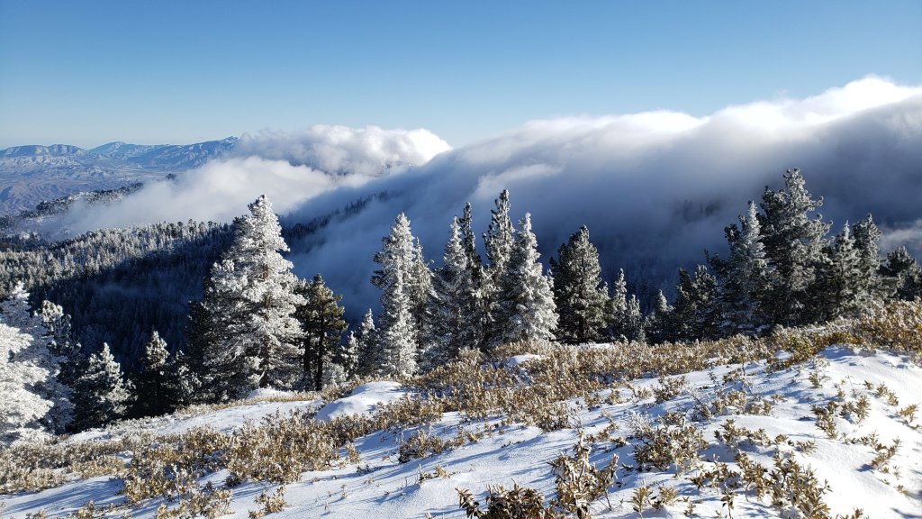
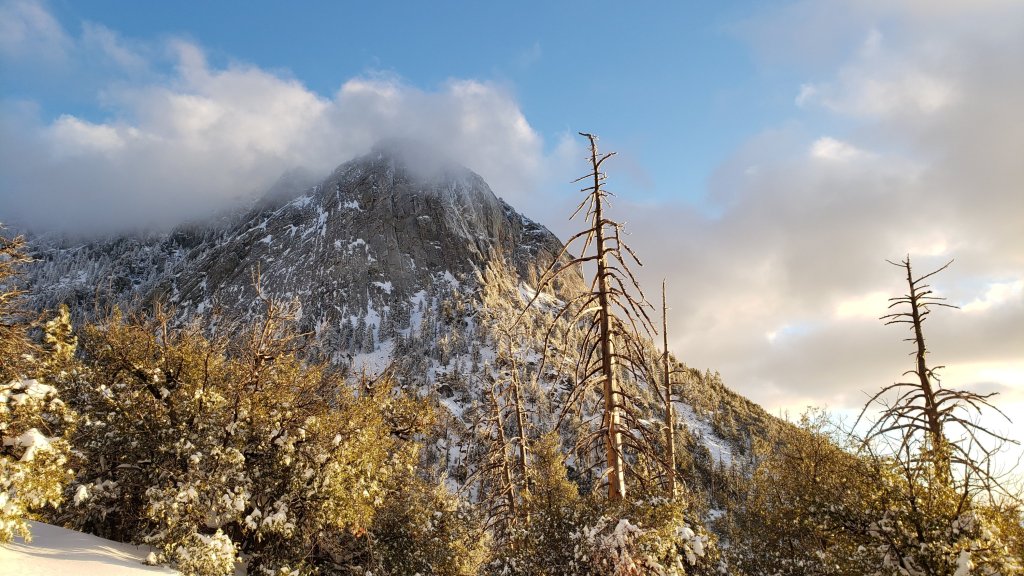
San Jacinto Trail Report: available for everyone, funded by readers. While all labor and time is volunteered, this Report completely depends on small private donations to cover its costs. In an especially challenging year, and with a busy winter already well underway, every contribution is invaluable. If you have found this Report useful, please consider visiting the Donate page. Thank you.
sanjacjon Uncategorized 1 Comment 5 MinutesEdit”Snow storm summary 26th January 2021″
Weather update 21st January 2021
[UPDATE 25th January: A further 9.0 inches of snow fell in Idyllwild overnight, with two more inches accumulating this morning. The air temperature has not exceeded 26°F in Idyllwild today. All trails above 4000ft are heavily obscured by snow. The next detailed high country update will be tomorrow evening, 26th January.]
[UPDATE 24th January: This morning we measured storm totals of 5.75 inches of snow in Idyllwild and 7.0 inches at Devil’s Slide trailhead in Humber Park, the result of steady snowfall yesterday afternoon and evening. Snow levels were down close to 4000ft in Garner Valley and 4500ft on Skyline Trail (thanks to Florian Boyd for the latter observation). Long Valley (8600ft) added about four inches for a total of six. A further 10 inches is possible tonight and tomorrow everywhere above about 4000ft, with dusting as low as 3000ft.]
[UPDATE 23rd January: Idyllwild awoke to 0.5 inch of fresh snow overnight. All three of us had a lovely hike from home up South Ridge Trail, finding about 1.0 inch fresh snow above 6500ft, and 1.5 inches at Tahquitz Peak. Strong overnight winds meant drifts a few inches deep in patches in the trail. The high country was visibly above the cloud all morning. It lightly snowed on us during the descent, but in Idyllwild it is barely cold enough to accumulate. Another 3-4 inches are forecast to accumulate by dusk tonight at all elevations.]
Exceptionally strong Santa Ana winds on 19th-20th January were accompanied by a very minor snowfall. Our rapid ascent of San Jacinto Peak this morning involved minimal postholing, as snow was only an inch deep to about 8500ft, and with little more than two inches of fresh powder in trails up to the highest peaks. As another bonus, it was remarkably mild and windless at the Peak.
With such strong accompanying winds, the snow was plastered to all surfaces, likely giving the impression from afar of much greater snowfall. By late morning today very rapid melting was underway, with the trails more slush than snow, much of the vegetation at all elevations clearing, and the light dusting down to 7000ft had already retreated to nearer 8000ft by noon.
I recorded a video discussion at the Peak, partly describing current conditions and the storm of the previous day, but mainly regarding the genuinely wintry weather coming over the next week or so.
For an approximation of trail conditions for tomorrow, see the previous report. Snow depths reported therein remain relevant, with the addition of an inch or so from the most recent storm. Starting Saturday 23rd, fresh snowfall will change conditions significantly. Also see that prior report for details of the various coronavirus restrictions and closures.
Spikes are recommended for some sections of all trails above about 8000ft, especially in the early morning and/or for descending. Spikes may be useful locally at lower elevations also. Snowshoes will become useful possibly as early as Saturday, but certainly during and after next week.
With very unsettled weather forecast for the remainder of January, hikers should be prepared for temperatures well below freezing in the high country, and potentially dangerously low (below 0°F) when considering wind chill effects.
WEATHER For the remainder of January we should finally get something resembling a proper winter. Three successive storm systems will each bring more snow than the previous one, and by the end of the month the mid elevations (Idyllwild-Pine Cove) could have about two feet of snow, with as much as three feet around the highest peaks. All three storms are more conventional westerly storms, unlike the light snowfall mentioned above that came from the north-east.
The first storm will be on Saturday 23rd, with roughly four inches of snow expected at all elevations above about 5000ft. The second storm is close behind, arriving the night of Sunday 24th and continuing into Monday 25th. This is a much colder system – the coldest system of this winter so far – with potentially 6-10 inches of snow in the high country, and seven inches around Idyllwild-Pine Cove, but with snow falling possibly as low as 3000ft. The third, warmer storm, hits mainly on Thursday 28th. Forecast models are currently less certain about this storm, but it may bring heavy, wet snow, perhaps 10-15 inches in the high country, and several inches at 6000ft, but with a more typical snow level at or above 5000ft, with significant rainfall lower down.
At San Jacinto Peak (10,810ft/3295m) on Thursday 21st January 2021 at 0910 the air temperature was 30.6°F (-1°C), with a windchill temperature of 23.6°F (-5°C), 60% relative humidity, and a very light NE wind sustained at 2 mph gusting to 5.1 mph.


San Jacinto Trail Report: available for everyone, funded by readers. While all labor and time is volunteered, this Report completely depends on small private donations to cover its costs. In an especially challenging year, and with a busy winter already well underway, every contribution is invaluable. If you have found this Report useful, please consider visiting the Donate page. Thank you.
sanjacjon Uncategorized Leave a comment 3 MinutesEdit”Weather update 21st January 2021″
Weather and trail update 19th January 2021
[UPDATE 20th January: wild Santa Ana winds over the past 24 hours have been accompanied by light precipitation. Based on our hike this morning, snow settled above 7000ft (0.5 inch) with about 1-2 inches above 8000ft. Drifting may be extreme in places due to the very strong winds. Trail condition information below may no longer be strictly accurate. Carrying spikes is recommended everywhere above 7000ft at least. The next storm systems, bringing much more snow, are forecast for Saturday and Monday.]
A remarkable sequence of weather conditions so far in January 2021 is forecast to get even more unusual in the next few days. Details are below – see Weather – but cold Santa Ana (north-east) winds tomorrow will briefly bring critical fire weather conditions, but may also draw up light precipitation from the south. The following 7-10 days will be cold and very unsettled, with precipitation possible on multiple days, more conventionally from the west. In contrast, the overnight low temperature in Idyllwild a couple of days ago was 30 degrees above seasonal.
My ascent of San Jacinto Peak yesterday morning was almost as fast as a typical summer hike, on a largely clear trail with only a few extended sections of firm ice and icy snow, up and down the east side trails via Devil’s Slide (with no spikes required ascending, but useful in a couple of spots for descending). Melting of the snow that fell on Monday 28th December was rapid in the past week, on sun-exposed slopes at all elevations, and more widely below about 8500ft, as described in detail below.
The Bonita Fire on 15th January was successfully held at about 715 acres. May Valley Road and the western section of Bonita Vista Road are closed (as are all associated side trails). As I watched multiple ‘planes drop retardant near May Valley Road with a snow-covered Thomas Mountain as a backdrop, it was abundantly clear to me that regrettably we no longer have a “fire season”. The accelerating and dramatic changes to our mountain climate in the past decade, with associated (and long-term) declines in forest health, can produce critical fire conditions year-round, even in mid-January. Also, when conditions get bad enough, the supposed “fire break” effects of past fires simply no longer exist. Some of what burned in the Bonita Fire had also burned in the Cranston Fire just 30 months earlier, and almost everything else had previously burned in the 2013 Mountain Fire (with some meadows burning in all three fires!). Sobering indeed.
Major trails have largely been traveled since the last snowfall in late December, and conditions are discussed below for specific trails where known. Melting has been rapid in the past week. In addition to those, there are posthole tracks around the Tahquitz area meadows on Willow Creek and Caramba trails, to Chinquapin Flat and to Tahquitz Peak. Snow depths measured today are listed at the foot of this posting.
Spikes remain recommended for some sections of all trails above about 8000ft (see trail-specific details below), especially for descending, as established trails are now generally well consolidated by hiker traffic and freeze-thaw cycles. Spikes may be useful locally at lower elevations also. Snowshoes are useful only for extended off-trail travel above about 10,000ft on sheltered slopes (that may change depending on snowfall over the next week or so).
With unsettled weather forecast for the remainder of January, hikers should be prepared for temperatures below freezing in the high country, and potentially far below freezing when considering wind chill effects (see below for temperatures recorded recently at San Jacinto Peak).
All developed and yellow post camping is closed in the San Jacinto Ranger District of the San Bernardino National Forest. This was initially due to exceptional fire risk, but more recently due to the coronavirus crisis. All camping is prohibited in Mount San Jacinto State Park, where the four wilderness camping areas in the State Park remain closed (camping is not permitted elsewhere in the State Park). Wilderness camping appears to now be permitted in the National Forest. See the State Park or Forest Service websites for further information.
Due to the coronavirus crisis Mount San Jacinto State Park is encouraging visitation to be confined to local residents only. The Idyllwild ranger station of the State Park has again closed (the U.S. Forest Service ranger station in Idyllwild has not reopened since March 2020). Day use permits are nevertheless required for the San Jacinto wilderness, and should be available at the self-serve kiosks outside either ranger station.
The USFS gate at Humber Park is closed. There is legal parking for nine vehicles just below the gate. On recent weekends (and some weekdays) the uppermost 0.1 mile of Fern Valley Road has also been closed at its junction with Forest Drive. Although parking is normally legal along Forest Drive, CHP has towed vehicles that were parked along that street at weekends. Use discretion when parking in this area on weekends/holidays. The gate on South Ridge Road is also closed.
Palm Springs Aerial Tramway closed again starting 12th December 2020 due to the coronavirus crisis, with no tentative reopening date at this time.
WEATHER After temperatures far above seasonal last week, with rapid snowmelt at all elevations, the remainder of January will be cold, unsettled, and with possibilities for precipitation. Very strong Santa Ana winds are forecast on 19th-20th. These will be associated with cold air (unlike the Santa Anas involved with the Bonita Fire last Friday). Light to moderate storm systems are forecast off-and-on for the remainder of the month, with snow currently possible on several of the next 14 days in the San Jacinto high country. Currently significant snowfalls are forecast centred around Saturday 23rd, Monday 25th, and Friday 29th January.
An excellent video discussion of the complex weather situation for the next few days was released this afternoon by NWS San Diego.
At San Jacinto Peak (10,810ft/3295m) on Monday 18th January 2021 at 0835 the air temperature was 30.1°F (-1°C), with a windchill temperature of 20.4°F (-6°C), 41% relative humidity, and a brisk NNE wind sustained at 7 mph gusting to 8.9 mph.
At the Peak on Monday 11th January 2021 at 0855 the air temperature was 24.6°F (-4°C), with a windchill temperature of 4.4°F (-16°C), 46% relative humidity, and a bitter NNE wind sustained at 25 mph gusting to 30.1 mph.
TRAIL CONDITIONS
Almost all trails are now only partially snow-covered. Most areas below about 8600ft have only patchy snow, with most trails below 7500ft clear or largely clear. Sun-exposed slopes in particular, even at the highest peaks, are largely clear of snow. Reliable tracks are now in place for most major trails including: Devil’s Slide, Deer Springs, Marion Mountain, Peak, Wellman, South Ridge, Tahquitz Peak, and the Tahquitz area meadows. Conditions may well change soon with dustings or light snowfalls possible on several days in the next week. Cold conditions for the foreseeable future will result in firm ice and icy snow on trails, which becomes more hazardous if it is covered with a thin layer of fresh snow.
Tahquitz Peak trail from Chinquapin Flat/PCT Mile 178 has steps to follow through the angled icy snow. These icy slopes are treacherous. Spikes are strongly recommended. Snowshoes are not advised due to the angle of the icy snow, even if there is a light covering of fresh snow in coming days.
Devil’s Slide Trail is largely clear of snow to 7600′ with a few extended icy snow patches. Snow is patchy but more continuous above that elevation, becoming almost continuous near Saddle Junction. The trail is hard and icy and spikes can be useful for descending. The major new treefall hazard just past the seventh and eighth switchbacks was being cut today by our great volunteer USFS trail crew.
Deer Springs Trail is basically clear of snow up to Strawberry Junction at 8100ft (spikes not required to this point). From Strawberry Junction to about 8600′, 0.2 mile before the Marion Mountain Trail junction, snow cover is very patchy. Snow is more continuous from there to San Jacinto Peak, but with significant cleared sections on sun-exposed slopes. Above Little Round Valley the posthole track through the snow does not follow the trail route to San Jacinto Peak, and is steep and direct, but is adequate. Spikes are very useful, especially for descending, as snow is icy and compacted.
Marion Mountain Trail has very limited patchy snow to 7500′ (no spikes required for ascending). There some extended patches of snow from there to the PCT/Deer Springs Trail junction. Spikes are useful, especially for descending.
Fuller Ridge Trail has not be traveled since the last snow (late December) and there are no tracks to follow.
Seven Pines Trail has had no hiker traffic since the most recent snowfall, with no tracks or trail to follow. Indeed this trail has been hiked very little since November 2018. Extremely cautious navigation is recommended for those who are not very familiar with hiking this trail. The Forest Service closure of Dark Canyon Road continues, and there is no vehicular access to Seven Pines trailhead.
The Wellman and Peak trails have less than 50% snow cover, and there is a well-defined and (largely) accurate track to follow through the sections of icy snow.
The Ernie Maxwell Trail is basically clear of snow.
South Ridge Trail is largely clear to Old Lookout Flat at 7600′. Snow cover is significant on the traverse from there to the start of the switchbacks (at about 7900ft), The 18 switchbacks to Tahquitz Peak are largely clear except where they are north-facing and receive little direct sun. Spikes are useful, especially for descending. South Ridge Road (closed) is largely clear of ice, with a few small patches remaining.
SNOW DEPTHS measured on 18th January 2021 as follows (with comparison to 29th December 2020 where known). Note that average depth is given; depths are very variable now due to differential melting in exposed areas, and to strong winds that caused extensive drifting. Altitudes are approximate.
San Jacinto Peak (10810′): 6 inches (17 inches on 29th December 2020)
Wellman Divide (9700′): 3 inches (15 inches on 29th December 2020)
Annie’s Junction/approx. PCT Mile 181.8 (9070′): 6 inches (15 inches on 29th December 2020)
Strawberry Junction (8100′): <1 inch
Saddle Junction/approx. PCT Mile 179.9 (8070′): <1 inch (16 inches on 29th December 2020)
Devil’s Slide Trail at Humber Park (6550′): <1 inch (14 inches on 29th December 2020)


San Jacinto Trail Report: available for everyone, funded by readers. While all labor and time is volunteered, this Report completely depends on small private donations to cover its costs. In an especially challenging year, and with a busy winter already well underway, every contribution is invaluable. If you have found this Report useful, please consider visiting the Donate page. Thank you.
sanjacjon Uncategorized 3 Comments 7 MinutesEdit”Weather and trail update 19th January 2021″
Bonita Fire 15th January 2021
UPDATED Saturday 16th at 0600
The Bonita Fire is under control (officially 20% contained) and no longer a threat to spread further. Final estimated acreage is 715 acres burned. All road closures and evacuation orders have been lifted.
UPDATED Friday 15th at 1230
All road closures in the area of the Bonita Fire have been lifted, with the exception of Highway 74 from Mountain Center to Lake Hemet. This section of highway is reduced to one lane with law enforcement escorts.
UPDATED Friday 15th at 0930
The raging Santa Ana wind has dropped, the air attack has been greatly scaled back, and it appears that the advance of the fire has been halted. It looks like its now largely a case of mopping up the dozens of hotspots. I would estimate final acreage burned may be 1000+.
Living Free has escaped a close fire unscathed yet again. The meadow immediately south of the animal sanctuary burned, literally to within a hundred yards of some buildings. A huge fire crew presence along Highway 74 just south of the Living Free entrance has ensured that the fire didn’t cross to the west side of the highway.
UPDATED Friday 15th at 0840
The Bonita Fire appeard to have started about 0.2 mile east of the junction of Bonita Vista and May Valley roads. It has burned about 0.5 mile west along Bonita Vista Road, including throughout the meadows at its junction with May Valley Road (which previously burned in both the 2013 Mountain and 2018 Cranston fires!) before descending into Johnson Meadow just east of Mountain Center.
Air attack is currently doing their typically remarkable job, focused around the Johnson Meadow area. At least four water-dropping helicopters are making runs back-and-forth to Lake Hemet. There are three tankers dropping Phos-Chek, including one large DC-10 type, plus at least two spotter planes.
A current focus of retardent drops are the closest flames to Idyllwild, about 1.8 miles down May Valley Road from its start at Cowbell Alley.Phos-Chek drop near May Valley Road at about 0815, 15th January 2021.
UPDATED Friday 15th at 0600
There is an active 600 acre fire in the vicinity of Mountain Center. The fire started near the junction of Bonita Vista and May Valley roads (both dirt USFS roads) overnight. Mountain Center has been evacuated.
Highway 243 is closed between Idyllwild and Mountain Center at Saunders Meadow Road, and Highway 74 is closed from Strawberry Creek Road (above Hemet) to Morris Ranch Road (Garner Valley). We have had wild Santa Ana winds overnight, which are continuing this morning.
More to follow. Stay safe everyone.
sanjacjon Uncategorized 2 Comments 2 MinutesEdit”Bonita Fire 15th January 2021″
Trail and weather update 12th January 2021
We had a pleasantly fast ascent of San Jacinto Peak yesterday morning on firm ice and snow up the east side trails via Devil’s Slide (with no spikes required), then descended the west side via Deer Springs Trail (using spikes down to Strawberry Junction). Melting of the snow that fell on Monday 28th December has been relatively slow to this point. This may change dramatically over the next week or so, when temperatures are forecast to be far above seasonal. Between 13th-17th January temperatures will be more reminiscent of April in Idyllwild, but more like May (or even June) in the high country. Obviously snowmelt will be rapid at all elevations, and where snow remains it will be soft and wet regardless of elevation or time of day.
Many major trails have now been traveled, and conditions are discussed below for specific trails where known. In addition to those, there are posthole tracks around the Tahquitz area meadows on Willow Creek and Caramba trails, to Chinquapin Flat and to Tahquitz Peak. There are no tracks emerging at Wellman Divide on the Round Valley Trail. Cautious navigation is strongly recommended everywhere. Snow depths measured today are listed at the foot of this posting.
Spikes remain strongly recommended everywhere above about 7500‘ (see trail-specific details below), especially in the morning and for descending, as established trails are now well consolidated by hiker traffic and freeze-thaw cycles. Spikes may be useful locally at lower elevations also. Snowshoes are now useful only for extended off-trail travel above about 9000′, and even then snow depths will likely only be adequate for the next week at most.
Despite temperatures above seasonal averages, hikers should nevertheless be prepared for temperatures near or below freezing in the high country, and potentially below freezing when considering wind chill effects (see below for temperatures recorded today at San Jacinto Peak).
All developed and yellow post camping is closed in both the Mount San Jacinto State Park and the San Jacinto Ranger District of the San Bernardino National Forest. This was initially due to exceptional fire risk, but more recently due to the coronavirus crisis. The four wilderness camping areas in the State Park remain closed (camping is not permitted elsewhere in the State Park). Wilderness camping appears to now be permitted in the National Forest. See the State Park or Forest Service websites for further information.
Due to the coronavirus crisis Mount San Jacinto State Park is encouraging visitation to be confined to local residents only. The Idyllwild ranger station of the State Park has again closed (the U.S. Forest Service ranger station in Idyllwild has not reopened since March 2020). Day use permits are nevertheless required for the San Jacinto wilderness, and should be available at the self-serve kiosks outside either ranger station.
The USFS gate at Humber Park is closed. There is legal parking for nine vehicles just below the gate. On weekends, the uppermost 0.1 mile of Fern Valley Road may also be closed at its junction with Forest Drive. Park along Forest Drive to access the Devil’s Slide and Ernie Maxwell trailheads. The gate on South Ridge Road is also closed.
Palm Springs Aerial Tramway closed again starting 12th December 2020 due to the coronavirus crisis, with no tentative reopening date at this time.
WEATHER Temperatures are forecast to be well above seasonal for at least the first half of January, with daytime highs at least 10-15°F above average at the elevation of Idyllwild. The impacts will be especially pronounced at higher elevation, with the peaks above 10,000ft forecast to have air temperatures at or above freezing into mid month, far above normal for January. Snow melt will accelerate in the next few days, especially on sun-exposed slopes. Temperatures will return to seasonal abruptly on Monday 18th, and there is the possibility of unsettled weather for the remainder of January.
At San Jacinto Peak (10,810ft/3295m) on Monday 11th January 2021 at 0855 the air temperature was 24.6°F (-4°C), with a windchill temperature of 4.4°F (-16°C), 46% relative humidity, and a bitter NNE wind sustained at 25 mph gusting to 30.1 mph.
At the Peak on Monday 4th January 2021 at 0945 the air temperature was 34.3°F (1°C), with a windchill temperature of 20.4°F (-6°C), 46% relative humidity, and a moderate due West wind sustained at 13 mph gusting to 21.7 mph.
TRAIL CONDITIONS
All trails above about 8500′ remain completely snow-covered. Most areas below 7500′ are patchy or rapidly clearing of snow. Areas between those elevations are largely snow-covered, but with clearing on sun-exposed slopes. Reliable tracks are now in place for most major trails including: Devil’s Slide, Deer Springs, Marion Mountain, Peak, Wellman, South Ridge, Tahquitz Peak, and the Tahquitz area meadows. Warm temperatures this week will result in ugly snow conditions at all elevations, with soft, slippery, and unpredictable icy snow increasingly prevalent.
Tahquitz Peak trail from Chinquapin Flat/PCT Mile 178 has steps to follow through the angled icy snow. These icy slopes are treacherous. Currently spikes are strongly recommended. Snowshoes are not advised due to the angle of the icy snow.
Devil’s Slide Trail is largely clearing of snow to 7600′ with a few extended icy snow patches. Snow is patchy but more continuous above that elevation, becoming continuous near Saddle Junction. The trail is hard and icy and spikes are very useful for descending. The major new treefall hazard just past the seventh and eighth switchbacks has been reported to USFS.
Deer Springs Trail is largely clear of snow up to Strawberry Junction at 8100′, with some icy snow patches remaining mainly close to the junction (spikes not required to this point). From Strawberry Junction to about 8600′, 0.2 mile before the Marion Mountain Trail junction, snow cover is increasingly patchy, but spikes are very useful for descending the well-defined icy track. Snow is continuous from there to San Jacinto Peak. The track(s) above the Marion Mountain Trail junction are easy to follow, but are posthole tracks, and in several places do not accurately follow the true trail route. Above Little Round Valley the posthole track through the snow does not remotely follow the trail route to San Jacinto Peak, and is steep and direct, but is adequate. Spikes are very useful, especially for descending, as snow is icy and compacted.
Marion Mountain Trail has patchy snow to 7500′ (no spikes required for ascending). There is largely continuous icy snow from there to the PCT/Deer Springs Trail junction. Spikes are useful, especially for descending.
Fuller Ridge Trail has not be traveled since the last snow (late December) and there are no tracks to follow.
Seven Pines Trail has had no hiker traffic since the most recent snowfall, with no tracks or trail to follow. Indeed this trail has been hiked very little since November 2018. Extremely cautious navigation is recommended for those who are not very familiar with hiking this trail. The Forest Service closure of Dark Canyon Road continues, and there is no vehicular access to Seven Pines trailhead.
The Wellman and Peak trails have a well-defined and (largely) accurate track to follow through the icy snow.
The Ernie Maxwell Trail is now largely clear in its lower 1.8 miles. Icy snow patches cover about 20% of the upper part closest to Humber Park. Spikes remain helpful especially for descending in the morning.
South Ridge Trail is rapidly clearing to Old Lookout Flat at 7600′. Snow cover is extensive from there to the Peak, other than on sun-exposed sections of trail which are now clear. Remaining snow will melt dramatically over the next few days. Spikes are useful, especially early in the morning. South Ridge Road (closed) is largely clear of ice, with a few lengthy patches remaining.
SNOW DEPTHS measured on 11th January 2021 as follows (with comparison to 13 days earlier on 29th December 2020 where known). Note that average depth is given; due to strong winds there can be extensive drifting, especially in the trails. Altitudes are approximate.
San Jacinto Peak (10810′): 11 inches (17 inches on 29th December 2020)
Little Round Valley (9800′): 11 inches
Wellman Divide (9700′): 4 inches (15 inches on 29th December 2020)
Annie’s Junction/approx. PCT Mile 181.8 (9070′): 10 inches (15 inches on 29th December 2020)
Strawberry Junction (8100′): 1-2 inches
Saddle Junction/approx. PCT Mile 179.9 (8070′): 5 inches (16 inches on 29th December 2020)
Devil’s Slide Trail at Humber Park (6550′): 1-2 inches (14 inches on 29th December 2020)
Idyllwild (at 5550′): 0 inches (15.5 inches on 29th December 2020)


San Jacinto Trail Report: available for everyone, funded by readers. While all labor and time is volunteered, this Report completely depends on small private donations to cover its costs. In an especially challenging year, and with a busy winter already well underway, every contribution is invaluable. If you have found this Report useful, please consider visiting the Donate page. Thank you.
sanjacjon Uncategorized Leave a comment 6 MinutesEdit”Trail and weather update 12th January 2021″
Snow update 5th January 2021
[UPDATED 8th January: melting has been steady at all elevations, but is especially noticeable below 7000ft. Equipment recommendations are unchanged. Specific trail conditions have been updated in the text below as needed.]
The third storm of this winter on Monday 28th December produced 15-17 inches of snow at all elevations above 5000ft, and a few inches down to near 4000ft in places. Strong Santa Ana winds on both 29th and 31st December undid some of the hard work of breaking trails in the high country, but the holiday weekend over the first three days of January resulted in further trails being established. A significant change in the forecast to unseasonably warm conditions at all elevations is already producing rapid melting at lower and mid elevations, and softening snow higher up. The latter was very striking by noon yesterday above 8500ft, and this will continue to worsen throughout this week.
Many major trails have now been traveled, and conditions are discussed below for specific trails where known. In addition to those, there are posthole tracks around the Tahquitz area meadows on Willow Creek and Caramba trails, to Chinquapin Flat and to Tahquitz Peak. There are no tracks emerging at Wellman Divide from Round Valley. Nevertheless, cautious navigation is strongly recommended everywhere. Snow depths measured today are listed at the foot of this posting.
Snowshoes are recommended everywhere above about 9000‘, and can be useful in less exposed areas down to 7800’ (e.g. around the Tahquitz area meadows). Elsewhere (and in addition), spikes are recommended for the foreseeable future in most areas above about 6000′, especially in the morning and for descending, as established trails become consolidated by hiker traffic and undergo freeze-thaw cycles.
Despite temperatures above seasonal averages, hikers should nevertheless be prepared for temperatures near or below freezing in the high country, and below freezing when considering wind chill effects (see below for recent temperatures at San Jacinto Peak).
For details regarding coronavirus closures, hiking permits, camping restrictions, ranger station access, and the Tramway, please see this earlier report, or contact the State Park or Forest Service as indicated on their websites.
The USFS gate at Humber Park is closed. There is legal parking for nine vehicles. On weekends, the uppermost 0.1 mile of Fern Valley Road may also be closed at its junction with Forest Drive. Park along Forest Drive to access the Devil’s Slide and Ernie Maxwell trailheads.
On my ascent of San Jacinto Peak on New Year’s Eve, I was treated to a half-inch snow storm that had not been forecast, which bubbled up, and almost as quickly disappeared, for an hour or so around noon. It was a useful reminder of the unpredictability of weather in the high mountains. The strong winds and spindrift meant I had to break trail on the ascent, and rather unfairly break it again on the descent! I recorded a short thank you video to 2020 supporters of the Report just below the summit that day. That final ascent of 2020 was my 207th of the year, part of 1.24 million feet of elevation gain in 2020 (both records for the San Jacinto mountains).
WEATHER Temperatures are forecast to be well above seasonal for at least the first half of January, with daytime highs at least 5-10°F above average at the elevation of Idyllwild. The impacts will be especially pronounced at higher elevation, with the peaks above 10,000ft forecast to have air temperatures at or above freezing into mid month, far above typical for January. Snow melt will accelerate in the next few days, especially on sun-exposed slopes.
At San Jacinto Peak (10,810ft/3295m) on Monday 4th January 2021 at 0945 the air temperature was 34.3°F (1°C), with a windchill temperature of 20.4°F (-6°C), 46% relative humidity, and a moderate due West wind sustained at 13 mph gusting to 21.7 mph.
At the Peak on Thursday 31st December 2020 at 1150 the air temperature was 13.1°F (-11°C), with a windchill temperature of -6.9°F (-22°C), 93% relative humidity, and a steady NNW wind sustained at 10 mph gusting to 14.9 mph, with light snow falling.
TRAIL CONDITIONS
Trails above about 5500ft are largely snow-covered, with snow cover increasingly patchy below 7000ft depending on aspect. Warm temperatures are making for ugly snow conditions at all elevations, with soft, wet, and unpredictable snow increasingly prevalent at all elevations.
Tahquitz Peak trail from Chinquapin Flat/PCT Mile 178 has limited steps to follow through the steeply angled icy snow, which may be partially eliminated at any time by strong winds drifting snow. These icy slopes are treacherous. Currently spikes (ideally with an ice axe if you know how to use one) are strongly recommended. Snowshoes are not advised due to the angle of the icy snow.
Deer Springs Trail has a relatively well-traveled posthole trail to follow to Little Round Valley. Beyond there, there is a single challenging posthole track to San Jacinto Peak (which is relatively direct and does not follow the trail route as such).
Marion Mountain Trail has a relatively well traveled posthole track through the snow to its junction with the PCT/Deer Springs Trail. Spikes are especially valuable for descending.
Devil’s Slide Trail has a well-traveled icy snow track to follow. Spikes are recommended. Snow is melting in patches below 7500ft, and especially on sun-exposed slopes below 7000ft.
North of Saddle Junction on the PCT there is a well worn posthole track for about 1.3 miles (to the top of “Angel’s Glide” at about 9000ft) for which spikes are useful. Thereafter, hikers attempting to summit San Jacinto Peak via the Wellman and Peak trails are recommended to switch to snowshoes and follow the clear snowshoe track to the Peak. Snow depths on this route make for atrocious postholing conditions as the snow softens after mid morning.
The Ernie Maxwell Trail [updated 8th January] is now largely clear in its lower 1.8 miles. Icy snow patches cover about 20% of the upper part closest to Humber Park. Spikes remain helpful especially for descending in the morning.

SNOW DEPTHS measured on 4th January 2021 as follows (with comparison to six days earlier on 29th December 2020). Note that average depth is given; due to strong winds there can be extensive drifting, especially in the trails. Altitudes are approximate.
San Jacinto Peak (10810′): 15 inches (17 inches on 29th December 2020)
Wellman Divide (9700′): 9 inches (15 inches on 29th December 2020)
Annie’s Junction/approx. PCT Mile 181.8 (9070′): 13 inches (15 inches on 29th December 2020)
Saddle Junction/approx. PCT Mile 179.9 (8070′): 12 inches (16 inches on 29th December 2020)
Devil’s Slide Trail at Humber Park (6550′): 8 inches (14 inches on 29th December 2020)
Idyllwild (at 5550′): 5 inches (15.5 inches on 29th December 2020)
San Jacinto Trail Report: available for everyone, funded by readers. While all labor and time is volunteered, this Report completely depends on small private donations to cover its costs. In an especially challenging year, and with a busy winter already well underway, every contribution is invaluable. If you have found this Report useful, please consider visiting the Donate page. Thank you.
sanjacjon Uncategorized Leave a comment 5 MinutesEdit”Snow update 5th January 2021″
