Wednesday 27th October had the clearest visibility from the high country since late April, with the southern Channel Islands clearly visible from San Jacinto Peak. The combination of widespread precipitation two days earlier literally dampening down the smoke and smog, and a shift to Santa Ana winds blowing what remained offshore, led to lovely conditions.
For the fifth time this month, we had a minor storm system pass through the San Jacinto mountains on the afternoon of Monday 25th October. It started drizzling in both Idyllwild and at San Jacinto Peak at about 1600. In the next four hours a total of 0.56in rain fell at 5550ft in Idyllwild. By 1715 the precipitation had turned to very light snow in the high country, accumulating to just under one inch depth at San Jacinto Peak. Snow dusted down to about 8100ft, settling to a depth of 0.25in above 9000ft, and near 1.0in above 10,000ft. Strong winds accompanied the system, with a maximum wind gust recorded at San Jacinto Peak of 37.1mph, but with sustained winds above 20mph for most of the day. Remarkably by early evening skies were completely clear, and only the strong winds remained.
A short video discussion of the storm and trail conditions recorded at San Jacinto Peak early morning on Tuesday 26th October gave a feel for wind and snow conditions at that time (available here).
Due to snow falling on top of rain and ice, rocky areas and trails were deceptively slippery on 26th-27th, especially around the high peaks. Spikes are very useful if you plan on hiking above 9000ft elevation in the next few days. With rapidly warming temperatures most ice and icy snow will likely be gone from the trail system by the weekend, but some shaded sections of trail may remain challenging.
Hikers should be prepared for temperatures near or below freezing in the high country, and potentially well below freezing when considering wind chill effects (see below for recent weather observations from San Jacinto Peak).
Be bear aware. Although rarely reported, several Black Bears remain active in the San Jacinto mountains. I was fortunate to see a very large (>300lb), uniformly dark brown individual at dawn on 7th September near Humber Park. I was able to get a couple of short, poor quality videos, of which one is available here.
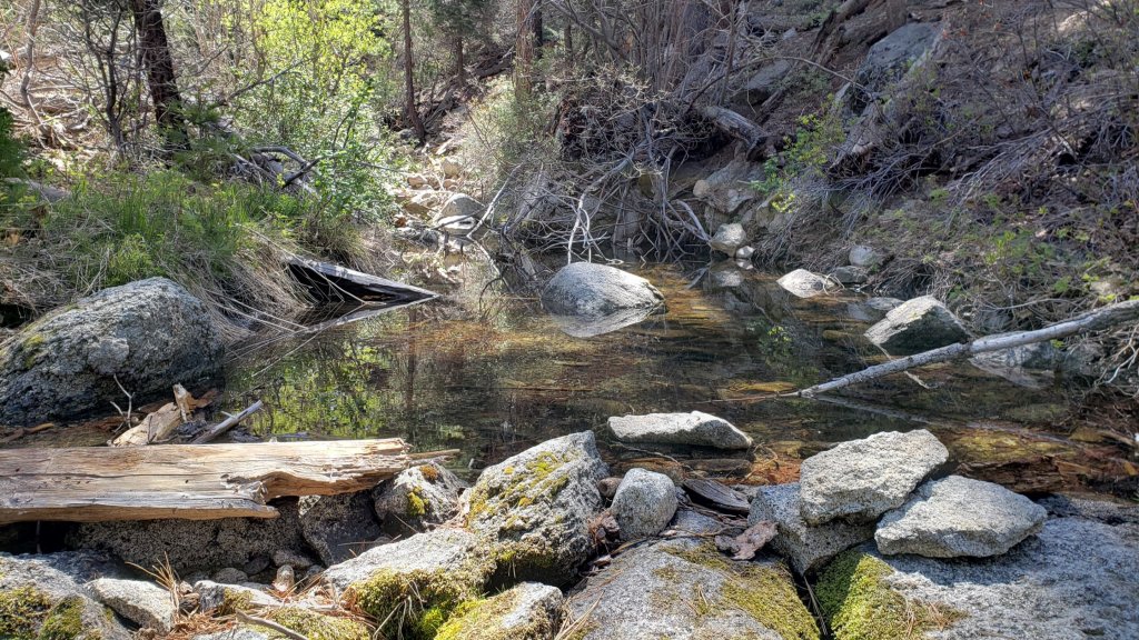
Although there have been minor improvements in flow immediately after recent storms, water conditions in the high country remain poor, with many springs and creeks having dried this summer. The current status of most water sources is unchanged from an earlier Report available here.
The U.S. Forest Service ranger station in Idyllwild has been closed due to USFS coronavirus protocols since March 2020. Apparently it is unlikely to reopen until 2022. Hiking and camping permits are nevertheless required for USFS lands, and should be available at the kiosk outside the ranger station.
The State Park ranger station has been open almost all year, and is the best source in Idyllwild for permits and additional trail information.
WEATHER Temperatures have been, and will continue, on something of a rollercoaster ride in October. After frigid conditions on 25th-26th, the last few days of October will be well above average for the month. Temperatures revert to cooler seasonal averages starting Sunday 31st October into the first week of November.
At San Jacinto Peak (10,810ft/3295m) on Wednesday 27th October 2021 at 0925 the air temperature was 36.6°F (2°C), with a windchill temperature of 23.5°F (-5°C), 80% relative humidity, and a fresh NNE wind sustained at 12 mph gusting to 21.0 mph.
At the Peak on Tuesday 26th October 2021 at 0645 the air temperature was 26.5°F (-3°C), with a windchill temperature of 7.9°F (-14°C), 32% relative humidity, and a bitter NW wind sustained at 18 mph gusting to 31.9 mph.
At the Peak on Monday 25th October 2021 at 1025 the air temperature was 32.6°F (0°C), with a windchill temperature of 14.4°F (-10°C), 97% relative humidity, and a wild WSW wind sustained at 20 mph gusting to 31.4 mph.

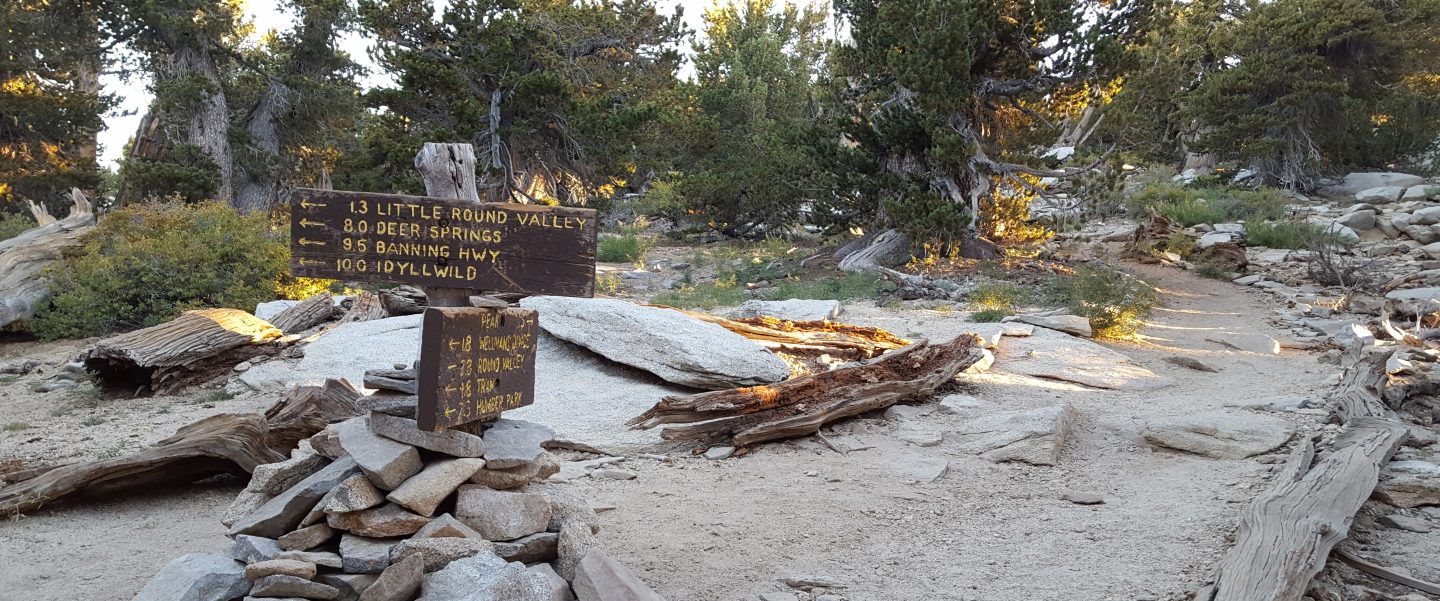
TRAIL CONDITIONS
Water conditions remain challenging despite recent autumnal weather, with many springs and creeks already having dried up or having very low flows, as discussed in an earlier Report. To date, temperatures have not been low enough to freeze springs in the high country.
The rockslide at PCT Mile 172.5, just north of Antsell Rock, was removed on Monday 14th June 2021. My “before, during, and after” video is available here. This section of the PCT is now safer and is narrow but readily passable with care by hikers (but remains impassable by stock).
Due to greatly reduced maintenance work during the coronavirus pandemic, many trails have accumulated treefall hazards since late 2019, passable with care by hikers but not for stock. Although reported promptly, regrettably neither Forest Service nor State Park have moved quickly to remove most hazards in 2021. With recent storms being accompanied by strong winds, hikers may encounter new and additional hazards. Some are described below, others include the PCT between Strawberry Cienega and Strawberry Junction (PCT Miles 182-183, at least 7 trees down), and Fuller Ridge Trail near its northern end (PCT Miles 189.1-190.2, three trees).
Spitler Peak Trail was cleared of multiple tree hazards by the Trail Report in early July. Marion Mountain Trail was cleared of multiple tree hazards by a CCC crew in late August, along with the adjacent PCT/Deer Springs Trail for 0.6 mile north to the south end of Fuller Ridge Trail.
Many treefall hazards from Red Tahquitz to Antsell Rock (PCT Miles 172.5-175) were cleared in June prior to the rockslide removal work. Nevertheless about 20 remain, including at least six major obstructions for hikers. Tahquitz Creek to Red Tahquitz (PCT Miles 175-177) was cleared in early June.
Willow Creek Trail has at least 33 downed trees between Skunk Cabbage Junction and Hidden Divide. Of these 22 are on the Forest Service section (16 between Willow Creek and the Park boundary), with 11 in the State Park. Most are readily passable by hikers with care. Despite so much work last year by myself and others, the whitethorn has grown back rapidly, but still remains less challenging than in 2019.
The Caramba Trail from near Reeds Meadow through Laws Camp and on to Caramba, and the Cedar Trail from Willow Creek Trail to Laws (which both nominally reopened in late 2018) are optimistically described by the Forest Service as “not maintained”. In reality parts of these trails no longer exist with significant sections of both so heavily overgrown that I strongly advise hikers do not attempt to follow them. Multiple experienced hikers have reported getting lost in this area since summer 2019. An informal use trail to the Laws Camp area is much more direct and completely avoids all of the challenging bush-whacking of the unmaintained trails (other hikers kindly nicknamed it the “King Trail”). It leaves Willow Creek Trail exactly 1.0 mile from Saddle Junction, 0.45 mile from the Skunk Cabbage turning (trailhead at N33°46’46”, W116°39’32”, WGS84). The cairned use trail descends largely on established deer tracks for 0.9 mile, reaching Willow Creek just upstream of the former site of Laws Camp. From Laws east to Caramba the route of the old Caramba Trail has become increasingly tricky to follow, especially for the first 1.2 miles east of Laws where there are dozens of trees down. Closer to Caramba the trail is relatively obvious (for those familiar with the route prior to the 2013 Mountain Fire). Very cautious navigation is recommended throughout this area.
Seven Pines Trail has had very limited hiker traffic since November 2018, largely because Dark Canyon Road was closed between February 2019 and early October 2021. There are at least 37 treefall hazards on the trail, four large ones on the short Forest Service section, and the remainder in the State Park, based on my October 2021 survey. Cautious navigation is recommended for those who are not very familiar with hiking this trail. Dark Canyon campground remains closed.

Thank you fellow hikers for taking the time to read this. While all labor and time is volunteered, the San Jacinto Trail Report completely depends on small private donations to cover operating costs. Every year seems to be challenging and 2021 has been no exception, so every contribution, no matter how small, is truly valuable. If you have found this Report useful, please consider visiting the Donate page. Thank you for your support.