Snow update 31st December 2018
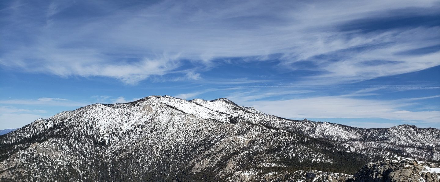
Just a brief update prior to a more comprehensive posting tomorrow afternoon. This morning we hiked to San Jacinto Peak from Humber Park, for what was my 126th ascent of the calendar year. On the way up we left the lower elevation cloud behind around 9000′, but it returned and started lightly snowing on us at about 10,000′ elevation. Snowfall at the Peak was erratic, with the cloud level right around 10,800′, and after we left we could see the high country bathed in sunshine again.
It was snowing lightly and intermittently on the descent, and had largely stopped by Saddle Junction. Fresh snowfall totals were: San Jacinto Peak 0.5″, Wellman Divide 1.0″, Wellman’s Cienega 1.5″, Saddle Junction 0.75″, Humber Park 0.5″. Settled snow in Idyllwild was barely 0.25″; although apparently more had fallen (at least 1.0″), it was too mild to settle.
It was chilly at the Peak, although nowhere near as cold as forecast, and much warmer than on Friday as outlined in the previous report. At San Jacinto Peak today at 0930 the air temperature was 16.5°F (-9°C), with a windchill temperature of 0.7°F (-18°C), 100% relative humidity, and a light 6 mph WSW wind gusting to 12 mph.
I recorded a brief video at the Peak this morning, which gives a feel for the conditions.
Finally, a huge thank you to all those supporters and donors who helped make 2018 such a remarkably successful year for the San Jacinto Trail Report, far, far beyond my most optimistic expectations for the project. All those supporters are listed here. If you have found the Report to be useful to you this year, please consider visiting the Donate page. Many thanks. Happy New Year and safe hiking.sanjacjonUncategorized1 Comment 1 MinuteEdit”Snow update 31st December 2018″
Cold and snow update 28th December 2018
I spent yesterday and today in the high country. My descent from San Jacinto Peak today was via Saddle Junction, Tahquitz Peak, and South Ridge Trail. I had anticipated exceptional cold overnight and was not disappointed, as I mention in the video below.
All high elevation trails (>8500′) remain snow-covered, with thin patchy snow in places down to about 6000′ on many trails (discussed in detail below). For details of the snow that fell on Christmas Day, see the previous posting linked here.
Despite the cold conditions, a remarkable amount of melting has occurred in the past few days. The 2-4″ of snow that fell on Christmas Day has largely melted in many of the areas that had previously cleared in December, with the fresh snow mainly remaining only on top of pre-existing snow cover.
Yesterday afternoon as I hiked to San Jacinto Peak, there was a little light snowfall above 9000′. No more than about 0.25″ accumulated, but it was a good example of how unpredictable mountain weather can be, as no precipitation had been forecast whatsoever.
Microspikes are useful, but are not essential, on most trails above about 7800′ at this time (see details below). They are most valuable in the early morning when snow is icier, and for descending. Snowshoes are useful for travel off-trail and in some areas of the high country above about 9800′. The traverse on the north side of Tahquitz Peak is especially challenging, as discussed below.
For the foreseeable future hikers should be prepared for temperatures at or near freezing in the high country (>8000′ elevation), and well below freezing at the highest peaks (with potential for severe cold when considering windchill effects).
Note that during the federal government shutdown, the U.S. Forest Service Idyllwild Ranger Station is closed. Adventure passes and wilderness permits are not required (or at least unenforceable) until the shutdown ends.
Weather Temperatures will remain cold until at least late next week, and there also appears to be a reasonable possibility of precipitation over the first weekend of 2019.
At San Jacinto Peak today, Friday 28th December, at 0640 the air temperature was -0.5°F (-18°C), with a windchill temperature of -30.1°F (-34.5°C), 78% relative humidity, and a blustery 11 mph due North wind gusting to 30 mph.
At the Peak on Tuesday 25th December, at 0810 the air temperature was 16.5°F (-9°C), with a windchill temperature of -1.8°F (-19°C), 100% relative humidity, and a chilly 10 mph WSW wind gusting to 16 mph.
TRAIL CONDITIONS
Tahquitz Peak trail from Chinquapin Flat had been very lightly traveled by midday today. Strong winds overnight had left heavy spindrift across the slope, overlaying more solid (and treacherous) icy snow. The spindrift had a very polystyrene quality, and was carving off in small slabs which were collapsing like mini wind slab avalanches downslope. The average snow depth was about 10-12″, however some drifted sections were 20-24″ deep. Until there has been more foot traffic here, crampons (or microspikes if you are very comfortable with their use), in conjunction with hiking poles or preferably an ice axe, are strongly recommended. [I would discourage carrying an ice axe if you aren’t familiar with how to use it.]
South Ridge Trail is largely clear of snow from the top of South Ridge Road to Old Lookout Flat (the plateau at 7800′), although there some extended sections of very shallow (<1″) snow. From 7800′ to Tahquitz Peak the trail is partly snow-covered with 2-4″ near Tahquitz Peak. There are some deeper drifts on the uppermost switchbacks. Due to the nature of the snow, microspikes are not necessary, but some hikers will find them useful especially for descending the uppermost switchbacks. [Note that the upper section of South Ridge Road is very icy, and dangerous for 2WD vehicles and hikers.]
Eastern slope trails All the major trails have been well traveled and are fairly well consolidated. This includes the main Long Valley and Round Valley trails. However the East Ridge Trail on San Jacinto Peak, the Sid Davis Trail, and the Old Tamarack Trail, have received no significant traffic, and require caution and/or snowshoes.
Deer Springs Trail has been very lightly traveled since the snow on Christmas Day. Snow depth is at about 12″ in Little Round Valley, with deeper drifts nearer San Jacinto Peak. There is no consolidated trail between Little Round Valley and San Jacinto Peak, with tracks of just 2-3 people, and these do not approximate to the trail. Snowshoes or mountaineering boots are recommended from Little Round Valley up.
Deer Springs Trail has patchy snow in exposed areas below 8000′, and microspikes are not essential in this section..
Marion Mountain Trail has only been lightly traveled. Thin snow starts at the trailhead, increasing to about 6-8″ at the junction with the PCT/Deer Springs Trail. Areas that had cleared following the earlier December snow, below about 7800′, are already starting to clear in patches.
Fuller Ridge Trail and Seven Pines Trail show no signs of recent use, so route finding will be very challenging for those not completely familiar with these trails.
Devil’s Slide Trail is largely clear of snow below 7600′. However the snow patches below this elevation are heavily compacted and icy. Most hikers will find microspikes are useful for at least the upper elevations of this trail.
Skyline Trail has light patchy snow above about 6500′, which is then more continuous from the Traverse upwards (>7200′) at about 2-4″ deep. The trail is consolidated and obvious. Some hikers are carrying microspikes and poles or ice axes, but report not needing to use them. [Many thanks to various correspondents for this information.]
Pacific Crest Trail north from Saddle Junction has only patchy snow to about 8700′, and then again from near Annie’s Junction to Strawberry Junction.
Pacific Crest Trail south from Saddle Junction has more-or-less continuous snow cover (at only 1-2″ deep) to 8300′, and then about 2-6″ deep, but with a clear consolidated track, to 8400′ at Chinquapin Flat. There has been no recent foot traffic on the PCT south from Chinquapin Flat.

sanjacjonUncategorized2 Comments 4 MinutesEdit”Cold and snow update 28th December 2018″
White Christmas! 25th December 2018
In Idyllwild and the high country we received a light snow today. I hiked to San Jacinto Peak early this morning from Humber Park via Wellman Divide, descending the same way. I recorded the following video at San Jacinto Peak at about 0815 this morning, but some details of snow depths are revised in the text below.
There was snow down to 5000′ that fell between 0700-1200 this morning, with a little rain overnight beforehand. In Idyllwild at 5550′, we had 0.08″ rain, followed by 0.5″ snow.
The snowfall pattern was somewhat unusual as the cloud level was around 10,000-11,000′. Consequently snowfall was intermittent at the higher elevations, and the greatest accumulations (3-4″) were between 9000-9800′.
Microspikes are useful, but not essential, on most trails above about 6000′ at this time (see snow depth details below). There is already rapid melting occurring below 6000′ , and this will likely extend to 7000′ in the next couple of days. However very cold overnight temperatures will result in considerable icing on the trails for the foreseeable future. Microspikes are especially most valuable in the early morning when snow is less soft, and for descending. Snowshoes are currently useful mainly for travel off-trail.
For at least the next week, hikers should be prepared for temperatures at or below freezing in the high country (>8000′ elevation), and well below freezing at the high peaks (with severe cold when considering windchill effects).
Note that during the federal government shutdown, the U.S. Forest Service Idyllwild Ranger Station is closed. Adventure passes and wilderness permits are not required (or at least unenforceable) until the shutdown ends.
Weather Thankfully, after nearly three weeks of above average temperatures, cold weather will predominate for the remainder of December. There is no additional precipitation in the forecasts for the next week or so.
At San Jacinto Peak today, Tuesday 25th December, at 0810 the air temperature was 16.5°F (-9°C), with a windchill temperature of -1.8°F (-19°C), 100% relative humidity, and a chilly 10 mph WSW wind gusting to 16 mph.
At the Peak on Friday 21st December, at 0845 the air temperature was 35.6°F (2°C), with a windchill temperature of 21.5°F (-5.5°C), 24% relative humidity, and a brisk 12 mph West wind gusting to 23 mph.
Measured snow depths are as follows. The first number is new accumulation today, the second (in parentheses) is the maximum depth at that location including the existing snow from earlier storms. Note that with so much melting this month, the deepest snow is very patchy, and at all elevations there were bare areas until this morning. Depths are averages, deeper wind-blown drifts will be encountered, especially at higher elevations. Altitudes are approximate.
San Jacinto Peak (10,810′): 2″ (15″)
10,000′ elevation: 2″ (12″)
Wellman Divide (9700′): 4″ (10″)
Annie’s Junction (State Park boundary north of Saddle Jn) (9050′): 3″ (12′)
Saddle Junction (8100′): 1.5″ (4″)
Humber Park (6500′): 1.5″ (1.5″)
Idyllwild (5550′): 0.5″ (0.5″)

sanjacjonUncategorized1 Comment 2 MinutesEdit”White Christmas! 25th December 2018″
Snow and trail update 21st December 2018
[UPDATE 24th December: starting tonight until at least the end of the month, very cold conditions should be expected across the high country (>8000′). At the high peaks, air temperatures will be well below freezing, with windchill temperatures about 20-50 degrees below freezing.]
[UPDATE 23rd December: during the federal government shutdown, the U.S. Forest Service Idyllwild Ranger Station is closed. Adventure passes and wilderness permits are not required (or at least unenforceable) until the shutdown ends.]
Happy Winter Solstice! Always a good day for hikers, knowing that we have six months of increasing day length to look forward to. Our hike to San Jacinto Peak this morning ascended from Humber Park via Wellman Divide and back. On Wednesday I spent a long day hiking Blaisdell Ridge and far up Falls Creek on the north face of San Jacinto for SAR work, which allowed me to assess the snow status on that aspect of the mountain.
All high elevation trails (>8500′) remain snow-covered. With unseasonal warm weather since Monday, rapid melting has continued, with many more inches of snow depth lost at all elevations in the past few days.
Snow depth at Saddle Junction is now 1-2″ and patchy (11-12″ just two weeks ago), and about 6″ at Wellman Divide (18″ two weeks ago). At Long Valley, only 1-2″ of snow remains. Snow level is at about 8000′ in Snow Creek, but overall snow is surprisingly sparse there.
Microspikes are useful, but not essential, on most trails above about 8000′ at this time (see details below). They are usually most valuable in the early morning when snow is less soft, and for descending. Snowshoes are currently useful only for extensive travel off-trail.
Starting on Monday 24th, hikers should be prepared for temperatures at or near freezing in the high country (>8000′ elevation), and below freezing at the highest elevations (well below freezing when considering windchill effects).
Weather Thankfully, the previous two weeks of very mild weather will come to an abrupt end next week, and temperatures may even be below average for the remainder of December. Current forecasts suggest the possibility of precipitation for the morning of 25th December, including light snow in the high country, which would be a great Christmas gift for the mountain.
At San Jacinto Peak today, Friday 21st December, at 0845 the air temperature was 35.6°F (2°C), with a windchill temperature of 21.5°F (-5.5°C), 24% relative humidity, and a brisk 12 mph West wind gusting to 23 mph.
At the Peak on Monday 17th December, at 0915 the air temperature was 21.4°F (-6°C), with a windchill temperature of 3.8°F (-16°C), 85% relative humidity, and a fresh 9 mph due West wind gusting to 17 mph.
TRAIL CONDITIONS
Tahquitz Peak trail from Chinquapin Flat has an average depth of about 6-10″ of snow, however some drifted sections remain about 20″ deep. There is a reasonable trail from earlier foot traffic, however the snow is becoming icy, especially in the early mornings. Microspikes (with hiking poles or ice axe) are strongly recommended, especially for descending. [I would discourage carrying an ice axe if you aren’t familiar with how to use it.]
South Ridge Trail is clear of snow from the top of South Ridge Road to Old Lookout Flat (the plateau at 7800′). From 7800′ to Tahquitz Peak the trail is largely snow-covered in patches, with 2-4″ near Tahquitz Peak. There are some deeper drifts on the uppermost switchbacks. Depending on the firmness of the snow, microspikes are not necessary for ascending, but they are useful for descending the uppermost switchbacks.
Eastern slope trails All the main trails have been well traveled and are well consolidated. This includes all the Long Valley and Round Valley trails, and the East Ridge Trail on San Jacinto Peak.
Western slope trails These have still been less traveled than the east side, and as such require more care, but nevertheless largely have clear, firm tracks to follow (with some exceptions discussed below). Snow melt has been a little less dramatic on the western side, which isn’t exposed to the morning sun and is much more heavily forested, especially above about 9000′.
Deer Springs Trail The track between Little Round Valley and San Jacinto Peak is now more obvious (but steep) and microspikes are sufficient (and recommended).
Deer Springs Trail is completely clear of snow below 8200′, and microspikes are not required below 8600′.
Marion Mountain Trail has been heavily traveled, and the trail is largely clear of ice and snow below about 7800′.
Fuller Ridge Trail and Seven Pines Trail show no signs of use since the storm earlier this month, so route finding will be very challenging for those not fully familiar with these trails.
Devil’s Slide Trail is clear of snow below 7800′. Hikers comfortable with moderate snow travel will find microspikes are not required to Saddle Junction.
Pacific Crest Trail north from Saddle Junction is largely clear of snow to about 8800′, and then again from near Annie’s Junction to Strawberry Juntion.

sanjacjonUncategorizedLeave a comment 3 MinutesEdit”Snow and trail update 21st December 2018″
Snow and trail update 17th December 2018
Our hike today to San Jacinto Peak ascended from Humber Park via Wellman Divide and descended Deer Springs Trail. The video below covers the basics, with details in the text.
All high elevation trails (>8000′) remain largely or completely snow-covered. With unusually mild weather (today notwithstanding), melting continues to be extensive, with many more inches of snow depth lost at all elevations in the past few days. Some examples of the snow loss are shown in photos at the end of this blog post.
Microspikes are useful, but not essential, on most trails above about 8000′ at this time (see details below). They are usually most valuable in the early morning when conditions may be icy, and for descending. Snowshoes are currently useful only for travel off-trail.
With the exception of the next few warm days, in general hkers should be prepared for temperatures near freezing at the highest elevations (well below freezing when considering windchill effects). (See weather data below.)
TRAIL CONDITIONS
Tahquitz Peak trail from Chinquapin Flat has an average depth of about 10″ of snow, however some drifted sections are about 20-24″ deep. There is a reasonable trail from foot traffic at the weekend. Conditions are currently so mild overnight that the snow is not icy and the consolidated soft snow conditions are good for traversing this trail in microspikes, preferably with an ice axe. Microspikes (with hiking poles or axe) are recommended. I would discourage carrying an ice axe if you aren’t familiar with how to use it.
South Ridge Trail is almost entirely clear of snow from the top of South Ridge Road to Old Lookout Flat (the plateau at 7800′), and microspikes are not required. From 7800′ to Tahquitz Peak the trail is almost continuously snow-covered, with about 2″ depth lower down, rising to 4-6″ nearer Tahquitz Peak. There are some deeper drifts on the uppermost switchbacks. Depending on the firmness of the snow, microspikes are not necessary for ascending, but they are useful for descending to about 8000′.
Eastern slope trails All the main trails have been well traveled and are well consolidated. This includes all the Long Valley and Round Valley trails, and the East Ridge Trail on San Jacinto Peak.
Western slope trails These have still been less traveled than the east side, and as such require more care, but nevertheless largely have clear, firm tracks to follow (with some exceptions discussed below). Snow melt has been less dramatic on the western side, which isn’t exposed to the morning sun and is much more heavily forested, especially above about 9000′.
Deer Springs Trail The track between Little Round Valley and San Jacinto Peak is now more obvious (but steep) and microspikes are sufficient.
The trail is completely clear of snow below 8000′, and microspikes are not required below 8400′.
Marion Mountain Trail has been heavily traveled, and the trail is largely clear of ice and snow below about 7700′.
Fuller Ridge Trail and Seven Pines Trail still show no signs of use since last week’s storm, so route finding will be very challenging for those not fully familiar with these trails.
Devil’s Slide Trail is largely clear of snow below 7800′. Hikers comfortable with snow travel will find microspikes are not required to Saddle Junction.
Weather Today was a lovely cold winter day on the mountain, but regrettably above-average temperatures will continue for the next few days, before a return to normal next weekend (whatever normal is these days). There is a chance of waking up to a white Christmas, with a possibility of precipitation forecast for the early morning of 25th December.
At San Jacinto Peak today, Monday 17th December, at 0915 the air temperature was 21.4°F (-6°C), with a windchill temperature of 3.8°F (-16°C), 85% relative humidity, and a fresh 9 mph due West wind gusting to 17 mph.
By contrast, at the Peak on Wednesday 12th December, at 0930 the air temperature was 34.6°F (1.5°C), with a windchill temperature of 20.3°F (-6°C), 24% relative humidity, and a moderate 8 mph NW wind gusting to 20 mph.


sanjacjonUncategorizedLeave a comment 3 MinutesEdit”Snow and trail update 17th December 2018″
Trail update 14th December 2018
Great news for local hiking! With effect tomorrow, Saturday 15th December, the U.S. Forest Service has reopened the Pacific Crest Trail (from Spitler Peak to Tahquitz Valley) and South Ridge Trail, that had been closed due to the Cranston Fire (the section of the PCT was also previously closed since the July 2013 Mountain Fire). The snow status of the South Ridge Trail is updated below. South Ridge Road is also reopening.
Also reopening are the Caramba and Cedar trails that were closed by the 2013 Mountain Fire. However those will remain unmaintained. They are somewhat overgrown, and navigation will be difficult for those who were not familiar with those trails prior to their closure.
The trail and road system around May Valley remains closed.
Today we took a circuitous hike to Tahquitz Peak (in order to check the trail on it’s north side). On both Wednesday and Monday we hiked to San Jacinto Peak, with diversions to assess side trails. An overview of last week’s storm and initial snow depths is at the 7th December report linked here.
All high elevation trails (>8000′) remain largely or completely snow-covered. With unusually mild weather, melting continues to be extensive, with many inches of snow depth lost at all elevations in the past week. A few challenging sections of trail remain however. Strong winds in the high country in the last few days have caused substantial drifting which has partly obscured some trails that were easily followed just 2-4 days ago. These include all the trails around San Jacinto peak above 10,300′, and the trail to Tahquitz Peak from Chinquapin Flat.
Microspikes are recommended on most trails above about 7500′ at this time (see details below). They are usually most valuable in the early morning when conditions may be most icy, and for descending.
Snowshoes are currently useful only for (I) travel off-trail, (ii) Deer Springs Trail between Little Round Valley and San Jacinto Peak, (iii) and on those trails that have not been traveled since last week (listed below).
Despite relatively mild conditions at present, hikers should nevertheless be prepared for temperatures near freezing at the highest elevations (well below freezing when considering windchill effects). (See weather data below.)
TRAIL CONDITIONS
Tahquitz Peak trail from Chinquapin Flat has an average depth of about 11″ of snow. However there has been heavy drifting in the past couple of days, and some sections are about 20-24″ deep, completely obscuring the consolidated trail from last weekend. Fortunately (or unfortunately, for those of us who want the snow to stick around), conditions are currently so mild overnight that the snow is not icy. This morning, the consolidated soft snow conditions were perfect for traversing this trail in microspikes with an ice axe. By the end of this weekend, another clearer trail may be in place. Microspikes (with poles or preferably an ice axe) are recommended. I would discourage the use of snowshoes on this section (the 35 degree slope makes it very challenging), and do not carry an ice axe if you aren’t familiar with how to use it.

South Ridge Trail is almost entirely clear of snow from the top of South Ridge Road to Old Lookout Flat (the plateau at 7800′), and microspikes are not required. From 7800′ to Tahquitz Peak the trail is almost continuously snow-covered, with about 2″ depth lower down, rising to 4-6″ nearer Tahquitz Peak. There are some deeper drifts on the uppermost switchbacks. Depending on the firmness of the snow, microspikes are not necessary for ascending, but they are useful for descending to about 8000′.
Eastern slope trails All the main trails have been well traveled and are well consolidated. Consequently snowshoes are not required (except for the situations described above), and microspikes are adequate.
This includes all the Long Valley and Round Valley trails, and the East Ridge Trail on San Jacinto Peak (in fact the latter has been much more heavily traveled and is more consolidated than the Peak Trail).
Western slope trails These have been much less traveled than the east side, and as such require much more care and are slower going.
Based on visible tracks, only a handful of hikers have traversed between Little Round Valley and San Jacinto Peak since last week’s storm, and as such there is no clear, consolidated trail. Snowshoes are advisable.
Fuller Ridge Trail and Seven Pines Trail show no signs of use since last week’s storm, so route finding will be very challenging for those not fully familiar with these trails.
Deer Springs Trail is largely clear of snow below Strawberry Junction (8100′), and microspikes are not essential.
Devil’s Slide Trail is largely clear of snow below 7700′, and some hikers will find microspikes are not required below that elevation. Saddle Junction (now about 5-6″) has lost about half of its snow depth since the storm one week ago.
Weather Regrettably, above-average temperatures will continue for the foreseeable future (they’re even forecast to get a bit warmer next week). The air temperature at San Jacinto Peak on both Monday and Wednesday mornings was slightly warmer than in Idyllwild at dawn! Steady melting will continue, especially on slopes exposed to direct sun.
At San Jacinto Peak on Wednesday 12th December, at 0930 the air temperature was 34.6°F (1.5°C), with a windchill temperature of 20.3°F (-6°C), 24% relative humidity, and a moderate 8 mph NW wind gusting to 20 mph.
At the Peak on Monday 10th December, at 0920 the air temperature was 37.5°F (3°C), with a windchill temperature of 25°F (-4°C), only 9% relative humidity, and a steady 15 mph SW wind gusting to 20 mph.sanjacjonUncategorizedLeave a comment 4 MinutesEdit”Trail update 14th December 2018″
Trail and snow update 10th December 2018
We hiked to San Jacinto Peak from Humber Park via Wellman Divide this morning, descending via Deer Springs Trail, with several diversions to assess side trails. I used microspikes only, although these were not ideal for uppermost Deer Springs Trail.
An overview of last week’s storm and snow depths is at the previous report linked here.
All high elevation trails (>7500′) remain snow-covered. Melting has been extensive, with several inches of snow depth lost at all elevations in just the past three days.
Microspikes are recommended on all trails above about 7500′ at this time (see details below). They are especially valuable in the morning before diurnal melting has started, and for descending.
Snowshoes are useful only for travel off-trail, for Deer Springs Trail between Little Round Valley and San Jacinto Peak, and on those trails that have not been traveled since last week (listed below).
Despite mild conditions at present, hikers should nevertheless be prepared for temperatures around freezing above about 8000′ (at lower elevations on some days), and below freezing at the highest elevations (well below freezing when considering windchill effects). (See weather data below.)
TRAIL CONDITIONS
Eastern slope trails All the main trails have been well traveled and are well consolidated. Consequently snowshoes are not required (except for the situations described above), and microspikes are adequate.
This includes all the Long Valley and Round Valley trails, the Sid Davis Trail, and the East Ridge Trail on San Jacinto Peak (in fact the latter has been more heavily traveled and is more consolidated than the Peak Trail).
Western slope trails These have been much less traveled than the east side, and as such require much more care and are slower going.
Based on visible tracks, only a handful of hikers have traversed between Little Round Valley and San Jacinto Peak since last week’s storm, and as such there is no clear, consolidated trail. Snowshoes are advisable.
Fuller Ridge Trail and Seven Pines Trail show no signs of use since last week’s storm, so route finding will be very challenging for those not fully familiar with these trails.
Deer Springs Trail is largely clear of snow below Strawberry Junction (8100′), and microspikes are not essential. Strawberry Junction lost about a quarter of its snow depth since Friday (now at about 6″).
Devil’s Slide Trail is largely clear of snow below 7500′, and some hikers will find microspikes are not essential below that elevation. Saddle Junction lost about one third of its snow since Friday (now 7-8″ depth).
Tahquitz Peak trail from Chinquapin Flat has about 12″ of icy snow. It was well traveled at the weekend and has a reasonable trail to follow with extreme care. Microspikes (and poles or an ice axe) are strongly recommended.

Photos: (above) The Peak Trail above Wellman Divide early this morning, 10th December, with (below) the same view from 7th December.

Weather Regrettably, above-average temperatures will continue for the foreseeable future. The air temperature at San Jacinto Peak this morning was slightly warmer than in Idyllwild at dawn! Steady melting will likely continue, especially on exposed slopes and below about 9000′.
There is a slim possibility of light precipitation on Monday 17th, after which a continuing unseasonal warming trend is forecast.
At San Jacinto Peak today, Monday 10th December, at 0920 the air temperature was 37.5°F (3°C), with a windchill temperature of 25°F (-4°C), only 9% relative humidity, and a steady 15 mph SW wind gusting to 20 mph.
At the Peak on Friday 7th December, at 1030 the air temperature was 21°F (-8°C), with a windchill temperature of 5.8°F (-15°C), 100% relative humidity, and a moderate 12 mph NNE wind gusting to at least 14 mph.sanjacjonUncategorizedLeave a comment 2 MinutesEdit”Trail and snow update 10th December 2018″
More snow! 7th December 2018
I hiked to San Jacinto Peak on the morning of Wednesday 5th (to get some “before storm” photos), and snowshoed up and back today in spectacular conditions. Special thanks to Kyle Eubanks for reporting snow conditions as he descended the west side (while I ascended the east).
The latest Trail Report video:
We got a good storm! Literally the best snowfall up here in two years. All mid- and high-elevation trails are snow-covered at present. Snow accumulated above about 7000′ elevation (see details below). There was about 7-8″ of new snow at 8000′, and around 12″ at and above 9000′.
Snowshoes are useful above about 8000′, and strongly recommended above 9000′.
Microspikes are recommended on all trails above about 6500′ elevation at this time.
Hikers should be prepared for temperatures at or below freezing above about 7000′ (at lower elevations on some days), and below freezing at the highest elevations (well below freezing when considering windchill effects). (See weather data below.)
Measured snow depths are as follows. These are total depths, (including the existing snow from the storm last week). These are averages, deeper wind-blown drifts will be encountered, especially at higher elevatons.
Eastern side: Wellman Divide 22″, Annie’s Junction 18″ (State Park boundary north of Saddle Junction), Saddle Junction 11″, Humber Park 0.5″.
Western side: Strawberry Junction 8″, Marion Mountain Trail (top) 12″, Fuller Ridge Trail at junction with Deer Springs 14″, Little Round Valley 18″.
San Jacinto Peak: 24-30″.
Weather It started snowing lightly at 1000 on Wednesday as I descended past Wellman Divide. It rained almost continuously in Idyllwild from Wednesday morning to Thursday night, for a total of 1.88″ at 5550′ elevation. The weather system was unusually warm, so snowfall was confined to above 7500′ until Thursday night when it descended to 6500′ (but left very little snow at that elevation).
At San Jacinto Peak today, Friday 7th December, at 1030 the air temperature was 21°F (-8°C), with a windchill temperature of 5.8°F (-15°C), 100% relative humidity, and a moderate 12 mph NNE wind gusting to at least 14 mph.
At the Peak on Wednesday 5th December, at 0915 the air temperature was 27.7°F (-3°C), with a windchill temperature of 10°F (-13°C), 48% relative humidity, and a strong 18 mph SW wind gusting to 26 mph.
The bad news is that unusually warm (for December) conditions are forecast for much of the next week or so. Melting was already rapid as I descended below 9000′, and Kyle reported that on lower Deer Springs Trail “the whole trail was a river”. Considerable melting at the lower elevations that currently have snow, and in areas that are exposed to direct sun, is to be expected.
Photos: (above) the view from San Jacinto Peak towards Jean Peak and Marion Mountain on Wednesday morning 5th December, and (below) the same view today.


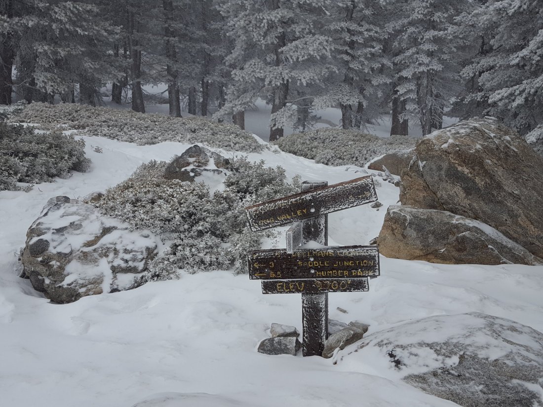
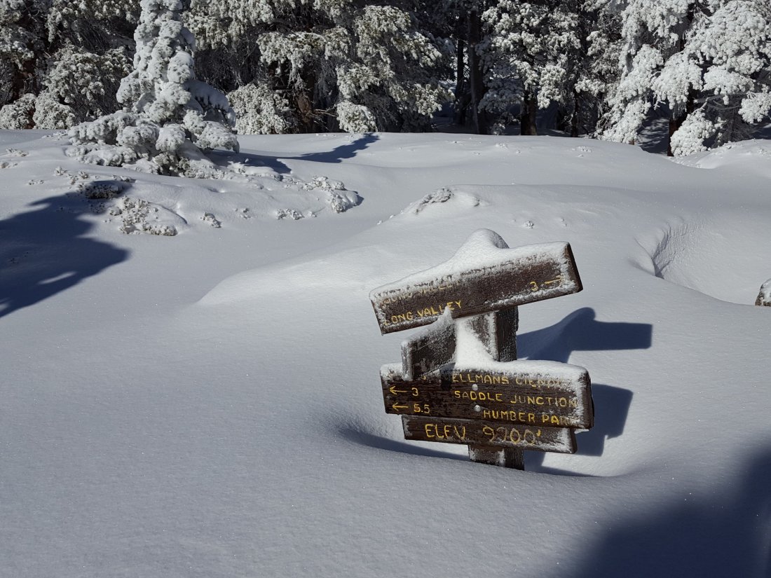
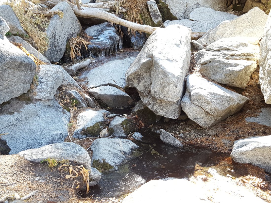
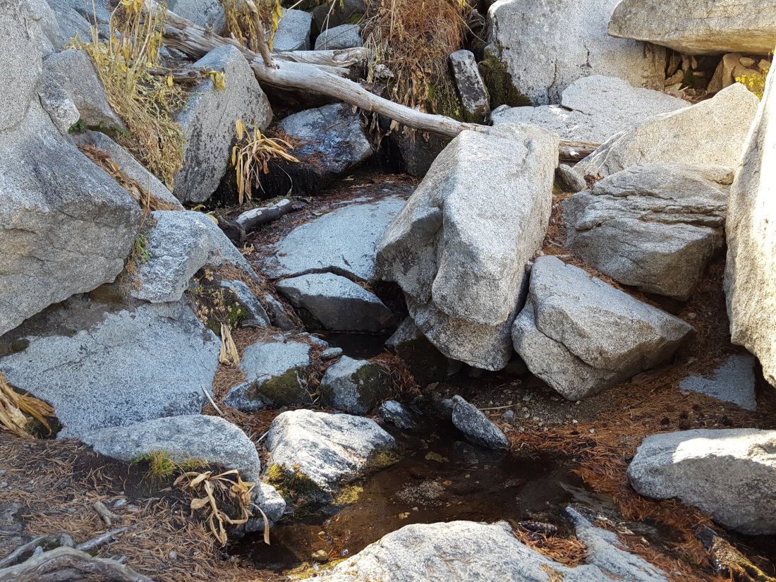
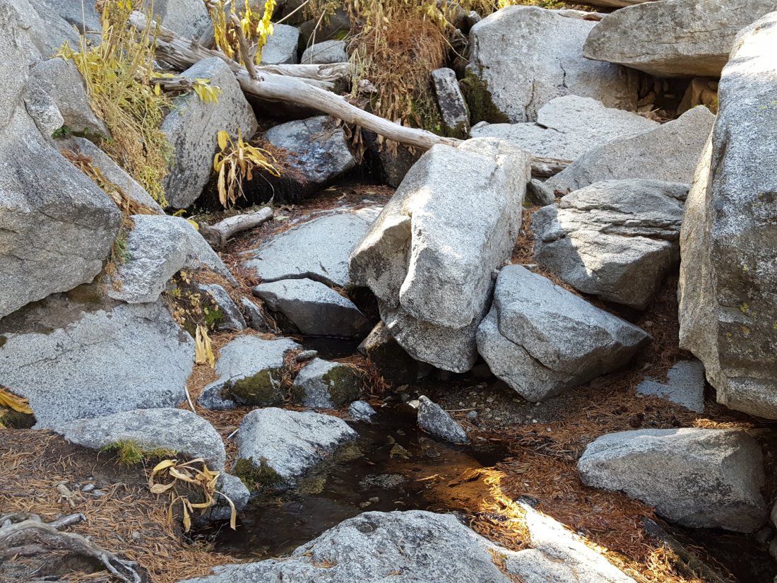
Photos: (above) the trail junction sign at Wellman Divide (9700′) on Wednesday morning 5th December, and (below) the same view today, 7th December.


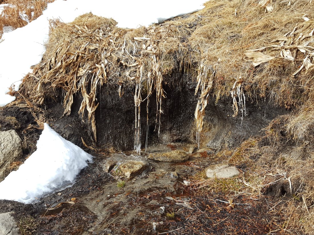
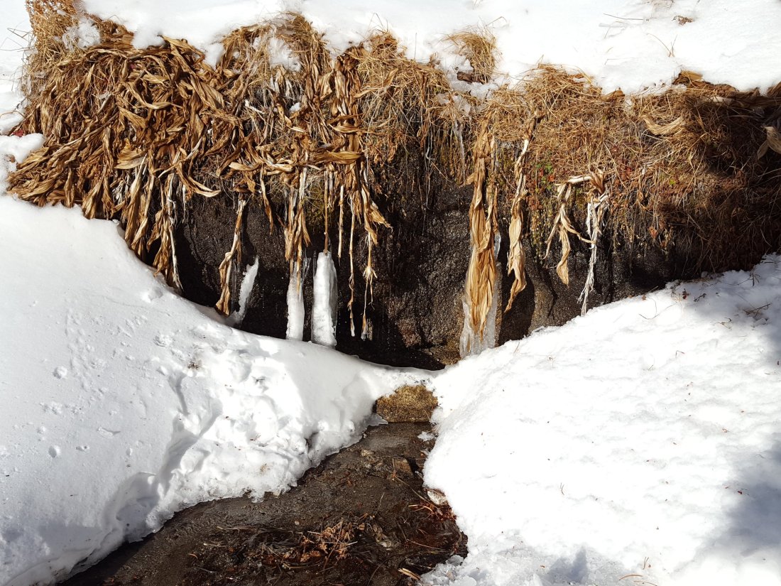
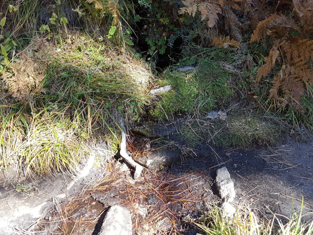
Photos: (above) the north spring at Wellman’s Cienega on Wednesday morning 5th December, and (below) the same view today, 7th December.

sanjacjonUncategorizedLeave a comment 2 MinutesEdit”More snow! 7th December 2018″
Snow update 3rd December 2018
[UPDATE Thursday 6th Dec: By 1100 there had been 1.2″ rain at 5550′ in Idyllwild, where it has been raining almost continuously since Wednesday morning. I took a quick hike yesterday morning to San Jacinto Peak, where it started snowing as we descended past Wellman Divide at 10 a.m. Then there was on/off light snow down to Humber Park. However it is a very mild system, coming from the SSW, and it is now raining at Humber Park with the snow level at about 7200′. Current forecasts suggest about 5″ inches of additional snow may fall at San Jacinto Peak today. Next full blog update will be post-storm on Friday 7th December.]
We hiked up to San Jacinto Peak via Devil’s Slide Trail and Wellman’s Divide this morning, and messed around in uppermost Snow Creek, to assess the status of melting and any changes in snow depths.
Trail conditions The snow situation is largely unchanged from the previous report of 30th November linked here. Please read that report for details. Snow depths at locations above 7500′ were largely unchanged.
Sufficient foot traffic on all major trails means that these are now relatively easy to follow. This includes Deer Springs Trail through Little Round Valley, and the Long Valley and Round Valley trails, all through to San Jacinto Peak.
Although it only received about 6″ of snow last week, the north side of Tahquitz Peak is quite treacherous, including the section of trail between Chinquapin Flat and Tahquitz Peak. It can be especially dangerous when descending from Tahquitz Peak, and in the morning when icy.
Extensive melting was taking place below 7500′ later this morning on sections of trail exposed to direct sun, such as lower Devil’s Slide, where the snow was becoming very patchy.
Microspikes are currently recommended on all trails above about 7000′ elevation. They are especially useful in the morning when snow is hard and icy, and when descending.
Weather At San Jacinto Peak today, Monday 3rd December, at 0945 the air temperature was a relatively mild 28°F (-2°C), but with a frigid windchill temperature of 8.3°F (-13°C), 58% relative humidity, and a stiff 18 mph WSW wind gusting to 31 mph.
Hikers should now be prepared for temperatures at or below freezing above about 7000′ (at lower elevations on some days), and below freezing at the highest elevations (but much colder when considering windchill effects).
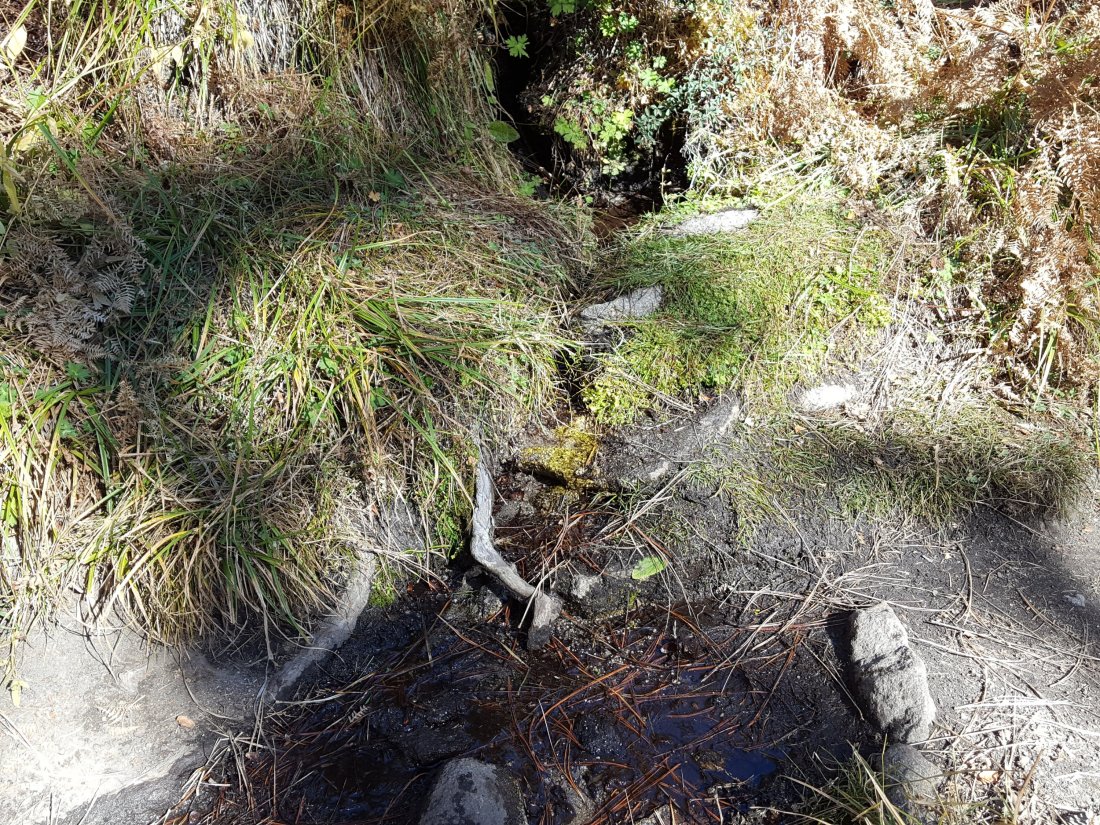
Water conditions Early this morning both Jolley and Middle springs were flowing on Devil’s Slide Trail, both useful water sources for the many dogs walked on this trail. Wellman’s Cienega (9300′) was partly unfrozen and flowing well at the springs this morning.
sanjacjonUncategorizedLeave a comment 2 MinutesEdit”Snow update 3rd December 2018″
Snow! 30th November 2018
[UPDATE 1st December: Anne and Anabel King report about 6″ of icy snow in the Tahquitz Peak area. The snow level started around 7200′, but was melting quickly in areas exposed to direct sun below 8000′. Microspikes were essential in the very icy conditions.]
I spent the last two days around San Jacinto Peak enjoying the storm system that came through yesterday, before I descended this morning via Deer Springs Trail. Many thanks to friend of the Trail Report Kyle Eubanks who joined me at the Peak last night and descended to the Tram this morning, providing the snow depth data for the eastern side.ErrorThis video doesn’t exist
Videos: (above) a quick summary of the weather at San Jacinto Peak early this morning, (below) a panorama from the Peak at sunrise today.ErrorThis video doesn’t exist
All mid- and high-elevation trails are snow-covered at present. Snow accumulated above about 6000′ elevation on the southern and western sides of the mountain, and above about 7000′ on the eastern side. Very strong westerly winds last night caused heavy drifting on eastern slopes.
Already by noon today, extensive melting was taking place below 8000′ on exposed slopes, and some trails, such as lower Deer Springs and Devil’s Slide, were starting to become a sloppy mess. These areas will become very icy overnight, and microspikes will be invaluable this weekend at least.
Microspikes are recommended on all trails above about 7000′ elevation at this time. Snowshoes may be useful for some hikers above about 9000′ (and possibly at lower elevations depending on personal preference).
Measured snow depths are as follows (these are average accumulations, deeper drifts will be encountered).
Eastern side: Long Valley 6″, Round Valley 6″, Wellman Divide 8″, Annie’s Junction 6.5″ (State Park boundary north of Saddle Junction).
Western side: Saddle Junction 4″, Strawberry Junction 3″, Marion Mountain Trail (top) 4″, Fuller Ridge Trail at junction with Deer Springs 5″, Little Round Valley 6″.
San Jacinto Peak: 12″ (drifts to 18″).
Weather It started snowing at San Jacinto Peak yesterday at about 0830, continuing until around midnight. In Idyllwild it started raining before sunrise yesterday, accumulating a total of 2.66″ at 5550′ by this morning. All stations at mid elevations on the mountain received about an inch or more of rain, with many recording more than two inches.
At San Jacinto Peak today, Friday 30th November, at 0620 the air temperature was 17°F (-10°C), with a windchill temperature of -8°F (-23°C), 100% relative humidity, and a howling 25 mph WSW wind gusting to at least 39 mph.
Hikers should now be prepared for temperatures at or below freezing above about 7000′ (at lower elevations on some days), and well below freezing at the highest elevations (even colder when considering windchill effects).
There is currently a high probability of precipitation at all elevations next week (5th-6th December).
Water conditions Obviously the water situation is no longer the concern that it has been for the past 6-7 months. Updates will only be given when there is something noteworthy to report (e.g., the Round Valley faucet starts flowing). However, finding flowing water can be a challenge as most water sources above 9000′ may be completely frozen, at least in the morning.


sanjacjonUncategorizedLeave a comment 2 MinutesEdit”Snow! 30th November 2018″
Rain and ice 22nd November 2018
[UPDATE Major snowfall is forecast for Thursday 29th November, above about 6500′ elevation. This will be accompanied by extreme westerly winds and severe cold. Snowfall could reach two feet deep in the highest elevations. The Trail Report will be updated on Friday 30th with full details.]
We hiked to San Jacinto Peak today from Humber Park via Wellman’s Divide, then descended via Deer Springs Trail. Earlier in the week we hiked to San Jacinto Peak and Tahquitz Peak on different days.
The first of the videos below describes the weather situation this morning, and the second is a panorama from San Jacinto Peak just after 0900 this morning.
Weather A relatively mild frontal system came through in the early hours of this morning, bringing rain to the entire mountain between about 0200-0800. We had 0.58″ at 5550′ elevation in Idyllwild, but higher elevations received less (only 0.13″ in Long Valley). Rain fell all the way to San Jacinto Peak, but above 9300′ it was freezing rain, and especially above 9900′ everything was plastered with ice (about 0.25″ thick all over San Jacinto Peak). There was a hint of very fine icy snow, mainly above 10,400′, but insufficient to be measured. The sun was already poking through by about 0800 above 9300′ this morning, and ice was already starting to melt at the Peak despite the frigid temperature.
Hikers should anticipate temperatures near freezing in the high country (>8000′) and at or below freezing at the high peaks (well below freezing with windchill).
The possibility of another, colder, frontal system is forecast for the last couple of days of November and the 1st/2nd of December.
At San Jacinto Peak today, Thursday 22nd November, at 0900 the air temperature was 23°F (-5°C), with a windchill temperature of 0.1°F (-18°C), 100% relative humidity, and a bitter 16 mph SW wind gusting to 27.5 mph.
On Sunday 18th November at 0830 conditions were more typical and less severe, as the air temperature was 33°F (0.5°C), with a windchill temperature of 27°F (-3°C), 36% relative humidity, with a light 2 mph WSW wind gusting to 7 mph.
Trail overview The brief rain today will make little difference to the water situation in the high country of the San Jacinto mountains, which remains very poor and largely unchanged from early October. Some water sources above 9000′ were partially frozen this morning, and more extensive freezing is to be expected soon.
Microspikes were very helpful around San Jacinto Peak early this morning, and are advisable now at the highest elevations after any precipitation.
Last week we found that Marion Creek, midway along the Suicide Rock Trail, continues to flow quite well. Cedar Spring on the Desert Divide just to the east of the PCT continues to flow gently, as detailed in a prior report at this link.
Continue to be Bear Aware A full-size adult Black Bear was caught on security video at night at a house near Upper Rim Rock Road in the Fern Valley neighborhood of Idyllwild in the first week of November. I have seen the video, and in both its large size and uniform colour pattern this was clearly a different bear to the one that passed by our own house back in May. [Many thanks to my neighbor Dr. Ken Browning for sharing this information with the Trail Report.]
EASTERN SLOPE WATER FEATURES
The Round Valley faucet has been dry since the summer.
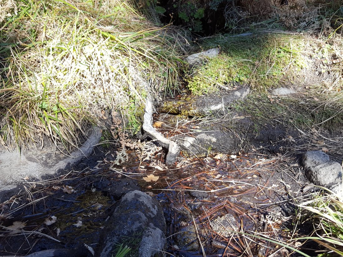
Both the northern and southern springs at Wellman’s Cienega continue to flow, both were stronger this morning during the drizzle.
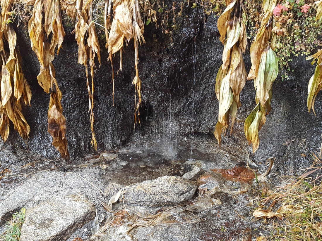
These springs are the sources for Willow Creek, which has not been flowing where it crosses the Willow Creek Trail since late summer. There may be small pools where water could be filtered just upstream from the crossing. The creek is actually flowing gently a few hundred yards upstream from the trail crossing, but access is not easy. Willow Creek has not previously been known to stop flowing at the trail crossing.
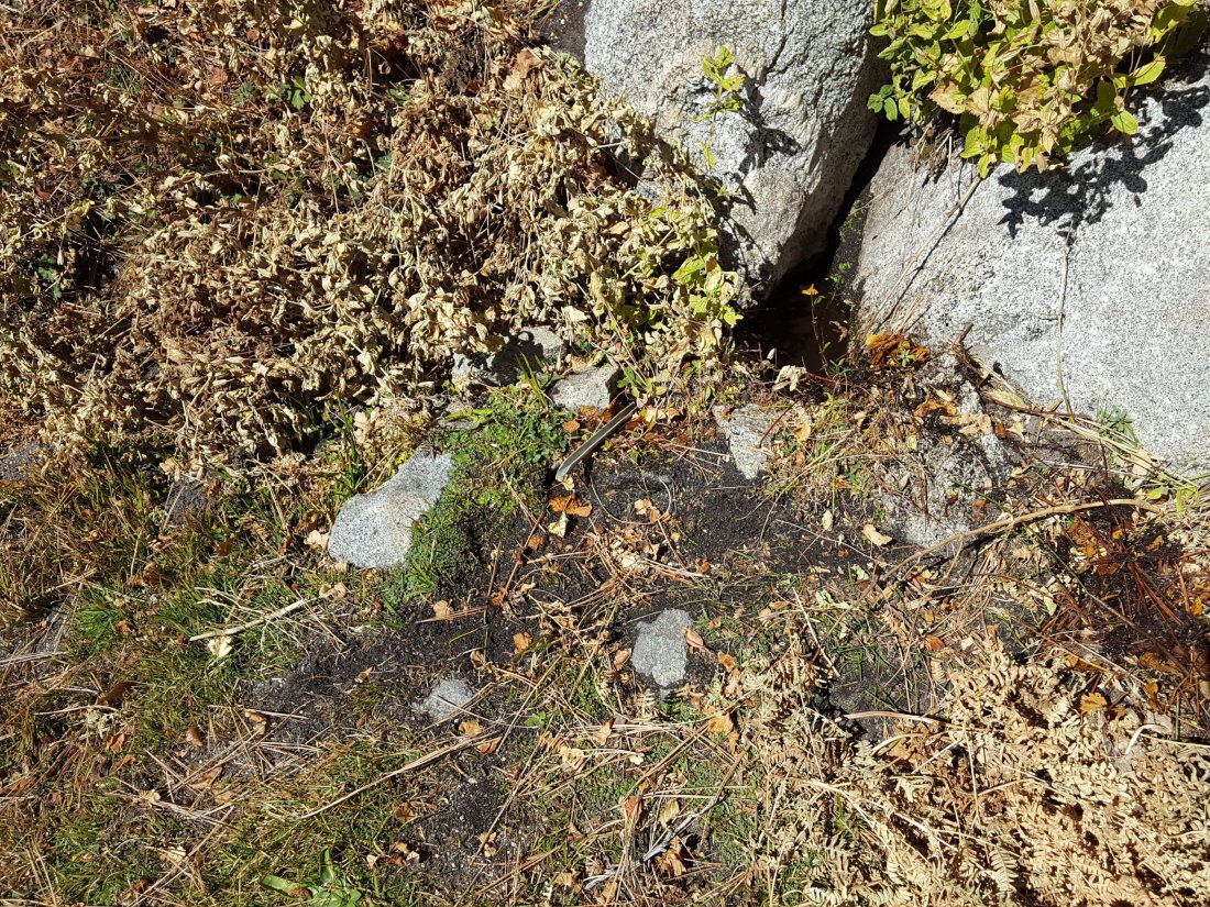
Tahquitz Valley has been completely dry since May.
Tahquitz Creek continues to flow well at the northern (lower) end of Little Tahquitz Meadow. This is the last remaining “reliable” water source in the Tahquitz meadows area.
Tahquitz Creek is only trickling further upstream at its source (known locally as Grethe Spring) where it crosses the PCT at the northern end of the fire closure (approx. PCT Mile 177). Immediately after (barely) crossing the PCT, the creek dries up.
Skunk Cabbage Creek is dry where the trail crosses Skunk Cabbage Meadow at the small wooden bridge.
WESTERN SLOPE WATER FEATURES
The North Fork of the San Jacinto River continues to flow, but poorly, where it crosses the Deer Springs Trail. This morning it was largely frozen. Flow of this major west-side water source this year has been the lowest in known history.

Just downstream, the North Fork of the San Jacinto River remains dry where it crosses the Pacific Crest Trail on Fuller Ridge (approx. PCT Mile 186). This was the critical water source for PCTers and others hiking to or from Snow Creek, a 22 mile section of trail infamous for being waterless (now waterless for >25 miles). Options for southbound PCT hikers (and other hikers) on this section are all poor. Switchback Spring and Strawberry Cienega (see below) are possibilities staying on the PCT, but both are at extremely low flows. Alternatively, from where the PCT crosses the Black Mountain Road it is possible to descend the road 2.4 miles to the Cinco Poses Spring (a faucet by the roadside, see below). This undulating and exposed road is a descent of about 600′ and ascent of 200′, that would have to be reversed on the way back. PCT hikers who choose to leave the PCT to ascend San Jacinto Peak quickly get access to water at the North Fork on Deer Springs Trail (as described above) and subsequently at Wellman’s Cienega (assuming they choose to descend via the east side).
O’Sullivan Creek (PCT Mile 186.3) on Fuller Ridge Trail has been dry since early May.
The spring in the creek in Little Round Valley has been completely dry since early June.
Shooting Star Spring – 0.28 trail miles below Little Round Valley – continues to trickle gently (it was completely unfrozen this morning). For hikers it is just possible to filter water from the source at the base of the obvious huge rock at the top of the wet area of trail, but a better option is to descend to the North Fork crossing mentioned above.
The Deer Springs stream crossing at the PCT (approx. PCT mile 185.6) is still dry, and the pools just upstream (and downstream) of the trail are also dry. The Deer Springs themselves continue to flow gently, about 0.15 miles upslope from the trail. Unfortunately, almost all the flow is diverted into a pipe for the Deer Springs camp. The Deer Springs camp just downslope from the trail had been occupied by a crew from the California Conservation Corps off-and-on since late May, but they departed at the end of October.
Switchback Spring – the small spring just below the eight switchbacks on Deer Springs Trail about 0.4 miles north of Strawberry Junction – continues to trickle gently, although flow was not noticeably stronger today.

The little spring at Strawberry Cienega (PCT mile 183) has not been flowing since September. The tiny pool in the crack between the two large rocks is just about useable for emergency filtering.
Cinco Poses Spring on Black Mountain Road (4.7 miles up from Highway 243) still has plenty of water at the faucet. Please do not forget to completely turn off the faucet when you are finished here. This could be an important emergency water source as others dry up throughout the western side of the mountain.
On Devil’s Slide Trail, Middle Spring has been dry since 26th July. Even today during the rain, it was not flowing at all.
On the Ernie Maxwell Trail, Chinquapin Creek just below Humber Park has been periodically diverted by Fern Valley Water District since the summer. Even when the creek is diverted, pools receive a little fresh flow immediately upstream from the trail. This is a very important water source for the many dogs walked on this trail.sanjacjonUncategorizedLeave a comment 6 MinutesEdit”Rain and ice 22nd November 2018″
Weather & water 15th November 2018
We hiked to San Jacinto Peak today with friend Carolyn Auwaerter, from Humber Park via Wellman’s Divide, then descending via Deer Springs Trail/PCT to the Suicide Rock Trail, then the Suicide Rock climbers trail back to Humber Park.
Weather There is a possibility of light precipitation forecast for Thursday 22nd November. Temperatures are now seasonal, and today it was frigid at the Peak. Hikers should anticipate temperatures near freezing in the high country (>9000′) and at or below freezing at the high peaks (potentially well below freezing with windchill).
At San Jacinto Peak today, Thursday 15th November, at 0930 the air temperature was 34.6°F (1.4°C), with a windchill temperature of 17°F (-8°C), 24% relative humidity, and a potent 25 mph NE (“Santa Ana”) wind gusting to 33.3 mph.
Similarly, on Friday 9th November at 0830 the air temperature was 29°F (-1.7°C), with a windchill temperature of 13.5°F (-10.3°C), 11% relative humidity, and a stiff 16 mph NE wind gusting to 18 mph.

Trail overview The water situation in the San Jacinto mountains remains very poor and basically unchanged from early October. The water sources above 9000′ were partially frozen this morning, and more extensive freezing is to be expected soon.
This afternoon we found that Marion Creek, midway along the Suicide Rock Trail, continues to flow quite well. Cedar Spring on the Desert Divide just to the east of the PCT continues to flow gently, as detailed in a prior report at this link.

EASTERN SLOPE WATER FEATURES
The Round Valley faucet has been dry since the summer.
Both the northern and southern springs at Wellman’s Cienega continue to flow gently.
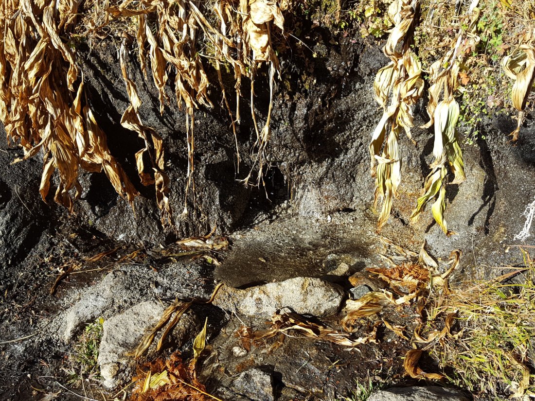
These springs are the sources for Willow Creek, which has not been flowing where it crosses the Willow Creek Trail since late summer. There may be small pools where water could be filtered just upstream from the crossing. The creek is actually flowing gently a few hundred yards upstream from the trail crossing, but access is not easy. Willow Creek has not previously been known to stop flowing at the trail crossing.
Tahquitz Valley has been completely dry since May.
Tahquitz Creek continues to flow well at the northern (lower) end of Little Tahquitz Meadow. This is the last remaining “reliable” water source in the Tahquitz meadows area.
Tahquitz Creek is barely trickling further upstream at its source (known locally as Grethe Spring) where it crosses the PCT at the northern end of the fire closure (approx. PCT Mile 177). Immediately after (barely) crossing the PCT, the creek dries up.
Skunk Cabbage Creek is dry where the trail crosses Skunk Cabbage Meadow at the small wooden bridge.
WESTERN SLOPE WATER FEATURES
The North Fork of the San Jacinto River continues to flow, but very poorly, where it crosses the Deer Springs Trail. Flow of this major west-side water source this year has been the lowest in known history.
Just downstream, the North Fork of the San Jacinto River remains dry where it crosses the Pacific Crest Trail on Fuller Ridge (approx. PCT Mile 186). This was the critical water source for PCTers and others hiking to or from Snow Creek, a 22 mile section of trail infamous for being waterless (now waterless for >25 miles). Options for southbound PCT hikers (and other hikers) on this section are all poor. Switchback Spring and Strawberry Cienega (see below) are possibilities staying on the PCT, but both are at extremely low flows. Alternatively, from where the PCT crosses the Black Mountain Road it is possible to descend the road 2.4 miles to the Cinco Poses Spring (a faucet by the roadside, see below). This undulating and exposed road is a descent of about 600′ and ascent of 200′, that would have to be reversed on the way back. PCT hikers who choose to leave the PCT to ascend San Jacinto Peak quickly get access to water at the North Fork on Deer Springs Trail (as described above) and subsequently at Wellman’s Cienega (assuming they choose to descend via the east side).
O’Sullivan Creek (PCT Mile 186.3) on Fuller Ridge Trail has been dry since early May.
The spring in the creek in Little Round Valley has been completely dry since early June.
Shooting Star Spring – 0.28 trail miles below Little Round Valley – continues to trickle gently (when not frozen). For hikers it is just possible to filter water from the source at the base of the obvious huge rock at the top of the wet area of trail, but a better option is to descend to the North Fork crossing mentioned above.
The Deer Springs stream crossing at the PCT (approx. PCT mile 185.6) is dry, and the pools just upstream (and downstream) of the trail are also dry. The Deer Springs themselves continue to flow gently, about 0.15 miles upslope from the trail. Unfortunately, almost all the flow is diverted into a pipe for the Deer Springs camp. The Deer Springs camp just downslope from the trail had been occupied by a crew from the California Conservation Corps off-and-on since late May, but they departed at the end of October.
Switchback Spring – the small spring just below the eight switchbacks on Deer Springs Trail about 0.4 miles north of Strawberry Junction – continues to trickle gently, although flow was very weak today. The tiny pool on the upslope side of the trail is now so shallow that filtering is very challenging.
The little spring at Strawberry Cienega (PCT mile 183) has not been flowing since September. The tiny pool in the crack between the two large rocks is just about useable for emergency filtering.
Cinco Poses Spring on Black Mountain Road (4.7 miles up from Highway 243) still has plenty of water at the faucet. Please do not forget to completely turn off the faucet when you are finished here. This could be an important emergency water source as others dry up throughout the western side of the mountain.
On Devil’s Slide Trail, Middle Spring has been dry since 26th July.
On the Ernie Maxwell Trail, Chinquapin Creek just below Humber Park has been periodically diverted by Fern Valley Water District since the summer. Even when the creek is diverted, good pools receive some fresh flow immediately upstream from the trail. This is a very important water source for the many dogs walked on this trail.sanjacjonUncategorizedLeave a comment 5 MinutesEdit”Weather & water 15th November 2018″
Weather and water 9th November 2018
We hiked to San Jacinto Peak three times this week, on 5th, 7th, and today, 9th November, via various routes. Today’s long loop from Humber Park included a full circuit of the mountain and a long section of the PCT. A really pleasant surprise was catching up with local friend and fellow hiker/runner Michele at Wellman Divide, who then joined us to and at San Jacinto Peak.
Weather Still no hint of precipitation for the mountain in short- or medium-term forecasts. Temperatures are finally dropping to near seasonal, and today it was frigid at the Peak, but it had otherwise been unusually mild so far in November, especially as recently as Monday 5th (see below). Hikers should now expect temperatures near freezing in the high country (>9000′), and at or below freezing at the high peaks (potentially well below freezing with windchill).
At San Jacinto Peak today, Friday 9th November, at 0830 the air temperature was 29°F (-1.7°C), with a windchill temperature of 13.5°F (-10.3°C), 11% relative humidity, and a stiff 16 mph NE (“Santa Ana”) wind gusting to 18 mph.
In stark contrast, on Monday 5th November, at 0835 the air temperature at San Jacinto Peak was a balmy 52°F (11°C), 35% relative humidity, and a windchill temperature of 44.7°F (7°C) despite a brisk NNW wind sustained at 11 mph, gusting to over 16 mph. The temperatures on Wednesday 7th were intermediate between the conditions of 5th and 9th, although more similar to the warmth of Monday 5th.
Trail overview The water situation in the San Jacinto mountains remains very poor, and the overall status of water sources is basically unchanged from early October. The water sources above 9000′ were partially frozen this morning, and more extensive freezing is to be expected in this season. With no precipitation forecast, these water conditions will not improve for the foreseeable future. Cedar Spring on the Desert Divide just to the east of the PCT continues to flow gently, as detailed in a prior report at this link.
EASTERN SLOPE WATER FEATURES
The Round Valley faucet has been dry since the summer.
Both the northern and southern springs at Wellman’s Cienega continue to flow gently.

These springs are the sources for Willow Creek, which has not been flowing where it crosses the Willow Creek Trail since late summer. There may be small pools where water could be filtered just upstream from the crossing. The creek is actually flowing gently a few hundred yards upstream from the trail crossing, but access is not easy. Willow Creek has not previously been known to stop flowing at the trail crossing.
Tahquitz Valley has been completely dry since May.
Tahquitz Creek continues to flow well at the northern (lower) end of Little Tahquitz Meadow. This is the last remaining “reliable” water source in the Tahquitz meadows area.

Tahquitz Creek is barely trickling further upstream at its source (known locally as Grethe Spring) where it crosses the PCT at the northern end of the fire closure (approx. PCT Mile 177). Immediately after (barely) crossing the PCT, the creek dries up.
Skunk Cabbage Creek is dry where the trail crosses Skunk Cabbage Meadow at the small wooden bridge.
WESTERN SLOPE WATER FEATURES
The North Fork of the San Jacinto River continues to flow poorly where it crosses the Deer Springs Trail. Flow rate was well below 0.5 gallons per minute today. Flow of this major west-side water source this year has been the lowest in known history.
Just downstream, the North Fork of the San Jacinto River remains dry where it crosses the Pacific Crest Trail on Fuller Ridge (approx. PCT Mile 186). This was the critical water source for PCTers and others hiking to or from Snow Creek, a 22 mile section of trail infamous for being waterless (now waterless for >25 miles). Options for southbound PCT hikers (and other hikers) on this section are all poor. Switchback Spring and Strawberry Cienega (see below) are possibilities staying on the PCT, but both are at extremely low flows. Alternatively, from where the PCT crosses the Black Mountain Road it is possible to descend the road 2.4 miles to the Cinco Poses Spring (a faucet by the roadside, see below). This undulating and exposed road is a descent of about 600′ and ascent of 200′, that would have to be reversed on the way back. PCT hikers who choose to leave the PCT to ascend San Jacinto Peak quickly get access to water at the North Fork on Deer Springs Trail (as described above) and subsequently at Wellman’s Cienega (assuming they choose to descend via the east side).
O’Sullivan Creek (PCT Mile 186.3) on Fuller Ridge Trail has been dry since early May.
The spring in the creek in Little Round Valley has been completely dry since early June.
Shooting Star Spring – 0.28 trail miles below Little Round Valley – continues to trickle gently (when not frozen). For hikers it is just possible to filter water from the source at the base of the obvious huge rock at the top of the wet area of trail, but a better option is to descend to the North Fork crossing mentioned above.
The Deer Springs stream crossing at the PCT (approx. PCT mile 185.6) is dry, and the pools just upstream (and downstream) of the trail are also dry. The Deer Springs themselves continue to flow gently, about 0.15 miles upslope from the trail. Unfortunately, almost all the flow is diverted into a pipe for the Deer Springs camp. The Deer Springs camp just downslope from the trail had been occupied by a crew from the California Conservation Corps off-and-on since late May, but they departed at the end of October.
Switchback Spring – the small spring just below the eight switchbacks on Deer Springs Trail about 0.4 miles north of Strawberry Junction – continues to trickle gently, although flow was very weak today. The tiny pool on the upslope side of the trail is now so shallow that filtering is very challenging.
The little spring at Strawberry Cienega (PCT mile 183) has not been flowing since September. The tiny pool in the crack between the two large rocks is just about useable for emergency filtering.
Cinco Poses Spring on Black Mountain Road (4.7 miles up from Highway 243) still has plenty of water at the faucet. Please do not forget to completely turn off the faucet when you are finished here. This could be an important emergency water source as others dry up throughout the western side of the mountain.
On Devil’s Slide Trail, Middle Spring has been dry since 26th July.
On the Ernie Maxwell Trail, Chinquapin Creek just below Humber Park has been periodically diverted by Fern Valley Water District since the summer. Even when the creek is diverted, good pools receive some fresh flow immediately upstream from the trail. This is a very important water source for the many dogs walked on this trail.sanjacjonUncategorizedLeave a comment 5 MinutesEdit”Weather and water 9th November 2018″
Water and weather 31st October 2018
Today I reviewed the water sources of the Tahquitz area meadows on the way to my fire lookout shift at Tahquitz Peak. Our hike yesterday went to San Jacinto Peak via Wellman’s Cienega, then descended Deer Springs Trail, checking the higher elevation water sources around the mountain en route.
Weather Temperatures have been above-average for the past week, and will remain so for at least the first week of November. Nevertheless, other than on unseasonably warm days, hikers should now expect temperatures near or below freezing at the high peaks (potentially well below freezing with windchill).
At San Jacinto Peak yesterday, Tuesday 30th October, at 0930 the air temperature was 39.5°F (4°C), with a windchill temperature of 27.4°F (-2.6°C), 31% relative humidity, and a fresh 10 mph due West wind gusting to 17 mph.
Bear update One of our resident Black Bears passed through Thousand Trails in upper Pine Cove on or around Sunday 28th October 2018. [Many thanks to Kathy Price-Robinson for this information.]
Trail overview The water situation in the San Jacinto mountains remains very poor, and the overall status of water sources is basically unchanged from early October. Small patches of snow remain on San Jacinto Peak in Snow Creek on the uppermost North Face.
Cedar Spring on the Desert Divide just to the east of the PCT continues to flow gently, as detailed in a prior report at this link.
EASTERN SLOPE WATER FEATURES
The Round Valley faucet has been dry since the summer.
Both the northern and southern springs at Wellman’s Cienega continue to flow gently.

These springs are the sources for Willow Creek, which is no longer flowing where it crosses the Willow Creek Trail. There are small pools where water could be filtered just upstream from the crossing. The creek is actually flowing gently a few hundred yards upstream from the trail crossing, but access is not easy. Willow Creek has not previously been known to stop flowing at the trail crossing.
Tahquitz Valley has been completely dry since May.
Tahquitz Creek continues to flow well at the northern (lower) end of Little Tahquitz Meadow. This is the last remaining “reliable” water source in the Tahquitz meadows area.
Tahquitz Creek is barely trickling further upstream at its source (known locally as Grethe Spring) where it crosses the PCT at the northern end of the fire closure (approx. PCT Mile 177). Immediately after (barely) crossing the PCT, the creek dries up.

Skunk Cabbage Creek is dry where the trail crosses Skunk Cabbage Meadow at the small wooden bridge.
WESTERN SLOPE WATER FEATURES
The North Fork of the San Jacinto River continues to flow poorly where it crosses the Deer Springs Trail. Flow rate was only about 0.5 gallons per minute today. Flow of this major west-side water source this year has been the lowest in known history.
Just downstream, the North Fork of the San Jacinto River remains dry where it crosses the Pacific Crest Trail on Fuller Ridge (approx. PCT Mile 186). This was the critical water source for PCTers and others hiking to or from Snow Creek, a 22 mile section of trail infamous for being waterless (now waterless for >25 miles). Options for southbound PCT hikers (and other hikers) on this section are all poor. Switchback Spring and Strawberry Cienega (see below) are possibilities staying on the PCT, but both are at extremely low flows. Alternatively, from where the PCT crosses the Black Mountain Road it is possible to descend the road 2.4 miles to the Cinco Poses Spring (a faucet by the roadside, see below). This undulating and exposed road is a descent of about 600′ and ascent of 200′, that would have to be reversed on the way back. PCT hikers who choose to leave the PCT to ascend San Jacinto Peak quickly get access to water at the North Fork on Deer Springs Trail (as described above) and subsequently at Wellman’s Cienega (assuming they choose to descend via the east side).
O’Sullivan Creek (PCT Mile 186.3) on Fuller Ridge Trail has been dry since early May.
The spring in the creek in Little Round Valley has been completely dry since early June.
Shooting Star Spring – 0.28 trail miles below Little Round Valley – continues to flow very gently. For hikers it is just possible to filter water from the source at the base of the obvious huge rock at the top of the wet area of trail, but a better option is to descend to the North Fork crossing mentioned above.
The Deer Springs stream crossing at the PCT (approx. PCT mile 185.6) is dry, and the pools just upstream (and downstream) of the trail are also dry. The Deer Springs themselves continue to flow gently, about 0.15 miles upslope from the trail. Unfortunately, almost all the flow is diverted into a pipe for the Deer Springs camp. The Deer Springs camp just downslope from the trail had been occupied by a crew from the California Conservation Corps off-and-on since late May, but on 30th October they appeared to be packing up and the camp will likely be vacated very soon.
Switchback Spring – the small spring just below the eight switchbacks on Deer Springs Trail about 0.4 miles north of Strawberry Junction – continues to trickle gently, although flow was very weak today. The tiny pool on the upslope side of the trail is now so shallow that filtering is very challenging.
The little spring at Strawberry Cienega (PCT mile 183) is dry. The tiny pool in the crack between the two large rocks might be useable for emergency filtering.
Cinco Poses Spring on Black Mountain Road (4.7 miles up from Highway 243) still has abundant water at the faucet. Please do not forget to completely turn off the faucet when you are finished here. This could be an important emergency water source as others dry up throughout the western side of the mountain.
On Devil’s Slide Trail, Middle Spring has been dry since 26th July.
On the Ernie Maxwell Trail, Chinquapin Creek just below Humber Park has been periodically diverted by Fern Valley Water District since the summer. It was dry where it crosses the trail when I checked it on Monday 29th October. Even when the creek is diverted, good pools receive some fresh flow immediately upstream from the trail. This is a very important water source for the many dogs walked on this trail.sanjacjonUncategorizedLeave a comment 4 MinutesEdit”Water and weather 31st October 2018″
Water and weather 25th October 2018
Our hike today went to San Jacinto Peak via Wellman’s Cienega, then descending Deer Springs Trail, which allowed a check of most higher elevation water sources around the mountain. Other hikes this week have included a couple in the Tahquitz area and one up-and-down the Black Mountain Trail. A hike with friends on Thursday 18th October to several peaks above 10,000′ included my 100th ascent of San Jacinto Peak this year.
Weather The moderate precipitation of 12th-13th October is already a distant memory. Temperatures had been pleasantly cool and more-or-less seasonal, but a marked warming to above-average temperatures starting today will continue over the next few days, before a return to cooler weather early next week.
Other than during the unseasonably warm weather for about the next week, hikers should now expect temperatures near freezing in the high country >9,000′ elevation, and at or below freezing at the high peaks (potentially well below freezing with windchill).
At San Jacinto Peak at 0925 this morning, Thursday 25th October, the air temperature was 45°F (7°C), with a windchill temperature of 40.4F (5°C), 32% relative humidity, and a very light mph North wind gusting to 5 mph. Note that the windchill temperature was 45° warmer than at the same time ten days earlier!
On Thursday 18th October at 0730, the air temperature was 27°F (-3°C), with a windchill temperature of 9.4°F (-12.5°C), 62% relative humidity, and a bitter 21 mph NNE wind gusting to 24 mph.

Trail overview The modest rainfall throughout the mountain – with even a dusting of snow in the high country – nearly two weeks ago has had no lasting impact on the water situation in the San Jacinto mountains, which remains very poor. The overall status of water sources is basically unchanged from early October. Miniscule patches of snow remain on San Jacinto Peak near the East Ridge Trail, but some decent patches (1-2″ deep) remain in Snow Creek on the uppermost North Face.
Cedar Spring on the Desert Divide just to the east of the PCT continues to flow gently, as detailed in a prior report at this link.
Excellent news on the Seven Pines Trail, as first reported here last week. It seems that frequent reporting of the poor condition of this trail to the agencies paid off, and the several dozen trees that were across this lovely trail have been largely cleared by a State maintenance team.
EASTERN SLOPE WATER FEATURES
The Round Valley faucet has been dry since the summer.
Both the northern and southern springs at Wellman’s Cienega continue to flow gently.

These springs are the sources for Willow Creek, which is no longer flowing where it crosses the Willow Creek Trail. There are small pools where water could be filtered just upstream from the crossing. The creek is actually flowing gently a few hundred yards upstream from the trail crossing, but access is not easy. Willow Creek has not previously been known to stop flowing at the trail crossing.
Tahquitz Valley has been completely dry since May.
Tahquitz Creek continues to flow well at the northern (lower) end of Little Tahquitz Meadow. This is the last remaining “reliable” water source in the Tahquitz meadows area.

Tahquitz Creek is barely trickling further upstream at its source (known locally as Grethe Spring) where it crosses the PCT at the northern end of the fire closure (approx. PCT Mile 177). Immediately after (barely) crossing the PCT, the creek dries up.
Skunk Cabbage Creek is dry where the trail crosses Skunk Cabbage Meadow at the small wooden bridge.
WESTERN SLOPE WATER FEATURES
The North Fork of the San Jacinto River continues to flow poorly where it crosses the Deer Springs Trail. Flow rate was down to about 0.5 gallons per minute today. Flow of this major west-side water source this year has been the lowest in known history.
Just downstream, the North Fork of the San Jacinto River was still dry today where it crosses the Pacific Crest Trail on Fuller Ridge (approx. PCT Mile 186). This was the critical water source for PCTers and others hiking to or from Snow Creek, a 22 mile section of trail infamous for being waterless (but now waterless for >25 miles). Options for southbound PCT hikers (and other hikers on this section) are all poor. Switchback Spring and Strawberry Cienega (see below) are possibilities staying on the PCT, but both are at extremely low flows. If heading to San Jacinto Peak, the North Fork where it crosses the Deer Springs Trail is a good option. Alternatively, from where the PCT crosses the Black Mountain Road it is possible to descend the road 2.4 miles to the Cinco Poses Spring (a faucet by the roadside, see below). This undulating and exposed road is a descent of about 600′ and ascent of 200′, that would have to be reversed on the way back. PCT hikers who choose to leave the PCT to ascend San Jacinto Peak quickly get access to water at the North Fork on Deer Springs Trail (as described above) and subsequently at Wellman’s Cienega (assuming they choose to descend via the east side).
O’Sullivan Creek (PCT Mile 186.3) on Fuller Ridge Trail has been dry since early May.
The spring in the creek in Little Round Valley has been completely dry since early June.
Shooting Star Spring – 0.28 trail miles below Little Round Valley – continues to flow very gently. For hikers it is just possible to filter water from the source at the base of the obvious huge rock at the top of the wet area of trail, but a better option is to descend to the North Fork crossing mentioned above.
The Deer Springs stream crossing at the PCT (approx. PCT mile 185.6) is dry, and the pools just upstream (and downstream) of the trail are also dry. The Deer Springs themselves continue to flow gently, about 0.15 miles upslope from the trail. Unfortunately, almost all the flow is diverted into a pipe for the Deer Springs camp. The Deer Springs camp just downslope from the trail has been occupied by a crew from the California Conservation Corps off-and-on since late May.
Switchback Spring – the small spring just below the eight switchbacks on Deer Springs Trail about 0.4 miles north of Strawberry Junction – continues to trickle gently, although flow was very weak today. The tiny pool on the upslope side of the trail is now so shallow that filtering is very challenging.

The little spring at Strawberry Cienega (PCT mile 183) is dry. The tiny pool in the crack between the two large rocks might be useable for emergency filtering.
Cinco Poses Spring on Black Mountain Road (4.7 miles up from Highway 243) still has abundant water at the faucet. Please do not forget to completely turn off the faucet when you are finished here. This could be an important emergency water source as others dry up throughout the western side of the mountain. [Many thanks to Florian Boyd for this update from our joint shift at the Black Mountain fire lookout on Tuesday 23rd October.]
On Devil’s Slide Trail, Middle Spring has been dry since 26th July.
On the Ernie Maxwell Trail, Chinquapin Creek just below Humber Park has been periodically diverted by Fern Valley Water District since the summer. It was dry where it crosses the trail when I checked it on Monday 22nd October. Even when the creek is diverted, good pools receive some fresh flow immediately upstream from the trail. This is a very important water source for the many dogs walked on this trail.sanjacjonUncategorizedLeave a comment 5 MinutesEdit”Water and weather 25th October 2018″
Snow and wind 15th October 2018
My pleasantly chilly hike today went to San Jacinto Peak via Wellman’s Cienega and a quick check of the Round Valley faucet, then descended on Deer Springs Trail, with a side hike part-way along Fuller Ridge Trail. This allowed me to check the higher elevation water sources around the mountain. [I was able to check the water sources of the Tahquitz area meadows on Tuesday 16th.]ErrorThis video doesn’t exist
Weather The entire mountain experienced moderate rainfall on Friday night and throughout Saturday, 12th-13th October. In total we had 0.72″ at 5550′ elevation in Idyllwild, while Garner Valley and Long Valley received an inch, and all the weather stations in the region recorded at least 0.5″.
The high elevations even received a dusting of October snow. About 0.5″ fell above 9800′ on the east side, with about 1.0″ above 10,300′. On the west side, the snow level was a little higher (there was none in Little Round Valley). Only very limited patches remained today (except in upper Snow Creek), and no traction assistance (e.g., microspikes) is currently required.
Also, hikers should now expect temperatures near freezing in the high country >9,000′ elevation, and at or below freezing at the high peaks (potentially well below freezing with windchill).
At San Jacinto Peak at 1045 this morning, Monday 15th October, the air temperature was 20°F (-7°C), with a windchill temperature of -4.7°F (-20°C), 30% relative humidity, and a sustained, frigid 22 mph NE wind gusting to 32.2 mph.
On Thursday 11th October at 1445, the air temperature was 38°F (3.3°C), with a windchill temperature of 30.9°F (-1°C), 79% relative humidity, and a light 3 mph South wind gusting to 7.5 mph.
Trail overview The water situation in the San Jacinto mountains remains very poor despite the precipitation of recent days discussed above. My observations indicate that water sources that were still flowing experienced an increase in flow rate thanks to the rainfall. However, sources that were already dry did not receive enough new input to get them flowing again.
Excellent news on the Seven Pines Trail. After years of neglect by the State Park, during which dozens of fallen trees significantly obscured this lovely trail, a maintenance program has removed almost all the obstructions. It seems that frequent reporting of the poor condition of this trail by myself and others to the agencies has finally paid off (I have had two search-and-rescue missions on Seven Pines this year alone, with hikers getting lost due to the challenges of navigating this trail).
EASTERN SLOPE WATER FEATURES
The Round Valley faucet remained dry today, with no evidence of any flow in recent days despite the rain.
Both the northern and southern springs at Wellman’s Cienega continue to flow. The northern spring was flowing much stronger this morning than last week.
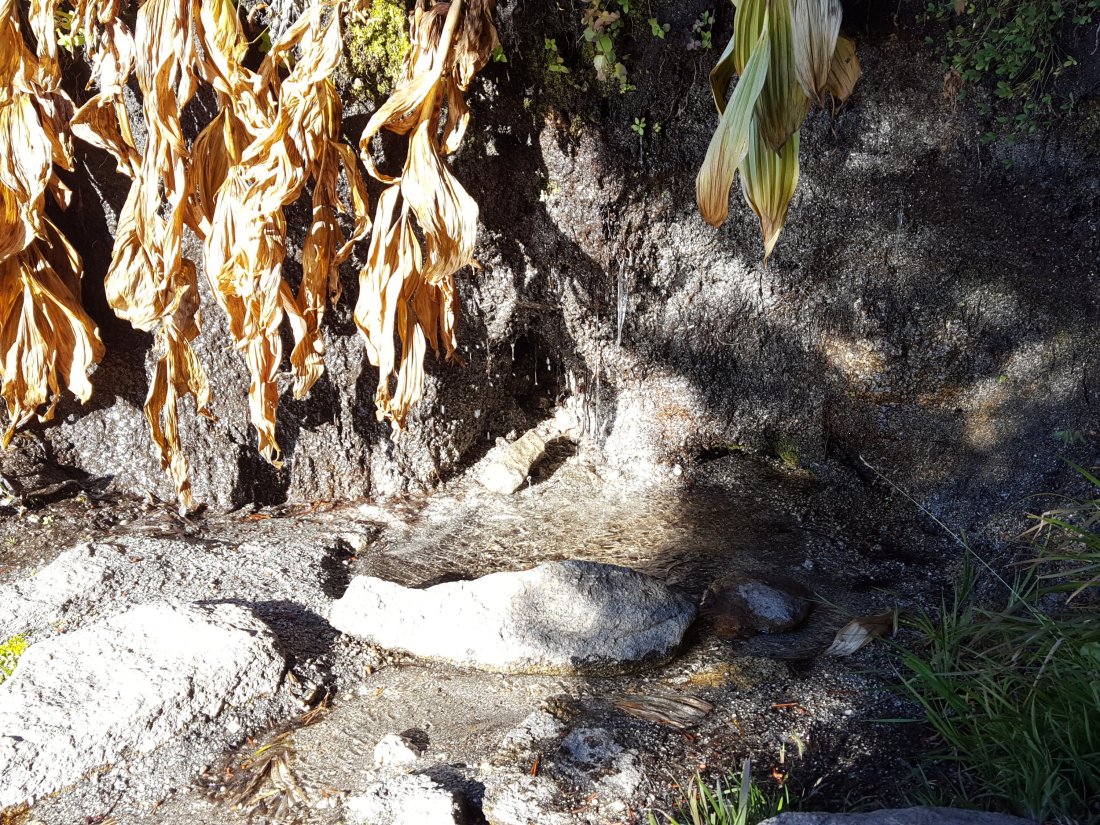
These springs are the sources for Willow Creek, which is no longer flowing where it crosses the Willow Creek Trail. There are small pools where water could be filtered just upstream from the crossing. The creek is actually flowing gently a few hundred yards upstream from the trail crossing, but access is not easy. Willow Creek has not previously been known to stop flowing at the trail crossing.
Tahquitz Valley has been completely dry since May.
Tahquitz Creek continues to flow well at the northern (lower) end of Little Tahquitz Meadow. This is the last remaining “reliable” water source in the Tahquitz meadows area.
Tahquitz Creek is barely trickling further upstream at its source (known locally as Grethe Spring) where it crosses the PCT at the northern end of the fire closure (approx. PCT Mile 177). Immediately after (barely) crossing the PCT, the creek dries up.

Skunk Cabbage Creek is dry where the trail crosses Skunk Cabbage Meadow at the small wooden bridge.
WESTERN SLOPE WATER FEATURES
The North Fork of the San Jacinto River continues to flow gently where it crosses the Deer Springs Trail. Initially on 15th October I thought the flow rate had dropped, but this was because the river was partly frozen just upstream (note the icicles in the upper part of the photo).
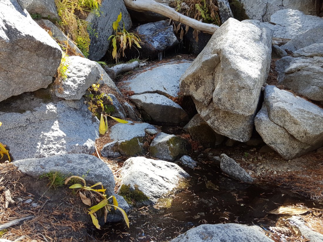
Just downstream, the North Fork of the San Jacinto River was still dry today where it crosses the Pacific Crest Trail on Fuller Ridge (approx. PCT Mile 186). This was the critical water source for PCTers and others hiking to or from Snow Creek, a 22 mile section of trail infamous for being waterless (but now waterless for >25 miles). Options for southbound PCT hikers (and other hikers on this section) are all poor. Switchback Spring and Strawberry Cienega (see below) are possibilities staying on the PCT, but both are at extremely low flows. If heading to San Jacinto Peak, the North Fork where it crosses the Deer Springs Trail is a good option. Alternatively, from where the PCT crosses the Black Mountain Road it is possible to descend the road 2.4 miles to the Cinco Poses Spring (a faucet by the roadside, see below). This undulating and exposed road is a descent of about 600′ and ascent of 200′, that would have to be reversed on the way back.
O’Sullivan Creek (PCT Mile 186.3) on Fuller Ridge Trail has been dry since early May.
The spring in the creek in Little Round Valley has been completely dry since early June.
Shooting Star Spring – 0.28 trail miles below Little Round Valley – continues to flow gently. For hikers it is possible to filter water from the source at the base of the obvious huge rock at the top of the wet area of trail, but a better option is to descend to the North Fork crossing mentioned above.
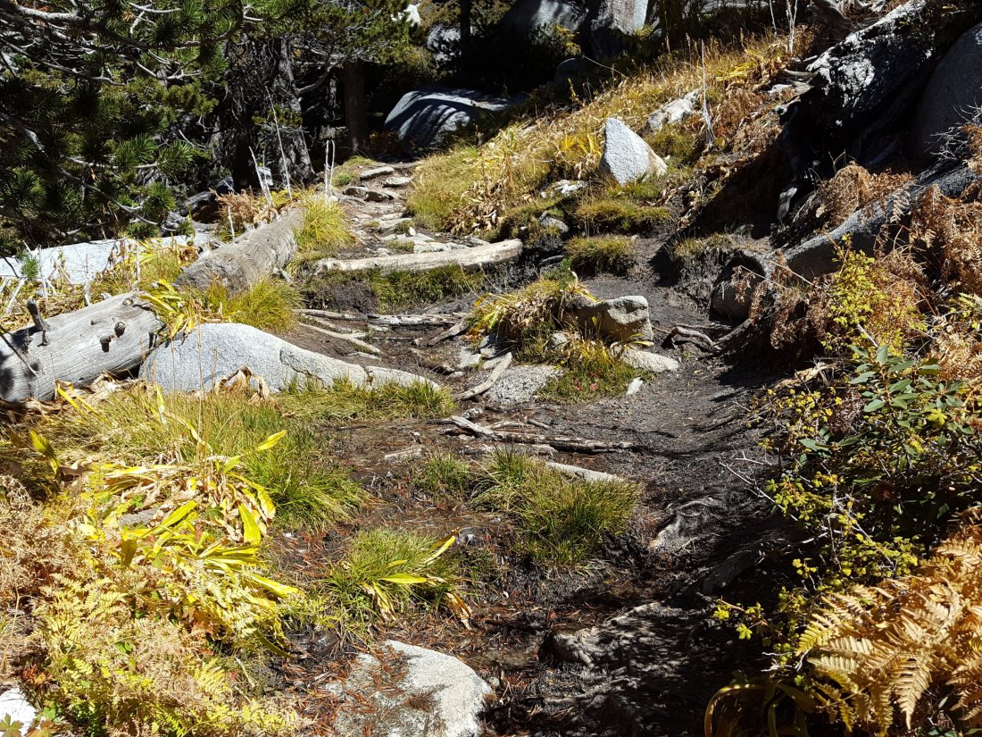
The Deer Springs stream crossing at the PCT (approx. PCT mile 185.6) is dry, and the pools just upstream (and downstream) of the trail are also dry. The Deer Springs themselves continue to flow gently, about 0.15 miles upslope from the trail. Unfortunately, almost all the flow is diverted into a pipe for the Deer Springs camp. The Deer Springs camp just downslope from the trail has been occupied by a crew from the California Conservation Corps off-and-on since late May.
Switchback Spring – the small spring just below the eight switchbacks on Deer Springs Trail about 0.4 miles north of Strawberry Junction – continues to trickle gently. Today there was no sign that the flow rate had improved after recent rain. The tiny pool on the upslope side of the trail is now so shallow that filtering is very challenging.
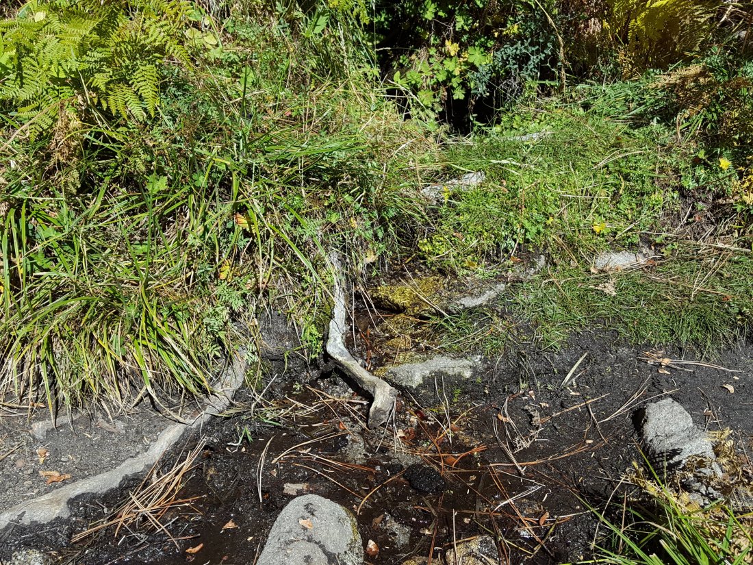
The little spring at Strawberry Cienega (PCT mile 183) is still dry. The tiny pool in the crack between the two large rocks might be useable for emergency filtering.
Cinco Poses Spring on Black Mountain Road (4.7 miles up from Highway 243) still has running water at the faucet. This could be an important emergency water source as others dry up throughout the western side of the mountain.
On Devil’s Slide Trail, Middle Spring has been dry since 26th July, and remained dry this morning despite recent rainfall.
On the Ernie Maxwell Trail, Chinquapin Creek just below Humber Park was no longer being diverted by Fern Valley Water District as of 2nd October. Today there were good pools in the trail, and the creek was trickling across the trail. [Many thanks to Anne King for today’s update.] Even if the creek is diverted, good pools receive some fresh flow immediately upstream from the trail. This creek is a very important water source for the many dogs walked on this trail.sanjacjonUncategorizedLeave a comment 5 MinutesEdit”Snow and wind 15th October 2018″
Weather 11th October 2018
There have been no significant changes to the water conditions on the mountain, which are detailed at the previous posting here.
However it has been a busy week for hiking, especially yesterday, as I mention in the video below. Also on Wednesday 10th, Anabel and I hiked the Cedar Springs and upper Jo Pond trails, and on 8th I went to San Jacinto Peak to check on the weather.ErrorThis video doesn’t exist
Weather Prospects for some rain at all elevations – even a dusting of snow on the Peak – seem good over the weekend. As I mention in the video, temperatures are near or below freezing at the highest elevations throughout the day at this time.
At San Jacinto Peak at 1445 on Thursday 11th October, the air temperature was 38°F (2.5°C), with a windchill temperature of 31°F (-0.5°C), 79% relative humidity, and a cool 3 mph South wind gusting to 8 mph.
On Monday 8th October at 0920, the air temperature was 34°F (1°C), with a windchill temperature of 21.4°F (-6°C), 32% relative humidity, and a sustained 5 mph NNW wind gusting to 14 mph.
Cedar Spring continues to flow gently. The trough about 35 yards upslope from the sign is full of water that is good for filtering.
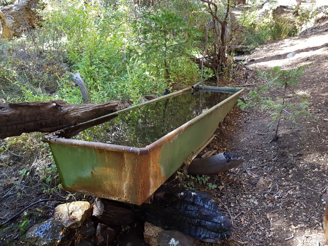
sanjacjonUncategorized5 Comments 1 MinuteEdit”Weather 11th October 2018″
Water and weather 5th October 2018
My lovely hike today went up Deer Springs Trail to San Jacinto Peak then descended on the east side via the Tahquitz area meadows to Tahquitz Peak. This allowed for a check of most water sources around the mountain, and to see the extent of the rainfall from yesterday morning.
Trail overview The water situation in the San Jacinto mountains remains very poor. At this stage of the year, I am optimistic that the few water sources that are still flowing will not dry up before adequate precipitation falls. The high country above 9000′ elevation missed out on the drizzle that fell yesterday (discussed below), so the status of most water sources remains unchanged from recent updates.
Weather There was very light rainfall in the early hours of Thursday morning, 4th October, with 0.15″ at 5500′ elevation in Idyllwild. Elevations above about 9000′ remained above the cloud and received no rainfall. On the trails there was subtle evidence of light rainfall below about 9000′ on all sides of the mountain.
As is typical in the San Jacintos, the transition from summer to winter is very rapid, and conditions are already starting to feel pleasantly wintry in the highest elevations. Temperatures are now near freezing in the high country >10,000′ elevation (and below freezing on exposed peaks with windchill).
At San Jacinto Peak at 1010 this morning, Friday 5th October, the air temperature was 37°F (3°C), with a windchill temperature of 25.3°F (-4°C), 54% relative humidity, and a cool 6 mph North wind gusting to 12 mph.
On Wednesday 3rd October at 0950, the air temperature was 41°F (5°C), with a windchill temperature of 28.4°F (-2°C), 45% relative humidity, and a sustained 8 mph SSW wind gusting to 18 mph.
EASTERN SLOPE WATER FEATURES
The Round Valley faucet is dry.
Both the northern and southern springs at Wellman’s Cienega continue to flow weakly. The northern spring was flowing very slightly stronger this morning than recent days.

These springs are the sources for Willow Creek, which is no longer flowing where it crosses the Willow Creek Trail. There are small pools where water could be filtered just upstream from the crossing. The creek is actually flowing gently a few hundred yards upstream from the trail crossing, but access is not easy. Willow Creek has not previously been known to stop flowing at the trail crossing.
Tahquitz Valley has been completely dry since May.
Tahquitz Creek continues to flow well at the northern (lower) end of Little Tahquitz Meadow. Flow today was slightly stronger following the light rain. This is the last remaining “reliable” water source in the Tahquitz meadows area.
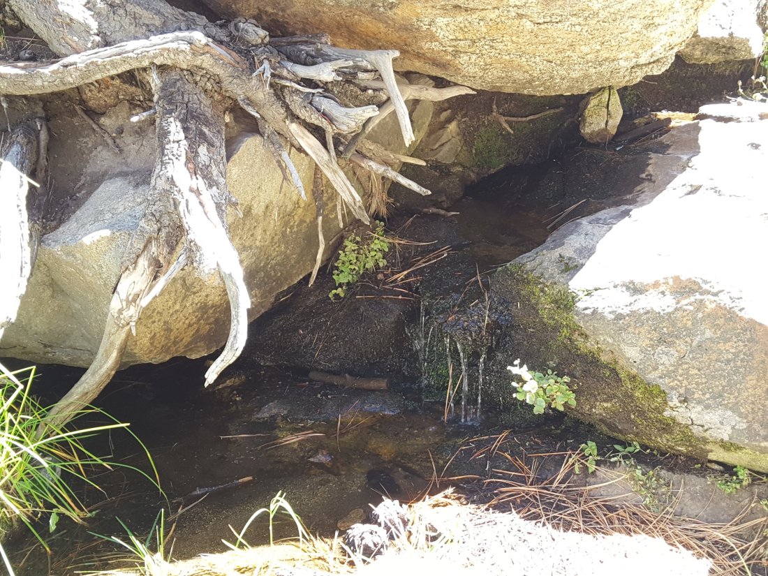
Tahquitz Creek is barely trickling further upstream at its source (known locally as Grethe Spring) where it crosses the PCT at the northern end of the fire closure (approx. PCT Mile 177). Immediately after (barely) crossing the PCT, the creek dries up.
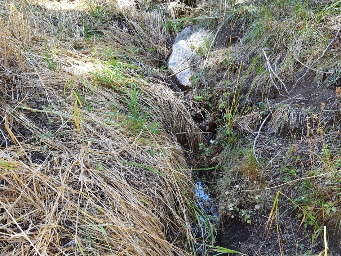
Skunk Cabbage Creek is dry where the trail crosses Skunk Cabbage Meadow at the small wooden bridge.
WESTERN SLOPE WATER FEATURES
The North Fork of the San Jacinto River continues to flow weakly where it crosses the Deer Springs Trail, but the flow has dropped dramatically in the past couple of weeks to only about 0.6 gallons per minute. The water levels for this river are the lowest in living memory.

Just downstream, the North Fork of the San Jacinto River has dried up where it crosses the Pacific Crest Trail on the Fuller Ridge Trail (approx. PCT Mile 186). This was the critical water source for PCTers and others hiking to or from Snow Creek, a 22 mile section of trail infamous for being waterless (but now waterless for >25 miles). Options for southbound PCT hikers (and other hikers on this section) are all poor. Switchback Spring and Strawberry Cienega (see below) are possibilities staying on the PCT, but both are at extremely low flows. If heading to San Jacinto Peak, the North Fork where it crosses the Deer Springs Trail is a good option. Alternatively, from where the PCT crosses the Black Mountain Road it is possible to descend the road 2.4 miles to the Cinco Poses Spring (a faucet by the roadside, see below). This undulating and exposed road is a descent of about 600′ and ascent of 200′, that would have to be reversed on the way back.
O’Sullivan Creek (PCT Mile 186.3) on Fuller Ridge Trail has been dry since early May.
The spring in the creek in Little Round Valley has been completely dry since early June.
Shooting Star Spring – 0.28 trail miles below Little Round Valley – continues to flow gently. For hikers it is possible to filter water from the source at the base of the obvious huge rock at the top of the wet area of trail, but a better option is to descend to the North Fork crossing mentioned above.
The Deer Springs stream crossing at the PCT (approx. PCT mile 185.6) is dry, and the pools just upstream (and downstream) of the trail are also dry. The Deer Springs themselves continue to flow gently, about 0.15 miles upslope from the trail. Unfortunately, almost all the flow is diverted into a pipe for the Deer Springs camp. The Deer Springs camp just downslope from the trail has been occupied by a crew from the California Conservation Corps off-and-on since late May.
Switchback Spring – the small spring just below the eight switchbacks on Deer Springs Trail about 0.4 miles north of Strawberry Junction – continues to trickle very gently. The tiny pool on the upslope side of the trail (where water could be filtered in an emergency) is now so shallow that filtering is challenging.
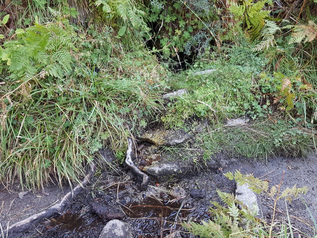
The little spring at Strawberry Cienega (PCT mile 183) has now dried up. The tiny pool in the crack between the two large rocks might be useable for emergency filtering.
Cinco Poses Spring on Black Mountain Road (4.7 miles up from Highway 243) still has running water at the faucet. This could be an important emergency water source as others dry up throughout the western side of the mountain.
On Devil’s Slide Trail, Middle Spring has been dry since 26th July.
On the Ernie Maxwell Trail, Chinquapin Creek just below Humber Park was no longer being diverted by Fern Valley Water District as of 2nd October. Even if the creek is diverted, good pools receive some fresh flow immediately upstream from the trail. This creek is a very important water source for the many dogs walked on this trail.sanjacjonUncategorizedLeave a comment 5 MinutesEdit”Water and weather 5th October 2018″
Water and weather 3rd October 2018
Our hike today to San Jacinto Peak allowed a check of water sources around the mountain. On Monday 1st, I was able to check the Tahquitz area on a hike to Tahquitz Peak, and yesterday we checked the status of Chinquapin Creek with a hike on the Ernie Maxwell Trail.
Cranston Fire news The closure of the popular South Ridge Trail will continue well into 2019. That is the recommendation of the BAER (Burned Area Emergency Report) for the damage to the San Jacinto Ranger District. Erosion and possible rock slides in burned sections of the trail are apparently the primary concerns. The current closure order closes this trail until 31st July 2019. As first reported on this website, there was no significant damage to the Pacific Crest Trail. It will completely reopen throughout the Desert Divide section in time for the 2019 PCT northbound spring season, hopefully sooner.
Trail overview The water situation in the San Jacinto mountains is at its worst in known history. Most well-known water sources are dry or are close to drying up and should not be relied upon by hikers at this time.
Weather Despite optimistic forecasts, the passage of Tropical Storm Rosa through the far south-eastern corner of California over the past three days produced no significant rainfall whatsoever in the San Jacinto mountains. There was a trace in Idyllwild on 1st October (<0.01″), and evidence of a similar amount around 9100′ (but not above or below that elevation) from yesterday. There is a slim chance of light rain over the next few days.
Regardless of the lack of precipitation, autumnal weather continues in the high country, and temperatures have now dropped to seasonal norms. Temperatures are now near freezing in the high country >10,000′ elevation (and below freezing on exposed peaks with windchill).
At San Jacinto Peak at 0950 this morning, Wednesday 3rd October, the air temperature was 41°F (5°C), with a windchill temperature of 28.4°F (-2°C), 45% relative humidity, and a sustained 8 mph SSW wind gusting to 18 mph.
On Friday 28th September, at 0630 the air temperature was 49°F (9.4°C), with a windchill temperature of 42.3°F (5.7°C), 24% relative humidity, and a light S wind at 8 mph gusting to 10 mph.
EASTERN SLOPE WATER FEATURES
The Round Valley faucet is dry.
Both the northern and southern springs at Wellman’s Cienega continue to flow weakly. The northern spring was flowing slightly stronger this morning, presumably from a little rainfall in the past couple of days, but this improvement is very subtle and will be short-lived.
These springs are the sources for Willow Creek, which is no longer flowing where it crosses the Willow Creek Trail. There are small pools where water could be filtered just upstream from the crossing. The creek is actually flowing gently a few hundred yards upstream from the trail crossing, but access is not easy. Willow Creek has not previously been known to stop flowing at the trail crossing.
Tahquitz Valley has been completely dry for about four months.
Tahquitz Creek continues to flow gently at the northern (lower) end of Little Tahquitz Meadow. This is the last remaining “reliable” water source in the Tahquitz meadows area.
Tahquitz Creek is barely trickling further upstream at its source (known locally as Grethe Spring) where it crosses the PCT at the northern end of the fire closure (approx. PCT Mile 177). Immediately after crossing the PCT, the creek dries up and disappears subsurface.
Skunk Cabbage Creek is dry where the trail crosses Skunk Cabbage Meadow at the small wooden bridge.
WESTERN SLOPE WATER FEATURES
The North Fork of the San Jacinto River continues to flow weakly where it crosses the Deer Springs Trail, but the flow has dropped dramatically in the past week to only 0.6 gallons per minute. The water levels for this river are the lowest in living memory.
Just downstream, the North Fork of the San Jacinto River has dried up where it crosses the Pacific Crest Trail on the Fuller Ridge Trail (approx. PCT Mile 186). This was the critical water source for PCTers and others hiking to or from Snow Creek, a 22 mile section of trail infamous for being waterless (but now waterless for >25 miles). Options for southbound PCT hikers (and other hikers on this section) are all poor. Switchback Spring and Strawberry Cienega (see below) are possibilities staying on the PCT, but both are at extremely low flows. If heading to San Jacinto Peak, the North Fork where it crosses the Deer Springs Trail is a good option. Alternatively, from where the PCT crosses the Black Mountain Road it is possible to descend the road 2.4 miles to the Cinco Poses Spring (a faucet by the roadside, see below). This undulating and exposed road is a descent of about 600′ and ascent of 200′, that would have to be reversed on the way back.
O’Sullivan Creek (PCT Mile 186.3) on Fuller Ridge Trail has been dry since early May.
The spring in the creek in Little Round Valley has been completely dry since early June.
Shooting Star Spring – 0.28 trail miles below Little Round Valley – continues to flow weakly. For hikers it is possible to filter water from the source at the base of the obvious huge rock at the top of the wet area of trail, but a better option is to descend to the North Fork crossing mentioned above.
The Deer Springs stream crossing at the PCT (approx. PCT mile 185.6) is dry, and the pools just upstream (and downstream) of the trail are also dry. The Deer Springs themselves continue to flow gently, about 0.15 miles upslope from the trail. Unfortunately, almost all the flow is diverted into a pipe for the Deer Springs camp. The Deer Springs camp just downslope from the trail has been occupied by a crew from the California Conservation Corps off-and-on since late May.
Switchback Spring – the small spring just below the eight switchbacks on Deer Springs Trail about 0.4 miles north of Strawberry Junction – continues to trickle very gently. The tiny pool on the upslope side of the trail (where water could be filtered if necessary) is now so shallow that filtering is challenging.
The little spring at Strawberry Cienega (PCT mile 183) has now dried up. The tiny pool in the crack between the two large rocks might be useable for emergency filtering.
Cinco Poses Spring on Black Mountain Road (4.7 miles up from Highway 243) still has running water at the faucet. This could be an important emergency water source as others dry up throughout the western side of the mountain.
On Devil’s Slide Trail, Middle Spring has been dry since 26th July.
On the Ernie Maxwell Trail, Chinquapin Creek just below Humber Park was no longer being diverted by Fern Valley Water District as of 2nd October. Even if the creek is diverted, good pools receive some fresh flow immediately upstream from the trail. This creek is a very important water source for the many dogs walked on this trail.sanjacjonUncategorizedLeave a comment 5 MinutesEdit”Water and weather 3rd October 2018″
Water and weather 28th September 2018
On Tuesday and again Thursday/Friday I hiked various trails to and around San Jacinto Peak. The former included a check of the Willow Creek drainage on our descent, and the latter included a large circuit to check water sources around the entire mountain.
Cranston Fire news The closure of the popular South Ridge Trail is likely to continue for at least a year. This is the recommendation of the BAER (Burned Area Emergency Report) for the damage to the San Jacinto Ranger District. Erosion and possible rock slides in burned sections of the trail are apparently the primary concerns. As first reported on this website, there was no significant damage to the Pacific Crest Trail. It will apparently completely reopen throughout the Desert Divide section in time for the 2019 PCT northbound spring season, hopefully sooner.
Trail overview The water situation in the San Jacinto mountains is at its worst in known history. Most well-known water sources are dry or are very close to drying up and should not be relied upon by hikers at this time. Thankfully, some rainfall is forecast next week in spinoff from Hurricane Rosa currently in the Pacific off western Mexico.
Details of the condition of high country trails following the 25th-30th July 2018 Cranston Fire are described at an earlier posting linked here.
Weather As mentioned above, significant rainfall is possible from Hurricane Rosa on Monday-Wednesday, 1st-3rd October. Associated temperatures will be around freezing (or even well below, with windchill) in the high country >10,000′ elevation.
Currently, lovely autumnal weather continues in the high country. Temperatures (especially overnight lows) remain well above average for September, with low humidity. Winds in the high country are changing direction multiple times every day.
At San Jacinto Peak at 0630 this morning, Friday 28th September, the air temperature was 49°F (9.4°C), with a windchill temperature of 42.3°F (5.7°C), 24% relative humidity, and a moderate 8 mph South wind gusting to 10 mph.
Yesterday morning Thursday 27th September, at 1100 the air temperature was a summery 57°F (14°C), with a windchill temperature of 50°F (10°C), 49% relative humidity, and a very light SW wind at 3 mph gusting to 6.6 mph.

Be Bear aware Our two resident Black Bears have had a low profile for the last couple of months. Apparently they have been largely in Hall’s Canyon, above Lake Fulmor. Unfortunately they have been making a nuisance of themselves, getting into trash and bird seed at the James Reserve. Hikers and campers everywhere, but especially those on the western side of the mountain (e.g. in the Black Mountain area), should have bear safety awareness, and practice bear-safe food storage. The tips at this CDFW website are useful.
EASTERN SLOPE WATER FEATURES
The Round Valley faucet is dry.
Both the northern and southern springs at Wellman’s Cienega continue to flow gently, but the northern spring in particular is now very weak. It will dry up in October without new precipitation.
These springs are the sources for Willow Creek, which is no longer flowing where it crosses the Willow Creek Trail. There are small pools where water could be filtered just upstream from the crossing. The creek is actually flowing gently a few hundred yards upstream from the trail crossing, but access is not easy. Willow Creek has not previously been known to stop flowing at the trail crossing.

Tahquitz Valley has been completely dry for about four months.
Tahquitz Creek continues to flow gently at the northern (lower) end of Little Tahquitz Meadow. This is the last remaining “reliable” water source in the Tahquitz meadows area.
Tahquitz Creek is barely trickling further upstream at its source (known locally as Grethe Spring) where it crosses the PCT at the northern end of the fire closure (approx. PCT Mile 177). Immediately after crossing the PCT, the creek dries up and disappears subsurface.
Skunk Cabbage Creek is dry where the trail crosses Skunk Cabbage Meadow at the small wooden bridge.
WESTERN SLOPE WATER FEATURES
The North Fork of the San Jacinto River continues to flow weakly where it crosses the Deer Springs Trail, but this morning I was surprised to find that the flow has dropped dramatically in the past week to only 0.6 gallons per minute. The water levels for this river are the lowest in living memory.

Just downstream, the North Fork of the San Jacinto River has dried up where it crosses the Pacific Crest Trail on the Fuller Ridge Trail (approx. PCT Mile 186). This was the critical water source for PCTers and others hiking to or from Snow Creek, a 22 mile section of trail infamous for being waterless (but now waterless for >25 miles). Options for southbound PCT hikers (and other hikers on this section) are all poor. Switchback Spring and Strawberry Cienega (see below) are possibilities staying on the PCT, but both are at extremely low flows. If heading to San Jacinto Peak, the North Fork where it crosses the Deer Springs Trail is a good option. Alternatively, from where the PCT crosses the Black Mountain Road it is possible to descend the road 2.4 miles to the Cinco Poses Spring (a faucet by the roadside, see below). This undulating and exposed road is a descent of about 600′ and ascent of 200′, that would have to be reversed on the way back.
O’Sullivan Creek (PCT Mile 186.3) on Fuller Ridge Trail has been dry since early May.
The spring in the creek in Little Round Valley has been completely dry since early June.
Shooting Star Spring – 0.28 trail miles below Little Round Valley – continues to flow weakly. For hikers it is possible to filter water from the source at the base of the obvious huge rock at the top of the wet area of trail, but a better option is to descend to the North Fork crossing mentioned above.

The Deer Springs stream crossing at the PCT (approx. PCT mile 185.6) is dry, and the pools just upstream (and downstream) of the trail are also dry. In my off-trail wanderings last week, I confirmed that the Deer Springs themselves continue to flow gently, about 0.15 miles upslope from the trail. Unfortunately, almost all the flow is diverted into a pipe for the Deer Springs camp. The Deer Springs camp just downslope from the trail has been occupied by a crew from the California Conservation Corps off-and-on since late May.
Switchback Spring – the small spring just below the eight switchbacks on Deer Springs Trail about 0.4 miles north of Strawberry Junction – continues to trickle very gently. The tiny pool on the upslope side of the trail (where water could be filtered if necessary) is now so shallow that filtering is challenging.

The little spring at Strawberry Cienega (PCT mile 183) has now dried up. The tiny pool in the crack between the two large rocks might be useable for emergency filtering.
Cinco Poses Spring on Black Mountain Road (4.7 miles up from Highway 243) still has running water at the faucet. This could be an important emergency water source as others dry up throughout the western side of the mountain.
On Devil’s Slide Trail, Middle Spring has been dry since 26th July.
On the Ernie Maxwell Trail, Chinquapin Creek just below Humber Park has been diverted by Fern Valley Water District more-or-less continuously since 1st July, drying the creek where it crosses the trail. However good pools receive some fresh flow immediately upstream from the trail. This can be a very important water source for the many dogs walked on this trail.

sanjacjonUncategorizedLeave a comment 5 MinutesEdit”Water and weather 28th September 2018″
Water and weather 21st September 2018
Last Friday I apparently set an arcane record, having hiked up San Jacinto Peak on 12 consecutive days. This week I have spent the past three days in the high country, with several opportunities to check water sources around the entire mountain.
Trail overview The Palm Springs Aerial Tramway remains shut for annual maintenance until 1st October. See the tram website for more details. Please do not even consider attempting the Skyline Trail at this time unless you fully understand that your only option is to hike off the mountain.
The water situation in the San Jacinto mountains is at its worst in known history. Most well-known water sources are dry or are very close to drying up and should not be relied upon by hikers at this time.
Details of the condition of high country trails following the 25th-30th July 2018 Cranston Fire are described at an earlier posting linked here.
Weather Lovely autumnal weather continues in the high country. Nevertheless, temperatures (especially overnight lows) remain well above average for September, with low humidity.
At San Jacinto Peak at 0630 this morning, Friday 21st September, the air temperature was 45°F (7°C), with a chilly windchill temperature of 33.9°F (1°C), 38% relative humidity, and a stiff 16 mph SSW wind gusting to 19 mph.
In stark contrast, yesterday morning Thursday 20th September, at 0630 the air temperature was 51°F (10.5°C), with a windchill temperature of 47°F (8°C), 6% relative humidity (yes, only six!), and a barely discernable NE wind at 4 mph.
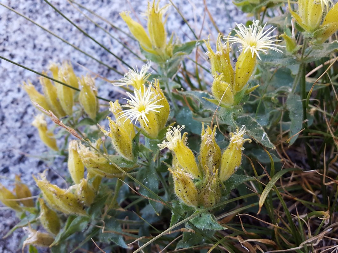
Be Bear aware Our two resident Black Bears have had a low profile for the last couple of months. Apparently they have been largely in Hall’s Canyon, above Lake Fulmor. Unfortunately they have been making a nuisance of themselves, getting into trash and bird seed at the James Reserve. Hikers and campers everywhere, but especially those on the western side of the mountain (e.g. in the Black Mountain area), should have bear safety awareness, and practice bear-safe food storage. The tips at this CDFW website are useful.
Always be Lion aware I always like to be reminded that Mountain Lions are common everywhere on the mountain. And I mean everywhere. Early this morning I found this very fresh lion scat at 10,400′ elevation near Miller Peak. Descending the Peak Trail, I found a fresh print in soft sand at 10,200′. In the area of Wellman’s Cienega at 9,200′, I found more fresh scat in the trail. None of these signs had been there 48 hours earlier. There are lots of Mule Deer in the high country this autumn, and where there are deer, there are lions.

EASTERN SLOPE WATER FEATURES
The Round Valley faucet is dry.
Both the northern and southern springs at Wellman’s Cienega continue to flow gently, but the northern spring in particular is now very weak. It will dry up in October without new precipitation.

These springs are the sources for Willow Creek, which is no longer flowing where it crosses the Willow Creek Trail. There are some pools a few inches deep where water could be filtered near the crossing. Willow Creek has never previously been known to stop flowing at this location.
Tahquitz Valley has been completely dry for at least three months.
Tahquitz Creek continues to flow gently at the northern (lower) end of Little Tahquitz Meadow. This is the last remaining “reliable” water source in the Tahquitz meadows area.
Tahquitz Creek is barely trickling further upstream at its source (known locally as Grethe Spring) where it crosses the PCT at the northern end of the fire closure (approx. PCT Mile 177). Immediately after crossing the PCT, the creek dries up and disappears subsurface.
Skunk Cabbage Creek is dry where the trail crosses Skunk Cabbage Meadow at the small wooden bridge.
WESTERN SLOPE WATER FEATURES
The North Fork of the San Jacinto River continues to flow gently where it crosses the Deer Springs Trail, but flow has dropped to about 1.5 gallons per minute. The water levels for this river are apparently the lowest in living memory.

The North Fork of the San Jacinto River has dried up where it crosses the Pacific Crest Trail on the Fuller Ridge Trail (approx. PCT Mile 186.2). This was the critical water source for PCTers and others hiking to or from Snow Creek, a 22 mile section of trail infamous for being waterless (now waterless for >25 miles). Options for southbound PCT hikers (and other hikers on this section) are all poor. Switchback Spring and Strawberry Cienega (see below) are possibilities staying on the PCT, but both are at very low flows. If heading to San Jacinto Peak, the North Fork where it crosses the Deer Springs Trail is a very good option. Alternatively, from where the PCT crosses the Black Mountain Road it is possible to descend the road 2.4 miles to the Cinco Poses Spring (a faucet by the roadside, see below). This undulating and exposed road is a descent of about 600′ and ascent of 200′, that would have to be reversed on the way back.
O’Sullivan Creek (PCT Mile 186.4) on Fuller Ridge Trail has been dry since early May.
The spring in the creek in Little Round Valley has been completely dry since early June.
Shooting Star Spring – 0.28 trail miles below Little Round Valley – continues to flow gently. For hikers it is possible to filter water from the source at the base of the obvious huge rock at the top of the wet area of trail, but a better option is to descend to the North Fork crossing mentioned above.
The Deer Springs stream crossing at the PCT (approx. PCT mile 185.6) is dry, and the pools just upstream (and downstream) of the trail are also dry. In my off-trail wanderings this week, I confirmed that the Deer Springs themselves continue to flow gently, about 0.15 miles upslope from the trail. Unfortunately, most of the flow is diverted into a pipe for the Deer Springs camp. The Deer Springs camp just downslope from the trail has been occupied by a crew from the California Conservation Corps off-and-on since late May.
Switchback Spring – the small spring just below the eight switchbacks on Deer Springs Trail about 0.4 miles north of Strawberry Junction – continues to trickle very gently. There is a tiny pool on the upslope side of the trail where water can be filtered if necessary.
The little spring at Strawberry Cienega (PCT mile 183) has now dried up. For emergency filtering, the tiny pool in the crack between the two large rocks remains for the time being.
Cinco Poses Spring on Black Mountain Road (4.7 miles up from Highway 243) still has plenty of running water at the faucet. This could be an important emergency water source as others dry up throughout the western side of the mountain.
On Devil’s Slide Trail, Middle Spring has been dry since 26th July.
On the Ernie Maxwell Trail, Chinquapin Creek just below Humber Park has been diverted by Fern Valley Water District more-or-less continuously since 1st July, drying the creek where it crosses the trail. However good pools receive some fresh flow immediately upstream from the trail. This can be a very important water source for the many dogs walked on this trail.sanjacjonUncategorizedLeave a comment 5 MinutesEdit”Water and weather 21st September 2018″
Water and weather 12th September 2018
I have spent the last three days in the high country, visiting San Jacinto Peak several times, and checked water sources yesterday on a long loop hike around the entire mountain.
Trail overview A reminder that the Palm Springs Aerial Tramway is shut for annual maintenance until 1st October. See the tram website for more details. Do not even consider attempting the Skyline Trail at this time unless you fully understand that you must hike off the mountain. Many thanks to Florian Boyd for placing a warning sign to this effect at the Palm Springs Art Museum trailhead. A CCC crew continues to work in Long Valley during the closure (I passed them today on Devil’s Slide Trail).
The water situation continues to deteriorate. Last week I noted that the North Fork of the San Jacinto River has dried up where it crosses the Pacific Crest Trail on Fuller Ridge. In addition, Willow Creek has stopped flowing where it crosses the Willow Creek Trail, and Strawberry Cienega has finally stopped flowing too (these are discussed in more detail below). In summary, most well-known water sources are dry or are very close to drying up and should not be relied upon by hikers at this time. There is no snow anywhere on the mountain (all trails have been completely clear since early May). Details of the condition of high country trails following the 25th-30th July 2018 Cranston Fire are described at an earlier posting linked here. Finally, a reminder that the Black Mountain Road was graded last week.
Weather Some delightful autumnal weather in the high country over the past few days. Temperatures (especially overnight lows) remain above average for September, with low humidity, and persistent strong winds at the high peaks.
At San Jacinto Peak at 1905 on Monday 10th September, the air temperature was 55°F (12.7°C), with a mild windchill temperature of 51°F (10.6°C), 14% relative humidity, and a light 4 mph W wind gusting to 7 mph. By contrast this morning Wednesday 12th September, at 0615 the air temperature was 44°F (6.7°C), with a fresh windchill temperature of 32°F (0°C), 38% relative humidity, and a stiff 21 mph W wind gusting to 27.5 mph. Winds were SW or WSW near or above 20 mph all day on 11th September.
EASTERN SLOPE WATER FEATURES
The Round Valley faucet is dry.
Both the northern and southern springs at Wellman’s Cienega continue to flow gently, but the northern spring in particular is now very weak. These springs are the sources for Willow Creek, which is no longer flowing where it crosses the Willow Creek Trail. There are some pools a few inches deep where water could be filtered near the crossing. Willow Creek has never previously been known to stop flowing at this location. [Many thanks to good friend of the Trail Report Val Rock for this Willow Creek update from today.]
Tahquitz Valley has been completely dry for at least three months.
Tahquitz Creek continues to flow gently at the northern (lower) end of Little Tahquitz Meadow. This is the last remaining “reliable” water source in the Tahquitz meadows area.
Tahquitz Creek is barely trickling further upstream at its source (known locally as Grethe Spring) where it crosses the PCT at the northern end of the fire closure (approx. PCT Mile 177). Immediately after crossing the PCT, the creek dries up and disappears subsurface.
Skunk Cabbage Creek is dry where the trail crosses Skunk Cabbage Meadow at the small wooden bridge.
WESTERN SLOPE WATER FEATURES
The North Fork of the San Jacinto River continues to flow gently where it crosses the Deer Springs Trail, but flow has dropped about another 10% for the second consecutive week, down now to about 1.6 gallons per minute. The water levels for this river are apparently the lowest in living memory.

The North Fork of the San Jacinto River has dried up where it crosses the Pacific Crest Trail on the Fuller Ridge Trail (approx. PCT Mile 186.2). This was the critical water source for PCTers and others hiking to or from Snow Creek, a 22 mile section of trail infamous for being waterless (now waterless for >25 miles). Options for southbound PCT hikers (and other hikers on this section) are all poor. Switchback Spring and Strawberry Cienega (see below) are possibilities staying on the PCT, but both are at very low flows. If heading to San Jacinto Peak, the North Fork where it crosses the Deer Springs Trail is a very good option. Alternatively, from where the PCT crosses the Black Mountain Road it is possible to descend the road 2.4 miles to the Cinco Poses Spring (a faucet by the roadside, see below). This undulating and exposed road is a descent of about 600′ and ascent of 200′, that would have to be reversed on the way back.
O’Sullivan Creek (PCT Mile 186.4) on Fuller Ridge Trail has been dry since early May.
The spring in the creek in Little Round Valley has been completely dry since early June.
Shooting Star Spring – 0.28 trail miles below Little Round Valley – continues to flow gently. For hikers it is possible to filter water from the source at the base of the obvious huge rock at the top of the wet area of trail, but a better option is to descend to the North Fork crossing mentioned above.
The Deer Springs stream crossing at the PCT (approx. PCT mile 185.6) is dry, and the pools just upstream (and downstream) of the trail are also dry. The Deer Springs camp just downslope has been occupied by a crew from the California Conservation Corps since late May (although only very briefly since the fire evacuation on 25th July).
Switchback Spring – the small spring just below the eight switchbacks on Deer Springs Trail about 0.4 miles north of Strawberry Junction – continues to trickle very gently. There is a tiny pool on the upslope side of the trail where water can be filtered if necessary.
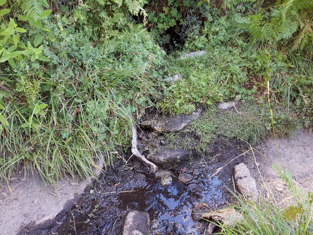
The little spring at Strawberry Cienega (PCT mile 183) has now dried up. For emergency filtering, the tiny pool in the crack between the two large rocks remains for the time being.
Cinco Poses Spring on Black Mountain Road (4.7 miles up from Highway 243) still has plenty of running water at the faucet. This could be an important emergency water source as others dry up throughout the western side of the mountain.
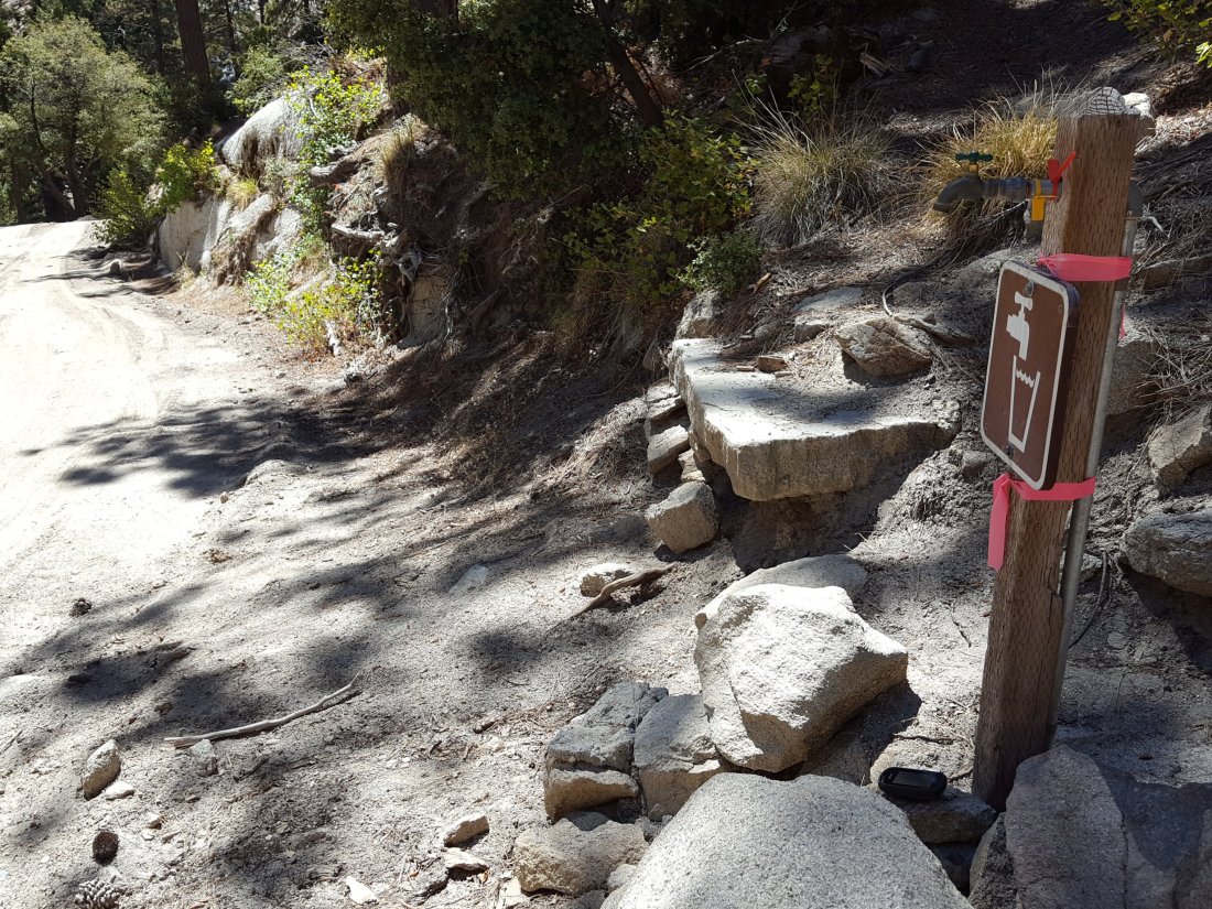
On Devil’s Slide Trail, Middle Spring has been dry since 26th July.
On the Ernie Maxwell Trail, Chinquapin Creek just below Humber Park has been diverted by Fern Valley Water District more-or-less continuously since 1st July, drying the creek where it crosses the trail. However good pools receive some fresh flow immediately upstream from the trail. This can be a very important water source for the many dogs walked on this trail.sanjacjonUncategorized1 Comment 5 MinutesEdit”Water and weather 12th September 2018″
Water and weather 6th September 2018
Today I hiked to San Jacinto Peak via Fuller Ridge Trail. We checked many water sources yesterday on a long loop hike to the Peak, descending via Deer Springs Trail. Tuesday morning’s hike to the Peak was just a quick one up the east side to enjoy the chilly weather.
Trail overview A flurry of noteworthy events on the mountain. The North Fork of the San Jacinto River has dried up where it crosses the Pacific Crest Trail on Fuller Ridge. The absence of this critical water source for hikers is discussed in more detail in the relevant section below. This presents a major problem for long distance hikers to/from Snow Creek.
The CCC crew working on the Pacific Crest Trail/Deer Springs Trail have completed the section near the Deer Springs crossing. Having taken at least four summer seasons to complete a few hundred yards of trail, questions have been asked whether it was the best use of resources, although it is very well constructed and a pleasure to use.
The Black Mountain road was graded earlier this week, and the road is now in its best condition since Spring 2017. Grading was completed all the way through to the Fuller Ridge campground and trailhead. This usually takes place right around Memorial Day weekend, but this year US Forest Service waited until after Labor Day weekend instead!
Flow rates at water sources are far below historic norms. Many well-known water sources are dry or are very close to drying up and should not be relied upon by hikers at this time. There is no snow anywhere on the mountain (all trails have been completely clear since early May). Details of the condition of high country trails following the 25th-30th July 2018 Cranston Fire are described at an earlier posting linked here.
Weather Some delightful autumnal weather in the high country over the past four days. Tuesday morning a sub-freezing windchill led me to pull on some thin gloves for the first time since May. A brief but rapid warming trend is expected for this weekend, followed thankfully by a return to more typical September temperatures next week.
At San Jacinto Peak at 0830 on Tuesday 4th September, the air temperature was 44°F (6.7°C), with a refreshing windchill temperature of 30.0°F (-1°C), 80% relative humidity (rising to 90% when cloud enveloped the Peak), and a strong 20 mph SE wind gusting to 27 mph. On Wednesday 5th September, at 0845 the air temperature was 46°F (7.8°C), with a cool windchill temperature of 36°F (2.2°C), 72% relative humidity, and a cool 10 mph ESE wind gusting to 19 mph.

EASTERN SLOPE WATER FEATURES
The Round Valley faucet is dry.
Both the northern and southern springs at Wellman’s Cienega continue to flow, but very weakly. These springs are the sources for Willow Creek, which continues to flow gently where it crosses the Willow Creek Trail.
Tahquitz Valley has been completely dry for at least three months.
Tahquitz Creek continues to flow steadily at the northern (lower) end of Little Tahquitz Meadow.

Tahquitz Creek is barely trickling further upstream at its source (known locally as Grethe Spring) where it crosses the PCT at the northern end of the fire closure (approx. PCT Mile 177). Immediately after crossing the PCT, the creek dries up and disappears subsurface.
Skunk Cabbage Creek is dry where the trail crosses Skunk Cabbage Meadow at the small wooden bridge.
WESTERN SLOPE WATER FEATURES
The North Fork of the San Jacinto River continues to flow gently where it crosses the Deer Springs Trail, but flow has dropped another 10% from last week, to about 1.8 gallons per minute. The water levels for this river are apparently the lowest in living memory.

The North Fork of the San Jacinto River has dried up where it crosses the Pacific Crest Trail on the Fuller Ridge Trail (approx. PCT Mile 186.2). This was the critical water source for PCTers and others hiking to or from Snow Creek, a 22 mile section of trail infamous for being waterless (now waterless for >25 miles). Options for southbound PCT hikers (and other hikers on this section) are all poor. Switchback Spring and Strawberry Cienega (see below) are possibilities staying on the PCT, but both are at very low flows. If heading to San Jacinto Peak, the North Fork where it crosses the Deer Springs Trail is a very good option. Alternatively, from where the PCT crosses the Black Mountain Road it is possible to descend the road 2.4 miles to the Cinco Poses Spring (a faucet by the roadside, see below). This undulating and exposed road is a descent of about 600′ and ascent of 200′, that would have to be reversed on the way back.
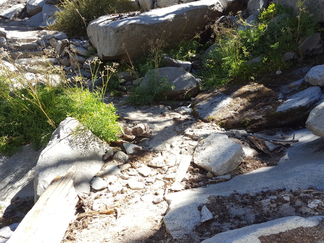
O’Sullivan Creek (PCT Mile 186.4) on Fuller Ridge Trail has been dry since early May.
The spring in the creek in Little Round Valley has been completely dry since early June.
Shooting Star Spring – 0.28 trail miles below Little Round Valley – continues to flow relatively gently. For hikers it is possible to filter water from the source at the base of the obvious huge rock, but a better option is to descend to the North Fork crossing mentioned above.

The Deer Springs stream crossing at the PCT (approx. PCT mile 185.6) is dry, and the pools just upstream (and downstream) of the trail are also dry. The Deer Springs camp just downslope has been occupied by a crew from the California Conservation Corps since late May (although only very briefly since the fire evacuation on 25th July).
Switchback Spring – the small spring just below the eight switchbacks on Deer Springs Trail about 0.4 miles north of Strawberry Junction – continues to trickle. There is a tiny pool on the upslope side of the trail where water can be filtered if necessary.
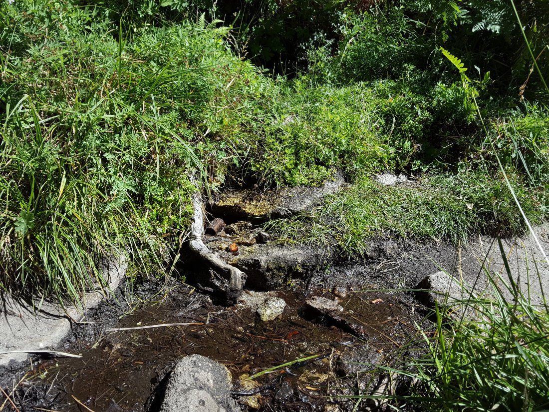
The little spring in the rock crack at Strawberry Cienega (PCT mile 183) is now barely flowing. For filtering, there is a tiny pool among the rocks (currently heavily obscured by vegetation).
Cinco Poses Spring on Black Mountain Road (4.7 miles up from Highway 243) still has plenty of running water at the faucet. This could be an important emergency water source as others dry up throughout the western side of the mountain.
On Devil’s Slide Trail, Middle Spring has been dry since 26th July.
On the Ernie Maxwell Trail, Chinquapin Creek just below Humber Park has been diverted by Fern Valley Water District more-or-less continuously since 1st July, drying the creek where it crosses the trail. However good pools receive some fresh flow immediately upstream from the trail. This can be a very important water source for the many dogs walked on this trail.sanjacjonUncategorizedLeave a comment 5 MinutesEdit”Water and weather 6th September 2018″
Weather 3rd September 2018
Anne and I hiked to San Jacinto Peak from Humber Park early this morning. Water conditions are little changed from last week, as described here. Lovely cool, windy weather at the Peak led to another brief video.ErrorThis video doesn’t exist
Despite the autumnal feel in recent days, another warming trend is forecast for the next few days. Both overnight low and daytime high temperatures will steadily rise this week to above average for midsummer (not September!) at the weekend, before starting to cool slightly the following week.
In summary today, at San Jacinto Peak at 0810 on Monday 3rd September, the air temperature was 44°F (6.7°C), with a cool windchill temperature of 33°F (0.5°C), 74% relative humidity, and a strong 16 mph SE wind gusting to 21 mph.
Although thunderstorms are not currently forecast, hikers should always be prepared for rapidly changing conditions in the high country in summer. Thunderstorms with lightning can occur at or near the high peaks even when such storms are not forecast for lower elevations.
On a different note, I usually tidy up the summit hut just below San Jacinto Peak every week. We had brought up a couple of bags specifically for this purpose today, only to find things had got a bit out of hand in just the past few days.

Above are the 18 empty plastic bottles we gathered from the hut. In addition we brought down two small bags of non-recyclable trash.
While I suspect the readers of this Trail Report are not the sort of hikers leaving their garbage up there, maybe now would be a good time to remind everyone that the San Jacinto Peak summit hut is not a public trash can. Thanks.sanjacjonUncategorizedLeave a comment 1 MinuteEdit”Weather 3rd September 2018″
Water conditions 30th August 2018
We checked most water sources on a long loop hike to San Jacinto Peak on Tuesday 28th, descending by Deer Springs Trail. On Wednesday 29th, I reviewed the springs and creeks around the Tahquitz area meadows following a fire lookout shift at Tahquitz Peak.
Weather The rain from storms in the middle of August is already a distant memory, and its impacts on water sources were predictably short-lived.
At San Jacinto Peak at 0830 on Tuesday 28th August, the air temperature was 47°F (8.3°C), with a cool windchill temperature of 38°F (3.3°C), 17% relative humidity, and a stiff 14 mph W wind gusting to 17 mph.
Although thunderstorms are not currently forecast, hikers should always be prepared for rapidly changing conditions in the high country in summer. Thunderstorms with lightning can occur at or near the high peaks even when such storms are not forecast for lower elevations.
Noteworthy climate observation #1. The historical average overnight low temperature for August in Idyllwild is 54.8°F (National Weather Service data). With only a couple of days remaining in August 2018, Idyllwild will have recorded a low temperature below 55°F only once this month, and the average low for the first 20 days of the month was 59.5°F.
Trail overview Flow rates at water sources are far below seasonal norms. Several well-known water sources are dry or are very close to drying up and should not be relied upon by hikers at this time. There is no snow anywhere on the mountain (all trails have been completely clear since early May). Details of the condition of high country trails following the 25th-30th July 2018 Cranston Fire are described at an earlier posting linked here.
EASTERN SLOPE WATER FEATURES
The Round Valley faucet is dry.
Both the northern and southern springs at Wellman’s Cienega continue to flow weakly. These springs are the sources for Willow Creek, which continues to flow where it crosses the Willow Creek Trail.
Tahquitz Valley has been completely dry for at least two months.
Tahquitz Creek continues to flow steadily at the northern (lower) end of Little Tahquitz Meadow.
Tahquitz Creek is barely trickling further upstream at its source (known locally as Grethe Spring) where it crosses the PCT at the northern end of the fire closure (approx. PCT Mile 177). Immediately after crossing the PCT, the creek dries up and disappears subsurface.
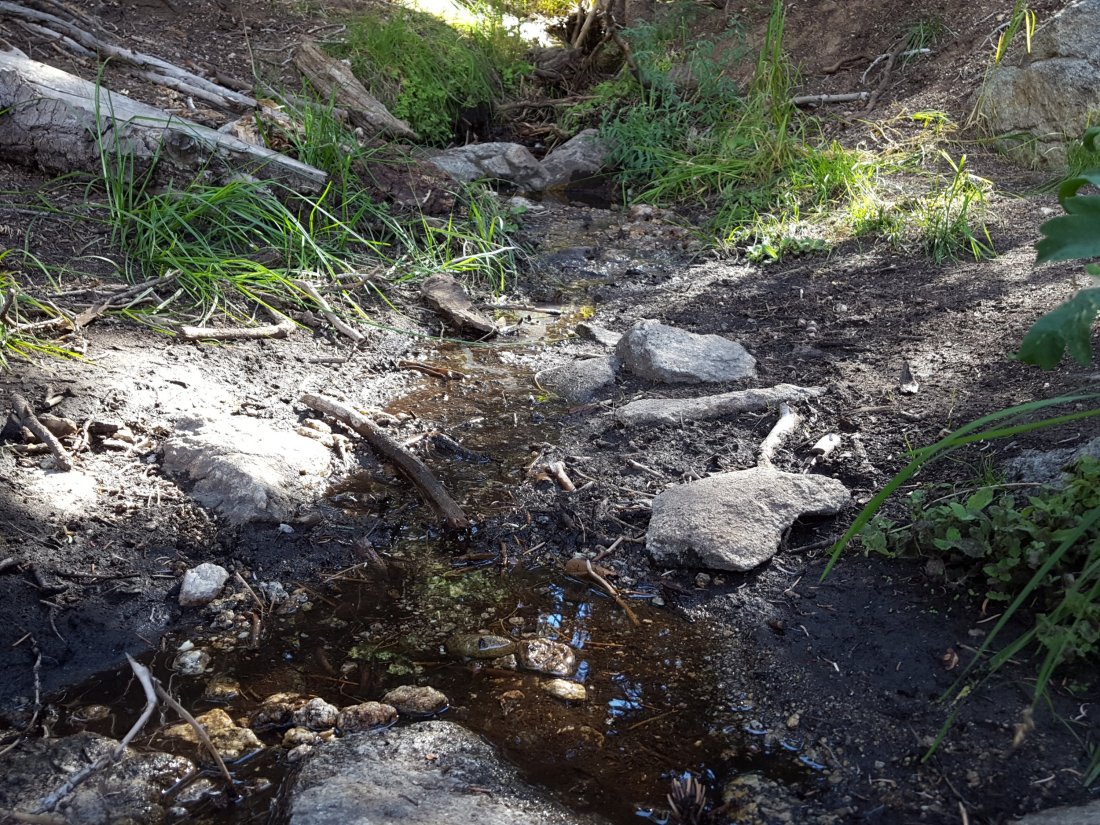
Skunk Cabbage Creek is dry where the trail crosses Skunk Cabbage Meadow at the small wooden bridge.
WESTERN SLOPE WATER FEATURES
The North Fork of the San Jacinto River continues to flow gently where it crosses the Deer Springs Trail, but flow has almost halved from last week, down to about 2.0 gallons per minute. The same river is close to drying up where it crosses the Pacific Crest Trail on the Fuller Ridge Trail (approx. PCT Mile 186.2), with flow at at only 0.1 gallons per minute. The latter is extremely low flow for this critical PCT water source. These two crossings are the most important water sources for hikers on the western side of the mountain. The water levels for this river are apparently the lowest in living memory.

O’Sullivan Creek (PCT Mile 186.4) on Fuller Ridge Trail remains completely dry.
The spring in the creek in Little Round Valley has been completely dry since early June.
Shooting Star Spring – 0.28 trail miles below Little Round Valley – continues to flow relatively well. For hikers it is possible to filter water from the source at the base of the obvious huge rock, but a better option is to descend to the North Fork crossing mentioned above.
The minor creek crossing (sometimes known as Rock Spring) on Deer Springs Trail midway between the North Fork of the San Jacinto River crossing and Shooting Star Spring, is functionally dry.
The Deer Springs stream crossing at the PCT (approx. PCT mile 185.6) is dry, and the pools just upstream (and downstream) of the trail are also dry. The Deer Springs camp just downslope has been occupied by a crew from the California Conservation Corps since late May (although not since the fire evacuation on 25th July).
Switchback Spring – the small spring just below the eight switchbacks on Deer Springs Trail about 0.4 miles north of Strawberry Junction – continues to flow well. There is a tiny pool on the upslope side of the trail where water can be filtered if necessary.

The little spring in the rock crack at Strawberry Cienega (PCT mile 183) is flowing very weakly. For filtering, there is a tiny pool among the rocks (currently heavily obscured by plants).
On Devil’s Slide Trail, Middle Spring has been dry since 26th July.
On the Ernie Maxwell Trail, Chinquapin Creek just below Humber Park has been diverted by Fern Valley Water District more-or-less continuously since 1st July, drying the creek where it crosses the trail. However good pools receive some fresh flow immediately upstream from the trail. This can be a very important water source for the many dogs walked on this trail.sanjacjonUncategorizedLeave a comment 4 MinutesEdit”Water conditions 30th August 2018″
Water conditions 24 August 2018
We went up to San Jacinto Peak this morning and also on Tuesday 21st, the latter via Fuller Ridge and the upper Deer Springs Trail before a fire lookout shift at Black Mountain. On Wednesday 22nd August, I reviewed the springs and creeks around the Tahquitz area meadows when descending from a fire lookout shift at Tahquitz Peak.
As the San Jacinto Trail Report creeps slowly into the 21st Century, I thought I’d try an occasional short video blog. All the usual detail follows in the text below.ErrorThis video doesn’t exist
Weather Rainfall from thunderstorms three days in a row last week, 15-17 August, included a spectacular storm cell over Idyllwild on the afternoon of 17th, when we recorded 1.50″ rain at home in under an hour! Despite similar rainfall on many parts of the mountain at the same time, impacts on water sources were remarkably short-lived.
At San Jacinto Peak at 0840 today, Friday 24th August, the air temperature was 51°F (10.5°C), with a pleasant windchill temperature of 43°F (6°C), a return to a more typical 39% relative humidity, and a firm 9 mph SW breeze gusting to 15 mph. It was even more autumnal on Tuesday 21st August, when at 0720 the air temperature was 49°F (9.5°C), with a cool windchill temperature of 40.4°F (4.7°C), 73% relative humidity, and a chilly SSW wind sustained at 16 mph and gusting just over 20 mph.
Despite the shift this week from monsoonal easterly airflow to more typical westerly maritime weather, hikers should always be prepared for rapidly changing conditions in the high country in summer. Thunderstorms with lightning can occur at or near the high peaks even when such storms are not forecast for lower elevations.
Trail overview Despite the rains of last week, flow rates at water sources have rapidly returned to being far below seasonal norms. Several well-known water sources are dry or are very close to drying up and should not be relied upon by hikers at this time. There is no snow anywhere on the mountain (all trails have been completely clear since early May). Details of the condition of high country trails following the 25-30 July 2018 Cranston Fire are described at an earlier posting linked here.
EASTERN SLOPE WATER FEATURES
The Round Valley faucet is dry again, despite flowing for a few days briefly after rain on Thursday 16th. [Thanks to Florian Boyd for this update from today.]
The flow rates at the northern and southern springs at Wellman’s Cienega have dropped drastically since the rains, but both continue to flow gently. These springs are the sources for Willow Creek, which continues to flow where it crosses the Willow Creek Trail.
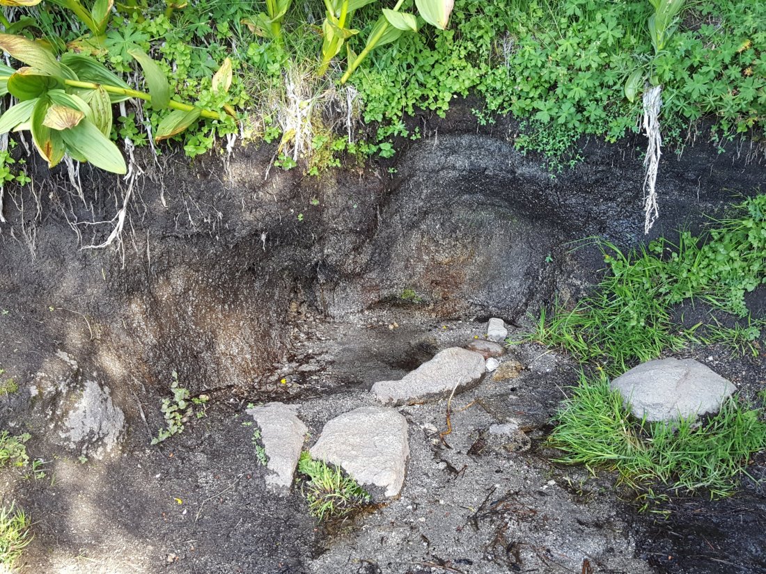
Tahquitz Valley has been completely dry for at least two months.
Tahquitz Creek continues to flow steadily at the northern (lower) end of Little Tahquitz Meadow.
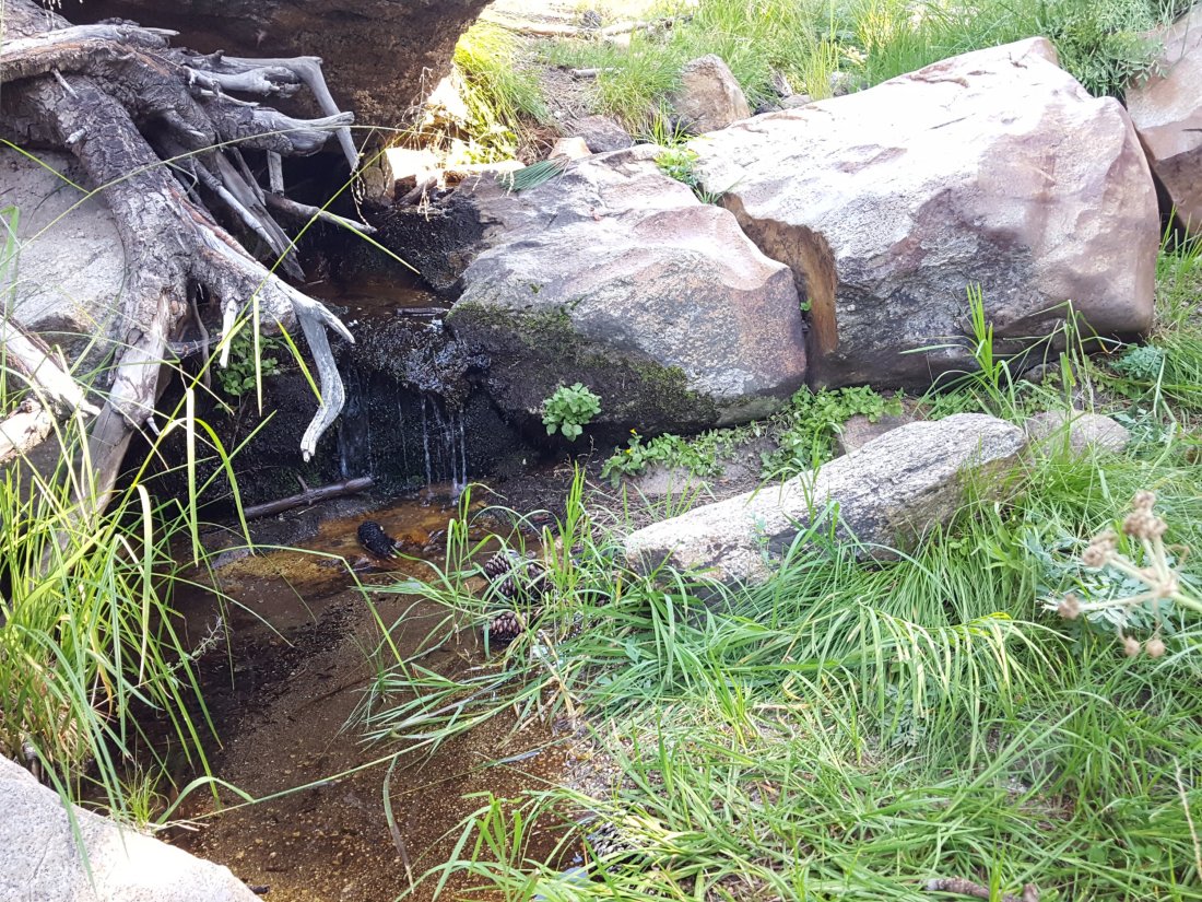
Tahquitz Creek continues to trickle gently further upstream at its source (known locally as Grethe Spring) where it crosses the PCT at the northern end of the fire closure (approx. PCT Mile 177). Immediately after crossing the PCT, the creek dries up and disappears subsurface.

Skunk Cabbage Creek is dry where the trail crosses Skunk Cabbage Meadow at the small wooden bridge.
WESTERN SLOPE WATER FEATURES
The North Fork of the San Jacinto River continues to flow gently where it crosses the Deer Springs Trail, at about 3.7 gallons per minute (up from about 2.6 gpm prior to last weeks rains). However, the same river just downslope is now flowing very weakly where it crosses the Pacific Crest Trail on the Fuller Ridge Trail (approx. PCT Mile 186.2), at only 0.2 gallons per minute. The latter is extremely low flow for this critical PCT water source. These two crossings are the most important water sources for hikers on the western side of the mountain. Prior to recent rains the flow rate was the lowest in living memory, and it will rapidly return to that status without new precipitation.

O’Sullivan Creek (PCT Mile 186.4) on Fuller Ridge Trail remains completely dry.
The spring in the creek in Little Round Valley has been completely dry since early June.
Shooting Star Spring – 0.28 trail miles below Little Round Valley – continues to flow significantly better than before the rain last week. For hikers it is possible to filter water from the source at the base of the obvious huge rock, but a better option is to descend to the North Fork crossing mentioned above.
The minor creek crossing (sometimes known as Rock Spring) on Deer Springs Trail midway between the North Fork of the San Jacinto River crossing and Shooting Star Spring, remained dry even during the rainfall, and has been dry across and below the trail since June.
The Deer Springs stream crossing at the PCT (approx. PCT mile 185.6) is dry, and the pools just upstream (and downstream) of the trail are also dry. The Deer Springs camp just downslope has been occupied by a crew from the California Conservation Corps since late May (although not since the fire evacuation on 25th July).
Switchback Spring – the small spring just below the eight switchbacks on Deer Springs Trail about 0.4 miles north of Strawberry Junction – continues to flow well. There is a tiny pool on the upslope side of the trail where water can be filtered if necessary.

The little spring in the rock crack at Strawberry Cienega (PCT mile 183) is back to flowing very weakly. For filtering, there is a tiny pool among the rocks (currently heavily obscured by plants). A permanently placed tent stake makes a clean accessible trickle out of the mud when flow rates are reasonable.
On Devil’s Slide Trail, Middle Spring has been completely dry since 26th July, with no significant flow even after last weeks rain.
On the Ernie Maxwell Trail, Chinquapin Creek just below Humber Park has been diverted by Fern Valley Water District to their storage tanks more-or-less continuously since 1st July, usually drying the creek where it crosses the trail. However good pools receive some fresh flow immediately upstream from the trail. This can be a very important water source for the many dogs walked on this trail.sanjacjonUncategorized1 Comment 4 MinutesEdit”Water conditions 24 August 2018″
Water and weather 17 August 2018
For details of the condition of high country trails following the 25-30 July 2018 Cranston Fire, see an earlier posting linked here.
Four hikes to San Jacinto Peak in the last five days via various routes included two full loops to review almost all water sources and the extent of recent rains. Yesterday, 16th August, I was able to review the springs and creeks around the Tahquitz area meadows en route to my fire lookout shift.
Weather Finally some reasonable rainfall from thunderstorms three days in a row, 15-17 August. At Idyllwild, the rainfall has been poor – although it is now raining heavily as I write this – with only a trace at 5550′ elevation on 15th, and 0.04″ on 16th. However many other areas of the mountain received good rainfall yesterday (16th), with roughly half-an-inch reported from such widely spread areas as Keenwild, Vista Grande, and Long Valley.

On the trails, yesterday there was evidence of light rain from the 15th all the way on the eastern side of the mountain from Humber Park to San Jacinto Peak. Judging by today’s hike, the rain yesterday afternoon (16th) was focused on the east side of the high country, again all the way from 6500′ to San Jacinto Peak. However on the west side, there was only evidence of much lighter rain, and some sections of the PCT/Deer Springs Trail were almost dry.
At San Jacinto Peak at 0740 today, Friday 17th August, the air temperature was 54°F (12°C), with a modest windchill temperature of 50°F (10°C), 78% relative humidity, and a light 3-5 mph ESE breeze. The previous two days, 15th and 16th August, the weather was very similar both mornings at around 0800 and starting to feel autumnal. The air temperature was 51°F (10.5°C), with lovely fresh windchill temperatures of 43°F (6°C), 80% relative humidity, and a firm SE breeze at 8 mph gusting to 15 mph.
Hikers should always be prepared for rapidly changing weather conditions in the high country in summer. Thunderstorms with lightning and rapidly falling temperatures can occur at or near the high peaks even when such storms are not forecast for lower elevations.
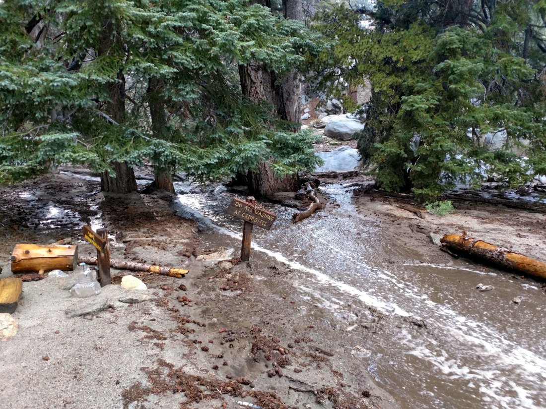
Highway closures Note that during and following rain storms, highways through areas that were denuded by the Cranston Fire are being closed abruptly due to elevated risk of flooding and mud/rock slides. The last two days Highway 243 from Idyllwild to Mountain Center, and Highway 74 from Hemet to Lake Hemet, have been closed for up to several hours in the afternoons. Factor this in to travel plans if there are storms in the forecast.
Trail overview Prior to the rains of the last couple of days, flow rates at all water sources were at their lowest of the year, and far below seasonal norms. Despite recent rains, some well-known water sources remain dry or are very close to drying up and should not be relied upon by hikers at this time. There is no snow anywhere on the mountain (all trails have been completely clear since early May).

EASTERN SLOPE WATER FEATURES
The Round Valley faucet was dry by Monday 13th, having apparently dried up a day or two earlier. It started flowing again after rain on Thursday 16th, but was only a steady trickle. [Thanks to Jeremy Odom for this information.] Nevertheless, this may only be temporary relief for a few days or weeks at best. Hikers and campers to Round and Tamarack valleys from the Tram are advised not to rely on this ephemeral water source and to pack in all their water.
The flow rate at both the northern and southern springs at Wellman’s Cienega doubled from Monday to Wednesday, and doubled again by today, Friday. These springs are the sources for Willow Creek, which continues to flow gently where it crosses the Willow Creek Trail.

Tahquitz Valley has been completely dry for at least two months, and recent rains have not changed that situation.
Tahquitz Creek continues to flow steadily at the northern (lower) end of Little Tahquitz Meadow.

Tahquitz Creek has briefly flash-flooded twice in the past three days further upstream at its source (known locally as Grethe Spring) where it crosses the PCT at the northern end of the fire closure (approx. PCT Mile 177). However shortly after rains it has returned to a very low flow. Immediately after crossing the PCT, the creek dries up and disappears subsurface.

Skunk Cabbage Creek remains largely dry where the trail crosses Skunk Cabbage Meadow at the small wooden bridge.
WESTERN SLOPE WATER FEATURES
The North Fork of the San Jacinto River continues to flow steadily both where it crosses the Deer Springs Trail, and where it crosses the Fuller Ridge Trail on the PCT (approx. PCT Mile 186.2). These two crossings are the most important water sources for hikers on the western side of the mountain. Prior to recent rains the flow rate was the lowest in living memory. About 100′ downstream from the river crossing on Fuller Ridge Trail the river runs dry and disappears subsurface.
O’Sullivan Creek (PCT Mile 186.4) on Fuller Ridge Trail remains completely dry.
The spring in the creek in Little Round Valley remained completely dry this morning despite recent rains, as it has been since early June.
Shooting Star Spring – 0.28 trail miles below Little Round Valley – is flowing at about twice the rate of Monday. For hikers it is possible to filter water from the source at the base of the obvious huge rock, but a better option is to descend to the North Fork crossing mentioned above.
The minor creek crossing (sometimes known as Rock Spring) on Deer Springs Trail midway between the North Fork of the San Jacinto River crossing and Shooting Star Spring remained completely dry this morning, and has been dry across and below the trail since June.
The Deer Springs stream crossing at the PCT (approx. PCT mile 185.6) is dry, and the pools just upstream (and downstream) of the trail are also dry. The Deer Springs camp just downslope has been occupied by a crew from the California Conservation Corps since late May (although not since the fire evacuation on 25th July).
Switchback Spring – the small spring just below the eight switchbacks on Deer Springs Trail about 0.4 miles north of Strawberry Junction – continues to flow well. There is a tiny pool on the upslope side of the trail where water can be filtered if necessary.
The little spring in the rock crack at Strawberry Cienega (PCT mile 183) is now flowing at least at double the rate of last week. For filtering, there is a tiny pool among the rocks (currently heavily obscured by plants), and a permanently placed tent stake makes a clean accessible trickle out of the mud.
On Devil’s Slide Trail, Middle Spring has been completely dry since 26th July. There was a little muddy rain puddle there this morning, not even enough for a dog to drink from.
On the Ernie Maxwell Trail, Chinquapin Creek just below Humber Park has been diverted by Fern Valley Water District to their storage tanks more-or-less continuously since 1st July, drying the creek where it crosses the trail. However good pools receive some fresh flow immediately upstream from the trail. This can be a very important water source for the many dogs walked on this trail.sanjacjonUncategorizedLeave a comment 5 MinutesEdit”Water and weather 17 August 2018″
Water conditions 13 August 2018
For details of the condition of high country trails following the July 2018 Cranston Fire, see the prior posting linked here. Today we were able to check all high country water sources on a lengthy loop hike to San Jacinto Peak via Devil’s Slide Trail, descending via Deer Springs Trail, with a couple of side hikes to check other sources too. Last week I was able to review the springs and creeks around the Tahquitz area meadows.
Weather At San Jacinto Peak at 0740 today, Monday 13th August, the air temperature was 52°F (11°C), with a lovely fresh windchill temperature of 45°F (7°C), 54% relative humidity, and a pleasant 5 mph SSE breeze gusting to 13 mph.
There is a moderate possibility of thunderstorms for the next three or four days. Hikers should always be prepared for rapidly changing weather conditions in the high country in summer. Thunderstorms with lightning can occur at or near the high peaks even when such storms are not forecast for lower elevations.
Trail overview Flow rates at all water sources are at their lowest of the year, and far below seasonal norms. Some well-known water sources are dry or are very close to drying up and should not be relied upon by hikers at this time. There is no snow anywhere on the mountain (all trails have been completely clear since early May).
EASTERN SLOPE WATER FEATURES
The Round Valley faucet was dry this morning, having apparently dried up in the last day or two (it was still just trickling on Friday 10th). Hikers and campers to Round and Tamarack valleys from the Tram must pack in all their water.
Both the northern and southern springs at Wellman’s Cienega are flowing weakly, but with no notable change since last week. These springs are the sources for Willow Creek, which continues to flow gently where it crosses the Willow Creek Trail.

Tahquitz Valley has been completely dry for at least two months.
Tahquitz Creek continues to flow gently at the northern (lower) end of Little Tahquitz Meadow.
Tahquitz Creek is only flowing very weakly further upstream at its source (known locally as Grethe Spring) where it crosses the PCT at the northern end of the fire closure (approx. PCT Mile 177). Immediately after crossing the PCT, the creek dries up and disappears subsurface.
Skunk Cabbage Creek is dry where the trail crosses Skunk Cabbage Meadow at the small wooden bridge.
WESTERN SLOPE WATER FEATURES
The North Fork of the San Jacinto River continues to flow gently both where it crosses the Deer Springs Trail, and where it crosses the Fuller Ridge Trail on the PCT (approx. PCT Mile 186.2). These two crossings are the most important water sources for hikers on the western side of the mountain. However, the flow rate is now the lowest in memory, even weaker than in the autumns of 2015 and 2016, today at only about 2.9 gallons per minute. About 100′ downstream from the river crossing on Fuller Ridge Trail the river runs dry and disappears subsurface. In addition, the North Fork is dry at all three of its crossings of the Seven Pines Trail.

O’Sullivan Creek (PCT Mile 186.4) on Fuller Ridge Trail is completely dry.
The spring in the creek in Little Round Valley has been completely dry since early June. [See photos below of the newly-constructed toilet in the LRV campground.]
Shooting Star Spring – 0.28 trail miles below Little Round Valley – is flowing weakly but consistently. For hikers it is possible to filter water from the source at the base of the obvious huge rock, but a better option is to descend to the North Fork crossing mentioned above.
The minor creek crossing (sometimes known as Rock Spring) on Deer Springs Trail midway between the North Fork of the San Jacinto River crossing and Shooting Star Spring is virtually dry, and has been dry across and below the trail since June.

The Deer Springs stream crossing at the PCT (approx. PCT mile 185.6) is dry, and the pools just upstream (and downstream) of the trail are also dry. The Deer Springs camp just downslope has been occupied by a crew from the California Conservation Corps (CCC) off-and-on since late May.
Switchback Spring – the small spring just below the eight switchbacks on Deer Springs Trail about 0.4 miles north of Strawberry Junction – continues to flow quite well. There is a tiny pool on the upslope side of the trail where water can be filtered if necessary.
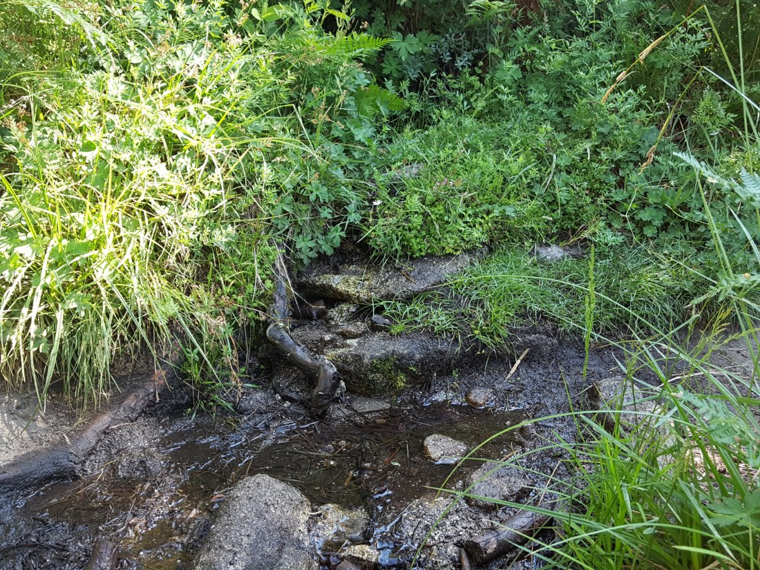
The little spring in the rock crack at Strawberry Cienega (PCT mile 183) is now flowing very weakly. For filtering, there is a tiny pool among the rocks (currently heavily obscured by plants), and a permanently placed tent stake makes a clean accessible trickle out of the mud. The current flow rate at the tent stake is too low to reliably measure (<0.01 gpm), down from 0.07 gallons per minute on 20th July.
On Devil’s Slide Trail, Middle Spring has been completely dry since 26th July.
On the Ernie Maxwell Trail, Chinquapin Creek just below Humber Park has been diverted by Fern Valley Water District to their storage tanks more-or-less continuously since 1st July, drying the creek where it crosses the trail. However good pools receive some fresh flow immediately upstream from the trail. This can be a very important water source for the many dogs walked on this trail.
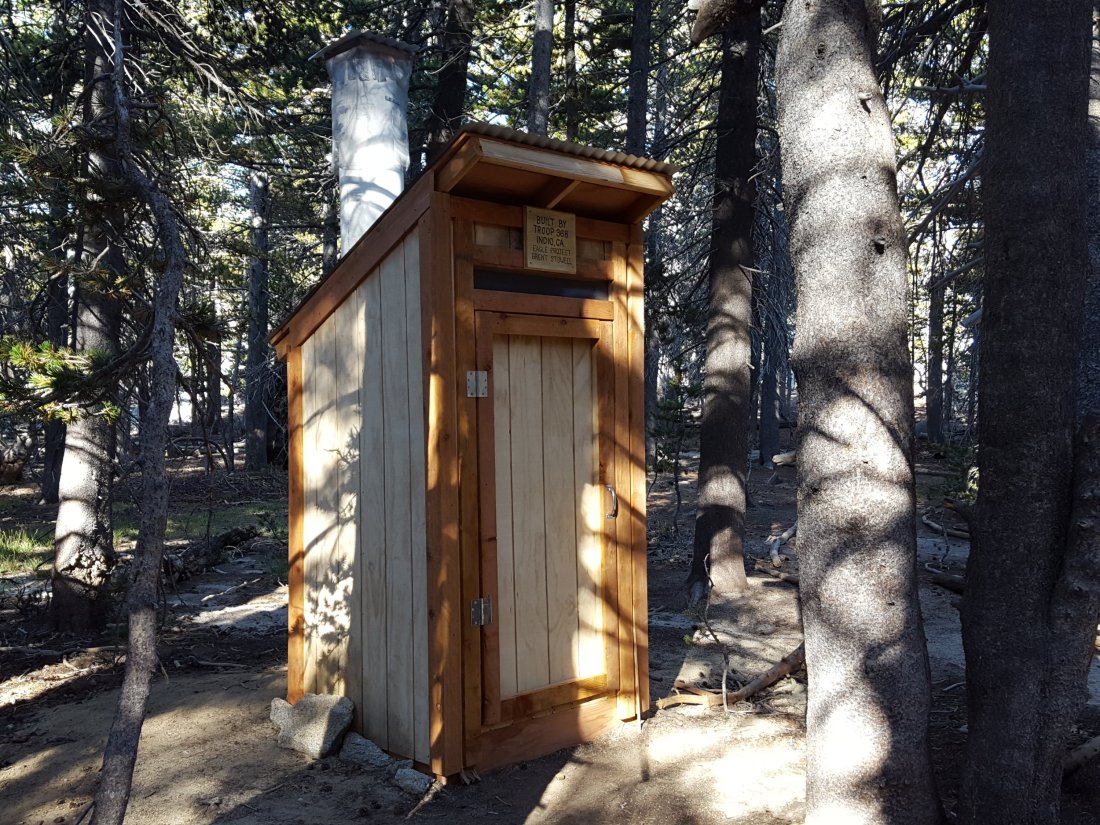

sanjacjonUncategorizedLeave a comment 4 MinutesEdit”Water conditions 13 August 2018″
Post-Cranston Fire trail conditions
The following is a final trail-by-trail review of the impacts of the Cranston Fire in the high country of the San Jacinto mountains, likely to mainly be of interest to readers most familiar with the trail system. This is NOT an official Forest Service assessment of trail conditions. Nevertheless, this information from a variety of sources is detailed and reliable.
Pacific Crest Trail The PCT on the Desert Divide was not significantly damaged as it was in the Mountain Fire. The Cranston Fire burned up the ridges from May Valley to the western and north-west flanks of Antsell Rock, and to the peaks of South Peak and Red Tahquitz. This section of the PCT was still closed from the 2013 Mountain Fire, but rehabilitation work had just been completed and the PCT was tentatively scheduled to reopen later in 2018. This plan may be in jeopardy, as the Mountain Fire closure order has been absorbed within the new Cranston Fire closure order which runs through July 2019.
Fortunately, the Cranston Fire largely did not burn over to the east side of the Desert Divide due to the lack of fuels caused, ironically, by the widespread destruction of the Mountain Fire. In this area, the PCT largely runs along the eastern flank of the Desert Divide. Only at the saddle between Red Tahquitz and South Peak, and just north of Antsell Rock, did the Cranston Fire reach the PCT, but in these relatively rocky areas there was no damage to the trail.
Although the Cranston Fire did burn a short way north between Red Tahquitz and Grey Tahquitz (Peak 8792), it did not reach the PCT here. The fire did however reach north to the PCT at Chinquapin Flat, having burned completely around Anabel Peak (Peak 8860), the high point of the ridge just east of Tahquitz Peak proper. The fire jumped the PCT by fewer than 100 feet in a couple of locations just downslope from Chinquapin Flat.
In summary, the PCT is essentially unchanged from its post-Mountain Fire status. Plans to reopen this section soon should be unaffected. This will be especially important given that the PCT Alternate through Hurkey Creek campground and May Valley – that we helped develop in 2014 and 2015 – was completely burned over by the Cranston Fire and may be closed for some considerable time (possibly years rather than months).

South Ridge Trail This is the high country trail most impacted by the Cranston Fire, and the only high country trail that remains closed under the reduced closure order. Vegetation along most of the trail side was not directly burned, but in a couple of areas the fire did jump the trail. Nowhere was the tread of the trail itself damaged. Specifically, vegetation on both sides of several switchbacks burned roughly midway between South Ridge Road and Old Lookout Flat. Just above Old Lookout Flat the fire started to descend the west side through the forest by about a hundred yards over a fairly wide area. In addition, significant vegetation cutting occurred at the top of South Ridge Road, and along the trail from there to Old Lookout Flat, as a measure to reduce spread of the fire.

The fire was allowed to burn up Hurkey Creek Canyon all the way to Tahquitz Peak, and some vegetation burned to within about 40 feet on the south and south-east sides of Tahquitz Peak fire lookout. Despite what was implied (or in some cases boldly stated) in inaccurate information disseminated by multiple irresponsible individuals – I’m trying to be polite here – the Tahquitz Peak fire lookout did NOT burn down in the Cranston Fire.
South Ridge Trail (from South Ridge Road south to Keenwild fire station) This multi-use trail, a popular mountain bike trail, was completely burned over, and will likely be closed for some considerable time.
May Valley Road (and adjacent bike trails) This dirt road very popular with locals for biking, hiking, running, and dog walking, was completely burned over from its crest just beyond Cowbell Alley all the way down to its junction with Bonita Vista Road. The latter burned from near Fleming Ranch west all the way along Keen Camp Ridge to Hwy 74.
No other high country trails were directly affected by the Cranston Fire. This includes all the trails around the Tahquitz area meadows, Devils Slide, Ernie Maxwell Trail, Willow Creek Trail, Ramona Trail, etc., all of which have now reopened. Black ash flakes were visible throughout all the trails of the mountain, even all the way to San Jacinto Peak, at least for the first few days after the fire. That there were not more spot fires scattered around the high country is very fortunate, to put it mildly.
Fobes Trail The Cranston Fire did not reach this far south in Garner Valley. However, dozer lines were inserted along/near Fobes Ranch Road, which is currently not open to non-residents, limiting trailhead access.
Spitler Peak Trail Although the fire burned both sides of Apple Canyon Road, the Spitler Peak Trail itself was unaffected. However, it may be some time before Apple Canyon Road – the access for the Spitler Peak trailhead – is fully open to non-residents.
Zen Center Trail This informal trail was unaffected by the Cranston Fire, although it remains in fairly poor condition, particularly in its upper elevations, since the Mountain Fire.sanjacjonUncategorized8 Comments 4 MinutesEdit”Post-Cranston Fire trail conditions”
Water conditions 4 August 2018
For details of the current status of trail openings, see the previous post here. For vehicle access to the mountain, Highway 243 will apparently reopen with no restrictions from Mountain Center to Idyllwild today at 1200. Highway 74 from Lake Hemet to Mountain Center and on to Hemet will reopen this afternoon with significant restrictions (one-way traffic and pilot car). [Highway 243 from Banning to Idyllwild has been open for a week.]
Yesterday, 3rd August, I was able to check all high country water sources in the State Park on a very circuitous hike (due to the Cranston Fire closure of Forest Service lands). During this hike I had the pleasure of a long chat with friends and San Jac regulars Ellen and Marilee, the only other folks I encountered on the trails all day. Meanwhile, good friend of the Trail Report Florian Boyd was hiking in Round Valley and checked the faucet there. Immediately before and after the brief fire closures, I was able to check all water sources on Forest Service lands during multiple hikes.
Weather At San Jacinto Peak at 0915 on Friday 3rd August the air temperature was 55°F (13°C), with 71% relative humidity, and a barely noticeable NW breeze gusting to 2 mph.
In general, temperatures for the next week will remain above average in the high country. As much as we could use more rain, heavy thunderstorms right now would be catastrophic in the recent burn areas. Thankfully, the likelihood of thunderstorms is diminished for the next week or so. Nevertheless, hikers should always be prepared for rapidly changing weather conditions in the high country in summer. Thunderstorms with lightning can occur at or near the high peaks even when such storms are not forecast for lower elevations.
Trail overview Flow rates at all water sources are at their lowest of the year, and far below seasonal norms. There is no snow anywhere on the mountain (all trails have been completely clear since early May). The sections of trail that burned in the Cranston Fire were last described in the posting linked here and will be updated shortly.
EASTERN SLOPE WATER FEATURES
The Round Valley faucet flow rate on Friday 3rd August was only 0.06 gallons per minute, down from the previous low on 6th July of 0.10 gallons per minute. [UPDATE Friday 10th August: the faucet flow rate is <0.01 gpm, barely dripping and basically unusable for hikers.] [Many thanks to Florian Boyd for these data from Round Valley.]
Both the northern and southern springs at Wellman’s Cienega are flowing weakly. These springs are the sources for Willow Creek, which continues to flow fairly well where it crosses the Willow Creek Trail.
Tahquitz Valley is completely dry.
Tahquitz Creek continues to flow well at the northern (lower) end of Little Tahquitz Meadow.
Tahquitz Creek is only flowing weakly further upstream at its source (known locally as Grethe Spring) where it crosses the PCT at the northern end of the fire closure (approx. PCT Mile 177). Just after crossing the PCT, the creek dries up and disappears subsurface.
Skunk Cabbage Creek is dry where the trail crosses Skunk Cabbage Meadow at the small wooden bridge.
WESTERN SLOPE WATER FEATURES
The North Fork of the San Jacinto River continues to flow reliably but fairly weakly both where it crosses the Deer Springs Trail, and where it crosses the Fuller Ridge Trail on the PCT (approx. PCT Mile 186.2). About 100′ downstream from the river crossing on Fuller Ridge Trail the river runs dry and disappears subsurface. During a search-and-rescue mission on Wednesday 25th July, I noticed that the North Fork is dry at all three of its crossings of the Seven Pines Trail.
O’Sullivan Creek (PCT Mile 186.4) on Fuller Ridge Trail is completely dry.
The spring in the creek in Little Round Valley has been completely dry since early June.
Shooting Star Spring – 0.28 trail miles below Little Round Valley – is flowing weakly. For hikers it is possible to filter water from the source at the base of the obvious huge rock, but a better option is to descend to the North Fork crossing mentioned above.
The minor creek crossing (sometimes known as Rock Spring) on Deer Springs Trail midway between the North Fork of the San Jacinto River crossing and Shooting Star Spring is basically completely dry, and has been dry across and below the trail for more than a month.
The Deer Springs stream crossing at the PCT (approx. PCT mile 185.6) is dry, and the pools just upstream (and downstream) of the trail are also dry. The Deer Springs camp just downslope has been occupied by a crew from the California Conservation Corps (CCC) since late May (although they have been absent for the last 10 days due to fire evacuation).
Switchback Spring – the small spring just below the eight switchbacks on Deer Springs Trail about 0.4 miles north of Strawberry Junction – continues to flow quite well. There is a tiny pool on the upslope side of the trail where water can be filtered.
The little spring in the rock crack at Strawberry Cienega (PCT mile 183) is now flowing weakly. For filtering, there is a tiny pool among the rocks (now heavily obscured by plants), and a permanently placed tent stake makes a clean accessible trickle out of the mud. The current flow rate at the tent stake is too low to measure (<0.01 gpm), down from 0.07 gallons per minute on 20th July.
On Devil’s Slide Trail, Middle Spring has been completely dry since 26th July.
On the Ernie Maxwell Trail, Chinquapin Creek just below Humber Park is – since 1st July – periodically diverted by Fern Valley Water District to their storage tanks, drying the creek where it crosses the trail. However, even when the creek flow is diverted, good pools remain immediately upstream from the trail. This is a very important water source for the many dogs walked on this trail.sanjacjonUncategorized2 Comments 4 MinutesEdit”Water conditions 4 August 2018″
Forest Service trails reopen 4 August 2018
The U.S. Forest Service has issued a reduced Cranston Fire forest closure order. All high country trails will be open starting 4th August 2018, with the exception of South Ridge Trail south from Tahquitz Peak. Trails that were already closed from the Mountain Fire – namely Caramba and Laws trails, and the PCT from Grethe Spring south to Spitler Peak Trail – remain closed. South Ridge Trail from Chinquapin Flat to Tahquitz Peak fire lookout will be open. South Ridge Road will remain closed.
Lower elevation trails such as May Valley Road and adjacent trails and roads will remain closed.
The reduced forest closure order is valid thru 31 July 2019 and is outlined on InciWeb, where the full text and map of the order can also be downloaded, linked here.
In addition, the entire wilderness of the Mount San Jacinto State Park reopened on Thursday 2nd August.
A full review of all the water resources on the mountain has been completed and will be updated as soon as possible.

sanjacjonUncategorizedLeave a comment 1 MinuteEdit”Forest Service trails reopen 4 August 2018″
State Park trails open 2 August 2018
For a full review of the status of access and trail conditions in the San Jacinto mountains high country following the Cranston Fire, see the previous post from 31st July linked here. Revised information is as follows.
The wilderness of the Mount San Jacinto State Park reopened today, Thursday 2nd August. Currently access is via the Palm Springs Aerial Tramway, as other routes pass through US Forest Service land, which remains closed (at least thru today, see below). This arrangement is outlined in a message on the State Park website (linked here). Also the Idyllwild and Stone Creek developed campgrounds reopened on Tuesday 31st July.
Currently all trails in the USFS San Jacinto Ranger District remain closed. The U.S. Forest Service issued an official forest closure order on the evening of 27th July, details of which are available at this link. However, a revised order may be released as soon as tonight or tomorrow, Friday 3rd August. This will likely reopen many of the trails that were unaffected by the Cranston Fire (and hence provide full access to the State Park wilderness). This will presumably include Marion Mountain Trail, Seven Pines Trail, Fuller Ridge and Black Mountain at least.
Black Mountain fire lookout reopened yesterday, 1st August. I accompanied Florian Boyd in having the pleasure of going back into service for the first time post-fire. Access is initially for lookout volunteers only, but hopefully this popular area will reopen very soon for all.sanjacjonUncategorizedLeave a comment 1 MinuteEdit”State Park trails open 2 August 2018″
Cranston Fire: trail update
The following is a review of the status of access and trail conditions in the San Jacinto mountains high country following the Cranston Fire. Following a review of the current state of access, there is a trail-by-trail breakdown of the fire’s impacts. The latter section is likely of interest mainly to local and hardcore hikers very familiar with the trail system. The trail details could not have been completed without information and photos from a completely reliable (anonymous) source on the ground.
Access overview: Forest Service lands
All trails in the USFS San Jacinto Ranger District remain closed. The U.S. Forest Service issued an official forest closure order on the evening of 27th July, details of which are available at this link. This measure initially closes the entire San Jacinto Ranger District trail system until 31st August 2018.
Good news however. USFS informed me yesterday that because most trails received little or no damage from the fire (as discussed in detail below), a new forest closure order has already been drafted and is in the review process (i.e. head office and legal team). We should hear about this revised order as soon as Friday, 3rd August. It is therefore likely that many trails in the forest will reopen sooner than initially feared.
More good news. Black Mountain fire lookout reopened 1st August. Access will initially be for fire lookout volunteers only. However it is further evidence that the trail and access conditions are returning to normal rather quickly.
Access overview: Mount San Jacinto State Park
The Palm Springs Aerial Tramway reopened 30th July, along with the Desert View and Nature trails in Long Valley. A message on the homepage of the State Park website (linked here) indicates that the Idyllwild and Stone Creek developed campgrounds reopened today, 31st July. All other State Park camping and trails in the wilderness remain closed.
Pacific Crest Trail Fears that the PCT on the Desert Divide would once again be badly damaged (as it was in the Mountain Fire) were thankfully not realised. The Cranston Fire burned up the ridges from May Valley to the western and north-west flanks of Antsell Rock, and to the peaks of South Peak and Red Tahquitz. This section of the PCT remained closed from the 2013 Mountain Fire, but rehabilitation work had just been completed and the PCT was likely to reopen later this year. Fortunately, the Cranston Fire could not burn over to the east side of the Desert Divide due to the lack of fuels. In this area, the PCT largely runs along the eastern flank of the Desert Divide. Only at the saddle between Red Tahquitz and South Peak did the Cranston Fire reach the PCT, but in this relatively rocky area there was no significant damage to the trail.
Although the Cranston Fire did burn a short way north between Red Tahquitz and Grey Tahquitz (Peak 8792), it did not reach the PCT here. The fire did however reach north to the PCT at Chinquapin Flat, having burned completely around Anabel Peak (Peak 8860), the high point of the ridge just east of Tahquitz Peak proper. The fire jumped the PCT by only a few yards just downslope from the sign at Chinquapin Flat.
In summary, the PCT is virtually unchanged from its post-Mountain Fire status. Hopefully plans to reopen this section soon will be unaffected. This will be especially important given that the PCT Alternate through Hurkey Creek campground and May Valley has been completely destroyed by the Cranston Fire.

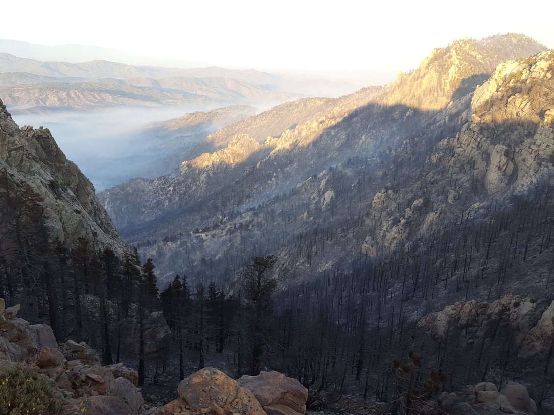
Fobes Trail The Cranston Fire did not reach this far south in Garner Valley. However the Fobes Ranch Road area remains closed until further notice.
Spitler Peak Trail Although there were some spot fires ahead of the main fire front in the semi-desert area south of Apple Canyon Road, the Spitler Peak Trail itself was apparently unaffected. However, it may be some time before Apple Canyon Road – the access for the Spitler Peak trailhead – is open to non-residents. [I don’t have reliable information on the status of the informal Zen Center Trail at this time.]
South Ridge Trail This is the higher elevation (>6000′) trail most impacted by the Cranston Fire. Most of the trail was not directly burned, but many areas were heavily covered with phos-chek retardant. Between Chinquapin Flat and Tahquitz Peak, some vegetation burned right around Tahquitz Peak. [Unless you have been slavishly following highly irresponsible individuals online or by email, you know by now that the Tahquitz Peak fire lookout did NOT burn down.]
South from Tahquitz Peak to Old Lookout Flat, the trail is well below the ridgeline on the western flank. As the fire was held at or near the ridgeline in most places, this section of trail is unaffected. From Old Lookout Flat south to the trailhead at the top of South Ridge Road, the trail was heavily hit with phos-chek retardant. In addition, the fire broke through in a few minor spots here. While the surrounding vegetation is burned, the fire was not notably hot through these areas and the trail itself is undamaged.
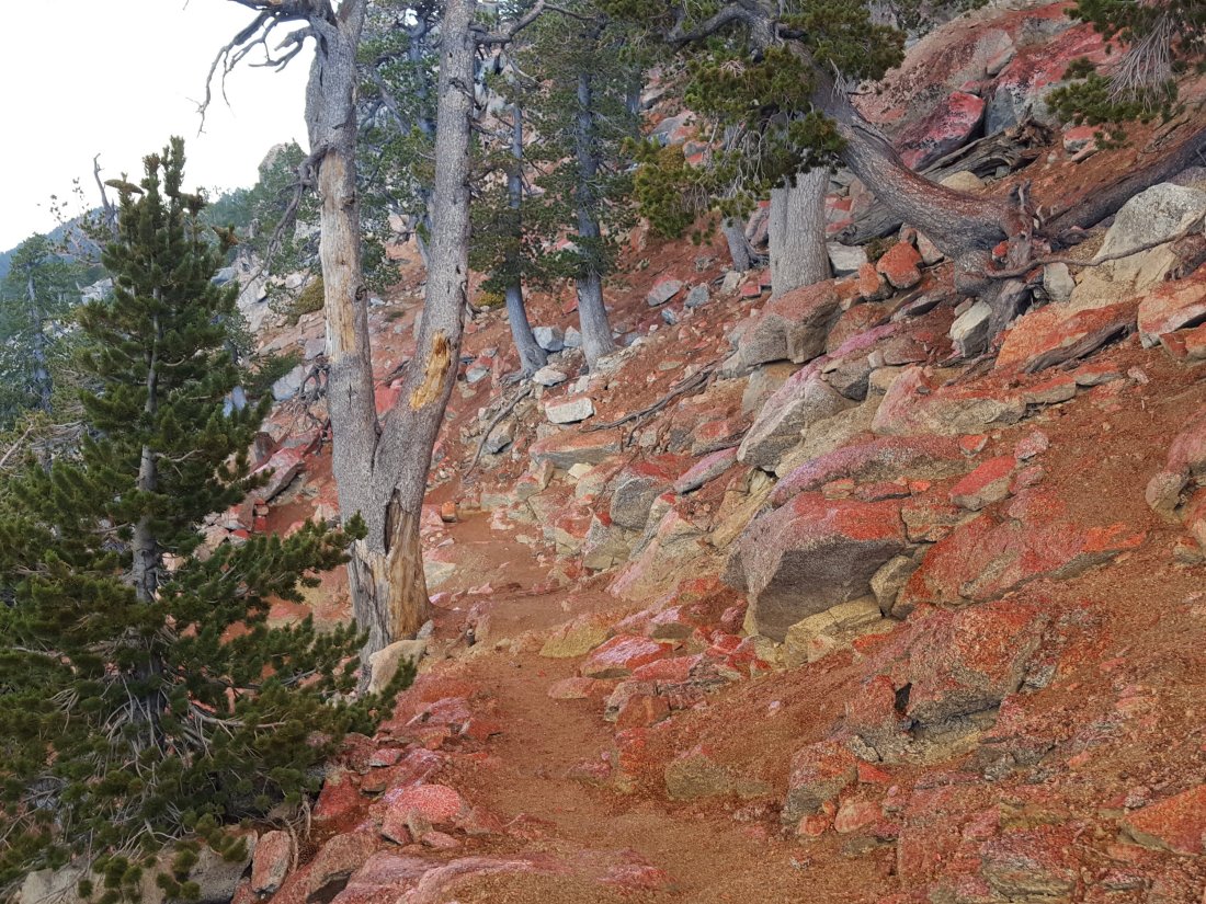
South Ridge Trail (from South Ridge Road to May Valley Road) This multi-use trail, a popular mountain bike trail, was completely burned over.
May Valley Road (and adjacent bike trails) This dirt road very popular with locals for biking, hiking, running, and dog walking, was completely burned over from its crest just beyond Cowbell Alley all the way down to its junction with Bonita Vista Road.
All other high country trails were not directly affected by the Cranston Fire. This includes all the trails around the Tahquitz area meadows, Devils Slide, Ernie Maxwell Trail, Willow Creek Trail, Ramona Trail, etc. It is however amazing (and frankly disconcerting) to see black ash flakes throughout all the trails of the mountain, even all the way to San Jacinto Peak. That there were not more spot fires scattered around the high country is very fortunate. It is to be hoped that all these other trails can be reopened promptly once all necessary fire suppression activities have been completed.sanjacjonUncategorized2 Comments 4 MinutesEdit”Cranston Fire: trail update”
Cranston Fire
UPDATE Monday 30th July 2018 at 1430
The San Jacinto Trail Report will steadily transition back to its primary objective (trail information) over the next couple of days. However a handful of quick pieces of fire-related news follow.
Helicopters continue to move back-and-forth across Idyllwild making water drops in the South Ridge area, but at greatly reduced intensity compared to recent days. Barely any smoke was visible up there at dawn this morning, and town was almost smoke-free.
Ground crews were deployed in the high country yesterday, primarily in the north-east area of the fire front (e.g., Red Tahquitz). The main visible smoke this morning was on the north-west side of Red Tahquitz, where the fire had marginally slopped over the east-west Tahquitz ridge into areas largely burned by the Mountain Fire in 2013.
Some residents returned yesterday with the evacuation order lifted for Idyllwild-Pine Cove, including almost all our immediate neighbours. Many part-time residents continued to stay off the hill however, allowing for a more gentle transition into “normal” town life. The Post Office, USFS Idyllwild Ranger Station, and some businesses and restaurants are reopening today. The Mount San Jacinto State Park headquarters remains closed.
The only road into Idyllwild remains Highway 243 from Banning. The original plan was to restrict access today to only residents plus commercial traffic, but non-residents are now being allowed access via Hwy 243 also.
Highway 74 on both sides of Mountain Center, and Highway 243 from Mountain Center to Idyllwild, remain closed. Highway 74 to Hemet will apparently remain closed for a minimum of another week (per CalTrans), after which traffic will be subject to flag and flow controls for at least two months. In the burn areas along Highway 74, Southern California Edison has to replace over 120 power poles, including more than 90 using aerial lifts by helicopter. I’m hearing anything between a minimum of two to four weeks to complete that work. In summary, the three road routes out of Mountain Center will be subject to continuing significant disruption for weeks or probably months.
Finally, many thanks to the dozens of people who contacted the San Jacinto Trail Report in recent days to say thank you for our accurate and detailed coverage of developments during the Cranston Fire. We did the best we could in challenging circumstances. Special thanks to Steven Morris and Martha Ludlum, and to Chrissy King, for their generous donations in recent days to help maintain this website. Donations are always accepted at this page! A full list of website supporters is always maintained here.
Thanks to all, and safe hiking. Jon.sanjacjonUncategorizedLeave a comment 2 MinutesEdit”Cranston Fire”
Long Valley reopening
According to the facebook page of the Palm Springs Aerial Tramway, the tram and the Long Valley hiking trails will reopen as of 1000 tomorrow, Monday July 30th 2018.
All other trails and all camping in Mount San Jacinto State Park will remain closed until further notice as a result of continuing activities in relation to the Cranston Fire.sanjacjonUncategorizedLeave a comment 1 MinuteEdit”Long Valley reopening”
Cranston Fire
UPDATE Sunday 29th July 2018 at 1315
Highway 74 south from Lake Hemet (to Highway 371/Paradise café) is now open. It will remain closed from Lake Hemet to Mountain Center for the foreseeable future.
UPDATE Sunday 29th July 2018 at 1015
The evacuation order for Idyllwild-Pine Cove has been lifted in the last hour. Access is for residents with identification only, and only via Highway 243 from Banning.
This morning Idyllwild was much less smoke-filled than the previous two days, with an encouraging rise in humidity. There are still a couple of hotspots smoldering on the Idyllwild side of South Ridge just south of Tahquitz Peak, but nothing that is apparently cause for alarm. The Cranston Fire is at 13,130 acres and is 29% contained, according to InciWeb.
After an early morning hike, I checked around the fringes of town a little. Good news is that despite the fire burning around and through it, the transfer station is open already. I’m guessing it will fill up fast with the contents of fridges that were without power for a few days. Note that the transfer station is currently only accessible from above via Saunders Meadow Road, not via the shorter route from Hwy 243 (which is still closed just after Marian View Drive).
The persistent hotspots at the southern end of South Ridge – where May Valley Road comes off from Cowbell Alley – have been contained and there was no sign of smoke there.
The situation for hikers and recreation remains largely unchanged and is described at this link. The Palm Springs Aerial Tramway and Long Valley hiking trails will reopen tomorrow, Monday 30th July, at 10am, according to the facebook page of the Tram.sanjacjonUncategorizedLeave a comment 1 MinuteEdit”Cranston Fire”
Cranston Fire
UPDATE Saturday 28th July at 1930
The helicopters finally fell silent at about 1600, a telltale sign that the hotspots on South Ridge were under control, at least for another evening. The ridge looks beautiful tonight, clear and smoke-free, but then it did last night too.
Highway 243 from Banning will apparently reopen tomorrow for those with confirmed identification as residents of Idyllwild-Pine Cove. Unfortunately Highway 74 has much greater challenges on both sides of Mountain Center, and it remains very unclear how long it will be before that highway can reopen to anything other than emergency traffic. It’s possible we may have to deal with only one route in and out of town for several weeks.
Details of trail and recreation closures are discussed at this link.sanjacjonUncategorizedLeave a comment 1 MinuteEdit”Cranston Fire”
Cranston Fire: trail update
All trails in the USFS San Jacinto Ranger District and the Mount San Jacinto State Park, including those served by the Palm Springs Aerial Tramway, are currently closed. The full recreation closures for both agencies are listed here.
The U.S. Forest Service issued an official forest closure order on the evening of 27th July, details of which are available at this link. This draconian measure initially closes the entire San Jacinto Ranger District trail system until 31st August 2018.
Hopefully common sense will prevail, and trails that are completely unaffected by (and literally miles away from) the Cranston Fire, such as Fuller Ridge Trail, Black Mountain Trail, Seven Pines Trail, and Marion Mountain Trail, among others, will be considered for reopening as soon as possible. Obviously these are functionally closed anyway at this time, given the combination of road closures (for non-residents), and the closure of the State Park at their higher elevations. Once those measures are lifted however, there is no logical reason to keep the aforementioned trails closed.
Bear in mind that this closure order applies only through August 31st. Some trails will remain closed long after that. Almost exactly five years on from the Mountain Fire, some trails are still closed from that fire (Caramba Trail, PCT from Spitler Peak Trail to Grethe Spring).
Fortunately, damage to high country trails by the Cranston Fire has been much more limited than by the Mountain Fire, but for example it is highly likely that the PCT south from Saddle Junction to Grethe Spring, the trail to Tahquitz Peak, and South Ridge Trail, will be closed well beyond August 31st. [I will be posting detailed information on trails impacted by this fire by the end of July.]
Exactly what the State Park does (and when) remains to be seen. It is not directly affected by the Cranston Fire at all, so hopefully it will reopen relatively soon. Of course many of the trails accessing the State Park initially pass through USFS land, complicating access (other than by the Tram) unless the agencies coordinate their approach.
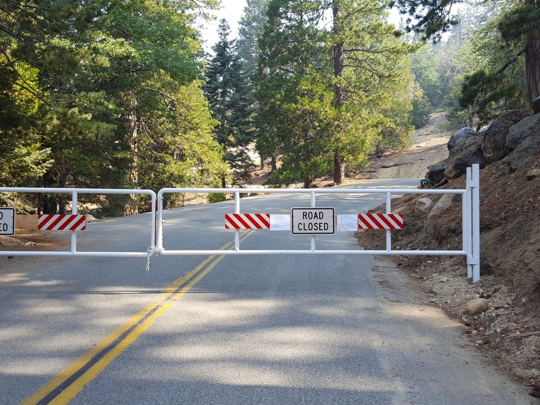
sanjacjonUncategorized1 Comment 2 MinutesEdit”Cranston Fire: trail update”
Cranston Fire
UPDATE Saturday 28th July at 1245
Sorry if this pattern is starting to sound familiar, but as with the previous two days, the major aerial water bombing campaign has been effective, and the hotspots I described earlier today seem to be under control. Regrettably, the weather has been less cooperative than anticipated, with a slightly cooler day not materializing, and its already 92 degrees F in Fern Valley. There was also a moderate south-west wind in the high country early this morning which is not helping (although winds have been far less dangerous than they could have been throughout this whole incident).
UPDATE Saturday 28th July at 1030

Although the overall spread of the fire has greatly diminished, for the first time it broke through the line along the top of South Ridge in several places overnight. I was up hours before first light, and could see trees and bushes burning on the Idyllwild side of the ridge in at least three places, which was both dramatic to see, and somewhat disconcerting. With binoculars I could see that one of the spot fires was a bush right next to Tahquitz Peak fire lookout, but by first light it had burned itself out and was just smoldering.
Fire crews had a well deserved rest first thing, and aerial activity didn’t commence until 0800. Since then the helicopters have been working incessantly to douse the hotspots.
These continuing challenges with the fire may – I emphasize may – have delayed any prospect of the evacuation order being lifted imminently. Incidentally, rumours that the power in town is intermittent (or even off again) are untrue.sanjacjonUncategorized1 Comment 1 MinuteEdit”Cranston Fire”
Cranston Fire
UPDATE Friday 27th July at 2010
Contrary to remarkably stubborn and ill-informed rumours, apparently spread by folks nowhere near Idyllwild, Tahquitz Peak fire lookout has not burned and is still standing strong as of 8pm this evening.

South Ridge looks as smoke-free as it has since Tuesday. However persistent hotspots evidently remain and some aerial suppression continues as I write. Barring some dramatic, unforseen change in the wind, I think its fair to say that the situation is looking at its most optimistic since this all began on Wednesday.
UPDATE Friday 27th July at 1700
Power seems to be restored to all of Idyllwild and Pine Cove. Current estimates are that it may be several weeks before power is restored to Mountain Center and Apple Canyon.
Although there is still significant helicopter activity putting water on hotspots on the east side of South Ridge, the smoke looking east from Idyllwild is the least threatening it’s been since Wednesday.
UPDATE Friday 27th July at 1450
Power starting to return to Idyllwild neighbourhoods, one of my neighbors WiFi signals just showed up on my ‘phone.
Also, Pine Cove residents with proof of a physical address north of Marion Ridge Drive are being allowed to return home by CHP via Hwy 243 from Banning.
UPDATE Friday 27th July at 1410
Power is back on in the centre of Idyllwild. Hasn’t come back in most residential neighborhoods yet, but we’re obviously heading in the right direction.
UPDATE Friday 27th July at 1330
All remains well in town. A nasty flare-up on the east side of South Ridge just over from the top of South Ridge Road has led to an amazing procession of helicopters over our house in the ladt hour, ferrying water from Dutch Flats to the blaze.
The flag at Tahquitz Peak shows a gusty south-west wind up high. It’s obviously not helping the suppression effort that the wind is shifting from day-to-day, but at least it’s not strong.
I just checked Tahquitz Peak and was dismayed to see the chapparal immediately on the south side of the Tower smouldering, literally within 100 yards of the structure. But fingers crossed, the old girl will hang in there.
Spirits in town remain high. I have a friend with a cache of a dozen bags of ice, so as long as we have enough gas to keep the generators running, there’s no reason to be drinking warm gin-and-tonics.sanjacjonUncategorizedLeave a comment 2 MinutesEdit”Cranston Fire”
Cranston Fire

UPDATE Friday 27th July at 1045.
Idyllwild-Pine Cove remain safe and secure. There has been a flare-up on the east side of South Ridge to the south of Tahquitz Peak, and a huge smoke column is rising from there now that was absent just an hour ago. The DC-10s are back making circuits over town again.
As planned, the fire burned up the east side of South Ridge and very close to Tahquitz Peak. Although it “slopped over” in a couple of spots, the South Ridge line, that I watched being laid down yesterday morning, apparently held remarkably well.
Yesterday afternoon the fire took a turn for the worse in Garner Valley. The northerly wind caused some south and south-east movement along Apple Canyon and towards Lake Hemet. The fire jumped Hwy 74 at Hurkey Creek, at least partly damaging both the county campground and the Ronald McDonald camp to its east.
Crews launched a major operation to defend properties at the head of Apple Canyon (e.g. Pine Springs Ranch). They allowed the fire to burn on by these properties, but structures themselves were largely saved. News in the Bonita Vista area was not so good, and I have reliable reports that some structures in that area, burned in the 2013 Mountain Fire, and the Fleming Ranch area were lost.
I don’t have reliable information as to the status of facilities and structures around Lake Hemet.
Edison trucks have started to appear around town for the first time since the fire started. Whether that means anything regarding the restoration of power, it’s hard to say. The word around town is that the evacuation order is unlikely to be lifted for a few more days. Although that’s pure speculation, it seems like a good guess as long as flare-ups continue relatively close to town.
UPDATE Friday 27th July at 0800.
All is well in Idyllwild. The fire did not break South Ridge at all yesterday, and for now, Idyllwild and Pine Cove remain safe. Lots of smouldering apparent along the east and south-east sides of South Ridge suggest that the fire burned extensively in the canyon on the the east flank of Tahquitz Peak.
Despite grossly irresponsible rumors from off the hill, Tahquitz Peak fire lookout is intact, with flag still flying. See photos below. (The flag was left up when my colleague Darla had to leave in haste on Wednesday, understandably. It is proving useful to me as I can see the wind direction at 8800′ by observing the flag through binoculars.)
The news for our beloved wilderness in the high country may be more mixed. It appears that the apparent containment plan I described yesterday (below) may have partly failed yesterday evening. From about 1730 to dark last night there was a massive increase in helicopter activity, transporting water drops to areas north-east of Tahquitz Peak. Impossible to say from here exactly what happened, but it’s possible the fire broke through in the areas north of Red Tahquitz and Chinquapin Flat. Hopefully I’ll learn more today.

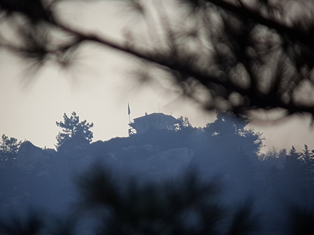
UPDATE Thursday 26th July at 1640.
Palm Springs Aerial Tramway is now CLOSED. All trails >5000′ elevation in the San Jacinto mountains are now CLOSED.
Also, another fire started just west of Pinyon at about 1015, the Ribbon Fire. Currently 100 acres, 0% contained.
UPDATE Thursday 26th July at 1300. For latest photos see below.
The fire was smouldering gently early this morning,, but a moderate NW wind picked up about 0930. Although this is taking the fire largely away from Idyllwild, it gave it significant energy. It started a major run east and north-east up the parallel ridges from May Valley to both South Peak and Antsell Rock. It is also burning heavily in the canyon immediately below Tahquitz Peak.
Looks like the decision has been made to let it burn these areas. The retardant tankers were doing a superb job of establishing South Ridge as a firm boundary. It was great to see them making a deliberate effort to protect Tahquitz Peak fire lookout, laying down three layers of Phos-Chek on the east side right next to the tower.
With its current path, the fire will largely run up to the Desert Divide and into areas that burned in the 2013 Mountain Fire. Most of those areas have very little fuel, and I imagine the hope is the fire will struggle to maintain itself. All this assumes no significant change in wind direction or strength (there is none forecast).
Ironically, this would mean the fire may burn into the area of the Pacific Crest Trail that is still currently closed from 2013. Restoration work on this section was just nearing completion, and the hope was it would reopen later this year.


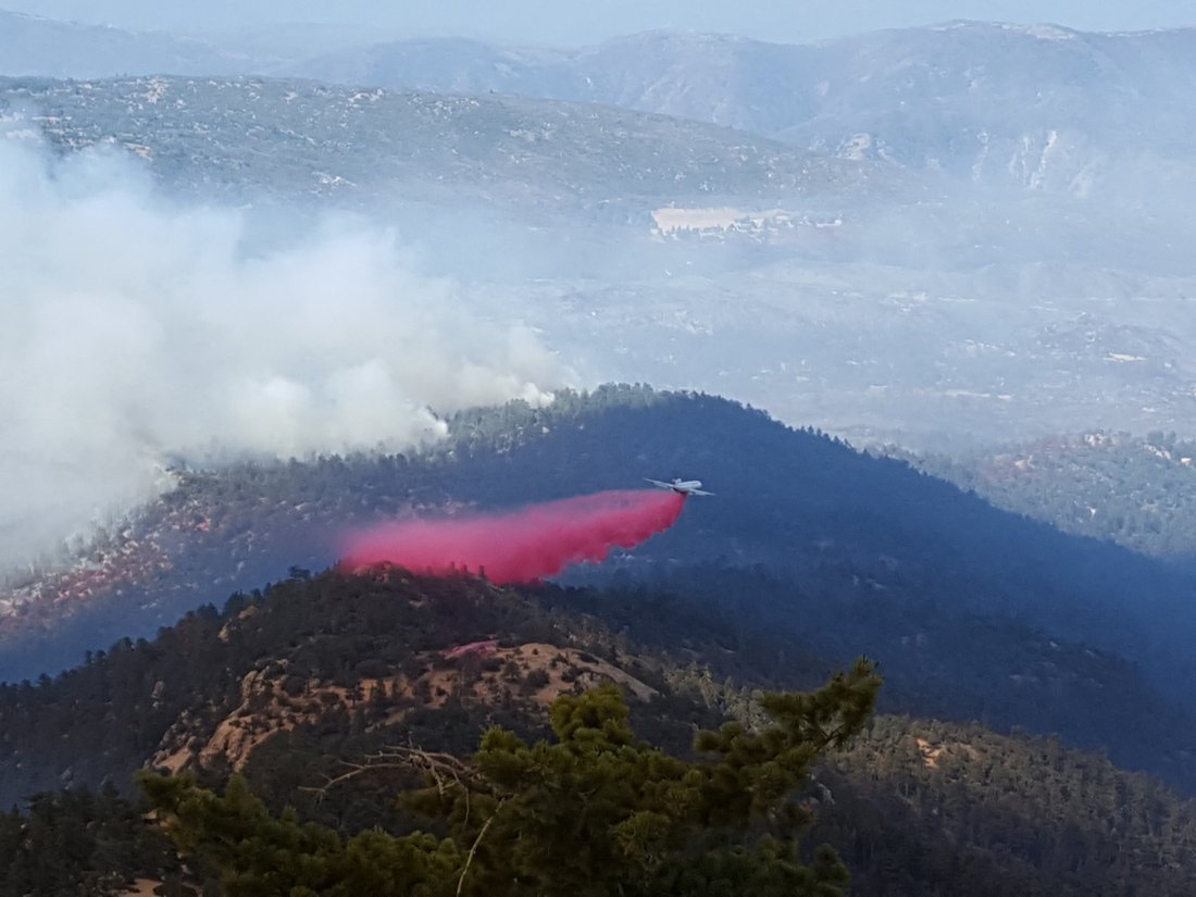
All Idyllwild area trails are currently closed (Ernie Maxwell, Devils Slide, South Ridge, Deer Springs, PCT, etc).
The Palm Springs Aerial Tramway remains open for now, but with no camping or hiking permitted beyond Long Valley.
Idyllwild is under mandatory evacuation (although many residents have stayed) and all roads to the Idyllwild area are closed.
The Cranston Fire, which has currently burned over 7500 acres, started at about 1200 on Wednesday 25th July to the west of Idyllwild. It burned just South of Idyllwild and north of Mountain Center, from west to east.
It continues to burn on the south slope of South Ridge and east toward Antsell Rock and South Peak.


Remarkably, when the fire started I was on a search-and-rescue mission for two lost hikers off the Seven Pines Trail. When I found them, I took the photo below. It was only during our complicated descent (when it started raining ash on us) that the gravity of the situation became clear. Then, and when I was trying to turn to head south toward Idyllwild at about 1700 and could barely make the left due to the constant stream of vehicles heading north on Hwy 243 evacuating town.
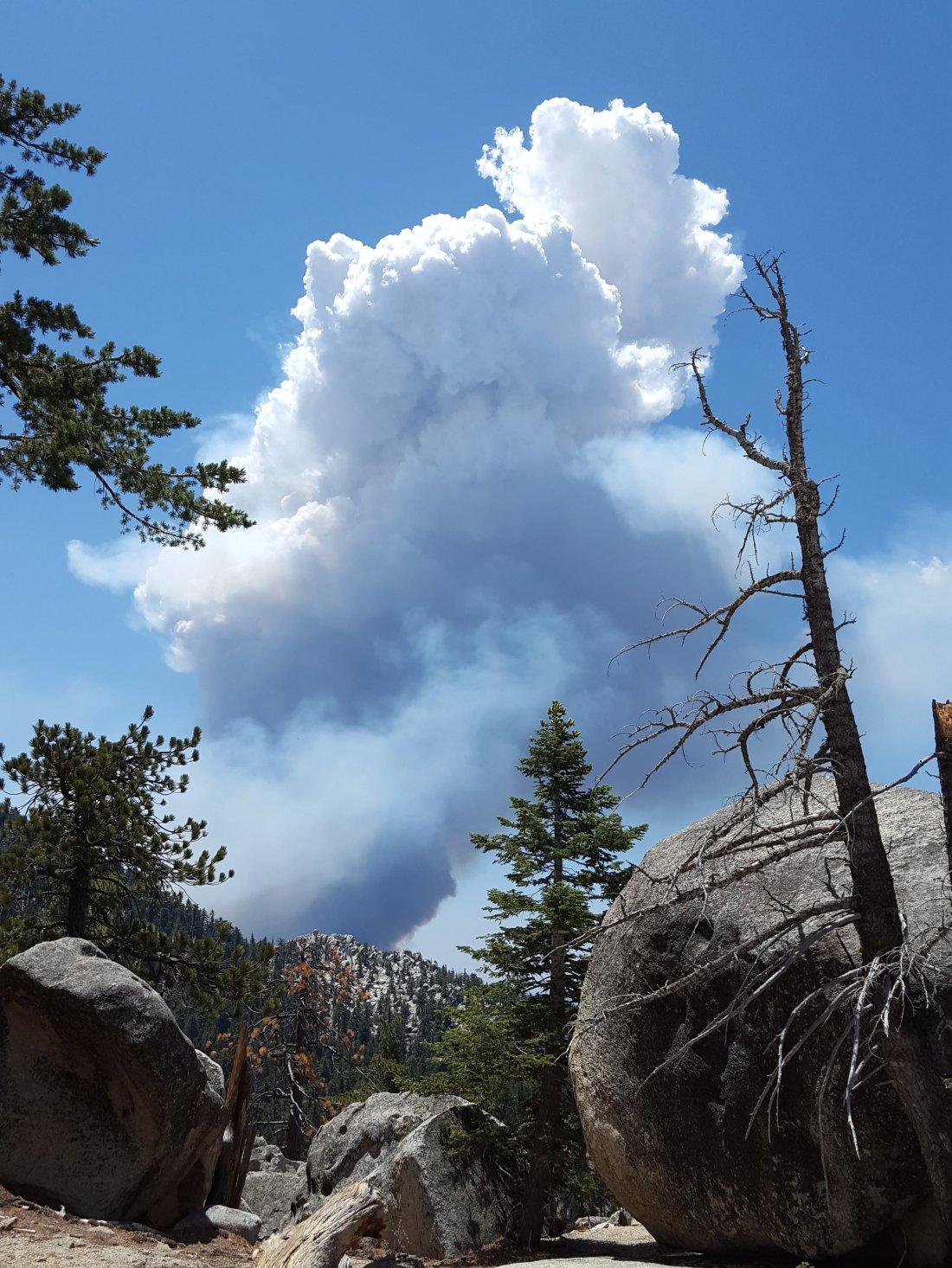
sanjacjonUncategorized1 Comment 5 MinutesEdit”Cranston Fire”
Water conditions 20 July 2018
Today I hiked from Devil’s Slide Trail to San Jacinto Peak on the Pacific Crest Trail via Strawberry Junction, plus an out-and-back on a short section of Fuller Ridge Trail, and up through Little Round Valley, then descending via Wellman Divide. On Monday 16th, I hiked to San Jacinto Peak up and down via Wellman Divide in the early morning, then spent the rest of the day in the Tahquitz area meadows botanizing. On Wednesday 18th I also hiked to Tahquitz Peak.
Weather At San Jacinto Peak at 1100 this morning the air temperature was 55°F (13°C), with a pleasantly cool windchill temperature of 48°F (9°C), a high 75% relative humidity (increasing to 90% when the Peak was enveloped in cloud), and a strong SE breeze gusting to 12 mph. On Monday 16th the temperature at the Peak by 0815 was already a sticky 59°F (15°C), with relative humidity of 63% and no discernable wind.
Regrettably no more rain since last week. Most of next week (starting 23rd) is forecast to be well above typical July temperatures for the mountain. Although the likelihood of thunderstorms may be diminished for the next week or so, hikers should always be prepared for rapidly changing weather conditions in the high country in summer. Thunderstorms with lightning can occur at or near the high peaks even when such storms are not forecast for lower elevations.
Trail overview Flow rates at all water sources have dropped again from the brief increase after last weeks rain, and overall flow rates remain far below seasonal norms. There is no snow anywhere on the mountain (all trails have been completely clear since early May).
Bear sightings No new ones to report, see previous post for last known observations.
EASTERN SLOPE WATER FEATURES
The Round Valley faucet flow rate today was at 0.20 gallons per minute, the same rate as on Tuesday 17th. This was a rapid drop from the post-rain increase to 0.35 gallons per minute on 13th July. Flow rate on 6th July had fallen as low as 0.10 gallons per minute. [Many thanks to Florian Boyd for these data from Round Valley.]
Both the northern and southern springs at Wellman’s Cienega are flowing gently. At the northern Cienega, flow rate today was roughly half that of last week, back to the low flow rate of early July. These springs are the sources for Willow Creek, which continues to flow fairly well where it crosses the Willow Creek Trail.

Tahquitz Valley is completely dry.
Tahquitz Creek continues to flow well at the northern (lower) end of Little Tahquitz Meadow.

Despite some rain last week, it is only flowing weakly further upstream at its source (known locally as Grethe Spring) where it crosses the PCT at the northern end of the fire closure (approx. PCT Mile 177). Just after crossing the PCT, the creek dries up and disappears subsurface.
Skunk Cabbage Creek has now dried up where the trail crosses Skunk Cabbage Meadow at the small wooden bridge.
WESTERN SLOPE WATER FEATURES
The North Fork of the San Jacinto River continues to flow reliably both where it crosses the Deer Springs Trail, and where it crosses the Fuller Ridge Trail on the PCT (approx. PCT Mile 186.2). About 100′ downstream from the river crossing on Fuller Ridge Trail, the flow rate was 1.2 gallons per minute today.
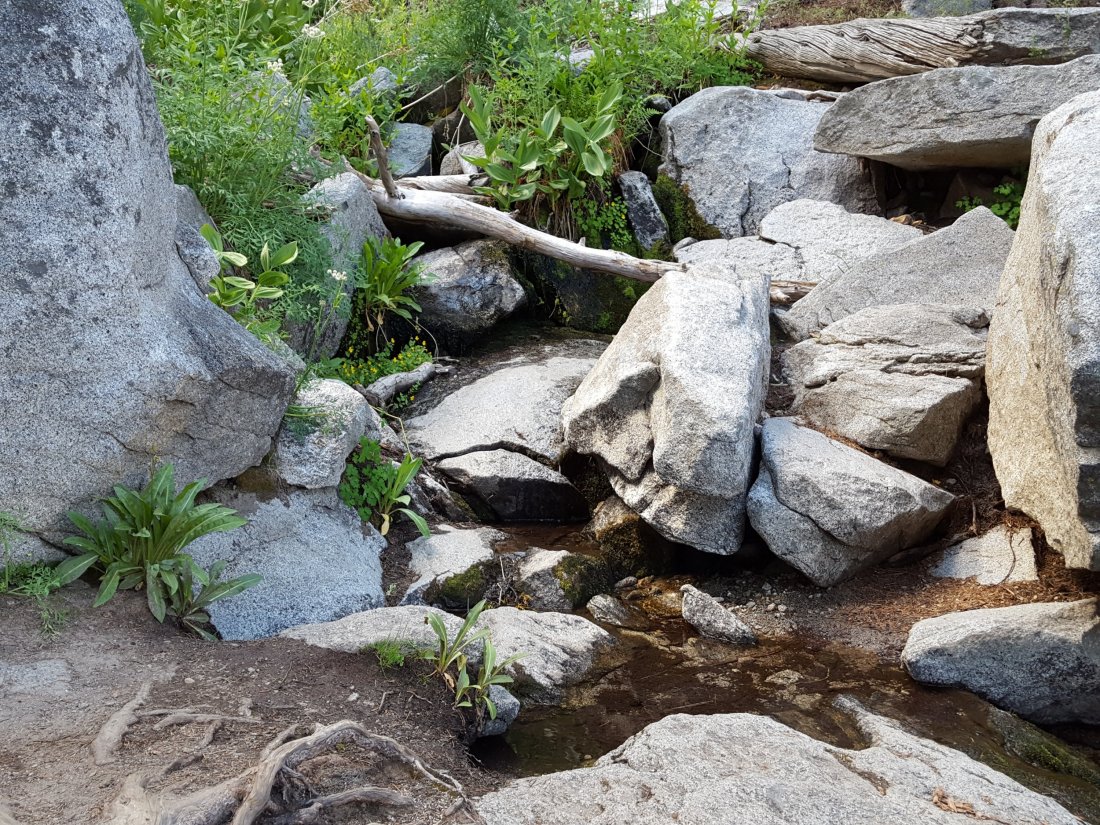

O’Sullivan Creek (PCT Mile 186.4) on Fuller Ridge Trail is completely dry.
The spring in the creek in Little Round Valley has been completely dry since early June.
Shooting Star Spring – 0.28 trail miles below Little Round Valley – is now flowing weakly. For hikers it is possible to filter water from the source at the base of the obvious huge rock, but a better option is to descend to the North Fork crossing mentioned above.
The minor creek crossing (sometimes known as Rock Spring) on Deer Springs Trail midway between the North Fork of the San Jacinto River crossing and Shooting Star Spring is close to drying completely, and is now dry across and below the trail.
The Deer Springs stream crossing at the PCT (approx. PCT mile 185.6) is dry, and the pools just upstream (and downstream) of the trail are also dry. The Deer Springs camp just downslope has been occupied by a crew from the California Conservation Corps (CCC) since late May.
Switchback Spring – the small spring just below the eight switchbacks on Deer Springs Trail about 0.4 miles north of Strawberry Junction – continues to flow quite well. There is a tiny pool on the upslope side of the trail where water can be filtered.
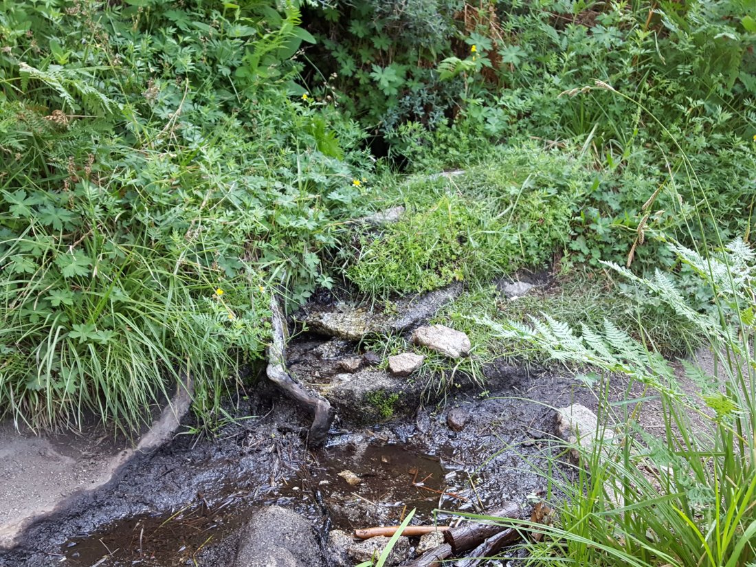
The little spring in the rock crack at Strawberry Cienega (PCT mile 183.0) continues to flow quite well. For filtering, there is a tiny pool among the rocks (now heavily obscured by plants), and a permanently placed tent stake makes a clean accessible trickle out of the mud. At the tent stake, the flow rate today was 0.07 gallons per minute.
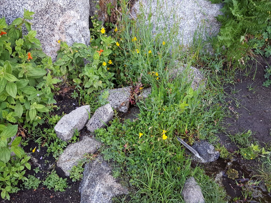
On Devil’s Slide Trail, Middle Spring is now just a trickle in the morning (barely enough for a dog to get a little water), but by afternoon it is basically dry. Insufficient flow for a hiker to get any water at all.
On the Ernie Maxwell Trail, Chinquapin Creek just below Humber Park is – since 1st July – periodically diverted by Fern Valley Water District to their storage tanks, drying the creek where it crosses the trail. However, even when the creek flow is diverted, good pools remain immediately upstream from the trail. This is a very important water source for the many dogs walked on this trail.sanjacjonUncategorizedLeave a comment 4 MinutesEdit”Water conditions 20 July 2018″
Water conditions 13 July 2018
This report is a compilation of several hikes in the last three days. Today we hiked from Devil’s Slide Trail to San Jacinto Peak via Wellman’s Cienega, repeating the same route we hiked on 11th. Yesterday (12th July) I hiked to my fire lookout shift at Tahquitz Peak checking all the meadows to the east of Saddle Junction, descending via South Ridge Trail. On 9th July, Anne and I hiked up Marion Mountain Trail to San Jacinto Peak via the PCT and Deer Springs Trail, repeating the route I hiked with Deb Nelson on 6th July. Also included are observations from Anne’s run on the Maxwell Trail yesterday, and from Florian Boyd’s hike to Round Valley today.
Weather At San Jacinto Peak at 0810 this morning the air temperature was 52°F (11°C), with a high 80% relative humidity and a very light SSE breeze. On Wednesday 11th July, temperature at the Peak at 0745 was 51°F (10.6°C), with a pleasantly cool windchill temperature of 43°F (6°C), very high relative humidity of 87%, and a stiff ENE wind gusting to 13mph.
We finally got some rain! Combined rainfall at 5550′ elevation in Idyllwild for Tuesday-Thursday was 0.44″. It rained all over the mountain, including parts of all three days at both San Jacinto and Tahquitz peaks. As is typical with thunderstorms, rainfall was highly variable depending on location. For example, on Wednesday evening (11th July), our home in Idyllwild received 0.25″, parts of the nearby Maxwell Trail remained completely dry, while Palm Springs got 1.0″ from the same storm.
Hikers should always be prepared for rapidly changing weather conditions in the high country in summer. Thunderstorms with lightning can occur at or near the high peaks even when such storms are not forecast for lower elevations.
Trail overview Flow rates at all water sources increased significantly in the last couple of days following the rains, but this improvement is temporary, and overall flow rates remain far below seasonal norms. There is no snow anywhere on the mountain (all trails have been completely clear since early May).
Bear sightings No new ones to report, see previous post for recent observations.
EASTERN SLOPE WATER FEATURES
The Round Valley faucet flow rate tripled in the last couple of days, to 0.35 gallons per minute today. [UPDATE 17 July: flow rate has already fallen to 0.2 gallons per minute.] Flow rate on 6th July was 0.10 gallons per minute (down from 0.28 gallons per minute on 15th June). [Many thanks to Florian Boyd for these data from Round Valley.]
Both the northern and southern springs at Wellman’s Cienega are flowing well. At the northern Cienega, flow rate today was roughly double that of last week. These springs are the sources for Willow Creek, which continues to flow fairly well where it crosses the Willow Creek Trail.

Tahquitz Valley is completely dry.
Tahquitz Creek continues to flow well at the northern (lower) end of Little Tahquitz Meadow.
Despite some rain, it is only flowing weakly further upstream at its source (known locally as Grethe Spring) where it crosses the PCT at the northern end of the fire closure (approx. PCT Mile 177). Just after crossing the PCT, the creek dries up and disappears subsurface.
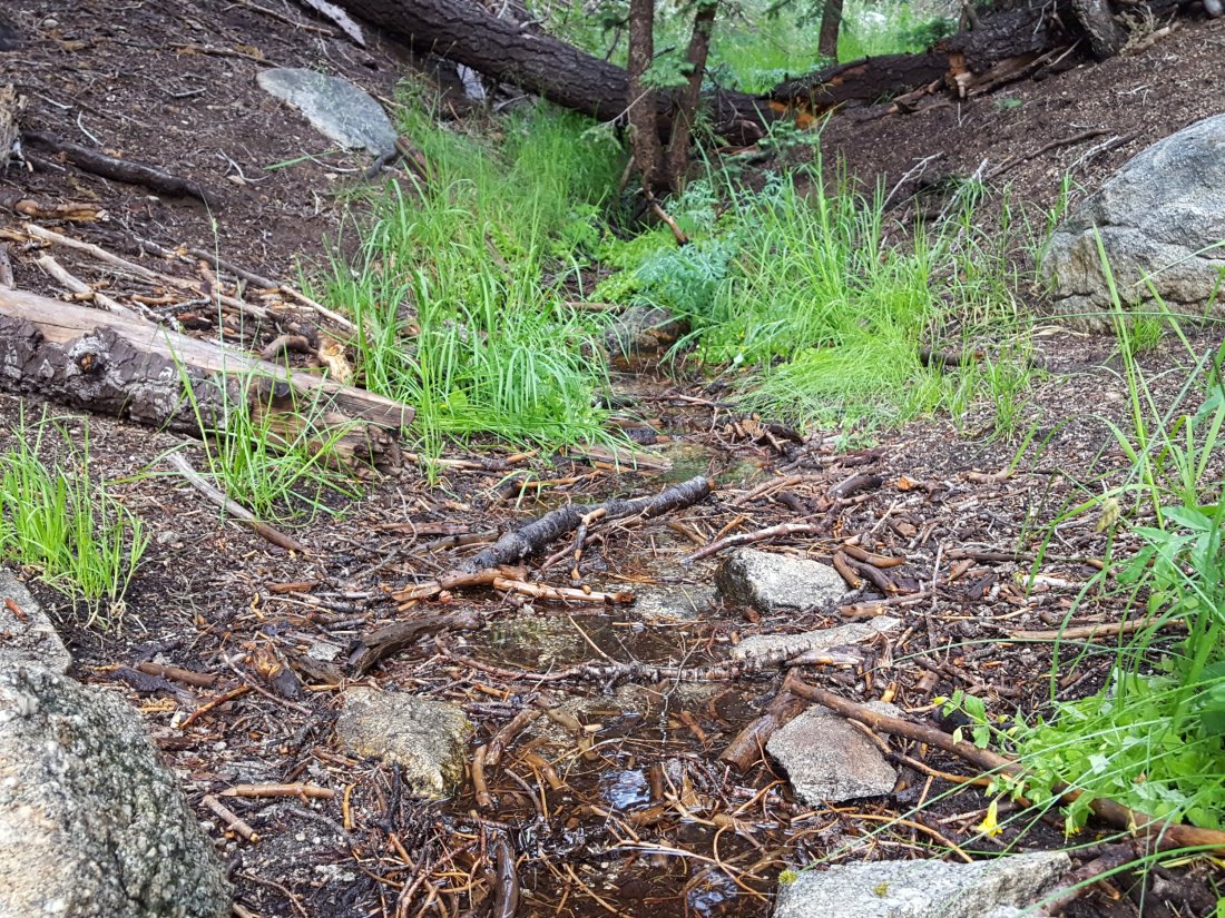
Skunk Cabbage Creek where it flows through Skunk Cabbage Meadow has now dried up, at least where the trail crosses the meadow. There are a few wet patches, but nothing that can be filtered.
WESTERN SLOPE WATER FEATURES
The North Fork of the San Jacinto River continues to flow reliably both where it crosses the Deer Springs Trail above Fuller Ridge, and where it crosses the Fuller Ridge Trail on the PCT (approx. PCT Mile 186.2).

O’Sullivan Creek (PCT Mile 186.4) on Fuller Ridge Trail is completely dry.
The spring in the creek in Little Round Valley has been completely dry since early June.
Shooting Star Spring – 0.28 trail miles below Little Round Valley – is currently flowing weakly but reliably. For hikers it is possible to filter water from the source at the base of the obvious huge rock. Otherwise the spring is largely just muddy across a short section of trail.
The minor creek crossing on Deer Springs Trail midway between the North Fork of the San Jacinto River crossing and Shooting Star Spring (sometimes known as Rock Spring) is close to drying completely, and is now dry across and below the trail.
The Deer Springs stream crossing at the PCT (approx. PCT mile 185.6) is dry, and the pools just upstream (and downstream) of the trail are also dry. The Deer Springs camp just downslope has been occupied by a crew from the California Conservation Corps (CCC) since late May.
Switchback Spring – the small spring just below the eight switchbacks on Deer Springs Trail about 0.4 miles north of Strawberry Junction – continues to flow well. There is a tiny pool on the upslope side of the trail where water can be filtered.
The little spring in the rock crack at Strawberry Cienega (PCT mile 183.0) continues to flow quite well. For filtering, there is a tiny pool among the rocks, and a carefully placed tent stake makes a clean accessible trickle out of the mud.
On Devil’s Slide Trail, Middle Spring is now just a trickle in the morning (just about enough for a dog to get a little water), but by afternoon it is often dry. Even after the recent rain, insufficient flow for a hiker to get any water at all.
On the Ernie Maxwell Trail, Chinquapin Creek just below Humber Park has now been diverted again by Fern Valley Water District to their tanks, drying the creek where it crosses the trail. However, even when the creek flow is diverted, good pools remain just upstream from the trail. This is an important water source for the many dogs walked on this trail.sanjacjonUncategorizedLeave a comment 4 MinutesEdit”Water conditions 13 July 2018″
Water conditions 9 July 2018
Yesterday Anne and I hiked up Marion Mountain Trail to San Jacinto Peak via the PCT and Deer Springs Trail, repeating the route I hiked with Deb Nelson on 6th July. Also included are observations from a run on the Maxwell Trail on 7th July, a hike up the east side trails to San Jacinto Peak on Sunday 1st July, and to Tahquitz Peak on 4th July.
Weather At San Jacinto Peak at 0845 yesterday morning the air temperature was a mild 61°F (16°C), with a high 53% relative humidity and a very light south-east breeze, under clear skies. By late morning, there was heavy cloud cover and the occasional rumble of thunder from the high country. No recorded rain in Idyllwild yet in July.
The chance of thunderstorms is forecast for the next few days at least. Any precipitation would be very welcome, but hikers should be aware of rapidly changing weather conditions in the high country, and the probability of lightning at/near the high peaks.
Trail overview Following a couple of questions I have had in recent days, I should reiterate that there is no snow anywhere on the mountain (all trails have been completely clear since early May). Flow rates at all water sources continue to drop every week, and are far below seasonal norms.
Bear sightings I spoke to local homeowners on 4th July who saw two bears together in their upper Fern Valley yard at night in late June. One of these was videoed by an automatic camera at another residence in upper Fern Valley just before midnight on Sunday 24th June. This individual appears to be one of the bears seen all over the mountain in 2017, different from the one we videoed on our property in Idyllwild on 15th May this year, linked to in the San Jacinto Trail Report for 31 May.
EASTERN SLOPE WATER FEATURES
The Round Valley faucet is now flowing very weakly. Flow rate on 6th July was 0.10 gallons per minute (down from 0.28 gallons per minute on 15th June). [Many thanks to Florian Boyd for this update from Round Valley.]
Both the northern and southern springs at Wellman’s Cienega are flowing. Flow rates continue to decline rapidly, and the northern spring continues to be weaker every time I pass by. Without fresh precipitation soon, this spring will be dry by August, which would be unprecedented in the known human history of Wellman’s Cienega. (The northern cienega dried for the first time in recorded history in 2015, and then again in 2016, but not until September-October.)
These springs are the sources for Willow Creek, which is still flowing fairly well where it crosses the Willow Creek Trail.
Tahquitz Valley is completely dry.
Tahquitz Creek continues to flow fairly well at the northern (lower) end of Little Tahquitz Meadow. It is now flowing weakly further upstream at its source (known locally as Grethe Spring) where it crosses the PCT at the northern end of the fire closure (approx. PCT Mile 177). Just after crossing the PCT, the creek dries up and disappears subsurface.
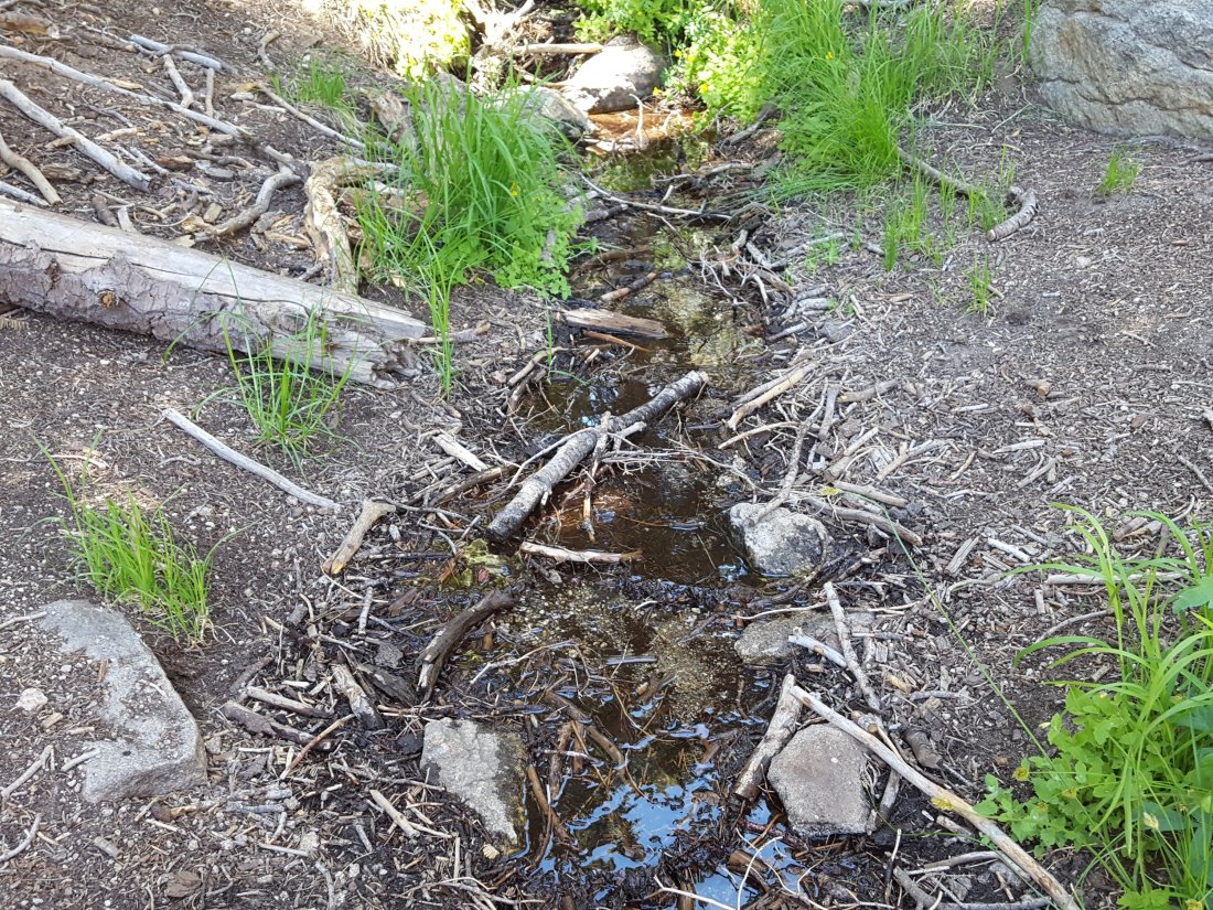
Skunk Cabbage Creek where it flows through Skunk Cabbage Meadow is currently flowing weakly. The water level has not changed markedly in the last couple of weeks.
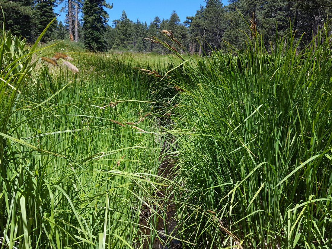
WESTERN SLOPE WATER FEATURES
The North Fork of the San Jacinto River continues to flow gently but reliably both where it crosses the Deer Springs Trail above Fuller Ridge, and where it crosses the Fuller Ridge Trail on the PCT (approx. PCT Mile 186.2).
O’Sullivan Creek (PCT Mile 186.4) on Fuller Ridge Trail is completely dry.
The spring in the creek in Little Round Valley has been completely dry since early June.
Shooting Star Spring – 0.28 trail miles below Little Round Valley – is currently flowing weakly but reliably. For hikers it is possible to filter water from the source at the base of the obvious huge rock. Otherwise the spring is largely just muddy across a short section of trail.
The minor creek crossing on Deer Springs Trail midway between the North Fork of the San Jacinto River crossing and Shooting Star Spring (sometimes known as Rock Spring) may be close to drying completely, and is now dry across and below the trail.

The Deer Springs stream crossing at the PCT (approx. PCT mile 185.6) is dry, and the pools just upstream (and downstream) of the trail are also dry. The Deer Springs camp just downslope has been occupied by a crew from the California Conservation Corps (CCC) since late May.
Switchback Spring – the small spring just below the eight switchbacks on Deer Springs Trail about 0.4 miles north of Strawberry Junction – continues to flow well. There is a tiny pool on the upslope side of the trail where water can be filtered.

The little spring in the rock crack at Strawberry Cienega (PCT mile 183.0) continues to flow quite well. For filtering, there is a tiny pool among the rocks, and a carefully placed tent stake makes a clean accessible trickle out of the mud.

On Devil’s Slide Trail, Middle Spring is now just a useless trickle in the early morning (barely even enough for a small dog to get a little water), but by afternoon it is dry. This is now the typical daily pattern. Insufficient flow for a hiker to get any water at all.
On the Ernie Maxwell Trail, the crossing of Chinquapin Creek just below Humber Park is now flowing again across the trail. Fern Valley Water District had briefly – between about 1st and 6th July – diverted water to their tanks, drying the creek where it crosses the trail. Usually the FVWD diversion is in place for several weeks or months every summer, and it is likely it will happen again soon. However, even when the creek flow is diverted, good pools remain just upstream from the trail. This is a very important water source for the many dogs walked on this trail.sanjacjonUncategorized4 Comments 4 MinutesEdit”Water conditions 9 July 2018″
Water conditions 6 July 2018
Yesterday I surveyed several water sources during a botanical hike with my friend Deb Nelson up Marion Mountain Trail to San Jacinto Peak via the PCT and Deer Springs Trail. Also included are observations from a hike up the east side trails to San Jacinto Peak on Sunday 1st July, and in the Tahquitz Peak area on 4th July.
At San Jacinto Peak at 1130 yesterday morning the air temperature was a very warm 67°F (19.4°C), with only 16% relative humidity and virtually no breeze.
Overview Following a couple of questions I have had in recent days, I should reiterate that there is no snow anywhere on the mountain (all trails have been completely clear since early May). Flow rates at all water sources continue to drop every week.
The chance of thunderstorms is forecast almost daily for the next week or so. Any precipitation would be very welcome, but beware of rapidly changing weather conditions in the high country, and the possibility of lightning at/near the high peaks.
Bear sightings I spoke to local homeowners on 4th July who saw two bears together in their upper Fern Valley yard at night in late June. One of these was videoed by an automatic camera at another residence in upper Fern Valley just before midnight on Sunday 24th June. This individual appears to be one of the bears seen all over the mountain in 2017, different from the one we videoed on our property in Idyllwild on 15th May this year, linked to in the San Jacinto Trail Report for 31 May.
EASTERN SLOPE WATER FEATURES
The Round Valley faucet is now flowing very weakly. Flow rate today, 6th July, was 0.10 gallons per minute (down from 0.28 gallons per minute on 15th June). Many thanks to Florian Boyd for this update from Round Valley.
Both the northern and southern springs at Wellman’s Cienega are flowing. Flow rates continue to decline rapidly, and the northern spring continues to be weaker every time I pass by. Without fresh precipitation soon, this spring will be dry by August, which would be unprecedented in the known human history of Wellman’s Cienega. (The northern cienega dried for the first time in recorded history in 2015, and then again in 2016, but not until September-October.)
These springs are the sources for Willow Creek, which is still flowing fairly well where it crosses the Willow Creek Trail.
Tahquitz Valley is completely dry.
Tahquitz Creek continues to flow fairly well at the northern (lower) end of Little Tahquitz Meadow. It is now flowing rather weakly further upstream at its source (known locally as Grethe Spring) where it crosses the PCT at the northern end of the fire closure (approx. PCT Mile 177). Just after crossing the PCT, the creek dries up and disappears subsurface.
Skunk Cabbage Creek where it flows through Skunk Cabbage Meadow is currently flowing weakly. The water level has not changed markedly in the last couple of weeks.
WESTERN SLOPE WATER FEATURES
The North Fork of the San Jacinto River continues to flow gently both where it crosses the Deer Springs Trail above Fuller Ridge, and where it crosses the Fuller Ridge Trail on the PCT (approx. PCT Mile 186.2).

O’Sullivan Creek (PCT Mile 186.4) on Fuller Ridge Trail is completely dry.
The spring in the creek in Little Round Valley has been completely dry since early June.
Shooting Star Spring – 0.28 trail miles below Little Round Valley – is currently flowing weakly but reliably.
The minor creek crossing on Deer Springs Trail midway between the North Fork of the San Jacinto River crossing and Shooting Star Spring (sometimes known as Rock Spring) may be close to drying completely, and is now dry across and below the trail.
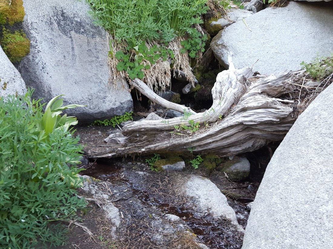
The Deer Springs stream crossing at the PCT (approx. PCT mile 185.6) is dry, and the pools just upstream (and downstream) of the trail are also dry. The Deer Springs camp just downslope has been occupied by a crew from the California Conservation Corps (CCC) since late May.
Switchback Spring – the small spring just below the eight switchbacks on Deer Springs Trail about 0.4 miles north of Strawberry Junction – continues to flow well.
The little spring in the rock crack at Strawberry Cienega (PCT mile 183.0) continues to flow quite well.
On Devil’s Slide Trail, Middle Spring is nothing more than a pathetic trickle in the early morning (barely enough for a dog to get a little water), but by afternoon it is dry. This is now the typical daily pattern. Either way, insufficient flow for a hiker to get any water at all.
On the Ernie Maxwell Trail, the crossing of Chinquapin Creek just below Humber Park is now dry across and below the trail (this is an important water source especially for dogs being walked on this trail). On or about 2nd July, Fern Valley Water District started their annual diversion of this creek to their water tanks. However, there is good flowing water just a few yards upstream from the trail, with several small pools for filtering or for dogs to drink. [UPDATE 7 July: on our run up the Maxwell Trail early this morning we were very surprised to find the creek flowing again across the trail. Apparently FVWD have suspended their diversion, so for the time being water is again available right on the trail.]sanjacjonUncategorizedLeave a comment 4 MinutesEdit”Water conditions 6 July 2018″
Mountain Footwear supports the San Jacinto Trail Report

Many thanks indeed to Mountain Footwear in Idyllwild, who this week became the first business sponsor of the San Jacinto Trail Report. Special thanks to Tony Vernon (owner) and Phyllis Lancaster (manager) for making this arrangement happen. Suppliers of great hiking boots such as Keen and Merrell, among many other things, Mountain Footwear is located on the ground floor of “The Fort” in the center of Idyllwild. Their support for the concept of the Trail Report is greatly appreciated.
The latest trail report, from yesterday 29th June, is posted at this link.sanjacjonUncategorized1 Comment 1 MinuteEdit”Mountain Footwear supports the San Jacinto Trail Report”
Water conditions 29 June 2018
A minor milestone on my hike this morning was my 50th ascent of San Jacinto Peak so far this year. I surveyed many water sources today, starting from Devils Slide Trail and hiking the PCT northbound from Saddle Junction to Fuller Ridge, then up to San Jacinto Peak and down via Wellman Divide back to the Tahquitz area meadows, before doing my shift at Tahquitz Peak Fire Lookout. Also included are observations from a hike to San Jacinto Peak on Monday 25th June.
At San Jacinto Peak early this morning the air temperature was a cool 50°F (10°C), and with a stiff south-west wind the windchill temperature was 44°F (6.7°C).
Overview I say it every week, but yet again flow rates at all water sources are visibly lower than just a week ago. Those very familiar with the Deer Springs Trail/PCT will be interested to find a short new section has just opened immediately before the Deer Springs crossing, where the CCC crew has been working for several years to take the PCT upslope and away from the streamside vegetation.
Bear sightings One was videoed by an automatic camera at a residence in upper Fern Valley (Idyllwild) just before midnight on Sunday 24th June. This individual appears to be one of the bears seen all over the mountain in 2017, different from the one we videoed on our property in Idyllwild on 15th May, linked to in the San Jacinto Trail Report for 31 May.
EASTERN SLOPE WATER FEATURES
The Round Valley faucet is flowing weakly but steadily. Flow rate on 15th June was about 0.28 gallons per minute.
Both the northern and southern springs at Wellman’s Cienega are flowing. Flow rates continue to decline rapidly, and the northern spring was much weaker today even than last week. Without fresh precipitation soon, this spring will be dry by August, which would be unprecedented in the known human history of Wellman’s Cienega. (The northern cienega dried for the first time in recorded history in 2015, and then again in 2016, but not until September-October.)
These springs are the sources for Willow Creek, which is still flowing fairly well where it crosses the Willow Creek Trail.
Tahquitz Valley is completely dry.
Tahquitz Creek continues to flow fairly well at the northern (lower) end of Little Tahquitz Meadow. It is now flowing rather weakly further upstream at its source (known locally as Grethe Spring) where it crosses the PCT at the northern end of the fire closure (approx. PCT Mile 177). Just after crossing the PCT, the creek dries up and disappears subsurface.
Skunk Cabbage Creek where it flows through Skunk Cabbage Meadow is currently flowing weakly. The water level today appeared to be similar to last week.
WESTERN SLOPE WATER FEATURES
The North Fork of the San Jacinto River continues to flow gently both where it crosses the Deer Springs Trail above Fuller Ridge, and where it crosses the Fuller Ridge Trail on the PCT (approx. PCT Mile 186.2).
O’Sullivan Creek (PCT Mile 186.4) on Fuller Ridge Trail is completely dry.
The spring in the creek in Little Round Valley has been completely dry since early June.
Shooting Star Spring – 0.28 trail miles below Little Round Valley – is currently flowing weakly but reliably.
The minor creek crossing on Deer Springs Trail midway between the North Fork of the San Jacinto River crossing and Shooting Star Spring (sometimes known as Rock Spring) is flowing very poorly, and is now dry across and below the trail.
The Deer Springs stream crossing at the PCT (approx. PCT mile 185.6) is dry, and the pools just upstream (and downstream) of the trail are also dry. The Deer Springs camp just downslope has been occupied by a crew from the California Conservation Corps (CCC) for about a month.
Switchback Spring – the small spring just below the eight switchbacks on Deer Springs Trail about 0.4 miles north of Strawberry Junction – continues to flow remarkably well.
The little spring in the rock crack at Strawberry Cienega (PCT mile 183.0) continues to flow surprisingly well.
On Devil’s Slide Trail, Middle Spring was a pathetic trickle very early this morning(barely enough for a dog to get a little water), but by late afternoon it was dry. This is now the typical daily pattern. Either way, not enough water for a hiker to get any water at all.
On the Ernie Maxwell Trail, the crossing of Chinquapin Creek just below Humber Park continues to flow well (an important water source especially for dogs being walked on this trail). [UPDATE 2nd July – Fern Valley Water District started it’s annual diversion of the creek to its water tanks, meaning the creek is now dry across the trail. However, there is good flowing water just a few yards upstream from the trail, with pools for filtering or for dogs to drink.]sanjacjonUncategorized1 Comment 3 MinutesEdit”Water conditions 29 June 2018″
Water conditions 20 June 2018
After two days of hiking around lava-strewn desert on a SAR mission in the Amboy area, I couldn’t wait to do a long cool forest hike back in the mountains. Today I surveyed many water sources, starting from Devils Slide Trail and hiking the PCT northbound from Saddle Junction to Fuller Ridge, then up to San Jacinto Peak and down via Wellman Divide back to Humber Park. Also included is information from a check of the Tahquitz area meadows on our botany hike on Saturday 16th. Many thanks to Florian Boyd for updating the status of the Round Valley faucet on 15th, and to Anne King for checking Chinquapin Creek on the Maxwell Trail while I was away.
At San Jacinto Peak at 0900 this morning the air temperature was a balmy 61°F (16°C), and with a light north breeze the windchill temperature was 59.5°F (15°C).
Overview Apologies for sounding like a broken record, but water resources everywhere are flowing poorly for the time of year, and yet again flow rates are visibly lower than just a week or two ago.
Bear sightings I had a reliable report of the small yearling Black Bear near the North Rim campsites on the Willow Creek Trail (i.e. only about 0.6 miles from Saddle Junction) on about 18th/19th June. This is likely the same individual we videoed at home in Idyllwild on 15th May that was linked to in the San Jacinto Trail Report for 31 May.
EASTERN SLOPE WATER FEATURES
The Round Valley faucet is currently flowing weakly but consistently, at a flow rate of about 0.28 gallons per minute. [Thanks to Florian Boyd for this update, from 15th June.]
Both the northern and southern springs at Wellman’s Cienega are flowing. Flow rates continue to decline rapidly, and the northern spring in particular is now much weaker than two weeks ago. At this rate, this spring may be dry by August, which would be unprecedented in the history of Wellman’s Cienega. (The northern cienega dried for the first time in recorded history in 2015, and then again in 2016, but not until September-October.)
These springs are the sources for Willow Creek, which is still flowing fairly well where it crosses the Willow Creek Trail.
Tahquitz Valley is completely dry.
Tahquitz Creek continues to flow fairly well at the northern (lower) end of Little Tahquitz Meadow. It is now flowing rather weakly further upstream at its source (known locally as Grethe Spring) where it crosses the PCT at the northern end of the fire closure (approx. PCT Mile 177). Just after crossing the PCT, the creek dries up and disappears subsurface.
Skunk Cabbage Creek where it flows through Skunk Cabbage Meadow is currently flowing weakly. The water level has dropped significantly compared to two weeks ago.

WESTERN SLOPE WATER FEATURES
The North Fork of the San Jacinto River is flowing relatively well both where it crosses the Deer Springs Trail above Fuller Ridge, and where it crosses the Fuller Ridge Trail on the PCT (approx. PCT Mile 186.2).
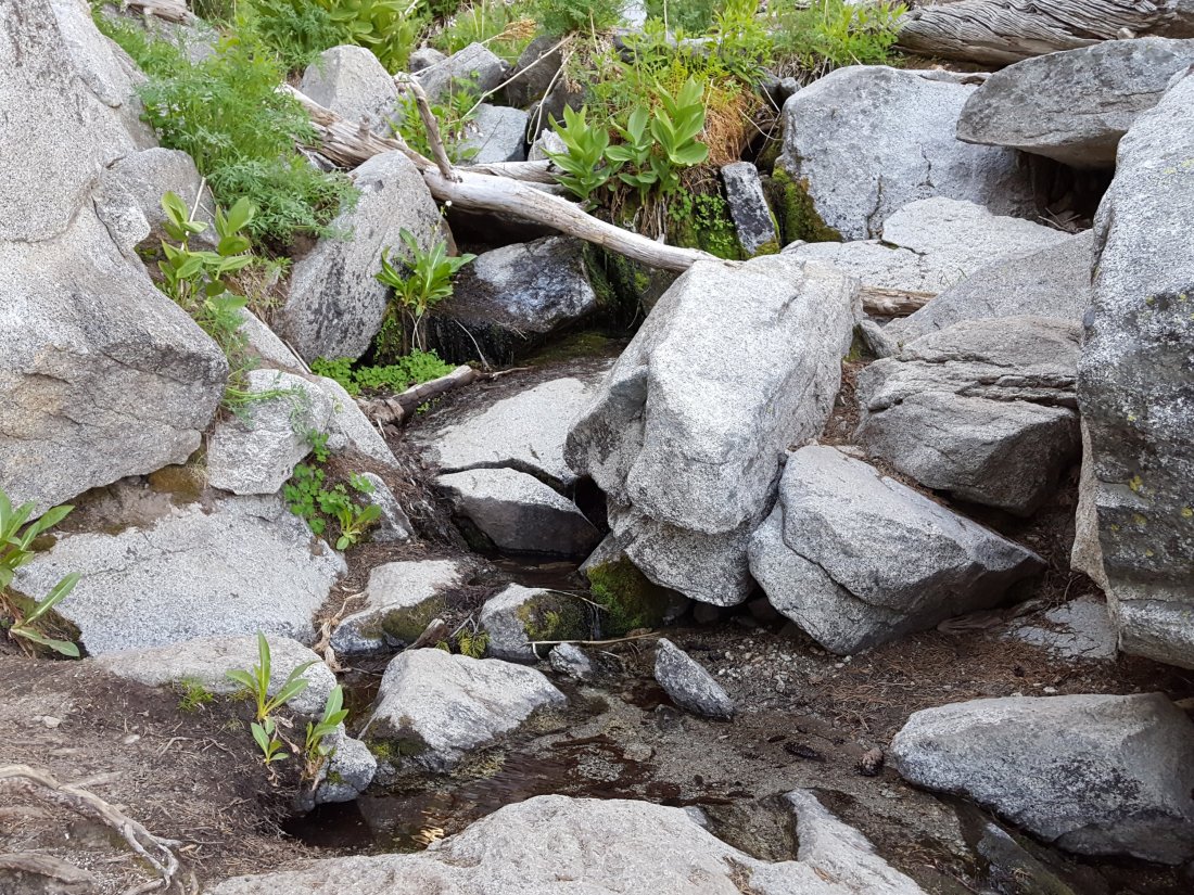
O’Sullivan Creek (PCT Mile 186.4) on Fuller Ridge Trail is completely dry.
The spring in the creek in Little Round Valley has been completely dry since early June.
Shooting Star Spring – 0.28 trail miles below Little Round Valley – is currently flowing weakly but reliably. Note that its namesake plants, Alpine Shooting Star Dodecatheon alpinum, are currently flowering spectacularly all around the spring.
The minor creek crossing on Deer Springs Trail midway between the North Fork of the San Jacinto River crossing and Shooting Star Spring (sometimes known as Rock Spring) is flowing very poorly, and is largely dry below the trail.

The Deer Springs stream crossing at the PCT (approx. PCT mile 185.6) is dry, and the pools just upstream (and downstream) of the trail are also dry. The Deer Springs camp just downslope is now occupied by a crew from the California Conservation Corps (CCC) for the season.
Switchback Spring – the small spring just below the eight switchbacks on Deer Springs Trail about 0.4 miles north of Strawberry Junction – continues to flow well.

The little spring in the rock crack at Strawberry Cienega (PCT mile 183.0) continues to flow surprisingly well.
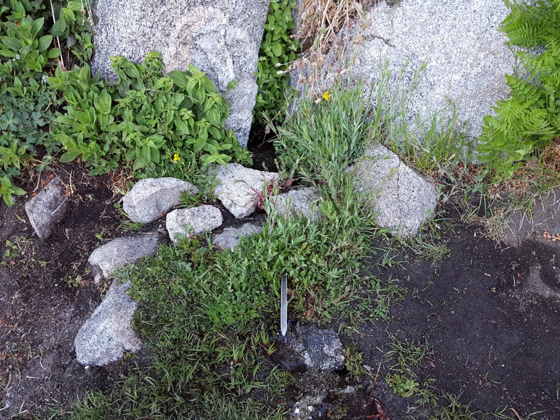
On Devil’s Slide Trail, Middle Spring is a weak trickle in the mornings (barely enough for a dog to get a little water).
On the Ernie Maxwell Trail, the crossing of Chinquapin Creek just below Humber Park continued to flow well as of at least 19th June.sanjacjonUncategorizedLeave a comment 3 MinutesEdit”Water conditions 20 June 2018″
Water conditions 7 June 2018
This morning we hiked to San Jacinto Peak via Marion Mountain Trail, checking springs on the western side of the mountain. Yesterday following my fire lookout shift at Tahquitz Peak, I checked the Tahquitz area meadows, and on Tuesday 5th our hike to San Jacinto and Cienega peaks from Humber Park included a side trip to check the Round Valley faucet.
At San Jacinto Peak at 0750 this morning the air temperature was 48°F (9°C), and with a light south-west wind the windchill temperature was a pleasant 44°F (7°C).
Overview Water resources everywhere are flowing poorly for the time of year, and yet again flow rates were often visibly lower than just 10 days ago. Water conditions for the PCT south of Idyllwild (from Highway 74 to the Spitler area) were last updated on 21 May. No new reports on bear sightings at the time of writing.
EASTERN SLOPE WATER FEATURES
The Round Valley faucet is currently flowing weakly but consistently.

Both the northern and southern springs at Wellman’s Cienega are flowing fine, but flow rates continue to decline rapidly. These are the sources for Willow Creek, which is flowing fairly well where it crosses the Willow Creek Trail.
Tahquitz Valley is completely dry.
Tahquitz Creek continues to flow fairly well at the northern (lower) end of Little Tahquitz Meadow. It is now flowing rather weakly further upstream at its source (known locally as Grethe Spring) where it crosses the PCT at the northern end of the fire closure (approx. PCT Mile 177). Just after crossing the PCT, the creek dries up and disappears subsurface.
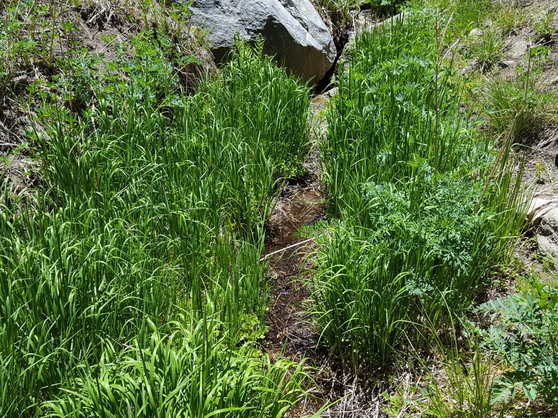
Skunk Cabbage Creek where it flows through Skunk Cabbage Meadow is currently flowing, but rather weakly for June.

WESTERN SLOPE WATER FEATURES
The North Fork of the San Jacinto River is flowing relatively well both where it crosses the Deer Springs Trail above Fuller Ridge, and where it crosses the Fuller Ridge Trail on the PCT (approx. PCT Mile 186.2). [For northbound thru-hikers, the latter is the crucial refill point before a section of 22.5 miles with no water.]
O’Sullivan Creek (PCT Mile 186.4) on Fuller Ridge Trail is completely dry.
The spring in the creek in Little Round Valley is now completely dry.
Shooting Star Spring – 0.28 trail miles below Little Round Valley – is currently flowing weakly but reliably.

The minor creek crossing on Deer Springs Trail midway between the North Fork of the San Jacinto River crossing and Shooting Star Spring is flowing very weakly, and is starting to dry up below the trail.
The Deer Springs stream crossing at the PCT (approx. PCT mile 185.6) is dry, and the pools just upstream (and downstream) of the trail are also dry. The Deer Springs camp just downslope is now occupied by a crew from the California Conservation Corps (CCC) for the season. [PCT thru hikers note: almost all PCT guides and apps confuse the Deer Springs crossing with the North Fork of the San Jacinto River. The latter is another 0.5 miles further north on the Fuller Ridge Trail, see above.]
The small spring at PCT Mile 183.5 (about 0.4 miles north of Strawberry Junction) continues to flow.
The little spring in the rock crack at Strawberry Cienega (PCT mile 183.0) continues to flow fairly well. [Thanks to Florian Boyd for this update from 1st June.]
On Devil’s Slide Trail, Middle Spring is barely a trickle (just about enough for a dog to get a little water).
On the Ernie Maxwell Trail, the crossing of Chinquapin Creek just below Humber Park continues to flow well.sanjacjonUncategorizedLeave a comment 3 MinutesEdit”Water conditions 7 June 2018″
Water (and bear!) conditions 31 May 2018
This update is a compilation of surveys, including this morning when we hiked to San Jacinto Peak from Humber Park via Wellman Divide, yesterday when I hiked up South Ridge to Tahquitz Peak and back via Devil’s Slide Trail as part of my first fire lookout shift of the season, and multiple other hikes in the last week to both San Jacinto and Tahquitz peaks.
At San Jacinto Peak at 0800 this morning the air temperature was 36.5°F (2.5°C), but with a steady west wind the windchill temperature was as low as 24.4°F (-4.2°C). All month a thick marine cloud layer has covered the lowlands to the west almost every morning at about 4000-5000′ elevation, usually (but not always) dispersing around 0900-1100.
Overview Water resources everywhere are flowing poorly for the time of year, and yet again flow rates everywhere were visibly lower than just 10 days ago. Water conditions for the PCT south of Idyllwild (from Highway 74 to the Spitler area) were last updated in my previous posting.
Be bear aware The San Jacinto Mountains do not ordinarily hold Black Bear. However in 2017, for the first time in 20 years, there were at least two seen in the summer months, everywhere from Garner Valley to Idyllwild to Long Valley and Black Mountain. Well at least one has made a reappearance this summer. On 28th May 2018, one large bear was reliably reported at the Black Mountain Group Campground. What may have been a different individual walked by our house in Idyllwild on 15th May 2018, and fortunately the wildlife cam on our property caught it on video. All hikers and campers in the area should therefore act as if they are in typical bear country and take necessary precautions.
And be snake aware Southern Pacific Rattlesnakes are now out in abundance, to at least 9000′ elevation. Reports I received yesterday from visitors to Tahquitz Peak ranged from 2-4 individuals on the trails between Humber Park and Tahquitz Peak, between mid morning to mid afternoon.
EASTERN SLOPE WATER FEATURES
The Round Valley faucet is currently flowing weakly but consistently.
Both the northern and southern springs at Wellman’s Cienega are flowing fine, but flow rates are very low for May. These are the sources for Willow Creek, which is flowing well where it crosses the Willow Creek Trail.
Tahquitz Valley is completely dry.
Tahquitz Creek is flowing fairly well at the northern (lower) end of Little Tahquitz Meadow. It is also flowing well further upstream at its source (known locally as Grethe Spring) where it crosses the PCT at the northern end of the fire closure (approx. PCT Mile 177).
Skunk Cabbage Creek – that flows through Skunk Cabbage Meadow and then crosses the Caramba Trail near Reeds Meadow – is currently flowing, but poorly.
WESTERN SLOPE WATER FEATURES
The North Fork of the San Jacinto River is flowing well both where it crosses the Deer Springs Trail above Fuller Ridge, and where it crosses the Fuller Ridge Trail on the PCT (approx. PCT Mile 186.2). [For northbound thru-hikers, the latter is the crucial refill point before a section of 22.5 miles with no water.]
O’Sullivan Creek (PCT Mile 186.4) on Fuller Ridge Trail is completely dry.
The spring in the creek in Little Round Valley is only a trickle for a few feet – half of what it was ten days ago – just above the crossing for Campsite 2 (Owls Hootch). There is no longer sufficient to filter, and it will dry completely in June.
Both the spring and small creek just below Little Round Valley (but above the North Fork of the San Jacinto River crossing) are currently flowing.
The Deer Springs stream crossing at the PCT (approx. PCT mile 185.6) is dry, and the pools just upstream (and downstream) of the trail are also dry. [PCT thru hikers note: almost all PCT guides and apps confuse the Deer Springs crossing with the North Fork of the San Jacinto River. The latter is another 0.5 miles further north on the Fuller Ridge Trail, see above.]
The small spring at PCT Mile 183.5 (about 0.4 miles north of Strawberry Junction) continues to flow.
The little spring in the rock crack at Strawberry Cienega (PCT mile 183.0) continues to flow fairly well.
On Devil’s Slide Trail Middle Spring is down to a trickle (just about enough for a dog to get a little water).
On the Ernie Maxwell Trail, the crossing of Chinquapin Creek just below Humber Park continues to flow well.sanjacjonUncategorized4 Comments 3 MinutesEdit”Water (and bear!) conditions 31 May 2018″
Water conditions 21 May 2018
This update is a compilation of surveys, including this morning when we hiked to San Jacinto Peak from Humber Park via Wellman Divide, returning via the Deer Springs Trail/PCT, and hikes last week along the Desert Divide south of Idyllwild and to the Tahquitz Peak and meadows areas.
At San Jacinto Peak at 0815 this morning the air temperature was 33.5°F (1°C), but with a light west wind the windchill temperature was as low as 21.8°F (-6°C).
Overview All trails have been completely clear of snow for nearly three weeks. Water resources everywhere are flowing relatively poorly for the time of year, and flow rates everywhere are visibly lower than just 10 days ago. Water conditions for the PCT south of Idyllwild (from Highway 74 to the Spitler area) are discussed at the foot of this posting.
EASTERN SLOPE WATER FEATURES
The Round Valley faucet is flowing weakly but consistently (it was dry from January 2014 to December 2016).
Both the northern and southern springs at Wellman’s Cienega are flowing well, but flow rates are low for May. These are the sources for Willow Creek, which is flowing well where it crosses the Willow Creek Trail.
Tahquitz Valley is completely dry.
Tahquitz Creek is flowing fairly well at the northern end of Little Tahquitz Meadow. It is also flowing well further upstream at its source (known locally as Grethe Spring) where it crosses the PCT at the northern end of the fire closure (approx. PCT Mile 177).
Skunk Cabbage Creek – that flows through Skunk Cabbage Meadow and then crosses the Caramba Trail near Reeds Meadow – is currently flowing fairly well.
WESTERN SLOPE WATER FEATURES
The North Fork of the San Jacinto River is flowing well both where it crosses the Deer Springs Trail above Fuller Ridge, and where it crosses the Fuller Ridge Trail on the PCT (approx. PCT Mile 186.2). [For northbound thru-hikers, the latter is the crucial refill point before a section of 22.5 miles with no water.]
O’Sullivan Creek (PCT Mile 186.4) on Fuller Ridge Trail is completely dry.
The spring in the creek in Little Round Valley is only a trickle for fewer than 15 feet – half of what it was ten days ago – just above the crossing for Campsite 2 (Owls Hootch). There is currently just about enough to filter, but it will likely be dry in the next couple of weeks.
Both the spring and small creek just below Little Round Valley (but above the North Fork of the San Jacinto River crossing) are currently flowing fairly well.
The Deer Springs stream crossing at the PCT (approx. PCT mile 185.6) is dry, and the pools just upstream (and downstream) of the trail are now also dry. [PCT thru hikers note: almost all PCT guides and apps confuse the Deer Springs crossing with the North Fork of the San Jacinto River. The latter is another 0.5 miles further north on the Fuller Ridge Trail, see above.]
The small spring at PCT Mile 183.5 (about 0.4 miles north of Strawberry Junction) continues to flow quite well.
The little spring in the rock crack at Strawberry Cienega (PCT mile 183.0) continues to flow fairly well.
On Devil’s Slide Trail, Jolley Spring is completely dry, and Middle Spring is down to a trickle (just enough for a dog to get a little water).
On the Ernie Maxwell Trail, the crossing of Chinquapin Creek just below Humber Park continues to flow very well.
DESERT DIVIDE (HWY 74 TO SPITLER AREA) WATER FEATURES
Highway 74 There is a water cache where the PCT crosses Highway 74, on the south side of the highway. In addition, there is a much smaller cache behind the Andy Elam memorial on the north side of the highway. These appear to be reliably maintained, but never assume water caches will definitely be there.
Pool 3.5 miles north of Highway 74 is now dry.
Live Oak Spring (N 33 37 21, W 116 33 24) Flowing well. The most reliable water source on the Desert Divide.
Cedar Spring (N 33 40 36, W 116 34 35) Flowing well. Easiest access is the trough just upstream from the trail to the campsite.
Apache Spring (N 33 43 11, W 116 37 13) Technically this is beyond the current closure boundary, but Apache Spring as a possible emergency water source. Flowing fairly well.
Spitler Peak Trail Descending the diversion trail, there are five water crossings. The first two, at 0.9 and 0.95 miles down, cross a tiny side creek which is now drying up and should be ignored. The next crossing, at 1.1 miles down, is Spitler Creek and is the best source of water (currently flowing fairly well). The next two crossings are the same creek, but for obvious reasons it is best to fill up at the highest of the three crossings.
Antsell Rock Creek (N 33 41 52, W 116 39 08) Right by the Spitler Peak Trail trailhead on Apple Canyon Road, Antsell Rock Creek is flowing well. Just on the upstream side of the road there is excellent access to the creek.sanjacjonUncategorized2 Comments 3 MinutesEdit”Water conditions 21 May 2018″
Water conditions 12 May 2018
This update is a compilation of surveys, including this morning when Anne and I hiked to San Jacinto Peak from Humber Park via Wellman Divide, yesterday when I hiked Marion Mountain Trail to San Jacinto Peak, returning via the Willow Creek drainage to Devils Slide Trail, and hikes to the Tahquitz Peak and meadows areas on 9th May and last week.
Overview All trails have been completely clear of snow for nearly 10 days. Water resources everywhere (including along the PCT) are flowing relatively poorly. The flow rates of many of the “perennial” springs are reminiscent of late summer.
EASTERN SLOPE WATER FEATURES
The Round Valley faucet is flowing weakly (it was dry from January 2014 to December 2016).
Bothe the northern and southern springs at Wellman’s Cienega are flowing well, but flow rates are low for May. These are the sources for Willow Creek, which is flowing well where it crosses the Willow Creek Trail.
Tahquitz Valley is completely dry.
Tahquitz Creek is flowing well at the northern (lower) end of Little Tahquitz Meadow. It is also flowing well further upstream at its source (known locally as Grethe Spring) where it crosses the PCT at the northern end of the fire closure (approx. PCT Mile 177).
Skunk Cabbage Creek – that flows through Skunk Cabbage Meadow and then crosses the Caramba Trail near Reeds Meadow – is currently flowing well.
WESTERN SLOPE WATER FEATURES
The North Fork of the San Jacinto River is flowing well both where it crosses the Deer Springs Trail above Fuller Ridge, and where it crosses the Fuller Ridge Trail on the PCT (approx. PCT Mile 186.2). [For northbound thru-hikers, the latter is the crucial refill point before a section of 22.5 miles with no water.]
O’Sullivan Creek (PCT Mile 186.4) on Fuller Ridge Trail is completely dry.
The spring in the creek in Little Round Valley is only a trickle for fewer than 30 feet just above the crossing for Campsite 2 (Owls Hootch).
Both the spring and small creek below Little Round Valley (but above the North Fork of the San Jacinto River crossing) are currently flowing quite well.
The Deer Springs stream crossing at the PCT (approx. PCT mile 185.6) is now dry, and even the tiny pools just upstream (and downstream) of the trail are drying rapidly. [PCT thru hikers note: almost all PCT guides and apps confuse the Deer Springs crossing with the North Fork of the San Jacinto River. The latter is another 0.5 miles further north on the Fuller Ridge Trail, see above.]
The little spring in the rock crack at Strawberry Cienega (PCT mile 183.0) continues to flow well.
On Devil’s Slide Trail, Jolley Spring is completely dry (there were still small pools last week), and Middle Spring is down to a trickle (just enough for a dog to get a little water).
On the Ernie Maxwell Trail, the crossing of Chinquapin Creek just below Humber Park is currently flowing well.sanjacjonUncategorizedLeave a comment 2 MinutesEdit”Water conditions 12 May 2018″
Trail and water update 7 May 2018
This morning we ran/hiked to San Jacinto Peak from Humber Park via Wellman Divide, returning via Deer Springs Trail and the PCT southbound back around to Devils Slide Trail. The main focus today was the status of springs and creeks.
Trails All evidence of the snow of 2nd May is long gone, and virtually no snow remains from earlier in the year either. All trails are completely clear of snow. At San Jacinto Peak there is no snow cover (except some limited patches on the north face). The eastern slope between San Jacinto and Miller peaks has only a few tiny patches of snow, and the East Ridge Trail is now clear.
Water resources along the PCT (and elsewhere) are already flowing relatively poorly. The flow rates of many of the “perennial” springs are reminiscent of late summer.
The North Fork of the San Jacinto River is flowing well both where it crosses the Deer Springs Trail above Fuller Ridge, and where it crosses the Fuller Ridge Trail on the PCT (approx. PCT Mile 186.2). [For northbound thru-hikers, the latter is the crucial refill point before a section of 22.5 miles with no water.]
O’Sullivan Creek (PCT Mile 186.4) on Fuller Ridge Trail is completely dry.
The spring in the creek in Little Round Valley is only a trickle for about 10 yards just above the crossing for Campsite 2 (Owls Hootch).
The Deer Springs stream crossing at the PCT (approx. PCT mile 185.6) is now dry, and even the tiny pools just upstream (and downstream) of the trail are drying rapidly. [PCT thru hikers note: almost all PCT guides and apps confuse the Deer Springs crossing with the North Fork of the San Jacinto River. The latter is another 0.5 miles further north on the Fuller Ridge Trail, and is flowing well.]
The little spring in the rock crack at Strawberry Cienega (PCT mile 183.0) continues to flow well.
Both the northern and southern springs at Wellman’s Cienega are flowing well, but flow rates are very low for May.sanjacjonUncategorizedLeave a comment 1 MinuteEdit”Trail and water update 7 May 2018″
Trail and snow update 2 May 2018
[UPDATE 3 May 2018 – I hiked San Jacinto Peak from Humber Park this morning. There were small patches of snow around 9000′ near the State Park boundary, from Wellman Divide to 10,100′, and above 10,500′. The snow was just 1-2″ deep and easily hiked without microspikes, and was melting fast already by mid morning. All other sections of trail were more exposed to direct sun and were completely clear. With a strong warming trend, almost all remaining fresh snowfall will likely have gone by Saturday 5th May.]
Today I surveyed the PCT along the Fuller Ridge Trail, then turned up to San Jacinto Peak via Little Round Valley, before returning by the same route.
Overview Today was an especially striking example of how quickly weather can change in the mountains. As expected a storm system overnight brought a dusting of snow above 5000′, a consistent 1.0″ (25mm) of snow on all trails above 6000′, and 1.5-2.0″ of snow on San Jacinto Peak above 10,500′. There was some drifting in the trails (to 4″ deep) in the most exposed areas, such as at the Peak >10,500′ and on the west slope of Fuller Ridge.
At San Jacinto Peak at 1200 today, I recorded a temperature of 23.5°F (-5°C), but the windchill under a light north-east breeze was down to 9°F (-13°C). At times during my hike it tried to snow again, and at others the sun put in brief appearances through the thick cloud.
In contrast to the sharp cold this morning, a very strong warming trend took hold in the afternoon, and even under cloudy skies there was dramatic melting everywhere. Trails that were completely snow covered in the morning were largely clear by the afternoon (see photos below). Remarkably by 1600, all areas below 8000′ were almost completely clear of snow.
Consequently the fresh snow had no significant impact on routefinding or the accessibility of any trails. No traction devices (e.g., microspikes) are necessary anywhere on the trail system.
Weather prognosis The strong warming trend that started this afternoon will continue and strengthen further for the next several days. By Friday (4th May) there will probably be no sign that we even had snow today!
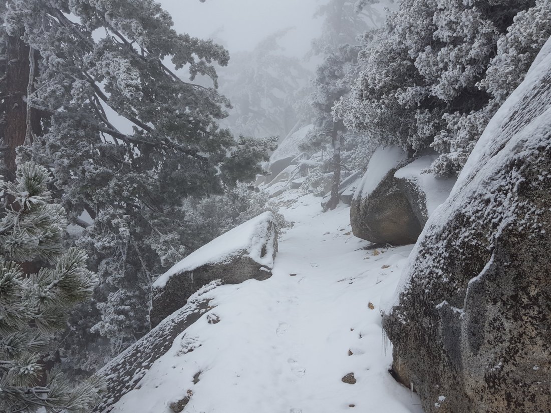
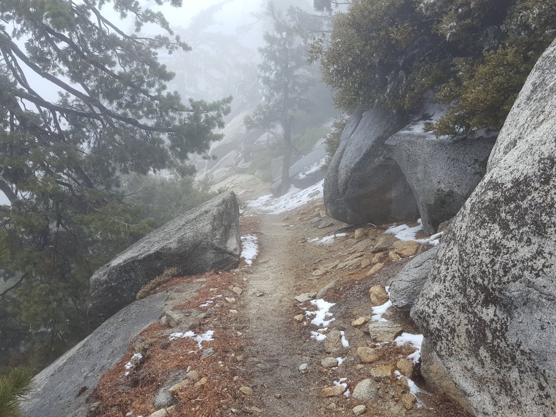
sanjacjonUncategorizedLeave a comment 2 MinutesEdit”Trail and snow update 2 May 2018″
Weather update 1 May 2018
The basic trail conditions are currently unchanged from my report yesterday. The temperature on the mountain (above 6000′) never got above freezing today, and a light snowfall seems likely tonight into tomorrow. We hiked early this morning from Humber Park to San Jacinto Peak, returning via Tahquitz Peak, and then checked the water sources in the Tahquitz meadows before descending Devils Slide Trail.
At San Jacinto Peak at 0900 this morning, the air temperature was 22°F (-5.5°C), but with a westerly wind gusting to nearly 20 mph, the wind chill temperature was as low as 6.3°F (-14°C). At that time the cloud level was below 7000′, but as we descended it rose to around 9000′. At Tahquitz Peak at 1200, we were in and out of the cloud and winds were lighter, and I recorded an air temperature of 25°F (-4°C) with a wind chill temp down to 17°F (-8°C).
We had no precipitation all day until we finally encountered some light drizzle below 6800′ as we descended Devils Slide Trail, but in Idyllwild it had barely rained (<0.1″).
Current forecasts project up to 2″ of snow above 5500′ elevation tonight into tomorrow morning, with up to about 3″ as high as San Jacinto Peak. I will update again tomorrow afternoon with revised trail conditions.
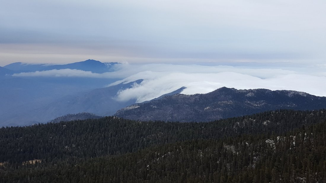
sanjacjonUncategorizedLeave a comment 1 MinuteEdit”Weather update 1 May 2018″
Trail update 30 April 2018
Yesterday we checked the Tahquitz Peak area via South Ridge Trail, and this morning hiked to San Jacinto Peak via the Marion Mountain Trail. Given the forecast of inclement weather, I plan to check San Jacinto Peak daily this week, via various routes.
Weather prognosis Rain and snow are forecast over the next couple of days, mainly from tomorrow afternoon (Tuesday 1st May) until the afternoon of Wednesday 2nd May. Current projections are for only about 1-2′ of snow at San Jacinto Peak, and for a dusting above about 5000′ elevation. This should not significantly impact routefinding or trail conditions, especially as very rapid warming is forecast within 1-2 days of the snowfall. Note that temperatures were well below freezing yesterday morning at Tahquitz Peak and this morning at San Jacinto Peak, and on both May 1st and 2nd wind chill temperatures at San Jacinto Peak may be lower than 10° F (-12° C).
Water resources along the PCT (and elsewhere) are already flowing relatively poorly. The flow rates of many of the “perennial” springs are now more reminiscent of late summer. Compared to last week, two significant water sources have almost dried up. The spring in the creek in Little Round Valley is barely a trickle for a few yards just above the crossing for Campsite 2 (Owls Hootch). The Deer Springs stream crossing at the PCT (approx. PCT mile 185.6) is now dry, although there are tiny pools just upstream (and downstream) of the trail. [PCT thru hikers note: almost all PCT guides and apps confuse the Deer Springs crossing with the North Fork of the San Jacinto River. The latter is another 0.5 miles further north on the Fuller Ridge Trail, and is flowing well.]
Pacific Crest Trail is currently completely clear.
San Jacinto Peak trails (both west and east sides) All clear.
At San Jacinto Peak itself there is no snow cover. The eastern slope between San Jacinto and Miller peaks has only patches of icy snow, and the East Ridge Trail is now clear.
South Ridge Trail between Tahquitz Peak and the PCT at Chinquapin Flat was completely clear of ice and icy snow by Monday 16th April.


sanjacjonUncategorized1 Comment 2 MinutesEdit”Trail update 30 April 2018″
Trail update 24 April 2018
Overview Judging by our run to San Jacinto Peak this morning, all evidence of the snow of five days ago is long gone, as is almost all the little remaining snow from earlier in the year. Barring any new snow storms (still quite likely until late May), the emphasis of the trail report and my hikes will now be shifting to water resources.
Pacific Crest Trail is completely clear.
Water resources along the PCT (and elsewhere) are currently flowing adequately. The flow rates of many of the “perennial” springs are more reminiscent of mid summer, and water will likely become a major issue in the next month or so.
San Jacinto Peak (west side trails) All clear.
San Jacinto Peak (east side trails) Completely clear to the Peak. The only snow near the trail remaining from earlier in the winter are a few tiny dirty icy patches just below and around 10,000′. These pose no hazard.
At San Jacinto Peak itself there is no snow cover. The eastern slope between San Jacinto and Miller peaks still has about 15% cover of icy snow, mainly a few inches deep. The East Ridge Trail is now largely visible, especially the lower third, and the upper areas involve limited snow travel.
South Ridge Trail between Tahquitz Peak and the PCT at Chinquapin Flat was completely clear of ice and icy snow by Monday 16th April.
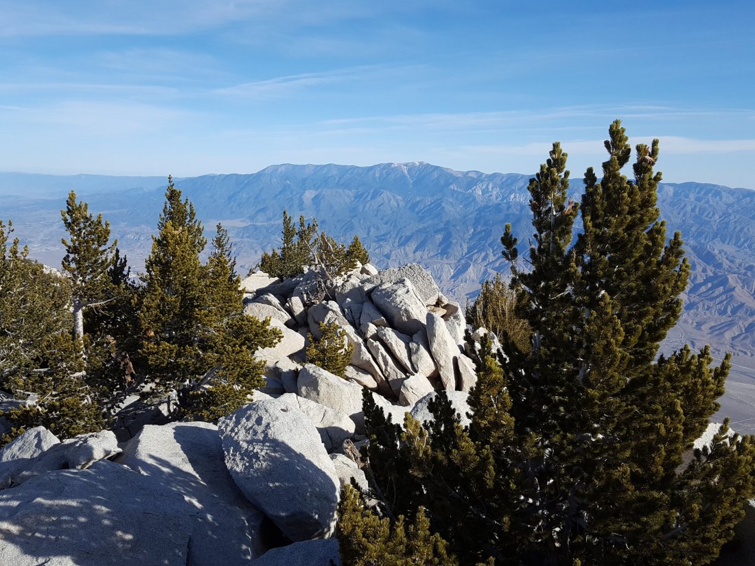

sanjacjonUncategorizedLeave a comment 1 MinuteEdit”Trail update 24 April 2018″
Trail and snow update 19 April 2018
Today I surveyed from Humber Park to San Jacinto Peak via Wellman Divide, returning via Little Round Valley and the PCT southbound through Strawberry Junction back to Devils Slide Trail. Earlier in the week I got more information on trail and water conditions by running up South Ridge Trail to Tahquitz Peak (16th), checking the Ernie Maxwell Trail (17th), and hiking all around the Willow Creek and Tahquitz meadows area (18th).
Overview Today was a great example of how quickly weather can change in the mountains. Another fairly mild week had melted almost all remaining snow/ice on the trails. A cold storm system today brought a dusting of snow above 4000′, and a consistent 0.5″ (12mm) of snow above 8000′, which fell between 0900 and 1100 this morning. At San Jacinto Peak at 0845 today, I recorded a windchill temperature of -8.0° F (-22° C)! However, as soon as the sun emerged, all snow in exposed areas below 10,000′ melted within an hour or so, and most was gone by early afternoon (see photos below). Consequently the fresh snow had no significant impact on routefinding or the accessibility of any trails. No traction devices (e.g., microspikes) are necessary anywhere on the trail system. There is a strong warming trend starting tomorrow, and any remaining snow from today’s storm will likely be melted in the next day or two.
Pacific Crest Trail is clear of snow, other than patches of fresh snow up to 0.5″ deep in areas that are very sheltered. All remaining areas of icy snow from earlier in the season have melted.
Water resources along the PCT (and elsewhere) are currently flowing well, but a number of ephemeral streams are drying up. The flow rates of many of the springs are more reminiscent of mid summer, and water will become a major issue in a month or so without substantial new precipitation.
San Jacinto Peak (west side trails) The upper Deer Springs Trail above the Fuller Ridge Trail junction is clear to San Jacinto Peak, other than patches of fresh snow from today less than an inch deep in sheltered areas.
San Jacinto Peak (east side trails) Completely clear to the Peak, other than patches of fresh snow from today less than an inch deep in sheltered areas. The only snow remaining from earlier in the winter are a few dirty icy patches about 0.3 miles above Wellman Divide, just below and at 10,000′. These pose minimal hazard.
At San Jacinto Peak itself there is almost no snow cover, and the regular route to the Peak involves no snow travel. The eastern slope between San Jacinto and Miller peaks still has about 40% cover of icy snow mainly 4-10″ deep. As a result the East Ridge Trail is still largely obscured.
South Ridge Trail between Tahquitz Peak and the PCT at Chinquapin Flat was completely clear of ice and icy snow on Monday 16th.
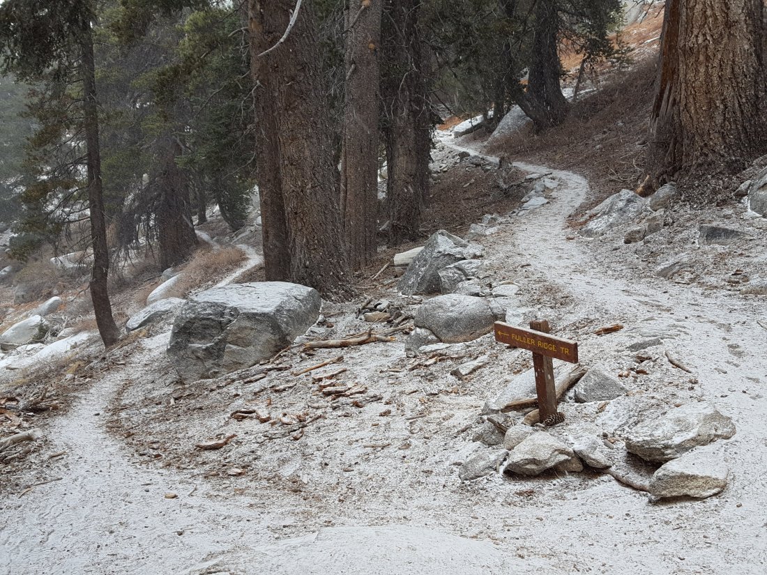


sanjacjonUncategorizedLeave a comment 2 MinutesEdit”Trail and snow update 19 April 2018″
PCT and Peak trails 11 April 2018
This update is a compilation of two surveys. On 9th April we hiked from Humber Park to San Jacinto Peak via Wellman Divide. Then on 11th we hiked up Marion Mountain Trail to San Jacinto Peak via the PCT/Deer Springs Trail and Little Round Valley.
[12 April update: I checked the South Ridge Trail between Tahquitz Peak and Chinquapin Flat/PCT where the last remaining sections of icy snow have almost disappeared and are easily passable without microspikes. The windchill temperature was 18°F (-8°C) up there early this morning!]
Overview Other than a couple of very limited areas discussed below, all trails, including the entire PCT, are clear (or functionally clear) of snow and ice. No traction devices (e.g., microspikes) are necessary anywhere on the trail system.
Pacific Crest Trail is virtually completely clear of snow/ice. A couple of very short sections of Fuller Ridge, near the southern and northern ends, have tiny patches of icy snow, but these pose no significant hazard.
Water resources along the PCT (and elsewhere) are flowing well, but a number of ephemeral streams are drying up. The flow rates of many of the springs are more reminiscent of mid summer, and water could become a major issue in a month or so without substantial new precipitation.
San Jacinto Peak (west side trails) The upper Deer Springs Trail above the Fuller Ridge Trail junction is virtually clear to San Jacinto Peak. Above 10,200′ there are about a dozen tiny patches of icy snow in the trail, but these can either be avoided or easily crossed.
San Jacinto Peak (east side trails) Virtually completely clear to the Peak, except for a section of about 0.2 miles above Wellman Divide, between 9900′ and 10,000′, where there is icy compacted snow in a series of extended patches. These are easily crossed without spikes and pose minimal hazard.
At San Jacinto Peak itself there is about 10% snow cover, and the route to the Peak involves no significant snow travel.
Hikers are reminded that NO FIRES ARE PERMITTED anywhere in wilderness under any circumstances. I was extremely disappointed to find the remains of a relatively fresh camp fire at the junction of the Fuller Ridge and Deer Springs trails this morning. This is especially dangerous and selfish under the current dry and windy conditions. In addition to the severe threat to lives, homes, and livelihoods of people living in the area, hikers should consider the effect that a wildfire caused by a camp fire getting out of control would have on the forest they are supposedly here to enjoy, on the long term future of the PCT in these mountains, and on the perception of hikers in the San Jacinto mountain communities.
 Hiker camp fire at Fuller Ridge Trail and Deer Springs Trail junction, 11 April 2018.sanjacjonUncategorizedLeave a comment 2 MinutesEdit”PCT and Peak trails 11 April 2018″
PCT water sources Hwy 74 to Idyllwild
On 2 April 2018 Anne, Anabel, and I ran the PCT north from Highway 74. Then today, 6 April 2018, I had a great hike with my friend Florian Boyd from the Cedar Spring Trail north up the PCT and descending via the Spitler Peak Trail (the current closure diversion). These trips allowed me to check all the key water sources along the Desert Divide section of the PCT. They are listed below from south to north. Bear in mind the three springs mentioned all involve a significant diversion off the PCT downhill to the east.
For trail conditions, see yesterday’s update, and reports for earlier days.
Highway 74 There are two major water caches where the PCT crosses Highway 74, on the south side of the highway. In addition, there is a much smaller cache behind the Andy Elam memorial on the north side of the highway. These appear to be reliably maintained, but never assume water caches will definitely be there.
Pool 3.5 miles north of Highway 74 Probably best used only in an emergency, this pool is right next to the trail. It is what remains of an ephemeral creek, and will dry up soon.
Live Oak Spring (N 33 37 21, W 116 33 24) Flowing strongly. The most reliable water source on the Desert Divide.
Cedar Spring (N 33 40 36, W 116 34 35) Flowing well. Easiest access is the trough just upstream from the trail to the campsite.

Apache Spring (N 33 43 11, W 116 37 13) Technically this is beyond the current closure boundary. However as the closure at the Spitler Peak Trail is currently unsigned (see photo at foot of this post), I have heard of some hikers continuing north past this point, so I thought I would list Apache Spring as a possible emergency source. Flowing well.

Spitler Peak Trail Descending the diversion trail, there are five water crossings. The first two, at 0.9 and 0.95 miles down, cross a tiny side creek and should be ignored. The next crossing, at 1.1 miles down, is Spitler Creek and is the best source of water (see photo below). The next two crossings are the same creek, but for obvious reasons it is best to fill up at the highest of the three crossings.
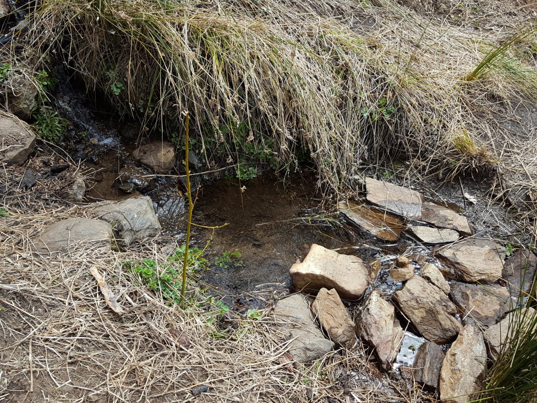
Antsell Rock Creek (N 33 41 52, W 116 39 08) Right by the Spitler Peak Trail trailhead on Apple Canyon Road, Antsell Rock Creek is flowing very well. Just on the upstream side of the road there is excellent access to the creek.

sanjacjonUncategorizedLeave a comment 2 MinutesEdit”PCT water sources Hwy 74 to Idyllwild”
PCT and Peak trails 5 April 2018
This morning we surveyed from Humber Park to San Jacinto Peak via Wellman Divide, then descended Deer Springs Trail via Little Round Valley and Strawberry Junction.
Overview Other than a couple of small areas of Fuller Ridge (see 1 April update), and South Ridge Trail on the north side of Tahquitz Peak (updated on 3 April), trails below 9000′ (2700m) are completely clear of snow and ice, including almost all of the PCT. The forecast for at least the next week will result in accelerated melting of the ice and snow persisting at higher elevations. The most difficult area remains the Upper Deer Springs Trail from San Jacinto Peak on the west side down to 9800′ (Little Round Valley). The majority of this trail remains under ice and icy snow. Although passable with considerable care without microspikes for those experienced on ice, hikers who are unfamiliar with ice/snow travel may well find microspikes useful for this section, especially on the descent.
Pacific Crest Trail The PCT is largely clear of snow/ice from Saddle Junction (Mile 179.9) to about Mile 185. The few tiny ice patches present can be safely crossed without microspikes. From about Mile 185 (just south of the Marion Mountain Trail junction) for about 0.5 mile, icy snow patches are more frequent, but spikes are not necessary. Fuller Ridge is also passable without microspikes, see the 1 April update for details. All water resources along the PCT (and elsewhere), including many ephemeral streams, are currently flowing well.
San Jacinto Peak trails On the west side, the Upper Deer Springs Trail above the Fuller Ridge Trail junction is clear to about 9600′, then there is a 0.25 mile section to 9700′ with extensive ice patches. The trail is largely clear again from 9700′ to the bottom of Little Round Valley. Little Round Valley has about 50% icy snow cover, although most is fairly flat and easy to traverse. There is about 60% snow cover to San Jacinto Peak from 10,200′, with the patches being very icy, especially in the morning. See comments above regarding value of microspikes in this area.
On the east side, the trail is almost completely clear to the Peak, except for a section of about 0.3 miles above Wellman Divide, between 9900′ and 10,100′, where there is almost continuous thin ice and compacted snow. Hikers uncomfortable with ice/snow travel may find microspikes useful on this section, at least for descending.
At San Jacinto Peak itself there is about 90% snow cover, but the steepest sections near the Peak can be reached via exposed boulders without significant snow travel. The East Ridge Trail (from near Miller Peak to just below San Jacinto Peak) is still 100% snow covered, largely 4-12″ deep, with some deeper drifts. There are no obvious tracks to follow. In the morning the snow here is hard and easy to ascend, but would probably require microspikes to descend.

sanjacjonUncategorized1 Comment 2 MinutesEdit”PCT and Peak trails 5 April 2018″
South Ridge Trail 3 April 2018
Anabel and I hiked South Ridge Trail to Tahquitz Peak this morning, continuing through to the PCT at Chinquapin Flat to check trail conditions. For details of most Peak and PCT trails, see report for 29 March (with Fuller Ridge updated on 1 April). The trails to San Jacinto Peak will next be updated on 5 April.
South Ridge Trail to Tahquitz Peak is completely clear, the last remaining tiny patches of dirty ice are barely visible.
South Ridge Trail from Tahquitz Peak to Chinquapin Flat/PCT This notorious section of trail is melting rapidly, and is now passable without use of microspikes. There are still five short patches of icy snow drifts that require care to cross, however they have very clear steps dug into them, making footholds reliable. As a good gauge for the state of the “winter” up here in 2018, this section of trail – traditionally one of the last to become safe to traverse – cleared some seven weeks later in 2016, and about five weeks later in 2017.sanjacjonUncategorized1 Comment 1 MinuteEdit”South Ridge Trail 3 April 2018″
Fuller Ridge 1 April 2018
I was able to hike the Fuller Ridge Trail this evening in perfect cool, cloudy, and calm conditions. Many thanks to PCT section hiker Mary (“Badger”) for supporting this survey hike.
Very little snow remains – especially for the time of year – on Fuller Ridge Trail, and with care, microspikes are not required to traverse this trail.
The areas of snow that persist are small, patchy, and soft. The most extensive sections are either side of the crossing of the North Fork of the San Jacinto River (PCT Mile 186.5), and then where the trail is on the north-facing slope between Miles 189.3 and 190.5. However neither of these areas presents a significant challenge, especially if using hiking poles.sanjacjonUncategorized2 Comments 1 MinuteEdit”Fuller Ridge 1 April 2018″
San Jacinto Peak via Wellman Divide 30 March 2018
I had no intention to update yesterday’s trail report, but on a quick hike to San Jac Peak this morning via Devil’s Slide Trail and Wellman Divide, I was impressed by the amount of melting in just the past 24 hours at higher elevations on the east side.
The continuous thin ice above Wellman Divide (9700′) has become very patchy, and has largely disappeared between 9700′ and 9900′. The exposed slope from 10,100′ to 10,300′ is virtually clear of snow. Much of the Peak Trail snow to 10,500′ is now patchy or soft.
Conditions have changed enough that for hikers comfortable with some moderate snow/ice travel, spikes are no longer necessary for hiking San Jacinto Peak via the east side route. This is especially true for those attempting the Peak later in the day (e.g., from the Palm Springs Aerial Tramway) when the remaining snowy sections will be soft underfoot.
Note that the extended areas of snow described yesterday around Annie’s Junction and the 10,000′ area remain largely unchanged. Also, conditions on the west side remain challenging and still require microspikes.
Conditions will continue to get easier with mild temperatures (especially overnight) forecast for the next week at least. At San Jacinto Peak early this morning, the temperature was above freezing, even with a slight windchill.sanjacjonUncategorizedLeave a comment 1 MinuteEdit”San Jacinto Peak via Wellman Divide 30 March 2018″
PCT and Peak trails 29 March 2018
Its been a busy few days! I undertook a solo private rescue on the north side of San Jacinto Peak on Monday, trail surveys Tuesday through today, plus another rescue (unfortunately of a PCT hiker) that I helped coordinate yesterday afternoon and completed this morning with RMRU. It has been fun to see and talk to so many hikers in the last few days, most of them having made great use of the San Jacinto Trail Report.
This morning I surveyed from Humber Park to San Jacinto Peak via Wellman Divide, combining that with assisting on the rescue at the Peak summit hut, then descended Deer Springs Trail via Little Round Valley and Strawberry Junction to home.
For details of the Willow Creek Trail, South Ridge Trail, the PCT south of Saddle Junction, and the Tahquitz Valley area trails, please see the report for yesterday.
The following trails are completely clear of snow: Devil’s Slide Trail, Ernie Maxwell Trail, Deer Springs Trail (below Strawberry Junction), Suicide Rock Trail.
Overview Melting in recent days has been moderate above about 9500′, but rapid below that elevation. The forecast for at least the next week will result in accelerated melting at all elevations. There are however a number of places where snow has become compacted into dangerous ice due to increased hiker traffic where microspikes remain highly recommended. Thru hikers who remain on the PCT from Saddle Junction through Fuller Ridge do not need microspikes. All hikers attempting ascents of San Jacinto Peak from either east or west sides are strongly recommended to carry spikes. All trails now have many very obvious tracks to follow, so routefinding should be straightforward.
Pacific Crest Trail The PCT is largely clear from Saddle Junction to about 0.2 miles south of Annie’s Junction (PCT Mile 181.8). There are 1-2″ ice from here to Annie’s Junction, but it can be crossed without microspikes. The section from Mile 182 to 185 is clear of snow. From about Mile 185 (just south of the Marion Mountain Trail junction) there is largely continuous ice/compacted snow cover, but again spikes are not essential. Fuller Ridge averages less than 20% thin snow/ice cover. The most challenging areas are near the northern end where the trail is on the north-east side of the ridgeline. Microspikes may be useful (especially in the morning) but not essential. All water resources along the PCT (and elsewhere) are currently flowing well, and thick ice is no longer a problem.
San Jacinto Peak trails On the west side, the Upper Deer Springs Trail above the Fuller Ridge Trail junction is largely clear to about 9500′, then with extensive icy snow patches to Little Round Valley. Little Round Valley has about 90% snow cover, again thin compacted snow, then there is 100% snow cover to the turning to San Jacinto Peak, a mixture of snow and ice. Descending (and even ascending) on these trails without spikes would be dangerous and unwise.
On the east side, there is almost continuous icy snow for 0.2 miles on either side of Annie’s Junction (the State Park boundary), then the trail is clear from Wellman’s Cienega to Wellman Divide. Above Wellman Divide (9700′) there is almost continuous thin ice on the trail to about 9900′, then virtually continuous thin compacted snow to the Peak. Again spikes are recommended, at least for descending.
At San Jacinto Peak itself there is about 90% snow cover, with many rocks and a few bare patches starting to become obvious. Icy snow is only 1-4″ deep on most of the trail near the Peak, but snow remains deeper (with some very deep drifts) off trail.
Marion Mountain Trail is largely clear of snow, with only a few isolated icy patches in shaded areas, especially near the junction with the PCT/Deer Springs Trail.

sanjacjonUncategorized1 Comment 3 MinutesEdit”PCT and Peak trails 29 March 2018″
Willow Creek and Tahquitz trails 28 March 2018
Our survey hike today took us up Devil’s Slide Trail (accompanied by our friend Michele) then from Saddle Junction on the Willow Creek Trail to its junction with the High Trail, back to the PCT south to Tahquitz Peak, a check of South Ridge Trail, then home. Despite cool temperatures, widespread melting has continued and much snow below 9000′ elevation has gone. I’ll update the San Jacinto Peak and PCT/Deer Springs trails tomorrow.
Willow Creek Trail is now completely clear, the last couple of tiny icy snow patches on either side of Hidden Divide having melted off the trail. Lovely water is flowing at the three creek crossings along the trail.
Pacific Crest Trail south of Saddle Junction is largely clear of snow/ice. There are a few extended patches of icy snow roughly midway between Chinquapin Flat and Saddle Junction (in the area of PCT mile 178.9 to 179.3) but these are easily traversed and do not require microspikes.
South Ridge Trail (from Tahquitz Peak to Chinquapin Flat/PCT). Despite extensive melting, this notoriously treacherous section remains challenging. There are good steps kicked into the sloping snow, but especially in the morning the drifts remain icy. Use of microspikes is still strongly recommended, especially for descending (northbound).
South Ridge Trail (south from Tahquitz Peak) is largely clear. A few icy snow patches remain along the traverse and some of the switchbacks above Old Lookout Flat (7800′), but these are melting fast and microspikes are not required.
Trails through Skunk Cabbage Meadow, Tahquitz Valley, and Little Tahquitz Valley are all largely clear, with just a few small patches of soft, melting snow.sanjacjonUncategorizedLeave a comment 1 MinuteEdit”Willow Creek and Tahquitz trails 28 March 2018″
Trail update 23 March 2018
Yesterday I surveyed South Ridge Trail via Tahquitz Peak to the PCT at Chinquapin Flat, then this morning I went from Humber Park to San Jacinto Peak via Wellman Divide, returning down the Deer Springs Trail, with a partial check of Fuller Ridge.
Overview Three storm systems affected the mountain since the last survey. Two systems between 14-18 March deposited modest snowfalls of a few inches across the mountain, but mild temperatures have since melted most snow below 8000′ elevation. Then yesterday a very warm system (a “pineapple express”) produced good rainfall at all elevations, even at San Jacinto Peak. Above about 9000′ this fell as frozen rain and rime, covering everything with a thick coating of ice, then early this morning it turned to snow, giving a very thin dusting of powder above 8300′ on top of the ice. Rainfall was 1.12″ at 5550′ in Idyllwild, and 1.76″ at 8600′ in Long Valley.
Forecast cold temperatures will probably mean little change to conditions over the next 3-4 days, then early summer weather arrives for the last few days of March (and into April), so very rapid melting will start. Microspikes remain useful in places for descending, and in the early morning, especially for trails on both sides of San Jacinto Peak above 9500′ elevation, but are not essential anywhere on the PCT.
The following trails are clear (or virtually clear) of snow/ice: Ernie Maxwell Trail, Devils Slide Trail, and Deer Springs Trail (below Strawberry Junction).
South Ridge Trail (to Tahquitz Peak) is largely clear from the top of South Ridge Road to Old Lookout Flat (7800′) although there are a few small patches of soft snow in places. From Old Lookout Flat to Tahquitz Peak, the trail is largely snow-covered, with 1-3″ of soft snow, and some deeper drifts in places. This area received only about 0.25″ of fresh snow last night, but may be icy in places over the next few mornings.
South Ridge Trail (from Tahquitz Peak to Chinquapin Flat/PCT) is completely covered with 4-8″ of (largely soft) snow, but with major drifts up to 2-3′ in places. There is not currently a very good set of tracks across this notoriously treacherous section due to continued drifting, melting, and ice fall. Microspikes are useful, especially when descending (i.e. going northbound).
Pacific Crest Trail The PCT is largely covered in 1-4″ of snow from Chinquapin Flat (mile 178) through Fuller Ridge, but with some clear areas mainly below 8300′ (higher on south-facing slopes). Saddle Junction (PCT mile 179.9) north to 9000′ elevation (about mile 181) is largely clear, but then there is continuous deeper snow cover for the next mile, 4-10″ in places, that makes for slow hiking. Either side of Strawberry Junction is largely clear until just south of the Marion Mountain Trail, after which snow cover is continuous at 2-4″ deep, with some deeper drifts. There was no significant fresh snow last night below 9000′ elevation.
Fuller Ridge Trail averages about 90% snow cover at the southern end, generally 1-4″ of soft snow, with occasional deeper drifts. On sunny sections of the trail, snow cover is no more than 40%, and there is rapid melting. The northern end of Fuller Ridge has more continuous snow (where the trail is on the shaded north-east side of the ridge) with some deeper drifts. There are now many clear tracks along Fuller Ridge Trail, making routefinding relatively easy.
San Jacinto Peak trails On both sides of the mountain, there is continuous snow cover on all trails above 9000′. Almost all this snow is from prior storms, not yesterday. Snow depths are very variable depending on drifting, but range from 2-10″. Depths are at the lower end of this range at lower elevations (e.g., Wellman’s Cienega and below Little Round Valley), and at the higher end of this range above Wellman Divide and above Little Round Valley.
The freezing rain yesterday, followed by a little drifting powder, has removed all signs of tracks above about 9700′. My footprints from today have probably largely disappeared already due to melting and drifting of powder, so some caution is required in routefinding. There are reasonable tracks to follow up from the Fuller Ridge Trail turning to Little Round Valley, but then nothing from there to San Jacinto Peak (I descended off-trail this morning, so please do not attempt to follow those!). There were no tracks whatsoever from Wellman Divide to the Peak early this morning on the east side.
Fresh snowfall last night was only 0.25″ from 9000′-9300′, 0.5″ to 9700′, and 1.0″ above 9700′, but bear in mind most precipitation yesterday fell as rain, which is currently sitting under this snow as a sheet of ice. At San Jacinto Peak, total snow cover now averages about 6-8″, but with heavy drifting throughout, from 1-3′ in places. The temperature at San Jacinto Peak at 0900 this morning was 25° F (-4° C), but with windchill was only 7° F (-14° C). The NW wind was gusting to at least 22 mph.
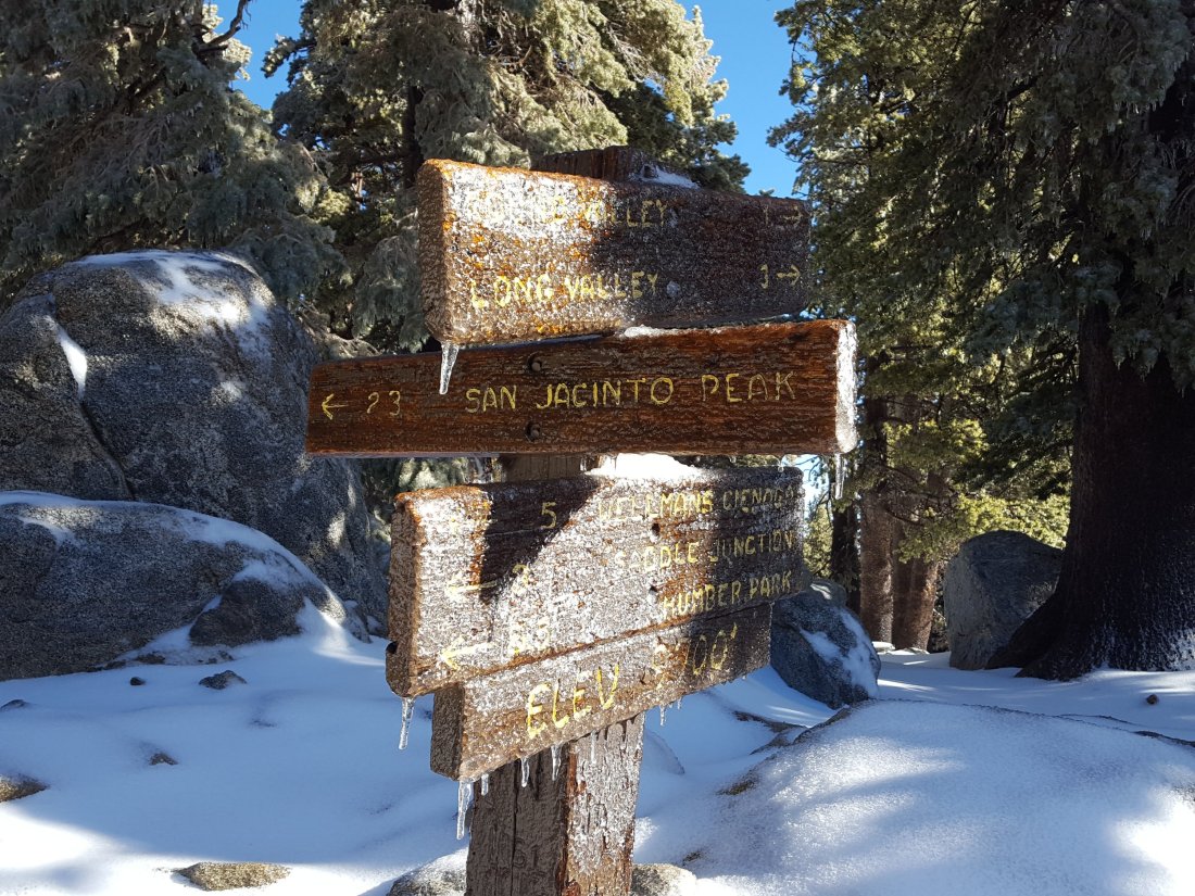
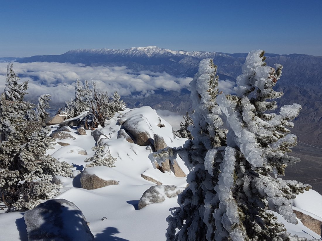
sanjacjonUncategorizedLeave a comment 3 MinutesEdit”Trail update 23 March 2018″
Trail update 12 March 2018
My hike today went up Deer Springs Trail – including a partial check of Fuller Ridge – to San Jacinto Peak, returning via Wellman Divide and Saddle Junction through to Tahquitz Peak, then back-tracking to descend Devils Slide Trail to Humber Park.
Overview A very mild storm system on 10 March produced rain (and some melting) at elevations below 9000′, and only 1-3″ snow higher up. The PCT was unaffected by new snowfall, and most sections of all trails below about 8100′ are completely clear. In addition, all trails have been well traveled and have obvious sets of tracks to follow. Unusually for this area, new snowfall was greater on the east side of the mountain than the west, with 1″ at Little Round Valley (9800′) increasing to 3″ at San Jacinto Peak, but with 2″ down to Wellman’s Cienega (9250′) and 1″ to about 9000′ near Annie’s Junction. The snow that fell was wet and fell largely on warm surfaces, so melting has been very rapid, and some trails were already clearing this morning barely 24 hours after the storm passed, especially on south and east aspects. Microspikes remain useful in places for descending, and in the early morning, but are not essential anywhere.
Due to a family health issue, the next update will not be until March 22-23. The weather for the next week will be mixed, with disagreement between forecasts about the balance of snow versus rain at different elevations. High elevations will receive some snowfall, but projections are for inches rather than feet, and perhaps nothing significant until 20-21 March. It is unlikely that more than microspikes will be required anywhere, but routefinding will be more challenging after fresh snowfalls than at present.
The following trails are largely or completely clear of snow/ice: Ernie Maxwell Trail, Devils Slide Trail, South Ridge Trail (south of Tahquitz Peak), Deer Springs Trail (Hwy 243 to Strawberry Junction), Marion Mountain Trail.
South Ridge Trail (from Tahquitz Peak to Chinquapin Flat/PCT) has improved significantly from just four days ago, but microspikes are still advisable, especially descending (northbound). This section of trail remains completely snow covered, but there is now a good set of steps and tracks to follow, and considerable melting has reduced the ice hazards along this notoriously treacherous section.
Pacific Crest Trail The PCT is predominantly clear from Chinquapin Flat (mile 178) through Fuller Ridge, but with some extended areas of melting ice/snow generally only about 1-2″ deep. Most significant of these is about 0.7 miles long from just south of the Marion Mountain Trail junction to the Fuller Ridge turning. Fuller Ridge averages about 40% snow cover, typically 1-2″ of soft snow, with a few deeper drifts. There are now several sets of tracks along Fuller Ridge Trail, making routefinding relatively easy.
For thru-hikers the water situation has improved significantly.Almost all ephemeral and perennial streams and springs are flowing. Above 8500′ elevation, many remain heavily or partially frozen, but flows of rainwater and meltwater are now accessible. The two crossings of the North Fork of the San Jacinto River (on Fuller Ridge and on the upper Deer Springs Trail) are still largely frozen, but in each case there is accessible water a few yards upstream from the trail.
San Jacinto Peak trails On the west side, the Upper Deer Springs Trail above the Fuller Ridge Trail junction has 50% ice/snow cover to about 9500′, then 95% snow cover to San Jacinto Peak. The route has been well traveled and is largely thin compacted snow, but there are patches of dangerous ice.
On the east side, there is continuous, but rapidly melting, snow (mainly 1-3″ deep) from just south of Annie’s Junction (the State Park boundary) through Wellman Divide to San Jacinto Peak. There is a short section of deeper, drifted snow around 10,000′ elevation. The lightly-traveled East Ridge Trail (from Miller Saddle to the Peak) is fully snow covered, mainly 3-5″ deep, but with drifts to 10-12″.


sanjacjonUncategorizedLeave a comment 3 MinutesEdit”Trail update 12 March 2018″
Tahquitz area trails 7 March 2018
Anabel and I hiked South Ridge Trail to Tahquitz Peak this morning, returning via the PCT from Chinquapin Flat to Saddle Junction, then down Devils Slide and Ernie Maxwell trails.
Overview Snow on trails has largely turned to ice, due to a combination of several days of freeze-thaw cycles, compacting by hiker traffic, and the precipitation a couple of days ago that was largely freezing rain to at least 9000′ elevation. This has made microspikes increasingly useful, best used in combination with hiking poles (or ice axe if you prefer). A significant additional problem is what my wife Anne has perfectly dubbed “ice cube” patches, where the recent freezing rain clumps are falling from the trees and accumulating in large piles in the trail. These patches can make progress slower, especially in trail running shoes. Although there is significant melting underway below about 7800′, at higher elevations all these ice problems will remain for the foreseeable future.
South Ridge Trail (to Tahquitz Peak) is largely clear below about 7700′, although with frequent ice patches. The trail has much more extensive icy sections and ice cube patches from Old Lookout Flat (7800′) to Tahquitz Peak. Spikes are not essential, but are very helpful, especially for descending.
South Ridge Trail (from Tahquitz Peak to Chinquapin Flat/PCT) True to its reputation, this section of trail is now very treacherous. Freezing rain of recent days has coated everything, including the snow drifts, with a thick layer of ice. Clumps of ice falling from trees above were bombarding us as we traversed, while the ice we dislodged from the trail was falling hundreds of feet below the trail. Extensive ice cube patches were complicating the trail in many areas. While the ice chunks are mostly smaller than baseballs, some pieces are softball or nearly soccer ball size. The deepest snowdrift I crunched into was about 27″ (70cm) deep. Microspikes are strongly recommended (crampons are not yet necessary), best used in combination with hiking poles or an ice axe. The potential consequences of a mistake on this section of trail are now very severe. (See photo below.)
PCT from Chinquapin Flat to Saddle Junction Largely covered in about 1″ of ice and/or compacted snow, with some short clear sections.
Devils Slide Trail [UPDATE 8 March: clear below 7700′, easily traversed small ice patches to Saddle Junction above] Completely clear below 6800′, then largely clear but with some small icy sections below 7700′. Almost completely ice-covered from 7700′ to Saddle Junction. Can be ascended without spikes, but they are very useful for descending the upper sections.
Ernie Maxwell Trail is essentially clear, with just a few tiny icy areas mainly at the northern (Humber Park) end. These are melting rapidly. No traction aids required.
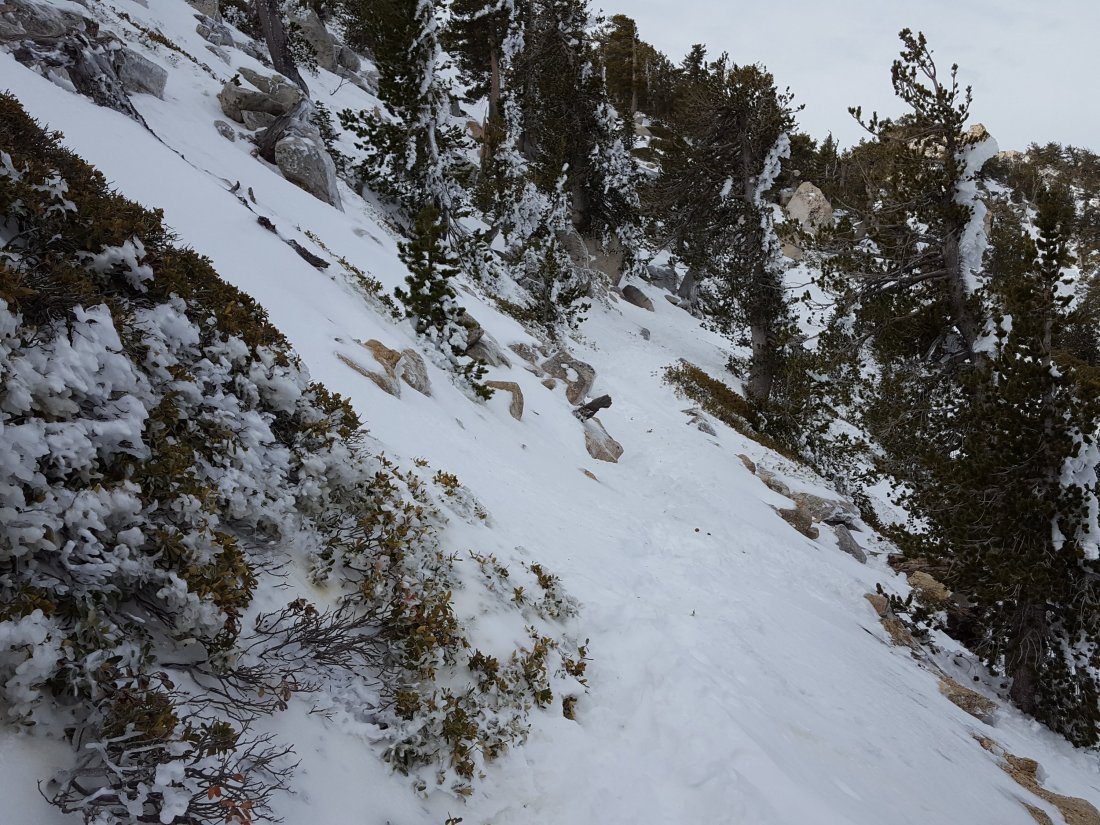
sanjacjonUncategorizedLeave a comment 2 MinutesEdit”Tahquitz area trails 7 March 2018″
PCT and Peak trails 28 Feb 2018
Today I surveyed from Humber Park to San Jacinto Peak via Wellman Divide, then back via Little Round Valley, the south end of Fuller Ridge Trail, and Deer Springs Trail. See yesterday’s update for details of the South Ridge Trail, the PCT south of Saddle Junction, Devil’s Slide Trail and the Ernie Maxwell Trail. The next trail update will be 7-8 March 2018.
Overview A good snowfall in the early hours of yesterday morning, and some flurries during yesterday, produced a remarkably consistent 4.5-5.5″ (approx. 13cm) of snow at almost all elevations above about 5000′. Strong winds have resulted in some drifting, in many places 6-8″ in trails. Although traction aids (e.g., microspikes) are not strictly essential, they will be useful in many areas, especially for descending, and in the morning when still icy. Very rapid melting started this afternoon below 8000′ at least, and will likely continue on/off for the next week. See the report for 23 Feb regarding the hazards of cold, water availability, and route finding. These issues will improve with higher temperatures over the next few days, but remain challenging. At San Jacinto Peak this morning the air temperature was 20.5° F (-6° C) with a windchill down to 8° F (-13° C), almost tropical compared to last week! At the time of writing, only my tracks were present on every trail surveyed today and yesterday, and these may soon be obscured by drifting snow and melting.
Pacific Crest Trail The entire PCT above 5500′ through the San Jacinto Mountains, including Fuller Ridge, is currently covered with about 3-5″ of fresh snow, with deeper drifts, making it slow going. Fuller Ridge does not have fresh tracks to follow. Snow depth at Saddle Junction was 5″, but only 3-4″ from Strawberry Junction to the Marion Mountain Trail junction. At the south end of Fuller Ridge, snow depth was 5.5″. Most water resources along the PCT above 8300′ are frozen solid and heavily obscured by snow.
San Jacinto Peak trails On the west side, the Upper Deer Springs Trail from Fuller Ridge Junction to San Jacinto Peak has continuous fresh snow cover of 4.5-5.5″ (significantly deeper in areas of drifting and in Little Round Valley where old snow remained). The fresh and drifted snow masks ice from previous storms, and at the various creek and spring crossings, so microspikes are very useful, especially when descending.
On the east side, snow depth at Annie’s Junction (the State Park boundary) was 5″, but only 3-4″ from Wellman’s Cienega through Wellman Divide, thereafter about 5″ to the Peak (but heavily drifted from 9900-10,100′). At San Jacinto Peak itself, fresh snow depth was about 5-6″, but in places overlaying icy snow from January, and heavily drifted.
Deer Springs Trail Snow depth at Strawberry Junction was only 3″, and from 7000-8000′ was 1-3″ with deeper drifts but also some rapidly melting clear areas. Below the Suicide Rock junction, largely clear with small snow patches melting quickly. (See above for sections north from Strawberry Junction.)sanjacjonUncategorized2 Comments 2 MinutesEdit”PCT and Peak trails 28 Feb 2018″
Tahquitz trails 27 Feb 2018
Anabel and I hiked through the fresh overnight snow from home via South Ridge Trail to Tahquitz Peak this morning, returning via the PCT from Chinquapin Flat to Saddle Junction, then down Devils Slide and Ernie Maxwell trails.
I would currently recommend using (or at least carrying) microspikes on all these trails. Although the powder currently provides good traction, in places (especially drifts) it masks ice from past storms underneath. Also, generally milder conditions starting tomorrow (but especially after next weekend) will result in freeze-thaw cycles that will turn more of this powder into ice. There is not yet sufficient depth and consistency of snow cover for snowshoeing.
South Ridge Trail (to Tahquitz Peak) received similar snowfall as Idyllwild (about 5″) for almost all of its length, but slightly more (5.5″) at the Peak. There has been significant drifting, especially above 7600′, and the trail sometimes alternates from almost bare to drifts up to 12″ deep. For PCT hikers the South Ridge Trail through to Saddle Junction can be an important route for those skipping Idyllwild, and/or for those doing continuous steps from the PCT Alternate at May Valley Road.
South Ridge Trail (from Tahquitz Peak to the PCT) has deep, drifted powder, from 6-18″, especially nearer the Peak. The deepest drift I crossed was about 27″ (70cm) deep. Although traction is relatively easy in the soft powder, the drifts hide dangerous ice from January storms, and spikes and hiking poles (or an ice axe if you prefer) are very useful. This short section of trail is notoriously treacherous, please use considerable caution.
PCT from Chinquapin Flat to Saddle Junction unusually received slightly less snow than South Ridge Trail, and has continuous snow cover from 4-5″ deep, with some shallower and deeper patches depending on drifting.
Devils Slide Trail has continuous snow cover averaging about 5″ at both Humber Park (6500′) and at Saddle Junction (8100′).
Ernie Maxwell Trail has continuous snow cover, with (oddly) slightly less snow at its upper end at Humber Park (about 4.5″) than at its lower end at Tahquitz View Drive (5″).


sanjacjonUncategorizedLeave a comment 1 MinuteEdit”Tahquitz trails 27 Feb 2018″
Trails 23 Feb 2018
Yesterday evening I surveyed South Ridge Trail past Tahquitz Peak to the PCT at Chinquapin Flat, and today hiked from Humber Park to San Jacinto Peak then back via Little Round Valley, the south end of Fuller Ridge Trail, and Deer Springs Trail.
Overview We have had three light dustings of snow this week, on Monday (discussed in previous post), yesterday, and briefly this morning. Combined these have produced a fairly consistent maximum of 2″ (5cm) of snow across the mountain above about 8000′, and above 6500′ about 1″ or even less. However very strong winds have resulted in extensive drifting, especially accumulating in trails. The uppermost parts of the mountain were above most of the cloud, and have also only received about 2″ of fresh snow, although here drifting has been extreme, especially on the east side of San Jacinto Peak. Although traction aids (e.g., microspikes) are not currently essential, I would now recommend them in a couple of specific areas (discussed below), and as always, hikers unfamiliar with snow/ice travel may find microspikes useful in many areas. Three notable hazards at present are discussed first.
Severe cold Last night at Tahquitz Peak, the windchill temperature was -1° F. At San Jacinto Peak today the air temperature (in the sun!) was only 4° F (-15.5° C) and I recorded a windchill temperature of -25.1° F (-32° C)! Everywhere above 9000′ (2700m) today was below 0° F (-18° C) when including windchill. Temperatures will warm very slightly this weekend, but at higher elevations (>8000′) they will remain below freezing day and night for the foreseeable future. These forecast temperatures do not include additional treacherous windchill effects. I advise against venturing into the highest elevations without the very best equipment suitable for such conditions.
Water This is only really an issue for thru hikers. Most sources above 8000′ are frozen solid and covered with inches of ice (that is a challenge to remove even with an ice axe!). This may remain a problem for at least the next couple of weeks. Of course there is plenty of snow to melt, but that is not very efficient with stove fuel.
Routefinding Many trails have received very little traffic this week, so there are few tracks to follow. On the less traveled trails on the western side of the mountain, in many cases there are one or two sets of tracks at most, but with strong winds and light powdery snow, tracks are disappearing within hours (or even minutes). The East Ridge Trail that was obvious on Monday had completely disappeared by Friday morning under drifts up to 12″ (30cm) deep.
Pacific Crest Trail Basically the entire PCT above 7500′ through the San Jacinto Mountains, including Fuller Ridge, is currently covered with at least 1-2″ of snow. However the route has tracks and is relatively easy to follow. The section north from Saddle Junction to Annie’s Junction (PCT miles 180-182) has some of the worst drifting, up to 4-6″ in places, and is consequently slow going.
Tahquitz Peak to Chinquapin Flat/PCT This is the most hazardous section of trail at present. Last night I waded through powder drifts at least 12″ deep, especially near the Tahquitz Peak end (at Chinquapin Flat there is less than 2″ of snow). By the time I headed back, just 10 minutes later, my tracks were already disappearing. I would recommend hiking poles and microspikes for most hikers on this section. If you do not know the route and there are no good tracks to follow, I do not recommend attempting this trail. Once these drifts become icy (perhaps as early as this weekend), this is an intimidating crossing.
San Jacinto Peak trails On the west side, the Upper Deer Springs Trail (from Fuller Ridge Junction to San Jacinto Peak) is lightly snow-covered (generally 2″ but significantly deeper in areas of drifting). However the drifted snow masks ice from previous storms, and microspikes are very useful here, especially when descending. The crossings of the various springs below Little Round Valley are frozen solid and form treacherous ice sheets. From Little Round Valley to the Peak the trail appears to have had only one set of tracks (which have probably now disappeared) in recent days.
On the east side, the trail from Wellman Divide to the Peak is clear for long stretches (<0.25″ snow depth), except from about 9900-10,100′, where drifted powder is overlaying icy snow from January, and varies from 2-8″ deep.
From Annie’s Junction (where the PCT turns sharply west at the State Park boundary) to Wellman Divide, the trail is initially under several inches of drifted snow, but then relatively clear (<1″ snow depth) to Wellman Divide.
Deer Springs Trail up to Strawberry Junction (see above for sections beyond Strawberry Junction) A patchwork of clear sections and areas of drifted powder to 2″ deep. Below the Suicide Rock turning, largely clear and small snow patches melting quickly.
Devils Slide Trail Below 7500′, a very light covering of snow (about 1″), increasing to 2″ by Saddle Junction (8100′). Currently, none of this is icy requiring microspikes, however this may change after weekend hiker traffic compacts the snow.
South Ridge Trail A light covering of snow (about 1″) as far as Old Lookout Flat (7800′) then at least 2″ deep to Tahquitz Peak, but with deeper drifts in places. Again, none of this is icy requiring microspikes yet, but this will change if weekend hiker traffic compacts the snow.sanjacjonUncategorizedLeave a comment 4 MinutesEdit”Trails 23 Feb 2018″
Trail update 19 Feb 2018
I started today hiking from San Jacinto Peak to the PCT via Little Round Valley, then surveyed almost all the PCT above 8000′ (Fuller Ridge southbound to Saddle Junction), and finished with Devils Slide Trail. At San Jacinto Peak it started snowing at 0630, and continued lightly until 0930.
Overview Last night most trails and many exposed aspects were snow-free. However, the entire mountain above about 5500′ received a light dusting of snow today. It is fair to assume that almost all major trails on the mountain currently have a light covering of snow. I measured about 1.0″ (2.5cm) at San Jacinto Peak and Annie’s Junction, 0.75″ in Little Round Valley, and 0.5″ at Strawberry Junction and Saddle Junction. The snowfall was largely graupel, a powdery hail-like snow that actually makes traction very easy on trails when it is fresh. Although traction aids (e.g., microspikes) are not currently essential, this may change as the current snow goes through freeze-thaw cycles and starts to become icy, especially where it is compacted by hiker traffic. Conditions may also change further as it is snowing again lightly this evening (at least in Idyllwild at 5550′), and further snow is forecast for the whole mountain later this week.
Severe cold This is the biggest hazard at present. Early this morning at San Jacinto Peak I recorded a temperature (including windchill effect) of -24.7° F (-31.5° C)! (See video below.) While this is extreme, temperatures are forecast to remain well below freezing at night above 6000′ (1800m), and at higher elevations below freezing all day, for at least the next 10 days. These forecast temperatures do not include additional dangerous windchill effects. Unless you are certain that you have the very best equipment suitable for such conditions, camping above 8000′ (2400m) for at least the next 10 days could be life-threatening.
Water The only concern with water right now is that most sources above 8500′ are frozen solid. This will remain a problem, especially in the mornings, for at least the next several days. For example at the crossing of the North Fork of the San Jacinto River on Fuller Ridge today at noon, I was unable to kick through several inches of solid ice with a hiking boot heel to reach the flowing trickle underneath (see photo below).
Pacific Crest Trail While much of the PCT through the San Jacinto Mountains is currently covered with a little snow (<1″), the route is relatively easy to follow. By this afternoon, the snow from the morning was already starting to melt on some sections on exposed southerly aspects (e.g., near Strawberry Cienega). Hikers very unfamiliar with snow/ice travel will find microspikes useful in some areas. Please also see comments above regarding severe cold, water problems, and additional forecast snow.
Upper Deer Springs Trail (from Fuller Ridge Junction to San Jacinto Peak) Lightly snow-covered (generally <1″ but 2-3″ in areas of drifting). In Little Round Valley about 90% snow cover of a few inches from January storms persists (under the fresh snowfall), but the trail is still fairly clear.
Devils Slide Trail Largely clear below 7000′, a very light covering of snow above 7000′.ErrorThis video doesn’t exist
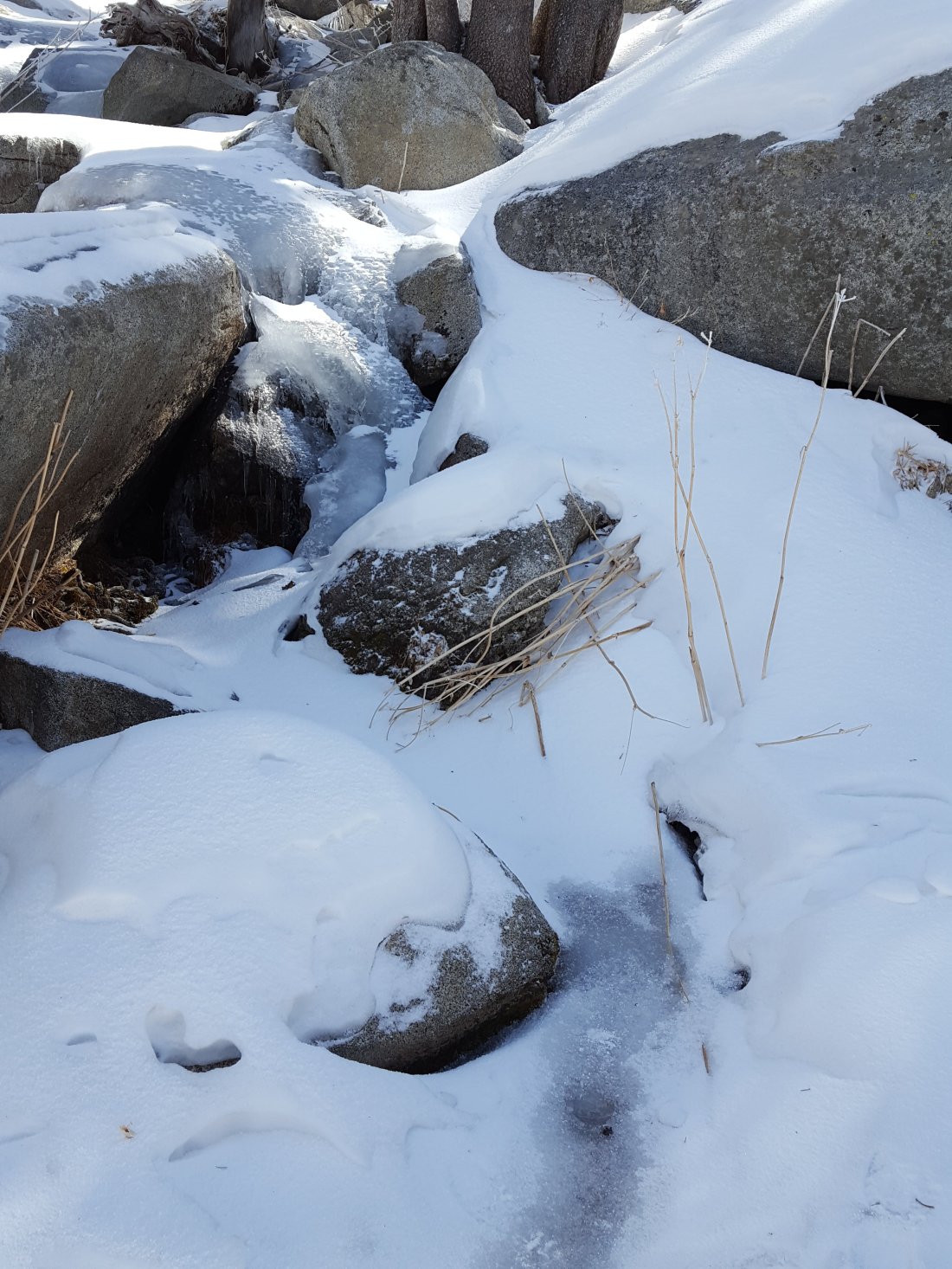

sanjacjonUncategorizedLeave a comment 2 MinutesEdit”Trail update 19 Feb 2018″
Tahquitz 16 Feb 2018
Anabel and I ran from home via the South Ridge Trail to Tahquitz Peak this morning, returning via Chinquapin Flat, the PCT to Saddle Junction, Devils Slide Trail, and the Ernie Maxwell Trail. The north side of Tahquitz Peak, from the Peak to the PCT, is always one of the most treacherous trail sections in the San Jacinto Mountains, and one of the very last to melt in spring. For PCT hikers the South Ridge Trail through to Saddle Junction is an important alternate for those skipping Idyllwild, and for those doing continuous steps from the PCT Alternate at May Valley Road.
Unusually for this time of year, the trails both north and south of Tahquitz Peak do not require microspikes. South Ridge Trail has only a few tiny ice patches. Although the trail between the Peak and the PCT is completely snow-covered, the light dusting of about 1″ of snow it received earlier this week actually improved traction significantly. I was able to run through this section comfortably in road running shoes with no spikes. However, hikers uncomfortable on snow/ice may prefer to use spikes for this section.
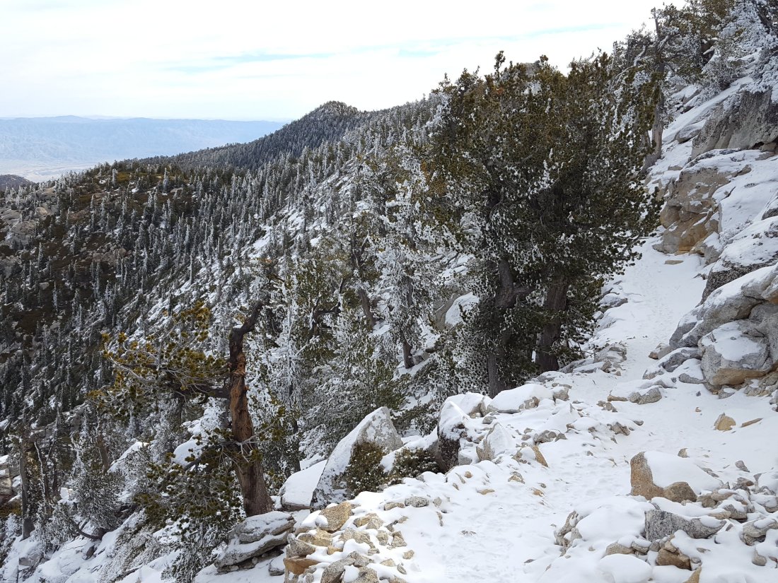
The PCT from Chinquapin Flat to Saddle Junction has some lengthy sections with snow cover (<2″ deep), but again this is actually much better for traction than ice. Devils Slide Trail is completely clear below about 7800′ (and no spikes are required higher up).sanjacjonUncategorizedLeave a comment 1 MinuteEdit”Tahquitz 16 Feb 2018″
Snow 14 Feb 2018
We have had three minor snow storms in the past three days. However they have produced so little snow that there is currently no change to the trail conditions from the 9 Feb update. In fact the highest elevations have been largely above the cloud, so there has been more melting than accumulation. For example today I was easily able to ascend and descend San Jacinto Peak without using microspikes. Nevertheless, those unfamiliar with snow/ice travel may continue to find spikes useful in places (as discussed in the 9 Feb update). Further precipitation is forecast for 18-19 Feb, and overnight temperatures are forecast to be well below freezing at higher elevations in the mountains for at least the next 10 days.
In the early hours of Monday 12 Feb there was light snow at higher elevations with the snowline at 6400′. That morning I visited Tahquitz Peak (8836′, 2700m) where there was only about 0.5″ (1.2cm) of fresh snow. By the time I was descending in mid-morning, most was already melting below 7700′.

Overnight on 12/13 February, there was much more widespread snow, with a dusting down as low as Garner Valley (4100′, 1250m). However, snow volume was very light and uniform, with only 0.6″ in Idyllwild (5550′, 1700m), and about the same at higher elevations.
Finally, most of today, Wednesday 14 Feb, was cloudy. I hiked to San Jacinto Peak from Humber Park in the early morning, and passed through extremely light snowfall both on the ascent and descent. The snowfall only settled to less than 0.5″ between about 7800′-9300′ elevation (2400-2800m). The top of the cloud was at about 10,200′, and the Peak was clear. The air temperature at the Peak was 22° F (-6° C), but with a steady wind the windchill temperature was 6° F (-14° C).
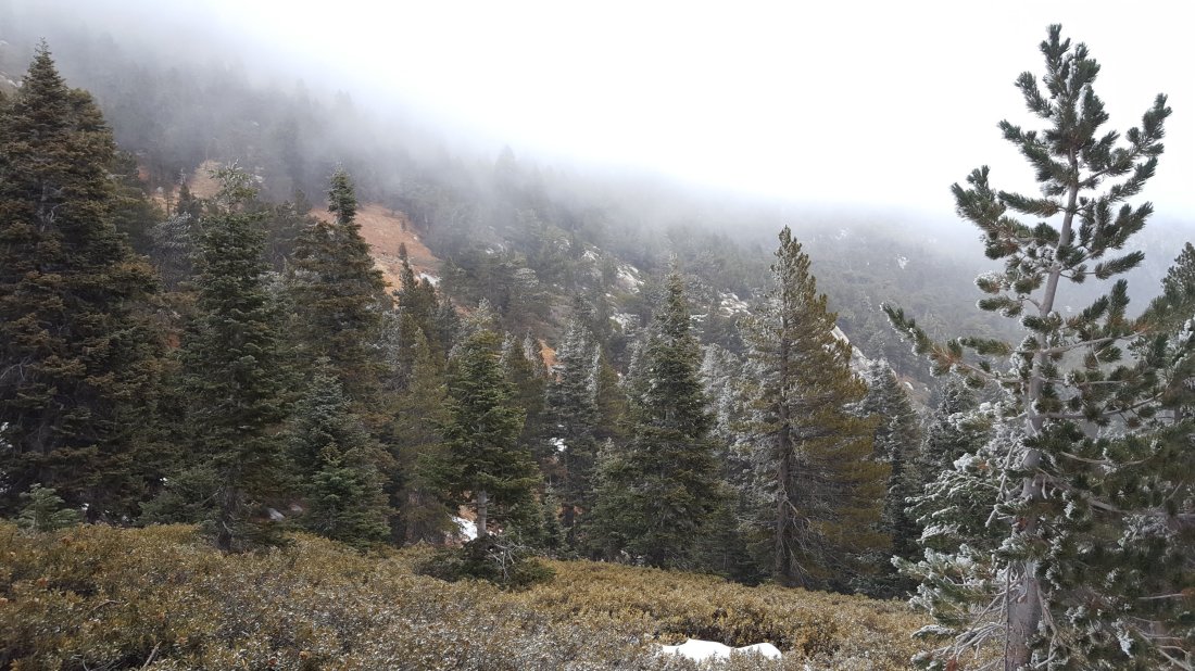

sanjacjonUncategorizedLeave a comment 1 MinuteEdit”Snow 14 Feb 2018″
Trail update 9 Feb 2018
In anticipation of the first wave of February northbound (nobo) PCT hikers, I surveyed the PCT from near Tahquitz Peak north through Fuller Ridge, plus all the main access trails to the high country, and San Jacinto Peak daily from 5-9 Feb.
Overview With near-record-low snowfall so far this winter, many trails are largely clear of snow (in stark contrast to this time in 2017). Nevertheless, in some places hikers may find microspikes useful for traversing areas of compacted snow. This is especially true when descending slopes. The main problem this season may prove to be water. Although currently not a problem, some springs are already drying up, and even with precipitation forecast next week, other springs will dry during the course of the nobo PCT season
Pacific Crest Trail The PCT is largely clear of snow throughout the San Jacinto Mountains. There are some easily traversed extended areas of compacted snow and ice either side of Annie’s Junction (the State Park boundary north of Saddle Junction, where the PCT turns sharply west to Strawberry Cienega), and then again along the 0.5 mile section just south of the Fuller Ridge Trail junction. Fuller Ridge Trail is largely clear. Where there are occasional small remnants of snow there are obvious tracks to follow with well-dug steps. Small snow patches are most extensive between 3.1-4.7 miles along Fuller Ridge (measured from the south end of the trail), but the trail is easy to follow and the snow is melting quickly. Note that there is excellent flowing water (under the ice) at the North Fork of the San Jacinto River (0.48 miles north from the S end of Fuller Ridge Trail)
San Jacinto Peak trails The trail north from Saddle Junction to San Jacinto Peak is mostly clear of snow. The only extended area of snow patches is north of Wellman’s Divide, between 9900’-10100’, but the trail is obvious. The Deer Springs Trail above the Fuller Ridge Trail has large ice/compacted snow patches, especially >9300′. Spikes are not required for ascending, but can be useful for descending for those unfamiliar with snow/ice travel. In Little Round Valley there continues to be about 90% snow cover under the trees, but the trail is obvious.
At San Jacinto Peak itself, there remains only 60% snow cover above 10,500’. The East Ridge (Ranger) Trail remains fully snow covered, with some drifts 6-10″ deep, but the trail is obvious (microspikes recommended for descending at least).
Deer Springs Trail Clear to Strawberry Junction (see above for details beyond Fuller Ridge).
PCT south from Saddle Junction to Mountain Fire closure Largely clear, small snow patches near Chinquapin Flat.
South Ridge Trail Clear from South Ridge Road trailhead to Tahquitz Peak, then passable with care to PCT (Chinquapin Flat). Between Tahquitz Peak and Chinquapin Flat there is continuous coverage of compacted snow that requires some care to traverse (microspikes are useful but not essential when heading north from Tahquitz Peak).
Devils Slide Trail Clear, a few tiny ice patches near Saddle Junction
Marion Mountain Trail Clear to State Park boundary. Some small ice patches in State Park section to Deer Springs Trail/PCT, but spikes not required.
