We checked most water sources on a long loop hike to San Jacinto Peak on Tuesday 28th, descending by Deer Springs Trail. On Wednesday 29th, I reviewed the springs and creeks around the Tahquitz area meadows following a fire lookout shift at Tahquitz Peak.
Weather The rain from storms in the middle of August is already a distant memory, and its impacts on water sources were predictably short-lived.
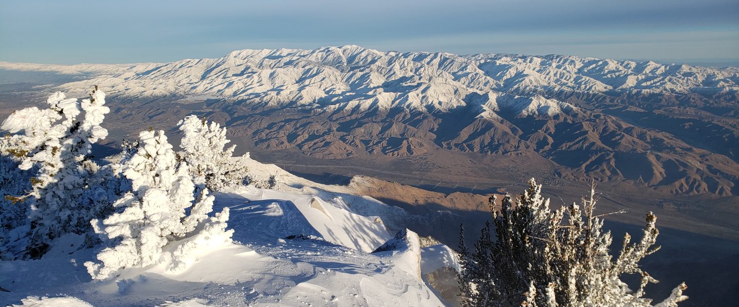
At San Jacinto Peak at 0830 on Tuesday 28th August, the air temperature was 47°F (8.3°C), with a cool windchill temperature of 38°F (3.3°C), 17% relative humidity, and a stiff 14 mph W wind gusting to 17 mph.
Although thunderstorms are not currently forecast, hikers should always be prepared for rapidly changing conditions in the high country in summer. Thunderstorms with lightning can occur at or near the high peaks even when such storms are not forecast for lower elevations.
Noteworthy climate observation #1. The historical average overnight low temperature for August in Idyllwild is 54.8°F (National Weather Service data). With only a couple of days remaining in August 2018, Idyllwild will have recorded a low temperature below 55°F only once this month, and the average low for the first 20 days of the month was 59.5°F.
Trail overview Flow rates at water sources are far below seasonal norms. Several well-known water sources are dry or are very close to drying up and should not be relied upon by hikers at this time. There is no snow anywhere on the mountain (all trails have been completely clear since early May). Details of the condition of high country trails following the 25th-30th July 2018 Cranston Fire are described at an earlier posting linked here.
EASTERN SLOPE WATER FEATURES
The Round Valley faucet is dry.
Both the northern and southern springs at Wellman’s Cienega continue to flow weakly. These springs are the sources for Willow Creek, which continues to flow where it crosses the Willow Creek Trail.
Tahquitz Valley has been completely dry for at least two months.
Tahquitz Creek continues to flow steadily at the northern (lower) end of Little Tahquitz Meadow.

Tahquitz Creek is barely trickling further upstream at its source (known locally as Grethe Spring) where it crosses the PCT at the northern end of the fire closure (approx. PCT Mile 177). Immediately after crossing the PCT, the creek dries up and disappears subsurface.
Skunk Cabbage Creek is dry where the trail crosses Skunk Cabbage Meadow at the small wooden bridge.
WESTERN SLOPE WATER FEATURES
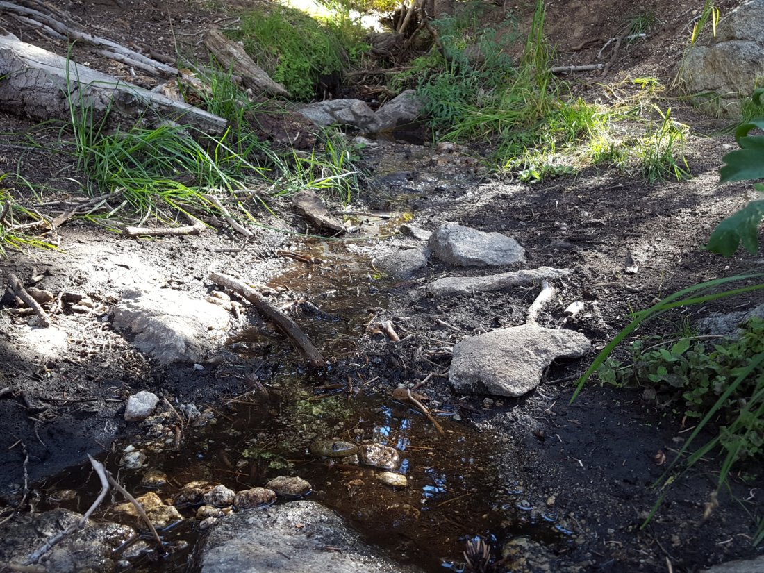
The North Fork of the San Jacinto River continues to flow gently where it crosses the Deer Springs Trail, but flow has almost halved from last week, down to about 2.0 gallons per minute. The same river is close to drying up where it crosses the Pacific Crest Trail on the Fuller Ridge Trail (approx. PCT Mile 186.2), with flow at at only 0.1 gallons per minute. The latter is extremely low flow for this critical PCT water source. These two crossings are the most important water sources for hikers on the western side of the mountain. The water levels for this river are apparently the lowest in living memory.

O’Sullivan Creek (PCT Mile 186.4) on Fuller Ridge Trail remains completely dry.
The spring in the creek in Little Round Valley has been completely dry since early June.
Shooting Star Spring – 0.28 trail miles below Little Round Valley – continues to flow relatively well. For hikers it is possible to filter water from the source at the base of the obvious huge rock, but a better option is to descend to the North Fork crossing mentioned above.
The minor creek crossing (sometimes known as Rock Spring) on Deer Springs Trail midway between the North Fork of the San Jacinto River crossing and Shooting Star Spring, is functionally dry.
The Deer Springs stream crossing at the PCT (approx. PCT mile 185.6) is dry, and the pools just upstream (and downstream) of the trail are also dry. The Deer Springs camp just downslope has been occupied by a crew from the California Conservation Corps since late May (although not since the fire evacuation on 25th July).
Switchback Spring – the small spring just below the eight switchbacks on Deer Springs Trail about 0.4 miles north of Strawberry Junction – continues to flow well. There is a tiny pool on the upslope side of the trail where water can be filtered if necessary.

The little spring in the rock crack at Strawberry Cienega (PCT mile 183) is flowing very weakly. For filtering, there is a tiny pool among the rocks (currently heavily obscured by plants).
On Devil’s Slide Trail, Middle Spring has been dry since 26th July.
On the Ernie Maxwell Trail, Chinquapin Creek just below Humber Park has been diverted by Fern Valley Water District more-or-less continuously since 1st July, drying the creek where it crosses the trail. However good pools receive some fresh flow immediately upstream from the trail. This can be a very important water source for the many dogs walked on this trail.
