Snow and trail update 27th December 2023
UPDATE Sunday 31st December @ 0945: yesterday’s minor storm produced light rain and some hail in Idyllwild adding up to 0.35 inch. A dusting of snow across the high country has included 0.25 inch of snow as low as Humber Park (6500 ft), one inch at Saddle Junction (8100 ft) and Wellman Divide (9700 ft) with 1.5 inches at San Jacinto Peak. Carrying spikes is strongly recommended above 6000 ft. Snow depths remain insufficient for crampons or snowshoes. That advice will change next week with three storms forecast over the next 10 days.
—————————
The forecast for the next ten days is unsettled, with three storms of steadily increasing intensities expected. A minor storm is forecast for Saturday 30th December, with light rain (0.3 inch) at mid elevations and light snow (1-3 inches) in the high country. Another minor system on 3rd-4th January is expected to be much colder, with a dusting of snow down to 5000 ft (i.e., likely including Idyllwild), and 2-6 inches in the high country. The most significant system is tentatively forecast for 6th-7th January, with as much as 1-2 feet of snow possible >10,000 ft elevation, several inches of snow at mid elevations, and a snow level near or even below 4000 ft.
A slow-moving, multiday, but ultimately minor storm system impacted the San Jacinto mountains across 18th-22nd December, with the bulk of the light snowfall on 22nd. Thin snow cover remains on the trails (>7700 ft) but is not significantly impacting hiking and most major trails already have well-traveled tracks to follow.
Precipitation totals for the storm were at the bottom end of the ranges given by many forecasts. Idyllwild (at 5550 ft) received 0.61 inch of rain across the five days, while 0.67 inch fell at Saddle Junction (8100 ft) on 18th-21st before turning to snow at that elevation on 22nd. Some of the early days of the system were warm enough that precipitation fell as freezing rain, rather than snow, as high as San Jacinto Peak on both 19th and 20th.
Most snow fell on Friday 22nd, with just very light dustings at the highest elevations on 18th and 20th. Snowfall totals included four inches at San Jacinto Peak, of which 3.5 inches were on 22nd, three inches at Wellman Divide (9700 ft) and Little Round Valley (9750 ft), and two inches at Saddle Junction. Long Valley (8600 ft) had about two inches of snow on 22nd, with light rain in the days prior.
I recorded a short video report from San Jacinto Peak at 0830 on Friday 22nd which gave a feel for conditions immediately following the main snowfall (linked here). As a relatively warm system, no significant snow fell below 7500 ft, with just a dusting down to 7200 ft.
Trails are clear of snow below 7700 ft elevation, and are clearing steadily on sun-exposed slopes up to 8900 ft. Conversely, trails are becoming increasingly icy higher up as very thin snow is compacted by hiker traffic and following freeze-thaw cycles. Spikes are recommended everywhere above about 8000 ft at this time, although hikers experienced with icy snow travel may find them of limited use. Snow depths are insufficient for snowshoes or crampons even at the highest elevations.
Daily survey hikes in the San Jacinto mountains include various routes to San Jacinto Peak multiple times per week (most recently on 20th, 21st, 22nd, 25th, and 27th December), Tahquitz Peak and area at least once per week (most recently on 19th and 24th December), plus a wide variety of other trails on intervening days.
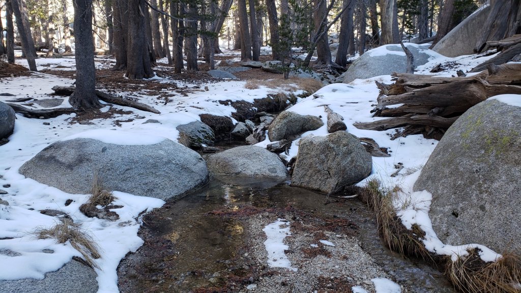
Water sources such as creeks, pipes, and springs largely continue to flow well for the time of year, thanks to the intensity of last winter plus various storms since August, and they have not frozen in recent cold weather. Ephemeral water sources have now largely dried, but campers and hikers will still generally find water wherever they are expecting it.
South Ridge Road (5S11) was graded on 15th October and reopened in mid November. May Valley Road (5S21) was fully graded in October, and is now much more user-friendly for both hikers and bikers. Dark Canyon Road (4S02) remains closed indefinitely, although the dirt section was partly graded in early October.
Black Mountain Road (4S01) was in its poorest condition for at least a decade by June this year. The partial grading undertaken in July improved the situation, but it remains a bumpy drive. Seasonal campgrounds and fire lookouts all closed for the winter by mid November.

WEATHER
Temperatures are forecast to be above seasonal until Saturday 30th December, before largely dropping below seasonal at least into the second week of January 2024. While a relatively warm week could facilitate melting, most days for the foreseeable future will be partly or mostly cloudy, potentially slowing snowmelt somewhat.
The next minor storm is forecast for Saturday 30th December, with light rain (<0.3 inch) at mid elevations and snow (<3 inches) in the high country. Another minor system on 3rd-4th January is expected to be much colder, with a dusting of snow likely down to Idyllwild, and a few inches in the high country. Yet another system is tentatively forecast for 6th-8th January, and may be both very cold – with a freeze level down to 4000 ft – and bring heavier precipitation (10-20 inches of snow in the high country possible).
Air temperatures above 10,000 ft elevation are now typically in the 20s-mid 30s Fahrenheit (-5 to 3°C). From 30th December into mid January, windchill temperatures at high elevations will generally be far below freezing, below 0°F (-18°C) on most days. Such conditions require appropriate clothing and equipment for very cold conditions.
At San Jacinto Peak (3295m/10,810ft) on Wednesday 27th December 2023 at 1015 the air temperature was 33.7°F (1°C), with a windchill temperature of 20.1°F (-7°C), 19% relative humidity, and a chilly WNW wind sustained at 10 mph gusting to 17.8 mph.
At the Peak on Monday 25th December 2023 at 0910 the air temperature was 31.6°F (0°C), with a windchill temperature of 17.3°F (-8°C), 43% relative humidity, and a sharp NW wind sustained at 11 mph gusting to 18.6 mph.
At the Peak on Friday 22nd December 2023 at 0825 the air temperature was 22.0°F (-6°C), with a windchill temperature of 2.7°F (-16°C), 91% relative humidity, and a bitter due South wind sustained at 13 mph gusting to 24.5 mph.

TRAIL CONDITIONS
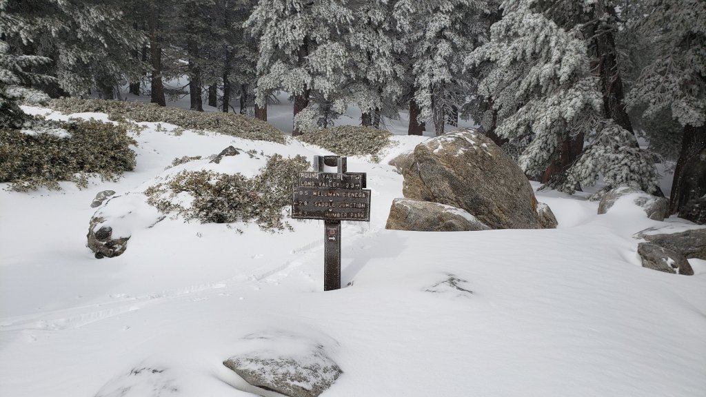
There is continuous thin snow cover on almost all trails above about 8500 ft, patchy icy snow sections as low as 7700 ft in places, and trails are completely clear of snow below 7700 ft elevation (higher in places; details below). Major trails have well-defined tracks through the thin remnant snow at this time, with the exception of Seven Pines Trail (as of 25th December).
Even very thin snow has become icy in places on well-traveled trails due to freeze-thaw cycles and compaction by hiker traffic. Spikes are consequently recommended everywhere above about 8000 ft at this time. Snow depths are insufficient for snowshoes or crampons even at the highest elevations.
Snow on sun-exposed slopes below 10,000 ft is very thin and is expected to largely melt in the next couple of days, but the sun angle is so low in late December that melting will be slow in traditionally sheltered areas, such as the north side of Tahquitz Peak, trails 0.4 mile either side of Annie’s Junction (PCT Mile 180.8), and some upper sections of Deer Springs Trail.
Deer Springs Trail below Strawberry Junction (8100 ft) is clear of snow. Thin snow covers about 60% of the trail between Strawberry Junction and the top of Marion Mountain Trail (8700 ft). From the Marion Mountain Trail junction to San Jacinto Peak the snow cover is continuous. Spikes are useful for descending the upper trail.
Marion Mountain Trail is largely clear of snow in its lower third, but thin icy snow remains on the upper tow-thirds. Even very shallow snow traditionally persists in the least exposed central section of the trail for weeks.
Devil’s Slide Trail is now functionally clear of snow to 7700 ft (about 0.5 mile before Saddle Junction). Snow cover is largely continuous on the upper trail and is becoming very icy. Spikes are useful, especially for descending.
The Wellman and Peak trails, both largely open and sun-exposed, currently remain largely snow-covered, but are expected to steadily clear of snow. Persistent areas of snow will remain in forested sections. A well-traveled track comes up to Wellman Divide from Long and Round valleys, with largely continuous snow above Round Valley at least.
Trails on the north side of Tahquitz (photo below) and Red Tahquitz peaks, including PCT Miles 175.5-177.5, and around the Tahquitz area meadows, remain fully covered with thin snow due to their northerly exposure, drifting, and/or forest cover. South Ridge Trail south from Tahquitz Peak is largely clear of snow (surveyed 24th December) but the uppermost switchbacks near the peak have a thin continuous icy snow cover (spikes are recommended for descending those switchbacks).
Fuller Ridge Trail has about 65% snow cover (surveyed 27th December), although nowhere is the snow depth greater than about two inches in the trail. The most sun-exposed sections of the trail are completely clear of snow. There are now reliable tracks to follow through the snow sections along the entire length of the trail.
Tropical Storm Hilary in late August resulted in one or two new treefall hazards on most trails, but only Willow Creek and Fuller Ridge trails were more significantly impacted.
The rough route cleared along Willow Creek Trail in early August remarkably lasted only two weeks before Tropical Storm Hilary brought down 19 new treefall hazards. Of the seven that came down on the Forest Service section, five were removed in early November. One huge trunk remains just east of Willow Creek that most hikers will find challenging to pass. Of the 12 on the State Park section, eight were cut in late August, and there is a cleared route from Long Valley to Hidden Divide, but four remain uncut between the divide and the Forest Service boundary. The whitethorn trimming is inconsistent and scrappy but overall the trail is more passable than it was as recently as July. Eight trees – of the 60+ down after last winter – remain to be cut on the USFS section for the original trail route to be fully restored, but that will not happen this year, if ever.
Fuller Ridge Trail (PCT Miles 185.5-190.5) has 11 treefall hazards, several of which are large and challenging to pass. The Forest Service section (Miles 189-190.5) was largely cleared and thoroughly raked in September, and is in its best condition for a decade. However the huge double treefall just 0.35 mile from the campground remains. Sadly the State Park section (Miles 185.5-189) remains a mess, with considerable debris remaining from the winter and recent storms, including nine significant treefall hazards.
Deer Springs Trail has had a few treefall hazards removed by the State Park in the past month, but at least seven significant problems remain below the Fuller Ridge Trail junction dating back to last winter. Almost all of the 12 downed trees above Fuller Ridge on upper Deer Springs Trail date back some 6-10 years and have been reported to the State Park multiple times (never resulting in meaningful action).
Trails around the Skunk Cabbage and Tahquitz area meadows have some significant treefall hazards remaining from last winter (resurveyed November 2023). There are six on the PCT section north from near Mile 177 (the crossing of Tahquitz Creek) to Saddle Junction (roughly Mile 179.3), three on each side of Chinquapin Flat. There are four significant treefalls, including a couple that are not easy to pass, on the Little Tahquitz Meadow trail between the Caramba Trail and the PCT junction, and three on the Skunk Cabbage Meadow trail.
Fourteen treefall hazards from last winter on South Ridge Trail (above the trailhead at the top of South Ridge Road) were removed by the Trail Report in May, and trail trimming has been undertaken regularly. No significant new treefall hazards resulted from Tropical Storm Hilary on this trail, but one minor new one fell in November. The middle section of South Ridge Trail – between May Valley Road and the top of South Ridge Road – is now clear following removal of 20 trees in two sessions this year (15th July and 30th October).
Marion Mountain Trail has five notable treefall hazards in the State Park (upper) half. One new large stump came down in Hilary low down on the Forest Service section, but it is easy to pass.
Ten new treefall hazards on Spitler Peak Trail, largely caused by Tropical Storm Hilary, were removed by the Trail Report in October and November. This brings to 95 the number of trees removed from this trail since July 2021 by the Trail Report. Several minor washouts from last winter in the upper switchbacks have significantly impacted the tread in places; these are not problematic for hikers, but the trail is impassable to stock.
Elsewhere on the PCT treefall hazards remain a problem in many places, most notably between Apache Peak and Red Tahquitz, where I counted 106 between Miles 169-175 in summer 2023. Large downed trees make for especially slow-going around Miles 172-175 (a section severely impacted by the July 2013 Mountain Fire).
The Caramba Trail from near Reeds Meadow through Laws Camp and on to Caramba, and the Cedar Trail from Willow Creek Trail to Laws, are euphemistically described by the Forest Service as “not maintained”. In reality both trails have been abandoned and functionally no longer exist. They are so heavily overgrown with dense whitethorn, which obscures dozens of downed trees, that I strongly advise hikers do not attempt to follow them (regardless of how much you may trust a certain app). An informal use trail to Laws is much more direct, well maintained, and avoids the challenging bushwhacking of the unmaintained trails (local Idyllwild hikers dubbed it the “King Trail” when I established the route in 2019). It leaves Willow Creek Trail exactly 1.0 mile from Saddle Junction, 0.46 mile from the Skunk Cabbage turning (trailhead at N 33.7796, W-116.6590). The route descends largely following long-established deer trails for 1.2 miles, meeting Willow Creek about 0.2 mile upstream from the site of the historic Laws Camp (the remains of which were destroyed by the 2013 Mountain Fire plus subsequent flood and treefall damage). The 11 trees down on the King Trail after last winter were removed in June, and the five trees brought down by Hilary were removed or diverted around in November 2023. The tread of the trail received some damage from Tropical Storm Hilary. From Laws east to Caramba the route of the original Caramba Trail has been well-cairned by myself and others and can largely be followed with very careful route-finding. My August 2023 survey counted about 110 trees down on this 2.1 miles of trail. It is especially obscure for the first 0.3 mile east of the Willow Creek crossing, becoming more obvious (but still subtle) as it descends towards Caramba. Very cautious navigation is advised throughout the area.
Seven Pines Trail is largely clear of treefall hazards. Five new trees came down across the trail in Tropical Storm Hilary, all in the central mile, but they are readily passable for hikers. Be advised that the trail in general becomes more obscure in the mile closest to its junction with the PCT. The Trail Report has “adopted” Seven Pines Trail as a priority for maintenance work as the trail has had a disproportionate number of lost hiker rescues in the past decade. Since November 2021, more than 70 downed trees have been removed and the trail is thoroughly trimmed and cleared several times per year. Nevertheless Seven Pines remains a genuine wilderness trail unlike the relatively wide, bare, and obvious routes of, for example, Devil’s Slide or Marion Mountain trails. Cautious navigation remains essential for those without considerable experience of hiking this trail.


While all time and labor is volunteered, the San Jacinto Trail Report uses small private donations to help cover operating costs. Your contribution keeps the Report available to all, free from advertising or paywalls, and independent from agencies. If you have found this Report useful, please consider using this link to the Donate page. Thank you very much for your support.


sanjacjon Uncategorized Leave a comment 12 MinutesEdit”Snow and trail update 27th December 2023″
Weather and snow update 22nd December 2023
UPDATE Sunday 24th December: trails are clear of snow below 7500 ft elevation, but are becoming increasingly icy higher up as very thin snow is compacted by hiker traffic and following freeze-thaw cycles. Spikes are strongly recommended everywhere above about 8000 ft at this time. Snow depths are insufficient for snowshoes or crampons even at the highest elevations.
UPDATE Friday 22nd December @ 2010: Precipitation totals for the storm system were rather disappointing. Overnight Idyllwild (at 5550 ft) received 0.28 inch of rain, followed by another 0.12 inch during the day. Long Valley (8600 ft) had about two inches of snow on 22nd, and San Jacinto Peak has an average depth of about 3.5 inches, drifted deeper in places. I recorded a short video report from San Jacinto Peak at 0830 (available here). Snow level dropped down to 7500 ft on Devil’s Slide Trail, with an average depth of one inch at Saddle Junction (8100 ft). Spikes are now useful and recommended everywhere above about 8000 ft elevation.
‐————————————
A slow-moving storm system over Southern California is producing an unpredictable weather pattern for the remainder of this week. Some precipitation is possible daily on 18th-23rd December. Probabilities increase substantially late on Thursday 21st and throughout Friday 22nd.
On our early morning hike to San Jacinto Peak on Monday 18th, we enjoyed a brief little snow storm up top while there was a very light rain throughout the mid and upper elevations. It snowed between 0910-0930, with 0.25 inch settling above 10,400 ft elevation, plus a dusting down to 9900 ft. Rainfall in Idyllwild (5550 ft) and at Saddle Junction (8100 ft) was barely 0.01 inch.
Brief rains overnight on 18th and occasionally on 19th produced a further 0.21 inch of rain in Idyllwild (5550 ft) by the morning of Wednesday 20th, 0.49 inch at Saddle Junction (8100 ft), and 0.32 inch at Wellman’s Cienega (9300 ft). Above that, it was mild enough that precipitation fell as freezing rain rather than snow, all the way to San Jacinto Peak where rocks were covered in a thin layer of ice.
Another very light rain overnight on 20th produced just 0.02 inch of rain in Idyllwild, and a very light snowfall of 0.25 inch above 10,000 ft in the high country, dusting down to about 9000 ft.
At most elevations, relatively warm rains have finally melted what little patchy snow remained from late November (see for example the photo below from the north side of Tahquitz Peak).
The first significant storm of winter 2023/24 is forecast to bring moderate precipitation to all elevations on 21st-22nd December. However, earlier forecasts suggesting 1-2 inches of rain at mid elevations and 1-2 feet of snow around the highest peaks of the San Jacinto mountains have now largely been replaced by more conservative estimates of an inch or less of rain, and 4-8 inches of snow, respectively.
It appears that the bulk of the energy from this storm system will now be west (and perhaps a little north) of the San Jacinto mountain range, as discussed in the latest National Weather Service video report released on 20th December (linked here).
This will be a mild storm system and the freeze level may remain relatively high, with nearly one inch of rainfall forecast for mid elevations (e.g., Idyllwild), and a mix of rain turning to light snow between about 7000-9000 ft mainly on Friday 22nd. The freeze level may eventually drop as low as 7500 ft, but no significant snowfall is currently forecast below about 7000 ft. Snow forecasts for the high country have varied dramatically from 2-20 inches above 10,000 ft, although the most recent models favor the lower end of that spectrum. Light snowfall at high elevations may be scattered across several days from 18th-23rd December, becoming moderate at times on Friday 22nd and accumulating to 6-8 inches.
Remaining snow from the minor storms at the end of November has now largely melted. For specific details of trail conditions please see the previous Report linked here. At this time, no traction devices are required anywhere on the trail system, but this will change during the course of the week, notably on 22nd-23rd, when spikes (at least) will become recommended.
Daily survey hikes in the San Jacinto mountains include various routes to San Jacinto Peak multiple times per week (most recently on 18th, 20th, 21st, and 22nd December), Tahquitz Peak and area at least once per week (most recently on 19th December), plus a wide variety of other trails on intervening days.
Air temperatures above 10,000 ft elevation are now generally in the 20s-low 30s Fahrenheit (-5 to 1°C), with windchill temperatures well below freezing. On 21st-23rd December at least, air and/or windchill temperatures may at times be far below freezing, requiring appropriate equipment for very cold conditions. A slight warming to near seasonal temperatures on 25th-29th December is expected to be followed by further cooling around the turn of the year.
At San Jacinto Peak (3295m/10,810ft) on Wednesday 20th December 2023 at 0905 the air temperature was 27.2°F (-3°C), with a windchill temperature of 13.5°F (-10°C), 39% relative humidity, and a cool SSW wind sustained at 8 mph gusting to 14.9 mph.
At the Peak on Monday 18th December 2023 at 0850 the air temperature was 34.9°F (2°C), with a windchill temperature of 20.5°F (-7°C), 68% relative humidity, and a sharp WSW wind sustained at 13 mph gusting to 21.6 mph.

While all time and labor is volunteered, the San Jacinto Trail Report uses small private donations to help cover operating costs. Every year has its unique challenges, and 2023 has been no exception. Your contribution keeps the Report available to all, free from advertising or paywalls, and independent from agencies. If you have found this Report useful, please consider using this link to the Donate page. Zelle, Venmo, and PayPal are all options. Thank you very much for your support.
sanjacjon Uncategorized 2 Comments 5 MinutesEdit”Weather and snow update 22nd December 2023″
Snow and trail update 15th December 2023
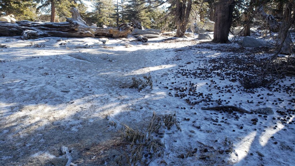
Most of the remaining snow from the minor storms at the end of November has now melted. Patchy areas of thin snow, rarely more than 0.5 inch deep, remain on sheltered, largely north-facing, slopes (see Trail Conditions section and photos below). However freeze-thaw cycles and compaction by hiker traffic has led to persistent patches in trails being icy and some hikers may find spikes useful in places. Temperatures remain well above seasonal for December until Tuesday 19th, and melting of remnant snow will continue slowly.
The first significant storm system of winter 2023/24 is expected to bring moderate precipitation to all elevations on 20th-23rd December. The freeze level may remain relatively high, with 1-2 inches of rainfall forecast for mid elevations, and a mix of rain turning to light snow between 6000-9000 ft spread across four days. The freeze level may eventually drop as low as 6500 ft on Saturday 23rd, but no significant snowfall is currently forecast below about 7000 ft. Snow forecasts for the high country range widely from 6-20 inches above 10,000 ft. Light to periodically heavy snowfall at high elevations may be scattered across several days from 20th-23rd December.
Daily survey hikes in the San Jacinto mountains include various routes to San Jacinto Peak multiple times per week (most recently on 7th, 11th, and 15th December), Tahquitz Peak and area at least once per week (most recently on 12th-13th December), plus a wide variety of other trails on intervening days. My recent weather observations from San Jacinto Peak are given in the Weather section below.
Water sources such as creeks, pipes, and springs largely continue to flow well for the time of year, given the intensity of last winter plus various storms since August, and did not freeze in recent cold weather (example photo below and in the prior Report linked here). Many ephemeral water sources have now dried, but campers and hikers will still generally find water wherever they are expecting it.
South Ridge Road (5S11) was graded on 15th October and reopened in mid November. May Valley Road (5S21) was fully graded in October, and is now much more user-friendly for both hikers and bikers. Dark Canyon Road (4S02) remains closed indefinitely, although the dirt section was partly graded in early October.
Black Mountain Road (4S01) was in its poorest condition for at least a decade by June this year. The partial grading undertaken in July improved the situation somewhat, but it remains a bumpy drive. Seasonal campgrounds and fire lookouts are now all closed for the winter.

WEATHER
Temperatures have remained at or above seasonal since 4th December. Snowmelt has been relatively rapid (given the time of year) in most areas below 8000 ft and those exposed to direct sunlight, but the sun angle is so low in December that melting has been slow in sheltered areas. Most days for the foreseeable future will be at least partly cloudy, slowing the rate of melting, with temperatures dropping to seasonal around Monday 18th December and then below average for several days from 20th December.
A storm system forecast for 20th-23rd December is expected to bring moderate precipitation to all elevations. The freeze level is currently predicted to remain relatively high, with 0.8-1.5 inches of rainfall at mid elevations spread across three or four days, and a mix of rain becoming light-to-moderate snow between 6000-9000 ft over the same time period. The freeze level may finally drop as low as 6500 ft by 23rd, but with no significant snowfall forecast below 6000 ft.
Snow forecasts for the high country have varied greatly but 8-12 inches are currently expected above 10,000 ft. Light snowfall may be scattered across at least 2-3 days, on 20th-22nd December.
Although warmer on 14th-17th December, air temperatures above 10,000 ft elevation are now generally in the 20s-low 30s Fahrenheit (-5 to 0°C), with windchill temperatures usually well below freezing, of course depending on wind speed. On 20th-23rd December, both air and windchill temperatures may be far below freezing, requiring appropriate equipment for very cold conditions.
At San Jacinto Peak (3295m/10,810ft) on Friday 15th December 2023 at 0810 the air temperature was 45.9°F (8°C), with a windchill temperature of 40.3°F (5°C), 4.5% relative humidity, and a steady SE wind sustained at 6 mph gusting to 7.2 mph.
At the Peak on Monday 11th December 2023 at 0850 the air temperature was 39.8°F (4°C), with a windchill temperature of 32.4°F (0°C), 37% relative humidity, and a light SW wind sustained at 6 mph gusting to 7.4 mph.
At the Peak on Thursday 7th December 2023 at 0805 the air temperature was 35.5°F (2°C), with a windchill temperature of 19.4°F (-7°C), 8% relative humidity, and a wild WNW wind sustained at 19 mph gusting to 39.7 mph.

TRAIL CONDITIONS
There is no significant settled snow anywhere in the high country. However a patchy light snow cover persists in places, notably on slopes that at this time of year receive limited or no direct sun. Even very thin snow has become icy in places on well-traveled trails due to freeze-thaw cycles and compaction by hiker traffic.
Traction devices are not currently required anywhere but carrying them is recommended as the few areas with persistent snow in the trails are generally very icy. Starting about Wednesday 20th December, spikes are expected to be strongly recommended everywhere above about 7000 ft, possibly lower.
Deer Springs Trail below Strawberry Junction (8100 ft) is clear of snow, and is now largely clear of snow from there to the high peaks. The few remaining tiny sections of snow are very icy in places however.
Marion Mountain Trail is largely clear of snow, but a few very short sections of thin icy snow remain, mainly in the least exposed central section of the trail. Spikes are not generally required however.
Devil’s Slide Trail is now functionally clear of snow. The Wellman and Peak trails, both largely open and sun-exposed, are almost completely clear of snow, but very small areas of snow remain in forested sections.
Trails on the north side of Tahquitz (photo above) and Red Tahquitz peaks, including PCT Miles 175.5-177.5, and around the Tahquitz area meadows, remain about 50% covered with very thin snow due to their northerly exposure, drifting, and/or forest cover. South Ridge Trail south from Tahquitz Peak is functionally clear of snow (surveyed 13th December).
Tropical Storm Hilary in late August resulted in one or two new treefall hazards on most trails, but only Willow Creek and Fuller Ridge trails were more significantly impacted.
The rough route cleared along Willow Creek Trail in early August remarkably lasted only two weeks before Tropical Storm Hilary brought down 19 new treefall hazards. Of the seven that came down on the Forest Service section, five were removed in early November. One huge trunk remains just east of Willow Creek that most hikers will find challenging to pass. Of the 12 on the State Park section, eight were cut in late August, and there is a cleared route from Long Valley to Hidden Divide, but four remain uncut between the divide and the Forest Service boundary. The whitethorn trimming is inconsistent and scrappy but overall the trail is more passable than it was as recently as July. Eight trees – of the 60+ down after last winter – remain to be cut on the USFS section for the original trail route to be fully restored, but that will not happen this year, if ever.
Fuller Ridge Trail (PCT Miles 185.5-190.5) has 11 treefall hazards, several of which are large and challenging to pass. The Forest Service section (Miles 189-190.5) was largely cleared and thoroughly raked in September, and is in its best condition for a decade. However the huge double treefall just 0.35 mile from the campground remains. Sadly the State Park section (Miles 185.5-189) remains a mess, with considerable debris remaining from the winter and recent storms, including nine significant treefall hazards.
Deer Springs Trail has had a few treefall hazards removed by the State Park in the past month, but at least seven significant problems remain below the Fuller Ridge Trail junction dating back to last winter. Almost all of the 12 downed trees above Fuller Ridge on upper Deer Springs Trail date back some 6-10 years and have been reported to the State Park multiple times (never resulting in meaningful action).
Trails around the Skunk Cabbage and Tahquitz area meadows have some significant treefall hazards remaining from last winter (resurveyed November 2023). There are six on the PCT section north from near Mile 177 (the crossing of Tahquitz Creek) to Saddle Junction (roughly Mile 179.3), three on each side of Chinquapin Flat. There are four significant treefalls, including a couple that are not easy to pass, on the Little Tahquitz Meadow trail between the Caramba Trail and the PCT junction, and three on the Skunk Cabbage Meadow trail.
Fourteen treefall hazards from this past winter on South Ridge Trail (above the trailhead at the top of South Ridge Road) were removed by the Trail Report in May, and trail trimming has been undertaken regularly. No significant new treefall hazards resulted from Tropical Storm Hilary on this trail, but one minor new one fell in November. The middle section of South Ridge Trail – between May Valley Road and the top of South Ridge Road – is now clear following removal of 20 trees in two sessions this season (15th July and 30th October).
Marion Mountain Trail has five notable treefall hazards in the State Park (upper) half. One new large stump came down in Hilary low down on the Forest Service section, but it is easy to pass.
Ten new treefall hazards on Spitler Peak Trail, largely caused by Tropical Storm Hilary, were removed by the Trail Report in October and November. This brings to 95 the number of trees removed from this trail since July 2021 by the Trail Report. Several minor washouts from last winter in the upper switchbacks have significantly impacted the tread in places; these are not problematic for hikers, but the trail is impassable to stock.
Elsewhere on the PCT treefall hazards remain a problem in many places, most notably between Apache Peak and Red Tahquitz, where I counted 106 between Miles 169-175 in summer 2023. Large downed trees make for especially slow-going around Miles 172-175 (a section severely impacted by the July 2013 Mountain Fire).
The Caramba Trail from near Reeds Meadow through Laws Camp and on to Caramba, and the Cedar Trail from Willow Creek Trail to Laws, are euphemistically described by the Forest Service as “not maintained”. In reality both trails have been abandoned and functionally no longer exist. They are so heavily overgrown with dense whitethorn, which obscures dozens of downed trees, that I strongly advise hikers do not attempt to follow them (regardless of how much you may trust a certain app). An informal use trail to Laws is much more direct, well maintained, and avoids the challenging bushwhacking of the unmaintained trails (local Idyllwild hikers dubbed it the “King Trail” when I established the route in 2019). It leaves Willow Creek Trail exactly 1.0 mile from Saddle Junction, 0.46 mile from the Skunk Cabbage turning (trailhead at N 33.7796, W-116.6590). The route descends largely following long-established deer trails for 1.2 miles, meeting Willow Creek about 0.2 mile upstream from the site of the historic Laws Camp (the remains of which were destroyed by the 2013 Mountain Fire plus subsequent flood and treefall damage). The 11 trees down on the King Trail after last winter were removed in June, and the five trees brought down by Hilary were removed or diverted around in November 2023. The tread of the trail received some damage from Tropical Storm Hilary. From Laws east to Caramba the route of the original Caramba Trail has been well-cairned by myself and others and can largely be followed with very careful route-finding. My August 2023 survey counted about 110 trees down on this 2.1 miles of trail. It is especially obscure for the first 0.3 mile east of the Willow Creek crossing, becoming more obvious (but still subtle) as it descends towards Caramba. Very cautious navigation is advised throughout the area.
Seven Pines Trail is largely clear of treefall hazards. Five new trees came down across the trail in Tropical Storm Hilary, all in the central mile, but they are readily passable for hikers. Be advised that the trail in general becomes more obscure in the mile closest to its junction with the PCT. The Trail Report has “adopted” Seven Pines Trail as a priority for maintenance work as the trail has had a disproportionate number of lost hiker rescues in the past decade. Since November 2021, more than 70 downed trees have been removed and the trail is thoroughly trimmed and cleared several times per year. Nevertheless Seven Pines remains a genuine wilderness trail unlike the relatively wide, bare, and obvious routes of, for example, Devil’s Slide or Marion Mountain trails. Cautious navigation remains essential for those without considerable experience of hiking this trail.
While all time and labor is volunteered, the San Jacinto Trail Report uses small private donations to help cover operating costs. Every year has its unique challenges, and 2023 has been no exception. Your contribution keeps the Report available to all, free from advertising or paywalls, and independent from agencies. If you have found this Report useful, please consider using this link to the Donate page. Zelle, Venmo, and PayPal are all options. Thank you very much for your support.


sanjacjon Uncategorized Leave a comment 10 MinutesEdit”Snow and trail update 15th December 2023″
Snow and trail update 7th December 2023
Minor storms on consecutive nights between 29th November and 1st December resulted in a thin covering of snow everywhere above about 6000 ft and a light dusting down to 5400 ft. On our hike up Marion Mountain and Deer Springs trails on 1st, the snow depth was remarkably consistent from 1.5 inches at the trailhead (6300 ft) to 2.0 inches at San Jacinto Peak, with only Little Round Valley (2.5 inches) having noticeably deeper cover. However drifting in the trails to a few inches deep did slow down hiking pace markedly.
As temperatures have risen in the first few days of December, snow has been melting steadily at all elevations, largely depending on sun exposure of the slope (see Trail Conditions below). However with freeze-thaw cycles and compaction by hiker traffic, remaining patches can be icy and some hikers may find spikes useful. With most of the next ten days forecast to have above seasonal temperatures melting of remnant snow will continue steadily at all elevations, and almost all snow may be gone by mid month.
Daily survey hikes in the San Jacinto mountains include various routes to San Jacinto Peak multiple times per week, most recently on 27th and 30th November and 1st, 4th, and 7th December, Tahquitz Peak and area at least once per week, plus many other trails on intervening days. My recent weather observations from San Jacinto Peak are given in the Weather section below.
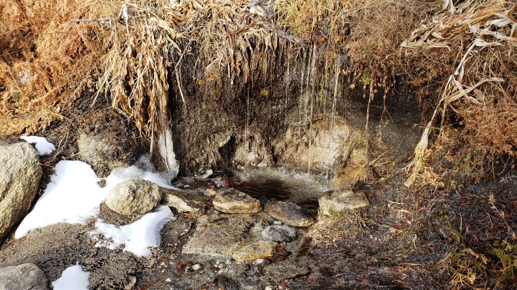
Water sources such as creeks, pipes, and springs largely continue to flow steadily for the time of year, given the intensity of last winter plus various storms since August, and did not freeze in recent cold weather (example photos below). Many ephemeral water sources have finally dried, but campers and hikers will still generally find water wherever they are expecting it.
South Ridge Road (5S11) was graded on 15th October and reopened in mid November. May Valley Road (5S21) was fully graded in October, and is now much more user-friendly for both hikers and bikers. Dark Canyon Road (4S02) remains closed indefinitely, although the dirt section was partly graded in early October.
Black Mountain Road (4S01) was in its poorest condition for at least a decade by June this year. The partial grading undertaken on 17th July improved the situation somewhat, but it remains a bumpy drive. Seasonal campgrounds and fire lookouts are now all closed for the winter.

WEATHER
After a couple of cool, cloudy, and occasionally stormy weeks, temperatures are rapidly rising to above seasonal on 4th-15th December. Both daytime high and overnight low temperatures are forecast to be 5-10°F above seasonal at mid and upper elevations on most days, melting much of the remnant patchy, thin, snow cover.
There is currently no significant new precipitation in the forecasts prior to late December. This will likely leave the San Jacinto mountains in the rare state of having no significant depth of settled snow in the high country at the middle of December for only the second time in at least the past 15 years. The latest video review from NWS San Diego (linked here) suggests considerable uncertainty about when the first major snow storm may impact our area, and if this winter will prove to be wetter or drier than average.
For the next two weeks, air temperatures above 10,000 ft elevation are expected to be above seasonal, generally in the 30s-low 40s Fahrenheit (1-7°C), with windchill temperatures around or even above freezing.
At San Jacinto Peak (3295m/10,810ft) on Thursday 7th December 2023 at 0805 the air temperature was 35.5°F (2°C), with a windchill temperature of 19.4°F (-7°C), 8% relative humidity, and a wild WNW wind sustained at 19 mph gusting to 39.7 mph.
At the Peak on Monday 4th December 2023 at 0840 the air temperature was 36.8°F (3°C), with a windchill temperature of 30.2°F (-1°C), 44% relative humidity, and a light due North breeze sustained at 4 mph gusting to 5.3 mph.
At the Peak on Friday 1st December 2023 at 0915 the air temperature was 24.8°F (-4°C), with a windchill temperature of 11.7°F (-11°C), 32% relative humidity, and a cool NNW wind sustained at 7 mph gusting to 13.5 mph.
At the Peak on Thursday 30th November 2023 at 0835 the air temperature was 18.8°F (-7°C), with a windchill temperature of -1.9°F (-19°C), 77% relative humidity, and an icy due West wind sustained at 14 mph gusting to 24.1 mph.
TRAIL CONDITIONS
There is no significant settled snow anywhere in the high country. However a patchy light snow cover persists in places, notably on slopes that at this time of year receive limited or no direct sun. Even very thin snow has become icy in places on well-traveled trails due to freeze-thaw cycles and compaction by hiker traffic. Generally warmer days over the next week or so will continue to clear trails steadily.
Deer Springs Trail below Strawberry Junction (8100 ft) is clear of snow, and is now largely clear of snow from there to the high peaks. The few remaining sections of snow are very icy in places however.
Devil’s Slide Trail is largely clear of snow, but a few short sections of icy snow remain in sheltered areas. The Wellman and Peak trails, both largely open and sun-exposed, are almost completely clear of snow, but small areas of snow remain in forested sections.
Trails on the north side of Tahquitz (photo below) and Red Tahquitz peaks, and around the Tahquitz area meadows, remain largely covered with thin snow due to their northerly exposure, drifting, and/or forest cover. South Ridge Trail south from Tahquitz Peak is almost clear of snow (surveyed 5th December).
Traction devices are not currently required anywhere but carrying them is recommended for at least the next few days. It is clear from my observations of tracks in the snow that no hikers are using spikes at this time, but those less experienced on icy trails may find them helpful.

Tropical Storm Hilary in late August resulted in one or two new treefall hazards on most trails, but only Willow Creek and Fuller Ridge trails were more significantly impacted.
The rough route cleared along Willow Creek Trail in early August remarkably lasted only two weeks before Tropical Storm Hilary brought down 19 new treefall hazards. Of the seven that came down on the Forest Service section, five were removed in early November. One huge trunk remains just east of Willow Creek that most hikers will find challenging to pass. Of the 12 on the State Park section, eight were cut in late August, and there is a cleared route from Long Valley to Hidden Divide, but four remain uncut between the divide and the Forest Service boundary. The whitethorn trimming is inconsistent and scrappy but overall the trail is more passable than it was as recently as July. Eight trees – of the 60+ down after last winter – remain to be cut on the USFS section for the original trail route to be fully restored, but that will not happen this year, if ever.
Fuller Ridge Trail (PCT Miles 185.5-190.5) has 11 treefall hazards, several of which are large and challenging to pass. The Forest Service section (Miles 189-190.5) was largely cleared and thoroughly raked in September, and is in its best condition for a decade. However the huge double treefall just 0.35 mile from the campground remains. Sadly the State Park section (Miles 185.5-189) remains a mess, with considerable debris remaining from the winter and recent storms, including nine significant treefall hazards.
Deer Springs Trail has had a few treefall hazards removed by the State Park in the past month, but at least seven significant problems remain below the Fuller Ridge Trail junction dating back to last winter. Almost all of the 12 downed trees above Fuller Ridge on upper Deer Springs Trail date back some 6-10 years and have been reported to the State Park multiple times (never resulting in meaningful action).
Trails around the Skunk Cabbage and Tahquitz area meadows have some significant treefall hazards remaining from last winter (resurveyed November 2023). There are six on the PCT section north from near Mile 177 (the crossing of Tahquitz Creek) to Saddle Junction (roughly Mile 179.3), three on each side of Chinquapin Flat. There are four significant treefalls, including a couple that are not easy to pass, on the Little Tahquitz Meadow trail between the Caramba Trail and the PCT junction, and three on the Skunk Cabbage Meadow trail.
Fourteen treefall hazards from this past winter on South Ridge Trail (above the trailhead at the top of South Ridge Road) were removed by the Trail Report in May, and trail trimming has been undertaken regularly. No significant new treefall hazards resulted from Tropical Storm Hilary on this trail, but one minor new one fell in November. The middle section of South Ridge Trail – between May Valley Road and the top of South Ridge Road – is now clear following removal of 20 trees in two sessions this season (15th July and 30th October).
Marion Mountain Trail has five notable treefall hazards in the State Park (upper) half. One new large stump came down in Hilary low down on the Forest Service section, but it is easy to pass.
Ten new treefall hazards on Spitler Peak Trail, largely caused by Tropical Storm Hilary, were removed by the Trail Report in October and November. This brings to 95 the number of trees removed from this trail since July 2021 by the Trail Report. Several minor washouts from last winter in the upper switchbacks have significantly impacted the tread in places; these are not problematic for hikers, but the trail is impassable to stock.
Elsewhere on the PCT treefall hazards remain a problem in many places, most notably between Apache Peak and Red Tahquitz, where I counted 106 between Miles 169-175 in summer 2023. Large downed trees make for especially slow-going around Miles 172-175 (a section severely impacted by the July 2013 Mountain Fire).
The Caramba Trail from near Reeds Meadow through Laws Camp and on to Caramba, and the Cedar Trail from Willow Creek Trail to Laws, are euphemistically described by the Forest Service as “not maintained”. In reality both trails have been abandoned and functionally no longer exist. They are so heavily overgrown with dense whitethorn, which obscures dozens of downed trees, that I strongly advise hikers do not attempt to follow them (regardless of how much you may trust a certain app). An informal use trail to Laws is much more direct, well maintained, and avoids the challenging bushwhacking of the unmaintained trails (local Idyllwild hikers dubbed it the “King Trail” when I established the route in 2019). It leaves Willow Creek Trail exactly 1.0 mile from Saddle Junction, 0.46 mile from the Skunk Cabbage turning (trailhead at N 33.7796, W-116.6590). The route descends largely following long-established deer trails for 1.2 miles, meeting Willow Creek about 0.2 mile upstream from the site of the historic Laws Camp (the remains of which were destroyed by the 2013 Mountain Fire plus subsequent flood and treefall damage). The 11 trees down on the King Trail after last winter were removed in June, and the five trees brought down by Hilary were removed or diverted around in November 2023. The tread of the trail received some damage from Tropical Storm Hilary. From Laws east to Caramba the route of the original Caramba Trail has been well-cairned by myself and others and can largely be followed with very careful route-finding. My August 2023 survey counted about 110 trees down on this 2.1 miles of trail. It is especially obscure for the first 0.3 mile east of the Willow Creek crossing, becoming more obvious (but still subtle) as it descends towards Caramba. Very cautious navigation is advised throughout the area.
Seven Pines Trail is largely clear of treefall hazards. Five new trees came down across the trail in Tropical Storm Hilary, all in the central mile, but they are readily passable for hikers. Be advised that the trail in general becomes more obscure in the mile closest to its junction with the PCT. The Trail Report has “adopted” Seven Pines Trail as a priority for maintenance work as the trail has had a disproportionate number of lost hiker rescues in the past decade. Since November 2021, more than 70 downed trees have been removed and the trail is thoroughly trimmed and cleared several times per year. Nevertheless Seven Pines remains a genuine wilderness trail unlike the relatively wide, bare, and obvious routes of, for example, Devil’s Slide or Marion Mountain trails. Cautious navigation remains essential for those without considerable experience of hiking this trail.

While all time and labor is volunteered, the San Jacinto Trail Report uses small private donations to help cover operating costs. Every year has its unique challenges, and 2023 has been no exception. Your contribution keeps the Report available to all, free from advertising or paywalls, and independent from agencies. If you have found this Report useful, please consider using this link to the Donate page. Zelle, Venmo, and PayPal are all options. Thank you very much for your support.


sanjacjon Uncategorized Leave a comment 10 MinutesEdit”Snow and trail update 7th December 2023″
Weather and trail update 30th November 2023
UPDATE 1st December 2023: yet another minor snow storm overnight, but this was the most significant of the winter to date. There is a consistent two inches of snow throughout the high country above 7000 ft (up to about 2.5 inches in Little Round Valley). Although it is not icy yet, carrying spikes is recommended for the next couple of days at least. Following several heavy hail storms overnight in Idyllwild, the snow dusted down to 5500 ft, but there is 1-1.5 inches at 6000-6500 ft in Pine Cove. With rapid warming in the next few days, melting is expected to be steady at all elevations. In the rain shadow on the eastern side of the mountains, Long Valley (8700 ft) received only a dusting of snow, already melted by this afternoon.
UPDATE 30th November 2023 at 1215: another very minor storm overnight produced 0.29 inch of rain in Idyllwild and a dusting of snow above 6200 ft. Snow depth is a sparse 0.25 inch, including around the highest peaks, but was a slightly deeper 0.5 inch between 8000-9500 ft, an elevation band that was presumably in the cloud for longer. Windchill temperature at San Jacinto Peak is -2°F (-19°C) so gear for cold weather is essential. By the time I descended late morning, most snow on Devil’s Slide Trail had already melted, as had significant sections as high as Wellman Divide (9700 ft).

————————
The most recent of several minor rain events in the past ten days occurred on the evening of 24th November, when a light rain at mid elevations (0.15 inch in Idyllwild) included a dusting of snow everywhere above about 7000 ft. The snow cover was thin but remarkably uniform, with 0.25 inch throughout the high country, but locally 0.5-1.0 inch, notably near and around Tahquitz Peak, which was enveloped in cloud for much longer than many other areas.
The light snows from that event and earlier dustings on 15th and 18th November (described in detail in the prior Report linked here) have now largely melted. Another minor storm system is tentatively forecast to impact the region across three days on 29th November-1st December. Details are given in Weather below, but light snow may occur across the high country and possibly including a very light dusting as low as Idyllwild.
Our survey hikes every day in the San Jacinto mountains include various routes to San Jacinto Peak multiple times per week, most recently on 20th, 23rd, and 27th November, Tahquitz Peak and area at least once per week, plus a wide range of other trails on intervening days. My recent weather observations from San Jacinto Peak are given in the Weather section below.
Water sources such as creeks, pipes, and springs largely continue to flow well for the time of year, given the intensity of last winter plus various storms since August. Many ephemeral water sources have finally dried, but campers and hikers will still generally find water wherever they are expecting it (see example photographs below and in the prior Report linked here).
Be bear aware. Although rarely reported, at least three Black Bears have been in the San Jacinto mountains since 2017, and I have had 1-2 sightings annually for the past six years. As I descended upper Marion Mountain Trail at about 8250 ft elevation mid morning on 14th September 2023 I had an excellent observation, initially in the open at 40-50 metres, of what may have been the same very large (>250lb) dark brown individual with a white chest blaze that I had previously seen on Devil’s Slide Trail in July 2022 and September 2021 (a poor quality video from the latter observation is available here).
South Ridge Road (5S11) was graded on 15th October and reopened in mid November. May Valley Road (5S21) was fully graded in October, and is now much more user-friendly for both hikers and bikers. Dark Canyon Road (4S02) remains closed indefinitely, although the dirt section was partly graded in early October.
Black Mountain Road (4S01) was in its poorest condition for at least a decade by June this year. The partial grading undertaken on 17th July improved the situation somewhat, but it remains a bumpy drive. Seasonal campgrounds and fire lookouts are now all closed for the winter.

WEATHER
Recent days have been pleasantly cloudy with below seasonal temperatures, and this pattern is expected to continue for another week.
A minor storm system is tentatively forecast to impact the region across three days on 29th November-1st December. The freeze level is expected to be lower than other minor storms earlier this month, and if it snows a dusting is possible down to 6000 ft or even lower (i.e., potentially including Idyllwild). Otherwise mid elevations are expected to receive light rain, mainly from the afternoon of Thursday 30th and throughout the morning of Friday 1st. Forecasting snowfall for the high country has proven to be problematic, but currently 0-3 inches of snow are possible, spread thinly across the same time period.
Next week temperatures are expected to abruptly rise to well above seasonal on 4th-9th December at least. Both daytime high and overnight low temperatures are currently forecast to be as much as 10°F above seasonal at mid and upper elevations, melting any light snow that may have fallen in the preceding days.
Air temperatures above 10,000 ft elevation are now generally in the upper 20s-low 30s Fahrenheit (-5 to 1°C), with windchill temperatures well below freezing, at times far below freezing depending on wind speed (note temperatures will be warmer on 4th-9th December as described above).
At San Jacinto Peak (3295m/10,810ft) on Monday 27th November 2023 at 0825 the air temperature was 32.5°F (0°C), with a windchill temperature of 19.4°F (-7°C), 7% relative humidity, and a cool SE wind sustained at 8 mph gusting to 13.9 mph.
At the Peak on Thursday 23rd November 2023 at 0810 the air temperature was 32.7°F (0°C), with a windchill temperature of 17.2°F (-8°C), 26% relative humidity, and a blustery due West wind sustained at 18 mph gusting to 31.7 mph.
At the Peak on Monday 20th November 2023 at 0810 the air temperature was 34.6°F (1°C), with a windchill temperature of 13.6°F (-10°C), 7% relative humidity, and a wild due North wind sustained at 20 mph gusting to 45.9 mph.

TRAIL CONDITIONS
With multiple light rains over the past ten days, trails are pleasantly dust-free, with generally little or no ice (but caution is recommended around springs and water crossings).
There is no significant settled snow anywhere in the high country. However a very thin dusting persists in places, notably on the north side of Tahquitz and Red Tahquitz peaks. Traction devices are not currently required anywhere, but may be useful in the first few days of December above about 9000 ft depending on snowfall from the expected minor storm (see discussion in Weather above).
Tropical Storm Hilary in late August resulted in many minor washouts across the trail system, considerable treefall debris in the trails. Most trails have one or two new treefall hazards, and only Willow Creek and Fuller Ridge trails were more significantly impacted.
The rough route cleared along Willow Creek Trail in early August remarkably lasted only two weeks before Tropical Storm Hilary brought down 19 new treefall hazards. Of the seven that came down on the Forest Service section, five were removed in early November. One huge trunk remains just east of Willow Creek that most hikers will find challenging to pass. Of the 12 on the State Park section, eight were cut in late August, and there is a cleared route from Long Valley to Hidden Divide, but four remain uncut between the divide and the Forest Service boundary. The whitethorn trimming is inconsistent and scrappy but overall the trail is more passable than it was as recently as July. Eight trees – of the 60+ down after last winter – remain to be cut on the USFS section for the original trail route to be fully restored, but that will not happen this year, if ever.
Fuller Ridge Trail (PCT Miles 185.5-190.5) has 11 treefall hazards, several of which are large and challenging to pass. The Forest Service section (Miles 189-190.5) was largely cleared and thoroughly raked in September, and is in its best condition for a decade. However the huge double treefall just 0.35 mile from the campground remains. Sadly the State Park section (Miles 185.5-189) remains a mess, with considerable debris remaining from the winter and recent storms, including nine significant treefall hazards.
Deer Springs Trail has had a few treefall hazards removed by the State Park in the past month, but at least seven significant problems remain below the Fuller Ridge Trail junction dating back to last winter. Almost all of the 12 downed trees above Fuller Ridge on upper Deer Springs Trail date back some 6-10 years and have been reported to the State Park multiple times (never resulting in meaningful action).
Trails around the Skunk Cabbage and Tahquitz area meadows have some significant treefall hazards remaining from last winter (resurveyed November 2023). There are six on the PCT section north from near Mile 177 (the crossing of Tahquitz Creek) to Saddle Junction (roughly Mile 179.3), three on each side of Chinquapin Flat. There are four significant treefalls, including a couple that are not easy to pass, on the Little Tahquitz Meadow trail between the Caramba Trail and the PCT junction, and three on the Skunk Cabbage Meadow trail.
Fourteen treefall hazards from this past winter on South Ridge Trail (above the trailhead at the top of South Ridge Road) were removed by the Trail Report in May, and trail trimming has been undertaken regularly. No significant new treefall hazards resulted from Tropical Storm Hilary on this trail, but one minor new one fell in November. The middle section of South Ridge Trail – between May Valley Road and the top of South Ridge Road – is now clear following removal of 20 trees in two sessions this season (15th July and 30th October).
Marion Mountain Trail has five notable treefall hazards in the State Park (upper) half. One new large stump came down in Hilary low down on the Forest Service section, but it is easy to pass.
Ten new treefall hazards on Spitler Peak Trail, largely caused by Tropical Storm Hilary, were removed by the Trail Report in October and November. This brings to 95 the number of trees removed from this trail since July 2021 by the Trail Report. Several minor washouts from last winter in the upper switchbacks have significantly impacted the tread in places; these are not problematic for hikers, but the trail is impassable to stock.
Elsewhere on the PCT treefall hazards remain a problem in many places, most notably between Apache Peak and Red Tahquitz, where I counted 106 between Miles 169-175 in summer 2023. Large downed trees make for especially slow-going around Miles 172-175 (a section severely impacted by the July 2013 Mountain Fire).
The Caramba Trail from near Reeds Meadow through Laws Camp and on to Caramba, and the Cedar Trail from Willow Creek Trail to Laws, are euphemistically described by the Forest Service as “not maintained”. In reality both trails have been abandoned and functionally no longer exist. They are so heavily overgrown with dense whitethorn, which obscures dozens of downed trees, that I strongly advise hikers do not attempt to follow them (regardless of how much you may trust a certain app). An informal use trail to Laws is much more direct, well maintained, and avoids the challenging bushwhacking of the unmaintained trails (local Idyllwild hikers dubbed it the “King Trail” when I established the route in 2019). It leaves Willow Creek Trail exactly 1.0 mile from Saddle Junction, 0.46 mile from the Skunk Cabbage turning (trailhead at N 33.7796, W-116.6590). The route descends largely following long-established deer trails for 1.2 miles, meeting Willow Creek about 0.2 mile upstream from the site of the historic Laws Camp (the remains of which were destroyed by the 2013 Mountain Fire plus subsequent flood and treefall damage). The 11 trees down on the King Trail after last winter were removed in June, and the five trees brought down by Hilary were removed or diverted around in November 2023. The tread of the trail received some damage from Tropical Storm Hilary. From Laws east to Caramba the route of the original Caramba Trail has been well-cairned by myself and others and can largely be followed with very careful route-finding. My August 2023 survey counted about 110 trees down on this 2.1 miles of trail. It is especially obscure for the first 0.3 mile east of the Willow Creek crossing, becoming more obvious (but still subtle) as it descends towards Caramba. Very cautious navigation is advised throughout the area.
Seven Pines Trail is largely clear of treefall hazards. Five new trees came down across the trail in Tropical Storm Hilary, all in the central mile, but they are readily passable for hikers. Be advised that the trail in general becomes more obscure in the mile closest to its junction with the PCT. The Trail Report has “adopted” Seven Pines Trail as a priority for maintenance work as the trail has had a disproportionate number of lost hiker rescues in the past decade. Since November 2021, more than 70 downed trees have been removed and the trail is thoroughly trimmed and cleared several times per year. Nevertheless Seven Pines remains a genuine wilderness trail unlike the relatively wide, bare, and obvious routes of, for example, Devil’s Slide or Marion Mountain trails. Cautious navigation remains essential for those without considerable experience of hiking this trail.
While all time and labor is volunteered, the San Jacinto Trail Report uses small private donations to help cover operating costs. Every year has its unique challenges, and 2023 has been no exception. Your contribution keeps the Report available to all, free from advertising or paywalls, and independent from agencies. If you have found this Report useful, please consider using this link to the Donate page. Zelle, Venmo, and PayPal are all options. Thank you very much for your support.


sanjacjon Uncategorized 1 Comment 10 MinutesEdit”Weather and trail update 30th November 2023″
Minor storms update 23rd November 2023
The second and third minor storm systems of winter 2023/24 have impacted the San Jacinto mountains in the past week. The more recent of the two, on Saturday 18th November, produced little rain, with 0.31 inch at Saddle Junction (8100 ft) and 0.24 inch in Little Round Valley (9750 ft), but it was cold enough to dust the high country with 0.25 inch of snow everywhere above about 9400 ft (see photo below). The thin snow melted very quickly and no traction devices are required.
The earlier storm on Wednesday 15th produced impressive rainfall totals, with roughly an inch in most mountain locations. Accompanied by relatively mild temperatures and intense thunder and lightning cells, it felt more like a midsummer monsoon than a mid November “winter” storm. Intermittent light rain started at about 1055 in Idyllwild, developing into localized vigorous thunderstorms by late afternoon before tapering off by about 2030 that evening.
With the system coming in from the south-west it was no surprise that the western side of the mountains received more rain than the east. Rainfall totals measured on 16th were (in order of volume): Little Round Valley (9750 ft) 1.30 inches, top of Marion Mountain Trail (8600 ft) 1.25 inches, San Jacinto Peak (10,700 ft) 1.20 inches, Wellman’s Cienega (9300 ft) 1.10 inches, Saddle Junction (8100 ft) 0.92 inch, Idyllwild (at 5550 ft) 0.89 inch, and Long Valley (8600 ft) 0.67 inch.
Temperatures did not fall below freezing at San Jacinto Peak until the precipitation had almost stopped, and there was only the lightest dusting of snow – not even measurable as a fraction of an inch – above 10,500 ft.
The lightning did generate at least one small wildfire at roughly 7000 ft in the Snow Creek drainage on the north side of San Jacinto Peak. Thanks to the help of great friends of the Trail Report Florian Boyd and Kyle Eubanks, I was able to get information about this fire to the relevant agencies promptly, and it was encouraging to see a CalFire helicopter working in the area later in the morning.
Our daily hikes in the San Jacinto mountains include various routes to/from San Jacinto Peak multiple times per week, most recently on 16th, 20th, and 23rd November, Tahquitz Peak and area at least weekly, plus many other trails on intervening days. Recent weather observations from San Jacinto Peak are given in the Weather section below.
Water sources such as creeks, pipes, and springs largely continue to flow very well for the time of year, given the intensity of last winter plus Tropical Storm Hilary in August (see multiple example photos below). Consequently there has been no need to report water details for specific locations this year. Many ephemeral water sources have finally dried, but campers and hikers will still generally find water wherever they are expecting it.
Be bear aware. Although rarely reported, at least three Black Bears have been in the San Jacinto mountains since 2017, and I have had 1-2 sightings annually for the past six years. As I descended upper Marion Mountain Trail at about 8250 ft elevation mid morning on 14th September 2023 I had an excellent observation, initially in the open at 40-50 metres, of what may have been the same very large (>250lb) dark brown individual with a white chest blaze that I had previously seen on Devil’s Slide Trail in July 2022 and September 2021 (a poor quality video from the latter observation is available here).
South Ridge Road (5S11) was fully graded on 15th October and reopened in mid November. May Valley Road (5S21) was fully graded in October, and is now much more user-friendly for both hikers and bikers. Dark Canyon Road (4S02) remains closed indefinitely, although the dirt section was partly graded in early October.
Black Mountain Road (4S01) was in its poorest condition for at least a decade by June this year. The partial grading undertaken on 17th July improved the situation somewhat, but it remains a bumpy drive. Boulder Basin Campground closed early for the season on 23rd October. Marion Mountain and Fern Basin campgrounds closed in early November. Black Mountain Fire Lookout closed for the season on Sunday 12th and Tahquitz Peak Fire Lookout on Monday 13th November.
WEATHER
The mild, minor rain storms that impacted the San Jacinto mountains on 16th and 18th November are described in detail above. Temperatures briefly rise to above seasonal before rapidly dropping back to near or even below average from Friday 24th November into December. On 21st-22nd in particular temperatures around the highest peaks – forecast to be as high as 40-46°F (5-8°C) – will be well above seasonal for late November. Two Santa Ana events – winds predominantly from the north-east – are expected, the first on 20th-21st November, and then again on 25th-27th.
Some forecasts are tentatively suggesting the possibility of a snow storm around 1st-2nd December. As with the storms in mid November however it is proving hard to accurately predict what if any impacts the system will have locally, with high country snow estimates ranging from 0-12 inches at this time.
Air temperatures above 10,000 ft elevation are now generally in the upper 20s-lower 30s Fahrenheit (-5 to +3°C), with windchill temperatures well below freezing, the latter depending on wind speed (note temperatures will average warmer on 21st-22nd November as described above).
At San Jacinto Peak (3295m/10,810ft) on Thursday 23rd November 2023 at 0810 the air temperature was 32.7°F (0°C), with a windchill temperature of 17.2°F (-8°C), 26% relative humidity, and a blustery due West wind sustained at 18 mph gusting to 31.7 mph.
At the Peak on Monday 20th November 2023 at 0810 the air temperature was 34.6°F (1°C), with a windchill temperature of 13.6°F (-10°C), 7% relative humidity, and a wild due North wind sustained at 20 mph gusting to 45.9 mph.
At the Peak on Thursday 16th November 2023 at 0810 the air temperature was 34.2°F (1°C), with a windchill temperature of 24.3°F (-4°C), 17% relative humidity, and a cool WSW wind sustained at 6 mph gusting to 11.4 mph.
TRAIL CONDITIONS
Tropical Storm Hilary in late August resulted in many minor washouts across the trail system, considerable treefall debris – branches, cones, sticks – in the trails, and water flowing across and in the trails. Damage could have been much worse, and few problems are challenging for hikers. Most trails have one or two new treefall hazards, and only Willow Creek and Fuller Ridge trails were more significantly impacted.
The rough route cleared along Willow Creek Trail in early August remarkably lasted only two weeks before Tropical Storm Hilary brought down 19 new treefall hazards. Of the seven that came down on the Forest Service section, five were removed in early November. One huge trunk remains just east of Willow Creek that most hikers will find challenging to pass. Of the 12 on the State Park section, eight were cut in late August, and there is a cleared route from Long Valley to Hidden Divide, but four remain uncut between the divide and the Forest Service boundary. The whitethorn trimming is inconsistent and scrappy but overall the trail is more passable than as recently as July. Eight trees – of the 60+ down after last winter – remain to be cut on the USFS section for the original trail route to be fully restored, but that will not happen this year, if ever.
Fuller Ridge Trail (PCT Miles 185.5-190.5) has 11 treefall hazards, several of which are large and challenging to pass. The Forest Service section (Miles 189-190.5) was largely cleared and thoroughly raked in September, and is in its best condition for a decade. However the huge double treefall just 0.35 mile from the campground remains. Sadly the State Park section (Miles 185.5-189) remains a mess, with considerable debris remaining from the winter and recent storms, including nine significant treefall hazards.
Deer Springs Trail has had some treefall hazards removed by the State Park in the past month, but at least seven significant problems remain below the Fuller Ridge Trail junction dating back to last winter. Almost all of the 12 downed trees above Fuller Ridge on upper Deer Springs Trail date back some 6-10 years and have been reported to the State Park multiple times to no avail.
Trails around the Skunk Cabbage and Tahquitz area meadows have some significant treefall hazards remaining from last winter (resurveyed early November 2023). There are six on the PCT section north from near Mile 177 (the crossing of Tahquitz Creek) to Saddle Junction (roughly Mile 179.3), three on each side of Chinquapin Flat. There are four significant treefalls, including a couple that are not easy to pass, on the Little Tahquitz Meadow trail between the Caramba Trail and the PCT junction.
Fourteen treefall hazards from this past winter on South Ridge Trail (above the trailhead at the top of South Ridge Road) were removed by the Trail Report in May, and trail trimming has been undertaken regularly. No significant new treefall hazards resulted from Tropical Storm Hilary on this trail. The middle section of South Ridge Trail – between May Valley Road and the top of South Ridge Road – is now clear following removal of 20 trees in two sessions this season (15th July and 30th October).
Marion Mountain Trail has five notable treefall hazards in the State Park (upper) half. One new large stump came down in Hilary low down on the Forest Service section, but it is easy to pass.
Of seven new treefall hazards on Spitler Peak Trail caused by Tropical Storm Hilary, the Trail Report removed five in early October (the couple that remain are at about head height and can be easily passed under). This brings to 90 the number of trees removed from this trail since July 2021 by the Trail Report. Several minor washouts from this past winter in the upper switchbacks have significantly impacted the tread in places; these are not problematic for hikers, but the trail is impassable to stock.
Elsewhere on the PCT treefall hazards remain a problem in many places, most notably between Apache Peak and Red Tahquitz, where I counted 106 between Miles 169-175 in summer 2023. Large downed trees make for especially slow-going around Miles 172-175 (a section severely impacted by the July 2013 Mountain Fire).
The Caramba Trail from near Reeds Meadow through Laws Camp and on to Caramba, and the Cedar Trail from Willow Creek Trail to Laws, are euphemistically described by the Forest Service as “not maintained”. In reality both trails have been abandoned and functionally no longer exist. They are so heavily overgrown with dense whitethorn, which obscures dozens of downed trees, that I strongly advise hikers do not attempt to follow them (regardless of how much you may trust a certain app). An informal use trail to Laws is much more direct, well maintained, and avoids the challenging bushwhacking of the unmaintained trails (local Idyllwild hikers dubbed it the “King Trail” when I established the route in 2019). It leaves Willow Creek Trail exactly 1.0 mile from Saddle Junction, 0.46 mile from the Skunk Cabbage turning (trailhead at N 33.7796, W-116.6590). The route descends largely following long-established deer trails for 1.2 miles, meeting Willow Creek about 0.2 mile upstream from the site of the historic Laws Camp (the remains of which were destroyed by the 2013 Mountain Fire plus subsequent flood and treefall damage). The 11 trees down on the King Trail after last winter were removed in June, and the five trees brought down by Hilary were removed or diverted around in November 2023. The tread of the trail received some damage from Tropical Storm Hilary. From Laws east to Caramba the route of the original Caramba Trail has been well-cairned by myself and others and can largely be followed with very careful route-finding. My August 2023 survey counted about 110 trees down on this 2.1 miles of trail. It is especially obscure for the first 0.3 mile east of the Willow Creek crossing, becoming more obvious (but still subtle) as it descends towards Caramba. Very cautious navigation is advised throughout the area.
Seven Pines Trail is largely clear of treefall hazards. Five new trees came down across the trail in Tropical Storm Hilary, all in the central mile, but they are readily passable for hikers. Be advised that the trail in general becomes more obscure in the mile closest to its junction with the PCT. The Trail Report has “adopted” Seven Pines Trail as a priority for maintenance work as the trail has had a disproportionate number of lost hiker rescues in the past decade. Since November 2021, more than 70 downed trees have been removed and the trail is thoroughly trimmed and cleared several times per year. Nevertheless Seven Pines remains a genuine wilderness trail unlike the relatively wide, bare, and obvious routes of, for example, Devil’s Slide or Marion Mountain trails. Cautious navigation remains essential for those without considerable experience of hiking this trail.

While all time and labor is volunteered, the San Jacinto Trail Report uses small private donations to help cover operating costs. Every year has its unique challenges, and 2023 has been no exception. Your contribution keeps the Report available to all, free from advertising or paywalls, and independent from agencies. If you have found this Report useful, please consider using this link to the Donate page. Zelle, Venmo, and PayPal are all options. Thank you very much for your support.


sanjacjon Uncategorized Leave a comment 9 MinutesEdit”Minor storms update 23rd November 2023″
Weather and trail update 10th November 2023
UPDATE 13th November 2023: the storm system predicted for later this week (discussed below) has proven very challenging to forecast accurately. While the coast may be much wetter, precipitation totals this far inland are now expected to be low. Most of the light rain will be in the evening and overnight on Wednesday 15th, but is now expected to be <0.5 inch at mid elevations. Only 1-2 inches of snow are likely around the highest peaks, with a freeze level at or even above 10,000 ft.
—————————–
The seasons are changing swiftly, and we may move quickly through autumnal conditions to wintry weather. Santa Ana winds forecast for 8th-12th November are expected to be strongest on 8th-9th, accompanied by low humidity, cold temperatures, and an elevated fire risk.
The first significant precipitation-producing storm system of winter 2023/24 is tentatively forecast for 15th-18th November. Rainfall is expected at mid elevations, with 0.2-1.5 inches of light rain forecast in Idyllwild (5000-6000 ft) spread across 3-4 days. Snow in the high country is possible but with a high freeze level around 9000 ft, and forecast snow accumulations remain very unclear and range widely from 0-12 inches above 10,000 ft.
Our daily hikes in the San Jacinto mountains include various routes to/from San Jacinto Peak multiple times per week, most recently on 3rd, 7th, and 10th November, Tahquitz Peak and area at least weekly, plus many other trails on intervening days. Recent weather observations from San Jacinto Peak are given in the Weather section below.
Water sources such as creeks, pipes, and springs largely continue to flow very well for the time of year, given the intensity of last winter, plus Tropical Storm Hilary in August (see multiple example photos in previous Report linked here plus photo below). Consequently there has been no need to report water details for specific locations this year.
Be bear aware. Although rarely reported, at least three Black Bears have been in the San Jacinto mountains since 2017, and I have had 1-2 sightings annually for the past six years. As I descended upper Marion Mountain Trail at about 8250 ft elevation mid morning on 14th September 2023 I had an excellent observation, initially in the open at 40-50 metres, of what may have been the same very large (>250lb) dark brown individual with a white chest blaze that I had previously seen on Devil’s Slide Trail in July 2022 and September 2021 (a poor quality video from the latter observation is available here).
May Valley Road (5S21) was fully graded in October, and is now much more user-friendly for both hikers and bikers. South Ridge Road (5S11) was fully graded on 15th October but remains closed to vehicles. Dark Canyon Road (4S02) remains closed indefinitely, although the dirt section was partly graded in early October.
Black Mountain Road (4S01) was in its poorest condition for at least a decade this spring. The partial grading undertaken on 17th July improved the situation somewhat, but it remains a bumpy drive that deteriorated further following Tropical Storm Hilary. Boulder Basin Campground closed early for the season on 23rd October. Marion Mountain and Fern Basin campgrounds closed in early November. Black Mountain Fire Lookout closes for the season on Sunday 12th November, and Tahquitz Peak Fire Lookout earlier than normal, in light of the weather forecast, on Monday 13th.
WEATHER
Temperatures were above seasonal for the entire first week of November. Temperatures are now dropping to roughly seasonal, initially associated with moderate Santa Ana winds on 8th-12th.
The first potentially significant storm system of winter 2023/24 is forecast for 15th-18th November. Rainfall is expected at mid elevations, with lees than an inch of rain forecast in Idyllwild, and light snow in the high country is possible, with a freeze level dropping (but remaining relatively high) at 8000-9000 ft on Friday 17th. Potential snow accumulations remain very uncertain in the forecast models – depending on if or when the system directly impacts our area – but could range from 0-12 inches above 10,000 ft.
Air temperatures above 10,000 ft elevation are now in the 30s Fahrenheit (-1 to 5°C), with windchill temperatures below freezing. Both air and windchill temperatures are expected to be lower associated with the anticipated passage of the storm system on 15th-18th November.
At San Jacinto Peak (3295m/10,810ft) on Friday 10th November 2023 at 0805 the air temperature was 30.8°F (-1°C), with a windchill temperature of 17.4°F (-8°C), 10% relative humidity, and a fresh NW wind sustained at 8 mph gusting to 15.6 mph.
At the Peak on Tuesday 7th November 2023 at 0820 the air temperature was 35.6°F (2°C), with a windchill temperature of 22.6°F (-5°C), 13% relative humidity, and a blustery WSW wind sustained at 12 mph gusting to 22.9 mph.
At the Peak on Friday 3rd November 2023 at 0845 the air temperature was 44.4°F (7°C), with a windchill temperature of 35.0°F (2°C), 12% relative humidity, and a benign ENE wind sustained at 8 mph gusting to 14.8 mph.
At the Peak on Monday 30th October 2023 at 0815 the air temperature was 34.4°F (1°C), with a windchill temperature of 18.3°F (-8°C), 3% relative humidity, and a potent NE wind sustained at 21 mph gusting to 28.5 mph. The astoundingly low 3.0% relative humidity is well below the previous record for San Jacinto Peak of 5%, recorded twice in July this year.
TRAIL CONDITIONS
Tropical Storm Hilary in late August resulted in many minor washouts across the trail system, considerable treefall debris – branches, cones, sticks – in the trails, and water flowing across and in the trails. Damage could have been much worse, and few problems are challenging for hikers. Most trails have one or two new treefall hazards, and only Willow Creek and Fuller Ridge trails were more significantly impacted.
The rough route cleared along Willow Creek Trail in early August remarkably lasted only two weeks before Tropical Storm Hilary brought down 19 new treefall hazards. Of the seven that came down on the Forest Service section, five were removed in early November. One huge trunk remains just east of Willow Creek that some hikers will find challenging to pass. Of the 12 on the State Park section, eight were cut in late August, and there is a cleared route from Long Valley to Hidden Divide, but four remain uncut between the divide and the Forest Service boundary. The whitethorn trimming is inconsistent and scrappy but overall the trail is more passable than as recently as July. Eight trees – of the 60+ down after last winter – remain to be cut on the USFS section for the original trail route to be fully restored, but that will not happen this year, if ever.
Fuller Ridge Trail (PCT Miles 185.5-190.5) has 11 treefall hazards, several of which are large and challenging to pass. The Forest Service section (Miles 189-190.5) was largely cleared and thoroughly raked in September, and is in its best condition for a decade. However the huge double treefall just 0.35 mile from the campground remains. Sadly the State Park section (Miles 185.5-189) remains a mess, with considerable debris remaining from the winter and recent storms, including nine significant treefall hazards.
Deer Springs Trail has about 17 significant treefall hazards below the Fuller Ridge Trail junction remaining from last winter. Water is flowing very well in Little Round Valley and in all of the springs and creeks along the Deer Springs Trail route. Almost all of the 12 downed trees above Fuller Ridge on Deer Springs Trail date back 5-10 years and have been reported to the State Park multiple times.
Trails around the Skunk Cabbage and Tahquitz area meadows have some significant treefall hazards remaining from last winter (resurveyed early November 2023). There are six on the PCT section north from near Mile 177 (the crossing of Tahquitz Creek) to Saddle Junction (roughly Mile 179.3), three on each side of Chinquapin Flat. There are four significant treefalls, including a couple that are not easy to pass, on the Little Tahquitz Meadow trail between the Caramba Trail and the PCT junction.
Fourteen treefall hazards from this past winter on South Ridge Trail (above the trailhead at the top of South Ridge Road) were removed by the Trail Report in May, and trail trimming has been undertaken regularly. No significant new treefall hazards resulted from Tropical Storm Hilary on this trail. South Ridge Road remains closed to vehicle traffic and is not expected to reopen until 2024 despite being fully graded in October. The middle section of South Ridge Trail – between May Valley Road and the top of South Ridge Road – is now clear following removal of 20 trees in two sessions this season (15th July and 30th October).
Marion Mountain Trail has five notable treefall hazards in the State Park (upper) half. One new large stump came down in Hilary low down on the Forest Service section, but it is easy to pass.
Of seven new treefall hazards on Spitler Peak Trail caused by Tropical Storm Hilary, the Trail Report removed five in early October (the couple that remain are at about head height and can be easily passed under). This brings to 90 the number of trees removed from this trail since July 2021 by the Trail Report. Several minor washouts from this past winter in the upper switchbacks have significantly impacted the tread in places; these are not problematic for hikers, but the trail is impassable to stock.
Elsewhere on the PCT treefall hazards remain a problem in many places, most notably between Apache Peak and Red Tahquitz, where I counted 106 between Miles 169-175 in June 2023. This section has not yet been resurveyed since T. S. Hilary. Large downed trees make for especially slow-going around Miles 172-175 (a section severely burned in the July 2013 Mountain Fire).
The Caramba Trail from near Reeds Meadow through Laws Camp and on to Caramba, and the Cedar Trail from Willow Creek Trail to Laws, are euphemistically described by the Forest Service as “not maintained”. In reality both trails have been abandoned and functionally no longer exist. They are so heavily overgrown with dense whitethorn, which obscures dozens of downed trees, that I strongly advise hikers do not attempt to follow them (regardless of how much you may trust a certain app). An informal use trail to Laws is much more direct, well maintained, and avoids the challenging bushwhacking of the unmaintained trails (local Idyllwild hikers dubbed it the “King Trail” when I established the route in 2019). It leaves Willow Creek Trail exactly 1.0 mile from Saddle Junction, 0.46 mile from the Skunk Cabbage turning (trailhead at lat/long N 33.7796, W 116.6590). The route descends largely following established deer trails for 1.2 miles, meeting Willow Creek about 0.2 mile upstream from the site of the historic Laws Camp (the remains of which were destroyed by the 2013 Mountain Fire and subsequent flood and treefall damage). The 11 trees down on the King Trail after this winter were removed in June-July 2023. The tread of the trail received some minor damage from Tropical Storm Hilary. From Laws east to Caramba the route of the original Caramba Trail has been well-cairned by myself and others and can largely be followed with very careful route-finding. My August 2023 survey counted about 110 trees down on this 2.1 miles of trail. It is especially obscure for the first 0.3 mile east of the Willow Creek crossing, becoming more obvious (but still subtle) as it descends towards Caramba. Very cautious navigation is advised throughout the area.
Seven Pines Trail is largely clear of treefall hazards. Five new trees came down across the trail in Tropical Storm Hilary, all in the central mile, but they are readily passable for hikers. Be advised that the trail in general becomes more obscure in the mile closest to its junction with the PCT. The Trail Report has “adopted” Seven Pines Trail as a priority for maintenance work as the trail has had a disproportionate number of lost hiker rescues in the past decade. Since November 2021, some 70 downed trees have been removed and the trail is thoroughly trimmed and cleared several times per year. Nevertheless Seven Pines remains a genuine wilderness trail unlike the relatively wide, bare, and obvious routes of, for example, Devil’s Slide or Marion Mountain trails. Cautious navigation remains essential for those without considerable experience of hiking this trail.
While all time and labor is volunteered, the San Jacinto Trail Report uses small private donations to help cover operating costs. Every year has its unique challenges, and 2023 has been no exception. Your contribution keeps the Report available to all, free from advertising or paywalls, and independent from agencies. If you have found this Report useful, please consider using this link to the Donate page. Zelle, Venmo, and PayPal are all options. Thank you very much for your support.

sanjacjon Uncategorized Leave a comment 9 MinutesEdit”Weather and trail update 10th November 2023″
Trail update 1st November 2023
Temperatures for the last week of October were below seasonal and pleasantly cool at all elevations. Conversely the first week of November is forecast to be significantly warmer than seasonal, before temperatures drop dramatically around 7th to about seasonal for the second week of the month. The astonishingly low 3% relative humidity recorded at San Jacinto Peak on 30th October 2023, associated with a potent Santa Ana wind, was the lowest ever reliably recorded at the Peak, surpassing the 5% recorded twice in early July this year. It is hard to imagine it getting any lower. The previous morning at the same time the relative humidity was measured at a more typical, but still dry, 17%.
Ice is forming around water features in the high country in the morning (see photo below of Wellman’s Cienega on 29th October), but with springs and creeks flowing so well this season, it will be many weeks before freezing becomes a problem for water access.
Daily hikes in the San Jacinto mountains include various routes to/from San Jacinto Peak multiple times per week, most recently on 23rd, 29th, and 30th October, plus many other trails on intervening days. Recent weather observations from San Jacinto Peak are given in the Weather section below.
Water sources such as creeks, pipes, and springs are generally flowing very well for the time of year, given the intensity of last winter, plus Tropical Storm Hilary in August (see multiple example photos in previous Report linked here). Consequently there has been no need to report water details for specific locations this year.
Be bear aware. Although rarely reported, at least three Black Bears have been in the San Jacinto mountains since 2017. As I descended upper Marion Mountain Trail at about 8250 ft elevation mid morning on 14th September 2023 I had an excellent sighting, initially in the open at 40-50 metres, of what may have been the same very large (>250lb) dark brown individual with a white chest blaze that I had previously seen on Devil’s Slide Trail in July 2022 and September 2021 (a poor quality video from the latter observation is available here).
May Valley Road (5S21) was fully graded in October, and is now much more user-friendly for both hikers and bikers. South Ridge Road (5S11) was fully graded on 15th October but remains closed to vehicles. Dark Canyon Road (4S02) remains closed indefinitely, although the dirt section was partly graded in early October.
Black Mountain Road (4S01) was in its poorest condition for at least a decade this spring. The partial grading undertaken on 17th July improved the situation somewhat, but it remains a bumpy drive that deteriorated further following Tropical Storm Hilary. Boulder Basin Campground closed early for the season on 23rd October. Black Mountain Fire Lookout closes for the season on Sunday 12th November, and Tahquitz Peak Fire Lookout on Sunday 19th.
WEATHER
Temperatures for the last few days of October were below seasonal, but should warm to well above seasonal for the entire first week of November. It is then forecast to rapidly drop back to cool, seasonal conditions starting 7th for at least the entire second week of the month. Air temperatures above 10,000 ft elevation are now generally in the 30s Fahrenheit (0-5°C), with windchill temperatures near or below freezing, but both may average a little warmer in the first week of November. There is no significant precipitation in the forecasts. Santa Ana winds are forecast for 2-3 days around the turn of the month.
Current expectations for the forthcoming winter, expected to be dominated by the prevailing El Niño weather phenomenon, may be broadly average for Southern California, according to the latest December-February projections from NOAA, as discussed in the most recent NWS regional video report (linked here). Precipitation may be near or above average, while temperatures are expected to trend somewhat above average.
At San Jacinto Peak (3295m/10,810ft) on Monday 30th October 2023 at 0815 the air temperature was 34.4°F (1°C), with a windchill temperature of 18.3°F (-8°C), 3% relative humidity, and a potent NE wind sustained at 21 mph gusting to 28.5 mph. The astoundingly low 3.0% relative humidity is well below the previous record for San Jacinto Peak of 5%, recorded twice in July this year.
At the Peak on Sunday 29th October 2023 at 0805 the air temperature was 25.5°F (-4°C), with a windchill temperature of 7.3°F (-14°C), 17% relative humidity, and a sharp NNE wind sustained at 18 mph gusting to 25.6 mph.
At the Peak on Monday 23rd October 2023 at 0845 the air temperature was 30.1°F (-1°C), with a windchill temperature of 15.3°F (-9°C), 48% relative humidity, and a fresh due West wind sustained at 13 mph gusting to 20.4 mph.

TRAIL CONDITIONS
Tropical Storm Hilary in late August resulted in many minor washouts across the trail system, considerable treefall debris – branches, cones, sticks – in the trails, and water flowing across and in the trails. Damage could have been much worse, and few problems are challenging for hikers. Most trails have one or two new treefall hazards, and only Willow Creek and Fuller Ridge trails were more significantly impacted.
The rough route cleared along Willow Creek Trail in early August remarkably lasted only two weeks before Tropical Storm Hilary brought down 19 new treefall hazards. Seven of these are on the Forest Service section, including one huge trunk just east of Willow Creek that some hikers will find challenging to pass. Of the 12 on the State Park section, eight have already been cut; there is now a cleared route from Long Valley to Hidden Divide, but four remain uncut between the divide and the Forest Service boundary. The whitethorn trimming is inconsistent and scrappy but overall the trail is more passable than in July. Eight trees – of the 60+ down after last winter – remain to be cut on the USFS section for the original trail route to be fully restored, but that is unlikely to happen soon, if ever.
Fuller Ridge Trail (PCT Miles 185.5-190.5) has 11 treefall hazards, several of which are large and challenging to pass. The Forest Service section (Miles 189-190.5) was largely cleared and thoroughly raked in September, and is in its best condition for a decade. However the huge double treefall just 0.35 mile from the campground remains (photo below). Sadly the State Park section (Miles 185.5-189) remains a mess, with considerable debris remaining from the winter and recent storms, including nine significant treefall hazards.
Deer Springs Trail has about 17 significant treefall hazards below the Fuller Ridge Trail junction remaining from the winter. Water is flowing very well in Little Round Valley and in all of the springs and creeks along the Deer Springs Trail route. Almost all of the 12 downed trees above Fuller Ridge on Deer Springs Trail date back 5-10 years and have been reported to the State Park multiple times.
Trails around the Skunk Cabbage and Tahquitz area meadows have some significant treefall hazards remaining from last winter (resurveyed early October 2023). There are six on the PCT section north from near Mile 177 (the crossing of Tahquitz Creek) to Saddle Junction (roughly Mile 179.3), three on each side of Chinquapin Flat. There are four significant treefalls, including a couple that are not easy to pass, on the Little Tahquitz Meadow trail between the Caramba Trail and the PCT junction.
Fourteen treefall hazards from this past winter on South Ridge Trail (above the trailhead at the top of South Ridge Road) were removed by the Trail Report in May, and trail trimming has been undertaken regularly. No significant new treefall hazards resulted from Tropical Storm Hilary on this trail. South Ridge Road remains closed to vehicle traffic and may not now reopen until 2024. The middle section of South Ridge Trail – between May Valley Road and the top of South Ridge Road – is now clear following removal of 20 trees in two sessions this season (15th July and 30th October).
Marion Mountain Trail has five notable treefall hazards in the State Park (upper) half. One new large stump came down in Hilary low down on the Forest Service section, but it is easy to pass.
Of seven new treefall hazards on Spitler Peak Trail caused by Tropical Storm Hilary, the Trail Report removed five in early October (the couple that remain are at about head height and can be easily passed under). This brings to 90 the number of trees removed from this trail since July 2021 by the Trail Report. Several minor washouts from this past winter in the upper switchbacks have significantly impacted the tread in places; these are not problematic for hikers, but the trail is impassable to stock.
Elsewhere on the PCT treefall hazards remain a problem in many places, most notably between Apache Peak and Red Tahquitz, where I counted 106 between Miles 169-175 in June 2023. This section has not yet been resurveyed since T. S. Hilary. Large downed trees make for especially slow-going around Miles 172-175 (a section severely burned in the July 2013 Mountain Fire).
The Caramba Trail from near Reeds Meadow through Laws Camp and on to Caramba, and the Cedar Trail from Willow Creek Trail to Laws, are euphemistically described by the Forest Service as “not maintained”. In reality both trails have been abandoned and functionally no longer exist. They are so heavily overgrown with dense whitethorn, which obscures dozens of downed trees, that I strongly advise hikers do not attempt to follow them (regardless of how much you may trust a certain app). An informal use trail to Laws is much more direct, well maintained, and avoids the challenging bushwhacking of the unmaintained trails (local Idyllwild hikers dubbed it the “King Trail” when I established the route in 2019). It leaves Willow Creek Trail exactly 1.0 mile from Saddle Junction, 0.46 mile from the Skunk Cabbage turning (trailhead at lat/long N 33.7796, W 116.6590). The route descends largely following established deer trails for 1.2 miles, meeting Willow Creek about 0.2 mile upstream from the site of the historic Laws Camp (the remains of which were destroyed by the 2013 Mountain Fire and subsequent flood and treefall damage). The 11 trees down on the King Trail after this winter were removed in June-July 2023. The tread of the trail received some minor damage from Tropical Storm Hilary. From Laws east to Caramba the route of the original Caramba Trail has been well-cairned by myself and others and can largely be followed with very careful route-finding. My August 2023 survey counted about 110 trees down on this 2.1 miles of trail. It is especially obscure for the first 0.3 mile east of the Willow Creek crossing, becoming more obvious (but still subtle) as it descends towards Caramba. Very cautious navigation is advised throughout the area.
Seven Pines Trail is largely clear of treefall hazards. Five new trees came down across the trail in Tropical Storm Hilary, all in the central mile, but they are readily passable for hikers. Be advised that the trail in general becomes more obscure in the mile closest to its junction with the PCT. The Trail Report has “adopted” Seven Pines Trail as a priority for maintenance work as the trail has had a disproportionate number of lost hiker rescues in the past decade. Since November 2021, about 70 downed trees have been removed and the trail is thoroughly trimmed and cleared several times per year. Nevertheless Seven Pines remains a genuine wilderness trail unlike the relatively wide, bare, and obvious routes of, for example, Devil’s Slide or Marion Mountain trails. Cautious navigation remains essential for those without considerable experience of hiking this trail.
While all time and labor is volunteered, the San Jacinto Trail Report uses small private donations to help cover operating costs. Every year has its unique challenges, and 2023 has been no exception. Your contribution keeps the Report available to all, free from advertising or paywalls, and independent from agencies. If you have found this Report useful, please consider using this link to the Donate page. Zelle, Venmo, and PayPal are all options. Thank you very much for your support.

sanjacjon Uncategorized Leave a comment 8 MinutesEdit”Trail update 1st November 2023″
Trail update 20th October 2023
The pattern of temperatures that has characterized this October – fluctuating from a few days of summer-like warmth to almost wintery days and back again – is forecast to continue. Current above average temperatures will continue until Friday 20th, before dropping markedly to near- or below-average next week (23rd-27th October at least). There is a slim possibility of light precipitation on Monday 23rd.
Daily survey hikes in the San Jacinto mountains include several different routes to/from San Jacinto Peak multiple times per week, most recently on 11th, 17th, and 20th October, plus many other trails on intervening days. Recent weather observations from San Jacinto Peak are given in the Weather section below. The minor snowfall on the afternoon of Saturday 30th September completely melted within days.
Water sources such as creeks, pipes, and springs are generally flowing remarkably well for the time of year, given the intensity of last winter, plus additional inputs from Tropical Storm Hilary in August, and the light rain and snow on 30th September (see example photos below). Consequently there has been no need to report water details for specific locations this year. The year had already seen the most water on the mountain since at least 1998 (following the great El Niño winter of 1997/98).
Given the intensity of last winter, and the additional wind and rain of Tropical Storm Hilary that passed directly over the San Jacinto mountains on 19th-20th August (as described here), hikers should anticipate encountering treefall hazards, minor washouts and significant debris on trails, as summarized in Trail Conditions below.
Be bear aware. Although rarely reported, up to three Black Bears have been in the San Jacinto mountains since 2017. As I descended upper Marion Mountain Trail at about 8250 ft elevation late morning (0948) on 14th September 2023 I had an excellent sighting, initially in the open at 40-50 metres, of what may have been the same very large (>250lb) dark brown individual with a white chest blaze that I had previously seen on Devil’s Slide Trail in July 2022 and September 2021 (a poor quality video from the latter observation is available here).
Be rattlesnake aware. Southern Pacific Rattlesnakes Crotalus (oreganus) helleri may continue to be active on the trail system during warmer weather, such as that forecast up to about 21st October. Above about 5000 ft, the venom of this rattlesnake species in the San Jacinto mountains is predominantly neurotoxic, almost always fatal for dogs and sometimes for humans (see my 2020 article here). Sightings are most frequent on Devil’s Slide and lower Deer Springs trails, and near Strawberry Cienega, Suicide Rock, and Tahquitz Peak.
Black Mountain Road (4S01) was in its poorest condition for at least a decade this spring. The partial grading undertaken on 17th July improved the situation somewhat, but it remained a bumpy drive that deteriorated further following Tropical Storm Hilary. Dark Canyon Road (4S02) remains closed indefinitely.
South Ridge Road (5S11) was fully graded around 15th October but remains closed to vehicles. Humber Park reopened on Saturday 14th October, having been closed since Sunday 1st October due to major road work on uppermost Fern Valley Road.
WEATHER
Temperatures in October continue to swing wildly from almost wintery to summer-like, and back again. The minor heatwave of 5th-9th October was followed by cool seasonal temperatures on 11th-13th. Another heatwave is forecast for 15th-20th, with temperatures generally about 10°F above seasonal, and overnight low temperatures in particular 10-15°F above average for October at mid elevations (e.g., Idyllwild). Temperatures will then drop markedly, and on 23rd-27th October (at least) will be near or even below average for late October. There is a slim possibility for light wintry precipitation on Monday 23rd.
Air temperatures above 10,000 ft elevation are now typically in the 40s Fahrenheit (5-10°C) with windchill temperatures around freezing, depending on wind speed. Starting Monday 23rd October air temperatures at these elevations will be in the 30s Fahrenheit (0-5°C), with windchill temperatures below freezing.
At San Jacinto Peak (3295m/10,810ft) on Friday 20th October 2023 at 0820 the air temperature was 46.4°F (8°C), with a windchill temperature of 40.8°F (5°C), 43% relative humidity, and a light NW wind sustained at 3 mph gusting to 8.4 mph.
At the Peak on Tuesday 17th October 2023 at 0805 the air temperature was 49.1°F (9°C), with a “windchill” temperature of 46.6°F (8°C), 12% relative humidity, and a very light NNE wind sustained at 2 mph gusting to 4.0 mph.
At the Peak on Wednesday 11th October 2023 at 0440 the air temperature was 41.6°F (5°C), with a windchill temperature of 29.5°F (-1°C), 14% relative humidity, and a fresh NW wind sustained at 15 mph gusting to 29.4 mph.
TRAIL CONDITIONS
The very light snow that fell on Saturday 30th September above 9000 ft elevation has melted.
Tropical Storm Hilary in late August resulted in many minor washouts across the trail system, considerable treefall debris – branches, cones, sticks – in the trails, and water flowing across and in the trails. Damage could have been much worse, and few problems are challenging for hikers. Most trails have one or two new treefall hazards, and only Willow Creek and Fuller Ridge trails were more significantly impacted.
The rough route cleared along Willow Creek Trail in early August remarkably lasted only two weeks before Tropical Storm Hilary brought down 19 new treefall hazards. Seven of these are on the Forest Service section, including one huge trunk just east of Willow Creek that some hikers will find challenging to pass. Of the 12 on the State Park section, eight have already been cut; there is now a cleared route from Long Valley to Hidden Divide, but four remain uncut between the divide and the Forest Service boundary. The whitethorn trimming is inconsistent and scrappy but overall the trail is more passable than in July. Eight trees – of the 60+ down after last winter – remain to be cut on the USFS section for the original trail route to be fully restored, but that is unlikely to happen soon, if ever.
Fuller Ridge Trail (PCT Miles 185.5-190.5) has 11 treefall hazards, several of which are large and challenging to pass. The Forest Service section (Miles 189-190.5) was largely cleared and thoroughly raked in September, and is in its best condition for a decade. However the huge double treefall just 0.35 mile from the campground remains (photo below). Sadly the State Park section (Miles 185.5-189) remains a mess, with considerable debris remaining from the winter and recent storms, including nine significant treefall hazards.
Deer Springs Trail has about 17 significant treefall hazards below the Fuller Ridge Trail junction remaining from the winter. Water is flowing very well in Little Round Valley and in all of the springs and creeks along the Deer Springs Trail route. Almost all of the 12 downed trees above Fuller Ridge on Deer Springs Trail date back 5-10 years and have been reported to the State Park multiple times.
Trails around the Skunk Cabbage and Tahquitz area meadows have some significant treefall hazards remaining from last winter (resurveyed early October 2023). There are six on the PCT section north from near Mile 177 (the crossing of Tahquitz Creek) to Saddle Junction (roughly Mile 179.3), three on each side of Chinquapin Flat. There are four significant treefalls, including a couple that are not easy to pass, on the Little Tahquitz Meadow trail between the Caramba Trail and the PCT junction.
Fourteen treefall hazards from this past winter on South Ridge Trail (above the trailhead at the top of South Ridge Road) were removed by the Trail Report in May, and trail trimming has been undertaken regularly. No significant new treefall hazards resulted from Tropical Storm Hilary on this trail. South Ridge Road remains closed to vehicle traffic and is not now expected to reopen until 2024. Eleven of 13 downed trees were removed from the middle section of South Ridge Trail (between May Valley Road and the top of South Ridge Road) on 15th July.
Marion Mountain Trail has five notable treefall hazards in the State Park (upper) half. One new large stump came down in Hilary low down on the Forest Service section, but it is easy to pass.
Of seven new treefall hazards on Spitler Peak Trail caused by Tropical Storm Hilary, the Trail Report removed five in early October (the couple that remain are at about head height and can be easily passed under). This brings to 90 the number of trees removed from this trail since July 2021 by the Trail Report. Several minor washouts from this past winter in the upper switchbacks have significantly impacted the tread in places; these are not problematic for hikers, but the trail is impassable to stock.
Elsewhere on the PCT treefall hazards remain a problem in many places, most notably between Apache Peak and Red Tahquitz, where I counted 106 between Miles 169-175 in June 2023. This section has not yet been resurveyed since T. S. Hilary. Large downed trees make for especially slow-going around Miles 172-175 (a section severely burned in the July 2013 Mountain Fire).
The Caramba Trail from near Reeds Meadow through Laws Camp and on to Caramba, and the Cedar Trail from Willow Creek Trail to Laws, are euphemistically described by the Forest Service as “not maintained”. In reality both trails have been abandoned and functionally no longer exist. They are so heavily overgrown with dense whitethorn, which obscures dozens of downed trees, that I strongly advise hikers do not attempt to follow them (regardless of how much you may trust a certain app). An informal use trail to Laws is much more direct, well maintained, and avoids the challenging bushwhacking of the unmaintained trails (local Idyllwild hikers dubbed it the “King Trail” when I established the route in 2019). It leaves Willow Creek Trail exactly 1.0 mile from Saddle Junction, 0.46 mile from the Skunk Cabbage turning (trailhead at lat/long N 33.7796, W 116.6590). The route descends largely following established deer trails for 1.2 miles, meeting Willow Creek about 0.2 mile upstream from the site of the historic Laws Camp (the remains of which were destroyed by the 2013 Mountain Fire and subsequent flood and treefall damage). The 11 trees down on the King Trail after this winter were removed in June-July 2023. The tread of the trail received some minor damage from Tropical Storm Hilary. From Laws east to Caramba the route of the original Caramba Trail has been well-cairned by myself and others and can largely be followed with very careful route-finding. My August 2023 survey counted about 110 trees down on this 2.1 miles of trail. It is especially obscure for the first 0.3 mile east of the Willow Creek crossing, becoming more obvious (but still subtle) as it descends towards Caramba. Very cautious navigation is advised throughout the area.
Seven Pines Trail is largely clear of treefall hazards. Five new trees came down across the trail in Tropical Storm Hilary, all in the central mile, but they are readily passable for hikers. Be advised that the trail in general becomes more obscure in the mile closest to its junction with the PCT. The Trail Report has “adopted” Seven Pines Trail as a priority for maintenance work as the trail has had a disproportionate number of lost hiker rescues in the past decade. Since November 2021, about 70 downed trees have been removed and the trail is thoroughly trimmed and cleared several times per year. Nevertheless Seven Pines remains a genuine wilderness trail unlike the relatively wide, bare, and obvious routes of, for example, Devil’s Slide or Marion Mountain trails. Cautious navigation remains essential for those without considerable experience of hiking this trail.
While all time and labor is volunteered, the San Jacinto Trail Report uses small private donations to help cover operating costs. Every year has its unique challenges, and 2023 has been no exception. Your contribution keeps the Report available to all, free from advertising or paywalls, and independent from agencies. If you have found this Report useful, please consider using this link to the Donate page. Zelle, Venmo, and PayPal are all options. Thank you very much for your support.
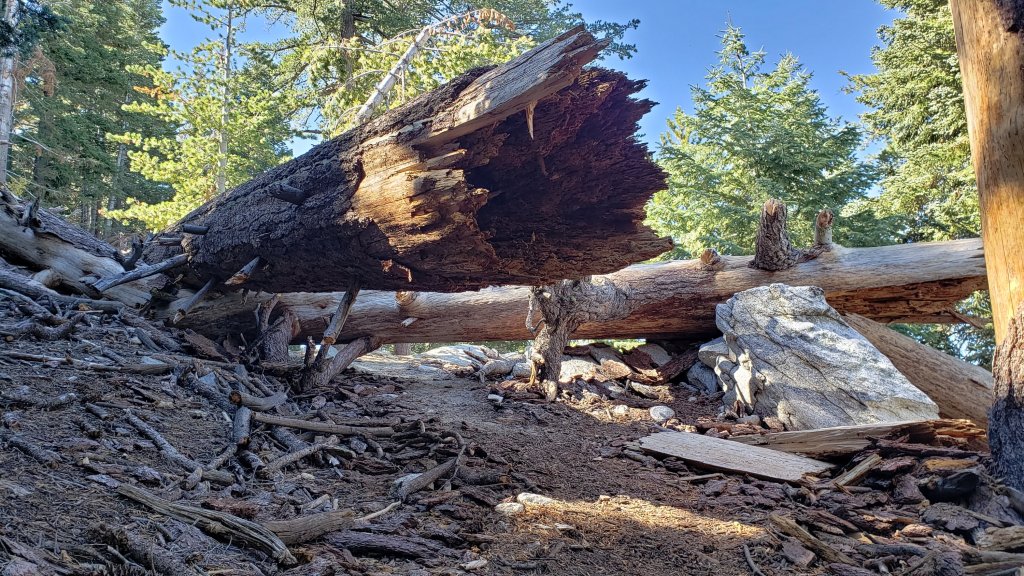
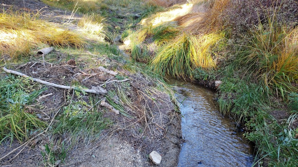


sanjacjon Uncategorized 3 Comments 9 MinutesEdit”Trail update 20th October 2023″
Snow and trail update 3rd October 2023
The earliest significant autumn snowfall in the San Jacinto mountains for a generation fell in the high country on the afternoon of Saturday 30th September, while I was at the Peak and then descending, between 1530 and 1710. One inch fell at San Jacinto Peak, with 0.5 inch all the way down to Wellman Divide (9700 ft), 0.25-0.5 inch to 9000 ft, and a dusting down to 8800 ft. Rainfall measured at Saddle Junction (8100 ft) was 0.22 inch, with a very similar 0.25 inch at 5550 ft in Idyllwild. I recorded a short video from San Jacinto Peak during the heaviest graupel on 30th, linked here.
Humber Park closed to all traffic on Sunday 1st October 2023 for at least two weeks due to major road restructuring work at the uppermost end of Fern Valley Road (see photos below). Note that the impacted trails – Devil’s Slide and Ernie Maxwell – remain open, although access to the upper end of the latter is partially obstructed by fill material (relevant agencies have been informed). Hikers have been requested to use the Ernie Maxwell Trail lower trailhead at Tahquitz View Drive to hike between Devil’s Slide Trail and Idyllwild.
Daily survey hikes in the San Jacinto mountains include several different routes to/from San Jacinto Peak multiple times per week, most recently on 26th and 30th September, and 1st October, plus many other trails on intervening days. Recent weather observations from San Jacinto Peak are given in the Weather section below.
Given the intensity of last winter, and the additional wind and rain of Tropical Storm Hilary that passed directly over the San Jacinto mountains on 19th-20th August (as described here), hikers should anticipate encountering treefall hazards, minor washouts and debris on trails, as summarized in Trail Conditions below.
Water sources such as creeks, pipes, and springs are generally flowing remarkably well for the time of year, given the intensity of the past winter, plus additional inputs from Tropical Storm Hilary in August, and the light rain and snow on 30th September. Consequently I will not be reporting water details for specific locations this season. The summer had already seen the most water on the mountain since at least 1998 (following the great El Niño winter of 1997/98).
Be bear aware. Although rarely reported, up to three Black Bears have been in the San Jacinto mountains since 2017. As I descended upper Marion Mountain Trail at about 8250 ft elevation late morning (0948) on 14th September 2023 I had an excellent sighting, initially in the open at 40-50 metres, of what may have been the same very large (>250lb) dark brown individual with a white chest blaze that I had previously seen on Devil’s Slide Trail in July 2022 and September 2021 (a poor quality video from the latter observation is available here). This is clearly a different individual, based on colour pattern and size, from the “blond” one I saw on Devil’s Slide Trail in August 2020 and had previously filmed walking past our home in Idyllwild in 2018 (video here).
Be rattlesnake aware. Southern Pacific Rattlesnakes Crotalus (oreganus) helleri may continue to be active on warm, sunny days, currently forecast for 4th-12th October (see photos in a prior Report linked here). Above about 5000 ft, the venom of this rattlesnake species in the San Jacinto mountains is predominantly neurotoxic, almost always fatal for dogs and sometimes for humans (see my 2020 article here). Devil’s Slide and lower Deer Springs trails, near Strawberry Cienega, and trails around both Suicide Rock and Tahquitz Peak, tend to be common locations for sightings.
Black Mountain Road (4S01) was in its poorest condition for at least a decade this spring. The partial grading undertaken on 17th July improved the situation somewhat, but it remained a bumpy drive that deteriorated further following Tropical Storm Hilary. Dark Canyon Road (4S02) remains closed indefinitely.
South Ridge Road (5S11) was partially graded in the last week of September 2023. It remained closed as of 1st October but is expected to reopen imminently.
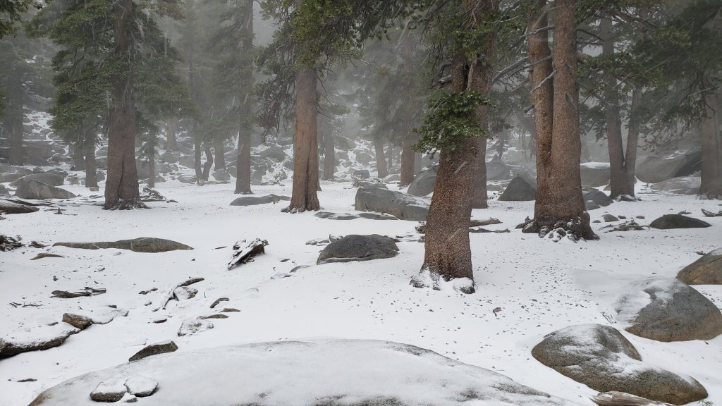
WEATHER
The remarkable rollercoaster of temperatures that has characterized the past four months of 2023 will continue in October. Following the genuinely wintery weather of 30th September-2nd October, a rapid warming is forecast to produce summer-like temperatures again on 5th-9th October, before then cooling somewhat to temperatures more typical for the first half of October. There is currently no significant new precipitation in the forecasts. Air temperatures above 10,000 ft elevation are now typically in the 40s Fahrenheit (5-10°C) with windchill temperatures generally close to freezing, depending on wind speed.
At San Jacinto Peak (10,810ft/3295m) on Sunday 1st October 2023 at 0835 the air temperature was 24.8°F (-4°C), with a windchill temperature of 7.2°F (-14°C), 97% relative humidity, and a bitter SW wind sustained at 14 mph gusting to 22.4 mph.
At the Peak on Saturday 30th September 2023 at 1510 the air temperature was 31.4°F (0°C), with a windchill temperature of 14.0°F (-10°C), 100% relative humidity, and a sharp WSW wind sustained at 12 mph gusting to 22.1 mph.
At the Peak on Tuesday 26th September 2023 at 0805 the air temperature was 51.4°F (11°C), with a “windchill” temperature of 49.6°F (10°C), 10% relative humidity, and a very light WSW breeze sustained at 3 mph gusting to 3.8 mph.
TRAIL CONDITIONS
The very light snow that fell on Saturday 30th September above 9000 ft elevation has melted rapidly and no traction devices are required.
See comments above regarding current restricted access to Devil’s Slide Trail and the upper trailhead for Ernie Maxwell Trail.
Tropical Storm Hilary in late August resulted in many minor washouts across the trail system, considerable treefall debris – branches, cones, sticks – in the trails, and water flowing across and in the trails. Damage could have been much worse, and no problems are especially challenging for hikers. Most trails have one or two new treefall hazards, and only Willow Creek Trail seems to have been more significantly impacted.
The rough route cleared along Willow Creek Trail in early August remarkably lasted only two weeks before Tropical Storm Hilary brought down 19 new treefall hazards. Seven of these are on the Forest Service section, including one huge trunk just east of Willow Creek that some hikers will find challenging to pass. Of the 12 on the State Park section, eight have already been cut; there is now a cleared route from Long Valley to Hidden Divide, but four remain uncut between the divide and the Forest Service boundary. The whitethorn trimming is inconsistent and scrappy but overall the trail is more passable than in July. Eight trees – of the 60+ down after last winter – remain to be cut on the USFS section for the original trail route to be fully restored, but that is unlikely to happen soon, if ever.
Deer Springs Trail has about 17 significant treefall hazards below the Fuller Ridge Trail junction remaining from the winter. Water is flowing very well in Little Round Valley and in all of the springs and creeks along the Deer Springs Trail route. Most of the 12 downed trees above Fuller Ridge on Deer Springs Trail date back many years and have been reported to the State Park multiple times.
Fuller Ridge Trail (PCT Miles 185.5-190.5) has seven treefall hazards, including four on the State Park side. One major hazard near the campground (near Mile 190) can be challenging to pass.
Trails around the Skunk Cabbage and Tahquitz area meadows have some significant treefall hazards throughout remaining from last winter. There are seven across the trails between Little Tahquitz Meadow and Chinquapin Flat and another two on the trail south from Saddle Junction to Chinquapin Flat.
Fourteen treefall hazards from this past winter on South Ridge Trail (above the trailhead at the top of South Ridge Road) were removed by the Trail Report in May, and trail trimming has been undertaken regularly. No significant new treefall hazards resulted from Tropical Storm Hilary on this trail. South Ridge Road remains closed to vehicle traffic and is not expected to reopen until graded, probably not until 2024. Eleven of 13 downed trees were removed from the middle section of South Ridge Trail (between May Valley Road and the top of South Ridge Road) on 15th July.
Marion Mountain Trail has four notable treefall hazards in the State Park (upper) half. One new large stump came down in Hilary low down on the Forest Service section, but it is easy to pass.
Of seven new treefall hazards on Spitler Peak Trail caused by Tropical Storm Hilary, the Trail Report removed five in early October. The couple that remain can be easily walked under by hikers. This brings to 90 the number of trees removed from this trail since July 2021 by the Trail Report. Several minor washouts from this past winter in the upper switchbacks have significantly impacted the tread in places; these are not problematic for hikers, but the trail is impassable to stock.
On the PCT treefall hazards remain a problem in many places, most notably between Apache Peak and Red Tahquitz, where I counted 106 between Miles 169-175 in June 2023. This section has not yet been resurveyed since T. S. Hilary. Large downed trees make for especially slow-going around Miles 172-175 (a section severely burned in the July 2013 Mountain Fire).
The Caramba Trail from near Reeds Meadow through Laws Camp and on to Caramba, and the Cedar Trail from Willow Creek Trail to Laws, are euphemistically described by the Forest Service as “not maintained”. In reality both trails have been abandoned and functionally no longer exist. They are so heavily overgrown with dense whitethorn, which obscures dozens of downed trees, that I strongly advise hikers do not attempt to follow them (regardless of how much you may trust a certain app). An informal use trail to Laws is much more direct, well maintained, and avoids the challenging bushwhacking of the unmaintained trails (local Idyllwild hikers dubbed it the “King Trail” when I established the route in 2019). It leaves Willow Creek Trail exactly 1.0 mile from Saddle Junction, 0.46 mile from the Skunk Cabbage turning (trailhead at lat/long N 33.7796, W 116.6590). The route descends largely following established deer trails for 1.2 miles, meeting Willow Creek about 0.2 mile upstream from the site of the historic Laws Camp (the remains of which were destroyed by the 2013 Mountain Fire and subsequent flood and treefall damage). The 11 trees down on the King Trail after this winter were removed in June-July 2023. The tread of the trail received some minor damage from Tropical Storm Hilary. From Laws east to Caramba the route of the original Caramba Trail has been well-cairned by myself and others and can largely be followed with very careful route-finding. My August 2023 survey counted about 110 trees down on this 2.1 miles of trail. It is especially obscure for the first 0.3 mile east of the Willow Creek crossing, becoming more obvious (but still subtle) as it descends towards Caramba. Very cautious navigation is advised throughout the area.
Seven Pines Trail is largely clear of treefall hazards. Five new trees came down across the trail in Tropical Storm Hilary, all in the central mile, but they are readily passable for hikers. Be advised that the trail in general becomes more obscure in the mile closest to its junction with the PCT. The Trail Report has “adopted” Seven Pines Trail as a priority for maintenance work as the trail has had a disproportionate number of lost hiker rescues in the past decade. Since November 2021, about 70 downed trees have been removed and the trail is thoroughly trimmed and cleared several times per year. Nevertheless Seven Pines remains a genuine wilderness trail unlike the relatively wide, bare, and obvious routes of, for example, Devil’s Slide or Marion Mountain trails. Cautious navigation remains essential for those without considerable experience of hiking this trail.
While all time and labor is volunteered, the San Jacinto Trail Report uses small private donations to help cover operating costs. Every year has its unique challenges, and 2023 has been no exception. Your contribution keeps the Report available to all, free from advertising or paywalls, and independent from agencies. If you have found this Report useful, please consider using this link to the Donate page. Zelle, Venmo, and PayPal are all options. Thank you very much for your support.

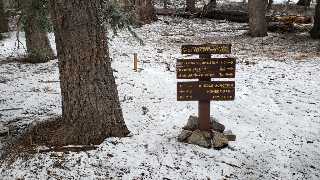

sanjacjon Uncategorized 2 Comments 9 MinutesEdit”Snow and trail update 3rd October 2023″
Trail update 28th September 2023
UPDATE Saturday 30th September: SNOW! In September! The earliest significant autumn snowfall in the San Jacinto mountains reported in a generation fell in the high country this afternoon, while I was at the Peak and descending between 1530 and 1710. One inch fell at San Jacinto Peak, with 0.5 inch all the way down to Wellman Divide (9700 ft), 0.25-0.5 inch to 9000 ft, and a dusting down to 8800 ft. Rainfall measured at Saddle Junction (8100 ft) and at 5550 ft in Idyllwild was remarkably the same, at 0.22 inch. The snow will not last long, with warm temperatures forecast in a couple of days, but it is fun to see while it lasts. I recorded a short video from San Jacinto Peak during the heaviest graupel, linked here.
——————————-
Autumnal weather has arrived in the San Jacinto mountains. On Thursday 21st September, I recorded the lowest windchill temperature – still just a modest 27.3°F (-3°C) – observed at San Jacinto Peak since late June. There was also a very light frost in Little Round Valley as we ascended shortly after dawn. On 22nd, a solidly overcast afternoon in the high country included a very light drizzle – 0.01 inch measured at San Jacinto Peak and 0.02 inch at Wellman’s Cienega – but misty cloud enveloping the peaks dissipated by early morning on 23rd (photos below).
A brief but intense cold front may bring wintry weather to the mountains on Saturday 30th September. Temperatures at the highest elevations will be around freezing, with strong winds leading to windchill values far below freezing. Light rain is forecast on Saturday afternoon at mid elevations (e.g., Idyllwild), and with a freeze level near 10,000 ft elevation, there is the possibility of an exceptionally early light snowfall (<1.0 inch) around the highest peaks. Cold temperatures will persist on Sunday 1st October.
Humber Park will be completely closed 24/7 to all forms of traffic, including pedestrian, for at least two weeks starting at 0600 on Sunday 1st October 2023 due to major road restructuring work at the uppermost end of Fern Valley Road. All hikers, notably PCT hikers, should use the lower Ernie Maxwell Trail access at Tahquitz View Drive to hike between Devil’s Slide Trail and Idyllwild.
Given the intensity of last winter, and the additional wind and rain of Tropical Storm Hilary that passed directly over the San Jacinto mountains on 19th-20th August (as described here), hikers should anticipate encountering treefall hazards, minor washouts and debris on trails, as summarized in Trail Conditions below.
Daily survey hikes in the San Jacinto mountains include several different routes to/from San Jacinto Peak multiple times per week, most recently on 21st, 22nd, 23rd, and 26th September, plus many other trails on intervening days. Recent weather observations from San Jacinto Peak are given in the Weather section below. The trail system has been clear of snow since mid July.
Water sources such as creeks, pipes, and springs are generally flowing remarkably well for the time of year (see photos below and those in the previous Report linked here). Consequently I will not be reporting water details for specific locations this season. This summer has seen the most water on the mountain since at least 1998 (following the great El Niño winter of 1997/98), even prior to the additional input from Tropical Storm Hilary in late August.
Be bear aware. Although rarely reported, up to three Black Bears have been in the San Jacinto mountains since 2017. As I descended upper Marion Mountain Trail at about 8250 ft elevation late morning (0948) on 14th September 2023 I had an excellent sighting, initially in the open at 40-50 metres, of what may have been the same very large (>250lb) dark brown individual with a white chest blaze that I had previously seen on Devil’s Slide Trail in July 2022 and September 2021 (a poor quality video from the latter observation is available here). This is clearly a different individual, based on colour pattern and size, from the “blond” one I saw on Devil’s Slide Trail in August 2020 and had previously filmed walking past our home in Idyllwild in 2018 (video here).
Be rattlesnake aware. Southern Pacific Rattlesnakes Crotalus (oreganus) helleri have remained active on the trail system even on recent cooler days (see photos in a prior Report linked here). Above about 5000 ft, the venom of this rattlesnake species in the San Jacinto mountains is predominantly neurotoxic, almost always fatal for dogs and sometimes for humans (see my 2020 article here). Devil’s Slide and lower Deer Springs trails, near Strawberry Cienega, and trails around both Suicide Rock and Tahquitz Peak, tend to be common locations for sightings.
Black Mountain Road (4S01) was in its poorest condition for at least a decade this spring. The partial grading undertaken on 17th July improved the situation somewhat, but it remained a bumpy drive that deteriorated further following Tropical Storm Hilary. Dark Canyon Road (4S02) remains closed indefinitely.
South Ridge Road (5S11) was partially graded in the last week of September 2023. It currently remains closed but is expected to reopen by 1st October (except in the event of a federal government shutdown).
WEATHER
Pleasantly cool (and periodically cloudy) autumnal weather has been the theme for most of September. Aside from moderate warming on 26th-27th, temperatures will generally remain near or below seasonal. Air temperatures above 9500 ft elevation are now typically in the 30s-40s Fahrenheit (0-10°C) with windchill temperatures generally a few degrees either side of freezing, depending on wind speed.
Much colder conditions are forecast to briefly accompany a minor cold front on 30th September and 1st October, with windchill temperatures well below freezing (near or below 10°F/-12°C) around the highest peaks on both days. There is currently no major new precipitation in the forecasts, but a possibility of light rain at mid elevations on the afternoon and evening of Saturday 30th, with some forecasts hinting at the possibility of an exceptionally early light snowfall (<1.0 inch) around the highest peaks. Temperatures are expected to warm quickly from Tuesday 3rd October.
At San Jacinto Peak (10,810ft/3295m) on Tuesday 26th September 2023 at 0805 the air temperature was 51.4°F (11°C), with a “windchill” temperature of 49.6°F (10°C), 10% relative humidity, and a very light WSW breeze sustained at 3 mph gusting to 3.8 mph.
At the Peak on Friday 21st September 2023 at 1850 the air temperature was 40.5°F (5°C), with a windchill temperature of 28.1°F (-2°C), 87% relative humidity, and a fresh WSW wind sustained at 12 mph gusting to 19.9 mph.
At the Peak on Thursday 21st September 2023 at 0900 the air temperature was 39.6°F (4°C), with a windchill temperature of 27.3°F (-3°C), 27% relative humidity, and a cool ESE wind sustained at 14 mph gusting to 22.0 mph.
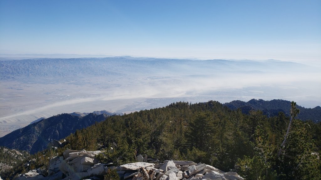
TRAIL CONDITIONS
The trail system cleared of snow in July. One small icy snow patch has persisted in the Snow Creek drainage (near 9000 ft), but all others have now finally melted.
Tropical Storm Hilary in late August resulted in many minor washouts across the trail system, considerable treefall debris – branches, cones, sticks – in the trails, and water flowing across and in the trails. Damage could have been much worse, and no problems are especially challenging for hikers. Most trails have one or two new treefall hazards, and only Willow Creek Trail seems to have been more significantly impacted.
The rough route cleared along Willow Creek Trail in early August remarkably lasted only two weeks before Tropical Storm Hilary brought down 19 new treefall hazards. Seven of these are on the Forest Service section, including one huge trunk just east of Willow Creek that some hikers will find challenging to pass. Of the 12 on the State Park section, eight have already been cut; there is now a cleared route from Long Valley to Hidden Divide, but four remain uncut between the divide and the Forest Service boundary. The whitethorn trimming is inconsistent and scrappy but overall the trail is more passable than in July. Eight trees – of the 60+ down after last winter – remain to be cut on the USFS section for the original trail route to be fully restored, but that is unlikely to happen soon, if ever.
Deer Springs Trail has about 18 significant treefall hazards below the Fuller Ridge Trail junction remaining from the winter. Water is flowing very well in Little Round Valley and in all of the springs and creeks along the Deer Springs Trail route. Most of the 12 downed trees above Fuller Ridge on Deer Springs Trail date back many years and have been reported to the State Park multiple times.
Fuller Ridge Trail (PCT Miles 185.5-190.5) has seven treefall hazards, including four on the State Park side. One major hazard near the campground (near Mile 190) can be challenging to pass.
Trails around the Skunk Cabbage and Tahquitz area meadows have some significant treefall hazards throughout remaining from last winter. There are seven across the trails between Little Tahquitz Meadow and Chinquapin Flat and another two on the trail south from Saddle Junction to Chinquapin Flat.
Fourteen treefall hazards from this past winter on South Ridge Trail (above the trailhead at the top of South Ridge Road) were removed by the Trail Report in May, and trail trimming has been undertaken regularly. No significant new treefall hazards resulted from Tropical Storm Hilary on this trail. South Ridge Road remains closed to vehicle traffic and is not expected to reopen until graded, probably not until 2024. Eleven of 13 downed trees were removed from the middle section of South Ridge Trail (between May Valley Road and the top of South Ridge Road) on 15th July.
Marion Mountain Trail has four notable treefall hazards in the State Park (upper) half. One new large stump came down in Hilary low down on the Forest Service section, but it is easy to pass.
The Trail Report removed all 38 treefall hazards from Spitler Peak Trail between late May and early June this year, bringing the total removed to 85+ since July 2021. Several minor washouts from this past winter in the upper switchbacks have significantly impacted the tread in places, and were worsened by Hilary; these are not problematic for hikers, but the trail is impassable to stock.
On the PCT treefall hazards remain a problem in many places, most notably between Apache Peak and Red Tahquitz, where I counted 106 between Miles 169-175 in June 2023. This section has not yet been resurveyed since T. S. Hilary. Large downed trees make for especially slow-going around Miles 172-175 (a section severely burned in the July 2013 Mountain Fire).
The Caramba Trail from near Reeds Meadow through Laws Camp and on to Caramba, and the Cedar Trail from Willow Creek Trail to Laws, are euphemistically described by the Forest Service as “not maintained”. In reality both trails have been abandoned and functionally no longer exist. They are so heavily overgrown with dense whitethorn, which obscures dozens of downed trees, that I strongly advise hikers do not attempt to follow them (regardless of how much you may trust a certain app). An informal use trail to Laws is much more direct, well maintained, and avoids the challenging bushwhacking of the unmaintained trails (local Idyllwild hikers dubbed it the “King Trail” when I established the route in 2019). It leaves Willow Creek Trail exactly 1.0 mile from Saddle Junction, 0.46 mile from the Skunk Cabbage turning (trailhead at lat/long N 33.7796, W 116.6590). The route descends largely following established deer trails for 1.2 miles, meeting Willow Creek about 0.2 mile upstream from the site of the historic Laws Camp (the remains of which were destroyed by the 2013 Mountain Fire and subsequent flood and treefall damage). The 11 trees down on the King Trail after this winter were removed in June-July 2023. The tread of the trail received some minor damage from Tropical Storm Hilary. From Laws east to Caramba the route of the original Caramba Trail has been well-cairned by myself and others and can largely be followed with very careful route-finding. My August 2023 survey counted about 110 trees down on this 2.1 miles of trail. It is especially obscure for the first 0.3 mile east of the Willow Creek crossing, becoming more obvious (but still subtle) as it descends towards Caramba. Very cautious navigation is advised throughout the area.
Seven Pines Trail is largely clear of treefall hazards. Five new trees came down across the trail in Tropical Storm Hilary, all in the central mile, but they are readily passable for hikers. Be advised that the trail in general becomes more obscure in the mile closest to its junction with the PCT. The Trail Report has “adopted” Seven Pines Trail as a priority for maintenance work as the trail has had a disproportionate number of lost hiker rescues in the past decade. Since November 2021, about 70 downed trees have been removed and the trail is thoroughly trimmed and cleared several times per year. Nevertheless Seven Pines remains a genuine wilderness trail unlike the relatively wide, bare, and obvious routes of, for example, Devil’s Slide or Marion Mountain trails. Cautious navigation remains essential for those without considerable experience of hiking this trail.

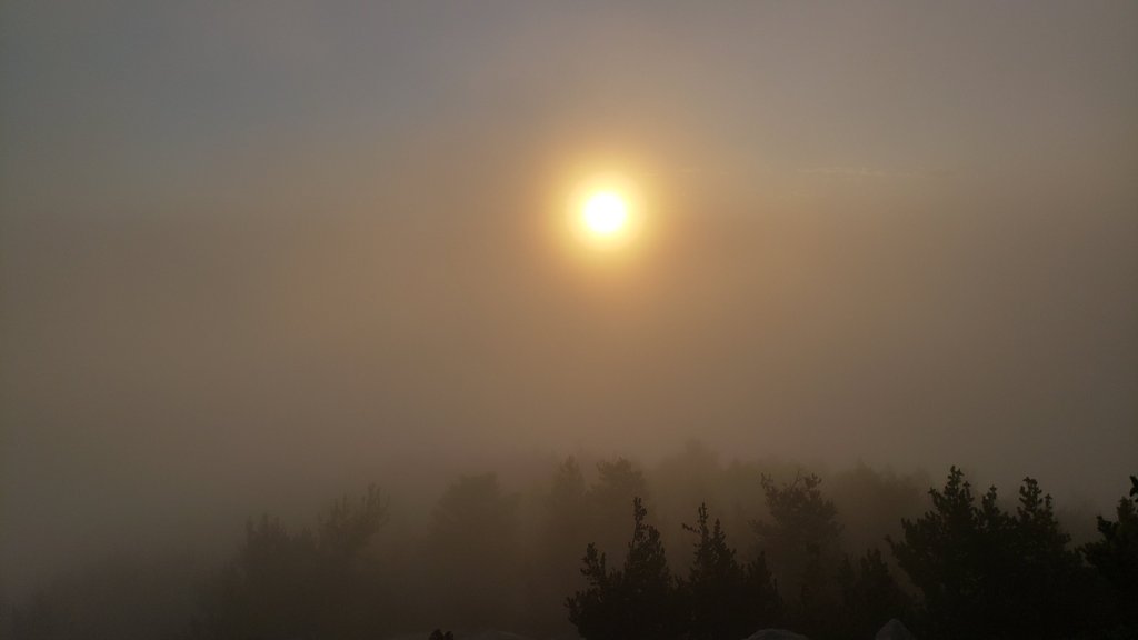
While all time and labor is volunteered, the San Jacinto Trail Report uses small private donations to help cover operating costs. Every year has its unique challenges, and 2023 has been no exception. Your contribution keeps the Report available to all, free from advertising or paywalls, and independent from agencies. If you have found this Report useful, please consider using this link to the Donate page. Zelle, Venmo, and PayPal are all options. Thank you very much for your support.
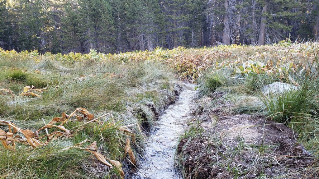

sanjacjon Uncategorized 3 Comments 10 MinutesEdit”Trail update 28th September 2023″
Trail update 14th September 2023
Tropical Storm (formerly Hurricane) Jova passed roughly 1000 miles to the south-west of the San Jacinto mountains last weekend. Despite the great distance, cloud bands from the storm on Sunday 10th September produced some localized light rain, with 0.05 inch in Idyllwild (at 5550 ft), 0.03 inch at Wellman’s Cienega (9300 ft) and 0.04 inch at San Jacinto Peak, but none measurable at Saddle Junction (8100 ft).
Humber Park will be closed to all vehicular and pedestrian traffic for at least two weeks starting 1st October 2023 due to major road work at the uppermost end of Fern Valley Road. All hikers, notably PCT hikers, should use the Ernie Maxwell Trail access via Tahquitz View Drive to get to/from Idyllwild. In addition be prepared for potential disruption accessing trailheads near Idyllwild throughout September-October due to resurfacing work on Fern Valley Road and both North Circle and South Circle drives.
Given the intensity of last winter, and the additional wind and rain of Tropical Storm Hilary that passed directly over the San Jacinto mountains on 19th-20th August (as described here), hikers should anticipate encountering treefall hazards, minor washouts and debris on trails, see Trail Conditions below.
Daily survey hikes in the San Jacinto mountains include several different routes to/from San Jacinto Peak multiple times per week, most recently on 8th, 13th, and 14th September, plus many other trails on intervening days. Recent weather observations from San Jacinto Peak are given in the Weather section below. The trail system has been clear of snow since mid July.
Water sources such as creeks, pipes, and springs are generally flowing remarkably well for the time of year (see photos below and those in the previous Report linked here). Consequently I am not reporting water details for specific locations at this time. This summer has seen the most water on the mountain since at least 1998 (following the great El Niño winter of 1997/98), even prior to the additional input from Tropical Storm Hilary in late August.
Be rattlesnake aware. Southern Pacific Rattlesnakes Crotalus (oreganus) helleri have been active on the trail system up to 9300 ft, even on recent cooler days (see photos in previous Report linked here). Above about 5000 ft, the venom of this rattlesnake species in the San Jacinto mountains is predominantly neurotoxic, almost always fatal for dogs and sometimes for humans (see my 2020 article here). Devil’s Slide and lower Deer Springs trails, near Strawberry Cienega, and trails around both Suicide Rock and Tahquitz Peak, tend to be common locations for sightings.
Be bear aware. Although rarely reported, up to three Black Bears have been in the San Jacinto mountains since 2017. As I descended upper Marion Mountain Trail at about 8250 ft elevation late morning (0948) on 14th September 2023 I had an excellent sighting, initially in the open at 40-50 metres, of what appears to be the same very large (>250lb) dark brown individual with a white chest blaze that I had previously seen on Devil’s Slide Trail in July 2022 and September 2021 (a poor quality video from the latter observation is available here). This is clearly a different individual, based on colour pattern and size, from the “blond” one I saw on Devil’s Slide Trail in August 2020 and had previously filmed walking past our home in Idyllwild in 2018 (video here).
Black Mountain Road (4S01) was in its poorest condition for at least a decade this spring. The partial grading undertaken on 17th July improved the situation somewhat, but it remained a bumpy drive that deteriorated further following Tropical Storm Hilary. Forest Service roads Dark Canyon Road (4S02) and South Ridge Road (5S11) remain closed to vehicles. Dark Canyon campground and the South Ridge yellow post sites remain closed.
WEATHER
Pleasantly cool (and periodically cloudy) autumnal weather has been, and will continue to be, the theme for most of September. This coming weekend, 15th-17th September, will briefly have above seasonal temperatures, before dropping to near- or below-average temperatures on 18th-23rd at least. Air temperatures above 10,000 ft elevation are now in the 40s Fahrenheit (5-10°C) with windchill temperatures typically a few degrees either side of freezing depending on wind strength. There is no significant new precipitation in the forecasts.
At San Jacinto Peak (10,810ft/3295m) on Thursday 14th September 2023 at 0815 the air temperature was 46.9°F (8°C), with a windchill temperature of 38.1°F (3°C), 72% relative humidity, and a cool ESE wind sustained at 8 mph gusting to 12.2 mph.
At the Peak on Wednesday 13th September 2023 at 0830 the air temperature was 47.7°F (9°C), with a “windchill” temperature of 45.9°F (8°C), 17% relative humidity, and a very light due West breeze sustained at 1 mph gusting to 2.8 mph.
At the Peak on Friday 8th September 2023 at 1005 the air temperature was 56.1°F (13°C), with a “windchill” temperature of 51.4°F (11°C), 47% relative humidity, and a brisk WSW wind sustained at 7 mph gusting to 11.2 mph.

TRAIL CONDITIONS
The trail system cleared of snow in July. A couple of icy snow patches remaining in the Snow Creek drainage (between 8500-9500 ft) have persisted into September, but others higher up were finally melted by the rains of Tropical Storm Hilary.
Hilary resulted in many minor washouts across the trail system, considerable treefall debris – branches, cones, sticks – in the trails, and water flowing across and in the trails. Damage could have been much worse, and few problems are particularly challenging for hikers. Most trails have one or two new treefall hazards, and only Willow Creek Trail seems to have been more severely impacted.
The rough route cleared along Willow Creek Trail in early August remarkably lasted only two weeks before Tropical Storm Hilary brought down 19 new treefall hazards. Seven of these are on the Forest Service section, including one huge trunk just east of Willow Creek that some hikers will find challenging to pass. Of the 12 on the State Park section, eight have already been cut; there is now a cleared route from Long Valley to Hidden Divide, but four remain uncut between the divide and the Forest Service boundary. The whitethorn trimming is inconsistent and scrappy but overall the trail is more passable than in July. Eight trees – of the 60+ down after last winter – remain to be cut on the USFS section for the original trail route to be fully restored, but that is unlikely to happen soon, if ever.
Deer Springs Trail has about 16 significant treefall hazards remaining from the winter. Water is flowing very well in Little Round Valley and in all of the springs and creeks along the Deer Springs Trail route.
Trails around the Skunk Cabbage and Tahquitz area meadows have some significant treefall hazards throughout remaining from last winter. There are seven across the trails between Little Tahquitz Meadow and Chinquapin Flat and another two on the trail south from Saddle Junction to Chinquapin Flat.
Fourteen treefall hazards from this past winter on South Ridge Trail (above the trailhead at the top of South Ridge Road) were removed by the Trail Report in May, and trail trimming has been undertaken regularly. No significant new treefall hazards resulted from Tropical Storm Hilary on this trail. South Ridge Road remains closed to vehicle traffic and is not expected to reopen until graded, probably not until 2024. Eleven of 13 downed trees were removed from the middle section of South Ridge Trail (between May Valley Road and the top of South Ridge Road) on 15th July.
Marion Mountain Trail has four notable treefall hazards in the State Park (upper) half. One new huge stump came down in Hilary low down on the Forest Service section, but it is easy to pass. The State Park installed new signage near the USFS/State Park boundary on 23rd August.
The Trail Report removed all 38 treefall hazards from Spitler Peak Trail between late May and early June this year, bringing the total removed to 85+ since July 2021. Several minor washouts from this past winter in the upper switchbacks have significantly impacted the tread in places, and were worsened by Hilary; these are not problematic for hikers, but the trail is impassable to stock.
On the PCT treefall hazards remain a problem in many places, most notably between Apache Peak and Red Tahquitz, where I counted 106 between Miles 169-175 in June 2023. This section has not yet been resurveyed since T. S. Hilary. Large downed trees make for especially slow-going around Miles 172-175 (a section severely burned in the July 2013 Mountain Fire).
The Caramba Trail from near Reeds Meadow through Laws Camp and on to Caramba, and the Cedar Trail from Willow Creek Trail to Laws, are euphemistically described by the Forest Service as “not maintained”. In reality both trails have been abandoned and functionally no longer exist. They are so heavily overgrown with dense whitethorn, which obscures dozens of downed trees, that I strongly advise hikers do not attempt to follow them (regardless of how much you may trust a certain app). An informal use trail to Laws is much more direct, well maintained, and avoids the challenging bushwhacking of the unmaintained trails (local Idyllwild hikers dubbed it the “King Trail” when I established the route in 2019). It leaves Willow Creek Trail exactly 1.0 mile from Saddle Junction, 0.46 mile from the Skunk Cabbage turning (trailhead at lat/long N 33.7796, W 116.6590). The route descends largely following established deer trails for 1.2 miles, meeting Willow Creek about 0.2 mile upstream from the site of the historic Laws Camp (the remains of which were destroyed by the 2013 Mountain Fire and subsequent flood and treefall damage). The 11 trees down on the King Trail after this winter were removed in June-July 2023. The tread of the trail received some minor damage from Tropical Storm Hilary. From Laws east to Caramba the route of the original Caramba Trail has been well-cairned by myself and others and can largely be followed with very careful route-finding. My August 2023 survey counted about 110 trees down on this 2.1 miles of trail. It is especially obscure for the first 0.3 mile east of the Willow Creek crossing, becoming more obvious (but still subtle) as it descends towards Caramba. Very cautious navigation is advised throughout the area.
Seven Pines Trail is largely clear of treefall hazards. Five new trees came down across the trail in Tropical Storm Hilary, all in the central mile, but they are easily passable for hikers. Be advised that the trail in general becomes more obscure in the mile closest to its junction with the PCT. The Trail Report has “adopted” Seven Pines Trail as a priority for maintenance work as the trail has had a disproportionate number of lost hiker rescues in the past decade. Since November 2021, about 70 downed trees have been removed and the trail is thoroughly trimmed and cleared several times per year. Nevertheless Seven Pines remains a genuine wilderness trail unlike the relatively wide, bare, and obvious routes of, for example, Devil’s Slide or Marion Mountain trails. Cautious navigation remains essential for those without considerable experience of hiking this trail.
While all time and labor is volunteered, the San Jacinto Trail Report uses small private donations to help cover operating costs. Every year has its unique challenges, and 2023 has been no exception. Your contribution keeps the Report available to all, free from advertising or paywalls, and independent from agencies. If you have found this Report useful, please consider using this link to the Donate page. Zelle, Venmo, and PayPal are all options. Thank you very much for your support.


sanjacjon Uncategorized Leave a comment 8 MinutesEdit”Trail update 14th September 2023″
Trail update 7th September 2023
Assessment of almost all trails has been completed since Tropical Storm Hilary passed directly over the San Jacinto mountains on 19th-20th August. Given the intensity of this past winter, and the additional wind and rain of Tropical Storm Hilary, hikers should anticipate encountering treefall hazards, minor washouts and debris on trails, as described in Trail Conditions below.
Daily survey hikes include many different routes to/from San Jacinto Peak multiple times per week, most recently on 1st and 5th September, plus other major trails on intervening days. A sample of my recent weather observations from San Jacinto Peak is given in the Weather section below. The trail system has been clear of snow since mid July.
In summer (and on 8th-11th September in particular) hikers should be prepared for unseasonably hot weather in the high country. Give considerable extra thought to route choice, start times, clothing, sun protection, and hydration requirements.
Water sources such as creeks, pipes, and springs are generally flowing very well (see example photos below). Consequently I am not reporting water details for specific locations at this time. This summer has seen the most water on the mountain since 1998 (following the great El Niño winter of 1997/98), even prior to the additional input from Tropical Storm Hilary.
Be rattlesnake aware. Southern Pacific Rattlesnakes Crotalus (oreganus) helleri have been active on the trail system up to 9300 ft, even on recent cooler days (photos below). Above about 5000 ft, the venom of this rattlesnake species in the San Jacinto mountains is predominantly neurotoxic, almost always fatal for dogs and sometimes for humans (see my 2020 article here). Devil’s Slide and lower Deer Springs trails, near Strawberry Cienega, and trails around both Suicide Rock and Tahquitz Peak, are common locations for sightings.
Black Mountain Road (4S01) was in its poorest condition for at least a decade this spring. The partial grading undertaken on 17th July improved the situation somewhat, but it remained a bumpy drive, now worsened by the rains of Tropical Storm Hilary. Forest Service roads Dark Canyon Road (4S02) and South Ridge Road (5S11) remain closed to vehicles. Dark Canyon campground and the South Ridge yellow post sites remain closed.
Due to major road work at the uppermost end of Fern Valley Road, Humber Park will be completely closed to all traffic for two weeks starting 1st October 2023 (exact dates tentative at this time). In general be prepared for disruption accessing trailheads near Idyllwild throughout September-October due to resurfacing work on Fern Valley Road and North Circle and South Circle drives.
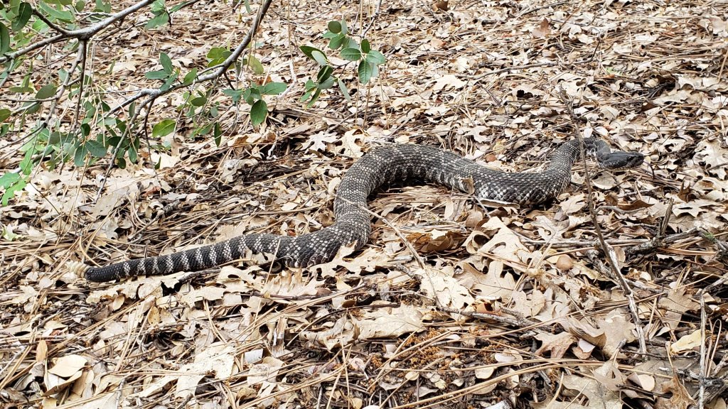
WEATHER
Temperatures were pleasantly autumnal for the first five days of September, having dropped well below seasonal. They are expected to rise again to well above average from 8th-11th, before then dropping once again to about seasonal for September from Wednesday 13th. There is no significant new precipitation in the forecasts.
At San Jacinto Peak (10,810ft/3295m) on Tuesday 5th September 2023 at 0800 the air temperature was 51.2°F (11°C), with a windchill temperature of 45.0°F (7°C), 14% relative humidity, and a gusty SSW wind sustained at 4 mph gusting to 11.2 mph.
At the Peak on Friday 1st September 2023 at 0755 the air temperature was 47.7°F (9°C), with a windchill temperature of 39.2°F (4°C), 76% relative humidity, and a stiff SSW wind sustained at 12 mph gusting to 17.4 mph.
TRAIL CONDITIONS
The trail system cleared of snow in July. A couple of icy snow patches remaining in the Snow Creek drainage (between 8500-9500 ft) have persisted into September, but others higher up were finally melted by the rains of Tropical Storm Hilary.
Hilary resulted in many minor washouts across the trail system, considerable treefall debris – branches, cones, sticks – in the trails, and water flowing across and in the trails. Damage could have been much worse, and few problems are challenging for hikers. Most trails have one or two new treefall hazards, and only Willow Creek Trail seems to have been more severely impacted.
The route cleared along Willow Creek Trail in early August lasted only two weeks before Tropical Storm Hilary brought down 19 new treefall hazards. Seven of these are on the Forest Service section, including one huge trunk just east of Willow Creek that many hikers may find challenging to pass. Of the 12 on the State Park section, eight have already been cut; there is now a cleared route from Long Valley to Hidden Divide, but four remain uncut between the divide and the Forest Service boundary. The whitethorn trimming is inconsistent and scrappy but overall the trail is more passable than in July. Eight trees – of the 60+ down after last winter – remain to be cut on the USFS section for the original trail route to be fully restored, but that is unlikely to happen soon, if ever.
Deer Springs Trail has about 16 significant treefall hazards remaining from the winter. Water is flowing very well in Little Round Valley and in all of the springs and creeks along the Deer Springs Trail route.
Trails around the Skunk Cabbage and Tahquitz area meadows have some significant treefall hazards throughout remaining from last winter. There are seven across the trails between Little Tahquitz Meadow and Chinquapin Flat and another two on the trail south from Saddle Junction to Chinquapin Flat.
Fourteen treefall hazards from this past winter on South Ridge Trail (above the trailhead at the top of South Ridge Road) were removed by the Trail Report in May, and trail trimming is undertaken regularly. No significant new treefall hazards resulted from Tropical Storm Hilary on this trail. South Ridge Road remains closed to vehicle traffic and is not expected to reopen until graded, possibly not until 2024. Eleven of 13 downed trees were removed from the middle section of South Ridge Trail (between May Valley Road and the top of South Ridge Road) on 15th July.
Marion Mountain Trail has four notable treefall hazards in the State Park (upper) half. One new huge stump came down in Hilary low down on the Forest Service section. The State Park installed new signage near the USFS/State Park boundary on 23rd August.
The Trail Report removed all 38 treefall hazards from Spitler Peak Trail between late May and early June this year, bringing the total removed to 85+ since July 2021. Several minor washouts from this past winter in the upper switchbacks have significantly impacted the tread in places, and were worsened by Hilary; these are not problematic for hikers, but the trail is impassable to stock.
On the PCT treefall hazards remain a problem in many places, most notably between Apache Peak and Red Tahquitz, where I counted 106 between Miles 169-175 in June 2023. This section has not yet been resurveyed since T. S. Hilary. Large downed trees make for especially slow-going around Miles 172-175 (a section severely burned in the July 2013 Mountain Fire).
The Caramba Trail from near Reeds Meadow through Laws Camp and on to Caramba, and the Cedar Trail from Willow Creek Trail to Laws, are euphemistically described by the Forest Service as “not maintained”. In reality both trails have been abandoned and functionally no longer exist. They are so heavily overgrown with dense whitethorn, which obscures dozens of downed trees, that I strongly advise hikers do not attempt to follow them (regardless of how much you may trust a certain app). An informal use trail to Laws is much more direct, well maintained, and avoids the challenging bushwhacking of the unmaintained trails (local Idyllwild hikers dubbed it the “King Trail” when I established the route in 2019). It leaves Willow Creek Trail exactly 1.0 mile from Saddle Junction, 0.46 mile from the Skunk Cabbage turning (trailhead at lat/long N 33.7796, W 116.6590). The route descends largely following established deer trails for 1.2 miles, meeting Willow Creek about 0.2 mile upstream from the site of the historic Laws Camp (the remains of which were destroyed by the 2013 Mountain Fire and subsequent flood and treefall damage). The 11 trees down on the King Trail after this winter were removed in June-July 2023. The tread of the trail received some minor damage from Tropical Storm Hilary. From Laws east to Caramba the route of the original Caramba Trail has been well-cairned by myself and others and can largely be followed with very careful route-finding. My August 2023 survey counted about 110 trees down on this 2.1 miles of trail. It is especially obscure for the first 0.3 mile east of the Willow Creek crossing, becoming more obvious (but still subtle) as it descends towards Caramba. Very cautious navigation is advised throughout the area.
Seven Pines Trail is largely clear of treefall hazards. Five new trees came down across the trail in Tropical Storm Hilary, all in the central mile, but they are easily passable for hikers. Be advised that the trail in general becomes more obscure in the mile closest to its junction with the PCT. The Trail Report has “adopted” Seven Pines Trail as a priority for maintenance work as the trail has had a disproportionate number of lost hiker rescues in the past decade. Since November 2021, about 70 downed trees have been removed and the trail is thoroughly trimmed and cleared at least in spring and autumn. Nevertheless Seven Pines remains a genuine wilderness trail unlike the relatively wide, bare, and obvious routes of, for example, Devil’s Slide or Marion Mountain trails. Cautious navigation remains essential for those without considerable experience of hiking this trail.


While all time and labor is volunteered, the San Jacinto Trail Report uses small private donations to help cover operating costs. Every year has its unique challenges, and 2023 has been no exception. Your contribution keeps the Report available to all, free from advertising or paywalls, and independent from agencies. If you have found this Report useful, please consider using this link to the Donate page. Zelle, Venmo, and PayPal are all options. Thank you very much for your support.

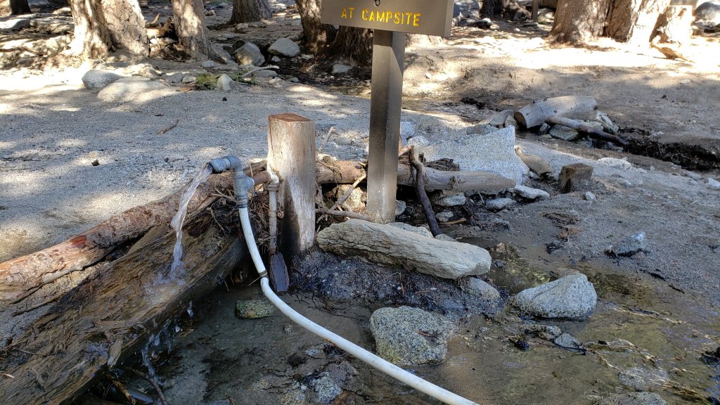


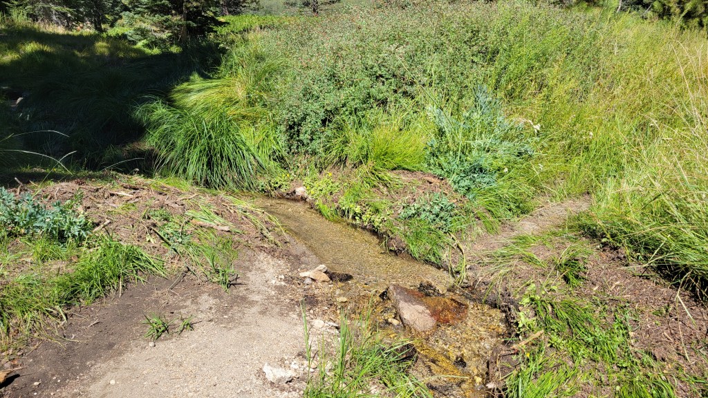
sanjacjon Uncategorized 1 Comment 8 MinutesEdit”Trail update 7th September 2023″
Trail update 31st August 2023
The full impacts from Tropical Storm Hilary, with its impressive 8-12 inches of rain across the San Jacinto high country, are still being assessed, although almost all trails have now been hiked at least once since the storm. Many minor washouts and considerable treefall debris remain in the trails following Hilary, but frankly the impacts could have been much worse. The only trail with major treefall damage surveyed to date is Willow Creek Trail (details and photos below), which sadly had only two weeks earlier been cleared of 60+ downed trees accumulated over the previous three years. The rainfall from Hilary has thankfully helped suppress and shorten our fire season.
Daily survey hikes include many different routes to San Jacinto Peak multiple times per week, most recently on 25th, 27th, and 29th August, plus many other trails on intervening days. A sample of my recent weather observations from San Jacinto Peak is given in the Weather section below. The trail system has been clear of snow since mid July.
On 29th-31st August hikers should be prepared for temperatures well above seasonal. Give considerable extra thought to route choice, start times, clothing, sun protection, and hydration requirements. Conversely, rapid cooling on 1st-4th September will lead to windchill temperatures below freezing above 10,000 ft elevation. Temperatures will then swing back above seasonal – for September – from 6th-9th.
Hikers should also be prepared for rapidly changing weather conditions in the high country. Monsoon thunderstorms are always a possibility in summer and early autumn. Lightning, brief but intense precipitation, and rapid temperature drops can occur in the high country even when such storms are not forecast for lower elevations.
Water sources such as creeks, pipes, and springs are flowing very well (see previous Report for some before-and-after storm photos) with flow rates well above the average of the last decade. Consequently I am not reporting water details for specific locations at this time. This summer has seen the most water on the mountain since 1998 (following the great El Niño winter of 1997/98), even prior to the additional input from Tropical Storm Hilary. Hidden Lake was refilled by Hilary, having been about 50% full by volume immediately prior to the storm (photo below).
Given the intensity of this past winter, and the additional wind and rain of Tropical Storm Hilary, hikers will encounter new treefall hazards and considerable fresh debris, on trails. Trails are slowly being cleared, largely by volunteers, as described in Trail Conditions below.
Be rattlesnake aware. Southern Pacific Rattlesnakes Crotalus (oreganus) helleri have been active on the trail system up to 9300 ft, mainly on warm, sunny days. Above about 5000 ft, the venom of this rattlesnake species in the San Jacinto mountains is predominantly neurotoxic, almost always fatal for dogs and sometimes for humans (see my 2020 discussion here). Devil’s Slide and lower Deer Springs trails, Suicide Rock, near Strawberry Cienega, and trails around Tahquitz Peak, are common locations for sightings.
Black Mountain Road (4S01) was in its poorest condition for at least a decade this spring. The partial grading undertaken on 17th July improved the situation somewhat, but it remained a bumpy drive which has been worsened by the rains of Tropical Storm Hilary. Forest Service roads Dark Canyon Road (4S02) and South Ridge Road (5S11) remain closed to vehicles. Dark Canyon campground and the South Ridge yellow post sites remain closed. The State Park campgrounds, temporarily closed following Hilary, have reopened.
The annual maintenance closure of the Palm Springs Aerial Tramway is scheduled to end on Friday 1st September 2023. See the Tramway website for details.
Due to major road work at the uppermost end of Fern Valley Road, Humber Park parking area will be completely closed to all traffic for two weeks in October 2023 (exact dates currently unknown). In general be prepared for disruption accessing trailheads around Idyllwild throughout September-October due to resurfacing work on lower Saunders Meadow and Fern Valley roads and North Circle and South Circle drives.

WEATHER
Temperatures have been on a rollercoaster ride since Tropical Storm Hilary passed directly over the San Jacinto mountains on 20th August. Conditions were pleasantly cool for several days following the storm, before a brief but potent heatwave arrived on 28th August, forecast to last until the end of the month. Temperatures will then rapidly plunge to well below seasonal in the first four days of September, before rising again to above average from 7th-11th at least. There is no significant new precipitation in the forecasts, but the possibility of a brief monsoonal thunderstorm on Saturday 2nd.
At San Jacinto Peak (10,810ft/3295m) on Tuesday 29th August 2023 at 0755 the air temperature was 56.8°F (13°C), with a “windchill” temperature of 52.2°F (11°C), 50% relative humidity, and a very gusty WNW wind sustained at 4 mph gusting to 13.6 mph.
At the Peak on Sunday 27th August 2023 at 0605 the air temperature was 50.9°F (10°C), with a windchill temperature of 43.3°F (6°C), 37% relative humidity, and a fresh SW wind sustained at 12 mph gusting to 19.9 mph.
At the Peak on Friday 25th August 2023 at 0730 the air temperature was 48.1°F (9°C), with a windchill temperature of 37.8°F (3°C), 45% relative humidity, and a blustery SSW wind sustained at 8 mph gusting to 20.6 mph.

TRAIL CONDITIONS
The trail system is clear of snow. A couple of icy snow patches remaining in the Snow Creek drainage (between 8500-9500 ft) will last into September, but others higher up were finally melted by the rains of Tropical Storm Hilary.
Hilary resulted in many minor washouts across the trail system, considerable treefall debris – branches, cones, sticks – in the trails, and water flowing across and in the trails. Damage could have been much worse, and few problems are challenging for hikers. Most trails have one or two new treefall hazards, and only Willow Creek Trail seems to have been more severely impacted.
After three years of neglect by the Forest Service, Willow Creek Trail had a continuous route cleared through in early August, largely by California Conservation Corps, plus volunteers from multiple organizations. Regrettably that relatively clear route lasted only two weeks as Tropical Storm Hilary brought down 19 new treefall hazards, including several very large ones that can be challenging to pass. Seven of these are on the Forest Service section, with 12 on the State Park section, most of the latter near Hidden Divide and the High Trail junction (photos below). In several areas the whitethorn trimming done earlier in August is frankly scrappy but nevertheless the trail is more readily passable than before. Of the 68 trees that were across the trail following the winter (and prior to Hilary), eight remain to be cut on the USFS section for the original course of the trail to be fully restored.
Deer Springs Trail has about 16 significant treefall hazards remaining from the winter. Water is flowing very well in Little Round Valley and in all of the springs and creeks along the Deer Springs Trail route.
Trails around the Skunk Cabbage and Tahquitz area meadows have some significant treefall hazards throughout remaining from last winter. There are seven across the trails between Little Tahquitz Meadow and Chinquapin Flat and another two on the trail south from Saddle Junction to Chinquapin Flat.
Fourteen treefall hazards from this past winter on South Ridge Trail (above the trailhead at the top of South Ridge Road) were removed by the Trail Report in May, and trail trimming is undertaken regularly. South Ridge Road remains closed to vehicle traffic and is not expected to reopen until graded, possibly not until August. Eleven of 13 downed trees were removed from the middle section of South Ridge Trail (between May Valley Road and the top of South Ridge Road) on 15th July.
Marion Mountain Trail has four notable treefall hazards in the State Park (upper) half. One new huge stump came down in Hilary low down on the Forest Service section. The State Park installed new signage near the USFS/State Park boundary on 23rd August.
The Trail Report removed all 38 treefall hazards from Spitler Peak Trail between late May and early June this year, bringing the total removed to 85+ since July 2021. Several minor washouts from this past winter in the upper switchbacks have significantly impacted the tread in places, and were worsened by Hilary; these are not problematic for hikers, but the trail is impassable to stock.
On the PCT treefall hazards remain a problem in many places, most notably between Apache Peak and Red Tahquitz, where I counted 106 between Miles 169-175 in June 2023. This section has not yet been resurveyed since T. S. Hilary. Large downed trees make for especially slow-going around Miles 172-175 (a section severely burned in the July 2013 Mountain Fire).
The Caramba Trail from near Reeds Meadow through Laws Camp and on to Caramba, and the Cedar Trail from Willow Creek Trail to Laws, are euphemistically described by the Forest Service as “not maintained”. In reality both trails have been abandoned and functionally no longer exist. They are so heavily overgrown with dense whitethorn, which obscures dozens of downed trees, that I strongly advise hikers do not attempt to follow them (regardless of how much you may trust a certain app). An informal use trail to Laws is much more direct, well maintained, and avoids the challenging bushwhacking of the unmaintained trails (local Idyllwild hikers dubbed it the “King Trail” when I established the route in 2019). It leaves Willow Creek Trail exactly 1.0 mile from Saddle Junction, 0.46 mile from the Skunk Cabbage turning (trailhead at lat/long N 33.7796, W 116.6590). The route descends largely following established deer trails for 1.2 miles, meeting Willow Creek about 0.2 mile upstream from the site of the historic Laws Camp (the remains of which were destroyed by the 2013 Mountain Fire and subsequent flood and treefall damage). The 11 trees down on the King Trail after this winter were removed in June-July 2023. From Laws east to Caramba the route of the original Caramba Trail has been well-cairned by myself and others and can largely be followed with very careful route-finding. My May 2023 survey counted just over 100 trees down on this 2.1 miles of trail. It is especially obscure for the first 0.3 mile east of the Willow Creek crossing, becoming more obvious (but still subtle) as it descends towards Caramba. Very cautious navigation is advised throughout the area.
Seven Pines Trail is clear of treefall hazards for about three miles of its 3.7 miles length. The Trail Report has “adopted” Seven Pines Trail as a priority for maintenance work as the trail has had a disproportionate number of lost hiker rescues in the past decade. Since November 2021, 67 downed trees have been removed and almost the entire trail thoroughly trimmed and cleared. Nevertheless Seven Pines remains a genuine wilderness trail unlike the relatively wide, bare, and obvious routes of, for example, Devil’s Slide or Marion Mountain trails. Cautious navigation remains essential for those without considerable experience of hiking this trail.
While all time and labor is volunteered, the San Jacinto Trail Report uses small private donations to help cover operating costs. Every year has its unique challenges, and 2023 has been no exception. Your contribution keeps the Report available to all, free from advertising or paywalls, and independent from agencies. If you have found this Report useful, please consider using this link to the Donate page. Zelle, Venmo, and PayPal are all options. Thank you very much for your support.


sanjacjon Uncategorized Leave a comment 9 MinutesEdit”Trail update 31st August 2023″
Tropical Storm Hilary and trail update 25th August 2023
Tropical Storm Hilary became the first such storm to make landfall in California in 84 years, and its impacts were felt across our region on 19th-20th August. Indeed the remnants of the eye of former Hurricane Hilary actually traveled northward directly over the San Jacinto mountains late on Sunday 20th, bulldozing heavy precipitation ahead of it, along with gusty winds.
Rain that had been forecast to start on Saturday morning ultimately did not impact most of the mountain range until Sunday 20th August. The notable exception was on the east side, where thunderstorms over Long Valley (8600 ft) produced 2.3 inches of rain on 19th, while Idyllwild, only a few miles away, recorded no rain that day.
The southern and western slopes did not receive any rain until the early hours of Sunday 20th, and the rain only intensified in the afternoon of 20th. Nevertheless, the final two day storm rainfall totals were impressive, with 4.30 inches in Idyllwild (measured at 5550 ft), 6.10 inches at Saddle Junction (8100 ft), 8.25 inches at San Jacinto Peak (measured at 10,700 ft), and a remarkable 11.74 inches in Long Valley (8600 ft). The rainfall from Hilary was much appreciated, and has certainly helped suppress and shorten our fire season.
Winds were much less impressive, and did not match those of Tropical Storm Kay that passed offshore Southern California in early September last year. Gusts at 50-55 mph were recorded in Apple Canyon, and just outside our area a gust of 61 mph was measured at Whitewater.
Daily survey hikes include many different routes to San Jacinto Peak multiple times per week, most recently on 21st, 23rd, and 25th August, plus a wide variety of other trails on intervening days. A sample of my recent weather observations from San Jacinto Peak is given in the Weather section below. The trail system has been clear of snow since mid July.
There is currently a large volume of water and treefall debris in the trails following Tropical Storm Hilary, although the impacts could have been much worse. All trails have minor washouts, but nothing unduly problematic. The only trail surveyed so far with major treefall damage is Willow Creek Trail (details below), which had only just been cleared of nearly 70 trees accumulated over three years of neglect.
Hikers in summer should be prepared for rapidly changing weather conditions in the high country. Monsoon thunderstorms are forecast as a possibility on several days for the next two weeks. Lightning, brief but intense precipitation, and rapid temperature drops can occur in the high country even when such storms are not forecast for lower elevations.
In the summer (and from 26th-30th August in particular) hikers should also be prepared for temperatures above seasonal in the high country. Give considerable extra thought to route choice, start times, clothing, sun protection, and hydration requirements.
Water sources such as creeks, pipes, and springs are flowing extremely well (see below for some “before-and-after” storm photos, and also photos in the prior Report linked here). Even after the brief boost from the heavy rainfall of recent days subsides, flow rates will continue to be well above the average of the last decade. Consequently in contrast to most recent years I am not reporting water flow details for specific locations at this time. This summer has seen the most water on the mountain since 1998 (following the great El Niño winter of 1997/98), even prior to the effects of Tropical Storm Hilary. Hidden Lake was refilled by Hilary, having been about 50% full by volume immediately prior to the storm (photo below).
Given the intensity of this past winter, and the wind and rain of Tropical Storm Hilary, hikers should expect to encounter new treefall hazards and considerable fresh debris, on trails. Trails are slowly being cleared, largely by volunteers, as described in Trail Conditions below.
Be rattlesnake aware. Southern Pacific Rattlesnakes Crotalus (oreganus) helleri were active on the trail system up to 9300 ft prior to Tropical Storm Hilary, and will likely reappear soon once temperatures warm again in the next few days. Above about 5000 ft, the venom of this rattlesnake species in the San Jacinto mountains is predominantly neurotoxic, almost always fatal for dogs and sometimes for humans (see my 2020 article here for further information). Devil’s Slide and lower Deer Springs trails, Suicide Rock, around Strawberry Cienega, and trails near Tahquitz Peak are common locations for sightings.
Black Mountain Road (4S01) was in its poorest condition for at least a decade this spring. The partial grading undertaken on 17th July improved the situation somewhat, but it remained a bumpy drive which will have been worsened by the rains of Tropical Storm Hilary. Forest Service roads Dark Canyon Road (4S02) and South Ridge Road (5S11) remain closed to vehicles. Dark Canyon campground and the South Ridge yellow post sites remain closed. The State Park campground at Stone Creek is temporarily closed due to maintenance issues following Hilary.
The annual maintenance closure of the Palm Springs Aerial Tramway is currently underway, with a scheduled reopening on 1st September 2023. See the Tramway website for further details.
Due to major road work at the uppermost end of Fern Valley Road, Humber Park parking area will be completely closed to all traffic for two weeks in October 2023 (exact dates currently unknown). In general be prepared for possible disruption accessing trailheads around Idyllwild throughout August-October due to resurfacing work on lower Saunders Meadow and Fern Valley roads and North Circle and South Circle drives.

WEATHER
Tropical Storm Hilary produced the heavy rainfall that was widely forecast, and gusty (but not damaging) winds reminiscent of a typical Santa Ana event. The remnants of the eye of former Hurricane Hilary traveled south-north directly across the San Jacinto mountains late on Sunday 20th, bulldozing heavy precipitation ahead. Rain that had been forecast to start on Saturday morning ultimately did not impact most of the mountain range until Sunday 20th. The notable exception was on the east side, where thunderstorms over Long Valley (8600 ft) produced 2.3 inches of rain on 19th, while Idyllwild, only a few miles away, recorded no rain that day.
The southern and western slopes did not receive any rain until about 0200 on Sunday 20th, intensifying in the afternoon of 20th. The final two day storm rainfall totals were impressive, with 4.30 inches in Idyllwild (measured at 5550 ft), 6.10 inches at Saddle Junction (8100 ft), approx. 8.25 inches at San Jacinto Peak (measured at 10,700 ft), and a remarkable 11.74 inches in Long Valley (8600 ft).
Daytime high temperatures remain below seasonal averages for the next few days, although overnight “low” temperatures will be back well above average by Wednesday 23rd. A minor heatwave then follows on 26th-30th August with temperatures far above seasonal for late August. Monsoonal thunderstorms are possible starting Wednesday 30th August into early September. Temperatures are forecast to cool in the first few days of September, but remain above seasonal.
At San Jacinto Peak (10,810ft/3295m) on Friday 25th August 2023 at 0730 the air temperature was 48.1°F (9°C), with a windchill temperature of 37.8°F (3°C), 45% relative humidity, and a blustery SSW wind sustained at 8 mph gusting to 20.6 mph.
At the Peak on Wednesday 23rd August 2023 at 0750 the air temperature was 50.7°F (10°C), with a “windchill” temperature of 43.5°F (6°C), 31% relative humidity, and a pleasant due South wind sustained at 8 mph gusting to 16.2 mph.
At the Peak on Monday 21st August 2023 at 0920 the air temperature was 41.1°F (5°C), with a windchill temperature of 28.4°F (-2°C), 45% relative humidity, and a brisk due South wind sustained at 13 mph gusting to 23.6 mph.

TRAIL CONDITIONS
The trail system is clear of snow. Despite my optimistic predictions earlier in the summer, no snow patches quite survived on or near the trail system into August, with the last few on the East Ridge of San Jacinto Peak finally melting in the last week of July. A couple of icy snow patches remaining in the Snow Creek drainage (between 8500-9500 ft) will last into September, but others higher up were melted by the rains of Tropical Storm Hilary.
Hilary resulted in many minor washouts across the trail system, considerable treefall debris – branches, cones, sticks – in the trails, and water flowing across and in the trails. Damage could have been much worse, and few problems are especially challenging for hikers. Most trails have one or two new treefall hazards, and only Willow Creek Trail seems to have been more severely impacted.
Deer Springs Trail has about 16 significant treefall hazards. Water is flowing very well in Little Round Valley and in all of the springs and creeks along the Deer Springs Trail route.
Trails around the Skunk Cabbage and Tahquitz area meadows have some significant treefall hazards throughout remaining from last winter. There are seven across the trails between Little Tahquitz Meadow and Chinquapin Flat and another two on the trail south from Saddle Junction to Chinquapin Flat.
After three years of neglect by the Forest Service, Willow Creek Trail had a continuous route cleared through in early August, largely by California Conservation Corps plus volunteers from PCTA, State Park, and USFS, among others. Regrettably that relatively clear route lasted only two weeks as Tropical Storm Hilary brought down 19 new treefall hazards, including several very large ones that are challenging to pass. Seven of these are on the Forest Service section, with 12 on the State Park section, most of the latter near Hidden Divide and the High Trail junction (photos below). In several areas the whitethorn trimming done earlier in August is frankly scrappy but nevertheless the trail is more readily passable than before. Of the 68 treefall hazards that were across the trail following the winter, eight remain to be cut on the USFS section for the original course of the trail to be fully restored, but that is unlikely to happen anytime soon, if ever.
Fourteen treefall hazards from this past winter on South Ridge Trail (above the trailhead at the top of South Ridge Road) were removed by the Trail Report in May, and trail trimming is undertaken regularly. South Ridge Road remains closed to vehicle traffic and is not expected to reopen until graded, possibly not until August. Eleven of 13 downed trees were removed from the middle section of South Ridge Trail (between May Valley Road and the top of South Ridge Road) on 15th July.
Marion Mountain Trail has four notable treefall hazards in the State Park (upper) half. One new huge stump came down in Hilary low down on the Forest Service section. The State Park installed a new sign at the USFS/State Park boundary on 23rd August.
The Trail Report removed all 38 treefall hazards from Spitler Peak Trail between late May and early June this year, bringing the total removed to 85+ since July 2021. Several minor washouts from this past winter in the upper switchbacks have significantly impacted the tread in places, and were worsened by Hilary; these are not problematic for hikers, but the trail is impassable to stock.
On the PCT treefall hazards remain a problem in many places, most notably between Apache Peak and Red Tahquitz, where I counted 106 between Miles 169-175 in June 2023. This section has not yet been resurveyed since T. S. Hilary. Large downed trees make for especially slow-going around Miles 172-175 (a section severely burned in the July 2013 Mountain Fire).
The Caramba Trail from near Reeds Meadow through Laws Camp and on to Caramba, and the Cedar Trail from Willow Creek Trail to Laws, are euphemistically described by the Forest Service as “not maintained”. In reality both trails have been abandoned and functionally no longer exist. They are so heavily overgrown with dense whitethorn, which obscures dozens of downed trees, that I strongly advise hikers do not attempt to follow them (regardless of how much you may trust a certain app). An informal use trail to Laws is much more direct, well maintained, and avoids the challenging bushwhacking of the unmaintained trails (local Idyllwild hikers dubbed it the “King Trail” when I established the route in 2019). It leaves Willow Creek Trail exactly 1.0 mile from Saddle Junction, 0.46 mile from the Skunk Cabbage turning (trailhead at lat/long N 33.7796, W 116.6590). The route descends largely following established deer trails for 1.2 miles, meeting Willow Creek about 0.2 mile upstream from the site of the historic Laws Camp (the remains of which were destroyed by the 2013 Mountain Fire and subsequent flood and treefall damage). The 11 trees down on the King Trail after this winter were removed in June-July 2023. From Laws east to Caramba the route of the original Caramba Trail has been well-cairned by myself and others and can largely be followed with very careful route-finding. My May 2023 survey counted just over 100 trees down on this 2.1 miles of trail. It is especially obscure for the first 0.3 mile east of the Willow Creek crossing, becoming more obvious (but still subtle) as it descends towards Caramba. Very cautious navigation is advised throughout the area.
Seven Pines Trail is clear of treefall hazards for about three miles of its 3.7 miles length. The Trail Report has “adopted” Seven Pines Trail as a priority for maintenance work as the trail has had a disproportionate number of lost hiker rescues in the past decade. Since November 2021, 67 downed trees have been removed and almost the entire trail thoroughly trimmed and cleared. Nevertheless Seven Pines remains a genuine wilderness trail unlike the relatively wide, bare, and obvious routes of, for example, Devil’s Slide or Marion Mountain trails. Cautious navigation remains essential for those without considerable experience of hiking this trail.


While all time and labor is volunteered, the San Jacinto Trail Report uses small private donations to help cover operating costs. Every year has its unique challenges, and 2023 has been no exception. Your contribution keeps the Report available to all, free from advertising or paywalls, and independent from agencies. If you have found this Report useful, please consider using this link to the Donate page. Zelle, Venmo, and PayPal are all options. Thank you very much for your support.


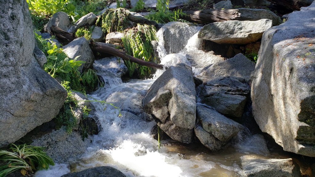
sanjacjon Uncategorized Leave a comment 11 MinutesEdit”Tropical Storm Hilary and trail update 25th August 2023″
Weather and trail update 16th August 2023
WEATHER UPDATE 20th August 2023 at 2015: Heavy rains from Tropical Storm Hilary have mainly fallen this afternoon. In Idyllwild the storm total has reached 2.85 inches at 5550 ft. In Long Valley, at 8600 ft on the eastern slope, which was under major thunderstorms yesterday morning, the storm total is currently 10.45 inches, with an impressive 8.23 inches so far today. Winds have been gusty but otherwise generally unremarkable.
WEATHER UPDATE 18th August 2023: Hurricane Hilary continues to churn northwards just west of central Baja. Current projections have Hilary entering California as a Tropical Storm, the first to do so since 1939, on Sunday 20th. Heavy rain is expected to start on Saturday morning and continue into Monday 21st. Rainfall projections are currently 3+ inches for Idyllwild, and 5-6 inches for the high peaks.
————————–
Despite occasional hotter days, August has generally been pleasantly mild and often cloudy, and certainly considerably cooler than July. That trend will largely continue with cool, cloudy, and wet weather forecast starting Saturday 19th and lasting for at least a week.
Tropical Storm Hilary expected to move north over Baja California is provisionally forecast to bring substantial rainfall to the San Jacinto mountains on 19th-21st August. Between 1-3 inches are forecast for mid elevations, e.g., Idyllwild-Pine Cove, with considerably more possible in the high country. If rainfall is at the upper end of these forecasts, the impacts could be severe, with localized flash flooding at all elevations and potential damage to mountain roads.
Hikers in summer should be prepared for rapidly changing weather conditions in the high country. Monsoon (and currently tropical storm) thunderstorms are forecast as a possibility on most days for the next 10-12 days. Lightning, brief but intense precipitation, and rapid temperature drops can occur in the high country even when such storms are not forecast for lower elevations.
In the summer (and on 15th-18th August in particular) hikers should also be prepared for unseasonably hot weather in the high country. Give considerable extra thought to route choice, start times, clothing, sun protection, and hydration requirements.
The trail system has been clear of snow since mid July. Daily survey hikes include many different routes to San Jacinto Peak multiple times per week, most recently on 11th, 14th, and 16th August, plus a wide variety of other trails on intervening days. A sample of my recent weather observations from San Jacinto Peak is given in the Weather section below.
Water sources such as creeks, pipes, and springs are generally flowing well (see sample photos below and in prior Reports). Consequently in contrast to most recent years I am not reporting water flow details for specific locations at this time. Flow rates are of course now finally dropping, and some ephemeral water sources have recently dried. To date this summer has seen the most water on the mountain since 1998 (following the great El Niño winter of 1997/98).
Given the intensity of this past winter, hikers should expect to encounter new treefall hazards on trails. Trails are slowly being cleared, largely by volunteers, as described in Trail Conditions below.
Be rattlesnake aware. Southern Pacific Rattlesnakes Crotalus (oreganus) helleri are active on the trail system up to 9300 ft elevation (photo below). Above about 5000 ft, the venom of this rattlesnake species in the San Jacinto mountains is predominantly neurotoxic, almost always fatal for dogs and sometimes for humans (see my 2020 article here for further information). Devil’s Slide and lower Deer Springs trails, Suicide Rock, around Strawberry Cienega, and trails near Tahquitz Peak are common locations for sightings.
Black Mountain Road (4S01) was in its poorest condition for at least a decade this spring. The partial grading undertaken on 17th July has improved the situation somewhat, but it remains a bumpy drive. Forest Service roads Dark Canyon Road (4S02) and South Ridge Road (5S11) remain closed to vehicles. Other than Dark Canyon campground and the South Ridge yellow post sites, all Forest and State camping areas have reopened.
The annual maintenance closure of the Palm Springs Aerial Tramway is scheduled for 7th-31st August 2023, a month earlier than usual, as described here.
Due to major road work at the uppermost end of Fern Valley Road, Humber Park parking area will be completely closed to all traffic for two weeks in October 2023 (exact dates currently unknown). In general be prepared for possible disruption accessing trailheads around Idyllwild throughout August-October due to resurfacing work, expected on lower Saunders Meadow Road in August, North Circle and South Circle drives in August-September, and Fern Valley Road in September-October.

WEATHER
Although the middle of this week (15th-17th) may have above-average temperatures, cool and cloudy weather is again forecast starting around Saturday 19th, with tropical monsoonal conditions likely lasting for a week or more. Spin-off from Tropical Storm Hilary moving north along Baja California on 19th-21st may bring substantial tropical moisture to the San Jacinto mountains. The forecasts currently vary greatly regarding quantity of possible rainfall, depending on the exact track of the tropical storm, but could be at least an inch or two at mid elevations, with 4-7 inches possible in the high country. A south-easterly airflow following passage of the tropical storm may bring in monsoonal thunderstorms for several days continuing to at least 25th August.
Monsoonal thunderstorms on Sunday 13th August produced good rains east and west of the San Jacinto mountains, but the intense cells sadly bypassed Idyllwild and the high country. Saddle Junction (8100 ft) received 0.12 inch, with 0.08 inch at Wellman’s Cienega (9300 ft), but only 0.02 inch was recorded both near San Jacinto Peak (10,700 ft) and in Idyllwild (at 5550 ft).
At San Jacinto Peak (10,810ft/3295m) on Wednesday 16th August 2023 at 0825 the air temperature was 63.1°F (17°C), with a “windchill” temperature of 55.8°F (13°C), 52% relative humidity, and a very light ESE breeze sustained at 2 mph gusting to 4.7 mph.
At the Peak on Monday 14th August 2023 at 0740 the air temperature was 49.4°F (10°C), with a windchill temperature of 39.8°F (4°C), 70% relative humidity, and a gusty SE wind sustained at 10 mph gusting to 19.6 mph.
At the Peak on Friday 11th August 2023 at 0755 the air temperature was 46.4°F (8°C), with a “windchill” temperature of 42.3°F (6°C), 56% relative humidity, and a SSW breeze sustained at 2 mph gusting to 5.9 mph.

TRAIL CONDITIONS
The trail system is clear of snow. Despite my optimistic predictions earlier in the summer, no snow patches quite survived on or near the trail system into August, with the last few on the East Ridge of San Jacinto Peak finally melting in the last week of July. A couple of narrow icy snow patches remain in the upper reaches of the Snow Creek drainage.
Deer Springs Trail has about 15 significant treefall hazards. Little Round Valley is now completely clear of snow, water is flowing very well there and in all of the springs and creeks along the Deer Springs Trail route (sample photos in prior Report linked here).
Trails around the Skunk Cabbage and Tahquitz area meadows have some significant treefall hazards throughout. There are seven treefall hazards across the trails between Little Tahquitz Meadow and Chinquapin Flat and another two down on the trail south from Saddle Junction to Chinquapin Flat.
After three years of neglect by the Forest Service, Willow Creek Trail has finally had a continuous route cleared through by a combination of State Park workers and contractors plus volunteers from several organizations, including the Trail Report. In several areas the whitethorn trimming work has been done poorly and the trail remains scrappy, but at least it is readily passable (photo below). Of the 68 treefall hazards that were across the trail following the winter, about eight remain to be cut for the original course of the trail to be fully restored, but that is unlikely to happen anytime soon, if ever.
Fourteen treefall hazards from this past winter on South Ridge Trail (above the trailhead at the top of South Ridge Road) were removed by the Trail Report in May, and trail trimming on that section is undertaken regularly. South Ridge Road remains closed to vehicle traffic and is not expected to reopen until graded, possibly not until August. Eleven of 13 downed trees were removed by volunteers from the middle section of South Ridge Trail (between May Valley Road and the top of South Ridge Road) on 15th July.
Marion Mountain Trail has four notable new treefall hazards in the State Park (upper) half.
The Trail Report removed all 38 treefall hazards from Spitler Peak Trail between late May and early June this year, bringing the total removed to 85+ since July 2021. Several minor washouts from this past winter in the upper switchbacks have significantly impacted the tread in places; these are not problematic for hikers, but the trail is impassable to stock.
The PCT is clear of snow throughout the San Jacinto mountains but treefall hazards remain a problem in many places, most notably between Apache Peak and Red Tahquitz, where I counted 106 between Miles 169-175 in June 2023. Large downed trees make for especially slow-going around Miles 172-175 (a section severely burned in the July 2013 Mountain Fire).
The Caramba Trail from near Reeds Meadow through Laws Camp and on to Caramba, and the Cedar Trail from Willow Creek Trail to Laws, are euphemistically described by the Forest Service as “not maintained”. In reality both trails have been abandoned and functionally no longer exist. They are so heavily overgrown with dense whitethorn, which obscures dozens of downed trees, that I strongly advise hikers do not attempt to follow them (regardless of how much you may trust a certain app). An informal use trail to Laws is much more direct, well maintained, and avoids the challenging bushwhacking of the unmaintained trails (local Idyllwild hikers dubbed it the “King Trail” when I established the route in 2019). It leaves Willow Creek Trail exactly 1.0 mile from Saddle Junction, 0.46 mile from the Skunk Cabbage turning (trailhead at lat/long N 33.7796, W 116.6590). The route descends largely following established deer trails for 1.2 miles, meeting Willow Creek about 0.2 mile upstream from the site of the historic Laws Camp (the remains of which were destroyed by the 2013 Mountain Fire and subsequent flood and treefall damage). The 11 trees down on the King Trail after this winter were removed in June-July 2023. From Laws east to Caramba the route of the original Caramba Trail has been well-cairned by myself and others and can largely be followed with very careful route-finding. My May 2023 survey counted just over 100 trees down on this 2.1 miles of trail. It is especially obscure for the first 0.3 mile east of the Willow Creek crossing, becoming more obvious (but still subtle) as it descends towards Caramba. Very cautious navigation is advised throughout the area.
Seven Pines Trail is clear of treefall hazards for about three miles of its 3.7 miles length. The Trail Report has “adopted” Seven Pines Trail as a priority for maintenance work as the trail has had a disproportionate number of lost hiker rescues in the past decade. Since November 2021, 67 downed trees have been removed and almost the entire trail thoroughly trimmed and cleared. Nevertheless Seven Pines remains a genuine wilderness trail unlike the relatively wide, bare, and obvious routes of, for example, Devil’s Slide or Marion Mountain trails. Cautious navigation remains essential for those without considerable experience of hiking this trail.

While all time and labor is volunteered, the San Jacinto Trail Report uses small private donations to help cover operating costs. Every year has its unique challenges, and 2023 has been no exception. Your contribution keeps the Report available to all, free from advertising or paywalls, and independent from agencies. If you have found this Report useful, please consider using this link to the Donate page. Zelle, Venmo, and PayPal are all options. Thank you very much for your support.


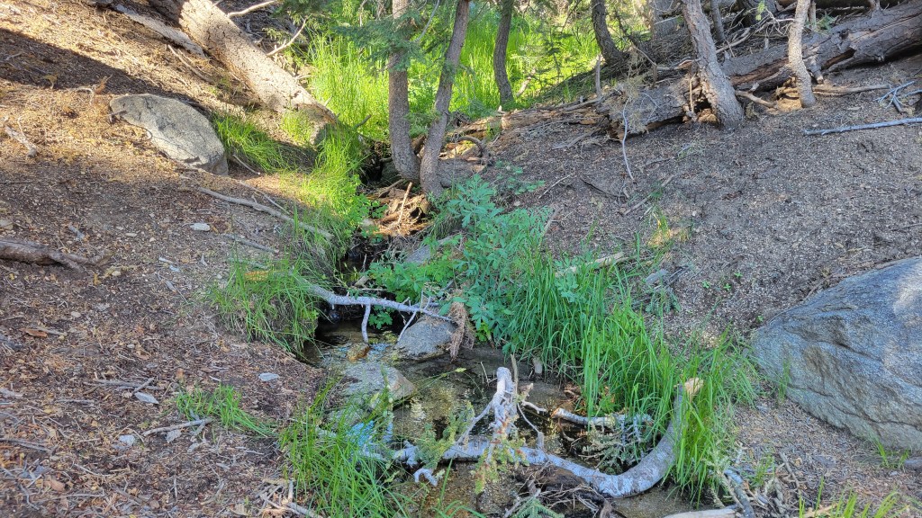


sanjacjon Uncategorized Leave a comment 9 MinutesEdit”Weather and trail update 16th August 2023″
Trail and weather update 9th August 2023
A near-record-long heatwave for the San Jacinto mountains lasting most of July was finally broken by humid, monsoonal conditions starting on Monday 31st. Prior to that, 16 days out of 17 between 14th-30th July had recorded high temperatures at or above 90°F in Idyllwild, with 21 consecutive days at or above 56°F overnight since 11th July (seasonal average high and low temperatures for Idyllwild in July are 85°F and 55°F, respectively).
Pleasant monsoon conditions on 31st July and 1st August produced between 0.22-0.64 inch of rain at mid and upper elevations depending on location (details in Weather section below). Dust-free trails and damp bracken made for a few days of delightful hiking. Humid, cloudy weather on 8th-9th August produced only trace amounts of drizzle, but monsoon rain is possible on any day from 11th-15th.
Following another brief heatwave on 5th-6th August, temperatures are below seasonal for a few days, prior to again heating to above average starting around 15th August.
Hikers in summer should be prepared for rapidly changing weather conditions in the high country. Monsoon thunderstorms are always a possibility, although none are currently forecast in the next week or so. Lightning, brief but intense precipitation, and rapid temperature drops can occur in the high country even when such storms are not forecast for lower elevations.
Despite some cooler, cloudy days, hikers should also be prepared for unseasonably hot weather in the high country. Give considerable extra thought to route choice, start times, clothing, sun protection, and hydration requirements.
The trail system has been clear of snow since mid July. Daily survey hikes include a variety of routes to San Jacinto Peak multiple times per week, most recently on 4th, 7th, and 9th August, plus a wide variety of other trails on intervening days. A sample of my recent weather observations from San Jacinto Peak is given in the Weather section below.
Water sources such as creeks, pipes, and springs are generally flowing very well (see example photos below). Consequently I am not reporting details for specific locations at this time. Given periodic hot temperatures and record low humidity in recent weeks, this situation will start changing in August. To date this summer has seen the most water on the mountain since 1998 (following the great El Niño winter of 1997/98).
Given the intensity of this past winter, hikers should expect to encounter new treefall hazards on trails. Trails are slowly being cleared, largely by volunteers, as described in Trail Conditions below.
Be rattlesnake aware. Southern Pacific Rattlesnakes Crotalus (oreganus) helleri are active on the trail system up to 9300 ft elevation. Above about 5000 ft, the venom of this rattlesnake species in the San Jacinto mountains is predominantly neurotoxic, typically fatal for dogs and potentially for humans (see my 2020 article here for further information). Devil’s Slide and lower Deer Springs trails, Suicide Rock, around Strawberry Cienega, and trails near Tahquitz Peak are common locations for sightings.
Black Mountain Road (4S01) was in its poorest condition for at least a decade this spring. The partial grading undertaken on 17th July has improved the situation somewhat. Forest Service roads Dark Canyon Road (4S02) and South Ridge Road (5S11) remain closed to vehicles. Other than Dark Canyon campground and the South Ridge yellow post sites, all Forest and State camping areas have reopened.
The annual maintenance closure of the Palm Springs Aerial Tramway is scheduled for 7th-31st August 2023, a month earlier than usual, as described here.
Due to major road work at the uppermost end of Fern Valley Road, Humber Park parking area will be completely closed to all traffic for two weeks in October 2023 (exact dates currently unknown). In general be prepared for disruption accessing trailheads around Idyllwild throughout August-October due to resurfacing work on North Circle Drive, South Circle Drive, and Fern Valley Road, and on lower Saunders Meadow Road in early August.

WEATHER
Daytime high temperatures across the entire month of July averaged 5.1°F above seasonal in Idyllwild, a dramatic contrast to the six consecutive months of below average temperatures that started 2023. Almost the entire final three weeks of July were in an unusually protracted heatwave, as described in the introduction above.
A couple of days of pleasant monsoon conditions on 31st July and 1st August produced a total of 0.34 inch of rain in Idyllwild at 5550 ft (0.08 inch on 31st, 0.26 inch on 1st) and 0.22 inch at San Jacinto Peak (0.10 inch on 31st, 0.12 inch on 1st). Combined totals for the two days were 0.64 inch at Wellman’s Cienega (9300 ft) and 0.60 inch at Saddle Junction (8100 ft).
Clear, largely sunny, but generally not hot, weather is forecast for this week. Following the brief two day heatwave on 5th-6th August, temperatures will be near or below seasonal until further significant heating is forecast starting Tuesday 15th August. There is the possibility of significant monsoonal precipitation on Sunday 13th. Fire risk remains very high.
At San Jacinto Peak (10,810ft/3295m) on Wednesday 9th August 2023 at 0740 the air temperature was 50.9°F (10°C), with a “windchill” temperature of 46.2°F (8°C), 66% relative humidity, and a light WSW wind sustained at 4 mph gusting to 8.8 mph.
At the Peak on Monday 7th August 2023 at 0825 the air temperature was 55.3°F (13°C), with a “windchill” temperature of 48.1°F (9°C), 7% relative humidity, and a gusty WSW wind sustained at 10 mph gusting to 19.5 mph.
At the Peak on Friday 4th August 2023 at 0730 the air temperature was 56.3°F (13°C), with a “windchill” temperature of 55.4°F (12°C), 9% relative humidity, and a very light due West breeze sustained at 2 mph gusting to 3.6 mph.

TRAIL CONDITIONS
The trail system is clear of snow. Despite my optimistic predictions earlier in the summer, no snow patches quite survived on or near the trail system into August, with the last few on the East Ridge of San Jacinto Peak finally melting in the last week of July. A couple of narrow icy snow patches remain in the upper reaches of the Snow Creek drainage into the second week of August.
Deer Springs Trail has about 15 significant treefall hazards. Little Round Valley is now completely clear of snow. Water is flowing very well there and in all of the springs and creeks along the Deer Springs Trail route (sample photos below).
Trails around the Skunk Cabbage and Tahquitz area meadows have significant treefall hazards throughout. There are seven treefall hazards across the trails between Little Tahquitz Meadow and Chinquapin Flat and another two down on the trail south from Saddle Junction to Chinquapin Flat.
After three years of neglect by the Forest Service, Willow Creek Trail has finally had a continuous route cleared through by a combination of State Park workers and contractors plus volunteers from several organizations, including the Trail Report. In several areas the whitethorn trimming work has been done poorly and the trail remains scrappy, but at least it is readily passable (photo below). Of the 68 treefall hazards that were across the trail following the winter, about eight remain to be cut for the original course of the trail to be fully restored, but that is unlikely to happen anytime soon, if ever.
Fourteen treefall hazards from this past winter on South Ridge Trail (above the trailhead at the top of South Ridge Road) were removed by the Trail Report in May, and trail trimming on that section is undertaken regularly. South Ridge Road remains closed to vehicle traffic and is not expected to reopen until graded, possibly not until August. Eleven of 13 downed trees were removed by volunteers from the middle section of South Ridge Trail (between May Valley Road and the top of South Ridge Road) on 15th July.
Marion Mountain Trail has four notable new treefall hazards in the State Park (upper) half.
The Trail Report removed all 38 treefall hazards from Spitler Peak Trail between late May and early June this year, bringing the total removed to 85+ since July 2021. Several minor washouts from this past winter in the upper switchbacks have significantly impacted the tread in places; these are not problematic for hikers, but the trail is impassable to stock.
The PCT is clear of snow throughout the San Jacinto mountains but treefall hazards remain a problem in many places, most notably between Apache Peak and Red Tahquitz, where I counted 106 between Miles 169-175 in June 2023. Large downed trees make for especially slow-going around Miles 172-175 (a section severely burned in the July 2013 Mountain Fire).
The Caramba Trail from near Reeds Meadow through Laws Camp and on to Caramba, and the Cedar Trail from Willow Creek Trail to Laws, are euphemistically described by the Forest Service as “not maintained”. In reality both trails have been abandoned and functionally no longer exist. They are so heavily overgrown with dense whitethorn, which obscures dozens of downed trees, that I strongly advise hikers do not attempt to follow them (regardless of how much you may trust a certain app). An informal use trail to Laws is much more direct, well maintained, and avoids the challenging bushwhacking of the unmaintained trails (local Idyllwild hikers dubbed it the “King Trail” when I established the route in 2019). It leaves Willow Creek Trail exactly 1.0 mile from Saddle Junction, 0.46 mile from the Skunk Cabbage turning (trailhead at lat/long N 33.7796, W 116.6590). The route descends largely following established deer trails for 1.2 miles, meeting Willow Creek about 0.2 mile upstream from the site of the historic Laws Camp (the remains of which were destroyed by the 2013 Mountain Fire and subsequent flood and treefall damage). The 11 trees down on the King Trail after this winter were removed in June-July 2023. From Laws east to Caramba the route of the original Caramba Trail has been well-cairned by myself and others and can largely be followed with very careful route-finding. My May 2023 survey counted just over 100 trees down on this 2.1 miles of trail. It is especially obscure for the first 0.3 mile east of the Willow Creek crossing, becoming more obvious (but still subtle) as it descends towards Caramba. Very cautious navigation is advised throughout the area.
Seven Pines Trail is clear of treefall hazards for about three miles of its 3.7 miles length. The Trail Report has “adopted” Seven Pines Trail as a priority for maintenance work as the trail has had a disproportionate number of lost hiker rescues in the past decade. Since November 2021, 67 downed trees have been removed and almost the entire trail thoroughly trimmed and cleared. Nevertheless Seven Pines remains a genuine wilderness trail unlike the relatively wide, bare, and obvious routes of, for example, Devil’s Slide or Marion Mountain trails. Cautious navigation remains essential for those without considerable experience of hiking this trail.

While all time and labor is volunteered, the San Jacinto Trail Report uses small private donations to help cover operating costs. Every year seems to have its unique challenges, and 2023 has been no exception. Your contribution keeps the Report available to all, free from advertising or paywalls, and independent from agencies. If you have found this Report useful, please consider using this link to the Donate page. Zelle, Venmo, and PayPal are all options. Thank you very much for your support.


sanjacjon Uncategorized 4 Comments 9 MinutesEdit”Trail and weather update 9th August 2023″
Weather and trail update 26th July 2023
UPDATE Friday 28th July 2023: The Wild Fire was held at <5 acres yesterday. However the San Jacinto mountains have been impacted today by smoke from the 900+ acre Bonny Fire, burning well to the south-west near Aguanga. Smoke started drifting across our area by about 0800, when I could smell it as I was descending through Round Valley, and a milky sun and smoky skies have continued all afternoon over Idyllwild.
UPDATE Thursday 27th July 2023: a fire started this afternoon immediately south of Idyllwild, in chaparral between the Transfer Station and Grinding Station, off Highway 243. Named the Wild Fire, I posted a short video of the fire activity as of about 1700 this evening (linked here) taken from the top of the Sunset Trail off May Valley Road. Briefly up to three water-dropping helicopters were in attendance, but that was down to one by about 1730. Held at 3-5 acres by dark.
————————-
The San Jacinto mountains are forecast to remain in a protracted heatwave for several more days, although temperatures have ameliorated somewhat from the record highs of last week. At mid elevations (such as Idyllwild) daytime highs will remain several degrees above seasonal every day until 31st July, with overnight lows 8-12°F above seasonal. Temperatures are generally expected to fall to around seasonal for the first four days of August, although overnight lows will remain above average, before another heating trend starts on Saturday 5th August.
A minor monsoonal thunderstorm on Sunday 23rd July produced a little rain – 0.05 inch at San Jacinto Peak and 0.06 inch in Idyllwild – and a pleasantly cool cloudy day with some welcome humidity. Further monsoonal conditions are a possibility for the foreseeable future, currently most likely on or around Monday 31st July.
Fire risk is currently very high. The fifth anniversary of the start of the Cranston Fire is on 25th July. That destructive 13,140 acre fire, started by an arsonist (currently serving a lengthy prison sentence) burned right around the western and southern fringes of Idyllwild, destroying several homes, trails, and well-forested canyons, and to within feet, literally, of Tahquitz Peak fire lookout (photos below).
Hikers should be prepared for unseasonably hot weather in the high country, with temperatures above seasonal at all times of day and at all elevations until 31st July, and then again from 5th August. Give considerable extra thought to route choice, start times, clothing, sun protection, and hydration requirements.
Hikers in summer should also be prepared for rapidly changing weather conditions in the high country. Monsoon thunderstorms are always a possibility, although storm probabilities are relatively low for the foreseeable future. Lightning, brief but intense precipitation, and rapid temperature drops can occur in the high country even when such storms are not forecast for lower elevations.
The trail system has been clear of snow since mid July. A handful of tiny snow patches remain in the most heavily drifted areas that traditionally melt late, notably the East Ridge of San Jacinto Peak.
Daily survey hikes include a variety of routes to San Jacinto Peak multiple times per week, most recently on 21st, 22nd, and 24th July, plus many other trails on intervening days. A sample of my recent weather observations from San Jacinto Peak is given in the Weather section below.
Currently perennial creeks, pipes, and springs are flowing well (e.g., see photos below and in the previous Report here), as are most ephemeral springs and creeks. Consequently I am not reporting details for individual water sources at this time. Given recent temperatures and record low humidity, this situation will start changing soon. To date this summer has seen the most water on the mountain since 1998 (following the great El Niño winter of 1997/98).
Given the intensity of this past winter, hikers will encounter new treefall hazards on trails. Trails are steadily being cleared, largely by volunteers. Since the snow melted the Trail Report has cleared upper South Ridge and Spitler Peak trails (14 and 38 trees, respectively), the PCT between Saddle and Annie’s junctions (approx. PCT Miles 179-181, eight of nine trees), the informal trail descending from Willow Creek Trail to Laws (10 trees), and largely cleared Seven Pines Trail. Starting in June about 45 trees – from an initial total of 68 – have been cut from Willow Creek Trail by a variety of volunteers and agencies.
Be rattlesnake aware. Southern Pacific Rattlesnakes Crotalus (oreganus) helleri have become very active on the trail system in recent days up to at least 8800 ft elevation. Above about 5000 ft, the venom of this rattlesnake species in these mountains is predominantly neurotoxic, typically fatal for dogs and sometimes for humans (see my 2020 article here for further information). Devil’s Slide and lower Deer Springs trails, Suicide Rock, around Strawberry Cienega, and trails near Tahquitz Peak are common locations for sightings, but rattlesnakes have been recorded up to 9300 ft, generally favoring sun-exposed rocky outcrops and slopes.
Black Mountain Road (4S01) was in its poorest condition for at least a decade this spring. The partial grading undertaken on 17th July has improved the situation somewhat. Forest Service roads Dark Canyon Road (4S02) and South Ridge Road (5S11) remain closed to vehicles. Other than Dark Canyon, all Forest and State campgrounds have now reopened.
The annual maintenance closure of the Palm Springs Aerial Tramway is scheduled for 7th-31st August 2023, a month earlier than usual.
Due to major road work at the uppermost end of Fern Valley Road, Humber Park parking area will be completely closed to all traffic, including cyclists and pedestrians, for two weeks in October 2023 (exact dates TBD). In general be prepared for disruption accessing trailheads around Idyllwild throughout August-October due to resurfacing work on North Circle Drive, South Circle Drive, and Fern Valley Road, and on lower Saunders Meadow Road in the first half of August.
WEATHER
July has been a dramatic contrast to the six consecutive months of below average temperatures that started 2023. The most recent heatwave has been unusually protracted, with 11 of the past 12 days recording a daytime high temperature of 90°F or higher in Idyllwild, a trend expected to continue for several more days. A modest cooling starting 31st July will drop temperatures closer to seasonal averages, and may be accompanied by some monsoonal activity. Thunderstorms are currently most likely on Sunday 30th July to Tuesday 1st August.
As is increasingly the trend in the San Jacinto mountains, the overnight “low” temperatures in particular will be as much as 10°F above seasonal especially at mid elevations until the end of July, and are forecast to remain several degrees above average well into August.
The highest elevations have not escaped the heatwave, with temperatures well above average for the month throughout the second half of July, and possibly lasting into early August. The temperature I measured at San Jacinto Peak on Friday 21st July (62.6°F/17.0°C) is the second highest ever known to have been reliably recorded at that location.
At San Jacinto Peak (10,810ft/3295m) on Monday 24th July 2023 at 0800 the air temperature was 55.1°F (13°C), with a windchill temperature of 51.1°F (11°C), 41% relative humidity, and a light SW wind sustained at 5 mph gusting to 9.1 mph.
At the Peak on Saturday 22nd July 2023 at 0645 the air temperature was 60.1°F (16°C), with a “windchill” temperature of 55.9°F (13°C), 34% relative humidity, and a steady SSE wind sustained at 10 mph gusting to 16.4 mph.
At the Peak on Friday 21st July 2023 at 0720 the air temperature was 62.6°F (17°C), with a “windchill” temperature of 59.7°F (15°C), 34% relative humidity, and a warm ESE wind sustained at 4 mph gusting to 7.6 mph. This air temperature is the second highest ever reliably observed at San Jacinto Peak, although it is 5.0°F below the astonishing all-time high recorded on 12th July 2021.

TRAIL CONDITIONS
The trail system is now clear of snow. San Jacinto Peak is now functionally clear of snow, with no significant snow patches on the trail routes up to the Peak. Snow cover remains about 5% on the East Ridge of the Peak, but the trail up that flank is functionally clear of snow.
Deer Springs Trail is clear of snow, but has about 15 significant treefall hazards. Little Round Valley is now completely clear of snow. Water is flowing very well there and in all of the springs and creeks along the Deer Springs Trail route.
Trails around the Skunk Cabbage and Tahquitz area meadows have significant treefall hazards throughout. There are seven treefall hazards across the trails between Little Tahquitz Meadow and Chinquapin Flat and another four down on the trail south from Saddle Junction to Chinquapin Flat.
Fourteen treefall hazards from this past winter on South Ridge Trail (above the trailhead at the top of South Ridge Road) were removed by the Trail Report in May, and trail trimming on that section is undertaken regularly. South Ridge Road remains closed to vehicle traffic and is not expected to reopen until graded, possibly not until August. Eleven of 13 downed trees were removed by volunteers from the middle section of South Ridge Trail (between May Valley Road and the top of South Ridge Road) on 15th July.
Marion Mountain Trail is clear of snow but there are four notable new treefall hazards in the State Park (upper) half.
Trail maintenance crews will be working regularly on Willow Creek Trail in late July and early August. The trail remains a slow, messy hike for about two miles due to treefall hazards and whitethorn overgrowth, but thanks to the work of various volunteers and State teams the situation is steadily improving. As of 28th July 2023, about 23 treefall hazards remained across the trail, some of which are large and/or challenging to hike around (or over). There is only one large tree down between Saddle Junction and the Skunk Cabbage Meadow junction, and then a further 19 trees down on the next 1.5 mile Forest Service section until the State Park boundary. Only three trees remain down on the State Park section of trail up to Hidden Divide. The trail section with the most trees down – between the Willow Creek crossing and the State Park boundary – is also overgrown with thick whitethorn. With trail maintenance work, this may improve over the next few weeks. The work that Bill Rhoads and I undertook to clear whitethorn along this trail in 2020 was not completely in vain and parts of the trail would have functionally disappeared by now otherwise. The State Park has done an excellent job of trimming and clearing the trail on their section, with 90% of the whitethorn cut back in recent weeks, and just a few significant overgrown patches remaining closer to Hidden Divide.
The Trail Report removed all 38 treefall hazards from Spitler Peak Trail between late May and early June this year, bringing the total removed to 85+ since July 2021. Several minor washouts from this past winter in the upper switchbacks have significantly impacted the tread in places; these are not problematic for hikers, but the trail is impassable to stock.
The PCT is clear of snow throughout the San Jacinto mountains. Treefall hazards are a problem in many places but most notably between Apache Peak and Red Tahquitz, where I counted 106 between Miles 169-175 in June 2023. Large downed trees make for especially slow-going around Miles 172-175 (a section severely burned in the 2013 Mountain Fire).
Trails clear of both snow and treefall hazards include the Peak Trail, Black Mountain Trail, Ernie Maxwell Trail, Devil’s Slide Trail, and the Wellman Trail.
The Caramba Trail from near Reeds Meadow through Laws Camp and on to Caramba, and the Cedar Trail from Willow Creek Trail to Laws, are euphemistically described by the Forest Service as “not maintained”. In reality both trails have been abandoned and no longer exist. They are so heavily overgrown with dense whitethorn, which obscures dozens of downed trees, that I strongly advise hikers do not attempt to follow them (regardless of how much you may trust a certain app). An informal use trail to Laws is much more direct, well maintained by the Trail Report, and avoids the challenging bushwhacking of the unmaintained trails (local Idyllwild hikers dubbed it the “King Trail” when I established the route in 2019). It leaves Willow Creek Trail exactly 1.0 mile from Saddle Junction, 0.46 mile from the Skunk Cabbage turning (trailhead at lat/long N 33.7796, W 116.6590). The route descends largely following established deer trails for 1.2 miles, meeting Willow Creek about 0.2 mile upstream from the site of the historic Laws Camp (the remains of which were destroyed by the 2013 Mountain Fire and subsequent flood and treefall damage). The 11 trees down on the King Trail after this winter were removed in June-July 2023. From Laws east to Caramba the route of the original Caramba Trail has been well-cairned by myself and others and can largely be followed with very careful route-finding. My May 2023 survey counted just over 100 trees down on this 2.1 miles of trail. It is especially obscure for the first 0.3 mile east of the Willow Creek crossing, becoming more obvious (but still subtle) as it descends towards Caramba. Very cautious navigation is advised throughout the area.
Seven Pines Trail is clear of snow. The crossing of the very swollen North Fork of the San Jacinto River at 1.5 miles on this trail (just after the State Park boundary) currently requires considerable caution. The Trail Report has “adopted” Seven Pines Trail as a priority for maintenance work as the trail has had a disproportionate number of lost hiker rescues in the past decade. Since November 2021, 67 downed trees have been removed and almost the entire trail thoroughly trimmed and cleared. Nevertheless Seven Pines remains a genuine wilderness trail unlike the relatively wide, bare, and obvious routes of, for example, Devil’s Slide or Marion Mountain trails. Cautious navigation remains essential for those without considerable experience of hiking this trail.


While all time and labor is volunteered, the San Jacinto Trail Report uses small private donations to help cover operating costs. Every year seems to have its unique challenges, and 2023 has been no exception. Your contribution keeps the Report available to all, free from advertising or paywalls, and independent from agencies. If you have found this Report useful, please consider using this link to the Donate page. Zelle, Venmo, and PayPal are all options. Thank you very much for your support.


sanjacjon Uncategorized Leave a comment 10 MinutesEdit”Weather and trail update 26th July 2023″
Weather and trail update 21st July 2023
The San Jacinto mountains remain in a protracted heatwave, along with much of the desert south-west. While local temperatures peaked last weekend – Idyllwild reached 99°F on Saturday 15th July surpassing the previous record high for that date by two degrees – temperatures above seasonal are forecast to persist until the end of July at least. At mid elevations (such as Idyllwild) daytime highs are expected to be several degrees above seasonal every day, with overnight lows generally 10-15°F above seasonal.
The highest elevations are equally impacted. Although an all-time record temperature is not now expected in the high country, by far the longest ever period of days >15°C (59°F) at San Jacinto Peak is likely, almost certainly of more than two weeks and potentially continuing into early August.
Fire risk is very high, as demonstrated by multiple significant fire starts in the grasslands of the nearby lowlands in the past week (described here). From San Jacinto Peak there was thankfully no visible sign of the Rabbit Fire by Monday 17th July, other than remnant smoke obscuring a very hazy Coachella Valley.
Hikers should be prepared for unseasonably hot weather in the high country, with temperatures well above seasonal at all times of day and at all elevations. Give considerable extra thought to route choice, start times, clothing, sun protection, and hydration requirements.
Hikers in summer should also always be prepared for rapidly changing weather conditions in the high country. Monsoon thunderstorms are a possibility, although storm probabilities are currently low for the foreseeable future. Lightning, brief but intense precipitation, and rapid temperature drops can occur in the high country even when such storms are not forecast for lower elevations.
The trail system is now clear of snow. A few snow patches remain in the most heavily drifted areas that traditionally melt late, notably the East Ridge of San Jacinto Peak.
Daily survey hikes include a variety of routes to San Jacinto Peak multiple times per week, most recently on 17th, 19th, and 21st July, plus many other trails on intervening days. A sample of my recent weather observations from San Jacinto Peak is given in the Weather section below.
Currently perennial creeks, pipes, and springs are flowing well (e.g., see photos in the previous Report and below), as are most ephemeral springs and creeks. Consequently I am not reporting details for individual water sources at this time. Given recent temperatures and record low humidity, this situation may change soon. To date this summer has seen the most water on the mountain since 1998 (following the great El Niño winter of 1997/98).
Given the intensity of this past winter, hikers will encounter new treefall hazards on trails. Trails are steadily being cleared, largely by volunteers. Since the snow melted the Trail Report has cleared upper South Ridge and Spitler Peak trails (14 and 38 trees, respectively), the PCT between Saddle and Annie’s junctions (approx. PCT Miles 179-181, eight of nine trees), the informal trail from Willow Creek Trail to Laws (10 trees), and largely cleared Seven Pines Trail. Starting in June 39 trees – from an initial total of about 68 – were cut from Willow Creek Trail by various volunteer and state teams.
Be rattlesnake aware. Southern Pacific Rattlesnakes Crotalus (oreganus) helleri are now present on the trail system up to at least 8800 ft elevation, although observations so far this year have been infrequent. Above about 5000 ft, the venom of this rattlesnake species in these mountains is predominantly neurotoxic, typically fatal for dogs and sometimes for humans (see my 2020 article here for further information). Devil’s Slide and lower Deer Springs trails, Suicide Rock, around Strawberry Cienega, and trails near Tahquitz Peak are common locations for sightings, but rattlesnakes have been recorded up to 9300 ft, generally favoring sun-exposed rocky outcrops and slopes.
Black Mountain Road (4S01) was in its poorest condition for at least a decade this spring. The mediocre grading job undertaken on 17th July improved the situation, but the Road remains lumpy and a high clearance vehicle is still recommended. Forest Service roads Dark Canyon Road (4S02) and South Ridge Road (5S11) remain closed to vehicles. Other than Dark Canyon, all Forest and State campgrounds have now reopened.
Tahquitz Peak fire lookout reopened for the season on 4th June. Black Mountain fire lookout will reopen for the season on Sunday 23rd July following (partial) grading of Black Mountain Road.
The annual maintenance closure of the Palm Springs Aerial Tramway is scheduled for 7th-31st August 2023, a month earlier than usual.
Due to major road work at the uppermost end of Fern Valley Road, Humber Park parking area will be completely closed to all traffic, including cyclists and pedestrians, for two weeks in October (exact dates TBD). In general be prepared for disruption accessing trailheads around Idyllwild throughout August-October due to resurfacing work on North Circle Drive, South Circle Drive, and Fern Valley Road.
WEATHER
Six consecutive months of below average temperatures to start 2023 ended abruptly at the beginning of July, and this month has seen two significant heatwaves already. The most recent of these is continuing at present and has been unusually protracted. At the elevation of Idyllwild daytime highs are forecast to average several degrees above seasonal every day into the last week of July. As is increasingly the trend in the San Jacinto mountains, the overnight “low” temperatures in particular will be as much as 15°F above seasonal especially at mid elevations.
The highest elevations will not be spared, with temperatures well above average for July for at least two, possibly three weeks, likely into early August. At San Jacinto Peak temperatures at or above 59°F (15°C) are predicted for 12-15 days; most years experience fewer than five days that warm at the Peak all summer.
There is no significant new precipitation in the forecasts, with no sign of monsoonal rains reaching the San Jacinto mountains before August. Despite the wet winter and cool first half of the year, vegetation moisture levels have rapidly dropped below average (per data in NWS San Diego video linked here). The fire danger locally is very high.
At San Jacinto Peak (10,810ft/3295m) on Friday 21st July 2023 at 0720 the air temperature was 62.6°F (17°C), with a “windchill” temperature of 59.7°F (15°C), 34% relative humidity, and a warm ESE wind sustained at 4 mph gusting to 7.6 mph.
At the Peak on Wednesday 19th July 2023 at 0645 the air temperature was 55.9°F (13°C), with a “windchill” temperature of 52.7°F (12°C), 46% relative humidity, and a light WSW wind sustained at 3 mph gusting to 7.0 mph.
At the Peak on Monday 17th July 2023 at 0710 the air temperature was 57.4°F (14°C), with a “windchill” temperature of 52.2°F (11°C), 54% relative humidity, and a pleasantly cool SSE wind sustained at 10 mph gusting to 19.2 mph.
At the Peak on Friday 14th July 2023 at 0705 the air temperature was 58.5°F (15°C), with no observable windchill, 34% relative humidity, and completely calm wind conditions (extremely rare at the Peak).
At the Peak on Friday 7th July 2023 at 0750 the air temperature was 52.7°F (12°C), with a “windchill” temperature of 46.3°F (8°C), 4.8% relative humidity, and a light but steady due West wind sustained at 11 mph gusting to 14.7 mph. This average relative humidity measurement (which briefly dropped as low as 4.2%) is the lowest ever reliably recorded at San Jacinto Peak, breaking the record of 5% set just two days earlier. Prior to 2023, I had only recorded RH as low as 7% on three occasions.
TRAIL CONDITIONS
The trail system is now clear of snow. Snow cover averages about 5% around San Jacinto Peak, but with no significant snow patches on the trail routes up to the Peak. Snow cover remains about 15% on the East Ridge of the Peak, but the trail up that flank is functionally clear of snow.
Deer Springs Trail is now clear of snow, but has about 15 significant treefall hazards. Little Round Valley is now clear of snow. Water is flowing very well there and in all of the springs and creeks along the Deer Springs Trail route.
Trails around the Skunk Cabbage and Tahquitz area meadows have significant treefall hazards throughout. There are seven treefall hazards across the trails between Little Tahquitz Meadow and Chinquapin Flat, four major trees down across Willow Creek Trail between Saddle Junction and the Skunk Cabbage Meadow junction, and another four down on the trail south from Saddle Junction to Chinquapin Flat.
The Peak Trail is now clear of snow. The East Ridge Trail remains partly obscured under about 15% snow cover, but the remaining snow is heavily drifted and initially melted very unevenly forming “sun cups” (photo in prior Report linked here).
Fourteen treefall hazards from this past winter on South Ridge Trail (above the trailhead at the top of South Ridge Road) were removed by the Trail Report in May, and trail trimming on that section is undertaken regularly. South Ridge Road remains closed to vehicle traffic and is not expected to reopen until graded, possibly not until August. Eleven of 13 downed trees were removed by volunteers from the middle section of South Ridge Trail (between May Valley Road and the top of South Ridge Road) on 15th July.
Marion Mountain Trail is clear of snow but there are four notable new treefall hazards in the State Park (upper) half.
Willow Creek Trail was a slow, messy hike for a couple of miles due to treefall hazards and whitethorn overgrowth, but thanks to the work of volunteers the situation has slowly improved since May. As of 21st July 2023, about 29 treefall hazards remained across the trail, many of which are large and some are challenging to hike around (or over). There is only one large tree down between Saddle Junction and the Skunk Cabbage Meadow junction, and then a further 25 trees down on the next 1.5 mile Forest Service section until the State Park boundary. Only three trees remain down on the State Park section of trail up to Hidden Divide. The trail section with the most (18) trees down – between the Willow Creek crossing and the State Park boundary – is also disappearing under thick whitethorn. The considerable amount of work that Bill Rhoads and I undertook to clear whitethorn along this trail in 2020 was not completely in vain and parts of the trail would have functionally disappeared by now otherwise. The State Park has done an excellent job of trimming and clearing the trail on their section, with 90% of the whitethorn cut back in recent weeks, with just a few significant overgrown patches remaining up high near the Divide.
The Trail Report removed all 38 treefall hazards from Spitler Peak Trail between late May and early June this year, bringing the total removed to 85+ since July 2021. Several minor washouts from this past winter in the upper switchbacks have significantly impacted the tread in places; these are not problematic for hikers, but the trail is impassable to stock.
The PCT is now clear of snow throughout the San Jacinto mountains. Treefall hazards are a problem in many places but most notably between Apache Peak and Red Tahquitz, where I counted 106 between Miles 169-175 in June 2023. Large downed trees make for especially slow-going around Miles 172-175 (a section severely burned in the 2013 Mountain Fire).
Trails clear of both snow and treefall hazards include Black Mountain Trail, Ernie Maxwell Trail, Devil’s Slide Trail, and the Wellman Trail.
The Caramba Trail from near Reeds Meadow through Laws Camp and on to Caramba, and the Cedar Trail from Willow Creek Trail to Laws, are euphemistically described by the Forest Service as “not maintained”. In reality both trails have been abandoned and no longer exist. They are so heavily overgrown with dense whitethorn, which obscures dozens of downed trees, that I strongly advise hikers do not attempt to follow them (regardless of how much you may trust a certain app). An informal use trail to Laws is much more direct, well maintained by the Trail Report, and avoids the challenging bushwhacking of the unmaintained trails (local Idyllwild hikers dubbed it the “King Trail” when I established the route in 2019). It leaves Willow Creek Trail exactly 1.0 mile from Saddle Junction, 0.46 mile from the Skunk Cabbage turning (trailhead at lat/long N 33.7796, W 116.6590). The route descends largely following established deer trails for 1.2 miles, meeting Willow Creek about 0.2 mile upstream from the site of the historic Laws Camp (the remains of which were destroyed by the 2013 Mountain Fire and subsequent flood and treefall damage). The 11 trees down on the King Trail after this winter were removed in June-July 2023. From Laws east to Caramba the route of the original Caramba Trail has been well-cairned by myself and others and can largely be followed with very careful route-finding. My May 2023 survey counted just over 100 trees down on this 2.1 miles of trail. It is especially obscure for the first 0.3 mile east of the Willow Creek crossing, becoming more obvious (but still subtle) as it descends towards Caramba. Very cautious navigation is advised throughout the area.
Seven Pines Trail is clear of snow. The crossing of the very swollen North Fork of the San Jacinto River at 1.5 miles (just after the State Park boundary) currently requires considerable caution. The Trail Report has “adopted” Seven Pines Trail as a priority for maintenance work as the trail has had a disproportionate number of lost hiker rescues in the past decade. Since November 2021, 67 downed trees have been removed and almost the entire trail thoroughly trimmed and cleared. Nevertheless Seven Pines remains a genuine wilderness trail unlike the relatively wide, bare, and obvious routes of, for example, Devil’s Slide or Marion Mountain trails. Cautious navigation remains essential for those without considerable experience of hiking this trail.


While all time and labor is volunteered, the San Jacinto Trail Report uses small private donations to help cover operating costs. Every year seems to have its unique challenges, and 2023 has been no exception. Your contribution keeps the Report available to all, free from advertising or paywalls, and independent from agencies. If you have found this Report useful, please consider using this link to the Donate page. Zelle, Venmo, and PayPal are all options. Thank you very much for your support.
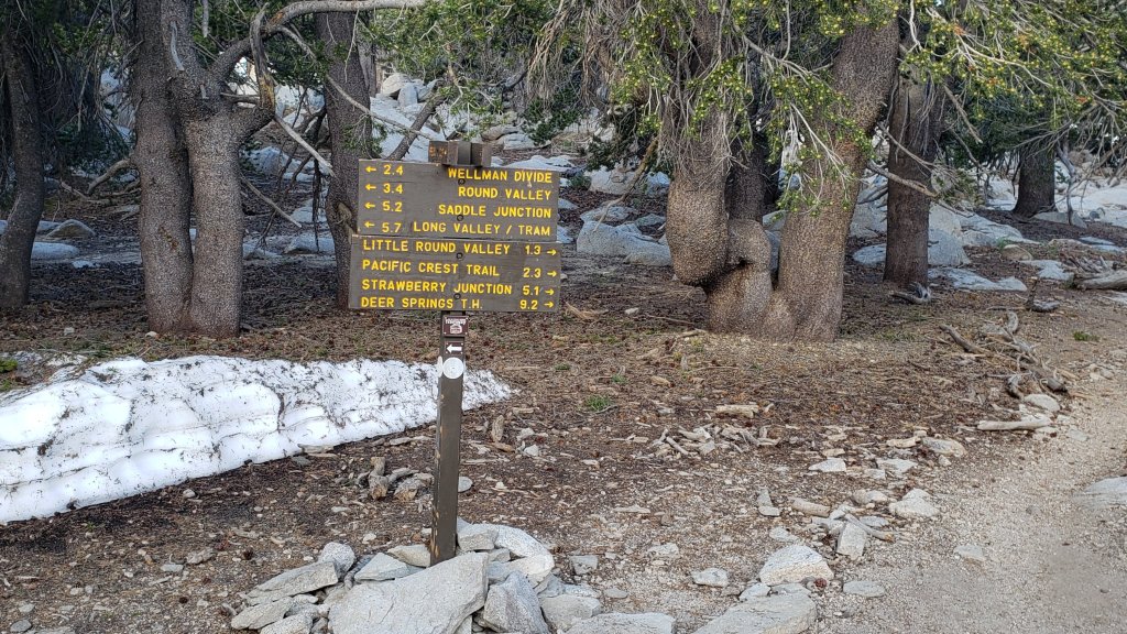

sanjacjon Uncategorized Leave a comment 10 MinutesEdit”Weather and trail update 21st July 2023″
Trail update 14th July 2023
Saturday 15th July marks the 10th anniversary of the start of the Mountain Fire, one of the most impactful events in the modern history of the San Jacinto mountains, and certainly the most damaging fire to property, the forest, the local economy, and the trail system in living memory. About 27,500 acres and more than 20 buildings burned. Although some assessments have suggested the fire may have been beneficial to forest ecology (linked here) such positive impacts were confined to a relatively small area at the highest elevations where the fire burned. Elsewhere the fire was damaging to the forest, notably along the Desert Divide where the trails and surrounding vegetation will never be the same again. Many trails were shut for years, most require much more maintenance now than before the fire, and some remain functionally abandoned to this day.
A heatwave, more severe than the brief one at the beginning of July, is forecast to build and peak this weekend. Temperatures well above seasonal are forecast for all elevations on 14th-18th at least, and with near-record heat in the high country on 15th-17th. Above-average temperatures are expected to persist for 7-10 days. well into late July. Fire risk will be very high.
Hikers should be prepared for unseasonably hot weather at all elevations, with temperatures far above seasonal and early morning temperatures in particular expected to be about 15°F above average this weekend. Give considerable extra thought to route choice, start times, clothing, sun protection, and water requirements.
With the exception of heavily drifted areas that traditionally melt late (notably the East Ridge of San Jacinto Peak) the trail system is now clear of snow. The few snow patches that remain from this past remarkable winter will soon largely disappear in the forthcoming heatwave.
Daily survey hikes include a variety of routes to San Jacinto Peak multiple times per week, most recently on 7th, 10th, and 14th July, plus a wide variety of other trails on intervening days. A sample of recent weather observations from San Jacinto Peak is given in the Weather section below.
Currently perennial creeks, pipes, and springs are flowing well (e.g., see photos in the previous Report), as are most ephemeral springs and creeks, although some of the latter are starting to dry. This summer has seen the most water on the mountain since 1998 (following the great El Niño winter of 1997/98).
Given the intensity of this past winter, hikers will encounter new treefall hazards on trails. Trails are steadily being cleared by volunteers. In recent weeks the Trail Report has cleared South Ridge and Spitler Peak trails (14 and 38 trees, respectively), the PCT between Saddle and Annie’s junctions (approx. PCT Miles 179-181, eight trees), the informal trail from Willow Creek Trail to Laws (10 trees), and largely cleared Seven Pines Trail. In June 33 trees – from a total of about 68 – were cut from Willow Creek Trail by volunteers, steadily making progress on the condition of that challenging trail (impacted by the 2013 Mountain Fire).
Be rattlesnake aware. Southern Pacific Rattlesnakes Crotalus (oreganus) helleri are now present on the trail system up to at least 8800 ft elevation. Above about 5000 ft, the venom of this rattlesnake species in these mountains is predominantly neurotoxic, typically fatal for dogs and sometimes for humans (see my article here for some further information). Devil’s Slide and lower Deer Springs trails, Suicide Rock, around Strawberry Cienega, and trails near Tahquitz Peak are common locations for sightings, but rattlesnakes have been recorded to 9300 ft, usually favoring sun-exposed slopes.
Black Mountain Road (4S01) is in its poorest condition for at least a decade, but grading is scheduled to start in mid July. Until the road is graded 4WD and/or high clearance are recommended. Forest Service roads Dark Canyon Road (4S02) and South Ridge Road (5S11) remain closed to vehicles. Other than Dark Canyon, all Forest and State campgrounds have now reopened.
Tahquitz Peak fire lookout reopened for the season on 4th June. Black Mountain fire lookout is currently not expected to reopen until late July, once grading of the road is completed.
The annual maintenance closure of the Palm Springs Aerial Tramway is scheduled for 7th-31st August 2023, a month earlier than usual.

WEATHER
Six consecutive months of below average temperatures to start 2023 have ended abruptly. Following a minor heatwave in the first few days of July, a more severe heatwave is forecast for this week, starting on 14th and expected to last at least a week. Temperatures will peak well above seasonal averages on 14th-18th, with daytime highs approaching 95°F in Idyllwild at the weekend (15th-16th July) before cooling slightly next week, but expected to remain above seasonal. As is increasingly the trend in the San Jacinto mountains, the overnight “low” temperatures in particular will be as much as 15°F above seasonal at mid elevations.
The highest elevations will not be spared, with temperatures well above average for July for at least a week. Near-record temperatures are currently forecast around the highest peaks on 15th-18th July. At San Jacinto Peak temperatures above 60°F (15.5°C) are predicted for several consecutive days; most years there are only 1-3 days that warm at the Peak all summer.
There is no significant new precipitation in the forecasts. Despite the wet winter and cool first half of the year, vegetation moisture levels have already dropped below average. The fire danger in the San Jacinto mountains is currently categorized as high to very high.
At San Jacinto Peak (10,810ft/3295m) on Friday 14th July 2023 at 0705 the air temperature was 58.5°F (15°C), with no observable windchill, 34% relative humidity, and completely calm wind conditions (which are extremely rare at the Peak).
At the Peak on Monday 10th July 2023 at 0720 the air temperature was 49.6°F (10°C), with a windchill temperature of 40.1°F (5°C), 18% relative humidity, and a stiff SSW wind sustained at 15 mph gusting to 30.1 mph.
At the Peak on Friday 7th July 2023 at 0750 the air temperature was 52.7°F (12°C), with a “windchill” temperature of 46.3°F (8°C), 4.8% relative humidity, and a light but steady due West wind sustained at 11 mph gusting to 14.7 mph. This average relative humidity measurement (which briefly dropped as low as 4.2%) is the lowest ever reliably recorded at San Jacinto Peak, breaking a record set just two days earlier (see below). Prior to 2023, I had only recorded RH as low as 7% on three occasions.
At the Peak on Wednesday 5th July 2023 at 0745 the air temperature was 55.8°F (13°C), with a “windchill” temperature of 53.2°F (12°C), 5% relative humidity, and a light but steady SW wind sustained at 5 mph gusting to 6.3 mph.
TRAIL CONDITIONS
The trail system is now functionally clear of snow. Traction devices are no longer required.
Snow cover averages about 5% around San Jacinto Peak. With careful route-finding – such as ascending the Peak via southern rather than eastern routes – no snow hiking is required.
Deer Springs Trail is now clear of snow, but has about 15 significant treefall hazards. Little Round Valley is now functionally clear of snow (a handful of minor drifts remain). Water is flowing very well there and in all of the springs and creeks along the Deer Springs Trail route.
Trails around the Skunk Cabbage and Tahquitz area meadows have significant treefall hazards throughout. There are seven treefall hazards across the trails between Little Tahquitz Meadow and Chinquapin Flat, four major trees down across Willow Creek Trail between Saddle Junction and the Skunk Cabbage Meadow junction, and another four down on the trail south from Saddle Junction to Chinquapin Flat.
The Wellman Trail has a couple of tiny snow patches remaining on its southernmost sheltered 0.4 mile north from Annie’s Junction [surveyed 10th July], but is otherwise clear.
The Peak Trail has extremely limited patchy snow. The initial traverse north from Wellman Divide to 9900 ft is clear. For about 0.6 mile between 9900-10,100 ft snow cover is <10% and the trail is obvious. The ascending switchbacks above 10,100 ft are clear. The East Ridge Trail remains partly obscured under about 25% snow cover, but the remaining snow is heavily drifted and has melted very unevenly forming “sun cups” (photo in prior Report linked here).
Fourteen treefall hazards from this past winter on South Ridge Trail were removed by the Trail Report in May, and trail trimming is undertaken regularly. South Ridge Road remains closed to vehicle traffic and is not expected to reopen until graded, possibly in July.
Marion Mountain Trail is clear of snow but there are four notable new treefall hazards in the State Park (upper) section.
Willow Creek Trail remains been a slow, messy hike for a couple of miles due to treefall hazards and whitethorn overgrowth, but thanks to the work of volunteers the situation has improved in recent weeks. There are plans in place to cut the remaining trees on the Forest Service section in the next month or so, weather permitting. As of early July 2023, about 35 treefall hazards remain across the trail, most of which are large and some are challenging to hike around (or over). There are four large trees down between Saddle Junction and the Skunk Cabbage Meadow junction, and then a further 25 trees down on the next 1.5 mile Forest Service section until the State Park boundary. Another six trees are down on the State Park section of trail up to Hidden Divide. Some of the trail with the most trees down – between Willow Creek and the State Park boundary – is also disappearing under thick whitethorn. The considerable amount of work that Bill Rhoads and I undertook to clear whitethorn along this trail in 2020 was not completely in vain and parts of the trail would have largely disappeared by now otherwise, but the whitethorn does make some treefall hazards more complicated to negotiate.
The Trail Report removed all 38 treefall hazards from Spitler Peak Trail between late May and early June this year, bringing the total removed to 85+ since July 2021. Several minor washouts from this past winter in the upper switchbacks have significantly impacted the tread in places; these are not problematic for hikers, but the trail is impassable to stock.
The PCT is now clear of snow throughout the San Jacinto mountains. Treefall hazards are a problem in many places but most notably between Apache Peak and Red Tahquitz, where I counted 106 between Miles 169-175 in June 2023. Large downed trees make for especially slow-going around Miles 172-175 (a section severely burned in the 2013 Mountain Fire).
Trails clear of both snow and treefall hazards include Black Mountain Trail, Ernie Maxwell Trail, and Devil’s Slide Trail.
The Caramba Trail from near Reeds Meadow through Laws Camp and on to Caramba, and the Cedar Trail from Willow Creek Trail to Laws, are euphemistically described by the Forest Service as “not maintained”. In reality both trails have been abandoned and no longer exist. They are so heavily overgrown with dense whitethorn, which obscures dozens of downed trees, that I strongly advise hikers do not attempt to follow them (regardless of how much you may trust a certain app). An informal use trail to Laws is much more direct, well maintained by the Trail Report, and avoids the challenging bushwhacking of the unmaintained trails (local Idyllwild hikers dubbed it the “King Trail” when I established the route in 2019). It leaves Willow Creek Trail exactly 1.0 mile from Saddle Junction, 0.46 mile from the Skunk Cabbage turning (trailhead at N 33.7796, W 116.6590). The route descends largely following established deer trails for 1.2 miles, meeting Willow Creek about 0.2 mile upstream from the site of the historic Laws Camp (the remains of which were destroyed by the 2013 Mountain Fire and subsequent flood and treefall damage). The 11 trees down on the King Trail after this winter were removed in June-July 2023. From Laws east to Caramba the route of the original Caramba Trail has been well-cairned by myself and others and can largely be followed with very careful route-finding. My May 2023 survey counted just over 100 trees down on this 2.1 miles of trail. It is especially obscure for the first 0.3 mile east of the Willow Creek crossing, becoming more obvious (but still subtle) as it descends towards Caramba. Very cautious navigation is advised throughout the area.
Seven Pines Trail is now clear of snow. The crossing of the very swollen North Fork of the San Jacinto River at 1.5 miles (just after the State Park boundary) currently requires considerable caution. The Trail Report has “adopted” Seven Pines Trail as a priority for maintenance work as the trail has had a disproportionate number of lost hiker rescues in the past decade. Since November 2021, 67 downed trees have been removed and almost the entire trail thoroughly trimmed and cleared. Nevertheless Seven Pines remains a genuine wilderness trail unlike the relatively wide, bare, and obvious routes of, for example, Devil’s Slide or Marion Mountain trails. Cautious navigation remains essential for those without considerable experience of hiking this trail.
While all time and labor is volunteered, the San Jacinto Trail Report uses small private donations to help cover operating costs. Every year seems to have its unique challenges, and 2023 is clearly no exception. Your contribution keeps the Report available to all, free from advertising or paywalls, and independent from agencies. If you have found this Report useful, please consider using this link to the Donate page. Zelle, Venmo, and PayPal are all options. Thank you very much for your support.
sanjacjon Uncategorized Leave a comment 9 MinutesEdit”Trail update 14th July 2023″
Trail update 6th July 2023
A heatwave in the first few days of July produced above seasonal temperatures at mid elevations, and well-above average temperatures at upper elevations. Daytime highs reached 80°F (27°C) at 8600 ft elevation in Long Valley for three consecutive days on 1st-3rd July, where there is considerable weather influence from the Coachella Valley.
After a brief cooling this week to temperatures a little below average for July, a more severe heatwave is forecast for next week, with temperatures well above seasonal at all elevations, and near-record heat in the high country. A sample of my recent weather observations from San Jacinto Peak are given below in the Weather section.
With the exception of heavily drifted areas that traditionally melt late (notably the East Ridge of San Jacinto Peak) the trail system is now clear of snow. Spikes are no longer required. Melting has been dramatic in Little Round Valley in the past week, and it is now largely clear (photos below). For readers interested in snow depths recorded in the San Jacinto mountains during this past remarkable winter, they were last listed in a recent Report available here.
Daily survey hikes include a variety of routes to San Jacinto Peak multiple times per week, most recently on 4th and 5th July, plus a wide variety of other trails on intervening days.
Currently perennial creeks, pipes, and springs are flowing well (e.g., see photos below), as are most ephemeral springs and creeks, although some of the latter are starting to dry. This summer has seen the most water on the mountain since 1998, following the great El Niño winter of 1997/98.
Given the intensity of this past winter, hikers will encounter new treefall hazards on trails. Trails are steadily being cleared by volunteers. In recent weeks the Trail Report has cleared South Ridge and Spitler Peak trails (14 and 38 trees, respectively), the PCT between Saddle and Annie’s junctions (approx. PCT Miles 179-181, eight trees), and largely cleared Seven Pines Trail and the informal use trail from Willow Creek Trail to Laws. In June 33 trees – from a total of about 68 – have been cut from Willow Creek Trail by volunteers, steadily making progress on the condition of that challenging trail.
Be rattlesnake aware. Southern Pacific Rattlesnakes (Crotalus [oreganus] helleri) are now widespread on the trail system up to at least 8800 ft elevation. Above about 5000 ft, the venom of this rattlesnake species in these mountains is largely neurotoxic, typically fatal for dogs and sometimes for humans (see article linked here for further information). Devil’s Slide and lower Deer Springs trails, Suicide Rock, around Strawberry Cienega, and trails near Tahquitz Peak are common locations for sightings, but rattlesnakes occur up to at least 9300 ft, often favoring warm, sun-exposed slopes.
Tahquitz Peak fire lookout reopened for the season on 4th June. Black Mountain fire lookout is currently not expected to reopen until the road is graded, possibly in July.
Black Mountain Road (4S01) is in its poorest condition for at least a decade and until the road is graded 4WD and/or high clearance are recommended. Forest Service roads Dark Canyon Road (4S02) and South Ridge Road (5S11) remain closed to vehicles. Other than Dark Canyon, all Forest and State campgrounds have now reopened.
The annual maintenance closure of the Palm Springs Aerial Tramway is scheduled for 7th-31st August 2023, a month earlier than usual.
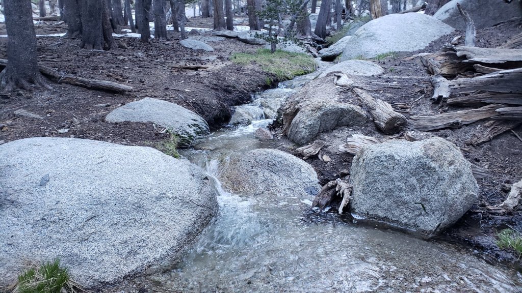
WEATHER
Six delightful months of below average temperatures to start 2023 ended abruptly this past weekend with a brief heatwave, with temperatures, especially overnight lows, well above seasonal even for July.
After a brief cooling this week to temperatures a little below average for the month, a more severe heatwave is forecast for next week. Temperatures will be well above average for July at all elevations, with overnight “low” temperatures in particular at least 10°F above seasonal at mid elevations. The high country will not be spared, with near-record temperatures currently forecast around the highest peaks for 12th-17th July.
There is no significant new precipitation in the forecasts. The fire danger in the San Jacinto mountains is currently categorized as high or very high.
At San Jacinto Peak (10,810ft/3295m) on Wednesday 5th July 2023 at 0745 the air temperature was 55.8°F (13°C), with a “windchill” temperature of 53.2°F (12°C), 5% relative humidity, and a light but steady SW wind sustained at 5 mph gusting to 6.3 mph. This relative humidity measurement of only 5% is the lowest ever reliably recorded at San Jacinto Peak.
At the Peak on Tuesday 4th July 2023 at 0655 the air temperature was 47.1°F (8°C), with a windchill temperature of 36.0°F (2°C), 16% relative humidity, and a harsh WSW wind sustained at 20 mph gusting to 30.2 mph.
At the Peak on Monday 26th June 2023 at 0750 the air temperature was 41.6°F (5°C), with a windchill temperature of 29.3°F (-2°C), 37% relative humidity, and a very fresh SW wind sustained at 16 mph gusting to 27.5 mph.
TRAIL CONDITIONS
The trail system is now functionally clear of snow. Traction devices are no longer required.
Deer Springs Trail is clear of snow up to Little Round Valley (just a handful of easily traversed patches remain). Snow cover is now <10% through Little Round Valley following very rapid melting in the past week. The designated camping areas are now clear. Above Little Round Valley only a handful of drifted snow patches remain, but they have obvious tracks up and over, or they can be hiked around.
Snow cover averages about 20% around San Jacinto Peak, ranging from <10% on the south facing slopes to 40% on the north and east slopes. With careful route-finding – such as ascending the Peak via southern rather than eastern routes – spikes are not required.
Trails around the Skunk Cabbage and Tahquitz area meadows are clear of snow, but with significant treefall hazards throughout. There are seven treefall hazards across the trails between Little Tahquitz Meadow and Chinquapin Flat, four major trees down across Willow Creek Trail between Saddle Junction and the Skunk Cabbage Meadow junction, and another four down on the trail south from Saddle Junction to Chinquapin Flat.
The Wellman Trail has a couple of small snow patches remaining on its southernmost sheltered 0.4 mile north from Annie’s Junction, but is otherwise clear.
The Peak Trail has very limited patchy snow. The initial traverse north from Wellman Divide to 9900 ft is clear and the track now follows the trail route. For about 0.6 mile between 9900-10,100 ft snow cover is <10% and the trail is obvious but in a couple of places diverts around some icy drifts. The ascending switchbacks above 10,100 ft are functionally clear, with just a couple of minor snow patches to traverse. The East Ridge Trail remains partly obscured under about 40% snow cover, but the remaining snow is heavily drifted and has melted very unevenly (forming “sun cups”, photo above).
South Ridge Trail is clear of snow both north and south of Tahquitz Peak. Fourteen treefall hazards from this past winter on the trail were removed by the Trail Report in May, and trail trimming is undertaken regularly. South Ridge Road remains closed to vehicle traffic and is not expected to reopen until graded, possibly in July.
Marion Mountain Trail is clear of snow. There is significant water flowing in the trail in places in its uppermost mile, and there are four notable treefall hazards.
Willow Creek Trail remains been a slow, messy hike for a couple of miles due to treefall hazards and whitethorn overgrowth, but thanks to the work of volunteers the situation has improved in recent weeks. As of the end of June 2023, about 35 treefall hazards remain across the trail, most of which are large and some are challenging to hike around (or over). There are four large trees down between Saddle Junction and the Skunk Cabbage Meadow junction, and then a further 25 trees down on the next 1.5 mile Forest Service section until the State Park boundary. Another six trees are down on the State Park section of trail up to Hidden Divide. Some of the trail with the most trees down – between Willow Creek and the State Park boundary – is also disappearing under thick whitethorn. The considerable amount of work that Bill Rhoads and I undertook to clear whitethorn along this trail in 2020 was not completely in vain and parts of the trail would have largely disappeared by now otherwise, but the whitethorn does make some treefall hazards more complicated to negotiate.
The Trail Report removed all 38 treefall hazards from Spitler Peak Trail between late May and early June this year, bringing the total removed to 85+ since July 2021. Trail trimming is undertaken regularly. Several minor washouts from this past winter in the upper switchbacks have significantly impacted the tread in places; these are not problematic for hikers, but the trail is impassable to stock.
Overall, the PCT is now functionally clear of snow throughout the San Jacinto mountains. Treefall hazards are a problem in many places but most notably between Apache Peak and Red Tahquitz, where I counted 106 between Miles 169-175 in June 2023. Many large downed trees make for especially slow-going around Miles 172-175.
Trails clear of both snow and treefall hazards include Black Mountain Trail, Ernie Maxwell Trail, and Devil’s Slide Trail.
The Caramba Trail from near Reeds Meadow through Laws Camp and on to Caramba, and the Cedar Trail from Willow Creek Trail to Laws, are euphemistically described by the Forest Service as “not maintained”. In reality both trails have been abandoned and no longer exist. They are so heavily overgrown with dense whitethorn that I strongly advise hikers do not attempt to follow them (regardless of how much you may trust a certain app). An informal use trail to Laws is much more direct, well maintained by the Trail Report, and avoids the challenging bushwhacking of the unmaintained trails (some Idyllwild hikers dubbed it the “King Trail” when I established the route in 2019). It leaves the Willow Creek Trail exactly 1.0 mile from Saddle Junction (0.46 mile from the Skunk Cabbage turning), descending largely on established deer trails for 1.2 miles, meeting Willow Creek just upstream from the old Laws Camp. Of 11 trees down on the King Trail after this winter, ten were removed in June and the one remaining large trunk is easy to pass. From Laws east to Caramba the route of the original Caramba Trail has been well-cairned by myself and others and can largely be followed with very careful route-finding. My May 2023 survey counted just over 100 trees down on this 2.1 miles of trail. It is especially obscure for the first 0.3 mile east of the Willow Creek crossing, becoming more obvious as it descends towards Caramba. Very cautious navigation is advised throughout the area.
Seven Pines Trail is now functionally clear of snow. The crossing of the very swollen North Fork of the San Jacinto River at 1.5 miles (just after the State Park boundary) is currently perilous and not recommended for most hikers. This will remain a tricky crossing into July. The Trail Report has “adopted” Seven Pines Trail as a priority for maintenance work as the trail has had a disproportionate number of lost hiker rescues in the past decade. Since November 2021, 67 downed trees have been removed and almost the entire trail thoroughly trimmed and cleared. Nevertheless Seven Pines remains a genuine wilderness trail unlike the relatively wide, bare, and obvious routes of, for example, Devil’s Slide or Marion Mountain trails. Cautious navigation remains essential for those without considerable experience of hiking this trail.


While all time and labor is volunteered, the San Jacinto Trail Report uses small private donations to help cover operating costs. Every year seems to have its unique challenges, and 2023 is clearly no exception. Your contribution keeps the Report available to all, free from advertising or paywalls, and independent from agencies. If you have found this Report useful, please consider using this link to the Donate page. Zelle, Venmo, and PayPal are all options. Thank you very much for your support.

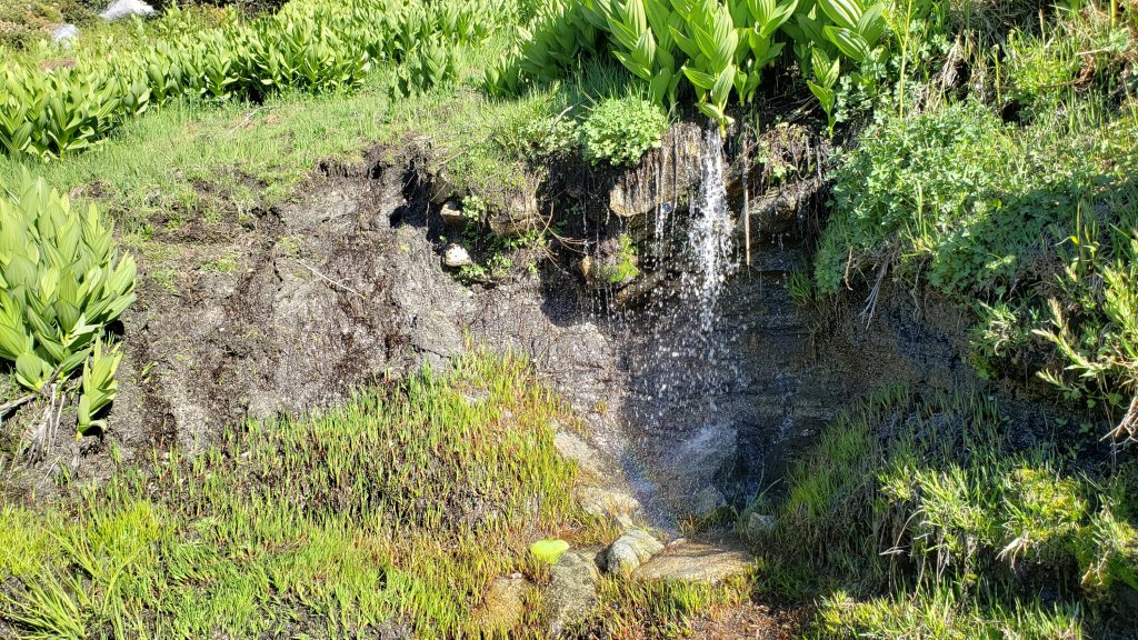
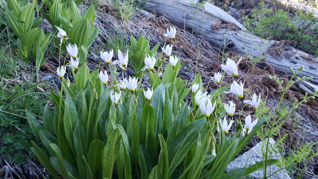
sanjacjon Uncategorized Leave a comment 9 MinutesEdit”Trail update 6th July 2023″
Trail update 28th June 2023
Localized, patchy snow remains in parts of the high country, but with the exception of a handful of sheltered areas that traditionally melt late (see Trail Conditions below), the trail system is largely clear of snow. Hikers may find that carrying spikes continues to be useful especially if hiking off-trail above about 9800 ft elevation, but with judicious route-finding spikes are not generally required on-trail.
With so little snow remaining I am no longer reporting snow depths. For readers interested in the maximum snow depths recorded in the San Jacinto mountains during this past remarkable winter, they are listed in a recent Report (available here). Images of the winter snow at its most impressive are available in various prior Reports (perhaps best at the beginning and end of March, linked here and here, respectively).
The cool temperatures that have been the dominant theme of the first six months of 2023 in the San Jacinto mountains will soon be a distant but pleasant memory. At the end of this week hot summer temperatures finally arrive, and what snow remains will of course quickly disappear. A sample of my recent weather observations from San Jacinto Peak are given below in the Weather section.
Our daily hikes include multiple routes to San Jacinto Peak multiple times per week, most recently on 23rd and 26th June, plus many other trails on intervening days. With the snow rapidly disappearing, increasingly the focus of some volunteers, including myself, is on trail clearance and maintenance work, sorely needed after a wild winter.
Currently all perennial waters, pipes, springs, etc. are flowing well, as are most ephemeral springs and creeks (although a few are starting to dry up). This summer has seen the most water on the mountain since 1998, following the great El Niño winter of 1997/98.
With so much snowmelt, there is a great deal of water in (and where still snowy, under) the trails. A tolerance for wet feet, or appropriate footwear that is at least highly water resistant, is strongly recommended. Be cautious of the few remaining fragile snow bridges over water.
Given the intensity of this past winter, hikers will encounter new treefall hazards on trails, along with considerable amounts of debris, branches, cones, etc. Trails are steadily being cleared by volunteers. The Trail Report has cleared South Ridge and Spitler Peak trails (14 and 38 trees, respectively), the PCT between Saddle and Annie’s junctions (approx. Miles 179-181, eight trees), and largely cleared Seven Pines Trail and the informal use trail down to Laws, in recent weeks. Kevin Cadieux led a PCTA crew that cleared 24 trees south from Fobes Saddle along the PCT in late May. In June 33 trees – from a total of about 68 – have been cut from Willow Creek Trail, steadily making progress on the condition of that especially challenging trail.
Be rattlesnake aware. Despite comments in this Report regarding snow and cool temperatures, Southern Pacific Rattlesnakes (Crotalus helleri) have been seen on the trail system up to at least 8000 ft elevation since late May. The lower two-thirds of Devil’s Slide Trail, near Strawberry Cienega, and trails around Tahquitz Peak are three common locations for sightings, but rattlesnakes are possible anywhere up to about 9300 ft. Rattlesnakes will get much more active with hot weather in the next week or so.

Tahquitz Peak fire lookout reopened for the season on Sunday 4th June. Access via South Ridge Trail is clear from both directions, the PCT/Chinquapin Flat to the north, or South Ridge Road (5S11) to the south, but note the latter remains closed to vehicle traffic. Black Mountain fire lookout is not expected to reopen until the road is graded, in July at the earliest.
Black Mountain Road (4S01) is in its poorest condition for at least a decade and until the road is graded 4WD and/or high clearance are recommended. Forest Service roads Dark Canyon Road (4S02) and South Ridge Road (5S11) remain closed to vehicles. Other than Dark Canyon, all other Forest and State campgrounds have now reopened.
Ramona Trail remains closed due to prescribed burning operations on Thomas Mountain.
The annual maintenance closure of the Palm Springs Aerial Tramway is scheduled for 7th-31st August 2023, a month earlier than usual.

WEATHER
With only one or two exceptions, daily daytime high temperatures have been 5-20°F below seasonal averages for most of June, while overnight lows have been closer to, but still generally below, seasonal. The overnight low temperature in Idyllwild of 36°F (2°C) on Friday 23rd June came close to the historical record low for that date and location.
This cool trend is ending, with temperatures rapidly accelerating from below seasonal on Wednesday 28th June to above average – and hot summer temperatures for the first time this year – by Friday 30th. In three days daytime high temperatures may climb by 20°F, and overnight low temperatures by about 15°F. After a very hot first few days of July, temperatures will fall to about seasonal, before potentially rising again in the second week of the month. There is no significant new precipitation in the forecasts.
At San Jacinto Peak (10,810ft/3295m) on Monday 26th June 2023 at 0750 the air temperature was 41.6°F (5°C), with a windchill temperature of 29.3°F (-2°C), 37% relative humidity, and a very fresh SW wind sustained at 16 mph gusting to 27.5 mph.
At the Peak on Friday 23rd June 2023 at 0825 the air temperature was 38.6°F (3°C), with a windchill temperature of 26.6°F (-3°C), 14% relative humidity, and a cool due West wind sustained at 14 mph gusting to 19.9 mph.
At the Peak on Sunday 18th June 2023 at 0645 the air temperature was 41.6°F (5°C), with a windchill temperature of 28.2°F (-2°C), 52% relative humidity, and a stiff WSW wind sustained at 17 mph gusting to 28.4 mph.

TRAIL CONDITIONS
Trails remain partly snow-covered above about 9700 ft. Trails below that elevation are now generally clear of snow, but elevations between 8800-9800 ft retain some snow patches in the most sheltered areas, rarely more than about 10% snow cover. Some hikers may find that spikes remain useful in a handful of high country areas, notably through Little Round Valley and on East Ridge, mainly for descending, but that they are no longer required.
Deer Springs Trail is clear of snow from the Highway 243 trailhead to near the Marion Mountain Trail junction, and functionally clear up to Little Round Valley (just a few easily traversed patches remain). Snow cover remains 40% and both very patchy but heavily drifted through Little Round Valley, but there is now a predominant boot track that largely follows the trail route. The designated camping areas are now largely clear. Above Little Round Valley snow cover averages about 10% and following the actual trail route has become much easier; the most significant drifted snow patches have obvious tracks up and over, or they can be hiked around.
Snow cover averages about 30% around San Jacinto Peak, ranging from only 10% on the south facing slopes to 90% on the north and east slopes. With careful route-finding – such as ascending the Peak via southern rather than eastern routes – spikes are not generally required.
Trails around the Skunk Cabbage and Tahquitz area meadows are clear of snow, but with significant treefall hazards throughout. There are seven treefall hazards across the trails between Little Tahquitz Meadow and Chinquapin Flat, four major trees down across Willow Creek Trail between Saddle Junction and the Skunk Cabbage Meadow junction, and another four down on the trail south from Saddle Junction to Chinquapin Flat.
The Wellman Trail has a very patchy 10% snow cover on its southernmost forested 0.4 mile north from Annie’s Junction, but is clear thereafter.
The Peak Trail has very limited patchy snow. The initial traverse north from Wellman Divide to 9900 ft is functionally clear and the track now follows the trail route. For about 0.6 mile between 9900-10,100 ft snow cover is about 10% and the predominant boot track diverts around some major icy drifts away from the trail route in places. The ascending switchbacks above 10,100 ft are functionally clear, with just a couple of extended snow patches to traverse. The East Ridge Trail boot track goes over largely continuous and very unevenly melted snow.
South Ridge Trail is clear of snow both north and south of Tahquitz Peak. Fourteen recent treefall hazards on the trail were removed by the Trail Report in May, and trail trimming is undertaken regularly. South Ridge Road remains closed to vehicle traffic and is not expected to reopen until graded, probably in July.
Marion Mountain Trail is clear of snow to the PCT/Deer Springs Trail. There is significant water flowing in the trail in places in its uppermost mile, and there are half-a-dozen notable treefall hazards.
Willow Creek Trail remains been a slow, messy hike for a couple of miles, but thanks to hard-working volunteers the situation has improved substantially in recent weeks. As of the end of June 2023, about 35 treefall hazards remain across the trail, most of which are large and some are challenging to hike around (or over). There are four large trees down between Saddle Junction and the Skunk Cabbage Meadow junction, and then a further 25 trees down on the next 1.5 mile Forest Service section until the State Park boundary. Another six trees are down on the State Park section of trail up to Hidden Divide. Some of the trail with the most trees down – between Willow Creek and the State Park boundary – is also disappearing under thick whitethorn. The considerable amount of work that Bill Rhoads and I undertook to clear whitethorn along this trail in 2020 was not completely in vain and parts of the trail would have largely disappeared by now otherwise, but the whitethorn does make some treefall hazards more complicated to negotiate.
The Trail Report removed all 38 treefall hazards from Spitler Peak Trail in late May and early June this year, bringing the total removed to at least 85 since July 2021. Trail trimming is undertaken regularly. Several minor washouts from this past winter in the upper switchbacks have significantly impacted the tread in places; these are not problematic for hikers, but the trail is impassable to stock.
Overall, the PCT is now functionally clear of snow throughout the San Jacinto mountains. Treefall hazards are a problem in many places but most notably between Apache Peak and Red Tahquitz, where I counted at least 96 between Miles 169-175 in May and June 2023. Many large downed trees make for especially slow-going around Miles 172-175.
Trails clear of both snow and treefall hazards include Black Mountain Trail, Ernie Maxwell Trail, and Devil’s Slide Trail.
Seven Pines Trail is now functionally clear of snow (a few patches remain in the uppermost 0.25 mile above 8500 ft). The crossing of the very swollen North Fork of the San Jacinto River at 1.5 miles (just after the State Park boundary) is currently perilous and not recommended for most hikers. This will remain a tricky crossing into July. The Trail Report has “adopted” Seven Pines Trail as a priority for maintenance work as the trail has had a disproportionate number of lost hiker rescues in the past decade. Since November 2021, 67 downed trees have been removed and almost the entire trail thoroughly trimmed and cleared. Nevertheless Seven Pines remains a genuine wilderness trail unlike the relatively wide, bare, and obvious routes of, for example, Devil’s Slide or Marion Mountain trails. Cautious navigation remains essential for those without significant experience of hiking this trail.
The Caramba Trail from near Reeds Meadow through Laws Camp and on to Caramba, and the Cedar Trail from Willow Creek Trail to Laws, are euphemistically described by the Forest Service as “not maintained”. In reality both trails no longer exist and are so heavily overgrown with dense whitethorn that I strongly advise hikers do not attempt to follow them (regardless of how much you may trust a certain app). An informal use trail to Laws is much more direct, well maintained by the Trail Report, and avoids the challenging bushwhacking of the unmaintained trails (some Idyllwild hikers dubbed it the “King Trail” when I established the route in 2019). It leaves the Willow Creek Trail exactly 1.0 mile from Saddle Junction (0.46 mile from the Skunk Cabbage turning), descending largely on established deer trails for 1.2 miles, meeting Willow Creek just upstream from the old Laws Camp. Of 11 trees down on the King Trail after this winter, ten were removed in June and the remaining large one is easy to pass. From Laws east to Caramba the route of the original Caramba Trail has been well-cairned by myself and others and can largely be followed with very careful route-finding. My May 2023 survey counted just over 100 trees down on this 2.1 miles of trail. It is especially obscure for the first 0.3 mile east of the Willow Creek crossing, becoming more obvious as it descends towards Caramba. Very cautious navigation is advised throughout the area.


While all time and labor is volunteered, the San Jacinto Trail Report uses small private donations to help cover modest operating costs. Every year has its unique challenges, and a remarkable 2023 is clearly no exception. Your contribution keeps the Report available to all, free from advertising or paywalls, and independent from agencies. If you have found this Report useful, please consider using this link to the Donate page. Zelle, Venmo, and PayPal are all options. Thank you so much for your support.


sanjacjon Uncategorized Leave a comment 10 MinutesEdit”Trail update 28th June 2023″
Trail and snow update 20th June 2023
With relatively little snow remaining – and what’s left now being very patchy – I am no longer reporting snow depths. However there is snow remaining in the high country, in places enough to be potentially hazardous. Trails above about 9700 ft (west side) and 9900 ft (east side) remain partly or mostly obscured by drifted icy snow. Trails as low as about 8900 ft elevation (on both flanks) have more limited patchy snow cover, mainly in sheltered areas that traditionally melt late. Cautious navigation remains valuable everywhere.
For readers interested in the maximum snow depths recorded at various locations in the San Jacinto mountains this past winter, they are listed in a recent past Report (available here). Images of this past winter’s snow at its most impressive are available in various prior Reports (perhaps best at the beginning and end of March 2023, linked here and here, respectively).
In keeping with the theme of 2023 to date, temperatures in June have been pleasantly cool and generally well below seasonal. They are finally forecast to rise, quite abruptly, to about seasonal for the month from Sunday 25th onwards, and then to well above average by the end of the month. Melting of remaining snow will accelerate markedly.
Our daily hikes include various routes to San Jacinto Peak multiple times per week, plus many other trails on intervening days. With the snow rapidly disappearing, increasingly the focus of some volunteers, including myself, is on trail clearance and maintenance work.
Spikes are no longer required for ascending San Jacinto Peak via the main east and west side routes, nor for other high country peaks. On Sunday 18th June for example, barebooting was relatively straightforward up to the Peak via Marion Mountain and upper Deer Springs trails, descending the Peak, Wellman, and Devil’s Slide trails back to Idyllwild (photos below). Some hikers will find that spikes remain useful in certain high country areas, notably through Little Round Valley and on East Ridge, mainly for descending, but that they are no longer required.
Currently all possible seasonal and perennial waters, pipes, springs, etc. are flowing well. I have not seen so much water on the mountain since 1998, following the great El Niño winter of 1997/98.
With so much snowmelt, there is a great deal of water in (and under) the trails, and this has also created some tricky stream and river crossings. Sections of Deer Springs Trail in particular will likely remain ephemeral streams for the next month or so. Appropriate footwear that is at least highly water resistant is strongly recommended. Be cautious of the few remaining fragile snow bridges over water.
Given the intensity of this past winter, hikers should anticipate encountering new treefall hazards on trails, along with considerable amounts of debris, branches, cones, etc. Trails are steadily being cleared by volunteers. The Trail Report has cleared South Ridge and Spitler Peak trails (14 and 38 trees, respectively), the PCT between Saddle and Annie’s junctions (approx. Miles 179-181, eight trees), and largely cleared Seven Pines Trail and the use trail to Laws, in recent weeks. Forest Service volunteers cut trees from the Ernie Maxwell and Devil’s Slide trails in late May. Kevin Cadieux led a PCTA crew that cleared 24 trees south from Fobes Saddle along the PCT in late May. Twenty small trees – from a total of about 68 – were cut from Willow Creek Trail on 8th June, not yet significantly improving the condition of that especially challenging trail, but progress is being made.
Be rattlesnake aware. Despite comments in this Report regarding snow and cool temperatures, Southern Pacific Rattlesnakes (Crotalus helleri) have been seen on the trail system up to at least 7500 ft elevation since late May. The lower two-thirds of Devil’s Slide Trail, near Strawberry Cienega, and trails around Tahquitz Peak are three common locations for sightings, but rattlesnakes are possible anywhere up to at least 9300 ft. Rattlesnakes will get much more active with warmer weather expected in late June.
Tahquitz Peak fire lookout reopened for the season on Sunday 4th June. Safe access is now possible via South Ridge Trail from both directions, the PCT/Chinquapin Flat to the north (crossing a couple of tiny snow patches), or South Ridge Road (5S11) to the south, but note the latter remains closed to vehicle traffic. Black Mountain fire lookout will not reopen until the road is graded, which is not expected until July.
Black Mountain Road (4S01) is in its poorest condition for at least a decade and until the road is graded 4WD and/or high clearance are recommended. Forest Service roads Dark Canyon Road (4S02) and South Ridge Road (5S11) remain closed to vehicles. Other than Dark Canyon, all other Forest and State campgrounds have now reopened.
The annual maintenance closure of the Palm Springs Aerial Tramway is scheduled for 7th-31st August 2023, a month earlier than usual.
WEATHER
With only one or two exceptions, daily daytime high temperatures have been 5-20°F below seasonal averages in the first three weeks of June, while overnight lows have been closer to, but still generally below, seasonal. This cool trend remains for much of this week, with temperatures finally rising to about seasonal for June from Sunday 25th, and then continuing to rise to above average at all elevations – to hot summer temperatures for the first time this year – for the final couple of days of the month. There is no significant new precipitation in the forecasts.
At San Jacinto Peak (10,810ft/3295m) on Sunday 18th June 2023 at 0645 the air temperature was 41.6°F (5°C), with a windchill temperature of 28.2°F (-2°C), 52% relative humidity, and a stiff WSW wind sustained at 17 mph gusting to 28.4 mph.
At the Peak on Monday 12th June 2023 at 0825 the air temperature was 46.0°F (8°C), with a “windchill” temperature of 43.8°F (7°C), 48% relative humidity, and effectively calm conditions with the lightest WSW breeze gusting to 1.2 mph.
At the Peak on Saturday 10th June 2023 at 0655 the air temperature was 40.5°F (5°C), with a windchill temperature of 30.9°F (-1°C), 19% relative humidity, and a moderate SSW wind sustained at 8 mph gusting to 14.4 mph.

TRAIL CONDITIONS
Trails remain partly or largely snow-covered above about 9800 ft. Trails below about 9800 ft are now generally clear of snow, but elevations between 8800-9800 ft locally retain some snow cover depending on aspect, drifting, and tree cover, but typically only 10-20% snow cover.
Both the Ernie Maxwell Trail and Devil’s Slide Trail are completely clear of snow.
Trails around the Skunk Cabbage and Tahquitz area meadows are functionally clear of snow, with just a few patches remaining in the most sheltered locations, but with significant treefall hazards throughout. There are seven treefall hazards across the trails between Little Tahquitz Meadow and Chinquapin Flat, four major trees down across Willow Creek Trail between Saddle Junction and the Skunk Cabbage Meadow junction, and another four down on the trail south from Saddle Junction to Chinquapin Flat.
The Wellman Trail has 30% snow cover on its southernmost 0.4 mile north from Annie’s Junction, but is clear thereafter. Note there is considerable flowing water in the trail in several places for a few tenths of a mile around Wellman’s Cienega.
The Peak Trail has very limited patchy snow. The initial traverse north from Wellman Divide to 9900 ft is functionally clear and the track largely follows the trail route. For about 0.6 mile between 9900-10,100 ft snow cover is about 40% and the boot track only partly follows the trail. The ascending switchbacks above 10,100 ft average only 10% snow cover and are clearing rapidly. The predominant boot track now follows the normal trail route around to Summit Junction. The East Ridge boot track remains obvious but goes over almost continuous and very lumpy snow.
Deer Springs Trail is clear of snow from the Highway 243 trailhead to near the Marion Mountain Trail junction. From there snow cover averages only about 10% up to Little Round Valley, with many lengthy clear sections. Snow cover remains 60% and heavily drifted through Little Round Valley, and there is no predominant boot track that accurately follows the trail route. Most of the designated camping areas are now largely clear. Above Little Round Valley snow cover averages about 40%, but with an extended central portion under 50% snow cover, and conversely the uppermost exposed switchbacks now less than 20% snow covered. Following the actual trail route is becoming easier. Cautious navigation is required on Deer Springs Trail, especially through and above Little Round Valley. Spikes can be useful (but are no longer required), especially for descending.
South Ridge Trail is clear of snow to Tahquitz Peak on the southern approach from South Ridge Road, and functionally clear of snow on the northern approach from Chinquapin Flat/PCT. The latter 0.4 mile section has two tiny snow patches remaining, but with excellent tracks with easy steps to follow through the snow and do not require spikes. Fourteen recent treefall hazards on the trail were removed by the Trail Report in May, and trail trimming is undertaken regularly. South Ridge Road remains closed to vehicle traffic and should reopen once graded, expected in the next month.
Willow Creek Trail is frankly a slow, messy hike for a couple of miles. At least 48 treefall hazards remain across the trail, most of which are large and some are challenging to hike around (or over) [multiple surveys in June 2023]. There are four large trees down between Saddle Junction and the Skunk Cabbage Meadow junction, and then a further 38 trees down on the next 1.5 mile Forest Service section until the State Park boundary. At least another six trees are down on the State Park section of trail up to Hidden Divide. Some of the trail with the most trees down – between Willow Creek and the State Park boundary – is also disappearing under thick whitethorn. The huge amount of work that Bill Rhoads and I undertook to clear whitethorn along this trail in 2020 was not completely in vain and parts of the trail would have largely disappeared by now otherwise, but the whitethorn does make some treefall hazards more complicated to negotiate.
Marion Mountain Trail is clear of snow to the PCT/Deer Springs Trail. There is significant water flowing in the trail in its uppermost mile, and there are half-a-dozen notable treefall hazards.
The Trail Report removed all 38 treefall hazards from Spitler Peak Trail in late May and early June this year, bringing the total removed to at least 85 since July 2021. Several minor washouts from this past winter in the upper switchbacks have significantly impacted the tread in places; these are not problematic for hikers, but the trail is impassable to stock.
Black Mountain Trail is clear of both snow and treefall hazards.
Seven Pines Trail is clear of snow to 8500 ft elevation (about three miles up from the trailhead). The crossing of the very swollen North Fork of the San Jacinto River at 1.5 miles (just after the State Park boundary) is currently perilous and not recommended for most hikers. This will remain a tricky crossing into July. Patchy snow cover between 8500 ft and the junction with Deer Springs Trail/PCT (at about 8700 ft) averages about 10%. The Trail Report has “adopted” Seven Pines Trail as a priority for maintenance work as the trail has had a disproportionate number of lost hiker rescues in the past decade. Since November 2021, 67 downed trees have been removed and almost the entire trail thoroughly trimmed and cleared. Nevertheless Seven Pines remains a genuine wilderness trail unlike the relatively wide, bare, and obvious routes of, for example, Devil’s Slide or Marion Mountain trails. Cautious navigation remains essential for those without significant experience of hiking this trail.
The Caramba Trail from near Reeds Meadow through Laws Camp and on to Caramba, and the Cedar Trail from Willow Creek Trail to Laws, are euphemistically described by the Forest Service as “not maintained”. In reality both trails no longer exist and are so heavily overgrown with dense whitethorn that I strongly advise hikers do not attempt to follow them (regardless of how much you may trust a certain app). An informal use trail to Laws is much more direct, relatively well maintained, and avoids all of the very challenging bushwhacking of the unmaintained trails (some local hikers dubbed it the “King Trail” when I established the route in 2019). It leaves the Willow Creek Trail exactly 1.0 mile from Saddle Junction (0.46 mile from the Skunk Cabbage turning), descending largely on established deer trails for 1.2 miles, meeting Willow Creek just upstream from the old Laws Camp. Of ten trees down on the King Trail [surveyed 11th June 2023], three have been removed, but none of the remaining seven are significant hazards. From Laws east to Caramba the route of the original Caramba Trail has been well-cairned by myself and others and can largely be followed with careful route-finding. My autumn 2022 survey counted 97 trees down on this 2.1 miles of trail. It is especially obscure 0.1-0.3 mile east of the Willow Creek crossing, becoming more obvious near Caramba. Very cautious navigation is advised throughout the area.
While all time and labor is volunteered, the San Jacinto Trail Report uses small private donations to help cover modest operating costs. Every year has its unique challenges, and a remarkable 2023 is clearly no exception. Your contribution keeps the Report available to all, free from advertising or paywalls, and independent from agencies. If you have found this Report useful, please consider using this link to the Donate page. Zelle, Venmo, and PayPal are all options. Thank you so much for your support.


sanjacjon Uncategorized Leave a comment 9 MinutesEdit”Trail and snow update 20th June 2023″
Trail and snow update 13th June 2023
The high country trails continue to be a mix of icy snow drifts to hike around or up-and-over and cleared patches. Temperatures so far in June have been pleasantly cool and generally well below seasonal, but are forecast to rise to about average for the month starting Wednesday 21st.
Humber Park, including Devil’s Slide trailhead, will be closed on 12th-14th June due to pesticide spraying work. The area will be closed to both parking and hiking access, according to the closure order posted at Humber this past weekend. [I confirmed that Humber Park had reopened on the evening of Wednesday 14th June.]
Our daily survey hikes include various routes to San Jacinto Peak multiple times per week, typically South Ridge and Spitler Peak trails weekly, and many other trails on intervening days. With the snow rapidly disappearing increasingly the focus of volunteers, including myself, is on trail clearance and maintenance work.
Spikes are no longer required for ascending San Jacinto Peak via the main east and west side routes, nor for other high country peaks, especially given the firmer snow in recent cool weather. On Saturday 10th and Monday 12th June for example, barebooting was relatively straightforward to and from the Peak on upper Deer Springs and Peak trails, respectively, but the previous week spikes had been useful descending to about 9900 ft. Some hikers will find that spikes remain useful in the high country, mainly for descending, but they are no longer required.
Trails above about 9700 ft (west side) and 9900 ft (east side) remain largely, or at least partly, obscured by drifted icy snow. Trails as low as about 8700 ft elevation (on both flanks) have increasingly patchy snow cover, especially on more northerly-facing slopes. Cautious navigation remains important everywhere.
Recently I have had several inquiries regarding water availability for campers in the high country. Given the typically dry conditions of the past decade, such questions are understandable. Currently there is water everywhere, and all possible seasonal and perennial waters, pipes, springs, etc. are flowing well. Personally I have not seen so much water on the mountain since 1998, following the great El Niño winter of 1997/98.
Details of average snow depths measured at various locations on the trail system are given at the foot of this posting, with the greatest snow depth recorded this winter for comparison.
With so much snowmelt, there is a great deal of water in (and under) the trails, and this has also created some tricky stream and river crossings. Lengthy sections of Deer Springs Trail in particular will likely remain ephemeral streams for the next month or so. Appropriate footwear that is at least highly water resistant is strongly recommended. Be cautious of fragile snow bridges over water.
Hikers should anticipate encountering new treefall hazards on trails, along with considerable amounts of debris, branches, cones, etc. While this is partly a consequence of the recent intense winter, most trails in the San Jacinto mountains have been inadequately maintained for years largely due to agency dysfunction, exacerbated by wildfires, the coronavirus pandemic, and climate change.
Despite many new fallen trees in the recent remarkable winter, trails are steadily being cleared by volunteers. The Trail Report has cleared South Ridge and Spitler Peak trails (14 and 38 trees, respectively), and largely cleared Seven Pines Trail and the use trail to Laws, in recent weeks. Forest Service volunteers cut trees from the Ernie Maxwell and Devil’s Slide trails in late May. Kevin Cadieux led a PCTA crew that cleared 24 trees south from Fobes Saddle along the PCT in late May. Twenty small trees – from a total of about 68 – were cut from Willow Creek Trail on 8th June, not yet significantly improving the condition of that especially challenging trail, but at least progress is being made.
Be rattlesnake aware. Despite comments in this Report regarding snow and cool temperatures, Southern Pacific Rattlesnakes (Crotalus helleri) have been seen on the trail system up to at least 7500 ft elevation since late May. The lower two-thirds of Devil’s Slide Trail, near Strawberry Cienega, and trails around Tahquitz Peak are three common locations for sightings, but rattlesnakes are possible anywhere up to at least 9300 ft.
Tahquitz Peak fire lookout reopened for the season on Sunday 4th June. Safe access is now possible via South Ridge Trail from both directions, the PCT/Chinquapin Flat to the north (crossing a couple of tiny snow patches), or South Ridge Road (5S11) to the south, but note the latter remains closed to vehicle traffic. Black Mountain fire lookout will not reopen until Black Mountain Road (4S01) is graded, possibly in June.
Forest Service roads currently closed to vehicular traffic include Dark Canyon Road (4S02) and South Ridge Road (5S11). Santa Rosa Road (7S02) reopened in early June. Black Mountain Road (4S01) is nominally closed but has effectively reopened. The gate 1.7 miles from the highway was vandalized repeatedly in mid May and the Forest Service decided not to attempt to lock it again. The road is in its poorest condition for at least a decade and until the road is graded – expected later in June – 4WD and/or high clearance are recommended.
The State Park Stone Creek campground reopened in early May. Forest Service campgrounds at Fern Basin, Marion Mountain and Boulder Basin reopened in early June, but Dark Canyon campground remains closed at this time.
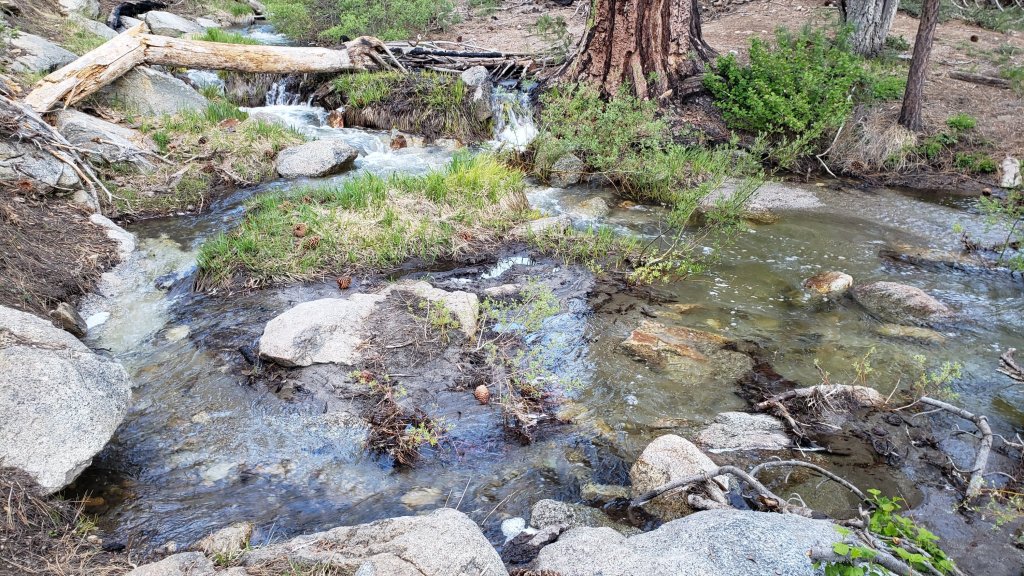
WEATHER
Daytime high temperatures were generally 10-20°F below seasonal averages in the first half of June, while overnight lows were closer to, but still slightly below, seasonal. This temperature pattern is changing, with warming during the course of this week, and then stronger warming in the following week with temperatures finally about seasonal for June from Wednesday 21st onwards. There is no significant new precipitation in the forecasts.
At San Jacinto Peak (10,810ft/3295m) on Monday 12th June 2023 at 0825 the air temperature was 46.0°F (8°C), with a “windchill” temperature of 43.8°F (7°C), 48% relative humidity, and effectively calm conditions with the lightest WSW breeze gusting to 1.2 mph.
At the Peak on Saturday 10th June 2023 at 0655 the air temperature was 40.5°F (5°C), with a windchill temperature of 30.9°F (-1°C), 19% relative humidity, and a moderate SSW wind sustained at 8 mph gusting to 14.4 mph.
At the Peak on Monday 5th June 2023 at 0745 the air temperature was 41.1°F (5°C), with a windchill temperature of 27.5°F (-2°C), 32% relative humidity, and a sharp SE wind sustained at 17 mph gusting to 27.4 mph.

TRAIL CONDITIONS
Trails remain partly or largely snow-covered above about 9800 ft. Trails below about 8800 ft are now generally clear of snow. Elevations between 8800-9800 ft vary considerably in snow cover depending on aspect, drifting, and tree cover, but typically average only 10-20% snow cover.
The PCT is now largely clear of snow through the San Jacinto mountains. Spikes remain potentially useful for three relatively short sections. The trail is clear of snow from Miles 151 (Highway 74) to about Mile 175. Treefall hazards are a problem on this section, I counted at least 94 between Miles 169-175 in May. Snow cover is about 10% from Miles 175 (Red Tahquitz) to 177.7 (Chinquapin Flat). Some hikers may find spikes useful on this section although the boot track is well-defined and relatively flat. Snow cover is very patchy and averages <10% between Miles 177.7 to Saddle Junction (about Mile 179). The south-facing slope of Miles 179-180 is clear of snow, but from Mile 180 (elevation 8900 ft) to about Mile 181 just past Annie’s Junction snow cover is 70%. Miles 181-185 are clear, then snow cover increases (about 50%) from Mile 185. Spikes can be useful on the snowy parts of this section, but are not required at this time depending upon personal preference and experience. Snow cover averages 30% along Fuller Ridge (Miles 185.5-191). The track does now largely follow the PCT route. Miles 185.5-187.5 average about 30% snow cover, Miles 187.6-188.5 (a south-facing slope) are clear, Miles 188.5-190 have 50% snow cover, and finally Miles 190-191 are now largely clear. Spikes can be useful for Fuller Ridge but they are no longer required, again depending on comfort level hiking on patchy icy snow.
Both the Ernie Maxwell Trail and Devil’s Slide Trail are completely clear of snow.
Trails around the Skunk Cabbage and Tahquitz area meadows are functionally clear of snow, with just a few patches remaining in the most sheltered locations, but significant treefall hazards throughout. There are seven treefall hazards across the trails between Little Tahquitz Meadow and Chinquapin Flat, four major trees down across Willow Creek Trail between Saddle Junction and the Skunk Cabbage Meadow junction, and another four down on the trail south from Saddle Junction to Chinquapin Flat.
The Wellman Trail has 70% snow cover on its southernmost 0.4 mile north from Annie’s Junction, but is functionally clear thereafter. The portion of the track with most snow cover does not always accurately follow the trail route. Note there is considerable flowing water in the trail in several places for a few tenths of a mile around Wellman’s Cienega.
The Peak Trail has increasingly patchy snow. The initial traverse north from Wellman Divide has only 10% snow cover for about a mile to 9900 ft and the track largely follows the trail route. For about 0.6 mile between 9900-10,100 ft snow cover is about 90% and the boot track only partly follows the trail. The ascending switchbacks above 10,100 ft average 40% snow cover and are clearing rapidly. The predominant boot track now follows the normal trail route around to Summit Junction. The East Ridge boot track remains obvious but goes over continuous and very lumpy snow.
There is a well-traveled boot track through 50% snow cover following the trail route up from Round Valley to Wellman Divide. Round Valley itself is largely clear of snow.
Deer Springs Trail is clear of snow from the Highway 243 trailhead to near the Marion Mountain Trail junction. The 0.6 mile from there to the Fuller Ridge Trail junction averages 40% snow cover. Once Deer Springs Trail leaves the PCT at the Fuller Ridge Trail junction, snow cover averages only about 10% up to Little Round Valley, with many lengthy clear sections. Snow cover remains 70% and heavily drifted through Little Round Valley, and there is no predominant boot track that accurately follows the trail route. Some of the designated camping areas are now largely clear. Above Little Round Valley snow cover averages about 50%, but with an extended central portion under 70% snow cover, and conversely the uppermost exposed switchbacks now less than 20% snow covered. Following the actual trail route is becoming easier, while the various winter season boot tracks have now largely melted out and are invisible and/or of little use. Cautious navigation is required on Deer Springs Trail, especially through and above Little Round Valley. Spikes can be useful (but are no longer required), especially for descending.
South Ridge Trail is clear of snow to Tahquitz Peak on the southern approach from South Ridge Road, and functionally clear of snow on the northern approach from Chinquapin Flat/PCT. The latter 0.4 mile section has three tiny snow patches remaining, but all have excellent tracks with easy steps to follow through the snow and do not require spikes. Fourteen recent treefall hazards on the trail were removed by the Trail Report in May, and trail trimming is undertaken regularly. South Ridge Road remains closed to vehicle traffic and will reopen once graded, possibly later in June.
Willow Creek Trail [surveyed 11th June] is frankly a slow, messy hike for a couple of miles. At least 48 treefall hazards remain across the trail, most of which are large and some are challenging to hike around (or over). There are four large trees down between Saddle Junction and the Skunk Cabbage Meadow junction, and then a further 38 trees down on the next 1.5 mile Forest Service section until the State Park boundary. At least another six trees are down on the State Park section of trail up to Hidden Divide. Some of the section with the most trees down – between Willow Creek and the State Park boundary – is also disappearing under thick whitethorn. The huge amount of work that Bill Rhoads and I undertook to clear whitethorn along this trail in 2020 was not completely in vain and parts of the trail would have largely disappeared by now otherwise, but the whitethorn does make some treefall hazards more complicated to negotiate.
Marion Mountain Trail is now clear of snow to the PCT/Deer Springs Trail. There is significant water flowing in the trail in its uppermost mile, along with half-a-dozen notable treefall hazards.
The Trail Report removed all 38 treefall hazards, plus many branches and other debris, from Spitler Peak Trail in late May and early June this year, bringing the total removed to at least 85 since July 2021. Several minor washouts from this past winter in the upper switchbacks have significantly impacted the tread in places; these are minor for hikers, but the trail is not passable to stock.
Black Mountain Trail is clear of both snow and treefall hazards. Boulder Basin campground reopened on 8th June.
Seven Pines Trail is clear of snow to 8300 ft elevation (about 2.5 miles up from the trailhead). The crossing of the very swollen North Fork of the San Jacinto River at 1.5 miles (just after the State Park boundary) is currently perilous and not recommended for most hikers. This may remain a tricky crossing into July. Patchy snow cover steadily increases between 8300 ft and the junction with Deer Springs Trail/PCT (at about 8700 ft), but overall averages about 20%. Some drifts obscure key switchbacks on the upper trail, and navigation, always a little tricky on this trail at the best of times, will be challenging for those not thoroughly familiar with this route. Of seven new treefall hazards on the trail below the snow line, six were removed by the Trail Report in late May, and a good start was made on clearing the trail of branches and other debris. Dark Canyon Road – the access for the Seven Pines trailhead – remains closed to vehicles for the foreseeable future.
The Caramba Trail from near Reeds Meadow through Laws Camp and on to Caramba, and the Cedar Trail from Willow Creek Trail to Laws, are euphemistically described by the Forest Service as “not maintained”. In reality both trails no longer exist and are so heavily overgrown I strongly advise hikers do not attempt to follow them (regardless of how much you may trust a certain app). An informal use trail to Laws is much more direct, relatively well maintained, and avoids all of the very challenging bushwhacking of the unmaintained trails (some local hikers dubbed it the “King Trail” when I established the route in 2019). It leaves the Willow Creek Trail exactly 1.0 mile from Saddle Junction (0.46 mile from the Skunk Cabbage turning), descending largely on established deer trails for 1.2 miles, meeting Willow Creek just upstream from the old Laws Camp. Of ten trees down on the King Trail [surveyed 11th June 2023], three have been removed, but none of the remaining seven are significant hazards. From Laws east to Caramba the route of the original Caramba Trail has been well-cairned by myself and others and can largely be followed with careful route-finding. My autumn 2022 survey counted 97 trees down on this 2.1 miles of trail. It is especially obscure 0.1-0.3 mile east of the Willow Creek crossing, becoming more obvious near Caramba. Very cautious navigation is advised throughout the area.
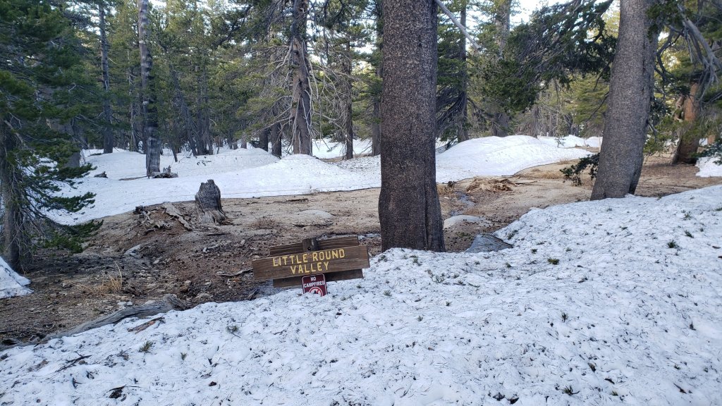
SNOW DEPTHS
Measured on 10th-12th June 2023. The first number is the current average snow depth, followed in parentheses by the maximum depth recorded in winter 2022/23 where known. Note that broad averages are given; due to drifting in strong winds, and the differential effects of melting (and of rain on snow in some March storms), there is considerable inconsistency of depth. Altitudes and PCT Miles are approximate.
San Jacinto Peak (10810 ft): 12-18 inches, many large clear patches developing and snow cover about 50%, but drifts 2-4 feet deep remain in places, especially on East Ridge (105 inches on 31st March)
Little Round Valley (9800 ft): 20 inches, about 70% snow cover, drifts 2-4 feet deep in places.
Wellman Divide (9700 ft): 9 inches, ranging from 0-25 inches (70-75 inches on 3rd and 31st March)
Annie’s Junction/PCT Mile 180.8 (9070 ft): 8 inches, snow cover 40% here (80 inches on 3rd March)
Long Valley (8600 ft): 0 inches (60 inches on 3rd March)
Strawberry Junction/PCT Mile 183.2 (8100 ft): 0 inches
Saddle Junction/PCT Mile 179 (8070 ft): 0 inches (48-50 inches on 3rd March)
Devil’s Slide trailhead at Humber Park (6550 ft): 0 inches (46 inches on 3rd March)
Idyllwild (at 5550 ft): 0 inches (45 inches on 1st March)
PCT Mile 151 at crossing with Highway 74 (4800 ft): 0 inches (13 inches in first week of March)
While all time and labor is volunteered, the San Jacinto Trail Report uses small private donations to help cover modest operating costs. Every year has its unique challenges, and a remarkable 2023 is clearly no exception. Your contribution keeps the Report available to all, free from advertising or paywalls, and independent from agencies. If you have found this Report useful, please consider using this link to the Donate page. Zelle, Venmo, and PayPal are all options. Thank you so much for your support.


sanjacjon Uncategorized 4 Comments 12 MinutesEdit”Trail and snow update 13th June 2023″
Trail and snow update 6th June 2023
UPDATE Sunday 11th June 2023: Humber Park, including the Devil’s Slide trailhead, will be closed on 12th-14th June for pesticide spraying operations. The area will be closed to both parking and hiking according to the closure order posted at Humber this weekend.
——————————–
The steady melt of the winter snowpack continues, and the high country trails are increasingly a mix of cleared patches and large icy drifts to go up-and-over. Most notable is the recent clearing of one of the most popular hiking trails, the short spur of South Ridge Trail up to Tahquitz Peak from Chinquapin Flat/PCT Mile 177.7. Other than a seasonably warm weekend on 3rd-4th, temperatures so far in June have been below seasonal, and are forecast to remain pleasantly cool until mid month.
Recently I have had several inquiries regarding water availability for campers in the high country. Given the typically dry conditions of the past decade, such questions are understandable. Currently there is water everywhere, and all possible seasonal and perennial waters, pipes, springs, etc. are flowing well. Personally I have not seen so much water on the mountain since 1998, following the great El Niño winter of 1997/98.
Our daily survey hikes include different routes to San Jacinto Peak multiple times per week, South Ridge and Spitler Peak trails weekly, and other trails on intervening days. With the snow rapidly disappearing, increasingly I am spending time on trail clearance and maintenance work.
On multiple hikes in recent days I have not required spikes for ascending San Jacinto Peak via the main east and west side routes, especially on firmer snow given the cooler weather. On Monday 5th June for example, barebooting was relatively straightforward to the Peak on Deer Springs Trail, but spikes were useful descending back down to Little Round Valley to about 9800 ft. Broadly speaking spikes continue to be useful in the high country, and some hikers may even prefer trail crampons.
Trails above about 9700 ft remain largely obscured by heavily drifted snow (lower in places). Trails as low as about 8700 ft elevation retain some patchy snow cover, especially on north-facing slopes. The reliable and obvious boot tracks of April and early May have become very scrappy with the widespread but patchy melting of recent weeks. Cautious navigation remains important everywhere.
Details of snow depths measured at various locations on the trail system are given at the foot of this posting, alongside the greatest snow depth recorded this past winter for comparison.
Spikes remain useful for the foreseeable future above about 9000 ft (potentially lower in places) but they are no longer be required on most routes, and depending on your comfort level hiking on icy or softening snow, and the quality of footwear being used. This elevation will continue to move slowly upwards with melting of snow, but spikes will remain useful for many hikers throughout June at least in parts of the high country. Spikes tend to be helpful for descending even when they are not required for ascending.
Crampons – with hiking poles and/or an ice axe, depending on terrain – are becoming less valuable, but remain potentially useful above about 9000 ft. They can be most useful off-trail in the high country on colder mornings. They are no longer required on the short section of South Ridge Trail across the north face of Tahquitz Peak.
With so much snowmelt, there is a great deal of water in (and under) the trails, and this has also created some tricky stream and river crossings. Lengthy sections of Deer Springs Trail in particular will basically remain ephemeral streams for the next month or two. Appropriate footwear that is at least highly water resistant is strongly recommended. Be especially cautious of the many fragile and potentially dangerous snow bridges across water.
Hikers should anticipate encountering many new treefall hazards on trails, along with considerable amounts of debris, branches, cones, etc. While this is partly a consequence of the recent intense winter, most trails in the San Jacinto mountains have been inadequately maintained for years largely due to agency dysfunction, plus effects of wildfires, the coronavirus pandemic, and climate change.
Trails are steadily being cleared of treefall hazards by volunteers. The Trail Report has cleared 14 and 38 trees from South Ridge and Spitler Peak trails, respectively, and largely cleared Seven Pines Trail, all since mid May. Forest Service volunteers recently cut trees from the Ernie Maxwell and Devil’s Slide trails. Kevin Cadieux led a PCTA crew that cleared 24 trees south from Fobes Saddle along the PCT last week. Twenty small trees – from a total of about 68 – were cut from Willow Creek Trail on 8th June, sadly not significantly improving the condition of that challenging trail, but at least progress is being made.
Hikers should be prepared for temperatures near freezing in the high country, and below freezing when considering wind chill effects, at least on some days (see below for my most recent weather observations from San Jacinto Peak).
Be rattlesnake aware. Despite comments in this Report regarding snow and cool temperatures, Southern Pacific Rattlesnakes (Crotalus helleri) have been seen on the trail system up to at least 7500 ft elevation since late May. The lower two-thirds of Devil’s Slide Trail, near Strawberry Cienega, and around Tahquitz Peak are typically locations with many sightings, but rattlesnakes are possible anywhere up to at least 9300 ft once temperatures ameliorate. Anyone interested in learning more about the unique rattlesnakes of the San Jacinto mountains, and the relationship that my dog and I have with them, may want to read an article I wrote in July 2020 (link here).
Tahquitz Peak fire lookout reopened for the season on Sunday 4th June. Safe access is now possible via South Ridge Trail from both directions, the PCT/Chinquapin Flat to the north, or South Ridge Road (5S11) to the south, but note the latter remains closed to vehicle traffic. Black Mountain fire lookout will not reopen until Black Mountain Road (4S01) is graded, expected to be later in June.
Forest Service roads currently closed to vehicular traffic include Dark Canyon Road (4S02) and South Ridge Road (5S11). Santa Rosa Road (7S02) reopened in early June. The State Park Stone Creek campground reopened in early May. Forest Service campgrounds at Fern Basin and Marion Mountain reopened at the beginning of June, but Boulder Basin and Dark Canyon campgrounds remain closed at this time. Black Mountain Road (4S01) is nominally closed but has effectively reopened. The gate 1.7 miles from the highway was vandalized repeatedly in mid May and the Forest Service decided not to attempt to lock it again. The road is in its poorest condition for at least a decade and until the road is graded – expected later in June – 4WD and/or high clearance are recommended. The USFS gate at Humber Park reopened on Wednesday 19th April.

WEATHER
Temperatures generally below seasonal averages have been a consistent theme for most of 2023 so far, and this is forecast to continue in the first half of June. Daytime high temperatures will be around 10-15°F below average, but even cooler on 6th-7th and 10th-12th, while overnight lows will be nearer, but still slightly below, seasonal, into the middle of the month.
There is no significant new precipitation in the forecasts, but as we experienced in the last week of May, some days over the next two weeks may be partly cloudy at mid elevations on the western side of the mountain range as the lifted marine layer hugs the hillsides at around 5000 ft elevation, occasionally moving higher, and always bringing the possibility of misty drizzle.
At San Jacinto Peak (10,810ft/3295m) on Monday 5th June 2023 at 0745 the air temperature was 41.1°F (5°C), with a windchill temperature of 27.5°F (-2°C), 32% relative humidity, and a sharp SE wind sustained at 17 mph gusting to 27.4 mph.
At the Peak on Thursday 1st June 2023 at 0750 the air temperature was 41.6°F (5°C), with a windchill temperature of 33.3°F (1°C), 38% relative humidity, and a light ESE wind sustained at 4 mph gusting to 8.8 mph.
At the Peak on Tuesday 30th May 2023 at 0840 the air temperature was 38.5°F (4°C), with a windchill temperature of 28.0°F (-2°C), 18% relative humidity, and a fresh due South wind sustained at 7 mph gusting to 13.4 mph.
TRAIL CONDITIONS
Trails remain largely or completely snow-covered above about 9700 ft. Trails below about 8700 ft are now generally clear of snow. Elevations between 8700-9700 ft vary considerably in snow cover depending on aspect, drifting, and tree cover, but typically average about 10-50% snow cover.
The PCT is now largely clear of snow through the San Jacinto mountains. Spikes remain useful for three relatively short sections. The trail is clear of snow from Miles 151 (Highway 74) to about Mile 175. Treefall hazards are a problem on this section, I counted at least 94 between Miles 169-175 in May. Snow cover is about 30% from Miles 175 (Red Tahquitz) to 177.7 (Chinquapin Flat). Some hikers may find spikes useful on this section although the boot track is well-defined and relatively flat. Snow cover is increasingly patchy and averages only about 10% between Miles 177.7 to Saddle Junction (about Mile 179). The south-facing slope of Miles 179-180 is clear of snow, but from Mile 180 (elevation 8900 ft) to about Mile 181 just past Annie’s Junction snow cover is 80% and the track can be hard to follow in places. Miles 181-184 are clear, then snow cover increases (>50%) from Mile 184.5. Spikes can be useful on the snowy parts of this section, but are not required at this time for hikers experienced with snow travel. Snow cover averages 30% along Fuller Ridge (Miles 185.5-191). The track does now largely follow the PCT route. Miles 185.5-187.5 average about 40% snow cover, Miles 187.6-188.5 (a south-facing slope) are clear, Miles 188.5-190 have 70% snow cover, and finally Miles 190-191 are now largely clear. Spikes are useful for Fuller Ridge but they are no longer required, depending on personal comfort level hiking on patchy icy snow.
Devil’s Slide Trail is clear of snow to Saddle Junction. Spikes are not required.
Trails around the Skunk Cabbage and Tahquitz area meadows are functionally clear of snow, with just a few patches remaining in the most sheltered locations. There are seven significant treefall hazards across the trails between Little Tahquitz Meadow and Chinquapin Flat, with a few others elsewhere around the meadows.
The Wellman Trail has largely continuous snow cover on its southern 0.4 mile north from Annie’s Junction, but snow cover is a very patchy 20% thereafter. The southern portion of the track (with continuous snow cover) does not always accurately follow the trail route, but the remainder of the track is now largely true to the trail route. Note there is considerable flowing water in the trail in several places for a few tenths of a mile around Wellman’s Cienega.
The Peak Trail route remains largely snow-covered. The initial traverse north from Wellman Divide has 20% snow cover for about a mile to 9900 ft and the track largely follows the trail route, but thereafter snow cover is about 90%. Around 9900-10,100 ft the predominant boot track does not follow the trail route. Close to San Jacinto Peak the predominant boot track ascends directly up the East Ridge over continuous lumpy snow cover. There are now some lighlty-traveled tracks to follow through the snow on the uppermost switchbacks of the typical Peak Trail route.
There is a well-traveled boot track through 60% snow cover largely following the trail route up from Round Valley to Wellman Divide. Extensive clear patches are opening up in and around Round Valley, though few are actually in the designated camping areas.
Deer Springs Trail is clear of snow to near the Marion Mountain Trail junction. The 0.6 mile from there to the Fuller Ridge Trail junction averages 60% snow cover. Once the Deer Springs track leaves the PCT at the south end of Fuller Ridge, the trail is clear for the first mile (to about 9300 ft elevation). Thereafter snow cover averages about 40% up to Little Round Valley, with a mix of extensive clear patches and short sections of near-continuous snow. Snow cover remains 80% and heavily drifted through Little Round Valley, and there is no predominant boot track that follows the actual trail route. Some of the designated camping areas now have cleared areas suitable for a tent or two. Above Little Round Valley snow cover averages about 70%, with the lowest exposed section at 60%, then an extended central portion at 90% snow cover, and the uppermost exposed switchbacks now only about 40% snow covered. Following the actual trail route is not easy, and the various snow season boot tracks have now largely melted out and are of limited use. Cautious navigation is required on Deer Springs Trail, especially through and above Little Round Valley. Spikes can be useful (but are no longer essential) especially for descending.
The Ernie Maxwell Trail is clear of snow. Crossing Chinquapin Creek just below Humber Park can be tricky as it is swollen with snowmelt.
South Ridge Trail is clear of snow to Tahquitz Peak on the southern approach from South Ridge Road, and functionally clear of snow on the northern approach from Chinquapin Flat/PCT. The latter 0.4 mile section has a handful of tiny snow patches remaining, but all have excellent tracks with easy steps to follow through the snow and do not require spikes (photo above). Fourteen recent treefall hazards on the trail were removed by the Trail Report in May, and trail trimming is undertaken regularly. South Ridge Road remains closed to vehicle traffic and will reopen once graded, possibly later in June.
Marion Mountain Trail is now clear of snow to the PCT, a couple of tiny patches remain at the top. There is a great deal of water flowing in the trail in its uppermost mile, along with half-a-dozen notable treefall hazards.
The Trail Report removed 38 treefall hazards, plus many branches and other debris, from Spitler Peak Trail in late May and early June this year, bringing the total removed to at least 85 in the past two years. The trail is now clear of treefall hazards. Several minor washouts from this past winter in the upper switchbacks have significantly impacted the tread in places. The trail is not passable to horses.
Black Mountain Trail is functionally clear of snow. A few minor patches remain on the climber’s trail route from the top of Black Mountain Trail to near the fire lookout. Boulder Basin campground remains closed at this time.
Seven Pines Trail is clear of snow to 8200 ft elevation (about 2.5 miles up from the trailhead). The crossing of the very swollen North Fork of the San Jacinto River at 1.5 miles (just after the State Park boundary) is currently perilous and not recommended for most hikers. This will likely remain a tricky crossing into July. Patchy snow cover steadily increases between 8200 ft and the junction with Deer Springs Trail/PCT (at about 8700 ft), but overall averages about 40%. Many of the drifts obscure key sections and switchbacks on the upper trail, and navigation will be challenging for those not thoroughly familiar with this trail. There is a very lightly traveled and poorly defined boot track through the snow patches. Of seven new treefall hazards down on the clear parts of the trail, six were removed by the Trail Report in late May, and a good start was made on clearing the trail of branches and other debris. Dark Canyon Road – the access for the Seven Pines trailhead – remains closed to vehicles.
The Caramba Trail from near Reeds Meadow through Laws Camp and on to Caramba, and the Cedar Trail from Willow Creek Trail to Laws, are euphemistically described by the Forest Service as “not maintained”. In reality both trails no longer exist and are so heavily overgrown I strongly advise hikers do not attempt to follow them. An informal use trail to Laws is much more direct and avoids all of the very challenging bushwhacking of the unmaintained trails (some local hikers dubbed it the “King Trail” when I established the route in 2019). It leaves the Willow Creek Trail exactly 1.0 mile from Saddle Junction (0.46 mile from the Skunk Cabbage turning), descending largely on established deer trails for 1.2 miles, meeting Willow Creek just upstream from the old Laws Camp. From Laws east to Caramba the route of the original Caramba Trail has been well-cairned by myself and others and can largely be followed with careful route-finding. My autumn 2022 survey counted 97 trees down on this 2.1 miles of trail. It is especially obscure 0.1-0.3 mile east of the Willow Creek crossing, becoming more obvious near Caramba. Very cautious navigation is advised throughout the area.
Willow Creek Trail is a slow, messy hike for a couple of miles. At least 48 treefall hazards remain across the trail, most of which are large and some are challenging to hike around (or over). There are four large trees down between Saddle Junction and the Skunk Cabbage Meadow junction, and then a further 38 trees down on the next 1.5 mile Forest Service section until the State Park boundary. At least another six trees are down on the State Park section of trail up to Hidden Divide. Some of the section with the most trees down – between Willow Creek and the State Park boundary – is also rapidly disappearing under thick whitethorn. The huge amount of work that Bill Rhoads and I undertook to clear whitethorn along this trail in 2020 was not completely in vain and parts of the trail would have largely disappeared by now otherwise, but the whitethorn does make some treefall hazards more complicated to negotiate.
The section of Skyline Trail that falls within the State Park jurisdiction above 5800 ft elevation reopened on 19th May following a closure of nearly four months due to supposedly “hazardous” snow conditions. (For readers who are unclear, Skyline Trail forms the lower two-thirds of the “Cactus-to-Clouds” [C2C] route.) Skyline Trail is now functionally clear of snow.

SNOW DEPTHS
Measured on 1st June (east side) and 5th June (west side). The first number is the current average snow depth, followed in parentheses by the maximum depth recorded in winter 2022/23 where known. Note that broad averages are given; due to drifting in strong winds, and the differential effects of melting (and of rain on snow in some March storms), there is considerable inconsistency of depth. Altitudes and PCT Miles are approximate.
San Jacinto Peak (10810 ft): 20 inches, with many large clear patches developing, but some drifts 5-6 feet deep remain in places (105 inches on 31st March)
Little Round Valley (9800 ft): 24 inches, about 80% snow cover, drifts up to 5 feet deep in places.
Wellman Divide (9700 ft): 12 inches, ranging from 0-30 inches (70-75 inches on both 3rd and 31st March)
Annie’s Junction/PCT Mile 180.8 (9070 ft): 18 inches, very patchy and heavily drifted here (80 inches on 3rd March)
Long Valley (8600 ft): 0 inches (60 inches on 3rd March)
Strawberry Junction/PCT Mile 183.2 (8100 ft): 0 inches
Saddle Junction/PCT Mile 179 (8070 ft): 0 inches (48-50 inches on 3rd March)
Devil’s Slide trailhead at Humber Park (6550 ft): 0 inches (46 inches on 3rd March)
Idyllwild (at 5550 ft): 0 inches (45 inches on 1st March)
PCT Mile 151 at crossing with Highway 74 (4800 ft): 0 inches (13 inches in first week of March)
While all time and labor is volunteered, the San Jacinto Trail Report uses small private donations to help cover modest operating costs. Every year has its unique challenges, and a remarkable 2023 is clearly no exception. Your contribution keeps the Report available to all, free from advertising or paywalls, and independent from agencies. If you have found this Report useful, please consider using this link to the Donate page. Zelle, Venmo, and PayPal are all options. Thank you so much for your support.


sanjacjon Uncategorized 3 Comments 14 MinutesEdit”Trail and snow update 6th June 2023″
Snow and trail update 1st June 2023
UPDATE Saturday 3rd June: the short section of South Ridge Trail on the north side of Tahquitz Peak is now functionally clear of snow. The four tiny patches that remain between Chinquapin Flat and Tahquitz Peak have excellent tracks across them and no spikes or other traction devices are required (photo below).
————————————–
Cooler weather in the last week of May only slowed snowmelt rates slightly, and a return to warm weather forecast for early June will accelerate melting once again. Nevertheless snow conditions in early June will continue to be more reminiscent of early or mid April in a “normal” year of the past decade.
Hiking different routes to San Jacinto Peak multiple times per week facilitates assessment of snow conditions on the trail system around the high country including the highest sections of the PCT in the San Jacinto mountains (Miles 179-181 and 183-185.5). Our daily hikes in between mainly assess other parts of the PCT, side trails and alternates, including, for example, South Ridge Trail every week. Our hike on Tuesday 30th May included all of Seven Pines Trail and a lengthy section of Fuller Ridge Trail, as well as all of upper Deer Springs Trail.
On multiple hikes in recent days I did not require spikes for ascending San Jacinto Peak via the main east and west side routes, with firmer snow given the cooler weather. However on two recent hikes spikes were especially useful for descending the western side via Deer Springs Trail, down to about 8700 ft. Overall spikes continue to be useful in the high country, and some hikers may prefer trail crampons.
Trails above about 8900 ft remain largely obscured by light to moderate snow (lower in places). Trails as low as 8000 ft elevation can have shallow but increasingly patchy snow cover, especially on north-facing slopes. The reliable boot tracks of April and early May have become increasingly scrappy with the widespread but patchy melting of recent weeks. Cautious navigation remains important everywhere.
Details of snow depths measured at various locations on the trail system are given at the foot of this posting. Note however that snow depth itself is very rarely indicative of the difficulty (or ease) of hiking a particular track or trail. For example a firm, well-compacted track across snow several feet deep is often much easier hiking than a poorly defined track across just a few inches depth of angled ice.
Spikes remain very useful for the foreseeable future above about 9000 ft (lower in places) but they may no longer be required depending upon the specifics of the route, the hiker’s comfort level hiking on icy snow, plus the quality of footwear being used. This elevation will continue to move slowly upwards with melting of snow over the next few weeks, but spikes will remain useful throughout June at least in parts of the high country. Spikes tend to be especially helpful for descending even when they are not required for ascending.
Crampons – with hiking poles and/or an ice axe, depending on terrain – are becoming less valuable, but remain potentially useful everywhere above about 9000 ft. Some hikers may find them especially valuable anywhere off-trail in the high country on colder mornings.
Snowshoes can be useful above about 9000 ft for off-trail travel only for the next few weeks when the conditions are warm enough, for example to reach the >10,000 ft peaks that are not connected by well-traveled tracks, on the warmest afternoons.
With so much snowmelt, there is a great deal of water in (and under) the trails, and this has also created some tricky stream and river crossings. Lengthy sections of Deer Springs Trail in particular will basically remain ephemeral streams for the next month or two. Appropriate footwear that is at least highly water resistant is strongly recommended. Be especially cautious of the many fragile and potentially dangerous snow bridges across water (e.g., see photo below).
Hikers should anticipate encountering many new treefall hazards on trails, along with considerable amounts of debris, branches, cones, etc. While some of these issues are a consequence of the recent intense winter, most trails in the San Jacinto mountains have been inadequately maintained for years largely due to agency dysfunction, plus some effects of wildfires, the coronavirus pandemic, and climate change.
Trails are steadily being cleared of treefall hazards by volunteers. The Trail Report has cleared South Ridge Trail, and largely cleared Spitler Peak and Seven Pines trails, in the past two weeks. Forest Service volunteers have cut trees from Ernie Maxwell and Devil’s Slide trails since mid May.
Hikers should be prepared for temperatures near freezing in the high country, and below freezing when considering wind chill effects (see below for my most recent weather observations from San Jacinto Peak).
Forest Service roads currently closed to vehicular traffic include Dark Canyon Road (4S02), South Ridge Road (5S11), and Santa Rosa Road (7S02), plus all their various side roads. The USFS gate at Humber Park reopened on Wednesday 19th April. The State Park Stone Creek campground reopened in early May, but Forest Service campgrounds remain closed at this time. Black Mountain Road (4S01) has effectively reopened. The gate 1.7 miles from the highway was vandalized in mid May and the Forest Service have decided to leave it open. The road is in its poorest condition for at least a decade and 4WD and/or high clearance are recommended.
Tahquitz Peak fire lookout reopens for the season on Sunday 4th June. Safe access is now possible from both directions on South Ridge Trail. Black Mountain fire lookout will not reopen until Black Mountain Road (4S01) is graded, which may be later this month.

WEATHER
The last week of May has been pleasantly cool, with temperatures below seasonal and more typical of April, especially at mid elevations. This will continue until 2nd June, after which temperatures will warm markedly. Next weekend (3rd-4th June) will be feel especially warm, but is forecast to be actually only slightly above seasonal for the month, before temperatures drop slightly again the following week. Next week the daytime highs will be near or even somewhat below average, while overnight lows will be at or slightly above seasonal. There is no significant new precipitation in the forecasts.
At San Jacinto Peak (10,810ft/3295m) on Thursday 1st June 2023 at 0750 the air temperature was 41.6°F (5°C), with a windchill temperature of 33.3°F (1°C), 38% relative humidity, and a light ESE wind sustained at 4 mph gusting to 8.8 mph.
At the Peak on Tuesday 30th May 2023 at 0840 the air temperature was 38.5°F (4°C), with a windchill temperature of 28.0°F (-2°C), 18% relative humidity, and a fresh due South wind sustained at 7 mph gusting to 13.4 mph.
At the Peak on Friday 26th May 2023 at 0740 the air temperature was 35.4°F (2°C), with a windchill temperature of 24.6°F (-4°C), 12% relative humidity, and a steady due West wind sustained at 10 mph gusting to 13.6 mph.

PACIFIC CREST TRAIL INFORMATION
The PCT is now largely clear of snow through the San Jacinto mountains. However three relatively short sections remain extensively snow-covered.
The trail is clear from Miles 151 (Highway 74) to about Mile 175. Treefall hazards are a problem on this section but none are insurmountable. I counted at least 94 between Miles 169-175 earlier in May. Apache Peak (Mile 169.5) and other nearby chutes have been clear of snow for several weeks.
Snow cover is about 50% from Miles 175 (Red Tahquitz) to 177.7 (Chinquapin Flat), but with a well traveled track through the extended snow patches and with very little consequential terrain. Some hikers will find that spikes can be useful on this section. The posthole track on Miles 175-178 does not accurately follow the trail route in places.
Snow cover is increasingly patchy and averages only about 30% between Miles 177.7 to Saddle Junction (about Mile 179). The south-facing slope of Miles 179-180 is clear of snow, but from Mile 180 (elevation 8900 ft) to about Mile 181 just past Annie’s Junction snow cover is 90% and the track can be hard to follow in places. Miles 181-184 are functionally clear of snow, and snow cover then becomes extensive (>90%) from Mile 184.5. Spikes can be useful on the snowy parts of this section, but are not required at this time for hikers experienced with snow travel.
There is a boot track through an average of 30% moderate-to-deep snow cover on the PCT along Fuller Ridge (Miles 185.5-191). The track does now largely follow the PCT route. Miles 185.5-187.5 average about 40% snow cover, Miles 187.6-188.5 (mainly south-facing slope) is largely clear, Miles 188.5-190 has >80% snow cover, and Miles 190-191 are now largely clear. At this time continuing north on Fuller Ridge requires the comfort level to hike on icy snow on some angled terrain, and spikes are recommended. Some hikers may still prefer to use trail crampons.
A well established alternate from Idyllwild – avoiding Fuller Ridge – is to connect back to the PCT at about Mile 191 using Black Mountain Road. Black Mountain Road is now clear of snow
PCT hikers are reminded that overnight stays are not permitted at or near San Jacinto Peak by the State Park, including in the historic shelter. The shelter should be left available for use by emergency services at all times. Little Round Valley and Strawberry Junction are excellent overnight options for thru-hikers.

TRAIL CONDITIONS
Trails remain largely (or in places completely) snow-covered above about 8900 ft. This elevation will continue to rise steadily with melting into June. Trails below about 8000 ft are now generally clear of snow. Elevations between 8000-8900 ft vary considerably in snow cover depending on aspect, drifting, and tree cover, but typically average about 10-50% snow cover. Details of the PCT, its boot tracks, and alternates are given in the PCT section above.
Devil’s Slide Trail is clear of snow to Saddle Junction. Spikes are not required.
The Wellman Trail has largely continuous snow cover on its southern 0.4 mile north from Annie’s Junction, but snow cover is a very patchy 20% thereafter. The southern portion of the track (with continuous snow cover) does not always accurately follow the trail route, but the remainder of the track is now largely true to the trail route. Note there is considerable flowing water in the trail in several places for a few tenths of a mile around Wellman’s Cienega.
The Peak Trail route remains largely snow-covered. The initial traverse north from Wellman Divide has 35% rapidly thinning snow cover for about a mile to 9900 ft and the track largely follows the trail route, but thereafter snow cover is >90%. Around 9900-10,100 ft the boot track does not follow the trail route. Close to San Jacinto Peak the predominant boot track ascends directly up the East Ridge (not up the switchbacks of the upper Peak Trail) over continuous lumpy snow cover.
There is a well-traveled boot track through 70% snow cover largely following the trail route up from Round Valley to Wellman Divide. Extensive clear patches are opening up in and around Round Valley, though few are actually in the designated camping areas.
Deer Springs Trail is clear of snow to Strawberry Junction. The trail is then functionally clear of snow (only a few limited patches) for about 1.5 miles north of Strawberry Junction until just south of the Marion Mountain Trail junction. Thereafter the predominant boot track generally follows the true trail route through largely continuous snow until Fuller Ridge. Once the Deer Springs track leaves the PCT at the south end of Fuller Ridge, snow cover is about 20% for the first 0.6 mile (to about 9200 ft elevation). Thereafter snow cover averages 60% up to Little Round Valley, but with both extensive clear patches and some lengthy sections of continuous snow. There is now one predominant boot track that almost entirely follows the actual trail route. Snow cover remains >90% and heavily drifted through Little Round Valley. Above Little Round Valley there are multiple boot tracks through the largely continuous icy snow. Most ascend steeply and directly towards San Jacinto Peak, and while one of them does now approximate to the true trail route, it is not the predominant track. Cautious navigation is required on Deer Springs Trail, especially above Little Round Valley, and spikes are recommended, especially for descending.
The Ernie Maxwell Trail is clear of snow. Crossing Chinquapin Creek just below Humber Park can be tricky as it is swollen with snowmelt.
South Ridge Trail is completely clear of snow to Tahquitz Peak. Fourteen recent treefall hazards on the trail were removed by the Trail Report on 16th May, and trail trimming is undertaken weekly. South Ridge Road remains closed to vehicle traffic, but is clear of snow and is tentatively scheduled to reopen in the first half of June.
Marion Mountain Trail is clear of snow for its lower 1.5 miles to 7500 ft. Snow then starts quite abruptly and from that elevation the softening snow cover averages 30% but with a mix of long clear sections and some lengthy snow patches. There is a great deal of water flowing in the trail in its uppermost mile, and there are many increasingly fragile snow bridges. The boot track is not always easy to follow in its uppermost section as it nears the PCT/Deer Springs Trail. Most hikers will prefer to use spikes, especially for descending parts of the upper half.
The Trail Report removed about 30 treefall hazards from Spitler Peak Trail on 25th May, bringing the total removed to just under 100 in the past two years. Half-a-dozen minor downed trees remain but none are significant obstructions. More worrisome are 5-6 washouts in the upper switchbacks which have significantly impacted the tread in places, necessitating significant trail recovery work (photos in prior Report).
Black Mountain Trail is functionally clear of snow. A few minor patches remain on the climber’s trail route from the top of Black Mountain Trail to near the fire lookout. Boulder Basin campground remains closed at this time.
Seven Pines Trail is clear of snow to 8200 ft elevation (about 2.5 miles up from the trailhead). The crossing of the very swollen North Fork of the San Jacinto River at 1.5 miles (just after the State Park boundary) is currently perilous and not recommended for most hikers. This will likely remain a dangerous crossing into July. Patchy snow cover steadily increases between 8200 ft and the junction with Deer Springs Trail/PCT (at about 8700 ft), but overall averages about 40%. Many of the drifts obscure key sections and switchbacks on the upper trail, and navigation will be challenging for those not extremely familiar with this trail. There is a very lightly traveled and poorly defined boot track through the snow patches. Of seven new treefall hazards down on the clear parts of the trail, six were removed by the Trail Report on 30th May, and a good start was made on clearing the trail of branches and other debris.
Dark Canyon Road – the access for Seven Pines Trail – is clear of snow, but remains closed to vehicles.
The section of Skyline Trail that falls within the State Park jurisdiction above 5800 ft elevation reopened on 19th May following a closure of nearly four months due to supposedly “hazardous” snow conditions. (For readers who are unclear, Skyline Trail forms the lower two-thirds of the “Cactus-to-Clouds” [C2C] route.) Skyline Trail is now functionally clear of snow.
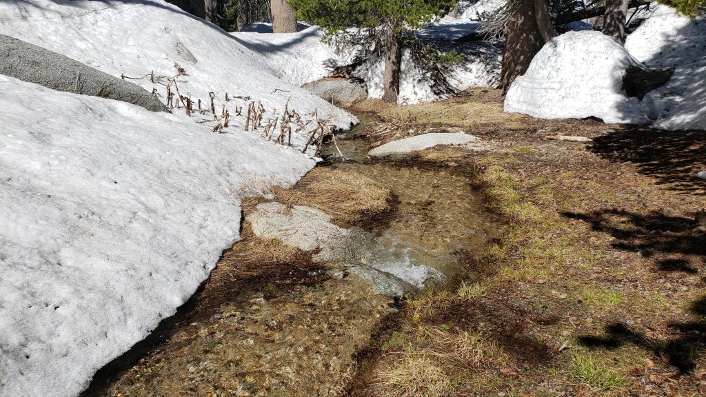
SNOW DEPTHS
Measured on 1st June (east side) and 29th May (west side) 2023. The first number is the current average snow depth, followed in parentheses by the maximum depth recorded in winter 2022/23 where known. Note that broad averages are given; due to drifting in strong winds, and the differential effects of melting (and of rain on snow in some March storms), there is considerable inconsistency of depth. Altitudes and PCT Miles are approximate.
San Jacinto Peak (10810 ft): 26 inches, with clear patches developing, but drifts up to 4 feet deep remain in places (105 inches on 31st March)
Little Round Valley (9800 ft): 28 inches, with large clear patches but also many drifts up to 5 feet deep.
Wellman Divide (9700 ft): 12 inches, ranging from 0-30 inches (70-75 inches on both 3rd and 31st March)
Annie’s Junction/PCT Mile 180.8 (9070 ft): 18 inches, very patchy and heavily drifted here (80 inches on 3rd March)
Long Valley (8600 ft): 0 inches (60 inches on 3rd March)
Strawberry Junction/PCT Mile 183.2 (8100 ft): 0 inches
Saddle Junction/PCT Mile 179 (8070 ft): 0 inches (48-50 inches on 3rd March)
Devil’s Slide trailhead at Humber Park (6550 ft): 0 inches (46 inches on 3rd March)
Idyllwild (at 5550 ft): 0 inches (45 inches on 1st March)
PCT Mile 151 at crossing with Highway 74 (4800 ft): 0 inches (13 inches in first week of March)
While all time and labor is volunteered, the San Jacinto Trail Report uses small private donations to help cover modest operating costs. Every year has its unique challenges, and a remarkable 2023 is clearly no exception. Your contribution keeps the Report available to all, free from advertising or paywalls, and independent from agencies. If you have found this Report useful, please consider using this link to the Donate page. Zelle, Venmo, and PayPal are all options. Thank you so much for your support.
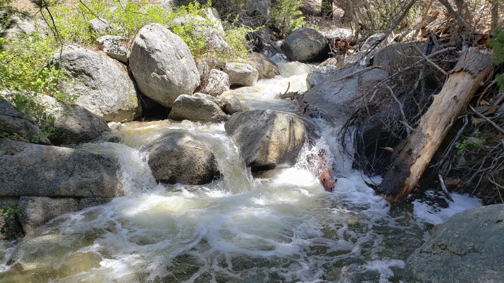
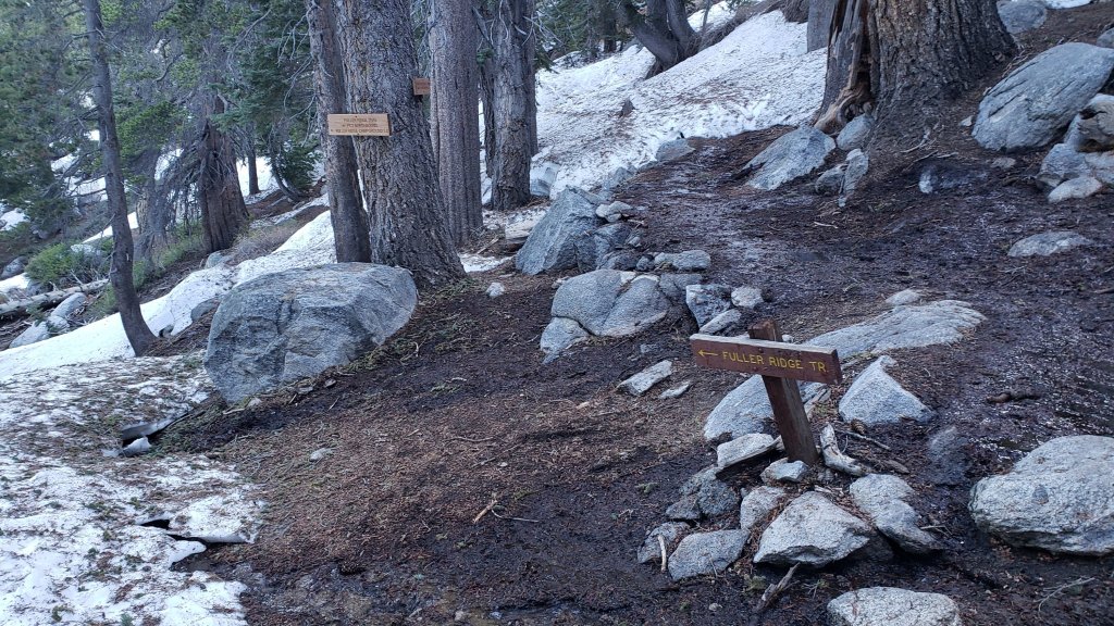


sanjacjon Uncategorized 2 Comments 13 MinutesEdit”Snow and trail update 1st June 2023″
Snow and trail update 24th May 2023
Temperatures well above seasonal on 12th-20th May greatly accelerated melting of snow, with many high country areas losing a further 12-18 inches of snow in the past week or so. Cooler weather for the remainder of the month, especially from 24th-29th, will slow snowmelt rates, and snow should be relatively firm underfoot, at least in the mornings.
An exceptionally early monsoon weather pattern, more reminiscent of late summer than late May, has been another weather feature of the past week. A couple of wonderful monsoonal thunderstorms on Sunday 21st May combined for an impressive 0.72 inch of rain in Idyllwild, with 0.24 inch recorded at Saddle Junction (8100 ft), 0.11 inch at Wellman’s Cienega (9300 ft), and a light sprinkling on the highest peaks.
Hiking different routes to San Jacinto Peak multiple times per week facilitates assessment of snow conditions on the trail system around the high country including the highest sections of the PCT in the San Jacinto mountains (Miles 179-181 and 183-185.5). Our daily hikes in between mainly assess other parts of the PCT, side trails and alternates, including, for example, South Ridge Trail every week.
On Monday 22nd May (and again on Friday 26th) I didn’t require spikes for ascending San Jacinto Peak via the east side route using Devil’s Slide, Wellman, Peak and East Ridge trails. However spikes were useful for descending the western side via Deer Springs Trail, down to about 8700 ft. Cooler weather this week may harden the compacted snow tracks, improving the traction and hiking conditions. Overall spikes continue to be useful in the high country, and some hikers may prefer trail crampons, although neither are now essential hiking on the established boot tracks.
Trails above about 8900 ft remain largely obscured by light to moderate snow (lower in places). Trails as low as 8000 ft elevation can have shallow but increasingly patchy snow cover, especially on north-facing slopes. The reliable boot tracks of April and early May have become increasingly scrappy with the widespread but patchy melting of recent weeks. Cautious navigation remains important everywhere.
Details of snow depths measured at various locations on the trail system are given at the foot of this posting. Note that snow depth itself is rarely indicative of the difficulty (or otherwise) of hiking a particular track or trail. For example a firm, well-compacted track across snow several feet deep is often much easier hiking than a poorly defined track across just a few inches depth of angled ice.
Traction decisions have generally become much easier again following the minor snowstorm in early May. The optimum traction device at any given time and place depends on a complex interaction of factors including time of day, sun exposure of the trail, air temperature, quality of footwear tread, and extent to which a track has been traveled and compacted. The willingness of the hiker to posthole in soft afternoon snow (which is rarely easy or fun) also influences choice of traction.
Spikes remain useful for the foreseeable future above about 9000 ft (lower in places) but they may no longer be required depending upon the specifics of the route, the hiker’s comfort level hiking on icy snow, plus the quality of footwear being used. This elevation will continue to move steadily upwards with melting of snow over the next few weeks, but spikes will remain useful throughout June at least in parts of the high country. Spikes tend to be especially helpful for descending even when they are not required for ascending.
Crampons – with hiking poles and/or an ice axe, depending on terrain – are becoming less valuable, but remain potentially useful everywhere above about 9000 ft. Some hikers will find them useful anywhere off-trail in the high country on colder mornings, and on-trail on certain moderate and higher angle slopes, such as the Peak Trail above Wellman Divide, Deer Springs Trail above Little Round Valley, and especially on the short section of South Ridge Trail across the north face of Tahquitz Peak.
Snowshoes remain useful above about 9000 ft for off-trail travel over the next few weeks, for example to reach the >10,000 ft peaks that are not connected by well-traveled tracks. Snow away from the compacted tracks generally softens rapidly by mid morning once direct sun hits slopes and temperatures rise.
In addition to snow and navigation issues, hikers should anticipate encountering many new treefall hazards on all trails, along with considerable amounts of debris, branches, cones, etc. While some of these issues are a consequence of the recent intense winter, most trails in the San Jacinto mountains have been inadequately maintained for years largely due to agency dysfunction, plus some effects of wildfires, the coronavirus pandemic, and climate change. In addition there can be a great deal of water in (and under) the trails, and this has also created some tricky crossings. Be very cautious of snow bridges across water.
Hikers should be prepared for temperatures near freezing in the high country, and below freezing when considering wind chill effects (see below for my recent weather observations from San Jacinto Peak).
Forest Service roads currently closed to vehicular traffic include Dark Canyon Road (4S02), South Ridge Road (5S11), and Santa Rosa Road (7S02), plus all their various side roads. The USFS gate at Humber Park reopened on Wednesday 19th April. The State Park Stone Creek campground reopened in early May, but Forest Service campgrounds remain closed at this time. Black Mountain Road (4S01) has effectively reopened. The gate 1.7 miles from the highway was vandalized in mid May and the Forest Service have decided to leave it open for now. The road is in its poorest condition for at least a decade and 4WD and/or high clearance are recommended.
WEATHER
Daytime temperatures are forecast to be below seasonal for May from 24th-31st, while overnight lows will be cooler than last week but about seasonal for the month. Air temperatures in the high country will remain just above freezing, but with windchills at or below freezing around the highest peaks. Temperatures will steadily warm to near seasonal in the first week of June. With the monsoonal easterly air flow now breaking down, there is no significant new precipitation in the forecasts.
At San Jacinto Peak (10,810ft/3295m) on Monday 22nd May 2023 at 0825 the air temperature was 43.9°F (7°C), with a windchill temperature of 36.7°F (3°C), 72% relative humidity, and a light SSW breeze sustained at 2 mph gusting to 6.8 mph.
At the Peak on Friday 19th May 2023 at 0805 the air temperature was 46.3°F (8°C), with a “windchill” temperature of 44.8°F (7°C), 37% relative humidity, and a near-calm SW breeze sustained at 0 mph gusting to 2.7 mph.
At the Peak on Monday 15th May 2023 at 0750 the air temperature was 41.6°F (5°C), with a windchill temperature of 30.7°F (-1°C), 39% relative humidity, and a fresh ESE wind sustained at 11 mph gusting to 18.8 mph.
PACIFIC CREST TRAIL INFORMATION
The PCT is now largely clear of snow through the San Jacinto mountains. However two significant sections remain extensively snow-covered.
The trail is clear from Miles 151 (Highway 74) to about Mile 175. Treefall hazards are a problem on this section but none are insurmountable. I counted at least 94 between Miles 169-175 on 1st May. Apache Peak (Mile 169.5) has been clear of snow for several weeks.
Snow cover is about 70% from Miles 175 (Red Tahquitz) to 177.7 (Chinquapin Flat), but with a well traveled track through the extended snow patches and with very limited consequential terrain. Many hikers will find that spikes can be useful on this section. Note that the posthole track on Miles 175-178 does not accurately follow the trail route in places.
PCT hikers should not attempt to use South Ridge Trail from the PCT at Chinquapin Flat (roughly Mile 177.7) to Idyllwild via Tahquitz Peak, even though this looks temptingly simple on apps and maps. There are no reliable steps to follow through a section of steeply angled (and notoriously treacherous) ice. Crampons, always with an ice axe, and expert knowledge of how to use this equipment on high angle terrain, are required. Even in low snow years these slopes always take many weeks longer to clear of ice than adjacent areas, and they are not expected to fully clear until the first week of June this year.
Snow cover is increasingly patchy and averages <50% between Miles 177.7 to Saddle Junction (about Mile 179). The south-facing slope of Miles 179-180 is clear of snow, but from Mile 180 (elevation 8900 ft) to about Mile 181 just past Annie’s Junction snow cover is >95% and the track can be hard to follow in places. Miles 181-184 are functionally clear of snow, and snow cover then becomes largely continuous from Mile 184.5. Spikes can be useful on the snowy parts of this section, but are not required at this time for hikers experienced with snow travel.
There is a boot track through an average of 60% moderate-to-deep snow cover on the PCT along Fuller Ridge (Miles 185.5-191). My video report from 10th May (available here) remains largely relevant. The track does not accurately follow the PCT route in some places and passes through some challenging terrain, especially in Miles 185.5-187. At this time continuing north on Fuller Ridge requires the skills and comfort level to hike on angled terrain with some moderate exposure, and spikes are recommended. Many hikers I have seen and talked to are carrying an ice axe to use with their spikes. Some hikers may still prefer to use trail crampons. Judging by what I see and hear firsthand on the mountain, most hikers are now passing through Fuller Ridge, but a significant percentage continue to prefer using the Black Mountain Road alternate at this time.
There is a potentially dangerous myth circulating on PCT social media that going up and over San Jacinto Peak somehow avoids Fuller Ridge. Whether you remain on the PCT northbound (going around at lower elevation via Strawberry Junction) or leave the PCT at Annie’s Junction (Mile 180.8) to go up to San Jacinto Peak and then down the west side to reconnect to the PCT at about Mile 185.5, you still have to hike Fuller Ridge (which is Miles 185.5-190.5). It is possible to do the former route more safely by leaving the PCT at Strawberry Junction (approx. Mile 183) and descending Deer Springs Trail, which is completely clear of snow below Strawberry Junction, back into Idyllwild.
A well established alternate from Idyllwild – avoiding Fuller Ridge – is to connect back to the PCT at about Mile 191 using Black Mountain Road. Black Mountain Road is clear of snow for the lower five miles, and then is functionally clear (increasingly patchy 10% snow cover) for the upper three miles to the PCT. Mile 191 northward to Interstate 10 is clear of snow.
PCT hikers are reminded that overnight stays are not permitted at or near San Jacinto Peak by the State Park, including in the historic shelter. The shelter should be left available for use by emergency services at all times. Little Round Valley and Strawberry Junction are excellent overnight options for thru-hikers.

TRAIL CONDITIONS
Trails remain largely or completely snow-covered above about 8900 ft. This elevation will continue to rise steadily with melting into June. Trails below about 7700 ft are now clear of snow. Elevations between 7700-8900 ft vary considerably in snow cover depending on aspect, drifting, and tree cover, but typically average about 10-50% snow cover. Details of the PCT, its boot tracks, and alternates are given in the PCT section above.
The section of Skyline Trail that falls within the State Park jurisdiction above 5800 ft elevation reopened on 19th May following a closure of nearly four months due to supposedly “hazardous” snow conditions. (For readers who are unclear, Skyline Trail forms the lower two-thirds of the “Cactus-to-Clouds” [C2C] route.) Skyline Trail is now functionally clear of snow.
Devil’s Slide Trail is clear of snow to Saddle Junction. Spikes are not required.
The Wellman Trail has continuous snow cover on its southern 0.4 mile, but snow cover is a very patchy 40% otherwise. The southern portion of the track (with continuous snow cover) does not accurately follow the trail route, but the remainder of the track is now largely true to the trail route. Note there is considerable flowing water in the trail in several places in the area of Wellman’s Cienega.
The Peak Trail route remains largely snow-covered. The initial traverse north from Wellman Divide has about 90% rapidly thinning snow cover for about a mile to 9900 ft and the track largely follows the trail route, but thereafter snow cover is continuous. Multiple meandering boot tracks are becoming increasingly scrappy above 10,000 ft, especially on the main traverse up to near Miller Peak, they only vaguely approximate to the trail route, and the going is consequently slow. Close to San Jacinto Peak the boot track ascends directly up the East Ridge (not the switchbacks of the upper Peak Trail).
There is a well-traveled boot track through largely continuous snow up from Round Valley to Wellman Divide. Extensive clear patches are opening up in and around Round Valley, though few are actually in the designated camping areas.
Deer Springs Trail is clear of snow to Strawberry Junction. The trail is then functionally clear of snow (only a few limited patches) for about 1.3 miles north of Strawberry Junction to about 8600 ft just south of the Marion Mountain Trail junction. Thereafter the predominant posthole track largely follows the true trail route through almost continuous snow until Fuller Ridge. Once the Deer Springs track leaves the PCT at the south end of Fuller Ridge, there is rarely one predominant boot track, and there are often multiple lightly-traveled tracks generally taking direct routes up the various snow slopes and only periodically approximating to the trail route. Snow cover is about 90% up to Little Round Valley, and functionally continuous thereafter. Above Little Round Valley there are multiple poorly-defined boot tracks which ascend steeply and directly towards San Jacinto Peak, none of them approximating to the true trail route. Cautious navigation is required on Deer Springs Trail, especially above the Fuller Ridge Trail junction, and spikes are recommended, especially for descending.
The Ernie Maxwell Trail is clear of snow. Crossing Chinquapin Creek just below Humber Park can be tricky as it is swollen with snowmelt.
The 0.4 mile section of South Ridge Trail between the PCT at Chinquapin Flat and Tahquitz Peak has no steps to follow through a short but steeply angled section of icy snow. These icy slopes are melting fast, but remain treacherous. Currently crampons, always with an ice axe, and thorough knowledge of how to use this equipment on high angle terrain, remain required. At current melt rates the trail is expected to be passable without additional traction in the first week of June.
South Ridge Trail is completely clear of snow to Tahquitz Peak on the southern approach from South Ridge Road. Fourteen recent treefall hazards on the trail were removed by the Trail Report on 16th May, and trail trimming is undertaken weekly. South Ridge Road remains closed to vehicle traffic, but is clear of snow and is tentatively scheduled to reopen in the first half of June.
Marion Mountain Trail is clear of snow for its lower 1.5 miles to 7500 ft. Snow then starts quite abruptly and from that elevation the softening snow cover averages 30% but with a mix of long clear sections and some lengthy snow patches. There is a great deal of water flowing in the trail in its uppermost mile, and there are many increasingly fragile snow bridges. The boot track is not always easy to follow in its uppermost section as it nears the PCT/Deer Springs Trail. Most hikers will prefer to use spikes, especially for descending parts of the upper half.
The Trail Report removed about 30 treefall hazards from Spitler Peak Trail on 25th May, bringing the total removed to just under 100 in the past two years. Half-a-dozen minor downed trees remain but none are significant obstructions. More worrisome are 5-6 washouts in the upper switchbacks which have significantly impacted the tread in places, necessitating significant trail recovery work (photos in prior Report).
Black Mountain Trail is completely clear of snow for 3.5 miles. The final 0.3 mile in the uppermost switchbacks has about 20% snow cover in patches. There is a lightly-traveled posthole track through those snow patches. From the top of the trail to the fire lookout, snow cover remains about 40%, but is soft and thinning rapidly. Black Mountain Road is functionally clear of snow but remains closed to vehicles at the gate 1.7 miles up from Highway 243.
Dark Canyon Road – the access for Seven Pines Trail – is clear of snow, but remains closed to vehicles.
SNOW DEPTHS
Measured on 22nd May 2023. The first number is the current average snow depth, followed in parentheses by the maximum depth recorded in winter 2022/23 where known. Note that broad averages are given; due to drifting in strong winds, and the differential effects of melting (and of rain on snow in some March storms), there is considerable inconsistency of depth. Altitudes and PCT Miles are approximate.
San Jacinto Peak (10810 ft): 30-36 inches, with some clear patches on south facing slopes, but drifts 5-6 feet deep remain in places (105 inches on 31st March)
Little Round Valley (9800 ft): 35 inches, with increasingly large clear patches but also many drifts 4-5 feet deep.
Wellman Divide (9700 ft): 20 inches, ranging from 0-50 inches (70-75 inches on both 3rd and 31st March)
Annie’s Junction/PCT Mile 180.8 (9070 ft): 30-35 inches (80 inches on 3rd March)
Long Valley (8600 ft): 0 inches (60 inches on 3rd March)
Strawberry Junction/PCT Mile 183.2 (8100 ft): 0 inches
Saddle Junction/PCT Mile 179 (8070 ft): 0-6 inches, largely clear but a few snow drifts 12-15 inches deep (48-50 inches on 3rd March)
Devil’s Slide trailhead at Humber Park (6550 ft): 0 inches (46 inches on 3rd March)
Idyllwild (at 5550 ft): 0 inches (45 inches on 1st March)
PCT Mile 151 at crossing with Highway 74 (4800 ft): 0 inches (13 inches in first week of March)


While all time and labor is volunteered, the San Jacinto Trail Report uses small private donations to help cover modest operating costs. Every year has its unique challenges, and a remarkable 2023 is clearly no exception. Your contribution keeps the Report available to all, free from advertising or paywalls, and independent from agencies. If you have found this Report useful, please consider using this link to the Donate page. Zelle, Venmo, and PayPal are all options. Thank you so much for your support.


sanjacjon Uncategorized 2 Comments 14 MinutesEdit”Snow and trail update 24th May 2023″
Snow and trail update 19th May 2023
UPDATE Sunday 21st May 2023: a spectacular monsoon thunderstorm around noon produced an impressive 0.56 inch of rain in Idyllwild in under one hour. The storm cells appeared to be largely confined to the western side of the mountains, including over Garner Valley, with no recorded, for example, in Long Valley.
——————————–
Skyline Trail between the State Park boundary (5800 ft elevation) and Grubbs Notch (Long Valley) reopened on Friday 19th May. The Skyline Trail forms the lower section of the C2C (Cactus-to-Clouds) route.
Considerable warming in recent days has greatly accelerated melting of snow. Above seasonal temperatures are forecast to continue until about 20th, while an exceptionally early monsoon weather pattern this week, about two months earlier than is typical for Southern California, may exacerbate the feeling of a premature summer.
Hiking different routes to San Jacinto Peak 2-3 times per week facilitates assessment of snow conditions on the trail system around the high country including the highest sections of the PCT in the San Jacinto mountains (Miles 179-181 and 183-185.5). Our daily hikes in between mainly assess other parts of the PCT, plus side trails and alternates.
Our hike on Monday 8th May was the first of 2023 for which I didn’t use spikes either for ascending or descending San Jacinto Peak, using an Alpine start (plus reliably grippy boots) to ensure I had relatively easy going on cold, firm snow on the east side route using Devil’s Slide, Wellman, Peak and East Ridge trails. In contrast, on Monday 15th, spikes were extremely useful above 9000 ft on Deer Springs Trail on an ascent on hard icy snow, and down to 8500 ft descending Marion Mountain Trail through rapidly softening snow patches. Overall spikes continue to be very valuable in the high country, and some hikers may prefer trail crampons.
On Wednesday 10th May we surveyed Fuller Ridge Trail (PCT Miles 185.5-190.5) again, with a summary video report on YouTube available here. There was a very light dusting of fresh snow (<0.5 inch) above about 8000 ft overnight, but most melted by the afternoon, and it had no significant impact on the trail conditions.
Currently trails above about 8900 ft remain largely obscured by light to moderate snow (much lower in places). Trails as low as 7700 ft elevation can have shallow but very patchy snow cover, mainly on north-facing slopes. The reliable boot tracks of April and early May have become increasingly messy and meandering with patchy melting. Cautious navigation remains important everywhere.
Details of snow depths measured at various locations on the trail system are given at the foot of this posting. Note that snow depth itself is rarely indicative of the difficulty (or otherwise) of hiking a particular track or trail. For example a firm, well-compacted track across snow several feet deep may be much easier hiking than a poorly defined track across just a few inches depth of steeply angled ice.
Traction decisions have generally become easier again following the minor snowstorm in early May. The optimum traction device at any given time and place depends on a complex interaction of factors including time of day, sun exposure of the trail, air temperature, and extent to which a track has been traveled and compacted. The willingness of the hiker to posthole in soft afternoon snow (which is rarely easy) also influences choice of traction.
Spikes remain very useful for the foreseeable future above about 9000 ft (lower in places) but they may no longer be essential depending upon the specifics of your route, comfort level hiking on icy snow, plus the quality of tread on footwear being used. This elevation will continue to move steadily upwards with melting of snow over the next few weeks, but spikes are expected to remain useful well into June in the high country. Spikes tend to be especially helpful for descending even when they are not required for ascending.
Crampons – with hiking poles and/or an ice axe, depending on terrain – are potentially useful everywhere above about 9000 ft, especially anywhere off-trail in the high country on cooler mornings, and on-trail on certain moderate and higher angle slopes, such as the Peak Trail above Wellman Divide, Deer Springs Trail above Little Round Valley, and the short section of South Ridge Trail across the north face of Tahquitz Peak.
Snowshoes remain useful above about 9000 ft for off-trail travel and on the warmest days over the next few weeks. Tracks in the high country soften rapidly once sun hits slopes and temperatures rise rapidly, at which point snowshoes may become valuable. It is clear from the overwhelming majority of high country tracks that hikers are preferring not to use snowshoes at this time.
In addition to snow and navigation issues, hikers should anticipate encountering many new treefall hazards on all trails, along with considerable amounts of debris, branches, cones, etc. While some of these issues are a consequence of the recent intense winter, most trails in the San Jacinto mountains have been inadequately maintained for years largely due to agency dysfunction, plus some effects of wildfires, the coronavirus pandemic, and climate change. In addition there can be a great deal of water in (and under) the trails, and this has also created some tricky crossings. Be very cautious of snow bridges across water.
Forest Service roads currently closed to vehicular traffic include Black Mountain Road (4S01), Dark Canyon Road (4S02), South Ridge Road (5S11), and Santa Rosa Road (7S02), plus all their various side roads. The USFS gate at Humber Park reopened on Wednesday 19th April. The State Park Stone Creek campground reopened in early May, but Forest Service campgrounds remain closed at this time.
WEATHER
Temperatures are forecast to be well above seasonal for May until Tuesday 23rd, when there will be a subtle cooling (but only down closer to seasonal temperatures). Overnight low temperatures in particular will be at least 10°F above average for the next week at both mid and upper elevations. Air temperatures around the highest peaks will be more typical of midsummer for those elevations.
While there is no significant new precipitation in the forecasts, there is the likelihood of cloudy conditions, possible minor rainfall and even associated thunderstorms on at least 19th-22nd May (there were a few raindrops and rumbles of thunder on the afternoon of Wednesday 17th in Idyllwild). These are exceptionally early monsoonal conditions, a month before the earliest monsoons recorded in the past decade and two months before the normal start of our monsoon season, as warm, moist air originating over Texas is pulled across Southern California by an unseasonal weather pattern.
At San Jacinto Peak (10,810ft/3295m) on Monday 15th May 2023 at 0750 the air temperature was 41.6°F (5°C), with a windchill temperature of 30.7°F (-1°C), 39% relative humidity, and a fresh ESE wind sustained at 11 mph gusting to 18.8 mph.
At the Peak on Thursday 11th May 2023 at 0745 the air temperature was 44.3°F (7°C), with a windchill temperature of 36.8°F (3°C), 25% relative humidity, and an extremely light WSW breeze sustained at 0 mph gusting to 2.6 mph.
At the Peak on Monday 8th May 2023 at 0740 the air temperature was 32.3°F (0°C), with a windchill temperature of 16.8°F (-8°C), 17% relative humidity, and a steady WSW wind sustained at 18 mph gusting to 23.7 mph.

PACIFIC CREST TRAIL INFORMATION
All of the PCT in the San Jacinto mountains is readily passable with, crucially, suitable skills and equipment, patience, and a thorough knowledge of all the possible alternates if needed. Snowmelt is expected to be rapid for the remainder of May. I cannot overemphasize the importance of having both appropriate equipment and the right skill set for the terrain. The latter includes interpreting the snow/ice conditions, understanding your physical and mental abilities, and conservative decision making. Some of these challenges may actually increase over the next couple of weeks with temperatures fluctuating either side of freezing at the highest elevations and highly variable snowmelt.
The PCT is now largely clear of snow through the San Jacinto mountains. However two significant sections remain extensively snow-covered. The trail is clear from Miles 151 (Highway 74) to about Mile 169, and functionally clear (with only a handful of tiny snow patches) to Mile 175. Treefall hazards are a problem on this section but none are insurmountable. I counted at least 94 between Miles 169-175 on 1st May. Apache Peak (Mile 169.5) is now clear of snow. See my latest video for details of Miles 169-179 (available here), where conditions remain fairly similar now despite the changeable weather in the intervening two weeks.
Snow cover is about 60% from Miles 175 (Red Tahquitz) to 178 (south of Saddle Junction), but with a well traveled track through the extended snow patches and with limited consequential terrain. Most hikers will find that spikes remain useful on this section, and note that the posthole track on Miles 175-178 does not accurately follow the trail route.
Descending the well-signed alternate at Spitler Peak Trail (Mile 168.5) is an option for hikers less comfortable on the sections of snow further north or lacking suitable traction. Spitler Peak Trail is clear of snow. Sadly this winter has has brought down about 30 minor trees and half-a-dozen washouts in the uppermost 1.2 miles but nothing overly challenging to pass. It is possible to get a ride on Apple Canyon Road, or to hike via the Forest Service roads – Bonita Vista Road and May Valley Road – into Idyllwild (check maps or apps for details).
PCT hikers should not attempt to use South Ridge Trail between the PCT at Chinquapin Flat (roughly Mile 177.7) and Idyllwild via Tahquitz Peak, even though this looks temptingly simple on apps and maps. There are no steps to follow through a lengthy section of steeply angled (and notoriously treacherous) ice slopes. Crampons, always with an ice axe, and expert knowledge of how to use this equipment on high angle terrain, are critical. Even in low snow years these slopes always take many weeks longer to clear of ice than adjacent areas, and they are expected to remain treacherous at least until the end of May this year.
Snow cover is moderate and averages 60% between Miles 179 to about Mile 192, but with extensive clearing on sun-exposed sections (especially Miles 181-184 and around Mile 187.5-188.5). Spikes can be useful everywhere throughout this section, but may not be essential at this time for hikers most experienced with snow travel.
There is a boot track through an average of 70% moderate-to-deep snow cover on the PCT along Fuller Ridge (Miles 185.5-191), as described in detail in my video report from 10th May (available here). The track does not accurately follow the PCT route in some places and passes through some challenging terrain, especially in Miles 185.5-187. At this time continuing north on Fuller Ridge requires the skills and comfort level to hike on angled terrain with some moderate exposure, and spikes (at a minimum) are recommended. Almost all hikers I have seen and talked to are carrying an ice axe to use with their spikes. Some hikers will prefer to use trail crampons. Judging by what I see and hear firsthand on the mountain, a significant proportion of thru hikers continue to prefer using the Black Mountain Road alternate at this time.
There is a myth circulating on PCT social media that going up and over San Jacinto Peak somehow avoids Fuller Ridge. Please note that this is both incorrect and potentially dangerous. Whether you remain on the PCT northbound (going around at lower elevation via Strawberry Junction) or leave the PCT at Annie’s Junction (Mile 180.8) to go up to San Jacinto Peak and then down the west side to reconnect to the PCT at about Mile 185.5, you still have to hike Fuller Ridge (which is Miles 185.5-190.5). It is possible to do the former route more safely by leaving the PCT at Strawberry Junction (approx. Mile 183) and descending Deer Springs Trail, which is completely clear of snow below Strawberry Junction, back into Idyllwild.
A well established alternate from Idyllwild – avoiding Fuller Ridge – is to connect back to the PCT at about Mile 191 using Black Mountain Road. Black Mountain Road is clear of snow for the lower five miles, and then has increasingly patchy 20% snow cover for the upper three miles to the PCT but there are excellent tracks to follow through the snow patches. Mile 192 northward to Interstate 10 is clear of snow.
PCT hikers are reminded that overnight stays are not permitted at or near San Jacinto Peak by the State Park, including in the historic shelter. The shelter should be left available for use by emergency services at all times. Little Round Valley and Strawberry Junction are excellent overnight options for thru-hikers.
While all time and labor is volunteered, the San Jacinto Trail Report uses small private donations to help cover modest operating costs. Every year has unique challenges, and clearly 2023 is already no exception. Your contribution keeps the Report available to all, free from advertising or paywalls, and independent from agencies. If you have found this Report useful, please consider using this link to the Donate page. Zelle, Venmo, and PayPal are all options. Thank you so much for your support.

TRAIL CONDITIONS
Trails remain almost completely snow-covered above about 8900 ft. This elevation will continue to rise steadily with rapid melting during the course of May. Trails below about 7600 ft are now clear of snow. Elevations between 7600-8900 ft vary considerably in snow cover depending on aspect, drifting, and tree cover, but typically average about 30-70% snow cover. Details of PCT tracks and alternates are given in the PCT section above.
Devil’s Slide Trail [surveyed 19th May] is functionally clear of snow to Saddle Junction. Spikes are not required.
There are tracks to follow around the Tahquitz area meadows. However few if any accurately follow the trail routes at this time, and at least on the initial 0.5 mile of the Caramba Trail and through Little Tahquitz Meadow there are multiple meandering tracks.
The track north from Saddle Junction follows initially follows the PCT route fairly accurately and is now only about 30% snow-covered for the first mile. From 8900 ft elevation, snow cover is functionally continuous.
The now heavily-traveled and well-compacted route thereafter follows the posthole track that I originally established on 31st March following the last major snowfall and continues on to San Jacinto Peak, via a route approximating to the Wellman, Peak, and East Ridge trails. Multiple boot tracks on the Wellman Trail, especially in the area of the switchbacks just below Wellman Divide, are potentially confusing and require careful navigation. The Wellman Trail has several extended areas already clearing of snow due to its high sun exposure.
There is a well-traveled boot track through largely continuous snow up from Round Valley to Wellman Divide.
The Peak Trail track above Wellman Divide is very well-defined given the additional foot traffic from the Tram/Long Valley. Almost all boot tracks ascend San Jacinto Peak directly via the East Ridge route rather than the switchbacks of the upper Peak Trail.
Deer Springs Trail [surveyed 15th May] is clear of snow to Strawberry Junction. The snow cover is increasingly patchy for more than a mile north of Strawberry Junction to about 8600 ft. Thereafter the predominant posthole track through continuous snow badly meanders in places and only vaguely approximates to the true trail route until Fuller Ridge. Once the Deer Springs track leaves the PCT at the south end of Fuller Ridge, there is rarely one predominant boot track, and there are often multiple lightly-traveled tracks generally taking direct routes up the various snow slopes and rarely approximating to the trail route. Above Little Round Valley there is a multitude of ill-defined posthole tracks all of which ascend steeply and directly up towards San Jacinto Peak. Very cautious navigation is required on Deer Springs Trail above the Fuller Ridge Trail junction, and spikes are strongly recommended.
The Ernie Maxwell Trail is clear of snow. Crossing Chinquapin Creek just below Humber Park can be tricky as it is swollen with snowmelt.
The 0.4 mile section of South Ridge Trail between the PCT at Chinquapin Flat and Tahquitz Peak has no steps to follow through the steeply angled ice with overlying deep snow. These icy slopes are notoriously treacherous. Currently crampons, always with an ice axe, and thorough knowledge of how to use this equipment on high angle terrain, are required.
South Ridge Trail [surveyed 14th and 16th May] is functionally clear of snow to Tahquitz Peak. Spikes are no longer required. Fourteen recent treefall hazards on the trail were removed by the Trail Report on 16th May. South Ridge Road is clear of snow but remains closed to vehicle traffic.
Marion Mountain Trail [surveyed 15th May] is clear of snow for its lower 1.5 miles to 7500 ft. Snow then starts quite abruptly and from that elevation the softening snow cover averages 40% but with a mix of long clear sections and some lengthy snow patches. There is a great deal of water flowing in the trail in its uppermost mile, and there are many increasingly fragile snow bridges. The boot track is not always easy to follow in its uppermost section as it nears the PCT/Deer Springs Trail. Most hikers will prefer to use spikes, especially for descending the upper half.
Spitler Peak Trail is clear of snow. Sadly most of my work of the past two years, in which more than 60 trees were cut on the upper trail, has been undone by this winter. About another 35 treefall hazards are on the trail, but thankfully almost all are small enough to be relatively easy to remove. More worrisome are 5-6 washouts in the upper switchbacks which have significantly impacted the tread in places, necessitating significant trail recovery work (photos in prior Report).
Black Mountain Trail is completely clear of snow for 3.5 miles. The final 0.3 mile in the uppermost switchbacks has about 20% snow cover in patches. There is a lightly-traveled posthole track through those snow patches. From the top of the trail to the fire lookout, snow cover remains >50%, but is soft and thinning rapidly.
Snow cover on Black Mountain Road is described in detail in the PCT section above.
Dark Canyon Road – the access for Seven Pines Trail – is completely clear of snow, but remains closed.
Effective 26th January 2023 the State Park closed the section of Skyline Trail that falls within its jurisdiction, above 5800 ft elevation, “until further notice due to dangerous weather conditions”. (For readers who are unclear, Skyline Trail forms the lower two-thirds of the “Cactus-to-Clouds” [C2C] route.) The State Park boundary is not marked but is near the site of the old Florian’s Cache, below Flat Rock. The open section of trail below 5800 ft is clear of snow.
SNOW DEPTHS
Measured on 11th-15th May 2023. The first number is the current average snow depth, followed in parentheses by the maximum depth recorded in winter 2022/23 where known. Note that broad averages are given; due to drifting in strong winds, and the differential effects of melting and of rain on snow in some March storms, there is considerable inconsistency of depth. Altitudes and PCT Miles are approximate.
San Jacinto Peak (10810 ft): 36-40 inches, with some clear patches now on the south face, but drifts up to seven feet deep remain in places (105 inches on 31st March)
Little Round Valley (9800 ft): 40 inches, with a few small clear patches now but also some drifts 6-7 feet deep.
Wellman Divide (9700 ft): 30 inches (70-75 inches on 3rd March and again on 31st March)
Annie’s Junction/PCT Mile 180.8 (9070 ft): 35-40 inches (80 inches on 3rd March)
Long Valley (8600 ft): 0 inches, a few very shallow snow patches remain (60 inches on 3rd March)
Strawberry Junction/PCT Mile 183.2 (8100 ft): 0 inches
Saddle Junction/PCT Mile 179 (8070 ft): 6 inches, many clear areas and very patchy snow drifts up to 20 inches deep (48-50 inches on 3rd March)
Devil’s Slide trailhead at Humber Park (6550 ft): 0 inches (46 inches on 3rd March)
Idyllwild (at 5550 ft): 0 inches (45 inches on 1st March)
PCT Mile 151 at crossing with Highway 74 (4800 ft): 0 inches (13 inches in first week of March)

sanjacjon Uncategorized 1 Comment 14 MinutesEdit”Snow and trail update 19th May 2023″
Snow and trail update 10th May 2023
On Wednesday 10th May we surveyed Fuller Ridge Trail (PCT Miles 185.5-190.5) again, publishing a relatively short video report on YouTube (available here). There was a very light dusting of fresh snow (<0.5 inch) above about 8000 ft overnight, but most melted by the afternoon, and it had no significant impact on the trail conditions.
The 26th (and final?) snow storm of this remarkable winter impacted the San Jacinto mountains on Thursday 4th May. Although the new snow depth was limited – with four inches throughout the high country, three inches at Saddle and Strawberry junctions, and barely an inch in Idyllwild – and it then almost completely melted off within a couple of days, the impact was briefly significant, especially for the dozens of PCT hikers in the area at the time.
We hiked different routes to San Jacinto Peak on both 4th and 5th May to assess the snow conditions during the storm and immediately thereafter. This also allowed me to put in reliable boot tracks on both the east and west sides of the mountain, as the snow depth, in combination with strong winds and drifting, largely eliminated the existing tracks above 9000 ft. I recorded a brief video report at the Peak on Thursday 4th May which gives a sense for conditions at that time, available here on YouTube.
I repeated those routes on both 8th and 11th May. Having genuinely needed crampons on the east and west slopes of the Peak on 5th, my hike on Monday 8th was the first of 2023 for which I didn’t use spikes either for ascending or descending San Jacinto Peak, using an Alpine start (and reliably grippy boots) to ensure I had relatively easy going on cold, firm snow. Most hikers will prefer to use spikes in the high country, and some may prefer trail crampons.
On the morning of Monday 1st May we hiked the PCT between Spitler Peak and Saddle Junction (PCT Miles 168.5-179), recording a video report (available here) to document trail and snow conditions on this key section of the Desert Divide. Conditions remain very similar now despite the changeable weather in the intervening week.
Currently trails above about 9000 ft are largely obscured by light to moderate snow (much lower in places). Trails as low as 7500 ft elevation can have shallow but very patchy snow cover, mainly on north-facing slopes. Cautious navigation is essential everywhere.
Details of snow depths measured at various locations on the trail system are given at the foot of this posting. Note that snow depth itself is rarely indicative of the difficulty (or otherwise) of hiking a particular track or trail. For example a firm, well-compacted track across snow several feet deep may be much easier hiking than a poorly defined track across just a few inches depth of steeply angled ice.
With the thin new snow from last week having already melted, traction decisions have become easier again, and where icy snow from earlier in the winter remains established tracks are compacted and defined. The optimum traction device at any given time and place depends on a complex interaction of factors including time of day, sun exposure of the trail, air temperature, and extent to which a track has been traveled and compacted. The willingness of the hiker to posthole in soft afternoon snow (which is rarely easy) also influences choice of traction.
Spikes are recommended for the foreseeable future everywhere above about 8000 ft (possibly lower in places) but are no longer essential depending upon your comfort level hiking on icy snow, plus the quality of tread on footwear being used. This elevation will continue to move steadily upwards with rapid melting of snow over the next few weeks, but spikes will remain useful throughout May. Spikes tend to be especially useful for descending even when they are not required for ascending.
Crampons – with hiking poles and/or an ice axe, depending on terrain – are potentially useful everywhere above about 9000 ft, when cold temperatures on some days, plus freeze/thaw cycles, lead to hardening of the snow surfaces. They could be especially useful over the next few weeks (depending on temperature) anywhere off-trail in the high country, and on-trail on certain moderate and higher angle slopes, at a minimum on the Peak Trail above Wellman Divide, the Wellman Trail, Deer Springs Trail above Little Round Valley, and uppermost South Ridge Trail, and on both flanks – but critically on the north face – of Tahquitz Peak.
Snowshoes remain useful above about 9000 ft for off-trail travel and on the warmest days over the next few weeks. Tracks in the high country can be firm if the morning is cold (spikes or even crampons best) but then soften rapidly once sun hits slopes and temperatures rise rapidly, at which point snowshoes may become valuable. It is clear from the overwhelming majority of high country tracks that hikers are preferring not to use snowshoes at this time.
Hikers should be prepared for temperatures near or below freezing in the high country, and often well below freezing when considering wind chill effects, until Friday 12th May after which warming will be rapid (see below for my recent weather observations from San Jacinto Peak).
In addition to snow and navigation issues, hikers should anticipate encountering many new treefall hazards on all trails, along with considerable amounts of debris, branches, cones, etc. While some of these issues are a consequence of the recent intense winter, most trails in the San Jacinto mountains have been inadequately maintained for years largely due to agency dysfunction, plus some effects of wildfires, the coronavirus pandemic, and climate change. In addition there can be a great deal of water in (and under) the trails, and this has also created some tricky crossings. Be very cautious of snow bridges across water.
The USFS gate at Humber Park reopened on Wednesday 19th April.
Forest Service roads currently closed to vehicular traffic by a revised closure order include Black Mountain Road (4S01), Dark Canyon Road (4S02), South Ridge Road (5S11), May Valley Road (5S21), and Santa Rosa Road (7S02), plus all their various side roads.
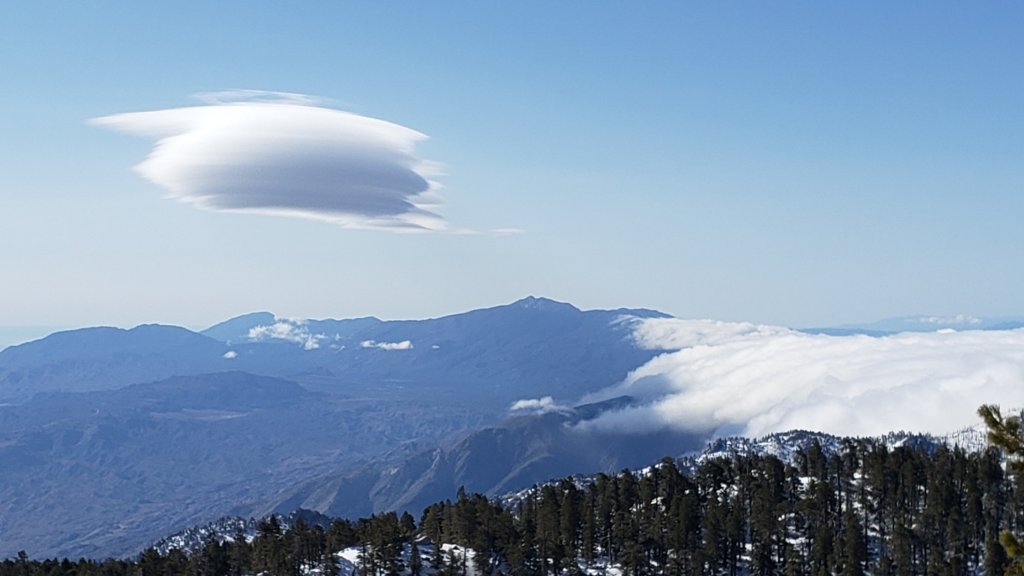
WEATHER
At mid elevations (e.g., Idyllwild-Pine Cove) temperatures remain pleasantly below seasonal for May until Thursday 11th, when a dramatic warming trend quickly pushes temperatures to well above average. In the high country, temperatures remain seasonal (i.e. near freezing) for a few more days, before rapid warming to temperatures well above seasonal starts around Friday 12th May, lasting for at least a week.
While there is no significant new precipitation in the forecasts, there is the possibility of minor rainfall, possibly associated with thunderstorms, on 16th-19th May. These are not storm systems as such, but localized precipitation, most similar to exceptionally early monsoonal conditions.
At San Jacinto Peak (10,810ft/3295m) on Monday 8th May 2023 at 0740 the air temperature was 32.3°F (0°C), with a windchill temperature of 16.8°F (-8°C), 17% relative humidity, and a steady WSW wind sustained at 18 mph gusting to 23.7 mph.
At the Peak on Friday 5th May 2023 at 0945 the air temperature was 21.6°F (-6°C), with a windchill temperature of 7.0°F (-14°C), 93% relative humidity, and a light due West wind sustained at 6 mph gusting to 12.8 mph.
At the Peak on Thursday 4th May 2023 at 1015 the air temperature was 20.1°F (-7°C), with a windchill temperature of 3.7°F (-16°C), 100% relative humidity, and a frigid SW wind sustained at 11 mph gusting to 16.8 mph.

PACIFIC CREST TRAIL INFORMATION
All of the PCT in the San Jacinto mountains is readily passable with, crucially, suitable skills and equipment, patience, and a thorough knowledge of all the possible alternates if needed. Snowmelt will be slow over the next couple of days, and snow will generally be firm and icy, before accelerating very rapidly after about 12th May. I cannot overemphasize the importance of having both appropriate equipment and the right skill set for the terrain. The latter includes interpreting the snow/ice conditions, understanding your physical and mental abilities, and conservative decision making. These challenges may actually increase over the next couple of weeks with temperatures fluctuating either side of freezing and highly variable snowmelt.
The PCT is clear of snow from Miles 151 (Highway 74) to about Mile 169, and functionally clear (with only a handful of tiny snow patches) to Mile 175. Treefall hazards are a problem on this section but none are insurmountable (I counted at least 94 between Miles 169-175 on 1st May). Apache Peak (Mile 169.5) is now functionally clear of snow. See my latest video for details of Miles 169-179 (available here).
Snow remains largely continuous from Miles 175 (Red Tahquitz) to 179 (Saddle Junction), but with a well traveled track and very little consequential terrain. Spikes are nevertheless recommended, and note that the posthole track on Miles 175-178 does not accurately follow the trail route.
Descending the well-signed alternate at Spitler Peak Trail (Mile 168.5) is an option for hikers less comfortable on the sections of angled snow further north or lacking suitable traction. Spitler Peak Trail is clear of snow. Sadly this winter has has brought down about 30 minor trees and half-a-dozen washouts in the uppermost 1.2 miles but nothing particularly challenging to pass. It is possible to get a ride on Apple Canyon Road, or to hike via the Forest Service roads – Bonita Vista Road and May Valley Road – into Idyllwild (check maps or apps for details).
PCT hikers should not attempt to use South Ridge Trail between the PCT at Chinquapin Flat (roughly Mile 177.7) and Idyllwild via Tahquitz Peak, even though this looks temptingly simple on apps and maps. There are no steps to follow through a lengthy section of steeply angled (and notoriously treacherous) ice slopes. Crampons, always with an ice axe, and expert knowledge of how to use this equipment on high angle terrain, are critical. These slopes always take many weeks longer to clear of ice than adjacent areas, and will remain treacherous throughout May (possibly into June this year).
Snow cover is moderate and averages 70% between Miles 179 to about Mile 192, but with extensive clearing on sun-exposed sections (especially Miles 181-184 and around Mile 187.5-188.5). Spikes can be useful everywhere.
There is a boot track through an average of 75% moderate-to-deep snow cover on the PCT along Fuller Ridge (Miles 185.5-191), as described in detail in my video report from 10th May (available here). The track does not accurately follow the PCT route in some places and passes through some challenging terrain, especially in Miles 185.5-187. At this time continuing north on Fuller Ridge requires the skills and comfort level to hike on angled terrain with some moderate exposure, and spikes (at a minimum) are recommended. Almost all hikers I have seen and talked to are carrying an ice axe to use with their spikes. Some hikers will prefer to use trail crampons (with an ice axe), assuming they have knowledge of how to use that equipment. Judging by what I see and hear firsthand on the mountain, up to half of thru hikers continue to prefer using the Black Mountain Road alternate at this time, but the proportion hiking Fuller Ridge has steadily increased over the past month.
There is a dangerous myth circulating on PCT social media that going up and over San Jacinto Peak somehow avoids Fuller Ridge. Please note that this is simply incorrect. Whether you remain on the PCT northbound (going around at lower elevation via Strawberry Junction) or leave the PCT at Annie’s Junction (Mile 180.8) to go up to San Jacinto Peak and then down the west side to reconnect to the PCT at about Mile 185.5, you still have to hike Fuller Ridge (which is Miles 185.5-190.5). It is possible to do the former route more safely by leaving the PCT at Strawberry Junction (approx. Mile 183) and descending Deer Springs Trail, which is completely clear of snow below Strawberry Junction, back into Idyllwild.
A well established alternate from Idyllwild – avoiding the challenging terrain of Fuller Ridge – is to connect back to the PCT at about Mile 191 using Black Mountain Road. Black Mountain Road is clear of snow for the lower four miles, and then has increasingly patchy 50% snow cover for the upper four miles to the PCT but there are excellent tracks to follow through the snow patches. Early on cold mornings the snow is hard and icy making it easy to hike, but snow is soft and postholing is poor by mid morning. Mile 193 northward to Interstate 10 is clear of snow.
PCT hikers are reminded that overnight stays are not permitted at or near San Jacinto Peak by the State Park, including in the historic shelter. The shelter must be left available for use by emergency services at all times. Little Round Valley and Strawberry Junction are excellent overnight options for thru-hikers.
TRAIL CONDITIONS
Trails remain almost wholly snow-covered above about 8900 ft. This elevation will continue to change steadily with rapid melting during the course of May. Trails below 7500 ft are now clear (or functionally clear) of snow. Elevations between 7500-8900 ft vary considerably in snow cover depending on aspect, drifting, and tree cover, but typically average about 30-70% snow cover. Details of PCT tracks and alternates are given in the PCT section above.
Devil’s Slide Trail is clear of snow for two miles to about 7700 ft elevation. Snow cover averages 20% for the remaining 0.5 mile to Saddle Junction, mainly as a few extended patches around the uppermost switchbacks and close to Saddle. Snow can be firm in early mornings but it is often soft otherwise, as early as late morning on warm days (expect moderate postholing by afternoon). Hikers will find that spikes are not generally required for ascending, but they can be useful for descending the upper 0.5 mile of trail.
There are tracks to follow around the Tahquitz area meadows. However none accurately follow the trail routes at this time, and at least on the initial 0.5 mile of the Caramba Trail and through Little Tahquitz Meadow there are multiple meandering tracks.
The track north from Saddle Junction follows initially follows the PCT route fairly accurately and is now only about 60% snow-covered for the first mile. From 8900 ft elevation, snow cover is functionally continuous.
The now heavily-traveled and well-compacted route thereafter follows the posthole track that I originally established on 31st March following the last major snowfall and continues on to San Jacinto Peak, via a route approximating to the Wellman, Peak, and East Ridge trails. Multiple boot tracks on the Wellman Trail, especially in the area of the switchbacks just below Wellman Divide, are potentially confusing and require careful navigation. The Wellman Trail has several extended areas already clearing of snow due to its high sun exposure.
There is a well-traveled boot track through largely continuous snow up from Round Valley to Wellman Divide.
The Peak Trail track above Wellman Divide is very well-defined given the additional foot traffic from the Tram/Long Valley. Almost all boot tracks ascend San Jacinto Peak directly via the East Ridge route rather than the switchbacks of the upper Peak Trail.
Deer Springs Trail is clear of snow to Strawberry Junction. The snow cover is increasingly patchy for more than a mile north of Strawberry Junction to about 8600 ft. Thereafter the predominant posthole track through continuous snow badly meanders in places and only vaguely approximates to the true trail route until Fuller Ridge. Once the Deer Springs track leaves the PCT at the south end of Fuller Ridge, it generally takes direct routes up the various snow slopes and again only vaguely approximates to the trail route. In Little Round Valley the primary posthole track ascends steeply and directly up towards San Jacinto Peak (my fault, sorry).
The Ernie Maxwell Trail is clear of snow. Crossing the swollen Chinquapin Creek just below Humber Park can be tricky, especially on warm afternoons when snowmelt flows are strongest.
The 0.4 mile section of South Ridge Trail between the PCT at Chinquapin Flat and Tahquitz Peak has no steps to follow through the steeply angled ice with overlying deep snow. These icy slopes are notoriously treacherous. Currently crampons, always with an ice axe, and thorough knowledge of how to use this equipment on high angle terrain, are required.
South Ridge Road is clear of snow but remains closed for vehicles. South Ridge Trail [updated 14th May] is functionally clear of snow to Tahquitz Peak.. Spikes are no longer necessary.
Marion Mountain Trail [updated 10th May] is functionally clear of snow for its lower 1.5 miles to 7500 ft. The snow then starts quite abruptly and from that elevation the snow cover is largely continuous. The boot track is not always easy to follow in its uppermost section as it nears the PCT/Deer Springs Trail. Most hikers will prefer to use spikes, especially for descending.
Spitler Peak Trail is clear of snow. Sadly most of my work of recent years, in which 60+ trees were cut on the upper trail, has been undone by this winter. About another 35 treefall hazards are on the trail, but thankfully almost all are small enough to be relatively easy to remove. More worrisome are 5-6 washouts in the upper switchbacks which have significantly impacted the tread in places, necessitating significant trail recovery work (photos in prior Report).
Black Mountain Trail is completely clear of snow for 3.5 miles. The final 0.3 mile in the uppermost switchbacks has about 40% snow cover in patches which obscure the route in places. There is a lightly-traveled and ill-defined posthole track through those snow patches. From the top of the trail to the fire lookout, snow cover remains almost continuous, but is soft and thinning rapidly.
Snow cover on Black Mountain Road is described in detail in the PCT section above.
Dark Canyon Road – the access for Seven Pines Trail – is completely clear of snow, but remains closed.
Effective 26th January 2023 the State Park closed the section of Skyline Trail that falls within its jurisdiction, above 5800 ft elevation, “until further notice due to dangerous weather conditions”. (For readers who are unclear, Skyline Trail forms the lower two-thirds of the “Cactus-to-Clouds” [C2C] route.) The State Park boundary is not marked but is near the site of the old Florian’s Cache, below Flat Rock. The open section of trail below 5800 ft is clear of snow.
SNOW DEPTHS
Measured on 8th May 2023 unless indicated. The first number is the current snow depth, followed in parentheses by the maximum depth recorded in winter 2022/23 where known. Note that broad averages are given; due to drifting in strong winds, and the differential effects of melting and of rain on snow in some March storms, there is considerable inconsistency of depth. Altitudes and PCT Miles are approximate.
San Jacinto Peak (10810 ft): 45-50 inches (105 inches on 31st March)
Little Round Valley (9800 ft): 55 inches
Wellman Divide (9700 ft): 35 inches (70-75 inches on 3rd March and again on 31st March)
Annie’s Junction/PCT Mile 180.8 (9070 ft): 40 inches (80 inches on 3rd March)
Long Valley (8600 ft): 0 inches, some shallow snow patches remain (60 inches on 3rd March)
Strawberry Junction/PCT Mile 183.2 (8100 ft): 0-2 inches
Saddle Junction/PCT Mile 179 (8070 ft): 10 inches, very patchy from 0-25 inches (48-50 inches on 3rd March)
Devil’s Slide trailhead at Humber Park (6550 ft): 0 inches (46 inches on 3rd March)
Idyllwild (at 5550 ft): 0 inches (45 inches on 1st March)
PCT Mile 151 at crossing with Highway 74 (4800 ft): 0 inches (13 inches in first week of March)
While all time and labor is volunteered, the San Jacinto Trail Report uses small private donations to help cover modest operating costs. Every year seems to have its unique challenges, and clearly 2023 is no exception. Your contribution keeps the Report available to all, free from advertising or paywalls, and independent from agencies. If you have found this Report useful, please consider using this link to the Donate page. Zelle, Venmo, and PayPal are all options. Thank you so much for your support.
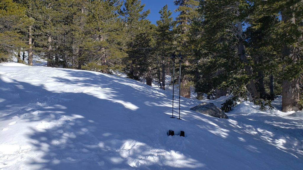
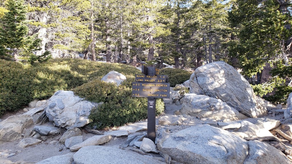


sanjacjon Uncategorized Leave a comment 15 MinutesEdit”Snow and trail update 10th May 2023″
Snow and trail update 2nd May 2023
UPDATE Friday 5th May at 1020: I hiked again to San Jacinto Peak this morning. Although I was able to bareboot using our tracks from yesterday to 9100 ft, from there it required crampons to break trail to the Peak. Above 9000 ft, crampons are currently strongly recommended. The fresh snow is too shallow for snowshoes which will slide on the underlying ice, but too deep for spikes which will not bite through the overlying powder. From 7000-9000 ft, spikes can be very useful. An excellent boot track is in place from Devil’s Slide Trail to San Jacinto Peak (using the East Ridge above 10,400 ft). There is a crampon track across the Fuller Ridge section of the PCT, however it does not accurately follow the trail in places, and it would be very challenging to follow in spikes for at least the next couple of days. There is also a track along the entire Deer Springs Trail, already rapidly melting up to Strawberry Junction, but very direct upslope from Little Round Valley (crampons recommended from the PCT to the Peak). The predominant boot track on part of Deer Springs Trail (PCT Miles 184-185.5) badly meanders and only vaguely approximates to the true trail route.
UPDATE Thursday 4th May at 1740: An interesting day (to say the least) on the mountain ended with me rescuing one PCT hiker from the Peak and guiding four others back down from near Wellman Cienega in snow storm conditions. Final snow totals were remarkably even across the high country, with four inches of fresh snow at San Jacinto Peak all the way down to 9000 ft, and three inches at Saddle Junction (8100 ft). About an inch of patchy, slushy snow remained on lower Devil’s Slide Trail this afternoon, with all snow melted from Idyllwild. At this time there are no tracks above 9000 ft elevation – ours from today were quickly eliminated by strong winds and drifting snow – spikes are strongly recommended everywhere above 6500 ft, and crampons are preferred above 9000 ft. Snow depths are not sufficient to require snowshoes.
UPDATE Thursday 4th May at 0940: snowfall from the 26th storm of this winter is proving to be at the upper end of forecasts. We hiked to San Jacinto Peak this morning in a minor blizzard. Snow level is around 5500ft in Idyllwild where an inch has fallen but is melting quickly. Fresh snow depth is about 3 inches at San Jacinto Peak but it continues to fall lightly.
I recorded a brief video report at the Peak available here on YouTube.
=====================
A minor heatwave in the last few days of April accelerated already rapid snowmelt. Idyllwild recorded seven consecutive days with high temperatures exceeding their historical average by at least 5°F (peaking at 14°F above average on Saturday 29th). Some locations on the mountain lost an average of 12 inches of snow per week throughout April, and everywhere lost at least 2-3 feet in the month.
In contrast, a significant cooling is forecast for 1st-7th May, with a week of temperatures well below seasonal averages. Minor precipitation is expected on Thursday 4th at all elevations, including a dusting of snow in the high country at least but potentially much lower, with 1-4 inches expected above 10,000 ft and a freeze level as low as 5500 ft elevation. While the depth of new snow may be insufficient to significantly obscure existing tracks, hikers unfamiliar with navigating in fresh snow should exercise particular caution. More importantly, areas of underlying ice may be obscured and the potential for dangerous hiking conditions is greatly increased with a thin cover of fresh snow on top of old icy snow.
On the morning of Monday 1st May we hiked the PCT between Spitler Peak and Saddle Junction (PCT Miles 168.5-179), recording a video report (available here) to document trail and snow conditions on this key section of the Desert Divide. The video report I recorded on Fuller Ridge on Friday 21st April (available here) remains largely applicable and I expect to report on that section again before the middle of May.
I have conducted survey hikes on the PCT and/or its side trails daily. My five hikes to San Jacinto Peak in the past two weeks – all using very grippy boots and with Alpine starts to take advantage of firm, reliable, early morning snow – have not required spikes for the ascent, but have used spikes to descend safely until snow petered out below 8000 ft elevation.
Currently trails above about 8000 ft are largely obscured by light to moderate snow (lower in places). Trails as low as 7000 ft elevation can have shallow but very patchy snow cover, mainly on north-facing slopes. Cautious navigation is essential everywhere.
Details of snow depths measured at various locations on the trail system are given at the foot of this posting. Note that snow depth itself is rarely indicative of the difficulty (or otherwise) of hiking a particular track or trail. For example a firm, well-compacted track across snow several feet deep may be much easier hiking than a poorly defined track across just a few inches depth of steeply angled ice.
Conditions will continue to fluctuate significantly over the next couple of weeks with relatively cold and icy surfaces in the first week of May, expected to be followed by generally warm and sunny weather in the second week of the month, when softening snow in all areas will impact the quality of tracks.
In the past week, traction decisions have generally become easier as established tracks become more compacted and defined. The optimum traction device at any given time and place depends on a complex interaction of factors including time of day, sun exposure of the trail, air temperature, and extent to which a track has been traveled and compacted. The willingness of the hiker to posthole (which is rarely easy) also influences choice of traction.
Spikes are strongly recommended for the foreseeable future everywhere above about 7500 ft (possibly lower in places depending on comfort level hiking on icy snow). This elevation will continue to slowly move upwards with steady melting of snow over the next few weeks, but is expected to remain relatively low throughout May. Spikes tend to be useful for descending and traversing even when they are not required for ascending.
Crampons – with hiking poles and/or an ice axe, depending on terrain – are potentially useful everywhere above about 8000 ft, when cold temperatures on some days, plus freeze/thaw cycles, lead to hardening of the snow surfaces. They will be especially useful over the next few weeks (depending on temperature) on certain moderate and higher angle slopes, at a minimum on the Peak Trail above Wellman Divide, the Wellman Trail, Deer Springs Trail above Little Round Valley, and uppermost South Ridge Trail, and on both flanks – but critically on the north face – of Tahquitz Peak.
Snowshoes remain useful above about 9000 ft, mainly for off-trail travel and on the warmest days. Tracks in the high country can be firm if the morning is cold (spikes or even crampons best) but then soften rapidly once sun hits slopes and temperatures rise, at which point snowshoes may become valuable. Snowshoes will remain invaluable for off-trail travel for many weeks above 9000 ft (potentially lower in places). It is clear from the overwhelming majority of high country tracks that hikers are preferring not to use snowshoes.
Hikers should be prepared for temperatures near or below freezing in the high country, and often well below freezing when considering wind chill effects (see below for my recent weather observations from San Jacinto Peak).
In addition to snow and navigation issues, hikers should anticipate encountering many new treefall hazards on all trails, along with considerable amounts of debris, branches, cones, etc. While some of these issues are a consequence of the recent intense winter, most trails in the San Jacinto mountains have been inadequately maintained for years, largely due to agency dysfunction, in combination with various effects of wildfires, the coronavirus pandemic, and climate change. In addition there can be a great deal of water in (and under) the trails, and this has also created some tricky crossings. Be very cautious of snow bridges across water.
The USFS gate at Humber Park reopened on Wednesday 19th April.
Forest Service roads currently closed to vehicular traffic by a revised closure order include Black Mountain Road (4S01), Dark Canyon Road (4S02), South Ridge Road (5S11), May Valley Road (5S21), and Santa Rosa Road (7S02), plus all their various side roads.

WEATHER
A significant cooling is forecast for 1st-7th May, with a week of temperatures well below seasonal averages, partly or mostly cloudy days on 2nd-5th, and moderate winds (strongest in the high country) on 1st-4th. Minor precipitation is forecast for Thursday 4th, including very light snow in the high country, and a freeze level possibly as low as 5500 ft elevation. As much as an inch of snow might fall Idyllwild, with 1-4 inches around the highest peaks. Starting on Monday 8th May temperatures are forecast to quickly climb back to average for May.
At San Jacinto Peak (10,810ft/3295m) on Sunday 30th April 2023 at 0650 the air temperature was 40.1°F (5°C), with a windchill temperature of 30.0°F (-1°C), 37% relative humidity, and a steady SSW wind sustained at 12 mph gusting to 15.5 mph.
At the Peak on Wednesday 26th April 2023 at 0740 the air temperature was 32.4°F (0°C), with a windchill temperature of 16.9°F (-8°C), 41% relative humidity, and a sharp due North wind sustained at 9 mph gusting to 23.8 mph.
At the Peak on Wednesday 19th April 2023 at 0745 the air temperature was 23.0°F (-5°C), with a windchill temperature of -1.5°F (-19°C), 28% relative humidity, and a bitter due West wind sustained at 32 mph gusting to 45.1 mph.
PACIFIC CREST TRAIL INFORMATION
All of the PCT in the San Jacinto mountains is readily passable with, crucially, suitable skills and equipment, patience, and a thorough knowledge of all the possible alternates if needed. Snowmelt will slow over the next few days, and snow will generally be firm and icy, before softening again in the second week of May. I cannot overemphasize the importance of having both appropriate equipment and the right skill set for the terrain. The latter includes interpreting the snow/ice conditions, understanding your physical and mental abilities, and conservative decision making. These challenges may increase over the next few weeks with temperatures fluctuating either side of freezing, seasonally strong insolation, and highly variable snowmelt.
The PCT is clear of snow from Miles 151 (Highway 74) to about Mile 169, and functionally clear (with only a handful of tiny snow patches) to Mile 175. Treefall hazards are a problem on this section but none are insurmountable (I counted at least 94 between Miles 169-175 on 1st May).
Apache Peak (Mile 169.5) is now functionally clear of snow. See my latest video for details of Miles 169-179 (available here). Snow is virtually continuous from Miles 175 (Red Tahquitz) to 179 (Saddle Junction), but with a well traveled track and very little consequential terrain. Spikes are nevertheless recommended, and note that the posthole track on Miles 175-178 does not accurately follow the trail route.
Descending the well-signed alternate at Spitler Peak Trail (Mile 168.5) is an excellent option for hikers less comfortable on the sections of angled snow further north or lacking suitable traction. Spitler Peak Trail is clear of snow. Sadly this winter has has brought down about 30 minor trees and half-a-dozen washouts in the uppermost 1.2 miles but nothing particularly challenging to pass. It is possible to get a ride on Apple Canyon Road, or to hike via the Forest Service roads – Bonita Vista Road and May Valley Road – into Idyllwild (check maps or apps for details).
PCT hikers should not attempt to use South Ridge Trail between the PCT at Chinquapin Flat (roughly Mile 177.7) and Idyllwild via Tahquitz Peak, even though this looks temptingly simple on apps and maps. There are no steps to follow through a lengthy section of steeply angled (and notoriously treacherous) ice slopes. Crampons, always with an ice axe, and expert knowledge of how to use this equipment on high angle terrain, are critical. These slopes always take many weeks longer to clear of ice than adjacent areas, and will remain treacherous throughout May (probably into June this year).
Snow cover is moderate and largely continuous between Miles 179 to about Mile 192, with large patches clearing on sun-exposed sections (notably Miles 181-184 and around Mile 188). Spikes (at a minimum) are recommended everywhere.
Note that only one sign at Annie’s Junction (approx. Mile 180.8) has recently emerged from the melting snow but remains hard to see, so route-finding at this junction can be challenging. There is a relatively lightly traveled posthole track from Annie’s Junction to Strawberry Junction through increasingly patchy snow.
There is a posthole track through about 90% moderate-to-deep snow cover on the PCT along Fuller Ridge (Miles 185.5-191), as described in detail in my video report from 21st April (available here). The track does not accurately follow the PCT route in many places, and passes through some challenging terrain. At this time continuing north on Fuller Ridge requires the skills and comfort level to hike on angled terrain with significant exposure, and spikes (at a minimum) are recommended. Almost all hikers I have seen and talked to are carrying an ice axe to use with their spikes. Some hikers will prefer to use crampons (always with an ice axe), assuming they have knowledge of how to use that equipment. Judging by what I am seeing and hearing on the mountain, many hikers continue to prefer using the Black Mountain Road alternate at this time, but the proportion hiking Fuller Ridge has steadily increased in the past couple of weeks.
There is a myth circulating on PCT social media that going up and over San Jacinto Peak somehow avoids Fuller Ridge. Please note that this is both incorrect and potentially dangerously misleading. Whether you remain on the PCT northbound (going around at lower elevation via Strawberry Junction) or leave the PCT at Annie’s Junction (Mile 180.8) to go up to San Jacinto Peak and then down the west side to reconnect to the PCT at about Mile 185.5, you still have to hike Fuller Ridge (which is Miles 185.5-190.5). It is possible to do the former route more safely by leaving the PCT at Strawberry Junction (approx. Mile 183) and descending Deer Springs Trail, which is completely clear of snow below Strawberry Junction, back into Idyllwild.
A well established alternate from Idyllwild – avoiding the challenging terrain of Fuller Ridge – is to connect back to the PCT at about Mile 191 using Black Mountain Road. Black Mountain Road is clear of snow for the lower four miles, and then has largely continuous light to moderate snow cover for the upper four miles to the PCT but there are excellent tracks to follow through the snow. Early on cold mornings the snow is hard and icy making it easy to hike, but snow is soft and postholing is poor by mid morning. Mile 195 northward to Interstate 10 is clear of snow.
The remarkable winter has created some challenges in addition to the snow. There can be a great deal of water in the trails, and this has also created a few tricky stream crossings. Be cautious of snow bridges across water. Forested trails are covered with downed branches and debris, plus many new treefall hazards, some of which are only becoming apparent as the snow recedes. Trail maintenance by agencies was already years behind schedule for a variety of reasons, and has deteriorated further this winter. Again, patience and caution will be essential this season more than most.
PCT hikers are reminded that overnight stays are not permitted at or near San Jacinto Peak by the State Park, including in the historic shelter. The shelter must be left available for use by emergency services at all times. Little Round Valley and Strawberry Junction are excellent overnight options for thru-hikers.

While all time and labor is volunteered, the San Jacinto Trail Report uses small private donations to help cover modest operating costs. Every year seems to have its unique challenges, and clearly 2023 is no exception. Your contribution keeps the Report available to all, free from advertising or paywalls, and independent from agencies. If you have found this Report useful, please consider using this link to the Donate page. Zelle, Venmo, and PayPal are all options. Thank you so much for your support.
TRAIL CONDITIONS
Trails above about 8000 ft remain largely snow-covered (wholly snow-covered above about 8900 ft). This will continue to change steadily with melting during the course of May. Trails below 7500 ft are now almost entirely clear of snow. Details of PCT tracks and alternates are given in the PCT section above.
Devil’s Slide Trail is clear of snow for two miles to about 7700 ft elevation. Snow cover averages 50% for the remaining 0.5 mile to Saddle Junction, mainly as a few extended patches around the uppermost switchbacks and close to Saddle. Snow can be firm in early mornings but it is often soft otherwise, as early as late morning on warm days (expect moderate postholing by afternoon). Many hikers will find that spikes are not required for ascending, but they can be useful for descending the upper 0.5 mile of trail.
There are tracks to follow around the Tahquitz area meadows. However none accurately follow the trail routes at this time, and at least on the initial 0.5 mile of the Caramba Trail and through Little Tahquitz Meadow there are multiple meandering tracks.
The track north from Saddle Junction follows initially follows the PCT route fairly accurately and is now only about 60% snow-covered for the first mile. From 8900 ft elevation, snow cover is continuous.
The now heavily-traveled and well-compacted route thereafter follows the posthole track that I originally established on 31st March following the last snowfall and continues on to San Jacinto Peak, via a route approximating to the Wellman, Peak, and East Ridge trails, at times climbing more steeply in places than the established trails, and generally contouring through the snow as needed to minimize unnecessary elevation loss and switchbacking. Beware of an increasing variety of alternate tracks that is developing, although most seem to ultimately reach the same endpoints. For example several other tracks head up from around 10,000 ft elevation directly upslope towards the summit junction, before turning north to the Peak.
Multiple trails lead from Round Valley up to the high country. There is a well-traveled posthole track through continuous snow up to Wellman Divide. At least two posthole-and-snowshoe tracks run more directly, one up Jean Peak, and another up to near Miller Peak where it connects to the established trail up East Ridge to the Peak; these will become harder to follow soon as the snow melts.
Deer Springs Trail is functionally clear of snow to Strawberry Junction. The snow cover is increasingly patchy for one mile north of Strawberry Junction to about 8600 ft. Thereafter the posthole track through largely continuous snow only partially follows the actual trail route. Once the Deer Springs track leaves the PCT at the south end of Fuller Ridge, it generally takes direct routes up the various snow slopes (see for example this photo in a prior Report) and again only vaguely approximates to the trail route. In Little Round Valley the track splits into several parallel tracks through the valley that then ascend steeply and directly up towards San Jacinto Peak.
The Ernie Maxwell Trail is functionally clear of snow. Crossing the swollen Chinquapin Creek just below Humber Park can be tricky, especially on warm afternoons when snowmelt flows are strongest.
The 0.4 mile section of South Ridge Trail between the PCT at Chinquapin Flat and Tahquitz Peak has no steps to follow through the steeply angled ice with overlying deep snow. These icy slopes are notoriously treacherous. Currently crampons, always with an ice axe, and thorough knowledge of how to use this equipment on high angle terrain, are required.
South Ridge Road is clear of snow. South Ridge Trail is clear of snow to Old Lookout Flat (7600 ft). Snow cover averages 40% on the traverse to 7900 ft and on the lower switchbacks up to about 8400 ft. Some snow patches and drifts remain fairly deep. Snow cover remains largely continuous and treacherous on the upper switchbacks to Tahquitz Peak, starting at about the seventh switchback up. In places the posthole track becomes relatively indistinct near the Peak where it crosses steep angled icy snow. Spikes at a minimum are required.
Marion Mountain Trail remains largely snow-covered and has only a relatively lightly-traveled track to follow, which only roughly approximates to the trail route in places. The lower 0.5 mile is largely clear of snow, but the remainder of the trail averages 90% snow cover. The track is not always easy to follow, especially when it breaks into multiple routes as it nears the PCT/Deer Springs Trail.
Spitler Peak Trail is clear of snow. Sadly most of my hard work of recent years, in which 60+ trees were cut on the upper trail, has been undone by this winter. About another 35 treefall hazards are on the trail, but thankfully almost all are small enough to be relatively easy to remove. More worrisome are 5-6 washouts in the upper switchbacks which have significantly impacted the tread in places, necessitating significant trail recovery work (photos in prior Report).
Black Mountain Trail [surveyed 28th April] is completely clear of snow for 3.5 miles. The final 0.3 mile in the uppermost switchbacks has about 60% snow cover in patches which obscure the route in places. There is a very lightly-traveled and ill-defined posthole track through those snow patches. From the top of the trail to the fire lookout, snow cover is almost continuous, but is soft and thinning rapidly.
Snow cover on Black Mountain Road is described in detail in the PCT section above.
Dark Canyon Road – the access for Seven Pines Trail – is completely clear of snow, but remains closed.
Effective 26th January 2023 the State Park closed the section of Skyline Trail that falls within its jurisdiction, above 5800 ft elevation, “until further notice due to dangerous weather conditions”. (For readers who are unclear, Skyline Trail forms the lower two-thirds of the “Cactus-to-Clouds” [C2C] route.) The State Park boundary is not marked but is near the site of the old Florian’s Cache, below Flat Rock. The open section of trail below 5800 ft is clear of snow.
SNOW DEPTHS
Measured on 30th April 2023 unless indicated. The first number is the current snow depth, followed in parentheses by the maximum depth recorded in winter 2022/23 where known. Note that broad averages are given; due to drifting in strong winds, and the differential effects of melting and of rain on snow in some March storms, there is considerable inconsistency of depth. Altitudes and PCT Miles are approximate.
San Jacinto Peak (10810 ft): 50-55 inches (100-105 inches on 31st March)
Little Round Valley (9800 ft): 60 inches
Wellman Divide (9700 ft): 40 inches (70-75 inches on 3rd March and again on 31st March)
Annie’s Junction/PCT Mile 180.8 (9070 ft): 45-50 inches (80 inches on 3rd March)
Long Valley (8600 ft): 4 inches, ranging from 0-10 inches (60 inches on 3rd March)
Strawberry Junction/PCT Mile 183.2 (8100 ft): 0-4 inches
Saddle Junction/PCT Mile 179 (8070 ft): 12 inches, ranging from 0-30 inches (48-50 inches on 3rd March)
Devil’s Slide trailhead at Humber Park (6550 ft): 0 inches (46 inches on 3rd March)
Idyllwild (at 5550 ft): 0 inches (45 inches on 1st March)
PCT Mile 151 at crossing with Highway 74 (4800 ft): 0 inches (13 inches in first week of March)


sanjacjon Uncategorized Leave a comment 16 MinutesEdit”Snow and trail update 2nd May 2023″
Snow and trail update 26th April 2023
A dramatic spring snowmelt is well underway. Everywhere on the mountain above 6000 ft has lost at least two feet of snow this month, with some mid elevation areas and sun-exposed slopes losing three feet (or even more) since the last significant snowfall at the end of March. With further warming in the forecasts – including a minor heatwave in the last few days of April – snowmelt will continue rapidly. It is unusual for the San Jacinto mountains to have no significant storm in April, and frankly it is disappointing to see so much snow disappear so quickly.
That said, plenty of snow remains in most areas above about 8000 ft. For example, on Friday 21st I undertook a comprehensive survey of the still very snowy Fuller Ridge section of the PCT, recording a detailed video report available here on YouTube. The PCT across Fuller Ridge is now passable with spikes, but only for hikers who are comfortable hiking on continuous icy snow across some moderate angle terrain with significant exposure in places, as discussed in more detail below.
I have conducted survey hikes daily, invariably on parts of the PCT and/or its side trails. On three recent cool early mornings (17th, 19th, and 26th) I was able to comfortably ascend San Jacinto Peak without spikes in very grippy boots via the east side track – approximating to Devil’s Slide, Wellman, Peak, and East Ridge trails – before then using spikes to descend safely until the snow petered out around 7800 ft.
Currently trails above about 8000 ft are largely obscured by moderate snow (lower in places). Trails as low as 7000 ft elevation have shallow but increasingly patchy snow cover. Cautious navigation is essential everywhere.
Details of snow depths measured at various locations on the trail system are given at the foot of this posting. Note that snow depth itself is rarely indicative of the difficulty (or otherwise) of hiking a particular track or trail. For example a firm, well-compacted track across snow several feet deep may be much easier hiking than a poorly defined track across just a few inches depth of steeply angled ice.
Conditions will continue to change significantly over the next couple of weeks with generally warm and sunny weather, while softening snow in all areas will impact the quality of tracks.
In the past week, traction decisions have generally become easier as established tracks become more compacted and defined. The optimum traction device at any given time and place depends on a complex interaction of factors including time of day, sun exposure of the trail, air temperature, and extent to which a track has been traveled and compacted. The willingness of the hiker to posthole (which is rarely easy) also influences choice of traction.
Spikes are strongly recommended for the foreseeable future everywhere above about 7500 ft (potentially lower in places). This elevation may slowly move upwards with steady melting of snow over the next few days and weeks, but will remain relatively low into May. Spikes tend to be especially useful for descending and traversing.
Crampons – with hiking poles and/or an ice axe, depending on terrain – are potentially useful everywhere above about 8000 ft, when cold temperatures on some days, plus freeze/thaw cycles, lead to hardening of the snow surfaces. They may become especially useful over the next few weeks (depending on temperature) on certain moderate and higher angle slopes, at a minimum on the Peak Trail above Wellman Divide, the Wellman Trail, Deer Springs Trail above Little Round Valley, and uppermost South Ridge Trail, and on both flanks – but critically on the north face – of Tahquitz Peak.
Snowshoes can be helpful everywhere above about 8000 ft (potentially lower in places on the warmest days for the remainder of April). Tracks in the high country can be firm if the morning is cold (crampons or even spikes best) but then soften rapidly once sun hits slopes and temperatures rise, at which point snowshoes may become preferable. Even after trails become compacted through freeze/thaw cycles and hiker traffic, snowshoes will remain invaluable for off-trail travel for many weeks above 8000 ft. It is clear from the overwhelming majority of high country tracks that hikers are preferring not to use or carry snowshoes.
In addition to snow and navigation issues, hikers should anticipate encountering many new treefall hazards on all trails, along with considerable amounts of debris, branches, cones, etc. While some of this is a consequence of the recent remarkable winter, most trails in the San Jacinto mountains have been inadequately maintained for many years, largely due to agency dysfunction, in combination with wildfires, the coronavirus pandemic, and climate change.
Especially with a cooling trend starting 1st May, hikers should be prepared for temperatures near or below freezing in the high country, and often well below freezing when considering wind chill effects (see below for my recent weather observations from San Jacinto Peak).
The USFS gate at Humber Park reopened on Wednesday 19th April.
Forest Service roads currently closed to vehicular traffic by a revised closure order include Black Mountain Road (4S01), Dark Canyon Road (4S02), South Ridge Road (5S11), May Valley Road (5S21), and Santa Rosa Road (7S02), plus all their various side roads.
WEATHER
A minor heatwave is currently forecast for the remainder of April, with summer-like temperatures on 27th-30th. Even at the highest elevations air temperatures will be well above freezing, while at mid elevations (e.g., Idyllwild) temperatures will be far above seasonal. Snowmelt will continue to be rapid at all elevations especially in sun-exposed areas. A significant cooling is forecast for 1st-5th May, with the possibility of minor precipitation on Thursday 4th, including potential for a very light dusting of snow in the high country.
At San Jacinto Peak (10,810ft/3295m) on Wednesday 26th April 2023 at 0740 the air temperature was 32.4°F (0°C), with a windchill temperature of 16.9°F (-8°C), 41% relative humidity, and a sharp due North wind sustained at 9 mph gusting to 23.8 mph.
At the Peak on Wednesday 19th April 2023 at 0745 the air temperature was 23.0°F (-5°C), with a windchill temperature of -1.5°F (-19°C), 28% relative humidity, and a bitter due West wind sustained at 32 mph gusting to 45.1 mph.
At the Peak on Monday 17th April 2023 at 0810 the air temperature was 33.9°F (1°C), with a windchill temperature of 20.8°F (-6°C), 27% relative humidity, and a fresh due West wind sustained at 12 mph gusting to 18.8 mph.

PACIFIC CREST TRAIL INFORMATION
Rapid and widespread snowmelt is underway and will continue to accelerate over the next few days. All areas of the PCT in the San Jacinto mountains are readily passable with, crucially, suitable skills and equipment, patience, and a thorough knowledge of all the possible alternates if needed. I cannot overemphasize the importance of having both appropriate equipment and the right skill set for the terrain. The latter includes interpreting the snow/ice conditions, understanding your physical and mental abilities, and conservative decision making. These challenges will steadily increase over the next few weeks with temperatures fluctuating either side of freezing, seasonally stronger insolation, and highly variable snowmelt.
The PCT is clear of snow from Miles 151 (Highway 74) to about Mile 167 (south side of Spitler Peak). Fobes Ranch Road and Fobes Trail (alternate at Mile 166) are clear of snow. There is a reliable and well-traveled track on the PCT north to about Mile 169. There is a track continuing beyond Apache Peak (Mile 169.5) all the way through to Mile 177. Spikes are strongly recommended as the posthole track is challenging with multiple crossings of angled snow slopes, and the track does not accurately follow the PCT route in places. The most heavily traveled track at Mile 169-169.5 goes over the saddle at Apache Peak rather than following the PCT route around to the east.
Descending the well-signed alternate at Spitler Peak Trail (Mile 168.5) is an excellent option for hikers less comfortable on lengthy sections of angled snow or lacking suitable traction. Spitler Peak Trail is clear of snow. Sadly this winter has has brought down about 30 minor trees and half-a-dozen washouts in the uppermost 1.2 miles but nothing particularly challenging to pass. It is possible to get a ride on Apple Canyon Road, or to hike via the Forest Service roads – Bonita Vista Road and May Valley Road – into Idyllwild (check maps or apps for details).
Snow is more-or-less continuous and deep between Miles 174.5-179 and the track around Red Tahquitz and west to Mile 177 does not accurately follow the PCT route.
PCT hikers should not attempt to use South Ridge Trail between the PCT at Chinquapin Flat (approx. Mile 177.7) and Idyllwild via Tahquitz Peak, even though this looks temptingly simple on apps and maps. There are no steps to follow through a lengthy section of notoriously treacherous and steeply angled ice slopes. Crampons, always with an ice axe, and expert knowledge of how to use this equipment on high angle terrain, are critical.
Snow cover is moderate and nearly continuous between Miles 179 to about Mile 193, with a few small bare patches starting to appear on the most sun exposed slopes. Spikes (at a minimum) are required everywhere.
Note that all signs and posts at Annie’s Junction (approx. Mile 180.8) are buried in deep snow, and route-finding here can be challenging. There is a relatively lightly traveled posthole track from Annie’s Junction to Strawberry Junction through increasingly patchy snow.
There is now also a posthole track through the almost continuous deep snow on the PCT along Fuller Ridge (Miles 185.5-191), as described in detail in my video report from 21st April (available here). The track does not accurately follow the PCT route in many places, and passes through some challenging terrain. At this time continuing north on Fuller Ridge requires the skills and comfort level to hike on angled terrain with significant exposure, and spikes (at a minimum) are recommended. Many hikers may prefer to use crampons and ice axe (assuming they have knowledge of how to use that equipment). Judging by what I am seeing on all the trails, most hikers continue to prefer using the Black Mountain Road alternate.
A well established alternate from Idyllwild – avoiding the challenging terrain of Fuller Ridge – is to connect back to the PCT at about Mile 191 using Black Mountain Road. Black Mountain Road is clear of snow for the lower four miles, and then has largely continuous light to moderate snow cover for the upper four miles to the PCT but there are excellent tracks to follow through the snow. Early on cold mornings the snow is hard and icy making it easy to hike, but snow is soft and postholing is poor by mid morning. Mile 195 northward to Interstate 10 is clear of snow.
The remarkable winter has created some challenges in addition to the snow. There can be a great deal of water in the trails, and this has also created a few tricky stream crossings. Be cautious of snow bridges across water. Forested trails are covered with downed branches and debris, plus many new treefall hazards, some of which are only becoming apparent as the snow recedes. Trail maintenance by agencies was already years behind schedule for a variety of reasons, and has deteriorated further this winter. Again, patience and caution will be essential this season more than most.
PCT hikers are reminded that overnight stays are not permitted at or near San Jacinto Peak by the State Park, including in the historic shelter. The shelter must be left available for use by emergency services at all times. Little Round Valley and Strawberry Junction are excellent overnight options for thru-hikers.
TRAIL CONDITIONS
Trails above about 8000 ft remain largely snow-covered (wholly snow-covered above about 8800 ft). This will change steadily with extensive melting over the next few days and weeks. Trails below 6500 ft are now almost entirely clear of snow. Details of PCT tracks and alternates are given in the PCT section above.
Devil’s Slide Trail is functionally clear of snow for its first mile, and then almost clear of snow another mile up to about 7700 ft elevation. Snow cover is about 60% for the remaining 0.5 mile to Saddle Junction. Snow can be firm in early mornings but it is often soft otherwise, as early as late morning on warm days (expect moderate postholing). The track through the remaining snow patches now largely follows the established trail route in the uppermost switchbacks close to Saddle Junction, but careful navigation is still required. Many hikers will find that spikes are not required for ascending, but they are useful for descending, especially the upper 0.5 mile of trail.
The posthole track that I originally established on 31st March following the last snowfall continues on to San Jacinto Peak, via a route approximating to the PCT, Wellman, Peak, and East Ridge trails, at times climbing more steeply in places than the established trails, and generally contouring through the snow as needed to minimize unnecessary elevation loss and switchbacking. This track has now been well-traveled and compacted. Other tracks head up from around 10,000 ft elevation directly upslope towards the summit junction, before turning north to the Peak.
Multiple trails lead from Round Valley up to the high country. There is now a reasonable posthole track through largely continuous snow up to Wellman Divide. At least two posthole-and-snowshoe tracks run more directly, one up Jean Peak, and another up to near Miller Peak where it connects to the established trail up East Ridge to the Peak.
Deer Springs Trail is functionally clear of snow to Strawberry Junction. The snow cover is increasingly patchy for one mile north of Strawberry Junction to about 8600 ft. Thereafter is a relatively lightly traveled posthole track north through continuous snow, that rarely follows the actual trail route, and can be tough to follow, especially for those who know the true trail well. Once the Deer Springs track leaves the PCT at the south end of Fuller Ridge, it generally takes direct routes up the various snow slopes (e.g., photo in previous Report) and again only vaguely approximates to the trail route. In Little Round Valley the track splits into at least two roughly parallel tracks through the valley that then ascend steeply and directly up towards San Jacinto Peak.
The Ernie Maxwell Trail is almost entirely clear of snow, but a couple of patches remain on the upper trail closest to Humber Park. Most hikers will find that spikes are not required. Crossing the swollen Chinquapin Creek just below Humber Park is tricky for many hikers.
The 0.4 mile section of South Ridge Trail between the PCT at Chinquapin Flat and Tahquitz Peak has no steps to follow through the steeply angled ice with overlying deep snow. These icy slopes are notoriously treacherous. Currently crampons, always with an ice axe, and thorough knowledge of how to use this equipment on high angle terrain, are critical.
South Ridge Road is clear of snow. South Ridge Trail is clear of snow to Old Lookout Flat (7600 ft). Snow cover averages 50% on the traverse to 7900 ft and on the lower switchbacks up to about 8400 ft, but some of the snow patches/drifts remain surprisingly deep. Snow cover is then almost continuous and treacherous on the upper switchbacks to Tahquitz Peak, starting at about switchback seven. In places the posthole track becomes indistinct and hard to follow near the Peak where it crosses steep angled icy snow. Spikes at a minimum are required, crampons/ice axe are preferable.
Marion Mountain Trail [surveyed 21st April] remains largely snow-covered and has only a lightly-traveled track to follow, which only roughly approximates to the trail route in places. The lower 0.5 mile has about 60% snow cover, but the remainder of the trail has 100% snow cover. The track is not always easy to follow, especially when it breaks into multiple routes as it nears the PCT/Deer Springs Trail. Below 7500 ft elevation, the snow is soft even in the early morning, and gets soft at all elevations later in the day.
Spitler Peak Trail [surveyed weekly] is clear of snow. Sadly most of my hard work of recent years, in which 60+ trees were cut on the upper trail, has been undone by this winter. About another 35 treefall hazards are on the trail, but thankfully almost all are small enough to be relatively easy to remove. More worrisome are 5-6 washouts in the upper switchbacks which have significantly impacted the tread in places, necessitating significant trail recovery work (photos in prior Report).
Black Mountain Trail [surveyed 28th April] is completely clear of snow for 3.5 miles. The final 0.3 mile in the uppermost switchbacks has about 60% snow cover in patches which obscure the route in places. There is a very lightly-traveled and ill-defined posthole track through those snow patches. From the top of the trail to the fire lookout, snow cover is almost continuous, but is soft and thinning rapidly.
Dark Canyon Road – the access for Seven Pines Trail – is now completely clear of snow, but remains closed [surveyed 25th April].
Effective 26th January 2023 the State Park closed the section of Skyline Trail that falls within its jurisdiction, above 5800 ft elevation, “until further notice due to dangerous weather conditions”. (For readers who are unclear, Skyline Trail forms the lower two-thirds of the “Cactus-to-Clouds” [C2C] route.) The State Park boundary is not marked but is near the site of the old Florian’s Cache, below Flat Rock. The open section of trail below 5800 ft is clear of snow.
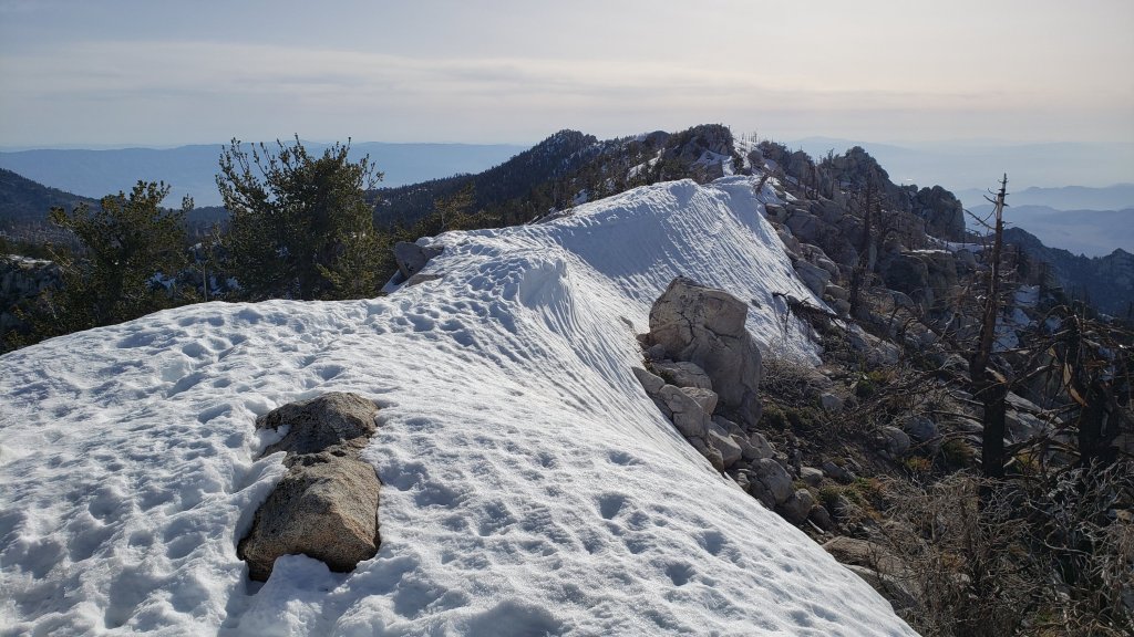
While all time and labor is volunteered, the San Jacinto Trail Report uses small private donations to help cover modest operating costs. Every year seems to have its unique challenges, and clearly 2023 is no exception. Your contribution keeps the Report available to all, free from advertising or paywalls, and independent from agencies. If you have found this Report useful, please consider using this link to the Donate page. Zelle, Venmo, and PayPal are all options. Thank you so much for your support.
SNOW DEPTHS
Measured on 26th April 2023 (east side locations) and 19th-21st April (west side). The first number is the current snow depth, followed in parentheses by the maximum depth recorded in winter 2022/23 where known. In all cases these are the greatest snow depths recorded at these locations for at least 11-12 years. Note that averages are given; due to strong winds accompanying all storms, and the differential effects of melting and of rain on snow in some earlier storms, there is considerable inconsistency of depth. Altitudes and PCT Miles are approximate.
San Jacinto Peak (10810 ft): 55-65 inches (100-105 inches on 31st March)
Little Round Valley (9800 ft): 70 inches (heavily drifted and slow to melt here, see photo in previous Report)
Wellman Divide (9700 ft): 45-48 inches (70-75 inches on 3rd March and again on 31st March)
Annie’s Junction/PCT Mile 180.8 (9070 ft): 50-60 inches (80 inches on 3rd March)
Long Valley (8600 ft): 18 inches, but ranging from 0-30 inches (c.60 inches on 3rd March)
Strawberry Junction/PCT Mile 183.2 (8100 ft): 0-10 inches
Saddle Junction/PCT Mile 179 (8070 ft): 20-36 inches (48-50 inches on 3rd March)
Devil’s Slide trailhead at Humber Park (6550 ft): 0-2 inches (46 inches on 3rd March)
Idyllwild (at 5550 ft): 0 inches (45 inches on 1st March)
PCT Mile 151 at crossing with Highway 74 (4800 ft): 0 inches (13 inches in first week of March)

sanjacjon Uncategorized 1 Comment 13 MinutesEdit”Snow and trail update 26th April 2023″
Snow and trail update 14th April 2023
UPDATE Friday 21st April 2023: I have uploaded a video report of a comprehensive survey of the Fuller Ridge section of the PCT from this morning, available here on YouTube.
UPDATE Monday 17th April 2023: I have updated some trail details below based on my ascent of San Jacinto Peak early this morning. The PCT across Fuller Ridge is now passable with spikes, but only for those who are comfortable hiking on angled terrain with significant exposure. Other trail information below is being updated daily (on 18th-21st April). The next comprehensive Report update is expected on 23rd April.
———————————
With the exception of somewhat cooler days on 12th-14th April, the San Jacinto mountains have settled into a relatively steady and mild weather pattern, with temperatures on most days at or even above seasonal at all elevations. Snowmelt is consequently proceeding rapidly, especially below 8000 ft and on sun-exposed slopes. Everywhere has lost at least 6-12 inches of snow in the past week, and up to two feet since the last snow storm at the end of March.
The divergent impact of the warm, wet storms in mid March is now especially striking. The storms melted much of the snow below about 7500 ft, so lower parts of well known trails such as Devil’s Slide and Deer Springs are nearly clear already (details below), while the same storms added snow at higher elevations, which consequently remain embedded in many feet of snow.
I have conducted survey hikes in the high country on six of the past 15 days, and elsewhere on the PCT or its alternates on every day in between. Most recently, on the morning of Friday 14th, I ascended San Jacinto Peak via the east side track (Devil’s Slide, Wellman, Peak, and East Ridge trails) that I broke on 31st March, and descended (approximately) via Deer Springs Trail. This facilitated survey of the highest parts of the PCT in the San Jacinto mountains (approx. Miles 179-181 and 185.5-183) plus several of its side trails.
On 14th I made use of the coolest day in the past week, plus an Alpine start, to ascend and descend entirely in spikes. I carried crampons and ice axe as a backup, but they went unused; however many hikers may have found them preferable to spikes. In softer snow on a very warm Monday 10th I was able to bareboot to 9200 ft near Wellman’s Cienega, before switching to spikes for the remainder of the ascent and keeping them on for almost the entire descent.
Currently trails above about 7500 ft are largely obscured by moderate snow, deeper above 8000 ft. Trails as low as 6000 ft elevation can have shallow and very patchy snow cover. Cautious navigation is critical everywhere.
Details of snow depths measured at various locations on the trail system are given at the foot of this posting. Note that snow depth itself is rarely indicative of the difficulty (or otherwise) of hiking a particular track or trail. For example a firm, well-compacted track across snow several feet deep may be much easier hiking than just a couple of inches depth of steeply angled ice.
Conditions will continue to change significantly over the next couple of weeks with generally warm and sunny weather, while softening snow in all areas will impact the quality of tracks.
To give an idea of the current traction challenge, I have been generally hiking with all three of snowshoes, crampons, and spikes, changing between them as conditions warrant. This challenge will evolve over the next week with warm temperatures on many days. The optimum traction device at any given time and place depends on a complex interaction of factors including time of day, sun exposure of the trail, air temperature, and extent to which a track has been established and compacted. The willingness of the hiker to posthole (itself somewhat correlated to fitness) also influences choice of traction.
As snow conditions continue to change spikes are strongly recommended for the foreseeable future everywhere above about 7000 ft (potentially lower in places). This elevation will slowly move upwards with steady melting over the next few days and weeks, but may remain relatively low into May.
Snowshoes can be helpful everywhere above about 8000 ft (potentially lower in places on the warmest days for the next week or so). Tracks in the high country can be firm if the morning is cold (crampons or even spikes best) but then soften rapidly once sun hits slopes and temperatures rise, at which point snowshoes may become preferable. Even after trails become compacted through freeze/thaw cycles and hiker traffic, snowshoes will remain invaluable for off-trail travel for many weeks above 8000 ft. It is clear from the overwhelming majority of high country tracks (seen on 14th April) that hikers are preferring not to use or carry snowshoes.
Crampons – with hiking poles and/or an ice axe, depending on terrain – are potentially useful everywhere above about 8000 ft, when cold temperatures on some days, plus freeze/thaw cycles, lead to hardening of the snow surfaces. They may become especially useful over the next few weeks (depending on temperature) on certain moderate and higher angle slopes, at a minimum on the Peak Trail above Wellman Divide, the Wellman Trail, Deer Springs Trail above Little Round Valley, and uppermost South Ridge Trail, and on both flanks – but critically on the north face – of Tahquitz Peak.
Despite unseasonal warm weather over the next week or more, hikers should nevertheless be prepared for temperatures near freezing in the high country, and below freezing when considering wind chill effects (see below for my recent weather observations from San Jacinto Peak).
The USFS gate at Humber Park reopened on Tuesday 18th April.
Forest Service roads currently closed to vehicular traffic by a revised closure order include Black Mountain Road (4S01), Dark Canyon Road (4S02), South Ridge Road (5S11), May Valley Road (5S21), and Santa Rosa Road (7S02), plus their various side roads.
WEATHER
Generally warm, sunny, stable weather is currently forecast for the remainder of April. With the exception of a brief cooling on 18th-19th April, temperatures may be at or above seasonal for the foreseeable future. Even at the highest elevations air temperatures are forecast to be at or above freezing almost daily. Snowmelt will continue to be rapid below 9000 ft and will proceed steadily at all elevations especially on sun-exposed slopes.
At San Jacinto Peak (10,810ft/3295m) on Friday 14th April 2023 at 0825 the air temperature was 29.7°F (-1°C), with a windchill temperature of 13.8°F (-10°C), 18% relative humidity, and a sharp WNW wind sustained at 14 mph gusting to 23.4 mph.
At the Peak on Monday 10th April 2023 at 0815 the air temperature was 40.7°F (5°C), with a windchill temperature of 30.2°F (-1°C), 37% relative humidity, and a steady SSE wind sustained at 12 mph gusting to 17.0 mph.
At the Peak on Thursday 6th April 2023 at 0755 the air temperature was 27.2°F (-3°C), with a windchill temperature of 18.0°F (-8°C), 37% relative humidity, and a light NNW wind sustained at 3 mph gusting to 6.5 mph.
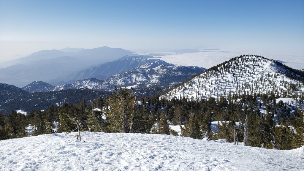
PACIFIC CREST TRAIL INFORMATION
Rapid and widespread snowmelt is underway and will accelerate over the next few days. Most or even all areas of the PCT in the San Jacinto mountains will soon become readily passable with, crucially, suitable skills and equipment, patience, and a thorough knowledge of all the possible alternates if needed.
The PCT is functionally clear of snow from Miles 151 (Highway 74) to about Mile 167 (south side of Spitler Peak). Fobes Ranch Road and Fobes Trail (alternate at Mile 166) are clear of snow. There is a reliable and well-traveled track on the PCT north to about Mile 169. There is now a track continuing beyond Apache Peak (Mile 169.5) all the way through to Mile 177. Spikes are very strongly recommended as the posthole track is challenging with multiple crossings of angled snow slopes, and the track does not accurately follow the PCT route in places. The track at Mile 169-169.5 goes over the saddle at Apache Peak rather than following the PCT route around to the east.
Descending via the well-signed alternate at Spitler Peak Trail (Mile 168.5) [surveyed 7th April] is an excellent option for hikers less comfortable on lengthy sections of angled snow or lacking suitable traction. Spitler Peak Trail is functionally clear of snow, although a few minor patches remain that do not require spikes. Sadly this winter has has brought down about 30 minor trees and half-a-dozen washouts in the uppermost 1.2 miles but nothing particularly challenging to pass.
It is possible to get a ride on Apple Canyon Road, or to hike via the Forest Service roads – Bonita Vista Road and May Valley Road – into Idyllwild (check maps or apps for details).
Snow is continuous and deep between Miles 174.5-179 and the track around Red Tahquitz and west to Mile 177 does not accurately follow the PCT route. Snow cover is moderate or deep and basically continuous between Miles 179 to about Mile 193, with a few small bare patches starting to appear on the most sun exposed slopes. Spikes (at a minimum) are required everywhere.
There is now [updated 17th April] a relatively well-traveled posthole track from Annie’s Junction (Mile 180.8) west to Strawberry Junction (Mile 183) which largely follows the PCT route through variable depth snow. All signs at Annie’s Junction are buried in deep snow, and route-finding here is challenging. There is a lightly traveled posthole track north from Strawberry Junction to the southern end of Fuller Ridge (where new signs placed in February 2021 remained just above the deep snow).
There is now also a posthole track through the snow on the PCT along Fuller Ridge (Miles 185.5-191). However it does not accurately follow the PCT route, and passes through some challenging terrain. The current trail conditions on Fuller Ridge are described in detail in the video report from 21st April available here on YouTube.
At this time continuing north on Fuller Ridge requires at least spikes, plus the skills and comfort level to hike on angled terrain with significant exposure. Many hikers will prefer to use crampons and ice axe (and have knowledge of how to use that equipment), plus have excellent snow hiking skills.
A well established alternate from Idyllwild – avoiding the challenging terrain of Fuller Ridge – is to connect back to the PCT at about Mile 191 using Black Mountain Road. Black Mountain Road [updated 21st April] is clear of snow for the lower four miles, and then has continuous light to moderate snow cover for the upper four miles to the PCT but there are excellent tracks to follow through the snow. Early on cold mornings the snow is hard and icy making it easy to hike, but snow is soft and postholing is poor by late morning. Mile 195 northward to Interstate 10 is clear of snow.
The remarkable winter has created some challenges in addition to the snow. There can be a great deal of water in the trails, and this has also created a few tricky crossings. Be cautious of snow bridges across water. Forested trails are covered with downed branches and debris, plus many new treefall hazards, some of which are only becoming apparent as the snow recedes. Trail maintenance by agencies was already years behind schedule due to the coronavirus pandemic, among other reasons, and this winter has greatly exacerbated the situation. Again, patience and caution will be essential this season more than most.
Recently I have mentioned the challenges of hard, icy snow underfoot and the value of using spikes (and/or crampons) especially for descending and traversing. While softening, melting, snow (and fresh powder if we have more storms!) may be suitable for snowshoeing for the next several weeks, snow at all elevations will generally become increasingly firm and icy following multiple freeze-thaw cycles, and compaction by increasing hiker traffic. I cannot overemphasize the importance of having both appropriate equipment and the right skill set for the terrain. The latter includes interpreting the snow/ice conditions, understanding your physical and mental abilities, and conservative decision making. These concerns will steadily increase over the next few weeks with temperatures fluctuating either side of freezing, seasonally stronger insolation, and highly variable snowmelt.
PCT hikers are reminded that overnight stays are not permitted at or near San Jacinto Peak, including in the historic shelter (currently iced-in anyway). The shelter must be left available for use by emergency services at all times. Little Round Valley and Strawberry Junction are excellent overnight options for thru-hikers.
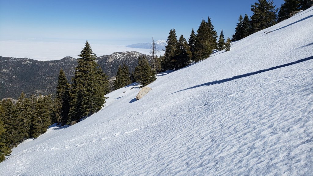
TRAIL CONDITIONS
Trails above about 7000 ft remain largely snow-covered (wholly snow-covered above about 8000 ft). This will change steadily with extensive melting over the next few days and weeks. Details of PCT tracks and alternates are given in the PCT section above.
Devil’s Slide Trail [updated 17th April] is functionally clear of snow for its first 0.5 mile (to near switchback 3). Snow cover is then about 40% and very patchy for another 1.1 miles up to about 7500 ft elevation. Snow cover is largelt continuous thereafter to Saddle Junction. Snow can be firm in early mornings (perfect for spikes all the way to Saddle) but it can be soft otherwise, as early as late morning on warm days (expect periodic deep and wet postholing). The track that I put in after the last storm at the end of March is steep and (intentionally) does not follow the established trail route in the uppermost switchbacks close to Saddle Junction, so careful navigation is required. Many hikers will find that spikes are not required for ascending, but they are useful for descending the upper third of the trail.
My snowshoe-and-posthole track from multiple ascents/descents continues on to San Jacinto Peak, via a route roughly approximating to the PCT, Wellman, Peak, and East Ridge trails, climbing more steeply in places than the established trails, and generally contouring through the snow as needed to minimize unnecessary elevation loss and switchbacking. This track has now been moderately well-traveled and compacted. Other tracks head up from around 10,000 ft elevation directly upslope towards the summit junction, before turning north to the Peak.
Multiple trails lead from Round Valley up to the high country. There is now a reasonable posthole track through continuous snow up to Wellman Divide. Two posthole-and-snowshoe tracks run more directly, one up Jean Peak, and another up to near Miller Peak where it connects to the established trail up East Ridge to the Peak.
Deer Springs Trail is functionally clear of snow to the Suicide Rock Trail junction (spikes not required). From there to Strawberry Junction snow cover averages only 30%, with few major patches until you near the PCT. This is so sun exposed that patches are soft by mid morning at the latest. The track up to Strawberry Junction is obvious but surprisingly lightly traveled, and much less firm and compacted than, for example, the track up Devil’s Slide.
On Deer Springs Trail above Strawberry Junction the snow cover is continuous. There is a very lightly traveled and uneven posthole track north from Strawberry Junction, that rarely follows the actual trail route, and can be tough to follow, especially for those who know the true trail well. Once the track leaves the PCT at the south end of Fuller Ridge, it generally takes direct routes up the various snow slopes (e.g., photo below), and again only vaguely approximates to the trail route. In Little Round Valley the track splits in two roughly parallel tracks through the valley and both ascend very directly up towards San Jacinto Peak.
The Ernie Maxwell Trail [updated 18th April] is almost entirely clear of icy snow, but a couple of extended patches remain on the upper trail closest to Humber Park. Most hikers will find that spikes are not required.
The 0.4 mile section of South Ridge Trail between the PCT at Chinquapin Flat and Tahquitz Peak has no steps to follow through the steeply angled ice with overlying deep snow. These icy slopes are notoriously treacherous. Currently crampons, always with an ice axe, and thorough knowledge of how to use this equipment on high angle terrain, are essential. Snowshoes are not advisable due to the angle of the icy snow.
Marion Mountain Trail [surveyed 21st April] remains largely snow-covered and has a very lightly-traveled track to follow, which only roughly approximates to the trail route in places. The lower 0.5 mile has about 60% snow cover, but the remainder of the trail has 100% snow cover. The track is not always easy to follow, especially when it breaks into multiple routes as it nears the PCT/Deer Springs Trail. Below 7500 ft elevation, the snow is soft even in the early morning, and gets soft at all elevations later in the day.
South Ridge Road is functionally clear of snow. South Ridge Trail [surveyed 20th April] has 30% snow cover up to Old Lookout Flat (7600 ft), but many of the snow patches remain surprisingly deep. Snow cover is then largely continuous from the Flat up to Tahquitz Peak. There is a posthole track to follow, which crosses steep angled icy snow in the upper switchbacks. Spikes at a minimum are required, crampons can be useful.
Spitler Peak Trail [surveyed weekly] is functionally clear of snow all the way to the PCT. A few minor snow patches remain on the most sheltered slopes but none of them require spikes to pass. Sadly most of my hard work of recent years, in which I cut 60+ trees on the upper trail, has been undone by this winter. About another 35 treefall hazards are on the trail, but thankfully almost all are small enough to be relatively easy to remove. More worrisome are 5-6 washouts in the upper switchbacks which have significantly impacted the tread in places, necessitating significant trail recovery work (photos below).
Effective 26th January 2023 the State Park closed the section of Skyline Trail that falls within its jurisdiction, above 5800 ft elevation, “until further notice due to dangerous weather conditions”. (For readers who are unclear, Skyline Trail forms the lower two-thirds of the “Cactus-to-Clouds” [C2C] route.) The State Park boundary is not marked but is near the site of the old Florian’s Cache, below Flat Rock. The open section of trail below 5800 ft is clear of snow.
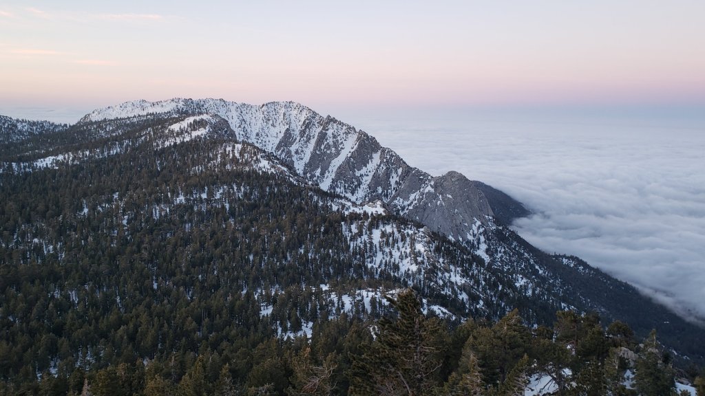
SNOW DEPTHS
Measured on Friday 14th April 2023 unless otherwise stated. The first number is the current snow depth, followed in parentheses by the maximum depth recorded in winter 2022/23 where known. In all cases these are the greatest snow depths recorded at these locations for at least 11-12 years. Note that averages are given; due to strong winds accompanying all storms, and the differential effects of rain on snow in some earlier storms, there is considerable inconsistency of depth. Altitudes and PCT Miles are approximate.
San Jacinto Peak (10810 ft): 78-82 inches (100-105 inches on 31st March)
Little Round Valley (9800 ft): 80-90 inches (heavily drifted and slow to melt here, see photo below)
Wellman Divide (9700 ft): 50-55 inches (70-75 inches on 3rd March and again on 31st March)
Annie’s Junction/PCT Mile 180.8 (9070 ft): 65 inches (80 inches on 3rd March)
Long Valley (8600 ft): 36 inches, but some bare patches already appearing (c.60 inches on 3rd March)
Strawberry Junction/PCT Mile 183.2 (8100 ft): 12 inches (but cleared patches developing, photo below)
Saddle Junction/PCT Mile 179 (8070 ft): 35 inches (48-50 inches on 3rd March)
Devil’s Slide trailhead at Humber Park (6550 ft): 0-3 inches, melting rapidly (46 inches on 3rd March)
Idyllwild (at 5550 ft): 0 inches (45 inches on 1st March)
PCT Mile 151 at crossing with Highway 74 (4800 ft): 0 inches (13 inches in first week of March)
While all time and labor is volunteered, the San Jacinto Trail Report uses small private donations to help cover modest operating costs. Every year seems to have its unique challenges, and clearly 2023 is no exception. Your contribution keeps the Report available to all, free from advertising or paywalls, and independent from agencies. If you have found this Report useful, please consider using this link to the Donate page. Zelle, Venmo, and PayPal are all options. Thank you so much for your support.
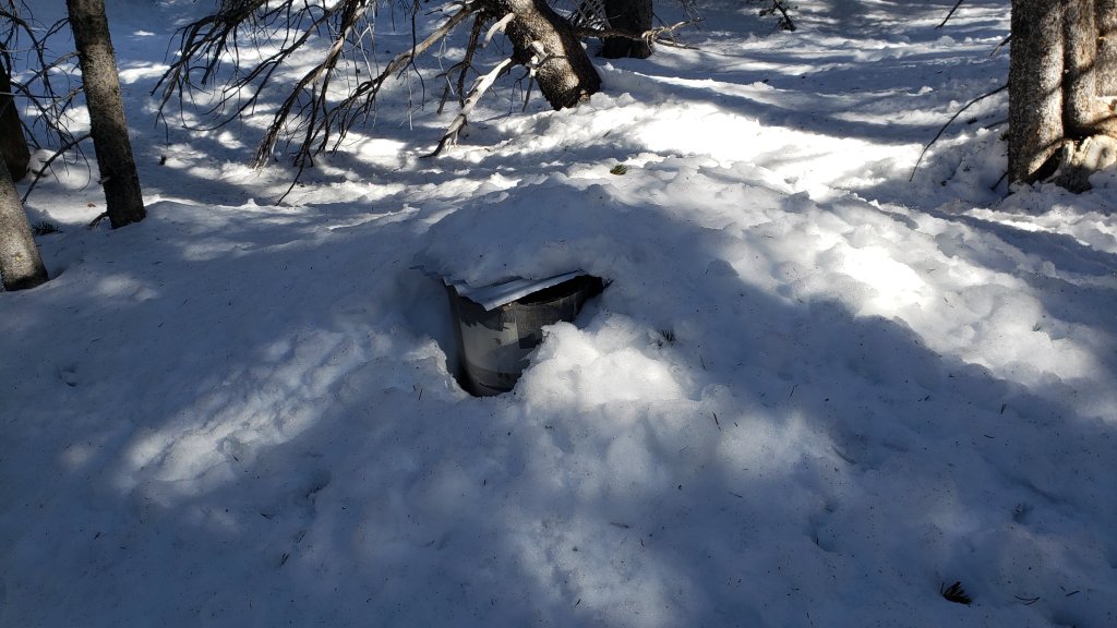

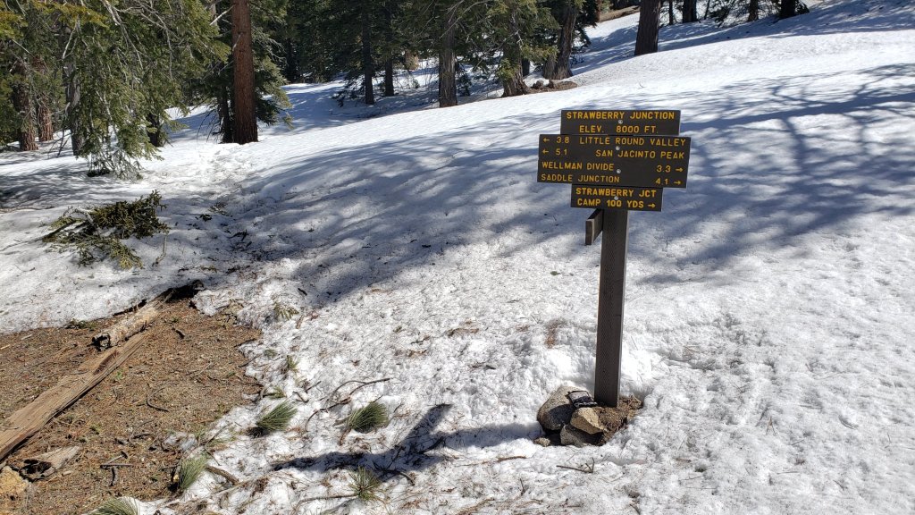
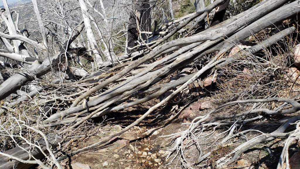
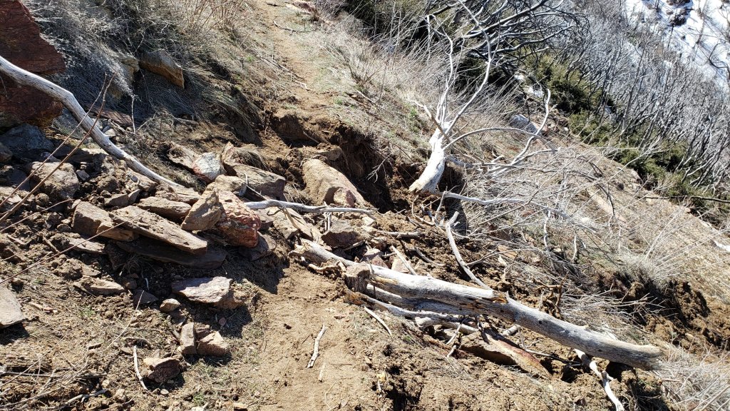
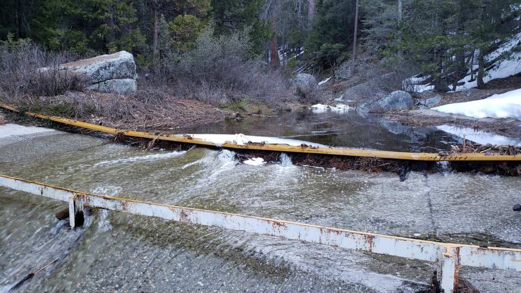
sanjacjon Uncategorized Leave a comment 15 MinutesEdit”Snow and trail update 14th April 2023″
Snow and trail update 7th April 2023
On Friday 7th April I surveyed Spitler Peak Trail and the PCT north to Apache Peak (Mile 169.5). There is now a posthole track north from Mile 169.5 – which goes over the saddle at Apache rather than around the east – to Saddle Junction (Mile 179). For hikers with limited snow hiking experience the alternate at Spitler Peak Trail (Mile 168.5) remains an excellent option. Sadly Spitler Peak Trail has deteriorated again this winter (details below).
Our last significant storm on 29th-30th March, the 24th of this remarkable winter, was described in the prior Report (linked here). We just caught the edge of a very minor system on 3rd April, which produced about 0.5 inch of snow in the high country, not enough to significantly impact the few tracks in place. I recorded a rather lengthy video from San Jacinto Peak on the morning of 6th April that discusses many of the key points herein (available here on YouTube).
The State Park wilderness reopened on Friday 7th April having been closed since 1st March. Frankly the less said about that closure the better. Skyline Trail (part of the C2C route) above 5800 ft remains closed, apparently indefinitely, and does not sound likely to reopen before late May. Currently there is no evidence of avalanche risk in the high country.
I conducted survey hikes in the high country on 31st March and 2nd, 5th, and 6th April, generally from Devil’s Slide Trail to San Jacinto Peak, via a short section of the PCT, Wellman’s, Peak, and East Ridge trails, descending the same way. On 31st I broke trail the entire route through fresh powder averaging 7-10 inches deep, following a storm the previous day. With little change in the weather that track has held up really well, and became a fast and firm route on cold mornings (photo below).
On 31st March conditions averaged better for snowshoes for the entire hike. Although I switched to crampons above about 10,000 ft, they proved to be of limited additional value. By the time I descended Devil’s Slide Trail, a relatively well-traveled compacted track was already forming. In contrast, on 2nd, 5th, and 6th April, I was able to ascend and descend the entire route just in spikes with no postholing (I carried snowshoes on 2nd and crampons on all three days, but they were unused). This was in part because of the relatively compacted track that I broken previously, and also because I had Alpine starts, returning to Humber Park by late morning, before the sun had become too potent on the exposed slopes.
Currently trails above about 7000 ft are obscured by moderate to deep snow. Trails as low as 5000 ft elevation can have shallow and very patchy snow cover. With the State Park closure in place for a week since the last snow storm, there are few tracks in place anywhere above 8000 ft. Very cautious navigation is essential everywhere.
Details of snow depths measured at various locations on the trail system are given at the foot of this posting. Note that snow depth itself is rarely indicative of the difficulty (or otherwise) of hiking a particular track or trail. For example a firm, well-compacted snowshoe or crampon track across snow several feet deep may be much easier hiking than just a couple of inches depth of steeply angled ice.
Conditions will change dramatically over the next couple of weeks, with a major warming trend bringing rapid and widespread melting (see Weather below), and greatly softening snow in all areas, impacting the quality of tracks.
To give an idea of the current traction challenge, I am generally hiking with all three of snowshoes, crampons, and spikes, changing between them as conditions warrant. This challenge will evolve over the next week with warm temperatures on many days. The optimum traction device at any given time and place depends on a complex interaction of factors including time of day, sun exposure of the trail, air temperature, and extent to which a track has been established and compacted. The willingness of the hiker to posthole (itself somewhat correlated to fitness) also influences choice of traction.
Snowshoes are expected to become increasingly helpful everywhere above about 8000 ft (potentially lower in places on the warmest days for the next week or so). Tracks in the high country can be firm if the morning is cold (crampons or even spikes best) but then soften rapidly once sun hits slopes and temperatures rise, at which point snowshoes may become preferable. Even after trails become compacted through freeze/thaw cycles and hiker traffic, snowshoes will remain invaluable for off-trail travel for many weeks above 8000 ft.
Crampons – with hiking poles and/or an ice axe, depending on terrain – are potentially useful everywhere above about 8000 ft, when cold temperatures on some days, plus freeze/thaw cycles, lead to hardening of the snow surfaces. They may become invaluable over the next few weeks (depending on temperature) on certain moderate and higher angle slopes, at a minimum on the Peak Trail above Wellman Divide, the Wellman Trail, Deer Springs Trail above Little Round Valley, and uppermost South Ridge Trail, and on both flanks but critically on the north face of Tahquitz Peak.
Increasingly as snow conditions change spikes are strongly recommended for the foreseeable future everywhere above about 7000 ft. This elevation will slowly move upwards with steady melting over the next few days and weeks, but may remain relatively low into May.
Despite unseasonably warm weather over the next week, hikers should nevertheless be prepared for temperatures near freezing in the high country, and below freezing when considering wind chill effects (see below for my recent weather observations from San Jacinto Peak).
The USFS gate at Humber Park remains closed. Even when the gate is closed there are nine legal parking spaces below the locked gate (which still require an Adventure Pass or equivalent to be displayed). If there are “Road Closed” signs across Fern Valley Road near its junction with Forest Drive – which has generally not been the case for the past week – then those nine spaces are also unavailable for legal parking.
Forest Service roads currently closed to vehicular traffic by a revised closure order include Black Mountain Road (4S01), Dark Canyon Road (4S02), South Ridge Road (5S11), May Valley Road (5S21), and Santa Rosa Road (7S02), plus their various side roads.
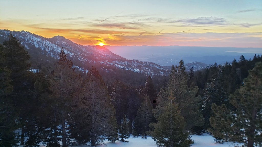
WEATHER
Warm, sunny, stable weather is generally forecast for at least the first half of April. With the exception of a brief cooling on 13th-14th April, temperatures will be at or above seasonal for the foreseeable future. Even at the highest elevations air temperatures will be above freezing almost daily from 8th April onwards. Snowmelt will be remarkably rapid below 9000 ft and will proceed steadily even higher especially on sun-exposed slopes.
At San Jacinto Peak (10,810ft/3295m) on Thursday 6th April 2023 at 0755 the air temperature was 27.2°F (-3°C), with a windchill temperature of 18.0°F (-8°C), 39% relative humidity, and a very light NNW wind sustained at 3 mph gusting to 6.5 mph.
At the Peak on Wednesday 5th April 2023 at 0815 the air temperature was 20.1°F (-7°C), with a windchill temperature of 2.3°F (-17°C), 13% relative humidity, and a fresh NW wind sustained at 12 mph gusting to 19.7 mph.
At the Peak on Sunday 2nd April 2023 at 0810 the air temperature was 31.3°F (0°C), with a windchill temperature of 14.2°F (-10°C), 39% relative humidity, and a bitter due West wind sustained at 22 mph gusting to 33.2 mph.
At the Peak on Friday 31st March 2023 at 1040 the air temperature was 23.4°F (-5°C), with a windchill temperature of 10.8°F (-12°C), 26% relative humidity, and a steady due West wind sustained at 8 mph gusting to 10.2 mph.
PACIFIC CREST TRAIL INFORMATION
Between the lengthy Park closure and storms continuing throughout March, completing the San Jacinto mountains section has been a major challenge even for experienced hikers this season. That said, rapid and widespread melting is underway and will accelerate over the next few days. Most or even all areas will soon become readily passable in April with – crucially – suitable skills and equipment, patience, and a thorough knowledge of all the possible alternates if needed.
The PCT from Mile 151 (Highway 74 crossing) to Mile 168.5 (Spitler Peak Trail alternate) is rapidly clearing of snow [checked at least weekly]. Fobes Ranch Road and Fobes Trail (another earlier alternate at Mile 166) are clear of snow.
There is a reliable well-traveled track on the PCT north to about Mile 169. There is now a track continuing beyond Apache Peak (Mile 169.5) all the way through to Mile 177. Spikes are essential as the posthole track is challenging with multiple crossings of angled snow slopes, and the track does not accurately follow the PCT route in places. Descending via the well-signed alternate at Spitler Peak Trail (Mile 168.5) is an excellent option for hikers less comfortable on lengthy sections of angled snow or lacking suitable traction. Spitler Peak Trail is functionally clear of snow, although a few minor patches remain that do not require spikes. Sadly this winter has has brought down about 30 minor trees and half-a-dozen washouts in the uppermost 1.2 miles but nothing particularly challenging to pass.
It is possible to get a ride on Apple Canyon Road, or to hike via the Forest Service roads – Bonita Vista Road and May Valley Road – into Idyllwild (check maps or apps for details).
By Monday 10th April, there was a single posthole track from Annie’s Junction (Mile 180.8) west to Strawberry Junction (Mile 183).
As of Friday 7th April, there were no tracks through the snow on the PCT along Fuller Ridge (Miles 185.5-191). However this is expected to change in the next few days.
At this time continuing north on Fuller Ridge requires crampons and ice axe (and knowledge of how to use that equipment), plus excellent snow hiking skills. Snowshoes may become increasingly valuable as the deep snow softens considerably over the next week.
A well established alternate from Idyllwild is to connect back to the PCT at about Mile 191 using Black Mountain Road. Black Mountain Road currently has continuous light to moderate snow cover but there are tracks to follow through the snow, and melting of the lower section will proceed steadily over the next week or so. Ignore signage that indicates the road is closed to hiker traffic, this is erroneous and has been reported to Forest Service. Snow on the road is rapidly melting, and expect 50% snow cover on the lower two miles, 90% cover for the next three miles averaging 2-6 inches deep, then 100% cover for the upper three miles, at 6-18 inches deep. Early on cold mornings the snow is hard and icy making it easy to hike, but snow is soft and postholing is poor by late morning. At last check, no vehicle had driven up from Highway 243 since the last snows.
The remarkable winter has created some challenges in addition to the snow. There can be a great deal of water in the trails, and this has also created a few tricky crossings. Be cautious of snow bridges across water. Forested trails are covered with downed branches and debris, plus many new treefall hazards, some of which are only becoming apparent as the snow recedes. Trail maintenance by agencies was already years behind schedule due to the coronavirus pandemic, among other reasons, and this winter has greatly exacerbated the situation. Again, patience and caution will be essential this season more than most.
Recently I have mentioned the challenges of hard, icy snow underfoot and the value of using spikes (and/or crampons) especially for descending and traversing. While softening, melting, snow (and fresh powder if we have more storms) may be ideal for snowshoeing for the next several weeks, snow at all elevations will generally become increasingly firm and icy following multiple freeze-thaw cycles, and compaction by increasing hiker traffic (especially once all high country trails reopen). I cannot overemphasize the importance of having both appropriate equipment and the right skill set for the terrain. The latter includes interpreting the snow/ice conditions, understanding your physical and mental abilities, and conservative decision making. These concerns will steadily increase over the next few weeks with temperatures fluctuating either side of freezing, seasonally stronger insolation, and highly variable snowmelt.
PCT hikers are reminded that overnight stays are not permitted at or near San Jacinto Peak, including in the historic shelter (currently snowed in anyway). Mt. San Jacinto State Park regulations permit overnight stays only in established campgrounds. Little Round Valley and Strawberry Junction are good options for thru-hikers.
While all time and labor is volunteered, the San Jacinto Trail Report uses small private donations to help cover modest operating costs. Every year seems to have its unique challenges, and clearly 2023 is no exception. Your contribution keeps the Report available to all, free from advertising or paywalls, and independent from agencies. If you have found this Report useful, please consider using this link to the Donate page. Zelle, Venmo, and PayPal are all options. Thank you so much for your support.

TRAIL CONDITIONS
Trails above about 6000 ft remain largely snow-covered (wholly snow-covered above about 7000 ft). This will change steadily with extensive melting over the next few days and weeks. Details of PCT tracks and alternates are given in the PCT section above.
Devil’s Slide Trail has a reliable, compacted snowshoe and posthole track to follow up to Saddle Junction. It can be firm in early mornings (perfect for spikes all the way to Saddle) but it can be soft otherwise, as early as late morning (snowshoes required, or expect periodic deep and wet postholing). Beware of some tricky stream crossings. The track that I put in after the last storm is steep and (intentionally) does not follow the established trail route in the uppermost switchbacks close to Saddle Junction, so careful navigation is required.
My snowshoe-and-posthole track from multiple ascents/descents continues on to San Jacinto Peak, via a route roughly approximating to the PCT, Wellman, Peak, and East Ridge trails, climbing more steeply in places than the established trails, and generally contouring through the snow as needed to minimize unnecessary elevation loss and switchbacking. This track has now been moderately well-traveled and compacted, and with no significant fresh snow expected it should remain reliable for some time.
The Ernie Maxwell Trail [surveyed 4th April 2023] still has 90% icy snow cover on the lower two-thirds of the route, becoming continuous on the upper trail nearer Humber Park. There is a well-marked but uneven posthole track to follow through the snow, which can be firm and icy on cold mornings, but becomes soft and slippery later in the day. Melting will be very fast on this trail over the next week or two.
There is a track south from Saddle Junction (PCT Mile 179) towards Chinquapin Flat (PCT Mile 177.5), but it does not accurately follow the established trail route, and snowshoes are recommended.
The 0.4 mile section of South Ridge Trail between the PCT at Chinquapin Flat and Tahquitz Peak has no steps to follow through the steeply angled ice with overlying deep snow. These icy slopes are notoriously treacherous. Currently crampons, always with an ice axe, and thorough knowledge of how to use this equipment on high angle terrain, are essential. Snowshoes are not advisable due to the angle of the icy snow.
Spitler Peak Trail [surveyed weekly] is functionally clear of snow all the way to the PCT. A few minor snow patches remain on the most sheltered slopes, totaling only 2-3% of the trail, but none of them require spikes to pass. Sadly most of my hard work of past two years, when I cut 60+ trees on the upper trail, has been undone by this winter. About another 35 treefall hazards are on the trail, but thankfully almost all are small enough to be relatively easy to remove. More worrisome are 5-6 washouts in the upper switchbacks which have significantly impacted the tread in places, necessitating significant trail recovery work.
Effective 26th January 2023 the State Park closed the section of Skyline Trail that falls within its jurisdiction, above 5800 ft elevation, “until further notice due to dangerous weather conditions”. (For readers who are unclear, Skyline Trail forms the lower two-thirds of the “Cactus-to-Clouds” [C2C] route.) The State Park boundary is not marked but is near the site of the old Florian’s Cache, below Flat Rock. The open section of trail below 5800 ft is clear of snow.
SNOW DEPTHS
Measured on Thursday 6th April 2023 unless otherwise stated. The first number is the current snow depth, followed in parentheses by the maximum depth recorded in winter 2022/23. In all cases these are the greatest snow depths recorded at these locations for at least 11-12 years. Note that averages are given; due to strong winds accompanying all storms, and the differential effects of rain on snow in some earlier storms, there is considerable inconsistency of depth. Altitudes and PCT Miles are approximate.
San Jacinto Peak (10810 ft): 90-95 inches (100-105 inches on 31st March)
Wellman Divide (9700 ft): 62-65 inches (70-75 inches on 3rd and 31st March)
Annie’s Junction/PCT Mile 180.8 (9070 ft): 70 inches (80 inches on 3rd March)
Long Valley (8600 ft): 45 inches (c.60 inches on 3rd March)
Saddle Junction/PCT Mile 179 (8070 ft): 36-38 inches (48-50 inches on 3rd March)
Devil’s Slide trailhead at Humber Park (6550 ft): 1-8 inches, melting rapidly (46 inches on 3rd March)
Idyllwild (at 5550 ft): 0-3 inches (45 inches on 1st March)
PCT Mile 151 at crossing with Highway 74 (4800 ft): 0 inches, largely melted by 31st March, measured on 1st April (13 inches in first week of March)
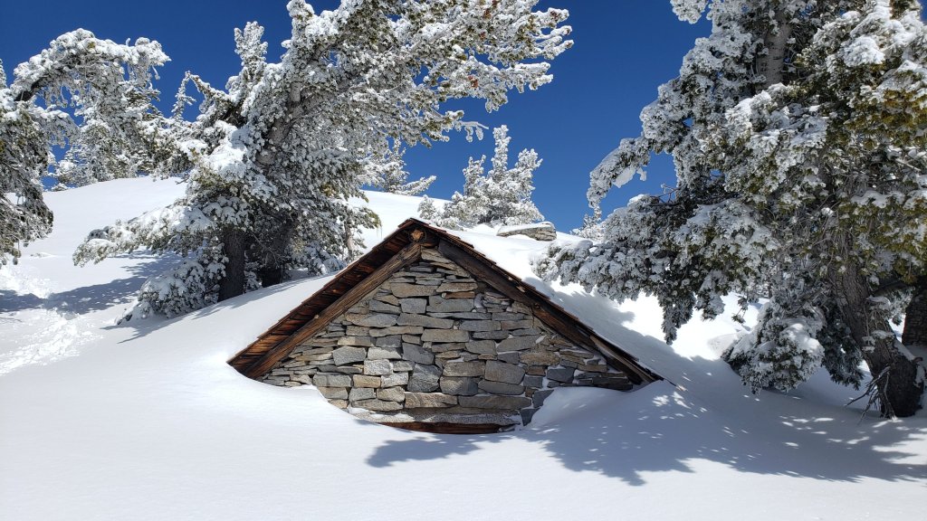

On Sunday 2nd April 2023 as I descended from San Jacinto Peak I twice crossed paths with friends, Idyllwild neighbors, and great supporters of the Trail Report. As it was my 750th ascent – apparently setting the record for most ascents all time of a 10,000 ft/3000 m peak in Southern California – we took photos in celebration (below). The record was previously held by the late Seuk Doo “Sam” Kim, who had summited Mt. San Antonio in the San Gabriel mountains just over 740 times.

sanjacjon Uncategorized 4 Comments 13 MinutesEdit”Snow and trail update 7th April 2023″
Snow storm update 2nd April 2023
UPDATE Thursday 6th April 2023: the State Park wilderness reopens tomorrow, Friday 7th April, according to a media release from the Park. Skyline Trail remains closed indefinitely, as discussed below.
UPDATE Wednesday 5th April 2023: I have updated the PCT section (and other sections) below based on significant new information from my hike this morning in the high country.
————————————-
This is an outline of current snow and trail conditions, following the 24th storm of this remarkable winter on 29th-30th March. It was a storm of two distinct days, with steady rain at mid elevations on 29th (totaling 0.7 inch at 5550 ft in Idyllwild), with light, intermittent snow in the high country that day. Much colder precipitation overnight and throughout much of 30th produced 6 inches of snow in Idyllwild, and a snow level down to 4000 ft elevation. I measured 2 inches at PCT Mile 151 (4800 ft) in Garner Valley early that morning, as described in a short video report (available here on YouTube).
It was periodically clear in the high country above about 8000 ft elevation while it was still snowing at mid elevations on 30th, and consequently there was relatively little difference in the snow totals between Idyllwild (6 inches at 5550 ft) and San Jacinto Peak (10 inches at 10,800 ft), with locations in between generally at 7-8 inches.
The State Park wilderness closed on 1st March (see State Park website and associated social media for their explanation of the situation). An additional closure applies to Skyline Trail (part of the C2C route) as discussed below under Trail Conditions. The latter does not sound likely to reopen before June.
Currently there is no avalanche risk on the high country slopes that are crossed by the established trail network, based on my multiple surveys since the recent snowfalls. There remains only a minor avalanche risk for the Snow Creek drainage on the north face of San Jacinto Peak now that the latest snowfall has consolidated. The biggest avalanche of the season so far occurred at around 7000-7500 ft in the Snow Creek drainage on 22nd-23rd March, immediately after the previous week’s heavy snowfall, and a substantial debris field is readily visible even from San Jacinto Peak in the 5000-7000 ft elevation range (see photo in previous Report).
I conducted survey hikes on 31st March and 2nd and 5th April. All went from Devil’s Slide Trail to San Jacinto Peak, via a short section of the PCT, Wellman’s, Peak, and East Ridge trails, descending the same way. On 31st I broke trail the entire route through fresh powder averaging 7-10 inches deep.
To give an idea of the current traction challenge, I am generally hiking with all three of snowshoes, crampons, and spikes, changing between them as conditions warrant. On 31st, conditions averaged better for snowshoes for the entire hike. Although I switched to crampons above about 10,000 ft, they proved to be of limited additional value. By the time I descended Devil’s Slide Trail, a relatively well-traveled compacted track was already forming.
In contrast, on 2nd and 5th April, I was able to ascend and descend the entire route just in spikes with no significant postholing (I carried snowshoes and crampons but they were unused). This was in part because of the relatively compacted track that I broken previously, and also because I had Alpine starts, returning to Humber Park by late morning, before the sun had become too potent on the exposed slopes.
Currently trails above about 6000 ft are obscured by moderate to deep snow. Trails down to 5000 ft elevation currently have shallow and very patchy snow cover. With the State Park closure in place, there are few tracks anywhere above 8000 ft. Very cautious navigation is essential everywhere.
Conditions will change dramatically over the next couple of weeks, with a major warming trend bringing rapid and widespread melting (see Weather below).
Details of snow depths measured at various locations on the trail system are given at the foot of this posting. Note that snow depth itself is rarely indicative of the difficulty (or otherwise) of hiking a particular track or trail. For example a firm, well-compacted snowshoe or crampon track across snow several feet deep may be much easier hiking than an angled icy section just inches deep.
Conditions are currently excellent for snowshoes everywhere above about 7000 ft (lower in places for the next week or so). Tracks in the high country can be firm if the early morning is cold (crampons or even spikes best) but then soften very rapidly once sun hits slopes and temperatures rise, at which point snowshoes are preferable. Even after trails become compacted through freeze/thaw cycles and hiker traffic, snowshoes will remain invaluable for off-trail travel for many weeks especially above 8000 ft.
Crampons – with hiking poles and/or an ice axe, depending on terrain – are becoming increasingly useful everywhere above about 7000 ft, as cold temperatures on some days, plus freeze/thaw cycles, lead to hardening of the snow surfaces. They will likely become invaluable over the next few weeks on certain moderate and higher angle slopes, at a minimum on the Peak Trail above Wellman Divide, the Wellman Trail, Deer Springs Trail above Little Round Valley, and uppermost South Ridge Trail, and on both flanks but critically on the north face of Tahquitz Peak.
Increasingly as snow conditions change spikes are strongly recommended for the foreseeable future everywhere above about 5500 ft. They can currently be valuable even for walking around Idyllwild early on cold mornings! This elevation will slowly move upwards with steady melting over the next few days and weeks, but may remain relatively low into May.
Hikers should be prepared for temperatures below freezing in the high country, and often well below freezing when considering wind chill effects (see below for my recent weather observations from San Jacinto Peak).
The USFS gate at Humber Park is closed. Even when the gate is closed there are nine legal parking spaces below the locked gate (which still require an Adventure Pass or equivalent to be displayed). If there are “Road Closed” signs across Fern Valley Road near its junction with Forest Drive then those nine spaces are also unavailable for legal parking.
Forest Service roads currently closed to vehicular traffic by a revised closure order include Black Mountain Road (4S01), Dark Canyon Road (4S02), South Ridge Road (5S11), May Valley Road (5S21), and Santa Rosa Road (7S02), plus their various side roads.
WEATHER
The great melting begins! Warm, sunny, stable weather is generally forecast for at least the first half of April. With the exception of a brief cooling on 3rd-4th April, mid elevation temperatures warm to seasonal and then starting next weekend move well above seasonal at least for 8th-12th April. Even at the highest elevations air temperatures will be far above seasonal for early April in the second week of the month. Sadly snowmelt will be remarkably rapid below 8000 ft and also on sun-exposed slopes at high elevations.
At San Jacinto Peak (10,810ft/3295m) on Sunday 2nd April 2023 at 0810 the air temperature was 31.3°F (0°C), with a windchill temperature of 14.2°F (-10°C), 39% relative humidity, and a bitter due West wind sustained at 22 mph gusting to 33.2 mph.
At the Peak on Friday 31st March 2023 at 1040 the air temperature was 23.4°F (-5°C), with a windchill temperature of 10.8°F (-12°C), 26% relative humidity, and a steady due West wind sustained at 8 mph gusting to 10.2 mph.
At the Peak on Monday 27th March 2023 at 1045 the air temperature was 25.3°F (-4°C), with a windchill temperature of 12.6°F (-11°C), 19% relative humidity, and a light WNW wind sustained at 7 mph gusting to 11.3 mph.
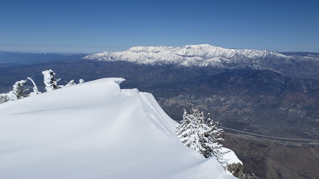
INFORMATION FOR PACIFIC CREST TRAIL HIKERS
Between the State Park closure and the storms throughout March, completing the San Jacinto mountains has been a major challenge even for experienced hikers this season. That said, melting will happen fast once it starts in earnest. Conditions in the southernmost sections will generally improve rapidly starting in the first week of April (judging by the forecasts), and most or even all areas will become readily passable with – crucially – suitable skills and equipment, patience, and a thorough knowledge of all the possible alternates if needed.
Recently I have mentioned the challenges of hard, icy snow underfoot and the value of using spikes (and/or crampons) especially for descending and traversing. While softening, melting, snow (and fresh powder if we have more storms) may be ideal for snowshoeing for the next several weeks, snow at all elevations will generally become increasingly firm and icy following multiple freeze-thaw cycles, and compaction by increasing hiker traffic (especially once high country trails reopen). I cannot overemphasize the importance of having both appropriate equipment and the right skill set for the terrain. The latter includes interpreting the snow/ice conditions, understanding your physical and mental abilities, and conservative decision making. These concerns will steadily increase over the next few weeks with temperatures fluctuating either side of freezing, seasonally stronger insolation, and highly variable snowmelt.
The remarkable winter has created some challenges in addition to the snow. There can be a great deal of water in the trails, and this has also created a few tricky crossings. Be cautious of snow bridges across water. Forested trails are covered with downed branches and debris, plus many new treefall hazards, some of which are only becoming apparent as the snow recedes. Trail maintenance by agencies was already years behind schedule due to the coronavirus pandemic, among other reasons, and this winter has greatly exacerbated the situation. Again, patience and caution will be essential this season more than most.
The PCT from Mile 151 (Highway 74 crossing) to Mile 166 (Fobes Trail alternate) is clearing of snow steadily [checked multiple times each week]. Fobes Ranch Road and Fobes Trail are clear of snow.
There are tracks continuing from Mile 166 to about Mile 169, but at this time there is no track continuing beyond Apache Peak (Mile 169.5) through to Mile 177. I recommend descending via the well-signed alternate at Spitler Peak Trail (Mile 168.5). There is a track to follow through about 6-10 inches of snow on its uppermost section, and it is then functionally clear of snow for its lower 3.5 miles. It is possible to get a ride on Apple Canyon Road, or to hike via the Forest Service roads (Bonita Vista Road and May Valley Road) into Idyllwild.
Proceeding north from about Mile 169 currently requires considerable snow hiking experience. At this time I recommend carrying snowshoes, crampons, and ice axe, plus you will need the necessary snow hiking experience to use that equipment safely in moderate angle terrain, along with patience, stamina, and route-finding skills.
As of Wednesday 5th April, there were no tracks through the snow on the PCT route coming north from Mile 175 (Red Tahquitz) through to Saddle Junction (Mile 179) and along Fuller Ridge (Miles 185.5-191).
A track was put in from Annie’s Junction (Mile 180.8) west to Strawberry Junction (Mile 183) on 5th April 2023, allowing easier access to descend Deer Springs Trail back to Idyllwild. At this time continuing north on Fuller Ridge requires crampons and ice axe (and knowledge of how to use that equipment), plus excellent snow hiking skills.
A well established alternate is to connect back to the PCT at about Mile 191 using Black Mountain Road. Black Mountain Road currently has continuous moderate snow cover but there are tracks to follow through the snow, and melting of the lower section will proceed steadily over the next week or so. Ignore any signage that indicates the road is closed to hiker traffic, this is erroneous and has been reported to Forest Service. Soon the conditions will be similar to my survey on 17th March, when the Road had 50% snow cover on the lower two miles, 90% cover for the next three miles averaging 2-6 inches deep, then 100% cover for the upper three miles, at 6-18 inches deep. Early on cold mornings the snow is hard and icy making it easy to hike, but snow is soft and postholing is poor by late morning. At last check, no vehicle had driven up from Highway 243 since the last snows.
PCT hikers are reminded that overnight stays are not permitted at or near San Jacinto Peak, including in the historic shelter (even after the Park wilderness reopens). Mt. San Jacinto State Park regulations permit overnight stays only in established campgrounds (when open). Little Round Valley and Strawberry Junction are good options for thru-hikers.
TRAIL CONDITIONS
Trails above about 6000 ft remain largely snow-covered (wholly snow-covered above about 7000 ft). This will change steadily with further melting over the next few days and weeks.
Devil’s Slide Trail has a reliable, compacted snowshoe and posthole track to follow up to Saddle Junction. It can be firm in early mornings (perfect for spikes all the way to Saddle) but it can be soft otherwise, as early as late morning (snowshoes required, or expect periodic deep and wet postholing). Beware of some tricky stream crossings. The track that I put in after the last storm is steep and (intentionally) does not follow the established trail route in the uppermost switchbacks close to Saddle Junction, so careful navigation is required.
My snowshoe-and-posthole track from multiple ascents/descents continues on to San Jacinto Peak, via a route roughly approximating to the PCT, Wellman, Peak, and East Ridge trails, climbing more steeply in places than the established trails, and generally contouring through the snow as needed to minimize unnecessary elevation loss. This track has now been moderately well-traveled and compacted, and with no significant fresh snow expected it should remain reliable for some time.
The Ernie Maxwell Trail [surveyed 4th April 2023] still has 90% icy snow cover on the lower two-thirds of the route, becoming continuous on the upper trail nearer Humber Park. There is a well-marked but uneven posthole track to follow through the snow, which can be firm and icy on cold mornings, but becomes soft and slippery later in the day. Melting will be very fast on this trail over the next week or two.
There is a track south from Saddle Junction (PCT Mile 179) towards Chinquapin Flat (PCT Mile 177.5), but it does not accurately follow the established trail route, and snowshoes are recommended.
The 0.4 mile section of South Ridge Trail between the PCT at Chinquapin Flat and Tahquitz Peak has no steps to follow through the steeply angled ice with overlying deep snow. These icy slopes are notoriously treacherous. Currently crampons, always with an ice axe, and thorough knowledge of how to use this equipment on high angle terrain, are essential. Snowshoes are not advisable due to the angle of the icy snow.
Spitler Peak Trail [surveyed weekly] is clear of snow in its lower half (first 2.4 miles). The upper half of the trail has continuous light snow cover. The initial part of this snowy section has the rapidly melting remains of an excellent snowshoe track to follow (firm in the morning, spikes ideal) but this ends about 3.8 miles from the highway, about one mile below the PCT junction. There is a posthole track the remainder of the way to the PCT.
In addition to the wider closure mentioned above, effective 26th January 2023 the State Park closed the section of Skyline Trail that falls within its jurisdiction, above 5800 ft elevation, “until further notice due to dangerous weather conditions”. (For readers who are unclear, Skyline Trail forms the lower two-thirds of the “Cactus-to-Clouds” [C2C] route.) The State Park boundary is not marked but is near the site of the old Florian’s Cache, below Flat Rock. The open section of trail below 5800 ft received some light snow cover down to about 4500 ft over the past week, but this has already melted.
SNOW DEPTHS
Measured on Friday 31st March unless otherwise stated. The first number is the current snow depth, followed in brackets by the new snowfall in the storm of 29th-30th March, and then where relevant in parentheses by the maximum depth at that location in winter 2022/23. Note that averages are given; due to strong winds accompanying all storms, and the differential effects of rain on snow in some earlier storms, there is considerable inconsistency of depth. Altitudes and PCT Miles are approximate.
San Jacinto Peak (10810 ft): 100-105 inches [10 inches], greatest depth of this winter, and since at least 2011 at this location
Wellman Divide (9700 ft): 70-72 inches [8 inches] (70-75 inches on 3rd March)
Annie’s Junction/PCT Mile 180.8 (9070 ft): 75 inches [8 inches] (80 inches on 3rd March)
Long Valley (8600 ft): 50 inches [c.7 inches] (c.60 inches on 3rd March)
Saddle Junction/PCT Mile 179 (8070 ft): 40-45 inches [8 inches] (48-50 inches on 3rd March)
Devil’s Slide trailhead at Humber Park (6550 ft): 15-20 inches, already melting rapidly on 1st April [7 inches] (46 inches on 3rd March)
Idyllwild (at 5550 ft): 0-6 inches, melting rapidly by 31st March [6 inches] (45 inches on 1st March)
PCT Mile 151 at crossing with Highway 74 (4800 ft): 2 inches, measured 30th March, largely melted by 31st (13 inches in first week of March)
While all time and labor is volunteered, the San Jacinto Trail Report uses small private donations to help cover modest operating costs. Every year seems to have its unique challenges, and clearly 2023 will be no exception. Your contribution keeps the Report available to all, free from advertising or paywalls, and independent from agencies. If you have found this Report useful, please consider using this link to the Donate page. Zelle, Venmo, and PayPal are all options. Thank you so much for your support.
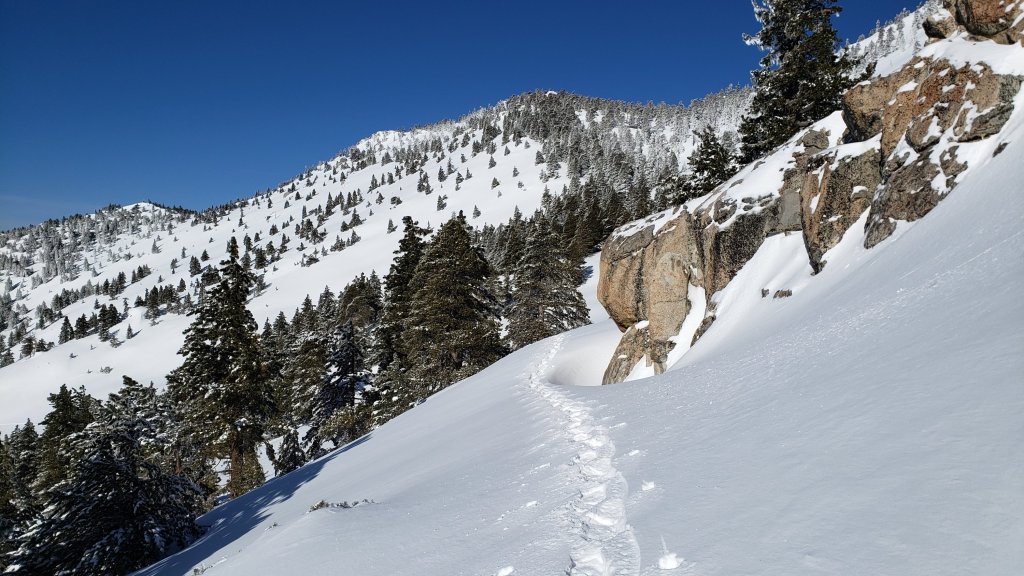


On Sunday 2nd April 2023 as I descended from San Jacinto Peak I twice crossed paths with friends and neighbors who are great supporters of the Trail Report. As it was my 750th ascent, setting the record for most ascents all time of a 10,000 ft peak in Southern California, we took photos in celebration. The record was previously held by the late Seuk Doo “Sam” Kim, who had summited Mt. San Antonio in the San Gabriel mountains just over 740 times.
sanjacjon Uncategorized 1 Comment 13 MinutesEdit”Snow storm update 2nd April 2023″
Snow update 28th March 2023
UPDATE Thursday 30th March 2023 at 1130: the 24th storm of this remarkable winter produced nearly three inches of snow in Idyllwild overnight, following a day of steady rain almost all day yesterday (totaling 0.7 inch at 5550 ft). Light snow in the high country yesterday and overnight totaled about 5 inches in Long Valley (8600 ft). Overnight it snowed down to 4000 ft, and I measured 2 inches at PCT Mile 151 early this morning, as described in a short video report I recorded there (available here on YouTube). It has periodically cleared in the high country above about 8000 ft elevation this morning, and also in Garner Valley, but it continues to snow steadily at mid elevations (e.g., in Idyllwild), with another 1-2 inches added since 0700.
——————————–
This is an outline of current snow and trail conditions, details of the situation after the last major storm were summarized in the previous Report (available here). The next storm, forecast to be relatively minor, is on its way on Wednesday 29th and Thursday 30th March. With a freeze level at around 4000-4500 ft elevation, a few inches of snow are expected at the mid elevations, including almost all of the PCT in the San Jacinto mountains. About 6-8 inches of snow are currently forecast for the high country.
The State Park wilderness closed on 1st March (see State Park website). At this time there is no tentative date for reopening. This closure includes PCT Miles 183-189. An additional closure applies to Skyline Trail (part of the C2C route) as discussed below under Trail Conditions.
Currently there is no avalanche risk on the high country slopes that are crossed by the established trail network, based on my multiple surveys since the latest snowfall. There remains a moderate avalanche risk for the Snow Creek drainage on the north face of San Jacinto Peak, most likely immediately following the next snowfall. The biggest avalanche of the season so far occurred at around 7000-7500 ft in the Snow Creek drainage on 22nd-23rd March, immediately after last week’s heavy snowfall, and a substantial debris field is readily visible even from San Jacinto Peak in the 5000-7000 ft elevation range (photo below).
My survey hike on Monday 27th – in my capacity as a volunteer wilderness ranger for the State Park – initially took me up Devil’s Slide Trail to Wellman’s Cienega. A firm compacted track on the former was ideal for spikes, but I switched to snowshoes just above Saddle Junction, and kept them on for the remainder of the hike, including the entire descent of Devil’s Slide in early afternoon. From the cienega, I went directly upslope, gaining the ridge on the south flank of Jean Peak. I followed the high country ridge up over Jean to San Jacinto Peak, before breaking trail on a more conventional descending route via (roughly) the East Ridge, Peak and Wellman trails back to the PCT. Despite its great depth, the high country snow was firm and I was sinking in only a few inches at most. I was surprised to find much of my snowshoe track from Wednesday 22nd remained just visible.
Currently trails above about 6500 ft are obscured by moderate to deep snow. Trails down to 5000 ft elevation currently have shallow and increasingly patchy snow cover. With the State Park closure in place, there are very few tracks anywhere above 8000 ft. Very cautious navigation is essential everywhere.
Details of snow depths measured at various locations on the trail system are given at the foot of this posting. Note that snow depth itself is rarely indicative of the difficulty (or otherwise) of hiking a particular track or trail. For example a firm, well-compacted snowshoe or crampon track across snow several feet deep may be much easier hiking than an angled icy section just inches deep.
Conditions are currently excellent for snowshoes everywhere above about 8000 ft (potentially lower in places for the next week or so). Tracks in the high country can be firm if the early morning is cold (crampons or even spikes best) but then soften rapidly once sun hits slopes and temperatures rise, at which point snowshoes are preferable.
To give an idea of the current traction challenge, I am generally hiking with all three of snowshoes, crampons, and spikes every time I go into the high country at present, changing between them as conditions warrant.
Crampons – with hiking poles and/or an ice axe, depending on terrain – are becoming increasingly useful everywhere especially above about 7000 ft, as cold temperatures on some days, plus freeze/thaw cycles, lead to hardening of the snow surfaces. They will likely become invaluable over the next week or so on certain moderate and higher angle slopes, at a minimum on the Peak Trail above Wellman Divide, the Wellman Trail, Deer Springs Trail above Little Round Valley, and uppermost South Ridge Trail, and on both flanks but critically on the north face of Tahquitz Peak.
Increasingly as snow conditions change spikes are strongly recommended for the foreseeable future everywhere above about 5500 ft. They can currently be valuable even for walking around Idyllwild early on cold mornings! This elevation will slowly move upwards with steady melting over the next few days and weeks, but will remain relatively low well into April.
Hikers should be prepared for temperatures below freezing in the high country, and well below freezing when considering wind chill effects (see below for my recent weather observations from San Jacinto Peak).
The USFS gate at Humber Park is closed. Even when the gate is closed there are nine legal parking spaces below the locked gate (which still require an Adventure Pass or equivalent to be displayed). If there are “Road Closed” signs across Fern Valley Road near its junction with Forest Drive – currently the case – then those nine spaces are also unavailable for legal parking.
Forest Service roads currently closed to vehicular traffic by a revised closure order include Black Mountain Road (4S01), Dark Canyon Road (4S02), South Ridge Road (5S11), May Valley Road (5S21), and Santa Rosa Road (7S02), plus their various side roads.
Palm Springs Aerial Tramway will be closed for maintenance on Monday 27th and Tuesday 28th March.
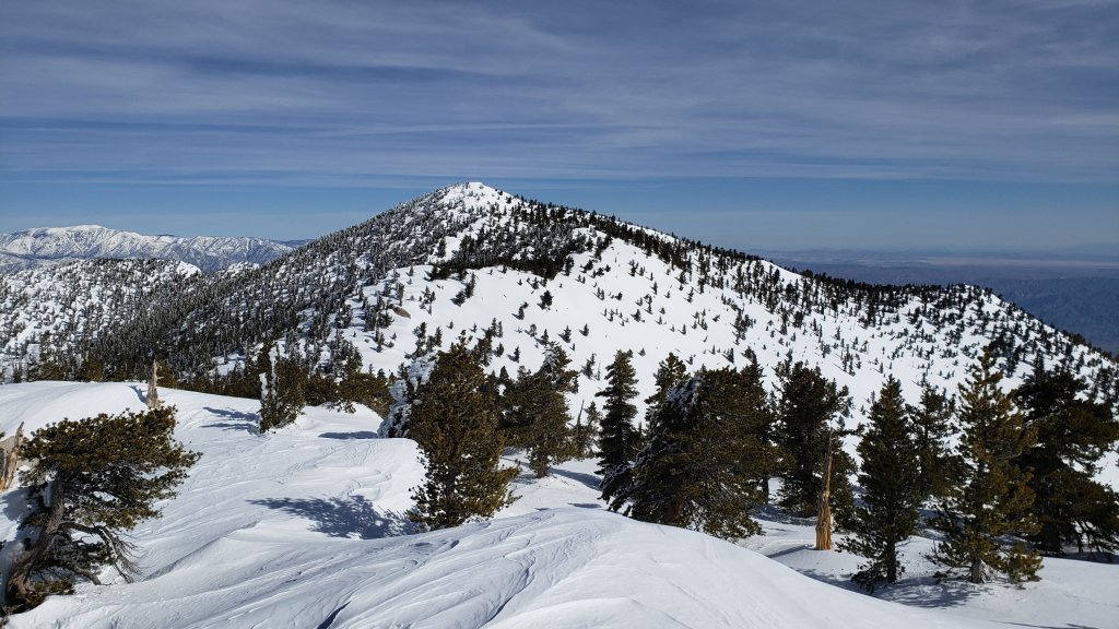
WEATHER
Conditions continue unsettled for the remainder of March. Two brief warm spells, on Tuesday 28th, and then again on 1st-2nd April, bookend the next minor storm system on 29th-30th. A mix of rain and 4-6 inches of snow are forecast for mid elevations (e.g., Idyllwild) with about 6-8 inches of snow for the high country. The system will be relatively cold, with snow expected to dust as low as 4000 ft, particularly on the night of Wednesday 29th. Winds – and therefore windchill temperatures – will be severe on the nights of 28th and 29th.
While somewhat more stable, sunnier weather with temperatures slightly warmer than the first three months of the year may start around 1st April, cold, cloudy, windy days nevertheless remain forecast for 3rd and 8th April at least, especially in the high country.
At San Jacinto Peak (10,810ft/3295m) on Monday 27th March 2023 at 1045 the air temperature was 25.3°F (-4°C), with a windchill temperature of 12.6°F (-11°C), 19% relative humidity, and a light WNW wind sustained at 7 mph gusting to 11.3 mph.
At the Peak on Monday 20th March 2023 at 1435 the air temperature was 20.8°F (-6°C), with a windchill temperature of 0.5°F (-18°C), 44% relative humidity, and a stiff due West wind sustained at 17 mph gusting to 28.0 mph, in complex, multi-layer cloud.
SOME THOUGHTS FOR PCT HIKERS
Between the State Park closure and the storms continuing in March, completing the San Jacinto mountains is currently a major challenge even for experienced hikers. That said, melting will happen fast once it starts in earnest – it is still Southern California after all – and because prior melting was accelerated by some storms bringing intense warm rain on top of the snow, especially below about 8000 ft which includes most of the PCT in these mountains.
Conditions in the southernmost sections will generally improve starting in the first week of April (judging by the forecasts), and most or even all areas will become readily passable with – crucially – suitable skills and equipment, patience, and a thorough knowledge of all the possible alternates if needed.
Recently I have mentioned the challenges of hard, icy snow underfoot and the value of using spikes (and/or crampons) especially for descending and traversing. While fresh snow (and softening, melting, snow) may be optimum for snowshoeing for the next several weeks, snow at all elevations will generally become increasingly firm and icy following multiple freeze-thaw cycles, and compaction by increasing hiker traffic in places (especially once high country trails reopen). I cannot overemphasize the importance of having both appropriate equipment and the right skill set for the terrain. The latter includes interpreting the snow/ice conditions, understanding your physical and mental abilities, and conservative decision making. These concerns will steadily increase over the next few weeks with temperatures fluctuating either side of freezing, seasonally stronger insolation, and highly variable snowmelt.
The remarkable winter has created some challenges in addition to the snow. There can be a great deal of water in the trails, and this has also created a few tricky crossings. Be cautious of snow bridges across water. Forested trails are covered with downed branches and debris, plus many new treefall hazards, some of which are only becoming apparent as the snow recedes. Trail maintenance by agencies was already years behind schedule due to the coronavirus pandemic, among other reasons, and this winter has greatly exacerbated the situation. Again, patience and caution will be essential this season more than most.
The PCT from Mile 151 (Highway 74 crossing) to Mile 166 (Fobes Trail) is clearing of snow steadily [checked 23rd and 24th March 2023], see photo in previous Report. Fobes Ranch Road and Fobes Trail [checked 24th] are also either clear or clearing of snow (more continuous snow a few inches deep remains on upper Fobes Trail).
Proceeding north from about Mile 166 currently requires considerable snow hiking experience. At this time I recommend carrying snowshoes, crampons, and ice axe, plus you will need the necessary snow hiking experience to use that equipment safely in moderate angle terrain, plus patience, stamina, and route-finding skills.
A well established alternate is to connect back to the PCT at about Mile 191 using Black Mountain Road. Black Mountain Road currently has continuous moderate snow cover but there are tracks to follow through the snow, and melting of the lower section will proceed steadily over the next week or so. Soon the conditions will be silimar to my survey on 17th March, when the Road had 50% snow cover on the lower two miles, 90% cover for the next three miles averaging 2-6 inches deep, then 100% cover for the upper three miles, at 6-18 inches deep. Early on cold mornings the snow is hard and icy making it easy to hike, but snow is soft and postholing is poor by late morning. At last check, no vehicle had driven up from Highway 243 since the last snows.

TRAIL CONDITIONS
Trails above about 5000 ft remain largely snow-covered (wholly snow-covered above about 6000 ft). This will change steadily with further melting over the next few days and weeks.
Devil’s Slide Trail has a good snowshoe track to follow up to Saddle Junction. It is firm in cold early mornings (ideal for spikes all the way to Saddle) but it can be very soft otherwise, as early as late morning (snowshoes required, or expect deep and wet postholing). Beware of water flowing in the trail, often obscured under thinning snow, and some associated tricky stream crossings. The track does not follow the established trail route in the uppermost switchbacks close to Saddle Junction, and careful navigation is required.
My snowshoe track from multiple ascents/descents continues on to San Jacinto Peak, via a route roughly approximating to the PCT, Wellman, Peak, and East Ridge trails, climbing more steeply in places than the established trails, and generally contouring through the snow as needed to minimize unnecessary elevation loss. Fresh snow expected on 29th-30th March will likely eliminate parts of the track.
As of Monday 27th, there were no tracks on the PCT south of Saddle Junction (Mile 179) towards Chinquapin Flat (Mile 177.5). There were snowshoe tracks around the Skunk Cabbage Meadow triangle.
The 0.4 mile section of South Ridge Trail between the PCT at Chinquapin Flat and Tahquitz Peak has no steps to follow through the steeply angled ice with overlying deep snow. These icy slopes are notoriously treacherous. Currently crampons, always with an ice axe, and thorough knowledge of how to use this equipment on high angle terrain, are essential. Snowshoes are not advisable due to the angle of the icy snow.
A reliable snowshoe track was put in on lower Deer Springs Trail to Strawberry Junction on Friday 24th March. There is no evidence of any tracks from Little Round Valley up to the San Jacinto Peak area at this time.
Spitler Peak Trail [surveyed 26th March] is clear of snow in its lower half (first 2.4 miles). The upper half of the trail has continuous light snow cover. The initial part of this snowy section has an excellent snowshoe track to follow, but this ends about 3.8 miles from the highway, about one mile below the PCT junction.
In addition to the wider closure mentioned above, effective 26th January 2023 the State Park closed the section of Skyline Trail that falls within its jurisdiction, above 5800 ft elevation, “until further notice due to dangerous weather conditions”. (For readers who are unclear, Skyline Trail forms the lower two-thirds of the “Cactus-to-Clouds” [C2C] route.) The State Park boundary is not marked but is near the site of the old Florian’s Cache, below Flat Rock. The open section of trail below 5800 ft received some light snow cover down to about 4500 ft over the past week, but this has already melted.
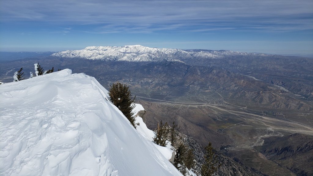
SNOW DEPTHS
Measured on Monday 27th March unless otherwise stated. The first number is the current snow depth, followed in parentheses by the maximum depth at that location in winter 2022/23. Note that averages are given; due to strong winds accompanying all storms, and the differential effects of rain on snow in some earlier storms, there is considerable inconsistency of depth. Altitudes and PCT Miles are approximate.
San Jacinto Peak (10810 ft): 95 inches (98-105 inches on 22nd March)
Wellman Divide (9700 ft): 65 inches (70-75 inches on 3rd March)
Annie’s Junction/PCT Mile 180.8 (9070 ft): 70 inches (80 inches on 3rd March)
Long Valley (8600 ft): 45 inches (c.60 inches on 3rd March)
Saddle Junction/PCT Mile 179 (8070 ft): 38 inches (48-50 inches on 3rd March)
Devil’s Slide trailhead at Humber Park (6550 ft): 10-15 inches (46 inches on 3rd March)
Idyllwild (at 5550 ft): 3-6 inches (45 inches on 1st March)
PCT Mile 151 at crossing with Highway 74 (4800 ft): 0 inch, measured 23rd March (13 inches in first week of March)
While all time and labor is volunteered, the San Jacinto Trail Report uses small private donations to help cover modest operating costs. Every year seems to have its unique challenges, and clearly 2023 will be no exception. Your contribution keeps the Report available to all, free from advertising or paywalls, and independent from agencies. If you have found this Report useful, please consider using this link to the Donate page. Zelle, Venmo, and PayPal are all options. Thank you so much for your support.
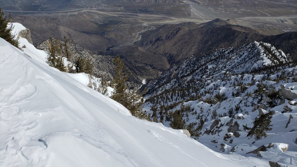
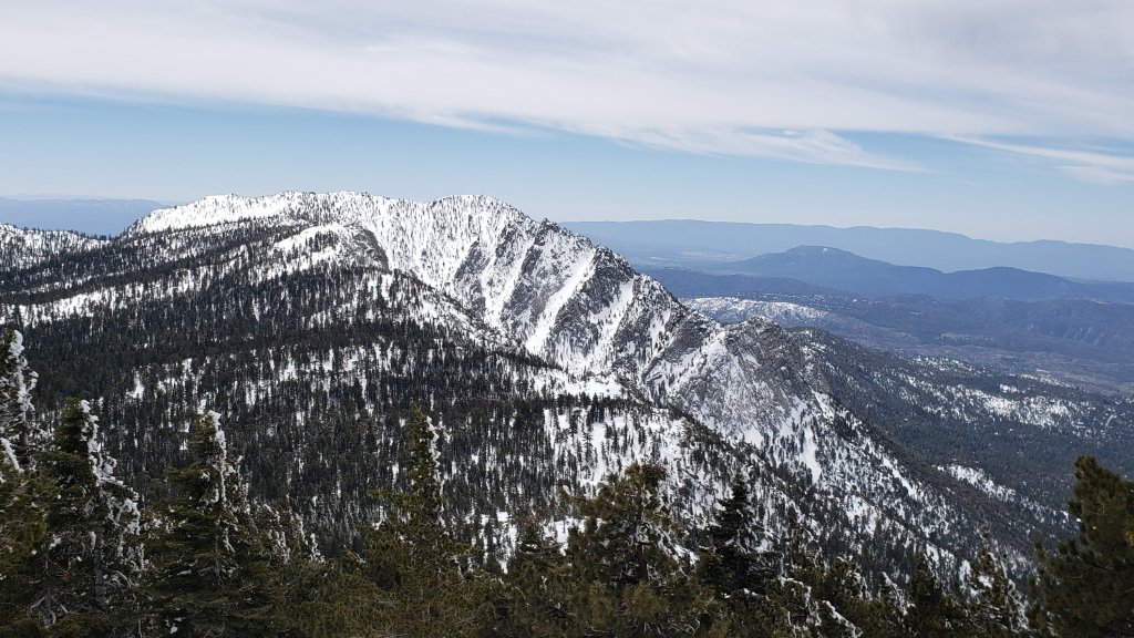

sanjacjon Uncategorized Leave a comment 11 MinutesEdit”Snow update 28th March 2023″
Major snow storm update 24th March 2023
Well, I’m starting to run out of superlatives for this winter, so I’ll just let numbers tell the tale. The 23rd storm of winter 2022/23 impacted the San Jacinto mountains on 21st-23rd March. Another two feet of snow at San Jacinto Peak brought the total depth currently on the ground there to about 100 inches. Given some melting between storms, the Peak total for the winter is now close to 120 inches, i.e. 10 feet. While that depth would have been unremarkable late last century, it is by far the most snow in the San Jacinto high country for over a decade, probably this century. I recorded a short video discussion near San Jacinto Peak on the morning of Wednesday 22nd March, which gives a feel for the conditions (available here on YouTube).
Meanwhile in Idyllwild, another 17 inches of snow took the winter total to nearly 90 inches, almost triple the annual average of the past 30 years, and as I discussed in an earlier analysis (linked here), makes this winter provisionally the snowiest in Idyllwild since the 1940s, and the third snowiest in recorded Idyllwild history (reliable data since 1943).
Unlike the two storms in mid March, this was not another “pineapple express”, but had a more northerly influence producing colder temperatures, thankfully no rain at higher elevations, and a light dusting of snow down to 4400 ft in Garner Valley (see photos below). Mid elevation locations such as Vista Grande and Keenwild reported 2-3 inches of rain before it turned to several inches of snow accumulation.
The State Park wilderness nominally closed on 1st March (see State Park website for their explanation). At this time there is no tentative date for reopening. Note however that there was no apparent enforcement in Long Valley on Saturday 25th at least, with multiple skiers reaching San Jacinto Peak and Snow Creek. This closure includes approximately PCT Miles 183-189. An additional closure applies to Skyline Trail (part of the C2C route) as discussed below under Trail Conditions.
Currently there appears to be no significant avalanche risk on the high country slopes that are crossed by the established trail network. I found no evidence of pre-avalanche characteristics as I descended the high slopes on the late morning of 22nd March following the latest heavy snowfall. There is however a moderate risk for the north face of San Jacinto Peak, especially given that pre-avalanche characteristics were reliably reported to me from upper Snow Creek on 20th, prior to the latest heavy snowfall.
I snowshoed San Jacinto Peak on Wednesday 22nd March via the eastern side route including Devil’s Slide Trail. Despite its great depth, the high country snow was firm and immaculate and I was sinking in only a few inches at most. Below about 8500 ft was a different story however, with relatively wet, heavy, snow on Devil’s Slide Trail causing some unpleasant postholing even in snowshoes (photos below).
Currently trails above about 6000 ft (lower in places) are obscured by moderate to deep snow. Trails down to 4600 ft elevation currently have shallow and increasingly patchy snow cover. With the State Park closure in place, there are very few tracks anywhere above 8000 ft. Very cautious navigation is essential everywhere.
Details of snow depths measured at various locations on the trail system are given at the foot of this posting. Note that snow depth itself is rarely indicative of the difficulty (or otherwise) of hiking a particular track or trail. For example a firm, well-compacted snowshoe or crampon track across snow several feet deep may be much easier hiking than an angled icy section just inches deep.
To give an idea of the current traction challenge, I am generally hiking with all three of snowshoes, crampons, and spikes every time I go into the high country at present, changing between them as conditions warrant.
Conditions are currently excellent for snowshoes everywhere above about 6000 ft (potentially a little lower in places for the next couple of days). This elevation will climb slowly over the next few days and weeks as temperatures rise and melting accelerates. Tracks in the high country can be firm if the early morning is cold (crampons best) but then soften very rapidly once sun hits slopes and temperatures rise, at which point snowshoes are preferable.
Crampons – with hiking poles and an ice axe, depending on terrain – may becoming increasingly useful everywhere especially above about 8000 ft, as colder temperatures on some days, plus freeze/thaw cycles, lead to hardening of the snow surfaces. They will likely become invaluable over the next week or so on certain moderate and higher angle slopes, at a minimum on the Peak Trail above Wellman Divide, the Wellman Trail, Deer Springs Trail above Little Round Valley, and uppermost South Ridge Trail, and on both flanks but critically on the north face of Tahquitz Peak.
Increasingly as snow conditions change spikes are strongly recommended for the foreseeable future everywhere above about 5000 ft. They can currently be valuable even for walking around Idyllwild early on cold mornings! This elevation will slowly move upwards with steady melting over the next few days and weeks, but will remain relatively low into April at least.
Recently I have mentioned the challenges of hard, icy snow underfoot and the value of using spikes (and/or crampons) especially for descending and traversing. While fresh snow (and softening, melting, snow) may be optimum for snowshoeing for the next several weeks, snow at all elevations will generally become increasingly firm and icy following multiple freeze-thaw cycles, and compaction by increasing hiker traffic in places (especially once high country trails reopen). I cannot overemphasize the importance of having both appropriate equipment and the right skill set for the terrain. The latter includes interpreting the snow/ice conditions, understanding your physical and mental abilities, and conservative decision making. These concerns will steadily increase over the next few weeks with temperatures fluctuating either side of freezing, seasonally stronger insolation, and highly variable snowmelt.
Hikers should be prepared for temperatures below freezing in the high country, and well below freezing when considering wind chill effects (see below for my recent weather observations from San Jacinto Peak).
The USFS gate at Humber Park is closed. Even when the gate is closed there are nine legal parking spaces below the locked gate (which still require an Adventure Pass or equivalent to be displayed). If there are “Road Closed” signs across Fern Valley Road near its junction with Forest Drive – currently the case – then those nine spaces are also unavailable for legal parking.
Forest Service roads currently closed to vehicular traffic by a revised closure order include Black Mountain Road (4S01), Dark Canyon Road (4S02), South Ridge Road (5S11), May Valley Road (5S21), and Santa Rosa Road (7S02), plus their various side roads.
Palm Springs Aerial Tramway will be closed for maintenance on Monday 27th and Tuesday 28th March.

SOME THOUGHTS FOR PCT HIKERS
Between the State Park closure and the storms continuing in March, completing the San Jacinto mountains is currently a major challenge even for experienced hikers. That said, melting will happen fast – it is still Southern California after all – and because melting was accelerated by some recent storms bringing intense warm rain on top of the snow, especially below about 8000 ft which includes most of the PCT in these mountains.
Hikers with March dates, if you have any flexibility at all in your timing, try to start later (easy for me to say I know). In a year with such dramatic snow conditions further north, it is highly unlikely that starting later than your “official” date will be a problem anywhere. Hikers with April or May dates, conditions in the southernmost sections will generally improve starting in the first week of April (judging by the forecasts), and most or all areas will be readily passable with – crucially – suitable skills and equipment, patience, and a thorough knowledge of all the possible alternates if needed.
The remarkable winter has created some challenges in addition to the snow. There can be a great deal of water in the trails, and this has also created a few tricky crossings. Do not trust snow bridges across water at this time; you will not get washed away, but it is a quick way to at least get soaking wet feet, and potentially a nasty fall. Finally, forested trails are covered with downed branches and debris, plus many new treefall hazards, some of which are only becoming apparent as the snow recedes. Trail maintenance by agencies was already years behind schedule due to the coronavirus pandemic, among other reasons, and this winter has greatly exacerbated the situation. Again, patience and caution will be essential this season more than usual.
The PCT from Mile 151 (Highway 74 crossing) to Mile 166 (Fobes Trail) is clearing of snow steadily [checked 23rd and 24th March 2023], see photo below. Fobes Ranch Road and Fobes Trail [checked 24th] are also either clear or clearing of snow (more continuous snow a few inches deep remains on upper Fobes Trail).
Proceeding north from about Mile 166 currently requires considerable snow hiking experience. At this time I recommend carrying snowshoes, crampons, and ice axe, plus you will need the necessary snow hiking experience to use that equipment safely in moderate angle terrain, plus patience, stamina, and route-finding skills. By Sunday 26th March there will be a track to follow for Miles 166-179, and from Miles 179-191 by about Tuesday 28th.
A well established alternate is to connect back to the PCT at about Mile 191 using Black Mountain Road. Black Mountain Road currently has continuous moderate snow cover but there are tracks to follow through the snow, and melting of the lower section will proceed steadily over the next week or so. Soon the conditions will be silimar to my survey on 17th March, when the Road had 50% snow cover on the lower two miles, 90% cover for the next three miles averaging 2-6 inches deep, then 100% cover for the upper three miles, at 6-18 inches deep. Early on cold mornings the snow is hard and icy making it easy to hike, but snow is soft and postholing is poor by late morning. Currently no vehicle has driven up from Highway 243 since the last snows.

WEATHER
Conditions continue unsettled for the remainder of March. A moderate warming trend will accelerate melting from 24th-28th. There is an increasing likelihood of a further minor storm system on 29th-30th, with a mix of rain and a few inches of snow at mid elevations (e.g., Idyllwild) and an uncertain 2-10 inches of snow forecast for the high country.
It appears that generally stable, sunny weather with a moderate warming trend may start around 1st April (no fooling). If so, that could herald the beginning of a major melting season.
At San Jacinto Peak (10,810ft/3295m) on Monday 20th March 2023 at 1435 the air temperature was 20.8°F (-6°C), with a windchill temperature of 0.5°F (-18°C), 44% relative humidity, and a stiff due West wind sustained at 17 mph gusting to 28.0 mph, in complex, multi-layer cloud.
At the Peak on Wednesday 15th March 2023 at 1115 the air temperature was 29.2°F (-2°C), with a windchill temperature of 10.7°F (-12°C), 100% relative humidity, and a gusty WSW wind sustained at 12 mph gusting to 23.5 mph, in driving sleety rain.
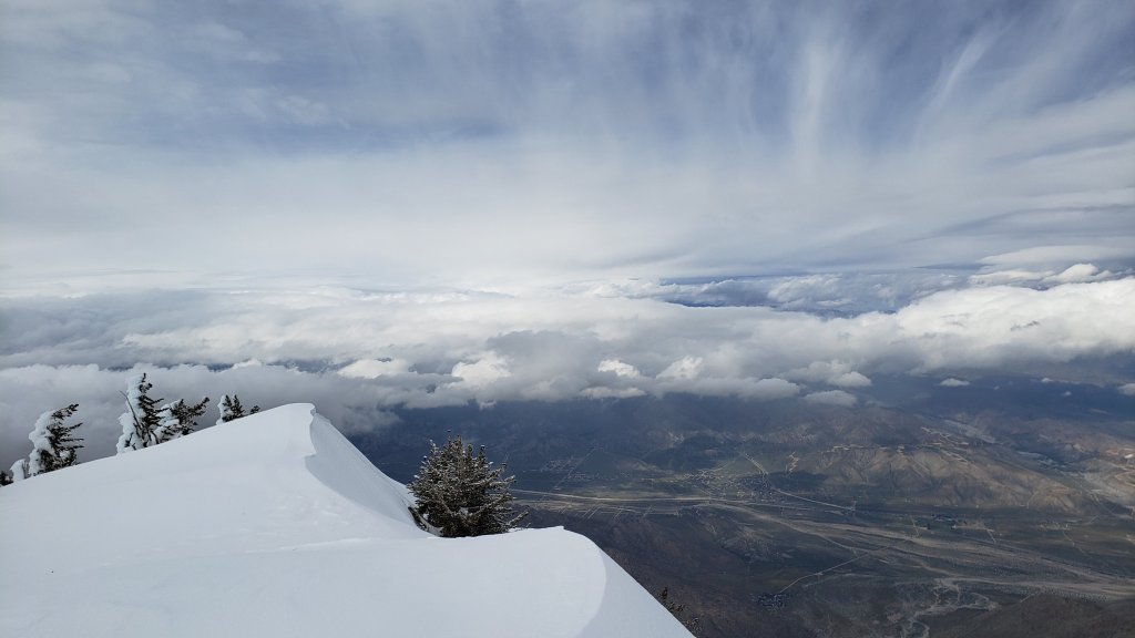
TRAIL CONDITIONS
All trails above about 5000 ft remain largely snow-covered (wholly snow-covered above about 6000 ft). This will change steadily with further melting over the next few days and weeks.
Devil’s Slide Trail has my descending snowshoe track from 22nd up to Saddle Junction. It can be firm in cold early mornings (ideal for spikes) but is very soft otherwise, and always by late morning (snowshoes required, or expect very deep and wet postholing). Beware of the huge amount of water flowing in the trail, often obscured under thinning snow, and some associated tricky stream crossings. The track does not follow the established trail route in the uppermost switchbacks close to Saddle Junction, and careful navigation is required. Another major new tree came down (between switchbacks 5 and 6) on 11th March, reported to USFS.
My snowshoe track continues on to San Jacinto Peak, via a route approximating to the PCT, Wellman, Peak, and East Ridge trails, climbing more steeply in places than the established trails, and generally contouring through the snow as needed to minimize unnecessary elevation loss. Wild spindrift snow on 22nd will have eliminated parts of the upper track.
The 0.4 mile section of South Ridge Trail between the PCT at Chinquapin Flat and Tahquitz Peak has no steps to follow through the steeply angled ice with overlying deep snow. These icy slopes are notoriously treacherous. Currently crampons, always with an ice axe, and thorough knowledge of how to use this equipment on high angle terrain, are essential. Snowshoes are not advisable due to the angle of the icy snow.
A reliable snowshoe track was put in on lower Deer Springs Trail to Strawberry Junction on Friday 24th March.
Spitler Peak Trail [surveyed 26th March] is clear of snow in its lower half (first 2.4 miles). The upper half of the trail has continuous light snow cover. The initial part of this snowy section has an excellent snowshoe track to follow, but this ends about 3.8 miles from the highway, about one mile below the PCT junction.
In addition to the wider closure mentioned above, effective 26th January 2023 the State Park closed the section of Skyline Trail that falls within its jurisdiction, above 5800 ft elevation, “until further notice due to dangerous weather conditions”. (For readers who are unclear, Skyline Trail forms the lower two-thirds of the “Cactus-to-Clouds” [C2C] route.) The State Park boundary is not marked but is near the site of the old Florian’s Cache, below Flat Rock. The open section of trail below 5800 ft received some light snow cover down to about 4500 ft over the past week, but this has already melted.
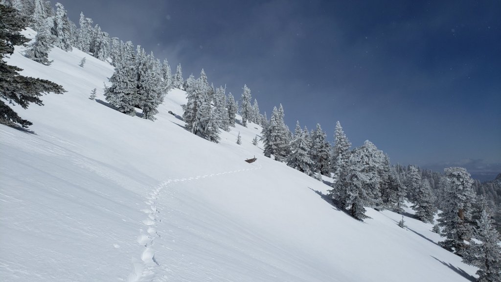
SNOW DEPTHS
Measured on Wednesday 22nd March unless otherwise stated. The first number is the current snow depth, which at locations above about 9000 ft elevation is the maximum depth recorded this winter, followed in parentheses by the snow added in this latest storm, and then by a comment where relevant regarding the maximum depth at that location this winter. Note that averages are given; due to strong winds accompanying all storms, and the differential effects of rain on snow in some earlier storms, there is considerable inconsistency of depth. Altitudes and PCT Miles are approximate.
San Jacinto Peak (10810 ft): 98-105 inches (added 23-25 inches on 21st-22nd March)
Wellman Divide (9700 ft): 71-73 inches (added 16-18 inches on 21st-22nd March), about the same depth recorded on 3rd March
Annie’s Junction/PCT Mile 180.8 (9070 ft): 73-75 inches (added 18-20 inches on 21st-22nd March), maximum recorded depth this winter c.80 inches on 3rd March
Long Valley (8600 ft): 50-55 inches (added 15+ inches on 21st-22nd March), maximum recorded depth this winter c.60 inches on 3rd March
Saddle Junction/PCT Mile 179 (8070 ft): 40-45 inches (added 16-18 inches on 21st-22nd March), maximum recorded depth this winter 48-50 inches on 3rd March
Devil’s Slide trailhead at Humber Park (6550 ft): 13-20 inches (added 13 inches on 21st-22nd March), maximum recorded depth this winter 46 inches on 3rd March
Idyllwild (at 5550 ft): 15-16 inches (added 15-16 inches on 21st-23rd March), maximum depth this winter 45-46 inches on 1st March
PCT Mile 151 at crossing with Highway 74 (4800 ft): 0-1 inch, measured 23rd March (dusting of snow on 22nd), maximum depth this winter 13 inches in first week of March.

While all time and labor is volunteered, the San Jacinto Trail Report uses small private donations to help cover modest operating costs. Every year seems to have its unique challenges, and clearly 2023 will be no exception. Your contribution keeps the Report available to all, free from advertising or paywalls, and independent from agencies. If you have found this Report useful, please consider using this link to the Donate page. Zelle, Venmo, and PayPal are all options. Thank you so much for your support.
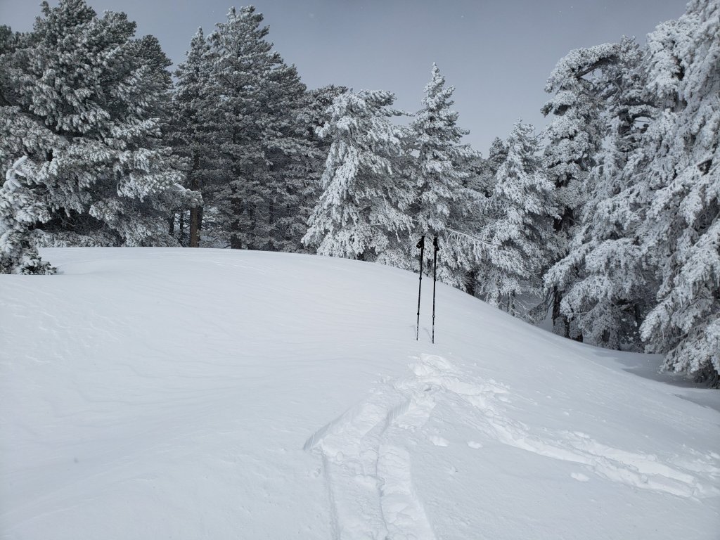
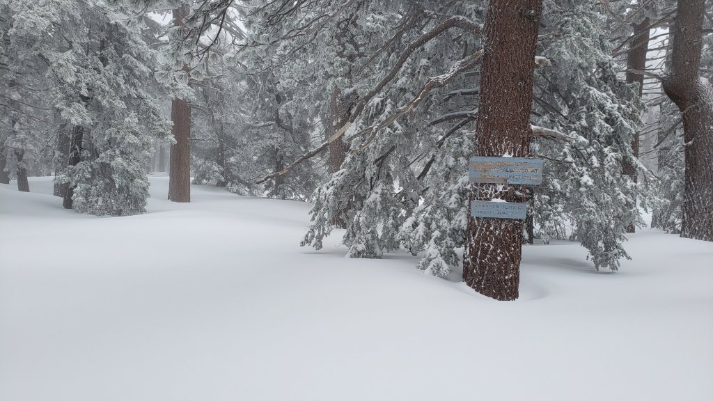

sanjacjon Uncategorized Leave a comment 12 MinutesEdit”Major snow storm update 24th March 2023″
Storm updates 21st-22nd March 2023
The 23rd storm system of winter 2022/23 is currently impacting the San Jacinto mountains. This storm has been forecast to be one of the largest snow-producing storms of this winter so far in the high country. Please check this page for periodic updates throughout the storm (the most recent is at the top).
UPDATE on Wednesday 22nd at 1730
My descent from San Jacinto Peak was uneventful but informative. I hope to complete a full update on conditions tomorrow. New snowfall summary is: San Jacinto Peak 23 inches, Wellman Divide 18-20 inches, Annie’s Junction 20 inches, Saddle Junction 16-18 inches, Devil’s Slide trailhead at Humber Park 13 inches, Idyllwild 12-13 inches. The snow was pleasant and compact in the high country, regardless of its 4-8 feet depth, but soft with grim postholing (even in snowshoes) on Devil’s Slide. At least there is now a useable track to follow.
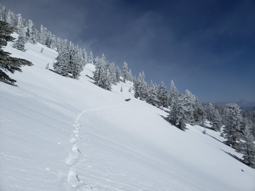
UPDATE on Wednesday 22nd at 0715
It snowed all night at San Jacinto Peak, with most intensity before midnight. Storm total is now 23 inches of snow, for a current total depth on the ground of 98-102 inches. This winter continues to amaze.
I recorded a brief video discussion at San Jacinto Peak at about 0830, available here on YouTube.
It also snowed much of the night in Idyllwild, adding about 7.5 inches (at 5550 ft) for a storm total of 12-13 inches. It is notclear enough to see how low it snowed, but the freeze level was forecast to be near 4000 ft elevation.
UPDATE on Tuesday 21st March at 2350
Snowing steadily at San Jacinto Peak, having added another six inches since dark for a storm total so far of 16 inches.
After snowing steadily in Idyllwild since dark it has now stopped, with about 3.5 inches having accumulated.
While all time and labor is volunteered, the San Jacinto Trail Report uses small private donations to cover modest operating costs. Every year seems to have its unique challenges and obviously 2023 will be no exception. Your contribution keeps the Report available to all readers, free from advertising or paywalls, and independent from agencies. If you have found this Report useful, please consider using this link to the Donate page. Zelle, Venmo, and PayPal are all options. Thank you so much for your support.
UPDATE on Tuesday 21st March at 1800
Very little precipitation has fallen in Idyllwild since mid morning, with only 0.06 inch of rain since 0700, and the very limited snow failing to settle.
In contrast, snowfall has been steady at San Jacinto Peak for the past two hours, with the storm total now at 10 inches.
UPDATE on Tuesday 21st March at 1530
After about 1300 the sun put in an appearance in Palm Springs, Idyllwild, and even (very briefly through the spindrift) at San Jacinto Peak. Florian Boyd kindly reports that the snow level on the Desert side of the mountains is above 5000 ft elevation.
Precipitation largely stopped in Idyllwild and the mid elevations, the air temperature moved well above freezing, and Anne described the snow in Idyllwild as already melted off the trees and as turning into a “sloppy mess”.
It has continued to snow lightly at San Jacinto Peak, with the storm total at about 7.5 inches, the wind has dropped a little and conditions are no longer blizzard-like. The major snowfall is expected tonight.
UPDATE on Tuesday 21st March at 1200
Fine snow composed of rounded grains has continued to fall at a rate of about 0.5 inch/hour all morning at San Jacinto Peak. Current storm total is 6 inches. Accompanied by strong westerly winds, it is a genuine whiteout blizzard (conditions which are actually relatively rare up here).
It stopped snowing in Idyllwild (for the time being at least) about two hours ago, and is now raining very lightly, with no significant accumulation so far.
New snowfall at Long Valley (8600ft) is similar, at about six inches. Note that the Palm Springs Aerial Tramway is closed today due to the weather.
UPDATE on Tuesday 21st March at 0950
It started snowing late in the night at all elevations above about 4000 ft. Idyllwild received about double the snow expected overnight, with 5.5 inches by 0700 this morning.
It must not have started snowing in the high country until the early hours of this morning. Once I was able to dig out, I measured only about 4-5 inches of fresh snow at San Jacinto Peak, for a current total depth nearing 85 inches.
Long Valley (8600 ft) has received about 4-5 inches of fresh snow this morning.
In all these locations it continues to snow steadily, but below about 6000 ft it is expected to turn to rain later this morning.
Yesterday evening I received a reliable first-hand report of pre-avalanche characteristics (“whoomphing”) in the upper elevations of Snow Creek on the north face of San Jacinto Peak.
With this fresh snowfall, based on my informal and provisional data, this winter becomes the third snowiest in recorded Idyllwild history, behind only two winters in the 1940s, as I previously discussed in an earlier posting (available here).
sanjacjon Uncategorized Leave a comment 3 MinutesEdit”Storm updates 21st-22nd March 2023″
Rain and snow storm update 17th March 2023
UPDATE Sunday 19th March: there has been light rain on/off in Idyllwild today, and a dusting of snow in the high country (mainly early morning), with about one inch accumulating in Long Valley (8600 ft).
UPDATE Friday 17th March: San Bernardino National Forest, including the San Jacinto Ranger District, reopened today following expiration of the closure order last night. Some forest roads remain closed (listed below). The State Park wilderness remains closed indefinitely, which includes Miles 183-189 of the PCT (i.e. from just east of Strawberry Junction to about one mile south of Fuller Ridge Campground).
‐——————————
Yet another remarkable storm in this truly memorable winter. The 22nd storm system to impact the San Jacinto mountains brought snow and heavy rain on Tuesday 14th and Wednesday 15th March. It was another mild, rain-generating “pineapple express”, like the storm just four days earlier, but differed in being just cold enough to produce moderate snowfall above 9000 ft elevation.
The storm brought both more snow and rainfall than was generally forecast for our mountains, with a whopping 3.97 inches of rain measured in Idyllwild (at 5550 ft) across the 30 hour duration of the storm, most of that falling late on 14th into the morning of 15th. Combined with temperatures above freezing, the rain on snow led to massive melting at mid elevations up to about 8500 ft, with every possible creek and stream gushing like a major montane torrent. In addition to the couple of photos below, I recorded a short video of the well-known Middle Spring on Devil’s Slide Trail (available here on YouTube) in full flow in the late afternoon of 15th. It is very rarely seen in that condition!
At the highest elevations, it started snowing at 1020 on Tuesday morning, initially heavily but of tiny rounded grains, accumulating to 3.5 inches by evening at San Jacinto Peak. The highest peaks weren’t spared the rain, with drizzle on the evening of 14th, which then turned to snow overnight. Another 8 inches of snow fell overnight at San Jacinto Peak, and then on 15th the precipitation oscillated between drizzle and snow for much of the day, ultimately producing a storm total of 13.5 inches of snow (plus an unknown, moderate, volume of light rain).
With the freeze level moving up and down the mountain multiple times during the storm’s passage, there was no defined snow level, but there was no evidence of snow below 8000 ft, only a dusting at Saddle Junction (8100 ft), and only about 4 inches even as high as Wellman Divide (9700 ft).
I reported a minor avalanche risk to the State Park on 15th above about 10,000 feet on east and north facing slopes (moderate risk for the north face of San Jacinto Peak) due to wind-loaded snow, but layers will have consolidated very quickly due to the rain and fluctuating freeze level. There was no evidence of pre-avalanche characteristics as I descended the high slopes on the afternoon of 15th.
The State Park wilderness closed on 1st March (see State Park website). At this time there is no tentative date for reopening. This closure includes approximately PCT Miles 183-189.
I snowshoed on both Monday 13th and Tuesday 14th to San Jacinto Peak via Devil’s Slide Trail and the eastern side route, returning from the second ascent on the afternoon of Wednesday 15th. On all three days the snow below Saddle Junction was very soft, and even higher by late morning the snow was getting soft and sloppy, and postholing would have been brutal.
Currently trails above about 7000 ft (lower in places) are obscured by moderate to deep snow. Trails down to 5500 ft elevation currently have shallower, increasingly patchy, snow cover. With closures in place, there are very few tracks anywhere. Very cautious navigation is essential everywhere.
Details of snow depths measured at various locations on the trail system are given at the foot of this posting. Note that snow depth itself is rarely indicative of the difficulty (or otherwise) of hiking a particular track or trail. For example a firm, well-compacted snowshoe or crampon track across snow several feet deep may be much easier hiking than an angled icy section just inches deep.
Conditions are currently excellent for snowshoes everywhere above about 7000 ft (lower in places). This elevation will continue to climb steadily over the next few days as temperatures rise and melting accelerates. Tracks in the high country can be quite firm if the early morning is cold (crampons best) but then soften very rapidly once sun hits slopes and temperatures rise, at which point snowshoes are preferable.
Crampons – with hiking poles and an ice axe, depending on terrain – may becoming increasingly useful everywhere above about 8500 ft, as colder temperatures on some days, freeze/thaw cycles (and, sadly, rain freezing on top of snow) lead to hardening of the snow surfaces. They will likely become essential over the next week or so on certain moderate and higher angle slopes, at a minimum on the Peak Trail above Wellman Divide, the Wellman Trail, Deer Springs Trail above Little Round Valley, and uppermost South Ridge Trail, and on both flanks but critically on the north face of Tahquitz Peak.
Currently, and increasingly as snow conditions change, spikes are strongly recommended for the foreseeable future everywhere above about 5000 ft. They are currently valuable even for walking around Idyllwild early on cold mornings! This elevation will slowly move upwards with steady melting over the next few days and weeks, but will remain relatively low into April at least.
Recently I have mentioned the challenges of hard, icy snow underfoot and the value of using spikes (and/or crampons) especially for descending and traversing. While fresh snow (and softening, melting, snow) may be optimum for snowshoeing for the next several weeks, snow at all elevations will generally become increasingly firm and icy following multiple freeze-thaw cycles, and compaction by increasing hiker traffic in places (once trails reopen). I cannot overemphasize the importance of having both appropriate equipment and the right skill set for the terrain. The latter includes interpreting the snow/ice conditions, understanding your physical and mental abilities, and conservative decision making. These concerns will steadily increase over the next few weeks with temperatures fluctuating either side of freezing, seasonally stronger insolation, and highly variable snowmelt.
Hikers should be prepared for temperatures near or below freezing in the high country, and well below freezing when considering wind chill effects (see below for my recent weather observations from San Jacinto Peak).
The USFS gate at Humber Park is closed. Even when the gate is closed there are nine legal parking spaces below the locked gate (which still require an Adventure Pass or equivalent to be displayed). If there are “Road Closed” signs across Fern Valley Road near its junction with Forest Drive – currently the case due to the Forest closure – then those nine spaces are also unavailable for legal parking.
Forest Service roads currently closed to vehicular traffic by a revised closure order include Black Mountain Road (4S01), Dark Canyon Road (4S02), South Ridge Road (5S11), May Valley Road (5S21), and Santa Rosa Road (7S02), plus their various side roads.
SOME THOUGHTS FOR EARLY SEASON PCT HIKERS
Between the closures and the storms forecast for the remainder of March, the San Jacinto mountains are currently a major challenge for even experienced thru hikers. That said, melting is happening remarkably fast, in part because we are still in Southern California (with the sun and temperatures that go along with that), and because melting has been accelerated by recent storms bringing intense warm rain on top of the snow, especially below about 8000 ft which includes most of the PCT in these mountains.
Hikers with March dates, if you have any flexibility at all in your timing, try to start later (easy for me to say I know). In a year with such dramatic snow conditions further north, it is highly unlikely that starting later than your “official” date will be a problem anywhere. Hikers with April or May dates, conditions in the southernmost sections continue to improve daily, and some or most areas will be passable with suitable skills, equipment, patience, and a thorough knowledge of all the possible alternates if needed.
So much rain – combined with melting snow – has generated a few new problems (in addition to the major snow challenges). Trails clear of snow are very muddy. Generally they dry fast here in Southern California, but that looks unlikely in the next few weeks. There is a great deal of water in the trails (see example photos below), and this has also created some tricky crossings. Do not trust any snow bridges across water at this time; you will not get washed away, but it is a quick way to at least get soaking wet feet, and potentially a nasty fall. Finally, forested trails are covered with downed branches and debris, plus many new treefall hazards, some of which are only becoming apparent as the snow recedes. Trail maintenance was already years behind schedule due to the coronavirus pandemic, and this winter has greatly exacerbated the situation. For these reasons, among others, patience and caution will be essential this season more than usual.
The PCT from Mile 151 (Highway 74 crossing) to Mile 165 (Fobes Trail) is now clear of snow [checked 16th March 2023], see photo below. Fobes Ranch Road and Fobes Trail are also functionally clear of snow (a few tiny patches may remain). I recorded a brief video from Mile 151 on the morning of 16th March (available here on YouTube).
Proceeding north from Mile 165 is not currently recommended, as it will require some combination of snowshoes, crampons, ice axe, and the necessary snow hiking experience to use that equipment safely in moderate angle terrain, plus considerable patience, stamina, and route-finding skills.
It is possible (once the Forest closure is lifted) to connect back to the PCT at about Mile 191 using the well-known Black Mountain Road alternate. Black Mountain Road [surveyed 17th March] currently has 50% snow cover on the lower two miles, 90% cover for the next three miles averaging 2-6 inches deep, then 100% cover for the upper three miles, at 6-18 inches deep. Early in the morning, the snow is hard and icy making it easy to hike, but snow is soft and postholing is bad by late morning. Currently no vehicle has driven further than 0.5 mile up from Highway 243 since the last snows.
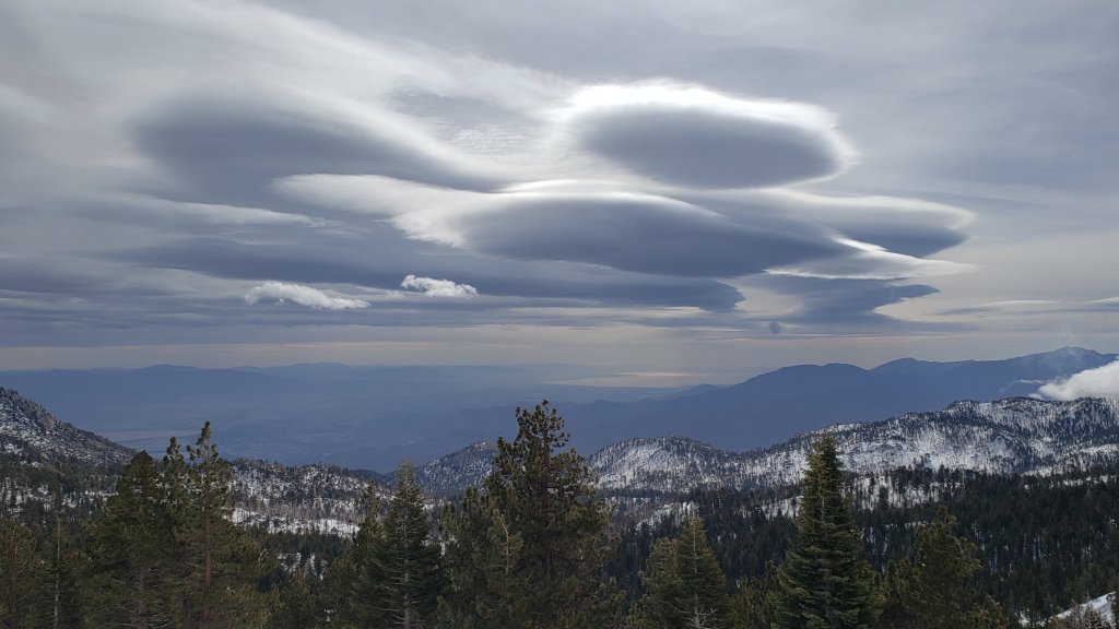
WEATHER
Conditions continue unsettled for the remainder of March. After a few days of somewhat warmer weather, another major storm system is expected on 20th-22nd March. This will have a more northerly and hence colder origin, similar to the storms of January and February rather than the warmer, wetter systems of the first half of March.
The storm is predicted to start with as much as an inch of rain at mid elevations, with a freeze level then dropping as low as 4500 ft on Wednesday 22nd, precipitation therefore turning to snow, with 2-6 inches possible in Idyllwild. As much as 18-25 inches of snow are forecast for the high country, mainly on the night of 21st. Clear, sunny days at all elevations, but with temperatures remaining below seasonal, start on Thursday 23rd, but a further storm system is possible before the end of March.
At San Jacinto Peak (10,810ft/3295m) on Wednesday 15th March 2023 at 1115 the air temperature was 29.2°F (-2°C), with a windchill temperature of 10.7°F (-12°C), 100% relative humidity, and a gusty WSW wind sustained at 12 mph gusting to 23.5 mph, in driving sleety rain.
At the Peak on Monday 13th March 2023 at 0945 the air temperature was 22.5°F (-5°C), with a windchill temperature of -0.7°F (-18°C), 14% relative humidity, and a wild WNW wind sustained at 24 mph gusting to 38.6 mph.
TRAIL CONDITIONS
All trails above about 6500 ft remain largely snow-covered (wholly snow-covered above about 7000 ft). This will change steadily with further melting over the next few days and weeks.
The 0.4 mile section of South Ridge Trail between the PCT at Chinquapin Flat and Tahquitz Peak has no steps to follow through the steeply angled ice with overlying deep snow. These icy slopes are notoriously treacherous. Currently crampons, always with an ice axe, and thorough knowledge of how to use this equipment on high angle terrain, are essential. Snowshoes are not advisable due to the angle of the icy snow.
Devil’s Slide Trail has a lightly-traveled snowshoe track up to Saddle Junction. It can be firm in cold early mornings (ideal for spikes) but is very soft and sloppy at all times currently, and always by late morning (snowshoes required, or expect very deep and wet postholing). Some bare patches are already showing below 7000 ft. Beware of the huge amount of water flowing in the trail, often obscured under thinning snow, and some associated tricky stream crossings. The track does not follow the established trail route in the uppermost switchbacks close to Saddle Junction, and very careful navigation is required. Another major new tree came down (between switchbacks 5 and 6) on 11th March, reported to USFS.
My snowshoe track continues on to San Jacinto Peak, via a route broadly approximating to the PCT, Wellman, Peak, and East Ridge trails, climbing more steeply in places than the established trails, and generally contouring through the snow as needed to minimize unnecessary elevation loss. Snow forecast next week will eliminate this track.
The Ernie Maxwell Trail has a lightly traveled snowshoe and posthole track to follow along its entire length. Large parts of the trail, especially near its lower (southern) end, are starting to clear. Early morning the snow can be firm and relatively easy to hike depending on air temperature, but it is otherwise soft with deep postholing. The majority of this trail is not on Forest Service land.
In addition to the wider closure mentioned above, effective 26th January 2023 the State Park closed the section of Skyline Trail that falls within its jurisdiction, above 5800 ft elevation, “until further notice due to dangerous weather conditions”. (For readers who are unclear, Skyline Trail forms the lower two-thirds of the “Cactus-to-Clouds” [C2C] route.) The State Park boundary is not marked but is near the site of the old Florian’s Cache, below Flat Rock. The open section of trail below 5800 ft received some light snow cover down to about 4500 ft over the past week, but this has already melted.
SNOW DEPTHS
Measured on Wednesday 15th March unless otherwise stated. The first number is the current snow depth, followed in parentheses by the maximum depth recorded this winter (on or around 3rd March), with a comment regarding the snow added in this latest storm (locations >8000 ft only). Note that averages are given; due to strong winds accompanying all storms, and the differential effects of rain on snow, there is widespread unevenness. Altitudes are approximate.
San Jacinto Peak (10810 ft): 75 inches (80-85 inches), added 13-14 inches on 14th-15th March
Wellman Divide (9700 ft): 55 inches (70-75 inches), added 4 inches on 14th-15th March
Annie’s Junction/PCT Mile 180.8 (9070 ft): 55 inches (75-80 inches, was heavily drifted here), added 3-4 inches on 14th-15th March
Long Valley (8600 ft): 36-40 inches (55-60 inches), added 1-2 inches on 14th-15th March
Saddle Junction/PCT Mile 179 (8070 ft): 25-28 inches (48-50 inches), added 0.5 inch on 14th-15th March
Devil’s Slide trailhead at Humber Park (6550 ft): 0-10 inches (46 inches)
Idyllwild (at 5550 ft): 0-6 inches (45-46 inches)
PCT Mile 151 at crossing with Highway 74 (4800 ft): 0 inches (13 inches), checked 16th March

While many hundreds of challenging hours of time and labor are volunteered annually, the San Jacinto Trail Report uses small private donations to help cover modest operating costs. Every year seems to have its unique challenges, and clearly 2023 will be no exception. Your contribution keeps the Report available to all, free from advertising or paywalls, and independent from agencies. If you have found this Report useful, please consider using this link to the Donate page. Zelle, Venmo, and PayPal are all options. Thank you so much for your support.


sanjacjon Uncategorized 1 Comment 11 MinutesEdit”Rain and snow storm update 17th March 2023″
Snow (and rain) update 13th March 2023
UPDATE Wednesday 15th March at 0930: Another 9 inches of snow fell overnight at San Jacinto Peak for a current storm total of 12.5 inches (plus some light rain yesterday evening). It stopped snowing at 0930. A dusting of 1-2 inches fell in Long Valley (8600 ft) on top of yesterday’s rain.
At 0700 Anne reported a remarkable 3.35 inches of rain for the previous 20 hours in Idyllwild (at 5550 ft).
There is a minor avalanche risk above about 10,000 feet on east and north facing slopes (moderate risk for the north face of San Jac) for the next couple of days, until the new wind loaded snow consolidates with older layers.
UPDATE Tuesday 14th March at 1810: the 22nd storm of the winter is here. It started snowing in the high country at 1020 this morning and accumulated 3.5 inches of fresh powder at San Jacinto Peak, before sadly turning to light rain at 1730. Although a few flakes fell at Long Valley (8600 ft) earlier in the day, it has been too mild for and snow to settle. It started raining in Idyllwild at about 1100, totaling about 0.52 inch (at 5550 ft) by 1730.
———————-
The 21st storm system to impact the San Jacinto mountains this winter was a “pineapple express” which brought steady rain on 10th-11th March. It started raining on Friday 10th morning at about 0700 at mid elevations, eventually reaching the high country with a mixture of rain, freezing rain, and sleet from about 1100. It finally stopped raining on Saturday afternoon, having become intermittent for much of that day. Rainfall in Idyllwild totaled an impressive 2.36 inches (measured at 5550 ft).
Although a few inches of snow were forecast for the highest peaks, sadly it rained all the way to San Jacinto Peak, with no new snowfall (photos below). The relatively warm rain augmented melting that was already underway from recent warmer, sunny days, and areas I checked in the high country have all lost at least 12-18 inches of snow depth in the past week or so.
Closures of both the National Forest lands and State Park wilderness remain in place. The San Bernardino National Forest, including the San Jacinto Ranger District, is closed until 16th March 2023 (closure notice here). There is hope that that closure will be lifted when it expires. The State Park wilderness closed on 1st March (see State Park website). It would be illogical that this closure, inaccurately justified by “unprecedented” snow, will be lifted imminently given that at least two more Pacific storms are already on their way (as discussed below).
I snowshoed on Thursday 9th and Monday 13th to San Jacinto Peak via Devil’s Slide Trail and the eastern side route. On 9th, following freeze/thaw cycles, Devil’s Slide was firm early morning, and I ascended to Saddle Junction just in spikes. I then used snowshoes from there to the Peak, and all the way back down. In contrast on 13th, after recent warm rain, the lower half of Devil’s Slide Trail was a miserable sloppy mess, requiring snowshoes from/to the trailhead. Thankfully, by about 7700 ft elevation, the snow surface had hardened sufficiently to make the going relatively easy.
On both days, my track from the previous ascent had held up well, and both ascents were consequently about two hours faster than when breaking trail through fresh powder on 3rd March. On both 9th and 13th by late morning the snow was getting soft and sloppy, and postholing would have been brutal. Snow conditions are generally benign, excellent for snowshoeing and crampons (depending on elevation), and there is no avalanche risk, even on the north face of San Jac.
Currently trails above about 7000 ft (lower in places) are largely obscured by moderate to deep snow. Trails down to 5000 ft elevation currently have shallower, increasingly patchy, snow cover. With closures in place, there are very few tracks anywhere. Very cautious navigation is essential everywhere.
Details of snow depths measured at various locations on the trail system are given at the foot of this posting. Note that snow depth itself is rarely indicative of the difficulty (or otherwise) of hiking a particular track or trail. For example a firm, well-compacted snowshoe or crampon track across snow several feet deep may be much easier hiking than an angled icy section just inches deep.
Conditions are currently excellent for snowshoes everywhere above about 6000 ft. This elevation will continue to climb steadily over the next few days and weeks as temperatures rise and melting accelerates (especially with more mild rainfall augmenting melting, especially below about 8000 ft). Tracks in the high country are quite firm in the early morning (crampons best) but then soften rapidly once sun hits slopes and temperatures rise, at which point snowshoes are preferable.
Crampons – with hiking poles and an ice axe, depending on terrain – are becoming increasingly useful everywhere above about 8500 ft, as freeze/thaw cycles (and, sadly, rain freezing on top of snow) lead to hardening of the snow surfaces. They will likely become essential on certain moderate and higher angle slopes, at a minimum on the Peak Trail above Wellman Divide, the Wellman Trail, Deer Springs Trail above Little Round Valley, and uppermost South Ridge Trail, and on both flanks but critically on the north face of Tahquitz Peak.
Currently, and increasingly as snow conditions change, spikes are strongly recommended for the foreseeable future everywhere above about 5000 ft. They are currently valuable even for walking around Idyllwild early on cold mornings! This elevation will slowly move upwards with steady melting over the next few days and weeks, but will remain relatively low for weeks at least.
Recently I have mentioned the challenges of hard, icy snow underfoot and the value of using spikes (and/or crampons) especially for descending and traversing. While fresh snow (and softening, melting, snow) may be optimum for snowshoeing for the next several weeks, snow at all elevations will generally become increasingly firm and icy following multiple freeze-thaw cycles, and compaction by increasing hiker traffic in places (once trails reopen). I cannot overemphasize the importance of having both appropriate equipment and the right skill set for the terrain. The latter includes interpreting the snow/ice conditions, understanding your physical and mental abilities, and conservative decision making. These concerns will steadily increase over the next few weeks with temperatures fluctuating either side of freezing, seasonally stronger insolation, and highly variable snowmelt.
Hikers should be prepared for temperatures near or below freezing in the high country, and well below freezing when considering wind chill effects (see below for my recent weather observations from San Jacinto Peak).
Based on three comprehensive assessments in the past ten days, there is currently no avalanche risk (even on the north face of San Jacinto Peak, which, contrary to recent erroneous information in local media, avalanches regularly every year, even in low snow years). This forecast may change briefly later this month if there is substantial fresh wind-loaded snow on top of the existing deep icy layer, in the storms forecast for 14th-15th and 19th-23rd March.
The USFS gate at Humber Park is closed. Even when the gate is closed there are nine legal parking spaces below the locked gate (which still require an Adventure Pass or equivalent to be displayed). If there are “Road Closed” signs across Fern Valley Road near its junction with Forest Drive – currently the case due to the Forest closure – then those nine spaces are also unavailable for legal parking.
SOME THOUGHTS FOR EARLY SEASON PCT HIKERS
Between the closures and further March storms forecast, the San Jacinto mountains are currently a major challenge for even experienced early season PCT hikers. That said, melting is happening fast, in part because we are still in Southern California and the March-April sun is potent. Melting has been accelerated by recent warm storms bringing rain on top of the snow, at all elevations, but especially below about 8000 ft, which includes most of the PCT in these mountains.
Hikers with March dates, if you have any flexibility at all in your timing, try to start later (easy for me to say I know). In a year with such dramatic snow conditions further north, it is highly unlikely that starting later than your “official” date will be a problem anywhere. Hikers with April or May dates, conditions in the southernmost sections continue to improve daily, and some or most areas will be passable with suitable skills, equipment, patience, and a thorough knowledge of all the possible alternates if needed.
Fobes Ranch Road (the side access to the PCT from about Mile 165) is clear of snow. The associated Fobes Trail is clearing rapidly. Snow depth has decreased 80-90% in the past week at PCT Mile 151 where the trail crosses Highway 74 (now averaging a patchy few inches with large bare sections). Given the continuing warming trend (and more warm rain) in the next week, by the time the Forest closure is expected to lift on 16th March the PCT will be readily passable from Mile 151-165 (spikes very strongly recommended). Proceeding north from Mile 165 is not currently recommended, as it will require crampons, ice axe, and the necessary snow hiking experience to use that equipment safely in high angle terrain, plus considerable patience, stamina, and route-finding skills.
It is possible (once the Forest closure is lifted) to connect back to the PCT at about Mile 191 using the well-known Black Mountain Road alternate. I will update conditions for all routes and alternates as time and weather permits.
WEATHER
Conditions are forecast to remain unsettled, but relatively warm, for the next ten days. Another mild Pacific storm is expected on the afternoon of Tuesday 14th, with a freeze level above 9000 ft, continuing into Wednesday 15th. Similar to the last one, this storm is predicted to bring up to two inches of rain to mid elevations, but 6-10 inches of snow are forecast for the highest elevations.
There is much less clarity regarding one or two possible storm systems tentatively predicted in the period 19th-23rd March. One or both may be colder than recent March storms, with light snow possibly as low as 7000 ft, while forecasts for snow at the highest elevations have varied widely from 3-18 inches. Most days in that period will at least be windy and cloudy in the high country.
At San Jacinto Peak (10,810ft/3295m) on Monday 13th March 2023 at 0945 the air temperature was 22.5°F (-5°C), with a windchill temperature of -0.7°F (-18°C), 14% relative humidity, and a wild WNW wind sustained at 24 mph gusting to 38.6 mph.
At the Peak on Thursday 9th March 2023 at 0925 the air temperature was 30.4°F (-1°C), with a windchill temperature of 15.9°F (-9°C), 52% relative humidity, and a fresh WSW wind sustained at 13 mph gusting to 18.1 mph.

TRAIL CONDITIONS
All trails above about 6000 ft are largely snow-covered (wholly snow-covered above about 7000 ft). This will change steadily with melting (and further rainfall) over the next few days and weeks.
Devil’s Slide Trail has a lightly-traveled snowshoe track up to Saddle Junction. It can be firm in cold early mornings (ideal for spikes) but is soft and sloppy at all times currently, and always by late morning (snowshoes required, or expect very deep postholing). Some short bare patches are already showing below 6800 ft. The track does not follow the established trail route in the uppermost switchbacks close to Saddle Junction, and very careful navigation is required. Another major new tree came down (between switchbacks 5 and 6) on about 11th March, reported to USFS.
My snowshoe track continues on to San Jacinto Peak, via a route broadly approximating to the PCT, Wellman, Peak, and East Ridge trails, climbing more steeply in places than the established trails, and generally contouring through the snow as needed to minimize unnecessary elevation loss. Snow forecast over the next week or so may combine with strong winds to obscure parts of this track, especially above about 10,000 ft elevation.
The Ernie Maxwell Trail has a lightly traveled snowshoe and posthole track to follow along its entire length. Early morning the snow can be firm and relatively easy to hike depending on air temperature, but it is otherwise soft with deep postholing. The majority of this trail is not on Forest Service land.
In addition to the wider closure mentioned above, effective 26th January 2023 the State Park closed the section of Skyline Trail that falls within its jurisdiction, above 5800 ft elevation, “until further notice due to dangerous weather conditions”. (For readers who are unclear, Skyline Trail forms the lower two-thirds of the “Cactus-to-Clouds” [C2C] route.) The State Park boundary is not marked but is near the site of the old Florian’s Cache, below Flat Rock. The open section of trail below 5800 ft received some light snow cover down to about 4500 ft over the past week, but this has already melted.

SNOW DEPTHS
Measured on Monday 13th March (unless otherwise stated). The first number is the current snow depth, with the maximum depth recorded this winter, measured on or around 3rd March, given in parentheses. Note that averages are given; due to strong winds accompanying all storms this winter there is widespread drifting. Altitudes are approximate.
San Jacinto Peak (10810 ft): 68-70 inches (80-85 inches)
Wellman Divide (9700 ft): 60 inches (70-75 inches)
Annie’s Junction/PCT Mile 180.8 (9070 ft): 58-60 inches (75-80 inches, heavily drifted here)
Long Valley (8600 ft): 40 inches (55-60 inches)
Saddle Junction/PCT Mile 179 (8070 ft): 32-36 inches (48-50 inches)
Devil’s Slide trailhead at Humber Park (6550 ft): 3-15 inches (46 inches)
Idyllwild (at 5550 ft): 6-15 inches (45-46 inches)
PCT Mile 151 at crossing with Highway 74 (4800 ft): 0-4 inches (13 inches)

While many hundreds of hours of time and labor are volunteered annually, the San Jacinto Trail Report uses small private donations to help cover modest operating costs. Every year seems to have its unique challenges, and clearly 2023 will be no exception. Your contribution keeps the Report available to all, free from advertising or paywalls, and independent from agencies. If you have found this Report useful, please consider using this link to the Donate page. Zelle, Venmo, and PayPal are all options. Thank you so much for your support.


sanjacjon Uncategorized 4 Comments 10 MinutesEdit”Snow (and rain) update 13th March 2023″
Storms and closures update 5th March 2023
UPDATE Saturday 11th March: It started raining yesterday morning at about 0700 at mid elevations, with a mixture of rain and light sleet in Long Valley (8600 ft) from about 1100. Rainfall in Idyllwild totaled an impressive 2.36 inches (measured at 5550 ft), finally stopping at 0930. Snow level in the high country is estimated to be at about 9500 ft, with none falling in Long Valley and only a couple of inches expected around the highest peaks.
UPDATE Thursday 9th March: I snowshoed this morning to San Jacinto Peak via Devil’s Slide Trail and the eastern side route. With freeze/thaw cycles, Devil’s Slide was firm early morning, and I ascended to Saddle Junction just in spikes. I then used snowshoes from there to the Peak, and all the way back down. My track from last week had held up well, and my ascent was consequently nearly two hours faster. By late morning the snow was getting soft and sloppy, and postholing would have been brutal. Snow melt/compaction has been rapid and substantial in just a week, 6-12 inches at all high country locations I measured (and even more in Idyllwild). Snow conditions are generally benign, excellent for snowshoeing, there is no avalanche risk (now even on the north face), and the continued State Park closure seems insupportable.
UPDATE Wednesday 8th March: Light but steady rain is now forecast at mid elevations for at least 10th-11th and 14th-15th March, with about one inch inch expected at mid elevations during the first of these storms, and roughly half that amount during the second storm. Combined with mild temperatures, the rain on snow will further increase melting, and make for very sloppy snow conditions. The high country may be above the cloud for some of the storm days, but light snow is tentatively forecast at higher elevations, especially on 14th-15th.
UPDATE Monday 6th March: Idyllwild had a very light dusting of snow (0.1 inch) early this morning, and it was drizzling in Garner Valley. Fobes Ranch Road (the side access to the PCT from about Mile 165) is clear of snow. Snow depth has more than halved in the past few days at PCT Mile 151 where the trail crosses Highway 74 (now averaging 4-6 inches with some bare patches, photo below). Given the strong warming trend in the next week, by the time the Forest closure is expected to lift on 16th March the PCT will be readily passable from Mile 151-165 (spikes strongly recommended). Proceeding north from Mile 165 is not currently recommended, as it will require crampons, ice axe, and the necessary snow hiking experience to use that equipment safely in high angle terrain, plus considerable patience, stamina, and route-finding skills.
————————
Well that was fun! Five snow storms impacted the San Jacinto mountains in a nine day period, ending 1st March. All the storms were somewhat different from one another in terms of quantity of snowfall, associated temperatures and winds, and lowest snow elevation. Strawberry Valley (where Idyllwild is located) was hit hardest relative to its elevation, with heavy snow there even at times that the high country was above the cloud, as reflected in the snow totals below.
I won’t repeat all the details as these storms were largely summarized in a daily updated blog format maintained over the past week or so (available here). Their combined impact was dramatic, including just over a foot of snow throughout Garner Valley (4300-4800 ft), nearly four feet of snow in Idyllwild (the annual average for town is 31 inches), and 2.5-4 feet of snow in the high country, depending on elevation.
The snowfall in Idyllwild this winter has already been the most recorded for 59 years, as discussed in a summary of National Weather Service statistics that I posted on 2nd March (linked here). With another 5-6 inches, we could experience the most snow to fall in Idyllwild in one winter since the 1940s.
Regrettably one consequence of this impressive snowfall is closure of both the National Forest lands and State Park wilderness in recent days. The latter is particularly unfortunate as conditions are actually more benign now than they were 2-6 weeks ago, when high country slopes were extremely icy and required more specialist equipment and skills.
San Bernardino National Forest, including the San Jacinto Ranger District, is closed until at least 16th March 2023. See their closure notice here for more details. The State Park wilderness closed on 1st March (see State Park website). It is clear that these closures will dramatically and negatively impact early season PCT hikers.
On Friday 3rd March I ascended and descended San Jacinto Peak via the east side (roughly the Devil’s Slide, Wellman, Peak, and East Ridge trail routes), breaking trail snowshoeing the entire way from Humber Park. I recorded a lengthy video discussing the general snow and closure situation while at the Peak (available here) plus a brief panorama video from the Peak itself (available here).
Currently trails above about 5500 ft (lower in places) are largely obscured by moderate to deep snow. Trails down to 4000 ft elevation currently have shallower snow cover. Very cautious navigation is essential everywhere.
Details of snow depths measured at various locations on the trail system are given at the foot of this posting. Note that snow depth itself is rarely indicative of the difficulty (or otherwise) of hiking a particular track or trail. For example a well-compacted snowshoe track across snow several feet deep may be much easier hiking than an angled icy section just a few inches deep.
Conditions are currently ideal for snowshoes everywhere (that is open) above about 4500 ft. This elevation will climb steadily over the next few days as temperatures rise and melting accelerates.
Crampons – with hiking poles and an ice axe, depending on terrain – may become increasingly useful everywhere above about 6500 ft, as freeze/thaw cycles lead to hardening of the snow surfaces. They will likely become essential on certain moderate and higher angle slopes, at a minimum on the Peak Trail above Wellman Divide, the Wellman Trail, Deer Springs Trail above Little Round Valley, and uppermost South Ridge Trail, and on both flanks but critically on the north face of Tahquitz Peak.
Currently, and increasingly as snow conditions change, spikes are strongly recommended for the foreseeable future everywhere above about 4000 ft. They are currently invaluable even for walking around Idyllwild early in the morning! This elevation will slowly move upwards with steady melting over the next few days and weeks, but will remain relatively low for weeks at least.
Recently I have mentioned the challenges of hard, icy snow underfoot and the value of using spikes (and/or crampons) especially for descending and traversing. While fresh snow may be optimum for snowshoeing for the next several weeks, snow at all elevations will become increasingly firm and icy following multiple freeze-thaw cycles, and compaction by increasing hiker traffic in places (once trails reopen), and I cannot overemphasize the importance of having both appropriate equipment and the right skill set for the terrain. The latter includes interpreting the snow/ice conditions, understanding your physical and mental abilities, and conservative decision making. These concerns will steadily increase over the next few weeks with temperatures fluctuating either side of freezing, seasonally stronger insolation, and highly variable snowmelt.
Hikers should be prepared for temperatures below freezing in the high country (once generally accessible), and well below freezing when considering wind chill effects.
The USFS gate at Humber Park is closed. Even when the gate is closed there are nine legal parking spaces below the locked gate (which still require an Adventure Pass or equivalent to be displayed). If there are “Road Closed” signs across Fern Valley Road near its junction with Forest Drive – currently the case due to the forest-wide closure – then those nine spaces are also unavailable for legal parking.
Based on my assessment on 3rd March, there is currently no significant avalanche risk (other than on the north face of San Jacinto Peak, which, contrary to recent erroneous information in local media, avalanches regularly every year, even in low snow years). Snow layers evidently consolidated rapidly, and the situation will only improve further with melting and freeze/thaw cycles. I found none of the pre-avalanche characteristics that I last observed on the exposed easterly slopes above 10,000 ft in early 2017 (in shallower but more dangerously layered snow).

WEATHER
After the meteorological excitement of the past two months, even a few days of relatively sunny, dry weather seem notable. A steady warming trend will lead to temperatures above seasonal (remember those?) from Friday 10th March onwards, rapidly accelerating snowmelt. Many of the next ten days will be at least partly cloudy. Temperatures in the high country will remain at or below freezing for another few days, before moving just above freezing starting Thursday 9th.
Light but steady rain is now forecast at mid elevations for at least 10th-11th and 14th-15th March, with about 1.0 inch expected at mid elevations during the first of these storms, and roughly half that amount during the second storm. Combined with mild temperatures, the rain on snow will further increase melting, and make for very sloppy snow conditions. The high country may be above the cloud for some of the storm days, but light snow is tentatively forecast at higher elevations, especially on 14th-15th.
The latest NWS San Diego video forecast (available here) provides an excellent summary of what happened meteorologically throughout the California mountains in late February, plus an overview of the weather coming to Southern California in March.
At San Jacinto Peak (10,810ft/3295m) on Friday 3rd March 2023 at 1155 the air temperature was 27.9°F (-2°C), with a windchill temperature of 10.1°F (-12°C), 18% relative humidity, and a frigid NW wind sustained at 14 mph gusting to 25 mph.

TRAIL CONDITIONS
All trails above about 4000 ft are largely snow-covered (wholly snow-covered above about 5000 ft). This will change steadily with melting over the next few days and weeks.
Devil’s Slide Trail [updated 9th March] has a lightly-traveled snowshoe and posthole track up to Saddle Junction. It is firm in cold early mornings (ideal for spikes) but soft and sloppy by late morning (snowshoes required, or expect deep postholing). The track does not follow the established trail route in the uppermost switchbacks close to Saddle Junction, and very careful navigation is required.
My snowshoe track continues on to San Jacinto Peak, via a route roughly approximating to the PCT, Wellman, Peak, and East Ridge trails, climbing more steeply in places than the established trails, and generally contouring through the snow as needed to minimize unnecessary elevation loss. Dustings of snow forecast over the next week or so may combine with strong winds to obscure parts of this track.
The Ernie Maxwell Trail [updated 8th March] has a very lightly traveled snowshoe and posthole track to follow along its entire length. Early morning the snow is firm and relatively easy to hike, but it will be soft with deep postholing by late morning. The majority of this trail is not on Forest Service land.
In addition to the wider closure mentioned above, effective 26th January 2023 the State Park closed the section of Skyline Trail that falls within its jurisdiction, above 5800 ft elevation, “until further notice due to dangerous weather conditions”. (For readers who are unclear, Skyline Trail forms the lower two-thirds of the “Cactus-to-Clouds” [C2C] route.) The State Park boundary is not marked but is near the site of the old Florian’s Cache, below Flat Rock. The open section of trail below 5800 ft received some light snow cover down to about 4500 ft over the past week, but this has already melted.

SNOW DEPTHS
Measured on Friday 3rd March (unless otherwise stated). The first number is the current total snow depth, with the fresh snowfall in the multi-storm event from 21st February to 1st March given in parentheses. Note that averages are given; due to strong winds accompanying all storms this winter there is widespread drifting. Altitudes are approximate.
San Jacinto Peak (10810 ft): 80-85 inches (40-45 inches)
Wellman Divide (9700 ft): 70-75 inches (30-35 inches)
Annie’s Junction/PCT Mile 180.8 (9070 ft): 75-80 inches (30-35 inches), heavily drifted here
Long Valley (8600 ft): 55-60 inches (35-38 inches)
Saddle Junction/PCT Mile 179 (8070 ft): 48-50 inches (28-30 inches)
Devil’s Slide trailhead at Humber Park (6550 ft): 46 inches on 2nd March (44-46 inches) melting rapidly by 3rd
Idyllwild (at 5550 ft): 45-46 inches on 2nd March (45-46 inches) melting rapidly by 3rd
PCT Mile 151 at crossing with Highway 74 (4800 ft): 13 inches, measured on 27th February

While many hundreds of hours of time and labor are volunteered annually, the San Jacinto Trail Report uses small private donations to help cover modest operating costs. Every year seems to have its unique challenges, and clearly 2023 will be no exception. Your contribution keeps the Report available to all, free from advertising or paywalls, and independent from agencies. If you have found this Report useful, please consider using this link to the Donate page. Zelle, Venmo, and PayPal are all options. Thank you so much for your support.


sanjacjon Uncategorized Leave a comment 10 MinutesEdit”Storms and closures update 5th March 2023″
Forest closure 3rd March 2023
San Bernardino National Forest – including the San Jacinto Ranger District – is closed until at least 16 March 2023. See closure notice link below for more details. Special thanks to Florian Boyd, great friend of the Trail Report, for bringing this to my attention (via text when I was snowshoeing at 9000 ft elevation on the PCT early this morning!).
Click to access fseprd1092464.pdf
The State Park wilderness was also closed a couple of days ago (see earlier Trail Report or State Park website). It is clear, based on information on the PCTA website closures page (linked here), that these closures will dramatically and negatively impact early season PCT hikers.
In related (but frankly much more positive) news, today I had a long but spectacular day snowshoeing to San Jacinto Peak. I hope to provide a more thorough Report tomorrow. In the meantime, a lengthy video discussion of the current situation recorded at the Peak is available here, and a brief panorama video from the Peak proper is available here.
sanjacjon Uncategorized 3 Comments 1 MinuteEdit”Forest closure 3rd March 2023″
The Great Snow of 2022/23
I put together this table from a spreadsheet I maintain of publicly available National Weather Service meteorological data. Data are provisional and require verification. Nevertheless, the snowfall so far in winter 2022/23 in Idyllwild would place it seventh in recorded history (reliable data collection started in 1943). Perhaps more significantly, we have received the most snow in a winter since 1963/64, a span of 59 years. So rather than being a “once-in-a-generation” event, this may prove to be a once-in-a-lifetime event for most Idyllwild residents. The table also shows that with another few inches, this could be the biggest snow season since the 1940s!
Although our perceptions may have been skewed by some extremely dry winters in the past decade, major snowfalls are not as rare as many current residents might think. This is the third time this century that Idyllwild has surpassed 60 inches of snow in a winter (62.8 inches in 2000/01, and 62.4 inches in 2010/11), so 60+ inch winters might be considered to occur roughly once every decade.
Major snowfall months have also occurred recently, in winters that did not otherwise end up with exceptional annual totals. February 2011 recorded 45.5 inches, and there were 45.5 inches in March 2006. By comparison, approximately 42 inches were recorded in February 2023 (provisional data). Of course, this February was notable in that roughly 80% of the total fell all in the last week of the month, with no respite for significant melting.
These data only reflect snowfall measurements, and do not incorporate rainfall totals. Broadly speaking it is clear that snowfall has become much more variable in the past decade, ranging from extremely dry (<10 inches) to, obviously, very snowy.
Note that data for the high country are dramatically different from those for Idyllwild, and generally sadly lacking, other than meteorological records for Long Valley (8600 ft elevation) since the 1960s. For example, although Long Valley currently has about 5 feet of snow, publicly available records for the 1970s show that Long Valley averaged 119 inches (almost 10 feet!) per winter back then.
The top ten snowfall totals by winter for Idyllwild are as follows:
108.1 inches 1948/49
107.5 inches 1943/44
77.1 inches 1952/53
76.1 inches 1963/64
74.9 inches 1961/62
72.7 inches 1951/52
71.8 inches 2022/23 (to date)
69.4 inches 1981/82
65.5 inches 1957/58
63.3 inches 1954/55
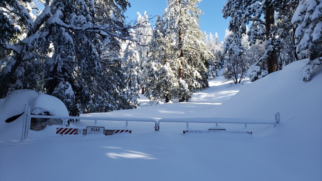
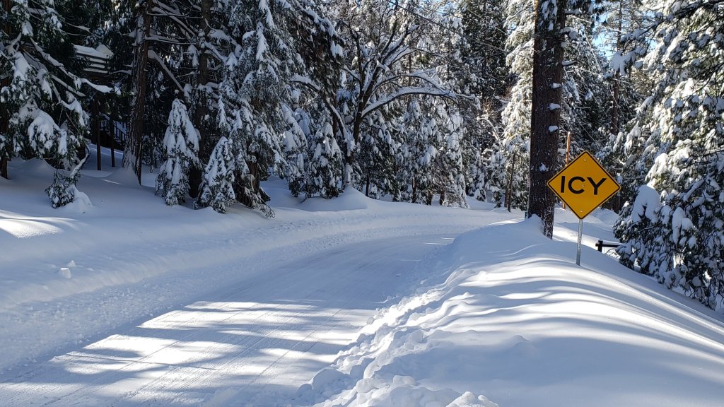
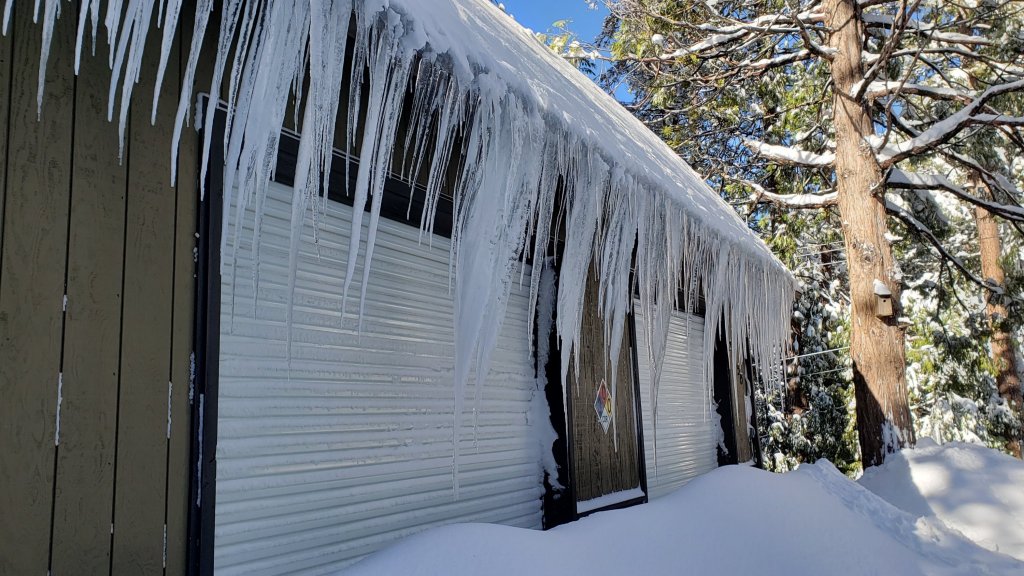
While many hundreds of hours of time and labor are volunteered annually, the San Jacinto Trail Report uses small private donations to help cover modest operating costs. Every year seems to have its unique challenges, and clearly 2023 will be no exception. Your contribution keeps the Report available to all, free from advertising or paywalls, and independent from agencies. If you have found this Report useful, please consider using this link to the Donate page. Zelle, Venmo, and PayPal are all options. Thank you so much for your support.
sanjacjon Uncategorized 11 Comments 2 MinutesEdit”The Great Snow of 2022/23″
Storm updates 24th February-1st March 2023
The 20th storm of winter 2022/23, the second of two storms across three days, is currently impacting the San Jacinto mountains. Please check this page for periodic updates (the most recent is at the top). A significant triple storm system had a major impact on 21st-26th February, and those updates are posted below also.
UPDATE on Wednesday 1st March at 1930
A remarkable further 9.5 inches of snow fell in Idyllwild today, bringing the storm total to 19.5 inches, before largely stopping and the cloud cover partly clearing out near dusk. Highways into Idyllwild were closed today and may well be for some or all of tomorrow. Sadly weight of snow has caused the roof of one shop in town to collapse, and I saw one collapsed car port (with cars inside) under the dramatic volume of snow.
The snowfall of this 20th storm of the winter brings the seasonal total here to 71.8 inches of snow, which is 233% of the average water year snowfall for Idyllwild. About 46 inches have fallen in the past eight days.
The State Park has closed the wilderness due to the weather conditions, as described on their website here. The Palm Springs Aerial Tramway/Long Valley remain open. Ironically the closure is due to “unprecedented snow fall”, although such snow fall was average prior to this century, and would have even been below average in the 1970s.
UPDATE on Wednesday 1st March at 0950
Storm number 20, and the last of a stunning first two months of 2023, produced another major snowfall with 10 inches overnight in Idyllwild, and it is still snowing heavily. When Anabel and I waded out for a modest walk, the snowplows seemed to be struggling to keep up on the streets, but we know they will catch up in due course. Forecasts suggest it may stop snowing in the next few hours. Long Valley (8600 ft) looks to have added about 12 inches since last night.
UPDATE on Tuesday 28th February at 1930
Today qualified as a day off from the incessant storms, although even then we managed a minor storm in Strawberry Valley (where Idyllwild is located), with two inches of fresh snowfall overnight and into the morning. The high country remained above the cloud for this one, with no fresh snowfall above about 8000 ft.
Largely a day for digging out again, and getting prepared for the next major snowfall, due tonight. Forecasts are inconsistent regarding the amount of snowfall in this next storm, but those that I trust suggest 12+ inches in Idyllwild over the next 24 hours, with 1-2 feet in the high country.
UPDATE on Monday 27th at 1910
Below is an excellent videograb of an avalanche in the Snow Creek drainage on the north face of San Jacinto Peak that was witnessed by friend of the Trail Report Catherine Peterson yesterday morning at about 0840. She was driving on Interstate 10 (and had to concentrate on the road!) but her friend Joyce Schwartz took some short videos from which this still image is taken.
The latest Trail Report (linked here) mentions the increasing avalanche risk with recent heavy wind-loaded snowfall on top of the icy pre-existing snow, and how avalanches occur every winter on the north face (contrary to erroneous information in recent local media stories). Conditions are currently excellent for avalanches on specific terrain in the San Jacinto high country, as proven below.

UPDATE on Monday 27th at 1140
We surveyed the PCT where it crosses Highway 74 (approx. PCT Mile 151) this morning, and recorded a short video available here on YouTube. This is the flattest portion of the PCT in the San Jacinto mountains, and snow depth currently averages about 13 inches. As evident in the video, spikes are currently needed at least, and snowshoes would be ideal especially for sections that have not yet been traveled.
Yesterday afternoon we checked Devil’s Slide trailhead at Humber Park, and measured an average snow depth of 26 inches. Snowshoes are very strongly recommended for any trails in, or leading to, the high country.
Further light snow is expected starting this evening, followed by much heavier snow overnight on 28th February-1st March.
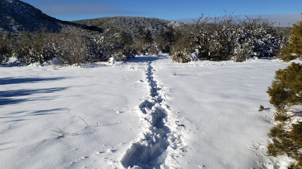
UPDATE on Sunday 26th at 1220
An additional 5.5 inches of snow fell in Idyllwild overnight, rather more than forecast, meaning we had to dig out yet again this morning. It finally stopped snowing at about 0700, and some blue sky has resulted in spectacular vistas.
By my measurements, Idyllwild is up to 51 inches of snow to date for this winter, compared to the average for the thirty year period 1991-2020 of 31 inches. Bear in mind that half the winter total, 26 inches, have fallen in the past five days!
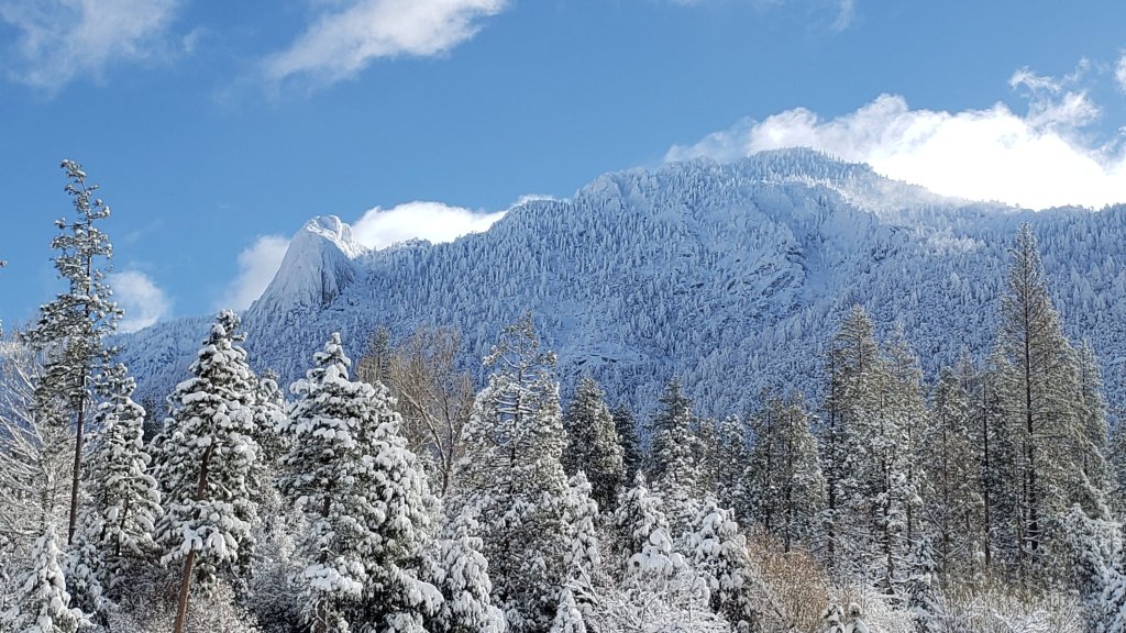

While many hundreds of hours of time and effort are volunteered every year, the San Jacinto Trail Report uses small private donations to help cover modest operating costs. Every year seems to have its challenges and it is clear already that 2023 will be no exception. Your contribution keeps the Report available to all, free from advertising or paywalls, and independent from agencies. If you have found this Report useful, please consider using this link to the Donate page. Zelle, Venmo, and PayPal are all options. Thank you so much for your support.
UPDATE on Saturday 25th at 1920
Steady heavy snow started in Idyllwild at about 0830 but stopped at about 1400. Very fine snow fell briefly this evening. An additional six inches of accumulation today brings the total in Idyllwild since 21st February to 20.5 inches. Forecasts suggest a further 2-3 inches are possible tonight.
It warmed last night to just above freezing below 6000 ft, with a mixture of rain and sleet falling on top of the prior snow, turning it increasingly to wet slush at mid elevations (we measured about 0.25 inch rain in Idyllwild). Long Valley added about 4-6 inches of snow overnight, and a little less than that during the day today.
UPDATE on Friday 24th at 1715
After a relatively benign day, it started snowing gently at 1340, and has become steady with large wet flakes in the past hour or so. Accumulation so far of about 0.5 inch in Idyllwild, and one inch at Long Valley.
Note that the Palm Springs Aerial Tramway has announced they will be closed tomorrow, Saturday 25th, due to “extreme weather”. See their announcement here. Many thanks to Florian Boyd for bringing this to my attention.
UPDATE on Friday 24th at 1210
I measured 15 inches of snow during a check of Devil’s Slide trailhead (6520 ft) at Humber Park this morning. I recorded a short video discussion there (available here on YouTube) which gives a feel for current conditions.
Snowshoes are recommended everywhere with snow above 4000 ft, potentially lower in places, and spikes are invaluable anywhere that has been cleared or compacted. I hope to provide more information on the high country situation on Sunday 26th, depending on conditions/weather.
UPDATE on Friday 24th at 0500
The story so far….. A minor storm on the night of Tuesday 21st (sixteenth storm of the winter) produced little snow – just an inch in Idyllwild – but severe cold and severe winds, erasing all tracks with wild drifting. This was immediately followed by a milder storm on 22nd-23rd that brought heavy snowfall with 13 inches in Idyllwild across a 30 hour period (measured at 5550 ft), and about 18 inches in Long Valley (8600 ft).
The eighteenth storm, due this evening, is an unusual atmospheric river combined with very cold air again, expected to produce heavy snowfall for 24th-25th February.
sanjacjon Uncategorized Leave a comment 5 MinutesEdit”Storm updates 24th February-1st March 2023″
Snow update 21st February 2023
UPDATE Thursday 23rd: Idyllwild woke up to about four inches of fresh snow overnight, and it snowed fairly consistently today (averaging 0.75 inch/hour), adding six more inches by late afternoon. Snowfall in Long Valley (8600 ft) has been steady until largely stopping by 1600, with close to 10 inches added since yesterday for a total accumulation there of nearly three feet. Florian Boyd kindly reported this morning that snow has dusted down to 4500 ft on the lower (open) section of Skyline Trail.
UPDATE Wednesday 22nd: the first of four storms expected over the next eight days, the sixteenth storm of this winter, produced a very light snowfall but bitterly cold conditions in the San Jacinto mountains overnight. I measured 1.5 inches of fresh snow at Saddle Junction early this morning, with about one inch at Humber Park, and 0.8 inch of snow (following 0.7 inch of rain) at 5550 ft in Idyllwild. Long Valley (8600 ft) has added about two inches, where it continues to snow gently this morning. The next, much more substantial, wave of snow arrives later this afternoon.
———————————————-
The primary purpose of this update is an advisory of imminent major snow accumulation forecast due to a triple storm sequence. A minor storm on the night of Tuesday 21st will include severe cold and severe winds, followed by milder, moderate storm on 22nd-23rd, and then an unusual atmospheric river combined with very cold air again producing heavy snowfall for 23rd-25th February. A fourth and final minor system is expected on 28th February-1st March. Consequently the trail conditions and snow depths reported herein will change dramatically over the next few days. Forecasts are currently indicating about 30-40 inches of snow for the highest peaks of the San Jacinto mountains (>10,000 ft) between 21st and 25th February, and about 18-30 inches for Idyllwild (5000-6000 ft elevations). Some of the storms are expected to be very cold with snow levels below 3000 ft, and, for example, Garner Valley may receive between 6-12 inches of snow by early March.
For those interested in a detailed statewide discussion of this dramatic weather event, I recommend reading the excellent analysis on Weather West (linked here). Most notable for our region is the remaining uncertainty within the meteorological models, which could result in us receiving half (or double!) the snowfall predicted in some forecasts.
On multiple recent ascents of San Jacinto Peak I have generally ascended and descended via the east side (Devil’s Slide, Wellman, Peak, and East Ridge routes). I have typically postholed barebooting to 8900-9200 ft before putting on crampons. Alternatively snowshoes could have been used, depending on personal preference and time of day. I have kept crampons on for most of the descent, removing them most of the way down Devil’s Slide Trail.
The fourteenth and fifteenth storm systems of winter 2022/23 impacted the San Jacinto mountains back-to-back on 13th and 14th February, as discussed in the previous Report available here.
Currently trails above about 7500 ft (lower in places) are largely obscured by moderate to deep snow. Trails down to 5000 ft elevation currently have patchy shallow snow cover. Very cautious navigation is strongly recommended everywhere.
Details of snow depths measured at various locations on the trail system are given at the foot of this posting. Note that snow depth itself is rarely indicative of the difficulty (or otherwise) of hiking a particular track or trail. Obviously these depths are expected to change dramatically over the next few days.
Snowshoes are useful in low to moderate angle terrain with adequate snow depth above about 8000 ft, for example the Tahquitz area meadows near Saddle Junction, sections of Deer Springs Trail, and Long Valley/Round Valley. Snowshoes can be used for ascending the highest peaks, but with considerable caution. They are not currently recommended for traversing moderate or higher angle slopes above 9000 ft that have challenging ice underlying powder. However, snowshoes will become increasingly useful as snow depths increase over the coming days; they may initially be useful as low as 4000 ft, steadily rising to 5000-6000 ft next week.
As mentioned above, crampons – with hiking poles and an ice axe, depending on terrain – are currently very useful everywhere above about 9000 ft. They are strongly recommended on certain moderate and higher angle slopes, at a minimum on the Peak Trail above Wellman Divide, the Wellman Trail, Deer Springs Trail above Little Round Valley, and uppermost South Ridge Trail, and on both flanks but critically on the north face of Tahquitz Peak.
Currently, and increasingly as snow conditions change, spikes are strongly recommended for the foreseeable future everywhere above about 6000 ft, lower in places. They are now invaluable on heavily traveled, compacted, icy tracks (before they clear of snow in the coming weeks) such as Devil’s Slide, Ernie Maxwell, and Deer Springs trails, at least, especially mornings when conditions tend to be most icy, and for descending. They are not however required, depending upon your comfort level hiking on shallow variable snow, potentially mixed with slushy and icy patches, and on the quality of your footwear (tread grip, in particular). Spikes could potentially be used to ascend to the highest peaks at this time, although crampons are certainly safer for traversing. This will change later this week.
Recently I have mentioned the challenges of hard, icy snow underfoot and the value of using spikes (and/or crampons) especially for descending and traversing. While fresh snow may be optimum for snowshoeing for the next couple of weeks, snow at all elevations will become increasingly firm and icy following multiple freeze-thaw cycles, and compaction by increasing hiker traffic in places, and I cannot overemphasize the importance of having both appropriate equipment and the right skill set for the terrain. The latter includes interpreting the snow/ice conditions, understanding your physical and mental abilities, and conservative decision making. These concerns may steadily increase over the next few weeks with (eventually) temperatures fluctuating either side of freezing, seasonally stronger insolation, and highly variable snowmelt.
Hikers should be prepared for temperatures below freezing in the high country, and far below freezing when considering wind chill effects (see below for my recent weather observations from San Jacinto Peak). Storm systems forecast for 21st-24th and 28th February are all predicted to include severe windchill temperatures near or below -20°F (-29°C).
Avalanche risk is currently minimal and is rarely a factor in the San Jacinto mountains with the exception of a couple of traditional locations (notably the north face of San Jacinto Peak). However avalanche risk may become significant over the next week if we receive a major wind-loaded snowfall on top of the deep, hardened base of snow currently in place. With storms accompanied by strong west winds, the slopes above about 9500 ft on the east flanks of San Jacinto and Jean peaks may develop a snow structure with minor to moderate avalanche risk by the weekend of 25th-26th (as last seen on these slopes in early 2017).
The USFS gate at Humber Park remains closed. Even when the gate is closed there are nine legal parking spaces below the locked gate (which still require an Adventure Pass or equivalent to be displayed). If there are “Road Closed” signs across Fern Valley Road at its junction with Forest Drive – likely the case at least on weekends and holidays when significant snow is present – then those nine spaces are also unavailable for legal parking.
South Ridge Road (5S11), Dark Canyon Road (4S02, the access to Seven Pines Trail), and Santa Rosa Truck Trail (7S02) are currently closed to vehicle traffic, as is Black Mountain Road at the gate 1.7 miles up from Highway 243.
WEATHER
As mentioned above, the focus is on heavy snowfall expected over the next 5-6 days (and potentially again on 28th February-1st March). The storm sequence starts with a minor storm on the night of Tuesday 21st, which may only produce 2-3 inches of snow at all elevations, but accompanied by high winds and bitterly cold temperatures.
This is followed by steady moderate to heavy snowfall starting in the afternoon of Wednesday 22nd and continuing into the early hours of Sunday 26th February. Forecasts are currently predicting 30-50 inches of snow for the highest peaks of the San Jacinto mountains (>10,000 ft) mainly between 23rd and 25th February, and about 18-30 inches for the Idyllwild area (5000-6000 ft elevations). Freeze levels will be well below 3000 ft at times, and for example Garner Valley (4300-4800 ft) could receive as much as 6-12 inches of snow this week. Additional moderate snowfall is tentatively forecast for 28th February-1st March.
At San Jacinto Peak (10,810ft/3295m) on Sunday 19th February 2023 at 1015 the air temperature was 19.6°F (-7°C), with a windchill temperature of 4.1°F (-16°C), 44% relative humidity, and a moderate SSE wind sustained at 8 mph gusting to 14 mph.
At the Peak on Wednesday 15th February 2023 at 1030 the air temperature was 4.9°F (-15°C), with a windchill temperature of -26.3°F (-32°C), 65% relative humidity, and a bitter due North wind sustained at 19 mph gusting to 27.7 mph.
At the on Monday 13th February 2023 at 1010 the air temperature was 16.8°F (-10°C), with a windchill temperature of -1.3°F (-19°C), 95% relative humidity, and a wintry NNW wind sustained at 7 mph gusting to 13.2 mph.

TRAIL CONDITIONS
All trails above about 5500 ft are largely snow-covered (wholly snow-covered above about 7000 ft). Note that tracks are being obscured very quickly by drifting of snow from strong winds, sometimes in hours or even minutes (see photo below). A light snowfall on the evening of Tuesday 21st will be accompanied by very strong winds, and is expected to largely or completely eliminate all tracks above about 7000 ft.
Effective 26th January 2023 the State Park closed the section of Skyline Trail that falls within its jurisdiction, above 5800 ft elevation, “until further notice due to dangerous weather conditions”. (For readers who are unclear, Skyline Trail forms the lower two-thirds of the “Cactus-to-Clouds” [C2C] route.) The State Park boundary is not marked but is near the site of the old Florian’s Cache, below Flat Rock. The open section of trail below 5800 ft is clear of snow.
Ernie Maxwell Trail has a well traveled track to follow along its entire length, through the increasingly patchy icy snow. Average snow cover is 40%, but is nearly continuous near Humber Park. Spikes are recommended especially in the morning as the snow is now hard, compacted and very icy in places. Three significant trees are now down across the trail, including two major hazards that are not easy to hike around both roughly halfway along the trail. All have been reported to US Forest Service.
Devil’s Slide Trail has a moderately traveled track to Saddle Junction. There are two new treefall hazards to pass on the upper trail.
Lightly-traveled snowshoe and/or posthole tracks radiate away from Saddle Junction around the meadow trail and south toward Chinquapin Flat, but I have not checked how accurately they follow established trail routes or how far they continue.
The 0.4 mile section of South Ridge Trail between Chinquapin Flat/PCT and Tahquitz Peak has no steps to follow through the steeply angled ice with overlying deep snow. These icy slopes are notoriously treacherous. Currently crampons, always with an ice axe, and thorough knowledge of how to use this equipment, are essential. Snowshoes are not advisable due to the angle of the icy snow.
Deer Springs Trail has a posthole track to follow along its entire length. My track from last week largely followed the established route of the trail, especially below the Fuller Ridge junction, but higher up the track is much more direct in places. Above Little Round Valley in particular my track down from the Peak is very direct, steep, and would be a challenging ascent.
Marion Mountain Trail has a lightly-traveled posthole track to follow, that does not follow the trail route in places.
Spitler Peak Trail had 10 new treefall hazards, almost all in the upper switchbacks. Only five of these require cutting, and I was able to remove three by hand earlier in February.
SNOW DEPTHS measured on 19th-20th February (east and south side locations) and 15th February 2023 (west side) are as follows. The number given is the current average total snow depth. Note that generally the maximum depths so far this winter were immediately following the major storm sequence on 14th-17th January 2023 (details of those depths available here). Note that averages are given; due to strong winds and considerable powder there is extreme drifting. Altitudes are approximate.
San Jacinto Peak (10810 ft): 37-42 inches, drifted >50 inches especially on east flank
Little Round Valley (9800 ft): 42-46 inches, heavily drifted
Wellman Divide (9700 ft): 40 inches
Seven Pines Trail junction with Deer Springs Trail (8700 ft): 35 inches
Annie’s Junction/PCT Mile 180.8 (9070 ft): 44 inches
Long Valley (8600 ft): 22 inches
Strawberry Junction (8100 ft): 15 inches
Saddle Junction/PCT Mile 179 (8070 ft): 21 inches
Devil’s Slide trailhead at Humber Park (6550 ft): 0-2 inches
Idyllwild (at 5550 ft): 0-1 inch
Thank you for taking the time to read this. While all time and labor is volunteered, the San Jacinto Trail Report uses small private donations to help cover costs. Every year seems to have its unique challenges, and it is already clear that 2023 will be no exception. Your contribution keeps the Report available to all, free from advertising or paywalls, and independent from agencies. If you have found this Report useful, please consider using this link to the Donate page. Zelle, Venmo, and PayPal are all options. Thank you so much for your support.

sanjacjon Uncategorized Leave a comment 9 MinutesEdit”Snow update 21st February 2023″
Minor storms update 16th February 2023
The fourteenth and fifteenth storm systems of winter 2022/23, both of them minor but having a significant effect in combination, impacted the San Jacinto mountains back-to-back on 13th and 14th February. Both storms were relatively cold, the second in particular dusting snow below 3500 ft elevation. Their arrival followed a period of several days of temperatures well above seasonal the previous week which had produced some significant melting. In fact on my hike to San Jacinto Peak on Monday 13th through steady morning snow I could barely tell the difference in snow depths from the previous week, as the few inches of fresh snow had almost exactly replaced the few inches of depth that had melted over the previous week.
Both storms produced more snow than was generally forecast. On 13th, Idyllwild received 2.75 inches, and I measured five inches at San Jacinto Peak, with 3-4 inches at locations in between. I recorded a short video at the Peak late morning on the 13th, available here on YouTube. On 14th, about 2.0 inches fell in Idyllwild, with an inch all the way down to 3500 ft (and a dusting even lower), but upper elevations received a similar amount, with 2.5 inches in Long Valley (8600 ft) and at Wellman Divide (9700 ft), and no more than three inches at San Jacinto Peak. However the combined effect of the two minor storms, in combination with wild gusty winds pushing spindrift snow all over the high country, had completely erased the few tracks that were in place by the morning of Wednesday 15th.
Temperatures on the morning of 15th were the lowest of this winter, and among the lowest of the past decade. At home at 5550 ft in Idyllwild we recorded 10.9°F (-12°C), the lowest temperature we have recorded there in nine winters. Later that morning at San Jacinto Peak, I measured a windchill temperature of -26.3°F (-32°C), the fourth lowest temperature I have ever recorded there.
Two ascents of San Jacinto Peak in three days had challenging snow and weather, but both were hugely enjoyable. On the morning of Wednesday 15th February I ascended via the east side (Devil’s Slide, Wellman, Peak, and East Ridge routes), descending the western side via – roughly – Deer Springs Trail. With the light fresh powder the previous evening, accompanied by very strong winds causing extensive drifting, prior tracks, including my own from 13th, had been totally erased everywhere so I was again breaking trail the entire way. Even Devil’s Slide Trail was largely obscured in deep drifted powder (photo below).
I postholed barebooting to 8900 ft before putting on crampons. Alternatively snowshoes could have been used for much of the hike. Although I made a concerted effort to put in a track as faithful to the trail routes as conditions permitted, wild winds and spindrift powder on all the exposed slopes rendered that fairly pointless.
On Monday 13th I also postholed the entire hike, as I was able to ascend barebooting to about 9200 ft before putting on crampons. I kept those on for the rest of the ascent, and almost all of the descent, finally removing them most of the way down Devil’s Slide Trail. Although that day was not as cold and windy as 15th, I ascended in heavy cloud conditions with steady snowfall for the first three hours. Once it stopped snowing, the mountain was shrouded in thick foggy cloud, such that visibility was as low as 100 feet on the exposed slopes of the Peak Trail. The cloud largely dissipated on my descent, affording some spectacular vistas.
Details of snow depths measured at various locations on the trail system are given at the foot of this posting. Note that snow depth itself is rarely indicative of the difficulty (or otherwise) of hiking a particular track or trail.
Be prepared for trails above about 7500 ft (lower in places) obscured by moderate to deep snow, and even fresh tracks being erased by spindrift snow in places. Trails down to 4000 ft elevation currently have shallow snow cover. Extremely cautious navigation is strongly recommended everywhere.
As described above, crampons – with hiking poles and an ice axe, depending on terrain – are currently very useful everywhere above about 9000 ft. They are strongly recommended on certain moderate and higher angle slopes, at a minimum on the Peak Trail above Wellman Divide, the Wellman Trail, Deer Springs Trail above Little Round Valley, and uppermost South Ridge Trail, and on both flanks but critically on the north face of Tahquitz Peak.
Currently, and increasingly as snow conditions change, spikes are strongly recommended for the foreseeable future everywhere above about 7000 ft, lower in places. They are now invaluable on heavily traveled, compacted, icy tracks (before they clear of snow in the coming weeks) such as Devil’s Slide, Ernie Maxwell, and Deer Springs trails, at least, especially mornings when conditions tend to be most icy, and for descending. They are not however required, depending upon your comfort level hiking on shallow variable snow, potentially mixed with slushy and icy patches, and on the quality of your footwear (tread grip, in particular). Spikes could potentially be used to ascend to the highest peaks at this time, although crampons are certainly safer for traversing.
Snowshoes are useful in low to moderate angle terrain with adequate snow depth above about 8000 ft, for example the Tahquitz area meadows near Saddle Junction, sections of Deer Springs Trail, and Long Valley/Round Valley. Snowshoes can be used for ascending the highest peaks, but with considerable caution. They are not currently recommended for traversing moderate or higher angle slopes above 9000 ft that have challenging ice underlying powder. However, snowshoes will become increasingly useful as conditions warm sufficiently for snow to become soft above about 8000 ft, especially on sunny slopes and afternoons. Snowshoes will remain valuable anywhere off trail above about 8000 ft for the foreseeable future.
Recently I have mentioned the challenges of hard, icy snow underfoot and the value of using spikes (and/or crampons) especially for descending and traversing. Snow at all elevations will become increasingly firm and icy following multiple freeze-thaw cycles, and compaction by increasing hiker traffic in places, and I cannot overemphasize the importance of having both appropriate equipment and the right skill set for the terrain. The latter includes interpreting the snow/ice conditions, understanding your physical and mental abilities, and conservative decision making. These concerns may steadily increase over the next few weeks with rising then falling temperatures, seasonally stronger insolation, and highly variable snowmelt.
Hikers should be prepared for temperatures below freezing in the high country, and far below freezing when considering wind chill effects (see below for my recent weather observations from San Jacinto Peak). A storm currently predicted for Wednesday 22nd February is tentatively forecast to have near record low (i.e. potentially dangerous) windchill temperatures.
The USFS gate at Humber Park remains closed. Even when the gate is closed there are nine legal parking spaces below the locked gate (which still require an Adventure Pass or equivalent to be displayed).
Azalea Drive, the access road to Marion Mountain trailhead, has not been fully plowed (surveyed Tuesday 14th). While the shallow icy snow should melt steadily over the next few days, 4WD/AWD vehicles are recommended.
South Ridge Road (5S11), Dark Canyon Road (4S02, the access to Seven Pines Trail), and Santa Rosa Truck Trail (7S02) are currently closed to vehicle traffic, as is Black Mountain Road at the gate 1.7 miles up from Highway 243.

WEATHER
The remainder of February is currently forecast to continue the cold temperatures of recent days, generally at or below seasonal at all mountain elevations, and to be increasingly unsettled. The first couple of days early next week (20th-21st) may warm slightly above seasonal, before promptly dropping well below average again, accompanying another unsettled period of multiple consecutive storm systems on 22nd-28th.
While snowfall accompanying the first of those storms may be light, perhaps 2-4 inches in Idyllwild and 4-6 inches in the high country, strong winds at the highest peaks are tentatively forecast to produce extremely cold windchill conditions, similar to 15th February (see below). Provisional forecasts suggest the later storm systems, around 25th-27th February, could produce much more significant snowfall, potentially 10-12 inches in Idyllwild and 24+ inches at the highest elevations.
At San Jacinto Peak (10,810ft/3295m) on Wednesday 15th February 2023 at 1030 the air temperature was 4.9°F (-15°C), with a windchill temperature of -26.3°F (-32°C), 65% relative humidity, and a bitter due North wind sustained at 19 mph gusting to 27.7 mph.
At the Peak on Monday 13th February 2023 at 1010 the air temperature was 16.8°F (-10°C), with a windchill temperature of -1.3°F (-19°C), 95% relative humidity, and a wintry NNW wind sustained at 7 mph gusting to 13.2 mph.
At the Peak on Monday 6th February 2023 at 0930 the air temperature was 11.1°F (-12°C), with a windchill temperature of -11.0°F (-24°C), 59% relative humidity, and a frigid NNW wind sustained at 12 mph gusting to 20.2 mph.

TRAIL CONDITIONS
All trails above about 4500 ft are snow-covered. By the afternoon of 15th, melting was already underway below 7000 ft. Reliable tracks are currently only known to be my posthole tracks from 15th for Devil’s Slide Trail through to San Jacinto Peak via the Wellman, Peak, and East Ridge trails, and then descending Deer Springs Trail.
Note that tracks are being obscured very quickly by drifting of snow from strong winds, sometimes in hours or even minutes (see photo below).
Effective 26th January 2023 the State Park closed the section of Skyline Trail that falls within its jurisdiction, above 5800 ft elevation, “until further notice due to dangerous weather conditions”. (For readers who are unclear, Skyline Trail forms the lower two-thirds of the “Cactus-to-Clouds” [C2C] route.) The State Park boundary is not marked but is near the site of the old Florian’s Cache, below Flat Rock. The open section of trail below 5800 ft is clear of snow.
Devil’s Slide Trail has a very lightly traveled track to Saddle Junction in place. There are two new treefall hazards to pass on the upper trail.
Deer Springs Trail has an excellent posthole track to follow along its entire length. This western side of the mountain was better protected from winds and drifting snow, and this track should largely survive until the weekend. My track largely followed the established route of the trail, especially below the Fuller Ridge junction, but higher up the track is much more direct in places. Above Little Round Valley in particular my track down from the Peak is very direct, steep, and would be a challenging ascent.
There were no visible hiker tracks on Marion Mountain, Seven Pines, or Fuller Ridge trails, as of 15th February.
The 0.4 mile section of South Ridge Trail between Chinquapin Flat/PCT and Tahquitz Peak has no steps to follow through the steeply angled ice with overlying deep snow. These icy slopes are notoriously treacherous. Currently crampons, always with an ice axe, and thorough knowledge of how to use this equipment, are essential. Snowshoes are not advisable due to the angle of the icy snow.
Spitler Peak Trail had 10 new treefall hazards, almost all in the upper switchbacks. Only five of these require cutting, and I was able to remove three by hand earlier in February.
SNOW DEPTHS measured on 15th February 2023 are as follows. The first number is the current average total snow depth at that location followed in parentheses where known by the combined fresh snowfall from the two minor storms on 13th-14th February. Note that generally the maximum depths so far this winter were immediately following the major storm sequence on 14th-17th January 2023 (details of those depths available here). Note that averages are given; due to strong winds and light powder there is extreme drifting. Altitudes are approximate.
San Jacinto Peak (10810 ft): 39-44 inches (new snow 8 inches)
Little Round Valley (9800 ft): 44-48 inches, heavily drifted
Wellman Divide (9700 ft): 42 inches (6 inches)
Seven Pines Trail junction with Deer Springs Trail (8700 ft): 35 inches (6 inches)
Annie’s Junction/PCT Mile 180.8 (9070 ft): 46 inches (5 inches)
Long Valley (8600 ft): 22 inches (4 inches)
Strawberry Junction (8100 ft): 16 inches (5 inches)
Saddle Junction/PCT Mile 179 (8070 ft): 22 inches (6 inches)
Devil’s Slide trailhead at Humber Park (6550 ft): 3-6 inches (6 inches, partly melted by afternoon of 15th)
Idyllwild (at 5550 ft): 2 inches (5 inches, largely melted by afternoon of 15th)

Thank you for taking the time to read this. While all time and labor is volunteered, the San Jacinto Trail Report uses small private donations to help cover costs. Every year seems to have its unique challenges, and it is already clear that 2023 will be no exception. Your contribution keeps the Report available to all, free from advertising or paywalls, and independent from agencies. If you have found this Report useful, please consider using this link to the Donate page. Zelle, Venmo, and PayPal are all options. Thank you so much for your support.


sanjacjon Uncategorized Leave a comment 10 MinutesEdit”Minor storms update 16th February 2023″
Snow and trail update 7th February 2023
UPDATE Monday 13th February: the first of two consecutive minor storms came through this morning, and produced more snow than was generally forecast. Idyllwild received 2.75 inches, and I measured five inches at San Jacinto Peak on my hike through the storm this morning, with 3-4 inches at locations in between. I recorded a short video at the Peak, available here on YouTube. With another storm imminent tomorrow, I do not plan a thorough update until Wednesday 15th.
UPDATE Sunday 12th February: back-to-back minor snow storms are forecast for this evening and all day Tuesday 14th. Current expectations are only for 1-2 inches of snow at mid elevations (e.g., Idyllwild) and not much more at higher elevations, perhaps 2-3 inches with each storm. Consequently the next comprehensive Report update will probably be published on Wednesday 15th February.
———————————–
Following the twelfth storm system of this winter on 29th-30th January, temperatures have largely swung to well above seasonal, with melting underway at all elevations, but especially below 8000 ft. However a brief frigid interlude on 5th-6th February included a very light overnight snowfall at all elevations above 5000 ft, with 0.75 inch in Idyllwild, increasing to 1.5 inch at San Jacinto Peak.
On the morning of Monday 6th February I ascended San Jacinto Peak for the fifth time in the past two weeks, this time via the east side (Devil’s Slide, Wellman, Peak, and East Ridge trails), descending the same way. With the light dusting of fresh powder overnight, accompanied by strong winds causing extensive drifting, prior tracks had been partially obscured everywhere and almost completely erased above 8900 ft so I was again breaking trail in the high country. Thankfully it was relatively straightforward in crampons as the underlying snow was very solid due to freeze/thaw cycles, and the overlying powder was generally shallow. Although I made a concerted effort to put in a track as faithful to the trail routes as conditions permitted, further strong winds and blowing powder in the high country were erasing tracks within hours or even minutes.
As last week, I was able to ascend barebooting to about 9200 ft before putting on crampons. I kept those on for the rest of the ascent, and almost all of the descent, finally removing them most of the way down Devil’s Slide Trail. There are layers of hard ice and firm icy snow beneath the fresh powder, and crampons are ideal at present everywhere above 9000 ft, potentially lower in places.
Details of snow depths measured at various locations on the trail system are given at the foot of this posting. Note that snow depth itself is rarely indicative of the difficulty (or otherwise) of hiking a particular track or trail.
Be prepared for trails above about 8000 ft (possibly lower in places) obscured by moderate snow, and even fresh tracks being erased by spindrift snow in places. Strong winds expected on 11th-12th, and again on 14th, will likely obscure many tracks. Cautious navigation is strongly recommended everywhere.
As described above, crampons – with hiking poles and an ice axe, depending on terrain – are currently ideal everywhere above about 9500 ft. They are strongly recommended on certain moderate and higher angle slopes, at a minimum on the Peak Trail above Wellman Divide, the Wellman Trail, Deer Springs Trail above Little Round Valley, and uppermost South Ridge Trail, and on both flanks but critically on the north face of Tahquitz Peak.
Currently, and increasingly as snow conditions change, spikes are strongly recommended for the foreseeable future everywhere above about 7000 ft, lower in places. They are now invaluable on heavily traveled, compacted, icy tracks (before they clear of snow in the coming weeks) such as Devil’s Slide, Ernie Maxwell, and Deer Springs trails, at least, especially mornings when conditions tend to be most icy, and for descending. They are not however required, depending upon your comfort level hiking on shallow variable snow, potentially mixed with slushy and icy patches, and on the quality of your footwear (tread grip, in particular). Spikes could potentially be used to ascend to the highest peaks at this time, although crampons are certainly safer for traversing (e.g., see photo below).
Snowshoes are useful in lower angle terrain with adequate snow depth above about 8000 ft, for example the Tahquitz area meadows near Saddle Junction, sections of Deer Springs Trail, and Long Valley/Round Valley. They are not currently recommended for traversing moderate angle slopes above 9000 ft that have challenging ice underlying shallow powder. However, snowshoes will become increasingly useful as conditions warm sufficiently for snow to become soft above about 9000 ft, especially on sunny slopes and afternoons. Snowshoes will remain valuable anywhere off trail above about 8000 ft for the foreseeable future.
Recently I have mentioned the challenges of hard, icy snow underfoot and the value of using spikes (and/or crampons) especially for descending and traversing. Snow at all elevations will become increasingly firm and icy following multiple freeze-thaw cycles, and compaction by increasing hiker traffic in places, and I cannot overemphasize the importance of having both appropriate equipment and the right skill set for the terrain. The latter includes interpreting the snow/ice conditions, understanding your physical and mental abilities, and conservative decision making. These concerns may steadily increase over the next few weeks with rising then falling temperatures, seasonally stronger insolation, and highly variable snowmelt.
Hikers should be prepared for temperatures below freezing in the high country, and well below freezing when considering wind chill effects (see below for my recent weather observations from San Jacinto Peak).
The USFS gate at Humber Park remains closed. Even when the gate is closed there are nine legal parking spaces below the locked gate (which still require an Adventure Pass or equivalent to be displayed). If there are “Road Closed” signs further down at the junction with Forest Drive – sometimes the case at weekends and holidays when snow is present – then those nine spaces are also theoretically unavailable for legal parking.
South Ridge Road (5S11), Dark Canyon Road (4S02, the access to Seven Pines Trail), and Santa Rosa Truck Trail (7S02) are currently closed to vehicle traffic, as is Black Mountain Road at the gate 1.7 miles up from Highway 243.
WEATHER
February has been more settled than the very eventful January, but temperatures remain on something of a rollercoaster ride. Temperatures have been largely above seasonal in the first week of the month, then following a brief cold spell another period of temperatures well above seasonal is forecast for 8th-10th. Thereafter a cooling trend will take temperatures well below seasonal again including the possibility of minor precipitation on 11th-15th February. Forecast precipitation is currently only a dusting of 1-2 inches of snow at upper elevations, but combined with strong winds this will be sufficient to complicate route-finding.
At San Jacinto Peak (10,810ft/3295m) on Monday 6th February 2023 at 0930 the air temperature was 11.1°F (-12°C), with a windchill temperature of -11.0°F (-24°C), 59% relative humidity, and a frigid NNW wind sustained at 12 mph gusting to 20.2 mph.
At the Peak on Wednesday 1st February 2023 at 0935 the air temperature was 16.6°F (-8°C), with a windchill temperature of -8.0°F (-22°C), 13% relative humidity, and a wild NNE wind sustained at 21 mph gusting to 35.2 mph.
At the Peak on Monday 30th January 2023 at 1110 the air temperature was 15.5°F (-9°C), with a windchill temperature of -0.4°F (-18°C), 98% relative humidity, and a light SSE wind sustained at 3 mph gusting to 8.4 mph.
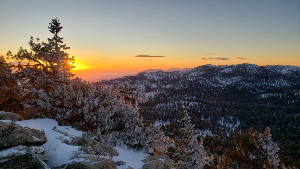
TRAIL CONDITIONS
All trails above about 6500 ft are currently snow-covered, and partially snow-covered above 5500 ft. Snow cover is shallow up to about 7000 ft, but relatively heavy above 8000 ft. Melting on sun-exposed slopes is already well underway, e.g., on lower Devil’s Slide Trail, South Ridge and lower Deer Springs trails. Steady melting is expected with warming temperatures this week, especially at mid elevations and on sun-exposed slopes.
Note that tracks discussed can be obscured quickly by drifting of snow from strong winds, sometimes in days or even hours. Strong winds expected on 11th-12th February, and again on 14th, will likely obscure many tracks with spindrift.
Effective 26th January 2023 the State Park closed the section of Skyline Trail that falls within its jurisdiction, above 5800 ft elevation, “until further notice due to dangerous weather conditions”. (For readers who are unclear, Skyline Trail forms the lower two-thirds of the “Cactus-to-Clouds” [C2C] route.) The State Park boundary is not marked but is near the site of the old Florian’s Cache, below Flat Rock. The open section of trail below 5800 ft is clear of snow.
Ernie Maxwell Trail has a well traveled track to follow along its entire length, through the increasingly patchy icy snow. Average snow cover is 60%, but is nearly continuous near Humber Park. Spikes are recommended especially in the morning as the snow is now hard, compacted and very icy in places. Three significant trees are now down across the trail, including two major hazards (one new in gale force winds on 26th January) that are not easy to hike around both roughly halfway along the trail. All have been reported to US Forest Service.
Devil’s Slide Trail has a traveled and largely compacted track to Saddle Junction in place already. The lower half of the trail in particular is very icy. Spikes are recommended at least for descending, and will become increasingly important with increasing compaction and freeze/thaw cycles. There are two new treefall hazards to pass on the upper trail.
Otherwise, reliable posthole tracks are in place from Saddle Junctions through to San Jacinto Peak via Wellman Divide, but parts will become obscured by drifting snow. From near Miller Peak I put in a track up the East Ridge, rather than continuing on the Peak Trail round to Summit Junction, but this track was being partially erased by spindrift within minutes.
South Ridge Trail [surveyed 10th Feb] is largely snow free until Old Lookout Flat at 7600 ft (c.15% snow cover). However the remaining snow patches are icy in the morning. Snow cover is continuous from there, with a posthole track to Tahquitz Peak. Spikes at least are required, but preferably crampons, both best used with an ice axe, specifically for the uppermost switchbacks, but traction is useful for descending much lower also. South Ridge Road remains closed now with only about 35% icy snow cover.
The 0.4 mile section of South Ridge Trail between Chinquapin Flat/PCT and Tahquitz Peak has no steps to follow through the steeply angled ice with overlying deep snow. These icy slopes are notoriously treacherous. Currently crampons, always with an ice axe, and thorough knowledge of how to use this equipment, are essential. Snowshoes are not advisable due to the angle of the icy snow.
Tracks are in place around Skunk Cabbage Meadow, and south from Saddle Junction toward Chinquapin Flat.
By 1st February there was a somewhat meandering snowshoe track from Round Valley (and presumably Long Valley) up to San Jacinto Peak, ultimately using the East Ridge route from near Miller Peak, that generally followed lower angle terrain and avoided the traversing slopes of the Peak Trail. However there was no sign of that route by 6th, due to drifting snow.
Spitler Peak Trail had 10 new treefall hazards, almost all in the upper switchbacks. Only five of these require cutting, and I was able to remove three by hand last week.
SNOW DEPTHS measured on 6th February 2023 are as follows. The first number is the current average total snow depth at that location followed in parentheses by the maximum depth where known so far this winter, generally immediately following the major storm sequence on 14th-17th January 2023. Note that averages are given; due to strong winds accompanying storms there is extensive drifting. Altitudes are approximate.
San Jacinto Peak (10810 ft): 36-40 inches (winter max depth 45-48 inches), drifted >50 inches in places
Wellman Divide (9700 ft): 38 inches (45 inches)
Annie’s Junction/PCT Mile 180.8 (9070 ft): 44 inches (48 inches)
Long Valley (8600 ft): 20 inches (24 inches)
Saddle Junction/PCT Mile 179 (8070 ft): 18 inches (22 inches)
Devil’s Slide trailhead at Humber Park (6550 ft): 0-3 inches, partly melted by afternoon of 6th (6 inches)
Idyllwild (at 5550 ft): <1.0 inch, largely melted by afternoon of 6th (4 inches)
Thank you for taking the time to read this. While all time and labor is volunteered, the San Jacinto Trail Report uses small private donations to help cover costs. Every year seems to have its unique challenges, and it is already clear that 2023 will be no exception. Your contribution keeps the Report available to all, free from advertising or paywalls, and independent from agencies. If you have found this Report useful, please consider using this link to the Donate page. Zelle, Venmo, and PayPal are all options. Thank you so much for your support.


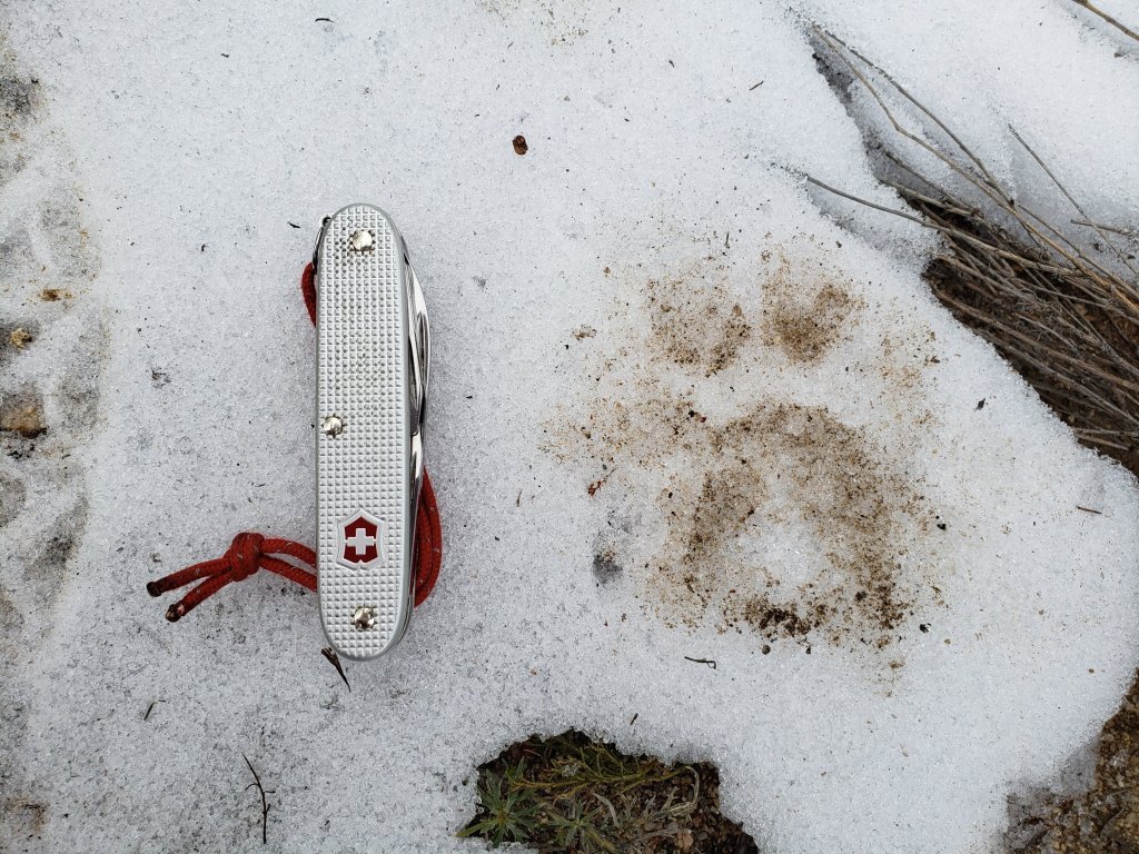
sanjacjon Uncategorized Leave a comment 9 MinutesEdit”Snow and trail update 7th February 2023″
Minor storm update 1st February 2023
The twelfth storm system of winter 2022/23 impacted the San Jacinto mountains with a minor snow storm on 29th-30th January. With a rapidly changing climate in the region in recent years, it has become increasingly common for there to be little or no difference in snow quantities at mid and higher elevations, often because the high country remains above the cloud, and this system was no exception.
Snow started in Idyllwild at about 1015 on Sunday 29th, ultimately accumulating about 3.5 inches (at 5550 ft) by the afternoon of 30th, while San Jacinto Peak (10,810 ft) added only two inches of powder. Locations in between, especially those on the western and southern slopes, added more with up to five inches at Saddle Junction (8100 ft). Long Valley at 8600 ft on the east slope received only about two inches of fresh snow.
On the mornings of both Wednesday 1st February and Monday 30th January I ascended San Jacinto Peak via the east side (Devil’s Slide, Wellman, Peak, and East Ridge trails), descending the same way. With such strong Santa Ana winds on Thursday 26th causing extensive drifting, and a light snowfall early on 30th, by the 30th prior tracks had been thoroughly erased and I was once again breaking trail the entire way from Humber Park to San Jacinto Peak, largely through relatively shallow powder. I made a concerted effort to put in a track as faithful to the trail routes as conditions permitted, both up and down. Further strong winds and blowing powder had eliminated much of these tracks again by Wednesday, and I again largely re-broke trail that day too. Indeed a wild wind in the high country that day was erasing tracks within hours or even minutes (see photos below).
On both days I was able to ascend barebooting to about 8800 ft on 30th and to 9200 ft on 1st, before putting on crampons. I kept those on for the rest of the ascent, and almost all of the descent, finally removing them most of the way down Devil’s Slide Trail. There are layers of hard ice and firm icy snow beneath the fresh powder, and crampons are ideal at present everywhere above 9000 ft, lower in places.
I recorded a short(ish) video report from San Jacinto Peak late morning on Monday 30th (available here on YouTube) that gives a feel for the conditions in the high country at that time.
Details of snow depths measured at various locations on the trail system are given at the foot of this posting. Measurements taken on Monday 30th were unchanged by Wednesday 1st. Note that snow depth itself is rarely indicative of the difficulty (or otherwise) of hiking a particular trail. Although the high country currently has its deepest snow accumulation since March 2019, this winter nevertheless remains well below the average for snowfall in the San Jacinto mountains to date.
Be prepared for trails above about 8000 ft (perhaps lower in places) completely or largely obscured by moderate to deep snow. Cautious navigation is strongly recommended everywhere.
As described above, crampons (always in conjunction with an ice axe) are currently recommended everywhere above about 8500 ft, and are strongly recommended on certain moderate and higher angle slopes, at a minimum on the Peak Trail above Wellman Divide, the Wellman Trail, Deer Springs Trail above Little Round Valley, and uppermost South Ridge Trail, on both flanks but especially on the north face of Tahquitz Peak.
Snowshoes are useful in lower angle terrain with adequate snow depth above about 8000 ft, for example the Tahquitz area meadows near Saddle Junction, sections of Deer Springs Trail, and Long Valley/Round Valley. They are not currently recommended for moderate angle slopes above 9000 ft that have challenging ice underlying shallow powder. However, snowshoes may become increasingly useful if conditions warm sufficiently for snow to become soft above about 9000 ft, especially on sunny slopes and afternoons. Snowshoes will remain valuable anywhere off trail above about 8000 ft for the foreseeable future.
Currently, and as conditions change, spikes are strongly recommended for the foreseeable future everywhere above about 7000 ft. They will be especially valuable on well-consolidated tracks over the coming days and weeks before they clear of snow (e.g., Devil’s Slide, Ernie Maxwell, Deer Springs trails, at least), on colder mornings when conditions are icy, and for descending. They are not however required, depending upon your comfort level hiking on shallow variable snow, potentially mixed with slushy and icy patches.
Melting and freeze/thaw cycles will combine to change trail conditions and potentially the preferred equipment for the terrain for the remainder of February.
Hikers should be prepared for temperatures below freezing in the high country, and well below freezing when considering wind chill effects (see below for my recent weather observations from San Jacinto Peak).
Skyline Trail closed on 26th January due to “dangerous weather conditions” above the State Park boundary (5800 ft elevation). There is no planned reopening date at this time. For those that are unclear, the Skyline Trail is the first segment of the C2C (“cactus to clouds”) from Palm Springs up to Grubb’s Notch, the access point to Long Valley.
The USFS gate at Humber Park remains closed. Even when the gate is closed there are nine legal parking spaces below the locked gate (which still require an Adventure Pass or equivalent to be displayed). If there are “Road Closed” signs further down at the junction with Forest Drive – sometimes the case at weekends and holidays when snow is present – then those nine spaces are also unavailable for legal parking.
South Ridge Road (5S11), Dark Canyon Road (4S02, the access to Seven Pines Trail), and Santa Rosa Truck Trail (7S02) are currently closed to vehicle traffic, as is Black Mountain Road at the gate 1.7 miles up from Highway 243.
WEATHER
February is forecast to be somewhat more settled than the very eventful January. A significant warming trend is expected for later this week and next weekend at all elevations, with significant melting likely, before cooling slightly Monday 6th February but remaining slightly above seasonal. Even around the 10,000 ft peaks temperatures are expected to fluctuate either side of freezing for at least the first half of February, which will lead to freeze/thaw cycles and likely icy conditions in the mornings followed by soft, challenging snow in the afternoons. At this time there is no further significant precipitation forecast prior to mid February.
At San Jacinto Peak (10,810ft/3295m) on Wednesday 1st February 2023 at 0935 the air temperature was 16.6°F (-8°C), with a windchill temperature of -8.0°F (-22°C), 13% relative humidity, and a wild NNE wind sustained at 21 mph gusting to 35.2 mph.
At the Peak on Monday 30th January 2023 at 1110 the air temperature was 15.5°F (-9°C), with a windchill temperature of -0.4°F (-18°C), 98% relative humidity, and a light SSE wind sustained at 3 mph gusting to 8.4 mph.
At the Peak on Monday 23rd January 2023 at 1010 the air temperature was 11.1°F (-11°C), with a windchill temperature of -16.2°F (-26°C), 47% relative humidity, and a bitter NNE wind sustained at 20 mph gusting to 27.7 mph.

TRAIL CONDITIONS
All trails above about 5500 ft are currently snow-covered. Snow cover is shallow up to about 7000 ft, but relatively heavy above 8000 ft. Melting on sun-exposed slopes is already well underway, e.g., on lower Devil’s Slide Trail, South Ridge and Deer Springs trails. Steady melting is expected with warming temperatures this week, especially at mid elevations and on sun-exposed slopes.
Note that tracks discussed are obscured quickly by heavy drifting of snow from strong winds, sometimes in days or even hours.
Effective 26th January 2023 the State Park closed the section of Skyline Trail that falls within its jurisdiction, above 5800 ft elevation, “until further notice due to dangerous weather conditions”. (For readers who are unclear, Skyline Trail forms the lower two-thirds of the “Cactus-to-Clouds” [C2C] route.) The State Park boundary is not marked but is near the site of the old Florian’s Cache, below Flat Rock. The open section of trail below 5800 ft is clear of snow.
Devil’s Slide Trail has a well traveled and compacted track to Saddle Junction in place already. Spikes are not needed yet, but that will change soon with increasing compaction and freeze/thaw cycles. There are two new treefall hazards to pass on the upper trail.
Otherwise, reliable posthole tracks are in place from Saddle Junctions through to San Jacinto Peak via Wellman Divide, but parts will become obscured by any additional light snowfall and/or especially by drifting snow from strong winds. From near Miller Peak I put in a track up the East Ridge, rather than continuing on the Peak Trail round to Summit Junction.
By 1st February there was a somewhat meandering snowshoe track from Round Valley (and presumably Long Valley) up to San Jacinto Peak, ultimately using the East Ridge route from near Miller Peak, that generally followed lower angle terrain and avoided the traversing slopes of the Peak Trail.
Ernie Maxwell Trail [checked 2nd February] has a heavily traveled track to follow along its entire length, through the increasingly patchy icy snow. Average snow cover is 60%, but is nearly continuous near Humber Park. Spikes are recommended especially in the morning as the snow is now hard, compacted and very icy in places. Three significant trees are now down across the trail, including two major hazards (one new in gale force winds on 26th January) that are not easy to hike around both roughly halfway along the trail. All have been reported to US Forest Service.
On South Ridge Trail spikes at least, but preferably crampons, are required for the uppermost switchbacks.
The 0.4 mile section of South Ridge Trail between Chinquapin Flat/PCT and Tahquitz Peak has no steps to follow through the steeply angled ice with overlying deep snow. These icy slopes are notoriously treacherous. Currently crampons, always with an ice axe, and advanced knowledge of how to use this equipment, are required. Snowshoes are not advisable due to the angle of the icy snow.
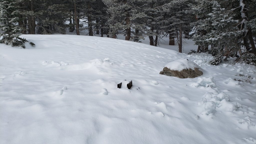
SNOW DEPTHS measured on 30th January 2023 (unless otherwise indicated) and checked again on 1st February are as follows. Three numbers are given: the first number is the current average total snow depth at that location, followed in brackets by the new snow accumulation from the storm on 29th-30th January, and finally in parentheses by the maximum depth where known so far this winter, generally on 18th January following the major storm sequence on 14th-17th January 2023. For locations measured on 23rd January, these measurements are still useful, as the new recent snow depth is roughly offset by melting over the past week. Note that averages are given; due to strong winds accompanying storms there is extensive drifting. Altitudes are approximate.
San Jacinto Peak (10810 ft): 40-45 inches [2 inches] (45-48 inches), drifted >50 inches in places
Little Round Valley (9800 ft): 45 inches, heavily drifted, measured 23rd January
Wellman Divide (9700 ft): 40 inches [2 inches] (45 inches)
Annie’s Junction/PCT Mile 180.8 (9070 ft): 44 inches [4 inches] (48 inches)
Tahquitz Peak (8836 ft): 25 inches, heavily drifted to 40 inches in places, measured 20th January
Seven Pines Trail junction with Deer Springs Trail (8700 ft): 36 inches, measured 23rd January
Long Valley (8600 ft): 22 inches [2 inches] (24 inches)
Strawberry Junction/PCT Mile 183 (8100 ft): 15 inches, measured 23rd January
Saddle Junction/PCT Mile 179 (8070 ft): 22 inches [5 inches] (22 inches)
Suicide Rock Trail junction with Deer Springs Trail (6950 ft): 3 inches, measured 23rd January
Devil’s Slide trailhead at Humber Park (6550 ft): 4-5 inches [4 inches] (6 inches) already melting afternoon of 30th
Idyllwild (at 5550 ft): 0-2 inches [3.5 inches] (3-4 inches) rapidly melting afternoon of 30th
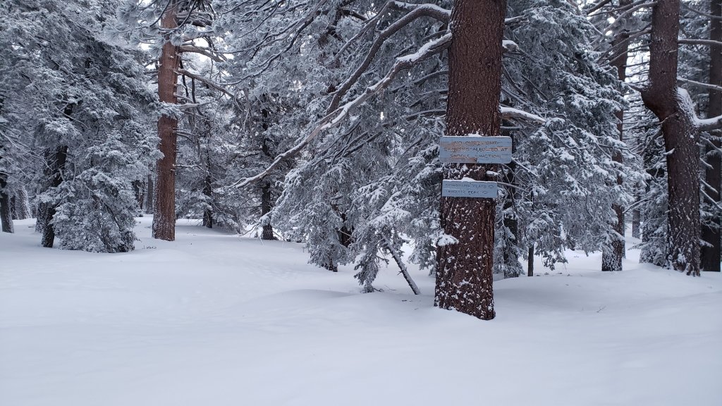
Thank you for taking the time to read this. While all time and labor is volunteered, the San Jacinto Trail Report uses small private donations to help cover costs. Every year seems to have its unique challenges, and it is already clear that 2023 will be no exception. Your contribution keeps the Report available to all, free from advertising or paywalls, and independent from agencies. If you have found this Report useful, please consider using this link to the Donate page. Zelle, Venmo, and PayPal are all options. Thank you so much for your support.
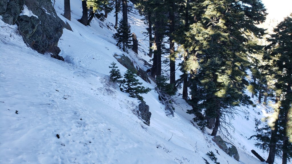

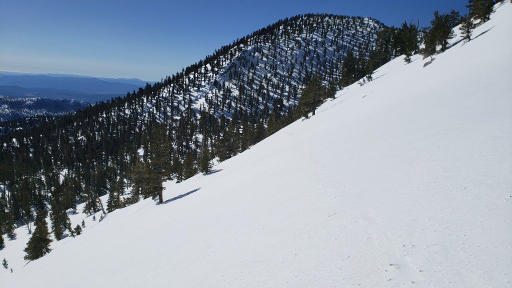
sanjacjon Uncategorized Leave a comment 9 MinutesEdit”Minor storm update 1st February 2023″
Snow update 25th January 2023
IMPORTANT UPDATE Thursday 26th January 2023: The State Park has announced that Skyline Trail is closed with immediate effect due to hazardous conditions above the State Park boundary (5800 ft elevation). There is no planned reopening date at this time. For those that are unclear, the Skyline Trail is the first segment of the C2C (“Cactus to clouds”) from Palm Springs up to Grubb’s Notch (Long Valley).
WEATHER UPDATE Thursday 26th January 2023: Wild Santa Ana (north-east) winds today in the San Jacinto mountains have included gusts of 69 and 73 mph early this morning at automated stations at each end of Bonita Vista Road. On the north side, a location just south-east of Banning in San Gorgonio Pass recorded a gust of 92 mph. Hikers should anticipate new treefall hazards in trails – we have already found one major new one on the Ernie Maxwell Trail – and also that tracks in snow may have been obscured by windblown drifting powder. The storm forecast for 29th-30th January looks less dramatic than previously predicted, with the high country largely above the storm (only an inch of snow forecast), and only 2-4 inches now expected at the elevation of Idyllwild.
—————————–
The previous Report (available here) summarized the conditions following the multiple storm event of 14th-17th January. My blogging throughout the storms gave more day-to-day detail and is available here. Since then Idyllwild had a very light dusting (<0.25 inch) of snow on Friday 20th, but the high country was above the cloud and unaffected.
Early on Monday 23rd January I ascended San Jacinto Peak via the east side (Devil’s Slide, Wellman, and Peak trails) that I had broken last Wednesday 18th, and descended the west side via (more-or-less) Deer Springs Trail. A strong and bitterly cold NNE wind made conditions interesting, with large parts of the broken tracks filling in overnight with spindrift (and wind blown ice blocks), so I found myself breaking lengthy sections of trail yet again. This started as low as Devil’s Slide Trail and continued all morning. On the plus side, as I had hoped, the cold meant that the exposed snow slopes from 9200 ft and above were largely firm and icy (example photo below). Consequently I put on crampons at Wellman’s Cienega, keeping them on all day until low down on Deer Springs Trail. Although I carried snowshoes it would have been risky to try to use them on the icy traverses.
On Friday 20th I broke South Ridge Trail to Tahquitz Peak. I put in a posthole track the entire way up, but crampons (with an ice axe) were essential at that time on the upper switchbacks above about 8300 ft due to the typical steeply angled ice obscured underneath 6-12 inches of powder (photos below).
Details of snow depths measured at various locations on the trail system are given at the foot of this posting. Note however that snow depth itself is rarely indicative of the difficulty (or otherwise) of hiking a particular trail. Although the high country currently has its deepest snow accumulation in almost four years, since March 2019, this winter nevertheless remains well below the average for snowfall in the San Jacinto mountains to late January.
Be prepared for trails above about 8000 ft (perhaps lower in places) completely or largely obscured by moderate to deep snow. Very cautious navigation is strongly recommended everywhere.
Current forecasts suggest that there may be significant snowfall on Sunday 29th-Monday 30th January at all elevations, but some warming and steady snow melt likely on either side of that date. Fresh snowfall, melting, and freeze/thaw cycles will all combine to change trail conditions and potentially the preferred equipment for the terrain over the next week or two.
With some melting already underway and compaction caused by freeze-thaw cycles and hiker traffic, conditions will deteriorate for snowshoeing over the next few days, especially on more heavily traveled trails below 9000ft. Nevertheless, snowshoes will be valuable anywhere off trail above about 8000ft for the foreseeable future, and on trail where tracks have not yet been broken. They may become increasingly useful if conditions warm sufficiently for snow to become soft above about 9000 ft, especially on sunny slopes and afternoons.
In addition to snowshoes, and as conditions change, spikes are strongly recommended for the foreseeable future everywhere above about 6000ft. They will be especially valuable on well-consolidated tracks over the coming weeks before they clear of snow (e.g., Devil’s Slide, Ernie Maxwell, Deer Springs trails, at least), on colder mornings when conditions are icy, and for descending. They are not however required, depending upon your comfort level hiking on shallow variable snow, potentially mixed with slushy and icy patches.
As described above, crampons (always in conjunction with an ice axe) are currently recommended on certain moderate and higher angle slopes, at a minimum on the Peak Trail above Wellman Divide, the Wellman Trail, and uppermost South Ridge Trail, on both flanks but especially on the north face of Tahquitz Peak.
Hikers should be prepared for temperatures below freezing in the high country, and well below freezing when considering wind chill effects (see below for my recent weather observations from San Jacinto Peak).
Avalanche risk in the high country is currently minimal due to snow depths and conditions, with the exception of the traditionally unstable north face of San Jacinto Peak which avalanches to some extent every winter.
As always after storms in the San Jacinto range be aware of considerable ice fall from overhead trees. Sadly this phenomenon has become much more of a factor in recent years with freezing rainfall (rather than snow) occurring at higher elevations at higher frequency with much warmer weather systems. This rain produces huge masses of ice in the trees, including chunks I have estimated as weighing 40-100 lb this winter, which can dislodge dramatically once direct sunlight warms the trees.
Hikers should be prepared for temperatures below freezing in the high country, and far below freezing when considering wind chill effects (see below for my recent weather observations from San Jacinto Peak).
The USFS gate at Humber Park remains closed. Even when the gate is closed there are nine legal parking spaces below the locked gate (which still require an Adventure Pass or equivalent to be displayed). If there are “Road Closed” signs further down – often the case at weekends and holidays when snow is present – then those nine spaces are also unavailable for legal parking.
South Ridge Road (5S11), Dark Canyon Road (4S02, the access to Seven Pines Trail), and Santa Rosa Truck Trail (7S02) are currently closed to vehicle traffic, as is Black Mountain Road at the gate 1.7 miles up from Highway 243.

WEATHER
After an interesting month of weather, the remainder of January into February is forecast to be somewhat more settled. In general temperatures are expected to warm to above average into next month at all elevations, especially at the highest elevations in the first week of February. Melting is expected to be steady and start to accelerate into February, but freeze/thaw cycles, compaction, and refreezing overnight may ultimately combine to produce very icy conditions.
That said, a moderate snow storm is forecast for Sunday 29th to Monday 30th January, with up to six inches of snow forecast above about 5000 ft, possibly up to 12 inches above 10,000 ft, and a freeze level down to 4000 ft.
At San Jacinto Peak (10,810ft/3295m) on Monday 23rd January 2023 at 1010 the air temperature was 11.1°F (-11°C), with a windchill temperature of -16.2°F (-26°C), 47% relative humidity, and a bitter NNE wind sustained at 20 mph gusting to 27.7 mph.
At the Peak on Wednesday 18th January 2023 at 1115 the air temperature was 16.8°F (-8°C), with a windchill temperature of -3.6°F (-20°C), 27% relative humidity, and a frigid NNW wind sustained at 10 mph gusting to 25.8 mph.
At the Peak on Sunday 15th January 2023 at 0750 the air temperature was 17.8°F (-8°C), with a windchill temperature of -5.6°F (-21°C), 100% relative humidity, and a wild SW wind sustained at 19 mph gusting to 30.2 mph.

TRAIL CONDITIONS
All trails above about 5500 ft are currently snow-covered. Snow cover is shallow up to about 7000 ft, but relatively heavy above 8000 ft. Melting on sun-exposed slopes is well underway, e.g., on lower South Ridge and Deer Springs trails.
Note that tracks discussed here may become obscured by heavy drifting of snow from strong winds combined with extensive ice fall from trees overhead.
Devil’s Slide Trail has a relatively well-traveled and compacted track to Saddle Junction in place already. Note that there are about a dozen stream crossings and sections of the trail with water flowing in them, at times for tens of feet. Waterproof or highly water resistant footwear is recommended. Spikes are not needed yet, but that will change soon with increasing compaction and freeze/thaw cycles. There are two new treefall hazards to pass on the upper trail.
Ernie Maxwell Trail [checked 23rd and 26th January] has good tracks to follow along its entire length, through the shallow icy snow (still >90% snow cover). Spikes are strongly recommended as the snow is now hard, compacted and very icy in places. Three significant trees are now down across the trail, including two major hazards (one new in gale force winds on 26th) that are not easy to hike around both roughly halfway along the trail.
South Ridge Trail has been broken from the top of South Ridge Road to Tahquitz Peak with a simple posthole track. Spikes at least, but preferably crampons, are required for the uppermost switchbacks (see photo below).
The 0.4 mile section of South Ridge Trail between Chinquapin Flat/PCT and Tahquitz Peak [checked 20th January] has no steps to follow through the steeply angled ice with overlying deep snow. These icy slopes are notoriously treacherous. Currently crampons, always with an ice axe, and advanced knowledge of how to use this equipment, are required. Snowshoes are not advisable due to the angle of the icy snow.
On 23rd January I saw posthole tracks from Saddle Junction that head down the start of the Caramba Trail, the start of Willow Creek Trail, and following the PCT southbound toward Chinquapin Flat, but I have no further details at this time.
The Wellman Trail track was disappearing under spindrift as I re-broke it on Monday 23rd. The route does not follow the established trail for the most part, and steepens considerably as it nears Wellman Divide. Crampons (or perhaps spikes or snowshoes on some days) are recommended.
The Peak Trail track is also partially disappearing under fresh spindrift (photos below). The route largely follows the established trail, but hikers coming from Long Valley over the weekend either did not find or follow my broken trail from last week, so in sections the route is unusual. Crampons are recommended for the traversing slopes.
The East Ridge Trail from near Miller Peak to San Jacinto Peak has multiple tracks, all of which were disappearing under fresh spindrift when I ascended that way on Monday 23rd.
Deer Springs Trail has a broken track to follow all the way to San Jacinto Peak. A well-traveled snowshoe track is in place up to Strawberry Junction. From there to the top of Marion Mountain Trail the route is a lightly-traveled posthole track. From the top of Marion, the route is well-traveled but pretty uneven, up into Little Round Valley. It does not accurately follow the established trail route in significant sections but is navigable. Through LRV and up to San Jacinto Peak, there are at least three tracks (two posthole, one snowshoe), none of which attempt to follow the trail route, and all are steep and very direct. There are five new major treefall hazards, plus many other limbs and branches, across the trail between the Suicide Rock junction and the Marion Mountain Trail junction.
Marion Mountain Trail has a well-traveled snowshoe track to follow along its entire length. Note that near its junction with Deer Springs Trail, the route was not close to the established trail, so cautious navigation may be needed.
There was no evidence of hiker tracks on Fuller Ridge Trail or Seven Pines Trail as of Monday 23rd January.

SNOW DEPTHS measured on 23rd January 2023 (unless otherwise indicated) are as follows. The first number is the current average total snow depth at that location, followed in parentheses where known by the maximum depth so far this winter immediately following the latest storm sequence on 14th-17th January 2023. Note that average depth is given; due to strong winds accompanying storms there is extensive drifting. Altitudes are approximate.
San Jacinto Peak (10810 ft): 42 inches (45-48 inches), drifted to 60 inches in places, especially on East Ridge.
Little Round Valley (9800 ft): 45 inches, heavily drifted
Wellman Divide (9700 ft): 40 inches (45 inches)
Annie’s Junction/PCT Mile 180.8 (9070 ft): 44 inches (45-48 inches)
Tahquitz Peak (8836 ft): 25 inches, heavily drifted to 40 inches in places (measured 20th January)
Seven Pines Trail junction with Deer Springs Trail (8700 ft): 36 inches
Long Valley (8600 ft): 20 inches (24 inches)
Strawberry Junction/PCT Mile 183 (8100 ft): 15 inches
Saddle Junction/PCT Mile 179 (8070 ft): 19 inches (21 inches)
Suicide Rock Trail junction with Deer Springs Trail (6950 ft): 1-3 inches
Devil’s Slide trailhead at Humber Park (6550 ft): 2-4 inches (5-6 inches)
Idyllwild (at 5550 ft): 0-2 inches (3 inches)
Thank you for taking the time to read this. While all time and labor is volunteered, the San Jacinto Trail Report uses small private donations to help cover costs. Every year seems to have its unique challenges, and it is already clear that 2023 will be no exception. Your contribution keeps the Report available to all, free from advertising or paywalls, and independent from agencies. If you have found this Report useful, please consider using this link to the Donate page. Zelle, Venmo, and PayPal are all options. Thank you so much for your support.


sanjacjon Uncategorized Leave a comment 10 MinutesEdit”Snow update 25th January 2023″
Snow storms update 19th January 2023
UPDATE Friday 20th January: Overnight Idyllwild had a very light dusting (<0.25 inch) of snow, but the high country was above the cloud so existing tracks should be unaffected. This morning I broke South Ridge Trail to Tahquitz Peak. I put in a posthole track the entire way up, but crampons (with an ice axe) were necessary on the upper switchbacks above about 8300 ft due to the usual steeply angled ice obscured underneath 6-12 inches of powder. Average snow depth around the peak was 24-25 inches, but heavily drifted.
——————————-
We have had an excellent start to 2023 regarding the water and snow situations in the San Jacinto mountains. This is a summary of conditions following the tenth and eleventh Pacific storms of winter 2022/23 to impact the San Jacinto range, that were basically a double “atmospheric river” event spread across 14th-17th January. My blogging throughout the storms gave more day-to-day detail and is available here.
I recorded an overly rambling and partly wind affected video report from San Jacinto Peak late morning on Wednesday 18th, available here on YouTube, but it does give a sense for the conditions underfoot at the highest elevations, and for the spectacular vista that day.
Across the three storm days, locations above about 9000 ft all generally added at least two feet of snow (admixed with layers of freezing rain in areas up to 10,000 ft). The highest peaks appeared to add slightly less snow than some lower locations, probably because they were above the cloud for some of the precipitation events.
Final precipitation numbers for Idyllwild (measured at 5550 ft elevation) across the three days were 5.06 inches of rain and 6.5 inches of snow, although only about half of the latter remained on the ground as a few inches were removed by (relatively) warm rain between snow storms.
The high country currently has the deepest snow accumulation in the San Jacinto mountains in almost four years, since March 2019. As encouraging as that is, it should be noted that snow accumulation at San Jacinto Peak is only at about 65% of the depth in March 2019, and this winter overall remains well below the historical average for snow in the high country, despite recent events.
Details of snow depths measured at various locations on the trail system are given at the foot of this posting. Note however that snow depth itself is rarely indicative of the difficulty (or otherwise) of hiking a particular trail.
Early on Wednesday 18th January I barebooted up Devil’s Slide Trail (which I had broken to Saddle the previous morning). From there I used snowshoes to ascend via Annie’s Junction and Wellman Divide. My track largely follows the established trail routes, with some modifications for the conditions. I stubbornly kept on my snowshoes to 10,100 ft elevation on the Peak Trail, despite some lateral slipping as I traversed the icy snow slopes. I switched to crampons and then finished breaking the Peak Trail through to near Miller Peak (photo below). From there I put in a direct ascending track roughly following the old East Ridge Trail to the Peak.
I kept my crampons on for the entire descent, taking advantage of excellent cross-country glissading conditions, and made it from San Jacinto Peak back to Humber Park in just over two hours.
With two further minor snowfalls possible in January, and strong winds in the high country expected on some days causing substantial spindrift, tracks broken through the snow may not last long. Be prepared for trails above about 8000 ft (perhaps lower in places) completely or largely obscured by moderate to deep snow; very cautious navigation is strongly recommended everywhere.
Currently few major trail routes have been traveled and even those may become partially obscured by drifted snow and fresh icefall. My tracks from Wednesday 18th January from Humber Park to/from San Jacinto Peak will be largely visible but may become somewhat obscured in places.
Snow depths are currently excellent for snowshoeing above about 7000 ft, where trails haven’t been too heavily traveled and compacted. However the snow conditions may not be suitable for snowshoeing on certain slopes, depending on the ice conditions below the surface due to multiple freezing rain incidents this winter. Eventually with compaction of the trails caused by increasing hiker traffic and freeze/thaw cycles snowshoes may steadily become less useful, however they will certainly remain valuable for off-trail travel in the high country well into February at least.
Spikes are currently useful throughout the trail system above about 6000 ft, possibly lower in places on cold (icy) mornings. They are not however required, depending upon your comfort level hiking on shallow variable snow, potentially mixed with slushy and icy patches. Spikes will become increasingly useful over the next few days and weeks as established trails become consolidated by hiker traffic and undergo freeze-thaw cycles. Spikes tend to be especially useful for descending trails.
As described above, crampons (always in conjunction with an ice axe) are currently recommended on certain moderate and higher angle slopes, at a minimum on the Peak Trail above Wellman Divide, and uppermost South Ridge Trail, especially on the north face of Tahquitz Peak.
Hikers should be prepared for temperatures below freezing in the high country, and well below freezing when considering wind chill effects (see below for my recent weather observations from San Jacinto Peak).
As always after storms in the San Jacinto range be aware of considerable ice fall from overhead trees. Sadly this phenomenon has become much more of a factor in recent years with freezing rainfall (rather than snow) occurring at higher elevations at higher frequency with much warmer weather systems. This rain produces huge masses of ice in the trees, including many chunks I have estimated as weighing 40-100 lb this winter, which can dislodge dramatically once direct sunlight warms the trees.
Currently the snow is relatively powdery; this will steadily change over the next few days and weeks. Underlying that powder are layers of ice (largely from freezing rain storms) which are much more perilous. Note that temperatures fluctuating either side of freezing are forecast for both mid and upper elevations. Steady melting of snow, especially on sun-exposed slopes, and freeze-thaw cycles will combine to change trail conditions and potentially the preferred equipment for the terrain.
Some general comments on snow/ice conditions. Time of day, temperature, and sun exposure all have significant impacts on the nature of the snow, in turn changing the conditions underfoot, and hence both the hiking difficulty and the preferred traction device (if any). These impacts are especially striking in Southern California mountains, where the sun is relatively potent even in midwinter and where even on the coldest days temperatures at mid elevations may fluctuate either side of freezing. A rapidly warming montane climate, with changes especially striking at high elevation, is exacerbating all of these issues.
Hikers should be prepared for temperatures below freezing in the high country, and far below freezing when considering wind chill effects (see below for my recent weather observations from San Jacinto Peak).
Currently the USFS gate at Humber Park is closed. When the gate is closed there are still nine legal parking spaces this side of the locked gate (which still require an Adventure Pass or equivalent to be displayed). Vehicles not parked in these spaces may be ticketed and/or towed. If there are “Road Closed” signs further down – often the case at weekends and holidays when snow is present – then those nine spaces are also unavailable for legal parking.
South Ridge Road (5S11) is also currently closed to vehicle traffic.
Dark Canyon Road (4S02, the access to Seven Pines Trail) and Santa Rosa Truck Trail (7S02) closed to vehicle traffic for the season on 7th November 2022. Black Mountain Road also closed on 7th November to vehicle traffic at the gate 1.7 miles up from Highway 243. Forest Service campgrounds at Boulder Basin, Marion Mountain, and Fern Basin are closed for the season. The State Park Stone Creek campground is also closed.

WEATHER
In general conditions in the remainder of January will be much more settled than for the first half of the month. Temperatures are expected to remain below average for January for the remainder of the month in Strawberry Valley (Idyllwild area), but are forecast to swing well above average (above freezing) for the highest elevations on 21st-26th January. Melting may be slow and largely confined to the most sun-exposed slopes, but freeze/thaw cycles, compaction, and low overnight temperatures may lead to very icy conditions.
In addition, there is the possibility of minor snow storms on Thursday 19th and around Sunday 29th January. While the snow quantities are forecast to be 1-2 inches at most, they may be much colder systems than have been typical so far this winter, with freeze levels below 5000 ft. Even if there is no precipitation, there will be temperatures well below seasonal on those days.
At San Jacinto Peak (10,810ft/3295m) on Wednesday 18th January 2023 at 1115 the air temperature was 16.8°F (-8°C), with a windchill temperature of -3.6°F (-20°C), 27% relative humidity, and a frigid NNW wind sustained at 10 mph gusting to 25.8 mph.
At the Peak on Sunday 15th January 2023 at 0750 the air temperature was 17.8°F (-8°C), with a windchill temperature of -5.6°F (-21°C), 100% relative humidity, and a wild SW wind sustained at 19 mph gusting to 30.2 mph.
At the Peak on Wednesday 11th January 2023 at 0915 the air temperature was 24.0°F (-4°C), with a windchill temperature of 5.8°F (-15°C), 74% relative humidity, and a bitter NNW wind sustained at 19 mph gusting to 24.5 mph.
TRAIL CONDITIONS
All trails above about 5000 ft are currently snow-covered. Snow cover is shallow up to about 7000 ft, but relatively heavy above 8000 ft.
Reliable tracks are in place (at least) for Devil’s Slide Trail. My snowshoe track continues from Saddle Junction through to San Jacinto Peak via Wellman Divide , the Peak Trail, and East Ridge, but this may become obscured by additional light snowfall and/or drifting snow from strong winds.
Devil’s Slide Trail has a relatively well-traveled and compacted track to Saddle Junction in place already. Note that there are about a dozen stream crossings and sections of the trail with water flowing in them, at times for tens of feet. Waterproof or highly water resistant footwear is recommended. Spikes are not needed yet, but that will change soon with increasing compaction and freeze/thaw cycles.
Ernie Maxwell Trail has good tracks to follow along its entire length, through the continuous snow cover a few inches deep. Many hikers may find spikes are already useful, and will become increasingly so during and after this weekend with melting and compaction. [Checked 18th January by Anne and Anabel.
On the afternoon of 18th I saw posthole tracks that head down the start of the Caramba Trail, and following the PCT southbound toward Chinquapin Flat, but I have no further details at this time.
The 0.4 mile section of South Ridge Trail between Chinquapin Flat/PCT and Tahquitz Peak [checked 20th January] has no steps to follow through the steeply angled ice with overlying deep snow. These icy slopes are notoriously treacherous. Currently crampons, always with an ice axe, and advanced knowledge of how to use this equipment, are required. Snowshoes are not advisable due to the angle of the icy snow.

SNOW DEPTHS measured on 18th January 2023 (unless otherwise indicated) are as follows. The first number is the current average total snow depth at that location, followed in parentheses by the approximate depth of fresh snow added by the latest storm sequence on 14th-17th January. Note that average depth is given; due to strong winds accompanying storms there is extensive drifting. Altitudes are approximate.
San Jacinto Peak (10810 ft): 45-48 inches (includes about 24 inches snow in latest storms), heavily drifted to 60 inches in places, especially on the East Ridge.
Wellman Divide (9700 ft): 45 inches (30 inches snow in latest storms) but heavily drifted here
Annie’s Junction/PCT Mile 180.8 (9070 ft): 45-48 inches (about 30-32 inches snow in latest storms)
Tahquitz Peak (8836 ft): 25 inches, heavily drifted to 40 inches in places (measured 20th January)
Long Valley (8600 ft): 24 inches (16 inches in latest storms)
Saddle Junction/PCT Mile 179 (8070 ft): 21 inches (13 inches snow in latest storms)
Devil’s Slide trailhead at Humber Park (6550 ft): 5-6 inches (all from latest storms, four inches of snow on top of ice)
Idyllwild (at 5550 ft): 3 inches (all from latest storms, admixed with 5.06 inches rain on 14th-16th) already melting steadily on 18th.


Thank you for taking the time to read this. While all time and labor is volunteered, the San Jacinto Trail Report uses small private donations to help cover costs. Every year seems to have its unique challenges, and it is already clear that 2023 will be no exception. Your contribution keeps the Report available to all, free from advertising or paywalls, and independent from agencies. If you have found this Report useful, please consider using this link to the Donate page. Zelle, Venmo, and PayPal are all options. Thank you so much for your support.


sanjacjon Uncategorized 1 Comment 10 MinutesEdit”Snow storms update 19th January 2023″
Storm updates 14th-17th January 2023
Back-to-back Pacific storm systems – already the tenth and eleventh storms of this winter – are forecast for Saturday 14th and then from late Sunday 15th January to the early hours of Tuesday 17th January.
Please check this page for periodic updates – the most recent is at the top – throughout the multiple day storm sequence. The next comprehensive Report update is not expected before Wednesday 18th January.
UPDATE on Tuesday 17th January at 1200
A light overnight snowfall, which produced another three inches in Idyllwild, finally stopped at 0700 this morning. Final totals for Idyllwild for the three day storm event were 6.5 inches of snow, plus an impressive 5.06 inches of rain.
This morning Anabel and I broke trail up Devil’s Slide Trail to Saddle Junction. The powder was lovely and soft, and overlying a firm icy layer (from all the freezing rain). While the snow was not especially deep, it still took about double the time of a completely dry ascent. I barebooted to Saddle, and then snowshoed back down to help consolidate the track. There had been an additional six inches of snow (plus an unknown amount of rain) since my measurement two days earlier, for a current total snow depth of about 21 inches at Saddle Junction. Two new trees were down on the upper trail, unsurprising given the huge weight of ice from freezing rain plastered all over the trees.
Current snow depth at Devil’s Slide trailhead at Humber Park is 4-5 inches on top of 1-2 inches of ice/icy snow from recent freezing rain.

UPDATE on Monday 16th January at 1740
Rain has continued solidly today in Idyllwild, with another 0.90 inch since 0700 this morning. It turned to occasional light snow at about 1500, but less than 0.5 inch has accumulated so far (at 5550 ft). However the high country has been largely above this precipitation, with the sun even trying to peek out at times in Long Valley, and only about another inch of snow was added there this morning. That is expected to change, with up to several inches of snow forecast both in the high country and at mid elevations tonight.
UPDATE on Monday 16th January at 0920
Overnight in Idyllwild we had three inches of snow, the first notable snowfall of this latest storm series, but temperatures actually warmed during the night (presumably with the arrival of the latest “atmospheric river”) and before dawn it was raining on top of the snow. The snow quickly turned into semi-melted slush. In combination with the four inches of rain since Saturday, not to mention the many inches of rain earlier this winter, the mid elevations, including the mountain communities, are now best described as a very soggy and slushy mess.
The freeze level is currently at about 7500 ft and it has been periodically snowing gently above that elevation, with Long Valley (8600 ft) having added a few inches overnight, for a current total depth of about 24 inches.
Thank you for taking the time to read this. While all time and effort is volunteered, the San Jacinto Trail Report requests small private donations to cover costs. Every year seems to have unique challenges and 2023 is already proving to be no exception. Your contribution keeps the Report available to all, free from advertising or paywalls, and independent from agencies. If the Report is useful to you in any way, please consider using this link to the Donate page. Zelle, Venmo, and PayPal are all now options. Thank you so much for your support.
UPDATE on Sunday 15th January at 1420
I snowshoed down from San Jacinto Peak via Wellman Divide, Saddle Junction, and Devil’s Slide Trail. It was near-whiteout conditions due to wild spindrift above Wellman Divide, but the new snow was firm and overall made for good snowshoeing conditions. Crunchy layers as high as 9800 ft elevation told me it had rained that high at the start of the storm yesterday, but conversely there was very light snow (<1 inch) down to 5500 ft in Idyllwild.
Measured snow depths as of late morning/early afternoon today are: San Jacinto Peak (10,810 ft) 38 inches, at least 14 new in this storm; Wellman Divide (9700 ft) 30 inches, with 15 new in this storm; Annie’s Junction – at 9070 ft the highest point of the PCT in Southern California – 30 inches, with 14 new in this storm; Saddle Junction (8100ft) 15 inches, about 7-8 new in this storm; Devil’s Slide Trailhead at Humber Park (6520 ft) 2 inches, all from this storm.
Personally I would not currently venture above 9000 ft elevation without crampons (always with an ice axe) and snowshoes, due to the current complexity and challenges of the icy snow slopes above that elevation.
Conversely, lower down Devil’s Slide Trail is a combination of very light snow cover, slush, and multiple stream crossings, with much water flowing down the trail. Suitable waterproof footwear is strongly recommended.


UPDATE on Sunday 15th January at 0830
The high country added only another couple of inches of snow overnight. Storm total at San Jacinto Peak is about 14 inches for a current total depth of 36+ inches (but very heavily drifted). It stopped snowing at about 0800.
Similarly, Long Valley (8600ft) added about two inches overnight for a storm total of about seven inches and a current total depth of about 15 inches.
Current air temperature at San Jacinto Peak is 17.8°F (-8°C) with a windchill of -5.6°F (-21°C) and a steady SW wind sustained at 19 mph gusting to 30.2 mph.
It continued to rain heavily overnight at mid elevations everywhere below about 7000 ft. Idyllwild at 5550 ft elevation recorded an impressive 4.01 inches of rain in the 24 hour period up to 0700 this morning. It is starting to turn to light sleet now as temperatures drop to near freezing. Locations in Pine Cove up to 6500 ft were reporting 3.1 to 3.8 inches of rain by 0500 today.
UPDATE on Saturday 14th January at 2010
The snow continues unabated, although the pace has slowed somewhat in the past hour. There is an average of 9-10 inches of fresh powder so far today at San Jacinto Peak, and about 5 inches in Long Valley.
Today’s rainfall total has passed an inch in Idyllwild, and various locations in Pine Cove (5800-6500 ft) were reporting 1.1 to 1.3 inches two hours ago. The freeze level has remained around 7500 ft for most of today, but is forecast to drop overnight closer to 6000 ft.
UPDATE on Saturday 14th January at 1705
The intensity of snowfall at San Jacinto Peak this afternoon is the best I’ve seen since late 2019. Although the flakes are small, it has been steadily accumulating at an inch per hour, with about six inches fresh powder so far today, for a Peak area total of about 30 inches. Another 10+ inches are forecast overnight, which is very possible given current conditions.
Snowfall at the elevation of Long Valley (8600 ft) has been similarly steady, and 3-4 inches of fresh powder there takes the total depth close to one foot.
Rainfall in Idyllwild (at 5550ft) has also maintained a steady pace, with close to 0.7 inch so far today.
UPDATE on Saturday 14th January at 1505
Cloud cover started to envelop the mountains early this morning. On my hike up to San Jacinto Peak it started snowing gently at 1025 in the high country. Snow accumulation was initially slow but has been an inch per hour recently, with 2.5 inch added at San Jacinto Peak since late this morning (on top of about 24 inches remaining from prior storms).
On my ascent I put crampons on at Wellman’s Cienega (9300 ft) and they were more-or-less essential for traversing the icy slopes of the Peak Trail. My tracks from Wednesday were still largely visible and helped a little with traction.
The initial freeze level was at about 9000 ft but has already dropped. After some early sleety drizzle it has been snowing in Long Valley (8600 ft) since late morning with 0.75 inch accumulating so far.
In Idyllwild (at 5550 ft) it started raining at 1100, where it has been relatively slow to accumulate so far, with 0.4 inch by 1500.

sanjacjon Uncategorized Leave a comment 6 MinutesEdit”Storm updates 14th-17th January 2023″
Minor snow storm update 11th January 2023
IMPORTANT UPDATE Friday 13th January: back-to-back Pacific storm systems are forecast to impact the San Jacinto mountains this weekend, the first on Saturday 14th, immediately followed by another Sunday 15th-Monday 16th January. These storms are currently forecast to each produce at least ten inches of snow at the highest elevations and an inch or more of rain at mid elevations (e.g., in Idyllwild). The second storm on 15th-16th is expected to be colder with a lower freeze level which may result in 1-2 inches of snow down to 5000 ft or possibly even lower.
—————————————-
The flow of “atmospheric river” storm systems continues unabated across California. Generally the San Jacinto mountains have just caught the southern edge of these systems, with nothing like the dramatic precipitation being reported from further north. That said, the cumulative effect of multiple systems is helpful to our moisture situation, and Tuesday 10th January saw the sixth storm in just over two weeks in the San Jacinto mountains (a timeline of the recent sequence of storms is available here in the previous Report).
Lamentably this latest storm was again very mild, with rain falling as high as the elevation of San Jacinto Peak – see photos below – all morning on Tuesday 10th, until finally turning to light snow in the early afternoon (at about 1330 in Long Valley). Rain had started overnight in Idyllwild, ending in late afternoon at a total of 1.26 inches.
Only 2.5 inches of snow fell at San Jacinto Peak (10,810ft) decreasing to 0.25 inch in upper Fern Valley (at approximately 6000 ft). With such mild storms this winter, it is interesting to speculate how much snow would currently be around the high peaks if air temperatures had been just a couple of degrees cooler. Currently there is less than three feet of snow at San Jacinto Peak; I suspect it would be 5-8 feet had we had fractionally cooler conditions in the past month.
Snow depths measured at many locations on the trail system on 11th January are given at the foot of this posting. Note however that snow depth itself is rarely indicative of the difficulty (or otherwise) of hiking a particular route, as discussed below. Many locations below 9000 ft had actually experienced a net loss of snow depth, as the (relatively) warm rain had melted and compacted the pre-existing snow, and so little new snow fell subsequently.
On the morning of Wednesday 11th January, getting an Alpine start, I broke trail the entire way from Humber Park to San Jacinto Peak via Devil’s Slide, PCT, Wellman, Peak, and East Ridge trails. That said, the going was extremely easy as the rain layer on top of the snow remaining for earlier storms had completely frozen, so I was only having to “break trail” through an inch or two of fine powder. The natural traction was superb, and I barebooted all the way to just above Wellman Divide (9700 ft) before finally putting on Kahtoola microspikes, accompanied by an ice axe.
The traversing slopes above Wellman’s Divide (roughly 9800-10,500 ft) were extremely firm early in the morning and potentially treacherous. Spikes at least, but preferably crampons, plus an ice axe (and thorough knowledge of how to use it) are currently required for traversing these slopes. It is possible they may deteriorate even further with some warming from direct sunlight. Snowshoes are not currently advisable on these slopes due to the angle of the underlying ice.
From near Miller Peak, I did not continue to break trail on the Peak Trail, but instead turned up the East Ridge, breaking a track roughly along the route of the old East Ridge Trail.
I descended Deer Springs Trail, again breaking trail the entire way, but again through light snow sitting on top of a very solid, icy snow layer. My route down to Little Round Valley will not be especially helpful to ascending hikers, as I made the most of conditions to take a direct glissading route. Through and below Little Round Valley, my track almost entirely follows the established trail.
All trails above about 8000 ft are obscured by snow at this time, and cautious navigation is strongly recommended everywhere. With significant further snowfalls expected in the next week (at least), and moderate to strong winds in the high country expected for many of those days causing some daily drifting of snow, much of the trail system may remain completely or somewhat obscured by snow throughout most or all of January.
Currently only two major trail routes have been traveled and even those may become partially obscured by drifted snow and fresh icefall. My tracks from Wednesday 11th January from Humber Park to San Jacinto Peak and down Deer Springs Trail will be largely visible but may be somewhat obscured in places.
Snow depths are currently suitable for snowshoeing above about 9000 ft, potentially lower in places. However the snow conditions may not be suitable for snowshoeing on certain slopes, as described above. This may continue for several weeks, or could change given further fresh snowfall forecast. Eventually with compaction of the trails caused by increasing hiker traffic and freeze/thaw cycles snowshoes may steadily become less useful, however they will likely remain valuable for off-trail travel in the high country into February.
Spikes are currently useful throughout the trail system above about 7000 ft, possibly lower in places on cold (icy) mornings. They are not however required, depending upon your comfort level hiking on shallow variable snow, potentially mixed with slushy and icy patches. Spikes will likely become increasingly useful over the next few days and weeks as established trails become consolidated by hiker traffic and undergo freeze-thaw cycles. Spikes tend to be especially useful for descending trails.
As mentioned above, crampons (always in conjunction with an ice axe) are currently recommended on certain moderate and higher angle slopes, notably the Peak Trail above Wellman Divide, and uppermost South Ridge Trail, especially on the north face of Tahquitz Peak.
Hikers should be prepared for temperatures well below freezing in the high country, and far below freezing when considering wind chill effects (see below for my recent weather observations from San Jacinto Peak). Potentially dangerous cold is currently forecast for the highest peaks for 14th-23rd January at least.
As always after storms in the San Jacinto range be aware of considerable ice fall from overhead trees. Sadly this phenomenon has become much more of a factor in the past 5-10 years with freezing rainfall (rather than snow) occurring at higher elevations at higher frequency with much warmer weather systems. This rain produces huge masses of ice in the trees, including chunks as large as a small microwave weighing 40-80 lb, which then dislodge as soon as direct sunlight warms the trees.
Some general comments on snow/ice conditions. Time of day, temperature, and sun exposure all have significant impacts on the nature of the snow, in turn changing the conditions underfoot, and hence both the hiking difficulty and the preferred traction device (if any). These impacts are especially striking in Southern California mountains, where the sun is relatively potent even in midwinter and where even on the coldest days temperatures at mid elevations may fluctuate either side of freezing. A rapidly warming montane climate, with changes especially striking at high elevation, is exacerbating all of these issues.
My pre-dawn hike up Devil’s Slide Trail on 11th January was delightful, primarily because there was the noise of running water almost everywhere. All seasonal and ephemeral streams were running strongly, and the current water conditions are the best for four years, since the great Valentine’s Day flood event of 2019. The other bonus was an immaculate set of fresh Mountain Lion tracks in the trail (photos below), with sign that the lion had crossed back-and-forth across Devil’s Slide in multiple locations further up also.
Currently the USFS gate at Humber Park is closed. When the gate is closed there are nine legal parking spaces this side of the locked gate (which still require an Adventure Pass or equivalent to be displayed). Vehicles not parked in these spaces may be ticketed and/or towed. If there are “Road Closed” signs further down at the junction with Forest Drive – as is often the case at weekends and holidays when snow is present – then those nine spaces are also unavailable for legal parking.
South Ridge Road (5S11) is also currently closed to vehicle traffic.
Dark Canyon Road (4S02, the access to Seven Pines Trail) and Santa Rosa Truck Trail (7S02) closed to vehicle traffic for the season on 7th November 2022. Black Mountain Road also closed on 7th November to vehicle traffic at the gate 1.7 miles up from Highway 243. Forest Service campgrounds at Boulder Basin, Marion Mountain, and Fern Basin are closed for the season. The State Park Stone Creek campground is also closed.

WEATHER
Conditions will remain very unsettled well into the third week of January. Two more significant “atmospheric river” storm systems are forecast on Saturday 14th-Sunday 15th, and on 16th-18th. While expected to be relatively mild at first with rain above 9000 ft, overall this next sequence of storms may prove to be colder than most of the recent systems. About 6-10 inches of snow are forecast for the high country on Saturday 14th, with 1-2 inches possible at the elevation of Idyllwild (preceded by 1-2 inches of rain).
Forecasts remain more uncertain about the second wave of stormy weather on 16th-18th January. However, forecast models suggest anywhere from 6-20 inches of snow above 10,000 ft elevation spread across at least two of the three days, and the possibility of several inches of snow at mid elevations (e.g., 2-4 inches in Idyllwild).
At San Jacinto Peak (10,810ft/3295m) on Wednesday 11th January 2023 at 0915 the air temperature was 24.0°F (-4°C), with a windchill temperature of 5.8°F (-15°C), 74% relative humidity, and a bitter NNW wind sustained at 19 mph gusting to 24.5 mph.
At the Peak on Friday 6th January 2023 at 0930 the air temperature was 25.7°F (-4°C), with a windchill temperature of 14.7°F (-10°C), 44% relative humidity, and a chilly NNW breeze sustained at 5 mph gusting to 10.6 mph.
At the Peak on Sunday 1st January 2023 at 0830 the air temperature was 17.9°F (-8°C), with a windchill temperature of -2.3°F (-19°C), 100% relative humidity, and a sharp WSW wind sustained at 11 mph gusting to 21.1 mph.

TRAIL CONDITIONS
All trails above about 6500 ft are currently lightly, or above 8000 ft moderately, snow-covered. As discussed above, multiple additional snowfalls forecast for 14th-18th January will further complicate the trail conditions.
Reliable tracks are in place (at least) for Devil’s Slide Trail through to San Jacinto Peak via Wellman Divide, and for the entire Deer Springs Trail. As of this morning, I saw no other broken tracks on the high country trail system.
The track on Deer Springs Trail largely follows the existing trail route up to Little Round Valley. My posthole/glissading track between LRV and San Jacinto Peak is very direct and steep, and of limited help to an ascending hiker.
The 0.4 mile section of South Ridge Trail between Chinquapin Flat/PCT and Tahquitz Peak [checked 9th January] has no steps to follow through the steeply angled icy snow. Although the snow is not particularly deep (10-12 inches) it is heavily drifted and steeply angled, and has at least one ice layer underneath the fresh powder. These icy slopes are notoriously treacherous and have been an area of multiple hiker fatalities in winter conditions in recent decades. Currently crampons, with an ice axe (and knowledge of how to use both), are strongly recommended. Snowshoes are dangerous due to the angle of the icy snow.
The traversing slopes above Wellman’s Divide (roughly 9800-10,500 ft) were extremely firm early in the morning and potentially treacherous. Spikes at least, but preferably crampons, plus an ice axe (and thorough knowledge of how to use it) are currently required for traversing these slopes. It is possible they may deteriorate even further with some warming from direct sunlight. Snowshoes are not currently advisable on these slopes due to the angle of the underlying ice.
The Ernie Maxwell Trail [surveyed 10th January] has minor patches of snow along its entire length, however it is largely clear for long sections, and the remaining snow is rarely icy. Spikes are not required.

SNOW DEPTHS measured on 11th January 2023 are as follows. The first number is the current average total snow depth at that location, followed in parentheses by the depth of fresh snow added by the latest storm on Tuesday 10th. Since the depths given in the previous Report, there has been some melting at higher elevations on sunny days and below 9000 ft caused by the heavy rainfall. Note that average depth is given; due to strong winds accompanying storms there is extensive drifting, often accumulating in the trails. Conversely in places scouring by the wind means the depths are well below the average. Altitudes are approximate.
San Jacinto Peak (10810 ft): 25-27 inches (includes 2.5 inches snow added on 10th January) but very heavily drifted
Little Round Valley (9800 ft): 24 inches (2 inches on 10th January)
Wellman Divide (9700 ft): 16 inches (1.5 inches snow plus unknown quantity of rain on 10th)
Annie’s Junction/PCT Mile 180.8 (9070 ft): 16 inches (1.5 inches snow plus unknown quantity of rain on 10th)
Seven Pines Trail junction with Deer Springs Trail/PCT Mile 184.9 (8700 ft): 13 inches (1 inch snow on 10th)
Long Valley (8600 ft): 8 inches (1 inch snow plus 1.5 inches rain on 10th)
Strawberry Junction/PCT Mile 183.3 (8100 ft): 6 inches (1 inch snow plus unknown quantity of rain on 10th)
Saddle Junction/PCT Mile 179 (8070 ft): 8 inches (1 inch snow plus unknown quantity of rain on 10th)
Deer Springs Trail at Suicide Rock Trail junction (6950 ft): 0-1 inch (0.5 inch snow plus >1.0 inch rain on 10th)
Devil’s Slide trailhead at Humber Park (6550 ft): 0.5 inch (0.5 inch snow plus >1.0 inch rain on 10th)
Idyllwild (at 5550 ft): 0 inch (no snow, 1.26 inches rain on 10th).

Thank you for taking the time to read this. While all time and labor is volunteered, the San Jacinto Trail Report uses small private donations to cover costs. Your contribution keeps the Report available to all, free from advertising or paywalls, and independent from agencies. If you have found this Report useful, please consider using this link to the Donate page. Zelle, Venmo, and PayPal are all options. Thank you so much for your support.


sanjacjon Uncategorized Leave a comment 11 MinutesEdit”Minor snow storm update 11th January 2023″
Minor snow storm update 7th January 2023
UPDATE Tuesday 10th January: Another minor and relatively warm storm is passing through our mountains today. The freeze level again started very high at >9000 ft, with light rain falling in Long Valley (8600 ft) all morning. Rain started overnight in Idyllwild, and by late this afternoon (at 1550) totals 1.22 inch. Precipitation turned to occasional light snow in Long Valley at about 1330, with an accumulation by 1550 of just 0.5 inch. The next comprehensive update of the Report will likely be in the evening of Wednesday 11th.
—————————————
Thursday 5th January saw the fifth storm in the past ten days in the San Jacinto mountains. While we have to be grateful for any precipitation received given our rapidly warming mountain climate, it was not the significant snow-producing storm that had been generally forecast in recent days. About six inches of snow fell at San Jacinto Peak (10,810ft) decreasing to 0.5 inch in upper Fern Valley (at c.6000 ft).
This latest storm was again very mild, as expected from an “atmospheric river” system pulling moisture in from warmer latitudes. The freeze level was above 7000 ft for most of the storm, with freezing rain plastering the vegetation as high as 10,000 ft. The system was cooler in the early hours of Friday morning, with a dusting of snow to 6000 ft and a covering of icy sleet below that in Idyllwild. Prior to that Idyllwild (at 5550 ft) had received 1.04 inches of rain, with a little hail and sleet mixed in.
I recorded a brief video at San Jacinto Peak at about 0930 on Friday 6th (available here on YouTube) which discusses conditions at that time.
On the morning of Friday 6th January, getting an Alpine start, I broke trail the entire way from Humber Park to San Jacinto Peak via Devil’s Slide, PCT, Wellman, Peak, and East Ridge trails. Tracks of myself and a couple of others from recent days were largely visible up Devil’s Slide Trail, and I barebooted to Saddle Junction through thin powder overlying ice. Above Saddle there was a layer of fresh powder (from the previous night) on top of a thick layer of ice, itself on top of more snow from prior storms. This was tricky for postholing which went through the ice layer. but ideal for snowshoes, which I used from Saddle to San Jacinto Peak and back. My Alpine start meant that all layers remained firm throughout the ascent. The traversing slopes above Wellman’s Divide were very firm and relatively tricky in snowshoes, and some hikers may prefer to use spikes (or probably crampons) plus an ice axe above about 9800 ft.
From near Miller Peak, I did not continue to break trail on the Peak Trail, but instead turned up the East Ridge, breaking a track roughly along the route of the old East Ridge Trail.
As I descended past Saddle Junction I was surprised not to see any other tracks as of early afternoon on Friday 6th, which I mention only because of the lack of broken trails this indicates. Indeed there were no other tracks anywhere above Humber Park, not even on lower Devil’s Slide Trail. Cautious navigation is strongly recommended everywhere. With two further snowfalls expected in the next ten days, and moderate to strong winds in the high country expected for most of those days causing some daily drifting of snow, much of the trail system may remain completely or somewhat obscured by moderate snow at least into the third week of January.
Currently only one major trail route has been traveled and even that is partially obscured by icefall, melting and drifted snow. My tracks from today (Friday 6th January) from Humber Park to San Jacinto Peak and back will be largely visible but will be somewhat obscured in places.
Details of snow depths measured at various locations on the trail system are given at the foot of this posting. Note however that snow depth itself is rarely indicative of the difficulty (or otherwise) of hiking a particular route.
Snow depths are currently suitable for snowshoeing everywhere above about 8000 ft, potentially lower in places. This will likely continue to be the case for several weeks, given fresh snowfall expected. Eventually with compaction of the trails caused by increasing hiker traffic and freeze/thaw cycles snowshoes may steadily become less useful, however they will remain valuable for off-trail travel in the high country well into February.
Spikes are currently useful throughout the trail system above about 6000 ft, potentially lower in places. They are not however required, depending upon your comfort level hiking on shallow variable snow, mixed with slushy and icy patches. Spikes will likely become more increasingly useful over the next few days as established trails become consolidated by hiker traffic and undergo freeze-thaw cycles. Spikes tend to be especially useful for descending trails.
Hikers should be prepared for temperatures below freezing in the high country, and far below freezing when considering wind chill effects (see below for my recent weather observations from San Jacinto Peak).
As always after storms in the San Jacinto range be aware of considerable ice fall from overhead trees. Sadly this phenomenon has become much more of a factor in the past 5-10 years with freezing rainfall (rather than snow) occurring at higher elevations at higher frequency with much warmer weather systems. This rain produces huge masses of ice in the trees, including chunks as large as a small microwave weighing 40-80 lb, which then dislodge as soon as direct sunlight warms the trees.
Some general comments on snow/ice conditions. Time of day, temperature, and sun exposure all have significant impacts on the nature of the snow, in turn changing the conditions underfoot, and hence both the hiking difficulty and the preferred traction device (if any). These impacts are especially striking in Southern California mountains, where the sun is relatively potent even in midwinter and where even on the coldest days temperatures at mid elevations may fluctuate either side of freezing. A rapidly warming montane climate, with changes especially striking at high elevation, is exacerbating all of these issues.
Prior to this storm, conditions had been extremely unsettled for about ten days, with four storms in a week, although only one of those was a significant snow-producing system. Those systems are summarized here:
- Minor storm overnight on 27th-28th December. A very mild system with rain to 9000 ft elevation (and consequently very icy conditions), and one inch of fresh snow above about 9000 ft elevation, increasing to 1.5 inch above 10,000 ft. Most of this snow had melted prior to my hike to San Jacinto Peak on 31st December.
- Minor 0.5 inch dusting of snow above 8000 ft on Thursday 29th (as I describe in this video). Most of this snow had also melted off by 31st December.
- Moderate storm largely in the early hours of 1st January 2023 was the third significant snowfall of winter 2022/23 to impact the San Jacinto mountains. This was discussed in the last Report. About 11 inches of snow fell at San Jacinto Peak. Initially a warm system with nearly two inches of rain in Idyllwild, later on New Year’s Day the snow level fell as low as 4000 ft, with three inches of snow in Idyllwild.
- Minor snow storm in the early hours of Tuesday 3rd January 2023 then turned to rain all day. Initially a cold system that brought 2-3 inches of snow to elevations between 4500 ft and 9000 ft. A short video summary of what we found when we broke trail up Devil’s Slide that morning is available here. The high country was above the weather for much of the night and added negligible new snow. Sadly at dawn the precipitation turned to drizzle at all elevations on the western slope and it rained all day, ruining the snow quality below 9000 ft. Total rainfall in Idyllwild was 0.38 inch.
Currently the USFS gate at Humber Park is closed. When the gate is closed there are nine legal parking spaces this side of the locked gate (which still require an Adventure Pass or equivalent to be displayed). Vehicles not parked in these spaces may be ticketed and/or towed. If there are “Road Closed” signs further down at the junction with Forest Drive – as is often the case at weekends and holidays when snow is present – then those nine spaces are also unavailable for legal parking.
South Ridge Road (5S11) is also currently closed to vehicle traffic.
Dark Canyon Road (4S02, the access to Seven Pines Trail) and Santa Rosa Truck Trail (7S02) closed to vehicle traffic for the season on 7th November 2022. Black Mountain Road also closed on 7th November to vehicle traffic at the gate 1.7 miles up from Highway 243. Forest Service campgrounds at Boulder Basin, Marion Mountain, and Fern Basin are closed for the season. The State Park Stone Creek campground is also closed.

WEATHER
Conditions will remain very unsettled throughout the second and third weeks of January. Two significant further “atmospheric river” storm systems are forecast, on Tuesday 10th, and then again on Saturday 14th-Sunday 15th. Both of these storms are expected to be relatively mild at first with rain a possibility up to 9000 ft before freeze levels drop down to 6000 ft. Relatively little snow is therefore expected throughout the mid elevations including Idyllwild.
Forecast models have a higher degree of confidence for the Tuesday storm than the storm next weekend. For both storms snow estimates for the highest elevations range from 10-15 inches, with perhaps only an inch of snow in Idyllwild following some rainfall. Current forecasts suggest that the moderate storm on 14th-15th January may be cooler than the Tuesday storm, with somewhat more snow at lower elevations.
At San Jacinto Peak (10,810ft/3295m) on Friday 6th January 2023 at 0930 the air temperature was 25.7°F (-4°C), with a windchill temperature of 14.7°F (-10°C), 44% relative humidity, and a chilly NNW breeze sustained at 5 mph gusting to 10.6 mph.
At the Peak on Sunday 1st January 2023 at 0830 the air temperature was 17.9°F (-8°C), with a windchill temperature of -2.3°F (-19°C), 100% relative humidity, and a sharp WSW wind sustained at 11 mph gusting to 21.1 mph.

TRAIL CONDITIONS
All trails above about 6500 ft are currently lightly, or above 7500 ft moderately, snow-covered.
Reliable tracks are in place (at least) for Devil’s Slide Trail. While my snowshoe track continues from Saddle Junction through to San Jacinto Peak via Wellman Divide, this was already becoming partially obscured by a combination of ice fall from overhead trees, melting of surface snow, and light drifting of powder in some areas.
As discussed above, additional snowfall expected on 10th and 14th-16th January will further complicate the trail conditions.
The 0.4 mile section of South Ridge Trail between Chinquapin Flat/PCT and Tahquitz Peak has no steps to follow through the steeply angled icy snow. Although the snow is not currently particularly deep (10-12 inches) it is heavily drifted and has at least one ice layer underneath the fresh powder. These icy slopes are notoriously treacherous and have been an area of multiple hiker fatalities in winter conditions in recent decades. Currently spikes at a minimum, and ideally crampons, with an ice axe (and knowledge of how to use it), are strongly recommended. Snowshoes are not advisable due to the angle of the icy snow.
The Ernie Maxwell Trail [surveyed 5th January] has patchy snow along its entire length, however it is largely clear for long sections, and the remaining snow is soft. On cold mornings the trail will be icy and some hikers will find spikes are useful, however on warmer days and afternoons spikes are not required.
SNOW DEPTHS measured on 6th January 2023 are as follows. The first number is the current average total snow depth at that location, followed in parentheses by the depth of fresh snow added by the latest storm on Thursday 5th. Since the depths given in the previous Report, there has been some melting at higher elevations which have been above the cloud at times, and below 7000 ft where temperatures have remained above freezing for several days. Note that average depth is given; due to strong winds accompanying storms there is extensive drifting, often accumulating in the trails. Conversely in places scouring by the wind means the depths are well below the average. Altitudes are approximate.
San Jacinto Peak (10810 ft): 22-24 inches (includes 6 inches added on 5th January)
Wellman Divide (9700 ft): 15 inches (5 inches snow plus unknown quantity of rain on 5th)
Annie’s Junction/PCT Mile 180.8 (9070 ft): 17 inches (5 inches snow plus unknown quantity of rain on 5th)
Long Valley (8600 ft): 8 inches (2 inches on 5th)
Saddle Junction/PCT Mile 179 (8070 ft): 10 inches (2 inches snow plus unknown quantity of rain on 5th)
Devil’s Slide trailhead at Humber Park (6550 ft): 3-5 inches (1 inch snow plus >1.0 inch rain on 5th)
Idyllwild (at 5550 ft): 0-1 inch (0.5 inch hail/sleet plus 1.04 inch rain on 5th).
Thank you for taking the time to read this. While all time and labor is volunteered, the San Jacinto Trail Report uses small private donations to cover costs. Your contribution keeps the Report available to all, free from advertising or paywalls, and independent from agencies. If you have found this Report useful, please consider using this link to the Donate page. Zelle, Venmo, and PayPal are all options. Thank you so much for your support.


sanjacjon Uncategorized 1 Comment 10 MinutesEdit”Minor snow storm update 7th January 2023″
Moderate snow storm 1st January 2023
UPDATE Thursday 5th January 2023: We are just catching the southern edge of the highly-publicized storm currently passing through central California. By dusk today it had rained 0.68 inch in Idyllwild, and Long Valley had 1.5 inches of fresh snowfall. The system was generally very mild, with the freeze level near 8000 ft, but this is expected to drop overnight, by which time the precipitation will have largely passed. The next comprehensive update to the Report will hopefully be tomorrow evening, Friday 6th.
UPDATE Tuesday 3rd January 2023: Following another minor overnight snow storm – our fourth in the past week – Anabel and I briskly broke trail up Devil’s Slide to Saddle Junction early this morning. A short video summary of what we found is available here. The high country was above the weather most of the night, and added an inch of fresh snow at most, however there were 2.25 inches in Idyllwild, and also roughly the same fresh snow depth at Humber Park and Saddle Junction. Current known total accumulations are 4 inches in Idyllwild, 6 inches at Devil’s Slide Trailhead, 9 inches at Saddle Junction, and 8 inches at Long Valley. Sadly at first light the precipitation turned to drizzle at all elevations on the western slope between (at least) Idyllwild and 8100 ft at Saddle Junction, and consequently the snow quality was deteriorating fast at mid elevations this morning. It continued to drizzle in Idyllwild all day, slowly accumulating to about 0.25 inch of rain.
————————————–
A positive start to the new year, this is a summary of conditions following the fifth Pacific storm (but only the third significant snowfall) of winter 2022/23 to impact the San Jacinto mountains. Forecasts indicate we will get a few more inches of snow overnight on 2nd-3rd January, and again on Thursday 5th January. The second week of January is expected to be relatively warm and sunny, so extensive melting will start, especially at mid elevations. Clearly conditions are expected to continue to change over the next week or two, so this summary is intentionally brief.
The storm started relatively mild, as might be expected from an “atmospheric river” system pulling moisture in from warmer latitudes, and as a result the freeze level was above 6500 ft for most of the storm, with rain as high as 9000 ft, before finally falling to about 5000 ft on the afternoon of Sunday 1st. Precipitation at the elevation of Idyllwild fell largely as rain (1.79 inches) before turning to “thunder snow” starting at 1235 on Sunday afternoon (currently accumulated to 1.5 inch but still snowing as I write this).
The total snow accumulation was ultimately somewhat below prior forecasts, with San Jacinto Peak receiving about 9-10 inches overnight (rather than the 12-16 anticipated). However subsequent light snow on Sunday 1st improved the depths by another couple of inches.
As I snowshoed down past 9000 ft elevation it was clear from a layer of ice underfoot that after a light snowfall, there had been rain on top of snow, before it started snowing again on top of that Sunday morning. This makes for less than perfect snowshoeing conditions, but still preferable to postholing.
Conditions prior to this storm had been unsettled for several days, with a minor storm overnight on 27th-28th December. This was a very mild system, producing rain to 9000 ft elevation (and consequently very icy conditions), and one inch of fresh snow above about 9000 ft elevation (increasing to 1.5 inch >10,000 ft). There was a further 0.5 inch dusting of snow above 8000 ft on Thursday 29th (as I describe in this video). Conditions are forecast to remain very unsettled for the first week of January. At least two further minor storm systems are forecast, overnight into Tuesday 3rd January, and then again all day on Thursday 5th January, as described in more detail in the Weather section below.
Details of snow depths measured at various locations on the trail system are given at the foot of this posting. Note however that snow depth itself is rarely indicative of the difficulty (or otherwise) of hiking a particular trail.
With at least two further snowfalls expected in the next few days, and strong winds in the high country expected for the next week causing substantial daily drifting of snow, much of the trail system will remain largely obscured by light to moderate snow until the second week of January. Consequently cautious navigation is recommended everywhere.
Snow depths are currently excellent for snowshoeing everywhere above about 8000 ft, potentially lower in places. This will continue to be the case for at least a week, given fresh snowfall expected. With compaction of the trails in the second week of January, snowshoes may steadily become less useful, however they will remain valuable for off-trail travel in the high country for the foreseeable future.
Spikes are currently useful throughout the trail system above about 5000 ft, potentially lower in places. They are not however required, depending upon your comfort level hiking on shallow variable snow, mixed with slushy and icy patches. Spikes will likely become more increasingly useful over the next few days and weeks as established trails become consolidated by hiker traffic and undergo freeze-thaw cycles. Spikes tend to be especially useful for descending trails.
As of the afternoon of Sunday 1st, the only tracks that I saw and that are known to be in place are my snowshoe track between Humber Park and San Jacinto Peak (using Devil’s Slide, Wellman, and Peak trails). There were posthole tracks heading south from Saddle Junction toward Chinquapin Flat. There is already a moderately traveled posthole track on Devil’s Slide Trail, and I was surprised to find that below 7000 ft some of the trail was already slushy simply due to relatively warm air temperatures as there was no direct sun.
Some general comments on snow/ice conditions. Time of day, temperature, and sun exposure all have significant impacts on the nature of the snow, in turn changing the conditions underfoot, and hence both the hiking difficulty and the preferred traction device (if any). These impacts are especially striking in Southern California mountains, where the sun is relatively potent even in midwinter and where even on the coldest days temperatures at mid elevations may fluctuate either side of freezing. A rapidly warming montane climate, with changes especially striking at high elevation, is exacerbating all of these issues.
Currently the snow is relatively powdery and benign; this will steadily change over the next few days and weeks. Note that temperatures fluctuating either side of freezing are forecast for both mid and upper elevations starting in a few days time. Steady melting of snow, especially on sun-exposed slopes, and freeze-thaw cycles will combine to change trail conditions and potentially the preferred equipment for the terrain.
Hikers should be prepared for temperatures below freezing in the high country, and far below freezing when considering wind chill effects (see below for my recent weather observations from San Jacinto Peak).
Currently the USFS gate at Humber Park is closed. When the gate is closed there are still nine legal parking spaces this side of the locked gate (which still require an Adventure Pass or equivalent to be displayed). Vehicles not parked in these spaces may be ticketed and/or towed. If there are “Road Closed” signs further down – as was often the case last winter at weekends and holidays – then those nine spaces are also unavailable for legal parking.
South Ridge Road (5S11) is also currently closed to vehicle traffic.
Dark Canyon Road (4S02, the access to Seven Pines Trail) and Santa Rosa Truck Trail (7S02) closed to vehicle traffic for the season on 7th November 2022. Black Mountain Road also closed on 7th November to vehicle traffic at the gate 1.7 miles up from Highway 243. Forest Service campgrounds at Boulder Basin, Marion Mountain, and Fern Basin are closed for the season. The State Park Stone Creek campground is also closed.
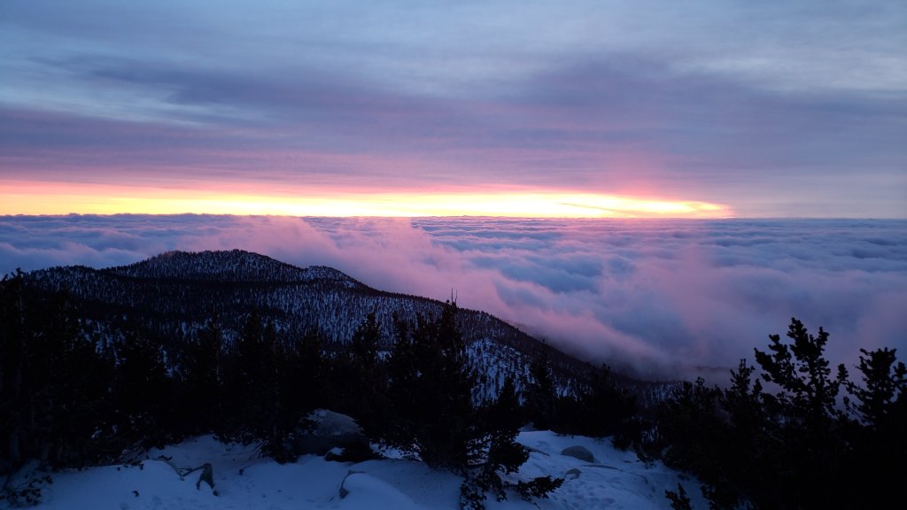
WEATHER
Conditions remain very unsettled for the first week of January. At least two further minor storm systems are forecast, overnight on Monday 2nd into Tuesday 3rd, and then again all day on Thursday 5th. These storms are each expected to produce a further 4-6 inches of snow. However the Tuesday storm is forecast to be much colder, with a freeze level dropping to 5000 ft, with several of inches of snow therefore possible at the elevation of Idyllwild. The high country may be above the cloud for some of that storm, as only 2-3 inches are forecast for the high country. The Thursday system will be significantly warmer, with a freeze level not dropping below about 7000 ft. Precipitation at the elevation of Idyllwild should therefore be rain (0.5-0.7 inch currently forecast), which may therefore largely melt and remove the snow that had fallen earlier in the week at that elevation.
At San Jacinto Peak (10,810ft/3295m) on Sunday 1st January 2023 at 0830 the air temperature was 17.9°F (-8°C), with a windchill temperature of -2.3°F (-19°C), 100% relative humidity, and a sharp WSW wind sustained at 11 mph gusting to 21.1 mph.
At the Peak on Saturday 31st December 2022 at 1650 the air temperature was 24.9°F (-4°C), with a windchill temperature of 4.8°F (-15°C), 62% relative humidity, and a bitter WSW wind sustained at 18 mph gusting to 30.1 mph.
At the Peak on Thursday 29th December 2022 at 0910 the air temperature was 25.8°F (-3°C), with a windchill temperature of 7.2°F (-14°C), 81% relative humidity, and a harsh WNW wind sustained at 12 mph gusting to 25.4 mph.
TRAIL CONDITIONS
All trails above about 5000 ft are currently lightly (or above 8000 ft, moderately) snow-covered.
Reliable tracks are in place (at least) for Devil’s Slide Trail. While my snowshoe track continues from Saddle Junctions through to San Jacinto Peak via Wellman Divide, this may rapidly become obscured by additional light snowfall and/or drifting snow from strong winds.
As discussed above, additional light snowfall on 3rd and 5th January will further complicate the trail conditions.
The 0.4 mile section of South Ridge Trail between Chinquapin Flat/PCT and Tahquitz Peak has no steps to follow through the steeply angled icy snow. Although the snow is not currently particularly deep (10-12 inches) it is heavily drifted and has an ice layer underneath the fresh powder. These icy slopes are notoriously treacherous. Currently spikes at a minimum, and ideally crampons, with an ice axe, are strongly recommended. Snowshoes are not advisable due to the angle of the icy snow.
SNOW DEPTHS measured on 1st January 2023 are as follows. The first number is the depth of fresh snow from this latest storm, followed in parentheses by the current total snow depth. Since the depths given in the previous Report, there had been very minor storms on 28th and 29th December, which added a couple of inches at the highest elevations, down to 0.5 inch at 8000 ft. However I was surprised to find almost all of this had melted by the time I hiked to San Jacinto Peak on 31st December. Note that average depth is given; due to strong winds accompanying the storm there is extensive drifting, often particularly accumulating in the trails. Conversely in some places scouring by the wind means the depths are well below the average. Altitudes are approximate.
San Jacinto Peak (10810 ft): storm total 12 inches (total depth 17-20 inches)
Wellman Divide (9700 ft): 8 inches (total 9 inches)
Annie’s Junction/approx. PCT Mile 181.8 (9070 ft): 9-10 inches (total 11-12 inches)
Long Valley (8600 ft): 8 inches (8-9 inches)
Saddle Junction/approx. PCT Mile 179.9 (8070 ft): 8 inches (8-9 inches)
Devil’s Slide trailhead at Humber Park (6550 ft): 4 inches (total 4 inches)
Idyllwild (at 5550 ft): 3.5 inches (total 3.5 inch).
Thank you for taking the time to read this. While all time and labor is volunteered, the San Jacinto Trail Report uses small private donations to cover costs. Your contribution keeps the Report available to all, free from advertising or paywalls, and independent from agencies. If you have found this Report useful, please consider using this link to the Donate page. Zelle, Venmo, and PayPal are all options. Thank you so much for your support.