On Wednesday 10th May we surveyed Fuller Ridge Trail (PCT Miles 185.5-190.5) again, publishing a relatively short video report on YouTube (available here). There was a very light dusting of fresh snow (<0.5 inch) above about 8000 ft overnight, but most melted by the afternoon, and it had no significant impact on the trail conditions.
The 26th (and final?) snow storm of this remarkable winter impacted the San Jacinto mountains on Thursday 4th May. Although the new snow depth was limited – with four inches throughout the high country, three inches at Saddle and Strawberry junctions, and barely an inch in Idyllwild – and it then almost completely melted off within a couple of days, the impact was briefly significant, especially for the dozens of PCT hikers in the area at the time.
We hiked different routes to San Jacinto Peak on both 4th and 5th May to assess the snow conditions during the storm and immediately thereafter. This also allowed me to put in reliable boot tracks on both the east and west sides of the mountain, as the snow depth, in combination with strong winds and drifting, largely eliminated the existing tracks above 9000 ft. I recorded a brief video report at the Peak on Thursday 4th May which gives a sense for conditions at that time, available here on YouTube.
I repeated those routes on both 8th and 11th May. Having genuinely needed crampons on the east and west slopes of the Peak on 5th, my hike on Monday 8th was the first of 2023 for which I didn’t use spikes either for ascending or descending San Jacinto Peak, using an Alpine start (and reliably grippy boots) to ensure I had relatively easy going on cold, firm snow. Most hikers will prefer to use spikes in the high country, and some may prefer trail crampons.
On the morning of Monday 1st May we hiked the PCT between Spitler Peak and Saddle Junction (PCT Miles 168.5-179), recording a video report (available here) to document trail and snow conditions on this key section of the Desert Divide. Conditions remain very similar now despite the changeable weather in the intervening week.
Currently trails above about 9000 ft are largely obscured by light to moderate snow (much lower in places). Trails as low as 7500 ft elevation can have shallow but very patchy snow cover, mainly on north-facing slopes. Cautious navigation is essential everywhere.
Details of snow depths measured at various locations on the trail system are given at the foot of this posting. Note that snow depth itself is rarely indicative of the difficulty (or otherwise) of hiking a particular track or trail. For example a firm, well-compacted track across snow several feet deep may be much easier hiking than a poorly defined track across just a few inches depth of steeply angled ice.
With the thin new snow from last week having already melted, traction decisions have become easier again, and where icy snow from earlier in the winter remains established tracks are compacted and defined. The optimum traction device at any given time and place depends on a complex interaction of factors including time of day, sun exposure of the trail, air temperature, and extent to which a track has been traveled and compacted. The willingness of the hiker to posthole in soft afternoon snow (which is rarely easy) also influences choice of traction.
Spikes are recommended for the foreseeable future everywhere above about 8000 ft (possibly lower in places) but are no longer essential depending upon your comfort level hiking on icy snow, plus the quality of tread on footwear being used. This elevation will continue to move steadily upwards with rapid melting of snow over the next few weeks, but spikes will remain useful throughout May. Spikes tend to be especially useful for descending even when they are not required for ascending.
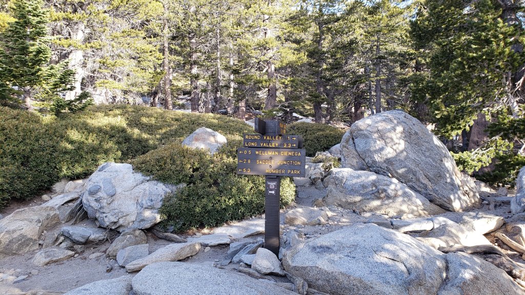
Crampons – with hiking poles and/or an ice axe, depending on terrain – are potentially useful everywhere above about 9000 ft, when cold temperatures on some days, plus freeze/thaw cycles, lead to hardening of the snow surfaces. They could be especially useful over the next few weeks (depending on temperature) anywhere off-trail in the high country, and on-trail on certain moderate and higher angle slopes, at a minimum on the Peak Trail above Wellman Divide, the Wellman Trail, Deer Springs Trail above Little Round Valley, and uppermost South Ridge Trail, and on both flanks – but critically on the north face – of Tahquitz Peak.
Snowshoes remain useful above about 9000 ft for off-trail travel and on the warmest days over the next few weeks. Tracks in the high country can be firm if the morning is cold (spikes or even crampons best) but then soften rapidly once sun hits slopes and temperatures rise rapidly, at which point snowshoes may become valuable. It is clear from the overwhelming majority of high country tracks that hikers are preferring not to use snowshoes at this time.
Hikers should be prepared for temperatures near or below freezing in the high country, and often well below freezing when considering wind chill effects, until Friday 12th May after which warming will be rapid (see below for my recent weather observations from San Jacinto Peak).
In addition to snow and navigation issues, hikers should anticipate encountering many new treefall hazards on all trails, along with considerable amounts of debris, branches, cones, etc. While some of these issues are a consequence of the recent intense winter, most trails in the San Jacinto mountains have been inadequately maintained for years largely due to agency dysfunction, plus some effects of wildfires, the coronavirus pandemic, and climate change. In addition there can be a great deal of water in (and under) the trails, and this has also created some tricky crossings. Be very cautious of snow bridges across water.
The USFS gate at Humber Park reopened on Wednesday 19th April.
Forest Service roads currently closed to vehicular traffic by a revised closure order include Black Mountain Road (4S01), Dark Canyon Road (4S02), South Ridge Road (5S11), May Valley Road (5S21), and Santa Rosa Road (7S02), plus all their various side roads.
WEATHER
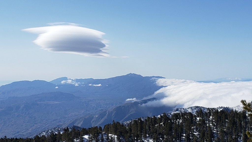
At mid elevations (e.g., Idyllwild-Pine Cove) temperatures remain pleasantly below seasonal for May until Thursday 11th, when a dramatic warming trend quickly pushes temperatures to well above average. In the high country, temperatures remain seasonal (i.e. near freezing) for a few more days, before rapid warming to temperatures well above seasonal starts around Friday 12th May, lasting for at least a week.
While there is no significant new precipitation in the forecasts, there is the possibility of minor rainfall, possibly associated with thunderstorms, on 16th-19th May. These are not storm systems as such, but localized precipitation, most similar to exceptionally early monsoonal conditions.
At San Jacinto Peak (10,810ft/3295m) on Monday 8th May 2023 at 0740 the air temperature was 32.3°F (0°C), with a windchill temperature of 16.8°F (-8°C), 17% relative humidity, and a steady WSW wind sustained at 18 mph gusting to 23.7 mph.
At the Peak on Friday 5th May 2023 at 0945 the air temperature was 21.6°F (-6°C), with a windchill temperature of 7.0°F (-14°C), 93% relative humidity, and a light due West wind sustained at 6 mph gusting to 12.8 mph.
At the Peak on Thursday 4th May 2023 at 1015 the air temperature was 20.1°F (-7°C), with a windchill temperature of 3.7°F (-16°C), 100% relative humidity, and a frigid SW wind sustained at 11 mph gusting to 16.8 mph.

PACIFIC CREST TRAIL INFORMATION
All of the PCT in the San Jacinto mountains is readily passable with, crucially, suitable skills and equipment, patience, and a thorough knowledge of all the possible alternates if needed. Snowmelt will be slow over the next couple of days, and snow will generally be firm and icy, before accelerating very rapidly after about 12th May. I cannot overemphasize the importance of having both appropriate equipment and the right skill set for the terrain. The latter includes interpreting the snow/ice conditions, understanding your physical and mental abilities, and conservative decision making. These challenges may actually increase over the next couple of weeks with temperatures fluctuating either side of freezing and highly variable snowmelt.
The PCT is clear of snow from Miles 151 (Highway 74) to about Mile 169, and functionally clear (with only a handful of tiny snow patches) to Mile 175. Treefall hazards are a problem on this section but none are insurmountable (I counted at least 94 between Miles 169-175 on 1st May). Apache Peak (Mile 169.5) is now functionally clear of snow. See my latest video for details of Miles 169-179 (available here).
Snow remains largely continuous from Miles 175 (Red Tahquitz) to 179 (Saddle Junction), but with a well traveled track and very little consequential terrain. Spikes are nevertheless recommended, and note that the posthole track on Miles 175-178 does not accurately follow the trail route.
Descending the well-signed alternate at Spitler Peak Trail (Mile 168.5) is an option for hikers less comfortable on the sections of angled snow further north or lacking suitable traction. Spitler Peak Trail is clear of snow. Sadly this winter has has brought down about 30 minor trees and half-a-dozen washouts in the uppermost 1.2 miles but nothing particularly challenging to pass. It is possible to get a ride on Apple Canyon Road, or to hike via the Forest Service roads – Bonita Vista Road and May Valley Road – into Idyllwild (check maps or apps for details).
PCT hikers should not attempt to use South Ridge Trail between the PCT at Chinquapin Flat (roughly Mile 177.7) and Idyllwild via Tahquitz Peak, even though this looks temptingly simple on apps and maps. There are no steps to follow through a lengthy section of steeply angled (and notoriously treacherous) ice slopes. Crampons, always with an ice axe, and expert knowledge of how to use this equipment on high angle terrain, are critical. These slopes always take many weeks longer to clear of ice than adjacent areas, and will remain treacherous throughout May (possibly into June this year).
Snow cover is moderate and averages 70% between Miles 179 to about Mile 192, but with extensive clearing on sun-exposed sections (especially Miles 181-184 and around Mile 187.5-188.5). Spikes can be useful everywhere.
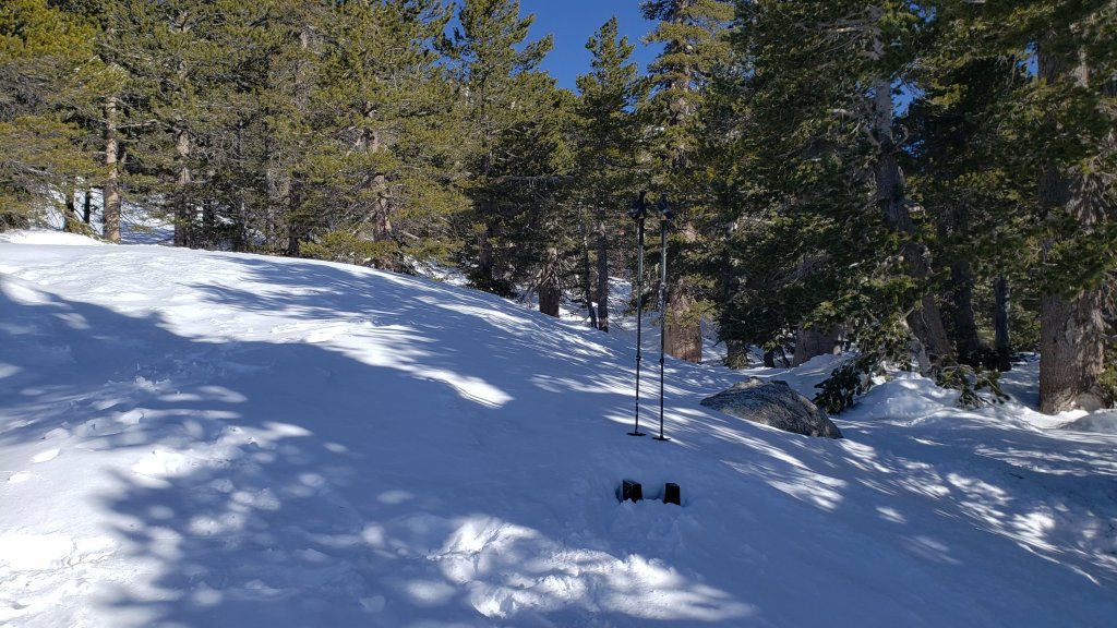
There is a boot track through an average of 75% moderate-to-deep snow cover on the PCT along Fuller Ridge (Miles 185.5-191), as described in detail in my video report from 10th May (available here). The track does not accurately follow the PCT route in some places and passes through some challenging terrain, especially in Miles 185.5-187. At this time continuing north on Fuller Ridge requires the skills and comfort level to hike on angled terrain with some moderate exposure, and spikes (at a minimum) are recommended. Almost all hikers I have seen and talked to are carrying an ice axe to use with their spikes. Some hikers will prefer to use trail crampons (with an ice axe), assuming they have knowledge of how to use that equipment. Judging by what I see and hear firsthand on the mountain, up to half of thru hikers continue to prefer using the Black Mountain Road alternate at this time, but the proportion hiking Fuller Ridge has steadily increased over the past month.
There is a dangerous myth circulating on PCT social media that going up and over San Jacinto Peak somehow avoids Fuller Ridge. Please note that this is simply incorrect. Whether you remain on the PCT northbound (going around at lower elevation via Strawberry Junction) or leave the PCT at Annie’s Junction (Mile 180.8) to go up to San Jacinto Peak and then down the west side to reconnect to the PCT at about Mile 185.5, you still have to hike Fuller Ridge (which is Miles 185.5-190.5). It is possible to do the former route more safely by leaving the PCT at Strawberry Junction (approx. Mile 183) and descending Deer Springs Trail, which is completely clear of snow below Strawberry Junction, back into Idyllwild.
A well established alternate from Idyllwild – avoiding the challenging terrain of Fuller Ridge – is to connect back to the PCT at about Mile 191 using Black Mountain Road. Black Mountain Road is clear of snow for the lower four miles, and then has increasingly patchy 50% snow cover for the upper four miles to the PCT but there are excellent tracks to follow through the snow patches. Early on cold mornings the snow is hard and icy making it easy to hike, but snow is soft and postholing is poor by mid morning. Mile 193 northward to Interstate 10 is clear of snow.
PCT hikers are reminded that overnight stays are not permitted at or near San Jacinto Peak by the State Park, including in the historic shelter. The shelter must be left available for use by emergency services at all times. Little Round Valley and Strawberry Junction are excellent overnight options for thru-hikers.
TRAIL CONDITIONS
Trails remain almost wholly snow-covered above about 8900 ft. This elevation will continue to change steadily with rapid melting during the course of May. Trails below 7500 ft are now clear (or functionally clear) of snow. Elevations between 7500-8900 ft vary considerably in snow cover depending on aspect, drifting, and tree cover, but typically average about 30-70% snow cover. Details of PCT tracks and alternates are given in the PCT section above.
Devil’s Slide Trail is clear of snow for two miles to about 7700 ft elevation. Snow cover averages 20% for the remaining 0.5 mile to Saddle Junction, mainly as a few extended patches around the uppermost switchbacks and close to Saddle. Snow can be firm in early mornings but it is often soft otherwise, as early as late morning on warm days (expect moderate postholing by afternoon). Hikers will find that spikes are not generally required for ascending, but they can be useful for descending the upper 0.5 mile of trail.
There are tracks to follow around the Tahquitz area meadows. However none accurately follow the trail routes at this time, and at least on the initial 0.5 mile of the Caramba Trail and through Little Tahquitz Meadow there are multiple meandering tracks.
The track north from Saddle Junction follows initially follows the PCT route fairly accurately and is now only about 60% snow-covered for the first mile. From 8900 ft elevation, snow cover is functionally continuous.
The now heavily-traveled and well-compacted route thereafter follows the posthole track that I originally established on 31st March following the last major snowfall and continues on to San Jacinto Peak, via a route approximating to the Wellman, Peak, and East Ridge trails. Multiple boot tracks on the Wellman Trail, especially in the area of the switchbacks just below Wellman Divide, are potentially confusing and require careful navigation. The Wellman Trail has several extended areas already clearing of snow due to its high sun exposure.
There is a well-traveled boot track through largely continuous snow up from Round Valley to Wellman Divide.
The Peak Trail track above Wellman Divide is very well-defined given the additional foot traffic from the Tram/Long Valley. Almost all boot tracks ascend San Jacinto Peak directly via the East Ridge route rather than the switchbacks of the upper Peak Trail.
Deer Springs Trail is clear of snow to Strawberry Junction. The snow cover is increasingly patchy for more than a mile north of Strawberry Junction to about 8600 ft. Thereafter the predominant posthole track through continuous snow badly meanders in places and only vaguely approximates to the true trail route until Fuller Ridge. Once the Deer Springs track leaves the PCT at the south end of Fuller Ridge, it generally takes direct routes up the various snow slopes and again only vaguely approximates to the trail route. In Little Round Valley the primary posthole track ascends steeply and directly up towards San Jacinto Peak (my fault, sorry).
The Ernie Maxwell Trail is clear of snow. Crossing the swollen Chinquapin Creek just below Humber Park can be tricky, especially on warm afternoons when snowmelt flows are strongest.
The 0.4 mile section of South Ridge Trail between the PCT at Chinquapin Flat and Tahquitz Peak has no steps to follow through the steeply angled ice with overlying deep snow. These icy slopes are notoriously treacherous. Currently crampons, always with an ice axe, and thorough knowledge of how to use this equipment on high angle terrain, are required.
South Ridge Road is clear of snow but remains closed for vehicles. South Ridge Trail [updated 14th May] is functionally clear of snow to Tahquitz Peak.. Spikes are no longer necessary.
Marion Mountain Trail [updated 10th May] is functionally clear of snow for its lower 1.5 miles to 7500 ft. The snow then starts quite abruptly and from that elevation the snow cover is largely continuous. The boot track is not always easy to follow in its uppermost section as it nears the PCT/Deer Springs Trail. Most hikers will prefer to use spikes, especially for descending.
Spitler Peak Trail is clear of snow. Sadly most of my work of recent years, in which 60+ trees were cut on the upper trail, has been undone by this winter. About another 35 treefall hazards are on the trail, but thankfully almost all are small enough to be relatively easy to remove. More worrisome are 5-6 washouts in the upper switchbacks which have significantly impacted the tread in places, necessitating significant trail recovery work (photos in prior Report).
Black Mountain Trail is completely clear of snow for 3.5 miles. The final 0.3 mile in the uppermost switchbacks has about 40% snow cover in patches which obscure the route in places. There is a lightly-traveled and ill-defined posthole track through those snow patches. From the top of the trail to the fire lookout, snow cover remains almost continuous, but is soft and thinning rapidly.
Snow cover on Black Mountain Road is described in detail in the PCT section above.
Dark Canyon Road – the access for Seven Pines Trail – is completely clear of snow, but remains closed.
Effective 26th January 2023 the State Park closed the section of Skyline Trail that falls within its jurisdiction, above 5800 ft elevation, “until further notice due to dangerous weather conditions”. (For readers who are unclear, Skyline Trail forms the lower two-thirds of the “Cactus-to-Clouds” [C2C] route.) The State Park boundary is not marked but is near the site of the old Florian’s Cache, below Flat Rock. The open section of trail below 5800 ft is clear of snow.
SNOW DEPTHS
Measured on 8th May 2023 unless indicated. The first number is the current snow depth, followed in parentheses by the maximum depth recorded in winter 2022/23 where known. Note that broad averages are given; due to drifting in strong winds, and the differential effects of melting and of rain on snow in some March storms, there is considerable inconsistency of depth. Altitudes and PCT Miles are approximate.
San Jacinto Peak (10810 ft): 45-50 inches (105 inches on 31st March)
Little Round Valley (9800 ft): 55 inches
Wellman Divide (9700 ft): 35 inches (70-75 inches on 3rd March and again on 31st March)
Annie’s Junction/PCT Mile 180.8 (9070 ft): 40 inches (80 inches on 3rd March)
Long Valley (8600 ft): 0 inches, some shallow snow patches remain (60 inches on 3rd March)
Strawberry Junction/PCT Mile 183.2 (8100 ft): 0-2 inches
Saddle Junction/PCT Mile 179 (8070 ft): 10 inches, very patchy from 0-25 inches (48-50 inches on 3rd March)
Devil’s Slide trailhead at Humber Park (6550 ft): 0 inches (46 inches on 3rd March)
Idyllwild (at 5550 ft): 0 inches (45 inches on 1st March)
PCT Mile 151 at crossing with Highway 74 (4800 ft): 0 inches (13 inches in first week of March)
While all time and labor is volunteered, the San Jacinto Trail Report uses small private donations to help cover modest operating costs. Every year seems to have its unique challenges, and clearly 2023 is no exception. Your contribution keeps the Report available to all, free from advertising or paywalls, and independent from agencies. If you have found this Report useful, please consider using this link to the Donate page. Zelle, Venmo, and PayPal are all options. Thank you so much for your support.