Weather and trail update 27th December 2022
UPDATE Sunday 1st January 2023: A moderate overnight storm produced 1.53 inches of rain in Idyllwild (at 5550ft). Snowfall in the high country has been somewhat below expectations, with nine inches at San Jacinto Peak (for a current total depth of about 16-18 inches), and 5-6 inches in Long Valley (8600ft, total c.6 inches). However a couple more inches of snow are expected this afternoon, and also on 2nd and 5th January.
UPDATE Thursday 29th December: I have uploaded a video from my hike to San Jacinto Peak this morning (available here on YouTube) where I enjoyed a minor snow storm. Compacted trails – such as Devil’s Slide, Deer Springs, Marion Mountain, South Ridge – are extremely icy between 7400-8900 ft due to the rain yesterday which has now frozen. Spikes are strongly recommended. Between the dustings of snow yesterday and today, high country tracks are becoming obscured and cautious navigation is strongly advised. The forecasts are very unsettled for the next week, but significant snowfall arrives on Saturday 31st (12+ inches expected in the high country) and may continue on/off until Friday 6th January 2023, potentially totaling 2-3 feet above 10,000 ft elevation.
UPDATE Wednesday 28th December: the overnight rain storm produced 0.73 inch in Idyllwild (measured at 5550 ft) while Long Valley (8600 ft) led San Jacinto mountain locations in rainfall with 1.01 inch. Due to the very high freeze level snowfall was restricted to a light dusting above 8200 ft, increasing to one inch above 9000 ft and 1.5 inch above 10,000 ft. Impacts will be minimal on high country trails, but trails between 7000-9000 ft with pre-existing snow may be a mix of slush, snow and ice, and will require some caution.
—————————————-
The holiday weekend had temperatures far above seasonal until Tuesday 27th. Such unseasonably warm temperatures led to rapid snow melt everywhere, despite the low sun angle at this time of year, while in many areas freeze/thaw cycles have resulted in icy trails and roads especially in the early mornings.
Such warm conditions will soon be a distant memory. Multiple “atmospheric river” storm systems are forecast to bring very unsettled weather to the San Jacinto mountains starting Tuesday 27th December, lasting well into the first week of January. While these are expected to bring significant precipitation throughout the state, there remains considerable uncertainty regarding timing and precipitation amounts for Southern California.
A key feature of this sequence of storms will be the relative warmth of the air masses which will lead to high freeze levels. This may mean rain and/or freezing rain as high as 10,000 ft, and challenging layers of icy or mixed snow/ice conditions at all elevations, including the possible melting of some or most preexisting snow below about 8000 ft due to rainfall.
Current forecasts for precipitation suggest as much as three inches of rain around the elevation of Idyllwild (5000-6000 ft) between the evening of Tuesday 27th December 2022 and Friday 6th January 2023. Forecasts for snowfall have varied greatly in both timing and volume, the latter ranging from inches to feet.
The first storm system comes through overnight on Tuesday 27th, with precipitation continuing into the morning of Wednesday 28th. Up to one inch of rain is forecast at mid elevations, but with only a couple of inches of snow likely around the highest peaks as the high country may be above the cloud for some of the storm. The freeze level will initially be above 10,000 ft, ultimately only falling to about 9000 ft, so many of the main access trails to the high country may get no new snowfall.
The second system may be more substantial, with precipitation expected most of the day and night of Saturday 31st December into Sunday 1st January. The freeze level will again start very high, but is forecast to fall lower, with the possibility of a light dusting of snow down to about 5500 ft. Another inch of rain is forecast for mid elevations, but a heavier snowfall is expected in the high country, with predictions ranging from 8-20 inches above 10,000 ft.
Further precipitation is tentatively forecast for 3rd-6th January, but amounts, timing, and freeze levels remain uncertain this far ahead. Again the freeze levels may be relatively high, with little more than an inch or two of snow likely below 6000 ft, a forecast 2-6 inches of fresh snowfall in the high country scattered across two or more days, and roughly 0.5-1.0 inch of rain (perhaps mainly freezing rain) throughout the mid elevations.
Recent hikes have included the high peaks (>10,000 ft) 2-4 times per week by various routes, Tahquitz Peak and area 1-2 times per week, South Ridge, Spitler Peak, and Marion Mountain trails, and May Valley Road and Indian Mountain Truck Trail.
Early morning hikes to San Jacinto Peak have generally had icy snow underfoot with sufficient bite for grippy boots, allowing me to bareboot all the way to San Jacinto Peak. There I generally put on Kahtoola microspikes for the descent. On 22nd for example I wore spikes down to about 7500 ft on Marion Mountain Trail, while on 27th I wore spikes down the Peak and Wellman trails and PCT down to 9000 ft.
Although good tracks are now in place for most major trails (details below), cautious navigation is recommended everywhere. Snow expected in the high country in the early hours of Wednesday 28th is not expected to be sufficient to obscure some of the higher elevation trails and complicate navigation.
Snow depths measured at various locations on the trail system are given at the foot of this posting. Note however that snow depth itself is rarely indicative of the difficulty (or otherwise) of hiking a particular trail. Very shallow snow is often icy and potentially perilous, while deeper powder can actually be much safer, albeit slow-going for hiking. Snow depths are expected to change multiple times over the next ten days due to mixed precipitation, including even possibly loss of snow at mid elevations due to rainfall.
Spikes are currently recommended throughout the trail system above about 7500 ft. They are not however required, depending upon your comfort level hiking on shallow variable snow, potentially mixed with slushy and/or icy patches (depending upon time of day). Spikes are expected to remain extremely useful over the next few weeks given the unpredictable weather. They tend to be especially valuable for descending trails.
Snowshoes are currently not required on the established trail system, which is now too heavily traveled and compacted for snowshoes. However they remain valuable for off-trail travel at elevations above about 9000 ft (potentially lower in places). Snowshoes are likely to become useful (even essential in early January), at least above about 9000 ft, if there is significant snowfall during the coming week or so as forecast.
Hikers should be prepared for temperatures below freezing in the high country, and generally far freezing when considering wind chill effects.
The USFS gate at Humber Park remains closed. Even when the gate is closed there are nine legal parking spaces this side of the locked gate (near the upper Ernie Maxwell trailhead; these nine space still require an Adventure Pass or equivalent). Vehicles not parked in these spaces have been ticketed and/or towed. If there are “Road Closed” signs further down – as was often the case last winter especially at weekends and holiday periods after fresh snowfall – then those nine spaces are also unavailable for legal parking.
South Ridge Road (5S11) remains closed to vehicle traffic. On 24th the road had about 30% patchy ice cover.
Dark Canyon Road (4S02, the access to Seven Pines Trail) and Santa Rosa Truck Trail (7S02) closed to vehicle traffic for the season on 7th November 2022. Black Mountain Road also closed on 7th November to vehicle traffic at the gate 1.7 miles up from Highway 243. Forest Service campgrounds at Boulder Basin, Marion Mountain, and Fern Basin, and the State Park campground at Stone Creek, are closed for the season.

WEATHER
The strange rollercoaster ride that has been winter 2022/23 so far will continue for the foreseeable future. Multiple mild storm systems are forecast to bring extremely unsettled weather to the San Jacinto mountains starting Tuesday 27th December, lasting well into the first week of January. Latest details are given in the introduction above. Rainfall may continue at mid elevations potentially for several consecutive days, and the relative warmth of the air masses may produce rain and/or freezing rain as high as San Jacinto Peak, challenging layers of icy or mixed snow/ice conditions at all elevations, and perhaps melting of much preexisting snow below about 8000 ft.
Current forecasts for precipitation suggest as much as three inches of rain around the elevation of Idyllwild (5000-6000 ft) between the afternoon of Tuesday 27th December 2022 and Wednesday 4th January 2023. Regarding snowfall, the high country may be above the cloud at times, with dustings of snow above about 7000 ft across much of the nine day period, but with the highest probability for a heavy snowfall on Saturday 31st December, totaling 8-15 inches.
At San Jacinto Peak (10,810ft/3295m) on Tuesday 27th December 2022 at 0850 the air temperature was 31.2°F (-1°C), with a windchill temperature of 15.1°F (-9°C), 31% relative humidity, and a sharp WSW wind sustained at 17 mph gusting to 26.1 mph.
At the Peak on Thursday 22nd December 2022 at 0910 the air temperature was 39.9°F (4°C), with a windchill temperature of 30.4°F (-1°C), 13% relative humidity, and a light WNW wind sustained at 9 mph gusting to 13.8 mph.
At the Peak on Monday 19th December 2022 at 0920 the air temperature was 31.3°F (0°C), with a windchill temperature of 20.7°F (-6°C), 9% relative humidity, and a gentle WNW wind sustained at 5 mph gusting to 9.9 mph.

TRAIL CONDITIONS
All trails above about 7500 ft remain lightly snow-covered. However, relatively well-traveled tracks are now in place for most major trails (details below). These conditions are expected to change significantly over the next ten days due to the highly unsettled weather forecast into early January.
The Ernie Maxwell Scenic Trail is largely clear of icy snow, with a few patches remaining, mostly close to Humber Park.
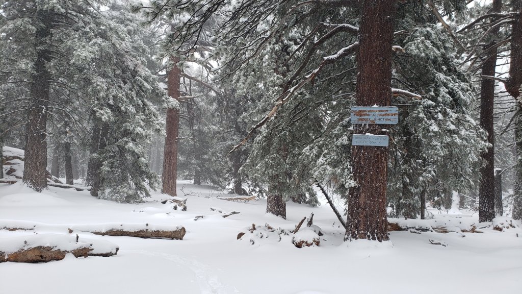
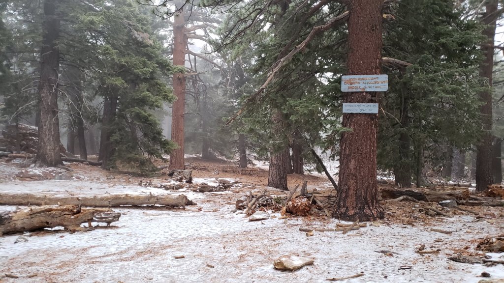
Devil’s Slide Trail is functionally clear of snow below 7600 ft, about two miles up, and then snow cover is about 60% up to Saddle Junction but becoming almost continuous within 0.2 mile of the junction. Spikes are recommended.
The 0.4 mile section of South Ridge Trail between Chinquapin Flat/PCT and Tahquitz Peak has a lightly traveled posthole track to follow through the drifted powder. Although not essential in the moderate depth powder, spikes are strongly recommended and many hikers will find them useful especially for descending. Hikers who have an ice axe (and know how to use it) may find it useful in places on this short section of trail. This trail will become significantly more treacherous as it is expected to add freezing rain and/or layers of snow and ice over the next ten days.
For about one mile north of Saddle Junction, snow cover is only a patchy 30% on the sun exposed slope (“Angel’s Glide”) and then averages about 50% on the Wellman Trail, but then icy snow cover is about 95% on the Peak Trail to San Jacinto Peak. However the route is now well-traveled and compacted.
There is a lightly traveled compacted snowshoe track on the East Ridge between Miller Peak and San Jacinto Peak but it does not accurately follow the route of the East Ridge Trail.
There is a compacted, well-traveled track on continuous light icy snow from Long Valley/Tram to Wellman Divide.
Skyline Trail has a good track to follow through very thin and patchy icy snow above about 7200 ft (the Traverse to Grubb’s Notch). Some hikers will find spikes preferable.
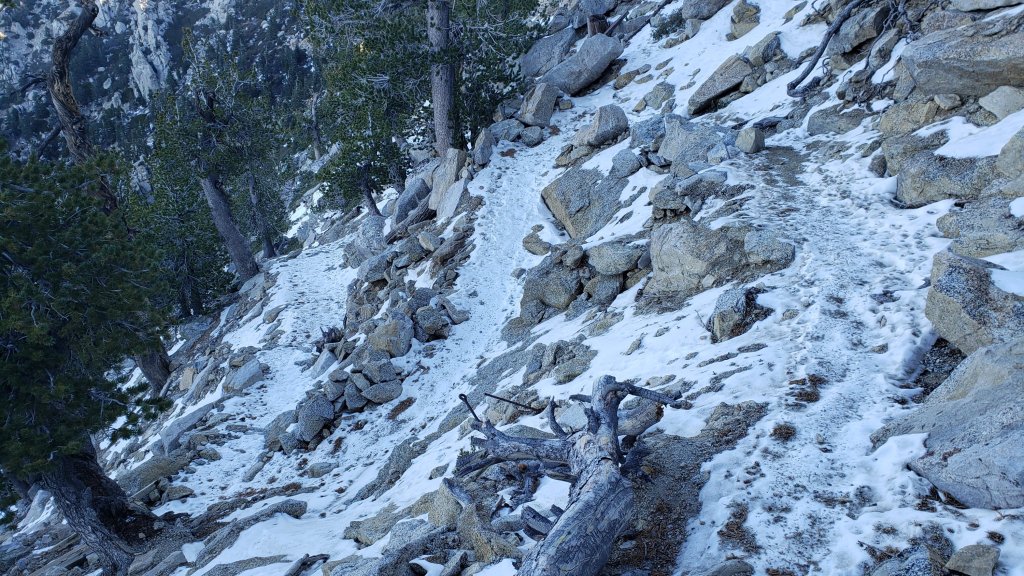
South Ridge Trail [updated 24th December] has about 30% icy snow cover from the top of South Ridge Road to Old Lookout Flat (7600 ft). To Tahquitz Peak snow cover averages about 40%, alternating on the 18 switchbacks between those that are largely clear (south-facing) and those that are largely snow-covered (north-facing). There is a well-traveled track to follow through the very light and patchy 1-3 inches of icy snow. Spikes are not generally required for ascending, but most hikers will find them useful for descending.
Deer Springs Trail [updated 22nd December] has an accurate track to follow all the way to San Jacinto Peak as I broke trail the entire way down to the Suicide Rock Trail junction on 15th December. I was pleased to see that over the weekend some posthole tracks were added on top of my snowshoe track from last week all the way up Deer Springs Trail to San Jacinto Peak. Although my original track accurately followed the trail above Little Round Valley, there are now a fair number of alternate shortcut tracks across this slope, so cautious navigation is advised. The trail is largely clear of snow from Highway 243 to Strawberry Junction, and with about 60% snow cover from there up to 8600 ft.
Marion Mountain Trail [updated 22nd December] has a well-defined but lumpy posthole track throughout. Spikes are recommended, at least for descending. A few cleared patches are developing below 7000 ft.
Seven Pines Trail has not been traveled since the storm in mid December, at least not in its uppermost section, and there is no track to follow through the snow.
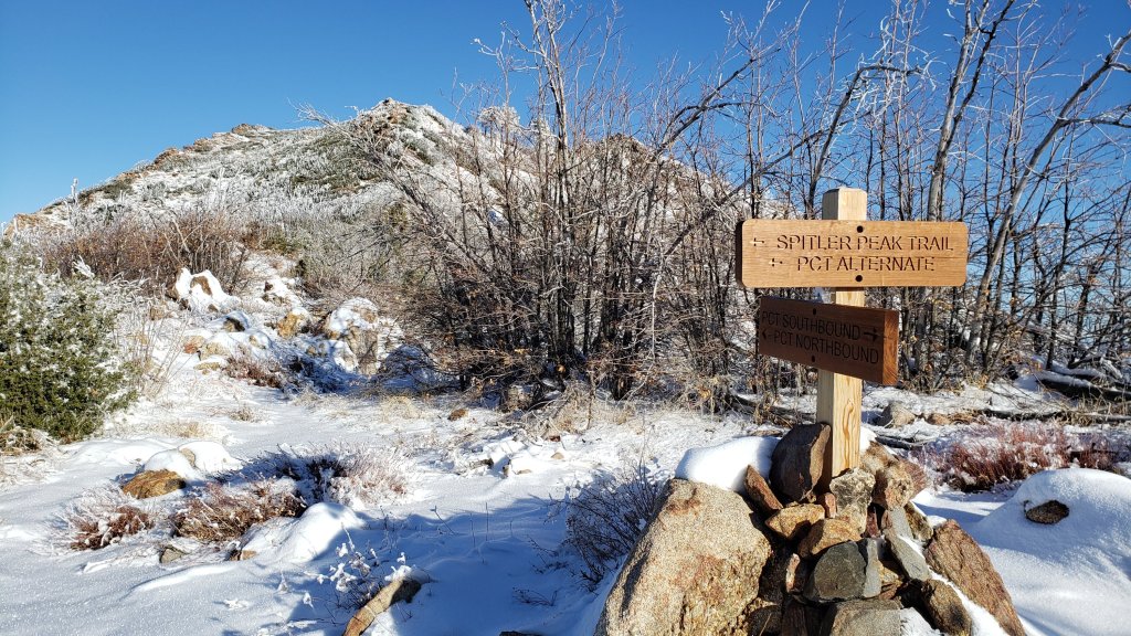
Spitler Peak Trail is now functionally clear of snow. There is a very visible boot track – through light snow in places in its upper switchbacks – to the PCT.
SNOW DEPTHS measured on 22nd-27th December 2022 are as follows. The first number is the current total snow depth, followed in parentheses by the greatest depth of the winter to date following the latest storm on 11th-12th December. Note that average depth is given; due to strong winds accompanying the storm there is extensive drifting, often particularly accumulating in the trails. Conversely in some places scouring by the wind means the depths are well below the average. Altitudes are approximate.
San Jacinto Peak (10810 ft): 6-8 inches (12-14 inches on 12th December)
Little Round Valley (9800 ft): 8 inches (10-12 inches on 12th December)
Wellman Divide (9700 ft): 0-2 inches (7 inches on 12th December)
Annie’s Junction/approx. PCT Mile 181.8 (9070 ft): 2-3 inches (5.5 inches on 12th December)
Marion Mountain Trail at junction with PCT (8700 ft): 3-4 inches (6 inches on 12th December)
Long Valley (8600 ft): 1-2 inches (5-6 inches on 12th December)
Strawberry Junction (8100 ft): 0-1 inches (4 inches on 12th December)
Saddle Junction/approx. PCT Mile 179.9 (8070 ft): 0-1 inch (4 inches on 12th December)
Devil’s Slide trailhead at Humber Park (6550 ft): 0 inch (3.5 inches on 12th December)
Idyllwild (at 5550 ft): 0 inch (3.0 inches on 12th December).
Thank you for taking the time to read this. While all time and labor is volunteered, the San Jacinto Trail Report uses small private donations to cover costs. Every year seems to have its unique challenges and 2022 has been no exception. Your contribution keeps the Report available to all, free from advertising or paywalls, and independent from agencies. If you have found this Report useful, please consider using this link to the Donate page. Zelle, Venmo, and PayPal are all options. Thank you so much for your support.

sanjacjon Uncategorized 2 Comments 10 MinutesEdit”Weather and trail update 27th December 2022″
Snow and trail update 21st December 2022
WEATHER UPDATE 23rd December: forecasts have been shifting dramatically in recent days. Following an unusually warm weekend, multiple “atmospheric river” storms will bring cold, cloudy weather with variable precipitation from Tuesday 27th December well into the first week of January. There is considerable uncertainty regarding timing and precipitation amounts for Southern California. Two or more inches of rain are likely for mid elevations (e.g., Idyllwild) on 27th-30th, with several inches of snow possible above 10,000 ft elevation on various days over the next week or so. High freeze levels may mean rain and/or freezing rain at the highest peaks at times, and icy or mixed snow/ice conditions at all elevations. The next full update will likely be on the afternoon of 25th.
————————————-
Conditions immediately following last week’s snow storm, the second significant Pacific system of winter 2022/23, that impacted the San Jacinto mountains on 11th-12th December were summarized in the previous Report (available here).
A major warming trend will significantly change conditions on the trail system in the next week or two. The week from 21st-26th December may be among the warmest on record for the year-end holiday period. In Idyllwild for several days both overnight low and daytime high temperatures will be more typical of March or even April than of late December. In the high country temperatures will be more like April or May, some 10-20°F above seasonal, before finally cooling (but still remaining above average) in the last couple of days of the year. Most significantly – in terms of snow conditions – daytime temperatures at all elevations will be well above freezing for about a week starting 20th.
Such unseasonably warm temperatures mean that snow melt will be rapid everywhere while in many areas freeze/thaw cycles will result in icy trails in the early mornings above about 7000 ft. By late morning snow conditions will become poor for hiking (soft, slippery, and even slushy) especially in sun-exposed areas.
On Thursday 15th I ascended San Jacinto Peak via the east side (Devil’s Slide, Wellman, and Peak trails) and descended the west side via Deer Springs Trail, while on Monday 19th we hiked to the Peak up and down the east side trails. In the week since the last storm we have surveyed trails around Tahquitz Peak twice, plus South Ridge, Spitler Peak, and Marion Mountain trails, among others.
On 15th I barebooted (i.e. no traction device) to 9000 ft on a lightly traveled and lumpy posthole track through thin icy snow. I snowshoed the rest of the way to San Jacinto Peak through lovely light powder. I descended via Deer Springs Trail, breaking trail snowshoeing through virgin powder all the way down to the Suicide Rock Trail junction.
On 19th the cold icy early morning snow had good bite for grippy boots and I barebooted all the way to San Jacinto Peak. I was surprised to find that no one had made it through on the Wellman Trail over the weekend, so I postholed somewhat over my snowshoe tracks from 15th until Wellman Divide. From there the Peak Trail was easy going, having been well-traveled by hikers coming up the Tram. I put on my Kahtoola microspikes to descend from the Peak, ultimately leaving them on most of the way down Devil’s Slide Trail.
Although good tracks are now in place for most major trails (details below), cautious navigation is recommended everywhere.
Snow depths measured at various locations on the trail system are given at the foot of this posting. Note however that snow depth itself is rarely indicative of the difficulty (or otherwise) of hiking a particular trail. Very shallow snow is often icy and potentially perilous, while deeper powder can actually be much safer, albeit slow-going for most hikers.
Spikes are currently recommended throughout the trail system above about 6500 ft. They are not however required, depending upon your comfort level hiking on shallow variable snow, potentially mixed with slushy and/or icy patches (depending upon time of day). Spikes will likely become increasingly useful over the next few days and weeks as established trails become consolidated by hiker traffic and undergo freeze-thaw cycles. They tend to be especially useful for descending trails.
Snowshoes are no longer required on the established trail system, which is now too compacted for snowshoes. However they will remain very valuable for off-trail travel at elevations above about 9000 ft (potentially lower in places) for the next week or two at least.
Note that temperatures fluctuating either side of freezing are forecast for mid to upper elevations (at least >6000 ft) for the foreseeable future. Melting of snow on sun-exposed slopes and freeze-thaw cycles will combine to change trail conditions and potentially the preferred equipment for the terrain. The advice above should be used with this in mind, and if in any doubt carry the necessary traction devices that you will be most comfortable using.
Despite warmer temperatures on some days, hikers should be prepared for temperatures near freezing in the high country, and generally below freezing when considering wind chill effects (see below for my recent weather observations from San Jacinto Peak).
Currently the USFS gate at Humber Park remains closed. Even when the gate is closed there are nine legal parking spaces this side of the locked gate (near the upper Ernie Maxwell trailhead). Vehicles not parked in these spaces may be ticketed and/or towed. If there are “Road Closed” signs further down – as was often the case last winter especially at weekends and holiday periods – then those nine spaces are also unavailable for legal parking.
South Ridge Road (5S11) is also currently closed to vehicle traffic.
Dark Canyon Road (4S02, the access to Seven Pines Trail) and Santa Rosa Truck Trail (7S02) closed to vehicle traffic for the season on 7th November 2022. Black Mountain Road also closed on 7th November to vehicle traffic at the gate 1.7 miles up from Highway 243. Forest Service campgrounds at Boulder Basin, Marion Mountain, and Fern Basin, and the State Park campground at Stone Creek, are closed for the season.

WEATHER
The forecast for the last ten days of December differs radically from what was predicted just a week ago, and a major warming trend is expected rather than another cold Pacific storm. Indeed the final third of December may be one of the warmest on record for the holiday period. Temperatures will climb steadily this week and be well above seasonal for at least 21st-28th December. In Idyllwild both overnight low and daytime high temperatures will be more typical of late March or even April than of late December. In the high country temperatures will be 10-20°F above seasonal and, more significantly regarding snow/ice conditions, well above freezing for at least a week.
Despite the relatively weak sun at this time of year, such warm temperatures mean that snow melt may be unusually rapid (for December) at all elevations, snow conditions will generally be poor for hiking (soft, slippery, and even slushy), while in many areas conditions will be ideal for freeze/thaw cycles and hence icy trails in the early mornings above about 7000 ft.
There is precipitation forecast from Wednesday 28th into the first week of 2023. Light or moderate rain is currently forecast daily at mid elevations (possibly totaling one inch in Idyllwild), with an uncertain possibility of light snow in the high country (<3 inches above 10,000 ft elevation).
At San Jacinto Peak (10,810ft/3295m) on Monday 19th December 2022 at 0920 the air temperature was 31.3°F (0°C), with a windchill temperature of 20.7°F (-6°C), 9% relative humidity, and a light WNW wind sustained at 5 mph gusting to 9.9 mph.
At the Peak on Thursday 15th December 2022 at 0715 the air temperature was 28.0°F (-2°C), with a windchill temperature of 13.9°F (-10°C), 52% relative humidity, and a chilly WNW wind sustained at 9 mph gusting to 14.5 mph.
At the Peak on Monday 12th December 2022 at 0715 the air temperature was 9.7°F (-12°C), with a windchill temperature of -13.4°F (-25°C), 100% relative humidity, and a sharp WSW wind sustained at 12 mph gusting to 21.2 mph.

TRAIL CONDITIONS
All trails above about 6500 ft remain lightly (or above 9000 ft, moderately) snow-covered. However, relatively well-traveled tracks are now in place for most major trails (details below).
The Ernie Maxwell Scenic Trail has a well-traveled track to follow throughout its length, snow cover is about 80%.
Devil’s Slide Trail has an excellent compacted track to follow to Saddle Junction. Snow cover is only 50% below 6700 ft, about 95% up to 7200 ft, and continuous thereafter. However it is thinning rapidly everywhere, and will look radically different in a week or so.
Early on the morning of Saturday 17th I broke trail back-and-forth across the 0.4 mile section of South Ridge Trail between Chinquapin Flat/PCT and Tahquitz Peak which now has a lightly traveled posthole track to follow through the drifted powder. The average snow depth in this area is only about five inches, but on this slope it is heavily drifted in places at 10-12 inches. Although not essential in the moderate depth powder, spikes are strongly recommended and many hikers will find them useful especially for descending. Hikers who have an ice axe (and know how to use it) may find it useful in places on this short section of trail. This trail will become significantly more treacherous as it undergoes freeze/thaw cycles and compaction over the next week or two.
Immediately north of Saddle Junction, snow cover is starting to become somewhat patchy on the sun exposed slope (“Angel’s Glide”) but icy snow cover is continuous through the Wellman and Peak trails to San Jacinto Peak. However the route is now largely well-traveled and compacted.
There is a compacted, well-traveled track on continuous light icy snow from Long Valley/Tram to Wellman Divide.
Skyline Trail has a good track to follow through light icy snow above about 7200 ft (the Traverse to Grubb’s Notch). Spikes are recommended.
South Ridge Trail from the top of South Ridge Road to Tahquitz Peak has a well-traveled track to follow through the very light and patchy 1-3 inches of icy snow. Spikes are not required for ascending, but some hikers will find them useful for descending.
Deer Springs Trail [updated 22nd December] has an accurate track to follow all the way to San Jacinto Peak as I broke trail the entire way down to the Suicide Rock Trail junction on 15th December. I was pleased to see that over the weekend some posthole tracks were added on top of my snowshoe track from last week all the way up Deer Springs Trail to San Jacinto Peak. Although my original track accurately followed the trail above Little Round Valley, there are now a fair number of alternate shortcut tracks across this slope, so cautious navigation is advised. There is a very well-traveled track on the lowest section of Deer Springs Trail continuing out to Suicide Rock.
Marion Mountain Trail [updated 22nd December] has a well-defined but lumpy posthole track throughout. Snow cover remains virtually continuous, but a few small patches are clearing below 7000 ft. Spikes are strongly recommended, at least for descending.
Seven Pines Trail has not been traveled since last week’s storm, at least not in its uppermost section, and there is no track to follow through the snow.
Spitler Peak Trail has a very visible boot track – through light snow in its upper switchbacks – to the PCT.
SNOW DEPTHS measured on 19th December (east side) or 15th December (west side) 2022 are as follows. The first number is the current total snow depth, followed in parentheses by the greatest depth of the winter to date following the latest storm on 11th-12th December. Note that average depth is given; due to strong winds accompanying the storm there is extensive drifting, often particularly accumulating in the trails. Conversely in some places scouring by the wind means the depths are well below the average. Altitudes are approximate.
San Jacinto Peak (10810 ft): 10-12 inches (12-14 inches on 12th December)
Little Round Valley (9800 ft): 9 inches (10-12 inches on 12th December)
Wellman Divide (9700 ft): 2-4 inches (7 inches on 12th December)
Annie’s Junction/approx. PCT Mile 181.8 (9070 ft): 4-5 inches (5.5 inches on 12th December)
Marion Mountain Trail at junction with PCT (8700 ft): 4-6 inches (6 inches on 12th December)
Long Valley (8600 ft): 3-4 inches (5-6 inches on 12th December)
Strawberry Junction (8100 ft): 3 inches (4 inches on 12th December)
Saddle Junction/approx. PCT Mile 179.9 (8070 ft): 3 inches (4 inches on 12th December)
Devil’s Slide Trail at Humber Park (6550 ft): 0-1 inches (3.5 inches on 12th December)
Idyllwild (at 5550 ft): 0 inch (3.0 inches on 12th December).


Thank you for taking the time to read this. While all time and labor is volunteered, the San Jacinto Trail Report uses small private donations to cover costs. Every year seems to have its unique challenges and 2022 has been no exception. Your contribution keeps the Report available to all, free from advertising or paywalls, and independent from agencies. If you have found this Report useful, please consider using this link to the Donate page. Zelle, Venmo, and PayPal are all options. Thank you so much for your support.


sanjacjon Uncategorized Leave a comment 9 MinutesEdit”Snow and trail update 21st December 2022″
Moderate snow storm 11th-12th December 2022
UPDATE Saturday 17th December 2022: Early this morning we hiked South Ridge Trail to Tahquitz Peak, and I broke trail from Tahquitz Peak to and from Chinquapin Flat through moderate snow. No tracks had made it as far as Chinquapin from Saddle Junction at that time. Trail conditions are updated below.
UPDATE Thursday 15th December 2022: Early this morning I hiked to San Jacinto Peak from Humber via Devil’s Slide, Wellman and Peak trails. I barebooted to 9000 ft, then snowshoed the rest of the way through lovely light powder. I descended via Deer Springs Trail, breaking trail through virgin powder all the way down to the Suicide Rock Trail junction. Most major trails now have a track through the snow to follow, details have been updated below.
UPDATE Wednesday 14th December 2022: Early this morning Anabel and I broke trail up Spitler Peak Trail to the PCT. There was thin patchy snow at the trailhead (4900 ft) and then it was largely continuous above 5800 ft. Most of the upper half of the trail had 3-4 inches of lovely fluffy powder. I was very happy to find no new treefall hazards down on Spitler Peak Trail. The lower half of the trail should be largely clear of snow by the weekend.
UPDATE Tuesday 13th December 2022: This morning Anabel and I broke trail up South Ridge Road and South Ridge Trail to Old Lookout Flat (7600 ft). Note that South Ridge Road (5S11) is closed to vehicle traffic. I measured an average of about four inches of snow at Old Lookout Flat, although with some deeper drifts in the trail.
————————————
This is a summary of conditions following the second significant Pacific storm of winter 2022/23 to impact the San Jacinto mountains. The “atmospheric river” of moisture from lower latitudes was weaker than the storm in early November, although snowfall was ultimately slightly greater in this storm than in November, perhaps in part due to the colder temperatures. The system averaged colder than the November storm, with more snow at lower elevations, although it was still notable that it initially rained as high as 9500 ft on the morning of Sunday 11th. There was a dusting of snow in Garner Valley (4300 ft).
The total snow accumulation was ultimately very close to that forecast in the days immediately prior to the storm. The rainfall totals at mid elevations were unremarkable, especially compared to those of the storm in early November (discussed here). As forecast, the storm came in two main waves, with the bulk of the precipitation falling for most of the daylight hours of Sunday 11th, followed by a remarkably calm and clear night, and then a much less intense period of snowfall between about 0800-1300 on Monday 12th.
For example, San Jacinto Peak received about 9 inches of fresh powder (on top of about 2-4 patchy inches of icy snow remaining from November) on Sunday 11th, with an additional inch falling on Monday 12th. In Idyllwild (data from 5550 ft) there was 1.14 inches of rain on Sunday 11th which turned to snow that afternoon, settling to 0.5 inch. On the morning of Monday 12th a further 2.5 inches of snow settled in Idyllwild.
I recorded a short video at San Jacinto Peak early on the morning of Monday 12th December (available here) which gives a feel for conditions as the storm was nearing its end.
As of the afternoon of Monday 12th, the only tracks that I saw and that are known to be in place are my snowshoe track between Humber Park and San Jacinto Peak (using Devil’s Slide, Wellman, and Peak trails), and the track of Kyle Eubanks from the previous evening between Long Valley and the Peak via Wellman Divide (which remained surprisingly visible in places about 15-20 hours later, showing how calm the winds were overnight).
Although snow depths are not generally sufficient to obscure the routes of the major trails, cautious navigation is recommended everywhere for the next few days in particular until tracks through the snow are in place.
Details of snow depths measured at various locations on the trail system are given at the foot of this posting. Note however that snow depth itself is rarely indicative of the difficulty (or otherwise) of hiking a particular trail.
Some general comments on snow/ice conditions. Time of day, temperature, and sun exposure all have significant impacts on the nature of the snow, in turn changing the conditions underfoot, and hence both the hiking difficulty and the preferred traction device (if any). These impacts are especially striking in Southern California mountains, where the sun is relatively potent even in midwinter and where even on the coldest days temperatures at mid elevations may fluctuate either side of freezing. A rapidly warming montane climate, with changes especially striking at high elevation, is exacerbating all of these issues.
Currently the snow is relatively powdery and benign; this will steadily change over the next few days and weeks. Note that temperatures fluctuating either side of freezing are forecast for both mid and upper elevations for the foreseeable future. Steady melting of snow, especially on sun-exposed slopes, and freeze-thaw cycles will combine to change trail conditions and potentially the preferred equipment for the terrain.
Snow depths are currently suitable for snowshoeing everywhere above about 8000 ft, possibly lower in places. However they are not required, depending on your comfort level with postholing in drifted snow of moderate depth. With compaction of the trails over the next few days, snowshoes will become less useful on-trail, however they will remain valuable for off-trail travel at the highest elevations for the foreseeable future.
Spikes are currently useful throughout the trail system above about 5000 ft, potentially lower in places. They are not however required, depending upon your comfort level hiking on shallow variable snow, mixed with slushy and icy patches. Spikes will likely become increasingly useful over the next few days and weeks as established trails become consolidated by hiker traffic and undergo freeze-thaw cycles. They tend to be especially useful for descending.
For the foreseeable future hikers should be prepared for temperatures below freezing in the high country, and well below freezing when considering wind chill effects (see below for my recent weather observations from San Jacinto Peak).
Currently the USFS gate at Humber Park is closed. This may change after the weekend. When plowed Humber will remain very icy for the next few days at least. Even when the gate is closed there are nine legal parking spaces this side of the locked gate (near the upper Ernie Maxwell trailhead). Vehicles not parked in these spaces may be ticketed and/or towed. If there are “Road Closed” signs further down – as was often the case last winter – then those nine spaces are also unavailable for legal parking.
South Ridge Road (5S11) is currently closed to vehicle traffic but is rapidly clearing [checked Saturday 17th] of snow.
Dark Canyon Road (4S02, the access to Seven Pines Trail) and Santa Rosa Truck Trail (7S02) closed to vehicle traffic for the season on 7th November 2022. Black Mountain Road also closed on 7th November to vehicle traffic at the gate 1.7 miles up from Highway 243. Forest Service campgrounds at Boulder Basin, Marion Mountain, and Fern Basin are closed for the season. The State Park Stone Creek campground is also closed.

WEATHER
Temperatures are forecast to remain near or below seasonal averages for at least the next week, with freezing conditions every night above about 4000 ft elevation. Most days will be at least partly cloudy. Combined with a weak sun at this time of year, snow melt will generally be very slow at upper elevations, and conditions will be ideal for freeze/thaw cycles and hence icy trails. The significant Pacific storm of the winter that had been forecast over an extended period between about 16th-21st December is no longer thought likely to impact the San Jacinto mountains, although considerable uncertainty persists in the weather models for that period.
At San Jacinto Peak (10,810ft/3295m) on Thursday 15th December 2022 at 0715 the air temperature was 28.0°F (-2°C), with a windchill temperature of 13.9°F (-10°C), 52% relative humidity, and a chilly WNW wind sustained at 9 mph gusting to 14.5 mph.
At the Peak on Monday 12th December 2022 at 0715 the air temperature was 9.7°F (-12°C), with a windchill temperature of -13.4°F (-25°C), 100% relative humidity, and a sharp WSW wind sustained at 12 mph gusting to 21.2 mph.
At the Peak on Thursday 8th December 2022 at 0900 the air temperature was 28.4°F (-2°C), with a windchill temperature of 12.7°F (-11°C), 11% relative humidity, and a fresh SW wind sustained at 7 mph gusting to 9.3 mph.
TRAIL CONDITIONS
All trails above about 5500 ft are currently lightly (or above 8500 ft, moderately) snow-covered. Underlying the fresh snow is – in places – a thin layer of ice and/or icy snow remaining from the previous storm in early November. This will make trail conditions more complicated, and if in any doubt whatsoever carry and use traction devices accordingly (see discussion in introduction above).
Devil’s Slide Trail has an excellent compacted track to follow to Saddle Junction.
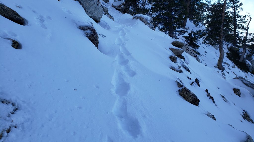
Early on the morning of Saturday 17th I broke trail back-and-forth across the 0.4 mile section of South Ridge Trail between Chinquapin Flat/PCT and Tahquitz Peak which now has a lightly traveled posthole track to follow through the drifted powder (photo below). The average snow depth in this area is only about five inches, but on this slope it is heavily drifted in places at 10-12 inches. Although not essential in the moderate depth powder, spikes are strongly recommended and many hikers will find them useful especially for descending. Hikers who have an ice axe (and know how to use it) may find it useful in places on this short section of trail. This trail will become significantly more treacherous as it undergoes freeze/thaw cycles and compaction over the next week or two.
There is evidence of a relatively well-traveled track south from Saddle Junction on the PCT, but as of the morning of Saturday 17th this track did not make it through to Chinquapin Flat.
There is an excellent snowshoe track to follow on the Wellman Trail and the Peak Trail up to San Jacinto Peak.
There is a relatively well-traveled track on the Round Valley Trail from Long Valley through to Wellman Divide.
Deer Springs Trail [updated 15th December] now has an accurate snowshoe track to follow all the way to San Jacinto Peak as I broke trail the entire way down to the Suicide Rock Trail junction on the afternoon of 15th. Unusually for me, I followed the entire route of the established trail down to Little Round Valley. There is a well-traveled track on the lowest section of Deer Springs Trail continuing out to Suicide Rock.
Marion Mountain Trail [updated 15th] has a mix of snowshoe and posthole tracks all the way up to its junction with Deer Springs Trail.
The Ernie Maxwell Scenic Trail has a well-traveled track to follow throughout, snow cover is 90%.
South Ridge Trail [hiked 13th and 17th December] has a well-traveled posthole track through shallow snow as far as Tahquitz Peak. Spikes are not essential but will be useful for most hikers, especially for descending. Melting has already reduced the snow cover to 90% as far as Old Lookout Flat (7600 ft).
Spitler Peak Trail has a very visible boot track through light snow to the PCT.
Seven Pines Trail has no sign of any hiker traffic since the snow on 12th.
SNOW DEPTHS measured on 12th November 2022 are as follows (measured on 15th for Deer Springs Trail locations). The first number is the current total snow depth, followed in parentheses by the storm total for this latest storm 11th-12th December. Note that average depth is given; due to strong winds accompanying the storm there is extensive drifting, often particularly accumulating in the trails. Conversely in some places scouring by the wind means the depths are well below the average. Altitudes are approximate.
San Jacinto Peak (10810 ft): 12-14 inches (storm total 10 inches)
Little Round Valley (9800 ft): 10-12 inches (storm total 7 inches)
Wellman Divide (9700 ft): 7 inches (storm total 6 inches)
Round Valley (9100 ft): 6 inches (storm total 5 inches) [thanks to Kyle Eubanks for this measurement]
Annie’s Junction/approx. PCT Mile 181.8 (9070 ft): 5.5 inches (storm total 5 inches)
Marion Mountain Trail at junction with PCT (8700 ft): 6 inches (storm total 5 inches)
Long Valley (8600 ft): 5-6 inches (storm total 5 inches) [thanks to Kyle Eubanks for this measurement]
Strawberry Junction (8100 ft): 3-4 inches (storm total 3-4 inches)
Saddle Junction/approx. PCT Mile 179.9 (8070 ft): 4 inches (storm total 3.5 inches)
Devil’s Slide Trail at Humber Park (6550 ft): 3.5 inches (storm total 3.5 inches)
Idyllwild (at 5550 ft): 3.0 inches (storm total 3.0 inches).
While all time and labor is volunteered, the San Jacinto Trail Report uses small private donations to cover costs. Every year seems to have its unique challenges and 2022 has been no exception. Your contribution keeps the Report available to all, free from advertising or paywalls, and independent from agencies. If you have found this Report useful, please consider using this link to the Donate page. Zelle, Venmo, and PayPal are all now options. Thank you so much for your support.
sanjacjon Uncategorized Leave a comment 10 MinutesEdit”Moderate snow storm 11th-12th December 2022″
Storm updates 11th-12th December 2022
The second significant Pacific storm of winter 2022/23 is currently impacting the San Jacinto mountains. This storm is expected to have two periods of precipitation, one each on 11th and 12th. Please check this page for periodic updates throughout the storm (the most recent is at the top).
UPDATE on Monday 12th at 0810
A short video giving a feel for current snow conditions at San Jacinto Peak is available here on YouTube.
No fresh snow fell overnight, with storm totals of about nine inches at San Jacinto Peak and 0.5 inch in Idyllwild unchanged. That said, it has just started gently snowing in both locations, so storm totals may increase slightly over the next couple of hours.
UPDATE on Sunday 11th at 1930
It has stopped snowing both in Idyllwild (current storm total 0.75 inch snow plus 1.14 inches of rain) and at San Jacinto Peak (9 inches snow).
Many thanks to Kyle Eubanks who I chatted with at the Peak this afternoon. He has just reported storm snow totals of 5-6 inches at Wellman Divide (9700 ft) and four inches in both Round and Long valleys from his descending hike.
UPDATE on Sunday 11th at 1645
In Idyllwild at 5550 ft, rainfall storm total today is 1.14 inches. It turned to occasional light snow showers at about 1430, with just 0.5 inch settled so far.
Moderate snow has continued for the past few hours at San Jacinto Peak, with a storm total so far of about 7.5 inches. The high winds forecast did not materialize, although gusts up to 35 mph have been enough to cause very heavy drifting.
Fresh snowfall in Long Valley is now at about four inches.
UPDATE on Sunday 11th at 1330
Precipitation has been steady at mid and upper elevations for the past few hours. Fresh snow at San Jacinto Peak now measures 3-4 inches, snow in Long Valley (8600 ft) at three inches, and rainfall in Idyllwild since 0700 this morning at 0.6 inch.
Dutch Flat, at about 5600 ft elevation between Idyllwild and Pine Cove, recorded 0.86 inch of rain by 1300.
UPDATE on Sunday 11th at 1050
Very light precipitation well before first light this morning included a dusting of snow above 6000 ft, <0.25 inch below 8000 ft and about 0.25 inch above that elevation, plus 0.03 inch of drizzle in Idyllwild.
On my hike up to San Jacinto Peak late this morning there was a little drizzle on most of Devil’s Slide Trail, then an on/off mix of drizzle, freezing rain,, and fine snow in the high country.
Currently there is about 1.5 inches of fresh snow at San Jacinto Peak, on top of the very patchy and icy 2-4 inches remaining from early November. However the fresh powder is very fine and drifting heavily in the strong SW wind, and I had 2-3 inches in places in the upper Peak Trail.
In Idyllwild (at 5550 ft) additional light rain this morning has added up to 0.1 inch. The rain has becoming heavier in the past hour or so. It remains well above freezing there, currently at 41°F.
Long Valley (8600 ft) has received about 1.0 inch fresh snow this morning.

While all time and labor is volunteered, the San Jacinto Trail Report uses small private donations to cover costs. Every year seems to have its challenges and 2022 has been no exception. Your contribution keeps the Report available to all, free from advertising or paywalls, and independent from agencies. If you have found this Report useful, please consider using this link to the Donate page. Zelle, Venmo, and PayPal are all options. Thank you so much for your support.
sanjacjon Uncategorized Leave a comment 2 MinutesEdit”Storm updates 11th-12th December 2022″
Trail update 7th December 2022
Two moderate snow storms in the next ten days or so are expected to have a major combined impact on the San Jacinto mountains. The first on Sunday 11th-Monday 12th may initially produce up to 1.5 inch of rain at the elevation of Idyllwild, transitioning to 2-4 inches of snow on Sunday night into Monday, while 10-12 inches of snow are forecast for the high country. There is disagreement between the forecast models where the freeze level will be for most of Sunday 11th which may alter the potential snowfall amounts (versus rainfall) at mid elevations. A less intense but slow moving multi-storm system is forecast for Friday 16th-Wednesday 21st. Forecasts range widely from 6-22 inches of snow for the highest elevations across multiple days, with a mix of rain and several inches of snow at mid elevations.
——————————
Potentially stormy weather forecast for four periods in the past ten days all failed to significantly impact the San Jacinto mountains. Cold clouds in the high country produced thick rime on the trees above about 10,200 ft elevation on 1st December (photo from 2nd below) but otherwise no meaningful precipitation. On the afternoon of Monday 6th I was treated to moody clouds and virga, a cloud base just above my head at San Jacinto Peak, and the briefest possible flurry of small snow flakes while at the Peak (but nothing settled).
As mentioned last week, current trail conditions are oddly reminiscent of spring, with snow distribution and iciness typical of April rather than December. That said, temperatures in the high country are much more typical of December than April! Snow from the moderate storm on 8th-9th November (discussed here) continues to melt slowly.
We survey the trail system daily, with hikes via different routes to San Jacinto Peak several times per week, Tahquitz Peak and vicinity at least weekly, and many other trails on other days. On 2nd, 5th, and 6th we barebooted to San Jacinto Peak on well-traveled and compacted tracks through increasingly patchy light icy snow. Monday 5th was the first day since the snow storm in early November that I did not use spikes for descending, as the icy snow in the high country was crisp and grippy in cold, cloudy conditions. Conversely on the afternoon of Tuesday 6th the ice was distinctly more watery, and I wore spikes from San Jacinto Peak down to Wellman Divide (9700 ft). In general most hikers will likely prefer to use spikes at least for descending down to about 10,000 ft (or lower).
Trails remain icy due to daily freeze/thaw cycles and compaction from hiker traffic, and spikes are useful throughout the trail system above about 9000 ft (lower in places). Spikes tend to be most valuable for descending even when not needed for ascending. Given cold temperatures for the foreseeable future, melting is expected to slow (or largely stop in the high country). Snowshoes are not required anywhere, as recent experience has shown that off-trail snow is now too shallow and/or patchy for snowshoes.
Hikers should be prepared for temperatures generally below freezing in the high country, and well below freezing when considering wind chill effects (see below for my recent weather observations from San Jacinto Peak).
Snow depths measured at various locations on the trail system are given at the foot of this posting. Note however that snow depth is rarely indicative of the ease (or otherwise) of hiking a given trail. Although excellent tracks are now in place and clearly visible for almost all major trails cautious navigation remains recommended.
Dark Canyon Road (4S02, the access to Seven Pines Trail) and Santa Rosa Truck Trail (7S02) closed to vehicle traffic for the season on 7th November 2022. Black Mountain Road also closed on 7th November to vehicle traffic at the gate 1.7 miles up from Highway 243. Forest Service campgrounds at Boulder Basin, Marion Mountain, and Fern Basin are closed for the season. Stone Creek campground had also closed, then reopened for Thanksgiving weekend.
WEATHER
A classic La Nina pattern – cool but relatively dry – is in place for the third winter in a row. Temperatures will be below seasonal for December for at least the next week, with many days cloudy or at least partly cloudy. Forecasts are increasingly confident of a moderate storm on Sunday 11th, with up to 1.5 inch of rain at the elevation of Idyllwild, turning into 1-3 inches of light snow on Sunday night, while 8-14 inches of snow are forecast for the high country.
At San Jacinto Peak (10,810ft/3295m) on Tuesday 6th December 2022 at 1530 the air temperature was 19.9°F (-7°C), with a windchill temperature of 3.8°F (-16°C), 18% relative humidity, and a sharp due West wind sustained at 7 mph gusting to 13.2 mph.
At the on Monday 5th December 2022 at 0840 the air temperature was 24.1°F (-4°C), with a windchill temperature of 2.8°F (-16°C), 20% relative humidity, and a bitter WSW wind sustained at 18 mph gusting to 33.0 mph.
At the Peak on Friday 2nd December 2022 at 1620 the air temperature was 26.2°F (-3°C), with a windchill temperature of 11.8°F (-11°C), 55% relative humidity, and a fresh WSW wind sustained at 8 mph gusting to 15.4 mph.

TRAIL CONDITIONS
Trails above about 8500 ft currently remain lightly covered with patchy icy snow (more continuous above about 9000 ft on the west side, 9900 ft on the east). However excellent well-traveled and compacted tracks are now in place for almost all major trails (details below).
Hikers will encounter new treefall hazards due to the enormous weight of ice from freezing rain associated with the early November storm, followed by recent Santa Ana winds, and since the passage of Tropical Storm Kay in September. New treefall hazards on major trails have been reported to relevant agencies, and those on Spitler Peak Trail have already been cleared by the Trail Report.
The Ernie Maxwell Trail is clear of snow. One major treefall hazard is across the trail almost exactly midway between the trailheads at Humber Park and Tahquitz View Drive.
Devil’s Slide Trail is functionally clear of icy snow to Saddle Junction. A few minor patches exist close to the top. Spikes are generally not required.
There is a very well-traveled track through increasingly patchy thin icy snow from Saddle Junction to Tahquitz Peak. The 0.4 mile section of South Ridge Trail between Chinquapin Flat/PCT and Tahquitz Peak has a well-traveled and level track to follow through the slowly melting inch of patchy icy snow (photo below from 30th November). Although not required, some hikers will find spikes useful especially for descending.
The Wellman Trail from Annie’s Junction to Wellman Divide has about 20% icy snow cover. Some hikers will find spikes are useful at least for descending.
The Peak Trail still has about 90% cover of icy snow to San Jacinto Peak. Spikes can be useful for descending in particular. Early on cold mornings, the icy snow is grippy, and I did not find spikes necessary on 5th.
The East Ridge Trail (from near Miller Peak to San Jacinto Peak) has a handful of tracks through the continuous snow, though none (including mine) accurately follow the trail route. Snow on this east slope is drifted, and remains 3-8 inches deep in places.
There is a well-traveled track on light icy snow from Long Valley/Tram to Wellman Divide. Skyline Trail is now largely clear, but has very limited patchy, thin, icy snow above about 7200 ft (the Traverse to Grubb’s Notch). Spikes will not be required by most hikers, depending upon comfort level hiking on patchy angled icy snow.
South Ridge Trail is now functionally clear of snow to Tahquitz Peak with only 1-2% icy snow cover overall. Some hikers may continue to find spikes useful for some of the minor icy patches but they are no longer required. South Ridge Road is clear of ice and snow.
Marion Mountain Trail (surveyed at least weekly in past month) now has only about 20% icy snow cover, largely in the central section between about 7400-8200 ft elevation which is less sun-exposed. Many hikers will nevertheless find spikes useful in places, especially for descending.
Deer Springs Trail (surveyed 8th December) is functionally clear of ice to Strawberry Junction (8100 ft). Snow cover is a patchy 20% from Strawberry Junction north for about 1.5 mile (roughly 8600 ft). From the top of Marion Mountain Trail icy snow cover is about 90% to Little Round Valley, although there are a few lengthy clear areas on sun-exposed sections. Snow cover remains >95% through Little Round Valley up to San Jacinto Peak. Above Little Round Valley there are multiple tracks through the snow ascending toward San Jacinto Peak, none of which entirely accurately follow the established trail. The trail is clearest above immediately above LRV and again close to the Peak junction. Spikes are recommended at least for descending upper Deer Springs Trail.
Spitler Peak Trail (last surveyed 18th November) is clear of snow. Given the importance of this trail for the safety of northbound PCT hikers in particular, it is one of several trails “adopted” by the Trail Report. We removed nine treefall hazards on 18th November and the trail is now completely clear again, bringing to 56 the number of trees we have removed from this trail since mid 2021.
Willow Creek Trail remains a relatively slow, messy hike for a couple of miles. Some 37 trees are down on the Forest Service section of this trail between Skunk Cabbage Junction and the State Park boundary (23rd September 2022 survey). Of those, 27 are in the 0.6 mile section between Willow Creek crossing and the State Park boundary. A few trees were cut by chainsaw at the far (Hidden Divide) end of the Forest Service section recently, presumably by a CCC or State Park crew. The State Park cut about a dozen trees on the section of trail under their jurisdiction in late July. Another tree came down near the start of this trail close to Saddle Junction in Tropical Storm Kay.
Although some treefall hazards from Red Tahquitz to Antsell Rock (PCT Miles 172.5-175) were cleared in June 2021 prior to the rockslide removal work, the situation has badly deteriorated since. In my most recent survey there were at least 82 treefall hazards between PCT Miles 170-175 including 20+ major ones, and about six more on PCT Miles 175-177. PCTA is aware of the situation, and is hoping to start addressing it soon (weather permitting).
On Fuller Ridge Trail there are five major treefall hazards obstructing the trail in the 1.5 mile section nearest to the campground (PCT Miles 189-190.5). Although most of the downed trees reported this summer were cleared in July, four more major trees came down in Tropical Storm Kay in September.
The Caramba Trail from near Reeds Meadow through Laws Camp and on to Caramba, and the Cedar Trail from Willow Creek Trail to Laws, are described by the Forest Service as “not maintained”. This is frankly grossly misleading and in reality both trails no longer exist and are so completely overgrown I strongly advise hikers do not attempt to follow them. An informal use trail to Laws is much more direct and avoids all of the very challenging bushwhacking of the former trails (local hikers Charles Phelan and Mark Gumprecht kindly nicknamed it the “King Trail” when I established the route in 2019). It leaves the Willow Creek Trail exactly 1.0 mile from Saddle Junction (0.46 mile from the Skunk Cabbage turning), descending largely on established deer trails for 1.2 miles, meeting Willow Creek just upstream from the old Laws Camp. From Laws east to Caramba the route of the original Caramba Trail has been well-cairned by myself and others and can largely be followed with very careful route-finding. My 2022 survey counted 97 trees down on this 2.1 miles of trail. It is especially obscure 0.1-0.3 mile east of the Willow Creek crossing, becoming more obvious near Caramba. Very cautious navigation is advised throughout the area.
Seven Pines Trail has one set of hiker tracks through the snow since the storm in early November 2022. This trail has had limited hiker traffic since November 2018, largely because Dark Canyon Road has only been open for a few months since the “Great Valentine’s Day flood” of 2019. The Trail Report has “adopted” Seven Pines Trail as a priority for maintenance work as the trail has had a disproportionate number of lost hiker rescues in the past decade. Between November 2021 and May 2022, 61 downed trees were removed and almost the entire trail thoroughly trimmed and cleared. Remarkably Tropical Storm Kay did not add any new treefall hazards to this trail. Nevertheless Seven Pines remains a genuine wilderness trail unlike the relatively wide, bare, and obvious routes of, for example, Devil’s Slide or Marion Mountain trails. Cautious navigation remains required for those who do not have significant experience of hiking this trail.

SNOW DEPTHS measured on 2nd-5th December 2022 are as follows, with depths after the only significant storm of this winter to date (on 9th November) for comparison in parentheses where known. Note that average depth is given; due to strong winds there has been drifting, often particularly accumulating in the trails. Conversely in places scouring by the wind means the depths can be well below the average. Altitudes are approximate.
San Jacinto Peak (10810 ft): 2-4 inches (was 12 inches on 9th November)
Little Round Valley (9800 ft): 2-4 inches (was approx. 10 inches on 9th November)
Wellman Divide (9700 ft): 0-1 inch (was 4 inches on 9th November)
Annie’s Junction/approx. PCT Mile 181.8 (9070 ft): 0-1 inch (was 6 inches on 9th November)
Deer Springs Trail at top of Marion Mountain Trail (8700 ft): 0-1 inch
Tahquitz Peak (north side trail, 8700 ft): 0-1 inch
Tahquitz Peak (south side trail, 8500-8700 ft): 0 inch
Long Valley (8600 ft): 0-1 inch (was 2-3 inches on 9th November)
Strawberry Junction (8100 ft): 0 inch (was approx. 2-3 inches on 9th November)
Saddle Junction/approx. PCT Mile 179.9 (8070 ft): 0-1 inch (was 3 inches on 9th November)
Devil’s Slide Trail at Humber Park (6550 ft): 0 inch (was 2.5 inches on 9th November)
Idyllwild (at 5550 ft): 0 inch (was <1 inch on 9th November)
While all time and labor is volunteered, the San Jacinto Trail Report uses small private donations to cover costs. Every year seems to have unique challenges and 2022 has been no exception. Your contribution keeps the Report available to all, free from advertising or paywalls, and independent from agencies. If you have found this Report useful, please consider using this link to the Donate page. Zelle, Venmo, and PayPal are all options. Thank you so much for your support.


sanjacjon Uncategorized Leave a comment 11 MinutesEdit”Trail update 7th December 2022″
Trail update 30th November 2022
[UPDATE 1st December 2022: the double storm system that looks likely to bring significant precipitation to northern and central California appears to be missing the San Jacinto mountains, despite optimistic forecasts over the previous week. Three periods of cold, cloudy days are now expected over the next ten days, but little if any precipitation.]
The storm expected on 28th November failed to materialize, producing only below average temperatures, wind, and spectacular clouds (photos below). A second forecast storm system may bring some light precipitation to the San Jacinto mountains on 2nd December, and possibly again on 4th-5th.
Current trail conditions are oddly reminiscent of spring, with snow distribution and iciness feeling more typical for April or May than late November. Snow from the moderate storm on 8th-9th November (summarized here) has been melting steadily at mid elevations but more slowly in the high country given the relative weakness of the sun at this time of year.
We have surveyed the high country almost daily, with hikes taking in San Jacinto Peak at least twice per week, Tahquitz Peak area once per week, and a variety of other trails on other days (World Cup viewing permitting of course). On 24th and 28th we barebooted to the Peak on well-traveled and compacted tracks through light icy snow. Both days I put spikes on at the Peak for the descent, on 24th keeping them on until about 8000 ft on Marion Mountain Trail, and on 28th until about 9900 ft on the Peak Trail, roughly one mile north of Wellman Divide.
Trails remain very icy due to daily freeze/thaw cycles and compaction from hiker traffic, so spikes are recommended throughout the trail system above about 8000 ft (lower in places). Spikes are especially valuable for descending even when they are no necessarily needed for ascending. Given colder temperatures for the foreseeable future, melting is expected to slow (or almost stop in the high country) and spikes will remain recommended well into December at least.
Snowshoes are not required anywhere on the established trail system, where snow is now too shallow, icy and compacted. In my recent experience off-trail snow is now also largely too shallow and/or patchy for snowshoes.
Snow depths measured at various locations on the trail system are given at the foot of this posting. Note however that snow depth is rarely indicative of the challenge (or otherwise) of a given trail. Although excellent tracks are now in place for almost all major trails cautious navigation remains recommended.
Hikers should be prepared for temperatures near or below freezing in the high country, and generally well below freezing when considering wind chill effects (see below for my recent weather observations from San Jacinto Peak).
Dark Canyon Road (4S02, the access to Seven Pines Trail) and Santa Rosa Truck Trail (7S02) closed to vehicle traffic for the season on 7th November 2022. Black Mountain Road also closed on 7th November to vehicle traffic at the gate 1.7 miles up from Highway 243. Forest Service campgrounds at Boulder Basin, Marion Mountain, and Fern Basin are closed for the season. Stone Creek campground had also closed, but I saw that it had apparently reopened for Thanksgiving weekend.

WEATHER
Temperatures will be near or generally below seasonal for the next ten days at least. A weather system, possibly in two waves across a broad time window between 2nd and 5th December, is currently forecast to produce light precipitation at all elevations, including a possible dusting of snow in the high country [update 1st December: no precipitation is now expected from these storms passing to the north of us]. The highest probability of precipitation is early morning on Friday 2nd. Precipitation on Sunday 4th into the early hours of Monday 5th is significantly less likely in the latest models. Temperatures may be mild enough to produce rain at mid elevations, for example totaling less than 0.25 inch in Idyllwild, while snow accumulation above 10,000 ft elevation is currently forecast to be a dusting, perhaps few inches at most.
At San Jacinto Peak (10,810ft/3295m) on Monday 28th November 2022 at 0855 the air temperature was 26.2°F (-3°C), with a windchill temperature of 8.8°F (-13°C), 11% relative humidity, and a sharp due West wind sustained at 17 mph gusting to 24.6 mph.
At the Peak on Thursday 24th November 2022 at 0810 the air temperature was 29.0°F (-2°C), with a windchill temperature of 5.7°F (-15°C), 16% relative humidity, and a severe NNW wind sustained at 25 mph gusting to 35.1 mph.
TRAIL CONDITIONS
Trails above about 7500 ft currently remain lightly covered with patchy icy snow (more continuous above about 9000 ft). However excellent well-traveled and compacted tracks are now in place for almost all major trails (details below).
Hikers will encounter new treefall hazards due to the enormous weight of ice from freezing rain associated with the early November storm, followed by recent Santa Ana winds, and since the passage of Tropical Storm Kay in September. New treefall hazards on major trails have been reported to relevant agencies, and those on Spitler Peak Trail have already been cleared by the Trail Report.
The Ernie Maxwell Trail is functionally clear of icy snow, although a few minor patches remain, especially close to Humber Park. Spikes are not required. One major treefall hazard is across the trail almost exactly midway between the trailheads at Humber Park and Tahquitz View Drive.
Devil’s Slide Trail is functionally clear of icy snow to about 7700 ft (about 1.7 miles up) although some dirty icy patches remain below that. Spikes not required to that elevation. Above that elevation, icy snow cover is about 60% to Saddle Junction. Spikes are generally not required for ascending, but most hikers find them useful at least for descending.
There is a very well-traveled track from Saddle Junction to Tahquitz Peak. The 0.4 mile section of South Ridge Trail between Chinquapin Flat/PCT and Tahquitz Peak has a well-traveled and level track to follow through the slowly melting inch of patchy icy snow (photo below from 30th). Although not required, many hikers will find spikes useful especially for descending.
The PCT on the south-facing slope (“Angel’s Glide”) for about 1.0 mile north of Saddle Junction is largely clear of snow (spikes not required).
The Wellman Trail from Annie’s Junction to Wellman Divide has about 40% icy snow cover. Some hikers will find spikes are useful at least for descending.
The Peak Trail has about 90% cover of icy snow to 9900 ft elevation, and then >95% cover to San Jacinto Peak. Spikes are recommended.
The East Ridge Trail (from near Miller Peak to San Jacinto Peak) has a handful of tracks through the continuous snow, though none (including mine) accurately follow the trail route. Snow on this east slope is drifted, and remains up to 12 inches deep in places.
There is a well-traveled track on light icy snow from Long Valley/Tram to Wellman Divide. Skyline Trail has a good track to follow through increasingly patchy, very thin, icy snow above about 7000 ft (the Traverse to Grubb’s Notch). Spikes are recommended but not required depending upon your comfort level hiking on angled icy snow.
South Ridge Trail (surveyed 26th and 30th November) is now functionally clear of snow to Tahquitz Peak with only 1-2% icy snow cover overall. Some hikers may continue to find spikes useful for some of the minor icy patches but they are no longer required. South Ridge Road is now clear of ice and snow.
Marion Mountain Trail (surveyed at least weekly in past month) has a very well-defined track to follow. Icy snow cover is 60% overall, becoming increasingly patchy below about 7000 ft, and again in the sun-exposed areas above 8000 ft. Spikes are useful, especially for descending.
Deer Springs Trail is clear from the Highway 243 trailhead to the Suicide Rock trail junction at 7000 ft, and functionally clear from there to Strawberry Junction (8100 ft), with a few icy snow patches increasing in length and frequency as you ascend. Snow cover is about 60% from Strawberry Junction north for about 1.0 mile (roughly 8500 ft), and thereafter >90% to San Jacinto Peak. An excellent track is easy to follow to Little Round Valley. Above Little Round Valley there are at least half-a-dozen tracks ascending toward San Jacinto Peak, none of which entirely accurately follow the established trail route. The main track is clearest just above LRV and again close to the Peak junction. Spikes are recommended at least for descending upper Deer Springs Trail.
Spitler Peak Trail (last surveyed 18th November) is clear of snow. Given the importance of this trail for the safety of northbound PCT hikers in particular, it is one of several trails “adopted” by the Trail Report. We removed nine treefall hazards on 18th November and the trail is now completely clear again, bringing to 56 the number of trees we have removed from this trail since mid 2021.
Willow Creek Trail remains a relatively slow, messy hike for a couple of miles. Some 37 trees are down on the Forest Service section of this trail between Skunk Cabbage Junction and the State Park boundary (23rd September 2022 survey). Of those, 27 are in the 0.6 mile section between Willow Creek crossing and the State Park boundary. A few trees were cut by chainsaw at the far (Hidden Divide) end of the Forest Service section recently, presumably by a CCC or State Park crew. The State Park cut about a dozen trees on the section of trail under their jurisdiction in late July. Another tree came down near the start of this trail close to Saddle Junction in Tropical Storm Kay.
Although some treefall hazards from Red Tahquitz to Antsell Rock (PCT Miles 172.5-175) were cleared in June 2021 prior to the rockslide removal work, the situation has badly deteriorated since. In my most recent survey there were at least 82 treefall hazards between PCT Miles 170-175 including 20+ major ones, and about six more on PCT Miles 175-177. PCTA is aware of the situation, and is hoping to start addressing it soon (weather permitting).
On Fuller Ridge Trail there are five major treefall hazards obstructing the trail in the 1.5 mile section nearest to the campground (PCT Miles 189-190.5). Although most of the downed trees reported this summer were cleared in July, four more major trees came down in Tropical Storm Kay in September.
The Caramba Trail from near Reeds Meadow through Laws Camp and on to Caramba, and the Cedar Trail from Willow Creek Trail to Laws, are described by the Forest Service as “not maintained”. This is frankly grossly misleading and in reality both trails no longer exist and are so completely overgrown I strongly advise hikers do not attempt to follow them. An informal use trail to Laws is much more direct and avoids all of the very challenging bushwhacking of the former trails (local hikers Charles Phelan and Mark Gumprecht kindly nicknamed it the “King Trail” when I established the route in 2019). It leaves the Willow Creek Trail exactly 1.0 mile from Saddle Junction (0.46 mile from the Skunk Cabbage turning), descending largely on established deer trails for 1.2 miles, meeting Willow Creek just upstream from the old Laws Camp. From Laws east to Caramba the route of the original Caramba Trail has been well-cairned by myself and others and can largely be followed with very careful route-finding. My 2022 survey counted 97 trees down on this 2.1 miles of trail. It is especially obscure 0.1-0.3 mile east of the Willow Creek crossing, becoming more obvious near Caramba. Very cautious navigation is advised throughout the area.
Seven Pines Trail has one set of hiker tracks through the snow since the storm in early November 2022. This trail has had limited hiker traffic since November 2018, largely because Dark Canyon Road has only been open for a few months since February 2019. The Trail Report has “adopted” Seven Pines Trail as a priority for maintenance work as the trail has had a disproportionate number of lost hiker rescues in the past decade. Between November 2021 and May 2022, 61 downed trees were removed and almost the entire trail thoroughly trimmed and cleared. Remarkably Tropical Storm Kay did not add any new treefall hazards to this trail. Nevertheless Seven Pines remains a genuine wilderness trail unlike the relatively wide, bare, and obvious routes of, for example, Devil’s Slide or Marion Mountain trails. Cautious navigation remains required for those who do not have significant experience of hiking this trail.
SNOW DEPTHS measured on or around 28th November 2022 are as follows, with depths after the last significant storm (on 9th November) for comparison in parentheses where known. Note that average depth is given; due to strong winds there has been extensive drifting, often particularly accumulating in the trails. Conversely in places scouring by the wind means the depths are well below the average. Altitudes are approximate.
San Jacinto Peak (10810 ft): 4-5 inches (was 12 inches on 9th)
Little Round Valley (9800 ft): 4 inches on 24th (was approx. 10 inches on 9th)
Wellman Divide (9700 ft): 0-1 inch (was 4 inches on 9th)
Annie’s Junction/approx. PCT Mile 181.8 (9070 ft): 0-1 inch, photo below (was 6 inches on 9th)
Deer Springs Trail at top of Marion Mountain Trail (8700 ft): 1-2 inches
Tahquitz Peak (north side trail, 8700 ft): 0-1 inch [measured 26th November]
Tahquitz Peak (south side trail, 8500-8700 ft): 0 inch [measured 26th November]
Long Valley (8600 ft): <1 inch (was 2-3 inches on 9th)
Strawberry Junction (8100 ft): 0 inch (was approx. 2-3 inches on 9th)
Saddle Junction/approx. PCT Mile 179.9 (8070 ft): <1 inch (was 3 inches on 9th)
Devil’s Slide Trail at Humber Park (6550 ft): 0 inch (was 2.5 inches on 9th)
Idyllwild (at 5550 ft): 0 inch (was <1 inch on 9th)
While all time and labor is volunteered, the San Jacinto Trail Report uses small private donations to cover costs. Every year seems to have unique challenges and 2022 has been no exception. Your contribution keeps the Report available to all, free from advertising or paywalls, and independent from agencies. If you have found this Report useful, please consider using this link to the Donate page. Zelle, Venmo, and PayPal are all options. Thank you so much for your support.
sanjacjon Uncategorized 2 Comments 10 MinutesEdit”Trail update 30th November 2022″
Snow and trail update 23rd November 2022
[UPDATED 24th November: we took a brisk hike up and down Marion Mountain and upper Deer Springs trails to San Jacinto Peak early this morning. The northerly wind was bitter at the Peak and got stronger throughout the morning as we descended. The Weather section below is updated. There are no significant changes to snow/ice conditions, and advice below – basically spikes recommended throughout the high country – remains valid. The forecasts remain wildly inconsistent for the potential storms next week but it is looking increasingly likely that the systems will miss us to the north.]
Snow from the moderate storm on 8th-9th November (summarized in a prior Report) has been melting steadily as temperatures in the past week have been above seasonal. A major change to the weather might occur next week (see Weather section below) with forecasts suggesting a possible double storm system impacting the San Jacinto mountains, and cold temperatures at all mountain elevations for a week at least.
Lightly cloudy conditions made for a delightful hike on the evening of Monday 21st ascending San Jacinto Peak via Marion Mountain and Deer Spring trails, descending the east side (Devil’s Slide, Wellman, and Peak trails). In recent days we have also surveyed trails around Tahquitz Peak, South Ridge, Spitler Peak, and Deer Springs, among others.
On 21st I again barebooted (i.e. no traction device) to the Peak on a generally well-traveled and compacted track through light icy snow. I put spikes on at the Peak for the descent and ultimately kept on my Kahtoola microspikes until about 9000 ft, one mile north of Saddle Junction. Even as melting proceeds steadily (details below), trails are very icy due to daily freeze/thaw cycles and compaction from hiker traffic, and spikes are recommended throughout the trail system above about 8000 ft (lower in places). Overall, melting is proceeding somewhat faster than expected but this holiday weekend trails will remain very icy. Often spikes are especially valuable for descending even when they are no necessarily needed for ascending.
Details of snow depths measured at various locations on the trail system are given at the foot of this posting. Note however that snow depth is rarely indicative of the challenge (or otherwise) of a given trail. Although excellent tracks are now in place for almost all major trails cautious navigation remains recommended.
Snowshoes are no longer required anywhere on the established trail system, where snow is now too shallow, icy and compacted. However this may change next week with new snowfall possible as discussed below.
Hikers should be prepared for temperatures near or below freezing in the high country, and generally well below freezing when considering wind chill effects (see below for my recent weather observations from San Jacinto Peak).
Currently the USFS gate at Humber Park remains open and the parking area has been largely plowed.
Black Mountain Road closed on 7th November to vehicle traffic at the gate 1.7 miles up from Highway 243 (see Forest Service website regarding this closure here). This is expected to be a seasonal closure until next year.
Dark Canyon Road (4S02, the access to Seven Pines Trail), and Santa Rosa Truck Trail (7S02) also closed to vehicle traffic for the season on 7th November 2022.
Forest Service campgrounds at Boulder Basin, Marion Mountain, and Fern Basin are now closed for the season. The State Park campground at Stone Creek is also closed.
Fire lookouts at Black Mountain and Tahquitz Peak were closed for the season ahead of schedule in anticipation of the snow storm in early November.
WEATHER
Above seasonal temperatures will continue until Sunday 27th November. A double storm has been forecast as a possibility between Monday 28th November and Sunday 4th December. However the precipitation amounts and probabilities for both storm systems have varied greatly in recent forecasts, and the models seem to be especially uncertain about details of the second storm (approx. 2nd-3rd December). Temperatures during and after both storms are forecast to be below seasonal for late November, colder than the storm system in early November, and windy and hence especially cold in the high country.
The first storm overnight on Monday 28th may produce snow above 10,000 ft (forecasts have ranged from 0-16 inches), and very light snow near the elevation of Idyllwild preceded by a little rain. The second system, possible in a broad time window between 2nd and 4th December, may produce significant snow in the high country (forecasts have ranged widely from 0-30 inches above 10,000 ft!) but probably light rain and/or about an inch of snow at the elevation of Idyllwild. This information will be updated daily over the next week as details are changing significantly with every new forecast. Sadly it is looking increasingly likely that neither storm will significantly impact the San Jacinto mountains.
At San Jacinto Peak (10,810ft/3295m) on Thursday 24th November 2022 at 0810 the air temperature was 29.0°F (-2°C), with a windchill temperature of 5.7°F (-15°C), 16% relative humidity, and a severe NNW wind sustained at 25 mph gusting to 35.1 mph.
At the Peak on Monday 21st November 2022 at 1610 the air temperature was 36.5°F (3°C), with a windchill temperature of 28.0°F (-2°C), 9% relative humidity, and a steady WSW breeze sustained at 6 mph gusting to 9.2 mph.
At the Peak on Thursday 17th November 2022 at 0825 the air temperature was 36.3°F (2°C), with a windchill temperature of 29.5°F (-1°C), 10% relative humidity, and a cool NW breeze sustained at 3 mph gusting to 6.3 mph.

TRAIL CONDITIONS
Trails above about 7500 ft currently remain lightly covered with patchy icy snow (more continuous above about 9000 ft). However excellent well-traveled and compacted tracks are now in place for most of the major trails (details below).
Hikers should expect to encounter new treefall hazards due to the enormous weight of ice from freezing rain associated with the early November storm, followed by recent Santa Ana winds, and after the passage of Tropical Storm Kay in September. New treefall hazards on several major trails have been reported, and those on Spitler Peak Trail have already been cleared by the Trail Report.
The Ernie Maxwell Trail is functionally clear of icy snow, although a few minor patches remain, especially close to Humber Park. Spikes are not required.
Devil’s Slide Trail is almost clear of icy snow to about 7700 ft although some extended dirty icy patches remain below that. Above that elevation, icy snow is largely continuous to Saddle Junction. Spikes are not required for ascending, but some hikers will find them useful at least for descending the uppermost section.
There is a very well-traveled track from Saddle Junction to Tahquitz Peak (multiple photos below). The 0.4 mile section of South Ridge Trail between Chinquapin Flat/PCT and Tahquitz Peak has a well-traveled and level track to follow through the steadily melting 1-2 inches of icy snow. Although not essential, spikes are recommended and many hikers will find them useful especially for descending.
The PCT on the south-facing slope (“Angel’s Glide”) for about 1.0 mile north of Saddle Junction is largely clear of snow (spikes not required).
The Wellman Trail from Annie’s Junction to Wellman Divide has about 40% icy snow cover. Spikes are useful at least for descending.
The Peak Trail has about 80% cover of icy snow, largely continuous above 9900 ft. Spikes are recommended.
There is a well-traveled track on light icy snow from Long Valley/Tram to Wellman Divide. Skyline Trail has a good track to follow through very thin icy snow above 7000 ft (the Traverse to Grubb’s Notch). Spikes are recommended but not strictly essential depending upon your comfort level hiking on angled icy snow.
The PCT throughout the San Jacinto mountains (roughly Miles 207-151) has a clear track to follow, including Fuller Ridge Trail, which has been traversed by a handful of sobo PCT hikers.
South Ridge Trail (surveyed 19th November) is largely clear of snow from the top of South Ridge Road to Old Lookout Flat at about 7600 ft, with just 5% cover of icy snow. The traverse from Old Lookout Flat to the bottom of the switchbacks has about 40% icy snow cover. The switchbacks up to Tahquitz Peak average only 20% icy snow cover, but the frequency and length of ice patches increases on the uppermost switchbacks. Spikes are useful but not strictly required for ascending, but most hikers will continue to find them very useful for descending. South Ridge Road itself is now functionally clear of ice and snow.
Marion Mountain Trail has a very well-defined track to follow. Icy snow cover is 80% overall, becoming increasingly patchy below about 7000 ft, and again in the sun-exposed areas above 8000 ft. Spikes are recommended, at least for descending.
Deer Springs Trail is clear from the Highway 243 trailhead to the Suicide Rock trail junction at 7000 ft, and functionally clear from there to Strawberry Junction (8100 ft), with a few icy snow patches increasing in length and frequency as you ascend. Snow cover is about 80% from Strawberry Junction north for about 1.0 mile (roughly 8500 ft), and thereafter essentially continuous to San Jacinto Peak. An excellent track is easy to follow to Little Round Valley. Above Little Round Valley there are at least half-a-dozen tracks ascending toward San Jacinto Peak, none of which accurately follow the established trail route. The main track is clearest just above LRV and again close to the Peak junction. Spikes are recommended at least for descending upper Deer Springs Trail.
Spitler Peak Trail (surveyed 18th November) is clear of snow. Given the importance of this trail for the safety of northbound PCT hikers in particular, it is one of several trails “adopted” by the Trail Report. We removed nine treefall hazards on 18th November and the trail is now completely clear again, bringing to 56 the number of trees we have removed from this trail since mid 2021.
Seven Pines Trail has not been traveled since the early November storm, at least not in its uppermost section, and there is no track to follow through the snow.

SNOW DEPTHS measured (largely) on 21st November 2022 are as follows, with depths from 9th November 2022 in parentheses where known. Note that average depth is given; due to strong winds accompanying storms there has been extensive drifting, often particularly accumulating in the trails. Conversely in places scouring by the wind means the depths are well below the average. Altitudes are approximate.
San Jacinto Peak (10810 ft): 6 inches (was 12 inches on 9th)
Little Round Valley (9800 ft): 5-6 inches (was approx. 10 inches on 9th)
Wellman Divide (9700 ft): 1-2 inches (was 4 inches on 9th)
Annie’s Junction/approx. PCT Mile 181.8 (9070 ft): 1-2 inches (was 6 inches on 9th)
Deer Springs Trail at top of Marion Mountain Trail (8700 ft): 1-3 inches
Tahquitz Peak (north side trail, 8700 ft): 1-2 inches [measured 19th November]
Tahquitz Peak (south side trail, 8500-8700 ft): 0-1 inch [measured 19th November]
Long Valley (8600 ft): 0-1 inch (was 2-3 inches on 9th)
Strawberry Junction (8100 ft): 0-1 inch (was approx. 2-3 inches on 9th)
Saddle Junction/approx. PCT Mile 179.9 (8070 ft): 0-1 inch (was 3 inches on 9th)
Devil’s Slide Trail at Humber Park (6550 ft): 0 inch (was 2.5 inches on 9th)
Idyllwild (at 5550 ft): 0 inch (was <1 inch on 9th)
While all time and labor is volunteered, the San Jacinto Trail Report uses small private donations to cover costs. Every year seems to have unique challenges and 2022 has been no exception. Your contribution keeps the Report available to all, free from advertising or paywalls, and independent from agencies. If you have found this Report useful, please consider using this link to the Donate page. Zelle, Venmo, and PayPal are all options. Thank you so much for your support.


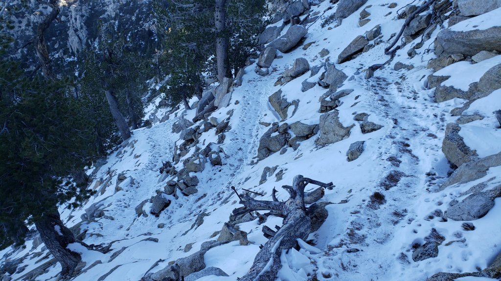
sanjacjon Uncategorized Leave a comment 8 MinutesEdit”Snow and trail update 23rd November 2022″
Trail update 16th November 2022
UPDATE 17th November 2022: as predicted, and even as melting proceeds steadily, trails are getting increasing icy due to daily freeze/thaw cycles, and spikes are recommended throughout the trail system above about 7000 ft. On my hike to San Jacinto Peak this morning, again I did not need spikes to ascend, but they were invaluable for descending all the way down to upper Devil’s Slide Trail. Starting in late morning the ice and icy snow is getting very slick due to a thin layer of meltwater on the surface, especially in sun-exposed areas. Overall, melting is proceeding faster than expected, especially with warmer than forecast temperatures, but this weekend trails will be very icy.
————————————–
Conditions immediately following the second Pacific storm, and the first significant snowfall, of winter 2022/23 that impacted the San Jacinto mountains on 8th-9th November were summarized in the previous Report.
On Monday 14th we ascended San Jacinto Peak via the east side (Devil’s Slide, Wellman, and Peak trails) and descended the west side via Deer Springs Trail. This facilitated survey of the highest parts of the PCT in the San Jacinto mountains (roughly Miles 179-181 and 185.5-183.5) plus several of its side trails. In the days since the storm, we have also surveyed trails around Tahquitz Peak, South Ridge, Spitler Peak, and Deer Springs, among others.
On 14th I barebooted (i.e. no traction device) to the Peak on a generally well-traveled and compacted track through light icy snow. The cold icy early morning snow had the perfect bite for good boots with excellent soles. The rocks around the summit were very slick with thick ice, and I put spikes on there and for the descent through Little Round Valley. I ultimately kept my Kahtoola microspikes on until just past the top of Marion Mountain Trail, but could have removed them somewhat sooner.
Although excellent tracks are now in place for almost all major trails (details below), cautious navigation is recommended everywhere.
Details of snow depths measured at various locations on the trail system are given at the foot of this posting. Note however that snow depth is rarely indicative of the challenge (or otherwise) of a given trail.
Spikes are currently recommended throughout the trail system above about 7500 ft, potentially lower in places. While they are not strictly required, depending upon your expertise level hiking on shallow variable icy snow, mixed with slush and ice patches (itself depending on time of day and sun exposure), spikes will continue become more increasingly useful over the next few days as established trails undergo freeze-thaw cycles and become further consolidated by hiker traffic. As I described above, spikes tend to be much more valuable for descending trails rather than ascending.
Snowshoes are no longer required anywhere on the established trail system, which is now too compacted for snowshoes. However they will remain valuable for off-trail travel at elevations above about 9500 ft for the foreseeable future.
Note that temperatures fluctuating either side of freezing are forecast for mid to upper elevations (at least >6000 ft) for the foreseeable future. Melting of snow on sun-exposed slopes and freeze-thaw cycles will combine to change trail conditions and potentially the preferred equipment for the terrain. The advice above should be used with this in mind, and if in any doubt carry the necessary traction devices that you will be most comfortable using.
Hikers should be prepared for temperatures near or below freezing in the high country, and generally well below freezing when considering wind chill effects (see below for my recent weather observations from San Jacinto Peak).
With such dramatic rainfall throughout the mountain range last week, and with snow now available for melting in the high country, I do not expect to be reporting on water conditions until next year. This is a genuine relief after such a long, hot, and largely dry last 6-7 months.
Currently the USFS gate at Humber Park remains open and the parking area has been largely plowed.
Black Mountain Road closed on 7th November to vehicle traffic at the gate 1.7 miles up from Highway 243 (see Forest Service website regarding this closure here). This is expected to be a seasonal closure until next year.
Dark Canyon Road (4S02), the access to Seven Pines Trail, and Santa Rosa Truck Trail (7S02) also closed to vehicle traffic for the season on 7th November 2022.
Forest Service campgrounds at Boulder Basin, Marion Mountain, and Fern Basin are now closed for the season.
Fire lookouts at Black Mountain and Tahquitz Peak were closed for the season ahead of schedule in anticipation of the snow storm last week.

WEATHER
A mixed assortment of weather is possible for the remainder of November. At mid elevations (e.g., Idyllwild) temperatures are forecast to warm for the next ten days, and to be above seasonal averages well into the second half of November. The same is largely true in the high country, however a short but severe Santa Ana wind event is forecast for 16th November. This may result in very strong winds and bitterly cold windchill temperatures at upper elevations. A minor heatwave is forecast for 23rd-27th November with temperatures at all elevations expected to warm to well above seasonal. There is the possibility that this will end abruptly with a minor storm on Monday 28th November, with 1-3 inches of snow possible above 10,000 ft.
Relatively mild temperatures combined with a weakening sun at this time of year means that snow melt may be slow at upper elevations, and conditions will be ideal for freeze/thaw cycles and hence icy trails everywhere above 6000 ft.
At San Jacinto Peak (10,810ft/3295m) on Monday 14th November 2022 at 0910 the air temperature was 33.3°F (1°C), with a windchill temperature of 20.7°F (-6°C), 25% relative humidity, and a cool NW wind sustained at 7 mph gusting to 12.9 mph.
At the Peak on Wednesday 9th November 2022 at 0820 the air temperature was 14.5°F (-10°C), with a windchill temperature of -7.8°F (-22°C), 100% relative humidity, and a sharp due West wind sustained at 20 mph gusting to 30.5 mph.

TRAIL CONDITIONS
All trails above about 7500 ft are currently remain lightly (or above 9000 ft, moderately) snow-covered. However excellent well-traveled and compacted tracks are now in place for most of the major trails (details below).
Hikers should expect to encounter new treefall hazards due to the enormous weight of ice from freezing rain currently in the trees and the high winds associated with the storm. New treefall hazards on Devil’s Slide Trail, South Ridge Trail, and Spitler Peak Trail, have all been reported.
The Ernie Maxwell Trail is largely clear of icy snow, although quite a few patches remain, especially close to Humber Park. Spikes are not required.
Devil’s Slide Trail is largely clear of icy snow to about 7400 ft (Middle Spring) although some extended patches remain below that. Above that elevation, icy snow is almost continuous to Saddle Junction. Spikes are not essential for ascending, but most hikers will find them useful at least for descending.
Immediately north of Saddle Junction, snow cover is initially somewhat patchy on the sun exposed slope (“Angel’s Glide”) but thereafter icy snow cover is continuous through the Wellman and Peak trails to San Jacinto Peak. However the route is largely well-traveled and compacted.
There is a well-traveled track on continuous light icy snow from Long Valley/Tram to Wellman Divide. Skyline Trail has a good track to follow through light icy snow above 7000 ft (the Traverse to Grubb’s Notch). Spikes are recommended.
There is a well-traveled track from Saddle Junction to Tahquitz Peak. The 0.4 mile section of South Ridge Trail between Chinquapin Flat/PCT and Tahquitz Peak has a well-traveled and level track – photo below – to follow through the light 3-4 inches of powder (drifted to six inches in places). Spikes are not essential, but many hikers may find them useful depending on their comfort level hiking on thin icy snow.
South Ridge Trail from the top of South Ridge Road to Tahquitz Peak has a well-traveled track to follow through the very light and patchy 1-3 inches of icy snow. Spikes are not required for ascending, but some hikers will find them useful for descending.
Marion Mountain Trail has a very well-defined track throughout. Spikes are recommended, at least for descending.
Deer Springs Trail is largely clear from the Highway 243 trailhead to the Suicide Rock trail junction at 7000 ft. From there to Strawberry Junction (8100 ft) snow cover averages 50% with patches increasing in length and frequency as you ascend. Spikes were not required even for descending on 14th. Snow cover is essentially continuous from Strawberry Junction to San Jacinto Peak, although patches are starting to clear below 8500 ft (south of the top of the Marion Mountain Trail). An excellent track is easy to follow to Little Round Valley. Above Little Round Valley the track is somewhat less clear and does not entirely accurately follow the establishes trail route. However the track is very useful and it is best to follow that route. Spikes are recommended at least for descending upper Deer Springs Trail.
The PCT throughout the San Jacinto mountains (roughly Miles 207-151) has a clear track to follow, including Fuller Ridge Trail, which has been traversed by a handful of sobo PCT hikers.
Spitler Peak Trail is functionally clear of snow, but see photo below regarding patches of ice fallen from trees.
Seven Pines Trail has not been traveled since last week’s storm, at least not in its uppermost section, and there is no track to follow through the snow.
SNOW DEPTHS measured on 14th November 2022 are as follows, with depths from 9th November 2022 in parentheses where known. Note that average depth is given; due to strong winds accompanying storms there has been extensive drifting, often particularly accumulating in the trails. Conversely in places scouring by the wind means the depths are well below the average. Altitudes are approximate.
San Jacinto Peak (10810 ft): 10 inches (was 12 inches on 9th)
Little Round Valley (9800 ft): 7-8 inches (photo above)
Wellman Divide (9700 ft): 3 inches (was 4 inches on 9th)
Round Valley (9100 ft): was 4 inches on 9th
Annie’s Junction/approx. PCT Mile 181.8 (9070 ft): 5 inches (was 6 inches on 9th)
Deer Springs Trail at top of Marion Mountain Trail (8700 ft): 4-5 inches
Tahquitz Peak (north side trail, 8700 ft): 3-4 inches, drifted to six [measured 11th November]
Tahquitz Peak (south side trail, 8500-8700 ft): 2 inches [measured 11th November]
Long Valley (8600 ft): was 2-3 inches on 9th
Strawberry Junction (8100 ft): 1-2 inches (photo below)
Saddle Junction/approx. PCT Mile 179.9 (8070 ft): 2 inches (was 3 inches on 9th)
Devil’s Slide Trail at Humber Park (6550 ft): patchy 0.5-1.0 inch (was 2.5 inches on 9th)
Idyllwild (at 5550 ft): 0 inch (was <1 inch on 9th)
Thank you for taking the time to read this. While all time and labor is volunteered, the San Jacinto Trail Report uses small private donations to cover costs. Every year seems to have its unique challenges and 2022 has been no exception. Your contribution keeps the Report available to all, free from advertising or paywalls, and independent from agencies. If you have found this Report useful, please consider using this link to the Donate page. Zelle, Venmo, and PayPal are all options. Thank you so much for your support.
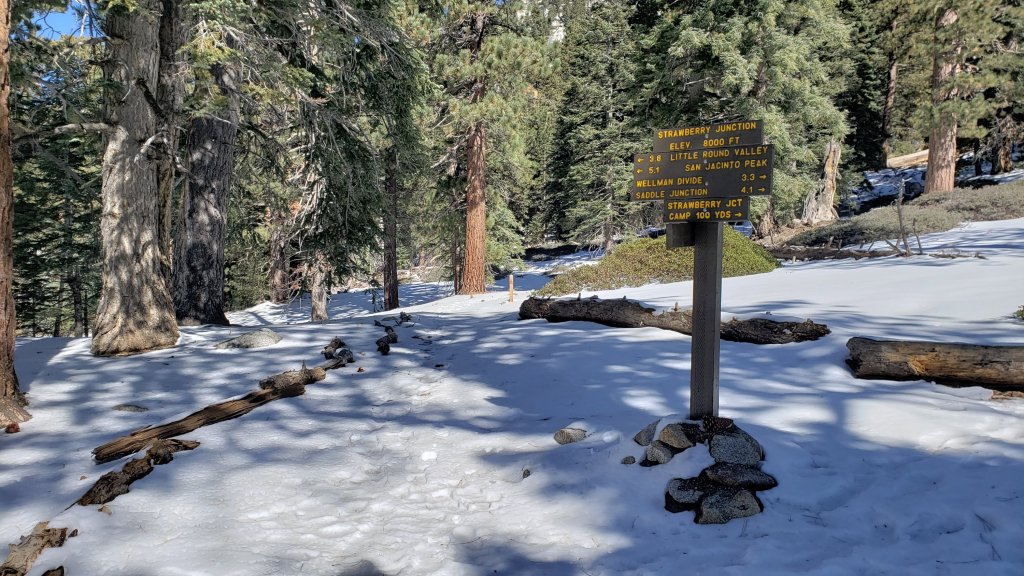


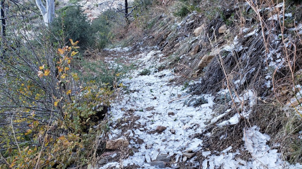

sanjacjon Uncategorized Leave a comment 8 MinutesEdit”Trail update 16th November 2022″
Moderate snow storm 8th-9th November 2022
UPDATE 11th November 2022: conditions for trails both north and south of Tahquitz Peak have been updated below, with photo, based on our hike this morning. In summary there are good tracks in place through the very shallow snow, and spikes are not required (but may be useful for some hikers depending on their experience in thin icy snow).
UPDATE #2 for 10th November 2022: It was disappointing late this morning to see southbound PCT hikers trying to hike down Highway 243 from Idyllwild to Mountain Center. Firstly because it is really unsafe, that is a busy and winding mountain road, not remotely a route designed for pedestrians. Secondly, because there is really very little snow on the PCT. As described below, there were only about three inches at Saddle Junction (PCT Mile 179) yesterday. This morning the PCT at the top of Spitler Peak Trail (roughly Mile 168.5) was basically clear of snow. Most of the PCT through the San Jacinto mountains has little more than 1-4 inches of snow to deal with. It is safest for all concerned that hikers hike the Trail rather than the highways.
UPDATE #1 for 10th November 2022: We hiked Spitler Peak Trail to its junction with the PCT this morning. Both trails were virtually completely clear of snow. Areas here at 6500-7000 ft had had much less snow than a few miles further north, only 0.5-1.0 inch depth. However there was a lot of rime ice starting to melt and fall from trees on upper Spitler (photos below). Nothing unduly dangerous, but something to be aware of for the next couple of days. The storm brought down four new treefall hazards down on upper Spitler Peak Trail, awkward but all passable with care.
———————————
This is a brief summary of conditions following the second Pacific storm, and the first significant snowfall, of winter 2022/23 to impact the San Jacinto mountains. The total snow accumulation was ultimately very close to the predictions given by forecasts in the days prior to the storm, and notably it was the heaviest snowfall in the first half of November for at least a decade. The rainfall totals at mid elevations were remarkable, and it is tempting to ponder what the snowfall totals could have been in the mountain communities and in the high country had the air temperatures been just a few degrees cooler.
I recorded a short video at San Jacinto Peak early on the morning of Wednesday 9th November (available here) which gives a feel for conditions as the storm finally cleared. I also reported on the storm in real time over the past couple of days (available here) which has more detail than this summary.
The storm was relatively mild, as might be expected from an “atmospheric river” system pulling moisture in from subtropical latitudes at this relatively early season, and as a result the freeze level was relatively high for most of the time that precipitation fell. Indeed it rained as high as San Jacinto Peak multiple times on 7th and 8th November.
Idyllwild (data from 5550 ft) received a prodigious 4.01 inches of rain in the 31 hours starting at midnight on Monday 7th. This is the second heaviest rainfall period in the past decade for Idyllwild (behind the almost unbeatable “Great Valentine’s Day flood” event of 2019, when we recorded 7.8 inches in just 20 hours!).
It wasn’t until early in the morning on Wednesday 9th, by which time the bulk of the storm system had passed, that the snow level fell to near 5000 ft, with 0.75 inch snow recorded at 5550 ft elevation. Details of snow depths measured at various locations on the trail system are given at the foot of this posting.
Although excellent tracks are now in place for some major trails (as outlined below), cautious navigation is recommended everywhere for the next few days in particular.
Snow depths are currently suitable for snowshoeing everywhere above about 9000 ft. However they are not required, depending on your comfort level with postholing in drifted snow of moderate depth. With compaction of the trails over the next few days, snowshoes may become less useful, however they will remain valuable for off-trail travel at the highest elevations for the foreseeable future.
Spikes are currently useful throughout the trail system above about 6000 ft, potentially lower in places. They are not however required, depending upon your comfort level hiking on shallow variable snow, mixed with slushy and icy patches. Spikes will likely become more increasingly useful over the next few days as established trails become consolidated by hiker traffic and undergo freeze-thaw cycles. They tend to be especially useful for descending trails.
Note that temperatures fluctuating either side of freezing are forecast for mid to upper elevations (at least >6000 ft) for the foreseeable future. Rapid melting of snow on sun-exposed slopes and freeze-thaw cycles will combine to change trail conditions and potentially the preferred equipment for the terrain.
Hikers should be prepared for temperatures near or below freezing in the high country, and generally well below freezing when considering wind chill effects (see below for my recent weather observations from San Jacinto Peak).
With such dramatic rainfall throughout the mountain range in the past two days, and with snow now available for melting in the high country, I do not expect to be reporting on water conditions until next year. After such a long, hot, and largely dry last 6-7 months, it was a real pleasure to see and hear water running in all of the ephemeral streams and springs on my descent on 9th November.
Currently the USFS gate at Humber Park remains open and the parking area has been largely plowed. It will however be very icy in the early mornings for the next few days at least. Even if the gate is closed there are nine legal parking spaces this side of the locked gate (near the upper Ernie Maxwell trailhead). Vehicles not parked in these spaces may be ticketed and/or towed. If there are “Road Closed” signs further down – as was often the case last winter – then those nine spaces are also unavailable for legal parking.
Black Mountain Road closed on 7th November to vehicle traffic at the gate 1.7 miles up from Highway 243 (see Forest Service website regarding this closure here).
Santa Rosa Truck Trail (7S02) also closed to vehicle traffic for the winter on 7th November 2022.
Forest Service campgrounds at Boulder Basin, Marion Mountain, and Fern Basin are now closed for the winter.
Fire lookouts at Black Mountain and Tahquitz Peak were closed for the season this past weekend ahead of schedule in anticipation of the snow storm.
WEATHER
Temperatures are forecast to remain at or even slightly below seasonal averages into the second half of November, with freezing conditions every night above about 5500 ft elevation. Combined with a weakening sun at this time of year, snow melt will generally be slow at upper elevations, and conditions will be ideal for freeze/thaw cycles and hence icy trails. There is currently no further precipitation in the forecasts.
At San Jacinto Peak (10,810ft/3295m) on Wednesday 9th November 2022 at 0820 the air temperature was 14.5°F (-10°C), with a windchill temperature of -7.8°F (-22°C), 100% relative humidity, and a sharp due West wind sustained at 20 mph gusting to 30.5 mph.
At the Peak on Monday 7th November 2022 at 1715 the air temperature was 28.4°F (-2°C), with a windchill temperature of 12.7°F (-11°C), 93% relative humidity, and a fresh WSW wind sustained at 10 mph gusting to 22.0 mph.
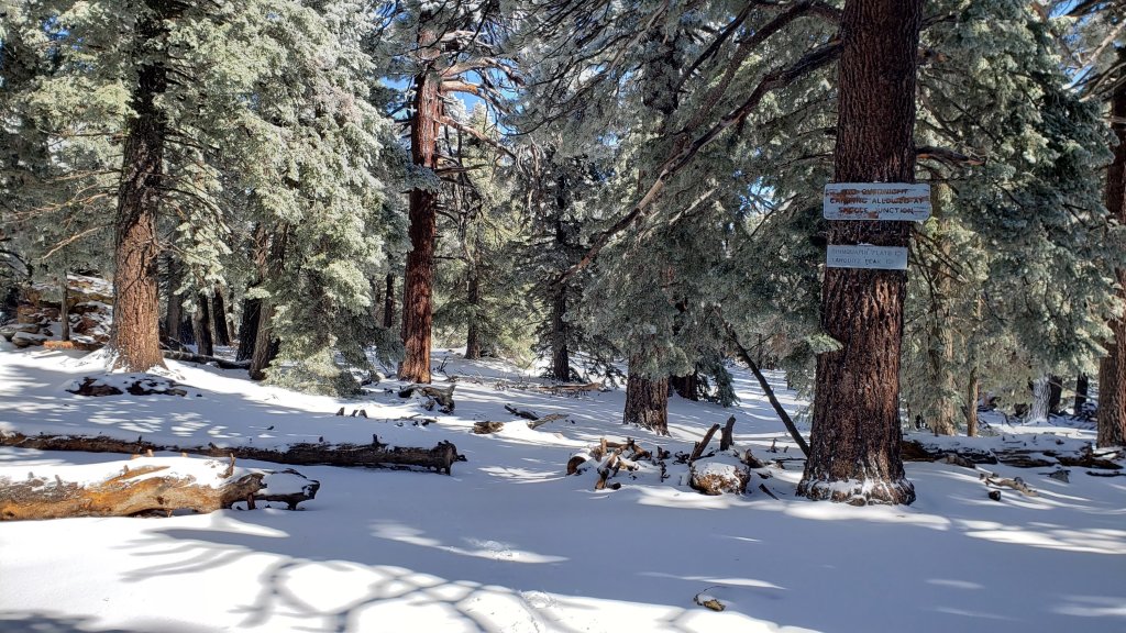
TRAIL CONDITIONS
All trails above about 6000 ft are currently lightly (or above 9000 ft, moderately) snow-covered. However by this afternoon, melting was already underway below 9000 ft on sun-exposed slopes.
Reliable tracks are in place (at least) for Devil’s Slide Trail through to San Jacinto Peak via Wellman Divide, from Long Valley/Tram to Wellman Divide, from Saddle Junction to Tahquitz Peak, and up South Ridge Trail to Tahquitz Peak.
The 0.4 mile section of South Ridge Trail between Chinquapin Flat/PCT and Tahquitz Peak has a well-traveled and level track – photo below – to follow through the light 3-4 inches of powder (drifted to six inches in places). Spikes are not required, but some hikers may find them useful depending on their comfort level hiking on thin icy snow.
South Ridge Trail from the top of South Ridge Road to Tahquitz Peak has a relatively well-traveled track to follow through the very light and patchy 1-3 inches of icy snow. Spikes are not required for ascending, but some hikers may find them useful for descending.
The PCT from Snow Creek south to at least Saddle Junction (roughly Miles 207-179) has a clear track to follow.
Hikers should expect to encounter new treefall hazards due to the enormous weight of ice from freezing rain currently in the trees and the high winds associated with the storm. New treefall hazards on Devil’s Slide Trail, South Ridge Trail, and Spitler Peak Trail, have all been reported.
SNOW DEPTHS measured on 9th November 2022 are as follows. Note that average depth is given; due to strong winds accompanying the storm there is extensive drifting, often particularly accumulating in the trails. Conversely in places scouring by the wind means the depths are well below the average. Altitudes are approximate.
San Jacinto Peak (10810 ft): 12 inches
Wellman Divide (9700 ft): 4 inches snow with 1-2 inches of ice underneath
Round Valley (9100 ft): 4 inches [special thanks to Kyle Eubanks for this measurement]
Annie’s Junction/approx. PCT Mile 181.8 (9070 ft): 6 inches
Tahquitz Peak (north side trail, 8700 ft): 3-4 inches, drifted to six [measured 11th November]
Tahquitz Peak (south side trail, 8500-8700 ft): 2 inches [measured 11th November]
Long Valley (8600 ft): 2-3 inches [special thanks to Kyle Eubanks for this measurement]
Saddle Junction/approx. PCT Mile 179.9 (8070 ft): 3 inches
Devil’s Slide Trail at Humber Park (6550 ft): 2.5 inches (melting already underway this afternoon)
Idyllwild (at 5550 ft): 0.75 inches (melting rapidly this afternoon).
Thank you for taking the time to read this. While all time and labor is volunteered, the San Jacinto Trail Report uses small private donations to cover costs. Every year seems to have its unique challenges and 2022 has been no exception. Your contribution keeps the Report available to all, free from advertising or paywalls, and independent from agencies. If you have found this Report useful, please consider using this link to the Donate page. Zelle, Venmo, and PayPal are all options. Thank you so much for your support.
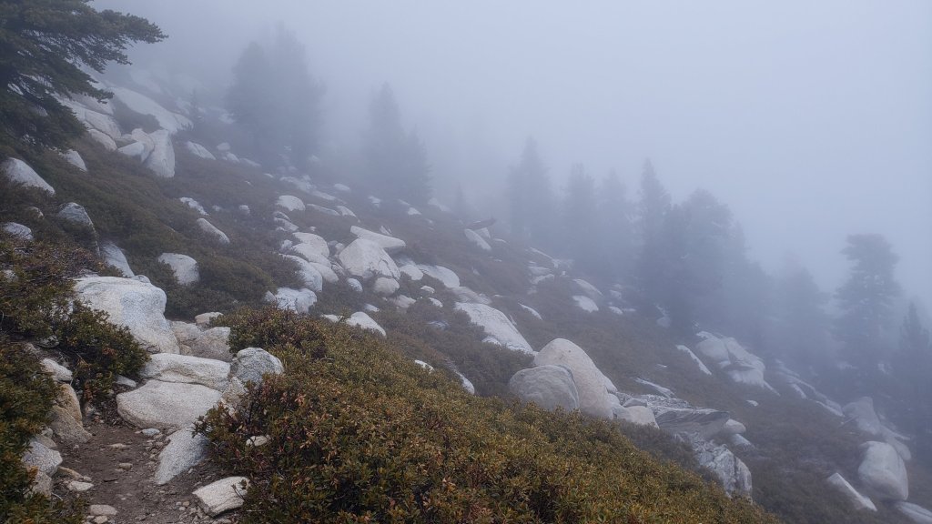
sanjacjon Uncategorized 1 Comment 8 MinutesEdit”Moderate snow storm 8th-9th November 2022″
Storm updates 8th November 2022
The first significant Pacific storm of winter 2022/23 is currently impacting the San Jacinto mountains. Please check this page for periodic updates – the most recent is at the top – throughout the storm.
UPDATE on Wednesday 9th at 0840
I have just recorded a short video (available here) from San Jacinto Peak giving a feel for current conditions.
About 0.75 inch of snow fell overnight in Idyllwild (at 5550 ft). The remarkable rainfall continued into the early hours of this morning, with final measurements of 3.45 inches in the past 24 hours, and a storm total of 4.01 inches!
San Jacinto Peak added about six inches of snow overnight for a final storm total of 12-13 inches.
Long Valley (at 8600 ft) has an estimated snow depth of 2-3 inches of snow which fell overnight, on top of over three inches of rain in the previous 36 hours.
UPDATE on Tuesday 8th at 1910
Thankfully the precipitation has largely turned back into snow at San Jacinto Peak, where the storm total is now close to 6 inches. Hopeful for significantly more overnight.
The storm total for rain in Idyllwild (at 5550ft) is now at a really impressive 2.32 inches, with 1.76 inches in the last 12 hours.
Kyle Eubanks reported that hiking through Long Valley was like walking through a river. The rain is starting to turn to snow there now, with about 0.5 inch accumulating so far, on top of more than two inches of rain today.
While all time and labor is volunteered, the San Jacinto Trail Report uses small private donations to cover costs. Every year seems to have its challenges and 2022 has been no exception. Your contribution keeps the Report available to all, free from advertising or paywalls, and independent from agencies. If you have found this Report useful, please consider using this link to the Donate page. Zelle, Venmo, and PayPal are all now options. Thank you so much for your support.
UPDATE on Tuesday 8th at 1600
Idyllwild has added an impressive 1.25 inches of rain since 0700 this morning, for a storm total already of about 1.8 inches.
Having reached a depth of about 4.5 inches of snow at San Jacinto Peak, there has been negligible new accumulation in the last hour or more. Hiking around I was disappointed to find that the precipitation had turned to freezing rain again, and I quickly got soaked.
The same seems to be happening in Long Valley where the air temperature is fluctuating just above freezing. An impressive rainfall total of at least two inches was accompanied by about 0.25 inch of snow, but some of that seems to have melted in the past hour or so.
UPDATE on Tuesday 8th at 1230
Idyllwild has added another 0.5 inch of rain since 0700 this morning, for a storm total already exceeding one inch.
Steady snowfall at a rate of about one inch per hour in the past couple of hours has accumulated at San Jacinto Peak to a total depth of 3.0 inches.
The freeze level had remained stubbornly high in this relatively mild “atmospheric river” storm. However the air temperature has dropped significantly since 1200, and at Long Valley (8600 ft) the heavy rain has turned to wet snow in the past half hour. Prior to that, Long Valley had about 1.5 inch of rain.
UPDATE on Tuesday 8th at 1030
Idyllwild received a good rain overnight with 0.56 inch recorded by 0700 (at 5550ft).
A barely measurable dusting of 0.25 inch of snow fell at San Jacinto Peak overnight following an estimated 0.2 inch of freezing rain that plastered all the rocks with verglas.
A light snow of fine rounded grains started at about 0800, and current accumulation at San Jacinto Peak is near 1.0 inch. Snow level on my hike this morning was at about 9500 ft, and it is currently raining steadily in Long Valley at 8600 ft.
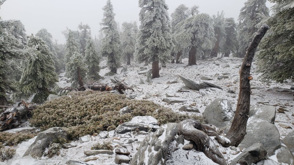
UPDATE on Monday 7th at 2030
Now raining steadily in Idyllwild. Remarkably it is also mild enough to be raining at San Jacinto Peak, where about 0.15 inch has fallen this afternoon.
UPDATE on Monday 7th at 1830
Cloud cover started to envelop the mountains late this morning. On a hike up to San Jacinto Peak there was a little drizzle on most of Devil’s Slide Trail (6500-8000 ft) in early afternoon. The high country was in the cloud, was dry in places, and occasional drizzle was very light and sparse.
At San Jacinto Peak itself the rocks were covered in very slick verglas although the air temperature was only just below freezing.
In Idyllwild (at 5550 ft) there was brief light drizzle in early afternoon also, enough to dampen surfaces but not even adding up to 0.1 inch.
Long Valley (8600 ft) has remained functionally dry, measuring just 0.01 inch of drizzle.
sanjacjon Uncategorized Leave a comment 3 MinutesEdit”Storm updates 8th November 2022″
Minor snow storm 3rd November 2022
UPDATED 5th November 2022: Weather forecasts are now confident that the San Jacinto mountains will be hit by our first significant snow storm of the season on 7th-9th November, with most of the precipitation falling on Tuesday 8th. The snow level may eventually drop below 5000 ft (around the lower end of Idyllwild) while estimates for snowfall above 10,000 ft elevation currently range from 10-30 inches. Rainfall below 6000 ft may be periodically intense and total 1-3 inches depending on location and elevation. Southbound PCT hikers in particular should continue to closely track forecasts (and the Trail Report) if they expect to be passing through the San Jacinto mountains in November. Spikes will almost certainly be recommended throughout the high country and on some of the PCT through the San Jacinto mountains for days (or possibly even weeks in places) following this storm. Snowshoes will likely be recommended above about 8000-9000 ft for several days at least, until trails become established and compacted (which can be slow at this time of year), and certainly for off-trail travel.
+++++++++++++++++++++++
The first snow in the San Jacinto mountains of the 2022/23 winter fell on the morning of Thursday 3rd November as the second phase of a two stage (but overall very minor) storm system. I hiked up to San Jacinto Peak through the most active snowfall early that day. The final accumulation above 10,000 ft was 0.5 inch, with about 0.25 inch above 9200 ft, and a trace elsewhere down to 5500 ft in Idyllwild. By early afternoon all ice had melted completely below 7000 ft.
Much more striking than the snow were very cold temperatures in the high country, exceptional for early November. I recorded an air temperature of 10.8°F (-12°C) at San Jacinto Peak at 0930, with a windchill temperature of -13.7°F (-25°C). These temperatures will not persist however, and indeed a rapid warming trend will make for above average temperatures in the high country by this weekend. Most or all of the snow will consequently melt quickly.
I recorded a short video summarizing the conditions and the forecast for the next week from San Jacinto Peak this morning, available here on YouTube.
The first part of the storm system involved a periodic light rain on the morning of Wednesday 2nd which produced 0.16 inch in Idyllwild (at 5550 ft). We hiked briskly that morning in the thick cloud and drizzle to Tahquitz Peak (8840 ft), where the air temperature was 30°F, with a windchill down to 18°F (-8°C). Patchy rime was forming above 8500 ft elevation (see photo below), but at the same time there were occasional patches of blue sky above us, and the cloud ceiling was at about 9000 ft. Consequently at that time the high country was above the cloud and remained dry.
No additional traction devices are currently required or recommended (although that will almost certainly change by Tuesday 8th November, see Weather discussion below).
Note that another snow storm – expected to produce substantially more precipitation than the one reported here – is currently forecast as for Monday 7th to Wednesday 9th November.
Hikers should be prepared for temperatures generally near freezing in the high country, and often below freezing around the high peaks when considering wind chill effects (see below for my latest weather observations from San Jacinto Peak). On 7th-9th November temperatures above 10,000 ft elevation are forecast to be far below freezing, with potentially dangerous windchills below 0°F (-18°C).
For discussion of specific trail condition and water information (prior to this minor snowfall), please see the previous Report (and others linked therein) available here.
Southbound PCT hikers in particular should continue to closely track forecasts (and the Trail Report) if they will be passing through the San Jacinto mountains in the first half of November.
Forest Service revised the closure order for areas impacted by the Fairview Fire valid until 24th January 2023. Details and a map are available here. The closed area is substantially reduced from the original September 2022 order, and is now largely confined to the actual burn scar in northern Bautista Canyon, plus the Red Mountain area.
The passage of Tropical Storm Kay on 9th September brought down many trees and branches, and hikers should anticipate finding new and additional treefall hazards and branches on trails.
Dark Canyon Campground will not reopen this year due to staffing/maintenance issues.
WEATHER
Temperatures briefly climb again to near or even above average over the weekend, before another storm system, potentially quite major for so early in the winter, is expected to arrive on Monday 7th November, continuing throughout Tuesday 8th into Wednesday 9th. Temperatures will again drop to far below seasonal, and at least moderate precipitation is currently forecast at all elevations, including 8-20 inches of snow in the high country, a freeze level down to Idyllwild (5000 ft) or even lower, and as much as 1-2 inches of rain at mid elevations.
At San Jacinto Peak (3295 m/10,810 ft) on Thursday 3rd November 2022 at 0930 the air temperature was 10.8°F (-12°C), with a windchill temperature of -13.7°F (-25°C), 100% relative humidity, and a bitter WNW wind sustained at 19 mph gusting to 28.7 mph.
At the Peak on Monday 31st October 2022 at 0850 the air temperature was 41.7°F (5°C), with a windchill temperature of 34.0°F (1°C), 11% relative humidity, and a steady NE wind sustained at 8 mph gusting to 10.0 mph.
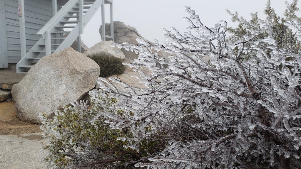
Thank you for taking the time to read this. While all time and labor is volunteered, the San Jacinto Trail Report depends on small donations to cover our costs. Your contribution keeps the Report available to all, free from advertising or paywalls, and independent from agencies. If you have found this Report useful, please consider using this link to the Donate page. Zelle, Venmo, and PayPal are all options. Thank you for your support.


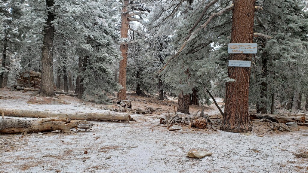
sanjacjon Uncategorized Leave a comment 4 MinutesEdit”Minor snow storm 3rd November 2022″
Weather and water update 1st November 2022
[UPDATE 2nd November 2022: A periodic light rain in Idyllwild this morning produced 0.16 inch (at 5550 ft). We hiked briskly in the thick cloud and drizzle to Tahquitz Peak (8840 ft), where the air temperature was 30°F, with a windchill down to 18°F (-8°C). Patchy rime was forming above 8500 ft elevation, but at the same time there were occasional patches of blue sky above us, and the cloud ceiling was at about 9000 ft. Consequently the high country was above the cloud and remained dry (for now).]
Weather forecasts continue to predict our first (albeit minor) snow storm of the season on 2nd-3rd November. The forecast models have been wildly variable for the past week on the severity of the storm, but are now generally suggesting a light snow in the high country. The snow level may fall to about 5500 ft (just above the elevation of central Idyllwild) while estimates for snowfall above 10,000 ft elevation range from 2-6 inches. Southbound PCT hikers in particular should continue to closely track forecasts (and the Trail Report) if they will be passing through the San Jacinto mountains in the first half of November. Spikes may be recommended on parts of the PCT for at least a few days following the storm if snowfall proves to be more significant than is currently forecast. Rainfall below 6000 ft is forecast at 0.2-0.5 inch. Note that another snow storm – expected to produce more precipitation than this week’s – is currently forecast as for Monday 7th and Tuesday 8th November.
Hikers should be prepared for temperatures generally near freezing in the high country, and often below freezing around the high peaks when considering wind chill effects (see below for my latest weather observations from San Jacinto Peak). On 2nd-4th November, and then again on 7th-8th, temperatures above 10,000 ft elevation are forecast to be well below freezing, with windchills below 0°F (-18°C).
Forest Service revised the closure order for areas impacted by the Fairview Fire valid until 24th January 2023. Details and a map are available here. The closed area is substantially reduced from the original September 2022 order, and is now largely confined to the actual burn scar in northern Bautista Canyon, plus the Red Mountain area.
The passage of Tropical Storm Kay on 9th September brought down many trees and branches, and hikers should anticipate finding new and additional treefall hazards and branches on trails. Current conditions for individual trails are discussed in detail below where known.
Based on multiple surveys in the past week throughout the trail system, water conditions have generally not changed significantly since the prior Report that is linked here, with the exception of the comments regarding Cedar Spring and Little Round Valley below. Photos illustrating the state of Tahquitz Creek at PCT Mile 177 and Little Tahquitz Valley were included in another prior Report available here.
Little Round Valley creek is now almost completely dry. A couple of short (20 yards) sections are still trickling in the middle of the valley, downstream from the Owl’s Hootch campsite. There is one small pool adequate for filtering.
Cedar Spring is flowing weakly both above and below the trough (starting 60 feet upslope from the trail that leads to the campsite). The inflow pipe to the trough that was apparently vandalized in May 2022 was repaired on 25th October by a volunteer. This again makes the trough the most accessible location for water filtering. Photos of the spring and trough taken earlier that same morning were in last week’s Report available here.
Full fire restrictions introduced on Thursday 26th May remain in place on Forest Service lands, as described in detail on their website. Campfires on all USFS lands in the San Jacinto mountains (including in fire rings at campgrounds and yellow post sites), and smoking, are prohibited for the remainder of the year. Fires are never permitted in the State Park wilderness.
Dark Canyon Campground will not reopen this year due to staffing/maintenance issues.
May Valley Road (5S21) reopened on 6th October, having been closed for eight months.
WEATHER
Temperatures for the last couple of days of October have been about average for the month. Moving into the first week of November, temperatures will drop dramatically as the forecasts are increasingly confident of the first (minor) snow storm of the winter on 2nd-3rd November. Precipitation is expected to come on two minor waves, the first on the morning of Wednesday 2nd, and then overnight in the early hours of Thursday 3rd. Freeze level may fall as low as 5500 ft while total snowfall above 10,000 ft is forecast to be 2-6 inches, largely falling in the second wave of precipitation early on Thursday morning.
Temperatures then briefly climb again to above average, especially in the high country, before another minor storm system is expected to arrive on Monday 7th November, continuing into Tuesday 8th. Temperatures will again drop to well below seasonal, and moderate precipitation is possible at all elevations, including 3-8 inches of snow in the high country, with a freeze level down to about Idyllwild (5000-5500 ft).
At San Jacinto Peak (3295 m/10,810 ft) on Monday 31st October 2022 at 0850 the air temperature was 41.7°F (5°C), with a windchill temperature of 34.0°F (1°C), 11% relative humidity, and a steady NE wind sustained at 8 mph gusting to 10.0 mph.
At the Peak on Thursday 27th October 2022 at 0855 the air temperature was 35.8°F (2°C), with a windchill temperature of 25.0°F (-4°C), 19% relative humidity, and a moderate WNW wind sustained at 8 mph gusting to 13.3 mph.
TRAIL CONDITIONS
Some major trails have accumulated treefall hazards since late 2019 (partly due to reduced agency work during the coronavirus pandemic) passable with care by hikers but not for stock. This situation worsened somewhat following Tropical Storm Kay in early September 2022.
Willow Creek Trail remains a relatively slow, messy hike for a couple of miles. Some 37 trees are down on the Forest Service section of this trail between Skunk Cabbage Junction and the State Park boundary (23rd September 2022 survey). Of those, 27 are in the 0.6 mile section between Willow Creek crossing and the State Park boundary. A few trees were cut by chainsaw at the far (Hidden Divide) end of the Forest Service section recently, presumably by a CCC or State Park crew. The State Park cut about a dozen trees on the section of trail under their jurisdiction in late July. Another tree came down near the start of this trail close to Saddle Junction in Tropical Storm Kay.
Spitler Peak Trail remains in its most hiker-friendly condition since the July 2013 Mountain Fire, thanks to efforts supported by Andrea Lankford/pctmissing.org. Forty downed trees were removed by the Trail Report from this trail in January, and another seven in late October. Currently only one small tree that requires cutting remains across the trail, just below the PCT (and it is easy to pass under).
Nine of the ten new treefall hazards on Deer Springs Trail from the Suicide Rock turning to Fuller Ridge following Tropical Storm Kay were cut by a State Park crew on 30th September, just ten days after I reported them.
Although some treefall hazards from Red Tahquitz to Antsell Rock (PCT Miles 172.5-175) were cleared in June 2021 prior to the rockslide removal work, the situation has badly deteriorated since. In my most recent survey there were 82 treefall hazards between PCT Miles 170-175 including 20+ major ones, and about six more on PCT Miles 175-177.
On Fuller Ridge Trail there are five major treefall hazards obstructing the trail in the 1.5 mile section nearest to the campground (PCT Miles 189-190.5). Although most of the downed trees reported this summer were cleared in July, four more major trees came down in Tropical Storm Kay.
The Caramba Trail from near Reeds Meadow through Laws Camp and on to Caramba, and the Cedar Trail from Willow Creek Trail to Laws, are described by the Forest Service as “not maintained”. This is frankly grossly misleading and in reality both trails no longer exist and are so completely overgrown I strongly advise hikers do not attempt to follow them. An informal use trail to Laws is much more direct and avoids all of the very challenging bushwhacking of the former trails (local hikers Charles Phelan and Mark Gumprecht kindly nicknamed it the “King Trail” when I established the route in 2019). It leaves the Willow Creek Trail exactly 1.0 mile from Saddle Junction (0.46 mile from the Skunk Cabbage turning), descending largely on established deer trails for 1.2 miles, meeting Willow Creek just upstream from the old Laws Camp. From Laws east to Caramba the route of the original Caramba Trail has been well-cairned by myself and others and can largely be followed with very careful route-finding. My 2022 survey counted 97 trees down on this 2.1 miles of trail. It is especially obscure 0.1-0.3 mile east of the Willow Creek crossing, becoming more obvious near Caramba. Very cautious navigation is advised throughout the area.
Seven Pines Trail has had limited hiker traffic since November 2018, largely because Dark Canyon Road was closed almost continuously from February 2019 to July 2022. Dark Canyon Road finally reopened in mid July 2022. The Trail Report has “adopted” Seven Pines Trail as a priority for maintenance work as the trail has had a disproportionate number of lost hiker rescues in the past decade. Between November 2021 and May 2022, 61 downed trees were removed and almost the entire trail thoroughly trimmed and cleared. Remarkably Tropical Storm Kay did not add any new treefall hazards to this trail. Nevertheless Seven Pines remains a genuine wilderness trail unlike the relatively wide, bare, and obvious routes of, for example, Devil’s Slide or Marion Mountain trails. Cautious navigation remains required for those who do not have significant experience of hiking this trail.
Thank you for taking the time to read this. While all time and labor is volunteered, the San Jacinto Trail Report depends on small donations to cover our costs. Your contribution keeps the Report available to all, free from advertising or paywalls, and independent from agencies. If you have found this Report useful, please consider using this link to the Donate page. Zelle, Venmo, and PayPal are all options. Thank you for your support.
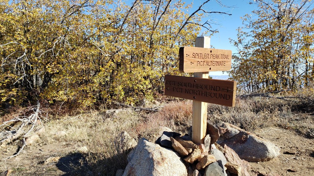
sanjacjon Uncategorized Leave a comment 7 MinutesEdit”Weather and water update 1st November 2022″
Trail and weather update 27th October 2022
Weather forecasts are predicting the first snow storm of the winter on 2nd-4th November. Unfortunately the forecast models vary greatly on the potential severity of the storm. The snow level may fall to about 6000 ft (a little above the elevation of Idyllwild) while estimates for snowfall above 10,000 ft elevation range widely from 6-24 inches. Southbound PCT hikers in particular are strongly recommended to closely track forecasts (and the Trail Report) if they will be passing through the San Jacinto mountains after 1st November. Spikes may be recommended on parts of the PCT for at least a few days following the storm if snowfall is significant. Rainfall below 6000 ft could exceed 0.5 inch. Projections for this storm will be updated daily.
Hikers should be prepared for temperatures generally near freezing in the high country, and often below freezing around the high peaks when considering wind chill effects (see below for my latest weather observations from San Jacinto Peak). Starting Wednesday 2nd November for at least 3-4 days temperatures above 10,000 ft elevation will be far below freezing, with windchills below 0°F (-18°C).
Although our best monsoon season in 5-6 years is over, the San Jacinto mountains did just about catch the southernmost edge of a storm system at the weekend, with light rain overnight on Saturday 22nd (0.31 inch in Idyllwild at 5550 ft). While the high country was enveloped in cloud – cold enough to produce thick rime on trees above 10,000 ft (see photos below) – the rain-bearing clouds were confined to the mid elevations, with no significant precipitation falling above 8000 feet, as confirmed by measurements at Saddle Junction (8100 ft, trace), Wellman’s Cienega (9300 ft, 0.02 inch), and near San Jacinto Peak (10,700 ft, none).
Forest Service revised the closure order for areas impacted by the Fairview Fire valid until 24th January 2023. Details and a map are available here. The closed area is substantially reduced from the original September 2022 order, and is now largely confined to the actual burn scar in northern Bautista Canyon, plus the Red Mountain area.
The passage of Tropical Storm Kay on 9th September brought down many trees and branches, and hikers should anticipate finding new and additional treefall hazards and branches on trails. Current conditions for individual trails are discussed in detail below where known.
Based on multiple surveys in the past week throughout the trail system, water conditions have not changed significantly since the prior Report that is linked here. Photos illustrating the current state of Tahquitz Creek at PCT Mile 177 and Little Tahquitz Valley, and at Little Round Valley, were included in last week’s Report available here.
An update on Cedar Spring. This is flowing weakly both above and below the trough (starting 60 feet upslope from the trail that leads to the campsite). The inflow pipe to the trough that was apparently vandalized in May 2022 was going to be repaired on 25th October by a volunteer that I encountered by chance on the trail. This will again make the trough the most accessible location for water filtering. In the meantime the trough has partially filled with rainwater (but with no flow it is cloudy and stagnant, photos below). I also encountered a trail crew low down on Cedar Spring Trail, who said they were going to do some trimming work from the PCT back down to the trailhead.
Full fire restrictions introduced on Thursday 26th May remain in place on Forest Service lands, as described in detail on their website. Campfires on all USFS lands in the San Jacinto mountains (including in fire rings at campgrounds and yellow post sites), and smoking, are prohibited for the remainder of the year. Fires are never permitted in the State Park wilderness.
Dark Canyon Campground will not reopen this year due to staffing/maintenance issues.
May Valley Road (5S21) reopened on 6th October, having been closed for eight months. Sadly signs regarding this closure have not been removed from the lower (Bonita Vista Road) end.
WEATHER
Temperatures for the last week of October will initially be somewhat below average for the month, but slowly warming daily. Starting around Friday 28th October, temperatures may briefly climb to above average. Moving into the first week of November, the forecasts are increasingly confident of the first snow storm of the winter around 2nd-3rd November. Freeze level may fall as low as 6000 ft (e.g., Fern Valley) while snowfall above 10,000 ft may be as much as 24-30 inches.
At San Jacinto Peak (10,810 ft/3295 m) on Thursday 27th October 2022 at 0855 the air temperature was 35.8°F (2°C), with a windchill temperature of 25.0°F (-4°C), 19% relative humidity, and a moderate WNW wind sustained at 8 mph gusting to 13.3 mph.
At the Peak on Monday 24th October 2022 at 0830 the air temperature was 36.4°F (2°C), with a windchill temperature of 25.2°F (-4°C), 16% relative humidity, and a fresh NNE wind sustained at 10 mph gusting to 15.7 mph.
At the Peak on Friday 21st October 2022 at 0940 the air temperature was 41.4°F (5°C), with a windchill temperature of 41.0°F (5°C), 40% relative humidity, and largely calm conditions with an occasional light NNE gust up to 2.0 mph.
At the Peak on Monday 17th October 2022 at 0835 the air temperature was 35.1°F (2°C), with a windchill temperature of 20.1°F (-7°C), 86% relative humidity, and a steady NNE wind sustained at 18 mph gusting to 23.2 mph.
TRAIL CONDITIONS
Some major trails have accumulated treefall hazards since late 2019 (partly due to reduced agency work during the coronavirus pandemic) passable with care by hikers but not for stock. This situation worsened somewhat following Tropical Storm Kay in early September 2022.
Willow Creek Trail remains a relatively slow, messy hike for a couple of miles. Some 37 trees are down on the Forest Service section of this trail between Skunk Cabbage Junction and the State Park boundary (23rd September 2022 survey). Of those, 27 are in the 0.6 mile section between Willow Creek crossing and the State Park boundary. A few trees were cut by chainsaw at the far (Hidden Divide) end of the Forest Service section recently, presumably by a CCC or State Park crew. The State Park cut about a dozen trees on the section of trail under their jurisdiction in late July. Another tree came down near the start of this trail close to Saddle Junction in Tropical Storm Kay.
Nine of the ten new treefall hazards on Deer Springs Trail from the Suicide Rock turning to Fuller Ridge following Tropical Storm Kay were cut by a State Park crew on 30th September, just ten days after I reported them.
Although some treefall hazards from Red Tahquitz to Antsell Rock (PCT Miles 172.5-175) were cleared in June 2021 prior to the rockslide removal work, the situation has badly deteriorated since. In my most recent survey there were 82 treefall hazards between PCT Miles 170-175 including 20+ major ones, and about six more on PCT Miles 175-177.
On Fuller Ridge Trail there are five major treefall hazards obstructing the trail in the 1.5 mile section nearest to the campground (PCT Miles 189-190.5). Although most of the downed trees reported this summer were cleared in July, at least four more major trees came down in Tropical Storm Kay.
Spitler Peak Trail remains in its most hiker-friendly condition since the July 2013 Mountain Fire. Forty downed trees, most from an ice storm in late December 2021, plus dozens of additional trunks and branches in the trail, were removed by the Trail Report from this trail in early 2022. Several small trees, including three actually across the trail, came down during Tropical Storm Kay (surveyed 16th September) but all are in the lower half of the trail and are easily negotiated.
The Caramba Trail from near Reeds Meadow through Laws Camp and on to Caramba, and the Cedar Trail from Willow Creek Trail to Laws, are described by the Forest Service as “not maintained”. This is frankly grossly misleading and in reality both trails no longer exist and are so completely overgrown I strongly advise hikers do not attempt to follow them. An informal use trail to Laws is much more direct and avoids all of the very challenging bushwhacking of the former trails (local hikers Charles Phelan and Mark Gumprecht kindly nicknamed it the “King Trail” when I established the route in 2019). It leaves the Willow Creek Trail exactly 1.0 mile from Saddle Junction (0.46 mile from the Skunk Cabbage turning), descending largely on established deer trails for 1.2 miles, meeting Willow Creek just upstream from the old Laws Camp. From Laws east to Caramba the route of the original Caramba Trail has been well-cairned by myself and others and can largely be followed with very careful route-finding. My 2022 survey counted 97 trees down on this 2.1 miles of trail. It is especially obscure 0.1-0.3 mile east of the Willow Creek crossing, becoming more obvious near Caramba. Very cautious navigation is advised throughout the area.
Seven Pines Trail has had limited hiker traffic since November 2018, largely because Dark Canyon Road was closed almost continuously from February 2019 to July 2022. Dark Canyon Road finally reopened in mid July 2022. The Trail Report has “adopted” Seven Pines Trail as a priority for maintenance work as the trail has had a disproportionate number of lost hiker rescues in the past decade. Between November 2021 and May 2022, 61 downed trees were removed and almost the entire trail thoroughly trimmed and cleared. Remarkably Tropical Storm Kay did not add any new treefall hazards to this trail. Nevertheless Seven Pines remains a genuine wilderness trail unlike the relatively wide, bare, and obvious routes of, for example, Devil’s Slide or Marion Mountain trails. Cautious navigation remains required for those who do not have significant experience of hiking this trail.
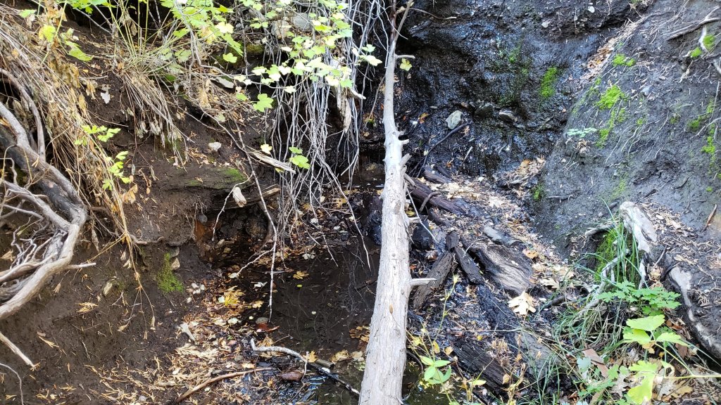
Thank you for taking the time to read this. While all time and labor is volunteered, the San Jacinto Trail Report depends on small donations to cover our costs. Your contribution keeps the Report available to all, free from advertising or paywalls, and independent from agencies. If you have found this Report useful, please consider using this link to the Donate page. Zelle, Venmo, and PayPal are all options. Thank you for your support.
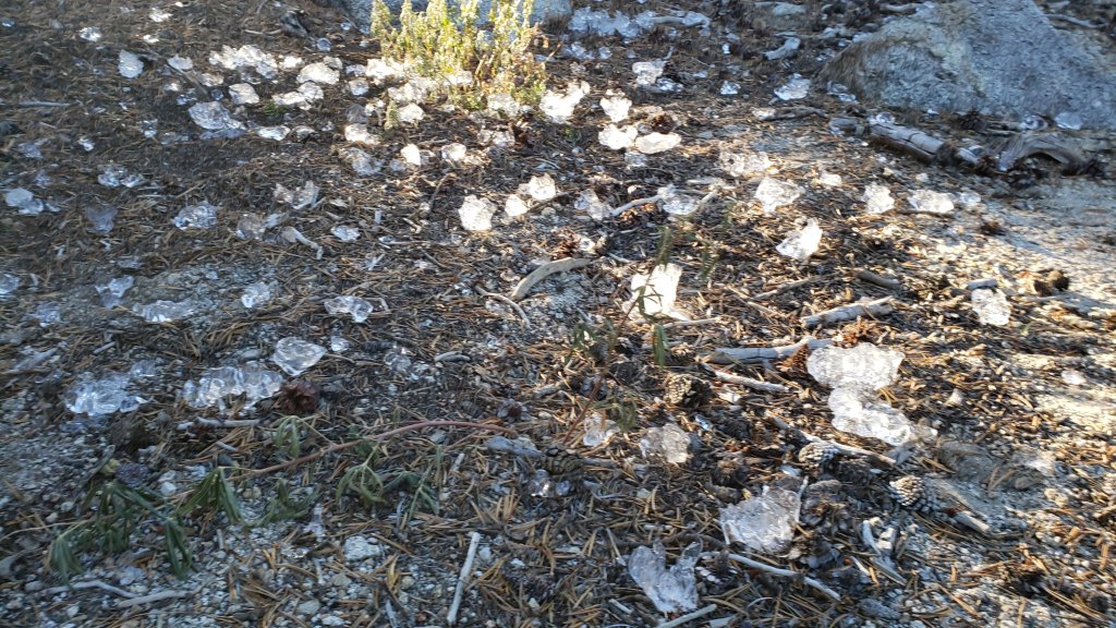
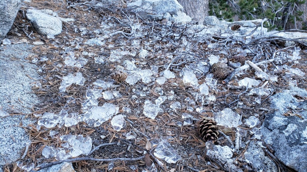
sanjacjon Uncategorized Leave a comment 7 MinutesEdit”Trail and weather update 27th October 2022″
Trail and weather update 18th October 2022
It is a huge pleasure (and frankly a great surprise) to let readers know that the Trail Report won the Ernie Maxwell Community Spirit Award this past week. Organized by the Idyllwild Town Crier newspaper (which was founded by Ernie and his wife Betty in 1946), the Award may be largely unknown outside Idyllwild-Pine Cove, but is quite a big deal within our little community. An avid hiker, early activist for protection of the mountain environment, and unique artist, among many other things, for much of the latter half of the 20th Century Ernie Maxwell was arguably the dominant personality in the San Jacinto mountains. He is of course memorialized in the name of the well-known Ernie Maxwell Scenic Trail. It is a genuine honor to have the Trail Report associated with him via this Award. Special thanks to Mark Dean of Pine Cove, long-time advocate and supporter of the Trail Report, for nominating me for the Award, and to those readers of the Idyllwild Town Crier (who apparently also follow the Trail Report!) for voting.
Our best (and certainly longest) monsoon season in years may finally be over, with no further significant storms currently forecast. Nevertheless the season was unusually long, persisting into mid October, and went out with a bang with an intense storm of thunder and lightning on the afternoon of Saturday 15th, accompanied by 0.51 inch of rain in Idyllwild. Similar rainfall was recorded at Saddle Junction (0.70 inch), Wellman’s Cienega (0.53 inch), and in Long Valley (0.63 inch). However such storms can be localized, and San Jacinto Peak received only 0.15 inch, while Little Round Valley and upper Deer Springs Trail showed evidence of only very light rain.
Hikers should be prepared for temperatures near freezing in the high country, and generally below freezing above about 10,000 ft elevation when considering wind chill effects (see below for my latest weather observations from San Jacinto Peak).
Forest Service revised the closure order for areas impacted by the Fairview Fire valid until 24th January 2023. Details and a map are available here. The closed area is substantially reduced from the original September 2022 order, and is now largely confined to the actual burn scar in northern Bautista Canyon, plus the Red Mountain area.
The passage of Tropical Storm Kay on 9th September brought down many trees and branches, and hikers should anticipate finding new and additional treefall hazards and branches on trails. I am steadily hiking the trail system surveying for new treefall hazards and reporting them to the agencies. Details are given under Trail Conditions below. Current conditions for individual trails are discussed in detail below where known.
Based on multiple surveys in the past week throughout the trail system, water conditions have not changed significantly since the previous Report (linked here). Photos below illustrate the current state of upper Tahquitz Creek, Little Round Valley, and Wellman’s Cienega.
Full fire restrictions introduced on Thursday 26th May remain in place on Forest Service lands, as described in detail here. Campfires on all USFS lands in the San Jacinto mountains (including in fire rings at campgrounds and yellow post sites), and smoking, are prohibited for the remainder of the year. Fires are never permitted in the State Park wilderness.
Dark Canyon Campground will not reopen this year due to staffing/maintenance issues.
May Valley Road (5S21) reopened on 6th October, having been closed for eight months.
WEATHER
Temperatures for the third week of October are forecast to be around average for the month, before dropping significantly to below average (especially the daytime highs) at all elevations from Saturday 22nd October onwards. There is a chance of light precipitation overnight on 22nd at mid elevations. It has been very unusual for the monsoon season to persist into mid October, but there are now no further significant thunderstorms in the forecasts.
At San Jacinto Peak (10,810ft/3295m) on Monday 17th October 2022 at 0835 the air temperature was 35.1°F (2°C), with a windchill temperature of 20.1°F (-7°C), 86% relative humidity, and a steady NNE wind sustained at 18 mph gusting to 23.2 mph.
At the Peak on Tuesday 11th October 2022 at 0930 the air temperature was 45.9°F (8°C), with a windchill temperature of 38.7°F (4°C), 72% relative humidity, and a very light ESE breeze sustained at 1 mph gusting to 4.9 mph.
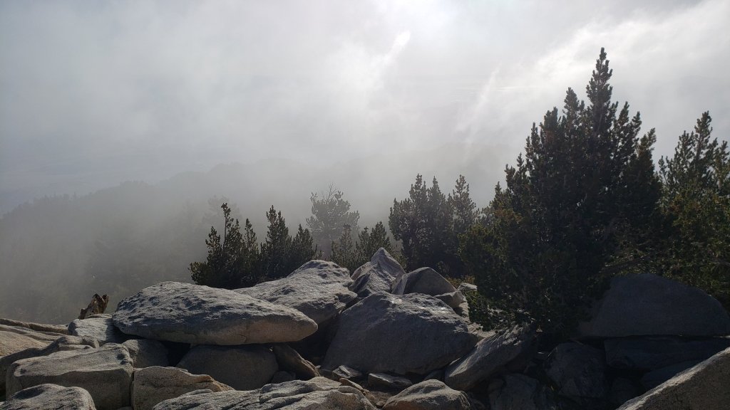
TRAIL CONDITIONS
Some major trails have accumulated treefall hazards since late 2019 (partly due to reduced agency work during the coronavirus pandemic) passable with care by hikers but not for stock. This situation worsened following Tropical Storm Kay in early September 2022.
Willow Creek Trail remains a relatively slow, messy hike for a couple of miles. Some 37 trees are down on the Forest Service section of this trail between Skunk Cabbage Junction and the State Park boundary (23rd September 2022 survey). Of those, 27 are in the 0.6 mile section between Willow Creek crossing and the State Park boundary. A few trees were cut by chainsaw at the far (Hidden Divide) end of the Forest Service section recently, presumably by a CCC or State Park crew. The State Park cut about a dozen trees on the section of trail under their jurisdiction in late July. Another tree came down near the start of this trail close to Saddle Junction in Tropical Storm Kay.
Nine of the ten new treefall hazards on Deer Springs Trail from the Suicide Rock turning to Fuller Ridge following Tropical Storm Kay were cut by a State Park crew on 30th September, just ten days after I reported them.
Although some treefall hazards from Red Tahquitz to Antsell Rock (PCT Miles 172.5-175) were cleared in June 2021 prior to the rockslide removal work, the situation has badly deteriorated since. In my most recent survey there were 82 treefall hazards between PCT Miles 170-175 including at least 20 major ones, plus about six more on PCT Miles 175-177.
The middle section of South Ridge Trail (between May Valley Road and the top of South Ridge Road) has several trees down which are significant obstructions (resurveyed 29th September). Those are expected to be cut in October.
Spitler Peak Trail remains in its most hiker-friendly condition since the July 2013 Mountain Fire. Forty downed trees, most from an ice storm in late December 2021, plus dozens of additional trunks and branches in the trail, were removed by the Trail Report from this trail in early 2022. Several small trees, including three actually across the trail, came down during Tropical Storm Kay (surveyed 16th September) but all are in the lower half of the trail and are easily negotiated.
On Fuller Ridge Trail there are five major treefall hazards obstructing the trail in the 1.5 mile section nearest to the campground (PCT Miles 189-190.5). Although most of the downed trees reported this summer were cleared in July, at least four more major trees came down in Tropical Storm Kay.
The Caramba Trail from near Reeds Meadow through Laws Camp and on to Caramba, and the Cedar Trail from Willow Creek Trail to Laws, are described by the Forest Service as “not maintained”. This is frankly grossly misleading and in reality both trails no longer exist and are so completely overgrown I strongly advise hikers do not attempt to follow them. An informal use trail to Laws is much more direct and avoids all of the very challenging bushwhacking of the former trails (local hikers Charles Phelan and Mark Gumprecht kindly nicknamed it the “King Trail” when I established the route in 2019). It leaves the Willow Creek Trail exactly 1.0 mile from Saddle Junction (0.46 mile from the Skunk Cabbage turning), descending largely on established deer trails for 1.2 miles, meeting Willow Creek just upstream from the old Laws Camp. From Laws east to Caramba the route of the original Caramba Trail has been well-cairned by myself and others and can largely be followed with very careful route-finding. My 2022 survey counted 97 trees down on this 2.1 miles of trail. It is especially obscure 0.1-0.3 mile east of the Willow Creek crossing, becoming more obvious near Caramba. Very cautious navigation is advised throughout the area.
Seven Pines Trail has had limited hiker traffic since November 2018, largely because Dark Canyon Road was closed almost continuously from February 2019 to July 2022. Dark Canyon Road finally reopened in mid July 2022. The Trail Report has “adopted” Seven Pines Trail as a priority for maintenance work as the trail has had a disproportionate number of lost hiker rescues in the past decade. Between November 2021 and May 2022, 61 downed trees were removed and almost the entire trail thoroughly trimmed and cleared. Remarkably Tropical Storm Kay did not add any new treefall hazards to this trail. Nevertheless Seven Pines remains a genuine wilderness trail unlike the relatively wide, bare, and obvious routes of, for example, Devil’s Slide or Marion Mountain trails. Cautious navigation remains required for those who do not have significant experience of hiking this trail.
Thank you for taking the time to read this. While all time and labor is volunteered, the San Jacinto Trail Report depends on small donations to cover our costs. Your contribution keeps the Report available to all, free from advertising or paywalls, and independent from agencies. If you have found this Report useful, please consider using this link to the Donate page. Zelle, Venmo, and PayPal are all options. Thank you for your support.


sanjacjon Uncategorized 3 Comments 7 MinutesEdit”Trail and weather update 18th October 2022″
Trail and weather update 13th October 2022
It is exceptional for monsoon conditions to persist into October in the San Jacinto mountains. Our best monsoon season in several years (see for example photos below from 11th) is forecast to continue to bring unpredictable thunderstorm conditions into the second half of October.
Despite overnight low temperatures so far this month being above average for the season, hikers should be prepared for temperatures near freezing in the high country, and generally below freezing above 10,000 ft elevation when considering wind chill effects, starting 15th October. Forecasts hint at the possibility of an early dusting of snow on 15th-16th above 10,000 feet elevation.
Forest Service has revised the closure order for areas impacted by the Fairview Fire valid until 24th January 2023. Details and a map are available here. The closed area is substantially reduced from the original September 2022 order, and is now largely confined to the actual burn scar in northern Bautista Canyon, plus the Red Mountain area.
Hikers should continue to be prepared for unpredictable, rapidly changing weather conditions in the high country in this year’s unusually long monsoon season. Thunderstorms with lightning, brief but intense precipitation (often hail), and rapid temperature drops, can occur in the high country even when such storms are not forecast for lower elevations. Currently highest probabilities are forecast for storms on 15th-16th and 20th-21st October.
Tropical Storm Kay on 9th September brought down many trees and branches, and hikers should anticipate finding new and additional treefall hazards and branches on trails. I am steadily hiking the trail system surveying for new treefall hazards and reporting them to the agencies. Details are given under Trail Conditions below.
Flow rates on springs and creeks which improved briefly following Tropical Storm Kay have now largely returned to (generally very dry) pre-storm conditions. Water conditions where known are detailed at the foot of this Report. Thorough surveys of water resources on the major trail systems on both the western and eastern slopes of the San Jacinto high country have been undertaken multiple times per week. Current conditions for individual trails are discussed in detail below where known.
Full fire restrictions introduced on Thursday 26th May remain in place on Forest Service lands, as described in detail here. Campfires on all USFS lands in the San Jacinto mountains (including in fire rings at campgrounds and yellow post sites), and smoking, are prohibited for the remainder of the year. Fires are never permitted in the State Park wilderness.
Dark Canyon Campground will not reopen this year due to staffing/maintenance issues.
May Valley Road (5S21) reopened on 6th October, having been closed for eight months due to hazardous trees and then tree removal work.
WEATHER
Temperatures in the first two weeks of October have generally remained above average for the month but are forecast to drop closer to (or even below) seasonal starting Friday 14th. It is very unusual for the monsoon season to persist into October, but thunderstorms remain a possibility daily for the foreseeable future, most notably on Saturday 15th.
The five month period April to August 2022 was the second warmest ever recorded in Southern California by overall mean temperature for those months combined (NWS data). This will come as no great surprise to those living in the San Jacinto mountains, where we experienced one of the longest, hottest summers ever.
At San Jacinto Peak (10,810ft/3295m) on Tuesday 11th October 2022 at 0930 the air temperature was 45.9°F (8°C), with a windchill temperature of 38.7°F (4°C), 72% relative humidity, and a very light ESE breeze sustained at 1 mph gusting to 4.9 mph.
At the Peak on Sunday 9th October 2022 at 1620 the air temperature was 43.3°F (6°C), with a windchill temperature of 37.2°F (3°C), 66% relative humidity, and a pleasantly cool NNE breeze sustained at 2 mph gusting to 7.5 mph.


TRAIL CONDITIONS
Some major trails have accumulated treefall hazards since late 2019 (partly due to reduced agency work during the coronavirus pandemic) passable with care by hikers but not for stock. This situation worsened following Tropical Storm Kay in early September 2022.
Willow Creek Trail remains a relatively slow, messy hike for a couple of miles. Some 37 trees are down on the Forest Service section of this trail between Skunk Cabbage Junction and the State Park boundary (23rd September 2022 survey). Of those, 27 are in the 0.6 mile section between Willow Creek crossing and the State Park boundary. A few trees were cut by chainsaw at the far (Hidden Divide) end of the Forest Service section recently, presumably by a CCC or State Park crew. The State Park cut about a dozen trees on the section of trail under their jurisdiction in late July. Another tree came down near the start of this trail close to Saddle Junction in Tropical Storm Kay.
Nine of the ten new treefall hazards on Deer Springs Trail from the Suicide Rock turning to Fuller Ridge following Tropical Storm Kay were cut by a State Park crew on 30th September, just ten days after I reported them.
Although some treefall hazards from Red Tahquitz to Antsell Rock (PCT Miles 172.5-175) were cleared in June 2021 prior to the rockslide removal work, the situation has badly deteriorated since. In my most recent survey there were 82 treefall hazards between PCT Miles 170-175 including at least 20 major ones, plus about six more on PCT Miles 175-177.
The middle section of South Ridge Trail (between May Valley Road and the top of South Ridge Road) has several trees down which are significant obstructions (resurveyed 29th September). Those are expected to be cut in October.
Spitler Peak Trail remains in its most hiker-friendly condition since the July 2013 Mountain Fire. Forty downed trees, most from an ice storm in late December 2021, plus dozens of additional trunks and branches in the trail, were removed by the Trail Report from this trail in early 2022. Several small trees, including three actually across the trail, came down during Tropical Storm Kay (surveyed 16th September) but all are in the lower half of the trail and are easily negotiated.
On Fuller Ridge Trail there are five major treefall hazards obstructing the trail in the 1.5 mile section nearest to the campground (PCT Miles 189-190.5). Although most of the downed trees reported this summer were cleared in July, at least four more major trees came down in Tropical Storm Kay.
The Caramba Trail from near Reeds Meadow through Laws Camp and on to Caramba, and the Cedar Trail from Willow Creek Trail to Laws, are described by the Forest Service as “not maintained”. This is frankly grossly misleading and in reality both trails no longer exist and are so completely overgrown I strongly advise hikers do not attempt to follow them. An informal use trail to Laws is much more direct and avoids all of the very challenging bushwhacking of the former trails (local hikers Charles Phelan and Mark Gumprecht kindly nicknamed it the “King Trail” when I established the route in 2019). It leaves the Willow Creek Trail exactly 1.0 mile from Saddle Junction (0.46 mile from the Skunk Cabbage turning), descending largely on established deer trails for 1.2 miles, meeting Willow Creek just upstream from the old Laws Camp. From Laws east to Caramba the route of the original Caramba Trail has been well-cairned by myself and others and can largely be followed with very careful route-finding. My 2022 survey counted 97 trees down on this 2.1 miles of trail. It is especially obscure 0.1-0.3 mile east of the Willow Creek crossing, becoming more obvious near Caramba. Very cautious navigation is advised throughout the area.
Seven Pines Trail has had limited hiker traffic since November 2018, largely because Dark Canyon Road was closed almost continuously from February 2019 to July 2022. Dark Canyon Road finally reopened in mid July 2022. The Trail Report has “adopted” Seven Pines Trail as a priority for maintenance work as the trail has had a disproportionate number of lost hiker rescues in the past decade. Between November 2021 and May 2022, 61 downed trees were removed and almost the entire trail thoroughly trimmed and cleared. Remarkably Tropical Storm Kay did not add any new treefall hazards to this trail. Nevertheless Seven Pines remains a genuine wilderness trail unlike the relatively wide, bare, and obvious routes of, for example, Devil’s Slide or Marion Mountain trails. Cautious navigation remains required for those who do not have significant experience of hiking this trail.
WATER CONDITIONS: Eastern slope
The Round Valley pipe is flowing at about 0.6 L/min (photo in prior Report). The nearby Round Valley creek and the small creek in Tamarack Valley both dried up in May.
Springs at Wellman’s Cienega are trickling (e.g., photo below). The flow rate was 0.5 L/min on 11th October, only 12% of the rate on 10th September.
The Wellman’s Cienega springs are the sources for Willow Creek, which is currently flowing weakly but reliably where it crosses the Willow Creek Trail (photo in prior Report).
Tahquitz Creek is flowing gently at the northern (lower) end of Little Tahquitz Valley at a flow rate of about 5.0 L/min [resurveyed 14th October]. It is flowing very weakly further upstream at its source, known colloquially as Grethe Spring, where it crosses the PCT at approx. PCT Mile 177. Between these locations Tahquitz Creek is dry (but presumably flowing subsurface). The small creek in Tahquitz Valley dried up in May.
Skunk Cabbage (“Candy’s”) Creek dried up in late June where it crosses under the trail through Skunk Cabbage Meadow.

WATER CONDITIONS: Western slope
Ephemeral creeks, such as those along Marion Mountain Trail and on Deer Springs Trail, dried up in May. Although they flowed for a few days after Tropical Storm Kay, they are now dry again.
The North Fork of the San Jacinto River is flowing gently, but reliably, at about 8.0 L/min where it crosses the Deer Springs Trail. It is also flowing gently downstream where it crosses the Fuller Ridge Trail on the PCT (approx. PCT Mile 186.2). However further downstream the river has been completely dry where it crosses Seven Pines Trail and Dark Canyon Road since July. See above for a photo of the source of this river, about 0.5 mile upstream from Deer Springs Trail.
The creek in Little Round Valley dried in both mid June and again in late August, but flowed between those times and subsequently thanks to periodic storm rainfall every few weeks. It is now flowing very weakly for only about 250 feet in the middle of the valley (behind the Owl’s Hootch campsite sign for example) having dried rapidly in the past two weeks.
Shooting Star Spring (below Little Round Valley but above the North Fork of the San Jacinto River crossing) is flowing weakly and is inadequate for filtering.
The Deer Springs stream crossing at the PCT/Deer Springs Trail (approx. PCT mile 185.6) dried up in late May. [I was surprised to find a little trickle on 2nd October immediately following a thunderstorm earlier that day, but this has not persisted.]
The tiny Switchback Spring at PCT Mile 183.5 (about 0.4 miles on the PCT northbound from Strawberry Junction) is flowing gently, and there is usually just adequate depth from which to filter water in the tiny pool on the upslope side of the trail (photo below). What this springs lacks in volume it makes up for with remarkable reliability.
The little creek at Strawberry Cienega (PCT mile 183.0) has been dry since June (although it flowed for a couple of days immediately after Tropical Storm Kay).
On Devil’s Slide Trail, Middle Spring is almost dry again. A tiny pool remains as a useful emergency water source for dogs. Other springs on this trail had been dry for months before the passage of Tropical Storm Kay, and five days later were already functionally dry again.
On the Ernie Maxwell Trail, the crossing of Chinquapin Creek just below Humber Park is dry where it crosses the trail. However, even when Fern Valley Water District is diverting flow into the pipe system small fresh pools remain among the rocks just upslope from the trail (these are an invaluable source of water for the many dogs walked on the Ernie Maxwell).
WATER CONDITIONS: Desert Divide
Live Oak Spring (N 33 37 21, W 116 33 24) Flowing. The most reliable water source on the Desert Divide.
Cedar Spring (N 33 40 36, W 116 34 35) [Updated 25th October] Flowing weakly above and below the trough (60 feet upslope from the trail that leads to the campsite). The inflow pipe to the trough that was apparently vandalized in May 2022 was being repaired on 25th October, which will again make the trough the most accessible location for water filtering.
Apache Spring (N 33 43 11, W 116 37 13) Flowing weakly, but the spring box remains full.
Spitler Peak Trail Descending the trail there are five water crossings. The first two, at 0.90 and 0.95 miles down, cross a tiny side creek which is largely dry and should be ignored. The next three crossings, at 1.1-1.5 miles down, are Spitler Creek and is the best source of water (currently flowing gently at both the uppermost and lowest crossings; photo of the latter in previous Report).
Antsell Rock Creek (N 33 41 52, W 116 39 08) Right by the Spitler Peak Trail trailhead on Apple Canyon Road, Antsell Rock Creek is dry. This large creek dried up in late spring, nearly two months earlier than last year, and remains dry now despite recent rains.
Thank you for taking the time to read this. While all time and labor is volunteered, the San Jacinto Trail Report depends on small private donations to cover our costs. Your contribution keeps the Report available to all, free from advertising or paywalls, and independent from agencies. If you have found this Report useful, please use this link to the Donate page. Zelle, Venmo, and PayPal are all options. Thank you for your support.


sanjacjon Uncategorized Leave a comment 10 MinutesEdit”Trail and weather update 13th October 2022″
Trail and weather update 6th October 2022
Temperatures in the first week of October, while cooler, have remained above average for the month. They are forecast to drop somewhat next week, following what may be the last storms of this year’s extended monsoon season on 8th-10th. Some forecasts hint at a (very low) possibility of a dusting snow around 14th-15th October above 10,000 feet elevation. Fingers crossed for an early start to the winter.
Our best monsoon season in at least five years is the gift that keeps on giving. An isolated thunderstorm on Sunday 2nd didn’t produce any rain in Idyllwild or at Saddle Junction but the entire high country had a moderate wetting, with 0.30 inch at Wellman’s Cienega and 0.23 inch at San Jacinto Peak. Most impressive was evidence of accumulated hail in Little Round Valley (photo below) that I found on a Sunday evening circuit of the mountain.
The Forest Service has issued a revised closure order for areas impacted by the Fairview Fire valid until 24th January 2023. Details and a map are available here. The closed area is substantially reduced from the original September 2022 order, and is now largely confined to the actual burn scar in northern Bautista Canyon, plus the Red Mountain area. Consequently the Cahuilla Mountain Wilderness, the Thomas Mountain area including the Ramona Trail, and the South Fork Wilderness Trail, have all now reopened.
Hikers should continue to be prepared for unpredictable, rapidly changing weather conditions in the high country into the autumn. Monsoon thunderstorms, usually in the afternoon, remain forecast as a possibility for the next week but on 9th-11th October in particular. Thunderstorms with lightning, brief but intense precipitation (including hail), and rapid temperature drops, can occur in the high country even when such storms are not forecast for lower elevations.
Tropical Storm Kay on 9th September brought down many trees and branches, and hikers should anticipate finding new and additional treefall hazards and branches on trails. I am steadily hiking the trail system surveying for new treefall hazards and reporting them to the agencies. Details are given under Trail Conditions below.
Flow rates on springs and creeks which improved briefly following Tropical Storm Kay have now largely returned to pre-storm conditions, with brief, highly localized improvements following thunderstorms. Water conditions where known are detailed at the foot of this Report. Thorough surveys of water resources on the major trail systems on both the western and eastern slopes of the San Jacinto high country have been undertaken 2-3 times per week, including Round Valley and Willow Creek weekly. Current conditions for individual trails are discussed in detail below where known.
All hikers, but especially those planning to hike Skyline Trail (either on its own or as part of the “Cactus-to-Clouds” route), should note that the Palm Springs Aerial Tramway is closed for annual maintenance until Sunday 9th October 2022, with a tentative reopening date of 10th October. Check their website for reopening confirmation and details.
Full fire restrictions introduced on Thursday 26th May remain in place on Forest Service lands, as described in detail here. Campfires on all USFS lands in the San Jacinto mountains (including in fire rings at campgrounds and yellow post sites), and smoking, are prohibited for the remainder of the year. Fires are never permitted in the State Park wilderness.
Dark Canyon Campground will not reopen this year due to staffing/maintenance issues.
May Valley Road (5S21) finally reopened on 6th October, having been closed for eight months due to hazardous trees and then tree removal work.
WEATHER
Temperatures in the first week of October have generally remained above average for the month, especially the overnight lows which have been 5-15°F above seasonal. They are forecast to finally drop closer to seasonal next week, following the possibility of what may be the last storms of this extended monsoon season on 9th-12th. There is the very slim possibility of the first snow of the winter on 14th-15th October around the highest peaks above 10,000 feet elevation.
The five month period April to August 2022 was the second warmest ever recorded in Southern California by overall mean temperature for those months combined (NWS data). This will come as no great surprise to those living in the San Jacinto mountains, where we experienced one of the longest, hottest summers ever.
At San Jacinto Peak (10,810ft/3295m) on Thursday 6th October 2022 at 0955 the air temperature was 43.4°F (6°C), with a windchill temperature of 36.3°F (2°C), 56% relative humidity, and a fresh NE breeze sustained at 6 mph gusting to 9.9 mph.
At the Peak on Tuesday 4th October 2022 at 1015 the air temperature was 45.6°F (8°C), with a windchill temperature of 38.1°F (3°C), 58% relative humidity, and a pleasantly cool NNE breeze sustained at 6 mph gusting to 11.3 mph.
At the Peak on Sunday 2nd October 2022 at 1715 the air temperature was 46.4°F (8°C), with a windchill temperature of 45.1°F (7°C), 84% relative humidity, and a very light WSW breeze sustained at 1.0 mph gusting to 4.7 mph.

TRAIL CONDITIONS
Many trails have accumulated treefall hazards since late 2019 (partly due to reduced agency work during the coronavirus pandemic) passable with care by hikers but not for stock. This situation was exacerbated by the impacts of Tropical Storm Kay in early September 2022.
Willow Creek Trail remains a relatively slow, messy hike for a couple of miles. Some 37 trees are down on the Forest Service section of this trail between Skunk Cabbage Junction and the State Park boundary (23rd September 2022 survey). Of those, 27 are in the 0.6 mile section between Willow Creek crossing and the State Park boundary. A few trees were cut by chainsaw at the far (Hidden Divide) end of the Forest Service section recently, presumably by a CCC or State Park crew. The State Park cut about a dozen trees on the section of trail under their jurisdiction in late July. Another tree came down near the start of this trail close to Saddle Junction in Tropical Storm Kay.
Nine of the ten new treefall hazards on Deer Springs Trail following Tropical Storm Kay were cut by a State Park crew on 30th September, just ten days after I reported them (must be some sort of record!).
Although some treefall hazards from Red Tahquitz to Antsell Rock (PCT Miles 172.5-175) were cleared in June 2021 prior to the rockslide removal work, the situation has badly deteriorated since. In my most recent survey there were 80 treefall hazards between PCT Miles 170-175, plus about six more on PCT Miles 175-177. At least a third of the former are major hazards that require some degree of scrambling over or around.
The middle section of South Ridge Trail (between May Valley Road and the top of South Ridge Road) has several trees down which are significant obstructions (resurveyed 29th September). Those are expected to be cut this month.
Spitler Peak Trail (surveyed 16th September) remains in its most hiker-friendly condition since the July 2013 Mountain Fire. Forty downed trees, most from an ice storm in late December 2021, plus dozens of additional trunks and branches in the trail, were removed by the Trail Report from this trail in early 2022. Several small trees, including three actually across the trail, came down during Tropical Storm Kay, but all are in the lower half of the trail and are easily negotiated.
On Fuller Ridge Trail there are five major treefall hazards obstructing the trail in the 1.5 mile section nearest to the campground (PCT Miles 189-190.5). Although most of the downed trees reported this summer were apparently cleared in July, at least four more major trees came down in Tropical Storm Kay.
The Caramba Trail from near Reeds Meadow through Laws Camp and on to Caramba, and the Cedar Trail from Willow Creek Trail to Laws, are described by the Forest Service as “not maintained”. This is frankly grossly misleading and in reality both trails no longer exist and are so completely overgrown I strongly advise hikers do not attempt to follow them. An informal use trail to Laws is much more direct and avoids all of the very challenging bushwhacking of the former trails (local hikers Charles Phelan and Mark Gumprecht kindly nicknamed it the “King Trail” when I established the route in 2019). It leaves the Willow Creek Trail exactly 1.0 mile from Saddle Junction (0.46 mile from the Skunk Cabbage turning), descending largely on established deer trails for 1.2 miles, meeting Willow Creek just upstream from the old Laws Camp. From Laws east to Caramba the route of the original Caramba Trail has been well-cairned by myself and others and can largely be followed with very careful route-finding. My 2022 survey counted 97 trees down on this 2.1 miles of trail. It is especially obscure 0.1-0.3 mile east of the Willow Creek crossing, becoming more obvious near Caramba. Very cautious navigation is advised throughout the area.
Seven Pines Trail has had limited hiker traffic since November 2018, largely because Dark Canyon Road was closed almost continuously from February 2019 to July 2022. Dark Canyon Road finally reopened in mid July 2022. The Trail Report has “adopted” Seven Pines Trail as a priority for maintenance work as the trail has had a disproportionate number of lost hiker rescues in the past decade. Between November 2021 and May 2022, 61 downed trees were removed and almost the entire trail thoroughly trimmed and cleared. Remarkably Tropical Storm Kay did not add any new treefall hazards to this trail. Nevertheless Seven Pines remains a genuine wilderness trail unlike the relatively wide, bare, and obvious routes of, for example, Devil’s Slide or Marion Mountain trails. Cautious navigation remains required for those who do not have significant experience of hiking this trail.
WATER CONDITIONS: Eastern slope
The Round Valley pipe is flowing at about 0.75 L/min (photo in previous Report). The nearby Round Valley creek and the small creek in Tamarack Valley both dried up in May.
Springs at Wellman’s Cienega are trickling. The flow rate was near 0.9 L/min on 4th October, roughly one quarter of the rate on 10th September.
The Wellman’s Cienega springs are the sources for Willow Creek, which is currently flowing weakly but reliably where it crosses the Willow Creek Trail (photo in previous Report).
Tahquitz Creek is flowing gently at the northern (lower) end of Little Tahquitz Valley at a flow rate of about 2.0 L/min. It is flowing very weakly further upstream at its source, known colloquially as Grethe Spring, where it crosses the PCT at approx. PCT Mile 177. Between these locations Tahquitz Creek is largely dry (but presumably flowing subsurface). The small creek in Tahquitz Valley dried up in May.
Skunk Cabbage (“Candy’s”) Creek dried up in late June where it crosses under the trail through Skunk Cabbage Meadow.
WATER CONDITIONS: Western slope
Ephemeral creeks, such as those along Marion Mountain Trail and on Deer Springs Trail, dried up in May. Although they flowed for a few days after Tropical Storm Kay, they are now dry again.
The North Fork of the San Jacinto River is flowing gently, but reliably, at at least 8.0 L/min where it crosses the Deer Springs Trail (also 8.0 L/min immediately after Kay, but up from 3.0 L/min last week). It is also flowing gently downstream where it crosses the Fuller Ridge Trail on the PCT (approx. PCT Mile 186.2). However further downstream the river is completely dry where it crosses Seven Pines Trail and Dark Canyon Road.
The creek in Little Round Valley dried in both mid June and again in late August, but flowed between those times and subsequently thanks to periodic storm rainfall every few weeks. It is now flowing very weakly for about 250 feet in the middle of the valley (behind the Owl’s Hootch campsite sign for example) having dried rapidly in the past week.
Shooting Star Spring (below Little Round Valley but above the North Fork of the San Jacinto River crossing) is flowing weakly and is inadequate for filtering.
The Deer Springs stream crossing at the PCT/Deer Springs Trail (approx. PCT mile 185.6) dried up in late May. [I was surprised to find a little trickle on 2nd October immediately following a thunderstorm earlier that day, but this will not last.]
The tiny Switchback Spring at PCT Mile 183.5 (about 0.4 miles on the PCT northbound from Strawberry Junction) is flowing gently, and there is usually just adequate depth from which to filter water in the tiny pool on the upslope side of the trail (photo in previous Report). What this springs lacks in volume it makes up for with remarkable reliability.
The little creek at Strawberry Cienega (PCT mile 183.0) has been dry since June (although it flowed for a couple of days immediately after Tropical Storm Kay).
On Devil’s Slide Trail, Middle Spring is almost dry again. A tiny pool remains as a useful emergency water source for dogs. Other springs on this trail had been dry for months before the passage of Tropical Storm Kay, and five days later were already functionally dry again.
On the Ernie Maxwell Trail, the crossing of Chinquapin Creek just below Humber Park is dry where it crosses the trail. However, even when Fern Valley Water District is diverting flow into the pipe system small fresh pools remain among the rocks just upslope from the trail (these are an invaluable source of water for the many dogs walked on the Ernie Maxwell).
WATER CONDITIONS: Desert Divide
Live Oak Spring (N 33 37 21, W 116 33 24) Flowing. The most reliable water source on the Desert Divide.
Cedar Spring (N 33 40 36, W 116 34 35) Flowing (upslope from the trail that leads to the campsite). Sadly the inflow pipe to the trough – formerly the most accessible water source – was vandalized in May 2022 and consequently the trough is dry. This damage has been reported to the Forest Service, but no repair is expected until later in the year.
Apache Spring (N 33 43 11, W 116 37 13) Flowing weakly, but the spring box remains full.
Spitler Peak Trail Descending the trail there are five water crossings. The first two, at 0.90 and 0.95 miles down, cross a tiny side creek which is largely dry and should be ignored. The next three crossings, at 1.1-1.5 miles down, are Spitler Creek and is the best source of water (currently flowing gently at both the uppermost and lowest crossings; photo of the latter in previous Report).
Antsell Rock Creek (N 33 41 52, W 116 39 08) Right by the Spitler Peak Trail trailhead on Apple Canyon Road, Antsell Rock Creek is dry. This large creek dried up in late spring, nearly two months earlier than last year, and remains dry now despite recent rains.
Thank you for taking the time to read this. While all time and labor is volunteered, the San Jacinto Trail Report depends on small private donations to cover our costs. Your contribution keeps the Report available to all, free from advertising or paywalls, and independent from agencies. If you have found this Report useful, please use this link to the Donate page. Zelle, Venmo, and PayPal are all options. Thank you for your support.


sanjacjon Uncategorized Leave a comment 10 MinutesEdit”Trail and weather update 6th October 2022″
Trail update 28th September 2022
The pleasantly autumnal (even well below seasonal!) temperatures that followed Tropical Storm Kay on 9th September have been replaced in recent days by a minor heatwave, with above seasonal temperatures expected to last until the end of the month. Temperatures in the first week of October are forecast to remain somewhat above average for that month.
An isolated monsoonal thunderstorm on Sunday 25th was not widely forecast but produced 0.79 inch of rain in Idyllwild (at 5550 ft elevation). It was brief, intense, and so localized that Saddle Junction (8100 ft) recorded an impressive 0.99 inch of rain, but less than 1.5 miles to the north there was only 0.05 inch at Wellman’s Cienega (9300 ft), while San Jacinto Peak and Long Valley remained completely dry.
The Forest Service issued a closure order for areas impacted by the Fairview Fire until 1st October 2022. Details and a map are available here. Almost all of the San Jacinto Ranger District south and west of Highway 74 is closed. This includes all of the South Fork Wilderness, the Cahuilla Mountain Wilderness, Bautista Canyon, and the Thomas Mountain area, including the Ramona Trail. A revised order in early October will probably reduce this closure to only those areas directly impacted by the Fairview Fire.
Hikers should continue to be prepared for unpredictable, rapidly changing weather conditions in the high country in late summer into autumn. Monsoon thunderstorms, usually in the afternoon, remain forecast as a possibility throughout the first week of October. Thunderstorms with lightning, brief but intense precipitation, and rapid temperature drops, can occur in the high country even when such storms are not forecast for lower elevations.
Tropical Storm Kay on 9th September brought down trees and branches, and hikers should anticipate finding new and additional treefall hazards and branches on trails. I am steadily hiking the trail system surveying for new treefall hazards and reporting them to the agencies. Details are given under Trail Conditions below.
Flow rates on springs and creeks which improved briefly following Tropical Storm Kay have now largely returned to pre-storm conditions. Water conditions where known are detailed at the foot of this Report. At least weekly hikes include thorough surveys of water resources on the major trail systems on both the western and eastern slopes of the San Jacinto high country, including Round Valley and Willow Creek. Current conditions for individual trails are discussed in detail below where known.
All hikers, but especially those planning to hike Skyline Trail (either on its own or as part of the “Cactus-to-Clouds” route), should note that the Palm Springs Aerial Tramway is closed for annual maintenance from Monday 12th September to Sunday 9th October 2022, with a tentative reopening date of 10th October.
Full fire restrictions introduced on Thursday 26th May remain in place on Forest Service lands, as described in detail here. Campfires on all USFS lands in the San Jacinto mountains (including in fire rings at campgrounds and yellow post sites), and smoking, are prohibited for the remainder of the year. Fires are never permitted in the State Park wilderness.
Dark Canyon Campground will not reopen this year due to staffing/maintenance issues.
The closure order for May Valley Road (5S21) expired on 5th September. The work on hazardous tree removal appears to have been completed in late September, but the gate near Cowbell Alley remains closed.
WEATHER
The autumnal temperatures ushered in by Tropical Storm Kay lasted for two weeks. Since Friday 23rd we have had a modest late September heat wave, with temperatures (especially the overnight lows) above seasonal. While temperatures may drop somewhat in the first week of October, they remain above average for that month (in particular the overnight lows will be 10-20°F above seasonal). The possibility of a minor monsoonal thunderstorm is forecast for Wednesday 28th September, and storms remain a possibility throughout the first week of October.
At San Jacinto Peak (10,810ft/3295m) on Monday 26th September 2022 at 0840 the air temperature was 51.3°F (11°C), with a windchill temperature of 46.7°F (8°C), 37% relative humidity, and a variable due North breeze sustained at 3 mph gusting to 8.3 mph.
At the Peak on Friday 23rd September 2022 at 0645 the air temperature was 44.3°F (7°C), with a windchill temperature of 38.5°F (4°C), 87% relative humidity, and a light due South wind sustained at 4 mph gusting to 8.8 mph.
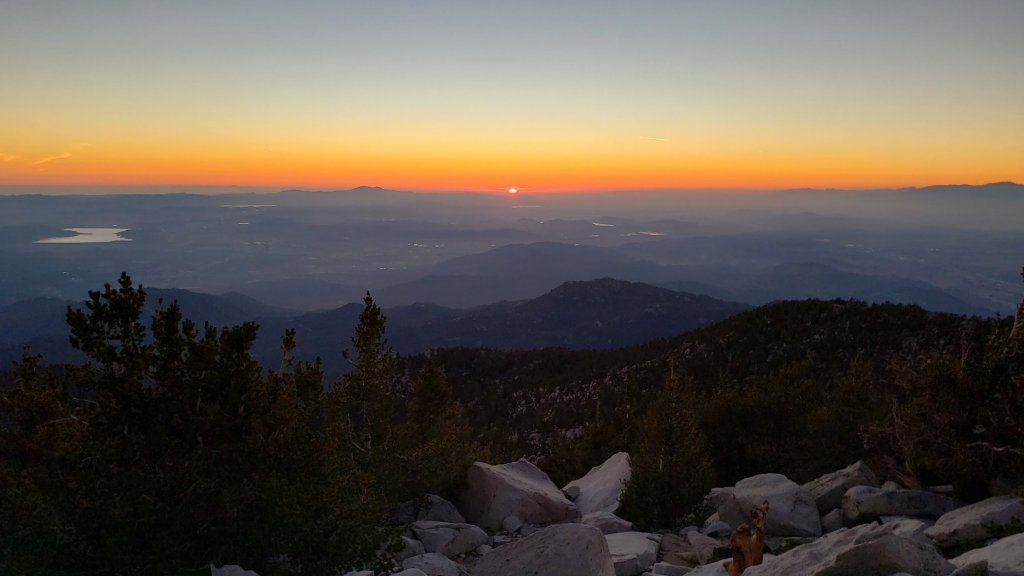
TRAIL CONDITIONS
Due to greatly reduced maintenance work by the agencies and PCTA during the coronavirus pandemic, many trails have accumulated treefall hazards since late 2019, passable with care by hikers but not for stock. This situation has been exacerbated by the impacts of Tropical Storm Kay in early September 2022 as described above. Not all trails have (yet) been checked since Tropical Storm Kay, and treefall conditions may be worse than described below.
Willow Creek Trail remains a relatively slow, messy hike for a couple of miles. Some 37 trees are down on the Forest Service section of this trail between Skunk Cabbage Junction and the State Park boundary (23rd September 2022 survey). Of those, 27 are in the 0.6 mile section between Willow Creek crossing and the State Park boundary. A few trees were cut by chainsaw at the far (Hidden Divide) end of the Forest Service section recently, presumably by a CCC crew. The State Park cut about a dozen trees on the section of trail under their jurisdiction in late July. Another tree came down near the start of this trail close to Saddle Junction in Tropical Storm Kay.
There are ten new treefall hazards on Deer Springs Trail (photos in previous Report, surveyed 19th September). The State Park has been notified. Five of these are between the Suicide Rock Trail junction and Strawberry Junction, with a further five between Strawberry Junction and the Fuller Ridge Trail junction (PCT Miles 183-185.5). Two near the top of Marion Mountain Trail include one right at the trail junction. [UPDATE 30th September: great news, on my descent this morning I passed a State Park crew ascending with a chainsaw to clear most or all of these trees.]
Although some treefall hazards from Red Tahquitz to Antsell Rock (PCT Miles 172.5-175) were cleared in June 2021 prior to the rockslide removal work, the situation has badly deteriorated. In my most recent survey I counted 80 treefall hazards between PCT Miles 170-175, plus about six more on PCT Miles 175-177. At least a third of the former are major hazards that require some degree of scrambling over or around.
The middle section of South Ridge Trail (between May Valley Road and the top of South Ridge Road) has several trees down which are significant obstructions.
Spitler Peak Trail (surveyed 16th September) remains in its most hiker-friendly condition since the July 2013 Mountain Fire. Forty downed trees, most from an ice storm in late December 2021, plus dozens of additional trunks and branches in the trail, were removed by the Trail Report from this trail in early 2022. Several small trees, including three actually across the trail, came down during Tropical Storm Kay, but all are in the lower half of the trail and are easily negotiated.
I have not thoroughly resurveyed Fuller Ridge Trail since Kay blew through. However there are at least five major treefall hazards obstructing the trail in the 1.5 mile section nearest to the campground (PCT Miles 189-190.5). Although most of the downed trees reported this summer were apparently cleared in July, at least four more major trees came down in Tropical Storm Kay (thanks to Snezana Nesic for this information).
The Caramba Trail from near Reeds Meadow through Laws Camp and on to Caramba, and the Cedar Trail from Willow Creek Trail to Laws, are described by the Forest Service as “not maintained”. This is frankly grossly misleading and in reality both trails no longer exist and are so heavily overgrown I strongly advise hikers do not attempt to follow them. An informal use trail to Laws is much more direct and avoids all of the very challenging bushwhacking of the unmaintained trails (some local hikers nicknamed it the “King Trail” when I established the route in 2019). It leaves the Willow Creek Trail exactly 1.0 mile from Saddle Junction (0.46 mile from the Skunk Cabbage turning), descending largely on established deer trails for 1.2 miles, meeting Willow Creek just upstream from the old Laws Camp. From Laws east to Caramba the route of the original Caramba Trail has been well-cairned by myself and others and can largely be followed with very careful route-finding. My 2022 survey counted 97 trees down on this 2.1 miles of trail. It is especially obscure 0.1-0.3 mile east of the Willow Creek crossing, becoming more obvious near Caramba. Very cautious navigation is advised throughout the area.
Seven Pines Trail has had limited hiker traffic since November 2018, largely because Dark Canyon Road was closed almost continuously from February 2019 to July 2022. Dark Canyon Road finally reopened in mid July 2022. The Trail Report has “adopted” Seven Pines Trail as a priority for maintenance work as the trail has had a disproportionate number of lost hiker rescues in the past decade. Between November 2021 and May 2022, 61 downed trees were removed and almost the entire trail thoroughly trimmed and cleared. Nevertheless Seven Pines remains a genuine wilderness trail unlike the relatively wide, bare, and obvious routes of, for example, Devil’s Slide or Marion Mountain trails. Cautious navigation remains required for those who do not have significant experience of hiking this trail.
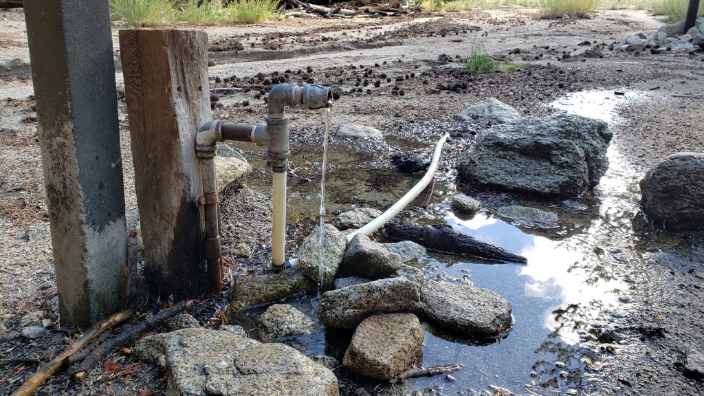
WATER CONDITIONS: Eastern slope
The Round Valley pipe is flowing at 1.0 L/min (measured 23rd September, photo above). The nearby Round Valley creek and the small creek in Tamarack Valley both dried up in May.
Springs at Wellman’s Cienega are trickling (photo below). The flow rate was 0.75L/min on 26th September, half the rate recorded on 19th, and one quarter of the rate on 10th September.
The Wellman’s Cienega springs are the sources for Willow Creek, which is currently flowing weakly but reliably where it crosses the Willow Creek Trail (photo below).
Tahquitz Creek is flowing gently at the northern (lower) end of Little Tahquitz Valley at a flow rate of 2L/min. It is flowing very weakly further upstream at its source, known colloquially as Grethe Spring, where it crosses the PCT at approx. PCT Mile 177. Between these locations Tahquitz Creek is largely dry (but presumably flowing subsurface). The small creek in Tahquitz Valley dried up in May.
Skunk Cabbage (“Candy’s”) Creek dried up in late June where it crosses under the trail through Skunk Cabbage Meadow.
WATER CONDITIONS: Western slope
Ephemeral creeks, such as those along Marion Mountain Trail and on Deer Springs Trail, dried up in May. Although they flowed for a few days after Tropical Storm Kay, they are now dry again.
The North Fork of the San Jacinto River is flowing gently, but reliably, at about 5.0L/min where it crosses the Deer Springs Trail (down from 8L/min immediately after Kay, but up from 3L/min last week), then weakly downstream where it crosses the Fuller Ridge Trail on the PCT (approx. PCT Mile 186.2). However the river is completely dry where it crosses Seven Pines Trail and Dark Canyon Road.
The creek in Little Round Valley dried in both mid June and again in late August, but flowed between those times and subsequently thanks to monsoon and storm rainfall. It is now flowing very weakly for about 350 feet in its lower half (photos in previous Report). Recent experience has shown it will continue to dry rapidly over the next few weeks without additional rainfall. [UPDATE 30th September: flow is down to a trickle for about 200 ft behind the “Owl’s Hootch” campsite sign, then it runs dry for a similar length before briefly flowing again. Water quality is not great and should be filtered.]
Shooting Star Spring (below Little Round Valley but above the North Fork of the San Jacinto River crossing) is flowing weakly and is inadequate for filtering.
The Deer Springs stream crossing at the PCT/Deer Springs Trail (approx. PCT mile 185.6) completely dried up in late May and has not restarted despite recent rains.
The tiny Switchback Spring at PCT Mile 183.5 (about 0.4 miles on the PCT northbound from Strawberry Junction) is flowing gently, and there is usually just adequate depth from which to filter water in the tiny pool on the upslope side of the trail (photo in previous Report). What this springs lacks in volume it makes up for with remarkable reliability.
The little creek at Strawberry Cienega (PCT mile 183.0) has been dry since June (although it flowed for a couple of days immediately after Tropical Storm Kay).
On Devil’s Slide Trail, Middle Spring is barely trickling. A tiny pool remains as a useful emergency water source for dogs. Other springs on this trail had been dry for months before the passage of Tropical Storm Kay, and five days later were already functionally dry again.
On the Ernie Maxwell Trail, the crossing of Chinquapin Creek just below Humber Park is dry where it crosses the trail. However, even when Fern Valley Water District is diverting flow into the pipe system small fresh pools remain among the rocks just upslope from the trail (these are an invaluable source of water for the many dogs walked on the Ernie Maxwell).
WATER CONDITIONS: Desert Divide
Live Oak Spring (N 33 37 21, W 116 33 24) Flowing. The most reliable water source on the Desert Divide.
Cedar Spring (N 33 40 36, W 116 34 35) Flowing (upslope from the trail that leads to the campsite). Sadly the inflow pipe to the trough – formerly the most accessible water source – was vandalized in May 2022 and consequently the trough is dry. This damage has been reported to the Forest Service, but no repair is expected until later in the year.
Apache Spring (N 33 43 11, W 116 37 13) Flowing weakly, but the spring box remains full.
Spitler Peak Trail Descending the trail there are five water crossings. The first two, at 0.90 and 0.95 miles down, cross a tiny side creek which is largely dry and should be ignored. The next three crossings, at 1.1-1.5 miles down, are Spitler Creek and is the best source of water (currently flowing gently at both the uppermost and lowest crossings; photo of the latter in previous Report).
Antsell Rock Creek (N 33 41 52, W 116 39 08) Right by the Spitler Peak Trail trailhead on Apple Canyon Road, Antsell Rock Creek is dry. This large creek dried up in late spring, nearly two months earlier than last year, and remains dry now despite recent rains.
Thank you for taking the time to read this. While all time and labor is volunteered, the San Jacinto Trail Report depends on small private donations to cover our costs. Your contribution keeps the Report available to all, free from advertising or paywalls, and independent from agencies. If you have found this Report useful, please use this link to the Donate page. Zelle, Venmo, and PayPal are all options. Thank you for your support.
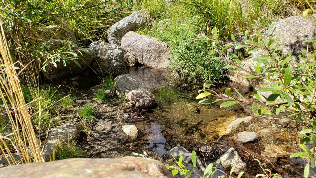
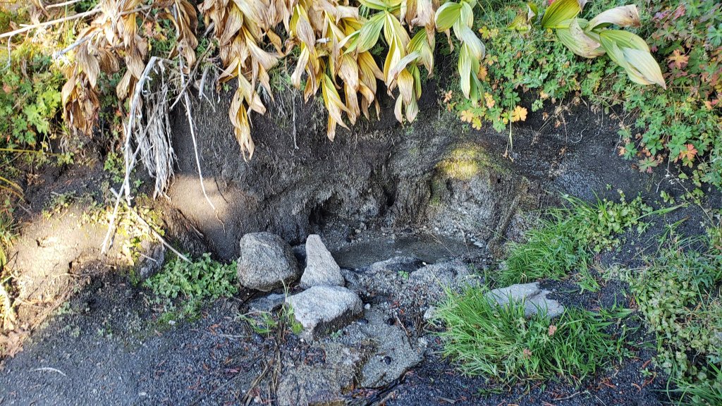
sanjacjon Uncategorized Leave a comment 10 MinutesEdit”Trail update 28th September 2022″
Trail and weather update 19th September 2022
It would be an understatement to say that the first half of September 2022 was complicated. The first few days continued a record-breaking heatwave that started in late August, with a run of nine days in Idyllwild with high temperatures at or above 90°F.
Late afternoon on 5th September the Fairview Fire started just south-east of Hemet. With light but shifting winds the fire initially went west, then east, south and finally south-west. Ultimately the fire spread to over 28,000 acres, killing two people and destroying multiple properties. Thousands of acres at the western edge of the San Jacinto Ranger District of the San Bernardino National Forest centred on Bautista Canyon were burned, including the Red Mountain Fire Lookout.
The heatwave ended in remarkably dramatic fashion on Friday 9th when Tropical Storm (formerly Hurricane) Kay passed offshore about 250 miles to the south-west of the San Jacinto mountains. This brought record-setting strong winds to the area, and sufficient rainfall to functionally extinguish the Fairview Fire. I spent the day observing the weather at San Jacinto Peak, where I recorded a maximum wind gust of 77.8 mph just after noon, shattering the previous strongest known wind speed recorded at that location. Wind gusts in Idyllwild exceeded 50 mph, stronger than even the fiercest Santa Ana winds recorded there, causing widespread damage to trees and overhead cables (we lost internet access for a week). Two different videos giving a sense of the conditions at San Jacinto Peak that day are available on YouTube and embedded in the previous Report.
The Forest Service has issued a closure order for areas impacted by the Fairview Fire currently valid until 1st October 2022. Details and a map are available here. Almost all of the San Jacinto Ranger District south and west of Highway 74 is closed. This includes all of the South Fork Wilderness, the Cahuilla Mountain Wilderness, Bautista Canyon, and the Thomas Mountain area, including the Ramona Trail.
Tropical Storm Kay brought down many trees and branches, and hikers should anticipate finding new and additional treefall hazards and branches on trails. I am steadily hiking the trail system surveying for new treefall hazards and reporting them to the relevant agencies. So far nothing I have found has been too challenging to hike past. I have found seven new trees down on the PCT but there are doubtless many more. Five are down between Miles 183-185.5 (photos below), and there are two minor ones near Mile 180.5, roughly 1.5 miles north of Saddle Junction. There are five trees down on Deer Springs Trail between the Suicide Rock and Strawberry junctions, including a couple of major ones. Three I found on Spitler Peak Trail are all minor. Marion Mountain, Wellman, Peak, and Devil’s Slide trails are all clear.
Flow rates on springs and creeks, including some minor ones, briefly improved due to rains from Tropical Storm Kay. However the effects have been remarkably short-lived. Water conditions where known are detailed at the foot of this Report. Hikes have included thorough surveys of water resources on the major trail systems on both the western and eastern slopes of the San Jacinto high country, and the Tahquitz area meadows. Current conditions for individual trails are discussed in detail below where known.
All hikers, but especially those planning to hike Skyline Trail (either on its own or as part of the “Cactus-to-Clouds” route), should note that the Palm Springs Aerial Tramway is closed for annual maintenance from Monday 12th September to Sunday 9th October 2022, with a tentative reopening date of 10th October.
Full fire restrictions were introduced on Thursday 26th May on Forest Service lands, as described in detail here. Campfires on all USFS lands in the San Jacinto mountains (including in fire rings at campgrounds and yellow post sites), and smoking, are prohibited for the remainder of the year. Fires are never permitted in the State Park wilderness.
Dark Canyon Campground will not reopen this year due to staffing/maintenance issues.
The closure order for May Valley Road (5S21) expired on 5th September, but work on hazardous tree removal continues and looks unlikely to be completed before October. A new closure order will presumably be issued in due course.
WEATHER
The autumnal temperatures ushered in by Tropical Storm Kay have remained and will persist for another week, before moving back somewhat above average starting Friday 23rd. There is no further significant precipitation in the forecasts.
Kay was accompanied by significant rainfall, and also facilitated an easterly airflow that brought light monsoon rainfall and thunderstorms on several subsequent days. The five day period 9th-13th September produced the following rainfall totals: 1.78 inches in Idyllwild (5550 ft), 2.43 inches at San Jacinto Peak (10,700 ft), and 2.88 inches at Wellman’s Cienega (9300 ft).
In Idyllwild the overnight low temperature dropped below the monthly average only twice between 9th July 2022 and 10th September, a period of 64 days (and the exceptions were marginal, on 27th and 30th August when lows of 55°F were recorded, the average low for August being 55.4°F). The record for consecutive days of above-monthly-average low temperatures was set just last summer at 56 days (12th June-6th August 2021).
At San Jacinto Peak (10,810ft/3295m) on Wednesday 14th September 2022 at 0850 the air temperature was 42.5°F (6°C), with a windchill temperature of 35.2°F (2°C), 73% relative humidity, and a light SSW breeze sustained at 3 mph gusting to 8.5 mph.
At the Peak on Monday 12th September 2022 at 0840 the air temperature was 42.6°F (6°C), with a windchill temperature of 32.0°F (0°C), 78% relative humidity, and a gusty SSE wind sustained at 13 mph gusting to 18.7 mph.
At the Peak on Friday 9th September 2022 at 1220 the air temperature was 42.4°F (6°C), with a windchill temperature of approximately 26°F (-3°C), 100% relative humidity, and a wild ENE gale sustained at 43 mph gusting to 77.8 mph. Both wind speeds were all-time records for the Peak.

TRAIL CONDITIONS
Due to greatly reduced maintenance work by the agencies and PCTA during the coronavirus pandemic, many trails have accumulated treefall hazards since late 2019, passable with care by hikers but not for stock. This situation has been exacerbated by the impacts of Tropical Storm Kay in early September 2022 as described above. Not all trails have (yet) been checked since Tropical Storm Kay, and treefall conditions may be worse than described below.
Willow Creek Trail is a slow, messy hike for a couple of miles, and is currently only recommended for experienced hikers. Some 46 trees are down on the Forest Service section of this trail between Skunk Cabbage Junction and the State Park boundary (August 2022 survey). Of those, 35 are in the 0.6 mile section between Willow Creek crossing and the State Park boundary. This situation has been reported to USFS. The State Park cut about a dozen trees on the section of trail under their jurisdiction in late July. The huge amount of work that Bill Rhoads and I undertook to clear whitethorn along this trail in 2020 was not completely in vain and parts of the trail would have largely disappeared otherwise, but it has grown back rapidly and makes some of the treefall hazards more complicated to negotiate (photos in previous Report).
Although some treefall hazards from Red Tahquitz to Antsell Rock (PCT Miles 172.5-175) were cleared in June 2021 prior to the rockslide removal work, the situation has badly deteriorated. In my most recent survey I counted about 80 treefall hazards between PCT Miles 170-175, plus about six more on PCT Miles 175-177. At least a third of the former are major hazards that require scrambling over or around.
There are ten new treefall hazards on Deer Springs Trail (photos below, surveyed 19th September). The State Park has been notified. Five of these are between the Suicide Rock Trail junction and Strawberry Junction, with a further five between Strawberry Junction and the Fuller Ridge Trail junction (PCT Miles 183-185.5). Two near the top of Marion Mountain Trail include one right at the trail junction.
The middle section of South Ridge Trail (between May Valley Road and the top of South Ridge Road) has several trees down which are significant obstructions.
Spitler Peak Trail (surveyed 16th September) remains in its most hiker-friendly condition since the July 2013 Mountain Fire. Forty downed trees, most from an ice storm in late December 2021, plus dozens of additional trunks and branches in the trail, were removed by the Trail Report from this trail in early 2022. Several small trees, including three actually across the trail, came down during Tropical Storm Kay, but all are in the lower half of the trail and are easily negotiated.
Fuller Ridge Trail has 14 treefall hazards (multiple 2022 surveys) obstructing the trail, but all are readily passable by relatively agile hikers. Eleven of these are in the 1.5 mile section closest to Fuller Ridge Campground (approx. PCT Miles 189-190.5).
The Caramba Trail from near Reeds Meadow through Laws Camp and on to Caramba, and the Cedar Trail from Willow Creek Trail to Laws, are optimistically described by the Forest Service as “not maintained”. In reality both trails no longer exist and are so heavily overgrown I strongly advise hikers do not attempt to follow them. An informal use trail to Laws is much more direct and avoids all of the very challenging bushwhacking of the unmaintained trails (some local hikers dubbed it the “King Trail” when I established the route in 2019). It leaves the Willow Creek Trail exactly 1.0 mile from Saddle Junction (0.46 mile from the Skunk Cabbage turning), descending largely on established deer trails for 1.2 miles, meeting Willow Creek just upstream from the old Laws Camp. From Laws east to Caramba the route of the original Caramba Trail has been well-cairned by myself and others and can largely be followed with very careful route-finding. My 2022 survey counted 97 trees down on this 2.1 miles of trail. It is especially obscure 0.1-0.3 mile east of the Willow Creek crossing, becoming more obvious near Caramba. Very cautious navigation is advised throughout the area.
Seven Pines Trail has had limited hiker traffic since November 2018, largely because Dark Canyon Road was closed almost continuously from February 2019 to July 2022. Dark Canyon Road finally reopened in mid July 2022. The Trail Report has “adopted” Seven Pines Trail as a priority for maintenance work as the trail has had a disproportionate number of lost hiker rescues in the past decade. Between November 2021 and May 2022, 61 downed trees were removed and almost the entire trail thoroughly trimmed and cleared. Nevertheless Seven Pines remains a genuine wilderness trail and is nothing like the relatively wide, bare, and obvious routes of, for example, Devil’s Slide or Marion Mountain trails. Cautious navigation remains required for those who do not have significant experience of hiking this trail.
WATER CONDITIONS: Eastern slope
The Round Valley pipe is trickling at about 0.5 L/min. The nearby Round Valley creek dried up in May. The small creek in Tamarack Valley also dried up in May.
Springs at Wellman’s Cienega are flowing (photo below). The flow rate of 3L/min immediately after Tropical Storm Kay had already dropped to 2L/min on 14th September, and 1.5L/min by 19th.
The Wellman’s Cienega springs are the sources for Willow Creek, which is currently flowing gently but reliably where it crosses the Willow Creek Trail.
Tahquitz Creek is flowing gently at the northern (lower) end of Little Tahquitz Valley at a flow rate of roughly 2L/min. It is flowing weakly further upstream at its source, known colloquially as Grethe Spring, where it crosses the PCT at approx. PCT Mile 177. Between these locations Tahquitz Creek is largely dry (but presumably flowing subsurface). The small creek in Tahquitz Valley dried up in May.
Skunk Cabbage (“Candy’s”) Creek dried up in late June where it crosses under the trail through Skunk Cabbage Meadow.
WATER CONDITIONS: Western slope
Ephemeral creeks, such as those along Marion Mountain Trail and on Deer Springs Trail, dried up in May. Although they flowed for a few days after Tropical Storm Kay, they were largely dry again on 14th September.
The North Fork of the San Jacinto River is flowing gently, but reliably, at about 4-5 L/min where it crosses the Deer Springs Trail (down from 8L/min immediately after Kay), and somewhat weakly downstream where it crosses the Fuller Ridge Trail on the PCT (approx. PCT Mile 186.2). However the river is completely dry where it crosses Seven Pines Trail and Dark Canyon Road.
The creek in Little Round Valley dried in both mid June and again in late August, but flowed between those times and subsequently thanks to monsoon and storm rainfall. It is now flowing very weakly for about 400 feet in its lower half (photo below). Recent experience has shown it will continue to dry rapidly over the next few weeks.
Shooting Star Spring (below Little Round Valley but above the North Fork of the San Jacinto River crossing) is flowing weakly and is inadequate for filtering.
The Deer Springs stream crossing at the PCT/Deer Springs Trail (approx. PCT mile 185.6) completely dried up in late May and has not restarted despite recent rains.
The tiny Switchback Spring at PCT Mile 183.5 (about 0.4 miles on the PCT northbound from Strawberry Junction) is flowing gently, and there is usually just adequate depth from which to filter water in the tiny pool on the upslope side of the trail. What this springs lacks in volume it makes up for with remarkable reliability.
The little creek at Strawberry Cienega (PCT mile 183.0) has been dry since June (although it flowed for a couple of days immediately after Tropical Storm Kay).
On Devil’s Slide Trail, Middle Spring is barely trickling. A tiny pool remains as a useful emergency drinking source for dogs. Other springs on this trail had been dry for months before the passage of Tropical Storm Kay, and five days later were already largely or completely dry again.
On the Ernie Maxwell Trail, the crossing of Chinquapin Creek just below Humber Park is dry where it crosses the trail. However, even when Fern Valley Water District is diverting flow into the pipe system small fresh pools remain among the rocks just upslope from the trail (these are an important source of water for the many dogs walked on the Ernie Maxwell).
WATER CONDITIONS: Desert Divide
Live Oak Spring (N 33 37 21, W 116 33 24) Flowing. The most reliable water source on the Desert Divide.
Cedar Spring (N 33 40 36, W 116 34 35) Flowing (upslope from the trail that leads to the campsite). Sadly the inflow pipe to the trough – formerly the most accessible water source – was vandalized in May 2022 and consequently the trough is dry. This damage has been reported to the Forest Service, but no repair is expected until later in the year.
Apache Spring (N 33 43 11, W 116 37 13) Flowing weakly, but the spring box remains full.
Spitler Peak Trail Descending the trail there are five water crossings. The first two, at 0.90 and 0.95 miles down, cross a tiny side creek which is largely dry and should be ignored. The next three crossings, at 1.1-1.5 miles down, are Spitler Creek and is the best source of water (currently flowing gently at both the uppermost and lowest crossings; photo of the latter below).
Antsell Rock Creek (N 33 41 52, W 116 39 08) Right by the Spitler Peak Trail trailhead on Apple Canyon Road, Antsell Rock Creek is dry. This large creek dried up in late spring, nearly two months earlier than last year, and remains dry now despite recent rains.


Thank you for taking the time to read this. While all time and labor is volunteered, the San Jacinto Trail Report depends on small private donations to cover our costs. Your contribution keeps the Report available to all, free from advertising or paywalls, and independent from agencies. If you have found this Report useful, please use this link to the Donate page. Zelle, Venmo, and PayPal are all options. Thank you for your support.


sanjacjon Uncategorized 3 Comments 11 MinutesEdit”Trail and weather update 19th September 2022″
Tropical Storm Kay 9th September 2022
Due to storm damage to overhead lines my internet access is currently very limited and it may be a week or more before the Trail Report can be fully updated. In the meantime here are a few key points relating to the storm and fire activity. For general details of trail and water conditions prior to Tropical Storm Kay, see this earlier Report.
(1) The Forest Service has issued a closure order for areas impacted by the Fairview Fire, currently valid until 1st October 2022. Details and a map are available here. Almost all of the San Jacinto Ranger District south and west of Highway 74 is closed. This includes all of the South Fork Wilderness, the Cahuilla Mountain Wilderness, Bautista Canyon, and the Thomas Mountain area, including the Ramona Trail.
(2) Springs and creeks, including some minor ones, are currently flowing due to rains from Tropical Storm Kay. This effect will be temporary, but at least for the next week, water is widespread in the high country. Flow rate at Wellman’s Cienega, which had dried up in the first week of September, was 3L/min on 10th September.
(3) The storm brought down trees and branches, and hikers should anticipate finding new and additional treefall hazards on trails. On my hikes since the storm so far I have found four trees down on the PCT but there are doubtless many more. Two are down near Mile 185 across Deer Springs Trail near the top of Marion Mountain Trail, and there are two minor ones near Mile 180.5, roughly 1.5 miles north of Saddle Junction.
[UPDATED 10th September @ 1050: rainfall totals for past 24 hours are 1.75 inches at San Jacinto Peak and 1.62 inches in Idyllwild (at 5550ft). Most impressive was 2.6 inches at Wellman’s Cienega (9300ft). It is a huge relief to get some meaningful precipitation. Springs are flowing again. Flow rate at Wellman’s Cienega was 3L/min this morning. Even small ephemeral springs on Devil’s Slide Trail are trickling.]
We hiked up to San Jacinto Peak this morning, Friday 9th September, to see what Tropical Storm (formerly Hurricane) Kay would bring in terms of weather. We were not disappointed.
On the way up I noted that Middle Spring on Devil’s Slide Trail, and the north springs at Wellman’s Cienega, had all finally dried up. Now with sufficient rain hopefully they will start trickling again.
It was one of the strangest ascents I have made. It was still very warm, over 70°F at the trailhead, so I was heading up in t-shirt and shorts but could see the cloud descending rapidly and the stiff wind was unusually warm. The wind and cloud were very reminiscent of my many winter ascents, but the air temperature was 40-50 degrees too warm. Making things even more unusual in several locations on Devil’s Slide Trail I could see to the west large flames and billowing smoke near the top of Rouse Ridge at its northern end close to Cranston, graphic evidence of the Fairview Fire several miles away.
We finally got into the cloud at about 8500 ft and had a very light rain shortly thereafter (but it was largely horizontal due to the strong easterly wind).
At the first recording of the weather at San Jacinto Peak at 1045 I measured a wind gust of 58.4 mph, surpassing my previous highest observation at that location by nearly 10 mph. The wind was sustained at an impressive 35 mph and bizarrely – given the wind speed – the windchill was a relatively mild 29.8°F.
The winds started to get crazy by about noon, and at my second attempt the maximum wind gust was an astonishing 77.8 mph. This crushed any previous record wind speed recorded at San Jacinto Peak, at least in the modern era. The sustained wind was well over 40 mph.
I recorded a short(ish) video near the Peak available here on YouTube.
Subsequently the winds never quite reached such strong gusts again. The air temperatures never fell below the mid 40s. However most impressive were the sustained wind speeds which remained above 30 mph for at least nine hours, roughly 0900-1800. In contrast winter storms at the peak are much more gusty with the sustained wind speeds rarely exceeding 30 mph, and when they do it is often only for an hour or two.
Most of the day the rainfall was very light, with only 0.25 inch until mid afternoon, but finally it started raining more heavily around 1600. As of 1830 rainfall at San Jacinto Peak today measured 0.9 inch. By about the same time, Idyllwild (at 5550ft) had recorded just over 1.0 inch. There will be a clearer picture of overall rainfall from this unusual event by tomorrow morning.
sanjacjon Uncategorized 2 Comments 3 MinutesEdit”Tropical Storm Kay 9th September 2022″
Fairview Fire update 8th September 2022
[UPDATED Friday 9th September @ 1130: I am currently at San Jacinto Peak having hiked up this morning to observe Tropical Storm Kay, more on this in a subsequent posting. The following photo has probably circulated widely by now, but those of us in the fire lookout community were devastated to learn of the destruction of Red Mountain lookout overnight in the Fairview Fire. While far from surprising given the conditions, it comes as a huge blow to us all.]

[UPDATED Thursday 8th September @ 1930: thankfully nothing significant to report from the Idyllwild-Pine Cove-Mountain Center area. Generally east or south-east winds, the outermost hint of Hurricane Kay perhaps, are pushing smoke and active burn areas away from here. Sadly conditions have deteriorated further in Bautista Canyon, and especially in the south-west quadrant of the fire, which may be exacerbated by high winds (from the east) predicted for tomorrow morning. Total acreage now at 23,900, roughly an additional 5,000 today (so far).]
[UPDATED Thursday 8th September @ 0930: I have just added some photos from our morning hike to Tahquitz Peak, below the more dramatic photos and video from last night.]
Fire acreage was reported near 12,000 on Wednesday afternoon but by 2230 a CalFire estimate put the fire at 19,300 acres.
No evacuation warning or order issued yet for Idyllwild-Pine Cove. Most of the growth overnight has been to the south, broadly speaking, and the immediate threat to Idyllwild-Pine Cove may have passed. However the afternoon is when fire behaviour tends to get vigourous and erratic.
Thankfully Red Mountain Fire Lookout has survived the night, just. There is a livestream from the mountaintop available on YouTube here.
Note that Highway 74 closed on Wednesday night between Valle Vista (east end of Hemet) and Mountain Center (Highway 243 junction).
I recorded the video below on Wednesday evening, 7th September, and have added a couple of still photos also.
The prognosis for the next 24 hours remains poor. Northern Bautista Canyon is largely destroyed and will never be the same again. Recent spread seems to be to the south towards the Sage area.
Hurricane Kay is forecast to arrive on Friday 9th and the rain will hopefully extinguish this fire. It is hard to overlook the irony that in a world with such a rapidly changing climate we may largely depend upon a hurricane to put out a huge wildfire that started during an exceptional heatwave.
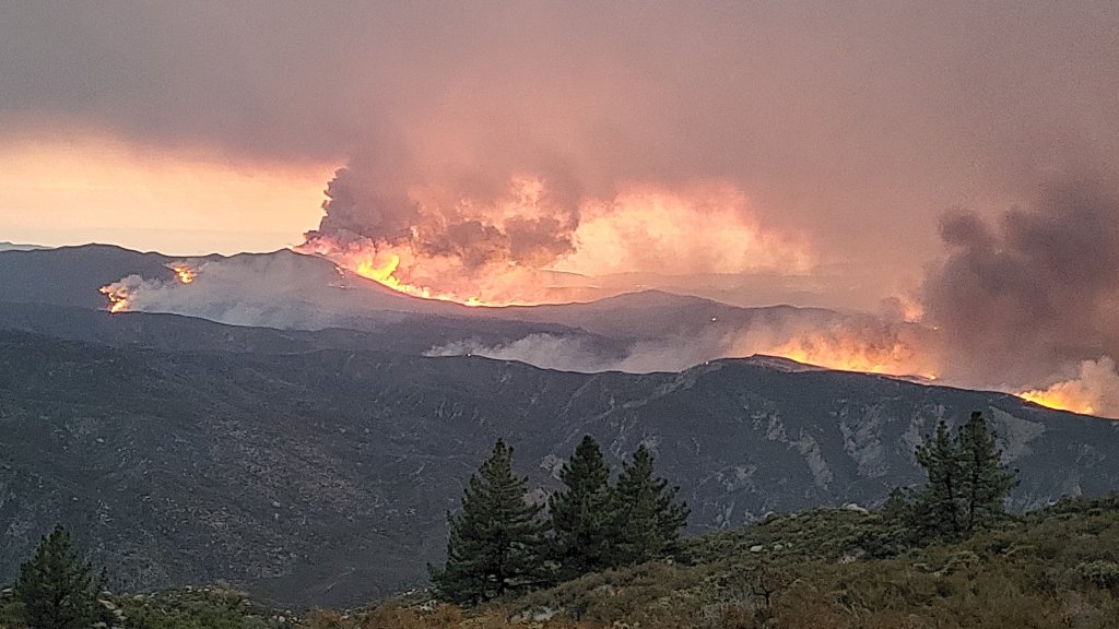
Below, sunset on 7th September 2022 underneath a huge pyrocumulus cloud that developed that afternoon over the fire.

Photos from Tahquitz Peak on Thursday 8th September follow.
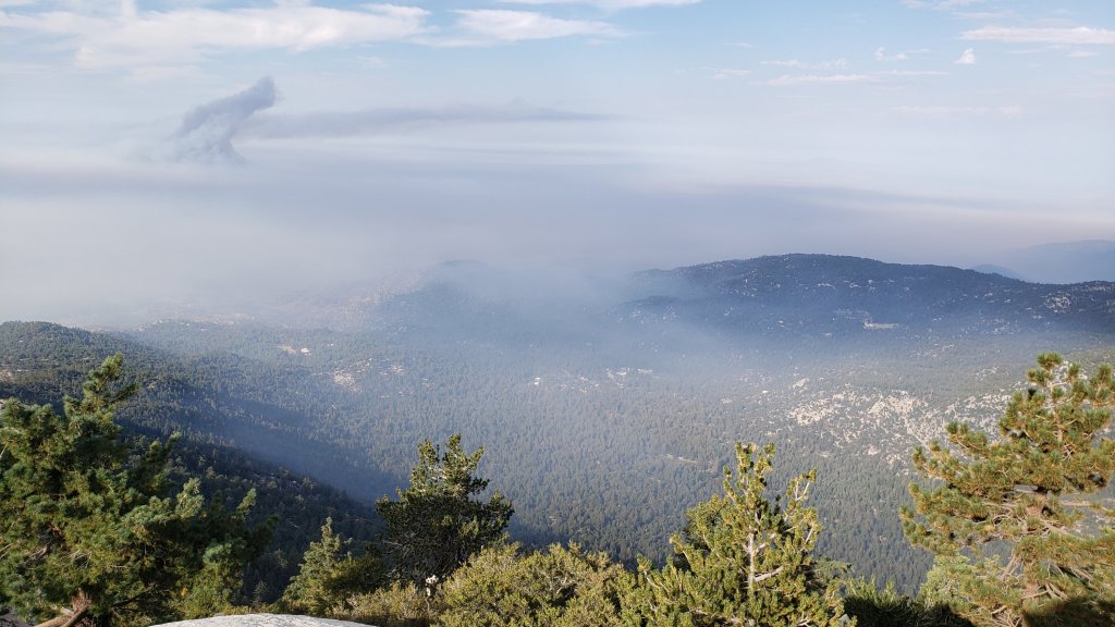

Please stay safe everyone.
sanjacjon Uncategorized 3 Comments 2 MinutesEdit”Fairview Fire update 8th September 2022″
Fire and weather update 7th September 2022
[UPDATED Wednesday 7th September @ 1630: news from the Fairview Fire has not been good this afternoon. Dramatic fire activity up (and out of) Bautista Canyon has continued and latest size estimate is now 9845 acres. The fire has apparently crossed Rouse Hill Road (5S15) near its northern end putting it less than one mile from Highway 74 (roughly a couple of miles east of Cranston).]
[UPDATED Wednesday 7th September @ 1430: latest reports indicate the Fairview Fire continues steady progress south-east up both sides of Bautista Canyon. Total size now at least 7100 acres. Crews have been placed at Bautista Conservation Camp for structure defense. An intensive Phos-Chek campaign is underway to protect the antennas and fire lookout at Red Mountain.]
[UPDATED Wednesday 7th September @ 0530: early this morning the Fairview Fire was estimated at 6520 acres, having more than doubled in size in the past 24 hours. Almost all of the spread was east into northern Bautista Canyon. The good news for residents of Idyllwild and Mountain Center is that winds today are expected to be weaker and variable but largely easterly, hopefully holding the fire well to our west in the Bautista Canyon area. Thanks to Hurricane Kay, cooler, damp, cloudy conditions are forecast for 9th and 10th September.]
[UPDATED Tuesday 6th September @ 2030: the Fairview Fire, now well over 5000 acres, is expanding steadily along a broad front, mainly to the southeast, occupying much of northern Bautista Canyon. A huge expanse of flame was visible to the naked eye about eight miles west of town this evening from Idyllwild.]
[UPDATED Tuesday 6th September @ 1650: the Fairview Fire is now estimated at 4500 acres. It continues to push east, having crossed into the National Forest and jumped Bautista Canyon Road. At that point the fire hits very rugged terrain with a lot of unburned fuel and it will be challenging to slow its progress. A combination of evacuation order and evacuation warning was recently issued for a huge area south and west of Highway 74 and north of Highway 371, roughly Mountain Center to Thomas Mountain and south to Anza.]
Attention is currently on the Fairview Fire which started just south-east of Hemet late afternoon on 5th September, quickly spreading to over 2000 acres, killing two people and destroying multiple properties. Although early this morning the eastern flank of the fire was about ten miles west of Mountain Center, and just over one mile west of the National Forest boundary, we know from recent experience (notably the Cranston Fire in July 2018) that fires can cover the ground from the east end of Hemet to the fringes of Idyllwild in a few hours. Thankfully the wind direction and wind speed currently make that scenario unlikely.
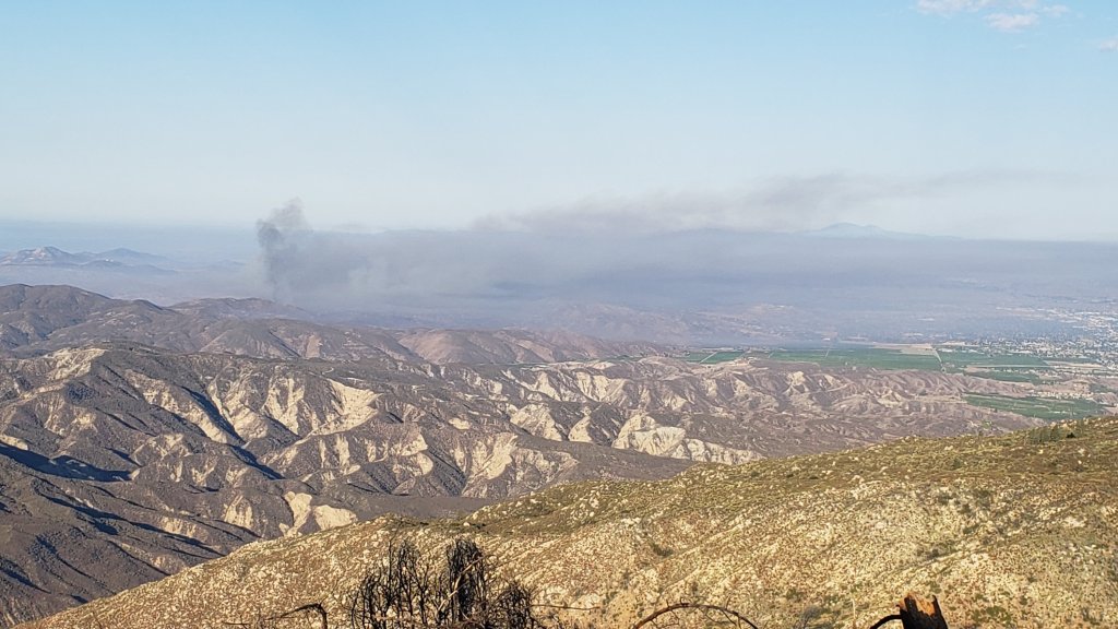
The exceptional heatwave that has been impacting our region since the end of August continues for another couple of days. The heatwave is forecast to break quite dramatically on Friday 9th, when the San Jacinto mountains will catch the edge of Hurricane Kay as it churns off the northwest coast of Baja California. Gale force winds around the highest peaks on Friday 9th will result in windchill temperatures below freezing on 9th-10th September in the high country even though air temperatures may be near 50°F (10°C). How much precipitation is associated with the wind and cloud is unclear from the divergent forecast models, currently ranging from a light drizzle to a couple of inches, but about 0.5-1.0 inch is suggested by most forecasts, mainly overnight on Friday 9th into the morning of Saturday 10th.
Water conditions where known are detailed at the foot of this Report. Please note these may change rapidly if there is substantial precipitation on 9th-10th September. Hikes have included thorough surveys of water resources on the major trail systems on both the western and eastern slopes of the San Jacinto high country frequently, plus Round Valley and the Tahquitz area meadows. Current conditions for individual trails are discussed in detail below where known.
Hikers should continue to be prepared for exceptionally hot weather until Friday 9th September, with overnight “low” temperatures at least 15-20°F above seasonal and daytime high temperatures around 90°F (32°C) even at 6000 ft elevation. Plan accordingly regarding route choice, start time, clothing, sun protection, and water requirements.
Hikers should be prepared for unpredictable, rapidly changing weather conditions in the high country in late summer. Monsoonal storms, typically in the afternoon, remain a possibility throughout September (in addition to the possible tropical storm spinoff on 9th-10th). Thunderstorms with lightning, brief but intense precipitation, and rapid temperature drops, can occur in the high country even when such storms are not forecast for lower elevations.
All hikers, but especially those planning to hike Skyline Trail (either on its own or as part of the “Cactus-to-Clouds”), should note that the Palm Springs Aerial Tramway is closed for annual maintenance from Monday 12th September to Sunday 9th October 2022, with a tentative reopening date of 10th October.
Full fire restrictions were introduced on Thursday 26th May on Forest Service lands, as described in detail here. Campfires on all USFS lands in the San Jacinto mountains (including in fire rings at campgrounds and yellow post sites), and smoking, are prohibited for the remainder of the year. Fires are never permitted in the State Park wilderness.
Dark Canyon Campground will not reopen this year due to staffing/maintenance issues.
May Valley Road (5S21) remains closed, including to foot traffic. Work to remove hazardous trees, burned by the 2018 Cranston Fire, finally got underway in mid August. The current closure order expired on 5th September, but work looks unlikely to be completed until later this month.
WEATHER
Temperatures that have been far above seasonal since 30th August will continue until 8th September. Daytime highs have exceeded 90°F (32°C) at 5000-6000 ft elevation while overnight low temperatures average 15-20°F above seasonal at mid elevations (5000-7500 ft). Daytime high temperatures finally drop to about average for September from 9th onwards (although overnight lows will apparently remain well above seasonal).
As described above, spinoff from Hurricane Kay will produce strong winds in the high country, windchill temperatures below freezing on 9th-11th September around the highest peaks, heavily cloudy days on 9th and 10th, and the possibility of up to an inch of rain at all elevations mainly on Saturday 10th. From 11th September onwards, temperatures are forecast to be closer to seasonal for the month, but with possibilities for monsoon rainfall continuing for several days.
According to National Weather Service data (available here) recorded at the Idyllwild Fire station, precipitation was slightly below average for August, despite some good monsoon rains. The air temperature averaged 2.7°F above normal for the month of August. The maximum high temperature of 96°F recorded on 31st August broke the record for that day (previously 94°F recorded in 2017).
In Idyllwild the overnight low temperature has dropped below the monthly average only once since 9th July 2022, currently a sequence of 56 days (the sole exception was on 27th August when a low of 55°F was recorded, the average low for August being 55.4°F). The record for consecutive days of above-monthly-average low temperatures was set just last summer at 56 days (12th June-6th August 2021).
At San Jacinto Peak (10,810ft/3295m) on Friday 2nd September 2022 at 0740 the air temperature was 60.5°F (16°C), with a windchill temperature of 54.5°F (13°C), 47% relative humidity, and a gusty NNE breeze sustained at 5 mph gusting to 10.4 mph.
TRAIL CONDITIONS
Due to greatly reduced maintenance work by the agencies and PCTA during the coronavirus pandemic, many trails have accumulated treefall hazards since late 2019, passable with care by hikers but not for stock.
Willow Creek Trail is a slow, messy hike for a couple of miles, and is currently only recommended for experienced hikers. Some 46 trees are down on the Forest Service section of this trail between Skunk Cabbage Junction and the State Park boundary (August 2022 survey). Of those, 35 are in the 0.6 mile section between Willow Creek crossing and the State Park boundary. This situation has been reported to USFS. The State Park cut about a dozen trees on the section of trail under their jurisdiction in late July. The huge amount of work that Bill Rhoads and I undertook to clear whitethorn along this trail in 2020 was not completely in vain and parts of the trail would have largely disappeared otherwise, but it has grown back rapidly and makes some of the treefall hazards more complicated to negotiate (photos in previous Report).
Although some treefall hazards from Red Tahquitz to Antsell Rock (PCT Miles 172.5-175) were cleared in June 2021 prior to the rockslide removal work, the situation has badly deteriorated. In my most recent survey I counted about 80 treefall hazards between PCT Miles 170-175, plus about six more on PCT Miles 175-177. At least a third of the former are major hazards that require scrambling over or around.
On 9th August a California Conservation Corps team cut the four treefall hazards on Deer Springs Trail between Strawberry Junction and the top of Marion Mountain Trail, including the huge one of three that came down in late 2021 just south of the latter junction (photo in previous Report).
The middle section of South Ridge Trail (between May Valley Road and the top of South Ridge Road) has several trees down which are significant obstructions.
Spitler Peak Trail is currently in its most hiker-friendly condition since the July 2013 Mountain Fire. Forty downed trees, most from an ice storm in late December 2021, plus dozens of additional trunks and branches in the trail, were removed by the Trail Report from this trail in early 2022.
Fuller Ridge Trail has 14 treefall hazards (multiple 2022 surveys) obstructing the trail, but all are readily passable by relatively agile hikers. Eleven of these are in the 1.5 mile section closest to Fuller Ridge Campground (approx. PCT Miles 189-190.5).
The Caramba Trail from near Reeds Meadow through Laws Camp and on to Caramba, and the Cedar Trail from Willow Creek Trail to Laws, are optimistically described by the Forest Service as “not maintained”. In reality both trails no longer exist and are so heavily overgrown I strongly advise hikers do not attempt to follow them. An informal use trail to Laws is much more direct and avoids all of the very challenging bushwhacking of the unmaintained trails (some local hikers dubbed it the “King Trail” when I established the route in 2019). It leaves the Willow Creek Trail exactly 1.0 mile from Saddle Junction (0.46 mile from the Skunk Cabbage turning), descending largely on established deer trails for 1.2 miles, meeting Willow Creek just upstream from the old Laws Camp. From Laws east to Caramba the route of the original Caramba Trail has been well-cairned by myself and others and can largely be followed with very careful route-finding. My 2022 survey counted 97 trees down on this 2.1 miles of trail. It is especially obscure 0.1-0.3 mile east of the Willow Creek crossing, becoming more obvious near Caramba. Very cautious navigation is advised throughout the area.
Seven Pines Trail has had limited hiker traffic since November 2018, largely because Dark Canyon Road was closed almost continuously from February 2019 to July 2022. Dark Canyon Road finally reopened in mid July 2022. The Trail Report has “adopted” Seven Pines Trail as a priority for maintenance work as the trail has had a disproportionate number of lost hiker rescues in the past decade. Between November 2021 and May 2022, 61 downed trees were removed and almost the entire trail thoroughly trimmed and cleared. Nevertheless Seven Pines remains a genuine wilderness trail and is nothing like the relatively wide, bare, and obvious routes of, for example, Devil’s Slide or Marion Mountain trails. Cautious navigation remains required for those who do not have significant experience of hiking this trail.
WATER CONDITIONS: Eastern slope
The Round Valley pipe is trickling at about 0.5 L/min (photo below). It is only continuing to flow into September thanks to some monsoonal rainfall input over the past month, but recent history suggests it could now dry up at any time without further precipitation. The nearby Round Valley creek dried up in May. The small creek in Tamarack Valley also dried up in May.
All springs at Wellman’s Cienega are flowing extremely weakly for the time of year, at about 0.25 L/min. They did not receive significant input from summer thunderstorms, and the well-known north springs may dry completely in the next month or two without significant precipitation. They should no longer be relied upon for anything other than emergency filtering. This spring dried for the first time in recorded history in October 2015, then again in September 2016.
The Wellman’s Cienega springs are the sources for Willow Creek, which is currently flowing weakly but reliably where it crosses the Willow Creek Trail.
Tahquitz Creek is flowing gently at the northern (lower) end of Little Tahquitz Valley at a flow rate of roughly 1.5L/min. It is flowing weakly further upstream at its source, known colloquially as Grethe Spring, where it crosses the PCT at approx. PCT Mile 177. Between these locations Tahquitz Creek is largely dry (but presumably flowing subsurface). The small creek in Tahquitz Valley dried up in May.
Skunk Cabbage (“Candy’s”) Creek dried up in late June where it crosses under the trail through Skunk Cabbage Meadow.
WATER CONDITIONS: Western slope
Ephemeral creeks, such as those along Marion Mountain Trail and on Deer Springs Trail, have been dry since May.
The North Fork of the San Jacinto River is flowing weakly, but reliably, at about 6.0 L/min where it crosses the Deer Springs Trail and more weakly downstream where it crosses the Fuller Ridge Trail on the PCT (approx. PCT Mile 186.2). However the river is completely dry where it crosses Seven Pines Trail and Dark Canyon Road (photos in previous Report).
The creek in Little Round Valley (photos below) dried dramatically in late August, and will not last beyond September without further rainfall. There is gentle surface flow in two short sections, for about 50 yards behind the “Campsite 2 Owl’s Hootch” sign, and for another 70 yards a little further downstream.
Shooting Star Spring (below Little Round Valley but above the North Fork of the San Jacinto River crossing) is now flowing very weakly and is inadequate for filtering.
The Deer Springs stream crossing at the PCT/Deer Springs Trail (approx. PCT mile 185.6) completely dried up in late May where it crosses the trail and did not receive any meaningful water from rains in July.
The tiny Switchback Spring at PCT Mile 183.5 (about 0.4 miles on the PCT northbound from Strawberry Junction) is flowing gently, and there is just about adequate depth from which to filter water in the tiny pool on the upslope side of the trail (photo in previous Report).
The little creek at Strawberry Cienega (PCT mile 183.0) has been dry since June.
On Devil’s Slide Trail, Middle Spring is barely trickling and will dry soon without new rain input. A tiny pool remains as a useful emergency drinking source for dogs. Other springs on this trail have been dry for months.
On the Ernie Maxwell Trail, the crossing of Chinquapin Creek just below Humber Park is dry where it crosses the trail. However, even when Fern Valley Water District is diverting flow into the pipe system small fresh pools remain among the rocks just upslope from the trail (these are an important source of water for the many dogs walked on the Ernie Maxwell).
WATER CONDITIONS: Desert Divide
Live Oak Spring (N 33 37 21, W 116 33 24) Flowing. The most reliable water source on the Desert Divide.
Cedar Spring (N 33 40 36, W 116 34 35) Flowing (upslope from the trail that leads to the campsite). Sadly the inflow pipe to the trough – formerly the most accessible water source – was vandalized in May 2022 and consequently the trough is dry. This damage has been reported to the Forest Service, but no repair is expected until later in the year.
Apache Spring (N 33 43 11, W 116 37 13) Flowing very weakly, but the spring box remains full. This spring has functionally dried up in recent years and may not be reliable by autumn.
Spitler Peak Trail Descending the trail there are five water crossings. The first two, at 0.90 and 0.95 miles down, cross a tiny side creek which is largely dry and should be ignored. The next three crossings, at 1.1-1.5 miles down, are Spitler Creek and is the best source of water (currently flowing gently at both the uppermost and lowest crossings).
Antsell Rock Creek (N 33 41 52, W 116 39 08) Right by the Spitler Peak Trail trailhead on Apple Canyon Road, Antsell Rock Creek is dry, nearly two months earlier than last year.
Thank you for taking the time to read this. While all time and labor is volunteered, the San Jacinto Trail Report depends on small private donations to cover our costs. Your contribution keeps the Report available to all, free from advertising or paywalls, and independent from agencies. If you have found this Report useful, please use this link to the Donate page. Zelle, Venmo, and PayPal are all options. Thank you for your support.


sanjacjon Uncategorized Leave a comment 12 MinutesEdit”Fire and weather update 7th September 2022″
Weather and water update 2nd September 2022
A few localized thunderstorms in the past couple of weeks included one over the Devil’s Slide Trail area on 20th August and another over San Jacinto Peak and the western slope (notably Marion Mountain Trail) on 24th August. While these dampened the trails, impacts on water sources were negligible compared to the more widespread and intense monsoonal rains of 30th July-1st August. The weather focus over the next week shifts to an exceptional early September heatwave, discussed in more detail below.
Water conditions where known are detailed at the foot of this Report. Hikes have included thorough surveys of water resources on the major trail systems on both the western and eastern slopes of the San Jacinto high country frequently, most recently on 25th and 28th August, plus Round Valley and around the Tahquitz area meadows. Current conditions for individual trails are discussed in detail below where known.
Hikers should be prepared for exceptionally hot weather from 31st August to 8th September, with overnight “low” temperatures at least 15-20°F above seasonal and daytime high temperatures at or above 90°F (32°C) even at 6000-7000 ft elevation. Plan accordingly regarding route choice, start time, clothing, sun protection, and water requirements.
Hikers should continue to be prepared for unpredictable, rapidly changing weather conditions in the high country in late summer. Monsoon thunderstorms, typically in the afternoon, remain a slim possibility daily for at least the next week. Thunderstorms with lightning, brief but intense precipitation, and rapid temperature drops, can occur in the high country even when such storms are not forecast for lower elevations.
Full fire restrictions were introduced on Thursday 26th May on Forest Service lands, as described in detail here. Campfires on all USFS lands in the San Jacinto mountains (including in fire rings at campgrounds and yellow post sites), and smoking, are prohibited for the remainder of the year. Fires are never permitted in the State Park wilderness.
Be rattlesnake aware. Southern Pacific Rattlesnakes (Crotalus helleri) have been seen on the trail system up to at least 8900 ft elevation. The lower two-thirds of Devil’s Slide Trail, near Strawberry Cienega, and around Tahquitz Peak are locations with regular sightings, but rattlesnakes are possible anywhere up to at least 9300 ft.
Seasonal campgrounds and Forest Service roads are now generally open. Note however the fire restrictions mentioned above. Dark Canyon Campground will not reopen this year due to staffing/maintenance issues.
May Valley Road (5S21) remains completely closed, including to foot traffic (photos below). Work to remove hazardous trees, burned by the 2018 Cranston Fire, finally got underway in mid August. The current closure order expires on 5th September, but work looks unlikely to be completed before late September.
WEATHER
Temperatures are forecast to be far above seasonal from 30th August until at least 8th September, with the likelihood that several early September temperature records for the San Jacinto mountains will be broken. Daytime highs will exceed 90°F (32°C) at 6000 ft elevation for nine consecutive days while overnight low temperatures will average 15-20°F above seasonal at mid elevations (5000-7500 ft). Forecast temperatures between 1st-8th September at San Jacinto Peak will be among the highest recorded there in 2022. Daytime high temperatures finally drop closer to average for September on 9th-10th (although overnight lows will remain well above seasonal). Monsoonal thunderstorms are currently forecast as a (slim) possibility daily until 9th September.
Based on National Weather Service data recorded at Idyllwild Fire station, the overnight low temperature has only dropped below the monthly average on one day since 9th July 2022 (that was on 27th August when a low of 55°F was recorded, the average low for the month being 55.4°F). The record for consecutive days of above-average low temperatures was set just last summer at 56 days (12th June-6th August 2021).
At San Jacinto Peak (10,810ft/3295m) on Friday 2nd September 2022 at 0740 the air temperature was 60.5°F (16°C), with a windchill temperature of 54.5°F (13°C), 47% relative humidity, and a gusty NNE breeze sustained at 5 mph gusting to 10.4 mph.
At the Peak on Monday 29th August 2022 at 0820 the air temperature was 50.7°F (10°C), with a windchill temperature of 42.8°F (6°C), 61% relative humidity, and a steady SE wind sustained at 9 mph gusting to 18.6 mph.
At the Peak on Thursday 25th August 2022 at 0835 the air temperature was 55.2°F (13°C), with a “windchill” temperature of 52.0°F (11°C), 67% relative humidity, and a very light NNE breeze sustained at 3 mph gusting to 4.5 mph.
TRAIL CONDITIONS
The trail system throughout the San Jacinto mountains cleared of snow in late April.
Due to greatly reduced maintenance work by the agencies and PCTA during the coronavirus pandemic, many trails have accumulated treefall hazards since late 2019, passable with care by hikers but not for stock.
Willow Creek Trail is a slow, messy hike for a couple of miles, and is currently only recommended for experienced hikers. Some 46 trees are down on the Forest Service section of this trail between Skunk Cabbage Junction and the State Park boundary (August 2022 survey). Of those, 35 are in the 0.6 mile section between Willow Creek crossing and the State Park boundary. This situation has been reported to USFS. The State Park cut about a dozen trees on the section of trail under their jurisdiction in late July. The huge amount of work that Bill Rhoads and I undertook to clear whitethorn along this trail in 2020 was not completely in vain and parts of the trail would have largely disappeared otherwise, but it has grown back rapidly and makes some of the treefall hazards more complicated to negotiate (photos in previous Report).
Although some treefall hazards from Red Tahquitz to Antsell Rock (PCT Miles 172.5-175) were cleared in June 2021 prior to the rockslide removal work, the situation has badly deteriorated. In my most recent survey I counted about 80 treefall hazards between PCT Miles 170-175, plus about six more on PCT Miles 175-177. At least a third of the former are major hazards that require scrambling over or around.
On 9th August a California Conservation Corps team cut the four treefall hazards on Deer Springs Trail between Strawberry Junction and the top of Marion Mountain Trail, including the huge one of three that came down in late 2021 just south of the latter junction (photo in previous Report).
The middle section of South Ridge Trail (between May Valley Road and the top of South Ridge Road) has several trees down which are significant obstructions.
Spitler Peak Trail is currently in its most hiker-friendly condition since the July 2013 Mountain Fire. Forty downed trees, most from an ice storm in late December 2021, plus dozens of additional trunks and branches in the trail, were removed by the Trail Report from this trail in early 2022.
Fuller Ridge Trail has 14 treefall hazards (multiple 2022 surveys) obstructing the trail, but all are readily passable by relatively agile hikers. Eleven of these are in the 1.5 mile section closest to Fuller Ridge Campground (approx. PCT Miles 189-190.5).
The Caramba Trail from near Reeds Meadow through Laws Camp and on to Caramba, and the Cedar Trail from Willow Creek Trail to Laws, are optimistically described by the Forest Service as “not maintained”. In reality both trails no longer exist and are so heavily overgrown I strongly advise hikers do not attempt to follow them. An informal use trail to Laws is much more direct and avoids all of the very challenging bushwhacking of the unmaintained trails (some local hikers dubbed it the “King Trail” when I established the route in 2019). It leaves the Willow Creek Trail exactly 1.0 mile from Saddle Junction (0.46 mile from the Skunk Cabbage turning), descending largely on established deer trails for 1.2 miles, meeting Willow Creek just upstream from the old Laws Camp. From Laws east to Caramba the route of the original Caramba Trail has been well-cairned by myself and others and can largely be followed with very careful route-finding. My 2022 survey counted 97 trees down on this 2.1 miles of trail. It is especially obscure 0.1-0.3 mile east of the Willow Creek crossing, becoming more obvious near Caramba. Very cautious navigation is advised throughout the area.
Seven Pines Trail has had limited hiker traffic since November 2018, largely because Dark Canyon Road was closed almost continuously from February 2019 to July 2022. Dark Canyon Road finally reopened in mid July 2022. The Trail Report has “adopted” Seven Pines Trail as a priority for maintenance work as the trail has had a disproportionate number of lost hiker rescues in the past decade. Between November 2021 and May 2022, 61 downed trees were removed and almost the entire trail thoroughly trimmed and cleared. Nevertheless Seven Pines remains a genuine wilderness trail and is nothing like the relatively wide, bare, and obvious routes of, for example, Devil’s Slide or Marion Mountain trails. Cautious navigation remains required for those who do not have significant experience of hiking this trail.
WATER CONDITIONS: Eastern slope
The Round Valley pipe is trickling at about 0.5 L/min (photo above). It is only continuing to flow into September thanks to some monsoonal rainfall input over the past month, but recent history suggests it could now dry up at any time without further precipitation. The nearby Round Valley creek dried up in May. The small creek in Tamarack Valley also dried up in May.
All springs at Wellman’s Cienega are flowing extremely weakly for the time of year, at about 0.25 L/min. They did not receive significant input from summer thunderstorms, and the well-known north springs (photo below) may dry completely in the next month or two without significant precipitation. They should no longer be relied upon for anything other than emergency filtering. This spring dried for the first time in recorded history in October 2015, then again in September 2016.
The Wellman’s Cienega springs are the sources for Willow Creek, which is currently flowing weakly but reliably where it crosses the Willow Creek Trail (photo in previous Report).
Tahquitz Creek is flowing gently at the northern (lower) end of Little Tahquitz Valley at a flow rate of roughly 1.5L/min. It is flowing weakly further upstream at its source, known colloquially as Grethe Spring, where it crosses the PCT at approx. PCT Mile 177. Between these locations Tahquitz Creek is largely dry (but presumably flowing subsurface). The small creek in Tahquitz Valley dried up in May.
Skunk Cabbage (“Candy’s”) Creek dried up in late June where it crosses under the trail through Skunk Cabbage Meadow.
WATER CONDITIONS: Western slope
Ephemeral creeks, such as those along Marion Mountain Trail and on Deer Springs Trail, have been dry since May.
The North Fork of the San Jacinto River is flowing weakly, but reliably, at about 6.0 L/min where it crosses the Deer Springs Trail (photo below) and more weakly downstream where it crosses the Fuller Ridge Trail on the PCT (approx. PCT Mile 186.2). However the river is completely dry where it crosses Seven Pines Trail and Dark Canyon Road (photos in previous Report).
The creek in Little Round Valley (photos below) has dried dramatically in late August, and will not last beyond September without further rainfall. There is gentle surface flow in two short sections, for about 50 yards behind the “Campsite 2 Owl’s Hootch” sign, and for another 70 yards a little further downstream.
Shooting Star Spring (below Little Round Valley but above the North Fork of the San Jacinto River crossing) is now flowing very weakly and is inadequate for filtering.
The Deer Springs stream crossing at the PCT/Deer Springs Trail (approx. PCT mile 185.6) completely dried up in late May where it crosses the trail and did not receive any meaningful water from rains in July.
The tiny Switchback Spring at PCT Mile 183.5 (about 0.4 miles on the PCT northbound from Strawberry Junction) is flowing gently, and there is just about adequate depth from which to filter water in the tiny pool on the upslope side of the trail (photo in previous Report).
The little creek at Strawberry Cienega (PCT mile 183.0) has been dry since June.
On Devil’s Slide Trail, Middle Spring is barely trickling and will dry soon without new rain input. A tiny pool remains as a useful emergency drinking source for dogs. Other springs on this trail have been dry for months.
On the Ernie Maxwell Trail, the crossing of Chinquapin Creek just below Humber Park is dry where it crosses the trail. However, even when Fern Valley Water District is diverting flow into the pipe system small fresh pools remain among the rocks just upslope from the trail (these are an important source of water for the many dogs walked on the Ernie Maxwell).
WATER CONDITIONS: Desert Divide
Live Oak Spring (N 33 37 21, W 116 33 24) Flowing. The most reliable water source on the Desert Divide.
Cedar Spring (N 33 40 36, W 116 34 35) Flowing (upslope from the trail that leads to the campsite). Sadly the inflow pipe to the trough – formerly the most accessible water source – was vandalized in May 2022 and consequently the trough is dry. This damage has been reported to the Forest Service, but no repair is expected until later in the year.
Apache Spring (N 33 43 11, W 116 37 13) Flowing very weakly, but the spring box remains full. This spring has functionally dried up in recent years and may not be reliable by autumn.
Spitler Peak Trail Descending the trail there are five water crossings. The first two, at 0.90 and 0.95 miles down, cross a tiny side creek which is largely dry and should be ignored. The next three crossings, at 1.1-1.5 miles down, are Spitler Creek and is the best source of water (currently flowing gently at both the uppermost and lowest crossings).
Antsell Rock Creek (N 33 41 52, W 116 39 08) Right by the Spitler Peak Trail trailhead on Apple Canyon Road, Antsell Rock Creek is dry, nearly two months earlier than last year.
Thank you for taking the time to read this. While all time and labor is volunteered, the San Jacinto Trail Report depends on small private donations to cover our costs. Your contribution keeps the Report available to all, free from advertising or paywalls, and independent from agencies. If you have found this Report useful, please use this link to the Donate page. Zelle, Venmo, and PayPal are all options. Thank you for your support.


sanjacjon Uncategorized Leave a comment 10 MinutesEdit”Weather and water update 2nd September 2022″
Water and weather update 25th August 2022
The excellent monsoonal rains of 30th July-1st August have not been repeated, although a minor storm cell over San Jacinto Peak and the western slope (notably Marion Mountain Trail) on Tuesday 24th did dampen some trails and slightly improve some water sources. Although forecasts indicate that further monsoon activity this month is unlikely, storms are possible in the first week of September.
Water conditions where known are detailed at the foot of this Report. Hikes have included thorough surveys of water resources on the major trail systems on both the western and eastern slopes of the San Jacinto high country frequently, most recently on 19th and 25th August, plus around the Tahquitz area meadows, Willow Creek Trail and Round Valley. Current conditions for individual trails are discussed in detail below where known.
Hikers should be prepared for continuing hot and humid weather, with overnight “low” temperatures forecast to remain about 5-15°F above seasonal into September, and daytime highs typically at or above seasonal averages (with the exception of 26th-28th). An intense heatwave is currently forecast for 30th August-4th September at least. Humidity has been above normal at all elevations for a month. Plan accordingly regarding route choice, start times, clothing, sun protection, and water requirements.
Hikers should continue to be prepared for the possibility of rapidly changing weather conditions in the high country in summer. Monsoon thunderstorms, typically in the afternoon, remain a possibility almost daily (although precipitation probabilities have generally lowered for the foreseeable future). Thunderstorms with lightning, brief but intense precipitation, and rapid temperature drops, can occur in the high country even when such storms are not forecast for lower elevations.
Full fire restrictions were introduced on Thursday 26th May on Forest Service lands, as described in detail here. Campfires on all USFS lands in the San Jacinto mountains (including in fire rings at campgrounds and yellow post sites), and smoking, are prohibited for the remainder of the year.
Be rattlesnake aware. Southern Pacific Rattlesnakes (Crotalus helleri) have been seen on the trail system up to at least 8900 ft elevation. The lower two-thirds of Devil’s Slide Trail, near Strawberry Cienega, and around Tahquitz Peak are regular hotspots, but rattlesnakes are possible anywhere up to at least 9300 ft.
Seasonal campgrounds and Forest Service roads are now generally open. Note however the fire restrictions mentioned above. Dark Canyon Campground will not reopen this year due to staffing/maintenance issues.
May Valley Road (5S21) remains completely closed (including to foot traffic). Work to remove hazard trees finally got underway in mid August. The current closure order expires on 5th September, but work looks unlikely to be completed before late September.

WEATHER
Daytime high temperatures are forecast to generally be around or above seasonal for the remainder of August, but well above average on 30th August until 4th September at least. Overnight low temperatures will continue to average 5-15°F above seasonal at mid elevations (5000-7500 ft). Monsoonal storms always remain a possibility at this time of year, but precipitation probabilities are currently low into the first week of September.
Based on National Weather Service data recorded at Idyllwild Fire station, the last time that the overnight low temperature was below the monthly average this year was on 9th July 2022, so we are currently on a run of at least 46 consecutive days of above-average low temperatures. While this is remarkable, it is still well short of the previous record of 56 days, set just last summer (12th June-6th August 2021).
At San Jacinto Peak (10,810ft/3295m) on Thursday 25th August 2022 at 0835 the air temperature was 55.2°F (13°C), with a “windchill” temperature of 52.0°F (11°C), 67% relative humidity, and a very light NNE breeze sustained at 3 mph gusting to 4.5 mph.
At the Peak on Friday 19th August 2022 at 0830 the air temperature was 57.5°F (14°C), with a “windchill” temperature of 50.0°F (10°C), 42% relative humidity, and a gentle NE breeze sustained at 5 mph gusting to 8.3 mph.

TRAIL CONDITIONS
The trail system throughout the San Jacinto mountains cleared of snow in late April.
Due to greatly reduced maintenance work by the agencies and PCTA during the coronavirus pandemic, many trails have accumulated treefall hazards since late 2019, passable with care by hikers but not for stock.
Willow Creek Trail is a slow, messy hike for a couple of miles, and is currently only recommended for experienced hikers. Some 46 trees are down on the Forest Service section of this trail between Skunk Cabbage Junction and the State Park boundary (August 2022 survey). Of those, 35 are in the 0.6 mile section between Willow Creek crossing and the State Park boundary. This situation has been reported to USFS. The State Park cut about a dozen trees on the section of trail under their jurisdiction in late July. The huge amount of work that Bill Rhoads and I undertook to clear whitethorn along this trail in 2020 was not completely in vain and parts of the trail would have largely disappeared otherwise, but it has grown back rapidly and makes some of the treefall hazards more complicated to negotiate (photos in previous Report).
Although some treefall hazards from Red Tahquitz to Antsell Rock (PCT Miles 172.5-175) were cleared in June 2021 prior to the rockslide removal work, the situation has badly deteriorated. In my most recent survey I counted about 80 treefall hazards between PCT Miles 170-175, plus about six more on PCT Miles 175-177. At least a third of the former are major hazards that require scrambling over or around.
On 9th August a California Conservation Corps team cut the four treefall hazards on Deer Springs Trail between Strawberry Junction and the top of Marion Mountain Trail, including the huge one of three that came down in late 2021 just south of the latter junction (photo in previous Report).
The middle section of South Ridge Trail (between May Valley Road and the top of South Ridge Road) has several trees down which are significant obstructions.
Spitler Peak Trail is currently in its most hiker-friendly condition since the July 2013 Mountain Fire. Forty downed trees, most from an ice storm in late December 2021, plus dozens of additional trunks and branches in the trail, were removed by the Trail Report from this trail in early 2022.
Fuller Ridge Trail has 14 treefall hazards (multiple 2022 surveys) obstructing the trail, but all are readily passable by relatively agile hikers. Eleven of these are in the 1.5 mile section closest to Fuller Ridge Campground (approx. PCT Miles 189-190.5).
The Caramba Trail from near Reeds Meadow through Laws Camp and on to Caramba, and the Cedar Trail from Willow Creek Trail to Laws, are optimistically described by the Forest Service as “not maintained”. In reality both trails no longer exist and are so heavily overgrown I strongly advise hikers do not attempt to follow them. An informal use trail to Laws is much more direct and avoids all of the very challenging bushwhacking of the unmaintained trails (some local hikers dubbed it the “King Trail” when I established the route in 2019). It leaves the Willow Creek Trail exactly 1.0 mile from Saddle Junction (0.46 mile from the Skunk Cabbage turning), descending largely on established deer trails for 1.2 miles, meeting Willow Creek just upstream from the old Laws Camp. From Laws east to Caramba the route of the original Caramba Trail has been well-cairned by myself and others and can largely be followed with very careful route-finding. My 2022 survey counted 97 trees down on this 2.1 miles of trail. It is especially obscure 0.1-0.3 mile east of the Willow Creek crossing, becoming more obvious near Caramba. Very cautious navigation is advised throughout the area.
Seven Pines Trail has had limited hiker traffic since November 2018, largely because Dark Canyon Road was closed almost continuously from February 2019 to July 2022. Dark Canyon Road finally reopened in mid July 2022. The Trail Report has “adopted” Seven Pines Trail as a priority for maintenance work as the trail has had a disproportionate number of lost hiker rescues in the past decade. Between November 2021 and May 2022, 61 downed trees were removed and almost the entire trail thoroughly trimmed and cleared. Nevertheless Seven Pines remains a genuine wilderness trail and is nothing like the relatively wide, bare, and obvious routes of, for example, Devil’s Slide or Marion Mountain trails. Cautious navigation remains required for those who do not have significant experience of hiking this trail.
WATER CONDITIONS: Eastern slope
The Round Valley pipe is flowing at roughly 1.0 L/min but recent history suggests it may not persist much longer without further rainfall input. The nearby Round Valley creek dried up in May. The small creek in Tamarack Valley also dried up in May.
All springs at Wellman’s Cienega are flowing extremely weakly for the time of year. They did not receive significant input from summer thunderstorms, and the well-known north springs (photo below) may dry completely in the next month or two without further precipitation. They should no longer be relied upon for filtering. This spring dried for the first time in recorded history in October 2015, then again in September 2016.
The Wellman’s Cienega springs are the sources for Willow Creek, which is currently flowing weakly but reliably where it crosses the Willow Creek Trail (photo in previous Report).
Tahquitz Creek is flowing gently at the northern (lower) end of Little Tahquitz Valley at a flow rate of roughly 2.0L/min. It is flowing weakly further upstream at its source, known colloquially as Grethe Spring, where it crosses the PCT at approx. PCT Mile 177. Between these locations Tahquitz Creek is largely dry (but presumably flowing subsurface). The small creek in Tahquitz Valley dried up in May.
Skunk Cabbage (“Candy’s”) Creek dried up in late June where it crosses under the trail through Skunk Cabbage Meadow.
WATER CONDITIONS: Western slope
Ephemeral creeks, such as those along Marion Mountain Trail and on Deer Springs Trail, have been dry since May.
The North Fork of the San Jacinto River is flowing relatively weakly where it crosses the Deer Springs Trail (photo in previous Report) and again downstream where it crosses the Fuller Ridge Trail on the PCT (approx. PCT Mile 186.2). However the river is completely dry where it crosses Seven Pines Trail and Dark Canyon Road (photos below).
The creek in Little Round Valley (photo below) has received periodic new precipitation from thunderstorms since late June, including on 24th August. Having been nearly dry in mid June, the creek continues to trickle through the lower half of the valley (for roughly 400 ft), forming some minor pools in the lower half. However the flow has dropped substantially in August, and may not last beyond September without further rainfall. The same creek continues to flow gently where it crosses Fuller Ridge Trail (at about PCT Mile 186.4).
Shooting Star Spring (below Little Round Valley but above the North Fork of the San Jacinto River crossing) is now flowing very weakly and is inadequate for filtering.
The Deer Springs stream crossing at the PCT/Deer Springs Trail (approx. PCT mile 185.6) completely dried up in late May where it crosses the trail and did not receive any meaningful water from rains in July.
The tiny Switchback Spring at PCT Mile 183.5 (about 0.4 miles on the PCT northbound from Strawberry Junction) is flowing gently, and there is just about adequate depth from which to filter water in the tiny pool on the upslope side of the trail (photo below).
The little creek at Strawberry Cienega (PCT mile 183.0) has been dry since June.
On Devil’s Slide Trail, Middle Spring is barely trickling and will dry soon without new rain input. A tiny pool remains as a useful emergency drinking source for dogs. Other springs on this trail have been dry for months.
On the Ernie Maxwell Trail, the crossing of Chinquapin Creek just below Humber Park is dry where it crosses the trail. However, even when Fern Valley Water District is diverting flow into the pipe system small fresh pools remain among the rocks just upslope from the trail (these are an important source of water for the many dogs walked on the Ernie Maxwell).
WATER CONDITIONS: Desert Divide
Live Oak Spring (N 33 37 21, W 116 33 24) Flowing. The most reliable water source on the Desert Divide.
Cedar Spring (N 33 40 36, W 116 34 35) Flowing (upslope from the trail that leads to the campsite). Sadly the inflow pipe to the trough – formerly the most accessible water source – was vandalized in May 2022 and consequently the trough is dry. This damage has been reported to the Forest Service, but no repair is expected until later in the year.
Apache Spring (N 33 43 11, W 116 37 13) Flowing weakly, but the spring box remains full. This spring has functionally dried up in recent years and may not be reliable by autumn.
Spitler Peak Trail Descending the trail there are five water crossings. The first two, at 0.90 and 0.95 miles down, cross a tiny side creek which is largely dry and should be ignored. The next three crossings, at 1.1-1.5 miles down, are Spitler Creek and is the best source of water (currently flowing steadily at both the uppermost and lowest crossings).
Antsell Rock Creek (N 33 41 52, W 116 39 08) Right by the Spitler Peak Trail trailhead on Apple Canyon Road, Antsell Rock Creek is dry, nearly two months earlier than last year.
Thank you for taking the time to read this. While all time and labor is volunteered, the San Jacinto Trail Report depends on your small private donations to cover our costs. Your contribution keeps the Report available to all, free from advertising or paywalls, and independent from agencies. If you have found this Report useful, please use this link to the Donate page. Zelle, Venmo, and PayPal are all options. Thank you for your support.


sanjacjon Uncategorized Leave a comment 10 MinutesEdit”Water and weather update 25th August 2022″
Water update 17th August 2022
Despite often cloudy and humid conditions since the excellent monsoonal rains of 30th July-1st August, with thunder rumbling some afternoons (and regular flash flood warnings being issued), we have not had significant further rainfall in the high country since 8th August, and not since 1st August in Idyllwild. Some effects of the earlier storms persist, with the trails still largely free of dust, but the impact on most water sources from these storms was minimal and the water situation continues to decline as described below. Sadly forecasts indicate that further monsoon activity this month is either unlikely or will be very limited.
Water conditions where known are detailed at the foot of this Report. Hikes have included thorough surveys of water resources on the major trail systems on both the western and eastern slopes of the San Jacinto high country at least weekly, most recently on Monday 15th August, and around the Tahquitz area meadows, Willow Creek Trail and Round Valley. Current conditions for individual trails are discussed in detail below where known.
Hikers should be prepared for continuing hot and humid weather, with overnight “low” temperatures forecast to remain about 10-15°F above seasonal into late August, and daytime highs typically at or above seasonal averages. Humidity is largely above normal at all elevations. Plan accordingly regarding route choice, start times, clothing, sun protection, and water requirements.
Hikers should continue to be prepared for the possibility of rapidly changing weather conditions in the high country in summer. Monsoon thunderstorms, typically in the afternoon, remain a possibility almost daily into late August (although precipitation probabilities have generally lowered for the next week or two). Thunderstorms with lightning, brief but intense precipitation, and rapid temperature drops, can occur in the high country even when such storms are not forecast for lower elevations.
Full fire restrictions were introduced on Thursday 26th May on Forest Service lands, as described in detail here. Campfires on all USFS lands in the San Jacinto mountains (including in fire rings at campgrounds and yellow post sites), and smoking, are prohibited for the remainder of the year.
Be rattlesnake aware. Southern Pacific Rattlesnakes (Crotalus helleri) have been seen on the trail system up to at least 8900 ft elevation. The lower two-thirds of Devil’s Slide Trail, near Strawberry Cienega, and around Tahquitz Peak are regular hotspots, but rattlesnakes are possible anywhere up to at least 9300 ft.
Be bear aware. Although rarely reported, up to three Black Bears have been in the San Jacinto mountains since 2017. On Devil’s Slide Trail at first light on 18th July 2022 we were very fortunate to see the same large (>250lb) dark brown individual that I had seen in September 2021 (one short, poor quality video from the earlier observation is available here). This was clearly a different individual, based on colour pattern and size, from the “blond” one I saw on Devil’s Slide Trail in August 2020 and had previously filmed at home in Idyllwild in 2018 (available here).
Seasonal campgrounds and Forest Service roads are now generally open. Note however the fire restrictions mentioned above. Dark Canyon Campground will not reopen this year due to staffing/maintenance issues. May Valley Road remains closed to vehicles due to “hazard trees” but the necessary tree work is expected to be completed in August.
WEATHER
Temperatures are forecast to be at or largely above seasonal for the remainder of August. Overnight low temperatures will continue to average 5-15°F above seasonal at mid elevations (5000-7500 ft). Higher than normal humidity can make it feel hotter, especially later in the day. Monsoonal storms remain a possibility every afternoon for at least the next ten days, although probabilities for significant precipitation are declining.
At San Jacinto Peak (10,810ft/3295m) on Monday 15th August 2022 at 0800 the air temperature was 60.8°F (16°C), with a “windchill” temperature of 58.8°F (14°C), 45% relative humidity, and a very light NNE breeze sustained at 1 mph gusting to 3.9 mph.
TRAIL CONDITIONS
The trail system throughout the San Jacinto mountains cleared of snow in late April.
Willow Creek Trail is a slow, messy hike in places, and is currently only recommended for experienced hikers. Some 46 trees are down on the Forest Service section of this trail between Skunk Cabbage Junction and the State Park boundary (August 2022 survey). Of those, 35 are in the 0.6 mile section between Willow Creek crossing and the State Park boundary. This situation has been reported in person to USFS. The State Park cut about a dozen trees on the section of trail under their jurisdiction in late July (photo below). The huge amount of work that Bill Rhoads and I undertook to clear whitethorn along this trail in 2020 was not completely in vain and parts of the trail would have largely disappeared otherwise, but it has grown back rapidly and makes some of the treefall hazards more complicated to negotiate (photo below).
Due to greatly reduced maintenance work by the agencies and PCTA during the coronavirus pandemic, many trails have accumulated treefall hazards since late 2019, passable with care by hikers but not for stock. Although some treefall hazards from Red Tahquitz to Antsell Rock (PCT Miles 172.5-175) were cleared in June 2021 prior to the rockslide removal work, the situation has badly deteriorated. In my most recent survey I counted about 80 treefall hazards between PCT Miles 170-175, plus about six more on PCT Miles 175-177. At least a third of the former are major hazards that require scrambling over or around.
On 9th August a California Conservation Corps team cut the four treefall hazards on Deer Springs Trail between Strawberry Junction and the top of Marion Mountain Trail, including the huge one of three that came down in late 2021 just south of the latter junction (photo below).
One new major treefall hazard came down on Marion Mountain Trail, about two miles up, in July. Otherwise this trail is in generally excellent condition.
The middle section of South Ridge Trail (between May Valley Road and the top of South Ridge Road) has several trees down which are significant obstructions.
Spitler Peak Trail is currently in its most hiker-friendly condition since the July 2013 Mountain Fire. Forty downed trees, most from an ice storm in late December 2021, plus dozens of additional trunks and branches in the trail, were removed by the Trail Report from this trail in early 2022.
Fuller Ridge Trail has 14 treefall hazards (multiple 2022 surveys) obstructing the trail, but all are readily passable by relatively agile hikers. Eleven of these are in the 1.5 mile section closest to Fuller Ridge Campground (approx. PCT Miles 189-190.5).
The Caramba Trail from near Reeds Meadow through Laws Camp and on to Caramba, and the Cedar Trail from Willow Creek Trail to Laws, are optimistically described by the Forest Service as “not maintained”. In reality both trails no longer exist and are so heavily overgrown I strongly advise hikers do not attempt to follow them. An informal use trail to Laws is much more direct and avoids all of the very challenging bushwhacking of the unmaintained trails (some local hikers dubbed it the “King Trail” when I established the route in 2019). It leaves the Willow Creek Trail exactly 1.0 mile from Saddle Junction (0.46 mile from the Skunk Cabbage turning), descending largely on established deer trails for 1.2 miles, meeting Willow Creek just upstream from the old Laws Camp. From Laws east to Caramba the route of the original Caramba Trail has been well-cairned by myself and others and can largely be followed with very careful route-finding. My 2022 survey counted 97 trees down on this 2.1 miles of trail. It is especially obscure 0.1-0.3 mile east of the Willow Creek crossing, becoming more obvious near Caramba. Very cautious navigation is advised throughout the area.
Seven Pines Trail has had limited hiker traffic since November 2018, largely because Dark Canyon Road was closed almost continuously from February 2019 to July 2022 (with a brief reopening October-December 2021). Dark Canyon Road finally reopened in mid July 2022. The Trail Report has “adopted” Seven Pines Trail as a priority for maintenance work as the trail has had a disproportionate number of lost hiker rescues in the past decade. Between November 2021 and May 2022, 61 downed trees were removed and almost the entire trail thoroughly trimmed and cleared. Despite this very considerable effort, Seven Pines remains a genuine wilderness trail and is nothing like the relatively wide, bare, and obvious routes of, for example, Devil’s Slide or Marion Mountain trails. Cautious navigation remains required for those who do not have significant experience of hiking this trail.

WATER CONDITIONS: Eastern slope
The Round Valley pipe is flowing at roughly 1.0 L/min but recent history suggests it may not persist all summer without further rainfall input. The nearby Round Valley creek dried up in May. The small creek in Tamarack Valley also dried up in May.
Both the northern and southern springs at Wellman’s Cienega are flowing extremely weakly for the time of year. They did not receive significant additional input from recent thunderstorms, and the well-known north springs may dry completely in the next couple of months without further precipitation. They should no longer be relied upon for filtering. This spring dried for the first time in recorded history in October 2015, then again in September 2016.
The Wellman’s Cienega springs are the sources for Willow Creek, which is currently flowing weakly but reliably where it crosses the Willow Creek Trail (photo below).
Tahquitz Creek is flowing gently at the northern (lower) end of Little Tahquitz Valley at a flow rate of >2.0L/min (photo below). It is flowing weakly further upstream at its source, known colloquially as Grethe Spring, where it crosses the PCT at approx. PCT Mile 177 (photo below). It is clear that this area received some fresh monsoonal rain input in late July, but this dissipated within hours. Between these locations Tahquitz Creek is largely dry (but presumably flowing subsurface). The small creek in Tahquitz Valley dried up in May.
Skunk Cabbage (“Candy’s”) Creek dried up in late June where it crosses under the trail through Skunk Cabbage Meadow.
WATER CONDITIONS: Western slope
Ephemeral creeks, such as those along Marion Mountain Trail and on Deer Springs Trail, have been dry since May.
The North Fork of the San Jacinto River is flowing relatively weakly where it crosses the Deer Springs Trail (photo below) and again downstream where it crosses the Fuller Ridge Trail on the PCT (approx. PCT Mile 186.2). However the river is completely dry where it crosses Seven Pines Trail and Dark Canyon Road (photos below).
The creek in Little Round Valley (photo below) received moderate new precipitation from thunderstorms at the end of July. Having been nearly dry in mid June, the creek just about continues to flow through the lower half of the valley (roughly 400 ft), forming some minor pools in the lower half. However the flow has dropped substantially in August, and may not last the autumn without further rainfall. The same creek continues to flow gently where it crosses Fuller Ridge Trail (at about PCT Mile 186.4).
Shooting Star Spring (below Little Round Valley but above the North Fork of the San Jacinto River crossing) is now flowing very weakly and is inadequate for filtering.
The Deer Springs stream crossing at the PCT/Deer Springs Trail (approx. PCT mile 185.6) completely dried up in late May where it crosses the trail and did not receive any meaningful water from rains in July.
The tiny Switchback Spring at PCT Mile 183.5 (about 0.4 miles on the PCT northbound from Strawberry Junction) is flowing gently, and there is just about adequate depth from which to filter water in the tiny pool on the upslope side of the trail (photo below).
The little creek at Strawberry Cienega (PCT mile 183.0) has been dry since June.
On Devil’s Slide Trail, Middle Spring is barely trickling and will dry soon without substantial monsoon rain input. A tiny pool remains as a useful emergency drinking source for dogs. Other springs on this trail have been dry for months.
On the Ernie Maxwell Trail, the crossing of Chinquapin Creek just below Humber Park is dry where it crosses the trail. However, even when Fern Valley Water District is diverting flow into the pipe system small fresh pools remain among the rocks just upslope from the trail (these are an important source of water for the many dogs walked on the Ernie Maxwell).
WATER CONDITIONS: Desert Divide
Live Oak Spring (N 33 37 21, W 116 33 24) Flowing. The most reliable water source on the Desert Divide.
Cedar Spring (N 33 40 36, W 116 34 35) Flowing (well upslope from the trail into the campsite). Likely received substantial fresh input from storms in late July. Sadly the inflow pipe to the trough – formerly the most accessible water source – was vandalized in May 2022 and consequently the trough was dry (but may temporarily fill with rainfall). This damage has been reported to the Forest Service, but no repair is expected before the autumn.
Apache Spring (N 33 43 11, W 116 37 13) Flowing weakly, but the spring box remains full (photo in earlier Report). This spring has functionally dried up in recent years and should not be relied upon by late summer.
Spitler Peak Trail Descending the trail there are five water crossings. The first two, at 0.90 and 0.95 miles down, cross a tiny side creek which is largely dry and should be ignored. The next three crossings, at 1.1-1.5 miles down, are Spitler Creek and is the best source of water (currently flowing steadily at both the uppermost and lowest crossings).
Antsell Rock Creek (N 33 41 52, W 116 39 08) Right by the Spitler Peak Trail trailhead on Apple Canyon Road, Antsell Rock Creek is dry, nearly two months earlier than last year.
Thank you for taking the time to read this. While all time and labor is volunteered, the San Jacinto Trail Report depends on your small private donations to cover our costs. Your contribution keeps the Report available to all, free from advertising or paywalls, and independent from agencies. If you have found this Report useful, please use this link to the Donate page. Zelle, Venmo, and PayPal are all options. Thank you for your support.

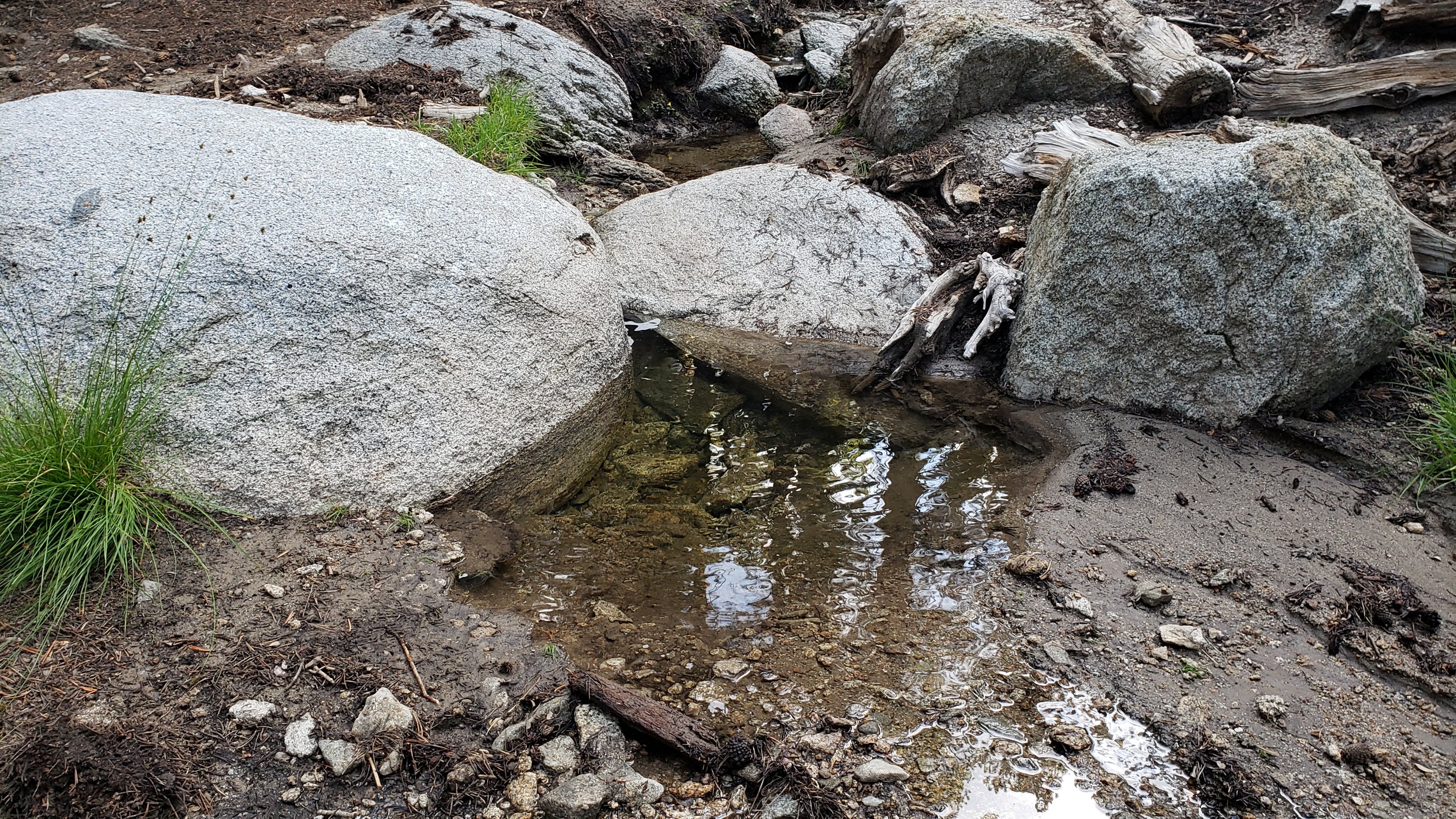

sanjacjon Uncategorized Leave a comment 10 MinutesEdit”Water update 17th August 2022″
Weather and water update 11th August 2022
Last week Idyllwild experienced its best summer monsoonal rains in 5-6 years, totaling 2.54 inches between Saturday 30th July and Monday 1st August. Although conditions have been largely cloudy and humid since, with thunder rumbling most afternoons, we have not had significant further rainfall in Idyllwild (just 0.07 inch on 4th August, and 0.11 inch on 8th August).
After surveying water sources the morning of 8th August, an intense storm cell that afternoon passed over the high country from Long Valley in the east (which recorded 2.1 inches of rain in under two hours) to Black Mountain in the west. This will have augmented some of the water sources mentioned below, although the effects are often surprisingly brief. Further thunderstorms are forecast almost daily for at least the next two weeks, currently most likely from 16th-19th August.
The very localized nature of earlier thunderstorms, and the speed of the runoff, meant that there was minimal impact on springs and creeks from the late July storms, as described in the previous report. On a full survey of the high country on the morning Monday 8th August, water sources were largely in a similarly poor condition to late July prior to the monsoonal rains. The notable exception was the creek in Little Round Valley, where flow remained gentle but steady, having been within days of drying up in mid June.
Water conditions where known are detailed at the foot of this Report. Recent hikes have included thorough surveys of water resources and trails around the Tahquitz area meadows, Willow Creek Trail and Round Valley, and the major trail systems on both the western and eastern slopes of the San Jacinto high country. Current conditions for individual trails are discussed in detail below where known.
The Palm Springs Aerial Tramway is closed until at least Monday 15th August due to maintenance issues following flash flooding on Monday 8th. Check their website for confirmation of reopening.
Hikers should be prepared for continuing hot and humid weather, with overnight “low” temperatures forecast to remain far above seasonal into late August, and daytime highs generally near or slightly above seasonal averages. Current humidity is far above normal at all elevations. Plan accordingly regarding route choice, start times, clothing, sun protection, and water requirements.
Hikers should also be prepared for the possibility of rapidly changing weather conditions in the high country in summer. Monsoon thunderstorms, typically in the afternoon, continue to be forecast as a possibility almost daily into late August. Thunderstorms with lightning, relatively brief but intense precipitation, and rapid temperature drops, can occur in the high country even when such storms are not forecast for lower elevations.
Full fire restrictions were introduced on Thursday 26th May on Forest Service lands, as described in detail here. Campfires on all USFS lands in the San Jacinto mountains (including in fire rings at campgrounds and yellow post sites), and smoking, are prohibited for the remainder of the year.
Be rattlesnake aware. Southern Pacific Rattlesnakes (Crotalus helleri) have been seen on the trail system up to at least 8900 ft elevation. The lower two-thirds of Devil’s Slide Trail, near Strawberry Cienega, and around Tahquitz Peak are regular hotspots, but rattlesnakes are possible anywhere up to at least 9300 ft. (Sightings are currently less frequent during monsoonal weather.) Readers interested in the uniqueness and challenges of rattlesnakes in the San Jacinto high country may find this article that I wrote two years ago informative.
Be bear aware. Although rarely reported, up to three Black Bears have been in the San Jacinto mountains since 2017. On Devil’s Slide Trail at first light on 18th July 2022 we were very fortunate to see the same large (>250lb) dark brown individual that I had seen in September 2021 (one short, poor quality video from the earlier observation is available here). This was clearly a different individual, based on colour pattern and size, from the “blond” one I saw on Devil’s Slide Trail in August 2020 and had previously filmed at home in Idyllwild in 2018 (available here).
Seasonal campgrounds and Forest Service roads are now generally open. Note however the fire restrictions mentioned above. Dark Canyon Road (5S02) reopened on 11th July. However Dark Canyon Campground will not reopen this year due to staffing/maintenance issues. May Valley Road remains closed to vehicles due to “hazard trees” but the necessary tree work is expected to be completed in August.
WEATHER
The persistent heatwave that dominated much of July has eased slightly with daytime highs generally forecast to be closer to seasonal throughout August. Much higher than normal humidity can make it feel cool but sticky early in the morning, then hotter later in the day. Overnight low temperatures will continue to average 5-15°F above seasonal at mid elevations (5000-7500 ft) for the foreseeable future. Monsoonal storms are a possibility every afternoon for at least the next two weeks, apparently most likely on 16th-19th August.
At San Jacinto Peak (10,810ft/3295m) on Monday 8th August 2022 at 0820 the air temperature was 51.7°F (11°C), with a “windchill” temperature of 45.0°F (7°C), 81% relative humidity, and a pleasantly fresh SSE breeze sustained at 5 mph gusting to 13.8 mph.
At the Peak on Monday 1st August 2022 at 0855 the air temperature was 52.1°F (11°C), with a “windchill” temperature of 47.4°F (8°C), 82% relative humidity, and a light SE breeze sustained at 2 mph gusting to 5.0 mph.
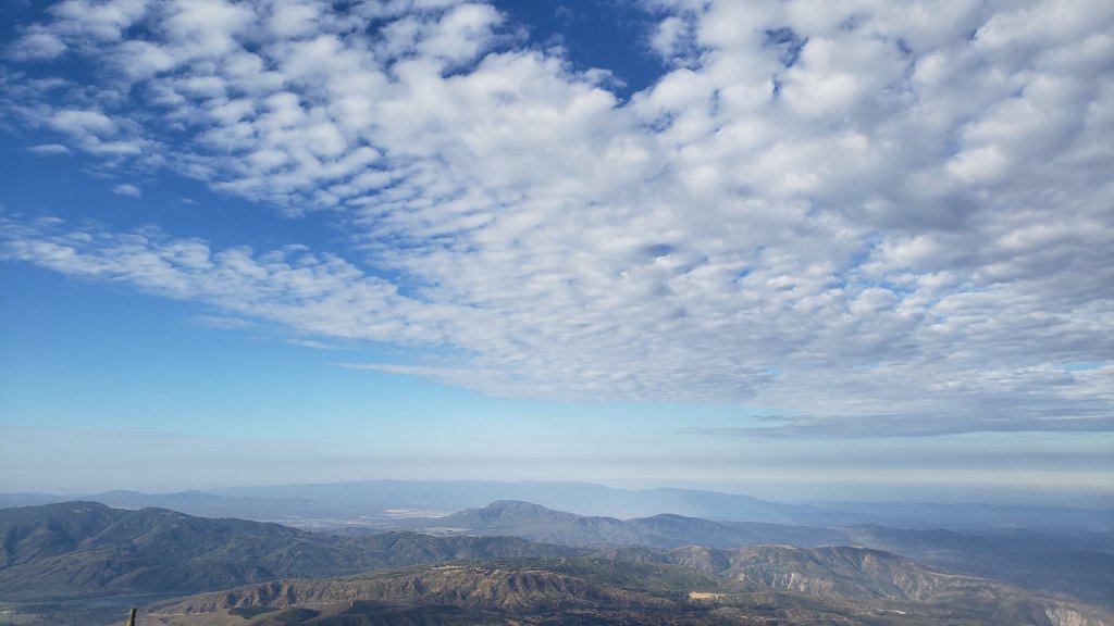
TRAIL CONDITIONS
The trail system throughout the San Jacinto mountains cleared of snow in late April.
Willow Creek Trail is a slow, messy hike in places, and is currently only recommended for experienced hikers. About 46 trees are down on the Forest Service section of this trail between Skunk Cabbage Junction and the State Park boundary (August 2022 survey). Of those, 35 are in the 0.6 mile section between Willow Creek crossing and the State Park boundary. This situation has been reported in person to USFS. The State Park cut the ten or so trees on the section of trail under their jurisdiction in late July (photo below). The huge amount of work that Bill Rhoads and I undertook to clear whitethorn along this trail in 2020 was not completely in vain, but it has grown back rapidly and makes some of the treefall hazards more complicated to negotiate (photo below).
Due to greatly reduced maintenance work by the agencies and PCTA during the coronavirus pandemic, many trails have accumulated treefall hazards since late 2019, passable with care by hikers but not for stock. Although some treefall hazards from Red Tahquitz to Antsell Rock (PCT Miles 172.5-175) were cleared in June 2021 prior to the rockslide removal work, the situation has badly deteriorated. In my most recent survey I counted at least 72 treefall hazards between PCT Miles 170-175, plus about six more on PCT Miles 175-177. At least a third of the former are major hazards that require scrambling over or around.
Three new trees that came down in late 2021 on Deer Springs Trail just south of its junction with Marion Mountain Trail are readily passable for hikers (but not for stock). A CCC crew is expected to clear these this month.
One new major treefall hazard came down on Marion Mountain Trail, about two miles up, in July.
The middle section of South Ridge Trail (between May Valley Road and the top of South Ridge Road) has several trees down which are significant obstructions.
Spitler Peak Trail is currently in its most hiker-friendly condition since the July 2013 Mountain Fire. Forty downed trees, most from an ice storm in late December 2021, plus dozens of additional trunks and branches in the trail, were removed by the Trail Report from this trail in early 2022.
Fuller Ridge Trail has 14 treefall hazards (multiple 2022 surveys) obstructing the trail, but all are readily passable by relatively agile hikers. Eleven of these are in the 1.5 mile section closest to Fuller Ridge Campground (approx. PCT Miles 189-190.5).
The Caramba Trail from near Reeds Meadow through Laws Camp and on to Caramba, and the Cedar Trail from Willow Creek Trail to Laws, are optimistically described by the Forest Service as “not maintained”. In reality both trails no longer exist and are so heavily overgrown I strongly advise hikers do not attempt to follow them. An informal use trail to Laws is much more direct and avoids all of the very challenging bushwhacking of the unmaintained trails (some local hikers dubbed it the “King Trail” when I established the route in 2019). It leaves the Willow Creek Trail exactly 1.0 mile from Saddle Junction (0.46 mile from the Skunk Cabbage turning), descending largely on established deer trails for 1.2 miles, meeting Willow Creek just upstream from the old Laws Camp. From Laws east to Caramba the route of the original Caramba Trail has been well-cairned by myself and others and can largely be followed with very careful route-finding. My 2022 survey counted 97 trees down on this 2.1 miles of trail. It is especially obscure 0.1-0.3 mile east of the Willow Creek crossing, becoming more obvious near Caramba. Very cautious navigation is advised throughout the area.
Seven Pines Trail has had very limited hiker traffic since November 2018, largely because Dark Canyon Road was closed almost continuously from February 2019 to July 2022 (with a brief reopening October-December 2021). Dark Canyon Road finally reopened in mid July 2022 however. The Trail Report has adopted Seven Pines Trail as a priority for maintenance work as the trail has had a disproportionate number of lost hiker rescues in the past decade. Between November 2021 and May 2022, 61 downed trees were removed and almost the entire trail thoroughly trimmed and cleared. Despite this very considerable effort, Seven Pines remains a genuine wilderness trail and is nothing like the relatively wide, bare, and obvious routes of, for example, Devil’s Slide or Marion Mountain trails. Cautious navigation remains required for those who do not have significant experience of hiking this trail.
WATER CONDITIONS: Eastern slope
The Round Valley pipe is flowing at about 1.0 L/min but recent history suggests it may not persist all summer without further rainfall input. The nearby Round Valley creek dried up in May. The small creek in Tamarack Valley also dried up in May.
Both the northern (photo below) and southern springs at Wellman’s Cienega are flowing extremely weakly for the time of year. They did not receive significant additional input from recent thunderstorms, and the well-known north springs may dry completely in the next couple of months without further precipitation. They should no longer be relied upon for filtering. This spring dried for the first time in recorded history in October 2015, then again in September 2016.
The Wellman’s Cienega springs are the sources for Willow Creek, which is currently flowing weakly but reliably where it crosses the Willow Creek Trail (photo above).
Tahquitz Creek is flowing gently at the northern (lower) end of Little Tahquitz Valley at a flow rate of >2.0L/min (photo below). It is flowing weakly further upstream at its source, known colloquially as Grethe Spring, where it crosses the PCT at approx. PCT Mile 177 (photo below). It is clear that this area received some fresh monsoonal rain input in late July, but this dissipated within hours. Between these locations Tahquitz Creek is largely dry (but presumably flowing subsurface). The small creek in Tahquitz Valley dried up in May.
Skunk Cabbage (“Candy’s”) Creek dried up in late June where it crosses under the trail through Skunk Cabbage Meadow.
WATER CONDITIONS: Western slope
Ephemeral creeks, such as those along Marion Mountain Trail and on Deer Springs Trail, have been dry since May.
The North Fork of the San Jacinto River is flowing relatively weakly where it crosses the Deer Springs Trail (photo below) and again downstream where it crosses the Fuller Ridge Trail on the PCT (approx. PCT Mile 186.2).
The creek in Little Round Valley (photos below) received moderate new precipitation from thunderstorms at the end of July. Having been nearly dry in mid June, the creek just about continues to flow through the lower half of the valley (roughly 400 ft), forming some reasonable pools in the lower half. The same creek continues to flow gently where it crosses Fuller Ridge Trail (at about PCT Mile 186.4).
Shooting Star Spring (below Little Round Valley but above the North Fork of the San Jacinto River crossing) is flowing gently but is inadequate for filtering.
The Deer Springs stream crossing at the PCT/Deer Springs Trail (approx. PCT mile 185.6) completely dried up in late May where it crosses the trail and did not receive any additional water from rains in July.
The tiny Switchback Spring at PCT Mile 183.5 (about 0.4 miles on the PCT northbound from Strawberry Junction) is flowing gently, and there is just about adequate depth from which to filter water in the tiny pool on the upslope side of the trail.
The little creek at Strawberry Cienega (PCT mile 183.0) has been dry since June.
On Devil’s Slide Trail, Middle Spring is barely trickling and may dry very soon without substantial monsoon rain input. A tiny pool remains as a useful emergency drinking source for dogs. Other springs on this trail have been dry for months.
On the Ernie Maxwell Trail, the crossing of Chinquapin Creek just below Humber Park is dry where it crosses the trail. However, even when Fern Valley Water District is diverting flow into the pipe system small fresh pools remain among the rocks just upslope from the trail (these are an important source of water for the many dogs walked on the Ernie Maxwell).
WATER CONDITIONS: Desert Divide
Live Oak Spring (N 33 37 21, W 116 33 24) Flowing. The most reliable water source on the Desert Divide.
Cedar Spring (N 33 40 36, W 116 34 35) Flowing (well upslope from the trail into the campsite). Likely received substantial fresh input from storms in late July. Sadly the inflow pipe to the trough – formerly the most accessible water source – was vandalized in May 2022 and consequently the trough was dry (but may temporarily fill with rainfall). This damage has been reported to the Forest Service, but no repair is expected before the autumn.
Apache Spring (N 33 43 11, W 116 37 13) Flowing weakly, but the spring box remains full (photo in earlier Report). This spring has functionally dried up in recent years and should not be relied upon by late summer.
Spitler Peak Trail Descending the trail there are five water crossings. The first two, at 0.90 and 0.95 miles down, cross a tiny side creek which is largely dry and should be ignored. The next three crossings, at 1.1-1.5 miles down, are Spitler Creek and is the best source of water (currently flowing steadily at both the uppermost and lowest crossings).
Antsell Rock Creek (N 33 41 52, W 116 39 08) Right by the Spitler Peak Trail trailhead on Apple Canyon Road, Antsell Rock Creek is dry, nearly two months earlier than last year.
Thank you for taking the time to read this. While all time and labor is volunteered, the San Jacinto Trail Report depends on your small private donations to cover our costs. Your contribution keeps the Report available to all, free from advertising or paywalls, and independent from agencies. If you have found this Report useful, please use this link to the Donate page. Zelle, Venmo, and PayPal are all options. Thank you for your support.
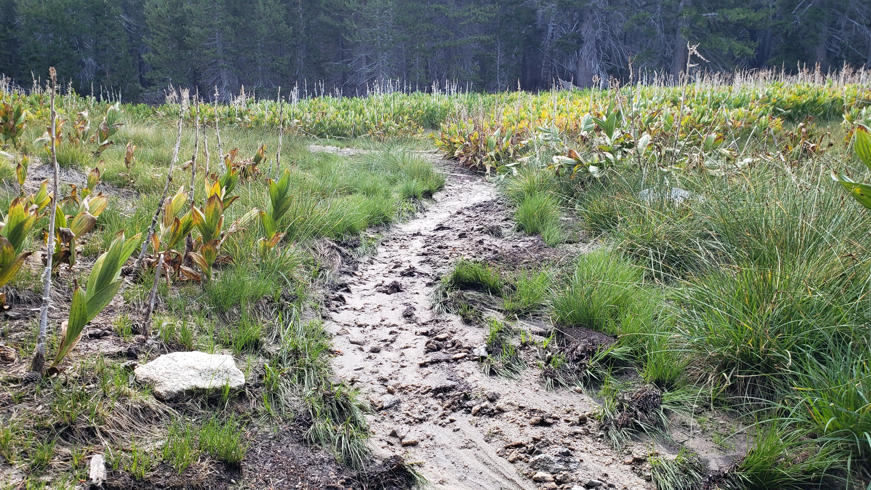

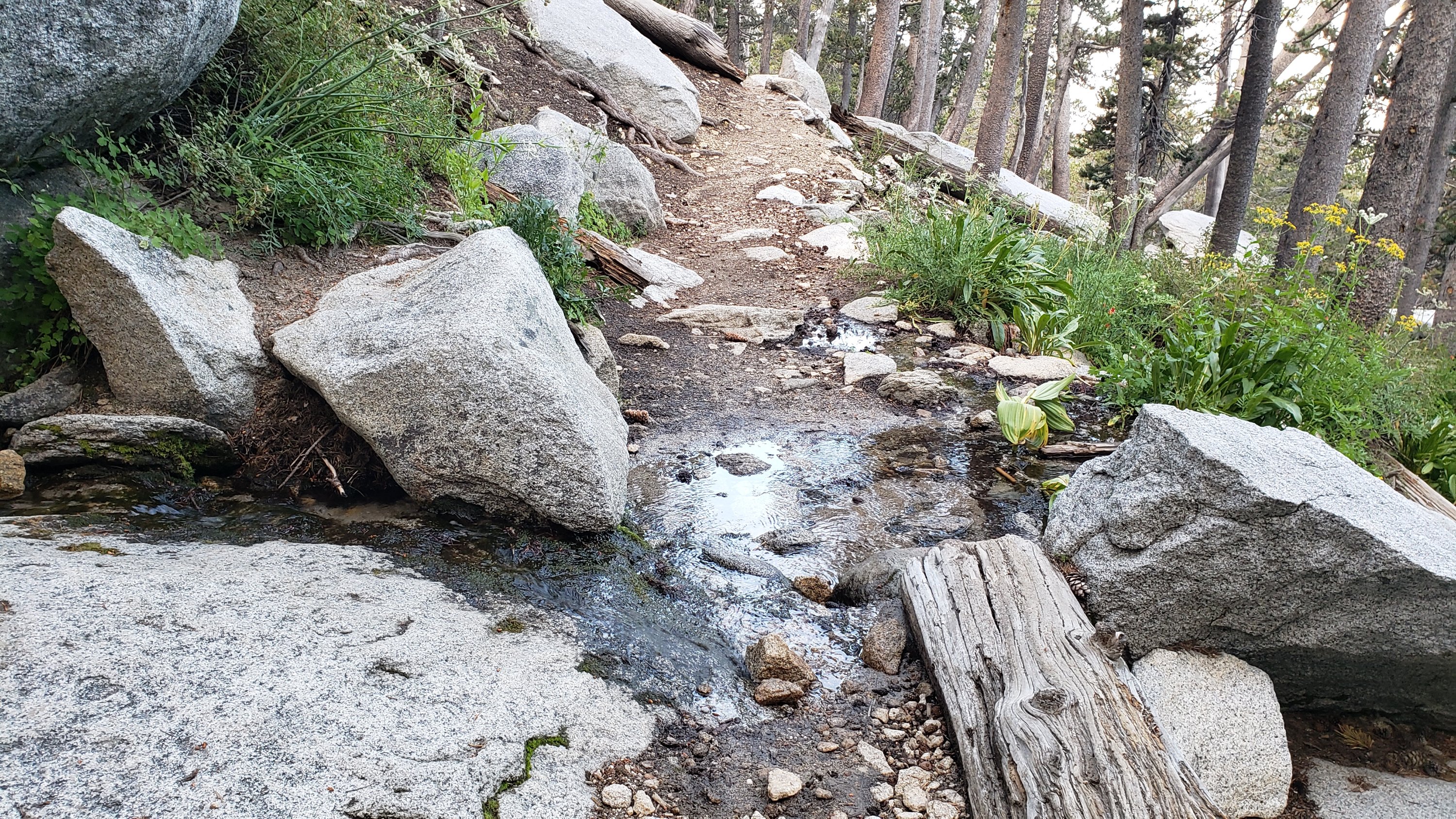


sanjacjon Uncategorized 2 Comments 11 MinutesEdit”Weather and water update 11th August 2022″
Water and weather update 3rd August 2022
Idyllwild experienced its best summer monsoonal rains in about five years in recent days, totaling 2.54 inches across three days (measured at 5550 ft elevation), which has temporarily alleviated some of the extreme fire risk. On Saturday 30th July from 1220-1320 an intense storm cell produced 0.77 inch rain, on Sunday 31st another one hour storm between 1030-1130 produced an impressive 1.08 inches of rain, and finally on Monday 1st August 0.69 inch fell between 1230-1400.
The thunderstorms were generally not forming until moist air coming from the east had passed to the west over the mountain range, so the eastern slope was generally missed by the intense storm cells, especially on 30th-31st July. On a full survey of the high country on Monday 1st August, southern and eastern slope routes such as Devil’s Slide, Wellman, and Peak trails were damp but with little evidence of significant rainfall and widespread runoff. For example flow rates at Middle Spring on Devil’s Slide Trail and the springs at Wellman’s Cienega were the same as the previous week (i.e. very poor). No rain was reported at Long Valley on 30th and 31st, but it did rain there on 1st August.
The western slope trails showed more evidence of superficial runoff, and flow had improved slightly in the creek in Little Round Valley. However flow rate had not significantly changed in the North Fork of the San Jacinto River, and Deer Springs crossing remains dry. Elsewhere in the mountains rainfall was extremely localized, with multiple intense cells over Garner Valley and the Desert Divide on Saturday 30th, and an extremely intense storm cell was stationary over the northern Santa Rosa mountains for about two hours on Sunday 31st which likely produced several inches of rain.
Water conditions where known are detailed at the foot of this Report. Unfortunately with thunderstorm effects being so localized (as described above), rapid runoff, and an extremely dry forest, the effects of monsoonal rains can be surprisingly brief. Recent hikes have included thorough surveys of water resources and trails around the Tahquitz area meadows, Willow Creek Trail and Round Valley, and the major trail systems on both the western and eastern slopes of the San Jacinto high country. Current conditions for individual trails are discussed in detail below where known.
Hikers should be prepared for continuing hot and humid weather, with overnight “low” temperatures forecast to remain well above seasonal into mid August, and daytime highs generally near seasonal averages. Current humidity is far above normal at all elevations. Plan accordingly regarding route choice, start times, clothing, sun protection, and water requirements.
Hikers should of course be prepared for the possibility of rapidly changing weather conditions in the high country in summer. Monsoon thunderstorms, typically in the afternoon, continue to be forecast for at least the next two weeks, but are currently most likely on 7th-12th August. Thunderstorms with lightning, relatively brief but intense precipitation, and rapid temperature drops, can occur in the high country even when such storms are not forecast for lower elevations.
Full fire restrictions were introduced on Thursday 26th May on Forest Service lands, as described in detail here. Campfires on all USFS lands in the San Jacinto mountains (including in fire rings at campgrounds and yellow post sites), and smoking, are prohibited for the remainder of the year.
Be rattlesnake aware. Southern Pacific Rattlesnakes (Crotalus helleri) have been seen on the trail system up to at least 8900 ft elevation. As usual the lower two-thirds of Devil’s Slide Trail and around Tahquitz Peak seem to be particular hotspots, but rattlesnakes are possible anywhere up to at least 9300 ft. (Of course sightings are currently much less frequent during monsoonal weather.) Readers interested in the uniqueness and challenges of rattlesnakes in the San Jacinto high country may find this article that I wrote two years ago informative.
Be bear aware. Although rarely reported, up to three Black Bears have been in the San Jacinto mountains since 2017. On Devil’s Slide Trail at first light on 18th July 2022 we were very fortunate to see the same large (>250lb) dark brown individual that I had seen in September 2021 (one short, poor quality video from the earlier observation is available here). This was clearly a different individual, based on colour pattern and size, from the “blond” one I saw on Devil’s Slide Trail in August 2020 and had previously filmed at home in Idyllwild in 2018 (available here).
Seasonal campgrounds and Forest Service roads are now generally open. Note however the fire restrictions mentioned above. Dark Canyon Road (5S02) reopened on 11th July. However Dark Canyon Campground will not reopen this year due to staffing/maintenance issues. May Valley Road remains closed to vehicles due to “hazard trees” but the necessary tree work is expected to be completed in August.
WEATHER
The persistent heatwave that dominated much of July has eased somewhat with daytime highs generally forecast to be near seasonal for the first half of August, with much higher than normal humidity at times making it feel cooler. Overnight lows will nevertheless continue to average 5-15°F above seasonal at mid elevations for the foreseeable future. Monsoonal storms are forecast almost every day throughout the first half of August, with the highest probability currently on 6th-11th August.
At San Jacinto Peak (10,810ft/3295m) on Monday 1st August 2022 at 0855 the air temperature was 52.1°F (11°C), with a “windchill” temperature of 47.4°F (8°C), 82% relative humidity, and a light SE breeze sustained at 2 mph gusting to 5.0 mph.
TRAIL CONDITIONS
The trail system throughout the San Jacinto mountains cleared of snow in late April.
Due to greatly reduced maintenance work by the agencies and PCTA during the coronavirus pandemic, many trails have accumulated treefall hazards since late 2019, passable with care by hikers but not for stock. Although some treefall hazards from Red Tahquitz to Antsell Rock (PCT Miles 172.5-175) were cleared in June 2021 prior to the rockslide removal work, the situation has badly deteriorated. In my most recent survey I counted at least 72 treefall hazards between PCT Miles 170-175, plus about six more on PCT Miles 175-177. At least a third of the former are major hazards that require scrambling over or around.
Three new trees that came down in late 2021 on Deer Springs Trail just south of its junction with Marion Mountain Trail are readily passable for hikers (but not for stock).
The middle section of South Ridge Trail (between May Valley Road and the top of South Ridge Road) has several trees down which are significant obstructions.
Willow Creek Trail is currently a slow, messy hike. About 39 trees (July 2022 survey) are down on the Forest Service section of this trail between Skunk Cabbage Junction and the State Park boundary. Some additional downed trees may remain on the State Park section, but a few others have been recently cut here.
Spitler Peak Trail is currently in its most hiker-friendly condition since the July 2013 Mountain Fire. Forty downed trees, most from an ice storm in late December 2021, plus dozens of additional trunks and branches in the trail, were removed by the Trail Report from this trail in early 2022.
Fuller Ridge Trail has 14 treefall hazards (multiple 2022 surveys) obstructing the trail, but all are readily passable by relatively agile hikers. Eleven of these are in the 1.5 mile section closest to Fuller Ridge Campground (approx. PCT Miles 189-190.5).
The Caramba Trail from near Reeds Meadow through Laws Camp and on to Caramba, and the Cedar Trail from Willow Creek Trail to Laws, are optimistically described by the Forest Service as “not maintained”. In reality both trails no longer exist and are so heavily overgrown I advise hikers do not attempt to follow them. An informal use trail to Laws is much more direct and avoids all of the very challenging bushwhacking of the unmaintained trails (some local hikers dubbed it the “King Trail” when I established the route in 2019). It leaves the Willow Creek Trail exactly 1.0 mile from Saddle Junction (0.46 mile from the Skunk Cabbage turning), descending largely on established deer trails for 1.2 miles, meeting Willow Creek just upstream from the old Laws Camp. From Laws east to Caramba the route of the original Caramba Trail has been well-cairned by myself and others and can largely be followed with very careful route-finding. My 2022 survey counted 97 trees down on this 2.1 miles of trail. It is especially obscure 0.1-0.3 mile east of the Willow Creek crossing, becoming more obvious near Caramba. Very cautious navigation is advised throughout the area.
Seven Pines Trail has had very limited hiker traffic since November 2018, largely because Dark Canyon Road was closed almost continuously from February 2019 to July 2022 (with a brief reopening October-December 2021). Dark Canyon Road finally reopened in mid July 2022 however. The Trail Report has adopted Seven Pines Trail as a priority for maintenance work as the trail has had a disproportionate number of lost hiker rescues in the past decade. Between November 2021 and May 2022, 61 downed trees were removed and almost the entire trail thoroughly trimmed and cleared. Despite this very considerable effort, Seven Pines remains a genuine wilderness trail and is nothing like the relatively wide, bare, and obvious routes of, for example, Devil’s Slide or Marion Mountain trails. Cautious navigation remains required for those who do not have significant experience of hiking this trail.

WATER CONDITIONS: Eastern slope
The Round Valley pipe is flowing (photo below) but recent history suggests it may not persist all summer without significant monsoonal storm input. The nearby Round Valley creek dried up in May. The small creek in Tamarack Valley also dried up in May.
Both the northern (photos below) and southern springs at Wellman’s Cienega are flowing extremely weakly for the time of year. They did not receive additional input from the recent localized thunderstorms, and the well-known north springs will dry up in the next couple of months without further precipitation. This spring dried for the first time in recorded history in October 2015, then again in September 2016.
The Wellman’s Cienega springs are the sources for Willow Creek, which is currently flowing gently but reliably where it crosses the Willow Creek Trail.
Tahquitz Creek is flowing gently at the northern (lower) end of Little Tahquitz Valley at a flow rate of >2.0L/min (photo below). It is flowing weakly further upstream at its source, known colloquially as Grethe Spring, where it crosses the PCT at approx. PCT Mile 177 (photo below). It is clear that this area received some fresh monsoonal rain input recently, but this dissipated within hours. Between these locations Tahquitz Creek is largely dry (but presumably flowing subsurface). The small creek in Tahquitz Valley dried up in May.
Skunk Cabbage (“Candy’s”) Creek dried up in late June where it crosses under the trail through Skunk Cabbage Meadow.
WATER CONDITIONS: Western slope
Ephemeral creeks, such as those along Marion Mountain Trail and on Deer Springs Trail, have been dry since May.
The North Fork of the San Jacinto River is flowing relatively weakly where it crosses the Deer Springs Trail (photo below) and again downstream where it crosses the Fuller Ridge Trail on the PCT (approx. PCT Mile 186.2).
The creek in Little Round Valley received moderate new precipitation from thunderstorms at the end of July. Having been nearly dry in mid June, the creek just about continues to flow through the lower half of the valley (roughly 400 ft), forming some reasonable pools in the lower half. The same creek continues to flow gently where it crosses Fuller Ridge Trail (at about PCT Mile 186.4).
Shooting Star Spring (below Little Round Valley but above the North Fork of the San Jacinto River crossing) is flowing gently and is barely adequate for filtering.
The Deer Springs stream crossing at the PCT/Deer Springs Trail (approx. PCT mile 185.6) completely dried up in late May where it crosses the trail and did not receive any additional water from rains in July.
The tiny Switchback Spring at PCT Mile 183.5 (about 0.4 miles on the PCT northbound from Strawberry Junction) is flowing gently, and there is just about adequate depth from which to filter water in the tiny pool on the upslope side of the trail.
The little creek at Strawberry Cienega (PCT mile 183.0) has been dry since June.
On Devil’s Slide Trail, Middle Spring is barely trickling and may dry in August without substantial monsoon rain input. A tiny pool remains as a useful drinking source for dogs. Other springs on this trail have been dry for months.
On the Ernie Maxwell Trail, the crossing of Chinquapin Creek just below Humber Park is dry where it crosses the trail. However, even when Fern Valley Water District is diverting flow into the pipe system small fresh pools remain among the rocks just upslope from the trail (these are an important source of water for the many dogs walked on the Ernie Maxwell).
WATER CONDITIONS: Desert Divide
Live Oak Spring (N 33 37 21, W 116 33 24) Flowing. The most reliable water source on the Desert Divide.
Cedar Spring (N 33 40 36, W 116 34 35) Flowing (well upslope from the trail into the campsite). Likely received substantial fresh input from storms in late July. Sadly the inflow pipe to the trough – formerly the most accessible water source – was vandalized in May 2022 and consequently the trough was dry (but may temporarily fill with rainfall). This damage has been reported to the Forest Service, but no repair is expected before the autumn.
Apache Spring (N 33 43 11, W 116 37 13) Flowing weakly, but the spring box remains full (photo in earlier Report). This spring has functionally dried up in recent years and should not be relied upon by late summer.
Spitler Peak Trail Descending the trail there are five water crossings. The first two, at 0.90 and 0.95 miles down, cross a tiny side creek which is largely dry and should be ignored. The next three crossings, at 1.1-1.5 miles down, are Spitler Creek and is the best source of water (currently flowing steadily at both the uppermost and lowest crossings).
Antsell Rock Creek (N 33 41 52, W 116 39 08) Right by the Spitler Peak Trail trailhead on Apple Canyon Road, Antsell Rock Creek is dry, nearly two months earlier than last year.

Thank you for taking the time to read this. While all time and labor is volunteered, the San Jacinto Trail Report depends on your small private donations to cover our costs. Your contribution keeps the Report available to all, free from advertising or paywalls, and independent from agencies. If you have found this Report useful, please use this link to the Donate page. Zelle, Venmo, and PayPal are all options. Thank you for your support.


sanjacjon Uncategorized 3 Comments 11 MinutesEdit”Water and weather update 3rd August 2022″
Water and trail update 27th July 2022
[UPDATED Sunday 31st July 2022: like yesterday, an intense thunderstorm directly over Idyllwild for just one hour between 1030-1130 produced an impressive 1.08 inches of rain (at 5550 ft). Also like yesterday, the eastern slope seemed to be largely missed by the storm cells, with no rain visible or reported at Long Valley. An extremely intense storm cell was stationary over the northern Santa Rosa mountains for about two hours, and likely produced several inches of rain. Obviously two days of monsoonal rains will have significantly changed the water situation, which will be surveyed and reported over the coming week.]
[UPDATED Saturday 30th July 2022: an intense thunderstorm over Idyllwild starting at 1220 produced 0.77 inch of rain (at 5550 ft elevation) in just one hour before ending abruptly. Similarly intense storm cells were seen across the western side of the San Jacinto mountains, especially in Garner Valley. The eastern side was largely unaffected, with Long Valley reporting zero rainfall. Obviously this rain will locally impact water sources, although the effects may be limited to a few days.]
Despite hours of thunder in the afternoons of both 24th and 25th July, negligible rain fell (e.g., on 24th, 0.02in recorded at Long Valley and only a trace in Idyllwild). On the morning of 25th in Tahquitz Meadow the trail and bracken ferns were slightly damp but flow rates at multiple locations on Tahquitz Creek were (unsurprisingly) unaffected. Elsewhere the trails were dry. It is possible that a very localized storm cell produced substantial rain somewhere in the mountains on either day.
Otherwise there has been no additional rainfall since a few highly localized thunderstorms on 22nd June, and with recent hot, dry, and windy weather, most water sources have continued to deteriorate steadily. Water conditions where known are detailed at the foot of this Report. Recent hikes have included thorough surveys of water resources and trails around the Tahquitz area meadows, Willow Creek Trail and Round Valley, and on both the western and eastern slopes of the San Jacinto high country. Current conditions for individual trails are discussed in detail below where known.
Hikers should be prepared for continuing hot weather, with overnight low temperatures forecast to generally remain well above seasonal into early August at least, and daytime highs generally near seasonal averages. Plan accordingly regarding route choice, start times, clothing, sun protection, and water requirements.
Hikers should also be prepared for the possibility of rapidly changing weather conditions in the high country in summer. Monsoon conditions, typically in the afternoons, are tentatively forecast from 29th July to 1st August, and again from 5th-8th August. Thunderstorms with lightning, brief but intense precipitation, and rapid temperature drops, can occur in the high country even when such storms are not forecast for lower elevations.
Full fire restrictions were introduced on Thursday 26th May on Forest Service lands, as described in detail here. Campfires on all USFS lands in the San Jacinto mountains (including in fire rings at campgrounds and yellow post sites), and smoking, are prohibited for the remainder of the year.
Be rattlesnake aware. Southern Pacific Rattlesnakes (Crotalus helleri) have been seen on the trail system up to at least 8900 ft elevation. As usual the lower two-thirds of Devil’s Slide Trail and around Tahquitz Peak seem to be particular hotspots, but rattlesnakes are possible anywhere up to at least 9300 ft. Readers interested in the uniqueness and challenges of rattlesnakes in the San Jacinto high country may find this article that I wrote two years ago informative.

Be bear aware. Although rarely reported, up to three Black Bears have been in the San Jacinto mountains since 2017. On Devil’s Slide Trail at first light on 18th July 2022 we were very fortunate to see the same large (>250lb) dark brown individual that I had seen in September 2021 (one short, poor quality video from the earlier observation is available here). This was clearly a different individual, based on colour pattern and size, from the “blond” one I saw on Devil’s Slide Trail in August 2020 and had previously filmed at home in Idyllwild in 2018 (available here).
Seasonal campgrounds and Forest Service roads are now generally open. Note however the fire restrictions mentioned above. Dark Canyon Road (5S02) reopened on about 11th July. However Dark Canyon Campground will not reopen this year due to staffing/maintenance issues. May Valley Road remains closed to vehicles due to “hazard trees” but the necessary tree work is expected to be completed in August.
WEATHER
The persistent heatwave that has dominated much of July has eased somewhat with daytime highs generally forecast to be near seasonal for the remainder of the month, although overnight lows will continue to average 5-10°F above seasonal at mid elevations for the foreseeable future. While there is currently little sign of significant precipitation in the forecasts, this could change at short notice with monsoonal storms forecast as a possibility for most days in the remainder of July and into the first week of August, but especially 30th July to 1st August, and 5th-8th August.
At San Jacinto Peak (10,810ft/3295m) on Friday 15th July 2022 at 0840 the air temperature was 56.3°F (14°C), with a “windchill” temperature of 54.7°F (13°C), 61% relative humidity, and a moderate due South wind sustained at 8 mph gusting to 17.5 mph.
TRAIL CONDITIONS
The trail system throughout the San Jacinto mountains cleared of snow in late April.
Due to greatly reduced maintenance work by the agencies and PCTA during the coronavirus pandemic, many trails have accumulated treefall hazards since late 2019, passable with care by hikers but not for stock. Although reported promptly, most hazards were not removed in 2021. With a couple of storms this past season being accompanied by strong winds and heavy ice loads, hikers should expect to encounter many new and additional hazards, especially in vulnerable burn areas (e.g., Willow Creek Trail, PCT Miles 170-177).
Although some treefall hazards from Red Tahquitz to Antsell Rock (PCT Miles 172.5-175) were cleared in June 2021 prior to the rockslide removal work, the situation has badly deteriorated. In my most recent survey I counted at least 72 treefall hazards between PCT Miles 170-175, plus about six more on PCT Miles 175-177. At least a third of the former are major hazards that require scrambling over or around.
Three new trees that came down in late 2021 on Deer Springs Trail just south of its junction with Marion Mountain Trail are readily passable for hikers (but not for stock).
The middle section of South Ridge Trail (between May Valley Road and the top of South Ridge Road) has several trees down which are significant obstructions.
Willow Creek Trail is currently a slow, messy hike. About 48 trees (July 2022 survey) are down between Skunk Cabbage Junction and Hidden Divide, 39 of these on the Forest Service section. A couple of these require significant caution to pass. Three or four nearest to Hidden Divide on the State Park section appear to have been recently cut.
Spitler Peak Trail is currently in its most hiker-friendly condition since the July 2013 Mountain Fire. Forty downed trees, most from an ice storm in late December 2021, plus dozens of additional trunks and branches in the trail, were removed by the Trail Report from this trail in early 2022.
Fuller Ridge Trail has 14 treefall hazards (May 2022 survey) obstructing the trail, but all are readily passable by relatively agile hikers. Eleven of these are in the 1.5 mile section closest to Fuller Ridge Campground (approx. PCT Miles 189-190.5).
The Caramba Trail from near Reeds Meadow through Laws Camp and on to Caramba, and the Cedar Trail from Willow Creek Trail to Laws, are optimistically described by the Forest Service as “not maintained”. In reality both trails no longer exist and are so heavily overgrown I advise hikers do not attempt to follow them. An informal use trail to Laws is much more direct and avoids all of the very challenging bushwhacking of the unmaintained trails (some local hikers dubbed it the “King Trail” when I established the route in 2019). It leaves the Willow Creek Trail exactly 1.0 mile from Saddle Junction (0.46 mile from the Skunk Cabbage turning), descending largely on established deer trails for 1.2 miles, meeting Willow Creek just upstream from the old Laws Camp. From Laws east to Caramba the route of the original Caramba Trail has been well-cairned by myself and others and can largely be followed with very careful route-finding. My 2022 survey counted 97 trees down on this 2.1 miles of trail. It is especially obscure 0.1-0.3 mile east of the Willow Creek crossing, becoming more obvious near Caramba. Very cautious navigation is advised throughout the area.
Seven Pines Trail has had very limited hiker traffic since November 2018, largely because Dark Canyon Road was closed almost continuously from February 2019 to July 2022 (with a brief reopening October-December 2021). Dark Canyon Road finally reopened in mid July 2022 however. The Trail Report has adopted Seven Pines Trail as a priority for maintenance work as the trail has had a disproportionate number of lost hiker rescues in the past decade. Between November 2021 and May 2022, 61 downed trees were removed and almost the entire trail thoroughly trimmed and cleared. Despite this very considerable effort, Seven Pines remains a genuine wilderness trail and is nothing like the relatively wide, bare, and obvious routes of, for example, Devil’s Slide or Marion Mountain trails. Cautious navigation remains required for those who do not have significant experience of hiking this trail.
WATER CONDITIONS: Eastern slope
The Round Valley pipe is flowing (photo above) but recent history suggests it will not persist all summer. The nearby Round Valley creek dried up in May. The small creek in Tamarack Valley also dried up in May.
Both the northern (photos below) and southern springs at Wellman’s Cienega are flowing extremely weakly for the time of year. They did not receive additional input from the localized thunderstorms in late June, and the well-known north springs will dry up in the next couple of months without further precipitation from summer monsoons. This spring dried for the first time in recorded history in October 2015, then again in September 2016.
The Wellman’s Cienega springs are the sources for Willow Creek, which is currently flowing weakly but reliably where it crosses the Willow Creek Trail (photo below).
Tahquitz Creek is flowing gently at the northern (lower) end of Little Tahquitz Valley at a flow rate of >2.0L/min (photo below). It is flowing very weakly further upstream at its source, known colloquially as Grethe Spring, where it crosses the PCT at approx. PCT Mile 177 (photo below). Between these locations Tahquitz Creek is largely dry (but presumably flowing subsurface). The small creek in Tahquitz Valley dried up in May.
Skunk Cabbage (“Candy’s”) Creek dried up in late June where it crosses under the trail through Skunk Cabbage Meadow.

WATER CONDITIONS: Western slope
Ephemeral creeks, such as those along Marion Mountain Trail and on Deer Springs Trail, have been dry since May.
The North Fork of the San Jacinto River is flowing relatively weakly where it crosses the Deer Springs Trail (photo below) and again downstream where it crosses the Fuller Ridge Trail on the PCT (approx. PCT Mile 186.2).
The creek in Little Round Valley received substantial new precipitation from a thunderstorm on 22nd June, the effects of which have been remarkably persistent. Having been nearly dry in mid June, the creek just about continues to flow very gently throughout most of the valley, forming some reasonable pools in the lower half (photo below) before disappearing subsurface where it crosses Deer Springs Trail. The same creek continues to flow gently where it crosses Fuller Ridge Trail (at about PCT Mile 186.4).
Shooting Star Spring (below Little Round Valley but above the North Fork of the San Jacinto River crossing) is flowing weakly and is barely adequate for filtering.
The Deer Springs stream crossing at the PCT/Deer Springs Trail (approx. PCT mile 185.6) completely dried up in late May where it crosses the trail (photo in earlier Report) and did not receive any additional water from rains in June.
The tiny Switchback Spring at PCT Mile 183.5 (about 0.4 miles on the PCT northbound from Strawberry Junction) is flowing gently, and there is just about adequate depth from which to filter water in the tiny pool on the upslope side of the trail.
The little creek at Strawberry Cienega (PCT mile 183.0) has been dry since June.
On Devil’s Slide Trail, Middle Spring is barely trickling and will dry in August without monsoon rain input. A tiny pool remains as a useful drinking source for dogs. Other springs on this trail have been dry for months.
On the Ernie Maxwell Trail, the crossing of Chinquapin Creek just below Humber Park is dry where it crosses the trail. However, even when Fern Valley Water District is diverting flow into the pipe system small fresh pools remain among the rocks just upslope from the trail (these are an important source of water for the many dogs walked on the Ernie Maxwell).
WATER CONDITIONS: Desert Divide
Live Oak Spring (N 33 37 21, W 116 33 24) Flowing. The most reliable water source on the Desert Divide.
Cedar Spring (N 33 40 36, W 116 34 35) Flowing very weakly (well upslope from the trail into the campsite) and should no longer be relied upon. Sadly the inflow pipe to the trough – formerly the most accessible water source – was vandalized in May 2022 and consequently the trough is now dry (see photos in earlier Report). This has been reported to the Forest Service, but no repair is expected before the autumn.
Apache Spring (N 33 43 11, W 116 37 13) Flowing very weakly, but the spring box remains full (photo in earlier Report). This spring has functionally dried up in recent years and should not be relied upon by late summer.
Spitler Peak Trail Descending the trail there are five water crossings. The first two, at 0.90 and 0.95 miles down, cross a tiny side creek which is largely dry and should be ignored. The next three crossings, at 1.1-1.5 miles down, are Spitler Creek and is the best source of water (currently flowing at both the uppermost and lowest crossings, photo in earlier Report).
Antsell Rock Creek (N 33 41 52, W 116 39 08) Right by the Spitler Peak Trail trailhead on Apple Canyon Road, Antsell Rock Creek is dry, nearly two months earlier than last year (photo in earlier Report).
Thank you for taking the time to read this. While all time and labor is volunteered, the San Jacinto Trail Report depends on your small private donations to cover our costs. Your contribution keeps the Report available to all, free from advertising or paywalls, and independent from agencies. If you have found this Report useful, please use this link to the Donate page. Zelle, Venmo, and PayPal are all options. Thank you for your support.


sanjacjon Uncategorized 1 Comment 11 MinutesEdit”Water and trail update 27th July 2022″
Water and trail update 20th July 2022
At this time of year the Trail Report may be updated somewhat less frequently – normally updates average every 5-7 days – during the next couple of months. Of course any significant news (e.g., fires, storms, closures) will be reported immediately.
There has been no additional rainfall since a few highly localized thunderstorms on 22nd June, and with recent hot, dry, and windy weather, most water sources have continued to deteriorate steadily. Current conditions for individual trails are discussed in detail below where known. Recent hikes have included thorough surveys of water resources around the Tahquitz area meadows and on the western and eastern slopes of the San Jacinto high country. Water conditions where known are detailed at the foot of this Report.
Hikers should be prepared for continuing hot weather, with temperatures – especially the overnight lows – forecast to generally be above seasonal for the remainder of July. Plan accordingly regarding route choice, start times, clothing, sun protection, and water requirements.
Hikers should also be prepared for the possibility of rapidly changing weather conditions in the high country in summer. Monsoon conditions, usually in the afternoons, are tentatively forecast from 25th-29th July. Thunderstorms with lightning, brief but intense precipitation, and rapid temperature drops, can occur in the high country even when such storms are not forecast for lower elevations.
Full fire restrictions were introduced on Thursday 26th May on Forest Service lands, as described in detail here. Campfires on all USFS lands in the San Jacinto mountains (including in fire rings at campgrounds and yellow post sites), and smoking, are prohibited for the remainder of the year.
Be rattlesnake aware. Southern Pacific Rattlesnakes (Crotalus helleri) have been seen on the trail system up to at least 8900 ft elevation. As usual the lower two-thirds of Devil’s Slide Trail and around Tahquitz Peak seem to be particular hotspots, but rattlesnakes are possible anywhere up to at least 9300 ft. Readers interested in the uniqueness and challenges of rattlesnakes in the San Jacinto high country may find this article that I wrote two years ago informative.
Be bear aware. Although rarely reported recently, up to three Black Bears have been in the San Jacinto mountains since 2017. On Devil’s Slide Trail at first light on 18th July 2022 we were very fortunate to see the same large (>250lb) dark brown individual that I had seen in September 2021 (one short, poor quality video from the earlier observation is available here). This was clearly a different individual, based on colour pattern and size, from the “blond” one I saw on Devil’s Slide Trail in August 2020 and had previously filmed at home in Idyllwild in 2018 (available here).
Seasonal campgrounds and Forest Service roads are now generally open. Note however the fire restrictions mentioned above. Dark Canyon Road (5S02) reopened on about 11th July. However Dark Canyon Campground will not reopen this year due to staffing/maintenance issues. May Valley Road remains closed to vehicles due to “hazard trees” but the necessary tree work is expected to be completed this month.
WEATHER
The persistent heatwave that has dominated much of July is forecast to persist until about 24th, although overnight lows in particular will continue to average 5-15°F above seasonal at mid elevations for the remainder of the month. There is currently no significant precipitation in the forecasts, with only a very small probability of monsoonal storms from 25th-29th.
At San Jacinto Peak (10,810ft/3295m) on Friday 15th July 2022 at 0840 the air temperature was 56.3°F (14°C), with a “windchill” temperature of 54.7°F (13°C), 61% relative humidity, and a moderate due South wind sustained at 8 mph gusting to 17.5 mph.
TRAIL CONDITIONS
The trail system throughout the San Jacinto mountains cleared of snow in late April.
Due to greatly reduced maintenance work by the agencies and PCTA during the coronavirus pandemic, many trails have accumulated treefall hazards since late 2019, passable with care by hikers but not for stock. Although reported promptly, most hazards were not removed in 2021. With a couple of storms this past season being accompanied by strong winds and heavy ice loads, hikers should expect to encounter many new and additional hazards, especially in vulnerable burn areas (e.g., Willow Creek Trail, PCT Miles 170-177).
Although some treefall hazards from Red Tahquitz to Antsell Rock (PCT Miles 172.5-175) were cleared in June 2021 prior to the rockslide removal work, the situation has badly deteriorated. In my most recent survey I counted at least 72 treefall hazards between PCT Miles 170-175, plus about six more on PCT Miles 175-177. At least a third of the former are major hazards that require scrambling over or around.
Three new trees that came down in late 2021 on Deer Springs Trail just south of its junction with Marion Mountain Trail are readily passable for hikers (but not for stock).
The middle section of South Ridge Trail (between May Valley Road and the top of South Ridge Road) has several trees down which are significant obstructions.
Willow Creek Trail is currently a slow, messy hike. About 45 trees (May 2022 survey) are down between Skunk Cabbage Junction and Hidden Divide, 75% of these on the Forest Service section.
Spitler Peak Trail is currently in its most hiker-friendly condition since the July 2013 Mountain Fire. Forty downed trees, most from an ice storm in late December 2021, plus dozens of additional trunks and branches in the trail, were removed by the Trail Report from this trail in early 2022.
Fuller Ridge Trail has 14 treefall hazards (May 2022 survey) obstructing the trail, but all are readily passable by relatively agile hikers. Eleven of these are in the 1.5 mile section closest to Fuller Ridge Campground (approx. PCT Miles 189-190.5).
The Caramba Trail from near Reeds Meadow through Laws Camp and on to Caramba, and the Cedar Trail from Willow Creek Trail to Laws, are optimistically described by the Forest Service as “not maintained”. In reality both trails no longer exist and are so heavily overgrown I advise hikers do not attempt to follow them. An informal use trail to Laws is much more direct and avoids all of the very challenging bushwhacking of the unmaintained trails (some local hikers dubbed it the “King Trail” when I established the route in 2019). It leaves the Willow Creek Trail exactly 1.0 mile from Saddle Junction (0.46 mile from the Skunk Cabbage turning), descending largely on established deer trails for 1.2 miles, meeting Willow Creek just upstream from the old Laws Camp. From Laws east to Caramba the route of the original Caramba Trail has been well-cairned by myself and others and can largely be followed with very careful route-finding. My February 2022 survey counted 97 trees down on this 2.1 miles of trail. It is especially obscure 0.1-0.3 mile east of the Willow Creek crossing, becoming clearer near Caramba. Cautious navigation is advised throughout the area.
Seven Pines Trail has had very limited hiker traffic since November 2018, largely because Dark Canyon Road was closed almost continuously from February 2019 to July 2022 (with a brief reopening October-December 2021). Dark Canyon Road finally reopened in mid July 2022 however. The Trail Report has adopted Seven Pines Trail as a priority for maintenance work as the trail has had a disproportionate number of lost hiker rescues in the past decade. Between November 2021 and May 2022, 61 downed trees were removed and almost the entire trail thoroughly trimmed and cleared. Despite this very considerable effort, Seven Pines remains a genuine wilderness trail and is nothing like the relatively wide, bare, and obvious routes of, for example, Devil’s Slide or Marion Mountain trails. Cautious navigation remains required for those who do not have significant experience of hiking this trail.

WATER CONDITIONS: Eastern slope
The Round Valley pipe is flowing but recent history suggests it will not persist all summer. The nearby Round Valley creek dried up in May. The small creek in Tamarack Valley also dried up in May.
Both the northern (photo above) and southern springs at Wellman’s Cienega are flowing extremely weakly for the time of year. They did not receive additional input from the localized thunderstorms in late June, and the well-known north spring will dry up in the next couple of months without further precipitation from summer monsoons. This spring dried for the first time in recorded history in October 2015, then again in September 2016.
The Wellman’s Cienega springs are the sources for Willow Creek, which is currently flowing relatively weakly but reliably where it crosses the Willow Creek Trail.
Tahquitz Creek is flowing (photos below) gently at the northern (lower) end of Little Tahquitz Valley. It is flowing very weakly further upstream at its source (known colloquially as Grethe Spring) where it crosses the PCT at approx. PCT Mile 177. Between these locations Tahquitz Creek is largely dry (but presumably flowing subsurface). The small creek in Tahquitz Valley dried up in May.
Skunk Cabbage (“Candy’s”) Creek dried up in late June where it crosses under the trail through Skunk Cabbage Meadow.


WATER CONDITIONS: Western slope
Ephemeral creeks, such as those along Marion Mountain Trail and on Deer Springs Trail, have been dry since May.
The North Fork of the San Jacinto River is now flowing relatively weakly where it crosses the Deer Springs Trail (phot below) and again downstream where it crosses the Fuller Ridge Trail on the PCT (approx. PCT Mile 186.2).
The creek in Little Round Valley received substantial new precipitation from a thunderstorm on 22nd June, the effects of which have been remarkably persistent. Having been nearly dry in mid June, the creek continues to flow very gently throughout most of the valley, forming some reasonable pools in the lower half (photo below) before disappearing subsurface where it crosses Deer Springs Trail. The same creek continues to flow gently where it crosses Fuller Ridge Trail (at about PCT Mile 186.4).
Shooting Star Spring (below Little Round Valley but above the North Fork of the San Jacinto River crossing) is flowing weakly and is barely adequate for filtering.
The Deer Springs stream crossing at the PCT/Deer Springs Trail (approx. PCT mile 185.6) completely dried up in late May where it crosses the trail (photo in earlier Report) and did not receive any additional water from rains in June.
The tiny Switchback Spring at PCT Mile 183.5 (about 0.4 miles on the PCT northbound from Strawberry Junction) is flowing gently, and there is just about adequate depth from which to filter water in the tiny pool on the upslope side of the trail.
The little creek at Strawberry Cienega (PCT mile 183.0) has been dry since June.
On Devil’s Slide Trail, Middle Spring is barely trickling and may well dry in July. A tiny pool remains as a useful drinking source for dogs. Other springs on this trail have been dry for months.
On the Ernie Maxwell Trail, the crossing of Chinquapin Creek just below Humber Park is dry where it crosses the trail. Fern Valley Water District is diverting flow into the pipe system but small fresh pools remain among the rocks just upslope from the trail (these are an important source of water for the many dogs walked on the Ernie Maxwell).
WATER CONDITIONS: Desert Divide
Live Oak Spring (N 33 37 21, W 116 33 24) Flowing. The most reliable water source on the Desert Divide.
Cedar Spring (N 33 40 36, W 116 34 35) Flowing very weakly (well upslope from the trail into the campsite) and should no longer be relied upon. Sadly the inflow pipe to the trough – formerly the most accessible water source – was vandalized in May 2022 and consequently the trough is now dry (see photos in earlier Report). This has been reported to the Forest Service, but no repair is expected before the autumn.
Apache Spring (N 33 43 11, W 116 37 13) Flowing weakly, and the spring box remains full (photo in earlier Report). This spring has functionally dried up in recent years and should not be relied upon by late summer.
Spitler Peak Trail Descending the trail there are five water crossings. The first two, at 0.90 and 0.95 miles down, cross a tiny side creek which is largely dry and should be ignored. The next three crossings, at 1.1-1.5 miles down, are Spitler Creek and is the best source of water (currently flowing steadily at both the uppermost and lowest crossings, photo in earlier Report).
Antsell Rock Creek (N 33 41 52, W 116 39 08) Right by the Spitler Peak Trail trailhead on Apple Canyon Road, Antsell Rock Creek is dry, nearly two months earlier than last year (photo in earlier Report).
Thank you for taking the time to read this. While all time and labor is volunteered, the San Jacinto Trail Report depends on your small private donations to cover our costs. Your contribution keeps the Report available to all, free from advertising or paywalls, and independent from agencies. If you have found this Report useful, please use this link to the Donate page. Zelle, Venmo, and PayPal are all options. Thank you for your support.
sanjacjon Uncategorized 1 Comment 9 MinutesEdit”Water and trail update 20th July 2022″
Water and trail update 7th July 2022
At this time of year the Trail Report may be updated somewhat less frequently – normally it is at least every 5-7 days – for the next couple of months. Of course any significant news (e.g., fires, storms, closures) will be reported immediately.
The temporary effects of the highly localized thunderstorms on 22nd June on a handful of water sources have now largely dissipated. The trail system has been clear of snow since April. Current conditions for individual trails are discussed in detail below where known. Recent hikes have included thorough surveys of water resources around the Tahquitz area meadows and in the San Jacinto high country. Water conditions where known are detailed at the foot of this Report.
Hikers should be prepared for hot weather, with temperatures forecast to be well above seasonal from 10th-16th July at least. Plan accordingly regarding route choice, start times, clothing, sun protection, and water requirements.
Hikers should also be prepared for rapidly changing weather conditions in the high country in summer. Monsoon conditions, usually in the afternoons, are a possibility around mid month, currently forecast to be most likely on 16th-19th July. Thunderstorms with lightning, brief but intense precipitation, and rapid temperature drops, can occur in the high country even when such storms are not forecast for lower elevations.
Full fire restrictions were introduced on Thursday 26th May on Forest Service lands, as described in detail here. Campfires on all USFS lands in the San Jacinto mountains (including in fire rings at campgrounds and yellow post sites), and smoking, are prohibited for the remainder of the year.
Be rattlesnake aware. Southern Pacific Rattlesnakes (Crotalus helleri) have been seen on the trail system up to at least 8900 ft elevation. As usual the lower two-thirds of Devil’s Slide Trail and around Tahquitz Peak seem to be particular hotspots, but rattlesnakes are possible anywhere up to at least 9300 ft.
Seasonal campgrounds and Forest Service roads are now generally open. Note however the fire restrictions mentioned above. Dark Canyon Road (5S02) currently remains closed but is expected to reopen this month. However Dark Canyon Campground will not reopen this year due to staffing/maintenance issues. May Valley Road remains closed to vehicles due to “hazard trees” but the necessary tree work is expected to be completed this month.
WEATHER
After the first few days of July were relatively cool, a major warming trend is imminent. Starting Friday 8th July and lasting until at least Monday 18th, temperatures are forecast to be above – at times far above – seasonal averages. Idyllwild (around 5200 ft elevation) may have daytime highs at or above 90°F for at least a week. Overnight lows in particular are forecast to average 10-15°F above seasonal at mid elevations. There is no significant precipitation in the forecasts, with only a slim possibility of monsoonal storms around mid-month.
At San Jacinto Peak (10,810ft/3295m) on Sunday 3rd July 2022 at 0835 the air temperature was 53.5°F (12°C), with a “windchill” temperature of 50.5°F (10°C), 7% relative humidity, and a light WSW wind sustained at 4 mph gusting to 8.4 mph.
TRAIL CONDITIONS
The trail system, including the entire PCT throughout the San Jacinto mountains, cleared of snow in late April.
Due to greatly reduced maintenance work by the agencies and PCTA during the coronavirus pandemic, many trails have accumulated treefall hazards since late 2019, passable with care by hikers but not for stock. Although reported promptly, most hazards were not removed in 2021. With a couple of storms this past season being accompanied by strong winds and heavy ice loads, hikers should expect to encounter many new and additional hazards, especially in vulnerable burn areas (e.g., Willow Creek Trail, PCT Miles 170-177).
Although some treefall hazards from Red Tahquitz to Antsell Rock (PCT Miles 172.5-175) were cleared in June 2021 prior to the rockslide removal work, the situation has badly deteriorated. In my most recent survey I counted at least 72 treefall hazards between PCT Miles 170-175, plus about six more on PCT Miles 175-177. At least a third of the former are major hazards that require scrambling over or around.
Recent significant treefall hazards on Devil’s Slide and Marion Mountain trails have been removed by the agencies.
Three new trees that came down in late 2021 on Deer Springs Trail just south of its junction with Marion Mountain Trail are readily passable for hikers (but not for stock).
The middle section of South Ridge Trail (between May Valley Road and the top of South Ridge Road) has several trees down which are significant obstructions.
Willow Creek Trail is currently a slow, messy hike. About 45 trees (May 2022 survey) are down between Skunk Cabbage Junction and Hidden Divide, 75% of these on the Forest Service section.
Spitler Peak Trail is currently in its most hiker-friendly condition since the 2013 Mountain Fire. Forty downed trees, most from an ice storm in late December 2021, plus dozens of additional trunks and branches in the trail, were removed by the Trail Report from this trail in early 2022.
Fuller Ridge Trail has 14 treefall hazards (May 2022 survey) obstructing the trail, but all are readily passable by relatively agile hikers. Eleven of these are in the 1.5 mile section closest to Fuller Ridge Campground (approx. PCT Miles 189-190.5).
The Caramba Trail from near Reeds Meadow through Laws Camp and on to Caramba, and the Cedar Trail from Willow Creek Trail to Laws, are optimistically described by the Forest Service as “not maintained”. In reality both trails no longer exist and are so heavily overgrown I advise hikers do not attempt to follow them. An informal use trail to Laws is much more direct and avoids all of the very challenging bushwhacking of the unmaintained trails (some local hikers dubbed it the “King Trail” when I established the route in 2019). It leaves the Willow Creek Trail exactly 1.0 mile from Saddle Junction (0.46 mile from the Skunk Cabbage turning), descending largely on established deer trails for 1.2 miles, meeting Willow Creek just upstream from the old Laws Camp. From Laws east to Caramba the route of the original Caramba Trail has been well-cairned by myself and others and can largely be followed with very careful route-finding. My February 2022 survey counted 97 trees down on this 2.1 miles of trail. It is especially obscure 0.1-0.3 mile east of the Willow Creek crossing, becoming clearer near Caramba. Cautious navigation is advised throughout the area.
Seven Pines Trail has had very limited hiker traffic since November 2018, largely because Dark Canyon Road has been closed almost continuously since February 2019 (with the brief exception of October-December 2021). The Trail Report has adopted Seven Pines Trail as a priority for maintenance work as the trail has had a disproportionate number of lost hiker rescues in the past decade. Between November 2021 and May 2022, 61 downed trees have been removed and almost the entire trail has been thoroughly trimmed and cleared. Despite this very considerable effort, Seven Pines remains a genuine wilderness trail and is nothing like the relatively wide, bare, and obvious routes of, for example, Devil’s Slide or Marion Mountain trails. Cautious navigation remains required for those who do not have significant experience of hiking this trail.

WATER CONDITIONS: Eastern slope
The Round Valley pipe is flowing but recent history suggests it will not persist all summer. The nearby Round Valley creek dried up in May. The small creek in Tamarack Valley also dried up in May.
Both the northern (photo above) and southern springs at Wellman’s Cienega are flowing very weakly for the time of year. They did not receive additional input from the localized thunderstorms in late June, and the well-known north spring seems destined to dry up in the next couple of months without further precipitation from summer monsoons. This spring dried for the first time in recorded history in October 2015, then again in September 2016.
The Wellman’s Cienega springs are the sources for Willow Creek, which is currently flowing steadily where it crosses the Willow Creek Trail.
Tahquitz Creek is flowing (photos below) gently at the northern (lower) end of Little Tahquitz Valley. It is flowing very weakly further upstream at its source (known colloquially as Grethe Spring) where it crosses the PCT at approx. PCT Mile 177. Between these locations Tahquitz Creek is largely dry (but presumably flowing subsurface). The small creek in Tahquitz Valley dried up in May.
Skunk Cabbage (“Candy’s”) Creek dried up in late June where it crosses under the trail through Skunk Cabbage Meadow.
WATER CONDITIONS: Western slope
Ephemeral creeks, such as those along Marion Mountain Trail and on Deer Springs Trail, are now all dry.
The North Fork of the San Jacinto River is flowing steadily where it crosses the Deer Springs Trail and again downstream where it crosses the Fuller Ridge Trail on the PCT (approx. PCT Mile 186.2).
The creek in Little Round Valley received significant new precipitation from a thunderstorm on 22nd June. Having been nearly dry in mid June, the creek is again close to drying again, but currently small pools for filtering remain. The same creek continues to flow where it crosses Fuller Ridge Trail (at about PCT Mile 186.4).
Shooting Star Spring (below Little Round Valley but above the North Fork of the San Jacinto River crossing) is flowing weakly and is barely adequate for filtering.
The Deer Springs stream crossing at the PCT/Deer Springs Trail (approx. PCT mile 185.6) completely dried up in late May where it crosses the trail (photo in this prior Report) and did not receive any additional water from rains in June.
The tiny Switchback Spring at PCT Mile 183.5 (about 0.4 miles on the PCT northbound from Strawberry Junction) is flowing gently, and there is just about adequate depth from which to filter water in the tiny pool on the upslope side of the trail.
The little creek at Strawberry Cienega (PCT mile 183.0) is functionally dry.
On Devil’s Slide Trail, Middle Spring is barely flowing and may well dry in July. A tiny pool remains as a useful drinking source for dogs. Other springs on this trail have been dry for months.
On the Ernie Maxwell Trail, the crossing of Chinquapin Creek just below Humber Park is dry again where it crosses the trail. Even when Fern Valley Water District diverts flow into the pipe system, there are very small fresh pools just upslope from the trail (these are an important source of water for the many dogs walked on the Ernie Maxwell).
WATER CONDITIONS: Desert Divide
Live Oak Spring (N 33 37 21, W 116 33 24) Flowing steadily. The most reliable water source on the Desert Divide.
Cedar Spring (N 33 40 36, W 116 34 35) Flowing very weakly (well upslope from the trail into the campsite) and should no longer be relied upon. Sadly the inflow pipe to the trough – formerly the most accessible water source – was vandalized in May 2022 and consequently the trough is now dry (see photos in previous Report).
Apache Spring (N 33 43 11, W 116 37 13) Flowing weakly, and the spring box remains full (photo in previous Report). This spring has functionally dried up in recent years and should not be relied upon by late summer.
Spitler Peak Trail Descending the trail there are five water crossings. The first two, at 0.90 and 0.95 miles down, cross a tiny side creek which is largely dry and should be ignored. The next three crossings, at 1.1-1.5 miles down, are Spitler Creek and is the best source of water (currently flowing steadily at both the uppermost and lowest crossings, photo in previous Report).
Antsell Rock Creek (N 33 41 52, W 116 39 08) Right by the Spitler Peak Trail trailhead on Apple Canyon Road, Antsell Rock Creek is dry, nearly two months earlier than last year (photo in previous Report).
Thank you for taking the time to read this. While all time and labor is volunteered, the San Jacinto Trail Report depends on your small private donations to cover our costs. Your contribution keeps the Report available to all, free from advertising or paywalls, and independent from agencies. If you have found this Report useful, please use this link to the Donate page. Zelle, Venmo, and PayPal are all options. Thank you for your support.


sanjacjon Uncategorized Leave a comment 8 MinutesEdit”Water and trail update 7th July 2022″
Water and trail update 30th June 2022
At this time of year the Trail Report may be updated somewhat less frequently – normally it is at least weekly – for the next couple of months. Of course any significant news (e.g., fires, storms, closures) will be reported immediately.
A day of intermittent thunderstorms in the San Jacinto mountains on Wednesday 22nd June included some highly localized but intense storm cells over parts of the high country. One storm cell for example generated about 0.5in of rain in Long Valley in just one hour in early afternoon. Such localized rain significantly improved the flow rates of a handful of water sources (if only for a few weeks), specifically in Little Round (photos below), Round, and Long valleys. By contrast, nearly a day of stormy weather produced only 0.05in of rain just three miles away in Idyllwild (at 5550ft).
The trail system has been clear of snow since April. Current conditions for individual trails are discussed in detail below where known. Recent hikes have included thorough surveys of water resources on the Desert Divide, the Tahquitz area meadows, and the western slope of the San Jacinto high country. Water conditions where known are detailed at the foot of this Report.
Hikers should be prepared for hot weather, with temperatures generally near or above seasonal, especially from 6th July onwards. Plan accordingly regarding route choice, start times, clothing, sun protection, and water requirements. Regrettably, no further monsoonal conditions are currently forecast.
Air quality and visibility down in the lowlands, especially the Coachella Valley, has been generally poor all year due to the lack of rainfall combined with windier than average conditions. Sadly this poor air quality has been visibly climbing into the higher elevations in recent weeks, with only occasional clearer days.
Full fire restrictions were introduced on Thursday 26th May on Forest Service lands, as described in detail here. Campfires on all USFS lands in the San Jacinto mountains (including in fire rings at campgrounds and yellow post sites), and smoking, are prohibited for the remainder of the year.
Be rattlesnake aware. Southern Pacific Rattlesnakes (Crotalus helleri) have been seen in June on the trail system up to at least 8900 ft elevation. As usual the lower two-thirds of Devil’s Slide Trail and around Tahquitz Peak seem to be particular hotspots, but rattlesnakes are possible anywhere up to at least 9300 ft.
Seasonal campgrounds and Forest Service roads are now generally open. Note however the fire restrictions mentioned above. Dark Canyon Road (5S02) remains in “winter closure” and consequently Dark Canyon Campground remains closed. May Valley Road remains closed to vehicles due to “hazard trees”.
WEATHER
Although the last week of June has been generally much warmer than seasonal, the first 5-6 days of July are forecast to be at (or even slightly below) seasonal average temperatures. Nevertheless overnight lows are forecast to continue to average a few degrees above seasonal at mid elevations. Hot weather, with temperatures well above seasonal, returns starting 6th July. There is no precipitation in the forecasts.
At San Jacinto Peak (10,810ft/3295m) on Sunday 26th June 2022 at 0930 the air temperature was 57.5°F (14°C), with a “windchill” temperature of 55.4°F (13°C), 23% relative humidity, and a light ENE wind sustained at 3 mph gusting to 11.2 mph.
TRAIL CONDITIONS
The trail system, including the entire PCT throughout the San Jacinto mountains, cleared of snow in late April.
Due to greatly reduced maintenance work by the agencies and PCTA during the coronavirus pandemic, many trails have accumulated treefall hazards since late 2019, passable with care by hikers but not for stock. Although reported promptly, most hazards were not removed in 2021. With a couple of storms this past season being accompanied by strong winds and heavy ice loads, hikers should expect to encounter many new and additional hazards, especially in vulnerable burn areas (e.g., Willow Creek Trail, PCT Miles 170-177).
Although some treefall hazards from Red Tahquitz to Antsell Rock (PCT Miles 172.5-175) were cleared in June 2021 prior to the rockslide removal work, the situation has badly deteriorated. In my most recent survey I counted at least 72 treefall hazards between PCT Miles 170-175, plus about six more on PCT Miles 175-177. At least a third of the former are major hazards that require scrambling over or around.
Recent significant treefall hazards on Devil’s Slide and Marion Mountain trails have been removed by the agencies.
Three new trees that came down in late 2021 on Deer Springs Trail just south of its junction with Marion Mountain Trail are readily passable for hikers (but not for stock).
The middle section of South Ridge Trail (between May Valley Road and the top of South Ridge Road) has several trees down which are significant obstructions.
Willow Creek Trail is currently a slow, messy hike. About 45 trees (May 2022 survey) are down between Skunk Cabbage Junction and Hidden Divide, 75% of these on the Forest Service section.
Spitler Peak Trail is currently in its most hiker-friendly condition since the 2013 Mountain Fire. Forty downed trees, most from an ice storm in late December 2021, plus dozens of additional trunks and branches in the trail, were removed by the Trail Report from this trail in early 2022 in time to aid PCT hikers using this as a snow-free alternate.
Fuller Ridge Trail has 14 treefall hazards (May 2022 survey) obstructing the trail, but all are readily passable by relatively agile hikers. Eleven of these are in the 1.5 mile section closest to Fuller Ridge Campground (approx. PCT Miles 189-190.5).
The Caramba Trail from near Reeds Meadow through Laws Camp and on to Caramba, and the Cedar Trail from Willow Creek Trail to Laws, are optimistically described by the Forest Service as “not maintained”. In reality both trails no longer exist and are so heavily overgrown I advise hikers do not attempt to follow them. An informal use trail to Laws is much more direct and avoids all of the very challenging bushwhacking of the unmaintained trails (some local hikers dubbed it the “King Trail” when I established the route in 2019). It leaves the Willow Creek Trail exactly 1.0 mile from Saddle Junction (0.46 mile from the Skunk Cabbage turning), descending largely on established deer trails for 1.2 miles, meeting Willow Creek just upstream from the old Laws Camp. From Laws east to Caramba the route of the original Caramba Trail has been well-cairned by myself and others and can largely be followed with very careful route-finding. My February 2022 survey counted 97 trees down on this 2.1 miles of trail. It is especially obscure 0.1-0.3 mile east of the Willow Creek crossing, becoming clearer near Caramba. Cautious navigation is advised throughout the area.
Seven Pines Trail has had very limited hiker traffic since November 2018, largely because Dark Canyon Road was closed from February 2019 to early October 2021, and again since December 2021. The Trail Report has adopted Seven Pines Trail as a priority for maintenance work as the trail has had a disproportionate number of lost hiker rescues in recent years. Between November 2021 and May 2022, 61 downed trees have been removed and almost the entire trail has been thoroughly trimmed and cleared. Despite this very considerable effort, Seven Pines remains a genuine wilderness trail and is nothing like the relatively wide, bare, and obvious routes of, for example, Devil’s Slide or Marion Mountain trails. Cautious navigation remains required for those who do not have substantial experience of hiking this trail.
WATER CONDITIONS: Eastern slope
The Round Valley pipe is flowing steadily but recent history suggests it will not persist all summer. The nearby Round Valley creek dried up in May. The small creek in Tamarack Valley also dried up in May.
Both the northern and southern springs at Wellman’s Cienega are flowing weakly for the time of year. It seems destined to dry up in the next couple of months without further precipitation from summer monsoons. This spring dried for the first time in recorded history in October 2015, then again in September 2016.
The Wellman’s Cienega springs are the sources for Willow Creek, which is currently flowing steadily where it crosses the Willow Creek Trail.
Tahquitz Creek is flowing steadily at the northern (lower) end of Little Tahquitz Meadow (photo in previous Report). It is flowing very weakly further upstream at its source (known colloquially as Grethe Spring) where it crosses the PCT at approx. PCT Mile 177 (photo in previous Report). Between these locations Tahquitz Creek is basically dry (but presumably flowing subsurface). The small creek in Tahquitz Valley dried up in May.
Skunk Cabbage (“Candy’s”) Creek – that flows through Skunk Cabbage Meadow and then crosses the remaining visible section of Caramba Trail near Reeds Meadow – is now barely trickling, is unsuitable for filtering, and may well dry in July.
WATER CONDITIONS: Western slope
Ephemeral creeks, such as those along Marion Mountain Trail and on Deer Springs Trail, are now all dry.
The North Fork of the San Jacinto River is flowing steadily where it crosses the Deer Springs Trail (photo below) and again downstream where it crosses the Fuller Ridge Trail on the PCT (approx. PCT Mile 186.2).
The creek in Little Round Valley received significant new precipitation from the storm system on 22nd June (see photos below). For the first time all year (even including spring snowmelt!), there is water in the creek throughout most of the valley, although it does disappear subsurface in sections. Consequently there are several small pools suitable for filtering, after the whole valley was extremely close to drying completely in the third week of June. The same creek continues to flow where it crosses Fuller Ridge Trail (at about PCT Mile 186.4).
Shooting Star Spring (below Little Round Valley but above the North Fork of the San Jacinto River crossing) is flowing weakly and is barely adequate for filtering.
The Deer Springs stream crossing at the PCT/Deer Springs Trail (approx. PCT mile 185.6) completely dried up in late May where it crosses the trail (photo in prior Report) and did not receive any additional water from recent rains.
The tiny Switchback Spring at PCT Mile 183.5 (about 0.4 miles on the PCT northbound from Strawberry Junction) is flowing gently, and there is just about adequate depth from which to filter water in the tiny pool on the upslope side of the trail.
The little creek at Strawberry Cienega (PCT mile 183.0) is functionally dry.
On Devil’s Slide Trail, Middle Spring is now barely trickling, and may well dry in July. A tiny pool remains as a useful drinking source for dogs. Other springs on this trail have been dry for months.
On the Ernie Maxwell Trail, the crossing of Chinquapin Creek just below Humber Park is dry again where it crosses the trail. Even when Fern Valley Water District diverts flow into the pipe system, there are small fresh pools just upslope from the trail (these are an important source of water for the many dogs walked on the Ernie Maxwell).
WATER CONDITIONS: Desert Divide
Live Oak Spring (N 33 37 21, W 116 33 24) Flowing steadily. The most reliable water source on the Desert Divide.
Cedar Spring (N 33 40 36, W 116 34 35) Flowing very weakly (well upslope from the trail into the campsite) and should no longer be relied upon. Sadly the inflow pipe to the trough – formerly the most accessible water source – was vandalized in May 2022 and consequently the trough is now dry (see photos in previous Report).
Apache Spring (N 33 43 11, W 116 37 13) Flowing weakly, and the spring box remains full (photo in previous Report). This spring has functionally dried up in recent years and should not be relied upon by late summer.
Spitler Peak Trail Descending the trail there are five water crossings. The first two, at 0.90 and 0.95 miles down, cross a tiny side creek which is largely dry and should be ignored. The next three crossings, at 1.1-1.5 miles down, are Spitler Creek and is the best source of water (currently flowing steadily at both the uppermost and lowest crossings, photo in previous Report).
Antsell Rock Creek (N 33 41 52, W 116 39 08) Right by the Spitler Peak Trail trailhead on Apple Canyon Road, Antsell Rock Creek is dry, nearly two months earlier than last year (photo in previous Report).
Thank you for taking the time to read this. While all time and labor is volunteered, the San Jacinto Trail Report depends on your small private donations to cover our costs. Your contribution keeps the Report available to all, free from advertising or paywalls, and independent from agencies. If you have found this Report useful, please use this link to the Donate page. Zelle, Venmo, and PayPal are all options. Thank you for your support.


sanjacjon Uncategorized Leave a comment 9 MinutesEdit”Water and trail update 30th June 2022″
Water and trail update 23rd June 2022
With relatively little changing on the trail system at present, other than the steady deterioration of the limited water resources, the Trail Report may be updated somewhat less frequently – normally it is at least weekly – for the next couple of months. Any significant news (e.g., fires, storms, closures, openings) will of course be reported immediately.
A day of intermittent thunderstorms in the San Jacinto mountains on Wednesday 22nd June produced only 0.05in rain in Idyllwild (at 5550ft). However, one intense storm cell over the north-east of the mountain did generate about 0.5in of rain in Long Valley in early afternoon. Such localized rain will improve (if only temporarily) flow rates of impacted water sources.
The trail system has been clear of snow since April. Current conditions for individual trails are discussed in detail below where known. Recent hikes have included thorough surveys of water resources on the Desert Divide and around the Tahquitz area meadows. Water conditions where known are detailed at the foot of this Report.
Hikers should be prepared for unseasonably hot weather, with temperatures well above average for the month, starting Tuesday 21st June and lasting until the end of the month. Please plan accordingly regarding route choice, start times, clothing, sun protection, and water requirements.
Hikers should also be prepared for rapidly changing weather conditions in the high country in summer. Monsoon conditions, usually in the afternoons, are a possibility for the foreseeable future, currently most likely on 22nd and 27th June. Thunderstorms with lightning, brief but intense precipitation, and rapid temperature drops, can occur in the high country even when such storms are not forecast for lower elevations.
Air quality and visibility down in the lowlands, especially the Coachella Valley, has been generally poor all year due to the lack of rainfall combined with windier than average conditions. Sadly this poor air quality has been visibly climbing into the higher elevations in recent weeks, with some occasional clearer days.
Full fire restrictions were introduced on Thursday 26th May on Forest Service lands, as described in detail here. Campfires on all USFS lands in the San Jacinto mountains (including in fire rings at campgrounds and yellow post sites), and smoking, are prohibited for the remainder of the year.
Be rattlesnake aware. Southern Pacific Rattlesnakes (Crotalus helleri) have recently been seen on the trail system up to at least 8900 ft elevation. As usual, the lower two-thirds of Devil’s Slide Trail, and around Tahquitz Peak, seem to be particular hotspots, but rattlesnakes are possible anywhere up to at least 9300 ft.
Seasonal campgrounds and Forest Service roads are now generally open. Note the fire restrictions mentioned above. Dark Canyon Road (5S02) remains in “winter closure” and consequently Dark Canyon Campground remains closed. May Valley Road remains closed to vehicles due to “hazard trees”.

WEATHER
Delightfully cool mornings on 18th-20th June presaged another major heatwave starting Tuesday 21st June. Overnight low temperatures in particular are forecast to average 10-15°F above seasonal for the remainder of June at mid elevations. Temperatures will then moderate to around seasonal for the first week of July. There is no significant precipitation in the forecasts.
Short-, medium-, and long-term weather projections are summarized in this NWS San Diego video, along with very informative data regarding the past couple of years of weather and fire seasons.
At San Jacinto Peak (10,810ft/3295m) on Monday 13th June 2022 at 0730 the air temperature was 42.6°F (6°C), with a windchill temperature of 31.6°F (0°C), 7% relative humidity, and a blustery due West wind sustained at 15 mph gusting to 26.2 mph.
TRAIL CONDITIONS
The trail system, including the entire PCT throughout the San Jacinto mountains, cleared of snow in late April.
Due to greatly reduced maintenance work by the agencies and PCTA during the coronavirus pandemic, many trails have accumulated treefall hazards since late 2019, passable with care by hikers but not for stock. Although reported promptly, most hazards were not removed in 2021. With a couple of storms this past season being accompanied by strong winds and heavy ice loads, hikers should expect to encounter many new and additional hazards, especially in vulnerable burn areas (e.g., Willow Creek Trail, PCT Miles 170-177).
Although some treefall hazards from Red Tahquitz to Antsell Rock (PCT Miles 172.5-175) were cleared in June 2021 prior to the rockslide removal work, the situation has badly deteriorated. In my most recent survey I counted at least 72 treefall hazards between PCT Miles 170-175, plus about six more on PCT Miles 175-177. At least a third of the former are major hazards that require scrambling over or around.
Recent significant treefall hazards on Devil’s Slide and Marion Mountain trails have been removed by the agencies.
Three new trees that came down in late 2021 on Deer Springs Trail just south of its junction with Marion Mountain Trail are readily passable for hikers (but not for stock).
The middle section of South Ridge Trail (between May Valley Road and the top of South Ridge Road) has several trees down which are significant obstructions.
Willow Creek Trail is currently a slow, messy hike. About 45 trees (May 2022 survey) are down between Skunk Cabbage Junction and Hidden Divide, 75% of these on the Forest Service section.
Spitler Peak Trail is currently in its most hiker-friendly condition since the 2013 Mountain Fire. Forty downed trees, most from an ice storm in late December 2021, plus dozens of additional trunks and branches in the trail, were removed by the Trail Report from this trail in early 2022 in time to aid PCT hikers using this as a snow-free alternate.
Fuller Ridge Trail has 14 treefall hazards (May 2022 survey) obstructing the trail, but all are readily passable by relatively agile hikers. Eleven of these are in the 1.5 mile section closest to Fuller Ridge Campground (approx. PCT Miles 189-190.5).
The Caramba Trail from near Reeds Meadow through Laws Camp and on to Caramba, and the Cedar Trail from Willow Creek Trail to Laws, are optimistically described by the Forest Service as “not maintained”. In reality both trails no longer exist and are so heavily overgrown I advise hikers do not attempt to follow them. An informal use trail to Laws is much more direct and avoids all of the very challenging bushwhacking of the unmaintained trails (some local hikers dubbed it the “King Trail” when I established the route in 2019). It leaves the Willow Creek Trail exactly 1.0 mile from Saddle Junction (0.46 mile from the Skunk Cabbage turning), descending largely on established deer trails for 1.2 miles, meeting Willow Creek just upstream from the old Laws Camp. From Laws east to Caramba the route of the original Caramba Trail has been well-cairned by myself and others and can largely be followed with very careful route-finding. My February 2022 survey counted 97 trees down on this 2.1 miles of trail. It is especially obscure 0.1-0.3 mile east of the Willow Creek crossing, becoming clearer near Caramba. Cautious navigation is advised throughout the area.
Seven Pines Trail has had very limited hiker traffic since November 2018, largely because Dark Canyon Road was closed from February 2019 to early October 2021, and again since December 2021. The Trail Report has adopted Seven Pines Trail as a priority for maintenance work as the trail has had a disproportionate number of lost hiker rescues in recent years. Between November 2021 and May 2022, 61 downed trees have been removed and almost the entire trail has been thoroughly trimmed and cleared. Despite this very considerable effort, Seven Pines remains a genuine wilderness trail and is nothing like the relatively wide, bare, and obvious routes of, for example, Devil’s Slide or Marion Mountain trails. Cautious navigation remains required for those who do not have substantial experience of hiking this trail.
WATER CONDITIONS: Eastern slope
The Round Valley pipe is flowing but recent history suggests it will not persist all summer. The nearby Round Valley creek dried up in May. The small creek in Tamarack Valley also dried up in May.
Both the northern and southern springs at Wellman’s Cienega are flowing very weakly for the time of year. In the second week of June the flow rate at the well-known northern spring again dropped dramatically in a matter of days to barely a trickle (photo in previous Report) and it seems destined to dry up in the next couple of months without precipitation from summer monsoons. This spring dried for the first time in recorded history in October 2015, then again in September 2016.
The Wellman’s Cienega springs are the sources for Willow Creek, which is currently flowing steadily where it crosses the Willow Creek Trail.
Tahquitz Creek is flowing steadily at the northern (lower) end of Little Tahquitz Meadow (photo in previous Report). It is flowing very weakly further upstream at its source (known colloquially as Grethe Spring) where it crosses the PCT at approx. PCT Mile 177 (photo in previous Report). Between these locations Tahquitz Creek is basically dry (but presumably flowing subsurface). The small creek in Tahquitz Valley dried up in May.
Skunk Cabbage (“Candy’s”) Creek – that flows through Skunk Cabbage Meadow and then crosses the remaining visible section of Caramba Trail near Reeds Meadow – is now barely trickling, is unsuitable for filtering, and will likely dry in July.
WATER CONDITIONS: Western slope
Ephemeral creeks, such as those along Marion Mountain Trail and on Deer Springs Trail, are now all dry.
The North Fork of the San Jacinto River is flowing steadily where it crosses the Deer Springs Trail and again downstream where it crosses the Fuller Ridge Trail on the PCT (approx. PCT Mile 186.2).
The creek in Little Round Valley barely trickles for about 150 ft at the lower end of Little Round Valley before disappearing subsurface. It will likely dry up in July (if not before), and should not be relied upon. The same creek continues to flow where it crosses Fuller Ridge Trail (at about PCT Mile 186.4).
Shooting Star Spring (below Little Round Valley but above the North Fork of the San Jacinto River crossing) is flowing weakly and is barely adequate for filtering.
The Deer Springs stream crossing at the PCT/Deer Springs Trail (approx. PCT mile 185.6) completely dried up in late May where it crosses the trail (photo in previous Report).
The tiny Switchback Spring at PCT Mile 183.5 (about 0.4 miles on the PCT northbound from Strawberry Junction) is flowing gently, and there is just about adequate depth from which to filter water in the tiny pool on the upslope side of the trail.
The little creek at Strawberry Cienega (PCT mile 183.0) is functionally dry.
On Devil’s Slide Trail, Middle Spring is now barely trickling, and will likely dry in July. A tiny pool remains as a useful drinking source for dogs. Other springs on this trail have been dry for months.
On the Ernie Maxwell Trail, the crossing of Chinquapin Creek just below Humber Park is dry again where it crosses the trail. Even when Fern Valley Water District diverts flow into the pipe system, there are small fresh pools just upslope from the trail (these are an important source of water for the many dogs walked on the Ernie Maxwell).

WATER CONDITIONS: Desert Divide
Live Oak Spring (N 33 37 21, W 116 33 24) Flowing steadily. The most reliable water source on the Desert Divide.
Cedar Spring (N 33 40 36, W 116 34 35) Flowing very weakly (well upslope from the trail into the campsite) and should no longer be relied upon. Sadly the inflow pipe to the trough – formerly the most accessible water source – was vandalized in May 2022 and consequently the trough is now dry (photos above and below).
Apache Spring (N 33 43 11, W 116 37 13) Flowing weakly, and the spring box remains full (photo below). This spring has functionally dried up in recent years and should not be relied upon by late summer.
Spitler Peak Trail Descending the trail there are five water crossings. The first two, at 0.90 and 0.95 miles down, cross a tiny side creek which is largely dry and should be ignored. The next three crossings, at 1.1-1.5 miles down, are Spitler Creek and is the best source of water (currently flowing steadily at both the uppermost and lowest crossings, photo below).
Antsell Rock Creek (N 33 41 52, W 116 39 08) Right by the Spitler Peak Trail trailhead on Apple Canyon Road, Antsell Rock Creek is dry, nearly two months earlier than last year (photo below).
Thank you for taking the time to read this. While all time and labor is volunteered, the San Jacinto Trail Report depends on your small private donations to cover our costs. Your contribution keeps the Report available to all, free from advertising or paywalls, and independent from agencies. If you have found this Report useful, please use this link to the Donate page. Zelle, Venmo, and PayPal are all options. Thank you for your support.
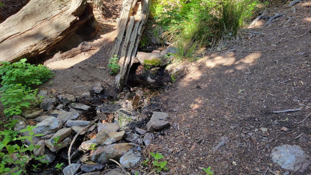
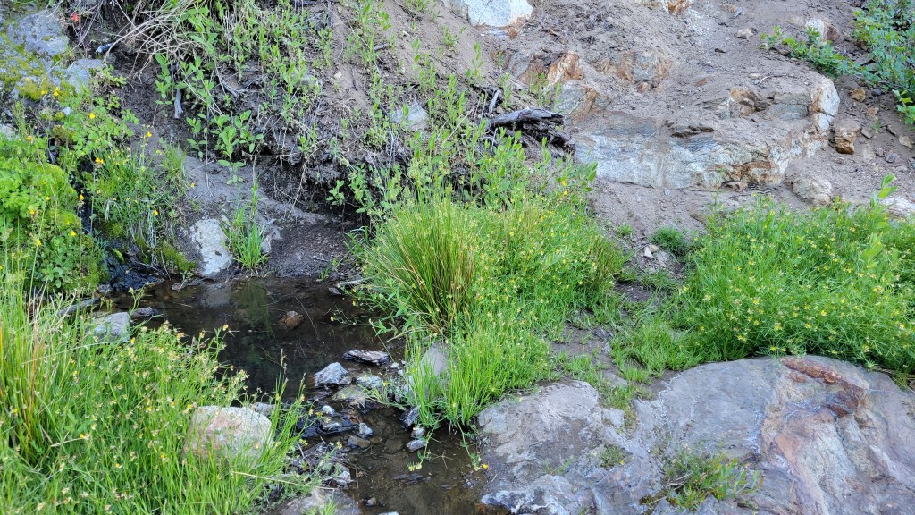
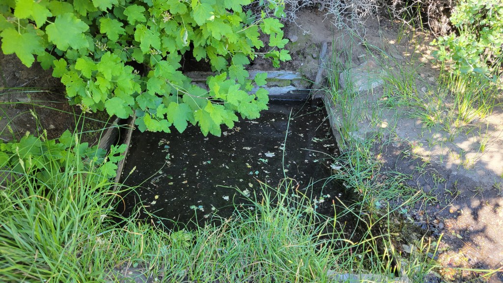

sanjacjon Uncategorized 1 Comment 9 MinutesEdit”Water and trail update 23rd June 2022″
Trail and water update 16th June 2022
With relatively little changing on the trail system at present, other than the steady deterioration of the limited water resources, the Trail Report will be updated less frequently – normally it is at least weekly – for the next couple of months. Any significant news (fires, closures, openings, etc.) will of course be reported immediately.
The trail system has been clear of snow since April. Current conditions for individual trails are discussed in detail below where known.
Hikers should be prepared for unseasonably hot weather, with temperatures well above average for the month, on 15-16th June, and again starting 21st June. Please plan accordingly regarding route choice, start times, clothing, sun protection, and water requirements.
Due to the exceptionally dry state of the mountain already, water conditions where known are detailed at the foot of this Report.
Air quality and visibility down in the lowlands, especially the Coachella Valley, has been generally poor all year, due to the lack of rainfall combined with windier than average conditions. Sadly this poor air quality has been visibly climbing into the higher elevations in recent weeks.
Full fire restrictions were introduced on Thursday 26th May on Forest Service lands, as described in detail here. Campfires on all USFS lands in the San Jacinto mountains (including in fire rings at campgrounds and yellow post sites), and smoking, are prohibited for the remainder of the year.
Be rattlesnake aware. Southern Pacific Rattlesnakes (Crotalus helleri) have recently been seen on the trail system up to at least 8900 ft elevation. As usual, the lower two-thirds of Devil’s Slide Trail, and around Tahquitz Peak, seem to be particular hotspots (e.g., see photos in this earlier Report).
Seasonal campgrounds and Forest Service roads are now generally open. Note the fire restrictions mentioned above. Dark Canyon Road (5S02) remains in “winter closure” and consequently Dark Canyon Campground remains closed. May Valley Road remains closed to vehicles due to “hazard trees”.
WEATHER
Following three near-record hot days (above 90°F in Idyllwild) on 9th-11th June, Monday 13th felt pleasantly cool, although it was actually slightly above seasonal! Temperatures are forecast to rise again and be well above seasonal for 15th-16th June, dropping back to pleasantly cool on 18th-19th, before another significant heatwave is currently forecast starting Tuesday 21st June. Overnight low temperatures in general may average 5-15°F above seasonal at mid elevations (even on Monday 13th the overnight low was more than 10°F above average). There is no significant precipitation in the forecasts.
Short-, medium-, and long-term weather projections are summarized in this NWS San Diego video, along with very informative data regarding the past couple of years of weather and fire seasons.
At San Jacinto Peak (10,810ft/3295m) on Monday 13th June 2022 at 0730 the air temperature was 42.6°F (6°C), with a windchill temperature of 31.6°F (0°C), 7% relative humidity, and a blustery due West wind sustained at 15 mph gusting to 26.2 mph.
At the Peak on Friday 10th June 2022 at 0700 the air temperature was 53.0°F (12°C), with a windchill temperature of 46.8°F (8°C), 44% relative humidity, and a moderate due South breeze sustained at 7 mph gusting to 15.4 mph.
TRAIL CONDITIONS
The trail system, including the entire PCT throughout the San Jacinto mountains, cleared of snow in late April.
Due to greatly reduced maintenance work by the agencies and PCTA during the coronavirus pandemic, many trails have accumulated treefall hazards since late 2019, passable with care by hikers but not for stock. Although reported promptly, most hazards were not removed in 2021. With a couple of storms this past season being accompanied by strong winds and heavy ice loads, hikers should expect to encounter many new and additional hazards, especially in vulnerable burn areas (e.g., Willow Creek Trail, PCT Miles 170-177).
Although some treefall hazards from Red Tahquitz to Antsell Rock (PCT Miles 172.5-175) were cleared in June 2021 prior to the rockslide removal work, the situation has badly deteriorated. In my most recent survey I counted at least 72 treefall hazards between PCT Miles 170-175, plus about six more on PCT Miles 175-177. At least a third of the former are major hazards that require scrambling over or around.
Recent significant treefall hazards on Devil’s Slide and Marion Mountain trails have been removed by the agencies.
Three new trees that came down in late 2021 on Deer Springs Trail just south of its junction with Marion Mountain Trail are readily passable for hikers (but not for stock).
The middle section of South Ridge Trail (between May Valley Road and the top of South Ridge Road) has several trees down which are significant obstructions.
Willow Creek Trail is currently a slow, messy hike. About 45 trees (May 2022 survey) are down between Skunk Cabbage Junction and Hidden Divide, 75% of these on the Forest Service section.
Spitler Peak Trail is currently in its most hiker-friendly condition since the 2013 Mountain Fire. Forty downed trees, most from an ice storm in late December 2021, plus dozens of additional trunks and branches in the trail, were removed by the Trail Report from this trail in early 2022 in time to aid PCT hikers using this as a snow-free alternate.
Fuller Ridge Trail has 14 treefall hazards (May 2022 survey) obstructing the trail, but all are readily passable by relatively agile hikers. Eleven of these are in the 1.5 mile section closest to Fuller Ridge Campground (approx. PCT Miles 189-190.5).
The Caramba Trail from near Reeds Meadow through Laws Camp and on to Caramba, and the Cedar Trail from Willow Creek Trail to Laws, are optimistically described by the Forest Service as “not maintained”. In reality both trails no longer exist and are so heavily overgrown I advise hikers do not attempt to follow them. An informal use trail to Laws is much more direct and avoids all of the very challenging bushwhacking of the unmaintained trails (some local hikers dubbed it the “King Trail” when I established the route in 2019). It leaves the Willow Creek Trail exactly 1.0 mile from Saddle Junction (0.46 mile from the Skunk Cabbage turning), descending largely on established deer trails for 1.2 miles, meeting Willow Creek just upstream from the old Laws Camp. From Laws east to Caramba the route of the original Caramba Trail has been well-cairned by myself and others and can largely be followed with very careful route-finding. My February 2022 survey counted 97 trees down on this 2.1 miles of trail. It is especially obscure 0.1-0.3 mile east of the Willow Creek crossing, becoming clearer near Caramba. Cautious navigation is advised throughout the area.
Seven Pines Trail has had very limited hiker traffic since November 2018, largely because Dark Canyon Road was closed from February 2019 to early October 2021, and again since December 2021. The Trail Report has adopted Seven Pines Trail as a priority for maintenance work as the trail has had a disproportionate number of lost hiker rescues in recent years. Between November 2021 and May 2022, 61 downed trees have been removed and almost the entire trail has been thoroughly trimmed and cleared. Despite this very considerable effort, Seven Pines remains a genuine wilderness trail and is nothing like the relatively wide, bare, and obvious routes of, for example, Devil’s Slide or Marion Mountain trails. Cautious navigation remains required for those who do not have substantial experience of hiking this trail.

WATER CONDITIONS
This is not a comprehensive review of the status of all mountain water sources. In the high country there are still a few tiny patches of snow available for melting. This video gave an overview of major water sources in the high country as of 10th May.
Water status: Eastern slope
The Round Valley pipe is flowing but recent history suggests it will not persist all summer. The nearby Round Valley creek dried up in May. The small creek in Tamarack Valley also dried up in May.
Both the northern and southern springs at Wellman’s Cienega are flowing very weakly for the time of year. In the second week of June the flow rate at the well-known northern spring again dropped dramatically in a matter of days to barely a trickle (photo below) and it seems destined to dry up in the next couple of months without precipitation from summer monsoons. This spring dried for the first time in recorded history in October 2015, then again in September 2016.
The Wellman’s Cienega springs are the sources for Willow Creek, which is currently flowing steadily where it crosses the Willow Creek Trail.
Tahquitz Creek is flowing steadily at the northern (lower) end of Little Tahquitz Meadow (photo above). It is flowing very weakly further upstream at its source (known colloquially as Grethe Spring) where it crosses the PCT at approx. PCT Mile 177 (photo below). Between these locations Tahquitz Creek is basically dry (but presumably flowing subsurface). The small creek in Tahquitz Valley dried up in May.
Skunk Cabbage (“Candy’s”) Creek – that flows through Skunk Cabbage Meadow (photo below) and then crosses the remaining visible section of Caramba Trail near Reeds Meadow – is now barely trickling, is unsuitable for filtering, and will likely dry in June/July.
Water status: Western slope
Ephemeral creeks, such as those along Marion Mountain Trail and on Deer Springs Trail, are now all dry.
The North Fork of the San Jacinto River is flowing steadily where it crosses the Deer Springs Trail and again downstream where it crosses the Fuller Ridge Trail on the PCT (approx. PCT Mile 186.2).
The creek in Little Round Valley barely trickles for about 150 ft at the lower end of Little Round Valley before disappearing subsurface. It will likely dry up in the next month, and cannot be relied upon. The same creek continues to flow steadily where it crosses Fuller Ridge Trail (at about PCT Mile 186.4).
Shooting Star Spring (below Little Round Valley but above the North Fork of the San Jacinto River crossing) is flowing weakly and is barely adequate for filtering.
The Deer Springs stream crossing at the PCT/Deer Springs Trail (approx. PCT mile 185.6) completely dried up in late May where it crosses the trail (photo above).
The tiny Switchback Spring at PCT Mile 183.5 (about 0.4 miles on the PCT northbound from Strawberry Junction) is flowing gently, and there is just about adequate depth from which to filter water in the tiny pool on the upslope side of the trail.
The little creek at Strawberry Cienega (PCT mile 183.0) is functionally dry.
On Devil’s Slide Trail, Middle Spring is now barely trickling, and will likely dry in July. A tiny pool remains as a useful drinking source for dogs at this time. Other springs on this trail have been dry for months.
On the Ernie Maxwell Trail, the crossing of Chinquapin Creek just below Humber Park is dry again where it crosses the trail. Even when Fern Valley Water District diverts flow into the pipe system, there are small fresh pools just upslope from the trail (these are an important source of water for the many dogs walked on the Ernie Maxwell).
Water status: Desert Divide
Live Oak Spring (N 33 37 21, W 116 33 24) Flowing steadily. The most reliable water source on the Desert Divide.
Cedar Spring (N 33 40 36, W 116 34 35) Flowing very weakly (well upslope from the trail into the campsite) and should no longer be relied upon. Sadly the inflow pipe to the trough – formerly the most accessible water source – was vandalized in about May 2022 and consequently the trough is now dry.
Apache Spring (N 33 43 11, W 116 37 13) Flowing weakly, and the spring box remains full. This spring has functionally dried up in recent years and should not be relied upon by late summer.
Spitler Peak Trail Descending the trail there are five water crossings. The first two, at 0.90 and 0.95 miles down, cross a tiny side creek which is largely dry and should be ignored. The next three crossings, at 1.1-1.5 miles down, are Spitler Creek and is the best source of water (currently flowing steadily at both the uppermost and lowest crossings).
Antsell Rock Creek (N 33 41 52, W 116 39 08) Right by the Spitler Peak Trail trailhead on Apple Canyon Road, Antsell Rock Creek is flowing weakly. Just on the upstream side of the road there is excellent access to the creek. Useful if hikers are descending the Spitler Peak Trail.
Thank you for taking the time to read this. While all time and labor is volunteered, the San Jacinto Trail Report depends on your small private donations to cover our costs. Your contribution keeps the Report available to all, free from advertising or paywalls, and independent from agencies. If you have found this Report useful, please use this link to the Donate page. Zelle, Venmo, and PayPal are all options. Thank you for your support.


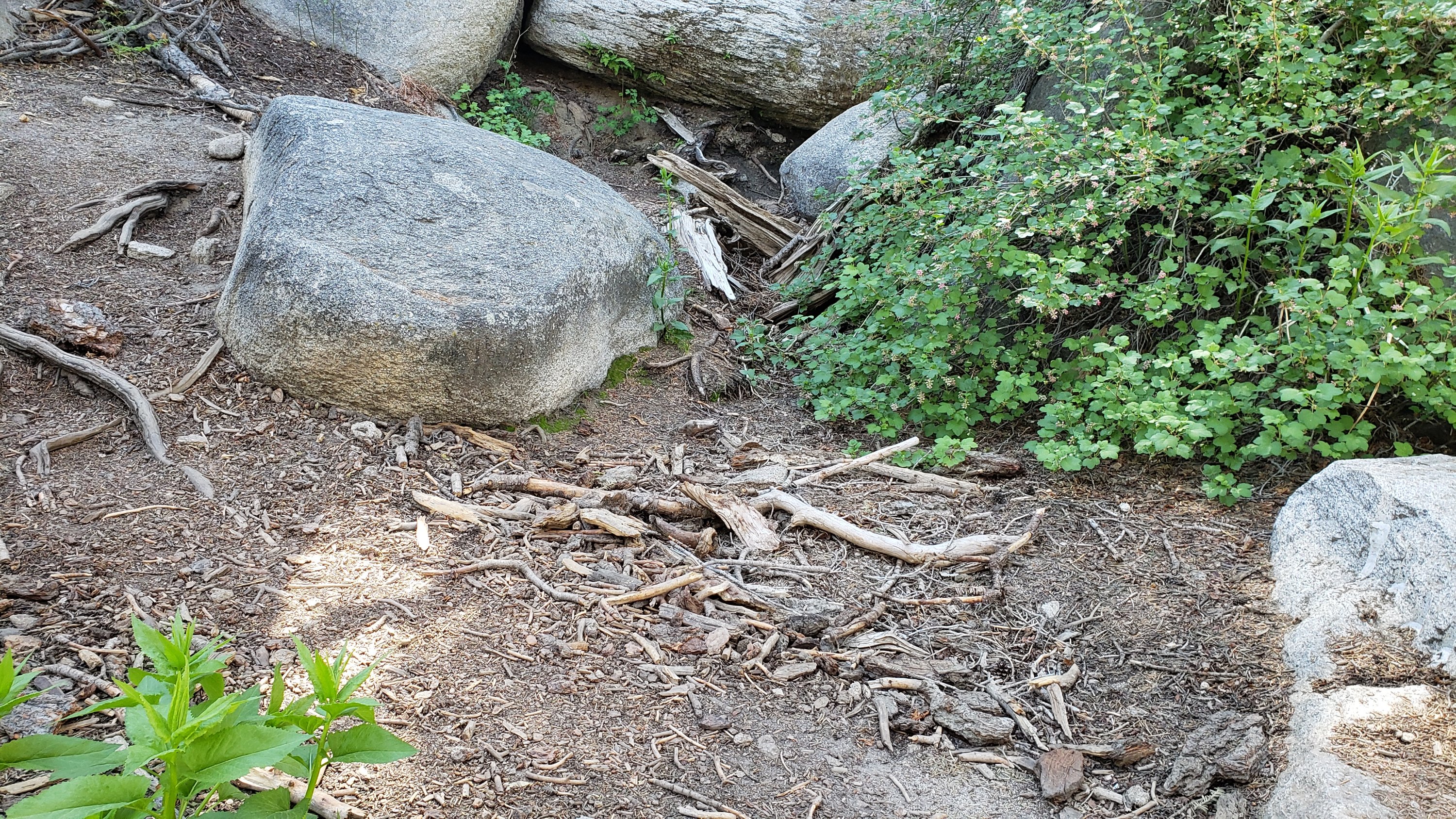
sanjacjon Uncategorized 5 Comments 9 MinutesEdit”Trail and water update 16th June 2022″
Water and weather update 8th June 2022
The trail system has been clear of snow for many weeks. Current conditions for individual trails are discussed in detail below where known.
In addition to ascending San Jacinto Peak by different routes on average once every 3-4 days, we have surveyed many other trails, in recent days including Deer Springs, Fuller Ridge, Seven Pines, Marion Mountain, and South Ridge, plus some Forest roads.
Hikers should be prepared for unseasonably hot weather, with temperatures generally far above average for June, starting Wednesday 8th June for at least ten days. Please plan accordingly regarding route choice, start times, clothing, sun protection, and water requirements.
Due to the exceptionally dry state of the mountain already, water conditions where known are detailed at the foot of this Report.
Air quality and visibility down in the lowlands, especially the Coachella Valley, has been poor all year, due to the lack of rainfall combined with windier than average conditions. Sadly this poor air quality has been visibly climbing into the higher elevations in recent weeks.
National Weather Service San Diego issued this very informative video on 29th May. Some of the data presented are remarkable, if generally very discouraging.
Full fire restrictions were introduced on Thursday 26th May on Forest Service lands, as described in detail here. Campfires on all USFS lands in the San Jacinto mountains (including in fire rings at campgrounds and yellow post sites) and smoking are prohibited for the remainder of the year.
Be rattlesnake aware. Southern Pacific Rattlesnakes (Crotalus helleri) have recently been seen on the trail system up to at least 8800 ft elevation (multiple times at Tahquitz Peak). As usual, the lower two-thirds of Devil’s Slide Trail seems to be a particular hotspot (e.g., see photos in this earlier Report).
Seasonal campgrounds and Forest Service roads are now generally open. Dark Canyon Road (5S02) remains in “winter closure” and consequently Dark Canyon Campground remains closed. May Valley Road remains closed to vehicles due to “hazard trees”.
WEATHER
Following a couple of relatively cool days for the second weekend in a row, temperatures are forecast to get hot and then even hotter. From Wednesday 8th June for at least ten days temperatures will generally be far above seasonal for June, exceeding even midsummer averages (with only a brief respite on 13th-14th). Overnight low temperatures in particular may average 10-20°F above seasonal at mid elevations. There is no precipitation in the forecasts.
Short-, medium-, and long-term weather projections are summarized in the latest NWS San Diego video (available here), along with very informative data regarding the past couple of years of weather and fire seasons.
At San Jacinto Peak (10,810ft/3295m) on Monday 6th June 2022 at 0800 the air temperature was 52.6°F (11°C), with a windchill temperature of 45.5°F (7°C), 21% relative humidity, and a brisk WNW wind sustained at 11 mph gusting to 22.6 mph.
At the Peak on Thursday 2nd June 2022 at 0835 the air temperature was 49.8°F (10°C), with a windchill temperature of 47.3°F (8°C), 24% relative humidity, and a very gentle due West breeze sustained at 1 mph gusting to 4.1 mph.
TRAIL CONDITIONS
The trail system, including the entire PCT throughout the San Jacinto mountains, cleared of snow in late April.
Due to greatly reduced maintenance work by the agencies and PCTA during the coronavirus pandemic, many trails have accumulated treefall hazards since late 2019, passable with care by hikers but not for stock. Although reported promptly, most hazards were not removed in 2021. With storms this season being accompanied by strong winds and heavy ice loads, hikers should expect to encounter many new and additional hazards, especially in vulnerable burn areas (e.g., Willow Creek Trail, PCT Miles 170-177).
Although some treefall hazards from Red Tahquitz to Antsell Rock (PCT Miles 172.5-175) were cleared in June 2021 prior to the rockslide removal work, the situation has badly deteriorated. In my most recent survey I counted at least 72 treefall hazards between PCT Miles 170-175. At least a third of these are major hazards that require scrambling over or around.
The significant new treefall hazard that fell about two miles up Devil’s Slide Trail over Memorial Day weekend was removed last week.
The huge treefall hazard across Marion Mountain Trail exactly at the State Park/Forest Service boundary was cut last week.
Three new trees that came down in late 2021 on Deer Springs Trail just south of its junction with Marion Mountain Trail are readily passable for hikers (but not for stock).
The middle section of South Ridge Trail (between May Valley Road and the top of South Ridge Road) has several trees down which are significant obstructions.
Willow Creek Trail is currently a slow, messy hike. About 45 trees (May 2022 survey) are down between Skunk Cabbage Junction and Hidden Divide, 75% of these on the Forest Service section.
Spitler Peak Trail is currently in its most hiker-friendly condition since the 2013 Mountain Fire. Forty downed trees, most from an ice storm in late December 2021, plus dozens of additional trunks and branches in the trail, were removed by the Trail Report from this trail in early 2022 in time to aid PCT hikers using this as a snow-free alternate.
Fuller Ridge Trail has 14 treefall hazards (May 2022 survey) obstructing the trail, but all are readily passable by relatively agile hikers. Eleven of these are in the 1.5 mile section closest to Fuller Ridge Campground (approx. PCT Miles 189-190.5).
The Caramba Trail from near Reeds Meadow through Laws Camp and on to Caramba, and the Cedar Trail from Willow Creek Trail to Laws, are optimistically described by the Forest Service as “not maintained”. In reality both trails no longer exist and are so heavily overgrown I advise hikers do not attempt to follow them. An informal use trail to Laws is much more direct and avoids all of the very challenging bushwhacking of the unmaintained trails (some local hikers dubbed it the “King Trail” when I established the route in 2019). It leaves the Willow Creek Trail exactly 1.0 mile from Saddle Junction (0.46 mile from the Skunk Cabbage turning), descending largely on established deer trails for 1.2 miles, meeting Willow Creek just upstream from the old Laws Camp. From Laws east to Caramba the route of the original Caramba Trail has been well-cairned by myself and others and can largely be followed with very careful route-finding. My February 2022 survey counted 97 trees down on this 2.1 miles of trail. It is especially obscure 0.1-0.3 mile east of the Willow Creek crossing, becoming clearer near Caramba. Cautious navigation is advised throughout the area.
Seven Pines Trail has had very limited hiker traffic since November 2018, largely because Dark Canyon Road was closed from February 2019 to early October 2021, and again since December 2021. The Trail Report has adopted Seven Pines Trail as a priority for maintenance work as the trail has had a disproportionate number of lost hiker rescues in recent years. Between November 2021 and May 2022, 61 downed trees have been removed and almost the entire trail has been thoroughly trimmed and cleared. Despite this very considerable effort, Seven Pines remains a genuine wilderness trail and is nothing like the relatively wide, bare, and obvious routes of, for example, Devil’s Slide or Marion Mountain trails. Cautious navigation remains required for those who do not have substantial experience of hiking this trail.
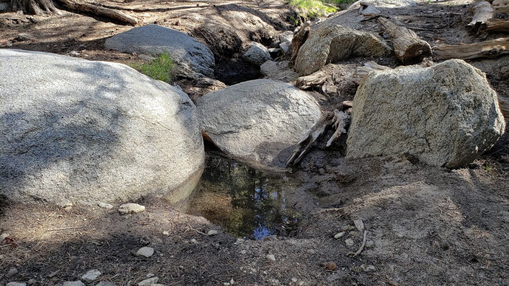
WATER CONDITIONS
This is not a comprehensive review of the status of all mountain water sources. In the high country there are still a few tiny patches of snow available for melting. This video gave an overview of major water sources in the high country as of 10th May.
WATER STATUS: Eastern slope
The Round Valley pipe is flowing steadily (photo below) but recent history suggests it will not persist all summer. The nearby Round Valley creek dried up in May. The small creek in Tamarack Valley also dried up in May.
Both the northern (photo below) and southern springs at Wellman’s Cienega are flowing very weakly for the time of year. In May the flow rate at the well-known northern spring dropped dramatically by about 50%. These springs are the sources for Willow Creek, which is flowing steadily where it crosses the Willow Creek Trail.
Tahquitz Creek is flowing steadily at the northern (lower) end of Little Tahquitz Meadow. It is also flowing weakly further upstream at its source (known colloquially as Grethe Spring) where it crosses the PCT (approx. PCT Mile 177). Between these locations Tahquitz Creek is largely dry (but presumably flowing subsurface). The small creek in Tahquitz Valley dried up in May.
Skunk Cabbage (“Candy’s”) Creek – that flows through Skunk Cabbage Meadow and then crosses the remaining visible section of Caramba Trail near Reeds Meadow – is currently flowing gently in both locations.
WATER STATUS: Western slope
Ephemeral creeks, such as those along Marion Mountain Trail and on Deer Springs Trail, are now all dry.
The North Fork of the San Jacinto River is flowing well where it crosses the Deer Springs Trail and again downstream where it crosses the Fuller Ridge Trail on the PCT (approx. PCT Mile 186.2).
The creek in Little Round Valley only trickles for about 150 ft at the lower end of Little Round Valley before disappearing subsurface (see photo above). It will likely dry up in the next month or two. The same creek continues to flow steadily where it crosses Fuller Ridge Trail (at about PCT Mile 186.4).
Shooting Star Spring (below Little Round Valley but above the North Fork of the San Jacinto River crossing) is flowing steadily.
The Deer Springs stream crossing at the PCT/Deer Springs Trail (approx. PCT mile 185.6) has dried up where it crosses the trail.
The tiny Switchback Spring at PCT Mile 183.5 (about 0.4 miles on the PCT northbound from Strawberry Junction) is flowing gently, and there is just about adequate depth from which to filter water in the tiny pool on the upslope side of the trail.
The little creek at Strawberry Cienega (PCT mile 183.0) is functionally dry.
On Devil’s Slide Trail, Middle Spring is now barely trickling, and will likely dry by July. A tiny pool remains as a useful drinking source for dogs. Other springs on this trail have been dry for weeks.
On the Ernie Maxwell Trail, the crossing of Chinquapin Creek just below Humber Park is dry again where it crosses the trail. Even when Fern Valley Water District diverts flow into the pipe system, there are small fresh pools just upslope from the trail (these are an important source of water for the many dogs walked on the Ernie Maxwell).
WATER STATUS: Desert Divide
Live Oak Spring (N 33 37 21, W 116 33 24) Flowing steadily. The most reliable water source on the Desert Divide.
Cedar Spring (N 33 40 36, W 116 34 35) Flowing gently. Easiest access is the trough 60 yards upstream from the trail to the campsite.
Apache Spring (N 33 43 11, W 116 37 13) Flowing very weakly, should no longer be relied upon.
Spitler Peak Trail Descending the trail there are five water crossings. The first two, at 0.9 and 0.95 miles down, cross a tiny side creek which is largely dry and should be ignored. The next three crossings, at 1.1-1.5 miles down, are Spitler Creek and is the best source of water (currently flowing at least at the lowest crossing).
Antsell Rock Creek (N 33 41 52, W 116 39 08) Right by the Spitler Peak Trail trailhead on Apple Canyon Road, Antsell Rock Creek is flowing weakly. Just on the upstream side of the road there is excellent access to the creek. Useful if hikers are descending the Spitler Peak Trail.

Thank you for taking the time to read this. While all time and labor is volunteered, the San Jacinto Trail Report depends on your small private donations to cover our costs. Your contribution keeps the Report available to all, free from advertising or paywalls, and independent from agencies. If you have found this Report useful, please use this link to the Donate page. Zelle, Venmo, and PayPal are all options. Thank you for your support.
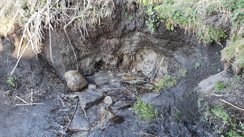
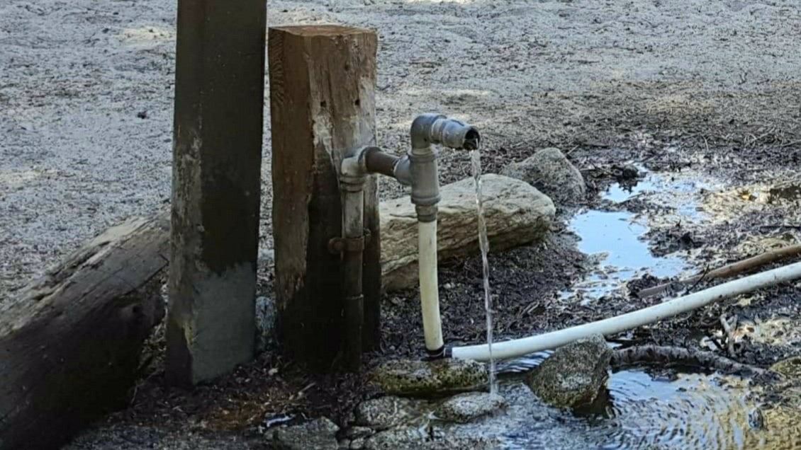
sanjacjon Uncategorized Leave a comment 8 MinutesEdit”Water and weather update 8th June 2022″
Trail update 1st June 2022
A special thank you to Steve Holldber, owner of Idyllwild Heating and Cooling, for hosting our successful fundraising sale on Saturday 28th May. Many thanks to Anne for tasty treats (visitors commented that they had never seen “free” baked goods and coffee at a yard sale before!), to Florian for publicizing the event on social media, and to the many neighbors and friends, new and old, who came by to say hello and support us.
The trail system has been clear of snow for a few weeks and spikes have not been required on the trails since April. Current conditions for individual trails are discussed in detail below where known.
In addition to ascending San Jacinto Peak by different routes on average every three days, we have surveyed large segments of the PCT, its side trails, and a few Forest roads. Trails surveyed in recent days have included Deer Springs, Fuller Ridge, Seven Pines, Marion Mountain, Spitler Peak, and South Ridge, among others.
Due to the exceptionally dry state of the mountain already, there is a brief summary of water conditions where known at the foot of this Report. A short video report (available here) was issued on 10th May giving a visual overview of water conditions in the high country. Air quality and visibility down in the lowlands, especially the Coachella Valley, has been poor all year, likely due to the lack of rainfall combined with windier than average conditions.
National Weather Service San Diego issued this very informative video on 29th May. Some of the data presented are remarkable, if generally very discouraging.
Full fire restrictions were introduced on Thursday 26th May on Forest Service lands, as described in detail here. Campfires on all USFS lands in the San Jacinto mountains (including in fire rings at campgrounds and yellow post sites) are prohibited for the remainder of the year.
Be rattlesnake aware. Southern Pacific Rattlesnakes (Crotalus helleri) have already been seen on the trail system up to at least 8800 ft elevation (near Tahquitz Peak). As usual, the lower two-thirds of Devil’s Slide Trail seems to be a particular hotspot (e.g., see photos in previous Report).
Black Mountain Road (4S01) reopened on 11th May. South Ridge Road was partially graded in mid April, smoothing the worst sections. Santa Rosa Road (7S02) reopened on 7th April. Dark Canyon Road (5S02) remains in “winter closure”.
Forest Service seasonal campgrounds reopened on Thursday 26th May (Boulder Basin, Marion Mountain, Fern Basin). Note the full fire restrictions described above. The State Park Stone Creek Campground reopened for the season on 6th May.

WEATHER
Following a couple of pleasantly cool days this weekend, temperatures are generally forecast to be above, or well above, seasonal for 1st-7th June, coolest next weekend (3rd-5th June). Overnight low temperatures in particular may average 5-15°F above seasonal at mid elevations. Preliminary forecasts suggest temperatures will be far above seasonal, more reminiscent of August than early June, about starting 8th June. There is no precipitation in the forecasts.
Short-, medium-, and long-term weather projections are summarized in the latest NWS San Diego video (available here), along with very informative data regarding the past couple of years of weather and fire seasons.
At San Jacinto Peak (10,810ft/3295m) on Monday 30th May 2022 at 0710 the air temperature was 39.5°F (4°C), with a windchill temperature of 27.3°F (-3°C), 18% relative humidity, and a brisk WNW wind sustained at 12 mph gusting to 20.5 mph.
At the Peak on Friday 27th May 2022 at 0740 the air temperature was 51.5°F (11°C), with a windchill temperature of 44.3°F (7°C), 23% relative humidity, and a gentle SW wind sustained at 6 mph gusting to 9.9 mph.
TRAIL CONDITIONS
The trail system, including the entire PCT throughout the San Jacinto mountains, has been clear of snow for several weeks.
Due to greatly reduced maintenance work by the agencies and PCTA during the coronavirus pandemic, many trails have accumulated treefall hazards since late 2019, passable with care by hikers but not for stock. Although reported promptly, most hazards were not removed in 2021. With storms this season being accompanied by strong winds and heavy ice loads, hikers should expect to encounter many new and additional hazards, especially in vulnerable burn areas (e.g., Willow Creek Trail, PCT Miles 170-177).
Although some treefall hazards from Red Tahquitz to Antsell Rock (PCT Miles 172.5-175) were cleared in June 2021 prior to the rockslide removal work, the situation has badly deteriorated since. In my most recent survey I counted at least 72 treefall hazards between PCT Miles 170-175. At least a third of these are major hazards that require scrambling over or around.
A significant new treefall hazard that fell across Devil’s Slide Trail over Memorial Day weekend about two miles up from Humber Park was immediately reported to the Forest Service.
The trail route on the East Ridge of San Jacinto Peak is now functionally clear of snow.
Marion Mountain Trail has one huge new treefall hazard across the trail exactly at the State Park/Forest Service boundary.
Deer Springs Trail is now clear of snow. Three new trees came down in late 2021 on the PCT/Deer Springs Trail just south of its junction with Marion Mountain Trail, but they are readily passable for hikers (but not for stock).
The middle section of South Ridge Trail (between May Valley Road and the top of South Ridge Road) has several trees down which are significant obstructions.
Willow Creek Trail has more than 40 downed trees between Skunk Cabbage Junction and Hidden Divide, 30 of these on the Forest Service section.
Spitler Peak Trail is currently in its most hiker-friendly condition since the 2013 Mountain Fire. Forty downed trees, most from an ice storm in late December 2021, plus dozens of additional trunks and branches in the trail, were removed by the Trail Report from this trail in early 2022.
Fuller Ridge Trail has 14 treefall hazards (May 2022 survey) obstructing the trail, but all are readily passable by agile hikers. Eleven of these are in the 1.5 mile section closest to Fuller Ridge Campground (approx PCT Miles 189-190.5).
The Caramba Trail from near Reeds Meadow through Laws Camp and on to Caramba, and the Cedar Trail from Willow Creek Trail to Laws, are optimistically described by the Forest Service as “not maintained”. In reality both trails no longer exist and are so heavily overgrown I advise hikers do not attempt to follow them. An informal use trail to Laws is much more direct and avoids all of the very challenging bushwhacking of the unmaintained trails (some local hikers dubbed it the “King Trail” when I established the route in 2019). It leaves the Willow Creek Trail exactly 1.0 mile from Saddle Junction (0.46 mile from the Skunk Cabbage turning), descending largely on established deer trails for 1.2 miles, meeting Willow Creek just upstream from the old Laws Camp. From Laws east to Caramba the route of the original Caramba Trail has been well-cairned by myself and others and can largely be followed with very careful route-finding. My February 2022 survey counted 97 trees down on this 2.1 miles of trail. It is especially obscure 0.1-0.3 mile east of the Willow Creek crossing, becoming clearer near Caramba. Cautious navigation is advised throughout the area.
Seven Pines Trail has had very limited hiker traffic since November 2018, largely because Dark Canyon Road was closed from February 2019 to early October 2021, and again since December 2021. The Trail Report has “adopted” Seven Pines Trail as a priority for maintenance work as the trail has had a disproportionate number of lost hiker rescues in recent years. Between November 2021 and May 2022, 61 downed trees have been removed and almost the entire trail has been thoroughly trimmed and cleared. Despite this very considerable effort, Seven Pines remains a genuine wilderness trail and is nothing like the relatively wide, bare routes of, for example, Devil’s Slide or Marion Mountain trails. Cautious navigation remains required for those who do not have substantial experience of hiking this trail.

WATER CONDITIONS
On Monday 23rd May, the flow rate at Wellman’s Cienega had dropped by a remarkable 50% since the previous week, although it is largely unchanged in the week since. While I expect sufficient water to continue to trickle here for another couple of months at least, this gives an idea of the poor state of water resources on the mountain this year, and the rate at which they can change.
This is not a comprehensive review of the status of all mountain water sources. In the high country there are still patches of snow available for melting, and several less well-known minor springs are flowing. Sadly however – given that it’s still only May – I have already been getting many questions regarding water availability on the mountain. I have checked all of these water sources personally in recent days.
This video gives an overview of major water sources in the high country as of 10th May.
Water sources currently flowing include: Wellman’s Cienega (flowing weakly on 30th May), Round Valley faucet (flowing well on 30th May), North Fork of the San Jacinto River (both where it crosses Deer Springs Trail and on Fuller Ridge Trail at PCT Mile 186), Deer Springs (PCT Mile 185.4, very weak flow), Willow Creek crossing on Willow Creek Trail, Tahquitz Creek (PCT Mile 177 and also Little Tahquitz Meadow), Skunk Cabbage Meadow creek, Strawberry Cienega (very weak), Apache Spring (weak), Cedar Spring, Live Oak Spring, Antsell Rock Creek (at the Spitler Peak trailhead), Spitler Creek (on Spitler Peak Trail, very weak flow).
Water sources known to be dry: Tahquitz Valley pipe, Penrod Canyon (approx. PCT Mile 154), Little Round Valley creek (isolated pools only and almost dry on 27th May).
Thank you for taking the time to read this. While all time and labor is volunteered, the San Jacinto Trail Report depends on your small private donations to cover our costs. Your contribution keeps the Report available to all, free from advertising or paywalls, and independent from agencies. If you have found this Report useful, please use this link to the Donate page. Zelle, Venmo, and PayPal are all options. Thank you so much for your support.

sanjacjon Uncategorized Leave a comment 7 MinutesEdit”Trail update 1st June 2022″
Trail update 25th May 2022
The Trail Report is holding a small fundraising sale on the morning of Saturday 28th May, very kindly hosted by Idyllwild Heating and Cooling on North Circle Drive in Idyllwild (near Cafe Aroma). There will be a variety of good condition hiking, camping, and outdoor gear. Also “free” (with your modest donation!) will be some of Anne’s delicious fresh baked treats, plus Pacific Crest Trail stickers, trail markers, and map posters. Thanks for your support!
The trail system has been clear of snow for a few weeks and spikes have not been required on the trails since April. Current conditions for individual trails are discussed in detail below where known.
In addition to multiple ascents of San Jacinto Peak by different routes in recent days we have surveyed large segments of the PCT, its side trails, and a few Forest roads. Trails surveyed in recent days have included Deer Springs, Fuller Ridge, Seven Pines, Marion Mountain, Spitler Peak, and South Ridge, among others.
Due to the exceptionally dry state of the mountain already, there is a brief summary of water conditions where known at the foot of this Report. A short video report (available here) was issued on 10th May giving a visual overview of water conditions in the high country. Air quality and visibility down in the lowlands, especially the Coachella Valley, has been poor all year, likely due to the lack of rainfall combined with windier than average conditions.
Full fire restrictions begin on Thursday 26th May on Forest Service lands, as described here. Campfires on all USFS lands in the San Jacinto mountains (including in fire rings at all campgrounds and yellow post sites) will then be prohibited for the remainder of the year.
Be rattlesnake aware. Southern Pacific Rattlesnakes (Crotalus helleri) have already been seen on the trail system up to at least 7000 ft elevation. As usual, the lower two-thirds of Devil’s Slide Trail seems to be a particular hotspot (see photos below).
South Ridge Road was partially graded in mid April, smoothing the worst sections. Santa Rosa Road (7S02) reopened on 7th April. Dark Canyon Road (5S02) remains in winter closure.
Black Mountain Road (4S01) reopened on 11th May.
Forest Service campgrounds seasonally closed for the winter will reopen on Thursday 26th May (Boulder Basin, Marion Mountain, Fern Basin). Note the full fire restrictions described above.
The State Park Stone Creek Campground reopened for the season on 6th May. The Forest Service ranger station in Idyllwild, closed for more than two years (originally due to the coronavirus pandemic), reopened on Saturday 21st May 2022.
WEATHER
Temperatures are generally forecast to remain well above seasonal for the remainder of May, though briefly pleasantly cooler on 28th-30th. Overnight low temperatures in particular may average 10-15°F above seasonal at mid elevations. There is no precipitation in the forecasts.
At San Jacinto Peak (10,810ft/3295m) on Monday 23rd May 2022 at 0725 the air temperature was 51.0°F (11°C), with a windchill temperature of 43.7°F (6°C), 31% relative humidity, and a pleasantly cool NNE wind sustained at 4 mph gusting to 8.8 mph.
At the Peak on Wednesday 18th May 2022 at 0740 the air temperature was 45.1°F (7°C), with a windchill temperature of 33.8°F (1°C), 37% relative humidity, and a pleasantly cool NE wind sustained at 10 mph gusting to 19.8 mph.
TRAIL CONDITIONS
All major trails are clear of snow, including for example the notoriously hazardous 0.4 mile section of South Ridge Trail from Chinquapin Flat/PCT Mile 178 to Tahquitz Peak. The PCT is now clear of snow throughout the San Jacinto mountains.
Skyline Trail reopened on 10th May having been closed from the State Park boundary (5800 ft) up to Grubb’s Notch since 1st February.
Due to greatly reduced maintenance work by the agencies and PCTA during the coronavirus pandemic, many trails have accumulated treefall hazards since late 2019, passable with care by hikers but not for stock. Although reported promptly, most hazards were not removed in 2021. With storms this season being accompanied by strong winds and heavy ice loads, hikers should expect to encounter many new and additional hazards, especially in vulnerable burn areas (e.g., Willow Creek Trail, PCT Miles 170-177).
Although some treefall hazards from Red Tahquitz to Antsell Rock (PCT Miles 172.5-175) were cleared in June 2021 prior to the rockslide removal work, the situation has badly deteriorated since. In my most recent survey I counted at least 72 treefall hazards between PCT Miles 170-175. At least a third of these are major hazards that require scrambling over or around.
The trail route on the East Ridge of San Jacinto Peak still has 20% snow cover but spikes are not required. The Wellman and Peak trails are clear of snow.
Marion Mountain Trail is clear of snow. There is one huge new treefall hazard across the trail exactly at the State Park/Forest Service boundary.
Deer Springs Trail is functionally clear of snow. A few tiny patches remain on the traverse near the North Fork of the San Jacinto River around 9400 ft elevation. Patchy snow cover is now <10% in Little Round Valley. Icy snow patches cover <5% of the trail from Little Round Valley to San Jacinto Peak. (Three new trees came down in late 2021 on the PCT/Deer Springs Trail just south of its junction with Marion Mountain Trail, but they are readily passable for hikers.)
South Ridge Trail (south of Tahquitz Peak) is clear of snow to Tahquitz Peak. The middle section of South Ridge Trail (between May Valley Road and the top of South Ridge Road) has several trees down which are significant obstructions.
Willow Creek Trail is clear of snow. However there are at least 40 downed trees between Skunk Cabbage Junction and Hidden Divide, nearly 30 of these on the Forest Service section.
Spitler Peak Trail is clear of snow. Forty downed trees, most from an ice storm in late December 2021, plus dozens of additional trunks and branches in the trail, have been removed by the Trail Report from this trail in early 2022.
Fuller Ridge Trail is clear of snow. There are 14 treefall hazards (May 2022 survey) obstructing the trail, but all are readily passable by agile hikers. Eleven of these are in the 1.5 mile section closest to Fuller Ridge Campground (approx PCT Miles 189-190.5).
The Caramba Trail from near Reeds Meadow through Laws Camp and on to Caramba, and the Cedar Trail from Willow Creek Trail to Laws, are optimistically described by the Forest Service as “not maintained”. In reality both trails no longer exist and are so heavily overgrown I advise hikers do not attempt to follow them. An informal use trail to Laws is much more direct and avoids all of the very challenging bushwhacking of the unmaintained trails (some local hikers dubbed it the “King Trail” when I established the route in 2019). It leaves the Willow Creek Trail exactly 1.0 mile from Saddle Junction (0.46 mile from the Skunk Cabbage turning), descending largely on established deer trails for 1.2 miles, meeting Willow Creek just upstream from the old Laws Camp. From Laws east to Caramba the route of the original Caramba Trail has been well-cairned by myself and others and can largely be followed with very careful route-finding. My February 2022 survey counted 97 trees down on this 2.1 miles of trail. It is especially obscure 0.1-0.3 mile east of the Willow Creek crossing, becoming clearer near Caramba. Cautious navigation is advised throughout the area.
Seven Pines Trail is functionally clear of snow, a few tiny patches remain on the uppermost 0.5 mile. This trail has had very limited hiker traffic since November 2018, largely because Dark Canyon Road was closed from February 2019 to early October 2021, and again since December 2021. The Trail Report has “adopted” Seven Pines Trail as a priority for maintenance work as the trail has had a disproportionate number of lost hiker rescues in recent years. Between November 2021 and May 2022, 57 downed trees have been removed. Almost all of the lower 3.0 miles has also been thoroughly trimmed and cleared, and the trail is now obvious and easy to follow for much of its length. While downed trees have now been removed from the upper 0.7 mile of trail, thorough clearing and trimming has not been finished, the route remains somewhat obscure in places, and cautious navigation is required for those who do not have experience of hiking this trail. Dark Canyon campground remains closed.

WATER CONDITIONS
On Monday 23rd May, the flow rate at Wellman’s Cienega had dropped by a remarkable 50% since the previous week. Although I expect sufficient water to continue to trickle here for another couple of months at least, this gives an idea of the poor state of water resources on the mountain this year, and the rate at which they can change.
This is not a comprehensive review of the status of all mountain water sources. In the high country there are still patches of snow available for melting, and several less well-known minor springs are flowing. Sadly however – given that it’s only May – I have already been getting many questions regarding water availability on the mountain. I have checked all of these water sources personally in recent days.
This video gives an overview of major water sources in the high country as of 10th May.
Water sources currently flowing include: Wellman’s Cienega, Round Valley faucet, Little Round Valley Creek (at west end of valley, very weak), North Fork of the San Jacinto River (both where it crosses Deer Springs Trail and on Fuller Ridge Trail at PCT Mile 186), Deer Springs (PCT Mile 185.4, very weak flow), Willow Creek crossing on Willow Creek Trail, Tahquitz Creek (PCT Mile 177 and also Little Tahquitz Meadow), Skunk Cabbage Meadow creek, Strawberry Cienega (weak), Apache Spring (weak), Cedar Spring, Live Oak Spring, Antsell Rock Creek (at the Spitler Peak trailhead), Spitler Creek (on Spitler Peak Trail).
Water sources known to be dry: Tahquitz Valley pipe, Penrod Canyon (approx. PCT Mile 154).
Thank you for taking the time to read this. While all time and labor is volunteered, the San Jacinto Trail Report depends on your small private donations to cover our costs. Your contribution keeps the Report available to all, free from advertising or paywalls, and independent from agencies. If you have found this Report useful, please use this link to the Donate page. Zelle, Venmo, and PayPal are all options. Thank you so much for your support.
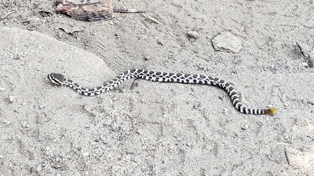


sanjacjon Uncategorized 1 Comment 7 MinutesEdit”Trail update 25th May 2022″
Trail update 18th May 2022
The trail system is now functionally clear of snow. Spikes have not been required on the trail system for several weeks. Current conditions for individual trails are discussed in detail below where known.
The USFS Humber Park trailhead and parking lot, which includes the Devil’s Slide Trail (3E05) trailhead and the upper trailhead for the Ernie Maxwell Scenic Trail (3E07), was originally closed between Monday 16th May and Friday 20th May due to insecticide spraying operations. However, due to early completion of the work, Humber Park is now expected to reopen on the afternoon of Wednesday 18th May. Closure notices at Saddle Junction may not be removed until Thursday 19th.
The State Park section of Skyline Trail reopened on 10th May having been closed since 1st February.
In addition to multiple ascents of San Jacinto Peak by different routes in recent days we have surveyed large segments of the PCT, its side trails, and a few Forest roads. Trails surveyed in recent days have included all of the Tahquitz area meadows, Spitler Peak, South Ridge, Marion Mountain, Seven Pines, Willow Creek, and Deer Springs trails.
Due to the exceptionally dry state of the mountain already, there is a brief summary of water conditions where known at the foot of this Report. A short video report (available here) was published on 10th May giving a visual overview of current water conditions in the high country. Air quality and visibility down in the lowlands, especially the Coachella Valley, has been poor all year, likely due to the lack of rainfall combined with windier than average conditions.
South Ridge Road was partially graded in mid April, smoothing the worst sections. Santa Rosa Road (7S02) reopened on 7th April. Dark Canyon Road (5S02) remains in winter closure.
Black Mountain Road (4S01) reopened on 11th May. Forest Service campgrounds seasonally closed for the winter are expected to reopen in the week before the Memorial Day weekend (including Boulder Basin, scheduled to reopen 26th May). The State Park Stone Creek Campground reopened for the season on 6th May.
The Forest Service ranger station in Idyllwild, closed for more than two years (originally due to the coronavirus pandemic), is scheduled to reopen on Saturday 21st May 2022.

WEATHER
After a couple of pleasantly seasonal days at the beginning and end of this week, temperatures are forecast to rise to far above seasonal from 21st to at least 26th May. Overnight low temperatures in particular will average 10-15°F above seasonal at mid elevations. Temperatures in the high country on 24th-29th will more closely resemble July/August than May. There is no precipitation in the forecasts.
At San Jacinto Peak (10,810ft/3295m) on Wednesday 18th May 2022 at 0740 the air temperature was 45.1°F (7°C), with a windchill temperature of 33.8°F (1°C), 37% relative humidity, and a pleasantly cool NE wind sustained at 10 mph gusting to 19.8 mph.
At the Peak on Monday 16th May 2022 at 0750 the air temperature was 43.3°F (6°C), with a windchill temperature of 34.7°F (1°C), 29% relative humidity, and a fresh due West wind sustained at 10 mph gusting to 13.7 mph.
At the Peak on Wednesday 11th May 2022 at 0820 the air temperature was 21.9°F (-6°C), with a windchill temperature of 2.7°F (-16°C), 13% relative humidity, and a gusty due West wind sustained at 13 mph gusting to 26.7 mph.

TRAIL CONDITIONS
All major trails are functionally clear of snow. Some tiny icy snow patches remain in a handful of places above about 9000 ft elevation as mentioned below. Named trails are completely clear of snow/ice unless discussed below.
Skyline Trail reopened on 10th May having been closed from the State Park boundary (5800 ft) up to Grubb’s Notch since 1st February.
Due to greatly reduced maintenance work by the agencies and PCTA during the coronavirus pandemic, many trails have accumulated treefall hazards since late 2019, passable with care by hikers but not for stock. Although reported promptly, most hazards were not removed in 2021. With storms this season being accompanied by strong winds and heavy ice loads, hikers should expect to encounter many new and additional hazards, especially in vulnerable burn areas (e.g., Willow Creek Trail, PCT Miles 170-177).
Although some treefall hazards from Red Tahquitz to Antsell Rock (PCT Miles 172.5-175) were cleared in June 2021 prior to the rockslide removal work, the situation has badly deteriorated since. In my most recent survey I counted at least 72 treefall hazards between PCT Miles 170-175. At least a third of these are major hazards that require scrambling over or around.
The notoriously hazardous 0.4 mile section of South Ridge Trail from Chinquapin Flat/PCT Mile 178 to Tahquitz Peak is now functionally clear of icy snow, and spikes are no longer required.
The PCT is now functionally clear of snow throughout the San Jacinto mountains. A few tiny patches remain just south of Annie’s Junction starting at about Mile 180.3, as do a few on the most sheltered sections of Fuller Ridge (Miles 188-189.5)
Snow cover now averages <5% on the Peak Trail, persisting in patches in two short traditionally persistent areas around 10,000 ft and 10,100 ft. Spikes are not required. The trail route on the East Ridge still has 40% snow cover but spikes are not required. The Wellman Trail is functionally clear of snow.
Marion Mountain Trail is clear of snow. There is one huge new treefall hazard across the trail exactly at the State Park/Forest Service boundary.
Deer Springs Trail is functionally clear of snow. A few tiny patches remain on the traverse near the North Fork of the San Jacinto River around 9400 ft elevation. Patchy snow cover is now <10% in Little Round Valley. Icy snow patches cover <5% of the trail from Little Round Valley to San Jacinto Peak. (Three new trees came down in late 2021 on the PCT/Deer Springs Trail just south of its junction with Marion Mountain Trail, but they are readily passable for hikers.)
South Ridge Trail (south of Tahquitz Peak) is clear of snow to Tahquitz Peak. The middle section of South Ridge Trail (between May Valley Road and the top of South Ridge Road) has several trees down which are significant obstructions.
Willow Creek Trail is clear of snow. However there are at least 40 downed trees between Skunk Cabbage Junction and Hidden Divide, nearly 30 of these on the Forest Service section.
Spitler Peak Trail is clear of snow. Forty downed trees, most from an ice storm in late December 2021, plus dozens of additional trunks and branches in the trail, have been removed by the Trail Report from this trail in early 2022.
The Caramba Trail from near Reeds Meadow through Laws Camp and on to Caramba, and the Cedar Trail from Willow Creek Trail to Laws, are optimistically described by the Forest Service as “not maintained”. In reality both trails no longer exist and are so heavily overgrown I advise hikers do not attempt to follow them. An informal use trail to Laws is much more direct and avoids all of the very challenging bushwhacking of the unmaintained trails (some local hikers dubbed it the “King Trail” when I established the route in 2019). It leaves the Willow Creek Trail exactly 1.0 mile from Saddle Junction (0.46 mile from the Skunk Cabbage turning), descending largely on established deer trails for 1.2 miles, meeting Willow Creek just upstream from the old Laws Camp. From Laws east to Caramba the route of the original Caramba Trail has been well-cairned by myself and others and can largely be followed with very careful route-finding. My February 2022 survey counted 97 trees down on this 2.1 miles of trail. It is especially obscure 0.1-0.3 mile east of the Willow Creek crossing, becoming clearer near Caramba. Cautious navigation is advised throughout the area.
Seven Pines Trail is functionally clear of snow. This trail has had very limited hiker traffic since November 2018, largely because Dark Canyon Road was closed from February 2019 to early October 2021, and again since December 2021. The Trail Report has “adopted” Seven Pines Trail as a priority for maintenance work as the trail has had a disproportionate number of lost hiker rescues in recent years. Starting in November 2021, 42 downed trees on the lower 3.0 miles of trail have been removed. Almost all of this section has also been thoroughly trimmed and cleared, and the trail is now obvious and easy to follow for much of its length (when clear of snow). However at least 18 downed trees remain on the upper 0.7 mile of trail, the route is very obscure in places, and cautious navigation is essential for those who do not have extensive experience of hiking this trail. Dark Canyon campground remains closed.
WATER CONDITIONS
This is not a comprehensive review of the status of all mountain water sources. In the high country there are still patches of snow available for melting, and several less well-known minor springs are flowing. Sadly however – given that it’s only May – I have already been getting many questions regarding water availability on the mountain. I have checked all of these water sources personally in recent days.
This video gives an overview of major water sources in the high country as of 10th May.
Water sources currently flowing include: Wellman’s Cienega, Round Valley faucet, Little Round Valley Creek (at west end of valley, very weak), North Fork of the San Jacinto River (both where it crosses Deer Springs Trail and on Fuller Ridge Trail at PCT Mile 186), Deer Springs (PCT Mile 185.4, very weak flow), Willow Creek crossing on Willow Creek Trail, Tahquitz Creek (PCT Mile 177 and also Little Tahquitz Meadow), Skunk Cabbage Meadow creek, Strawberry Cienega (weak), Apache Spring (weak), Cedar Spring, Live Oak Spring, Antsell Rock Creek (at the Spitler Peak trailhead), Spitler Creek (on Spitler Peak Trail).
Water sources known to be dry: Tahquitz Valley pipe, Penrod Canyon (approx. PCT Mile 154).
Thank you for taking the time to read this. While all labor and time is volunteered, the San Jacinto Trail Report completely depends on your small private donations to cover our modest costs. Your contribution keeps the Report available to all, free from advertising or paywalls, and independent from agencies. If you have found this Report useful, please visit the Donate page. Zelle, Venmo, and PayPal are all now donation options. Thank you so much for your support.


sanjacjon Uncategorized Leave a comment 7 MinutesEdit”Trail update 18th May 2022″
Trail update 11th May 2022
Major trails are now completely (or functionally) clear of snow. Spikes are no longer required on the trail system. Some hikers may find that spikes remain useful in a handful of limited areas (mentioned below) depending on individual comfort level and experience on small patches of icy snow. Current conditions for individual trails are discussed in detail below where known.
Skyline Trail reopened on 10th May having been closed from the State Park boundary (5800 ft) up to Grubb’s Notch since 1st February.
In addition to multiple ascents of San Jacinto Peak by different routes in recent days we have surveyed large segments of the PCT, its side trails, and a few Forest roads. Trails surveyed in recent days have included all of the Tahquitz area meadows, Spitler Peak, South Ridge, Marion Mountain, Seven Pines, Willow Creek, Caramba, and Deer Springs.
As snow is now so patchy and limited, I am no longer reporting snow depths. This does not mean there is no snow in the high country, only that in the locations for which I typically report depths, averages are zero. Snow patches remain in areas above 9000 ft, largely off established trails and on north-facing slopes.
Air quality and visibility down in the lowlands, especially the Coachella Valley, has been poor all year, likely due to the lack of rainfall combined with windier than average conditions. Of my 34 ascents of San Jacinto Peak so far this year, the Salton Sea has not been visible for a third of them (including on 9th May), and the north shore has been indistinct at best for most.
Due to the exceptionally dry state of the mountain already, there is a brief summary of water conditions where known at the foot of this Report. A short video report (available here) was published on 10th May giving a visual overview of current water conditions in the high country.
Despite periodic warm spells, hikers should continue to be prepared for temperatures near freezing in the high country, and below freezing when considering wind chill effects (see below for some of my most recent weather observations from San Jacinto Peak).
The USFS Humber Park trailhead and parking lot, which includes the Devil’s Slide Trail (3E05) trailhead and the upper trailhead for the Ernie Maxwell Scenic Trail (3E07), will be closed from the afternoon of Monday 16th May to Friday 20th May due to tree management work.
South Ridge Road was partially graded in mid April, smoothing the worst sections. Santa Rosa Road (7S02) reopened on 7th April. Dark Canyon Road (5S02) remains in winter closure.
Black Mountain Road (4S01) reopened on 11th May, as did the Forest Service campgrounds seasonally closed for the winter (except Boulder Basin, scheduled to reopen 26th May). The State Park Stone Creek Campground reopened for the season on 6th May.
The Forest Service ranger station in Idyllwild, closed for more than two years (originally due to the coronavirus pandemic), is now tentatively scheduled to reopen later in May 2022.
WEATHER
Temperatures are forecast to be well below seasonal on 9th-11th May. Temperatures then rise dramatically to well above seasonal for 13th-19th May (temperatures may be more typical of July than May) before then falling to closer to seasonal. There is no precipitation in the forecasts.
At San Jacinto Peak (10,810ft/3295m) on Wednesday 11th May 2022 at 0820 the air temperature was 21.9°F (-6°C), with a windchill temperature of 2.7°F (-16°C), 13% relative humidity, and a gusty due West wind sustained at 13 mph gusting to 26.7 mph.
At the Peak on Monday 9th May 2022 at 0825 the air temperature was 32.6°F (0°C), with a windchill temperature of 16.7°F (-9°C), 31% relative humidity, and a bitter due West wind sustained at 14 mph gusting to 25.7 mph.
At the Peak on Thursday 5th May 2022 at 0740 the air temperature was 47.4°F (9°C), with a windchill temperature of 43.0°F (6°C), 8% relative humidity, and a light WNW wind sustained at 4 mph gusting to 7.3 mph.
TRAIL CONDITIONS
All major trails are functionally clear of snow. Some small icy snow patches remain in places above about 9000 ft elevation as mentioned below. Named trails are completely clear of snow/ice unless discussed below.
Skyline Trail reopened on 10th May having been closed from the State Park boundary (5800 ft) up to Grubb’s Notch since 1st February.
Due to greatly reduced maintenance work by the agencies and PCTA during the coronavirus pandemic, many trails have accumulated treefall hazards since late 2019, passable with care by hikers but not for stock. Although reported promptly, most hazards were not removed in 2021. With storms this season being accompanied by strong winds and heavy ice loads, hikers should expect to encounter many new and additional hazards, especially in vulnerable burn areas (e.g., Willow Creek Trail, PCT Miles 170-177).
Although some treefall hazards from Red Tahquitz to Antsell Rock (PCT Miles 172.5-175) were cleared in June 2021 prior to the rockslide removal work, the situation has badly deteriorated this winter. In March 2022 I counted at least 72 treefall hazards between PCT Miles 170-175. At least a third of these are major hazards that require scrambling over or around.
The notoriously hazardous 0.4 mile section of South Ridge Trail from Chinquapin Flat/PCT Mile 178 to Tahquitz Peak is now functionally clear of icy snow. Two tiny patches remain but these have well-defined steps through the very short stretches of snow. Most hikers are finding spikes are no longer required.
The PCT is clear of snow from Mile 151 to 175 (Red Tahquitz). Snow cover remains about 10% between Miles 175-177, but very few hikers are finding that spikes remain necessary in that area. Snow cover is now very limited between Miles 178 to 184, with the exception of the notoriously stubborn half mile just south of Annie’s Junction starting at about Mile 180.3 (about 10% snow cover). Some snow patches remain on the sheltered sections of Fuller Ridge (notably Miles 188-189.5)
Snow cover now averages only 5% on the Peak Trail, persisting in patches in two short traditionally persistent areas around 10,000 ft and 10,100 ft. Spikes are generally not required. The trail route on the East Ridge still has 60% snow cover but is clearing steadily.
The Wellman Trail is almost clear of snow, other than 20% cover on the first 0.3 mile north of Annie’s Junction.
Marion Mountain Trail is clear of snow. There is one huge new treefall hazard across the trail exactly at the State Park/Forest Service boundary.
Deer Springs Trail is functionally clear of snow. A few patches remain on the traverse near the North Fork of the San Jacinto River around 9400 ft elevation. Patchy snow cover remains about 20% in Little Round Valley. Icy snow patches only cover <5% of the trail from Little Round Valley to San Jacinto Peak. (Three new trees came down in late 2021 on the PCT/Deer Springs Trail just south of its junction with Marion Mountain Trail, but they are readily passable for hikers.)
South Ridge Trail (south of Tahquitz Peak) is clear of snow to Tahquitz Peak. The middle section of South Ridge Trail (between May Valley Road and the top of South Ridge Road) has several trees down which are significant obstructions.
Willow Creek Trail is clear of snow. However there are at least 40 downed trees between Skunk Cabbage Junction and Hidden Divide, nearly 30 of these on the Forest Service section.
Spitler Peak Trail is clear of snow. Forty downed trees, most from an ice storm in late December 2021, plus dozens of additional trunks and branches in the trail, have been removed by the Trail Report from this trail in early 2022.
The Caramba Trail from near Reeds Meadow through Laws Camp and on to Caramba, and the Cedar Trail from Willow Creek Trail to Laws, are optimistically described by the Forest Service as “not maintained”. In reality both trails no longer exist and are so heavily overgrown I advise hikers do not attempt to follow them. An informal use trail to Laws is much more direct and avoids all of the very challenging bushwhacking of the unmaintained trails (some local hikers dubbed it the “King Trail” when I established the route in 2019). It leaves the Willow Creek Trail exactly 1.0 mile from Saddle Junction (0.46 mile from the Skunk Cabbage turning), descending largely on established deer trails for 1.2 miles, meeting Willow Creek just upstream from the old Laws Camp. From Laws east to Caramba the route of the original Caramba Trail has been well-cairned by myself and others and can largely be followed with very careful route-finding. My February 2022 survey counted 97 trees down on this 2.1 miles of trail. It is especially obscure 0.1-0.3 mile east of the Willow Creek crossing, generally becoming clearer near Caramba. Cautious navigation is advised throughout the area.
Seven Pines Trail is functionally clear of snow. This trail has had very limited hiker traffic since November 2018, largely because Dark Canyon Road was closed from February 2019 to early October 2021, and again since December 2021. The Trail Report has “adopted” Seven Pines Trail as a priority for maintenance work as the trail has had a disproportionate number of lost hiker rescues in recent years. Starting in November 2021, 42 downed trees on the lower 3.0 miles of trail have been removed. Almost all of this section has also been thoroughly trimmed and cleared, and the trail is now obvious and easy to follow for much of its length (when clear of snow). However at least 18 downed trees remain on the upper 0.7 mile of trail, the route is very obscure in places, and cautious navigation is essential for those who do not have extensive experience of hiking this trail. Dark Canyon campground remains closed.
WATER CONDITIONS
This is not a comprehensive review of the status of all mountain water sources. In the high country there are still many patches of snow available for melting, and several less well-known minor springs are flowing. Sadly however – given that it’s only May – I have already been getting many questions regarding water availability on the mountain. I have checked all of these water sources personally in the past few days.
This video gives an overview of major water sources in the high country as of 10th May.
Water sources currently flowing include: Wellman’s Cienega, Round Valley faucet, Little Round Valley Creek (at west end of valley, very weak), North Fork of the San Jacinto River (both where it crosses Deer Springs Trail and on Fuller Ridge Trail at PCT Mile 186), Deer Springs (PCT Mile 185.4, very weak flow), Willow Creek crossing on Willow Creek Trail, Tahquitz Creek (PCT Mile 177 and also Little Tahquitz Meadow), Skunk Cabbage Meadow creek, Strawberry Cienega (weak), Apache Spring (weak), Cedar Spring, Live Oak Spring.
Water sources known to be dry: Tahquitz Valley pipe, Penrod Canyon (approx. PCT Mile 154).
Thank you for taking the time to read this. While all labor and time is volunteered, the San Jacinto Trail Report completely depends on your small private donations to cover our modest costs. Your contribution helps to keep the Report active, free from advertising, and independent from agencies. If you have found this Report useful, please visit the Donate page. Zelle, Venmo, and PayPal are all now available options. Thank you so much for your support.


sanjacjon Uncategorized 7 Comments 7 MinutesEdit”Trail update 11th May 2022″
Trail update 3rd May 2022
Melting of remaining snow has continued steadily and most major trails are now largely or completely clear of snow. Many hikers have found spikes unnecessary for the past couple of weeks, and hardly any of the 130 PCT hikers I have seen and talked with in the past ten days were using (or even carrying) spikes. Current conditions for individual trails are discussed in detail below where known.
Early on Monday 2nd May we ascended San Jacinto Peak via Devil’s Slide, PCT, Wellman’s, and Peak trails, descending the same way. In addition to multiple ascents of San Jacinto Peak by different routes in recent days we have surveyed multiple segments of the PCT, its side trails, and a few Forest roads. Trails surveyed in recent days have included South Ridge (twice), Marion Mountain, Seven Pines, Willow Creek, Laws and Caramba, and Deer Springs.
In general spikes are no longer required, especially on extensively melted and/or well-traveled trails with defined snow steps. Hikers may find spikes remain useful in a handful of small areas above about 8500 ft (generally discussed below), depending on individual comfort level and experience on patches of icy snow, where snow on trails is compacted by hiker traffic and following freeze-thaw cycles. Spikes are generally most useful for descending.
As snow is now so patchy and limited, I am no longer reporting snow depths. This does not mean there is no snow in the high country, only that in the locations for which I typically report depths, averages are zero or functionally zero. Significant snow remains in areas above 9000 ft, largely off established trails, in sheltered forested areas, and on north-facing slopes.
Despite mostly warmer days, hikers should continue to be prepared for temperatures near freezing in the high country, and below freezing when considering wind chill effects, especially on 10th-12th May. See below for some of my most recent weather observations from San Jacinto Peak.
The USFS gates at Humber Park and South Ridge Road are open. South Ridge Road was partially graded in mid April, smoothing the worst sections. Santa Rosa Road (7S02) reopened on 7th April. Black Mountain (4S01) and Dark Canyon (5S02) roads remain in winter closure (for vehicle traffic only).
The Forest Service ranger station in Idyllwild, closed for more than two years (originally due to the coronavirus pandemic), is now tentatively scheduled to reopen later in May 2022.
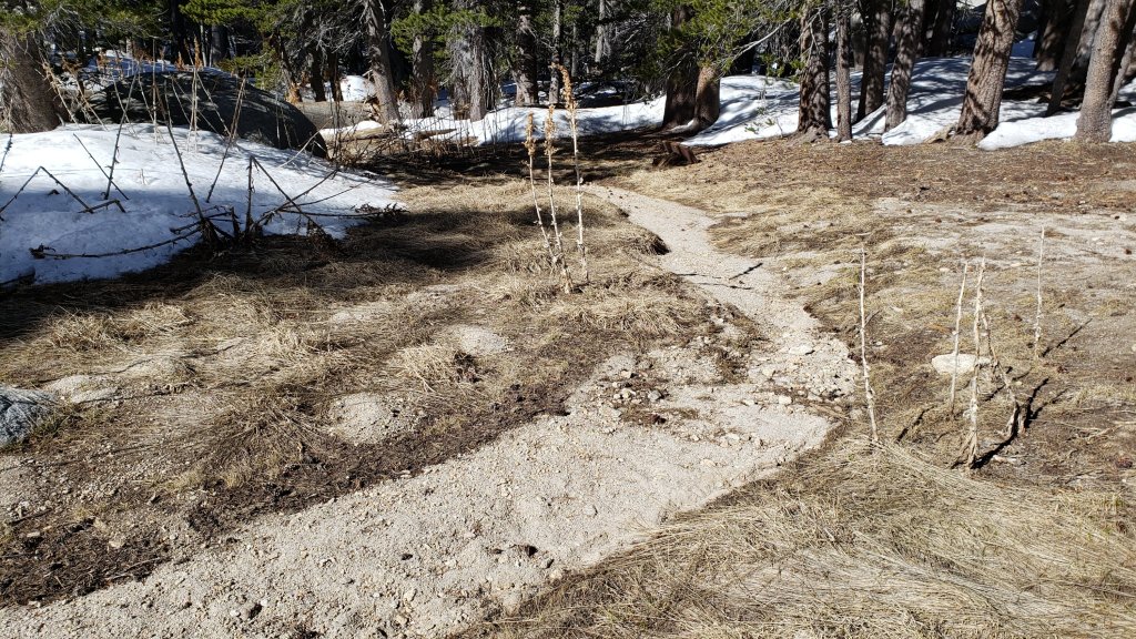
WEATHER
Temperatures are forecast to be at or above seasonal (in particular overnight lows) for the first week of May. It will be especially warm on 4th-7th May. Temperatures then drop below seasonal for most of the second week of the month, including temperatures below freezing in the high country on 10th-12th May. Temperatures rise to (or above) seasonal again starting 13th May. There is no significant precipitation in the forecasts.
The first three months of the year combined to be the second driest ever here in Riverside County, and the driest on record for the entire northern half of California (NWS data). The Sierra snowpack, at an impressive 160% of average on 1st January, was only 38% of average by 1st April. In the San Jacinto mountains precipitation has been below average in the high country for the tenth consecutive winter (and eight of those ten winters, including the past three seasons, have been well below average).
At San Jacinto Peak (10,810ft/3295m) on Monday 2nd May 2022 at 0815 the air temperature was 44.4°F (7°C), with a windchill temperature of 36.9°F (3°C), 10% relative humidity, and a brisk WNW wind sustained at 7 mph gusting to 12.3 mph.
At the Peak on Friday 29th April 2022 at 0815 the air temperature was 43.5°F (6°C), with a windchill temperature of 36.1°F (2°C), 8% relative humidity, and a light NNW wind sustained at 4 mph gusting to 8.3 mph.
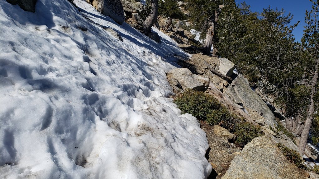
TRAIL CONDITIONS
Trails below about 8600 ft elevation are clear of snow. Thin patchy snow cover is rapidly becoming very limited on the trails above that elevation.
Effective Tuesday 1st February 2022 the State Park closed the section of Skyline Trail that falls within its jurisdiction, above 5800 ft elevation, “due to dangerous ice accumulation” (Skyline Trail forms the lower two-thirds of the “Cactus-to-Clouds” [C2C] route). The Superintendent stated on 25th April “we are monitoring weather conditions and the route and hope to reopen in the coming weeks”. The State Park boundary on Skyline is not marked but is near the site of the old Florian’s Cache, below Flat Rock.
Due to greatly reduced maintenance work by the agencies and PCTA during the coronavirus pandemic, many trails have accumulated treefall hazards since late 2019, passable with care by hikers but not for stock. Although reported promptly, most hazards were not removed in 2021. With storms this season being accompanied by strong winds and heavy ice loads, hikers should expect to encounter many new and additional hazards, especially in vulnerable burn areas (e.g., Willow Creek Trail, PCT Miles 170-177).
Although some treefall hazards from Red Tahquitz to Antsell Rock (PCT Miles 172.5-175) were cleared in June 2021 prior to the rockslide removal work, the situation has badly deteriorated this winter. In a full survey in March 2022, I counted at least 72 treefall hazards between PCT Miles 170-175. At least a third of these are major hazards that require scrambling over or around.
The 0.4 mile section of South Ridge Trail from Chinquapin Flat/PCT Mile 178 to Tahquitz Peak has cleared rapidly [updated 1st May]. Two tiny patches of icy snow remain to cross, but these have well-defined steps through the snow (see photos above and below). Most hikers will find spikes are no longer required.
The following trails below 8800 ft elevation are completely clear of snow/ice: Ernie Maxwell, Devil’s Slide, Suicide Rock, South Ridge (south from Tahquitz Peak), all Garner Valley trails.
The PCT is clear of snow from Mile 151 to 175 (Red Tahquitz). Snow cover remains about 30% between Miles 175-177, but very few hikers are finding that spikes remain necessary in that area. Snow cover is now very limited between Miles 178 to 184, with the exception of the notoriously stubborn half mile just south of Annie’s Junction starting at about Mile 180.3 (about 50% snow cover). Some snow patches remain on the sheltered sections of Fuller Ridge (notably Miles 188-189.5)
Snow cover now averages only 5% on the Peak Trail, persisting in two short traditional areas at 10,000 ft and 10,100 ft. Spikes are generally not required. The snow route on the East Ridge still has >80% snow cover but is clearing steadily.
The Wellman Trail is almost clear of snow, other than 60% cover on the first 0.3 mile north of Annie’s Junction.
Marion Mountain Trail is clear of snow [updated 29th April]. There is one huge new treefall hazard across the trail exactly at the State Park/Forest Service boundary.
Deer Springs Trail is clear of snow to just south of the Marion Mountain Trail junction. Thereafter snow cover is a patchy 10% to about 9300 ft. Above that elevation snow cover currently averages 30%, but will continue to melt rapidly in the next few days. Snow is most extensive (50%) in Little Round Valley. Above Little Round Valley snow cover averages 20%. Some hikers may find spikes useful in places, especially for descending. (Three new trees came down in late 2021 on the PCT/Deer Springs Trail just south of its junction with Marion Mountain Trail, but they are readily passable for hikers.)
South Ridge Trail (south of Tahquitz Peak) is clear of snow to Tahquitz Peak. The middle section of South Ridge Trail (between May Valley Road and the top of South Ridge Road) has several trees down which are significant obstructions.
Willow Creek Trail is clear of snow. However there are at least 40 downed trees between Skunk Cabbage Junction and Hidden Divide, nearly 30 of these on the Forest Service section.
Spitler Peak Trail is clear of snow. Forty downed trees, most from an ice storm in late December 2021, plus dozens of additional trunks and branches in the trail, have been removed by the Trail Report from this trail in early 2022.
The Caramba Trail from near Reeds Meadow through Laws Camp and on to Caramba, and the Cedar Trail from Willow Creek Trail to Laws, are optimistically described by the Forest Service as “not maintained”. In reality both trails no longer exist and are so heavily overgrown I advise hikers do not attempt to follow them. An informal use trail to Laws is much more direct and avoids all of the very challenging bushwhacking of the unmaintained trails (some local hikers dubbed it the “King Trail” when I established the route in 2019). It leaves the Willow Creek Trail exactly 1.0 mile from Saddle Junction (0.46 mile from the Skunk Cabbage turning), descending largely on established deer trails for 1.2 miles, meeting Willow Creek just upstream from the old Laws Camp. From Laws east to Caramba the route of the original Caramba Trail has been well-cairned by myself and others and can largely be followed with very careful route-finding. My February 2022 survey counted 97 trees down on this 2.1 miles of trail. It is especially obscure 0.1-0.3 mile east of the Willow Creek crossing, generally becoming clearer near Caramba. Cautious navigation is advised throughout the area.
Seven Pines Trail is clear of snow to 7500 ft. Above that elevation snow cover is a patchy 10%. This trail has had very limited hiker traffic since November 2018, largely because Dark Canyon Road was closed from February 2019 to early October 2021, and again since December 2021. The Trail Report has “adopted” Seven Pines Trail as a priority for maintenance work as the trail has had a disproportionate number of lost hiker rescues in recent years. Starting in November 2021, 42 downed trees on the lower 3.0 miles of trail have been removed. Almost all of this section has also been thoroughly trimmed and cleared, and the trail is now obvious and easy to follow for much of its length (when clear of snow). However at least 18 downed trees remain on the upper 0.7 mile of trail, the route is very obscure in places, and cautious navigation is essential for those who do not have extensive experience of hiking this trail. Dark Canyon campground remains closed.
It’s northbound PCT season! Please consider helping the Trail Report at our busiest time of the year. While all labor and time is volunteered, the San Jacinto Trail Report completely depends on your small private donations to cover costs. Your contribution helps to keep the Report active, free from advertising, and independent from agencies. If you have found this Report useful, please visit the Donate page. Zelle, Venmo, and PayPal are all now options. Thank you for your support.

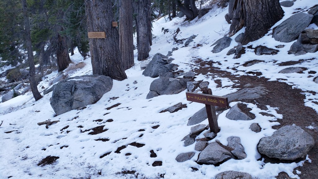


sanjacjon Uncategorized 4 Comments 8 MinutesEdit”Trail update 3rd May 2022″
Trail update 27th April 2022
The minor snow storm on Friday 22nd April produced a few inches of fine powder in the high country, down to a very light dusting in Idyllwild, as detailed in the previous Report and this short video recorded from San Jacinto Peak as the storm abated. The majority of that new snow has already melted, especially on sun-exposed slopes, with rapidly warming temperatures in recent days.
Early on Monday 25th April we ascended via Marion Mountain and Deer Springs trails to San Jacinto Peak, descending via the East Ridge, Peak, Wellman’s, PCT, and Devil’s Slide trails. This loop also facilitated survey of the highest parts of the PCT in the San Jacinto mountains (roughly PCT Miles 179-181 and 185-186) plus several of its side trails.
For the third Peak ascent in the past six days my spikes went unused, even for descending. Of the 16 PCT hikers I talked with on our loop on 25th, none were using (or even carrying) spikes.
Hikers may find spikes remain useful in a few areas above about 8000 ft (generally discussed below), depending on individual comfort level and experience on patches of icy snow, where snow on trails is compacted by hiker traffic and following freeze-thaw cycles. In general spikes are no longer required, especially on extensively melted and/or well-traveled trails with defined snow steps. Spikes remain most useful for descending, especially for the first few hundred feet of elevation down from the highest peaks. Spikes remain recommended in certain locations, such as the north side of Tahquitz Peak.
Snow depths, such as they are, measured on 25th April are given below. Current conditions for individual trails are discussed in detail below where known.
Despite periodic warmer temperatures, hikers should nevertheless be prepared for temperatures near freezing in the high country, and below freezing when considering wind chill effects (see below for some of my most recent weather observations from San Jacinto Peak).
The USFS gates at Humber Park and South Ridge Road are open, and those areas are clear of snow. South Ridge Road was partially graded in mid April, removing the most uneven sections. Santa Rosa Road (7S02) reopened on 7th April. Black Mountain (4S01) and Dark Canyon (5S02) roads remain in winter closure (for vehicle traffic only).
The Forest Service ranger station in Idyllwild, closed for more than two years (originally due to the coronavirus pandemic), is now tentatively scheduled to reopen in May 2022.
WEATHER
Temperatures are forecast to be generally around seasonal for the remainder of April, with the exception of a cooler day on Thursday 28th, warming to above seasonal for the first ten days of May (and well above seasonal in the high country). There is no further precipitation in the forecasts.
The first three months of the year combined to be the second driest ever here in Riverside County, and the driest on record for the entire northern half of California (NWS data). The Sierra snowpack, at an impressive 160% of average on 1st January, was only 38% of average by 1st April. In the San Jacinto mountains precipitation has been below average in the high country for the tenth consecutive winter (and eight of those ten winters, including the past three seasons, have been well below average).
At San Jacinto Peak (10,810ft/3295m) on Monday 25th April 2022 at 0825 the air temperature was 40.8°F (5°C), with a windchill temperature of 38.3°F (4°C), 23% relative humidity, and a barely perceptible SE breeze sustained at 1 mph gusting to 2.6 mph.
At the Peak on Friday 22nd April 2022 at 1130 the air temperature was 16.5°F (-9°C), with a windchill temperature of -11.7°F (-24°C), 98% relative humidity, and a wild WSW wind sustained at 23 mph gusting to 47.3 mph. The latter was the strongest wind gust reliably recorded at San Jacinto Peak this winter.
At the Peak on Wednesday 20th April 2022 at 0750 the air temperature was 30.5°F (-1°C), with a windchill temperature of 12.1°F (-11°C), 61% relative humidity, and a strong due West wind sustained at 22 mph gusting to 32.1 mph.
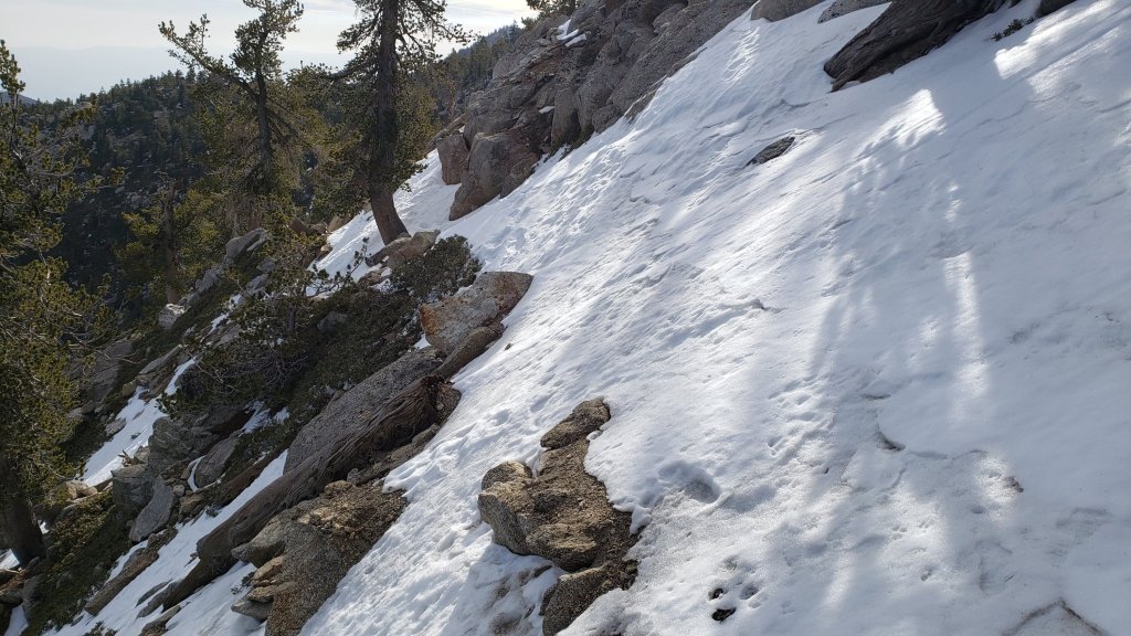
TRAIL CONDITIONS
Trails below about 8700ft are largely or completely clear of snow, and thin patchy snow cover is increasingly limited above that elevation.
Effective Tuesday 1st February 2022 the State Park closed the section of Skyline Trail that falls within its jurisdiction, above 5800 ft elevation, “due to dangerous ice accumulation” (Skyline Trail forms the lower two-thirds of the “Cactus-to-Clouds” [C2C] route). The Superintendent stated on 25th April “we are monitoring weather conditions and the route and hope to reopen in the coming weeks”. The State Park boundary is not marked but is near the site of the old Florian’s Cache, below Flat Rock.
Due to greatly reduced maintenance work by the agencies and PCTA during the coronavirus pandemic, many trails have accumulated treefall hazards since late 2019, passable with care by hikers but not for stock. Although reported promptly, most hazards were not removed in 2021. With storms this season being accompanied by strong winds and heavy ice loads, hikers should expect to encounter many new and additional hazards, especially in vulnerable burn areas (e.g., Willow Creek Trail, PCT Miles 170-177).
Although some treefall hazards from Red Tahquitz to Antsell Rock (PCT Miles 172.5-175) were cleared in June 2021 prior to the rockslide removal work, the situation has badly deteriorated this winter. In a full survey in March 2022, I counted at least 72 treefall hazards between PCT Miles 170-175. At least a third of these are major hazards that require scrambling over or around.
The 0.4 mile section of South Ridge Trail to Tahquitz Peak from Chinquapin Flat/PCT Mile 178 is clearing rapidly. However one extended patch of angled icy snow remains for which spikes, or even better crampons and ice axe, are required (see photo above).
The following trails below 8800 ft elevation are completely clear of snow/ice: Ernie Maxwell, Devil’s Slide, Suicide Rock, South Ridge (south from Tahquitz Peak), all Garner Valley trails.
The PCT is functionally clear of snow from Mile 151 to 175 (Red Tahquitz). A few tiny patches remain on the north-east side of Apache Peak but will clear in the next day or two. Snow cover remains about 40% between Miles 175-178, and some hikers are finding that spikes remain useful for those few miles. Snow cover is now limited between Miles 178 to 184, with the exception of the notoriously stubborn half mile just south of Annie’s Junction starting at about Mile 180.3. Some lengthy snow patches remain on the sheltered sections of Fuller Ridge (notably Miles 188-189.5)
Snow cover now only averages 10% on the Peak Trail, persisting in the handful of traditional areas that are less sun-exposed (e.g., around 9900-10,100 ft). Spikes are generally not required for ascending, but may be useful in places for descending. A posthole snow route on the East Ridge still has >95% snow cover but is becoming increasingly uneven due to melting.
The Wellman Trail is almost clear of snow, other than the first 0.3 mile north of Annie’s Junction.
Marion Mountain Trail has about 10% cover of thin, patchy, icy snow, largely above 7600 ft elevation. Spikes are not required. There is one huge new treefall hazard across the trail exactly at the State Park/Forest Service boundary.
Deer Springs Trail is functionally clear of snow to about 8600ft (c.0.2 mile south of Marion Mountain Trail junction). Thereafter snow cover is a patchy 50% to about 9300 ft. Above that elevation snow cover currently averages 70%, but will melt rapidly in the next few days. Snow is most extensive (90%) in Little Round Valley. Above Little Round Valley snow cover averages 60%, with the first switchbacks above LRV, and those closest to Summit Junction, rapidly clearing of snow. Most hikers will find spikes useful, especially for descending. (Three new trees came down in late 2021 on the PCT/Deer Springs Trail just south of its junction with Marion Mountain Trail, but they are readily passable for hikers.)
South Ridge Trail (south of Tahquitz Peak) [checked 26th April] is clear of snow to Tahquitz Peak and spikes are not required. The middle section of South Ridge Trail (between May Valley Road and the top of South Ridge Road) has several trees down which are significant obstructions.
Willow Creek Trail has less than 30% snow cover overall, with most remaining snow expected to melt in the next few days. However there are at least 40 downed trees between Skunk Cabbage Junction and Hidden Divide, nearly 30 of these on the Forest Service section.
Spitler Peak Trail is functionally clear of snow. Forty downed trees, most from an ice storm in late December 2021, plus dozens of additional trunks and branches in the trail, have been removed by the Trail Report from this trail in early 2022.
The Caramba Trail from near Reeds Meadow through Laws Camp and on to Caramba, and the Cedar Trail from Willow Creek Trail to Laws, are optimistically described by the Forest Service as “not maintained”. In reality both trails no longer exist and are so heavily overgrown I advise hikers do not attempt to follow them. An informal use trail to Laws is much more direct and avoids all of the very challenging bushwhacking of the unmaintained trails (some local hikers dubbed it the “King Trail” when I established the route in 2019). It leaves the Willow Creek Trail exactly 1.0 mile from Saddle Junction (0.46 mile from the Skunk Cabbage turning), descending largely on established deer trails for 1.2 miles, meeting Willow Creek just upstream from the old Laws Camp. From Laws east to Caramba the route of the original Caramba Trail has been well-cairned by myself and others and can largely be followed with very careful route-finding. My February 2022 survey counted 97 trees down on this 2.1 miles of trail. It is especially obscure 0.1-0.3 mile east of the Willow Creek crossing, generally becoming clearer near Caramba. Cautious navigation is advised throughout the area.
Seven Pines Trail is functionally clear of snow to 7500 ft. Above that elevation snow cover is a patchy 30%. This trail has had very limited hiker traffic since November 2018, largely because Dark Canyon Road was closed from February 2019 to early October 2021, and again since December 2021. The Trail Report has “adopted” Seven Pines Trail as a priority for maintenance work as the trail has had a disproportionate number of lost hiker rescues in recent years. Starting in November 2021, 42 downed trees on the lower 3.0 miles of trail have been removed. Almost all of this section has also been thoroughly trimmed and cleared, and the trail is now obvious and easy to follow for much of its length (when clear of snow). However at least 18 downed trees remain on the upper 0.7 mile of trail, the route is very obscure in places (especially in snow conditions), and cautious navigation is essential for those who do not have extensive experience of hiking this trail. Dark Canyon campground remains closed.
SNOW DEPTHS measured on Monday 25th April 2022 are as follows. Where known, the fresh snowfall following the minor storm on Friday 22nd April 2022 is given in parentheses. As mentioned in previous Reports, although many areas retain some extensive patches of snow from December and February storms, average measurements were functionally zero inches in all locations immediately prior to 22nd April. Note that there was considerable drifting in the trails in the latest storm. Altitudes are approximate.
San Jacinto Peak (10810 ft): 1-2 inches (5 inches on 22nd April)
Little Round Valley (9800 ft): 3-5 inches
Wellman Divide (9700 ft): 0 inches (3.5 inches on 22nd April)
Annie’s Junction/approx. PCT Mile 180.8 (9070 ft): 2 inches (3.5 inches on 22nd April)
Seven Pines Trail junction with Deer Springs Trail/approx. PCT Mile 184.9 (8700 ft): 1 inch
Saddle Junction/approx. PCT Mile 179 (8070 ft): 0 inches (2.5 inches on 22nd April)
Devil’s Slide Trail at Humber Park (6520 ft): 0 inches (1.5 inches on 22nd April, largely melted by that afternoon)
Marion Mountain trailhead (6300 ft): 0 inches
Idyllwild (at 5550 ft): 0 inches (<0.25 inch on 22nd April 2022, all melted by that afternoon)
PACIFIC CREST TRAIL
Detailed snow conditions on the PCT are described above under “Trail Conditions”.
This has been a well-below average snow year for the San Jacinto high country (for the third season in a row, and now for eight of the past ten winters). Given rapid climate change here there could well be relatively little snow and ice by the time you reach the San Jacinto mountains. Nevertheless even small, isolated sections of icy snow can be challenging, especially for those with limited experience of snow/ice hiking. Details of current snow/ice conditions will be clear from updates to the Trail Report over coming weeks.
The rockslide at PCT Mile 172.5, just north of Antsell Rock, was removed on 14th June 2021. My “before, during, and after” video is available here. This section of the PCT is now safer and is narrow but readily passable with care by hikers (but remains impassable by stock).
If you take an alternate further south, it is possible to regain the PCT from Idyllwild via Devil’s Slide Trail at Saddle Junction (about Mile 179.5). Do not attempt to regain the PCT via South Ridge Trail as the slope on the north side of Tahquitz Peak always remains ice-covered well into April, requires spikes (at least), and is notoriously treacherous.
Black Mountain Road is not closed to hiker traffic, only to vehicles. This is a temporary, seasonal closure, and usually it reopens to vehicles in April or May (although that is weather and/or maintenance dependent).
PCT hikers are reminded that overnight stays are not permitted at or near San Jacinto Peak, including in the historic shelter. Mt. San Jacinto State Park permits overnight stays only in established campgrounds. Little Round Valley and Strawberry Junction are good options for thru-hikers.
It’s northbound PCT season! Please help the Trail Report at our busiest time of the year. While all labor and time is volunteered, the San Jacinto Trail Report completely depends on your small private donations to cover costs. Your contribution helps to keep the Report active, free from advertising, and independent from agencies. If you have found this Report useful, please visit the Donate page. Zelle, Venmo, and PayPal are all now options. Thank you for your support.
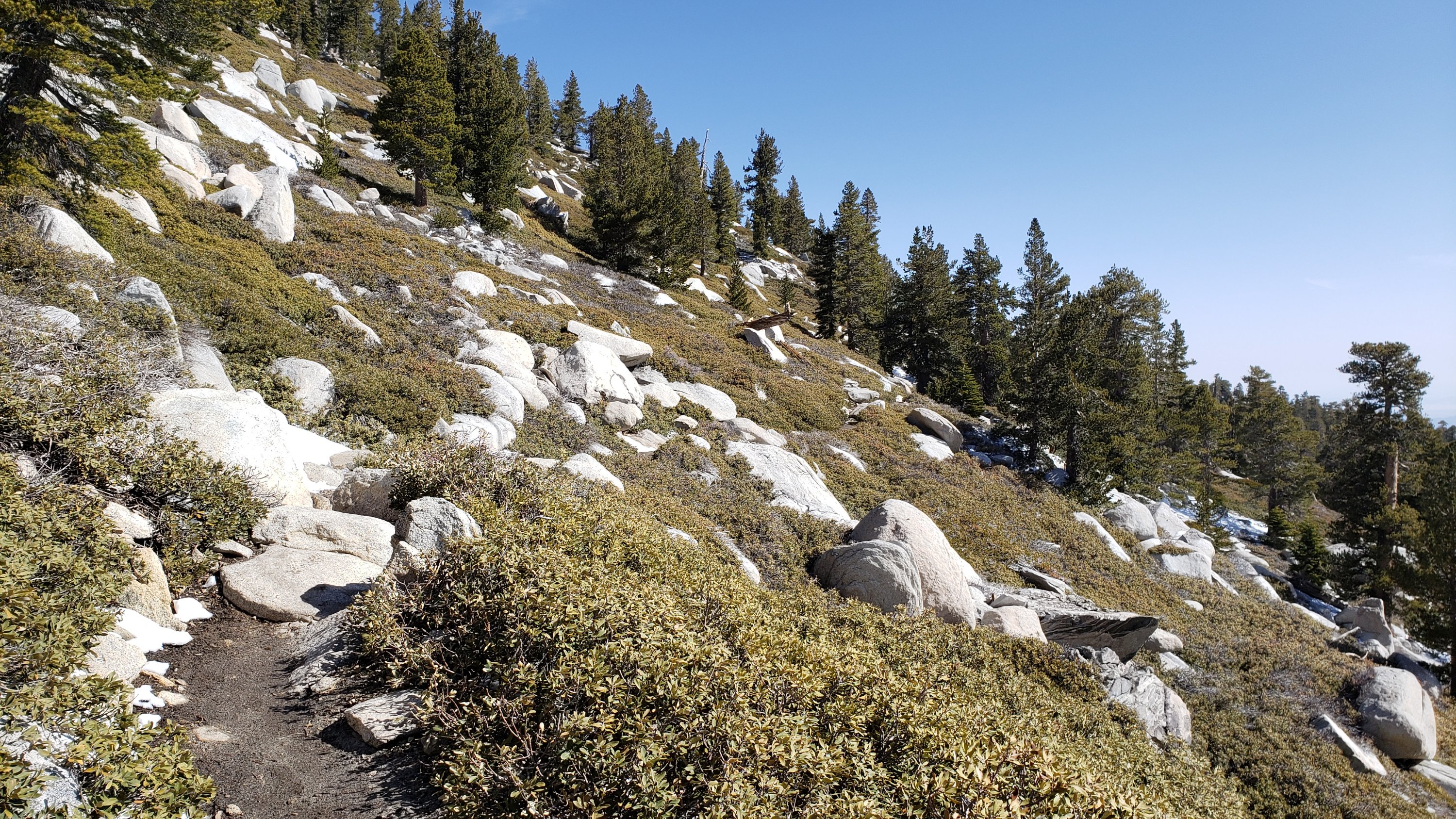
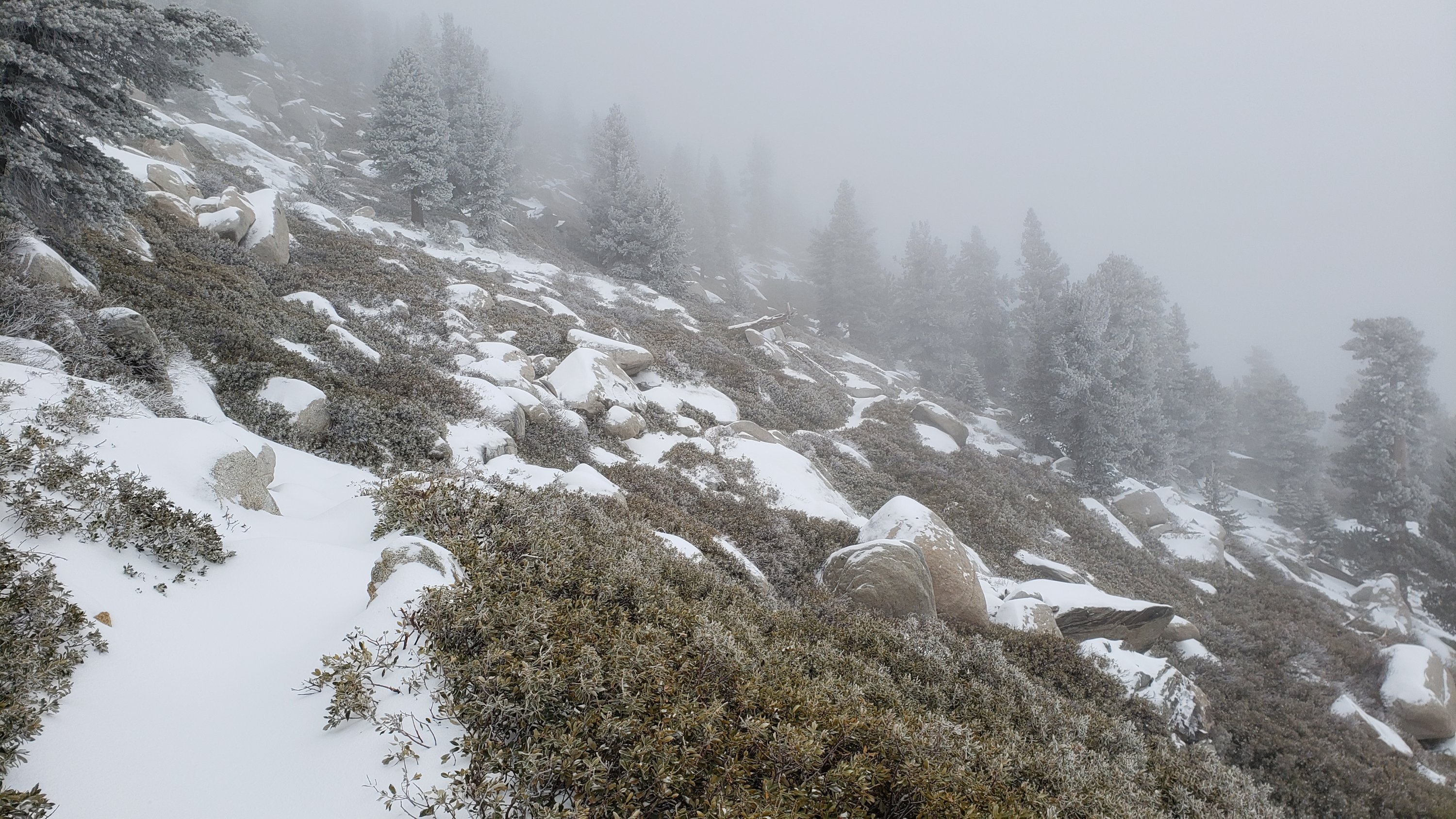

sanjacjon Uncategorized 1 Comment 10 MinutesEdit”Trail update 27th April 2022″
Minor snow storm 22nd April 2022
[UPDATE Sunday 24th April 2022 @ 1030: a minor fire reported just inside the State Park 1.6 miles up Marion Mountain Trail is currently being contained by Forest Service personnel. The fire was only a few feet square and surrounded by light snow. Judging by the size and location, it was likely an illegal campfire.]
This is a very brief summary of a minor storm that passed over the San Jacinto mountains on Friday 22nd April. With very warm, sunny conditions forecast for the next week, I will not go into too much detail as rapid melting will quickly return general conditions back to those described in the previous Report.
Rain started in Idyllwild (at 5550 ft) just after midnight, eventually accumulating to an impressive 0.64 inch by about 0500, before turning to a very light sleety snow (<0.25 inch accumulation).
Overall precipitation was, thankfully, above most forecasts, with 2-5 inches of snow in the high country (depending on elevation), and a dusting of snow down to about 5000 ft. Snow depths measured on 22nd April are detailed near the foot of this post.
Early on Friday 22nd we ascended San Jacinto Peak via Devil’s Slide, PCT, Wellman, and Peak trails, breaking trail by postholing the entire ascent, and then descending the same route (other than descending the East Ridge down to 10,400 ft). Although I carried spikes, I never thought of using them in nice light, dry, powder which afforded good grip.
I recorded a short video summary of conditions – in a wild westerly wind, sorry for the mediocre sound – at San Jacinto Peak late morning on 22nd April.
Current conditions for individual routes are discussed in detail below where known. These will change rapidly with warming temperatures and widespread melting in the next few days. Although useful tracks are already in place for some major trails (mentioned below), including the entire PCT, cautious navigation remains recommended everywhere.
Some hikers will find that spikes are currently helpful depending upon comfort level on thin snow cover. They are not generally required however, as thin, soft snow is providing reasonable traction to footwear suitable for mountain hiking in winter conditions. This will change over the next couple of days in differing ways, as some high country trails rapidly melt in very warm temperatures, while others become compacted and icier with freeze-thaw cycles. Spikes are generally especially valuable on well-consolidated tracks, on colder mornings when conditions are icy, and (as always) for descending and traversing. Snow conditions are extremely poor for snowshoeing with very thin snow plus rapid melting expected.
Despite unseasonably warm temperatures in the next week, hikers should nevertheless be prepared for temperatures around freezing in the high country, and potentially well below freezing when considering wind chill effects (see below for some of my recent observations from San Jacinto Peak).
The USFS gates at Humber Park and South Ridge Road remain open. Humber Park was largely clear of snow by the afternoon of 22nd April.
WEATHER
Temperatures are forecast to rise rapidly to above seasonal by Sunday 24th, be very warm on 25th-27th, then drop slightly to near seasonal from Thursday 28th. Snowmelt will be very rapid and widespread at all elevations.
At San Jacinto Peak (10,810ft/3295m) on Friday 22nd April 2022 at 1130 the air temperature was 16.5°F (-9°C), with a windchill temperature of -11.7°F (-24°C), 98% relative humidity, and a wild WSW wind sustained at 23 mph gusting to 47.3 mph. The latter was the strongest wind gust recorded at San Jacinto Peak this winter.
At the Peak on Wednesday 20th April 2022 at 0750 the air temperature was 30.5°F (-1°C), with a windchill temperature of 12.1°F (-11°C), 61% relative humidity, and a strong due West wind sustained at 22 mph gusting to 32.1 mph.
TRAIL CONDITIONS
All trails above about 6500 ft are currently partially obscured by light snow, with thin snow cover continuous above about 7000 ft. Melting was already underway on 22nd April and will accelerate very rapidly over the next week.
The entire PCT through the San Jacinto mountains already has a well-traveled track through the fresh snow. By the time I descended on the afternoon of 22nd, I was pleased to see well-defined tracks following my route north from Saddle Junction, and continuing on round to Strawberry Junction. A well-traveled track came in to Saddle Junction from the south, and discussions with various thru hikers I passed indicated that the PCT north and south of the area I covered was hiked by multiple groups in the afternoon of 22nd.
Hikers should anticipate encountering significant new treefall hazards, especially in vulnerable burn areas (e.g., Willow Creek Trail, PCT Miles 166-177).
Effective Tuesday 1st February 2022 the State Park closed the section of Skyline Trail that falls within its jurisdiction, above 5800 ft elevation, initially “due to dangerous ice accumulation”. Although the trail is now clear of significant ice problems, Ranger Station staff have indicated that the trail remains closed indefinitely. The State Park boundary is not marked but is near the site of the old Florian’s Cache, below Flat Rock.
The 0.4 mile section of South Ridge Trail to Tahquitz Peak from Chinquapin Flat/PCT Mile 178 had good steps to follow through the steeply angled icy snow. These steps will have been largely obscured by the fresh snowfall. These icy slopes are notoriously treacherous. Spikes are strongly recommended for this weekend at least. There was a fatal hiker fall here on Sunday 30th January.
Devil’s Slide Trail has a very well-defined track to follow. Sections were already close to clearing (and/or turning to slush) by the afternoon of 22nd April, especially below 6700 ft.
The Ernie Maxwell Trail is already partly clear of snow, and will clear completely this weekend.
My shallow posthole track is largely well-defined from Annie’s Junction to San Jacinto Peak, via the Wellman and Peak trails. Tracks were disappearing quickly under spindrift snow in wind-exposed areas above 9900 ft elevation.
SNOW DEPTHS measured on Friday 22nd April 2022 are as follows. The only number given is the new snowfall. As mentioned in the previous Report, although many areas retain some extensive patches of older snow, average mweasurements were functionally zero inches in all locations prior to this latest storm. Due to strong winds accompanying this storm note that there is considerable drifting in the trails. Altitudes are approximate.
San Jacinto Peak (10810 ft): 5 inches
Wellman Divide (9700 ft): 3.5 inches
Annie’s Junction/approx. PCT Mile 180.8 (9070 ft): 3.5 inches
Saddle Junction/approx. PCT Mile 179 (8070 ft): 2.5 inches
Devil’s Slide Trail at Humber Park (6520 ft): 1.5 inches (largely melted by afternoon of 22nd)
Idyllwild (at 5550 ft): <0.25 inch (all melted by afternoon of 22nd)
It’s northbound PCT season! Please help the Trail Report at our busiest time of the year. While all labor and time is volunteered, the San Jacinto Trail Report completely depends on your small private donations to keep active, free from advertising, and independent from agencies. If you have found this Report useful, please visit the Donate page. Zelle, Venmo, and PayPal are all available. Thank you for your support.


sanjacjon Uncategorized Leave a comment 5 MinutesEdit”Minor snow storm 22nd April 2022″
Trail update 20th April 2022
[UPDATED 22nd April 2022: a minor snow storm overnight produced five inches of snow at San Jacinto Peak, and 0.5in rain and a trace of snow in Idyllwild. Snowmelt will be rapid over the weekend,, but some hikers will find spikes useful for at least the next couple of days. More details (and a feel for conditions in the high country) in this short video recorded late this morning.]
Recent warm days have led to further widespread snowmelt. Although a very minor storm system is forecast for the early morning of Friday 22nd April, only 1-2 inches of snow are expected above about 8000 ft elevation, which is unlikely to significantly impact trail conditions or increase navigation challenges. A return to warm weather immediately after the storm will result in fresh snow melting very quickly.
In addition to multiple ascents of San Jacinto Peak by different routes in recent days we have surveyed multiple segments of the PCT, its side trails, and Forest roads. Trails surveyed in recent days have included South Ridge, Marion Mountain, Seven Pines, Willow Creek, Laws and Caramba, Deer Springs, and Spitler Peak.
Early on Monday 18th April we ascended via Devil’s Slide, Wellman, Peak, and East Ridge trails to San Jacinto Peak, descending via Deer Springs Trail. This loop also facilitated survey of the highest parts of the PCT in the San Jacinto mountains (roughly Miles 179-181 and 185.5-183) plus several of its side trails. This was my first Peak ascent this calendar year in which my spikes went unused all morning, even for descending. Of the 24 PCT hikers I saw and chatted with on my loop hike, only a handful were using spikes, even those leaving the Trail to summit the Peak.
Hikers may find spikes remain useful in a few areas above about 8000 ft (generally discussed below), depending on individual comfort level and experience on patches of icy snow, where snow on trails is compacted by hiker traffic and following freeze-thaw cycles. In general spikes are no longer required, especially on extensively melted and well-traveled trails with defined snow steps. Spikes remain most useful for descending, especially for the first few hundred feet of elevation down from the highest peaks. Spikes remain valuable – if no longer strictly essential – in certain locations, such as the north side of Tahquitz Peak.
As snow is now so patchy and limited, I am no longer reporting snow depths. However significant snow remains in patches, largely in sheltered forested areas, and on north-facing slopes. Current conditions for individual trails are discussed in detail below where known.
Despite unseasonal warm temperatures at times, hikers should nevertheless be prepared for temperatures near or below freezing in the high country, and well below freezing when considering wind chill effects (see below for some of my most recent weather observations from San Jacinto Peak).
The USFS gates at Humber Park and South Ridge Road are open, and these areas cleared of icy snow weeks ago. Santa Rosa Road (7S02) reopened on 7th April. Black Mountain (4S01) and Dark Canyon (5S02) roads remain in winter closure (for vehicle traffic only).
The Forest Service ranger station in Idyllwild, closed for more than two years (originally due to the coronavirus pandemic) is now tentatively scheduled to reopen in May 2022.

WEATHER
After a few recent days of above seasonal temperatures, a cooler spell is forecast between 20th-23rd April, with temperatures at or even slightly below average for April. A minor storm system is forecast for the early morning of Friday 22nd April, with <0.3in rain forecast for Idyllwild and a dusting of snow above about 7000 ft elevation, with two inches of snow possible around the highest peaks. Starting Sunday 24th temperatures yet again rise to well above seasonal, and will be very warm for April on 25th-29th.
The first three months of the year combined to be the second driest ever here in Riverside County, and the driest on record for the entire northern half of California (NWS data). The Sierra snowpack, at an impressive 160% of average on 1st January, was only 38% of average by 1st April. In the San Jacinto mountains precipitation has been below average in the high country for the tenth consecutive winter (and eight of those ten winters, including the past three seasons, have been well below average).
At San Jacinto Peak (10,810ft/3295m) on Wednesday 20th April 2022 at 0750 the air temperature was 30.5°F (-1°C), with a windchill temperature of 12.1°F (-11°C), 61% relative humidity, and a strong due West wind sustained at 22 mph gusting to 32.1 mph.
At the Peak on Monday 18th April 2022 at 0820 the air temperature was 40.5°F (5°C), with a windchill temperature of 29.3°F (-1°C), 28% relative humidity, and a steady WNW wind sustained at 17 mph gusting to 27.6 mph.
At the Peak on Wednesday 13th April 2022 at 0830 the air temperature was 29.1°F (-2°C), with a windchill temperature of 14.6°F (-9°C), 17% relative humidity, and a sharp NW wind sustained at 9 mph gusting to 17.3 mph.

TRAIL CONDITIONS
Trails below about 8700ft are generally clear of snow, and thin patchy snow cover is increasingly limited above that elevation.
Due to greatly reduced maintenance work by the agencies and PCTA during the coronavirus pandemic, many trails have accumulated treefall hazards since late 2019, passable with care by hikers but not for stock. Although reported promptly, most hazards were not removed in 2021. With storms this season being accompanied by strong winds and heavy ice loads, hikers will encounter many new and additional hazards, especially in vulnerable burn areas (e.g., Willow Creek Trail, PCT Miles 170-177).
Although some treefall hazards from Red Tahquitz to Antsell Rock (PCT Miles 172.5-175) were cleared in June 2021 prior to the rockslide removal work, the situation has badly deteriorated this winter. In a full survey on 19th March 2022, I counted at least 72 treefall hazards between PCT Miles 170-175. At least a third of these are major hazards that require scrambling over or around.
The 0.4 mile section of South Ridge Trail to Tahquitz Peak from Chinquapin Flat/PCT Mile 178 is now clearing rapidly. A few extended patches of angled icy snow remain but have steps to follow. Most hikers will find spikes are still useful, especially for descending, but they are no longer essential.
Effective 1st February 2022 the State Park closed the section of Skyline Trail that falls within its jurisdiction, above 5800 ft elevation, “due to dangerous ice accumulation”. (Skyline Trail forms the lower two-thirds of the “Cactus-to-Clouds” [C2C] route.) The trail is expected to reopen later in April. The State Park boundary is not marked but is near the site of the old Florian’s Cache, below Flat Rock. The trail remained closed as of 19th April.
The following trails below 8800 ft elevation are completely clear of snow/ice: Ernie Maxwell, Devil’s Slide, Suicide Rock, South Ridge (south from Tahquitz Peak), all Garner Valley trails.
The PCT is clear of snow from Mile 151 to 175 (Red Tahquitz). Snow cover remains about 40% between Miles 175-178, and some hikers are finding that spikes remain useful for those few miles. Snow cover is now limited between Miles 178 to 184, with the exception of the notoriously stubborn half mile just south of Annie’s Junction starting at about Mile 180.3. Some lengthy snow patches remain on the sheltered sections of Fuller Ridge (notably Miles 188-189.5)
Snow cover now only averages 10% on the Peak Trail, persisting in the handful of traditional areas that are less sun-exposed (e.g., around 9000-10,100 ft). Spikes are generally not required for ascending, but can be useful in places for descending. The well-compacted snow route on the East Ridge still has 95% snow cover but is becoming increasingly uneven due to melting.
The Wellman Trail is almost clear of snow, other than the first 0.3 mile north of Annie’s Junction.
Marion Mountain Trail is now clear of snow. There is one huge new treefall hazard across the trail exactly at the State Park/Forest Service boundary.
Deer Springs Trail is completely clear of snow to about 8700ft (just south of the Marion Mountain Trail junction). Thereafter snow cover is a very patchy 10% to about 9300 ft. Above that elevation snow cover averages only 30%. Snow is most extensive (60%) in Little Round Valley. Above Little Round Valley snow cover averages only 40%, with the first switchbacks above LRV, and those closest to Summit Junction, now functionally clear of snow. Some hikers will find spikes useful, especially for descending. (Three new trees came down in late 2021 on the PCT/Deer Springs Trail just south of its junction with Marion Mountain Trail, but they are readily passable for hikers.)
South Ridge Trail (south of Tahquitz Peak) is clear of snow to Tahquitz Peak. Spikes are not required. The middle section of South Ridge Trail (between May Valley Road and the top of South Ridge Road) has several trees down which are significant obstructions.
Willow Creek Trail has less than 10% snow cover overall, with a traveled track to Long Valley through the remaining snow patches. However there are at least 40 downed trees between Skunk Cabbage Junction and Hidden Divide, nearly 30 of these on the Forest Service section.
Spitler Peak Trail is clear of snow. Forty downed trees, most from an ice storm in late December 2021, plus dozens of additional trunks and branches in the trail, have been removed by the Trail Report from this trail in early 2022.
The Caramba Trail from near Reeds Meadow through Laws Camp and on to Caramba, and the Cedar Trail from Willow Creek Trail to Laws, are optimistically described by the Forest Service as “not maintained”. In reality both trails no longer exist and are so heavily overgrown I advise hikers do not attempt to follow them. An informal use trail to Laws is much more direct and avoids all of the very challenging bushwhacking of the unmaintained trails (some local hikers dubbed it the “King Trail” when I established the route in 2019). It leaves the Willow Creek Trail exactly 1.0 mile from Saddle Junction (0.46 mile from the Skunk Cabbage turning), descending largely on established deer trails for 1.2 miles, meeting Willow Creek just upstream from the old Laws Camp. From Laws east to Caramba the route of the original Caramba Trail has been well-cairned by myself and others and can largely be followed with very careful route-finding. My February 2022 survey counted 97 trees down on this 2.1 miles of trail. It is especially obscure 0.1-0.3 mile east of the Willow Creek crossing, generally becoming clearer near Caramba. Cautious navigation is advised throughout the area.
Seven Pines Trail is clear of snow to 8200 ft. Above that elevation snow cover is a patchy 30%. There is at least one set of visible hiker tracks across the remaining snow patches on Seven Pines Trail as of 11th April. This trail has had very limited hiker traffic since November 2018, largely because Dark Canyon Road was closed from February 2019 to early October 2021, and again since December 2021. The Trail Report has “adopted” Seven Pines Trail as a priority for maintenance work as the trail has had a disproportionate number of lost hiker rescues in recent years. Starting in November 2021, 42 treefall hazards on the lower 3.0 miles of trail have been removed. Almost all of this section has also been thoroughly trimmed and cleared, and the trail is now obvious and easy to follow for much of its length (when clear of snow). However at least 18 downed trees remain on the upper 0.7 mile of trail, the route is very obscure in places (especially in snow conditions), and cautious navigation is required especially for those who are not very familiar with hiking this trail. Dark Canyon campground remains closed.
It’s northbound PCT season! Please help the Trail Report at our busiest time of the year. While all labor and time is volunteered, the San Jacinto Trail Report completely depends on your small private donations to cover costs. Your contribution helps to keep the Report active, free from advertising, and independent from agencies. If you have found this Report useful, please visit the Donate page. Zelle, Venmo, and PayPal are all now options. Thank you for your support.
PACIFIC CREST TRAIL
Detailed snow conditions on the PCT are described above under “Trail Conditions”.
This has been a well-below average snow year for the San Jacinto high country (for the third season in a row, and now for eight of the past ten winters). Given rapid climate change here there could well be relatively little snow and ice by the time you reach the San Jacinto mountains. Nevertheless even small, isolated sections of icy snow can be challenging, especially for those with limited experience of snow/ice hiking. Details of current snow/ice conditions will be clear from updates to the Trail Report over coming weeks.
The rockslide at PCT Mile 172.5, just north of Antsell Rock, was removed on 14th June 2021. My “before, during, and after” video is available here. This section of the PCT is now safer and is narrow but readily passable with care by hikers (but remains impassable by stock).
If you take an alternate further south, it is possible to regain the PCT from Idyllwild via Devil’s Slide Trail at Saddle Junction (about Mile 179.5). Do not attempt to regain the PCT via South Ridge Trail as the slope on the north side of Tahquitz Peak always remains ice-covered well into April, requires spikes (at least), and is notoriously treacherous.
Black Mountain Road is not closed to hiker traffic, only to vehicles. This is a temporary, seasonal closure, and usually it reopens to vehicles in April or May (although that is weather and/or maintenance dependent).
PCT hikers are reminded that overnight stays are not permitted at or near San Jacinto Peak, including in the historic shelter. Mt. San Jacinto State Park regulations permit overnight stays only in established campgrounds. Little Round Valley and Strawberry Junction are good options for thru-hikers.

sanjacjon Uncategorized 3 Comments 9 MinutesEdit”Trail update 20th April 2022″
Trail and snow update 13th April 2022
Although cooler conditions are (thankfully) forecast for the next few days, near record warm weather last week led to very rapid and widespread snowmelt. Consequently overall snowmelt conditions are nearly two months ahead of an average snow year. The minor storm overnight on Monday 11th April produced no snow, and a mere 0.02in of drizzle in Idyllwild.
In addition to multiple ascents of San Jacinto Peak by different routes in recent days we have surveyed multiple segments of the PCT, its side trails, and Forest roads.
While spikes have not been needed on my ascents of San Jacinto Peak since late March, most hikers are continuing to find them useful in parts of the high country depending on their comfort level on patchy ice and icy snow. Spikes remain most useful for descending, especially for the first few hundred feet of elevation down from the highest peaks. Current conditions for individual trails are discussed in detail below where known.
Spikes remain useful – but are no longer required, especially on heavily traveled trails with defined steps – in some areas above about 8000 ft, depending on individual comfort level on icy snow, and where snow on trails is compacted by hiker traffic and following freeze-thaw cycles. Spikes are generally most valuable for traversing and for descending.
Snow depths measured on 11th April are detailed near the foot of this post, but note that snow depth is not necessarily indicative of the difficulty (or otherwise) of conditions underfoot.
Hikers should be prepared for temperatures near or below freezing in the high country, and well below freezing when considering wind chill effects (see below for some of my most recent weather observations from San Jacinto Peak).
The USFS gates at Humber Park and South Ridge Road are open. Humber Park was clear of snow by the afternoon of 29th March, and South Ridge Road is clear of icy snow.
The following USFS roads are in winter closure (for vehicle traffic only): Black Mountain (4S01) and Dark Canyon (5S02).
Santa Rosa Road (7S02) reopened on 7th April.
The Forest Service ranger station in Idyllwild, closed for more than two years (originally due to the coronavirus pandemic) is reportedly scheduled to reopen on 23rd April 2022.
WEATHER
Following the cold but frustratingly dry storm system that passed through overnight on Monday 11th April, temperatures climb slowly back to around seasonal by Friday 15th April, and then continue to warm to above seasonal for 17th-18th April, before dropping back to seasonal. Some forecasts are suggesting the possibility of a minor storm system on 22nd-23rd April.
This recent video from National Weather Service San Diego includes some grim statistics. The first three months of the year combined to be the second driest ever here in Riverside County, and the driest on record for the entire northern half of California. The Sierra snowpack, at an impressive 160% of average on 1st January, was only 38% of average on 1st April.
In the San Jacinto mountains for the tenth consecutive winter precipitation has been below average in the high country (and eight of those ten winters, including the past three seasons, have been well below average).
At San Jacinto Peak (10,810ft/3295m) on Wednesday 13th April 2022 at 0830 the air temperature was 29.1°F (-2°C), with a windchill temperature of 14.6°F (-9°C), 17% relative humidity, and a sharp NW wind sustained at 9 mph gusting to 17.3 mph.
At the Peak on Monday 11th April 2022 at 0920 the air temperature was 35.6°F (2°C), with a windchill temperature of 23.5°F (-5°C), 46% relative humidity, and a bitter WNW wind sustained at 15 mph gusting to 22.7 mph.
At the Peak on Friday 8th April 2022 at 0820 the air temperature was 41.4°F (5°C), with a windchill temperature of 31.5°F (0°C), 28% relative humidity, and a stiff NE wind sustained at 16 mph gusting to 22.1 mph.
TRAIL CONDITIONS
Trails below about 8700ft are now largely or completely clear of snow, and thin snow cover is increasingly patchy everywhere above that elevation, especially on sun-exposed slopes.
Due to greatly reduced maintenance work by the agencies and PCTA during the coronavirus pandemic, many trails have accumulated treefall hazards since late 2019, passable with care by hikers but not for stock. Although reported promptly, agencies failed to remove most hazards in 2021. With recent storms being accompanied by strong winds and heavy ice loads, hikers will encounter many new and additional hazards, especially in vulnerable burn areas (e.g., Willow Creek Trail, PCT Miles 170-177).
Although some treefall hazards from Red Tahquitz to Antsell Rock (PCT Miles 172.5-175) were cleared in June 2021 prior to the rockslide removal work, the situation has badly deteriorated this winter. In a full survey on 19th March 2022, I counted at least 72 treefall hazards between PCT Miles 170-175. At least a third of these are major hazards that require scrambling over or around. Many hikers have told me recently that the tree hazards are much more problematic than the remaining snow.
The 0.4 mile section of South Ridge Trail to Tahquitz Peak from Chinquapin Flat/PCT Mile 178 is melting rapidly and has a set of steps to follow through the steeply angled icy snow. These icy slopes are notoriously treacherous. While crampons with an ice axe (and thorough knowledge of how to use both) are preferred, experienced hikers will find spikes sufficient. There was a fatal hiker fall here on Sunday 30th January 2022.
Effective Tuesday 1st February 2022 the State Park closed the section of Skyline Trail that falls within its jurisdiction, above 5800 ft elevation, “due to dangerous ice accumulation”. (Skyline Trail forms the lower two-thirds of the “Cactus-to-Clouds” [C2C] route.) The trail is expected to reopen later in April. The State Park boundary is not marked but is near the site of the old Florian’s Cache, below Flat Rock. The open section of trail below 5800 ft is clear of snow.
The following trails below 8800 ft elevation are completely clear of snow/ice: Ernie Maxwell, Devil’s Slide, Suicide Rock, South Ridge (south from Tahquitz Peak).
The PCT is clear of snow from Mile 151 to 175 (Red Tahquitz). Snow cover remains extensive (>40%) between Miles 175-178, and many hikers are finding that spikes remain useful for those few miles. Snow cover is now very limited between Miles 178 to 184, with the exception of the notoriously stubborn half mile just south of Annie’s Junction starting at about Mile 180.3. From Mile 184 to 190 snow cover averages about 50%, with some lengthy snow patches. Exposed sections of Fuller Ridge (e.g., Miles 186.6-187.5 and 187.8-188.5) are now clear, as are areas north of Mile 190.
Snow cover is now only about 40% on the Peak Trail, persisting in the handful of traditional areas that are less sun-exposed, and above about 10,400 ft. Spikes are generally not required for ascending, but can be useful in places for descending. The well-compacted snow route on the East Ridge has 95% snow cover.
The Wellman Trail is almost clear of snow, other than the first 0.3 mile north of Annie’s Junction.
Marion Mountain Trail is now clear of snow, with just a tiny snow patch right below its junction with Deer Springs Trail that does not require spikes. There is one huge new treefall hazard across the trail exactly at the State Park/Forest Service boundary.
Deer Springs Trail is clear of snow to about 8600ft (just south of the Marion Mountain Trail junction). Thereafter snow cover is a very patchy 10% to about 9300 ft. Above that elevation snow cover averages about 50%. Snow cover is most extensive (80%) in Little Round Valley. Above Little Round Valley snow cover averages 60%, however the first switchbacks above LRV, and those closest to Summit Junction, are now functionally clear of snow. The trail itself is largely visible now, and is a good route for ascending. My former direct off-trail snow route is now heavily melted and not recommended. Cautious navigation is required as there are several alternative tracks meandering across the patchy snow slope. Spikes are useful, especially for descending. [Three new trees came down in late 2021 on the PCT/Deer Springs Trail just south of its junction with Marion Mountain Trail, but they are readily passable for hikers.]
South Ridge Trail (south of Tahquitz Peak) is clear of snow to Tahquitz Peak, with just a couple of tiny ice patches remaining near the Peak. Spikes are not required. The middle section of South Ridge Trail (between May Valley Road and the top of South Ridge Road) has several trees down which are significant obstructions.
The Round Valley Trail has well-traveled tracks to follow from Long Valley to Wellman Divide, and is clearing rapidly.
Willow Creek Trail has about 10% snow cover overall, with a lightly-traveled track to Long Valley through the remaining snow patches. However there are at least 40 downed trees between Skunk Cabbage Junction and Hidden Divide, nearly 30 of these on the Forest Service section.
Spitler Peak Trail is clear of snow. Forty downed trees, most from an ice storm in late December 2021, plus dozens of additional trunks and branches in the trail, have been removed by the Trail Report from this trail in early 2022.
The Caramba Trail from near Reeds Meadow through Laws Camp and on to Caramba, and the Cedar Trail from Willow Creek Trail to Laws, are optimistically described by the Forest Service as “not maintained”. In reality both trails no longer exist and are so heavily overgrown I advise hikers do not attempt to follow them. An informal use trail to Laws is much more direct and avoids all of the very challenging bushwhacking of the unmaintained trails (some local hikers dubbed it the “King Trail” when I established the route in 2019). It leaves the Willow Creek Trail exactly 1.0 mile from Saddle Junction (0.46 mile from the Skunk Cabbage turning), descending largely on established deer trails for 1.2 miles, meeting Willow Creek just upstream from the old Laws Camp. From Laws east to Caramba the route of the original Caramba Trail has been well-cairned by myself and others and can largely be followed with careful route-finding. My February 2022 survey counted 97 trees down on this 2.1 mile trail. It is especially obscure 0.1-0.3 mile east of the Willow Creek crossing, generally becoming clearer near Caramba. Cautious navigation is advised throughout the area.
Seven Pines Trail is functionally clear of snow to 8200 ft. Above that elevation snow cover is a patchy 40%. There is one set of visible hiker tracks across the remaining snow patches on Seven Pines Trail as of 11th April. This trail has had very limited hiker traffic since November 2018, largely because Dark Canyon Road was closed from February 2019 to early October 2021, and again since December 2021. The Trail Report has “adopted” Seven Pines Trail as a priority for maintenance work as the trail has had a disproportionate number of lost hiker rescues in recent years. Starting in November 2021, 42 treefall hazards on the lower 3.0 miles of trail have been removed. Almost all of this section has also been thoroughly trimmed and cleared, and the trail is now obvious and easy to follow for much of its length (when clear of snow). However at least 18 downed trees remain on the upper 0.7 mile of trail, the route is very obscure in places (especially in snow conditions), and cautious navigation is required especially for those who are not very familiar with hiking this trail. Dark Canyon campground remains closed.
SNOW DEPTHS measured on 11th April 2022 are as follows. The first number is the current average total depth, with the greatest depth of the winter following the storms of 22nd-23rd February 2022 given in parentheses, where known. Due to strong winds accompanying storms and complex differential melting between snowfall events, note that there is considerable variability in snow depth, especially in the trails. Altitudes are approximate.
San Jacinto Peak (10810 ft): 0-8 inches (31-35 inches on 23rd February)
Little Round Valley (9800 ft): 5 inches (30-36 inches on 23rd February, heavily drifted)
Wellman Divide (9700 ft): 0 inches (23 inches on 23rd February)
Annie’s Junction/approx. PCT Mile 180.8 (9070 ft): 0-6 inches (28 inches on 23rd February)
Seven Pines Trail junction with Deer Springs Trail/approx. PCT Mile 184.9 (8700 ft): 2-4 inches
Strawberry Junction/approx. PCT Mile 183 (8100 ft): 0 inches
Saddle Junction/approx. PCT Mile 179 (8070 ft): 0 inches (16 inches on 23rd February)
Devil’s Slide Trail at Humber Park (6520 ft): 0 inches (15 inches on 23rd February)
It’s northbound PCT season! Please help the Trail Report at our busiest time of the year. While all labor and time is volunteered, the San Jacinto Trail Report completely depends on your small private donations to cover costs. Your contribution helps to keep the Report active, free from advertising, and independent from agencies. If you have found this Report useful, please visit the Donate page. Zelle, Venmo, and PayPal are all now options. Thank you for your support.
PACIFIC CREST TRAIL
Detailed snow conditions on the PCT are described above under “Trail Conditions”.
This has been a well-below average snow year for the San Jacinto high country (for the third season in a row, and now for eight of the past ten winters). Given rapid climate change here there could well be relatively little snow and ice by the time you reach the San Jacinto mountains. Nevertheless even small, isolated sections of icy snow can be challenging, especially for those with limited experience of snow/ice hiking. Details of current snow/ice conditions will be clear from updates to the Trail Report over coming weeks.
The rockslide at PCT Mile 172.5, just north of Antsell Rock, was removed on 14th June 2021. My “before, during, and after” video is available here. This section of the PCT is now safer and is narrow but readily passable with care by hikers (but remains impassable by stock).
If you take an alternate further south, it is possible to regain the PCT from Idyllwild via Devil’s Slide Trail at Saddle Junction (about Mile 179.5). Do not attempt to regain the PCT via South Ridge Trail as the slope on the north side of Tahquitz Peak always remains ice-covered well into April, requires spikes (at least), and is notoriously treacherous.
Black Mountain Road is not closed to hiker traffic, only to vehicles. This is a temporary, seasonal closure, and usually it reopens to vehicles in April or May (although that is weather and/or maintenance dependent).
PCT hikers are reminded that overnight stays are not permitted at or near San Jacinto Peak, including in the historic shelter. Mt. San Jacinto State Park regulations permit overnight stays only in established campgrounds. Little Round Valley and Strawberry Junction are good options for thru-hikers.


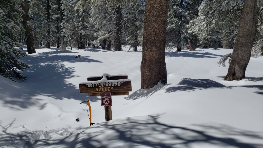
sanjacjon Uncategorized Leave a comment 10 MinutesEdit”Trail and snow update 13th April 2022″
Snow and trail update 5th April 2022
Snowfall from the minor storm last week (described here) melted within days, as illustrated in the photos at the foot of this posting. Melting of older snow largely from earlier this “winter” – I use that word in the broadest possible sense – has also accelerated dramatically. Very warm, dry conditions are forecast for the first ten days of April.
In addition to multiple ascents of San Jacinto Peak by different routes in recent days we have surveyed many segments of PCT Miles 168-191 and its side trails.
On none of my recent ascents of San Jacinto Peak have spikes been needed, although many hikers will find them useful in places depending on their comfort level on icy snow. Spikes are useful for descending, at least for the first few hundred feet of elevation below San Jacinto Peak.
On 31st March we reviewed conditions again at Apache Peak (PCT Mile 169.5) as discussed in this short video. Very little snow remains, and the video discussing conditions for Miles 168.5-179.5 (Spitler Peak to Saddle Junction) on 19th March (available here) remains relevant, although now hikers will encounter even less snow than in the video. Similarly the detailed video report (linked here) for Fuller Ridge Trail/PCT Miles 185.5-190.5 based on a full survey on Wednesday 23rd March also remains broadly applicable. Again, conditions will only continue to get easier over the next week. See below for a detailed description of snow cover on the PCT from Miles 151-205.
Snow depths measured on 1st and 4th April are detailed near the foot of this post, but note that snow depth is rarely indicative of the difficulty (or otherwise) of conditions underfoot.
Current conditions for individual trails are discussed in detail below where known. These will continue to change and simplify with rapid and widespread melting over the next ten days. Although useful tracks are now in place for most major trails (discussed below), cautious navigation is recommended everywhere.
Spikes remain useful (but no longer essential, especially on well-traveled trails) in some areas above about 8000 ft, as snow on trails can be icy where compacted by hiker traffic and following freeze-thaw cycles. Spikes are generally most valuable for traversing and for descending. Snow conditions are extremely poor for snowshoeing with limited thin snow cover, and continued rapid melting expected.
Despite unseasonably warm weather, hikers should continue to be prepared for temperatures near or below freezing in the high country, and potentially well below freezing when considering wind chill effects, especially next week (see below for my recent weather observations from San Jacinto Peak).
The USFS gates at Humber Park and South Ridge Road are open. Humber Park was clear of snow by the afternoon of 29th March, and South Ridge Road is clear of icy snow.
The following USFS roads are in winter closure (for vehicle traffic only): Black Mountain (4S01), Dark Canyon (5S02), and Santa Rosa (7S02).
The Forest Service ranger station in Idyllwild, closed for more than two years (originally due to the coronavirus pandemic) is tentatively scheduled to reopen on 23rd April 2022.
WEATHER
Temperatures forecast for 5th-9th April will be at or near record highs and more closely resemble early June rather than early April. They will be accompanied by Santa Ana winds and very low humidity. A significant cooling is expected for a few days starting 11th April. Forecasts remain uncertain, but there is the possibility of a very minor storm system around 12th April.
This latest video from National Weather Service San Diego makes includes some grim statistics. The first three months of the year combined to be the second driest ever here in Riverside County, and the driest on record for the entire northern half of California. The Sierra snowpack, at an impressive 160% of average on 1st January, is now only 38% of average.
In the San Jacinto mountains for the tenth consecutive winter precipitation has been below average in the high country (and eight of those ten winters, including this season, have been well below average).
At San Jacinto Peak (10,810ft/3295m) on Monday 4th April 2022 at 0835 the air temperature was 34.0°F (1°C), with a windchill temperature of 26.6°F (-3°C), 61% relative humidity, and a light NE wind sustained at 4 mph gusting to 8.4 mph.
At the Peak on Friday 1st April 2022 at 0825 the air temperature was 32.2°F (0°C), with a windchill temperature of 18.3°F (-8°C), 55% relative humidity, and a fresh ESE wind sustained at 11 mph gusting to 18.4 mph.
TRAIL CONDITIONS
Many trails below about 8700ft are now largely or completely clear of snow, and thin snow cover is increasingly patchy everywhere above that elevation, especially on sun-exposed slopes. Melting has been steady in the past two weeks, and will accelerate dramatically in the second week of April.
Due to greatly reduced maintenance work by the agencies and PCTA during the coronavirus pandemic, many trails have accumulated treefall hazards since late 2019, passable with care by hikers but not for stock. Although reported promptly, agencies failed to remove most hazards in 2021. With recent storms being accompanied by strong winds and heavy ice loads, hikers will encounter many new and additional hazards, especially in vulnerable burn areas (e.g., Willow Creek Trail, PCT Miles 170-177).
Although some treefall hazards from Red Tahquitz to Antsell Rock (PCT Miles 172.5-175) were cleared in June 2021 prior to the rockslide removal work, the situation has badly deteriorated this winter. In a full survey on 19th March 2022, I counted at least 72 treefall hazards between PCT Miles 170-175. At least a third of these are major hazards that require scrambling over or around. Many hikers have commented to me that the tree hazards are more problematic than the remaining snow.
The 0.4 mile section of South Ridge Trail to Tahquitz Peak from Chinquapin Flat/PCT Mile 178 is melting rapidly and has a set of steps to follow through the steeply angled icy snow. These icy slopes are notoriously treacherous however. Currently crampons with an ice axe (and thorough knowledge of how to use both) are preferred, although experienced hikers will find spikes sufficient. There was a fatal hiker fall here on Sunday 30th January 2022.
Effective Tuesday 1st February 2022 the State Park closed the section of Skyline Trail that falls within its jurisdiction, above 5800 ft elevation, “due to dangerous ice accumulation”. (Skyline Trail forms the lower two-thirds of the “Cactus-to-Clouds” [C2C] route.) The trail is expected to reopen sometime in April. The State Park boundary is not marked but is near the site of the old Florian’s Cache, below Flat Rock. The open section of trail below 5800 ft is clear of snow.
Devil’s Slide Trail is clear of icy snow to near Saddle Junction, with just a few tiny patches mainly near the latter.
The PCT for a mile north of Saddle Junction (“Angel’s Glide”) is essentially clear of snow.
The Wellman Trail is now only about 40% snow-covered.
The well-traveled compacted track on the Peak Trail from Wellman Divide to near Miller Peak follows the trail route. Icy snow cover remains 80% but spikes are generally not needed other than close to San Jacinto Peak. Above 10,400ft tracks most tracks form a well-compacted route up the East Ridge.
Marion Mountain Trail is now functionally clear of snow, with just a few tiny dirty snow patches that do not require spikes. There is one huge new treefall hazard across the trail exactly at the State Park/Forest Service boundary.
Snow cover on the PCT has almost completely melted from Miles 151 (Highway 74) to about 175 (Red Tahquitz). See my video discussing conditions for Miles 168.5-179.5 (Spitler Peak to Saddle Junction) on 19th March available here, with the specific area around Apache Peak surveyed again on 31st March (here). Although snow remains largely continuous between Miles 175-179, this will change rapidly over the next week. Spikes are useful for those few miles. Snow cover is becoming very limited between Miles 178 to 184, with the exception of the notoriously stubborn half mile just south of Annie’s Junction starting at about Mile 180.3. From Mile 184 to 191, snow cover is extensive, although exposed sections of Fuller Ridge (e.g., Miles 186.6-187.5 and 187.8-188.5) are now clear, as are areas north of Mile 191. See the detailed video report (linked here) for Fuller Ridge Trail/PCT Miles 185.5-190.5 based on a full survey on Wednesday 23rd March.
Deer Springs Trail is clear of snow to about 8600ft (just south of the Marion Mountain Trail junction). Thereafter snow cover is roughly 50% to about 9400 ft. Above that elevation snow cover is nearly continuous (>90%), with some clear patches rapidly developing. Spikes are useful, especially for descending. [Three new trees came down in late 2021 on the PCT/Deer Springs Trail just south of its junction with Marion Mountain Trail, but they are readily passable for hikers.] From Little Round Valley up to near the Peak the most heavily traveled track follows my posthole track from 29th March, which itself followed my snowshoe route from late February. This track did not attempt to follow the trail route and is very direct and steep (and would be a challenging ascent for many). Cautious navigation is required as there are several alternative tracks meandering across this snow slope. Some short sections of the trail above Little Round Valley have started to clear of snow.
South Ridge Trail (south of Tahquitz Peak) [updated 7th April] is clear of snow to Tahquitz Peak, with just a couple of tiny ice patches remaining near the Peak. Spikes are not required. The middle section of South Ridge Trail (between May Valley Road and the top of South Ridge Road) has several trees down which are significant obstructions.
The Ernie Maxwell Trail is clear of snow.
The Round Valley Trail has well-traveled tracks to follow from Long Valley to Wellman Divide, and is clearing rapidly.
Willow Creek Trail has about 20% snow cover overall, with a posthole and snowshoe track to Long Valley through the remaining snow. There are at least 40 downed trees between Skunk Cabbage Junction and Hidden Divide, nearly 30 of these on the Forest Service section.
The trail from Saddle Junction to near Reeds Meadow, then past Little Tahquitz Meadow to connect to the PCT is currently largely an ugly posthole track through soft snow that does not remotely follow the established trail routes. Melting will be rapid in the next week or so.
The Suicide Rock Trail is clear of snow.
Spitler Peak Trail is clear of snow. Forty downed trees, most from an ice storm in late December 2021, plus dozens of additional trunks and branches in the trail, have been removed by the Trail Report from this trail in 2022.
The Strawberry Trail between Annie’s and Strawberry junctions (roughly PCT Miles 181-183) has been well-traveled, is very sun-exposed and is functionally clear of snow.
The Caramba Trail from near Reeds Meadow through Laws Camp and on to Caramba, and the Cedar Trail from Willow Creek Trail to Laws, are optimistically described by the Forest Service as “not maintained”. In reality both trails no longer exist and are so heavily overgrown I advise hikers do not attempt to follow them. An informal use trail to Laws is much more direct and avoids all of the very challenging bushwhacking of the unmaintained trails (some local hikers dubbed it the “King Trail” when I established the route in 2019). It leaves the Willow Creek Trail exactly 1.0 mile from Saddle Junction (0.46 mile from the Skunk Cabbage turning), descending largely on established deer trails for 1.2 miles, meeting Willow Creek just upstream from the old Laws Camp. From Laws east to Caramba the route of the original Caramba Trail has been well-cairned by myself and others and can largely be followed with careful route-finding. My February 2022 survey counted 97 trees down on this 2.1 mile trail. It is especially obscure 0.1-0.3 mile east of the Willow Creek crossing, generally becoming clearer near Caramba. Cautious navigation is advised throughout the area.
Seven Pines Trail has had very limited hiker traffic since November 2018, largely because Dark Canyon Road was closed from February 2019 to early October 2021, and again since December 2021. The Trail Report has “adopted” Seven Pines Trail as a priority for maintenance work as the trail has had a disproportionate number of lost hiker rescues in recent years. Starting in November 2021, 42 treefall hazards on the lower 3.0 miles of trail have been removed. Almost all of this section has also been thoroughly trimmed and cleared, and the trail is now obvious and easy to follow for much of its length (when clear of snow). However at least 18 downed trees remain on the upper 0.7 mile of trail, the route is very obscure in places, and cautious navigation is required especially for those who are not very familiar with hiking this trail. Dark Canyon campground remains closed.
Unsurprisingly, there were no visible hiker tracks on Seven Pines Trail as of 4th April.
SNOW DEPTHS measured on 1st April 2022 (eastern side locations) and 4th April 2022 (western side) are as follows. The first number is the current average total depth, with the greatest depth of the winter following the storms of 22nd-23rd February 2022 given in parentheses, where known. Due to strong winds accompanying storms and complex differential melting between snowfall events, note that there is considerable variability in snow depth, especially in the trails. Altitudes are approximate.
San Jacinto Peak (10810 ft): 7-8 inches (31-35 inches on 23rd February)
Little Round Valley (9800 ft): 10 inches (30-36 inches on 23rd February, heavily drifted)
Wellman Divide (9700 ft): 0-4 inches (23 inches on 23rd February)
Annie’s Junction/approx. PCT Mile 180.8 (9070 ft): 9 inches (28 inches on 23rd February)
Seven Pines Trail junction with Deer Springs Trail/approx. PCT Mile 184.9 (8700 ft): 4-6 inches
Strawberry Junction/approx. PCT Mile 183 (8100 ft): 0 inches, new snow largely melted by afternoon of 29th March
Saddle Junction/approx. PCT Mile 179 (8070 ft): 0 inches (16 inches on 23rd February)
Devil’s Slide Trail at Humber Park (6520 ft): 0 inches (15 inches on 23rd February)
It’s northbound PCT season! Please help the Trail Report at our busiest time of the year. While all labor and time is volunteered, the San Jacinto Trail Report completely depends on your small private donations to cover costs. Your contribution helps to keep the Report active, free from advertising, and independent from agencies. If you have found this Report useful, please visit the Donate page. Zelle, Venmo, and PayPal are all available. Thank you so much for your support.
PACIFIC CREST TRAIL
Detailed snow conditions on the PCT are described above under “Trail Conditions”.
This has been a well-below average snow year for the San Jacinto high country (for the third season in a row, and now for eight of the past ten winters). Given rapid climate change here there could well be relatively little snow and ice by the time you reach the San Jacinto mountains. Nevertheless even small, isolated sections of icy snow can be challenging, especially for those with limited experience of snow/ice hiking. Details of current snow/ice conditions will be clear from updates to the Trail Report over coming weeks.
The rockslide at PCT Mile 172.5, just north of Antsell Rock, was removed on 14th June 2021. My “before, during, and after” video is available here. This section of the PCT is now safer and is narrow but readily passable with care by hikers (but remains impassable by stock).
If you take an alternate further south, it is possible to regain the PCT from Idyllwild via Devil’s Slide Trail at Saddle Junction (about Mile 179.5). Do not attempt to regain the PCT via South Ridge Trail as the slope on the north side of Tahquitz Peak always remains ice-covered well into April (at least), requires crampons and ice axe, and is notoriously treacherous.
Black Mountain Road is not closed to hiker traffic, only to vehicles. This is a temporary, seasonal closure, and usually it reopens to vehicles in April (although that is weather dependent).
PCT hikers are reminded that overnight stays are not permitted at or near San Jacinto Peak, including in the historic shelter. Mt. San Jacinto State Park regulations permit overnight stays only in established campgrounds. Little Round Valley and Strawberry Junction are good options for thru-hikers.


sanjacjon Uncategorized Leave a comment 11 MinutesEdit”Snow and trail update 5th April 2022″
Minor snow storm update 29th March 2022
[UPDATE Thursday 31st March 2022: this morning we shot a short video review of the Apache Peak area (PCT Mile 169.5) available here on YouTube. PCT Miles 151-175 are now functionally clear of snow and many thru hikers will find spikes are no longer required until rounding onto the north side of Red Tahquitz at Mile 175.]
A minor storm passed over the San Jacinto mountains on Monday 28th March, with light precipitation continuing into the early hours of Tuesday 29th.
Overall precipitation was well below forecasts, with only 3-5 inches of snow in the high country (depending on elevation). There was a dusting of snow down to about 5000 ft. In Idyllwild at 5550 ft we received 0.63 in of rain, plus 1.5 in of snow, although the latter melted within a few hours. Snow depths measured on 29th March are detailed near the foot of this post, but note that snow depth is rarely indicative of the difficulty (or otherwise) of conditions underfoot.
Early on Tuesday 29th March we ascended San Jacinto Peak via Devil’s Slide, PCT, Wellman, Peak, and East Ridge trails. Although I carried crampons, spikes, and ice axe, in case I encountered a variety of challenging conditions, I ultimately only used the latter in lieu of poles. I broke trail the entire way through shallow to moderate snow, in good boots with excellent traction.
We descended Deer Springs Trail, again breaking trail almost the entire way, and again with no need for additional traction in easy powder, returning to Humber Park via the Suicide Rock Trail and Suicide Rock climbers trail. I did briefly encounter some posthole tracks near the top of Marion Mountain Trail. With such shallow snow, melting was well underway by the time I descended below Strawberry Junction, despite the west slope remaining in the cloud almost all day below about 9000 ft.
This loop also facilitated survey of – and breaking trail for – the highest parts of the PCT in the San Jacinto mountains (roughly Miles 179-181 and 185.5-183) plus survey of several of its side trails.
Current conditions for individual routes are discussed in detail below where known. These will change rapidly with warming temperatures and widespread melting by next weekend. Although useful tracks are now in place for some major trails (discussed below), cautious navigation remains recommended everywhere.
I cannot overemphasize the importance of having both appropriate equipment and the right skill set for the terrain. The latter includes interpreting the snow/ice conditions, understanding your physical and mental abilities, and conservative decision making. These concerns may steadily increase over the next couple of weeks with snow undergoing multiple freeze-thaw cycles, with rising temperatures, seasonally stronger insolation, and highly variable snowmelt.
Spikes are currently helpful but are not strictly essential, as thin, soft snow is providing reasonable traction to footwear suitable for mountain hiking in winter conditions. This may change over the next few days as high country trails become compacted and icier with freeze-thaw cycles. Then spikes will be recommended everywhere above about 8000ft. They are generally especially valuable on well-consolidated tracks, on colder mornings when conditions are icy, and (as always) for descending and traversing. In the high country some hikers will find crampons a suitable alternative to spikes, although they are certainly not necessary (except of course on the north faces of San Jac and Tahquitz).
Snow conditions are generally poor for snowshoeing with thin snow plus rapid melting expected. With melting and compaction caused by freeze-thaw cycles and hiker traffic, conditions will rapidly deteriorate further for snowshoeing over the next week. Nevertheless, snowshoes may be valuable off trail above about 9000ft for the next few days.
Despite unseasonably warm temperatures in the next week or so, hikers should nevertheless be prepared for temperatures around freezing in the high country, and often well below freezing when considering wind chill effects (see below for my recent observations from San Jacinto Peak).
The USFS gates at Humber Park and South Ridge Road remain open. Humber Park was clear of snow by the afternoon of 29th March.

WEATHER
Temperatures are forecast to rise rapidly to about seasonal by Wednesday 30th, and then to warm further to above seasonal on 1st April. The first week of April will be very warm and snowmelt will be rapid and widespread at all elevations.
At San Jacinto Peak (10,810ft/3295m) on Tuesday 29th March 2022 at 1040 the air temperature was 19.8°F (-7°C), with a windchill temperature of -1.0°F (-18°C), 94% relative humidity, and a bitter WNW wind sustained at 12 mph gusting to 25.9 mph.
At the Peak on Friday 25th March 2022 at 0835 the air temperature was 45.5°F (7.5°C), with a windchill temperature of 38.3°F (3°C), 27% relative humidity, and a light SSE wind sustained at 5 mph gusting to 12.7 mph. The air temperature was likely an all-time record high for this location in the month of March.
TRAIL CONDITIONS
All trails above about 6500 ft are currently partially obscured by light snow, with thin snow cover continuous above about 8000 ft. Melting was already underway on 29th March and will accelerate very rapidly over the next week.
Current snow cover on the PCT is limited from Miles 151 (Highway 74) to about 160, and then increasingly patchy between Miles 160 and 175 (Red Tahquitz). The thin snow cover from this latest storm will melt within the next few days. Some shaded chutes and slopes can be tricky for those without snow/ice experience, and spikes remain recommended. Within a couple of days my video discussing conditions for Miles 168.5-179.5 (Spitler Peak to Saddle Junction) on 19th March available here will again be accurate to the conditions due to rapid melting. Snow remains largely continuous between Miles 175-179. Snow cover will quickly become very patchy in sun-exposed areas between Miles 178 to 184, with the exception of the notoriously stubborn half mile just south of Annie’s Junction starting at about Mile 180.3. From Mile 184 to 191, snow cover is currently largely continuous, although extensive exposed sections of Fuller Ridge (e.g., Miles 186.6-187.5 and 187.8-188.5) will very rapidly clear again, as will areas north of Mile 191. The detailed video report (linked here) for Fuller Ridge Trail/PCT Miles 185.5-190.5 based on a full survey on Wednesday 23rd March will again be accurate to conditions after melting on 30th-31st March.
Hikers should anticipate encountering significant new treefall hazards, especially in vulnerable burn areas (e.g., Willow Creek Trail, PCT Miles 166-177). Storms in December 2021 left trees heavily laden with ice, and I have since found many broken tree limbs and downed trees throughout the trail system. Severe Santa Ana winds in January and February have brought down further trees and branches.
Effective Tuesday 1st February 2022 the State Park closed the section of Skyline Trail that falls within its jurisdiction, above 5800 ft elevation, “due to dangerous ice accumulation”. Long Valley Ranger Station staff have stated that the trail may not reopen before April. The State Park boundary is not marked but is near the site of the old Florian’s Cache, below Flat Rock. Very shallow snow from these latest storms on the open section of trail below 5800 ft will melt very rapidly on this exposed slope.
The 0.4 mile section of South Ridge Trail to Tahquitz Peak from Chinquapin Flat/PCT Mile 178 has very indistinct steps to follow through the steeply angled icy snow. These steps will have been largely obscured by the fresh snowfall. These icy slopes are notoriously treacherous. Crampons with an ice axe (and knowledge of how to use both) are currently recommended. It is possible that spikes will be sufficient by the weekend. There was a fatal hiker fall here on Sunday 30th January.
Devil’s Slide Trail has a well-defined shallow posthole track to follow. Large sections were already clearing by the afternoon of 29th March, especially below 7700 ft.
The Ernie Maxwell Trail is already largely clear of snow, and will clear completely on 30th March.
My shallow posthole track is well-defined from Saddle Junction to San Jacinto Peak, via the PCT, Wellman, and Peak trails. Above 10,400 ft my posthole track roughly follows the East Ridge Trail route.
Marion Mountain Trail has a well-defined posthole track through the snow along its entire length, however it does not follow the trail route in places.
There were no visible hiker tracks on Seven Pines or Fuller Ridge trails as of early afternoon on 29th March, nor on the Strawberry Trail (approx. PCT Miles 181-183).
Deer Springs Trail has a well-defined track along its entire length. Most snow had already melted below Strawberry Junction (8100 ft) by the afternoon of 29th, and it will liekly clear completely below about 8600 ft on 30th-31st. Below Little Round Valley I (generally) made a conscious effort to accurately follow the trail route. Through and above Little Round Valley the only track is my shallow posthole route down from the Peak which does not attempt to follow the trail route and is very direct and steep (and would be a challenging ascent for many hikers).
Suicide Rock Trail was functionally clear of snow by the afternoon of 29th March.
Spitler Peak Trail will very rapidly clear of snow in the next day or two. Forty downed trees, most from an ice storm in late December 2021, plus dozens of additional trunks and branches in the trail, have been removed by the Trail Report from this trail in 2022.

SNOW DEPTHS measured on 29th March 2022 are as follows. The first number is the current average total depth, with the new snow from the storm on 28th-29th March given in parentheses. Due to strong winds accompanying storms and complex differential melting between snowfall events, note that there is considerable variability in snow depth, especially in the trails. Altitudes are approximate.
San Jacinto Peak (10810 ft): 12-14 inches (4-5 inches new)
Little Round Valley (9800 ft): 12-14 inches (4 inches new)
Wellman Divide (9700 ft): 4-6 inches (4 inches new)
Annie’s Junction/approx. PCT Mile 180.8 (9070 ft): 11 inches (3 inches new)
Seven Pines Trail junction with Deer Springs Trail/approx. PCT Mile 184.9 (8700 ft): 8 inches (3 inches new)
Strawberry Junction/approx. PCT Mile 183 (8100 ft): 0-1 inch (1-2 inches new, largely melted by afternoon of 29th)
Saddle Junction/approx. PCT Mile 179 (8070 ft): 2-3 inches (2 inches new)
Devil’s Slide Trail at Humber Park (6520 ft): 1.5 inches (1.5 inches new, largely melted by afternoon of 29th)
Idyllwild (at 5550 ft): 1.5 inches (1.5 inches new, all melted by afternoon of 29th)
It’s northbound PCT season! Please help the Trail Report at our busiest time of the year. While all labor and time is volunteered, the San Jacinto Trail Report completely depends on your small private donations to keep active, free from advertising, and independent from agencies. If you have found this Report useful, please visit the Donate page. Zelle has been added as a fee-free way to donate. Thank you for your support.

sanjacjon Uncategorized Leave a comment 7 MinutesEdit”Minor snow storm update 29th March 2022″
Brief weather and trail update 26th March 2022
[UPDATED Tuesday 29th March @ 1055: We broke trail this morning up Devil’s Slide Trail to San Jacinto Peak. Snow depths range from two inches at Saddle Junction (8070ft) to 4-5 inches here at San Jacinto Peak. Spikes are recommended but are not strictly essential. Crampons are an alternative above 9000ft for those who have them. Shallow snow and underlying icy snow generally make conditions poor for snowshoes. We will descend breaking trail down Deer Springs Trail. Main update this evening.]
[UPDATED Monday 28th March @ 1955: we hiked up Tahquitz Peak this afternoon to assess the start of the storm. It started drizzling on us at 1330. Around the Peak very light snow was slowly settling above 8500 ft, with a mix of snow, sleet and rain from 7800-8500 ft, and drizzle below that. So far 0.48 in of rain has fallen in Idyllwild at 5550 ft elevation, with a scant 0.5 in of snow settled at Tahquitz Peak (8800 ft) and in Long Valley (8600 ft). After a lull for a couple of hours, the second, colder phase of the system is imminent, lasting until pre-dawn tomorrow.]
This is a short update, hopefully useful for all readers but with the large number of thru hikers currently on the PCT in mind (we have seen and talked to dozens on hikes in recent days). For more comprehensive details of trail conditions for trails not mentioned below, Forest road closures, and other general information, see the previous report for 21st-23rd March linked here.
After days of uncertainty, the forecasts have become somewhat clearer for the storm system expected on Monday 28th March. The storm will have two phases, now so close together that essentially there will be continuous precipitation from early Monday afternoon until around sunrise on Tuesday 29th.
The first phase is particularly warm and will bring rain to lower and mid elevations on Monday afternoon, with a freeze level at 7000-7500 ft. The second phase, lasting most of Monday night, will be colder, with the freeze level dropping to about 6000 ft. Snowfall estimates above 10,000 ft for the entire system total 6-10 inches. Lower elevations will receive less snow, especially those around 5500-7500 ft that will get rain from the first phase of the storm. Idyllwild is expected to be below the snow level.
Most of the PCT in the San Jacinto mountains is above 6000 ft and will some experience light snowfall. Miles 175-191 are all above 7700 ft and are expected to receive about 2-6 inches of snow. In combination with strong winds (and therefore drifting) this may be sufficient to obscure the existing track in places, complicate navigation, and make for more challenging conditions underfoot.
Shallow fresh snow on top of ice (from rain) or on top of older icy snow are conditions that have proven to be challenging for less experienced hikers in the San Jacinto mountains in recent years, and these are the conditions that are now expected for 28th-30th March at least. Fresh snow obscures the ice or icy snow underneath, and makes it harder for traction devices to grip. Considerable caution is recommended in such conditions. Melting will be relatively rapid in the days immediately after the storm, but with some freeze-thaw cycles for at least a few days.
Although useful tracks are now in place for most major trails, some of these above about 7000 ft will become obscured on Monday 28th for up to several days, and cautious navigation is recommended everywhere.
I have hiked somewhere on the PCT and/or its alternates every day for the past couple of weeks. I uploaded a detailed video report (linked here) for Fuller Ridge Trail/PCT Miles 185.5-190.5 based on a full survey on the morning of Wednesday 23rd March. Also note that four days earlier I did a similar survey and video report for PCT Miles 168.5-179.5. Obviously these videos are only applicable until Sunday 27th March.
Early on Friday 25th March we ascended San Jacinto Peak via Devil’s Slide, PCT, Wellman, Peak, and East Ridge trails, descending the same way. Boots with excellent traction were sufficient all the way to the Peak. I only used spikes to descend to about 10,300 ft. Hikers with a lower comfort level on snow and icy snow will find spikes useful more widely.
Snow depths measured on 23rd-25th March are detailed near the foot of this post but note that snow depth alone is rarely indicative of the difficulty or otherwise of conditions for hiking.
Spikes are recommended (but are not essential on well-traveled trails) above about 7600 ft, as snow on trails can be icy where compacted by hiker traffic and following freeze-thaw cycles. Spikes are generally most valuable for traversing and for descending. Starting Monday 28th, spikes are expected to be strongly recommended everywhere above about 6000 ft for several days.
PCT hikers that leave the trail by Mile 165, and then regain the trail at Mile 191 using the Black Mountain Road alternate, currently no longer require spikes (currently spikes remain recommended for some parts of Miles 166-191). This advice may change after 28th March.
WEATHER
Specifics of the warm mixed precipitation storm on Monday 28th are given above. About an inch of rain is expected at mid elevations, with snowfall of 6-10 inches in the high country. Relatively mild, sunny conditions are expected from Wednesday 30th March onwards, and rapid snowmelt will resume.
The air temperature recorded at San Jacinto Peak on Friday 25th March – an astonishing 45.5°F (7.5°C) – was likely an all-time record high for the Peak in March.
January 2022 was the driest January in recorded history in the San Jacinto high country, with only 0.75 in of fresh snow falling at San Jacinto Peak. Snowfall in both December 2021 and February 2022 was below seasonal for the high country. Consequently, for the tenth consecutive winter, precipitation will be below average in the San Jacinto high country (and eight of those ten winters have been well below average).
At San Jacinto Peak (10,810ft/3295m) on Friday 25th March 2022 at 0835 the air temperature was 45.5°F (7.5°C), with a windchill temperature of 38.3°F (3°C), 27% relative humidity, and a light SSE wind sustained at 5 mph gusting to 12.7 mph.
At the Peak on Monday 21st March 2022 at 0830 the air temperature was 35.4°F (2°C), with a windchill temperature of 16.5°F (-9°C), 47% relative humidity, and a gusty NNW wind sustained at 5 mph gusting to 16.7 mph.
TRAIL CONDITIONS
Current snow cover on the PCT is extremely limited from Miles 151 (Highway 74) to about 160, and then increasingly patchy between Miles 160 and 175 (Red Tahquitz). Some shaded chutes and slopes can be tricky for those without snow/ice experience, and spikes remain recommended. See my video discussing conditions for Miles 168.5-179.5 (Spitler Peak to Saddle Junction) on 19th March available here. Snow remains largely continuous between Miles 175-179. Snow cover is becoming very patchy in sun-exposed areas between Miles 178 to 184, with the exception of the notoriously stubborn half mile just south of Annie’s Junction starting at about Mile 180.3. From Mile 184 to 191, snow cover is largely continuous, although extensive exposed sections of Fuller Ridge (e.g., Miles 186.6-187.5 and 187.8-188.5) are now largely clear, as are areas north of Mile 191. See the detailed video report (linked here) for Fuller Ridge Trail/PCT Miles 185.5-190.5 based on a full survey on Wednesday 23rd March.
Trails below about 7500ft are now generally clear of snow, light snow cover is increasingly patchy below 9000ft, and light to moderate cover is largely continuous but melting steadily everywhere above 9000ft. Melting has been very rapid in the past two weeks.
Although some treefall hazards from Red Tahquitz to Antsell Rock (PCT Miles 172.5-175) were cleared in June 2021 prior to the rockslide removal work, the situation has badly deteriorated this winter. In a full survey on 19th March 2022, I counted at least 72 treefall hazards between PCT Miles 170-175. At least a third of these are major hazards that require scrambling over or around.
Devil’s Slide Trail is essentially clear of icy snow to near Saddle Junction, with just a few patches mainly near the latter. Hikers may find spikes useful near Saddle, especially for descending.
The PCT for a mile north of Saddle Junction (“Angel’s Glide”) is essentially clear of snow. The Wellman Trail is now only about 50% snow-covered.
The 0.4 mile section of South Ridge Trail to Tahquitz Peak from Chinquapin Flat/PCT Mile 178 has no steps to follow through the steeply angled icy snow. These icy slopes are notoriously treacherous. Crampons with an ice axe (and thorough knowledge of how to use both) are required. Snowshoes are not advised due to the angle of the icy snow. There was a fatal hiker fall here on Sunday 30th January.
The well-traveled compacted track on the Peak Trail from Wellman Divide to near Miller Peak follows the trail route. Icy snow cover remains 60%. Above 10,400ft tracks form a partially compacted route up the East Ridge. The Peak Trail itself has not been properly broken above 10,400 ft.
Marion Mountain Trail has about 50% snow cover overall, with a very well-traveled compacted track throughout. The trail is largely clear (<10% snow cover) to about 7400 ft and then snow cover averages 60% up to the PCT/Deer Springs Trail junction, with a couple of lengthy clear sections. Spikes are useful for descending. There is one huge new treefall hazard across the trail exactly at the State Park/Forest Service boundary.
Unsurprisingly, there were no visible hiker tracks on Seven Pines Trail as of 23rd March.
Deer Springs Trail is clear of snow to Strawberry Junction at 8100ft, and is largely clear from there to about 8600ft (just south of the Marion Mountain Trail junction). Thereafter snow cover is about 95%, with a few clear patches developing. Spikes are useful, especially for descending. [Three new trees came down in late 2021 on the PCT/Deer Springs Trail just south of its junction with Marion Mountain Trail, but they are readily passable for hikers.] Through Little Round Valley and on up to near the Peak the most heavily traveled track follows my prior snowshoe route which did not attempt to follow the trail route and is very direct and steep (and is a challenging ascent for many). Cautious navigation is required as there are several alternative tracks meandering across this snow slope.
Willow Creek Trail has about 40% snow cover overall, with a posthole and snowshoe track to Long Valley through the remaining snow. There are at least 40 downed trees between Skunk Cabbage Junction and Hidden Divide, nearly 30 of these on the Forest Service section.
The trail from Saddle Junction to near Reeds Meadow, then past Little Tahquitz Meadow to connect to the PCT is currently an ugly posthole track through soft snow that does not remotely follow the established trail routes.
The Strawberry Trail between Annie’s and Strawberry junctions (roughly PCT Miles 181-183) has been well-traveled, is very sun-exposed and is clearing rapidly of snow.
The Ernie Maxwell Trail is clear of snow.
The Suicide Rock Trail is clear of snow.
Spitler Peak Trail is clear of snow. Forty downed trees, most from an ice storm in late December 2021, plus dozens of additional trunks and branches in the trail, have been removed by the Trail Report from this trail in 2022.
SNOW DEPTHS measured on 23rd-25th March 2022 are as follows. The first number is the current average total depth, with the greatest depth recorded after the largest storm of this calendar year (on 22nd-23rd February 2022) given in parentheses, where known. Due to strong winds accompanying storms and complex differential melting between snowfall events, note that there is considerable variability in snow depth. Altitudes are approximate.
San Jacinto Peak (10810 ft): 9 inches (31-35 inches on 23rd February)
Little Round Valley (9800 ft): 10-12 inches (with heavy drifting here)
Wellman Divide (9700 ft): 0-4 inches (23 inches on 23rd February)
Annie’s Junction/approx. PCT Mile 180.8 (9070 ft): 8 inches (28 inches on 23rd February)
Seven Pines Trail junction with Deer Springs Trail/approx. PCT Mile 184.9 (8700 ft): 6 inches
Strawberry Junction/approx. PCT Mile 183 (8100 ft): 0 inches
Saddle Junction/approx. PCT Mile 179 (8070 ft): 0-1 inch (16 inches on 23rd February)
Devil’s Slide Trail at Humber Park (6520 ft): 0 inches (15 inches on 23rd February)
It’s northbound PCT season! Please help the Trail Report at our busiest time of the year. While all labor and time is volunteered, the San Jacinto Trail Report completely depends on your small private donations to keep the Report active, free from advertising, and independent from agencies. If you have found this Report useful, please visit the Donate page. Zelle has been added as a fee-free way to donate. Thank you for your support.


sanjacjon Uncategorized Leave a comment 9 MinutesEdit”Brief weather and trail update 26th March 2022″
Snow and trail update 23rd March 2022
[I have uploaded a detailed video report (linked here) for Fuller Ridge Trail/PCT Miles 185.5-190.5 based on a full survey on the morning of Wednesday 23rd March. Also note that four days earlier I did a similar survey and video report for PCT Miles 168.5-179.5.]
Other than brief cooler weather on Sunday 20th, warm and sunny conditions have led to rapid snowmelt at all elevations. This will accelerate further this week, with forecast temperatures far above average for March. Overall snow conditions already more closely resemble mid April (or, in a “normal” year, early May) than mid March.
Very minor precipitation on 20th included 0.11 in of rain in Idyllwild (at 5550 ft) and 0.25 in snow above 8700ft with a dusting down to 7500 ft. There was a narrow band between 8700-9800 ft on the western slope with 0.5 in snow, dropping back to just 0.25 in at the highest peaks.
Snow depths measured (largely) on 21st March are detailed near the foot of this post but note that snow depth is rarely indicative of the difficulty or otherwise of conditions for hiking.
In addition to multiple ascents of San Jacinto Peak by different routes in recent days we have surveyed several segments of PCT Miles 151-186 and its side trails, plus multiple Forest roads. On Saturday 19th March we hiked PCT Miles 168.5-179.5 (Spitler Peak to Saddle Junction) plus Spitler Peak and Devil’s Slide trails, and reported on conditions in this detailed video report.
Current conditions for individual trails are discussed in detail below where known. These will continue to change with rapid and widespread melting over the next week, followed by the possibility of a light to moderate snowstorm on 28th-29th March.
Early on Monday 21st March we ascended San Jacinto Peak via Marion Mountain and Deer Springs trails. Boots with excellent traction were sufficient all the way to the Peak. Spikes were useful for descending continuously to about 8600 ft and then on some patches down to 7500 ft. Hikers with a lower comfort level on snow and icy snow will find spikes useful more widely. Although useful tracks are now in place for most major trails (discussed below), cautious navigation is recommended everywhere.
Although snow conditions are rapidly becoming benign in the San Jacinto mountains, I continue to emphasize the critical importance of having both appropriate equipment and the right skill set for the terrain. The latter includes interpreting the snow/ice conditions, understanding your physical and mental abilities, and conservative decision making.
Spikes are recommended (but not essential on well-traveled trails) almost everywhere above about 7400 ft, as snow on trails can be icy where compacted by hiker traffic and following freeze-thaw cycles. Spikes are generally most valuable for traversing and for descending. PCT hikers that leave the trail by Mile 165, and then regain the trail at Mile 191 using the Black Mountain Road alternate, no longer require spikes (currently spikes remain recommended for some parts of Miles 166-191).
With the main trails now largely having compacted tracks snowshoes are no longer required but they remain very useful in off-trail areas only above about 7900ft. With continued snowmelt conditions will further deteriorate for snowshoeing over the next week.
Despite generally warmer than seasonal weather, hikers should nevertheless be prepared for temperatures near or below freezing in the high country, and potentially well below freezing when considering wind chill effects (see below for my recent weather observations from San Jacinto Peak).
The USFS gate at Humber Park reopened on 11th March.
South Ridge Road is open and is largely clear of icy snow.
The following USFS roads are in winter closure (for vehicle traffic only): Black Mountain (4S01), Dark Canyon (5S02), and Santa Rosa (7S02).

WEATHER
Temperatures will yet again climb to well above seasonal, with very warm conditions forecast for 24th-26th March. There is the likelihood of a warm storm around Monday 28th, with moderate rainfall at mid elevations, and snowfall up to 10-12 inches in the high country.
January 2022 was the driest January in recorded history in the San Jacinto high country, with only 0.75in of fresh snow falling at San Jacinto Peak. Snowfall in both December 2021 and February 2022 was below seasonal for the high country. Consequently, for the tenth consecutive winter, precipitation will be below average in the San Jacinto high country (and eight of those ten winters have been well below average).
At San Jacinto Peak (10,810ft/3295m) on Monday 21st March 2022 at 0830 the air temperature was 35.4°F (2°C), with a windchill temperature of 16.5°F (-9°C), 47% relative humidity, and a gusty NNW wind sustained at 5 mph gusting to 16.7 mph.
At the Peak on Thursday 17th March 2022 at 0830 the air temperature was 29.1°F (-2°C), with a windchill temperature of 14.5°F (-10°C), 19% relative humidity, and a bitter due North wind sustained at 14 mph gusting to 16.5 mph.

TRAIL CONDITIONS
Trails below about 7500ft are now generally clear of snow, light snow cover is increasingly patchy below 9000ft, and light to moderate cover remains largely continuous everywhere above 9000ft. Icy snow from prior storms persists on shaded north and north-east slopes (e.g., Red Tahquitz, Tahquitz, Apache, and Spitler peaks, and Antsell Rock). Melting has been rapid in the past week and will accelerate over the next week.
Due to greatly reduced maintenance work by the agencies and PCTA during the coronavirus pandemic, many trails have accumulated treefall hazards since late 2019, passable with care by hikers but not for stock. Although reported promptly, agencies failed to remove most hazards in 2021. With recent storms being accompanied by strong winds and heavy ice loads, hikers will encounter many new and additional hazards, especially in vulnerable burn areas (e.g., Willow Creek Trail, PCT Miles 170-177).
The 0.4 mile section of South Ridge Trail to Tahquitz Peak from Chinquapin Flat/PCT Mile 178 has no steps to follow through the steeply angled icy snow. These icy slopes are notoriously treacherous. Crampons with an ice axe (and thorough knowledge of how to use both) are required. Snowshoes are not advised due to the angle of the icy snow. There was a fatal hiker fall here on Sunday 30th January.
Effective Tuesday 1st February 2022 the State Park closed the section of Skyline Trail that falls within its jurisdiction, above 5800 ft elevation, “due to dangerous ice accumulation”. (Skyline Trail forms the lower two-thirds of the “Cactus-to-Clouds” [C2C] route.) Long Valley Ranger Station staff have stated that the trail may not reopen before April. The State Park boundary is not marked but is near the site of the old Florian’s Cache, below Flat Rock. The open section of trail below 5800 ft is clear of snow.
Current snow cover on the PCT is very limited from Miles 151 (Highway 74) to about 160, and then increasingly patchy between Miles 160 and 175 (Red Tahquitz). Although limited, some shaded chutes and slopes can be tricky for those without snow/ice experience, and spikes remain recommended. See my video discussing conditions for Miles 168.5-179.5 (Spitler Peak to Saddle Junction) on 19th March available here. Although snow remains largely continuous between Miles 175-179, this will change rapidly over the next week. Snow cover is becoming very patchy in sun-exposed areas between Miles 178 to 184, with the exception of the notoriously stubborn half mile just south of Annie’s Junction starting at about Mile 180.3. From Mile 184 to 191, snow cover is largely continuous, although some exposed sections of Fuller Ridge (e.g., Miles 186.6-187.5 and 187.8-188.5) are now largely clear, as are areas north of Mile 191. See the detailed video report (linked here) for Fuller Ridge Trail/PCT Miles 185.5-190.5 based on a full survey on Wednesday 23rd March.
Although some treefall hazards from Red Tahquitz to Antsell Rock (PCT Miles 172.5-175) were cleared in June 2021 prior to the rockslide removal work, the situation has badly deteriorated this winter. In a full survey on 19th March 2022, I counted at least 72 treefall hazards between PCT Miles 170-175. At least a third of these are major hazards that require scrambling over or around.
The Ernie Maxwell Trail is clear of snow.
Devil’s Slide Trail is largely clear of icy snow to about 7700 ft, and then with about 40% patchy cover to Saddle Junction. Hikers will generally find spikes useful on the upper trail, especially for descending.
The PCT for a mile north of Saddle Junction (“Angel’s Glide”) is already largely clear of snow. The Wellman Trail has a well-traveled posthole route that largely follows the trail and remains about 90% snow-covered, but sun-exposed sections are clearing rapidly.
The well-traveled compacted track on the Peak Trail from Wellman Divide to near Miller Peak follows the trail route. Icy snow cover remains >90%. Above 10,400ft tracks form a partially compacted snowshoe route up the East Ridge. The Round Valley Trail has well-traveled tracks to follow from Long Valley to Wellman Divide.
Marion Mountain Trail has about 50% snow cover overall, with a very well-traveled compacted track throughout. The trail is largely clear (10% snow cover) to about 7400 ft and then snow cover averages 70% up to the PCT/Deer Springs Trail junction, with a couple of lengthy clear sections. Spikes are very useful for descending. There is one huge new treefall hazard across the trail exactly at the State Park/Forest Service boundary.
There is now an obvious posthole track on Fuller Ridge Trail, although it does not accurately follow the PCT route in places. Spikes remain recommended for this section. I expect to fully update conditions on Fuller Ridge by 24th March.
There were no visible hiker tracks on Seven Pines Trail as of 21st March.
Deer Springs Trail is functionally clear of snow to Strawberry Junction at 8100ft, and is largely clear from there to about 8600ft (just south of the Marion Mountain Trail junction). Thereafter snow cover is nearly continuous, with a few minor clear patches developing. Spikes are useful, especially for descending. [Three new trees came down in late 2021 on the PCT/Deer Springs Trail just south of its junction with Marion Mountain Trail, but they are readily passable for hikers.] Through Little Round Valley and on up to near the Peak the most heavily traveled track follows my prior snowshoe route which did not attempt to follow the trail route and is very direct and steep (and would be a challenging ascent for many). Cautious navigation is required as there are several alternative tracks meandering across this snow slope.
Willow Creek Trail has about 50% snow cover overall, with a posthole and snowshoe track to Long Valley through the remaining snow. There are at least 40 downed trees between Skunk Cabbage Junction and Hidden Divide, nearly 30 of these on the Forest Service section.
The trail from Saddle Junction to near Reeds Meadow, then past Little Tahquitz Meadow to connect to the PCT is currently an ugly posthole track through soft snow that does not remotely follow the established trail routes.
The Suicide Rock Trail is clear of snow.
Spitler Peak Trail is clear of snow. Forty downed trees, most from an ice storm in late December 2021, plus dozens of additional trunks and branches in the trail, have been removed by the Trail Report from this trail in 2022.
South Ridge Trail (south of Tahquitz Peak) is rapidly clearing of snow up to Old Lookout Flat (7600ft). Icy snow cover is about 50% to near Tahquitz Peak, and nearly continuous on the uppermost half-a-dozen switchbacks. Spikes recommended. The middle section of South Ridge Trail (between May Valley Road and the top of South Ridge Road) has several trees down which are significant obstructions.
The Strawberry Trail between Annie’s and Strawberry junctions (roughly PCT Miles 181-183) has been well-traveled, is very sun-exposed and is clearing rapidly of snow.
The Caramba Trail from near Reeds Meadow through Laws Camp and on to Caramba, and the Cedar Trail from Willow Creek Trail to Laws, are optimistically described by the Forest Service as “not maintained”. In reality both trails no longer exist and are so heavily overgrown I advise hikers do not attempt to follow them. An informal use trail to Laws is much more direct and avoids all of the very challenging bushwhacking of the unmaintained trails (some local hikers dubbed it the “King Trail” when I established the route in 2019). It leaves the Willow Creek Trail exactly 1.0 mile from Saddle Junction (0.46 mile from the Skunk Cabbage turning), descending largely on established deer trails for 1.2 miles, meeting Willow Creek just upstream from the old Laws Camp. From Laws east to Caramba the route of the original Caramba Trail has been well-cairned by myself and others and can largely be followed with careful route-finding. My February 2022 survey counted 97 trees down on this 2.1 mile trail. It is especially obscure 0.1-0.3 mile east of the Willow Creek crossing, generally becoming clearer near Caramba. Cautious navigation is advised throughout the area.
Seven Pines Trail has had very limited hiker traffic since November 2018, largely because Dark Canyon Road was closed from February 2019 to early October 2021, and again since December 2021. The Trail Report has “adopted” Seven Pines Trail as a priority for maintenance work as the trail has had a disproportionate number of lost hiker rescues in recent years. Starting in November 2021, 42 treefall hazards on the lower 3.0 miles of trail have been removed. Almost all of this section has also been thoroughly trimmed and cleared, and the trail is now obvious and easy to follow for much of its length (when clear of snow). However at least 18 downed trees remain on the upper 0.7 mile of trail, the route is very obscure in places, and cautious navigation is required especially for those who are not very familiar with hiking this trail. Dark Canyon campground remains closed.
SNOW DEPTHS measured on (or around) 21st March 2022 are as follows. The first number is the current average total depth, with the greatest depth recorded after the largest storm of this calendar year (on 22nd-23rd February 2022) given in parentheses, where known. Due to strong winds accompanying storms and complex differential melting between snowfall events, note that there is considerable variability in snow depth. Altitudes are approximate.
San Jacinto Peak (10810 ft): 14-15 inches (31-35 inches on 23rd February)
Little Round Valley (9800 ft): 16 inches (with heavy drifting here)
Wellman Divide (9700 ft): 4 inches (23 inches on 23rd February)
Annie’s Junction/approx. PCT Mile 180.8 (9070 ft): 14 inches (28 inches on 23rd February)
Seven Pines Trail junction with Deer Springs Trail/approx. PCT Mile 184.9 (8700 ft): 6-8 inches
Strawberry Junction/approx. PCT Mile 183 (8100 ft): 0-2 inches
Saddle Junction/approx. PCT Mile 179 (8070 ft): 2-4 inches (16 inches on 23rd February)
Devil’s Slide Trail at Humber Park (6520 ft): 0 inches (15 inches on 23rd February)
Idyllwild (at 5550 ft): 0 inches, melted by 10th March (10.5 inches on 23rd February)
It’s northbound PCT season! Please help the Trail Report at our busiest time of the year. While all labor and time is volunteered, the San Jacinto Trail Report completely depends on your small private donations to cover costs. Your contribution helps to keep the Report active, free from advertising, and independent from agencies. If you have found this Report useful, please visit the Donate page. Zelle has been added as a fee-free way to donate. Thank you for your support.
PACIFIC CREST TRAIL
This has been a well-below average snow year for the San Jacinto high country (for the third season in a row, and now for eight of the past ten winters). Given rapid climate change here there could be relatively little snow and ice by the time you reach the San Jacinto mountains. Nevertheless even small, isolated sections of icy snow can be challenging, especially for those with limited experience of snow/ice hiking. Details of current snow/ice conditions will be clear from updates to the Trail Report over coming weeks.
Current snow cover on the PCT is very limited from Miles 151 (Highway 74) to about 160, and then increasingly patchy between Miles 160 and 175 (Red Tahquitz). Although limited, some shaded chutes and slopes can be tricky for those without snow/ice experience, and spikes remain recommended. See my video discussing conditions for Miles 168.5-179.5 (Spitler Peak to Saddle Junction) on 19th March available here. Although snow remains largely continuous between Miles 175-179, this will change rapidly over the next week. Snow cover is becoming very patchy in sun-exposed areas between Miles 178 to 184, with the exception of the notoriously stubborn half mile just south of Annie’s Junction starting at about Mile 180.3. From Mile 184 to 191, snow cover is largely continuous, although some exposed sections of Fuller Ridge (e.g., Miles 186.6-187.5 and 187.8-188.5) are now largely clear, as are areas north of Mile 191. See the detailed video report (linked here) for Fuller Ridge Trail/PCT Miles 185.5-190.5 based on a full survey on Wednesday 23rd March.
The short snow slope on the NE side of Apache Peak (Mile 169.5) that has proved problematic for some hikers over the years is currently largely snow-covered but is not currently challenging (see video report mentioned above). Spikes are currently recommended. Every individual should make their own assessment of whether to cross based on their comfort level on angled snow, their snow/ice experience, available equipment, time of day, and current snow conditions. If in any doubt whatsoever, turn around and take the Spitler Peak Trail alternate option at Mile 168.5.
The rockslide at PCT Mile 172.5, just north of Antsell Rock, was removed on 14th June 2021. My “before, during, and after” video is available here. This section of the PCT is now safer and is narrow but readily passable with care by hikers (but remains impassable by stock).
If you take an alternate further south, it is possible to regain the PCT from Idyllwild via Devil’s Slide Trail at Saddle Junction (about Mile 179.5). Do not attempt to regain the PCT via South Ridge Trail as the slope on the north side of Tahquitz Peak always remains ice-covered well into April (at least), requires crampons and ice axe, and is notoriously treacherous.
Black Mountain Road is not closed to hiker traffic, only to vehicles. This is a temporary, seasonal closure, and usually it reopens to vehicles in March or April (although that is weather dependent).
PCT hikers are reminded that overnight stays are not permitted at or near San Jacinto Peak, including in the historic shelter. Mt. San Jacinto State Park regulations permit overnight stays only in established campgrounds (when open). Little Round Valley and Strawberry Junction are good options for thru hikers.

sanjacjon Uncategorized Leave a comment 13 MinutesEdit”Snow and trail update 23rd March 2022″
Snow and trail update 17th March 2022
[UPDATED 20th March: very minor precipitation overnight included 0.09in rain in Idyllwild and 0.25in snow at 8600ft with a dusting down to 7500ft. Spikes remain recommended above about 7000ft.]
[UPDATED 19th March: we hiked PCT Miles 168.5-179.5 and reported on conditions in this video report.]
[I have added a section “Pacific Crest Trail” at the foot of this update. However significant sections of the main Report also have key information for thru hikers, especially the discussion of current snow/ice conditions and recommended traction equipment.]
Although temperatures have been relatively cool for most of the past week, sunny conditions have started to rapidly melt the light snowfall from 5th-6th March from exposed areas at all elevations and from much of the trail system below about 7000 ft. Snow depths measured on 14th March are detailed near the foot of this post – and were not substantially different on 17th – but note that snow depth is rarely indicative of the difficulty (or otherwise) of conditions for hiking.
In addition to multiple ascents of San Jacinto Peak by different routes in recent days we have also surveyed Spitler Peak Trail, several segments of PCT Miles 151-170 and its side trails, plus multiple Forest roads. Current conditions for individual trails are discussed in detail below where known. These will continue to change with rapid melting over the next week or two (and the possibility of light snow on Sunday 20th).
Early on Monday 14th March we ascended San Jacinto Peak via Marion Mountain and Deer Springs trails. I went minimalist with equipment this time, which proved to be the right decision, as boots with excellent traction were sufficient all the way to the Peak. We descended the east side of the mountain, via the East Ridge, Peak, Wellman, and Devil’s Slide trails. Although I wore spikes down to about 8000 ft they were not required below about 10,400 ft as the softening snow allowed for good grip. Hikers with a lower comfort level on snow and icy snow will find spikes useful more widely. Although useful tracks are now in place for most major trails (discussed below), cautious navigation is strongly recommended everywhere.
On 8th March I recorded a video report of conditions on the Desert Divide, specifically at Apache Peak (PCT Mile 169.5) available here.
Multiple hiker falls already this year in the San Jacinto mountains, including one fatality, demonstrate the critical importance of having both appropriate equipment and the right skill set for the terrain. The latter includes interpreting the snow/ice conditions, understanding your physical and mental abilities, and conservative decision making.
Spikes are recommended (but not essential on well-traveled trails) almost everywhere above about 7000 ft, as snow on trails can be icy following freeze-thaw cycles and where compacted by hiker traffic. Spikes are generally most valuable for traversing and for descending. Thru hikers that leave the PCT by Mile 165, and then regain the trail at Mile 191 using the Black Mountain Road alternate, no longer require spikes (currently spikes remain strongly recommended for Miles 166-191).
Last week snowshoeing conditions were the best of the winter so far, thanks to the depth, structure, and low water content of the graupel snow from the early March storms. However the main trails now have compacted tracks and snowshoes are no longer required. Snowshoes remain recommended in off-trail areas only above about 8000ft. Below that elevation snow coverage is generally too shallow for snowshoeing and with continued melting, conditions are expected to deteriorate even off-trail over the next week or two.
Despite generally warmer than seasonal weather, hikers should nevertheless be prepared for temperatures near or below freezing in the high country, and potentially well below freezing when considering wind chill effects (see below for my recent weather observations from San Jacinto Peak).
The USFS gate at Humber Park reopened on 11th March.
South Ridge Road is open and is largely clear of icy snow. AWD/4WD vehicle recommended.
According to the Forest Service website the following USFS roads are in winter closure (for vehicle traffic only): Black Mountain (4S01), Dark Canyon (5S02), and Santa Rosa (7S02).
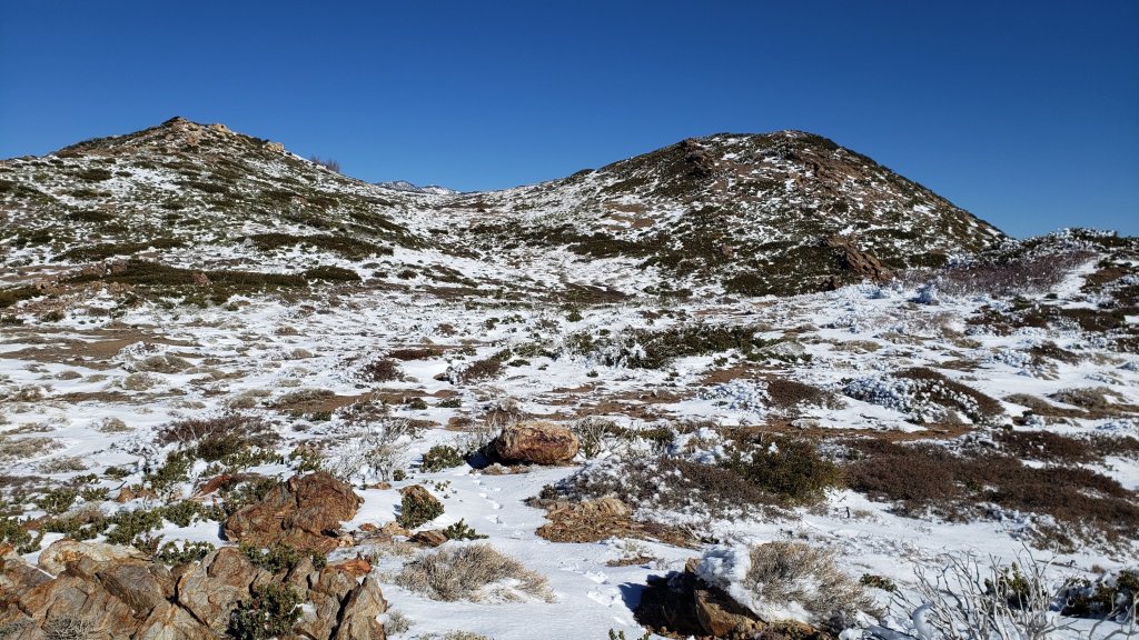
WEATHER
Temperatures have yet again climbed dramatically to well above seasonal and are expected to remain above average until Sunday 20th March, when they will very briefly dip to below seasonal. Temperatures in the last week or so of March are currently forecast to be far above seasonal. There is the possibility of a light snowfall, mainly above 7000 ft elevation, on 20th.
January 2022 was the driest January in recorded history in the San Jacinto high country, with only 0.75in of fresh snow falling at San Jacinto Peak. Snowfall in both December 2021 and February 2022 was below seasonal for the high country. Consequently, for the tenth consecutive winter, precipitation will be below average in the San Jacinto high country (and eight of those ten winters have been well below average).
At San Jacinto Peak (10,810ft/3295m) on Thursday 17th March 2022 at 0830 the air temperature was 29.1°F (-2°C), with a windchill temperature of 14.5°F (-10°C), 19% relative humidity, and a bitter due North wind sustained at 14 mph gusting to 16.5 mph.
At the Peak on Monday 14th March 2022 at 0830 the air temperature was 38.8°F (4°C), with a windchill temperature of 30.7°F (-1°C), 47% relative humidity, and a gentle NNW wind sustained at 5 mph gusting to 9.9 mph.
At the Peak on Sunday 6th March 2022 at 1045 the air temperature was 17.9°F (-8°C), with a windchill temperature of 0.3°F (-18°C), 71% relative humidity, and a steady WNW wind sustained at 7 mph gusting to 15.0 mph.
TRAIL CONDITIONS
Trails below about 6700ft are now generally clear of snow, light snow cover is increasingly patchy below 9000ft, and light to moderate cover remains largely continuous everywhere above 9000ft. Icy snow from December 2021, with fresh powder from storms in late February and early March, persists on shaded north and north-east slopes (e.g., Red Tahquitz, Tahquitz, Apache, and Spitler peaks, and Antsell Rock). Melting is already well underway since the last snowfall on 6th March and will accelerate rapidly over the next week, most prominently on sun-exposed slopes and below 9000 ft.
Due to greatly reduced maintenance work by the agencies and PCTA during the coronavirus pandemic, many trails have accumulated treefall hazards since late 2019, passable with care by hikers but not for stock. Although reported promptly, regrettably neither Forest Service nor State Park were quick to remove most hazards in 2021. With recent storms being accompanied by strong winds and heavy ice loads, hikers will encounter some new and additional hazards, especially in vulnerable burn areas (e.g., Willow Creek Trail, PCT Miles 166-177).
The 0.4 mile section of South Ridge Trail to Tahquitz Peak from Chinquapin Flat/PCT Mile 178 has no steps to follow through the steeply angled icy snow. These icy slopes are notoriously treacherous. Crampons with an ice axe (and thorough knowledge of how to use both) are required. Snowshoes are not advised due to the angle of the icy snow. There was a fatal hiker fall here on Sunday 30th January.
Effective Tuesday 1st February 2022 the State Park closed the section of Skyline Trail that falls within its jurisdiction, above 5800 ft elevation, “due to dangerous ice accumulation”. (Skyline Trail forms the lower two-thirds of the “Cactus-to-Clouds” [C2C] route.) Long Valley Ranger Station staff have stated that the trail may not reopen before April. The State Park boundary is not marked but is near the site of the old Florian’s Cache, below Flat Rock. The open section of trail below 5800 ft is clear of snow.
Current snow cover on the PCT is very limited from Miles 151 (Highway 74) to about 160, and then increasingly patchy between Miles 160 and about 175 (Red Tahquitz). Icy snow remains relatively deep on north-facing slopes e.g., Spitler Peak (Mile 168), Apache Peak (Mile 169.5-170), and Antsell Rock (Mile 171-172). Although limited, some of these chutes and slopes are challenging and spikes (at least) are strongly recommended for the foreseeable future. See my video from the north-east slope of Apache Peak from 8th March linked here. Note that the off-trail north side of the Apache saddle is also still partly snow-covered. Although snow is largely continuous between Miles 175-192, this will continue to change rapidly over the next week or two with warm, sunny weather forecast. Snow cover is already patchy in sun-exposed areas between Miles 178 to 184, with the exception of the notoriously stubborn half mile just south of Annie’s Junction starting at about Mile 180.3. From Mile 183.5 to 192, snow is largely continuous, although some exposed sections of Fuller Ridge (e.g., parts of Miles 186.5-188.5) are thinning and clearing rapidly, as are areas north of Mile 191.
The Ernie Maxwell Trail [updated 16th March] is essentially clear of snow with a few tiny patches near Humber Park.
Devil’s Slide Trail is clear of icy snow to about 6800 ft, and then with about 60% patchy cover to Saddle Junction (mainly near the latter). Some hikers will find spikes useful on the upper trail, especially for descending.
The PCT for a mile north of Saddle Junction (“Angel’s Glide”) is already 50% clear of snow. The Wellman Trail has a well-traveled posthole route that largely follows the trail and remains more than 90% snow-covered, but sun-exposed sections are clearing rapidly.
The well-traveled compacted track on the Peak Trail from Wellman Divide to near Miller Peak follows the trail route. Icy snow cover remains >95%. Above 10,400ft tracks form a partially compacted snowshoe route up the East Ridge. The route of the Peak Trail from near Miller Peak to Summit Junction has not been broken. The Round Valley Trail has well-traveled tracks to follow from Long Valley to Wellman Divide.
Marion Mountain Trail [updated 17th March] has about 60% snow cover overall, with a very well-traveled compacted track throughout. The trail is largely clear to about 7100 ft and then again in sun-exposed areas above 8200 ft to Deer Springs Trail (at 8700ft). Snow cover is about 90% in the central elevations of the trail. Spikes are very useful, especially for descending. There is one huge new treefall hazard across the trail exactly at the State Park/Forest Service boundary.
There are now [17th March] two sets of northbound posthole tracks on Fuller Ridge Trail. Spikes (at least) are strongly recommended for this section.
There were no visible hiker tracks on Seven Pines Trail as of 17th March.
Deer Springs Trail is clear of snow to the Suicide Rock Trail, and is rapidly clearing of snow to Strawberry Junction at 8100ft. From there to 8700ft (0.2 mile south of Marion Mountain Trail) snow cover is a rapidly thinning 50%. Thereafter snow cover is nearly continuous, with a few minor clear patches developing. Spikes are useful, especially for descending. [Three new trees came down in late 2021 on the PCT/Deer Springs Trail just south of its junction with Marion Mountain Trail, but they are readily passable for hikers.] Through Little Round Valley and on up to near the Peak the track follows my snowshoe route from last week which did not attempt to follow the trail route and is very direct and steep (and would be a challenging ascent for many). Cautious navigation is required as there are several alternative tracks meandering across this snow slope.
The Suicide Rock Trail is largely clear of snow, with very obvious tracks through the rapidly melting remaining snow patches.
Spitler Peak Trail is clear of snow on its lower half, and with some patches (totaling about 10% cover) in the upper half. Some hikers will find spikes useful for descending. Forty downed trees, most from an ice storm in late December 2021, plus dozens of additional trunks and branches in the trail, have been removed by the Trail Report from this trail in 2022.
South Ridge Trail (south of Tahquitz Peak) is rapidly clearing of snow up to Old Lookout Flat (7600ft). Icy snow cover is about 80% to near Tahquitz Peak, and continuous on the uppermost half-a-dozen switchbacks. Spikes recommended. The middle section of South Ridge Trail (between May Valley Road and the top of South Ridge Road) has several trees down which are significant obstructions.
The Strawberry Trail between Annie’s and Strawberry junctions (roughly PCT Miles 181-183) has been well-traveled, is very sun-exposed and is clearing rapidly of snow.
The Caramba Trail from near Reeds Meadow through Laws Camp and on to Caramba, and the Cedar Trail from Willow Creek Trail to Laws, are optimistically described by the Forest Service as “not maintained”. In reality both trails no longer exist and are so heavily overgrown I advise hikers do not attempt to follow them. An informal use trail to Laws is much more direct and avoids all of the very challenging bushwhacking of the unmaintained trails (some local hikers dubbed it the “King Trail” when I established the route in 2019). It leaves the Willow Creek Trail exactly 1.0 mile from Saddle Junction (0.46 mile from the Skunk Cabbage turning), descending largely on established deer trails for 1.2 miles, meeting Willow Creek just upstream from the old Laws Camp. From Laws east to Caramba the route of the original Caramba Trail has been well-cairned by myself and others and can largely be followed with careful route-finding. My February 2022 survey counted 97 trees down on this 2.1 mile trail. It is especially obscure 0.1-0.3 mile east of the Willow Creek crossing, generally becoming clearer near Caramba. Cautious navigation is advised throughout the area.
Willow Creek Trail has a poor posthole track at least to the Skunk Cabbage junction. When surveyed on 11th February 2022 it had at least 40 downed trees between Skunk Cabbage Junction and Hidden Divide, nearly 30 of these on the Forest Service section.
Many treefall hazards from Red Tahquitz to Antsell Rock (PCT Miles 172.5-175) were cleared in June 2021 prior to the rockslide removal work mentioned above. Nevertheless more than 20 remain, including at least six major obstructions for hikers. Tahquitz Creek to Red Tahquitz (PCT Miles 175-177) was cleared in early June 2021. All of this section has added new treefall hazards this winter.
Seven Pines Trail has had very limited hiker traffic since November 2018, largely because Dark Canyon Road was closed from February 2019 to early October 2021, and again since December 2021. The Trail Report has “adopted” Seven Pines Trail as a priority for maintenance work as the trail has had a disproportionate number of lost hiker rescues in recent years. Starting in November 2021, 42 treefall hazards on the lower 3.0 miles of trail have been removed. Almost all of this section has also been thoroughly trimmed and cleared, and the trail is now obvious and easy to follow for much of its length (when clear of snow). However at least 18 downed trees remain on the upper 0.7 mile of trail, the route is very obscure in places, and cautious navigation is required especially for those who are not very familiar with hiking this trail. Dark Canyon campground remains closed.

SNOW DEPTHS measured on 14th March 2022 are as follows. The first number is the current average total depth, with the greatest depth recorded after the largest storm of this calendar year (on 22nd-23rd February 2022) given in parentheses, where known. Due to strong winds accompanying storms and complex differential melting between snowfall events, note that there is considerable variability in snow depth. Altitudes are approximate.
San Jacinto Peak (10810 ft): 18 inches (31-35 inches on 23rd February)
Little Round Valley (9800 ft): 20 inches (with heavy drifting here)
Wellman Divide (9700 ft): 7 inches (23 inches on 23rd February)
Annie’s Junction/approx. PCT Mile 180.8 (9070 ft): 16 inches (28 inches on 23rd February)
Seven Pines Trail junction with Deer Springs Trail/approx. PCT Mile 184.9 (8700 ft): 9 inches
Strawberry Junction/approx. PCT Mile 183 (8100 ft): 2-3 inches
Saddle Junction/approx. PCT Mile 179 (8070 ft): 5 inches (16 inches on 23rd February)
Devil’s Slide Trail at Humber Park (6520 ft): 0 inches (15 inches on 23rd February)
Idyllwild (at 5550 ft): 0 inches, melted by 10th March (10.5 inches on 23rd February)
Garner Valley (at 4200 ft): 0 inches, melted by 7th March (2 inches on 24th February).
It’s northbound PCT season! Please help the Trail Report at our busiest time of the year. While all labor and time is volunteered, the San Jacinto Trail Report completely depends on private donations to cover operating costs. Your contribution helps to keep the Report active, free from advertising, and independent from agencies. If you have found this Report useful, please visit the Donate page. Zelle has been added as a fee-free way to donate. Thank you for your support.
PACIFIC CREST TRAIL
This has been a well-below average snow year for the San Jacinto high country (for the third season in a row, and now for eight of the past ten winters). Given rapid climate change here there could be relatively little snow and ice by the time you reach the San Jacinto mountains. Nevertheless even small, isolated sections of icy snow can be perilous. Details of current snow/ice conditions will be clear from updates to the Trail Report over coming weeks.
The short snow slope on the NE side of Apache Peak (Mile 169.5) that has proved challenging over the years is currently snow-covered, but a few days ago was not unusually difficult, as discussed in the video available here. Spikes are currently recommended. Every individual should make their own assessment of whether to cross based on their comfort level on angled snow, their snow/ice experience, available equipment, time of day, and current snow conditions. If in any doubt whatsoever, turn around and take the Spitler Peak Trail alternate option at Mile 168.5.
The rockslide at PCT Mile 172.5, just north of Antsell Rock, was removed on 14th June 2021. My “before, during, and after” video is available here. This section of the PCT is now safer and is narrow but readily passable with care by hikers (but remains impassable by stock).
If you take an alternate further south, it is possible to regain the PCT from Idyllwild via Devil’s Slide Trail at Saddle Junction (about Mile 179.5). Do not attempt to regain the PCT via South Ridge Trail as the slope on the north side of Tahquitz Peak always remains ice-covered well into April (at least), requires crampons and ice axe, and is notoriously treacherous.
Contrary to some reports, Black Mountain Road is not closed to hiker traffic, only to vehicles. This is a temporary, seasonal closure, and usually it reopens to vehicles in March or April (although that is weather dependent).
PCT hikers are reminded that overnight stays are not permitted at or near San Jacinto Peak, including in the historic shelter. Mt. San Jacinto State Park regulations permit overnight stays only in established campgrounds (when open). Little Round Valley and Strawberry Junction are good options for thru hikers.

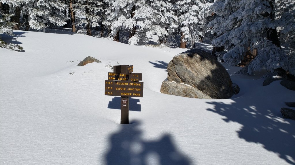
sanjacjon Uncategorized Leave a comment 13 MinutesEdit”Snow and trail update 17th March 2022″
Minor snow storms update 8th March 2022
[UPDATED 8th March: this morning I recorded a video report of conditions on the Desert Divide, specifically at Apache Peak (PCT Mile 169.5) available here.]
Back-to-back minor snow storms passed over the San Jacinto mountains on Friday 4th and Saturday 5th March. Both systems were so fragmented that it felt like one very patchy storm scattered across two days. Although the western slope, including Strawberry Valley where Idyllwild is located, was almost continuously shrouded in cloud for the two days, the high country was above the cloud for much of that time, so snow accumulations did not increase substantially with elevation.
A light snow early on the morning of Friday 4th produced one inch of snow in Idyllwild and we measured two inches of fresh snow at Saddle Junction (8070ft, PCT Mile 179) on a hike that morning. The former largely melted that afternoon however. It then rained periodically in Idyllwild that afternoon. Overnight 0.25in snow fell in Idyllwild, but the main snowfall on Saturday 5th came in the late afternoon with an intense graupel storm which deposited 3-6 inches at all elevations above 5000 ft within 2-3 hours. There was a dusting of snow down to about 4000 ft. Snow depths measured on 6th March are detailed near the foot of this post, but note that snow depth is rarely indicative of the difficulty (or otherwise) of conditions underfoot.
Early on Sunday 6th March I ascended San Jacinto Peak via Devil’s Slide, Wellman, Peak, and East Ridge trails. As usual after a patchy and unpredictable storm, I carried snowshoes, poles, crampons, ice axe, and spikes, in case I encountered a variety of challenging conditions. I had to break trail the entire way, initially just in light mountaineering boots to Saddle Junction, and then in snowshoes from there to the Peak. Snowshoeing conditions were the best of the winter so far. I was able to cruise across through a relatively thin layer of fresh powder on top of a firm layer of snow underneath. In addition graupel has such a low water content that combined with its circular shape it just falls off the shoes.
I descended Deer Springs Trail, again breaking trail almost the entire way, continuing to use snowshoes from the Peak down to about 6800ft just below the Suicide Rock Trail junction. By late morning the snow was already becoming sticky on sun-exposed slopes, and rapid melting was underway below 7500 ft. I did briefly encounter some posthole tracks (but not the hikers, oddly) near the top of Marion Mountain Trail.
This loop also facilitated survey of – and breaking trail for – the highest parts of the PCT in the San Jacinto mountains (roughly Miles 179-181 and 185.5-183) plus survey of several of its side trails.
Current conditions for individual routes are discussed in detail below where known. After a few cool days, a steady warming trend will accelerate melting. These conditions will lead to steady melting of snow and freeze-thaw cycles that will combine to change trail conditions and potentially the preferred equipment for the terrain. Although useful tracks are now in place for some major trails (discussed below), cautious navigation is strongly recommended everywhere.
I cannot overemphasize the importance of having both appropriate equipment and the right skill set for the terrain. The latter includes interpreting the snow/ice conditions, understanding your physical and mental abilities, and conservative decision making. These concerns may steadily increase over the next couple of weeks with snow undergoing multiple freeze-thaw cycles, with rising temperatures, seasonally stronger insolation, and highly variable snowmelt.
Snow conditions are currently ideal for snowshoeing everywhere above about 8000ft. With steady melting and compaction caused by freeze-thaw cycles and hiker traffic, conditions will rapidly deteriorate for snowshoeing over the next week or so. Nevertheless, snowshoes may be valuable anywhere off trail above about 8000ft for the next couple of weeks (depending on temperatures).
Spikes are currently not especially helpful, as snow is generally too soft and spikes will not enhance traction significantly. This will change over the next week or so as trails become compacted and icier with freeze-thaw cycles. Then spikes will be recommended everywhere above about 6000ft. They are generally especially valuable on well-consolidated tracks, on colder mornings when conditions are icy, and (as always) for descending and traversing. In the high country some hikers will find crampons a suitable alternative to spikes, although currently they are not necessary (except of course on the north faces of San Jac and Tahquitz).
Hikers should be prepared for temperatures generally below freezing in the high country, and often well below freezing when considering wind chill effects (see below for my recent observations from San Jacinto Peak).
The USFS gate at Humber Park closed on 22nd February. Even when closed there are nine legal parking spaces immediately below the gate. Vehicles not parked in these spaces may be ticketed and/or towed. If there are “Road Closed” signs further down – as was the case on recent weekends – then those nine spaces are also unavailable for legal parking.

WEATHER Temperatures are forecast to rise slowly to about seasonal by Saturday 12th, and then to warm rapidly to well above seasonal on 12th-15th March at least. There is the possibility of a further minor snow storm on Thursday 17th.
At San Jacinto Peak (10,810ft/3295m) on Sunday 6th March 2022 at 1045 the air temperature was 17.9°F (-8°C), with a windchill temperature of 0.3°F (-18°C), 71% relative humidity, and a steady WNW wind sustained at 7 mph gusting to 15.0 mph.
At the Peak on Monday 28th February 2022 at 0905 the air temperature was 33.8°F (1°C), with a windchill temperature of 19.2°F (-7°C), 35% relative humidity, and a persistent NNE wind sustained at 17 mph gusting to 23.5 mph.

TRAIL CONDITIONS
All trails above about 5500 ft are currently obscured by light to moderate snow. Rapidly melting and increasingly patchy snow remains in sheltered locations down to 4500 ft. Melting was already underway on 6th March and will accelerate rapidly over the next week, most prominently on sun-exposed slopes and below 8000 ft.
Hikers should anticipate encountering significant new treefall hazards, especially in vulnerable burn areas (e.g., Willow Creek Trail, PCT Miles 166-177). Storms in December 2021 left trees heavily laden with ice, and I have since found many broken tree limbs and downed trees throughout the trail system. Severe Santa Ana winds in January and February have brought down further trees and branches.
Effective Tuesday 1st February 2022 the State Park closed the section of Skyline Trail that falls within its jurisdiction, above 5800 ft elevation, “due to dangerous ice accumulation”. Long Valley Ranger Station staff have stated that the trail may not reopen before April. The State Park boundary is not marked but is near the site of the old Florian’s Cache, below Flat Rock. Very shallow snow from these latest storms on the open section of trail below 5800 ft will melt very rapidly on this exposed slope.
The 0.4 mile section of South Ridge Trail to Tahquitz Peak from Chinquapin Flat/PCT Mile 178 has no steps to follow through the steeply angled icy snow. These icy slopes are notoriously treacherous. Crampons with an ice axe (and knowledge of how to use both) are required. Snowshoes are not advised due to the angle of the icy snow. There was a fatal hiker fall here on Sunday 30th January.
Current snow cover on the PCT will become increasingly patchy from Miles 151 (Highway 74) to about 160, and remain largely continuous between Miles 160 and about 175 (Red Tahquitz), especially deep on north-facing slopes e.g., Spitler Peak (Mile 168) and Apache Peak (Mile 169.5-170). Note that in addition to the challenging north-east side of Apache Peak, the off-trail north side of the Apache saddle is also still largely snow-covered (also requiring spikes). Snow is also continuous between Miles 175-193. Snow cover will become patchy in sun-exposed areas between Miles 178 to 184 in the next few days, with the exception of the notoriously stubborn half mile just south of Annie’s Junction starting at about Mile 180.3. From Mile 183.5 to 193, snow is largely continuous, although some exposed sections of Fuller Ridge (e.g., parts of Miles 186.5-188.5) are thinning rapidly, as are areas north of Mile 191.
Devil’s Slide Trail has a well-defined posthole track to follow.
The Ernie Maxwell Trail has a well-defined snowshoe and footprint track to follow along its entire length.
My snowshoe track is well-defined from Saddle Junction to San Jacinto Peak, via the PCT, Wellman, and Peak trails. Above 10,400 ft my snowshoe track roughly follows the East Ridge Trail route.
Marion Mountain Trail has a well-defined posthole track through the snow along its entire length, however it does not follow the trail route in places.
There were no visible hiker tracks on Seven Pines or Fuller Ridge trails as of 6th March.
Deer Springs Trail has a well-defined track along its entire length. This consists of a well-traveled posthole track to the Suicide Rock turning, and then my snowshoe track from 6th to the Peak. Below Little Round Valley I (generally) made a conscious effort to accurately follow the trail route. Through and above Little Round Valley the only track is my snowshoe route down from the Peak which does not attempt to follow the trail route and is very direct and steep (and would be a challenging ascent for many).
There is well-defined posthole track on the Suicide Rock Trail through the rapidly melting snow from Deer Springs Trail.
Spitler Peak Trail will rapidly clear of snow on its lower half. Spikes will be useful for descending for about the next week. Forty downed trees, most from an ice storm in late December 2021, plus dozens of additional trunks and branches in the trail, have been removed by the Trail Report from this trail in 2022.
SNOW DEPTHS measured on 6th March 2022 are as follows. The first number is the current average total depth followed by the amount of new snow in these latest storms, with the greatest depth recorded after the storm of 22nd-23rd February given in parentheses, where known. Due to strong winds accompanying storms and widespread differential melting between snowfall events, note that there is considerable variability in snow depth. Altitudes are approximate.
San Jacinto Peak (10810 ft): 24-25 inches, 7 inches new (31-35 inches on 23rd February)
Little Round Valley (9800 ft): 24-28 inches, 6 inches new (with heavy drifting here)
Wellman Divide (9700 ft): 12 inches, 6 inches new (23 inches on 23rd February)
Annie’s Junction/approx. PCT Mile 180.8 (9070 ft): 24 inches, 8 inches new (28 inches on 23rd February)
Seven Pines Trail junction with Deer Springs Trail/approx. PCT Mile 184.9 (8700 ft): 11 inches, 5.5 inches new
Strawberry Junction/approx. PCT Mile 183 (8100 ft): 6 inches, 4-5 inches new
Saddle Junction/approx. PCT Mile 179 (8070 ft): 12 inches, 6 inches new (16 inches on 23rd February)
Devil’s Slide Trail at Humber Park (6520 ft): 4 inches, all new (was 15 inches on 23rd February)
Idyllwild (at 5550 ft): 3.5 inches, all new, rapidly melting (10.5 inches on 23rd February)
Garner Valley (at 4200 ft): <1 inch, all new, completely melted by 7th March (was 2 inches on 24th February).
Thank you for taking the time to read this. While all labor and time is volunteered, the San Jacinto Trail Report completely depends on private donations to cover operating costs. Your contribution helps to keep the Report active, free from advertising, and independent from agencies. If you have found this Report useful, please visit the Donate page. Thank you for your support.


sanjacjon Uncategorized Leave a comment 8 MinutesEdit”Minor snow storms update 8th March 2022″
Snow, trail and weather update 1st March 2022
[UPDATE Saturday 5th March @ 1745: having had negligible precipitation all day we are in the middle of a relatively brief but intense graupel storm. At Humber Park (6300ft) just now I measured 1.5 inches that has accumulated in the past hour, but it is forecast to continue snowing heavily for at least another hour. The next comprehensive Report will be tomorrow afternoon, Sunday 6th March.]
[UPDATE Friday 4th March @ 1835: a dusting of snow early this morning produced one inch of snow in Idyllwild, which then largely melted in the afternoon. We measured 2.0in fresh snow at Saddle Junction (8070ft, PCT Mile 179) on our hike this morning, for a total depth there of about 10 inches. It rained on/off in Idyllwild this afternoon, but the high country was above the cloud for much of the day, with a scant 1.5in of snow falling in Long Valley (8600ft). Similar light snow is expected tomorrow. There is no significant change to the equipment recommendations discussed below.]
Conditions immediately after the moderate storm of 22nd-23rd February were summarised in the previous Report. Snowmelt has been very rapid in recent days even by our Southern California standards, and small patches of lower Devil’s Slide Trail around 6600 ft elevation were clear of snow before dawn on 28th February where I had measured 12-15 inches of snow just five days earlier. Similarly sun-exposed areas around San Jacinto Peak and Wellman Divide had already lost nearly one foot of snow knee photos below). Snow depths measured on 28th February are detailed near the foot of this post, but note that snow depth is rarely indicative of the difficulty (or otherwise) of conditions underfoot.
Early on Monday 28th February I ascended via Devil’s Slide, Wellman, Peak, and East Ridge trails to San Jacinto Peak – in boots with excellent traction – without needing spikes (although I always carry them in winter). Hikers less familiar with very uneven (and at times icy) snow travel will prefer to use the latter. I descended Deer Springs Trail, using snowshoes from the Peak down to Strawberry Junction at 8100ft, initially because the trail had not been broken from 10,700 ft down to about 9400 ft. This loop also facilitated survey of the highest parts of the PCT in the San Jacinto mountains (roughly Miles 179-181 and 185.5-183) plus several of its side trails. Since 25th February I have also hiked PCT Miles 151-154 and many miles near Mile 165 to assess conditions in those area also.
Current conditions for individual trails are discussed in detail below where known. Note that trail conditions will change significantly in multiple ways over the next week or two. A few days of very warm sunny weather will accelerate the already rapid melting underway. Then some further fresh snowfall is now expected around 4th-6th March (at least). The latter will be accompanied by cold temperatures that will persist for a few days after the snowfall. Finally a period of roughly seasonal temperatures will lead to steady melting of snow and freeze-thaw cycles that will combine to change trail conditions yet again and potentially the preferred equipment for the terrain.
Recently I have mentioned the challenges of hard, icy snow underfoot and the value of using spikes especially for descending and traversing. Snow at all elevations will become increasingly firm and icy following multiple freeze-thaw cycles, and I cannot overemphasize the importance of having both appropriate equipment and the right skill set for the terrain. The latter includes interpreting the snow/ice conditions, understanding your physical and mental abilities, and conservative decision making. These concerns may steadily increase over the next couple of weeks with dramatically rising then falling temperatures, seasonally stronger insolation, and highly variable snowmelt.
Although useful tracks are now in place for some major trails (discussed below), cautious navigation is strongly recommended everywhere. Light snowfall possible around 4th-6th March, accompanied by strong winds and extensive drifting, may well be of sufficient depth to obscure some of the existing tracks in the high country.
Spikes are strongly recommended for the foreseeable future everywhere above about 6000ft, potentially lower on colder days and following fresh precipitation. They are especially valuable on well-consolidated tracks, on colder mornings when conditions are icy, and (as always) for descending and traversing. In the high country some hikers will find crampons a suitable alternative to spikes, although currently they are not strictly necessary (except on the known challenging north faces of San Jac and Tahquitz).
Snow conditions are currently ideal for snowshoeing everywhere above about 8000ft but generally not on compacted, well-traveled, or postholed trails. With steady melting already well advanced and compaction caused by freeze-thaw cycles and hiker traffic, conditions will rapidly deteriorate for snowshoeing over the next couple of days, before then potentially becoming more useful again after fresh snowfall. Nevertheless, snowshoes may be valuable anywhere off trail above about 8000ft for the foreseeable future.
Hikers should be prepared for temperatures below or near freezing in the high country, and generally well below freezing when considering wind chill effects (see below for my recent observations from San Jacinto Peak).
Snow depth and structure are both currently insufficient for significant avalanche risk in the high country, with the exception of the traditionally unstable north face of San Jacinto Peak (and possibly the north face of Tahquitz Peak). Some interesting wind slabs that I dislodged on my descent on 23rd have melted and/or stabilized.
The USFS gate at Humber Park closed on 22nd February. Even when closed there are nine legal parking spaces immediately below the gate. Vehicles not parked in these spaces may be ticketed and/or towed. If there are “Road Closed” signs further down – as was the case at the weekend – then those nine spaces are also unavailable for legal parking. Exercise considerable caution when parking anywhere in this area especially during snowy weekends.
WEATHER Temperatures have steadily warmed over the past couple of days and will be above seasonal on 1st-3rd March, with continued rapid and extensive melting of snow expected. Temperatures will then drop quickly to below seasonal from 4th March onwards, with unsettled conditions expected. Especially cold conditions are forecast for the high country on 4th-7th March with moderate snowfall possible above about 4500 ft from the evening of Thursday 3rd to Sunday 6th March. Current forecasts are for about 2-3 inches of snow in Idyllwild increasing to 6-10 inches around the highest peaks, mainly on Friday 4th.
At San Jacinto Peak (10,810ft/3295m) on Monday 28th February 2022 at 0905 the air temperature was 33.8°F (1°C), with a windchill temperature of 19.2°F (-7°C), 35% relative humidity, and a persistent NNE wind sustained at 17 mph gusting to 23.5 mph.
At the Peak on Tuesday 22nd February 2022 at 1130 the air temperature was 12.6°F (-11°C), with a windchill temperature of -16.4°F (-27°C), 93% relative humidity, and a bitter WSW wind sustained at 21 mph gusting to 33.1 mph.
At the Peak on Monday 21st February 2022 at 0855 the air temperature was 20.1°F (-7°C), with a windchill temperature of -3.6°F (-20°C), 36% relative humidity, and a brutal due West wind sustained at 25 mph gusting to 32.2 mph.

TRAIL CONDITIONS
All trails above about 6500 ft are largely or completely snow-covered. Increasingly patchy snow remains in sheltered locations down to 4500 ft. Melting has been very rapid at all elevations since 25th February, most prominently on sun-exposed slopes and below 8000 ft.
Hikers should anticipate encountering significant new treefall hazards, especially in vulnerable burn areas (e.g., Willow Creek Trail, PCT Miles 166-177). Storms in December 2021 left trees heavily laden with ice, and I have since found many broken tree limbs and downed trees throughout the trail system. Severe Santa Ana winds in January and February have brought down further trees and branches.
Effective Tuesday 1st February 2022 the State Park closed the section of Skyline Trail that falls within its jurisdiction, above 5800 ft elevation, “due to dangerous ice accumulation”. Long Valley Ranger Station staff have stated that the trail may not reopen before April. The State Park boundary is not marked but is near the site of the old Florian’s Cache, below Flat Rock. Snow on the open section of trail below 5800 ft will melt very rapidly on this exposed slope.
The 0.4 mile section of South Ridge Trail to Tahquitz Peak from Chinquapin Flat/PCT Mile 178 has no steps to follow through the steeply angled icy snow. These icy slopes are notoriously treacherous. Crampons with an ice axe (and knowledge of how to use both) are required. Snowshoes are not advised due to the angle of the icy snow. There was a fatal hiker fall here on Sunday 30th January.
Current snow cover on the PCT is increasingly patchy from Miles 151 (Highway 74) to about 160, and largely continuous between Miles 160 and about 175 (Red Tahquitz), especially deep on north-facing slopes e.g., Spitler Peak (Mile 168) and Apache Peak (Mile 169.5-170). Note that in addition to the challenging north-east side of Apache Peak, the off-trail north side of the Apache saddle is also still largely snow-covered (also requiring spikes). Snow is also continuous between Miles 175-193. Snow cover will become patchy in sun-exposed areas between Miles 178 to 184 in the next few days, with the exception of the notoriously stubborn half mile just south of Annie’s Junction starting at about Mile 180.3. From Mile 183.5 to 193, snow is largely continuous, although some exposed sections of Fuller Ridge (e.g., parts of Miles 186.5-188.5) are thinning rapidly, as are areas north of Mile 191.
Devil’s Slide Trail has a well-traveled compacted track to follow.
The Ernie Maxwell Trail has a well-defined snowshoe and footprint track to follow along its entire length (thanks to Anne and Anabel for this information from 28th February).
There are no tracks from Saddle Junction out on the Willow Creek Trail. There are well-traveled snowshoe tracks heading toward Reed’s Meadow and Chinquapin Flat however.
The Peak Trail has a well-defined, but very uneven, posthole track from Wellman Divide to about 10,400 ft elevation near Miller Peak, which vaguely follows the trail route and my snowshoe track from 23rd February. However there are multiple tracks, some snowshoe and some posthole, for the 0.5 mile between 9900 ft and 10,100 ft, none of which accurately follow the trail route, and cautious navigation is required. Above 10,400 ft the Peak Trail has not been broken, and there is only a posthole track directly up the East Ridge.
There are two well-defined snowshoe tracks from Long Valley towards San Jacinto Peak, one following the “Sid Davis Trail” and then directly up from Tamarack Valley, and another that roughly follows the Round Valley Trail route emerging near Wellman Divide.
Marion Mountain Trail has a well-traveled track through the snow along its entire length, however it does not follow the trail route in places, especially near Deer Springs Trail.
There were no visible hiker tracks on Seven Pines or Fuller Ridge trails as of 28th February.
Deer Springs Trail has increasingly patchy snow below the Suicide Rock Trail junction, but almost continuous snow above that. There is a generally excellent snowshoe and posthole track to follow through the snow to about 9400 ft (about one mile below Little Round Valley) which largely follows the established trail route. Through and above Little Round Valley the only track is my snowshoe route down from the Peak on 28th February which is very direct and steep (and would be a challenging ascent for many).
There is well-defined track on the Suicide Rock Trail through the patchy snow from Deer Springs Trail.
Spitler Peak Trail [updated 2nd March] is clear of snow for its lower half, and the upper half has less than 10% snow cover. Most hikers will not need spikesfor the handful of snow patches that remain.

SNOW DEPTHS measured on 28th February 2022 are as follows. The first number is the current average depth, including the snow remaining from storms in late December (and from 15th February at higher elevations) while the greatest depth immediately after the storm on 22nd-23rd February is given in parentheses, where known. Due to strong winds accompanying storms and widespread differential melting between snowfall events, note that there is considerable variability in snow depth. Altitudes are approximate.
San Jacinto Peak (10810 ft): 20-24 inches (31-35 inches on 23rd February)
Little Round Valley (9800 ft): 24-30 inches (heavy drifting here)
Wellman Divide (9700 ft): 12 inches (23 inches on 23rd February)
Annie’s Junction/approx. PCT Mile 180.8 (9070 ft): 20 inches (28 inches on 23rd February)
Seven Pines Trail junction with Deer Springs Trail/approx. PCT Mile 184.9 (8700 ft): 11 inches
Strawberry Junction/approx. PCT Mile 183 (8100 ft): 6 inches
Saddle Junction/approx. PCT Mile 179 (8070 ft): 11 inches (16 inches on 23rd February)
Devil’s Slide Trail at Humber Park (6520 ft): 0-8 inches (was 15 inches on 23rd February)
Idyllwild (at 5550 ft): 0-3 inches (10.5 inches on 23rd February)
Mountain Center (4400 ft): 0-2 inches (was 4-5 inches on 24th February)
Garner Valley (at 4200 ft): 0 inches (was 2 inches on 24th February).
Thank you for taking the time to read this. While all labor and time is volunteered, the San Jacinto Trail Report completely depends on private donations to cover operating costs. Your contribution helps to keep the Report active, free from advertising, and independent from agencies. If you have found this Report useful, please visit the Donate page. Thank you for your support.

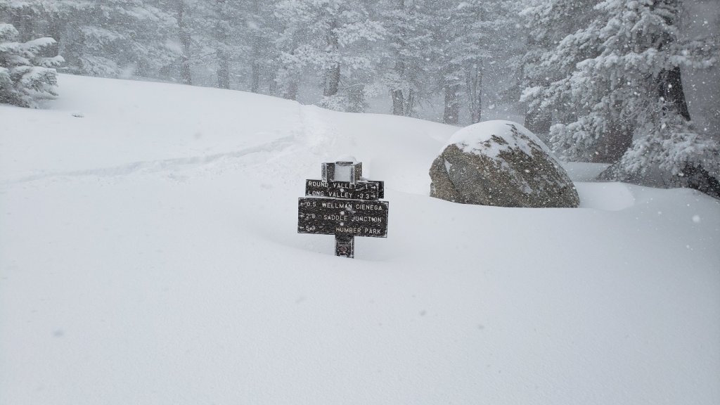

sanjacjon Uncategorized Leave a comment 9 MinutesEdit”Snow, trail and weather update 1st March 2022″
Snow storm summary 23rd February 2022
This is a brief summary of conditions following the second snow storm in February 2022. This storm proved to be unexpectedly significant, and may well prove to be the most substantial of this winter.
It started snowing very lightly at mid elevations on the morning of Tuesday 22nd, with the high country initially above the cloud. Snow started falling at San Jacinto Peak in early afternoon, getting steadily heavier throughout the night. Although originally forecast to stop snowing on the morning of Wednesday 23rd, it continued off-and-on until late afternoon at all elevations.
Snowfall totals were well above the upper end of forecasts, especially for the high country where I measured snow depths generally double what had been expected. To be fair to the meteorological community, they don’t get this stuff too wrong, too often (at least in Southern California).
With such a cold storm, the snow was exceptionally fine, light, and dry, some of the best powder I have ever seen up here. The quality was more typical of continental snow (as in the Rockies) rather than the maritime snow more typical of California and the Cascades.
Snow depths measured on my descent this afternoon are listed at the foot of this posting. However because of the extremely light powder, in combination with very strong winds before, during, and after the snowfall, there is massive drifting everywhere, and in particular drifts are deep in the trails where snow tends to accumulate.
Snow level was initially down to about 4500 ft on the eastern slope (Skyline Trail) but then fell during the course of Wednesday much lower, with a dusting down to 2500 ft on the Maynard Mine Trail (many thanks to Florian Boyd for these observations from the Palm Springs side).
Currently no major trails have been traveled and all are totally obscured by snowfall and heavily drifted snow. My tracks from this afternoon descending from San Jacinto Peak via the East Ridge, Peak, Wellman, and Devil’s Slide trails will have already been largely obliterated by drifting snow (and in some places I did not follow the established trail routes). There were no other tracks anywhere above Humber Park, not even on lower Devil’s Slide Trail. Extremely cautious navigation is strongly recommended everywhere.
Snowshoes are very strongly recommended for at least the next few days everywhere above at least 6000 ft (lower in places), and in the high country for the foreseeable future (at least for off trail travel once trail routes become established). Spikes will become increasingly useful above 4000 ft as trails become more heavily traveled and hence compacted, and as they become icy with freeze-thaw cycles as temperatures warm. By next week spikes may only be needed above about 6000 ft.
Note that a return to unseasonably warm temperatures is forecast within a few days. This will lead to significant melting, especially on sun-exposed slopes and below 9000 ft, plus freeze-thaw cycles which will combine to steadily change trail conditions and, in places, the preferred equipment for the terrain. While trails are currently under deep snow, by next week be prepared for very icy trails (especially mornings) but also very wet, slushy trails especially on sun-exposed mid elevation slopes (e.g., lower Deer Springs and Devil’s Slide trails).
Hikers should be prepared for temperatures below or near freezing in the high country, and generally well below freezing when considering wind chill effects (see below for my recent observations from San Jacinto Peak).
The USFS gate at Humber Park was closed on Tuesday 22nd February.
WEATHER Temperatures will be well below seasonal (i.e. very cold) for the next few days, before rapidly warming to well above seasonal starting 28th February and lasting for the first few days of March.
At San Jacinto Peak (10,810ft/3295m) on Tuesday 22nd February 2022 at 1130 the air temperature was 12.6°F (-11°C), with a windchill temperature of -16.4°F (-27°C), 93% relative humidity, and a bitter WSW wind sustained at 21 mph gusting to 33.1 mph.
At the Peak on Monday 21st February 2022 at 0855 the air temperature was 20.1°F (-7°C), with a windchill temperature of -3.6°F (-20°C), 36% relative humidity, and a brutal due West wind sustained at 25 mph gusting to 32.2 mph.
SNOW DEPTHS measured on 23rd February 2022 are as follows. The first number is the current average depth, including the snow remaining from storms in late December (and from 15th February at higher elevations) while the new snow added in this latest storm is given in parentheses. Due to strong winds accompanying this and previous storms, and widespread differential melting between snowfalls events, note that there is huge variability in snow depth. Altitudes are approximate.
San Jacinto Peak (10810 ft): 33-37 inches (20 inches added 22nd-23rd February)
Wellman Divide (9700 ft): 25 inches (18 inches added 22nd-23rd February)
Annie’s Junction/approx. PCT Mile 180.8 (9070 ft): 28 inches (18 inches added 22nd-23rd February)
Saddle Junction/approx. PCT Mile 179 (8070 ft): 15-16 inches (15 inches added 22nd-23rd February)
Devil’s Slide Trail at Humber Park (6520 ft): 15 inches (all added 22nd-23rd February)
Idyllwild (at 5550 ft): 10.5 inches (all added 22nd-23rd February).
Mountain Center (4400 ft): 4-5 inches (all added 22nd-23rd February, melting rapidly by 25th).
Garner Valley (4200 ft): 2 inches (all added 22nd-23rd February, melting rapidly by 25th).
Thank you for taking the time to read this. While all labor and time is volunteered, the San Jacinto Trail Report completely depends on private donations to cover operating costs. Your contribution helps to keep the Report active, free from advertising, and independent from agencies. If you have found this Report useful, please visit the Donate page. Thank you for your support.


sanjacjon Uncategorized Leave a comment 4 MinutesEdit”Snow storm summary 23rd February 2022″
Weather and snow update 21st February 2022
[UPDATE Wednesday 23rd February 2022 at 0800: I have posted a short video from San Jacinto Peak (available here) discussing current knowledge of conditions after the overnight snowstorm.]
[UPDATE Wednesday 23rd February 2022 at 0650: Snowfall in the high country was well above forecast with initial measurements around 20 inches fresh powder at San Jacinto Peak (on top of an average of 12 inches already on the ground). It is some of the finest, lightest powder I have ever seen up here. Snow depth in Idyllwild is almost exactly as expected at about 8 inches (thank you Anne). On the eastern slope, snow fell down to 4500ft on Skyline Trail (thank you Florian).]
[UPDATE Tuesday 22nd February 2022 at 1940: It started snowing very lightly between 6000-9000ft at 0730 this morning. The high country was initially largely above the cloud, but it started snowing at San Jacinto Peak after 1230, getting heavier throughout the afternoon (about 5.0in accumulation so far). Air temperature at 1130 was 12°F, with a windchill of -16.4°F (-27°C). Snow accumulation in Idyllwild (at 5550ft) is currently 2.0in.]
Warm and sunny conditions in the past few days have largely melted the light snowfall from 15th February from exposed slopes and from much of the trail system below 8600 ft. Consequently trail and overall snow conditions on Monday 21st looked remarkably similar to 14th February. This will change on Tuesday 22nd when another minor storm will cover all tracks again, with 5-9 inches of snow expected at mid and upper elevations, accompanied by severe winds.
Multiple hiker falls already this year in the San Jacinto mountains, including one fatality, demonstrate the critical importance of having both appropriate equipment and the right skill set for the terrain. The latter includes interpreting the snow/ice conditions, understanding your physical and mental abilities, and conservative decision making. Further snowfall expected on 22nd February will make conditions more complex as underlying icy areas are obscured, and as hiking traction devices struggle to grip through the surface powder into the harder icy snow below.
Early on Monday 21st February we ascended via Devil’s Slide, Wellman, Peak, and East Ridge trails to San Jacinto Peak, needing spikes only for the final three hundred feet of ascent on the East Ridge as the route was disappearing under spectacular spindrift in a very strong and gusty wind (sustained close to 30mph) near the Peak. We descended via Deer Springs Trail, and spikes were useful down to about 8700ft on the largely icy, compacted track. Hikers with a lower comfort level on snow and ice will find spikes useful more widely.
In addition to multiple ascents of San Jacinto Peak by different routes in recent days we have also surveyed South Ridge Trail, several segments of the PCT and its side trails, plus multiple Forest roads. Current conditions for individual trails are discussed in detail below where known. Again, these will change first with fresh snowfall expected on 22nd, followed by rapid melting into the first week of March.
Spikes are useful almost everywhere above about 7700ft as snow on trails can be icy following weeks of freeze-thaw cycles (and where compacted by hiker traffic). Spikes are especially valuable for traversing and for descending.
Trails remain snow-covered above 9000 ft, with thinning and increasingly patchy snow down to about 7700ft, and generally clear below that elevation (with some notable exceptions at lower elevations on the PCT). Overall snow conditions on the trails are already more typical of April or May than February. These conditions will change over the next few days with minor snowfall expected in the high country.
Thereafter warm, dry weather is forecast with temperatures well above seasonal at all elevations starting on 28th February. Rapid melting of snow and freeze-thaw cycles will combine to change trail conditions yet again and potentially the preferred equipment for the terrain.
Snow from 15th February, overlying the remaining icy snow from December 2021, has melted rapidly. Snow depths measured on 21st are detailed at the foot of this post.
Hikers should be prepared for temperatures near or below freezing in the high country, and well below freezing when considering wind chill effects (see below for my recent weather observations from San Jacinto Peak). Forecast temperatures for the high country for 22nd-23rd February are dangerously cold.
May Valley Road was closed by Forest Service to all traffic, including foot traffic, on Friday 28th January due to hazardous trees. USFS social media states “there currently is no timeline for the road’s reopening”. There was minimal evidence of significant work in progress by 18th February.
The USFS gate at Humber Park reopened on 21st January having been closed since 13th December 2021. South Ridge Road (5S11) reopened in the second week of February. It is expected that both will close again on 22nd February following the fresh snowfall.
According to the Forest Service website the following USFS roads are in winter closure (for vehicle traffic only): Black Mountain (4S01), San Jacinto Truck Trail (5S09), Dark Canyon (5S02), and Santa Rosa (7S02).
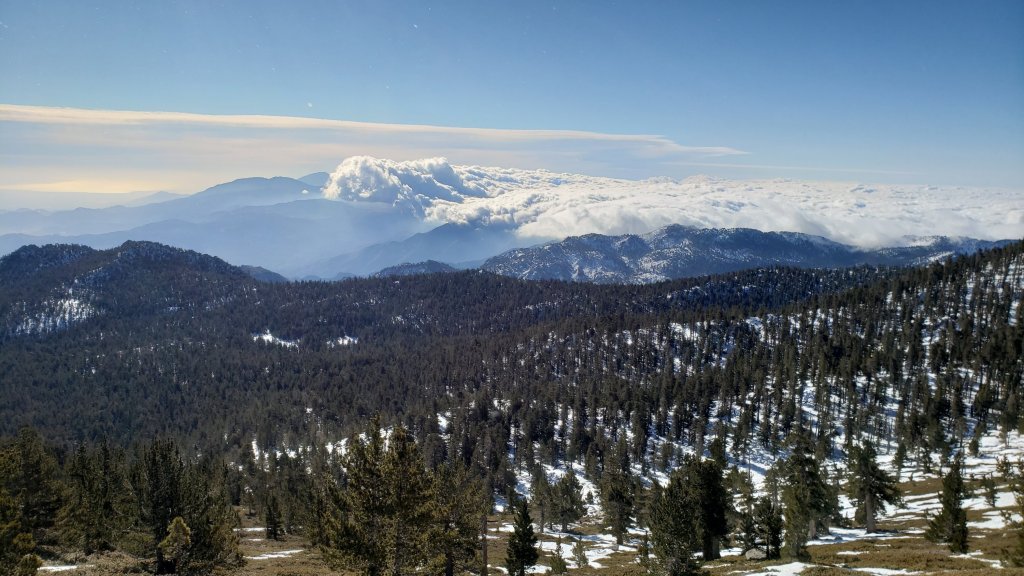
WEATHER
In a very similar pattern to last week relatively warm temperatures over the weekend will rapidly drop to below seasonal with the passage of a brief but energetic (although not very moist) storm system on 21st-23rd February. Strong winds and very cold temperatures will accompany light snowfall, the latter expected mainly on the night of Tuesday 22nd, with 4-9 inches of snow forecast at various elevations in Idyllwild-Pine Cove and 6-9 inches in the high country (note that the high country may be above the cloud for longer, hence the similar snowfall totals). The freeze level will be down to 3500 ft so at least some snow is expected at almost all elevations of the PCT in the San Jacinto mountains.
Temperatures will yet again climb dramatically to well above seasonal by 28th February. Current forecast temperatures for San Jacinto Peak on 1st March, more than five degrees Centigrade above freezing, would be at or near a record high for the Peak in March.
January 2022 was the driest January in recorded history in the San Jacinto high country, with only 0.75in of fresh snow falling at San Jacinto Peak, and among the driest ever recorded in Idyllwild.
At San Jacinto Peak (10,810ft/3295m) on Monday 21st February 2022 at 0855 the air temperature was 20.1°F (-7°C), with a windchill temperature of -3.6°F (-20°C), 36% relative humidity, and a brutal due West wind sustained at 25 mph gusting to 32.2 mph.
At the Peak on Wednesday 16th February 2022 at 0955 the air temperature was 20.3°F (-7°C), with a windchill temperature of -0.2°F (-18°C), 74% relative humidity, and a stiff due North wind sustained at 12 mph gusting to 21.1 mph.
TRAIL CONDITIONS
Trails below about 7600ft are now generally clear of snow, snow cover is increasingly patchy below 9000ft, and remains largely continuous everywhere above 9000ft. Icy snow from December 2021, with fresh powder from 15th February, persists at elevations below 7700ft in particular on shaded north and north-east slopes (e.g., Red Tahquitz, Tahquitz, Apache, and Spitler peaks, and Antsell Rock).
Hikers should anticipate encountering significant new treefall hazards, especially in vulnerable burn areas (e.g., Willow Creek Trail, PCT Miles 166-177). Storms in December 2021 left trees heavily laden with ice, and I have since found many broken tree limbs and downed trees throughout the trail system. Severe Santa Ana winds in January and February have brought down further trees and branches.
Effective Tuesday 1st February 2022 the State Park closed the section of Skyline Trail that falls within its jurisdiction, above 5800 ft elevation, “due to dangerous ice accumulation”. Long Valley Ranger Station staff are speculating that the trail may not reopen before April. The State Park boundary is not marked but is near the site of the old Florian’s Cache, below Flat Rock. Signage was posted at the relevant trailheads on 3rd February.
The 0.4 mile section of South Ridge Trail to Tahquitz Peak from Chinquapin Flat/PCT Mile 178 has no steps to follow through the steeply angled icy snow [updated 20th February]. These icy slopes are notoriously treacherous. Crampons with an ice axe (and knowledge of how to use both) are required. There was a fatal hiker fall here on Sunday 30th January.
Current snow cover on the PCT is patchy between Miles 168 and about 175 (Red Tahquitz), largely confined to certain north- or east-facing slopes e.g., Spitler Peak (Mile 168), Apache Peak (Mile 169.5), and Antsell Rock (Mile 171-172). Although limited, some of these chutes and slopes are challenging and spikes are strongly recommended. Snow is then largely continuous between Miles 175-179 (to near Saddle Junction). Snow on the Trail is limited to about Mile 184.5, except for a stubborn section of 0.5 mile approaching Annie’s Junction (Mile 180.8) which is always among the last areas to clear every spring. Most of Miles 184-191 is snow-covered, although some exposed sections of Fuller Ridge (e.g., Miles 186.5-188.5) are clearing rapidly.
Devil’s Slide Trail is now functionally clear of icy snow to about 7700ft, and then with about 50% cover to Saddle Junction (mainly near the latter). Some hikers will find spikes useful on the upper trail, especially for descending.
South Ridge Trail (south of Tahquitz Peak) is functionally clear of snow up to Old Lookout Flat (7600ft). Icy snow cover is about 5% to near Tahquitz Peak, increasing to about 35% on the uppermost half-a-dozen switchbacks. The middle section of South Ridge Trail (between May Valley Road and the top of South Ridge Road) has several trees down which are significant obstructions (surveyed February 2022).
The predominant compacted tracks on the Peak Trail from Wellman Divide to near Miller Peak now generally approximate to the trail route. Icy snow cover remains >95%. Above 10,400ft most tracks form a compacted posthole route up the East Ridge. However the route of the Peak Trail also has a lightly used track, which is challenging in one short section before Summit Junction (spikes recommended). The Round Valley Trail has well-traveled tracks to follow from Long Valley to Wellman Divide.
Marion Mountain Trail is functionally clear of snow to about 7500ft. Icy snow cover is 40% from 7500-8200ft. From 8200ft to Deer Springs Trail (at 8700ft) snow cover is only about 30%. Most hikers will find spikes useful for ascending parts of the upper half of the trail, and they are invaluable for descending in the same areas. There is one huge new treefall hazard across the trail exactly at the State Park/Forest Service boundary.
Unsurprisingly, there continue to be no visible hiker tracks on the upper sections of Fuller Ridge and Seven Pines trails.
Deer Springs Trail is functionally clear of snow to Strawberry Junction at 8100ft. From there to 8700ft (0.2 mile south of Marion Mountain Trail) snow cover is barely 10%. Thereafter snow cover is nearly continuous, with a few minor clear patches developing. Spikes are useful, especially for descending. [Three new trees came down in late 2021 on the PCT/Deer Springs Trail just south of its junction with Marion Mountain Trail, but they are readily passable for hikers.] Through Little Round Valley and on up to the Peak the track is direct and does not follow the trail route. Cautious navigation is required as there are many alternative tracks meandering across this icy snow slope.
The Strawberry Trail between Annie’s and Strawberry junctions (roughly PCT Miles 181-183) is very sun-exposed and is largely clear of snow.
The Caramba Trail from near Reeds Meadow through Laws Camp and on to Caramba, and the Cedar Trail from Willow Creek Trail to Laws, are optimistically described by the Forest Service as “not maintained”. In reality both trails no longer exist and are so heavily overgrown I advise hikers do not attempt to follow them. An informal use trail to Laws is much more direct and avoids all of the very challenging bush-whacking of the unmaintained trails (some local hikers dubbed it the “King Trail” when I established the route in 2019). It leaves the Willow Creek Trail exactly 1.0 mile from Saddle Junction (0.46 mile from the Skunk Cabbage turning), descending largely on established deer trails for 1.2 miles, meeting Willow Creek just upstream from the old Laws Camp. From Laws east to Caramba the route of the original Caramba Trail has been well-cairned by myself and others and can largely be followed with careful route-finding. My February 2022 survey counted 97 trees down on this 2.1 mile trail. It is especially obscure 0.1-0.3 mile east of the Willow Creek crossing, generally becoming clearer near Caramba. Cautious navigation is advised throughout the area. The King Trail still has 50% icy snow cover (spikes required), but the Caramba Trail east of Willow Creek is clear of snow (10th February survey).
Spitler Peak Trail is largely clear of snow. Nearly 40 downed trees from ice storms in December 2021, plus dozens of additional trunks and branches in the trail, were removed by the Trail Report in January 2022. Further trail trimming continues steadily.
The rockslide at PCT Mile 172.5, just north of Antsell Rock, was removed on 14th June 2021. My “before, during, and after” video is available here. This section of the PCT is now safer and is narrow but readily passable with care by hikers (but remains impassable by stock).
Due to greatly reduced maintenance work by the agencies and PCTA during the coronavirus pandemic, many trails have accumulated treefall hazards since late 2019, passable with care by hikers but not for stock. Although reported promptly, regrettably neither Forest Service nor State Park were quick to remove most hazards in 2021. With recent storms being accompanied by strong winds and heavy ice loads, hikers will encounter some new and additional hazards. Some are described above and below, others include the PCT between Strawberry Cienega and Strawberry Junction (PCT Miles 182-183, at least 7 trees down), and Fuller Ridge Trail near its northern end (PCT Miles 189.1-190.2, three trees).
Willow Creek Trail, resurveyed on 11th February 2022, has at least 40 downed trees between Skunk Cabbage Junction and Hidden Divide. Nearly 30 of these are on the Forest Service section.
Many treefall hazards from Red Tahquitz to Antsell Rock (PCT Miles 172.5-175) were cleared in June 2021 prior to the rockslide removal work mentioned above. Nevertheless more than 20 remain, including at least six major obstructions for hikers. Tahquitz Creek to Red Tahquitz (PCT Miles 175-177) was cleared in early June 2021. All of this section has added new treefall hazards this winter.
Seven Pines Trail has had very limited hiker traffic since November 2018, largely because Dark Canyon Road was closed from February 2019 to early October 2021, and again since December 2021. The Trail Report has “adopted” Seven Pines Trail as a priority for maintenance work as the trail has had a disproportionate number of lost hiker rescues in recent years. Starting in November 2021, 42 treefall hazards on the lower 3.0 miles of trail have been removed. Almost all of this section has also been thoroughly trimmed and cleared, and the trail is now obvious and easy to follow for much of its length (when clear of snow). However at least 18 downed trees remain on the upper 0.7 mile of trail, the route is very obscure in places, and cautious navigation is required especially for those who are not very familiar with hiking this trail. Dark Canyon campground remains closed.
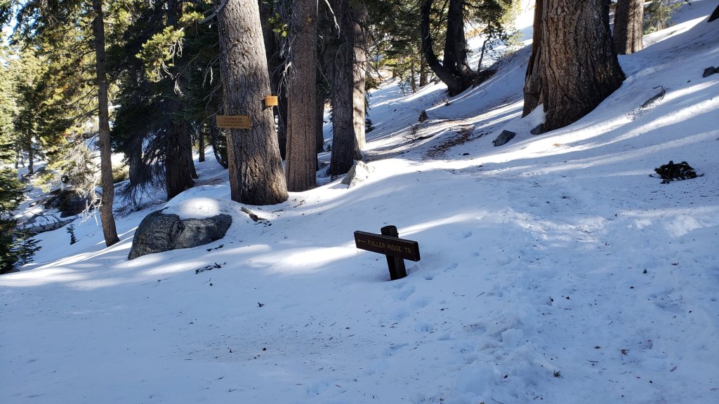
SNOW DEPTHS measured on 21st February 2022 are as follows. The first number is the current average depth, with the snow depth recorded on 31st December 2021 (to date the greatest snow depth of the season) following in parentheses. Note that average depth is given; due to strong winds accompanying some of the storms, and differential melting, there is considerable drifting and variability. Altitudes are approximate.
San Jacinto Peak (10810ft): 12-13 inches (was 30 inches on 31st December)
Little Round Valley (9800ft): 9-10 inches (was 25 inches on 31st December)
Wellman Divide (9700ft): 5 inches (was 26 inches on 31st December)
Annie’s Junction/approx. PCT Mile 181.8 (9070ft): 10 inches (was 23 inches on 31st December)
Deer Springs Trail at junction with Seven Pines Trail/PCT Mile 184.9 (8700ft): 7 inches (was 11 inches on 31st December)
Strawberry Junction/PCT Mile 183 (8100ft): 0 inches (was 8 inches on 31st December)
Saddle Junction/approx. PCT Mile 179.9 (8070ft): 0-1 inches (was 12 inches on 31st December).
Devil’s Slide Trail at Humber Park (6520ft): 0 inches (was 7 inches on 31st December)
Idyllwild (at 5550ft): 0 inches (was 6.5 inches on 31st December)
Thank you for taking the time to read this. While all labor and time is volunteered, the San Jacinto Trail Report completely depends on private donations to cover operating costs. Your contribution helps to keep the Report active, free from advertising, and independent from agencies. If you have found this Report useful, please visit the Donate page. Thank you for your support.
sanjacjon Uncategorized Leave a comment 11 MinutesEdit”Weather and snow update 21st February 2022″
Minor snow storm summary 16th February 2022
This is a brief summary of conditions following the only snow storm so far in February 2022 (and only the second storm of the calendar year to date). For full details of trail closures, Forest road closures, trail conditions (other than their current snow situation), and weather, please see the previous Report linked here.
The snowfall overnight was at the upper end of forecast projections. Snow depths measured today are listed at the foot of this posting, but note that due to strong winds associated with the storm (that continued today) drifted snow is often deeper in the trails themselves.
As is increasingly the trend with a rapidly changing climate in recent years, there was little difference in snowfall between the mid and upper elevations, with 2.25 inches measured in Idyllwild (at 5550ft) through to 5.0 inches at San Jacinto Peak (10,810ft). The storm system was colder than forecast at lower elevations, with a dusting of snow down to about 4000ft.
Early this morning we broke trail through light snow from Devil’s Slide to San Jacinto Peak via the PCT, Wellman, and Peak trails, descending the same way. Based on the anticipated snow conditions and depths I carried crampons, ice axe, and spikes. I did not use the latter, but eventually put on crampons at 9300 ft on the ascent, using them down to about 8800 ft on the descent. Crampons were essential as underlying icy snow areas were obscured by the fresh powder, and only crampons could grip through the surface powder into the harder icy snow below.
By early afternoon very rapid melting was already underway below 9000 ft and on sun-exposed slopes. Parts of the PCT north of Saddle Junction, and much of Devil’s Slide Trail below 7700 ft, both of which had had a solid covering of several inches of fresh snow in the morning, were already clear by this afternoon. Conversely above 9000 ft many of my tracks from the morning were already disappearing under spindrift in persistent gusty winds.
Spikes are recommended for at least the next few days everywhere above about 6000 ft, and in the high country for the foreseeable future. As described above crampons are recommended for many areas above about 9000 ft for at least the next few days. Anywhere that crampons are needed, an ice axe is also needed (along with the knowledge of how to use this equipment). Snow depths are currently insufficient for snowshoeing even in the high country. Indeed snowshoes are potentially dangerous in any angled terrain at present due to the presence of underlying ice.
Note that relatively warm temperatures are forecast for the next few days. This will lead to significant melting and freeze-thaw cycles which will combine to steadily change trail conditions and, in places, the preferred equipment for the terrain. Be prepared for very icy trails (especially mornings) but also very wet, slushy trails (as was the case this afternoon on Devil’s Slide).
Currently very few major trails have been traveled and all are completely or largely obscured by snowfall and/or drifting snow. On my descent early this afternoon mine were the only tracks beyond Saddle Junction. The significance of this is that there are currently no tracks on Willow Creek Trail, to Chinquapin Flat or Tahquitz Peak, or around the meadows. Beyond Saddle Junction, at the time of writing my posthole tracks to San Jacinto Peak are the only traveled high country trail. Cautious navigation is strongly recommended everywhere.
Hikers should be prepared for temperatures below or near freezing in the high country, and generally well below freezing when considering wind chill effects (see below for conditions at San Jacinto Peak today).
The USFS gate at Humber Park remains open and the parking area was already essentially clear of snow by the afternoon of 16th.
WEATHER For details of the forecast for the next week or so, please see the previous Report.
At San Jacinto Peak (10,810ft/3295m) on Wednesday 16th February 2022 at 0955 the air temperature was 20.3°F (-7°C), with a windchill temperature of -0.2°F (-18°C), 74% relative humidity, and a stiff due North wind sustained at 12 mph gusting to 21.1 mph.
SNOW DEPTHS measured on 16th February 2022 are as follows. The first number is the current average depth, with most of the snow remaining from storms in late December, while the new snow added in this latest storm given in parentheses. Due to strong winds accompanying this and previous storms, and rapid and differential melting, there is considerable variability in snow depth. Altitudes are approximate.
San Jacinto Peak (10810 ft): 17 inches (5 inches added on 15th February)
Wellman Divide (9700 ft): 11 inches (5 inches added on 15th February)
Annie’s Junction/approx. PCT Mile 180.8 (9070 ft): 11 inches (4 inches added on 15th February)
Saddle Junction/approx. PCT Mile 179 (8070 ft): 4-5 inches (4 inches added on 15th February)
Devil’s Slide Trail at Humber Park (6520 ft): 3 inches (all added on 15th February, but already largely melted by afternoon of 16th)
Idyllwild (at 5550 ft): 2.25 inches (all added on 15th February, but almost completely melted by afternoon of 16th).
Thank you for taking the time to read this. While all labor and time is volunteered, the San Jacinto Trail Report completely depends on private donations to cover operating costs. Your contribution helps to keep the Report active, free from advertising, and independent from agencies. If you have found this Report useful, please visit the Donate page. Thank you for your support.

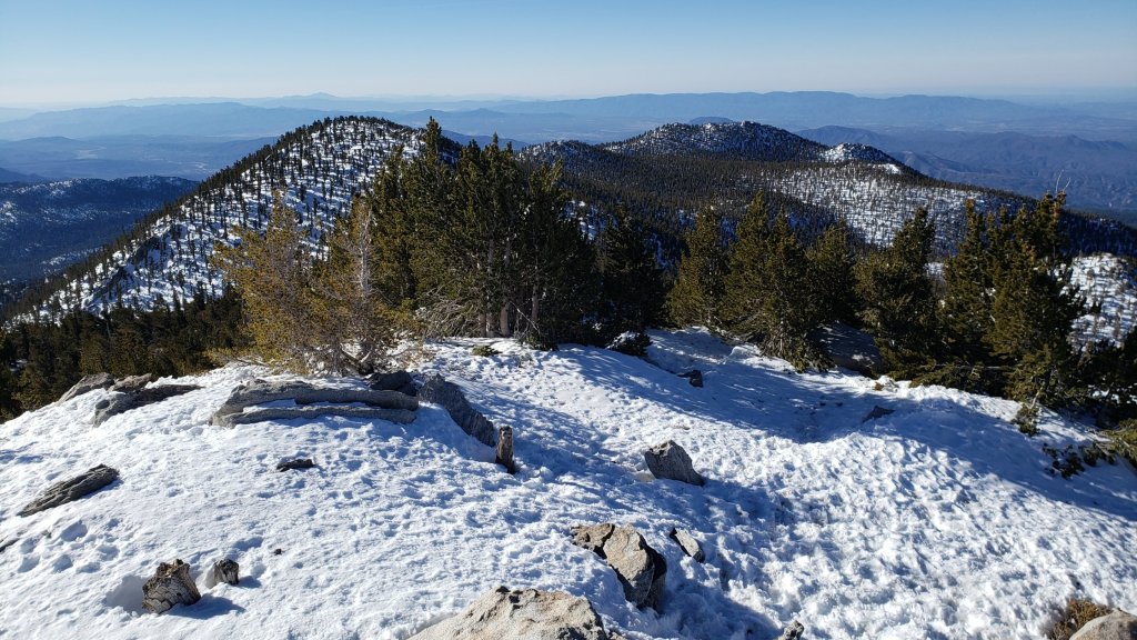


sanjacjon Uncategorized 2 Comments 4 MinutesEdit”Minor snow storm summary 16th February 2022″
Weather and trail update 15th February 2022
Dramatic fluctuations in temperatures forecast over the next two weeks will result in many freeze-thaw cycles and further hazardous hardening of already icy snow. Light snowfall is likely on 15th and 21st February and could make conditions more complex as underlying icy areas are obscured, and as hiking traction devices struggle to grip through the surface powder into the harder icy snow below.
Multiple hiker falls already this year in the San Jacinto mountains, including one fatality, demonstrate the critical importance of having both appropriate equipment and the right skill set for the terrain. The latter includes interpreting the snow/ice conditions, understanding your physical and mental abilities, and conservative decision making.
Early on Monday 14th February I hiked Marion Mountain and Deer Springs trails to and from San Jacinto Peak. Spikes were not required for ascending (in boots with excellent traction on crisp, cold icy snow) but were invaluable descending down Deer Springs Trail to the top of Marion Mountain Trail, and then for one short section part way down the latter. Similarly on 10th I ascended via Devil’s Slide, Wellman, and Peak trails, needing spikes for the last few hundred feet of ascent as icy snow was becoming wet on the surface due to the warm temperature and direct sun. Spikes were useful for descending down to about 9000ft for the same reasons. Hikers with a lower comfort level on snow and ice will find spikes useful more widely.
In addition to multiple ascents of San Jacinto Peak by different routes in recent days we have also surveyed several segments of the PCT, Willow Creek, Caramba, South Ridge and Spitler Peak trails, plus multiple Forest roads. Current conditions for individual trails are discussed in detail below where known.
Trails remain at least 95% snow-covered above 9000ft, with thinning and increasingly patchy snow down to about 7700ft, and generally clear below that elevation (with some notable exceptions at lower elevations on the PCT). Overall snow conditions on the trails are already more typical of April or May than early February. These conditions will likely change over the next ten days with two minor waves of snowfall currently expected in the high country.
Snow remaining from December 2021 has continued to melt slowly but steadily. Snow depths measured in recent days are detailed at the foot of this post.
Spikes are recommended everywhere above at least 7700ft as snow on trails is very icy following weeks of freeze-thaw cycles (and where compacted by hiker traffic). Spikes are especially valuable for traversing and for descending. Based on tracks I am seeing in the high country some hikers are preferring to use crampons, and those are an option in areas of continuous icy snow above about 9000ft (potentially lower in steeper terrain). Traction devices will become increasingly important over the next week or two at least, starting on 15th.
Hikers should generally be prepared for temperatures near or below freezing in the high country, and well below freezing when considering wind chill effects (see below for my recent weather observations from San Jacinto Peak).
May Valley Road was closed by Forest Service to all traffic, including foot traffic, on Friday 28th January due to hazardous trees. USFS social media states “there currently is no timeline for the road’s reopening”. There was little evidence of significant work in progress by 13th February.
The USFS gate at Humber Park reopened on 21st January having been closed since 13th December 2021. South Ridge Road (5S11) reopened in the second week of February.
According to the Forest Service website the following USFS roads are in winter closure (for vehicle traffic only): Black Mountain (4S01), San Jacinto Truck Trail (5S09), Dark Canyon (5S02), and Santa Rosa (7S02). All are currently free of snow and ice.

WEATHER
Temperatures are forecast to fluctuate dramatically over the next two weeks associated with the passage of energetic (but relatively dry) storm systems. Record warm temperatures this past week have resembled April or even May rather than the first half of February (as discussed here for example). The jet stream plunges southward on Monday 14th, with much colder air arriving on Tuesday 15th. However the air flow will track far enough west then south of us that oceanic moisture will be largely cut off from the system, and a cold, windy storm is expected, rather than a wet one. Only a few inches of snow are forecast for the high country.
Temperatures then rapidly rise again to above seasonal (although not as unusually warm as recent days) for 18th-19th February, before another storm system passes through on 21st-23rd February. The latter is forecast to be cold and windy as on 15th, with at least as much precipitation (perhaps 3-6 inches of snow in Idyllwild, 4-7 inches in the high country).
January 2022 was the driest January in recorded history in the San Jacinto high country, with only 0.75in of fresh snow falling at San Jacinto Peak (at least 2-3 feet of snow would be normal). No snow and only 0.32in rain fell in Idyllwild (at 5550ft) last month, making it about the sixth driest January for combined precipitation in Idyllwild since systematic records began in the 1940s. There has also been no measurable precipitation in the first half of February 2022.
At San Jacinto Peak (10,810ft/3295m) on Monday 14th February 2022 at 0845 the air temperature was 38.3°F (4°C), with a windchill temperature of 28.9°F (-2°C), 14% relative humidity, and a light WSW wind sustained at 7 mph gusting to 10.9 mph.
At the Peak on Thursday 10th February 2022 at 1015 the air temperature was 29.6°F (-1°C), with a windchill temperature of 10.9°F (-12°C), 42% relative humidity, and a severe NNE wind sustained at 21 mph gusting to 33.7 mph.
TRAIL CONDITIONS
Trails below about 7700ft are now generally clear of snow, snow cover is increasingly patchy below 9000ft, and remains continuous (or >95% cover) everywhere above 9000ft. Snow persists at elevations below 7700ft in particular on shaded north and north-east slopes (e.g., Red Tahquitz, Tahquitz, Apache, and Spitler peaks, and Antsell Rock). Melting has been steady at all elevations recently, but will be limited over the next ten days week with generally colder temperatures.
Hikers should anticipate encountering significant new treefall hazards, especially in vulnerable burn areas (e.g., Willow Creek Trail, PCT Miles 166-177). Storms in December 2021 left trees heavily laden with ice, and I have since found many broken tree limbs and downed trees throughout the trail system. Severe Santa Ana winds in January and February have brought down further trees and branches.
Effective Tuesday 1st February 2022 the State Park closed the section of Skyline Trail that falls within its jurisdiction, above 5800 ft elevation, “due to dangerous ice accumulation”. Long Valley Ranger Station staff are speculating that the trail may not reopen before April. The State Park boundary is not marked but is near the site of the old Florian’s Cache, below Flat Rock. Signage was posted at the relevant trailheads on 3rd February. There is no snow on the open section of trail below 5800 ft.
The 0.4 mile section of South Ridge Trail to Tahquitz Peak from Chinquapin Flat/PCT Mile 178 has no steps to follow through the steeply angled icy snow. These icy slopes are notoriously treacherous. Crampons with an ice axe (and knowledge of how to use both) are required. There was a fatal hiker fall here on Sunday 30th January.
Current snow cover on the PCT is very patchy between Miles 168 and about 175 (Red Tahquitz), mainly confined to certain north- or east-facing slopes e.g., Spitler Peak (Mile 168), Apache Peak (Mile 169.5, see photo below), and Antsell Rock (Mile 171-172). Although limited, some of these chutes and slopes are challenging and spikes are recommended. Snow is then largely continuous between Miles 175-179 (to near Saddle Junction). Snow on the Trail is very limited to about Mile 184.5, except for a stubborn section of 0.5 mile approaching Annie’s Junction (Mile 180.8) which is always among the last areas to clear every spring. Most of Miles 184-191 is snow-covered, although some exposed sections of Fuller Ridge (e.g., Miles 186.5-188.5) are clearing rapidly. My next thorough assessment of snow conditions on the PCT will likely be in late February.
Devil’s Slide Trail is now clear of icy snow to about 7800ft, and then with about 20% cover to Saddle Junction (mainly near the latter). Some hikers will find spikes useful on the upper trail, especially for descending.
South Ridge Trail (south of Tahquitz Peak) is clear of snow up to Old Lookout Flat (7600ft). Icy snow cover is about 5% to near Tahquitz Peak, increasing to about 15% on the uppermost half-a-dozen switchbacks. Most hikers will find spikes useful, especially for descending. The middle section of South Ridge Trail (between May Valley Road and the top of South Ridge Road) has several trees down which are significant obstructions (surveyed February 2022).
The predominant compacted tracks on the Peak Trail from Wellman Divide to near Miller Peak now generally approximate to the trail route. Icy snow cover remains >90%. Above 10,400ft most tracks form a compacted posthole route up the East Ridge. However the route of the Peak Trail also has a lightly used track, which is challenging in one short section before Summit Junction (spikes recommended). The Round Valley Trail has well-traveled tracks to follow from Long Valley to Wellman Divide.
Marion Mountain Trail is functionally clear of snow to about 7700ft. Icy snow cover is 40% from 7700-8200ft. From 8200ft to Deer Springs Trail (at 8700ft) snow cover is only about 10%. Most hikers will find spikes useful for ascending parts of the upper half of the trail, and they are invaluable for descending in the same areas. There is one huge new treefall hazard across the trail exactly at the State Park/Forest Service boundary.
Unsurprisingly, there continue to be no visible hiker tracks on the upper sections of Fuller Ridge and Seven Pines trails. The latter is largely clear of snow to the State Park boundary, and then snow cover is increasingly patchy above the North Fork crossing to about 7700ft (but see below regarding tree hazards and trail maintenance).
Deer Springs Trail is clear of snow to Strawberry Junction at 8100ft. From there to 8700ft (0.2 mile south of Marion Mountain Trail) snow cover is barely 10%. Thereafter snow cover is nearly continuous, with a few minor clear patches developing. Spikes are useful, especially for descending. [Three new trees came down in late 2021 on the PCT/Deer Springs Trail just south of its junction with Marion Mountain Trail, but they are readily passable for hikers.] Through Little Round Valley the track is more direct and only vaguely follows the trail route. The most heavily traveled track from LRV to near San Jacinto Peak largely follows, unfortunately for most ascending hikers, my original snowshoe route from 31st December, which is direct and steep. Cautious navigation is required as there are many alternative tracks meandering across this icy snow slope.
The Strawberry Trail between Annie’s and Strawberry junctions (roughly PCT Miles 181-183) is very sun-exposed and is 90% clear of snow.
The Caramba Trail from near Reeds Meadow through Laws Camp and on to Caramba, and the Cedar Trail from Willow Creek Trail to Laws, are optimistically described by the Forest Service as “not maintained”. In reality both trails no longer exist and are so heavily overgrown I advise hikers do not attempt to follow them. An informal use trail to Laws is much more direct and avoids all of the very challenging bush-whacking of the unmaintained trails (some local hikers dubbed it the “King Trail” when I established the route in 2019). It leaves the Willow Creek Trail exactly 1.0 mile from Saddle Junction (0.46 mile from the Skunk Cabbage turning), descending largely on established deer trails for 1.2 miles, meeting Willow Creek just upstream from the old Laws Camp. From Laws east to Caramba the route of the original Caramba Trail has been well-cairned by myself and others and can largely be followed with careful route-finding. My February 2022 survey counted 97 trees down on this 2.1 mile trail. It is especially obscure 0.1-0.3 mile east of the Willow Creek crossing, generally becoming clearer near Caramba. Cautious navigation is advised throughout the area. The King Trail still has 50% icy snow cover (spikes required), but the Caramba Trail east of Willow Creek is clear of snow (10th February survey).
Spitler Peak Trail is clear of snow. Nearly 40 downed trees from ice storms in December 2021, plus dozens of additional trunks and branches in the trail, were removed by the Trail Report in January 2022. Further trail trimming continues steadily.
The rockslide at PCT Mile 172.5, just north of Antsell Rock, was removed on 14th June 2021. My “before, during, and after” video is available here. This section of the PCT is now safer and is narrow but readily passable with care by hikers (but remains impassable by stock).
Due to greatly reduced maintenance work by the agencies and PCTA during the coronavirus pandemic, many trails have accumulated treefall hazards since late 2019, passable with care by hikers but not for stock. Although reported promptly, regrettably neither Forest Service nor State Park were quick to remove most hazards in 2021. With recent storms being accompanied by strong winds and heavy ice loads, hikers will encounter some new and additional hazards. Some are described above and below, others include the PCT between Strawberry Cienega and Strawberry Junction (PCT Miles 182-183, at least 7 trees down), and Fuller Ridge Trail near its northern end (PCT Miles 189.1-190.2, three trees).
Willow Creek Trail, resurveyed on 11th February 2022, has at least 40 downed trees between Skunk Cabbage Junction and Hidden Divide. Nearly 30 of these are on the Forest Service section.
Many treefall hazards from Red Tahquitz to Antsell Rock (PCT Miles 172.5-175) were cleared in June 2021 prior to the rockslide removal work mentioned above. Nevertheless more than 20 remain, including at least six major obstructions for hikers. Tahquitz Creek to Red Tahquitz (PCT Miles 175-177) was cleared in early June 2021. All of this section has added new treefall hazards this winter.
Seven Pines Trail has had very limited hiker traffic since November 2018, largely because Dark Canyon Road was closed from February 2019 to early October 2021, and again since December 2021. The Trail Report has “adopted” Seven Pines Trail as a priority for maintenance work as the trail has had a disproportionate number of lost hiker rescues in recent years. Starting in November 2021, 42 treefall hazards on the lower 3.0 miles of trail have been removed. Almost all of this section has also been thoroughly trimmed and cleared, and the trail is now obvious and easy to follow for much of its length (when clear of snow). However at least 18 downed trees remain on the upper 0.7 mile of trail, the route is very obscure in places, and cautious navigation is required especially for those who are not very familiar with hiking this trail. Dark Canyon campground remains closed.
SNOW DEPTHS measured on 14th February (west side) and 10th February (east side) are as follows. The first number is the current average depth, with the snow depth recorded on 31st December 2021 following in parentheses. Note that average depth is given; due to strong winds accompanying some of the storms, and differential melting, there is considerable drifting and variability. Altitudes are approximate.
San Jacinto Peak (10810ft): 12 inches (was 30 inches on 31st December)
Little Round Valley (9800ft): 9 inches (was 25 inches on 31st December)
Wellman Divide (9700ft): 6 inches (was 26 inches on 31st December)
Annie’s Junction/approx. PCT Mile 181.8 (9070ft): 7 inches (was 23 inches on 31st December)
Deer Springs Trail at junction with Seven Pines Trail/PCT Mile 184.9 (8700ft): 5 inches (was 11 inches on 31st December)
Strawberry Junction/PCT Mile 183 (8100ft): 0 inches (was 8 inches on 31st December)
Saddle Junction/approx. PCT Mile 179.9 (8070ft): 0-1 inches (was 12 inches on 31st December).
Devil’s Slide Trail at Humber Park (6520ft): 0 inches (was 7 inches on 31st December)
Idyllwild (at 5550ft): 0 inches (was 6.5 inches on 31st December)
Thank you fellow hikers for taking the time to read this. While all labor and time is volunteered, the San Jacinto Trail Report completely depends on small private donations to cover operating costs. Every year seems to have its challenges and 2022 already looks like it will be no exception, so every contribution, no matter how small, is truly valuable. If you have found this Report useful, please consider visiting the Donate page. Thank you for your support.


sanjacjon Uncategorized 1 Comment 11 MinutesEdit”Weather and trail update 15th February 2022″
Trail update 9th February 2022
Recently I have mentioned the challenges of hard, icy snow underfoot from evidence of various hiker falls and challenging incidents, and the value of using spikes especially for descending and traversing. Snow at all elevations has been firm and icy following more than a month of freeze-thaw cycles, and I cannot overemphasize the importance of having both appropriate equipment and the right skill set for the terrain. The latter includes interpreting the snow/ice conditions, understanding your physical and mental abilities, and conservative decision making. These concerns may diminish over the next week with warming temperatures and accelerating melting.
Early on Monday 7th February we ascended via Devil’s Slide, Wellman, and Peak trails to San Jacinto Peak – in boots with excellent traction – without needing spikes. Hikers less familiar with icy snow travel will prefer to use the latter. We descended Deer Springs Trail, and spikes were invaluable from the Peak down to 8700ft. On Wednesday 2nd February, we hiked Marion Mountain and Deer Springs trails to and from the Peak. Spikes were not required for ascending until about 10,000ft elevation (above Little Round Valley) but were invaluable descending down Marion Mountain Trail to about 7500ft.
Note that warm, dry weather is forecast with temperatures far above seasonal at all elevations in the second week of February. Rapid melting of snow and freeze-thaw cycles will combine to change trail conditions and potentially the preferred equipment for the terrain. As early as 0830 on the morning of Monday 7th icy snow on sun-exposed slopes high on the east flank of San Jac was already getting watery on the surface, making it more slippery. Warmer afternoons will soften snow, generally (but not always) improving the grip underfoot.
Snow remaining from December 2021 has continued to melt slowly but steadily. Snow depths measured on 7th February are detailed at the foot of this post.
In addition to ascents of San Jacinto Peak by various routes in recent days we have also surveyed several segments of the PCT, plus South Ridge and Spitler Peak trails, and several Forest roads. Current conditions for individual trails are discussed in detail below where known.
Trails remain almost completely snow-covered above 9000ft, with thinning and increasingly patchy snow down to about 7700ft, and generally clear below that elevation. Overall snow conditions on the trails are already more typical of April or May than early February. Tracks at the highest elevations (>9800ft) currently only approximate to the routes of established trails (especially Deer Springs Trail above Little Round Valley). Cautious navigation is recommended everywhere.
Spikes are recommended everywhere above about 7700ft as trails are icy where compacted by hiker traffic and following freeze-thaw cycles. Spikes are especially valuable on colder mornings when conditions are particularly icy, and for descending. Based on tracks I am seeing in the high country some hikers are preferring to use crampons, and those are an option in areas of continuous icy snow above about 9000ft (potentially lower in steeper terrain).
Despite unseasonably warm temperatures, hikers should nevertheless be prepared for temperatures near freezing in the high country, and below freezing when considering wind chill effects (see below for some of my recent weather observations from San Jacinto Peak).
May Valley Road was closed by Forest Service to all traffic, including foot traffic, on Friday 28th January due to hazardous trees. USFS social media states “there currently is no timeline for the road’s reopening”. There was no evidence of any work in progress by 4th February.
The USFS gate at Humber Park reopened on 21st January having been closed since 13th December 2021. Note that Humber will be temporarily closed for up to three days starting at 1800 on Sunday 6th February for hazardous tree removal.
South Ridge Road (5S11) reopened in the second week of February.
According to the Forest Service website the following USFS roads are in winter closure (for vehicle traffic only): Black Mountain (4S01), San Jacinto Truck Trail (5S09), Dark Canyon (5S02), and Santa Rosa (7S02). All are currently free of snow and ice.

WEATHER All elevations will rapidly warm to far above seasonal averages until Tuesday 15th February, when temperatures will plunge briefly to below seasonal before swinging above average yet again late next week. Temperatures this week are forecast to more closely resemble April (or even May for overnight lows) rather than the first half of February.
There continues to be no significant precipitation in the forecasts. However a minor storm system with the possibility of a very light dusting of snow is forecast for Tuesday 15th February. Long term projections tentatively suggest an increasing probability of storm systems from late February into April, but Southern California is not predicted to receive “drought-busting” precipitation.
January 2022 was the driest January in recorded history in the San Jacinto high country, with only 0.75in of fresh snow falling at San Jacinto Peak (at least 2-3 feet of snow would be normal). No snow and only 0.32in rain fell in Idyllwild (at 5550ft) last month, making it about the sixth driest January for combined precipitation in Idyllwild since systematic records began in the 1940s.
At San Jacinto Peak (10,810ft/3295m) on Monday 7th February 2022 at 0915 the air temperature was 34.4°F (1°C), with a windchill temperature of 21.7°F (-6°C), 24% relative humidity, and a steady NNE wind sustained at 11 mph gusting to 16.0 mph.
At the Peak on Wednesday 2nd February 2022 at 0855 the air temperature was 14.4°F (-10°C), with a windchill temperature of -9.5°F (-23°C), 26% relative humidity, and a bitter due North wind sustained at 14 mph gusting to 22.6 mph.

TRAIL CONDITIONS
Trails below about 7700ft are now clear (or largely clear) of snow, snow cover is increasingly patchy below 9000ft, and remains largely continuous everywhere above 9000ft. Snow persists at elevations below 7700ft in particular on shaded north and north-east slopes (e.g., Red Tahquitz, Tahquitz, Apache, and Spitler peaks). Melting has been steady but slow at all elevations recently, but will accelerate rapidly this week with warm temperatures.
Hikers should anticipate encountering significant new treefall hazards, especially in vulnerable burn areas (e.g., Willow Creek Trail, PCT Miles 166-177). Storms in December 2021 left trees heavily laden with ice, and I have since found many broken tree limbs and downed trees throughout the trail system. Severe Santa Ana winds in January and early February will have brought down further trees and branches.
Effective Tuesday 1st February 2022 the State Park closed the section of Skyline Trail that falls within its jurisdiction, above 5800 ft elevation, “due to dangerous ice accumulation”. The State Park boundary is not marked but is near the site of the old Florian’s Cache, below Flat Rock. Signage was posted at the relevant trailheads on 3rd February. There is no snow on the open section of trail below 5800 ft.
The 0.4 mile section of South Ridge Trail to Tahquitz Peak from Chinquapin Flat/PCT Mile 178 has no steps to follow through the steeply angled icy snow. These icy slopes are notoriously treacherous. Crampons with an ice axe (and knowledge of how to use both) are required. There was a fatal hiker fall here on Sunday 30th January.
Current snow cover on the PCT is patchy and steadily thinning between Miles 168 and about 175 (Red Tahquitz), mainly confined to certain north- or east-facing slopes e.g., Spitler Peak (Mile 168), Apache Peak (Mile 169.5, see photo below), and Antsell Rock (Mile 171-172). Snow is then largely continuous between Miles 175-179 (to near Saddle Junction). Snow on the Trail is very limited patchy to about Mile 184.5, except for a stubborn section of 0.5 mile approaching Annie’s Junction (Mile 180.8) which is always among the last areas to clear every spring. Most of Miles 184-191 is snow-covered, although some exposed sections of Fuller Ridge (e.g., Miles 186.5-188.5) are clearing rapidly. My next thorough assessment of snow conditions on the PCT will likely be around 20th February.
Devil’s Slide Trail is now clear of icy snow to about 7800ft, and then with about 20% cover to Saddle Junction (mainly near the latter). Spikes can be useful on the upper trail, especially for descending.
South Ridge Trail (south of Tahquitz Peak) is clear of snow up to Old Lookout Flat (7600ft). Icy snow cover remains about 10% to near Tahquitz Peak, increasing to about 20% on the uppermost half-a-dozen switchbacks. Most hikers will find spikes useful, especially for descending. The middle section of South Ridge Trail (between May Valley Road and the top of South Ridge Road) has 12 trees down, many of which are significant obstructions.
The predominant compacted tracks on the Peak Trail from Wellman Divide to near Miller Peak now generally approximate to the trail route. Above 10,400ft most tracks form a compacted posthole route up the East Ridge. However the route of the Peak Trail also has a lightly used track, which are challenging in one short section before Summit Junction (spikes recommended). The Round Valley Trail has well-traveled tracks to follow from Long Valley to Wellman Divide.
Marion Mountain Trail is functionally clear of snow to about 7600ft. Icy snow cover is 80% from 7600-8200ft, and there is an obvious compacted track through the snow. From 8200ft to Deer Springs Trail (at 8700ft) snow cover is only about 50%. Most hikers will find spikes useful for ascending the upper half of the trail, and they are invaluable for descending. There is one huge new treefall hazard across the trail exactly at the State Park/Forest Service boundary.
Unsurprisingly, there continue to be no visible hiker tracks on the upper sections of Fuller Ridge and Seven Pines trails. The latter is largely clear of snow to the State Park boundary, and then snow cover is increasingly patchy above the North Fork crossing to about 7700ft (but see below regarding tree hazards and trail maintenance).
Deer Springs Trail is clear of snow to Strawberry Junction at 8100ft. From there to 8700ft (0.2 mile south of Marion Mountain Trail) snow cover is barely 20%. Thereafter snow cover is essentially continuous. Spikes are useful, especially for descending. [Three new trees came down in late 2021 on the PCT/Deer Springs Trail just south of its junction with Marion Mountain Trail, but they are readily passable for hikers.] Through Little Round Valley the track is more direct and only vaguely follows the trail route. The most heavily traveled track from LRV to near San Jacinto Peak largely follows, unfortunately for ascending hikers, my original snowshoe route from 31st December, which is direct and steep. Cautious navigation is required as there are many alternative tracks meandering across this slope.
The Strawberry Trail between Annie’s and Strawberry junctions (roughly PCT Miles 181-183) has been well traveled and there tracks to follow where snow patches remain. Overall this very sun-exposed section of trail is 90% clear of snow.
Spitler Peak Trail is clear of snow and spikes are not required. Nearly 40 downed trees from ice storms in December 2021, plus dozens of additional trunks and branches in the trail, were removed by the Trail Report in January 2022. Further trail trimming continues steadily.
The Suicide Rock Trail and the Ernie Maxwell Trail are both clear of ice and snow.
The rockslide at PCT Mile 172.5, just north of Antsell Rock, was removed on 14th June 2021. My “before, during, and after” video is available here. This section of the PCT is now safer and is narrow but readily passable with care by hikers (but remains impassable by stock).
Due to greatly reduced maintenance work by the agencies and PCTA during the coronavirus pandemic, many trails have accumulated treefall hazards since late 2019, passable with care by hikers but not for stock. Although reported promptly, regrettably neither Forest Service nor State Park were quick to remove most hazards in 2021. With recent storms being accompanied by strong winds and heavy ice loads, hikers will encounter some new and additional hazards. Some are described above and below, others include the PCT between Strawberry Cienega and Strawberry Junction (PCT Miles 182-183, at least 7 trees down), and Fuller Ridge Trail near its northern end (PCT Miles 189.1-190.2, three trees).
Willow Creek Trail has at least 33 downed trees between Skunk Cabbage Junction and Hidden Divide. Of these 22 are on the Forest Service section (16 between Willow Creek and the Park boundary), with 11 in the State Park. Most are readily passable by hikers with care. Despite much work in 2020 by USFS volunteer Bill Rhoads and myself, the whitethorn has grown back rapidly, but still remains much less challenging than in 2019.
Many treefall hazards from Red Tahquitz to Antsell Rock (PCT Miles 172.5-175) were cleared in June 2021 prior to the rockslide removal work mentioned above. Nevertheless more than 20 remain, including at least six major obstructions for hikers. Tahquitz Creek to Red Tahquitz (PCT Miles 175-177) was cleared in early June 2021. All of this section has likely added new treefall hazards this winter.
Seven Pines Trail has had very limited hiker traffic since November 2018, largely because Dark Canyon Road was closed between February 2019 and early October 2021, and again since December 2021. The Trail Report has “adopted” Seven Pines Trail as a priority for maintenance work as the trail has had a disproportionate number of lost hiker rescues in recent years. Starting in November 2021, 42 treefall hazards on the lower 3.0 miles of trail have been removed. Almost all of this section has also been thoroughly trimmed and cleared, and the trail is now obvious and easy to follow for much of its length (when clear of snow). However at least 18 downed trees remain on the upper 0.7 mile of trail, the route is very obscure in places, and cautious navigation is required especially for those who are not very familiar with hiking this trail. Dark Canyon campground remains closed.
SNOW DEPTHS measured on 7th February 2022 are as follows. The first number is the current average depth, with the snow depth recorded on 31st December 2021 following in parentheses. Note that average depth is given; due to strong winds accompanying some of the storms, and differential melting, there is considerable drifting and variability. Altitudes are approximate.
San Jacinto Peak (10810ft): 14 inches (was 30 inches on 31st December)
Little Round Valley (9800ft): 12 inches (was 25 inches on 31st December)
Wellman Divide (9700ft): 7-8 inches (was 26 inches on 31st December)
Annie’s Junction/approx. PCT Mile 181.8 (9070ft): 7 inches (was 23 inches on 31st December)
Deer Springs Trail at junction with Seven Pines Trail/PCT Mile 184.9 (8700ft): 6 inches (was 11 inches on 31st December)
Strawberry Junction/PCT Mile 183 (8100ft): 0 inches (was 8 inches on 31st December)
Saddle Junction/approx. PCT Mile 179.9 (8070ft): 0-2 inches (was 12 inches on 31st December).
Devil’s Slide Trail at Humber Park (6520ft): 0 inches (was 7 inches on 31st December)
Idyllwild (at 5550ft): 0 inches (was 6.5 inches on 31st December)
Thank you fellow hikers for taking the time to read this. While all labor and time is volunteered, the San Jacinto Trail Report completely depends on small private donations to cover operating costs. Every year seems to have its challenges and 2022 already looks like it will be no exception, so every contribution, no matter how small, is truly valuable. If you have found this Report useful, please consider visiting the Donate page. Thank you for your support.

sanjacjon Uncategorized Leave a comment 11 MinutesEdit”Trail update 9th February 2022″
Trail update 2nd February 2022
IMPORTANT NOTE: Effective Tuesday 1st February 2022 Mt. San Jacinto State Park has closed the section of Skyline Trail that falls within its jurisdiction. The District Superintendents Order (#954-22-007) states “Skyline Route conditions are unsafe …. due to dangerous ice accumulation” and that “Skyline Route is closed until further notice from the 5800′ State Park boundary to its intersection with the Desert View Trail”. (In my experience the boundary is not marked but is near the site of the old Florian’s Cache, between Rescue 2 and Flat Rock.) Updates on the closure will be posted on State Park social media and webpage. Signage was posted at the relevant trailheads on 3rd February. I was informed that this closure is a direct consequence of multiple challenging rescues in this section of trail in recent weeks. Please see my comments immediately below, that I posted the day before this announcement.
Last week I alluded to the challenges of hard, icy snow underfoot from evidence of hiker falls on uppermost Deer Springs Trail, and the value of using spikes, and in places an ice axe, especially for descending and traversing. There have been multiple serious incidents in recent days, including on Sunday 30th January a fatal hiker fall on the short section of South Ridge Trail on the notoriously treacherous north side of Tahquitz Peak.
Snow at all elevations has become firm and very icy due to a month of freeze-thaw cycles, and I cannot overemphasize the importance of having both appropriate equipment and the right skill set for the terrain. The latter includes interpreting the snow/ice conditions, understanding your physical and mental abilities, and conservative decision making.
In addition to ascents of San Jacinto Peak in recent days we have also surveyed several segments of the PCT, plus South Ridge, Spitler Peak (twice), Seven Pines, and Stone Creek trails, and May Valley and Sawmill Flats roads. Current conditions for individual trails are discussed in detail below where known.
Early on Monday 31st January I ascended via Devil’s Slide, Wellman, and Peak trails to San Jacinto Peak – in boots with excellent traction – without needing spikes, although hikers less familiar with icy snow travel would prefer to use the latter. Not being much of a user of hiking poles, in recent weeks I have found an ice axe handy traversing the slopes high on the east flank of San Jac. I descended the same route, and spikes were invaluable from the Peak down to about 8500ft. On Wednesday 2nd February, we ascended Marion Mountain and Deer Springs trails to the Peak. Spikes were not required for ascending until above Little Round Valley, but were invaluable descending down to about 7500ft.
Snow remaining from December 2021 has continued to melt slowly but steadily. Snow depths remeasured on 31st January and 2nd February are detailed at the foot of this post.
Trails remain completely snow-covered above 9000ft, with thinning and increasingly patchy snow down to about 7500ft, and generally clear below that elevation. Overall snow conditions on the trails are more typical of April (or even May) than late January. Tracks at the highest elevations (>9800ft) currently only approximate to the routes of established trails (especially Deer Springs Trail above Little Round Valley). Cautious navigation is recommended everywhere.
Spikes are recommended everywhere above about 7500ft as trails are icy where compacted by hiker traffic and following freeze-thaw cycles. Spikes are especially valuable on colder mornings when conditions are particularly icy, and for descending. Based on tracks I am seeing in the high country some hikers are preferring to use crampons, and those are an option in areas of continuous icy snow above about 9000ft (potentially lower in steeper terrain).
Hikers should be prepared for temperatures below freezing in the high country, and often well below freezing when considering wind chill effects (see below for some of my recent weather observations from San Jacinto Peak). Forecast temperatures in the first week of February will be severely cold at the highest elevations.
May Valley Road was closed by Forest Service to all traffic, including foot traffic, on Friday 28th January due to hazardous trees. USFS social media states “there currently is no timeline for the road’s reopening”. There was no evidence of any significant work in progress by 4th February.
The USFS gate at Humber Park reopened on 21st January having been closed since 13th December 2021. Note that Humber will be temporarily closed for up to three days starting at 1800 on Sunday 6th February for hazardous tree removal.
The following Forest Service roads are in winter closure: South Ridge Road (5S11), Black Mountain (4S01), San Jacinto Truck Trail (5S09), Dark Canyon (5S02), and Santa Rosa (7S02). All are currently free of snow and ice.

WEATHER Temperatures at all elevations will be below seasonal averages for the first four days of February, before quickly warming to well above average next week. There continues to be no significant precipitation in the forecasts.
January 2022 was the driest January in recorded history in the San Jacinto high country, with only 0.75in of fresh snow falling at San Jacinto Peak. Only 0.32in rain and no snow fell in Idyllwild at 5550ft, making it about the sixth driest January for combined precipitation in Idyllwild since systematic records began in 1943.
At San Jacinto Peak (10,810ft/3295m) on Wednesday 2nd February 2022 at 0855 the air temperature was 14.4°F (-10°C), with a windchill temperature of -9.5°F (-23°C), 26% relative humidity, and a bitter due North wind sustained at 14 mph gusting to 22.6 mph.
At the Peak on Monday 31st January 2022 at 0850 the air temperature was 33.1°F (1°C), with a windchill temperature of 17.1°F (-8°C), 24% relative humidity, and a sharp NW wind sustained at 15 mph gusting to 26.4 mph.
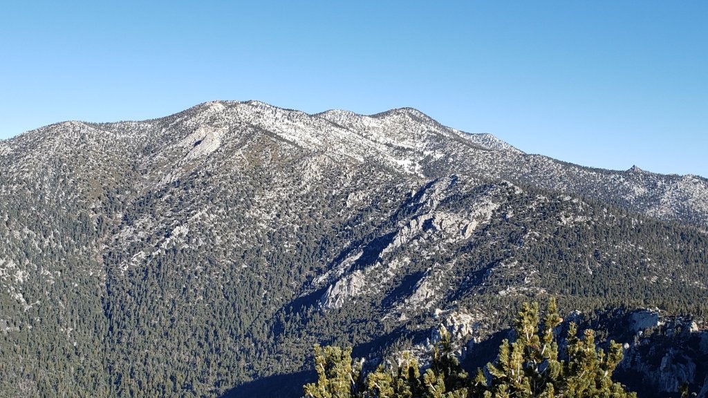
TRAIL CONDITIONS
Trails below about 7700ft are now clear (or largely clear) of snow, snow cover is increasingly patchy below 9000ft, and is continuous everywhere above 9000ft. Snow persists at elevations below 7700ft in particular on shaded north and north-east slopes (e.g., Red Tahquitz, Tahquitz, Apache, and Spitler peaks). Melting has been steady but slow at all elevations and will slow further over the next week with cool temperatures.
Hikers should anticipate encountering significant new treefall hazards, especially in vulnerable burn areas (e.g., Spitler Peak Trail, Willow Creek Trail, PCT Miles 166-177). Storms in December 2021 left trees very heavily laden with ice, and I have since found many broken tree limbs and downed trees on the trail system. Severe Santa Ana winds on 22nd January will have brought down further trees and branches.
The 0.4 mile section of South Ridge Trail to Tahquitz Peak from Chinquapin Flat/PCT Mile 178 has no steps to follow through the steeply angled icy snow. These icy slopes are notoriously treacherous. Crampons with an ice axe (and knowledge of how to use both) are required.
Skyline Trail is currently closed above about 5800ft (the State Park boundary), see discussion at top of this posting and the State Park website for any updates. There is no snow on the open section of trail below the State Park boundary.
Devil’s Slide Trail is now functionally clear of icy snow to about 7800ft, and then with about 50% cover to Saddle Junction. Spikes can be useful on the upper trail, especially for descending.
South Ridge Trail (south of Tahquitz Peak) is functionally clear of snow to Old Lookout Flat (7600ft). Icy snow cover remains about 10% to near Tahquitz Peak, increasing to about 25% on the uppermost half-a-dozen switchbacks. Most hikers will find spikes useful, especially for descending.
The middle section of South Ridge Trail (between May Valley Road and the top of South Ridge Road) has 12 trees down, most of which are major obstructions.
The predominant compacted tracks on the Peak Trail from Wellman Divide to near Miller Peak now generally follow the trail route. However careful navigation is still required as the slopes between 9800ft and 10,400ft remain covered with various (rapidly melting) meandering tracks. Above 10,400ft most tracks form a compacted posthole route up the East Ridge. However the route of the Peak Trail also has a very lightly used track, which are challenging in one short section before Summit Junction (spikes required).
There are well-traveled compacted tracks to follow from Long Valley though Round Valley to Wellman Divide.
Marion Mountain Trail is functionally clear of snow to about 7600ft. Icy snow cover is 80% from 7600-8200ft, and there is a well-traveled track through the snow. From 8200ft to Deer Springs Trail (at 8800ft) snow cover is about 50%. Most hikers will find spikes useful for ascending the upper half of the trail, and they are invaluable for descending. There is one huge new treefall hazard across the trail exactly at the State Park/Forest Service boundary.
Unsurprisingly, there continue to be no visible hiker tracks on the upper sections of Fuller Ridge and Seven Pines trails. The latter is largely clear of snow to the State Park boundary, and then snow cover is increasingly patchy above the North Fork crossing to about 7700ft (but see below regarding tree hazards and trail maintenance).
Deer Springs Trail is clear of snow to Strawberry Junction at 8100ft. From there to 8600ft (just before the Marion Mountain Trail junction) snow cover is an increasingly patchy 40%. Above 8600ft snow cover is essentially continuous. Spikes are useful, especially for descending. [Three new trees came down in late 2021 on the PCT/Deer Springs Trail just south of its junction with Marion Mountain Trail, but they are readily passable for hikers.] Through Little Round Valley the track is more direct and only vaguely follows the trail route. The most heavily traveled track from LRV to near San Jacinto Peak largely follows, unfortunately for ascending hikers, my original snowshoe route from 31st December, which is direct and steep. Cautious navigation is required as there are many alternative tracks meandering across this slope.
The Strawberry Trail between Annie’s and Strawberry junctions (roughly PCT Miles 181-183) has been well traveled and there tracks to follow. Most of this very sun-exposed section of trail is clear of snow.
The Suicide Rock Trail is clear of snow, with only a handful of tiny patches remaining.
The Ernie Maxwell Trail is clear of ice and snow.
Spitler Peak Trail is clear of snow and spikes are not required. Nearly 40 downed trees from ice storms in December 2021, plus dozens of additional trunks and branches in the trail, were removed by the Trail Report in January 2022.
The rockslide at PCT Mile 172.5, just north of Antsell Rock, was removed on 14th June 2021. My “before, during, and after” video is available here. This section of the PCT is now safer and is narrow but readily passable with care by hikers (but remains impassable by stock).
Due to greatly reduced maintenance work by the agencies and PCTA during the coronavirus pandemic, many trails have accumulated treefall hazards since late 2019, passable with care by hikers but not for stock. Although reported promptly, regrettably neither Forest Service nor State Park were quick to remove most hazards in 2021. With recent storms being accompanied by strong winds and heavy ice loads, hikers will encounter some new and additional hazards. Some are described above and below, others include the PCT between Strawberry Cienega and Strawberry Junction (PCT Miles 182-183, at least 7 trees down), and Fuller Ridge Trail near its northern end (PCT Miles 189.1-190.2, three trees).
Willow Creek Trail has at least 33 downed trees between Skunk Cabbage Junction and Hidden Divide. Of these 22 are on the Forest Service section (16 between Willow Creek and the Park boundary), with 11 in the State Park. Most are readily passable by hikers with care. Despite much work in 2020 by USFS volunteer Bill Rhoads and myself, the whitethorn has grown back rapidly, but still remains much less challenging than in 2019.
Many treefall hazards from Red Tahquitz to Antsell Rock (PCT Miles 172.5-175) were cleared in June 2021 prior to the rockslide removal work mentioned above. Nevertheless more than 20 remain, including at least six major obstructions for hikers. Tahquitz Creek to Red Tahquitz (PCT Miles 175-177) was cleared in early June 2021. All of this section has likely added new treefall hazards this winter.
Seven Pines Trail has had very limited hiker traffic since November 2018, largely because Dark Canyon Road was closed between February 2019 and early October 2021, and again since December 2021. The Trail Report has “adopted” Seven Pines Trail as a priority for maintenance work as the trail has had a disproportionate number of lost hiker rescues in recent years. Starting in November 2021, 42 treefall hazards on the lower 3.0 miles of trail have been removed. Almost all of this section has also been thoroughly trimmed and cleared, and the trail is now obvious and easy to follow for much of its length (when clear of snow). However at least 18 downed trees remain on the upper 0.7 mile of trail, the route is very obscure in places, and cautious navigation is required especially for those who are not very familiar with hiking this trail. Dark Canyon campground remains closed.
SNOW DEPTHS measured on 31st January 2022 are as follows (or on 2nd February for Deer Springs Trail locations). The first number is the current average depth, with the snow depth recorded on 31st December 2021 following in parentheses. Note that average depth is given; due to strong winds accompanying some of the storms, and differential melting, there is considerable drifting and variability. Altitudes are approximate.
San Jacinto Peak (10810ft): 16 inches (was 30 inches on 31st December)
Little Round Valley (9800ft): 14 inches on 2nd February (was 25 inches on 31st December)
Wellman Divide (9700ft): 9 inches (was 26 inches on 31st December)
Annie’s Junction/approx. PCT Mile 181.8 (9070ft): 8 inches (was 23 inches on 31st December)
Deer Springs Trail at junction with Seven Pines Trail/PCT Mile 184.9 (8700ft): 6 inches on 2nd February (was 11 inches on 31st December)
Strawberry Junction/PCT Mile 183 (8100ft): 0-1 inches on 2nd February (was 8 inches on 31st December)
Saddle Junction/approx. PCT Mile 179.9 (8070ft): 1-2 inches (was 12 inches on 31st December).
Devil’s Slide Trail at Humber Park (6520ft): 0 inches (was 7 inches on 31st December)
Idyllwild (at 5550ft): 0 inches (was 6.5 inches on 31st December)
Thank you fellow hikers for taking the time to read this. While all labor and time is volunteered, the San Jacinto Trail Report completely depends on small private donations to cover operating costs. Every year seems to have its challenges and 2022 already looks like it will be no exception, so every contribution, no matter how small, is truly valuable. If you have found this Report useful, please consider visiting the Donate page. Thank you for your support.


sanjacjon Uncategorized Leave a comment 10 MinutesEdit”Trail update 2nd February 2022″
Snow and trail update 26th January 2022
Early on Monday 24th January we hiked via Devil’s Slide, Wellman, and Peak trails to San Jacinto Peak without needing spikes, although hikers less familiar with icy snow travel would prefer to use them. Not being much of a user of hiking poles, I have recently found an ice axe handy traversing the slopes high on the east flank of San Jac. We descended via Deer Springs Trail, and high on the initial descent to Little Round Valley I twice saw the obvious marks of significant hiker falls in the snow. I may repeat this too often in these Reports, but spikes are often invaluable for descending, even when not needed for ascending. I finally removed mine just south of the junction with Marion Mountain Trail.
In addition to ascents of San Jacinto Peak in recent days we have also surveyed many of the trails in the Idyllwild area, and have spent significant time on Spitler Peak and Seven Pines trails. Current conditions for individual trails are discussed in detail below where known.
Snow from the five (mostly minor) storms that impacted the San Jacinto mountains in December 2021, plus the dusting in the high country last week, has continued to melt slowly but steadily. Snow depths measured on Monday 24th are detailed at the foot of this post.
Trails remain completely snow-covered above 9000ft, with thinning and increasingly patchy snow down to about 7500ft, and largely clear below that elevation. Overall snow conditions on the trails are more typical of April than late January. Tracks at the highest elevations (>9800ft) currently only approximate to the routes of established trails (especially Deer Springs Trail above Little Round Valley). Cautious navigation is recommended everywhere.
Spikes are useful everywhere above about 7500ft as trails are icy where compacted by hiker traffic and following freeze-thaw cycles. Spikes are especially valuable on colder mornings when conditions are particularly icy, and for descending. However they are no longer essential, especially on warmer days as the snow softens. Snowshoes may be useful in off-trail areas only above about 9000ft although in many areas snow depth is becoming too shallow.
Note that relatively mild and dry weather is forecast to continue with temperatures largely above seasonal at all elevations to the end of January. This will lead to continued melting and freeze-thaw cycles which will combine to steadily change trail conditions and, in places, the preferred equipment for the terrain.
Hikers should be prepared for temperatures near or below freezing in the high country, and often well below freezing when considering wind chill effects (see below for some of my recent weather observations from San Jacinto Peak). Forecast temperatures in the high country in the first week of February may be dangerously cold.
Hikers should anticipate encountering significant new treefall hazards, especially in vulnerable burn areas (e.g., Spitler Peak Trail, Willow Creek Trail, PCT Miles 166-177). Storms in December 2021 left trees very heavily laden with ice, and I have since found many broken tree limbs and downed trees on the trail system. Severe Santa Ana winds on 22nd January will have brought down further trees and branches.
May Valley Road [updated 29th January] was closed by Forest Service to all traffic, including foot traffic, on Friday 28th due to hazardous trees. According to USFS social media feeds, there is no timeline for reopening.
The USFS gate at Humber Park reopened on 21st January having been closed since 13th December 2021.
South Ridge Road remains closed [updated 30th January] but is clear of snow and ice.
Dark Canyon Road, the access for Seven Pines Trail, closed in December 2021 due to winter conditions. It is now [updated 21st January] clear of snow.
WEATHER Temperatures at all elevations will remain at or above seasonal averages before dropping to about seasonal on Tuesday 1st February. The first few days of February may be cooler and unsettled. Steady melting will continue at all elevations this week, most pronounced below 9000ft and on sun-exposed slopes.
Worryingly for January – the second most important month of the year for rain and snow behind February – there is no significant precipitation in the forecasts for the remainder of the month. Light precipitation on 17th-18th January produced 0.32in rain in Idyllwild at 5550ft (and a paltry 0.75in snow at San Jacinto Peak). Remarkably, that is the only measurable precipitation to date this January, a month for which Idyllwild averages 4.74in rain and 6.3in of snow (NWS 1991-2020 data), and the high country should receive feet of snow. There is the slim possibility of a storm system around 1st-4th February, although forecast models vary enormously on potential precipitation amounts, if any.
At San Jacinto Peak (10,810ft/3295m) on Monday 24th January 2022 at 0855 the air temperature was 31.2°F (0°C), with a windchill temperature of 17.8°F (-8°C), 63% relative humidity, and a light NNE wind sustained at 7 mph gusting to 12.6 mph.
At the Peak on Tuesday 18th January 2022 at 1115 the air temperature was 25.6°F (-4°C), with a windchill temperature of 14.2°F (-10°C), 78% relative humidity, and a light NNE wind sustained at 4 mph gusting to 7.6 mph.

TRAIL CONDITIONS
Trails below about 7700ft are now clear (or largely clear) of snow, snow cover is increasingly patchy below 9000ft, and is continuous everywhere above 9000ft. Melting has been slow but steady at all elevations and may accelerate significantly over the next week with warmer temperatures.
Tahquitz Peak trail from Chinquapin Flat/PCT Mile 178 has no steps to follow through the steeply angled icy snow. These icy slopes are notoriously treacherous. Currently crampons with an ice axe (and knowledge of how to use both) are required. Snowshoes are not advised due to the angle of the icy snow.
The Ernie Maxwell Trail is functionally clear of ice and snow.
Devil’s Slide Trail is now largely clear of icy snow to about 7700ft, and then with 80% cover to Saddle Junction. Spikes are useful on the upper trail, especially for descending.
South Ridge Trail is functionally clear of snow to Old Lookout Flat (7600ft). Icy snow cover remains about 10% to near Tahquitz Peak, increasing to about 25% on the uppermost half-a-dozen switchbacks. Spikes are not essential, but most hikers will find them useful, especially for descending.
The predominant compacted tracks on the Peak Trail from Wellman Divide to near Miller Peak now generally follow the trail route. However careful navigation is still required as the slopes between 9800ft and 10,400ft remain covered with a maze of (rapidly melting) meandering tracks. Above 10,400ft most tracks form a compacted posthole route up the East Ridge. However the route of the Peak Trail also has a very lightly used track, which are challenging in one short section before Summit Junction (spikes required).
There are well-traveled compacted tracks to follow from Long Valley though Round Valley to Wellman Divide.
Marion Mountain Trail has a moderately well-traveled track that largely follows the trail route up to Deer Springs Trail. There has been patchy clearing of snow below 7500ft. Unsurprisingly, there are continue to be no visible hiker tracks on the upper sections of Fuller Ridge and Seven Pines trails.
Deer Springs Trail is clear of snow to Strawberry Junction at 8100ft. From there to 8600ft (just before the Marion Mountain Trail junction) snow cover is a patchy 50%. Above 8600ft snow cover is continuous. Spikes are useful, especially for descending. Three new trees came down in late 2021 on the PCT/Deer Springs Trail just south of its junction with Marion Mountain Trail, but they are readily passable for hikers. Through Little Round Valley the track is more direct and only vaguely follows the trail route. The most heavily traveled track from LRV to near San Jacinto Peak largely follows, unfortunately for ascending hikers, my original snowshoe route from 31st December, which is direct and steep. There are however alternative tracks meandering across this slope.
The “Strawberry Trail” between Annie’s and Strawberry junctions (roughly PCT Miles 181-183) has been well traveled and there tracks to follow. Much of this very sun-exposed section of trail is rapidly clearing of snow.
The Suicide Rock Trail is clear of snow, with only a handful of tiny patches remaining.
Spitler Peak Trail, surveyed multiple times this month, is clear of snow and spikes are not required. Nearly 40 downed trees from ice storms in December, plus dozens of additional trunks and branches in the trail, have been removed by the Trail Report [updated 26th January] .
May Valley Road is clear of snow. The multiple trees down after the storm on 14th December 2021 have been cleared (by locals rather than by Forest Service).
The rockslide at PCT Mile 172.5, just north of Antsell Rock, was removed on 14th June 2021. My “before, during, and after” video is available here. This section of the PCT is now safer and is narrow but readily passable with care by hikers (but remains impassable by stock).
Due to greatly reduced maintenance work by the agencies and PCTA during the coronavirus pandemic, many trails have accumulated treefall hazards since late 2019, passable with care by hikers but not for stock. Although reported promptly, regrettably neither Forest Service nor State Park were quick to remove most hazards in 2021. With recent storms being accompanied by strong winds and heavy ice loads, hikers will encounter some new and additional hazards. Some are described above and below, others include the PCT between Strawberry Cienega and Strawberry Junction (PCT Miles 182-183, at least 7 trees down), and Fuller Ridge Trail near its northern end (PCT Miles 189.1-190.2, three trees).
Willow Creek Trail has at least 33 downed trees between Skunk Cabbage Junction and Hidden Divide. Of these 22 are on the Forest Service section (16 between Willow Creek and the Park boundary), with 11 in the State Park. Most are readily passable by hikers with care. Despite much work in 2020 by USFS volunteer Bill Rhoads and myself, the whitethorn has grown back rapidly, but still remains much less challenging than in 2019.
Many treefall hazards from Red Tahquitz to Antsell Rock (PCT Miles 172.5-175) were cleared in June 2021 prior to the rockslide removal work mentioned above. Nevertheless more than 20 remain, including at least six major obstructions for hikers. Tahquitz Creek to Red Tahquitz (PCT Miles 175-177) was cleared in early June 2021. All of this section has likely added new treefall hazards this winter.
Seven Pines Trail has had very limited hiker traffic since November 2018, largely because Dark Canyon Road was closed between February 2019 and early October 2021, and again since December 2021. The Trail Report has “adopted” Seven Pines Trail as a priority for maintenance work as the trail has had a disproportionate number of lost hiker rescues in recent years. Starting in November 2021, 42 treefall hazards on the lower 3.0 miles of trail have been removed. Almost all of this section has also been thoroughly trimmed and cleared, and the trail is now obvious and easy to follow for much of its length (when clear of snow). However at least 18 downed trees remain on the upper 0.7 mile of trail, the route is very obscure in places, and cautious navigation is required especially for those who are not very familiar with hiking this trail. Dark Canyon campground remains closed.
SNOW DEPTHS measured on 24th January 2022 are as follows. The first number is the current average depth, with the snow depth recorded on 31st December 2021 following in parentheses. The very minor snowfall on 17th-18th January is of course included but was greatly exceeded by melting in weeks before and since. Note that average depth is given; due to strong winds accompanying some of the storms, and differential melting, there is considerable drifting and variability. Altitudes are approximate.
San Jacinto Peak (10810ft): 18 inches (was 30 inches on 31st December)
Little Round Valley (9800ft): 16 inches (was 25 inches on 31st December)
Wellman Divide (9700ft): 12 inches (was 26 inches on 31st December)
Annie’s Junction/approx. PCT Mile 181.8 (9070ft): 13 inches (was 23 inches on 31st December)
Deer Springs Trail at junction with Seven Pines Trail/PCT Mile 184.9 (8800ft): 6-7 inches (was 11 inches on 31st December)
Strawberry Junction/PCT Mile 183 (8100ft): 0-1 inches (was 8 inches on 31st December)
Saddle Junction/approx. PCT Mile 179.9 (8070ft): 2-3 inches (was 12 inches on 31st December).
Devil’s Slide Trail at Humber Park (6520ft): 0 inches (was 7 inches on 31st December)
Idyllwild (at 5550ft): 0 inches (was 6.5 inches on 31st December)
Thank you fellow hikers for taking the time to read this. While all labor and time is volunteered, the San Jacinto Trail Report completely depends on small private donations to cover operating costs. Every year seems to have its challenges and 2022 already looks like it will be no exception, so every contribution, no matter how small, is truly valuable. If you have found this Report useful, please consider visiting the Donate page. Thank you for your support.
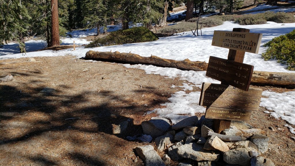

sanjacjon Uncategorized Leave a comment 9 MinutesEdit”Snow and trail update 26th January 2022″
Snow and trail update 19th January 2022
Light showers between the afternoon of Monday 17th and early morning of Tuesday 18th January produced a total of 0.32in rain in Idyllwild (at 5550ft). Remarkably, that was the first measurable precipitation to date in January, a month for which Idyllwild averages 4.74in rain and 6.3in of snow (NWS 1991-2020 data).
On our hike this morning to San Jacinto Peak we found that the overnight rain had turned largely to freezing rain above 7900ft, and then a dusting of snow above 9000ft. The high country was evidently above the cloud for much of the period (as it was all day on 18th too), and there was only 0.25in of fresh snow at 9000ft, increasing to just 0.75in at San Jacinto Peak.
Over much of the past week the snow from the five mostly minor storms that impacted the San Jacinto mountains in December 2021 continued to melt slowly but steadily. Melting was aided by moderate but warm Santa Ana winds on 15th January. Snow depths measured on 18th are detailed at the foot of this post.
In addition to ascents of San Jacinto Peak in the past few days we have also surveyed many of the trails in the Idyllwild area, and spent most of 17th on Spitler Peak Trail and the adjacent PCT. Current conditions for individual trails are discussed in detail below where known.
Leaving relatively late on 18th (after waiting for the drizzle to stop in Idyllwild) I was able to hike from Devil’s Slide Trail to San Jacinto Peak without needing spikes, as the thin fresh snow cover gave excellent grip on what is now a firm, well-compacted route. Spikes were however invaluable for descending down to about 7600ft. Not being much of a user of hiking poles, I found an ice axe was very handy traversing the snow slopes between San Jacinto Peak and Wellman Divide.
Major trails remain mostly covered by icy snow above 7500ft, and completely covered above 9000ft. Tracks at the highest elevations (>9800ft) currently only approximate to the routes of established trails (specifically Deer Springs Trail above Little Round Valley). Cautious navigation is recommended everywhere. The very light snow in the early hours of 18th did not obscure any existing tracks.
Spikes are recommended everywhere above about 7500ft as trails are icy where compacted by hiker traffic and following freeze-thaw cycles. Spikes can be especially valuable on colder mornings when conditions are particularly icy, and for descending. However they are no longer essential, especially on warmer days as the snow softens. Snowshoes may be useful in off-trail areas only above about 9000ft, especially as snow softens on warmer days and in afternoons. Below that elevation snow coverage is generally either too shallow, or trails too compacted, for snowshoes.
Note that relatively mild and dry weather is forecast to continue with temperatures largely above seasonal at all elevations to the end of January. This will lead to significant melting and freeze-thaw cycles which will combine to steadily change trail conditions and, in places, the preferred equipment for the terrain.
Hikers should be prepared for temperatures near or below freezing in the high country, and often well below freezing when considering wind chill effects (see below for some of my recent weather observations from San Jacinto Peak).
Storms in December 2021 left trees very heavily laden with ice, and I have since found many broken tree limbs and downed trees on the trail system. Hikers should anticipate encountering significant new treefall hazards, especially in vulnerable burn areas (e.g., Spitler Peak Trail, Willow Creek Trail, PCT Miles 166-177).
The USFS gate at Humber Park reopened on 21st January having been closed since 13th December 2021. Even when closed there are nine legal parking spaces immediately below the gate. Vehicles not parked in these spaces may be ticketed and/or towed. If there are “Road Closed” signs further down – as was the case for most of the holiday period – then those nine spaces are also unavailable for legal parking.
South Ridge Road [updated 23rd January] remains closed, but is essentially clear of snow/ice.
Dark Canyon Road, the access for Seven Pines Trail, closed in December 2021 due to winter conditions. It is now clear of snow [updated 21st January].
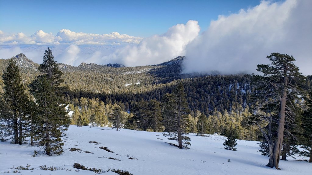
WEATHER Temperatures at all elevations, especially overnight lows, are forecast to warm to above seasonal averages starting Thursday 20th, and largely remain above average until the end of January. Saturday 22nd will be the coldest day, associated with strong Santa Ana (NE) winds.. Steady melting will continue at all elevations, most pronounced below 9000ft and on sun-exposed slopes. Worryingly for January – the second most important month of the year for rain and snow behind February – there is no significant precipitation in the forecasts for the remainder of the month.
At San Jacinto Peak (10,810ft/3295m) on Tuesday 18th January 2022 at 1115 the air temperature was 25.6°F (-4°C), with a windchill temperature of 14.2°F (-10°C), 78% relative humidity, and a light NNE wind sustained at 4 mph gusting to 7.6 mph.
At the Peak on Thursday 13th January 2022 at 0920 the air temperature was 40.2°F (5°C), with a windchill temperature of 35.2°F (2°C), 24% relative humidity, and a soft NE breeze sustained at 2 mph gusting to 5.6 mph.
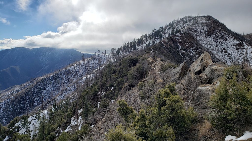
TRAIL CONDITIONS
Trails below about 7500ft are now largely clear of snow, snow cover is extensive but increasingly patchy to 8500ft, and is continuous everywhere above 9000ft. Melting has been steady at mid elevations and may accelerate significantly over the next couple of weeks in the high country.
Spitler Peak Trail, surveyed multiple times this month, is now functionally clear of snow and spikes are not required. There are about 17 treefall hazards remaining in a 0.5 mile section, about one mile below the PCT junction, some of which are difficult to pass. Some 25 other downed trees, plus dozens of additional branches down in the trail, have been removed by the Trail Report.
The Ernie Maxwell Trail is almost completely clear of ice and snow, with just a few minor patches remaining near Humber Park. Spikes not required.
Devil’s Slide Trail is now largely clear of icy snow to about 7000ft, with about 20% snow cover to 7600ft, and then 80% cover to Saddle Junction. Spikes are useful on the upper trail, especially for descending.
South Ridge Trail has cleared rapidly of snow to Old Lookout Flat (7600ft). Snow cover remains about 80% from there to Tahquitz Peak, for which spikes are useful.
Tahquitz Peak trail from Chinquapin Flat/PCT Mile 178 has steps to follow through the continuous angled icy snow. These icy slopes are treacherous. Currently spikes, at least with hiking poles (or ideally an ice axe plus knowledge of how to use it) are recommended.
My persistence with putting in tracks on the Peak Trail has largely paid off, and the predominant compacted tracks from Wellman Divide to near Miller Peak now generally follow the trail route. However careful navigation is required, as the slopes between 9800ft and 10,400ft remain covered with a maze of (rapidly melting) meandering tracks. Above 10,400ft almost all tracks form a compacted posthole route up the East Ridge.
There are well-traveled compacted tracks to follow from Long Valley though Round Valley to Wellman Divide.
Marion Mountain Trail has a moderately well-traveled track that largely follows the trail route up to Deer Springs Trail. There has been patchy clearing of snow below 7500ft. Unsurprisingly, there are continue to be no visible hiker tracks on Fuller Ridge and Seven Pines trails.
Deer Springs Trail is clear of snow to the Suicide Rock trail junction. Snow cover is only about 10% from there to Strawberry Junction. An excellent compacted track largely follows the established trail route above Strawberry Junction, and spikes are useful, especially for descending. Through Little Round Valley the track is more direct and does not follow the trail route, and the most heavily traveled track from LRV to near San Jacinto Peak follows, unfortunately for ascending hikers, my snowshoe route from 31st December, which is very direct and steep. There are however many alternative tracks meandering across this slope.
The “Strawberry Trail” between Annie’s and Strawberry junctions (roughly PCT Miles 181-183) has been well traveled and there tracks to follow. Much of this very sun-exposed section of trail clears relatively rapidly of snow for its elevation.
The Suicide Rock Trail has only a handful of minor snow patches remaining.
May Valley Road is clear of snow. The multiple trees down after the storm on 14th December 2021 have been cleared (by locals rather than by Forest Service).
The rockslide at PCT Mile 172.5, just north of Antsell Rock, was removed on 14th June 2021. My “before, during, and after” video is available here. This section of the PCT is now safer and is narrow but readily passable with care by hikers (but remains impassable by stock).
Due to greatly reduced maintenance work by the agencies and PCTA during the coronavirus pandemic, many trails have accumulated treefall hazards since late 2019, passable with care by hikers but not for stock. Although reported promptly, regrettably neither Forest Service nor State Park were quick to remove most hazards in 2021. With recent storms being accompanied by strong winds and heavy ice loads, hikers will encounter some new and additional hazards. Some are described below, others include the PCT between Strawberry Cienega and Strawberry Junction (PCT Miles 182-183, at least 7 trees down), and Fuller Ridge Trail near its northern end (PCT Miles 189.1-190.2, three trees).
Willow Creek Trail has at least 33 downed trees between Skunk Cabbage Junction and Hidden Divide. Of these 22 are on the Forest Service section (16 between Willow Creek and the Park boundary), with 11 in the State Park. Most are readily passable by hikers with care. Despite much work in 2020 by USFS volunteer Bill Rhoads and myself, the whitethorn has grown back rapidly, but still remains much less challenging than in 2019.
Marion Mountain Trail was cleared of multiple tree hazards by a California Conservation Corps team in late August 2021, along with the adjacent PCT/Deer Springs Trail for 0.6 mile north to the south end of Fuller Ridge Trail. Three new trees came down in late 2021 on the PCT just south of its junction with Marion Mountain Trail, but they are readily passable for hikers.
Many treefall hazards from Red Tahquitz to Antsell Rock (PCT Miles 172.5-175) were cleared in June 2021 prior to the rockslide removal work mentioned above. Nevertheless more than 20 remain, including at least six major obstructions for hikers. Tahquitz Creek to Red Tahquitz (PCT Miles 175-177) was cleared in early June 2021. All of this section has likely added new treefall hazards this winter.
Seven Pines Trail has had very limited hiker traffic since November 2018, largely because Dark Canyon Road was closed between February 2019 and early October 2021, and again since December 2021. The Trail Report has “adopted” Seven Pines Trail as a priority for maintenance work as the trail has had a disproportionate number of lost hiker rescues in recent years. Starting in November 2021, 42 treefall hazards on the lower 3.0 miles of trail have been removed. Almost all of this section has also been trimmed and cleared, and the trail is now obvious and easy to follow for much of its length (when clear of snow). However at least 18 downed trees remain on the upper 0.7 mile of trail, the route is very obscure in places, and cautious navigation is required especially for those who are not very familiar with hiking this trail. Dark Canyon campground remains closed.
SNOW DEPTHS measured on 18th January 2022 are as follows. The first number is the current average total depth, with the snow depth recorded on 31st December 2021 following in parentheses. The very minor snowfall on 17th-18th January is of course included but was greatly exceeded by melting in the previous week. Note that average depth is given; due to strong winds accompanying some of the storms, and differential melting, there is considerable drifting and variability. Altitudes are approximate.
San Jacinto Peak (10810ft): 20 inches (was 30 inches on 31st December)
Wellman Divide (9700ft): 14 inches (was 26 inches on 31st December)
Annie’s Junction/approx. PCT Mile 181.8 (9070ft): 16 inches (was 23 inches on 31st December)
Strawberry Junction/PCT Mile 183 (8100ft): 0-2 inches on 17th (was 8 inches on 31st December)
Saddle Junction/approx. PCT Mile 179.9 (8070ft): 4 inches (was 12 inches on 31st December).
Devil’s Slide Trail at Humber Park (6520ft): 0 inches (was 7 inches on 31st December)
Idyllwild (at 5550ft): 0 inches (was 6.5 inches on 31st December)
Thank you fellow hikers for taking the time to read this. While all labor and time is volunteered, the San Jacinto Trail Report completely depends on small private donations to cover operating costs. Every year seems to have its challenges and 2022 already looks like it will be no exception, so every contribution, no matter how small, is truly valuable. If you have found this Report useful, please consider visiting the Donate page. Thank you for your support.
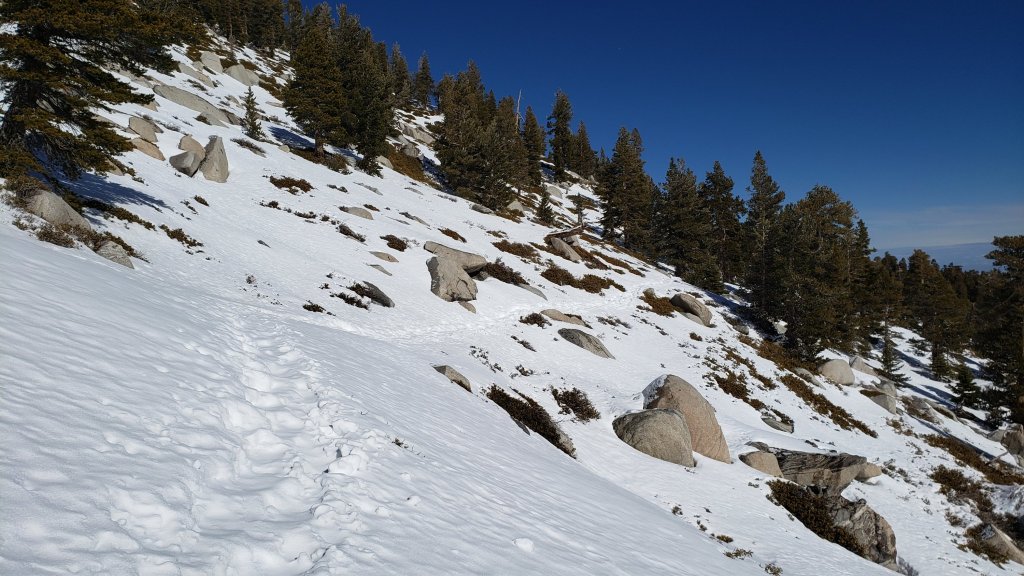
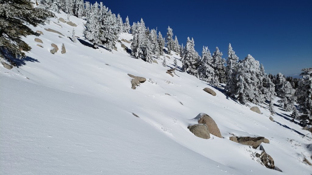
sanjacjon Uncategorized 2 Comments 9 MinutesEdit”Snow and trail update 19th January 2022″
Snow and trail update 12th January 2022
The snow from the five mostly minor storms that impacted the San Jacinto mountains in December 2021 continues to melt slowly but steadily, in what has so far been a relatively mild and very dry January.
The combination of Santa Ana winds on 9th and a thin but continuous cloud cover on 10th produced what will almost certainly be the clearest visibility of the year on the morning of 10th. From San Jacinto Peak I could clearly see the entire east coastline of San Clemente Island, the cliffs on the south end of Santa Catalina, plus container ships offshore, all with the naked eye.
In addition to a couple of recent ascents of San Jacinto Peak, in the past few days we have also surveyed Spitler Peak and South Ridge trails, among several others. Current conditions for individual trails are discussed in detail below where known.
Early on 10th I was able to get from Devil’s Slide Trail to above Wellman Divide before needing spikes, as the icy snow was firm but grippy on a largely well-compacted route. Spikes were then useful from 9900ft to San Jacinto Peak. We descended Deer Springs Trail, and I removed spikes at Strawberry Junction. Hiking poles are useful in the high country, and an ice axe wouldn’t have been a bad idea when traversing slopes on the east flank of San Jac.
Most major trails have now been traveled but all remain largely or completely covered by light to moderate snowfall above 7000ft. Tracks at the highest elevations (>9800ft) currently do not always approximate to the routes of established trails (specifically sections of the Peak Trail above 9900ft, and Deer Springs Trail above Little Round Valley). Cautious navigation is recommended everywhere.
Spikes remain recommended everywhere above about 5500ft as trails are icy where compacted by hiker traffic and following freeze-thaw cycles. Spikes can be especially valuable on colder mornings when conditions are particularly icy, and for descending. Snowshoes remain useful in off-trail areas only above about 8000ft, especially as snow softens on warmer days and in afternoons. Below that elevation snow coverage is generally either too shallow, or trails too compacted, for snowshoes. Crampons and ice axe remain an option on much of the east slope above 9800ft, but there is nowhere on or near established tracks that spikes are inadequate, and conditions will continue to change with further melting and additional hiker traffic.
Note that warming is forecast to continue, with temperatures above seasonal at mid elevations especially into late January. This will lead to significant melting and freeze-thaw cycles which will combine to steadily change trail conditions and, in places, the preferred equipment for the terrain.
Hikers should be prepared for temperatures near or below freezing in the high country, and generally well below freezing when considering wind chill effects (see below for some of my recent weather observations from San Jacinto Peak).
Storms in December 2021 left trees very heavily laden with ice, and I have since found many broken tree limbs and downed trees on the trail system. Hikers should anticipate encountering significant new treefall hazards, especially in vulnerable burn areas (e.g., May Valley Road, Spitler Peak Trail, Willow Creek Trail, PCT Miles 166-177).
The USFS gate at Humber Park closed on 13th December 2021. Even when closed there are nine legal parking spaces immediately below the gate. Vehicles not parked in these spaces may be ticketed and/or towed. If there are “Road Closed” signs further down – as has been the case for most of the past three weeks – then those nine spaces are also unavailable for legal parking. Exercise caution parking in this area as multiple vehicles have been towed on recent weekends.
South Ridge Road is currently closed, and remains almost completely snow/ice covered.
Dark Canyon Road, the access for Seven Pines Trail, closed in December 2021 due to winter conditions. As of 7th January, it remained 90% snow-covered.

WEATHER Temperatures at mid elevations, especially overnight lows, are forecast to remain above seasonal averages well into the second half of January. In the high country temperatures will be above seasonal until about 17th, before cooling to near seasonal. Steady melting will continue at all elevations, likely most pronounced below 8000ft and on sun-exposed slopes. Worryingly for January, there continues to be no significant precipitation in the forecasts.
At San Jacinto Peak (10,810ft/3295m) on Monday 10th January 2022 at 0855 the air temperature was 34.6°F (1°C), with a windchill temperature of 22.5°F (-5°C), 10% relative humidity, and a steady SSE wind sustained at 11 mph gusting to 16.0 mph.
At the Peak on Tuesday 4th January 2022 at 1020 the air temperature was 31.6°F (0°C), with a windchill temperature of 14.5°F (-10°C), 58% relative humidity, and a bitter NW wind sustained at 10 mph gusting to 24.3 mph.
At the Peak on Friday 31st December 2021 at 1055 the air temperature was 19.2°F (-7°C), with a windchill temperature of -3.1°F (-20°C), 92% relative humidity, and a frigid WSW wind sustained at 19 mph gusting to 31.1 mph.
TRAIL CONDITIONS
All trails above about 7000ft are snow-covered, lower in sheltered places. Melting has been steady at mid elevations and may accelerate significantly this week in the high country.
Spitler Peak Trail, fully surveyed to the PCT on 8th January, is currently very challenging for hikers (see sample photos below). There are 35 treefall hazards on its uppermost two miles, some of which are not easy to pass, plus dozens of additional branches down in the trail, some embedded in icy snow. Icy snow conditions mean spikes are currently recommended in places on the uppermost two miles.
The Ernie Maxwell Trail has a well-compacted icy snow track to follow along its entire length. Snow cover remains about 90% in the lower (southern) section, and is nearly continuous nearer Humber Park. Spikes are especially useful in mornings before snow softens, and for descending.
Devil’s Slide Trail has a well-traveled, compacted snow track to follow, no longer suitable for snowshoes but spikes are useful especially for descending. Snow cover is now only 50% below 7000ft, but about 90% from there to Saddle Junction.
South Ridge Trail has a well-traveled track up to Old Lookout Flat (7600ft) and spikes are adequate. There is a traveled posthole track continuing up to Tahquitz Peak, for which spikes are useful.
Tahquitz Peak trail from Chinquapin Flat/PCT Mile 178 has steps to follow through the angled icy snow. These icy slopes are treacherous. Currently spikes, at least with hiking poles (or an ice axe plus knowledge of how to use it) are recommended. Snowshoes are strongly discouraged due to the angle of the icy snow.
The Peak Trail now has tracks to follow from Wellman Divide to San Jacinto Peak. However careful navigation is required, as the slopes between 9800ft and 10,400ft are covered with a maze of meandering tracks, most of which do not closely follow the route of the Peak Trail. The most heavily traveled route between 10,100-10,400ft parallels the Peak Trail route rather than following it, and above 10,400ft almost all tracks form an excellent compacted posthole route that vaguely follows the East Ridge Trail above Miller Peak directly to San Jac.
There are well-traveled compacted tracks to follow from Long Valley though Round Valley to Wellman Divide, and another rather direct compacted track up from Tamarack Valley around the south flank of Miller Peak.
Marion Mountain Trail has a moderately well-traveled track that largely follows the trail route up to Deer Springs Trail. Azalea Trail, the access road for Marion Mountain trailhead, has only been partially plowed and is 4WD/AWD accessible only (this will change in the next week or two with further melting). Unsurprisingly, there are continue to be no visible hiker tracks on Fuller Ridge and Seven Pines trails.
Deer Springs Trail is largely clear of snow to the Suicide Rock trail junction. Snow cover is about 50% from there to Strawberry Junction, and spikes are useful but not required. An excellent compacted track largely follows the established trail route above Strawberry Junction. Through Little Round Valley the track is more direct and does not follow the trail route, and the most heavily traveled track from LRV to near San Jacinto Peak follows, unfortunately for ascending hikers, my snowshoe route from 31st December, and is very direct and steep. There are however many alternative tracks meandering all across this slope.
The Suicide Rock Trail has a well-traveled track through very patchy and rapidly melting snow.
May Valley Road is clear of snow. The multiple trees down after the storm on 14th December 2021 have been cleared (mainly by locals).
The rockslide at PCT Mile 172.5, just north of Antsell Rock, was removed on 14th June 2021. My “before, during, and after” video is available here. This section of the PCT is now safer and is narrow but readily passable with care by hikers (but remains impassable by stock).
Due to greatly reduced maintenance work by the agencies and PCTA during the coronavirus pandemic, many trails have accumulated treefall hazards since late 2019, passable with care by hikers but not for stock. Although reported promptly, regrettably neither Forest Service nor State Park were quick to remove most hazards in 2021. With recent storms being accompanied by strong winds and heavy ice loads, hikers will encounter some new and additional hazards. Some are described below, others include the PCT between Strawberry Cienega and Strawberry Junction (PCT Miles 182-183, at least 7 trees down), and Fuller Ridge Trail near its northern end (PCT Miles 189.1-190.2, three trees).
Willow Creek Trail has at least 33 downed trees between Skunk Cabbage Junction and Hidden Divide. Of these 22 are on the Forest Service section (16 between Willow Creek and the Park boundary), with 11 in the State Park. Most are readily passable by hikers with care. Despite much work in 2020 by USFS volunteer Bill Rhoads and myself, the whitethorn has grown back rapidly, but still remains much less challenging than in 2019.
Marion Mountain Trail was cleared of multiple tree hazards by a California Conservation Corps team in late August 2021, along with the adjacent PCT/Deer Springs Trail for 0.6 mile north to the south end of Fuller Ridge Trail. Three new trees came down in late 2021 on the PCT just south of its junction with Marion Mountain Trail, but they are readily passable for hikers.
Many treefall hazards from Red Tahquitz to Antsell Rock (PCT Miles 172.5-175) were cleared in June 2021 prior to the rockslide removal work mentioned above. Nevertheless more than 20 remain, including at least six major obstructions for hikers. Tahquitz Creek to Red Tahquitz (PCT Miles 175-177) was cleared in early June 2021. All of this section has likely added new treefall hazards this winter.
Seven Pines Trail has had very limited hiker traffic since November 2018, largely because Dark Canyon Road was closed between February 2019 and early October 2021, and again since December 2021. The Trail Report has “adopted” Seven Pines Trail as a priority for maintenance work as the trail has had a disproportionate number of lost hiker rescues in recent years. Starting in November 2021, 42 treefall hazards on the lower 3.0 miles of trail have been removed. Most of this section has also been trimmed and cleared, and the trail is now obvious and easy to follow for much of its length (when clear of snow). However at least 18 downed trees remain on the upper 0.7 mile of trail, the route is very obscure in places, and cautious navigation is required especially for those who are not very familiar with hiking this trail. Dark Canyon campground remains closed.
SNOW DEPTHS measured on 10th January 2022 are as follows. The first number is the current average total depth, with the snow depth recorded on 31st December 2021 following in parentheses. Note that average depth is given; due to strong winds accompanying some of the storms, and differential melting, there is considerable drifting and variability. Altitudes are approximate.
San Jacinto Peak (10810ft): 24 inches (was 30 inches on 31st December)
Little Round Valley (9800ft): 20 inches (was 25 inches on 31st December)
Wellman Divide (9700ft): 18 inches (was 26 inches on 31st December)
Annie’s Junction/approx. PCT Mile 181.8 (9070ft): 18 inches (was 23 inches on 31st December)
Deer Springs Trail at junction with Seven Pines Trail (8800ft): 7-9 inches (was 11 inches on 31st December)
Strawberry Junction/PCT Mile 183 (8100ft): 1-3 inches (was 8 inches on 31st December)
Saddle Junction/approx. PCT Mile 179.9 (8070ft): 7 inches (was 12 inches on 31st December).
Devil’s Slide Trail at Humber Park (6520ft): 0-2 inches (very patchy, was 7 inches on 31st December)
Idyllwild (at 5550ft): 0-1 inch (very patchy, was 6.5 inches on 31st December)


Thank you fellow hikers for taking the time to read this. While all labor and time is volunteered, the San Jacinto Trail Report completely depends on small private donations to cover operating costs. Every year seems to have its challenges and 2022 already looks like it will be no exception, so every contribution, no matter how small, is truly valuable. If you have found this Report useful, please consider visiting the Donate page. Thank you for your support.


sanjacjon Uncategorized Leave a comment 9 MinutesEdit”Snow and trail update 12th January 2022″
Snow and trail update 6th January 2022
This is an adaptation of the Report originally issued on 31st December 2021, which followed four mostly minor storms that impacted the San Jacinto mountains between 24th-30th December. Although temperatures at mid elevations have started to warm to above seasonal in the past couple of days, melting has progressed slowly especially at higher elevations. High country locations have generally lost only an inch or two of snow depth, mid elevations several inches, and snow has almost completely cleared below 5000ft.
On 5th January we undertook a partial survey of South Ridge Trail with great friend of the Report Charles Phelan, and on 4th January we ascended to San Jacinto Peak via Devil’s Slide, Wellman, and (roughly) Peak trails. Current conditions for individual trails are discussed in detail below where known.
On 4th I largely broke trail again above Saddle Junction to Wellman Divide (my tracks from 31st December barely visible above 8500ft due to spindrift), initially in spikes then snowshoes from 9000ft to just above Wellman Divide. The slopes of the Peak “Trail” remained firm and challenging in snowshoes, and I switched back to spikes to reach San Jac (see details below regarding routes in the high country).
Most major trails have now been traveled but all remain covered by light to moderate snowfall. Tracks at the highest elevations (>9800ft) currently do not approximate to the routes of established trails (specifically the Peak Trail above 9900ft, and Deer Springs Trail above Little Round Valley). Cautious navigation is recommended everywhere.
Spikes are recommended everywhere above about 5500ft as trails become icy when compacted by hiker traffic and undergo freeze-thaw cycles. Spikes are especially valuable on colder mornings when conditions are particularly icy, and for descending. Snowshoes are currently useful in many areas above about 8000ft, especially as snow softens with warming temperatures. Below that elevation snow coverage is either generally too shallow, or trails will become compacted and unsuitable for snowshoes, when they will become mainly valuable for off-trail travel only. Crampons and ice axe remain a good option on much of the east slope above 9800ft, but this will change with increased melting and hiker traffic.
Note that rapid warming will continue, the temperatures above seasonal at mid elevations (e.g., Idyllwild) into at least mid January, and well above seasonal in the high country to Saturday 8th January (before dropping to near average). These temperatures will lead to significant melting and freeze-thaw cycles which will combine to change trail conditions and, in places, the preferred equipment for the terrain. However, some combination of spikes and snowshoes – the latter on mild days of soft snow, for off-trail travel, or for unbroken routes – will likely be useful in the San Jacinto high country for the foreseeable future.
Hikers should be prepared for temperatures near or below freezing in the high country, and generally well below freezing when considering wind chill effects (see below for some of my recent weather observations from San Jacinto Peak).
All five storms in December left trees very heavily laden with ice, and I have since found many broken tree limbs and downed trees on the trail system. Hikers should anticipate encountering significant new treefall hazards, especially in vulnerable burn areas (e.g., May Valley Road, Spitler Peak Trail, Willow Creek Trail, PCT Miles 166-177).
The USFS gate at Humber Park closed on 13th December. Even when closed there are nine legal parking spaces immediately below the gate. Vehicles not parked in these spaces may be ticketed and/or towed. If there are signs further down indicating that the road is closed – as has been the case for most of the past two weeks – then the nine spaces are also unavailable for legal parking. Exercise caution parking in this area as multiple vehicles have been towed on recent weekends.
South Ridge Road is currently closed, and is completely snow/ice covered.
Dark Canyon Road, the access for Seven Pines Trail, closed in December due to winter conditions. It remains 90% snow-covered [updated 7th January].

WEATHER Temperatures at mid elevations will remain slightly above seasonal averages well into mid January. In the high country temperatures will be well above seasonal until 8th January, before dropping to near seasonal. Steady melting will continue at all elevations, but will be most pronounced below 8000ft and on intensely sun-exposed slopes. There is no significant precipitation in the forecasts.
At San Jacinto Peak (10,810ft/3295m) on Tuesday 4th January 2022 at 1020 the air temperature was 31.6°F (0°C), with a windchill temperature of 14.5°F (-10°C), 58% relative humidity, and a bitter NW wind sustained at 10 mph gusting to 24.3 mph.
At the Peak on Friday 31st December 2021 at 1055 the air temperature was 19.2°F (-7°C), with a windchill temperature of -3.1°F (-20°C), 92% relative humidity, and a frigid WSW wind sustained at 19 mph gusting to 31.1 mph.

TRAIL CONDITIONS
All trails above about 6500ft are snow-covered, lower in sheltered places. Melting has been well underway at mid elevations and will accelerate significantly over the next few days.
Spitler Peak Trail [updated 8th January] is currently very challenging for hikers, with an astonishing 35 treefall hazards on its uppermost two miles, many of which are not easy to pass, plus dozens of additional branches down in the trail. Almost all of these came down since my last survey on 22nd December, when I counted only seven trees down. In addition icy snow conditions mean that spikes are currently recommended on the uppermost two miles.
The Ernie Maxwell Trail [updated 6th January] has a well-compacted snowshoe track to follow along its entire length. The snow depth is starting to thin especially at the lower (southern) end of the trail but snow cover remains >90%. Spikes are increasingly useful as the snow is icy following freeze-thaw cycles.
Devil’s Slide Trail has a well-traveled, compacted snow track to follow, no longer suitable for snowshoes but spikes are useful especially for descending. Melting was starting to reveal some rock steps and gravel patches below 7000ft on 4th January.
South Ridge Trail has a well-traveled track up to Old Lookout Flat (7600ft) and spikes are adequate. There is a very lightly traveled posthole track continuing up to Tahquitz Peak, for which snowshoes may be useful as snow continues to soften.
Tahquitz Peak trail from Chinquapin Flat/PCT Mile 178 has steps to follow through the angled icy snow, and these may well improve this weekend. These icy slopes are treacherous. Currently spikes, at least with hiking poles (or an ice axe plus knowledge of how to use it) are recommended. Snowshoes are not advised due to the angle of the icy snow.
There are two routes in place from Long Valley up to San Jacinto Peak. There is a moderately traveled compacted track from Round Valley that approximates to the trail as far as Wellman Divide, follows part of the Peak Trail route, then climbs steeply around the east and north flanks of Jean Peak (following the route I established on 31st December, as discussed in the previous Report). There is a lightly traveled snowshoe track that roughly follows the “Sid Davis Trail” to Tamarack Valley, the old Tamarack Trail to near 10,000ft, and then climbs south of Miller Peak up the East Ridge Trail line. As of 4th January, the Peak Trail was only partially broken. This situation may improve this weekend with steady melting expected.
Marion Mountain Trail has a lightly traveled track that largely follows the trail route up to Deer Springs Trail. Azalea Trail, the access road for Marion Mountain trailhead, has only been partially plowed and is currently 4WD/AWD accessible only. This may improve with melting in the next week or two. Unsurprisingly, there remain no visible tracks on Fuller Ridge and Seven Pines trails.
Deer Springs Trail has an obvious but lightly traveled snowshoe-and-posthole track above Strawberry Junction. Below Little Round Valley it largely follows the established trail route. Through Little Round Valley the track is more direct and does not follow the trail route, and the track from LRV to near San Jacinto Peak is very direct, steep, and is a challenging ascent. There is a relatively well-traveled posthole track up to Strawberry Junction.
The lower Deer Springs Trail to Suicide Rock has a well-traveled track through light and rapidly melting snow.
May Valley Road is almost clear of snow, however it is largely impassable by vehicles due to multiple trees down (reported to USFS).
The rockslide at PCT Mile 172.5, just north of Antsell Rock, was removed on 14th June 2021. My “before, during, and after” video is available here. This section of the PCT is now safer and is narrow but readily passable with care by hikers (but remains impassable by stock).
Due to greatly reduced maintenance work by the agencies and PCTA during the coronavirus pandemic, many trails have accumulated treefall hazards since late 2019, passable with care by hikers but not for stock. Although reported promptly, regrettably neither Forest Service nor State Park were quick to remove most hazards in 2021. With recent storms being accompanied by strong winds and heavy ice loads, hikers will encounter some new and additional hazards. Some are described below, others include the PCT between Strawberry Cienega and Strawberry Junction (PCT Miles 182-183, at least 7 trees down), and Fuller Ridge Trail near its northern end (PCT Miles 189.1-190.2, three trees).
Willow Creek Trail has at least 33 downed trees between Skunk Cabbage Junction and Hidden Divide. Of these 22 are on the Forest Service section (16 between Willow Creek and the Park boundary), with 11 in the State Park. Most are readily passable by hikers with care. Despite much work in 2020 by USFS volunteer Bill Rhoads and myself, the whitethorn has grown back rapidly, but still remains much less challenging than in 2019.
Marion Mountain Trail was cleared of multiple tree hazards by a California Conservation Corps team in late August 2021, along with the adjacent PCT/Deer Springs Trail for 0.6 mile north to the south end of Fuller Ridge Trail. Three new trees came down in late 2021 on the PCT just south of its junction with Marion Mountain Trail, but they are readily passable for hikers.
Many treefall hazards from Red Tahquitz to Antsell Rock (PCT Miles 172.5-175) were cleared in June 2021 prior to the rockslide removal work mentioned above. Nevertheless more than 20 remain, including at least six major obstructions for hikers. Tahquitz Creek to Red Tahquitz (PCT Miles 175-177) was cleared in early June 2021.
Seven Pines Trail has had very limited hiker traffic since November 2018, largely because Dark Canyon Road was closed between February 2019 and early October 2021, and again since December 2021. The Trail Report has “adopted” Seven Pines Trail as a priority for maintenance work as the trail has had a disproportionate number of lost hiker rescues in recent years. Starting in November 2021, 42 treefall hazards on the lower 3.0 miles of trail have been removed. Most of this section has also been trimmed and cleared, and the trail is now obvious and easy to follow for much of its length (when clear of snow). However approximately 18 downed trees remain on the upper 0.7 mile of trail, the route is very obscure in places, and cautious navigation is required especially for those who are not very familiar with hiking this trail. Dark Canyon campground remains closed.
SNOW DEPTHS measured on 4th January 2022 are as follows. The first number is the current average total depth, with the snow depth recorded on 31st December 2021 following in parentheses. Note that average depth is given; due to strong winds accompanying some of the storms, and differential melting, there is considerable drifting and variability. Altitudes are approximate.
San Jacinto Peak (10810ft): 28 inches (was 30 inches on 31st December)
Wellman Divide (9700ft): 23 inches (was 26 inches on 31st December)
Annie’s Junction/approx. PCT Mile 181.8 (9070ft): 22 inches (was 23 inches on 31st December)
Long Valley (8600ft): about 12 inches (was 14 inches on 31st December)
Saddle Junction/approx. PCT Mile 179.9 (8070ft): 10 inches (was 12 inches on 31st December).
Devil’s Slide Trail at Humber Park (6520ft): 0-4 inches (patchy melting, was 7 inches on 31st December)
Idyllwild (at 5550ft): 0-2 inches (patchy melting, was 6.5 inches on 31st December)
Thank you fellow hikers for taking the time to read this. While all labor and time is volunteered, the San Jacinto Trail Report completely depends on small private donations to cover operating costs. Every year seems to have its challenges and 2022 already looks like it will be no exception, so every contribution, no matter how small, is truly valuable. If you have found this Report useful, please consider visiting the Donate page. Thank you for your support.


sanjacjon Uncategorized 2 Comments 9 MinutesEdit”Snow and trail update 6th January 2022″
Snow and trail update 1st January 2022
Starting on 24th December we had four storm systems pass through the San Jacinto mountains in seven days, plus some additional localized precipitation on days between the storms.
Contrary to earlier forecasts, the first system on 23rd-24th December ultimately proved to be by far the most substantial of the four, and was summarized in the previous Report (available here). That system was relatively warm, including light rainfall briefly as high as San Jacinto Peak, and was dominated by impressive rainfall numbers at mid elevations (e.g., 4.35in at 5550ft in Idyllwild in under 48 hours).
The three subsequent minor storms were colder, producing snow as low as 4000-5000ft, although by the final wave of precipitation on 30th air temperatures were above freezing below 6000ft and some melting was already underway with light drizzle at times. Unfortunately the high country was above the clouds for the majority of the precipitation that fell in the mid elevations on 26th-30th December. Indeed the fourth storm system on 30th largely passed the San Jacinto mountains to the west.
Ultimately projections that by the end of December we could have received up to two feet of snow in Idyllwild and 4-5 feet in the high country proved to be wildly optimistic. Idyllwild finished the week of storms with roughly seven inches of snow, exact depths varying by location, and San Jacinto Peak with about 30 inches (of which eight remained from an earlier storm on 14th December).
On 31st December I ascended an east side route (Devil’s Slide, Wellman, Peak trails) to San Jacinto Peak, and then descended the west side via Deer Springs Trail. Current conditions for individual trails are discussed in detail below. I largely broke trail above Saddle Junction, initially postholing then in snowshoes above 9000ft. The slopes above Wellman Divide became increasing firm and challenging in snowshoes, and I had to leave the route of the Peak Trail and head directly upslope to the north-east side of Jean Peak to then reach San Jac. I recorded a shortish video near the Peak discussing snow and trail conditions (available here). The powder was near-perfect on the west side, where I found no tracks at all above Strawberry Junction.
Currently very few major trails have been traveled and all are covered by moderate snowfall. This situation may change significantly over the long New Year holiday weekend, with clearer weather forecast and hikers likely to be active on most of the trail system. Nevertheless, cautious navigation is recommended everywhere.
Snow depths are currently ideal for snowshoeing almost everywhere above about 8000ft. Below that elevation snow coverage is either generally too shallow for snowshoes, or trails will become compacted and unsuitable, when snowshoes will become mainly valuable for off-trail travel only. Crampons and ice axe are currently a good option on much of the east slope above 9800ft, but this may not be the case within a few days with melting and hiker traffic. Spikes are recommended everywhere above about 5000ft for the foreseeable future as trails become icy when compacted by hiker traffic and undergo freeze-thaw cycles. Spikes may be especially valuable on trails with heavy water flow in the trails that may partially freeze over the next few days (e.g., Devil’s Slide and Deer Springs trails), on colder mornings when conditions are particularly icy, and for descending.
Note that rapid warming is expected in early January 2022, with significant melting and freeze-thaw cycles which will combine to change trail conditions and, in places, the preferred equipment for the terrain. However, some combination of spikes and snowshoes – the latter on warm days of soft snow, off-trail, or for unbroken routes – will likely be useful in the San Jacinto high country for the foreseeable future.
Hikers should be prepared for temperatures around or below freezing in the high country, and generally well below freezing when considering wind chill effects (see below for some of my recent weather observations from San Jacinto Peak).
Both this sequence of storms and the prior system earlier in December left branches heavily laden with ice, and as a result I have found many broken tree limbs and downed trees in the trails. Hikers should expect to find significant new treefall hazards, especially in vulnerable burn areas (e.g., May Valley Road, Spitler Peak Trail, Willow Creek Trail, PCT Miles 166-177).
For details regarding pre-existing (non snow/ice) hazards on the trails, coronavirus issues and ranger station access, please see this earlier Report or contact the State Park or Forest Service as indicated on their websites.
The USFS gate at Humber Park closed on 13th December. Even when closed there are nine legal parking spaces immediately below the gate. Any vehicles not parked in these spaces may be ticketed and/or towed. If there are signs further down indicating that the road is closed then the nine spaces are also unavailable for legal parking. On 31st December for example, CHP cleared all vehicles from this area in the afternoon (thanks to Bill Rhoads for this information).

WEATHER Temperatures will remain below seasonal averages this weekend until 4th January 2022, and then rapidly warm to above average for 5th-7th January, before returning to about seasonal. Sadly temperatures above freezing (and well above seasonal) are forecast at the highest peaks on 3rd-7th January. Clearly there will be steady melting at all elevations, especially rapid below 8000ft and on sun-exposed slopes.
At San Jacinto Peak (10,810ft/3295m) on Friday 31st December 2021 at 1055 the air temperature was 19.2°F (-7°C), with a windchill temperature of -3.1°F (-20°C), 92% relative humidity, and a bitter WSW wind sustained at 19 mph gusting to 31.1 mph.
At the Peak on Thursday 23rd December 2021 at 1615 the air temperature was 27.7°F (-2°C), with a windchill temperature of 9.5°F (-13°C), 94% relative humidity, and a gusty due West wind sustained at 17 mph gusting to 27.8 mph.
TRAIL CONDITIONS
All trails above about 4500ft are snow-covered. By yesterday afternoon, melting was already well underway below 6000′, and will accelerate significantly over the next few days.
The Ernie Maxwell Trail has a well-defined 18″ wide snowshoe track to follow along its entire length. Unfortunately this was starting to soften on 31st December (many thanks to Anne and Anabel for this information). The snow has the right texture that spikes are not currently required. This may change with increased compaction and freeze-thaw cycles this weekend.
Devil’s Slide Trail has a well-traveled, compacted snow track to follow, spikes are especially useful for descending.
Tahquitz Peak trail from Chinquapin Flat/PCT Mile 178 has steps to follow through the angled icy snow, and these may well improve this weekend. These icy slopes are treacherous. Currently spikes, at least with hiking poles (or an ice axe plus knowledge of how to use it) are recommended. Snowshoes are not advised due to the angle of the icy snow.
There were no visible tracks whatsoever on Marion Mountain, Seven Pines, or Fuller Ridge trails, as of the afternoon of 31st December. Azalea Trail, the access road for Marion Mountain trailhead, has not been plowed and is 4WD/AWD accessible only.
The only broken route I saw from Round Valley up to San Jacinto Peak is a posthole track that comes directly up, completely bypassing Wellman Divide and most of the Peak Trail route, coming around the east and north flanks of Jean Peak (see my discussion above of the current challenges of the Peak Trail).
Deer Springs Trail has only my descending snowshoe track to follow above Strawberry Junction. Below Little Round Valley I largely followed the established trail route. Through Little Round Valley I was more direct and made no effort to follow the trail route, and my snowshoe track down from the Peak to LRV is very direct, steep, and would be a challenging ascent. There is now a posthole track up to Strawberry Junction.
The lower Deer Springs Trail to Suicide Rock has a well-traveled posthole track through the light snow.
Dark Canyon Road, the access for Seven Pines Trail, is closed due to winter conditions, likely into next month.
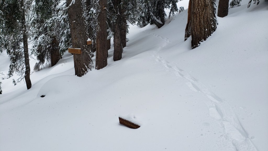
SNOW DEPTHS measured on 31st December 2021 are as follows. The first number is the current average total depth, with the snow depth recorded on 24th, prior to the three most recent minor storms, following in parentheses (where known). Note that average depth is given; due to strong winds accompanying some of the storms, there is extensive drifting, especially in the trails. Altitudes are approximate.
San Jacinto Peak (10810ft): 30 inches (was 22 inches on afternoon of 24th December)
Little Round Valley (9800ft): 25 inches
Wellman Divide (9700ft): 26 inches (was 20 inches on afternoon of 24th)
Annie’s Junction/approx. PCT Mile 181.8 (9070ft): 23 inches (was 14 inches on afternoon of 24th)
Deer Springs Trail at junction with Seven Pines Trail (8800ft): 11 inches
Long Valley (8600ft): about 14 inches (was 12 inches on 24th; many thanks to Kyle Eubanks for that measurement)
Strawberry Junction/PCT Mile 183 (8100ft): 8 inches
Saddle Junction/approx. PCT Mile 179.9 (8070ft): 12 inches (was 3 inches on afternoon of 24th, some earlier snow was removed by rain on 23rd-24th).
Devil’s Slide Trail at Humber Park (6520ft): 7 inches (was less than one inch on 24th)
Idyllwild (at 5550ft): 6.5 inches (melting already underway 29th-30th, was 0 inches on afternoon of 24th)
Thank you fellow hikers for taking the time to read this. While all labor and time is volunteered, the San Jacinto Trail Report completely depends on small private donations to cover operating costs. Every year seems to have its challenges and 2022 already looks like it will be no exception, so every contribution, no matter how small, is truly valuable. If you have found this Report useful, please consider visiting the Donate page. Thank you for your support.