[UPDATED Tuesday 29th March @ 1055: We broke trail this morning up Devil’s Slide Trail to San Jacinto Peak. Snow depths range from two inches at Saddle Junction (8070ft) to 4-5 inches here at San Jacinto Peak. Spikes are recommended but are not strictly essential. Crampons are an alternative above 9000ft for those who have them. Shallow snow and underlying icy snow generally make conditions poor for snowshoes. We will descend breaking trail down Deer Springs Trail. Main update this evening.]
[UPDATED Monday 28th March @ 1955: we hiked up Tahquitz Peak this afternoon to assess the start of the storm. It started drizzling on us at 1330. Around the Peak very light snow was slowly settling above 8500 ft, with a mix of snow, sleet and rain from 7800-8500 ft, and drizzle below that. So far 0.48 in of rain has fallen in Idyllwild at 5550 ft elevation, with a scant 0.5 in of snow settled at Tahquitz Peak (8800 ft) and in Long Valley (8600 ft). After a lull for a couple of hours, the second, colder phase of the system is imminent, lasting until pre-dawn tomorrow.]
This is a short update, hopefully useful for all readers but with the large number of thru hikers currently on the PCT in mind (we have seen and talked to dozens on hikes in recent days). For more comprehensive details of trail conditions for trails not mentioned below, Forest road closures, and other general information, see the previous report for 21st-23rd March linked here.
After days of uncertainty, the forecasts have become somewhat clearer for the storm system expected on Monday 28th March. The storm will have two phases, now so close together that essentially there will be continuous precipitation from early Monday afternoon until around sunrise on Tuesday 29th.
The first phase is particularly warm and will bring rain to lower and mid elevations on Monday afternoon, with a freeze level at 7000-7500 ft. The second phase, lasting most of Monday night, will be colder, with the freeze level dropping to about 6000 ft. Snowfall estimates above 10,000 ft for the entire system total 6-10 inches. Lower elevations will receive less snow, especially those around 5500-7500 ft that will get rain from the first phase of the storm. Idyllwild is expected to be below the snow level.
Most of the PCT in the San Jacinto mountains is above 6000 ft and will some experience light snowfall. Miles 175-191 are all above 7700 ft and are expected to receive about 2-6 inches of snow. In combination with strong winds (and therefore drifting) this may be sufficient to obscure the existing track in places, complicate navigation, and make for more challenging conditions underfoot.
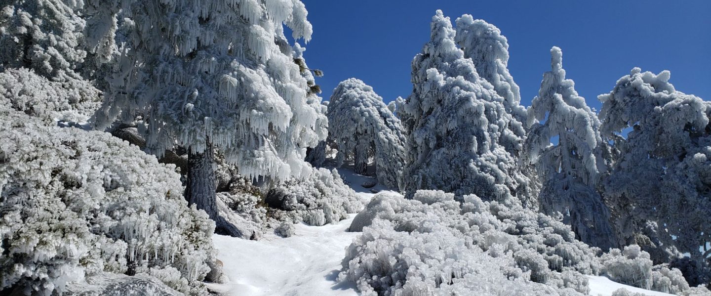
Shallow fresh snow on top of ice (from rain) or on top of older icy snow are conditions that have proven to be challenging for less experienced hikers in the San Jacinto mountains in recent years, and these are the conditions that are now expected for 28th-30th March at least. Fresh snow obscures the ice or icy snow underneath, and makes it harder for traction devices to grip. Considerable caution is recommended in such conditions. Melting will be relatively rapid in the days immediately after the storm, but with some freeze-thaw cycles for at least a few days.
Although useful tracks are now in place for most major trails, some of these above about 7000 ft will become obscured on Monday 28th for up to several days, and cautious navigation is recommended everywhere.
I have hiked somewhere on the PCT and/or its alternates every day for the past couple of weeks. I uploaded a detailed video report (linked here) for Fuller Ridge Trail/PCT Miles 185.5-190.5 based on a full survey on the morning of Wednesday 23rd March. Also note that four days earlier I did a similar survey and video report for PCT Miles 168.5-179.5. Obviously these videos are only applicable until Sunday 27th March.
Early on Friday 25th March we ascended San Jacinto Peak via Devil’s Slide, PCT, Wellman, Peak, and East Ridge trails, descending the same way. Boots with excellent traction were sufficient all the way to the Peak. I only used spikes to descend to about 10,300 ft. Hikers with a lower comfort level on snow and icy snow will find spikes useful more widely.
Snow depths measured on 23rd-25th March are detailed near the foot of this post but note that snow depth alone is rarely indicative of the difficulty or otherwise of conditions for hiking.
Spikes are recommended (but are not essential on well-traveled trails) above about 7600 ft, as snow on trails can be icy where compacted by hiker traffic and following freeze-thaw cycles. Spikes are generally most valuable for traversing and for descending. Starting Monday 28th, spikes are expected to be strongly recommended everywhere above about 6000 ft for several days.
PCT hikers that leave the trail by Mile 165, and then regain the trail at Mile 191 using the Black Mountain Road alternate, currently no longer require spikes (currently spikes remain recommended for some parts of Miles 166-191). This advice may change after 28th March.
WEATHER
Specifics of the warm mixed precipitation storm on Monday 28th are given above. About an inch of rain is expected at mid elevations, with snowfall of 6-10 inches in the high country. Relatively mild, sunny conditions are expected from Wednesday 30th March onwards, and rapid snowmelt will resume.
The air temperature recorded at San Jacinto Peak on Friday 25th March – an astonishing 45.5°F (7.5°C) – was likely an all-time record high for the Peak in March.
January 2022 was the driest January in recorded history in the San Jacinto high country, with only 0.75 in of fresh snow falling at San Jacinto Peak. Snowfall in both December 2021 and February 2022 was below seasonal for the high country. Consequently, for the tenth consecutive winter, precipitation will be below average in the San Jacinto high country (and eight of those ten winters have been well below average).
At San Jacinto Peak (10,810ft/3295m) on Friday 25th March 2022 at 0835 the air temperature was 45.5°F (7.5°C), with a windchill temperature of 38.3°F (3°C), 27% relative humidity, and a light SSE wind sustained at 5 mph gusting to 12.7 mph.
At the Peak on Monday 21st March 2022 at 0830 the air temperature was 35.4°F (2°C), with a windchill temperature of 16.5°F (-9°C), 47% relative humidity, and a gusty NNW wind sustained at 5 mph gusting to 16.7 mph.
TRAIL CONDITIONS
Current snow cover on the PCT is extremely limited from Miles 151 (Highway 74) to about 160, and then increasingly patchy between Miles 160 and 175 (Red Tahquitz). Some shaded chutes and slopes can be tricky for those without snow/ice experience, and spikes remain recommended. See my video discussing conditions for Miles 168.5-179.5 (Spitler Peak to Saddle Junction) on 19th March available here. Snow remains largely continuous between Miles 175-179. Snow cover is becoming very patchy in sun-exposed areas between Miles 178 to 184, with the exception of the notoriously stubborn half mile just south of Annie’s Junction starting at about Mile 180.3. From Mile 184 to 191, snow cover is largely continuous, although extensive exposed sections of Fuller Ridge (e.g., Miles 186.6-187.5 and 187.8-188.5) are now largely clear, as are areas north of Mile 191. See the detailed video report (linked here) for Fuller Ridge Trail/PCT Miles 185.5-190.5 based on a full survey on Wednesday 23rd March.
Trails below about 7500ft are now generally clear of snow, light snow cover is increasingly patchy below 9000ft, and light to moderate cover is largely continuous but melting steadily everywhere above 9000ft. Melting has been very rapid in the past two weeks.
Although some treefall hazards from Red Tahquitz to Antsell Rock (PCT Miles 172.5-175) were cleared in June 2021 prior to the rockslide removal work, the situation has badly deteriorated this winter. In a full survey on 19th March 2022, I counted at least 72 treefall hazards between PCT Miles 170-175. At least a third of these are major hazards that require scrambling over or around.
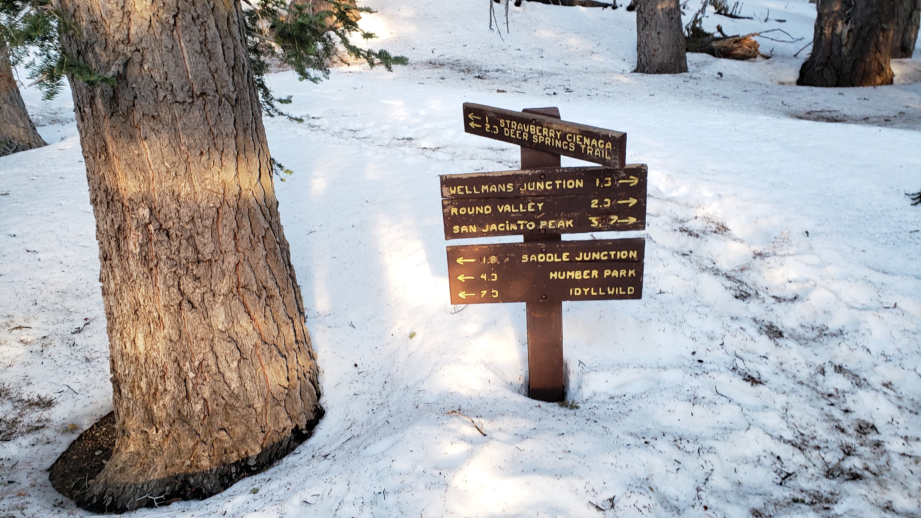
Devil’s Slide Trail is essentially clear of icy snow to near Saddle Junction, with just a few patches mainly near the latter. Hikers may find spikes useful near Saddle, especially for descending.
The PCT for a mile north of Saddle Junction (“Angel’s Glide”) is essentially clear of snow. The Wellman Trail is now only about 50% snow-covered.
The 0.4 mile section of South Ridge Trail to Tahquitz Peak from Chinquapin Flat/PCT Mile 178 has no steps to follow through the steeply angled icy snow. These icy slopes are notoriously treacherous. Crampons with an ice axe (and thorough knowledge of how to use both) are required. Snowshoes are not advised due to the angle of the icy snow. There was a fatal hiker fall here on Sunday 30th January.
The well-traveled compacted track on the Peak Trail from Wellman Divide to near Miller Peak follows the trail route. Icy snow cover remains 60%. Above 10,400ft tracks form a partially compacted route up the East Ridge. The Peak Trail itself has not been properly broken above 10,400 ft.
Marion Mountain Trail has about 50% snow cover overall, with a very well-traveled compacted track throughout. The trail is largely clear (<10% snow cover) to about 7400 ft and then snow cover averages 60% up to the PCT/Deer Springs Trail junction, with a couple of lengthy clear sections. Spikes are useful for descending. There is one huge new treefall hazard across the trail exactly at the State Park/Forest Service boundary.
Unsurprisingly, there were no visible hiker tracks on Seven Pines Trail as of 23rd March.
Deer Springs Trail is clear of snow to Strawberry Junction at 8100ft, and is largely clear from there to about 8600ft (just south of the Marion Mountain Trail junction). Thereafter snow cover is about 95%, with a few clear patches developing. Spikes are useful, especially for descending. [Three new trees came down in late 2021 on the PCT/Deer Springs Trail just south of its junction with Marion Mountain Trail, but they are readily passable for hikers.] Through Little Round Valley and on up to near the Peak the most heavily traveled track follows my prior snowshoe route which did not attempt to follow the trail route and is very direct and steep (and is a challenging ascent for many). Cautious navigation is required as there are several alternative tracks meandering across this snow slope.
Willow Creek Trail has about 40% snow cover overall, with a posthole and snowshoe track to Long Valley through the remaining snow. There are at least 40 downed trees between Skunk Cabbage Junction and Hidden Divide, nearly 30 of these on the Forest Service section.
The trail from Saddle Junction to near Reeds Meadow, then past Little Tahquitz Meadow to connect to the PCT is currently an ugly posthole track through soft snow that does not remotely follow the established trail routes.
The Strawberry Trail between Annie’s and Strawberry junctions (roughly PCT Miles 181-183) has been well-traveled, is very sun-exposed and is clearing rapidly of snow.
The Ernie Maxwell Trail is clear of snow.
The Suicide Rock Trail is clear of snow.
Spitler Peak Trail is clear of snow. Forty downed trees, most from an ice storm in late December 2021, plus dozens of additional trunks and branches in the trail, have been removed by the Trail Report from this trail in 2022.
SNOW DEPTHS measured on 23rd-25th March 2022 are as follows. The first number is the current average total depth, with the greatest depth recorded after the largest storm of this calendar year (on 22nd-23rd February 2022) given in parentheses, where known. Due to strong winds accompanying storms and complex differential melting between snowfall events, note that there is considerable variability in snow depth. Altitudes are approximate.
San Jacinto Peak (10810 ft): 9 inches (31-35 inches on 23rd February)
Little Round Valley (9800 ft): 10-12 inches (with heavy drifting here)
Wellman Divide (9700 ft): 0-4 inches (23 inches on 23rd February)
Annie’s Junction/approx. PCT Mile 180.8 (9070 ft): 8 inches (28 inches on 23rd February)
Seven Pines Trail junction with Deer Springs Trail/approx. PCT Mile 184.9 (8700 ft): 6 inches
Strawberry Junction/approx. PCT Mile 183 (8100 ft): 0 inches
Saddle Junction/approx. PCT Mile 179 (8070 ft): 0-1 inch (16 inches on 23rd February)
Devil’s Slide Trail at Humber Park (6520 ft): 0 inches (15 inches on 23rd February)
It’s northbound PCT season! Please help the Trail Report at our busiest time of the year. While all labor and time is volunteered, the San Jacinto Trail Report completely depends on your small private donations to keep the Report active, free from advertising, and independent from agencies. If you have found this Report useful, please visit the Donate page. Zelle has been added as a fee-free way to donate. Thank you for your support.