Snow and trail update 30th December 2025
UPDATE Friday 2nd January 2026: it continued to drizzle up to 9000 ft until early this morning. San Jacinto Peak added two inches of snow, but it is embedded in a thick ice layer of freezing rain.
I recorded a video report from the Peak early this morning (linked here) discussing the weather and current conditions.
Spikes are strongly recommended everywhere above about 9000 ft due to heavy icing of all surfaces at this time.
Rainfall was prodigious, with about 5.4 inches at Wellman’s Cienega (9300 ft) in the past 48 hours.
UPDATE Thursday 1st January 2026 at 1745: steady rain overnight and almost all day is finally slowing (almost to a stop at mid elevations). Idyllwild (at 5550 ft) received 1.47 inches in the 24 hours up to 0700 this morning, and another 1.37 inches in the subsequent ten hours, for an impressive storm total of 2.84 inches. Long Valley (8500 ft) recorded 1.63 inches in the 24 hours to midnight last night, with an additional 0.45 inch today. The freeze level remained above 10,000 ft all morning, finally dropping this afternoon closer to 9000 ft (but after the bulk of the precipitation had passed).
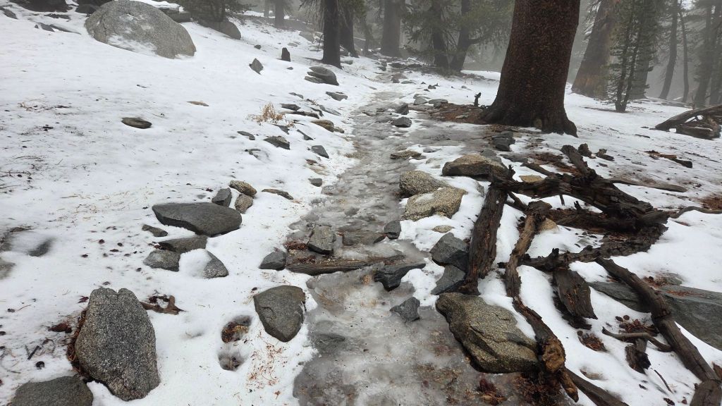
UPDATE Wednesday 31st December 2025: I spent most of the day in the high country, as my morning hike turned into substantial involvement in a hiker rescue from San Jacinto Peak. The good news is that all has ended well, but this update was of course delayed. Rain started this morning at 0700, but did not turn heavy at mid elevations until 1500. Above 9000 ft, the rain was heavy for much of the day, with Wellman’s Cienega recording 0.4 inch in just four hours from 0900-1300. Rain in Idyllwild totaled 0.83 inch from 0700-1900 today. The system is very mild, as expected, with rain as high as San Jacinto Peak this morning before turning to intermittent snow and sleet at about 1115, but only above 10,500 ft. Trails that had snow and/or ice remaining from last week (or even November) have fast become an ugly mix of softening snow, watery ice, and, increasingly, slush. Fully waterproof gear, including footwear, is critical for the next 36 hours, in addition to gear for genuine winter conditions. Rain is forecast to persist all night until late tomorrow afternoon, at least to 10,000 ft, with just a few inches of snow expected above that elevation.
UPDATE Tuesday 30th December 2025: an extremely mild winter storm arrives tomorrow morning, bringing steady rain all day on Wednesday and Thursday (totaling about two inches at Idyllwild elevation). The forecast freeze level is remarkably high, not dropping below 10,000 ft, above which 6-8 inches of snow are tentatively forecast, with perhaps a dusting down to 9000 ft. After a hiatus on Friday 2nd January, most of the first half of January remains unsettled, with precipitation possible on many days, and a more typical freeze level – especially in the second week of the month – perhaps eventually bringing snow down to mid elevations.
UPDATE Monday 29th December 2025: in a 180° change in the weather – literally, in terms of the wind direction – strong Santa Ana winds are impacting the mountains today. I recorded a north-easterly wind gust of 43.8 mph at Tahquitz Peak early this morning, but more impressive was the sustained speed at 30 mph, with the wind seemingly strengthening further after we left the peak. Although the direction remains the same, the wind speeds are forecast to drop substantially tomorrow, Tuesday 30th, with rain forecast for the following day.
—————————————-
This update summarizes conditions following the fifth storm system of winter 2025/26 – a major atmospheric river across most of California – that recently impacted the San Jacinto mountains on 23rd-26th December. This update is intentionally brief as (a) very limited snowfall has resulted in generally benign trail conditions, and (b) another very warm storm system starting 31st December expected to bring widespread rain to at least 10,000 ft elevation and lasting into the first few days of January will change conditions significantly once again.
Despite reports of dramatic weather only a short distance to our west, the latest storm greatly underperformed forecasts in the San Jacinto mountains. Across three different days of precipitation, total snow accumulation at San Jacinto Peak was 7.5 inches, with 2.01 inches of rain in Idyllwild (at 5550 ft).
Other than at the end of the storm system on 26th, the bulk of the storm was very mild, and rather than adding snow, rainfall as high as 10,000 ft actually contributed to removing much of the already rather limited snow that remained from November storms. When the freeze level finally dropped, even snowfall on 26th was generally less than 0.5 inch fell below 8500ft, with only an inch to 9900 ft, so impacts on the trails have been very limited.
I recorded a short video discussion from San Jacinto Peak on the morning of Saturday 27th December, giving a feel for the snow conditions underfoot at the highest elevations (linked here). I maintained day-by-day postings on the progress of the multiday storm system available here.
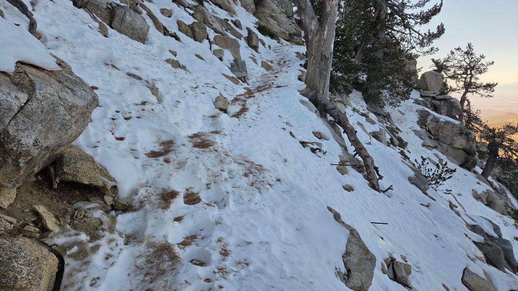
Details are given below under Trail Conditions, but carrying spikes remains advisable everywhere above about 9000 ft, and they can be useful down to 8000 ft in places. Sections of ice and icy snow that remained from November are now largely obscured under thin fresh snow cover, making them especially treacherous. This is especially true on the Peak Trail between 9700-10,100 ft, and on upper Deer Springs Trail (9000-10,500 ft). Spikes tend to be especially helpful for descending, even when they do not seem necessary for ascending.
Snow depths are not currently suitable for snowshoes, except perhaps for off-trail travel around the highest peaks (>10,000 ft), but even then only for the next couple of days as melting is expected to be steady with rising temperatures this week.
Snow depths measured at various locations on the trail system are given towards the end of this posting. Note however that snow depth itself is rarely indicative of the difficulty (or ease) of hiking a particular track or trail. For example a firm, well-compacted track across snow feet deep is often much easier hiking than traversing across just a few inches depth of angled virgin icy snow.
High country temperatures are forecast to remain near or above seasonal for the first ten days of January 2026. Nevertheless, hikers should be prepared for temperatures near or below freezing in the high country (>9800 ft elevation) and at times well below freezing when considering wind chill effects. See the Weather section below for my recent observations from San Jacinto Peak.
The conditions forecast for 31st December-4th January are similar to those on 15th November which resulted in multiple significant hypothermia cases in the San Jacinto high country, and with which I was heavily involved as I alluded in a prior report linked here. Hikers – most notably those from the Tramway where such conditions are less anticipated – may be ascending through rain, before encountering snowfall, stronger winds, and frigid windchills at the highest elevations. Being fully prepared for the challenging combination of both winter conditions and wet weather will be critical (at a minimum, having fully wind- and waterproof clothing, plus multiple dry layers, hats, and gloves stored in a truly waterproof pack system, is very strongly advised). A clear recognition of when turning around is the safest option in such conditions is also invaluable.
Daily survey hikes by the Trail Report year-round in the San Jacinto mountains include multiple routes to the highest peaks including San Jacinto Peak typically at least twice per week (but almost daily during winter storm weather), Tahquitz Peak and area at least once per week, plus a wide variety of other trails on intervening days.
WEATHER
Temperatures rise steadily in the last few days of December, with widespread melting of the very thin snow expected. They will remain somewhat above seasonal in the first week of January, especially at upper elevations, even as a new storm system arrives.
The first five days of January 2026 are forecast to be very unsettled, especially at mid elevations. About two inches of rain are expected at Idyllwild elevation (5000-6000 ft) between the afternoon of Wednesday 31st December and Monday 5th January, heaviest on 31st December and 1st January. The system is expected to be even warmer than that of 23rd-24th December, with freeze levels consistently near or even above 10,000 ft. Snowfall around the highest peaks is tentatively forecast to be several inches spread across the five days, mostly falling on 31st and 1st, with little more than a dusting expected down to 8000 ft, and only roughly 1-3 inches in between, following significant rainfall to 10,500 ft or higher.
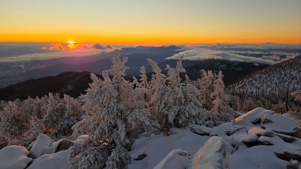
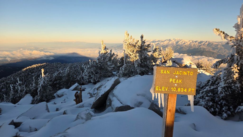
At San Jacinto Peak (10,811ft/3295m) on Saturday 27th December 2025 at 0730 the air temperature was 15.2°F (-9°C), with a windchill temperature of -7.4°F (-22°C), 100% relative humidity, and a bitter NW wind sustained at 20 mph gusting to 28.2 mph.
At the Peak on Friday 26th November 2025 at 1330 the air temperature was 28.4°F (-2°C), with a windchill temperature of 13.4°F (-10°C), 98% relative humidity, and a surprisingly gentle SW wind sustained at 5 mph gusting to 6.5 mph.
At the Peak on Thursday 25th December 2025 at 0645 the air temperature was 20.6°F (-6°C), with a windchill temperature of -0.2°F (-18°C), 98% relative humidity, and a sharp due West wind sustained at 15 mph gusting to 27.0 mph.
At the Peak on Wednesday 24th November 2025 at 1045 the air temperature was 32.3°F (0°C), with a windchill temperature of 15.6°F (-9°C), 96% relative humidity, and a harsh SSW wind sustained at 20 mph gusting to 28.9 mph.
TRAIL CONDITIONS
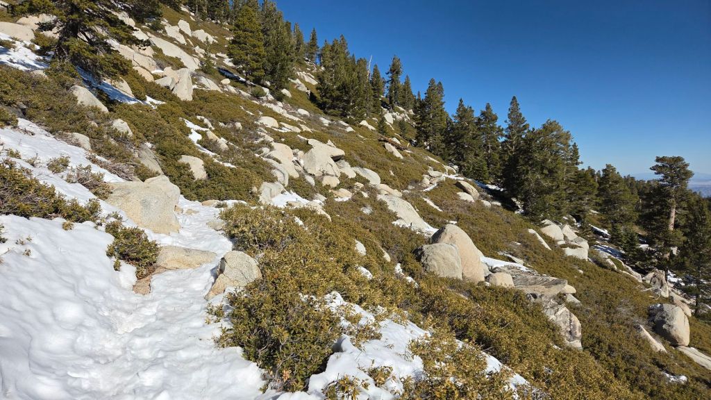
Trails below about 9,900 ft (east side) or 9000 ft (west side) have such a thin covering of snow that they are functionally snow-free, or will largely clear of snow within the next day or two. With sunny days forecast on 28th-31st December in the high country, melting will be rapid, especially on sun-exposed slopes.
Spikes can be useful in places above about 8000 ft, but especially above 9000 ft, depending upon personal preference and comfort level hiking on icy snow. Snow on established trails from storms in November has become densely compacted by hiker traffic, has undergone many freeze-thaw cycles, and has recently been rained upon. Spikes are especially useful for descending heavily traveled high elevation trails (e.g., Peak and upper Deer Springs trails), and also the north side of Tahquitz Peak, which remained largely unmelted from November storms.
Snow depths are generally unsuitable for snowshoeing everywhere due to limited snow depths and compaction/ice.
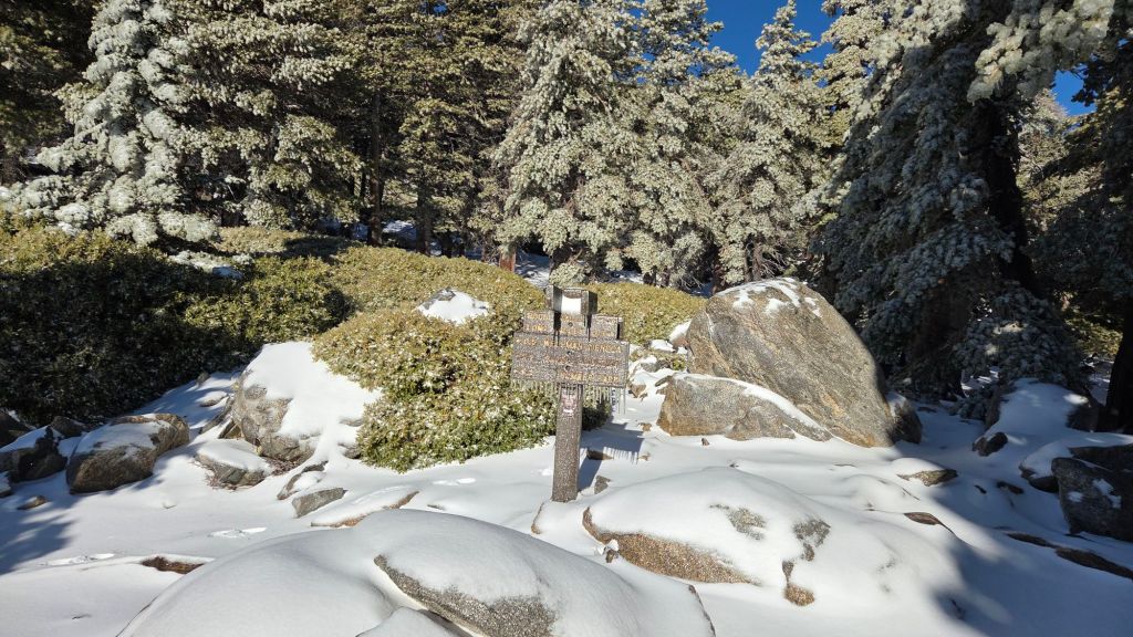
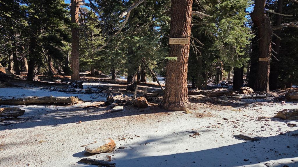
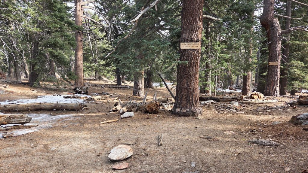
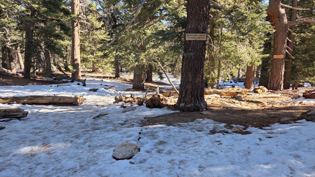
Devil’s Slide Trail is clear of snow, but is very icy in places close to Saddle Junction in the mornings.
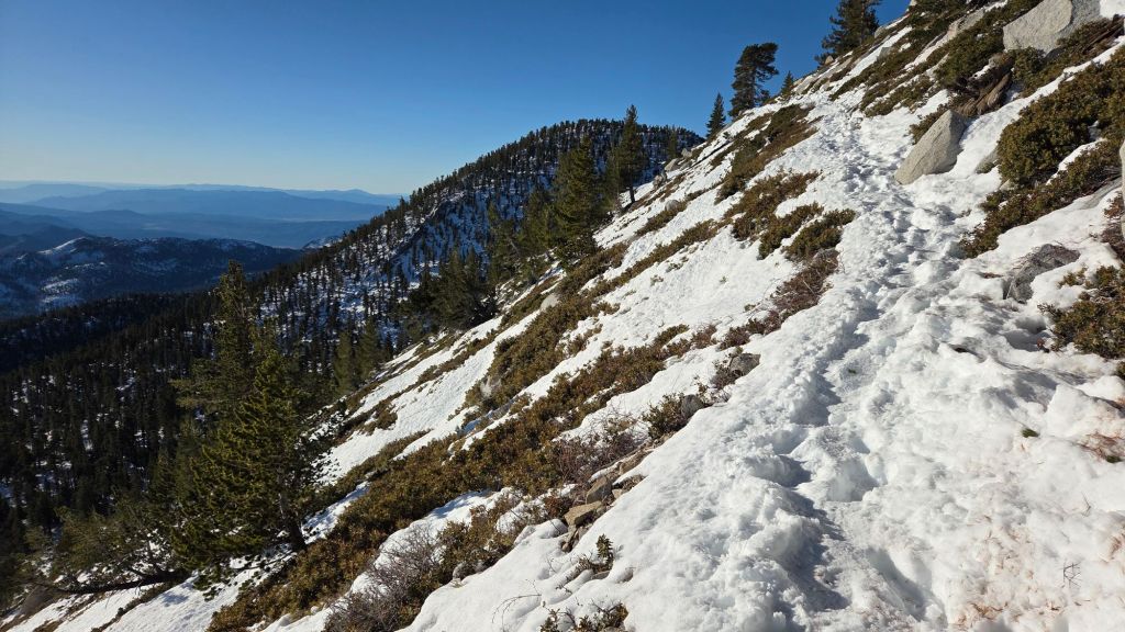
The section of South Ridge Trail from Chinquapin Flat to Tahquitz Peak [updated 29th December] currently has a well-traveled, uneven track to follow through increasingly patchy angled icy snow. A very thin covering of fresh snow partially obscures the persistent compacted icy snow remaining from November. These icy slopes on the north side of Tahquitz Peak are notoriously treacherous. Currently spikes are recommended; they are not essential for hikers most experienced with icy snow travel, but conversely this route will not feel safe for some hikers.
South Ridge Trail [updated 29th December] is functionally clear of snow, but has a few small but tricky ice patches above 8500 ft. There is a patchy dusting of 0.25 inch of snow admixed with ice around Tahquitz Peak. Most hikers may find spikes useful
As of Saturday 27th, there was a lightly-traveled track to follow through very shallow and rapidly melting snow on the Strawberry Trail (PCT Miles 180.8-183).
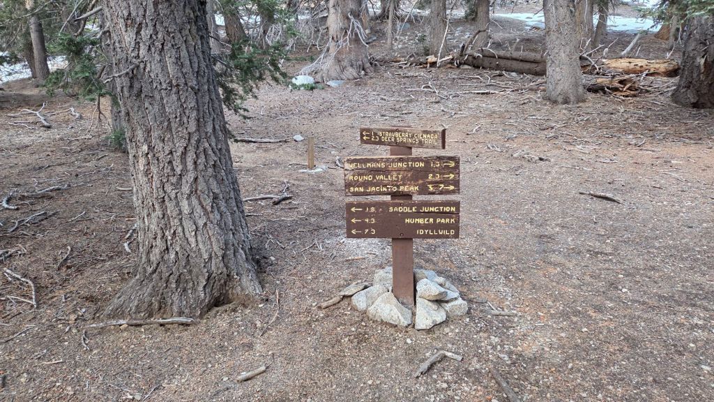
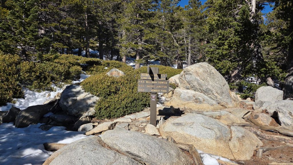
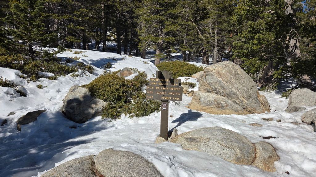
There are well-traveled and compacted tracks on Round Valley Trail through Long and Round valleys to Wellman Divide.
The PCT north from Saddle Junction, continuing onto the Wellman Trail, has a well-traveled track through very light snow cover to Wellman Divide [updated Saturday 27th]. Melting has been rapid on the most sun-exposed section immediately north of Saddle Junction (“Angel’s Glide”) with some lengthy snow-free sections already appearing.
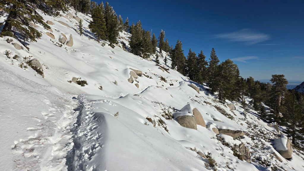
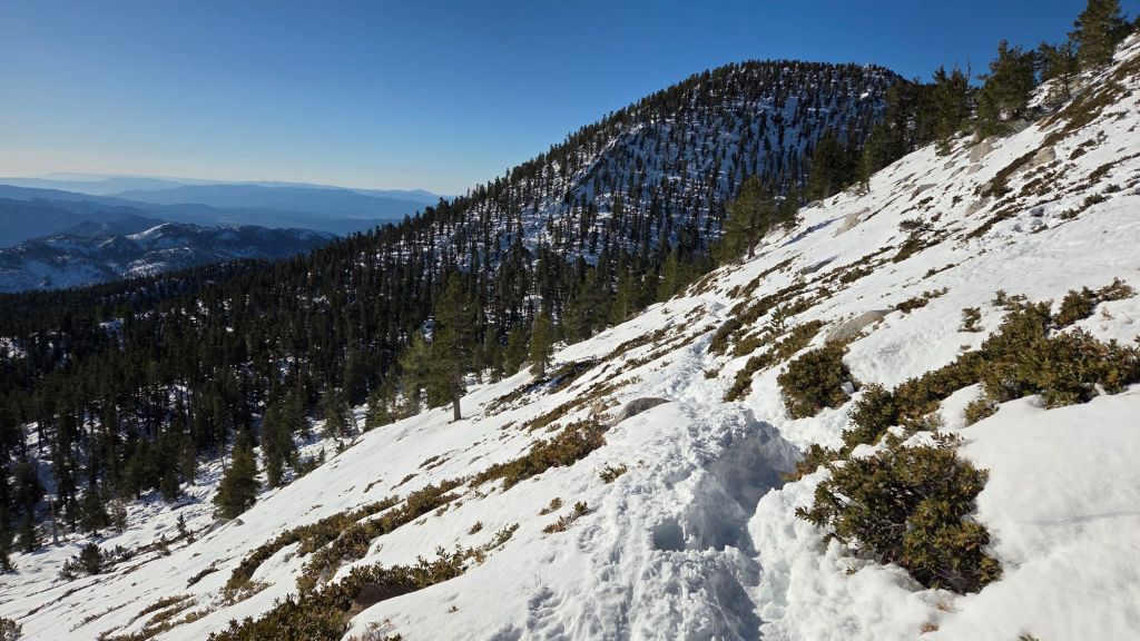
The Peak Trail has a well-traveled track through generally thin continuous snow cover that accurately follows the trail route to the Summit Junction with Deer Springs Trail, and then onward up to San Jacinto Peak.
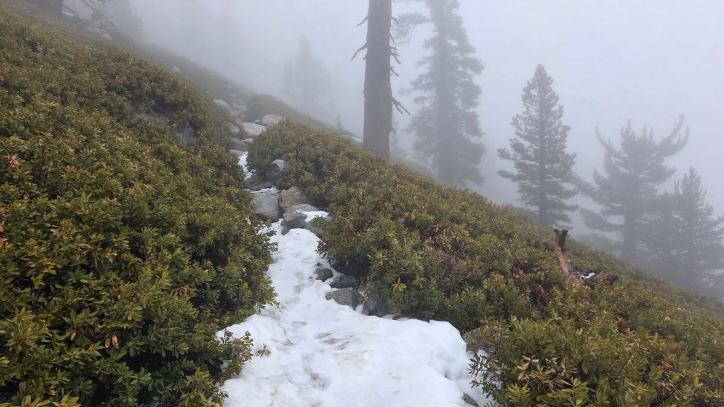
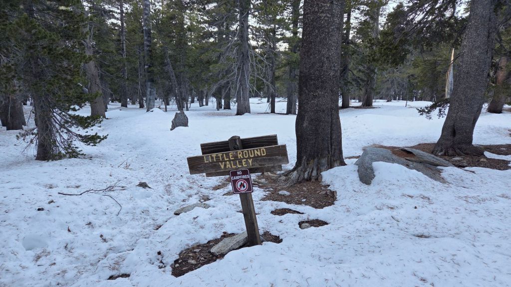
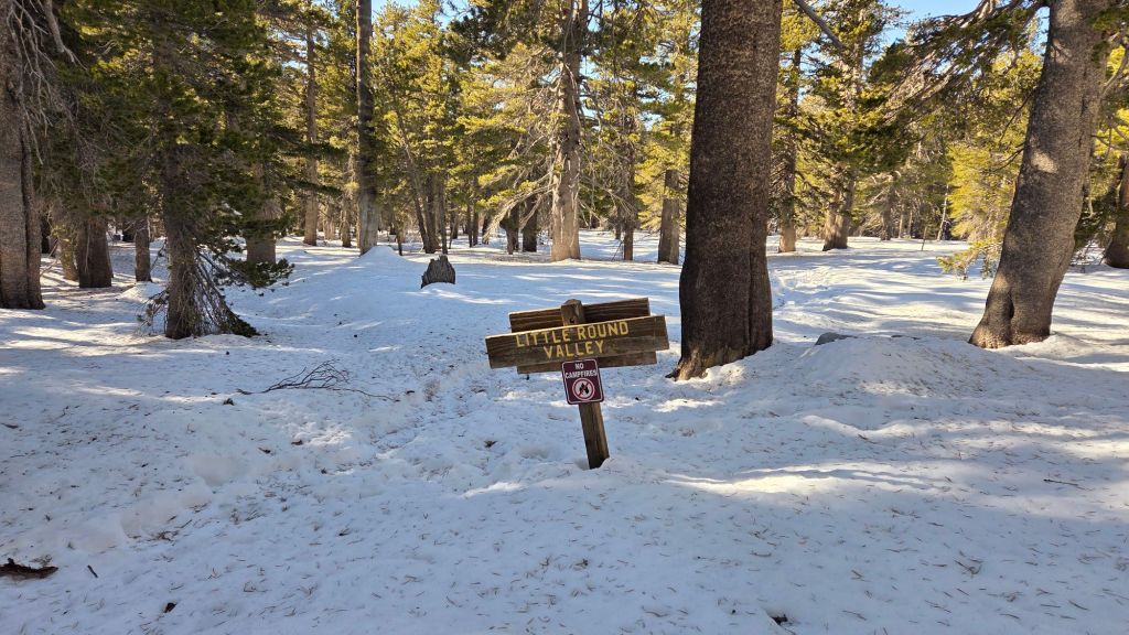
Upper Deer Springs Trail does not have a track to follow through continuous snow above Little Round Valley as of Saturday 27th. The existing tracks will have been completely obscured by fresh snow, which although shallow, was heavily drifted by strong accompanying winds. Spikes are strongly recommended for this route.
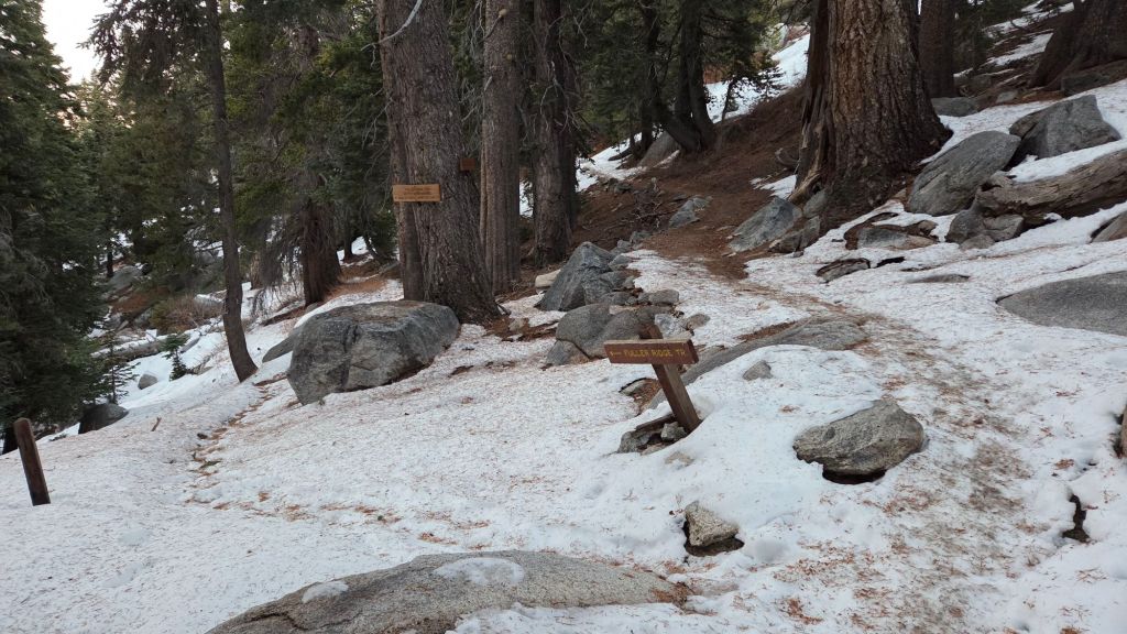
Fuller Ridge Trail [updated Saturday 27th] has a lightly traveled but accurate track to follow through very thin snow cover along its entire length (PCT Miles 185.5-190.5).
SNOW DEPTHS
Snow depths measured on 27th December 2025 are as follows. Current total depth is the first number given, followed (in parentheses) by details of the snowfall in the storm of 23rd-26th December. Altitudes and PCT mileages are approximate.
San Jacinto Peak (10811 ft): 10 inches, drifted deeper in places, notably on East Ridge (0.5 inch added 23rd, 3.5 inches on 24th, 3.5 inches on 26th December)
Wellman Divide (9700 ft): 1 inch (1 inch on 26th December)
Annie’s Junction/PCT Mile 180.8 (9020 ft): 1 inch (1 inches on 26th December)
Long Valley (8500 ft): 1 inch (on 26th December)
Saddle Junction/approx. PCT Mile 179 (8070 ft): <0.25 inch (on 26th December)
Devil’s Slide Trail at Humber Park (6500 ft): 0 inch
Idyllwild (at 5550 ft): 0 inch snow, 1.99 inches rain 23rd-26th December.
The San Jacinto Trail Report celebrates ten years of operation in 2026. It is read by over 30,000 people each year, and will pass one million views in 2026. The Report has helped thousands of hikers, and saved multiple lives, both directly and indirectly. Since the Report became established online, snow/ice rescues in the San Jacinto Mountains have dropped 82%, also saving Riverside County tens, if not hundreds, of thousands of dollars. While all time is volunteered, the Report uses small private donations to help cover operating costs. Donations keep the Report available to all, free from advertising or paywalls, and independent from agencies. If you have found this Report useful, please consider using this link to the Donate page. Thank you very much for your support.
sanjacjon Uncategorized 1 Comment 10 MinutesEdit”Snow and trail update 30th December 2025″
Storm updates 27th December 2025
The fifth storm system of winter 2025/26 is forecast to impact the San Jacinto mountains between Tuesday 23rd and Friday 26th December 2025.
Please check this page for periodic updates – the most recent is at the top – throughout the multiday storm sequence. The next comprehensive Report update, summarizing conditions after the storm, is tentatively scheduled for Saturday 27th.
UPDATE Saturday 27th December at 0700
Overnight snowfall at San Jacinto Peak totaled 3.5 inches, for a rather paltry storm total of 7.5 inches.
I recorded a short video discussion from the Peak at 0730 this morning, giving a feel for the snow conditions underfoot (linked here).
Snow dusted down to 7800 ft, with one inch at 8500 ft (e.g., Long Valley).
Rainfall in Idyllwild at 0700 totaled 0.82 inch in the previous 24 hours.
Hikers this weekend will find spikes invaluable above 9000 ft, as there is extensive ice and icy snow on the main trails now obscured under a thin cover of fresh powder. Snow depths are insufficient for snowshoes, other than perhaps for off-trail travel only around the highest peaks, snd even then only for the next day or two as melting will be steady with warming temperatures.
UPDATE Friday 26th December at 2010
Fine granular snow has so far accumulated to two inches average depth in the past six hours at San Jacinto Peak, although the snow has been heaviest in the past hour.
A light dusting (<0.25 inch) in Long Valley at 8500 ft shortly before dusk melted, it then briefly rained at that elevation before recently turning to snow, with currently 0.5 inch accumulation.
Rainfall this afternoon in Idyllwild totaled 0.47 inch by 1900 (at 5550 ft), where it continues to rain gently.
UPDATE Friday 26th December at 1430
It started raining in Idyllwild at 1350 this afternoon, and about 15 minutes later started snowing lightly and intermittently at San Jacinto Peak. Forecasts have reduced expected precipitation amounts for this final phase of the storm system, with 3-4 inches of snow predicted for the high peaks, and under 0.5 inch rain for Idyllwild. Very light snow is expected as low as 6000 ft.
The Peak Trail is very icy starting immediately above Wellman Divide (9700 ft) and spikes are strongly recommended. The same is almost certainly true on upper Deer Springs Trail (there probably as low as 9000 ft).
UPDATE Thursday 25th December at 1200
There was no further precipitation overnight. I recorded a short video report from San Jacinto Peak this morning just after sunrise (linked here). With clearing skies, a sharp drop in temperatures, and such wet snow yesterday, the snow above 10,000 ft has frozen solid, making for very easy hiking (with spikes and/or appropriate boots).
The next low pressure system arrives tomorrow morning, Friday 26th, and a colder air mass should result in the snow level dropping to 6000 ft, possibly even lower. Snow estimates are about six inches above 10,000 ft and 2-4 inches at 8000 ft (e.g., Saddle and Strawberry junctions). Rainfall of 0.5-0.8 inch is forecast for the mid elevations.
While all time and labor is volunteered, the San Jacinto Trail Report uses small private donations to help cover operating costs. Your contribution keeps the Report available to all, free from advertising or paywalls, and independent from agencies. If you have found this Report useful, please consider using this link to the Donate page. Thank you very much for your support.
UPDATE Wednesday 24th December at 1915
It stopped snowing at San Jacinto Peak at about 1800, where unfortunately only 3.5 inches accumulated today.
The snow level today was astonishingly high, having dusted down to 9000 ft, but with no more than a barely measurable 0.25 inch at Wellman Divide. On his descent to the tram, Kyle Eubanks described Round and Long valleys as having “many rivers and waterfalls”, such was the volume of rainfall (plus snowmelt).
Idyllwild (at 5550 ft) recorded 0.76 inch of rain today, for a storm total of 1.17 inches, less than half the forecast expectations.
UPDATE Wednesday 24th December at 1630
Snowfall has been largely continuous at San Jacinto Peak for the past four hours, but often light, so far accumulating to 2.5 inches. Winds have been sustained at 25-30 mph, with gusts close to 40 mph, but it feels like the strongest winds and heaviest precipitation have slipped past to the west of the San Jacinto mountains.
Rainfall in Idyllwild since 0700 today has totaled 0.45 inch, for a storm total of 0.86 inch so far, roughly half of forecast.
That said, rain intensity is clearly localized, as Long Valley (8500 ft) is reporting 1.4 inches since midnight. I saw Kyle Eubanks at the Peak this afternoon and he commented that trails in Long and Round valleys were “like rivers”, so the relatively low rainfall for Idyllwild is evidently not representative of the whole mountain.
UPDATE Wednesday 24th December at 1200
Precipitation largely stopped at mid and upper elevations between 0700-1000, with light rain starting again above 10,000 ft at about 0950, finally turning to snow at 1150 around San Jacinto Peak. Winds are getting potent in the high country, sustained from SSW at 20 mph, gusting to 29 mph, but forecast to continue strengthening.
UPDATE Wednesday 24th December at 0620
At least in the San Jacinto mountains the initial front of the atmospheric river system is so mild (relatively speaking) that it is currently raining all the way to San Jacinto Peak.
Patchy, and at times intense, rain started in Idyllwild at 0200, with rain accumulation overnight 0.26 inch in Idyllwild (at 5550 ft), for a current storm total of 0.41 inch, with 0.22 reported in Long Valley (8500 ft).
UPDATE Tuesday 23rd December at 1700
One “arm” of the dramatic low pressure system forming off the California coast passed over the San Jacinto mountains around 1130 this morning, bringing light precipitation throughout. The temperature plunged more than 10°F in less than half-an-hour in the high country, and it briefly snowed above 8000 ft (with 0.5 inch briefly accumulating above 10,000 ft, and barely a dusting in Long Valley), and about 0.02 inch of drizzle in Idyllwild. The temperature rose again subsequently, largely melting the minimal fresh snow. It remained misty and drizzly throughout the early afternoon, totaling 0.15 inch in Idyllwild, before beautifully clearing out at dusk.
sanjacjon Uncategorized Leave a comment 4 MinutesEdit”Storm updates 27th December 2025″
Snow and weather update 22nd December 2025
The major blocking high pressure area over the south-west of the country continued to generate very warm and dry conditions for our region for most of the first three weeks of December. A significant atmospheric river system is forecast to impact Southern California on 23rd-26th December. While precipitation volumes and timing remain somewhat uncertain for the San Jacinto mountains, the bulk of the system will be relatively mild, with a high freeze level, and snowfall largely above about 9000 ft, before the freeze level drops, with snow possibly as low as 6500 ft, by late on 26th. Considerable rainfall (2.5-3.5 inches across four days) is expected throughout mid elevations. Unsettled conditions, with possibilities for further light precipitation (snow in the high country, rain at mid elevations) may persist for the last three days of the year and the first three days of January.
Since the minor snow storms that impacted the region for nine days in mid November – discussed in detail in a prior Report linked here – temperatures generally well above seasonal have led to very rapid snow melt for the time of year (photos below).
The air temperature of 52.2°F (11°C) that I recorded at San Jacinto Peak on Thursday 11th December 2025 shattered (by 3°F) the previous high temperature knowingly recorded at the Peak in the month of December.
Once temperatures drop markedly from 23rd December onwards, hikers must be prepared for temperatures below freezing at high elevations, and potentially far below freezing when considering wind chill effects, with strong winds (>30 mph) forecast on many days. See the Weather section below for my recent observations from San Jacinto Peak.
The conditions forecast for 24th-25th December are similar to those on 15th November which resulted in multiple significant hypothermia cases in the San Jacinto high country (the overlap with a holiday period adding a further complication) to which I briefly alluded in a prior report linked here. Hikers – most notably those from the Tramway where such conditions are rarely anticipated – may be ascending through rain, before encountering snow, strong winds, and frigid windchills at the highest elevations. Being fully prepared for the challenging combination of both genuine winter conditions and very wet weather will be critical (at a minimum, having fully wind- and waterproof clothing, plus multiple dry layers, hats, and gloves stored in a truly waterproof pack system, is very strongly advised). A clear recognition of when turning around is the safest option in such conditions is also invaluable.
Details are given below under Trail Conditions, but most hikers will find that carrying spikes remains advisable in areas above about 9000 ft, although experienced hikers will find they are generally no longer needed on established trails even well above that elevation. Spikes tend to be especially helpful for descending, even when they seem to be of limited use for ascending.
Current snow depths measured at various locations on the trail system are given near the foot of this posting. Note that these are expected to change starting Wednesday 24th. Also note that snow depth itself is rarely indicative of the difficulty (or ease) of hiking a particular track or trail. For example a firm, well-compacted track across snow feet deep is often much easier hiking than traversing across just a few inches depth of, for example, angled virgin icy snow. Conversely, just a one inch covering of icy snow at mid-elevations (where there have been many freeze-thaw cycles) can be among the most treacherous surfaces to hike.
Black Mountain Road (4S01) closed to vehicle traffic in mid November at the gate 1.7 miles up from Highway 243. Despite being clear of snow for most of December it is now expected to remain closed for the winter season, per Forest Service.
Daily survey hikes by the Trail Report year-round in the San Jacinto mountains include multiple routes to the highest peaks including San Jacinto Peak typically at least twice every week (and even more frequently during stormy weather), Tahquitz Peak and area at least once per week, plus a wide variety of other trails on intervening days.
WEATHER
Temperatures have generally been well above seasonal since the last week of November (with the brief exception of 1st-4th December). They are forecast to remain far above seasonal until 22nd December, after which the current “blocking” high pressure system is forecast to move east, allowing a storm system flow to return (perhaps only briefly) to Southern California.
Significant rainfall is expected at mid elevations, with about three inches of rain forecast between 23rd and 26th December at 5000-6000 ft. Rainfall will be heaviest and probably continuous on Wednesday 24th, but lighter and more intermittent on 25th-26th.
Snowfall predictions for the high country have varied significantly, but most recent forecast models suggest 12-20 inches of snow are possible around the highest peaks of the San Jacinto mountains, largely on Wednesday 24th but continuing into the 25th. Regardless of precise snow volumes, the system is expected to be relatively warm, at least initially, with freeze levels largely remaining above 8000 ft, and hence little (or possibly even no) snowfall expected at mid elevations. It is most likely that any snowfall in the mid elevations will accumulate as the coldest part of the storm system moves through late on Friday 26th, when 1-2 inches are possible at the higher elevations of Pine Cove and Fern Valley.
Further waves of unsettled weather are tentatively forecast almost daily between 29th December and 3rd January, with light rainfall (mid elevations) and very light snowfall (highest elevations) possible on some or even all of those days. Currently the timing and volume of precipitation on those days is uncertain, but will become clearer over the course of the next week.
The second, third, and fourth storm systems of winter 2025/26 all impacted the San Jacinto mountains in quick succession, on 14th-16th, 17th-18th, and 20th-22nd November, respectively. All three storms were relatively mild, with high freeze levels and very limited snow below 7000 ft. The storm sequence and precipitation outcomes were described in detail in an earlier Report (linked here).
At San Jacinto Peak (10,811ft/3295m) on Monday 22nd December 2025 at 0845 the air temperature was 39.9°F (4°C), with a windchill temperature of 27.5°F (-2°C), 26% relative humidity, and a stiffening SW wind sustained at 12 mph gusting to 20.3 mph.
At the Peak on Thursday 18th December 2025 at 0840 the air temperature was 44.3°F (7°C), with a windchill temperature of 34.5°F (1°C), 44% relative humidity, and a fresh NW wind sustained at 10 mph gusting to 15.6 mph.
At the Peak on Monday 15th December 2025 at 0830 the air temperature was 40.4°F (5°C), with a windchill temperature of 34.5°F (1°C), 22% relative humidity, and a very light due North wind sustained at 2 mph gusting to 5.5 mph.
At the Peak on Thursday 11th December 2025 at 0830 the air temperature was 52.2°F (11°C), with a “windchill” temperature of 48.4°F (9°C), 15% relative humidity, and a barely discernable SE wind sustained at 2 mph gusting to 3.5 mph. This is the first time I have ever recorded an air temperature exceeding 50°F in December at the Peak, and this is undoubtedly a record high for the month at that location.

TRAIL CONDITIONS
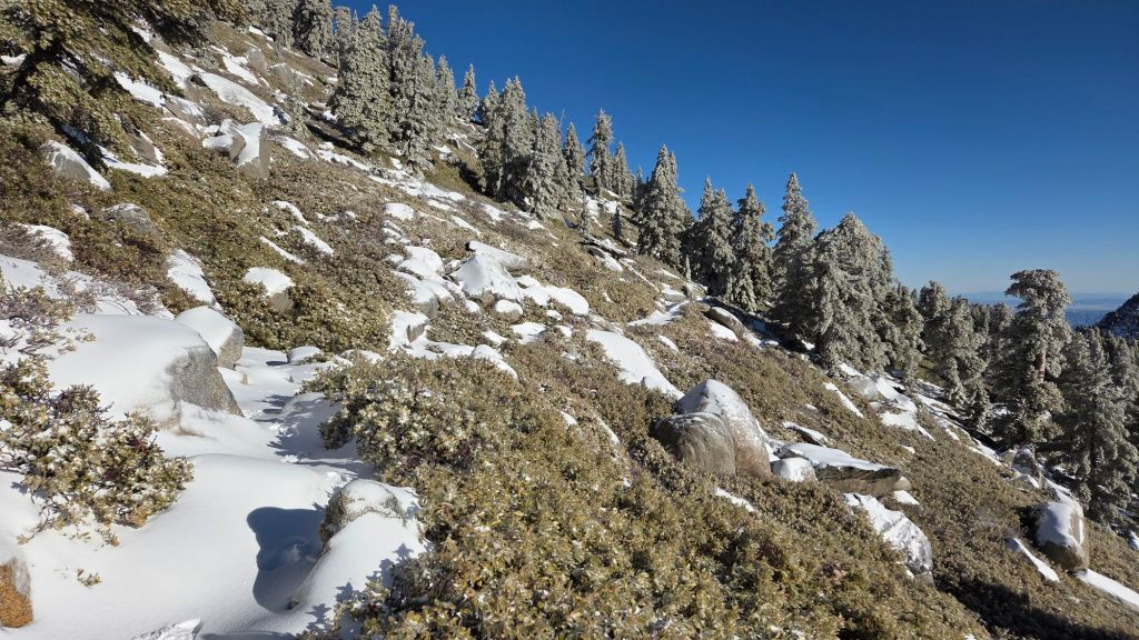
Trails above about 9500 ft remain largely snow-covered (details below), especially on the less-exposed western slope trails. With above seasonal temperatures almost continuously since 24th November, melting has been unusually rapid for the time of year, especially on sun-exposed slopes. This melting will continue with warm temperatures forecast to persist until 22nd December.
Spikes can be useful above about 9000 ft, locally as low as 8500 ft, as established trails have become consolidated by hiker traffic and undergone freeze-thaw cycles. They are especially useful for descending parts of heavily traveled tracks where the snow persists (most notably uppermost Deer Springs Trail). Snow depth and condition is no longer suitable for snowshoes, even for off-trail travel at the highest elevations.
Devil’s Slide Trail [updated 22nd December] is now clear of icy snow. A few tiny, persistent, icy snow patches remain above 7700 ft, but most are so dirt-covered at this time that underfoot traction is rarely a concern. Spikes are no longer required.
There is a well-traveled, compacted track on the PCT south from Saddle Junction to Chinquapin Flat/PCT Mile 178 [updated 18th December]. Snow cover has dropped markedly this week, to about 40%.
The section of South Ridge Trail from Chinquapin Flat to Tahquitz Peak [updated 20th December] has a very well-traveled track to follow through increasingly patchy angled icy snow. These icy slopes on the north side of Tahquitz Peak are notoriously treacherous, and see so little direct sunlight in December and January that conditions change slowly at this time of year. That said, some cleared patches have appeared this week, especially at the Chinquapin Flat (northern) end. Spikes are recommended for most hikers, but even then parts of the route may not be comfortable for all (photo above).
South Ridge Trail south of Tahquitz Peak [updated 20th December] is now clear of snow to Tahquitz Peak, with a few tiny icy patches remaining above 8500 ft (switchback 9).
The Strawberry Trail (PCT Miles 180.8-183) is functionally clear of snow, other than patches that persist for 0.1 mile at its eastern end, and in a handful of forested sections nearer Strawberry Junction.
Willow Creek Trail [updated 18th December] averages less than 10% thin snow cover to Hidden Divide.
There are well-traveled and compacted tracks on Round Valley Trail through Long and Round valleys to Wellman Divide, and on the “Sid Davis” route, the latter emerging at the Peak Trail near 10,000 ft [updated 15th December]. Both routes are starting to have extensive bare patches appear in their most exposed sections.
The PCT north from Saddle Junction [updated 22nd December] is now clear of snow to 9000 ft elevation, with just a few small icy snow patches persisting on this very sun-exposed south-facing slope. From 9000 ft, where the trail enters forest, to Annie’s Junction, has cleared dramatically in the past few days, and now averages only 10% snow cover. Most hikers will find spikes are not required.
The Wellman Trail [updated 22nd December] averages less than 10% snow cover, concentrated in the forested section at its southern end (closest to Annie’s Junction). Spikes are not required.
The Peak Trail [updated 22nd December] has a rapidly diminishing 30% cover of softening and generally thin snow, largely confined to the sheltered section around 10,000 ft, and then above 10,400 ft. There is a split in hiker traffic – as is traditional in winter – near Miller Peak at 10,400 ft. The East Ridge route is a somewhat meandering (but well-compacted) route through 90% continuous snow cover to San Jacinto Peak. The Peak Trail itself above 10,400 ft now has a heavily-traveled track to follow through 80% snow cover. Trails just below San Jacinto Peak proper have largely consolidated into 3-4 alternate routes, all of which ultimately reach the peak. Spikes are no longer essential on this trail for those with extensive experience of snow hiking. Snow cover on the exposed south- and east-facing slopes around San Jacinto Peak is now only 30%, and averages just 1-2 inches in most places, with drifts to 10 inches.
Deer Springs Trail [updated 15th December] is clear of snow to 8500 ft (just 0.4 mile south of the Marion Mountain Trail junction). Although snow cover still averages about 90% thereafter all the way to San Jacinto Peak, lengthy bare patches are starting to appear even as high as 10,500 ft in the most sun-exposed areas, and these will expand steadily over the next week. After the Marion junction, the track is well-traveled and compacted to Little Round Valley, almost entirely following the trail route accurately (spikes useful for descending). Above Little Round Valley there are myriad posthole track options, but the most heavily traveled now almost entirely follows the actual trail route. The other, more direct tracks, are now harder to follow as they encounter rocks and vegetation in the rapidly expanding snow-free areas.
Marion Mountain Trail [updated 15th December] is now largely clear of snow to the junction with the PCT/Deer Springs Trail. Nevertheless, two sections of persistent icy snow sections remain, one for about 0.4 mile in the central (most sheltered) portion of the trail, and the other the final 0.1 mile closest to the PCT. Some hikers will find that spikes remain very useful, especially for descending, as some of the icy snow patches are treacherous. The Trail Report removed one new blowdown from the lower trail on 9th, but there is another significant one about 0.7 mile from the top (with a fairly easy workaround).
Seven Pines Trail [updated 15th December] has no tracks to follow through the patchy snow on its uppermost section.
Fuller Ridge Trail (PCT Miles 185.5-190.5) [updated 15th December] has a lightly traveled but accurate posthole track to follow through the remaining 20% snow cover in its most sheltered sections. Sun-exposed areas (notably Miles 186-186.6 and 187.5-188.5) and those closest to Black Mountain Road (north from Mile 189.5) are now clear of snow.
Black Mountain Trail (2E35) was functionally clear of snow by 3rd December, with just a few tiny icy snow patches near the top. Four medium-sized treefall hazards include three within 0.1 mile of one another about 1.5 miles up from the trailhead, plus another just below the top of the trail, but all have easy workarounds. The climbers trail section that continues from the top of the trail to the fire lookout still has about 20% icy snow cover, as does the uppermost access road to the tower.
SNOW DEPTHS
Snow depths measured on 22nd December 2025 (most locations) and 15th December (Deer Springs Trail) are as follows. Current total depth is the first number given, followed (in parentheses) by the total measured in November following the most recent storms. Altitudes and PCT mileages are approximate.
San Jacinto Peak (10811 ft): 0-3 inches (was 17 inches on 24th November)
Little Round Valley (9800 ft): 4-5 inches (was 15-18 inches in late November)
Wellman Divide (9700 ft): 0 inch (was 11 inches on 24th November)
Annie’s Junction/PCT Mile 180.8 (9020 ft): 0 inch (was 12 inches on 24th November)
Fuller Ridge Trail junction with Deer Springs Trail/PCT Mile 185.5 (8900 ft): 2-3 inches (was 10-12 inches in late November)
Long Valley (8500 ft): 0-1 inch (was 8 inches on 24th November)
Saddle Junction/PCT Mile 179 (8070 ft): 0 inch (was 8 inches on 24th November)
Strawberry Junction/PCT Mile 183 (8050 ft): 0 inches (was 6 inches in late November)
Devil’s Slide Trail at Humber Park (6550 ft): 0 inch by 24th November.
While all time and labor is volunteered, the San Jacinto Trail Report uses small private donations to help cover operating costs. Your contribution keeps the Report available to all, free from advertising or paywalls, and independent from agencies. If you have found this Report useful, please consider using this link to the Donate page. Thank you very much for your support.

sanjacjon Uncategorized Leave a comment 11 MinutesEdit”Snow and weather update 22nd December 2025″
Snow and trail update 13th December 2025
A major blocking high pressure system just west of California will continue to generate warm, relatively calm, and extremely dry conditions for our region into the second half of December. There are tentative forecasts suggesting the jet stream may return to Southern California late in December, around 22nd-26th. Three minor snow storms impacted the San Jacinto mountains in nine days in mid November, as discussed in detail in a prior Report (linked here). Since then, temperatures generally well above seasonal have led to rapid snow melt (for the time of year, given the Sun is at its weakest of the year).
The air temperature of 52.2°F (11°C) that I recorded at San Jacinto Peak on Thursday 11th December 2025 shattered (by 3°F) the previous high temperature knowingly recorded at the Peak in the month of December. Forecasts suggest that the new record could even be exceeded again early next week.
Details are given below under Trail Conditions, but most hikers will find that spikes remain useful in many areas above about 9000 ft, although experienced hikers may find they are no longer essential on established trails even well above that elevation. Despite rapid melting, challenging icy patches persist as low as 7700 ft, notably on Devil’s Slide and Marion Mountain trails. Spikes tend to be especially helpful for descending, even when they seem unnecessary for ascending.
Snow depths measured at various locations on the trail system are given near the foot of this posting. Note however that snow depth itself is rarely indicative of the difficulty (or ease) of hiking a particular track or trail. For example a firm, well-compacted track across snow feet deep is often much easier hiking than traversing across just a few inches depth of, for example, angled virgin icy snow. Conversely, just a one inch covering of icy snow at mid-elevations (where there have been many freeze-thaw cycles) can be among the most treacherous surfaces to hike.
Temperatures are forecast to be far above seasonal into the second half of December. Nevertheless, it is (nominally) winter and hikers should be prepared for temperatures near freezing above 10,000 ft elevation, and periodically below freezing when considering wind chill effects. This advisory may be especially important after 20th December. See the Weather section below for my recent observations from San Jacinto Peak.
Black Mountain Road (4S01) closed to vehicle traffic in mid November at the gate 1.7 miles up from Highway 243. Despite being clear of snow it is now expected to remain closed for the winter season, according to Forest Service.
Be bear aware. Although generally rarely reported, at least six individually identifiable Black Bears have been observed in the San Jacinto mountains since 2017 (I have personally encountered at least one annually for the past seven years). A full-sized adult bear with a right ear tag has been seen in multiple locations from Willow Creek to Fern Valley since August (see my video from a trail cam on 14th September available here, and images from Fern Valley in late August in a prior Report linked here). A smaller, second individual has been reliably reported at least twice, most recently in late September in lower Fern Valley. My brief videos from Devil’s Slide Trail in September 2021 (linked here) and one walking past our house in 2018 (linked here) show two further individuals. There have been no reports of negative interactions with humans in the high country, at or near campsites, or on trails, but bear-safe storage of food when camping is recommended.
Daily survey hikes by the Trail Report year-round in the San Jacinto mountains include multiple routes to the highest peaks including San Jacinto Peak typically at least twice per week (much more frequently during stormy weather and in winter), Tahquitz Peak and area at least once per week, plus a wide variety of other trails on intervening days.
WEATHER
Temperatures were well above seasonal in the last week of November, and following a few days of cooler seasonal temperatures on 1st-4th, they again warmed to well above average starting Friday 5th. Temperatures are forecast to remain far above seasonal until 20th December, after which there is a possibility that the current “blocking” high pressure system moves away, allowing the jet stream flow to return to Southern California (although details of possible precipitation remain unclear at this time).
The second, third, and fourth storm systems of winter 2025/26 all impacted the San Jacinto mountains in quick succession, on 14th-16th, 17th-18th, and 20th-22nd November, respectively. All three storms were relatively mild, with high freeze levels and very limited snow below 7000 ft. The storm sequence and precipitation outcomes were described in detail in an earlier Report (linked here).
At San Jacinto Peak (10,811ft/3295m) on Thursday 11th December 2025 at 0830 the air temperature was 52.2°F (11°C), with a “windchill” temperature of 48.4°F (9°C), 15% relative humidity, and a barely discernable SE wind sustained at 2 mph gusting to 3.5 mph. This is the first time I have ever recorded an air temperature exceeding 50°F in December at the Peak, and this is undoubtedly a record high for the month at that location.
At the Peak on Tuesday 9th December 2025 at 0750 the air temperature was 40.5°F (5°C), with a windchill temperature of 29.5°F (-1°C), 16% relative humidity, and a persistent NNE wind sustained at 15 mph gusting to 21.6 mph.
At the Peak on Monday 8th December 2025 at 0820 the air temperature was 37.2°F (3°C), with a windchill temperature of 28.0°F (-2°C), 31% relative humidity, and a light NNW wind sustained at 4 mph gusting to 10.5 mph.
At the Peak on Thursday 4th December 2025 at 0840 the air temperature was 24.5°F (-4°C), with a windchill temperature of 8.2°F (-13°C), 13% relative humidity, and a remarkably steady NE wind sustained at 15 mph gusting to 17.7 mph.
TRAIL CONDITIONS
All trails above about 8500 ft remain largely snow-covered (details below), although the frequency and extent of snow-free patches has increased rapidly this week. With above seasonal temperatures almost continuously since 24th November, melting has been unusually rapid for the time of year, especially on sun-exposed slopes. This melting will accelerate further with unusually warm temperatures forecast for the next week at least.
Spikes can be useful above about 9000 ft, locally as low as 7700 ft, as established trails have become consolidated by hiker traffic and undergone freeze-thaw cycles. They are especially useful for descending parts of heavily traveled tracks where the snow has become compacted and icy (e.g., Devil’s Slide, Wellman, Peak, Round Valley, Marion Mountain, and uppermost Deer Springs trails).
Snow depths are marginally suitable for snowshoes above about 9500 ft, but only for off-trail travel. They are no longer useful on established high country trails which are all now heavily compacted. Snow depths everywhere are dropping steadily, and snowshoes will be of little or no use, even off-trail, by mid December.
Devil’s Slide Trail [updated 11th December] is clear of icy snow to about 7700 ft. Above that elevation average ice cover is now only 20% to Saddle Junction. Nevertheless some of the small, persistent, icy snow patches are treacherous, especially those closest to Saddle Junction, and many hikers will continue to find traction devices are helpful on the uppermost trail, especially for descending.
There is a well-traveled, compacted track on the PCT south from Saddle Junction to Chinquapin Flat/PCT Mile 178 [updated 11th December]. Snow cover has dropped markedly this week, to about 80%.
The section of South Ridge Trail from Chinquapin Flat to Tahquitz Peak [updated 13th December] now has a well-traveled track to follow through the angled icy snow. These icy slopes on the north side of Tahquitz Peak are notoriously treacherous, and see no direct sunlight in December and January, so conditions change very slowly at this time of year. Spikes are recommended for most hikers, but even then the route will not be comfortable for all (photo below).
South Ridge Trail south of Tahquitz Peak [updated 13th December] is functionally clear of snow to Tahquitz Peak, with a limited number of small icy patches remaining mainly above 8500 ft (switchback 9). Most hikers will find spikes are no longer needed.
There is a lightly-traveled posthole track to follow through shallow and rapidly melting snow on the Strawberry Trail (PCT Miles 180.8-183). The bulk of this trail is very sun-exposed and snow cover now averages only 10% on this trail.
Willow Creek Trail [updated 11th December] has a lightly traveled track to follow through shallow and patchy snow to Skunk Cabbage Meadow. Thereafter the trail is largely clear of snow to Hidden Divide.
There are well-traveled and compacted tracks on Round Valley Trail through Long and Round valleys to Wellman Divide, and on the “Sid Davis” route, the latter emerging at the Peak Trail near 10,000 ft [updated 11th December]. Both routes are starting to have extensive bare patches appear in their most exposed sections.
The PCT north from Saddle Junction [updated 11th December] is now largely clear of snow to 9000 ft elevation, with just a few small icy snow patches persisting on this very sun-exposed south-facing slope. From 9000 ft, where the trail enters forest, there is a well-traveled, compacted, track through light snow cover (now about 90%) to Annie’s Junction and north onto the Wellman Trail.
The Wellman Trail [updated 11th December] averages only about 30% snow cover, concentrated in the most forested sections. The remaining, sun-exposed, areas are clearing rapidly.
The Peak Trail [updated 11th December] has a well-traveled, compacted, track through 90% snow cover that accurately follows the trail route. Several snow-free patches have appeared in the past few days, and these will expand considerably in the next week. There is a split in hiker traffic – as is traditional in winter – near Miller Peak at 10,400 ft, with two equally prominent tracks, one taking the East Ridge on a somewhat meandering (but well-compacted) route to San Jacinto Peak, and the Peak Trail itself above 10,400 ft now having a defined but often lumpy posthole track to follow (photo above). Trails just below San Jacinto Peak proper have largely consolidated into 3-4 alternate routes, all of which ultimately reach the peak. Most hikers are clearly using spikes on this trail, but they are no longer essential for those with extensive experience of snow hiking.
Deer Springs Trail [updated 9th December] is clear of snow to Strawberry Junction. Above Strawberry Junction snow cover has rapidly thinned and largely cleared to 8500 ft (just 0.5 miles south of the Marion Mountain Trail junction). Although snow cover averages 90% thereafter all the way to San Jacinto Peak, lengthy bare patches are starting to appear even as high as 9650 ft in the most sun-exposed areas, and these will expand steadily over the next week or two. Where snow remains between Strawberry Junction and the top of Marion Mountain Trail (approx. PCT Miles 183-185) there is only a moderately traveled posthole track but the snow is thin and easy underfoot. After the Marion junction, the track is well-traveled and compacted to Little Round Valley, almost entirely following the trail route accurately (spikes useful for descending). Above Little Round Valley there are myriad posthole track options, one of which largely follows the actual trail route, but it is rarely the most heavily traveled, most compacted, or indeed the best option, but eventually all the tracks seem to ultimately make their way up towards the Peak (example photo below).
Marion Mountain Trail [updated 9th December] is completely clear of snow to 7700 ft, a little above midway to the junction with the PCT/Deer Springs Trail. In the upper half of the trail snow cover now averages only 30%, but note that some of the persistent snow sections are lengthy and very icy. Spikes remain very useful, especially for descending, as some of the icy snow patches are treacherous. The Trail Report removed one new blowdown from the lower trail on 9th, but there is another significant one about 0.7 mile from the top (with a fairly easy workaround).
Seven Pines Trail [updated 9th December] has no tracks to follow through the snow on its upper section.
Fuller Ridge Trail (PCT Miles 185.5-190.5) [updated 9th December] has a lightly traveled but accurate posthole track to follow through the remaining 30% snow cover in its most sheltered sections. Sun-exposed areas (notably Miles 186-186.6 and 187.5-188.5) and those closest to Black Mountain Road (north from Mile 189.5) are now functionally clear of snow.
Black Mountain Trail (2E35)[updated 3rd December 2025] is functionally clear of snow, with just a few tiny icy snow patches near the top. Four medium-sized treefall hazards include three within 0.1 mile of one another about 1.5 miles up from the trailhead, plus another just below the top of the trail, but all have easy workarounds. The climbers trail section that continues from the top of the trail to the fire lookout still has about 40% icy snow cover, as does the uppermost access road to the tower.
SNOW DEPTHS
Snow depths measured on 9th December (Deer Springs Trail locations) and 8th December 2025 (elsewhere) are as follows. Current total depth is the first number given, followed (in parentheses) by the total measured in November following the most recent storms. Altitudes and PCT mileages are approximate.
San Jacinto Peak (10811 ft): 7-8 inches (was 17 inches on 24th November)
Little Round Valley (9800 ft): 5-7 inches (was 15-18 inches in late November)
Wellman Divide (9700 ft): 1-2 inches (was 11 inches on 24th November)
Annie’s Junction/PCT Mile 180.8 (9020 ft): 2 inches (was 12 inches on 24th November)
Fuller Ridge Trail junction with Deer Springs Trail/PCT Mile 185.5 (8900 ft): 5 inches (was 10-12 inches in late November)
Long Valley (8500 ft): 2-3 inches (was 8 inches on 24th November)
Saddle Junction/PCT Mile 179 (8070 ft): 0-2 inches (was 8 inches on 24th November)
Strawberry Junction/PCT Mile 183 (8050 ft): 0 inches (was 6 inches in late November)
Devil’s Slide Trail at Humber Park (6550 ft): 0 inch by 24th November.
While all time and labor is volunteered, the San Jacinto Trail Report uses small private donations to help cover operating costs. Your contribution keeps the Report available to all, free from advertising or paywalls, and independent from agencies. If you have found this Report useful, please consider using this link to the Donate page. Thank you very much for your support.


sanjacjon Uncategorized Leave a comment 11 MinutesEdit”Snow and trail update 13th December 2025″
Snow and trail update 6th December 2025
Three minor snow storms impacted the San Jacinto mountains in nine days in mid November, as discussed in detail in the previous Report (linked here). Since then, a week of above seasonal temperatures has led to relatively rapid melting (for the time of year). Although this week is cooling to about seasonal, further dry, warm, weather is expected to return and persist into mid December, with currently no significant additional precipitation in the forecasts.
Details are given below under Trail Conditions, but spikes remain valuable in many areas above about 8000 ft, although experienced hikers may find they are no longer essential on established trails even well above that elevation. Despite rapid melting, treacherous icy patches persist as low as 7700 ft, notably on Devil’s Slide and Marion Mountain trails. Spikes tend to be especially helpful for descending, even when they are unnecessary for ascending. Snow depths are locally suitable for snowshoes above about 9500 ft, but generally only off-trail. They are no longer useful on established trails which are now heavily compacted (and hence ideal for spikes) such as Round Valley Trail, Peak Trail, Wellman Trail, and the posthole route on upper Deer Springs Trail.
Snow depths measured at various locations on the trail system are given towards the end of this posting. Note however that snow depth itself is rarely indicative of the difficulty (or ease) of hiking a particular track or trail. For example a firm, well-compacted track across snow feet deep is often much easier hiking than traversing across just a few inches depth of, for example, angled virgin icy snow. Conversely, just a one inch covering of icy snow at mid-elevations (where there have been many freeze-thaw cycles) can be the most treacherous surface to hike.
Temperatures are forecast to be generally above seasonal into mid December. Nevertheless, hikers should be prepared for temperatures near or below freezing above 10,000 ft elevation, and at times well below freezing when considering wind chill effects, the latter in particular during the passage of a cold front to the north on 3rd-4th December. See the Weather section below for my recent observations from San Jacinto Peak.
Be bear aware. Although generally rarely reported, at least six individually identifiable Black Bears have been observed in the San Jacinto mountains since 2017 (I have personally encountered at least one annually for the past seven years). A full-sized adult bear with a right ear tag has been seen in multiple locations from Willow Creek to Fern Valley since August (see my video from a trail cam on 14th September available here, and images from Fern Valley in late August in a prior Report linked here). A smaller, second individual has been reliably reported at least twice, most recently in late September in lower Fern Valley. My brief videos from Devil’s Slide Trail in September 2021 (linked here) and one walking past our house in 2018 (linked here) show two further individuals. There have been no reports of negative interactions with humans in the high country, at or near campsites, or on trails, but bear-safe storage of food when camping is recommended.
Daily survey hikes by the Trail Report year-round in the San Jacinto mountains include multiple routes to the highest peaks including San Jacinto Peak typically at least twice per week (much more frequently during stormy weather and in winter), Tahquitz Peak and area at least once per week, plus a wide variety of other trails on intervening days.

WEATHER
Temperatures were well above seasonal in the last week of November, and following a few seasonal days on 1st-4th, will again be well above average starting Friday 5th, then potentially far above average on 8th-12th December. During the latter period, temperatures will be especially mild in the high country (more akin to early April than early December), and melting of snow is expected to be steady throughout, and rapid on sun-exposed slopes.
The second, third, and fourth storm systems of winter 2025/26 all impacted the San Jacinto mountains in quick succession, on 14th-16th, 17th-18th, and 20th-22nd November, respectively. All three storms were relatively mild, with high freeze levels and very limited snow below 7000 ft. The storm sequence and precipitation outcomes were described in detail in the previous Report (linked here).
All three storms underperformed their snow forecasts, but given the climate change crisis, any snow on the ground prior to December should probably be considered something of a bonus. Indeed, at 18.5 inches total snowfall at San Jacinto Peak by the end of November 2025, this winter is second only to 2019/20 in the past eight years for the most snowfall before 1st December (some may remember the spectacular Thanksgiving storm of 2019 that produced almost three feet of snow in three days in late November that year).
At San Jacinto Peak (10,811ft/3295m) on Thursday 4th December 2025 at 0840 the air temperature was 24.5°F (-4°C), with a windchill temperature of 8.2°F (-13°C), 13% relative humidity, and an exceptionally steady NE wind sustained at 15 mph gusting to 17.7 mph.
At the Peak on Monday 1st December 2025 at 0840 the air temperature was 30.6°F (-1°C), with a windchill temperature of 22.8°F (-5°C), 44% relative humidity, and a light NNE wind sustained at 2 mph gusting to 5.8 mph.
At the Peak on Saturday 29th November 2025 at 0755 the air temperature was 36.1°F (2°C), with a windchill temperature of 24.4°F (-4°C), 31% relative humidity, and a benign WNW wind sustained at 6 mph gusting to 11.2 mph.
At the Peak on Thursday 27th November 2025 at 0850 the air temperature was 41.6°F (5°C), with a windchill temperature of 35.2°F (2°C), 18% relative humidity, and a steady SE wind sustained at 6 mph gusting to 7.9 mph.
TRAIL CONDITIONS
All trails above about 8500 ft are largely – or above about 9500 ft completely – snow-covered. With above seasonal temperatures since 24th, melting has been unusually rapid, especially on sun-exposed slopes.
Spikes can be useful above about 8000 ft, locally somewhat lower, as established trails have become consolidated by hiker traffic and undergone freeze-thaw cycles. They are especially useful for descending heavily traveled tracks where the snow has become compacted and icy (e.g., Devil’s Slide, Wellman, Peak, Round Valley, and uppermost Deer Springs trails).
Snow depths are locally suitable for snowshoeing above 9500 ft, but only off-trail or when breaking trail on routes that have so far been largely untraveled. Snow depths are dropping steadily, and snowshoes will be of very limited use by the second week of December.
Devil’s Slide Trail [updated 4th December] is functionally clear of icy snow to about 7700 ft. Above that elevation, there is a heavily compacted and icy track to follow through increasingly patchy thin snow (average ice cover now only 30% to Saddle Junction). Some hikers will find that traction devices are helpful on the upper trail, especially for descending.
There is a well-traveled, compacted track on the PCT south from Saddle Junction to Chinquapin Flat/PCT Mile 178 [updated 4th December]. The track is somewhat less well traveled and requires some minor postholing about 0.3 mile from Chinquapin Flat.
The section of South Ridge Trail from Chinquapin Flat to Tahquitz Peak [updated 6th December] now has a well-traveled track to follow through the angled icy snow, with significant compaction over the holiday weekend in late November, plus minor melting. Some of the track remains covered by fallen ice. These icy slopes on the north side of Tahquitz Peak are notoriously treacherous. Spikes are recommended for most hikers, but even then the route will not be comfortable for all (photo below).
South Ridge Trail south of Tahquitz Peak [updated 6th December] is functionally clear of snow to 8500 ft (switchback 9) with just a couple of tiny icy patches below that elevation. Thereafter icy snow cover averages about 40% to Tahquitz Peak, but it is diminishing rapidly with coverage having halved in the past four days. Some hikers will find spikes useful for descending the upper trail.
As of Sunday 30th November, there is a simple posthole track to follow through shallow and rapidly melting snow on the Strawberry Trail (PCT Miles 180.8-183). The bulk of this trail is very sun-exposed and snow cover averages only 30% on this trail.
Willow Creek Trail [updated 1st December] has a lightly traveled track to follow through shallow and patchy snow, at least to Skunk Cabbage Meadow.
There are well-traveled and compacted tracks on Round Valley Trail through Long and Round valleys to Wellman Divide, and on the “Sid Davis” route, the latter emerging at the Peak Trail near 10,000 ft [updated 4th December].
The PCT north from Saddle Junction, continuing onto the Wellman Trail, has a well-traveled and increasingly compacted track through light snow cover to Wellman Divide [updated 1st December]. Melting has been rapid on the most sun-exposed section immediately north of Saddle Junction (“Angel’s Glide”) with some lengthy snow-free sections already appearing, and the first mile north of Saddle Junction now averages only 50% snow cover.
The Peak Trail [updated 4th December] has a well-traveled, compacted, posthole track through continuous snow cover that accurately follows the trail route to near Miller Peak at 10,400 ft. Thereafter there is a split in hiker traffic – as is traditional in winter – with two equally prominent tracks, one taking the East Ridge on a somewhat meandering route to San Jacinto Peak, and the Peak Trail itself above 10,400 ft now having a defined compacted track to follow. Trails just below San Jacinto Peak proper are starting to consolidate into less of a shambolic maze of alternate routes, but there has been some infilling with spindrift in strong winds on 3rd-4th December, reducing the visibility of some tracks, notably that on the East Ridge.
Deer Springs Trail [updated 4th December] is clear of snow to Strawberry Junction. Above Strawberry Junction snow cover has rapidly thinned and is increasingly patchy to 8500 ft (about 0.5 miles south of the Marion Mountain Trail junction). Although snow cover is functionally continuous thereafter all the way to San Jacinto Peak, small bare patches are starting to appear even as high as 9650 ft. There is only a moderately traveled posthole track between Strawberry Junction and the top of Marion Mountain Trail (approx. PCT Miles 183-185), but the snow is thin and easy underfoot. After the Marion junction, the track is well-traveled and compacted to Little Round Valley, almost entirely following the trail route accurately (spikes useful for descending). Above Little Round Valley there are multiple posthole track options, none of which consistently follow the actual trail route, most of which ascend steeply, some of which are more heavily traveled than others, but all of which seem to ultimately make their way up towards the Peak (example photo below).
Marion Mountain Trail [updated 4th December] is completely clear of snow to 7600 ft, roughly midway to the junction with the PCT/Deer Springs Trail. In the upper half of the trail snow cover averages 60%, with extensive bare patches in the most sun-exposed areas, but also some lengthy and very icy sections too. Spikes are very useful, especially for descending.
Seven Pines Trail [updated 4th December] has no tracks to follow through the snow on its upper section.
Fuller Ridge Trail [updated 4th December] has a lightly traveled but accurate posthole track to follow through light snow cover along its entire length (PCT Miles 185.5-190.5). Sun-exposed areas (notably Miles 187.5-188.5) and those closest to Black Mountain Road (Mile 190 north) are now largely clear of snow.
Black Mountain Trail (2E35)[updated 3rd December 2025] is functionally clear of snow, with just a few tiny icy snow patches near the top. Four medium-sized treefall hazards include three within 0.1 mile of one another about 1.5 miles up from the trailhead, plus another just below the top of the trail, but all have easy workarounds. The climbers trail section that continues from the top of the trail to the fire lookout still has about 40% icy snow cover, as does the uppermost access road to the tower.

SNOW DEPTHS
Snow depths measured on 1st December 2025 are as follows. Current total depth is the first number given, followed (in parentheses) by the total measured on 24th November following the most recent storms. Altitudes and PCT mileages are approximate.
San Jacinto Peak (10811 ft): 11-12 inches (17 inches on 24th November)
Wellman Divide (9700 ft): 5 inches (was 11 inches on 24th)
Annie’s Junction/PCT Mile 180.8 (9020 ft): 10 inches (was 12 inches on 24th)
Long Valley (8500 ft): 3-4 inches (was 8 inches on 24th)
Saddle Junction/approx. PCT Mile 179 (8070 ft): 3-4 inches (was 8 inches on 24th)
Devil’s Slide Trail at Humber Park (6550 ft): 0 inch by 24th November.
While all time and labor is volunteered, the San Jacinto Trail Report uses small private donations to help cover operating costs. Your contribution keeps the Report available to all, free from advertising or paywalls, and independent from agencies. If you have found this Report useful, please consider using this link to the Donate page. Thank you very much for your support.

sanjacjon Uncategorized Leave a comment 10 MinutesEdit”Snow and trail update 6th December 2025″
Snow and trail update 29th November 2025
Details are given below under Trail Conditions, but carrying spikes is now generally advisable everywhere above about 8000 ft. Despite rapid melting, treacherous icy patches persist as low as 7700 ft, notably on Devil’s Slide Trail. Spikes tend to be especially helpful for descending, even when they do not seem necessary for ascending. Snow depths are currently suitable for snowshoes above about 9000 ft, but they are only of use on untraveled trails and off-trail. They are no longer useful on established trails which are now heavily compacted (and hence ideal for spikes) such as Round Valley Trail, Peak Trail, Wellman Trail, and the posthole route on upper Deer Springs Trail.
The second, third, and fourth storm systems of winter 2025/26 all recently impacted the San Jacinto mountains in quick succession, on 14th-16th, 17th-18th, and 20th-22nd November, respectively. More detail on each is given in the Weather section below.
All three storms underperformed their snow forecasts, but given the climate change crisis, any snow on the ground prior to December should probably be considered something of a bonus. Indeed, at 18.5 inches total snowfall at San Jacinto Peak by the end of November 2025, this winter is second only to 2019/20 in the past eight years for the most snowfall before 1st December (some may remember the spectacular Thanksgiving storm of 2019 that produced almost three feet of snow in three days in late November that year).
The most recent storm resulted in arguably the biggest weather forecasting error in the past decade in these mountains, when the first wave of the storm late on Friday 21st November produced only four inches of snow at San Jacinto Peak, in contrast to the 10-25 inches that was widely predicted. The situation was partially salvaged when the rotational movement of the system brought it back around on Saturday 22nd, this time coming in from easterly directions, with locations on the east slope, including the Peak, receiving 3-4 more inches. The easterly winds accompanying the rotation were strong and especially gusty, resulting in prodigious drifting.
Snow depths measured at various locations on the trail system are given towards the end of this posting. Note however that snow depth itself is rarely indicative of the difficulty (or ease) of hiking a particular track or trail. For example a firm, well-compacted track across snow feet deep is often much easier hiking than traversing across just a few inches depth of angled virgin icy snow.
Temperatures are now expected to be above seasonal into early December. Nevertheless, hikers should be prepared for temperatures near freezing above 10,000 ft elevation, and below freezing when considering wind chill effects, in particular around 4th and 7th-8th December. At this time, the next possible precipitation is tentatively forecast for 3rd-4th December. See the Weather section below for my recent observations from San Jacinto Peak.
Be bear aware. Although generally rarely reported, at least six individually identifiable Black Bears have been observed in the San Jacinto mountains since 2017 (I have personally encountered at least one annually for the past seven years). A full-sized adult bear with a right ear tag has been seen in multiple locations from Willow Creek to Fern Valley since August (see my video from a trail cam on 14th September available here, and images from Fern Valley in late August in a prior Report linked here). A smaller, second individual has been reliably reported at least twice, most recently in late September in lower Fern Valley. My brief videos from Devil’s Slide Trail in September 2021 (linked here) and one walking past our house in 2018 (linked here) show two further individuals. There have been no reports of negative interactions with humans in the high country, at or near campsites, or on trails, but bear-safe storage of food when camping is recommended.
Daily survey hikes by the Trail Report year-round in the San Jacinto mountains include multiple routes to the highest peaks including San Jacinto Peak typically at least twice per week (much more frequently during stormy weather and in winter), Tahquitz Peak and area at least once per week, plus a wide variety of other trails on intervening days.
WEATHER
Three storm systems impacted the San Jacinto mountains in nine days from 14th-22nd November. All three storms were relatively mild, with high freeze levels and very limited snow below 7000 ft.
An “atmospheric river” on 14th-16th started extremely warm for the season, with a freeze level initially above 11,000 ft and rain throughout the highest peaks for the first day of the storm, before turning to snow early on Saturday 15th. Even then, the snow level remained high, with little more than a dusting below 7000 ft. This warmth of course limited snow at all elevations, with seven inches at San Jacinto Peak, down to three inches at Saddle Junction (8100 ft). Accumulated rainfall was impressive at mid elevations, with 2.70 inches in Idyllwild (at 5550 ft).
The system on 17th-18th was colder, with a freeze level dropping to 6000 ft. However this cooling happened largely after the passage of the main precipitation, so snowfall at mid elevations was extremely limited, with just one inch at Humber Park (6500 ft)(which lasted only hours before melting) and barely a dusting below that. Fresh snowfall in the high country was more limited than the prior storm (four inches at San Jacinto Peak), but more uniformly distributed across all elevations above 8000 ft (2-4 inches throughout). Rainfall in Idyllwild was 0.51 inch.
The third system, on 20th-22nd, initially moved across the region from the south-west. Universally forecast to produce heavy snow, in the San Jacinto mountains the accumulation rate of 0.25 inch/hour at the highest elevations overnight on 20th produced only four inches by first light the next day as the storm moved away, with a dusting down to 6500 ft. Thankfully the rotation of the system brought it back around from the east with a vengeance the next day, with fine snowfall accompanied by sustained winds of 20 mph with gusts nearly double that speed. Snowfall accumulation on 22nd roughly matched that on 20th-21st, especially on the eastern slope of the mountain (e.g,, from Red Tahquitz to Long Valley, including the east flanks of the high peaks), with three inches at San Jacinto Peak for a nine day total accumulation of 17-18 inches.
Temperatures are rising rapidly to above seasonal this week, especially at upper elevations. This is expected to result in steady snowmelt at all elevations, and consequent deterioration in trail conditions of snowy tracks. Minor storm systems provisionally forecast to arrive overnight on Saturday 29th November and another on 3rd-4th December now look like to pass too far to the north to impact the San Jacinto mountains, other than causing brief and modest drops in temperatures.
At San Jacinto Peak (10,811ft/3295m) on Saturday 29th November 2025 at 0755 the air temperature was 36.1°F (2°C), with a windchill temperature of 24.4°F (-4°C), 31% relative humidity, and a benign WNW wind sustained at 6 mph gusting to 11.2 mph.
At the Peak on Thursday 27th November 2025 at 0850 the air temperature was 41.6°F (5°C), with a windchill temperature of 35.2°F (2°C), 18% relative humidity, and a steady SE wind sustained at 6 mph gusting to 7.9 mph.
At the Peak on Monday 24th November 2025 at 0910 the air temperature was 35.5°F (2°C), with a windchill temperature of 25.0°F (-4°C), 47% relative humidity, and a light NNE wind sustained at 4 mph gusting to 10.2 mph.
At the Peak on Friday 21st November 2025 at 0820 the air temperature was 18.7°F (-7°C), with a windchill temperature of 1.9°F (-17°C), 56% relative humidity, and a cool SSW wind sustained at 11 mph gusting to 14.8 mph.

TRAIL CONDITIONS
All trails above about 8000 ft are largely – or above 9000 ft completely – snow-covered. With above seasonal temperatures since 24th, melting has been unusually rapid, especially on sun-exposed slopes.
Spikes can be useful everywhere above about 8000 ft, locally lower in places, as established trails have become consolidated by hiker traffic and undergone freeze-thaw cycles. They are especially useful for descending heavily traveled trails where they have become compacted and icy (e.g., Devil’s Slide, Wellman, Peak, and Round Valley trails).
Snow depths are suitable for snowshoeing above 9000 ft, but only off-trail or when breaking trail on routes that have so far been untraveled.
Devil’s Slide Trail [updated Saturday 29th] is functionally clear of icy snow to about 7600 ft. Above that elevation, there is a heavily compacted and icy track to follow through increasingly patchy thin snow (average snow cover now 50% to Saddle Junction). Most hikers will find that traction devices are very helpful on the upper trail, especially for descending.
There is a well-traveled, compacted track most of the way on the PCT south from Saddle Junction to Chinquapin Flat/PCT Mile 178 [updated Wednesday 26th]. The track is less well traveled and requires some minor postholing about 0.3 mile from Chinquapin Flat.
The section of South Ridge Trail from Chinquapin Flat to Tahquitz Peak [updated Wednesday 26th] currently has a lightly traveled, uneven track to follow through the angled icy snow. Much of the track is covered by fallen ice. These icy slopes on the north side of Tahquitz Peak are notoriously treacherous. Currently spikes (with hiking poles at a minimum) are strongly recommended, but the route is probably not suitable for most hikers (photo above).
South Ridge Trail [updated Wednesday 26th] is clear of snow to 0.5 mile beyond Old Lookout Flat to about 7800 ft. Snow cover is increasingly patchy to 8500 ft, but the patches are invariably icy. There is a well-defined but icy track through continuous snow above 8500 ft to Tahquitz Peak. Rocks around the Peak are also largely icy, but the tower is now almost completely clear of ice. Spikes are recommended for the upper trail.
As of Saturday 29th, there were no tracks to follow through shallow and rapidly melting snow on the Strawberry Trail (PCT Miles 180.8-183).
Willow Creek Trail [updated Saturday 29th] now has a lightly traveled track to follow through shallow and patchy snow, at least to Skunk Cabbage Meadow.
There are well-traveled and compacted tracks on Round Valley Trail through Long and Round valleys to Wellman Divide, and on the “Sid Davis” route, the latter emerging at the Peak Trail near 10,000 ft [updated Saturday 29th].
The PCT north from Saddle Junction, continuing onto the Wellman Trail, has a well-traveled and increasingly compacted track through light to moderate snow cover to Wellman Divide [updated Saturday 29th]. Melting has been rapid on the most sun-exposed section immediately north of Saddle Junction (“Angel’s Glide”) with some lengthy snow-free sections already appearing.
The Peak Trail [updated Saturday 29th] has a well-traveled, compacted, posthole track through continuous snow cover that accurately follows the trail route to near Miller Peak at 10,400 ft. Thereafter the majority of hiker traffic – as is traditional in winter – takes the East Ridge on a meandering route to San Jacinto Peak. The Peak Trail itself above 10,400 ft has seen more traffic this weekend, but remains a more uneven postholing route. Tracks just below San Jacinto Peak proper are starting to consolidate into less of a shambolic maze of alternate routes, but it is still easy to wander well off track on less obvious options.
Deer Springs Trail [updated Thursday 27th] is functionally clear of snow to Strawberry Junction, with just a few tiny patches of soft snow close to the junction (spikes not required). Above Strawberry Junction snow cover is very thin and increasingly patchy to 8500 ft, becoming functionally continuous thereafter all the way to San Jacinto Peak. There is only a very lightly traveled posthole track between Strawberry Junction and the top of Marion Mountain Trail (approx. PCT Miles 183-185), but the snow is thin and easy underfoot. After the Marion junction, the track is well-traveled and compacted to Little Round Valley, almost entirely following the trail route accurately (spikes useful, mainly for descending). Above Little Round Valley there are two options, a lightly traveled and uneven posthole track that ascends steeply (as is traditional in winter), or my snowshoe track that largely follows the trail route. The latter (photograph below) is an easier ascent, but only if followed with snowshoes (or skis), as it would otherwise involve severe postholing.
Marion Mountain Trail [updated Thursday 27th] has a well-traveled and compacted track that accurately follows the trail route through the snow on its upper section. Patchy snow cover starts at 7000 ft and is largely continuous above 7500 ft, with bare patches higher in the most sun-exposed areas. Spikes are useful, especially for descending.
Seven Pines Trail [updated Thursday 27th] has no tracks to follow through the snow on its upper section.
Fuller Ridge Trail [updated Thursday 27th] has a lightly traveled but accurate posthole track to follow through light-to-moderate snow cover along its entire length (PCT Miles 185.5-190.5).

SNOW DEPTHS
Snow depths measured on 24th November 2025 are as follows. Current total depth is the first number given, followed (in parentheses) by details of the snowfall in the storm of 21st-22nd November. For details of the snowfall in the two preceding storms see the prior Report (linked here). Altitudes and PCT mileages are approximate. [Update on Saturday 29th November: all of these locations have lost 20-40% of these depths to melting in the past five days. I expect to issue revised measurements on Monday 1st December.]
San Jacinto Peak (10811 ft): 17-18 inches (4 inches added by 21st November, plus three on 22nd)
Wellman Divide (9700 ft): 11 inches (4 inches new on 21st-22nd)
Annie’s Junction/PCT Mile 180.8 (9020 ft): 12 inches (6 inches new on 21st-22nd)
Long Valley (8500 ft): 8 inches
Saddle Junction/approx. PCT Mile 179 (8070 ft): 8 inches (3 inches new on 21st-22nd)
Devil’s Slide Trail at Humber Park (6550 ft): 0 inch on 24th, with single inches on 18th and 21st already completely melted
Idyllwild (at 5550 ft): 0 inch snow, 0.56 inch rain 21st-23rd November
While all time and labor is volunteered, the San Jacinto Trail Report uses small private donations to help cover operating costs. Your contribution keeps the Report available to all, free from advertising or paywalls, and independent from agencies. If you have found this Report useful, please consider using this link to the Donate page. Thank you very much for your support.
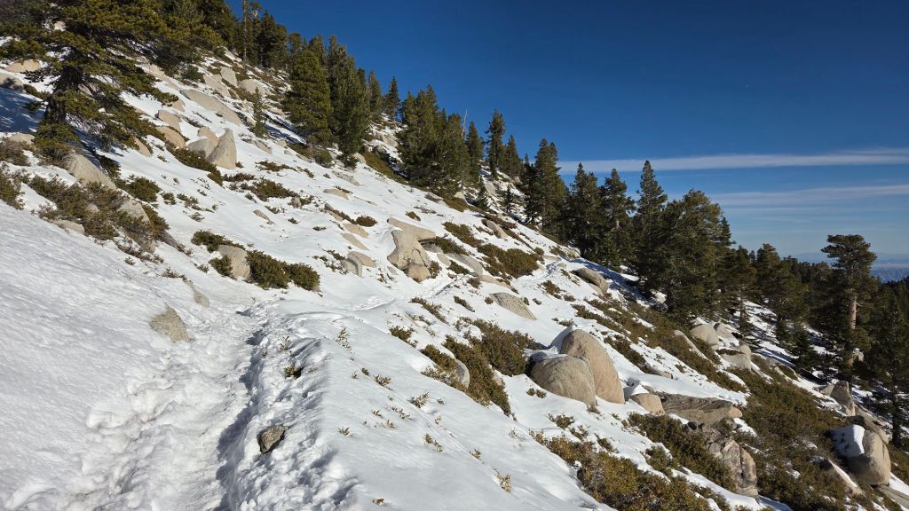
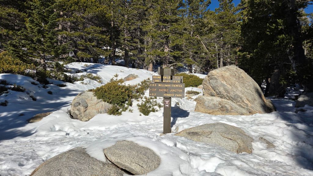
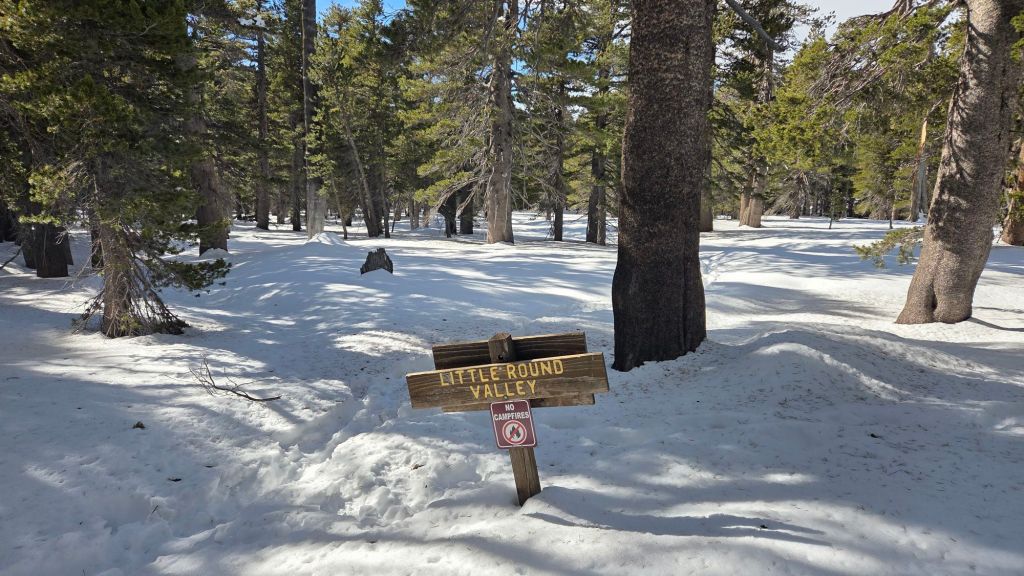
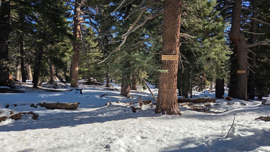

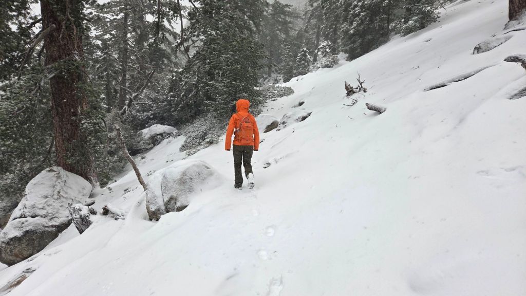
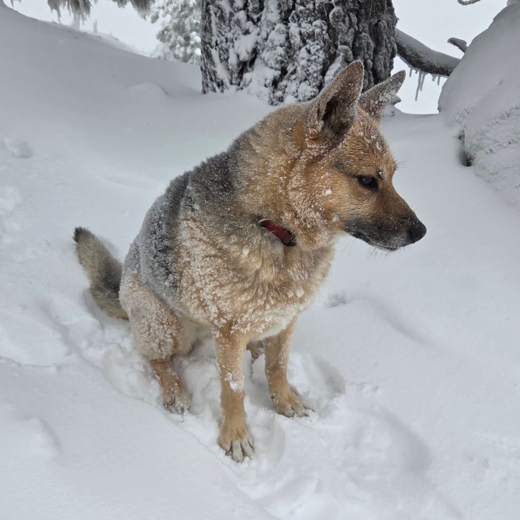
sanjacjon Uncategorized Leave a comment 11 MinutesEdit”Snow and trail update 29th November 2025″
Snow storms update 19th November 2025
UPDATE Saturday 22nd November 2025 at 1150: as seems to be more frequent in recent years, the rotational movement of yesterday’s storm system has brought it back around, this time coming in from easterly directions. Consequently the east side of the range has received modest snowfall this morning, with about four inches in Long Valley (for a total depth of about eight inches). The highest elevations remained above the cloud for much of the morning. The easterly winds have been strong and very gusty, resulting in extensive drifting, and unfortunately the (at least partial) removal of tracks broken yesterday. We broke trail up South Ridge this morning to Tahquitz Peak, from where I recorded a short video report (linked here). The snow level remained high at about 7000 ft, with just light drizzle in Idyllwild, and total accumulation at Tahquitz is a modest 4-6 inches, but this is obscured by severe drifting everywhere above about 8000 ft. Further fresh snow is possible this afternoon.
UPDATE Friday 21st November 2025: in the biggest weather forecasting error in the past decade in these mountains, the storm overnight – our third in eight days – that was widely forecast to produce 10-25 inches of snow around the highest peaks instead resulted in only three inches at San Jacinto Peak, with one inch at both Saddle Junction and Long Valley, and barely a dusting below 7000 ft. It was however a gorgeous morning in the high country, as seen in a short video report I recorded from San Jacinto Peak early today (linked here). As of this morning, well-defined, accurate tracks are in place on Devil’s Slide Trail, north from there via the Wellman and Peak trails to San Jacinto Peak, and also on the Round Valley Trail from Long Valley to Wellman Divide (broken above 9000 ft with snowshoes by myself and Kyle Eubanks). Spikes are useful everywhere above about 8000 ft, potentially lower in places. While we both used snowshoes this morning above about 9000 ft, they will not be required even above that elevation on traveled tracks (they would however be useful on upper Deer Springs Trail, which does not have a freshly broken track as of Friday morning).

————————————–
This is a summary of conditions following the second and third storm systems of winter 2025/26 that impacted the San Jacinto mountains on 14th-16th and 17th-18th November, respectively. I recorded a video report from San Jacinto Peak on the morning on Tuesday 18th (linked here) which gives a feel for current conditions in the high country.
This Report is intentionally brief as the next storm system, the third in a week, arrives late on Thursday 20th with precipitation expected to last into Saturday 22nd November. That storm will again be relatively cool, similar to the storm on 17th-18th, with a freeze level dropping to near 6000 ft, and potentially two feet of snow forecast above 10,000 ft elevation. Consequently snow and trail conditions are expected to change markedly again by Saturday 22nd, although the changes should be limited to upper elevations, with predominantly rain expected below about 6500 ft.
Both of the recent storms were ultimately less impactful than forecasts had suggested, partly due to the difficulty of predicting the exact paths of complex rotating “atmospheric rivers”, and partly because the first storm was so mild that the very high freeze level significantly restricted the quantity of snowfall (it rained all the way up to San Jacinto Peak for the first 20 hours of the storm throughout 14th November). It is interesting to speculate that if the front of that earlier storm system had been just a couple of degrees colder, with a freeze level consequently hundreds of feet lower overnight on Friday 14th, the snow depth around the highest peaks could easily have been double what we ultimately experienced.
Further details are given below under Trail Conditions, but in summary, carrying spikes is now recommended everywhere above about 7500 ft. Snow depths are currently marginal anywhere for snowshoes, although they could be used above about 9500 ft on untraveled trails. That advice is expected to change by Saturday 22nd with significant additional fresh snowfall.
Details of snow depths measured at various locations on the trail system are given towards the end of this posting. Note however that snow depth itself is rarely indicative of the difficulty (or ease) of hiking a particular track or trail. For example a firm, well-compacted track across snow several feet deep is often much easier hiking than traversing across just a few inches depth of angled virgin icy snow.
Below seasonal temperatures followed the passage of the storm system on Tuesday 18th November and will persist until Sunday 23rd. Hikers must be prepared for temperatures well below freezing at higher elevations, and far below freezing when considering wind chill effects. See the Weather section below for my recent observations from San Jacinto Peak.
Be bear aware. Although generally rarely reported, at least six individually identifiable Black Bears have been observed in the San Jacinto mountains since 2017 (I have personally encountered at least one annually for the past seven years). A full-sized adult bear with a right ear tag has been seen in multiple locations from Willow Creek to Fern Valley since August (see my video from a trail cam on 14th September available here, and images from Fern Valley in late August in a prior Report linked here). A smaller, second individual has been reliably reported at least twice, most recently in late September in lower Fern Valley. My brief videos from Devil’s Slide Trail in September 2021 (linked here) and one walking past our house in 2018 (linked here) show two further individuals. There have been no reports of negative interactions with humans in the high country, at or near campsites, or on trails, but bear-safe storage of food when camping is recommended.
Daily survey hikes by the Trail Report year-round in the San Jacinto mountains include multiple routes to the highest peaks including San Jacinto Peak typically at least twice per week (more frequently during stormy weather), Tahquitz Peak and area at least once per week, plus a wide variety of other trails on intervening days.

WEATHER
The second storm system of the season (and the first since 14th October) impacted the region on 14th-16th November. The “atmospheric river” system was extremely warm for the season, with a freeze level initially above 11,000 ft and rain throughout the highest peaks for the first day of the storm, before turning to snow early on Saturday 15th. Even then, the snow level remained high throughout the storm, with little more than a dusting below 7000 ft. Inevitably this limited snow at all elevations, with seven inches at San Jacinto Peak, down to three inches at Saddle Junction (8100 ft). Accumulated rainfall was impressive at mid elevations, with 2.70 inches in Idyllwild (at 5550 ft).
The system on 17th-18th was palpably colder, with a freeze level dropping to 6000 ft. However this rapid cooling happened largely after the passage of the main precipitation, so snowfall at mid elevations was extremely limited, with just one inch at Humber Park (6500 ft)(which lasted only hours before melting) and barely a dusting below that. Fresh snowfall in the high country was more limited than the prior storm (four inches at San Jacinto Peak), but more uniformly distributed across all elevations above 8000 ft (2-4 inches throughout). Rainfall in Idyllwild was 0.51 inch.
The third system in a week, due on 20th-21st, is expected to be similar in temperature to the storm of 17th-18th. with a freeze level near 6000 ft. About one inch of rain is forecast for Idyllwild. Although snow forecasts have varied widely in recent days, at least 10-12 inches, possibly much more, is now expected above 10,000 ft.
Starting Sunday 23rd November, temperatures are tentatively forecast to rise rapidly to above seasonal, especially at upper elevations. This is expected to result in rapid snowmelt at all elevations, and of course consequent steady changes in trail conditions.
The first (very minor) winter storm of the season impacted the region on Tuesday 14th October 2025, as described in detail in a prior Report (linked here).
At San Jacinto Peak (10,811ft/3295m) on Tuesday 18th November 2025 at 0650 the air temperature was 15.9°F (-9°C), with a windchill temperature of -3.7°F (-20°C), 38% relative humidity, and a sharp SSW wind sustained at 14 mph gusting to 20.7 mph.
At the Peak on Monday 17th November 2025 at 1420 the air temperature was 25.0°F (-4°C), with a windchill temperature of 16.0°F (-9°C), 66% relative humidity, and a frigid SW wind sustained at 14 mph gusting to 26 mph.
At the Peak on Friday 14th November 2025 at 1610 the air temperature was 36.0°F (2°C), with a windchill temperature of 23.5°F (-4°C), 100% relative humidity, and a steady due South wind sustained at 14 mph gusting to 17.4 mph.
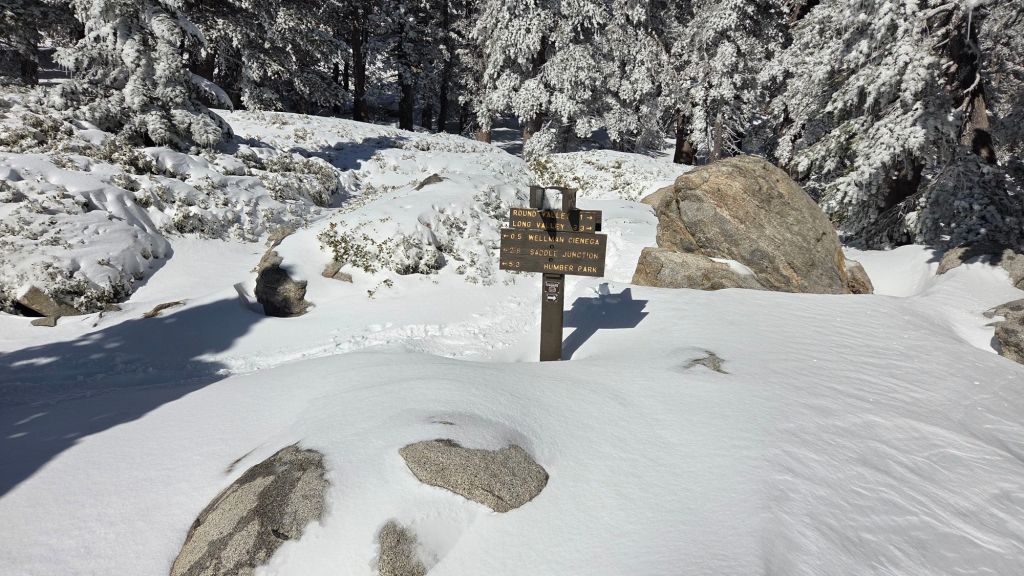
TRAIL CONDITIONS
All trails above about 7500 ft are largely or completely snow-covered. By the afternoon of 18th, melting was already well underway below 9000 ft. The powder on 18th was so light and fine that drifting in the trails has been dramatic above 9000 ft, which is not reflected in the snow depths given below. Trails above 10,000 ft have snow up to 25 inches deep in the trail routes in places.
Spikes are potentially useful everywhere above about 7500 ft, lower in places, especially as established trails become consolidated by hiker traffic and undergo freeze-thaw cycles. They are especially useful for descending trails when they become icy and compacted (e.g. Devil’s Slide and lower Deer Springs trails). Snow depths are suitable for snowshoeing above 10,000 ft, but this elevation is expected to drop significantly after 22nd November.
Ernie Maxwell Trail is completely clear of snow.
Devil’s Slide Trail has a well-traveled track to follow through largely continuous thin icy snow above 7000 ft.
Deer Springs Trail is largely clear of snow to the Suicide Rock junction with just a few patches close to the junction (spikes not required). Above Strawberry Junction snow cover is continuous, but at this time there is no track to follow to Little Round Valley or beyond to San Jacinto Peak.
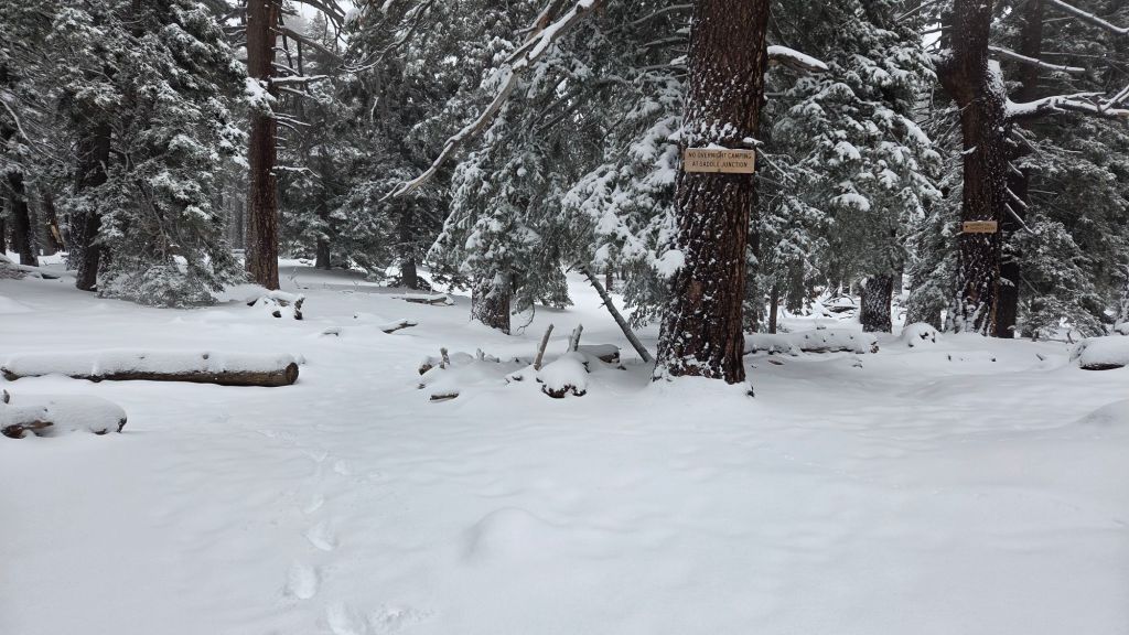
SNOW DEPTHS
Snow depths measured on 18th November 2025 are as follows. Current total depth is the first number given, followed (in parentheses) by the snowfall in the storm of 14th-16th November and then the snowfall in the storm of 17th-18th November). Altitudes and PCT mileages are approximate.
San Jacinto Peak (10811 ft): 11 inches (7 inches by 16th November/4 inches added by 18th November)
Wellman Divide (9700 ft): 7 inches (4 inches/3 inches)
Annie’s Junction/PCT Mile 180.8 (9020 ft): 6 inches (3 inches/3 inches)
Saddle Junction/approx. PCT Mile 179 (8070 ft): 5 inches (3 inches/2 inches)
Devil’s Slide Trail at Humber Park (6550 ft): 1 inch on 18th, already completely melted later that day
Idyllwild (village center at 5400 ft): 0 inches
While all time and labor is volunteered, the San Jacinto Trail Report uses small private donations to help cover operating costs. Your contribution keeps the Report available to all, free from advertising or paywalls, and independent from agencies. If you have found this Report useful, please consider using this link to the Donate page. Thank you very much for your support.
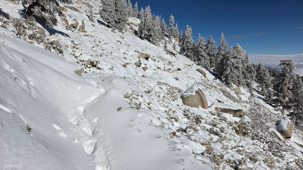

sanjacjon Uncategorized Leave a comment 8 MinutesEdit”Snow storms update 19th November 2025″
Storm updates 18th November 2025
The first significant storms of winter 2025/26 – three systems in eight days – are forecast to impact the San Jacinto mountains from Friday 14th to Friday 21st November 2025.
Please check this page for periodic updates – the most recent is at the top – throughout the multiday storm sequence. The next comprehensive Report update, summarizing conditions during and after the first two of the three storms, is tentatively scheduled for Wednesday 19th.
UPDATE Tuesday 18th November at 0800
The minor storm that moved through swiftly overnight produced a further three inches of snow at San Jacinto Peak – for a total on the ground of about 10 inches – and dusted locally as low as 6000 ft. The snow quality was perfect, a light powder, but that did drift heavily in gusty overnight winds, so tracks are obscured above 10,000 ft and snow in trails can be much deeper than expected.
At this time snow depths are marginal for snowshoes. That is expected to change, at least above about 9500 ft, following the next storm on Friday 21st.
Rainfall in Idyllwild totaled 0.51 inch, with no evidence of snow in Pine Cove (to 6300 ft).
I recorded a video report from San Jacinto Peak early this morning (linked here) which gives a good feel for current conditions.
UPDATE Monday 17th November at 1545
On my afternoon hike, snow conditions were poor and slushy to nearly 9000 ft, before improving above that elevation. Snow depths at Annie’s Junction (9020 ft) and Wellman Divide (9700 ft) are four and five inches, respectively.
At San Jacinto Peak (10,811ft/3295m) on Monday 17th November 2025 at 1515 the air temperature was 24.1°F (-4°C), with a windchill temperature of 5.5°F (-15°C), 72% relative humidity, and a fresh WSW wind sustained at 15 mph gusting to 23.9 mph.
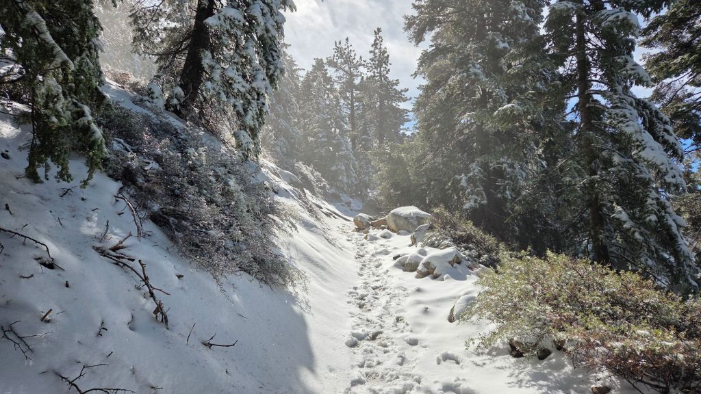
UPDATE Monday 17th November at 1130
There was no further precipitation overnight. The second storm arrives tonight and is forecast to move through relatively quickly overnight, with several inches of additional snow in the high country and just under 0.5 inch of rain at mid elevations.
The current snow level is as low as 7000 ft in Strawberry Valley with a dusting down to 6600 ft. Snow depth increases steadily with three inches at 8000 ft (Saddle Junction) up to seven inches at San Jacinto Peak.
Devil’s Slide Trail for example has largely continuous snow in the trail above 7200 ft, which is currently slushy, but will freeze again overnight.
Carrying spikes is recommended everywhere above about 7000 ft at this time, along with the necessary clothing and equipment for genuine winter conditions. The storm coming in tonight is considerably colder, with high country air temperatures well below freezing and windchills far below freezing for the remainder of this week.
While all time and labor is volunteered, the San Jacinto Trail Report uses small private donations to help cover operating costs. Your contribution keeps the Report available to all, free from advertising or paywalls, and independent from agencies. If you have found this Report useful, please consider using this link to the Donate page. Thank you very much for your support.
UPDATE Sunday 16th November at 1900
Until it largely stopped at dusk, the rain was almost continuous in Idyllwild today, with an additional 0.84 inch in the past 12 hours for a storm total of 2.70 inches.
Periodic snowfall restarted in the high country by 1200, with the snow level remaining high (>7500 ft), but with only modest accumulation (struggling to reach 0.25 inch/hour) by the time it stopped in mid afternoon.
UPDATE Sunday 16th November at 0940
Periodic rain overnight at mid elevations produced another half inch in Idyllwild, for an impressive storm total at 5550 ft (since Friday 14th) of 1.86 inches by 0700 this morning (and it continues to rain steadily). Light snow overnight and into this morning has added about two inches at the elevation of Long Valley (8500 ft), with total depth at San Jacinto Peak now near six inches. The snow level has remained stubbornly around 7500 ft, with all elevations above that level having added an inch or two of snow since yesterday.
By 0930 it stopped snowing throughout most of the high country, with the cloud cover rapidly clearing on the eastern side of the mountain range. All forecasts are indicating relatively minimal further precipitation today as this first storm system moves away to the east, however rain-producing cloud often remains socked into the west slope valleys long after the high country has cleared.
UPDATE Saturday 15th November at 1830
Apologies for the delayed updating. As described below, it was a challenging day around the Peak. Snowfall at San Jacinto Peak was three inches by early afternoon, likely 4-5 inches by this evening, with two inches at Wellman Divide (9700 ft). There has been a dusting as low as 8000 ft (just below Saddle Junction), with a slushy 0.5 inch from there to 9000 ft elevation.
An additional 0.9 inch of rain in Idyllwild today brings the storm total at 5550 ft to 1.41 inches. Rainfall accumulation at Saddle Junction was 1.29 inches before turning to sleet/light snow.
We dealt with three cases of hypothermia in two separate hiker groups at San Jacinto Peak today, occupying most of the daylight hours. All cases were basically caused by hikers getting wet in the rain on their ascents and then running into the cold, wind, and snow at the highest elevations. Two women I assisted this afternoon exhibited serious symptoms, and I helped get them dry, provided them with extra clothing that I had, made hot beverages, and ultimately guided them part way back down the mountain. The good news is that I have had messages from both groups that everyone eventually got home safely. A tough day, but a great learning experience for those who ventured into the high country today.

UPDATE Saturday 15th November at 0930
The bad news from the top of the mountain is that it rained gently throughout the night at San Jacinto Peak, with the freeze level remaining stubbornly above 11,000 ft. Storm total rainfall by 0700 was 1.09 inches.
The good news is that it steadily turned to snow after 0700, accumulating to 0.75 inch by 0930. Currently the snow level is reported to be around Wellman Divide (9700 ft).
Rainfall storm total in Idyllwild up to 0700 this morning was 0.51 inch.
UPDATE Friday 14th November at 2020
The temperature at San Jacinto Peak has remained around 36°F all day, with consequently no snow but 0.79 inch of rain accumulating by 2015. It is forecast to turn to light snow overnight.
On our hike up this afternoon, there was intermittent light rain at all elevations above 6000 ft.
Total rainfall in Idyllwild in the past 24 hours has been an unexpectedly low 0.28 inch, most of which fell overnight.
UPDATE Friday 14th November at 1030
Rain accumulation overnight by 0700 was 0.20 inch in Idyllwild (at 5550 ft), with 0.05 inch in Long Valley (8500 ft). The start of the system was so mild – well above freezing even above 10,000 ft – that light rain fell at all elevations including around the highest peaks.
sanjacjon Uncategorized Leave a comment 5 MinutesEdit”Storm updates 18th November 2025″
Weather and trail update 12th November 2025
The first significant winter storm of the 2025/26 winter will impact the San Jacinto mountains on 14th-16th November. A second storm system will follow so close behind, on 17th-18th, that the gap between the two may be hard to discern, especially at mid elevations where it is expected to rain more-or-less continuously for five days (14th-18th).
The first system will be warm for the season, with initial rainfall potentially above 10,000 ft before the freeze level drops down to around 8000 ft. Rain is expected to persist at mid elevations for at least three days (Friday-Sunday), heaviest on Saturday 15th, and may reach (or even exceed) three inches. Current forecasts indicate 10-15 inches of snow around the highest peaks, mainly focused on the morning of 15th. Due to the warmth of the system, snowfall may be only 4-6 inches at the elevations of Strawberry and Saddle junctions (both around 8000 ft) as these areas will predominantly receive rain. A dusting of snow is possible at elevations as low as Pine Cove and Fern Valley.
Uncertainty persists regarding the second storm system tentatively forecast for 17th-19th. The system is expected to be much colder, with a freeze level dropping as low as 5500 ft, hence light snow in Pine Cove and Idyllwild is more likely. Atmospheric instability continues throughout those days, with a likelihood of periodic light rain at mid elevations (roughly an additional one inch forecast), but snow estimates for the high country have ranged widely from 0-12 inches, with about the middle of that range most likely.
A third storm system tentatively forecast for 20th-21st will also be relatively cold. At this time further light rain is forecast for mid elevations, nut little or no snow for the high country.
Water flows have deteriorated again despite inches of rain in recent months (some example photos below) although this situation may become academic later this week. Most key hiker water sources remain flowing. All ephemeral sources that dried in the summer but temporarily flowed again earlier this month are now dry again. Wellman’s Cienega and the pipe in Round Valley are flowing steadily and will now maintain useable flow into the winter. The creek in Little Round Valley has dried again both where it passes through the meadow and also where it crosses Deer Springs Trail, but continues to flow patchily in its central section. Deer Springs creek (PCT Mile 185.4) dried up in late July where it crosses the trail of the same name, and although it has intermittently flowed again twice during recent rains, is now functionally dry again. The North Fork of the San Jacinto River is flowing where it crosses both Fuller Ridge (PCT Mile 186) and Deer Springs trails, but is largely dry where it crosses Seven Pines Trail. Stone Creek has now dried again where it crosses Deer Springs Trail (near PCT Mile 183.6). Marion Creek is flowing steadily where it crosses the Suicide Rock Trail. Strawberry Cienega (approx PCT Mile 181.9), has dried again.
Willow Creek is flowing weakly again where it crosses the Willow Creek Trail, having dried in August. Hidden Lake functionally dried by the end of June. Long Valley Creek is dry where it passes through Round Valley, as is the nearby creek in Tamarack Valley. Water is flowing reliably in Tahquitz Creek at PCT Mile 177 and again further downstream at the north end of Little Tahquitz Meadow (although it is dry between those two locations)(photos below). The pipe in Tahquitz Meadow dried in mid July. Skunk Cabbage Meadow creek is functionally dry. Middle Spring on Devil’s Slide Trail has been functionally dry since 1st August, but I maintain a tiny pool there from which dogs can drink.
Be bear aware. Although generally rarely reported, at least six individually identifiable Black Bears have been observed in the San Jacinto mountains since 2017 (I have personally encountered at least one annually for the past seven years). A full-sized adult bear with a right ear tag has been seen in multiple locations from Willow Creek to Fern Valley since August (see my video from a trail cam on 14th September available here, and images from Fern Valley in late August in a prior Report linked here). A smaller, second individual has been reliably reported at least twice, most recently in late September in lower Fern Valley. My brief videos from Devil’s Slide Trail in September 2021 (linked here) and one walking past our house in 2018 (linked here) show two further individuals. There have been no reports of negative interactions with humans in the high country, at or near campsites, or on trails, but bear-safe storage of food when camping is recommended.
Daily survey hikes by the Trail Report year-round in the San Jacinto mountains include multiple routes to the highest peaks including San Jacinto Peak typically at least twice per week (more frequently during stormy weather), Tahquitz Peak and area at least once per week, plus a wide variety of other trails on intervening days.

WEATHER
Temperatures throughout early November were generally above seasonal at all elevations, with warm, dry (but thankfully weak) easterly winds in recent days. Temperatures cool markedly after Tuesday 11th with the anticipated passage of back-to-back minor winter storms on 13th-19th November.
Winter storm systems are forecast for 14th-16th November (high degree of confidence), 17th-18th November (some uncertainty), and 20th-21st (considerable uncertainty). The first system will be relatively mild, with a freeze level likely above 7000 ft. Steady rain from late Thursday 13th into Sunday 16th is forecast to total at least two inches at mid elevations (e.g., Idyllwild). Currently 8-15 inches of snow are forecast around the highest peaks, but due to the warmth of the system, possibly fewer than six inches at the elevations of Strawberry and Saddle junctions (around 8000 ft).
National Weather Service San Diego published a detailed, revised, video forecast of the upcoming storm system on 12th November (linked here).
The second system on 17th-18th will be colder, with several inches of snowfall mainly on Monday 17th in the high country even though rainfall at mid elevations could be less than one inch, the latter mainly in the afternoon/evening of Monday 17th. Due to the temperature of the storm, light snow is possible at elevations as low as Pine Cove and Fern Valley (a dusting at 5000 ft, 1-3 inches near 6000 ft).
Details remain unclear for the third system, due on 20th-21st, at this time, although it is expected to be as cold as the storm on 17th-18th, but possibly fast moving, and hence with minimal precipitation.
The first (very minor) winter storm of the season impacted the region on Tuesday 14th October. Snow fell intermittently at San Jacinto Peak most of the afternoon, accumulating to about 1.5 inches. Snow dusted as low as 9000 ft, averaging about one inch above 9500 ft. Rainfall in Idyllwild (5550 ft) totaled an impressive 0.76 inch for the day, with 0.85 inch at Saddle Junction (8100 ft).
That storm was a dramatic contrast from the relatively mild, humid, weather experienced since late August. The San Jacinto mountains had a remarkable sequence of tropical and monsoonal autumnal rains spread across ten distinct rain events between 22nd August and 10th October. San Jacinto Peak recorded an impressive 8.74 inches of rainfall, with 4.58 inches recorded in Idyllwild (at 5550 ft).
At San Jacinto Peak (10,811ft/3295m) on Wednesday 12th November 2025 at 1020 the air temperature was 39.9°F (4°C), with a windchill temperature of 28.0°F (-2°C), 48% relative humidity, and a fresh WSW wind sustained at 12 mph gusting to 18.5 mph.
At the Peak on Friday 7th November 2025 at 0945 the air temperature was 46.1°F (8°C), with a windchill temperature of 39.6°F (4°C), 35% relative humidity, and a cool NNE wind sustained at 6 mph gusting to 9.7 mph.
At the Peak on Monday 3rd November 2025 at 0840 the air temperature was 44.1°F (7°C), with a windchill temperature of 36.5°F (2°C), 16% relative humidity, and a remarkably steady SW wind sustained at 9 mph gusting to 10.9 mph.
At the Peak on Friday 31st October 2025 at 0910 the air temperature was 45.3°F (7°C), with a “windchill” temperature of 43.0°F (6°C), 36% relative humidity, and a very light NNE breeze sustained at 0 mph gusting to 3.0 mph.
At the Peak on Wednesday 29th October 2025 at 0945 the air temperature was 56.2°F (13°C), with a “windchill” temperature of 50.7°F (10°C), 30% relative humidity, and a barely discernable NW breeze sustained at 0 mph gusting to 2.2 mph.
TRAIL CONDITIONS
Temperatures will be relatively cold in the high country during the passage of dual storm systems between 13th-19th November. Hikers must be prepared for temperatures well below freezing at higher elevations, and far below freezing when considering wind chill effects, especially on 14th, 15th, 18th, and 19th. It is expected that spikes may be needed above about 9000 ft elevation after 14th.
Trails have cleared of the icy snow that fell three weeks ago. Thankfully most trails suffered relatively minor tread erosion from intense rains in August-October. Neither the Wolf Fire in late June nor the Rosa Fire in early August had major impacts on the trail system, although the latter did burn the southernmost 0.5 mile of the Palm Canyon trail.
For the first time in nearly a decade, Deer Springs Trail from its trailhead to Little Round Valley is now completely clear of blowdowns, with 26 trees removed since the middle of last year (of which 70% were cut by the Trail Report). A joint Eastern Sierra Conservation Corps/State Park crew working in early October trimmed encroaching vegetation along Deer Springs Trail just above the Fuller Ridge Trail junction to about 9300 ft.
On PCT Miles 170-175 (roughly Apache Peak to Red Tahquitz) most blowdowns have been removed but six trees remain to be cut around South Peak (Miles 173.5-174) of which most are significant obstructions for hikers. Sections of the trail are badly overgrown with brush and in their worst condition in decades, especially most of Miles 168-174.
The two large downed trees near PCT Mile 180 were removed by the Trail Report this spring. The Strawberry Trail (PCT Miles 180.8-183.1) has had long-term blowdowns removed this month by Forest Service volunteers. The brush along Miles 181-181.7 has become heavily overgrown since it was last trimmed by the Trail Report in 2021, but there is a plan for trimming work in the next few months.
The maintenance condition of the Fuller Ridge (Miles 185.5-190.5) section of the PCT improved significantly in July 2025, with the Trail Report clearing most of the 15 blowdowns and a PCTA volunteer crew cutting the remainder the following week.
On the Wellman Trail, Wellman’s Cienega is flowing well compared to earlier in the autumn (photo below). The Trail Report continues the work it started last year to keep this trail well-maintained (after it had become badly overgrown by early 2024).
Dark Canyon Road (4S02) had some effective basic maintenance on its dirt section in the spring. The associated Dark Canyon campground is closed for the year (apparently due to federal budget cuts).
For the first time in about 20 years Seven Pines Trail has a continuous route completely cleared of blowdown trees, with the trail also as faithful to the original route as possible. The Trail Report “adopted” Seven Pines as a priority for maintenance work nearly a decade ago due to a disproportionate number of lost hiker rescues (with State Park and Forest Service evidently no longer maintaining the route). Since 2019 we have now removed exactly 100 downed trees – including 25 since April of this year – and the trail is largely trimmed and cleared semi-annually. Although our work has restored this delightful trail, Seven Pines remains a genuine wilderness trail unlike the wider, bare, obvious routes of, for example, Devil’s Slide or Marion Mountain trails. Cautious navigation remains invaluable for those without extensive experience of hiking this trail.
Black Mountain Road is open and in its typical non-graded condition, i.e. lumpy but readily passable in any moderate clearance vehicle. The tap at Cinco Poses Spring currently has reliable water (located alongside the road 0.2 mile below the Boulder Basin turning).
On Willow Creek Trail whitethorn urgently needs trimming again especially near the boundary between the two agencies. The two large trees remaining uncut in the State Park section from several years ago have easy workarounds.
The Caramba Trail from near Reeds Meadow through Laws Camp and on to Caramba, and the Cedar Trail from Willow Creek Trail to Laws, are euphemistically (and arguably dangerously) described by the Forest Service as “not maintained”. In reality both trails have been abandoned for more than a decade and no longer exist. They are so heavily overgrown, largely with dense whitethorn which obscures dozens of downed trees, that hikers should not attempt to follow them (regardless of how much you may trust any particular app).
An informal use trail to Laws is much more direct, generally well maintained, and avoids the bushwhacking of the abandoned trails (some local Idyllwild hikers dubbed it the “King Trail” when I established the route in 2019). It leaves Willow Creek Trail exactly 1.0 mile from Saddle Junction, 0.46 mile from the Skunk Cabbage turning (trailhead at N 33.7796, W 116.6590). The route descends following former deer trails for 1.2 miles, meeting Willow Creek about 0.15 mile upstream from the site of the historic Laws Camp (the remains of which were destroyed by the 2013 Mountain Fire and subsequent flood and treefall damage). One huge pine tree fell in late 2024 across the King Trail about midway down that requires a minor scramble underneath, but nine additional blowdowns have been removed since January 2025, with the trail trimmed and cleaned three times this year.
From Laws east to Caramba the original Caramba Trail has been cairned by myself and others and can largely be followed with skilled route-finding. My most recent 2025 survey counted 120 trees down on this 2.1 miles of trail. It is extremely obscure for the first 0.5 mile east of the Willow Creek crossing, becoming more obvious (but still subtle) as it descends towards Caramba. Very cautious navigation is strongly recommended throughout the area.
Stormy weather this autumn brought down another seven trees across Spitler Peak Trail. All were removed by the Trail Report on 20th October, bringing to 169 the total number of trees we have removed from this route in the past seven years. One very large burned cedar is the only tree that remains across the trail, immediately after the first creek crossing 3.2 miles up from the trailhead.
The Zen Center Trail continues its serious deterioration that started following the 2013 Mountain Fire, with a combination of vigorous regrowth and treefall hazards further obscuring the route with each passing season. The lower and upper thirds of this trail are partially cairned and not too bad for those who are very familiar with the former route, but even the experienced find navigating the central section tricky. Long trousers, scrambling gloves, and a genuine enjoyment of bush-whacking are all strongly recommended.
While all time and labor is volunteered, the San Jacinto Trail Report uses small donations to help cover modest operating costs. Your contribution keeps the Report available to all, free from advertising or paywalls, and independent from agencies. If you have found this Report useful, please consider using this link to the Donate page. Thank you very much for your support.
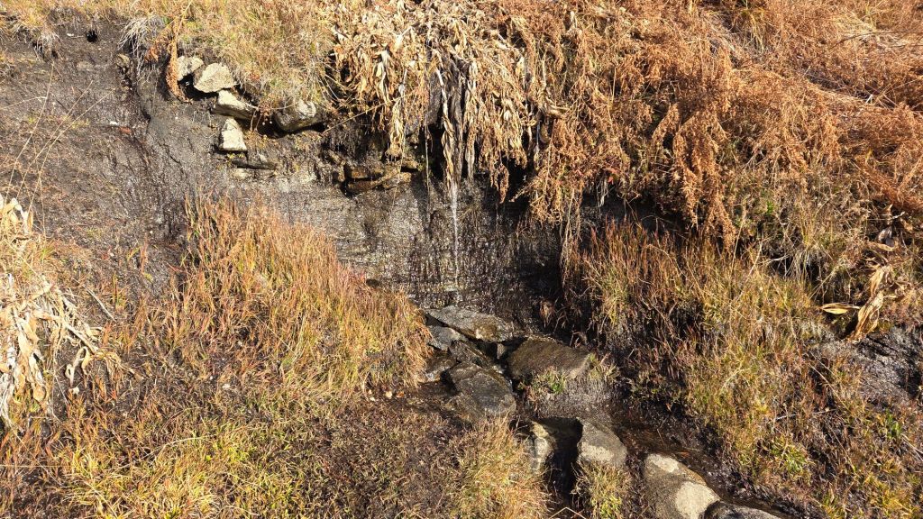
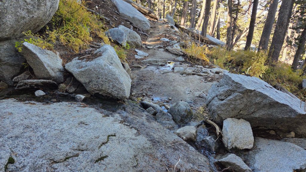
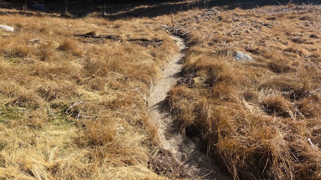
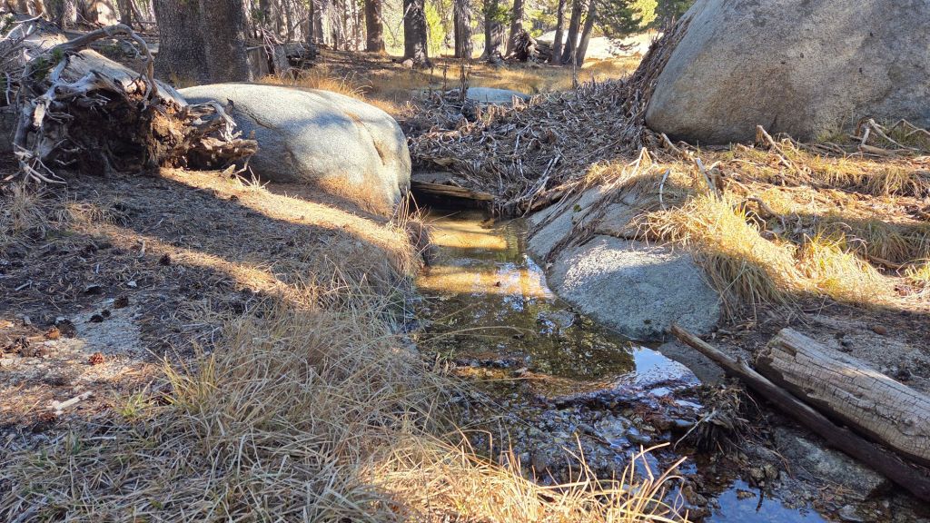
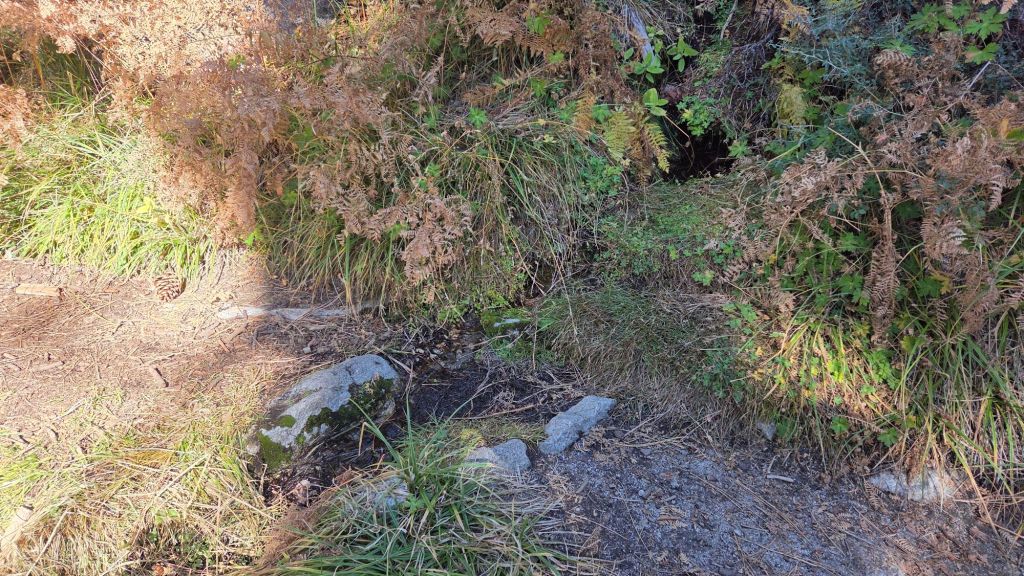
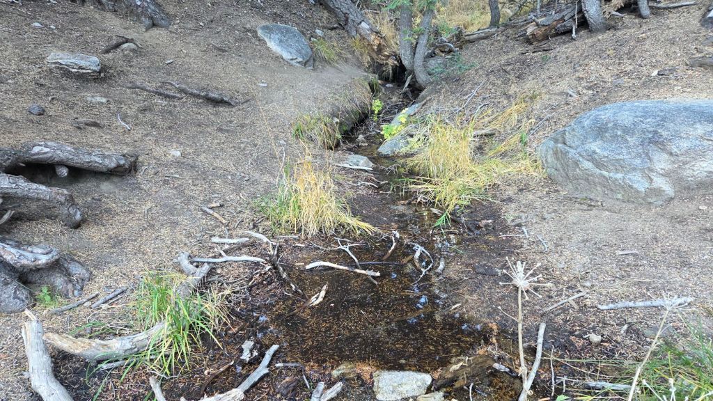

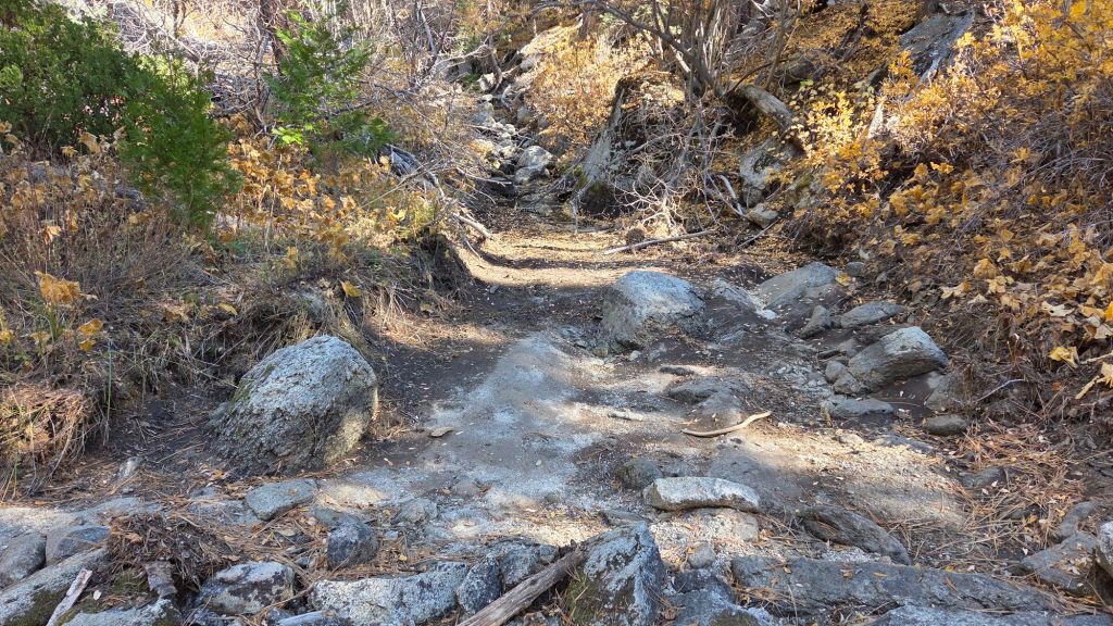
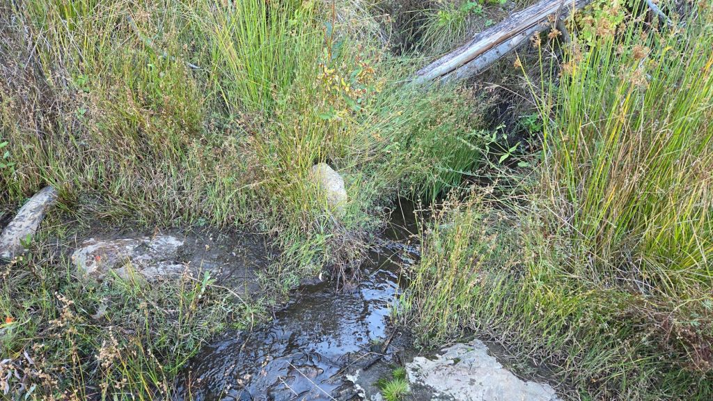
sanjacjon Uncategorized Leave a comment 12 MinutesEdit”Weather and trail update 12th November 2025″
Trail and water update 8th November 2025
Temperatures in early November have been broadly above seasonal at all elevations. They are expected to remain above average into the second week of November, before cooling from 12th. Forecasts are suggesting back-to-back minor winter storm systems on 13th-14th and 17th-19th November. The first system will be mild, with rain potentially as high as 9,000 ft (before possibly transitioning to light snow). Rain may persist at mid elevations for 1-2 days, starting on the afternoon of 13th. The system on 18th will be colder, with a dusting of snow as low as 6500 ft possible. For the first storm, snowfall is forecast to be limited to no more than 1-2 inches around the highest peaks, while estimates for the later storm have ranged widely from 1-12 inches.
Water flows have deteriorated again despite inches of rain in recent months (some example photos below). However most key hiker water sources are flowing. All ephemeral sources that dried in the summer but temporarily flowed again earlier this month are now dry again. Wellman’s Cienega and the pipe in Round Valley are flowing steadily and will now maintain useable flow into the winter. The creek in Little Round Valley has dried again both where it passes through the meadow and also where it crosses Deer Springs Trail, but continues to flow patchily in its central section. Deer Springs creek (PCT Mile 185.4) dried up in late July where it crosses the trail of the same name, and although it has intermittently flowed again twice during recent rains, is now functionally dry again. The North Fork of the San Jacinto River is flowing where it crosses both Fuller Ridge (PCT Mile 186) and Deer Springs trails, but is largely dry where it crosses Seven Pines Trail. Stone Creek has now dried again where it crosses Deer Springs Trail (near PCT Mile 183.6). Marion Creek is flowing steadily where it crosses the Suicide Rock Trail. Strawberry Cienega (approx PCT Mile 181.9), has dried again.
Willow Creek is flowing weakly again where it crosses the Willow Creek Trail, having dried in August. Hidden Lake functionally dried by the end of June. Long Valley Creek is dry where it passes through Round Valley, as is the nearby creek in Tamarack Valley. Water is flowing reliably in Tahquitz Creek at PCT Mile 177 and again further downstream at the north end of Little Tahquitz Meadow (although it is dry between those two locations)(photos below). The pipe in Tahquitz Meadow dried in mid July. Skunk Cabbage Meadow creek is functionally dry. Middle Spring on Devil’s Slide Trail has been functionally dry since 1st August, but I maintain a tiny pool there from which dogs can drink.
During the federal government shutdown, the Forest Service Idyllwild Ranger Station is closed. Unlike the 2018-19 shutdown which occurred in the winter months of December-January, gates on Forest Service roads and USFS campgrounds have remained open (for now).
Be bear aware. Although generally rarely reported, at least six individually identifiable Black Bears have been observed in the San Jacinto mountains since 2017 (I have personally encountered at least one annually for the past seven years). A full-sized adult bear with a right ear tag has been seen in multiple locations from Willow Creek to Fern Valley since August (see my video from a trail cam on 14th September available here, and images from Fern Valley in late August in a prior Report linked here). A smaller, second individual has been reliably reported at least twice, most recently in late September in lower Fern Valley. My brief videos from Devil’s Slide Trail in September 2021 (linked here) and one walking past our house in 2018 (linked here) show two further individuals. There have been no reports of negative interactions with humans in the high country, at or near campsites, or on trails, but bear-safe storage of food when camping is recommended.
The fire lookout at Black Mountain is closed indefinitely due to issues identified in a May 2025 safety inspection. Tahquitz Peak lookout reopened (likely only for a few weeks) on 7th November having been closed all season to date.
Daily survey hikes by the Trail Report year-round in the San Jacinto mountains include multiple routes to the highest peaks including San Jacinto Peak typically at least twice per week (more frequently during stormy weather), Tahquitz Peak and area at least once per week, plus a wide variety of other trails on intervening days.
WEATHER
Temperatures remain generally above seasonal throughout early November, before cooling markedly after Tuesday 11th.
Consecutive winter storm systems are forecast (with increasing reliability) for 13th-15th and 18th November. The first system will be relatively mild for the season, with a freeze level above 7000 ft and initial rainfall possibly near 10,000 ft (before turning to very light snow). Steady light rain from late on Thursday 13th into Saturday 15th could total one inch at mid elevations (e.g., Idyllwild). Only 1-3 inches of snow are currently forecast around the highest peaks, with a dusting possible at elevations as low as Pine Cove and upper Fern Valley.
The system on 18th is forecast to be colder, with a freeze level potentially dropping to 6000 ft and hence a dusting of snow as low as Idyllwild possible. Snowfall in the high country is expected to be somewhat greater with the second storm than the first, but still only 2-4 inches, falling throughout the day on Tuesday 18th.
The first (very minor) winter storm of the season impacted the region on Tuesday 14th October. Snow fell intermittently at San Jacinto Peak most of the afternoon, accumulating to about 1.5 inches. Snow dusted as low as 9000 ft, averaging about one inch above 9500 ft. Rainfall in Idyllwild (5550 ft) totaled an impressive 0.76 inch for the day, with 0.85 inch at Saddle Junction (8100 ft).
That storm was a dramatic contrast from the relatively mild, humid, weather experienced since late August. The San Jacinto mountains had a remarkable sequence of tropical and monsoonal autumnal rains spread across ten distinct rain events between 22nd August and 10th October. San Jacinto Peak recorded an impressive 8.74 inches of rainfall, with 4.58 inches recorded in Idyllwild (at 5550 ft).
One interesting consequence of the climate change crisis is the increasing prevalence of tropical, rather than monsoonal, rainfall in the San Jacinto mountains. In three of the four most recent years (2022-2025) the majority of rainfall in our region between August-October has come from tropical sources (generally from the south or south-west) as opposed to the historically much more frequent monsoonal storms (originating from easterly directions).
At San Jacinto Peak (10,811ft/3295m) on Friday 7th November 2025 at 0945 the air temperature was 46.1°F (8°C), with a windchill temperature of 39.6°F (4°C), 35% relative humidity, and a cool NNE wind sustained at 6 mph gusting to 9.7 mph.
At the Peak on Monday 3rd November 2025 at 0840 the air temperature was 44.1°F (7°C), with a windchill temperature of 36.5°F (2°C), 16% relative humidity, and a remarkably steady SW wind sustained at 9 mph gusting to 10.9 mph.
At the Peak on Friday 31st October 2025 at 0910 the air temperature was 45.3°F (7°C), with a “windchill” temperature of 43.0°F (6°C), 36% relative humidity, and a very light NNE breeze sustained at 0 mph gusting to 3.0 mph.
At the Peak on Wednesday 29th October 2025 at 0945 the air temperature was 56.2°F (13°C), with a “windchill” temperature of 50.7°F (10°C), 30% relative humidity, and a barely discernable NW breeze sustained at 0 mph gusting to 2.2 mph.
TRAIL CONDITIONS
Trails have cleared of the icy snow that fell three weeks ago. Thankfully most trails suffered relatively minor tread erosion from intense rains in August-October. Neither the Wolf Fire in late June nor the Rosa Fire in early August had major impacts on the trail system, although the latter did burn the southernmost 0.5 mile of the Palm Canyon trail.
For the first time in nearly a decade, Deer Springs Trail from its trailhead to Little Round Valley is now completely clear of blowdowns, with 26 trees removed since the middle of last year (of which 70% were cut by the Trail Report). A joint Eastern Sierra Conservation Corps/State Park crew working in early October trimmed encroaching vegetation along Deer Springs Trail just above the Fuller Ridge Trail junction to about 9300 ft.
On PCT Miles 170-175 (roughly Apache Peak to Red Tahquitz) most blowdowns have been removed but six trees remain to be cut around South Peak (Miles 173.5-174) of which most are significant obstructions for hikers. Sections of the trail are badly overgrown with brush and in their worst condition in decades, especially most of Miles 168-174.
The two large downed trees near PCT Mile 180 were removed by the Trail Report this spring. The Strawberry Trail (PCT Miles 180.8-183.1) has had long-term blowdowns removed this month by Forest Service volunteers. The brush along Miles 181-181.7 has become heavily overgrown since it was last trimmed by the Trail Report in 2021, but there is a plan for trimming work in the next few months.
The maintenance condition of the Fuller Ridge (Miles 185.5-190.5) section of the PCT improved significantly in July 2025, with the Trail Report clearing most of the 15 blowdowns and a PCTA volunteer crew cutting the remainder the following week.
On the Wellman Trail, Wellman’s Cienega is flowing well compared to earlier in the autumn (photo below). The Trail Report continues the work it started last year to keep this trail well-maintained (after it had become badly overgrown by early 2024).
Dark Canyon Road (4S02) had some effective basic maintenance on its dirt section in the spring. The associated Dark Canyon campground is closed for the year (apparently due to federal budget cuts).
For the first time in about 20 years Seven Pines Trail has a continuous route completely cleared of blowdown trees, with the trail also as faithful to the original route as possible. The Trail Report “adopted” Seven Pines as a priority for maintenance work nearly a decade ago due to a disproportionate number of lost hiker rescues (with State Park and Forest Service evidently no longer maintaining the route). Since 2019 we have now removed exactly 100 downed trees – including 25 since April of this year – and the trail is largely trimmed and cleared semi-annually. Although our work has restored this delightful trail, Seven Pines remains a genuine wilderness trail unlike the wider, bare, obvious routes of, for example, Devil’s Slide or Marion Mountain trails. Cautious navigation remains invaluable for those without extensive experience of hiking this trail.
Black Mountain Road is open and in its typical non-graded condition, i.e. lumpy but readily passable in any moderate clearance vehicle. The tap at Cinco Poses Spring currently has reliable water (located alongside the road 0.2 mile below the Boulder Basin turning).
On Willow Creek Trail whitethorn urgently needs trimming again especially near the boundary between the two agencies. The two large trees remaining uncut in the State Park section from several years ago have easy workarounds.
The Caramba Trail from near Reeds Meadow through Laws Camp and on to Caramba, and the Cedar Trail from Willow Creek Trail to Laws, are euphemistically (and arguably dangerously) described by the Forest Service as “not maintained”. In reality both trails have been abandoned for more than a decade and no longer exist. They are so heavily overgrown, largely with dense whitethorn which obscures dozens of downed trees, that hikers should not attempt to follow them (regardless of how much you may trust any particular app).
An informal use trail to Laws is much more direct, generally well maintained, and avoids the bushwhacking of the abandoned trails (some local Idyllwild hikers dubbed it the “King Trail” when I established the route in 2019). It leaves Willow Creek Trail exactly 1.0 mile from Saddle Junction, 0.46 mile from the Skunk Cabbage turning (trailhead at N 33.7796, W 116.6590). The route descends following former deer trails for 1.2 miles, meeting Willow Creek about 0.15 mile upstream from the site of the historic Laws Camp (the remains of which were destroyed by the 2013 Mountain Fire and subsequent flood and treefall damage). One huge pine tree fell in late 2024 across the King Trail about midway down that requires a minor scramble underneath, but nine additional blowdowns have been removed since January 2025, with the trail trimmed and cleaned three times this year.
From Laws east to Caramba the original Caramba Trail has been cairned by myself and others and can largely be followed with skilled route-finding. My most recent 2025 survey counted 120 trees down on this 2.1 miles of trail. It is extremely obscure for the first 0.5 mile east of the Willow Creek crossing, becoming more obvious (but still subtle) as it descends towards Caramba. Very cautious navigation is strongly recommended throughout the area.
Stormy weather this autumn brought down another seven trees across Spitler Peak Trail. All were removed by the Trail Report on 20th October, bringing to 169 the total number of trees we have removed from this route in the past seven years. One very large burned cedar is the only tree that remains across the trail, immediately after the first creek crossing 3.2 miles up from the trailhead.
The Zen Center Trail continues its serious deterioration that started following the 2013 Mountain Fire, with a combination of vigorous regrowth and treefall hazards further obscuring the route with each passing season. The lower and upper thirds of this trail are partially cairned and not too bad for those who are very familiar with the former route, but even the experienced find navigating the central section tricky. Long trousers, scrambling gloves, and a genuine enjoyment of bush-whacking are all strongly recommended.
While all time and labor is volunteered, the San Jacinto Trail Report uses small donations to help cover modest operating costs. Your contribution keeps the Report available to all, free from advertising or paywalls, and independent from agencies. If you have found this Report useful, please consider using this link to the Donate page. Thank you very much for your support.
sanjacjon Uncategorized Leave a comment 10 MinutesEdit”Trail and water update 8th November 2025″
Trail update 22nd October 2025
The first winter storm of the season impacted the region on Tuesday 14th October, with precipitation starting about 1130 and lasting until near dusk. Snow fell intermittently at San Jacinto Peak most of the afternoon, accumulating to about 1.5 inches, but with a periodic mix of drizzle and sleet, and finishing with a thick icy coating from late freezing rain. Snow dusted as low as 9000 ft, averaging about one inch above 9500 ft. Rainfall in Idyllwild (5550 ft) totaled an impressive 0.76 inch for the day, with 0.85 inch at Saddle Junction (8100 ft). I posted a short video report from San Jacinto Peak early on 15th, linked here. Despite a steady warming trend in recent days, on Wednesday 22nd thin icy snow still persisted in patches in the most shaded areas above 9900 ft elevation, although spikes are no longer required anywhere.
This storm was a dramatic contrast from the relatively mild, humid, weather we have generally experienced since late August. The San Jacinto mountains had a remarkable sequence of tropical and monsoonal autumnal rains in the past eight weeks. San Jacinto Peak recorded an impressive 8.74 inches of rainfall spread across ten distinct rain events between 22nd August and 10th October, with 4.58 inches recorded in Idyllwild (at 5550 ft) over the same period.
The most recent tropical rains, on 9th-10th October, were concentrated on the western flank of the mountain range. The junction of Marion Mountain and Deer Springs trails at 8600 ft recorded 2.23 inches of rain, with 1.67 inches at 9800 ft in Little Round Valley, in contrast to just 0.36 inch at Saddle Junction (located on the southern flank of the high country).
Water flows have improved following the rain events of recent weeks, although many rapidly returned to their mid-August condition (see photos below). Some key hiker water sources are flowing reasonably well. All ephemeral sources dried in the summer but some are temporarily flowing again, especially those on the western side of the mountains. Wellman’s Cienega and the pipe in Round Valley are flowing and should now maintain useable flow into the winter. The creek in Little Round Valley has already dried again both where it passes through the meadow and also where it crosses Deer Springs Trail, but continues to flow patchily in its central section. Deer Springs creek dried up in late July where it crosses the trail of the same name, and although it has intermittently flowed again twice during recent rains, it will dry again soon. The North Fork of the San Jacinto River is flowing where it crosses both Fuller Ridge and Deer Springs trails. Stone Creek is temporarily trickling again where it crosses Deer Springs Trail (near PCT Mile 183.6). Marion Creek is flowing steadily where it crosses the Suicide Rock Trail. Strawberry Cienega (approx PCT Mile 181.9), which dried in midsummer, is temporarily trickling again, but not sufficiently to filter any useful volume of water.
Willow Creek is flowing again where it crosses the Willow Creek Trail, having dried in August. Hidden Lake dried by the end of June (although it temporarily holds a tiny pond from recent rains). Long Valley Creek is dry where it passes through Round Valley, as is the nearby creek in Tamarack Valley. Water is flowing reliably in Tahquitz Creek at PCT Mile 177 and again further downstream at the north end of Little Tahquitz Meadow (although it is dry between those two locations). The pipe in Tahquitz Meadow dried up in mid July. Skunk Cabbage Meadow creek is functionally dry and no longer useful for filtering. Middle Spring on Devil’s Slide Trail has been functionally dry since 1st August, but I maintain a tiny pool there from which dogs can drink.
During the federal government shutdown, the Forest Service Idyllwild Ranger Station is closed. Unlike the 2018-19 shutdown which occurred in the winter months of December-January, gates on Forest Service roads and USFS campgrounds have remained open (for now).
Fire lookouts at Black Mountain and Tahquitz Peak are closed indefinitely due to issues identified in a May 2025 safety inspection at Black Mountain. Neither tower is now expected to reopen until 2026.
Be bear aware. Although generally rarely reported, up to six individually identifiable Black Bears have been observed in the San Jacinto mountains since 2017, and I have personally seen at least one annually for the past seven years. A full-sized adult bear with an ear tag has been seen in multiple locations from Laws to Fern Valley since late August (see my video from 14th September available here, and images from late August in a prior Report linked here). My other brief videos from Devil’s Slide Trail in September 2021 (linked here) and one walking through our property in Idyllwild in 2018 (linked here) show two other individuals. There have been no reports of negative interactions with humans in the high country, at or near campsites, or on trails.
Daily survey hikes by the Trail Report year-round in the San Jacinto mountains include multiple routes to the highest peaks including San Jacinto Peak typically at least twice per week (more frequently during stormy weather), Tahquitz Peak and area at least once per week, plus a wide variety of other trails on intervening days.

WEATHER
Temperatures plunged to well below seasonal for October on 13th-16th with the passage of a cold front associated with the first winter storm of the season on Tuesday 14th. Strong winds associated with passage of the cold front briefly dropped windchill temperatures close to 0°F (-18°C) at the highest peaks.
Temperatures warm quickly this week, especially at mid elevations, and will be above seasonal for late October on most days from 18th to the end of the month. The last few days of October are forecast to be unusually warm for the season.
The San Jacinto mountains received valuable monsoonal and tropical rainfall in ten distinct events since late August, as described in more detail in the previous Report and links therein (linked here). The most recent tropical rains, on 9th-10th October, were associated with the breakdown of former Hurricane Priscilla far to our south. Locations on the western side of the high country received the bulk of the the intense rainfall, with 2.23 inches of rain recorded at the junction of Marion Mountain and Deer Springs trails at 8600 ft, and 1.67 inches at 9800 ft in Little Round Valley. In contrast, locations to the south of the high country received much less rain, with Saddle Junction recording just 0.36 inch, and Idyllwild 0.49 inch, while higher elevation locations on the east side fell between those extremes (1.21 inches at Wellman’s Cienega). San Jacinto Peak recorded 1.43 inches.
One interesting consequence of the climate change crisis is the increasing prevalence of tropical, rather than monsoonal, rainfall in the San Jacinto mountains. In three of the four most recent years (2022-2025) the majority of rainfall in our region between August-October has come from tropical sources (generally from the south or south-west) as opposed to the historically much more frequent monsoonal storms (originating from easterly directions).
At San Jacinto Peak (10,811ft/3295m) on Wednesday 22nd October 2025 at 0930 the air temperature was 37.8°F (3°C), with a windchill temperature of 21.9°F (-6°C), 46% relative humidity, and a chilly SW wind sustained at 12 mph gusting to 21.4 mph.
At the Peak on Friday 17th October 2025 at 0940 the air temperature was 31.7°F (0°C), with a windchill temperature of 17.6°F (-8°C), 47% relative humidity, and a cool NNE wind sustained at 8 mph gusting to 14.9 mph.
At the Peak on Wednesday 15th October 2025 at 0645 the air temperature was 22.5°F (-5°C), with a windchill temperature of 5.5°F (-15°C), 100% relative humidity, and a frigid due West wind sustained at 14 mph gusting to 22.0 mph.
At the Peak on Tuesday 14th October 2025 at 1045 the air temperature was 30.3°F (-1°C), with a windchill temperature of 14.0°F (-10°C), 93% relative humidity, and a bitter SW wind sustained at 10 mph gusting to 20.6 mph.
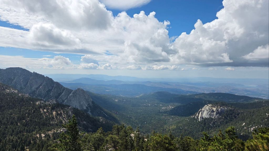
TRAIL CONDITIONS
Icy snow was almost continuous on trails above 9300 ft on 15th October, with a patchy mix of ice, snow, and sleet down to 8800 ft. Spikes were useful, but not essential for those very familiar with hiking in such conditions, above about 9500 ft. These conditions will improve steadily with a warming trend over 16th-19th October, with melting most rapid at lower elevations (initially below 10,000 ft) and on the most sun-exposed trails. As of Friday 17th, very thin icy snow was still widespread in the sheltered sections of the Peak Trail above 9900 ft, and as low as 9300 ft on the least sun-exposed sections of Deer Springs Trail. With caution, spikes are generally not required, although there is little harm with carrying them of course.
Thankfully most trails have suffered relatively minor tread erosion from recent intense rains. Neither the Wolf Fire in late June nor the Rosa Fire in early August had major impacts on the trail system, although the latter did burn the southernmost 0.5 mile of the Palm Canyon trail.
For the first time in nearly a decade, Deer Springs Trail from its trailhead to Little Round Valley is now completely clear of blowdowns, with 26 trees removed since the middle of last year, of which 70% were cut by the Trail Report. A joint Eastern Sierra Conservation Corps/State Park crew working in early October made good progress trimming encroaching vegetation along Deer Springs Trail just above the Fuller Ridge Trail junction to about 9300 ft.
On PCT Miles 170-175 (roughly Apache Peak to Red Tahquitz) most blowdowns have been removed but six trees remain to be cut around South Peak (Miles 173.5-174) of which most are significant obstructions for hikers. Sections of the trail are badly overgrown with brush and in their worst condition in decades, especially most of Miles 168-174.
The two large downed trees near PCT Mile 180 were removed by the Trail Report this spring. The Strawberry Trail (PCT Miles 180.8-183.1) has had several of its decade-old blowdowns removed this month by Forest Service volunteers. The brush along Miles 181-181.7 has become heavily overgrown since it was last trimmed by the Trail Report in 2021, but there is a plan for trimming work in the next few months.
The maintenance condition of the Fuller Ridge (Miles 185.5-190.5) section of the PCT improved significantly in July 2025, with the Trail Report clearing most of the 15 blowdowns and a PCTA volunteer crew cutting the remainder the following week.
On the Wellman Trail, Wellman’s Cienega is flowing well compared to earlier in the autumn (photo below). The Trail Report continues the work it started last year to keep this trail clear (after it had become badly overgrown by early 2024).
Dark Canyon Road (4S02) had some effective basic maintenance on its dirt section in the spring. The associated Dark Canyon campground is closed for the year (apparently due to federal budget cuts).
For the first time in about 20 years Seven Pines Trail has a continuous route completely cleared of blowdown trees, with the trail also as faithful to the original route as possible. The Trail Report “adopted” Seven Pines as a priority for maintenance work nearly a decade ago due to a disproportionate number of lost hiker rescues (with State Park and Forest Service evidently no longer maintaining the route). Since 2019 we have now removed exactly 100 downed trees – including 25 since April of this year – and the trail is largely trimmed and cleared annually. Although our work has restored this delightful trail, Seven Pines remains a genuine wilderness trail unlike the wider, bare, obvious routes of, for example, Devil’s Slide or Marion Mountain trails. Cautious navigation remains invaluable for those without extensive experience of hiking this trail.
Black Mountain Road is open and in its typical non-graded condition, i.e. lumpy but readily passable in any moderate clearance vehicle. The tap at Cinco Poses Spring currently has reliable water (located alongside the road 0.2 mile below the Boulder Basin turning).
On Willow Creek Trail whitethorn urgently needs trimming again especially near the boundary between the two agencies. The two large trees remaining uncut in the State Park section from several years ago have easy workarounds.
The Caramba Trail from near Reeds Meadow through Laws Camp and on to Caramba, and the Cedar Trail from Willow Creek Trail to Laws, are euphemistically (and arguably dangerously) described by the Forest Service as “not maintained”. In reality both trails have been abandoned for more than a decade and no longer exist. They are so heavily overgrown, largely with dense whitethorn which obscures dozens of downed trees, that hikers should not attempt to follow them (regardless of how much you may trust any particular app).
An informal use trail to Laws is much more direct, generally well maintained, and avoids the bushwhacking of the abandoned trails (some local Idyllwild hikers dubbed it the “King Trail” when I established the route in 2019). It leaves Willow Creek Trail exactly 1.0 mile from Saddle Junction, 0.46 mile from the Skunk Cabbage turning (trailhead at N 33.7796, W 116.6590). The route descends following former deer trails for 1.2 miles, meeting Willow Creek about 0.15 mile upstream from the site of the historic Laws Camp (the remains of which were destroyed by the 2013 Mountain Fire and subsequent flood and treefall damage). One huge pine tree fell in late 2024 across the King Trail about midway down that requires a minor scramble underneath, but nine additional blowdowns have been removed since January 2025, with the trail trimmed and cleaned three times this year.
From Laws east to Caramba the original Caramba Trail has been cairned by myself and others and can largely be followed with skilled route-finding. My most recent 2025 survey counted 120 trees down on this 2.1 miles of trail. It is extremely obscure for the first 0.5 mile east of the Willow Creek crossing, becoming more obvious (but still subtle) as it descends towards Caramba. Very cautious navigation is strongly recommended throughout the area.
Stormy weather this autumn brought down another seven trees across Spitler Peak Trail. All were removed by the Trail Report on 20th October, bringing to 169 the total number of trees we have removed from this route in the past seven years. One very large burned cedar is the only tree that remains across the trail, immediately after the first creek crossing 3.2 miles up from the trailhead.
The Zen Center Trail continues its serious deterioration that started following the 2013 Mountain Fire, with a combination of vigorous regrowth and treefall hazards further obscuring the route with each passing season. The lower and upper thirds of this trail are partially cairned and not too bad for those who are very familiar with the former route, but even the experienced find navigating the central section tricky. Long trousers, scrambling gloves, and a genuine enjoyment of bush-whacking are all strongly recommended.
While all time and labor is volunteered, the San Jacinto Trail Report uses small donations to help cover modest operating costs. Your contribution keeps the Report available to all, free from advertising or paywalls, and independent from agencies. If you have found this Report useful, please consider using this link to the Donate page. Thank you very much for your support.

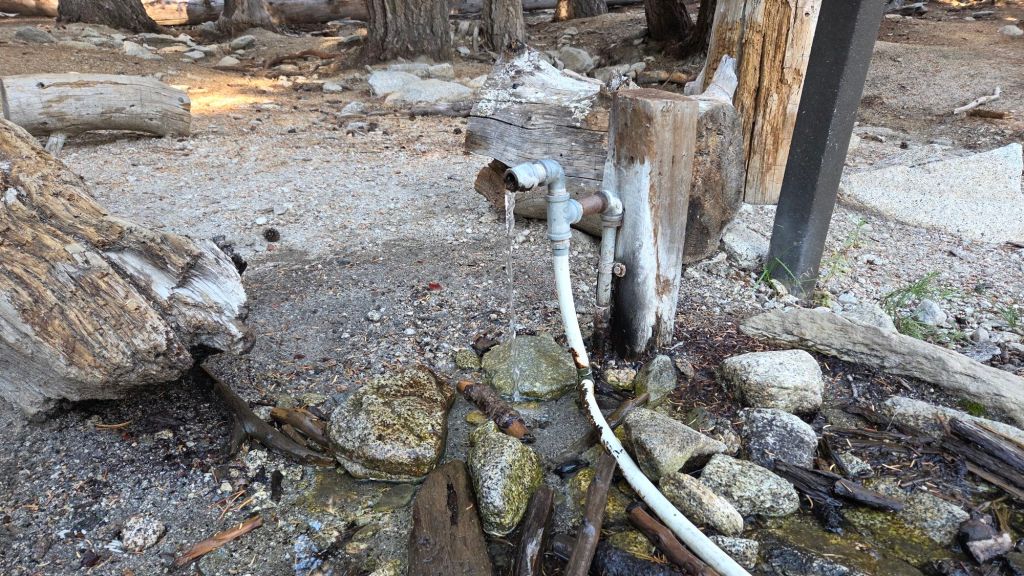

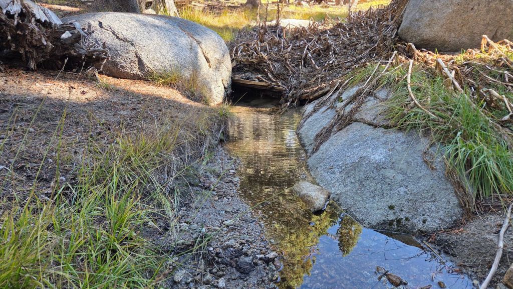
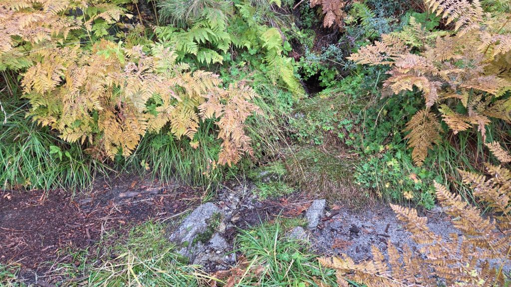
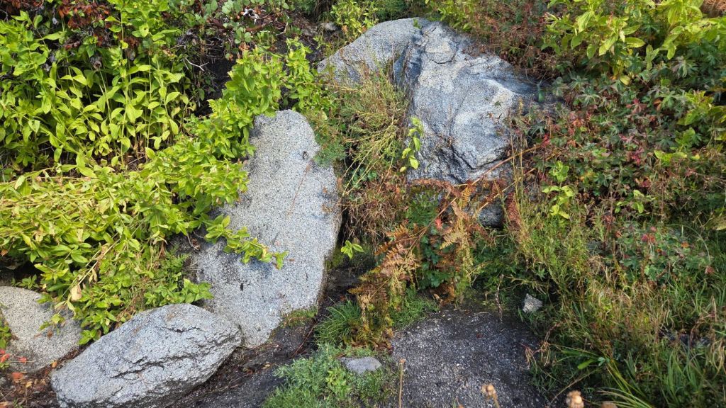
sanjacjon Uncategorized Leave a comment 11 MinutesEdit”Trail update 22nd October 2025″
Trail and water update 10th October 2025
The San Jacinto mountains have experienced a remarkable sequence of tropical and monsoonal autumnal rains in the past eight weeks, as described in more detail in the Weather section below. San Jacinto Peak has recorded an impressive 7.46 inches of rainfall since 22nd August, with 4.20 inches recorded in Idyllwild (at 5550 ft) over the same period.
Further tropical moisture fell on 9th and 10th October (included in the numbers above). A storm system passing largely to the north of our region next week – mainly overnight on 14th-15th October – is associated with a cold front and will be the first winter storm of the season, in dramatic contrast to the warm, humid, tropical storms of recent weeks. Light precipitation starting in the afternoon of Tuesday 14th may include a dusting of snow above 10,000 ft elevation, but limited rainfall everywhere below that level.
Palm Springs Aerial Tramway closed for scheduled annual maintenance for five weeks starting 8th September, with a tentative reopening on 13th October 2025.
Water flows improved only briefly following the rain events of recent weeks, and many have already returned to their mid-August condition (example photos below). Some key hiker water sources are flowing reasonably well, but all ephemeral sources dried in the summer. Wellman’s Cienega and the pipe in Round Valley are flowing steadily and should now maintain useable flow deep into the autumn. Ephemeral sources along Marion Mountain Trail are all dry for the first time in more than two years. The creek in Little Round Valley has already dried again where it passes through the meadow and also where it crosses Deer springs Trail, but continues to flow patchily in its central section. Deer Springs creek dried up in late July where it crosses the trail of the same name, and has dried again following very brief flow last month. The North Fork of the San Jacinto River is flowing where it crosses both Fuller Ridge and Deer Springs trails. Marion Creek is flowing steadily where it crosses the Suicide Rock Trail. Strawberry Cienega (approx PCT Mile 181.9), which dried in midsummer, is temporarily trickling again, but not sufficiently to filter any useful volume of water.
Willow Creek is flowing (weakly) again where it crosses the Willow Creek Trail, having dried in August. All other minor creeks that cross Willow Creek Trail remain dry however. Hidden Lake dried by the end of June (although it temporarily holds a tiny pond from recent rains). Long Valley Creek is dry where it passes through Round Valley, as is the nearby creek in Tamarack Valley. Water is flowing reliably in Tahquitz Creek at PCT Mile 177 and again further downstream at the north end of Little Tahquitz Meadow (although it is dry between those two locations). The pipe in Tahquitz Meadow dried up in mid July. Skunk Cabbage Meadow creek is functionally dry and no longer useful for filtering. Middle Spring on Devil’s Slide Trail has been functionally dry since 1st August, but I maintain a tiny pool there from which dogs can drink.
Full fire restrictions began on Tuesday 1st July 2025 on Forest Service lands, as described on the USFS website linked here. Campfires throughout USFS lands in the San Jacinto Mountains, including all campgrounds and yellow post sites, are prohibited.
Note that during the federal government shutdown, the U.S. Forest Service Idyllwild Ranger Station is closed. Adventure passes and wilderness permits are not required (or are at least unenforceable) until the shutdown ends. Unlike the 2018-19 shutdown which occurred in the winter months of December-January, gates on Forest Service roads and USFS campgrounds have remained open (for now).
Fire lookouts at Black Mountain and Tahquitz Peak are closed indefinitely due to issues identified in a May 2025 safety inspection of Black Mountain lookout. Regrettably it is now unlikely that either will reopen this year.
Be bear aware. Although generally rarely reported, 4-5 individually identifiable Black Bears have been observed in the San Jacinto mountains since 2017, and I have personally seen at least one annually for the past six years. Two bears have been seen in multiple locations in Fern Valley since late August, a large, chestnut-colored adult (images in the previous Report linked here) initially seen on Willow Creek Trail, plus a smaller immature dark-colored individual. My brief videos from Devil’s Slide Trail in September 2021 (linked here) and one walking through our property in Idyllwild in 2018 (linked here) show two other individuals. There have been no reports of negative interactions with humans in the high country, at or near campsites, or on trails.
Survey hikes by the Trail Report daily and year-round in the San Jacinto mountains include multiple routes to the highest peaks including San Jacinto Peak typically at least twice per week (more frequently during stormy weather), Tahquitz Peak and area at least once per week, plus a wide variety of other trails on intervening days.
WEATHER
Temperatures stabilized at (or even slightly below) seasonal for the last week of September. They are now forecast to remain near seasonal for the first half of October, with a warming trend on 7th-10th. There is currently only light precipitation in the forecasts, as described above associated with the breakdown of Hurricane Priscilla, most likely on 9th-10th October. Typical autumnal temperatures forecast for the high country may include temperatures close to freezing around the highest peaks in October, most notably associated with the passage of a cold front after Monday 13th.
The San Jacinto mountains received valuable monsoonal and tropical rainfall in late August and early September, as described in detail in an earlier Report (linked here). Subsequently the heaviest rainfall was on 18th September, as described in the previous Report (linked here). Additional rainfall fell on Saturday 27th September when a highly localized storm cell – at that time it wasn’t even raining in nearby Pine Cove – produced 0.57 inch of rain in Idyllwild in just an hour early in the afternoon. A spectacular thunderstorm that evening was more widespread, with a further 0.38 inch of rain in Idyllwild, and very heavy rain in Garner Valley. Some parts of the high country received reasonable rainfall (0.61 inch at San Jacinto Peak and 0.41 inch at Wellman’s Cienega) but other areas missed the most intense precipitation (only 0.1 inch in Long Valley all day).
At San Jacinto Peak (10,811ft/3295m) on Friday 10th October 2025 at 1015 the air temperature was 50.6°F (10°C), with a windchill temperature of 42.4°F (6°C), 82% relative humidity, and a steady SSW wind sustained at 6 mph gusting to 10.6 mph.
At the Peak on Monday 6th October 2025 at 0900 the air temperature was 48.7°F (9°C), with a windchill temperature of 41.0°F (5°C), 31% relative humidity, and a light SSW wind sustained at 3 mph gusting to 9.0 mph.
At the Peak on Friday 3rd October 2025 at 0640 the air temperature was 38.5°F (4°C), with a windchill temperature of 23.5°F (-5°C), 37% relative humidity, and a stiff SW wind sustained at 19 mph gusting to 33.4 mph.
TRAIL CONDITIONS
The established trail system was completely clear of snow by late May. Most trails have suffered only minor tread erosion from recent intense rains. Neither the Wolf Fire in late June nor the Rosa Fire in early August had major impacts on the trail system, although the latter did burn the southernmost 0.5 mile of the Palm Canyon trail.
For the first time in a decade, upper Deer Springs Trail – between the top of Marion Mountain Trail and Little Round Valley – is now clear of blowdowns, with the Trail Report having removed nine trees this year, including the two major hazards at PCT Mile 185.3 that came down this past winter.
A joint Eastern Sierra Conservation Corps/State Park crew working on 2nd-6th October made good progress trimming Deer Springs Trail just above the Fuller Ridge Trail junction to about 9300 ft. While some progress was made cutting a few trees lower down on Deer Springs Trail, they unfortunately failed to clear the long-term major blowdowns located 0.25 mile north of Strawberry Junction, and about 0.9 mile south of Strawberry Junction.
On PCT Miles 170-175 (roughly Apache Peak to Red Tahquitz) most blowdowns have been removed but six trees remain to be cut around South Peak (Miles 173.5-174) of which most are significant obstructions for hikers. Sections of the trail are badly overgrown with brush and in their worst condition in decades, especially most of Miles 168-174.
The two large downed trees near PCT Mile 180 were removed by the Trail Report this spring. The Strawberry Trail (PCT Miles 180.8-183.1) has ten blowdowns, none of which pose major hazards to hikers. Of the eight on the Forest Service section, several have been down for 8-10 years and reported repeatedly but with no action. The brush along Miles 181-181.7 has become heavily overgrown since it was last trimmed in 2021.
The maintenance condition of the Fuller Ridge (Miles 185.5-190.5) section of the PCT improved in July 2025, with the Trail Report clearing most of the 15 blowdowns and a PCTA volunteer crew cutting the remainder the following week.
On the Wellman Trail, Wellman’s Cienega is flowing relatively well compared to earlier in the autumn (photo below). The Trail Report continues the work it started last year to keep this trail clear (after it had become badly overgrown by early 2024).
Dark Canyon Road (4S02) had some effective basic maintenance on its dirt section in the spring. The associated Dark Canyon campground is closed for the year (apparently due to federal budget cuts).
For the first time in about 20 years Seven Pines Trail has a continuous route completely cleared of blowdown trees, with the trail also as faithful to the original route as possible. The Trail Report “adopted” Seven Pines as a priority for maintenance work nearly a decade ago due to a disproportionate number of lost hiker rescues (with State Park and Forest Service evidently no longer maintaining the route). Since 2019 we have now removed exactly 100 downed trees – including 25 since April of this year – and the trail is largely trimmed and cleared annually. Although our work has restored this delightful trail, Seven Pines remains a genuine wilderness trail unlike the wider, bare, obvious routes of, for example, Devil’s Slide or Marion Mountain trails. Cautious navigation remains invaluable for those without extensive experience of hiking this trail.
Black Mountain Road is open and in its typical non-graded condition, i.e. lumpy but readily passable in any moderate clearance vehicle. The tap at Cinco Poses Spring currently has reliable water (located alongside the road 0.2 mile below the Boulder Basin turning).
On Willow Creek Trail whitethorn urgently needs trimming again especially near the boundary between the two agencies. The two large trees remaining uncut in the State Park section from several years ago have easy workarounds.
The Caramba Trail from near Reeds Meadow through Laws Camp and on to Caramba, and the Cedar Trail from Willow Creek Trail to Laws, are euphemistically (and arguably dangerously) described by the Forest Service as “not maintained”. In reality both trails have been abandoned for more than a decade and no longer exist. They are so heavily overgrown, largely with dense whitethorn which obscures dozens of downed trees, that hikers should not attempt to follow them (regardless of how much you may trust any particular app).
An informal use trail to Laws is much more direct, generally well maintained, and avoids the bushwhacking of the abandoned trails (some local Idyllwild hikers dubbed it the “King Trail” when I established the route in 2019). It leaves Willow Creek Trail exactly 1.0 mile from Saddle Junction, 0.46 mile from the Skunk Cabbage turning (trailhead at N 33.7796, W 116.6590). The route descends following former deer trails for 1.2 miles, meeting Willow Creek about 0.15 mile upstream from the site of the historic Laws Camp (the remains of which were destroyed by the 2013 Mountain Fire and subsequent flood and treefall damage). One huge pine tree fell in late 2024 across the King Trail about midway down that requires a minor scramble underneath, but nine additional blowdowns have been removed since January 2025, with the trail already trimmed and cleared twice this year.
From Laws east to Caramba the original Caramba Trail has been cairned by myself and others and can largely be followed with skilled route-finding. My most recent 2025 survey counted 120 trees down on this 2.1 miles of trail. It is extremely obscure for the first 0.5 mile east of the Willow Creek crossing, becoming more obvious (but still subtle) as it descends towards Caramba. Very cautious navigation is strongly recommended throughout the area.
Storms early in 2025 brought down another 34 trees across Spitler Peak Trail. All but one were removed by the Trail Report, bringing to 162 the total number of trees we have removed from this route in the past seven years. One very large burned cedar remains across the trail immediately after the first creek crossing 3.2 miles up from the trailhead. A couple of other much more recent blowdowns are small and easily stepped over.
The Zen Center Trail continues its serious deterioration that started following the 2013 Mountain Fire, with a combination of vigorous regrowth and treefall hazards further obscuring the route with each passing season. The lower and upper thirds of this trail are partially cairned and not too bad for those who are very familiar with the former route, but even the experienced find navigating the central section tricky. Long trousers, scrambling gloves, and a genuine enjoyment of bush-whacking are all strongly recommended.
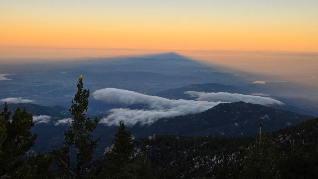

While all time and labor is volunteered, the San Jacinto Trail Report uses small donations to help cover modest operating costs. Your contribution keeps the Report available to all, free from advertising or paywalls, and independent from agencies. If you have found this Report useful, please consider using this link to the Donate page. Thank you very much for your support.
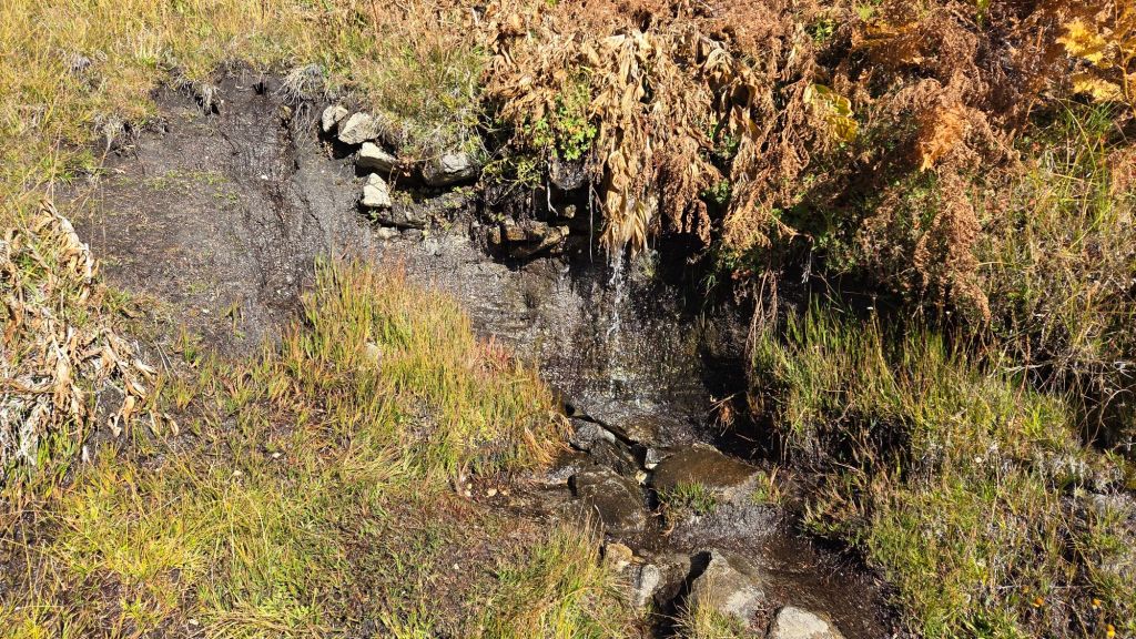


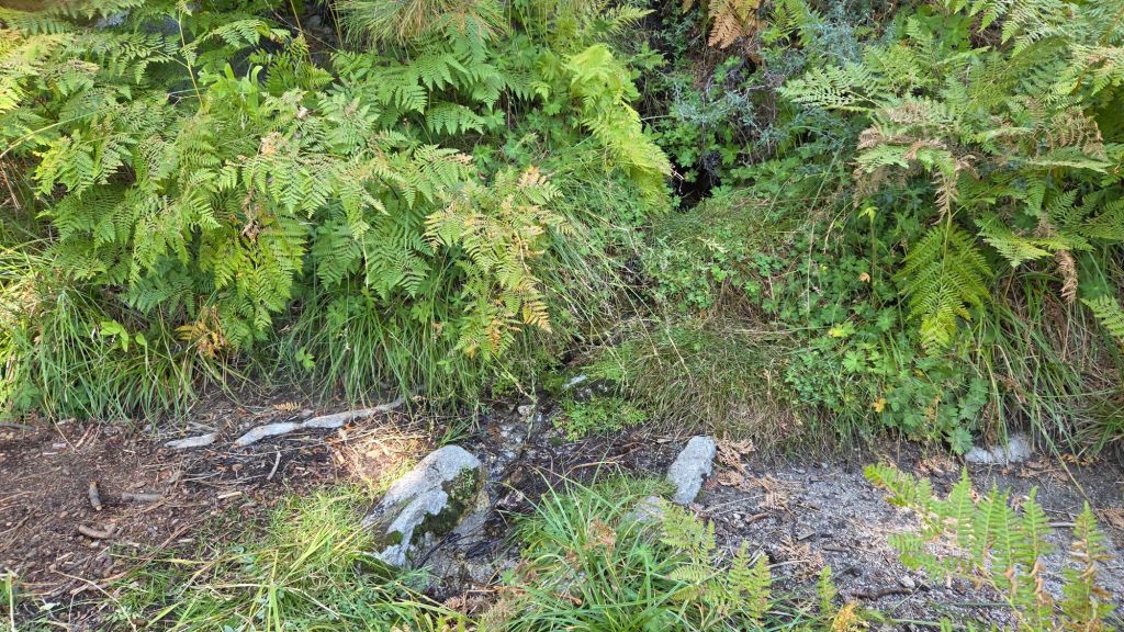

sanjacjon Uncategorized Leave a comment 11 MinutesEdit”Trail and water update 10th October 2025″
Trail and water update 23rd September 2025
UPDATE Saturday 27th September 2025: a highly localized storm cell – it wasn’t even raining in nearby Pine Cove – produced 0.57 inch of rain in Idyllwild in just an hour early in the afternoon. A spectacular thunderstorm in the evening was more widespread, with a further 0.38 inch of rain in Idyllwild, and very heavy rain in Garner Valley, but large parts of the high country missed the most intense precipitation (e.g., only 0.1 inch in Long Valley for the entire day).
———————————-
After nearly eight months of well-below-average precipitation to start 2025, the San Jacinto mountains have received multiple waves of excellent monsoonal and tropical rainfall since late August. Rainfall at San Jacinto Peak totaled 6.70 inches between 22nd August and 21st September, with 2.66 inches recorded in Idyllwild (at 5550 ft) over the same period.
The most intense rainfall fell on Thursday last week. Moisture drawn north from former Tropical Storm Mario generated two phases of rain on 18th September, totaling 3.13 inches at San Jacinto Peak in under 24 hours, with 1.49 inches also measured in Idyllwild. I was hiking near the Peak during a spectacular afternoon thunderstorm that day, with 1.40 inches of rain measured at the Peak in just 40 minutes, including slushy hail above 10,000 ft. Idyllwild recorded 0.67 inch in the same storm. Earlier in the day the system produced more steady rain up to 0800, with 1.34 inches measured at San Jacinto Peak, 1.39 inches in Little Round Valley, and 0.82 inch in Idyllwild.
Further rains are possible over the next week, currently forecast as most likely on 26th-28th, as disorganized tropical moisture to our south may generate more cloud flowing northwards, with any possible precipitation intensity as always depending upon localized thunderstorm activity. After Wednesday 24th, temperatures are forecast to be at (or even below) seasonal for the remainder of September.
Palm Springs Aerial Tramway closed for scheduled annual maintenance for five weeks starting 8th September, with a tentative reopening on 13th October 2025.
Water flows have briefly improved, given the rain events of recent days (and weeks). Although many key hiker water sources are temporarily flowing reasonably well, all ephemeral sources dried in the summer. Wellman’s Cienega, the pipe in Round Valley, and the creek in Little Round Valley, are flowing steadily and should now maintain useable flow into the autumn. Ephemeral sources along Marion Mountain Trail are all dry for the first time in more than two years. Deer Springs creek dried up in late July where it crosses the trail of the same name (and remains dry even after recent rains). The North Fork of the San Jacinto River is flowing where it crosses both Fuller Ridge and Deer Springs trails. Marion Creek is flowing steadily where it crosses the Suicide Rock Trail.
Willow Creek is flowing again where it crosses the Willow Creek Trail, having dried in August. All other minor creeks that cross Willow Creek Trail are dry however. Hidden Lake dried by the end of June (although it temporarily holds a small pond from recent rains). Long Valley Creek is dry where it passes through Round Valley, as is the nearby creek in Tamarack Valley. Water is flowing reliably in Tahquitz Creek at PCT Mile 177 and again further downstream at the north end of Little Tahquitz Meadow (although it is dry between those two locations). The pipe in Tahquitz Meadow dried up in mid July. Skunk Cabbage Meadow creek is functionally dry and no longer useful for filtering. Strawberry Cienega is functionally dry despite some recent rainwater flows. Middle Spring on Devil’s Slide Trail has been functionally dry since 1st August, but a tiny pool persists from which dogs can drink.
Full fire restrictions began on Tuesday 1st July 2025 on Forest Service lands, as described on the USFS website linked here. Campfires throughout USFS lands in the San Jacinto Mountains, including all campgrounds and yellow post sites, are prohibited.
Fire lookouts at Black Mountain and Tahquitz Peak are closed indefinitely due to issues identified in a May 2025 safety inspection of Black Mountain lookout. Neither lookout will reopen before October, and regrettably it is unclear whether either will reopen this year.
Be bear aware. Although generally rarely reported, 3-5 individually identifiable Black Bears have been observed in the San Jacinto mountains since 2017, and I have personally seen at least one annually for the past six years. An adult-sized, light chestnut-colored bear has been reported multiple times since early July, initially from Willow Creek Trail, and subsequently in multiple locations in Fern Valley since late August (images in the previous Report linked here). My brief videos from Devil’s Slide Trail in September 2021 (linked here) and one walking through our property in Idyllwild in 2018 (linked here) show two other individuals. There have been no reports of negative interactions with humans in the high country, at or near campsites, or on trails.
Survey hikes by the Trail Report daily and year-round in the San Jacinto mountains include multiple routes to the highest peaks including San Jacinto Peak typically 2-3 times per week (more frequently during stormy weather), Tahquitz Peak and area at least once per week, plus a wide variety of other trails on intervening days.

WEATHER
Temperatures that were predominantly above seasonal for nearly four months since 20th May may finally stabilize at (or even below) seasonal for the last week of September. After a couple of warmer days, temperatures drop and remain relatively cool on 25th-30th September.
The San Jacinto mountains received valuable monsoonal and tropical rainfall in late August and early September, as described in detail in the previous Report (linked here). Subsequently the heaviest rainfall was on 18th September, as described above. Forecasts are currently suggesting that there may be further tropical rainfall later this week, most likely on 26th-28th. Further atmospheric instability is very tentatively forecast into the first few days of October.
At San Jacinto Peak (10,811ft/3295m) on Monday 22nd September 2025 at 0920 the air temperature was 47.3°F (8°C), with a windchill temperature of 42.3°F (6°C), 74% relative humidity, and a very light SW wind sustained at 2 mph gusting to 5.6 mph.
At the Peak on Friday 19th September 2025 at 0635 the air temperature was 39.5°F (4°C), with a windchill temperature of 29.1°F (-2°C), 97% relative humidity, and a fresh SW wind sustained at 8 mph gusting to 17.0 mph.
At the Peak on Tuesday 16th September 2025 at 1010 the air temperature was 61.0°F (16°C), with a windchill temperature of 47.5°F (9°C), 65% relative humidity, and a variable SSW wind sustained at 2 mph gusting to 8.1 mph. This remarkable air temperature is a record high for the Peak in September.
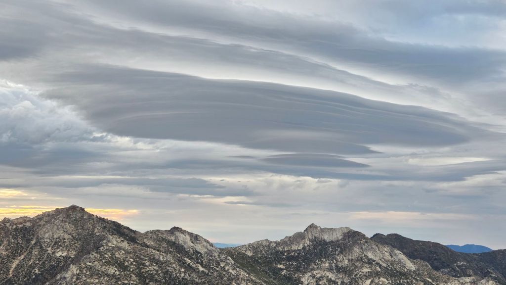
TRAIL CONDITIONS
The established trail system was completely clear of snow by late May. While most trails have suffered nothing more that minor tread erosion from recent intense rains, it possible that some sections have suffered more significant damage as not all trails have been surveyed at this time. Neither the Wolf Fire in late June nor the Rosa Fire in early August had major impacts on the trail system, although the latter did burn the southernmost 0.5 mile of the Palm Canyon trail.
On PCT Miles 170-175 (roughly Apache Peak to Red Tahquitz) most blowdowns have been removed but six trees remain to be cut around South Peak (Miles 173.5-174) of which most are significant obstructions for hikers. Lengthy sections of the trail are badly overgrown with brush and in their worst condition in decades, especially most of Miles 168-174.
The two large downed trees near PCT Mile 180 were removed by the Trail Report in May. The Strawberry Trail (PCT Miles 180.8-183.1) has ten blowdowns, none of which pose major hazards to hikers. Of the eight on the Forest Service section, several have been down for 8-10 years and reported repeatedly but with no action. The brush along Miles 181-181.7 has become heavily overgrown since it was last trimmed in 2021.
Five further blowdowns remain on the Deer Springs Trail portion of the PCT (Miles 183-185), some of which are major obstructions, albeit with workarounds. For the first time in a decade, upper Deer Springs Trail – between the top of Marion Mountain Trail and Little Round Valley – is now clear of blowdowns, with the Trail Report having removed eight trees earlier this year, including the two major hazards at PCT Mile 185.3 that came down this past winter.
The maintenance condition of the Fuller Ridge (Miles 185.5-190.5) section of the PCT improved in July 2025, with the Trail Report clearing most of the 15 blowdowns and a PCTA volunteer crew cutting the remainder the following week.
On the Wellman Trail, Wellman’s Cienega is flowing relatively gently (photo below) but there is still plenty of water for hikers for now. The Trail Report continues the work it started last year to keep this trail clear (after it had become badly overgrown by early 2024).
Dark Canyon Road (4S02) reopened in May and the dirt section has had some effective basic maintenance. The associated Dark Canyon campground is closed for the year (federal budget cuts).
For the first time in about 20 years Seven Pines Trail has a continuous route completely cleared of blowdown trees, with the trail also as faithful to the original route as possible. The Trail Report “adopted” Seven Pines as a priority for maintenance work nearly a decade ago due to a disproportionate number of lost hiker rescues (with State Park and Forest Service evidently no longer maintaining the route). Since 2019 we have now removed exactly 100 downed trees – including 25 since April of this year – and the trail is largely trimmed and cleared annually. Although our work has restored this delightful trail, Seven Pines remains a genuine wilderness trail unlike the wider, bare, obvious routes of, for example, Devil’s Slide or Marion Mountain trails. Cautious navigation remains invaluable for those without extensive experience of hiking this trail.
Black Mountain Road is open and in its typical non-graded condition, i.e. lumpy but readily passable in any moderate clearance vehicle. The tap at Cinco Poses Spring currently has reliable water (located alongside the road 0.2 mile below the Boulder Basin turning).
Willow Creek Trail is in its best condition since it was thoroughly cleared in 2020, although whitethorn urgently needs trimming again especially near the boundary between the two agencies. The two large trees remaining uncut in the State Park section from several years ago have easy workarounds.
The Caramba Trail from near Reeds Meadow through Laws Camp and on to Caramba, and the Cedar Trail from Willow Creek Trail to Laws, are euphemistically (and arguably dangerously) described by the Forest Service as “not maintained”. In reality both trails have been abandoned for more than a decade and no longer exist. They are so heavily overgrown, largely with dense whitethorn which obscures dozens of downed trees, that hikers should not attempt to follow them (regardless of how much you may trust any particular app).
An informal use trail to Laws is much more direct, generally well maintained, and avoids the bushwhacking of the abandoned trails (some local Idyllwild hikers dubbed it the “King Trail” when I established the route in 2019). It leaves Willow Creek Trail exactly 1.0 mile from Saddle Junction, 0.46 mile from the Skunk Cabbage turning (trailhead at N 33.7796, W 116.6590). The route descends following former deer trails for 1.2 miles, meeting Willow Creek about 0.15 mile upstream from the site of the historic Laws Camp (the remains of which were destroyed by the 2013 Mountain Fire and subsequent flood and treefall damage). One huge pine tree fell in late 2024 across the King Trail about midway down that requires a minor scramble underneath, but nine additional blowdowns have been removed since January 2025, with the trail already trimmed and cleared twice this year.
From Laws east to Caramba the original Caramba Trail has been cairned by myself and others and can largely be followed with skilled route-finding. My most recent 2025 survey counted 120 trees down on this 2.1 miles of trail. It is extremely obscure for the first 0.5 mile east of the Willow Creek crossing, becoming more obvious (but still subtle) as it descends towards Caramba. Very cautious navigation is strongly recommended throughout the area.
Storms early in 2025 brought down another 34 trees across Spitler Peak Trail. All but one were removed by the Trail Report, bringing to 162 the total number of trees we have removed from this route in the past seven years. One very large burned cedar remains across the trail immediately after the first creek crossing 3.2 miles up from the trailhead. A couple of other much more recent blowdowns are small and easily stepped over.
The Zen Center Trail continues its serious deterioration that started following the 2013 Mountain Fire, with a combination of vigorous regrowth and treefall hazards further obscuring the route with each passing season. The lower and upper thirds of this trail are partially cairned and not too bad for those who are very familiar with the former route, but even the experienced find navigating the central section tricky. Long trousers, scrambling gloves, and a genuine enjoyment of bush-whacking are all strongly recommended.
While all time and labor is volunteered, the San Jacinto Trail Report uses small donations to help cover modest operating costs. Your contribution keeps the Report available to all, free from advertising or paywalls, and independent from agencies. If you have found this Report useful, please consider using this link to the Donate page. Thank you very much for your support.


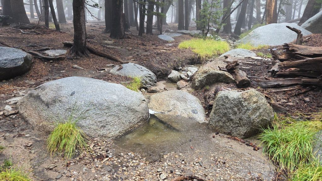
sanjacjon Uncategorized Leave a comment 10 MinutesEdit”Trail and water update 23rd September 2025″
Trail and water update 20th September 2025
After eight months of below-average precipitation to start 2025, the San Jacinto mountains have received four separate periods of excellent monsoonal and tropical rainfall since late August. San Jacinto Peak received 3.5 inches between 22nd August and 2nd September, and despite some trail erosion during intense thunderstorms, the rain pleasantly refreshed the forest and dampened hiking routes.
Moisture drawn north from former Tropical Storm Mario generated two phases of rain on Thursday 18th September 2025, totaling an additional 3.13 inches at San Jacinto Peak in less than a day, with 1.49 inches also measured in Idyllwild (at 5550 ft). I was hiking near the Peak during a spectacular afternoon thunderstorm, with 1.40 inches of rain falling at the Peak in about 40 minutes, including slushy hail above 10,000 ft. Idyllwild recorded 0.67 inch in the same storm. Earlier in the day the system produced steady rain up to 0800, with 1.34 inches measured at San Jacinto Peak, 1.39 inches in Little Round Valley, and 0.82 inch in Idyllwild.
Daytime temperatures are now forecast to remain largely around seasonal for the remainder of September, but with overnight low temperatures still tending to be above average. Further tropical rains are possible over the next week, as a disorganized possible tropical depression south of Baja California may generate more moisture flowing northwards, with intensity depending as always upon localized thunderstorm activity. Rains will briefly result in lower daytime temperatures.
Palm Springs Aerial Tramway closed for scheduled annual maintenance for five weeks starting 8th September, with a tentative reopening on 13th October 2025.
Water flows markedly improved in recent days, with four different monsoonal/tropical rain events since late August. Although many key hiker water sources are temporarily flowing well, all ephemeral sources dried in the summer. Wellman’s Cienega, the pipe in Round Valley, and the creek in Little Round Valley, are flowing steadily and should now maintain useable flow well into the autumn. Ephemeral sources along Marion Mountain Trail are all dry for the first time in more than two years. Deer Springs creek dried up in late July where it crosses the trail of the same name (and remains dry even after recent rains). The North Fork of the San Jacinto River is flowing where it crosses both Fuller Ridge and Deer Springs trails. Marion Creek is flowing steadily where it crosses the Suicide Rock Trail.
Willow Creek is flowing again where it crosses the Willow Creek Trail, having dried in August. All other minor creeks that cross Willow Creek Trail remain dry however. Hidden Lake dried by the end of June (although it temporarily holds a small pond from recent rains). Long Valley Creek is dry where it passes through Round Valley, as is the nearby creek in Tamarack Valley. Water is flowing reliably in Tahquitz Creek at PCT Mile 177 and again further downstream at the north end of Little Tahquitz Meadow (although it is dry between those two locations). The pipe in Tahquitz Meadow dried up in mid July. Skunk Cabbage Meadow creek is functionally dry and no longer useful for filtering. Strawberry Cienega is dry. Middle Spring on Devil’s Slide Trail was functionally dry by 1st August, but a tiny pool persists from which dogs can drink.
Full fire restrictions began on Tuesday 1st July 2025 on Forest Service lands, as described on the USFS website linked here. Campfires throughout USFS lands in the San Jacinto Mountains, including all campgrounds and yellow post sites, are prohibited.
Fire lookouts at Black Mountain and Tahquitz Peak are closed indefinitely due to issues identified in a May 2025 safety inspection of Black Mountain lookout. Neither lookout will reopen before October, and regrettably it is unclear whether either will reopen this year.
Be bear aware. Although generally rarely reported, 3-5 individually identifiable Black Bears have been observed in the San Jacinto mountains since 2017, and I have personally seen at least one annually for the past six years. Most recently, an adult-sized, light chestnut-colored bear was reliably reported from Willow Creek Trail adjacent to Skunk Cabbage Meadow on 12th July 2025. What is almost certainly the same individual has been seen in multiple locations in Fern Valley since late August (photos below). My brief videos from Devil’s Slide Trail in September 2021 (available here) and one walking through our property in Idyllwild in 2018 (linked here) show two other individuals. There have been no reports of negative interactions with humans at or near campsites or on trails.
Survey hikes by the Trail Report every single day throughout the year in the San Jacinto mountains include multiple routes to various high peaks including San Jacinto Peak typically 2-3 times per week (more frequently during stormy weather), Tahquitz Peak and area at least once per week, plus a wide variety of other trails on intervening days.
WEATHER
Temperatures have been predominantly above seasonal for nearly four months since 20th May, with overnight low temperatures in particular generally well above average. Although feeling pleasantly cooler compared to midsummer, temperatures have remained above seasonal for much of September, and temperature near or above seasonal will continue until late in the month.
The San Jacinto mountains received some valuable monsoonal and tropical rainfall in late August and early September, as described in detail in the previous Report (linked here). Subsequently the heaviest rainfall was on 18th September, as described above. Forecasts are currently suggesting that there may be further tropical rainfall this week, possibly accompanying thunderstorms.
At San Jacinto Peak (10,811ft/3295m) on Thursday 18th September 2025 at 0940 the air temperature was 46.2°F (8°C), with a windchill temperature of 35.6°F (2°C), 100% relative humidity, and a blustery due South wind sustained at 10 mph gusting to 19.9 mph.
At the Peak on Tuesday 16th September 2025 at 1010 the air temperature was 61.0°F (16°C), with a windchill temperature of 47.5°F (9°C), 65% relative humidity, and a variable SSW wind sustained at 2 mph gusting to 8.1 mph. This remarkable air temperature is a record high for the Peak in September.
At the Peak on Thursday 11th September 2025 at 0635 the air temperature was 41.8°F (5°C), with a windchill temperature of 30.6°F (-1°C), 21% relative humidity, and a steady SW wind sustained at 14 mph gusting to 21.9 mph.
At the Peak on Wednesday 10th September 2025 at 1000 the air temperature was 47.4°F (9°C), with a windchill temperature of 34.3°F (1°C), 21% relative humidity, and a fresh WSW wind sustained at 9 mph gusting to 18.7 mph.
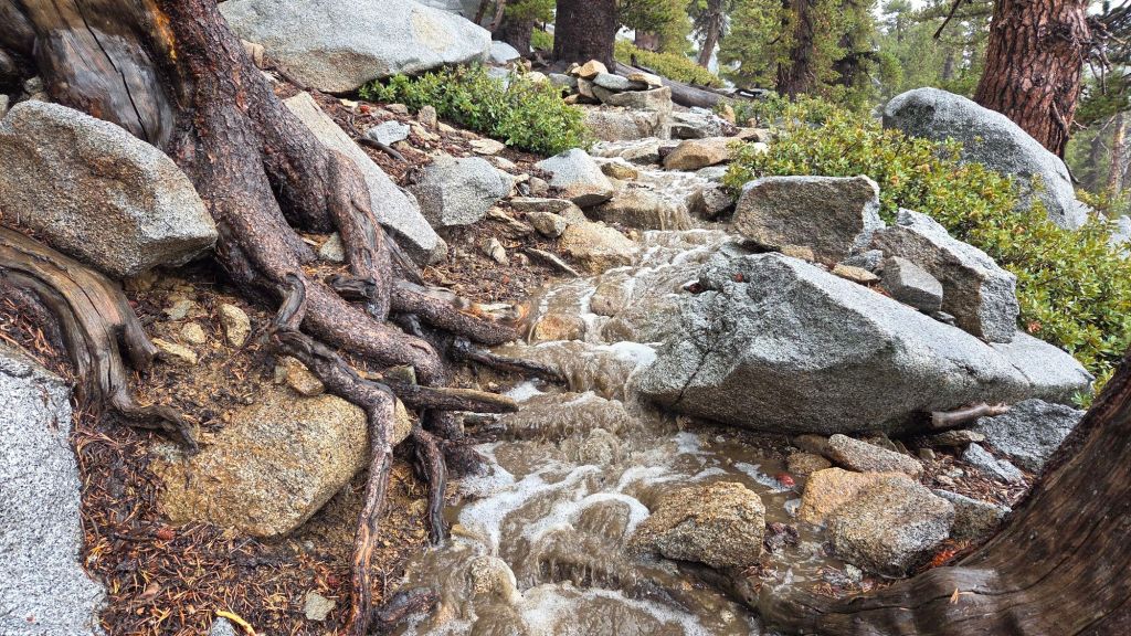
TRAIL CONDITIONS
The established trail system was completely clear of snow by late May. Neither the Wolf Fire in late June nor the Rosa Fire in early August had major impacts on the trail system, although the latter did burn the southernmost 0.5 mile of the Palm Canyon trail.
On PCT Miles 170-175 (roughly Apache Peak to Red Tahquitz) most blowdowns have been removed but six trees remain to be cut around South Peak (Miles 173.5-174) of which most are significant obstructions for hikers. Lengthy sections of the trail are badly overgrown with brush and in their worst condition in decades, especially most of Miles 168-174.
The two large downed trees near PCT Mile 180 were removed by the Trail Report in May. The Strawberry Trail (PCT Miles 180.8-183.1) has ten blowdowns, none of which pose major hazards to hikers. Of the eight on the Forest Service section, several have been down for 8-10 years and reported repeatedly but with no action. The brush along Miles 181-181.7 has become heavily overgrown since it was last trimmed in 2021.
Five further blowdowns remain on the Deer Springs Trail portion of the PCT (Miles 183-185), some of which are major obstructions, albeit with workarounds. For the first time in a decade, upper Deer Springs Trail – between the top of Marion Mountain Trail and Little Round Valley – is now clear of blowdowns, with the Trail Report having removed eight trees earlier this year, including the two major hazards at PCT Mile 185.3 that came down this past winter.
The maintenance condition of the Fuller Ridge (Miles 185.5-190.5) section of the PCT improved in July 2025, with the Trail Report clearing most of the 15 blowdowns and a PCTA volunteer crew cutting the remainder the following week.
On the Wellman Trail, Wellman’s Cienega is flowing relatively gently (photo below) but there is still plenty of water for hikers for now. The Trail Report continues the work it started last year to keep this trail clear (after it had become badly overgrown by early 2024).
Dark Canyon Road (4S02) reopened in May and the dirt section has had some effective basic maintenance. The associated Dark Canyon campground is closed for the year (federal budget cuts).
For the first time in about 20 years Seven Pines Trail has a continuous route completely cleared of blowdown trees, with the trail also as faithful to the original route as possible. The Trail Report “adopted” Seven Pines as a priority for maintenance work nearly a decade ago due to a disproportionate number of lost hiker rescues (with State Park and Forest Service evidently no longer maintaining the route). Since 2019 we have now removed exactly 100 downed trees – including 25 since April of this year – and the trail is largely trimmed and cleared annually. Although our work has restored this delightful trail, Seven Pines remains a genuine wilderness trail unlike the wider, bare, obvious routes of, for example, Devil’s Slide or Marion Mountain trails. Cautious navigation remains invaluable for those without extensive experience of hiking this trail.
Black Mountain Road is open and in its typical non-graded condition, i.e. lumpy but readily passable in any moderate clearance vehicle. The tap at Cinco Poses Spring currently has reliable water (located alongside the road 0.2 mile below the Boulder Basin turning).
Willow Creek Trail is in its best condition since it was thoroughly cleared in 2020, although whitethorn urgently needs trimming again especially near the boundary between the two agencies. The two large trees remaining uncut in the State Park section from several years ago have easy workarounds.
The Caramba Trail from near Reeds Meadow through Laws Camp and on to Caramba, and the Cedar Trail from Willow Creek Trail to Laws, are euphemistically (and arguably dangerously) described by the Forest Service as “not maintained”. In reality both trails have been abandoned for more than a decade and no longer exist. They are so heavily overgrown, largely with dense whitethorn which obscures dozens of downed trees, that hikers should not attempt to follow them (regardless of how much you may trust any particular app).
An informal use trail to Laws is much more direct, generally well maintained, and avoids the bushwhacking of the abandoned trails (some local Idyllwild hikers dubbed it the “King Trail” when I established the route in 2019). It leaves Willow Creek Trail exactly 1.0 mile from Saddle Junction, 0.46 mile from the Skunk Cabbage turning (trailhead at N 33.7796, W 116.6590). The route descends following former deer trails for 1.2 miles, meeting Willow Creek about 0.15 mile upstream from the site of the historic Laws Camp (the remains of which were destroyed by the 2013 Mountain Fire and subsequent flood and treefall damage). One huge pine tree fell in late 2024 across the King Trail about midway down that requires a minor scramble underneath, but nine additional blowdowns have been removed since January 2025, with the trail already trimmed and cleared twice this year.
From Laws east to Caramba the original Caramba Trail has been cairned by myself and others and can largely be followed with skilled route-finding. My most recent 2025 survey counted 120 trees down on this 2.1 miles of trail. It is extremely obscure for the first 0.5 mile east of the Willow Creek crossing, becoming more obvious (but still subtle) as it descends towards Caramba. Very cautious navigation is strongly recommended throughout the area.
Storms early in 2025 brought down another 34 trees across Spitler Peak Trail. All but one were removed by the Trail Report, bringing to 162 the total number of trees we have removed from this route in the past seven years. One very large burned cedar remains across the trail immediately after the first creek crossing 3.2 miles up from the trailhead. A couple of other much more recent blowdowns are small and easily stepped over.
The Zen Center Trail continues its serious deterioration that started following the 2013 Mountain Fire, with a combination of vigorous regrowth and treefall hazards further obscuring the route with each passing season. The lower and upper thirds of this trail are partially cairned and not too bad for those who are very familiar with the former route, but even the experienced find navigating the central section tricky. Long trousers, scrambling gloves, and a genuine enjoyment of bush-whacking are all strongly recommended.
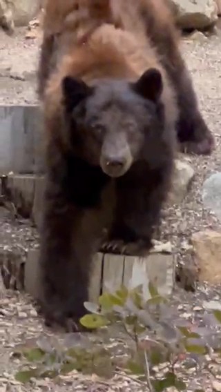


While all time and labor is volunteered, the San Jacinto Trail Report uses small donations to help cover modest operating costs. Your contribution keeps the Report available to all, free from advertising or paywalls, and independent from agencies. If you have found this Report useful, please consider using this link to the Donate page. Thank you very much for your support.


sanjacjon Uncategorized Leave a comment 10 MinutesEdit”Trail and water update 20th September 2025″
Trail and water update 11th September 2025
Temperatures dropped markedly starting Tuesday 2nd September, but remained above seasonal with unusually high humidity. Autumnal temperatures, i.e. seasonal for September, finally arrived starting Tuesday 9th, accompanied by fresh westerly winds and low humidity. This may only be a temporary reprieve however, with warm conditions forecast again for next week (at least 15th-19th September).
After eight months of below-average precipitation to start 2025, the San Jacinto mountains finally received some monsoonal and tropical rainfall in late August and early September, described in detail under Weather below. The rainfall totals have been satisfying – San Jacinto Peak received 3.5 inches between 22nd August and 2nd September – and despite some trail erosion during intense thunderstorms, the rain has done a great job of refreshing the forest and dampening hiking routes.
Palm Springs Aerial Tramway closed for scheduled annual maintenance for five weeks starting 8th September, with a tentative reopening on 13th October 2025.
Water flows everywhere remain low – illustrated by some photos below – with ephemeral sources now dry. Recent rains have briefly augmented stream flow, but past experience suggests the effects will be short-lived, perhaps only a week or two in most locations. The descriptions below largely reflect the long-term situation, which is likely to be the default again by mid-September.
Key hiker water sources such as Wellman’s Cienega and the pipe in Round Valley are flowing gently but steadily and will now maintain useable flow into the autumn. Ephemeral sources along Marion Mountain Trail are all dry for the first time in more than two years. Deer Springs creek dried up in late July where it crosses the trail of the same name (and remains dry even after recent rains). Flow in the creek in Little Round Valley has dropped dramatically since late July. While the creek is running briefly again, the flow is low and it may well be dry again by next week. The North Fork is dry where it crossed by Seven Pines Trail, but is flowing gently higher up where it crosses both Fuller Ridge and Deer Springs trails. Marion Creek is flowing steadily where it crosses the Suicide Rock Trail.
Willow Creek is now flowing again where it crosses the Willow Creek Trail, having dried in August. All other minor creeks that cross Willow Creek Trail remain dry however. Hidden Lake had dried by the end of June (although it currently holds a small pond from recent rains). Long Valley Creek is dry where it passes through Round Valley, as is the nearby creek in Tamarack Valley. Water is flowing reliably in Tahquitz Creek at PCT Mile 177 and again further downstream at the north end of Little Tahquitz Meadow (although it is dry between those two locations). The pipe in Tahquitz Meadow dried up in mid July. Skunk Cabbage Meadow creek is functionally dry and no longer useful for filtering. Strawberry Cienega is dry. Middle Spring on Devil’s Slide Trail was functionally dry by 1st August, but a tiny pool persists from which dogs can drink.
Full fire restrictions began on Tuesday 1st July 2025 on Forest Service lands, as described on the USFS website linked here. Campfires throughout USFS lands in the San Jacinto Mountains, including all campgrounds and yellow post sites, are now prohibited.
Fire lookouts at Black Mountain and Tahquitz Peak are closed indefinitely due to issues identified in a May 2025 safety inspection of Black Mountain lookout. Neither lookout will reopen before October, and regrettably it is unclear whether either will reopen this year.
Be bear aware. Although rarely reported in recent years, 3-5 individually identifiable Black Bears have been observed in the San Jacinto mountains since 2017, and I have personally seen at least one annually for the past six years. One adult-sized, light chestnut-colored individual was reliably reported from Willow Creek Trail adjacent to Skunk Cabbage Meadow on 12th July 2025. What was almost certainly the same individual was seen in Fern Valley in late August (photo below). My brief videos from Devil’s Slide Trail in September 2021 (available here) and one walking through our property in Idyllwild in 2018 (linked here) show two other individuals. There have been no reports of negative interactions with humans at or near campsites or on trails.
Be rattlesnake aware. Above about 5000 ft elevation, the venom of Southern Pacific Rattlesnakes (Crotalus [oreganus] helleri) in the San Jacinto mountains is predominantly neurotoxic, almost always fatal for dogs and sometimes for humans (see my detailed article linked here for further information describing our dogs’ survival after a July 2020 neurotoxic bite). Devil’s Slide Trail, lower Deer Springs and lower Marion Mountain trails, Suicide Rock, near Strawberry Cienega, and trails around Tahquitz Peak are frequent locations for sightings, but rattlesnakes have been recorded widely up to 9350 ft (see example photos of an adult and a juvenile in a previous Report linked here). Encounters with rattlesnakes are rapidly declining with cooling temperatures in recent days, especially above 6000 ft.
Survey hikes by the Trail Report every single day throughout the year in the San Jacinto mountains include multiple routes to various high peaks including San Jacinto Peak typically 2-3 times per week (more frequently during stormy weather), Tahquitz Peak and area at least once per week, plus a wide variety of other trails on intervening days.
WEATHER
Temperatures have been generally above seasonal for three months from 20th May to 24th August, with overnight low temperatures in particular well above average, with notable heatwaves between 10th-20th June, in the second week of July, and again in both the second and third weeks of August.
The hot temperatures of the holiday weekend at the turn of the month thankfully cool starting on Tuesday 2nd September (although they remained above seasonal for the month during the first week of September). A further drop in temperatures, to average for the month, is forecast starting Tuesday 9th September.
The San Jacinto mountains received some monsoonal and tropical rainfall in late August and early September. The most recent monsoon storm was on Tuesday 2nd September when more than one inch of rain fell across the high country in just half-an-hour around 0730-0800, with lighter rain persisting until noon. I had the good fortune to be out in the thick of the storm as I hiked cautiously toward San Jacinto Peak, through trails that had (briefly) turned into whitewater creeks and with extremely vigorous thunder and lightning all around. Recorded rainfall on 2nd was 1.51 inches at San Jacinto Peak (10,810 ft), 1.49 inches at Wellman’s Cienega (9300 ft), 0.70 inch at Little Round Valley (9800 ft), and 0.72 inch at Saddle Junction (8100 ft). In Idyllwild (at 5550 ft) total rainfall was an impressive 0.80 inch.
The first measurable monsoonal precipitation of the summer in these mountains fell on 22nd-25th August. Although there was some rain on all four days, the most spectacular thunderstorms were on Monday 25th August. A localized storm cell lingered over the high country in the early afternoon, initially producing heavy hail above 8900 ft on the eastern slope (photo below) and above 9600 ft on the western slope. Rainfall just that afternoon was 1.21 inches at San Jacinto Peak. The same storm storm reportedly produced over two inches of rain in just one hour in Long Valley. In contrast, rainfall in Idyllwild measured barely 0.02 inch. Total rain accumulation for the four days was 1.75 inches at San Jacinto Peak, 1.40 inches in Little Round Valley (9800 ft), 1.22 inches at the junction of Marion Mountain and Deer Springs trails (8700 ft), 0.71 inches at Wellman’s Cienega (9300 ft), and 0.43 inch at Saddle Junction (8100 ft). In Idyllwild (at 5550 ft) total rainfall was 0.25 inch, most of which fell on Saturday 23rd.
On Thursday 28th August we had a fully overcast day with many hours of light rain. This came not from monsoonal storms originating to our east, but from the remains of an offshore tropical storm to the south-west. Recorded rainfall was 0.27 inch at San Jacinto Peak (10,810 ft), 0.32 inch at Wellman’s Cienega (9300 ft), and 0.25 inch at Saddle Junction (8100 ft). In Idyllwild (at 5550 ft) total rainfall was 0.11 inch.
At San Jacinto Peak (10,810ft/3295m) on Thursday 11th September 2025 at 0635 the air temperature was 41.8°F (5°C), with a windchill temperature of 30.6°F (-1°C), 21% relative humidity, and a steady SW wind sustained at 14 mph gusting to 21.9 mph.
At the Peak on Wednesday 10th September 2025 at 1000 the air temperature was 47.4°F (9°C), with a windchill temperature of 34.3°F (1°C), 21% relative humidity, and a fresh WSW wind sustained at 9 mph gusting to 18.7 mph.
At the Peak on Tuesday 9th September 2025 at 0900 the air temperature was 50.2°F (10°C), with a windchill temperature of 44.8°F (7°C), 14% relative humidity, and a cool WSW wind sustained at 5 mph gusting to 8.2 mph.
TRAIL CONDITIONS
The established trail system was completely clear of snow by late May. Neither the Wolf Fire in late June nor the Rosa Fire in early August had major impacts on the trail system, although the latter did burn the southernmost 0.5 mile of the Palm Canyon trail.
Recent work has largely resolved the backlog of downed trees on PCT Miles 170-175 (roughly Apache Peak to Red Tahquitz) accumulated during years of agency neglect. Six trees remain to be cut around South Peak (Miles 173.5-174) of which most are significant obstructions for hikers. Lengthy sections of the trail are badly overgrown with brush and in their worst condition in decades, especially most of Miles 168-174, but PCTA/Forest Service show little interest in improving this situation. Regrettably post-fire erosion has created a loose, rocky, and uneven tread in some parts of the same section, requiring caution in places. The trail is not passable by stock.
The two large downed trees near PCT Mile 180 were removed by the Trail Report in May. The Strawberry Trail (PCT Miles 180.8-183.1) has ten blowdowns, none of which pose major hazards to hikers. Of the eight on the Forest Service section, several have been down for 8-10 years and reported repeatedly but with no action. The brush between the cienega and Annie’s Junction (roughly Miles 181-181.7) has become heavily overgrown since it was last trimmed in 2021.
Five further blowdowns remain on the Deer Springs Trail portion of the PCT (Miles 183-185), some of which are major obstructions, albeit with workarounds. For the first time in a decade, upper Deer Springs Trail – between the top of Marion Mountain Trail and Little Round Valley – is now clear of blowdowns, with the Trail Report having removed eight trees earlier this year, including the two major hazards at PCT Mile 185.3 that came down this past winter. [About ten further trees would need to be cut to restore the original route of Deer Springs Trail above Little Round Valley, but the State Park has shown zero interest in maintaining this trail for more than a decade. That section of trail, despite many minor workarounds, remains relatively easy to follow.]
The maintenance condition of the Fuller Ridge (Miles 185.5-190.5) section of the PCT improved in July 2025, having been in very poor condition earlier in the year. The Trail Report cleared nine of 15 blowdowns mid-month. A PCTA volunteer crew the following week largely removed the remaining six trees and undertook some brush trimming and clearing of debris.
On the Wellman Trail, Wellman’s Cienega is flowing relatively gently (photo below) but there is still plenty of water for hikers for now. The Trail Report continues the work it started last year to keep this trail clear (after it had become badly overgrown by early 2024).
Dark Canyon Road (4S02) reopened in May and the dirt section has had some effective basic maintenance. The associated Dark Canyon campground is closed for the year due to federal budget issues.
For the first time in about 20 years Seven Pines Trail has a continuous route completely cleared of blowdown trees, with the trail also as faithful to the original route as possible. The Trail Report “adopted” Seven Pines as a priority for maintenance work nearly a decade ago due to a disproportionate number of lost hiker rescues (with State Park and Forest Service evidently no longer maintaining the route). Since 2019 we have now removed exactly 100 downed trees – including 25 since April of this year – and the trail is largely trimmed and cleared annually. Although our work has restored this delightful trail, Seven Pines remains a genuine wilderness trail unlike the wider, bare, obvious routes of, for example, Devil’s Slide or Marion Mountain trails. Cautious navigation remains invaluable for those without extensive experience of hiking this trail.
Black Mountain Road is open and in its typical non-graded condition, i.e. lumpy but readily passable in any moderate clearance vehicle. The tap at Cinco Poses Spring currently has reliable water but this may not last beyond September (located alongside the road 0.2 mile below the Boulder Basin turning).
Willow Creek Trail is in its best condition since it was thoroughly cleared in 2020, although whitethorn urgently needs trimming again especially near the boundary between the two agencies. The two large trees remaining uncut in the State Park section from several years ago have easy workarounds.
The Caramba Trail from near Reeds Meadow through Laws Camp and on to Caramba, and the Cedar Trail from Willow Creek Trail to Laws, are euphemistically (and arguably dangerously) described by the Forest Service as “not maintained”. In reality both trails have been abandoned for more than a decade and no longer exist. They are so heavily overgrown, largely with dense whitethorn which obscures dozens of downed trees, that hikers should not attempt to follow them (regardless of how much you may trust any particular app).
An informal use trail to Laws is much more direct, generally well maintained, and avoids the bushwhacking of the abandoned trails (some local Idyllwild hikers dubbed it the “King Trail” when I established the route in 2019). It leaves Willow Creek Trail exactly 1.0 mile from Saddle Junction, 0.46 mile from the Skunk Cabbage turning (trailhead at N 33.7796, W 116.6590). The route descends following former deer trails for 1.2 miles, meeting Willow Creek about 0.15 mile upstream from the site of the historic Laws Camp (the remains of which were destroyed by the 2013 Mountain Fire and subsequent flood and treefall damage). One huge pine tree fell in late 2024 across the King Trail about midway down that requires a minor scramble underneath, but nine additional blowdowns have been removed since January 2025, with the trail already trimmed and cleared twice this year.
From Laws east to Caramba the original Caramba Trail has been cairned by myself and others and can largely be followed with skilled route-finding. My most recent 2025 survey counted 120 trees down on this 2.1 miles of trail. It is extremely obscure for the first 0.5 mile east of the Willow Creek crossing, becoming more obvious (but still subtle) as it descends towards Caramba. Very cautious navigation is strongly recommended throughout the area.
Storms early in 2025 brought down another 34 trees across Spitler Peak Trail. All but one were removed by the Trail Report, bringing to 162 the total number of trees we have removed from this route in the past seven years. One very large burned cedar remains across the trail immediately after the first creek crossing 3.2 miles up from the trailhead. A couple of other much more recent blowdowns are small and easily stepped over.
The Zen Center Trail continues its serious deterioration that started following the 2013 Mountain Fire, with a combination of vigorous regrowth and treefall hazards further obscuring the route with each passing season. The lower and upper thirds of this trail are partially cairned and not too bad for those who are very familiar with the former route, but even the experienced find navigating the central section tricky. Long trousers, scrambling gloves, and a genuine enjoyment of bush-whacking are all strongly recommended.

While all time and labor is volunteered, the San Jacinto Trail Report uses small donations to help cover modest operating costs. Your contribution keeps the Report available to all, free from advertising or paywalls, and independent from agencies. If you have found this Report useful, please consider using this link to the Donate page. Thank you very much for your support.
sanjacjon Uncategorized 1 Comment 12 MinutesEdit”Trail and water update 11th September 2025″
Trail and water update 28th August 2025
UPDATE Friday 29th August 2025: in addition to the rain (and hail) described below, on Thursday 28th we had a fully overcast day with many hours of light rain. This came from the remains of an offshore tropical storm to our south-west, not from monsoonal conditions to the east. Although rainfall totals were unremarkable, the steady, wetting, drizzle did a good job of dampening trails and refreshing the forest. Recorded rainfall was 0.27 inch at San Jacinto Peak (10,810 ft), 0.32 inch at Wellman’s Cienega (9300 ft), and 0.25 inch at Saddle Junction (8100 ft). In Idyllwild (at 5550 ft) total rainfall was 0.12 inch. Hot temperatures are forecast for this weekend, followed by encouraging probabilities of monsoonal thunderstorm activity every afternoon from 2nd-8th September.
————————————-
The San Jacinto mountains received their first measurable monsoonal precipitation of the summer on 22nd-25th August. There was little more than 0.02 inch on the afternoon of Friday 22nd, but rainfall on Saturday 23rd was intense at times. I experienced the best of it firsthand at San Jacinto Peak that morning with rain, periodically accompanied by impressive thunder and lightning, steady from 0900, before thinning to light drizzle about 1130. Rainfall was heaviest from 0900-1000, with 0.26 inch falling in just that hour see photo below). Further rainfall on the afternoon of Sunday 24th was highly localized, with only 0.04 inch in Idyllwild.
The most spectacular thunderstorms were on Monday 25th August. An intense storm cell lingered over the high country in the early afternoon, initially producing heavy hail above 8900 ft on the eastern slope (photo below) and above 9600 ft on the western slope. Rainfall that afternoon was a further 1.21 inches at San Jacinto Peak, and 1.02 inches at the junction of Marion Mountain and Deer Springs trails. The same storm storm reportedly produced over two inches of rain in just one hour in Long Valley. In contrast, rainfall in Idyllwild measured barely 0.02 inch.
Total rain accumulation for the four days was 1.75 inches at San Jacinto Peak, 1.40 inches in Little Round Valley (9800 ft), 1.22 inches at the junction of Marion Mountain and Deer Springs trails (8700 ft), 0.71 inches at Wellman’s Cienega (9300 ft), and 0.43 inch at Saddle Junction (8100 ft). In Idyllwild (at 5550 ft) total rainfall was 0.25 inch, most of which fell on Saturday 23rd.
Palm Springs Aerial Tramway reopened on Saturday 16th following a seven day closure for emergency maintenance. The scheduled annual maintenance closure is for five weeks from 8th September until at least 12th October 2025.
Water flows everywhere remain low – illustrated by multiple photos below – with ephemeral sources now dry. Recent rains will briefly augment stream flow, but past experience suggests the effects will be short-lived, a few days to a week in most locations. The descriptions below largely reflect the long-term situation, which is likely to be the default again by the first week of September.
Key hiker water sources such as Wellman’s Cienega and the pipe in Round Valley are flowing gently but steadily and are likely to maintain useable flow into the autumn. Ephemeral sources along Marion Mountain Trail are all dry for the first time in more than two years. Deer Springs creek dried up in late July where it crosses the trail of the same name. Flow in the creek in Little Round Valley has dropped dramatically since late July. While the creek was running briefly again on 26th August, the day before only a few tiny pools persisted for filtering by campers. It is likely it will dry again by next week. The North Fork is completely dry where it crossed by Seven Pines Trail, but is flowing gently higher up where it crosses both Fuller Ridge and Deer Springs trails. Marion Creek is flowing steadily where it crosses the Suicide Rock Trail.
Willow Creek is now dry where it crosses the Willow Creek Trail, although there are some minor pools about 100 yards downstream. All other minor creeks that cross Willow Creek Trail are also dry. Hidden Lake dried by the end of June. Long Valley Creek is dry where it passes through Round Valley, as is the nearby creek in Tamarack Valley. Water is flowing reliably in Tahquitz Creek at PCT Mile 177 and again further downstream at the north end of Little Tahquitz Meadow (although it is dry between those two locations). The pipe in Tahquitz Meadow dried up in mid July. Skunk Cabbage Meadow creek is functionally dry and no longer useful for filtering. Strawberry Cienega is dry. Middle Spring on Devil’s Slide Trail was functionally dry by 1st August, but a tiny pool persists from which dogs can drink.
Full fire restrictions began on Tuesday 1st July 2025 on Forest Service lands, as described on the USFS website linked here. Campfires throughout USFS lands in the San Jacinto Mountains, including all campgrounds and yellow post sites, are now prohibited.
Fire lookouts at Black Mountain and Tahquitz Peak are closed indefinitely due to issues identified in a May 2025 safety inspection of Black Mountain lookout. USFS has informed the Trail Report that Tahquitz Peak lookout may reopen by October if upgrades to its lightning conductor array are completed, but it is unlikely Black Mountain lookout will reopen this season.
Be rattlesnake aware. Above about 5000 ft elevation, the venom of Southern Pacific Rattlesnakes (Crotalus [oreganus] helleri) in the San Jacinto mountains is predominantly neurotoxic, almost always fatal for dogs and sometimes for humans (see my detailed article linked here for further information describing our dogs’ survival after a July 2020 neurotoxic bite). Devil’s Slide Trail, lower Deer Springs and lower Marion Mountain trails, Suicide Rock, near Strawberry Cienega, and trails around Tahquitz Peak are frequent locations for sightings, but rattlesnakes have been recorded widely up to 9350 ft (see example photos of an adult and a juvenile in a previous Report linked here).
Be bear aware. Although rarely reported in recent years, at least three individually identifiable Black Bears have been in the San Jacinto mountains since 2017, and I have personally seen at least one annually for the past six years. One adult-sized, light chestnut-colored individual was reliably reported – with photographs – from Willow Creek Trail adjacent to Skunk Cabbage Meadow on 12th July 2025 (information courtesy of Mike Meyer). I photographed fresh tracks in snow on 12th February 2024 at 9000 ft near PCT Mile 180.5 (photo linked here), and my brief videos from Devil’s Slide Trail in September 2021 (available here) and one walking through our property in Idyllwild in 2018 (linked here) show two different individuals. There have been no reports of negative interactions with humans at or near campsites or on trails.
Dark Canyon Road (4S02) reopened in May and the dirt section has had some effective basic maintenance. The associated Dark Canyon campground is closed for the year due to federal budget issues.
Survey hikes by the Trail Report every single day throughout the year in the San Jacinto mountains include multiple routes to various high peaks including San Jacinto Peak typically 2-3 times per week (more frequently during stormy weather), Tahquitz Peak and area at least once per week, plus a wide variety of other trails on intervening days.
WEATHER
Temperatures have been generally above seasonal for three months from 20th May to 24th August, with notable heatwaves between 10th-20th June, in the second week of July, and again in the second and third weeks of August. Interestingly the perception among friends and neighbors in Idyllwild is of a relatively mild summer. This is perhaps due – thankfully – to the lack of severe heatwaves (e.g., temperatures pushing close to 100°F [38°C]) but sadly may simply be indicative of habituation to steadily warmer average temperatures.
Temperatures were about seasonal from 14th-19th August, but then again above seasonal until 25th, with overnight low temperatures in particular well above average. For the remainder of the month, 25th-29th at least, temperatures are expected to be about seasonal for late August.
Monsoon conditions have largely failed in the desert south-west this season, however as described above we finally experienced some rainfall in the San Jacinto mountains associated with thunderstorms on 22nd-25th August. Further rainfall is forecast as a possibility on several days in the remainder of August, most likely early- to mid-afternoon, with probabilities currently highest on Thursday 28th, and then again for 2nd-8th September (at least).
At San Jacinto Peak (10,810ft/3295m) on Friday 29th August 2025 at 0850 the air temperature was 48.6°F (9°C), with a windchill temperature of 38.8°F (4°C), 73% relative humidity, and a cool NNE wind sustained at 5 mph gusting to 11.2 mph.
At the Peak on Tuesday 26th August 2025 at 0845 the air temperature was 58.5°F (15°C), with a “windchill” temperature of 47.3°F (8°C), 71% relative humidity, and a barely discernable WNW wind sustained at 1 mph gusting to 3.2 mph.
At the Peak on Monday 25th August 2025 at 0755 the air temperature was 52.3°F (11°C), with a windchill temperature of 44.8°F (7°C), 65% relative humidity, and a fresh SSE wind sustained at 9 mph gusting to 15.3 mph.
At the Peak on Saturday 23rd August 2025 at 0855 the air temperature was 52.8°F (11°C), with a windchill temperature of 45.9°F (8°C), 67% relative humidity, and a pleasantly cool SE wind sustained at 10 mph gusting to 16.2 mph.

TRAIL CONDITIONS
The established trail system was completely clear of snow by late May. Neither the Wolf Fire in late June nor the Rosa Fire in early August had major impacts on the trail system, although the latter did burn the southernmost 0.5 mile of the Palm Canyon trail.
Recent work has largely resolved the backlog of downed trees on PCT Miles 170-175 (roughly Apache Peak to Red Tahquitz) accumulated during 5+ years of agency neglect. Six trees remain to be cut around South Peak (Miles 173.5-174) of which most are significant obstructions for hikers. Lengthy sections of the trail are badly overgrown with brush and in their worst condition in decades, especially most of Miles 168-174, but PCTA/Forest Service show little interest in improving this situation. Regrettably post-fire erosion has created a loose, rocky, and uneven tread in some parts of the same section, requiring caution in places. The trail is not passable by stock.
The two large downed trees near PCT Mile 180 were removed by the Trail Report in May. The Strawberry Trail (PCT Miles 180.8-183.1) has ten blowdowns, none of which pose major hazards to hikers. Of the eight on the Forest Service section, several have been down for 8-10 years and reported repeatedly but with no action. The brush between the cienega and Annie’s Junction (roughly Miles 181-181.7) has become heavily overgrown since it was last trimmed in 2021.
Five further blowdowns remain on the Deer Springs Trail portion of the PCT (Miles 183-185), some of which are major obstructions, albeit with workarounds. For the first time in a decade, upper Deer Springs Trail – between the top of Marion Mountain Trail and Little Round Valley – is now clear of blowdowns, with the Trail Report having removed eight trees this spring, including the two major hazards at PCT Mile 185.3 that came down this past winter. [About ten further trees would need to be cut to restore the original route of Deer Springs Trail above Little Round Valley, but there is no prospect of that happening soon, if ever. That section of trail, despite too many minor workarounds, remains relatively easy to follow.]
The maintenance condition of the Fuller Ridge (Miles 185.5-190.5) section of the PCT improved in July 2025, having been in very poor condition earlier in the year. The Trail Report cleared nine of 15 blowdowns mid-month. A PCTA volunteer crew the following week largely removed the remaining six trees and undertook some brush trimming and clearing of debris, but sadly the opportunity was missed to comprehensively trim this trail.
On the Wellman Trail, Wellman’s Cienega is flowing relatively poorly (photo below) but there is still plenty of water for hikers for now. The Trail Report continues the work it started last year to keep this trail clear (after it had become badly overgrown by early 2024).
For the first time in more than 15 years Seven Pines Trail has a continuous route completely cleared of blowdown trees, with the trail also as faithful to the original route as possible. The Trail Report “adopted” Seven Pines as a priority for maintenance work nearly a decade ago due to a disproportionate number of lost hiker rescues (with State Park and Forest Service evidently no longer maintaining the route). Since 2019 we have now removed exactly 100 downed trees – including 25 since April of this year – and the trail is largely trimmed and cleared annually. Although our work has restored this delightful trail, Seven Pines remains a genuine wilderness trail unlike the wider, bare, obvious routes of, for example, Devil’s Slide or Marion Mountain trails. Cautious navigation remains invaluable for those without extensive experience of hiking this trail.
Black Mountain Road is open and in its typical non-graded condition, i.e. lumpy but readily passable in any moderate clearance vehicle. The tap at Cinco Poses Spring currently has reliable water but this may not last beyond August (located alongside the road 0.2 mile below the Boulder Basin turning).
Willow Creek Trail is in its best condition since it was thoroughly cleared in 2020. The four new trees that came down on the Forest Service section in January 2025 were cut in June-July. Whitethorn badly needs trimming again especially near the boundary between the two agencies, but is not as overgrown as it was in 2022-23. The two large trees remaining uncut in the State Park section from several years ago have easy workarounds.
The Caramba Trail from near Reeds Meadow through Laws Camp and on to Caramba, and the Cedar Trail from Willow Creek Trail to Laws, are euphemistically (and arguably dangerously) described by the Forest Service as “not maintained”. In reality both trails have been abandoned for more than a decade and no longer exist. They are so heavily overgrown, largely with dense whitethorn which obscures dozens of downed trees, that hikers should not attempt to follow them (regardless of how much you may trust any particular app).
An informal use trail to Laws is much more direct, generally well maintained, and avoids the bushwhacking of the abandoned trails (some local Idyllwild hikers dubbed it the “King Trail” when I established the route in 2019). It leaves Willow Creek Trail exactly 1.0 mile from Saddle Junction, 0.46 mile from the Skunk Cabbage turning (trailhead at N 33.7796, W 116.6590). The route descends following former deer trails for 1.2 miles, meeting Willow Creek about 0.15 mile upstream from the site of the historic Laws Camp (the remains of which were destroyed by the 2013 Mountain Fire and subsequent flood and treefall damage). One huge pine tree fell in late 2024 across the King Trail about midway down that requires a minor scramble underneath, but nine additional blowdowns have been removed since January 2025, with the trail already trimmed and cleared twice this year.
From Laws east to Caramba the original Caramba Trail has been cairned by myself and others and can largely be followed with skilled route-finding. My most recent 2025 survey counted 120 trees down on this 2.1 miles of trail. It is extremely obscure for the first 0.5 mile east of the Willow Creek crossing, becoming more obvious (but still subtle) as it descends towards Caramba. Very cautious navigation is strongly recommended throughout the area.
Storms in February-March brought down another 34 trees across Spitler Peak Trail. All but one were removed in March by the Trail Report, bringing to 162 the total number of trees we have removed from this route in the past seven years. One very large burned cedar remains across the trail immediately after the first creek crossing 3.2 miles up from the trailhead. A couple of other recent blowdowns are small and easily stepped over.
The Zen Center Trail continues its serious deterioration that started following the 2013 Mountain Fire, with a combination of vigorous regrowth and treefall hazards further obscuring the route with each passing season. The lower and upper thirds of this trail are partially cairned and not too bad for those who are very familiar with the former route, but even the experienced find navigating the central section tricky. Long trousers, scrambling gloves, and a genuine enjoyment of bush-whacking are all strongly recommended.
While all time and labor is volunteered, the San Jacinto Trail Report uses small donations to help cover modest operating costs. Your contribution keeps the Report available to all, free from advertising or paywalls, and independent from agencies. If you have found this Report useful, please consider using this link to the Donate page. Thank you very much for your support.

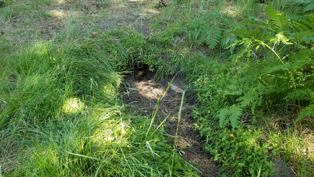

sanjacjon Uncategorized Leave a comment 13 MinutesEdit”Trail and water update 28th August 2025″
Trail and water update 15th August 2025
Air quality remains mediocre in the San Jacinto mountains, although this is hardly surprising given no precipitation for months and smoke from numerous fires spreading throughout Southern California, most notably the huge Gifford Fire to our north-west. Conditions have however improved compared to mid July and earlier in August (e.g., photos in previous Report linked here).
The Rosa Fire on the south-east fringe of the San Jacinto mountains was contained by 8th August. The fire started alongside Highway 74 west of Ribbonwood just after noon on 4th August, quickly spreading to 1700 acres. Highway 74, closed for five days in the vicinity of the fire, reopened late on Friday 8th.
Palm Springs Aerial Tramway closed for emergency maintenance starting Friday 8th August but is expected to reopen on Saturday 16th. The annual scheduled maintenance closure is for five weeks from 8th September until at least 12th October 2025.
Hikers should be prepared for unseasonably hot weather on 20th-24th August, with temperatures above seasonal even for midsummer. Please give considerable extra thought to route choice, start times, clothing, sun protection, and water requirements (the latter especially challenging in this dry year).
Water flows everywhere are low – illustrated by multiple photos below – with ephemeral sources now dry. Key hiker water sources such as Wellman’s Cienega and the pipe in Round Valley are flowing gently but steadily and may maintain useable flow into the autumn. Ephemeral sources along Marion Mountain Trail are all dry for the first time in more than two years. Deer Springs creek dried up in late July where it crosses the trail of the same name. Flow in the creek in Little Round Valley has dropped dramatically since late July, and while a few small pools persist for filtering by campers, it is largely dry, other than about a hundred yards in the middle of the valley (most accessible by the sign for campsite 2). The North Fork is completely dry where it crossed by Seven Pines Trail, but is flowing gently higher up where it crosses both Fuller Ridge and Deer Springs trails.
Willow Creek is now dry where it crosses the Willow Creek Trail, although there are some minor pools about 100 yards downstream. All other minor creeks that cross Willow Creek Trail are also dry. Hidden Lake dried by the end of June. Long Valley Creek is dry where it passes through Round Valley, as is the nearby creek in Tamarack Valley. Water is flowing reliably in Tahquitz Creek at PCT Mile 177 and again further downstream at the north end of Little Tahquitz Meadow (although it is dry between those two locations). The pipe in Tahquitz Meadow dried up in mid July. Skunk Cabbage Meadow creek is functionally dry and no longer useful for filtering. Strawberry Cienega is dry. Middle Spring on Devil’s Slide Trail was functionally dry by 1st August, but a tiny pool persists from which dogs can drink.
It should be clear from the paragraphs above that fire risk is currently severe. Full fire restrictions began on Tuesday 1st July 2025 on Forest Service lands, as described on the USFS website linked here. Campfires throughout USFS lands in the San Jacinto Mountains, including all campgrounds and yellow post sites, are now prohibited.
Fire lookouts at Black Mountain and Tahquitz Peak are closed indefinitely due to issues identified in a May 2025 safety inspection of Black Mountain lookout. USFS has informed the Trail Report that Tahquitz Peak lookout could reopen by September once upgrades to its lightning conductor array are completed, but there is little optimism that Black Mountain lookout will reopen this season.
Be rattlesnake aware. Above about 5000 ft elevation, the venom of Southern Pacific Rattlesnakes (Crotalus [oreganus] helleri) in the San Jacinto mountains is predominantly neurotoxic, almost always fatal for dogs and sometimes for humans (see my detailed article linked here for further information describing our dogs’ survival after a July 2020 neurotoxic bite). Devil’s Slide Trail, lower Deer Springs and lower Marion Mountain trails, Suicide Rock, near Strawberry Cienega, and trails around Tahquitz Peak are frequent locations for sightings, but rattlesnakes have been recorded widely up to 9350 ft (see example photos of an adult and a juvenile in a previous Report linked here).
Be bear aware. Although rarely reported in recent years, at least three individually identifiable Black Bears have been in the San Jacinto mountains since 2017, and I have personally seen at least one annually for the past six years. One adult-sized, light chestnut-colored individual was reliably reported – with photographs – from Willow Creek Trail adjacent to Skunk Cabbage Meadow on 12th July 2025 (information courtesy of Mike Meyer). I photographed fresh tracks in snow on 12th February 2024 at 9000 ft near PCT Mile 180.5 (photo linked here), and my brief videos from Devil’s Slide Trail in September 2021 (available here) and one walking through our property in Idyllwild in 2018 (linked here) show two different individuals. There have been no reports of negative interactions with humans at or near campsites or on trails.
Dark Canyon Road (4S02) reopened in May and the dirt section has had some effective basic maintenance. The associated Dark Canyon campground will be closed for the year due to federal budget issues.
Survey hikes by the Trail Report every single day throughout the year in the San Jacinto mountains include multiple routes to various high peaks including San Jacinto Peak typically 2-3 times per week (more frequently during stormy weather), Tahquitz Peak and area at least once per week, plus a wide variety of other trails on intervening days.
WEATHER
Temperatures have been generally above seasonal for almost three months since 20th May, with notable heatwaves between 10th-20th June, in the second week of July, and again in the second week of August. Interestingly the perception among friends and neighbors in Idyllwild is of a relatively mild summer. This is perhaps due to the lack of severe heatwaves (e.g., temperatures pushing close to 100°F [38°C]) but sadly may simply be indicative of habituation to warmer average temperatures.
Temperatures are forecast to remain above seasonal even for midsummer until 14th August, before cooling (briefly) to about average for a few days, and then rising again by 20th.
Monsoon conditions have largely failed in the desert south-west this season, however there are currently small probabilities for rain in the forecast for 21st-25th August.
At San Jacinto Peak (10,810ft/3295m) on Friday 15th August 2025 at 0825 the air temperature was 48.1°F (9°C), with a windchill temperature of 43.7°F (6°C), 29% relative humidity, and a gentle WNW wind sustained at 3 mph gusting to 6.8 mph.
At the Peak on Monday 11th August 2025 at 0830 the air temperature was 60.5°F (16°C), with a “windchill” temperature of 52.9°F (12°C), 51% relative humidity, and a light SW wind sustained at 6 mph gusting to 9.3 mph.
At the Peak on Friday 8th August 2025 at 0830 the air temperature was 56.8°F (14°C), with a “windchill” temperature of 50.9°F (11°C), 37% relative humidity, and a pleasantly cool WSW wind sustained at 8 mph gusting to 14.7 mph.
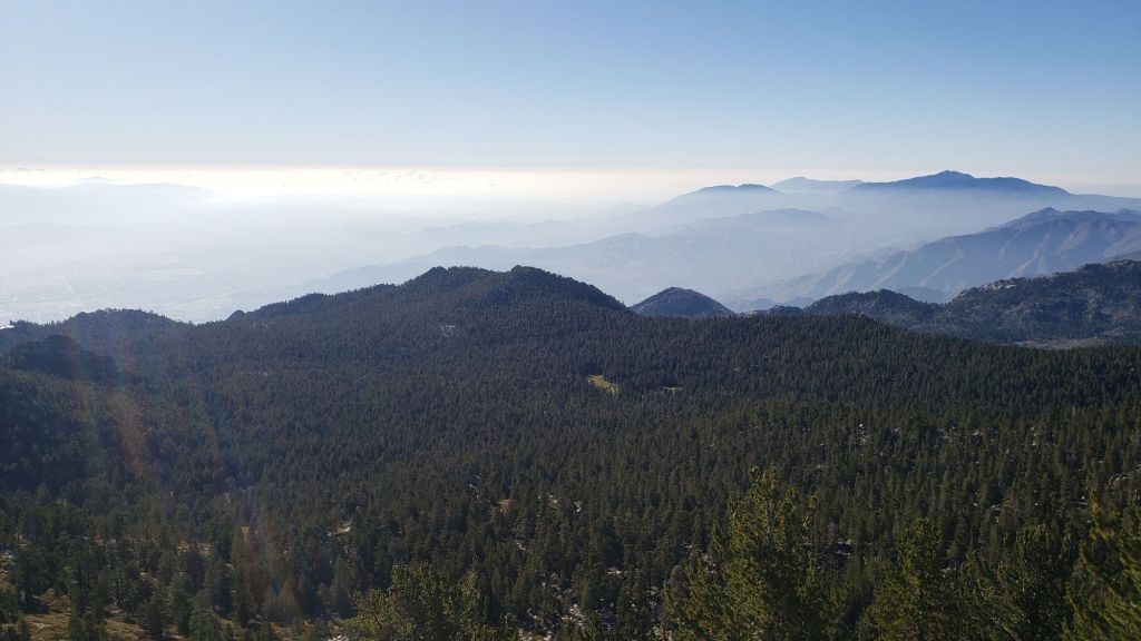
TRAIL CONDITIONS
The established trail system was completely clear of snow by late May. Neither the Wolf Fire in late June nor the Rosa Fire in early August had major impacts on the trail system, although the latter did burn the southernmost 0.5 mile of the Palm Canyon trail.
Work from mid 2024 to early 2025 by various crews largely resolved the backlog of downed trees on PCT Miles 170-175 (roughly Apache Peak to Red Tahquitz) accumulated during 5+ years of agency neglect. Six trees remain to be cut around South Peak (Miles 173.5-174) of which most are significant obstructions for hikers. Lengthy sections of the trail are badly overgrown with brush and in their worst condition in decades, especially most of Miles 168-174, but PCTA/Forest Service show little interest in improving this situation. Regrettably post-fire erosion has created a loose, rocky, and uneven tread in some parts of the same section, requiring caution in places. The trail is not passable by stock.
The two large downed trees near PCT Mile 180 were removed by the Trail Report in May. The Strawberry Trail (PCT Miles 180.8-183.1) has ten blowdowns, none of which pose major hazards to hikers. Of the eight on the Forest Service section, several have been down for 8-10 years and reported repeatedly but with no action. The brush between the cienega and Annie’s Junction (roughly Miles 181-181.7) has become heavily overgrown since it was last trimmed in 2021.
Five further blowdowns remain on the Deer Springs Trail portion of the PCT (Miles 183-185), some of which are major obstructions, albeit with workarounds. For the first time in a decade, upper Deer Springs Trail – between the top of Marion Mountain Trail and Little Round Valley – is now clear of blowdowns, with the Trail Report having removed eight trees this spring, including the two major hazards at PCT Mile 185.3 that came down this past winter. [About ten further trees would need to be cut to restore the original route of Deer Springs Trail above Little Round Valley, but there is no prospect of that happening soon, if ever. That section of trail, despite too many minor workarounds, remains relatively easy to follow.]
The maintenance condition of the Fuller Ridge (Miles 185.5-190.5) section of the PCT improved in July 2025, having been in very poor condition earlier in the year. The Trail Report cleared nine of 15 blowdowns mid-month. A PCTA volunteer crew the following week largely removed the remaining six trees and undertook some brush trimming and clearing of debris, but sadly the opportunity was missed to comprehensively trim this trail.
On the Wellman Trail, Wellman’s Cienega is flowing relatively poorly (photo below) but there is still plenty of water for hikers for now. The Trail Report continues the work it started last year to keep this trail clear (after it had become badly overgrown by early 2024).
For the first time in more than 15 years Seven Pines Trail has a continuous route completely cleared of blowdown trees, with the trail also as faithful to the original route as possible. The Trail Report “adopted” Seven Pines as a priority for maintenance work nearly a decade ago due to a disproportionate number of lost hiker rescues (with State Park and Forest Service evidently no longer maintaining the route). Since 2019 we have now removed exactly 100 downed trees – including 25 since April of this year – and the trail is largely trimmed and cleared annually. Although our work has restored this delightful trail, Seven Pines remains a genuine wilderness trail unlike the wider, bare, obvious routes of, for example, Devil’s Slide or Marion Mountain trails. Cautious navigation remains invaluable for those without extensive experience of hiking this trail.
Black Mountain Road is open and in its typical non-graded condition, i.e. lumpy but readily passable in any moderate clearance vehicle. The tap at Cinco Poses Spring currently has reliable water but this may not last beyond August (located alongside the road 0.2 mile below the Boulder Basin turning).
Willow Creek Trail is in its best condition since it was thoroughly cleared in 2020. The four new trees that came down on the Forest Service section in January 2025 were cut in June-July. Whitethorn badly needs trimming again especially near the boundary between the two agencies, but is not as overgrown as it was in 2022-23. The two large trees remaining uncut in the State Park section from several years ago have easy workarounds.
The Caramba Trail from near Reeds Meadow through Laws Camp and on to Caramba, and the Cedar Trail from Willow Creek Trail to Laws, are euphemistically (and arguably dangerously) described by the Forest Service as “not maintained”. In reality both trails have been abandoned for more than a decade and no longer exist. They are so heavily overgrown, largely with dense whitethorn which obscures dozens of downed trees, that hikers should not attempt to follow them (regardless of how much you may trust any particular app).
An informal use trail to Laws is much more direct, generally well maintained, and avoids the bushwhacking of the abandoned trails (some local Idyllwild hikers dubbed it the “King Trail” when I established the route in 2019). It leaves Willow Creek Trail exactly 1.0 mile from Saddle Junction, 0.46 mile from the Skunk Cabbage turning (trailhead at N 33.7796, W 116.6590). The route descends following former deer trails for 1.2 miles, meeting Willow Creek about 0.15 mile upstream from the site of the historic Laws Camp (the remains of which were destroyed by the 2013 Mountain Fire and subsequent flood and treefall damage). One huge pine tree fell in late 2024 across the King Trail about midway down that requires a minor scramble underneath, but nine additional blowdowns have been removed since January 2025, with the trail already trimmed and cleared twice this year.
From Laws east to Caramba the original Caramba Trail has been cairned by myself and others and can largely be followed with skilled route-finding. My most recent 2025 survey counted 120 trees down on this 2.1 miles of trail. It is extremely obscure for the first 0.5 mile east of the Willow Creek crossing, becoming more obvious (but still subtle) as it descends towards Caramba. Very cautious navigation is strongly recommended throughout the area.
Storms in February-March brought down another 34 trees across Spitler Peak Trail. All but one were removed in March by the Trail Report, bringing to 162 the total number of trees we have removed from this route in the past seven years. One very large burned cedar remains across the trail immediately after the first creek crossing 3.2 miles up from the trailhead. A couple of other recent blowdowns are small and easily stepped over.
The Zen Center Trail continues its serious deterioration that started following the 2013 Mountain Fire, with a combination of vigorous regrowth and treefall hazards further obscuring the route with each passing season. The lower and upper thirds of this trail are partially cairned and not too bad for those who are very familiar with the former route, but even the experienced find navigating the central section tricky. Long trousers, scrambling gloves, and a genuine enjoyment of bush-whacking are all strongly recommended.
While all time and labor is volunteered, the San Jacinto Trail Report uses small donations to help cover modest operating costs. Your contribution keeps the Report available to all, free from advertising or paywalls, and independent from agencies. If you have found this Report useful, please consider using this link to the Donate page. Thank you very much for your support.


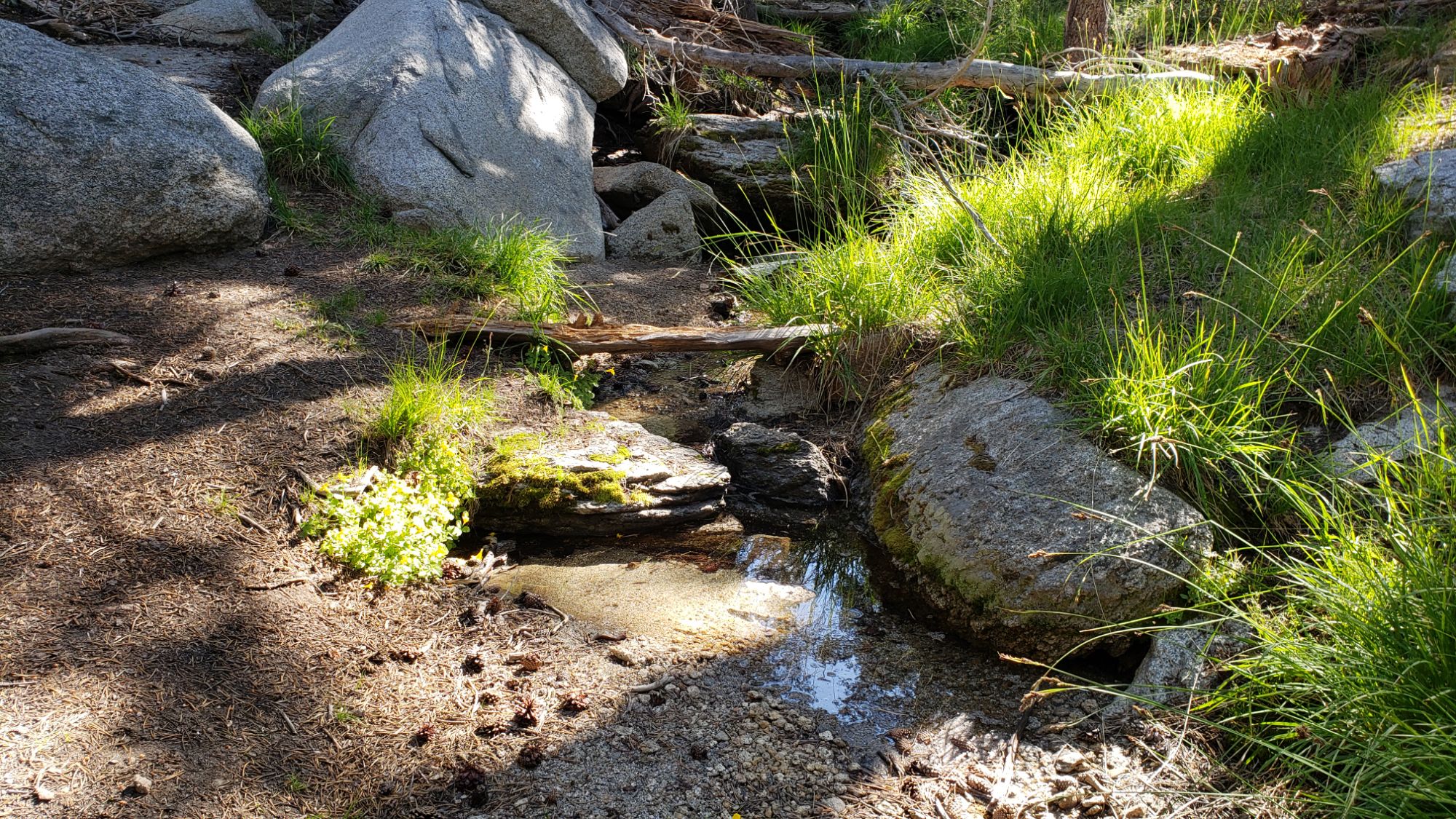

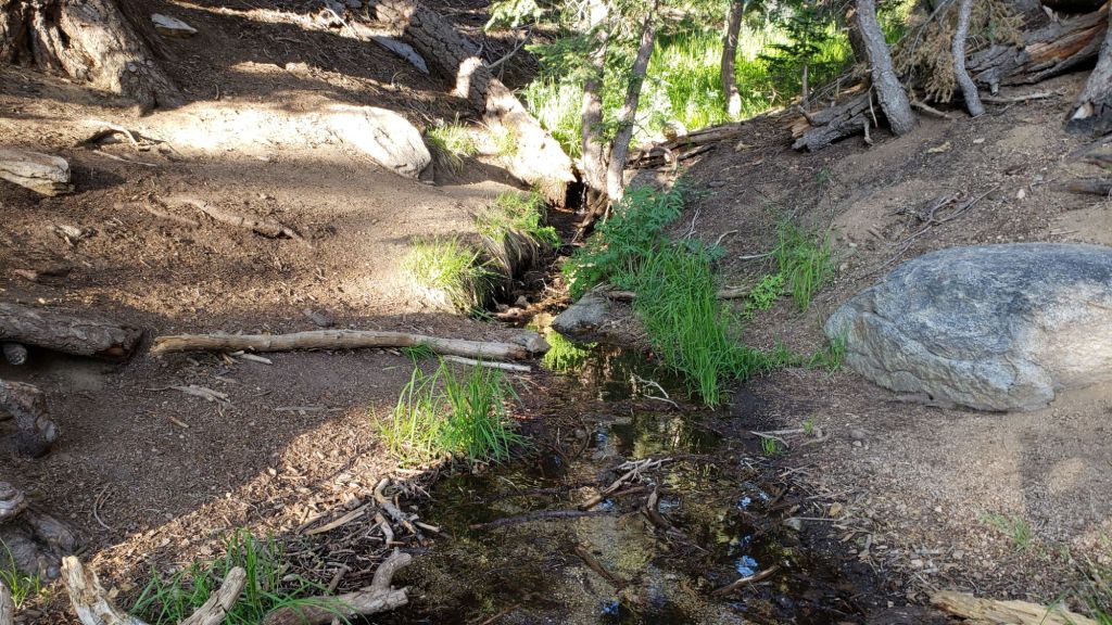


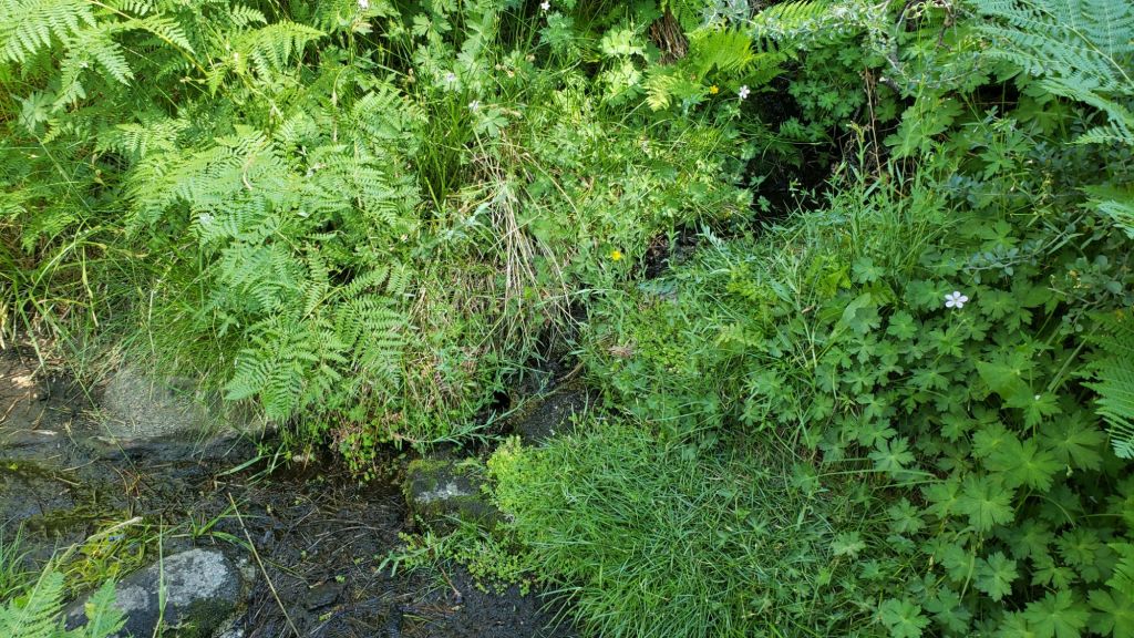
sanjacjon Uncategorized 1 Comment 11 MinutesEdit”Trail and water update 15th August 2025″
Trail and water update 8th August 2025
The Rosa Fire on the south-east fringe of the San Jacinto mountains is now largely under control. The fire started alongside Highway 74 west of Ribbonwood just after noon on 4th August, quickly spreading to 1700 acres. Highway 74, closed for five days in the vicinity of the fire, reopened at midnight on Friday 8th.
Palm Springs Aerial Tramway closed indefinitely for emergency maintenance starting Friday 8th August, and is expected to remain closed until at least Tuesday 12th. The annual scheduled 2025 maintenance closure is from 8th September until at least 12th October.
Air quality improved on 5th August after two very poor days, with smoke enveloping the San Jacinto mountains (photos below) starting on Sunday 3rd, mainly from the huge Gifford Fire far to our north-west. Early morning on Monday 4th the smoke had settled in the flatlands below 7000 ft, and hiking in the high country was the place to be, but by late morning the smoke was again climbing over 9000 ft and well into Strawberry Valley (where Idyllwild is located). Sunlight on both days was muted – like a partial solar eclipse – similar to the impact of the Grand Canyon fires in mid July.
Temperatures are again heating to above seasonal for the first two weeks of August, with modest cooling not forecast until Friday 15th. Temperatures that had been at or above seasonal since late May finally dropped to near seasonal starting 16th July. In the third week of July we were treated to a hint of September, with temperatures at all elevations below seasonal for several days, exemplified by the windchill temperature of 35.4°F (2°C) I recorded at San Jacinto Peak on Friday 25th July.
Hikers should be prepared for unseasonably hot weather, especially on 6th-14th August, with temperatures well above seasonal even for midsummer. Please give considerable extra thought to route choice, start times, clothing, sun protection, and water requirements (the latter especially challenging in this dry year).
Water flows everywhere are low (many photos below) with ephemeral sources now dry. Key hiker water sources such as Wellman’s Cienega and the pipe in Round Valley are flowing and may maintain useable flow into the autumn. Ephemeral sources along Marion Mountain Trail are all dry for the first time in more than two years. Deer Springs creek dried up in late July where it crosses the trail of the same name. Flow in the creek in Little Round Valley has dropped dramatically since late July, and while a few small pools persist for filtering by campers, it is largely dry now, other than about a hundred yards in the middle of the valley (most accessible by the sign for campsite 2). The North Fork is completely dry where it crossed by Seven Pines Trail, but is flowing gently higher up where it crosses both Fuller Ridge and Deer Springs trails. Hidden Lake dried by the end of June. Long Valley Creek is dry where it passes through Round Valley. Water is flowing reliably in Tahquitz Creek at PCT Mile 177 and again further downstream at the north end of Little Tahquitz Meadow (although it is dry between those two locations). The pipe in Tahquitz Meadow dried up in mid July. Skunk Cabbage Meadow creek is close to drying and no longer has sufficient depth for filtering. Strawberry Cienega is now dry. Middle Spring on Devil’s Slide Trail was functionally dry by 1st August, but a tiny pool persists from which dogs can drink.
It should be clear from the paragraphs above that fire risk is currently severe. Full fire restrictions began on Tuesday 1st July 2025 on Forest Service lands, as described on the USFS website linked here. Campfires throughout USFS lands in the San Jacinto Mountains, including all campgrounds and yellow post sites, are now prohibited.
Fire lookouts at Black Mountain and Tahquitz Peak are closed indefinitely due to issues identified in a May 2025 safety inspection of Black Mountain lookout. USFS has informed the Trail Report that Tahquitz Peak lookout could reopen by September once upgrades to its lightning conductor array are completed, but there is little optimism that Black Mountain lookout will reopen this season.
Be rattlesnake aware. Above about 5000 ft elevation, the venom of Southern Pacific Rattlesnakes (Crotalus [oreganus] helleri) in the San Jacinto mountains is predominantly neurotoxic, almost always fatal for dogs and sometimes for humans (see my detailed article linked here for further information describing our dogs’ survival after a July 2020 neurotoxic bite). Devil’s Slide Trail, lower Deer Springs and lower Marion Mountain trails, Suicide Rock, near Strawberry Cienega, and trails around Tahquitz Peak are frequent locations for sightings, but rattlesnakes have been recorded widely up to 9350 ft (see example photos of an adult and a juvenile in the previous Report linked here).
Be bear aware. Although rarely reported in recent years, at least three individually identifiable Black Bears have been in the San Jacinto mountains since 2017, and I have personally seen at least one annually for the past six years. One adult-sized, light chestnut-colored individual was reliably reported – with photographs – from Willow Creek Trail adjacent to Skunk Cabbage Meadow on 12th July 2025 (information courtesy of Mike Meyer). I photographed fresh tracks in snow on 12th February 2024 at 9000 ft near PCT Mile 180.5 (photo linked here), and my brief videos from Devil’s Slide Trail in September 2021 (available here) and one walking through our property in Idyllwild in 2018 (linked here) show two different individuals. There have been no reports of negative interactions with humans at or near campsites or on trails.
Dark Canyon Road (4S02) reopened in May and the dirt section has had some effective basic maintenance. The associated Dark Canyon campground will be closed for the year due to federal budget issues.
Survey hikes by the Trail Report every single day throughout the year in the San Jacinto mountains include multiple routes to various high peaks including San Jacinto Peak typically 2-3 times per week (more frequently during stormy weather), Tahquitz Peak and area at least once per week, plus a wide variety of other trails on intervening days.
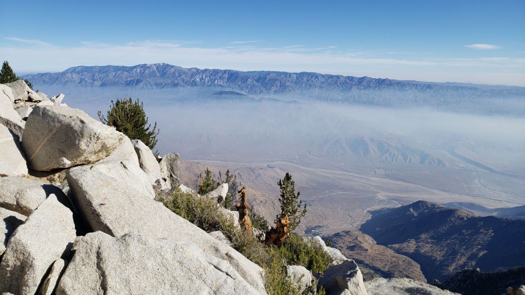
WEATHER
Temperatures were generally above seasonal for nearly two months from 20th May until mid July, with heatwaves above even midsummer averages between 10th-20th June and again in the second week of July. Daytime high temperatures were then somewhat below average for the month starting Thursday 17th July for ten days.
Temperatures warmed again to slightly above seasonal starting Tuesday 29th July and then to well above seasonal starting Saturday 2nd August. Temperatures are now forecast to be well above seasonal even for midsummer on at least 7th-14th August.
Monsoon conditions have largely failed in the desert south-west so far this season, with no significant precipitation forecast for the San Jacinto mountains for the foreseeable future. Localized monsoonal thunderstorms on 17th-18th July produced some intense rain at lower elevations along the Highway 74 corridor and to the north of the San Jacinto mountains, but there was no measurable precipitation anywhere above 5000 ft, and only a few raindrops in Idyllwild.
The air temperature of 64.4°F (18°C) at San Jacinto Peak on Monday 14th July was the hottest this year and the seventh highest I have ever recorded at that location. Notably, five of the six higher temperatures ever were all from 2024, indicative of the strong heating trend increasingly affecting the high country in recent years.
At San Jacinto Peak (10,810ft/3295m) on Friday 8th August 2025 at 0830 the air temperature was 56.8°F (14°C), with a “windchill” temperature of 50.9°F (11°C), 37% relative humidity, and a pleasantly cool WSW wind sustained at 8 mph gusting to 14.7 mph.
At the Peak on Monday 4th August 2025 at 0830 the air temperature was 55.1°F (13°C), with a “windchill” temperature of 48.9°F (9°C), 9% relative humidity, and a moderate due West wind sustained at 10 mph gusting to 16.3 mph.
At the Peak on Friday 1st August 2025 at 0850 the air temperature was 57.5°F (14°C), with a “windchill” temperature of 49.1°F (10°C), 16% relative humidity, and a variable SW wind sustained at 7 mph gusting to 12.0 mph.

TRAIL CONDITIONS
The established trail system was completely clear of snow by late May. The Wolf Fire in late June had no significant impact on the trail system.
Work from mid 2024 to early 2025 by various crews largely resolved the backlog of downed trees on PCT Miles 170-175 (roughly Apache Peak to Red Tahquitz) accumulated during 5+ years of agency neglect. Six trees remain to be cut around South Peak (Miles 173.5-174) of which most are significant obstructions for hikers. Lengthy sections of the trail are badly overgrown with brush and in their worst condition in decades, especially most of Miles 168-174, but PCTA/Forest Service seem to show little interest in improving this situation. Regrettably post-fire erosion has created a loose, rocky, and uneven tread in some parts of the same section, requiring caution in places.
The two large downed trees near PCT Mile 180 were removed by the Trail Report in May. The Strawberry Trail (PCT Miles 180.8-183.1) has ten blowdowns, none of which pose major hazards to hikers. Of the eight on the Forest Service section, several have been down for 8-10 years and reported repeatedly but with no action. The brush between the cienega and Annie’s Junction (roughly Miles 181-181.7) has become heavily overgrown since it was last trimmed in 2021.
Five further blowdowns remain on the Deer Springs Trail portion of the PCT (Miles 183-185), some of which are major obstructions, albeit with workarounds. For the first time in a decade, upper Deer Springs Trail – between the top of Marion Mountain Trail and Little Round Valley – is now clear of blowdowns, with the Trail Report having removed eight trees this spring, including the two major hazards at PCT Mile 185.3 that came down this past winter. [About ten further trees would need to be cut to restore the original route of Deer Springs Trail above Little Round Valley, but there is no prospect of that happening soon, if ever. That section of trail, despite too many minor workarounds, remains relatively easy to follow.]
The maintenance condition of the Fuller Ridge (Miles 185.5-190.5) section of the PCT improved in July 2025, having been in very poor condition earlier in the year. The Trail Report cleared nine of 15 blowdowns mid-month (example photo below). A PCTA volunteer crew the following week largely removed the remaining six trees and undertook some brush trimming and clearing of debris, but sadly the opportunity was missed to comprehensively clear and trim this trail.
On the Wellman Trail, Wellman’s Cienega is flowing relatively poorly (photo below) but there is still plenty of water for hikers for now. The Trail Report continues the work it started last year to keep this trail clear (after it had become badly overgrown by early 2024).
For the first time in more than 15 years Seven Pines Trail has a continuous route completely cleared of blowdown trees, with the trail also as faithful to the original route as possible. The Trail Report “adopted” Seven Pines as a priority for maintenance work nearly a decade ago due to a disproportionate number of lost hiker rescues (with State Park and Forest Service evidently no longer maintaining the route). Since 2019 we have now removed exactly 100 downed trees – including 25 since April of this year – and the trail is largely trimmed and cleared annually. Although our work has restored this delightful trail, Seven Pines remains a genuine wilderness trail unlike the wider, bare, obvious routes of, for example, Devil’s Slide or Marion Mountain trails. Cautious navigation remains invaluable for those without extensive experience of hiking this trail.
Black Mountain Road is open and in its typical non-graded condition, i.e. lumpy but readily passable in any moderate clearance vehicle. The tap at Cinco Poses Spring currently has reliable water but this may not last beyond August (located alongside the road 0.2 mile below the Boulder Basin turning).
Willow Creek Trail is in its best condition since it was thoroughly cleared in 2020. The four new trees that came down on the Forest Service section in January 2025 were cut in June-July. Whitethorn needs trimming again especially near the boundary between the two agencies, but is not as overgrown as it was in 2022-23. Two new trees down on the State Park side are minor and easily passed, and the two large ones remaining uncut from several years ago also have easy workarounds.
The Caramba Trail from near Reeds Meadow through Laws Camp and on to Caramba, and the Cedar Trail from Willow Creek Trail to Laws, are euphemistically (and arguably dangerously) described by the Forest Service as “not maintained”. In reality both trails have been abandoned for more than a decade and no longer exist. They are so heavily overgrown, largely with dense whitethorn which obscures dozens of downed trees, that hikers should not attempt to follow them (regardless of how much you may trust any particular app).
An informal use trail to Laws is much more direct, generally well maintained, and avoids the bushwhacking of the abandoned trails (some local Idyllwild hikers dubbed it the “King Trail” when I established the route in 2019). It leaves Willow Creek Trail exactly 1.0 mile from Saddle Junction, 0.46 mile from the Skunk Cabbage turning (trailhead at N 33.7796, W 116.6590). The route descends following former deer trails for 1.2 miles, meeting Willow Creek about 0.15 mile upstream from the site of the historic Laws Camp (the remains of which were destroyed by the 2013 Mountain Fire and subsequent flood and treefall damage). One huge pine tree fell in late 2024 across the King Trail about midway down that requires a minor scramble underneath, but nine additional blowdowns have been removed since January 2025, with the trail already trimmed and cleared twice this year.
From Laws east to Caramba the original Caramba Trail has been cairned by myself and others and can largely be followed with skilled route-finding. My most recent 2025 survey counted 120 trees down on this 2.1 miles of trail. It is extremely obscure for the first 0.5 mile east of the Willow Creek crossing, becoming more obvious (but still subtle) as it descends towards Caramba. Very cautious navigation is strongly recommended throughout the area.
Storms in February-March brought down another 34 trees across Spitler Peak Trail. All but one were removed in March by the Trail Report, bringing to 162 the total number of trees we have removed from this route in the past seven years. One very large burned cedar remains across the trail immediately after the first creek crossing 3.2 miles up from the trailhead. A couple of other recent blowdowns are small and easily stepped over.
The Zen Center Trail continues its serious deterioration that started following the 2013 Mountain Fire, with a combination of vigorous regrowth and treefall hazards further obscuring the route with each passing season. The lower and upper thirds of this trail are partially cairned and not too bad for those who are very familiar with the former route, but even the experienced find navigating the central section tricky. Long trousers, scrambling gloves, and a genuine enjoyment of bush-whacking are all strongly recommended.
While all time and labor is volunteered, the San Jacinto Trail Report uses small donations to help cover modest operating costs. Your contribution keeps the Report available to all, free from advertising or paywalls, and independent from agencies. If you have found this Report useful, please consider using this link to the Donate page. Thank you very much for your support.
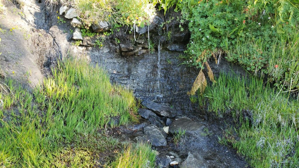

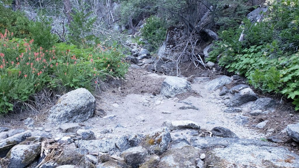
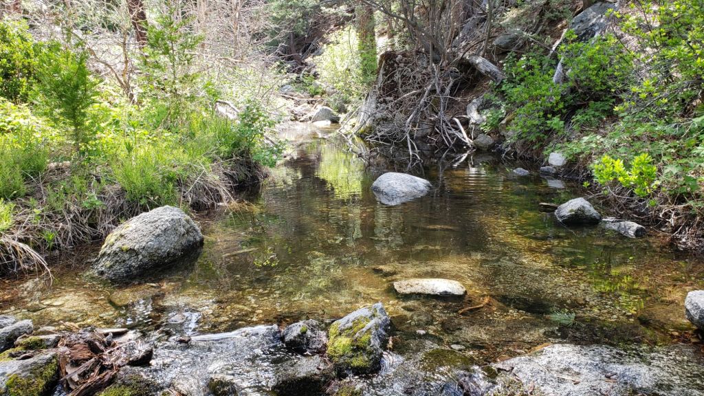
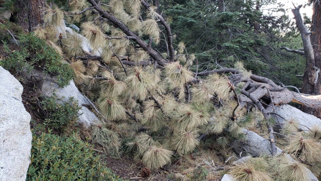


sanjacjon Uncategorized Leave a comment 12 MinutesEdit”Trail and water update 8th August 2025″
Trail and water update 25th July 2025
The air temperature of 64.4°F (18°C) at San Jacinto Peak on Monday 14th July was the hottest this year and the seventh highest I have ever recorded at that location. Notably, five of the six higher temperatures were all from 2024, indicative of the strong heating trend increasingly affecting the high country in recent years.
The heatwave throughout the first half of July has abated with temperatures dropping to near seasonal starting Wednesday 16th. This week we have been treated to a hint of September, with temperatures at all elevations below seasonal. The windchill temperature of 35.4°F (2°C) at San Jacinto Peak on Friday 25th July felt truly refreshing.
Air quality in our region, which had been poor for much of July, has improved dramatically in the last couple of days, with unusually good visibility for July from the high peaks on 25th thanks to a steady westerly wind. Smoke from the nearby Wolf Fire at the end of June briefly impacted air quality, which then deteriorated further on 14th-16th (photo below) due to smoke from major fires burning in Arizona. Sunlight on 14th-17th was remarkably weak, more reminiscent of a partial solar eclipse than midsummer.
Water flows everywhere are low for July (see photos below) with almost all ephemeral sources now dry. Key hiker water sources such as Wellman’s Cienega and the pipe in Round Valley are flowing and are expected to maintain some flow into the autumn. Ephemeral sources along Marion Mountain Trail are all dry for the first time in more than two years. Deer Springs creek dried up in late July where it crosses the trail of the same name. The creek in Little Round Valley is close to drying in its upper section, but may persist for the remainder of the summer where it crosses Deer Springs Trail near the mouth of the valley. The North Fork is completely dry where it crossed by Seven Pines Trail (“before and after” photos below), but is flowing gently higher up where it crosses both Fuller Ridge and Deer Springs trails. Hidden Lake dried by the end of June. Long Valley Creek is dry where it passes through Round Valley. Water is flowing reliably in Tahquitz Creek at PCT Mile 177 and again further downstream at the north end of Little Tahquitz Meadow (although it is dry between those two locations). The pipe in Tahquitz Meadow dried up in mid July. Skunk Cabbage Meadow creek is close to drying and no longer has sufficient depth for filtering. Strawberry Cienega is now dry. Middle Spring on Devil’s Slide Trail continues to just trickle.
Full fire restrictions began on Tuesday 1st July 2025 on Forest Service lands, as described on the USFS website linked here. Campfires throughout USFS lands in the San Jacinto Mountains, including all campgrounds and yellow post sites, are now prohibited.
Fire lookouts at Black Mountain and Tahquitz Peak are closed indefinitely due to issues identified in a May 2025 safety inspection of Black Mountain lookout. USFS has indicated to the Trail Report that Tahquitz Peak lookout could reopen by September once upgrades to its lightning conductor array are completed, but there is much less optimism that Black Mountain lookout will reopen this season.
Dark Canyon Road (4S02) reopened in May and the dirt section has had some effective basic maintenance. The associated Dark Canyon campground will be closed for the year due to federal budget issues.
Be rattlesnake aware. Above about 5000 ft elevation, the venom of Southern Pacific Rattlesnakes (Crotalus [oreganus] helleri) in the San Jacinto mountains is predominantly neurotoxic, almost always fatal for dogs and sometimes for humans (see my detailed article linked here for further information describing our dogs’ survival after a July 2020 neurotoxic bite). Devil’s Slide Trail, lower Deer Springs and lower Marion Mountain trails, Suicide Rock, near Strawberry Cienega, and trails around Tahquitz Peak are frequent locations for sightings, but rattlesnakes have been recorded widely up to 9350 ft (see example photos of an adult and a juvenile in the previous Report linked here).
Be bear aware. Although rarely reported in recent years, at least three individually identifiable Black Bears have been in the San Jacinto mountains since 2017, and I have personally seen at least one annually for the past six years. One adult-sized, light chestnut-colored individual was reliably reported – with photographs – from Willow Creek Trail adjacent to Skunk Cabbage Meadow on 12th July 2025 (information courtesy of Mike Meyer). I photographed fresh tracks in snow on 12th February 2024 at 9000 ft near PCT Mile 180.5 (photo linked here), and my brief videos from Devil’s Slide Trail in September 2021 (available here) and one walking through our property in Idyllwild in 2018 (linked here) show two different individuals. There have been no reports of negative interactions with humans at or near campsites or on trails.
Survey hikes by the Trail Report every single day throughout the year in the San Jacinto mountains include multiple routes to various high peaks including San Jacinto Peak typically 2-3 times per week (more frequently during storms), Tahquitz Peak and area at least once per week, plus a wide variety of other trails on intervening days.

WEATHER
Temperatures were generally above seasonal for nearly two months from 20th May until mid July, with heatwaves above even midsummer averages between 10th-20th June and again in the second week of July.
Daytime high temperatures are currently forecast to be near (or even slightly below) average for the month starting Thursday 17th July for about ten days. Temperatures are then forecast to warm again to near or slightly above seasonal by Monday 28th July.
Localized monsoonal thunderstorms on 17th-18th July produced some intense rain at lower elevations along the Highway 74 corridor and to the north of the San Jacinto mountains, but there was no measurable precipitation anywhere above 5000 ft, with little more than a few raindrops in Idyllwild.
At San Jacinto Peak (10,810ft/3295m) on Friday 25th July 2025 at 0810 the air temperature was 45.0°F (8°C), with a windchill temperature of 35.4°F (2°C), 48% relative humidity, and a cool WSW wind sustained at 9 mph gusting to 14.4 mph.
At the Peak on Monday 21st July 2025 at 0810 the air temperature was 47.7°F (9°C), with a windchill temperature of 41.5°F (5°C), 53% relative humidity, and a light WSW wind sustained at 4 mph gusting to 8.0 mph.
At the Peak on Saturday 19th July 2025 at 0740 the air temperature was 49.6°F (10°C), with a windchill temperature of 41.5°F (5°C), 62% relative humidity, and a steady SE wind sustained at 7 mph gusting to 13.4 mph.

TRAIL CONDITIONS
The established trail system was completely clear of snow by late May. The Wolf Fire in late June had no significant impact on the trail system.
Work since mid 2024 by PCTA-USFS-ACE crews has largely resolved the backlog of downed trees on PCT Miles 170-175 (roughly Apache Peak to Red Tahquitz) accumulated during years of agency neglect. Six trees remain to be cut around South Peak (Miles 173.5-174) of which most are significant obstructions for hikers [surveyed June 2025]. Lengthy sections of the trail are badly overgrown with brush and in urgent need of trimming, especially most of Miles 168-174. Regrettably post-fire erosion has created a loose, rocky, and uneven tread in parts of the same section, requiring caution in places.
The two large downed trees near PCT Mile 180 were removed by the Trail Report in May. The Strawberry Trail (PCT Miles 180.8-183.1) has ten blowdowns, none of which pose major hazards to hikers. Of the eight on the Forest Service section, several have been down for 8-10 years and reported repeatedly but with no action. The brush between the cienega and Annie’s Junction (roughly Miles 181-181.7) has become heavily overgrown since it was last trimmed in 2021.
Five further blowdowns remain on the Deer Springs Trail portion of the PCT (Miles 183-185), some of which are major obstructions, albeit with workarounds. For the first time in a decade, upper Deer Springs Trail – between the top of Marion Mountain Trail and Little Round Valley – is now clear of blowdowns, with the Trail Report having removed eight trees this spring, including the two major hazards at PCT Mile 185.3 that came down this past winter. About ten further trees would need to be cut to restore the original route of Deer Springs Trail above Little Round Valley, but there is no prospect of that happening soon, if ever. That section of trail, despite dozens of minor workarounds, remains easy to follow.
The maintenance condition of the Fuller Ridge (Miles 185.5-190.5) section of the PCT has improved significantly this month, having previously been the poorest I had seen in well over a decade. The Trail Report cleared nine of 15 blowdowns mid-month (example photo below). A PCTA volunteer crew scheduled to work on this section in late July will hopefully remove the remaining six, trim overgrown bushes, and clear much of the accumulated winter debris in this section of the trail.
On the Wellman Trail, Wellman’s Cienega is flowing relatively poorly (photo below) but there is still plenty of water for hikers for now. The Trail Report continues the work it started last year to maintain this trail (having become badly overgrown by early 2024).
Black Mountain Road is open and in its typical non-graded condition, i.e. lumpy but readily passable in any moderate clearance vehicle. South Ridge Road is in similar condition.
Storms in February-March brought down another 34 trees across Spitler Peak Trail. All but one were removed in late March by the Trail Report, bringing to 162 the total number of trees we have removed from this route in the past seven years. One very large burned cedar remains across the trail immediately after the first creek crossing 3.2 miles up from the trailhead. Another new but thankfully small tree came down very recently close to the PCT but is easily stepped over.
For the first time in more than 15 years Seven Pines Trail has a continuous route completely cleared of blowdown trees, with the trail also as faithful to the original route as possible. The Trail Report “adopted” Seven Pines as a priority for maintenance work nearly a decade ago due to a disproportionate number of lost hiker rescues, with State Park and Forest Service evidently no longer maintaining the route. Since 2019 we have now removed exactly 100 downed trees – including 25 cut since April of this year – and the trail is steadily trimmed and cleared annually. Although our work has restored this delightful trail, Seven Pines remains a genuine wilderness trail unlike the wider, bare, obvious routes of, for example, Devil’s Slide or Marion Mountain trails. Cautious navigation remains invaluable for those without extensive experience of hiking this trail.
After considerable work (mainly on the Forest Service side) Willow Creek Trail is in much better condition than this time last year. Of the four new trees that came down on the Forest Service section in January, three were removed in June, and the other is expected to be cut soon. Whitethorn needs trimming again especially near the boundary between the two agencies, but is not as bad as in 2022-23. Two new trees on the State Park side are minor and easily passed, and thankfully the two large ones remaining uncut from years ago are also easily passed.
The Caramba Trail from near Reeds Meadow through Laws Camp and on to Caramba, and the Cedar Trail from Willow Creek Trail to Laws, are euphemistically (and potentially dangerously) described by the Forest Service as “not maintained”. In reality both trails have been abandoned for more than a decade and no longer exist. They are so heavily overgrown, largely with dense whitethorn which obscures dozens of downed trees, that hikers should not attempt to follow them (regardless of how much you may trust any particular app). An informal use trail to Laws is much more direct, generally well maintained, and avoids the bushwhacking of the abandoned trails (some local Idyllwild hikers dubbed it the “King Trail” when I established the route in 2019). It leaves Willow Creek Trail exactly 1.0 mile from Saddle Junction, 0.46 mile from the Skunk Cabbage turning (trailhead at N 33.7796, W 116.6590). The route descends largely following former deer trails for 1.2 miles, meeting Willow Creek about 0.15 mile upstream from the site of the historic Laws Camp (the remains of which were destroyed by the 2013 Mountain Fire and subsequent flood and treefall damage). One huge pine tree fell in late 2024 across the King Trail about midway down that requires a minor scramble underneath, but nine additional blowdowns have been removed since January 2025, with the trail already trimmed and cleared twice this year.
From Laws east to Caramba the original Caramba Trail has been cairned by myself and others and can largely be followed with careful route-finding. My most recent 2025 survey counted 120 trees down on this 2.1 miles of trail. It is extremely obscure for the first 0.5 mile east of the Willow Creek crossing, becoming more obvious (but still subtle) as it descends towards Caramba. Very cautious navigation is strongly recommended throughout the area.
The Zen Center Trail continues its serious deterioration that started following the 2013 Mountain Fire, with a combination of vigorous regrowth and treefall hazards further obscuring the route with each passing season. The lower and upper thirds of this trail are partially cairned and not too bad for those who are very familiar with the former route, but even the experienced find navigating the central section tricky. Long trousers, scrambling gloves, and a genuine enjoyment of bush-whacking are all strongly recommended.

While all time and labor is volunteered, the San Jacinto Trail Report uses small donations to help cover modest operating costs. Your contribution keeps the Report available to all, free from advertising or paywalls, and independent from agencies. If you have found this Report useful, please consider using this link to the Donate page. Thank you very much for your support.
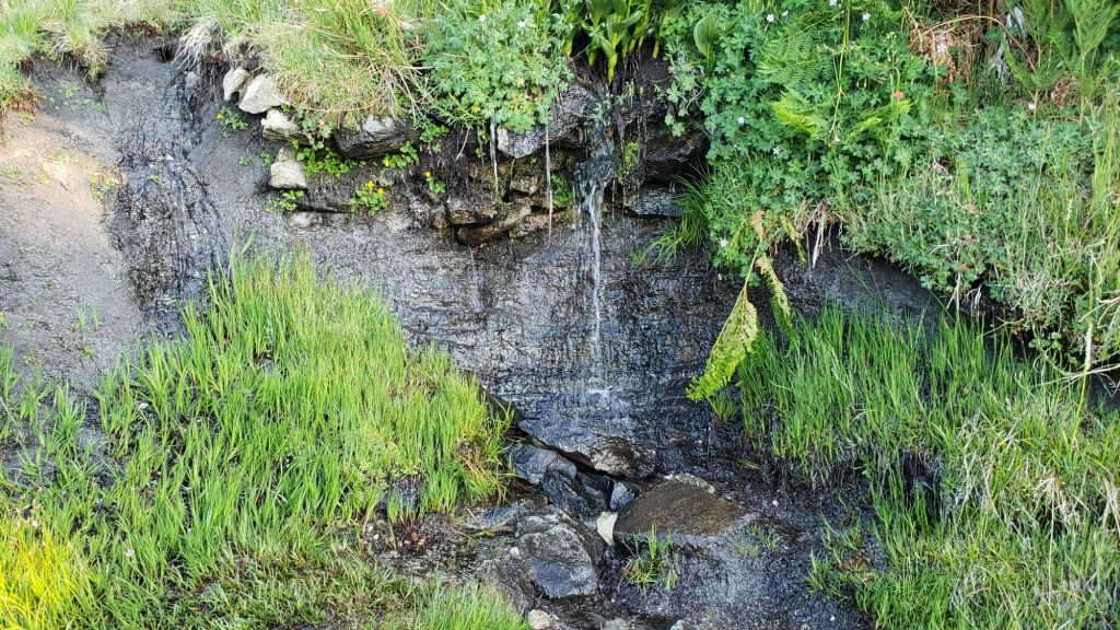
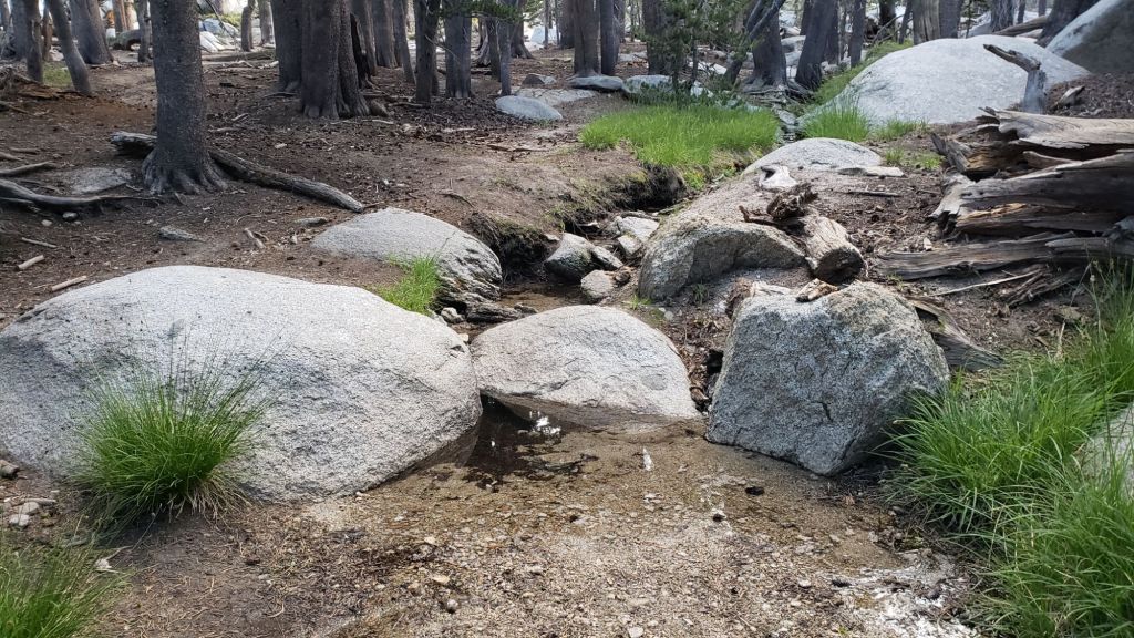

sanjacjon Uncategorized Leave a comment 11 MinutesEdit”Trail and water update 25th July 2025″
Trail update 9th July 2025
Hikers should be prepared for hot weather from Tuesday 8th onwards, with forecast temperatures above seasonal even for July, and overnight low temperatures in particular as much as 10°F above average. At the elevation of Idyllwild (5300 ft), high and low temperatures are forecast to be around or above 90°F and 60°F, respectively, for at least six consecutive days (9th-14th July). Please give considerable extra thought to route choice, start times, clothing, sun protection, and water requirements.
The Wolf Fire started on the afternoon of Sunday 29th June in the extreme north-west corner of the San Jacinto mountains (just south of Banning) and rapidly spread to the east, burning across Mount Edna, closing Highway 243, and threatening the Twin Pines area. By that evening, thick smoke enveloped the mountains, including all of Idyllwild and Pine Cove, and the fire had expanded to 1200 acres. Thankfully the wind shifted dramatically overnight (from westerly to south-east) which helped slow fire progress, moved the fire away from the most populous areas of the San Jacinto mountains, and cleared the smoke from the high country. By 1st July the fire had been held at about 2410 acres and Highway 243 reopened on the evening of Thursday 3rd July.
Although smoke from the Wolf Fire dissipated promptly, in the absence of strong winds and any hint of precipitation, there has again been a deterioration in air quality in our region. Although not as bad as during the third week of June (see photo in prior Report linked here), visibility from San Jacinto Peak on Friday 4th July was once again very poor, with a prominent smoke/smog band below 10,000 ft.
Water flows everywhere are low for July, with many ephemeral sources already dry (multiple example photos below). Key hiker water sources such as Wellman’s Cienega and the pipe in Round Valley are currently flowing but may dry up in the autumn. Ephemeral sources along Marion Mountain Trail are now all dry for the first time in more than two years. The Deer Springs creek is now dry where it crosses the trail of the same name. The creek in Little Round Valley may be only weeks from drying in its upper section, but could persist for a couple of months where it crosses Deer Springs Trail at the mouth of the valley. Hidden Lake was dry by the end of June. Long Valley Creek is dry where it passes through Round Valley, but Tamarack Creek just to the north is trickling. Water is flowing relatively well, for now, in Skunk Cabbage Meadow, and reliably in Tahquitz Creek at PCT Mile 177 and again further downstream at the north end of Little Tahquitz Meadow (although it is completely dry at the surface between those two locations). Middle Spring on Devil’s Slide Trail continues to trickle.
Full fire restrictions began on Tuesday 1st July 2025 on Forest Service lands, as described on the USFS website linked here. Campfires throughout USFS lands in the San Jacinto Mountains, including all campgrounds and yellow post sites, are now prohibited.
Fire lookouts at Black Mountain and Tahquitz Peak are sadly closed indefinitely due to issues identified in a May safety inspection, and are not expected to reopen before August at the earliest. Dark Canyon Road (4S02) reopened in May and the dirt section has had some effective basic maintenance. The associated Dark Canyon campground will be closed for the year due to staffing/budget challenges.
Be rattlesnake aware. Above about 5000 ft elevation, the venom of Southern Pacific Rattlesnakes (Crotalus [oreganus] helleri) in the San Jacinto mountains is predominantly neurotoxic, almost always fatal for dogs and sometimes for humans (see my detailed article linked here for further information describing our dogs’ survival after a July 2020 neurotoxic bite). Devil’s Slide Trail, lower Deer Springs and lower Marion Mountain trails, Suicide Rock, near Strawberry Cienega, and trails around Tahquitz Peak are frequent locations for sightings, but rattlesnakes have been recorded widely up to 9350 ft (see photos below).
Be bear aware. Although rarely reported in recent years, at least three individually identifiable Black Bears have been in the San Jacinto mountains since 2017, and I have personally seen at least one annually for the past six years. One adult-sized, light chestnut-colored individual was reliably reported – with multiple photographs – from Willow Creek Trail alongside Skunk Cabbage Meadow on 12th July 2025 (information courtesy of Mike Meyer). I photographed fresh tracks in snow on 12th February 2024 at 9000 ft near PCT Mile 180.5 (photo linked here), and my brief videos from Devil’s Slide Trail in September 2021 (available here) and one on our property in Idyllwild in 2018 (linked here) show two different individuals. There have been no reports of negative interactions with humans at or near campsites or on trails.
Survey hikes by the Trail Report literally daily throughout the year in the San Jacinto mountains include multiple routes to various high peaks including San Jacinto Peak typically 2-3 times per week (more frequently during storms), Tahquitz Peak and area at least once per week, plus a wide variety of other trails on intervening days.


WEATHER
Temperatures were consistently above seasonal for a month starting on 20th May, and peaked above even midsummer averages between 10th-20th June, with multiple daytime highs at or above 90°F recorded. There were five pleasantly cool days starting 21st June, with temperatures briefly below seasonal, before then rising yet again to above average for June by Thursday 26th.
Temperatures in the first few days of July were about seasonal for midsummer, before rising to above seasonal for July starting around Tuesday 8th. Temperatures are currently forecast to be at or above average for the month until at least 20th July. At the elevation of Idyllwild (5300 ft) daytime high and overnight low temperatures will be around or may even exceed 90°F and 60°F, respectively, for at least six consecutive days (9th-14th July). There is no significant precipitation in the forecasts, with monsoon conditions not well developed in the desert south-west at this time.
At San Jacinto Peak (10,810ft/3295m) on Friday 11th July 2025 at 0815 the air temperature was 55.6°F (13°C), with a “windchill” temperature of 49.5°F (10°C), 8% relative humidity, and a steady due West wind sustained at 13 mph gusting to 19.9 mph.
At the Peak on Tuesday 8th July 2025 at 0745 the air temperature was 54.0°F (12°C), with a “windchill” temperature of 47.1°F (8°C), 10% relative humidity, and a brisk SSW wind sustained at 10 mph gusting to 18.8 mph.
At the Peak on Friday 4th July 2025 at 0740 the air temperature was 48.4°F (9°C), with a “windchill” temperature of 44.1°F (7°C), 49% relative humidity, and a steady WSW wind sustained at 5 mph gusting to 7.2 mph.
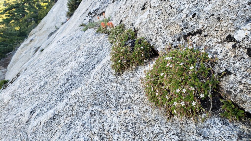
TRAIL CONDITIONS
The established trail system was completely clear of snow by late May. The Wolf Fire did not have any significant impact on the trail system.
Work since mid 2024 by various PCTA-USFS-ACE crews has largely resolved the backlog of downed trees on PCT Miles 170-175 (roughly Apache Peak to Red Tahquitz) accumulated during several years of agency neglect. Six trees remain to be cut around South Peak (Miles 173.5-174) of which most are significant obstructions for hikers [surveyed June 2025]. Lengthy sections of the trail are overgrown with brush and in urgent need of trimming, especially most of Miles 168-174. Regrettably post-fire erosion has created a loose, rocky, and uneven tread in parts of the same section, requiring significant caution in places.
The two large downed trees near PCT Mile 180 were removed by the Trail Report on 21st May (photo in a prior Report linked here). The Strawberry Trail (PCT Miles 180.8-183.1) has ten blowdowns, none of which pose major hazards to hikers. Of the eight on the Forest Service section, several have been down for 8-10 years and reported repeatedly but with no action. The brush between the cienega and Annie’s Junction (roughly Miles 181-181.7) has become heavily overgrown since it was last trimmed in 2021.
Five further blowdowns remain on the Deer Springs Trail portion of the PCT (Miles 183-185), some of which are major obstructions, albeit with workarounds. For the first time in a decade, upper Deer Springs Trail, between the top of Marion Mountain Trail and Little Round Valley, is now clear of blowdowns, with the Trail Report having removed eight trees this spring, including the two major hazards at PCT Mile 185.3 that came down this past winter. About ten further trees would need to be cut to restore the original route of Deer Springs Trail above Little Round Valley, but there is no prospect of that happening soon, if ever. The trail, despite dozens of minor alternates, is easy to follow.
Sadly the maintenance condition of the Fuller Ridge (Miles 185.5-190.5) section of the PCT is the poorest I have ever seen. The State Park has not attempted to maintain their section (Miles 185.5-189) for more than a dozen years. Treefall hazards were cut by PCTA in 2019, and vegetation was thoroughly trimmed by the Trail Report in 2020, but repeating these tasks is now long overdue and there are 12 trees down on that section of which five present major obstructions. Needless to say the trail is impassable with stock. The tread is a mess of debris (sticks, branches, rocks, cones) and shortcut switchbacks. Thankfully reporting of these problems has led to the scheduling of a PCTA volunteer crew to work on this section in late July 2025. By contrast the Forest Service section (north from Mile 189) has been relatively well maintained in recent years, with just three (thankfully all small) new trees coming down on that section this past winter.
On the Wellman Trail, Wellman’s Cienega is flowing relatively poorly (photo below) but there is still plenty of water for hikers for now. The Trail Report continues the work it started last year to maintain this trail (having become badly overgrown by early 2024).
Black Mountain Road is open and in its typical non-graded condition, i.e. lumpy but readily passable in any moderate clearance vehicle. South Ridge Road is in similar condition.
Storms in February-March brought down another 34 trees across Spitler Peak Trail. All but one were removed in late March by the Trail Report, bringing to 162 the total number of trees we have removed from this route in the past six years. One very large burned cedar remains across the trail immediately after the first creek crossing 3.2 miles up from the trailhead. Another new but thankfully small tree came down very recently close to the PCT but is easily stepped over.
As of 16th June 2025, for the first time in at least 15 years Seven Pines Trail has a continuous route completely cleared of blowdown trees (the route is now also as faithful to the original trail as possible). Since April this year a further 25 treefall hazards have been removed, and with slow but steady work continuing on clearing accumulated winter debris, to date mainly below 8200 ft. The Trail Report “adopted” Seven Pines as a priority for maintenance work nearly a decade ago due to a disproportionate number of lost hiker rescues, with State Park and Forest Service no longer maintaining the route. Since 2019 we have now removed exactly 100 downed trees and the trail is largely trimmed and cleared at least annually. Although our work has functionally restored this delightful trail, note that Seven Pines remains a genuine wilderness trail unlike the wider, bare, obvious routes of, for example, Devil’s Slide or Marion Mountain trails. Cautious navigation remains invaluable for those without extensive experience of hiking this trail.
After considerable work (mainly on the Forest Service side) Willow Creek Trail is in much better condition than this time last year. Of the four new trees that came down on the Forest Service section in January, three were removed in June, and the other is expected to be cut soon. Whitethorn needs trimming again especially near the boundary between the two agencies, but is not as bad as in 2022-23. Two new trees on the State Park side are minor and easily passed, and thankfully the two large ones remaining uncut from years ago are also easily passed.
The Caramba Trail from near Reeds Meadow through Laws Camp and on to Caramba, and the Cedar Trail from Willow Creek Trail to Laws, are euphemistically (and potentially dangerously) described by the Forest Service as “not maintained”. In reality both trails have been abandoned and no longer exist. They are so heavily overgrown, largely with dense whitethorn which obscures dozens of downed trees, that hikers should not attempt to follow them (regardless of how much you may trust an app). An informal use trail to Laws is much more direct, generally well maintained, and avoids the bushwhacking of the unmaintained trails (some local Idyllwild hikers dubbed it the “King Trail” when I established the route in 2019). It leaves Willow Creek Trail exactly 1.0 mile from Saddle Junction, 0.46 mile from the Skunk Cabbage turning (trailhead at N 33.7796, W 116.6590). The route descends largely following established deer trails for 1.2 miles, meeting Willow Creek about 0.2 mile upstream from the site of the historic Laws Camp (the remains of which were destroyed by the 2013 Mountain Fire and subsequent flood and treefall damage). One huge tree fell in late 2024 across the King Trail about midway down and requires a minor scramble underneath (that tree may not be cut soon), while another fell in January 2025 close to the bottom of the trail that is relatively easy to cross over. Another five recently downed trees were either removed or worked around in January 2025, when the trail was thoroughly trimmed and cleared. From Laws east to Caramba the original Caramba Trail has been cairned by myself and others and can largely be followed with careful route-finding. My February 2025 survey counted about 120 trees down on this 2.1 miles of trail. It is extremely obscure for the first 0.5 mile east of the Willow Creek crossing, becoming more obvious (but still subtle) as it descends towards Caramba. Very cautious navigation is advised throughout the area.
The Zen Center Trail continues its serious deterioration that started following the 2013 Mountain Fire, with a combination of vigorous regrowth and treefall hazards further obscuring the route with each passing season. The lower and upper thirds of this trail are partially cairned and not too bad for those who are very familiar with the former route, but even the experienced find navigating the central section tricky. Long trousers, scrambling gloves, and a genuine enjoyment of bush-whacking are all strongly recommended.

While all time and labor is volunteered, the San Jacinto Trail Report uses small donations to help cover modest operating costs. Your contribution keeps the Report available to all, free from advertising or paywalls, and independent from agencies. If you have found this Report useful, please consider using this link to the Donate page. Thank you very much for your support.
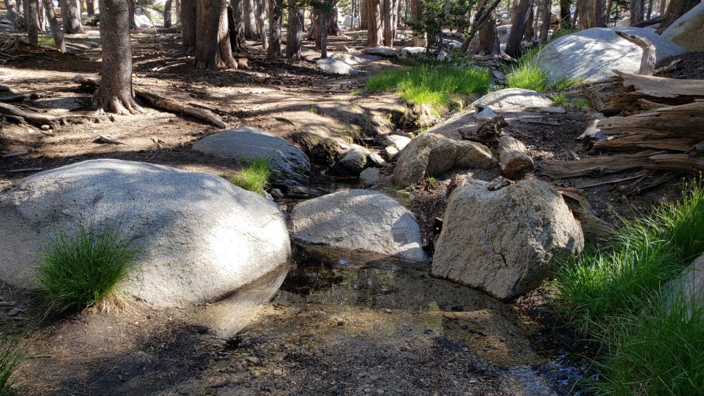
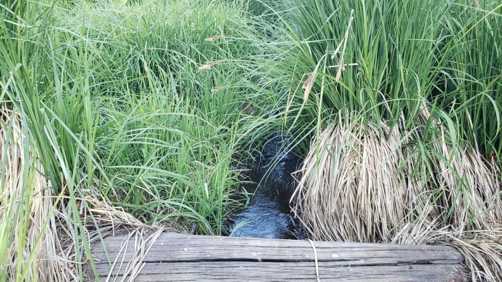
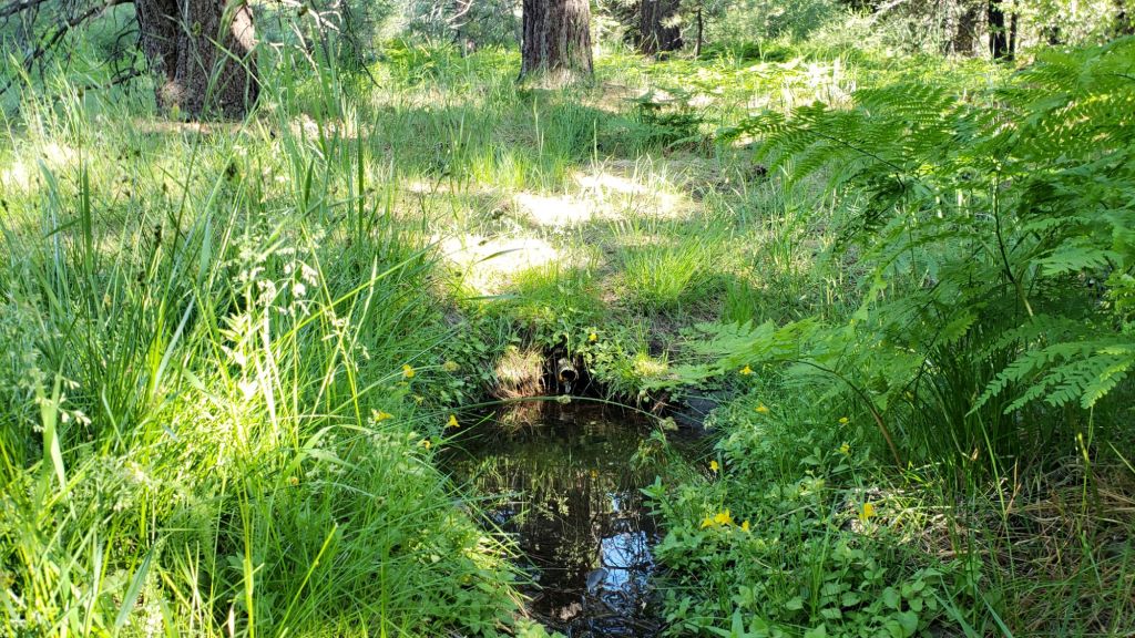
sanjacjon Uncategorized 2 Comments 11 MinutesEdit”Trail update 9th July 2025″
Trail update 26th June 2025
UPDATE Monday 30th June at 1200: The wind shifted dramatically overnight (from westerly to south-east) which thankfully both limited the progress of the Wolf Fire, and moved it away from the populated areas of the San Jacinto mountains. While I could clearly see smoke from San Jacinto Peak this morning, and burned areas right up to Highway 243, the acreage has held at 1400.
UPDATE Sunday 29th June at 1900: Air quality – which as I described below was already poor – has deteriorated dramatically this afternoon with smoke from the Wolf Fire covering the San Jacinto mountains. The fire, currently 1200 acres, is in the far north-west of the mountain range, just west of the Twin Pines area. Highway 243 between Banning and Idyllwild has been impacted and is closed.
——————————————–
Humans and wildlife enjoyed some respite from the summer heat with a unexpected, albeit brief, taste of spring in late June. Temperatures fell markedly to slightly below average for the month on 21st June, and remained relatively cool until Thursday 26th, before being forecast to rapidly rise again to near or above seasonal for the next week.
In the absence of strong winds and any hint of precipitation, there has been a serious deterioration in air quality in our region. Visibility in all directions from San Jacinto Peak on Sunday 22nd was as poor as I have ever seen – other than days with fire smoke of course – with Palm Springs completely obscured by haze (photo below).
Water flows everywhere are low for this early in the summer, but currently holding steady (multiple example photos below). Key hiker water sources such as Wellman’s Cienega, Strawberry Cienega, and the pipe in Round Valley are all flowing but one or more may dry up later this summer. Ephemeral sources along Marion Mountain Trail are now all dry for the first time in more than two years. The creek in Little Round Valley may be only weeks from drying in its upper section, but could persist for a couple of months where it crosses Deer Springs Trail at the mouth of the valley. Hidden Lake is functionally dry by the end of June. Long Valley Creek is dry where it passes through Round Valley, but Tamarack Creek just to the north is trickling. Water is flowing relatively well, for now, in Skunk Cabbage Meadow, and reliably in Tahquitz Creek at PCT Mile 177 and again further downstream at the north end of Little Tahquitz Meadow (although it is completely dry between those two locations).
Hikers should be prepared for unseasonably hot weather from Thursday 26th onwards, with temperatures well above seasonal for June, overnight low temperatures in particular as much as 10°F above average. Please give considerable extra thought to route choice, start times, clothing, sun protection, and water requirements (the latter especially challenging in this dry year).
Dark Canyon Road (4S02) reopened in May and the dirt section has had some effective basic maintenance. The associated Dark Canyon campground will be closed for the year due to staffing/budget challenges. Fire lookouts at Black Mountain and Tahquitz Peak, expected to reopen in May, are sadly closed indefinitely due to issues identified in a recent safety inspection.
Be rattlesnake aware. Above about 5000 ft elevation, the venom of Southern Pacific Rattlesnakes (Crotalus [oreganus] helleri) in the San Jacinto mountains is predominantly neurotoxic, almost always fatal for dogs and sometimes for humans (see my detailed 2020 article linked here for further information). Devil’s Slide Trail, lower Deer Springs and lower Marion Mountain trails, Suicide Rock, near Strawberry Cienega, and trails around Tahquitz Peak are frequent locations for sightings, but rattlesnakes have been recorded widely up to 9350 ft (see photos below).
Survey hikes by the Trail Report every single day throughout the year in the San Jacinto mountains include multiple routes to various high peaks including San Jacinto Peak typically 2-3 times per week (most frequently during storms), Tahquitz Peak and area at least once per week, plus a wide variety of other trails on intervening days.
WEATHER
Temperatures were consistently above seasonal for a month starting on 20th May, and peaked above even midsummer averages between 10th-20th June, with multiple daytime highs at or above 90°F recorded. Finally temperatures dropped markedly starting 21st June, to below seasonal, and will remain pleasantly cool in the first half of this week before then rising yet again to above average for June by Thursday 26th. Temperatures in the first week of July are expected to be about seasonal for that month.
There is no significant precipitation in the forecasts, with monsoon conditions not well developed in the desert south-west at this time.
At San Jacinto Peak (10,810ft/3295m) on Sunday 22nd June 2025 at 0900 the air temperature was 46.0°F (8°C), with a windchill temperature of 36.9°F (3°C), 14% relative humidity, and a light WNW wind sustained at 6 mph gusting to 10.1 mph.
At the Peak on Friday 20th June 2025 at 0830 the air temperature was 46.8°F (8°C), with a windchill temperature of 35.4°F (2°C), 29% relative humidity, and a steady WNW wind sustained at 19 mph gusting to 31.5 mph.
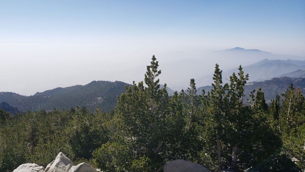
TRAIL CONDITIONS
The established trail system was completely clear of snow by late May.
Work since mid 2024 by various PCTA-USFS-ACE crews has largely resolved the backlog of downed trees on PCT Miles 170-175 (roughly Apache Peak to Red Tahquitz) accumulated during several years of agency neglect. Six trees remain to be cut around South Peak (Miles 173.5-174) of which most are significant obstructions for hikers [surveyed June 2025]. Lengthy sections of the trail are overgrown with brush and in urgent need of trimming, especially most of Miles 168-174. Regrettably post-fire erosion has created a loose, rocky, and uneven tread in parts of the same section, requiring significant caution in places.
The two large downed trees near PCT Mile 180 were removed by the Trail Report on 21st May (photo in a prior Report linked here). The Strawberry Trail (PCT Miles 180.8-183.1) has ten blowdowns, none of which pose major hazards to hikers. Of the eight on the Forest Service section, several have been down for 8-10 years and reported repeatedly but with no action. The brush between the cienega and Annie’s Junction (roughly Miles 181-181.7) has become heavily overgrown since it was last trimmed in 2021.
Five further blowdowns remain on the Deer Springs Trail portion of the PCT (Miles 183-185), some of which are major obstructions, albeit with workarounds. Two of the most significant blowdowns on this section, at Mile 185.3, were removed by the Trail Report last week (photo in previous Report linked here).
Sadly the maintenance condition of the Fuller Ridge (Miles 185.5-190.5) section of the PCT is the poorest I have ever seen. The State Park has not attempted to maintain their section (Miles 185.5-189) for more than a dozen years. Treefall hazards were cut by PCTA in 2019, and vegetation was thoroughly trimmed by the Trail Report in 2020, but repeating these tasks is now long overdue and there are 12 trees down on that section of which five present major obstructions. Needless to say the trail is impassable with stock. The tread is a mess of debris (sticks, branches, rocks, cones) and shortcut switchbacks. Thankfully our reporting of these problems has led to the scheduling of a PCTA volunteer crew to work on this section in late July. By contrast the Forest Service section (north from Mile 189) has been relatively well maintained in recent years, with just three (thankfully all small) new trees coming down on that section this past winter.
On the Wellman Trail, Wellman’s Cienega is flowing poorly for this early in the season (photo below) but there is still plenty of water for hikers for now. The Trail Report continues the work it started in mid 2024 to heavily trim this formerly overgrown trail.
Black Mountain Road is open and in its typical non-graded condition, i.e. lumpy but readily passable in any moderate clearance vehicle. South Ridge Road is in very similar condition.
Storms in February-March brought down another 34 trees across Spitler Peak Trail. All but one were removed in late March by the Trail Report, bringing to 162 the total number of trees we have removed from this route in the past six years. One very large burned cedar remains across the trail immediately after the first creek crossing 3.2 miles up from the trailhead. Another new but thankfully small tree came down very recently close to the PCT but is easily stepped over.
As of 16th June 2025, for the first time in at least 15 years Seven Pines Trail has a continuous route completely cleared of blowdown trees (the route is now also as faithful to the original trail as possible). Since April this year a further 25 treefall hazards have been removed, and with slow but steady work continuing on clearing accumulated winter debris, to date mainly below 8200 ft. The Trail Report “adopted” Seven Pines as a priority for maintenance work nearly a decade ago due to a disproportionate number of lost hiker rescues, with State Park and Forest Service no longer maintaining the route. Since 2019 we have now removed exactly 100 downed trees and the trail is largely trimmed and cleared at least annually. Although our work has functionally restored this delightful trail, note that Seven Pines remains a genuine wilderness trail unlike the wider, bare, obvious routes of, for example, Devil’s Slide or Marion Mountain trails. Cautious navigation remains invaluable for those without extensive experience of hiking this trail.
After considerable work (mainly on the Forest Service side) Willow Creek Trail is in much better condition than this time last year. Of the four new trees that came down on the Forest Service section in January, three were removed in June, and the other is expected to be cut soon. Whitethorn needs trimming again especially near the boundary between the two agencies, but is not as bad as in 2022-23. Two new trees on the State Park side are minor and easily passed, and thankfully the two large ones remaining uncut from years ago are also easily passed.
The Caramba Trail from near Reeds Meadow through Laws Camp and on to Caramba, and the Cedar Trail from Willow Creek Trail to Laws, are euphemistically (and potentially dangerously) described by the Forest Service as “not maintained”. In reality both trails have been abandoned and no longer exist. They are so heavily overgrown, largely with dense whitethorn which obscures dozens of downed trees, that hikers should not attempt to follow them (regardless of how much you may trust an app). An informal use trail to Laws is much more direct, generally well maintained, and avoids the bushwhacking of the unmaintained trails (some local Idyllwild hikers dubbed it the “King Trail” when I established the route in 2019). It leaves Willow Creek Trail exactly 1.0 mile from Saddle Junction, 0.46 mile from the Skunk Cabbage turning (trailhead at N 33.7796, W 116.6590). The route descends largely following established deer trails for 1.2 miles, meeting Willow Creek about 0.2 mile upstream from the site of the historic Laws Camp (the remains of which were destroyed by the 2013 Mountain Fire and subsequent flood and treefall damage). One huge tree fell in late 2024 across the King Trail about midway down and requires a minor scramble underneath (that tree may not be cut soon), while another fell in January 2025 close to the bottom of the trail that is relatively easy to cross over. Another five recently downed trees were either removed or worked around in January 2025, when the trail was thoroughly trimmed and cleared. From Laws east to Caramba the original Caramba Trail has been cairned by myself and others and can largely be followed with careful route-finding. My February 2025 survey counted about 120 trees down on this 2.1 miles of trail. It is extremely obscure for the first 0.5 mile east of the Willow Creek crossing, becoming more obvious (but still subtle) as it descends towards Caramba. Very cautious navigation is advised throughout the area.
The Zen Center Trail continues its serious deterioration that started following the 2013 Mountain Fire, with a combination of vigorous regrowth and treefall hazards further obscuring the route with each passing season. The lower and upper thirds of this trail are partially cairned and not too bad for those who are very familiar with the former route, but even the experienced find navigating the central section tricky. Long trousers, scrambling gloves, and a genuine enjoyment of bush-whacking are all strongly recommended.
While all time and labor is volunteered, the San Jacinto Trail Report uses small donations to help cover modest operating costs. Your contribution keeps the Report available to all, free from advertising or paywalls, and independent from agencies. If you have found this Report useful, please consider using this link to the Donate page. Thank you very much for your support.
sanjacjon Uncategorized Leave a comment 10 MinutesEdit”Trail update 26th June 2025″
Trail update 20th June 2025
Water flows in most “perennial” sources are low, or even very low, for this early in the summer. Key hiker water sources such as Wellman’s Cienega, Strawberry Cienega, and the pipe in Round Valley (sample photos below) are currently flowing but may dry up later this summer. The creek in Little Round Valley is only weeks from drying in its upper section, but may persist for a month or two where it crosses Deer Springs Trail at the mouth of the valley. Hidden Lake was so low in late May that it is likely to dry completely by the end of June. Long Valley Creek is dry where it passes through Round Valley, but Tamarack Creek just to the north is trickling. Water is flowing surprisingly well, for now, in Skunk Cabbage Meadow, and reliably in Tahquitz Creek at PCT Mile 177 and again further downstream at the north end of Little Tahquitz Meadow (photos below).
Hikers should be prepared for unseasonably hot weather until Friday 20th (and from Thursday 26th onwards), with temperatures well above seasonal for June, overnight low temperatures in particular as much as 10-15°F above average. Please give considerable extra thought to route choice, start times, clothing, sun protection, and water requirements (the latter especially challenging in this dry year).
Dark Canyon Road (4S02) reopened in May and the dirt section has had some effective basic maintenance. The associated Dark Canyon campground will be closed for the year due to staffing/budget challenges. Fire lookouts at Black Mountain and Tahquitz Peak, expected to reopen in May, are sadly closed indefinitely due to issues identified in a recent safety inspection.
Be rattlesnake aware. Rattlesnakes are now active, although so far populations appear to be low this season. Above about 5000 ft elevation, the venom of Southern Pacific Rattlesnakes (Crotalus [oreganus] helleri) in the San Jacinto mountains is predominantly neurotoxic, almost always fatal for dogs and sometimes for humans (see my detailed 2020 article linked here for further information). Devil’s Slide Trail, lower Deer Springs and lower Marion Mountain trails, Suicide Rock, near Strawberry Cienega, and trails around Tahquitz Peak are frequent locations for sightings, but rattlesnakes have been recorded throughout up to 9350 ft.
Survey hikes by the Trail Report every single day throughout the year in the San Jacinto mountains include varied routes to the high peaks including San Jacinto Peak typically 2-3 times per week (more frequently during storms), Tahquitz Peak and area 1-2 times per week, plus a wide variety of other trails on intervening days.
WEATHER
Temperatures have been consistently above seasonal since 20th May and are forecast to remain that way until about 20th June. Temperatures will be more typical of July-August between 10th-20th June.
Temperatures are forecast to drop quite rapidly on 21st-25th June, to near or even below seasonal, before then rising yet again to above average for June by Thursday 26th. There is no significant precipitation in the forecasts.
Thunderstorms on the afternoon and evening of Tuesday 3rd June were accompanied by remarkably early monsoonal moisture. Locations on the east side of the mountain range received the most rain, with 0.38 inch at Wellman’s Cienega (9300 ft) and 0.35 inch at Saddle Junction (8100 ft). San Jacinto Peak recorded just 0.16 inch, with similar amounts in Little Round Valley and at the top of Marion Mountain Trail, and only 0.13 inch in Idyllwild (at 5550 ft).
Total accumulated snowfall this past winter at San Jacinto Peak – 72.6 inches – was the lowest in recorded history (the three driest winters have all been in the past five years). For context, this is approximately 40% of what was average snowfall for the Peak less than 50 years ago.
At San Jacinto Peak (10,810ft/3295m) on Friday 20th June 2025 at 0830 the air temperature was 46.8°F (8°C), with a windchill temperature of 35.4°F (2°C), 29% relative humidity, and a steady WNW wind sustained at 19 mph gusting to 31.5 mph.
At the Peak on Monday 16th June 2025 at 0930 the air temperature was 59.2°F (15°C), with a “windchill” temperature of 57.2°F (14°C), 15% relative humidity, and a light WNW breeze sustained at 3 mph gusting to 5.5 mph.
At the Peak on Sunday 14th June 2025 at 0740 the air temperature was 53.9°F (12°C), with a “windchill” temperature of 47.3°F (8°C), 13% relative humidity, and a moderate WSW wind sustained at 7 mph gusting to 15.1 mph.
TRAIL CONDITIONS
The established trail system was completely clear of snow by late May.
Work since mid 2024 by various PCTA-USFS-ACE crews has largely resolved the backlog of downed trees on PCT Miles 170-175 (broadly Apache Peak to Red Tahquitz) accumulated during several years of agency neglect. Six trees remain to be cut around South Peak (Miles 173.5-174) of which most are significant obstructions for hikers [surveyed 5th June]. Lengthy sections of the trail are overgrown with brush and in urgent need of trimming, especially most of Miles 168-174. Regrettably post-fire erosion has created a loose, rocky, and uneven tread in parts of the same section, requiring significant caution in places.
The two large downed trees near PCT Mile 180 were removed by the Trail Report on 21st May (photo in a prior Report linked here). The Strawberry Trail (PCT Miles 180.8-183.1) has ten blowdowns, none of which pose major hazards to hikers. Of the eight on the Forest Service section, several have been down for 8-10 years and reported repeatedly but with no action. The brush between the cienega and Annie’s Junction (roughly Miles 181-181.7) has become heavily overgrown since it was last trimmed in 2021.
Five further blowdowns remain on the Deer Springs Trail portion of the PCT (Miles 183-185), some of which are major obstructions, albeit with workarounds. Two of the most significant blowdowns on this section, at Mile 185.3, were removed by the Trail Report earlier this week (photo below).
Sadly the maintenance condition of the Fuller Ridge (Miles 185.5-190.5) section of the PCT is the poorest I have ever seen. The State Park has not attempted to maintain their section (Miles 185.5-189) for more than a dozen years. Treefall hazards were cut by PCTA in 2019, and vegetation was thoroughly trimmed by the Trail Report in 2020, but repeating these tasks is now long overdue and there are 12 trees down on that section of which five present major obstructions. Needless to say the trail is impassable with stock. The tread is a mess of debris (sticks, branches, rocks, cones) and shortcut switchbacks. By contrast the Forest Service section (north from Mile 189) has been relatively well maintained in recent years, with just three (thankfully all small) new trees coming down on that section this past winter.
On the Wellman Trail, Wellman’s Cienega is flowing poorly for this early in the season (photo below) but there is still plenty of water for now. The Trail Report continues the work it started in mid 2024 to heavily trim this formerly overgrown trail.
The East Ridge Trail route to San Jacinto Peak starting at 10,400 ft near Miller Peak has finally cleared of snow cover, with a couple of tiny patches lingering into mid June. The old trail can now be followed for its entire length.
Black Mountain Road is open and in its typical non-graded condition, i.e. lumpy but readily passable in any moderate clearance vehicle. South Ridge Road is in very similar condition.
Storms in February-March brought down another 34 trees across Spitler Peak Trail. All but one were removed in late March by the Trail Report, bringing to 162 the total number of trees we have removed from this route in the past six years. One very large burned cedar remains across the trail immediately after the first creek crossing 3.2 miles up from the trailhead. Another new but thankfully small tree came down very recently close to the PCT but is easily passed over [surveyed 5th June].
As of 16th June 2025, for the first time in at least 15 years Seven Pines Trail has a continuous route completely cleared of blowdown trees (the route is also largely faithful to the original trail). Since April this year a further 25 treefall hazards have been removed, with slow but steady progress made on clearing of accumulated winter debris in the trail, especially below 8200 ft. The Trail Report “adopted” Seven Pines as a priority for maintenance work nearly a decade ago due to a disproportionate number of lost hiker rescues, with State Park and Forest Service no longer maintaining the route. Since 2019 we have now removed exactly 100 blowdowns and the trail is generally trimmed and cleared at least annually. Although our work has functionally restored this delightful trail, note that Seven Pines remains a genuine wilderness trail unlike the wider, bare, obvious routes of, for example, Devil’s Slide or Marion Mountain trails. Cautious navigation remains invaluable for those without extensive experience of hiking this trail.
After considerable work (mainly on the Forest Service side) Willow Creek Trail is in much better condition than this time last year. Four new trees came down on the Forest Service section in January, two of which are very large and somewhat tricky to pass (located about 0.5 mile south of Willow Creek, and 0.3 mile north of the creek). It is hoped that these will be removed in mid June. Whitethorn needs trimming again especially near the boundary between the two agencies, but is not as bad as in 2022-23. Two new trees on the State Park side are minor and easily passed, and thankfully the two large ones remaining uncut from years ago are also easily passed.
The Caramba Trail from near Reeds Meadow through Laws Camp and on to Caramba, and the Cedar Trail from Willow Creek Trail to Laws, are euphemistically (and potentially dangerously) described by the Forest Service as “not maintained”. In reality both trails have been abandoned and no longer exist. They are so heavily overgrown, largely with dense whitethorn which obscures dozens of downed trees, that hikers should not attempt to follow them (regardless of how much you may trust an app). An informal use trail to Laws is much more direct, generally well maintained, and avoids the bushwhacking of the unmaintained trails (some local Idyllwild hikers dubbed it the “King Trail” when I established the route in 2019). It leaves Willow Creek Trail exactly 1.0 mile from Saddle Junction, 0.46 mile from the Skunk Cabbage turning (trailhead at N 33.7796, W 116.6590). The route descends largely following established deer trails for 1.2 miles, meeting Willow Creek about 0.2 mile upstream from the site of the historic Laws Camp (the remains of which were destroyed by the 2013 Mountain Fire and subsequent flood and treefall damage). One huge tree fell in late 2024 across the King Trail about midway down and requires a minor scramble underneath (that tree may not be cut soon), while another fell in January 2025 close to the bottom of the trail that is relatively easy to cross over. Another five recently downed trees were either removed or worked around in January 2025, when the trail was thoroughly trimmed and cleared. From Laws east to Caramba the original Caramba Trail has been cairned by myself and others and can largely be followed with careful route-finding. My February 2025 survey counted about 120 trees down on this 2.1 miles of trail. It is extremely obscure for the first 0.5 mile east of the Willow Creek crossing, becoming more obvious (but still subtle) as it descends towards Caramba. Very cautious navigation is advised throughout the area.
The Zen Center Trail continues its serious deterioration that started following the 2013 Mountain Fire, with a combination of vigorous regrowth and treefall hazards further obscuring the route with each passing season. The lower and upper thirds of this trail are partially cairned and not too bad for those who are very familiar with the former route, but even the experienced find navigating the central section tricky. Long trousers, scrambling gloves, and a genuine enjoyment of bush-whacking are all strongly recommended.
While all time and labor is volunteered, the San Jacinto Trail Report uses small donations to help cover modest operating costs. Your contribution keeps the Report available to all, free from advertising or paywalls, and independent from agencies. If you have found this Report useful, please consider using this link to the Donate page. Thank you very much for your support.

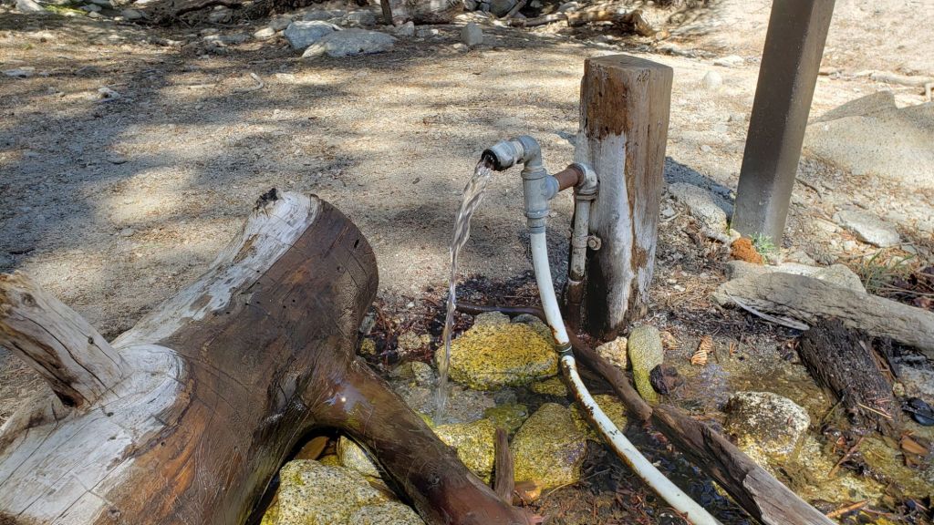


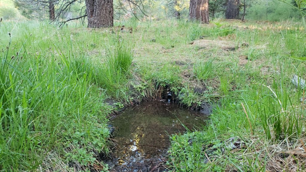


sanjacjon Uncategorized Leave a comment 10 MinutesEdit”Trail update 20th June 2025″
Trail update 5th June 2025
Pleasant, relatively cool temperatures in the first few days of June are forecast to rise yet again to above average starting Friday 6th. A hint of drizzle on Sunday 1st produced just 0.01 inch of rain at San Jacinto Peak. Dramatic thunderstorms on the afternoon and evening of Tuesday 3rd were accompanied by remarkably early monsoonal moisture. As the storm cells came in from the east, locations on that side of the mountain range received the most rain, with 0.38 inch at Wellman’s Cienega (9300 ft) and 0.35 inch at Saddle Junction (8100 ft). San Jacinto Peak recorded just 0.16 inch, with similar amounts in Little Round Valley and at the top of Marion Mountain Trail, and only 0.13 inch in Idyllwild (at 5550 ft).
Water flows in most “perennial” sources are generally low for this early in the summer (although they will flow better for 2-3 days after the rain). Key hiker water sources such as Wellman’s Cienega, Strawberry Cienega, the creek in Little Round Valley, and the pipe in Round Valley (example photos below) are flowing but may dry up later this season. Hidden Lake was exceptionally low in May, less than 10% full (by volume), and will probably dry completely by the end of June. Long Valley Creek is largely dry where it passes through Round Valley, but Tamarack Creek just to the north is flowing gently. Water is flowing surprisingly well, for now, in Skunk Cabbage Meadow, and reliably in Tahquitz Creek at PCT Mile 177 and again further downstream at the north end of Little Tahquitz Meadow (photos below).
Forest Service campgrounds at Marion Mountain, Fern Basin, and Boulder Basin reopened for the season on 22nd May. Dark Canyon Road (4S02) reopened for the season on 16th May and the dirt section has had some effective basic maintenance. The associated Dark Canyon campground will be closed for the year due to staffing/budget challenges. Fire lookouts at Black Mountain and Tahquitz Peak, expected to reopen in May, are sadly closed indefinitely due to issues identified in a recent safety inspection.
Be rattlesnake aware. Rattlesnakes are now active on warmer days and/or at warmer times of day. Above about 5000 ft elevation, the venom of Southern Pacific Rattlesnakes (Crotalus [oreganus] helleri) in the San Jacinto mountains is predominantly neurotoxic, almost always fatal for dogs and sometimes for humans (see my detailed 2020 article linked here for further information). Devil’s Slide Trail, lower Deer Springs and lower Marion Mountain trails, Suicide Rock, near Strawberry Cienega, and trails around Tahquitz Peak are among the most frequent locations for sightings, but rattlesnakes have been recorded widely up to 9350 ft.
Survey hikes by the Trail Report every single day throughout the year in the San Jacinto mountains include varied routes to the high peaks including San Jacinto Peak typically 2-3 times per week (more frequently during storms), Tahquitz Peak and area 1-2 times per week, plus a wide variety of other trails on intervening days.

WEATHER
Temperatures rose to well above seasonal starting 20th May and remained generally above seasonal until the end of the month, with no significant precipitation in the forecasts. Midsummer temperatures are forecast between Friday 6th and Wednesday 11th June, before cooling somewhat to seasonal for mid June.
Total accumulated snowfall this past winter at San Jacinto Peak – 73.1 inches – is the lowest in recorded history (the three driest winters have all been in the past five years, all between 73-76 inches). For context, this is 40% of what was average snowfall for the Peak less than 50 years ago.
At San Jacinto Peak (10,810ft/3295m) on Wednesday 4th June 2025 at 0830 the air temperature was 52.1°F (11°C), with a “windchill” temperature of 48.2°F (9°C), 59% relative humidity, and a barely discernable NW breeze sustained at 0 mph gusting to 1.7 mph.
At the Peak on Monday 2nd June 2025 at 0755 the air temperature was 47.4°F (9°C), with a windchill temperature of 39.9°F (4°C), 73% relative humidity, and a light NNE wind sustained at 4 mph gusting to 7.0 mph.
At the Peak on Sunday 1st June 2025 at 0735 the air temperature was 45.6°F (8°C), with a windchill temperature of 36.9°F (3°C), 58% relative humidity, and a steady ESE wind sustained at 9 mph gusting to 15.1 mph.
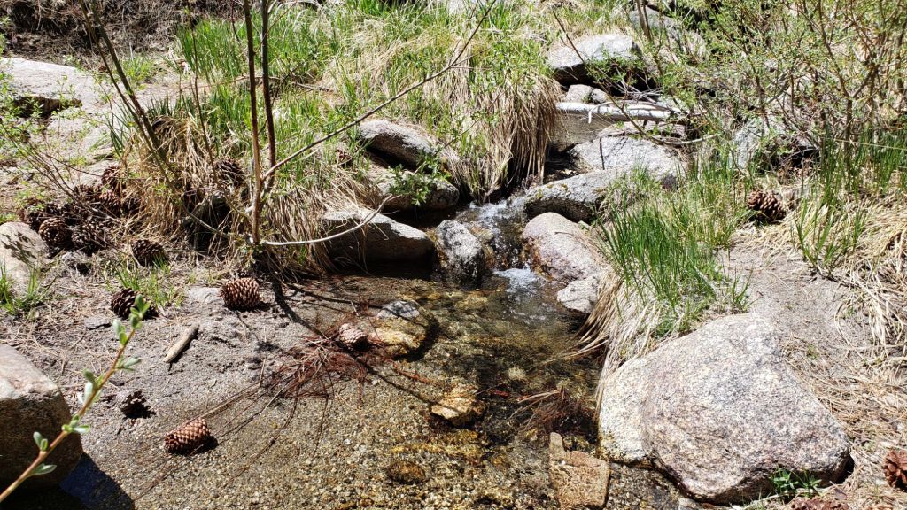
TRAIL CONDITIONS
The established trail system was completely clear of snow by late May.
The Pacific Crest Trail is now clear of snow through the San Jacinto mountains. The two large downed trees near Mile 180 were removed by the Trail Report on 21st May (photo in a prior Report linked here).
Work since mid 2024 by various PCTA-USFS-ACE crews has largely resolved the backlog of downed trees on Miles 170-175 (broadly Apache Peak to Red Tahquitz) accumulated during several years of agency neglect. Six trees remain to be cut around South Peak (Miles 173.5-174) of which most are significant obstructions for hikers [surveyed 5th June]. Lengthy sections of the trail are overgrown with brush and in urgent need of trimming, especially most of Miles 168-174. Regrettably post-fire erosion has created a loose, rocky, and uneven tread in parts of the same section, requiring significant caution in places.
The Strawberry Trail (PCT Miles 180.8-183.1) has ten blowdowns, none of which pose major hazards to hikers. Of the eight on the Forest Service section, several have been down for 8-10 years and reported repeatedly but with no action. The brush between the cienega and Annie’s Junction (roughly Miles 181-181.7) has become heavily overgrown since it was last trimmed in 2021.
Seven further blowdowns are on the Deer Springs Trail section of the PCT (Miles 183-185.5), almost all of which are major obstructions, albeit with workarounds. Hopefully the State Park/PCTA make these a priority for removal this season.
Fuller Ridge (PCT Miles 185.5-190.5) is completely clear of snow. Sadly the maintenance condition of this iconic section of the PCT is the poorest I have ever seen. The State Park has not attempted to maintain their section (Miles 185.5-189) for more than a dozen years. Treefall hazards were cut by PCTA in 2019, and vegetation was thoroughly trimmed by the Trail Report in 2020, but repeating these tasks is now long overdue and there are 12 trees down on that section of which five present major obstructions. Needless to say the trail is impassable with stock. The tread is a mess of debris (sticks, branches, rocks, cones) and shortcut switchbacks. By contrast the Forest Service section (north from Mile 189) has been relatively well maintained in recent years, with just three (thankfully all small) new trees coming down on that section this past winter.
The Wellman Trail is snow-free. Wellman’s Cienega is flowing poorly for this early in the season (photo below). The Trail Report continues the work it started in mid 2024 to heavily trim this formerly overgrown trail.
The Peak Trail is clear of snow, with a handful of tiny patches in the north-facing and sheltered section at 9900-10,100 ft (always last to clear in spring). Rocks around San Jacinto Peak are completely clear of snow.
The East Ridge Trail route to San Jacinto Peak starting at 10,400 ft near Miller Peak has cleared to just 5% snow cover. The old trail can now be followed for its entire length.
South Ridge Trail is clear of snow to both the north and south of Tahquitz Peak, including the infamous 0.4 mile section of South Ridge Trail between Chinquapin Flat/PCT Mile 177 and Tahquitz Peak which is now completely clear of snow. South Ridge Road is lumpy but readily passable in any moderate clearance vehicle.
Black Mountain Road is open and in its typical non-graded condition, i.e. lumpy but readily passable in any moderate clearance vehicle.
Storms in February-March brought down another 34 trees across Spitler Peak Trail. All but one were removed in late March by the Trail Report, bringing to 162 the total number of trees we have removed from this route in the past six years. One very large burned cedar remains across the trail immediately after the first creek crossing 3.2 miles up from the trailhead. Another new but thankfully small tree came down very recently close to the PCT but is easily passed over [surveyed 5th June].
Seven Pines Trail was clear of snow by late May. Twenty-two downed trees have been removed since April this year, and slow but steady progress made on removal of accumulated winter debris in the trail, especially up to about 8000 ft. Work on the uppermost trail so far this spring has been largely limited to removal of major blowdowns. The Trail Report “adopted” Seven Pines as a priority for maintenance work nearly a decade ago due to a disproportionate number of lost hiker rescues, with both State Park and Forest Service apparently no longer maintaining the route. Since 2019 we have removed 97 downed trees and the trail is generally trimmed and cleared twice annually. Roughly five trees remain to be cut close to Deer Springs Trail to restore the original trail route, but all blowdowns below about 8400 ft have now been removed [most recently surveyed 6th June]. Although our work has largely restored this trail, note that Seven Pines remains a genuine wilderness trail completely unlike the wider, bare, obvious routes of, for example, Devil’s Slide or Marion Mountain trails. Cautious navigation is essential for those without exceptional experience of hiking this trail. Note that in general the trail becomes most obscure in its uppermost mile (i.e. closest to the Deer Springs Trail/PCT junction).
After considerable work (mainly on the Forest Service side) Willow Creek Trail is in much better condition than this time last year. Four new trees came down on the Forest Service section in January, two of which are very large and tricky to pass (located about 0.5 mile south of Willow Creek, and 0.3 mile north of the creek). Whitethorn needs trimming again especially near the boundary between the two agencies, but is not as bad as in 2022-23. Two new trees on the State Park side are minor and easily passed, and thankfully the two large ones remaining uncut from years ago are also easily passed.
The Caramba Trail from near Reeds Meadow through Laws Camp and on to Caramba, and the Cedar Trail from Willow Creek Trail to Laws, are euphemistically (and potentially dangerously) described by the Forest Service as “not maintained”. In reality both trails have been abandoned and no longer exist. They are so heavily overgrown, largely with dense whitethorn which obscures dozens of downed trees, that hikers should not attempt to follow them (regardless of how much you may trust an app). An informal use trail to Laws is much more direct, generally well maintained, and avoids the bushwhacking of the unmaintained trails (some local Idyllwild hikers dubbed it the “King Trail” when I established the route in 2019). It leaves Willow Creek Trail exactly 1.0 mile from Saddle Junction, 0.46 mile from the Skunk Cabbage turning (trailhead at N 33.7796, W 116.6590). The route descends largely following established deer trails for 1.2 miles, meeting Willow Creek about 0.2 mile upstream from the site of the historic Laws Camp (the remains of which were destroyed by the 2013 Mountain Fire and subsequent flood and treefall damage). One huge tree fell in late 2024 across the King Trail about midway down and requires a minor scramble underneath (that tree will not be cut soon), while another fell in January 2025 close to the bottom of the trail that is relatively easy to cross over. Another five recently downed trees were either removed or worked around in January 2025, when the trail was thoroughly trimmed and cleared. From Laws east to Caramba the original Caramba Trail has been cairned by myself and others and can largely be followed with careful route-finding. My February 2025 survey counted about 120 trees down on this 2.1 miles of trail. It is extremely obscure for the first 0.5 mile east of the Willow Creek crossing, becoming more obvious (but still subtle) as it descends towards Caramba. Very cautious navigation is advised throughout the area.
The Zen Center Trail continues its serious deterioration that started following the 2013 Mountain Fire, with a combination of vigorous regrowth and treefall hazards further obscuring the route with each passing season. The lower and upper thirds of this trail are partially cairned and not too bad for those who are very familiar with the former route, but even the experienced find navigating the central section tricky. Long trousers, scrambling gloves, and a genuine enjoyment of bush-whacking are all strongly recommended.
While all time and labor is volunteered, the San Jacinto Trail Report uses small donations to help cover modest operating costs. Your contribution keeps the Report available to all, free from advertising or paywalls, and independent from agencies. If you have found this Report useful, please consider using this link to the Donate page. Thank you very much for your support.


sanjacjon Uncategorized Leave a comment 10 MinutesEdit”Trail update 5th June 2025″
Trail update 23rd May 2025
All trails, including the Pacific Crest Trail, are functionally clear of snow throughout the San Jacinto mountains. Spikes are no longer required anywhere on the established trail system. The minor storm on 16th May – really nothing more than elevated marine layer cloud – produced a very light rain in Idyllwild (0.03 inch) but no measurable precipitation in the high country.
Water flows in most perennial sources are low – in some cases, very low – for May. Although flowing gently at present (example photos below), key water sources such as Wellman’s Cienega, the creek in Little Round Valley, and the pipe in Round Valley may well dry up later this year. Hidden Lake is the lowest I have ever seen in May, less than 10% full (by volume), and may dry completely by the end of June. Long Valley Creek is largely dry where it passes through Round Valley, but Tamarack Creek just to the north is flowing gently. Total accumulated snowfall for this winter at San Jacinto Peak – 73.1 inches – is the lowest in recorded history (the three driest winters have all been in the past five years, all between 73-76 inches). For reference, this is only 40% of what was average snowfall for the Peak just 40-50 years ago.
Forest Service campgrounds at Marion Mountain, Fern Basin, and Boulder Basin reopened for the season on 22nd May. Dark Canyon Road (4S02) reopened for the season on 16th May, contrary to an earlier USFS announcement that it would be closed for the year, and the dirt section has had some effective basic maintenance. The associated Dark Canyon campground is however expected to be closed for the year due to federal staffing/budget cuts. Fire lookouts at Black Mountain and Tahquitz Peak, due to reopen this month, are closed indefinitely due to issues identified in a recent safety inspection.
Be rattlesnake aware. Rattlesnakes have become active in the mid and upper elevations this month. Above about 5000 ft elevation, the venom of Southern Pacific Rattlesnakes (Crotalus [oreganus] helleri) in the San Jacinto mountains is predominantly neurotoxic, almost always fatal for dogs and sometimes for humans (see my detailed 2020 article linked here for further information). Devil’s Slide Trail, lower Deer Springs and lower Marion Mountain trails, Suicide Rock, near Strawberry Cienega, and trails around Tahquitz Peak are frequent locations for sightings, but rattlesnakes have been recorded widely up to 9350 ft.
Survey hikes by the Trail Report every single day throughout the year in the San Jacinto mountains include varied routes to the high peaks including San Jacinto Peak typically 2-3 times per week (more frequently during storms), Tahquitz Peak and area 1-2 times per week, plus a wide variety of other trails on intervening days.
WEATHER
Temperatures rose to well above seasonal starting Tuesday 20th May. Following the rollercoaster of temperatures over the past couple of months, sadly it finally looks like we may be settling into more consistent summer-like weather. Temperatures are expected to remain generally above seasonal until the end of the month, with no significant precipitation in the forecasts, and no notably cloudy days expected. Midsummer-like temperatures are forecast for the last four days of May.
At San Jacinto Peak (10,810ft/3295m) on Friday 23rd May 2025 at 0815 the air temperature was 44.1°F (7°C), with a windchill temperature of 32.2°F (0°C), 15% relative humidity, and a steady SW wind sustained at 18 mph gusting to 21.6 mph.
At the Peak on Wednesday 21st May 2025 at 0905 the air temperature was 51.0°F (11°C), with a “windchill” temperature of 47.3°F (9°C), 12% relative humidity, and a gentle WSW wind sustained at 2 mph gusting to 5.7 mph.
At the Peak on Friday 16th May 2025 at 1010 the air temperature was 43.5°F (6°C), with a windchill temperature of 33.1°F (1°C), 42% relative humidity, and a light SW wind sustained at 5 mph gusting to 8.1 mph.
TRAIL CONDITIONS
Snowmelt – of what little snow remained – has been very rapid in the past week. Unless indicated below, trails are completely clear of snow. At this time spikes are no longer necessary anywhere on the established trail system.
The Pacific Crest Trail is now clear of snow through the San Jacinto mountains. Miles 151 (Highway 74) to about Mile 175 are clear. Snow patches are minimal between Miles 175 to near Saddle Junction (about Mile 179). The south-facing slope of Miles 179-180 is clear, while from Mile 180 (elevation 8900 ft) to about Mile 181 just past Annie’s Junction snow cover has dropped dramatically in recent days to just a few tiny patches. The two large downed trees near Mile 180 were removed by the Trail Report on 21st May (photo below). Miles 181-184.5 are sun-exposed and clear of snow. Snow cover consists of a handful of tiny patches around Mile 185 in the sheltered area near the Deer Springs crossing.
Fuller Ridge (PCT Miles 185.5-190.5) is now completely clear of snow. Sadly the maintenance condition of this iconic section of the PCT is the poorest I have ever seen. The State Park has not attempted to maintain their section (Miles 185.5-189) for more than a dozen years. Treefall hazards were cut by PCTA in 2019, and vegetation was thoroughly trimmed by the Trail Report in 2020, but repeating these tasks is now long overdue and there are 12 trees down on that section of which five present major obstructions. Needless to say the trail is impassable with stock. The tread is a mess of debris (sticks, branches, rocks, cones) and shortcut switchbacks. By contrast the Forest Service section (north from Mile 189) has been relatively well maintained in recent years, with just three (thankfully all small) new trees coming down on that section this past winter.
Work in the past ten months by joint PCTA-USFS crews has largely resolved the years-old backlog of dozens of downed trees on Miles 170-175. Ten trees remain uncut around Mile 174, which are expected to be removed by early June. Most of Miles 168-175 remains overgrown with brush but further trimming work is scheduled for the northern part of this section in late May and early June.
The Wellman Trail is now snow-free, with a couple of tiny patches confined to the forested 0.3 mile section immediately north of Annie’s Junction. Wellman’s Cienega is flowing poorly for so early in the season (photo below). The Trail Report has worked steadily since mid 2024 to heavily trim this formerly overgrown trail.
The Peak Trail is clear of snow, with just a few tiny patches in the north-facing and sheltered section at 9900-10,100 ft (always last to clear in spring). Rocks around San Jacinto Peak are clear of snow.
The East Ridge Trail route to San Jacinto Peak starting at 10,400 ft near Miller Peak has cleared to only 10% snow cover. The old trail is now largely exposed and can be followed for most of its length.
South Ridge Trail is clear of snow to both the north and south of Tahquitz Peak, including the 0.4 mile section of South Ridge Trail between Chinquapin Flat/PCT Mile 177 and Tahquitz Peak which is now functionally clear of snow. South Ridge Road is lumpy but readily passable in any moderate clearance vehicle.
Marion Mountain Trail is now clear of snow.
Deer Springs Trail is functionally clear of snow to Little Round Valley. A few very limited icy snow patches remain, notably in the most sheltered areas either side of the Deer Springs crossing and again in the drainage of the North Fork of the San Jacinto River. In Little Round Valley, snow cover averages 10%, with the few remaining patches mainly in the central, heavily forested section. Above Little Round Valley the trail has only 10% snow cover, but there are a few large icy snow drifts in a couple of key places around switchbacks. Spikes are no longer useful for descending upper Deer Springs Trail.
Black Mountain Road is open and in its typical non-graded condition, i.e. lumpy but readily passable in any moderate clearance vehicle.
Storms in February-March brought down another 34 trees across Spitler Peak Trail. All but one were removed in late March, bringing to 162 the total number of trees removed by the Trail Report from this route in the past six years.
Seven Pines Trail is clear of snow [surveyed 26th May]. Nineteen downed trees have been removed since April this year, and steady progress made on removal of accumulated winter debris in the trail especially up to about 8000 ft. Snow has only recently cleared above 8200 ft, so our work this spring has so far been limited on the upper trail. The Trail Report “adopted” Seven Pines as a priority for maintenance work nearly a decade ago due to a disproportionate number of lost hiker rescues, with both State Park and Forest Service having functionally abandoned the route. Since 2019 we have removed 94 downed trees and the trail is generally trimmed and cleared at least annually. Three recent blowdowns remain to be cut in the uppermost 0.6 mile, and about six trees need to be cut close to Deer Springs Trail to restore the original trail route, but all blowdowns below about 8300 ft have now been removed. Although our work has largely restored this trail, note that Seven Pines remains a genuine wilderness trail completely unlike the wider, bare, obvious routes of, for example, Devil’s Slide or Marion Mountain trails. Cautious navigation is essential for those without exceptional experience of hiking this trail. Also note that in general the trail becomes most obscure in its uppermost mile (i.e. closest to the Deer Springs Trail/PCT junction).
After considerable work (mainly on the Forest Service side) Willow Creek Trail is in much better condition than this time last year. Four new trees came down on the Forest Service section in January, two of which are very large and tricky to pass (located about 0.5 mile south of Willow Creek, and 0.3 mile north of the creek). Whitethorn needs trimming again especially near the boundary between the two agencies, but is not as bad as in 2022-23. Two new trees on the State Park side are minor and easily passed, and thankfully the two large ones remaining uncut from several years ago are also easily passed.
The Caramba Trail from near Reeds Meadow through Laws Camp and on to Caramba, and the Cedar Trail from Willow Creek Trail to Laws, are euphemistically (and potentially dangerously) described by the Forest Service as “not maintained”. In reality both trails have been abandoned and no longer exist. They are so heavily overgrown, largely with dense whitethorn which obscures dozens of downed trees, that hikers should not attempt to follow them (regardless of how much you may trust an app). An informal use trail to Laws is much more direct, generally well maintained, and avoids the bushwhacking of the unmaintained trails (some local Idyllwild hikers dubbed it the “King Trail” when I established the route in 2019). It leaves Willow Creek Trail exactly 1.0 mile from Saddle Junction, 0.46 mile from the Skunk Cabbage turning (trailhead at N 33.7796, W 116.6590). The route descends largely following established deer trails for 1.2 miles, meeting Willow Creek about 0.2 mile upstream from the site of the historic Laws Camp (the remains of which were destroyed by the 2013 Mountain Fire and subsequent flood and treefall damage). One huge tree fell in late 2024 across the King Trail about midway down and requires a minor scramble underneath (that tree will not be cut soon), while another fell in January 2025 close to the bottom of the trail that is relatively easy to cross over. Another five recently downed trees were either removed or worked around in January 2025, when the trail was thoroughly trimmed and cleared. From Laws east to Caramba the original Caramba Trail has been cairned by myself and others and can largely be followed with careful route-finding. My February 2025 survey counted about 120 trees down on this 2.1 miles of trail. It is extremely obscure for the first 0.5 mile east of the Willow Creek crossing, becoming more obvious (but still subtle) as it descends towards Caramba. Very cautious navigation is advised throughout the area.
The Zen Center Trail continues its serious deterioration that started following the 2013 Mountain Fire, with a combination of vigorous regrowth and treefall hazards further obscuring the route with each passing season. The lower and upper thirds of this trail are partially cairned and not too bad for those who are very familiar with the former route, but even the experienced find navigating the central section tricky. Long trousers, scrambling gloves, and a genuine enjoyment of bush-whacking are all strongly recommended.
While all time and labor is volunteered, the San Jacinto Trail Report uses small donations to help cover modest operating costs. Your contribution keeps the Report available to all, free from advertising or paywalls, and independent from agencies. If you have found this Report useful, please consider using this link to the Donate page. Thank you very much for your support.
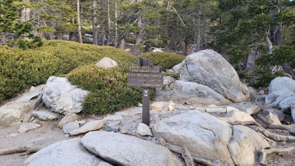
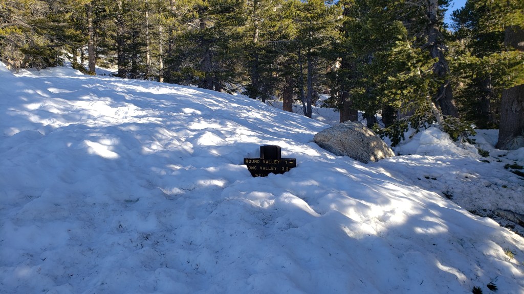
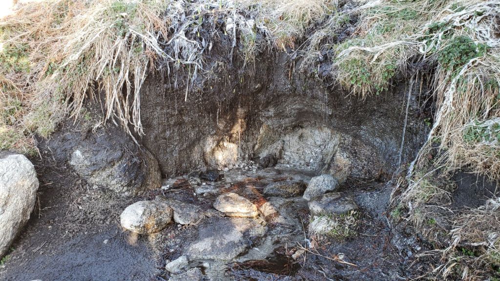


sanjacjon Uncategorized Leave a comment 10 MinutesEdit”Trail update 23rd May 2025″
Trail update 18th May 2025
Temperatures far above seasonal last week rapidly melted most remaining snow (largely old icy snow persisting from storms in March). All trails, including the Pacific Crest Trail, are functionally clear of snow through the San Jacinto mountains. Spikes are no longer required anywhere on the established trail system.
Water flows in most perennial sources are low – in some cases, very low – for mid May. Although flowing gently at present (example photos below), key water sources such as the creek in Little Round Valley and the pipe in Round Valley may well dry at some point this summer. Total accumulated snowfall for this winter at San Jacinto Peak – currently 73.1 inches – would be, by an inch or two, the lowest on record (the three driest winters have all been in the past five years, all between 73-76 inches). In the past decade average annual snowfall at the Peak has been 111 inches (in the latter half of last century it was approximately 180 inches).
Forest Service campgrounds at Marion Mountain, Fern Basin, and Boulder Basin all reopen for the season on 22nd May. Dark Canyon Road (4S02) somewhat unexpectedly reopened for the season on 16th May, and the dirt section has had some effective basic maintenance. The associated Dark Canyon campground is expected to be closed for the year due to federal government staffing/budget cuts. Fire lookouts at Black Mountain and Tahquitz Peak, due to reopen this month, are closed indefinitely due to safety issues identified in recent federal inspections.
Survey hikes by the Trail Report every single day throughout the year in the San Jacinto mountains include varied routes to the high peaks including San Jacinto Peak typically 2-3 times per week (more frequently during storms), Tahquitz Peak and area 1-2 times per week, plus a wide variety of other trails on intervening days.
WEATHER
Minor storm systems on 26th April (1-2 inches of snow) and again on 4th May (2-4 inches) both produced light snow falls in the high country. However, above average temperatures immediately following the storms, combined with a seasonally potent sun, led to very rapid melting and in both cases trails had largely cleared within 1-2 days.
Temperatures rose yet again to above seasonal from 7th May, and on 9th-10th temperatures more closely resembled summer, with both highs and lows as much as 10-20°F above seasonal for early May.
Temperatures dropped back to about average (and pleasantly cool) for May starting Monday 12th, and are now forecast to remain around seasonal for the next week. Notably cooler days on 13th-14th and Sunday 18th have the possibility of very minor rainfall, most likely early in the the morning (and probably at mid elevations rather than in the high country). Temperatures rise to well above seasonal again starting Tuesday 20th May.
At San Jacinto Peak (10,810ft/3295m) on Wednesday 14th May 2025 at 0805 the air temperature was 26.8°F (-3°C), with a windchill temperature of 10.6°F (-12°C), 41% relative humidity, and a fresh NNE wind sustained at 8 mph gusting to 16.5 mph.
At the Peak on Monday 12th May 2025 at 0740 the air temperature was 34.8°F (2°C), with a windchill temperature of 19.2°F (-7°C), 39% relative humidity, and a chilly WSW wind sustained at 19 mph gusting to 30.0 mph.
At the Peak on Tuesday 6th May 2025 at 0825 the air temperature was 36.3°F (2°C), with a windchill temperature of 25.2°F (-4°C), 80% relative humidity, and a variable WNW wind sustained at 2 mph gusting to 9.6 mph.
TRAIL CONDITIONS
Snowmelt – of what little snow remained – has been very rapid in the past week. Unless indicated below, trails are clear of snow. At this time few if any hikers are finding spikes necessary.
The Pacific Crest Trail is now functionally clear of snow through the San Jacinto mountains. Miles 151 (Highway 74) to about Mile 175 are clear. Snow cover is very limited between Miles 175 to Saddle Junction (about Mile 179). The south-facing slope of Miles 179-180 is clear, while from Mile 180 (elevation 8900 ft) to about Mile 181 just past Annie’s Junction snow cover has dropped dramatically in recent days to under 10%. Miles 181-184.5 are sun-exposed and clear. Snow cover consists of a few patches around Mile 185 in the sheltered area near the Deer Springs crossing, but again there is a well-traveled boot track through the handful of tiny patches.
Fuller Ridge (PCT Miles 185.5-190.5) is now completely clear of snow. Sadly the maintenance condition of this iconic section of the PCT is the poorest I have ever seen. The State Park has not attempted to maintain their section (Miles 185.5-189) for more than a dozen years. Treefall hazards were cut by PCTA in 2019, and it was thoroughly trimmed by the Trail Report in 2020, but repeating these tasks is now long overdue and there are 12 trees down on that section of which five present major obstructions. Needless to say the trail is impassable with stock. The tread is a mess of debris (sticks, branches, rocks, cones) and shortcut switchbacks. By contrast the Forest Service section (north from Mile 189) has been relatively well maintained in recent years, with just three (thankfully small) new trees coming down on that section this past winter.
Work in the past ten months by joint PCTA-USFS crews has largely resolved the years-old backlog of dozens of downed trees on Miles 170-175. Ten trees remain uncut around Mile 174, which are expected to be removed by early June. Most of Miles 168-175 remains overgrown with brush but further trimming work is scheduled for the northern part of this section in late May and early June.
The Wellman Trail is now functionally snow-free, with <10% snow cover confined to the forested 0.3 mile section immediately north of Annie’s Junction. Wellman’s Cienega is unfrozen but flowing relatively poorly for so early in the season. The Trail Report has worked steadily over the past year to heavily trim this formerly overgrown trail.
The Peak Trail averages <10% snow cover, almost all of which is in a few patches in the north-facing and sheltered section at 9900-10,100 ft (always last to clear in spring). Rocks around San Jacinto Peak are functionally clear of snow and it is easy to ascend the Peak without stepping on snow patches.
The East Ridge Trail route to San Jacinto Peak starting at 10,400 ft near Miller Peak has cleared rapidly to only 25% snow cover. The old trail is now largely visible and can followed in places.
South Ridge Trail is clear of snow to both the north and south of Tahquitz Peak, including the 0.4 mile section of South Ridge Trail between Chinquapin Flat/PCT Mile 177 and Tahquitz Peak which is now functionally clear of snow. South Ridge Road is lumpy but readily passable in any moderate clearance vehicle.
Marion Mountain Trail is now clear of snow.
Deer Springs Trail is functionally clear of snow to Little Round Valley. A few limited sections of icy snow patches remain, notably in the most sheltered areas either side of the Deer Springs crossing and again in the drainage of the North Fork of the San Jacinto River. In Little Round Valley, snow cover averages only 10%, with most patches in the central, heavily forested section. Above Little Round Valley the trail has only 10% snow cover, but there are some large icy snow drifts in a few key places around switchbacks. Spikes are no longer useful for descending upper Deer Springs Trail.
Black Mountain Road is open and in its typical non-graded condition, i.e. lumpy but readily passable in any moderate clearance vehicle.
Storms in February-March brought down another 34 trees across Spitler Peak Trail. All but one were removed in late March, bringing to 162 the total number of trees removed by the Trail Report from this route in the past six years.
Seven Pines Trail is functionally clear of snow, with just a handful of old snow drifts from 8200 ft to the PCT/Deer Springs Trail. Eighteen downed trees have been removed since April this year, and significant progress made on removal of accumulated winter debris in the trail up to about 8000 ft. The Trail Report “adopted” Seven Pines as a priority for maintenance work years ago due to a disproportionate number of lost hiker rescues in the previous decade, with neither State Park nor Forest Service having shown significant interest in maintaining the route for many years. Since 2019 we have removed 93 downed trees and the trail is generally trimmed and cleared at least annually. About six trees remain to be cut close to Deer Springs Trail to restore the original trail route, but all blowdowns below about 8200 ft have now been removed. Although our work has largely restored this trail, note that Seven Pines remains a genuine wilderness trail unlike the wider, bare, obvious routes of, for example, Devil’s Slide or Marion Mountain trails. Cautious navigation remains invaluable for those without considerable experience of hiking this trail. Also note the trail becomes most obscure in its uppermost mile (i.e. closest to the Deer Springs Trail/PCT junction).
The Caramba Trail from near Reeds Meadow through Laws Camp and on to Caramba, and the Cedar Trail from Willow Creek Trail to Laws, are euphemistically (and potentially dangerously) described by the Forest Service as “not maintained”. In reality both trails have been abandoned and no longer exist. They are so heavily overgrown, largely with dense whitethorn which obscures dozens of downed trees, that hikers should not attempt to follow them (regardless of how much you may trust an app). An informal use trail to Laws is much more direct, generally well maintained, and avoids the bushwhacking of the unmaintained trails (some local Idyllwild hikers dubbed it the “King Trail” when I established the route in 2019). It leaves Willow Creek Trail exactly 1.0 mile from Saddle Junction, 0.46 mile from the Skunk Cabbage turning (trailhead at N 33.7796, W 116.6590). The route descends largely following established deer trails for 1.2 miles, meeting Willow Creek about 0.2 mile upstream from the site of the historic Laws Camp (the remains of which were destroyed by the 2013 Mountain Fire and subsequent flood and treefall damage). One huge tree fell in late 2024 across the King Trail about midway down and requires a minor scramble underneath (that tree will not be cut soon), while another fell in January 2025 close to the bottom of the trail that is relatively easy to cross over. Another five recently downed trees were either removed or worked around in January 2025, when the trail was thoroughly trimmed and cleared. From Laws east to Caramba the original Caramba Trail has been cairned by myself and others and can largely be followed with careful route-finding. My February 2025 survey counted about 120 trees down on this 2.1 miles of trail. It is extremely obscure for the first 0.5 mile east of the Willow Creek crossing, becoming more obvious (but still subtle) as it descends towards Caramba. Very cautious navigation is advised throughout the area.
By late 2024 Willow Creek Trail was nearing its 2020 condition, the last time the original trail route was fully cleared and passable. Four new trees came down on the Forest Service section in January 2025, two of which are large and tricky for hikers to pass. In addition to trees being cut in 2024, whitethorn trimming was largely completed, mainly by volunteers, on the Forest Service side in late summer. On the State Park side localized trimming of the worst patches was undertaken in 2024, and the minor treefall hazards new in 2023/24 were removed, leaving just two major long term downed trees (both easy to pass for hikers).
The Zen Center Trail continues its serious deterioration that started following the 2013 Mountain Fire, with a combination of vigorous regrowth and treefall hazards further obscuring the route with each passing season. The lower and upper thirds of this trail are partially cairned and not too bad for those who are very familiar with the former route, but even the experienced find navigating the central section tricky. Long trousers, scrambling gloves, and a genuine enjoyment of bush-whacking are all strongly recommended.
While all time and labor is volunteered, the San Jacinto Trail Report uses small donations to help cover modest operating costs. Your contribution keeps the Report available to all, free from advertising or paywalls, and independent from agencies. If you have found this Report useful, please consider using this link to the Donate page. Thank you very much for your support.


sanjacjon Uncategorized Leave a comment 9 MinutesEdit”Trail update 18th May 2025″
Trail update 8th May 2025
Minor storm systems on 26th April (1-2 inches of snow) and again on 4th May (2-4 inches) both produced light snow falls in the high country. However, above average temperatures immediately following the storms, combined with a seasonally potent sun, led to very rapid melting and in both cases trails had largely cleared within 1-2 days.
Hot temperatures forecast for the remainder of this week will rapidly melt much of the old icy snow (from storms in March). Spikes are no longer required anywhere, although some hikers may find them useful in places, as described under Trail Conditions. The Pacific Crest Trail has heavily-traveled tracks in the very limited areas – described below – where snow remains on the trail in the San Jacinto mountains.
Water flows in most perennial sources are low – in some cases, very low – for early May. Currently at 73.1 inches, total accumulated snowfall for this winter at San Jacinto Peak could be, by an inch or two, the lowest on record (the three driest winters have all been in the past five years, and each is between 73-76 inches). In the past decade average annual snowfall at the Peak has been 110.5 inches (in the latter half of last century it was approximately 180 inches).
Dark Canyon Road (4S02), the access road to the Seven Pines trailhead, is expected to be closed for the year for staffing/budget reasons (the trail and road remain open for hikers however).
Survey hikes by the Trail Report every single day throughout the year in the San Jacinto mountains include varied routes to the high peaks including San Jacinto Peak typically 2-3 times per week (more frequently during storms), Tahquitz Peak and area 1-2 times per week, plus a wide variety of other trails on intervening days.

WEATHER
Very minor storm systems have impacted the San Jacinto mountains twice in the past ten days, the first on Saturday 26th April. Very fine snow started as low as Idyllwild late that morning and continued on/off into the evening. Most areas at elevations ranging from Humber Park (6500 ft) to San Jacinto Peak (10,810 ft) accumulated only about one inch, but depth at Saddle Junction (8100 ft) was 1.5 inch, with about two inches accumulating in sheltered areas between 8500-9500 ft. In Idyllwild, about 0.4 inch of rain earlier in the day turned to snow in the evening, accumulating to a patchy 0.5 inch.
The system on 4th May was more significant than forecast, with two inches of snow above 9000 ft, three inches at 10,000 ft, and nearly four inches at San Jacinto Peak. Although there was a dusting down to 7000 ft, snow accumulation was negligible below 9000 ft. Idyllwild recorded 0.18 inch of rain.
Temperatures rise yet again to above seasonal by Wednesday 7th May. On 9th-10th temperatures will more closely resemble summer, with both highs and lows as much as 10-20°F above seasonal for early May, notably at mid (rather than upper) elevations. Temperatures drop back to pleasantly cool and seasonal for the first half of May during the following week, on 12th-15th at least.
At San Jacinto Peak (10,810ft/3295m) on Tuesday 6th May 2025 at 0825 the air temperature was 36.3°F (2°C), with a windchill temperature of 25.2°F (-4°C), 80% relative humidity, and a variable WNW wind sustained at 2 mph gusting to 9.6 mph.
At the Peak on Monday 5th May 2025 at 0920 the air temperature was 27.8°F (-3°C), with a windchill temperature of 15.1°F (-10°C), 100% relative humidity, and a fresh due North wind sustained at 5 mph gusting to 12.0 mph.
At the Peak on Sunday 4th May 2025 at 0825 the air temperature was 29.1°F (-2°C), with a windchill temperature of 18.7°F (-8°C), 78% relative humidity, and a light due East wind sustained at 3 mph gusting to 8.5 mph.
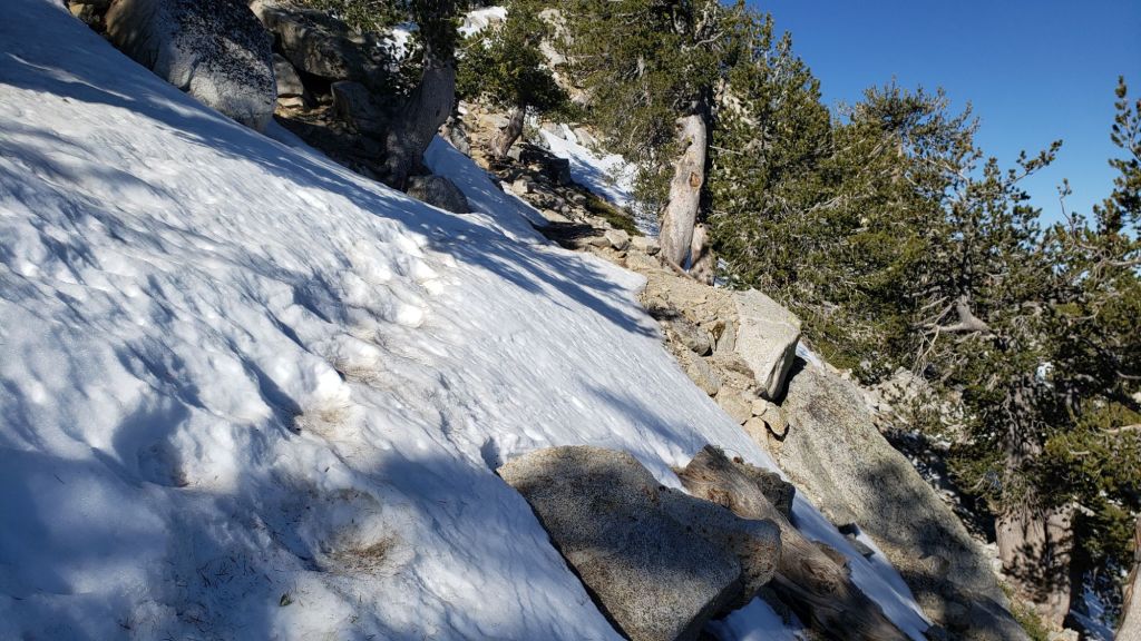
TRAIL CONDITIONS
Snowmelt has been steady in the past day or so, both of the limited fresh snow and old remaining snow from March, and will accelerate markedly in the warm weather this week. Everywhere above about 9000 ft carrying spikes can be useful depending on personal preference and experience, but most hikers are now finding spikes unnecessary.
The Pacific Crest Trail is now largely clear of snow through the San Jacinto mountains, with the exception of a few areas described below. Miles 151 (Highway 74) to about Mile 175 are clear. Snow cover from Miles 175 (Red Tahquitz) to 177.7 (Chinquapin Flat) is about 30% with a very well-worn track. Snow cover is minimal between Miles 177.7 to Saddle Junction (about Mile 179). The south-facing slope of Miles 179-180 is clear, while from Mile 180 (elevation 8900 ft) to about Mile 181 just past Annie’s Junction snow cover has dropped dramatically in recent days to just 25%. Miles 181-184.5 are sun-exposed and clear. Snow cover increases around Mile 185 in the sheltered area near the Deer Springs crossing, but again there is a well-traveled boot track. Fuller Ridge (Miles 185.5-191) now averages just 20% snow cover, with Miles 186-186.5 and 187.5-188.3 in particular being sun-exposed and snow-free. Some hikers may find spikes are useful in places throughout this section, but they are not required as the track is well-defined with good steps where it goes through snow patches. The trail is clear of snow from Mile 191 northwards.
Although the situation improved somewhat in 2024, treefall hazards remain a significant problem along parts of the Pacific Crest Trail, most notably between Antsell Rock and South Peak. About 60 trees are down across the trail between PCT Miles 170.5-174, with 37 of these, including several serious obstructions that make for slow-going, between Miles 172.5-174 (around and immediately south of South Peak). A further nine smaller obstructions are down from Miles 168.5-170.5 (Spitler Peak Trail to Zen Center Trail). Significant sections of Miles 168.5-175 are also badly overgrown with brush and are in urgent need of major trimming work. Further logging and trimming work is scheduled in this area in May and early June this year.
Devil’s Slide Trail is clear of snow.
The Wellman Trail is now almost snow-free, with just 20% snow cover confined to the forested 0.3 mile section immediately north of Annie’s Junction. Wellman’s Cienega is unfrozen but flowing relatively poorly for so early in the year.
The Peak Trail averages only 10% snow cover, almost all of which is in the north-facing and sheltered section at 9900-10,100 ft (always slow to clear in spring). Rocks around San Jacinto Peak are largely clear of snow and it is possible to ascend the Peak without stepping on snow patches.
The East Ridge Trail route to San Jacinto Peak starting at 10,400 ft near Miller Peak had cleared rapidly to only 40% snow cover prior to the snowfall on 4th. It will likely to return to <50% snow cover during the course of this week. The old trail is visible and can followed in places.
South Ridge Trail is clear of snow to Tahquitz Peak. South Ridge Road is lumpy but readily passable in any moderate clearance vehicle.
The 0.4 mile section of South Ridge Trail between Chinquapin Flat/PCT Mile 177 and Tahquitz Peak is now largely clear of snow and has a reliable boot track to follow through the few remaining tiny snow patches (example photo above). Most hikers are finding spikes are no longer required on this trail.
Marion Mountain Trail is functionally clear of snow, with just a couple of limited patches of old icy snow remaining at the PCT junction.
Deer Springs Trail will be almost entirely clear of snow up to 9200 ft (above the Fuller Ridge Trail junction) by the weekend, and largely clear of snow to Little Round Valley. A few limited areas of extended icy snow patches remain, notably in the most sheltered areas either side of the Deer Springs crossing and again in the drainage of the North Fork of the San Jacinto River. Nevertheless the well-traveled track is easy to follow to Little Round Valley. In Little Round Valley, snow cover averages only 50%, most continuous in the central, most forested section. Above Little Round Valley the trail has only 20% snow cover, but can be tricky to follow, with large icy snow drifts in a few key places around switchbacks. Spikes remain useful at least for descending parts of upper Deer Springs Trail.
Spitler Peak Trail is clear of snow. Storms in February-March brought down another 34 trees across this trail. All but one were removed in late March, bringing to 162 the total number of trees removed by the Trail Report from this route in the past six years. A very large burned cedar remains which can be a little tricky to pass, next to the first crossing of Spitler Creek (3.2 miles up from the trailhead, 1.6 miles down from the PCT).
Seven Pines Trail is functionally clear of snow to 8200 ft, with about 30% cover of old snow drifts from there to the PCT/Deer Springs Trail. Seventeen downed trees were removed in April 2025, and significant progress made on removal of accumulated winter debris in the trail up to about 8000 ft (example photo below). The Trail Report “adopted” Seven Pines as a priority for maintenance work years ago due to a disproportionate number of lost hiker rescues in the previous decade, with neither State Park nor Forest Service having shown significant interest in maintaining the route for many years. Since 2019 we have removed 92 downed trees and the trail is generally trimmed and cleared at least annually. About six trees remain to be cut above the current snow line to restore the original trail route, plus one very large recently downed tree lower down. Although our work has largely restored this trail, note that Seven Pines remains a genuine wilderness trail unlike the wider, bare, obvious routes of, for example, Devil’s Slide or Marion Mountain trails. Cautious navigation remains invaluable for those without considerable experience of hiking this trail. Also note the trail becomes most obscure in its uppermost mile – especially at present due to snow drifts – i.e. closest to the Deer Springs Trail/PCT junction.
The Caramba Trail from near Reeds Meadow through Laws Camp and on to Caramba, and the Cedar Trail from Willow Creek Trail to Laws, are euphemistically (and potentially dangerously) described by the Forest Service as “not maintained”. In reality both trails have been abandoned and no longer exist. They are so heavily overgrown, largely with dense whitethorn which obscures dozens of downed trees, that hikers should not attempt to follow them (regardless of how much you may trust an app). An informal use trail to Laws is much more direct, generally well maintained, and avoids the bushwhacking of the unmaintained trails (some local Idyllwild hikers dubbed it the “King Trail” when I established the route in 2019). It leaves Willow Creek Trail exactly 1.0 mile from Saddle Junction, 0.46 mile from the Skunk Cabbage turning (trailhead at N 33.7796, W 116.6590). The route descends largely following established deer trails for 1.2 miles, meeting Willow Creek about 0.2 mile upstream from the site of the historic Laws Camp (the remains of which were destroyed by the 2013 Mountain Fire and subsequent flood and treefall damage). One huge tree fell in late 2024 across the King Trail about midway down and requires a minor scramble underneath (that tree will not be cut soon), while another fell in January 2025 close to the bottom of the trail that is relatively easy to cross over. Another five recently downed trees were either removed or worked around in January 2025, when the trail was thoroughly trimmed and cleared. From Laws east to Caramba the original Caramba Trail has been cairned by myself and others and can largely be followed with careful route-finding. My February 2025 survey counted about 120 trees down on this 2.1 miles of trail. It is extremely obscure for the first 0.5 mile east of the Willow Creek crossing, becoming more obvious (but still subtle) as it descends towards Caramba. Very cautious navigation is advised throughout the area.
In late 2024 Willow Creek Trail was nearing its 2020 condition, the last time the original trail route was fully cleared and passable. Four new trees came down on the Forest Service section in January, two of which are large and tricky for hikers to pass. In addition to trees being cut in 2024, whitethorn trimming was largely completed, mainly by volunteers, on the Forest Service side in late summer. On the State Park side localized trimming of the worst patches was undertaken in 2024, and the minor treefall hazards new in 2023/24 were removed, leaving just two major long term downed trees (both easy to pass for hikers).
The Zen Center Trail continues its serious deterioration that started following the 2013 Mountain Fire, with a combination of vigorous regrowth and treefall hazards further obscuring the route with each passing season. The lower and upper thirds of this trail are partially cairned and not too bad for those who are very familiar with the former route, but even the experienced find navigating the central section tricky. Long trousers, scrambling gloves, and a genuine enjoyment of bush-whacking are all strongly recommended.
While all time and labor is volunteered, the San Jacinto Trail Report uses small donations to help cover modest operating costs. Your contribution keeps the Report available to all, free from advertising or paywalls, and independent from agencies. If you have found this Report useful, please consider using this link to the Donate page. Thank you very much for your support.
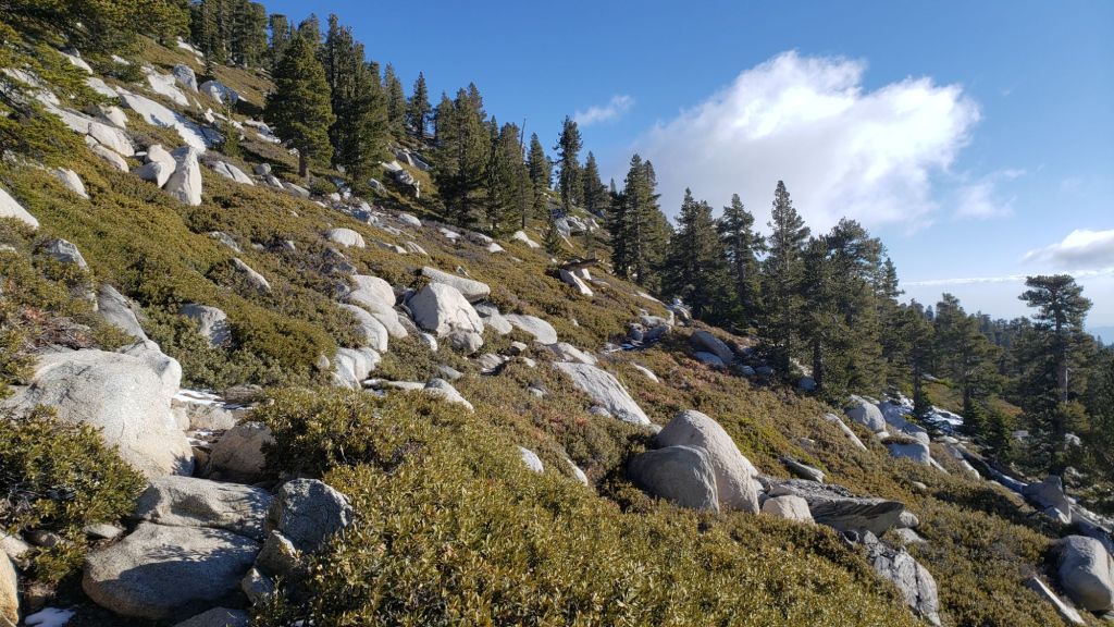

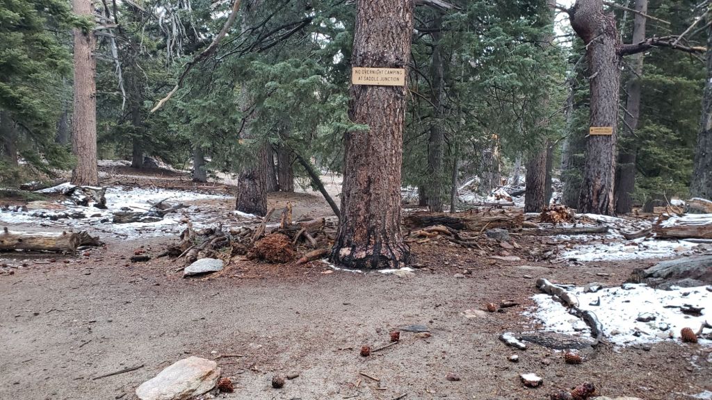
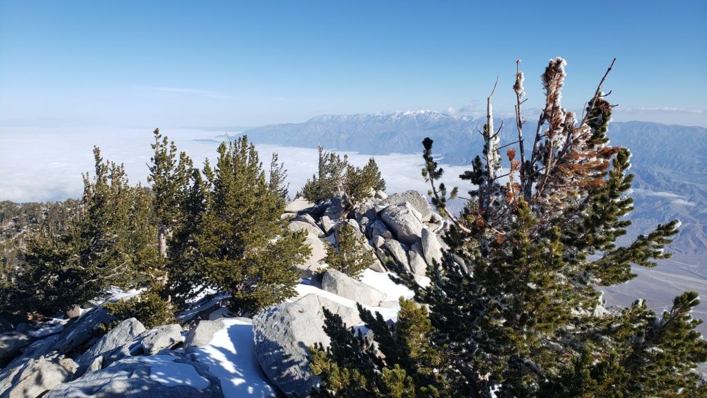


sanjacjon Uncategorized Leave a comment 10 MinutesEdit”Trail update 8th May 2025″
Trail update 4th May 2025
UPDATE Tuesday 6th May 2025: We returned to San Jacinto Peak this morning, and as anticipated, almost all the snow from yesterday is gone. Although a patchy thin covering remains in sheltered areas above 9900 ft, most trails have already cleared, and those that haven’t will be functionally clear of new snow in the next 24 hours. Consequently, conditions as described below from prior to 4th May are now functionally accurate again. Spikes are not required anywhere, although some hikers may find them useful in places, as described under Trail Conditions.
UPDATE Monday 5th May 2025: the minor snow storm yesterday evening and overnight was more significant than forecast, with two inches of snow above 9000 ft, three inches at 10,000 ft, and nearly four inches at San Jacinto Peak. Idyllwild recorded 0.18 inch of rain. I broke trail this morning via the Wellman and Peak trails, and recorded a short video from the Peak (linked here). Below 9000 ft the snow barely settled, trails are still readily visible, and no additional traction devices are required. PCT hikers remaining on the trail (i.e. not going up to the Peak) will not find navigation is significantly impacted. Conditions will change dramatically again in the next 1-2 days with temperatures climbing very rapidly, and trail conditions will quickly return to those described below.
UPDATE Sunday 4th May 2025: An extremely rare combination of weather phenomena is impacting the San Jacinto mountains today. A thick marine cloud layer up to 8000 ft – obviously coming in form the west – is covering the west slope (not in itself unusual), while very cold thunderstorm cells are circulating from the opposite direction (from the east this morning, now more northerly). The cloud base of these cumulonimbus formations was at about 12,000 ft. On my descent from San Jacinto Peak this morning I had the very strange experience of descending through foggy marine layer cloud on Devil’s Slide Trail, while steady graupel snow was falling from the much higher thunderstorm clouds through the lower cloud onto me. On the east slope, it has now locally dusted about 0.25 inch of snow (e.g., in Long Valley) early this afternoon.
————————————————-
The San Jacinto mountains caught the southern edge of a minor storm system on Saturday 26th April. Very fine snow started as low as Idyllwild at 1145 that morning and continued on/off into the evening. Total accumulation across most of the high country was one inch, with the highest peaks being above the cloud for some of the storm and/or melting underway even as the snow fell, as I described in a short video report recorded at San Jacinto Peak (linked here) late on 26th. With mild temperatures, that fresh snow melted within 2-3 days, and trail conditions have now returned to a comparable condition to last week.
To assess the changing conditions, I hiked to San Jacinto Peak on the afternoon of 26th through the bulk of the storm, then returned on the morning of 27th following further very light overnight snow. In the process I documented a remarkable morning for cloud formations (see under Weather below). We hiked to Tahquitz Peak, mainly to assess the snowbound north side, on the morning of 28th.
In Idyllwild, about 0.4 inch of rain earlier in the day turned to snow on the evening of 26th, accumulating to a patchy 0.5 inch at best. Most areas at elevations ranging from Humber Park (6500 ft) to San Jacinto Peak (10,810 ft) accumulated only about one inch of snow. However snow depth at Saddle Junction (8100 ft) was 1.5 inch, with about two inches accumulating in sheltered areas between 8500-9500 ft, notably below Little Round Valley on Deer Springs Trail, around Tahquitz Peak, and either side of Annie’s Junction (9020 ft, roughly PCT Miles 180-181). The snow did drift and accumulate deeper (3-4 inches) in the trails especially in areas that had prior icy snow remaining from earlier in the season. Spikes remain useful, but are not generally required.
During the course of this week, trails below 9000 ft will generally clear of snow (except the most sheltered areas) with even the highest peaks rapidly clearing on all but their most sheltered slopes. The Pacific Crest Trail has heavily-traveled tracks in the limited areas – described below – where snow remains on the trail in the San Jacinto mountains.
Dark Canyon Road (4S02), the access road to the Seven Pines trailhead, is expected to be closed for the year due to staffing/budget reasons (the trail and road remain open for hikers however). USFS gates at Humber Park and South Ridge Road both reopened in late March after brief closures.
Survey hikes by the Trail Report every single day throughout the year in the San Jacinto mountains include varied routes to the high peaks including San Jacinto Peak typically 2-3 times per week (more frequently during storms), Tahquitz Peak and area 1-2 times per week, plus a wide variety of other trails on intervening days.
WEATHER
The rollercoaster of temperatures that has been a feature of this year so far is forecast to continue for the foreseeable future. The remainder of this week warms to temperatures above seasonal in the first couple of days of May.
Passage of another minor system to our north leads to rapid cooling and the possibility of further minor precipitation – drizzle at mid elevations and a dusting of snow in the high country – on 4th and 5th May. Current forecasts suggest the majority of the precipitation will be late afternoon and overnight on Sunday 4th, with any high country snow most likely early on Monday 5th.
Temperatures then promptly rise yet again to above seasonal by Wednesday 7th May. On 8th-11th temperatures will more closely resemble midsummer, with both highs and lows as much as 10-20°F above seasonal for early May, especially at mid (rather than upper) elevations.
The recent video discussion from National Weather Service San Diego (linked here) includes data that confirm that this winter in Southern California has been one of the driest and warmest on record – with observations back to 1850 – especially for our area of montane central Riverside Country. Projections for the next few months suggest a hotter-than-average summer, with no clarity at this time on the likelihood of monsoonal moisture reaching us before late summer, if at all.
At San Jacinto Peak (10,810ft/3295m) on Sunday 4th May 2025 at 0825 the air temperature was 29.1°F (-2°C), with a windchill temperature of 18.7°F (-8°C), 78% relative humidity, and a light due East wind sustained at 3 mph gusting to 8.5 mph.
At the Peak on Thursday 1st May 2025 at 0810 the air temperature was 34.8°F (2°C), with a windchill temperature of 20.3°F (-7°C), 42% relative humidity, and a cool ESE wind sustained at 15 mph gusting to 20.5 mph.
At the Peak on Sunday 27th April 2025 at 0920 the air temperature was 14.3°F (-10°C), with a windchill temperature of -7.1°F (-22°C), 73% relative humidity, and a sharp due West wind sustained at 15 mph gusting to 24.5 mph.
As I ascended the Wellman and Peak trails on the morning of Sunday 27th, I was extremely fortunate to document the generation of a spectacular lenticular cloud formation over the Santa Rosa Mountains. Scroll right through the five images below, each captioned with the time the photo was taken. Lenticular clouds form only in specific atmospheric conditions when moisture-laden air is forced by a strong, steady wind over a very prominent peak – in this case Toro Peak – creating a unique wave pattern of airflow (there is a much better explanation at the NWS page linked here).
- At 0742 the first lenticular clouds develop the classic UFO shape in an otherwise relatively simple sky
- By 0826 a much more complicated sky includes various lenticular clouds starting to coalesce
- By 0854 multiple lenticular clouds form the archetypal “stack of pancakes” thousands of feet high
- At 0916 the layers start to merge into a huge mushroom-like formation as seen from San Jacinto Peak
- As I descended at 1013 the lenticular mass dissipates in the distance as I focused on the wispy marine layer cloud overhead
TRAIL CONDITIONS
Snowmelt has been rapid this week, both of the minimal fresh snow and old remaining snow from March. Everywhere above about 9000 ft carrying spikes can be useful where old snow patches are generally firm, but most hikers are now finding spikes unnecessary.
The Pacific Crest Trail is now largely clear of snow through the San Jacinto mountains, with the exception of a few areas described below. Miles 151 (Highway 74) to about Mile 175 are clear. Snow cover from Miles 175 (Red Tahquitz) to 177.7 (Chinquapin Flat) is about 30% with a very well-worn track. Snow cover is minimal between Miles 177.7 to Saddle Junction (about Mile 179). The south-facing slope of Miles 179-180 is clear, while from Mile 180 (elevation 8900 ft) to about Mile 181 just past Annie’s Junction snow cover has dropped dramatically in recent days to just 20%. Miles 181-184.5 are sun-exposed and clear. Snow cover increases around Mile 185 in the sheltered area near the Deer Springs crossing, but again there is a well-traveled boot track. Fuller Ridge (Miles 185.5-191) now averages just 20% snow cover, with Miles 186-186.5 and 187.5-188.3 in particular being sun-exposed and snow-free. Most hikers will find spikes are useful in places throughout this section, but they are not required as the track is well-defined with good steps. The trail is clear of snow from Mile 191 northwards.
Although the situation improved somewhat in 2024, treefall hazards remain a significant problem along parts of the Pacific Crest Trail, most notably between Antsell Rock and South Peak. About 60 trees are down across the trail between PCT Miles 170.5-174, with 37 of these, including several serious obstructions that make for slow-going, between Miles 172.5-174 (around and immediately south of South Peak). A further nine smaller obstructions are down from Miles 168.5-170.5 (Spitler Peak Trail to Zen Center Trail). Significant sections of Miles 168.5-175 are also badly overgrown with brush and are in urgent need of major trimming work. Further logging and trimming work is scheduled for this section in May and early June this year.
Devil’s Slide Trail [surveyed 4th May] is clear of snow.
The Wellman Trail [surveyed 4th May] is now almost snow-free, with just 20% snow cover confined to the forested 0.3 mile section immediately north of Annie’s Junction. Wellman’s Cienega is now unfrozen but flowing poorly for so early in the season.
The Peak Trail [surveyed 4th May] now averages only 10% snow cover, almost all of which is in the north-facing and sheltered section at 9900-10,100 ft that is always slow to clear in spring. Rocks around San Jacinto Peak [surveyed 4th May] are now functionally clear of snow and it is possible to ascend the Peak without stepping on snow patches.
The East Ridge Trail route [surveyed 4th May] to San Jacinto Peak starting at 10,400 ft near Miller Peak has cleared rapidly in recent days and has only 40% snow cover. The old trail can be seen and followed in places.
South Ridge Trail [surveyed 3rd May] is now clear of snow to Tahquitz Peak. South Ridge Road is lumpy but readily passable in any moderate clearance vehicle.
The 0.4 mile section of South Ridge Trail between Chinquapin Flat/PCT Mile 177 and Tahquitz Peak [surveyed 3rd May] is now largely clear of snow and has a reliable boot track to follow through the remaining small snow patches. Some hikers may find spikes are still useful, but most are finding they are no longer required.
Spitler Peak Trail is clear of snow. Storms in February-March brought down another 34 trees across this trail. All but one were removed in late March, bringing to 162 the total number of trees removed by the Trail Report from this route in the past six years. A very large burned cedar remains which can be a little tricky to pass, next to the first crossing of Spitler Creek (3.2 miles up from the trailhead, 1.6 miles down from the PCT).
Marion Mountain Trail [surveyed 1st May] is clear of snow, with just a couple of limited patches of old icy snow remaining at the PCT junction.
Deer Springs Trail [surveyed 1st May] is almost entirely clear of snow up to 9200 ft (above the Fuller Ridge Trail junction) and is largely clear of snow to Little Round Valley. A few limited areas of extended icy snow patches remain, notably in the most sheltered areas either side of the Deer Springs crossing and again in the drainage of the North Fork of the San Jacinto River. Nevertheless the well-traveled track is easy to follow to Little Round Valley. In Little Round Valley, snow cover averages only 50%, most continuous in the central, most forested section. Above Little Round Valley the trail has only 20% snow cover, but can be tricky to follow, with large icy snow drifts in a few key places around switchbacks. Spikes remain useful at least for descending parts of upper Deer Springs Trail.
Seven Pines Trail [surveyed 24th April] is clear of snow to 8200 ft, with about 30% cover of soft snow drifts from there to the PCT/Deer Springs Trail. Seventeen downed trees were removed in April 2025, and significant progress made on removal of accumulated winter debris in the trail up to about 8000 ft (example photo below). The Trail Report “adopted” Seven Pines as a priority for maintenance work years ago due to a disproportionate number of lost hiker rescues in the previous decade, with neither State Park nor Forest Service having shown significant interest in maintaining the route for many years. Since 2019 we have removed 92 downed trees and the trail is generally trimmed and cleared at least annually. About six trees remain to be cut above the current snow line to restore the original trail route, plus one very large recently downed tree lower down. Although our work has largely restored this trail, note that Seven Pines remains a genuine wilderness trail unlike the wider, bare, obvious routes of, for example, Devil’s Slide or Marion Mountain trails. Cautious navigation remains invaluable for those without considerable experience of hiking this trail. Also note the trail becomes most obscure in its uppermost mile – especially at present due to snow drifts – i.e. closest to the Deer Springs Trail/PCT junction.
The Caramba Trail from near Reeds Meadow through Laws Camp and on to Caramba, and the Cedar Trail from Willow Creek Trail to Laws, are euphemistically (and potentially dangerously) described by the Forest Service as “not maintained”. In reality both trails have been abandoned and no longer exist. They are so heavily overgrown, largely with dense whitethorn which obscures dozens of downed trees, that hikers should not attempt to follow them (regardless of how much you may trust an app). An informal use trail to Laws is much more direct, generally well maintained, and avoids the bushwhacking of the unmaintained trails (some local Idyllwild hikers dubbed it the “King Trail” when I established the route in 2019). It leaves Willow Creek Trail exactly 1.0 mile from Saddle Junction, 0.46 mile from the Skunk Cabbage turning (trailhead at N 33.7796, W 116.6590). The route descends largely following established deer trails for 1.2 miles, meeting Willow Creek about 0.2 mile upstream from the site of the historic Laws Camp (the remains of which were destroyed by the 2013 Mountain Fire and subsequent flood and treefall damage). One huge tree fell in late 2024 across the King Trail about midway down and requires a minor scramble underneath (that tree will not be cut soon), while another fell in January 2025 close to the bottom of the trail that is relatively easy to cross over. Another five recently downed trees were either removed or worked around in January 2025, when the trail was thoroughly trimmed and cleared. From Laws east to Caramba the original Caramba Trail has been cairned by myself and others and can largely be followed with careful route-finding. My February 2025 survey counted about 120 trees down on this 2.1 miles of trail. It is extremely obscure for the first 0.5 mile east of the Willow Creek crossing, becoming more obvious (but still subtle) as it descends towards Caramba. Very cautious navigation is advised throughout the area.
In late 2024 Willow Creek Trail was nearing its 2020 condition, the last time the original trail route was fully cleared and passable. Four new trees came down on the Forest Service section in January, two of which are large and tricky for hikers to pass. In addition to trees being cut in 2024, whitethorn trimming was largely completed, mainly by volunteers, on the Forest Service side in late summer. On the State Park side localized trimming of the worst patches was undertaken in 2024, and the minor treefall hazards new in 2023/24 were removed, leaving just two major long term downed trees (both easy to pass for hikers).
The Zen Center Trail continues its serious deterioration that started following the 2013 Mountain Fire, with a combination of vigorous regrowth and treefall hazards further obscuring the route with each passing season. The lower and upper thirds of this trail are partially cairned and not too bad for those who are very familiar with the former route, but even the experienced find navigating the central section tricky. Long trousers, scrambling gloves, and a genuine enjoyment of bush-whacking are all strongly recommended.
While all time and labor is volunteered, the San Jacinto Trail Report uses small donations to help cover modest operating costs. Your contribution keeps the Report available to all, free from advertising or paywalls, and independent from agencies. If you have found this Report useful, please consider using this link to the Donate page. Thank you very much for your support.
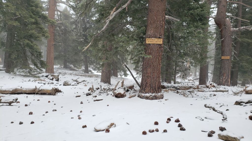


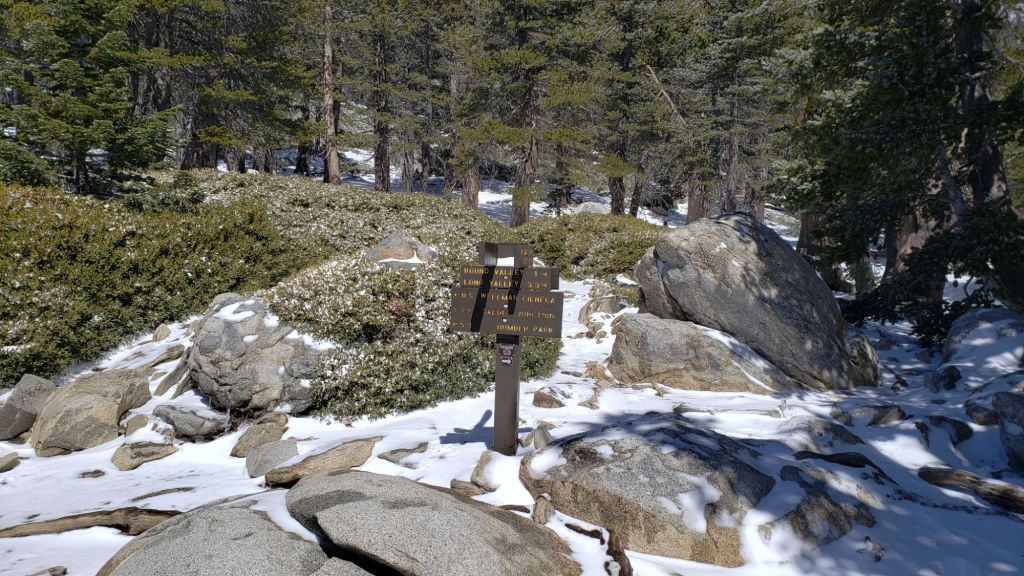

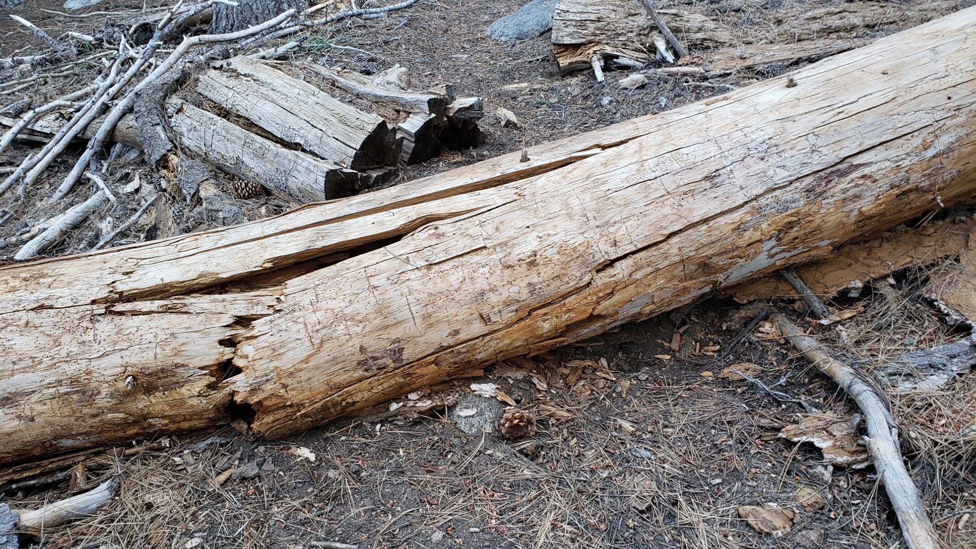
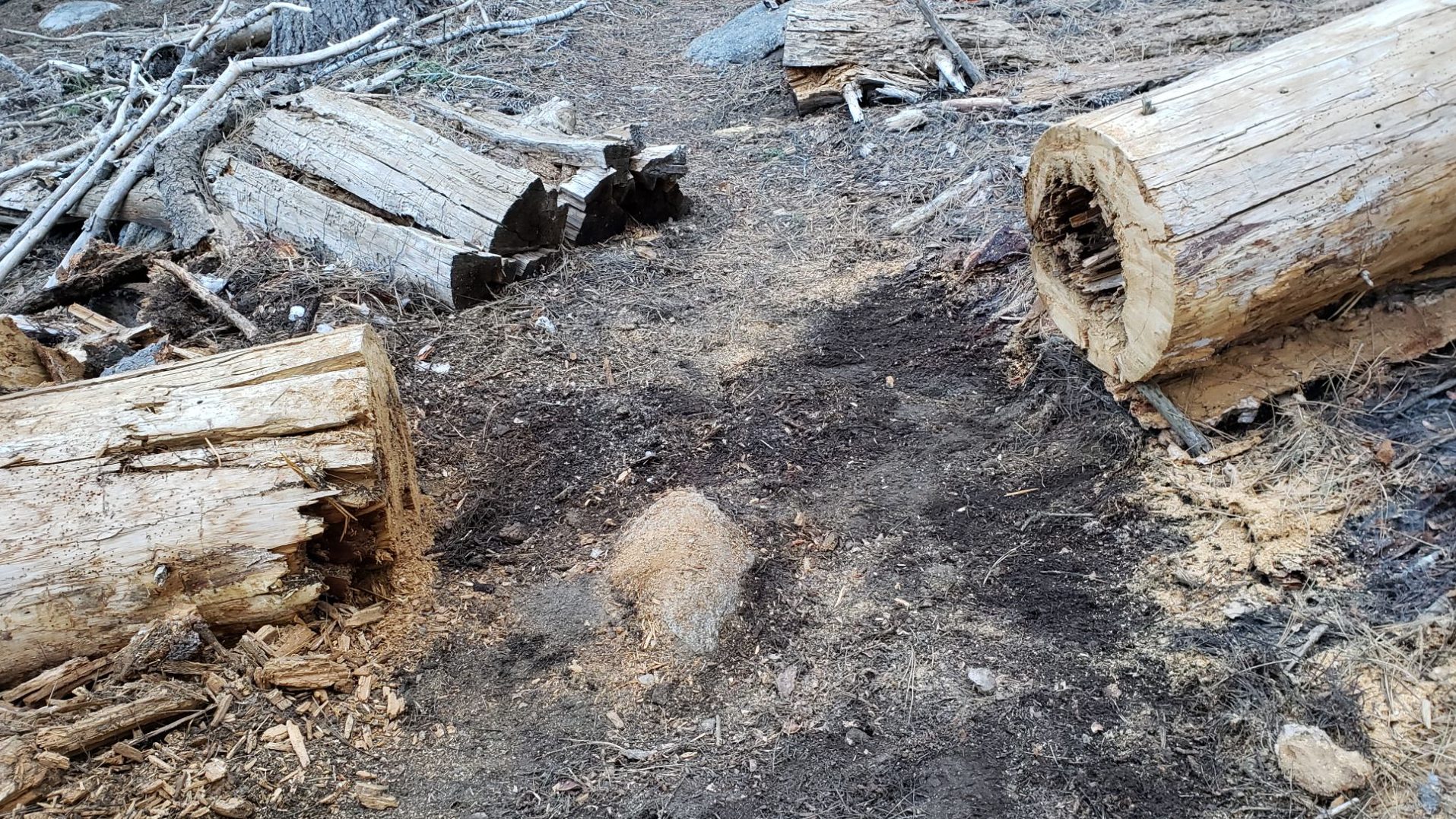
sanjacjon Uncategorized 2 Comments 13 MinutesEdit”Trail update 4th May 2025″
Trail update 24th April 2025
UPDATE Saturday 26th April 2025: very light, fine snow started as low as Idyllwild at 1145 and continued on/off all afternoon as I ascended to San Jacinto Peak. Total accumulation in the high country was barely one inch, as I described in a short video report recorded at the Peak (linked here). As I descended this evening, snow depth at Saddle Junction (8100 ft) was 0.5 inch (photo below), with a patchy 0.25 inch at Humber Park (6500 ft). The very light snow has not significantly altered the trail conditions described below. Spikes remain useful to carry, but are certainly not generally required.

—————————————————
The passage of a storm system largely to our north this weekend will draw the marine layer high up onto the west slope of the San Jacinto mountains, in a similar manner to the event described below on 16th-18th. This will result in cloudy, cool, and damp conditions at mid elevations on 26th-27th, with a forecast for light precipitation on Saturday 26th, in the afternoon and again overnight. Initially forecast to be drizzle, temperatures may be cold enough for very light snow as low as 5000 ft (unlikely to accumulate more than one inch). Temperatures will certainly be below freezing in the high country on 25th-28th, and even below seasonal on 26th-27th. The highest peaks may remain above the cloud, but an inch of snow has been predicted in the most recent forecasts.
Trails below 9000 ft have now generally cleared of snow (except the most sheltered areas) and even the highest peaks are rapidly clearing on all but their most sheltered slopes (example photos below). The Pacific Crest Trail has heavily-traveled tracks in the very limited areas – described below – where snow remains on the trail in the San Jacinto mountains. Spikes provide ample traction, but are no longer needed on most of the PCT.
Below-seasonal temperatures on 16th-18th April were accompanied by an especially deep and dense marine cloud layer (photos below), at times bringing thick fog to Idyllwild. Over the three days, sadly drizzle in Idyllwild only added up to 0.06 inch, with zero precipitation in the high country which remained above the cloud.
Spikes remain a useful option above about 9000 ft (lower in a handful of places) although with reliable grippy footwear, hikers experienced on icy snow will find spikes are generally no longer required on established tracks. This even includes the north side of Tahquitz Peak, although spikes – at least – remain strongly recommended there (details below).
Snow depths are no longer detailed below. This does not imply that there is no snow in the high country, rather that snow cover is generally too patchy in most areas to provide meaningful measurements or change hiking conditions. Forecast warm and sunny weather will result in continuing steady snowmelt.
Black Mountain Road remains closed (to vehicle traffic only) at the gate 1.7 miles up from Highway 243. USFS expects to reopen the road before the end of April. Dark Canyon Road (4S02), the access road to the Seven Pines trailhead, is expected to be closed for the year due to staffing/budget reasons (the trail and road remain open for hikers however). USFS gates at Humber Park and South Ridge Road both reopened in late March after brief closures.
Survey hikes by the Trail Report every single day throughout the year in the San Jacinto mountains include varied routes to the high peaks including San Jacinto Peak typically 2-3 times per week (more frequently during storms), Tahquitz Peak and area 1-2 times per week, plus a wide variety of other trails on intervening days.

WEATHER
Temperatures have been above seasonal averages for much of April, and that trend is forecast to broadly continue for the remainder of the month, with temperatures getting especially warm from Tuesday 29th into the first week of May.
Another high marine layer event on the western slope will result in cloudy, cool, and damp conditions at mid elevations on 26th-27th, with a forecast for light drizzle (<0.2 inch) in Idyllwild on Saturday 26th, possibly mixed with, or turning to, very light snow down to 5000 ft. Temperatures well below freezing on 25th-28th in the high country may result in very light snow (1-2 inches) on 26th, but it is also possible that the uppermost elevations remain above the cloud.
Below-seasonal temperatures on 16th-18th April were accompanied by an especially deep and dense marine cloud layer which brought periodic very light drizzle. In Idyllwild this only added up to 0.06 inch across the three days, with no precipitation above 9000 ft.
The latest video discussion from National Weather Service San Diego (linked here) includes data that confirm that this winter in Southern California has been one of the driest and warmest on record – with observations back to 1850 – especially for our area of montane central Riverside Country. Projections for the next few months suggest a hotter-than-average summer, with no clarity at this time on the likelihood of monsoonal moisture reaching us before late summer, if at all.
At San Jacinto Peak (10,810ft/3295m) on Sunday 20th April 2025 at 0800 the air temperature was 36.8°F (3°C), with a “windchill” temperature of 34.9°F (2°C), 25% relative humidity, and a barely discernable SW breeze sustained at 0 mph gusting to 2.6 mph.
At the Peak on Thursday 17th April 2025 at 0850 the air temperature was 31.1°F (-1°C), with a windchill temperature of 20.5°F (-6°C), 25% relative humidity, and a light WNW wind sustained at 4 mph gusting to 9.6 mph.
At the Peak on Wednesday 16th April 2025 at 0815 the air temperature was 36.9°F (3°C), with a windchill temperature of 25.0°F (-4°C), 17% relative humidity, and a fresh SSW wind sustained at 7 mph gusting to 12.0 mph.
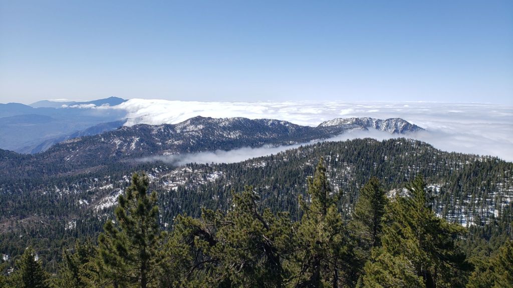
TRAIL CONDITIONS
Snowmelt has been generally rapid since the last notable storm in mid March, and will continue throughout the remainder of April. Snow depths and trail conditions in the first half of April more closely resembled May (or even early June in a good snow year).
Everywhere above about 9000 ft carrying spikes is recommended as established trails have been consolidated by hiker traffic. As always, spikes tend to be most useful for descending, even when they are not necessarily required for ascending. Hikers with considerable experience on snow and ice will find that spikes are now generally not required on the tracks of the established trail system.
The Pacific Crest Trail through the San Jacinto mountains is largely clear of snow. Snow is gone from Miles 151 (Highway 74) to about Mile 175. Snow cover averages 60% from Miles 175 (Red Tahquitz) to 177.7 (Chinquapin Flat). Snow cover is very patchy between Miles 177.7 to Saddle Junction (about Mile 179). The south-facing slope of Miles 179-180 is clear, but from Mile 180 (elevation 8900 ft) to about Mile 181 just past Annie’s Junction snow cover is about 80%. Miles 181-184 are sun-exposed and clear. Snow cover increases after Mile 184. There is a well-traveled boot track through an average of 50% snow cover on the PCT along Fuller Ridge (Miles 185.5-191). This track does not accurately follow the trail in places. Miles 186-186.5 and 187.5-188.3 in particular are sun-exposed and now snow-free. Most hikers will find spikes are useful in places throughout this section, but they are not required as the track is well-defined with good steps. The trail is functionally clear of snow from Mile 190 northwards.
PCT hikers should not attempt to use South Ridge Trail from the PCT at Chinquapin Flat (roughly Mile 177.7) to Idyllwild via Tahquitz Peak, even though this looks temptingly short and simple on apps and maps (photo above, further details below).
Although the situation improved somewhat in 2024, treefall hazards remain a significant problem along parts of the Pacific Crest Trail, most notably between Antsell Rock and South Peak. About 60 trees are down across the trail between PCT Miles 170.5-174, with 37 of these, including several serious obstructions that make for slow-going, between Miles 172.5-174 (around and immediately south of South Peak). A further nine smaller obstructions are down from Miles 168.5-170.5 (Spitler Peak Trail to Zen Center Trail). Significant sections of Miles 168.5-175 are also badly overgrown with brush and are in urgent need of major trimming work.
PCT hikers are asked to respect that overnight stays are not permitted at or near San Jacinto Peak, including in the historic shelter, to minimize impacts to a sensitive subalpine environment. Officially Mt. San Jacinto State Park permits overnight stays only in established campgrounds (Little Round Valley and Strawberry Junction are good options for thru-hikers).
Devil’s Slide Trail [surveyed 17th April] is clear of snow.
The Ernie Maxwell Trail is clear of snow. The one remaining minor downed tree on this trail has been reported to the Forest Service.
The PCT heading north from Saddle Junction is clear of snow to 9000 ft (approx. Miles 179-180, a.k.a. “Angel’s Glide”).
Snow cover on the Wellman Trail [surveyed 17th April] is only 20% and is almost entirely confined the forested 0.3 mile section immediately north of Annie’s Junction. Wellman’s Cienega is unfrozen and flowing well.
The Peak Trail [surveyed 17th April] now averages only 40% snow cover, almost all of which is above 10,000 ft elevation. Snow cover is continuous in the north-facing and sheltered section at 9900-10,100 ft that is always slow to clear in spring. There is a well-traveled compacted posthole track on the uppermost part of the Peak Trail.
The East Ridge Trail route [surveyed 17th April] to San Jacinto Peak starting at 10,400 ft near Miller Peak remains almost fully snow-covered. The route has been much less-traveled with the recent clearing of the upper Peak Trail, but a posthole track through shallow snow remains.
South Ridge Trail [surveyed 18th April] from the top of South Ridge Road is clear of snow to Tahquitz Peak. Spikes are not required. South Ridge Road is lumpy but readily passable in any moderate clearance vehicle.

The 0.4 mile section of South Ridge Trail between Chinquapin Flat/PCT Mile 177 and Tahquitz Peak [surveyed twice weekly, most recently 18th April] has a single postholing boot track to follow through the steeply angled snow (photo above), which in its steepest section does not accurately follow the trail route and has considerable underlying ice. These slopes comprise some of the most consequential terrain in winter in these mountains, and this route is still not recommended for most hikers at this time. Although the track is passable without spikes for the most experienced hikers, spikes at a minimum are strongly recommended, should be accompanied by hiking poles or ideally an ice axe, and, critically, adequate experience and knowledge of how to use this equipment in such terrain.
Spitler Peak Trail is clear of snow [multiple surveys in March and April]. Storms in February-March brought down another 34 trees across this trail. All but one were removed in late March, bringing to 162 the total number of trees removed by the Trail Report from this route in the past six years. A very large burned cedar remains which can be a little tricky to pass, next to the first crossing of Spitler Creek (3.2 miles up from the trailhead, 1.6 miles down from the PCT).
Round Valley Trail is largely clear of snow from Long Valley to Round Valley. There is a well-traveled track through the remaining very thin and patchy snow from there to Wellman Divide.
Marion Mountain Trail [surveyed 20th April] is clear of snow, other than a limited patch right at the PCT junction.
Deer Springs Trail [surveyed 20th April] is clear of snow to just south of the junction with Marion Mountain Trail (about 1.5 miles north of Strawberry Junction). Thereafter thin snow cover averages 70% to San Jacinto Peak although many patches of trail, lengthy in places, are now clear in the most sun-exposed sections. The well-traveled track is generally easy to follow to Little Round Valley. Above Little Round Valley the trail is roughly 60% clear of snow but both the trail and the remaining posthole tracks are tricky to follow, with the latter frequently running into patches of cleared bushes and rocks. Spikes remain somewhat useful at least for descending upper Deer Springs Trail, but especially on mornings when the icy snow is crisp and dry, they are no longer required.
Seven Pines Trail [surveyed 24th April] is functionally clear of snow to 8200 ft, with about 40% cover of soft snow drifts from there to the PCT/Deer Springs Trail. Seventeen downed trees have been removed so far this month, and significant progress made on removal of accumulated winter debris in the trail up to about 8000 ft (photos below). The Trail Report “adopted” Seven Pines as a priority for maintenance work years ago due to a disproportionate number of lost hiker rescues in the previous decade, with neither State Park nor Forest Service having shown significant interest in maintaining the route for many years. Since 2019 we have removed 92 downed trees and the trail is generally trimmed and cleared at least annually. About six trees remain to be cut above the current snow line to restore the original trail route, plus one very large recently downed tree lower down. Although our work has largely restored this trail, note that Seven Pines remains a genuine wilderness trail unlike the wider, bare, obvious routes of, for example, Devil’s Slide or Marion Mountain trails. Cautious navigation remains invaluable for those without considerable experience of hiking this trail. Also note the trail becomes most obscure in its uppermost mile – especially at present due to snow drifts – i.e. closest to the Deer Springs Trail/PCT junction.
The Caramba Trail from near Reeds Meadow through Laws Camp and on to Caramba, and the Cedar Trail from Willow Creek Trail to Laws, are euphemistically (and potentially dangerously) described by the Forest Service as “not maintained”. In reality both trails have been abandoned and no longer exist. They are so heavily overgrown, largely with dense whitethorn which obscures dozens of downed trees, that hikers should not attempt to follow them (regardless of how much you may trust an app). An informal use trail to Laws is much more direct, generally well maintained, and avoids the bushwhacking of the unmaintained trails (some local Idyllwild hikers dubbed it the “King Trail” when I established the route in 2019). It leaves Willow Creek Trail exactly 1.0 mile from Saddle Junction, 0.46 mile from the Skunk Cabbage turning (trailhead at N 33.7796, W 116.6590). The route descends largely following established deer trails for 1.2 miles, meeting Willow Creek about 0.2 mile upstream from the site of the historic Laws Camp (the remains of which were destroyed by the 2013 Mountain Fire and subsequent flood and treefall damage). One huge tree fell in late 2024 across the King Trail about midway down and requires a minor scramble underneath (that tree will not be cut soon), while another fell in January 2025 close to the bottom of the trail that is relatively easy to cross over. Another five recently downed trees were either removed or worked around in January 2025, when the trail was thoroughly trimmed and cleared. From Laws east to Caramba the original Caramba Trail has been cairned by myself and others and can largely be followed with careful route-finding. My February 2025 survey counted about 120 trees down on this 2.1 miles of trail. It is extremely obscure for the first 0.5 mile east of the Willow Creek crossing, becoming more obvious (but still subtle) as it descends towards Caramba. Very cautious navigation is advised throughout the area.
In late 2024 Willow Creek Trail was nearing its 2020 condition, the last time the original trail route was fully cleared and passable. Four new trees came down on the Forest Service section in January, two of which are large and tricky for hikers to pass. In addition to trees being cut in 2024, whitethorn trimming was largely completed, mainly by volunteers, on the Forest Service side in late summer. On the State Park side localized trimming of the worst patches was undertaken in 2024, and the minor treefall hazards new in 2023/24 were removed, leaving just two major long term downed trees (both easy to pass for hikers).
The Zen Center Trail continues its serious deterioration that started following the 2013 Mountain Fire, with a combination of vigorous regrowth and treefall hazards further obscuring the route with each passing season. The lower and upper thirds of this trail are partially cairned and not too bad for those who are very familiar with the former route, but even the experienced find navigating the central section tricky. Long trousers, scrambling gloves, and a genuine enjoyment of bush-whacking are all strongly recommended.
While all time and labor is volunteered, the San Jacinto Trail Report uses small donations to help cover modest operating costs. Your contribution keeps the Report available to all, free from advertising or paywalls, and independent from agencies. If you have found this Report useful, please consider using this link to the Donate page. Thank you very much for your support.

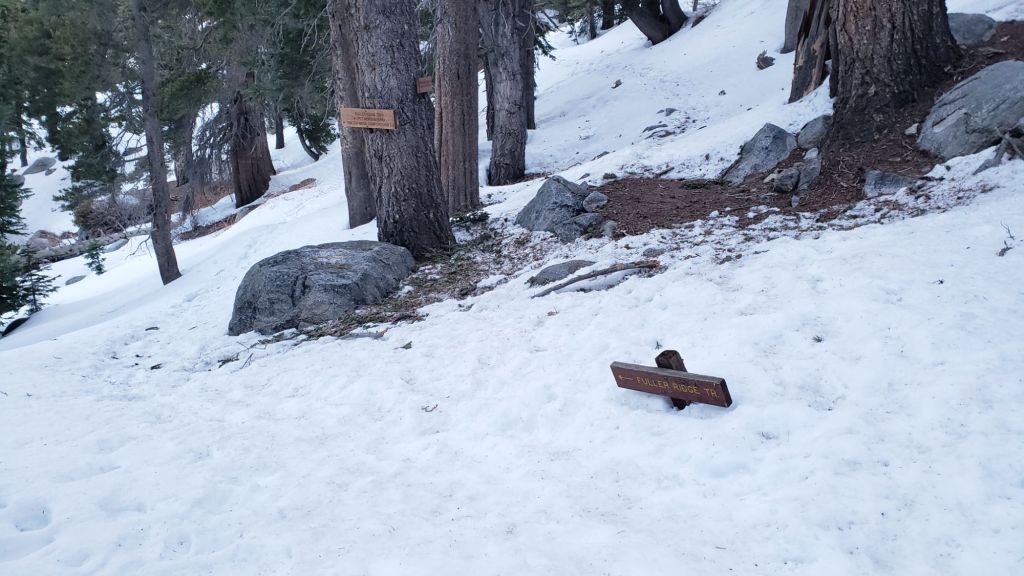

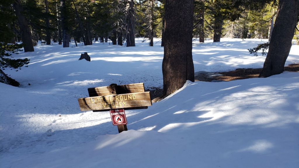


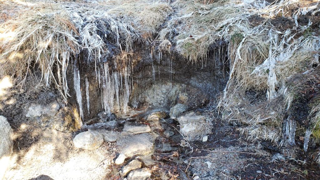


sanjacjon Uncategorized Leave a comment 13 MinutesEdit”Trail update 24th April 2025″
Trail update 18th April 2025
With temperatures well above seasonal on 6th-15th April at all elevations, melting of snow has been predictably rapid and widespread. Trails below 9000 ft have generally cleared (except the most sheltered areas) and even the highest peaks are largely clear on sun-exposed slopes. The air temperature of 50.3°F (10°C) recorded at San Jacinto Peak on Friday 11th was the highest ever reported for the Peak in April, and was more typical of midsummer months.
The PCT-specific section has now been incorporated into Trail Conditions and abbreviated due to the speed of melting and the relative ease of conditions at this time. The Pacific Crest Trail has very well-traveled tracks in the limited areas (described below) where snow remains on the trail in the San Jacinto mountains. Spikes provide ample traction, but are no longer needed on most of the PCT.
Below-seasonal temperatures on 17th-18th April may be accompanied by light rain (<0.3 inch) at mid elevations, and a decreasing possibility of a dusting of snow (<0.5 inch) in the high country. Temperatures will briefly be well below freezing at the highest elevations on 17th-19th. Trail conditions are not expected to be significantly altered by this brief change in weather.
Spikes remain useful above about 9000 ft (lower in places) although with reliable grippy footwear, hikers very experienced on icy snow will find spikes are generally no longer required on established tracks. Crampons remain an option on the north side of Tahquitz Peak for another week or so, although spikes are now sufficient (details below). Crampons are otherwise of very limited use elsewhere on the trail system. Snow depths and conditions are unsuitable for snowshoes.
Snow depths are no longer detailed below. This does not imply that there is no snow in the high country, simply that snow cover is generally too thin and so patchy in most areas to provide meaningful measurements or change hiking conditions. Forecast mild and sunny weather (with the exception noted above) will lead to further steady snowmelt.
Black Mountain Road remains closed (to vehicle traffic only) at the gate 1.7 miles up from Highway 243. USFS expects to reopen the road by the end of April. Dark Canyon Road (4S02), the access road to the Seven Pines trailhead, is expected to be closed for the year due to staffing/budget reasons (the trail and road remain open for hikers however). USFS gates at Humber Park and South Ridge Road both reopened in late March after brief closures due to winter conditions.
Survey hikes by the Trail Report every single day throughout the year in the San Jacinto mountains include varied routes to the high peaks including San Jacinto Peak typically 2-3 times per week (more frequently during storms), Tahquitz Peak and area 1-2 times per week, plus a wide variety of other trails on intervening days.
WEATHER
Unseasonably warm weather arrived on 5th April, and temperatures rose far above seasonal on 9th-11th, more typical of June, or even a mild midsummer day. The air temperature of 50.3°F (10°C) that I recorded at San Jacinto Peak on Friday 11th was the highest ever observed at the Peak in April.
Temperatures briefly drop closer to seasonal starting Wednesday 16th. A rising marine layer penetrating well inland will bring below-seasonal temperatures on 17th-18th April accompanied by light rain (<0.3 inch) at mid elevations, and the possibility of a dusting of snow (<1.0 inch) in the high country. Temperatures will briefly be well below freezing at the highest elevations on 17th-19th.
Temperatures quickly rise again above seasonal for the remainder of April from 19th onward, with no significant further precipitation in the forecasts.
At San Jacinto Peak (10,810ft/3295m) on Thursday 17th April 2025 at 0850 the air temperature was 31.1°F (-1°C), with a windchill temperature of 20.5°F (-6°C), 25% relative humidity, and a light WNW wind sustained at 4 mph gusting to 9.6 mph.
At the Peak on Wednesday 16th April 2025 at 0815 the air temperature was 36.9°F (3°C), with a windchill temperature of 25.0°F (-4°C), 17% relative humidity, and a fresh SSW wind sustained at 7 mph gusting to 12.0 mph.
At the Peak on Friday 11th April 2025 at 0835 the air temperature was 50.3°F (10°C), with a “windchill” temperature of 44.8°F (7°C), 10% relative humidity, and a light SW breeze sustained at 2 mph gusting to 6.6 mph.
TRAIL CONDITIONS
Snowmelt has been rapid since the last significant storm in mid March, and is expected to continue to be steady throughout the remainder of April. Snow depths and trail conditions in the first half of April more closely resemble May (or even early June in a good snow year).
Everywhere above about 9000 ft carrying spikes is recommended as established trails have been consolidated by hiker traffic. As always, spikes tend to be most useful for descending, even when they are not necessarily required for ascending. Hikers with considerable experience on snow and ice will find that spikes are now generally not required on the tracks of the established trail system.
The entire Pacific Crest Trail through the San Jacinto mountains is readily passable. The trail is clear of snow from Miles 151 (Highway 74) to about Mile 175. Snow cover averages 70% from Miles 175 (Red Tahquitz) to 177.7 (Chinquapin Flat). Snow cover is very patchy between Miles 177.7 to Saddle Junction (about Mile 179). The south-facing slope of Miles 179-180 is clear, but from Mile 180 (elevation 8900 ft) to about Mile 181 just past Annie’s Junction snow cover is about 90%. Miles 181-184 are sun-exposed and clear. There is a well-traveled boot track through variable snow cover on the PCT along Fuller Ridge (Miles 185.5-191). This track does not accurately follow the trail in places. Miles 186-186.5 and 187.5-188.3 are now snow-free. Most hikers will find spikes are useful in places throughout this section, but they are not required. The trail is functionally clear of snow from Mile 190 northwards.
PCT hikers should not attempt to use South Ridge Trail from the PCT at Chinquapin Flat (roughly Mile 177.7) to Idyllwild via Tahquitz Peak, even though this looks temptingly short and simple on apps and maps (photo above, further details below).
Although the situation improved somewhat in 2024, treefall hazards remain a significant problem along parts of the Pacific Crest Trail, most notably between Antsell Rock and South Peak. About 60 trees are down across the trail between PCT Miles 170.5-174, with 37 of these, including several serious obstructions that make for slow-going, between Miles 172.5-174 (around and immediately south of South Peak). A further nine smaller obstructions are down from Miles 168.5-170.5 (Spitler Peak Trail to Zen Center Trail). Significant sections of Miles 168.5-175 are also badly overgrown with brush and are in urgent need of major trimming work.
PCT hikers are asked to respect that overnight stays are not permitted at or near San Jacinto Peak, including in the historic shelter, to minimize impacts to a sensitive subalpine environment. Officially Mt. San Jacinto State Park permits overnight stays only in established campgrounds (Little Round Valley and Strawberry Junction are good options for thru-hikers).
Devil’s Slide Trail [surveyed 17th April] is clear of snow.
The Ernie Maxwell Trail is clear of snow. The couple of minor downed trees on this trail have been reported to the Forest Service.
The PCT heading north from Saddle Junction (a.k.a. “Angel’s Glide”) is functionally clear of snow to 9000 ft.
Snow cover on the Wellman Trail [surveyed 17th April] is only 20% and is almost entirely confined the forested 0.3 mile section immediately north of Annie’s Junction. Wellman’s Cienega is unfrozen and flowing well.
The Peak Trail [surveyed 17th April] now averages only 40% snow cover, almost all of which is above 10,000 ft elevation. Snow cover is continuous in the north-facing and sheltered section at 9900-10,100 ft that is always slow to clear in spring. There is a well-traveled compacted posthole track on the uppermost part of the Peak Trail.
The East Ridge Trail route [surveyed 17th April] to San Jacinto Peak starting at 10,400 ft near Miller Peak remains almost fully snow-covered. The route has been much less-traveled with the recent clearing of the upper Peak Trail, but a posthole track through shallow snow remains.
South Ridge Trail [surveyed 14th and 18th April] from the top of South Ridge Road is clear of snow to Tahquitz Peak. Spikes are not required. South Ridge Road is lumpy but readily passable in any moderate clearance vehicle.
The 0.4 mile section of South Ridge Trail between Chinquapin Flat/PCT Mile 177 and Tahquitz Peak [surveyed 14th and 18th April] has a single postholing boot track to follow through the steeply angled snow (photo above), which in its steepest section does not accurately follow the trail route and has considerable underlying ice. These slopes comprise some of the most consequential terrain in winter in these mountains, and this route is still not recommended for most hikers at this time. Although the track is passable without spikes for the most experienced hikers, spikes at a minimum are strongly recommended, should be accompanied by hiking poles or ideally an ice axe, and, critically, adequate experience and knowledge of how to use this equipment in such terrain.
Spitler Peak Trail is clear of snow [multiple surveys in March/April]. Storms in February-March brought down another 34 trees across this trail, but all but one were removed in late March (bringing to 162 the total number of trees removed by the Trail Report from this route in the past six years). A very large burned cedar remains which can be a little tricky to pass, next to the first crossing of Spitler Creek (3.2 miles up from the trailhead, 1.6 miles down from the PCT).
Round Valley Trail is largely clear of snow from Long Valley to Round Valley. There is a well-traveled track through the very thin and patchy snow from there to Wellman Divide.
Marion Mountain Trail [surveyed 16th April] is clear of snow, other than a limited patch right at the PCT junction.
Deer Springs Trail [surveyed 16th April] is clear of snow to just south of the junction with Marion Mountain Trail (about 1.5 miles north of Strawberry Junction). Thereafter thin snow cover averages 90% to San Jacinto Peak although many patches of trail, lengthy in places, are clear now in the most sun-exposed sections. The well-traveled track is generally easy to follow to Little Round Valley. Above Little Round Valley the trail is increasingly clear of snow (roughly 50%) but both the trail and the remaining posthole tracks are tricky to follow, with the latter frequently running into patches of cleared bushes and rocks. Spikes remain generally useful at least for descending upper Deer Springs Trail, but especially on mornings when the icy snow is crisp and dry, they are no longer required.
Seven Pines Trail [surveyed 9th and 12th April] is functionally clear of snow to 8200 ft, with about 50% cover of soft snow drifts from there to the PCT/Deer Springs Trail. Thirteen downed trees have been removed so far this month, and significant progress made on removal of accumulated winter debris in the trail up to about 8000 ft. The Trail Report “adopted” Seven Pines as a priority for maintenance work due to a disproportionate number of lost hiker rescues in the past decade, with neither State Park nor Forest Service having shown significant interest in maintaining the route for many years. Since 2019 we have removed 88 downed trees and the trail is trimmed and raked regularly. About ten trees remain to be cut above the current snow line, with one large one lower down. Although our work has hugely improved the condition of the trail, Seven Pines remains a genuine wilderness trail unlike the wider, bare, and much more obvious routes of, for example, Devil’s Slide or Marion Mountain trails. Cautious navigation remains invaluable for those without considerable experience of hiking this trail. Note the trail becomes most obscure in its uppermost mile, closest to the Deer Springs Trail/PCT junction.

While all time and labor is volunteered, the San Jacinto Trail Report uses small donations to help cover operating costs. Your contribution keeps the Report available to all, free from advertising or paywalls, and independent from agencies. If you have found this Report useful, please consider using this link to the Donate page. Thank you very much for your support.
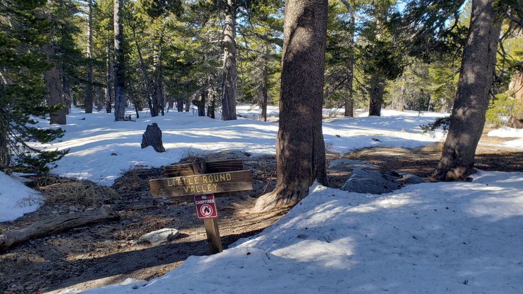

sanjacjon Uncategorized 2 Comments 10 MinutesEdit”Trail update 18th April 2025″
Snow and trail update 9th April 2025
UPDATE Friday 11th April 2025: Melting has been very rapid as expected, and hikers this weekend will find conditions are generally more benign than described below. Most snow has now gone from areas below 9000 ft, especially on sun-exposed slopes. Snow above that elevation is generally so thin and compacted that postholing in established tracks is actually minimal. Carrying spikes remains wise for most hikers everywhere above about 9000 ft.
———————————-
In a year already full of major swings in weather, the most dramatic is underway. After a lovely cool first few cloudy days of April, with a light dusting of snow on Wednesday 2nd, and firm, reliable snow tracks, temperatures rise dramatically this week. The impacts of this change will be especially noticeable as snow is relatively shallow everywhere, and with such unseasonably hot weather, rapid melting will bring back the sloppy postholing of late March, with quickly clearing trails especially below 9000 ft and, in the most sun-exposed areas, even up to the highest peaks.
This update includes a detailed PCT-specific section (between Weather and Trail Conditions), although much of the remainder of the Report includes material relevant to thru hikers also. The Pacific Crest Trail has well-traveled tracks where snow remains along its entire length in the San Jacinto mountains. Spikes are sufficient traction everywhere on the PCT, but are no longer required in many areas.
Carrying spikes remains recommended everywhere above about 7500 ft, although with reliably grippy footwear, hikers with significant experience on icy snow will find they are not required for travel on or adjacent to established tracks. To give a sense of conditions, although I have carried spikes as a precaution, I have not used them for my last five ascents (via various routes) of San Jacinto Peak in the past ten days.
Crampons are preferable on the north side of Tahquitz Peak (details below). Crampons can be used elsewhere on the high country trails, generally above 9000 ft, but they are certainly not required, and will become far less suitable as snow-free patches rapidly appear throughout the high country in the next few days.
Snowshoes may again briefly become an option above about 9000 ft after about Monday 7th April on warm days from late morning onwards as snow softens dramatically (but consistent snow depths may well be too shallow in all but very sheltered areas).
Details of snow depths measured at a few sample locations on the trail system are given below (for what may be the final time this season, given the imminent dramatic melting expected). Note that snow depth itself is very rarely indicative of the difficulty (or ease) of hiking a particular track or trail. For example, a firm, well-compacted track across deep snow – e.g., see photo below – is often much easier hiking than a less well-traveled track across just a few inches depth of angled icy snow.
Black Mountain Road remains closed (to vehicle traffic only) at the gate 1.7 miles up from Highway 243 due to winter conditions. Dark Canyon Road (4S02), the access road to the Seven Pines trailhead, is expected to be closed for the year due to staffing/funding reasons. USFS gates at Humber Park and South Ridge Road both reopened in late March after brief closures due to winter conditions.
Survey hikes by the Trail Report every single day throughout the year in the San Jacinto mountains include varied routes to the high peaks including San Jacinto Peak typically 1-3 times per week (more frequently during storms), Tahquitz Peak and area 1-2 times per week, plus a wide variety of other trails on intervening days.

WEATHER
A minor storm on 2nd April produced only very light snow, with 0.5 inch in Idyllwild and locations up to 7000 ft, 0.75 inch at Saddle Junction (PCT Mile 179), and just two inches everywhere from 9000 ft up to San Jacinto Peak. Fresh snow was so shallow that most had melted in sun-exposed areas within a day or two, despite cold temperatures.
Sadly, summer temperatures arrive 2-3 months ahead of schedule this week, albeit only briefly. Temperatures started to rise steadily on Saturday 5th, and will be more typical of June, or even a mild midsummer day, on 9th-11th. Temperatures may drop closer to seasonal the following week (by about 15th). Remaining snow will melt rapidly, and softer snow conditions will mean a return to the postholing of late March.
Temperatures are forecast to remain largely above seasonal for the remainder of April, and the prospects for significant further precipitation are also poor, as described in detail in the latest video report from National Weather Service San Diego (linked here).
Idyllwild is currently at about 85% of seasonal snowfall for the water year, but only 45% of average rainfall. We will once again be dependent on an increasingly unreliable monsoon season to approach an average water year.
At San Jacinto Peak (10,810ft/3295m) on Sunday 6th April 2025 at 0800 the air temperature was 27.8°F (-2°C), with a windchill temperature of 8.8°F (-13°C), 39% relative humidity, and a steady NE wind sustained at 20 mph gusting to 25.3 mph.
At the Peak on Friday 4th April 2025 at 0845 the air temperature was 15.1°F (-9°C), with a windchill temperature of -4.5°F (-20°C), 90% relative humidity, and a sharp NNE wind sustained at 11 mph gusting to 16.8 mph.
At the Peak on Thursday 3rd April 2025 at 0910 the air temperature was 12.8°F (-11°C), with a windchill temperature of -9.0°F (-23°C), 100% relative humidity, and a frigid NNE wind sustained at 15 mph gusting to 19.8 mph.

PACIFIC CREST TRAIL
All of the PCT in the San Jacinto mountains is readily passable with, crucially, suitable skills and equipment, patience, and a thorough knowledge of all possible alternates if needed. Snowmelt has been rapid since the last significant storm in mid March, and is expected to continue to be fast throughout the remainder of April.
There is a continuous boot track on the PCT through the entire San Jacinto mountains. However, that does not mean the hike is easy, as laborious postholing will be required in many areas this month as temperatures rise markedly.
The trail is largely clear of snow from Miles 151 (Highway 74) to about Mile 174. Limited patchy snow remains on north-facing and sheltered slopes, such as the descent to Fobes Saddle, and on the east side of Spitler Peak. Apache Peak is now largely clear of icy snow, and those wishing to avoid now there altogether can pass over the top of the Apache Peak saddle (leave the trail due north at about Mile 169.2).
Snow cover is largely continuous from Miles 175 (Red Tahquitz) to 177.7 (Chinquapin Flat), although the terrain is generally benign. Many hikers will find spikes useful on this section.
PCT hikers should not attempt to use South Ridge Trail from the PCT at Chinquapin Flat (roughly Mile 177.7) to Idyllwild via Tahquitz Peak, even though this looks temptingly short and simple on apps and maps. This section of steeply angled (and notoriously treacherous) ice slopes remains challenging weeks after surrounding trails have melted, and currently requires crampons, ice axe, and the expertise to use that equipment.
Snow cover is becoming patchy between Miles 177.7 to Saddle Junction (about Mile 179). The south-facing slope of Miles 179-180 is largely clear, but from Mile 180 (elevation 8900 ft) to about Mile 181 just past Annie’s Junction snow cover is almost continuous (phot above). Miles 181-183 are sun-exposed and are largely clear. Snow cover is largely continuous from Mile 184 through to about Mile 192. Most hikers will find spikes are very useful throughout this section.
There is a moderately traveled postholing boot track through variable snow cover on the PCT along Fuller Ridge (Miles 185.5-191). This track does not accurately follow the trail in places. Extensive snow-free sections are now developing on Miles 186-186.5 and 187.5-188.3. At this time continuing north on Fuller Ridge requires the skills and comfort level to hike on angled terrain with some moderate exposure, and spikes are recommended (although not essential for the experienced). Taking the Black Mountain Road alternate remains an excellent option for hikers less comfortable with the Fuller Ridge section for the next week or so.
A well established alternate from Idyllwild – avoiding Fuller Ridge – is to connect back to the PCT at about Mile 191 using Black Mountain Road. Black Mountain Road is clear of snow for the lower five miles, and then has only patchy snow cover for the upper three miles to the PCT but with an obvious track following the road through the snow patches. Mile 192 northward to Interstate 10 is clear of snow.
Although the situation improved somewhat in 2024, treefall hazards remain a significant problem along parts of the Pacific Crest Trail, most notably between Antsell Rock and South Peak. Some 56 trees are down across the trail between PCT Miles 170.5-174, with 37 of these, including several serious obstructions that make for slow-going, between Miles 172.5-174 (around and immediately south of South Peak). A further nine smaller obstructions are down from Miles 168.5-170.5 (Spitler Peak Trail to Zen Center Trail). Significant sections of Miles 168.5-175 are also badly overgrown with brush and are in urgent need of major trimming work (surveyed February 2025).
PCT hikers are asked to respect that overnight stays are not permitted at or near San Jacinto Peak, including in the historic shelter, to minimize impacts to a sensitive subalpine environment. Officially Mt. San Jacinto State Park permits overnight stays only in established campgrounds (Little Round Valley and Strawberry Junction are good options for thru-hikers).
TRAIL CONDITIONS
Where snow remains, tracks are in place for almost all trails. Melting has been fast since the very minor storm on 2nd April, and will accelerate dramatically this week with the first major heatwave of the year. Conditions this week will deteriorate for snow hiking, with the softening snow lending itself to significant sloppy postholing.
Everywhere above about 7500 ft carrying spikes is recommended as established trails have been consolidated by hiker traffic. As always, spikes tend to be most useful for descending, even when they are not necessarily required for ascending. Hikers with considerable experience on snow and ice will find that spikes are now generally not required on the tracks of the established trail system.
For details of specifics of downed trees, prior to the March snow storms, see an earlier Report (linked here).
Devil’s Slide Trail [surveyed 4th April] is rapidly clearing of snow, with just a few limited, dirty patches remaining, largely concentrated close to Saddle Junction. Most hikers will find spikes are no longer required.
The Ernie Maxwell Trail is clear of snow. The couple of minor downed trees on this trail were recently reported to the Forest Service.
From Saddle Junction northbound a well-defined posthole track – in areas that still have snow -continues to San Jacinto Peak through Annie’s Junction (PCT Mile 180.8) and Wellman Divide, via the Wellman, Peak, and East Ridge trails [all surveyed 30th March].
The PCT heading north from Saddle Junction (a.k.a. “Angel’s Glide”) is largely clear of snow to 9000 ft. Snow cover remains about 90% from 9000 ft through Annie’s Junction and onward to near Wellman’s Cienega. Snow cover on the Wellman Trail averages only 50% [all surveyed 4th April].
The Peak Trail route [surveyed 4th April] is very well-defined, and a few small snow-free patches are starting to appear. There is now a well-traveled posthole track on the uppermost part of the Peak Trail, but at 10,400 ft near Miller Peak, the alternate direct track climbs up the East Ridge Trail route, as is traditional in winter.
The 0.4 mile section of South Ridge Trail between Chinquapin Flat/PCT Mile 177 and Tahquitz Peak [surveyed 7th April] has an indistinct single boot track to follow through the steeply angled snow, which in its steepest section does not accurately follow the trail route and has considerable underlying ice (photo below). These slopes comprise some of the most consequential terrain in winter in these mountains, and this route is not recommended for almost all hikers at this time. Spikes at a minimum are strongly recommended (crampons preferable), should be accompanied by an ice axe, and, critically, adequate experience and knowledge of how to use this equipment in such terrain.
South Ridge Trail [surveyed 7th April] from the top of South Ridge Road is functionally clear of snow to Tahquitz Peak, with just a handful of tiny patches close to the peak. Spikes are not required. South Ridge Road is lumpy but passable in any moderate clearance vehicle.
Spitler Peak Trail [surveyed 27th March] is clear of snow. Storms in February-March brought down another 34 trees across this trail, but all of the small-to-medium-sized hazards were removed on 21st and 23rd March (bringing to 162 the total number of trees removed by the Trail Report from this route in the past six years). Just one very large burned cedar remains which can be a little tricky to pass, next to the first crossing of Spitler Creek (3.2 miles up from the trailhead, 1.6 miles down from the PCT).
Round Valley Trail is rapidly clearing of snow from Long Valley to Round Valley. There is a well-traveled track on increasingly patchy icy snow from there to Wellman Divide.
Marion Mountain Trail [surveyed 6th April] is largely clear of snow below 7500 ft, averaging about 10% snow cover. From that elevation to the junction with Deer Springs Trail/PCT, snow cover averages 40%. There is a well-worn track throughout all snow patches. Some hikers will find spikes are useful, at least for descending, but steps are so well-defined through the snow that spikes are certainly no longer required.
Deer Springs Trail [surveyed 6th April] is clear of snow from the Highway 243 trailhead to the Suicide Rock trail junction at 7000 ft. From there to Strawberry Junction (8100 ft) snow cover averages just 10% with snow patches increasing in length and frequency as you ascend. Spikes are not required as far as Strawberry Junction, even for descending. Snow cover is largely continuous from Strawberry Junction to San Jacinto Peak, although extensive clear sections are starting to appear below 8500 ft (south of the top of the Marion Mountain Trail). A well-traveled track is then generally easy to follow to Little Round Valley, although there are two tracks in places and even the more traveled option does not accurately follow the trail route in places. Above Little Round Valley there are multiple posthole tracks, all generally much more direct than the actual trail and none remotely following the established trail route (as is traditional in adequate snow conditions). There is one well-traveled track well north of the trail, and another well to the south, plus my very direct single posthole track straight to the Peak. Despite their challenges, all these routes do ultimately end up at San Jacinto Peak. Spikes are generally useful at least for descending upper Deer Springs Trail, but on mornings when the icy snow is crisp and dry, they are not required.
Seven Pines Trail [surveyed 9th and 12th April] is functionally clear of snow to 8200 ft, with about 50% cover of soft snow drifts from there to the PCT/Deer Springs Trail. Thirteen downed trees have been removed so far this month, and significant progress made on removal of accumulated winter debris in the trail up to about 8000 ft. The Trail Report “adopted” Seven Pines as a priority for maintenance work due to a disproportionate number of lost hiker rescues in the past decade, with neither State Park nor Forest Service having shown significant interest in maintaining the route for many years. Since 2019 we have removed 88 downed trees and the trail is trimmed and raked regularly. Currently about ten trees remain to be cut above the snow line, and one large one lower down. Although our work has hugely improved the condition of the trail, Seven Pines remains a genuine wilderness trail unlike the wider, bare, and much more obvious routes of, for example, Devil’s Slide or Marion Mountain trails. Cautious navigation remains invaluable for those without considerable experience of hiking this trail. Note the trail becomes most obscure in its uppermost mile, closest to the Deer Springs Trail/PCT junction.
While all time and labor is volunteered, the San Jacinto Trail Report uses small donations to help cover operating costs. Your contribution keeps the Report available to all, free from advertising or paywalls, and independent from agencies. If you have found this Report useful, please consider using this link to the Donate page. Thank you very much for your support.

SNOW DEPTHS
Measured on 6th April (west slope locations) and 4th April 2025 (east side). The first number gives current average depth. Strong winds accompanying storms led to extensive drifting, and there has been highly variable melting in the past week or so. The number in parentheses indicates the greatest depth for that location recorded this winter, generally on 15th March after the last significant storm. Altitudes and PCT Miles are approximate.
San Jacinto Peak (10810 ft): 14 inches drifted to two feet in places (was 40 inches on 15th March)
Little Round Valley (9800 ft): 9 inches ranging from 0-24 inches (was 35 inches on 15th March)
Wellman Divide (9700 ft): 2 inches, ranging from 0-8 inches (was 20 inches on 15th March)
Annie’s Junction/PCT Mile 180.8 (9020 ft): 15 inches (was 38 inches on 15th March)
Saddle Junction/PCT Mile 179 (8070 ft): 1 inch, ranging from 0-4 inches (was 21 inches on 15th March)
Strawberry Junction/PCT Mile 183 (8050 ft): 0 inches (was 20 inches on 15th March)
Devil’s Slide Trail at Humber Park (6550 ft): 0 inches (was 15 inches on 7th March and 12 inches on 15th March)
Idyllwild (at 5550 ft): 0 inches (was 14 inches on 7th March and 11 inches on 15th March)

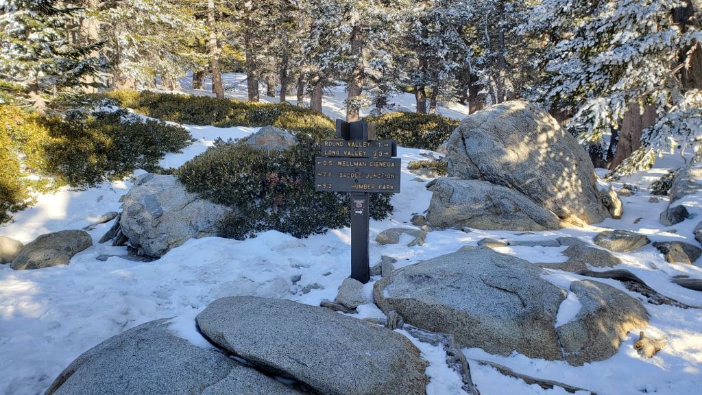

sanjacjon Uncategorized Leave a comment 14 MinutesEdit”Snow and trail update 9th April 2025″
Snow and trail update 1st April 2025
UPDATE Friday 4th April 2025: the minor storm system on 2nd produced only very light snow, with 0.5 inch in Idyllwild and locations up to 7000 ft (already largely melted), 0.75 inch at Saddle Junction (PCT Mile 179), and two inches everywhere from 9000 ft up to San Jacinto Peak. Snow was so shallow that pre-existing tracks could be followed relatively easily, and I recorded a short video report as I descended the East Ridge Trail of San Jacinto Peak on 3rd (linked here). I resurveyed throughout the high country on 4th. The Pacific Crest Trail has well-traveled tracks throughout the fresh snow along its entire length in the San Jacinto mountains. Spikes are sufficient traction everywhere on the PCT and also on the main trails to the high peaks. Melting has already been remarkably rapid and will accelerate this weekend, and trail conditions are already starting to resemble those described below.
————————————-
As described in the introduction to the previous report (linked here) we are on track for one of the driest winters in recorded history for the San Jacinto high country. That said, this week is pleasantly cool and cloudy – perhaps the last vestige of winter 2024/25 – resulting in relatively firm and reliable snow conditions, ideal for brisk, efficient hiking. Largely gone is the soft, slushy postholing of last week, at least until temperatures warm again next weekend (from about 5th April onwards).
This update includes a detailed PCT-specific section (between Weather and Trail Conditions), although much of the remainder of the Report includes material relevant to thru hikers also.
Carrying spikes remains recommended everywhere above about 7500 ft, although with reliably grippy footwear, hikers with extensive experience on icy snow will find they are not required for travel on or adjacent to established tracks. Spikes remain very valuable for significant sections of the PCT, as described below. To give a sense of track conditions, although I have carried them as a precaution, I have not used spikes for my last three ascents (via various routes) of San Jacinto Peak in recent days.
Crampons are preferable on the north side of Tahquitz Peak (details below). Crampons are also a reasonable option elsewhere on the high country trails, generally above 9000 ft, but they are not required, and will become much less suitable as snow-free patches appear throughout the high country in the second week of April.
Conditions are currently unsuitable for snowshoes on established tracks due to the firmness of icy snow almost everywhere. Snowshoes may again become an option above about 9000 ft after about Monday 7th April on warm days from late morning onwards as snow softens dramatically (but by then consistent snow depths may well be too shallow in all but very sheltered areas).
Details of snow depths measured at a few sample locations on the trail system are given below. Note however that snow depth itself is very rarely indicative of the difficulty (or ease) of hiking a particular track or trail. For example – as discussed above – a firm, well-compacted track across deep snow is often much easier hiking than a less well-traveled track across just a few inches depth of angled icy snow.
The USFS gate at Humber Park reopened on 21st March, having closed on 5th March. South Ridge Road reopened on 25th March, having been closed since 10th. Black Mountain Road remains closed (to vehicle traffic only) at the gate 1.7 miles up from Highway 243 due to winter conditions. Dark Canyon Road (4S02), the access road to the Seven Pines trailhead, is closed long-term for staffing/funding reasons.
Survey hikes by the Trail Report every single day throughout the year in the San Jacinto mountains include varied routes to the high peaks including San Jacinto Peak typically 1-3 times per week (more frequently during stormy weather), Tahquitz Peak and area 1-2 times per week, plus a wide variety of other trails on intervening days.

WEATHER
A cooler, unsettled week between Saturday 29th March and Friday 4th April will include temperatures at or even below seasonal at all elevations, largely cloudy days, strong winds in the high country, and modest chances for some light precipitation.
Very light rain is possible any day in this cooler period, but is currently most likely on the afternoon and evening of Tuesday 1st and again on the afternoon of Thursday 3rd April. Total rainfall at mid elevations across the 4-5 day period is expected to be less than 0.5 inch. Dustings of 0.5-1.0 inch of snow are currently forecast as possible at higher elevations on the afternoons of 1st and 3rd April.
Temperatures start to rise steadily on Saturday 5th into the second week of April. Remaining snow will melt rapidly, and softer snow conditions will mean a return to the postholing of last week.
Idyllwild is currently at about 85% of seasonal snowfall for the water year, but only 45% of average rainfall. We will once again be dependent on an increasingly unreliable monsoon season to approach an average water year. The latest video report from National Weather Service San Diego suggests generally warmer and drier than average conditions may now persist for months (video linked here).
At San Jacinto Peak (10,810ft/3295m) on Sunday 30th March 2025 at 0845 the air temperature was 28.8°F (-2°C), with a windchill temperature of 10.8°F (-12°C), 93% relative humidity, and a fresh WNW wind sustained at 19 mph gusting to 31.0 mph.
At the Peak on Tuesday 18th March 2025 at 0925 the air temperature was 23.3°F (-5°C), with a windchill temperature of 2.6°F (-16°C), 21% relative humidity, and a potent WNW wind sustained at 25 mph gusting to 33.7 mph.
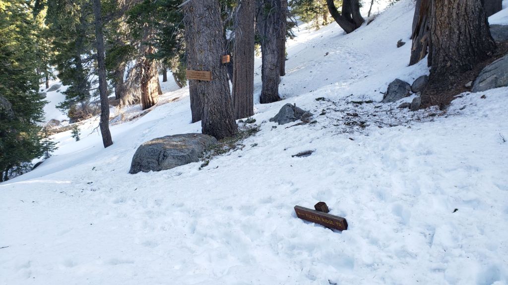
PACIFIC CREST TRAIL
All of the PCT in the San Jacinto mountains is readily passable with, crucially, suitable skills and equipment, patience, and a thorough knowledge of all possible alternates if needed. Snowmelt has been very rapid since the last storm in mid March, and is expected to continue to be fast into early April (at least). Nevertheless, I cannot overemphasize the importance of having both appropriate equipment and the right skill set for the terrain. The latter includes interpreting the snow/ice conditions, understanding your physical and mental abilities, and conservative decision making.
There is now a continuous boot track on the PCT through the entire San Jacinto mountains. However, that does not mean the hike is easy, as laborious postholing is required in many areas, and some sections – notably Miles 169-176 and Miles 185.5-191 – have consequential terrain in places that will not be suitable for some hikers depending on their equipment and experience traversing icy snow slopes.
The trail is largely clear of snow from Miles 151 (Highway 74) to about Mile 167. Limited patchy snow remains on north-facing and sheltered slopes, such as the descent to Fobes Saddle, and on the east side of Spitler Peak. There are alternates at Fobes Saddle (Mile 166) and Spitler Peak Trail (Mile 168.5) that would be good options for hikers not comfortable on the icy snow slopes ahead.
We surveyed PCT Miles 168.5-170, including the challenging north-east side of Apache Peak, on Friday 21st March, recording a short video report (linked here). Melting has been fast but sheltered north and east facing slopes between Miles 167 (Spitler Peak) and 176 (Red Tahquitz) remain partly snow-covered and require the necessary equipment and experience for such conditions.
Snow cover is largely continuous from Miles 175 (Red Tahquitz) to 177.7 (Chinquapin Flat), although the terrain is generally benign. Many hikers will find spikes useful on this section.
PCT hikers should not attempt to use South Ridge Trail from the PCT at Chinquapin Flat (roughly Mile 177.7) to Idyllwild via Tahquitz Peak, even though this looks temptingly short and simple on apps and maps. This section of steeply angled (and notoriously treacherous) ice slopes remains challenging weeks after surrounding trails have melted, and currently requires crampons, ice axe, and the expertise to use that equipment.
Snow cover is becoming patchy between Miles 177.7 to Saddle Junction (about Mile 179). The south-facing slope of Miles 179-180 is largely clear, but from Mile 180 (elevation 8900 ft) to about Mile 181 just past Annie’s Junction snow cover is almost continuous. Miles 181-183 are sun-exposed and are largely clear. Snow cover is largely continuous from Mile 184 through to about Mile 192. Most hikers will find spikes are very useful throughout this section.
There is currently only a moderately traveled postholing boot track through variable snow cover on the PCT along Fuller Ridge (Miles 185.5-191). This track does not accurately follow the trail in places. Extensive snow-free sections are now developing on Miles 186-186.5 and 187.5-188.3. At this time continuing north on Fuller Ridge requires the skills and comfort level to hike on angled terrain with some moderate exposure, and spikes are recommended (although not strictly essential for the experienced). Taking the Black Mountain Road alternate remains an excellent option for hikers less comfortable with the Fuller Ridge section for the next week or so.
A well established alternate from Idyllwild – avoiding Fuller Ridge – is to connect back to the PCT at about Mile 191 using Black Mountain Road. Black Mountain Road is clear of snow for the lower five miles, and then has only patchy snow cover for the upper three miles to the PCT but with an obvious track following the road through the snow patches. Mile 192 northward to Interstate 10 is clear of snow.
Although the situation improved somewhat in 2024, treefall hazards remain a significant problem along parts of the Pacific Crest Trail, most notably between Antsell Rock and South Peak. Some 56 trees are down across the trail between PCT Miles 170.5-174, with 37 of these, including several serious obstructions that make for slow-going, between Miles 172.5-174 (around and immediately south of South Peak). A further nine smaller obstructions are down from Miles 168.5-170.5 (Spitler Peak Trail to Zen Center Trail). Significant sections of Miles 168.5-175 are also badly overgrown with brush and are in urgent need of major trimming work (surveyed February 2025).
PCT hikers are asked to respect that overnight stays are not permitted at or near San Jacinto Peak, including in the historic shelter, to minimize impacts to a sensitive subalpine environment. Officially Mt. San Jacinto State Park permits overnight stays only in established campgrounds (Little Round Valley and Strawberry Junction are good options for thru-hikers).
While all time and labor is volunteered, the San Jacinto Trail Report uses small donations to help cover operating costs. Your contribution keeps the Report available to all, free from advertising or paywalls, and independent from agencies. If you have found this Report useful, please consider using this link to the Donate page. Thank you very much for your support.
TRAIL CONDITIONS
Where snow remains, tracks are in place for almost all trails. Melting has been fast since the last storm on 15th March, but will be minimal this week in cooler, cloudier weather. Conditions this week will be excellent for snow hiking, with relatively firm, reliable footings in the compacted icy snow.
Everywhere above about 7500 ft carrying spikes is recommended as established trails are now consolidated by hiker traffic and as they continue to undergo freeze-thaw cycles. As always, spikes tend to be especially useful for descending, even when they are not necessarily required for ascending. Hikers with considerable experience on snow and ice will find that spikes are generally not required on the tracks of the established trail system.
For details of specifics of downed trees, prior to the latest snow storms, see an earlier Report (linked here).
Devil’s Slide Trail [surveyed 30th March] is almost clear of snow, with just a few limited, dirty patches remaining, largely concentrated close to Saddle Junction. Most hikers will find spikes are no longer required.
The Ernie Maxwell Trail is clear of snow [surveyed 27th March].
From Saddle Junction northbound a well-defined posthole track – in areas that still have snow -continues to San Jacinto Peak through Annie’s Junction (PCT Mile 180.8) and Wellman Divide, via the Wellman, Peak, and East Ridge trails [all surveyed 30th March].
The PCT heading north from Saddle Junction (a.k.a. “Angel’s Glide”) is largely clear of snow to 9000 ft. Snow cover remains about 90% from 9000 ft through Annie’s Junction and onward to near Wellman’s Cienega. Snow cover on the Wellman Trail averages only 50% [all surveyed 30th March].
The Peak Trail route [surveyed 30th March] is very well-defined, and a few small snow-free patches are starting to appear. There is now a lightly-traveled posthole track on the uppermost part of the Peak Trail, but at 10,400 ft near Miller Peak, the heavily-traveled track climbs up the East Ridge Trail route, as is traditional in winter.
The 0.4 mile section of South Ridge Trail between Chinquapin Flat/PCT Mile 177 and Tahquitz Peak [surveyed 1st April] has a single boot track to follow through the steeply angled snow, which in its steepest section does not accurately follow the trail route and has considerable underlying ice (photo above). These slopes comprise some of the most consequential terrain in winter in these mountains, and this route is not recommended for most hikers at this time. Spikes at a minimum are strongly recommended (crampons are preferable), should be accompanied by an ice axe, and, critically, adequate experience and knowledge of how to use this equipment in such terrain.
South Ridge Trail [surveyed 1st April] from the top of South Ridge Road is functionally clear of snow to Tahquitz Peak, with just a handful of tiny patches close to the peak. Spikes are no longer required. South Ridge Road is clear of snow.
Spitler Peak Trail [surveyed 27th March] is clear of snow. Storms in February-March brought down another 34 trees across this trail, but all of the small-to-medium-sized hazards were removed on 21st and 23rd March (bringing to 162 the total number of trees removed by the Trail Report from this route in the past six years). Just one very large burned cedar remains which can be a little tricky to pass, next to the first crossing of Spitler Creek (3.2 miles up from the trailhead, 1.6 miles down from the PCT).
Round Valley Trail is rapidly clearing of snow from Long Valley to Round Valley. There is a well-traveled track on largely continuous but thin icy snow from there to Wellman Divide.
Marion Mountain Trail [surveyed 29th March] is largely clear of snow below 7500 ft, averaging about 10% snow cover. From that elevation to the junction with Deer Springs Trail/PCT, snow cover averages 50%. There is a well-worn track throughout all snow patches. Some hikers will find spikes are useful, at least for descending, but steps are so well-defined through the snow that spikes are certainly no longer essential.
Deer Springs Trail [surveyed 29th March] is clear of snow from the Highway 243 trailhead to the Suicide Rock trail junction at 7000 ft. From there to Strawberry Junction (8100 ft) snow cover averages just 10% with snow patches increasing in length and frequency as you ascend. Spikes are not required as far as Strawberry Junction, even for descending. Snow cover is largely continuous from Strawberry Junction to San Jacinto Peak, although clear sections are starting to appear below 8500 ft (south of the top of the Marion Mountain Trail). The track from Strawberry Junction to the junction with Marion Mountain Trail is generally a laborious posthole track. A well-traveled track is then generally easy to follow to Little Round Valley, although it does not accurately follow the trail route in places. Above Little Round Valley there are multiple posthole/snowshoe tracks, all generally much more direct than the actual trail and not remotely following the established trail route (as is traditional in adequate snow conditions). There is one well-traveled track well north of the trail, and another well to the south, plus my very direct single posthole track straight to the Peak. Despite their challenges, all these routes do ultimately end up at San Jacinto Peak. Spikes are generally recommended at least for descending upper Deer Springs Trail, but on mornings when the icy snow is crisp and dry, they are not required.


SNOW DEPTHS
Measured on 29th March (west slope locations) and 30th March 2025 (east side). The first number gives current average depth. Strong winds accompanying storms led to extensive drifting, and there has been highly variable melting in the past week or so. The number in parentheses indicates the greatest depth for that location recorded this winter, generally on 15th March after the last significant storm. Altitudes and PCT Miles are approximate.
San Jacinto Peak (10810 ft): 16 inches drifted to 2-3 feet in places (was 40 inches on 15th March)
Little Round Valley (9800 ft): 11 inches ranging from 0-24 inches (was 35 inches on 15th March)
Wellman Divide (9700 ft): 3 inches, ranging from 0-10 inches (was 20 inches on 15th March)
Annie’s Junction/PCT Mile 180.8 (9020 ft): 16 inches (was 38 inches on 15th March)
Saddle Junction/PCT Mile 179 (8070 ft): 1 inch, ranging from 0-5 inches (was 21 inches on 15th March)
Strawberry Junction/PCT Mile 183 (8050 ft): 0 inches (was 20 inches on 15th March)
Devil’s Slide Trail at Humber Park (6550 ft): 0 inches (was 15 inches on 7th March and 12 inches on 15th March)
Idyllwild (at 5550 ft): 0 inches (was 14 inches on 7th March and 11 inches on 15th March)

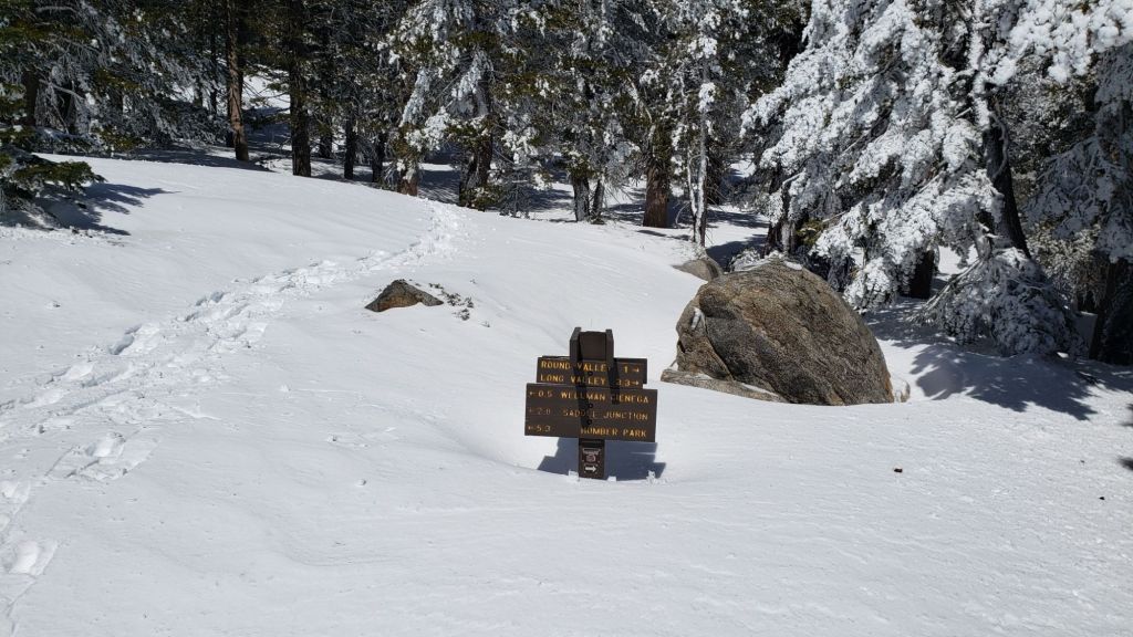


sanjacjon Uncategorized Leave a comment 13 MinutesEdit”Snow and trail update 1st April 2025″
Snow and trail update 27th March 2025
Despite the snowfall from storms between mid February and mid March, if the San Jacinto high country receives no more snowfall this winter then 2024/25 will be the second driest winter on record for the upper elevations of these mountains (using the metric of total snowfall at San Jacinto Peak). It would be unprecedented not to get at least a few more inches of snow between now and 1st June, although remarkably we still need 40+ inches to avoid this being one of the three driest high country winters on record.
Of course, none of this will be much solace to PCT hikers postholing through melting, soft, slushy snow, or taking alternates, or both. With temperatures currently well above seasonal at all elevations until 26th March, melting will continue steadily. At mid elevations temperatures drop to around seasonal for the last four days of March into the first week of April, but temperatures remain largely above seasonal in the high country (with the exception of 28th-30th March, and 4th April). Relatively cloudy skies will be a feature of the next 7-10 days, slowing snow melt somewhat.
It was striking on Monday 24th that the PCT immediately north of Saddle Junction, a section that had an average depth of two feet of snow just nine days ago, is already rapidly clearing, with extensive bare patches in and near the trail. San Jacinto Peak has already lost more than 12 inches of snow in the same time period.
This update includes a detailed PCT-specific section (between Weather and Trail Conditions), although much of the remainder of the Report includes material relevant to thru hikers also.
We surveyed PCT Mile 169.5, the challenging north-east side of Apache Peak, on 21st March, where I recorded a short video report (linked here). Melting has been fast but sheltered north and east facing slopes between Miles 167 (Spitler Peak) and 176 (Red Tahquitz) remain snow-bound and require the necessary equipment and experience for such conditions. Since recording that video, Spitler Peak Trail has been cleared of all but one of 34 trees that came down in recent storms, so that is now a relatively hassle-free alternate.
Carrying spikes is recommended everywhere above about 7500 ft for the foreseeable future. They remain invaluable for significant sections of the PCT, although they are not strictly required. On Monday 24th and Saturday 29th I was able to hike to San Jacinto Peak via Devil’s Slide and Marion Mountains trails, respectively, without using spikes either up or down, specifically with an Alpine start on relatively firm morning snow (note that I carried spikes just in case).
Crampons are required on the north side of Tahquitz Peak (details below). Crampons are also a reasonable option elsewhere on the high country trails, generally above 9000 ft, but they are not required, and will become much less suitable as snow-free patches appear in the second week of April.
Conditions are currently reasonable for snowshoes everywhere above about 9000 ft, only on warmer days from late morning onwards as snow softens dramatically, especially on sun-exposed slopes.
Details of snow depths measured at a few sample locations on the trail system are given below. Note however that snow depth itself is very rarely indicative of the difficulty (or ease) of hiking a particular track or trail. For example a firm, well-compacted track across deep snow is often much easier hiking than a less well-traveled track across just a few inches depth of angled icy snow.
The USFS gate at Humber Park reopened on 21st March, having closed on 5th March. South Ridge Road reopened on 25th March, having been closed since 10th. Black Mountain Road remains closed (to vehicle traffic only) at the gate 1.7 miles up from Highway 243 due to winter conditions. Dark Canyon Road (4S02), the access road to the Seven Pines trailhead, is closed long-term for staffing/funding reasons.
Survey hikes by the Trail Report every single day throughout the year in the San Jacinto mountains include varied routes to the high peaks including San Jacinto Peak typically 1-3 times per week (more frequently during storms), Tahquitz Peak and area 1-2 times per week, plus a wide variety of other trails on intervening days.
WEATHER
The complex sequence of minor and moderate storms that impacted the region in the first half of March is described in a previous report (linked here).
The overall pattern for the remainder of March into the first week of April is for warmer than seasonal temperatures at higher elevations, but cooling to near seasonal, with significant cloudiness, at mid elevations. Temperatures will be hot (for March) until Thursday 27th. Thereafter, 7-10 days of cooler, seasonally average temperatures are forecast for mid elevations, but temperatures will generally remain above average (and, crucially, near or above freezing) in the high country, other than brief but notable cooling on 2nd-4th April.
The last few days of March and the first week of April are expected to be partly or mostly cloudy, in contrast to recent clear, sunny days. There are possibilities for very light rain at mid elevations on the western slope (e.g., Idyllwild and the PCT) from 28th March to 4th April as a dense layer of moist marine cloud rises to at least 7000 ft elevation.
Idyllwild is currently at about 85% of seasonal snowfall for the water year, but only 45% of average rainfall. We will once again be dependent on an increasingly unreliable monsoon season to approach an average water year. The latest video report from National Weather Service San Diego suggests generally warmer and drier than average conditions may now persist for months (video linked here).
At San Jacinto Peak (10,810ft/3295m) on Monday 24th March 2025 at 0835 the air temperature was 38.1°F (3°C), with a windchill temperature of 27.0°F (-3°C), 45% relative humidity, and a remarkably steady ESE wind sustained at 13 mph gusting to 15.0 mph.
At the Peak on Tuesday 18th March 2025 at 0925 the air temperature was 19.1°F (-7°C), with a windchill temperature of -3.1°F (-20°C), 33% relative humidity, and a chilly NNW wind sustained at 15 mph gusting to 27.6 mph.
PACIFIC CREST TRAIL
All of the PCT in the San Jacinto mountains is readily passable with, crucially, suitable skills and equipment, patience, and a thorough knowledge of all possible alternates if needed. Snowmelt has been very rapid since the last storm in mid March, and is expected to continue to be fast into early April (at least). Nevertheless, I cannot overemphasize the importance of having both appropriate equipment and the right skill set for the terrain. The latter includes interpreting the snow/ice conditions, understanding your physical and mental abilities, and conservative decision making.
There is now a continuous boot track on the PCT through the entire San Jacinto mountains. However, that does not mean the hike is easy, as laborious postholing is required in many areas, and some sections – notably Miles 169-176 and Miles 185.5-191 – have consequential terrain in places that will not be suitable for some hikers depending on their equipment and experience traversing icy snow slopes.
The trail is largely clear of snow from Miles 151 (Highway 74) to about Mile 167. Some thin patchy icy snow remains on north-facing and sheltered slopes, such as the descent to Fobes Saddle, and on the east side of Spitler Peak. There are alternates at Fobes Saddle (Mile 166) and Spitler Peak Trail (Mile 168.5) that would be good options for hikers not comfortable on the icy snow slopes ahead.
We surveyed PCT Miles 168.5-170, including the challenging north-east side of Apache Peak, on Friday 21st March, recording a short video report (linked here). Melting has been fast but sheltered north and east facing slopes between Miles 167 (Spitler Peak) and 176 (Red Tahquitz) remain significantly snow-covered and require the necessary equipment and experience for such conditions.
Snow cover is continuous from Miles 175 (Red Tahquitz) to 177.7 (Chinquapin Flat), although the terrain is generally benign. Many hikers will find spikes useful on this section.
PCT hikers should not attempt to use South Ridge Trail from the PCT at Chinquapin Flat (roughly Mile 177.7) to Idyllwild via Tahquitz Peak, even though this looks temptingly short and simple on apps and maps. This section of steeply angled (and notoriously treacherous) ice slopes remains challenging weeks after surrounding trails have melted, and currently requires crampons, ice axe, and the expertise to use that equipment.
Snow cover is thinning and just starting to become patchy between Miles 177.7 to Saddle Junction (about Mile 179). The south-facing slope of Miles 179-180 is already starting to clear, but from Mile 180 (elevation 8900 ft) to about Mile 181 just past Annie’s Junction snow cover is continuous. Miles 181-183 are sun-exposed and are clearing of snow very quickly. Snow cover is largely continuous from Mile 183.5 through to about Mile 192. Most hikers will find spikes are very useful throughout this section.
There is currently only a lightly traveled postholing boot track through moderate snow cover on the PCT along Fuller Ridge (Miles 185.5-191). This track does not accurately follow the trail in places. Snow-free patches are now developing on Miles 186-186.5 and 187.5-188.3. At this time continuing north on Fuller Ridge requires the skills and comfort level to hike on angled terrain with some moderate exposure, and spikes are recommended (although not strictly essential for the experienced). Taking the Black Mountain Road alternate is an excellent option for hikers uncomfortable with the Fuller Ridge section for the next week or two.
In recent years a myth has periodically circulated on PCT social media that going up and over San Jacinto Peak somehow avoids Fuller Ridge. This is erroneous and potentially dangerous. Whether you remain on the PCT northbound (going around at lower elevation via Strawberry Junction, Mile 183) or leave the PCT at Annie’s Junction (Mile 180.8) to go up to San Jacinto Peak and then down the west side to reconnect to the PCT at about Mile 185.5, you still have to hike Fuller Ridge (Miles 185.5-190.5). It is possible to do the former route more safely by leaving the PCT at Strawberry Junction and descending Deer Springs Trail, which is largely clear of snow below Strawberry Junction, back into Idyllwild.
A well established alternate from Idyllwild – avoiding Fuller Ridge – is to connect back to the PCT at about Mile 191 using Black Mountain Road. Black Mountain Road is clear of snow for the lower five miles, and then has patchy snow cover for the upper three miles to the PCT but with an obvious track following the road through the snow patches. Mile 192 northward to Interstate 10 is functionally clear of snow, and patchy snow on Miles 191-192 will clear in the next week.
Although the situation improved somewhat in 2024, treefall hazards remain a significant problem along parts of the Pacific Crest Trail, most notably between Antsell Rock and South Peak. Some 56 trees are down across the trail between PCT Miles 170.5-174, with 37 of these, including several serious obstructions that make for slow-going, between Miles 172.5-174 (around and immediately south of South Peak). A further nine smaller obstructions are down from Miles 168.5-170.5 (Spitler Peak Trail to Zen Center Trail). Significant sections of Miles 168.5-175 are also badly overgrown with brush and are in urgent need of major trimming work (surveyed February 2025).
PCT hikers are asked to respect that overnight stays are not permitted at or near San Jacinto Peak, including in the historic shelter, to minimize impacts to a sensitive subalpine environment. Officially Mt. San Jacinto State Park permits overnight stays only in established campgrounds (Little Round Valley and Strawberry Junction are good options for thru-hikers).

TRAIL CONDITIONS
Tracks are now in place for most major trails, although above 7500 ft they generally require significant postholing through softening, melting snow, especially for the next 1-2 weeks.
Everywhere above about 7000 ft carrying spikes is recommended as established trails become consolidated by hiker traffic and as they undergo freeze-thaw cycles (more thaw than freeze recently). As always, spikes tend to be especially useful for descending, even when they are not necessarily required for ascending.
Snow depths and conditions are suitable for snowshoeing everywhere in the high country above 9000 ft, best above 9500 ft. On sun-exposed slopes that snow is softening and becoming “weighty” by mid morning (if not sooner) making for slower and less enjoyable snowshoeing. The same however is true for postholing.
For details of specifics of downed trees, prior to the latest snow storms, see an earlier Report (linked here).
Devil’s Slide Trail is functionally clear of snow below 7400 ft, with just a few minor patches remaining. Above that elevation, snow cover averages about 60%. Icy snow patches are lengthy around the upper switchbacks (switchbacks 6-8 for those very familiar with the trail) and close to Saddle Junction. Most hikers will find spikes can be useful, especially for descending.
The Ernie Maxwell Trail is clear of snow [updated 27th March].
From Saddle Junction northbound a well-defined posthole track continues to San Jacinto Peak via Annie’s Junction (PCT Mile 180.8) and Wellman Divide, via the Wellman, Peak, and East Ridge trails.
The PCT heading north from Saddle Junction (a.k.a. “Angel’s Glide”) is clearing rapidly of snow on its sun-exposed sections, especially the lower half below 8500 ft. Snow cover is >95% and the track is a fairly laborious posthole mess from 9000 ft through Annie’s Junction and onward on the Wellman Trail to Wellman Divide.
The Peak Trail route is very well-defined, and due to volume of traffic, averages less uneven than the Wellman Trail. At 10,400 ft near Miller Peak, the track climbs up the East Ridge Trail route, as is traditional in winter (the uppermost Peak Trail still has no tracks to follow).
The 0.4 mile section of South Ridge Trail between Chinquapin Flat/PCT Mile 177 and Tahquitz Peak [updated 26th March] has no track to follow through the steeply angled snow, with substantial underlying ice. These slopes comprise some of the most consequential terrain in winter in these mountains, and this route is not recommended for most hikers at this time. Crampons are required, always accompanied by an ice axe, and, critically, adequate knowledge of how to use this equipment.
South Ridge Trail [updated 26th March] from the top of South Ridge Road to Tahquitz Peak is clear of snow to Old Lookout Flat (7600 ft). Snow cover averages only 10% from there to Tahquitz Peak, with patches increasing in frequency and length close to the peak. Most hikers will not require spikes, but they can be useful for descending the uppermost switchbacks. South Ridge Road is clear of snow.
Spitler Peak Trail is clear of snow. Storms in February-March brought down another 34 trees across this trail, but all of the small-to-medium-sized hazards were removed on 21st and 23rd March (bringing to 162 the total number of trees removed by the Trail Report from this route in the past six years). Just one very large burned cedar remains which can be a little tricky to pass, next to the first crossing of Spitler Creek (3.2 miles up from the trailhead, 1.6 miles down from the PCT).
Round Valley Trail has a well-traveled track on largely continuous but thin icy snow from Long Valley/Tram to Wellman Divide.
Marion Mountain Trail is largely clear of snow below 7500 ft, averaging about 10% snow cover. From that elevation to the junction with Deer Springs Trail/PCT, snow cover average 50%. There is a well-worn track throughout all snow patches. Some hikers will find spikes are useful, at least for descending, but steps are so well-defined through the snow that spikes are certainly no longer essential.
Deer Springs Trail is functionally clear of snow from the Highway 243 trailhead to the Suicide Rock trail junction at 7000 ft. From there to Strawberry Junction (8100 ft) snow cover averages just 20% with snow patches increasing in length and frequency as you ascend. Spikes are not required as far as Strawberry Junction, even for descending. Snow cover is largely continuous from Strawberry Junction to San Jacinto Peak, although clear sections are starting to appear below 8500 ft (south of the top of the Marion Mountain Trail). The track from Strawberry Junction to the junction with Marion Mountain Trail is generally a laborious posthole track. A well-traveled track is then generally easy to follow to Little Round Valley, although it does not accurately follow the trail route in places. Above Little Round Valley there are multiple posthole/snowshoe tracks, all generally much more direct than the actual trail and not remotely following the established trail route (as is traditional in adequate snow conditions). There is one well-traveled track well north of the trail, and another well to the south, plus my very direct single posthole track straight to the Peak. Despite their challenges, all these routes do ultimately end up at San Jacinto Peak. Spikes are generally recommended at least for descending upper Deer Springs Trail, but on mornings when the icy snow is crisp and dry, they are not required.

SNOW DEPTHS
Measured on 24th March 2025. The first number gives current average depth. Due to strong winds accompanying recent storms there has been extensive drifting. The number in parentheses indicates the greatest depth for that location recorded this winter, generally on 15th March after the last significant storm. Altitudes and PCT Miles are approximate.
San Jacinto Peak (10810 ft): 25 inches (was 40 inches on 15th March) drifted to 3-4 feet in places
Wellman Divide (9700 ft): 7 inches (was 20 inches on 15th March)
Annie’s Junction/approx. PCT Mile 180.8 (9020 ft): 27 inches (was 38 inches on 15th March)
Saddle Junction/approx. PCT Mile 179 (8070 ft): 4 inches (was 21 inches on 15th March)
Devil’s Slide Trail at Humber Park (6550 ft): 0 inches (was 15 inches on 7th March and 12 inches on 15th March)
Idyllwild (at 5550 ft): 0 inches (was 14 inches on 7th March and 11 inches on 15th March)

While all time and labor is volunteered, the San Jacinto Trail Report uses small donations to help cover operating costs. Your contribution keeps the Report available to all, free from advertising or paywalls, and independent from agencies. If you have found this Report useful, please consider using this link to the Donate page. Thank you very much for your support.
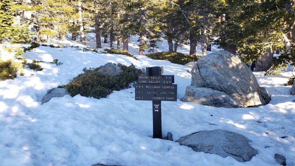


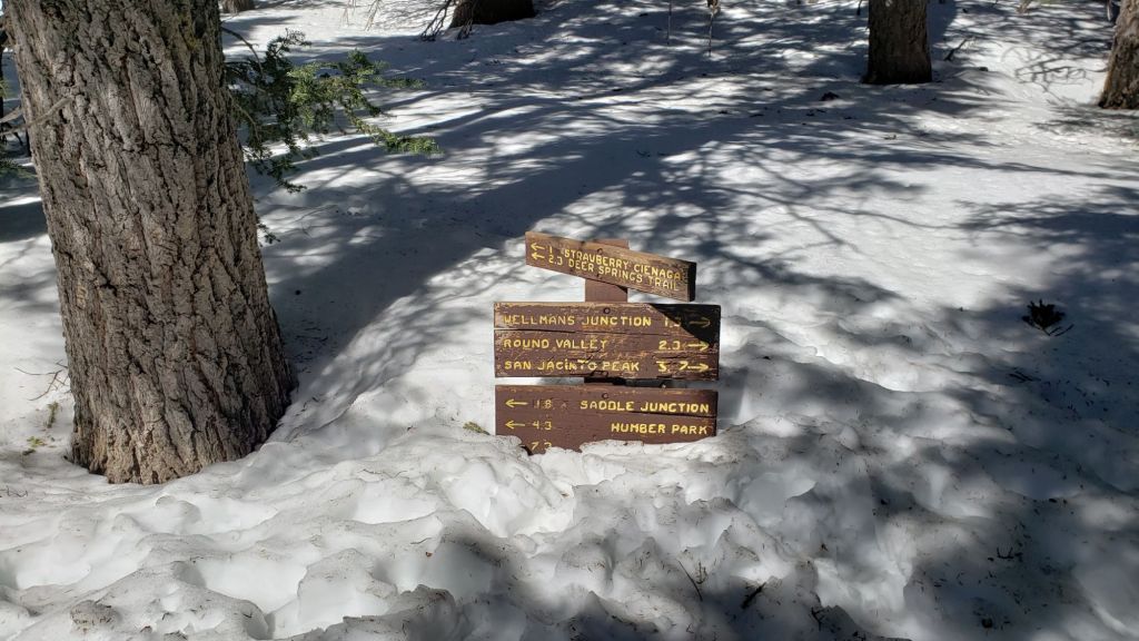
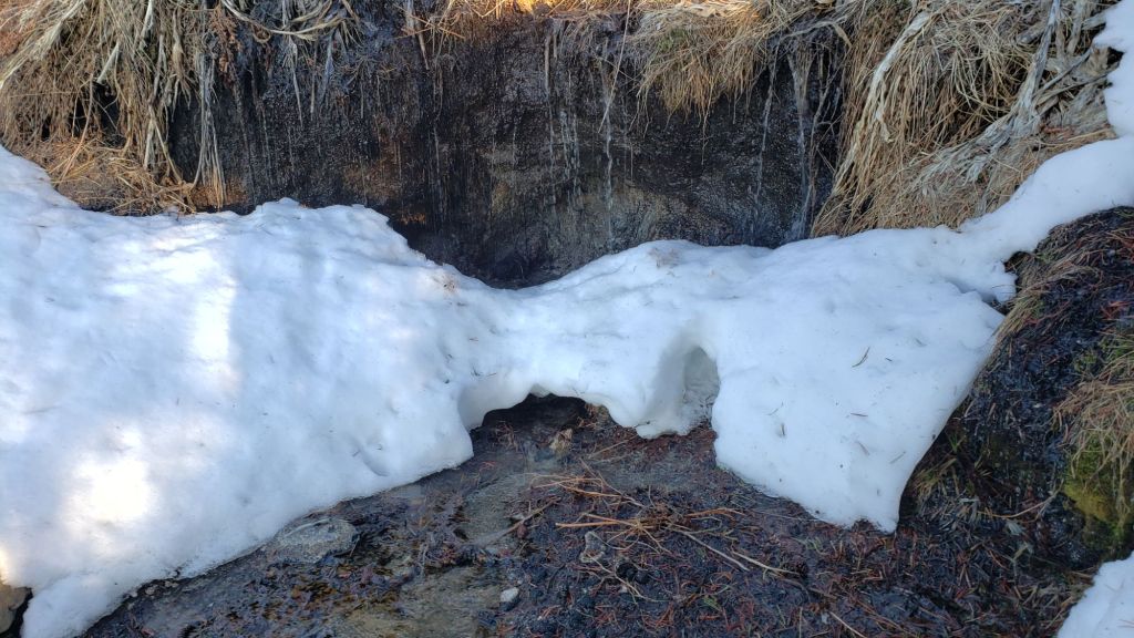
sanjacjon Uncategorized Leave a comment 13 MinutesEdit”Snow and trail update 27th March 2025″
Snow and trail update 18th March 2025
UPDATE Friday 21st March 2025: We surveyed PCT Mile 169.5, the challenging north-east side of Apache Peak, this morning, where I recorded a short video report (linked here). Melting has been fast but sheltered north and east facing slopes between Miles 167 (Spitler Peak) and 176 (Red Tahquitz) remain snow-bound and require the necessary equipment and experience for such conditions.
I have heavily revised this report since it was first issued on 15th March, having now re-surveyed all of the high country and much of the PCT. A dedicated PCT section is below (between Weather and Trail Conditions below).
The San Jacinto mountains were impacted by back-to-back storms last week, a moderate snow storm all day on Thursday 13th March, immediately followed by a second minor system on Friday 14th. These represented the eleventh and twelfth storm systems of this winter (for comparison, the previous two winters had 26 and 28 storm systems, respectively). Further minor precipitation on 17th produced 0.17 inch of rain in Idyllwild but no new snow in the high country.
Although of shorter duration, the system on 13th March was broadly similar to that on 5th-7th March, a cold atmospheric river with snow dusting as low as 3500 ft, and with significant depth of snow everywhere above about 4500 ft elevation. This had an immediate major impact on all trails in the San Jacinto mountains, including the entire PCT section from Miles 151 (Highway 74 crossing) to 197 (above Snow Creek village).
Although significant snow conditions will persist in the high country into April, thru hikers in particular should note that melting is expected to be rapid. Temperatures generally well above seasonal are now forecast for much of the remainder of March at both mid and upper elevations. Based on my detailed observations in the past decade, it is normal for the high country to lose 12 inches of snow per week in March-April, assuming average sun exposure and temperatures.
Details of snow depths measured at a few sample locations on the trail system are given below. Note however that snow depth itself is very rarely indicative of the difficulty (or ease) of hiking a particular track or trail. For example a firm, well-compacted track across deep snow is often much easier hiking than a less well-traveled track across just a few inches depth of angled icy snow.
The final combined new snow total form this latest storm sequence at San Jacinto Peak was 17 inches, for a current total depth of 40 inches, while snow accumulation in Idyllwild (at 5550 ft) was an impressive 11 inches (nine on 13th, followed by two inches on 14th). Ultimately, both storms on 13th and 14th produced somewhat less snow than forecast, especially at higher elevations.
I recorded a short video at San Jacinto Peak late morning on Saturday 15th discussing general conditions at that time (linked here).
Conditions are currently suitable for snowshoes everywhere above about 8000 ft. This elevation will continue to rise steadily this month. With rapid melting, conditions for snowshoes will deteriorate quickly below about 8000 ft, despite the snow depths. Nevertheless snowshoes will remain the best option even in the soft, wet, melting snow.
Carrying spikes is recommended everywhere above about 7000 ft for the foreseeable future. Crampons are required on the north side of Tahquitz Peak (details below). At this time the snow is generally too soft to require crampons elsewhere in the high country, but that may well change with freeze-thaw cycles and compaction over the coming days.
I broke trail on 15th March from Humber Park to San Jacinto Peak, accurately following the route via Devil’s Slide Trail, a short section of the PCT, and the Wellman, Peak, and East Ridge trails. Andrew “Bones” Simpson joined me for the final mile above 10,100 ft. These tracks will hold up well given a relatively mild, sunny forecast, although melting and ice falling from trees will deteriorate them.
On my descent late morning on Saturday 15th, I have never seen the snow conditions deteriorate so quickly (having surveyed >200 storms in the past decade). Within hours, lovely firm, fresh, powder had softened to wet, heavy, deteriorating snow, even above 10,000 ft. By early afternoon, sections of lower Devil’s Slide Trail were linear patches of slush, where six hours earlier it had be unblemished powder.
On Tuesday 18th I ascended San Jacinto Peak via the east side (Devil’s Slide, Wellman, Peak, and East Ridge trails) and descended the west side via Deer Springs Trail, carrying spikes and snowshoes. This facilitated survey of the highest parts of the PCT in the San Jacinto mountains (roughly Miles 179-181 and 185.5-183) plus several side trails. I was able to ascend barebooting on my well-traveled snowshoe track to 10,300 ft on the Peak Trail before needing spikes to continue. I then wore spikes all the way down Deer Springs Trail to about 7500 ft.
The USFS gate at Humber Park reopened on 21st March, having been closed since 5th March. Even when closed there are nine legal parking spaces immediately below the gate. South Ridge Road has been closed since 10th March due to seasonal conditions. Black Mountain Road is also closed (to vehicle traffic only) at the gate 1.7 miles up from Highway 243 due to winter conditions. Dark Canyon Road (4S02), the access road to the Seven Pines trailhead, is closed long-term for staffing/funding reasons.
Survey hikes by the Trail Report every single day throughout the year in the San Jacinto mountains include varied routes to the high peaks including San Jacinto Peak typically 2-3 times per week (more frequently during storms), Tahquitz Peak and area 1-2 times per week, plus a wide variety of other trails on intervening days.

WEATHER
Seasonally warm days prior to the arrival of these latest storms stimulated significant melting, with, for example, most areas of Fern Valley and Idyllwild below 6500 ft almost completely clear of snow.
A minor storm on Tuesday 11th, starting pre-dawn and lasting for most of the day, produced mainly light rain at mid elevations (0.3 inch in Idyllwild), and a dusting of 1-2 inches of snow in the high country. That brief minor storm ran almost seamlessly into a cold atmospheric river on 13th March, similar to the storm of 5th-7th March, producing 9-15 inches of snow everywhere above about 5000 ft, and dusting as low as 3500 ft. Finally, a minor atmospheric river immediately followed that on 14th, producing less snow than forecast (only two inches throughout the mid and higher elevations), with a little light drizzle also below 7000 ft.
The overall pattern for the remainder of March is for warmer than seasonal temperatures, getting progressively warmer as the month continues. In addition, most days will be cloudless and sunny, further accelerating snow melt, especially on sun-exposed slopes. Temperatures will be hot (for March) on 23rd-27th.
An atmospheric river system passed largely to our north on the evening of Monday 17th March, producing no more that limited light rain at mid elevations (017 inch in Idyllwild) and evidence of drizzle to 9500 ft, but no new snowfall at higher elevations.
At San Jacinto Peak (10,810ft/3295m) on Tuesday 18th March 2025 at 0925 the air temperature was 19.1°F (-7°C), with a windchill temperature of -3.1°F (-20°C), 33% relative humidity, and a chilly NNW wind sustained at 15 mph gusting to 27.6 mph.
At the Peak on Saturday 15th March 2025 at 1010 the air temperature was 27.4°F (-3°C), with a windchill temperature of 9.3°F (-13°C), 55% relative humidity, and a frigid NNW wind sustained at 14 mph gusting to 27.9 mph.
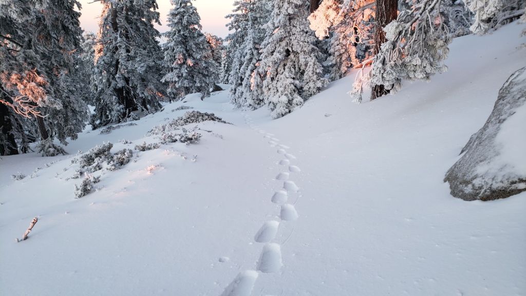
PACIFIC CREST TRAIL
All of the PCT in the San Jacinto mountains is readily passable with, crucially, suitable skills and equipment, patience, and a thorough knowledge of all the possible alternates if needed. Snowmelt is expected to be rapid for the remainder of March. I cannot overemphasize the importance of having both appropriate equipment and the right skill set for the terrain. The latter includes interpreting the snow/ice conditions, understanding your physical and mental abilities, and conservative decision making. Some of these challenges may actually increase briefly over the next week or so with temperatures fluctuating either side of freezing at the highest elevations and highly variable snowmelt.
There is now a continuous boot track on the PCT through the entire San Jacinto mountains. However, that does not mean the trail is easy to follow, laborious postholing is required in many areas, and some sections – notably Miles 169-176 and Miles 185.5-191 – have consequential terrain that will not be suitable for many hikers depending on their equipment and experience traversing icy snow slopes.
The trail was largely covered in thin snow from Miles 151 (Highway 74) to about Mile 167 as of 15th March. However this has already melted rapidly. Some thin patchy icy snow remains on north-facing and sheltered slopes. There are alternates at Fobes Saddle (Mile 166) and Spitler Peak Trail (Mile 168.5) that would be good options for hikers not comfortable on the icy snow slopes ahead.
We surveyed PCT Mile 168.5-170, including the challenging north-east side of Apache Peak, on Friday 21st March, recording a short video report (linked here). Melting has been fast but sheltered north and east facing slopes between Miles 167 (Spitler Peak) and 176 (Red Tahquitz) remain significantly snow-covered and require the necessary equipment and experience for such conditions.
Snow cover is continuous from Miles 175 (Red Tahquitz) to 177.7 (Chinquapin Flat), although the terrain is generally benign. Many hikers will find spikes useful on this section.
PCT hikers should not attempt to use South Ridge Trail from the PCT at Chinquapin Flat (roughly Mile 177.7) to Idyllwild via Tahquitz Peak, even though this looks temptingly simple on apps and maps. This section of steeply angled (and notoriously treacherous) ice slopes remains challenging weeks after surrounding trails have melted, and currently requires crampons, ice axe, and the expertise to use that equipment.
Snow cover is thinning and will soon become patchy between Miles 177.7 to Saddle Junction (about Mile 179). The south-facing slope of Miles 179-180 is already starting to clear, but from Mile 180 (elevation 8900 ft) to about Mile 181 just past Annie’s Junction snow cover is continuous. Miles 181-183 are sun-exposed and will clear of snow in the next week. Snow cover is continuous from Mile 183.5 through to about Mile 195. Spikes are useful throughout this section.
There is currently only a single postholing boot track through moderate snow cover on the PCT along Fuller Ridge (Miles 185.5-191). This track does not accurately follow the trail in places. At this time continuing north on Fuller Ridge requires the skills and comfort level to hike on angled terrain with some moderate exposure, and spikes are required. Taking the Black Mountain Road alternate is recommended for the majority of hikers for the next week or two.
In recent years a myth has periodically circulated on PCT social media that going up and over San Jacinto Peak somehow avoids Fuller Ridge. This is erroneous and potentially dangerous. Whether you remain on the PCT northbound (going around at lower elevation via Strawberry Junction, Mile 183) or leave the PCT at Annie’s Junction (Mile 180.8) to go up to San Jacinto Peak and then down the west side to reconnect to the PCT at about Mile 185.5, you still have to hike Fuller Ridge (Miles 185.5-190.5). It is possible to do the former route more safely by leaving the PCT at Strawberry Junction and descending Deer Springs Trail, which is largely clear of snow below Strawberry Junction, back into Idyllwild.
A well established alternate from Idyllwild – avoiding Fuller Ridge – is to connect back to the PCT at about Mile 191 using Black Mountain Road. Black Mountain Road is rapidly clearing of snow for the lower five miles, and then has continuous snow cover for the upper three miles to the PCT but following the road through the snow patches is obvious. Mile 195 northward to Interstate 10 is functionally clear of snow, and Miles 191-195 will clear in the next week or so.
Although the situation improved somewhat in 2024, treefall hazards remain a significant problem along parts of the Pacific Crest Trail, most notably between Antsell Rock and South Peak. Some 56 trees are down across the trail between PCT Miles 170.5-174, with 37 of these, including several serious obstructions that make for slow-going, between Miles 172.5-174 (around and immediately south of South Peak). A further nine smaller obstructions are down from Miles 168.5-170.5 (Spitler Peak Trail to Zen Center Trail). Significant sections of Miles 168.5-175 are also badly overgrown with brush and are in urgent need of major trimming work (surveyed February 2025).
PCT hikers are asked to respect that overnight stays are not permitted at or near San Jacinto Peak, including in the historic shelter, to minimize impacts to a sensitive subalpine environment. Officially Mt. San Jacinto State Park permits overnight stays only in established campgrounds (Little Round Valley and Strawberry Junction are good options for thru-hikers).
PCT hikers, please support the Trail Report! While all time and labor is volunteered, the San Jacinto Trail Report uses small donations to help cover operating costs. Your contribution keeps the Report available to all, free from advertising or paywalls, and independent from agencies. If you have found this Report useful, please consider using this link to the Donate page. Thank you very much for your support.
TRAIL CONDITIONS
Tracks are now in place for most major trails, although they may require significant postholing through softening, melting snow, especially for the next 1-2 weeks.
Snow depths and conditions are suitable for snowshoeing everywhere in the high country. Melting is already well underway and it has been noticeable on sun-exposed slopes that snow is softening and becoming “weighty” by mid morning (if not sooner) making for slower and less enjoyable snowshoeing. The same is true for postholing.
Everywhere above about 7000 ft carrying spikes is recommended as established trails become consolidated by hiker traffic and as they undergo freeze-thaw cycles. As always, spikes tend to be especially useful for descending, even when they are not necessarily required for ascending.
For details of specifics of downed trees, prior to the latest snow storms, see an earlier Report (linked here).
Devil’s Slide Trail has a very well defined track to Saddle Junction. Snow is rapidly clearing below 7000 ft.
The Ernie Maxwell Trail is largely clear of snow, and has a very well-defined track through the remaining patches of shallow icy snow. Snow patches are distributed throughout the length of the trail, but become longer and more frequent on the upper trail (closer to Humber Park). Some hikers may find spikes are useful, especially for the upper trail.
From Saddle Junction northbound a well-defined snowshoe track continues to San Jacinto Peak via Annie’s Junction (PCT Mile 180.8) and Wellman Divide, via the Wellman, Peak, and East Ridge trails. Due to spindrift, the tracks can be periodically obscure on some exposed slopes closest to the Peak.
The 0.4 mile section of South Ridge Trail between Chinquapin Flat/PCT Mile 177 and Tahquitz Peak, that has attracted much media attention recently, has no track to follow through the steeply angled snow, with substantial underlying ice. These slopes comprise some of the most consequential terrain in winter in these mountains, and this route is not recommended for most hikers at this time. Crampons are required, always accompanied by an ice axe, and, critically, adequate knowledge of how to use this equipment. Snowshoes are not recommended due to the underlying angled ice.
Spitler Peak Trail [updated 23rd March] is clear of snow. Unfortunately storms in February-March brought down another 34 trees across this trail. All of the small-to-medium-sized obstacles were removed on 21st and 23rd March (bringing to 162 the total number of trees removed by the Trail Report from this route in the past six years). One very large burned cedar remains, right by the first crossing of Spitler Creek (3.2 miles up from the trailhead).
Round Valley Trail has a well-traveled track on continuous moderate icy snow from Long Valley/Tram to Wellman Divide.
South Ridge Trail from the top of South Ridge Road to Tahquitz Peak has a moderately-traveled track to follow through moderate icy snow for about one mile. There is then a lightly-traveled posthole track on to Old Lookout Flat (7600 ft). There is currently no track to follow from there to Tahquitz Peak (as of 17th March). Spikes are not required for ascending, but some hikers will find them useful for descending.
Marion Mountain Trail has a well-defined snowshoe and posthole track throughout, but the track does not always accurately follow the actual trail route. Spikes are recommended, at least for descending.
Deer Springs Trail is rapidly clearing from the Highway 243 trailhead to the Suicide Rock trail junction at 7000 ft. From there to Strawberry Junction (8100 ft) snow cover averages 90% with snow patches increasing in length and frequency as you ascend. Spikes were not required even for descending by the afternoon of 18th. Snow cover is continuous from Strawberry Junction to San Jacinto Peak, although a few small patches are starting to appear below 8500 ft (south of the top of the Marion Mountain Trail). The track from Strawberry Junction to the junction with Marion Mountain Trail is a laborious posthole track. An adequate snowshoe track is then generally easy to follow to Little Round Valley, although it does not follow the trail route in many places. Above Little Round Valley there is only a single. very circuitous, snowshoe track (which does not remotely follow the established trail route). However the compaction of the track is useful for negotiating the unconsolidated snow, and it does ultimately end up at San Jacinto Peak. Spikes are recommended at least for descending upper Deer Springs Trail, but snowshoes are preferable on warm days (i.e. daily now until the end of March).
SNOW DEPTHS
Measured on 15th March 2025. The first number gives total average depth. Due to strong winds accompanying recent storms there has been extensive drifting. The number in parentheses indicates the new snowfall in the storms on 13th-14th March. Altitudes and PCT Miles are approximate.
San Jacinto Peak (10810 ft): 40 inches (17 inches new snow), drifted to 4-5 feet deep in places
Wellman Divide (9700 ft): 20 inches (14 inches new snow), heavily melted from 8th-12th March
Annie’s Junction/approx. PCT Mile 180.8 (9020 ft): 38 inches (12 inches new snow)
Saddle Junction/approx. PCT Mile 179 (8070 ft): 21 inches (13 inches new snow)
Devil’s Slide Trail at Humber Park (6550 ft): 12 inches (12 inches new snow, already rapidly melting by late morning on 15th)
Idyllwild (at 5550 ft): 11 inches (11 inches new snow, already largely melted on 15th)
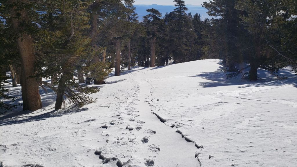
While all time and labor is volunteered, the San Jacinto Trail Report uses small donations to help cover operating costs. Your contribution keeps the Report available to all, free from advertising or paywalls, and independent from agencies. If you have found this Report useful, please consider using this link to the Donate page. Thank you very much for your support.
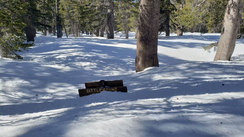


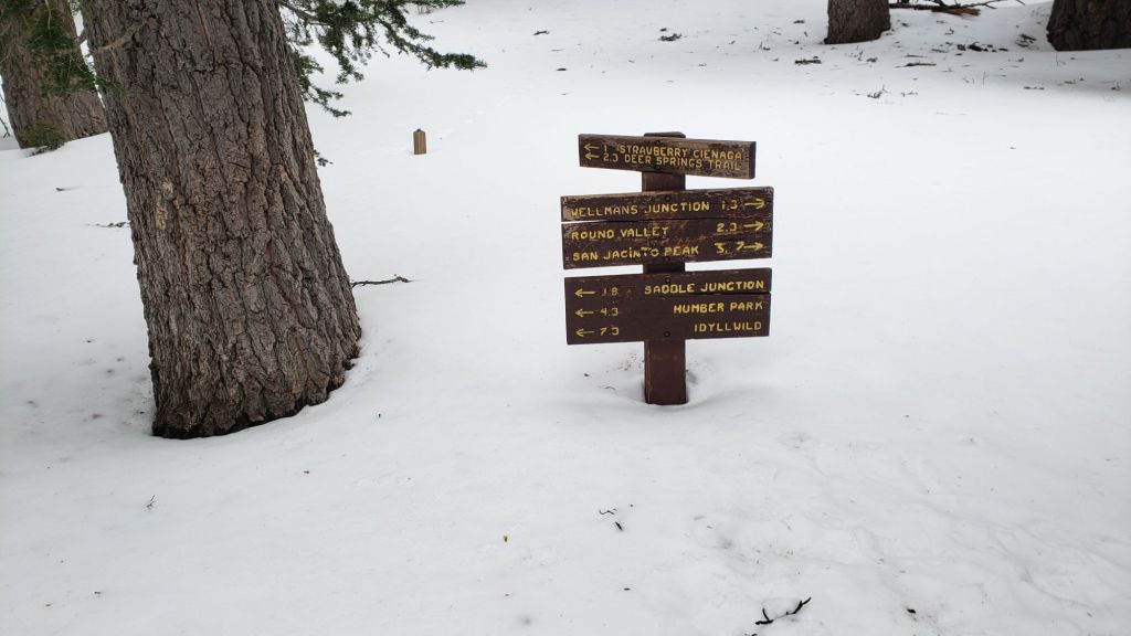
sanjacjon Uncategorized Leave a comment 14 MinutesEdit”Snow and trail update 18th March 2025″
Storm report 13th-14th March 2025
The eleventh storm of winter 2024/25 – forecast to produce the most precipitation this winter – is moving across the San Jacinto mountains between Thursday 13th and Friday 14th March 2025.
Please check this page for periodic updates – the most recent is at the top – throughout the multiple day storm sequence. The next comprehensive Report update, summarizing conditions during and after the storm, is planned for late on Saturday 15th March.
UPDATE Friday 14th March at 1600
Snowfall has been very light for much of the day at all elevations, with only 1.5 inches accumulating in Idyllwild, and no more than two inches at both Long Valley (8500 ft) and San Jacinto Peak (10,810 ft). Total accumulation at the Peak is now 40-45 inches, and 10-12 inches in Idyllwild (although slow melting is already underway this afternoon).
UPDATE Friday 14th March at 1035
After a clear night, light snow started again just after 0800 this morning. Accumulation rates are slow at both high and mid elevations, barely 0.25 inch/hour. This snowfall is forecast to continue most of today, with 3-4 inches expected at all elevations above about 5000 ft. There was significant melting overnight and this morning below 5000 ft, with snow cover now thin and patchy at 4000-4500 ft.
UPDATE Thursday 13th March at 1925
Total snow accumulation from the storm today has been 9.0 inches in Idyllwild, with snowfall rates dropping to about 0.5 inch/hour for much of the afternoon, then stopping before dusk. Storm total at San Jacinto Peak is 13-14 inches, for a total depth just over 40 inches.
A secondary storm tomorrow is forecast to be accompanied by very strong winds (and hence severe drifting) in the high country. Light snowfall throughout most of the daylight hours on Friday will include 3-4 inches at the highest elevations, with 4-6 inches at mid elevations (such as Idyllwild), and with the freeze level remaining around 4000 ft.
UPDATE Thursday 13th March at 1025
Fresh snowfall at San Jacinto Peak since last night has been about 10 inches, for a current total depth near 40 inches. Long Valley (8500 ft) has added 7-8 inches this morning.
Rainfall in the early hours of the morning in Idyllwild (at 5550 ft) was 0.37 inch by 0700, having turned to snow around 0630. Snowfall rates have neared an impressive two inches per hour, with 6.0 inches accumulating between 0630-1000.
With significant fresh snowfall now down below 4500 ft elevation, almost all the PCT in the San Jacinto mountains (Miles 151-197) is now covered with at least several inches of fresh snowfall. This will make for heavy postholing everywhere, even below 7000 ft, and snowshoes would be ideal above that elevation (potentially much lower).
Further significant snow is expected throughout today and again on Friday. That said, melting will be rapid at all elevations with temperatures abruptly swinging to above seasonal by Sunday 16th, and remaining (relatively) warm for much of next week.
While all time and labor is volunteered, the San Jacinto Trail Report uses small private donations to help cover operating costs. Your contribution keeps the Report available to all, free from advertising or paywalls, and independent from agencies. If you have found this Report useful, please consider using this link to the Donate page. Thank you very much for your support.
sanjacjon Uncategorized Leave a comment 2 MinutesEdit”Storm report 13th-14th March 2025″
Moderate snow storm 5th-7th March 2025
UPDATE Wednesday 12th March 2025: I am not updating the main report until Saturday 15th given the dramatic changes expected in the next couple of days. I recorded a short video report from Saddle Junction (PCT Mile 179, 8100 ft elevation) this morning, to give a feel for current conditions, discussing the challenging next couple of days, and the encouraging news for thru hikers for the remainder of March (video linked here). The storm over 13th-14th March is expected to be very similar to the one described below last week.
UPDATE Tuesday 11th March 2025: light precipitation most of the day produced 0.29 inch of rain in Idyllwild (at 5550 ft), light snow with no significant accumulation in Pine Cove (6200 ft), two inches of snow at Saddle Junction (8100 ft) and at San Jacinto Peak (10,810 ft).
UPDATE Monday 10th March 2025: As expected, melting has been rapid and judging by our hike on a lengthy section of the PCT today, Miles 151-167 are largely clear of snow. North and east facing slopes, such as the PCT around Spitler Peak, still retain moderate depth snow. Options for nobo PCT hikers would be to leave the trail at Fobes Trail (Mile 166) or at Spitler Peak Trail (Mile 168.5). Miles 169-177 require crampons and ice axe, and the time and energy for miles of postholing. Conditions will change again very soon, with rain and/or snow (depending on elevation) on 11th, and a significant snow storm (similar to the one on 5th-7th described below) on 13th.
——————————
This is a summary of trail conditions following a moderate snow storm spread across nearly 36 hours from the afternoon of Wednesday 5th into the early hours of Friday 7th March. This update is intentionally brief because (i) with a weekend imminent, details of which trails have been traveled may change dramatically in the next day or two, (ii) rapid warming will result in equally rapid snow melt, especially below about 7500 ft, and (iii) further rounds of significant precipitation are forecast for the next ten days, which will change conditions yet again.
Ultimately this latest atmospheric river was cold, with snow dusting as low as 3500 ft, and with 12 inches or more of snow everywhere above 4500 ft elevation. This has obviously had a dramatic impact on all trails in the San Jacinto mountains, including the entire PCT section from Miles 151 (Highway 74 crossing) to 197 (above Snow Creek village).
Details of snow depths for select locations are given below. The final storm total at San Jacinto Peak was 18 inches, for a current total depth of about 27 inches, while snow accumulation in Idyllwild (at 5550 ft) was an impressive 14 inches. Snow depths at almost all other locations above 5000 ft fell somewhere in the range of 14-18 inches.
I recorded a short video (linked here) giving a feel for the gorgeous conditions at San Jacinto Peak early on the morning of Friday 7th.
Initially the storm system was very mild on arrival on Wednesday 5th, with drizzle all the way to San Jacinto Peak, although thankfully it quickly turned to snow. Mid elevations received reasonable rain (0.78 inch in Idyllwild) before it turned to snow around first light on Thursday 6th.
Conditions are currently excellent for snowshoes everywhere above about 5000 ft, potentially lower in places. Rapid melting is already underway, and the next three days are forecast to be relatively warm before further precipitation arrives in the early hours of Tuesday 11th. Consequently conditions for snowshoes will deteriorate quickly below about 7000 ft, despite the snow depths.
Therefore, carrying spikes is recommended everywhere above about 5000 ft for the foreseeable future. Crampons are required on the north side of Tahquitz Peak (details below). At this time the snow is generally too soft to require crampons elsewhere, but that may well change with freeze-thaw cycles and compaction over the coming days.
For anyone interested in snowshoeing (or postholing perhaps) to San Jacinto Peak this weekend from Humber Park, I broke trail on 7th March accurately following the route via Devil’s Slide Trail, a short section of the PCT, and the Wellman, Peak, and East Ridge trails. These tracks should hold up relatively well as strong winds are not forecast again until next week.
Into the second half of March at least, hikers must be prepared for genuine winter conditions in the high country, with temperatures near or below freezing, and generally well (or even far) below freezing when considering wind chill effects (see below for my recent weather observations from San Jacinto Peak).
The USFS gate at Humber Park closed on 5th March. Even when closed there are nine legal parking spaces immediately below the gate. This weekend “road closed” signs will likely be in place at the junction with Forest Drive, further complicating parking. South Ridge Road closed on 10th March due to seasonal conditions, as did Black Mountain Road at the gate 1.7 miles up from Highway 243. Dark Canyon Road (4S02), the access road to the Seven Pines trailhead, is closed long-term from maintenance reasons.
Survey hikes by the Trail Report every single day throughout the year in the San Jacinto mountains include varied routes to the high peaks including San Jacinto Peak typically 2-3 times per week (even more frequently during storms), Tahquitz Peak and area 1-3 times per week, plus a wide variety of other trails on intervening days.

WEATHER
After seasonally warm days on 9th and 10th, which will stimulate significant melting, a minor storm is forecast for Tuesday 11th, starting pre-dawn and lasting for most of the day. A relatively warm system will likely produce mainly light rain (<0.5 inch) at mid elevations, with a tentative forecast for 1-3 inches of snow in the high country.
That brief minor storm will run almost seamlessly into a moderate storm forecast for 12th-13th March. This will be a colder atmospheric river, similar to the storm of 5th-7th March, with a snow level potentially down to 4000 ft again. Mid elevations (e.g., Idyllwild) are currently expected to receive 4-8 inches of snow. High country snow estimates have ranged from 15-30 inches, with the lower end of that range currently favored by most recent forecasts.
Yet another storm system is tentatively forecast for 17th-18th March. Precipitation amounts and exact timing are uncertain this far in advance, but 6-18 inches of snow are again possible for the high country.
At San Jacinto Peak (10,810ft/3295m) on Friday 7th March 2025 at 0620 the air temperature was 12.8°F (-11°C), with a windchill temperature of -6.0°F (-21°C), 100% relative humidity, and a light due North wind sustained at 3 mph gusting to 9.8 mph.
At the Peak on Wednesday 5th March 2025 at 1550 the air temperature was 29.8°F (-1°C), with a windchill temperature of 15.4°F (-9°C), 98% relative humidity, and a frigid SW wind sustained at 8 mph gusting to 18.6 mph.

TRAIL CONDITIONS
Trails are obscured by moderate depth snow everywhere above about 4500 ft. Most of the established trails do not have tracks to follow at this time. Cautious navigation is critical everywhere.
Snow depths and conditions are excellent for snowshoeing everywhere in the high country, and, at least temporarily, at mid elevations also. Melting was already underway by late morning on 7th below about 8500 ft, and it was noticeable on sun-exposed slopes that the powder was already softening and becoming “weighty”, making for slower and less enjoyable snowshoeing. The same would be true for postholing.
Everywhere above about 5000 ft carrying spikes is recommended as established trails become consolidated by hiker traffic and as they undergo freeze-thaw cycles. As always, spikes tend to be especially useful for descending, even when they are not necessarily required for ascending.
For details of specifics of downed trees, prior to this latest snow storm, see an earlier Report (linked here).
Details of snow depths measured at a few sample locations on the trail system are given below. Note however that snow depth itself is very rarely indicative of the difficulty (or ease) of hiking a particular track or trail. For example a firm, well-compacted track across deep snow is often much easier hiking than a poorly defined track across just a few inches depth of angled icy snow.
Devil’s Slide Trail has a well-traveled track through moderate depth snow to about 7500 ft, beyond which, at the time of writing, only my snowshoe tracks continue to Saddle Junction.
The Ernie Maxwell Trail did not have a track through the moderate depth snow at its upper end (near Humber Park) as of Saturday 8th March.
From Saddle Junction northbound a posthole track continues to San Jacinto Peak via Annie’s Junction (PCT Mile 180.8) and Wellman Divide, via the Wellman, Peak, and East Ridge trails. Due to spindrift, the tracks may be obscure on some exposed slopes closest to the Peak.
The 0.4 mile section of South Ridge Trail between Chinquapin Flat/PCT Mile 177 and Tahquitz Peak, that has attracted much media attention recently, has no track to follow through the steeply angled snow, with substantial underlying ice. These slopes comprise some of the most consequential terrain in winter in these mountains, and this route is not recommended for most hikers at this time. Crampons are required, always accompanied by an ice axe, and, critically, adequate knowledge of how to use this equipment. Snowshoes are not recommended due to the underlying angled ice.

SNOW DEPTHS
Measured on 7th March 2025. The first number gives total average depth. Due to very strong winds accompanying the most recent storm system there was extensive drifting. The number in parentheses indicates the new snowfall in the storm on 5th-7th March. Altitudes and PCT Miles are approximate.
San Jacinto Peak (10810 ft): 27 inches (17.5 inches new snow, drifts in places to 40 inches deep)
Wellman Divide (9700 ft): 17 inches (14 inches new snow)
Annie’s Junction/approx. PCT Mile 180.8 (9020 ft): 28 inches (17 inches new snow)
Saddle Junction/approx. PCT Mile 179 (8070 ft): 14 inches (13 inches new snow)
Devil’s Slide Trail at Humber Park (6550 ft): 15 inches (15 inches new snow, already rapidly melting by noon on 7th)
Idyllwild (at 5550 ft): 14 inches (14 inches new snow, already melting on 7th)
While all time and labor is volunteered, the San Jacinto Trail Report uses small private donations to help cover operating costs. Your contribution keeps the Report available to all, free from advertising or paywalls, and independent from agencies. If you have found this Report useful, please consider using this link to the Donate page. Thank you very much for your support.


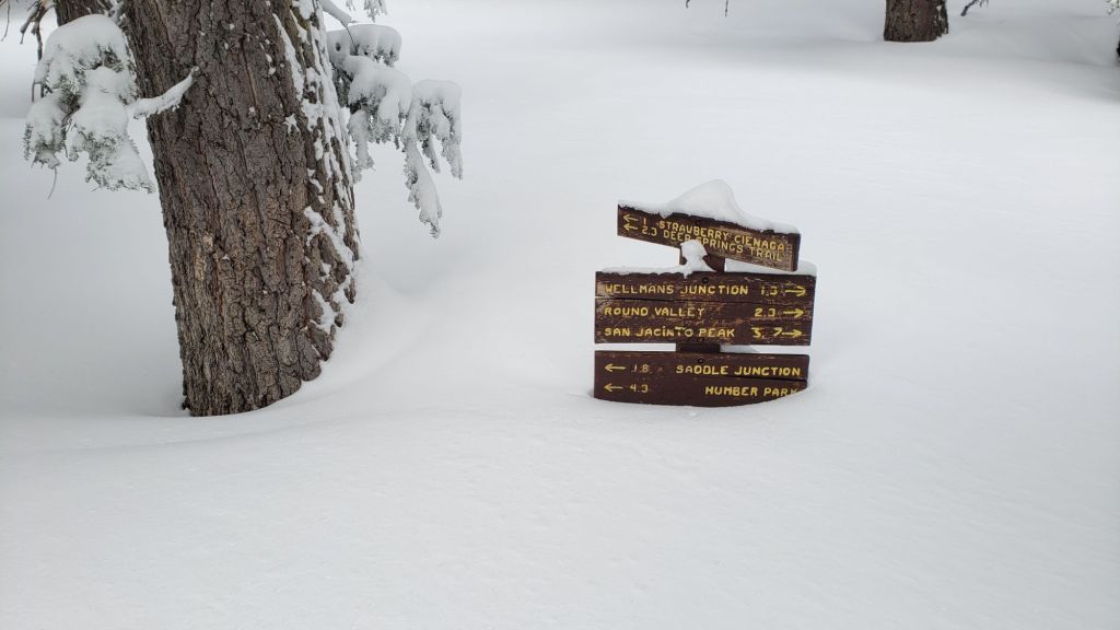
sanjacjon Uncategorized Leave a comment 8 MinutesEdit”Moderate snow storm 5th-7th March 2025″
Storm report 5th-7th March 2025
Only the ninth storm of winter 2024/25 – but forecast to be one of the most notable for expected precipitation – is moving across the San Jacinto mountains between Wednesday 5th and Friday 7th March 2025.
Please check this page for periodic updates – the most recent is at the top – throughout the multiple day storm sequence. The next comprehensive Report update, summarizing conditions during and after the storm, may be published late on Friday 7th March.
UPDATE Friday 7th March at 0500
Final storm total at San Jacinto Peak is 18 inches, for a current total depth of about 27 inches (although variable due to extensive drifting, and up to three feet deep in places).
I recorded a short video (linked here) giving a feel for the gorgeous conditions at San Jacinto Peak early this morning.
Snow depth in Idyllwild (at 5550 ft) is an impressive 14 inches.
UPDATE Thursday 6th March at 2030
Snow depth at San Jacinto Peak is now around 22 inches, with 13 inches the current storm total. The lovely fluffy powder is ideal for snowshoeing. Several more inches are expected tonight.
Current accumulation is an impressive 8-9 inches in Idyllwild, and it continues to snow gently.
With significant snowfall now down below 5000 ft elevation, almost all the PCT in the San Jacinto mountains (Miles 151-196) are now covered with at least several inches of fresh snowfall. This will make for heavy postholing below 7000 ft, and snowshoes would be ideal above that elevation (potentially much lower) . Melting will be rapid at mid elevations this weekend, but further snow is expected next week.
UPDATE Thursday 6th March at 1730
After several hours of minimal snow at all elevations, snowfall has become markedly heavier in the past three hours, with larger flake size. Storm total is now 11 inches at San Jacinto Peak, accumulating at one inch per hour.
Snow depth in Idyllwild in Idyllwild is 5.5 inches at 5550 ft, following 0.78 inch of rain overnight.
UPDATE Thursday 6th March at 1100
Light snow in the mid elevations has accumulated to 1.25 inches in Idyllwild (5550 ft) and 2-3 inches in Pine Cove (6200 ft).
Snow at San Jacinto Peak is tiny rounded grains which consequently are struggling to accumulate to notable depth, another two inches this morning, for a current storm total of seven inches. Long Valley has about half that, roughly 3.5-4 inches.
The heaviest snowfall is forecast for this afternoon and evening, potentially doubling the current storm totals.
UPDATE Thursday 6th March at 0730
Fresh snowfall at San Jacinto Peak overnight was four inches, for a storm total of five, and a total depth of about 14 inches. Long Valley (8500 ft) added about three inches, for a total accumulation of about 8 inches.
Snow level is now below 5000 ft elevation, meaning that almost all the PCT in the San Jacinto mountains (at least Miles 151-195) will be covered with fresh snowfall.
Rainfall in Idyllwild at 5550 ft was 0.78 inch by 0700, having turned to snow around 0600 and already accumulating 0.75 inch. Rainfall generally at mid elevations (up to 6500 ft) was 0.8-1.0 inch throughout the western side of the mountain range, with much less at eastern locations.
While all time and labor is volunteered, the San Jacinto Trail Report uses small private donations to help cover operating costs. Your contribution keeps the Report available to all, free from advertising or paywalls, and independent from agencies. If you have found this Report useful, please consider using this link to the Donate page. Thank you very much for your support.
UPDATE Wednesday 5th March at 1920
Light drizzle started at about 1400 at mid and upper elevations. Yes, sadly it was warm enough (at just below freezing) to rain as high as San Jacinto Peak on my hike this afternoon.
By 1600 the precipitation finally turned to very light snow above 10,000 ft, although accumulation is less than 0.25 inch per hour.
After dark the snow level dropped to 8000 ft, with barely 0.25 inch of snow having accumulated in Long Valley (8500 ft) in two hours.
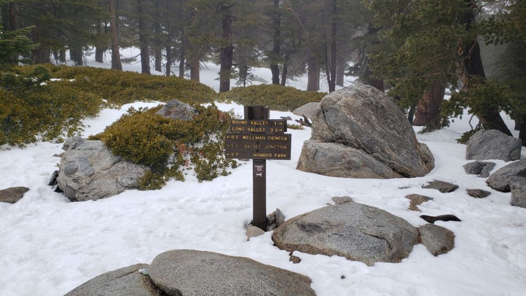
sanjacjon Uncategorized Leave a comment 3 MinutesEdit”Storm report 5th-7th March 2025″
Minor snow storm 3rd March 2025
UPDATE 5th March 2025: A moderate atmospheric river storm will start to cross the San Jacinto mountains this afternoon, continuing in phases into the early hours of Friday 7th. Significant snowfall, accompanied by strong winds and severe cold, is expected in the high country, with inches of snow as low as 4000-5000 ft elevation. Further significant storms are predicted overnight on 10th-11th and again on 12th-13th March.
———————————-
This is a brief summary of trail conditions following a minor snow storm overnight on Sunday 2nd March. Although nominally the eighth storm of this winter, seven of those, like this most recent storm, have been minor and total snowfall at San Jacinto Peak since September 2024 has been a paltry 29 inches.
This summary is thankfully brief because this is expected to be the first of four storms in rapid succession – with the next three on 5th-6th, 10th-11th, and 13th-14th March – all of which are currently forecast to produce significant precipitation.
I broke trail through light snow on the morning of Monday 3rd March via Devil’s Slide Trail, a short section of the PCT, and the Wellman, Peak, and East Ridge trails, to San Jacinto Peak. At San Jacinto Peak in late morning I recorded a short video report (linked here), and also took a video of the beautifully sunny, but windy, conditions on top (linked here).
This report includes a brief dedicated Pacific Crest Trail section (below, between Weather and Trail Conditions) for the benefit of northbound PCT hikers. Additional information elsewhere in the report is however also of use to PCT hikers.
Trails below about 6600 ft are already clearing of snow, with snow on trails up to 9000 ft on the most sun-exposed slopes already becoming thin and patchy (details under Trail Conditions below).
Details of recommended traction devices are given below under Trail Conditions. In summary, carrying spikes is recommended everywhere above about 6500 ft. Crampons are potentially useful everywhere in the high country above about 9000 ft for the next couple of days as the light powder is not adhering well to the pre-existing icy snow below. Crampons are required on the north side of Tahquitz Peak (details below). Snowshoes can be useful above about 9000 ft elevation, and will become invaluable after 5th March.
For the foreseeable, hikers must be prepared for genuine winter conditions in the high country, with temperatures near or well below freezing, and potentially far below freezing when considering wind chill effects, in addition to strong winds and heavily drifting snow (see below for my recent weather observations from San Jacinto Peak).
Details of snow depths measured at a few sample locations on the trail system are given at the foot of this posting. Note however that snow depth itself is very rarely indicative of the difficulty (or ease) of hiking a particular track or trail. For example a firm, well-compacted track across deeper snow is often much easier hiking than a poorly defined track across just a few inches depth of angled icy snow.
The USFS gate at Humber Park is open, but is expected to close on 5th March. Even when closed there are nine legal parking spaces immediately below the gate. South Ridge Road currently remains open and is readily passable, albeit somewhat lumpy in places. Dark Canyon Road (4S02), the access road to the Seven Pines trailhead, is closed due to seasonal conditions.
Survey hikes by the Trail Report every single day throughout the year in the San Jacinto mountains include varied routes to the high peaks including San Jacinto Peak typically 2-3 times per week (even more frequently during storms), Tahquitz Peak and area 1-3 times per week, plus a wide variety of other trails on intervening days.

WEATHER
March may be far more interesting meteorologically than the preceding several months. Within hours of the passage of the light snow storm on 3rd, temperatures were already warming rapidly, with melting visible on bushes and rocks at 10,000 ft by noon that day. This will continue on Tuesday 4th.
A moderate (or even major) storm is forecast for 5th-6th March. Two precipitation phases are expected, on the afternoon and evening of Wednesday 5th, and then again on the afternoon and evening of Thursday 6th. The former will be warmer, with predominantly rain expected at mid elevations (possibly an inch in Idyllwild) before turning to snow that night. At mid elevations it may snow for much of 6th, with 3-5 inches possible.
Snow is expected throughout the higher elevations from Wednesday evening to Friday morning, with the heaviest accumulations on Wednesday and Thursday nights. Total snowfall forecasts for the high country have varied greatly from 10-25 inches, with 12-20 inches now most likely above 10,000 ft.
Temperatures may warm quickly after passage of that storm, and will be above seasonal yet again on 8th-9th, before an extended period of unstable weather is forecast starting Monday 10th March. Details remain uncertain at this time, but light or moderate precipitation is possible daily from 10th to 14th March, in the high country perhaps most likely at the beginning and end of that period.
At San Jacinto Peak (10,810ft/3295m) on Monday 3rd March 2025 at 1025 the air temperature was 11.9°F (-11°C), with a windchill temperature of -13.7°F (-25°C), 69% relative humidity, and a wild WNW wind sustained at 18 mph gusting to 30.0 mph.
At the Peak on Friday 28th February 2025 at 0800 the air temperature was 27.8°F (-2°C), with a windchill temperature of 11.3°F (-13°C), 41% relative humidity, and a bitter SE wind sustained at 17 mph gusting to 23.9 mph.

PACIFIC CREST TRAIL
The trail was largely covered in thin snow from Miles 151 (Highway 74) to about Mile 175 as of 3rd March. However this was already melting rapidly that afternoon. Some thin patchy icy snow remains on north-facing and sheltered slopes from February. A patchy 1-2 inches of snow on the north-east side of Apache Peak (Miles 169.5) poses no significant problems. Treefall hazards are a problem on parts of this section but none are insurmountable, as described in more detail below.
Snow cover is continuous from Miles 175 (Red Tahquitz) to 177.7 (Chinquapin Flat), with no boot track at this time through very limited consequential terrain. Many hikers may find spikes useful on this section.
PCT hikers should not attempt to use South Ridge Trail from the PCT at Chinquapin Flat (roughly Mile 177.7) to Idyllwild via Tahquitz Peak, even though this looks temptingly simple on apps and maps. This section of steeply angled (and notoriously treacherous) ice slopes will become especially problematic after further snowfall on 5th March.
Snow cover is thin and starting to become patchy and averages 90% between Miles 177.7 to Saddle Junction (about Mile 179). The south-facing slope of Miles 179-180 is already starting to clear, but from Mile 180 (elevation 8900 ft) to about Mile 181 just past Annie’s Junction snow cover is continuous. Miles 181-183 are sun-exposed and will briefly clear of snow on 4th March, and snow cover is then becomes continuous from Mile 183.5. Spikes can be useful on the snowy parts of this section, but are not required at this time for hikers experienced with snow travel.
There is currently no boot track through moderate snow cover on the PCT along Fuller Ridge (Miles 185.5-191). At this time continuing north on Fuller Ridge requires the skills and comfort level to hike on angled terrain with some moderate exposure, and spikes are recommended. After 5th March, taking the Black Mountain Road alternate will probably be recommended for the foreseeable future, pending thorough surveys.
In recent years a myth has periodically circulated on PCT social media that going up and over San Jacinto Peak somehow avoids Fuller Ridge. This is erroneous and potentially dangerous. Whether you remain on the PCT northbound (going around at lower elevation via Strawberry Junction, Mile 183) or leave the PCT at Annie’s Junction (Mile 180.8) to go up to San Jacinto Peak and then down the west side to reconnect to the PCT at about Mile 185.5, you still have to hike Fuller Ridge (Miles 185.5-190.5). It is possible to do the former route more safely by leaving the PCT at Strawberry Junction and descending Deer Springs Trail, which is largely clear of snow below Strawberry Junction, back into Idyllwild.
A well established alternate from Idyllwild – avoiding Fuller Ridge – is to connect back to the PCT at about Mile 191 using Black Mountain Road. Black Mountain Road is clear of snow for the lower five miles, and then has increasingly patchy 20% snow cover for the upper three miles to the PCT but following the road through the snow patches is obvious. Mile 192 northward to Interstate 10 is functionally clear of snow.
Although the situation improved somewhat in 2024, treefall hazards remain a significant problem along parts of the Pacific Crest Trail, most notably between Antsell Rock and South Peak. Some 56 trees are down across the trail between PCT Miles 170.5-174, with 37 of these, including several serious obstructions that make for slow-going, between Miles 172.5-174 (around and immediately south of South Peak). A further nine smaller obstructions are down from Miles 168.5-170.5 (Spitler Peak Trail to Zen Center Trail). Significant sections of Miles 168.5-175 are also badly overgrown with brush and are in urgent need of major trimming work (surveyed February 2025).
PCT hikers are asked to respect that overnight stays are not permitted at or near San Jacinto Peak, including in the historic shelter, to minimize impacts to a sensitive subalpine environment. Officially Mt. San Jacinto State Park permits overnight stays only in established campgrounds (Little Round Valley and Strawberry Junction are good options for thru-hikers).

While all time and labor is volunteered, the San Jacinto Trail Report uses small private donations to help cover operating costs. Your contribution keeps the Report available to all, free from advertising or paywalls, and independent from agencies. If you have found this Report useful, please consider using this link to the Donate page. Thank you very much for your support.

TRAIL CONDITIONS
Trails are covered with thin patchy snow above about 6000 ft, and light-to-moderate depth snow above about 8500 ft. Melting is rapidly underway at all elevations, and clear patches are already appearing as high as 8500 ft in places. This is expected to change dramatically from 5th March onward (see Weather above).
For details of trail conditions, including specifics of downed trees, prior to this latest minor snow storm, see the previous Report (linked here).
Everywhere above about 6500 ft carrying spikes is recommended as established trails become consolidated by hiker traffic and as they undergo freeze-thaw cycles. As always, spikes tend to be especially useful for descending, even when they are not necessarily required for ascending.
Devil’s Slide Trail has a well-traveled track through very thin snow to Saddle Junction.
There is a moderately traveled track south on the PCT from Saddle Junction (Mile 179) to about Mile 177 (Chinquapin Flat).
From Saddle Junction northbound a posthole track continues to San Jacinto Peak via Annie’s Junction (PCT Mile 180.8) and Wellman Divide, via the Wellman, Peak, and East Ridge trails. Due to strong winds, the tracks may be obscure on some exposed slopes.
There is now a continuous posthole track on the Peak Trail. However the track turns up to the Peak near Miller Peak via the East Ridge Trail route. These tracks may well have been obscured by spindrift snow by the afternoon of 3rd March.
Tahquitz Peak trail from Chinquapin Flat/PCT Mile 177 has a challenging and very lightly traveled posthole track to follow through the steeply angled icy snow. These slopes comprise some of the most consequential terrain in winter in these mountains, and this route is not recommended for most hikers at this time. Spikes (or preferably crampons) are strongly recommended, with at least hiking poles or ideally an ice axe (and, critically, adequate knowledge of how to use it).
SNOW DEPTHS
Measured on 3rd March 2025. The first number gives total average depth. Due to strong winds accompanying the most recent storm system there was extensive drifting and accumulation in the trails. The number in parentheses indicates the new snowfall in the storm on 2nd-3rd March. Altitudes and PCT Miles are approximate.
San Jacinto Peak (10810 ft): 10 inches (4 inches new snow on 3rd March)
Wellman Divide (9700 ft): 6 inches (3 inches new snow on 3rd March)
Annie’s Junction/approx. PCT Mile 180.8 (9020 ft): 12 inches (3 inches new snow on 3rd March)
Saddle Junction/approx. PCT Mile 179 (8070 ft): 2-3 inches (2 inches new snow on 3rd March)
Devil’s Slide Trail at Humber Park (6550 ft): 0-1 inches (1 inch new snow on 3rd March, already largely melted by that afternoon)
Idyllwild (at 5550 ft): 0 inches (0.5 inch new snow on 3rd March, already largely melted)
While all time and labor is volunteered, the San Jacinto Trail Report uses small private donations to help cover operating costs. Your contribution keeps the Report available to all, free from advertising or paywalls, and independent from agencies. If you have found this Report useful, please consider using this link to the Donate page. Thank you very much for your support.
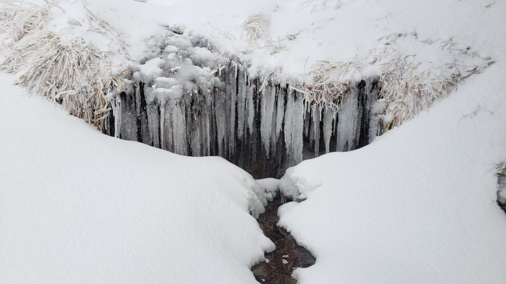

sanjacjon Uncategorized Leave a comment 9 MinutesEdit”Minor snow storm 3rd March 2025″
Trail and weather update 26th February 2025
UPDATE Friday 28th February 2025: I recorded a video report from San Jacinto Peak early this morning (linked here), giving a feel for current conditions and discussing the significant weather change on the way. Below seasonal temperatures are expected for the next two weeks, with three snow storms in quick succession expected on 2nd-3rd, 5th-6th, and 10th-11th March. Even limited snowfall in the first of these storms will be enough to complicate conditions underfoot in the high country by obscuring the thin icy snow above about 9000 ft elevation (lower in places) that persists from mid February.

Despite the moderate storm mid month, Southern California continues to experience one of the the driest winters since records began in 1850. Worse still, this is easily the driest winter in history for the San Jacinto mountains high country, where total snowfall at San Jacinto Peak since September 2024 has been a paltry 25 inches. That number will need to more than double in the next couple of months even to match the lowest snow total in recorded history (57.75 inches in winter 2021/22). The air temperature at San Jacinto Peak on Monday 24th (40.8°F/5°C) was the hottest ever recorded there in the month of February.
The first – and so far only – notable storm of this winter, between Wednesday 12th and Friday 14th February, accounted for 70% of this winter’s snowfall to date and was described in detail in the previous report (linked here). There is an increasing possibility of a minor storm on 2nd-3rd March, with 1-5 inches of snow forecast for the high country, and a mix of light snow and rain for mid elevations.
This report is the first of the season to include a dedicated Pacific Crest Trail section (below, between Weather and Trail Conditions) for the benefit of northbound PCT hikers. Additional information elsewhere in the report is however also of use to PCT hikers.
Trails below about 7600 ft are now generally clear of snow, with snow on trails up to 9000 ft on sun-exposed slopes becoming increasingly patchy (details under Trail Conditions below).
Carrying spikes is recommended throughout the trail system above about 7500 ft. While they are not required, depending upon your expertise and comfort level hiking on shallow, variable, icy snow – with snow condition itself depending on time of day and sun exposure – spikes continue to be widely useful as established tracks undergo freeze-thaw cycles and are consolidated by hiker traffic. Typically spikes tend to be much more valuable for descending trails than for ascending.
Snowshoes are no longer helpful on the established trail system, which is too compacted for their use. Hikers venturing well off-trail may find that they remain valuable in some areas above about 9000 ft.
Hikers should be prepared for temperatures near or below freezing in the high country, and well below freezing when considering wind chill effects, from 28th February into the first week of March (see below for my recent weather observations from San Jacinto Peak).
Survey hikes by the Trail Report every single day throughout the year in the San Jacinto mountains include varied routes to the high peaks including San Jacinto Peak typically 2-3 times per week (more frequently during storms), Tahquitz Peak and area 1-2 times per week, plus a wide variety of other trails on intervening days.
Details of snow depths measured at various locations on the trail system are given at the foot of this posting. Note however that snow depth itself is very rarely indicative of the difficulty (or ease) of hiking a particular track or trail. For example a firm, well-compacted track across deeper snow is often much easier hiking than a poorly defined track across just a few inches depth of angled icy snow.
The USFS gate at Humber Park reopened on 18th February after a brief closure. Even when closed there are nine legal parking spaces immediately below the gate. South Ridge Road remains open and is readily passable, albeit somewhat lumpy in places. Dark Canyon Road (4S02), the access road to the Seven Pines trailhead, is closed due to seasonal conditions.
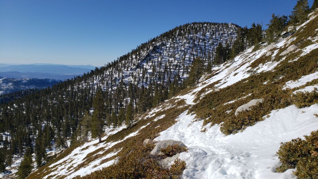
WEATHER
Since the passage of the storm more than a week ago, temperatures have been largely above seasonal. Temperatures are forecast to be far above average for February from 23rd-27th, with snow softening and melting everywhere.
A rapid cooling will result in temperatures below average from 28th February throughout the first week of March, as minor systems pass through on 2nd-3rd and again 5th-6th March. From 27th February onwards, most days will be partly or mostly cloudy.
Forecasts are currently indicating possibilities for light precipitation on 1st-6th March, most likely on 3rd, with 1-3 inches of snow possible at the highest elevations. The system will be cold enough to produce a dusting of snow as low as 4000 ft.
At San Jacinto Peak (10,810ft/3295m) on Friday 28th February 2025 at 0800 the air temperature was 27.8°F (-2°C), with a windchill temperature of 11.3°F (-13°C), 41% relative humidity, and a bitter SE wind sustained at 17 mph gusting to 23.9 mph.
At the Peak on Monday 24th February 2025 at 0810 the air temperature was 40.8°F (5°C), with a windchill temperature of 30.6°F (-1°C), 55% relative humidity, and a very light NW wind sustained at 3 mph gusting to 7.5 mph.
At the Peak on Thursday 20th February 2025 at 0820 the air temperature was 35.6°F (2°C), with a windchill temperature of 23.2°F (-5°C), 17% relative humidity, and a steady NNW wind sustained at 10 mph gusting to 18.3 mph.

PACIFIC CREST TRAIL
The trail is largely clear of snow from Miles 151 (Highway 74) to about Mile 175. Some thin patchy snow remains on north-facing and sheltered slopes. A patchy 1-2 inches of snow on the north-east side of Apache Peak (Miles 169.5) poses no significant problems. Treefall hazards are a problem on parts of this section but none are insurmountable, as described in more detail under Trail Conditions.
Snow cover is continuous from Miles 175 (Red Tahquitz) to 177.7 (Chinquapin Flat), with a lightly-traveled boot track through very limited consequential terrain. Many hikers may find spikes useful on this section.
PCT hikers attempting to use South Ridge Trail from the PCT at Chinquapin Flat (roughly Mile 177.7) to Idyllwild via Tahquitz Peak – even though this looks temptingly simple on apps and maps – should note that there is only a rough track with limited steps to follow through a section of steeply angled (and notoriously treacherous) ice slopes.
Snow cover is thin and starting to become patchy and averages 90% between Miles 177.7 to Saddle Junction (about Mile 179). The south-facing slope of Miles 179-180 is 50% clear, but from Mile 180 (elevation 8900 ft) to about Mile 181 just past Annie’s Junction snow cover is continuous. Miles 181-183 are sun-exposed and clearing of snow, and snow cover then becomes largely continuous from Mile 183.5. Spikes can be useful on the snowy parts of this section, but are not required at this time for hikers experienced with snow travel.
There is a boot track through an average of 90% moderate snow cover on the PCT along Fuller Ridge (Miles 185.5-191), steadily clearing on the most sun-exposed areas. The track does not accurately follow the PCT route in some places and passes through some challenging terrain, especially in Miles 185.5-187. At this time continuing north on Fuller Ridge requires the skills and comfort level to hike on angled terrain with some moderate exposure, and spikes are recommended.
In recent years a myth has periodically circulated on PCT social media that going up and over San Jacinto Peak somehow avoids Fuller Ridge. This is erroneous and potentially dangerous. Whether you remain on the PCT northbound (going around at lower elevation via Strawberry Junction, Mile 183) or leave the PCT at Annie’s Junction (Mile 180.8) to go up to San Jacinto Peak and then down the west side to reconnect to the PCT at about Mile 185.5, you still have to hike Fuller Ridge (Miles 185.5-190.5). It is possible to do the former route more safely by leaving the PCT at Strawberry Junction and descending Deer Springs Trail, which is largely clear of snow below Strawberry Junction, back into Idyllwild.
A well established alternate from Idyllwild – avoiding Fuller Ridge – is to connect back to the PCT at about Mile 191 using Black Mountain Road. Black Mountain Road is clear of snow for the lower five miles, and then has increasingly patchy 20% snow cover for the upper three miles to the PCT but following the road through the snow patches is obvious. Mile 192 northward to Interstate 10 is functionally clear of snow.
PCT hikers are asked to respect that overnight stays are not permitted at or near San Jacinto Peak, including in the historic shelter, to minimize impacts to a sensitive subalpine environment. Officially Mt. San Jacinto State Park permits overnight stays only in established campgrounds (Little Round Valley and Strawberry Junction are good options for thru-hikers).
While all time and labor is volunteered, the San Jacinto Trail Report uses small private donations to help cover operating costs. Your contribution keeps the Report available to all, free from advertising or paywalls, and independent from agencies. If you have found this Report useful, please consider using this link to the Donate page. Thank you very much for your support.

TRAIL CONDITIONS
Trails are covered with thin patchy snow above about 7500 ft, and light-to-moderate depth snow above about 8500 ft. Melting is steadily underway at all elevations, and clear patches are already appearing as high as 9000 ft in places. Due to unusually mild temperatures at all elevations this week, snow is softening as early as mid morning, and significant postholing is possible by late morning.
Everywhere above about 7500 ft carrying spikes is recommended as established trails become consolidated by hiker traffic and as they undergo freeze-thaw cycles. This elevation will continue to rise over the next few days as sun-exposed trails continue to melt. As always, spikes tend to be especially useful for descending, even when they are not necessarily required for ascending. For example I have yet to need spikes to ascend to San Jacinto Peak since recent snowfall, but have used them to descend down to 8900 ft on Deer Springs Trail.
Devil’s Slide Trail is now clear of snow to about 7600 ft. From there to Saddle Junction there is about 40% cover of thin and increasingly patchy icy snow to Saddle Junction. Some hikers will find spikes useful in this upper section, especially for descending.
There is a moderately traveled posthole track south on the PCT from Saddle Junction (Mile 179) to about Mile 177 (Chinquapin Flat), that is then very lightly-traveled onward to Tahquitz Peak.
From Saddle Junction northbound a well-traveled track continues to San Jacinto Peak via Annie’s Junction (PCT Mile 180.8) and Wellman Divide, via the Wellman, Peak, and East Ridge trails.
There is now a continuous posthole track on the Peak Trail. However the most-consolidated posthole tracks turn up to the Peak near Miller Peak via the East Ridge Trail route, and although there are various meandering options ascending the ridge, they all merge near the Peak.
Also on the tram side, there is a well-traveled posthole track from Long Valley through Round Valley to Wellman Divide. Earlier tracks coming directly up from the tram via Tamarack Valley (the “Sid Davis” route) that were put in immediately after the storm last week are no longer passable due to melting.
Deer Springs Trail is clear of snow to the Suicide Rock trail junction. The trail remains clear of snow to 7500 ft, with then about 10% thin snow cover nearer Strawberry Junction (8050 ft). Thereafter snow cover is largely continuous to San Jacinto Peak, albeit thin and starting to become patchy especially below 8600 ft. The track is relatively lightly-traveled but easy to follow to the junction with Marion Mountain Trail. Above that point the well-traveled track largely follows the true trail route to Little Round Valley. Above Little Round Valley, there is a mess of meandering posthole tracks that all head upslope toward San Jacinto Peak, with none of them consistently or accurately following the trail route (as is typical in winter with adequate snow depth on this slope), before coalescing near Summit Junction (10,500 ft).
On the section of Deer Springs Trail between Strawberry Junction and the top of Marion Mountain Trail (roughly PCT Miles 183-185) six significant treefall hazards remain, mostly from high winds in January. Three more came down in a concentrated area just north of the top of Seven Pines Trail (near Mile 185.2). About ten further trees on the upper trail (above Fuller Ridge) have been down and reported repeatedly for more than a decade but with no action from the State Park. Two significant obstructions are down across the trail between the Suicide Rock Trail junction and Strawberry Junction.
Marion Mountain Trail is clear of snow to 7600 ft. For a brief transition 0.1 mile above that elevation, icy snow cover is about 50%, before quickly becoming 90% up to the PCT/Deer Springs Trail. There is a good boot track to follow throughout. While spikes are not essential on the ascent, most hikers will find them invaluable for the descent. Several large tree limbs and four medium-sized trees came down across the trail in recent weeks, with one on the Forest Service section and three in the State Park, all of which are relatively easy to pass over for hikers.
South Ridge Trail [updated 28th] is now largely clear of snow until the uppermost switchbacks close to the peak. In the uppermost switchbacks (>8500 ft, switchback 12) icy snow cover averages 60%, and some hikers will find spikes useful, especially for descending. Five treefall hazards that came down in the trail earlier this year have already been removed by the Trail Report, and the most extensive trail trimming program on South Ridge in more than a decade has continued throughout this winter.
Tahquitz Peak trail from Chinquapin Flat/PCT Mile 177 has a challenging and very lightly traveled posthole track to follow through the steeply angled icy snow (photo in previous Report linked here). These slopes comprise some of the most consequential terrain in winter in these mountains, and this route is not recommended for most hikers at this time. Spikes (or even crampons) are strongly recommended, with at least hiking poles or preferably an ice axe (assuming adequate knowledge of how to use it).
Although the situation has improved somewhat in recent months, treefall hazards remain a significant problem along parts of the Pacific Crest Trail, most notably between Antsell Rock and South Peak. Some 56 trees are down across the trail between PCT Miles 170.5-174, with 37 of these, including several serious obstructions that make for slow-going, between Miles 172.5-174 (around and immediately south of South Peak). A further nine smaller obstructions are down from Miles 168.5-170.5 (Spitler Peak Trail to Zen Center Trail). Significant sections of Miles 168.5-175 are also badly overgrown with brush and are in urgent need of major trimming work (surveyed January 2025).
On the Fuller Ridge Trail section of the PCT there are 12 trees down on the State Park section of the trail (Miles 185.5-189, which have not been maintained by that agency for many years). Several of these pose quite significant hazards for hikers. On the Forest Service section (Miles 189.3-190.5) five significant treefall hazards were removed by USFS late in 2024. Snow cover on Fuller Ridge Trail averages only 50%, but is very localized with sun-exposed sections completely clear and shaded sections still with 1-2 inches depth of snow in the trail.
Trees down on the Strawberry Trail section of the PCT (Annie’s Junction to Strawberry Junction, Miles 180.8-183) have remained uncut by the Forest Service for nearly a decade. About six hazards on this section are thankfully all relatively easy for hikers to negotiate.
The Trail Report heavily trimmed the formerly overgrown Wellman Trail (Annie’s Junction to Wellman Divide) from September 2024-January 2025.
In February 2025 the Trail Report cleared Spitler Peak Trail of the six trees that came down in Santa Ana winds in January (bringing to 129 the total number of trees removed by the Report from this trail in recent years). We also removed most of the whitethorn from the central portion of the trail in December 2024. While more brush trimming work is always required, in general the trail is currently in its best condition since at least mid 2023. Spitler Creek continues to flow gently at its various crossings in the upper switchbacks, and Antsell Rock Creek starting flowing gently again late last year.
The Trail Report removed the only two new small trees down across Fobes Trail earlier in February. The trail is otherwise largely clear, with only a few minor branch hazards mainly along the lower trail.
The Caramba Trail from near Reeds Meadow through Laws Camp and on to Caramba, and the Cedar Trail from Willow Creek Trail to Laws, are euphemistically (and potentially dangerously) described by the Forest Service as “not maintained”. In reality both trails have been abandoned and no longer exist. They are so heavily overgrown, largely with dense whitethorn, which obscures dozens of downed trees, that hikers should not attempt to follow them (regardless of how much you may trust an app). An informal use trail to Laws is much more direct, well maintained, and avoids the bushwhacking of the unmaintained trails (some local Idyllwild hikers dubbed it the “King Trail” when I established the route in 2019). It leaves Willow Creek Trail exactly 1.0 mile from Saddle Junction, 0.46 mile from the Skunk Cabbage turning (trailhead at N 33.7796, W 116.6590). The route descends largely following established deer trails for 1.2 miles, meeting Willow Creek about 0.2 mile upstream from the site of the historic Laws Camp (the remains of which were destroyed by the 2013 Mountain Fire and subsequent flood and treefall damage). One huge tree fell in late 2024 across the King Trail about midway down and requires a minor scramble underneath (that tree will not be cut soon), while another fell in January 2025 close to the bottom of the trail that is relatively easy to cross over. Another five recently downed trees were either removed or worked around in January 2025, when the trail was thoroughly trimmed and cleared. From Laws east to Caramba the route of the original Caramba Trail has been cairned by myself and others and can largely be followed with careful route-finding. My February 2025 survey counted about 120 trees down on this 2.1 miles of trail. It is extremely obscure for the first 0.5 mile east of the Willow Creek crossing, becoming more obvious (but still subtle) as it descends towards Caramba. Very cautious navigation is advised throughout the area.
In late 2024 Willow Creek Trail was nearing its 2020 condition, the last time the original trail route was fully cleared and passable. Four new trees came down on the Forest Service section in January, two of which are large and tricky for hikers to pass. In addition to trees being cut in 2024, whitethorn trimming was largely completed, mainly by volunteers, on the Forest Service side in late summer. On the State Park side localized trimming of the worst patches was undertaken in 2024, and the minor treefall hazards new in 2023/24 were removed, leaving just two major long term downed trees (both easy to pass for hikers).
The Trail Report “adopted” Seven Pines Trail as a priority for maintenance work as the trail had a disproportionate number of lost hiker rescues in the past decade, and both State Park and Forest Service have shown no interest in maintaining the route for years. Since 2020 we have removed 75 downed trees and the trail is trimmed and cleared multiple times annually. As of late 2024 the trail is – by its low standards – relatively clear of treefall hazards, with three down across the trail in its upper section, all easily passable for hikers. A further half-a-dozen downed trees close to the PCT junction would need to be removed to fully restore the original route of the trail. Although the condition of the trail is greatly improved, Seven Pines remains a genuine wilderness trail unlike the wider, bare, obvious routes of, for example, Devil’s Slide or Marion Mountain trails. Cautious navigation remains essential for those without considerable experience of hiking this trail. Be aware in particular that Seven Pines Trail becomes most obscure in the mile closest to its junction with Deer Springs Trail/PCT.
The Zen Center Trail continues its serious deterioration that started following the 2013 Mountain Fire, with a combination of vigorous regrowth and treefall hazards further obscuring the route with each passing season. The lower and upper thirds of this trail are partially cairned and not too bad for those who are very familiar with the former route, but even the experienced find navigating the central section tricky. Long trousers, scrambling gloves, and an enjoyment of bush-whacking are all strongly recommended.
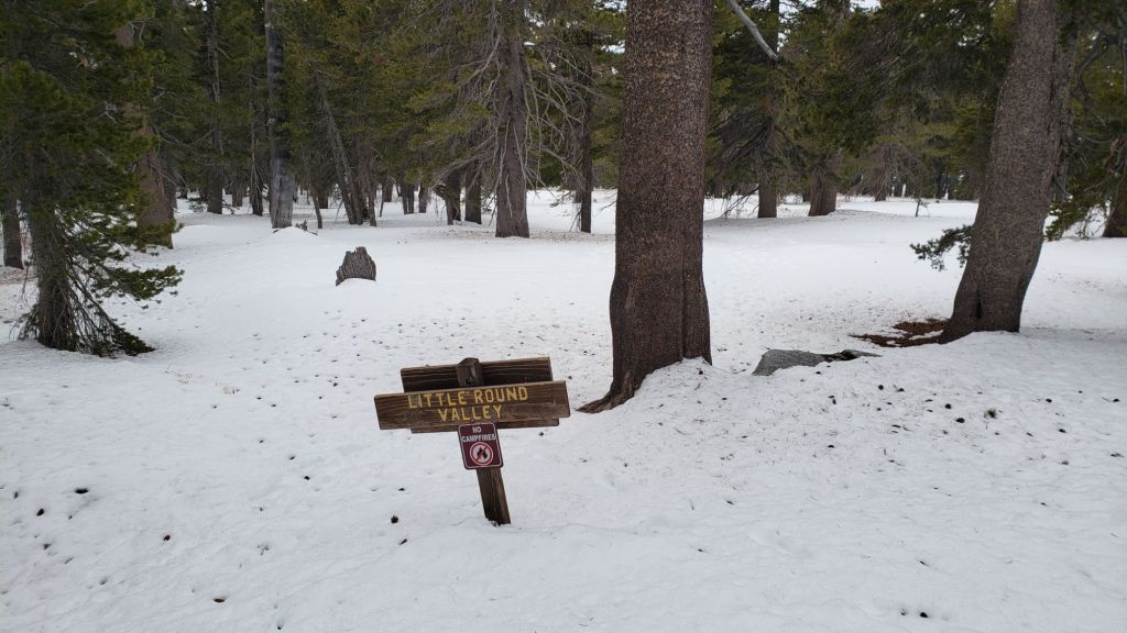
SNOW DEPTHS
Measured on 24th February 2025 (20th February for Deer Springs Trail locations). Note that average depth is given; due to strong winds accompanying the storm system there was extensive drifting, especially in the trails. Altitudes and PCT Miles are approximate. Also note that – remarkably for February – none of these locations had any snow remaining from prior storms (i.e. everything recorded here was from the latest, mid February, storm).
San Jacinto Peak (10810 ft): 11 inches (was 17.5 inches on 14th February, drifted areas ranging from 7-24 inches)
Little Round Valley (9750 ft): 16 inches (drifted to 24 inches in places)
Wellman Divide (9700 ft): 6 inches (was 17 inches on 14th February, heavily drifted in places)
Annie’s Junction/approx. PCT Mile 180.8 (9020 ft): 13 inches (was 16-17 inches on 14th February)
Fuller Ridge Trail junction with Deer Springs Trail/approx. PCT Mile 185.5 (8800 ft): 12 inches
Saddle Junction/approx. PCT Mile 179 (8070 ft): 1-2 inches (was 3.5 inches on 14th February)
Strawberry Junction/approx. PCT Mile 183.1 (8050 ft): 1-2 inches (patchy 0-4 inches)
Devil’s Slide Trail at Humber Park (6550 ft): 0 inches (was 2-3 inches on 14th February)
Idyllwild (at 5550 ft): 0 inches (0.25 inch of snow on 12th February, and 5.3 inches of rain 12th-14th February)
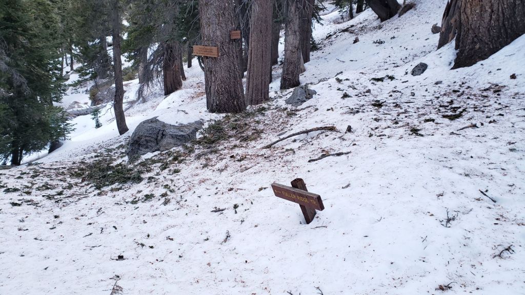
While all time and labor is volunteered, the San Jacinto Trail Report uses small private donations to help cover operating costs. Your contribution keeps the Report available to all, free from advertising or paywalls, and independent from agencies. If you have found this Report useful, please consider using this link to the Donate page. Thank you very much for your support.

sanjacjon Uncategorized Leave a comment 16 MinutesEdit”Trail and weather update 26th February 2025″
Moderate snow storm 12th-14th February 2025
UPDATED Thursday 20th February: I hiked to San Jacinto Peak today for the fourth time in the past week, ascending via the Wellman and Peak trails, descending Deer Springs Trail, and have updated the Trail Conditions section below accordingly. I summarized my observations from Sunday 16th in a video report from the far-too-warm-for-February Peak (linked here). On 17th we hiked both north and south sides of Tahquitz Peak. High country tracks are generally firm and reliable underfoot in the early morning, but become soft by late morning, with a much greater likelihood of postholing by and after noon.
————————————-
This is a summary of conditions following the seventh, but by far most substantial, snow storm of winter 2024/25, with the majority of the snow falling between the afternoon of Thursday 13th and the morning of Friday 14th February.
Exactly six years on from the (in)famous Valentine’s Day flood of 2019 – when eight inches of rain in less than a day destroyed several mountain roads, some for months – heavy rain was also a feature of this storm, with Idyllwild recording 5.3 inches (and nearly four inches in one 24 hour period).
This complex storm sequence had multiple phases as discussed under Weather below. The practical consequence was a strikingly high snow level, with moderate snow above about 8500 ft, and surprisingly shallow snow lower down. I have never recorded such a discrepancy in snow depths between Saddle Junction (8100 ft, with just three inches by the afternoon of 14th) and Annie’s Junction (9020 ft, nearly 18 inches).
Final storm totals included 17-18 inches at San Jacinto Peak, similar amounts at Wellman Divide and Annie’s Junction (due to the complexities of the timing of the snowfall), just 10-11 inches at Long Valley, and three inches or fewer from Saddle Junction (8100 ft) down to about 6500 ft.
I recorded a short video report from San Jacinto Peak in the snow just after 0900 on Friday 14th (linked here).
Most trails have now been traveled and most are no longer obscured by significant snowfall, due to hiker traffic and with rapid melting continuing. Nevertheless cautious navigation is recommended everywhere. Snow depths measured on 14th are listed at the foot of this posting, but note that due to very strong winds accompanying the storm there was extreme drifting, and snow is often deeper in the trails.
Until about 18th, conditions were unusually good for snowshoeing above about 9000 ft on most of the mountain, and as low as 8000 ft on the eastern side (where less impacted by rainfall). Rarely have I encountered such a densely formed snowpack in fresh powder, and I was gliding across the surface of the snow on 14th. With compaction from freeze/thaw cycles, conditions are now better for spikes.
Everywhere above about 7000 ft it is recommended to carry spikes for the foreseeable future as established trails have become consolidated by hiker traffic and as they undergo freeze-thaw cycles. This elevation will rise further over the next week as sun-exposed trails rapidly melt.
Sadly – but unsurprisingly given the trend this winter – temperatures abruptly rise to above seasonal on Saturday 15th February, and remain warm for days, possibly even for the remainder of the month. Consequently melting will be rapid at all elevations, especially on sun-exposed slopes. Only those traditional locations that are especially sheltered – for example the north face of Tahquitz Peak, either side of Annie’s Junction (PCT Mile 180.8), in and below Little Round Valley – may continue to hold deep snow for the next several weeks.
The USFS gate at Humber Park reopened on 18th February after a brief closure. Even when closed there are nine legal parking spaces immediately below the gate. If there is a “Road Closed” sign lower down, it is also possible to park along Forest Drive. South Ridge Road remains open and is readily passable, albeit somewhat lumpy in places. Dark Canyon Road (4S02), the access road to the Seven Pines trailhead, is closed due to seasonal conditions.

WEATHER
Temperatures are forecast to abruptly rise above seasonal averages this weekend and remain elevated for the remainder of February, especially on 23rd-27th. By Sunday 23rd record high temperatures for the month of February are possible around the highest peaks. Most days are forecast to be clear and sunny until the turn of the month. Obviously these factors will combine to cause rapid snow melt and deteriorate hiking conditions markedly.
The three day storm on 12th-14th was complex with three distinct phases. The first cold phase on the morning of Wednesday 12th included snow dusting down to just below 5000 ft but minimal depth, with only 0.25 inch in Idyllwild and 0.5 inch at Tahquitz Peak (8836 ft). Upper elevations and especially the eastern side of the mountains received no measurable snow at that time.
As temperatures warmed on 12th and into 13th, the shallow snow at mid elevations melted, producing slush on the trails below 9000 ft. Rainfall then dominated as the snow level rose – briefly as high as San Jacinto Peak – before stabilizing around 8500 ft.
From the evening of 12th to the early hours of 14th, rainfall dominated below about 8500 ft, with snowfall above that elevation, and the greatest intensity of both overnight on 13th.
The final third phase was another cooling as the system departed, with the snow level dropping to 6000 ft early on 14th. Precipitation became more inconsistent throughout 14th, finally ending in the early afternoon.
At San Jacinto Peak (10,810ft/3295m) on Thursday 20th February 2025 at 0820 the air temperature was 35.6°F (2°C), with a windchill temperature of 23.2°F (-5°C), 17% relative humidity, and a steady NNW wind sustained at 10 mph gusting to 18.3 mph.
At the Peak on Sunday 16th February 2025 at 0915 the air temperature was 36.4°F (2°C), with a windchill temperature of 30.1°F (-1°C), 45% relative humidity, and a very light WNW wind sustained at 3 mph gusting to 5.8 mph.
At the Peak on Friday 14th February 2025 at 0915 the air temperature was 20.4°F (-6°C), with a windchill temperature of -1.3°F (-19°C), 100% relative humidity, and a bitter WNW wind sustained at 17 mph gusting to 26.7 mph.

TRAIL CONDITIONS
Trails are snow-covered with thin snow above about 7500 ft, and moderate depth snow above about 8500 ft. Melting is underway at all elevations, and clear sections are already appearing below 7500 ft, e.g., lower Devil’s Slide Trail, South Ridge Trail, and lower Deer Springs Trail.
Until about 18th least, beware of large volumes of ice falling from trees over trails, especially from 8000-10,000 ft. Although this happens to some extent following every storm, due to the large volume and high elevation of freezing rain associated with this latest storm, the ice fall risk is unusually noteworthy at present.
Everywhere above about 7500 ft carrying spikes is strongly recommended for the foreseeable future [updated 20th February] as established trails become consolidated by hiker traffic and as they undergo freeze-thaw cycles. This elevation will rise over the next few days as sun-exposed trails continue to melt. As always, spikes tend to be especially useful for descending, even when they are not necessarily required for ascending. Early on the morning of 20th I did not need spikes at all to ascend the Wellman and Peak trails to San Jacinto Peak, on an excellent firm snow track, but used them to descend down to 8900 ft on Deer Springs Trail. By about 1030, snow was becoming soft below Strawberry Junction (but was thankfully already very shallow).
Conditions remain suitable for snowshoeing above about 9000 ft on most of the mountain. Snowshoes may actually become increasingly useful over the next week to minimize postholing as snow softens by late morning, especially on sun-exposed slopes.
Devil’s Slide Trail [20th February] is now functionally clear of snow to about 7500 ft. Hikers are unlikely to require spikes below that elevation. From there to Saddle Junction there is a well-consolidated track to follow through thin, icy snow to Saddle Junction. Spikes are useful in this upper section, especially for descending.
There is a lightly traveled posthole track south on the PCT from Saddle Junction (Mile 179) to about Mile 177 (Chinquapin Flat).
From Saddle Junction northbound [20th February] a well-traveled track continues to San Jacinto Peak via Annie’s Junction (PCT Mile 180.8) and Wellman Divide, via the Wellman, Peak, and East Ridge trails.
Tracks on the Peak Trail end near Miller Peak, where they are joined by tracks coming up from the tram via Tamarack Valley. These all continue up to the Peak via the East Ridge Trail route [20th February], and although there are various options ascending the ridge, they all end up at the Peak.
Also on the tram side, there is a well-traveled posthole track from Long Valley through Round Valley to Wellman Divide.
Deer Springs Trail [20th February] is clear of snow to the Suicide Rock trail junction. The trail remains largely clear of snow to 7500 ft, with then about 50% thin snow cover to Strawberry Junction. Thereafter snow cover is continuous to San Jacinto Peak, albeit very thin below 8600 ft. The track is relatively lightly-traveled but easy to follow to the junction with Marion Mountain Trail. Above that point the well-traveled track is relatively easy to follow, and largely follows the true trail route, to Little Round Valley. Above Little Round Valley, there is only a scattering of posthole tracks that all meander upslope to San Jacinto Peak, with none of them approximating to the trail route (as is traditional in with adequate snow depth on this slope).
South Ridge Trail [22nd February] has a posthole track to Tahquitz Peak fire lookout. The trail is clear of snow to Old Lookout Flat (at 7600 ft). Snow cover averages 50% beyond that. In the uppermost switchbacks (>8500 ft, switchback 12) snow cover is continuous, uneven (due to icefall) and most hikers will find spikes are useful, especially for descending.
Tahquitz Peak trail from Chinquapin Flat/PCT Mile 177 has a challenging and very lightly traveled posthole track to follow through the steeply angled icy snow (photo below). These slopes comprise some of the most consequential terrain in winter in these mountains, and this route is not recommended for most hikers at this time. Spikes (or even crampons) are strongly recommended, with at least hiking poles or preferably an ice axe (assuming adequate knowledge of how to use it).

SNOW DEPTHS
Measured on 14th February 2025. Note that average depth is given; due to strong winds accompanying the storm system there is extensive drifting, especially in the trails. Altitudes and PCT Miles are approximate. Also note that – remarkably for February – none of these locations had any snow remaining from prior storms (i.e. everything recorded here was from this latest storm).
San Jacinto Peak (10810 ft): 18 inches (drifted areas ranging from 7-24 inches)
Wellman Divide (9700 ft): 17 inches, heavily drifted in places.
Annie’s Junction/approx. PCT Mile 180.8 (9020 ft): 15-18 inches
Saddle Junction/approx. PCT Mile 179 (8070 ft): 3 inches
Devil’s Slide Trail at Humber Park (6550 ft): 2 inches (largely slushy, melting already underway)
Idyllwild (at 5550 ft): 0 inches of snow. The 0.25 inch on 12th melted very rapidly. An impressive 4.69 inches of rain since the 12th included 3.72 inches in the 24 hour period starting 0700 on 13th.
While all time and labor is volunteered, the San Jacinto Trail Report uses small private donations to help cover operating costs. Your contribution keeps the Report available to all, free from advertising or paywalls, and independent from agencies. If you have found this Report useful, please consider using this link to the Donate page. Thank you very much for your support.


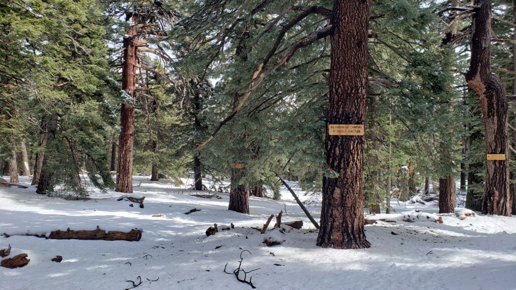
sanjacjon Uncategorized Leave a comment 9 MinutesEdit”Moderate snow storm 12th-14th February 2025″
Storm report 12th-14th February 2025
Only the seventh storm of winter 2024/25 – but by far the most notable one for expected precipitation – is forecast to move across the San Jacinto mountains between Wednesday 12th and Friday 14th February 2025.
Please check this page for periodic updates – the most recent is at the top – throughout the multiple day storm sequence. The next comprehensive Report update, summarizing conditions during and after the storm, may be published late on Friday 14th February.
UPDATE Friday 14th February at 1010: it continues to snow gently in the high country, but it is accumulating at only 0.25-0.5 inch per hour. Storm total at San Jacinto Peak is 16-17 inches.
I recorded a short video report from San Jacinto Peak in the snow just after 0900 (linked here).
UPDATE Friday 14th February at 0700: Idyllwild has recorded an impressive 3.72 inches of rain in the past 24 hours, for a current storm total of 4.69 inches.
Snow depths broadly doubled overnight, with storm totals of 14-16 inches at San Jacinto Peak and 9-10 inches in Long Valley (8500 ft). Strong winds overnight mean that drifting is severe, with measurements around San Jacinto Peak ranging from 7-22 inches. Snow fell entirely as fine rounded grains (rather than big flakes) so couldn’t reach the most optimistic depths forecast.
UPDATE Thursday 13th February at 1700: Snow has been slow to accumulate at San Jacinto Peak, with currently 5.0 inches of fresh powder (but very heavily drifted in strong winds).
Snow level on my morning hike was above 9000 ft, with rain below 8500 ft, and sleet in between, but all are expected to drop overnight.
Idyllwild has added 1.32 inches of rain since 0700 today, for a storm total of 2.29 inches already (and the most intense precipitation still to come in the next few hours).
UPDATE Thursday 13th February at 1330: Freezing rain overnight reached all the way to San Jacinto Peak before turning to light snow early this morning. There is currently 3.5 inches of fresh powder at the Peak, and I measured 2.5 inches at Wellman Divide (9700 ft) a couple of hours earlier. The heavy snowfall is expected over the next 12 hours.
Idyllwild has added another 0.75 inches of rain since 0700 for a storm total of >1.7 inches so far. Trail conditions were challenging between 7500-9300 ft, with heavy water flows running underneath 1-2 inches of slush as the light snow from yesterday melted.
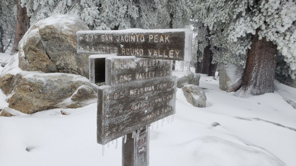
While all time and labor is volunteered, the San Jacinto Trail Report uses small private donations to help cover operating costs. Your contribution keeps the Report available to all, free from advertising or paywalls, and independent from agencies. If you have found this Report useful, please consider using this link to the Donate page. Thank you very much for your support.
UPDATE Thursday 13th February at 0700
Rainfall in the past 24 hours in Idyllwild has totaled 0.97 inch and is steadily intensifying. It finally started snowing lightly in Long Valley at about 0500 this morning, accumulating very slowly.
UPDATE Wednesday 12th February at 1950
Very light misty drizzle in Idyllwild for most of the afternoon and evening has added up to 0.15 inch so far. This aligns with most weather stations in the San Jacinto mountains which are reporting 0.1-0.2 inch, with 0.25 inch in Anza. The eastern slope is still not reporting any snow at upper elevations.
UPDATE Wednesday 12th February at 1340
We hiked to a windy and frigid Tahquitz Peak (8836 ft) this morning through very light, fine snow, and recorded a short video report from the fire lookout (linked here). Periodic brighter spells suggested that the top of the cloud was just above us, somewhere between 9000-10,000 ft, and hence unsurprisingly Long Valley (at 8500 ft on the east slope) remains snow-free at this time. No more than 0.5 inch accumulated around Tahquitz Peak, and by the time we descended, snow was starting to melt as high as 8500 ft and below 6500 ft it had already completely melted as the temperature rose to a few degrees above freezing.

UPDATE Wednesday 12th February at 0630
In the early hours of this morning Idyllwild was dusted with 0.25 inch of snow, but it had stopped by first light. The high country and eastern side of the mountains have remained largely above the cloud at this time, with no snow in Long Valley (8500 ft). As the bulk of the storm system moves in, temperatures are forecast to rise, with rain starting at mid elevations around noon and light snow in the high country around dusk. Total snow accumulation estimates for the high country have increased, with up to two feet now possible on Thursday.
sanjacjon Uncategorized Leave a comment 3 MinutesEdit”Storm report 12th-14th February 2025″
Weather and trail update 10th February 2025
UPDATE Wednesday 12th February 2025 at 0630: In the early hours of this morning Idyllwild was dusted with 0.25 inch of snow, but it had stopped by first light. The high country and eastern side of the mountains have remained largely above the cloud at this time, with no snow in Long Valley (8500 ft). As the bulk of the storm system moves in, temperatures are forecast to rise, with rain starting at mid elevations around noon and light snow in the high country around dusk. Total snow accumulation estimates for the high country have increased, with up to two feet now possible on Thursday.
————————————-
The first substantial storm system of winter 2024/25 to impact Southern California is finally forecast for this coming week. A moderate “atmospheric river” is expected between Wednesday 12th and Friday 14th February, with the first light precipitation possible on the evening of Tuesday 11th. The system will be mild, with a high snow level that may drop close to 5000 ft only briefly at the beginning and end of the storm sequence. Consequently rain is forecast for mid elevations (e.g., Idyllwild), with an impressive 2-4 inches possible. Snow estimates for the highest elevations of the high country have ranged widely from 10-40 inches, although a depth around 12-18 inches is now most likely. Regardless of the final depth, impacts on the trail system could be significant, at least for the remainder of February.
Melting of the light snow from the storm on 26th-27th January has been rapid. We experienced continuous snow cover in the high country for only four days (the late January storm is described in detail in a prior Report linked here). Total snowfall at San Jacinto Peak since September 2024 has been a pitiful 7.6 inches. Most trails are clear of snow (details under Trail Conditions below).
In the early hours of Friday 7th February we caught the southernmost edge of an atmospheric river passing to the north. I hiked to San Jacinto Peak that morning through pleasant misty cloud and periodic drizzle before reaching patchy blue sky right around the Peak. The storm was mild, producing only rain all the way to the highest elevations. Above 9500 ft freezing rain plastered all surfaces with ice but that quickly melted in full sun the following day. Saddle Junction (8100 ft) with 0.51 inch recorded the most rainfall, with 0.41 inch at Wellman’s Cienega (9300 ft), 0.32 inch in Idyllwild, and 0.2 inch at San Jacinto Peak.
Conditions are currently suitable for spikes in places above about 8700 ft on the western slope (e.g., Deer Springs Trail) as the established trails have undergone freeze-thaw cycles and remaining thin snow has become icy due to consolidation by hiker traffic. Recommendations for traction devices are expected to change significantly starting 12th February.
Hikers must be prepared for temperatures below freezing in the high country, and well below freezing when considering wind chill effects, for the foreseeable future (see below for my recent weather observations from San Jacinto Peak).
Survey hikes by the Trail Report every single day throughout the year in the San Jacinto mountains include varied routes to the high peaks including San Jacinto Peak typically 2-3 times per week (more frequently during storms), Tahquitz Peak and area 1-2 times per week, plus a wide variety of other trails on intervening days.
Regardless of how low the snow level drops during the storm this week, access to Forest Service dirt roads may well close due to seasonal conditions, at least temporarily. The USFS gate at Humber Park is currently open. Even when closed there are nine legal parking spaces immediately below the gate. South Ridge Road is currently open and is readily passable with AWD/4WD vehicles.

WEATHER
Following temperatures this past weekend that were again well above seasonal, a rapid cooling will result in temperatures below average on 11th-14th February.
As described above, a moderate storm system is forecast for this coming week, impacting the San Jacinto mountains between Tuesday 11th and Friday 14th February. The system will be relatively mild with several inches of rain forecast for mid elevations, with a possibility for light snow at the beginning of the storm as low as 5000 ft (which will subsequently melt as temperatures rise on 13th and 14th).
Snow estimates for the high country have ranged as high as 40 inches. The most likely final depth is now expected to be 1-2 feet at most. The relative warmth of the system will result in a high snow level, around 7000-8000 ft for much of the storm, with consequently little or no snowfall expected below 6000 ft.
Immediately after passage of the storm, temperatures quickly rise to above seasonal at all elevations starting 15th February, but most strikingly at the highest elevations. Consequently melting of snow may be rapid once again.
At San Jacinto Peak (10,810ft/3295m) on Monday 10th February 2025 at 0845 the air temperature was 24.9°F (-4°C), with a windchill temperature of 8.2°F (-13°C), 44% relative humidity, and a cool due West wind sustained at 13 mph gusting to 18..7 mph.
At the Peak on Sunday 9th February 2025 at 0835 the air temperature was 29.4°F (-1°C), with a windchill temperature of 14.5°F (-10°C), 12% relative humidity, and a steady WSW wind sustained at 14 mph gusting to 18.9 mph.
At the Peak on Friday 7th February 2025 at 0940 the air temperature was 27.4°F (-3°C), with a windchill temperature of 8.8°F (-13°C), 100% relative humidity, and a bitter WSW wind sustained at 18 mph gusting to 28.4 mph.
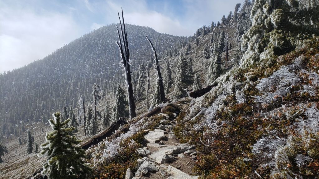
TRAIL CONDITIONS
There is currently no continuous settled snow in the San Jacinto mountains, an unprecedented situation in recorded history this late into the winter. The thin covering above 9000 ft that fell on 7th January only lasted for a few days despite cold temperatures, while the 4-6 inches of snow from the minor storm on 26th-27th January has already largely melted. Obviously this situation is expected to change starting Wednesday 12th February, and hikers must be fully prepared for winter conditions thereafter.
Most hikers will find that traction devices are not widely required on the trail system at this time, although conditions are currently suitable for spikes in places above about 8700 ft on the western slope (Deer Springs Trail and short parts of the PCT) as the established trails have undergone freeze-thaw cycles and the thin snow has become icy due to consolidation by hiker traffic. Spikes tend to be much more valuable for descending trails than ascending.
There is functionally no snow on trails on the eastern side trails, e.g., the Peak Trail is almost completely clear. Tiny patches persist in the most sheltered areas above 9000 ft, notably either side of Annie’s Junction (PCT Mile 180.8), then again at 9900-10,100 ft on the Peak Trail and above 10,500 ft around San Jacinto Peak.
The East Ridge Trail (between Miller-San Jacinto peaks) is still 50% snow-covered, but only one inch deep and with a well-traveled (but icy) track accurately following the old trail route.
Deer Springs Trail is clear of snow from the trailhead to Strawberry Junction, and then beyond for about 1.5 miles to near 8600 ft elevation. From just south of the junction with Marion Mountain Trail snow cover is a patchy 60% in the trail to San Jacinto Peak, although much of the sun-exposed route above Little Round Valley is now clear. Snow is thin and patchy in the trail, but due to hiker compaction it is icy. Some hikers will find spikes useful on the upper part of this trail.
On the section of Deer Springs Trail between Strawberry Junction and the top of Marion Mountain Trail (roughly PCT Miles 183-185) six significant treefall hazards remain, mostly from high winds in January. Three more came down in a concentrated area just north of the top of Seven Pines Trail (near Mile 185.2). About ten further trees on the upper trail (above Fuller Ridge) have been down and reported repeatedly for more than a decade but with no action from the State Park. Two significant obstructions are down across the trail between the Suicide Rock Trail junction and Strawberry Junction.
South Ridge Trail is clear of snow from the top of South Ridge Road to Tahquitz Peak (updated 3rd Feb). Four treefall hazards that came down in the trail in strong winds in January were removed by the Trail Report in early February.
There is a well-traveled track through patchy thin snow on the short section of South Ridge Trail on the north side of Tahquitz Peak to Chinquapin Flat. This is icy in places and hikers may find spikes are useful here.
Although the situation has improved somewhat in recent months, treefall hazards remain a significant problem along parts of the Pacific Crest Trail, most notably between Antsell Rock and South Peak. Some 56 trees are down across the trail between PCT Miles 170.5-174, with 37 of these, including several serious obstructions that make for slow-going, between Miles 172.5-174 (around and immediately south of South Peak). A further nine smaller obstructions are down from Miles 168.5-170.5 (Spitler Peak Trail to Zen Center Trail). Significant sections of Miles 168.5-175 are also badly overgrown with brush and are in urgent need of major trimming work (surveyed January 2025).
On the Fuller Ridge Trail section of the PCT there are 12 trees down on the State Park section of the trail (Miles 185.5-189, which have not been maintained by that agency for many years). Several of these pose quite significant hazards for hikers. On the Forest Service section (Miles 189.3-190.5) five significant treefall hazards were removed by USFS late in 2024. Snow cover on Fuller Ridge Trail averages only 50%, but is very localized with sun-exposed sections completely clear and shaded sections still with 1-2 inches depth of snow in the trail.
Trees down on the Strawberry Trail section of the PCT (Annie’s Junction to Strawberry Junction, Miles 180.8-183) have remained uncut by the Forest Service for nearly a decade. About six hazards on this section are thankfully all relatively easy for hikers to negotiate.
The Trail Report heavily trimmed the formerly overgrown Wellman Trail (Annie’s Junction to Wellman Divide) from September 2024-January 2025. The Wellman Trail currently averages about 20% snow cover, confined to the sections that are sheltered under the forest canopy.
In February 2025 the Trail Report cleared Spitler Peak Trail of the six trees that came down in Santa Ana winds in January (bringing to 129 the total number of trees removed by the Report from this trail in recent years). We also removed most of the whitethorn from the central portion of the trail in December 2024. While more brush trimming work is always required, in general the trail is currently in its best condition since at least mid 2023. Spitler Creek continues to flow gently at its various crossings in the upper switchbacks, and Antsell Rock Creek starting flowing gently again in November 2024 (but will dry again this spring without significant further precipitation).
The Trail Report removed the only two new small trees down across Fobes Trail last week. The trail is otherwise largely clear, with only a few minor branch hazards mainly along the lower trail. Snow was gone from this trail (all below 6000 ft) by 31st January.
The Caramba Trail from near Reeds Meadow through Laws Camp and on to Caramba, and the Cedar Trail from Willow Creek Trail to Laws, are euphemistically (and potentially dangerously) described by the Forest Service as “not maintained”. In reality both trails have been abandoned and no longer exist. They are so heavily overgrown, largely with dense whitethorn, which obscures dozens of downed trees, that hikers should not attempt to follow them (regardless of how much you may trust an app). An informal use trail to Laws is much more direct, well maintained, and avoids the bushwhacking of the unmaintained trails (some local Idyllwild hikers dubbed it the “King Trail” when I established the route in 2019). It leaves Willow Creek Trail exactly 1.0 mile from Saddle Junction, 0.46 mile from the Skunk Cabbage turning (trailhead at N 33.7796, W 116.6590). The route descends largely following established deer trails for 1.2 miles, meeting Willow Creek about 0.2 mile upstream from the site of the historic Laws Camp (the remains of which were destroyed by the 2013 Mountain Fire and subsequent flood and treefall damage). One huge tree fell in late 2024 across the King Trail about midway down and requires a minor scramble underneath (that tree will not be cut soon), while another fell in January 2025 close to the bottom of the trail that is relatively easy to cross over. Another five recently downed trees were either removed or worked around in January 2025, when the trail was thoroughly trimmed and cleared. From Laws east to Caramba the route of the original Caramba Trail has been cairned by myself and others and can largely be followed with careful route-finding. My February 2025 survey counted about 120 trees down on this 2.1 miles of trail. It is extremely obscure for the first 0.5 mile east of the Willow Creek crossing, becoming more obvious (but still subtle) as it descends towards Caramba. Very cautious navigation is advised throughout the area.
In late 2024 Willow Creek Trail was nearing its 2020 condition, the last time the original trail route was fully cleared and passable. Four new trees came down on the Forest Service section in January, two of which are large and tricky for hikers to pass. In addition to trees being cut in 2024, whitethorn trimming was largely completed, mainly by volunteers, on the Forest Service side in late summer. On the State Park side localized trimming of the worst patches was undertaken in 2024, and the minor treefall hazards new in 2023/24 were removed, leaving just two major long term downed trees (both easy to pass for hikers).
The Trail Report “adopted” Seven Pines Trail as a priority for maintenance work as the trail had a disproportionate number of lost hiker rescues in the past decade, and both State Park and Forest Service have shown no interest in maintaining the route for years. Since 2020 we have removed 75 downed trees and the trail is trimmed and cleared multiple times annually. As of late 2024 the trail is largely clear of treefall hazards, with three down across the trail in its upper section, all easily passable for hikers. A further half-a-dozen downed trees close to the PCT junction would need to be removed to fully restore the original route of the trail. Although the condition of the trail is hugely improved, Seven Pines remains a genuine wilderness trail unlike the wider, bare, obvious routes of, for example, Devil’s Slide or Marion Mountain trails. Cautious navigation remains essential for those without considerable experience of hiking this trail. Be aware in particular that Seven Pines Trail becomes most obscure in the mile closest to its junction with Deer Springs Trail/PCT.
The Zen Center Trail continues its serious deterioration that started following the 2013 Mountain Fire, with a combination of vigorous regrowth and treefall hazards further obscuring the route with each passing season. The lower and upper thirds of this trail are partially cairned and not too bad for those who are very familiar with the former route, but even the experienced find navigating the central section tricky. Long trousers, scrambling gloves, and an enjoyment of bush-whacking are all strongly recommended.

While all time and labor is volunteered, the San Jacinto Trail Report uses small private donations to help cover operating costs. Your contribution keeps the Report available to all, free from advertising or paywalls, and independent from agencies. If you have found this Report useful, please consider using this link to the Donate page. Thank you very much for your support.
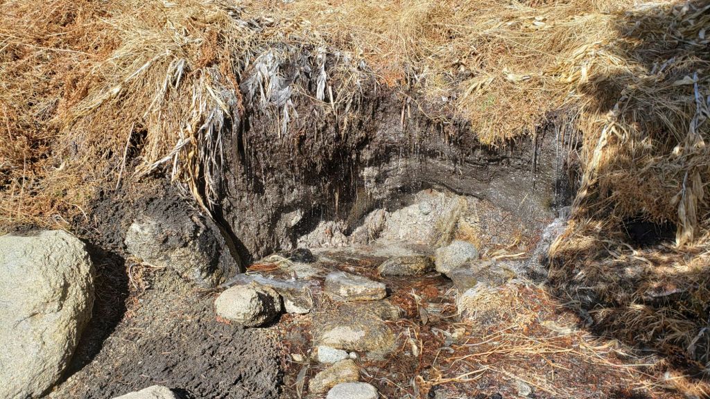
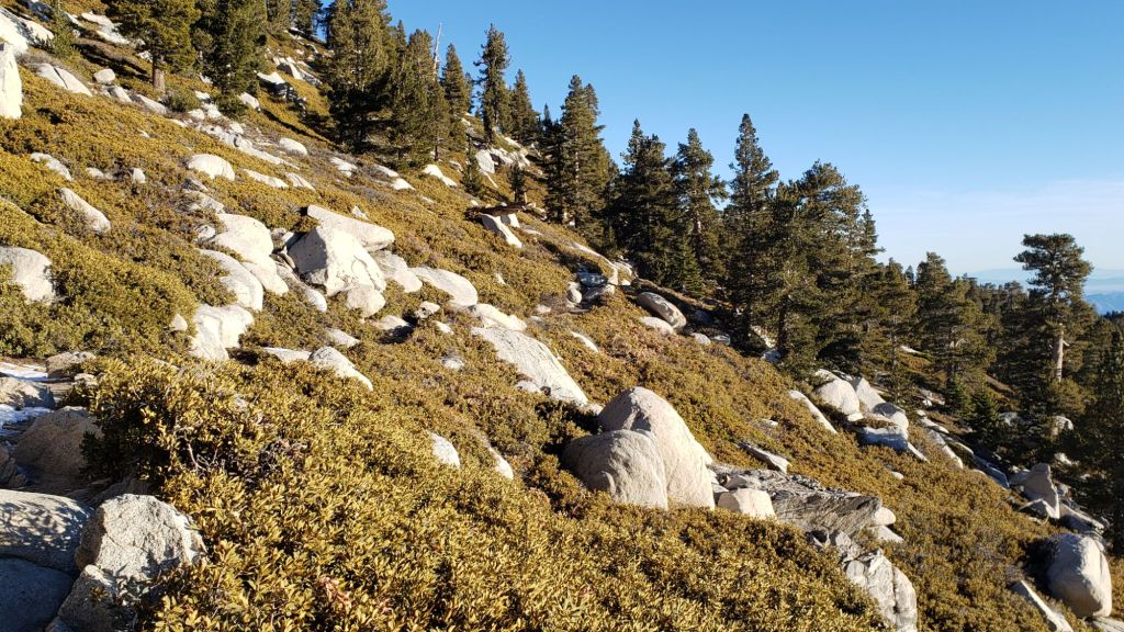

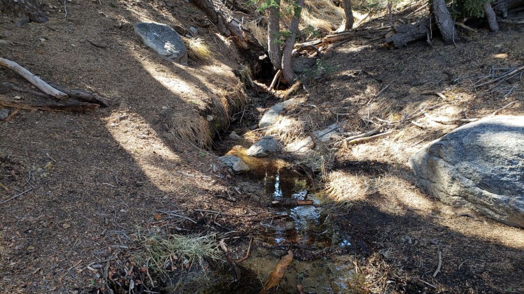

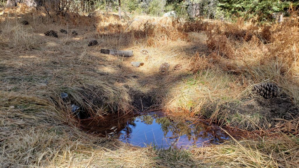
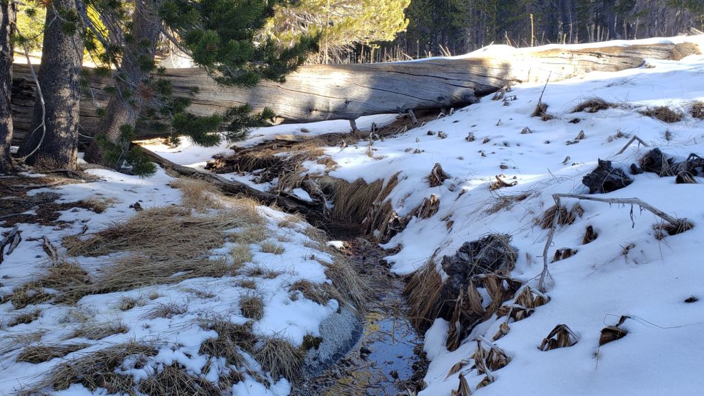
sanjacjon Uncategorized Leave a comment 11 MinutesEdit”Weather and trail update 10th February 2025″
Trail update 5th February 2025
UPDATE Friday 7th February at 1330: we caught the southernmost edge of an atmospheric river passing to our north overnight. I hiked to San Jacinto Peak this morning through pleasant misty cloud and periodic drizzle before reaching patchy blue sky right around the Peak. The storm was mild, producing only rain all the way to the highest elevations. Above 9500 ft freezing rain has plastered all surfaces with a thin but treacherous covering of ice. Spikes are strongly recommended at the highest elevations until the emerging sun melts the ice. The most rainfall on the mountain was at Saddle Junction (8100 ft) with 0.51 inch, with 0.41 inch at Wellman’s Cienega (9300 ft), 0.24 inch in Idyllwild, and 0.2 inch at San Jacinto Peak.
——————————————-
The dramatically variable weather that is increasingly typical of the climate this century has certainly been impacting the San Jacinto mountains in the past week. Only five days after the all-too-minor snow storm of last week, it was t-shirt-and-shorts weather in Idyllwild this weekend. Temperatures quickly swung from below seasonal to far above average for February. San Jacinto Peak flirted with an all-time record high temperature for the month of February on 2nd, and may continue to do so on/off throughout the first two weeks of the month (the record high for February is 39.3°F on 22nd in 2021).
Predictably, melting of the light snow from the storm on 26th-27th January has been very rapid. We experienced continuous snow cover in the high country for only four days (the late January storm is described in detail in the previous Report linked here). Total snowfall at San Jacinto Peak since September 2024 has been a pitiful 7.6 inches. Many trails are already functionally clear of snow (details under Trail Conditions below) and the remainder may be within days.
Moderate rainfall is now forecast for the mid elevations overnight on 6th and throughout 7th February. Up to one inch is possible at 5000-6000 ft (e.g., Idyllwild-Pine Cove). The high country may stay largely above the precipitation, with less than 0.1 inch rain currently expected (and temperatures forecast to be too warm for snow). Another storm system is brewing for next week (12th-14th February) with possibilities for more significant snowfall, and further rain at mid elevations.
Conditions are currently suitable for spikes in places above about 8700 ft on the western slope as the established trails have undergone freeze-thaw cycles and the thin snow has become icy due to consolidation by hiker traffic. Snow depths are of course insufficient for snowshoes. Snow depths are insufficient to justify listing at the foot of this posting.
Despite temperatures being above seasonal for February, hikers should be prepared for temperatures near freezing in the high country, and potentially well below freezing when considering wind chill effects on some days (see below for my recent weather observations from San Jacinto Peak).
Survey hikes by the Trail Report every single day throughout the year in the San Jacinto mountains include varied routes to the high peaks including San Jacinto Peak typically 2-3 times per week (more frequently during storms), Tahquitz Peak and area 1-2 times per week, plus a wide variety of other trails on intervening days. On Sunday 2nd we ascended San Jacinto Peak via the classic east side route (using Devil’s Slide, Wellman, and Peak trails) and descended the west side via Deer Springs Trail. This facilitated survey of the highest parts of the PCT in the San Jacinto mountains (roughly Miles 179-181 and 185.5-183.5) plus several of its side trails.
The USFS gate at Humber Park reopened late last week. Even when closed there are nine legal parking spaces immediately below the gate. Vehicles not parked in these spaces have been ticketed in past winters. South Ridge Road is open and is readily passable with AWD/4WD vehicles.
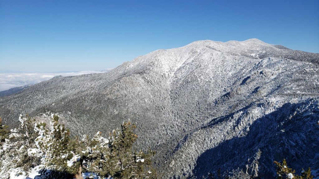
WEATHER
Temperatures are forecast to remain well above seasonal until Tuesday 4th February, when they drop to near (or even slightly below) average for at least a week. Most days into mid February are forecast to be at least partly cloudy.
A warm atmospheric river passing (predictably) to our north this week will raise the marine layer to 6000-8000 ft elevation, potentially producing some light rain between 4th-7th February. Current projections are for less than 0.2 inch of rain across the four days, most likely on Friday 7th, focused on the western slope and west-facing valleys (e.g., much of the PCT in these mountains, Idyllwild-Pine Cove, Garner Valley and the Desert Divide).
The high country is expected to remain above the cloud and receive no significant new precipitation, although there is a slim possibility of a very light dusting of snow on Friday 7th. Due to the warmth of the upper level air mass, temperatures in the high country are forecast to remain 5-10°F above normal on most days into mid February, although westerly winds will remain relatively strong.
At San Jacinto Peak (10,810ft/3295m) on Sunday 2nd February 2025 at 0825 the air temperature was 37.7°F (3°C), with a windchill temperature of 22.1°F (-5°C), 45% relative humidity, and a steady due West wind sustained at 22 mph gusting to 32.1 mph.
At the Peak on Monday 27th January 2025 at 1040 the air temperature was 16.0°F (-9°C), with a windchill temperature of 9.0°F (-13°C), 74% relative humidity, and a remarkably calm hint of a NNW breeze sustained at 0 mph gusting to 2.8 mph.

TRAIL CONDITIONS
For details of water availability prior to the late January minor storm, see an earlier Report (linked here).
There is currently no continuous settled snow in the San Jacinto mountains, a truly unprecedented situation in recorded history this far into the winter months. The thin covering above 9000 ft that fell on 7th January only lasted for a few days despite cold temperatures, while the 4-6 inches of snow from the minor storm on 26th-27th January has already largely melted.
Most hikers will find that traction devices are not required on the trail system, although conditions are currently suitable for spikes in places above about 8700 ft on the western slope (Deer Springs Trail and short parts of the PCT) as the established trails have undergone freeze-thaw cycles and the thin snow has become icy due to consolidation by hiker traffic. Spikes tend to be much more valuable for descending trails than ascending.
There is functionally no snow on trails below 9000 ft on the eastern side trails, e.g., Devil’s Slide Trail is clear, as is most of PCT Miles 178-180. Patches persist in the most sheltered areas above 9000 ft, notably either side of Annie’s Junction (PCT Mile 180.8), then again at 9900-10,100 ft on the Peak Trail and above 10,500 ft around San Jacinto Peak.
The East Ridge Trail (between Miller-San Jacinto peaks) is still 90% snow-covered, but only 1-2 inches deep and with a well-traveled track accurately following the old trail route.
Deer Springs Trail is functionally clear of snow from the trailhead to Strawberry Junction, and then beyond for about 1.5 miles to 8600 ft elevation. From just south of the junction with Marion Mountain Trail snow cover is about 90% in the trail all the way to San Jacinto Peak. Snow is thin and patchy in the trail, but due to hiker compaction it is icy. Some hikers will find spikes useful on the upper part of this trail.
On the section of Deer Springs Trail between Strawberry Junction and the top of Marion Mountain Trail (roughly PCT Miles 183-185) six significant treefall hazards remain, mostly from high winds in January. Three more came down in a concentrated area just north of the top of Seven Pines Trail (near Mile 185.2). About ten further trees on the upper trail (above Fuller Ridge) have been down and reported repeatedly for more than a decade but with no action from the State Park. Two significant obstructions are down across the trail between the Suicide Rock Trail junction and Strawberry Junction.
South Ridge Trail is clear of snow from the top of South Ridge Road to Tahquitz Peak (updated 3rd Feb). Four treefall hazards that came down in the trail in strong winds in January were removed by the Trail Report in early February.
There is a well-traveled track through almost continuous thin icy snow on the short section of South Ridge Trail on the north side of Tahquitz Peak to Chinquapin Flat. This is icy in places and hikers will find spikes are useful here.
Although the situation has improved somewhat in recent months, treefall hazards remain a significant problem along parts of the Pacific Crest Trail, most notably between Antsell Rock and South Peak. Some 56 trees are down across the trail between PCT Miles 170.5-174, with 37 of these, including several serious obstructions that make for slow-going, between Miles 172.5-174 (around and immediately south of South Peak). A further nine smaller obstructions are down from Miles 168.5-170.5 (Spitler Peak Trail to Zen Center Trail). Significant sections of Miles 168.5-175 are also badly overgrown with brush and are in urgent need of major trimming work (surveyed January 2025).
On the Fuller Ridge Trail section of the PCT there are 12 trees down on the State Park section of the trail (Miles 185.5-189, which have not been maintained by that agency for many years). Several of these pose quite significant hazards for hikers. On the Forest Service section (Miles 189.3-190.5) five significant treefall hazards were removed by USFS late in 2024. Snow cover on Fuller Ridge Trail averages only 50%, but is very localized with sun-exposed sections completely clear and shaded sections still with 1-2 inches depth of snow in the trail.
Trees down on the Strawberry Trail section of the PCT (Annie’s Junction to Strawberry Junction, Miles 180.8-183) have remained uncut by the Forest Service for nearly a decade. About six hazards on this section are thankfully all relatively easy for hikers to negotiate.
The Trail Report heavily trimmed the formerly overgrown Wellman Trail (Annie’s Junction to Wellman Divide) from September 2024-January 2025. The Wellman Trail currently averages about 20% snow cover, confined to the sections that are sheltered under the forest canopy.
In February 2025 the Trail Report cleared Spitler Peak Trail of the six trees that came down in Santa Ana winds in January (bringing to 129 the total number of trees removed by the Report from this trail in recent years). We also removed most of the whitethorn from the central portion of the trail in December 2024. While more brush trimming work is always required, in general the trail is currently in its best condition since at least mid 2023. Spitler Creek continues to flow gently at its various crossings in the upper switchbacks, and Antsell Rock Creek starting flowing gently again in November 2024 (but will dry again this spring without significant further precipitation).
The Trail Report removed the only two new small trees down across Fobes Trail last week. The trail is otherwise largely clear, with only a few minor branch hazards mainly along the lower trail. Snow was gone from this trail (all below 6000 ft) by 31st January.
The Caramba Trail from near Reeds Meadow through Laws Camp and on to Caramba, and the Cedar Trail from Willow Creek Trail to Laws, are euphemistically (and potentially dangerously) described by the Forest Service as “not maintained”. In reality both trails have been abandoned and no longer exist. They are so heavily overgrown, largely with dense whitethorn, which obscures dozens of downed trees, that hikers should not attempt to follow them (regardless of how much you may trust an app). An informal use trail to Laws is much more direct, well maintained, and avoids the bushwhacking of the unmaintained trails (some local Idyllwild hikers dubbed it the “King Trail” when I established the route in 2019). It leaves Willow Creek Trail exactly 1.0 mile from Saddle Junction, 0.46 mile from the Skunk Cabbage turning (trailhead at N 33.7796, W 116.6590). The route descends largely following established deer trails for 1.2 miles, meeting Willow Creek about 0.2 mile upstream from the site of the historic Laws Camp (the remains of which were destroyed by the 2013 Mountain Fire and subsequent flood and treefall damage). One huge tree fell in late 2024 across the King Trail about midway down and requires a minor scramble underneath (that tree will not be cut soon) while another one close to Laws is relatively easy to pass over. Another five recently downed trees were either removed or worked around in January 2025, when the trail was thoroughly trimmed and cleared. From Laws east to Caramba the route of the original Caramba Trail has been cairned by myself and others and can largely be followed with careful route-finding. My February 2025 survey counted about 120 trees down on this 2.1 miles of trail. It is extremely obscure for the first 0.5 mile east of the Willow Creek crossing, becoming more obvious (but still subtle) as it descends towards Caramba. Very cautious navigation is advised throughout the area.
Willow Creek Trail is nearing its 2020 condition, the last time the original trail route was fully cleared and passable. Four new trees came down on the Forest Service section in January, two of which are large and tricky for hikers to pass. Many prior treefall hazards on the Forest Service section were cut in 2024. Whitethorn trimming was largely completed, mainly by volunteers, on the Forest Service side in late summer 2024. On the State Park side some localized whitethorn trimming of the worst patches was undertaken in 2024, and the minor treefall hazards new in 2023/24 were removed, leaving just two major long term downed trees (both have simple workarounds for hikers).
The Trail Report “adopted” Seven Pines Trail as a priority for maintenance work as the trail had a disproportionate number of lost hiker rescues in the past decade, and both State Park and Forest Service have shown no interest in maintaining the route for years. Since 2020 we have removed 75 downed trees and the trail is trimmed and cleared multiple times annually. As of late 2024 the trail is largely clear of treefall hazards, with three down across the trail in its upper section, all easily passable for hikers. A further half-a-dozen downed trees close to the PCT junction would need to be removed to fully restore the original route of the trail. Although the condition of the trail is hugely improved, Seven Pines remains a genuine wilderness trail unlike the wider, bare, obvious routes of, for example, Devil’s Slide or Marion Mountain trails. Cautious navigation remains essential for those without considerable experience of hiking this trail. Be aware in particular that Seven Pines Trail becomes most obscure in the mile closest to its junction with Deer Springs Trail/PCT.
The Zen Center Trail continues its serious deterioration that started following the 2013 Mountain Fire, with a combination of vigorous regrowth and treefall hazards further obscuring the route with each passing season. The lower and upper thirds of this trail are partially cairned and not too bad for those who are very familiar with the former route, but even the experienced find navigating the central section tricky. Long trousers, scrambling gloves, and an enjoyment of bush-whacking are all strongly recommended.
While all time and labor is volunteered, the San Jacinto Trail Report uses small private donations to help cover operating costs. Your contribution keeps the Report available to all, free from advertising or paywalls, and independent from agencies. If you have found this Report useful, please consider using this link to the Donate page. Thank you very much for your support.

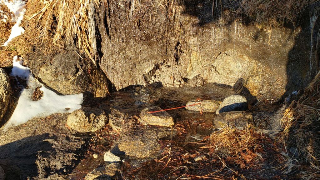
sanjacjon Uncategorized Leave a comment 12 MinutesEdit”Trail update 5th February 2025″
Minor snow storm update 29th January 2025
This is a summary of conditions following the only notable (so far) snow storm of winter 2024/25, albeit a minor storm by the standards of the San Jacinto mountains, with snow falling on 26th and 27th January. As is increasingly the trend with a rapidly changing climate in recent years, the snowfall did not fit an obvious altitudinal pattern (in which snow depth generally increases at higher elevations), with storm totals of about four inches at both Idyllwild (at 5550ft) and at San Jacinto Peak (10,810ft). The greatest depths I measured were between 7500 and 9500 ft, peaking at 6.5 inches at Saddle Junction (8100 ft).
The storm system was not a conventional “atmospheric river” originating well to the west, but came from a stalled “cut off” low pressure system around which the jet stream took a sinuous path from northern Canada. Consequently the system was cold, with a dusting of snow below 4000 ft on the morning of 27th, and the slow movement resulted in light snow continuing on/off for most of two days. The bulk of the snowfall was nevertheless concentrated in two phases, in the early hours of Sunday 26th, and then again overnight into the early hours of Monday 27th.
I broke trail to San Jacinto Peak via Devil’s Slide, Wellman, Peak, and East Ridge trails on Sunday 26th January, enjoying the conditions so much that I then repeated the same route, again breaking trail through further fresh snow, on Monday 27th. I recorded short video reports from the Peak on both days (linked here for Sunday 26th, and here for Monday 27th). We broke trail up South Ridge to Tahquitz Peak on 29th, and also put in a trail on the north side of Tahquitz between the peak and Chinquapin Flat.
Currently some trails have not been traveled and most are somewhat obscured by light snowfall. On my descent on the afternoon of 27th I noted that apart from Devil’s Slide Trail (and my own tracks on the PCT northbound ultimately heading to San Jacinto Peak) there were no other broken trails away from Saddle Junction. This will change soon with limited hiker traffic, but cautious navigation is recommended everywhere. Snow depths are listed at the foot of this posting, but note that due to drifting, snow is sometimes deeper in the trails themselves.
Snow depth and structure are both currently suitable for spikes above roughly 7000 ft, and spikes will become increasingly valuable as established trails become consolidated by hiker traffic and undergo freeze-thaw cycles. With rapid melting expected in the next week, the elevation at which spikes are needed will rise quickly. Snow depths are generally insufficient for snowshoes (except possibly around the Tahquitz area meadows for the next day or two) and crampons/ice axe are not required anywhere.
Hikers should be prepared for temperatures below freezing in the high country, and well below freezing when considering wind chill effects until Thursday 30th (see below for my recent weather observations from San Jacinto Peak).
The USFS gate at Humber Park closed on Sunday 26th January. Even when closed there are nine legal parking spaces immediately below the gate. Vehicles not parked in these spaces have been ticketed in past winters. South Ridge Road remains (unexpectedly) open and is readily passable with AWD/4WD vehicles.
WEATHER
Temperatures are forecast to remain below seasonal averages until Thursday 30th, with no significant further precipitation in January, although a possibility of light precipitation on the afternoon of Tuesday 28th. Temperatures are then forecast to rise dramatically to far above seasonal starting Friday 31st, with both daytime highs and overnight lows 10-15°F above average for January/February. The high country will not be spared, with temperatures also some 15°F above normal during the first couple of days of February. This will obviously very rapidly accelerate snowmelt at all elevations.
Temperatures are expected to cool somewhat into the second week of February, with light precipitation currently forecast for Wednesday 5th. This rainfall may be confined to the mid elevations with about 0.25 inch forecast for Idyllwild, with the high country forecast to be above the cloud with no snow expected at this time.
The latest video report from National Weather Service San Diego (linked here) summarizes the recent storm event and describes the weather patterns for the next week.
At San Jacinto Peak (10,810ft/3295m) on Monday 27th January 2025 at 1040 the air temperature was 16.0°F (-9°C), with a windchill temperature of 9.0°F (-13°C), 74% relative humidity, and a remarkably calm hint of a NNW breeze sustained at 0 mph gusting to 2.8 mph.
At the Peak on Sunday 26th January 2025 at 1110 the air temperature was 17.8°F (-8°C), with a windchill temperature of -3.8°F (-20°C), 100% relative humidity, and a cool WSW wind sustained at 9 mph gusting to 15.9 mph.
TRAIL CONDITIONS
For details of specific trail conditions (and water availability) prior to this latest minor storm, see the previous Report (linked here).
All trails above about 6000 ft are at least partially snow-covered. By the afternoon of 27th melting was already underway below 6500 ft, and this will accelerate rapidly over the next few days. Reliable tracks are currently only known to be in place for Devil’s Slide Trail through to San Jacinto Peak via Wellman Divide.
Devil’s Slide Trail has a relatively well-traveled track to follow.
Deer Springs Trail has a reliable track through the snow all the way to San Jacinto Peak as of Thursday 30th.
South Ridge Trail has a lightly traveled posthole track through to Tahquitz Peak as of Wednesday 29th. On the same day we put through a track on the north side to and from the Peak to Chinquapin Flat, where snow depth averages five inches but is drifted to 8-12 inches in the trail.
The Ernie Maxwell Trail has a well-traveled track to follow.

SNOW DEPTHS
Numbers given here are storm totals, measured initially on 26th then again on 27th January 2025, after each of the two main periods of snowfall. Note that average depth is given; some drifting and accumulation has occurred, especially in trails. Altitudes and PCT Miles are approximate.
San Jacinto Peak (10810 ft): 3.5 inches
Wellman Divide (9700 ft): 5.0 inches
Annie’s Junction/approx. PCT Mile 180.8 (9020 ft): 5.0 inches
Tahquitz Peak (8836 ft): 5.0 inches, drifted 8-12 inches on north side trail, and 6-8 inches on uppermost South Ridge Trail
Long Valley (8400 ft): 4.5 inches
Saddle Junction/approx. PCT Mile 179 (8070 ft): 6.5 inches
Devil’s Slide Trail at Humber Park (6550 ft): 5.0 inches (largely melted by 29th)
Idyllwild (at 5550 ft): 4.0 inches, largely melted by afternoon of 27th.

While all time and labor is volunteered, the San Jacinto Trail Report uses small private donations to help cover operating costs. Your contribution keeps the Report available to all, free from advertising or paywalls, and independent from agencies. If you have found this Report useful, please consider using this link to the Donate page. Thank you very much for your support.


sanjacjon Uncategorized 1 Comment 5 MinutesEdit”Minor snow storm update 29th January 2025″
Weather and trail update 22nd January 2025
UPDATE Monday 27th January at 1130: I hiked back up to San Jacinto Peak this morning, recording another short video report (linked here). Snow last night dusted down to 4000 ft, but otherwise was a consistent 2-2.5 inches everywhere, in addition to what remained from yesterday. Greatest depth is at Saddle Junction (8100 ft) with 6.5 inches, but a paltry 3.5 inches at San Jacinto Peak. Storm total for Idyllwild is four inches, but most of yesterday’s snow had already melted by Sunday evening. I hope topublish a full update to the Report this evening.
UPDATE Sunday 26th January at 1620: I hiked to San Jacinto Peak this morning and recorded a short video report from there late morning (linked here). Light snow started in the early hours of this morning, so far accumulating to 1.5 inch in Idyllwild (but already largely melted this afternoon) and one inch at San Jacinto Peak, but with 4.0 inches at Saddle Junction (8100 ft) and 3.5 inches at 9000 ft, suggesting the high country was above the cloud for some of the first wave of snow. Current forecasts expect 2-3 more inches everywhere by tomorrow morning. At this time carrying traction devices such as microspikes is recommended everywhere on the trail system above 7000 ft, and cautious navigation is required for those who are not very familiar with the trails in snow conditions.
—————————————–
Southern California is experiencing the driest start to a winter since records began in 1850, as discussed in a recent National Weather Service San Diego video report (linked here). Riverside County, along with much of the rest of southern California, is currently under 5% of average precipitation for the water year (i.e. since 1st October). December 2024 was the first time in recorded history that no snow fell in the San Jacinto high country in December, by far the latest into any winter on record with no settled snow in these mountains. Total snowfall at San Jacinto Peak since September 2024 has been a laughable 3.6 inches. Consequently at this time hikers will find spikes are not required anywhere on the trail system, however this is expected to change significantly this weekend.
A minor-to-moderate storm system is now forecast for 25th-27th January. With a complex and dramatic jet stream flow bringing an air mass originating in central Canada directly to Southern California, this is expected to be a cold system with a dusting of snow possibly as low as 4000 ft. Precipitation estimates have varied from one to 14 inches of snow above 10,000 ft, with about 5-7 inches currently most likely. Snow at mid elevations is expected from the evening of Saturday 25th throughout Sunday 26th, with up to four inches possible between 5000-6000 ft (e.g., Idyllwild-Pine Cove).
Survey hikes by the Trail Report every single day throughout the year in the San Jacinto mountains include varied routes to the high peaks including San Jacinto Peak typically 2-3 times per week (more frequently during storms), Tahquitz Peak and area 1-2 times per week, plus a wide variety of other trails on intervening days.
Despite a failed monsoon in 2024 and below-average precipitation both last winter and – very obviously – so far this season, most major springs, creeks, and pipes largely continue to flow at this time, surviving for now off the above average precipitation from September 2022 to August 2023 (sample photos below and in a prior Report linked here). Note that many of these water sources may freeze temporarily in the coming days.
The Round Valley faucet continued to flow well as of 19th January 2025. The creek in Little Round Valley largely dried up in early January 2025 but is still flowing gently – when unfrozen – in its central section (photo below). In the Tahquitz area meadows, the Tahquitz Valley pipe (for those who know where it is) continues to flow well. Tahquitz Creek is flowing at the northern end of Little Tahquitz Meadow, and adjacent to its source where it crosses the PCT at Mile 177. Strawberry Cienega is dry. Stone Creek is dry where it crosses Deer Springs Trail at about PCT Mile 183.6. Bud Spring near 9900 ft, just north-west of Marion Mountain, is flowing. Cedar Spring is flowing gently. Tool Box Spring (at the top of Ramona Trail) continues to flow well as of mid January.
WEATHER
Prior to the arrival of the winter storm on 25th, moderate to strong Santa Ana winds (i.e. largely from northeasterly directions) are forecast for 20th-21st. Gusts to 55 mph are possible in the high country and 30 mph around Idyllwild-Pine Cove. Even though much of this winter has been unusually mild, air temperatures are nevertheless often near or below freezing above 10,000 ft, where strong winds (>20 mph) greatly influence the feel of temperatures and hence associated risks. At this time of year, hikers must always be prepared for winter temperatures in the high country regardless of forecasts and/or how relatively mild it may feel at trailheads (see my sample Peak weather observations below).
Temperatures have been largely above average for months dating back to last summer. After the passage of the Santa Ana winds, temperatures will quickly warm to well above average at all elevations on 22nd-24th, before falling dramatically on Saturday 25th.
A minor-to-moderate storm system is now expected on 25th-27th January. As described above this is expected to be a cold system with light snow possible down to 4000 ft. Temperatures at the highest elevations on 25th-27th are forecast to be severely cold, with air temperatures near or below 10°F/-12°C, and windchills well below 0°F/-18°C.
Light snowfall is expected for at least 24 hours between the evening of Saturday 25th until the evening of Sunday 26th, perhaps continuing into Monday 27th. Precipitation estimates currently suggest 5-9 inches of snow above 10,000 ft, and 2-4 inches at mid elevations (5000-6000 ft).
Following passage of the storm, temperatures are forecast to quickly rise yet again, and by the first week of February may be well above seasonal (i.e. significantly above freezing in the high country).
A minor storm on Tuesday 7th January briefly brought light snow throughout the mountains with a dusting down to 6500 ft and about an inch above 9000 ft. Three inches settled at San Jacinto Peak where I recorded a short video report that evening (linked here). Remaining snow is now largely melted and what little remains is very thin and patchy.
The latest National Weather Service San Diego video report (linked here) released on 20th January describes in detail the weather patterns expected over the next ten days.
At San Jacinto Peak (3295m/10,810ft) on Monday 20th January 2025 at 0830 the air temperature was 11.4°F (-11°C), with a windchill temperature of -13.9°F (-26°C), 58% relative humidity, and a frigid due North wind sustained at 20 mph gusting to 28.3 mph.
At the Peak on Friday 17th January 2025 at 0800 the air temperature was 24.0°F (-4°C), with a windchill temperature of 8.6°F (-13°C), 22% relative humidity, and a fresh NW wind sustained at 8 mph gusting to 15.8 mph.
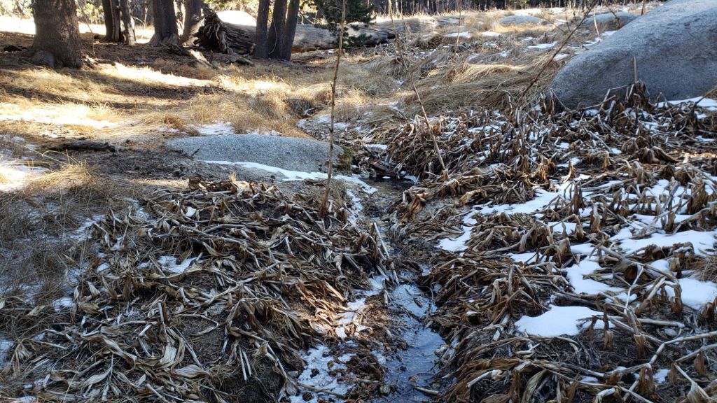
TRAIL CONDITIONS
There is currently no continuous settled snow in the San Jacinto mountains, a truly unprecedented situation in recorded history this far into the winter months. The thin covering above 9000 ft that fell on 7th January only lasted for a few days despite cold temperatures (photos in previous Report linked here). There is functionally no snow on trails below 9900 ft on the eastern side trails, with thin but locally icy patches at 9900-10,100 ft on the Peak Trail and around San Jacinto Peak. The East Ridge Trail (Miller-San Jacinto peaks) is still 50% snow-covered. Snow is gone on Deer Springs Trail below 9500 ft, and is sparse and patchy above that. Few if any hikers will find that traction devices are required anywhere on the trail system. As described above, the snow situation is expected to change significantly in the next week.
Although the situation has improved somewhat in recent months, treefall hazards remain a significant problem along parts of the Pacific Crest Trail, most notably between Antsell Rock and South Peak. Some 56 trees are down across the trail between PCT Miles 170.5-174, with 37 of these, including several serious obstructions that make for slow-going, between Miles 172.5-174 (around and immediately south of South Peak). A further nine smaller obstructions are down from Miles 168.5-170.5 (Spitler Peak Trail to Zen Center Trail). Significant sections of Miles 168.5-175 are also badly overgrown with brush and are in urgent need of major trimming work (surveyed January 2025).
On the Fuller Ridge Trail section of the PCT there are 12 trees down on the State Park section of the trail (Miles 185.5-189, which have not been maintained by that agency for many years). Several of these pose quite significant hazards for hikers. On the Forest Service section (Miles 189.3-190.5) five significant treefall hazards were removed by USFS late in 2024.
On the section of Deer Springs Trail between Strawberry Junction and the top of Marion Mountain Trail (roughly PCT Miles 183-185) most of the tricky treefall hazards that came down in strong winds earlier in the month were removed on 22nd January 2025, following an urgent request from the Trail Report. About ten further trees on the upper trail (above Fuller Ridge) have been down and reported repeatedly for more than a decade but with no action from the State Park.
Trees down on the Strawberry Trail section of the PCT (Annie’s Junction to Strawberry Junction, Miles 180.8-183) have remained uncut by the Forest Service for nearly a decade. About six hazards on this section are thankfully all relatively easy for hikers to negotiate.
The Trail Report heavily trimmed the formerly overgrown Wellman Trail (Annie’s Junction to Wellman Divide) in September-December 2024 and this work continues in January 2025. We continue to trim South Ridge Trail year-round, but with increased effort in December-January 2024/25.
The Trail Report removed almost all the obstructive whitethorn from Spitler Peak Trail in December 2024, largely in the central portion of the trail (miles 2.0-3.2 from the trailhead). Another 37 treefall hazards were cleared by the Trail Report in 2024, bringing to 123+ the total number of downed trees removed by the Report from this trail in recent years. While more brush trimming work is always required, in general the trail is currently in its best condition since at least mid 2023. Spitler Creek continues to flow gently at its various crossings in the upper switchbacks, and Antsell Rock Creek starting flowing gently again in November but will likely dry again soon.
The Caramba Trail from near Reeds Meadow through Laws Camp and on to Caramba, and the Cedar Trail from Willow Creek Trail to Laws, are euphemistically (and potentially dangerously) described by the Forest Service as “not maintained”. In reality both trails have been abandoned and no longer exist. They are so heavily overgrown, largely with dense whitethorn, which obscures dozens of downed trees, that hikers should not attempt to follow them (regardless of how much you may trust an app). An informal use trail to Laws is much more direct, well maintained, and avoids the bushwhacking of the unmaintained trails (some local Idyllwild hikers dubbed it the “King Trail” when I established the route in 2019). It leaves Willow Creek Trail exactly 1.0 mile from Saddle Junction, 0.46 mile from the Skunk Cabbage turning (trailhead at N 33.7796, W 116.6590). The route descends largely following established deer trails for 1.2 miles, meeting Willow Creek about 0.2 mile upstream from the site of the historic Laws Camp (the remains of which were destroyed by the 2013 Mountain Fire and subsequent flood and treefall damage). One huge tree fell in late 2024 across the King Trail about midway down and requires a minor scramble underneath (that tree will not be cut soon). Another five recently downed trees were either removed or worked around in January 2025, when the trail was thoroughly trimmed and cleared. From Laws east to Caramba the route of the original Caramba Trail has been cairned by myself and others and can largely be followed with very careful route-finding. My first 2025 survey counted about 120 trees down on this 2.1 miles of trail. It is especially obscure for the first 0.3 mile east of the Willow Creek crossing, becoming more obvious (but still subtle) as it descends towards Caramba. Very cautious navigation is advised throughout the area.
Willow Creek Trail is nearing its 2020 condition, the last time the original trail route was fully cleared and passable. Almost all significant treefall hazards on the Forest Service section were cut by mid August (several uncut trees remain that need to be removed to fully restore the original trail route). Whitethorn trimming was largely completed, mainly by volunteers, on the Forest Service side in August and early September 2024. On the State Park side some localized whitethorn trimming of the worst patches was undertaken in September, and the minor treefall hazards new in 2023/24 were removed, leaving just two major long term downed trees (both have simple workarounds for hikers).
The Trail Report “adopted” Seven Pines Trail as a priority for maintenance work as the trail had a disproportionate number of lost hiker rescues in the past decade, and both State Park and Forest Service have shown no interest in maintaining the route for years. Since 2020 we have removed 75 downed trees and the trail is trimmed and cleared multiple times annually. As of late 2024 the trail is largely clear of treefall hazards, with three down across the trail in its upper section, all easily passable for hikers. A further half-a-dozen downed trees close to the PCT junction would need to be removed to fully restore the original route of the trail. Although the condition of the trail is hugely improved, Seven Pines remains a genuine wilderness trail unlike the wider, bare, obvious routes of, for example, Devil’s Slide or Marion Mountain trails. Cautious navigation remains essential for those without considerable experience of hiking this trail. Be aware in particular that Seven Pines Trail becomes most obscure in the mile closest to its junction with Deer Springs Trail/PCT.
The Zen Center Trail continues its serious deterioration that started following the 2013 Mountain Fire, with a combination of vigorous regrowth and treefall hazards further obscuring the route with each passing season. The lower and upper thirds of this trail are partially cairned and not too bad for those who are very familiar with the former route, but even the experienced find navigating the central section tricky. Long trousers, scrambling gloves, and an enjoyment of bush-whacking are all strongly recommended.
While all time and labor is volunteered, the San Jacinto Trail Report uses small private donations to help cover operating costs. Your contribution keeps the Report available to all, free from advertising or paywalls, and independent from agencies. If you have found this Report useful, please consider using this link to the Donate page. Thank you very much for your support.

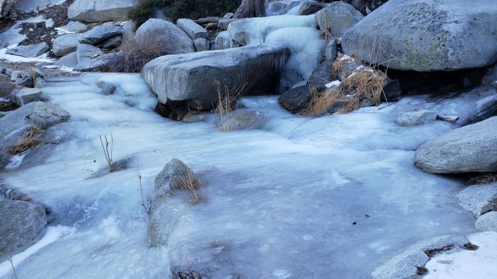

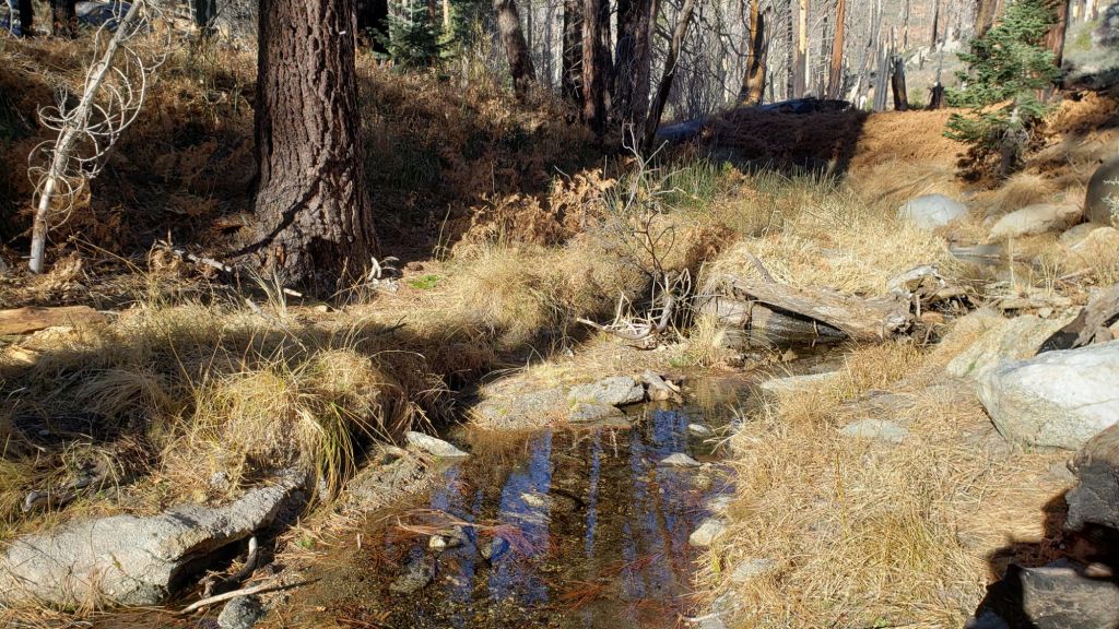

sanjacjon Uncategorized Leave a comment 11 MinutesEdit”Weather and trail update 22nd January 2025″
Trail update 17th January 2025
Southern California is experiencing the driest start to a winter since records began in 1850, as discussed in a recent National Weather Service San Diego video report (linked here). Riverside County, along with much of the rest of southern California, is currently under 5% of average precipitation for the water year (i.e. since 1st October).
There is only limited evidence for a significant change in the weather. The jet stream and associated atmospheric rivers are being forced generally to our north by a “Rex block” – an obstructive high/low pressure combination – which typically lasts for days, but has potential to persist for months. There is the possibility of a minor storm system bringing some precipitation on 25th-27th January.
December 2024 was the first time in recorded history that no snow fell in the San Jacinto high country in December, by far the latest into any winter on record with no settled snow in these mountains. Total snowfall at San Jacinto Peak since September 2024 has been a laughable 3.6 inches.
A minor storm on Tuesday 7th January briefly brought light snow throughout the mountains with a dusting down to 6500 ft and about an inch above 9000 ft. Three inches settled at San Jacinto Peak where I recorded a short video report that evening (linked here). Unfortunately the dusting below 9000 ft had largely melted already on sun-exposed slopes within 24 hours. Remaining snow is now largely melted and what little remains is thin and patchy. Most hikers will find spikes are not required anywhere on the trail system.
Survey hikes by the Trail Report every single day throughout the year in the San Jacinto mountains include varied routes to the high peaks including San Jacinto Peak typically 2-3 times per week (more frequently during storms), Tahquitz Peak and area 1-2 times per week, plus a wide variety of other trails on intervening days.
Despite a failed monsoon in 2024 and below-average precipitation both last winter and – very obviously – so far this season, most major springs, creeks, and pipes largely continue to flow at this time, surviving for now off the above average precipitation from September 2022 to August 2023 (see photos below and in the previous Report linked here). The Round Valley faucet continued to flow well as of 13th January 2025. The creek in Little Round Valley finally dried up in early January 2025. In the Tahquitz area meadows, the Tahquitz Valley pipe (for those who know where it is) continues to flow well. Tahquitz Creek is flowing at the northern end of Little Tahquitz Meadow, and adjacent to its source where it crosses the PCT at Mile 177. Strawberry Cienega is dry. Stone Creek is dry where it crosses Deer Springs Trail at about PCT Mile 183.6. Bud Spring near 9900 ft, just north-west of Marion Mountain, is flowing (photo in an earlier Report linked here). Cedar Spring is flowing gently. Tool Box Spring (at the top of Ramona Trail) continues to flow well as of mid January.

WEATHER
Temperatures have been largely above average for months dating back to last summer. Temperatures are currently forecast to be around or below seasonal until about Tuesday 21st, when they will quickly warm to well above average at all elevations on 22nd-24th, before falling again around Saturday 25th.
Temperatures in the high country will be near or below freezing for the next week, with cold windchills around the high peaks. A cold air storm system may pass over starting Saturday 25th and bring cold temperatures at the highest elevations on 25th-27th (air temperatures well below 20°F/-9°C, windchills potentially far below 0°F/-18°C).
Moderate to strong Santa Ana winds (i.e. largely from northeasterly directions) are forecast for 20th-23rd, especially severe on 20th-21st. Even though much of this winter has been unusually mild, air temperatures are nevertheless often near freezing above 10,000 ft, where strong winds (>20 mph) greatly influence the feel of temperatures and hence associated risks. At this time of year, hikers should always be prepared for winter temperatures in the high country regardless of forecasts and/or how relatively mild it may feel at trailheads (see my sample Peak weather observations below).
While prospects for precipitation into early February are slim, there is the possibility of a minor storm system bringing some precipitation on 25th-26th January. At this time it is too early to be confident about snow or rain probabilities or quantities associated with that possible storm system.
The latest National Weather Service San Diego video report (linked here) released on 17th January describes in detail the weather patterns expected over the next week and beyond.
At San Jacinto Peak (3295m/10,810ft) on Friday 17th January 2025 at 0800 the air temperature was 24.0°F (-4°C), with a windchill temperature of 8.6°F (-13°C), 22% relative humidity, and a fresh NW wind sustained at 8 mph gusting to 15.8 mph.
At the Peak on Monday 13th January 2025 at 0850 the air temperature was 17.8°F (-8°C), with a windchill temperature of 2.7°F (-16°C), 17% relative humidity, and a light due North wind sustained at 7 mph gusting to 11.6 mph.
At the Peak on Wednesday 8th January 2025 at 1115 the air temperature was 12.5°F (-11°C), with a windchill temperature of -14.3°F (-26°C), 86% relative humidity, and a frigid NNE wind sustained at 23 mph gusting to 33.9 mph.

TRAIL CONDITIONS
There is currently no continuous settled snow in the San Jacinto mountains, a truly unprecedented situation in recorded history this far into the winter months. The thin covering above 9000 ft that fell on 7th January only lasted for a few days despite cold temperatures (photos above and below). There is functionally no snow on trails below 9900 ft on the eastern side trails, with thin but locally icy patches at 9900-10,100 ft on the Peak Trail and around San Jacinto Peak. The East Ridge Trail (Miller-San Jacinto peaks) is still largely snow-covered. Snow is gone on Deer Springs Trail below 9500 ft, and is sparse and patchy above that. Few if any hikers will find that traction devices are required anywhere on the trail system.
Treefall hazards remain a significant problem along parts of the Pacific Crest Trail, most notably between Antsell Rock and South Peak. Some 56 trees are down across the trail between PCT Miles 170.5-174, with 37 of these, including several serious obstructions that make for slow-going, between Miles 172.5-174 (around and immediately south of South Peak). A further nine smaller obstructions are down from Miles 168.5-170.5 (Spitler Peak Trail to Zen Center Trail). Significant sections of Miles 168.5-175 are also badly overgrown with brush and are in urgent need of major trimming work (surveyed late 2024).
On the Fuller Ridge Trail section of the PCT there are 12 trees down on the State Park section of the trail (Miles 185.5-189, which have not been maintained by that agency for many years). Several of these pose quite significant hazards for hikers. On the Forest Service section (Miles 189.3-190.5) five significant treefall hazards were removed by USFS late in 2024.
On the section of Deer Springs Trail between Strawberry Junction and the top of Marion Mountain Trail (roughly PCT Miles 183-185) five new major treefall hazards came down in strong winds in early January 2025, bringing to seven the number of major downed trees on this section. These have been reported to the State Park. A further 8-9 trees are on the upper trail (above Fuller Ridge) have been down and reported repeatedly for a decade but with no action from the State Park.
Trees down on the Strawberry Trail section of the PCT (Annie’s Junction to Strawberry Junction, Miles 180.8-183) have remained uncut by the Forest Service for nearly a decade. About six hazards on this section are thankfully all relatively easy for hikers to negotiate.
The Trail Report heavily trimmed the formerly overgrown Wellman Trail (Annie’s Junction to Wellman Divide) in September-December 2024 and this work continues in January 2025. We continue to trim South Ridge Trail year-round, but with increased effort in December-January 2024/25.
The Trail Report removed almost all the obstructive whitethorn from Spitler Peak Trail in December 2024, largely in the central portion of the trail (miles 2.0-3.2 from the trailhead). Another 37 treefall hazards were cleared by the Trail Report in 2024, bringing to 123+ the total number of downed trees removed by the Report from this trail in recent years. While more brush trimming work is always required, in general the trail is currently in its best condition since at least mid 2023. Spitler Creek continues to flow gently at its various crossings in the upper switchbacks, and Antsell Rock Creek starting flowing gently again in November but will likely dry again soon.
The Caramba Trail from near Reeds Meadow through Laws Camp and on to Caramba, and the Cedar Trail from Willow Creek Trail to Laws, are euphemistically (and potentially dangerously) described by the Forest Service as “not maintained”. In reality both trails have been abandoned and no longer exist. They are so heavily overgrown, largely with dense whitethorn, which obscures dozens of downed trees, that hikers should not attempt to follow them (regardless of how much you may trust an app). An informal use trail to Laws is much more direct, well maintained, and avoids the bushwhacking of the unmaintained trails (some local Idyllwild hikers dubbed it the “King Trail” when I established the route in 2019). It leaves Willow Creek Trail exactly 1.0 mile from Saddle Junction, 0.46 mile from the Skunk Cabbage turning (trailhead at N 33.7796, W 116.6590). The route descends largely following established deer trails for 1.2 miles, meeting Willow Creek about 0.2 mile upstream from the site of the historic Laws Camp (the remains of which were destroyed by the 2013 Mountain Fire and subsequent flood and treefall damage). One huge tree fell in late 2024 across the King Trail about midway down and requires a minor scramble underneath (that tree will not be cut soon). Another five recently downed trees were either removed or worked around in early January 2025, when the trail was thoroughly trimmed and raked. From Laws east to Caramba the route of the original Caramba Trail has been cairned by myself and others and can largely be followed with very careful route-finding. My first 2025 survey counted about 120 trees down on this 2.1 miles of trail. It is especially obscure for the first 0.3 mile east of the Willow Creek crossing, becoming more obvious (but still subtle) as it descends towards Caramba. Very cautious navigation is advised throughout the area.
Willow Creek Trail is nearing its 2020 condition, the last time the original trail route was fully cleared and passable. Almost all significant treefall hazards on the Forest Service section were cut by mid August (several uncut trees remain that need to be removed to fully restore the original trail route). Whitethorn trimming was largely completed, mainly by volunteers, on the Forest Service side in August and early September 2024. On the State Park side some localized whitethorn trimming of the worst patches was undertaken in September, and the minor treefall hazards new in 2023/24 were removed, leaving just two major long term downed trees (both have simple workarounds for hikers).
The Trail Report “adopted” Seven Pines Trail as a priority for maintenance work as the trail had a disproportionate number of lost hiker rescues in the past decade, and both State Park and Forest Service have shown no interest in maintaining the route for years. Since 2020 we have removed 75 downed trees and the trail is trimmed and cleared multiple times annually. As of late 2024 the trail is largely clear of treefall hazards, with three down across the trail in its upper section, all easily passable for hikers. A further half-a-dozen downed trees close to the PCT junction would need to be removed to fully restore the original route of the trail. Although the condition of the trail is hugely improved, Seven Pines remains a genuine wilderness trail unlike the wider, bare, obvious routes of, for example, Devil’s Slide or Marion Mountain trails. Cautious navigation remains essential for those without considerable experience of hiking this trail. Be aware in particular that Seven Pines Trail becomes most obscure in the mile closest to its junction with Deer Springs Trail/PCT.
The Zen Center Trail continues its serious deterioration that started following the 2013 Mountain Fire, with a combination of vigorous regrowth and treefall hazards further obscuring the route with each passing season. The lower and upper thirds of this trail are partially cairned and not too bad for those who are very familiar with the former route, but even the experienced find navigating the central section tricky. Long trousers, scrambling gloves, and an enjoyment of bush-whacking are all strongly recommended.


While all time and labor is volunteered, the San Jacinto Trail Report uses small private donations to help cover operating costs. Your contribution keeps the Report available to all, free from advertising or paywalls, and independent from agencies. If you have found this Report useful, please consider using this link to the Donate page. Thank you very much for your support.


sanjacjon Uncategorized Leave a comment 10 MinutesEdit”Trail update 17th January 2025″
Trail update 5th January 2025
UPDATE Friday 10th January 2025 at 1700: Due to high fire risk, power has been shut off in Fern Valley since Tuesday evening. It may be restored tonight. Consequently bandwidth is limited for updating the Trail Report, and a full update is now unlikely before Monday 13th. I took the opportunity to hike to San Jacinto Peak again on 8th, putting in tracks through the shallow snow on east and west sides of the mountain for others to follow. We hiked the Tahquitz Peak area on 9th. Snow has largely gone everywhere below 9000 ft, with, for example, no snow on the trails to Tahquitz Peak. Snow is thin, patchy, and steadily melting at higher elevations. Most hikers will find spikes are not required.
UPDATE Tuesday 7th January 2025 at 2050: We finally have a little settled snow this winter! Cold, strong Santa Ana winds (i.e. coming in from the north-east) started early this morning, and produced minor – but much needed – precipitation, with light snow throughout the mountains above 6500 ft. Three inches settled at San Jacinto Peak, and I measured two inches at Wellman Divide (9700 ft), and 0.75 inch above 9000 ft. Locations on the north-east (windward) side received a little more snow, with at least an inch in Long Valley (8500 ft). Snow has drifted in trails due to the strong accompanying winds which have strengthened further this evening. The dusting below 9000 ft has largely melted already on sun-exposed slopes. I recorded a short video report from San Jacinto Peak on my hike this evening (linked here). The air temperature at the Peak was 13.3°F (-10°C) at 1600, with a windchill temperature of -13.5°F (-25°C). Similar temperatures are expected tomorrow morning.
———————————–
December 2024 was the first time in recorded history that no snow fell in the San Jacinto high country in December, nor was there any settled snow remaining from prior storms. It is consequently by far the latest into any winter on record with no snow in these mountains. Total snowfall – using that term very generously – at San Jacinto Peak since September 2024 has been 0.6 inch, the sum of three very light dustings all of which promptly melted.
Almost all of Riverside County, along with many other parts of south-east California, is currently under 5% of average precipitation for the water year (i.e. since 1st October), and the other Southern California ranges – the Santa Ana, San Gabriel, and San Bernardino mountains – also have no settled snow (other than artificial snow made at ski resorts).
There is currently no evidence of a significant change on the way. The jet stream and associated atmospheric rivers continue to track generally to our north. Even when the jet stream tracks across Southern California (on 7th-9th January), we will remain in the dry portion of the air mass. Note that temperatures in the high country will be far below freezing on 7th and 8th January, with severely cold windchill temperatures (below 0°F/-18°C) and the possibility of very light precipitation.
Survey hikes by the Trail Report every day throughout the year in the San Jacinto mountains include varied routes to the high peaks including San Jacinto Peak typically 2-3 times per week, Tahquitz Peak and area 1-2 times per week, plus a wide variety of other trails on intervening days.
Unusual recent weather – unseasonably warm and dry so deep into the winter months – has led to an exceptionally active tick season. Some trails are predictably tick-prone, such as Cedar Springs Trail where the lower section currently has cattle ranging on and near the trail, and wood ticks (genus Dermacentor) are abundant. Even trails such as lower Deer Springs Trail are producing tick encounters (deer ticks, Ixodes, appropriately enough). Hikers with dogs in particular should take necessary precautions and check thoroughly for ticks post-hike.
Despite a failed monsoon earlier this year and below-average precipitation both last winter and – very obviously – so far this season, major springs, creeks, and pipes largely continue to flow at this time, surviving for now off the above average precipitation from September 2022 to August 2023 (see photos below and in a previous Report linked here). The Round Valley faucet continued to flow well as of 1st January 2025. In the Tahquitz area meadows, the Tahquitz Valley pipe (for those who know where it is) continues to flow well. Tahquitz Creek is flowing steadily at the northern end of Little Tahquitz Meadow, and near its source where it crosses the PCT at Mile 177. Strawberry Cienega is dry. Stone Creek is dry where it crosses Deer Springs Trail at about PCT Mile 183.6. Bud Spring near 9900 ft, just north-west of Marion Mountain, is flowing (photo in prior Report linked here). Cedar Spring is flowing well for the time of year.

WEATHER
Other than fluctuating either side of seasonal during the second week of the month, temperatures were above average for most of December. They are currently forecast to continue to be above seasonal for the first half of January, albeit briefly dipping close to seasonal on 6th-8th before rising again. Temperatures in the high country will be well below freezing on 7th and 8th January, with windchill temperatures potentially dangerously cold (likely below 0°F [approx. -20°C]).
Strong winds are currently forecast for the high country almost every day in the first two weeks of January. Strong – at times very strong – Santa Ana winds (i.e. largely from northeasterly directions) are forecast for 7th-9th and again on 14th-15th January. Even though much of this winter has been unusually mild, air temperatures are nevertheless often near freezing above 10,000 ft, and strong winds (>20 mph) greatly influence the feel of temperatures and hence associated risks. At this time of year, hikers should always be prepared for winter temperatures in the high country regardless of forecasts and/or how mild it may feel at trailheads (see my sample Peak weather observations below).
Many days for the foreseeable future will be at least partly cloudy. There was no significant precipitation in December 2024 at mid or upper elevations, and there is currently no significant precipitation in the forecasts until at least mid January.
The latest video report from NWS San Diego (linked here) gives a thorough explanation of the weather conditions expected for the week of 6th-10th January.
At San Jacinto Peak (3295m/10,810ft) on Wednesday 1st January 2025 at 0815 the air temperature was 39.3°F (4°C), with a windchill temperature of 23.5°F (-5°C), 23% relative humidity, and a variable due West wind sustained at 10 mph gusting to 22.3 mph.
At the Peak on Sunday 29th December 2024 at 0840 the air temperature was 38.8°F (4°C), with a windchill temperature of 25.2°F (-4°C), 12% relative humidity, and a blustery WNW wind sustained at 13 mph gusting to 23.7 mph.

TRAIL CONDITIONS
There is currently no settled snow anywhere in the San Jacinto mountains (sadly for the first time in recorded history into January).
Treefall hazards remain a significant problem along parts of the Pacific Crest Trail, most notably between Antsell Rock and South Peak. Some 56 trees are down across the trail between PCT Miles 170.5-174, with 37 of these, including several serious obstructions that make for slow-going, between Miles 172.5-174 (around and immediately south of South Peak). A further nine smaller obstructions are down from Miles 168.5-170.5 (Spitler Peak Trail to Zen Center Trail). Significant sections of Miles 168.5-175 are also badly overgrown with brush and are in urgent need of major trimming work (surveyed late 2024).
On the Fuller Ridge Trail section of the PCT there are 12 trees down on the State Park section of the trail (Miles 185.5-189), which has not been maintained by that agency for many years. Several of these pose quite significant hazards for hikers. On the Forest Service section (Miles 189.3-190.5) five significant treefall hazards were removed by USFS late in 2024.
Trees down on the Strawberry Trail section of the PCT (Annie’s Junction to Strawberry Junction, Miles 180.8-183) have remained uncut by the Forest Service for nearly a decade. About six hazards on this section are thankfully all relatively easy for hikers to negotiate.
The Trail Report heavily trimmed the formerly overgrown Wellman Trail (Annie’s Junction to Wellman Divide) in September-December 2024. We continue to trim South Ridge Trail year-round, but with increased effort in December 2024.
The Trail Report focused on removing almost all the obstructive whitethorn from Spitler Peak Trail in December 2024, largely in the central portion of the trail (miles 2.0-3.2 from the trailhead). Another 37 treefall hazards were cleared by the Trail Report in 2024, bringing to 123+ the total number of downed trees removed by the Report from this trail in recent years. While more brush trimming work is always required, in general the trail is currently in its best condition since at least mid 2023. Spitler Creek continues to flow gently at its various crossings in the upper switchbacks, and Antsell Rock Creek starting flowing gently again in November.
About 12 treefall hazards on Deer Springs Trail include 8-9 in the upper trail that have been down and reported repeatedly for a decade but with no action from the State Park. All but two of the treefall hazards down between Strawberry Junction and the top of Marion Mountain Trail (roughly PCT Miles 183-185) were removed by the Trail Report in late June.
Willow Creek Trail is nearing its 2020 condition, the last time the original trail route was fully cleared and passable. Almost all significant treefall hazards on the Forest Service section were cut by mid August (several uncut trees remain that need to be removed to fully restore the original trail route). Whitethorn trimming was largely completed, mainly by volunteers, on the Forest Service side in August and early September 2024. On the State Park side some localized whitethorn trimming of the worst patches was undertaken in September, and the minor treefall hazards new in 2023/24 were removed, leaving just two major long term downed trees (both have simple workarounds for hikers).
The Caramba Trail from near Reeds Meadow through Laws Camp and on to Caramba, and the Cedar Trail from Willow Creek Trail to Laws, are euphemistically (and potentially dangerously) described by the Forest Service as “not maintained”. In reality both trails have been abandoned and no longer exist. They are so heavily overgrown, largely with dense whitethorn, which obscures dozens of downed trees, that hikers should not attempt to follow them (regardless of how much you may trust an app). An informal use trail to Laws is much more direct, well maintained, and avoids the bushwhacking of the unmaintained trails (some local Idyllwild hikers dubbed it the “King Trail” when I established the route in 2019). It leaves Willow Creek Trail exactly 1.0 mile from Saddle Junction, 0.46 mile from the Skunk Cabbage turning (trailhead at N 33.7796, W 116.6590). The route descends largely following established deer trails for 1.2 miles, meeting Willow Creek about 0.2 mile upstream from the site of the historic Laws Camp (the remains of which were destroyed by the 2013 Mountain Fire and subsequent flood and treefall damage). One huge tree fell in late 2024 across the King Trail about midway down and requires a minor scramble underneath (that tree will not be cut soon). Another five recently downed trees were either removed or worked around in early January 2025, when the trail was thoroughly trimmed and raked. From Laws east to Caramba the route of the original Caramba Trail has been cairned by myself and others and can largely be followed with very careful route-finding. My first 2025 survey counted about 120 trees down on this 2.1 miles of trail. It is especially obscure for the first 0.3 mile east of the Willow Creek crossing, becoming more obvious (but still subtle) as it descends towards Caramba. Very cautious navigation is advised throughout the area.
The Trail Report “adopted” Seven Pines Trail as a priority for maintenance work as the trail had a disproportionate number of lost hiker rescues in the past decade, and both State Park and Forest Service have shown no interest in maintaining the route for years. Since 2020 we have removed 75 downed trees and the trail is trimmed and cleared multiple times annually. As of late 2024 the trail is largely clear of treefall hazards, with three down across the trail in its upper section, all easily passable for hikers. A further half-a-dozen downed trees close to the PCT junction would need to be removed to fully restore the original route of the trail. Although the condition of the trail is hugely improved, Seven Pines remains a genuine wilderness trail unlike the wider, bare, obvious routes of, for example, Devil’s Slide or Marion Mountain trails. Cautious navigation remains essential for those without considerable experience of hiking this trail. Be aware in particular that Seven Pines Trail becomes most obscure in the mile closest to its junction with Deer Springs Trail/PCT.
The Zen Center Trail continues its serious deterioration that started following the 2013 Mountain Fire, with a combination of vigorous regrowth and treefall hazards further obscuring the route with each passing season. The lower and upper thirds of this trail are partially cairned and not too bad for those who are very familiar with the former route, but even the experienced find navigating the central section tricky. Long trousers, scrambling gloves, and an enjoyment of bush-whacking are all strongly recommended.
While all time and labor is volunteered, the San Jacinto Trail Report uses small private donations to help cover operating costs. Your contribution keeps the Report available to all, free from advertising or paywalls, and independent from agencies. If you have found this Report useful, please consider using this link to the Donate page. Thank you very much for your support.