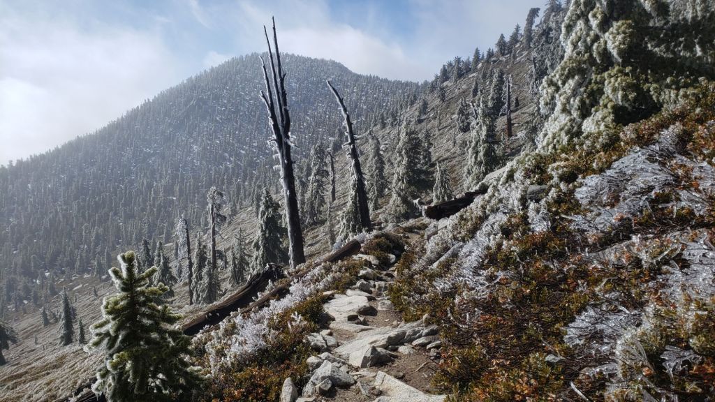
UPDATE Friday 7th February at 1330: we caught the southernmost edge of an atmospheric river passing to our north overnight. I hiked to San Jacinto Peak this morning through pleasant misty cloud and periodic drizzle before reaching patchy blue sky right around the Peak. The storm was mild, producing only rain all the way to the highest elevations. Above 9500 ft freezing rain has plastered all surfaces with a thin but treacherous covering of ice. Spikes are strongly recommended at the highest elevations until the emerging sun melts the ice. The most rainfall on the mountain was at Saddle Junction (8100 ft) with 0.51 inch, with 0.41 inch at Wellman’s Cienega (9300 ft), 0.24 inch in Idyllwild, and 0.2 inch at San Jacinto Peak.

——————————————-
The dramatically variable weather that is increasingly typical of the climate this century has certainly been impacting the San Jacinto mountains in the past week. Only five days after the all-too-minor snow storm of last week, it was t-shirt-and-shorts weather in Idyllwild this weekend. Temperatures quickly swung from below seasonal to far above average for February. San Jacinto Peak flirted with an all-time record high temperature for the month of February on 2nd, and may continue to do so on/off throughout the first two weeks of the month (the record high for February is 39.3°F on 22nd in 2021).
Predictably, melting of the light snow from the storm on 26th-27th January has been very rapid. We experienced continuous snow cover in the high country for only four days (the late January storm is described in detail in the previous Report linked here). Total snowfall at San Jacinto Peak since September 2024 has been a pitiful 7.6 inches. Many trails are already functionally clear of snow (details under Trail Conditions below) and the remainder may be within days.
Moderate rainfall is now forecast for the mid elevations overnight on 6th and throughout 7th February. Up to one inch is possible at 5000-6000 ft (e.g., Idyllwild-Pine Cove). The high country may stay largely above the precipitation, with less than 0.1 inch rain currently expected (and temperatures forecast to be too warm for snow). Another storm system is brewing for next week (12th-14th February) with possibilities for more significant snowfall, and further rain at mid elevations.
Conditions are currently suitable for spikes in places above about 8700 ft on the western slope as the established trails have undergone freeze-thaw cycles and the thin snow has become icy due to consolidation by hiker traffic. Snow depths are of course insufficient for snowshoes. Snow depths are insufficient to justify listing at the foot of this posting.
Despite temperatures being above seasonal for February, hikers should be prepared for temperatures near freezing in the high country, and potentially well below freezing when considering wind chill effects on some days (see below for my recent weather observations from San Jacinto Peak).
Survey hikes by the Trail Report every single day throughout the year in the San Jacinto mountains include varied routes to the high peaks including San Jacinto Peak typically 2-3 times per week (more frequently during storms), Tahquitz Peak and area 1-2 times per week, plus a wide variety of other trails on intervening days. On Sunday 2nd we ascended San Jacinto Peak via the classic east side route (using Devil’s Slide, Wellman, and Peak trails) and descended the west side via Deer Springs Trail. This facilitated survey of the highest parts of the PCT in the San Jacinto mountains (roughly Miles 179-181 and 185.5-183.5) plus several of its side trails.
The USFS gate at Humber Park reopened late last week. Even when closed there are nine legal parking spaces immediately below the gate. Vehicles not parked in these spaces have been ticketed in past winters. South Ridge Road is open and is readily passable with AWD/4WD vehicles.
WEATHER
Temperatures are forecast to remain well above seasonal until Tuesday 4th February, when they drop to near (or even slightly below) average for at least a week. Most days into mid February are forecast to be at least partly cloudy.
A warm atmospheric river passing (predictably) to our north this week will raise the marine layer to 6000-8000 ft elevation, potentially producing some light rain between 4th-7th February. Current projections are for less than 0.2 inch of rain across the four days, most likely on Friday 7th, focused on the western slope and west-facing valleys (e.g., much of the PCT in these mountains, Idyllwild-Pine Cove, Garner Valley and the Desert Divide).
The high country is expected to remain above the cloud and receive no significant new precipitation, although there is a slim possibility of a very light dusting of snow on Friday 7th. Due to the warmth of the upper level air mass, temperatures in the high country are forecast to remain 5-10°F above normal on most days into mid February, although westerly winds will remain relatively strong.
At San Jacinto Peak (10,810ft/3295m) on Sunday 2nd February 2025 at 0825 the air temperature was 37.7°F (3°C), with a windchill temperature of 22.1°F (-5°C), 45% relative humidity, and a steady due West wind sustained at 22 mph gusting to 32.1 mph.
At the Peak on Monday 27th January 2025 at 1040 the air temperature was 16.0°F (-9°C), with a windchill temperature of 9.0°F (-13°C), 74% relative humidity, and a remarkably calm hint of a NNW breeze sustained at 0 mph gusting to 2.8 mph.

TRAIL CONDITIONS
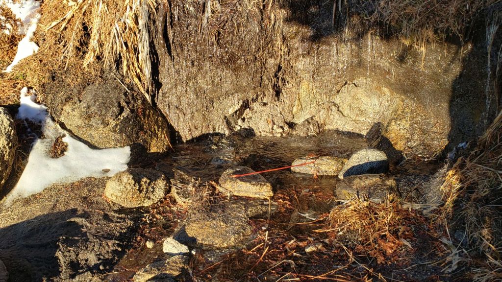
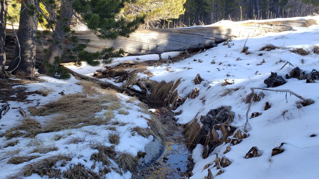
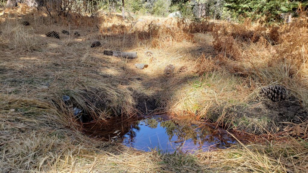
For details of water availability prior to the late January minor storm, see an earlier Report (linked here).
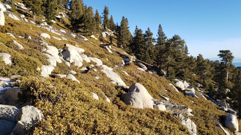
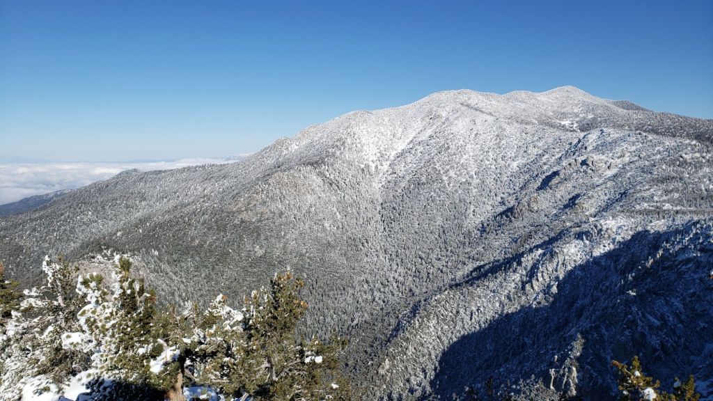
There is currently no continuous settled snow in the San Jacinto mountains, a truly unprecedented situation in recorded history this far into the winter months. The thin covering above 9000 ft that fell on 7th January only lasted for a few days despite cold temperatures, while the 4-6 inches of snow from the minor storm on 26th-27th January has already largely melted.
Most hikers will find that traction devices are not required on the trail system, although conditions are currently suitable for spikes in places above about 8700 ft on the western slope (Deer Springs Trail and short parts of the PCT) as the established trails have undergone freeze-thaw cycles and the thin snow has become icy due to consolidation by hiker traffic. Spikes tend to be much more valuable for descending trails than ascending.
There is functionally no snow on trails below 9000 ft on the eastern side trails, e.g., Devil’s Slide Trail is clear, as is most of PCT Miles 178-180. Patches persist in the most sheltered areas above 9000 ft, notably either side of Annie’s Junction (PCT Mile 180.8), then again at 9900-10,100 ft on the Peak Trail and above 10,500 ft around San Jacinto Peak.
The East Ridge Trail (between Miller-San Jacinto peaks) is still 90% snow-covered, but only 1-2 inches deep and with a well-traveled track accurately following the old trail route.
Deer Springs Trail is functionally clear of snow from the trailhead to Strawberry Junction, and then beyond for about 1.5 miles to 8600 ft elevation. From just south of the junction with Marion Mountain Trail snow cover is about 90% in the trail all the way to San Jacinto Peak. Snow is thin and patchy in the trail, but due to hiker compaction it is icy. Some hikers will find spikes useful on the upper part of this trail.
On the section of Deer Springs Trail between Strawberry Junction and the top of Marion Mountain Trail (roughly PCT Miles 183-185) six significant treefall hazards remain, mostly from high winds in January. Three more came down in a concentrated area just north of the top of Seven Pines Trail (near Mile 185.2). About ten further trees on the upper trail (above Fuller Ridge) have been down and reported repeatedly for more than a decade but with no action from the State Park. Two significant obstructions are down across the trail between the Suicide Rock Trail junction and Strawberry Junction.
South Ridge Trail is clear of snow from the top of South Ridge Road to Tahquitz Peak (updated 3rd Feb). Four treefall hazards that came down in the trail in strong winds in January were removed by the Trail Report in early February.
There is a well-traveled track through almost continuous thin icy snow on the short section of South Ridge Trail on the north side of Tahquitz Peak to Chinquapin Flat. This is icy in places and hikers will find spikes are useful here.
Although the situation has improved somewhat in recent months, treefall hazards remain a significant problem along parts of the Pacific Crest Trail, most notably between Antsell Rock and South Peak. Some 56 trees are down across the trail between PCT Miles 170.5-174, with 37 of these, including several serious obstructions that make for slow-going, between Miles 172.5-174 (around and immediately south of South Peak). A further nine smaller obstructions are down from Miles 168.5-170.5 (Spitler Peak Trail to Zen Center Trail). Significant sections of Miles 168.5-175 are also badly overgrown with brush and are in urgent need of major trimming work (surveyed January 2025).
On the Fuller Ridge Trail section of the PCT there are 12 trees down on the State Park section of the trail (Miles 185.5-189, which have not been maintained by that agency for many years). Several of these pose quite significant hazards for hikers. On the Forest Service section (Miles 189.3-190.5) five significant treefall hazards were removed by USFS late in 2024. Snow cover on Fuller Ridge Trail averages only 50%, but is very localized with sun-exposed sections completely clear and shaded sections still with 1-2 inches depth of snow in the trail.
Trees down on the Strawberry Trail section of the PCT (Annie’s Junction to Strawberry Junction, Miles 180.8-183) have remained uncut by the Forest Service for nearly a decade. About six hazards on this section are thankfully all relatively easy for hikers to negotiate.
The Trail Report heavily trimmed the formerly overgrown Wellman Trail (Annie’s Junction to Wellman Divide) from September 2024-January 2025. The Wellman Trail currently averages about 20% snow cover, confined to the sections that are sheltered under the forest canopy.
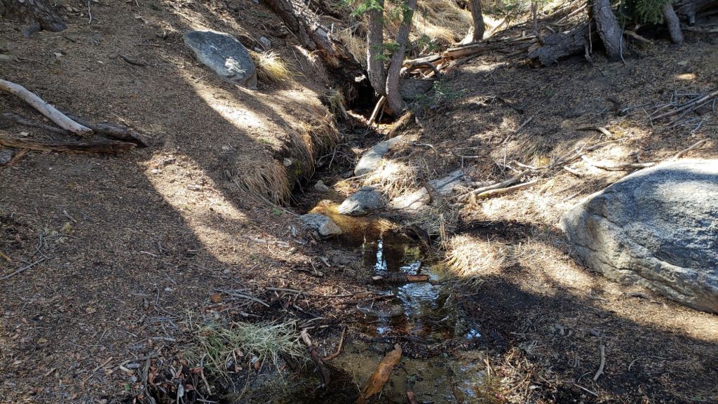
In February 2025 the Trail Report cleared Spitler Peak Trail of the six trees that came down in Santa Ana winds in January (bringing to 129 the total number of trees removed by the Report from this trail in recent years). We also removed most of the whitethorn from the central portion of the trail in December 2024. While more brush trimming work is always required, in general the trail is currently in its best condition since at least mid 2023. Spitler Creek continues to flow gently at its various crossings in the upper switchbacks, and Antsell Rock Creek starting flowing gently again in November 2024 (but will dry again this spring without significant further precipitation).
The Trail Report removed the only two new small trees down across Fobes Trail last week. The trail is otherwise largely clear, with only a few minor branch hazards mainly along the lower trail. Snow was gone from this trail (all below 6000 ft) by 31st January.
The Caramba Trail from near Reeds Meadow through Laws Camp and on to Caramba, and the Cedar Trail from Willow Creek Trail to Laws, are euphemistically (and potentially dangerously) described by the Forest Service as “not maintained”. In reality both trails have been abandoned and no longer exist. They are so heavily overgrown, largely with dense whitethorn, which obscures dozens of downed trees, that hikers should not attempt to follow them (regardless of how much you may trust an app). An informal use trail to Laws is much more direct, well maintained, and avoids the bushwhacking of the unmaintained trails (some local Idyllwild hikers dubbed it the “King Trail” when I established the route in 2019). It leaves Willow Creek Trail exactly 1.0 mile from Saddle Junction, 0.46 mile from the Skunk Cabbage turning (trailhead at N 33.7796, W 116.6590). The route descends largely following established deer trails for 1.2 miles, meeting Willow Creek about 0.2 mile upstream from the site of the historic Laws Camp (the remains of which were destroyed by the 2013 Mountain Fire and subsequent flood and treefall damage). One huge tree fell in late 2024 across the King Trail about midway down and requires a minor scramble underneath (that tree will not be cut soon) while another one close to Laws is relatively easy to pass over. Another five recently downed trees were either removed or worked around in January 2025, when the trail was thoroughly trimmed and cleared. From Laws east to Caramba the route of the original Caramba Trail has been cairned by myself and others and can largely be followed with careful route-finding. My February 2025 survey counted about 120 trees down on this 2.1 miles of trail. It is extremely obscure for the first 0.5 mile east of the Willow Creek crossing, becoming more obvious (but still subtle) as it descends towards Caramba. Very cautious navigation is advised throughout the area.
Willow Creek Trail is nearing its 2020 condition, the last time the original trail route was fully cleared and passable. Four new trees came down on the Forest Service section in January, two of which are large and tricky for hikers to pass. Many prior treefall hazards on the Forest Service section were cut in 2024. Whitethorn trimming was largely completed, mainly by volunteers, on the Forest Service side in late summer 2024. On the State Park side some localized whitethorn trimming of the worst patches was undertaken in 2024, and the minor treefall hazards new in 2023/24 were removed, leaving just two major long term downed trees (both have simple workarounds for hikers).
The Trail Report “adopted” Seven Pines Trail as a priority for maintenance work as the trail had a disproportionate number of lost hiker rescues in the past decade, and both State Park and Forest Service have shown no interest in maintaining the route for years. Since 2020 we have removed 75 downed trees and the trail is trimmed and cleared multiple times annually. As of late 2024 the trail is largely clear of treefall hazards, with three down across the trail in its upper section, all easily passable for hikers. A further half-a-dozen downed trees close to the PCT junction would need to be removed to fully restore the original route of the trail. Although the condition of the trail is hugely improved, Seven Pines remains a genuine wilderness trail unlike the wider, bare, obvious routes of, for example, Devil’s Slide or Marion Mountain trails. Cautious navigation remains essential for those without considerable experience of hiking this trail. Be aware in particular that Seven Pines Trail becomes most obscure in the mile closest to its junction with Deer Springs Trail/PCT.
The Zen Center Trail continues its serious deterioration that started following the 2013 Mountain Fire, with a combination of vigorous regrowth and treefall hazards further obscuring the route with each passing season. The lower and upper thirds of this trail are partially cairned and not too bad for those who are very familiar with the former route, but even the experienced find navigating the central section tricky. Long trousers, scrambling gloves, and an enjoyment of bush-whacking are all strongly recommended.

While all time and labor is volunteered, the San Jacinto Trail Report uses small private donations to help cover operating costs. Your contribution keeps the Report available to all, free from advertising or paywalls, and independent from agencies. If you have found this Report useful, please consider using this link to the Donate page. Thank you very much for your support.