[UPDATE Thursday 31st March 2022: this morning we shot a short video review of the Apache Peak area (PCT Mile 169.5) available here on YouTube. PCT Miles 151-175 are now functionally clear of snow and many thru hikers will find spikes are no longer required until rounding onto the north side of Red Tahquitz at Mile 175.]
A minor storm passed over the San Jacinto mountains on Monday 28th March, with light precipitation continuing into the early hours of Tuesday 29th.
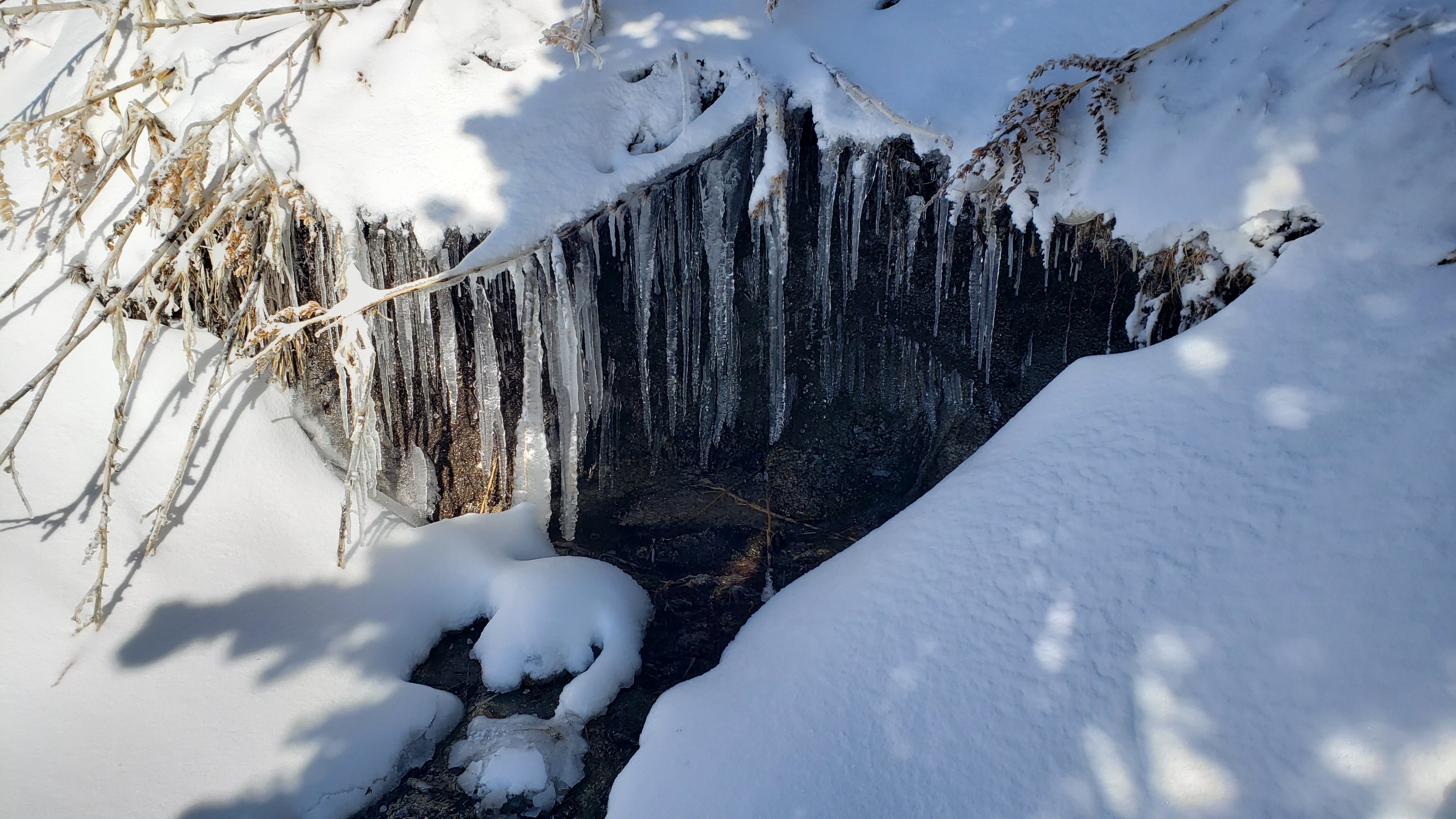
Overall precipitation was well below forecasts, with only 3-5 inches of snow in the high country (depending on elevation). There was a dusting of snow down to about 5000 ft. In Idyllwild at 5550 ft we received 0.63 in of rain, plus 1.5 in of snow, although the latter melted within a few hours. Snow depths measured on 29th March are detailed near the foot of this post, but note that snow depth is rarely indicative of the difficulty (or otherwise) of conditions underfoot.
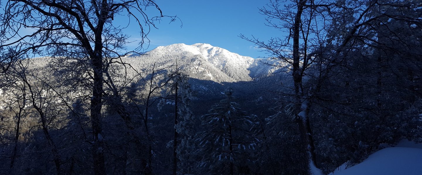
Early on Tuesday 29th March we ascended San Jacinto Peak via Devil’s Slide, PCT, Wellman, Peak, and East Ridge trails. Although I carried crampons, spikes, and ice axe, in case I encountered a variety of challenging conditions, I ultimately only used the latter in lieu of poles. I broke trail the entire way through shallow to moderate snow, in good boots with excellent traction.
We descended Deer Springs Trail, again breaking trail almost the entire way, and again with no need for additional traction in easy powder, returning to Humber Park via the Suicide Rock Trail and Suicide Rock climbers trail. I did briefly encounter some posthole tracks near the top of Marion Mountain Trail. With such shallow snow, melting was well underway by the time I descended below Strawberry Junction, despite the west slope remaining in the cloud almost all day below about 9000 ft.
This loop also facilitated survey of – and breaking trail for – the highest parts of the PCT in the San Jacinto mountains (roughly Miles 179-181 and 185.5-183) plus survey of several of its side trails.
Current conditions for individual routes are discussed in detail below where known. These will change rapidly with warming temperatures and widespread melting by next weekend. Although useful tracks are now in place for some major trails (discussed below), cautious navigation remains recommended everywhere.
I cannot overemphasize the importance of having both appropriate equipment and the right skill set for the terrain. The latter includes interpreting the snow/ice conditions, understanding your physical and mental abilities, and conservative decision making. These concerns may steadily increase over the next couple of weeks with snow undergoing multiple freeze-thaw cycles, with rising temperatures, seasonally stronger insolation, and highly variable snowmelt.
Spikes are currently helpful but are not strictly essential, as thin, soft snow is providing reasonable traction to footwear suitable for mountain hiking in winter conditions. This may change over the next few days as high country trails become compacted and icier with freeze-thaw cycles. Then spikes will be recommended everywhere above about 8000ft. They are generally especially valuable on well-consolidated tracks, on colder mornings when conditions are icy, and (as always) for descending and traversing. In the high country some hikers will find crampons a suitable alternative to spikes, although they are certainly not necessary (except of course on the north faces of San Jac and Tahquitz).
Snow conditions are generally poor for snowshoeing with thin snow plus rapid melting expected. With melting and compaction caused by freeze-thaw cycles and hiker traffic, conditions will rapidly deteriorate further for snowshoeing over the next week. Nevertheless, snowshoes may be valuable off trail above about 9000ft for the next few days.
Despite unseasonably warm temperatures in the next week or so, hikers should nevertheless be prepared for temperatures around freezing in the high country, and often well below freezing when considering wind chill effects (see below for my recent observations from San Jacinto Peak).
The USFS gates at Humber Park and South Ridge Road remain open. Humber Park was clear of snow by the afternoon of 29th March.

WEATHER
Temperatures are forecast to rise rapidly to about seasonal by Wednesday 30th, and then to warm further to above seasonal on 1st April. The first week of April will be very warm and snowmelt will be rapid and widespread at all elevations.
At San Jacinto Peak (10,810ft/3295m) on Tuesday 29th March 2022 at 1040 the air temperature was 19.8°F (-7°C), with a windchill temperature of -1.0°F (-18°C), 94% relative humidity, and a bitter WNW wind sustained at 12 mph gusting to 25.9 mph.
At the Peak on Friday 25th March 2022 at 0835 the air temperature was 45.5°F (7.5°C), with a windchill temperature of 38.3°F (3°C), 27% relative humidity, and a light SSE wind sustained at 5 mph gusting to 12.7 mph. The air temperature was likely an all-time record high for this location in the month of March.
TRAIL CONDITIONS
All trails above about 6500 ft are currently partially obscured by light snow, with thin snow cover continuous above about 8000 ft. Melting was already underway on 29th March and will accelerate very rapidly over the next week.
Current snow cover on the PCT is limited from Miles 151 (Highway 74) to about 160, and then increasingly patchy between Miles 160 and 175 (Red Tahquitz). The thin snow cover from this latest storm will melt within the next few days. Some shaded chutes and slopes can be tricky for those without snow/ice experience, and spikes remain recommended. Within a couple of days my video discussing conditions for Miles 168.5-179.5 (Spitler Peak to Saddle Junction) on 19th March available here will again be accurate to the conditions due to rapid melting. Snow remains largely continuous between Miles 175-179. Snow cover will quickly become very patchy in sun-exposed areas between Miles 178 to 184, with the exception of the notoriously stubborn half mile just south of Annie’s Junction starting at about Mile 180.3. From Mile 184 to 191, snow cover is currently largely continuous, although extensive exposed sections of Fuller Ridge (e.g., Miles 186.6-187.5 and 187.8-188.5) will very rapidly clear again, as will areas north of Mile 191. The detailed video report (linked here) for Fuller Ridge Trail/PCT Miles 185.5-190.5 based on a full survey on Wednesday 23rd March will again be accurate to conditions after melting on 30th-31st March.
Hikers should anticipate encountering significant new treefall hazards, especially in vulnerable burn areas (e.g., Willow Creek Trail, PCT Miles 166-177). Storms in December 2021 left trees heavily laden with ice, and I have since found many broken tree limbs and downed trees throughout the trail system. Severe Santa Ana winds in January and February have brought down further trees and branches.
Effective Tuesday 1st February 2022 the State Park closed the section of Skyline Trail that falls within its jurisdiction, above 5800 ft elevation, “due to dangerous ice accumulation”. Long Valley Ranger Station staff have stated that the trail may not reopen before April. The State Park boundary is not marked but is near the site of the old Florian’s Cache, below Flat Rock. Very shallow snow from these latest storms on the open section of trail below 5800 ft will melt very rapidly on this exposed slope.
The 0.4 mile section of South Ridge Trail to Tahquitz Peak from Chinquapin Flat/PCT Mile 178 has very indistinct steps to follow through the steeply angled icy snow. These steps will have been largely obscured by the fresh snowfall. These icy slopes are notoriously treacherous. Crampons with an ice axe (and knowledge of how to use both) are currently recommended. It is possible that spikes will be sufficient by the weekend. There was a fatal hiker fall here on Sunday 30th January.
Devil’s Slide Trail has a well-defined shallow posthole track to follow. Large sections were already clearing by the afternoon of 29th March, especially below 7700 ft.
The Ernie Maxwell Trail is already largely clear of snow, and will clear completely on 30th March.
My shallow posthole track is well-defined from Saddle Junction to San Jacinto Peak, via the PCT, Wellman, and Peak trails. Above 10,400 ft my posthole track roughly follows the East Ridge Trail route.
Marion Mountain Trail has a well-defined posthole track through the snow along its entire length, however it does not follow the trail route in places.
There were no visible hiker tracks on Seven Pines or Fuller Ridge trails as of early afternoon on 29th March, nor on the Strawberry Trail (approx. PCT Miles 181-183).
Deer Springs Trail has a well-defined track along its entire length. Most snow had already melted below Strawberry Junction (8100 ft) by the afternoon of 29th, and it will liekly clear completely below about 8600 ft on 30th-31st. Below Little Round Valley I (generally) made a conscious effort to accurately follow the trail route. Through and above Little Round Valley the only track is my shallow posthole route down from the Peak which does not attempt to follow the trail route and is very direct and steep (and would be a challenging ascent for many hikers).
Suicide Rock Trail was functionally clear of snow by the afternoon of 29th March.
Spitler Peak Trail will very rapidly clear of snow in the next day or two. Forty downed trees, most from an ice storm in late December 2021, plus dozens of additional trunks and branches in the trail, have been removed by the Trail Report from this trail in 2022.

SNOW DEPTHS measured on 29th March 2022 are as follows. The first number is the current average total depth, with the new snow from the storm on 28th-29th March given in parentheses. Due to strong winds accompanying storms and complex differential melting between snowfall events, note that there is considerable variability in snow depth, especially in the trails. Altitudes are approximate.
San Jacinto Peak (10810 ft): 12-14 inches (4-5 inches new)
Little Round Valley (9800 ft): 12-14 inches (4 inches new)
Wellman Divide (9700 ft): 4-6 inches (4 inches new)
Annie’s Junction/approx. PCT Mile 180.8 (9070 ft): 11 inches (3 inches new)
Seven Pines Trail junction with Deer Springs Trail/approx. PCT Mile 184.9 (8700 ft): 8 inches (3 inches new)
Strawberry Junction/approx. PCT Mile 183 (8100 ft): 0-1 inch (1-2 inches new, largely melted by afternoon of 29th)
Saddle Junction/approx. PCT Mile 179 (8070 ft): 2-3 inches (2 inches new)
Devil’s Slide Trail at Humber Park (6520 ft): 1.5 inches (1.5 inches new, largely melted by afternoon of 29th)
Idyllwild (at 5550 ft): 1.5 inches (1.5 inches new, all melted by afternoon of 29th)
It’s northbound PCT season! Please help the Trail Report at our busiest time of the year. While all labor and time is volunteered, the San Jacinto Trail Report completely depends on your small private donations to keep active, free from advertising, and independent from agencies. If you have found this Report useful, please visit the Donate page. Zelle has been added as a fee-free way to donate. Thank you for your support.