[UPDATE Saturday 5th March @ 1745: having had negligible precipitation all day we are in the middle of a relatively brief but intense graupel storm. At Humber Park (6300ft) just now I measured 1.5 inches that has accumulated in the past hour, but it is forecast to continue snowing heavily for at least another hour. The next comprehensive Report will be tomorrow afternoon, Sunday 6th March.]
[UPDATE Friday 4th March @ 1835: a dusting of snow early this morning produced one inch of snow in Idyllwild, which then largely melted in the afternoon. We measured 2.0in fresh snow at Saddle Junction (8070ft, PCT Mile 179) on our hike this morning, for a total depth there of about 10 inches. It rained on/off in Idyllwild this afternoon, but the high country was above the cloud for much of the day, with a scant 1.5in of snow falling in Long Valley (8600ft). Similar light snow is expected tomorrow. There is no significant change to the equipment recommendations discussed below.]
Conditions immediately after the moderate storm of 22nd-23rd February were summarised in the previous Report. Snowmelt has been very rapid in recent days even by our Southern California standards, and small patches of lower Devil’s Slide Trail around 6600 ft elevation were clear of snow before dawn on 28th February where I had measured 12-15 inches of snow just five days earlier. Similarly sun-exposed areas around San Jacinto Peak and Wellman Divide had already lost nearly one foot of snow knee photos below). Snow depths measured on 28th February are detailed near the foot of this post, but note that snow depth is rarely indicative of the difficulty (or otherwise) of conditions underfoot.
Early on Monday 28th February I ascended via Devil’s Slide, Wellman, Peak, and East Ridge trails to San Jacinto Peak – in boots with excellent traction – without needing spikes (although I always carry them in winter). Hikers less familiar with very uneven (and at times icy) snow travel will prefer to use the latter. I descended Deer Springs Trail, using snowshoes from the Peak down to Strawberry Junction at 8100ft, initially because the trail had not been broken from 10,700 ft down to about 9400 ft. This loop also facilitated survey of the highest parts of the PCT in the San Jacinto mountains (roughly Miles 179-181 and 185.5-183) plus several of its side trails. Since 25th February I have also hiked PCT Miles 151-154 and many miles near Mile 165 to assess conditions in those area also.
Current conditions for individual trails are discussed in detail below where known. Note that trail conditions will change significantly in multiple ways over the next week or two. A few days of very warm sunny weather will accelerate the already rapid melting underway. Then some further fresh snowfall is now expected around 4th-6th March (at least). The latter will be accompanied by cold temperatures that will persist for a few days after the snowfall. Finally a period of roughly seasonal temperatures will lead to steady melting of snow and freeze-thaw cycles that will combine to change trail conditions yet again and potentially the preferred equipment for the terrain.
Recently I have mentioned the challenges of hard, icy snow underfoot and the value of using spikes especially for descending and traversing. Snow at all elevations will become increasingly firm and icy following multiple freeze-thaw cycles, and I cannot overemphasize the importance of having both appropriate equipment and the right skill set for the terrain. The latter includes interpreting the snow/ice conditions, understanding your physical and mental abilities, and conservative decision making. These concerns may steadily increase over the next couple of weeks with dramatically rising then falling temperatures, seasonally stronger insolation, and highly variable snowmelt.
Although useful tracks are now in place for some major trails (discussed below), cautious navigation is strongly recommended everywhere. Light snowfall possible around 4th-6th March, accompanied by strong winds and extensive drifting, may well be of sufficient depth to obscure some of the existing tracks in the high country.
Spikes are strongly recommended for the foreseeable future everywhere above about 6000ft, potentially lower on colder days and following fresh precipitation. They are especially valuable on well-consolidated tracks, on colder mornings when conditions are icy, and (as always) for descending and traversing. In the high country some hikers will find crampons a suitable alternative to spikes, although currently they are not strictly necessary (except on the known challenging north faces of San Jac and Tahquitz).
Snow conditions are currently ideal for snowshoeing everywhere above about 8000ft but generally not on compacted, well-traveled, or postholed trails. With steady melting already well advanced and compaction caused by freeze-thaw cycles and hiker traffic, conditions will rapidly deteriorate for snowshoeing over the next couple of days, before then potentially becoming more useful again after fresh snowfall. Nevertheless, snowshoes may be valuable anywhere off trail above about 8000ft for the foreseeable future.
Hikers should be prepared for temperatures below or near freezing in the high country, and generally well below freezing when considering wind chill effects (see below for my recent observations from San Jacinto Peak).
Snow depth and structure are both currently insufficient for significant avalanche risk in the high country, with the exception of the traditionally unstable north face of San Jacinto Peak (and possibly the north face of Tahquitz Peak). Some interesting wind slabs that I dislodged on my descent on 23rd have melted and/or stabilized.
The USFS gate at Humber Park closed on 22nd February. Even when closed there are nine legal parking spaces immediately below the gate. Vehicles not parked in these spaces may be ticketed and/or towed. If there are “Road Closed” signs further down – as was the case at the weekend – then those nine spaces are also unavailable for legal parking. Exercise considerable caution when parking anywhere in this area especially during snowy weekends.
WEATHER Temperatures have steadily warmed over the past couple of days and will be above seasonal on 1st-3rd March, with continued rapid and extensive melting of snow expected. Temperatures will then drop quickly to below seasonal from 4th March onwards, with unsettled conditions expected. Especially cold conditions are forecast for the high country on 4th-7th March with moderate snowfall possible above about 4500 ft from the evening of Thursday 3rd to Sunday 6th March. Current forecasts are for about 2-3 inches of snow in Idyllwild increasing to 6-10 inches around the highest peaks, mainly on Friday 4th.
At San Jacinto Peak (10,810ft/3295m) on Monday 28th February 2022 at 0905 the air temperature was 33.8°F (1°C), with a windchill temperature of 19.2°F (-7°C), 35% relative humidity, and a persistent NNE wind sustained at 17 mph gusting to 23.5 mph.
At the Peak on Tuesday 22nd February 2022 at 1130 the air temperature was 12.6°F (-11°C), with a windchill temperature of -16.4°F (-27°C), 93% relative humidity, and a bitter WSW wind sustained at 21 mph gusting to 33.1 mph.
At the Peak on Monday 21st February 2022 at 0855 the air temperature was 20.1°F (-7°C), with a windchill temperature of -3.6°F (-20°C), 36% relative humidity, and a brutal due West wind sustained at 25 mph gusting to 32.2 mph.

TRAIL CONDITIONS
All trails above about 6500 ft are largely or completely snow-covered. Increasingly patchy snow remains in sheltered locations down to 4500 ft. Melting has been very rapid at all elevations since 25th February, most prominently on sun-exposed slopes and below 8000 ft.
Hikers should anticipate encountering significant new treefall hazards, especially in vulnerable burn areas (e.g., Willow Creek Trail, PCT Miles 166-177). Storms in December 2021 left trees heavily laden with ice, and I have since found many broken tree limbs and downed trees throughout the trail system. Severe Santa Ana winds in January and February have brought down further trees and branches.
Effective Tuesday 1st February 2022 the State Park closed the section of Skyline Trail that falls within its jurisdiction, above 5800 ft elevation, “due to dangerous ice accumulation”. Long Valley Ranger Station staff have stated that the trail may not reopen before April. The State Park boundary is not marked but is near the site of the old Florian’s Cache, below Flat Rock. Snow on the open section of trail below 5800 ft will melt very rapidly on this exposed slope.
The 0.4 mile section of South Ridge Trail to Tahquitz Peak from Chinquapin Flat/PCT Mile 178 has no steps to follow through the steeply angled icy snow. These icy slopes are notoriously treacherous. Crampons with an ice axe (and knowledge of how to use both) are required. Snowshoes are not advised due to the angle of the icy snow. There was a fatal hiker fall here on Sunday 30th January.
Current snow cover on the PCT is increasingly patchy from Miles 151 (Highway 74) to about 160, and largely continuous between Miles 160 and about 175 (Red Tahquitz), especially deep on north-facing slopes e.g., Spitler Peak (Mile 168) and Apache Peak (Mile 169.5-170). Note that in addition to the challenging north-east side of Apache Peak, the off-trail north side of the Apache saddle is also still largely snow-covered (also requiring spikes). Snow is also continuous between Miles 175-193. Snow cover will become patchy in sun-exposed areas between Miles 178 to 184 in the next few days, with the exception of the notoriously stubborn half mile just south of Annie’s Junction starting at about Mile 180.3. From Mile 183.5 to 193, snow is largely continuous, although some exposed sections of Fuller Ridge (e.g., parts of Miles 186.5-188.5) are thinning rapidly, as are areas north of Mile 191.
Devil’s Slide Trail has a well-traveled compacted track to follow.
The Ernie Maxwell Trail has a well-defined snowshoe and footprint track to follow along its entire length (thanks to Anne and Anabel for this information from 28th February).
There are no tracks from Saddle Junction out on the Willow Creek Trail. There are well-traveled snowshoe tracks heading toward Reed’s Meadow and Chinquapin Flat however.
The Peak Trail has a well-defined, but very uneven, posthole track from Wellman Divide to about 10,400 ft elevation near Miller Peak, which vaguely follows the trail route and my snowshoe track from 23rd February. However there are multiple tracks, some snowshoe and some posthole, for the 0.5 mile between 9900 ft and 10,100 ft, none of which accurately follow the trail route, and cautious navigation is required. Above 10,400 ft the Peak Trail has not been broken, and there is only a posthole track directly up the East Ridge.
There are two well-defined snowshoe tracks from Long Valley towards San Jacinto Peak, one following the “Sid Davis Trail” and then directly up from Tamarack Valley, and another that roughly follows the Round Valley Trail route emerging near Wellman Divide.
Marion Mountain Trail has a well-traveled track through the snow along its entire length, however it does not follow the trail route in places, especially near Deer Springs Trail.
There were no visible hiker tracks on Seven Pines or Fuller Ridge trails as of 28th February.
Deer Springs Trail has increasingly patchy snow below the Suicide Rock Trail junction, but almost continuous snow above that. There is a generally excellent snowshoe and posthole track to follow through the snow to about 9400 ft (about one mile below Little Round Valley) which largely follows the established trail route. Through and above Little Round Valley the only track is my snowshoe route down from the Peak on 28th February which is very direct and steep (and would be a challenging ascent for many).
There is well-defined track on the Suicide Rock Trail through the patchy snow from Deer Springs Trail.
Spitler Peak Trail [updated 2nd March] is clear of snow for its lower half, and the upper half has less than 10% snow cover. Most hikers will not need spikesfor the handful of snow patches that remain.

SNOW DEPTHS measured on 28th February 2022 are as follows. The first number is the current average depth, including the snow remaining from storms in late December (and from 15th February at higher elevations) while the greatest depth immediately after the storm on 22nd-23rd February is given in parentheses, where known. Due to strong winds accompanying storms and widespread differential melting between snowfall events, note that there is considerable variability in snow depth. Altitudes are approximate.
San Jacinto Peak (10810 ft): 20-24 inches (31-35 inches on 23rd February)
Little Round Valley (9800 ft): 24-30 inches (heavy drifting here)
Wellman Divide (9700 ft): 12 inches (23 inches on 23rd February)
Annie’s Junction/approx. PCT Mile 180.8 (9070 ft): 20 inches (28 inches on 23rd February)
Seven Pines Trail junction with Deer Springs Trail/approx. PCT Mile 184.9 (8700 ft): 11 inches
Strawberry Junction/approx. PCT Mile 183 (8100 ft): 6 inches
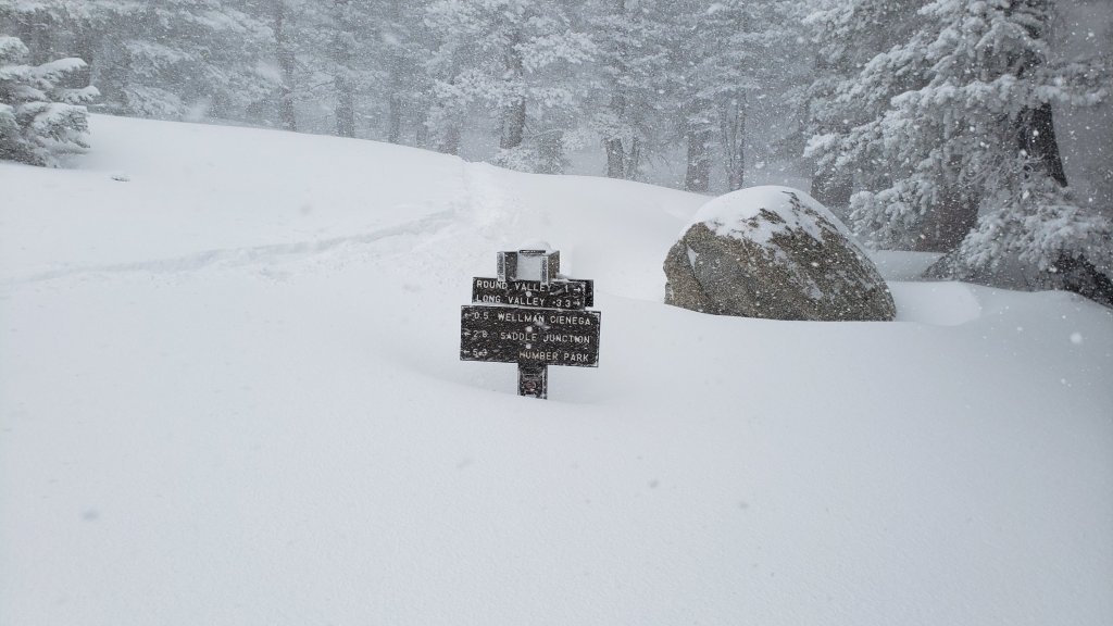
Saddle Junction/approx. PCT Mile 179 (8070 ft): 11 inches (16 inches on 23rd February)
Devil’s Slide Trail at Humber Park (6520 ft): 0-8 inches (was 15 inches on 23rd February)
Idyllwild (at 5550 ft): 0-3 inches (10.5 inches on 23rd February)
Mountain Center (4400 ft): 0-2 inches (was 4-5 inches on 24th February)
Garner Valley (at 4200 ft): 0 inches (was 2 inches on 24th February).
Thank you for taking the time to read this. While all labor and time is volunteered, the San Jacinto Trail Report completely depends on private donations to cover operating costs. Your contribution helps to keep the Report active, free from advertising, and independent from agencies. If you have found this Report useful, please visit the Donate page. Thank you for your support.