[UPDATED 8th March: this morning I recorded a video report of conditions on the Desert Divide, specifically at Apache Peak (PCT Mile 169.5) available here.]
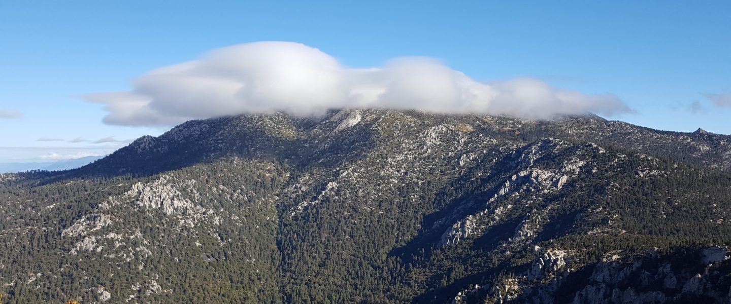
Back-to-back minor snow storms passed over the San Jacinto mountains on Friday 4th and Saturday 5th March. Both systems were so fragmented that it felt like one very patchy storm scattered across two days. Although the western slope, including Strawberry Valley where Idyllwild is located, was almost continuously shrouded in cloud for the two days, the high country was above the cloud for much of that time, so snow accumulations did not increase substantially with elevation.
A light snow early on the morning of Friday 4th produced one inch of snow in Idyllwild and we measured two inches of fresh snow at Saddle Junction (8070ft, PCT Mile 179) on a hike that morning. The former largely melted that afternoon however. It then rained periodically in Idyllwild that afternoon. Overnight 0.25in snow fell in Idyllwild, but the main snowfall on Saturday 5th came in the late afternoon with an intense graupel storm which deposited 3-6 inches at all elevations above 5000 ft within 2-3 hours. There was a dusting of snow down to about 4000 ft. Snow depths measured on 6th March are detailed near the foot of this post, but note that snow depth is rarely indicative of the difficulty (or otherwise) of conditions underfoot.
Early on Sunday 6th March I ascended San Jacinto Peak via Devil’s Slide, Wellman, Peak, and East Ridge trails. As usual after a patchy and unpredictable storm, I carried snowshoes, poles, crampons, ice axe, and spikes, in case I encountered a variety of challenging conditions. I had to break trail the entire way, initially just in light mountaineering boots to Saddle Junction, and then in snowshoes from there to the Peak. Snowshoeing conditions were the best of the winter so far. I was able to cruise across through a relatively thin layer of fresh powder on top of a firm layer of snow underneath. In addition graupel has such a low water content that combined with its circular shape it just falls off the shoes.
I descended Deer Springs Trail, again breaking trail almost the entire way, continuing to use snowshoes from the Peak down to about 6800ft just below the Suicide Rock Trail junction. By late morning the snow was already becoming sticky on sun-exposed slopes, and rapid melting was underway below 7500 ft. I did briefly encounter some posthole tracks (but not the hikers, oddly) near the top of Marion Mountain Trail.
This loop also facilitated survey of – and breaking trail for – the highest parts of the PCT in the San Jacinto mountains (roughly Miles 179-181 and 185.5-183) plus survey of several of its side trails.
Current conditions for individual routes are discussed in detail below where known. After a few cool days, a steady warming trend will accelerate melting. These conditions will lead to steady melting of snow and freeze-thaw cycles that will combine to change trail conditions and potentially the preferred equipment for the terrain. Although useful tracks are now in place for some major trails (discussed below), cautious navigation is strongly recommended everywhere.
I cannot overemphasize the importance of having both appropriate equipment and the right skill set for the terrain. The latter includes interpreting the snow/ice conditions, understanding your physical and mental abilities, and conservative decision making. These concerns may steadily increase over the next couple of weeks with snow undergoing multiple freeze-thaw cycles, with rising temperatures, seasonally stronger insolation, and highly variable snowmelt.
Snow conditions are currently ideal for snowshoeing everywhere above about 8000ft. With steady melting and compaction caused by freeze-thaw cycles and hiker traffic, conditions will rapidly deteriorate for snowshoeing over the next week or so. Nevertheless, snowshoes may be valuable anywhere off trail above about 8000ft for the next couple of weeks (depending on temperatures).
Spikes are currently not especially helpful, as snow is generally too soft and spikes will not enhance traction significantly. This will change over the next week or so as trails become compacted and icier with freeze-thaw cycles. Then spikes will be recommended everywhere above about 6000ft. They are generally especially valuable on well-consolidated tracks, on colder mornings when conditions are icy, and (as always) for descending and traversing. In the high country some hikers will find crampons a suitable alternative to spikes, although currently they are not necessary (except of course on the north faces of San Jac and Tahquitz).
Hikers should be prepared for temperatures generally below freezing in the high country, and often well below freezing when considering wind chill effects (see below for my recent observations from San Jacinto Peak).
The USFS gate at Humber Park closed on 22nd February. Even when closed there are nine legal parking spaces immediately below the gate. Vehicles not parked in these spaces may be ticketed and/or towed. If there are “Road Closed” signs further down – as was the case on recent weekends – then those nine spaces are also unavailable for legal parking.

WEATHER Temperatures are forecast to rise slowly to about seasonal by Saturday 12th, and then to warm rapidly to well above seasonal on 12th-15th March at least. There is the possibility of a further minor snow storm on Thursday 17th.
At San Jacinto Peak (10,810ft/3295m) on Sunday 6th March 2022 at 1045 the air temperature was 17.9°F (-8°C), with a windchill temperature of 0.3°F (-18°C), 71% relative humidity, and a steady WNW wind sustained at 7 mph gusting to 15.0 mph.
At the Peak on Monday 28th February 2022 at 0905 the air temperature was 33.8°F (1°C), with a windchill temperature of 19.2°F (-7°C), 35% relative humidity, and a persistent NNE wind sustained at 17 mph gusting to 23.5 mph.

TRAIL CONDITIONS
All trails above about 5500 ft are currently obscured by light to moderate snow. Rapidly melting and increasingly patchy snow remains in sheltered locations down to 4500 ft. Melting was already underway on 6th March and will accelerate rapidly over the next week, most prominently on sun-exposed slopes and below 8000 ft.
Hikers should anticipate encountering significant new treefall hazards, especially in vulnerable burn areas (e.g., Willow Creek Trail, PCT Miles 166-177). Storms in December 2021 left trees heavily laden with ice, and I have since found many broken tree limbs and downed trees throughout the trail system. Severe Santa Ana winds in January and February have brought down further trees and branches.
Effective Tuesday 1st February 2022 the State Park closed the section of Skyline Trail that falls within its jurisdiction, above 5800 ft elevation, “due to dangerous ice accumulation”. Long Valley Ranger Station staff have stated that the trail may not reopen before April. The State Park boundary is not marked but is near the site of the old Florian’s Cache, below Flat Rock. Very shallow snow from these latest storms on the open section of trail below 5800 ft will melt very rapidly on this exposed slope.
The 0.4 mile section of South Ridge Trail to Tahquitz Peak from Chinquapin Flat/PCT Mile 178 has no steps to follow through the steeply angled icy snow. These icy slopes are notoriously treacherous. Crampons with an ice axe (and knowledge of how to use both) are required. Snowshoes are not advised due to the angle of the icy snow. There was a fatal hiker fall here on Sunday 30th January.
Current snow cover on the PCT will become increasingly patchy from Miles 151 (Highway 74) to about 160, and remain largely continuous between Miles 160 and about 175 (Red Tahquitz), especially deep on north-facing slopes e.g., Spitler Peak (Mile 168) and Apache Peak (Mile 169.5-170). Note that in addition to the challenging north-east side of Apache Peak, the off-trail north side of the Apache saddle is also still largely snow-covered (also requiring spikes). Snow is also continuous between Miles 175-193. Snow cover will become patchy in sun-exposed areas between Miles 178 to 184 in the next few days, with the exception of the notoriously stubborn half mile just south of Annie’s Junction starting at about Mile 180.3. From Mile 183.5 to 193, snow is largely continuous, although some exposed sections of Fuller Ridge (e.g., parts of Miles 186.5-188.5) are thinning rapidly, as are areas north of Mile 191.
Devil’s Slide Trail has a well-defined posthole track to follow.
The Ernie Maxwell Trail has a well-defined snowshoe and footprint track to follow along its entire length.
My snowshoe track is well-defined from Saddle Junction to San Jacinto Peak, via the PCT, Wellman, and Peak trails. Above 10,400 ft my snowshoe track roughly follows the East Ridge Trail route.
Marion Mountain Trail has a well-defined posthole track through the snow along its entire length, however it does not follow the trail route in places.
There were no visible hiker tracks on Seven Pines or Fuller Ridge trails as of 6th March.
Deer Springs Trail has a well-defined track along its entire length. This consists of a well-traveled posthole track to the Suicide Rock turning, and then my snowshoe track from 6th to the Peak. Below Little Round Valley I (generally) made a conscious effort to accurately follow the trail route. Through and above Little Round Valley the only track is my snowshoe route down from the Peak which does not attempt to follow the trail route and is very direct and steep (and would be a challenging ascent for many).
There is well-defined posthole track on the Suicide Rock Trail through the rapidly melting snow from Deer Springs Trail.
Spitler Peak Trail will rapidly clear of snow on its lower half. Spikes will be useful for descending for about the next week. Forty downed trees, most from an ice storm in late December 2021, plus dozens of additional trunks and branches in the trail, have been removed by the Trail Report from this trail in 2022.
SNOW DEPTHS measured on 6th March 2022 are as follows. The first number is the current average total depth followed by the amount of new snow in these latest storms, with the greatest depth recorded after the storm of 22nd-23rd February given in parentheses, where known. Due to strong winds accompanying storms and widespread differential melting between snowfall events, note that there is considerable variability in snow depth. Altitudes are approximate.
San Jacinto Peak (10810 ft): 24-25 inches, 7 inches new (31-35 inches on 23rd February)
Little Round Valley (9800 ft): 24-28 inches, 6 inches new (with heavy drifting here)
Wellman Divide (9700 ft): 12 inches, 6 inches new (23 inches on 23rd February)
Annie’s Junction/approx. PCT Mile 180.8 (9070 ft): 24 inches, 8 inches new (28 inches on 23rd February)
Seven Pines Trail junction with Deer Springs Trail/approx. PCT Mile 184.9 (8700 ft): 11 inches, 5.5 inches new
Strawberry Junction/approx. PCT Mile 183 (8100 ft): 6 inches, 4-5 inches new
Saddle Junction/approx. PCT Mile 179 (8070 ft): 12 inches, 6 inches new (16 inches on 23rd February)
Devil’s Slide Trail at Humber Park (6520 ft): 4 inches, all new (was 15 inches on 23rd February)
Idyllwild (at 5550 ft): 3.5 inches, all new, rapidly melting (10.5 inches on 23rd February)
Garner Valley (at 4200 ft): <1 inch, all new, completely melted by 7th March (was 2 inches on 24th February).
Thank you for taking the time to read this. While all labor and time is volunteered, the San Jacinto Trail Report completely depends on private donations to cover operating costs. Your contribution helps to keep the Report active, free from advertising, and independent from agencies. If you have found this Report useful, please visit the Donate page. Thank you for your support.


