Last week Idyllwild experienced its best summer monsoonal rains in 5-6 years, totaling 2.54 inches between Saturday 30th July and Monday 1st August. Although conditions have been largely cloudy and humid since, with thunder rumbling most afternoons, we have not had significant further rainfall in Idyllwild (just 0.07 inch on 4th August, and 0.11 inch on 8th August).
After surveying water sources the morning of 8th August, an intense storm cell that afternoon passed over the high country from Long Valley in the east (which recorded 2.1 inches of rain in under two hours) to Black Mountain in the west. This will have augmented some of the water sources mentioned below, although the effects are often surprisingly brief. Further thunderstorms are forecast almost daily for at least the next two weeks, currently most likely from 16th-19th August.
The very localized nature of earlier thunderstorms, and the speed of the runoff, meant that there was minimal impact on springs and creeks from the late July storms, as described in the previous report. On a full survey of the high country on the morning Monday 8th August, water sources were largely in a similarly poor condition to late July prior to the monsoonal rains. The notable exception was the creek in Little Round Valley, where flow remained gentle but steady, having been within days of drying up in mid June.
Water conditions where known are detailed at the foot of this Report. Recent hikes have included thorough surveys of water resources and trails around the Tahquitz area meadows, Willow Creek Trail and Round Valley, and the major trail systems on both the western and eastern slopes of the San Jacinto high country. Current conditions for individual trails are discussed in detail below where known.
The Palm Springs Aerial Tramway is closed until at least Monday 15th August due to maintenance issues following flash flooding on Monday 8th. Check their website for confirmation of reopening.
Hikers should be prepared for continuing hot and humid weather, with overnight “low” temperatures forecast to remain far above seasonal into late August, and daytime highs generally near or slightly above seasonal averages. Current humidity is far above normal at all elevations. Plan accordingly regarding route choice, start times, clothing, sun protection, and water requirements.
Hikers should also be prepared for the possibility of rapidly changing weather conditions in the high country in summer. Monsoon thunderstorms, typically in the afternoon, continue to be forecast as a possibility almost daily into late August. Thunderstorms with lightning, relatively brief but intense precipitation, and rapid temperature drops, can occur in the high country even when such storms are not forecast for lower elevations.
Full fire restrictions were introduced on Thursday 26th May on Forest Service lands, as described in detail here. Campfires on all USFS lands in the San Jacinto mountains (including in fire rings at campgrounds and yellow post sites), and smoking, are prohibited for the remainder of the year.
Be rattlesnake aware. Southern Pacific Rattlesnakes (Crotalus helleri) have been seen on the trail system up to at least 8900 ft elevation. The lower two-thirds of Devil’s Slide Trail, near Strawberry Cienega, and around Tahquitz Peak are regular hotspots, but rattlesnakes are possible anywhere up to at least 9300 ft. (Sightings are currently less frequent during monsoonal weather.) Readers interested in the uniqueness and challenges of rattlesnakes in the San Jacinto high country may find this article that I wrote two years ago informative.
Be bear aware. Although rarely reported, up to three Black Bears have been in the San Jacinto mountains since 2017. On Devil’s Slide Trail at first light on 18th July 2022 we were very fortunate to see the same large (>250lb) dark brown individual that I had seen in September 2021 (one short, poor quality video from the earlier observation is available here). This was clearly a different individual, based on colour pattern and size, from the “blond” one I saw on Devil’s Slide Trail in August 2020 and had previously filmed at home in Idyllwild in 2018 (available here).
Seasonal campgrounds and Forest Service roads are now generally open. Note however the fire restrictions mentioned above. Dark Canyon Road (5S02) reopened on 11th July. However Dark Canyon Campground will not reopen this year due to staffing/maintenance issues. May Valley Road remains closed to vehicles due to “hazard trees” but the necessary tree work is expected to be completed in August.
WEATHER
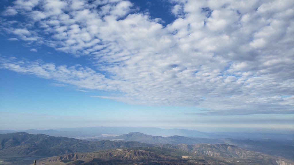
The persistent heatwave that dominated much of July has eased slightly with daytime highs generally forecast to be closer to seasonal throughout August. Much higher than normal humidity can make it feel cool but sticky early in the morning, then hotter later in the day. Overnight low temperatures will continue to average 5-15°F above seasonal at mid elevations (5000-7500 ft) for the foreseeable future. Monsoonal storms are a possibility every afternoon for at least the next two weeks, apparently most likely on 16th-19th August.
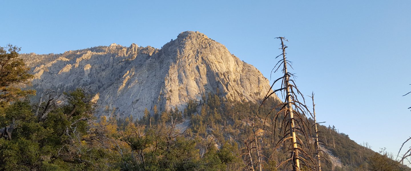
At San Jacinto Peak (10,810ft/3295m) on Monday 8th August 2022 at 0820 the air temperature was 51.7°F (11°C), with a “windchill” temperature of 45.0°F (7°C), 81% relative humidity, and a pleasantly fresh SSE breeze sustained at 5 mph gusting to 13.8 mph.
At the Peak on Monday 1st August 2022 at 0855 the air temperature was 52.1°F (11°C), with a “windchill” temperature of 47.4°F (8°C), 82% relative humidity, and a light SE breeze sustained at 2 mph gusting to 5.0 mph.
TRAIL CONDITIONS
The trail system throughout the San Jacinto mountains cleared of snow in late April.
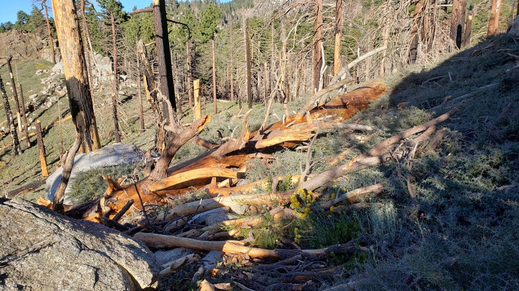
Willow Creek Trail is a slow, messy hike in places, and is currently only recommended for experienced hikers. About 46 trees are down on the Forest Service section of this trail between Skunk Cabbage Junction and the State Park boundary (August 2022 survey). Of those, 35 are in the 0.6 mile section between Willow Creek crossing and the State Park boundary. This situation has been reported in person to USFS. The State Park cut the ten or so trees on the section of trail under their jurisdiction in late July (photo below). The huge amount of work that Bill Rhoads and I undertook to clear whitethorn along this trail in 2020 was not completely in vain, but it has grown back rapidly and makes some of the treefall hazards more complicated to negotiate (photo below).
Due to greatly reduced maintenance work by the agencies and PCTA during the coronavirus pandemic, many trails have accumulated treefall hazards since late 2019, passable with care by hikers but not for stock. Although some treefall hazards from Red Tahquitz to Antsell Rock (PCT Miles 172.5-175) were cleared in June 2021 prior to the rockslide removal work, the situation has badly deteriorated. In my most recent survey I counted at least 72 treefall hazards between PCT Miles 170-175, plus about six more on PCT Miles 175-177. At least a third of the former are major hazards that require scrambling over or around.
Three new trees that came down in late 2021 on Deer Springs Trail just south of its junction with Marion Mountain Trail are readily passable for hikers (but not for stock). A CCC crew is expected to clear these this month.
One new major treefall hazard came down on Marion Mountain Trail, about two miles up, in July.
The middle section of South Ridge Trail (between May Valley Road and the top of South Ridge Road) has several trees down which are significant obstructions.
Spitler Peak Trail is currently in its most hiker-friendly condition since the July 2013 Mountain Fire. Forty downed trees, most from an ice storm in late December 2021, plus dozens of additional trunks and branches in the trail, were removed by the Trail Report from this trail in early 2022.
Fuller Ridge Trail has 14 treefall hazards (multiple 2022 surveys) obstructing the trail, but all are readily passable by relatively agile hikers. Eleven of these are in the 1.5 mile section closest to Fuller Ridge Campground (approx. PCT Miles 189-190.5).
The Caramba Trail from near Reeds Meadow through Laws Camp and on to Caramba, and the Cedar Trail from Willow Creek Trail to Laws, are optimistically described by the Forest Service as “not maintained”. In reality both trails no longer exist and are so heavily overgrown I strongly advise hikers do not attempt to follow them. An informal use trail to Laws is much more direct and avoids all of the very challenging bushwhacking of the unmaintained trails (some local hikers dubbed it the “King Trail” when I established the route in 2019). It leaves the Willow Creek Trail exactly 1.0 mile from Saddle Junction (0.46 mile from the Skunk Cabbage turning), descending largely on established deer trails for 1.2 miles, meeting Willow Creek just upstream from the old Laws Camp. From Laws east to Caramba the route of the original Caramba Trail has been well-cairned by myself and others and can largely be followed with very careful route-finding. My 2022 survey counted 97 trees down on this 2.1 miles of trail. It is especially obscure 0.1-0.3 mile east of the Willow Creek crossing, becoming more obvious near Caramba. Very cautious navigation is advised throughout the area.
Seven Pines Trail has had very limited hiker traffic since November 2018, largely because Dark Canyon Road was closed almost continuously from February 2019 to July 2022 (with a brief reopening October-December 2021). Dark Canyon Road finally reopened in mid July 2022 however. The Trail Report has adopted Seven Pines Trail as a priority for maintenance work as the trail has had a disproportionate number of lost hiker rescues in the past decade. Between November 2021 and May 2022, 61 downed trees were removed and almost the entire trail thoroughly trimmed and cleared. Despite this very considerable effort, Seven Pines remains a genuine wilderness trail and is nothing like the relatively wide, bare, and obvious routes of, for example, Devil’s Slide or Marion Mountain trails. Cautious navigation remains required for those who do not have significant experience of hiking this trail.
WATER CONDITIONS: Eastern slope
The Round Valley pipe is flowing at about 1.0 L/min but recent history suggests it may not persist all summer without further rainfall input. The nearby Round Valley creek dried up in May. The small creek in Tamarack Valley also dried up in May.
Both the northern (photo below) and southern springs at Wellman’s Cienega are flowing extremely weakly for the time of year. They did not receive significant additional input from recent thunderstorms, and the well-known north springs may dry completely in the next couple of months without further precipitation. They should no longer be relied upon for filtering. This spring dried for the first time in recorded history in October 2015, then again in September 2016.
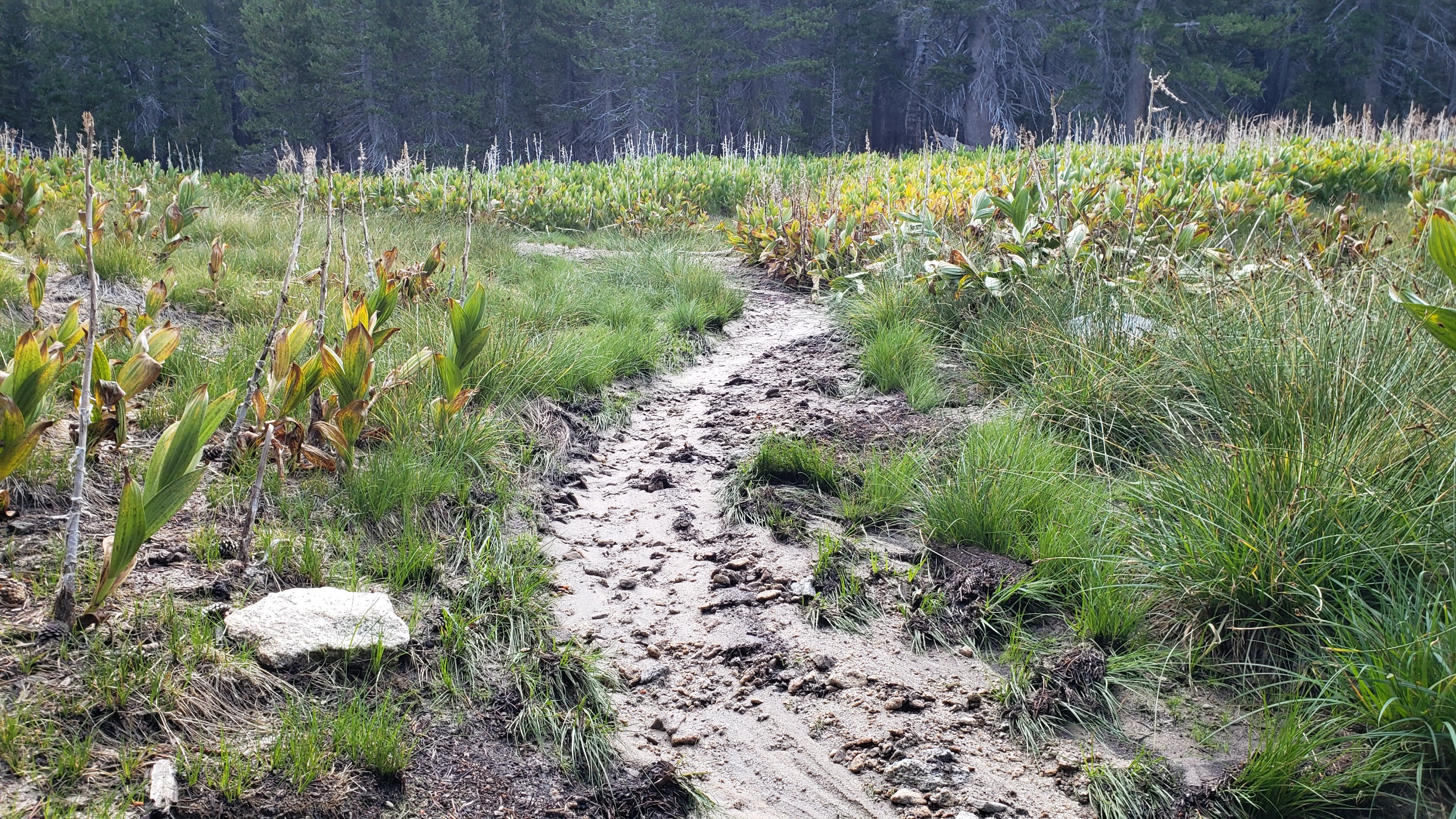
The Wellman’s Cienega springs are the sources for Willow Creek, which is currently flowing weakly but reliably where it crosses the Willow Creek Trail (photo above).
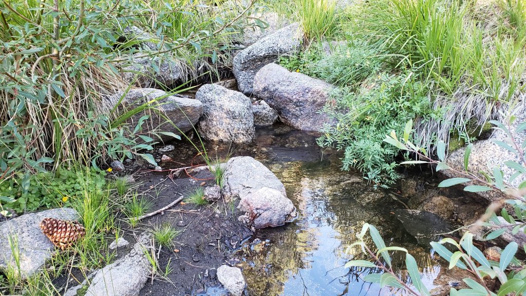
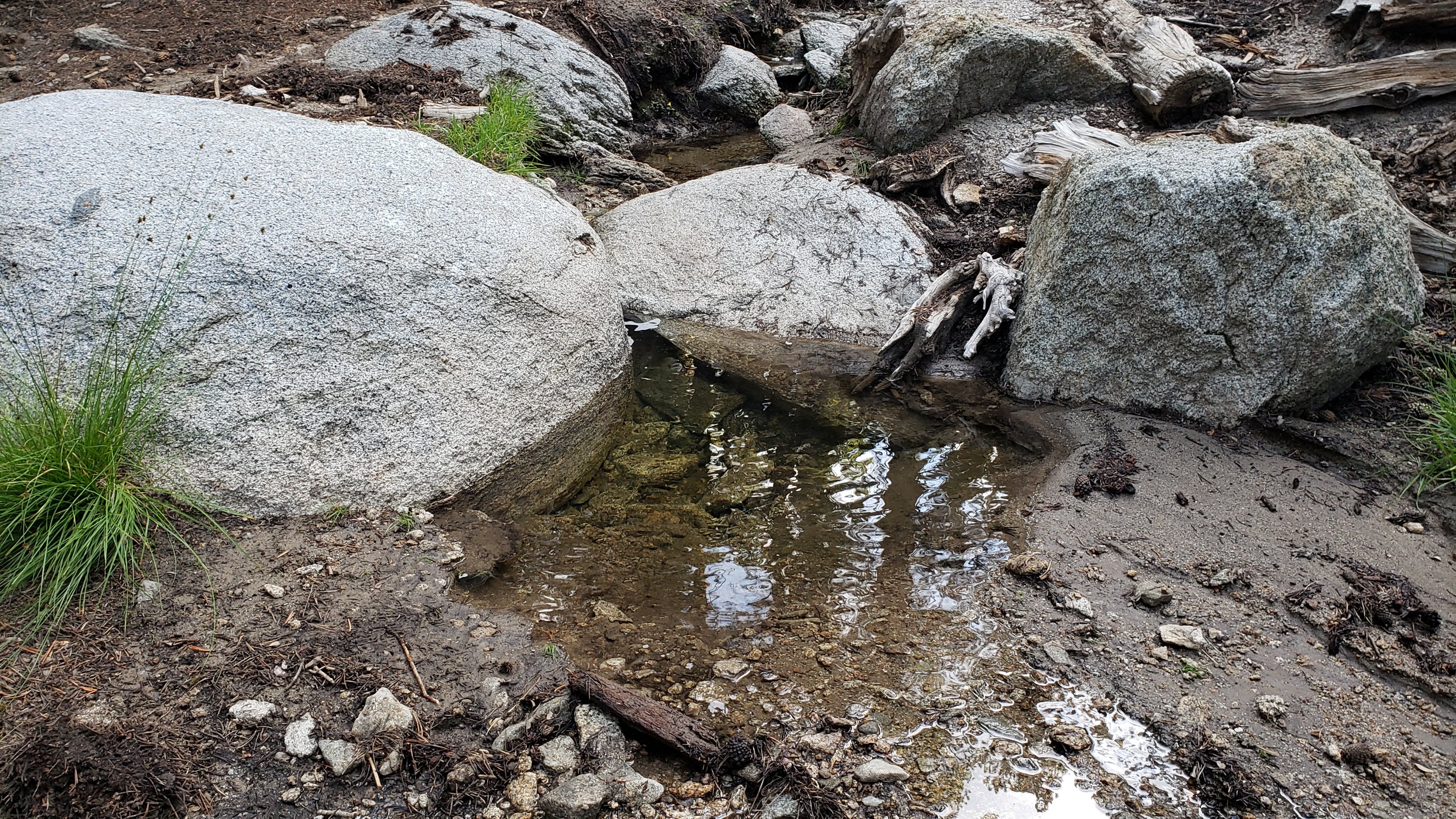
Tahquitz Creek is flowing gently at the northern (lower) end of Little Tahquitz Valley at a flow rate of >2.0L/min (photo below). It is flowing weakly further upstream at its source, known colloquially as Grethe Spring, where it crosses the PCT at approx. PCT Mile 177 (photo below). It is clear that this area received some fresh monsoonal rain input in late July, but this dissipated within hours. Between these locations Tahquitz Creek is largely dry (but presumably flowing subsurface). The small creek in Tahquitz Valley dried up in May.
Skunk Cabbage (“Candy’s”) Creek dried up in late June where it crosses under the trail through Skunk Cabbage Meadow.
WATER CONDITIONS: Western slope
Ephemeral creeks, such as those along Marion Mountain Trail and on Deer Springs Trail, have been dry since May.
The North Fork of the San Jacinto River is flowing relatively weakly where it crosses the Deer Springs Trail (photo below) and again downstream where it crosses the Fuller Ridge Trail on the PCT (approx. PCT Mile 186.2).
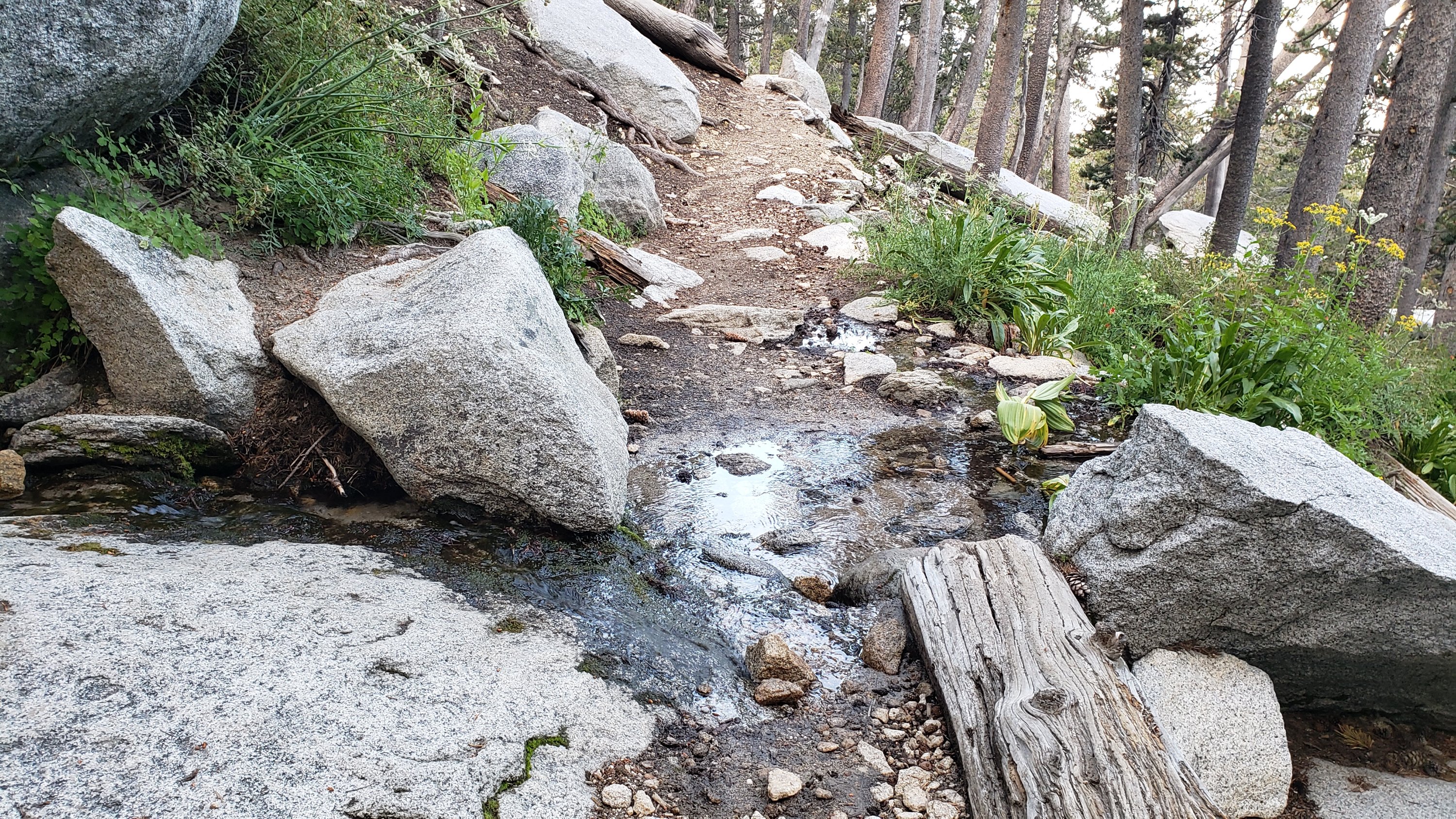
The creek in Little Round Valley (photos below) received moderate new precipitation from thunderstorms at the end of July. Having been nearly dry in mid June, the creek just about continues to flow through the lower half of the valley (roughly 400 ft), forming some reasonable pools in the lower half. The same creek continues to flow gently where it crosses Fuller Ridge Trail (at about PCT Mile 186.4).
Shooting Star Spring (below Little Round Valley but above the North Fork of the San Jacinto River crossing) is flowing gently but is inadequate for filtering.
The Deer Springs stream crossing at the PCT/Deer Springs Trail (approx. PCT mile 185.6) completely dried up in late May where it crosses the trail and did not receive any additional water from rains in July.
The tiny Switchback Spring at PCT Mile 183.5 (about 0.4 miles on the PCT northbound from Strawberry Junction) is flowing gently, and there is just about adequate depth from which to filter water in the tiny pool on the upslope side of the trail.
The little creek at Strawberry Cienega (PCT mile 183.0) has been dry since June.
On Devil’s Slide Trail, Middle Spring is barely trickling and may dry very soon without substantial monsoon rain input. A tiny pool remains as a useful emergency drinking source for dogs. Other springs on this trail have been dry for months.
On the Ernie Maxwell Trail, the crossing of Chinquapin Creek just below Humber Park is dry where it crosses the trail. However, even when Fern Valley Water District is diverting flow into the pipe system small fresh pools remain among the rocks just upslope from the trail (these are an important source of water for the many dogs walked on the Ernie Maxwell).
WATER CONDITIONS: Desert Divide
Live Oak Spring (N 33 37 21, W 116 33 24) Flowing. The most reliable water source on the Desert Divide.
Cedar Spring (N 33 40 36, W 116 34 35) Flowing (well upslope from the trail into the campsite). Likely received substantial fresh input from storms in late July. Sadly the inflow pipe to the trough – formerly the most accessible water source – was vandalized in May 2022 and consequently the trough was dry (but may temporarily fill with rainfall). This damage has been reported to the Forest Service, but no repair is expected before the autumn.
Apache Spring (N 33 43 11, W 116 37 13) Flowing weakly, but the spring box remains full (photo in earlier Report). This spring has functionally dried up in recent years and should not be relied upon by late summer.
Spitler Peak Trail Descending the trail there are five water crossings. The first two, at 0.90 and 0.95 miles down, cross a tiny side creek which is largely dry and should be ignored. The next three crossings, at 1.1-1.5 miles down, are Spitler Creek and is the best source of water (currently flowing steadily at both the uppermost and lowest crossings).
Antsell Rock Creek (N 33 41 52, W 116 39 08) Right by the Spitler Peak Trail trailhead on Apple Canyon Road, Antsell Rock Creek is dry, nearly two months earlier than last year.
Thank you for taking the time to read this. While all time and labor is volunteered, the San Jacinto Trail Report depends on your small private donations to cover our costs. Your contribution keeps the Report available to all, free from advertising or paywalls, and independent from agencies. If you have found this Report useful, please use this link to the Donate page. Zelle, Venmo, and PayPal are all options. Thank you for your support.


Hi. What happened to the pipe spring in Tahquitz Valley? I know it has been dry but I visited it in May and it was damaged. I asked the USFS several times with no answers.
LikeLike
Hi Jeri. The faucet was removed from the TV pipe some 3-4 years ago. USFS policy seems to be to deny the existence of the pipe, I believe to discourage damage to the meadow from foot traffic. I generally don’t mention it in the Trail Report for that reason. Four of the past five years it has been dry anyway by late winter. Much easier water is available in Tahquitz Creek just a few minutes walk away at the lower end of Little Tahquitz Valley. Safe hiking, Jon.
LikeLike