UPDATE Saturday 17th December 2022: Early this morning we hiked South Ridge Trail to Tahquitz Peak, and I broke trail from Tahquitz Peak to and from Chinquapin Flat through moderate snow. No tracks had made it as far as Chinquapin from Saddle Junction at that time. Trail conditions are updated below.
UPDATE Thursday 15th December 2022: Early this morning I hiked to San Jacinto Peak from Humber via Devil’s Slide, Wellman and Peak trails. I barebooted to 9000 ft, then snowshoed the rest of the way through lovely light powder. I descended via Deer Springs Trail, breaking trail through virgin powder all the way down to the Suicide Rock Trail junction. Most major trails now have a track through the snow to follow, details have been updated below.
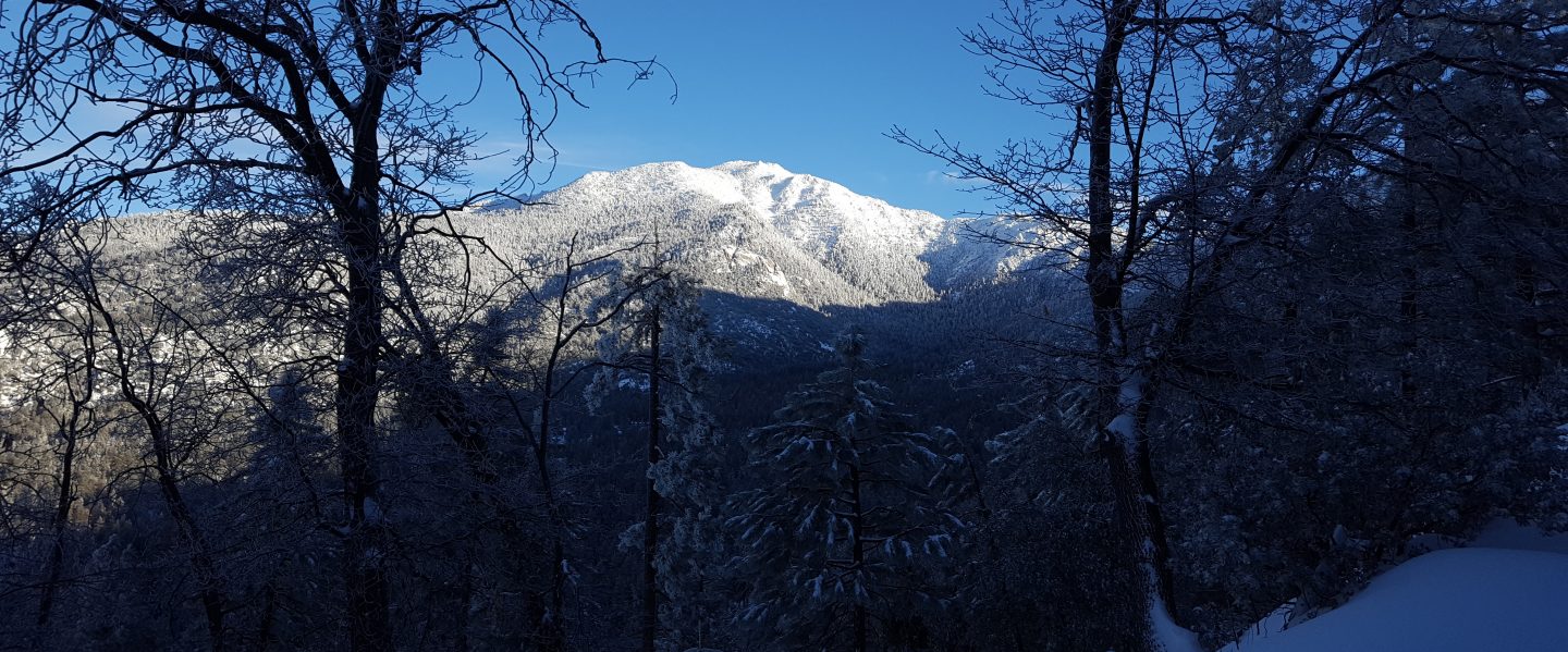
UPDATE Wednesday 14th December 2022: Early this morning Anabel and I broke trail up Spitler Peak Trail to the PCT. There was thin patchy snow at the trailhead (4900 ft) and then it was largely continuous above 5800 ft. Most of the upper half of the trail had 3-4 inches of lovely fluffy powder. I was very happy to find no new treefall hazards down on Spitler Peak Trail. The lower half of the trail should be largely clear of snow by the weekend.
UPDATE Tuesday 13th December 2022: This morning Anabel and I broke trail up South Ridge Road and South Ridge Trail to Old Lookout Flat (7600 ft). Note that South Ridge Road (5S11) is closed to vehicle traffic. I measured an average of about four inches of snow at Old Lookout Flat, although with some deeper drifts in the trail.
————————————
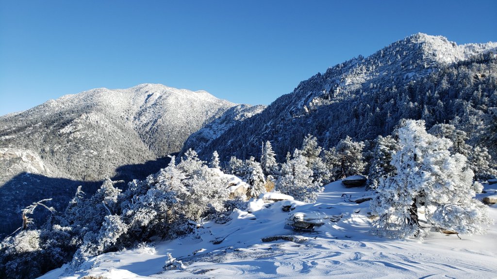
This is a summary of conditions following the second significant Pacific storm of winter 2022/23 to impact the San Jacinto mountains. The “atmospheric river” of moisture from lower latitudes was weaker than the storm in early November, although snowfall was ultimately slightly greater in this storm than in November, perhaps in part due to the colder temperatures. The system averaged colder than the November storm, with more snow at lower elevations, although it was still notable that it initially rained as high as 9500 ft on the morning of Sunday 11th. There was a dusting of snow in Garner Valley (4300 ft).
The total snow accumulation was ultimately very close to that forecast in the days immediately prior to the storm. The rainfall totals at mid elevations were unremarkable, especially compared to those of the storm in early November (discussed here). As forecast, the storm came in two main waves, with the bulk of the precipitation falling for most of the daylight hours of Sunday 11th, followed by a remarkably calm and clear night, and then a much less intense period of snowfall between about 0800-1300 on Monday 12th.
For example, San Jacinto Peak received about 9 inches of fresh powder (on top of about 2-4 patchy inches of icy snow remaining from November) on Sunday 11th, with an additional inch falling on Monday 12th. In Idyllwild (data from 5550 ft) there was 1.14 inches of rain on Sunday 11th which turned to snow that afternoon, settling to 0.5 inch. On the morning of Monday 12th a further 2.5 inches of snow settled in Idyllwild.
I recorded a short video at San Jacinto Peak early on the morning of Monday 12th December (available here) which gives a feel for conditions as the storm was nearing its end.
As of the afternoon of Monday 12th, the only tracks that I saw and that are known to be in place are my snowshoe track between Humber Park and San Jacinto Peak (using Devil’s Slide, Wellman, and Peak trails), and the track of Kyle Eubanks from the previous evening between Long Valley and the Peak via Wellman Divide (which remained surprisingly visible in places about 15-20 hours later, showing how calm the winds were overnight).
Although snow depths are not generally sufficient to obscure the routes of the major trails, cautious navigation is recommended everywhere for the next few days in particular until tracks through the snow are in place.
Details of snow depths measured at various locations on the trail system are given at the foot of this posting. Note however that snow depth itself is rarely indicative of the difficulty (or otherwise) of hiking a particular trail.
Some general comments on snow/ice conditions. Time of day, temperature, and sun exposure all have significant impacts on the nature of the snow, in turn changing the conditions underfoot, and hence both the hiking difficulty and the preferred traction device (if any). These impacts are especially striking in Southern California mountains, where the sun is relatively potent even in midwinter and where even on the coldest days temperatures at mid elevations may fluctuate either side of freezing. A rapidly warming montane climate, with changes especially striking at high elevation, is exacerbating all of these issues.
Currently the snow is relatively powdery and benign; this will steadily change over the next few days and weeks. Note that temperatures fluctuating either side of freezing are forecast for both mid and upper elevations for the foreseeable future. Steady melting of snow, especially on sun-exposed slopes, and freeze-thaw cycles will combine to change trail conditions and potentially the preferred equipment for the terrain.
Snow depths are currently suitable for snowshoeing everywhere above about 8000 ft, possibly lower in places. However they are not required, depending on your comfort level with postholing in drifted snow of moderate depth. With compaction of the trails over the next few days, snowshoes will become less useful on-trail, however they will remain valuable for off-trail travel at the highest elevations for the foreseeable future.
Spikes are currently useful throughout the trail system above about 5000 ft, potentially lower in places. They are not however required, depending upon your comfort level hiking on shallow variable snow, mixed with slushy and icy patches. Spikes will likely become increasingly useful over the next few days and weeks as established trails become consolidated by hiker traffic and undergo freeze-thaw cycles. They tend to be especially useful for descending.
For the foreseeable future hikers should be prepared for temperatures below freezing in the high country, and well below freezing when considering wind chill effects (see below for my recent weather observations from San Jacinto Peak).
Currently the USFS gate at Humber Park is closed. This may change after the weekend. When plowed Humber will remain very icy for the next few days at least. Even when the gate is closed there are nine legal parking spaces this side of the locked gate (near the upper Ernie Maxwell trailhead). Vehicles not parked in these spaces may be ticketed and/or towed. If there are “Road Closed” signs further down – as was often the case last winter – then those nine spaces are also unavailable for legal parking.
South Ridge Road (5S11) is currently closed to vehicle traffic but is rapidly clearing [checked Saturday 17th] of snow.
Dark Canyon Road (4S02, the access to Seven Pines Trail) and Santa Rosa Truck Trail (7S02) closed to vehicle traffic for the season on 7th November 2022. Black Mountain Road also closed on 7th November to vehicle traffic at the gate 1.7 miles up from Highway 243. Forest Service campgrounds at Boulder Basin, Marion Mountain, and Fern Basin are closed for the season. The State Park Stone Creek campground is also closed.

WEATHER
Temperatures are forecast to remain near or below seasonal averages for at least the next week, with freezing conditions every night above about 4000 ft elevation. Most days will be at least partly cloudy. Combined with a weak sun at this time of year, snow melt will generally be very slow at upper elevations, and conditions will be ideal for freeze/thaw cycles and hence icy trails. The significant Pacific storm of the winter that had been forecast over an extended period between about 16th-21st December is no longer thought likely to impact the San Jacinto mountains, although considerable uncertainty persists in the weather models for that period.
At San Jacinto Peak (10,810ft/3295m) on Thursday 15th December 2022 at 0715 the air temperature was 28.0°F (-2°C), with a windchill temperature of 13.9°F (-10°C), 52% relative humidity, and a chilly WNW wind sustained at 9 mph gusting to 14.5 mph.
At the Peak on Monday 12th December 2022 at 0715 the air temperature was 9.7°F (-12°C), with a windchill temperature of -13.4°F (-25°C), 100% relative humidity, and a sharp WSW wind sustained at 12 mph gusting to 21.2 mph.
At the Peak on Thursday 8th December 2022 at 0900 the air temperature was 28.4°F (-2°C), with a windchill temperature of 12.7°F (-11°C), 11% relative humidity, and a fresh SW wind sustained at 7 mph gusting to 9.3 mph.
TRAIL CONDITIONS
All trails above about 5500 ft are currently lightly (or above 8500 ft, moderately) snow-covered. Underlying the fresh snow is – in places – a thin layer of ice and/or icy snow remaining from the previous storm in early November. This will make trail conditions more complicated, and if in any doubt whatsoever carry and use traction devices accordingly (see discussion in introduction above).
Devil’s Slide Trail has an excellent compacted track to follow to Saddle Junction.
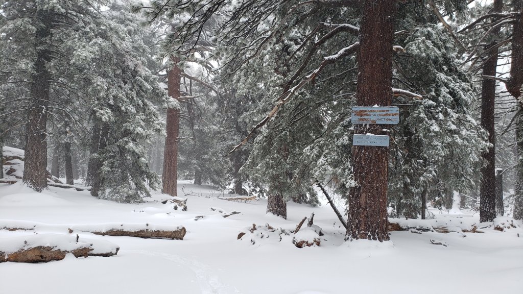
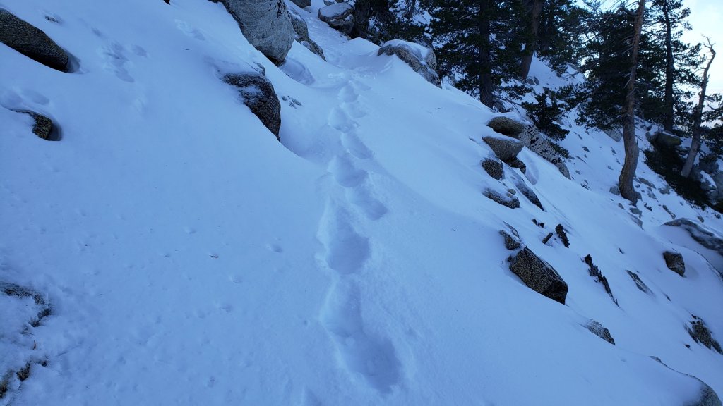
Early on the morning of Saturday 17th I broke trail back-and-forth across the 0.4 mile section of South Ridge Trail between Chinquapin Flat/PCT and Tahquitz Peak which now has a lightly traveled posthole track to follow through the drifted powder (photo below). The average snow depth in this area is only about five inches, but on this slope it is heavily drifted in places at 10-12 inches. Although not essential in the moderate depth powder, spikes are strongly recommended and many hikers will find them useful especially for descending. Hikers who have an ice axe (and know how to use it) may find it useful in places on this short section of trail. This trail will become significantly more treacherous as it undergoes freeze/thaw cycles and compaction over the next week or two.
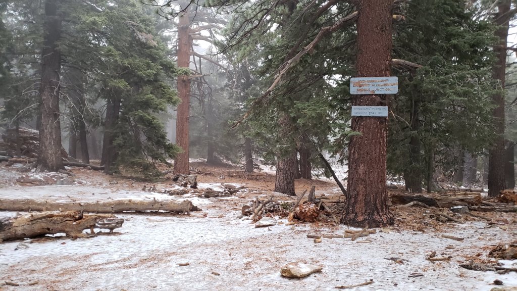
There is evidence of a relatively well-traveled track south from Saddle Junction on the PCT, but as of the morning of Saturday 17th this track did not make it through to Chinquapin Flat.
There is an excellent snowshoe track to follow on the Wellman Trail and the Peak Trail up to San Jacinto Peak.
There is a relatively well-traveled track on the Round Valley Trail from Long Valley through to Wellman Divide.
Deer Springs Trail [updated 15th December] now has an accurate snowshoe track to follow all the way to San Jacinto Peak as I broke trail the entire way down to the Suicide Rock Trail junction on the afternoon of 15th. Unusually for me, I followed the entire route of the established trail down to Little Round Valley. There is a well-traveled track on the lowest section of Deer Springs Trail continuing out to Suicide Rock.
Marion Mountain Trail [updated 15th] has a mix of snowshoe and posthole tracks all the way up to its junction with Deer Springs Trail.
The Ernie Maxwell Scenic Trail has a well-traveled track to follow throughout, snow cover is 90%.
South Ridge Trail [hiked 13th and 17th December] has a well-traveled posthole track through shallow snow as far as Tahquitz Peak. Spikes are not essential but will be useful for most hikers, especially for descending. Melting has already reduced the snow cover to 90% as far as Old Lookout Flat (7600 ft).
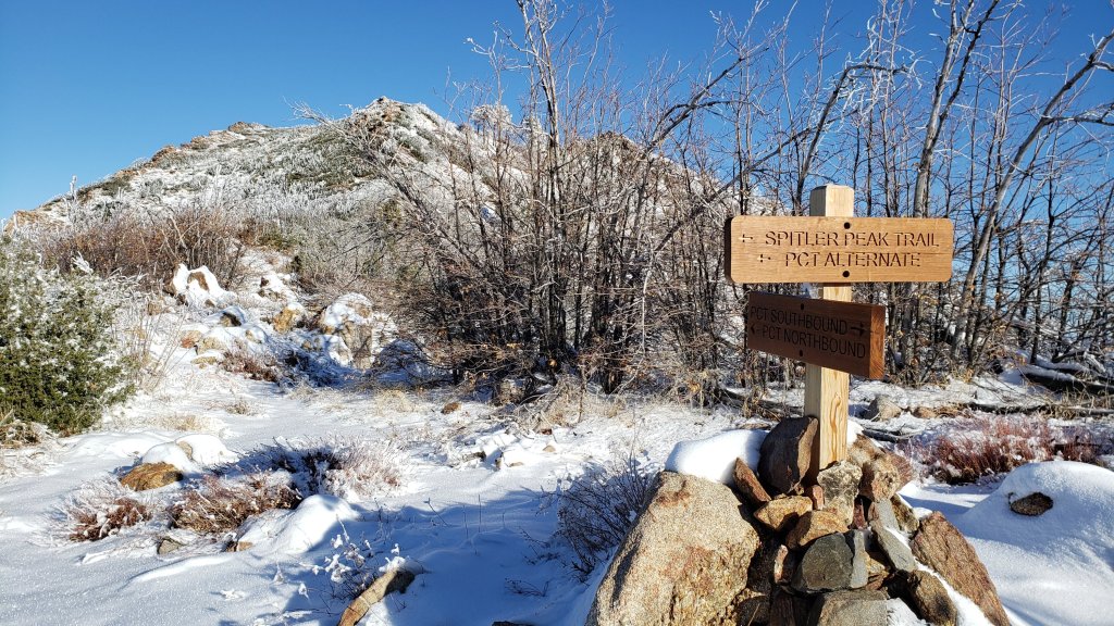
Spitler Peak Trail has a very visible boot track through light snow to the PCT.
Seven Pines Trail has no sign of any hiker traffic since the snow on 12th.
SNOW DEPTHS measured on 12th November 2022 are as follows (measured on 15th for Deer Springs Trail locations). The first number is the current total snow depth, followed in parentheses by the storm total for this latest storm 11th-12th December. Note that average depth is given; due to strong winds accompanying the storm there is extensive drifting, often particularly accumulating in the trails. Conversely in some places scouring by the wind means the depths are well below the average. Altitudes are approximate.
San Jacinto Peak (10810 ft): 12-14 inches (storm total 10 inches)
Little Round Valley (9800 ft): 10-12 inches (storm total 7 inches)
Wellman Divide (9700 ft): 7 inches (storm total 6 inches)
Round Valley (9100 ft): 6 inches (storm total 5 inches) [thanks to Kyle Eubanks for this measurement]
Annie’s Junction/approx. PCT Mile 181.8 (9070 ft): 5.5 inches (storm total 5 inches)
Marion Mountain Trail at junction with PCT (8700 ft): 6 inches (storm total 5 inches)
Long Valley (8600 ft): 5-6 inches (storm total 5 inches) [thanks to Kyle Eubanks for this measurement]
Strawberry Junction (8100 ft): 3-4 inches (storm total 3-4 inches)
Saddle Junction/approx. PCT Mile 179.9 (8070 ft): 4 inches (storm total 3.5 inches)
Devil’s Slide Trail at Humber Park (6550 ft): 3.5 inches (storm total 3.5 inches)
Idyllwild (at 5550 ft): 3.0 inches (storm total 3.0 inches).
While all time and labor is volunteered, the San Jacinto Trail Report uses small private donations to cover costs. Every year seems to have its unique challenges and 2022 has been no exception. Your contribution keeps the Report available to all, free from advertising or paywalls, and independent from agencies. If you have found this Report useful, please consider using this link to the Donate page. Zelle, Venmo, and PayPal are all now options. Thank you so much for your support.