UPDATE 11th November 2022: conditions for trails both north and south of Tahquitz Peak have been updated below, with photo, based on our hike this morning. In summary there are good tracks in place through the very shallow snow, and spikes are not required (but may be useful for some hikers depending on their experience in thin icy snow).
UPDATE #2 for 10th November 2022: It was disappointing late this morning to see southbound PCT hikers trying to hike down Highway 243 from Idyllwild to Mountain Center. Firstly because it is really unsafe, that is a busy and winding mountain road, not remotely a route designed for pedestrians. Secondly, because there is really very little snow on the PCT. As described below, there were only about three inches at Saddle Junction (PCT Mile 179) yesterday. This morning the PCT at the top of Spitler Peak Trail (roughly Mile 168.5) was basically clear of snow. Most of the PCT through the San Jacinto mountains has little more than 1-4 inches of snow to deal with. It is safest for all concerned that hikers hike the Trail rather than the highways.
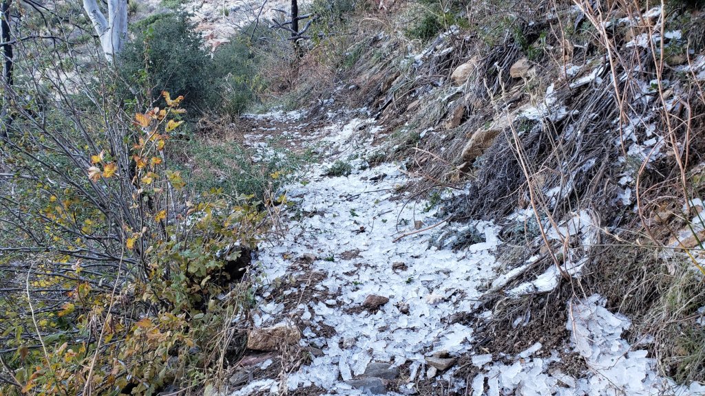
UPDATE #1 for 10th November 2022: We hiked Spitler Peak Trail to its junction with the PCT this morning. Both trails were virtually completely clear of snow. Areas here at 6500-7000 ft had had much less snow than a few miles further north, only 0.5-1.0 inch depth. However there was a lot of rime ice starting to melt and fall from trees on upper Spitler (photos below). Nothing unduly dangerous, but something to be aware of for the next couple of days. The storm brought down four new treefall hazards down on upper Spitler Peak Trail, awkward but all passable with care.
———————————
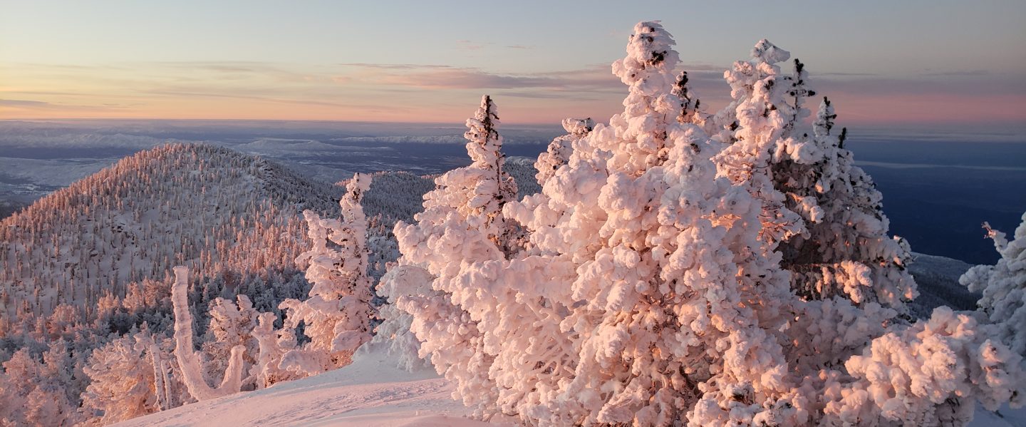
This is a brief summary of conditions following the second Pacific storm, and the first significant snowfall, of winter 2022/23 to impact the San Jacinto mountains. The total snow accumulation was ultimately very close to the predictions given by forecasts in the days prior to the storm, and notably it was the heaviest snowfall in the first half of November for at least a decade. The rainfall totals at mid elevations were remarkable, and it is tempting to ponder what the snowfall totals could have been in the mountain communities and in the high country had the air temperatures been just a few degrees cooler.
I recorded a short video at San Jacinto Peak early on the morning of Wednesday 9th November (available here) which gives a feel for conditions as the storm finally cleared. I also reported on the storm in real time over the past couple of days (available here) which has more detail than this summary.
The storm was relatively mild, as might be expected from an “atmospheric river” system pulling moisture in from subtropical latitudes at this relatively early season, and as a result the freeze level was relatively high for most of the time that precipitation fell. Indeed it rained as high as San Jacinto Peak multiple times on 7th and 8th November.
Idyllwild (data from 5550 ft) received a prodigious 4.01 inches of rain in the 31 hours starting at midnight on Monday 7th. This is the second heaviest rainfall period in the past decade for Idyllwild (behind the almost unbeatable “Great Valentine’s Day flood” event of 2019, when we recorded 7.8 inches in just 20 hours!).
It wasn’t until early in the morning on Wednesday 9th, by which time the bulk of the storm system had passed, that the snow level fell to near 5000 ft, with 0.75 inch snow recorded at 5550 ft elevation. Details of snow depths measured at various locations on the trail system are given at the foot of this posting.
Although excellent tracks are now in place for some major trails (as outlined below), cautious navigation is recommended everywhere for the next few days in particular.
Snow depths are currently suitable for snowshoeing everywhere above about 9000 ft. However they are not required, depending on your comfort level with postholing in drifted snow of moderate depth. With compaction of the trails over the next few days, snowshoes may become less useful, however they will remain valuable for off-trail travel at the highest elevations for the foreseeable future.
Spikes are currently useful throughout the trail system above about 6000 ft, potentially lower in places. They are not however required, depending upon your comfort level hiking on shallow variable snow, mixed with slushy and icy patches. Spikes will likely become more increasingly useful over the next few days as established trails become consolidated by hiker traffic and undergo freeze-thaw cycles. They tend to be especially useful for descending trails.
Note that temperatures fluctuating either side of freezing are forecast for mid to upper elevations (at least >6000 ft) for the foreseeable future. Rapid melting of snow on sun-exposed slopes and freeze-thaw cycles will combine to change trail conditions and potentially the preferred equipment for the terrain.
Hikers should be prepared for temperatures near or below freezing in the high country, and generally well below freezing when considering wind chill effects (see below for my recent weather observations from San Jacinto Peak).
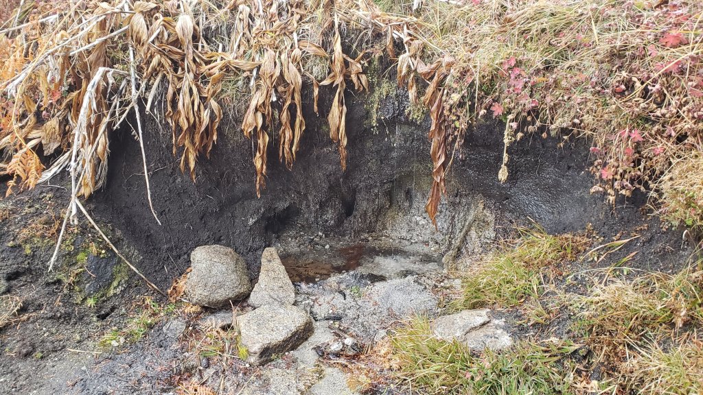
With such dramatic rainfall throughout the mountain range in the past two days, and with snow now available for melting in the high country, I do not expect to be reporting on water conditions until next year. After such a long, hot, and largely dry last 6-7 months, it was a real pleasure to see and hear water running in all of the ephemeral streams and springs on my descent on 9th November.
Currently the USFS gate at Humber Park remains open and the parking area has been largely plowed. It will however be very icy in the early mornings for the next few days at least. Even if the gate is closed there are nine legal parking spaces this side of the locked gate (near the upper Ernie Maxwell trailhead). Vehicles not parked in these spaces may be ticketed and/or towed. If there are “Road Closed” signs further down – as was often the case last winter – then those nine spaces are also unavailable for legal parking.
Black Mountain Road closed on 7th November to vehicle traffic at the gate 1.7 miles up from Highway 243 (see Forest Service website regarding this closure here).
Santa Rosa Truck Trail (7S02) also closed to vehicle traffic for the winter on 7th November 2022.
Forest Service campgrounds at Boulder Basin, Marion Mountain, and Fern Basin are now closed for the winter.
Fire lookouts at Black Mountain and Tahquitz Peak were closed for the season this past weekend ahead of schedule in anticipation of the snow storm.

WEATHER
Temperatures are forecast to remain at or even slightly below seasonal averages into the second half of November, with freezing conditions every night above about 5500 ft elevation. Combined with a weakening sun at this time of year, snow melt will generally be slow at upper elevations, and conditions will be ideal for freeze/thaw cycles and hence icy trails. There is currently no further precipitation in the forecasts.
At San Jacinto Peak (10,810ft/3295m) on Wednesday 9th November 2022 at 0820 the air temperature was 14.5°F (-10°C), with a windchill temperature of -7.8°F (-22°C), 100% relative humidity, and a sharp due West wind sustained at 20 mph gusting to 30.5 mph.
At the Peak on Monday 7th November 2022 at 1715 the air temperature was 28.4°F (-2°C), with a windchill temperature of 12.7°F (-11°C), 93% relative humidity, and a fresh WSW wind sustained at 10 mph gusting to 22.0 mph.
TRAIL CONDITIONS
All trails above about 6000 ft are currently lightly (or above 9000 ft, moderately) snow-covered. However by this afternoon, melting was already underway below 9000 ft on sun-exposed slopes.
Reliable tracks are in place (at least) for Devil’s Slide Trail through to San Jacinto Peak via Wellman Divide, from Long Valley/Tram to Wellman Divide, from Saddle Junction to Tahquitz Peak, and up South Ridge Trail to Tahquitz Peak.
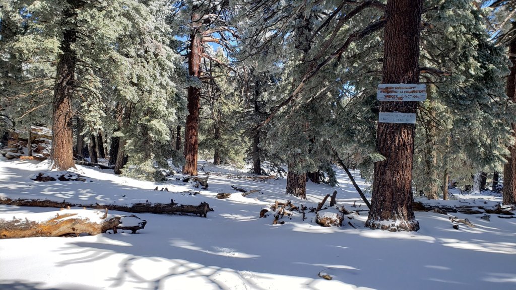
The 0.4 mile section of South Ridge Trail between Chinquapin Flat/PCT and Tahquitz Peak has a well-traveled and level track – photo below – to follow through the light 3-4 inches of powder (drifted to six inches in places). Spikes are not required, but some hikers may find them useful depending on their comfort level hiking on thin icy snow.
South Ridge Trail from the top of South Ridge Road to Tahquitz Peak has a relatively well-traveled track to follow through the very light and patchy 1-3 inches of icy snow. Spikes are not required for ascending, but some hikers may find them useful for descending.
The PCT from Snow Creek south to at least Saddle Junction (roughly Miles 207-179) has a clear track to follow.
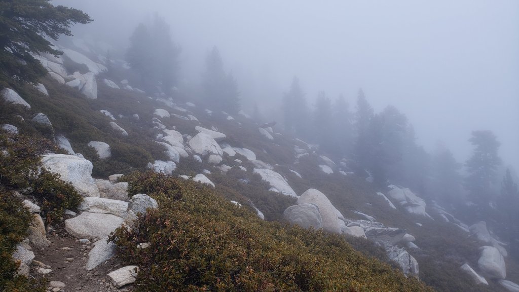
Hikers should expect to encounter new treefall hazards due to the enormous weight of ice from freezing rain currently in the trees and the high winds associated with the storm. New treefall hazards on Devil’s Slide Trail, South Ridge Trail, and Spitler Peak Trail, have all been reported.
SNOW DEPTHS measured on 9th November 2022 are as follows. Note that average depth is given; due to strong winds accompanying the storm there is extensive drifting, often particularly accumulating in the trails. Conversely in places scouring by the wind means the depths are well below the average. Altitudes are approximate.
San Jacinto Peak (10810 ft): 12 inches
Wellman Divide (9700 ft): 4 inches snow with 1-2 inches of ice underneath
Round Valley (9100 ft): 4 inches [special thanks to Kyle Eubanks for this measurement]
Annie’s Junction/approx. PCT Mile 181.8 (9070 ft): 6 inches
Tahquitz Peak (north side trail, 8700 ft): 3-4 inches, drifted to six [measured 11th November]
Tahquitz Peak (south side trail, 8500-8700 ft): 2 inches [measured 11th November]
Long Valley (8600 ft): 2-3 inches [special thanks to Kyle Eubanks for this measurement]
Saddle Junction/approx. PCT Mile 179.9 (8070 ft): 3 inches
Devil’s Slide Trail at Humber Park (6550 ft): 2.5 inches (melting already underway this afternoon)
Idyllwild (at 5550 ft): 0.75 inches (melting rapidly this afternoon).

Thank you for taking the time to read this. While all time and labor is volunteered, the San Jacinto Trail Report uses small private donations to cover costs. Every year seems to have its unique challenges and 2022 has been no exception. Your contribution keeps the Report available to all, free from advertising or paywalls, and independent from agencies. If you have found this Report useful, please consider using this link to the Donate page. Zelle, Venmo, and PayPal are all options. Thank you so much for your support.


Wow, great photos! Lets hope the snow keeps up this winter, would love to get some snowshoeing in this year! Thanks as always for the updates!
LikeLike