This is an adaptation of the Report originally issued on 31st December 2021, which followed four mostly minor storms that impacted the San Jacinto mountains between 24th-30th December. Although temperatures at mid elevations have started to warm to above seasonal in the past couple of days, melting has progressed slowly especially at higher elevations. High country locations have generally lost only an inch or two of snow depth, mid elevations several inches, and snow has almost completely cleared below 5000ft.
On 5th January we undertook a partial survey of South Ridge Trail with great friend of the Report Charles Phelan, and on 4th January we ascended to San Jacinto Peak via Devil’s Slide, Wellman, and (roughly) Peak trails. Current conditions for individual trails are discussed in detail below where known.
On 4th I largely broke trail again above Saddle Junction to Wellman Divide (my tracks from 31st December barely visible above 8500ft due to spindrift), initially in spikes then snowshoes from 9000ft to just above Wellman Divide. The slopes of the Peak “Trail” remained firm and challenging in snowshoes, and I switched back to spikes to reach San Jac (see details below regarding routes in the high country).
Most major trails have now been traveled but all remain covered by light to moderate snowfall. Tracks at the highest elevations (>9800ft) currently do not approximate to the routes of established trails (specifically the Peak Trail above 9900ft, and Deer Springs Trail above Little Round Valley). Cautious navigation is recommended everywhere.
Spikes are recommended everywhere above about 5500ft as trails become icy when compacted by hiker traffic and undergo freeze-thaw cycles. Spikes are especially valuable on colder mornings when conditions are particularly icy, and for descending. Snowshoes are currently useful in many areas above about 8000ft, especially as snow softens with warming temperatures. Below that elevation snow coverage is either generally too shallow, or trails will become compacted and unsuitable for snowshoes, when they will become mainly valuable for off-trail travel only. Crampons and ice axe remain a good option on much of the east slope above 9800ft, but this will change with increased melting and hiker traffic.
Note that rapid warming will continue, the temperatures above seasonal at mid elevations (e.g., Idyllwild) into at least mid January, and well above seasonal in the high country to Saturday 8th January (before dropping to near average). These temperatures will lead to significant melting and freeze-thaw cycles which will combine to change trail conditions and, in places, the preferred equipment for the terrain. However, some combination of spikes and snowshoes – the latter on mild days of soft snow, for off-trail travel, or for unbroken routes – will likely be useful in the San Jacinto high country for the foreseeable future.
Hikers should be prepared for temperatures near or below freezing in the high country, and generally well below freezing when considering wind chill effects (see below for some of my recent weather observations from San Jacinto Peak).
All five storms in December left trees very heavily laden with ice, and I have since found many broken tree limbs and downed trees on the trail system. Hikers should anticipate encountering significant new treefall hazards, especially in vulnerable burn areas (e.g., May Valley Road, Spitler Peak Trail, Willow Creek Trail, PCT Miles 166-177).
The USFS gate at Humber Park closed on 13th December. Even when closed there are nine legal parking spaces immediately below the gate. Vehicles not parked in these spaces may be ticketed and/or towed. If there are signs further down indicating that the road is closed – as has been the case for most of the past two weeks – then the nine spaces are also unavailable for legal parking. Exercise caution parking in this area as multiple vehicles have been towed on recent weekends.
South Ridge Road is currently closed, and is completely snow/ice covered.
Dark Canyon Road, the access for Seven Pines Trail, closed in December due to winter conditions. It remains 90% snow-covered [updated 7th January].

WEATHER Temperatures at mid elevations will remain slightly above seasonal averages well into mid January. In the high country temperatures will be well above seasonal until 8th January, before dropping to near seasonal. Steady melting will continue at all elevations, but will be most pronounced below 8000ft and on intensely sun-exposed slopes. There is no significant precipitation in the forecasts.
At San Jacinto Peak (10,810ft/3295m) on Tuesday 4th January 2022 at 1020 the air temperature was 31.6°F (0°C), with a windchill temperature of 14.5°F (-10°C), 58% relative humidity, and a bitter NW wind sustained at 10 mph gusting to 24.3 mph.
At the Peak on Friday 31st December 2021 at 1055 the air temperature was 19.2°F (-7°C), with a windchill temperature of -3.1°F (-20°C), 92% relative humidity, and a frigid WSW wind sustained at 19 mph gusting to 31.1 mph.

TRAIL CONDITIONS
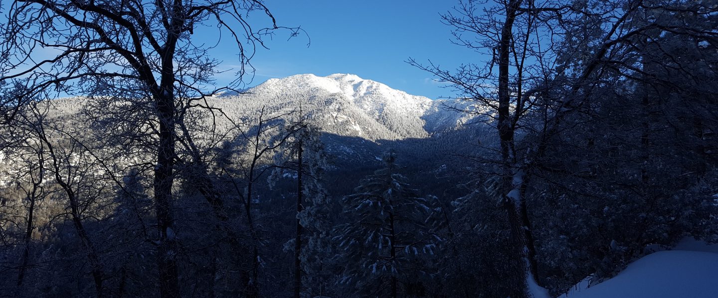
All trails above about 6500ft are snow-covered, lower in sheltered places. Melting has been well underway at mid elevations and will accelerate significantly over the next few days.
Spitler Peak Trail [updated 8th January] is currently very challenging for hikers, with an astonishing 35 treefall hazards on its uppermost two miles, many of which are not easy to pass, plus dozens of additional branches down in the trail. Almost all of these came down since my last survey on 22nd December, when I counted only seven trees down. In addition icy snow conditions mean that spikes are currently recommended on the uppermost two miles.
The Ernie Maxwell Trail [updated 6th January] has a well-compacted snowshoe track to follow along its entire length. The snow depth is starting to thin especially at the lower (southern) end of the trail but snow cover remains >90%. Spikes are increasingly useful as the snow is icy following freeze-thaw cycles.
Devil’s Slide Trail has a well-traveled, compacted snow track to follow, no longer suitable for snowshoes but spikes are useful especially for descending. Melting was starting to reveal some rock steps and gravel patches below 7000ft on 4th January.
South Ridge Trail has a well-traveled track up to Old Lookout Flat (7600ft) and spikes are adequate. There is a very lightly traveled posthole track continuing up to Tahquitz Peak, for which snowshoes may be useful as snow continues to soften.
Tahquitz Peak trail from Chinquapin Flat/PCT Mile 178 has steps to follow through the angled icy snow, and these may well improve this weekend. These icy slopes are treacherous. Currently spikes, at least with hiking poles (or an ice axe plus knowledge of how to use it) are recommended. Snowshoes are not advised due to the angle of the icy snow.
There are two routes in place from Long Valley up to San Jacinto Peak. There is a moderately traveled compacted track from Round Valley that approximates to the trail as far as Wellman Divide, follows part of the Peak Trail route, then climbs steeply around the east and north flanks of Jean Peak (following the route I established on 31st December, as discussed in the previous Report). There is a lightly traveled snowshoe track that roughly follows the “Sid Davis Trail” to Tamarack Valley, the old Tamarack Trail to near 10,000ft, and then climbs south of Miller Peak up the East Ridge Trail line. As of 4th January, the Peak Trail was only partially broken. This situation may improve this weekend with steady melting expected.
Marion Mountain Trail has a lightly traveled track that largely follows the trail route up to Deer Springs Trail. Azalea Trail, the access road for Marion Mountain trailhead, has only been partially plowed and is currently 4WD/AWD accessible only. This may improve with melting in the next week or two. Unsurprisingly, there remain no visible tracks on Fuller Ridge and Seven Pines trails.
Deer Springs Trail has an obvious but lightly traveled snowshoe-and-posthole track above Strawberry Junction. Below Little Round Valley it largely follows the established trail route. Through Little Round Valley the track is more direct and does not follow the trail route, and the track from LRV to near San Jacinto Peak is very direct, steep, and is a challenging ascent. There is a relatively well-traveled posthole track up to Strawberry Junction.
The lower Deer Springs Trail to Suicide Rock has a well-traveled track through light and rapidly melting snow.
May Valley Road is almost clear of snow, however it is largely impassable by vehicles due to multiple trees down (reported to USFS).
The rockslide at PCT Mile 172.5, just north of Antsell Rock, was removed on 14th June 2021. My “before, during, and after” video is available here. This section of the PCT is now safer and is narrow but readily passable with care by hikers (but remains impassable by stock).
Due to greatly reduced maintenance work by the agencies and PCTA during the coronavirus pandemic, many trails have accumulated treefall hazards since late 2019, passable with care by hikers but not for stock. Although reported promptly, regrettably neither Forest Service nor State Park were quick to remove most hazards in 2021. With recent storms being accompanied by strong winds and heavy ice loads, hikers will encounter some new and additional hazards. Some are described below, others include the PCT between Strawberry Cienega and Strawberry Junction (PCT Miles 182-183, at least 7 trees down), and Fuller Ridge Trail near its northern end (PCT Miles 189.1-190.2, three trees).
Willow Creek Trail has at least 33 downed trees between Skunk Cabbage Junction and Hidden Divide. Of these 22 are on the Forest Service section (16 between Willow Creek and the Park boundary), with 11 in the State Park. Most are readily passable by hikers with care. Despite much work in 2020 by USFS volunteer Bill Rhoads and myself, the whitethorn has grown back rapidly, but still remains much less challenging than in 2019.
Marion Mountain Trail was cleared of multiple tree hazards by a California Conservation Corps team in late August 2021, along with the adjacent PCT/Deer Springs Trail for 0.6 mile north to the south end of Fuller Ridge Trail. Three new trees came down in late 2021 on the PCT just south of its junction with Marion Mountain Trail, but they are readily passable for hikers.
Many treefall hazards from Red Tahquitz to Antsell Rock (PCT Miles 172.5-175) were cleared in June 2021 prior to the rockslide removal work mentioned above. Nevertheless more than 20 remain, including at least six major obstructions for hikers. Tahquitz Creek to Red Tahquitz (PCT Miles 175-177) was cleared in early June 2021.
Seven Pines Trail has had very limited hiker traffic since November 2018, largely because Dark Canyon Road was closed between February 2019 and early October 2021, and again since December 2021. The Trail Report has “adopted” Seven Pines Trail as a priority for maintenance work as the trail has had a disproportionate number of lost hiker rescues in recent years. Starting in November 2021, 42 treefall hazards on the lower 3.0 miles of trail have been removed. Most of this section has also been trimmed and cleared, and the trail is now obvious and easy to follow for much of its length (when clear of snow). However approximately 18 downed trees remain on the upper 0.7 mile of trail, the route is very obscure in places, and cautious navigation is required especially for those who are not very familiar with hiking this trail. Dark Canyon campground remains closed.
SNOW DEPTHS measured on 4th January 2022 are as follows. The first number is the current average total depth, with the snow depth recorded on 31st December 2021 following in parentheses. Note that average depth is given; due to strong winds accompanying some of the storms, and differential melting, there is considerable drifting and variability. Altitudes are approximate.
San Jacinto Peak (10810ft): 28 inches (was 30 inches on 31st December)
Wellman Divide (9700ft): 23 inches (was 26 inches on 31st December)
Annie’s Junction/approx. PCT Mile 181.8 (9070ft): 22 inches (was 23 inches on 31st December)
Long Valley (8600ft): about 12 inches (was 14 inches on 31st December)
Saddle Junction/approx. PCT Mile 179.9 (8070ft): 10 inches (was 12 inches on 31st December).
Devil’s Slide Trail at Humber Park (6520ft): 0-4 inches (patchy melting, was 7 inches on 31st December)
Idyllwild (at 5550ft): 0-2 inches (patchy melting, was 6.5 inches on 31st December)
Thank you fellow hikers for taking the time to read this. While all labor and time is volunteered, the San Jacinto Trail Report completely depends on small private donations to cover operating costs. Every year seems to have its challenges and 2022 already looks like it will be no exception, so every contribution, no matter how small, is truly valuable. If you have found this Report useful, please consider visiting the Donate page. Thank you for your support.


Thank you for the continuing great reports. Have you noticed if anyone is snow camping at Round Valley, Tamarack, or Little Round Valley?
LikeLike
Thanks Mike. A couple of guys camped in Round on night of 3rd. There was one tent site used in LRV in late December (regretted they also left a large campfire ring). I talked to two sets of folks who camped at Strawberry at the the weekend. Safe hiking, Jon.
LikeLike