Starting on 24th December we had four storm systems pass through the San Jacinto mountains in seven days, plus some additional localized precipitation on days between the storms.
Contrary to earlier forecasts, the first system on 23rd-24th December ultimately proved to be by far the most substantial of the four, and was summarized in the previous Report (available here). That system was relatively warm, including light rainfall briefly as high as San Jacinto Peak, and was dominated by impressive rainfall numbers at mid elevations (e.g., 4.35in at 5550ft in Idyllwild in under 48 hours).
The three subsequent minor storms were colder, producing snow as low as 4000-5000ft, although by the final wave of precipitation on 30th air temperatures were above freezing below 6000ft and some melting was already underway with light drizzle at times. Unfortunately the high country was above the clouds for the majority of the precipitation that fell in the mid elevations on 26th-30th December. Indeed the fourth storm system on 30th largely passed the San Jacinto mountains to the west.
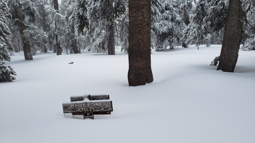
Ultimately projections that by the end of December we could have received up to two feet of snow in Idyllwild and 4-5 feet in the high country proved to be wildly optimistic. Idyllwild finished the week of storms with roughly seven inches of snow, exact depths varying by location, and San Jacinto Peak with about 30 inches (of which eight remained from an earlier storm on 14th December).
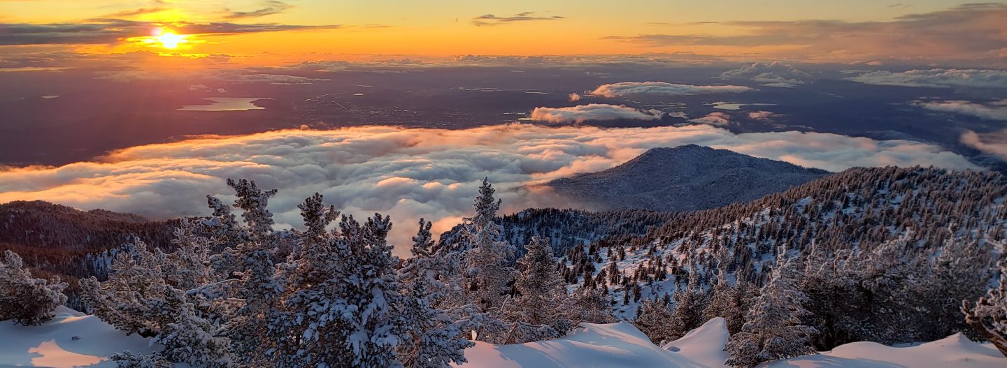
On 31st December I ascended an east side route (Devil’s Slide, Wellman, Peak trails) to San Jacinto Peak, and then descended the west side via Deer Springs Trail. Current conditions for individual trails are discussed in detail below. I largely broke trail above Saddle Junction, initially postholing then in snowshoes above 9000ft. The slopes above Wellman Divide became increasing firm and challenging in snowshoes, and I had to leave the route of the Peak Trail and head directly upslope to the north-east side of Jean Peak to then reach San Jac. I recorded a shortish video near the Peak discussing snow and trail conditions (available here). The powder was near-perfect on the west side, where I found no tracks at all above Strawberry Junction.
Currently very few major trails have been traveled and all are covered by moderate snowfall. This situation may change significantly over the long New Year holiday weekend, with clearer weather forecast and hikers likely to be active on most of the trail system. Nevertheless, cautious navigation is recommended everywhere.
Snow depths are currently ideal for snowshoeing almost everywhere above about 8000ft. Below that elevation snow coverage is either generally too shallow for snowshoes, or trails will become compacted and unsuitable, when snowshoes will become mainly valuable for off-trail travel only. Crampons and ice axe are currently a good option on much of the east slope above 9800ft, but this may not be the case within a few days with melting and hiker traffic. Spikes are recommended everywhere above about 5000ft for the foreseeable future as trails become icy when compacted by hiker traffic and undergo freeze-thaw cycles. Spikes may be especially valuable on trails with heavy water flow in the trails that may partially freeze over the next few days (e.g., Devil’s Slide and Deer Springs trails), on colder mornings when conditions are particularly icy, and for descending.
Note that rapid warming is expected in early January 2022, with significant melting and freeze-thaw cycles which will combine to change trail conditions and, in places, the preferred equipment for the terrain. However, some combination of spikes and snowshoes – the latter on warm days of soft snow, off-trail, or for unbroken routes – will likely be useful in the San Jacinto high country for the foreseeable future.
Hikers should be prepared for temperatures around or below freezing in the high country, and generally well below freezing when considering wind chill effects (see below for some of my recent weather observations from San Jacinto Peak).
Both this sequence of storms and the prior system earlier in December left branches heavily laden with ice, and as a result I have found many broken tree limbs and downed trees in the trails. Hikers should expect to find significant new treefall hazards, especially in vulnerable burn areas (e.g., May Valley Road, Spitler Peak Trail, Willow Creek Trail, PCT Miles 166-177).
For details regarding pre-existing (non snow/ice) hazards on the trails, coronavirus issues and ranger station access, please see this earlier Report or contact the State Park or Forest Service as indicated on their websites.
The USFS gate at Humber Park closed on 13th December. Even when closed there are nine legal parking spaces immediately below the gate. Any vehicles not parked in these spaces may be ticketed and/or towed. If there are signs further down indicating that the road is closed then the nine spaces are also unavailable for legal parking. On 31st December for example, CHP cleared all vehicles from this area in the afternoon (thanks to Bill Rhoads for this information).

WEATHER Temperatures will remain below seasonal averages this weekend until 4th January 2022, and then rapidly warm to above average for 5th-7th January, before returning to about seasonal. Sadly temperatures above freezing (and well above seasonal) are forecast at the highest peaks on 3rd-7th January. Clearly there will be steady melting at all elevations, especially rapid below 8000ft and on sun-exposed slopes.
At San Jacinto Peak (10,810ft/3295m) on Friday 31st December 2021 at 1055 the air temperature was 19.2°F (-7°C), with a windchill temperature of -3.1°F (-20°C), 92% relative humidity, and a bitter WSW wind sustained at 19 mph gusting to 31.1 mph.
At the Peak on Thursday 23rd December 2021 at 1615 the air temperature was 27.7°F (-2°C), with a windchill temperature of 9.5°F (-13°C), 94% relative humidity, and a gusty due West wind sustained at 17 mph gusting to 27.8 mph.
TRAIL CONDITIONS
All trails above about 4500ft are snow-covered. By yesterday afternoon, melting was already well underway below 6000′, and will accelerate significantly over the next few days.
The Ernie Maxwell Trail has a well-defined 18″ wide snowshoe track to follow along its entire length. Unfortunately this was starting to soften on 31st December (many thanks to Anne and Anabel for this information). The snow has the right texture that spikes are not currently required. This may change with increased compaction and freeze-thaw cycles this weekend.
Devil’s Slide Trail has a well-traveled, compacted snow track to follow, spikes are especially useful for descending.
Tahquitz Peak trail from Chinquapin Flat/PCT Mile 178 has steps to follow through the angled icy snow, and these may well improve this weekend. These icy slopes are treacherous. Currently spikes, at least with hiking poles (or an ice axe plus knowledge of how to use it) are recommended. Snowshoes are not advised due to the angle of the icy snow.
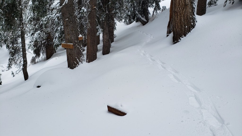
There were no visible tracks whatsoever on Marion Mountain, Seven Pines, or Fuller Ridge trails, as of the afternoon of 31st December. Azalea Trail, the access road for Marion Mountain trailhead, has not been plowed and is 4WD/AWD accessible only.
The only broken route I saw from Round Valley up to San Jacinto Peak is a posthole track that comes directly up, completely bypassing Wellman Divide and most of the Peak Trail route, coming around the east and north flanks of Jean Peak (see my discussion above of the current challenges of the Peak Trail).
Deer Springs Trail has only my descending snowshoe track to follow above Strawberry Junction. Below Little Round Valley I largely followed the established trail route. Through Little Round Valley I was more direct and made no effort to follow the trail route, and my snowshoe track down from the Peak to LRV is very direct, steep, and would be a challenging ascent. There is now a posthole track up to Strawberry Junction.
The lower Deer Springs Trail to Suicide Rock has a well-traveled posthole track through the light snow.
Dark Canyon Road, the access for Seven Pines Trail, is closed due to winter conditions, likely into next month.
SNOW DEPTHS measured on 31st December 2021 are as follows. The first number is the current average total depth, with the snow depth recorded on 24th, prior to the three most recent minor storms, following in parentheses (where known). Note that average depth is given; due to strong winds accompanying some of the storms, there is extensive drifting, especially in the trails. Altitudes are approximate.
San Jacinto Peak (10810ft): 30 inches (was 22 inches on afternoon of 24th December)
Little Round Valley (9800ft): 25 inches
Wellman Divide (9700ft): 26 inches (was 20 inches on afternoon of 24th)
Annie’s Junction/approx. PCT Mile 181.8 (9070ft): 23 inches (was 14 inches on afternoon of 24th)
Deer Springs Trail at junction with Seven Pines Trail (8800ft): 11 inches
Long Valley (8600ft): about 14 inches (was 12 inches on 24th; many thanks to Kyle Eubanks for that measurement)
Strawberry Junction/PCT Mile 183 (8100ft): 8 inches
Saddle Junction/approx. PCT Mile 179.9 (8070ft): 12 inches (was 3 inches on afternoon of 24th, some earlier snow was removed by rain on 23rd-24th).
Devil’s Slide Trail at Humber Park (6520ft): 7 inches (was less than one inch on 24th)
Idyllwild (at 5550ft): 6.5 inches (melting already underway 29th-30th, was 0 inches on afternoon of 24th)
Thank you fellow hikers for taking the time to read this. While all labor and time is volunteered, the San Jacinto Trail Report completely depends on small private donations to cover operating costs. Every year seems to have its challenges and 2022 already looks like it will be no exception, so every contribution, no matter how small, is truly valuable. If you have found this Report useful, please consider visiting the Donate page. Thank you for your support.