[UPDATED 24th November: we took a brisk hike up and down Marion Mountain and upper Deer Springs trails to San Jacinto Peak early this morning. The northerly wind was bitter at the Peak and got stronger throughout the morning as we descended. The Weather section below is updated. There are no significant changes to snow/ice conditions, and advice below – basically spikes recommended throughout the high country – remains valid. The forecasts remain wildly inconsistent for the potential storms next week but it is looking increasingly likely that the systems will miss us to the north.]
Snow from the moderate storm on 8th-9th November (summarized in a prior Report) has been melting steadily as temperatures in the past week have been above seasonal. A major change to the weather might occur next week (see Weather section below) with forecasts suggesting a possible double storm system impacting the San Jacinto mountains, and cold temperatures at all mountain elevations for a week at least.
Lightly cloudy conditions made for a delightful hike on the evening of Monday 21st ascending San Jacinto Peak via Marion Mountain and Deer Spring trails, descending the east side (Devil’s Slide, Wellman, and Peak trails). In recent days we have also surveyed trails around Tahquitz Peak, South Ridge, Spitler Peak, and Deer Springs, among others.
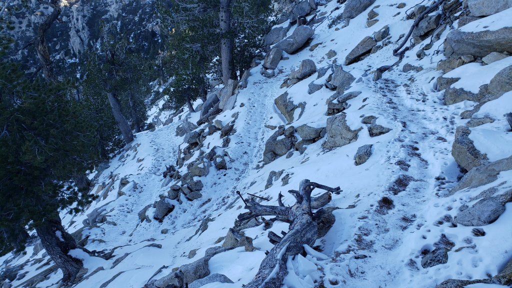
On 21st I again barebooted (i.e. no traction device) to the Peak on a generally well-traveled and compacted track through light icy snow. I put spikes on at the Peak for the descent and ultimately kept on my Kahtoola microspikes until about 9000 ft, one mile north of Saddle Junction. Even as melting proceeds steadily (details below), trails are very icy due to daily freeze/thaw cycles and compaction from hiker traffic, and spikes are recommended throughout the trail system above about 8000 ft (lower in places). Overall, melting is proceeding somewhat faster than expected but this holiday weekend trails will remain very icy. Often spikes are especially valuable for descending even when they are no necessarily needed for ascending.
Details of snow depths measured at various locations on the trail system are given at the foot of this posting. Note however that snow depth is rarely indicative of the challenge (or otherwise) of a given trail. Although excellent tracks are now in place for almost all major trails cautious navigation remains recommended.
Snowshoes are no longer required anywhere on the established trail system, where snow is now too shallow, icy and compacted. However this may change next week with new snowfall possible as discussed below.
Hikers should be prepared for temperatures near or below freezing in the high country, and generally well below freezing when considering wind chill effects (see below for my recent weather observations from San Jacinto Peak).
Currently the USFS gate at Humber Park remains open and the parking area has been largely plowed.
Black Mountain Road closed on 7th November to vehicle traffic at the gate 1.7 miles up from Highway 243 (see Forest Service website regarding this closure here). This is expected to be a seasonal closure until next year.
Dark Canyon Road (4S02, the access to Seven Pines Trail), and Santa Rosa Truck Trail (7S02) also closed to vehicle traffic for the season on 7th November 2022.
Forest Service campgrounds at Boulder Basin, Marion Mountain, and Fern Basin are now closed for the season. The State Park campground at Stone Creek is also closed.
Fire lookouts at Black Mountain and Tahquitz Peak were closed for the season ahead of schedule in anticipation of the snow storm in early November.
WEATHER
Above seasonal temperatures will continue until Sunday 27th November. A double storm has been forecast as a possibility between Monday 28th November and Sunday 4th December. However the precipitation amounts and probabilities for both storm systems have varied greatly in recent forecasts, and the models seem to be especially uncertain about details of the second storm (approx. 2nd-3rd December). Temperatures during and after both storms are forecast to be below seasonal for late November, colder than the storm system in early November, and windy and hence especially cold in the high country.
The first storm overnight on Monday 28th may produce snow above 10,000 ft (forecasts have ranged from 0-16 inches), and very light snow near the elevation of Idyllwild preceded by a little rain. The second system, possible in a broad time window between 2nd and 4th December, may produce significant snow in the high country (forecasts have ranged widely from 0-30 inches above 10,000 ft!) but probably light rain and/or about an inch of snow at the elevation of Idyllwild. This information will be updated daily over the next week as details are changing significantly with every new forecast. Sadly it is looking increasingly likely that neither storm will significantly impact the San Jacinto mountains.
At San Jacinto Peak (10,810ft/3295m) on Thursday 24th November 2022 at 0810 the air temperature was 29.0°F (-2°C), with a windchill temperature of 5.7°F (-15°C), 16% relative humidity, and a severe NNW wind sustained at 25 mph gusting to 35.1 mph.
At the Peak on Monday 21st November 2022 at 1610 the air temperature was 36.5°F (3°C), with a windchill temperature of 28.0°F (-2°C), 9% relative humidity, and a steady WSW breeze sustained at 6 mph gusting to 9.2 mph.
At the Peak on Thursday 17th November 2022 at 0825 the air temperature was 36.3°F (2°C), with a windchill temperature of 29.5°F (-1°C), 10% relative humidity, and a cool NW breeze sustained at 3 mph gusting to 6.3 mph.

TRAIL CONDITIONS
Trails above about 7500 ft currently remain lightly covered with patchy icy snow (more continuous above about 9000 ft). However excellent well-traveled and compacted tracks are now in place for most of the major trails (details below).
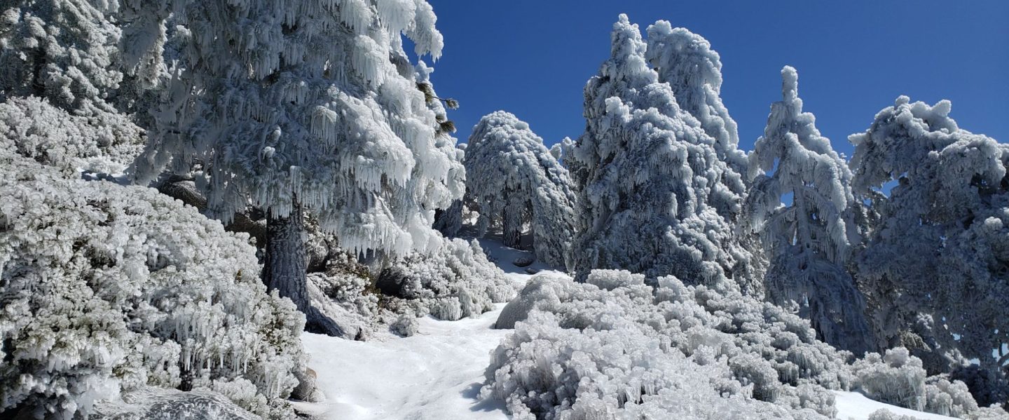
Hikers should expect to encounter new treefall hazards due to the enormous weight of ice from freezing rain associated with the early November storm, followed by recent Santa Ana winds, and after the passage of Tropical Storm Kay in September. New treefall hazards on several major trails have been reported, and those on Spitler Peak Trail have already been cleared by the Trail Report.
The Ernie Maxwell Trail is functionally clear of icy snow, although a few minor patches remain, especially close to Humber Park. Spikes are not required.
Devil’s Slide Trail is almost clear of icy snow to about 7700 ft although some extended dirty icy patches remain below that. Above that elevation, icy snow is largely continuous to Saddle Junction. Spikes are not required for ascending, but some hikers will find them useful at least for descending the uppermost section.
There is a very well-traveled track from Saddle Junction to Tahquitz Peak (multiple photos below). The 0.4 mile section of South Ridge Trail between Chinquapin Flat/PCT and Tahquitz Peak has a well-traveled and level track to follow through the steadily melting 1-2 inches of icy snow. Although not essential, spikes are recommended and many hikers will find them useful especially for descending.
The PCT on the south-facing slope (“Angel’s Glide”) for about 1.0 mile north of Saddle Junction is largely clear of snow (spikes not required).
The Wellman Trail from Annie’s Junction to Wellman Divide has about 40% icy snow cover. Spikes are useful at least for descending.
The Peak Trail has about 80% cover of icy snow, largely continuous above 9900 ft. Spikes are recommended.
There is a well-traveled track on light icy snow from Long Valley/Tram to Wellman Divide. Skyline Trail has a good track to follow through very thin icy snow above 7000 ft (the Traverse to Grubb’s Notch). Spikes are recommended but not strictly essential depending upon your comfort level hiking on angled icy snow.
The PCT throughout the San Jacinto mountains (roughly Miles 207-151) has a clear track to follow, including Fuller Ridge Trail, which has been traversed by a handful of sobo PCT hikers.
South Ridge Trail (surveyed 19th November) is largely clear of snow from the top of South Ridge Road to Old Lookout Flat at about 7600 ft, with just 5% cover of icy snow. The traverse from Old Lookout Flat to the bottom of the switchbacks has about 40% icy snow cover. The switchbacks up to Tahquitz Peak average only 20% icy snow cover, but the frequency and length of ice patches increases on the uppermost switchbacks. Spikes are useful but not strictly required for ascending, but most hikers will continue to find them very useful for descending. South Ridge Road itself is now functionally clear of ice and snow.
Marion Mountain Trail has a very well-defined track to follow. Icy snow cover is 80% overall, becoming increasingly patchy below about 7000 ft, and again in the sun-exposed areas above 8000 ft. Spikes are recommended, at least for descending.
Deer Springs Trail is clear from the Highway 243 trailhead to the Suicide Rock trail junction at 7000 ft, and functionally clear from there to Strawberry Junction (8100 ft), with a few icy snow patches increasing in length and frequency as you ascend. Snow cover is about 80% from Strawberry Junction north for about 1.0 mile (roughly 8500 ft), and thereafter essentially continuous to San Jacinto Peak. An excellent track is easy to follow to Little Round Valley. Above Little Round Valley there are at least half-a-dozen tracks ascending toward San Jacinto Peak, none of which accurately follow the established trail route. The main track is clearest just above LRV and again close to the Peak junction. Spikes are recommended at least for descending upper Deer Springs Trail.
Spitler Peak Trail (surveyed 18th November) is clear of snow. Given the importance of this trail for the safety of northbound PCT hikers in particular, it is one of several trails “adopted” by the Trail Report. We removed nine treefall hazards on 18th November and the trail is now completely clear again, bringing to 56 the number of trees we have removed from this trail since mid 2021.
Seven Pines Trail has not been traveled since the early November storm, at least not in its uppermost section, and there is no track to follow through the snow.

SNOW DEPTHS measured (largely) on 21st November 2022 are as follows, with depths from 9th November 2022 in parentheses where known. Note that average depth is given; due to strong winds accompanying storms there has been extensive drifting, often particularly accumulating in the trails. Conversely in places scouring by the wind means the depths are well below the average. Altitudes are approximate.
San Jacinto Peak (10810 ft): 6 inches (was 12 inches on 9th)
Little Round Valley (9800 ft): 5-6 inches (was approx. 10 inches on 9th)
Wellman Divide (9700 ft): 1-2 inches (was 4 inches on 9th)
Annie’s Junction/approx. PCT Mile 181.8 (9070 ft): 1-2 inches (was 6 inches on 9th)
Deer Springs Trail at top of Marion Mountain Trail (8700 ft): 1-3 inches
Tahquitz Peak (north side trail, 8700 ft): 1-2 inches [measured 19th November]
Tahquitz Peak (south side trail, 8500-8700 ft): 0-1 inch [measured 19th November]
Long Valley (8600 ft): 0-1 inch (was 2-3 inches on 9th)
Strawberry Junction (8100 ft): 0-1 inch (was approx. 2-3 inches on 9th)
Saddle Junction/approx. PCT Mile 179.9 (8070 ft): 0-1 inch (was 3 inches on 9th)
Devil’s Slide Trail at Humber Park (6550 ft): 0 inch (was 2.5 inches on 9th)
Idyllwild (at 5550 ft): 0 inch (was <1 inch on 9th)
While all time and labor is volunteered, the San Jacinto Trail Report uses small private donations to cover costs. Every year seems to have unique challenges and 2022 has been no exception. Your contribution keeps the Report available to all, free from advertising or paywalls, and independent from agencies. If you have found this Report useful, please consider using this link to the Donate page. Zelle, Venmo, and PayPal are all options. Thank you so much for your support.