The pleasantly autumnal (even well below seasonal!) temperatures that followed Tropical Storm Kay on 9th September have been replaced in recent days by a minor heatwave, with above seasonal temperatures expected to last until the end of the month. Temperatures in the first week of October are forecast to remain somewhat above average for that month.
An isolated monsoonal thunderstorm on Sunday 25th was not widely forecast but produced 0.79 inch of rain in Idyllwild (at 5550 ft elevation). It was brief, intense, and so localized that Saddle Junction (8100 ft) recorded an impressive 0.99 inch of rain, but less than 1.5 miles to the north there was only 0.05 inch at Wellman’s Cienega (9300 ft), while San Jacinto Peak and Long Valley remained completely dry.
The Forest Service issued a closure order for areas impacted by the Fairview Fire until 1st October 2022. Details and a map are available here. Almost all of the San Jacinto Ranger District south and west of Highway 74 is closed. This includes all of the South Fork Wilderness, the Cahuilla Mountain Wilderness, Bautista Canyon, and the Thomas Mountain area, including the Ramona Trail. A revised order in early October will probably reduce this closure to only those areas directly impacted by the Fairview Fire.
Hikers should continue to be prepared for unpredictable, rapidly changing weather conditions in the high country in late summer into autumn. Monsoon thunderstorms, usually in the afternoon, remain forecast as a possibility throughout the first week of October. Thunderstorms with lightning, brief but intense precipitation, and rapid temperature drops, can occur in the high country even when such storms are not forecast for lower elevations.
Tropical Storm Kay on 9th September brought down trees and branches, and hikers should anticipate finding new and additional treefall hazards and branches on trails. I am steadily hiking the trail system surveying for new treefall hazards and reporting them to the agencies. Details are given under Trail Conditions below.
Flow rates on springs and creeks which improved briefly following Tropical Storm Kay have now largely returned to pre-storm conditions. Water conditions where known are detailed at the foot of this Report. At least weekly hikes include thorough surveys of water resources on the major trail systems on both the western and eastern slopes of the San Jacinto high country, including Round Valley and Willow Creek. Current conditions for individual trails are discussed in detail below where known.
All hikers, but especially those planning to hike Skyline Trail (either on its own or as part of the “Cactus-to-Clouds” route), should note that the Palm Springs Aerial Tramway is closed for annual maintenance from Monday 12th September to Sunday 9th October 2022, with a tentative reopening date of 10th October.
Full fire restrictions introduced on Thursday 26th May remain in place on Forest Service lands, as described in detail here. Campfires on all USFS lands in the San Jacinto mountains (including in fire rings at campgrounds and yellow post sites), and smoking, are prohibited for the remainder of the year. Fires are never permitted in the State Park wilderness.
Dark Canyon Campground will not reopen this year due to staffing/maintenance issues.
The closure order for May Valley Road (5S21) expired on 5th September. The work on hazardous tree removal appears to have been completed in late September, but the gate near Cowbell Alley remains closed.
WEATHER
The autumnal temperatures ushered in by Tropical Storm Kay lasted for two weeks. Since Friday 23rd we have had a modest late September heat wave, with temperatures (especially the overnight lows) above seasonal. While temperatures may drop somewhat in the first week of October, they remain above average for that month (in particular the overnight lows will be 10-20°F above seasonal). The possibility of a minor monsoonal thunderstorm is forecast for Wednesday 28th September, and storms remain a possibility throughout the first week of October.
At San Jacinto Peak (10,810ft/3295m) on Monday 26th September 2022 at 0840 the air temperature was 51.3°F (11°C), with a windchill temperature of 46.7°F (8°C), 37% relative humidity, and a variable due North breeze sustained at 3 mph gusting to 8.3 mph.
At the Peak on Friday 23rd September 2022 at 0645 the air temperature was 44.3°F (7°C), with a windchill temperature of 38.5°F (4°C), 87% relative humidity, and a light due South wind sustained at 4 mph gusting to 8.8 mph.
TRAIL CONDITIONS
Due to greatly reduced maintenance work by the agencies and PCTA during the coronavirus pandemic, many trails have accumulated treefall hazards since late 2019, passable with care by hikers but not for stock. This situation has been exacerbated by the impacts of Tropical Storm Kay in early September 2022 as described above. Not all trails have (yet) been checked since Tropical Storm Kay, and treefall conditions may be worse than described below.
Willow Creek Trail remains a relatively slow, messy hike for a couple of miles. Some 37 trees are down on the Forest Service section of this trail between Skunk Cabbage Junction and the State Park boundary (23rd September 2022 survey). Of those, 27 are in the 0.6 mile section between Willow Creek crossing and the State Park boundary. A few trees were cut by chainsaw at the far (Hidden Divide) end of the Forest Service section recently, presumably by a CCC crew. The State Park cut about a dozen trees on the section of trail under their jurisdiction in late July. Another tree came down near the start of this trail close to Saddle Junction in Tropical Storm Kay.
There are ten new treefall hazards on Deer Springs Trail (photos in previous Report, surveyed 19th September). The State Park has been notified. Five of these are between the Suicide Rock Trail junction and Strawberry Junction, with a further five between Strawberry Junction and the Fuller Ridge Trail junction (PCT Miles 183-185.5). Two near the top of Marion Mountain Trail include one right at the trail junction. [UPDATE 30th September: great news, on my descent this morning I passed a State Park crew ascending with a chainsaw to clear most or all of these trees.]
Although some treefall hazards from Red Tahquitz to Antsell Rock (PCT Miles 172.5-175) were cleared in June 2021 prior to the rockslide removal work, the situation has badly deteriorated. In my most recent survey I counted 80 treefall hazards between PCT Miles 170-175, plus about six more on PCT Miles 175-177. At least a third of the former are major hazards that require some degree of scrambling over or around.
The middle section of South Ridge Trail (between May Valley Road and the top of South Ridge Road) has several trees down which are significant obstructions.
Spitler Peak Trail (surveyed 16th September) remains in its most hiker-friendly condition since the July 2013 Mountain Fire. Forty downed trees, most from an ice storm in late December 2021, plus dozens of additional trunks and branches in the trail, were removed by the Trail Report from this trail in early 2022. Several small trees, including three actually across the trail, came down during Tropical Storm Kay, but all are in the lower half of the trail and are easily negotiated.
I have not thoroughly resurveyed Fuller Ridge Trail since Kay blew through. However there are at least five major treefall hazards obstructing the trail in the 1.5 mile section nearest to the campground (PCT Miles 189-190.5). Although most of the downed trees reported this summer were apparently cleared in July, at least four more major trees came down in Tropical Storm Kay (thanks to Snezana Nesic for this information).
The Caramba Trail from near Reeds Meadow through Laws Camp and on to Caramba, and the Cedar Trail from Willow Creek Trail to Laws, are described by the Forest Service as “not maintained”. This is frankly grossly misleading and in reality both trails no longer exist and are so heavily overgrown I strongly advise hikers do not attempt to follow them. An informal use trail to Laws is much more direct and avoids all of the very challenging bushwhacking of the unmaintained trails (some local hikers nicknamed it the “King Trail” when I established the route in 2019). It leaves the Willow Creek Trail exactly 1.0 mile from Saddle Junction (0.46 mile from the Skunk Cabbage turning), descending largely on established deer trails for 1.2 miles, meeting Willow Creek just upstream from the old Laws Camp. From Laws east to Caramba the route of the original Caramba Trail has been well-cairned by myself and others and can largely be followed with very careful route-finding. My 2022 survey counted 97 trees down on this 2.1 miles of trail. It is especially obscure 0.1-0.3 mile east of the Willow Creek crossing, becoming more obvious near Caramba. Very cautious navigation is advised throughout the area.
Seven Pines Trail has had limited hiker traffic since November 2018, largely because Dark Canyon Road was closed almost continuously from February 2019 to July 2022. Dark Canyon Road finally reopened in mid July 2022. The Trail Report has “adopted” Seven Pines Trail as a priority for maintenance work as the trail has had a disproportionate number of lost hiker rescues in the past decade. Between November 2021 and May 2022, 61 downed trees were removed and almost the entire trail thoroughly trimmed and cleared. Nevertheless Seven Pines remains a genuine wilderness trail unlike the relatively wide, bare, and obvious routes of, for example, Devil’s Slide or Marion Mountain trails. Cautious navigation remains required for those who do not have significant experience of hiking this trail.
WATER CONDITIONS: Eastern slope
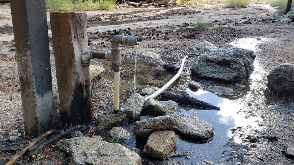
The Round Valley pipe is flowing at 1.0 L/min (measured 23rd September, photo above). The nearby Round Valley creek and the small creek in Tamarack Valley both dried up in May.
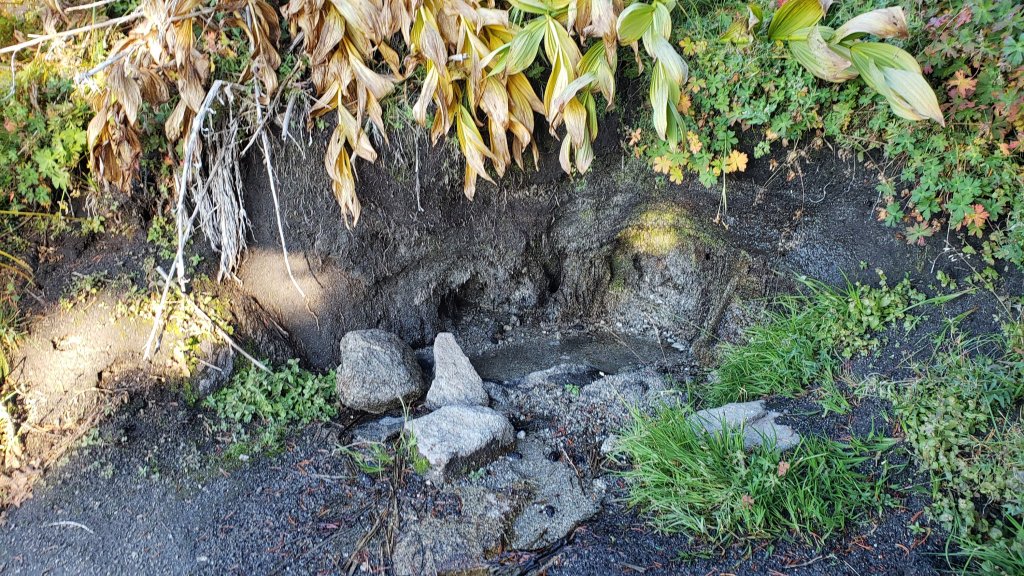
Springs at Wellman’s Cienega are trickling (photo below). The flow rate was 0.75L/min on 26th September, half the rate recorded on 19th, and one quarter of the rate on 10th September.
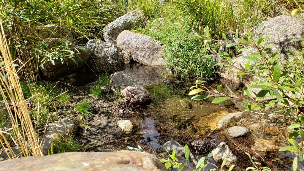
The Wellman’s Cienega springs are the sources for Willow Creek, which is currently flowing weakly but reliably where it crosses the Willow Creek Trail (photo below).
Tahquitz Creek is flowing gently at the northern (lower) end of Little Tahquitz Valley at a flow rate of 2L/min. It is flowing very weakly further upstream at its source, known colloquially as Grethe Spring, where it crosses the PCT at approx. PCT Mile 177. Between these locations Tahquitz Creek is largely dry (but presumably flowing subsurface). The small creek in Tahquitz Valley dried up in May.
Skunk Cabbage (“Candy’s”) Creek dried up in late June where it crosses under the trail through Skunk Cabbage Meadow.
WATER CONDITIONS: Western slope
Ephemeral creeks, such as those along Marion Mountain Trail and on Deer Springs Trail, dried up in May. Although they flowed for a few days after Tropical Storm Kay, they are now dry again.
The North Fork of the San Jacinto River is flowing gently, but reliably, at about 5.0L/min where it crosses the Deer Springs Trail (down from 8L/min immediately after Kay, but up from 3L/min last week), then weakly downstream where it crosses the Fuller Ridge Trail on the PCT (approx. PCT Mile 186.2). However the river is completely dry where it crosses Seven Pines Trail and Dark Canyon Road.
The creek in Little Round Valley dried in both mid June and again in late August, but flowed between those times and subsequently thanks to monsoon and storm rainfall. It is now flowing very weakly for about 350 feet in its lower half (photos in previous Report). Recent experience has shown it will continue to dry rapidly over the next few weeks without additional rainfall. [UPDATE 30th September: flow is down to a trickle for about 200 ft behind the “Owl’s Hootch” campsite sign, then it runs dry for a similar length before briefly flowing again. Water quality is not great and should be filtered.]
Shooting Star Spring (below Little Round Valley but above the North Fork of the San Jacinto River crossing) is flowing weakly and is inadequate for filtering.
The Deer Springs stream crossing at the PCT/Deer Springs Trail (approx. PCT mile 185.6) completely dried up in late May and has not restarted despite recent rains.
The tiny Switchback Spring at PCT Mile 183.5 (about 0.4 miles on the PCT northbound from Strawberry Junction) is flowing gently, and there is usually just adequate depth from which to filter water in the tiny pool on the upslope side of the trail (photo in previous Report). What this springs lacks in volume it makes up for with remarkable reliability.
The little creek at Strawberry Cienega (PCT mile 183.0) has been dry since June (although it flowed for a couple of days immediately after Tropical Storm Kay).
On Devil’s Slide Trail, Middle Spring is barely trickling. A tiny pool remains as a useful emergency water source for dogs. Other springs on this trail had been dry for months before the passage of Tropical Storm Kay, and five days later were already functionally dry again.
On the Ernie Maxwell Trail, the crossing of Chinquapin Creek just below Humber Park is dry where it crosses the trail. However, even when Fern Valley Water District is diverting flow into the pipe system small fresh pools remain among the rocks just upslope from the trail (these are an invaluable source of water for the many dogs walked on the Ernie Maxwell).
WATER CONDITIONS: Desert Divide
Live Oak Spring (N 33 37 21, W 116 33 24) Flowing. The most reliable water source on the Desert Divide.
Cedar Spring (N 33 40 36, W 116 34 35) Flowing (upslope from the trail that leads to the campsite). Sadly the inflow pipe to the trough – formerly the most accessible water source – was vandalized in May 2022 and consequently the trough is dry. This damage has been reported to the Forest Service, but no repair is expected until later in the year.
Apache Spring (N 33 43 11, W 116 37 13) Flowing weakly, but the spring box remains full.
Spitler Peak Trail Descending the trail there are five water crossings. The first two, at 0.90 and 0.95 miles down, cross a tiny side creek which is largely dry and should be ignored. The next three crossings, at 1.1-1.5 miles down, are Spitler Creek and is the best source of water (currently flowing gently at both the uppermost and lowest crossings; photo of the latter in previous Report).
Antsell Rock Creek (N 33 41 52, W 116 39 08) Right by the Spitler Peak Trail trailhead on Apple Canyon Road, Antsell Rock Creek is dry. This large creek dried up in late spring, nearly two months earlier than last year, and remains dry now despite recent rains.
Thank you for taking the time to read this. While all time and labor is volunteered, the San Jacinto Trail Report depends on small private donations to cover our costs. Your contribution keeps the Report available to all, free from advertising or paywalls, and independent from agencies. If you have found this Report useful, please use this link to the Donate page. Zelle, Venmo, and PayPal are all options. Thank you for your support.