Recently I have mentioned the challenges of hard, icy snow underfoot from evidence of various hiker falls and challenging incidents, and the value of using spikes especially for descending and traversing. Snow at all elevations has been firm and icy following more than a month of freeze-thaw cycles, and I cannot overemphasize the importance of having both appropriate equipment and the right skill set for the terrain. The latter includes interpreting the snow/ice conditions, understanding your physical and mental abilities, and conservative decision making. These concerns may diminish over the next week with warming temperatures and accelerating melting.
Early on Monday 7th February we ascended via Devil’s Slide, Wellman, and Peak trails to San Jacinto Peak – in boots with excellent traction – without needing spikes. Hikers less familiar with icy snow travel will prefer to use the latter. We descended Deer Springs Trail, and spikes were invaluable from the Peak down to 8700ft. On Wednesday 2nd February, we hiked Marion Mountain and Deer Springs trails to and from the Peak. Spikes were not required for ascending until about 10,000ft elevation (above Little Round Valley) but were invaluable descending down Marion Mountain Trail to about 7500ft.
Note that warm, dry weather is forecast with temperatures far above seasonal at all elevations in the second week of February. Rapid melting of snow and freeze-thaw cycles will combine to change trail conditions and potentially the preferred equipment for the terrain. As early as 0830 on the morning of Monday 7th icy snow on sun-exposed slopes high on the east flank of San Jac was already getting watery on the surface, making it more slippery. Warmer afternoons will soften snow, generally (but not always) improving the grip underfoot.
Snow remaining from December 2021 has continued to melt slowly but steadily. Snow depths measured on 7th February are detailed at the foot of this post.
In addition to ascents of San Jacinto Peak by various routes in recent days we have also surveyed several segments of the PCT, plus South Ridge and Spitler Peak trails, and several Forest roads. Current conditions for individual trails are discussed in detail below where known.
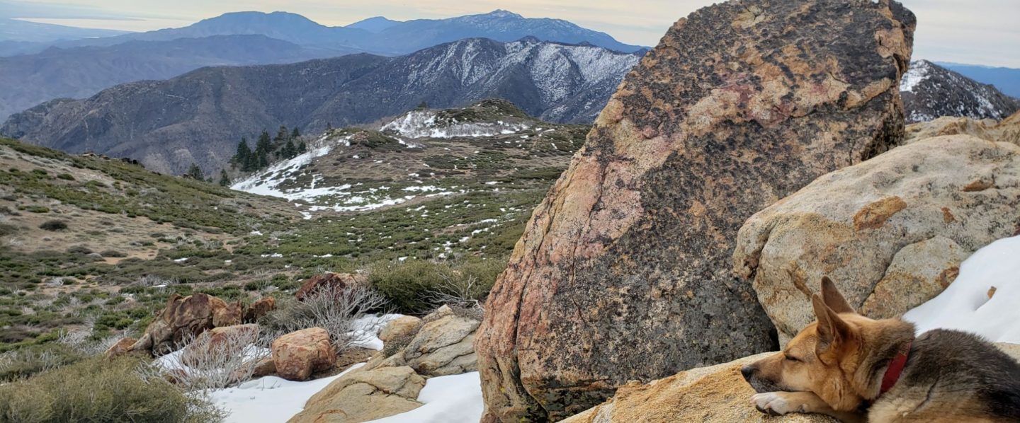
Trails remain almost completely snow-covered above 9000ft, with thinning and increasingly patchy snow down to about 7700ft, and generally clear below that elevation. Overall snow conditions on the trails are already more typical of April or May than early February. Tracks at the highest elevations (>9800ft) currently only approximate to the routes of established trails (especially Deer Springs Trail above Little Round Valley). Cautious navigation is recommended everywhere.
Spikes are recommended everywhere above about 7700ft as trails are icy where compacted by hiker traffic and following freeze-thaw cycles. Spikes are especially valuable on colder mornings when conditions are particularly icy, and for descending. Based on tracks I am seeing in the high country some hikers are preferring to use crampons, and those are an option in areas of continuous icy snow above about 9000ft (potentially lower in steeper terrain).
Despite unseasonably warm temperatures, hikers should nevertheless be prepared for temperatures near freezing in the high country, and below freezing when considering wind chill effects (see below for some of my recent weather observations from San Jacinto Peak).
May Valley Road was closed by Forest Service to all traffic, including foot traffic, on Friday 28th January due to hazardous trees. USFS social media states “there currently is no timeline for the road’s reopening”. There was no evidence of any work in progress by 4th February.
The USFS gate at Humber Park reopened on 21st January having been closed since 13th December 2021. Note that Humber will be temporarily closed for up to three days starting at 1800 on Sunday 6th February for hazardous tree removal.
South Ridge Road (5S11) reopened in the second week of February.
According to the Forest Service website the following USFS roads are in winter closure (for vehicle traffic only): Black Mountain (4S01), San Jacinto Truck Trail (5S09), Dark Canyon (5S02), and Santa Rosa (7S02). All are currently free of snow and ice.

WEATHER All elevations will rapidly warm to far above seasonal averages until Tuesday 15th February, when temperatures will plunge briefly to below seasonal before swinging above average yet again late next week. Temperatures this week are forecast to more closely resemble April (or even May for overnight lows) rather than the first half of February.
There continues to be no significant precipitation in the forecasts. However a minor storm system with the possibility of a very light dusting of snow is forecast for Tuesday 15th February. Long term projections tentatively suggest an increasing probability of storm systems from late February into April, but Southern California is not predicted to receive “drought-busting” precipitation.
January 2022 was the driest January in recorded history in the San Jacinto high country, with only 0.75in of fresh snow falling at San Jacinto Peak (at least 2-3 feet of snow would be normal). No snow and only 0.32in rain fell in Idyllwild (at 5550ft) last month, making it about the sixth driest January for combined precipitation in Idyllwild since systematic records began in the 1940s.
At San Jacinto Peak (10,810ft/3295m) on Monday 7th February 2022 at 0915 the air temperature was 34.4°F (1°C), with a windchill temperature of 21.7°F (-6°C), 24% relative humidity, and a steady NNE wind sustained at 11 mph gusting to 16.0 mph.
At the Peak on Wednesday 2nd February 2022 at 0855 the air temperature was 14.4°F (-10°C), with a windchill temperature of -9.5°F (-23°C), 26% relative humidity, and a bitter due North wind sustained at 14 mph gusting to 22.6 mph.

TRAIL CONDITIONS
Trails below about 7700ft are now clear (or largely clear) of snow, snow cover is increasingly patchy below 9000ft, and remains largely continuous everywhere above 9000ft. Snow persists at elevations below 7700ft in particular on shaded north and north-east slopes (e.g., Red Tahquitz, Tahquitz, Apache, and Spitler peaks). Melting has been steady but slow at all elevations recently, but will accelerate rapidly this week with warm temperatures.
Hikers should anticipate encountering significant new treefall hazards, especially in vulnerable burn areas (e.g., Willow Creek Trail, PCT Miles 166-177). Storms in December 2021 left trees heavily laden with ice, and I have since found many broken tree limbs and downed trees throughout the trail system. Severe Santa Ana winds in January and early February will have brought down further trees and branches.
Effective Tuesday 1st February 2022 the State Park closed the section of Skyline Trail that falls within its jurisdiction, above 5800 ft elevation, “due to dangerous ice accumulation”. The State Park boundary is not marked but is near the site of the old Florian’s Cache, below Flat Rock. Signage was posted at the relevant trailheads on 3rd February. There is no snow on the open section of trail below 5800 ft.
The 0.4 mile section of South Ridge Trail to Tahquitz Peak from Chinquapin Flat/PCT Mile 178 has no steps to follow through the steeply angled icy snow. These icy slopes are notoriously treacherous. Crampons with an ice axe (and knowledge of how to use both) are required. There was a fatal hiker fall here on Sunday 30th January.
Current snow cover on the PCT is patchy and steadily thinning between Miles 168 and about 175 (Red Tahquitz), mainly confined to certain north- or east-facing slopes e.g., Spitler Peak (Mile 168), Apache Peak (Mile 169.5, see photo below), and Antsell Rock (Mile 171-172). Snow is then largely continuous between Miles 175-179 (to near Saddle Junction). Snow on the Trail is very limited patchy to about Mile 184.5, except for a stubborn section of 0.5 mile approaching Annie’s Junction (Mile 180.8) which is always among the last areas to clear every spring. Most of Miles 184-191 is snow-covered, although some exposed sections of Fuller Ridge (e.g., Miles 186.5-188.5) are clearing rapidly. My next thorough assessment of snow conditions on the PCT will likely be around 20th February.
Devil’s Slide Trail is now clear of icy snow to about 7800ft, and then with about 20% cover to Saddle Junction (mainly near the latter). Spikes can be useful on the upper trail, especially for descending.
South Ridge Trail (south of Tahquitz Peak) is clear of snow up to Old Lookout Flat (7600ft). Icy snow cover remains about 10% to near Tahquitz Peak, increasing to about 20% on the uppermost half-a-dozen switchbacks. Most hikers will find spikes useful, especially for descending. The middle section of South Ridge Trail (between May Valley Road and the top of South Ridge Road) has 12 trees down, many of which are significant obstructions.
The predominant compacted tracks on the Peak Trail from Wellman Divide to near Miller Peak now generally approximate to the trail route. Above 10,400ft most tracks form a compacted posthole route up the East Ridge. However the route of the Peak Trail also has a lightly used track, which are challenging in one short section before Summit Junction (spikes recommended). The Round Valley Trail has well-traveled tracks to follow from Long Valley to Wellman Divide.
Marion Mountain Trail is functionally clear of snow to about 7600ft. Icy snow cover is 80% from 7600-8200ft, and there is an obvious compacted track through the snow. From 8200ft to Deer Springs Trail (at 8700ft) snow cover is only about 50%. Most hikers will find spikes useful for ascending the upper half of the trail, and they are invaluable for descending. There is one huge new treefall hazard across the trail exactly at the State Park/Forest Service boundary.
Unsurprisingly, there continue to be no visible hiker tracks on the upper sections of Fuller Ridge and Seven Pines trails. The latter is largely clear of snow to the State Park boundary, and then snow cover is increasingly patchy above the North Fork crossing to about 7700ft (but see below regarding tree hazards and trail maintenance).
Deer Springs Trail is clear of snow to Strawberry Junction at 8100ft. From there to 8700ft (0.2 mile south of Marion Mountain Trail) snow cover is barely 20%. Thereafter snow cover is essentially continuous. Spikes are useful, especially for descending. [Three new trees came down in late 2021 on the PCT/Deer Springs Trail just south of its junction with Marion Mountain Trail, but they are readily passable for hikers.] Through Little Round Valley the track is more direct and only vaguely follows the trail route. The most heavily traveled track from LRV to near San Jacinto Peak largely follows, unfortunately for ascending hikers, my original snowshoe route from 31st December, which is direct and steep. Cautious navigation is required as there are many alternative tracks meandering across this slope.
The Strawberry Trail between Annie’s and Strawberry junctions (roughly PCT Miles 181-183) has been well traveled and there tracks to follow where snow patches remain. Overall this very sun-exposed section of trail is 90% clear of snow.
Spitler Peak Trail is clear of snow and spikes are not required. Nearly 40 downed trees from ice storms in December 2021, plus dozens of additional trunks and branches in the trail, were removed by the Trail Report in January 2022. Further trail trimming continues steadily.
The Suicide Rock Trail and the Ernie Maxwell Trail are both clear of ice and snow.
The rockslide at PCT Mile 172.5, just north of Antsell Rock, was removed on 14th June 2021. My “before, during, and after” video is available here. This section of the PCT is now safer and is narrow but readily passable with care by hikers (but remains impassable by stock).
Due to greatly reduced maintenance work by the agencies and PCTA during the coronavirus pandemic, many trails have accumulated treefall hazards since late 2019, passable with care by hikers but not for stock. Although reported promptly, regrettably neither Forest Service nor State Park were quick to remove most hazards in 2021. With recent storms being accompanied by strong winds and heavy ice loads, hikers will encounter some new and additional hazards. Some are described above and below, others include the PCT between Strawberry Cienega and Strawberry Junction (PCT Miles 182-183, at least 7 trees down), and Fuller Ridge Trail near its northern end (PCT Miles 189.1-190.2, three trees).
Willow Creek Trail has at least 33 downed trees between Skunk Cabbage Junction and Hidden Divide. Of these 22 are on the Forest Service section (16 between Willow Creek and the Park boundary), with 11 in the State Park. Most are readily passable by hikers with care. Despite much work in 2020 by USFS volunteer Bill Rhoads and myself, the whitethorn has grown back rapidly, but still remains much less challenging than in 2019.
Many treefall hazards from Red Tahquitz to Antsell Rock (PCT Miles 172.5-175) were cleared in June 2021 prior to the rockslide removal work mentioned above. Nevertheless more than 20 remain, including at least six major obstructions for hikers. Tahquitz Creek to Red Tahquitz (PCT Miles 175-177) was cleared in early June 2021. All of this section has likely added new treefall hazards this winter.
Seven Pines Trail has had very limited hiker traffic since November 2018, largely because Dark Canyon Road was closed between February 2019 and early October 2021, and again since December 2021. The Trail Report has “adopted” Seven Pines Trail as a priority for maintenance work as the trail has had a disproportionate number of lost hiker rescues in recent years. Starting in November 2021, 42 treefall hazards on the lower 3.0 miles of trail have been removed. Almost all of this section has also been thoroughly trimmed and cleared, and the trail is now obvious and easy to follow for much of its length (when clear of snow). However at least 18 downed trees remain on the upper 0.7 mile of trail, the route is very obscure in places, and cautious navigation is required especially for those who are not very familiar with hiking this trail. Dark Canyon campground remains closed.
SNOW DEPTHS measured on 7th February 2022 are as follows. The first number is the current average depth, with the snow depth recorded on 31st December 2021 following in parentheses. Note that average depth is given; due to strong winds accompanying some of the storms, and differential melting, there is considerable drifting and variability. Altitudes are approximate.
San Jacinto Peak (10810ft): 14 inches (was 30 inches on 31st December)
Little Round Valley (9800ft): 12 inches (was 25 inches on 31st December)
Wellman Divide (9700ft): 7-8 inches (was 26 inches on 31st December)
Annie’s Junction/approx. PCT Mile 181.8 (9070ft): 7 inches (was 23 inches on 31st December)
Deer Springs Trail at junction with Seven Pines Trail/PCT Mile 184.9 (8700ft): 6 inches (was 11 inches on 31st December)
Strawberry Junction/PCT Mile 183 (8100ft): 0 inches (was 8 inches on 31st December)
Saddle Junction/approx. PCT Mile 179.9 (8070ft): 0-2 inches (was 12 inches on 31st December).
Devil’s Slide Trail at Humber Park (6520ft): 0 inches (was 7 inches on 31st December)
Idyllwild (at 5550ft): 0 inches (was 6.5 inches on 31st December)
Thank you fellow hikers for taking the time to read this. While all labor and time is volunteered, the San Jacinto Trail Report completely depends on small private donations to cover operating costs. Every year seems to have its challenges and 2022 already looks like it will be no exception, so every contribution, no matter how small, is truly valuable. If you have found this Report useful, please consider visiting the Donate page. Thank you for your support.


