[UPDATE Wednesday 23rd February 2022 at 0800: I have posted a short video from San Jacinto Peak (available here) discussing current knowledge of conditions after the overnight snowstorm.]
[UPDATE Wednesday 23rd February 2022 at 0650: Snowfall in the high country was well above forecast with initial measurements around 20 inches fresh powder at San Jacinto Peak (on top of an average of 12 inches already on the ground). It is some of the finest, lightest powder I have ever seen up here. Snow depth in Idyllwild is almost exactly as expected at about 8 inches (thank you Anne). On the eastern slope, snow fell down to 4500ft on Skyline Trail (thank you Florian).]
[UPDATE Tuesday 22nd February 2022 at 1940: It started snowing very lightly between 6000-9000ft at 0730 this morning. The high country was initially largely above the cloud, but it started snowing at San Jacinto Peak after 1230, getting heavier throughout the afternoon (about 5.0in accumulation so far). Air temperature at 1130 was 12°F, with a windchill of -16.4°F (-27°C). Snow accumulation in Idyllwild (at 5550ft) is currently 2.0in.]
Warm and sunny conditions in the past few days have largely melted the light snowfall from 15th February from exposed slopes and from much of the trail system below 8600 ft. Consequently trail and overall snow conditions on Monday 21st looked remarkably similar to 14th February. This will change on Tuesday 22nd when another minor storm will cover all tracks again, with 5-9 inches of snow expected at mid and upper elevations, accompanied by severe winds.
Multiple hiker falls already this year in the San Jacinto mountains, including one fatality, demonstrate the critical importance of having both appropriate equipment and the right skill set for the terrain. The latter includes interpreting the snow/ice conditions, understanding your physical and mental abilities, and conservative decision making. Further snowfall expected on 22nd February will make conditions more complex as underlying icy areas are obscured, and as hiking traction devices struggle to grip through the surface powder into the harder icy snow below.
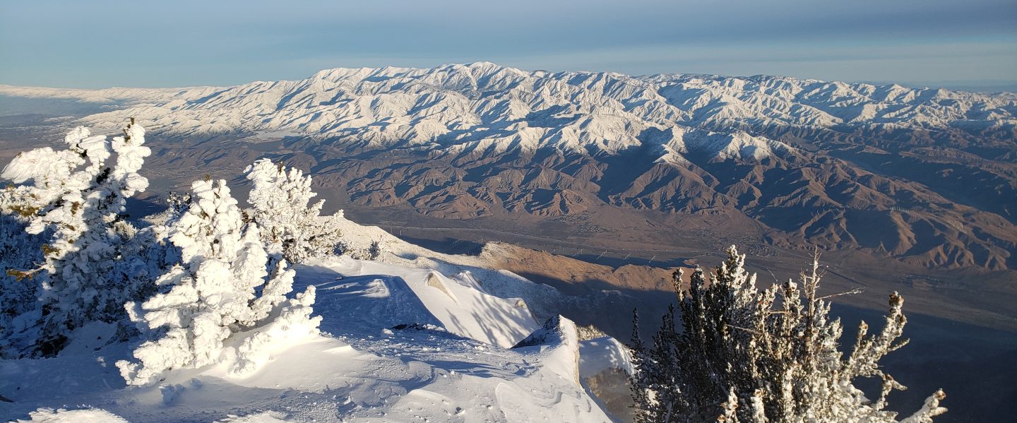
Early on Monday 21st February we ascended via Devil’s Slide, Wellman, Peak, and East Ridge trails to San Jacinto Peak, needing spikes only for the final three hundred feet of ascent on the East Ridge as the route was disappearing under spectacular spindrift in a very strong and gusty wind (sustained close to 30mph) near the Peak. We descended via Deer Springs Trail, and spikes were useful down to about 8700ft on the largely icy, compacted track. Hikers with a lower comfort level on snow and ice will find spikes useful more widely.
In addition to multiple ascents of San Jacinto Peak by different routes in recent days we have also surveyed South Ridge Trail, several segments of the PCT and its side trails, plus multiple Forest roads. Current conditions for individual trails are discussed in detail below where known. Again, these will change first with fresh snowfall expected on 22nd, followed by rapid melting into the first week of March.
Spikes are useful almost everywhere above about 7700ft as snow on trails can be icy following weeks of freeze-thaw cycles (and where compacted by hiker traffic). Spikes are especially valuable for traversing and for descending.
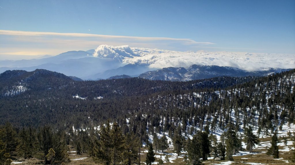
Trails remain snow-covered above 9000 ft, with thinning and increasingly patchy snow down to about 7700ft, and generally clear below that elevation (with some notable exceptions at lower elevations on the PCT). Overall snow conditions on the trails are already more typical of April or May than February. These conditions will change over the next few days with minor snowfall expected in the high country.
Thereafter warm, dry weather is forecast with temperatures well above seasonal at all elevations starting on 28th February. Rapid melting of snow and freeze-thaw cycles will combine to change trail conditions yet again and potentially the preferred equipment for the terrain.
Snow from 15th February, overlying the remaining icy snow from December 2021, has melted rapidly. Snow depths measured on 21st are detailed at the foot of this post.
Hikers should be prepared for temperatures near or below freezing in the high country, and well below freezing when considering wind chill effects (see below for my recent weather observations from San Jacinto Peak). Forecast temperatures for the high country for 22nd-23rd February are dangerously cold.
May Valley Road was closed by Forest Service to all traffic, including foot traffic, on Friday 28th January due to hazardous trees. USFS social media states “there currently is no timeline for the road’s reopening”. There was minimal evidence of significant work in progress by 18th February.
The USFS gate at Humber Park reopened on 21st January having been closed since 13th December 2021. South Ridge Road (5S11) reopened in the second week of February. It is expected that both will close again on 22nd February following the fresh snowfall.
According to the Forest Service website the following USFS roads are in winter closure (for vehicle traffic only): Black Mountain (4S01), San Jacinto Truck Trail (5S09), Dark Canyon (5S02), and Santa Rosa (7S02).
WEATHER
In a very similar pattern to last week relatively warm temperatures over the weekend will rapidly drop to below seasonal with the passage of a brief but energetic (although not very moist) storm system on 21st-23rd February. Strong winds and very cold temperatures will accompany light snowfall, the latter expected mainly on the night of Tuesday 22nd, with 4-9 inches of snow forecast at various elevations in Idyllwild-Pine Cove and 6-9 inches in the high country (note that the high country may be above the cloud for longer, hence the similar snowfall totals). The freeze level will be down to 3500 ft so at least some snow is expected at almost all elevations of the PCT in the San Jacinto mountains.
Temperatures will yet again climb dramatically to well above seasonal by 28th February. Current forecast temperatures for San Jacinto Peak on 1st March, more than five degrees Centigrade above freezing, would be at or near a record high for the Peak in March.
January 2022 was the driest January in recorded history in the San Jacinto high country, with only 0.75in of fresh snow falling at San Jacinto Peak, and among the driest ever recorded in Idyllwild.
At San Jacinto Peak (10,810ft/3295m) on Monday 21st February 2022 at 0855 the air temperature was 20.1°F (-7°C), with a windchill temperature of -3.6°F (-20°C), 36% relative humidity, and a brutal due West wind sustained at 25 mph gusting to 32.2 mph.
At the Peak on Wednesday 16th February 2022 at 0955 the air temperature was 20.3°F (-7°C), with a windchill temperature of -0.2°F (-18°C), 74% relative humidity, and a stiff due North wind sustained at 12 mph gusting to 21.1 mph.
TRAIL CONDITIONS
Trails below about 7600ft are now generally clear of snow, snow cover is increasingly patchy below 9000ft, and remains largely continuous everywhere above 9000ft. Icy snow from December 2021, with fresh powder from 15th February, persists at elevations below 7700ft in particular on shaded north and north-east slopes (e.g., Red Tahquitz, Tahquitz, Apache, and Spitler peaks, and Antsell Rock).
Hikers should anticipate encountering significant new treefall hazards, especially in vulnerable burn areas (e.g., Willow Creek Trail, PCT Miles 166-177). Storms in December 2021 left trees heavily laden with ice, and I have since found many broken tree limbs and downed trees throughout the trail system. Severe Santa Ana winds in January and February have brought down further trees and branches.
Effective Tuesday 1st February 2022 the State Park closed the section of Skyline Trail that falls within its jurisdiction, above 5800 ft elevation, “due to dangerous ice accumulation”. Long Valley Ranger Station staff are speculating that the trail may not reopen before April. The State Park boundary is not marked but is near the site of the old Florian’s Cache, below Flat Rock. Signage was posted at the relevant trailheads on 3rd February.
The 0.4 mile section of South Ridge Trail to Tahquitz Peak from Chinquapin Flat/PCT Mile 178 has no steps to follow through the steeply angled icy snow [updated 20th February]. These icy slopes are notoriously treacherous. Crampons with an ice axe (and knowledge of how to use both) are required. There was a fatal hiker fall here on Sunday 30th January.
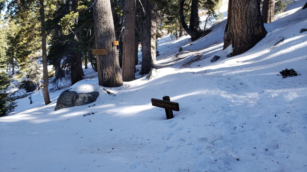
Current snow cover on the PCT is patchy between Miles 168 and about 175 (Red Tahquitz), largely confined to certain north- or east-facing slopes e.g., Spitler Peak (Mile 168), Apache Peak (Mile 169.5), and Antsell Rock (Mile 171-172). Although limited, some of these chutes and slopes are challenging and spikes are strongly recommended. Snow is then largely continuous between Miles 175-179 (to near Saddle Junction). Snow on the Trail is limited to about Mile 184.5, except for a stubborn section of 0.5 mile approaching Annie’s Junction (Mile 180.8) which is always among the last areas to clear every spring. Most of Miles 184-191 is snow-covered, although some exposed sections of Fuller Ridge (e.g., Miles 186.5-188.5) are clearing rapidly.
Devil’s Slide Trail is now functionally clear of icy snow to about 7700ft, and then with about 50% cover to Saddle Junction (mainly near the latter). Some hikers will find spikes useful on the upper trail, especially for descending.
South Ridge Trail (south of Tahquitz Peak) is functionally clear of snow up to Old Lookout Flat (7600ft). Icy snow cover is about 5% to near Tahquitz Peak, increasing to about 35% on the uppermost half-a-dozen switchbacks. The middle section of South Ridge Trail (between May Valley Road and the top of South Ridge Road) has several trees down which are significant obstructions (surveyed February 2022).
The predominant compacted tracks on the Peak Trail from Wellman Divide to near Miller Peak now generally approximate to the trail route. Icy snow cover remains >95%. Above 10,400ft most tracks form a compacted posthole route up the East Ridge. However the route of the Peak Trail also has a lightly used track, which is challenging in one short section before Summit Junction (spikes recommended). The Round Valley Trail has well-traveled tracks to follow from Long Valley to Wellman Divide.
Marion Mountain Trail is functionally clear of snow to about 7500ft. Icy snow cover is 40% from 7500-8200ft. From 8200ft to Deer Springs Trail (at 8700ft) snow cover is only about 30%. Most hikers will find spikes useful for ascending parts of the upper half of the trail, and they are invaluable for descending in the same areas. There is one huge new treefall hazard across the trail exactly at the State Park/Forest Service boundary.
Unsurprisingly, there continue to be no visible hiker tracks on the upper sections of Fuller Ridge and Seven Pines trails.
Deer Springs Trail is functionally clear of snow to Strawberry Junction at 8100ft. From there to 8700ft (0.2 mile south of Marion Mountain Trail) snow cover is barely 10%. Thereafter snow cover is nearly continuous, with a few minor clear patches developing. Spikes are useful, especially for descending. [Three new trees came down in late 2021 on the PCT/Deer Springs Trail just south of its junction with Marion Mountain Trail, but they are readily passable for hikers.] Through Little Round Valley and on up to the Peak the track is direct and does not follow the trail route. Cautious navigation is required as there are many alternative tracks meandering across this icy snow slope.
The Strawberry Trail between Annie’s and Strawberry junctions (roughly PCT Miles 181-183) is very sun-exposed and is largely clear of snow.
The Caramba Trail from near Reeds Meadow through Laws Camp and on to Caramba, and the Cedar Trail from Willow Creek Trail to Laws, are optimistically described by the Forest Service as “not maintained”. In reality both trails no longer exist and are so heavily overgrown I advise hikers do not attempt to follow them. An informal use trail to Laws is much more direct and avoids all of the very challenging bush-whacking of the unmaintained trails (some local hikers dubbed it the “King Trail” when I established the route in 2019). It leaves the Willow Creek Trail exactly 1.0 mile from Saddle Junction (0.46 mile from the Skunk Cabbage turning), descending largely on established deer trails for 1.2 miles, meeting Willow Creek just upstream from the old Laws Camp. From Laws east to Caramba the route of the original Caramba Trail has been well-cairned by myself and others and can largely be followed with careful route-finding. My February 2022 survey counted 97 trees down on this 2.1 mile trail. It is especially obscure 0.1-0.3 mile east of the Willow Creek crossing, generally becoming clearer near Caramba. Cautious navigation is advised throughout the area. The King Trail still has 50% icy snow cover (spikes required), but the Caramba Trail east of Willow Creek is clear of snow (10th February survey).
Spitler Peak Trail is largely clear of snow. Nearly 40 downed trees from ice storms in December 2021, plus dozens of additional trunks and branches in the trail, were removed by the Trail Report in January 2022. Further trail trimming continues steadily.
The rockslide at PCT Mile 172.5, just north of Antsell Rock, was removed on 14th June 2021. My “before, during, and after” video is available here. This section of the PCT is now safer and is narrow but readily passable with care by hikers (but remains impassable by stock).
Due to greatly reduced maintenance work by the agencies and PCTA during the coronavirus pandemic, many trails have accumulated treefall hazards since late 2019, passable with care by hikers but not for stock. Although reported promptly, regrettably neither Forest Service nor State Park were quick to remove most hazards in 2021. With recent storms being accompanied by strong winds and heavy ice loads, hikers will encounter some new and additional hazards. Some are described above and below, others include the PCT between Strawberry Cienega and Strawberry Junction (PCT Miles 182-183, at least 7 trees down), and Fuller Ridge Trail near its northern end (PCT Miles 189.1-190.2, three trees).
Willow Creek Trail, resurveyed on 11th February 2022, has at least 40 downed trees between Skunk Cabbage Junction and Hidden Divide. Nearly 30 of these are on the Forest Service section.
Many treefall hazards from Red Tahquitz to Antsell Rock (PCT Miles 172.5-175) were cleared in June 2021 prior to the rockslide removal work mentioned above. Nevertheless more than 20 remain, including at least six major obstructions for hikers. Tahquitz Creek to Red Tahquitz (PCT Miles 175-177) was cleared in early June 2021. All of this section has added new treefall hazards this winter.
Seven Pines Trail has had very limited hiker traffic since November 2018, largely because Dark Canyon Road was closed from February 2019 to early October 2021, and again since December 2021. The Trail Report has “adopted” Seven Pines Trail as a priority for maintenance work as the trail has had a disproportionate number of lost hiker rescues in recent years. Starting in November 2021, 42 treefall hazards on the lower 3.0 miles of trail have been removed. Almost all of this section has also been thoroughly trimmed and cleared, and the trail is now obvious and easy to follow for much of its length (when clear of snow). However at least 18 downed trees remain on the upper 0.7 mile of trail, the route is very obscure in places, and cautious navigation is required especially for those who are not very familiar with hiking this trail. Dark Canyon campground remains closed.
SNOW DEPTHS measured on 21st February 2022 are as follows. The first number is the current average depth, with the snow depth recorded on 31st December 2021 (to date the greatest snow depth of the season) following in parentheses. Note that average depth is given; due to strong winds accompanying some of the storms, and differential melting, there is considerable drifting and variability. Altitudes are approximate.
San Jacinto Peak (10810ft): 12-13 inches (was 30 inches on 31st December)
Little Round Valley (9800ft): 9-10 inches (was 25 inches on 31st December)
Wellman Divide (9700ft): 5 inches (was 26 inches on 31st December)
Annie’s Junction/approx. PCT Mile 181.8 (9070ft): 10 inches (was 23 inches on 31st December)
Deer Springs Trail at junction with Seven Pines Trail/PCT Mile 184.9 (8700ft): 7 inches (was 11 inches on 31st December)
Strawberry Junction/PCT Mile 183 (8100ft): 0 inches (was 8 inches on 31st December)
Saddle Junction/approx. PCT Mile 179.9 (8070ft): 0-1 inches (was 12 inches on 31st December).
Devil’s Slide Trail at Humber Park (6520ft): 0 inches (was 7 inches on 31st December)
Idyllwild (at 5550ft): 0 inches (was 6.5 inches on 31st December)
Thank you for taking the time to read this. While all labor and time is volunteered, the San Jacinto Trail Report completely depends on private donations to cover operating costs. Your contribution helps to keep the Report active, free from advertising, and independent from agencies. If you have found this Report useful, please visit the Donate page. Thank you for your support.
