UPDATE Sunday 19th March: there has been light rain on/off in Idyllwild today, and a dusting of snow in the high country (mainly early morning), with about one inch accumulating in Long Valley (8600 ft).
UPDATE Friday 17th March: San Bernardino National Forest, including the San Jacinto Ranger District, reopened today following expiration of the closure order last night. Some forest roads remain closed (listed below). The State Park wilderness remains closed indefinitely, which includes Miles 183-189 of the PCT (i.e. from just east of Strawberry Junction to about one mile south of Fuller Ridge Campground).
‐——————————
Yet another remarkable storm in this truly memorable winter. The 22nd storm system to impact the San Jacinto mountains brought snow and heavy rain on Tuesday 14th and Wednesday 15th March. It was another mild, rain-generating “pineapple express”, like the storm just four days earlier, but differed in being just cold enough to produce moderate snowfall above 9000 ft elevation.
The storm brought both more snow and rainfall than was generally forecast for our mountains, with a whopping 3.97 inches of rain measured in Idyllwild (at 5550 ft) across the 30 hour duration of the storm, most of that falling late on 14th into the morning of 15th. Combined with temperatures above freezing, the rain on snow led to massive melting at mid elevations up to about 8500 ft, with every possible creek and stream gushing like a major montane torrent. In addition to the couple of photos below, I recorded a short video of the well-known Middle Spring on Devil’s Slide Trail (available here on YouTube) in full flow in the late afternoon of 15th. It is very rarely seen in that condition!
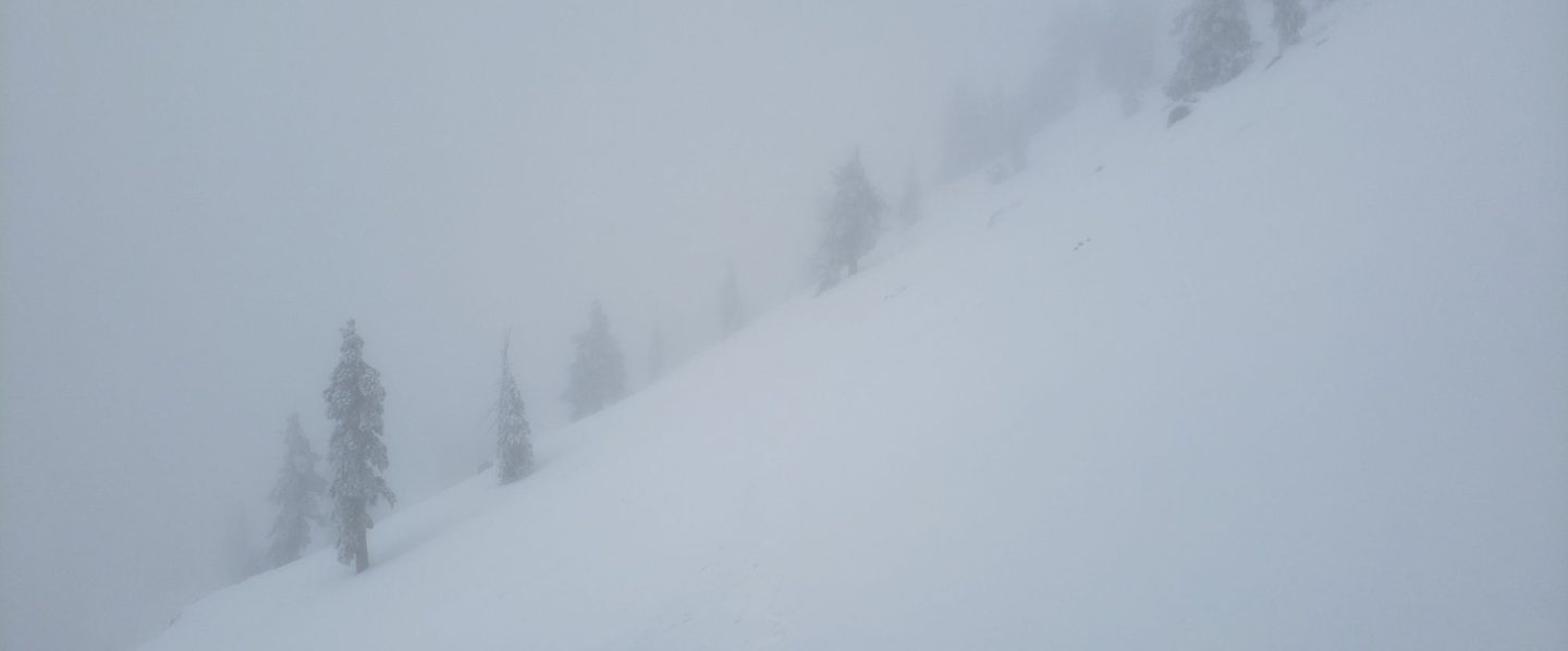
At the highest elevations, it started snowing at 1020 on Tuesday morning, initially heavily but of tiny rounded grains, accumulating to 3.5 inches by evening at San Jacinto Peak. The highest peaks weren’t spared the rain, with drizzle on the evening of 14th, which then turned to snow overnight. Another 8 inches of snow fell overnight at San Jacinto Peak, and then on 15th the precipitation oscillated between drizzle and snow for much of the day, ultimately producing a storm total of 13.5 inches of snow (plus an unknown, moderate, volume of light rain).
With the freeze level moving up and down the mountain multiple times during the storm’s passage, there was no defined snow level, but there was no evidence of snow below 8000 ft, only a dusting at Saddle Junction (8100 ft), and only about 4 inches even as high as Wellman Divide (9700 ft).
I reported a minor avalanche risk to the State Park on 15th above about 10,000 feet on east and north facing slopes (moderate risk for the north face of San Jacinto Peak) due to wind-loaded snow, but layers will have consolidated very quickly due to the rain and fluctuating freeze level. There was no evidence of pre-avalanche characteristics as I descended the high slopes on the afternoon of 15th.
The State Park wilderness closed on 1st March (see State Park website). At this time there is no tentative date for reopening. This closure includes approximately PCT Miles 183-189.
I snowshoed on both Monday 13th and Tuesday 14th to San Jacinto Peak via Devil’s Slide Trail and the eastern side route, returning from the second ascent on the afternoon of Wednesday 15th. On all three days the snow below Saddle Junction was very soft, and even higher by late morning the snow was getting soft and sloppy, and postholing would have been brutal.
Currently trails above about 7000 ft (lower in places) are obscured by moderate to deep snow. Trails down to 5500 ft elevation currently have shallower, increasingly patchy, snow cover. With closures in place, there are very few tracks anywhere. Very cautious navigation is essential everywhere.
Details of snow depths measured at various locations on the trail system are given at the foot of this posting. Note that snow depth itself is rarely indicative of the difficulty (or otherwise) of hiking a particular track or trail. For example a firm, well-compacted snowshoe or crampon track across snow several feet deep may be much easier hiking than an angled icy section just inches deep.
Conditions are currently excellent for snowshoes everywhere above about 7000 ft (lower in places). This elevation will continue to climb steadily over the next few days as temperatures rise and melting accelerates. Tracks in the high country can be quite firm if the early morning is cold (crampons best) but then soften very rapidly once sun hits slopes and temperatures rise, at which point snowshoes are preferable.
Crampons – with hiking poles and an ice axe, depending on terrain – may becoming increasingly useful everywhere above about 8500 ft, as colder temperatures on some days, freeze/thaw cycles (and, sadly, rain freezing on top of snow) lead to hardening of the snow surfaces. They will likely become essential over the next week or so on certain moderate and higher angle slopes, at a minimum on the Peak Trail above Wellman Divide, the Wellman Trail, Deer Springs Trail above Little Round Valley, and uppermost South Ridge Trail, and on both flanks but critically on the north face of Tahquitz Peak.
Currently, and increasingly as snow conditions change, spikes are strongly recommended for the foreseeable future everywhere above about 5000 ft. They are currently valuable even for walking around Idyllwild early on cold mornings! This elevation will slowly move upwards with steady melting over the next few days and weeks, but will remain relatively low into April at least.
Recently I have mentioned the challenges of hard, icy snow underfoot and the value of using spikes (and/or crampons) especially for descending and traversing. While fresh snow (and softening, melting, snow) may be optimum for snowshoeing for the next several weeks, snow at all elevations will generally become increasingly firm and icy following multiple freeze-thaw cycles, and compaction by increasing hiker traffic in places (once trails reopen). I cannot overemphasize the importance of having both appropriate equipment and the right skill set for the terrain. The latter includes interpreting the snow/ice conditions, understanding your physical and mental abilities, and conservative decision making. These concerns will steadily increase over the next few weeks with temperatures fluctuating either side of freezing, seasonally stronger insolation, and highly variable snowmelt.
Hikers should be prepared for temperatures near or below freezing in the high country, and well below freezing when considering wind chill effects (see below for my recent weather observations from San Jacinto Peak).
The USFS gate at Humber Park is closed. Even when the gate is closed there are nine legal parking spaces below the locked gate (which still require an Adventure Pass or equivalent to be displayed). If there are “Road Closed” signs across Fern Valley Road near its junction with Forest Drive – currently the case due to the Forest closure – then those nine spaces are also unavailable for legal parking.
Forest Service roads currently closed to vehicular traffic by a revised closure order include Black Mountain Road (4S01), Dark Canyon Road (4S02), South Ridge Road (5S11), May Valley Road (5S21), and Santa Rosa Road (7S02), plus their various side roads.
SOME THOUGHTS FOR EARLY SEASON PCT HIKERS
Between the closures and the storms forecast for the remainder of March, the San Jacinto mountains are currently a major challenge for even experienced thru hikers. That said, melting is happening remarkably fast, in part because we are still in Southern California (with the sun and temperatures that go along with that), and because melting has been accelerated by recent storms bringing intense warm rain on top of the snow, especially below about 8000 ft which includes most of the PCT in these mountains.
Hikers with March dates, if you have any flexibility at all in your timing, try to start later (easy for me to say I know). In a year with such dramatic snow conditions further north, it is highly unlikely that starting later than your “official” date will be a problem anywhere. Hikers with April or May dates, conditions in the southernmost sections continue to improve daily, and some or most areas will be passable with suitable skills, equipment, patience, and a thorough knowledge of all the possible alternates if needed.
So much rain – combined with melting snow – has generated a few new problems (in addition to the major snow challenges). Trails clear of snow are very muddy. Generally they dry fast here in Southern California, but that looks unlikely in the next few weeks. There is a great deal of water in the trails (see example photos below), and this has also created some tricky crossings. Do not trust any snow bridges across water at this time; you will not get washed away, but it is a quick way to at least get soaking wet feet, and potentially a nasty fall. Finally, forested trails are covered with downed branches and debris, plus many new treefall hazards, some of which are only becoming apparent as the snow recedes. Trail maintenance was already years behind schedule due to the coronavirus pandemic, and this winter has greatly exacerbated the situation. For these reasons, among others, patience and caution will be essential this season more than usual.
The PCT from Mile 151 (Highway 74 crossing) to Mile 165 (Fobes Trail) is now clear of snow [checked 16th March 2023], see photo below. Fobes Ranch Road and Fobes Trail are also functionally clear of snow (a few tiny patches may remain). I recorded a brief video from Mile 151 on the morning of 16th March (available here on YouTube).
Proceeding north from Mile 165 is not currently recommended, as it will require some combination of snowshoes, crampons, ice axe, and the necessary snow hiking experience to use that equipment safely in moderate angle terrain, plus considerable patience, stamina, and route-finding skills.
It is possible (once the Forest closure is lifted) to connect back to the PCT at about Mile 191 using the well-known Black Mountain Road alternate. Black Mountain Road [surveyed 17th March] currently has 50% snow cover on the lower two miles, 90% cover for the next three miles averaging 2-6 inches deep, then 100% cover for the upper three miles, at 6-18 inches deep. Early in the morning, the snow is hard and icy making it easy to hike, but snow is soft and postholing is bad by late morning. Currently no vehicle has driven further than 0.5 mile up from Highway 243 since the last snows.
WEATHER
Conditions continue unsettled for the remainder of March. After a few days of somewhat warmer weather, another major storm system is expected on 20th-22nd March. This will have a more northerly and hence colder origin, similar to the storms of January and February rather than the warmer, wetter systems of the first half of March.
The storm is predicted to start with as much as an inch of rain at mid elevations, with a freeze level then dropping as low as 4500 ft on Wednesday 22nd, precipitation therefore turning to snow, with 2-6 inches possible in Idyllwild. As much as 18-25 inches of snow are forecast for the high country, mainly on the night of 21st. Clear, sunny days at all elevations, but with temperatures remaining below seasonal, start on Thursday 23rd, but a further storm system is possible before the end of March.
At San Jacinto Peak (10,810ft/3295m) on Wednesday 15th March 2023 at 1115 the air temperature was 29.2°F (-2°C), with a windchill temperature of 10.7°F (-12°C), 100% relative humidity, and a gusty WSW wind sustained at 12 mph gusting to 23.5 mph, in driving sleety rain.
At the Peak on Monday 13th March 2023 at 0945 the air temperature was 22.5°F (-5°C), with a windchill temperature of -0.7°F (-18°C), 14% relative humidity, and a wild WNW wind sustained at 24 mph gusting to 38.6 mph.
TRAIL CONDITIONS
All trails above about 6500 ft remain largely snow-covered (wholly snow-covered above about 7000 ft). This will change steadily with further melting over the next few days and weeks.
The 0.4 mile section of South Ridge Trail between the PCT at Chinquapin Flat and Tahquitz Peak has no steps to follow through the steeply angled ice with overlying deep snow. These icy slopes are notoriously treacherous. Currently crampons, always with an ice axe, and thorough knowledge of how to use this equipment on high angle terrain, are essential. Snowshoes are not advisable due to the angle of the icy snow.
Devil’s Slide Trail has a lightly-traveled snowshoe track up to Saddle Junction. It can be firm in cold early mornings (ideal for spikes) but is very soft and sloppy at all times currently, and always by late morning (snowshoes required, or expect very deep and wet postholing). Some bare patches are already showing below 7000 ft. Beware of the huge amount of water flowing in the trail, often obscured under thinning snow, and some associated tricky stream crossings. The track does not follow the established trail route in the uppermost switchbacks close to Saddle Junction, and very careful navigation is required. Another major new tree came down (between switchbacks 5 and 6) on 11th March, reported to USFS.
My snowshoe track continues on to San Jacinto Peak, via a route broadly approximating to the PCT, Wellman, Peak, and East Ridge trails, climbing more steeply in places than the established trails, and generally contouring through the snow as needed to minimize unnecessary elevation loss. Snow forecast next week will eliminate this track.
The Ernie Maxwell Trail has a lightly traveled snowshoe and posthole track to follow along its entire length. Large parts of the trail, especially near its lower (southern) end, are starting to clear. Early morning the snow can be firm and relatively easy to hike depending on air temperature, but it is otherwise soft with deep postholing. The majority of this trail is not on Forest Service land.
In addition to the wider closure mentioned above, effective 26th January 2023 the State Park closed the section of Skyline Trail that falls within its jurisdiction, above 5800 ft elevation, “until further notice due to dangerous weather conditions”. (For readers who are unclear, Skyline Trail forms the lower two-thirds of the “Cactus-to-Clouds” [C2C] route.) The State Park boundary is not marked but is near the site of the old Florian’s Cache, below Flat Rock. The open section of trail below 5800 ft received some light snow cover down to about 4500 ft over the past week, but this has already melted.
SNOW DEPTHS
Measured on Wednesday 15th March unless otherwise stated. The first number is the current snow depth, followed in parentheses by the maximum depth recorded this winter (on or around 3rd March), with a comment regarding the snow added in this latest storm (locations >8000 ft only). Note that averages are given; due to strong winds accompanying all storms, and the differential effects of rain on snow, there is widespread unevenness. Altitudes are approximate.
San Jacinto Peak (10810 ft): 75 inches (80-85 inches), added 13-14 inches on 14th-15th March
Wellman Divide (9700 ft): 55 inches (70-75 inches), added 4 inches on 14th-15th March
Annie’s Junction/PCT Mile 180.8 (9070 ft): 55 inches (75-80 inches, was heavily drifted here), added 3-4 inches on 14th-15th March
Long Valley (8600 ft): 36-40 inches (55-60 inches), added 1-2 inches on 14th-15th March
Saddle Junction/PCT Mile 179 (8070 ft): 25-28 inches (48-50 inches), added 0.5 inch on 14th-15th March
Devil’s Slide trailhead at Humber Park (6550 ft): 0-10 inches (46 inches)
Idyllwild (at 5550 ft): 0-6 inches (45-46 inches)
PCT Mile 151 at crossing with Highway 74 (4800 ft): 0 inches (13 inches), checked 16th March

While many hundreds of challenging hours of time and labor are volunteered annually, the San Jacinto Trail Report uses small private donations to help cover modest operating costs. Every year seems to have its unique challenges, and clearly 2023 will be no exception. Your contribution keeps the Report available to all, free from advertising or paywalls, and independent from agencies. If you have found this Report useful, please consider using this link to the Donate page. Zelle, Venmo, and PayPal are all options. Thank you so much for your support.


I wait years for these type of snow conditions and them some clueless, bureaucrat closes the wilderness. What an ignorant, ill-advised gaggle of idiots, starting with our politicians, we have allowed to make decisions for our society. So very sad.
LikeLike