UPDATE Thursday 23rd: Idyllwild woke up to about four inches of fresh snow overnight, and it snowed fairly consistently today (averaging 0.75 inch/hour), adding six more inches by late afternoon. Snowfall in Long Valley (8600 ft) has been steady until largely stopping by 1600, with close to 10 inches added since yesterday for a total accumulation there of nearly three feet. Florian Boyd kindly reported this morning that snow has dusted down to 4500 ft on the lower (open) section of Skyline Trail.
UPDATE Wednesday 22nd: the first of four storms expected over the next eight days, the sixteenth storm of this winter, produced a very light snowfall but bitterly cold conditions in the San Jacinto mountains overnight. I measured 1.5 inches of fresh snow at Saddle Junction early this morning, with about one inch at Humber Park, and 0.8 inch of snow (following 0.7 inch of rain) at 5550 ft in Idyllwild. Long Valley (8600 ft) has added about two inches, where it continues to snow gently this morning. The next, much more substantial, wave of snow arrives later this afternoon.
———————————————-
The primary purpose of this update is an advisory of imminent major snow accumulation forecast due to a triple storm sequence. A minor storm on the night of Tuesday 21st will include severe cold and severe winds, followed by milder, moderate storm on 22nd-23rd, and then an unusual atmospheric river combined with very cold air again producing heavy snowfall for 23rd-25th February. A fourth and final minor system is expected on 28th February-1st March. Consequently the trail conditions and snow depths reported herein will change dramatically over the next few days. Forecasts are currently indicating about 30-40 inches of snow for the highest peaks of the San Jacinto mountains (>10,000 ft) between 21st and 25th February, and about 18-30 inches for Idyllwild (5000-6000 ft elevations). Some of the storms are expected to be very cold with snow levels below 3000 ft, and, for example, Garner Valley may receive between 6-12 inches of snow by early March.
For those interested in a detailed statewide discussion of this dramatic weather event, I recommend reading the excellent analysis on Weather West (linked here). Most notable for our region is the remaining uncertainty within the meteorological models, which could result in us receiving half (or double!) the snowfall predicted in some forecasts.
On multiple recent ascents of San Jacinto Peak I have generally ascended and descended via the east side (Devil’s Slide, Wellman, Peak, and East Ridge routes). I have typically postholed barebooting to 8900-9200 ft before putting on crampons. Alternatively snowshoes could have been used, depending on personal preference and time of day. I have kept crampons on for most of the descent, removing them most of the way down Devil’s Slide Trail.
The fourteenth and fifteenth storm systems of winter 2022/23 impacted the San Jacinto mountains back-to-back on 13th and 14th February, as discussed in the previous Report available here.
Currently trails above about 7500 ft (lower in places) are largely obscured by moderate to deep snow. Trails down to 5000 ft elevation currently have patchy shallow snow cover. Very cautious navigation is strongly recommended everywhere.
Details of snow depths measured at various locations on the trail system are given at the foot of this posting. Note that snow depth itself is rarely indicative of the difficulty (or otherwise) of hiking a particular track or trail. Obviously these depths are expected to change dramatically over the next few days.
Snowshoes are useful in low to moderate angle terrain with adequate snow depth above about 8000 ft, for example the Tahquitz area meadows near Saddle Junction, sections of Deer Springs Trail, and Long Valley/Round Valley. Snowshoes can be used for ascending the highest peaks, but with considerable caution. They are not currently recommended for traversing moderate or higher angle slopes above 9000 ft that have challenging ice underlying powder. However, snowshoes will become increasingly useful as snow depths increase over the coming days; they may initially be useful as low as 4000 ft, steadily rising to 5000-6000 ft next week.
As mentioned above, crampons – with hiking poles and an ice axe, depending on terrain – are currently very useful everywhere above about 9000 ft. They are strongly recommended on certain moderate and higher angle slopes, at a minimum on the Peak Trail above Wellman Divide, the Wellman Trail, Deer Springs Trail above Little Round Valley, and uppermost South Ridge Trail, and on both flanks but critically on the north face of Tahquitz Peak.
Currently, and increasingly as snow conditions change, spikes are strongly recommended for the foreseeable future everywhere above about 6000 ft, lower in places. They are now invaluable on heavily traveled, compacted, icy tracks (before they clear of snow in the coming weeks) such as Devil’s Slide, Ernie Maxwell, and Deer Springs trails, at least, especially mornings when conditions tend to be most icy, and for descending. They are not however required, depending upon your comfort level hiking on shallow variable snow, potentially mixed with slushy and icy patches, and on the quality of your footwear (tread grip, in particular). Spikes could potentially be used to ascend to the highest peaks at this time, although crampons are certainly safer for traversing. This will change later this week.
Recently I have mentioned the challenges of hard, icy snow underfoot and the value of using spikes (and/or crampons) especially for descending and traversing. While fresh snow may be optimum for snowshoeing for the next couple of weeks, snow at all elevations will become increasingly firm and icy following multiple freeze-thaw cycles, and compaction by increasing hiker traffic in places, and I cannot overemphasize the importance of having both appropriate equipment and the right skill set for the terrain. The latter includes interpreting the snow/ice conditions, understanding your physical and mental abilities, and conservative decision making. These concerns may steadily increase over the next few weeks with (eventually) temperatures fluctuating either side of freezing, seasonally stronger insolation, and highly variable snowmelt.
Hikers should be prepared for temperatures below freezing in the high country, and far below freezing when considering wind chill effects (see below for my recent weather observations from San Jacinto Peak). Storm systems forecast for 21st-24th and 28th February are all predicted to include severe windchill temperatures near or below -20°F (-29°C).
Avalanche risk is currently minimal and is rarely a factor in the San Jacinto mountains with the exception of a couple of traditional locations (notably the north face of San Jacinto Peak). However avalanche risk may become significant over the next week if we receive a major wind-loaded snowfall on top of the deep, hardened base of snow currently in place. With storms accompanied by strong west winds, the slopes above about 9500 ft on the east flanks of San Jacinto and Jean peaks may develop a snow structure with minor to moderate avalanche risk by the weekend of 25th-26th (as last seen on these slopes in early 2017).
The USFS gate at Humber Park remains closed. Even when the gate is closed there are nine legal parking spaces below the locked gate (which still require an Adventure Pass or equivalent to be displayed). If there are “Road Closed” signs across Fern Valley Road at its junction with Forest Drive – likely the case at least on weekends and holidays when significant snow is present – then those nine spaces are also unavailable for legal parking.
South Ridge Road (5S11), Dark Canyon Road (4S02, the access to Seven Pines Trail), and Santa Rosa Truck Trail (7S02) are currently closed to vehicle traffic, as is Black Mountain Road at the gate 1.7 miles up from Highway 243.
WEATHER
As mentioned above, the focus is on heavy snowfall expected over the next 5-6 days (and potentially again on 28th February-1st March). The storm sequence starts with a minor storm on the night of Tuesday 21st, which may only produce 2-3 inches of snow at all elevations, but accompanied by high winds and bitterly cold temperatures.
This is followed by steady moderate to heavy snowfall starting in the afternoon of Wednesday 22nd and continuing into the early hours of Sunday 26th February. Forecasts are currently predicting 30-50 inches of snow for the highest peaks of the San Jacinto mountains (>10,000 ft) mainly between 23rd and 25th February, and about 18-30 inches for the Idyllwild area (5000-6000 ft elevations). Freeze levels will be well below 3000 ft at times, and for example Garner Valley (4300-4800 ft) could receive as much as 6-12 inches of snow this week. Additional moderate snowfall is tentatively forecast for 28th February-1st March.
At San Jacinto Peak (10,810ft/3295m) on Sunday 19th February 2023 at 1015 the air temperature was 19.6°F (-7°C), with a windchill temperature of 4.1°F (-16°C), 44% relative humidity, and a moderate SSE wind sustained at 8 mph gusting to 14 mph.
At the Peak on Wednesday 15th February 2023 at 1030 the air temperature was 4.9°F (-15°C), with a windchill temperature of -26.3°F (-32°C), 65% relative humidity, and a bitter due North wind sustained at 19 mph gusting to 27.7 mph.
At the on Monday 13th February 2023 at 1010 the air temperature was 16.8°F (-10°C), with a windchill temperature of -1.3°F (-19°C), 95% relative humidity, and a wintry NNW wind sustained at 7 mph gusting to 13.2 mph.

TRAIL CONDITIONS
All trails above about 5500 ft are largely snow-covered (wholly snow-covered above about 7000 ft). Note that tracks are being obscured very quickly by drifting of snow from strong winds, sometimes in hours or even minutes (see photo below). A light snowfall on the evening of Tuesday 21st will be accompanied by very strong winds, and is expected to largely or completely eliminate all tracks above about 7000 ft.
Effective 26th January 2023 the State Park closed the section of Skyline Trail that falls within its jurisdiction, above 5800 ft elevation, “until further notice due to dangerous weather conditions”. (For readers who are unclear, Skyline Trail forms the lower two-thirds of the “Cactus-to-Clouds” [C2C] route.) The State Park boundary is not marked but is near the site of the old Florian’s Cache, below Flat Rock. The open section of trail below 5800 ft is clear of snow.
Ernie Maxwell Trail has a well traveled track to follow along its entire length, through the increasingly patchy icy snow. Average snow cover is 40%, but is nearly continuous near Humber Park. Spikes are recommended especially in the morning as the snow is now hard, compacted and very icy in places. Three significant trees are now down across the trail, including two major hazards that are not easy to hike around both roughly halfway along the trail. All have been reported to US Forest Service.
Devil’s Slide Trail has a moderately traveled track to Saddle Junction. There are two new treefall hazards to pass on the upper trail.
Lightly-traveled snowshoe and/or posthole tracks radiate away from Saddle Junction around the meadow trail and south toward Chinquapin Flat, but I have not checked how accurately they follow established trail routes or how far they continue.
The 0.4 mile section of South Ridge Trail between Chinquapin Flat/PCT and Tahquitz Peak has no steps to follow through the steeply angled ice with overlying deep snow. These icy slopes are notoriously treacherous. Currently crampons, always with an ice axe, and thorough knowledge of how to use this equipment, are essential. Snowshoes are not advisable due to the angle of the icy snow.
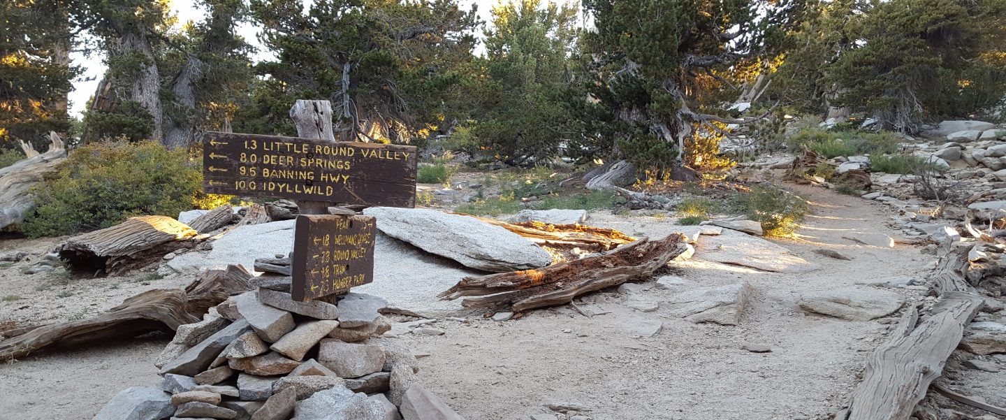
Deer Springs Trail has a posthole track to follow along its entire length. My track from last week largely followed the established route of the trail, especially below the Fuller Ridge junction, but higher up the track is much more direct in places. Above Little Round Valley in particular my track down from the Peak is very direct, steep, and would be a challenging ascent.
Marion Mountain Trail has a lightly-traveled posthole track to follow, that does not follow the trail route in places.
Spitler Peak Trail had 10 new treefall hazards, almost all in the upper switchbacks. Only five of these require cutting, and I was able to remove three by hand earlier in February.
SNOW DEPTHS measured on 19th-20th February (east and south side locations) and 15th February 2023 (west side) are as follows. The number given is the current average total snow depth. Note that generally the maximum depths so far this winter were immediately following the major storm sequence on 14th-17th January 2023 (details of those depths available here). Note that averages are given; due to strong winds and considerable powder there is extreme drifting. Altitudes are approximate.
San Jacinto Peak (10810 ft): 37-42 inches, drifted >50 inches especially on east flank
Little Round Valley (9800 ft): 42-46 inches, heavily drifted
Wellman Divide (9700 ft): 40 inches
Seven Pines Trail junction with Deer Springs Trail (8700 ft): 35 inches
Annie’s Junction/PCT Mile 180.8 (9070 ft): 44 inches
Long Valley (8600 ft): 22 inches
Strawberry Junction (8100 ft): 15 inches
Saddle Junction/PCT Mile 179 (8070 ft): 21 inches
Devil’s Slide trailhead at Humber Park (6550 ft): 0-2 inches
Idyllwild (at 5550 ft): 0-1 inch
Thank you for taking the time to read this. While all time and labor is volunteered, the San Jacinto Trail Report uses small private donations to help cover costs. Every year seems to have its unique challenges, and it is already clear that 2023 will be no exception. Your contribution keeps the Report available to all, free from advertising or paywalls, and independent from agencies. If you have found this Report useful, please consider using this link to the Donate page. Zelle, Venmo, and PayPal are all options. Thank you so much for your support.

