The twelfth storm system of winter 2022/23 impacted the San Jacinto mountains with a minor snow storm on 29th-30th January. With a rapidly changing climate in the region in recent years, it has become increasingly common for there to be little or no difference in snow quantities at mid and higher elevations, often because the high country remains above the cloud, and this system was no exception.
Snow started in Idyllwild at about 1015 on Sunday 29th, ultimately accumulating about 3.5 inches (at 5550 ft) by the afternoon of 30th, while San Jacinto Peak (10,810 ft) added only two inches of powder. Locations in between, especially those on the western and southern slopes, added more with up to five inches at Saddle Junction (8100 ft). Long Valley at 8600 ft on the east slope received only about two inches of fresh snow.
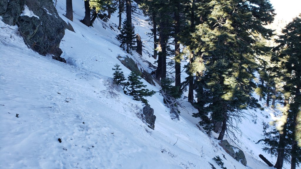
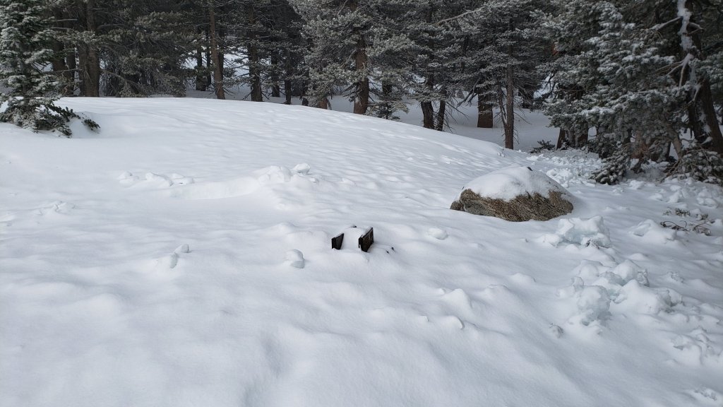
On the mornings of both Wednesday 1st February and Monday 30th January I ascended San Jacinto Peak via the east side (Devil’s Slide, Wellman, Peak, and East Ridge trails), descending the same way. With such strong Santa Ana winds on Thursday 26th causing extensive drifting, and a light snowfall early on 30th, by the 30th prior tracks had been thoroughly erased and I was once again breaking trail the entire way from Humber Park to San Jacinto Peak, largely through relatively shallow powder. I made a concerted effort to put in a track as faithful to the trail routes as conditions permitted, both up and down. Further strong winds and blowing powder had eliminated much of these tracks again by Wednesday, and I again largely re-broke trail that day too. Indeed a wild wind in the high country that day was erasing tracks within hours or even minutes (see photos below).
On both days I was able to ascend barebooting to about 8800 ft on 30th and to 9200 ft on 1st, before putting on crampons. I kept those on for the rest of the ascent, and almost all of the descent, finally removing them most of the way down Devil’s Slide Trail. There are layers of hard ice and firm icy snow beneath the fresh powder, and crampons are ideal at present everywhere above 9000 ft, lower in places.
I recorded a short(ish) video report from San Jacinto Peak late morning on Monday 30th (available here on YouTube) that gives a feel for the conditions in the high country at that time.
Details of snow depths measured at various locations on the trail system are given at the foot of this posting. Measurements taken on Monday 30th were unchanged by Wednesday 1st. Note that snow depth itself is rarely indicative of the difficulty (or otherwise) of hiking a particular trail. Although the high country currently has its deepest snow accumulation since March 2019, this winter nevertheless remains well below the average for snowfall in the San Jacinto mountains to date.
Be prepared for trails above about 8000 ft (perhaps lower in places) completely or largely obscured by moderate to deep snow. Cautious navigation is strongly recommended everywhere.
As described above, crampons (always in conjunction with an ice axe) are currently recommended everywhere above about 8500 ft, and are strongly recommended on certain moderate and higher angle slopes, at a minimum on the Peak Trail above Wellman Divide, the Wellman Trail, Deer Springs Trail above Little Round Valley, and uppermost South Ridge Trail, on both flanks but especially on the north face of Tahquitz Peak.
Snowshoes are useful in lower angle terrain with adequate snow depth above about 8000 ft, for example the Tahquitz area meadows near Saddle Junction, sections of Deer Springs Trail, and Long Valley/Round Valley. They are not currently recommended for moderate angle slopes above 9000 ft that have challenging ice underlying shallow powder. However, snowshoes may become increasingly useful if conditions warm sufficiently for snow to become soft above about 9000 ft, especially on sunny slopes and afternoons. Snowshoes will remain valuable anywhere off trail above about 8000 ft for the foreseeable future.
Currently, and as conditions change, spikes are strongly recommended for the foreseeable future everywhere above about 7000 ft. They will be especially valuable on well-consolidated tracks over the coming days and weeks before they clear of snow (e.g., Devil’s Slide, Ernie Maxwell, Deer Springs trails, at least), on colder mornings when conditions are icy, and for descending. They are not however required, depending upon your comfort level hiking on shallow variable snow, potentially mixed with slushy and icy patches.
Melting and freeze/thaw cycles will combine to change trail conditions and potentially the preferred equipment for the terrain for the remainder of February.
Hikers should be prepared for temperatures below freezing in the high country, and well below freezing when considering wind chill effects (see below for my recent weather observations from San Jacinto Peak).
Skyline Trail closed on 26th January due to “dangerous weather conditions” above the State Park boundary (5800 ft elevation). There is no planned reopening date at this time. For those that are unclear, the Skyline Trail is the first segment of the C2C (“cactus to clouds”) from Palm Springs up to Grubb’s Notch, the access point to Long Valley.
The USFS gate at Humber Park remains closed. Even when the gate is closed there are nine legal parking spaces below the locked gate (which still require an Adventure Pass or equivalent to be displayed). If there are “Road Closed” signs further down at the junction with Forest Drive – sometimes the case at weekends and holidays when snow is present – then those nine spaces are also unavailable for legal parking.
South Ridge Road (5S11), Dark Canyon Road (4S02, the access to Seven Pines Trail), and Santa Rosa Truck Trail (7S02) are currently closed to vehicle traffic, as is Black Mountain Road at the gate 1.7 miles up from Highway 243.
WEATHER
February is forecast to be somewhat more settled than the very eventful January. A significant warming trend is expected for later this week and next weekend at all elevations, with significant melting likely, before cooling slightly Monday 6th February but remaining slightly above seasonal. Even around the 10,000 ft peaks temperatures are expected to fluctuate either side of freezing for at least the first half of February, which will lead to freeze/thaw cycles and likely icy conditions in the mornings followed by soft, challenging snow in the afternoons. At this time there is no further significant precipitation forecast prior to mid February.
At San Jacinto Peak (10,810ft/3295m) on Wednesday 1st February 2023 at 0935 the air temperature was 16.6°F (-8°C), with a windchill temperature of -8.0°F (-22°C), 13% relative humidity, and a wild NNE wind sustained at 21 mph gusting to 35.2 mph.
At the Peak on Monday 30th January 2023 at 1110 the air temperature was 15.5°F (-9°C), with a windchill temperature of -0.4°F (-18°C), 98% relative humidity, and a light SSE wind sustained at 3 mph gusting to 8.4 mph.
At the Peak on Monday 23rd January 2023 at 1010 the air temperature was 11.1°F (-11°C), with a windchill temperature of -16.2°F (-26°C), 47% relative humidity, and a bitter NNE wind sustained at 20 mph gusting to 27.7 mph.

TRAIL CONDITIONS
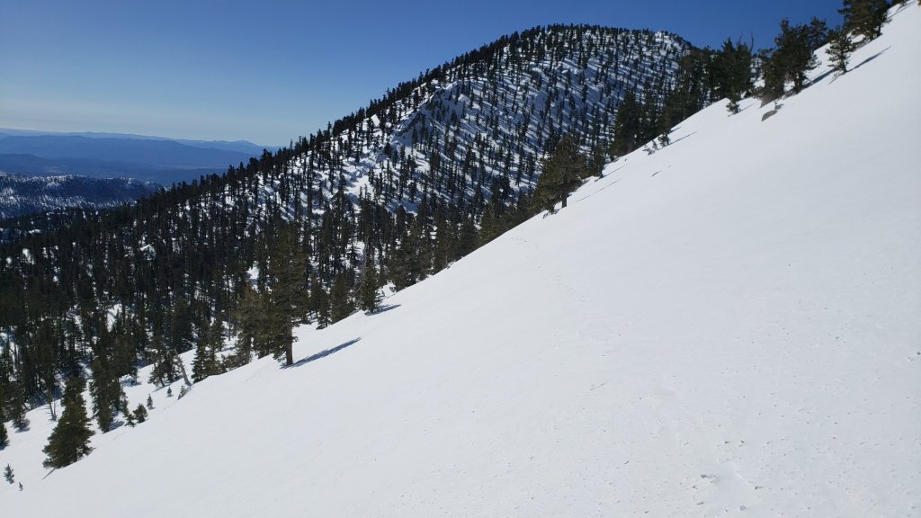
All trails above about 5500 ft are currently snow-covered. Snow cover is shallow up to about 7000 ft, but relatively heavy above 8000 ft. Melting on sun-exposed slopes is already well underway, e.g., on lower Devil’s Slide Trail, South Ridge and Deer Springs trails. Steady melting is expected with warming temperatures this week, especially at mid elevations and on sun-exposed slopes.
Note that tracks discussed are obscured quickly by heavy drifting of snow from strong winds, sometimes in days or even hours.
Effective 26th January 2023 the State Park closed the section of Skyline Trail that falls within its jurisdiction, above 5800 ft elevation, “until further notice due to dangerous weather conditions”. (For readers who are unclear, Skyline Trail forms the lower two-thirds of the “Cactus-to-Clouds” [C2C] route.) The State Park boundary is not marked but is near the site of the old Florian’s Cache, below Flat Rock. The open section of trail below 5800 ft is clear of snow.
Devil’s Slide Trail has a well traveled and compacted track to Saddle Junction in place already. Spikes are not needed yet, but that will change soon with increasing compaction and freeze/thaw cycles. There are two new treefall hazards to pass on the upper trail.
Otherwise, reliable posthole tracks are in place from Saddle Junctions through to San Jacinto Peak via Wellman Divide, but parts will become obscured by any additional light snowfall and/or especially by drifting snow from strong winds. From near Miller Peak I put in a track up the East Ridge, rather than continuing on the Peak Trail round to Summit Junction.
By 1st February there was a somewhat meandering snowshoe track from Round Valley (and presumably Long Valley) up to San Jacinto Peak, ultimately using the East Ridge route from near Miller Peak, that generally followed lower angle terrain and avoided the traversing slopes of the Peak Trail.
Ernie Maxwell Trail [checked 2nd February] has a heavily traveled track to follow along its entire length, through the increasingly patchy icy snow. Average snow cover is 60%, but is nearly continuous near Humber Park. Spikes are recommended especially in the morning as the snow is now hard, compacted and very icy in places. Three significant trees are now down across the trail, including two major hazards (one new in gale force winds on 26th January) that are not easy to hike around both roughly halfway along the trail. All have been reported to US Forest Service.
On South Ridge Trail spikes at least, but preferably crampons, are required for the uppermost switchbacks.
The 0.4 mile section of South Ridge Trail between Chinquapin Flat/PCT and Tahquitz Peak has no steps to follow through the steeply angled ice with overlying deep snow. These icy slopes are notoriously treacherous. Currently crampons, always with an ice axe, and advanced knowledge of how to use this equipment, are required. Snowshoes are not advisable due to the angle of the icy snow.
SNOW DEPTHS measured on 30th January 2023 (unless otherwise indicated) and checked again on 1st February are as follows. Three numbers are given: the first number is the current average total snow depth at that location, followed in brackets by the new snow accumulation from the storm on 29th-30th January, and finally in parentheses by the maximum depth where known so far this winter, generally on 18th January following the major storm sequence on 14th-17th January 2023. For locations measured on 23rd January, these measurements are still useful, as the new recent snow depth is roughly offset by melting over the past week. Note that averages are given; due to strong winds accompanying storms there is extensive drifting. Altitudes are approximate.
San Jacinto Peak (10810 ft): 40-45 inches [2 inches] (45-48 inches), drifted >50 inches in places
Little Round Valley (9800 ft): 45 inches, heavily drifted, measured 23rd January
Wellman Divide (9700 ft): 40 inches [2 inches] (45 inches)
Annie’s Junction/PCT Mile 180.8 (9070 ft): 44 inches [4 inches] (48 inches)
Tahquitz Peak (8836 ft): 25 inches, heavily drifted to 40 inches in places, measured 20th January
Seven Pines Trail junction with Deer Springs Trail (8700 ft): 36 inches, measured 23rd January
Long Valley (8600 ft): 22 inches [2 inches] (24 inches)
Strawberry Junction/PCT Mile 183 (8100 ft): 15 inches, measured 23rd January
Saddle Junction/PCT Mile 179 (8070 ft): 22 inches [5 inches] (22 inches)
Suicide Rock Trail junction with Deer Springs Trail (6950 ft): 3 inches, measured 23rd January
Devil’s Slide trailhead at Humber Park (6550 ft): 4-5 inches [4 inches] (6 inches) already melting afternoon of 30th
Idyllwild (at 5550 ft): 0-2 inches [3.5 inches] (3-4 inches) rapidly melting afternoon of 30th
Thank you for taking the time to read this. While all time and labor is volunteered, the San Jacinto Trail Report uses small private donations to help cover costs. Every year seems to have its unique challenges, and it is already clear that 2023 will be no exception. Your contribution keeps the Report available to all, free from advertising or paywalls, and independent from agencies. If you have found this Report useful, please consider using this link to the Donate page. Zelle, Venmo, and PayPal are all options. Thank you so much for your support.