Back-to-back Pacific storm systems – already the tenth and eleventh storms of this winter – are forecast for Saturday 14th and then from late Sunday 15th January to the early hours of Tuesday 17th January.
Please check this page for periodic updates – the most recent is at the top – throughout the multiple day storm sequence. The next comprehensive Report update is not expected before Wednesday 18th January.
UPDATE on Tuesday 17th January at 1200
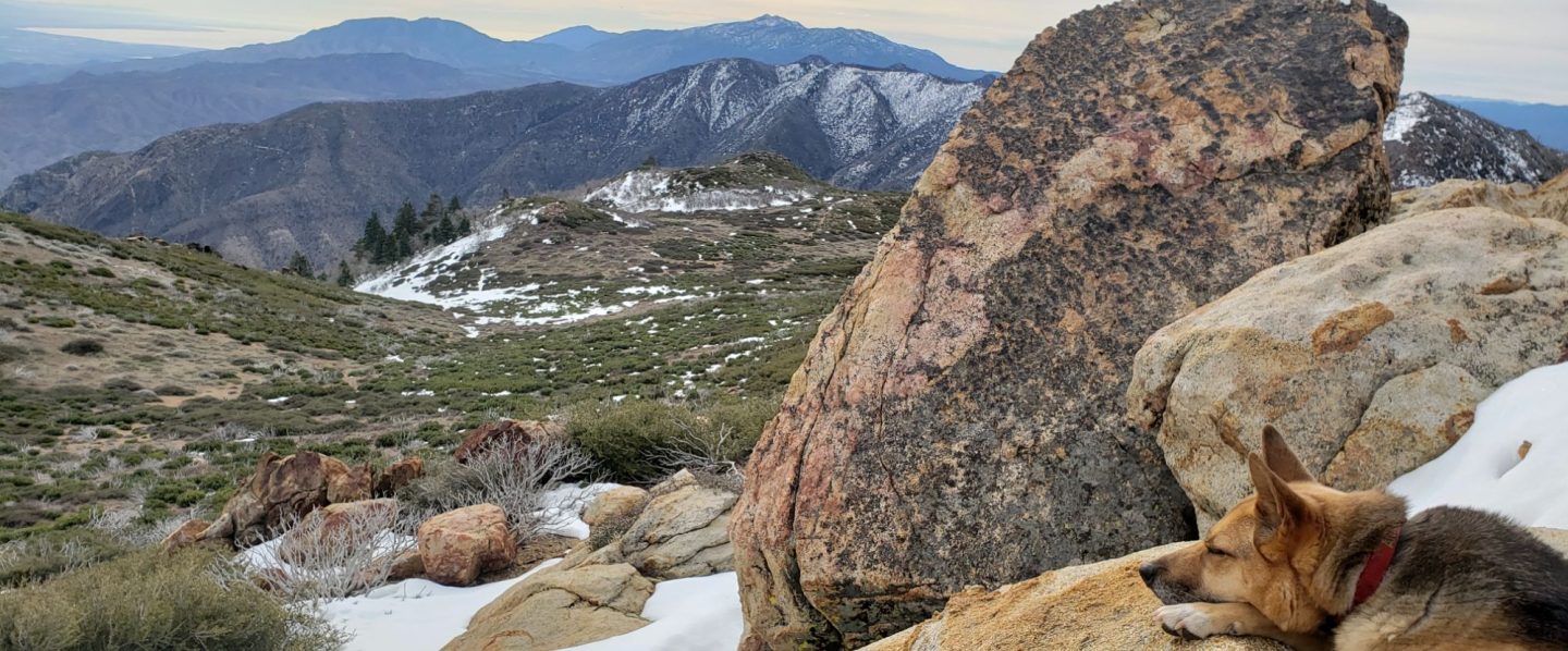
A light overnight snowfall, which produced another three inches in Idyllwild, finally stopped at 0700 this morning. Final totals for Idyllwild for the three day storm event were 6.5 inches of snow, plus an impressive 5.06 inches of rain.
This morning Anabel and I broke trail up Devil’s Slide Trail to Saddle Junction. The powder was lovely and soft, and overlying a firm icy layer (from all the freezing rain). While the snow was not especially deep, it still took about double the time of a completely dry ascent. I barebooted to Saddle, and then snowshoed back down to help consolidate the track. There had been an additional six inches of snow (plus an unknown amount of rain) since my measurement two days earlier, for a current total snow depth of about 21 inches at Saddle Junction. Two new trees were down on the upper trail, unsurprising given the huge weight of ice from freezing rain plastered all over the trees.
Current snow depth at Devil’s Slide trailhead at Humber Park is 4-5 inches on top of 1-2 inches of ice/icy snow from recent freezing rain.

UPDATE on Monday 16th January at 1740
Rain has continued solidly today in Idyllwild, with another 0.90 inch since 0700 this morning. It turned to occasional light snow at about 1500, but less than 0.5 inch has accumulated so far (at 5550 ft). However the high country has been largely above this precipitation, with the sun even trying to peek out at times in Long Valley, and only about another inch of snow was added there this morning. That is expected to change, with up to several inches of snow forecast both in the high country and at mid elevations tonight.
UPDATE on Monday 16th January at 0920
Overnight in Idyllwild we had three inches of snow, the first notable snowfall of this latest storm series, but temperatures actually warmed during the night (presumably with the arrival of the latest “atmospheric river”) and before dawn it was raining on top of the snow. The snow quickly turned into semi-melted slush. In combination with the four inches of rain since Saturday, not to mention the many inches of rain earlier this winter, the mid elevations, including the mountain communities, are now best described as a very soggy and slushy mess.
The freeze level is currently at about 7500 ft and it has been periodically snowing gently above that elevation, with Long Valley (8600 ft) having added a few inches overnight, for a current total depth of about 24 inches.
Thank you for taking the time to read this. While all time and effort is volunteered, the San Jacinto Trail Report requests small private donations to cover costs. Every year seems to have unique challenges and 2023 is already proving to be no exception. Your contribution keeps the Report available to all, free from advertising or paywalls, and independent from agencies. If the Report is useful to you in any way, please consider using this link to the Donate page. Zelle, Venmo, and PayPal are all now options. Thank you so much for your support.
UPDATE on Sunday 15th January at 1420
I snowshoed down from San Jacinto Peak via Wellman Divide, Saddle Junction, and Devil’s Slide Trail. It was near-whiteout conditions due to wild spindrift above Wellman Divide, but the new snow was firm and overall made for good snowshoeing conditions. Crunchy layers as high as 9800 ft elevation told me it had rained that high at the start of the storm yesterday, but conversely there was very light snow (<1 inch) down to 5500 ft in Idyllwild.
Measured snow depths as of late morning/early afternoon today are: San Jacinto Peak (10,810 ft) 38 inches, at least 14 new in this storm; Wellman Divide (9700 ft) 30 inches, with 15 new in this storm; Annie’s Junction – at 9070 ft the highest point of the PCT in Southern California – 30 inches, with 14 new in this storm; Saddle Junction (8100ft) 15 inches, about 7-8 new in this storm; Devil’s Slide Trailhead at Humber Park (6520 ft) 2 inches, all from this storm.
Personally I would not currently venture above 9000 ft elevation without crampons (always with an ice axe) and snowshoes, due to the current complexity and challenges of the icy snow slopes above that elevation.
Conversely, lower down Devil’s Slide Trail is a combination of very light snow cover, slush, and multiple stream crossings, with much water flowing down the trail. Suitable waterproof footwear is strongly recommended.


UPDATE on Sunday 15th January at 0830
The high country added only another couple of inches of snow overnight. Storm total at San Jacinto Peak is about 14 inches for a current total depth of 36+ inches (but very heavily drifted). It stopped snowing at about 0800.
Similarly, Long Valley (8600ft) added about two inches overnight for a storm total of about seven inches and a current total depth of about 15 inches.
Current air temperature at San Jacinto Peak is 17.8°F (-8°C) with a windchill of -5.6°F (-21°C) and a steady SW wind sustained at 19 mph gusting to 30.2 mph.
It continued to rain heavily overnight at mid elevations everywhere below about 7000 ft. Idyllwild at 5550 ft elevation recorded an impressive 4.01 inches of rain in the 24 hour period up to 0700 this morning. It is starting to turn to light sleet now as temperatures drop to near freezing. Locations in Pine Cove up to 6500 ft were reporting 3.1 to 3.8 inches of rain by 0500 today.
UPDATE on Saturday 14th January at 2010
The snow continues unabated, although the pace has slowed somewhat in the past hour. There is an average of 9-10 inches of fresh powder so far today at San Jacinto Peak, and about 5 inches in Long Valley.
Today’s rainfall total has passed an inch in Idyllwild, and various locations in Pine Cove (5800-6500 ft) were reporting 1.1 to 1.3 inches two hours ago. The freeze level has remained around 7500 ft for most of today, but is forecast to drop overnight closer to 6000 ft.
UPDATE on Saturday 14th January at 1705
The intensity of snowfall at San Jacinto Peak this afternoon is the best I’ve seen since late 2019. Although the flakes are small, it has been steadily accumulating at an inch per hour, with about six inches fresh powder so far today, for a Peak area total of about 30 inches. Another 10+ inches are forecast overnight, which is very possible given current conditions.
Snowfall at the elevation of Long Valley (8600 ft) has been similarly steady, and 3-4 inches of fresh powder there takes the total depth close to one foot.
Rainfall in Idyllwild (at 5550ft) has also maintained a steady pace, with close to 0.7 inch so far today.
UPDATE on Saturday 14th January at 1505
Cloud cover started to envelop the mountains early this morning. On my hike up to San Jacinto Peak it started snowing gently at 1025 in the high country. Snow accumulation was initially slow but has been an inch per hour recently, with 2.5 inch added at San Jacinto Peak since late this morning (on top of about 24 inches remaining from prior storms).
On my ascent I put crampons on at Wellman’s Cienega (9300 ft) and they were more-or-less essential for traversing the icy slopes of the Peak Trail. My tracks from Wednesday were still largely visible and helped a little with traction.
The initial freeze level was at about 9000 ft but has already dropped. After some early sleety drizzle it has been snowing in Long Valley (8600 ft) since late morning with 0.75 inch accumulating so far.
In Idyllwild (at 5550 ft) it started raining at 1100, where it has been relatively slow to accumulate so far, with 0.4 inch by 1500.

