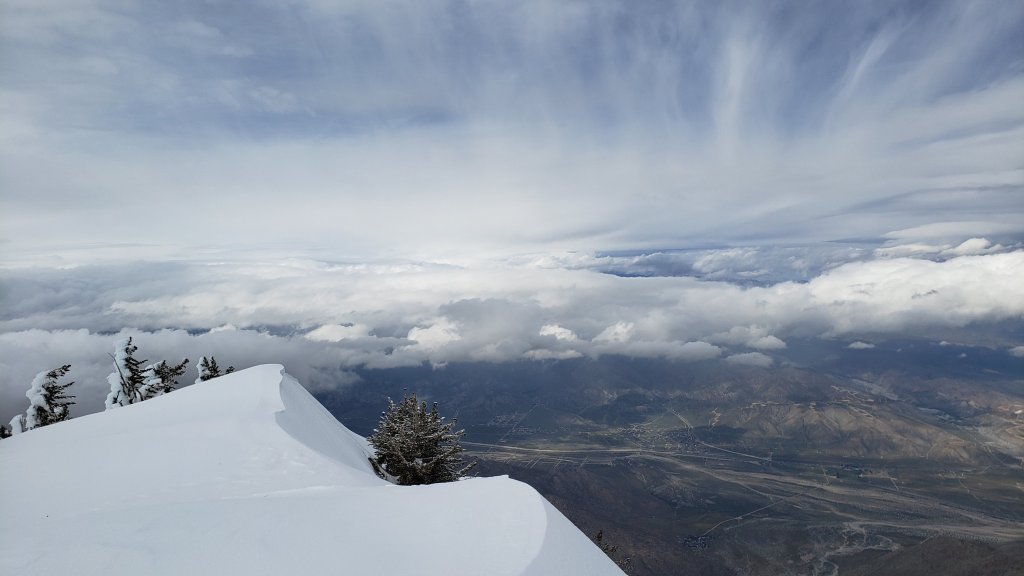
Well, I’m starting to run out of superlatives for this winter, so I’ll just let numbers tell the tale. The 23rd storm of winter 2022/23 impacted the San Jacinto mountains on 21st-23rd March. Another two feet of snow at San Jacinto Peak brought the total depth currently on the ground there to about 100 inches. Given some melting between storms, the Peak total for the winter is now close to 120 inches, i.e. 10 feet. While that depth would have been unremarkable late last century, it is by far the most snow in the San Jacinto high country for over a decade, probably this century. I recorded a short video discussion near San Jacinto Peak on the morning of Wednesday 22nd March, which gives a feel for the conditions (available here on YouTube).
Meanwhile in Idyllwild, another 17 inches of snow took the winter total to nearly 90 inches, almost triple the annual average of the past 30 years, and as I discussed in an earlier analysis (linked here), makes this winter provisionally the snowiest in Idyllwild since the 1940s, and the third snowiest in recorded Idyllwild history (reliable data since 1943).
Unlike the two storms in mid March, this was not another “pineapple express”, but had a more northerly influence producing colder temperatures, thankfully no rain at higher elevations, and a light dusting of snow down to 4400 ft in Garner Valley (see photos below). Mid elevation locations such as Vista Grande and Keenwild reported 2-3 inches of rain before it turned to several inches of snow accumulation.
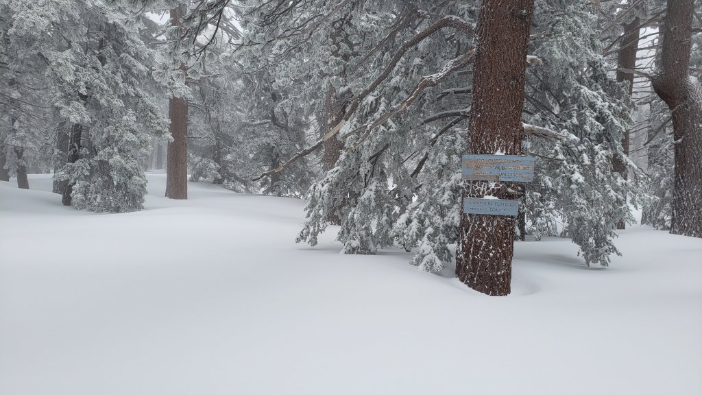
The State Park wilderness nominally closed on 1st March (see State Park website for their explanation). At this time there is no tentative date for reopening. Note however that there was no apparent enforcement in Long Valley on Saturday 25th at least, with multiple skiers reaching San Jacinto Peak and Snow Creek. This closure includes approximately PCT Miles 183-189. An additional closure applies to Skyline Trail (part of the C2C route) as discussed below under Trail Conditions.
Currently there appears to be no significant avalanche risk on the high country slopes that are crossed by the established trail network. I found no evidence of pre-avalanche characteristics as I descended the high slopes on the late morning of 22nd March following the latest heavy snowfall. There is however a moderate risk for the north face of San Jacinto Peak, especially given that pre-avalanche characteristics were reliably reported to me from upper Snow Creek on 20th, prior to the latest heavy snowfall.
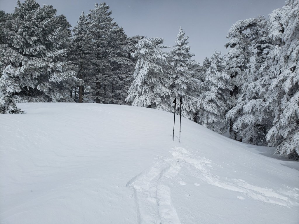
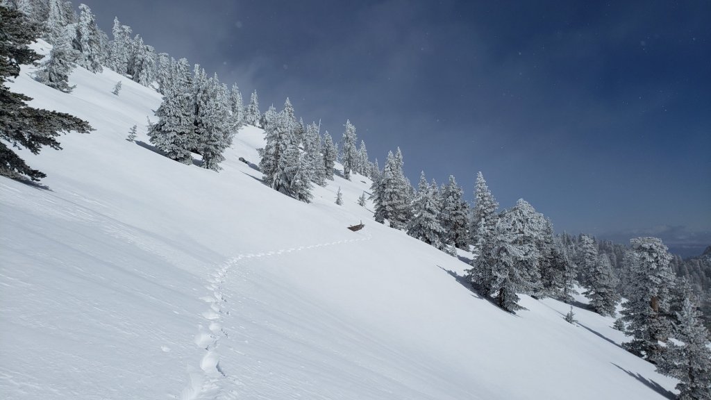
I snowshoed San Jacinto Peak on Wednesday 22nd March via the eastern side route including Devil’s Slide Trail. Despite its great depth, the high country snow was firm and immaculate and I was sinking in only a few inches at most. Below about 8500 ft was a different story however, with relatively wet, heavy, snow on Devil’s Slide Trail causing some unpleasant postholing even in snowshoes (photos below).
Currently trails above about 6000 ft (lower in places) are obscured by moderate to deep snow. Trails down to 4600 ft elevation currently have shallow and increasingly patchy snow cover. With the State Park closure in place, there are very few tracks anywhere above 8000 ft. Very cautious navigation is essential everywhere.
Details of snow depths measured at various locations on the trail system are given at the foot of this posting. Note that snow depth itself is rarely indicative of the difficulty (or otherwise) of hiking a particular track or trail. For example a firm, well-compacted snowshoe or crampon track across snow several feet deep may be much easier hiking than an angled icy section just inches deep.
To give an idea of the current traction challenge, I am generally hiking with all three of snowshoes, crampons, and spikes every time I go into the high country at present, changing between them as conditions warrant.
Conditions are currently excellent for snowshoes everywhere above about 6000 ft (potentially a little lower in places for the next couple of days). This elevation will climb slowly over the next few days and weeks as temperatures rise and melting accelerates. Tracks in the high country can be firm if the early morning is cold (crampons best) but then soften very rapidly once sun hits slopes and temperatures rise, at which point snowshoes are preferable.
Crampons – with hiking poles and an ice axe, depending on terrain – may becoming increasingly useful everywhere especially above about 8000 ft, as colder temperatures on some days, plus freeze/thaw cycles, lead to hardening of the snow surfaces. They will likely become invaluable over the next week or so on certain moderate and higher angle slopes, at a minimum on the Peak Trail above Wellman Divide, the Wellman Trail, Deer Springs Trail above Little Round Valley, and uppermost South Ridge Trail, and on both flanks but critically on the north face of Tahquitz Peak.
Increasingly as snow conditions change spikes are strongly recommended for the foreseeable future everywhere above about 5000 ft. They can currently be valuable even for walking around Idyllwild early on cold mornings! This elevation will slowly move upwards with steady melting over the next few days and weeks, but will remain relatively low into April at least.
Recently I have mentioned the challenges of hard, icy snow underfoot and the value of using spikes (and/or crampons) especially for descending and traversing. While fresh snow (and softening, melting, snow) may be optimum for snowshoeing for the next several weeks, snow at all elevations will generally become increasingly firm and icy following multiple freeze-thaw cycles, and compaction by increasing hiker traffic in places (especially once high country trails reopen). I cannot overemphasize the importance of having both appropriate equipment and the right skill set for the terrain. The latter includes interpreting the snow/ice conditions, understanding your physical and mental abilities, and conservative decision making. These concerns will steadily increase over the next few weeks with temperatures fluctuating either side of freezing, seasonally stronger insolation, and highly variable snowmelt.
Hikers should be prepared for temperatures below freezing in the high country, and well below freezing when considering wind chill effects (see below for my recent weather observations from San Jacinto Peak).
The USFS gate at Humber Park is closed. Even when the gate is closed there are nine legal parking spaces below the locked gate (which still require an Adventure Pass or equivalent to be displayed). If there are “Road Closed” signs across Fern Valley Road near its junction with Forest Drive – currently the case – then those nine spaces are also unavailable for legal parking.
Forest Service roads currently closed to vehicular traffic by a revised closure order include Black Mountain Road (4S01), Dark Canyon Road (4S02), South Ridge Road (5S11), May Valley Road (5S21), and Santa Rosa Road (7S02), plus their various side roads.
Palm Springs Aerial Tramway will be closed for maintenance on Monday 27th and Tuesday 28th March.

SOME THOUGHTS FOR PCT HIKERS
Between the State Park closure and the storms continuing in March, completing the San Jacinto mountains is currently a major challenge even for experienced hikers. That said, melting will happen fast – it is still Southern California after all – and because melting was accelerated by some recent storms bringing intense warm rain on top of the snow, especially below about 8000 ft which includes most of the PCT in these mountains.
Hikers with March dates, if you have any flexibility at all in your timing, try to start later (easy for me to say I know). In a year with such dramatic snow conditions further north, it is highly unlikely that starting later than your “official” date will be a problem anywhere. Hikers with April or May dates, conditions in the southernmost sections will generally improve starting in the first week of April (judging by the forecasts), and most or all areas will be readily passable with – crucially – suitable skills and equipment, patience, and a thorough knowledge of all the possible alternates if needed.
The remarkable winter has created some challenges in addition to the snow. There can be a great deal of water in the trails, and this has also created a few tricky crossings. Do not trust snow bridges across water at this time; you will not get washed away, but it is a quick way to at least get soaking wet feet, and potentially a nasty fall. Finally, forested trails are covered with downed branches and debris, plus many new treefall hazards, some of which are only becoming apparent as the snow recedes. Trail maintenance by agencies was already years behind schedule due to the coronavirus pandemic, among other reasons, and this winter has greatly exacerbated the situation. Again, patience and caution will be essential this season more than usual.
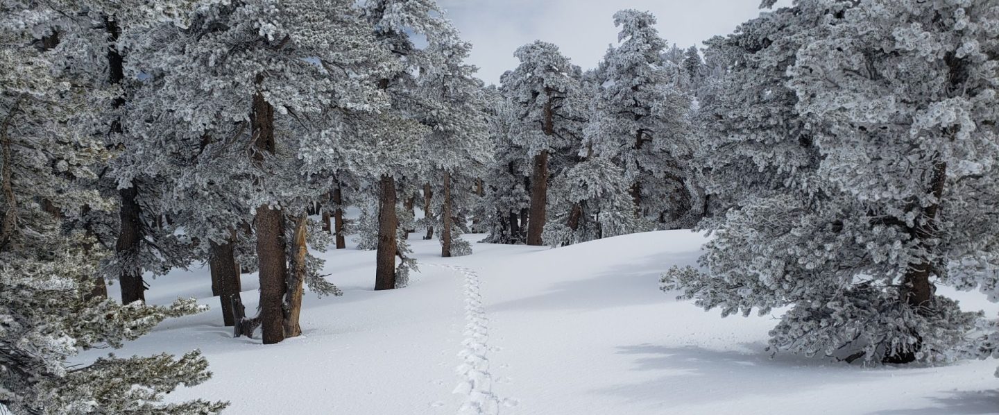
The PCT from Mile 151 (Highway 74 crossing) to Mile 166 (Fobes Trail) is clearing of snow steadily [checked 23rd and 24th March 2023], see photo below. Fobes Ranch Road and Fobes Trail [checked 24th] are also either clear or clearing of snow (more continuous snow a few inches deep remains on upper Fobes Trail).
Proceeding north from about Mile 166 currently requires considerable snow hiking experience. At this time I recommend carrying snowshoes, crampons, and ice axe, plus you will need the necessary snow hiking experience to use that equipment safely in moderate angle terrain, plus patience, stamina, and route-finding skills. By Sunday 26th March there will be a track to follow for Miles 166-179, and from Miles 179-191 by about Tuesday 28th.
A well established alternate is to connect back to the PCT at about Mile 191 using Black Mountain Road. Black Mountain Road currently has continuous moderate snow cover but there are tracks to follow through the snow, and melting of the lower section will proceed steadily over the next week or so. Soon the conditions will be silimar to my survey on 17th March, when the Road had 50% snow cover on the lower two miles, 90% cover for the next three miles averaging 2-6 inches deep, then 100% cover for the upper three miles, at 6-18 inches deep. Early on cold mornings the snow is hard and icy making it easy to hike, but snow is soft and postholing is poor by late morning. Currently no vehicle has driven up from Highway 243 since the last snows.

WEATHER
Conditions continue unsettled for the remainder of March. A moderate warming trend will accelerate melting from 24th-28th. There is an increasing likelihood of a further minor storm system on 29th-30th, with a mix of rain and a few inches of snow at mid elevations (e.g., Idyllwild) and an uncertain 2-10 inches of snow forecast for the high country.
It appears that generally stable, sunny weather with a moderate warming trend may start around 1st April (no fooling). If so, that could herald the beginning of a major melting season.
At San Jacinto Peak (10,810ft/3295m) on Monday 20th March 2023 at 1435 the air temperature was 20.8°F (-6°C), with a windchill temperature of 0.5°F (-18°C), 44% relative humidity, and a stiff due West wind sustained at 17 mph gusting to 28.0 mph, in complex, multi-layer cloud.
At the Peak on Wednesday 15th March 2023 at 1115 the air temperature was 29.2°F (-2°C), with a windchill temperature of 10.7°F (-12°C), 100% relative humidity, and a gusty WSW wind sustained at 12 mph gusting to 23.5 mph, in driving sleety rain.
TRAIL CONDITIONS
All trails above about 5000 ft remain largely snow-covered (wholly snow-covered above about 6000 ft). This will change steadily with further melting over the next few days and weeks.
Devil’s Slide Trail has my descending snowshoe track from 22nd up to Saddle Junction. It can be firm in cold early mornings (ideal for spikes) but is very soft otherwise, and always by late morning (snowshoes required, or expect very deep and wet postholing). Beware of the huge amount of water flowing in the trail, often obscured under thinning snow, and some associated tricky stream crossings. The track does not follow the established trail route in the uppermost switchbacks close to Saddle Junction, and careful navigation is required. Another major new tree came down (between switchbacks 5 and 6) on 11th March, reported to USFS.
My snowshoe track continues on to San Jacinto Peak, via a route approximating to the PCT, Wellman, Peak, and East Ridge trails, climbing more steeply in places than the established trails, and generally contouring through the snow as needed to minimize unnecessary elevation loss. Wild spindrift snow on 22nd will have eliminated parts of the upper track.
The 0.4 mile section of South Ridge Trail between the PCT at Chinquapin Flat and Tahquitz Peak has no steps to follow through the steeply angled ice with overlying deep snow. These icy slopes are notoriously treacherous. Currently crampons, always with an ice axe, and thorough knowledge of how to use this equipment on high angle terrain, are essential. Snowshoes are not advisable due to the angle of the icy snow.
A reliable snowshoe track was put in on lower Deer Springs Trail to Strawberry Junction on Friday 24th March.
Spitler Peak Trail [surveyed 26th March] is clear of snow in its lower half (first 2.4 miles). The upper half of the trail has continuous light snow cover. The initial part of this snowy section has an excellent snowshoe track to follow, but this ends about 3.8 miles from the highway, about one mile below the PCT junction.
In addition to the wider closure mentioned above, effective 26th January 2023 the State Park closed the section of Skyline Trail that falls within its jurisdiction, above 5800 ft elevation, “until further notice due to dangerous weather conditions”. (For readers who are unclear, Skyline Trail forms the lower two-thirds of the “Cactus-to-Clouds” [C2C] route.) The State Park boundary is not marked but is near the site of the old Florian’s Cache, below Flat Rock. The open section of trail below 5800 ft received some light snow cover down to about 4500 ft over the past week, but this has already melted.
SNOW DEPTHS
Measured on Wednesday 22nd March unless otherwise stated. The first number is the current snow depth, which at locations above about 9000 ft elevation is the maximum depth recorded this winter, followed in parentheses by the snow added in this latest storm, and then by a comment where relevant regarding the maximum depth at that location this winter. Note that averages are given; due to strong winds accompanying all storms, and the differential effects of rain on snow in some earlier storms, there is considerable inconsistency of depth. Altitudes and PCT Miles are approximate.
San Jacinto Peak (10810 ft): 98-105 inches (added 23-25 inches on 21st-22nd March)
Wellman Divide (9700 ft): 71-73 inches (added 16-18 inches on 21st-22nd March), about the same depth recorded on 3rd March
Annie’s Junction/PCT Mile 180.8 (9070 ft): 73-75 inches (added 18-20 inches on 21st-22nd March), maximum recorded depth this winter c.80 inches on 3rd March
Long Valley (8600 ft): 50-55 inches (added 15+ inches on 21st-22nd March), maximum recorded depth this winter c.60 inches on 3rd March
Saddle Junction/PCT Mile 179 (8070 ft): 40-45 inches (added 16-18 inches on 21st-22nd March), maximum recorded depth this winter 48-50 inches on 3rd March
Devil’s Slide trailhead at Humber Park (6550 ft): 13-20 inches (added 13 inches on 21st-22nd March), maximum recorded depth this winter 46 inches on 3rd March
Idyllwild (at 5550 ft): 15-16 inches (added 15-16 inches on 21st-23rd March), maximum depth this winter 45-46 inches on 1st March
PCT Mile 151 at crossing with Highway 74 (4800 ft): 0-1 inch, measured 23rd March (dusting of snow on 22nd), maximum depth this winter 13 inches in first week of March.

While all time and labor is volunteered, the San Jacinto Trail Report uses small private donations to help cover modest operating costs. Every year seems to have its unique challenges, and clearly 2023 will be no exception. Your contribution keeps the Report available to all, free from advertising or paywalls, and independent from agencies. If you have found this Report useful, please consider using this link to the Donate page. Zelle, Venmo, and PayPal are all options. Thank you so much for your support.