For details of the condition of high country trails following the July 2018 Cranston Fire, see the prior posting linked here. Today we were able to check all high country water sources on a lengthy loop hike to San Jacinto Peak via Devil’s Slide Trail, descending via Deer Springs Trail, with a couple of side hikes to check other sources too. Last week I was able to review the springs and creeks around the Tahquitz area meadows.
Weather At San Jacinto Peak at 0740 today, Monday 13th August, the air temperature was 52°F (11°C), with a lovely fresh windchill temperature of 45°F (7°C), 54% relative humidity, and a pleasant 5 mph SSE breeze gusting to 13 mph.
There is a moderate possibility of thunderstorms for the next three or four days. Hikers should always be prepared for rapidly changing weather conditions in the high country in summer. Thunderstorms with lightning can occur at or near the high peaks even when such storms are not forecast for lower elevations.
Trail overview Flow rates at all water sources are at their lowest of the year, and far below seasonal norms. Some well-known water sources are dry or are very close to drying up and should not be relied upon by hikers at this time. There is no snow anywhere on the mountain (all trails have been completely clear since early May).
EASTERN SLOPE WATER FEATURES
The Round Valley faucet was dry this morning, having apparently dried up in the last day or two (it was still just trickling on Friday 10th). Hikers and campers to Round and Tamarack valleys from the Tram must pack in all their water.
Both the northern and southern springs at Wellman’s Cienega are flowing weakly, but with no notable change since last week. These springs are the sources for Willow Creek, which continues to flow gently where it crosses the Willow Creek Trail.

Tahquitz Valley has been completely dry for at least two months.
Tahquitz Creek continues to flow gently at the northern (lower) end of Little Tahquitz Meadow.
Tahquitz Creek is only flowing very weakly further upstream at its source (known locally as Grethe Spring) where it crosses the PCT at the northern end of the fire closure (approx. PCT Mile 177). Immediately after crossing the PCT, the creek dries up and disappears subsurface.
Skunk Cabbage Creek is dry where the trail crosses Skunk Cabbage Meadow at the small wooden bridge.
WESTERN SLOPE WATER FEATURES
The North Fork of the San Jacinto River continues to flow gently both where it crosses the Deer Springs Trail, and where it crosses the Fuller Ridge Trail on the PCT (approx. PCT Mile 186.2). These two crossings are the most important water sources for hikers on the western side of the mountain. However, the flow rate is now the lowest in memory, even weaker than in the autumns of 2015 and 2016, today at only about 2.9 gallons per minute. About 100′ downstream from the river crossing on Fuller Ridge Trail the river runs dry and disappears subsurface. In addition, the North Fork is dry at all three of its crossings of the Seven Pines Trail.

O’Sullivan Creek (PCT Mile 186.4) on Fuller Ridge Trail is completely dry.
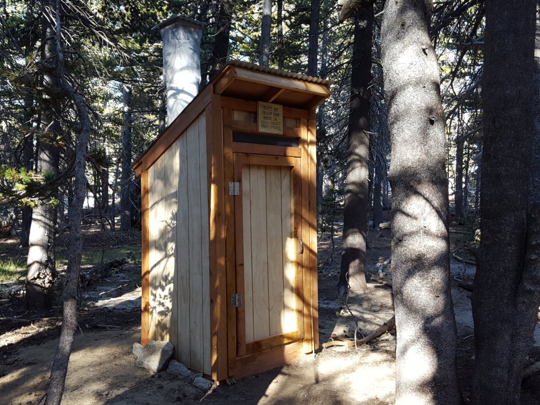
The spring in the creek in Little Round Valley has been completely dry since early June. [See photos below of the newly-constructed toilet in the LRV campground.]
Shooting Star Spring – 0.28 trail miles below Little Round Valley – is flowing weakly but consistently. For hikers it is possible to filter water from the source at the base of the obvious huge rock, but a better option is to descend to the North Fork crossing mentioned above.
The minor creek crossing (sometimes known as Rock Spring) on Deer Springs Trail midway between the North Fork of the San Jacinto River crossing and Shooting Star Spring is virtually dry, and has been dry across and below the trail since June.

The Deer Springs stream crossing at the PCT (approx. PCT mile 185.6) is dry, and the pools just upstream (and downstream) of the trail are also dry. The Deer Springs camp just downslope has been occupied by a crew from the California Conservation Corps (CCC) off-and-on since late May.
Switchback Spring – the small spring just below the eight switchbacks on Deer Springs Trail about 0.4 miles north of Strawberry Junction – continues to flow quite well. There is a tiny pool on the upslope side of the trail where water can be filtered if necessary.
The little spring in the rock crack at Strawberry Cienega (PCT mile 183) is now flowing very weakly. For filtering, there is a tiny pool among the rocks (currently heavily obscured by plants), and a permanently placed tent stake makes a clean accessible trickle out of the mud. The current flow rate at the tent stake is too low to reliably measure (<0.01 gpm), down from 0.07 gallons per minute on 20th July.
On Devil’s Slide Trail, Middle Spring has been completely dry since 26th July.
On the Ernie Maxwell Trail, Chinquapin Creek just below Humber Park has been diverted by Fern Valley Water District to their storage tanks more-or-less continuously since 1st July, drying the creek where it crosses the trail. However good pools receive some fresh flow immediately upstream from the trail. This can be a very important water source for the many dogs walked on this trail.