For details of the condition of high country trails following the 25-30 July 2018 Cranston Fire, see an earlier posting linked here.
Four hikes to San Jacinto Peak in the last five days via various routes included two full loops to review almost all water sources and the extent of recent rains. Yesterday, 16th August, I was able to review the springs and creeks around the Tahquitz area meadows en route to my fire lookout shift.
Weather Finally some reasonable rainfall from thunderstorms three days in a row, 15-17 August. At Idyllwild, the rainfall has been poor – although it is now raining heavily as I write this – with only a trace at 5550′ elevation on 15th, and 0.04″ on 16th. However many other areas of the mountain received good rainfall yesterday (16th), with roughly half-an-inch reported from such widely spread areas as Keenwild, Vista Grande, and Long Valley.

On the trails, yesterday there was evidence of light rain from the 15th all the way on the eastern side of the mountain from Humber Park to San Jacinto Peak. Judging by today’s hike, the rain yesterday afternoon (16th) was focused on the east side of the high country, again all the way from 6500′ to San Jacinto Peak. However on the west side, there was only evidence of much lighter rain, and some sections of the PCT/Deer Springs Trail were almost dry.
At San Jacinto Peak at 0740 today, Friday 17th August, the air temperature was 54°F (12°C), with a modest windchill temperature of 50°F (10°C), 78% relative humidity, and a light 3-5 mph ESE breeze. The previous two days, 15th and 16th August, the weather was very similar both mornings at around 0800 and starting to feel autumnal. The air temperature was 51°F (10.5°C), with lovely fresh windchill temperatures of 43°F (6°C), 80% relative humidity, and a firm SE breeze at 8 mph gusting to 15 mph.
Hikers should always be prepared for rapidly changing weather conditions in the high country in summer. Thunderstorms with lightning and rapidly falling temperatures can occur at or near the high peaks even when such storms are not forecast for lower elevations.
Highway closures Note that during and following rain storms, highways through areas that were denuded by the Cranston Fire are being closed abruptly due to elevated risk of flooding and mud/rock slides. The last two days Highway 243 from Idyllwild to Mountain Center, and Highway 74 from Hemet to Lake Hemet, have been closed for up to several hours in the afternoons. Factor this in to travel plans if there are storms in the forecast.
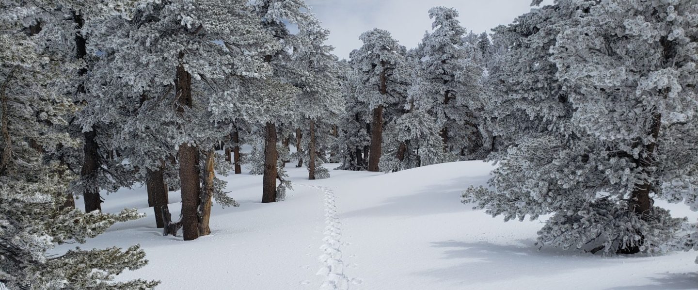
Trail overview Prior to the rains of the last couple of days, flow rates at all water sources were at their lowest of the year, and far below seasonal norms. Despite recent rains, some well-known water sources remain dry or are very close to drying up and should not be relied upon by hikers at this time. There is no snow anywhere on the mountain (all trails have been completely clear since early May).

EASTERN SLOPE WATER FEATURES
The Round Valley faucet was dry by Monday 13th, having apparently dried up a day or two earlier. It started flowing again after rain on Thursday 16th, but was only a steady trickle. [Thanks to Jeremy Odom for this information.] Nevertheless, this may only be temporary relief for a few days or weeks at best. Hikers and campers to Round and Tamarack valleys from the Tram are advised not to rely on this ephemeral water source and to pack in all their water.
The flow rate at both the northern and southern springs at Wellman’s Cienega doubled from Monday to Wednesday, and doubled again by today, Friday. These springs are the sources for Willow Creek, which continues to flow gently where it crosses the Willow Creek Trail.

Tahquitz Valley has been completely dry for at least two months, and recent rains have not changed that situation.
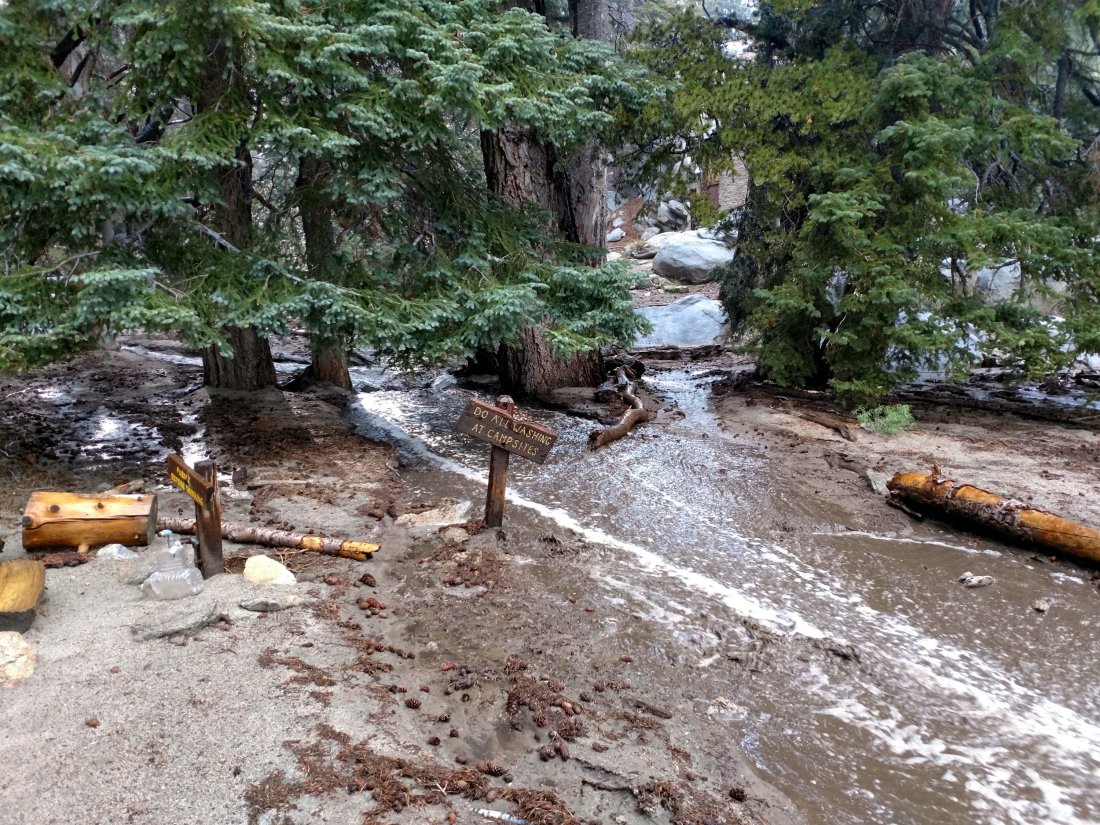
Tahquitz Creek continues to flow steadily at the northern (lower) end of Little Tahquitz Meadow.

Tahquitz Creek has briefly flash-flooded twice in the past three days further upstream at its source (known locally as Grethe Spring) where it crosses the PCT at the northern end of the fire closure (approx. PCT Mile 177). However shortly after rains it has returned to a very low flow. Immediately after crossing the PCT, the creek dries up and disappears subsurface.

Skunk Cabbage Creek remains largely dry where the trail crosses Skunk Cabbage Meadow at the small wooden bridge.
WESTERN SLOPE WATER FEATURES
The North Fork of the San Jacinto River continues to flow steadily both where it crosses the Deer Springs Trail, and where it crosses the Fuller Ridge Trail on the PCT (approx. PCT Mile 186.2). These two crossings are the most important water sources for hikers on the western side of the mountain. Prior to recent rains the flow rate was the lowest in living memory. About 100′ downstream from the river crossing on Fuller Ridge Trail the river runs dry and disappears subsurface.
O’Sullivan Creek (PCT Mile 186.4) on Fuller Ridge Trail remains completely dry.
The spring in the creek in Little Round Valley remained completely dry this morning despite recent rains, as it has been since early June.
Shooting Star Spring – 0.28 trail miles below Little Round Valley – is flowing at about twice the rate of Monday. For hikers it is possible to filter water from the source at the base of the obvious huge rock, but a better option is to descend to the North Fork crossing mentioned above.
The minor creek crossing (sometimes known as Rock Spring) on Deer Springs Trail midway between the North Fork of the San Jacinto River crossing and Shooting Star Spring remained completely dry this morning, and has been dry across and below the trail since June.
The Deer Springs stream crossing at the PCT (approx. PCT mile 185.6) is dry, and the pools just upstream (and downstream) of the trail are also dry. The Deer Springs camp just downslope has been occupied by a crew from the California Conservation Corps since late May (although not since the fire evacuation on 25th July).
Switchback Spring – the small spring just below the eight switchbacks on Deer Springs Trail about 0.4 miles north of Strawberry Junction – continues to flow well. There is a tiny pool on the upslope side of the trail where water can be filtered if necessary.

The little spring in the rock crack at Strawberry Cienega (PCT mile 183) is now flowing at least at double the rate of last week. For filtering, there is a tiny pool among the rocks (currently heavily obscured by plants), and a permanently placed tent stake makes a clean accessible trickle out of the mud.
On Devil’s Slide Trail, Middle Spring has been completely dry since 26th July. There was a little muddy rain puddle there this morning, not even enough for a dog to drink from.
On the Ernie Maxwell Trail, Chinquapin Creek just below Humber Park has been diverted by Fern Valley Water District to their storage tanks more-or-less continuously since 1st July, drying the creek where it crosses the trail. However good pools receive some fresh flow immediately upstream from the trail. This can be a very important water source for the many dogs walked on this trail.
