Today I hiked to San Jacinto Peak via Fuller Ridge Trail. We checked many water sources yesterday on a long loop hike to the Peak, descending via Deer Springs Trail. Tuesday morning’s hike to the Peak was just a quick one up the east side to enjoy the chilly weather.
Trail overview A flurry of noteworthy events on the mountain. The North Fork of the San Jacinto River has dried up where it crosses the Pacific Crest Trail on Fuller Ridge. The absence of this critical water source for hikers is discussed in more detail in the relevant section below. This presents a major problem for long distance hikers to/from Snow Creek.
The CCC crew working on the Pacific Crest Trail/Deer Springs Trail have completed the section near the Deer Springs crossing. Having taken at least four summer seasons to complete a few hundred yards of trail, questions have been asked whether it was the best use of resources, although it is very well constructed and a pleasure to use.
The Black Mountain road was graded earlier this week, and the road is now in its best condition since Spring 2017. Grading was completed all the way through to the Fuller Ridge campground and trailhead. This usually takes place right around Memorial Day weekend, but this year US Forest Service waited until after Labor Day weekend instead!
Flow rates at water sources are far below historic norms. Many well-known water sources are dry or are very close to drying up and should not be relied upon by hikers at this time. There is no snow anywhere on the mountain (all trails have been completely clear since early May). Details of the condition of high country trails following the 25th-30th July 2018 Cranston Fire are described at an earlier posting linked here.
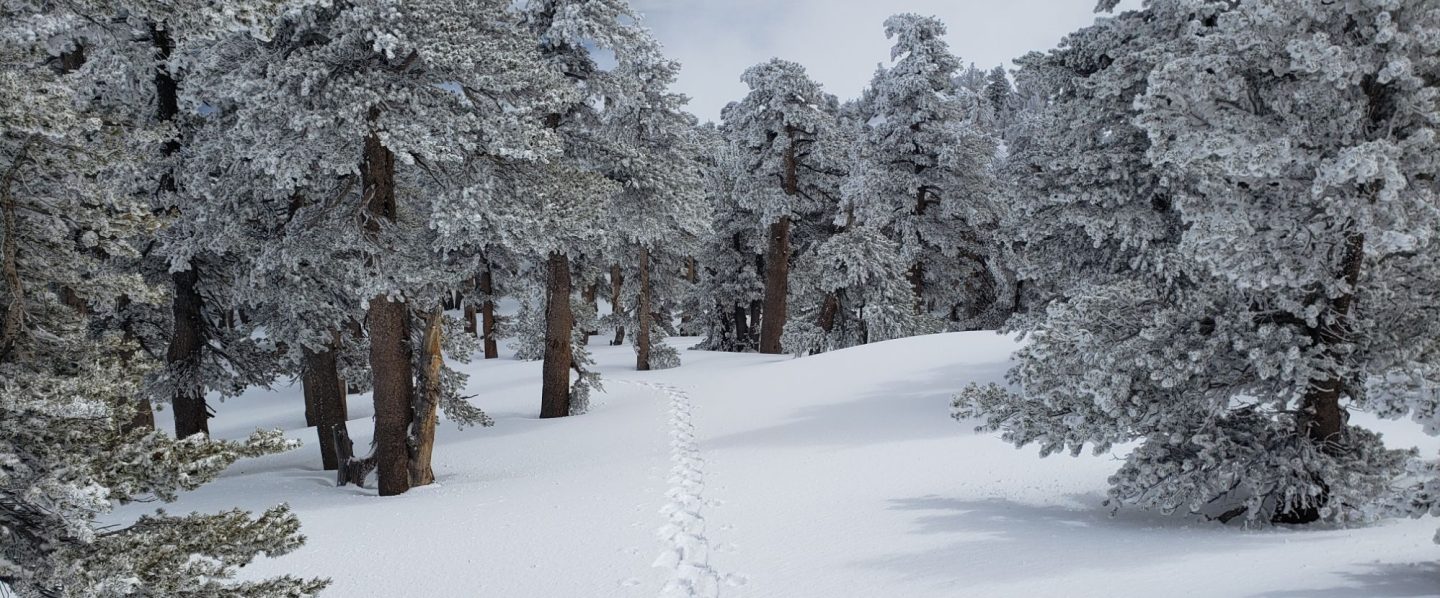
Weather Some delightful autumnal weather in the high country over the past four days. Tuesday morning a sub-freezing windchill led me to pull on some thin gloves for the first time since May. A brief but rapid warming trend is expected for this weekend, followed thankfully by a return to more typical September temperatures next week.
At San Jacinto Peak at 0830 on Tuesday 4th September, the air temperature was 44°F (6.7°C), with a refreshing windchill temperature of 30.0°F (-1°C), 80% relative humidity (rising to 90% when cloud enveloped the Peak), and a strong 20 mph SE wind gusting to 27 mph. On Wednesday 5th September, at 0845 the air temperature was 46°F (7.8°C), with a cool windchill temperature of 36°F (2.2°C), 72% relative humidity, and a cool 10 mph ESE wind gusting to 19 mph.

EASTERN SLOPE WATER FEATURES
The Round Valley faucet is dry.
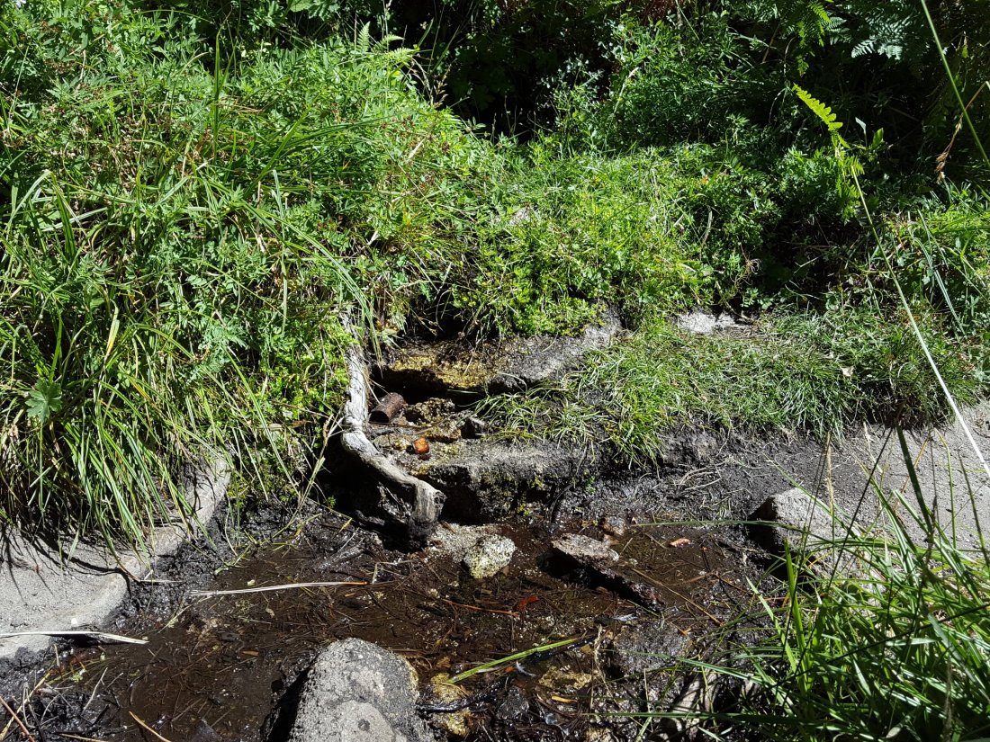
Both the northern and southern springs at Wellman’s Cienega continue to flow, but very weakly. These springs are the sources for Willow Creek, which continues to flow gently where it crosses the Willow Creek Trail.
Tahquitz Valley has been completely dry for at least three months.
Tahquitz Creek continues to flow steadily at the northern (lower) end of Little Tahquitz Meadow.

Tahquitz Creek is barely trickling further upstream at its source (known locally as Grethe Spring) where it crosses the PCT at the northern end of the fire closure (approx. PCT Mile 177). Immediately after crossing the PCT, the creek dries up and disappears subsurface.
Skunk Cabbage Creek is dry where the trail crosses Skunk Cabbage Meadow at the small wooden bridge.
WESTERN SLOPE WATER FEATURES
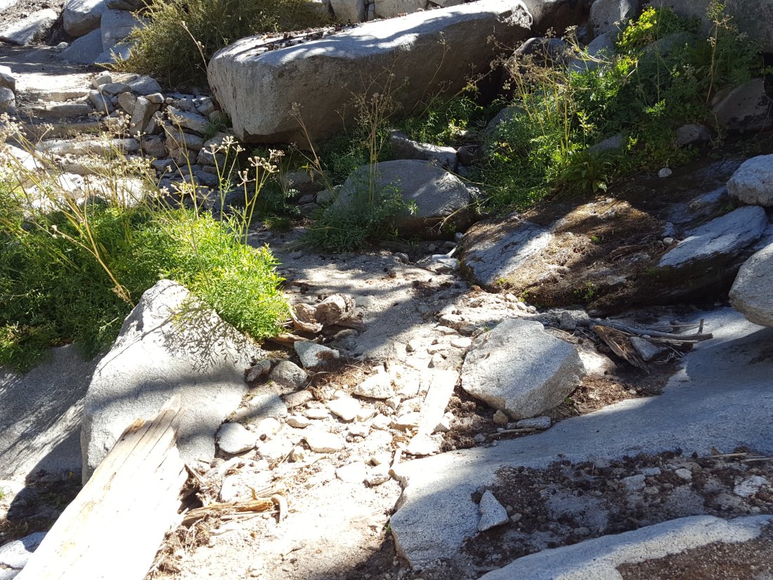
The North Fork of the San Jacinto River continues to flow gently where it crosses the Deer Springs Trail, but flow has dropped another 10% from last week, to about 1.8 gallons per minute. The water levels for this river are apparently the lowest in living memory.

The North Fork of the San Jacinto River has dried up where it crosses the Pacific Crest Trail on the Fuller Ridge Trail (approx. PCT Mile 186.2). This was the critical water source for PCTers and others hiking to or from Snow Creek, a 22 mile section of trail infamous for being waterless (now waterless for >25 miles). Options for southbound PCT hikers (and other hikers on this section) are all poor. Switchback Spring and Strawberry Cienega (see below) are possibilities staying on the PCT, but both are at very low flows. If heading to San Jacinto Peak, the North Fork where it crosses the Deer Springs Trail is a very good option. Alternatively, from where the PCT crosses the Black Mountain Road it is possible to descend the road 2.4 miles to the Cinco Poses Spring (a faucet by the roadside, see below). This undulating and exposed road is a descent of about 600′ and ascent of 200′, that would have to be reversed on the way back.
O’Sullivan Creek (PCT Mile 186.4) on Fuller Ridge Trail has been dry since early May.
The spring in the creek in Little Round Valley has been completely dry since early June.
Shooting Star Spring – 0.28 trail miles below Little Round Valley – continues to flow relatively gently. For hikers it is possible to filter water from the source at the base of the obvious huge rock, but a better option is to descend to the North Fork crossing mentioned above.

The Deer Springs stream crossing at the PCT (approx. PCT mile 185.6) is dry, and the pools just upstream (and downstream) of the trail are also dry. The Deer Springs camp just downslope has been occupied by a crew from the California Conservation Corps since late May (although only very briefly since the fire evacuation on 25th July).
Switchback Spring – the small spring just below the eight switchbacks on Deer Springs Trail about 0.4 miles north of Strawberry Junction – continues to trickle. There is a tiny pool on the upslope side of the trail where water can be filtered if necessary.
The little spring in the rock crack at Strawberry Cienega (PCT mile 183) is now barely flowing. For filtering, there is a tiny pool among the rocks (currently heavily obscured by vegetation).
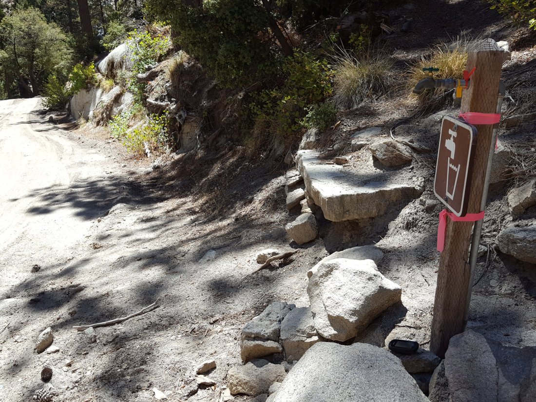
Cinco Poses Spring on Black Mountain Road (4.7 miles up from Highway 243) still has plenty of running water at the faucet. This could be an important emergency water source as others dry up throughout the western side of the mountain.
On Devil’s Slide Trail, Middle Spring has been dry since 26th July.
On the Ernie Maxwell Trail, Chinquapin Creek just below Humber Park has been diverted by Fern Valley Water District more-or-less continuously since 1st July, drying the creek where it crosses the trail. However good pools receive some fresh flow immediately upstream from the trail. This can be a very important water source for the many dogs walked on this trail.
