For details of the current status of trail openings, see the previous post here. For vehicle access to the mountain, Highway 243 will apparently reopen with no restrictions from Mountain Center to Idyllwild today at 1200. Highway 74 from Lake Hemet to Mountain Center and on to Hemet will reopen this afternoon with significant restrictions (one-way traffic and pilot car). [Highway 243 from Banning to Idyllwild has been open for a week.]
Yesterday, 3rd August, I was able to check all high country water sources in the State Park on a very circuitous hike (due to the Cranston Fire closure of Forest Service lands). During this hike I had the pleasure of a long chat with friends and San Jac regulars Ellen and Marilee, the only other folks I encountered on the trails all day. Meanwhile, good friend of the Trail Report Florian Boyd was hiking in Round Valley and checked the faucet there. Immediately before and after the brief fire closures, I was able to check all water sources on Forest Service lands during multiple hikes.
Weather At San Jacinto Peak at 0915 on Friday 3rd August the air temperature was 55°F (13°C), with 71% relative humidity, and a barely noticeable NW breeze gusting to 2 mph.
In general, temperatures for the next week will remain above average in the high country. As much as we could use more rain, heavy thunderstorms right now would be catastrophic in the recent burn areas. Thankfully, the likelihood of thunderstorms is diminished for the next week or so. Nevertheless, hikers should always be prepared for rapidly changing weather conditions in the high country in summer. Thunderstorms with lightning can occur at or near the high peaks even when such storms are not forecast for lower elevations.
Trail overview Flow rates at all water sources are at their lowest of the year, and far below seasonal norms. There is no snow anywhere on the mountain (all trails have been completely clear since early May). The sections of trail that burned in the Cranston Fire were last described in the posting linked here and will be updated shortly.
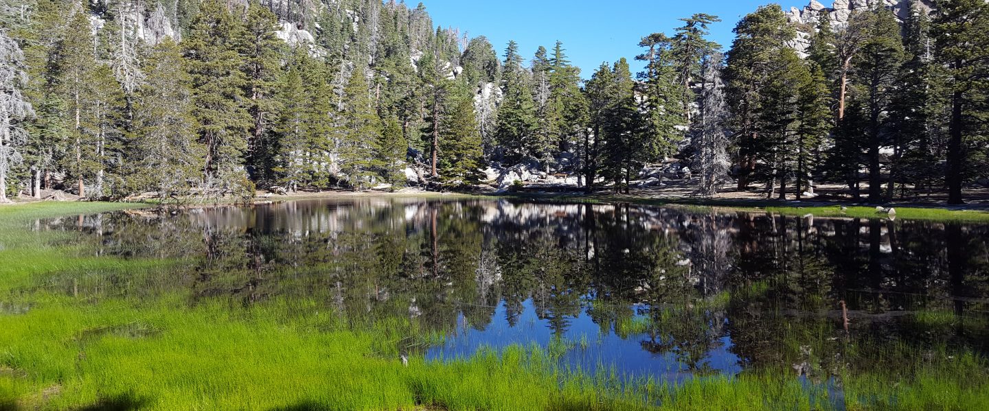
EASTERN SLOPE WATER FEATURES
The Round Valley faucet flow rate on Friday 3rd August was only 0.06 gallons per minute, down from the previous low on 6th July of 0.10 gallons per minute. [UPDATE Friday 10th August: the faucet flow rate is <0.01 gpm, barely dripping and basically unusable for hikers.] [Many thanks to Florian Boyd for these data from Round Valley.]
Both the northern and southern springs at Wellman’s Cienega are flowing weakly. These springs are the sources for Willow Creek, which continues to flow fairly well where it crosses the Willow Creek Trail.
Tahquitz Valley is completely dry.
Tahquitz Creek continues to flow well at the northern (lower) end of Little Tahquitz Meadow.
Tahquitz Creek is only flowing weakly further upstream at its source (known locally as Grethe Spring) where it crosses the PCT at the northern end of the fire closure (approx. PCT Mile 177). Just after crossing the PCT, the creek dries up and disappears subsurface.
Skunk Cabbage Creek is dry where the trail crosses Skunk Cabbage Meadow at the small wooden bridge.
WESTERN SLOPE WATER FEATURES
The North Fork of the San Jacinto River continues to flow reliably but fairly weakly both where it crosses the Deer Springs Trail, and where it crosses the Fuller Ridge Trail on the PCT (approx. PCT Mile 186.2). About 100′ downstream from the river crossing on Fuller Ridge Trail the river runs dry and disappears subsurface. During a search-and-rescue mission on Wednesday 25th July, I noticed that the North Fork is dry at all three of its crossings of the Seven Pines Trail.
O’Sullivan Creek (PCT Mile 186.4) on Fuller Ridge Trail is completely dry.
The spring in the creek in Little Round Valley has been completely dry since early June.
Shooting Star Spring – 0.28 trail miles below Little Round Valley – is flowing weakly. For hikers it is possible to filter water from the source at the base of the obvious huge rock, but a better option is to descend to the North Fork crossing mentioned above.
The minor creek crossing (sometimes known as Rock Spring) on Deer Springs Trail midway between the North Fork of the San Jacinto River crossing and Shooting Star Spring is basically completely dry, and has been dry across and below the trail for more than a month.
The Deer Springs stream crossing at the PCT (approx. PCT mile 185.6) is dry, and the pools just upstream (and downstream) of the trail are also dry. The Deer Springs camp just downslope has been occupied by a crew from the California Conservation Corps (CCC) since late May (although they have been absent for the last 10 days due to fire evacuation).
Switchback Spring – the small spring just below the eight switchbacks on Deer Springs Trail about 0.4 miles north of Strawberry Junction – continues to flow quite well. There is a tiny pool on the upslope side of the trail where water can be filtered.
The little spring in the rock crack at Strawberry Cienega (PCT mile 183) is now flowing weakly. For filtering, there is a tiny pool among the rocks (now heavily obscured by plants), and a permanently placed tent stake makes a clean accessible trickle out of the mud. The current flow rate at the tent stake is too low to measure (<0.01 gpm), down from 0.07 gallons per minute on 20th July.
On Devil’s Slide Trail, Middle Spring has been completely dry since 26th July.
On the Ernie Maxwell Trail, Chinquapin Creek just below Humber Park is – since 1st July – periodically diverted by Fern Valley Water District to their storage tanks, drying the creek where it crosses the trail. However, even when the creek flow is diverted, good pools remain immediately upstream from the trail. This is a very important water source for the many dogs walked on this trail.

Hi, Jon
So glad I found your posting site. I have hiked Palomar and Laguna my whole life because they are in my backyard. The first time I visited San Jacinto I fell in love. My best hiking days are behind me now and I have to be more careful. I feel a lot safer though, having the information you provide when I am spending time on the mountain. THANK YOU for taking the time to post. I Iook forward to meeting you on the trail someday.
Sincerely, Dan
LikeLike