This morning we hiked to San Jacinto Peak via Marion Mountain Trail, checking springs on the western side of the mountain. Yesterday following my fire lookout shift at Tahquitz Peak, I checked the Tahquitz area meadows, and on Tuesday 5th our hike to San Jacinto and Cienega peaks from Humber Park included a side trip to check the Round Valley faucet.
At San Jacinto Peak at 0750 this morning the air temperature was 48°F (9°C), and with a light south-west wind the windchill temperature was a pleasant 44°F (7°C).
Overview Water resources everywhere are flowing poorly for the time of year, and yet again flow rates were often visibly lower than just 10 days ago. Water conditions for the PCT south of Idyllwild (from Highway 74 to the Spitler area) were last updated on 21 May. No new reports on bear sightings at the time of writing.
EASTERN SLOPE WATER FEATURES
The Round Valley faucet is currently flowing weakly but consistently.

Both the northern and southern springs at Wellman’s Cienega are flowing fine, but flow rates continue to decline rapidly. These are the sources for Willow Creek, which is flowing fairly well where it crosses the Willow Creek Trail.
Tahquitz Valley is completely dry.
Tahquitz Creek continues to flow fairly well at the northern (lower) end of Little Tahquitz Meadow. It is now flowing rather weakly further upstream at its source (known locally as Grethe Spring) where it crosses the PCT at the northern end of the fire closure (approx. PCT Mile 177). Just after crossing the PCT, the creek dries up and disappears subsurface.
Skunk Cabbage Creek where it flows through Skunk Cabbage Meadow is currently flowing, but rather weakly for June.

WESTERN SLOPE WATER FEATURES
The North Fork of the San Jacinto River is flowing relatively well both where it crosses the Deer Springs Trail above Fuller Ridge, and where it crosses the Fuller Ridge Trail on the PCT (approx. PCT Mile 186.2). [For northbound thru-hikers, the latter is the crucial refill point before a section of 22.5 miles with no water.]
O’Sullivan Creek (PCT Mile 186.4) on Fuller Ridge Trail is completely dry.
The spring in the creek in Little Round Valley is now completely dry.
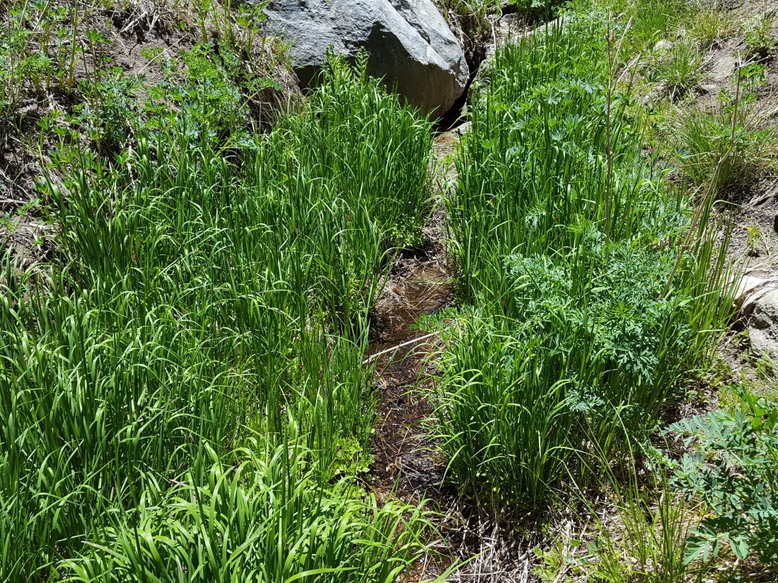
Shooting Star Spring – 0.28 trail miles below Little Round Valley – is currently flowing weakly but reliably.

The minor creek crossing on Deer Springs Trail midway between the North Fork of the San Jacinto River crossing and Shooting Star Spring is flowing very weakly, and is starting to dry up below the trail.
The Deer Springs stream crossing at the PCT (approx. PCT mile 185.6) is dry, and the pools just upstream (and downstream) of the trail are also dry. The Deer Springs camp just downslope is now occupied by a crew from the California Conservation Corps (CCC) for the season. [PCT thru hikers note: almost all PCT guides and apps confuse the Deer Springs crossing with the North Fork of the San Jacinto River. The latter is another 0.5 miles further north on the Fuller Ridge Trail, see above.]
The small spring at PCT Mile 183.5 (about 0.4 miles north of Strawberry Junction) continues to flow.
The little spring in the rock crack at Strawberry Cienega (PCT mile 183.0) continues to flow fairly well. [Thanks to Florian Boyd for this update from 1st June.]
On Devil’s Slide Trail, Middle Spring is barely a trickle (just about enough for a dog to get a little water).
On the Ernie Maxwell Trail, the crossing of Chinquapin Creek just below Humber Park continues to flow well.
