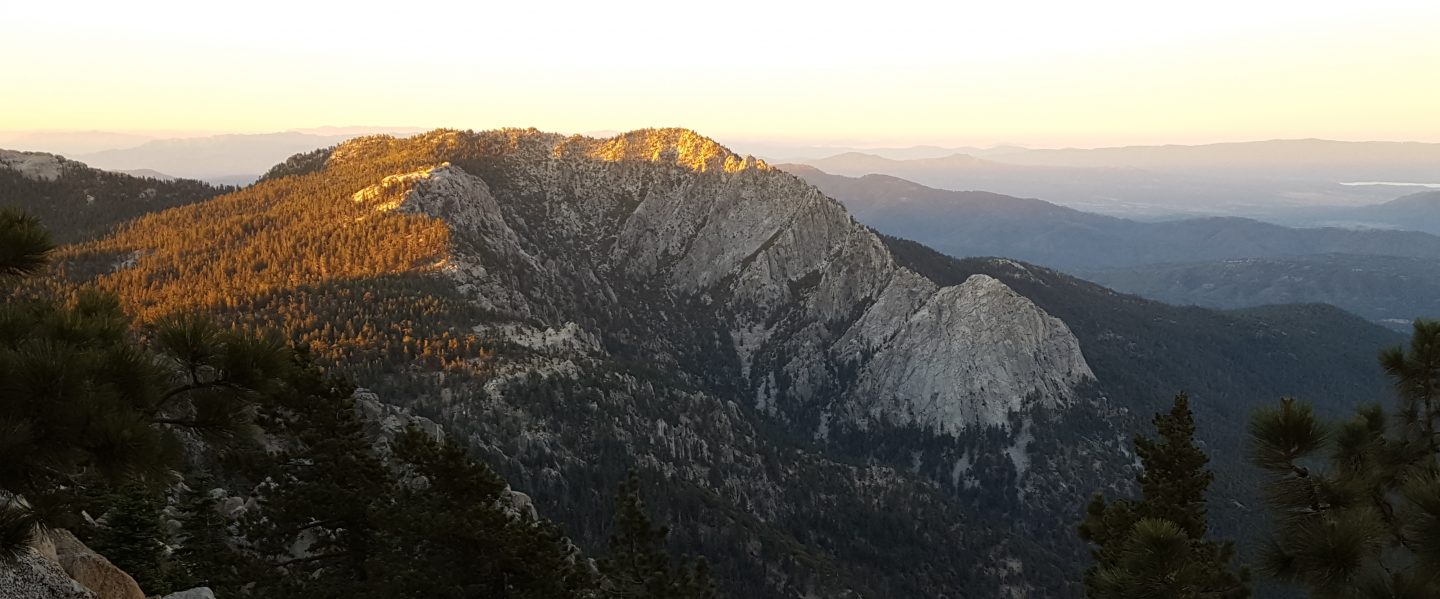
On Tuesday and again Thursday/Friday I hiked various trails to and around San Jacinto Peak. The former included a check of the Willow Creek drainage on our descent, and the latter included a large circuit to check water sources around the entire mountain.
Cranston Fire news The closure of the popular South Ridge Trail is likely to continue for at least a year. This is the recommendation of the BAER (Burned Area Emergency Report) for the damage to the San Jacinto Ranger District. Erosion and possible rock slides in burned sections of the trail are apparently the primary concerns. As first reported on this website, there was no significant damage to the Pacific Crest Trail. It will apparently completely reopen throughout the Desert Divide section in time for the 2019 PCT northbound spring season, hopefully sooner.
Trail overview The water situation in the San Jacinto mountains is at its worst in known history. Most well-known water sources are dry or are very close to drying up and should not be relied upon by hikers at this time. Thankfully, some rainfall is forecast next week in spinoff from Hurricane Rosa currently in the Pacific off western Mexico.
Details of the condition of high country trails following the 25th-30th July 2018 Cranston Fire are described at an earlier posting linked here.
Weather As mentioned above, significant rainfall is possible from Hurricane Rosa on Monday-Wednesday, 1st-3rd October. Associated temperatures will be around freezing (or even well below, with windchill) in the high country >10,000′ elevation.
Currently, lovely autumnal weather continues in the high country. Temperatures (especially overnight lows) remain well above average for September, with low humidity. Winds in the high country are changing direction multiple times every day.
At San Jacinto Peak at 0630 this morning, Friday 28th September, the air temperature was 49°F (9.4°C), with a windchill temperature of 42.3°F (5.7°C), 24% relative humidity, and a moderate 8 mph South wind gusting to 10 mph.
Yesterday morning Thursday 27th September, at 1100 the air temperature was a summery 57°F (14°C), with a windchill temperature of 50°F (10°C), 49% relative humidity, and a very light SW wind at 3 mph gusting to 6.6 mph.

Be Bear aware Our two resident Black Bears have had a low profile for the last couple of months. Apparently they have been largely in Hall’s Canyon, above Lake Fulmor. Unfortunately they have been making a nuisance of themselves, getting into trash and bird seed at the James Reserve. Hikers and campers everywhere, but especially those on the western side of the mountain (e.g. in the Black Mountain area), should have bear safety awareness, and practice bear-safe food storage. The tips at this CDFW website are useful.
EASTERN SLOPE WATER FEATURES
The Round Valley faucet is dry.
Both the northern and southern springs at Wellman’s Cienega continue to flow gently, but the northern spring in particular is now very weak. It will dry up in October without new precipitation.
These springs are the sources for Willow Creek, which is no longer flowing where it crosses the Willow Creek Trail. There are small pools where water could be filtered just upstream from the crossing. The creek is actually flowing gently a few hundred yards upstream from the trail crossing, but access is not easy. Willow Creek has not previously been known to stop flowing at the trail crossing.

Tahquitz Valley has been completely dry for about four months.
Tahquitz Creek continues to flow gently at the northern (lower) end of Little Tahquitz Meadow. This is the last remaining “reliable” water source in the Tahquitz meadows area.
Tahquitz Creek is barely trickling further upstream at its source (known locally as Grethe Spring) where it crosses the PCT at the northern end of the fire closure (approx. PCT Mile 177). Immediately after crossing the PCT, the creek dries up and disappears subsurface.
Skunk Cabbage Creek is dry where the trail crosses Skunk Cabbage Meadow at the small wooden bridge.
WESTERN SLOPE WATER FEATURES
The North Fork of the San Jacinto River continues to flow weakly where it crosses the Deer Springs Trail, but this morning I was surprised to find that the flow has dropped dramatically in the past week to only 0.6 gallons per minute. The water levels for this river are the lowest in living memory.

Just downstream, the North Fork of the San Jacinto River has dried up where it crosses the Pacific Crest Trail on the Fuller Ridge Trail (approx. PCT Mile 186). This was the critical water source for PCTers and others hiking to or from Snow Creek, a 22 mile section of trail infamous for being waterless (but now waterless for >25 miles). Options for southbound PCT hikers (and other hikers on this section) are all poor. Switchback Spring and Strawberry Cienega (see below) are possibilities staying on the PCT, but both are at extremely low flows. If heading to San Jacinto Peak, the North Fork where it crosses the Deer Springs Trail is a good option. Alternatively, from where the PCT crosses the Black Mountain Road it is possible to descend the road 2.4 miles to the Cinco Poses Spring (a faucet by the roadside, see below). This undulating and exposed road is a descent of about 600′ and ascent of 200′, that would have to be reversed on the way back.
O’Sullivan Creek (PCT Mile 186.3) on Fuller Ridge Trail has been dry since early May.
The spring in the creek in Little Round Valley has been completely dry since early June.
Shooting Star Spring – 0.28 trail miles below Little Round Valley – continues to flow weakly. For hikers it is possible to filter water from the source at the base of the obvious huge rock at the top of the wet area of trail, but a better option is to descend to the North Fork crossing mentioned above.

The Deer Springs stream crossing at the PCT (approx. PCT mile 185.6) is dry, and the pools just upstream (and downstream) of the trail are also dry. In my off-trail wanderings last week, I confirmed that the Deer Springs themselves continue to flow gently, about 0.15 miles upslope from the trail. Unfortunately, almost all the flow is diverted into a pipe for the Deer Springs camp. The Deer Springs camp just downslope from the trail has been occupied by a crew from the California Conservation Corps off-and-on since late May.
Switchback Spring – the small spring just below the eight switchbacks on Deer Springs Trail about 0.4 miles north of Strawberry Junction – continues to trickle very gently. The tiny pool on the upslope side of the trail (where water could be filtered if necessary) is now so shallow that filtering is challenging.

The little spring at Strawberry Cienega (PCT mile 183) has now dried up. The tiny pool in the crack between the two large rocks might be useable for emergency filtering.
Cinco Poses Spring on Black Mountain Road (4.7 miles up from Highway 243) still has running water at the faucet. This could be an important emergency water source as others dry up throughout the western side of the mountain.
On Devil’s Slide Trail, Middle Spring has been dry since 26th July.
On the Ernie Maxwell Trail, Chinquapin Creek just below Humber Park has been diverted by Fern Valley Water District more-or-less continuously since 1st July, drying the creek where it crosses the trail. However good pools receive some fresh flow immediately upstream from the trail. This can be a very important water source for the many dogs walked on this trail.

