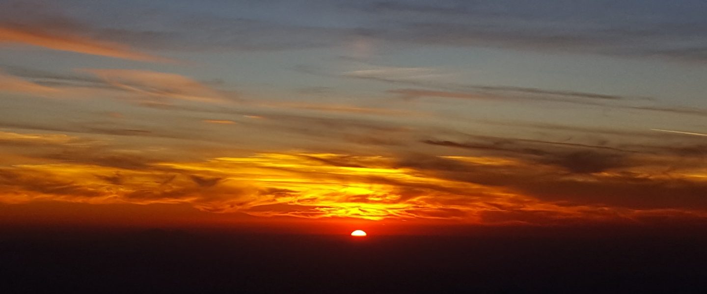
My lovely hike today went up Deer Springs Trail to San Jacinto Peak then descended on the east side via the Tahquitz area meadows to Tahquitz Peak. This allowed for a check of most water sources around the mountain, and to see the extent of the rainfall from yesterday morning.
Trail overview The water situation in the San Jacinto mountains remains very poor. At this stage of the year, I am optimistic that the few water sources that are still flowing will not dry up before adequate precipitation falls. The high country above 9000′ elevation missed out on the drizzle that fell yesterday (discussed below), so the status of most water sources remains unchanged from recent updates.
Weather There was very light rainfall in the early hours of Thursday morning, 4th October, with 0.15″ at 5500′ elevation in Idyllwild. Elevations above about 9000′ remained above the cloud and received no rainfall. On the trails there was subtle evidence of light rainfall below about 9000′ on all sides of the mountain.
As is typical in the San Jacintos, the transition from summer to winter is very rapid, and conditions are already starting to feel pleasantly wintry in the highest elevations. Temperatures are now near freezing in the high country >10,000′ elevation (and below freezing on exposed peaks with windchill).
At San Jacinto Peak at 1010 this morning, Friday 5th October, the air temperature was 37°F (3°C), with a windchill temperature of 25.3°F (-4°C), 54% relative humidity, and a cool 6 mph North wind gusting to 12 mph.
On Wednesday 3rd October at 0950, the air temperature was 41°F (5°C), with a windchill temperature of 28.4°F (-2°C), 45% relative humidity, and a sustained 8 mph SSW wind gusting to 18 mph.
EASTERN SLOPE WATER FEATURES
The Round Valley faucet is dry.
Both the northern and southern springs at Wellman’s Cienega continue to flow weakly. The northern spring was flowing very slightly stronger this morning than recent days.

These springs are the sources for Willow Creek, which is no longer flowing where it crosses the Willow Creek Trail. There are small pools where water could be filtered just upstream from the crossing. The creek is actually flowing gently a few hundred yards upstream from the trail crossing, but access is not easy. Willow Creek has not previously been known to stop flowing at the trail crossing.
Tahquitz Valley has been completely dry since May.
Tahquitz Creek continues to flow well at the northern (lower) end of Little Tahquitz Meadow. Flow today was slightly stronger following the light rain. This is the last remaining “reliable” water source in the Tahquitz meadows area.
Tahquitz Creek is barely trickling further upstream at its source (known locally as Grethe Spring) where it crosses the PCT at the northern end of the fire closure (approx. PCT Mile 177). Immediately after (barely) crossing the PCT, the creek dries up.
Skunk Cabbage Creek is dry where the trail crosses Skunk Cabbage Meadow at the small wooden bridge.
WESTERN SLOPE WATER FEATURES
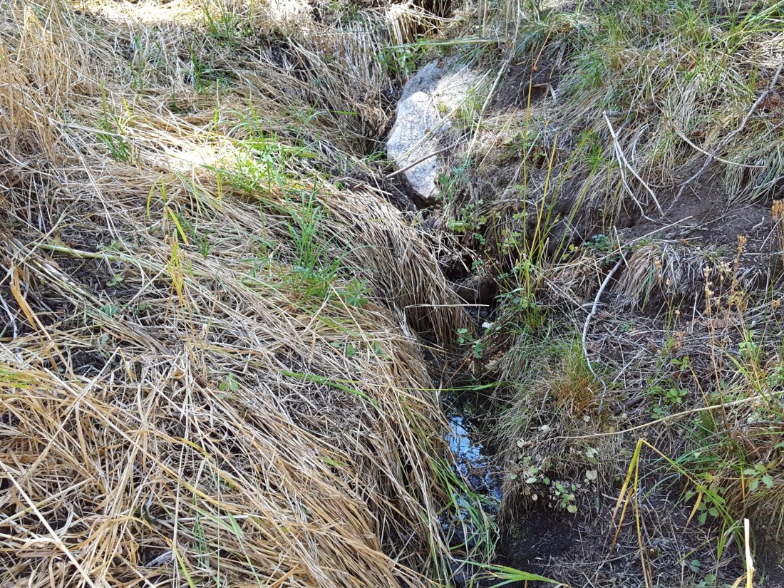
The North Fork of the San Jacinto River continues to flow weakly where it crosses the Deer Springs Trail, but the flow has dropped dramatically in the past couple of weeks to only about 0.6 gallons per minute. The water levels for this river are the lowest in living memory.

Just downstream, the North Fork of the San Jacinto River has dried up where it crosses the Pacific Crest Trail on the Fuller Ridge Trail (approx. PCT Mile 186). This was the critical water source for PCTers and others hiking to or from Snow Creek, a 22 mile section of trail infamous for being waterless (but now waterless for >25 miles). Options for southbound PCT hikers (and other hikers on this section) are all poor. Switchback Spring and Strawberry Cienega (see below) are possibilities staying on the PCT, but both are at extremely low flows. If heading to San Jacinto Peak, the North Fork where it crosses the Deer Springs Trail is a good option. Alternatively, from where the PCT crosses the Black Mountain Road it is possible to descend the road 2.4 miles to the Cinco Poses Spring (a faucet by the roadside, see below). This undulating and exposed road is a descent of about 600′ and ascent of 200′, that would have to be reversed on the way back.
O’Sullivan Creek (PCT Mile 186.3) on Fuller Ridge Trail has been dry since early May.
The spring in the creek in Little Round Valley has been completely dry since early June.
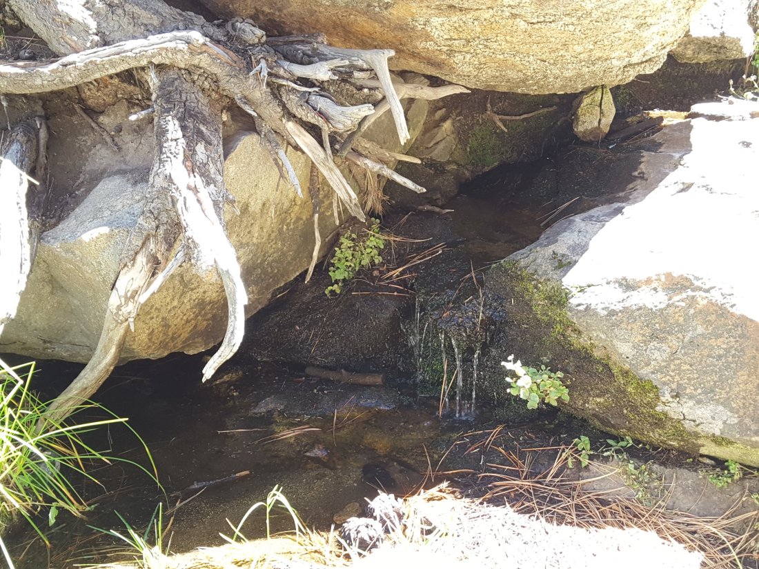
Shooting Star Spring – 0.28 trail miles below Little Round Valley – continues to flow gently. For hikers it is possible to filter water from the source at the base of the obvious huge rock at the top of the wet area of trail, but a better option is to descend to the North Fork crossing mentioned above.
The Deer Springs stream crossing at the PCT (approx. PCT mile 185.6) is dry, and the pools just upstream (and downstream) of the trail are also dry. The Deer Springs themselves continue to flow gently, about 0.15 miles upslope from the trail. Unfortunately, almost all the flow is diverted into a pipe for the Deer Springs camp. The Deer Springs camp just downslope from the trail has been occupied by a crew from the California Conservation Corps off-and-on since late May.
Switchback Spring – the small spring just below the eight switchbacks on Deer Springs Trail about 0.4 miles north of Strawberry Junction – continues to trickle very gently. The tiny pool on the upslope side of the trail (where water could be filtered in an emergency) is now so shallow that filtering is challenging.
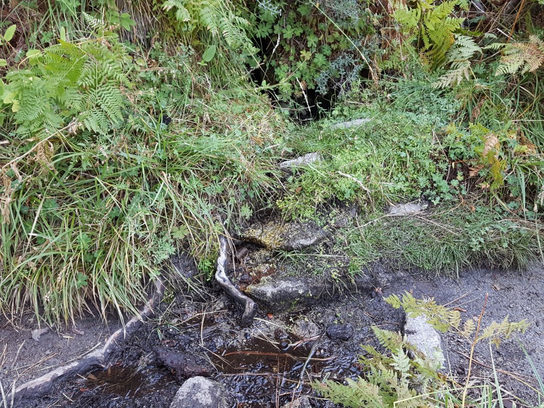
The little spring at Strawberry Cienega (PCT mile 183) has now dried up. The tiny pool in the crack between the two large rocks might be useable for emergency filtering.
Cinco Poses Spring on Black Mountain Road (4.7 miles up from Highway 243) still has running water at the faucet. This could be an important emergency water source as others dry up throughout the western side of the mountain.
On Devil’s Slide Trail, Middle Spring has been dry since 26th July.
On the Ernie Maxwell Trail, Chinquapin Creek just below Humber Park was no longer being diverted by Fern Valley Water District as of 2nd October. Even if the creek is diverted, good pools receive some fresh flow immediately upstream from the trail. This creek is a very important water source for the many dogs walked on this trail.
