
UPDATE Friday 27th July at 1045.
Idyllwild-Pine Cove remain safe and secure. There has been a flare-up on the east side of South Ridge to the south of Tahquitz Peak, and a huge smoke column is rising from there now that was absent just an hour ago. The DC-10s are back making circuits over town again.
As planned, the fire burned up the east side of South Ridge and very close to Tahquitz Peak. Although it “slopped over” in a couple of spots, the South Ridge line, that I watched being laid down yesterday morning, apparently held remarkably well.
Yesterday afternoon the fire took a turn for the worse in Garner Valley. The northerly wind caused some south and south-east movement along Apple Canyon and towards Lake Hemet. The fire jumped Hwy 74 at Hurkey Creek, at least partly damaging both the county campground and the Ronald McDonald camp to its east.
Crews launched a major operation to defend properties at the head of Apple Canyon (e.g. Pine Springs Ranch). They allowed the fire to burn on by these properties, but structures themselves were largely saved. News in the Bonita Vista area was not so good, and I have reliable reports that some structures in that area, burned in the 2013 Mountain Fire, and the Fleming Ranch area were lost.
I don’t have reliable information as to the status of facilities and structures around Lake Hemet.
Edison trucks have started to appear around town for the first time since the fire started. Whether that means anything regarding the restoration of power, it’s hard to say. The word around town is that the evacuation order is unlikely to be lifted for a few more days. Although that’s pure speculation, it seems like a good guess as long as flare-ups continue relatively close to town.
UPDATE Friday 27th July at 0800.
All is well in Idyllwild. The fire did not break South Ridge at all yesterday, and for now, Idyllwild and Pine Cove remain safe. Lots of smouldering apparent along the east and south-east sides of South Ridge suggest that the fire burned extensively in the canyon on the the east flank of Tahquitz Peak.
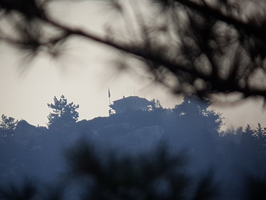
Despite grossly irresponsible rumors from off the hill, Tahquitz Peak fire lookout is intact, with flag still flying. See photos below. (The flag was left up when my colleague Darla had to leave in haste on Wednesday, understandably. It is proving useful to me as I can see the wind direction at 8800′ by observing the flag through binoculars.)
The news for our beloved wilderness in the high country may be more mixed. It appears that the apparent containment plan I described yesterday (below) may have partly failed yesterday evening. From about 1730 to dark last night there was a massive increase in helicopter activity, transporting water drops to areas north-east of Tahquitz Peak. Impossible to say from here exactly what happened, but it’s possible the fire broke through in the areas north of Red Tahquitz and Chinquapin Flat. Hopefully I’ll learn more today.

UPDATE Thursday 26th July at 1640.
Palm Springs Aerial Tramway is now CLOSED. All trails >5000′ elevation in the San Jacinto mountains are now CLOSED.
Also, another fire started just west of Pinyon at about 1015, the Ribbon Fire. Currently 100 acres, 0% contained.
UPDATE Thursday 26th July at 1300. For latest photos see below.
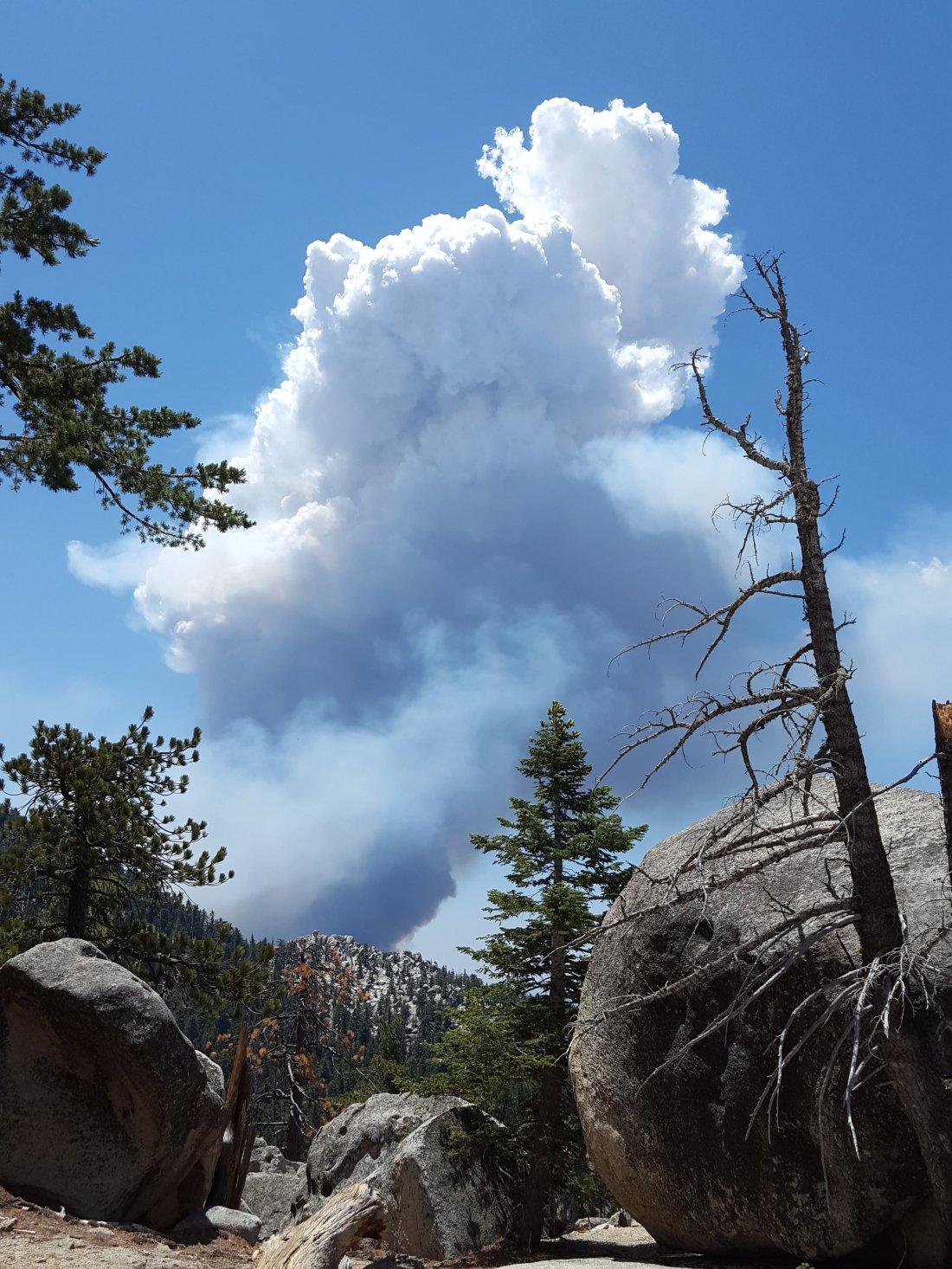
The fire was smouldering gently early this morning,, but a moderate NW wind picked up about 0930. Although this is taking the fire largely away from Idyllwild, it gave it significant energy. It started a major run east and north-east up the parallel ridges from May Valley to both South Peak and Antsell Rock. It is also burning heavily in the canyon immediately below Tahquitz Peak.
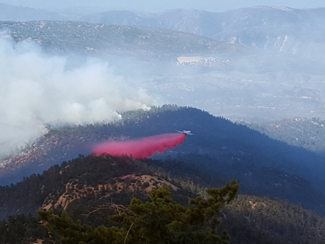
Looks like the decision has been made to let it burn these areas. The retardant tankers were doing a superb job of establishing South Ridge as a firm boundary. It was great to see them making a deliberate effort to protect Tahquitz Peak fire lookout, laying down three layers of Phos-Chek on the east side right next to the tower.
With its current path, the fire will largely run up to the Desert Divide and into areas that burned in the 2013 Mountain Fire. Most of those areas have very little fuel, and I imagine the hope is the fire will struggle to maintain itself. All this assumes no significant change in wind direction or strength (there is none forecast).
Ironically, this would mean the fire may burn into the area of the Pacific Crest Trail that is still currently closed from 2013. Restoration work on this section was just nearing completion, and the hope was it would reopen later this year.


All Idyllwild area trails are currently closed (Ernie Maxwell, Devils Slide, South Ridge, Deer Springs, PCT, etc).
The Palm Springs Aerial Tramway remains open for now, but with no camping or hiking permitted beyond Long Valley.
Idyllwild is under mandatory evacuation (although many residents have stayed) and all roads to the Idyllwild area are closed.
The Cranston Fire, which has currently burned over 7500 acres, started at about 1200 on Wednesday 25th July to the west of Idyllwild. It burned just South of Idyllwild and north of Mountain Center, from west to east.
It continues to burn on the south slope of South Ridge and east toward Antsell Rock and South Peak.


Remarkably, when the fire started I was on a search-and-rescue mission for two lost hikers off the Seven Pines Trail. When I found them, I took the photo below. It was only during our complicated descent (when it started raining ash on us) that the gravity of the situation became clear. Then, and when I was trying to turn to head south toward Idyllwild at about 1700 and could barely make the left due to the constant stream of vehicles heading north on Hwy 243 evacuating town.

Thank you for the updates.
LikeLike