On 2 April 2018 Anne, Anabel, and I ran the PCT north from Highway 74. Then today, 6 April 2018, I had a great hike with my friend Florian Boyd from the Cedar Spring Trail north up the PCT and descending via the Spitler Peak Trail (the current closure diversion). These trips allowed me to check all the key water sources along the Desert Divide section of the PCT. They are listed below from south to north. Bear in mind the three springs mentioned all involve a significant diversion off the PCT downhill to the east.
For trail conditions, see yesterday’s update, and reports for earlier days.
Highway 74 There are two major water caches where the PCT crosses Highway 74, on the south side of the highway. In addition, there is a much smaller cache behind the Andy Elam memorial on the north side of the highway. These appear to be reliably maintained, but never assume water caches will definitely be there.
Pool 3.5 miles north of Highway 74 Probably best used only in an emergency, this pool is right next to the trail. It is what remains of an ephemeral creek, and will dry up soon.
Live Oak Spring (N 33 37 21, W 116 33 24) Flowing strongly. The most reliable water source on the Desert Divide.
Cedar Spring (N 33 40 36, W 116 34 35) Flowing well. Easiest access is the trough just upstream from the trail to the campsite.

Apache Spring (N 33 43 11, W 116 37 13) Technically this is beyond the current closure boundary. However as the closure at the Spitler Peak Trail is currently unsigned (see photo at foot of this post), I have heard of some hikers continuing north past this point, so I thought I would list Apache Spring as a possible emergency source. Flowing well.

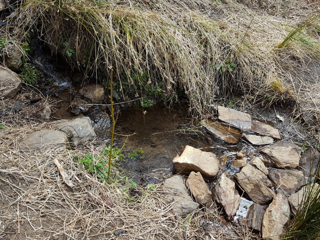
Spitler Peak Trail Descending the diversion trail, there are five water crossings. The first two, at 0.9 and 0.95 miles down, cross a tiny side creek and should be ignored. The next crossing, at 1.1 miles down, is Spitler Creek and is the best source of water (see photo below). The next two crossings are the same creek, but for obvious reasons it is best to fill up at the highest of the three crossings.
Antsell Rock Creek (N 33 41 52, W 116 39 08) Right by the Spitler Peak Trail trailhead on Apple Canyon Road, Antsell Rock Creek is flowing very well. Just on the upstream side of the road there is excellent access to the creek.

