Daily survey hikes have included San Jacinto Peak multiple times per week, plus in recent days Spitler Peak Trail, South Ridge Trail (several times), Laws/Caramba area, South Fork Wilderness Trail, and the Tahquitz/Skunk Cabbage meadow trail complex. Recent trail maintenance has focused on several of the trails mentioned above.
Full fire restrictions began on Wednesday 23rd June on Forest Service lands, as described here. All campfires at USFS campgrounds and yellow post sites in the San Jacinto mountains are now prohibited.
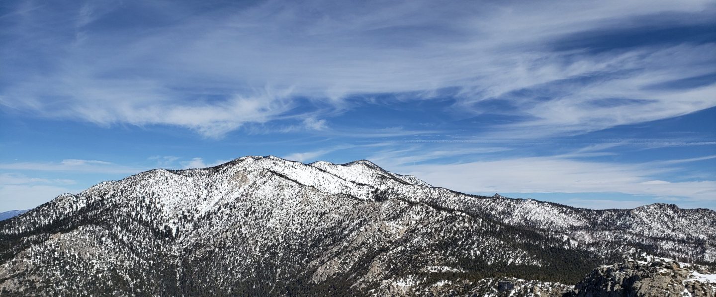
Temperatures for the foreseeable future will be largely well above seasonal averages, so plan your hiking accordingly for very hot, very dry conditions.
Hikers should also be prepared for rapidly changing weather conditions in the high country in summer. Monsoon conditions, usually in the afternoons, are a slim possibility for the foreseeable future. Thunderstorms with lightning, precipitation, and rapid temperature drops, can occur in the high country even when such storms are not forecast for lower elevations.
Water conditions in the high country are poor and deteriorating. Hot, dry weather for many weeks has not helped the situation. The current status of many key springs and creeks is described in detail below. The creek in Little Round Valley was almost dry on 6th July. On 5th July I was surprised to find that Antsell Rock Creek has dried up at Apple Canyon Road adjacent to the Spitler Peak trailhead.
Be bear aware. Although sightings have been infrequent in the past two years, one was reported on Willow Creek Trail at 0745 on 3rd July just east of Saddle Junction (per David English). The size and colour reported suggest this may be a third individual, different from the “Rite Aid” bear and “Blondie” who both appeared in 2017 (see my video of the latter in Idyllwild in 2018). The Trail Report last reported very fresh tracks on lower Seven Pines Trail on 22nd May (see this earlier Report for photo).
Mountain Lions are thankfully always common and widespread locally. One of my camera traps in the San Jacinto mountains near Idyllwild obtained great daylight video of an adult female on 24th June.
The rockslide at PCT Mile 172.5, just north of Antsell Rock, was removed on Monday 14th June. My “before, during, and after” video is available here. This section of the PCT is now safer and is readily passable with care by hikers (but still not by stock).
The U.S. Forest Service ranger station in Idyllwild remains closed due to USFS coronavirus protocols. It may reopen later this month. Hiking and camping permits are nevertheless required for USFS lands, and are usually available at the kiosk outside the ranger station. The State Park ranger station reopened months ago.
WEATHER Temperatures overall will be above seasonal averages for the foreseeable future, with overnight lows in particular tending to be far above seasonal. There is no significant precipitation in the forecast. Fire risk remains severe.
At San Jacinto Peak (10,810ft/3295m) on Tuesday 6th July 2021 at 0825 the air temperature was 56.5°F (14°C), with a windchill temperature of 49.9°F (10°C), 31% relative humidity, and a stiff due East wind sustained at 10 mph gusting to 17.4 mph.
At the Peak on Thursday 1st July 2021 at 0805 the air temperature was 52.3°F (11°C), with a windchill temperature of 47.6°F (9°C), 48% relative humidity, and a light due West wind sustained at 5 mph gusting to 9.0 mph.
TRAIL CONDITIONS
Trails throughout the San Jacinto high country cleared of snow by early May. Water conditions are a major concern, with most springs and creeks already having flows more typical of late autumn, as discussed in detail below.
Black Mountain Road reopened on 23rd April, and the Black Mountain Fire Lookout on 23rd May. Boulder Basin campground reopened on 22nd May along with other USFS seasonal campgrounds. Tahquitz Peak Fire Lookout reopened for the season on Sunday 30th May.
Many trails have accumulated treefall hazards from the past two winters, passable with care by hikers but not for stock. Some are described below, others include: PCT between Strawberry Cienega and Deer Springs camp (PCT Miles 182-185, about 12 trees down), Fuller Ridge Trail near its northern end (PCT Miles 189.1-190.2, three trees). Spitler Peak Trail was cleared of multiple tree hazards in early July.
Many treefall hazards from Red Tahquitz to Antsell Rock (PCT Miles 172.5-175) were cleared in June. Nevertheless about 20 remain, including at least six major obstructions for hikers. Tahquitz Creek to Red Tahquitz ( PCT Miles 175-177) has been completely cleared.
Willow Creek Trail has 14 downed trees on its Forest Service section (including a couple of new ones in high winds in June), with a couple of large, heavily-branched trees that are somewhat challenging to pass. This was reported to USFS in April. There are half-a-dozen additional trees down on the State Park section of the same trail.
The Caramba Trail from near Reeds Meadow through Laws Camp and on to Caramba, and the Cedar Trail from Willow Creek Trail to Laws (which both nominally reopened in late 2018) are optimistically described by the Forest Service as “not maintained”. In reality parts of these trails no longer exist with significant sections of both so heavily overgrown that I strongly advise hikers do not attempt to follow them. Multiple experienced hikers have reported getting lost in this area since summer 2019. An informal use trail to the Laws area is much more direct and completely avoids all of the challenging bush-whacking of the unmaintained trails (local hikers have kindly nicknamed it the “King Trail“). It leaves Willow Creek Trail exactly 1.0 mile from Saddle Junction, 0.45 mile from the Skunk Cabbage turning (trailhead at N33°46’46”, W116°39’32”, WGS84). The cairned (but subtle) trail descends largely on established deer tracks for 0.9 mile, reaching Willow Creek just upstream of the former site of Laws Camp. From Laws east to Caramba the route of the old Caramba Trail has become increasingly tricky to follow, especially for the first 1.2 miles east of Laws where there are dozens of trees down. Closer to Caramba the trail is relatively obvious (for those familiar with the route prior to the 2013 Mountain Fire). Very cautious navigation is recommended throughout this area.
Seven Pines Trail has had limited hiker traffic since November 2018. There are 35 treefall hazards on the trail, four large ones on the short Forest Service section, and the remainder in the State Park, based on my recent survey. Cautious navigation is recommended for those who are not familiar with hiking this trail. Dark Canyon Road has been closed since early 2019, and there is currently no vehicular access to Seven Pines trailhead.

WATER STATUS: Eastern slope
The Round Valley pipe is flowing weakly (at about 0.5L/min on 28th June). This source may not be reliable throughout the summer. Creeks in Round Valley and Tamarack Valley were dry in May (in 2020 neither dried until August).
Both the northern and southern springs at Wellman’s Cienega are flowing very gently (but adequately to filter). These are the sources for Willow Creek, which is flowing, but relatively weakly, where it crosses the Willow Creek Trail.
Tahquitz Creek is flowing steadily at the northern end of Little Tahquitz Meadow. It is also flowing further upstream at its source (known locally as Grethe Spring) where it crosses the PCT at approx. Mile 177.
The small creek in Tahquitz Valley dried some four months earlier than in 2020.
Candy’s Creek – that flows through Skunk Cabbage Meadow and then crosses the remaining visible section of Caramba Trail near Reeds Meadow – is currently flowing gently in both locations.
WATER STATUS: Western slope
The North Fork of the San Jacinto River is flowing steadily where it crosses the Deer Springs Trail and again downstream where it crosses the Fuller Ridge Trail on the PCT (approx. PCT Mile 186.2).
The creek in Little Round Valley has stopped flowing, there are tiny pools for about 20 feet, and it dries up long before leaving the Valley (see photo above). It is currently very marginal for filtering, and will completely dry in July. The same creek dried up where it crosses Fuller Ridge Trail (at about PCT Mile 186.4) in April.
Shooting Star Spring (below Little Round Valley but above the North Fork of the San Jacinto River crossing) is flowing weakly and is very poor for filtering.
The Deer Springs stream crossing is dry at the PCT/Deer Springs Trail (approx. PCT mile 185.6). (Despite some online mapping to the contrary, this is NOT the source for the North Fork of the San Jacinto River.)
The tiny but perennial spring about 0.4 miles north of Strawberry Junction (known colloquially as Switchback Spring) is flowing. I rework the tiny pool every week and there is just adequate depth from which to filter water.
The little creek at Strawberry Cienega (PCT mile 183.0) is almost dry. The tiny pool is barely sufficient for filtering (I nearly drained it dry trying to filter 0.25L in late June).

On Devil’s Slide Trail, Middle Spring is now almost dry. Other springs on this trail are dry.
On the Ernie Maxwell Trail, the crossing of Chinquapin Creek just below Humber Park is dry where it crosses the trail. However, there are tiny fresh pools just upslope from the trail (this creek is an important source of water for the many dogs walked on this trail.
The faucet at Cinco Poses Spring, about 4.5 miles up Black Mountain Road, continues to flow well.
WATER STATUS: Desert Divide
Live Oak Spring (N 33 37 21, W 116 33 24) Flowing. The most reliable water source on the Desert Divide.
Cedar Spring (N 33 40 36, W 116 34 35) Flowing. Easiest access is the trough about 60 yards upstream from the trail to the campsite.
Apache Spring (N 33 43 11, W 116 37 13) Barely trickling, not now reliable.
Spitler Peak Trail Descending the trail from the PCT there are five water crossings. The first two, at 0.9 and 0.95 miles down, cross a tiny side creek which is largely dry and should be ignored. The next crossing, at 1.1 miles down, is Spitler Creek and is the best source of water (currently flowing very gently, but can be filtered). The next two crossings are the same creek, also flowing adequately for filtering.

Antsell Rock Creek (N 33 41 52, W 116 39 08) Right by the Spitler Peak Trail trailhead on Apple Canyon Road, Antsell Rock Creek is now dry. Even in the very dry years of 2015 and 2016, this source did not dry until the autumn.


Thank you hikers for taking the time to read this. While all labor and time is volunteered, the San Jacinto Trail Report completely depends on small private donations to cover operating costs. Every year seems to be challenging and 2021 has been no exception, so every contribution, no matter how small, is truly valuable. If you have found this Report useful, please consider visiting the Donate page. Thank you.
