[UPDATED @ 1810 on Thursday 9th December: on/off light drizzle all morning across the San Jacinto mountains turned to rain around noon, with (so far) 0.75in of rain in Idyllwild at 5550ft. The high country was in and out of the cloud this morning, with some drizzle, turning to light snow at about 1230. About 1.0in of snow has fallen in Long Valley (8600ft). On the western slope snow level is at 6200ft with a light dusting of 0.25in at Devil’s Slide trailhead (6520ft). Spikes are now recommended for anyone hiking to the high country, especially as temperatures will result in icy freeze/thaw conditions for the foreseeable future. More substantial snow storms are currently forecast for 14th and 18th December. ]
[UPDATED @ 1530 on Tuesday 7th December: a very light drizzle this morning produced 0.04in of rain in Idyllwild (at 5550ft) and about 0.10in in Long Valley (8600ft).]
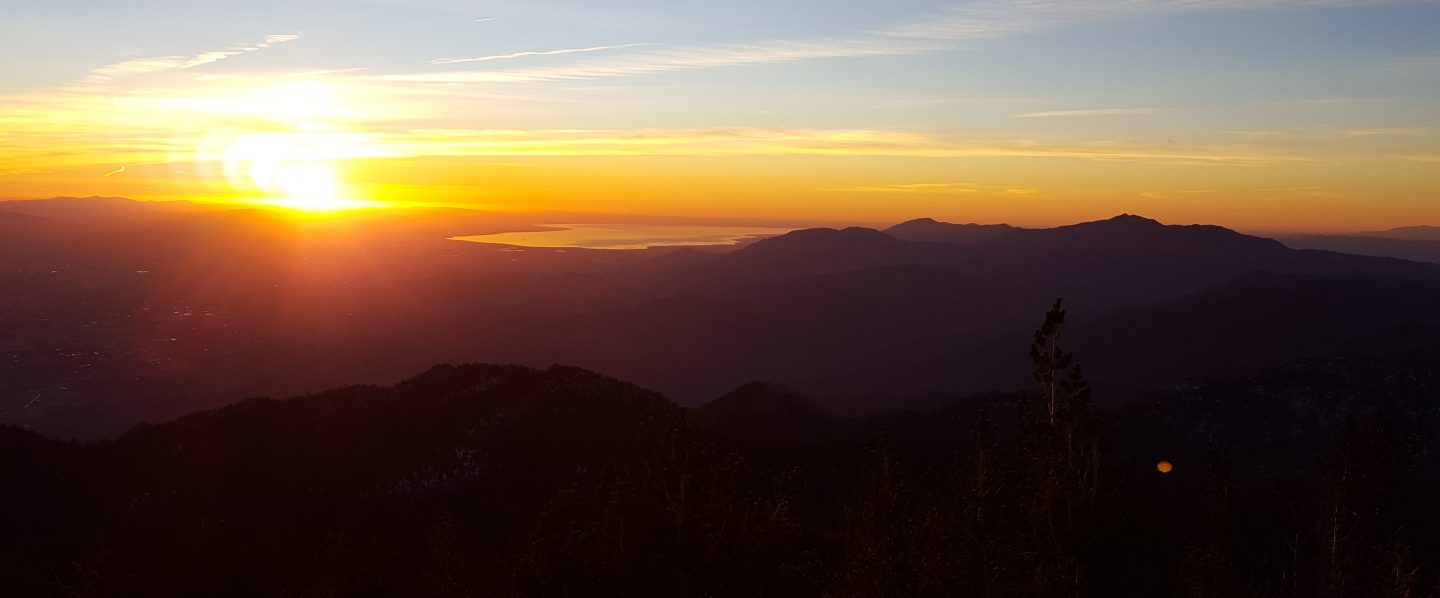
The record dry and warm conditions in November 2021 continued into the first week of December. There was no snow anywhere in the San Jacinto mountains at the beginning of December for the first time since systematic records began. The good news is that the next ten days look much more unsettled, with three light to moderate storm systems forecast, as discussed in Weather below.
Hikers should be prepared for temperatures around or below freezing in the high country and potentially well below freezing when considering wind chill effects. See below for my most recent weather observations from San Jacinto Peak.
Unsurprisingly, water conditions in the high country continue to deteriorate. Many springs and creeks dried months ago. The current status of most key water sources is discussed in detail in the previous Report linked here. This situation will change imminently with some precipitation forecast over the next ten days. With such low flow rates some water sources have started to freeze in the high country.
Full fire restrictions remain in place on Forest Service lands, as described here. All campfires anywhere in the San Jacinto mountains, including at all USFS campgrounds and yellow post sites, are prohibited. All forms of campfire are always prohibited in designated wilderness (both State Park and USFS). Currently fire risk remains very high, although that may change soon.
The U.S. Forest Service ranger station in Idyllwild has been closed due to USFS coronavirus protocols since March 2020. Apparently it will not reopen before February 2022. Hiking and camping permits are nevertheless required for USFS lands, and should be self-issued at the kiosk outside the ranger station. The State Park ranger station has been open almost all year, and is the best source in Idyllwild for permits and additional trail information. Forest Service campgrounds are closed for the season, along with the State Park Stone Creek campground. The State Park campground at the Idyllwild Ranger Station normally remains open all year.
WEATHER Forecast models for the next ten days have been quite variable, but the good news is that as many as three systems may bring some precipitation to all elevations over the next ten days. Very light rain (<0.1in) is forecast early on Tuesday 7th, although no snow is expected in this relatively warm system. There is increasing probability of a moderate and cold storm system on Thursday 9th December, producing some snowfall (2-6in) and dusting as low as 6000ft, plus moderate rainfall at mid and lower elevations. There is less clarity on another moderate but warmer storm next week around 14th-15th, with a few more inches of snow possible for the high country (>9000ft), currently most likely on Wednesday 15th.
At San Jacinto Peak (10,810ft/3295m) on Monday 6th December 2021 at 0835 the air temperature was 44.9°F (7°C), with a windchill temperature of 40.9°F (5°C), 40% relative humidity, and a gentle NW breeze sustained at 2 mph gusting to 6.3 mph.
At the Peak on Friday 3rd December 2021 at 0850 the air temperature was 38.7°F (4°C), with a windchill temperature of 31.7°F (0°C), 65% relative humidity, and a light SE wind sustained at 2 mph gusting to 9.8 mph.
At the Peak on Wednesday 1st December 2021 at 0830 the air temperature was 30.7°F (-1°C), with a windchill temperature of 20.1°F (-7°C), 31% relative humidity, and a cool NNE wind sustained at 5 mph gusting to 9.1 mph.
TRAIL CONDITIONS
For the first time since systematic records began, there was no settled snow anywhere in the San Jacinto mountains at the beginning of December. Obviously no snow equipment (e.g., spikes) is required at this time. However, this situation is expected to change soon with storm systems expected in the next ten days. The current poor status of most key water sources, that should also change in forthcoming days, is discussed in detail in the previous Report linked here.
The rockslide at PCT Mile 172.5, just north of Antsell Rock, was removed on Monday 14th June 2021. My “before, during, and after” video is available here. This section of the PCT is now safer and is narrow but readily passable with care by hikers (but remains impassable by stock).
Due to greatly reduced maintenance work by the agencies and PCTA during the coronavirus pandemic, many trails have accumulated treefall hazards since late 2019, passable with care by hikers but not for stock. Although reported promptly, regrettably neither Forest Service nor State Park have moved quickly to remove most hazards in 2021. With Santa Ana events and recent storms being accompanied by strong winds, hikers may encounter some new and additional hazards. Some are described below, others include the PCT between Strawberry Cienega and Strawberry Junction (PCT Miles 182-183, at least 7 trees down), and Fuller Ridge Trail near its northern end (PCT Miles 189.1-190.2, three trees).
Willow Creek Trail has at least 33 downed trees between Skunk Cabbage Junction and Hidden Divide. Of these 22 are on the Forest Service section (16 between Willow Creek and the Park boundary), with 11 in the State Park. Most are readily passable by hikers with care. Despite so much work last year by USFS volunteer Bill Rhoads and myself, the whitethorn has grown back rapidly, but still remains much less challenging than in 2019.
Spitler Peak Trail was cleared of multiple tree hazards by the Trail Report in early July, and has been trimmed periodically throughout 2021.
Marion Mountain Trail was cleared of multiple tree hazards by a California Conservation Corps team in late August, along with the adjacent PCT/Deer Springs Trail for 0.6 mile north to the south end of Fuller Ridge Trail. One new tree came down in early November 2021 on the PCT just yards south of its junction with Marion Mountain Trail, but it is easily passable for hikers.
Many treefall hazards from Red Tahquitz to Antsell Rock (PCT Miles 172.5-175) were cleared in June prior to the rockslide removal work mentioned above. Nevertheless about 20 remain, including at least six major obstructions for hikers. Tahquitz Creek to Red Tahquitz (PCT Miles 175-177) was cleared in early June.
Seven Pines Trail has had very limited hiker traffic since November 2018, largely because Dark Canyon Road was closed between February 2019 and early October 2021. The Trail Report has “adopted” Seven Pines Trail as a priority for maintenance work as the trail has had a disproportionate number of lost hiker rescues in recent years. Starting in November 2021, 42 treefall hazards on the lower 3.0 miles of trail have been removed. Most of this section has also been trimmed and cleared, and the trail is now obvious and easy to follow for much of its length. However approximately 18 downed trees remain on the upper 0.7 mile of trail, the route is very obscure in places, and cautious navigation is required especially for those who are not very familiar with hiking this trail. Dark Canyon campground remains closed.
The Caramba Trail from near Reeds Meadow through Laws Camp and on to Caramba, and the Cedar Trail from Willow Creek Trail to Laws (which both nominally reopened in late 2018) are optimistically described by the Forest Service as “not maintained”. In reality parts of these trails no longer exist with significant sections of both so heavily overgrown that I strongly advise hikers do not attempt to follow them. Multiple experienced hikers have reported getting lost in this area since summer 2019. An informal use trail to the Laws Camp area is much more direct and completely avoids all of the challenging bush-whacking of the unmaintained trails (other hikers kindly nicknamed it the “King Trail”). It leaves Willow Creek Trail exactly 1.0 mile from Saddle Junction, 0.45 mile from the Skunk Cabbage turning (trailhead at N33°46’46”, W116°39’32”, WGS84). The cairned use trail descends largely on established deer tracks for 0.9 mile, reaching Willow Creek just upstream of the former site of Laws Camp. From Laws east to Caramba the route of the old Caramba Trail has become increasingly tricky to follow, especially for the first 1.2 miles east of Laws where there are dozens of trees down. Closer to Caramba the trail is relatively obvious (for those familiar with the route prior to the 2013 Mountain Fire). Very cautious navigation is recommended throughout this area.


Thank you fellow hikers for taking the time to read this. While all labor and time is volunteered, the San Jacinto Trail Report completely depends on small private donations to cover operating costs. Every year seems to be challenging and 2021 has been no exception, so every contribution, no matter how small, is truly valuable. If you have found this Report useful, please consider visiting the Donate page. Thank you for your support.
