Intensive trail surveys have continued daily, including San Jacinto Peak most recently on 3rd and 6th May by different routes. Other hikes in the past few days have included much of the PCT locally plus some side trails (Willow Creek Trail, Zen Center Trail, South Ridge Trail, Tahquitz Peak area). An early morning hike to the Laws Camp area on 4th was rewarded with a beautifully lit, protracted view of a large adult Mountain Lion. This was my tenth (and best) lion sighting in just the past 20 months in the San Jacinto mountains.
Trails throughout the San Jacinto high country are almost entirely clear of snow and spikes are generally not required. There are some exceptions discussed below. As expected, the very light dusting of snow from 26th and 27th April completely melted within a couple of days. What little snow remains (from storms earlier in the winter) is now so patchy that snow depth measurements are no longer meaningful and they have been omitted from this report.
Drying of ephemeral creeks and springs has continued steadily, and water conditions in the high country are already worryingly reminiscent of the extremely dry years of 2015 and 2016.

WEATHER Temperatures are forecast to be above average (especially the overnight lows) for at least the next two weeks. There is no precipitation in the forecast.
At San Jacinto Peak (10,810ft/3295m) on Thursday 6th May 2021 at 0805 the air temperature was 41.4°F (5°C), with a windchill temperature of 28.2°F (-2°C), 39% relative humidity, and a stiff SSE wind sustained at 16 mph gusting to 29.6 mph.
At the Peak on Monday 3rd May 2021 at 0820 the air temperature was 34.3°F (1°C), with a windchill temperature of 23.6°F (-4°C), 55% relative humidity, and a moderate WNW wind sustained at 8 mph gusting to 13.5 mph.
At the Peak on Wednesday 28th April 2021 at 0840 the air temperature was 27.3°F (-3°C), with a windchill temperature of 13.9°F (-10°C), 61% relative humidity, and a gusty due North wind sustained at 8 mph gusting to 12.5 mph.
TRAIL CONDITIONS
Trails throughout the San Jacinto high country are almost entirely clear of snow and spikes are generally not required. There are some exceptions discussed below. See “Pacific Crest Trail” below for details of that trail. Regrettably water conditions are already becoming a concern, with most springs and creeks already having flows more typical of late summer.
Tahquitz Peak trail from Chinquapin Flat/PCT Mile 178 no longer requires spikes between the PCT and Tahquitz Peak, depending on your comfort level hiking on angled icy snow. Hiking poles and considerable caution are useful. There are good steps to follow through the small remaining patches for which some hikers will be more comfortable using spikes.
Deer Springs Trail is almost completely clear of snow to San Jacinto Peak. There are a few short snow patches below Little Round Valley, averaging only about 5% cover. Snow cover is 40% through Little Round Valley but the trail route is obvious and not challenging. Above Little Round Valley to San Jacinto Peak the trail has cleared very rapidly, with a handful of tiny snow patches only.
South Ridge Trail is clear to Tahquitz Peak. South Ridge Road is open.
Black Mountain Road reopened on 23rd April and is clear of snow.
Wellman Trail (from Annie’s Junction to Wellman Divide) is largely clear of snow, except for about 20% cover for 0.3 mile immediately north of Annie’s Junction.
The Peak Trail (Wellman Divide to San Jacinto Peak) is clear of snow except for the 0.2 mile patch between 9900-10,100ft, where snow cover is about 30%.
The East Ridge Trail on the east flank of San Jacinto Peak remains about 40% snow-covered. There is an ugly posthole track to follow in places but it can be easier to hike across the top of the compacted icy snow patches (at least in the early morning and on cold days).
Fuller Ridge Trail has limited stubborn snow patches around the crossing of the North Fork of the San Jacinto River (Mile 186), and on the northerly slopes of Fuller Ridge (approx. Miles 187.5-187.8 and 188.6-189.6).
Seven Pines Trail has been hiked very little since November 2018. Very cautious navigation is recommended for those who are not completely familiar with hiking this trail. The Forest Service closure of Dark Canyon Road continues, and there is no vehicular access to Seven Pines trailhead.
The Round Valley Trail to Wellman Divide has about 10% patchy snow cover. Long Valley is clear of snow.
Snow cover on the PCT: The PCT is clear of snow from Miles 151 (Highway 74) to about 175 (Red Tahquitz). A few small snow patches remain between Miles 175-177. Miles 177 to 185 are almost clear of snow with the exception of the notoriously stubborn 0.5 mile just south of Annie’s Junction at about Mile 180.8. Snow cover is about 10% from Mile 184 to 185.5, although spikes are not required. From Mile 185.5 to 191, snow is increasingly patchy. Stubborn sections remain around the crossing of the North Fork of the San Jacinto River (Mile 186), and on the northerly slopes of Fuller Ridge Trail (approx. Miles 187.5-187.8 and 188.6-190.4). North of Mile 190 is clear of snow.
Additional trails completely clear of snow include: Devil’s Slide, Marion Mountain, Ernie Maxwell, Spitler Peak, Cedar Spring, Skyline, and all Garner Valley trails.
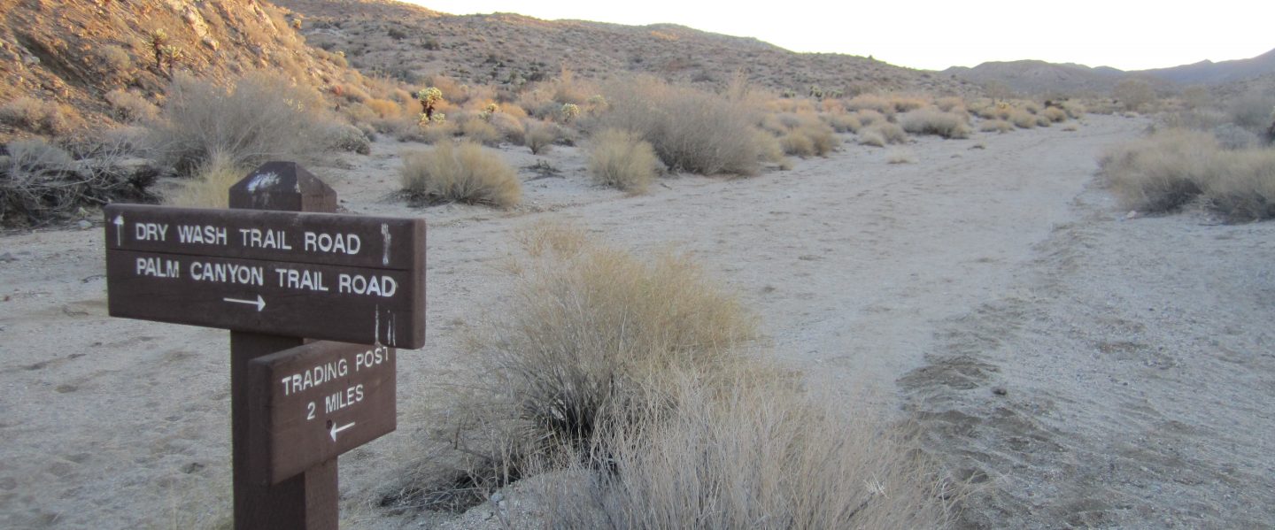
The Caramba Trail from near Reeds Meadow through Laws Camp and on to Caramba, and the Cedar Trail from Willow Creek Trail to Laws (which both nominally reopened in late 2018) are optimistically described by the Forest Service as “not maintained”. In reality parts of these trails no longer exist. Long sections of both are so heavily overgrown that I strongly advise hikers do not attempt to follow them. Multiple experienced hikers have reported getting lost in this area since summer 2019. An informal use trail to Laws is much more direct and completely avoids all of the very challenging bush-whacking of the unmaintained trails (local hikers have kindly dubbed it the “King Trail“). It leaves Willow Creek Trail exactly 1.0 mile from Saddle Junction, 0.45 mile from the Skunk Cabbage turning (trailhead coordinates N33°46’46”, W116°39’32”). The trail descends largely on well-cairned deer tracks for 1.2 miles, roughly paralleling Willow Creek just to its south. Be advised that it is an indistinct use trail, becoming somewhat less obvious as it nears Laws (by which time Willow Creek is very close on the left hand side, so navigation is not a challenge). From Laws east to Caramba the route of the original Caramba Trail is relatively easy to follow (for those who were familiar with this trail prior to the 2013 Mountain Fire). Throughout this area cautious navigation is advised.
PACIFIC CREST TRAIL
All Mile numbers are approximate. The main Report (above) is updated at least weekly or during/after any storm and contains significant additional information relevant to PCT hikers.
PCT hikers are reminded that overnight stays are not permitted at or near San Jacinto Peak, including in the historic shelter. This is especially critical during the coronavirus pandemic as it is impossible to adequately clean and sterilize the shelter. Mt. San Jacinto State Park regulations permit overnight stays only in established campgrounds. Strawberry Junction (approx. Mile 183) is a good option for thru-hikers.
This has been a far below average snow year for the San Jacinto high country. Given accelerating climate change here, depending on your start date there may be relatively little snow and ice by the time you reach the San Jacinto mountains. Nevertheless even small, isolated sections of icy snow can be perilous. Details of current snow/ice conditions will be clear from updates to the Trail Report over coming weeks.
Spikes remain useful for those hikers less comfortable hiking on snow for very limited parts of the Trail between about Miles 165 and 191, although at this time most individuals hiking with poles will find spikes unnecessary. Please always practice safe decision-making based on your own comfort level (not that of your hiking partners), experience, ability, available equipment, time of day (which can greatly affect traction on snow and ice), and current snow and weather conditions.
The PCT through the Snow Fire closure area (approx. Miles 191-207) reopened on 3rd April 2021. Only the tread of the Trail has reopened, USFS is not permitting camping along the 16+ mile section.
PCT hikers – thanks for taking the time to read this. The San Jacinto Trail Report depends entirely on small private donations to cover its direct costs. With a busy winter overlapping with a complex PCT season, every contribution, no matter how small, is truly valuable. If you have found the Report useful, please consider visiting the Donate page. Thank you, and safe hiking.
Coming off at Mile 168.5 (the well-signed Spitler Peak Trail alternate) may still be a good option for some this nobo season. There are nearly 60 trees down across the Trail between Miles 169-177, plus the rock slide at Mile 172.5. Spitler Peak Trail itself clears of snow (as is now the case) long before the PCT north of that point. The short snow slope on the NE side of Apache Peak (Mile 169.5) that has proved challenging over the years is now clear of snow, with good steps to follow. Spikes are no longer required, although hiking poles and caution are always useful.
The Pacific Crest Trail remains open at the rockslide north of Antsell Rock (Mile 172.5). Reports that the assisting rope around the rockslide is “in tatters” are completely misleading. However the rope is not in new condition, and if you choose to use it, you do so completely at your own risk. USFS has told the Trail Report that responsibility for removing the rockslide is currently with the PCTA, and that there are currently no plans to close this section of the PCT for removal work before summer 2021 at the earliest. This video report (recorded on 1st March 2021, starts at minute 9.05) may be useful for deciding whether to hike around the rockslide.
If you take an alternate further south, it is possible to regain the PCT from Idyllwild via Devil’s Slide Trail at Saddle Junction (about Mile 179). It is recommended that you do not attempt to regain the PCT via South Ridge Trail as the slope on the north side of Tahquitz Peak remains partly ice-covered and is notoriously treacherous.


