The first significant storm of winter 2021/22 is currently impacting the San Jacinto mountains.
Please continue to check this page for periodic storm updates throughout the next 24 hours.
UPDATE @ 1950 on Tuesday 14th
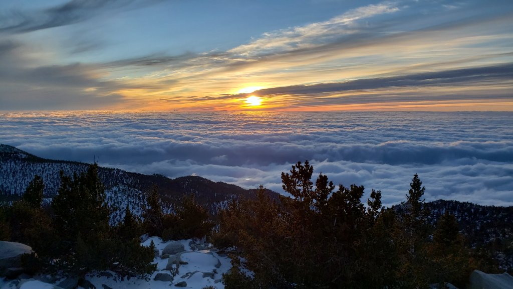
The moon started appearing on/off from 1830 over San Jacinto Peak and although it continues snowing very lightly, it is unlikely much more than a further inch will accumulate. Storm total at the Peak is currently a heavily drifted 8-9 inches.
In Idyllwild it stopped snowing by 1900. At 5550ft elevation, one inch had settled, in addition to nearly 1.5 inches of rain that fell earlier in the day.
UPDATE @ 1700 on Tuesday 14th
At San Jacinto Peak at 1630 the air temperature was 10.4°F (-12°C), with a windchill temperature of -17.5°F (-27.5°C), 93% relative humidity, and a very gusty WNW wind sustained at 21 mph gusting to 32.5 mph.
Total fresh snow accumulation is about 7-8 inches although it continues to snow steadily, but still in fine rounded grains (which are very slow to accumulate to significant depth). The snow is heavily drifting in a gusty westerly wind, to 12-18 inches in places.

UPDATE @ 1550 on Tuesday 14th
In Idyllwild at 5550ft the rain finally turned to snow at about 1500. In an hour about 0.25in has settled. Prior to that, 1.43in of rain fell today.
At San Jacinto Peak, snow accumulation had slowed considerably, to a current storm total of about six inches, with extreme drifting. Long Valley has approximately four inches fresh snow. An intensification is underway, that looks likely to last for another 1-2 hours.
UPDATE @ 1355 on Tuesday 14th
The storm has intensified significantly in the last hour. Rainfall for the day is just over 0.9in in Idyllwild, with currently no sign of it turning to snow.
The snowfall rate is up to at least one inch per hour at San Jacinto Peak, where I just measured a current storm total of about five inches. However the wind is gusting wildly, and some drifts are already 12 inches deep, while wind-exposed rocks remain bare.
Radar outputs suggest a series of bands over the next couple of hours, with waves of strong storm activity alternating with (relative) lulls in intensity.
Fresh snowfall in Long Valley (8600ft) is about 3-4in, on top of 0.5in remaining from last week.
UPDATE @ 1105 on Tuesday 14th
Light rain immediately prior to sunrise had produced 0.19in rain in Idyllwild (at 5550ft) and 0.3in rain in Long Valley (8600ft) by 0730. At about that time the precipitation in Long Valley turned to light snow. By mid morning, total rainfall in Idyllwild was almost exactly 0.5in.
Very light snow, falling as tiny rounded grains, started before dawn at San Jacinto Peak (10,810ft), only accumulating to 0.25in until 0900. (This is on top of a patchy two inches remaining from last week’s minor storm.) Intermittent heavier snow, but still rounded grains, started around 0915, currently accumulating to about one inch in the past two hours.
Current forecasts predict about 18in of snow around the highest peaks, but snowfall rates will have to accelerate rapidly in the next few hours for that to be realized.
Thank you fellow hikers for taking the time to read this. While all labor and time is volunteered, the San Jacinto Trail Report completely depends on small private donations to cover operating costs. Every year seems to have its challenges and 2021 has been no exception, so every contribution, no matter how small, is truly valuable. If you have found this Report useful, please consider visiting the Donate page. Thank you for your support.