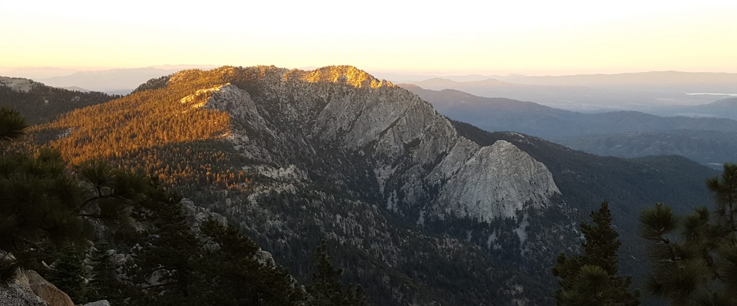
We have continued to hike to San Jacinto Peak every day so far in May, using many different routes, today for example ascending via Devil’s Slide Trail and descending via Tahquitz Peak and South Ridge Trail.
Other than the few remaining patchy areas described in detail below, the snow has almost completely gone from the trail system. Consequently snow depths are no longer reported. Pleasantly cool weather so far this week has resulted in firm icy snow in the mornings, with easy hiking conditions where areas of snow remain. On warmer afternoons and days, caution is advised on soft snow melting away from rocks and logs, and over running water. Potentially ankle-breaking posthole conditions remain in such areas. Where snow remains in the high country, reliable tracks are now in place for all major routes on the mountain.
Hikers uncomfortable on limited patches of icy snow may find that microspikes remain useful in some areas on colder early mornings and/or for descending. Otherwise microspikes are no longer required on the trail system.
The trails have felt rather “wild west” in recent weeks, with huge numbers of hikers, especially at weekends, many clearly not familiar with wilderness regulations. I have several examples, but early this morning I extinguished an active campfire right next to the trail about 0.5 mile south of Annie’s Junction. It was a good learning opportunity for the camper, who was genuinely ignorant of the Forest camping and fire regulations. Thankfully the breeze today was much lighter than yesterday. Although California is clearly still in the depths of the coronavirus crisis, we urgently need the agencies to restore the permit and enforcement systems, such as they are. Otherwise I fear the next indirect consequence of Covid-19 could be a forest fire up here.
Despite mild weather at lower elevations, for the next several days hikers should be prepared for temperatures at or near freezing in the high country, and below freezing when considering windchill effects (for example see weather data below for Tuesday 19th May!).
Palm Springs Aerial Tramway is closed indefinitely (since 12th March) due to the coronavirus crisis. Black Mountain Road remains closed by Forest Service order until 31st May. It is expected to reopen on 1st June.
Fire lookouts at Tahquitz Peak and Black Mountain will be operational starting 31st May and 1st June, respectively. The structures will be closed to visitors due to Covid-19 restrictions.
WEATHER For the next few days temperatures are forecast to be close to seasonal. Starting on Monday 25th, the last week of May sees a return to very hot summer temperatures. Regrettably, there is no precipitation in the forecast. The seemingly reliable May storms of recent years have failed us in 2020.
At San Jacinto Peak (3295m/10,810ft) today, Wednesday 20th May 2020, at 0830 the air temperature was 31.4°F (0°C), with a windchill of 23.4°F (-5°C), 22% relative humidity, and a cool due West wind sustained at 3 mph gusting to 8.4 mph.
At the Peak on Tuesday 19th May 2020, at 0815 the air temperature was 17.9°F (-8°C), with a windchill of -1.5°F (-19°C), 51% relative humidity, and a bitter due West wind sustained at 9 mph gusting to 19.8 mph.
The warmest day of the year to date recorded at the Peak remains Thursday 7th May 2020, when at 0810 the air temperature was 53.1°F (12°C), with a “windchill” of 50.5°F (10°C), 17% relative humidity, and a very light due West wind sustained at 2 mph gusting to 5.2 mph.
TRAIL CONDITIONS
All trails below about 9000′ are clear of snow, while higher trails have only very short sections with limited (<30%) snow-cover (see details below).
The following trails are completely clear of snow: Ernie Maxwell, Devil’s Slide, Willow Creek, South Ridge, Marion Mountain, and Seven Pines. The Desert Divide south of Red Tahquitz (approx. PCT Mile 175), including side trails such as Spitler Peak, Cedar Spring, Apache Spring, Zen Centre, and Live Oak Spring trails, is all clear of snow. All of the latter have new treefall hazards from this winter, passable for hikers but not stock.
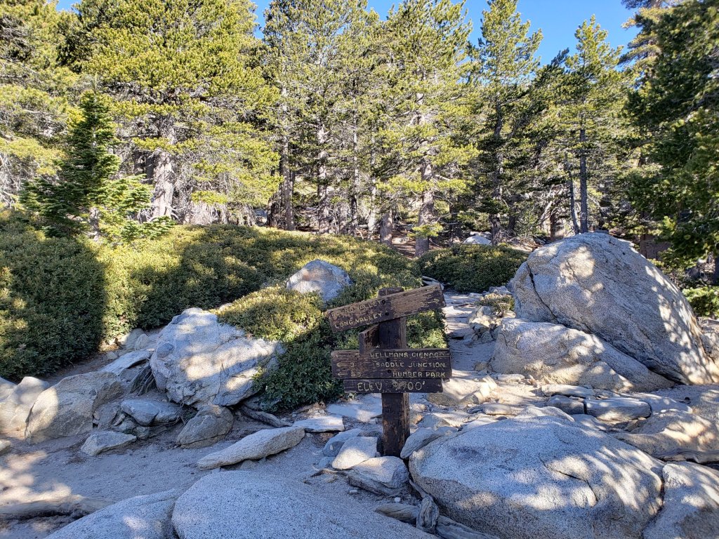
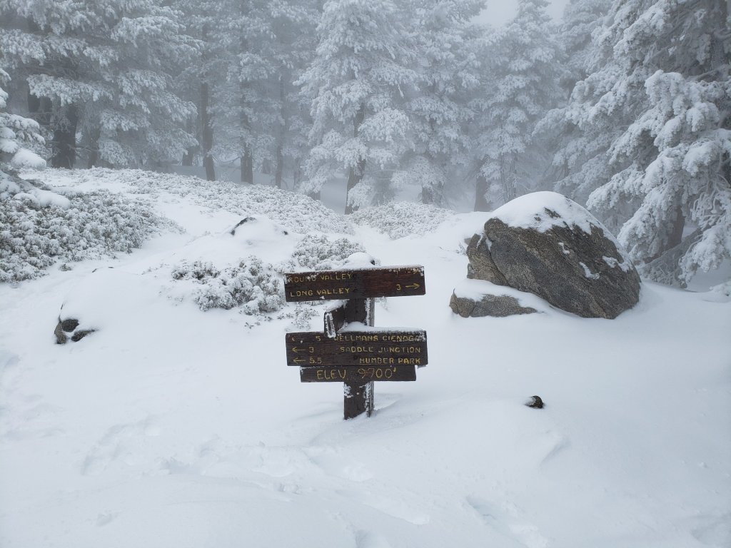
The Peak Trail above Wellman Divide is clear of snow, except for patches for 0.2 mile around 10,000′, and tiny patches very close to San Jacinto Peak. The East Ridge Trail still has 70% drifted snow cover. The Wellman Trail is largely clear, except for <10% cover in the first 0.4 mile north from Annie’s Junction (the State Park boundary).
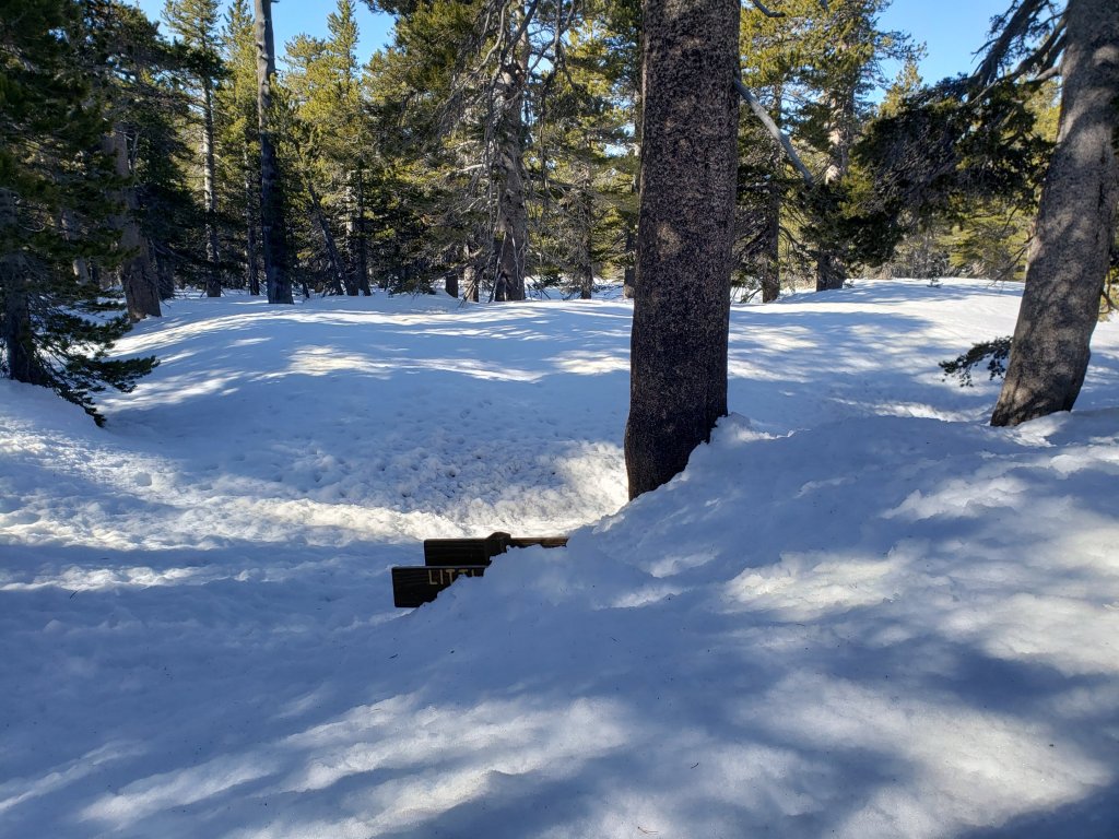
Deer Springs Trail [updated 23rd May] is virtually clear of snow to Little Round Valley. There is a new major double treefall hazard next to the Deer Springs crossing. Snow cover is <10% on the 0.4 mile from 9500′ to the crossing of the North Fork of the San Jacinto River, and it is then clear again for the final 0.2 mile ascent to Little Round Valley. Snow cover through Little Round Valley is 30%. Up to San Jacinto Peak snow cover is <10%. The trail is now obvious, with excellent steps, through the snow patches.
Willow Creek Trail is completely clear of snow, but has 24 new tree hazards (13 on Forest Service land, 11 on State Park) between Saddle Junction and Hidden Divide from this past winter, based on a full survey undertaken 13th May. None are as large or as challenging to get around as in 2019, but some caution is recommended.
Fuller Ridge Trail (PCT Miles 185.5-190.5) is clear of snow, although a few minor patches remain, especially near the north end.
Round Valley Trail is largely clear from Long Valley to Round Valley, but from there to Wellman Divide still has about 30% coverage of shallow snow patches. Trail finding is a little tricky on that 1.0 mile section. The High Trail has a few minor snow drifts still across the trail, and one major treefall hazard.
Tahquitz Peak trail from Chinquapin Flat/PCT Mile 178 is virtually clear of snow. It is easy to hike around the edges of the two tiny patches that remain. Microspikes are no longer required.
Seven Pines Trail [updated 23rd May] has been very lightly traveled since November 2018. There are at least 25 treefall hazards on the trail, based on multiple May 2020 surveys. Very cautious navigation is recommended for those who are unfamiliar with hiking this trail. The Forest Service closure of Dark Canyon Road is expected to continue until 2021, consequently there is currently no vehicular access to Seven Pines trailhead.
The Caramba Trail from near Reeds Meadow through Laws Camp to Caramba, and the Cedar Trail from Willow Creek Trail to Laws, are not maintained. Temporary signage to this effect has been in place since June 2019. Both trails are very indistinct and heavily overgrown with challenging whitethorn in places. Hikers without considerable prior experience of this area should exercise extremely cautious navigation. From Laws east to Caramba the route of the original trail is relatively easy to follow (for those who were familiar with this trail prior to the 2013 Mountain Fire). An informal use trail to Laws has been developed which is much more direct and avoids all of the challenging bush-whacking of the unmaintained trails (some local hikers have kindly named it the “King Trail”). It leaves the Willow Creek Trail exactly 1.0 mile from Saddle Junction (0.46 mile from the Skunk Cabbage turning), descending largely on established deer trails for 1.2 miles, roughly paralleling Willow Creek just to its south. Currently it is quite obvious for about a mile, becoming less distinct as it nears Laws (by which time Willow Creek is close by on your left hand side, so navigation is not a challenge).
WATER All major creeks and springs are currently flowing well, as are some ephemeral sources. Consequently their status is not being updated in detail at this time.
PACIFIC CREST TRAIL
The Pacific Crest Trail remains open at the rockslide just north of Antsell Rock (Mile 172.5). USFS has told the Trail Report that there are currently no plans to close this section of the PCT during spring 2020. The video report (available here) can be useful for deciding whether to try to hike around the rockslide or take an alternate route. All hikers this spring are reporting having no significant difficulty here.
PCT hikers are reminded that overnight stays are not permitted at or near San Jacinto Peak, including in the historic shelter. Mt. San Jacinto State Park regulations permit overnight stays only in established campgrounds (Little Round Valley and Strawberry Junction are good options for thru-hikers).

San Jacinto Trail Report: available for everyone, funded by readers.While all labor and time is volunteered, this Report completely depends on small private donations to cover its direct costs. With a very challenging first few months of 2020, every contribution is invaluable. If you have found this Report useful, please consider visiting the Donate page. Thank you.
