[UPDATE 9th March: With an unpredictable weather situation over the next few days, rather than post a new Report today I recorded this short video discussion at San Jacinto Peak this morning.]
[UPDATE 8th March: Weather discussion below has been revised reflecting the greatly reduced forecasts of precipitation next week.]
[UPDATE 6th March: information for South Ridge and the Tahquitz Peak trails is updated below based on our hike this morning.]
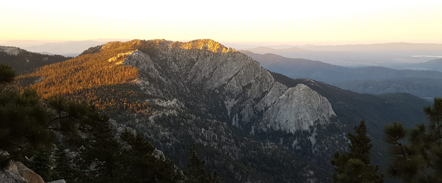
Temperatures well above historic averages have rapidly melted much of the snow that fell earlier this week in a minor snow storm discussed in the last Report. We have hiked to San Jacinto Peak the past two mornings, and it has felt like the snow conditions have been changing by the hour. In many areas below 8000′ almost all fresh snow has melted, and in areas that had previously cleared this winter and/or are sun-exposed below about 9500′ have lost almost all the fresh snowfall. Icy, reliable snow in the early morning is turning to the consistency of warm ice cream by late morning in many areas, which can help or hinder hiking depending on your preference.
Current conditions, and especially the forecast storm coming next week, are discussed in detail in a YouTube video recorded this morning at San Jacinto Peak.
Snow depths measured today are listed at the foot of this posting. Very strong Santa Ana winds in the high country overnight immediately after the snow storm caused very heavy drifting, even eliminating our tracks during the storm from Monday. There has been very little hiker traffic in the high country during this week, so very cautious navigation is recommended everywhere.
Equipment recommendations are changing almost as quickly as the snow conditions. Microspikes remain useful in some areas (see below) for hikers who are less comfortable on snow and ice, on compacted well-traveled trails, and in particular for descending. Hikers with suitable footwear and hiking poles will often not need any additional traction, depending on temperature as discussed above. Shallow snow depths largely preclude any use for snowshoes now, except in some areas off-trail above about 9500′ elevation, and on the western side in and above Little Round Valley.
Starting this weekend, hikers should be prepared for temperatures near or below freezing in the high country, and well below freezing when considering windchill effects.
WEATHER [updated Sunday 8th] A storm system is forecast to impact the San Jacinto mountains for several days next week (10th-13th March) with a high likelihood of precipitation on Tuesday 10th. Revised forecasts have reduced likely snowfall to a few inches in the high country and less than one inch of rain at mid elevations. This storm system will be much warmer than others this winter, with an initial snow level above 8000′, eventually dropping to 7000′ or lower. Another minor storm is possible on about 16th-17th March.
The latest video from NWS San Diego (posted on 6th March) discusses the forecast storm in detail.
At San Jacinto Peak (10,810ft/3295m) today, Thursday 5th March 2020, at 1010 the air temperature was 37.3°F (3°C), with a windchill of 29.5°F (-1°C), 32% relative humidity, and a light ESE wind sustained at 5 mph gusting to 9.5 mph.
In stark contrast, at the Peak on Monday 2nd March 2020, at 1020 the air temperature was 12.8°F (-11°C), with a windchill of -10.4°F (-24°C), 100% relative humidity, and a sharp NNW wind sustained at 10 mph gusting to 24.7 mph, while lightly snowing.
PACIFIC CREST TRAIL
The Pacific Crest Trail remains open at the rockslide just north of Antsell Rock (Mile 172.5). USFS has told the Trail Report that there are currently no plans to close this section of the PCT during spring 2020. The video report (available here) can be useful for deciding whether to try to hike around the rockslide or take an alternate route.
Microspikes may be useful on some of the PCT for patchy snow travel between approximately Miles 160 and 191, depending upon your comfort level in variable snow/ice conditions. Most thru hikers using poles will probably find spikes unnecessary however. See below for conditions on some specifc sections of the PCT and the many side trails.
Current snow cover on the PCT is patchy and thin between Miles 160 and about 175 (Red Tahquitz), mainly confined to certain north-facing slopes e.g., Spitler Peak (Mile 168) and Apache Peak (Mile 169.5). Snow is then continuous between Miles 175-179 (to near Saddle Junction). The Trail is then largely clear to about Mile 184, except for a stubborn section of 0.5 mile approaching Annie’s Junction (Mile 180.8) which is always among the last areas to clear every spring. Most of Miles 184-191 is snow-covered, although exposed sections of Fuller Ridge (e.g., Miles 186.5-188.5) are clearing rapidly. North from about Mile 191 to Snow Creek is clear.
PCT hikers are reminded that overnight stays are not permitted at or near San Jacinto Peak, including in the historic shelter. Mt. San Jacinto State Park regulations permit overnight stays only in established campgrounds. Options for thru-hikers are Strawberry Junction and Little Round Valley.
TRAIL CONDITIONS
All trails above about 9000′ remain largely snow-covered, with depth depending on elevation (see below) but exposed slopes are clearing very rapidly (e.g., around Wellman’s Cienega). Some sections of trails above about 7700′ have limited icy snow cover.
Deer Springs Trail is largely clear of snow to Strawberry Junction with just a few patches close to the junction (microspikes not required). The PCT section from here to Fuller Ridge is partly clear of snow to about 8500′ elevation (south of the Marion Mountain Trail junction), then there is extensive snow cover thereafter, currently with no track to follow. To Little Round Valley and onward to San Jacinto Peak there is no fresh track and heavy drifting in places. Snowshoes may be useful above about 9500′ and microspikes can be useful for descending.
Fuller Ridge Trail (PCT Miles 185.5-190.5) has been clearing quickly, especially on sun-exposed slopes, mainly Miles 186.5-188.5. There are no tracks to follow through the snow.
Round Valley Trail from the Tram through to Wellman Divide has been lighlty traveled and a track through the snow exists.
Devil’s Slide Trail has limited icy snow cover in patches, mainly in the 0.5 mile nearest to Saddle Junction. Due to snow and ice compaction caused by hiker traffic, microspikes are helpful in some areas above 7700′, especially for descending, but are not required.
Ernie Maxwell Trail is virtually clear of snow, with just a few tiny patches, mainly near Humber Park.
The notoriously treacherous Tahquitz Peak trail from Chinquapin Flat/PCT Mile 178 is clearing surprisingly quickly, the snow drifts are softening (on warm days), and crampons are no longer required. There is a set of tracks to follow, however overnight spindrift and freeze-thaw cycles can partly obscure tracks some mornings. Microspikes are strongly recommended, ideally in conjunction with an ice axe (if you know how to use it).
South Ridge Trail is clear of snow to Tahquitz Peak. A few tiny icy patches are easily hiked. Microspikes are not required. South Ridge Road is clear.
Seven Pines Trail has had no hiker traffic so far this winter, with no tracks or trail to follow. Indeed this trail has only been hiked a handful of times since November 2018. Extremely cautious navigation is recommended for those who are not very familiar with hiking this trail. The Forest Service closure of Dark Canyon Road continues, and there is no vehicular access to Seven Pines trailhead.
SNOW DEPTHS measured on 5th March 2020. Note that average depth is given, drifts can be much deeper in places. Altitudes are approximate.
San Jacinto Peak (10810′): 16″ (was 47″ on 27th December 2019)
Wellman Divide (9700′): 2″ (was 27″ on 27th December 2019)
Annie’s Junction (9070′): 12″ (was 25″ on 27th December 2019)
Long Valley (8600′): 2″
Strawberry Junction (8100′): <1″
Saddle Junction (8070′): 1″ (was 19″ on 27th December 2019)
Devil’s Slide trailhead at Humber Park (6550′): 0″ (was 11″ on 27th December 2019)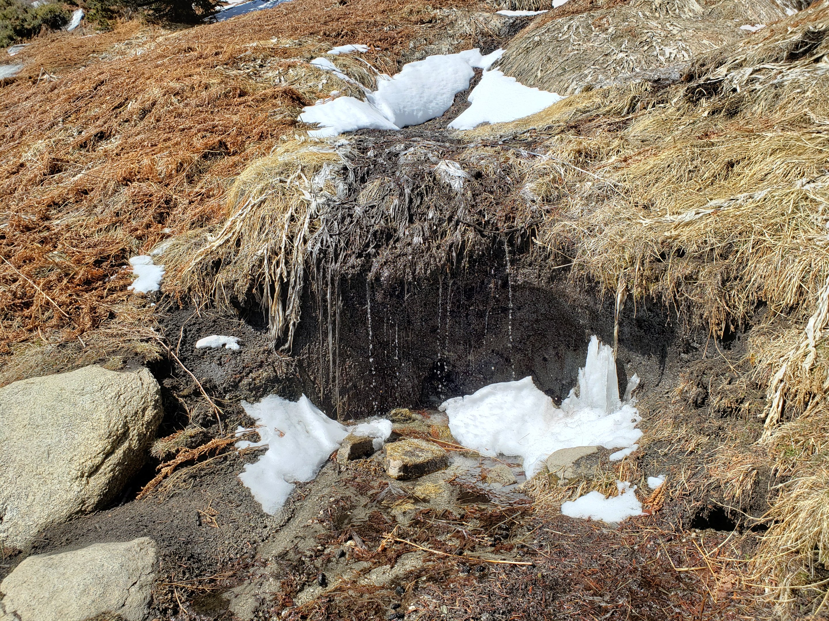

San Jacinto Trail Report: available for everyone, funded by readers. While thousands of hours of labor are volunteered, the Report depends on small private donations to cover its direct costs (e.g., gear, gas, web space). With a busy PCT season underway, every contribution is invaluable, and your donation helps subsidise the thousands of thru-hikers who also use the Report. If you have found this Report useful, please consider visiting the Donate page. Thank you.
