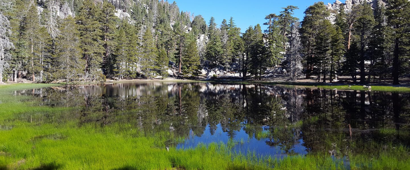
Recent hikes have included several to San Jacinto Peak, the Tahquitz area meadows today to check on water conditions on my way to Tahquitz Peak, South Ridge Trail, and a few early morning runs on the Ernie Maxwell Trail.
Anabel update: Thank you so much to the remarkable number of people who commented or contacted us about Anabel’s story. At a time of so much dismal news, her toughness, good fortune, and a happy ending, has clearly resonated with many people. It has been the most viewed posting on the Trail Report since the July 2018 Cranston Fire. If you haven’t seen the story of how our dog Anabel survived a neurotoxic rattlesnake bite in the San Jacinto high country against long odds, it is available here. She is doing great, still only ten days removed from ICU, slowly increasing her walking mileage every morning, and all neurological effects to her breathing and mobility have rapidly declined. All three of us are fortunate indeed.

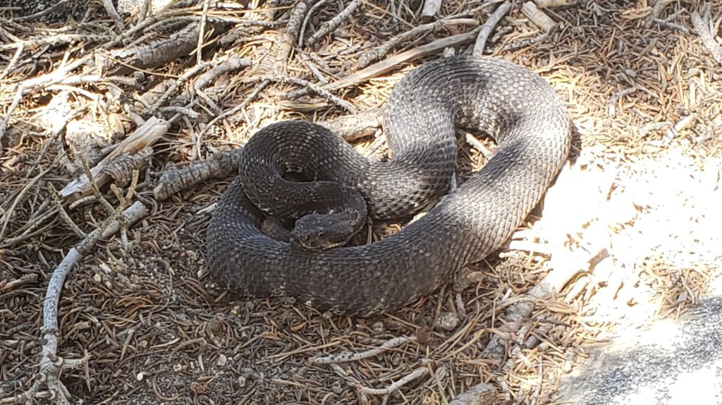
Be rattlesnake aware. On Monday 13th July, I saw a record (for me) four Southern Pacific Rattlesnakes in just 1.5 hours on my mid-morning descent from San Jacinto Peak to Humber Park. This was especially striking as up to now 2020 has generally been a relatively poor year for rattlesnake abundance on the mountain trails (notwithstanding what happened to Anabel last week). I came within inches of stepping on the highest of these, at 9200′ near Wellman’s Cienega, had another at 8600′ (photo below), and then two more low down on Devil’s Slide Trail at 6800′ and 6600′. All were large (at least three feet long) adults, and as usual all were relatively placid and easy to pass. With such warm weather, caution is advised for at least the next couple of months.
Black Mountain Road reopened on 20th June, having been graded through to the Fuller Ridge campground. USFS indicates that Boulder Basin campground will remain closed all year. Palm Springs Aerial Tramway is closed indefinitely (since 12th March) due to the coronavirus crisis.
For camping in Mount San Jacinto State Park, see their website for details. The U.S. Forest Service ranger station in Idyllwild remains closed due to the coronavirus crisis. Although Forest Service wilderness camping and hiking permits can be issued if requested, they are currently not required. USFS campgrounds are now open, except those discussed elsewhere in this post.
WEATHER After three days of about seasonal temperatures at the beginning of this week, hot summer weather returns on Thursday 16th and will persist for the foreseeable future. Fire risk will be severe. There is no significant precipitation in the forecast. Temperatures over the next week will be above seasonal averages, especially the overnight lows. Heat was exceptional this past weekend, with an overnight low on 11th July some 15° above the monthly average of 54°F, and an Idyllwild high on Sunday 12th of 95°F, nearly ten degrees above average.
At San Jacinto Peak (3295m/10,810ft) on Monday 13th July 2020, at 0825 the air temperature was 52.7°F (11°C), with a windchill of 46.6°F (8°C), 69% relative humidity, and a pleasant SW wind sustained at 9 mph gusting to 15.5 mph.
The coolest recent day at the Peak was Monday 29th June 2020, when at 0805 the air temperature was 35.3°F (2°C), with a windchill of 21.0°F (-6°C), 33% relative humidity, and a stiff due West wind sustained at 16 mph gusting to 31.2 mph.
The warmest day of 2020 so far recorded at San Jacinto Peak remains Monday 22nd June, when at 0830 the air temperature was 57.0°F (14°C) with 37% relative humidity and a barely discernible SW wind gusting to 2.9 mph.
TRAIL CONDITIONS
All trails have been clear of snow since early June. Many trails have new treefall hazards from this past winter, passable for hikers but not for stock. Some are described in detail below, others include: PCT south of Red Tahquitz (approx. PCT Miles 173-175), PCT between Strawberry Cienega and Deer Springs camp (Miles 182-185), Fuller Ridge Trail near its northern end (PCT Miles 189.1-190.2), Spitler Peak, Cedar Spring, and Apache Spring trails.
Willow Creek Trail has 14 tree hazards (five on Forest Service land, nine on State Park) between Willow Creek and Hidden Divide from this past winter. Ten additional trees on Forest Service land east of Saddle Junction, and two in the State Park, have been cleared since late May. As reported previously, the challenging whitethorn on this trail has now been removed.
Seven Pines Trail has been very lightly traveled since November 2018. There are 25 treefall hazards on the trail, almost all in the upper State Park section of trail, based on multiple May/June 2020 surveys. Very cautious navigation is recommended for those unfamiliar with this trail. The Forest Service closure of Dark Canyon Road is expected to continue into 2021, so there is currently no vehicular access to Seven Pines trailhead.
The Pacific Crest Trail remains open at the rockslide just north of Antsell Rock (Mile 172.5). USFS has not indicated when this area may close for removal of the rockslide. The video report (available here) can be useful for deciding whether to hike around the rockslide or take an alternate route.
Forest Service temporary signage indicates that the Caramba Trail from near Reeds Meadow through Laws Camp and on to Caramba, and the Cedar Trail from Willow Creek Trail to Laws, are “not maintained”. In reality both trails no longer exist. Both are so heavily overgrown I advise hikers do not attempt to follow them. Many experienced hikers have reported getting lost in this area since summer 2019. An informal use trail to Laws has been developed which is much more direct and avoids all of the challenging bush-whacking of the unmaintained trails (some local hikers have kindly named it the “King Trail”). It leaves the Willow Creek Trail exactly 1.0 mile from Saddle Junction (0.46 mile from the Skunk Cabbage turning), descending largely on established deer trails for 1.2 miles, roughly paralleling Willow Creek just to its south. Currently it is indistinct, becoming even less obvious as it nears Laws (by which time Willow Creek is close by on your left hand side, so navigation is not a challenge). I hope to work on the trail in early July. From Laws east to Caramba the route of the original Caramba Trail is relatively easy to follow (for those who were familiar with this trail prior to the 2013 Mountain Fire). Nevertheless very cautious navigation is still advised.
WATER STATUS: Eastern slope
The Round Valley pipe is not currently flowing. The flow as been redirected to the CCC camp in Long Valley and water pressure is insufficient to also flow at the pipe. Fortunately Round Valley creek just a few yards away is flowing gently, but it will likely dry up any day now.
Both the northern and southern springs at Wellman’s Cienega are flowing gently. These are the sources for Willow Creek, which is flowing well where it crosses the Willow Creek Trail.
Tahquitz Creek is flowing at the northern end of Little Tahquitz Meadow. It is also flowing further upstream at its source (known locally as Grethe Spring) where it crosses the PCT (approx. PCT Mile 177).

Candy’s Creek – that flows through Skunk Cabbage Meadow and then crosses the remaining visible section of Caramba Trail near Reeds Meadow – is currently flowing steadily.
WATER STATUS: Western slope
The North Fork of the San Jacinto River is flowing very well where it crosses the Deer Springs Trail and even better where it crosses the Fuller Ridge Trail on the PCT (approx. PCT Mile 186.2).
The creek in Little Round Valley is flowing, although at less than half the volume compared to this time last year. The same creek is flowing well where it crosses Fuller Ridge Trail (at about PCT Mile 186.4).
Shooting Star Spring (below Little Round Valley but above the North Fork of the San Jacinto River crossing) is flowing well.
The Deer Springs stream crossing at the PCT (approx. PCT mile 185.6) is flowing strongly.
Switchback Spring at PCT Mile 183.5 (about 0.4 miles north of Strawberry Junction) is flowing well, but there is little depth in which to filter water.
The little creek at Strawberry Cienega (PCT mile 183.0) is flowing gently, but will dry up very soon.
On Devil’s Slide Trail, Middle Spring is flowing gently. Other creeks and springs on this trail have functionally dried up.
On the Ernie Maxwell Trail, the crossing of Chinquapin Creek just below Humber Park continues to flow well (an important source of water for the many dogs walked on this trail).
WATER STATUS: Desert Divide
Live Oak Spring (N 33 37 21, W 116 33 24) Flowing well. The most reliable water source on the Desert Divide.
Cedar Spring (N 33 40 36, W 116 34 35) Flowing well. Easiest access is the trough just upstream from the trail to the campsite.
Apache Spring (N 33 43 11, W 116 37 13) Flowing fairly well.
Spitler Peak Trail Descending the trail there are five water crossings. The first two, at 0.9 and 0.95 miles down, cross a tiny side creek which is largely dry and should be ignored. The next crossing, at 1.1 miles down, is Spitler Creek and is the best source of water (currently flowing well). The next two crossings are the same creek, but for obvious reasons it is best to fill up at the highest of the three crossings.
Antsell Rock Creek (N 33 41 52, W 116 39 08) Right by the Spitler Peak Trail trailhead on Apple Canyon Road, Antsell Rock Creek is flowing very well. Just on the upstream side of the road there is excellent access to the creek. Useful if hikers are descending the Spitler Peak Trail.
San Jacinto Trail Report: available for everyone, funded by readers. While all labor and time is volunteered, this Report completely depends on small private donations to cover its direct costs. With a very challenging first few months of 2020, every contribution is invaluable. If you have found this Report useful, please consider visiting the Donate page. Thank you.
