Daily hikes have included several to San Jacinto Peak, plus most of the major trails around the high country and Tahquitz Peak, in the past week. On my drive up Fern Valley Road before dawn on Monday 20th, I was very fortunate to see a relatively young Mountain Lion cub cross the road. Doubtless I had only missed seeing its mother by a minute or less. Remarkably that is the sixth time since September 2019 that I have seen a lion up here, having seen none for several years previously.
We currently have three missing persons cases from 2020 in and around the San Jacinto mountains, summarized here (although only one was a hiker on public trails). Anyone with any relevant information should contact Riverside County Sheriffs Department.
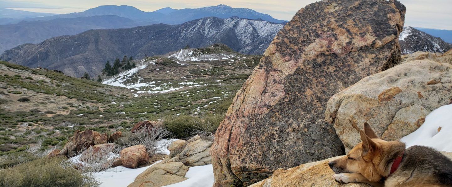
Anabel update: In another unlikely twist to the improbable story of how our dog Anabel survived a neurotoxic rattlesnake bite in the San Jacinto high country (the full story is available here), we were descending Devil’s Slide Trail early in the morning on Saturday 18th – the first day Anabel had been on that trail since she was bitten – when we passed a hiker who unexpectedly asked “what is the name of your dog?”. Remarkably the hiker proved to be Chelsea, the senior vet tech at Temecula Emergency Pet Clinic on the afternoon of 2nd July, the day Anabel was bitten and admitted! Although I had never met her, Chelsea of course recognized Anabel, having watched over her for many hours over two days. We had a long chat, Chelsea was visibly moved to see how well Anabel was doing, and it gave me the opportunity to again try to find the words to thank her, and her colleagues, for what they had done.
Be bear aware. I had a great view of a Black Bear at 0558 this morning at 7800′ elevation on Devil’s Slide Trail. This is one of the two individuals that appeared in the San Jacinto mountains – where they normally do not occur – in 2017, but to the best of my knowledge there had been no sightings for about a year. This individual is very distinctive, with a bright blond upper body and dark chocolate head and legs (“Blondie” feels like an appropriate nickname). As a youngster, the same bear walked past our house in Idyllwild two years ago (short video here). Now however, Blondie is all grown up and looked very large today, perhaps 50% larger than in the 2018 video.
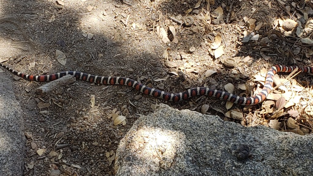
Be rattlesnake aware. After a slow start to the summer, Southern Pacific Rattlesnakes have been especially active in the past couple of weeks. As usual, the lower two-thirds of Devil’s Slide Trail seems to be a particular hotspot. For the first year ever, they are also occurring at the elevation of Wellman’s Cienega, where they are particularly hard to see on the heavily vegetated trail.

Black Mountain Road reopened on 20th June, having been graded through to the Fuller Ridge campground. However Boulder Basin campground will remain closed all year. Palm Springs Aerial Tramway is closed indefinitely (since 12th March) due to the coronavirus crisis.
Permits are required for hiking and camping in Mount San Jacinto State Park, see their website for details. The U.S. Forest Service ranger station in Idyllwild remains closed due to the coronavirus crisis. Although Forest Service wilderness camping and hiking permits can be issued if requested, they are currently not required. USFS campgrounds are now open, except those discussed elsewhere in this post.
WEATHER A couple of days with slightly below seasonal temperatures this week will end on about Sunday 26th July, when hot summer weather returns. Temperatures are forecast to be far above seasonal averages next week. There is no significant precipitation in the forecast. Fire risk remains severe.
At San Jacinto Peak (3295m/10,810ft) on Monday 20th July 2020, at 0835 the air temperature was 59.7°F (15°C), with no discernible windchill, 31% relative humidity, largely calm with an occasional NE breeze gusting to 2.7 mph. This was the warmest morning I have recorded at the Peak so far in 2020.
At the Peak on Friday 17th July 2020 at 0755 the air temperature was 54.9°F (13°C), with a windchill of 50.0°F (10°C), 25% relative humidity, and a light due South wind sustained at 5 mph gusting to 12.5 mph.
TRAIL CONDITIONS
All trails have been clear of snow since early June. Many trails have new treefall hazards from this past winter, passable for hikers but not for stock. Some are described in detail below, others include: PCT south of Red Tahquitz (approx. PCT Miles 173-175), PCT between Strawberry Cienega and Deer Springs camp (Miles 182-185), Fuller Ridge Trail near its northern end (PCT Miles 189.1-190.2), Spitler Peak, Cedar Spring, and Apache Spring trails.
Willow Creek Trail has 14 tree hazards (five on Forest Service land, nine on State Park) between Willow Creek and Hidden Divide from this past winter. Ten additional trees on Forest Service land east of Saddle Junction, and two in the State Park, have been cleared since late May. As reported previously, the challenging whitethorn on this trail has now been removed.
Seven Pines Trail has been very lightly traveled since November 2018. There are 25 treefall hazards on the trail, almost all in the upper State Park section of trail, based on multiple May/June 2020 surveys. Very cautious navigation is recommended for those unfamiliar with this trail. The Forest Service closure of Dark Canyon Road is expected to continue into 2021, so there is currently no vehicular access to Seven Pines trailhead.
The Pacific Crest Trail remains open at the rockslide just north of Antsell Rock (Mile 172.5). USFS has not indicated when this area may close for removal of the rockslide. The video report (available here) can be useful for deciding whether to hike around the rockslide or take an alternate route.
Forest Service temporary signage indicates that the Caramba Trail from near Reeds Meadow through Laws Camp and on to Caramba, and the Cedar Trail from Willow Creek Trail to Laws, are “not maintained”. In reality both trails no longer exist. Both are so heavily overgrown I advise hikers do not attempt to follow them. Many experienced hikers have reported getting lost in this area since summer 2019. An informal use trail to Laws has been developed which is much more direct and avoids all of the challenging bush-whacking of the unmaintained trails (some local hikers have kindly named it the “King Trail”). It leaves the Willow Creek Trail exactly 1.0 mile from Saddle Junction (0.46 mile from the Skunk Cabbage turning), descending largely on established deer trails for 1.2 miles, roughly paralleling Willow Creek just to its south. Currently it is indistinct, becoming even less obvious as it nears Laws (by which time Willow Creek is close by on your left hand side, so navigation is not a challenge). I hope to work on the trail in early July. From Laws east to Caramba the route of the original Caramba Trail is relatively easy to follow (for those who were familiar with this trail prior to the 2013 Mountain Fire). Nevertheless very cautious navigation is still advised.
WATER STATUS: Eastern slope
The Round Valley pipe is not currently flowing. The flow as been redirected to the CCC camp in Long Valley and water pressure is insufficient to also flow at the pipe. Fortunately Round Valley creek just a few yards away is flowing gently, but it will likely dry up any day now.
Both the northern and southern springs at Wellman’s Cienega are flowing gently. These are the sources for Willow Creek, which is flowing well where it crosses the Willow Creek Trail.
Tahquitz Creek is flowing at the northern end of Little Tahquitz Meadow. It is also flowing further upstream at its source (known locally as Grethe Spring) where it crosses the PCT (approx. PCT Mile 177). The small creek in Tahquitz Valley continues to flow gently.
Candy’s Creek – that flows through Skunk Cabbage Meadow and then crosses the remaining visible section of Caramba Trail near Reeds Meadow – is currently flowing steadily.
WATER STATUS: Western slope
The North Fork of the San Jacinto River is flowing very well where it crosses the Deer Springs Trail and even better where it crosses the Fuller Ridge Trail on the PCT (approx. PCT Mile 186.2).
The creek in Little Round Valley is flowing, although at less than half the volume compared to this time last year. The same creek is flowing well where it crosses Fuller Ridge Trail (at about PCT Mile 186.4).

Shooting Star Spring (below Little Round Valley but above the North Fork of the San Jacinto River crossing) is flowing well.
The Deer Springs stream crossing at the PCT (approx. PCT mile 185.6) is flowing strongly.
Switchback Spring at PCT Mile 183.5 (about 0.4 miles north of Strawberry Junction) is flowing gently, but there is not adequate depth in which to filter water.
The little creek at Strawberry Cienega (PCT mile 183.0) is now functionally dry and should not be relied upon for filtering.
On Devil’s Slide Trail, Middle Spring is flowing gently. Other creeks and springs on this trail have functionally dried up.
On the Ernie Maxwell Trail, the crossing of Chinquapin Creek just below Humber Park continues to flow well (an important source of water for the many dogs walked on this trail).
WATER STATUS: Desert Divide
Live Oak Spring (N 33 37 21, W 116 33 24) Flowing well. The most reliable water source on the Desert Divide.
Cedar Spring (N 33 40 36, W 116 34 35) Flowing well. Easiest access is the trough just upstream from the trail to the campsite.
Apache Spring (N 33 43 11, W 116 37 13) Flowing fairly well.
Spitler Peak Trail Descending the trail there are five water crossings. The first two, at 0.9 and 0.95 miles down, cross a tiny side creek which is largely dry and should be ignored. The next crossing, at 1.1 miles down, is Spitler Creek and is the best source of water (currently flowing well). The next two crossings are the same creek, but for obvious reasons it is best to fill up at the highest of the three crossings.
Antsell Rock Creek (N 33 41 52, W 116 39 08) Right by the Spitler Peak Trail trailhead on Apple Canyon Road, Antsell Rock Creek is flowing very well. Just on the upstream side of the road there is excellent access to the creek. Useful if hikers are descending the Spitler Peak Trail.
San Jacinto Trail Report: available for everyone, funded by readers. While all labor and time is volunteered, this Report completely depends on small private donations to cover its direct costs. With a very challenging first half of 2020, every contribution is invaluable. If you have found this Report useful, please consider visiting the Donate page. Thank you.
