[UPDATE 26th March: another short video recorded today discusses latest conditions based on a superb hike today to San Jacinto Peak with Kyle Eubanks, and in recent days to the Desert Divide. I anticipate a full text update to the Trail Report tomorrow.]
[UPDATE 22nd March: a video recorded today discusses latest conditions based on hikes today on the east and west sides of San Jacinto Peak, and yesterday to Tahquitz Peak.]
COVID-19 UPDATE: The Pacific Crest Trail Association has asked all PCT hikers on the Trail – as well as those waiting to start – to cancel or postpone their journeys. Read their statement here. Additionally, the State Park system has closed all camping facilities, including the Idyllwild campground. Camping is not permitted anywhere in Mount San Jacinto State Park until further notice. The Riverside County Park campground in Idyllwild is closed. Nomad Ventures in Idyllwild is closed indefinitely.
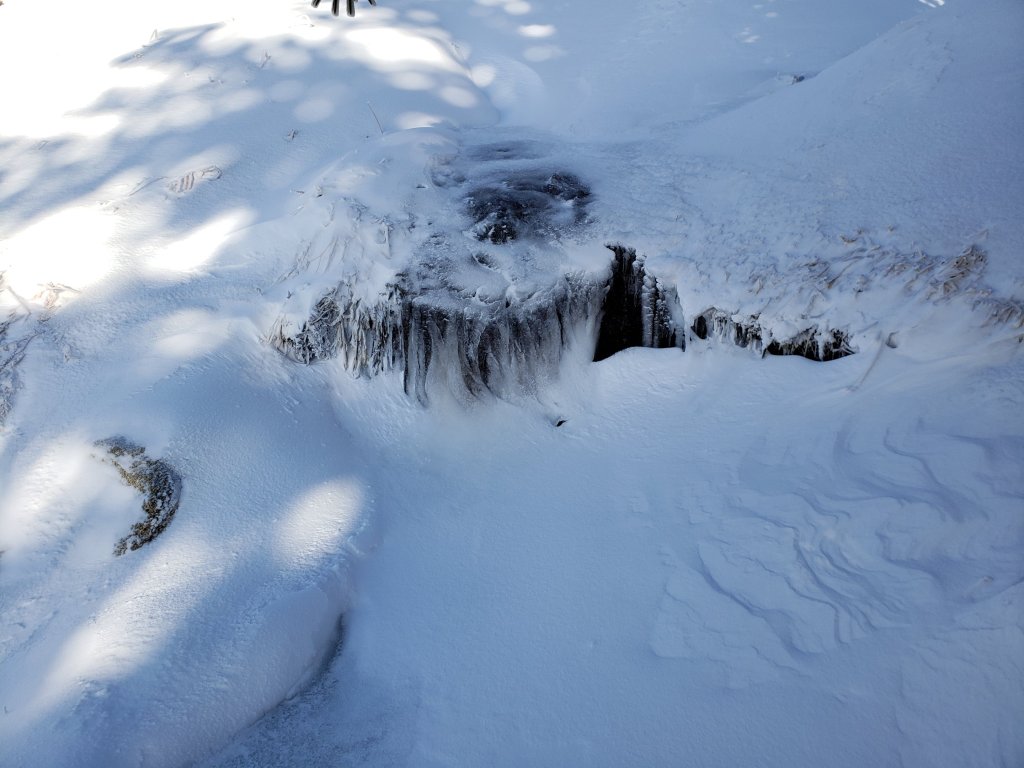
Three minor snow storms on consecutive days 17th-19th March have left the trail system snow-covered in the San Jacinto mountains almost everywhere above 4500′ elevation. I have been to many different areas to observe the effects, San Jacinto Peak on 17th, the PCT at Highway 74 and South Ridge yesterday, and Deer Springs Trail to the PCT today. Special thanks to Kyle Eubanks who ascended San Jacinto Peak today via Deer Springs Trail. A video discussion from Strawberry Junction of current conditions was posted this afternoon.
The storm on 17th produced 1-2 inches of snow at all elevations above about 5000′. The snow level fell lower on 18th, with a dusting of an inch down to 4600′ (Mile 151 on the PCT), 3″ in Idyllwild, and 5″ at the top of South Ridge Road (6500′). Snowfall today has ranged from 2″ in Idyllwild and Long Valley, to 3-4″ at Strawberry and Saddle junctions. It continues to snow lightly and intermittently in Idyllwild as I write this mid-afternoon on 19th.
Although there has been some fresh snowfall in the high country, it has often been much less than at mid elevations because the cloud level has largely held around 8700-9300′, with the high country above it. Conversely, on each of the three afternoons, short bursts of rapid snowmelt have occurred below 7000′ during brief appearances of the sun and temperatures barely above freezing. For these reasons elevations in the 7000-9000′ range have a disproportionate depth of snow at this time.
Currently almost all major trails, including almost the entire PCT through the high country of the San Jacinto mountains, have not been traveled and are obscured by moderate snowfall. Very cautious navigation is strongly recommended everywhere. Snow depths measured today are listed at the foot of this posting.
At present postholing through shallow to moderate snow is not too challenging in most areas below 8000′ (including most of the PCT). Microspikes may become increasingly useful over the next few days as established trails become consolidated by hiker traffic and undergo freeze-thaw cycles. They are especially useful for descending trails when they become icy and compacted (e.g. Devil’s Slide and lower Deer Springs trails). Snow depths are currently ideal for snowshoeing in the high country and snowshoes are recommended above about 8000′ for day hikers. Snowshoeing conditions will deteriorate rapidly below 9000′ with considerable snowmelt expected over this weekend.
Hikers should be prepared for temperatures below freezing in the high country, with potentially dangerous cold when considering windchill effects.
Due to the coronavirus crisis, the Palm Springs Aerial Tramway remains closed indefinitely since 12th March (until at least 30th April).
The USFS gate at Humber Park has been closed since 18th March. There are only nine legal parking spaces (available for all uses) just below the gate and near the upper Ernie Maxwell trailhead. The next closest legal parking is 0.1 mile downhill on Forest Drive.
WEATHER Warmer, brighter weather on 20th-22nd will result in rapid melting below 8000′, and locally higher on sun-exposed slopes. More unsettled and unpredictable conditions are possible next week, with light rain (or very light snow above 6000′) currently forecast on 23rd and 26th.
At San Jacinto Peak (10,810ft/3295m) on Tuesday 17th March 2020 at 0950 the air temperature was 10.6°F (-12°C), with a windchill temperature of -11.7°F (-24°C), 57% relative humidity, and a bitter SW wind sustained at 11 mph gusting to 22.8 mph.
PACIFIC CREST TRAIL
Microspikes may be useful on some of the PCT only after sufficient hiker traffic to compact the snow, and/or freeze-thaw cycles. Depending upon your comfort level in variable snow/ice conditions, most thru-hikers using footwear with good tread in combination with poles will find spikes unnecessary however. For the last three days I have found hiking in a few of inches of fresh powder to be relatively easy-going.
The Pacific Crest Trail remains open at the rockslide just north of Antsell Rock (Mile 172.5). USFS has told the Trail Report that there are currently no plans to close this section of the PCT during spring 2020. The video report (available here) can be useful for deciding whether to try to hike around the rockslide or take an alternate route. There is no current information on how snow/ice conditions may have impacted the route around this rockslide.
PCT hikers are reminded that overnight stays are not permitted at or near San Jacinto Peak, including in the historic shelter. Mt. San Jacinto State Park regulations permit overnight stays only in established campgrounds. Options for thru-hikers are Strawberry Junction and Little Round Valley.
TRAIL CONDITIONS
All trails above about 6000′ are snow-covered, with depth depending on elevation. Reliable tracks are currently in place only for Devil’s Slide Trail, and from Deer Springs Trail to San Jacinto Peak. Strong winds in the high country on 17th, and continuing patchy snowfall on 19th, may have obscured tracks within hours however. The closure of the Tram will result in very light hiker traffic to the highest peaks via the Peak Trail, and little or no traffic on the Long and Round Valley trails.
Devil’s Slide Trail has a well-traveled track to follow. Microspikes may become useful, especially in early morning. Snow cover is still >90% even with some melting this afternoon.
Ernie Maxwell Trail is largely under a continuous 2-4″ of snow cover.
Deer Springs Trail A reliable track was put in today from the trailhead to San Jacinto Peak by a combination of Kyle Eubanks and myself. See comments above however regarding effects of wind and continuing light snowfall.
Tahquitz Peak trail from Chinquapin Flat/PCT Mile 178 [updated 16th March] has no steps to follow through the angled icy snow for at least 0.3 miles. These ice slopes are notoriously treacherous. Crampons are strongly recommended, in conjunction with an ice axe (if you know how to use both). Snowshoes are not advised due to the angle of the underlying ice.
Seven Pines Trail has had no visible signs of hiker traffic so far this winter, with no tracks or trail to follow. Indeed it has only been hiked a handful of times since November 2018. Extremely cautious navigation is recommended for those who are not very familiar with hiking this trail in snow. The Forest Service closure of Dark Canyon Road will remain in place until summer 2020, hence there is no vehicular access to Seven Pines trailhead.
SNOW DEPTHS measured today are as follows. Total for storms on 18th-19th is first, followed by current total depth in brackets, then comments in parentheses. Note that average depth is given, drifts can be much deeper in places. Altitudes are approximate. Many thanks to Pete Kirkham for data for Saddle Saddle and Annie’s junctions.
San Jacinto Peak (10810′): 2″ [27″]
Little Round Valley (9800′): 2″ [20″]
Wellman Divide (9700′): 2″ [12″]
Annie’s Junction/approx. PCT Mile 181 (9070′): 3″ [19″]
Fuller Ridge south end/PCT Mile 185.5 (8950′): 4″ [12″]
Long Valley (8600′): 3″ [8″]
Strawberry Junction/approx. PCT Mile 183 (8100′): 4″ [6″]
Saddle Junction/approx. PCT Mile 179 (8070′): 4″ [8″]
Devil’s Slide Trail at Humber Park (6550′): 4″ [7″]
Idyllwild (at 5550′): 2″ [3″] (periodic melting every afternoon)

San Jacinto Trail Report: available for everyone, funded by readers. While all labor and time is volunteered, this Report completely depends on small private donations to cover its direct costs. With a busy winter overlapping with PCT season, every contribution is invaluable. If you have found this Report useful, please consider visiting the Donate page. Thank you.