[UPDATED 7th February to include the latest forecast for the storm on 9th-10th, and new information from my hike today around Tahquitz Peak, and from yesterday to San Jacinto Peak.]
We have hiked to San Jacinto Peak four of the past five mornings, affording a check of most major routes. South Ridge and the Tahquitz Peak area have also been hiked twice in the past four days. Delightfully frigid temperatures made for solid hiking on icy snow yesterday and today. Chilly conditions at San Jacinto Peak this morning are discussed in a short video available on YouTube.
In the early hours of the morning of Monday 3rd, we had 0.04″ rain in Idyllwild, with <0.25″ snow between 6400′-9100′ elevation. There was no fresh snowfall in the high country, which was above the cloud. By the time I descended from the Peak late morning, the fresh snow had already disappeared below 7600′, and almost all of it was gone today.
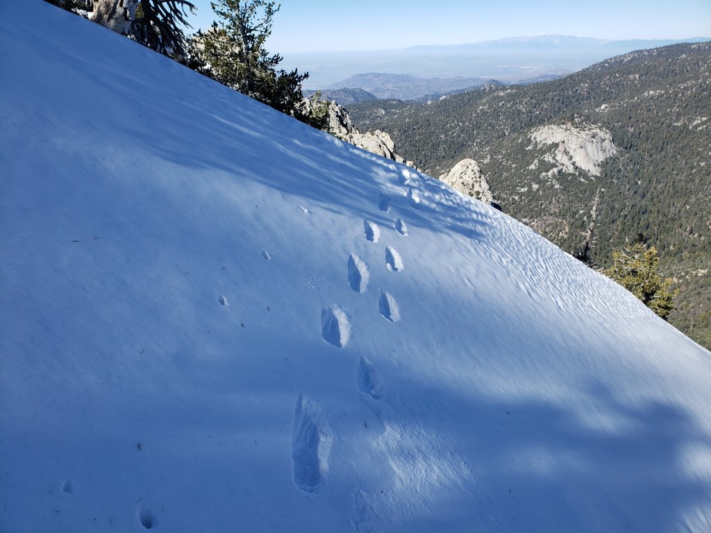
Snow depths measured today are listed at the foot of this posting. Strong winds in the high country may cause spindrift to obscure parts of even the heavily traveled trails. Cautious navigation is recommended everywhere.
Microspikes remain useful in some areas (see below) for hikers inexperienced on snow and ice, on compacted, well-traveled trails, in particular for descending. Hikers with suitable footwear and hiking poles will likely not need spikes. Snowshoes may be useful in limited areas off-trail above about 9500′ elevation. This information only applies through Sunday 9th (when fresh snowfall is expected).
Despite unseaonably warm weather on some days, hikers should nevertheless be prepared for temperatures near or below freezing in the high country, and potentially far below freezing when considering windchil effects (see below for weather recorded recently at San Jacinto Peak).
Note that the USFS gate at Humber Park reopened on 5th February.
WEATHER Following the current short but severe cold spell, there will be yet another rapid swing to above average temperatures (mainly 7th-8th February). The new video from NWS San Diego (issued on 7th Feb) indicates a good chance of precipitation at the beginning and end of next week (9th-14th February), before a return to warmer, dry conditions in the second half of the month. Current forecasts anticipate a light snowfall above about 4000′, with a few inches possible in the high country, mainly on 9th-10th February.
At San Jacinto Peak (10,810ft/3295m) today, Wednesday 4th February 2020, at 1010 the air temperature was 2.5°F (-16°C), with a windchill of -28.1°F (-33°C), 52% relative humidity, and a sharp due North wind sustained at 15 mph gusting to 29.8 mph.
At the Peak on Monday 3rd February 2020, at 0910 the air temperature was 18.4°F (-7°C), with a windchill of -2.5°F (-19°C), 22% relative humidity, and a chilly WSW wind sustained at 11 mph gusting to 23.9 mph.
PACIFIC CREST TRAIL
The Pacific Crest Trail remains open at the rockslide just north of Antsell Rock (Mile 172.5). USFS has stated there are currently no plans to close this section of the PCT during spring 2020. The video report from 7th October (available here) can be useful for deciding whether to try to hike around the rockslide or take an alternate route.
Microspikes may be useful, but certainly not essential, on some of the PCT for patchy snow travel between approximately Miles 165 and 191, depending upon your comfort level on icy snow. See below for conditions on some specifc sections of the PCT and the many side trails.
PCT hikers are reminded that overnight stays are not permitted at or near San Jacinto Peak, including in the historic shelter. Mt. San Jacinto State Park regulations permit overnight stays only in established campgrounds. Options for thru-hikers are Strawberry Junction and Little Round Valley.
TRAIL CONDITIONS
All trails above about 9000′ remain largely snow-covered, with depth depending on elevation (see below). Some sections of trails above about 7800′ may have limited snow cover.
Deer Springs Trail is clear of snow to Strawberry Junction with just a few tiny patches close to the junction (microspikes not required). The PCT section from here to Fuller Ridge is almost clear of snow to about 8700′ elevation (just south of the Marion Mountain Trail junction), then there is continuous snow cover thereafter, with a well-traveled, consolidated track to follow. A track above 9000′ to Little Round Valley is consolidated, but be advised that it does not follow the established trail in places. Above Little Round Valley there is a direct (i.e. steep) track to follow to San Jacinto Peak. Microspikes are useful for descending.
Fuller Ridge Trail (PCT Miles 185.5-190.5) has been clearing quickly, especially on sun-exposed slopes, mainly Miles 186.5-188.5. There are tracks to follow through the snow.
Marion Mountain Trail has been heavily traveled and has a good consolidated track to follow. Microspikes are useful, but not required, for descending the uppermost 0.5 mile. Note the road to Marion Mountain trailhead has been open all winter and is clear of snow.
Round Valley Trail from the Tram through to Wellman Divide has been well-traveled and a good track through the snow is easy to follow, on to San Jacinto Peak.
Devil’s Slide Trail has limited icy snow cover in patches, mainly in the 0.1 mile nearest to Saddle Junction. Microspikes may be helpful in some areas above 7700′, but are not required.
Ernie Maxwell Trail is clear of snow.
The parts of Willow Creek Trail and Caramba Trail nearest to Saddle Junction have well-defined tracks, likely heading around Skunk Cabbage Meadow.
The PCT southbound from Saddle Junction has been traveled to Chinquapin Flat.
Tahquitz Peak trail from Chinquapin Flat/PCT Mile 178 is clearing surprisingly quickly, the snow drifts are softening (on warm days), and crampons are no longer required. Microspikes are strongly recommended, in conjunction with an ice axe (if you know how to use it). In the morning, overnight wind conditions and the freeze-thaw cycle may well have covered the existing steps through the angled icy snow for 0.1-0.2 mile.
South Ridge Road is clear of ice. South Ridge Trail is basically clear to Tahquitz Peak, but with a few easily-traversed tiny remnant icy snow patches. Microspikes are no longer required.
Seven Pines Trail has had no hiker traffic so far this winter, with no tracks or trail to follow. Indeed this trail has only been hiked a handful of times since November 2018. Extremely cautious navigation is recommended for those who are not very familiar with hiking this trail in snow.
The Forest Service closure of Dark Canyon Road remains in place, hence there is no vehicular access to Seven Pines trailhead.
SNOW DEPTHS measured on 4th February 2020 (except where otherwise indicated). Note that average depth is given, drifts can be much deeper in places. Altitudes are approximate.
San Jacinto Peak (10810′): 20″ (was 47″ on 27th December)
Little Round Valley (9800′): 19″ (on 29th January 2020)
Wellman Divide (9700′): 2″ (was 27″ on 27th December)
Annie’s Junction (9070′): 11″ (was 25″ on 27th December)
Fuller Ridge Trail (PCT Mile 185.5) at junction with Deer Springs Trail (8950′): 12″ (on 29th January 2020)
Long Valley (8600′): <1″
Strawberry Junction (8100′): 0″
Saddle Junction (8070′): 1″ (was 19″ on 27th December)
Devil’s Slide trailhead at Humber Park (6520′): 0″ (was 11″ on 27th December)
San Jacinto Trail Report: available for everyone, funded by readers. While thousands of hours of labor are volunteered, the Report is wholly dependent on small private donations to cover its direct costs (e.g., gear, gas, web space). With a busy PCT season coming soon, every contribution is invaluable, and your donation helps subsidise the thousands of thru-hikers who also use the Report. If you have found this Report useful, please consider visiting the Donate page. Thank you.
