[UPDATE 18th April: I discuss current gear recommendations, snow conditions, and forthcoming weather in a video recorded this morning at San Jacinto Peak. In the text below, conditions for some trails are updated based on hikes in the past two days.]
Anabel and I have been very busy in the days since the multi-day snow storm last week surveying as many different trails as possible. We hiked to the Apache Peak area this morning to assess conditions there (discussed below and in this short [breezy] video).
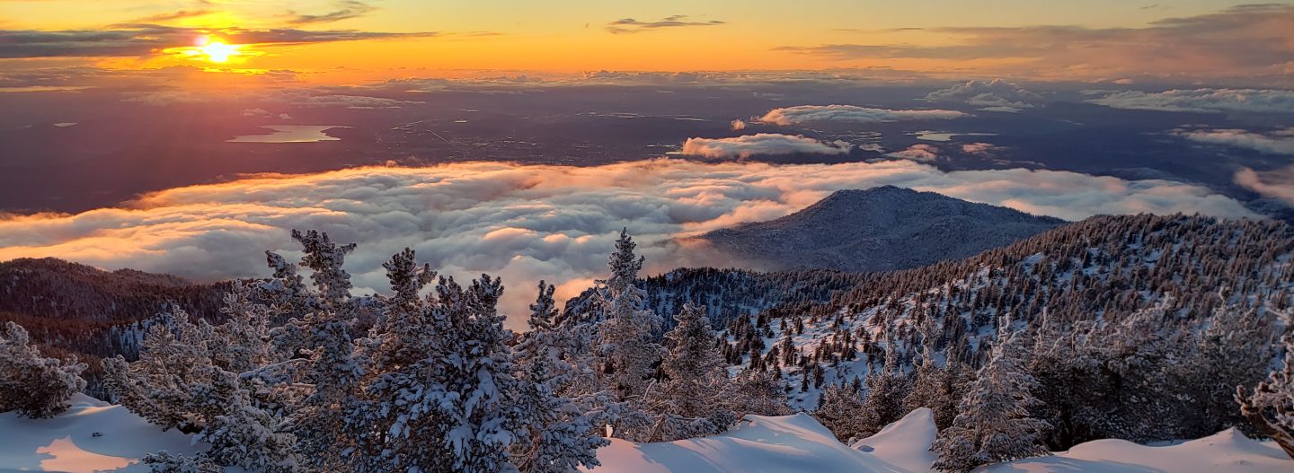
Snow conditions are changing very rapidly at present, and depend on many factors, as discussed in today’s video. Icy, reliable snow in the early morning can turn to the consistency of warm ice cream by mid/late morning in many areas, depending on exposure, temperature, and cloud cover, which can help or hinder hiking depending on your preference. Most areas below 7000′ have lost over a foot of snow in just three days, and some sun-exposed slopes have experienced even faster melting rates.
Snow depths measured in recent days, with comparison to the maximum depth a few days earlier, are listed at the foot of this posting. There has been little hiker traffic in the high country, so very cautious navigation is recommended everywhere.
Equipment recommendations are changing almost as quickly as the snow depths and conditions. Microspikes can be useful in some areas (see below) for hikers who are less comfortable on snow and ice, on the very few compacted trails, and in particular for descending. Hikers with suitable footwear and hiking poles may not need any additional traction, depending on your willingness to posthole in soft snow, and on temperature/time of day as discussed above. Snowshoes remain useful, but likely only for another few days depending on slope aspect, in areas above about 8000′ elevation.
Despite the strong warming trend at all elevations, hikers should be prepared for temperatures near or below freezing in the high country, and potentially well below freezing when considering windchill effects.
All trailhead parking is closed by county public health order. Enforcement was strong this weekend by multiple law enforcement agencies. I was sceptical if this would persist on weekdays, but there was clear evidence of it continuing yesterday at least. The Palm Springs Aerial Tramway remains closed indefinitely (since 12th March).

WEATHER Largely sunny conditions and warmer – but still below average – temperatures are forecast for the remainder of April. Extensive and rapid melting will accelerate at all elevations, especially on sun-exposed slopes.
PACIFIC CREST TRAIL
The short icy snow slope on the NE side of Apache Peak (PCT Mile 169.5) that had multiple incidents in late March has greatly improved. This morning – as described in this video – snow was relatively soft and is melting rapidly. Microspikes are recommended, but it is possible to traverse without them securely. Every individual should make their own assessment of whether to cross based on their comfort level on angled snow, their experience, available equipment, time of day, and current snow conditions. If in any doubt, turn around and take the Spitler Peak Trail alternate route at Mile 168.5.
The Pacific Crest Trail remains open at the rockslide just north of Antsell Rock (Mile 172.5). USFS has told the Trail Report that there are currently no plans to close this section of the PCT during spring 2020. The video report (available here) can be useful for deciding whether to try to hike around the rockslide or take an alternate route. All hikers this spring are reporting having no significant difficulty here.
Microspikes may be useful on some of the PCT for continuous snow travel between approximately Miles 173 and 192, depending upon your comfort level in variable snow/ice conditions. Hikers willing to posthole extensively and using poles may find spikes unnecessary in most areas however. See below for conditions on some specific sections of the PCT and the many side trails.
Current snow cover on the PCT is patchy and thin between Miles 166 and about 173 (Red Tahquitz), mainly confined to certain north-facing slopes e.g., Spitler Peak (Mile 168) and Apache Peak (Mile 169.5). Snow is currently continuous between Miles 174-192 (north end of Fuller Ridge). Short sections of the Trail will start to clear rapidly in the next few days (e.g., around Strawberry Junction Mile 183). North from about Mile 191 to Snow Creek is clear.
PCT hikers are reminded that overnight stays are not permitted at or near San Jacinto Peak, including in the historic shelter. Mt. San Jacinto State Park regulations normally permit overnight stays only in established campgrounds, although due to the Covid-19 crisis, no camping is currently allowed anywhere in the State Park.
TRAIL CONDITIONS
All trails above about 7500′ remain snow-covered, with depth depending on elevation (see below) but exposed slopes much higher are clearing rapidly. Some sections of trails above about 7000′ have may patchy icy snow cover, depending on exposure.
Spitler Peak Trail is virtually clear of snow, with just a few small thin patches remaining near the PCT. There are ten treefall hazards, most of which remain since last year.
Cedar Spring Trail is clear of snow to the PCT, but still largely snow-covered to the spring.
Apache Spring Trail was about 50% snow-covered this morning but was clearing very rapidly. There are two new treefall hazards.
Deer Springs Trail is largely clear of snow to the Suicide Rock junction (microspikes not required). From there to Strawberry Junction and north on the PCT to about 8500′ is melting very rapidly. Snowshoes may be useful above about 8500′ and microspikes can be useful for descending.
South Ridge Trail is virtually clear to Old Lookout Flat at 7600′. Snow cover is currently continuous higher up, but that will change dramatically over the next few days. Microspikes are useful. South Ridge Road (currently closed) is clear of ice.
Fuller Ridge Trail (PCT Miles 185.5-190.5). There are tracks to follow through the snow, although these do match the route of the regular trail in many places.
Round Valley Trail through to Wellman Divide has not been visibly traveled since the Tram closure in mid March.
Devil’s Slide Trail [updated 18th April] is clear of snow below 7200′, and is becoming patchy below 7700′. Icy snow cover is currently continuous from there to Saddle Junction. Microspikes can be useful, especially for descending, but are not essential. In three locations there are new significant treefall hazards, caused by sheer weight of heavy wet snow (USFS and PCTA have been notified).
Ernie Maxwell Trail is clear of snow, with just a few tiny patches near Humber Park.
Tahquitz Peak trail from Chinquapin Flat/PCT Mile 178 has no steps to follow through the angled icy snow. These ice slopes are notoriously treacherous. Currently crampons are strongly recommended, in conjunction with an ice axe (if you know how to use both). Snowshoes are not advised due to the angle of the underlying ice.
Seven Pines Trail has had no hiker traffic so far this winter, with no tracks or trail to follow. Indeed this trail has only been hiked a handful of times since November 2018. Extremely cautious navigation is recommended for those who are not very familiar with hiking this trail. The Forest Service closure of Dark Canyon Road continues, and there is no vehicular access to Seven Pines trailhead.
SNOW DEPTHS measured 13th-15th April 2020 (with depth on 10th-12th April 2020 in parentheses). Note that average depth is given, drifts can be much deeper in places. Altitudes are approximate.
San Jacinto Peak (10810′): 36″ (was 40″ on 12th April)
Wellman Divide (9700′): 27″ (was 32″ on 12th April)
Annie’s Junction (9070′): 33″ (was 35″ on 12th April)
Long Valley (8600′): 8″ (was 16″ on 11th April)
Strawberry Junction (8100′): 12″ (was 25″ on 11th April)
Saddle Junction (8070′): 18″ (was 26″ on 11th April)
Spitler Peak Trail at PCT Mile 168.5 (7040′): <1″ (was 10″ on 10th April)
Devil’s Slide trailhead at Humber Park (6550′): <2″ (was 14″ on 11th April)


