[UPDATE 23rd April: conditions for the PCT at Apache Peak and South Ridge Trail are updated below, based on hikes yesterday and this morning, respectively.]
Today I made the most of what was likely the last true snow hike for the foreseeable future, doing a full circuit of the mountain, ascending the east side trails and descending Deer Springs Trail. Starting well before sunrise, conditions underfoot were ideal, with hard refrozen snow everywhere. This allowed me to ascend in just boots, using only the melted remains of my snowshoe tracks from three days ago for grip on slopes. Microspikes were essential for a very direct descent.
Exceptionally warm summer-like temperatures for the remainder of April will radically change hiking conditions in a couple of days starting tomorrow. Snow melt has been rapid even with moderate temperatures over the last few days, with 1-2 feet of snow lost (depending on elevation) in just a week (see photos below).
Snow conditions will continue to change very rapidly, depending on a complex combination of elevation, time of day, slope exposure, temperature, and cloud cover. The bottom line is that remarkably little snow may be left at most elevations by the end of April. Snow depths measured today, with comparison to the recent maximum depth, are listed at the foot of this posting. There has been no other hiker traffic above 9100′, and tracks disappear rapidly with melting, so very cautious navigation is recommended everywhere.
Inevitably, gear recommendations are changing almost as quickly as the snow depths and conditions. Microspikes can be useful in some areas (see below) for hikers who are less comfortable on snow and ice, on the few compacted trails, and in particular for descending. Hikers with suitable footwear and hiking poles may not need any additional traction, depending on your willingness to posthole in soft snow, and on temperature/time of day as mentioned above. Snowshoes remain useful, but for only another few days, in areas above about 9000′ elevation.
Due to the apparent contradictions and inconsistent enforcement of various county, state, and federal rules and regulations during the coronavirus crisis, I recommend contacting relevant agencies directly for their latest information. According to their website, Mount San Jacinto State Park remains open only for locals visiting from near their primary residences. The Palm Springs Aerial Tramway remains closed indefinitely (since 12th March).
WEATHER Regrettably – for those of us concerned about fire risk, water, and forest health – summer apparently begins tomorrow. For the remainder of April, overnight low temperatures are forecast to resemble early July averages, and daytime highs will be more typical of June. Extremely rapid snowmelt is expected at all elevations.
At San Jacinto Peak (10,810ft/3295m) today, Tuesday 21st April 2020, at 0755 the air temperature was 21.8°F (-6°C), with a windchill of 4.4°F (-15°C), 68% relative humidity, and a bitter NNE wind sustained at 12 mph gusting to 17.8 mph.
At the Peak on Saturday 18th April 2020, at 0930 the air temperature was 23.7°F (-5°C), with a windchill of 9.6°F (-12°C), 100% relative humidity, and a cool WNW wind sustained at 7 mph gusting to 14.2 mph.

PACIFIC CREST TRAIL
The short icy snow slope on the NE side of Apache Peak (PCT Mile 169.5) that had multiple incidents in late March has greatly improved. The very limited remaining snow is soft with obvious tracks, and is melting rapidly (see photo below).

The Pacific Crest Trail remains open at the rockslide just north of Antsell Rock (Mile 172.5). USFS has told the Trail Report that there are currently no plans to close this section of the PCT during spring 2020. The video report (available here) can be useful for deciding whether to try to hike around the rockslide or take an alternate route. All hikers this spring are reporting having no significant difficulty here.
Microspikes may be useful on some of the PCT for increasingly patchy snow travel between approximately Miles 173 and 191, depending upon your comfort level in variable snow/ice conditions. Hikers willing to posthole extensively and using poles may find spikes unnecessary in most areas however. See below for conditions on some specific sections of the PCT and the many side trails.
Current snow cover on the PCT is very limited between Miles 151 (Highway 74) and about 175 (Red Tahquitz). Snow is then largely continuous between Miles 175-179 (to near Saddle Junction). The Trail is rapidly clearing to about Mile 184 (just north of Strawberry Junction) except for a stubborn section of 0.5 mile approaching Annie’s Junction (Mile 180.8) which is always among the last areas to clear every spring. Most of Miles 184-191 is snow-covered, although exposed sections of Fuller Ridge (e.g., Miles 186.5-188.5) will start clearing rapidly. North from about Mile 191 to Snow Creek is clear.
PCT hikers are reminded that overnight stays are not permitted at or near San Jacinto Peak, including in the historic shelter. Mt. San Jacinto State Park regulations permit overnight stays only in established campgrounds (additionally, due to the Covid-19 crisis, no camping is currently allowed anywhere in the State Park).
TRAIL CONDITIONS
All trails above about 8000′ remain largely snow-covered, with depth depending on elevation (see below) but exposed slopes much higher are clearing rapidly. Some sections of trails above about 7000′ have may patchy icy snow cover, depending on exposure.
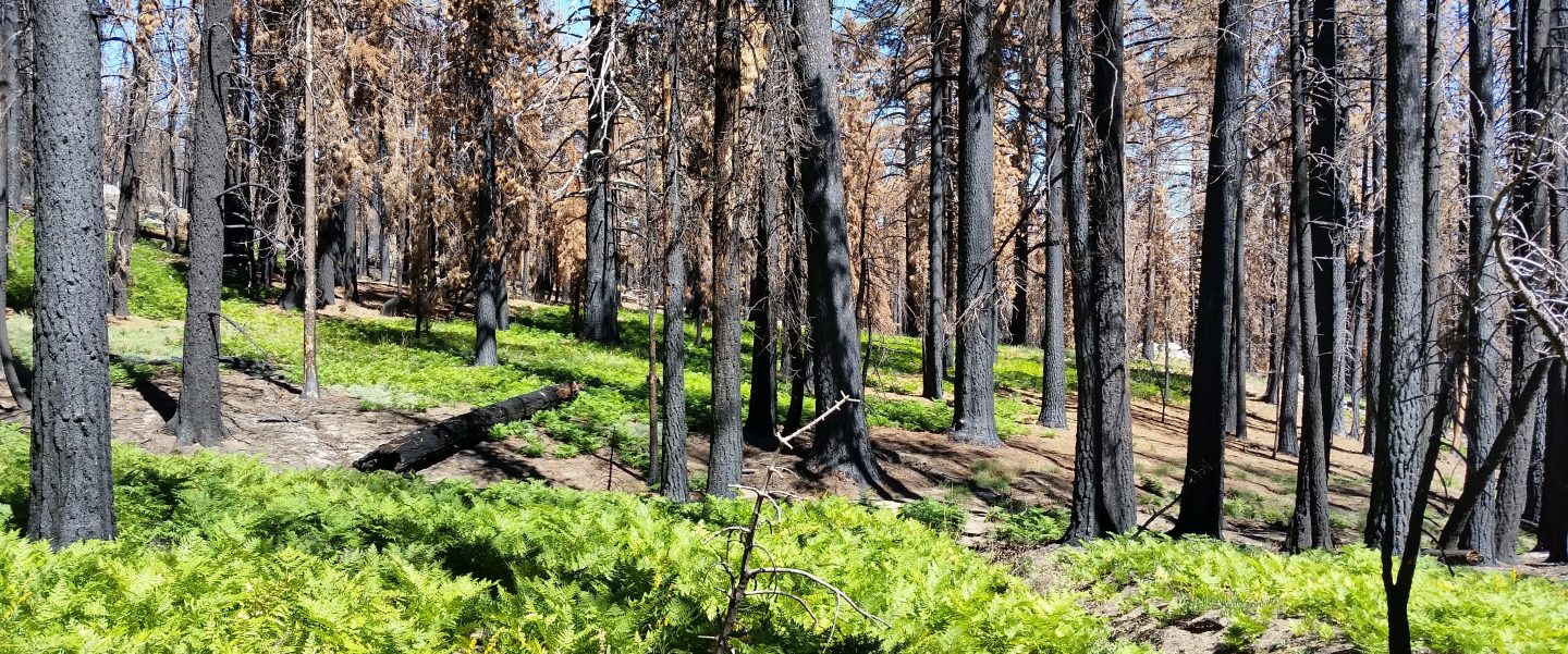
The Desert Divide south of Red Tahquitz, including side trails such as Spitler Peak, Cedar Spring, Apache Spring, Zen Centre, and Live Oak Spring trails, are all clear of snow. All have new treefall hazards from this winter, passable for hikers but not stock.
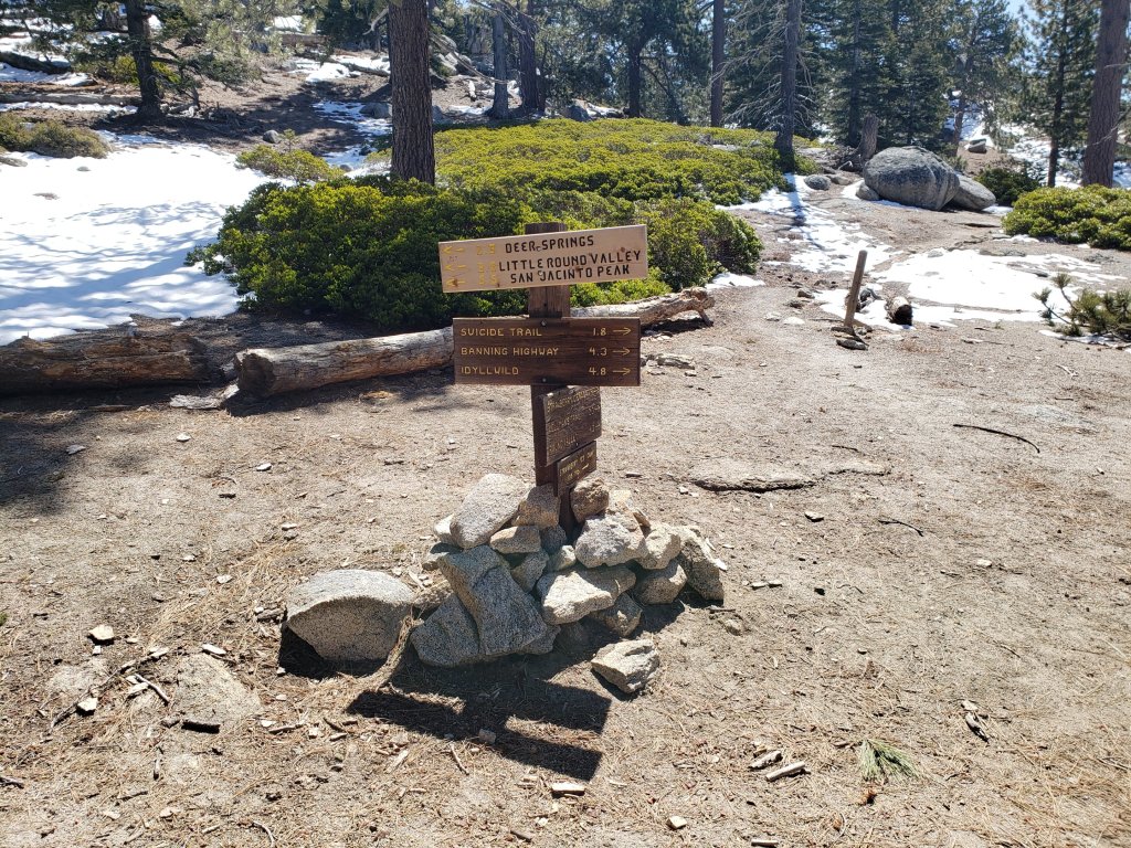
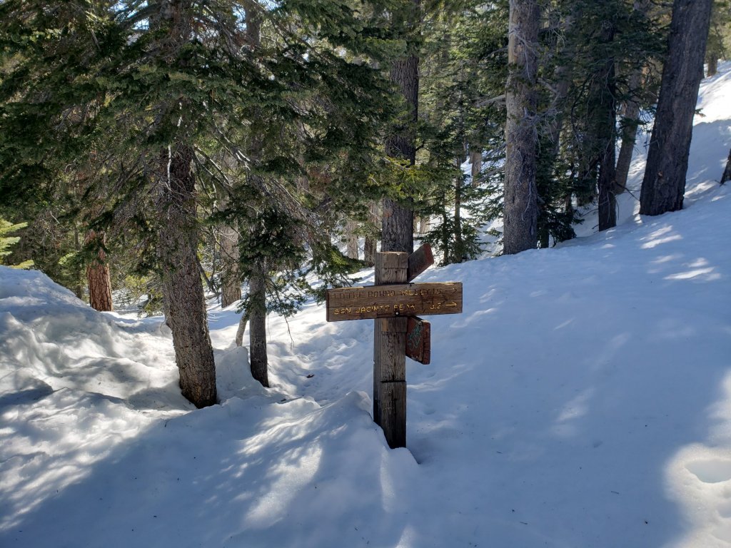
Deer Springs Trail is basically clear of snow to Strawberry Junction, with just a few tiny soft patches remaining. North on the PCT to about 8500′ is melting very rapidly. Snow is continuous from about Mile 184 (just south of Marion Mountain Trail junction). Snowshoes are currently useful above about 9500′ and microspikes can be useful for descending.
South Ridge Trail [updated 23rd April] is clear to Old Lookout Flat at 7600′. Snow cover is soft and extremely limited from there to about 8600′, after which cover is about 50% to the Peak. This will melt dramatically over the next few days. Microspikes can be useful for descending the uppermost 5-7 switchbacks early in the morning. South Ridge Road (currently closed) is clear of ice.
Fuller Ridge Trail (PCT Miles 185.5-190.5). There are tracks to follow through the snow, although these do match the route of the regular trail in many places.
Round Valley Trail through to Wellman Divide has not been visibly traveled since the Tram closure in mid March.
Devil’s Slide Trail is clear of snow below 7200′, largely clear below 8000′, and icy snow cover is increasingly patchy from there to Saddle Junction. Microspikes can be useful, especially for descending, but are not essential. In three locations there are new significant treefall hazards. Several more minor obstructions have been removed.
Ernie Maxwell Trail is clear of snow.
Tahquitz Peak trail from Chinquapin Flat/PCT Mile 178 has no steps to follow through the angled icy snow. These ice slopes are notoriously treacherous. Currently crampons are strongly recommended, in conjunction with an ice axe (if you know how to use both). Snowshoes are not advised due to the angle of the underlying ice.
Seven Pines Trail has had no hiker traffic so far this winter, with no tracks or trail to follow. Indeed this trail has only been hiked a handful of times since November 2018. Extremely cautious navigation is recommended for those who are not very familiar with hiking this trail. The Forest Service closure of Dark Canyon Road continues, and there is no vehicular access to Seven Pines trailhead.
SNOW DEPTHS measured 21st April 2020 (with depth on 10th-12th April 2020 in parentheses for comparison where known). Note that average depth is given, drifts can be much deeper in places. Altitudes are approximate.
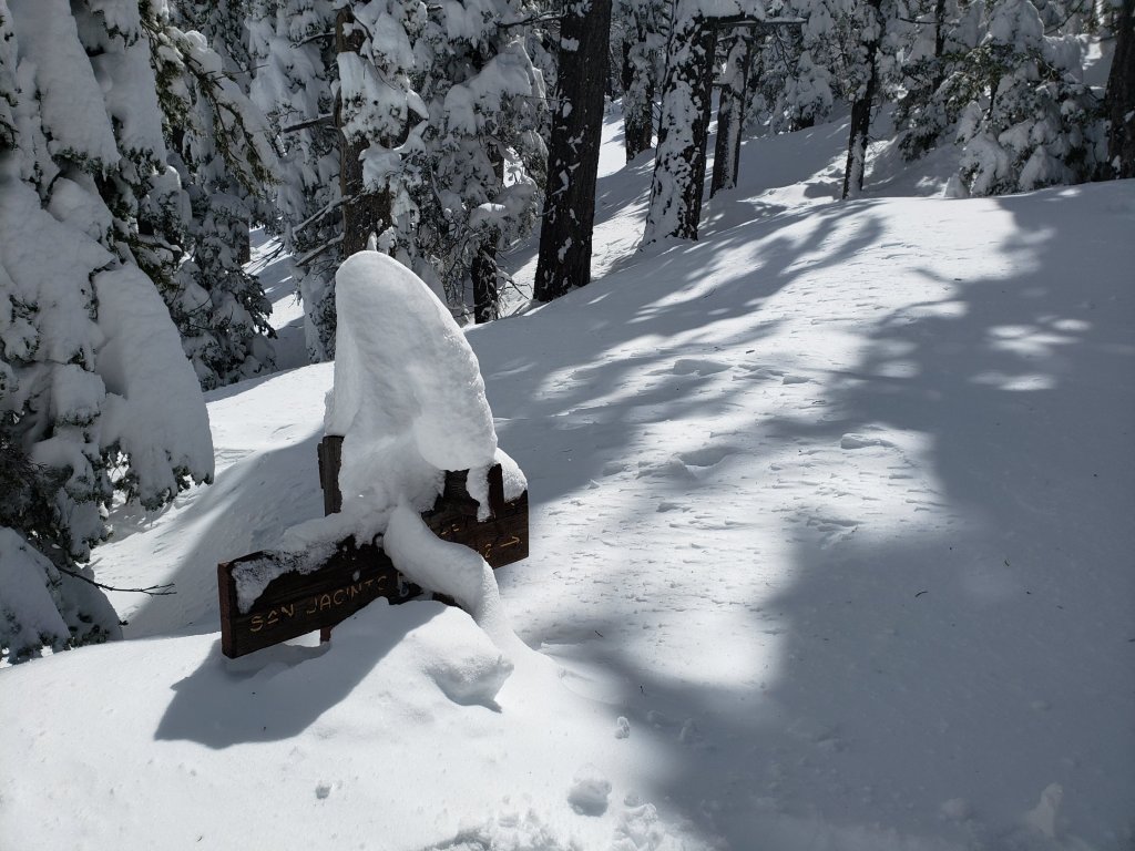
San Jacinto Peak (10810′): 31″ (was 40″ on 12th April)
Little Round Valley (9800′): 30″
Wellman Divide (9700′): 14″ (was 32″ on 12th April)
Annie’s Junction (9070′): 21″ (was 35″ on 12th April)
Seven Pines Trail junction with Deer Springs Trail (8700′): 15″ (was 31″ on 11th April)
Long Valley (8600′): 4″ (was 16″ on 11th April)
Strawberry Junction (8100′): <1″ (was 25″ on 11th April)
Saddle Junction (8070′): 7″ (was 26″ on 11th April)
Devil’s Slide trailhead at Humber Park (6550′): 0″ (was 14″ on 11th April)